
lovethailand home >North Travel Attractions >Chiang Mai Travel Attractions > 65 National Parks and Nature Destinations in North..
TL;DR: 65 National Parks and Nature Destinations in Northern Thailand.

65 National Parks and Nature Destinations in Northern Thailand
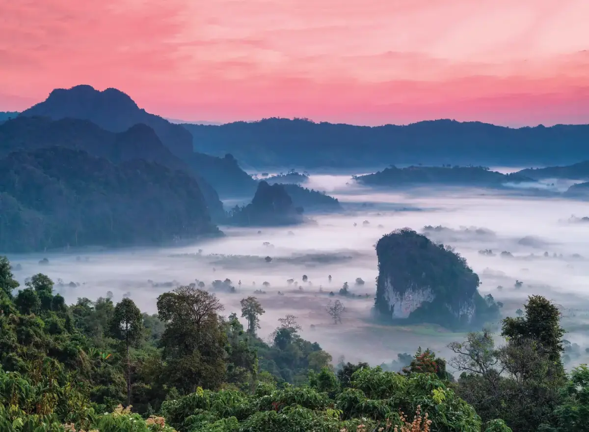
65 National Parks and Nature Destinations in Northern Thailand: A Complete Travel Guide Northern Thailand is one of the country's most remarkable regions for nature travel, offering towering mountain ranges, deep valleys, lush forests, dramatic waterfalls, winding rivers, and diverse ecosystems. Its national parks attract travelers seeking everything from peaceful forest retreats and spectacular sunrise viewpoints to challenging mountain treks and unforgettable camping experiences. Whether you want to watch a sea of mist drift across the mountains, discover rare highland plants, explore limestone formations, or visit a waterfall hidden deep in the forest, Northern Thailand offers a rich variety of landscapes and experiences.
Many visitors associate Northern Thailand's national parks with Doi Inthanon in Chiang Mai, home to the country's highest mountain, or Huai Nam Dang, celebrated for its spectacular sunrise views and mist-filled valleys. However, the region offers many other outstanding destinations. Doi Phu Kha National Park in Nan protects rare plant species and important mountain ecosystems, while Phu Hin Rong Kla National Park in Phitsanulok combines fascinating geological formations with significant chapters of Thailand's modern history. Phu Soi Dao National Park is especially popular among hikers, thanks to its high-altitude pine plateau and seasonal wildflower fields.
The extraordinary natural diversity of Northern Thailand is largely shaped by its mountain geography. Major ranges such as the Thanon Thong Chai and Phi Pan Nam mountains rise from lower forested slopes to elevations exceeding 2,000 meters. These differences in altitude create noticeable variations in temperature, rainfall, humidity, and vegetation. Lower elevations support deciduous and dry dipterocarp forests, while higher mountains contain evergreen forests, pine woodlands, and cool, moisture-rich montane ecosystems. Together, these environments provide important habitats for birds, mammals, insects, and a wide variety of plant species.
Northern Thailand's national parks are also essential to the country's water resources. Mountain forests absorb rainfall, protect soil, regulate runoff, and sustain streams that eventually join major river systems, including the Ping, Wang, Yom, and Nan rivers. These waterways support agriculture, local communities, and downstream ecosystems. Protecting mountain forests is therefore about much more than preserving beautiful scenery: it is also crucial for long-term water security and environmental stability.
The relationship between nature and local culture adds another dimension to exploring this region. Many mountain landscapes are closely connected to Lanna communities and highland ethnic groups whose traditions, agricultural practices, handicrafts, food, and knowledge of natural resources have developed over generations. Travelers passing through these communities can gain a deeper understanding of local heritage while enjoying the surrounding landscapes. Responsible visitors should respect local customs, ask permission before photographing people or private property, and support community-based tourism where possible.
Each season offers a different perspective on the national parks of Northern Thailand. During the rainy season, forests become especially green and many waterfalls are at their most impressive. The transition from the rainy season to the cooler months often brings favorable conditions for morning mist and dramatic mountain views. From approximately November to February, cooler temperatures make highland viewpoints, sunrise excursions, and camping particularly appealing. However, seasonal flowers, mist, and clear mountain views depend on actual weather conditions, while some trekking routes close periodically for ecological recovery or safety reasons.
Choosing the right destination depends on your interests and travel plans. Doi Suthep–Pui and Doi Inthanon are suitable for travelers based in Chiang Mai who want to combine several attractions in a day. Huai Nam Dang and Doi Pha Hom Pok appeal to visitors seeking mountain scenery and cooler weather. Doi Phu Kha and Si Nan can be explored as part of a longer journey through Nan Province. For more adventurous travelers, Phu Hin Rong Kla and Phu Soi Dao offer distinctive landscapes and rewarding opportunities to experience nature on foot.
Preparation is particularly important when visiting high-altitude national parks. Mountain roads can be steep and winding, weather conditions can change rapidly, and mobile phone coverage may be limited in remote areas. Before traveling, check current access restrictions, trail openings, camping requirements, and weather forecasts. Bring appropriate footwear, sufficient drinking water, rain protection, warm clothing, and essential supplies. Drivers should ensure their vehicle's brakes and tires are in good condition before tackling mountain routes.
Responsible travel helps protect the natural environments that make these destinations special. Stay on designated trails, never feed wildlife, do not remove plants or natural objects, and take all litter away with you. Respect park regulations and use authorized facilities and services. These simple practices help conserve forests, wildlife habitats, and fragile ecosystems for future generations.
This guide presents 65 national parks and related protected nature destinations included in the article's Northern Thailand destination list. The selection includes officially established national parks as well as areas identified in the source list as being under preparation for national park designation. Each destination introduces its natural highlights, popular attractions, suggested activities, recommended travel periods, access information, and Google Maps directions to help international visitors plan their journeys.

1. Doi Inthanon National Park, Chiang Mai is one of Thailand's most celebrated natural destinations. Located primarily in Chom Thong District and surrounding areas of Chiang Mai Province, the park is home to Doi Inthanon, the country's highest mountain, rising approximately 2,565 meters above sea level. Its varied elevations create an exceptional range of habitats, from warmer foothill forests to cool, moisture-rich mountain ecosystems near the summit.
The mountain was formerly known as Doi Luang and Doi Ang Ka before being named in honor of King Inthawichayanon, the last ruler of Chiang Mai. His historical connection to the mountain remains part of the area's cultural significance, and a memorial containing part of his ashes stands near the summit. Doi Inthanon therefore offers visitors an experience combining natural beauty, Lanna heritage, and conservation.
Main Attractions and Highlights: The summit of Doi Inthanon, the twin royal pagodas of Naphamethanidon and Naphaphonphumisiri, Kew Mae Pan Nature Trail, Ang Ka Nature Trail, Wachirathan Waterfall, Mae Ya Waterfall, and Mae Klang Waterfall are among the park's best-known attractions. The twin pagodas stand in a striking mountain setting, while Kew Mae Pan offers scenic ridgeline views and opportunities to explore high-altitude forest habitats when the trail is open.
Ang Ka Nature Trail is particularly fascinating because of its cool, humid montane evergreen forest, where mosses, ferns, and other moisture-loving plants cover the surrounding vegetation. Travelers interested in waterfalls should consider Wachirathan Waterfall, known for its powerful cascade and drifting spray, or Mae Ya Waterfall, whose water descends over a broad series of natural rock steps.
Things to Do: Visit Thailand's highest point, admire mountain panoramas, photograph misty landscapes, explore nature trails, discover waterfalls, go birdwatching, and learn about high-altitude forest ecosystems. Nearby Royal Project agricultural areas and highland communities can also be included in a longer itinerary.
Best Time to Visit: The cool season is especially popular for mountain scenery and low temperatures. The rainy season and the transition into the cool season bring lush forests and impressive waterfalls. Some nature trails have seasonal closures, so check the latest park announcements.
Getting There: From Chiang Mai city, follow Highway 108 toward Chom Thong District, then turn onto Highway 1009, which climbs toward Doi Inthanon. The road is paved but includes steep gradients and sharp bends. Make sure your vehicle is suitable for mountain driving, particularly during wet or foggy conditions.
Map (GPS):Directions to Doi Inthanon National Park
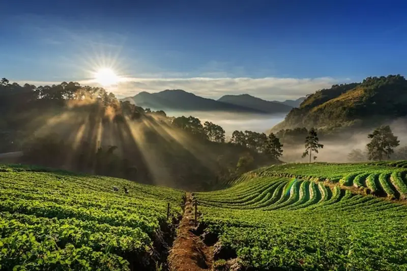
2. Doi Suthep–Pui National Park, Chiang Mai is a major protected natural area located just outside Chiang Mai city. Covering mountains in Mueang Chiang Mai, Mae Rim, and Hang Dong districts, it combines forest conservation with important religious and cultural landmarks. Its proximity to the city makes it particularly convenient for travelers who want to experience mountain scenery, forest environments, and Lanna heritage within a single day.
The park's mountainous landscape contains different forest types according to altitude, particularly around Doi Suthep and Doi Pui. These forests protect important water sources and provide habitats for native wildlife and plants. The mountains have also maintained close historical connections with Chiang Mai's communities, religious traditions, and cultural identity.
Main Attractions and Highlights: Wat Phra That Doi Suthep, Bhubing Palace, Doi Pui Hmong Village, Huai Kaew Waterfall, Monthathan Waterfall, and mountain viewpoints along the access road are among the best-known destinations. Wat Phra That Doi Suthep is one of Chiang Mai's most important Buddhist temples and offers panoramic views over the city, while Doi Pui Hmong Village introduces visitors to highland community culture.
For nature lovers, Huai Kaew Waterfall is conveniently located near the city, while Monthathan Waterfall offers a more forested setting. Nature trails in designated areas provide opportunities to observe vegetation and discover how mountain ecosystems change with altitude.
Things to Do: Visit Wat Phra That Doi Suthep, enjoy panoramic views of Chiang Mai, explore nature trails, discover waterfalls, learn about Hmong culture, and photograph the surrounding mountains. The park is suitable for families, cultural travelers, and visitors with limited time in Chiang Mai.
Best Time to Visit: The park can be enjoyed during much of the year. Cooler months offer pleasant mountain temperatures, while the rainy season brings particularly lush greenery and stronger waterfall flows. Roads and trails may become slippery after heavy rain.
Getting There: From central Chiang Mai, follow Huai Kaew Road past Chiang Mai University and Chiang Mai Zoo, then continue onto Highway 1004 toward Doi Suthep. Private cars, rental vehicles, and local red songthaew shared taxis are possible transport options. Confirm the exact destination because attractions are spread across different parts of the mountain.
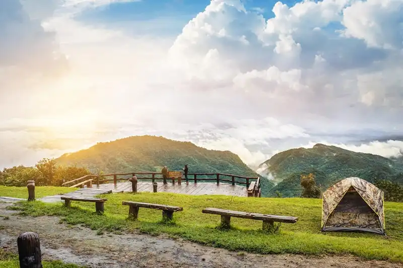
3. Doi Pha Hom Pok National Park, Chiang Mai lies in the northern part of Chiang Mai Province, covering mountainous areas around Fang, Mae Ai, and Chai Prakan districts. Its most famous feature is Doi Pha Hom Pok, a summit rising approximately 2,285 meters above sea level, making it one of Thailand's highest mountains. The park protects rugged highland terrain, montane evergreen forests, pine woodland, and important headwater ecosystems.
The appeal of Doi Pha Hom Pok lies in its remote mountain atmosphere. Travelers interested in hiking can explore designated routes toward higher elevations, where cooler temperatures and panoramic views create a distinctly different experience from lowland Chiang Mai. On suitable mornings, clouds and mist may gather in the valleys, revealing layers of mountains as the sun rises.
Main Attractions and Highlights: Doi Pha Hom Pok summit, Kew Lom viewpoints, Fang Hot Springs, and high-altitude nature trails are among the most interesting features. Fang Hot Springs offers a very different experience from the summit trek, with naturally heated water emerging from beneath the ground in a geothermal landscape.
The park's upland forests support plants adapted to cool temperatures and moist conditions. They also provide important habitats for birds and other wildlife. The considerable elevation difference between the foothills and the summit allows visitors to experience a variety of forest environments during the same trip.
Things to Do: Trek toward the summit where permitted, enjoy sunrise views, photograph mountain mist, go birdwatching, discover highland vegetation, and visit Fang Hot Springs. Visitors planning a long trek should prepare appropriate equipment and confirm access regulations in advance.
Best Time to Visit: The late rainy season and cool season are particularly attractive for mountain views and cooler temperatures. During the rainy season, forests are especially green, although some trekking routes may be unsuitable or temporarily restricted.
Getting There: From Chiang Mai city, follow Highway 107 through Mae Rim, Mae Taeng, and Chiang Dao toward Fang. Continue toward Fang Hot Springs or the designated park access point appropriate to your planned activity. Visitors trekking to the summit should confirm the correct trailhead with park staff.

4. Huai Nam Dang National Park, Chiang Mai and Mae Hong Son extends across mountainous terrain between Chiang Mai and Mae Hong Son provinces. It is particularly famous for sweeping mountain views and the spectacular seas of mist that can appear over its valleys. Located near the popular road between Chiang Mai and Pai, the park is a rewarding stop for travelers exploring the mountainous landscapes of Northern Thailand.
Huai Nam Dang's best-known experience is watching the landscape at sunrise. When weather conditions are favorable, thick mist gathers across the valleys below the viewpoints. As daylight breaks over the mountains, the changing colors of the sky and the layered mountain silhouettes create a memorable panorama.
Main Attractions and Highlights: Doi Kew Lom viewpoint, views toward Doi Chang, mist-filled valleys, and Pong Dueat Pa Pae hot springs provide a varied selection of natural experiences. Doi Kew Lom is especially popular for sunrise photography, while Pong Dueat Pa Pae offers an opportunity to discover geothermal activity in a forest setting.
The park also protects important mountain forests and headwater ecosystems. Evergreen and pine forests support diverse vegetation and wildlife, while higher elevations offer cool temperatures and quiet surroundings suitable for nature appreciation.
Things to Do: Watch the sunrise, photograph seas of mist, camp in authorized areas, explore nature trails, and visit natural hot springs. Huai Nam Dang can be combined with Pai or Mae Taeng as part of a two-day or longer northern road trip.
Best Time to Visit: The transition into the cool season and the winter months are particularly popular for sunrise scenery and cooler weather. Rainy-season travel offers lush landscapes but requires extra attention to weather and road conditions.
Getting There: From Chiang Mai, follow Highway 107 toward Mae Taeng, then take Highway 1095 toward Pai. Follow the signs for Huai Nam Dang National Park. The road has numerous bends and steep sections, so drive carefully, particularly in rain or fog.
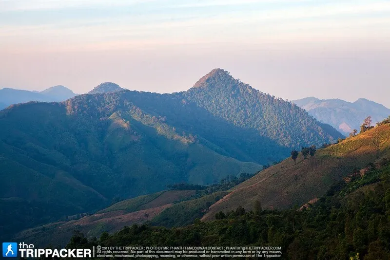
5. Doi Phu Kha National Park, Nan is one of Nan Province's most important protected areas, known for its mountain scenery, watershed forests, and botanical diversity. Covering rugged terrain across several districts, the park's main tourism areas are accessible from Pua and Bo Kluea. Its landscape includes montane evergreen forests, pine woodland, mixed deciduous forests, and highland habitats containing a wide variety of native plants.
One of the park's most distinctive botanical treasures is Chomphu Phu Kha, a rare flowering tree closely associated with the conservation significance of Doi Phu Kha. The park's forests also support birds, wildlife, and important headwater systems that contribute to the wider Nan River basin.
Main Attractions and Highlights: The 1715 Viewpoint, Doi Phu Wae, designated nature trails, and the scenic Pua–Bo Kluea mountain road are among the main attractions. The 1715 Viewpoint offers expansive mountain panoramas, while Doi Phu Wae attracts travelers interested in more demanding mountain experiences where access is permitted.
Traveling through Doi Phu Kha is itself part of the experience. The winding roads pass through changing forest landscapes, valleys, and highland communities. The park can be incorporated into a longer Nan itinerary that also includes Pua, Bo Kluea, and nearby rural settlements.
Things to Do: Enjoy mountain viewpoints, observe rare plants, photograph forest scenery, explore designated nature trails, and discover highland communities. The area is particularly suitable for visitors who enjoy scenic drives and slower-paced nature travel.
Best Time to Visit: The late rainy season provides particularly green mountain landscapes, while the cool season offers refreshing temperatures and scenic drives. Check road conditions and park announcements before traveling.
Getting There: From Nan city, follow Highway 1080 toward Pua, then continue along the mountain road toward Bo Kluea, which passes through the Doi Phu Kha area. The route includes steep gradients and winding sections, so allow additional time for scenic stops.
Map (GPS):Directions to Doi Phu Kha National Park
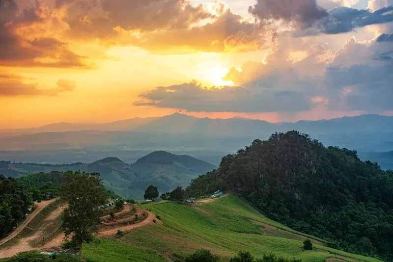
6. Si Nan National Park, Nan extends across mountainous areas of Nan Province, including parts of Wiang Sa, Na Noi, and Na Muen districts. Its landscape features forested mountains, cliffs, valleys, and sections of the Nan River. The park is particularly popular for sunrise views, camping, and the spectacular open mountain scenery around Doi Samer Dao.
Doi Samer Dao is an open ridge with expansive views over the surrounding valleys and sky. On suitable mornings, mist can cover the valleys below, while clear nights offer opportunities for stargazing. This combination of mountain panoramas and peaceful surroundings makes it one of Nan's best-known camping and nature photography destinations.
Main Attractions and Highlights: Doi Samer Dao, Doi Pha Chu, Pha Hua Sing, and scenic stretches overlooking the Nan River are important attractions. Doi Pha Chu offers another perspective on the surrounding mountains, while visitors can also explore nearby geological landmarks such as the unusual earth pillars of Na Noi.
The park's forests play a valuable role in watershed protection and biodiversity conservation. Dry dipterocarp forest, mixed deciduous forest, and other vegetation types occur across its varied terrain. Camping and outdoor activities are limited to designated areas to protect the surrounding environment.
Things to Do: Watch the sunrise, photograph seas of mist, enjoy stargazing, camp in permitted areas, explore natural viewpoints, and learn about mountain ecosystems.
Best Time to Visit: The late rainy season and cool season are particularly popular for pleasant temperatures and potential morning mist. For stargazing, choose clear nights with limited cloud cover.
Getting There: From Nan city, follow Highway 101 through Wiang Sa toward Na Noi, then continue along the signposted roads to the park. Doi Samer Dao and the park's headquarters are separate destinations, so choose the correct location before setting off.
Map (GPS):Directions to Si Nan National Park
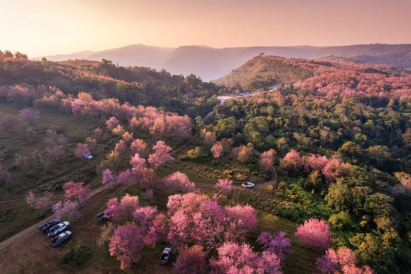
7. Phu Hin Rong Kla National Park, Phitsanulok is an extraordinary destination combining mountainous scenery, unusual geological formations, and significant modern Thai history. Spanning the border areas of Phitsanulok, Phetchabun, and Loei provinces, the park contains high mountain ridges, pine forests, montane evergreen vegetation, dramatic cliffs, and distinctive rock landscapes.
The park has historical importance because parts of the area were once associated with the Communist Party of Thailand's activities. Historical locations, including the former Political and Military School, provide insight into that period of Thailand's history. The relationship between the rugged landscape and these historical events gives Phu Hin Rong Kla a distinctive character.
Main Attractions and Highlights: Lan Hin Pum, Lan Hin Taek, Pha Chu Thong, the former Political and Military School, and various nature trails are among the most interesting destinations. Lan Hin Pum is known for unusual rounded rock formations, while Lan Hin Taek features striking fractures and cracks in the rock surface, formed through natural geological processes over long periods.
Phu Hin Rong Kla's mountain ecosystems contain evergreen and pine forests, with cool temperatures during the winter months. Rain brings lush greenery and mist, although some rocky paths can become slippery. The combination of forest, rock formations, and historic sites makes the park particularly rewarding for visitors interested in both nature and heritage.
Things to Do: Explore geological formations, follow designated nature trails, photograph cliffs and rock landscapes, visit historical sites, and discover mountain forests. The park can also be included in a wider itinerary with Phu Thap Boek and nearby mountain attractions.
Best Time to Visit: The late rainy season and cool season are particularly appealing for mountain scenery and comfortable temperatures. During wet weather, take care on rock surfaces and forest paths.
Getting There: From Phitsanulok, travel via Nakhon Thai District to reach the park. Another approach is available from Phetchabun through Lom Sak and the Phu Thap Boek area. Both routes include steep mountain sections and winding roads.
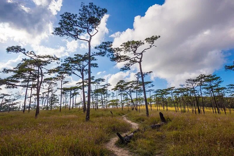
8. Phu Soi Dao National Park, Uttaradit and Phitsanulok is one of Northern Thailand's most rewarding destinations for hikers and mountain campers. Located near the Thai–Lao border across parts of Uttaradit and Phitsanulok provinces, the park protects rugged mountains, evergreen forests, pine woodland, waterfalls, and high-altitude grasslands. Its most celebrated feature is the Phu Soi Dao pine plateau, famous for its distinctive landscape and seasonal wildflowers.
The pine plateau sits approximately 1,633 meters above sea level. It is a relatively open mountain area with scattered pine trees and broad views of the surrounding landscape. During the appropriate season, purple Murdannia gigantea wildflowers, known in Thai as Dok Ngon Nak, bloom across parts of the plateau, creating a particularly memorable scene against the pine forest and drifting mountain mist.
Main Attractions and Highlights: The pine plateau, seasonal Dok Ngon Nak wildflower fields, Sai Thip Waterfall, Phu Soi Dao Waterfall, and the trekking route to the plateau are among the park's main attractions. The ascent includes forest trails, streams, and steep sections, requiring greater physical preparation than a casual nature walk.
The trek offers visitors an opportunity to experience changes in vegetation and landscape with increasing altitude. Lower forests gradually give way to cooler mountain environments before hikers reach the open pine plateau. The combination of forest, grassland, seasonal flowers, and mist makes this destination particularly distinctive.
Things to Do: Trek to the pine plateau, camp in designated areas, photograph seasonal wildflowers, observe highland ecosystems, and visit waterfalls. Check current trail opening dates, booking procedures, and equipment requirements before arranging a trek.
Best Time to Visit: The main trekking season depends on official park access arrangements. The flowering season is especially popular, but dates vary with weather and ecological conditions. Rain can make steep trails slippery and more demanding.
Getting There: Visitors can approach the park from Uttaradit via Nam Pat District or from Phitsanulok via Chat Trakan District. Reaching the pine plateau requires hiking from the designated trailhead. Check current access arrangements and trail regulations before departure.
Map (GPS):Directions to Phu Soi Dao National Park

9. Khlong Lan National Park, Kamphaeng Phet is renowned for its impressive waterfalls and well-preserved forests. Located in Khlong Lan District of Kamphaeng Phet Province, the park protects mountains, valleys, streams, and forest habitats that form part of Thailand's extensive western forest landscapes. Its accessibility and remarkable waterfalls make it a popular destination for travelers exploring the natural attractions of lower Northern Thailand.
Khlong Lan Waterfall is the park's best-known attraction. A substantial volume of water descends over a high cliff into the area below, creating a dramatic natural setting surrounded by lush forest. The waterfall's appearance changes with seasonal rainfall and water levels, becoming particularly powerful during the rainy season. Heavy rainfall may, however, require temporary safety restrictions around the falls.
Main Attractions and Highlights: Khlong Lan Waterfall, Khlong Nam Lai Waterfall, Kaeng Ko Roi, and the surrounding forest environments offer opportunities to enjoy waterfalls, streams, and mountain landscapes. Khlong Lan Waterfall is especially popular for photography, while other natural areas provide quieter settings for appreciating the forest.
The park plays an important role in watershed and biodiversity conservation. Its forests include mixed deciduous, dry evergreen, and upland vegetation depending on elevation and environmental conditions. These habitats support wildlife and help maintain the ecological health of the surrounding region.
Things to Do: Visit waterfalls, photograph forest scenery, explore designated nature trails, and relax in authorized visitor areas. The main waterfall is relatively accessible, making the park suitable for families and travelers planning a day trip.
Best Time to Visit: The rainy season and the months immediately afterward offer lush forests and potentially impressive waterfall flows. Visitors must check water levels and safety announcements. The cool season is also suitable for relaxing outdoor visits.
Getting There: From Kamphaeng Phet city, travel toward Khlong Lan District and follow the signs for Khlong Lan Waterfall and the national park. A private car or rental vehicle is convenient. Other attractions may require separate routes, so plan according to your available time.
Map (GPS):Directions to Khlong Lan National Park

10. Nam Nao National Park, Phetchabun is a major protected forest area in lower Northern Thailand, extending across mountainous landscapes in Phetchabun and adjoining parts of Chaiyaphum Province. The park contains highland plateaus, pine forests, mixed deciduous woodland, dry dipterocarp forest, and dry evergreen habitats. It is particularly well known for its cool-season weather and peaceful forest camping atmosphere.
The name Nam Nao is closely associated with the area's cool mountain climate. During the winter months, temperatures can be considerably lower than in surrounding lowlands, making the park attractive to visitors seeking fresh air and a quieter natural environment. Tall pine trees and open forest landscapes give Nam Nao a character distinct from densely forested tropical lowland parks.
Main Attractions and Highlights: Nam Nao's pine forests, Phu Kho viewpoints, sunrise viewing areas, and designated nature trails are among its main attractions. Forest trails offer opportunities to observe vegetation, while viewpoints provide broad panoramas across the mountain landscape.
The park is also important for wildlife and habitat conservation because of its extensive forest cover and ecological connectivity. Visitors interested in birdwatching, forest ecology, and natural history can discover different vegetation types and learn how wildlife depends on intact forest habitats.
Things to Do: Explore nature trails, photograph pine forests and mountain views, go birdwatching, camp in permitted areas, and enjoy sunrise scenery. Allow enough time to travel between attractions because the park covers a substantial area.
Best Time to Visit: The cool season is especially suitable for camping and experiencing low mountain temperatures. The rainy season offers greener landscapes, but road conditions and trail openings should be checked before visiting.
Getting There: From Phetchabun, travel through Lom Sak District and follow Highway 12 toward Nam Nao National Park. Visitors approaching from Khon Kaen can also use Highway 12. The road passes through mountainous and forested terrain, requiring additional caution during rain or fog.
Map (GPS):Directions to Nam Nao National Park
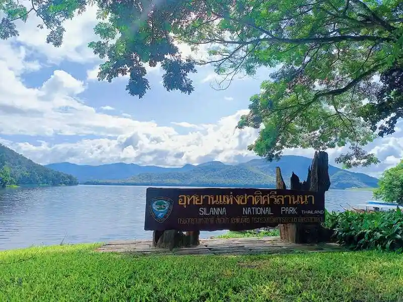
11. Si Lanna National Park, Chiang Mai is an important protected forest area in Chiang Mai Province, extending across parts of Phrao, Mae Taeng, and Chiang Dao districts. Its landscape consists of forested mountains, deep valleys, streams, and diverse natural habitats. One of the park's most distinctive attractions is the large reservoir created by Mae Ngat Somboon Chon Dam, where expansive waters are surrounded by lush mountain scenery. The combination of forest and reservoir landscapes makes Si Lanna a popular destination for travelers seeking peaceful natural surroundings within reach of Chiang Mai.
The significance of Si Lanna National Park extends beyond tourism. Its forests protect important headwater areas that support local river systems and surrounding communities. The park contains a variety of habitats, including mixed deciduous, dry dipterocarp, and evergreen forests, depending on elevation and environmental conditions. These ecosystems provide habitats for wildlife, help retain soil moisture, and contribute to the long-term stability of the region's water resources.
Main Attractions and Highlights: Mae Ngat Somboon Chon Dam, nearby Bua Tong Waterfall and the Seven-Colored Spring, and designated forest nature trails are among the most interesting destinations in and around the park. The reservoir is especially attractive for its broad water views, green mountain backdrop, peaceful atmosphere, and opportunities for boat excursions where authorized. Bua Tong Waterfall and the Seven-Colored Spring can also be included in a wider trip through the Mae Taeng area, although they should be treated as separate destinations with their own access arrangements.
The landscape changes noticeably throughout the year. During the rainy season, surrounding forests become especially green and streams carry greater volumes of water. The cool season offers pleasant conditions for enjoying the reservoir and outdoor scenery. Visitors with limited time can concentrate on accessible lakeside areas, while those planning to explore remote forest locations should confirm access requirements with park officials.
Things to Do: Admire the scenery around Mae Ngat Reservoir, take authorized boat trips, relax near the water, photograph mountain landscapes, explore designated nature trails, and learn about watershed conservation. Nearby attractions in Mae Taeng and Phrao districts can be included in a longer itinerary.
Best Time to Visit: The park can be enjoyed during much of the year. The cool season is particularly pleasant for outdoor activities and reservoir views, while the late rainy season offers lush mountain scenery and refreshing natural surroundings.
Getting There: From Chiang Mai city, follow Highway 107 toward Mae Taeng District, then continue along the signposted roads to Si Lanna National Park or Mae Ngat Somboon Chon Dam. The park headquarters and individual attractions may have different access routes, so select the appropriate destination on your map.
Map (GPS):Directions to Si Lanna National Park

12. Op Luang National Park, Chiang Mai is one of Northern Thailand's most fascinating destinations for geology and prehistoric archaeology. Located in Hot District of Chiang Mai Province, the park is best known for its spectacular narrow gorge, where the Mae Chaem River flows between towering rock walls. The landscape was shaped by prolonged natural erosion, creating a dramatic passage through the mountains that differs considerably from the waterfalls and highland forests found in many other northern national parks.
The name Op Luang is closely associated with the area's distinctive landforms. In Northern Thai usage, an op refers to a narrow rocky passage or gorge through which water flows, while luang conveys the sense of something large or significant. The name therefore reflects the impressive natural gorge that forms the park's most recognizable landmark. Visitors can admire the steep rock faces, rushing water, and surrounding forest while observing how long-term geological processes have shaped the landscape.
Main Attractions and Highlights: The Op Luang Gorge, suspension bridge, designated nature trails, and prehistoric archaeological sites are among the park's most important features. The suspension bridge crossing the gorge is a popular viewpoint, offering a memorable perspective on the steep rock walls and the river below. Nearby walking trails allow visitors to appreciate the surrounding forest and geological formations at closer range.
Op Luang also has archaeological importance because evidence of prehistoric human activity has been discovered in the surrounding area. These findings provide insight into the relationship between early human communities and the Mae Chaem River landscape. A visit to the park therefore combines natural history, archaeology, geology, and forest ecology within a single destination.
Things to Do: Admire the gorge, photograph the suspension bridge and surrounding cliffs, explore designated nature trails, learn about prehistoric archaeology, and observe geological formations. The park is suitable for nature enthusiasts, families, students, and travelers interested in Thailand's ancient landscapes.
Best Time to Visit: The cool season and the transition from the rainy season to cooler weather are particularly suitable for walking and sightseeing. During heavy rainfall, paths can become slippery and river levels may rise quickly, requiring additional caution.
Getting There: From Chiang Mai city, follow Highway 108 through San Pa Tong, Chom Thong, and Hot districts, then continue toward Mae Sariang. The national park is located close to the main road, with signs directing visitors to the gorge and visitor facilities.
Map (GPS):Directions to Op Luang National Park

13. Pha Daeng National Park, Chiang Mai is located in northern Chiang Mai Province, covering mountainous areas of Chiang Dao, Wiang Haeng, and Chai Prakan districts. Its headquarters are situated in the Chiang Dao area. The park is characterized by rugged limestone mountains, forested valleys, waterfalls, caves, and important natural habitats. It is particularly appealing to visitors interested in the ecology and geology of Northern Thailand's limestone mountain landscapes.
Pha Daeng National Park protects forests connected to the extensive mountain systems of northern Chiang Mai. Its vegetation changes with elevation, moisture, and soil conditions, including mixed deciduous, dry dipterocarp, and evergreen forest in suitable areas. These natural environments support wildlife and protect headwater streams that supply surrounding communities.
Main Attractions and Highlights: Si Sangwan Waterfall, Pang Tong Waterfall, and the limestone mountain scenery are among the park's most notable natural features. Si Sangwan Waterfall is particularly attractive for its water flowing over natural rock formations surrounded by forest vegetation. It provides an opportunity to appreciate the quiet natural atmosphere, while more remote areas may require special access arrangements.
The park's rugged limestone terrain includes cliffs, valleys, and forested hills that create varied scenery across northern Chiang Mai. Visitors interested in places away from the region's busiest attractions can explore the designated natural areas while learning about limestone habitats and forest conservation. Certain locations are protected or difficult to access, so travel should remain within permitted areas.
Things to Do: Visit waterfalls, photograph forest scenery, explore designated nature trails, go birdwatching, and learn about limestone landscapes. Travelers planning excursions into remote areas should obtain current access information and follow park regulations.
Best Time to Visit: The late rainy season offers lush vegetation and attractive waterfall scenery, while the cool season is pleasant for forest walks. Check local weather conditions and access restrictions before visiting.
Getting There: From Chiang Mai, take Highway 107 through Mae Rim and Mae Taeng toward Chiang Dao. Continue toward Mueang Na Subdistrict and the park headquarters along the designated route. Confirm the access point for the specific waterfall or nature area you plan to visit.
Map (GPS):Directions to Pha Daeng National Park

14. Mae Takhrai National Park, Chiang Mai is a protected natural area extending across parts of Chiang Mai and Lamphun provinces. The landscape features forested hills, mountain streams, and important headwater ecosystems, with visitor access areas near Mae On and Doi Saket districts of Chiang Mai. The park offers a peaceful alternative for travelers seeking natural surroundings away from the busiest attractions of Chiang Mai city.
Mae Takhrai's forests vary according to elevation and local environmental conditions. Mountain slopes collect rainfall and feed streams that flow toward nearby communities, making the park important for watershed conservation. Its forest habitats also support native plants and wildlife, contributing to the ecological health of eastern Chiang Mai.
Main Attractions and Highlights: Mae Takhrai Reservoir, wooded streams, and designated nature trails are among the park's principal attractions. The reservoir offers quiet views of water surrounded by green hills and is especially suitable for landscape photography and relaxed nature appreciation.
Another advantage of Mae Takhrai is its proximity to other natural attractions east of Chiang Mai. Visitors can plan a broader trip that includes hot springs or mountain destinations around Mae On District. However, travel times and access roads vary, so each destination should be checked separately.
Things to Do: Enjoy reservoir views, relax among forested hills, explore designated nature trails, photograph mountain streams, and learn about watershed ecosystems. The park is suitable for families and travelers looking for a relatively accessible natural retreat from Chiang Mai.
Best Time to Visit: The cool season offers comfortable conditions for outdoor recreation and forest walks. During the rainy season, vegetation becomes especially lush, although some trails and roads may be slippery.
Getting There: From Chiang Mai city, travel via the Chiang Mai–Doi Saket or Chiang Mai–San Kamphaeng routes toward Mae On District. Follow local signs to the park's visitor area. Use the GPS coordinates for your intended destination to select the most suitable access road.
Map (GPS):Directions to Mae Takhrai National Park

15. Doi Wiang Pha National Park (Under Preparation), Chiang Mai is a proposed national park area in the mountainous border region between Chiang Mai and Chiang Rai provinces. Its main access and visitor service area are associated with Chai Prakan District in Chiang Mai. The landscape consists of rugged mountain ridges, forested valleys, and important headwater habitats that contribute to the natural heritage of upper Northern Thailand.
Doi Wiang Pha is distinguished by its elevated terrain and highland forests, where temperatures are generally cooler than in the surrounding lowlands. The varied elevations support different types of vegetation and provide habitats for wildlife. The area's mountain ridges and relatively peaceful natural environment are particularly attractive to visitors interested in forest ecology and mountain landscapes.
Main Attractions and Highlights: Doi Wiang Pha, mountain ridgelines, natural viewpoints, and forest trails authorized by park staff are the main features of the area. Elevated viewpoints may offer panoramic scenery over northern Chiang Mai's mountain ranges, while designated trails provide opportunities to observe forest vegetation and the surrounding landscape.
Unlike national parks with extensive visitor facilities and easily accessible major attractions, Doi Wiang Pha includes mountain terrain where access may require more careful planning. Trekking routes and remote areas can be subject to seasonal closures or conservation restrictions. Travelers should confirm current access conditions and permission requirements before planning a mountain excursion.
Things to Do: Admire mountain scenery, explore permitted nature trails, go birdwatching, and learn about highland forest ecosystems. The area is most suitable for experienced nature travelers who can prepare appropriately for mountain conditions.
Best Time to Visit: The cool season and the transition from the rainy season to cooler months are attractive for mountain scenery. However, access arrangements should always be checked because some routes may close seasonally.
Getting There: From Chiang Mai city, follow Highway 107 through Chiang Dao toward Chai Prakan District. Continue toward Si Dong Yen Subdistrict and the designated park access area. Visitors planning to reach mountain viewpoints or trekking routes should consult local staff about the appropriate access point and regulations.

16. Khun Khan National Park, Chiang Mai is situated in the western mountains of Chiang Mai Province, covering parts of Samoeng and Mae Chaem districts. With an area of approximately 397 square kilometers, the park protects extensive mountain forests and important headwater ecosystems. Its rugged landscape and relatively remote atmosphere make it an interesting destination for travelers seeking quieter natural surroundings away from major tourism centers.
Khun Khan contains varied forest habitats, including mixed deciduous and montane evergreen forests, along with other vegetation types determined by altitude and environmental conditions. Its forests support wildlife and birds while protecting streams that originate in the mountains. The landscape is characterized by forested slopes, valleys, and a generally peaceful atmosphere suitable for nature study.
Main Attractions and Highlights: Highland forests, headwater streams, natural valleys, and designated nature trails form the park's principal attractions. The surrounding Samoeng area also offers rural and mountain scenery that can be included in a wider itinerary. Visitors interested in remote natural areas should confirm which trails and access points are currently open.
The park plays an important role in maintaining the ecological health of western Chiang Mai's mountain systems. Its forests help reduce soil erosion, retain moisture, and regulate water flow. The relationship between protected forest landscapes and neighboring communities offers an opportunity to understand the wider value of forest conservation.
Things to Do: Explore designated nature trails, observe forest vegetation, go birdwatching, photograph mountain scenery, and discover nearby rural communities. Avoid entering remote forest areas without authorization or an approved guide where required.
Best Time to Visit: The cool season is particularly comfortable for forest walks. During the rainy season, vegetation becomes lush, although some mountain trails may be muddy or slippery.
Getting There: From Chiang Mai city, travel toward Samoeng District and continue to Mae Sap Subdistrict and the national park headquarters along the signposted route. Some sections pass through mountainous terrain, so ensure your vehicle is in good condition and allow sufficient travel time.
Map (GPS):Directions to Khun Khan National Park

17. Doi Luang National Park, Chiang Rai is an extensive national park spanning parts of Chiang Rai, Phayao, and Lampang provinces. Its mountainous landscape forms part of the Phi Pan Nam mountain system, with important visitor facilities accessible from Phan District in Chiang Rai. The park is known for its forested mountains, waterfalls, and watershed ecosystems that connect natural landscapes across several provinces.
Doi Luang's forests play a significant role in protecting regional water resources because they extend across several administrative areas and supply numerous streams. Differences in elevation and terrain support a variety of forest habitats, including mixed deciduous, evergreen, and upland forests. These environments sustain diverse plant and wildlife communities.
Main Attractions and Highlights: Pu Kaeng Waterfall, Champa Thong Waterfall, Wang Kaew Waterfall, and other forest destinations are among the park's important natural attractions. Pu Kaeng Waterfall, located on the Chiang Rai side, is particularly well known for its water flowing over a series of rock formations surrounded by lush forest. Other attractions are distributed across the park's wider territory, so visitors should plan their routes according to the specific province and destination.
The variety of landscapes within Doi Luang allows for several different kinds of nature travel. Visitors can explore waterfalls and forest paths, observe changes in vegetation with altitude, and learn about watershed conservation. Families may prefer easily accessible waterfalls, while more experienced nature enthusiasts can investigate designated mountain trails.
Things to Do: Discover waterfalls, explore authorized nature trails, photograph forest scenery, go birdwatching, and learn about mountain watershed ecosystems. Check access restrictions for individual attractions, as routes may close seasonally.
Best Time to Visit: The late rainy season offers particularly green forests and attractive waterfalls. The cool season provides comfortable temperatures for outdoor exploration.
Getting There: From Chiang Rai city, follow Highway 1 toward Phan District, then continue to Mae Yen Subdistrict and the national park headquarters along the signposted route. Travelers visiting waterfalls in other provinces should use location-specific directions because the park covers a large area.
Map (GPS):Directions to Doi Luang National Park

18. Khun Chae National Park, Chiang Rai is located in Wiang Pa Pao District, Chiang Rai Province, near the main road linking Chiang Mai and Chiang Rai. The park protects rugged mountains and extensive forests, offering a natural retreat for visitors interested in highland ecosystems, watershed conservation, and quieter mountain landscapes away from the region's busiest destinations.
The forests of Khun Chae vary according to elevation and environmental conditions, ranging from mixed deciduous forest to evergreen and cooler upland habitats. This ecological variety supports numerous plant, bird, and wildlife species. The forests also protect important water sources serving communities in Wiang Pa Pao and surrounding areas.
Main Attractions and Highlights: Mae Tho Waterfall, Doi Mot, and designated forest trails are among the park's principal attractions. Mae Tho Waterfall offers a peaceful forest setting, while Doi Mot is of interest to visitors seeking mountain scenery and trekking experiences where access is authorized.
Khun Chae is particularly appealing for its relatively undisturbed natural atmosphere. Walking through designated forest areas provides opportunities to observe changes in vegetation and environmental conditions at different elevations. The combination of mountain slopes, streams, and forest habitats makes the park a rewarding destination for nature enthusiasts.
Things to Do: Visit waterfalls, explore nature trails, go birdwatching, photograph mountain landscapes, and learn about forest ecology. Remote trekking routes may require advance arrangements with park officials.
Best Time to Visit: The cool season and the transition from the rainy season are generally suitable for nature walks. The rainy season brings lush greenery but also slippery ground and potential flash-flood risks near streams.
Getting There: From Chiang Rai, take Highway 118 toward Wiang Pa Pao, or approach from Chiang Mai along the same Chiang Mai–Chiang Rai route. Follow the signs toward the park around Mae Chedi and Mae Chedi Mai subdistricts.
Map (GPS):Directions to Khun Chae National Park

19. Lam Nam Kok National Park (Under Preparation), Chiang Rai is a proposed national park area covering forested mountains and headwater landscapes in Mueang Chiang Rai, Mae Chan, Mae Suai, and Mae Lao districts of Chiang Rai Province. The area is distinguished by mountains, streams, waterfalls, and extensive watershed forests connected to the Kok River system, one of the province's most significant waterways.
Lam Nam Kok contains a variety of forest ecosystems shaped by elevation and moisture. These forests support native plants and wildlife while helping protect the water resources of the Kok River basin. The relationship between the mountains and the river system is central to the area's ecological importance and its appeal as a nature tourism destination.
Main Attractions and Highlights: Khun Korn Waterfall, Huai Kaew Waterfall, and forested stream valleys are among the most interesting destinations associated with the area. Khun Korn Waterfall is one of Chiang Rai's best-known waterfalls, with water cascading from a high cliff within a lush forest environment. Reaching the waterfall requires walking along a designated nature trail from the visitor access area.
Lam Nam Kok also offers opportunities to combine nature travel with cultural experiences in Chiang Rai. Visitors can explore accessible waterfalls and nearby communities as part of a wider itinerary. However, heavy rainfall may affect waterfall safety and trail conditions, so current access information should be checked before traveling.
Things to Do: Visit waterfalls, follow forest nature trails, photograph streams and mountain scenery, go birdwatching, and learn about watershed ecosystems. The area is suitable for travelers seeking natural attractions within reach of Chiang Rai city.
Best Time to Visit: The cool season is pleasant for walking, while the transition from the rainy season often provides especially lush vegetation and attractive waterfall flows. Follow official safety announcements when visiting streams or waterfalls.
Getting There: From Chiang Rai city, visitors can approach the park area around Doi Hang Subdistrict or travel directly to individual attractions such as Khun Korn Waterfall. These destinations have different access roads, so confirm the exact location before departing.

20. Ob Khan National Park (Under Preparation), Chiang Mai is a proposed national park area located around Hang Dong District and neighboring parts of Chiang Mai Province. Its most distinctive feature is a narrow rocky gorge carved by a river, creating impressive natural rock formations and a scenic stream landscape. The area is popular among travelers seeking a peaceful natural escape within relatively easy reach of Chiang Mai city.
The main gorge at Ob Khan was gradually shaped by flowing water eroding and wearing away the surrounding rock over a long period. The Mae Khan River passes through the area, creating striking rocky banks, narrow passages, and flowing water between the rock formations. This landscape is valuable both for its geological interest and its natural beauty.
Main Attractions and Highlights: Ob Khan Gorge, the Mae Khan River, natural rock formations, and nearby forested stream areas are the main attractions. Visitors can observe the rocky cliffs and flowing water from designated areas, experiencing a landscape quite different from the waterfalls and mountain summits commonly associated with Northern Thailand.
The surrounding forests help maintain the ecological health of the Mae Khan River. Wooded slopes and streamside vegetation provide habitats for wildlife while supporting the natural water system. The area is suitable for travelers who want to experience forest and river scenery without venturing far from Chiang Mai. However, rocks and riverbanks may become slippery during the rainy season, and water levels can rise after heavy rainfall.
Things to Do: Admire the gorge, photograph rock formations and flowing water, take short nature walks, relax beside the river in permitted areas, and learn about the geological processes that shaped the landscape.
Best Time to Visit: The cool season and the transition from the rainy season generally offer pleasant conditions for nature walks. During the rainy season, visitors should exercise caution around rocky riverbanks and avoid approaching fast-flowing water.
Getting There: From Chiang Mai city, travel toward Hang Dong District and continue into Nam Phrae Subdistrict. Follow local roads and signs toward Ob Khan. Private cars and rental vehicles are convenient, but check current road conditions and designated parking arrangements before departure.
Map (GPS):Directions to Ob Khan National Park Area

21. Tham Pla–Pha Suea Waterfall National Park, Mae Hong Son is an outstanding natural destination in Mae Hong Son Province, known for its forested mountains, limestone caves, freshwater ecosystems, and scenic waterfalls. The park's most popular attractions are located in and around Mueang Mae Hong Son District, making it an appealing destination for travelers exploring the mountainous landscapes of northwestern Thailand. Its natural environment combines rugged hills, valleys, streams, and unusual water features that distinguish it from many other national parks in the region.
The park's mountainous terrain plays an important role in protecting watershed forests and the natural water systems of Mae Hong Son. Its forests retain moisture and supply streams that flow through valleys and limestone landscapes. These conditions create a variety of habitats for plants, freshwater species, and wildlife. Travelers exploring the park can observe the relationship between the surrounding forest, the geological formations, and the water emerging from the mountains.
Main Attractions and Highlights: Tham Pla, also known as Fish Cave, Pha Suea Waterfall, and the surrounding forest scenery are among the park's principal attractions. Fish Cave is particularly distinctive because freshwater flows from beneath a limestone mountain, forming a natural pool inhabited by numerous fish commonly known as pla phluang. The setting provides an opportunity to observe a unique freshwater habitat and explore the shaded grounds around the cave.
Pha Suea Waterfall is another major attraction, featuring water cascading over rock formations and spreading across a broad natural surface. The waterfall's appearance changes with the seasons, becoming particularly impressive when rainfall increases the water flow. Visitors can appreciate the surrounding forest and photograph the falls from designated viewing areas. Extra caution is necessary during the rainy season because rocks may become slippery and water levels can rise rapidly.
Beyond its visitor attractions, the park is important for the conservation of Mae Hong Son's mountain ecosystems. Forests protect water sources, support native vegetation, and provide habitats for wildlife. The combination of limestone formations, forested slopes, and natural streams makes the park a valuable destination for environmental education and nature appreciation.
Things to Do: Visit Fish Cave, observe its freshwater ecosystem, photograph Pha Suea Waterfall, explore designated forest paths, and enjoy the surrounding mountain scenery. The park is suitable for families and travelers seeking accessible natural attractions without demanding long-distance trekking.
Best Time to Visit: Different seasons offer different experiences. The rainy season can provide more impressive waterfall flows, while the cool season is pleasant for exploring forest paths and outdoor attractions. Always check weather conditions and waterfall access restrictions before visiting.
Getting There: From Mae Hong Son town, follow Highway 1095 toward Pang Mapha and the northern part of the province. Signs direct visitors toward Fish Cave, while Pha Suea Waterfall is accessible via the northern sightseeing route. Both attractions can be included in a day trip, although they have separate locations and access roads.
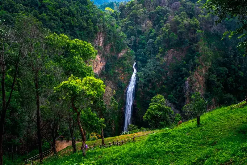
22. Namtok Mae Surin National Park, Mae Hong Son is a mountainous national park famous for its spectacular waterfall and dramatic highland scenery. Located in Mae Hong Son Province, with important tourism areas around Khun Yuam District, the park protects forested mountains, deep valleys, and important headwater ecosystems. Its combination of steep terrain, dense vegetation, and waterfalls makes it one of the region's most appealing destinations for travelers interested in landscape photography and natural scenery.
Mae Surin Waterfall is the park's principal attraction. Water plunges from a high cliff into the valley below, creating a striking natural landscape surrounded by green mountains. Visitors can admire the waterfall from designated viewpoints, where the impressive height of the cascade and the surrounding forest become particularly apparent. During periods of substantial rainfall, the waterfall can appear especially powerful, although heavy rain may also affect visitor safety and access.
Main Attractions and Highlights: Mae Surin Waterfall, mountain viewpoints, forest landscapes, and the nearby Doi Mae U Kho Mexican sunflower fields are among the area's most interesting destinations. The waterfall is especially attractive for visitors who enjoy photographing natural landscapes. During the seasonal flowering period, travelers can combine a visit to the park with Doi Mae U Kho, where hillsides may become covered in bright yellow Mexican sunflowers.
The national park also plays an important ecological role. Its forests protect mountain watersheds and provide habitats for wildlife and native vegetation. Steep terrain and deep valleys have helped preserve extensive natural environments, while also making certain parts of the park difficult to access. Tourism activities must therefore be managed carefully to protect visitors and the surrounding ecosystems.
Things to Do: Admire Mae Surin Waterfall from designated viewpoints, photograph forested mountains, discover the park's natural landscapes, and combine a trip with the seasonal Mexican sunflower fields at Doi Mae U Kho. The park is especially suitable for travelers who enjoy scenery and nature photography.
Best Time to Visit: The rainy season and its transition into the cool season often bring lush forests and substantial waterfall flows. The later months of the year are particularly interesting for combining waterfall sightseeing with the seasonal flower fields. Check flowering conditions and access announcements before traveling.
Getting There: From Mae Hong Son town, follow Highway 108 toward Khun Yuam District, then continue along the mountain roads toward Mae U Kho and the national park. The route includes steep gradients and winding sections, so allow sufficient driving time and ensure your vehicle is in good condition.

23. Salawin National Park, Mae Hong Son is a remarkable national park along the Thai–Myanmar border in Mae Hong Son Province. Covering areas of Mae Sariang and Sop Moei districts, the park is best known for its landscapes along the Salween River, also called the Salawin River in Thailand. This major Southeast Asian river flows through rugged mountains and deep valleys, creating a distinctive natural environment of forested slopes, riverbanks, and remote communities.
The Salween River is central to both the ecology and cultural history of the region. In certain sections, it forms part of the boundary between Thailand and Myanmar. Communities along the river have developed livelihoods closely connected with the waterway, including local transportation and the use of natural resources. Travelers visiting the area can appreciate both the dramatic riverside scenery and the cultural heritage of communities living near this important international river.
Main Attractions and Highlights: The Salween River, Ban Mae Sam Laep, Ban Tha Ta Fang, and the surrounding forested mountain landscapes are among the park's most interesting features. Ban Mae Sam Laep is a riverside community associated with local transportation and access to the river, while Ban Tha Ta Fang offers another opportunity to experience the natural atmosphere of the Salween landscape.
The park is also significant for the conservation of forests along Thailand's western border. Its mountain forests protect watersheds and provide habitats for native plants and animals. The rugged terrain and relatively remote location contribute to the area's distinctive ecological character, offering a valuable setting for understanding the relationship between forests, rivers, and border communities.
Things to Do: Admire river scenery, photograph mountains and waterways, learn about riverside communities, and take boat trips on authorized routes when conditions are safe. Travelers must check river conditions, operator arrangements, and any relevant border-area restrictions before visiting.
Best Time to Visit: The cool season and periods with suitable river conditions can be particularly appealing for appreciating the landscape. During the rainy season, river levels and currents may change rapidly, making safety checks essential.
Getting There: From Mae Hong Son town, follow Highway 108 toward Mae Sariang. Continue to the appropriate riverside destination along the designated local roads. Some attractions require travel along mountain roads or onward boat transportation. Confirm your arrangements and access conditions before departure.
Map (GPS):Directions to Salawin National Park

24. Mae Charim National Park, Nan is one of Nan Province's most interesting destinations for outdoor adventure, particularly whitewater rafting on the Wa River. Located around Mae Charim District and neighboring mountain areas, the park contains rugged hills, extensive forests, streams, and river valleys that support important watershed ecosystems. Its combination of natural beauty and challenging river environments attracts visitors interested in both conservation and adventure tourism.
The Wa River is the park's best-known natural feature. Its course passes through forested valleys and sections of rocky rapids, creating rafting routes of varying difficulty. Water speed and conditions change according to rainfall and river levels, so choosing a suitable route requires careful planning and professional safety assessment. For many adventurous travelers, rafting on the Wa River is one of the most memorable activities available in Nan Province.
Main Attractions and Highlights: The Wa River, natural rapids, forested riverbanks, and designated nature areas are the main attractions. Whitewater rafting provides an opportunity to experience the landscape from the river, passing mountain slopes, rocky sections, and lush vegetation. Visitors who prefer less demanding activities can appreciate the surrounding natural scenery and use authorized visitor facilities.
The park's forests protect important headwater systems that feed the Wa River and its tributaries. These forests sustain wildlife habitats, regulate water flow, and reduce soil erosion. The relationship between the forest and the river provides a valuable opportunity to learn about watershed ecology and the importance of protecting mountain environments.
Things to Do: Experience whitewater rafting with authorized and experienced operators, explore designated nature trails, photograph river and mountain scenery, and learn about forest and freshwater ecosystems. Rafters should wear properly fitted life jackets, use suitable safety equipment, and follow their guides' instructions at all times.
Best Time to Visit: The suitability of rafting depends on water levels, weather, and official access arrangements rather than the calendar alone. For other outdoor activities, check current river conditions, weather forecasts, and park announcements before departure.
Getting There: From Nan city, follow Highway 1168 toward Mae Charim District. Continue toward Nam Phang Subdistrict or the designated park access area. Travelers arranging rafting excursions should confirm the operator's meeting point because different rafting routes may use different launch locations.
Map (GPS):Directions to Mae Charim National Park

25. Khun Nan National Park, Nan is situated in the northern mountain region of Nan Province, particularly around Bo Kluea District near the Thai–Lao border. The park protects rugged mountain ranges and important headwater forests that contribute to the wider Nan River system. Its name reflects the area's close association with the upper watershed of Nan Province, where forested mountains provide water to streams and communities throughout the surrounding valleys.
Khun Nan is characterized by remote mountain scenery and extensive natural forests. Vegetation changes with altitude and local environmental conditions, creating diverse habitats for plants, birds, and wildlife. The park also contains mountain streams and waterfalls formed by its headwater systems, making it particularly attractive for travelers interested in forest conservation and less-developed natural destinations.
Main Attractions and Highlights: Sapan Waterfall, Huai Ha Waterfall, and the mountain landscapes around Bo Kluea District are among the area's most interesting natural destinations. The village of Sapan is also known for its valley scenery, streams, and peaceful rural atmosphere. Visitors can combine the national park with a wider exploration of Bo Kluea, while planning the separate access routes for individual attractions.
The park has considerable conservation value because its mountain forests form part of a broader network of natural habitats in Nan Province. Forest vegetation supports biodiversity, protects watersheds, and helps maintain water quality and flow. Responsible tourism is especially important in such environments, where remote ecosystems can be sensitive to disturbance.
Things to Do: Visit waterfalls, photograph mountain valleys, explore designated forest areas, discover Sapan and Bo Kluea communities, and learn about watershed ecology. The park is particularly suitable for travelers planning several days in Nan's mountain districts.
Best Time to Visit: The late rainy season offers lush forests, streams, and scenic mountain landscapes. The cool season provides refreshing temperatures and pleasant conditions for exploring rural valleys. Check mountain road conditions and waterfall access before traveling during heavy rainfall.
Getting There: From Nan city, travel through Pua District toward Bo Kluea, then continue into Dong Phaya Subdistrict and the national park area. Many sections of the route are mountainous, with steep gradients and sharp bends. Ensure your vehicle is suitable and allow sufficient time for the journey.
Map (GPS):Directions to Khun Nan National Park

26. Khun Sathan National Park, Nan is a mountainous national park in Na Noi District, Nan Province, known for its peaceful forest environments, cool-season weather, and panoramic highland scenery. The park protects forested mountains and important watershed habitats, providing an attractive natural destination for visitors who prefer quieter landscapes and cooler temperatures away from major tourism centers.
Khun Sathan's mountain forests contain diverse vegetation determined by altitude, soil conditions, and moisture. These ecosystems help protect water sources and support wildlife habitats. The area's elevated terrain also provides opportunities to observe mountain ridges and valleys, particularly during the early morning when mist sometimes gathers below the higher viewpoints.
Main Attractions and Highlights: Doi Ku Sathan, scenic mountain viewpoints, and designated forest areas are among the main attractions. The surrounding highlands offer wide views and peaceful natural settings that appeal to visitors interested in mountain photography, forest scenery, and fresh air.
The park also forms part of Nan's wider rural mountain landscape, where forested hills, valleys, farming communities, and winding roads create a scenic journey. Travelers passing through the area can appreciate changes in vegetation and topography while learning about the relationship between forest protection and nearby communities. Visitors should respect private property and follow park access regulations.
Things to Do: Admire mountain views, photograph morning mist when conditions are suitable, explore designated nature trails, and relax in natural surroundings. Camping is permitted only in designated areas and under current park regulations.
Best Time to Visit: The cool season is particularly appealing for its low temperatures and panoramic mountain scenery. The late rainy season offers green forests and potential morning mist, depending on weather conditions.
Getting There: From Nan city, follow Highway 101 toward Wiang Sa, then continue to Na Noi District and San Tha Subdistrict. Follow the signs toward Khun Sathan National Park. Some sections are steep and winding, so exercise caution on mountain roads.
Map (GPS):Directions to Khun Sathan National Park

27. Tham Saken National Park, Nan is located in Song Khwae District, Nan Province, with protected mountain landscapes extending toward parts of Phayao Province. The park is characterized by rugged mountains, forests, streams, and important watershed habitats. Its relatively quiet natural setting makes it appealing to visitors interested in exploring the lesser-known mountain environments of upper Northern Thailand.
The park's name is associated with the natural cave and mountain features of the area. Its forests play an important role in conserving water sources and maintaining ecological balance across the mountainous landscape. Vegetation changes with elevation and local moisture conditions, providing habitats for native birds and wildlife.
Main Attractions and Highlights: Tham Saken Cave, Pha Than Waterfall, and the surrounding mountain scenery are among the area's natural features. Waterfall and stream environments provide opportunities to observe forest ecosystems, while the area's caves and rocky landscapes are of interest to visitors studying natural geological formations. Access to individual sites may depend on current park regulations.
Tham Saken National Park also contributes to the protection of forests along the Nan–Phayao mountain region. Vegetation helps retain soil moisture, regulate streamflow, and reduce erosion on steep slopes. These ecological functions make the park valuable for environmental conservation and education, in addition to its scenic appeal.
Things to Do: Explore authorized cave and nature areas, observe forest vegetation, photograph mountain landscapes, discover streams and waterfalls, and go birdwatching. Before entering caves or remote trails, check whether access is open and whether an authorized guide is required.
Best Time to Visit: The cool season and the transition from the rainy season generally offer pleasant forest conditions. During heavy rainfall, cave access, stream levels, and slippery trails may create additional safety concerns.
Getting There: From Nan city, travel toward Tha Wang Pha and Song Khwae districts, then continue into Yot Subdistrict along the designated park access route. Some roads pass through mountainous and rural areas, so check directions and vehicle suitability before setting off.
Map (GPS):Directions to Tham Saken National Park
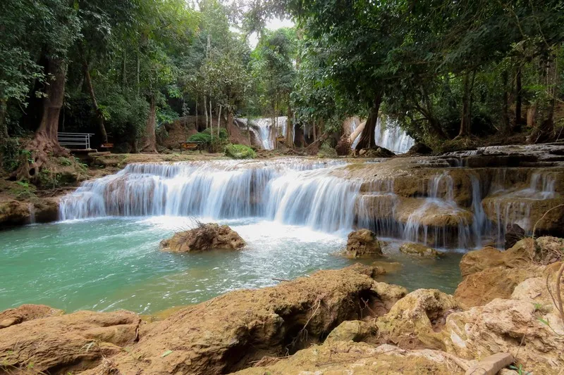
28. Doi Phu Nang National Park, Phayao is situated in Phayao Province, covering areas of Chiang Muan, Pong, and Dok Khamtai districts. The park protects rugged forested mountains and important headwater ecosystems, offering a peaceful natural setting for visitors interested in waterfalls, forest landscapes, and nature-based recreation. Its relatively quiet atmosphere provides an alternative to the more heavily visited destinations of Northern Thailand.
The forests of Doi Phu Nang contain varied vegetation and habitats shaped by mountain elevations and local environmental conditions. These forests help maintain soil moisture, regulate water flow, and protect streams that supply surrounding communities. They also provide habitats for birds and other wildlife, making the park important for regional biodiversity conservation.
Main Attractions and Highlights: Than Sawan Waterfall, Huai Ton Phueng Waterfall, and the surrounding forest scenery are among the park's main attractions. Than Sawan Waterfall is particularly appealing for its water flowing over natural rock formations in a shaded forest environment. The streams and forest paths provide opportunities for relaxing outdoor visits and nature photography.
Doi Phu Nang is especially attractive to visitors who appreciate peaceful natural surroundings rather than large, crowded tourism centers. Waterfalls and forest environments provide opportunities to enjoy the sounds of flowing water and observe vegetation in its natural setting. Visitors should remain within designated areas and follow local safety instructions.
Things to Do: Visit waterfalls, photograph streams and forest landscapes, explore designated nature trails, go birdwatching, and relax in authorized visitor areas. The park offers an appealing alternative for travelers seeking nature experiences beyond Phayao's well-known lake attractions.
Best Time to Visit: The rainy season and its transition into the cool season offer lush greenery and potentially impressive waterfalls. The cool season provides pleasant conditions for walking and exploring nature.
Getting There: From Phayao city, travel toward Dok Khamtai and Chiang Muan districts, then follow the signs to the national park. Individual waterfalls and attractions may have different access routes, so verify the specific destination before departing.
Map (GPS):Directions to Doi Phu Nang National Park

29. Phu Sang National Park, Phayao is located in Phu Sang District of Phayao Province, close to the Thai–Lao border, with natural areas extending toward parts of Chiang Rai Province. The park is renowned for its mountain forests, streams, and an unusual warm-water waterfall that distinguishes it from many other waterfall destinations in Northern Thailand. Its combination of geological interest and accessible natural scenery makes it particularly appealing for families and nature enthusiasts.
The park's best-known attraction is Phu Sang Waterfall, where naturally warm water flows over a series of rock formations in a forest setting. This unusual characteristic is associated with natural groundwater and geothermal conditions. The waterfall offers a distinctive experience because the water temperature differs from that of typical mountain waterfalls, while the surrounding trees provide a shaded and peaceful atmosphere.
Main Attractions and Highlights: Phu Sang Waterfall, natural warm-water sources, forest paths, and mountain scenery are the principal attractions. Visitors can observe water flowing over the rocks and learn about the area's natural water system from designated viewing areas. Nearby forest environments also provide opportunities for short walks and photography.
The national park plays an important role in conserving forests along the Thai–Lao border. Its mountain vegetation helps protect water sources and provides habitats for wildlife and native plants. The combination of forest ecology and warm-water features makes the park particularly valuable for nature education and conservation.
Things to Do: Visit Phu Sang Waterfall, observe the natural warm-water environment, explore designated forest paths, photograph streams and vegetation, and relax in authorized areas. Its relatively accessible attractions make it suitable for families and visitors who prefer shorter nature walks.
Best Time to Visit: The park can be visited during much of the year. The cool season offers pleasant weather for walking, while the rainy season brings greener forests. Check water levels and safety conditions before approaching streams or waterfall areas.
Getting There: From Phayao city, travel through Chun and Chiang Kham districts toward Phu Sang District, then follow the signs to the national park. Private cars and rental vehicles are convenient options. Confirm whether your destination is Phu Sang Waterfall or the park headquarters, as the access points may differ.
Map (GPS):Directions to Phu Sang National Park

30. Nanthaburi National Park (Under Preparation), Nan is a proposed national park area in the mountains of Tha Wang Pha District and surrounding parts of Nan Province. The landscape consists of rugged mountain ranges, forested valleys, and important watershed habitats. Its relatively peaceful setting makes it attractive to travelers interested in exploring lesser-known natural environments and learning about the mountain ecosystems of upper Northern Thailand.
The forests of Nanthaburi contain various vegetation types determined by altitude and local moisture conditions. These include montane evergreen and mixed deciduous forests, along with other forest habitats suited to the terrain. The vegetation protects water sources and provides shelter for native wildlife, making the area important for biodiversity conservation.
Main Attractions and Highlights: Mountain ridgelines, headwater forests, and the scenic landscapes around Tha Wang Pha are the area's main natural features. Visitors interested in forest ecology can explore designated routes, where available, and observe changes in mountain vegetation. Some higher locations offer broad views over the surrounding hills and valleys.
The area also has cultural interest because its mountain landscapes are closely connected with rural communities in Nan Province. Travelers passing through Tha Wang Pha can appreciate local agricultural scenery and traditional village environments as part of a wider itinerary. Respect for local communities and protected forest regulations is essential during such visits.
Things to Do: Admire mountain scenery, explore authorized forest areas, go birdwatching, and photograph natural landscapes. Activities involving remote trekking or access to restricted conservation areas should be arranged according to current regulations and guidance from local authorities.
Best Time to Visit: The cool season offers refreshing temperatures and attractive mountain views, while the late rainy season brings lush vegetation. Check current access arrangements and mountain road conditions before visiting.
Getting There: From Nan city, follow Highway 1080 toward Tha Wang Pha District, then continue to the designated access area according to current local directions. Some mountain routes may have seasonal limitations or require vehicles suitable for rough terrain.
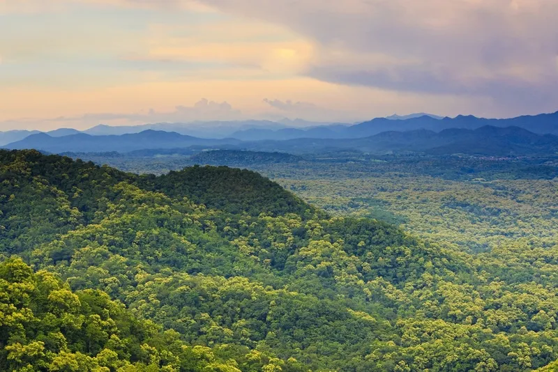
31. Mae Yom National Park, Phrae is a protected natural area distinguished by its mixed deciduous forests, native teak trees, and scenic landscapes along the Yom River. Located primarily in Song District of Phrae Province, with some forest areas extending toward Ngao District in Lampang, the park consists of forested mountains, valleys, streams, and riverside lowlands. The Yom River flows through important natural environments within the park, making Mae Yom significant for watershed conservation, wildlife habitats, and the protection of Thailand's native teak forests.
One of Mae Yom National Park's most remarkable features is its naturally occurring teak forest. Teak is an important native tree species associated with the mixed deciduous forests of Northern Thailand, and the park helps preserve both the trees and the ecological conditions necessary for their continued growth. The forests around Kaeng Suea Ten are especially important in this respect. Visitors interested in forest ecology can learn how soil conditions, seasonal rainfall, and the surrounding landscape contribute to the development of mature teak forests.
Main Attractions and Highlights: Kaeng Suea Ten, natural teak forests, and the landscapes along the Yom River are among the park's principal attractions. Kaeng Suea Ten is characterized by natural rocky sections and rapids along the river, with scenery that changes according to seasonal water levels. Forested riverbanks and nearby woodland also provide important habitats for wildlife and freshwater ecosystems.
The conservation significance of Mae Yom extends beyond its scenic river landscapes. Its forests help regulate runoff, retain soil moisture, reduce erosion on mountain slopes, and sustain native wildlife. The park offers valuable opportunities to understand the relationship between forest conservation and the ecological health of the Yom River basin.
Things to Do: Admire the scenery around Kaeng Suea Ten, learn about natural teak forests, photograph river landscapes, and explore designated forest trails. Visitors approaching the river should check water levels and follow local safety instructions, especially during the rainy season.
Best Time to Visit: The cool season is suitable for forest walks and nature study, while the late rainy season offers lush vegetation and attractive river scenery. River conditions should always be checked before visiting areas close to the water.
Getting There: From Phrae city, travel toward Song District, then continue to Sa Iap Subdistrict and the national park along the designated roads. Parts of the journey pass through rural and mountainous areas, so confirm your destination and road conditions before departure.
Map (GPS):Directions to Mae Yom National Park

32. Wiang Kosai National Park, Phrae is located across mountainous areas of Phrae and Lampang provinces. It covers parts of Long and Wang Chin districts in Phrae, together with neighboring areas of Thoen, Sop Prap, and Mae Tha districts in Lampang. The landscape includes rugged mountain ranges, forested valleys, streams, and waterfalls, forming an important protected watershed area in Northern Thailand.
The forests of Wiang Kosai contain diverse vegetation, including mixed deciduous forests and evergreen habitats in areas with higher moisture levels. These ecosystems protect water sources and provide habitats for birds, wildlife, and native plants. The park's relatively peaceful atmosphere makes it appealing to visitors seeking nature experiences beyond the historic towns and cultural landmarks of Phrae Province.
Main Attractions and Highlights: Mae Koeng Luang Waterfall, Mae Koeng Noi Waterfall, and the surrounding streams and forests are the park's most interesting features. Mae Koeng Luang Waterfall is particularly attractive because water cascades over a series of rocky steps surrounded by natural woodland. Its appearance varies with seasonal rainfall, offering different scenery throughout the year.
The relationship between the mountains, streams, and forests is central to the park's ecological importance. Visitors can observe how flowing water shapes natural rock formations and supports vegetation along the stream banks. Walking within designated areas provides an opportunity to enjoy forest scenery while learning about watershed ecosystems.
Things to Do: Visit Mae Koeng Waterfalls, follow designated nature trails, photograph forest streams and rock formations, and relax in authorized visitor areas. The park is suitable for families and travelers who prefer a slower-paced natural experience.
Best Time to Visit: The late rainy season is particularly attractive for waterfalls and green forests, while the cool season provides comfortable temperatures for nature walks. Check water levels and trail conditions before visiting.
Getting There: From Phrae city, follow Highway 1023 toward Long and Wang Chin districts, then continue along the signposted roads into the national park. Travelers approaching from Lampang can also use routes through Thoen District. Select the access route according to the waterfall or visitor area you intend to visit.
Map (GPS):Directions to Wiang Kosai National Park

33. Doi Pha Klong National Park, Phrae is a national park renowned for its limestone mountains, unusual rock formations, caves, and forest habitats. Located in Phrae Province, with areas extending across Mueang Phrae, Sung Men, and Long districts, the park consists of rugged mountains, limestone cliffs, caves, and wooded slopes. Its geological landscape differs considerably from the pine forests and mountain waterfalls commonly associated with Northern Thailand.
The limestone formations of Doi Pha Klong were shaped by natural weathering and erosion over exceptionally long periods. These processes created cliffs, cavities, and distinctive rock surfaces that reveal the geological history of the area. The forests growing around the limestone mountains contain vegetation adapted to different soil and moisture conditions, contributing to the park's ecological diversity.
Main Attractions and Highlights: Suan Hin Maharat, also known as the Maharaj Rock Garden, Tham Erawan Cave, and the surrounding limestone mountains are among the park's principal attractions. The rock garden is distinguished by groups of naturally weathered stones with unusual shapes, making it particularly interesting for geological study and photography.
Beyond its rock formations, Doi Pha Klong protects forest habitats and nature trails that provide opportunities to observe the relationship between vegetation and limestone terrain. Visitors should remain on designated paths and avoid climbing on unmarked rocks, as some surfaces can be sharp, unstable, or slippery after rain.
Things to Do: Discover the natural rock garden, study limestone geology, explore authorized nature trails, photograph unusual rock formations, and learn about forest ecosystems. The park is suitable for families, students, and travelers interested in geology and natural history.
Best Time to Visit: The cool season is particularly suitable for exploring outdoor geological attractions. The late rainy season brings greener forests, although wet rock surfaces may require extra care.
Getting There: From Phrae city, follow the roads toward Long District and the designated national park access area, including routes connected to Highway 1023. Check the location of the specific rock garden, cave, or visitor facility before setting off, as individual attractions may use different entrances.
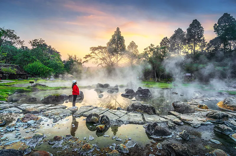
34. Chae Son National Park, Lampang is one of Lampang Province's best-known natural destinations, celebrated for its hot springs, waterfalls, and mountain forests. Located primarily in Mueang Pan District, the park combines geothermal features and forest landscapes within the same protected area. This combination makes it particularly appealing to families, nature enthusiasts, and travelers interested in discovering the geological processes responsible for naturally heated water.
The park's most distinctive attraction is Chae Son Hot Springs, where naturally heated groundwater rises to the surface in a landscape of rocks, pools, and forest vegetation. The hot water is associated with geothermal heat beneath the Earth's surface and circulates through fractures in the surrounding rock. Visitors can observe the steaming pools from designated areas, but should take great care because water temperatures can be dangerously high.
Main Attractions and Highlights: Chae Son Hot Springs, Chae Son Waterfall, and the surrounding nature trails are the park's main attractions. Chae Son Waterfall descends through several natural levels, with water flowing over rocks surrounded by green forest. The hot springs offer a contrasting landscape of steaming water and geothermal activity, making it possible to experience two very different natural environments during the same visit.
Chae Son National Park also protects mountain forests and important headwater ecosystems. Its varied vegetation supports native wildlife, while the forests help maintain soil moisture and regulate natural water systems. The interaction between geothermal activity, streams, and forest landscapes makes the park particularly interesting for nature education.
Things to Do: Visit natural hot springs, learn about geothermal features, admire Chae Son Waterfall, explore designated nature trails, photograph forest scenery, and relax in permitted visitor areas. Always follow safety signs near hot water and avoid entering restricted pools.
Best Time to Visit: The cool season offers a particularly pleasant atmosphere around the hot springs, while the rainy season and the period immediately afterward provide lush vegetation and attractive waterfalls. Exercise additional caution on wet paths.
Getting There: From Lampang city, travel toward Mueang Pan District and Chae Son Subdistrict, then follow the signs to the national park. Private cars and rental vehicles are convenient options. Check the current road conditions and visitor access arrangements before traveling.
Map (GPS):Directions to Chae Son National Park
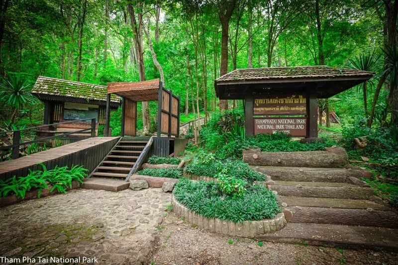
35. Tham Pha Thai National Park (Under Preparation), Lampang is a protected natural area in Lampang Province, with important limestone mountain and cave landscapes around Ngao District and surrounding areas. The park is particularly notable for its geological formations, forest environments, and extensive cave systems. Its distinctive limestone terrain makes it an appealing destination for travelers interested in geology, natural history, and the ecology of cave environments.
Tham Pha Thai Cave is the area's best-known natural feature. Formed within limestone mountains, the cave contains stalactites and stalagmites that developed as mineral-rich water gradually deposited calcium carbonate over long periods. These formations have a variety of shapes and provide visible evidence of the geological processes that continue to shape cave landscapes.
Main Attractions and Highlights: Tham Pha Thai Cave, limestone mountains, and surrounding forests near Ngao District are the principal attractions. Visitors may be able to observe cave formations and learn about their development along routes approved for public access. It is essential to avoid touching or damaging stalactites and stalagmites, as these formations can take extremely long periods to develop.
The area also has ecological importance because forests surrounding the limestone mountains protect watersheds and provide habitats for native wildlife and plants. Cave systems can support specialized species, including bats and small organisms adapted to dark environments. Responsible tourism is particularly important to avoid disturbing these sensitive ecosystems.
Things to Do: Explore authorized limestone caves, observe stalactites and stalagmites, learn about geological processes, walk along designated nature trails, and photograph forested mountain scenery. Visitors should check whether cave access is open and whether a guide is required.
Best Time to Visit: The cool season and periods of relatively dry weather are generally more comfortable for exploring outdoor areas. Cave visits should always be planned around current safety conditions, particularly after heavy rainfall.
Getting There: From Lampang city, follow Highway 1 toward Ngao District, then continue to Ban Huat Subdistrict and the signposted Tham Pha Thai area. Select the appropriate destination for the cave entrance or designated visitor facilities.
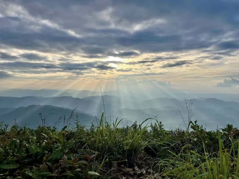
36. Doi Chong National Park, Lampang is situated in the mountainous landscape of Sop Prap District and surrounding parts of Lampang Province. The park protects extensive forested mountains and important headwater habitats that contribute to the ecological health of Northern Thailand. Its rugged terrain, peaceful atmosphere, and natural forest environments make it attractive to visitors interested in hiking, ecology, and mountain scenery.
Doi Chong's forests contain varied vegetation, including mixed deciduous and dry dipterocarp forests, along with other habitats determined by elevation and environmental conditions. The forests protect mountain streams and provide habitats for wildlife, while their vegetation helps retain soil moisture and regulate the flow of water toward surrounding communities.
Main Attractions and Highlights: The Doi Chong mountain range, forest landscapes, and natural viewpoints along designated access routes form the park's principal attractions. Some elevated areas offer broad views over the surrounding mountains when weather conditions are clear. Visitors interested in observing different forest types can explore permitted routes that pass through the park's varied terrain.
The park's relatively quiet setting makes it particularly valuable for nature study and forest conservation. Compared with Lampang's better-known tourist attractions, Doi Chong provides an opportunity to experience mountain forests with fewer developed visitor facilities. Travelers should remain on authorized trails and avoid disturbing wildlife.
Things to Do: Explore nature trails, photograph mountain and forest scenery, go birdwatching, and learn about watershed ecosystems. Longer treks should be arranged in accordance with park regulations, with guidance from officials where required.
Best Time to Visit: The cool season offers comfortable conditions for walking, while the transition from the rainy season brings lush vegetation and occasional morning mist in suitable weather conditions.
Getting There: From Lampang city, follow Highway 1 south toward Sop Prap District, then continue toward Na Yang Subdistrict and the designated park access area. Some roads pass through rural and mountainous terrain, so check road conditions before departure.
Map (GPS):Directions to Doi Chong National Park
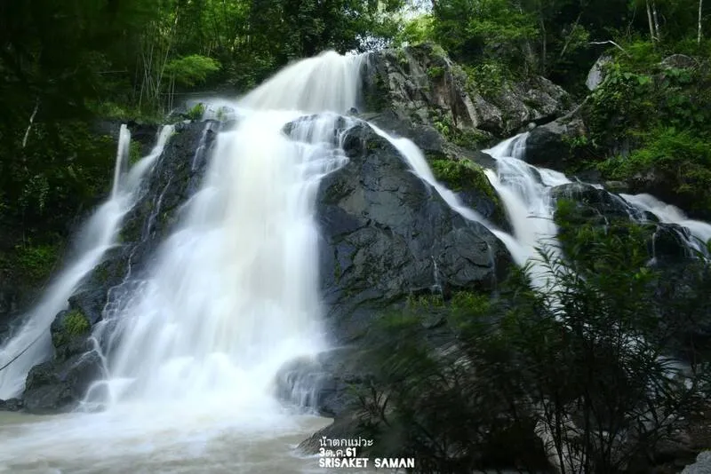
37. Mae Wa National Park, Lampang is a protected natural area in Thoen District of Lampang Province, characterized by rugged mountains, forested valleys, streams, and waterfalls. Its mountain forests form part of the important watershed landscapes of lower Northern Thailand. The park is particularly suitable for travelers seeking quieter forest environments and an opportunity to discover natural waterfalls away from the region's most heavily visited destinations.
Mae Wa contains varied forest vegetation, including mixed deciduous and dry dipterocarp forests, together with other habitats shaped by elevation and local conditions. These forests help retain moisture and protect the mountain streams that flow toward neighboring communities. Their ecological significance extends beyond tourism, as they support local water resources and biodiversity.
Main Attractions and Highlights: Mae Wa Waterfall and the surrounding forest streams are among the park's best-known attractions. The waterfall features water flowing over natural rock formations in a shaded woodland setting. Its appearance changes with rainfall, and the surrounding forest provides a peaceful environment for relaxation and nature photography.
The park also offers opportunities to learn about watershed conservation and the ecological importance of mountain forests in Lampang Province. Visitors exploring its natural areas should follow designated trails, avoid disturbing wildlife, and ensure that all litter is removed after their visit.
Things to Do: Visit Mae Wa Waterfall, explore accessible forest streams, photograph natural scenery, and learn about local vegetation. The park can be included in a day trip or a longer journey through southern Lampang.
Best Time to Visit: The late rainy season is particularly attractive for waterfall scenery and green forests, while the cool season is pleasant for walking. Check current waterfall access and safety announcements before departure.
Getting There: From Lampang city, follow Highway 1 toward Thoen District, then continue into Mae Wa Subdistrict and the national park along the designated access route. Some local roads may be narrow or winding, so confirm road conditions before traveling.
Map (GPS):Directions to Mae Wa National Park

38. Mae Ping National Park, Lamphun is an important protected landscape of forested mountains, rivers, waterfalls, and natural valleys. Located primarily in Li District of Lamphun Province, with additional areas extending into Chiang Mai and Tak, the park is closely connected to the Ping River basin. Its natural environments include rugged mountains, waterways, grasslands, and forests that support valuable watershed ecosystems.
One of Mae Ping National Park's most distinctive features is the Ping River, which winds through mountain valleys and forested landscapes. The river creates scenic stretches of water surrounded by hills and woodland, offering opportunities for quiet nature appreciation. Accessible viewpoints and authorized visitor areas provide different perspectives on this remarkable environment.
Main Attractions and Highlights: Ko Luang Waterfall, Thung Kik, and Kaeng Ko are among the park's main attractions. Ko Luang Waterfall is known for its attractive pools and forest setting. Thung Kik offers a contrasting landscape of open grassland and woodland, while Kaeng Ko is associated with extensive waterside scenery surrounded by mountains.
Mae Ping contains varied ecosystems shaped by elevation, vegetation, and the presence of water. Forested mountains, grasslands, and riverside habitats provide opportunities to observe different environments within the same national park. These natural systems also contribute to water conservation and support native wildlife.
Things to Do: Discover Ko Luang Waterfall, enjoy views of the Ping River, photograph mountain scenery, explore grassland and forest environments, and relax in designated areas. Activities involving boats, water access, or camping must follow current park regulations.
Best Time to Visit: The cool season and the transition from the rainy season offer pleasant conditions for nature travel. Forest vegetation is especially green after seasonal rainfall, while cooler months are suitable for walking and scenic visits.
Getting There: From Lamphun city, travel toward Li District and follow the roads leading to Mae Ping National Park or your intended attraction. Ko Luang Waterfall, Thung Kik, and Kaeng Ko are situated in different parts of the park, so plan your route accordingly.
Map (GPS):Directions to Mae Ping National Park

39. Doi Khun Tan National Park, Lamphun and Lampang is located along the mountainous border between Mae Tha District in Lamphun and Hang Chat District in Lampang. The park is distinguished by its combination of forested mountains and historic railway engineering. Its landscape includes an important section of the northern mountain range, while the famous Khun Tan Railway Tunnel reflects a significant chapter in the development of Thailand's rail transportation system.
The mountains of Doi Khun Tan contain important watershed forests and diverse vegetation that changes with altitude. Mixed deciduous forests, pine woodland, and other mountain habitats provide scenic landscapes and support native wildlife. The park's natural character, combined with the history of the railway passing beneath the mountain, creates a distinctive destination for travelers interested in both nature and engineering heritage.
Main Attractions and Highlights: Doi Khun Tan's hiking trails, mountain viewpoints, Khun Tan Railway Tunnel, and the surroundings of Khun Tan Railway Station are among the area's principal attractions. The park offers several trekking destinations at different elevations, allowing visitors to choose routes according to their experience and physical fitness.
One of the park's most unusual experiences is arriving by train. Travelers can use the Northern Railway Line to reach Khun Tan Station, then continue on foot along the designated route into the national park. This journey combines the atmosphere of a historic mountain railway with hiking through natural forest environments.
Things to Do: Hike designated mountain trails, admire viewpoints, explore pine forest habitats, photograph natural scenery, and visit the area around Khun Tan Railway Station. The park is particularly interesting for travelers who enjoy combining historical transport experiences with outdoor exploration.
Best Time to Visit: The cool season and the late rainy season offer attractive forest scenery and pleasant temperatures. During the rainy season, trails may become slippery, so check current route conditions before hiking.
Getting There: Travel by train on Thailand's Northern Railway Line to Khun Tan Station, then continue on foot toward the national park along the designated access route. Road access is also possible from Lamphun or Lampang using local roads. Check the available parking areas and walking routes before departure.
Map (GPS):Directions to Doi Khun Tan National Park

40. Lam Nam Nan National Park, Uttaradit is a protected natural area covering mountainous landscapes in Uttaradit Province and adjoining parts of Phrae. Its terrain includes rugged mountain ranges, forested valleys, and riverside environments associated with the Nan River basin. The park plays an important role in the conservation of forest habitats and water resources in lower Northern Thailand, particularly in landscapes that contribute to one of the country's major river systems.
The park's scenery is distinguished by forested mountains and natural waterways extending through valleys. Different elevations and environmental conditions support a variety of vegetation and wildlife habitats. These mountain forests contribute to soil conservation, maintain watershed health, and help regulate water flow toward lower-lying communities.
Main Attractions and Highlights: Scenic sections of the Nan River, natural landscapes around Sirikit Dam, and forested mountain viewpoints are among the area's main attractions. Water and mountain scenery create attractive settings for photography and peaceful outdoor visits. However, destinations around Sirikit Dam and individual attractions within the park may have separate entrances and access routes.
Lam Nam Nan National Park has considerable ecological value because its forests help protect headwater areas, reduce erosion, and provide habitats for native wildlife. Its relationship with the Nan River basin makes it particularly interesting for visitors seeking to understand the importance of mountain forests to Thailand's water resources and environmental health.
Things to Do: Admire river and reservoir landscapes, photograph forested mountains, explore authorized nature trails, and relax in designated visitor areas. Water-based activities should be undertaken only where permitted and under appropriate safety conditions.
Best Time to Visit: The cool season and the transition from the rainy season offer pleasant temperatures and attractive mountain scenery. During periods of heavy rainfall, visitors should check water levels and road conditions before traveling.
Getting There: From Uttaradit city, travel toward Tha Pla or Nam Pat districts according to your intended destination, then follow the designated roads to the park. Because the protected area covers a substantial landscape and its attractions may be widely separated, confirm the exact GPS location before beginning the journey.
Map (GPS):Directions to Lam Nam Nan National Park
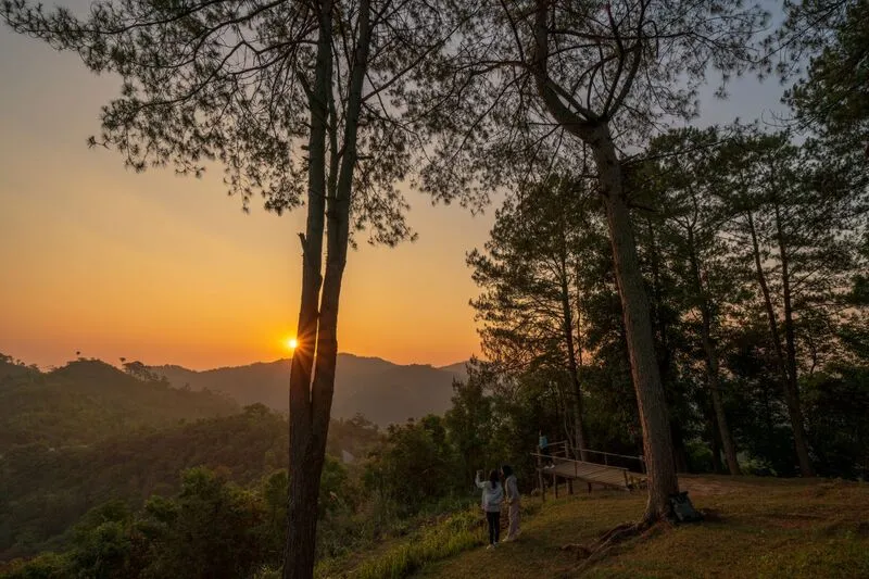
41. Taksin Maharat National Park, Tak is a protected natural area in the western mountains of Tak Province, covering parts of Mueang Tak and Mae Sot districts. The park is characterized by rugged mountain ranges, forested valleys, and important watershed ecosystems. Its elevated terrain offers cooler conditions than the surrounding lowlands during certain times of the year, making it a rewarding destination for visitors traveling between Tak and Mae Sot. The park is particularly significant for forest conservation and the protection of native plants, wildlife habitats, and natural water sources.
One of the park's most remarkable features is its enormous krabak tree, a native tropical hardwood that has become an important natural symbol of Taksin Maharat. The tree demonstrates the ecological value of mature forests and the importance of conserving old-growth vegetation. Visitors can follow designated nature trails to appreciate the tree's impressive size and learn about the forest ecosystem that has supported its growth over a long period.
Main Attractions and Highlights: The giant krabak tree, natural stone bridge, Pang A Noi Waterfall, and forest nature trails are among the park's most interesting attractions. The ancient-looking stone bridge is a notable geological feature shaped by natural processes, while the waterfall and forest environments provide opportunities for photography and nature appreciation. The combination of botanical and geological attractions distinguishes Taksin Maharat from many other forest destinations.
The park's forests contain varied vegetation according to elevation and environmental conditions. These habitats provide shelter for birds and other wildlife while helping retain soil moisture and protect mountain streams. Conserving the forests contributes to the long-term ecological stability of Tak Province's mountain landscapes.
Things to Do: Visit the giant krabak tree, explore designated forest trails, photograph unusual rock formations, go birdwatching, discover waterfalls, and relax in permitted visitor areas. The park is suitable for families, nature enthusiasts, and travelers driving between Tak and Mae Sot.
Best Time to Visit: The cool season and the transition from the rainy season offer pleasant temperatures for exploring forest trails. During periods of heavy rainfall, paths may become slippery, so take appropriate precautions.
Getting There: From Tak city, follow Highway 12 toward Mae Sot. The park is accessible from the mountain road, with signs directing visitors to designated entrances and facilities. The highway contains steep and winding sections, so ensure your vehicle is in good condition and drive carefully.
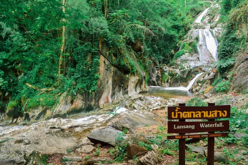
42. Lan Sang National Park, Tak is a national park known for its waterfalls, mountain forests, and accessible natural scenery. Located in Mae Tho Subdistrict, Mueang Tak District, the park forms part of the forested mountain landscapes of western Thailand. Its rugged terrain and important headwater ecosystems make it valuable for conservation, while its proximity to Tak city makes it an appealing destination for day trips and family outings.
The park's principal natural features are its streams and waterfalls, which flow through forested valleys and over rock formations. Different sections of the waterways create a variety of landscapes, from broad rocky streambeds to cascades descending over natural steps. These features allow visitors to experience several forms of freshwater scenery within the same protected area.
Main Attractions and Highlights: Lan Sang Waterfall, Pha The Waterfall, Lan Liang Ma Waterfall, and natural forest streams are among the park's main attractions. Lan Sang Waterfall is particularly popular for its scenic surroundings and flowing water. Nearby streams and other waterfalls provide opportunities for nature walks and photography, with access depending on current trail and safety conditions.
Lan Sang National Park contains forest habitats that support wildlife and native vegetation. The forests protect soil and water resources and help maintain the natural streams that flow toward surrounding communities. Visiting the park also offers an opportunity to learn about the ecological relationship between mountain forests and freshwater environments.
Things to Do: Visit waterfalls, explore designated nature trails, photograph streams and forest vegetation, go birdwatching, and relax in permitted areas. The park is suitable for travelers seeking a nature excursion within reach of Tak city.
Best Time to Visit: The rainy season and the transition into cooler months often provide lush forests and impressive waterfall flows. The cool season is particularly pleasant for walking. Check safety announcements during periods of heavy rainfall.
Getting There: From Tak city, follow Highway 12 toward Mae Sot, then take the signposted road to Lan Sang National Park in Mae Tho Subdistrict. Private cars and rental vehicles are convenient. Confirm the access point for the waterfall you intend to visit.
Map (GPS):Directions to Lan Sang National Park

43. Khun Phawo National Park, Tak is located in Mae Ramat District of Tak Province, with important visitor areas around Sam Muen Subdistrict. The park protects mountainous forests, streams, and important watershed habitats that form part of Thailand's western forest landscapes. Its relatively remote atmosphere makes it suitable for visitors interested in forest ecology and quieter nature destinations.
Khun Phawo's forests contain a variety of vegetation, including mixed deciduous and evergreen habitats in appropriate environmental conditions. These forests support wildlife, birds, and important mountain streams while helping maintain soil moisture and reduce erosion. Their ecological significance extends beyond tourism because they contribute to the conservation of western Thailand's extensive forest ecosystems.
Main Attractions and Highlights: Huai Krathing Waterfall, Pa Mak Waterfall, and the surrounding forest scenery are among the area's natural features. Waterfalls and streams provide opportunities to appreciate the park's woodland environment, although access to individual attractions may vary according to seasonal restrictions or conservation requirements.
The park plays an important role in protecting connected forest habitats and watershed systems. Its mountainous landscapes help conserve biodiversity while providing valuable opportunities for environmental education. Visitors should follow designated trails, respect wildlife habitats, and avoid entering restricted forest areas.
Things to Do: Explore accessible nature trails, admire mountain landscapes, photograph forests and waterfalls, and learn about watershed conservation. Visitors should confirm which attractions are currently open before traveling.
Best Time to Visit: The cool season and the late rainy season are generally suitable for nature exploration. During heavy rainfall, some trails may become inaccessible because of slippery ground, stream levels, or other safety concerns.
Getting There: From Tak city, travel toward Mae Sot and continue to Mae Ramat District and Sam Muen Subdistrict using the designated local roads. The journey includes mountainous sections, so check road conditions and prepare your vehicle appropriately.
Map (GPS):Directions to Khun Phawo National Park

44. Khlong Wang Chao National Park, Kamphaeng Phet is an important protected forest landscape extending across areas of Kamphaeng Phet and Tak provinces. The park contains rugged mountains, forested valleys, streams, and waterfalls within Thailand's extensive western forest region. Its natural environments are significant for biodiversity conservation, watershed protection, and the preservation of forest ecosystems connected to other protected areas.
The forests of Khlong Wang Chao vary with elevation, rainfall, and local environmental conditions, including mixed deciduous, evergreen, and other forest habitats. These landscapes support wildlife and protect mountain streams that flow through the surrounding region. The park's relatively remote natural areas provide opportunities for visitors interested in forest conservation and less-developed nature destinations.
Main Attractions and Highlights: Khlong Wang Chao Waterfall, Tao Dam Waterfall, and the surrounding forest streams are among the park's principal natural attractions. Tao Dam Waterfall is particularly interesting for its steep rocky terrain and forest setting, while other streams and waterfalls demonstrate the ecological relationship between mountain forests and freshwater habitats.
The park's importance extends to conserving the wider western forest ecosystem. Its natural habitats maintain ecological connectivity, support biodiversity, and protect water resources. Travelers interested in nature can explore authorized areas and learn about forest environments without disturbing wildlife or leaving designated routes.
Things to Do: Visit waterfalls, explore designated nature trails, photograph forest scenery, go birdwatching, and relax in permitted visitor areas. Remote waterfalls and forest routes may require special access arrangements, so check current park regulations before departure.
Best Time to Visit: The cool season and the transition from the rainy season are suitable for nature walks. The rainy season brings lush forest scenery but may also create risks from strong stream currents, slippery ground, and flash floods.
Getting There: From Kamphaeng Phet city, travel toward Khlong Lan District, then continue toward Pong Nam Ron Subdistrict and the park along the designated route. Some sections pass through mountainous terrain, and access to certain attractions may require vehicles suitable for local road conditions.
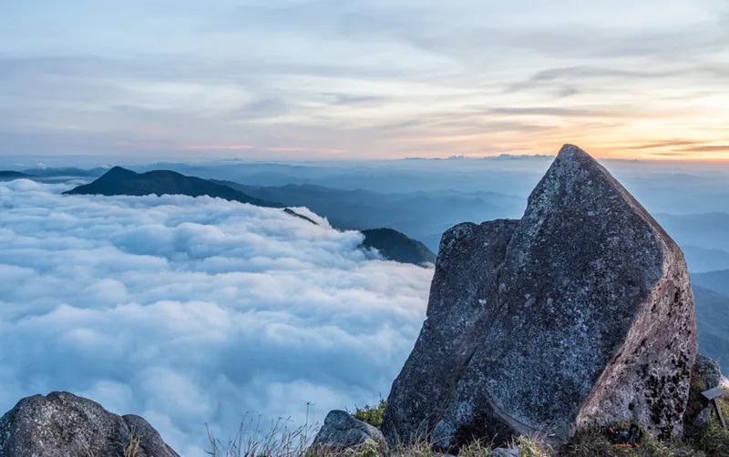
45. Mae Wong National Park, Kamphaeng Phet and Nakhon Sawan is a major protected forest area extending across Kamphaeng Phet and Nakhon Sawan provinces. The park forms part of Thailand's western forest landscapes, where extensive mountain forests are connected with other protected habitats. Its terrain includes rugged mountains, valleys, streams, and natural forests that play an essential role in watershed protection and biodiversity conservation.
Mae Wong is known for its extensive forests and dramatic mountain landscapes. Vegetation changes with altitude and environmental conditions, with mixed deciduous, evergreen, and higher-elevation forest habitats occurring across the park. These ecosystems support native wildlife and help maintain the ecological connectivity of Thailand's western forests.
Main Attractions and Highlights: Chong Yen, Mount Mokoju, and designated forest trails are among the park's best-known attractions. Chong Yen is a highland destination with cool temperatures and forested mountain views, making it particularly appealing to nature enthusiasts and photographers. Mokoju is a famous challenge for experienced hikers seeking a demanding multi-day mountain expedition.
The route to Mokoju involves difficult mountain terrain, steep trails, and an extended journey through remote forests. It requires physical fitness, suitable equipment, and compliance with official trekking arrangements. Access is restricted to designated periods and may require advance registration or booking through the relevant authorities. The route should never be attempted without proper preparation or required guidance.
Things to Do: Enjoy the mountain scenery at Chong Yen, go birdwatching, photograph forest landscapes, explore designated trails, and join authorized trekking expeditions to Mokoju when available. Choose activities that match your fitness, experience, and equipment.
Best Time to Visit: The cool season is particularly attractive for mountain views and lower temperatures. Long-distance trekking routes operate according to official seasonal access schedules and may not be available throughout the year.
Getting There: From Kamphaeng Phet city, travel toward Khlong Lan or Pang Sila Thong districts according to the intended park access point. Different attractions may use separate routes, so confirm the GPS destination and current road conditions before traveling.
Map (GPS):Directions to Mae Wong National Park
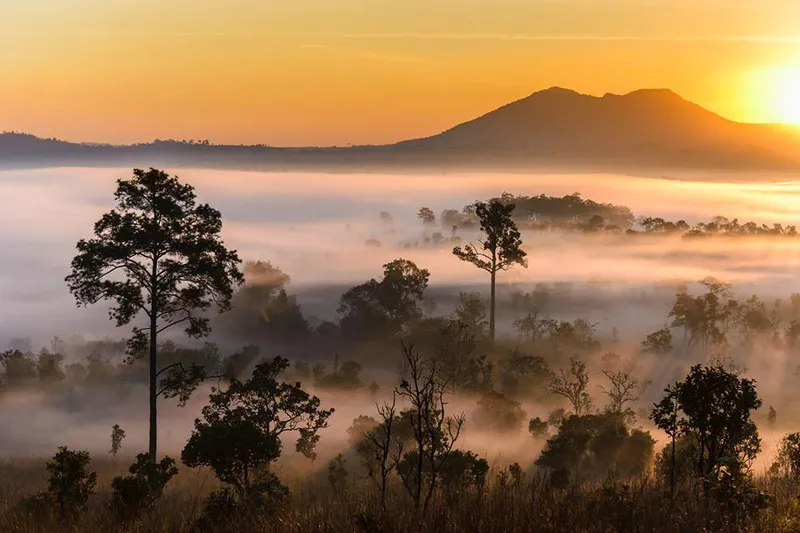
46. Thung Salaeng Luang National Park, Phitsanulok and Phetchabun is famous for its expansive grasslands, pine forests, and distinctive highland scenery. Spanning areas of Phitsanulok and Phetchabun provinces, the park contains elevated plains, rolling hills, wooded mountains, and natural grassland ecosystems. Its open landscapes have earned it the nickname Thailand's savanna, reflecting the appearance of broad grassy plains bordered by pine woodland and distant mountains.
Thung Salaeng Luang is particularly important for conserving grassland and forest ecosystems. The park contains pine forests, dry dipterocarp forests, mixed deciduous woodland, and natural grasslands. These habitats support native plants and animals and offer opportunities to observe the relationship between vegetation, altitude, and seasonal environmental conditions.
Main Attractions and Highlights: Thung Salaeng Luang, Thung Nang Phaya, Thung Non Son, and the Nong Mae Na area are among the park's best-known destinations. Thung Nang Phaya is especially attractive for its open grassland surrounded by pine trees, creating impressive scenery during the early morning and late afternoon. Thung Non Son is another important natural grassland area, particularly interesting for seasonal wildflowers and nature exploration.
The landscape changes noticeably throughout the year. During the rainy season, the grasslands become intensely green and the surrounding forests are especially lush. In the cool season, temperatures are more comfortable for outdoor activities, and mist may gather across the landscape when weather conditions are favorable.
Things to Do: Explore grasslands and pine forests, photograph natural scenery, study grassland ecosystems, go birdwatching, and camp in designated areas. Access to remote grasslands and forest routes may be restricted according to seasonal conservation measures.
Best Time to Visit: The late rainy season and cool season are particularly suitable for enjoying green grasslands, open scenery, and pleasant temperatures. During periods of heavy rainfall, some roads or trails may be temporarily closed.
Getting There: From Phitsanulok city, travel through Wang Thong District and follow Highway 12 toward the national park. Visitors can also approach from Phetchabun via Khao Kho and the Nong Mae Na area. Because attractions are spread across a large landscape, plan your route according to the specific destination.
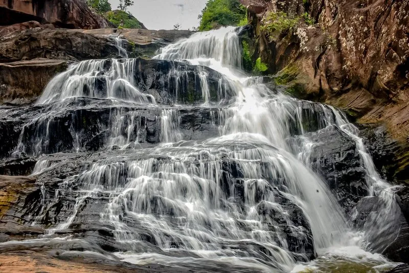
47. Namtok Chat Trakan National Park, Phitsanulok is located in Chat Trakan District of Phitsanulok Province and is renowned for its beautiful multi-tiered waterfall and surrounding mountain forests. The park protects rugged highland terrain and important watershed ecosystems, providing a natural retreat for visitors seeking forest scenery, flowing streams, and waterfalls in lower Northern Thailand.
Chat Trakan Waterfall consists of several levels formed where flowing water descends over natural rock formations at different elevations. Each section has distinctive rock surfaces, pools, and surrounding vegetation. Visitors can explore designated waterfall trails and observe how moving water has shaped the landscape over long periods.
Main Attractions and Highlights: Chat Trakan Waterfall, also known locally as Pak Rong Waterfall, is the park's principal attraction. Its multiple cascades provide varied scenery along the stream. Some levels have natural pools and attractive rock formations, while the surrounding forests offer opportunities for photography and nature observation. Visitors should choose routes appropriate to their fitness and take care on slippery surfaces.
The park's forests are important for watershed protection and biodiversity conservation. Different vegetation types occur according to the mountainous terrain and environmental conditions, supporting native wildlife and helping regulate streamflow. Responsible tourism contributes to preserving the natural conditions that sustain the waterfall and its surrounding ecosystem.
Things to Do: Explore accessible waterfall levels, walk along designated forest trails, photograph flowing water and natural rock formations, and relax near streams where permitted. The park is suitable for travelers planning a nature excursion from Phitsanulok.
Best Time to Visit: The rainy season and the transition into cooler months can offer impressive waterfall flows and lush vegetation. However, visitors should be alert to flash-flood risks and slippery paths after heavy rainfall. The cool season offers pleasant conditions for walking.
Getting There: From Phitsanulok city, travel toward Nakhon Thai District and continue to Chat Trakan District, following signs toward the national park. Some sections pass through mountainous terrain and include winding roads. Check current access conditions before departure.
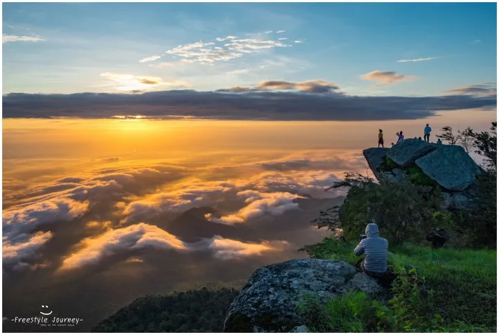
48. Ramkhamhaeng National Park, Sukhothai is situated in Khiri Mat District of Sukhothai Province and is distinguished by its mountain landscapes, forest ecosystems, and the famous Khao Luang mountain range. The park provides a challenging hiking destination while also offering a connection to the historical and cultural heritage of Sukhothai. Its rugged terrain and extensive forests make it particularly attractive for visitors interested in mountain trekking and natural scenery.
Khao Luang is the park's best-known mountain destination. The trekking route climbs steep forested slopes and passes through different natural environments as elevation increases. Hikers experience changing vegetation, cooler mountain conditions, and increasingly expansive views of the surrounding landscape. The demanding terrain requires suitable physical preparation and appropriate hiking equipment.
Main Attractions and Highlights: Khao Luang, Yod Khao Narai, Yod Khao Phra Mae Ya, and designated mountain trails are among the park's most interesting features. The mountain summits offer panoramic views of the surrounding ridges and lowlands when conditions are clear. The area is particularly popular among hikers seeking a rewarding mountain experience in Sukhothai Province.
The park is also significant for conserving forest habitats and mountain watersheds. Its vegetation provides habitats for wildlife and helps maintain soil stability and natural water resources. Visitors should remain on designated trails, respect conservation regulations, and avoid leaving litter in the forest.
Things to Do: Hike Khao Luang, admire mountain panoramas, photograph sunrise scenery and mist when conditions are favorable, and explore highland forests. The park is particularly suitable for physically prepared travelers who enjoy challenging trekking routes.
Best Time to Visit: The cool season and the transition from the rainy season are popular for trekking. Mountain paths can be steep and slippery after rainfall, so check route availability and current weather conditions before planning an ascent.
Getting There: From Sukhothai city, travel toward Khiri Mat District and follow the signs to Ramkhamhaeng National Park. Hikers planning to climb Khao Luang should confirm the official trailhead, trekking requirements, and camping regulations before departure.
Map (GPS):Directions to Ramkhamhaeng National Park
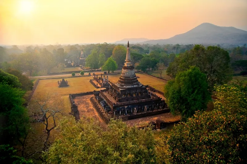
49. Si Satchanalai National Park, Sukhothai is located in Si Satchanalai District of Sukhothai Province, with important visitor areas around Ban Kaeng Subdistrict. The park protects forested mountains, streams, waterfalls, and important watershed habitats. It is particularly interesting because it lies in a province celebrated for its historical heritage, allowing travelers to combine natural attractions with visits to important archaeological sites.
The forests of Si Satchanalai National Park contain varied vegetation adapted to the mountainous terrain and environmental conditions. These forests help maintain the region's water resources and provide habitats for native birds and wildlife. The peaceful natural atmosphere offers an appealing contrast to Sukhothai's historic towns and temple complexes.
Main Attractions and Highlights: Tat Duean Waterfall, Tat Dao Waterfall, and the surrounding forest landscapes are among the park's main attractions. The waterfalls feature water flowing over natural rock formations in shaded forest environments, creating opportunities for nature photography and outdoor recreation. Access to individual waterfalls may require different routes or walking distances.
The park can also be included in a cultural and nature itinerary through Sukhothai Province. Visitors may combine a nature excursion with Si Satchanalai Historical Park, although the archaeological park and the national park are separate destinations. Allow sufficient travel time and confirm the correct access roads for each location.
Things to Do: Visit waterfalls, explore designated nature trails, photograph streams and forest vegetation, and combine nature travel with the historical attractions of Sukhothai Province. The park is suitable for travelers interested in both natural landscapes and Thai cultural heritage.
Best Time to Visit: The cool season and the late rainy season are particularly suitable for nature walks and waterfall visits. During heavy rainfall, streams may rise and forest paths may become slippery, requiring additional caution.
Getting There: From Sukhothai city, travel toward Si Satchanalai District and continue into Ban Kaeng Subdistrict, following the signs to the national park. Some waterfalls may require additional travel along forest roads or walking trails, so verify the intended destination before setting off.

50. Tat Mok National Park, Phetchabun is a mountainous national park located in Mueang Phetchabun District, Phetchabun Province. The park protects rugged forested mountains and important watershed ecosystems of lower Northern Thailand. It is particularly famous for Tat Mok Waterfall, a striking natural cascade descending from a high cliff in a forest setting, making it a rewarding destination for visitors seeking waterfalls and mountain scenery.
Tat Mok Waterfall is distinguished by water plunging down a steep rock face and producing spray around its lower sections. The surrounding forest creates a lush natural setting that becomes particularly attractive when rainfall provides a substantial water flow. Visitors can appreciate the waterfall and nearby forest environment from designated trails and viewpoints.
Main Attractions and Highlights: Tat Mok Waterfall and the surrounding mountain forests are the park's principal attractions. The waterfall's dramatic cliff, flowing water, and forest vegetation provide excellent opportunities for nature photography. Walking toward the waterfall also allows visitors to experience the park's shaded forest environment and natural streams.
The park's forests contribute to watershed protection, biodiversity conservation, and soil stability in the mountainous landscape. Native vegetation helps retain moisture and supports wildlife habitats, while reducing erosion on steep slopes. Responsible visitation helps protect these natural systems and preserve the waterfall's surrounding environment.
Things to Do: Visit Tat Mok Waterfall, explore designated nature trails, photograph the waterfall and forest scenery, and relax in authorized visitor areas. The park is suitable for nature enthusiasts and travelers planning a day excursion from Phetchabun city.
Best Time to Visit: The rainy season and the transition into cooler months can offer impressive waterfall flows and lush vegetation, although slippery paths and rising water levels require caution. The cool season is pleasant for forest walks.
Getting There: From Phetchabun city, travel toward Na Pa Subdistrict and follow the signs to Tat Mok National Park. Some sections pass through mountainous terrain, and reaching the waterfall may require walking from the designated visitor area. Check current trail and access conditions before departure.
Map (GPS):Directions to Tat Mok National Park
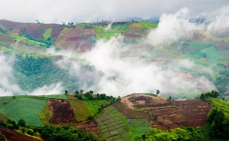
51. Mae Tho National Park (Under Preparation), Chiang Mai is a protected natural area in the mountainous western region of Chiang Mai Province, covering parts of Hot and Mae Chaem districts. The landscape is characterized by high mountain ranges, deep valleys, extensive forests, and important watershed ecosystems. The area is particularly appealing to travelers interested in peaceful mountain scenery, highland forests, and the traditional rural landscapes of western Chiang Mai.
Mae Tho contains considerable variations in elevation, creating several distinct forest habitats. Lower slopes support dry dipterocarp and mixed deciduous forests, while higher elevations may contain pine forests and cooler montane evergreen environments. These variations contribute to the area's biodiversity, providing habitats for wildlife and native plants while protecting headwater streams that supply surrounding communities.
The appeal of Mae Tho extends beyond any single mountain summit or viewpoint. Forested ridges stretch across the landscape, separated by valleys and rural settlements. On mornings when weather conditions are favorable, mist may gather in the valleys, creating dramatic layers of mountains as the sunlight gradually illuminates the landscape. These scenes are particularly attractive for travelers interested in nature photography and slow-paced mountain journeys.
Main Attractions and Highlights: Mountain viewpoints, watershed forests, designated nature routes, and the rural highland landscape are among the area's main features. The surrounding mountains offer scenic panoramas, while villages and agricultural land in the valleys add another dimension to the landscape. During the rainy season, green fields and cultivated terraces in neighboring communities can create particularly attractive scenery.
The mountain communities around Mae Tho have developed ways of life closely connected to the surrounding environment. Local agricultural practices, settlement patterns, and traditional knowledge reflect the challenges of living in highland terrain. Travelers passing through these communities can appreciate local rural culture, but should respect private property, avoid entering agricultural land without permission, and follow community guidelines.
From a conservation perspective, Mae Tho is important for protecting mountain watersheds. Forest vegetation absorbs rainfall, stabilizes soil, and helps regulate the flow of water through streams descending toward lower elevations. Preserving these forests therefore supports both biodiversity and the long-term availability of water for surrounding communities.
Things to Do: Admire mountain panoramas, photograph valleys and morning mist when conditions are suitable, study watershed forest ecosystems, go birdwatching, and discover highland communities. Remote trekking or access to protected forest areas should be arranged according to current regulations.
Best Time to Visit: The transition from the rainy season to cooler months offers lush mountain landscapes and opportunities to see mist in the valleys. The cool season is particularly pleasant for mountain sightseeing. During heavy rainfall, some roads may become slippery or difficult to navigate.
Getting There: From Chiang Mai city, follow Highway 108 through Chom Thong toward Hot District. Continue toward Bo Sali Subdistrict and the designated Mae Tho National Park access area. Some sections pass through steep and winding mountain terrain, so check road conditions and ensure that your vehicle is suitable for the journey.
Map (GPS):Directions to Mae Tho National Park Area

52. Khwae Noi National Park (Under Preparation), Phitsanulok is a proposed national park area in Phitsanulok Province, covering mountainous landscapes across Wat Bot, Chat Trakan, Nakhon Thai, and Wang Thong districts. Its terrain consists of rugged mountain ranges, forested valleys, streams, and important watershed habitats connected to the Khwae Noi River system. The area plays a significant role in protecting forests and water resources that support communities and agricultural landscapes throughout Phitsanulok.
The forests of Khwae Noi contain a variety of habitats, including mixed deciduous, dry dipterocarp, dry evergreen, and montane evergreen forests in suitable areas. These environments support native plants and wildlife while helping stabilize soil and regulate water flow. The ecological importance of the area is closely related to the health of the surrounding river basin.
One of Khwae Noi's defining characteristics is the relationship between its mountain forests and the Khwae Noi River. Rainwater collected by the forested slopes feeds streams and tributaries before reaching lower elevations. These water systems contribute to the wider river basin, supporting agriculture and everyday life in the surrounding region. Protecting the forests therefore has direct ecological and social benefits beyond their value as attractive natural scenery.
Main Attractions and Highlights: Watershed forests, natural rocky streams, waterfalls, mountain viewpoints, and landscapes associated with the Khwae Noi River system are among the area's important features. Visitors can appreciate the forest and river environments along routes authorized for public access.
Khwae Noi Bamrung Daen Dam is another notable destination in Phitsanulok Province that can be included in a wider itinerary. Its expansive reservoir and surrounding mountains offer attractive scenery, but the dam and individual national park attractions are separate destinations. Travelers should confirm the specific access route for each location rather than assuming that all attractions share a common entrance.
The area also provides opportunities for environmental education. Forest conservation in the upper watershed influences water quality, streamflow, and ecological conditions downstream. Exploring designated natural areas can help visitors appreciate how protected mountain landscapes contribute to the sustainability of surrounding communities.
Things to Do: Admire forested mountains and river landscapes, explore authorized nature trails, photograph streams and natural scenery, and combine a nature excursion with a separate visit to Khwae Noi Bamrung Daen Dam. Water-based recreation should take place only where permitted and under suitable safety conditions.
Best Time to Visit: The cool season and the transition from the rainy season offer pleasant conditions for forest exploration. During the rainy season, streams may rise rapidly and some trails may become slippery, so check safety announcements before visiting.
Getting There: From Phitsanulok city, travel toward Wat Bot District, then continue to Khan Chong Subdistrict and the designated park access area. Because the protected landscape covers a wide region, use the precise GPS location for your intended attraction rather than relying on a general district destination.

53. Namtok Pha Charoen National Park (Under Preparation), Tak is a protected natural area in Phop Phra District and neighboring parts of Mae Sot District, Tak Province. Its landscape consists of forested mountains, streams, waterfalls, and geothermal features along the scenic Mae Sot–Umphang route. The park is particularly known for Pha Charoen Waterfall, an attractive limestone waterfall with numerous natural tiers. The combination of waterfalls, seasonal wildflowers, and hot springs makes the area an appealing destination for travelers exploring western Thailand.
Pha Charoen Waterfall is the area's most recognizable attraction. Its water flows over an extensive sequence of limestone steps, creating numerous small cascades and pools. The waterfall is traditionally described as having 97 tiers, a distinctive feature that contributes to its reputation. Surrounded by lush vegetation, the cascade provides beautiful scenery and opportunities for observing natural limestone formations.
The limestone waterfall landscape is associated with the gradual deposition of minerals carried by flowing water. Over long periods, these deposits help shape the rock surfaces and create tiered formations. Visitors can observe the relationship between water, minerals, and natural geological processes while walking in designated areas. Care is necessary on wet rocks, where algae and flowing water may create slippery conditions.
Main Attractions and Highlights: Pha Charoen Waterfall, Huai Nam Nak Hot Springs, seasonal orange Siam tulips, and forested mountain landscapes are among the area's main attractions. The waterfall is accessible from the Mae Sot–Umphang road, while the hot springs provide a contrasting geothermal experience. These destinations can be combined in a wider itinerary, depending on current access arrangements.
During certain periods, orange Siam tulips bloom in natural areas of the park, adding seasonal color to the surrounding forest landscape. Flowering conditions vary from year to year according to rainfall and local weather. Travelers hoping to see the flowers should confirm the current flowering period before departure.
The park also has important conservation value because its forests form part of the natural landscapes near Thailand's western border. Mixed deciduous and other forest habitats protect watersheds and provide shelter for wildlife. Preserving these ecosystems is essential for maintaining the streams and waterfalls that make the region attractive to visitors.
Things to Do: Visit Pha Charoen Waterfall, learn about limestone formations, photograph waterfalls and seasonal flowers, explore natural hot springs, and follow designated forest trails. The area is suitable for families and travelers using the Mae Sot–Umphang route.
Best Time to Visit: The rainy season and the transition into cooler months often provide lush forests, attractive waterfall flows, and seasonal flowers. The cool season is pleasant for walking. Always check water conditions and safety announcements after heavy rainfall.
Getting There: From Mae Sot District, follow Highway 1090 toward Umphang and Phop Phra. Near Chong Khaep Subdistrict, look for the signposted entrance to Pha Charoen Waterfall around kilometer marker 37. Continue along the local access road to the designated visitor area. Exercise caution on wet or winding sections.

54. Mae Wang National Park, Chiang Mai is a mountainous national park southwest of Chiang Mai city, distinguished by forests, rivers, streams, and remarkable geological formations. Covering natural areas around Mae Wang District and neighboring landscapes, the park is particularly well known for Pha Chor, an impressive site featuring eroded earth cliffs and unusual sedimentary formations. Its varied terrain makes the park valuable for both watershed conservation and the study of natural geological processes.
The park's landscape ranges from forested hills to dramatic earth formations shaped by erosion over extremely long periods. Flowing water, weathering, and changes in the landscape gradually exposed and reshaped layers of sediment, producing the distinctive cliffs and columns visible today. These features provide an opportunity to understand how natural forces can transform the Earth's surface.
Main Attractions and Highlights:Pha Chor is the park's best-known geological attraction. Its towering earth cliffs and columns display unusual shapes created by long-term erosion of sedimentary layers. Visitors can follow designated walking trails to view the cliffs from different perspectives and appreciate the varying colors and textures of the exposed earth.
Photography is particularly rewarding at Pha Chor because the appearance of the cliffs changes with the direction and intensity of sunlight. Shadows emphasize the formations' surfaces and create different visual effects throughout the day. The surrounding forest and mountain environments offer additional opportunities to experience the natural landscapes of Mae Wang.
Beyond Pha Chor, Mae Wang National Park protects important forest ecosystems and streams that contribute to the region's water resources. Mountain vegetation helps maintain soil moisture and supports native wildlife. The relationship between forest cover, flowing water, and erosion is central to understanding the landscape.
Things to Do: Explore Pha Chor, photograph earth cliffs, learn about geological processes, walk along designated nature trails, and combine the visit with other natural attractions in Mae Wang District. The site is suitable for families, students, and visitors interested in natural history.
Best Time to Visit: The cool season and relatively dry periods are particularly suitable for exploring Pha Chor because earthen walking paths are generally easier to navigate. During heavy rainfall, trails may become muddy or slippery, and access conditions can change.
Getting There: From Chiang Mai city, travel toward Hang Dong and Mae Wang districts, then follow local signs to Pha Chor. Other attractions within the wider national park area may use different access roads, so confirm your destination before traveling.
Map (GPS) — Pha Chor Attraction:Directions to Pha Chor, not the park headquarters
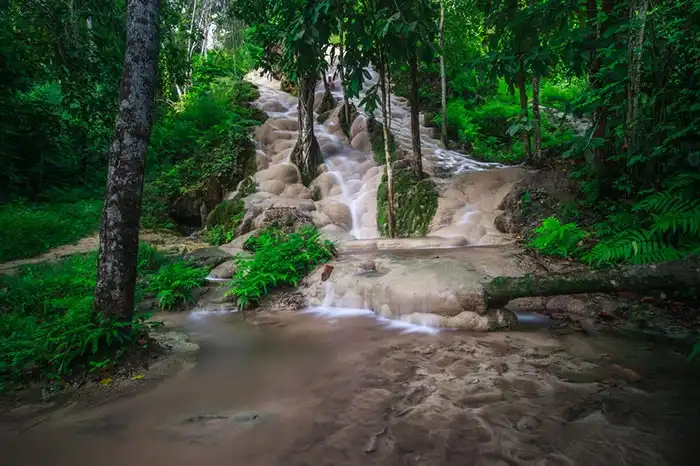
55. Bua Tong Waterfall–Seven-Color Spring National Park (Under Preparation), Chiang Mai is a natural conservation area associated with a remarkable limestone waterfall and a distinctive spring in Chiang Mai Province. Its principal attractions, Bua Tong Waterfall and the Seven-Color Spring, have become popular among Thai and international travelers because of their unusual geological characteristics, clear water, and forest setting.
Bua Tong Waterfall is especially distinctive because mineral deposits have formed a series of limestone terraces and rough-textured rock surfaces. Flowing water descends over these steps, creating a landscape unlike that of many conventional mountain waterfalls. The surrounding forest provides shade and contributes to the area's peaceful atmosphere. Although some rock surfaces offer greater traction than smooth stone, visitors should never assume that all areas are safe to climb or walk on without caution.
Main Attractions and Highlights:Bua Tong Waterfall and the Seven-Color Spring are the area's principal destinations. The spring is known for its clear water and striking appearance, while the waterfall offers multiple limestone tiers. Visitors can observe the natural water system and surrounding geology from designated viewing and walking areas.
The area has ecological significance because its water features are connected to groundwater and limestone formations. Water chemistry, mineral deposits, and the surrounding forest environment all contribute to the character of the landscape. Protecting the spring and waterfall requires careful waste management and responsible visitor behavior.
Things to Do: Admire the limestone waterfall, observe the natural spring, explore designated forest paths, photograph flowing water, and learn about geological processes. Any walking or recreational activity on the waterfall rocks must follow current safety signs and instructions from local staff.
Best Time to Visit: The site can be enjoyed during much of the year. Choose days with suitable weather and avoid visiting slippery waterfall sections during or immediately after heavy rainfall.
Getting There: From Chiang Mai city, travel toward Mae Taeng District and follow the signposted route to Bua Tong Waterfall and the Seven-Color Spring. A private car or rental vehicle is convenient, but check current road directions before departing.
Map (GPS) — Bua Tong Waterfall and Seven-Color Spring:Directions to the waterfall and spring
56. Tham Luang–Khun Nam Nang Non National Park (Under Preparation), Chiang Rai is a protected natural area in Mae Sai District, Chiang Rai Province, internationally recognized for its extensive limestone cave system, underground waterways, and association with the extraordinary 2018 rescue of the Wild Boars football team. The landscape features limestone mountains, caves, natural water systems, and forested slopes, making it significant for geology, environmental education, and modern Thai history.
The Tham Luang cave system developed over long geological periods as flowing groundwater gradually dissolved limestone, creating underground passages and chambers. Seasonal rainfall influences water movement through the cave, and some sections can flood rapidly during periods of intense precipitation. These characteristics demonstrate the importance of understanding cave hydrology and following strict safety regulations.
Main Attractions and Highlights:Tham Luang–Khun Nam Nang Non Forest Park, exhibitions associated with the Wild Boars rescue, the Doi Nang Non mountain landscape, and designated cave-related nature areas are among the main visitor attractions. The site provides opportunities to learn about limestone geology, cave safety, and the international rescue operation that brought global attention to the area.
In 2018, twelve young football players and their coach became trapped inside Tham Luang after flooding blocked their exit. The rescue operation involved Thai authorities and specialists from several countries, demonstrating extraordinary international cooperation and technical expertise. The event remains a significant part of the site's contemporary history.
The natural environment remains an important reason to visit. The mountain landscape and cave system offer valuable lessons about geology, underground water systems, and responsible tourism. Visitors should recognize that cave access may be restricted according to weather conditions, conservation measures, or visitor safety requirements.
Things to Do: Explore authorized visitor areas, learn about the Wild Boars rescue, visit interpretive exhibitions where available, study limestone geology, and enjoy views of Doi Nang Non. Never enter closed cave passages or restricted areas without permission.
Best Time to Visit: Check current opening announcements before traveling. During the rainy season, underground water levels can change rapidly, and cave access may be restricted for safety reasons.
Getting There: From Chiang Rai city, follow Highway 1 toward Mae Sai District, then continue toward Pong Pha Subdistrict and the signposted Tham Luang–Khun Nam Nang Non visitor area. Private vehicles can reach the designated public access facilities.
Map (GPS) — Tham Luang Visitor Area:Directions to Tham Luang–Khun Nam Nang Non

57. Phu Chi Fa National Park (Under Preparation), Chiang Rai is a highland conservation area associated with one of Northern Thailand's most celebrated sunrise viewpoints. Located near the Thai–Lao border in Thoeng District, Chiang Rai Province, the area features dramatic mountain ridges, steep cliffs, and panoramic views across valleys and mountains extending into Laos. Phu Chi Fa is particularly famous for morning seas of mist and cool-season mountain scenery.
The name Phu Chi Fa refers to the distinctive shape of the mountain, whose pointed cliff appears to reach toward the sky. From the open ridge, visitors can admire extensive mountain landscapes and valleys below. When weather conditions are favorable, thick mist gathers across the lower terrain, creating the appearance of a white sea beneath the mountain summit.
Main Attractions and Highlights:Phu Chi Fa Forest Park is the best-known destination in the area. The sunrise viewpoint is especially popular with visitors who arrive before dawn to watch the first sunlight appear above the mountain ridges. The surrounding highland communities and scenic roads offer further opportunities for nature photography and cultural exploration.
The surrounding mountain landscape is ecologically significant and supports local tourism communities. Responsible travel is essential to protect vegetation on the ridgelines, manage waste, and reduce environmental pressure on popular viewpoints. Visitors should remain on designated paths and respect any barriers near steep cliffs.
Things to Do: Watch the sunrise, photograph seas of mist, admire mountain panoramas, explore designated nature paths, and visit nearby highland communities. The area is especially attractive for photographers and travelers seeking cool mountain weather.
Best Time to Visit: The late rainy season and cool season are especially popular for sunrise views and potential seas of mist. Mist formation depends on temperature, humidity, and wind conditions, so it cannot be guaranteed on every visit.
Getting There: From Chiang Rai city, travel toward Thoeng District, then follow the mountain roads and signs to Phu Chi Fa. The road includes steep gradients and sharp bends. Drivers should exercise particular care when traveling before sunrise or during foggy weather.
Map (GPS) — Phu Chi Fa Viewpoint:Directions to Phu Chi Fa viewpoint
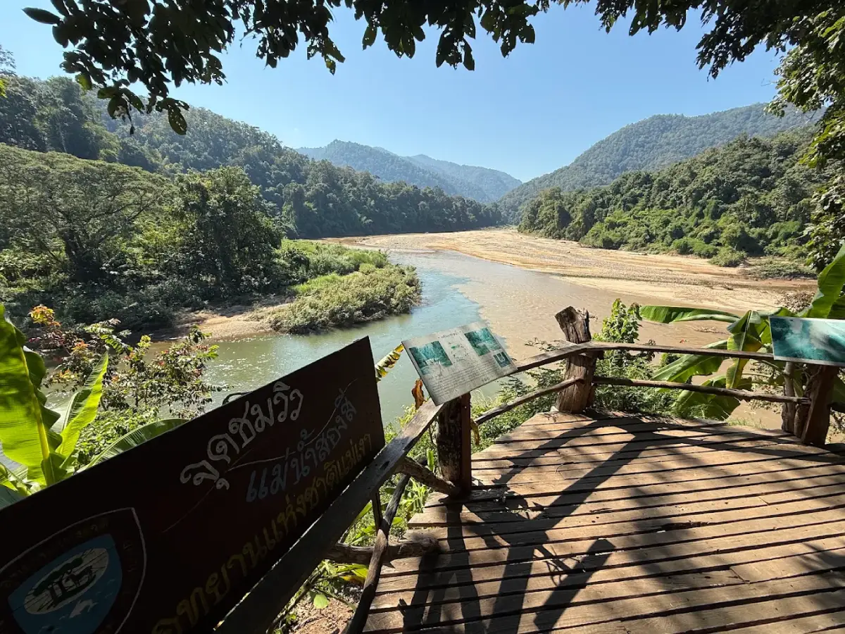
58. Mae Ngao National Park (Under Preparation), Mae Hong Son is a natural conservation area associated with the forested mountains and river ecosystems of southern Mae Hong Son Province, particularly around Sop Moei District. The terrain includes rugged mountain ranges, dense forests, and rivers flowing through remote valleys. The area is especially interesting for travelers seeking river-based adventures and opportunities to appreciate the forest landscapes of northwestern Thailand.
The Mae Ngao River is one of the area's most distinctive natural features. Flowing through forested valleys and rocky sections, the river contains rapids that have attracted adventurous travelers interested in rafting. Water speed and difficulty vary with rainfall and river levels, so the suitability of any rafting route must be assessed carefully before an excursion.
Main Attractions and Highlights:Mae Ngao River Rafting is one of the best-known activities associated with the area. Rafting routes offer views of forested mountains and riverbanks, allowing participants to experience the natural landscape from the water. The difficulty and availability of individual routes depend on river conditions and the arrangements of authorized operators.
The forests surrounding the Mae Ngao River are important for watershed conservation and freshwater ecology. Mountain vegetation stabilizes soil and helps maintain the streams that feed the river. Riparian habitats provide shelter for aquatic species and other wildlife, making responsible river tourism essential to protecting the ecosystem.
Things to Do: Join authorized rafting excursions, photograph mountain and river scenery, explore permitted riverside nature areas, and learn about forest and freshwater ecosystems. All rafting activities should be undertaken with experienced guides and appropriate safety equipment.
Best Time to Visit: Rafting conditions depend on actual water levels, weather, and professional safety assessments. Do not assume that any particular season guarantees suitable river conditions, particularly after heavy rainfall.
Getting There: From Mae Sariang, travel south toward Sop Moei District and the designated Mae Ngao rafting access area. The starting point depends on the rafting program and river conditions, so confirm the operator's meeting location before traveling.
Map (GPS) — Mae Ngao Rafting Area:Directions to Mae Ngao rafting area, not necessarily the park headquarters
59. Mae Sariang National Park (Under Preparation), Mae Hong Son is a proposed conservation area associated with the mountains and forests of southern Mae Hong Son Province. The surrounding landscape includes forested ridges, valleys, streams, and important headwater environments near Mae Sariang District. These natural features contribute to the conservation of forest ecosystems and water resources used by nearby rural communities.
The mountain forests surrounding Mae Sariang have long been connected to the region's rivers, agricultural landscapes, and settlements. Communities have developed along valleys and waterways, while surrounding forests help regulate streamflow and retain moisture. The relationship between nature and local livelihoods gives the area value for both environmental education and cultural understanding.
Main Attractions and Highlights: Forested mountains, river valleys, and nearby communities with diverse cultural traditions are important features of the Mae Sariang region. Travelers can use Mae Sariang town as a base for exploring surrounding natural destinations, provided that the specific access routes and conservation restrictions are checked in advance.
Visitors interested in experiencing local culture before exploring the surrounding mountains can also visit Mae Sariang Morning Market. This market offers an introduction to everyday community life and local food traditions. It is located in Mae Sariang town and is not an attraction inside the proposed national park area. Travelers should therefore treat the market and the protected forest area as separate destinations.
Things to Do: Admire mountain scenery, explore authorized natural areas, discover the cultural heritage of Mae Sariang's communities, and visit nearby nature destinations. Access to remote forests should follow current conservation regulations and local guidance.
Best Time to Visit: The cool season and the transition from the rainy season generally offer pleasant conditions for mountain sightseeing and rural travel. During heavy rainfall, mountain roads may be affected by slippery surfaces or landslide risks.
Getting There: From Chiang Mai, follow Highway 108 through Hot District and Op Luang toward Mae Sariang. Travelers approaching from Mae Hong Son town can also follow Highway 108 south. For visits to the proposed conservation area, confirm the correct access point and current visitor arrangements with the responsible authorities.
Map (GPS) — Mae Sariang Morning Market:Directions to Mae Sariang Morning Market — not the national park location
60. Mae Puem National Park, Phayao is a protected forest and watershed area associated with the mountainous region between Phayao and Chiang Rai provinces. Its natural environment consists of forested hills, streams, and water resources that are important to surrounding communities and agricultural landscapes. The park contributes to the conservation of biodiversity and the maintenance of healthy watershed ecosystems in upper Northern Thailand.
Mae Puem's forests include mixed deciduous and dry dipterocarp vegetation in suitable environments, together with other forest habitats determined by elevation and rainfall. These ecosystems provide shelter for wildlife and birds while helping retain soil moisture and regulate the flow of water through mountain streams.
Main Attractions and Highlights: Forest landscapes, natural water resources, and designated nature areas are among the park's principal features. Travelers interested in the forests of Phayao can explore authorized routes and learn about the ecological value of mountain watershed conservation. It is important to confirm the correct park access point rather than relying on the location of unrelated water attractions.
For visitors interested in exploring another waterside destination in Phayao Province, Mae Suk Reservoir has a separate English-language attraction page. It should not be treated as the headquarters or principal entrance of Mae Puem National Park, because it is a different destination requiring its own travel arrangements.
Things to Do: Explore authorized forest trails, observe natural vegetation, photograph forest and water landscapes, and learn about watershed ecosystems. Visitors should follow current access regulations and remain within designated areas.
Best Time to Visit: The cool season and the late rainy season are suitable for exploring natural landscapes. During heavy rainfall, trails may become slippery and stream levels may rise, requiring additional precautions.
Getting There: From Phayao city, confirm the current access route to Mae Puem National Park with the responsible park authorities. Because the protected landscape extends across different areas, use the correct national park location rather than the GPS coordinates of an unrelated reservoir.
Map (GPS) — Mae Suk Reservoir:Directions to Mae Suk Reservoir — not Mae Puem National Park

61. Khelang Banphot National Park (Under Preparation), Lampang is a proposed conservation area associated with the mountainous landscapes and natural forests of Lampang Province. Its environment includes forested hills, mountain slopes, and watershed habitats that contribute to the ecological health of the surrounding region. These natural landscapes are important for protecting water resources, maintaining biodiversity, and conserving forests close to communities and urban areas.
The name Khelang Banphot reflects a connection with Lampang's historical identity as Khelang Nakhon. The surrounding mountains and forests have long influenced the local environment, providing water resources and natural habitats. Forest conservation helps stabilize soil, regulate runoff, and maintain the natural systems that support communities in the province.
Main Attractions and Highlights: Mountain landscapes, natural forests, and designated nature areas are among the region's main features. Travelers interested in accessible forest scenery near Lampang city can also explore Mon Phaya Chae Forest Park, which has a separate English-language attraction page on LoveThailand.org. Mon Phaya Chae Forest Park and the proposed Khelang Banphot National Park should not automatically be treated as the same protected area.
Forested mountain environments in Lampang support native vegetation and wildlife while helping maintain important water sources. Their conservation is essential for biodiversity, soil protection, and long-term environmental stability. Travelers exploring these landscapes should remain on designated routes and avoid activities that damage the surrounding ecosystem.
Things to Do: Enjoy mountain scenery, explore authorized nature areas, study forest ecosystems, and visit natural attractions around Lampang. Before traveling specifically to the proposed national park area, confirm its current administrative status, access points, and visitor arrangements.
Best Time to Visit: The cool season provides pleasant conditions for outdoor recreation and nature walks. Forests are particularly green during the rainy season, although trails may become slippery after rainfall.
Getting There: Use Lampang city as the starting point and confirm the precise access location of the proposed Khelang Banphot National Park with the responsible authorities. Do not use the coordinates of Mon Phaya Chae Forest Park as the national park's headquarters without confirmation.
Map (GPS) — Mon Phaya Chae Forest Park:Directions to Mon Phaya Chae Forest Park, not the proposed national park headquarters

62. Ton Sak Yai Forest Park, Uttaradit is a protected natural destination in Nam Pat District of Uttaradit Province, famous for its enormous teak tree and surrounding forest environment. The giant teak tree is an important natural landmark that reflects the ecological and historical significance of native teak forests in Northern Thailand. Its impressive dimensions and longevity make it a valuable attraction for visitors interested in botany, forest ecology, and conservation.
The giant teak tree represents the remarkable growth potential of teak under suitable natural conditions. Mature trees play important ecological roles, providing habitats for other organisms while contributing to forest structure and biodiversity. Protecting a large, old tree also requires conserving its surrounding soil, root system, and forest environment.
Main Attractions and Highlights:Ton Sak Yai Forest Park and its giant teak tree are the area's principal attractions. Visitors can admire the remarkable trunk, learn about the natural history of teak, and explore designated paths through the surrounding forest. The destination provides an accessible opportunity to understand the importance of protecting ancient trees.
The surrounding woodland is also significant as part of the natural environment supporting the giant teak tree. Forest vegetation protects the soil and contributes to the stability of local ecosystems. Visitors should avoid damaging tree bark, disturbing exposed roots, or leaving the designated paths around the tree.
Things to Do: Admire the giant teak tree, learn about teak forest ecology, photograph natural scenery, and explore designated forest paths. The destination is suitable for families, students, and visitors interested in Thailand's botanical heritage.
Best Time to Visit: The site can generally be enjoyed during different seasons. The cool season provides pleasant conditions for walking, while the rainy season brings lush vegetation but may also create slippery paths.
Getting There: From Uttaradit city, travel toward Nam Pat District, then follow the signs to Ton Sak Yai Forest Park. The verified attraction page identifies the destination as a forest park, so travelers should use that name when planning their route rather than assuming that it is a separately established national park.
Map (GPS) — Ton Sak Yai Forest Park:Directions to Ton Sak Yai Forest Park
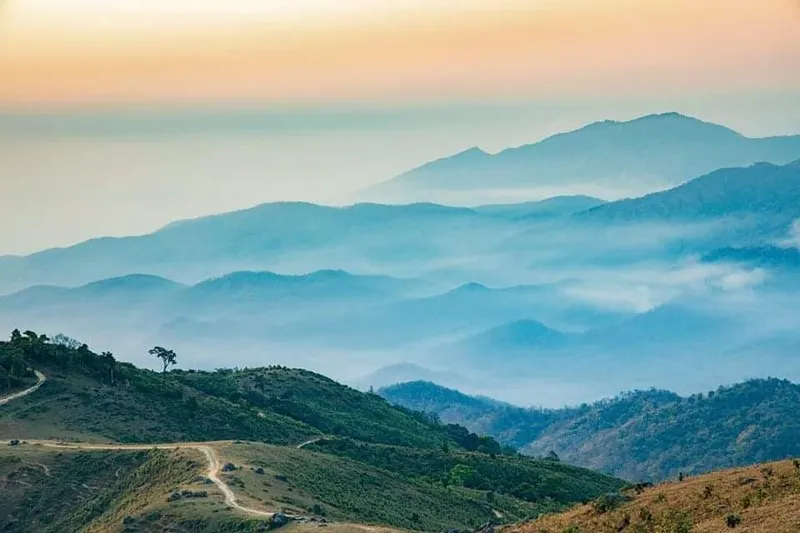
63. Doi Soi Malai–Petrified Wood National Park (Under Preparation), Tak is a proposed conservation area associated with mountainous forests and important petrified wood sites in Tak Province. The area's natural heritage combines mountain landscapes, forest ecosystems, and geological evidence of ancient vegetation. These features make it particularly interesting for visitors interested in natural history, paleontology, and the long-term geological processes that have shaped the region.
Doi Soi Malai is characterized by mountainous terrain and natural forest landscapes. Its ridgelines offer opportunities to appreciate the scenery of western and lower Northern Thailand, while the surrounding vegetation contributes to watershed conservation and biodiversity protection. Travelers exploring authorized areas can observe the relationship between mountain geography and forest ecosystems.
Main Attractions and Highlights:Doi Soi Malai and the petrified wood sites of Tak Province are among the area's most significant natural features. Doi Soi Malai is associated with mountain scenery, while petrified wood provides important evidence of ancient trees and geological processes that occurred over exceptionally long periods.
Petrified wood forms when buried tree material is gradually replaced or filled by minerals while preserving aspects of the original wood structure. Over geological time, this process transforms organic material into stone-like fossils. These remains provide scientists with valuable information about ancient vegetation and past environmental conditions. Visitors should appreciate them as protected natural heritage and must not remove fossil material from conservation sites.
The mountain attractions and petrified wood locations are not necessarily accessible from the same entrance. Travelers should identify their preferred destination and confirm the appropriate route before setting off. The GPS coordinates provided here identify Doi Soi Malai, not every geological site or the proposed national park headquarters.
Things to Do: Admire mountain landscapes, explore authorized forest areas, learn about petrified wood and geological processes, and photograph natural scenery. Any visit to protected fossil sites must comply with local conservation regulations.
Best Time to Visit: The cool season and the transition from the rainy season are attractive for mountain sightseeing. Visiting geological or fossil attractions depends on the opening arrangements of the individual site.
Getting There: From Tak city, follow the appropriate route to Doi Soi Malai and the designated visitor area. Travelers planning to visit petrified wood sites should arrange the route separately because these locations are not necessarily close to the mountain viewpoint.
Map (GPS) — Doi Soi Malai:Directions to Doi Soi Malai, not the petrified wood sites
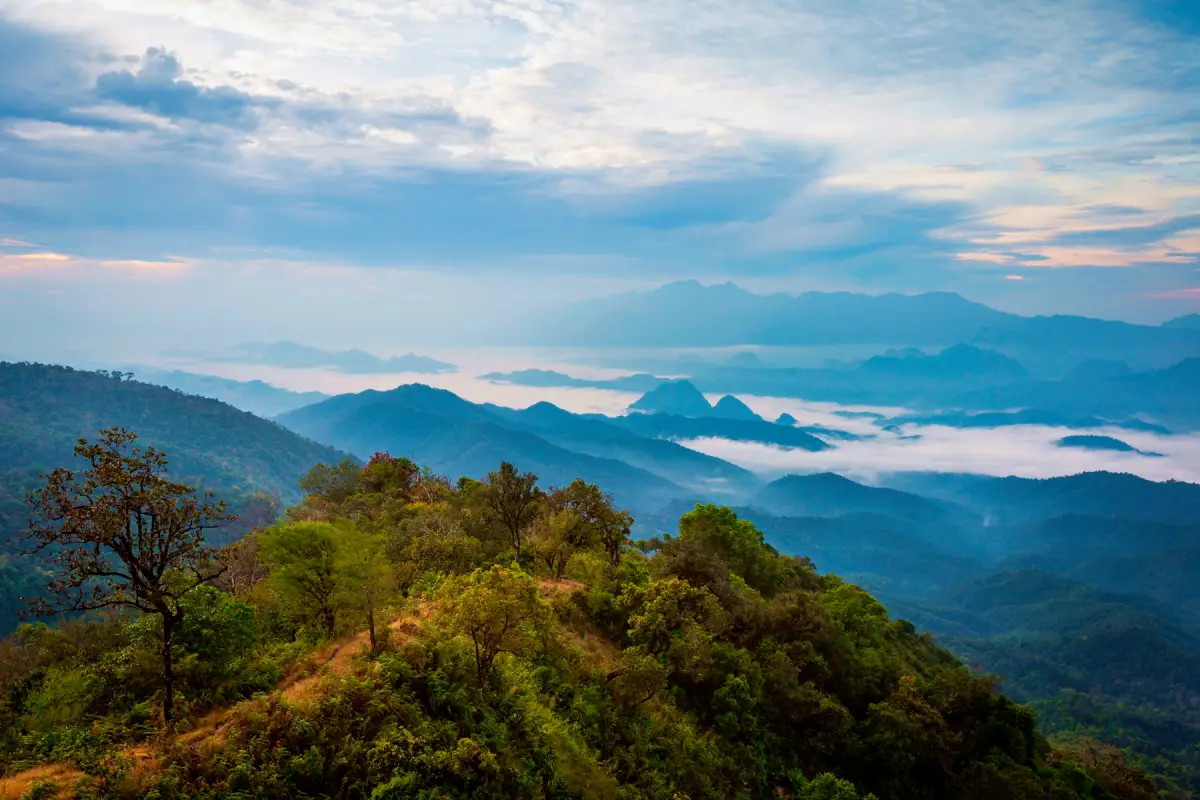
64. Mae Moei National Park, Tak is a national park located in Tha Song Yang District of Tak Province, near the Thai–Myanmar border. It is renowned for its rugged mountain scenery, seas of mist, peaceful forest environments, and scenic highland viewpoints. The park protects extensive mountain forests and important watershed habitats in northwestern Thailand, making it a rewarding destination for nature enthusiasts, photographers, and travelers interested in mountain camping.
The park's mountainous landscape forms part of the natural border region between Thailand and Myanmar. Forested ridges and deep valleys create dramatic panoramic scenery, while the elevated terrain provides cooler conditions during certain times of the year. Its forests protect mountain water sources and support important wildlife habitats, contributing to the ecological health of the region.
One of Mae Moei's greatest attractions is the spectacular sea of mist that can appear over the Mae Ramoeng valleys. When moisture and temperature conditions are favorable, mist gathers between mountain ridges before sunrise. As daylight spreads across the landscape, the mist and mountains create striking layers of light and shadow. These conditions make the park especially appealing for sunrise photography.
Main Attractions and Highlights:Mon Kio Lom, Mon Khruba Sai, Mon Phun Suda, Chao Doi Waterfall, and the scenic Mae Ramoeng mountain landscape are among the park's most interesting destinations. Mon Kio Lom is a particularly well-known viewpoint, located at approximately 940 meters above sea level and offering expansive views across the surrounding mountain ranges when conditions are clear.
Mon Kio Lom lies approximately 12 kilometers from the national park headquarters, making it a separate destination that requires route planning. Visitors hoping to watch the sunrise should allow sufficient driving time along the mountain road, particularly when traveling before dawn. Fog can reduce visibility significantly, so drivers should proceed carefully.
Other viewpoints, including Mon Khruba Sai and Mon Phun Suda, offer different perspectives on the forested ridges and valleys. These locations can be included in a mountain sightseeing itinerary, depending on current access arrangements and weather conditions. Camping is permitted only in authorized areas and under the park's current regulations.
Chao Doi Waterfall provides another natural experience, with water descending through the forest over rock formations and along a mountain stream. The surrounding woodland offers opportunities for nature study and photography. Waterfall conditions vary with rainfall, and visitors should be cautious around slippery surfaces and strong currents.
Mae Moei's forests are particularly important because they protect natural habitats and watersheds along the international border. The forest ecosystems support biodiversity and contribute to the maintenance of healthy mountain water systems. Responsible visitor behavior is essential to preserving the area's natural beauty and ecological value.
The park is particularly appealing to travelers who appreciate quiet natural settings and outdoor experiences. When camping in designated areas, visitors may enjoy cool evening temperatures, natural forest sounds, and opportunities to observe the night sky under clear conditions. Appropriate equipment and preparation are important because weather can change rapidly at higher elevations.
Things to Do: Watch the sunrise and seas of mist, photograph mountain landscapes, visit Mon Kio Lom and other viewpoints, camp in authorized areas, explore designated nature trails, and visit Chao Doi Waterfall. Bring warm clothing, drinking water, rain protection, and suitable equipment for mountain conditions.
Best Time to Visit: The transition from the rainy season to the cool season and the winter months are particularly attractive for mountain scenery and potential seas of mist. The rainy season provides lush forests but may also bring slippery roads and heavy rainfall. Seas of mist depend on weather conditions and cannot be guaranteed on every visit.
Getting There: From Tak city, follow Highway 12 toward Mae Sot, then continue on Highway 105 through Mae Ramat toward Tha Song Yang District. Follow local signs toward Mae Moei National Park. Visitors heading to Mon Kio Lom should use the specific viewpoint coordinates because it is located away from the park headquarters. Take additional care when driving on steep mountain roads before sunrise.
Map (GPS) — Mon Kio Lom Viewpoint:Directions to Mon Kio Lom in Mae Moei National Park
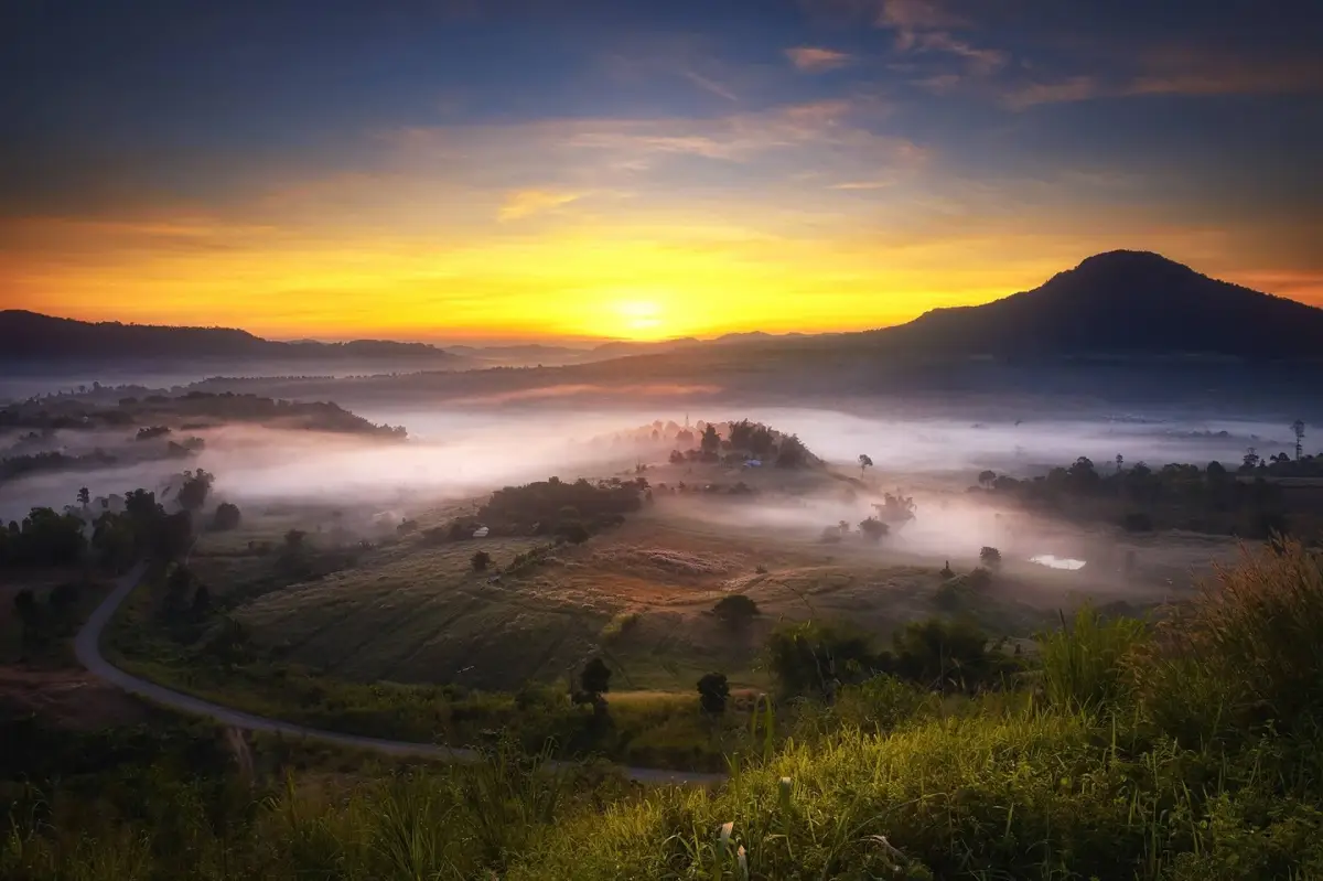
65. Khao Kho National Park, Phetchabun is a mountainous national park in Phetchabun Province, known for forested ridges, scenic valleys, natural streams, and important watershed ecosystems. The surrounding Khao Kho region is one of Thailand's most popular highland destinations, celebrated for its mountain views, cooler weather, and occasional seas of mist. Within the park's natural landscapes, Wang Tum Waterfall is particularly noteworthy for its impressive cliff and opportunities for supervised adventure activities.
Khao Kho's mountainous terrain creates a variety of ecological environments, with forests and valleys that help protect water sources and support wildlife habitats. The surrounding highlands also feature viewpoints, rural communities, and sites connected with Thailand's modern history. However, not every attraction in Khao Kho District lies within the national park, so travelers should distinguish between the protected area and the wider tourism region.
The park's forests contribute to the conservation of watersheds and biodiversity in lower Northern Thailand. Mountain vegetation helps retain soil moisture, regulate runoff, and reduce erosion on steep slopes. These ecological functions are particularly important in areas where forests, streams, and surrounding communities are closely connected.
Main Attractions and Highlights:Wang Tum Waterfall is one of the area's most distinctive natural attractions. Located near Ban Dong Long in Khaem Son Subdistrict, Khao Kho District, it features water descending from a rocky cliff approximately 40 meters high. The waterfall is surrounded by forested mountain scenery and is known for both nature sightseeing and organized adventure activities.
The waterfall's appearance changes according to rainfall and water conditions. When water flow is suitable, the cascade creates attractive scenery against the high cliff and surrounding vegetation. Designated viewing areas provide opportunities for photography and nature appreciation, while forested access routes allow visitors to experience the local mountain environment.
One activity particularly associated with Wang Tum Waterfall is waterfall abseiling. This supervised adventure involves descending a steep rock face using ropes, harnesses, protective equipment, and established safety procedures. Because the activity requires technical knowledge, travelers should participate only with experienced and appropriately equipped operators. Attempting to descend the waterfall independently without proper training or supervision is unsafe.
Wang Tum Waterfall has also contributed to community-based nature tourism in the Khao Kho area. Local tourism initiatives can provide visitors with opportunities to experience the natural landscape while supporting community livelihoods. Responsible tourism should balance recreational activities with the conservation of the waterfall, surrounding vegetation, and stream ecosystem.
Visitors may combine Wang Tum Waterfall with other attractions in the wider Khao Kho region, including mountain viewpoints and cultural or historical destinations. These locations are not necessarily within the national park and may require separate access routes. Allow enough travel time because mountain roads and attractions can be widely separated.
Things to Do: Visit Wang Tum Waterfall, photograph the cliff and forest scenery, explore authorized nature areas, and participate in supervised waterfall abseiling where available. Adventure activities must follow the safety arrangements of qualified operators and should not proceed during unsuitable weather or water conditions.
Best Time to Visit: The cool season and the transition from the rainy season are attractive for mountain sightseeing. Waterfall conditions vary with rainfall, and activities such as abseiling depend on professional safety assessments. Heavy rain or rapidly rising water levels may make access unsafe.
Getting There: From Phetchabun city, travel toward Khao Kho District and Khaem Son Subdistrict, then continue to Ban Dong Long and the designated Wang Tum Waterfall access route. The journey includes mountain roads with steep and winding sections. Visitors joining an organized activity should confirm the meeting point and access arrangements with their operator.
Map (GPS) — Wang Tum Waterfall:Directions to Wang Tum Waterfall, not the national park headquarters
| Category | Details |
| Article Title | 65 National Parks and Nature Destinations in Northern Thailand: A Complete Travel Guide |
| Region | Upper and lower Northern Thailand, including mountain ranges, forests, rivers, waterfalls, and protected natural landscapes across several provinces |
| Number of Destinations | 65 destinations in the article's selected list, including established national parks, proposed national park areas, and related protected nature destinations |
| Main Highlights | Mountain summits, seas of mist, waterfalls, pine forests, montane evergreen forests, natural grasslands, limestone caves, hot springs, and major river landscapes |
| Recommended For | Nature enthusiasts, families, photographers, birdwatchers, hikers, campers, and travelers interested in conservation and natural history |
| Best Destinations for Mountain Views and Seas of Mist | Doi Inthanon, Huai Nam Dang, Doi Pha Hom Pok, Phu Soi Dao, Mae Moei, and Phu Chi Fa |
| Best Destinations for Waterfalls | Khlong Lan, Chae Son, Namtok Mae Surin, Namtok Chat Trakan, Namtok Pha Charoen, Tat Mok, and Phu Sang |
| Hiking and Camping Destinations | Phu Soi Dao, Mae Wong, Ramkhamhaeng, Doi Khun Tan, Thung Salaeng Luang, and Phu Hin Rong Kla, subject to current trail and camping regulations |
| Geological Attractions | Op Luang, Ob Khan, Doi Pha Klong, Tham Pha Thai, Phu Hin Rong Kla, Mae Wang, and Doi Soi Malai–Petrified Wood |
| Hot Spring Destinations | Chae Son, Doi Pha Hom Pok, Huai Nam Dang, and Namtok Pha Charoen |
| Natural and Historical Attractions | Phu Hin Rong Kla, Op Luang, Doi Khun Tan, and Tham Luang–Khun Nam Nang Non |
| Best Travel Seasons | The cool season is especially attractive for mountain views and camping, while the rainy season and its transition into cooler months provide lush forests and waterfalls. Actual conditions vary by destination |
| Transportation | Private cars and rental vehicles are convenient for many destinations. Some attractions require hiking, authorized transport, or advance access arrangements |
| Important Safety Considerations | Steep mountain roads, dense fog, flash floods, slippery trails, seasonal closures, and activities requiring advance permission or professional guides |
| English Attraction Pages and GPS | 53 destinations have corresponding national park detail pages on LoveThailand.org. The remaining 12 use related attraction pages where available. GPS coordinates for individual attractions should not be assumed to identify national park headquarters |
Frequently Asked Questions (FAQ)
Q: What are the best national parks to visit in Northern Thailand?
A: Popular choices include Doi Inthanon, Doi Suthep–Pui, Huai Nam Dang, Doi Pha Hom Pok, Doi Phu Kha, Si Nan, Phu Hin Rong Kla, Phu Soi Dao, Khlong Lan, and Nam Nao. Each offers different natural attractions, including mountain summits, waterfalls, forests, scenic viewpoints, and hiking trails.
Q: Which national parks in Northern Thailand are best for seeing seas of mist?
A: Huai Nam Dang, Doi Inthanon, Doi Pha Hom Pok, Phu Chi Fa, Doi Samer Dao in Si Nan National Park, and Mon Kio Lom in Mae Moei National Park are well-known destinations for misty mountain scenery. The transition from the rainy season to the cool season often provides suitable conditions, but seas of mist cannot be guaranteed on every visit.
Q: Which national parks in Northern Thailand are best for hiking?
A: Phu Soi Dao, Mae Wong, Ramkhamhaeng, Doi Khun Tan, and Phu Hin Rong Kla are interesting options for hiking enthusiasts. Their trails vary considerably in difficulty, distance, and access requirements. Visitors should choose routes suitable for their fitness and confirm seasonal trail openings before traveling.
Q: Where can I see beautiful waterfalls in Northern Thailand's national parks?
A: Khlong Lan, Chae Son, Namtok Mae Surin, Namtok Chat Trakan, Tat Mok, Phu Sang, and Namtok Pha Charoen are notable waterfall destinations. Waterfalls can be especially impressive during the rainy season, but visitors must check local conditions because heavy rainfall can create flash-flood risks.
Q: Can I camp in every national park in Northern Thailand?
A: No. Camping is permitted only in designated areas and may require advance reservations. Some parks close certain campsites or trekking routes seasonally for conservation or safety reasons. Always check current park regulations and availability before planning an overnight stay.
Q: When is the best time to visit national parks in Northern Thailand?
A: November to February is generally popular for cooler temperatures, mountain scenery, and opportunities to see seas of mist. The rainy season offers lush forests and waterfalls, but mountain roads and walking trails may become more difficult or unsafe. The best period depends on the specific destination and activities planned.
Q: What should I prepare before visiting national parks in Northern Thailand?
A: Check current park opening announcements, weather forecasts, road conditions, and any trekking or camping requirements. Bring suitable walking shoes, drinking water, warm clothing, rain protection, and essential supplies. If driving, make sure your vehicle's brakes and tires are suitable for steep mountain roads.
Q: Do all GPS links in this guide lead to national park headquarters?
A: No. Some Google Maps links identify individual attractions, such as Pha Chor, Mon Kio Lom, Wang Tum Waterfall, or Phu Chi Fa. These locations may be some distance from the relevant park headquarters. Always check the destination name shown in the map before starting your journey.
 Category: ●Travel Articles, Recipes
 Group: ●Travel Review, Food Review
Last Update : 1 DayAgo
 Last Update : 1 DayAgo
Recommend

 Art, Culture and Heritage
 Historical Sites and Monuments(8)
 Landmarks and Memorials(5)
 Royal Palace(2)
 Art, Craft Centres, Tradition(43)
 Museums(24)
 Educational Places
 Museum for Study(2)
 Educational Gardens, Farm(5)
 Training Center(1)
 Places of Worship
 Temple(79)
 Mosque(2)
 Other Sacred Sites(17)
 Research and Development
 Royal Project(45)
 Suburban Living
 Village, Community(41)
 Local Market(14)
 Nature and Wildlife
 National Parks and Marine Reserves(18)
 Mountain (Doi)(21)
 Dam, Reservoir, Lake(26)
 Waterfalls(43)
 Hot Springs(12)
 Caves(11)
 River, Canal(6)
 Other natural attractions(14)
 Entertainment and Agricultural
 Zoos and Aquariums(3)
 Animal camps and shows(3)
 Stadium(1)
 Farms, Parks and Ecotourism(19)
 Waterpark(2)
 Theater(1)
 Outdoor and Adventure Activities(10)
 Shopping
 Shopping and Night Market(6)
 Restaurant
 Michelin Star(1)
 Michelin Guide(23)
 Call Customer Service in Tourism
 Call Customer Service in Tourism(1)
Travel Review, Food Review(24)
 Food Menu, North Recipes(30)
 Thai Desserts, North Recipes(17)


