
lovethailand home >Eastern Travel Attractions >Chanthaburi Travel Attractions > 50 Best Places to Visit in Eastern Thailand in 202..
TL;DR: 50 Best Places to Visit in Eastern Thailand in 2027. Highlights include Where to Stay.

50 Best Places to Visit in Eastern Thailand in 2027
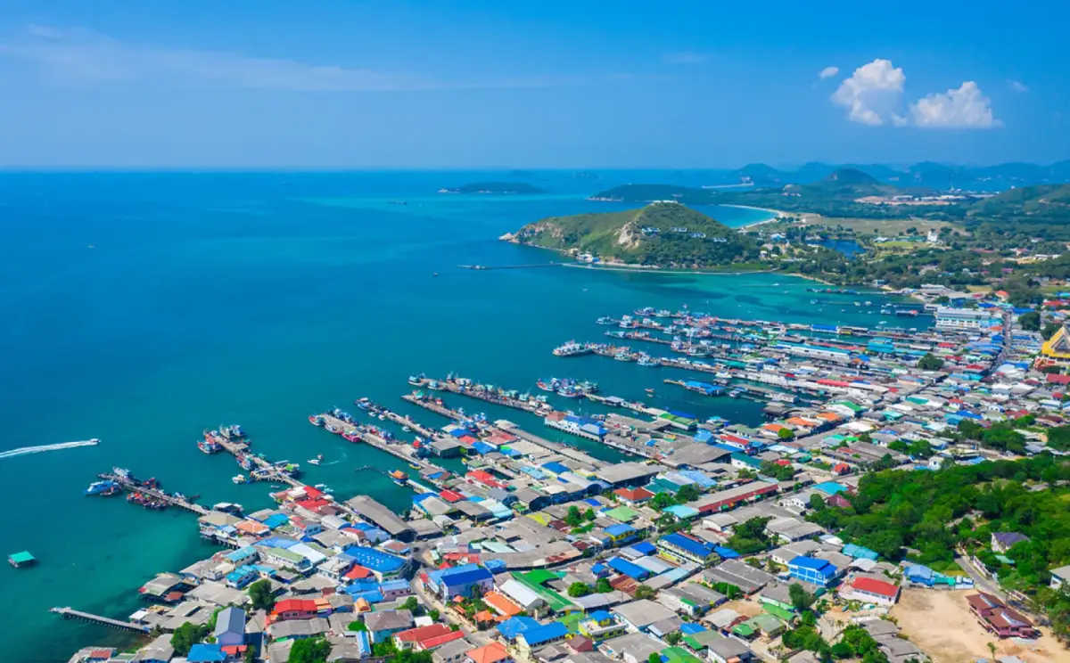
50 Best Places to Visit in Eastern Thailand in 2027: The Complete Guide to Six Provinces, Islands, Beaches, History, Culture, Local Food and Accommodation. Eastern Thailand is one of the country's most varied travel regions. Across Chon Buri, Rayong, Chanthaburi, Trat, Prachin Buri and Sa Kaeo, travelers will find famous Gulf of Thailand beaches, tropical islands, historic towns, Buddhist and Khmer-era monuments, national parks, mangroves, waterfalls, orchards and distinctive local food. This guide brings together 50 destinations and practical ways to experience the region's natural and cultural heritage.
The region's appeal lies in the remarkable contrast between coastline and inland landscapes. Bang Saen and Pattaya offer accessible urban beaches; Koh Larn, Koh Samet, Koh Chang, Koh Mak and Koh Kood provide different island experiences. Farther inland, forests, agricultural land, reservoirs and ancient settlements reveal a less familiar side of eastern Thailand. Choosing activities according to the season makes travel possible throughout much of the year.
Chon Buri is the main gateway to the eastern coastline for travelers from Bangkok. Alongside Bang Saen, Pattaya, Koh Larn and Koh Sichang, the province features the intricately carved Sanctuary of Truth, Khao Kheow Open Zoo, Nong Nooch Tropical Garden, the cliff-carved Buddha at Khao Chee Chan, temples, coastal viewpoints and traditional markets. It works particularly well for weekend breaks and family holidays.
Rayong combines sandy beaches and Koh Samet with traditional fishing communities, fruit plantations and wetlands. Mae Ramphueng Beach, Saeng Chan Beach, the Prasae estuary, Thung Prong Thong, Rayong Botanical Garden and Yomjinda Road demonstrate the area's natural and historical variety. Fishing, seafood processing and seasonal fruit growing remain important to the region's character.
Chanthaburi is associated with historic riverfront commerce, gemstones, tropical fruit and a rich mixture of cultural traditions. Chanthaboon Riverside Community preserves traces of an older trading town, while the Cathedral of the Immaculate Conception represents an important Christian heritage. Namtok Phliu, Kung Krabaen Bay, Chao Lao Beach and Nang Phaya Viewpoint reveal the province's impressive natural scenery. Durian, mangosteen and rambutan orchards are another reason to visit.
Trat is the principal gateway to Koh Chang, Koh Mak and Koh Kood. Koh Chang combines forested mountains, waterfalls and beaches; Koh Kood is particularly appealing for its quieter natural landscapes; and Koh Mak is associated with relaxed, environmentally conscious island travel. On the mainland, Ban Nam Chiao, Laem Ngop and fishing settlements reveal the role of maritime trade and traditional crafts.
Prachin Buri and Sa Kaeo offer an inland contrast to the coast. Prachin Buri contains the archaeological remains of Si Mahosot, the historic Chao Phraya Abhaibhubejhr Building, Kaeng Hin Phoeng and Thap Lan National Park. Sa Kaeo is home to Sdok Kok Thom Sanctuary, Pang Sida National Park, limestone landscapes, reservoirs and Rong Kluea Market near the Cambodian border. These destinations reveal ancient regional connections and vital forest ecosystems.
Geography and natural heritage. Eastern Thailand includes beaches, bays, headlands, islands, mangrove forests and estuaries, as well as hills, rivers and agricultural plains. Coastal fishing communities depend on marine resources, while inland settlements draw on forests and fertile farmland. These different environments support activities ranging from snorkeling and wildlife observation to hiking and fruit-orchard visits.
Mangrove ecosystems are especially important in Rayong, Chanthaburi and Trat. They provide breeding habitats for aquatic animals, protect shorelines from erosion and support fishing communities. The golden-green canopy of Thung Prong Thong and the ecological interpretation at Kung Krabaen Bay show how nature tourism can contribute to conservation awareness.
Inland forests protect water sources and biodiversity. Khao Chamao–Khao Wong, Thap Lan and Pang Sida national parks provide habitats for wildlife and attractive areas for nature study. The rainy season brings lush vegetation and stronger waterfall flows, but also creates risks from slippery paths, fast-flowing water and temporary closures.
History of Eastern Thailand. Archaeological evidence in Prachin Buri and Sa Kaeo shows the region's long connection to early settlement networks, Buddhism, Brahmanical-Hindu beliefs and regional trade. Si Mahosot preserves elements of Dvaravati-era urban development, while Sdok Kok Thom demonstrates the architectural and religious influence of the Angkorian Khmer world. These sites help explain centuries of cultural exchange across mainland Southeast Asia.
During the Ayutthaya and Rattanakosin periods, eastern coastal settlements became increasingly important to trade and maritime communications. Chanthaburi and Trat were connected to Gulf of Thailand trading routes, while Chon Buri and Rayong developed fishing settlements and commercial neighborhoods. Chinese merchants and other migrant communities influenced local architecture, temples, shrines, cuisine and commerce.
Chanthaburi also occupies an important place in Thai history following the fall of Ayutthaya in 1767. King Taksin gathered forces and supplies in the area before continuing his campaign to restore Siamese independence. This history connects the eastern seaboard to a major turning point between the late Ayutthaya and early Thonburi periods.
Festivals and traditions. Community celebrations reflect agriculture, Buddhism, fishing and coastal beliefs. Chon Buri's famous Buffalo Racing Festival recalls a time when buffaloes were essential to rice farming and transporting crops. Today the event continues to express local identity, collective memory and community celebration.
Buddhist festivals remain central to local life, from Songkran and the beginning and end of Buddhist Lent to annual merit-making and Kathin robe-offering ceremonies. Temples often serve as both religious centers and gathering places where generations share knowledge and maintain neighborhood relationships.
The annual Khao Khitchakut pilgrimage in Chanthaburi attracts devotees wishing to pay respect to the revered Buddha footprint. This is a seasonal religious event with specific transport arrangements and access regulations, not a permanently open mountain excursion. Visitors should check each year's official dates.
Along the coast, beliefs and observances linked to fishing, safe passage at sea and local shrines reflect the role of maritime life. Such traditions reinforce community connections in settlements throughout Rayong, Chanthaburi and Trat.
Culture and community life. Eastern Thailand's cultural identity has grown through interactions among Thai communities, Thai-Chinese merchants, Vietnamese-descended residents and people connected to Khmer traditions. This diversity appears in architecture, faith, food, craftwork and everyday social life. Chanthaboon's old trading houses and Chanthaburi's cathedral provide two contrasting examples within a single city.
Temples, Chinese shrines and Christian churches illustrate the coexistence of different religious traditions. Historic Buddhist structures and local rituals remain important, while the Cathedral of the Immaculate Conception demonstrates the city's longstanding Catholic heritage and Western-influenced architecture.
Traditional crafts make use of resources found near the sea and in farming communities. Seafood drying, fish sauce, shrimp paste, basketry and fruit preservation all express local knowledge. Ban Nam Chiao in Trat is especially known for its distinctive woven ngam hats, linking practical craftsmanship to community identity.
Food in Eastern Thailand combines fresh seafood with vegetables, herbs, spices and seasonal fruit. Coastal menus feature fish, prawns, crab, squid and shellfish, served grilled, steamed, in spicy soups or in other familiar Thai preparations. Dried fish, shrimp paste and fish sauce are also deeply tied to the local economy.
Moo Chamuang, a Chanthaburi specialty, is made by slowly cooking pork with the naturally sour leaves of the chamuang plant. Its balance of sour, savory and sweet flavors shows how local ingredients shape eastern Thai cooking. Chanthaburi is also known for its rice noodles, often called sen chan, used in stir-fried dishes and other recipes.
Chanthaburi pepper is an important local crop and seasoning, contributing its fragrance and heat to regional cooking. Khao lam Nong Mon, sold around Chon Buri's Nong Mon Market, consists of sticky rice, coconut milk and other ingredients cooked in bamboo tubes and is a well-known souvenir.
Eastern Thailand's fruit orchards are another major attraction, particularly in Rayong, Chanthaburi and Trat. Durian, mangosteen, rambutan, langsat and salak are among the region's products. Harvest periods vary, but many orchards in Chanthaburi offer seasonal visits around May to July, allowing travelers to learn about cultivation and taste fresh fruit.
Local markets sell fresh and dried seafood, fruit products, sauces, traditional desserts and community-made crafts. Purchasing from local producers supports livelihoods and helps sustain traditional food knowledge.
Where to stay. Accommodation choices range from city hotels and beach resorts to island bungalows, family-run guesthouses, community homestays and orchard retreats. Consider the attractions you want to visit, travel distances, ferry connections and seasonal weather before choosing an area.
Staying in Chon Buri: Bang Saen is convenient for beach dining and short breaks, while Pattaya and Jomtien offer extensive hotel choices and transport links. Koh Larn is suited to travelers wishing to spend a night on an island rather than return with the day-trip crowds.
Staying in Rayong: Choose Koh Samet or a mainland beach for a seaside holiday, and Mueang Rayong or Klaeng for trips focused on historic neighborhoods, orchards and nature attractions. Island accommodation requires more attention to boat schedules and transfers.
Staying in Chanthaburi: The city center works well for riverfront history, temples and local food, while Chao Lao Beach and nearby coastline offer seaside resorts. Some rural accommodation options are suitable for fruit-orchard experiences.
Staying in Trat: Koh Chang offers varied excursions and accommodation, Koh Kood is attractive for peaceful natural scenery, and Koh Mak suits an unhurried island experience. Ferry departure piers, arrival points and local transfers should all be confirmed in advance.
Staying in Prachin Buri and Sa Kaeo: Town hotels and nature-oriented accommodation can serve as bases for archaeological sites, forests and national parks. Choose a location close to your main activities to avoid unnecessary backtracking.
Best time to visit. November to April is generally favorable for planning many island trips, especially in Trat, although actual sea conditions can vary. The southwest monsoon may affect ferry services from roughly May to October. Fruit orchard visits should follow harvest seasons, while waterfall excursions require special attention to rain, high water and park notices.
Suggested trip lengths. A one-day outing can combine Bang Saen, Khao Sam Muk and Nong Mon Market. A two-day visit suits Chon Buri, Rayong or Chanthaburi, depending on your interests. Three days allow more time for mainland Chanthaburi and Trat, while island-hopping should be given extra days rather than squeezed into one schedule.
Travelers interested in archaeology and forests can plan a Prachin Buri–Sa Kaeo route covering Si Mahosot, Chao Phraya Abhaibhubejhr Building, Sdok Kok Thom and Pang Sida. It is a rewarding alternative to an exclusively coastal holiday.
Responsible travel helps protect these places. Use community businesses, follow national park and temple rules, do not feed wild animals, avoid damaging corals or monuments, and dispose of waste correctly. The following 50 destinations illustrate how much eastern Thailand offers beyond its familiar beaches.

1. Bang Saen Beach, Chon Buri Bang Saen has long been one of the most accessible seaside escapes from Bangkok. Its beachfront in Saen Suk, Mueang Chon Buri, combines an open view across the Gulf of Thailand with a lively promenade, local restaurants, and places to stay. The beach is equally suitable for a short family outing and a relaxed overnight break.
Highlights: The area's transformation from coastal communities to a popular resort town mirrors the growth of Chon Buri's road network. Walk the waterfront, sample seafood and the well-known bamboo-cooked khao lam sold around Nong Mon Market, or continue to Laem Tan and Khao Sam Muk. The local legend of Saen and Sam Muk adds a cultural dimension to the shoreline, although it should be understood as folklore rather than documented history.
Morning and late afternoon are pleasant times to visit. Weekends can be crowded; use designated parking areas, follow swimming warnings, and help keep the beach clean.
Getting There: From the nearest mainland town, follow the local route or official transport services to the attraction. Check seasonal access conditions and public transport before departure.
Map (GPS):Open Google Maps – Bang Saen Beach

2. Sanctuary of Truth, Chon Buri The Sanctuary of Truth stands on the Laem Ratchawet waterfront in the Na Kluea area of Pattaya. This immense contemporary wooden building combines traditional carving techniques with philosophical and religious imagery drawn from several Asian traditions. Conceived by Lek Viriyaphant, its construction began in 1981 and continues as an ongoing undertaking.
Highlights: Elaborate wooden sculptures, roof tiers, pillars, and figures encourage visitors to reflect on family, morality, the universe, and human existence. The structure is not an ancient Khmer or Ayutthaya monument; it is a modern cultural project created through traditional craftsmanship. Taking a guided tour is a useful way to understand the symbolism rather than treating the building only as a photographic backdrop.
Some sections may be undergoing construction or conservation. Observe safety instructions and protective-equipment requirements, and allow time to appreciate the impressive silhouette against the sea.
Getting There: From the nearest mainland town, follow the local route or official transport services to the attraction. Check seasonal access conditions and public transport before departure.
Map (GPS):Open Google Maps – Sanctuary of Truth

3. Khao Kheow Open Zoo, Chon Buri Khao Kheow Open Zoo occupies an extensive green setting in the Bang Phra area of Si Racha. It is a family-oriented destination where exhibits and educational activities introduce the diversity of animal life, behavior, habitats, and conservation needs.
Highlights: The zoo's spacious layout and different exhibit environments offer opportunities to discuss how animals obtain food, interact, and adapt to their surroundings. It also invites visitors to consider the threats caused by habitat loss and wildlife trafficking. A visit can become an engaging learning experience for children when combined with information provided by the staff and interpretive signs.
Plan the zones you would most like to see because the grounds are extensive. Carry drinking water and sun protection, never feed animals outside authorized programs, and avoid noise or behavior that disturbs them.
Getting There: From the nearest mainland town, follow the local route or official transport services to the attraction. Check seasonal access conditions and public transport before departure.
Map (GPS):Open Google Maps – Khao Kheow Open Zoo

4. Sai Kaew Beach (Koh Samet), Rayong Sai Kaew Beach, on the northeastern side of Koh Samet in Rayong, is known for its pale sand, clear sea views, accommodation, and lively beachfront dining. It makes a convenient base for first-time visitors who want to enjoy the coast and explore other bays on the island.
Highlights: Koh Samet forms part of Khao Laem Ya–Mu Ko Samet National Park. Its appeal therefore depends on maintaining clean beaches and healthy coastal ecosystems. The island is also associated with the literary world of Sunthon Phu's Phra Aphai Mani, a connection celebrated in Rayong's cultural tourism; fictional locations should not be treated as proven historical sites.
Reach the island by passenger boat or speedboat from the Ban Phe area. Check sea conditions, ferry schedules, park rules, and your accommodation's transfer arrangements, particularly during monsoon periods.
Getting There: For island destinations, arrange the appropriate ferry or passenger boat from the mainland, then continue by locally available transport. Confirm the arrival pier and return journey; the GPS marker is not a road connection across the sea.

5. Thung Prong Thong Mangrove Boardwalk, Rayong Thung Prong Thong is a striking mangrove landscape around Pak Nam Prasae in Klaeng District. A designated boardwalk passes over the muddy forest floor, where the canopy of prong trees can take on a luminous golden-green appearance as sunlight falls across it.
Highlights: The site offers more than attractive photographs. Mangroves protect the shoreline, provide nurseries for young marine animals, support local fishing livelihoods, and store carbon. Watching the trees, tidal conditions, and animals from the elevated path helps explain why conservation is essential to this estuarine community.
Light conditions vary, so the famous golden color is not identical every day. Walk only on the provided route, avoid damaging branches and roots, and consider combining the visit with the nearby Pak Nam Prasae community and naval memorial.
Getting There: From the nearest mainland town, follow the local route or official transport services to the attraction. Check seasonal access conditions and public transport before departure.

6. Chanthaboon Riverside Community, Chanthaburi Chanthaboon Riverside Community preserves an important stretch of Chanthaburi's historic commercial district. Traditional wooden houses, former trading premises, and architectural details reflecting Thai, Chinese, and Western influences line streets close to the Chanthaburi River.
Highlights: The river was once central to transporting goods and connecting merchants and residents. The neighborhood remains a lived-in place, not merely a collection of heritage facades. Take time to observe doors, shutters, verandas, family shops, and the adaptations that allow old buildings to remain useful. Local dishes made with chamuang leaves and Chanthaburi rice noodles provide another route into its multicultural history.
Visitors can also walk toward the Cathedral of the Immaculate Conception to explore the city's Christian heritage. Respect residential privacy, ask permission before photographing inside businesses or homes, and support neighborhood enterprises.
Getting There: From the nearest mainland town, follow the local route or official transport services to the attraction. Check seasonal access conditions and public transport before departure.

7. Koh Kood, Trat Koh Kood, a large island off Trat, combines quiet beaches, forest-covered hills, freshwater streams, and traditional coastal communities. Its varied scenery makes it particularly rewarding for visitors who can spend several nights rather than attempt a hurried day trip.
Highlights: Fishing and boat travel have shaped island livelihoods, and some communities still retain waterside houses and traditional marine activities. Away from the beaches, forest paths and Khlong Chao Waterfall reveal another side of the island. Activities may include kayaking and marine excursions, subject to local conditions and conservation rules.
Passenger-boat schedules and sea conditions shape every visit. Arrange your transfer from the arrival pier to your accommodation, minimize single-use plastics, and avoid activities that damage coral or disturb local communities.
Getting There: For island destinations, arrange the appropriate ferry or passenger boat from the mainland, then continue by locally available transport. Confirm the arrival pier and return journey; the GPS marker is not a road connection across the sea.
Map (GPS):Open Google Maps – Koh Kood

8. Si Mahosot Ancient Town, Prachin Buri Si Mahosot Ancient Town in Prachin Buri is one of eastern Thailand's significant archaeological landscapes. Traces of earthworks, moats, religious buildings, and settlement organization reveal an ancient community linked to Dvaravati culture and wider exchanges across Southeast Asia.
Highlights: Its remains illuminate how earlier societies planned settlements, managed water, practiced Buddhism and Brahmanical-Hindu traditions, and connected with other centers. Nearby Sa Morakot and related monuments add context, while the Prachin Buri National Museum helps visitors understand artifacts that may be difficult to interpret at the site alone.
Much of the archaeology is outdoors. Wear suitable walking shoes, read available information carefully, and never climb on, remove, or disturb any part of the ruins.
Getting There: Travel to the relevant district and follow official signs to the archaeological, religious, museum or protected area. Check the opening schedule and access restrictions before visiting.

9. Sdok Kok Thom Sanctuary, Sa Kaeo Sdok Kok Thom Sanctuary in Sa Kaeo is an important Khmer-period religious complex in Khok Sung District. Its orderly plan, stone structures, ceremonial approach, and inscriptions connect the site to the history of the Angkorian world and Brahmanical-Hindu worship.
Highlights: The famous Sdok Kok Thom inscription is valuable for studying court traditions, religious institutions, and aspects of Khmer political history. Walking from the outer approach toward the central shrine reveals how architectural space could express religious meaning. Sandstone and laterite construction also demonstrate the technical ability of ancient craftsmen.
Allow time to study the layout instead of visiting only for photographs. Do not climb the monuments or touch delicate carved surfaces, and review local travel advisories for areas near the Cambodian border.
Getting There: Travel to the relevant district and follow official signs to the archaeological, religious, museum or protected area. Check the opening schedule and access restrictions before visiting.

10. Pang Sida National Park, Sa Kaeo Pang Sida National Park spans forested parts of Sa Kaeo and Prachin Buri and belongs to the Dong Phayayen–Khao Yai Forest Complex, a UNESCO World Heritage property. Mountains, streams, waterfalls, and woodland habitats make it an important protected landscape.
Highlights: The park is especially associated with butterfly watching when weather and moisture create favorable conditions. Butterflies gathering at mineral-rich patches illustrate the ecological relationships among insects, plants, water, and soil. Waterfalls and nature trails offer additional ways to appreciate the forest and the role it plays in protecting headwaters and wildlife corridors.
Visit only areas open to the public, do not feed wildlife or catch butterflies, and follow park announcements. Heavy rain may make trails slippery or cause sudden rises in stream levels.
Getting There: From the nearest mainland town, follow the local route or official transport services to the attraction. Check seasonal access conditions and public transport before departure.

11. Koh Larn, Chon Buri Koh Larn lies a short boat journey offshore from Pattaya and offers a different atmosphere from the busy mainland city. Tawaen, Tien, Samae, and Nual beaches provide varied settings for swimming, relaxation, and coastal photography.
Highlights: The island's history is tied to fishing and marine transport, while its present economy also includes accommodation, restaurants, and visitor services. Rather than rushing between every beach, choose a few locations and enjoy them at an easy pace. An overnight stay offers a quieter early-morning experience before the day-trip boats arrive.
Travel from Bali Hai Pier in Pattaya and confirm the return sailing. Use a life jacket on boats, respect the community, and remember that a map pin on the island is not a driving destination from the mainland.
Getting There: For island destinations, arrange the appropriate ferry or passenger boat from the mainland, then continue by locally available transport. Confirm the arrival pier and return journey; the GPS marker is not a road connection across the sea.
Map (GPS):Open Google Maps – Koh Larn

12. Koh Sichang, Chon Buri Koh Sichang, offshore from Si Racha, is notable for combining island scenery with royal and maritime history. Its atmosphere is less focused on beach recreation than Koh Larn and is especially rewarding for travelers interested in architecture and local heritage.
Highlights: Phra Chudadhuj Ratchathan, associated with King Chulalongkorn's reign, and the elegant Asdang Bridge are important historic landmarks. Chong Khao Khat offers dramatic coastal views. Island temples, shrines, fishing communities, and the active harbor also reveal connections between Chinese-Thai traditions and seaborne commerce.
Reach the island by ferry from Si Racha and plan local transport for hills and dispersed attractions. Dress for warm weather and check sailing conditions before departure.
Getting There: For island destinations, arrange the appropriate ferry or passenger boat from the mainland, then continue by locally available transport. Confirm the arrival pier and return journey; the GPS marker is not a road connection across the sea.
Map (GPS):Open Google Maps – Koh Sichang

13. Pattaya Beach, Chon Buri Pattaya Beach fronts one of Thailand's best-known international resort cities. Hotels, shopping districts, restaurants, transport links, and visitor services sit close to its long, curving urban waterfront.
Highlights: Pattaya's transformation from coastal communities into a tourism center accelerated during the twentieth century. Today the shoreline remains a public gathering place and a gateway to attractions across Bang Lamung, including Koh Larn and the Sanctuary of Truth. Different sections of the beach vary in character, from the northern resort area to the busier central and southern districts.
Enjoy the seafront promenade in cooler hours, compare costs before booking water activities, and follow local beach safety notices. Accommodation is best chosen around the other destinations on your itinerary.
Getting There: From the nearest mainland town, follow the local route or official transport services to the attraction. Check seasonal access conditions and public transport before departure.
Map (GPS):Open Google Maps – Pattaya Beach

14. Jomtien Beach, Chon Buri Jomtien Beach lies south of central Pattaya and offers a long coastal road, sea views, restaurants, and many accommodation choices. Its relaxed seaside identity complements the denser commercial districts farther north.
Highlights: As Pattaya expanded, the Jomtien area developed into a popular base for families and travelers seeking time beside the Gulf of Thailand. Morning walks, coastal meals, and sunset views can form the core of an easy itinerary; other attractions around Na Jomtien and Sattahip can be visited on the same trip.
Swimming and water sports depend on sea conditions and permitted areas. Be aware of warning flags, take care with children, and keep the beach clean.
Getting There: From the nearest mainland town, follow the local route or official transport services to the attraction. Check seasonal access conditions and public transport before departure.
Map (GPS):Open Google Maps – Jomtien Beach

15. Nong Nooch Tropical Garden, Chon Buri Nong Nooch Tropical Garden, near Pattaya in Chon Buri, is an expansive landscaped attraction where botanical collections and garden design become part of the visitor experience. Plant displays, shaped hedges, ornamental gardens, and planned pathways create settings that appeal to families and gardening enthusiasts.
Highlights: The destination grew from a managed garden into a large site showcasing many horticultural styles. Visitors can observe how climate, water, sunlight, plant selection, and design principles affect the appearance of different gardens. The experience can also introduce children to plant diversity and the value of well-maintained green spaces.
The grounds are large, so choose your preferred zones and allow time for walking and breaks. Protect yourself from strong sun and respect restrictions around delicate collections.
Getting There: From the nearest mainland town, follow the local route or official transport services to the attraction. Check seasonal access conditions and public transport before departure.

16. Khao Chee Chan Buddha, Chon Buri Khao Chee Chan is a distinctive Buddhist landmark near Sattahip, where an immense Buddha image is outlined on a natural cliff face. The monument combines modern construction techniques with Thai religious art and the dramatic presence of the surrounding hill.
Highlights: The image was created to commemorate King Bhumibol Adulyadej's fiftieth anniversary on the throne in 1996. Seen from the landscaped grounds below, its scale and relationship to the stone face are particularly striking. The setting encourages contemplation and illustrates how contemporary sacred art can be integrated into natural geography.
Dress respectfully, remain within designated viewing areas, and combine the visit with Wat Yanasangwararam or Nong Nooch Garden if time permits.
Getting There: From the nearest mainland town, follow the local route or official transport services to the attraction. Check seasonal access conditions and public transport before departure.
Map (GPS):Open Google Maps – Khao Chee Chan Buddha

17. Wat Yanasangwararam Woramahawihan, Chon Buri Wat Yanasangwararam Woramahawihan is a major royal Buddhist monastery in the Huai Yai area of Bang Lamung, Chon Buri. Its quiet grounds, religious buildings, varied architectural styles, and landscaped setting offer a contemplative alternative to nearby beach resorts.
Highlights: The monastery is associated with Somdet Phra Nyanasamvara, a Supreme Patriarch of Thailand. Visitors can appreciate Buddhist art, shrines, sacred spaces, and the relationship between monastic institutions and local religious life. The grounds are not simply a photo stop; worshippers and monks continue to use the temple for religious practice.
Wear modest clothing, speak quietly, follow instructions about photography and access, and respect worship and meditation activities.
Getting There: From the nearest mainland town, follow the local route or official transport services to the attraction. Check seasonal access conditions and public transport before departure.

18. Nong Mon Market, Chon Buri Nong Mon Market sits beside Sukhumvit Road near Bang Saen and has long been associated with food souvenirs from Chon Buri. Its signature product is khao lam, sticky rice with coconut milk and other ingredients cooked inside bamboo tubes.
Highlights: The stalls also offer dried seafood, local snacks, and processed foods connected to the province's fishing and coastal communities. The market demonstrates how roadside commerce developed alongside travel routes linking Bangkok with seaside resorts. Sampling and shopping here can add a culinary and cultural dimension to a Bang Saen visit.
Check packaging and storage guidance before buying perishables, and use safe crossings and proper parking around this busy stretch of road.
Getting There: From the nearest mainland town, follow the local route or official transport services to the attraction. Check seasonal access conditions and public transport before departure.
Map (GPS):Open Google Maps – Nong Mon Market

19. Khao Sam Muk, Chon Buri Khao Sam Muk is a coastal hill overlooking the Gulf of Thailand between Bang Saen and Ang Sila. Its viewpoints reveal the shape of the shoreline and provide a different perspective from the flat beach below.
Highlights: The hill is famous for the local legend of Sam Muk and Saen, a tragic love story reflected in regional place-name traditions. The tale remains culturally important but should not be confused with verified historical events. Monkeys are also associated with the hill, making careful management of food and personal belongings important.
Visit in the cooler hours, stop only in designated parking areas, and do not feed or approach the monkeys. Khao Sam Muk fits naturally into a trip with Bang Saen, Laem Tan, and Ang Sila.
Getting There: From the nearest mainland town, follow the local route or official transport services to the attraction. Check seasonal access conditions and public transport before departure.
Map (GPS):Open Google Maps – Khao Sam Muk

20. Rayong Botanical Garden, Rayong Rayong Botanical Garden protects a distinctive wetland landscape in the Chak Phong area of Klaeng District. Marsh plants, melaleuca woodland, freshwater vegetation, and other plant communities show how species adapt to waterlogged conditions close to the coast.
Highlights: Unlike a conventional ornamental flower garden, this site emphasizes wetland ecology and the conservation of native plant life. Visitors can learn how plant species, soils, water levels, birds, and other organisms depend on one another. Where available, boat or kayak experiences provide a different view of the vegetation.
Check activity availability and safety equipment before entering the water, respect research or restricted areas, and consider nearby beaches and Klaeng communities for the rest of the day.
Getting There: From the nearest mainland town, follow the local route or official transport services to the attraction. Check seasonal access conditions and public transport before departure.

21. Rayong Old Town (Yomjinda Road), Rayong Rayong Old Town along Yomjinda Road, in Tha Pradu, preserves the atmosphere of a former commercial district close to the river. Timber houses, traditional storefronts, and long-established businesses illustrate an earlier phase of urban life.
Highlights: Water transport and trading shaped the district before modern roads became dominant. A leisurely walk reveals old doors, balconies, windows, and architectural influences linked to local merchants and Thai-Chinese families. Food shops, desserts, and small businesses keep the neighborhood active rather than turning it into a static museum.
Explore respectfully, obtain permission before photographing private property, and check dates for special walking-street events instead of assuming the same program runs every evening.
Getting There: From the nearest mainland town, follow the local route or official transport services to the attraction. Check seasonal access conditions and public transport before departure.

22. Mae Ramphueng Beach, Rayong Mae Ramphueng Beach is a long stretch of coastline in Mueang Rayong, with a coastal road, shady spots, seafood restaurants, and accommodation at different points along the shore. It is a relaxed mainland alternative to staying on Koh Samet.
Highlights: Traditional fishing communities shaped the wider area before seaside tourism developed. Visitors can choose a quieter section of sand, enjoy local dishes, or combine the beach with Khao Laem Ya and the Ban Phe ferry area. The changing light and broad Gulf of Thailand views make early morning and late afternoon particularly appealing.
Strong currents and dangerous surf can occur here. Always obey beach warning flags and official advice; swimming should never be assumed safe simply because the sea looks calm.
Getting There: From the nearest mainland town, follow the local route or official transport services to the attraction. Check seasonal access conditions and public transport before departure.
Map (GPS):Open Google Maps – Mae Ramphueng Beach

23. Khao Chamao–Khao Wong National Park, Rayong Khao Chamao–Khao Wong National Park encompasses forested hills, streams, and waterfalls in Rayong and neighboring Chanthaburi. The Khao Chamao waterfall system is among its best-known features and gives visitors access to the region's inland rainforest environment.
Highlights: Mountain forests support wildlife, protect watersheds, and help regulate the flow of rivers. Walking through designated trail sections provides an opportunity to study different plants, stream habitats, and rocky waterfall landscapes. Conditions vary greatly between dry and wet seasons, and water levels can rise quickly after rainfall.
Wear non-slip footwear, carry sufficient water, remain on authorized trails, and follow the park's instructions regarding swimming or temporary closures.
Getting There: From the nearest mainland town, follow the local route or official transport services to the attraction. Check seasonal access conditions and public transport before departure.

24. HTMS Prasae Memorial, Rayong The HTMS Prasae memorial area at Pak Nam Prasae brings naval history into the coastal landscape of Klaeng District. The preserved vessel and associated memorials invite reflection on Thai maritime service and the wider importance of shipping to eastern coastal communities.
Highlights: The name Prasae is also closely connected with the estuary's fishing settlements and waterborne commerce. Examining the vessel's structure can help visitors understand the specialized design of military ships and how they differ from local fishing boats. The wider trip can include seafood, the waterfront community, and Thung Prong Thong's mangrove walkway.
Obey access restrictions around the vessel and watch for uneven surfaces or metal structures. Not every part of a preserved ship is necessarily open to visitors.
Getting There: From the nearest mainland town, follow the local route or official transport services to the attraction. Check seasonal access conditions and public transport before departure.
Map (GPS):Open Google Maps – HTMS Prasae Memorial

25. Saeng Chan Beach, Rayong Saeng Chan Beach, near central Rayong, is distinctive for its repeated crescent-shaped shoreline and coastal protection structures. It provides a visible example of how engineering responses to coastal erosion can change the appearance of a beach.
Highlights: Visitors can observe the interaction among waves, sediment movement, breakwaters, and seaside development while enjoying views along the coast. Its proximity to the city makes it convenient for a brief waterfront stop after visiting Rayong Old Town or local restaurants.
This is better approached as a scenic coastal walk than a guarantee of safe swimming. Stay off wet or unstable rocks, respect warning notices, and avoid wave-exposed structures.
Getting There: From the nearest mainland town, follow the local route or official transport services to the attraction. Check seasonal access conditions and public transport before departure.
Map (GPS):Open Google Maps – Saeng Chan Beach

26. Sunthon Phu Monument, Rayong The Sunthon Phu Monument in Klaeng District honors one of Thailand's most celebrated poets and helps connect Rayong with the country's literary heritage. Sculptures of the poet and figures from Phra Aphai Mani encourage visitors to explore the stories that shaped generations of Thai readers.
Highlights: Sunthon Phu wrote influential poetry and travel narratives during the early Rattanakosin era. The adventures of Phra Aphai Mani, mermaids, and the giantess sea figure have become powerful cultural images in the province, although the work is imaginative literature rather than a record of real events.
Families and students can use the monument as a starting point for literary learning. The location can also be paired with nearby Laem Mae Phim seaside attractions.
Getting There: From the nearest mainland town, follow the local route or official transport services to the attraction. Check seasonal access conditions and public transport before departure.
Map (GPS):Open Google Maps – Sunthon Phu Monument

27. Namtok Phliu National Park, Chanthaburi Namtok Phliu National Park in Chanthaburi is known for its forested waterfall, clear flowing streams, and historic royal connections. The natural scenery creates an inviting setting for learning about forests and freshwater ecology.
Highlights: The area contains memorials linked to King Chulalongkorn and Queen Sunandha Kumariratana, including the pyramid-shaped memorial near the falls. These features connect the landscape with the history of the royal court in the nineteenth century. Visitors may notice freshwater fish in natural pools, but feeding wildlife should follow park rules.
Rain can make rocks slippery and streams dangerous. Follow marked paths, stay out of restricted water areas, and consider combining the visit with Chanthaburi's historic town.
Getting There: Travel to the relevant district and follow official signs to the archaeological, religious, museum or protected area. Check the opening schedule and access restrictions before visiting.

28. Khai Noen Wong Historic Fort, Chanthaburi Khai Noen Wong is a historic fortified complex in Bang Kacha, Mueang Chanthaburi, associated with the early Rattanakosin period and Thailand's eastern coastal defenses. Its walls, earthworks, and elevated setting reveal an important strategic dimension of the province's history.
Highlights: The fortress was established during King Rama III's reign amid concerns about regional security and approaches to the coast. Its plan illustrates the relationship between landscape, defensive engineering, and the movement of people and goods. Visiting the site alongside older commercial neighborhoods helps show that Chanthaburi was both a trading town and a place of military importance.
Read the interpretive information where available, do not climb fragile sections or remove materials, and allow time to appreciate the broader setting rather than only individual ruins.
Getting There: Travel to the relevant district and follow official signs to the archaeological, religious, museum or protected area. Check the opening schedule and access restrictions before visiting.

29. Nang Phaya Viewpoint, Chanthaburi Nang Phaya Viewpoint in Na Yai Am District provides one of Chanthaburi's most recognizable coastal panoramas. From the elevated viewpoint, the winding Chalerm Burapha Chonlathit road curves around hills above the Gulf of Thailand.
Highlights: The appeal lies in seeing the relationship among terrain, road design, forested slopes, and the sea in a single landscape. Conditions and visibility change with the weather, and softer morning or late-afternoon light can be especially attractive for photography. The viewpoint connects naturally with Khung Wiman Beach and other nearby coastal destinations.
Park only in authorized areas and never stand in the roadway for a photograph. Treat the viewpoint as part of a working public road, not a traffic-free photo studio.
Getting There: From the nearest mainland town, follow the local route or official transport services to the attraction. Check seasonal access conditions and public transport before departure.
Map (GPS):Open Google Maps – Nang Phaya Viewpoint

30. Kung Krabaen Bay Royal Development Study Center, Chanthaburi The Kung Krabaen Bay Royal Development Study Center in Tha Mai, Chanthaburi, is an important place for learning about mangrove ecosystems and sustainable coastal livelihoods. Its programs reflect the need to balance natural resource protection with the needs of surrounding communities.
Highlights: A nature trail allows visitors to observe mangrove roots, mudflat organisms, changing tidal levels, and the ecological functions of the bay. These forests provide nurseries for aquatic life and contribute to coastal stability. Educational activities also illustrate links between environmental conservation, fisheries, and the well-being of local families.
Stay on the boardwalk, avoid disturbing wildlife, and consider combining the visit with Chao Lao Beach and Nang Phaya Viewpoint.
Getting There: From the nearest mainland town, follow the local route or official transport services to the attraction. Check seasonal access conditions and public transport before departure.

31. Khao Khitchakut National Park, Chanthaburi Khao Khitchakut National Park covers forested mountains and streams in Chanthaburi and is especially well known for the annual pilgrimage to the revered Buddha footprint on the mountain. This combination of natural heritage and religious devotion distinguishes the area from an ordinary forest destination.
Highlights: The pilgrimage involves a special seasonal access arrangement, transport procedures, and regulations established by the relevant authorities. Visitors should not assume that the pilgrimage route is open every day. Outside that period, other protected nature areas may have different access rules and operating conditions.
For nature outings, follow park requirements, observe weather-related closures, and respect wildlife. For religious visits, dress modestly, maintain a considerate atmosphere, and check the current year's pilgrimage announcement before traveling.
Getting There: Travel to the relevant district and follow official signs to the archaeological, religious, museum or protected area. Check the opening schedule and access restrictions before visiting.

32. Chao Lao Beach, Chanthaburi Chao Lao Beach, on Chanthaburi's coastline in Tha Mai District, offers a laid-back mixture of sand, seaside accommodation, and seafood restaurants. It is a popular choice for a restful coastal stay with convenient access to nearby ecological and scenic attractions.
Highlights: Fishing has long influenced communities along this coast, and seafood remains a central part of the visitor experience. Early morning walks and relaxed evenings beside the water are especially appealing. Travelers can also explore the Kung Krabaen Bay area and continue toward Nang Phaya Viewpoint along the coastal route.
Choose accommodation based on the section of beach you intend to use, check tide and surf conditions before swimming, and support local food businesses responsibly.
Getting There: From the nearest mainland town, follow the local route or official transport services to the attraction. Check seasonal access conditions and public transport before departure.
Map (GPS):Open Google Maps – Chao Lao Beach
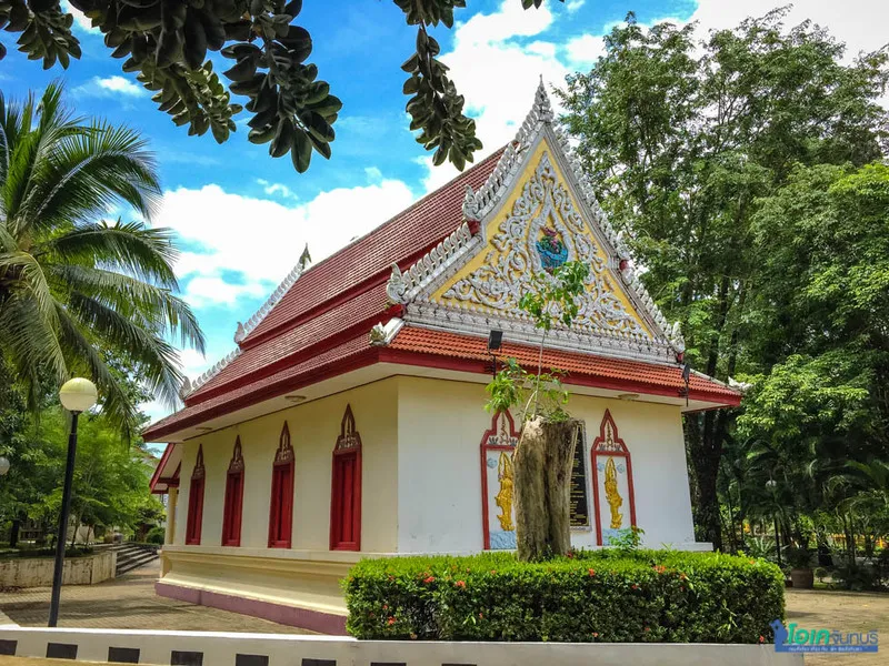
33. Wat Nong Bua, Chanthaburi Wat Nong Bua, in the Nong Bua community of Mueang Chanthaburi, is a Buddhist temple with historical roots extending to the reign of King Mongkut, Rama IV. Its religious role remains connected to everyday community life and local traditions.
Highlights: The surrounding Nong Bua area is also known for traditional snacks and community food heritage. Visitors can combine a respectful temple visit with learning about local cuisine when community stalls or events are operating. These are separate activities: food markets should not be assumed to take place inside the temple or to run every day.
Dress appropriately for a place of worship, respect private property in the neighborhood, and check event dates if you are especially interested in the area's traditional sweets.
Getting There: From the nearest mainland town, follow the local route or official transport services to the attraction. Check seasonal access conditions and public transport before departure.
Map (GPS):Open Google Maps – Wat Nong Bua

34. Wat Khao Sukim, Chanthaburi Wat Khao Sukim is a well-known meditation and Buddhist learning center in the Khao Bai Si area of Tha Mai District, Chanthaburi. Its hillside setting, religious buildings, and collections of Buddhist art make it a destination for both worshippers and cultural visitors.
Highlights: The temple's significance lies in spiritual practice as well as architectural and artistic heritage. Visitors can enjoy the quiet surroundings, observe religious images, and reflect on the role of temples in supporting meditation and community learning. Its elevated location also adds a landscape dimension to the experience.
Dress modestly, avoid disturbing monks and worshippers, and follow any restrictions on photography or access to buildings.
Getting There: From the nearest mainland town, follow the local route or official transport services to the attraction. Check seasonal access conditions and public transport before departure.
Map (GPS):Open Google Maps – Wat Khao Sukim
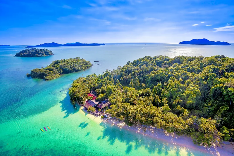
35. Mu Ko Chang National Park, Trat Mu Ko Chang National Park protects important marine and terrestrial environments around Koh Chang and nearby islands in Trat. Forested mountains, waterfalls, beaches, and surrounding waters create a rich combination of landscapes.
Highlights: Koh Chang is a major tourism island, but the park reminds visitors that the same setting also forms habitats for wildlife and aquatic species. Exploring it responsibly means distinguishing public visitor areas from conservation zones, keeping to approved trails, and considering the impact of boats and snorkeling on sensitive habitats.
Park opening arrangements vary by site, and access to individual islands or waterfalls may depend on weather and sea conditions. Check local restrictions and use properly equipped transport.
Getting There: For island destinations, arrange the appropriate ferry or passenger boat from the mainland, then continue by locally available transport. Confirm the arrival pier and return journey; the GPS marker is not a road connection across the sea.

36. Koh Mak, Trat Koh Mak is an island in Trat between Koh Chang and Koh Kood. It is known for its comparatively relaxed setting, beach scenery, local communities, and interest in environmentally responsible tourism.
Highlights: Rather than trying to see numerous sights in a single day, the island rewards visitors who spend time walking or cycling where safe, enjoying local meals, and observing its coastal landscapes. Fishing, plantations, and small community enterprises provide context beyond resort tourism.
Plan your ferry connections carefully, reduce waste, and respect local initiatives aimed at preserving the island's natural character. A map coordinate on Koh Mak cannot serve as an uninterrupted driving route from the mainland.
Getting There: For island destinations, arrange the appropriate ferry or passenger boat from the mainland, then continue by locally available transport. Confirm the arrival pier and return journey; the GPS marker is not a road connection across the sea.
Map (GPS):Open Google Maps – Koh Mak

37. Khlong Plu Waterfall, Trat Khlong Plu Waterfall is one of Koh Chang's best-known freshwater attractions, located amid tropical forest on the island. Flowing down rock faces into natural pools, it provides an inland contrast to the coast.
Highlights: The forest catchment supports the streams and helps protect biodiversity. On the approach, visitors can observe trees and the changing sound of running water. However, the volume and speed of the waterfall depend strongly on seasonal rainfall. Slippery stones and sudden surges can make some areas unsafe.
Only enter the water where permitted, use suitable shoes, and follow park instructions. The map coordinate published on the source Detail page should not be assumed to identify the precise waterfall entrance; confirm the trailhead locally.
Getting There: For island destinations, arrange the appropriate ferry or passenger boat from the mainland, then continue by locally available transport. Confirm the arrival pier and return journey; the GPS marker is not a road connection across the sea.
Map (GPS):Open Google Maps – Khlong Plu Waterfall
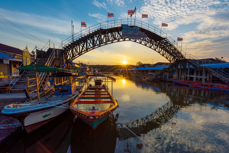
38. Ban Nam Chiao Community, Trat Ban Nam Chiao in Laem Ngop, Trat, is a community tourism destination with riverside homes, fishing traditions, and distinctive craft heritage. The village illustrates the cultural and religious diversity of eastern coastal settlements.
Highlights: One of its best-known traditions is the making of the locally distinctive ngam, a woven hat associated with everyday life and traditional skills. Mangrove areas, fishing boats, the pedestrian bridge, and community products add to the experience. Meeting local craftspeople offers a chance to understand how practical objects embody generations of knowledge.
Respect homes and working areas, ask before photographing residents, and check which cultural or boating activities are available rather than assuming all services operate throughout the day.
Getting There: From the nearest mainland town, follow the local route or official transport services to the attraction. Check seasonal access conditions and public transport before departure.

39. Ban Chuen Beach (Maro Beach), Trat Ban Chuen Beach, also known as Maro Beach, is a quieter stretch of Trat coastline in Mai Rut, Khlong Yai District. With an open sea view and an atmosphere less hectic than many major resorts, it appeals to visitors looking for simple coastal relaxation.
Highlights: The wider area's identity is connected to fishing, seaside settlements, and routes leading farther toward the Cambodian border. A visit may include walking the sand, enjoying seafood, photographing the coastline, or staying nearby to appreciate the morning atmosphere.
Check sea conditions carefully before swimming and consider border-area transport advisories when planning longer journeys farther south.
Getting There: From the nearest mainland town, follow the local route or official transport services to the attraction. Check seasonal access conditions and public transport before departure.
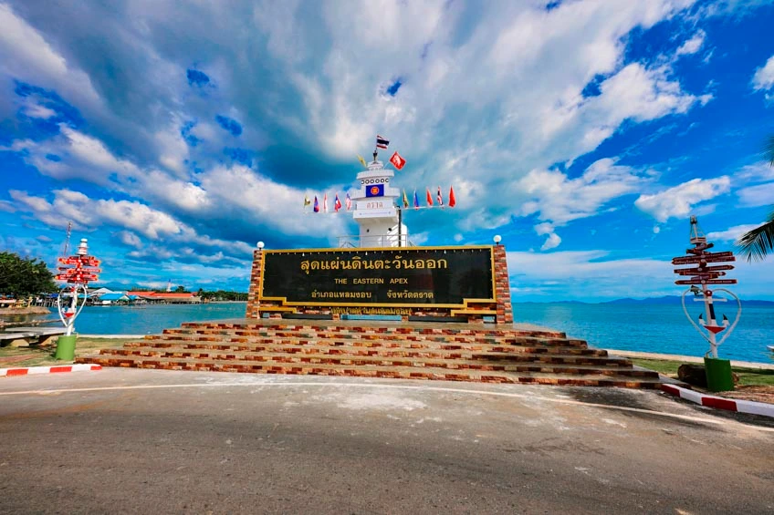
40. Laem Ngop, Trat Laem Ngop is a coastal district and historic maritime gateway in Trat, closely associated with travel toward Koh Chang and the surrounding islands. Its shorefront, local shops, seafood, and fishing connections make it more than merely a transfer point.
Highlights: The landscape illustrates how port communities link mainland trade and island life. Traditional crafts, regional seafood, and nearby Ban Nam Chiao provide opportunities to appreciate local culture. Travelers can include Laem Ngop in a mainland itinerary before continuing to offshore destinations.
Verify which pier currently serves your chosen island ferry, since boat services do not necessarily depart from every historic waterfront location.
Getting There: From the nearest mainland town, follow the local route or official transport services to the attraction. Check seasonal access conditions and public transport before departure.
Map (GPS):Open Google Maps – Laem Ngop
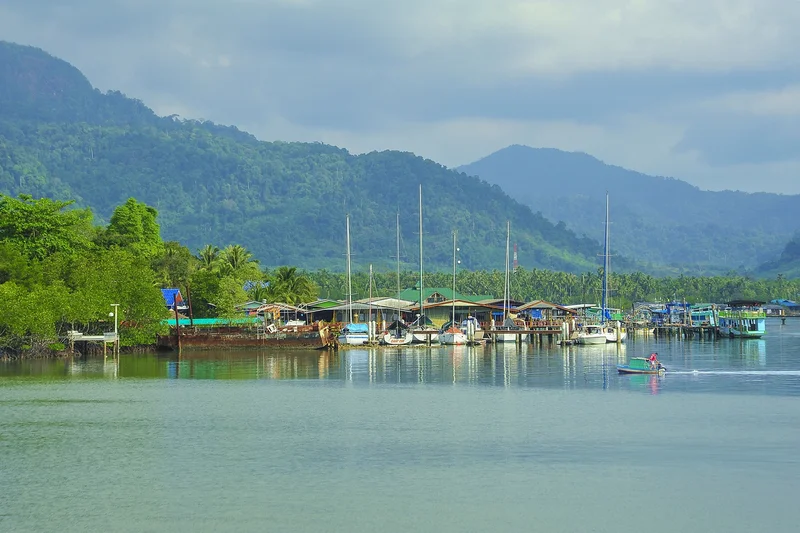
41. Ban Salak Khok, Trat Ban Salak Khok is a fishing and ecotourism community in the southern part of Koh Chang, Trat. Its sheltered inlet, winding waterways, waterside homes, and mangrove environment create a distinctive landscape that differs from the island's main beach resorts.
Highlights: The natural shape of the bay provides protected water for fishing boats, while the mangroves support coastal biodiversity. Where organized by local operators, low-impact boat excursions can introduce visitors to the waterways and livelihoods of the community. The value of the experience lies in learning about a living landscape, not simply photographing it.
Follow the guidance of community operators, avoid disturbing marine life, and respect working boats and residential areas.
Getting There: For island destinations, arrange the appropriate ferry or passenger boat from the mainland, then continue by locally available transport. Confirm the arrival pier and return journey; the GPS marker is not a road connection across the sea.
Map (GPS):Open Google Maps – Ban Salak Khok

42. Chao Phraya Abhaibhubejhr Building, Prachin Buri The Chao Phraya Abhaibhubejhr Building is a celebrated historic structure within the hospital complex in Mueang Prachin Buri. Its elegant European-influenced architecture, decorated facade, and symmetrical composition make it a notable reminder of an earlier period of Thai architectural history.
Highlights: The building is associated with Chao Phraya Abhaibhubejhr and has become closely connected with the province's reputation for Thai traditional medicine and herbal knowledge. A visit can explore the relationship among heritage conservation, public health, plant-based remedies, and cultural education.
Because it stands within an active hospital setting, observe site rules and avoid disrupting patients or staff. Check which museum or exhibition areas are accessible on your visit.
Getting There: From the nearest mainland town, follow the local route or official transport services to the attraction. Check seasonal access conditions and public transport before departure.

43. Sacred Bodhi Tree at Wat Si Maha Pho, Prachin Buri The sacred Bodhi tree at Wat Si Maha Pho in Si Mahosot District, Prachin Buri, is a revered symbol of Buddhism. Local tradition associates it with the lineage of the sacred Bodhi tree of Bodh Gaya, where the Buddha attained enlightenment.
Highlights: The temple and the surrounding area highlight the depth of Buddhist belief in this part of eastern Thailand. The site's cultural importance lies not only in the tree itself but also in the traditions, acts of worship, and stories maintained by local communities. Legends about precise age and origin should be recognized as traditional accounts rather than measured scientific facts.
Visitors should behave respectfully, avoid damaging the tree or roots, and consider combining this stop with the ancient sites of Si Mahosot.
Getting There: Travel to the relevant district and follow official signs to the archaeological, religious, museum or protected area. Check the opening schedule and access restrictions before visiting.

44. Kaeng Hin Phoeng Rapids, Prachin Buri Kaeng Hin Phoeng in Na Di, Prachin Buri, is known for seasonal whitewater rafting along the Sai Yai River. Rapids created by rocky sections of the river offer a different type of eastern Thailand adventure from beaches and islands.
Highlights: The activity is highly dependent on water levels, rainfall, and permission from the relevant authorities. Forested surroundings and river ecology are important parts of the experience, but moving water can become dangerous without warning. Rafting should only be undertaken with a qualified operator, appropriate protective equipment, and an informed assessment of conditions.
Check whether rafting is operating before making travel plans, follow the guide's instructions, and do not enter closed or hazardous river sections.
Getting There: From the nearest mainland town, follow the local route or official transport services to the attraction. Check seasonal access conditions and public transport before departure.

45. Prachin Buri National Museum, Prachin Buri Prachin Buri National Museum is a key destination for exploring the archaeology and artistic heritage of eastern Thailand. Collections help interpret discoveries from Si Mahosot and other regional sites, including religious sculptures and objects associated with ancient settlements.
Highlights: A museum visit makes it easier to understand the relationships among Dvaravati cultural developments, Buddhism, Brahmanical traditions, and later regional influences. It can serve as either an introduction before exploring archaeological remains or a follow-up to put outdoor discoveries in context.
Museum opening days differ from those of outdoor attractions. Check the official schedule before visiting and observe photography and artifact-protection rules.
Getting There: Travel to the relevant district and follow official signs to the archaeological, religious, museum or protected area. Check the opening schedule and access restrictions before visiting.

46. Thap Lan National Park, Prachin Buri Thap Lan National Park stretches across parts of Prachin Buri and Nakhon Ratchasima and forms part of the Dong Phayayen–Khao Yai Forest Complex. It is particularly associated with important fan-palm landscapes as well as forested hills and water resources.
Highlights: Its ecological value extends beyond individual viewpoints: large connected forests provide wildlife habitats, protect headwaters, and maintain rare plant communities. Travelers can learn about these systems at approved visitor areas while appreciating a landscape that differs from the eastern coastline.
The park covers a wide area, and attractions may be far apart. Choose the correct entrance for your intended activity, stay within permitted zones, and check fire, weather, and conservation-related closures.
Getting There: Travel to the relevant district and follow official signs to the archaeological, religious, museum or protected area. Check the opening schedule and access restrictions before visiting.

47. Tham Phet Pho Thong Cave, Sa Kaeo Tham Phet Pho Thong Cave in Khlong Hat, Sa Kaeo, is a limestone cave known for chambers, stalactites, stalagmites, and mineral formations. The cave environment offers an opportunity to understand the long geological processes that create underground features.
Highlights: Its shapes and colors are formed gradually through water moving through limestone and depositing minerals. Some formations suggest familiar objects or leaf-like patterns, giving rise to local descriptive names. Such delicate structures can be irreversibly damaged by touching or breaking them.
Plan to visit with appropriate local guidance where required, use safe footwear and lighting, and never remove or touch cave formations.
Getting There: Travel to the relevant district and follow official signs to the archaeological, religious, museum or protected area. Check the opening schedule and access restrictions before visiting.

48. Khao Chakan, Sa Kaeo Khao Chakan is a prominent limestone hill in Sa Kaeo, rising above surrounding lowlands. Its unusual profile, caves, and wildlife give it a landscape character unlike the province's broad agricultural plains.
Highlights: The limestone geology explains many of the hill's sharp contours and cave spaces. Monkeys may be seen around accessible areas, while bats are associated with the hill's natural habitats. Watching wildlife from a respectful distance is safer and less disruptive than attempting to feed or approach animals.
Use approved walking areas, prepare for heat and uneven terrain, and avoid entering caves or climbing where access is restricted.
Getting There: From the nearest mainland town, follow the local route or official transport services to the attraction. Check seasonal access conditions and public transport before departure.
Map (GPS):Open Google Maps – Khao Chakan

49. Tha Krabak Reservoir, Sa Kaeo Tha Krabak Reservoir lies in the Tha Yaek area of Mueang Sa Kaeo and is associated with a royal-initiative water development project. The reservoir provides an important example of infrastructure serving agriculture and local water management while also creating a scenic landscape.
Highlights: Visitors can appreciate the open water, surrounding hills, and the relationship between reservoirs and farming communities. It is an attractive stop for a quiet view rather than an amusement venue, and the broader area can be combined with other inland Sa Kaeo attractions.
Observe rules governing the dam and water, avoid restricted operational areas, and do not assume that swimming or boating is permitted.
Getting There: From the nearest mainland town, follow the local route or official transport services to the attraction. Check seasonal access conditions and public transport before departure.
Map (GPS):Open Google Maps – Tha Krabak Reservoir

50. Rong Kluea Border Market, Sa Kaeo Rong Kluea Market, officially associated with the Ban Khlong Luek border market in Aranyaprathet, Sa Kaeo, is a major trading destination close to the Thai–Cambodian frontier. Its stalls and commercial activity reflect the long-standing importance of cross-border exchange in the region.
Highlights: Goods sold in the market vary widely, and the market's character is shaped by traders, transport connections, and the wider border economy. Visitors can explore the commercial atmosphere and understand how the frontier has influenced local livelihoods, but market access and border rules can change.
Check current safety and border-area advisories before departure, compare prices carefully, and respect market rules. Visiting the market does not automatically confer permission to cross the international border.
Getting There: From the nearest mainland town, follow the local route or official transport services to the attraction. Check seasonal access conditions and public transport before departure.
| No. | Place | Province | Details | Map (GPS) |
| 1 | Bang Saen Beach | Chon Buri | Read Details | Open Map |
| 2 | Sanctuary of Truth | Chon Buri | Read Details | Open Map |
| 3 | Khao Kheow Open Zoo | Chon Buri | Read Details | Open Map |
| 4 | Sai Kaew Beach (Koh Samet) | Rayong | Read Details | Open Map |
| 5 | Thung Prong Thong Mangrove Boardwalk | Rayong | Read Details | Open Map |
| 6 | Chanthaboon Riverside Community | Chanthaburi | Read Details | Open Map |
| 7 | Koh Kood | Trat | Read Details | Open Map |
| 8 | Si Mahosot Ancient Town | Prachin Buri | Read Details | Open Map |
| 9 | Sdok Kok Thom Sanctuary | Sa Kaeo | Read Details | Open Map |
| 10 | Pang Sida National Park | Sa Kaeo | Read Details | Open Map |
| 11 | Koh Larn | Chon Buri | Read Details | Open Map |
| 12 | Koh Sichang | Chon Buri | Read Details | Open Map |
| 13 | Pattaya Beach | Chon Buri | Read Details | Open Map |
| 14 | Jomtien Beach | Chon Buri | Read Details | Open Map |
| 15 | Nong Nooch Tropical Garden | Chon Buri | Read Details | Open Map |
| 16 | Khao Chee Chan Buddha | Chon Buri | Read Details | Open Map |
| 17 | Wat Yanasangwararam Woramahawihan | Chon Buri | Read Details | Open Map |
| 18 | Nong Mon Market | Chon Buri | Read Details | Open Map |
| 19 | Khao Sam Muk | Chon Buri | Read Details | Open Map |
| 20 | Rayong Botanical Garden | Rayong | Read Details | Open Map |
| 21 | Rayong Old Town (Yomjinda Road) | Rayong | Read Details | Open Map |
| 22 | Mae Ramphueng Beach | Rayong | Read Details | Open Map |
| 23 | Khao Chamao–Khao Wong National Park | Rayong | Read Details | Open Map |
| 24 | HTMS Prasae Memorial | Rayong | Read Details | Open Map |
| 25 | Saeng Chan Beach | Rayong | Read Details | Open Map |
| 26 | Sunthon Phu Monument | Rayong | Read Details | Open Map |
| 27 | Namtok Phliu National Park | Chanthaburi | Read Details | Open Map |
| 28 | Khai Noen Wong Historic Fort | Chanthaburi | Read Details | Open Map |
| 29 | Nang Phaya Viewpoint | Chanthaburi | Read Details | Open Map |
| 30 | Kung Krabaen Bay Royal Development Study Center | Chanthaburi | Read Details | Open Map |
| 31 | Khao Khitchakut National Park | Chanthaburi | Read Details | Open Map |
| 32 | Chao Lao Beach | Chanthaburi | Read Details | Open Map |
| 33 | Wat Nong Bua | Chanthaburi | Read Details | Open Map |
| 34 | Wat Khao Sukim | Chanthaburi | Read Details | Open Map |
| 35 | Mu Ko Chang National Park | Trat | Read Details | Open Map |
| 36 | Koh Mak | Trat | Read Details | Open Map |
| 37 | Khlong Plu Waterfall | Trat | Read Details | Open Map |
| 38 | Ban Nam Chiao Community | Trat | Read Details | Open Map |
| 39 | Ban Chuen Beach (Maro Beach) | Trat | Read Details | Open Map |
| 40 | Laem Ngop | Trat | Read Details | Open Map |
| 41 | Ban Salak Khok | Trat | Read Details | Open Map |
| 42 | Chao Phraya Abhaibhubejhr Building | Prachin Buri | Read Details | Open Map |
| 43 | Sacred Bodhi Tree at Wat Si Maha Pho | Prachin Buri | Read Details | Open Map |
| 44 | Kaeng Hin Phoeng Rapids | Prachin Buri | Read Details | Open Map |
| 45 | Prachin Buri National Museum | Prachin Buri | Read Details | Open Map |
| 46 | Thap Lan National Park | Prachin Buri | Read Details | Open Map |
| 47 | Tham Phet Pho Thong Cave | Sa Kaeo | Read Details | Open Map |
| 48 | Khao Chakan | Sa Kaeo | Read Details | Open Map |
| 49 | Tha Krabak Reservoir | Sa Kaeo | Read Details | Open Map |
| 50 | Rong Kluea Border Market | Sa Kaeo | Read Details | Open Map |
| Province | Best For | Highlights | Where to Stay |
| Chon Buri | Weekend breaks, families, seaside excursions | Bang Saen, Pattaya, Koh Larn, Koh Sichang, cultural attractions | Bang Saen or Pattaya for convenience; island stays for overnight relaxation |
| Rayong | Beaches, islands, nature and local heritage | Koh Samet, coastal fishing villages, wetlands, old town | Town center, mainland beaches or Koh Samet depending on itinerary |
| Chanthaburi | History, heritage, orchards and coast | Chanthaboon, waterfalls, mangroves, fruit farms | City center for heritage; Chao Lao coastline for sea |
| Trat | Islands and community-based coastal travel | Koh Chang, Koh Kood, Koh Mak, traditional communities | Select an island and plan boat transfers |
| Prachin Buri | Archaeology, museums and forests | Si Mahosot, Abhaibhubejhr Building, Thap Lan | Town accommodation or nature-based stays near chosen sites |
| Sa Kaeo | Khmer heritage, forests, inland attractions | Sdok Kok Thom, Pang Sida, Khao Chakan, border market | Town or district accommodation near main route |
One Day in Chon Buri: Bang Saen–Khao Sam Muk–Nong Mon Market Start with a walk on Bang Saen Beach, continue to coastal views at Khao Sam Muk, and finish with bamboo sticky rice, seafood products and local souvenirs at Nong Mon Market. Allow extra travel time on holidays and do not feed monkeys around the hill.
Two Days, One Night in Rayong: Old Town–Mae Ramphueng–Pak Nam Prasae On day one, explore Yomjinda Road and spend the evening near Mae Ramphueng Beach. On day two, continue to the Prasae estuary for Thung Prong Thong and the HTMS Prasae memorial. Check local schedules and driving times.
Three Days, Two Nights: Chanthaburi–Trat Explore Chanthaboon Riverside Community and city heritage on day one. Travel along Chanthaburi’s scenic coast on day two and continue to Trat. On day three, explore Ban Nam Chiao or Laem Ngop. Add extra days if planning Koh Chang, Koh Mak or Koh Kood, since ferries and transfers take time.
Three Days, Two Nights: Prachin Buri–Sa Kaeo Visit Si Mahosot and the sacred Bodhi tree on day one. See the Prachin Buri National Museum and the Abhaibhubejhr Building on day two before continuing to Sa Kaeo. On day three, choose Khao Chakan or Pang Sida according to current access and weather; check security advisories before visiting locations near the border.
Travel advice for 2027: Ferry schedules, park opening hours, access fees, border restrictions, and tourism services can change. Confirm details with the relevant operator or authority shortly before departure. The Google Maps links above reproduce coordinates shown on each LoveThailand.org Detail page and may identify a general location rather than a specific entrance or jetty.
Frequently Asked Questions (FAQ)
Q: Which six provinces are included in Eastern Thailand in this guide?
A: Chon Buri, Rayong, Chanthaburi, Trat, Prachin Buri and Sa Kaeo.
Q: Where should first-time visitors to Eastern Thailand go?
A: For a convenient seaside introduction, choose Bang Saen, Pattaya or Rayong. For a more varied experience, combine a historic neighborhood, a coastal area and a national park.
Q: When is the best time for island travel?
A: November through April is often favorable for planning many island visits, especially around Trat, but actual sea conditions and ferry operations must always be checked.
Q: Which islands are suitable for a quieter holiday?
A: Koh Kood and Koh Mak are appealing choices for unhurried island stays, while Koh Chang offers a wider mix of beaches, forests and excursions.
Q: Can I visit Koh Larn or Koh Samet without staying overnight?
A: Yes, day trips may be possible when boat schedules and weather permit, but an overnight stay provides more time and a less rushed experience.
Q: Where can I experience local culture and historic architecture?
A: Visit Chanthaboon Riverside Community, Rayong Old Town, Koh Sichang’s royal heritage sites, Khai Noen Wong and Si Mahosot.
Q: Which local foods should I try?
A: Look for moo chamuang, sen chan noodles, Chanthaburi pepper, khao lam from Nong Mon and fresh seafood prepared by local communities.
Q: When is the eastern fruit season?
A: Harvest dates vary, but orchards in Chanthaburi and neighboring provinces often have significant fruit production around May to July.
Q: Which national parks offer wildlife or waterfall experiences?
A: Pang Sida, Khao Chamao–Khao Wong, Namtok Phliu, Khao Khitchakut and Thap Lan are notable options, subject to park access and weather.
Q: How many days should I plan for Eastern Thailand?
A: One day works for a compact Chon Buri outing; two to three days allow a mainland provincial trip; island stays and multi-province trips usually need more time.
Q: Can I drive directly to every Google Maps destination?
A: No. Islands require ferries or boats, and some park or waterfall coordinates do not mark the exact visitor entrance. Check the correct pier and access point.
Q: What should I check before traveling near the Cambodian border?
A: Review current security and border notices, access restrictions, transport conditions and the opening status of any markets or historic sites you plan to visit.
 Category: ●Travel Articles, Recipes
 Group: ●Travel Review, Food Review
Last Update : 2 WeekAgo
 Last Update : 2 WeekAgo
Recommend

 Art, Culture and Heritage
 Historical Sites and Monuments(7)
 Landmarks and Memorials(7)
 Royal Palace(1)
 Art, Craft Centres, Tradition(7)
 Museums(2)
 Educational Places
 Educational Gardens, Farm(5)
 Places of Worship
 Temple(25)
 Church(1)
 Other Sacred Sites(16)
 Research and Development
 Royal Project(1)
 Suburban Living
 Village, Community(4)
 Local Market(5)
 Nature and Wildlife
 National Parks and Marine Reserves(7)
 Mountain (Doi)(3)
 Dam, Reservoir, Lake(8)
 Waterfalls(21)
 Hot Springs(1)
 Caves(4)
 River, Canal(3)
 Bays and Beaches(9)
 Islands(2)
 Other natural attractions(3)
 Entertainment and Agricultural
 Zoos and Aquariums(3)
 Stadium(1)
 Farms, Parks and Ecotourism(7)
 Outdoor and Adventure Activities(3)
Travel Review, Food Review(3)


