
lovethailand home >South Travel Attractions >Nakhon Si Thammarat Travel Attractions > 50 Best Places to Visit in Southern Thailand in 20..
TL;DR: 50 Best Places to Visit in Southern Thailand in 2027, open Daily Opening Hours: Public areas of the island are generally accessible.
50 Best Places to Visit in Southern Thailand in 2027
50 Best Places to Visit in Southern Thailand in 2027: Beaches, Islands, Mountains, Old Towns and Must-See Attractions Southern Thailand is one of the country's most remarkable travel regions, bringing together the beauty of two coastlines: the Andaman Sea to the west and the Gulf of Thailand to the east. Across the region, visitors will discover tropical islands, limestone mountains, lush rainforests, waterfalls, historic towns, important temples and culturally distinctive communities. For travelers planning a trip in 2027, some of the most compelling destinations include Koh Samui, the Phi Phi Islands, Koh Lipe, Patong Beach, Koh Tao, Cheow Lan Lake, Khao Sok National Park, Promthep Cape, Ao Nang and the Emerald Pool. Together, these attractions offer everything from relaxing beach holidays and snorkeling adventures to rainforest exploration, cultural experiences and family-friendly travel.
Southern Thailand comprises 14 provinces: Chumphon, Surat Thani, Nakhon Si Thammarat, Phatthalung, Songkhla, Pattani, Yala, Narathiwat, Ranong, Phang Nga, Phuket, Krabi, Trang and Satun. Each province has a distinctive character. Surat Thani is the gateway to Koh Samui, Koh Phangan, Koh Tao and the forests of Khao Sok. Krabi is celebrated for its dramatic limestone formations and the Phi Phi Islands, while Phuket combines beautiful beaches with a historic old town. Satun is famous for Koh Lipe and the Adang–Rawi Islands. Travelers interested in history, architecture and cultural heritage will also find fascinating places to explore in Nakhon Si Thammarat, Songkhla, Pattani and other provinces throughout the region.
The appeal of Southern Thailand extends far beyond white-sand beaches and crystal-clear water. Mountain ranges, coastal plains, watershed forests and agricultural communities shape the region's diverse landscapes. Fishing villages and working harbors reflect generations of coastal life, while inland areas contain rubber plantations, tropical fruit orchards, natural waterways and communities that continue to preserve traditional knowledge. Traveling through the South offers opportunities to experience the sea, rainforest, mountains, local cuisine and cultural heritage within the same journey.
Historically, Southern Thailand formed part of extensive maritime trading networks connecting the Malay Peninsula with India, China and other parts of Southeast Asia. These relationships remain visible in historic port towns, Buddhist temples, mosques, Chinese shrines, Sino-Portuguese buildings, local languages, food and traditional celebrations. Nakhon Si Thammarat played an important role in the development of Buddhism and southern culture. Songkhla preserves historic neighborhoods shaped by diverse communities, while the southern border provinces have distinctive Malay cultural traditions and identities.

Southern Thai culture is especially rich in performing arts, religious celebrations and traditional cuisine. Shadow puppetry, known as Nang Talung, and the Nora dance tradition remain important cultural expressions. Major celebrations include the Sart Duen Sip festival and Chak Phra processions, alongside traditions associated with sea communities and Muslim populations. Handwoven fabrics, basketry, local handicrafts and products made from regional natural resources are also part of the South's cultural identity. Travelers can learn about these traditions through temples, museums, historic neighborhoods, local markets and community-based tourism activities.

Southern Thai cuisine is another highlight of any journey through the region. Its distinctive flavors come from aromatic curry pastes, fresh herbs, spicy ingredients and seafood. Popular dishes include Gaeng Som, a sour and spicy curry often called Southern Thai yellow curry, Khua Kling dry curry, Gaeng Tai Pla, Khao Yam rice salad with herbs, Nam Budu fermented fish sauce, Khanom Jeen rice noodles served with curry, and freshly prepared seafood. Some provinces have their own specialties, such as Phuket's Moo Hong braised pork, Malay-influenced dishes and an extensive variety of traditional sweets. Popular souvenirs include dried seafood products, shrimp paste, cashew nuts, Khanom La sweets, handwoven textiles and locally made handicrafts.
When planning a Southern Thailand itinerary, begin by choosing a coastline and a cluster of nearby provinces that match the length of your holiday. With only one day available, it is best to remain within a single province or select attractions along the same route, such as the beaches and viewpoints of southern Phuket or Ao Nang and nearby destinations in Krabi. With two or three days, you can add a boat excursion or an overnight island stay. A trip of four or five days or longer provides more flexibility to combine different experiences, perhaps dividing your time between coastal attractions and inland natural landscapes.
Weather patterns differ between the Andaman coast and the Gulf of Thailand. The most suitable travel period therefore depends on the province and activities you choose. Boat journeys, diving excursions and access to marine national parks are particularly sensitive to seasonal winds and sea conditions. Travelers should always check weather forecasts, national park announcements and ferry schedules before departure. A flexible itinerary makes it easier to change plans when conditions are unsuitable for outdoor or marine activities.
For those who love islands, beaches and underwater adventures, Koh Samui, Koh Tao, the Phi Phi Islands and Koh Lipe are excellent starting points. Travelers looking for tropical rainforests, dramatic limestone scenery and peaceful natural surroundings should consider Khao Sok National Park and Cheow Lan Lake. Visitors who prioritize convenient accommodation, restaurants and transportation may prefer to begin their journey in Phuket or Krabi before exploring other destinations. The following 50 attractions showcase both Southern Thailand's best-known landmarks and the lesser-known places that reveal the region's extraordinary diversity.
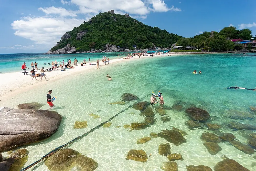
1. Koh Samui, Surat Thani Province, is one of Thailand's most internationally recognized island destinations. Located in the Gulf of Thailand, the island forms Koh Samui District and combines beautiful beaches, tropical mountains, traditional communities, significant Buddhist temples, restaurants and accommodation ranging from simple guesthouses to luxury resorts. Visitors can enjoy a peaceful seaside holiday, explore the island's natural and cultural attractions, or use Koh Samui as a base for discovering nearby islands.
Highlights: Chaweng Beach, Lamai Beach, Bophut Beach, Fisherman's Village, Big Buddha Temple, Wat Plai Laem, Hin Ta and Hin Yai Rocks, Na Muang Waterfalls, coastal viewpoints and traditional island communities.
Chaweng Beach is one of Koh Samui's main tourism centers, with a long stretch of sand and an extensive selection of resorts, restaurants, shops and beachfront activities. Lamai Beach offers a different coastal atmosphere and is located near the famous Hin Ta and Hin Yai rock formations. Travelers seeking lively entertainment may prefer the island's major beach districts, while those looking for a quieter experience can choose accommodation along less developed stretches of coastline.
Koh Samui also has a rich cultural side. Big Buddha Temple, located on Koh Fan, is an important religious landmark and offers attractive coastal views. Wat Plai Laem is known for its distinctive Buddhist architecture and sculptures, while Fisherman's Village in Bophut reflects the island's maritime heritage through its buildings, restaurants, shops and atmosphere. Visiting these locations adds cultural depth to a holiday otherwise focused on beaches and resorts.
The island's interior is characterized by hills, tropical vegetation and traditional agricultural areas. The route to Na Muang Waterfalls provides a chance to experience a different side of Samui, away from the shoreline. Exploring the island by car also reveals a variety of landscapes, including coastal communities, ferry terminals, hillside roads and scenic viewpoints. Drivers should select routes suited to their experience and take particular care on steep mountain roads.
Koh Samui is suitable for couples, families, groups of friends and travelers planning a multi-night stay. With two or three days, visitors can dedicate one day to beaches and Bophut, another to temples and inland attractions, and a third to relaxing or taking a boat excursion. Travelers continuing to Koh Phangan or Koh Tao should plan ferry connections carefully and allow sufficient time between journeys. January through May is generally a favorable period for planning a seaside holiday, although marine weather conditions should always be checked before departure.
Open Days: Daily Opening Hours: Public areas of the island are generally accessible throughout the day; ferry terminals, attractions, restaurants and other businesses operate according to their individual schedules.
Getting There: Travelers can fly directly to Samui Airport or travel overland to Surat Thani and take a ferry from the Don Sak area. On the island, rental vehicles, taxis and hotel transfers provide transportation between beaches and attractions. Check the departure pier and ferry timetable before traveling.
Map (GPS):View Koh Samui on Google Maps
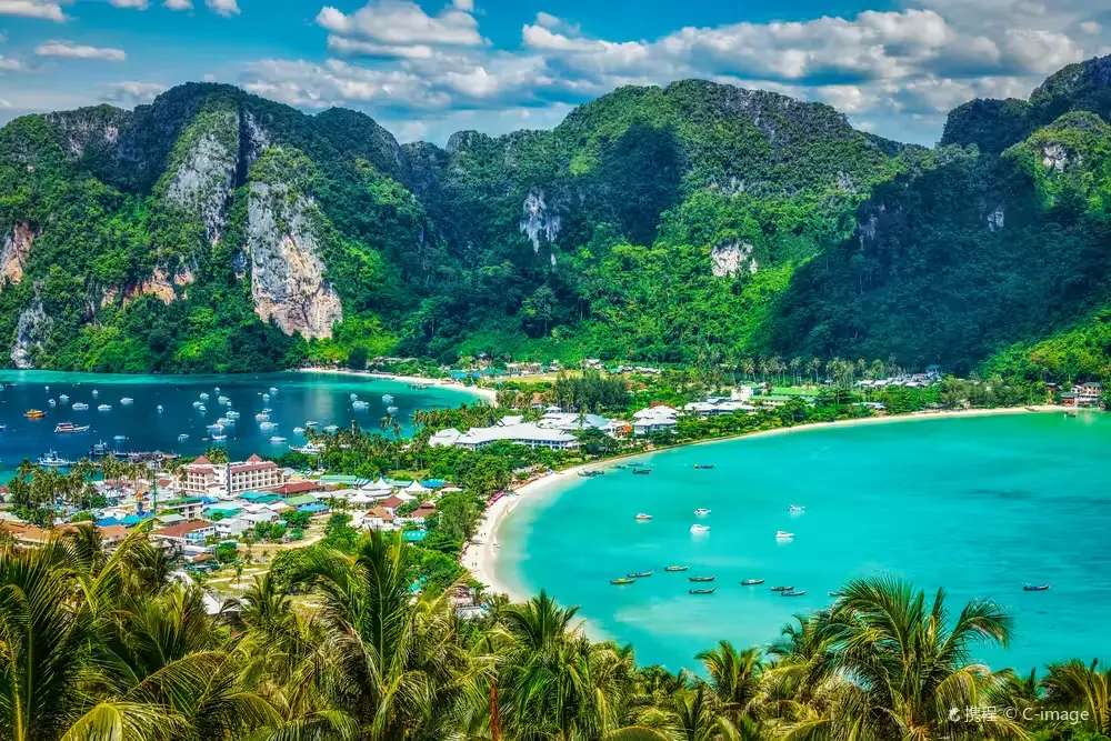
2. The Phi Phi Islands, Krabi Province, are an internationally famous group of islands in the Andaman Sea. Towering limestone cliffs surrounding bays of emerald-green water create some of Thailand's most recognizable coastal scenery. The islands include established tourist communities as well as protected natural areas within Hat Noppharat Thara–Mu Ko Phi Phi National Park, where ongoing conservation is essential to protecting the marine environment.
Highlights: Phi Phi Don, Phi Phi Leh, Maya Bay, Pileh Lagoon, Loh Samah Bay, Tonsai Bay, Loh Dalum Bay, Phi Phi Don viewpoints, Bamboo Island and diving sites around the archipelago.
Phi Phi Don is the main transportation and accommodation hub. It has a ferry pier, hotels, restaurants, shops and tour services. One of its most distinctive geographical features is the narrow strip of land separating Tonsai Bay and Loh Dalum Bay. From the elevated viewpoints, visitors can admire both beaches framed by forested hills and the surrounding sea. This panoramic perspective makes the viewpoints among the most popular photography locations in Krabi.
Phi Phi Leh is a limestone island surrounded by dramatic cliffs and several remarkable bays. Maya Bay is celebrated for its white sandy beach and imposing rock walls, while Pileh Lagoon is distinguished by green water enclosed by steep limestone formations. Visiting these locations requires compliance with national park regulations, designated entry and exit routes, boat restrictions and any temporary closures introduced to protect the environment.
The Phi Phi Islands are equally remarkable below the surface. Coral reefs and marine habitats support many species of fish and other sea creatures. Bida Nok and Bida Nai are well-known diving areas, while Bamboo Island is appreciated for its sandy beaches and coastal scenery. Choosing responsible boat operators and diving centers helps minimize disturbance to fragile marine ecosystems.
Travelers with only one day may choose a guided boat excursion covering attractions that are open to visitors. However, staying at least one night on Phi Phi Don allows more time to explore the village, visit viewpoints, relax on the beaches and take separate excursions to surrounding islands. Travel schedules should remain flexible because strong winds, rough seas and national park restrictions can affect access to individual bays. Some areas close periodically to support environmental recovery.
Open Days: Daily in areas authorized for visitors Opening Hours: National park tourism areas generally operate from 08:00 to 16:30; selected bays may close temporarily under official conservation announcements.
Getting There: Ferry and tour boat services operate from designated piers in Krabi and Phuket, including Klong Jilad Pier, departure points around Ao Nang and Rassada Pier in Phuket. Phi Phi Don is the main connection point for onward excursions. Confirm boat schedules and national park access restrictions before departure.
Map (GPS):View the Phi Phi Islands on Google Maps
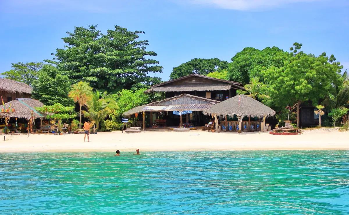
3. Koh Lipe, Satun Province, is a popular tropical island in the southern Andaman Sea, located in Ko Sarai Subdistrict, Mueang Satun District. Known for its powdery white sand, clear turquoise water, coral reefs and access to the Adang–Rawi Islands, Koh Lipe offers a memorable combination of natural beauty and island life. Beyond its beach resorts, the island is also home to an Urak Lawoi sea community whose traditions and maritime knowledge form an important part of its cultural heritage.
Highlights: Pattaya Beach, Sunrise Beach, Sunset Beach, Koh Lipe Walking Street, coral reefs, snorkeling excursions around the Adang–Rawi Islands and the cultural heritage of the Urak Lawoi community.
Pattaya Beach is one of the island's principal tourist areas, with numerous accommodations, restaurants and activities. Sunrise Beach is particularly appealing in the morning and offers views toward nearby Koh Adang, while Sunset Beach is known for its evening scenery. Visitors can select accommodation according to their interests, whether they prefer swimming, kayaking, snorkeling, beach walks or simply relaxing beside the sea.
Koh Lipe's Walking Street becomes especially lively in the evening, with restaurants, local shops and services for travelers. The island's Urak Lawoi community has a distinctive cultural background closely connected with seafaring, fishing and traditional beliefs about the sea. Learning about this community respectfully helps visitors understand that Koh Lipe is not only a holiday destination but also a place where people have lived and maintained cultural traditions for generations.
Nearby Koh Adang offers a contrasting landscape of forests, hills and viewpoints overlooking Koh Lipe. Snorkeling areas around the Adang–Rawi Islands range from shallow-water sites to locations that require guided boat access. Conditions vary with seasonal winds and national park regulations, particularly during periods when selected areas are closed for environmental recovery.
A stay of at least three days and two nights is recommended for travelers who want to experience the island at a relaxed pace. This provides time to explore different beaches, enjoy sunrise and sunset, discover local communities and take a snorkeling excursion when conditions are suitable. Trips to Koh Adang and surrounding islands should ideally be arranged separately from the departure day because boat services can be affected by changing sea conditions.
Open Days: Daily, subject to sea conditions and ferry services Best Time to Visit: Generally November to April, when conditions are often more favorable for Andaman Sea excursions.
Getting There: Travel to Pak Bara Pier in La-ngu District, Satun Province, and continue by scheduled boat or speedboat to Koh Lipe. Check departure times, weather conditions and operator requirements, especially during the monsoon season.
Map (GPS):View Koh Lipe on Google Maps
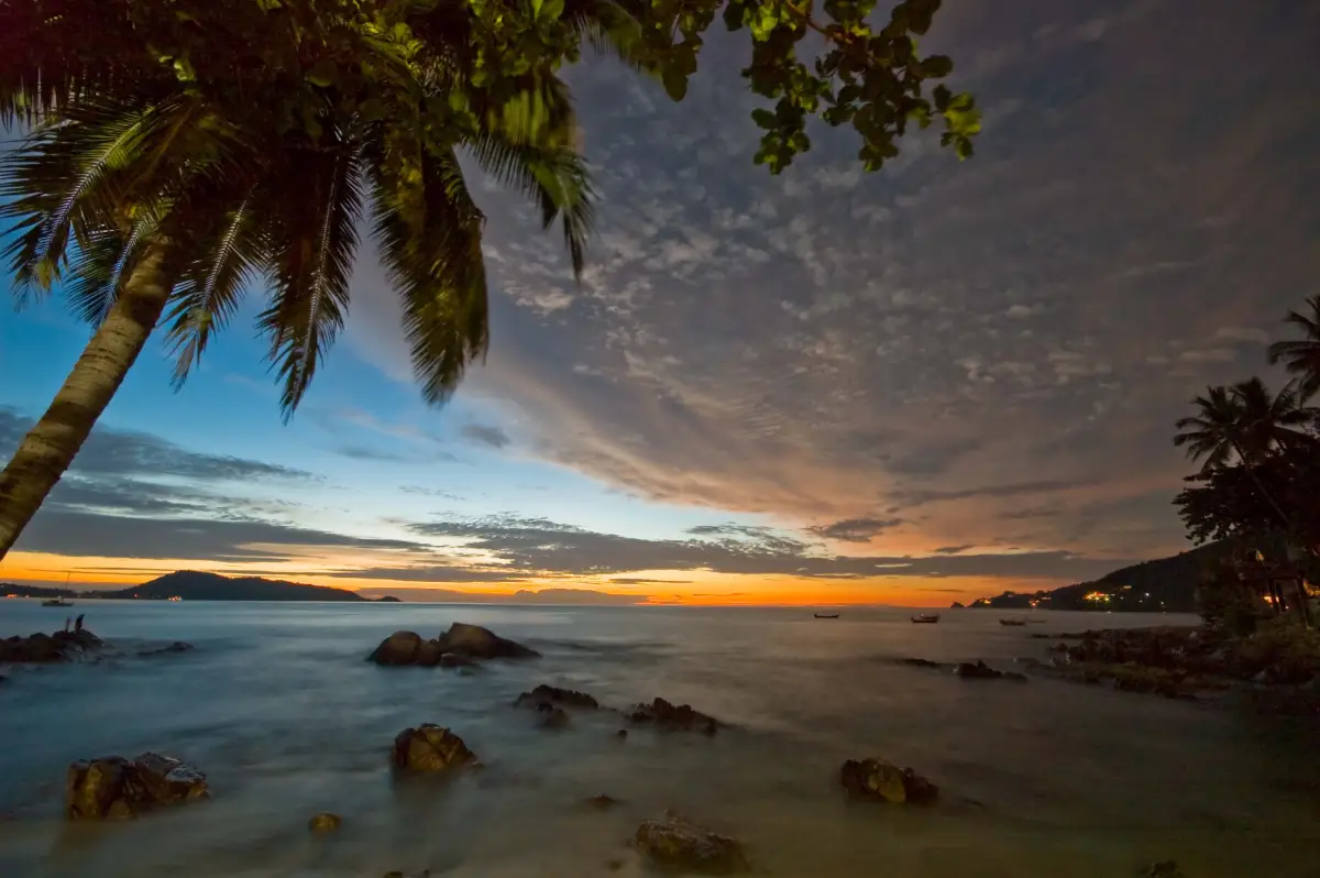
4. Patong Beach, Phuket Province, is one of Thailand's best-known beaches and a major tourism center on the island's western coast. Situated in Patong Subdistrict, Kathu District, it forms a broad, curved bay surrounded by green hills, with a long sandy beach running alongside the coastal road. Patong is particularly popular because it combines a seaside holiday with extensive accommodation, restaurants, shopping centers and nightlife in one destination.
Highlights: Patong Beach, beachfront activities, Thaweewong Road, Bangla Road, restaurants, shopping centers and Phuket's lively nightlife.
Patong is well suited to visitors who want a beach holiday with convenient access to tourist facilities. Travelers can stroll along the shore, relax on the sand or join permitted water activities when sea conditions are safe. The central beachfront is close to restaurants and major tourist services, while the northern and southern ends of the bay offer somewhat different atmospheres and accommodation choices.
Just beyond the beachfront are international restaurants, traditional Thai eateries, souvenir shops, spas and shopping centers. Bangla Road is particularly famous for its nightlife and entertainment. Visitors seeking an energetic holiday can enjoy the area from afternoon into late evening, while those who prefer quieter surroundings should consider accommodation away from the main entertainment streets.
Phuket's western coastline is affected by seasonal winds and waves. Calm conditions are generally better for swimming and beach activities, whereas the monsoon season can bring powerful surf and dangerous rip currents. Travelers should always follow beach safety flags and lifeguard instructions and avoid entering the water when warning signs indicate hazardous conditions.
Patong can be visited for a few hours, a full day or an extended holiday. Travelers staying in the area can also explore Karon Beach, Kata Beach and other parts of Phuket. Those interested in history and culture should consider spending another day in Phuket Old Town, whose traditional architecture and historic streets provide a striking contrast to Patong's modern tourism atmosphere.
Open Days: Daily Best Time to Visit: 06:00–18:00 for beach relaxation; protect yourself from strong midday sunlight and follow marine safety warnings.
Getting There: From Phuket Town, travel toward Kathu and continue west to Patong. Some sections of the road are steep and winding. Travelers arriving at Phuket International Airport can use an airport transfer, taxi or rental vehicle. Allow additional travel time during busy tourist periods.
Map (GPS):View Patong Beach on Google Maps
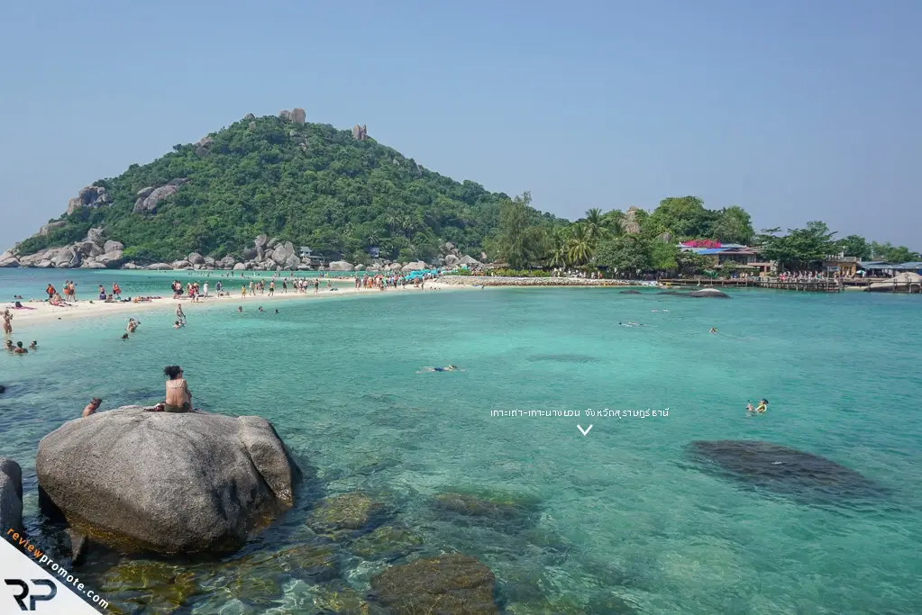
5. Koh Tao, Surat Thani Province, is a Gulf of Thailand island internationally recognized for scuba diving and underwater exploration. Administratively part of Koh Phangan District, the island features sandy beaches, small bays, granite formations and scenic viewpoints. Its varied underwater environments provide opportunities for beginners learning to dive as well as experienced divers seeking more advanced sites under professional supervision.
Highlights: Sairee Beach, Chalok Baan Kao Bay, Shark Bay, Aow Leuk, island viewpoints and boat excursions to Koh Nang Yuan, famous for its distinctive sandbars connecting small islands.
Sairee Beach is one of Koh Tao's main tourist districts, offering accommodation, restaurants, diving centers and beachfront relaxation. Other bays around the island have different characteristics. Some are ideal for quiet holidays, others offer snorkeling opportunities, and several are more exposed to changing sea conditions. Choosing a suitable location according to personal experience and the weather helps make water activities safer and more enjoyable.
The island is particularly well known for its diving industry. Numerous schools offer introductory experiences and certification courses for beginners, as well as advanced training for experienced divers. Visitors who have never tried scuba diving can arrange supervised introductory sessions, while certified divers can select sites appropriate to their qualifications and the conditions on the day. Professional instruction and responsible diving practices are essential for protecting both participants and marine ecosystems.
Beyond diving, Koh Tao offers sunset walks, seaside dining and elevated viewpoints overlooking its bays. A boat trip to nearby Koh Nang Yuan is another popular experience. The small islands are connected by narrow sandy stretches, creating a landscape that is especially striking from above. Visitors should follow the site's conservation regulations and avoid activities that might damage its beaches or marine habitats.
Koh Tao is best enjoyed over several nights, particularly for travelers taking a diving course, which requires time for training and scheduled underwater sessions. Those visiting primarily for relaxation can divide their time between beaches, snorkeling and excursions to Koh Nang Yuan. All visitors should choose operators with appropriate safety standards and avoid touching or standing on coral reefs.
Open Days: Daily, subject to weather and ferry schedules Best Time to Visit: February to April is generally favorable for planning sea and diving activities, although individual operators have their own schedules.
Getting There: Koh Tao is accessible by passenger boat from designated departure points in Chumphon and Surat Thani, as well as from Koh Samui and Koh Phangan, depending on the operator's routes. Confirm the departure pier, boarding time and current sea conditions before traveling.
Map (GPS):View Koh Tao on Google Maps
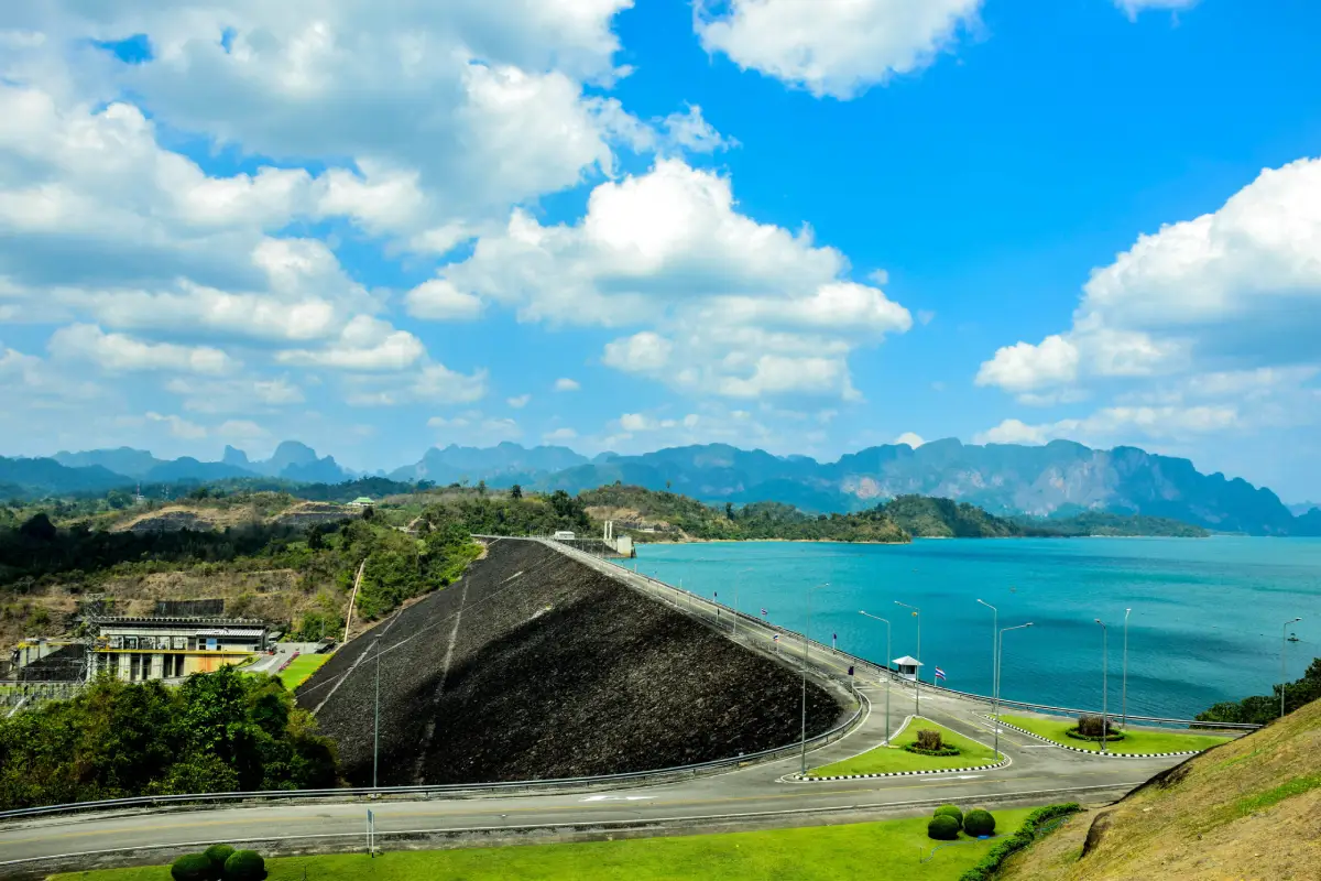
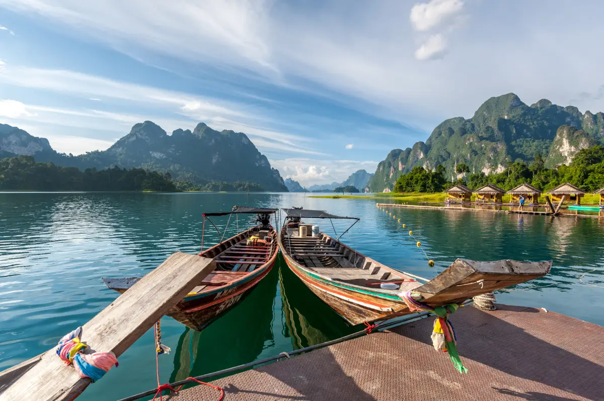
6. Ratchaprapha Dam (Cheow Lan Dam), Surat Thani Province, is a major natural attraction in Ban Ta Khun District, celebrated for its vast green lake surrounded by towering limestone mountains. The extraordinary scenery has earned the area the nickname "Guilin of Thailand." The combination of open water, rainforest, dramatic cliffs and protected natural landscapes within Khao Sok National Park makes Cheow Lan Lake one of the South's most memorable destinations beyond its beaches and islands.
Highlights: Dam viewpoints, Cheow Lan Lake, the Three Brothers limestone formations known as Khao Sam Kloe, scenic boat cruises, floating raft-house accommodation, kayaking and guided nature trails in authorized areas.
Ratchaprapha Dam is a multipurpose dam that plays a role in electricity generation and water management. Its reservoir has also become an outstanding destination for nature-based tourism. Visitors can explore two distinctly different areas: the viewpoints around the dam itself and the extensive lake accessible by boat. The dam area is suitable for a scenic stop, while lake excursions provide close-up views of limestone cliffs rising dramatically from the water.
Khao Sam Kloe, or the Three Brothers, is one of Cheow Lan Lake's iconic landscapes. Three prominent limestone formations stand above the water and are frequently included in sightseeing boat routes. Floating raft houses offer another distinctive experience for travelers seeking accommodation surrounded by nature. Early mornings can be especially atmospheric when the lake is calm and mist forms around the mountain slopes.
Activities around the reservoir include scenic cruises, kayaking, overnight stays and guided walks along trails open to visitors. Certain areas contain caves and forest routes that require experienced guides or national park staff. Water levels, rainfall and terrain can directly affect safety, so travelers must confirm whether caves and remote trails are open before planning these activities.
Day visitors can join a boat trip to major scenic sites and return to shore later the same day. Those seeking a more immersive experience may prefer to stay overnight at an authorized floating lodge, enjoying the peaceful surroundings and the early morning landscape. Cheow Lan Lake can also be combined with Khao Sok National Park, although it is advisable to dedicate separate days to the lake and the forest trekking area.
Open Days: Daily Opening Hours: Main sightseeing and service areas generally operate from 07:00 to 18:00; boat trips and floating accommodation follow individual operator schedules.
Getting There: From Surat Thani, take Highway 401 toward Ban Ta Khun District and follow the road to Ratchaprapha Dam. Travelers planning a lake cruise should continue to the designated tourist boat pier and arrange transport in advance. The dam viewpoint and the lake departure pier are separate locations.
Map (GPS):View Ratchaprapha Dam on Google Maps
7. Khao Sok National Park, Surat Thani Province, is an important protected rainforest landscape known for its tropical forests, limestone mountains, rivers, waterfalls and outstanding biodiversity. The park extends across several districts of Surat Thani and includes both the forested Khlong Sok area and the Cheow Lan Lake zone above Ratchaprapha Dam. Visitors can choose experiences ranging from relatively short nature walks to longer forest adventures and overnight stays in authorized locations.
Highlights: Tropical rainforest, limestone formations, forest trails, Bang Hua Rat Waterfall, Ton Kloi Waterfall, Sip Et Chan Waterfall, Mae Yai Waterfall and the Cheow Lan Lake landscape within the wider Khao Sok ecosystem.
Khao Sok is one of Southern Thailand's most important rainforest areas. Its rugged landscape comprises mountains, limestone cliffs, valleys and rivers flowing through dense vegetation. The forest supports a wide variety of plants and wildlife, including distinctive species such as Rafflesia, known for its enormous flowers. Visitors hoping to see rare plants should follow designated trails and ranger guidance rather than leaving established routes.
The park offers walking trails with different levels of difficulty. Some lead to streams and waterfalls, while others venture deeper into the forest and require more time. Bang Hua Rat, Wing Hin, Ton Kloi and Sip Et Chan waterfalls are among the natural features associated with the park. Access to individual sites depends on trail conditions, water levels and rainfall, so visitors should confirm the current situation before setting out.
Exploring Khao Sok reveals a side of Southern Thailand very different from its beaches. Forest walks offer opportunities to observe trees, climbing plants, fungi, insects and the countless smaller organisms that contribute to the rainforest ecosystem. Nature enthusiasts should allow at least one day for the Khlong Sok area and an additional day for Cheow Lan Lake if they want to experience both parts of the park.
Khao Sok is particularly suitable for nature lovers, botanical enthusiasts, photographers and travelers seeking a break from busy urban destinations. Families with children and older visitors should select shorter trails suited to their physical abilities. Walking through the forest during heavy rainfall or approaching fast-flowing streams without proper safety precautions should be avoided.
Open Days: Daily in areas authorized for visitors Opening Hours: General visitor access is typically 08:30–16:30; some trails may close seasonally or because of unsafe weather conditions.
Getting There: Travelers can approach the Khlong Sok area in Phanom District from Surat Thani or Khao Lak via Highway 401. The Cheow Lan Lake zone is reached through Ratchaprapha Dam in Ban Ta Khun District. Confirm which area you intend to visit because the access roads, activity meeting points and travel arrangements differ.
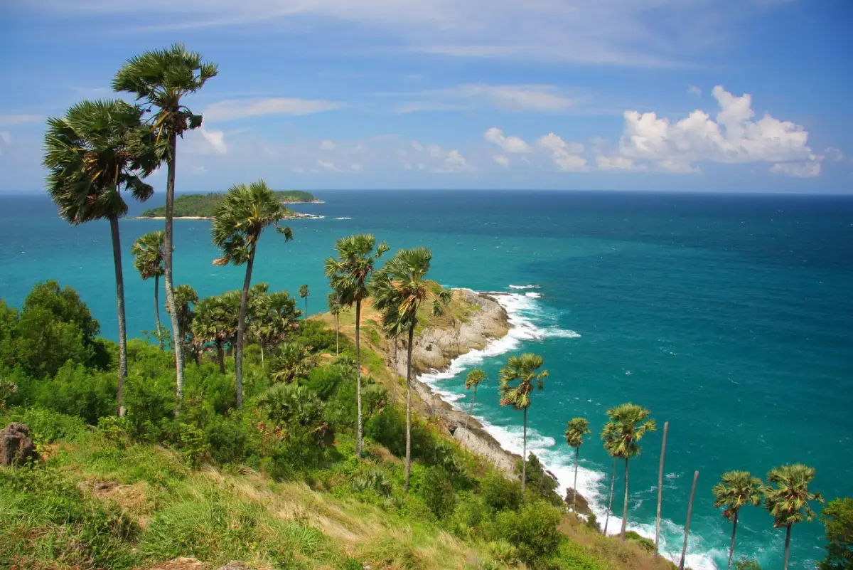
8. Promthep Cape, Phuket Province, is one of the island's most famous coastal viewpoints, situated at its southern end in Rawai Subdistrict, Mueang Phuket District. Its defining feature is a rocky headland extending into the Andaman Sea, surrounded by palm trees and panoramic views toward the horizon. Promthep Cape is particularly popular for watching the sunset and photographing the natural beauty of Phuket's coastline.
Highlights: Promthep Cape viewpoint, rocky headland, Kanchanaphisek Lighthouse, palm-fringed landscape, panoramic Andaman Sea views and nearby islands off Phuket's southern coast.
The main viewpoint overlooks the narrow rocky cape stretching into the sea and the surrounding coastline. In the late afternoon, warm sunlight illuminates the rocks and water, creating particularly attractive conditions for landscape photography. Visitors arriving before sunset can walk around the viewing area and select a suitable place to enjoy the changing light. The viewpoint becomes especially busy as sunset approaches.
Kanchanaphisek Lighthouse is another notable feature of the cape, with connections to maritime navigation and the coastal landscape. Nearby are religious shrines and facilities serving visitors. Exploring Promthep Cape therefore offers more than a sunset photograph; it also provides an opportunity to appreciate the relationship between the region's coastline and its maritime history.
Visitors interested in exploring the headland should remain on designated paths and take care around rocks, steep slopes and slippery ground. These conditions can become especially hazardous after rain or during strong winds. Walking toward the tip of the cape should be avoided when the terrain is unsafe, and visitors should never approach cliff edges solely to obtain photographs.
Promthep Cape can easily be combined with a journey through southern Phuket, including Nai Harn Beach, Ya Nui Beach, Windmill Viewpoint and Rawai Beach. A practical itinerary is to enjoy the nearby beaches during the day, visit Promthep Cape in the late afternoon and finish with dinner around Rawai. This route brings together coastal scenery, scenic viewpoints and local food within a single day.
Open Days: Daily Opening Hours: 06:00–19:00 Best Time to Visit: Late afternoon, especially before sunset.
Getting There: From Phuket Town, travel south toward Chalong and Rawai before continuing along the coastal roads to Promthep Cape. Rental cars, taxis and private transfers are all convenient options. Allow extra travel time during the evening when many visitors arrive to watch the sunset.
Map (GPS):View Promthep Cape on Google Maps
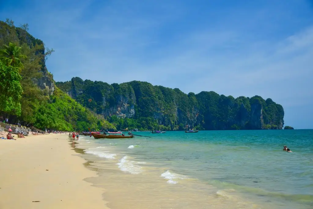
9. Ao Nang, Krabi Province, is one of the region's best-known coastal resorts and an important departure point for exploring nearby islands and beaches. Located in Ao Nang Subdistrict, Mueang Krabi District, the area features a sandy shoreline framed by limestone mountains, together with a wide selection of hotels, restaurants, shops and boat services connecting visitors with some of the Andaman coast's most popular attractions.
Highlights: Ao Nang Beach, limestone mountain scenery, beachfront roads, boat departure points and excursions to Railay Beach, the Krabi Sandbar, Poda Island and nearby offshore islands.
Ao Nang provides the opportunity to enjoy a beautiful coastal setting without traveling to a distant island. Visitors can walk along the beach, admire the limestone cliffs and spend the evening exploring beachfront restaurants and shops. The atmosphere balances the convenience of a developed tourism district with the distinctive natural scenery for which Krabi is famous.
One of Ao Nang's most important roles is as a gateway for boat excursions. Local long-tail boats and organized tours provide connections to Railay Beach, Phra Nang Cave Beach, Poda Island and the Krabi Sandbar, known locally as Thale Waek. When planning these excursions, travelers should consider travel time, the type of activities offered and the tides, since some natural features are most visible only at particular water levels.
Ao Nang also offers accommodation across a broad range of prices and styles. Staying in this area allows travelers to take different day trips without changing hotels. Besides island excursions, visitors can explore inland Krabi attractions such as the Emerald Pool and Khlong Thom Hot Springs. These inland sites are some distance from the coast, so they are best visited on a separate day with sufficient travel time.
For families, Ao Nang is a convenient choice because restaurants, shops and transport services are readily available. Photographers may particularly enjoy the evening light on the beach, while travelers planning island trips should arrange boat excursions early in the day and leave room for changes caused by rain, strong winds or unfavorable sea conditions.
Open Days: Daily Best Time to Visit: Morning for boat departures and late afternoon for beach walks. November to April is generally favorable for Andaman Sea activities.
Getting There: From Krabi Town, take the main road toward the Ao Nang coast by private car, rental vehicle, taxi or airport transfer. Boats to offshore islands and beaches without road access depart from designated piers or boarding points operated by local service providers.
Map (GPS):View Ao Nang on Google Maps
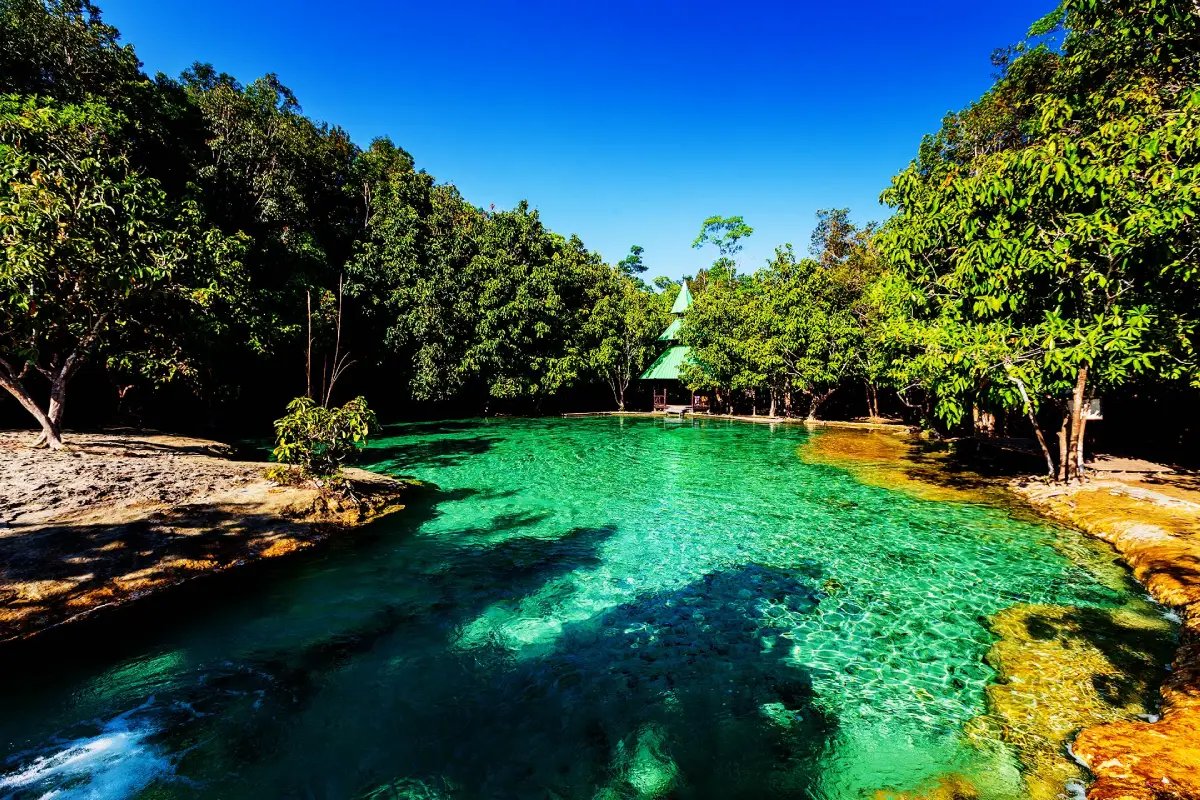
10. Emerald Pool (Sa Morakot), Krabi Province, is a distinctive natural attraction in Khlong Thom District, famous for its emerald-green freshwater pool surrounded by tropical vegetation. Unlike Krabi's celebrated beaches and offshore islands, Emerald Pool offers a forest environment where visitors can follow nature trails and discover a freshwater ecosystem of remarkable beauty.
Highlights: Naturally emerald-colored freshwater pool, forest walking trails, lush vegetation, tropical plants and freshwater habitats within the natural landscape of Khlong Thom District.
The appeal of Emerald Pool begins along the walking route through the forest. Shaded paths introduce visitors to tropical plants and the atmosphere of a landscape quite different from the Andaman coast. The main pool is especially striking because of its distinctive water color, which changes in appearance according to natural light and environmental conditions. It has become a popular place for enjoying the scenery and taking photographs.
Emerald Pool is also part of a sensitive natural environment where visitors share the landscape with native plants, freshwater habitats and other elements of the forest ecosystem. Staying on designated paths and following site regulations help protect the area. Visitors should not remove plants or animals from the forest and should avoid using products that could affect water quality in areas where swimming is permitted.
The attraction is suitable for families, groups of friends and nature enthusiasts. Comfortable footwear is recommended because walking trails may be damp or wet, especially after rain. Visitors should also bring drinking water and appropriate sun protection, and allow enough time to enjoy the walk rather than rushing directly to the pool. Families traveling with children or older relatives should select a route appropriate to everyone's mobility.
Emerald Pool can be combined with Khlong Thom Hot Springs, another well-known natural attraction in the same district. Together, the two sites make an appealing inland day trip for travelers staying in Krabi Town or Ao Nang. Sufficient time should be allowed for the road journey and walking routes, and the itinerary should take account of the opening hours and visitor regulations at both locations.
Open Days: Daily Opening Hours: 08:30–16:30. Visitors must follow the site regulations, including restrictions on access and swimming.
Getting There: Travel by road from Krabi Town or Ao Nang toward Khlong Thom District, then follow signs to the Emerald Pool visitor area. After reaching the parking area, continue on foot along the designated nature trail. Check current access conditions and swimming regulations before departure.
Map (GPS):View Emerald Pool on Google Maps
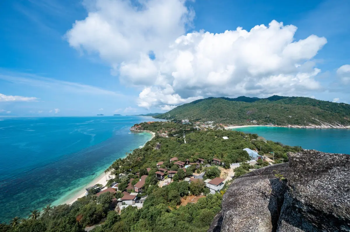
11. Koh Phangan, Surat Thani Province, is a well-known island destination in the Gulf of Thailand, situated north of Koh Samui within Koh Phangan District. What makes the island particularly appealing is the variety of travel experiences it offers, from lively beaches and seaside activities to secluded bays, forest-covered mountains, waterfalls, Buddhist temples and coastal communities that continue to maintain their traditional way of life. Although Koh Phangan is internationally recognized for its beach celebrations, it is also an excellent destination for travelers who want to spend several days relaxing and exploring nature.
Highlights: Haad Rin, Haad Yao, Haad Salad, Thong Nai Pan Yai Beach, Thong Nai Pan Noi Beach, Chaloklum Bay, Phaeng Waterfall, island viewpoints, Wat Phu Khao Noi and the local atmosphere of Thong Sala.
Koh Phangan has a rugged interior of hills and forests, while bays and beaches are scattered around its coastline. Haad Rin, on the southern part of the island, is internationally known for the Full Moon Party. In contrast, western beaches such as Haad Yao and Haad Salad offer more relaxed surroundings and attractive sunset views. On the eastern coast, the Thong Nai Pan beaches are framed by mountains and appeal to visitors seeking a quieter seaside escape surrounded by tropical scenery.
Beyond its beaches, Koh Phangan has several fascinating inland attractions. Phaeng Waterfall and the forested landscapes of Than Sadet–Ko Pha-ngan National Park provide opportunities for nature walks and scenic viewpoints in areas open to visitors. Exploring these locations reveals a side of the island that differs considerably from its nightlife and beach entertainment. From certain elevated viewpoints, travelers can admire the coastline and surrounding islands of the Gulf of Thailand, although access depends on weather and trail conditions.
The island's communities have long been associated with fishing, coconut cultivation and maritime trade. Thong Sala remains an important center for transport and local services, with a ferry pier, markets, restaurants and traditional shops. Exploring the markets and sampling local food allows travelers to experience everyday island life. Buddhist temples and religious sites also reflect the close relationship between Koh Phangan's communities, local beliefs and long-established traditions.
Koh Phangan is suitable for couples, groups of friends, nature lovers, wellness travelers and families seeking accommodation near quieter beaches. At least two or three days are recommended for exploring different parts of the island because some roads cross mountainous terrain and include steep sections. Choosing accommodation close to the beaches or activities you plan to enjoy can significantly reduce travel time.
Visitors planning to continue to Koh Samui or Koh Tao can arrange an island-hopping itinerary using scheduled ferry connections. However, marine conditions and seasonal winds can affect services, particularly during periods of rough weather. Travelers with onward flights or long-distance transport arrangements should allow sufficient time between connections in case ferry schedules change.
Open Days: Daily, subject to ferry services and weather conditions Best Time to Visit: Periods of calm seas are preferable for beach activities and water sports; individual attractions follow their own operating schedules.
Getting There: Koh Phangan is accessible by ferry from Koh Samui and designated mainland piers in Surat Thani Province. Thong Sala Pier is one of the island's principal arrival points. Local transport includes taxis, rental vehicles and accommodation transfers. Travelers should exercise caution when riding motorcycles, particularly on steep and winding mountain roads.
Map (GPS):View Koh Phangan on Google Maps
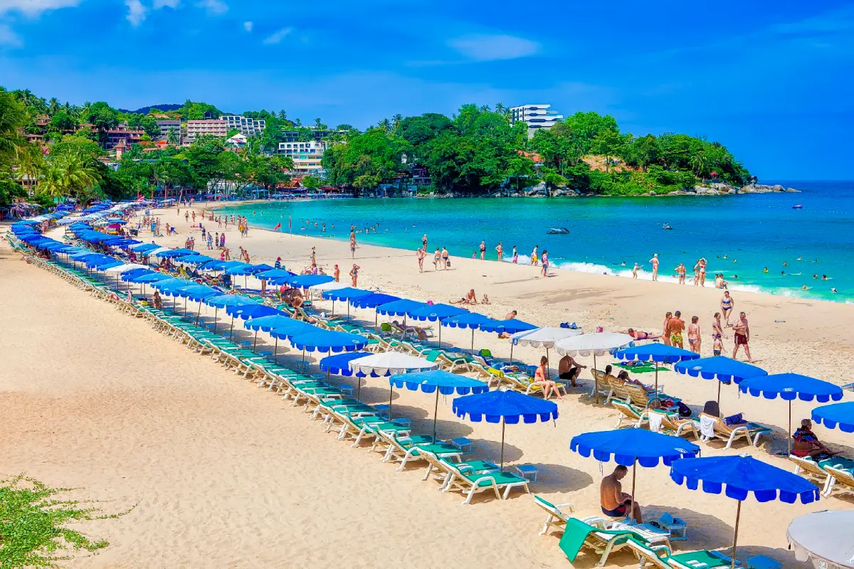
12. Kata Beach, Phuket Province, is one of the island's most popular beaches, located on its western coast in Karon Subdistrict, Mueang Phuket District. This beautiful curved bay is surrounded by green hills and tropical vegetation, with fine sand and expansive views across the Andaman Sea. Kata Beach is particularly appealing to travelers looking for a seaside holiday with convenient access to restaurants, hotels and tourism services, while enjoying a more relaxed atmosphere than the lively entertainment district of Patong.
Highlights: Kata Beach, turquoise sea views, Koh Pu Island, beachfront relaxation, seasonal water sports, nearby restaurants and accommodation, and excursions to Kata Noi Beach and Karon Viewpoint.
Kata Beach offers an attractive stretch of sand for walking, relaxing and admiring Koh Pu, the small island visible offshore. Green hills frame the bay and create particularly scenic views when sunlight reflects across the water and coastline. The beach is popular with families, couples and visitors seeking a comfortable coastal setting without traveling far from Phuket's major tourist areas.
Water activities at Kata Beach change with the seasons. When the sea is calm, conditions may be suitable for swimming in designated safe areas. During periods when waves are appropriate, the beach also attracts people interested in surfing. However, Phuket's western coast is affected by the southwest monsoon, which can bring strong waves and dangerous rip currents. Visitors must follow safety flags and lifeguard instructions and should never enter the water when swimming is prohibited.
The surrounding neighborhood offers restaurants, cafés, hotels and shops, making it easy to spend an entire day in the area. Photography enthusiasts can also visit Karon Viewpoint, which overlooks Kata Noi, Kata and Karon beaches along the coastline. This viewpoint offers one of the clearest panoramic perspectives of the distinctive coastal geography of southwestern Phuket.
Kata Beach can easily be included in a day trip with Karon Beach, Kata Noi Beach and nearby viewpoints. Travelers may spend the afternoon relaxing on the sand and remain until the evening to enjoy the changing light before dining at a local restaurant. Those with more time can extend their itinerary toward Nai Harn Beach and Promthep Cape, combining several of southern Phuket's most scenic coastal locations.
Open Days: Daily Best Time to Visit: Morning and late afternoon for relaxing and enjoying the scenery. Swimming should always depend on sea conditions and beach safety flags.
Getting There: Kata Beach lies south of Karon Beach and can be reached from Phuket Town or Patong by car, taxi or rental vehicle using the main roads along the island's western coast. Airport transfers are also available from Phuket International Airport to accommodation in the Kata area.
Map (GPS):View Kata Beach on Google Maps
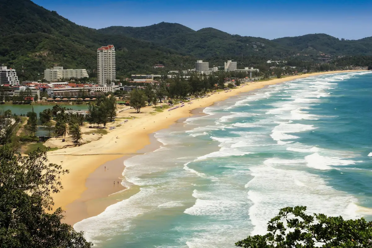
13. Karon Beach, Phuket Province, is a spacious beach on the island's western coast, located in Karon Subdistrict, Mueang Phuket District. Its long, gently curving shoreline opens toward the Andaman Sea, offering a broad stretch of sand and an attractive coastal landscape. Karon is particularly well suited to travelers who enjoy walking along the beach, relaxing beside the sea and staying in an area with convenient restaurants and accommodation.
Highlights: Karon Beach, panoramic Andaman Sea views, sunset scenery, coastal roads, beachfront restaurants, nearby hotels and convenient connections to Kata Beach and Karon Viewpoint.
One of Karon Beach's defining features is its extensive, uninterrupted shoreline. Visitors can enjoy long walks beside the sea while admiring the surrounding hills, trees and changing coastal scenery. Different sections of the beach have slightly different atmospheres. Some are close to hotels and restaurants, while others provide more open space for peaceful relaxation. Early morning and late afternoon are especially pleasant times to enjoy the sea breeze and softer natural light.
Despite its popularity, swimming at Karon Beach requires careful attention to current conditions. Strong waves and rip currents can occur during the monsoon season, and the beach's exposure to the open sea means conditions can change considerably from day to day. Travelers should swim only where it is safe, observe warning flags and avoid entering the water whenever swimming restrictions are in force.
The surrounding Karon community offers Thai restaurants, seafood dining, tourist shops and accommodation in a variety of styles. Travelers can stay close to the beach for convenient morning and evening walks or use Karon as a base for exploring other parts of southern Phuket. Its proximity to Kata Beach, Kata Noi Beach and Karon Viewpoint makes it possible to visit several scenic attractions without frequently changing hotels.
Karon Beach is suitable for couples, families, beach walkers and landscape photographers. Travelers with only a few hours can enjoy a shoreline walk and sunset, while those staying for several nights can explore other Phuket attractions. Phuket Old Town and Wat Chalong are particularly worthwhile additions for visitors interested in experiencing the island's history, architecture and Buddhist heritage alongside its beaches.
Open Days: Daily Best Time to Visit: 06:00–18:30 for beach walks, relaxation and coastal views. The public beach does not follow the fixed closing hours of a commercial attraction.
Getting There: Karon Beach lies between Patong and Kata on Phuket's western coast. It is accessible by car, taxi or rental vehicle from Phuket Town and Phuket International Airport. Some coastal roads have steep and winding sections, so drivers should take appropriate precautions.
Map (GPS):View Karon Beach on Google Maps
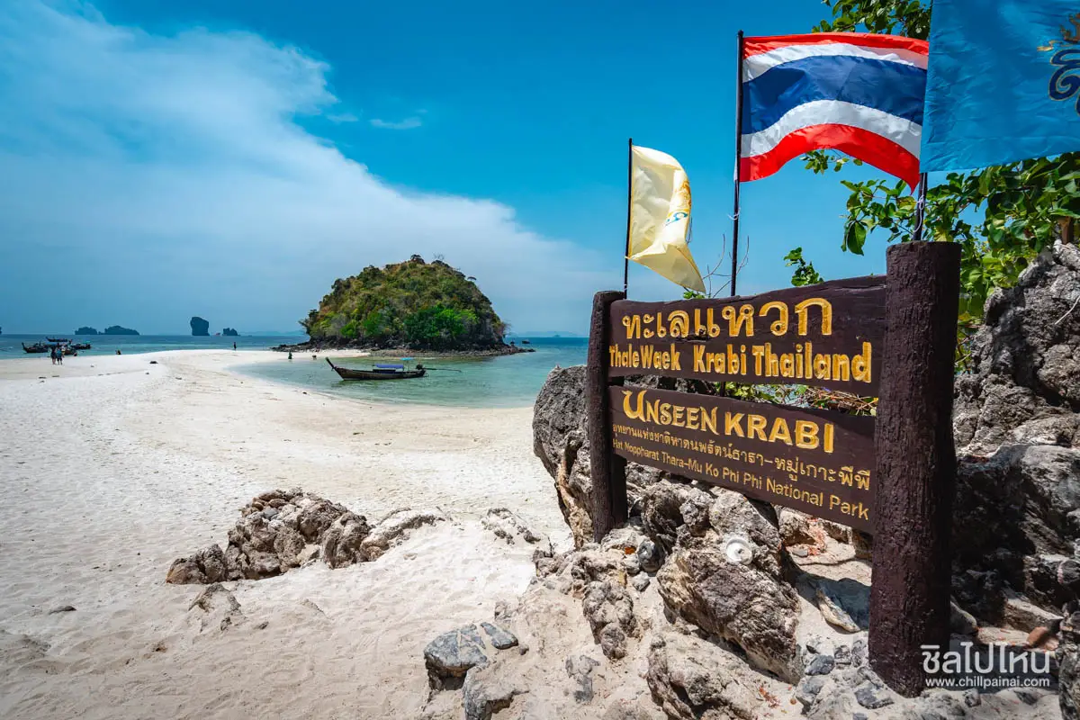
14. Thale Waek (Separated Sea), Krabi Province, is one of Thailand's most celebrated natural marine phenomena. Located around Chicken Island, Tup Island and Mor Island in the Andaman Sea near Ao Nang, it is famous for sandbars that emerge as the tide recedes, creating a temporary sandy connection between the islands. The sight of pale sand extending through turquoise water, surrounded by limestone formations, has become an iconic image of tourism in Krabi.
Highlights: The natural sandbars connecting Chicken Island, Tup Island and Mor Island, panoramic Andaman Sea scenery, photography during low tide, snorkeling in authorized areas and island-hopping excursions from Ao Nang.
Thale Waek is created by coastal geography and the natural movement of the tides. When the water level falls sufficiently, the sandbars between the islands become exposed, forming pathways that appear to divide the surrounding sea. The width of the exposed sand and the length of time it remains visible vary according to tidal conditions and weather. Travelers hoping to experience the phenomenon should therefore consult tidal information before booking a boat trip rather than relying solely on a morning or afternoon departure time.
The landscape is particularly striking because of its limestone formations, small beaches and the changing shades of the sea. Chicken Island is recognizable for the shape of its prominent rock formation, while Tup and Mor islands are closely associated with the connecting sandbars. Visitors can appreciate these features from their boats or from designated areas that are safe to access when the tide is favorable.
Thale Waek is commonly included in island-hopping excursions from Ao Nang, often alongside Poda Island and other nearby marine attractions. Typical activities include walking on the exposed sand, photography, beach relaxation and snorkeling in permitted locations. Because the area lies within a national park, visitors must follow conservation rules, avoid collecting natural resources and never step on coral reefs.
The destination is suitable for families, couples and travelers who enjoy beautiful natural scenery, provided they are comfortable traveling by boat. Families with children and older visitors should choose days with calm seas and operators that provide appropriate safety equipment. If strong winds or official restrictions prevent boat departures, an inland sightseeing program is a safer alternative.
Open Days: Daily, subject to boat operations and national park announcements Best Time to Visit: Low tide, when the connecting sandbars are clearly visible. Check the tide table and marine weather forecast for the actual travel date.
Getting There: Take a long-tail boat or organized island tour from Ao Nang or other authorized boat departure points in Krabi. Select an excursion visiting Chicken Island, Tup Island and Mor Island, and inform the operator that seeing the exposed sandbar during low tide is a priority.
Map (GPS):View Thale Waek on Google Maps
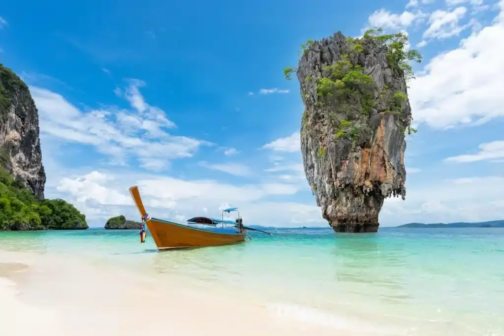
15. Khao Tapu and Khao Phing Kan, Phang Nga Province, are internationally recognized natural attractions within Ao Phang Nga National Park in Takua Thung District. The most distinctive landmark is Khao Tapu, a tall limestone rock rising dramatically from the sea, while Khao Phing Kan is known for a large rock formation that appears to lean against another section of the cliff. These unusual landscapes developed through geological processes and natural erosion over long periods and have become symbols of tourism in Phang Nga Bay.
Highlights: Khao Tapu, Khao Phing Kan, limestone formations in Phang Nga Bay, mangrove scenery, boat excursions and nearby attractions such as Koh Panyee and Tham Lot within Ao Phang Nga National Park.
Khao Tapu is particularly famous for its tall, narrow limestone shape rising above the surrounding water. Its base appears narrower than the upper section, giving the rock a striking silhouette. From designated viewpoints on Khao Phing Kan, visitors can see this isolated formation standing against the dramatic landscape of Phang Nga Bay. The location is also widely known as James Bond Island because it appeared in a James Bond film, helping establish its international reputation.
Khao Phing Kan itself is a limestone island with a small beach and designated areas where visitors can explore the natural surroundings. Its leaning rock formation is an interesting example of limestone landforms shaped by natural geological processes. Travelers can follow authorized walking routes and photograph Khao Tapu from safe viewpoints. Approaching unstable cliffs or restricted areas should always be avoided.
Ao Phang Nga National Park is valuable not only for its scenery but also for its coastal ecosystems. The landscape includes mangrove forests, waterways winding between limestone mountains, caves and numerous islands. A boat journey through the bay reveals natural formations quite different from the open beaches of the Andaman coast, together with local communities whose livelihoods have long depended on the sea and mangrove environment.
Excursions to Khao Tapu and Khao Phing Kan can be combined with Koh Panyee, a coastal community known for its mosque, school, restaurants and fishing traditions. Other tours may include boat trips through Tham Lot and surrounding mangrove channels, depending on authorized routes. Travelers should select operators that respect national park rules and avoid activities that could damage the natural environment.
Open Days: Daily, subject to national park regulations Opening Hours: Generally 08:00–16:30; island access depends on boat services and sea conditions.
Getting There: Travel by road to a tourist pier in Phang Nga Province, such as the Surakul Pier area or another departure point designated by your tour operator. Continue by boat into Phang Nga Bay to visit Khao Tapu and Khao Phing Kan. The islands cannot be reached directly by car, so confirm the departure pier and excursion duration before traveling.
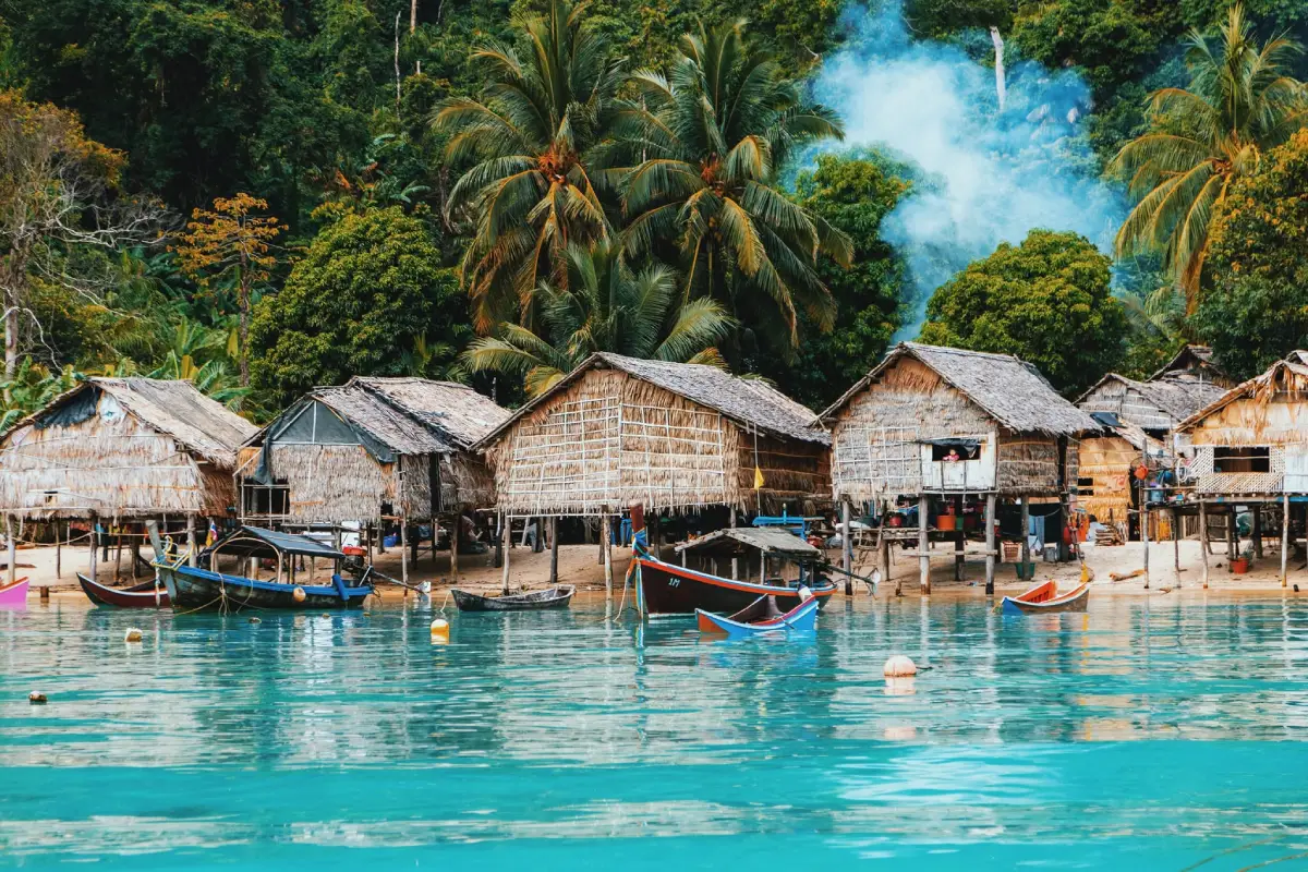
16. Mu Ko Surin National Park, Phang Nga Province, is a marine national park renowned for its coral reefs, crystal-clear water and rich biodiversity. Situated in the Andaman Sea off the coast of Khura Buri District, the park contains several islands, with Koh Surin Nuea and Koh Surin Tai forming the principal parts of the archipelago. This is an outstanding destination for travelers interested in marine nature, snorkeling and learning about the conservation of important coastal ecosystems.
Highlights: Koh Surin Nuea, Koh Surin Tai, Chong Khad Bay, Mai Ngam Bay, snorkeling sites, diverse coral reefs, the Moken community and panoramic Andaman Sea landscapes.
The Surin Islands are surrounded by clear water and coral reefs in several areas. Authorized shallow-water sites are particularly attractive for snorkeling because visitors can observe marine life without needing to undertake deep dives. However, each snorkeling location has different depths, currents and weather exposure. Guided excursions with knowledgeable operators are recommended to ensure a suitable choice of sites and appropriate safety precautions.
Chong Khad Bay and Mai Ngam Bay are among the best-known areas of the Surin Islands, offering attractive beaches, beautiful water and natural coastal scenery. Visitors can relax on the shore, admire the landscape and enjoy snorkeling where permitted. Access to each bay must follow national park regulations and may be affected by marine conditions on the day.
An important cultural feature of the Surin Islands is their relationship with the Moken community, an Indigenous maritime people whose traditional knowledge includes navigation, fishing and living in coastal environments. Travelers who have opportunities to learn about Moken culture should respect local customs, privacy and community rules. Their way of life deserves to be understood as a living cultural heritage rather than treated solely as a tourist attraction.
The park's environmental importance is especially evident in its coral reefs and marine habitats. Snorkelers should never touch coral, feed fish or leave rubbish in the sea. Underwater photographers should maintain appropriate distance from marine animals and control their movements to avoid accidental damage to fragile reef structures.
Mu Ko Surin National Park can be visited on a day excursion when suitable boat services are operating. Overnight stays may also be possible within areas and accommodation facilities authorized by the park. Travelers must check seasonal opening announcements before booking, as marine national parks can close during monsoon periods for safety reasons and to support the recovery of natural resources.
Open Days: Seasonally, according to national park announcements Opening Hours: During the visitor season, general access is typically 08:30–16:30. Confirm the exact opening and closing dates for the year before traveling.
Getting There: Travel overland to Khura Buri District in Phang Nga Province, then take an authorized boat service to the Surin Islands from the designated pier. Journeys depend on ferry or tour boat schedules and sea conditions. Visitors planning overnight stays should check national park accommodation arrangements in advance.
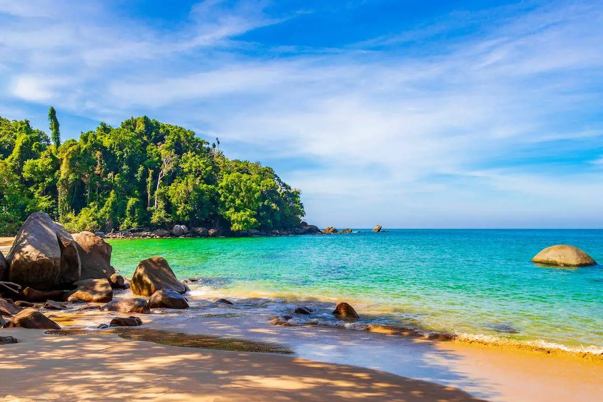
17. Khao Lak Beach, Phang Nga Province, is a well-known Andaman coast holiday destination celebrated for its long beaches, peaceful atmosphere and scenery combining mountains and the sea. The wider Khao Lak tourism area extends across several communities and beaches in Takua Pa District and neighboring coastal areas. Khao Lak–Lam Ru National Park is one of its important natural attractions. The region is particularly appealing as a relaxed seaside base for excursions to the Surin Islands, the Similan Islands and inland attractions of Phang Nga Province.
Highlights: Khao Lak's coastal beaches, Nang Thong Beach, Bang Niang Beach, Khuk Khak Beach, Khao Lak–Lam Ru National Park, coastal nature trails and marine excursions to offshore islands.
Khao Lak extends along a series of beautiful beaches, each with its own atmosphere. Nang Thong Beach is close to established tourist services and restaurants, while Bang Niang offers shops, markets and a wide selection of accommodation. Khuk Khak and the more northerly beaches include quieter areas suited to visitors who want to spend time relaxing. Travelers can choose accommodation according to their preferences for convenience, beach access or peaceful surroundings.
Khao Lak–Lam Ru National Park protects both rainforest and coastal environments. Walking trails open to visitors provide opportunities to observe tropical plants, natural landforms and sea views from selected locations. Entry to individual areas is subject to park operating hours and announcements, and some trails may close when conditions become unsafe.
Khao Lak also has an important place in the region's modern history because of the Indian Ocean tsunami on December 26, 2004, which severely affected coastal communities. Memorial sites and educational locations in the wider area help visitors understand the disaster, the importance of warning systems and the resilience of communities as they rebuilt their lives. Learning about this history adds a meaningful dimension to a seaside holiday.
For travelers who enjoy marine activities, Khao Lak is a convenient base for visiting offshore island groups, although boat excursions depend on the tourist season and sea conditions. Those who prefer to remain on the mainland can enjoy the beaches, visit local markets, sample regional food or explore inland natural attractions. This flexibility makes Khao Lak suitable for couples, families and travelers planning longer holidays.
Open Days: Public beaches are accessible daily Best Time to Visit: Morning and late afternoon for coastal relaxation. National park visitor areas generally operate from 08:30 to 16:30 and may close under official announcements.
Getting There: Khao Lak can be reached from Phuket International Airport or Phang Nga Town via Phetkasem Road, Highway 4, toward the coastal areas of Takua Pa District. Private cars, rental vehicles and hotel transfers are available. Visitors exploring several beaches should plan local transport carefully because the different beach districts are spread along the coastline.
Map (GPS):View Khao Lak Beach on Google Maps
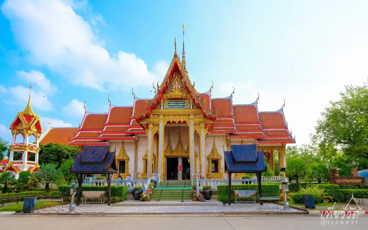
18. Wat Chalong (Wat Chaiyathararam), Phuket Province, is an important Buddhist temple located in Chalong Subdistrict, Mueang Phuket District. The temple is widely known for its association with Luang Pho Chaem and other highly respected Buddhist monks, as well as for the beauty of its religious architecture. Wat Chalong reflects the close relationship between Buddhism and the history of Phuket's communities and is an important destination for visitors who wish to pay their respects while learning about the island's cultural heritage.
Highlights: Phra Mahathat Chedi Phra Chom Thai Barami Prakat, statues of Luang Pho Chaem, Luang Pho Chuang and Luang Pho Klueam, Buddhist architecture, religious murals and the temple's longstanding spiritual significance.
Wat Chalong has a particularly strong historical connection with Luang Pho Chaem, also known by his ecclesiastical title Phra Khru Wisuttiwongsachan, a revered monk who remains an important figure in Phuket's religious history. His role is associated with the island's communities and significant events of the past. The respect shown toward him has continued through local traditions, devotional practices and visits by Buddhist worshippers over many generations.
Phra Mahathat Chedi Phra Chom Thai Barami Prakat is one of the most impressive structures within the temple complex. Its architecture features elaborate Buddhist decorative details, sacred images and paintings connected with the life and teachings of the Buddha. Visitors can appreciate the building's artistic craftsmanship and learn about Buddhist traditions through the religious art displayed in areas open to the public.
Many visitors come to Wat Chalong to pay respects to the revered monks, make merit and admire the temple's buildings. Buddhist holy days and important local celebrations attract large numbers of worshippers. The annual Wat Chalong Fair is particularly associated with Phuket's community life and longstanding traditions. Travelers interested in attending should consult temple announcements for the dates and arrangements of each year's event.
Wat Chalong is recommended for travelers interested in religion, local history, architecture and Phuket's cultural identity. It can be combined with a visit to Phuket Old Town or included in a southern Phuket itinerary featuring Rawai Beach and Promthep Cape. Visitors should dress respectfully, remove their shoes where required and avoid disturbing people engaged in worship or religious ceremonies.
Open Days: Daily Opening Hours: 07:00–17:00.
Getting There: Wat Chalong is located on Chao Fa West Road in Chalong Subdistrict, Mueang Phuket District. It can be reached from Phuket Town by car or taxi, traveling toward Chalong. The temple is conveniently located for continuing to beaches and viewpoints in southern Phuket.
Map (GPS):View Wat Chalong on Google Maps
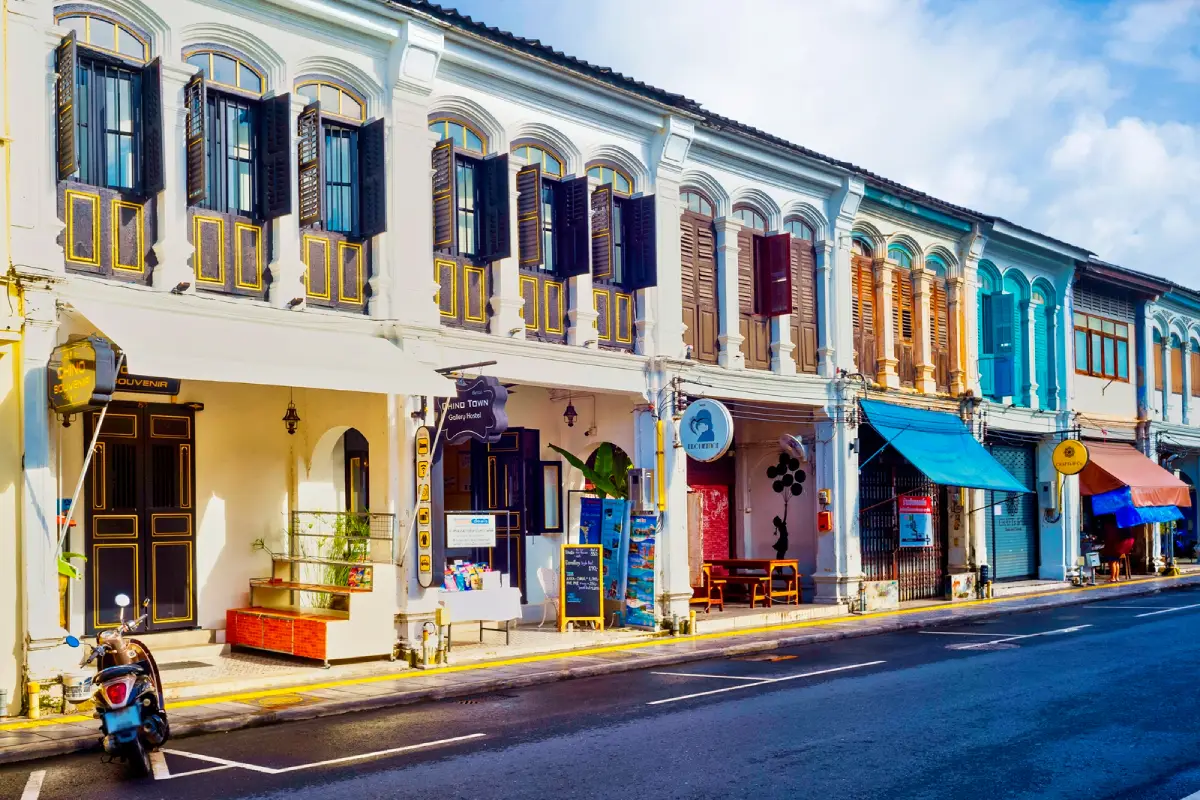
19. Phuket Old Town and Sino-Portuguese Architecture, Phuket Province, is one of the island's most important historic and architectural districts. The area is centered on streets such as Thalang Road, Dibuk Road, Krabi Road, Phang Nga Road and Yaowarat Road, where historic shophouses and buildings reflect Phuket's prosperity during the tin-mining era. The townscape illustrates a distinctive blend of Chinese cultural influences and European architectural styles, commonly described as Sino-Portuguese architecture.
Highlights: Thalang Road, Dibuk Road, Krabi Road, Phang Nga Road, Sino-Portuguese shophouses, Phuket Thai Hua Museum, Baan Chinpracha, Chinese shrines, local restaurants and the Sunday Walking Street Market, also known as Lard Yai.
Phuket's history is closely associated with tin mining, once a major economic activity that attracted people from different regions to settle on the island. Chinese communities and merchants played an important role in the growth of the town. Economic prosperity led to the construction of commercial buildings, residences and public structures incorporating architectural features from several traditions. Today, many historic buildings continue to serve as shops, restaurants, boutique hotels and heritage attractions.
Sino-Portuguese architecture in Phuket is recognizable through decorative archways, shuttered windows, ornamental plasterwork, patterned tiles and covered walkways along certain stretches of shophouses. Some buildings have been carefully restored to retain their historic appearance, while others have been adapted for modern use. Walking through the old town offers an opportunity to appreciate how architectural heritage and contemporary urban life coexist.
Thalang Road is one of the most popular streets for sightseeing and photography, with historic buildings, restaurants, cafés and local shops. Nearby Krabi Road and Dibuk Road contain additional architectural landmarks and places connected with the history of Phuket's communities. Travelers seeking a deeper understanding of the town can visit Phuket Thai Hua Museum or Baan Chinpracha, subject to their respective opening schedules.
The appeal of Phuket Old Town extends beyond its architecture to the island's distinctive food culture. Dishes and desserts such as Moo Hong, Hokkien noodles, A-Pong pancakes and O-Aew dessert reflect the influence of Chinese and Baba–Nyonya traditions. Daytime is suitable for appreciating architecture and visiting museums, while the evening brings a lively atmosphere to local restaurants and community events. The Sunday Walking Street Market on Thalang Road is a particularly well-known weekly attraction.
Phuket Old Town is ideal for travelers interested in history, architecture, photography, local food and walking-based cultural exploration. At least half a day is recommended for discovering its principal streets and attractions, although a full day allows a more relaxed experience. Travelers who also want to see the island's coastal highlights can dedicate another day to Wat Chalong, Kata Beach, Karon Beach and Promthep Cape.
Open Days: The historic district can be explored daily Best Time to Visit: Morning or evening. The Lard Yai Sunday Walking Street Market generally operates on Sundays from 16:00 to 22:00.
Getting There: Phuket Old Town is located within Phuket City and is accessible by car, taxi and public transport serving the town center. Visitors planning to explore Thalang Road, Dibuk Road and Krabi Road should use authorized parking areas and continue on foot to experience the historic streets more fully.
Map (GPS):View Phuket Old Town on Google Maps
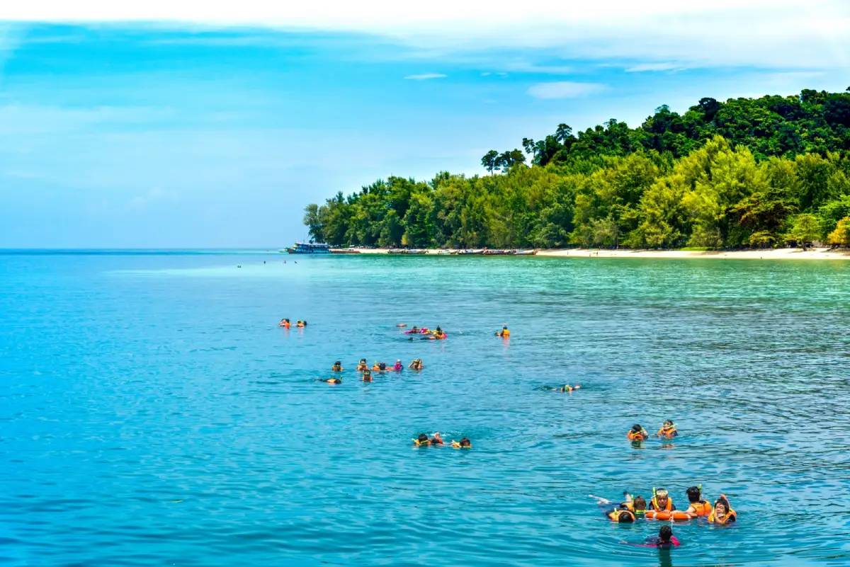
20. Koh Kradan, Trang Province, is an Andaman Sea island renowned for its white sandy beaches, exceptionally clear water and shallow coral reefs. Located in Ko Libong Subdistrict, Kantang District, part of the island is protected within Hat Chao Mai National Park. Koh Kradan has a naturally beautiful setting suited to peaceful seaside holidays, with beaches overlooking the surrounding sea and neighboring islands. Its striking coastal scenery has made it one of Trang's most admired island destinations.
Highlights: White sandy beaches, clear turquoise water, shallow coral reefs, views of Trang's offshore islands, beachfront relaxation, snorkeling and boat connections to Koh Mook and nearby destinations.
Koh Kradan is especially attractive for its fine sandy beaches and clear coastal waters. From suitable stretches of the shoreline, visitors can enjoy views toward other islands and distant hills. The island's appearance changes with sunlight, sea conditions and the season. Landscape photographers will appreciate the contrast between pale sand, turquoise water and the green vegetation covering the island.
Relaxing by the sea and snorkeling in authorized areas are among Koh Kradan's main activities. The coral reefs close to parts of the coast provide habitats for diverse marine life. Visitors must exercise care not to step on coral, remove shells or other natural resources, or leave rubbish on the beach. Wearing a life jacket during appropriate water activities and following advice from park staff or tour operators help protect both visitors and the marine environment.
Unlike larger tourist islands, Koh Kradan does not have a densely developed commercial center comparable to Phuket or Koh Samui. Its appeal lies in its peaceful atmosphere and the opportunity to spend time surrounded by nature. Travelers planning an overnight stay should confirm accommodation availability and boat schedules before departure because facilities are more limited and subject to the island's conditions and conservation regulations.
Koh Kradan can be included in a boat itinerary with Koh Mook and Emerald Cave, another celebrated natural attraction of Trang Province. Visitors staying on the mainland may choose a day excursion, while those hoping to enjoy a quiet morning beside the sea can consider an overnight stay when accommodation is available. All boat arrangements should take into account seasonal weather and national park access requirements.
Koh Kradan is suitable for couples, nature lovers, snorkeling enthusiasts and families seeking a relaxing island holiday. However, reaching the island requires boat transportation, and access to individual beaches may be affected by tides and waves. Families with young children or older travelers should confirm boarding arrangements and select excursions suited to their mobility. Visitors must also check announcements from Hat Chao Mai National Park regarding seasonal closures before booking.
Open Days: Seasonally, subject to Hat Chao Mai National Park announcements Best Time to Visit: Generally November to April for Andaman Sea activities, with daytime boat services depending on the operator and sea conditions.
Getting There: Travel overland to a tourist pier in Trang Province, such as the Pak Meng area or another pier designated by the boat operator, then continue by boat to Koh Kradan. Travel time depends on the departure pier, type of boat and marine conditions. Confirm boat schedules and national park access restrictions before departure.
Map (GPS):View Koh Kradan on Google Maps
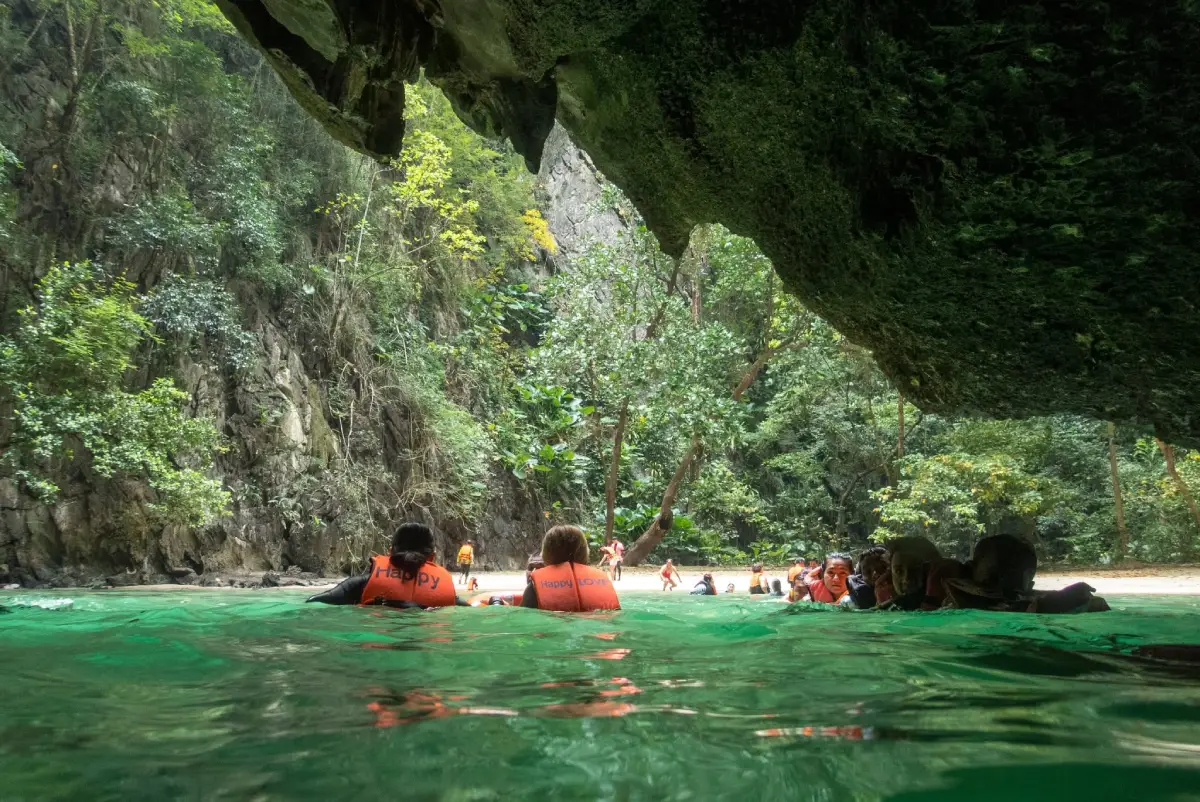
21. Koh Mook and Emerald Cave, Trang Province, are among Southern Thailand's most distinctive marine attractions. Located in Ko Libong Subdistrict, Kantang District, within Hat Chao Mai National Park, Koh Mook is famous for Tham Morakot, or Emerald Cave, a remarkable sea cave that leads to a secluded beach surrounded by towering limestone cliffs. Visiting the cave is an unusual experience because travelers must pass through a natural tunnel to reach the sheltered open space inside the island, revealing a hidden landscape that cannot be seen from the surrounding sea.
Highlights: Emerald Cave, its natural sea tunnel, the hidden sandy beach, limestone cliffs, Koh Mook's fishing communities and island-hopping routes connecting Koh Kradan and other islands of Trang Province.
Emerald Cave is a coastal limestone formation featuring a tunnel that connects the open sea with a secluded interior beach. The appearance of the entrance changes with the tides and natural light. When sunlight reflects through the water near the cave opening, the sea can appear emerald green, giving the attraction its memorable name. After passing through the tunnel, visitors reach a remarkable beach enclosed by steep cliffs and tropical vegetation, creating an atmosphere unlike that of an ordinary seaside destination.
Entering Emerald Cave requires careful consideration of tides, currents, waves and visibility. The tunnel can be dark, and conditions may change quickly. Visitors should use an experienced local guide or authorized tour operator, wear a life jacket as instructed and follow all safety procedures. Entering the cave independently is not advisable. If marine conditions are unsuitable, the excursion should be postponed or replaced with a safer activity.
Koh Mook offers more than its famous cave. The island is home to established communities whose livelihoods have long been associated with fishing, maritime travel and coastal resources. Visitors can discover village life, local restaurants and beaches around the island. Staying overnight provides an opportunity to appreciate this quieter side of Koh Mook rather than experiencing it only as a brief stop during a day excursion.
The island's landscape combines limestone cliffs, sandy beaches and varied coastal formations. A boat journey around Koh Mook reveals different sections of the coastline, from steep rock faces rising above the sea to beaches and inhabited coastal areas. Responsible tourism is particularly important because the island contains sensitive habitats. Visitors should not disturb marine life, collect natural resources or leave rubbish on beaches or in the water.
Koh Mook and Emerald Cave are suitable for adventurous travelers, nature enthusiasts and photographers interested in extraordinary coastal landscapes. An excursion can be combined with Koh Kradan and other attractions of the Trang archipelago. However, the cave experience is not suitable for everyone, particularly travelers with limited mobility or those uncomfortable with activities in water. It is essential to understand the physical requirements and current conditions before joining a tour.
Open Days: Seasonally, subject to Hat Chao Mai National Park announcements Best Time to Visit: When tides, currents and sea conditions permit safe access to the cave. Confirm the boat schedule and current access restrictions before departure.
Getting There: Travel overland to a tourist pier in Trang Province, such as Kuan Tung Ku Pier or another departure point designated by your operator, then continue by boat to Koh Mook or join an organized Emerald Cave excursion. Access to the cave must follow tidal conditions and guidance from experienced local operators.
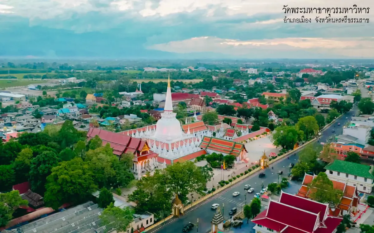
22. Wat Phra Mahathat Woramahawihan, Nakhon Si Thammarat Province, is one of Southern Thailand's most significant Buddhist temples and historic religious landmarks. Located on Ratchadamnoen Road in Nai Mueang Subdistrict, Mueang Nakhon Si Thammarat District, this royal temple is renowned for its Phra Borommathat Chedi, an important center of Buddhist devotion. The temple reflects the historical development of Buddhism on the southern peninsula and preserves cultural traditions that have been maintained by local communities for generations.
Highlights: Phra Borommathat Chedi, Wihan Phra Mahaphinetsakrom or Wihan Phra Song Ma, Wihan Khian, Wihan Luang, important Buddhist images and the traditional Hae Pha Khuen That ceremony.
Phra Borommathat Chedi is the temple's most significant architectural and religious feature. Its bell-shaped form reflects Buddhist architectural traditions associated with Sri Lankan influences and the development of southern Thai religious art. The chedi is revered by Buddhists from Nakhon Si Thammarat and neighboring provinces. Visitors can appreciate its striking architecture and experience the atmosphere of devotion that continues to define the temple.
The history of Wat Phra Mahathat Woramahawihan is closely connected with the historical importance of Nakhon Si Thammarat. The city developed as a major center on the southern peninsula, with links to maritime trade, religious exchange and cultural connections across the Gulf of Thailand and Indian Ocean. The temple therefore has significance beyond its role as a place of worship: it is an important source of knowledge about the region's history, artistic traditions and religious beliefs.
Several religious buildings within the temple complex feature distinctive architectural details and Buddhist artwork. Visitors can observe decorative elements, sculptures and artistic craftsmanship in the areas open to the public. The different structures reveal aspects of the temple's development over time and its longstanding role in religious ceremonies, education and the cultural life of the surrounding community.
One of the temple's most important traditions is the Hae Pha Khuen That ceremony, during which Buddhist devotees bring long lengths of ceremonial cloth, including Phra Bot cloth, as offerings to wrap around the sacred chedi. The ritual expresses respect for the Buddha's relics and represents a powerful continuation of Buddhist faith. It is also an important community tradition, bringing together worshippers from Nakhon Si Thammarat and other regions.
Travelers interested in history and culture can combine a visit to Wat Phra Mahathat Woramahawihan with museums, historic attractions, local markets and traditional restaurants in Nakhon Si Thammarat. Exploring these places helps explain the relationship between the temple, the city and everyday community life. Visitors should dress modestly, remove their shoes where required and avoid disturbing people taking part in religious activities.
Open Days: Daily Opening Hours: 08:00–16:30.
Getting There: Wat Phra Mahathat Woramahawihan is situated on Ratchadamnoen Road in central Nakhon Si Thammarat. It is accessible by private car, taxi and local transport. Travelers arriving at Nakhon Si Thammarat Airport can take a transfer into the city and continue toward the temple along Ratchadamnoen Road.
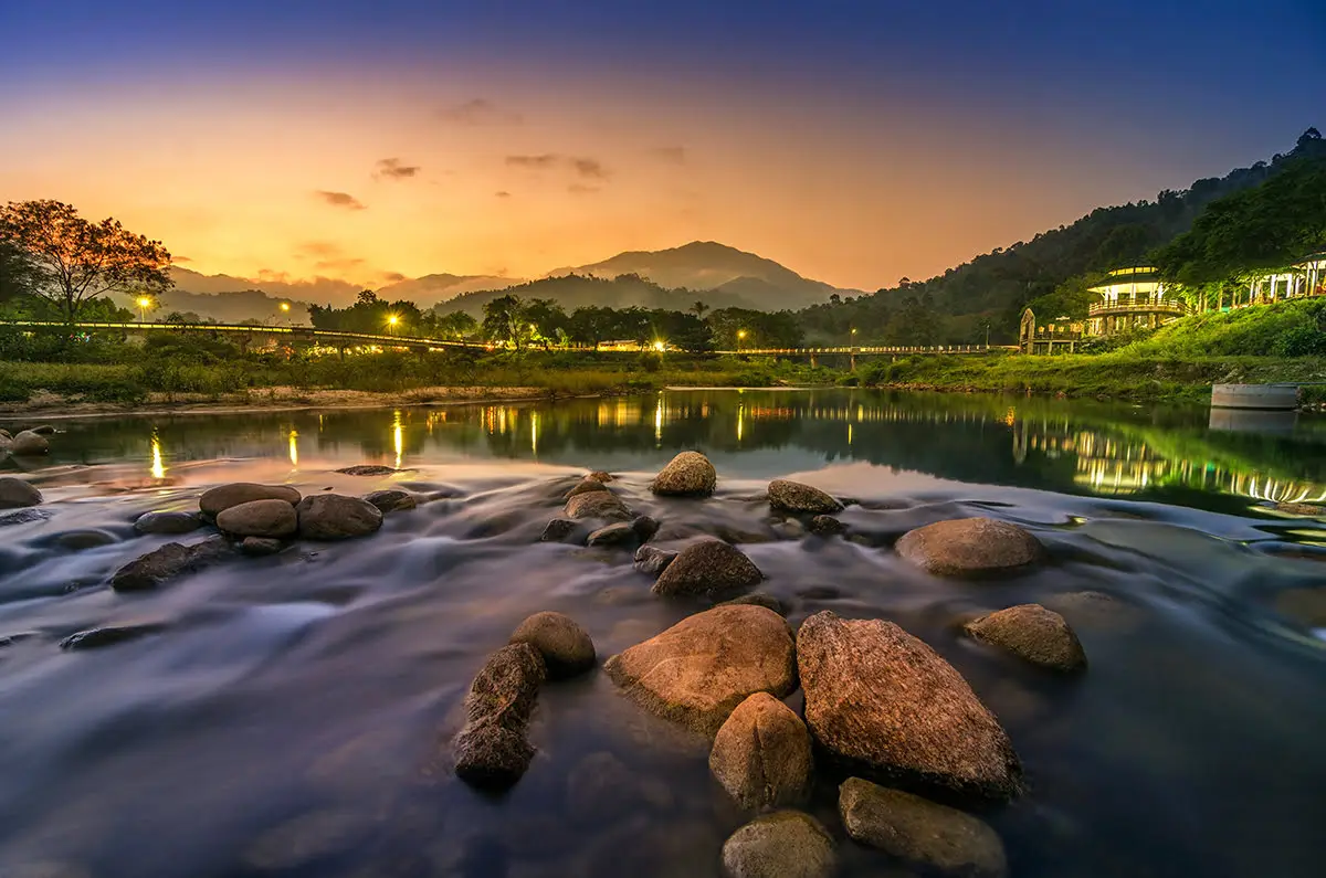
23. Ban Khiriwong, Nakhon Si Thammarat Province, is a well-known community-based tourism destination in Kam Lon Subdistrict, Lan Saka District. Surrounded by mountains and tropical forests near the Khao Luang range, the village is celebrated for its scenic landscapes, flowing streams, fruit orchards and traditional community life. Visitors come to Ban Khiriwong to relax in a peaceful environment, learn about local handicrafts and experience how villagers maintain close relationships with their natural surroundings.
Highlights: Ban Khiriwong Bridge, village streams, mountain scenery, fruit orchards, community homestays, naturally dyed textiles, local handicrafts and cultural learning activities.
Ban Khiriwong lies in a valley surrounded by mountains, with streams flowing through the community. The surrounding forests and orchards create a green landscape that is especially attractive to visitors seeking a peaceful rural atmosphere. One of the best-known photography locations is the bridge overlooking the stream, with mountains forming a scenic backdrop. Early mornings are particularly pleasant for walking around the village, although visitors must be cautious near waterways during periods of heavy rainfall.
Fruit cultivation is an important part of Khiriwong's community economy and cultural identity. Mangosteen, rambutan, durian and other tropical fruits are grown in local orchards according to their natural seasons. Agricultural knowledge, orchard management and the processing of local products have been passed down and adapted to support community-based tourism. Visitors can learn how farming contributes to the local way of life while enjoying the surrounding natural scenery.
Traditional handicrafts are another distinctive aspect of Ban Khiriwong, particularly naturally dyed textiles and handmade products created using local materials. Learning about these crafts reveals the knowledge and careful work involved in preparing materials, extracting natural colors and producing patterns on fabric. Travelers interested in local craftsmanship can purchase products directly from community producers, supporting small businesses and the preservation of traditional skills.
Community homestays offer an opportunity to experience village life more closely. Activities depend on the services and availability of each host, but may include walks through the village, local meals, relaxing by the stream and participation in arranged cultural workshops. Staying overnight is especially suitable for travelers who prefer meaningful local experiences rather than rushing between several destinations in a single day.
Ban Khiriwong is ideal for families, couples, handicraft enthusiasts and nature lovers. Visitors with only half a day can explore the village and its main attractions, while a one- or two-night stay provides more time to appreciate community life. Excursions into the surrounding mountains should be planned according to weather conditions, and experienced guides should be used for activities that require them.
Open Days: Daily Best Time to Visit: Daytime for village walks and sightseeing. Homestays and organized community learning activities should be booked in advance.
Getting There: From Nakhon Si Thammarat city, travel toward Lan Saka District and continue to Kam Lon Subdistrict following the route to Ban Khiriwong. Private vehicles and hired cars are convenient options. The approach includes winding roads, so drivers should take particular care during wet weather.
Map (GPS):View Ban Khiriwong on Google Maps
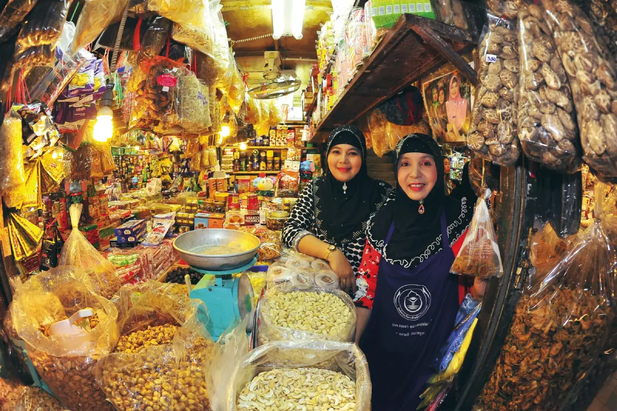
24. Kim Yong Market, Songkhla Province, is one of Hat Yai's most famous traditional markets and commercial landmarks. Located in the heart of Hat Yai's busy shopping district, the market is renowned for its variety of dried foods, fruits, snacks, souvenirs, household goods and merchandise associated with regional trade. For travelers visiting Hat Yai, Kim Yong Market is an excellent destination for discovering local products and experiencing the lively atmosphere of a long-established trading center.
Highlights: Traditional shopping streets, dried foods, snacks, seasonal fruits, local souvenirs, historic shops and the energetic commercial atmosphere of central Hat Yai.
Kim Yong Market has long served as a trading area connecting merchants and customers from Southern Thailand and neighboring regions, including visitors from Malaysia. The market and surrounding streets contain numerous shops selling different categories of goods, allowing travelers to explore a variety of products within a compact area. Shopping activity begins early in the day, particularly around food vendors and stalls selling popular souvenirs.
Common products include dried fruits, nuts, traditional snacks, processed foods, beverages and other locally popular goods. Hat Yai's importance as a commercial center explains the variety of products sold here. Visitors can compare prices, ask about product origins and check packaging or expiration dates before purchasing food to take home.
The market also reflects Hat Yai's cultural diversity. Thai-Chinese communities, merchants and residents from different backgrounds have contributed to the city's growth over many generations. This heritage is visible in certain shop types, foods and everyday customs. Exploring the market therefore provides insight into the relationship between commerce, cuisine and the cultural identity of the city.
Travelers who enjoy street photography can observe the atmosphere of shops and surrounding streets while respecting vendors' and customers' privacy. A visit of approximately one or two hours is generally sufficient for browsing the principal shopping areas. Kim Yong Market can also be combined with other Hat Yai attractions, including Wat Hat Yai Nai, Hat Yai Municipal Park and the city's many local restaurants.
Kim Yong Market is suitable for travelers interested in shopping, local food and traditional markets. Comfortable footwear is recommended because exploring the surrounding shopping streets involves walking. Drivers should also plan parking arrangements carefully, as the central commercial district can experience traffic congestion during busy periods.
Open Days: Daily Opening Hours: 06:30–18:30. Individual shops may operate on different schedules.
Getting There: Kim Yong Market is situated in central Hat Yai, near Supasarnrangsan Road and Niphat Uthit Road. It can be reached by car, taxi or on foot from nearby accommodation. Travelers arriving by train can take local transport or a taxi from Hat Yai Railway Station.
Map (GPS):View Kim Yong Market on Google Maps
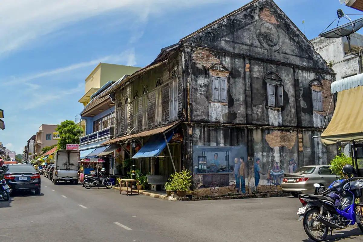
25. Songkhla Old Town, Songkhla Province, is an important historic and cultural district in Mueang Songkhla District. Its principal streets include Nakhon Nok Road, Nakhon Nai Road and Nang Ngam Road, where old shophouses, traditional businesses, religious buildings and community landmarks preserve traces of the city's long history as a maritime trading center. The neighborhood reflects the architectural and cultural influences of different ethnic and religious communities whose lives have been connected with Songkhla Lake and the surrounding coastal region.
Highlights: Nakhon Nok Road, Nakhon Nai Road, Nang Ngam Road, historic buildings, old shops, Chinese shrines, temples, street art, traditional cuisine and neighborhood life near Songkhla Lake.
Songkhla's historical development is closely connected with maritime trade and the exchange of goods between communities around Songkhla Lake and other regions. These activities encouraged people of different backgrounds to settle in the city, including Thai-Chinese and Muslim communities. Their cultural influences remain visible in architectural styles, religious sites, food traditions and the arrangement of buildings throughout the old town. Unlike a preserved historical monument, Songkhla Old Town remains an active neighborhood where residents continue to live and work.
Nakhon Nok Road and Nakhon Nai Road are important routes for exploring the district's historic architecture. Along these streets, visitors can see old houses and commercial buildings whose styles reflect Chinese cultural influences and the history of local trade. Some structures retain much of their traditional appearance, while others have been adapted into restaurants, cafés, accommodation or creative spaces. Walking through the neighborhood reveals how historic urban architecture can continue to function within a modern city.
Nang Ngam Road is particularly appealing for travelers interested in local food and traditional shops. Its restaurants, sweets and snacks reflect the combination of Thai, Chinese and regional southern influences. Sampling dishes along this historic street is also a way to explore the city's cultural heritage through everyday cuisine. Each establishment contributes to the character of the neighborhood through its own food, customers and history.
Street art adds another dimension to Songkhla Old Town. Murals and painted walls often depict everyday activities, local occupations and memories associated with the city. Travelers can combine an architectural walking tour with photography at different mural locations. However, it is important to remember that the historic district is a residential community. Visitors should avoid blocking private entrances or disturbing local residents while taking photographs.
Songkhla Old Town is recommended for visitors interested in history, architecture, local cuisine and cultural photography. It can be combined with the Songkhla National Museum, Khao Tang Kuan and other attractions in the city. Allowing at least half a day provides enough time to appreciate the streets, food and atmosphere without rushing from one landmark to another.
Open Days: Daily Best Time to Visit: 08:00–20:00 for exploring the historic district. Individual shops, restaurants and museums have their own operating hours.
Getting There: Songkhla Old Town is located in Bo Yang Subdistrict, Mueang Songkhla District. Visitors can travel by car or taxi to the areas around Nakhon Nok Road, Nakhon Nai Road and Nang Ngam Road. From Hat Yai, follow the main road toward Songkhla city, then park in an authorized area and continue exploring the historic neighborhood on foot.
Map (GPS):View Songkhla Old Town on Google Maps
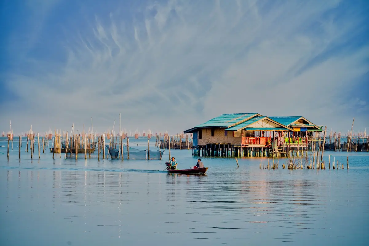
26. Ko Yo, Songkhla Province, is a large island in the southern part of Songkhla Lake, located in Ko Yo Subdistrict, Mueang Songkhla District. The island is known for its peaceful lakeside scenery, traditional communities, handicrafts and regional cuisine. Connected to the mainland by the Tinsulanonda Bridge, Ko Yo can be reached easily by car and is a convenient destination for travelers exploring Songkhla city and the wider lake area.
Highlights: Tinsulanonda Bridge, Songkhla Lake views, Ko Yo handwoven textiles, Wat Laem Pho, lakeside communities, seafood restaurants and tropical fruit orchards.
Songkhla Lake is an extensive and ecologically distinctive water system that supports communities across several provinces of Southern Thailand. Ko Yo lies in its southern section and features low hills, settlements and cultivated land. Visitors can admire views of the lake, bridges and surrounding shoreline from different points on the island. Unlike islands in the open Andaman Sea, Ko Yo is characterized by the combination of a lake environment, working communities and traditional agriculture.
Ko Yo handwoven fabric is one of Songkhla's most distinctive traditional products. It is known for its woven patterns and craftsmanship, techniques that have been passed down within local communities. Learning about the production process offers insight into the relationship between traditional handicrafts and household income. Visitors can explore local textile products and purchase items directly from producers, helping support the continuation of community knowledge and skills.
Wat Laem Pho is an important Buddhist temple on Ko Yo and a place where visitors can pay their respects while enjoying the atmosphere beside Songkhla Lake. Roads around the island also connect restaurants, viewpoints and community attractions, making Ko Yo suitable for a relaxed driving excursion. The island's distinctive setting allows visitors to experience religious heritage, community life and lakeside scenery within a relatively compact area.
The island's cuisine is closely connected with the resources of Songkhla Lake. Local restaurants serve a variety of dishes prepared with fish and ingredients associated with the surrounding waters. Dining beside the lake offers an enjoyable opportunity to appreciate views of the water and Tinsulanonda Bridge. Agricultural products and local specialties further reflect the relationship between farming, fishing and community livelihoods.
Ko Yo is suitable for families, couples, older travelers and anyone interested in a relaxed cultural excursion. It can be combined with Songkhla Old Town, Khao Tang Kuan and other lakeside attractions. Exploring the island by car is particularly convenient, although travelers should allow sufficient time for stops at temples, viewpoints, restaurants and traditional craft producers.
Open Days: Daily Opening Hours: The island is accessible 24 hours a day; temples, restaurants, shops and cultural attractions follow their own schedules.
Getting There: Drive from Songkhla city via Tinsulanonda Bridge, which connects Ko Yo with the surrounding mainland. Private cars and hired vehicles are convenient for visiting locations around the island, as attractions are spread across several areas.
Map (GPS):View Ko Yo on Google Maps
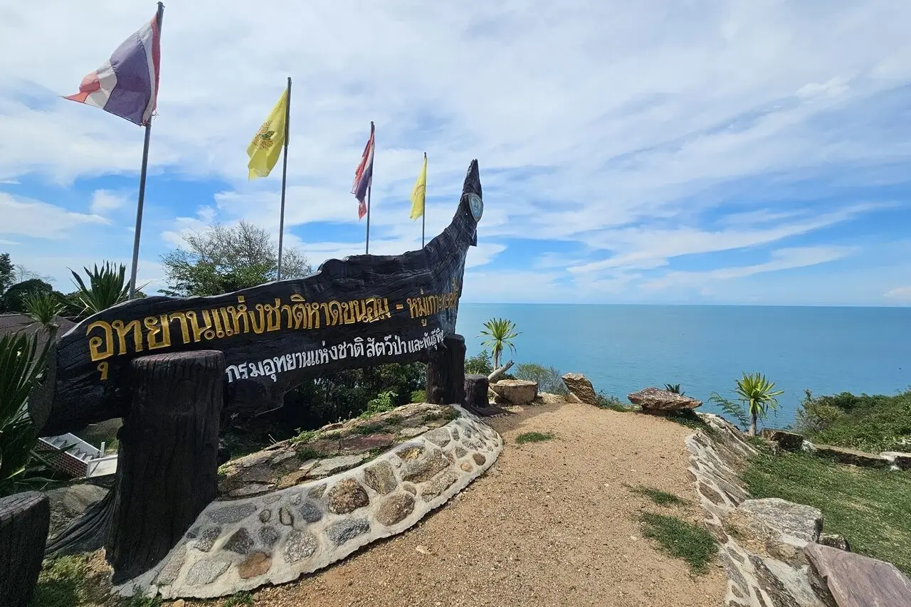
27. Hat Khanom–Mu Ko Thale Tai National Park, Nakhon Si Thammarat Province, is an important coastal and marine conservation landscape associated with Khanom District and nearby areas. The Khanom coastline is known for its beaches, coastal mountains, bays and marine ecosystems in the Gulf of Thailand. The area offers travelers an opportunity to experience a different coastal environment from the Andaman Sea while learning about the natural resources and fishing communities of the southern Gulf coast.
Highlights: Khanom beaches, Gulf of Thailand scenery, coastal mountains, nature boat excursions, the habitat of pink dolphins and coastal attractions around Khanom District.
The Khanom coastline features numerous beaches and bays with different natural characteristics. Some areas provide broad sandy stretches suitable for relaxation, while others have hills or cliffs close to the shore, creating attractive coastal scenery. Visitors can enjoy beach walks, photography and the atmosphere of local seaside communities. Before swimming or undertaking water activities, travelers should assess current waves and weather conditions.
One of the area's most famous natural attractions is the opportunity to observe pink dolphins in coastal waters. These marine mammals are an important part of the local ecosystem and have become closely associated with responsible nature-based tourism in Khanom. Travelers interested in dolphin watching should select operators who maintain appropriate viewing distances, avoid chasing the animals and do not feed or disturb them. Dolphins are wild animals, so sightings cannot be guaranteed on every excursion.
Fishing communities along the coastline have traditionally depended on marine resources for their livelihoods. Tourism contributes to local income through boat services, accommodation, restaurants and community products. However, maintaining the balance between economic activities and conservation is essential. Healthy coastal habitats and good water quality support both local communities and the long-term appeal of the destination.
Khanom is a convenient stopping point for travelers moving between Nakhon Si Thammarat and Surat Thani. The area can be explored through coastal beaches, viewpoints and natural attractions around the district. Because the coastline extends over several locations, visitors should identify their intended beaches or boat departure points before traveling rather than assuming that all attractions are located within a short walking distance.
Hat Khanom–Mu Ko Thale Tai National Park is suitable for families, couples, wildlife enthusiasts and photographers seeking a peaceful coastal holiday. Visitors planning to enter protected areas or take boat excursions should confirm official access rules and select operators with appropriate safety standards. Marine activities may be restricted during periods of strong winds or hazardous sea conditions.
Open Days: Daily, according to conservation area announcements Opening Hours: 08:30–16:30 for designated visitor areas. Marine activities depend on local operators and weather conditions.
Getting There: Travel by road from Nakhon Si Thammarat or Surat Thani toward Khanom District using the main highways connecting the Gulf of Thailand coast. Continue to the chosen beach or tourism service point by private car or hired vehicle. Travelers planning a boat excursion should confirm the exact departure pier beforehand.
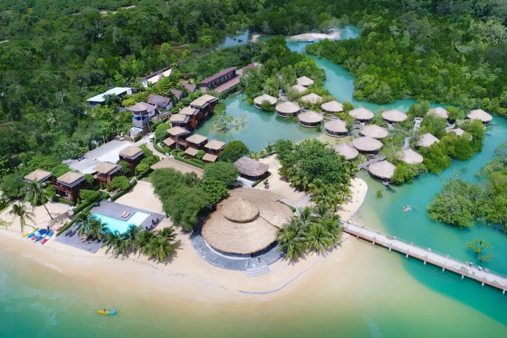
28. Koh Phayam, Ranong Province, is an island destination in the Andaman Sea known for its quiet atmosphere, natural beaches, forests and traditional agricultural communities. Located in Ko Phayam Subdistrict, Mueang Ranong District, it offers an appealing alternative for travelers who prefer an island holiday away from highly developed tourist centers. Koh Phayam is characterized by broad sandy beaches, cashew nut orchards and a relatively relaxed way of life closely connected with the island's environment.
Highlights: Aow Yai, Aow Khao Kwai, natural beaches, mangrove forests, cashew nut orchards, Wat Ko Phayam, peaceful seaside accommodation and sunset viewpoints along the Andaman coast.
Aow Yai is one of Koh Phayam's principal beaches, known for its long and broad sandy shoreline. The area offers accommodation and restaurants while retaining a more natural atmosphere than major island resorts elsewhere in Thailand. Aow Khao Kwai is another popular coastal area, characterized by its curved bay and attractive evening scenery. Travelers can select a beach according to the type of surroundings they prefer, from open coastal views to quieter locations for relaxation.
Koh Phayam has forests, beaches and agricultural land, including cashew nut orchards that form an important part of the island's local economy. Cashew cultivation is closely connected with community life, and locally produced cashew nuts are among the island's recognizable products. Exploring the island offers opportunities to see both traditional agricultural activities and the coastal landscapes that attract visitors.
The island is particularly suitable for slow travel. Visitors can relax on the beach, read, explore walking routes or spend time in small restaurants and cafés. Life on Koh Phayam has a different pace from that of major tourist cities. Accommodation should be selected carefully with consideration for beach location, transport and available services, because facilities in some areas remain relatively limited.
Travelers interested in local culture can learn about community life through Wat Ko Phayam, village shops and the island's relationship with fishing and agriculture. Respectful visits to local neighborhoods offer a deeper understanding of Koh Phayam beyond its scenic beaches. Supporting locally operated businesses also helps distribute tourism income within the island community.
Koh Phayam is ideal for couples, independent travelers, nature lovers and visitors seeking a peaceful holiday. A stay of at least two days and one night is recommended, allowing time to explore several beaches without rushing. Because access requires a boat journey, travelers should prioritize periods of relatively calm seas and confirm transport arrangements, especially during the monsoon season.
Open Days: Daily, depending on boat services and marine conditions Best Time to Visit: Generally November to April, when the Andaman Sea is often more suitable for island excursions.
Getting There: Travel to Ranong town and continue to the departure pier for Koh Phayam. Take a scheduled passenger boat according to the services available. On the island, travelers can use local transport or arrange transfers with their accommodation. Confirm the return boat schedule before traveling.
Map (GPS):View Koh Phayam on Google Maps
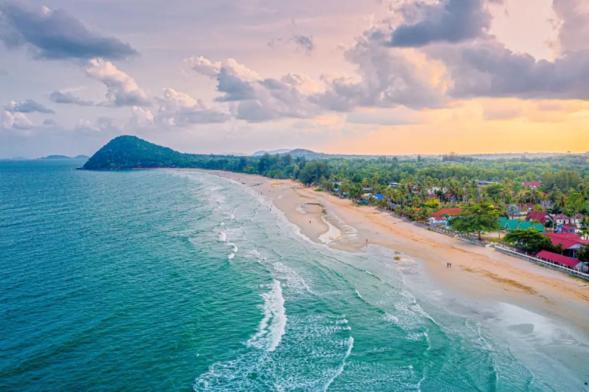
29. Thung Wua Laen Beach, Chumphon Province, is one of the province's most popular beaches, located in Saphli Subdistrict, Pathio District. Known for its long stretch of white sand and open views across the Gulf of Thailand, the beach offers a pleasant setting for seaside relaxation. Restaurants, accommodation and tourism services are available near the shoreline, making it a convenient destination for visitors exploring Chumphon or traveling through Southern Thailand.
Highlights: Long white sandy beach, Gulf of Thailand views, morning coastal scenery, seaside walks, seafood restaurants, beachfront accommodation and connections to other marine attractions of Chumphon Province.
Thung Wua Laen Beach has a broad, continuous shoreline suitable for long walks beside the sea. The surrounding atmosphere is relaxed, with coastal views and open space contributing to its appeal. Since the beach faces the Gulf of Thailand, early morning sunlight provides attractive conditions for appreciating the scenery and taking landscape photographs. Visitors seeking a quieter experience may prefer to arrive before the main tourism areas become busy.
Restaurants and different types of accommodation are available around the beach, allowing travelers to remain in the area throughout the day. Visitors can enjoy local seafood, spend time on the sand or stay overnight before continuing to other destinations. Having restaurants and accommodation close to the coastline makes the beach suitable for families and travelers who prefer a holiday without frequent journeys between attractions.
Although the surroundings are peaceful, swimming conditions vary according to weather, tides and seasonal winds. Strong waves can occur during certain periods, particularly when monsoon conditions affect the Gulf coast. Visitors should check current safety information before entering the water and supervise children carefully near the shoreline.
Thung Wua Laen Beach can also form part of a wider marine itinerary in Chumphon Province. Travelers interested in snorkeling or diving can investigate authorized boat excursions to offshore islands and reef areas, subject to available services and sea conditions. Spending separate days on beach relaxation and marine excursions can make the experience more enjoyable and reduce unnecessary travel pressure.
The beach is suitable for families, couples, landscape photographers and travelers looking for a comfortable seaside stop. A half-day visit is sufficient for a walk and a meal overlooking the sea, while an overnight stay gives visitors more time to enjoy the morning atmosphere and explore other attractions around Chumphon.
Open Days: Daily Opening Hours: The public beach is generally accessible 24 hours a day. Best Time to Visit: Morning and late afternoon for beach relaxation.
Getting There: Thung Wua Laen Beach is located in Saphli Subdistrict, Pathio District. It can be reached by road from Chumphon town using the main route toward the coast. Travelers may use a private car or hired vehicle. Those arriving by train can arrange onward road transport from a suitable nearby station.
Map (GPS):View Thung Wua Laen Beach on Google Maps
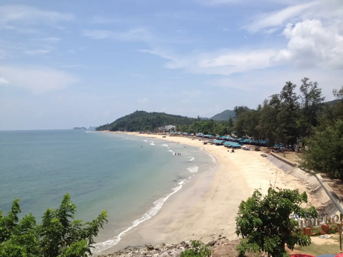
30. Hat Sai Ri Beach, Chumphon Province, is a coastal attraction with both natural beauty and historical significance, located in Hat Sai Ri Subdistrict, Mueang Chumphon District. The beach offers views across the Gulf of Thailand, with surrounding hills and coastal scenery. It is also closely associated with the shrine of Admiral Prince Abhakara Kiartivongse, Prince of Chumphon, an important historical figure honored as the Father of the Royal Thai Navy. These cultural and historical connections give Hat Sai Ri a distinctive identity beyond that of an ordinary seaside destination.
Highlights: Hat Sai Ri Beach, the Prince of Chumphon Shrine, the HTMS Chumphon memorial area, Gulf of Thailand scenery, coastal viewpoints and historical attractions associated with the Royal Thai Navy.
Hat Sai Ri is a coastal landscape where visitors can enjoy views of the Gulf of Thailand and the surrounding hills. Travelers can walk along the shoreline, relax beside the sea and visit the nearby memorial area. Unlike beach destinations focused mainly on swimming and entertainment, Hat Sai Ri attracts many visitors who wish to pay their respects to the Prince of Chumphon and learn about an important chapter in Thailand's naval history.
Admiral Prince Abhakara Kiartivongse, Prince of Chumphon, played a significant role in the development of the modern Royal Thai Navy. He is widely respected by naval personnel and members of the public. Hat Sai Ri is closely associated with his memory, and the shrine and related historical attractions provide places where visitors can express respect and learn about his contributions to Thailand's maritime heritage.
The HTMS Chumphon memorial area offers another opportunity to explore naval history and the importance of the Prince of Chumphon. Visitors should observe the appropriate etiquette at memorial and religious sites, particularly in areas where people gather to pay their respects. Learning about the commemorative significance of these locations can enrich a visit beyond simply enjoying the beach scenery.
Hat Sai Ri can be combined with other attractions in Mueang Chumphon District, including coastal viewpoints and nearby natural areas. Travelers interested in photography may enjoy the shoreline during the morning or late afternoon, while history enthusiasts can spend additional time exploring memorial structures and information associated with the Prince of Chumphon.
Hat Sai Ri is suitable for families, older travelers, history enthusiasts and visitors who wish to visit the Prince of Chumphon Shrine. Half a day is generally enough to explore the beach and principal memorial locations, although the area can also form part of a wider day trip around Chumphon. Respectful clothing and behavior are recommended when visiting the shrine and other commemorative sites.
Open Days: Daily Opening Hours: The public beach can generally be visited throughout the day, while the main memorial area is open from 06:30 to 20:00.
Getting There: Hat Sai Ri Beach lies in Mueang Chumphon District and can be reached from Chumphon town by private car or taxi using the main road toward the coast. Follow signs for Hat Sai Ri and the Prince of Chumphon Shrine. Visitors should use designated parking areas and follow the permitted routes around the memorial complex.
Map (GPS):View Hat Sai Ri Beach on Google Maps
31. Thale Noi Non-Hunting Area, Phatthalung Province, is an internationally significant wetland conservation area situated around Thale Noi in Khuan Khanun District. It forms part of the wider Songkhla Lake wetland ecosystem and is particularly well known for its extensive freshwater landscapes, aquatic vegetation, seasonal lotus blooms and abundant birdlife. The surrounding communities have maintained a close relationship with these natural resources for generations. Visitors can enjoy remarkable wetland scenery, observe wildlife and learn about the importance of protecting freshwater ecosystems.
Highlights: Lotus-covered wetlands, waterbird watching, guided boat excursions, water buffalo, Thale Noi's freshwater ecosystem, scenic lakeside routes and traditional Krajood sedge handicrafts.
Thale Noi is a shallow freshwater wetland rather than a coastal sea. Its natural environment includes broad areas of open water, aquatic plants and seasonal lotus flowers. During certain periods, lotus blooms spread across large sections of the wetland, creating especially beautiful scenery in the morning when the flowers open in the gentle sunlight. The combination of floating vegetation, reflective water and distant landscapes makes Thale Noi one of Phatthalung's most recognizable destinations for nature photography.
The wetlands provide feeding and breeding habitats for numerous species of waterbirds, including resident and migratory birds. A guided boat excursion offers opportunities to observe these animals in their natural environment. Visitors should maintain a respectful distance and avoid disturbing bird colonies. Birdwatching also reveals the ecological relationships between aquatic plants, wetland habitats and the food sources that support wildlife populations.
Water buffalo are another characteristic sight around Thale Noi. In certain areas, herds can be seen grazing in wetlands and shallow water, creating a distinctive landscape closely associated with Phatthalung. These animals are part of the surrounding agricultural environment and should be observed from a safe distance. Visitors should not approach them too closely or attempt to interfere with their activities.
Thale Noi also has strong cultural connections with nearby communities, particularly through the traditional use of Krajood, a sedge plant found in wetland environments. Local artisans weave this material into mats, bags and household products. Learning about Krajood handicrafts illustrates how natural resources can support community livelihoods and provides an opportunity to appreciate the region's traditional knowledge.
Boat trips are especially popular among photographers, birdwatchers and visitors interested in seeing the wetlands at close range. Early morning excursions are often preferred for observing lotus flowers and wildlife, as the temperatures are relatively comfortable and the natural light is suitable for photography. Travelers should prepare sun protection, drinking water and suitable camera equipment, and choose boat operators who provide life jackets and experienced local boat drivers.
Thale Noi Non-Hunting Area is suitable for families, wildlife enthusiasts, nature photographers and travelers interested in conservation. It can be combined with local craft communities and other attractions around Khuan Khanun District. Visitors should remember that lotus blooms and wildlife sightings vary according to the season and natural conditions rather than occurring identically throughout the year.
Open Days: Daily Opening Hours: 08:30–16:30 Best Time to Visit: Early morning for boat trips to observe lotus flowers and waterbirds, subject to available boat services.
Getting There: Travel from Phatthalung town toward Khuan Khanun District and continue along the roads leading to Thale Noi. Private cars and hired vehicles can reach the visitor and boat service areas. Travelers hoping to take an early morning excursion should arrange their boat trip with a local operator in advance.
32. Khao Ok Thalu, Phatthalung Province, is a famous limestone mountain and one of the province's most recognizable natural landmarks. Situated in Mueang Phatthalung District, the mountain is distinguished by a large natural opening that passes through its limestone formation, allowing the sky to be seen through the rock from certain viewpoints. This remarkable feature developed through long-term natural weathering and erosion, becoming an enduring symbol of Phatthalung's geography, history and local identity.
Highlights: The natural opening through the limestone mountain, its distinctive rock formation, views of Phatthalung town, mountain scenery and walking routes around the foothills.
Khao Ok Thalu rises prominently near the urban area of Phatthalung. Its most distinctive characteristic is the large opening in the limestone wall, clearly visible from certain directions. This unusual shape makes the mountain stand out in the surrounding landscape and has led to its use as an important symbol of the province. Visitors can appreciate the formation from viewpoints around the base, where the mountain's silhouette is particularly recognizable.
From a geological perspective, Khao Ok Thalu demonstrates the natural processes that shape limestone landscapes. Over long periods, weathering and the dissolution of limestone can produce cavities, caves and openings within rock formations. Such geological features occur in several areas of Southern Thailand, but Khao Ok Thalu is especially striking because its opening can be observed from a considerable distance.
The mountain has long been associated with the identity and memories of Phatthalung's communities. It frequently appears in local imagery and descriptions of the province. Visiting Khao Ok Thalu therefore offers an opportunity to understand a geographical landmark that contributes to the character of the city. Travelers interested in local heritage can combine the visit with other cultural and historical attractions around central Phatthalung.
Visitors who enjoy outdoor activities can explore accessible areas around the foothills using designated routes. Those considering a climb toward elevated viewpoints should carefully assess their physical condition, the steepness of the trail and current weather conditions. Limestone surfaces and mountain steps can become slippery, especially after rainfall, so appropriate footwear and caution are essential.
Khao Ok Thalu is recommended for nature enthusiasts, geology lovers, photographers and travelers wishing to see one of Phatthalung's defining landmarks. It can be included in a day exploring the provincial town before continuing to Thale Noi or communities around Songkhla Lake. For photography, an open viewpoint and suitable sunlight help reveal the distinctive shape of the mountain and its natural opening.
Open Days: The mountain can be viewed from surrounding public areas daily Best Time to Visit: Morning or late afternoon for scenery and photography. Mountain climbing should only be undertaken when the trail and weather conditions are safe.
Getting There: Khao Ok Thalu is located close to central Phatthalung and can be reached by car or taxi. Travelers planning to use a mountain walking route should confirm the designated entrance and current trail conditions before starting.
Map (GPS):View Khao Ok Thalu on Google Maps
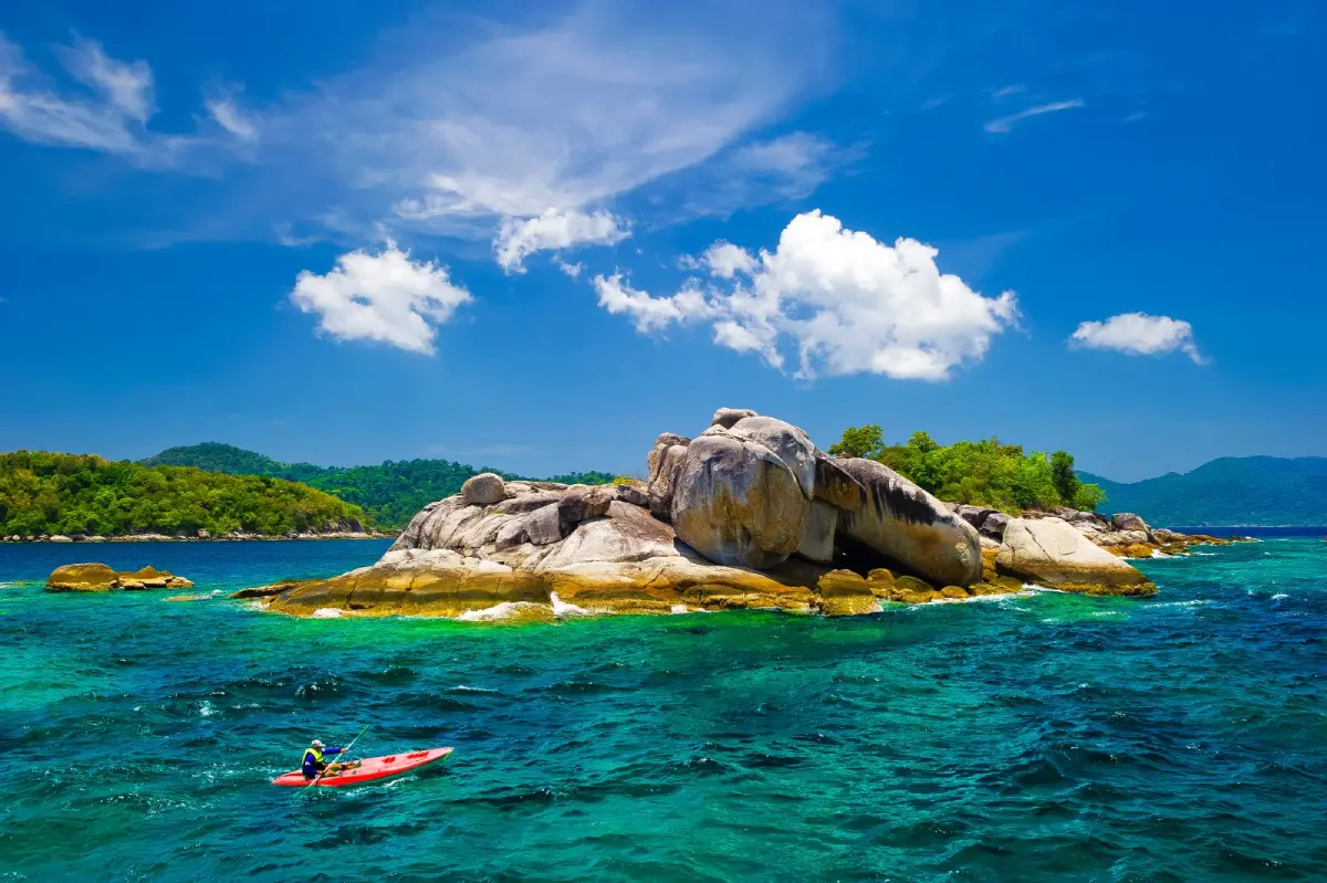
33. Tarutao National Park, Satun Province, is an important marine national park in the southern Andaman Sea, protecting numerous islands and surrounding marine environments. Koh Tarutao is one of its principal islands, featuring tropical forests, mountains, beaches, bays and historical sites. The park is remarkable not only for its beautiful coastal scenery but also for the island's role in Thailand's history and the conservation of its natural ecosystems.
Highlights: Koh Tarutao, Ao Phante Malaka, Ao Son, Ao Talo Wao, natural beaches, mangrove forests, nature trails and historical sites associated with the island's former prison settlements.
Koh Tarutao has a diverse landscape combining mountains, forests, sandy beaches and sheltered bays. Some coastal areas feature long stretches of sand, while others are surrounded by forest extending close to the water. These natural landscapes create an atmosphere very different from heavily developed tourist islands. Visitors can appreciate the island's peaceful environment and admire the Andaman Sea from designated areas open to the public.
Ao Phante Malaka is an important visitor area on Koh Tarutao and is associated with the park's tourism services. Ao Son is known for its beach and natural surroundings, offering opportunities for relaxation when the area is open to visitors. Travelers may walk along designated beaches, explore nature trails or participate in permitted activities according to the season. All visitors should respect conservation regulations and avoid disturbing wildlife.
Historically, Koh Tarutao was used as a place of detention for prisoners, giving the island a distinctive historical background. The stories associated with its former prison settlements reveal aspects of life, transportation and the administration of a remote island during an earlier period. Exploring this history helps visitors understand Tarutao's transformation from a place associated with imprisonment into a national park dedicated to nature conservation and education.
Tarutao National Park is valuable for both terrestrial and marine ecosystems. Forests provide habitats for many species of plants and animals, while the surrounding coastline includes environments associated with coral reefs, seagrass and other marine life. Responsible tourism is essential to protecting these habitats. Visitors must follow park regulations on waste disposal, camping and access to sensitive conservation zones.
The park is suitable for travelers who enjoy nature, hiking, history and peaceful beaches. Visitors wishing to explore several parts of Koh Tarutao should allow sufficient time and investigate the available transport arrangements, as some locations are far from the principal visitor area. Overnight stays must follow national park regulations and booking procedures during the official tourism season.
Open Days: Seasonally, according to national park announcements Opening Hours: Visitor services generally operate from 08:30 to 16:30 during the open season. Access depends on the park's regulations and boat services.
Getting There: Travel to Pak Bara Pier in La-ngu District, Satun Province, and continue by an authorized boat service toward Koh Tarutao when available. Confirm the current boat route, park opening dates and any overnight accommodation arrangements before departure.
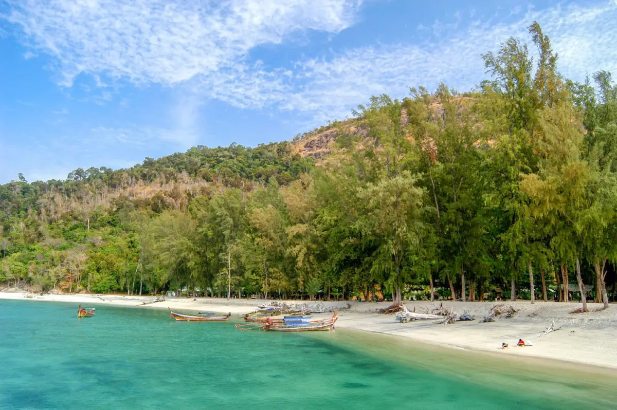
34. Mu Ko Adang–Rawi, Satun Province, is a group of tropical islands in the southern Andaman Sea, located within Ko Sarai Subdistrict, Mueang Satun District, and protected as part of Tarutao National Park. The islands are celebrated for white sandy beaches, clear seawater, forest-covered landscapes and snorkeling sites rich in coral reefs and marine life. Their proximity to Koh Lipe makes them a particularly appealing choice for nature-based marine excursions during periods of calm seas.
Highlights: Koh Adang, Koh Rawi, white sandy beaches, coral reefs, snorkeling, natural forest landscapes and viewpoints overlooking nearby islands.
Koh Adang is distinguished by its forest-covered hills and impressive views of the surrounding sea. Certain elevated viewpoints provide panoramic scenery, including views toward Koh Lipe. Exploring the island's natural features offers an opportunity to appreciate the contrast between tropical rainforest and the Andaman coast. Visitors should use designated routes and consider the physical demands of walking uphill, particularly in hot or wet weather.
Koh Rawi and nearby islands are associated with clear waters, attractive beaches and marine environments that appeal to snorkelers and nature lovers. The character of each beach varies according to the surrounding terrain and sea conditions. Some areas are suitable for relaxed coastal visits, while snorkeling and other water activities should be undertaken only at authorized sites and when conditions are safe.
Coral reefs surrounding the island group are ecologically important and support numerous marine organisms. Travelers should avoid touching or standing on coral, collecting shells or other natural resources, and feeding fish. Snorkeling with suitable equipment and maintaining a safe distance from marine wildlife are important practices for preserving these fragile environments.
The Adang–Rawi Islands can be visited through boat excursions arranged from Koh Lipe, subject to park regulations and local operating conditions. As the island group includes protected marine environments, access to individual bays, beaches and snorkeling locations can change according to conservation requirements, seasonal closures and weather.
These islands are particularly attractive to travelers seeking experiences beyond the main beaches of Koh Lipe. A separate day excursion allows time to enjoy the scenery, take photographs, swim or snorkel in designated areas and learn about the surrounding marine ecosystem. Families with children should carefully consider boat conditions and the suitability of each activity.
Open Days: According to national park seasonal announcements and sea conditions Best Time to Visit: Generally November to April for Andaman Sea activities.
Getting There: Travel to Koh Lipe from Pak Bara Pier, then arrange a permitted boat excursion to the Adang–Rawi island group. The precise route and destinations depend on national park regulations, weather and the boat operator's itinerary.
Map (GPS):View Mu Ko Adang–Rawi on Google Maps
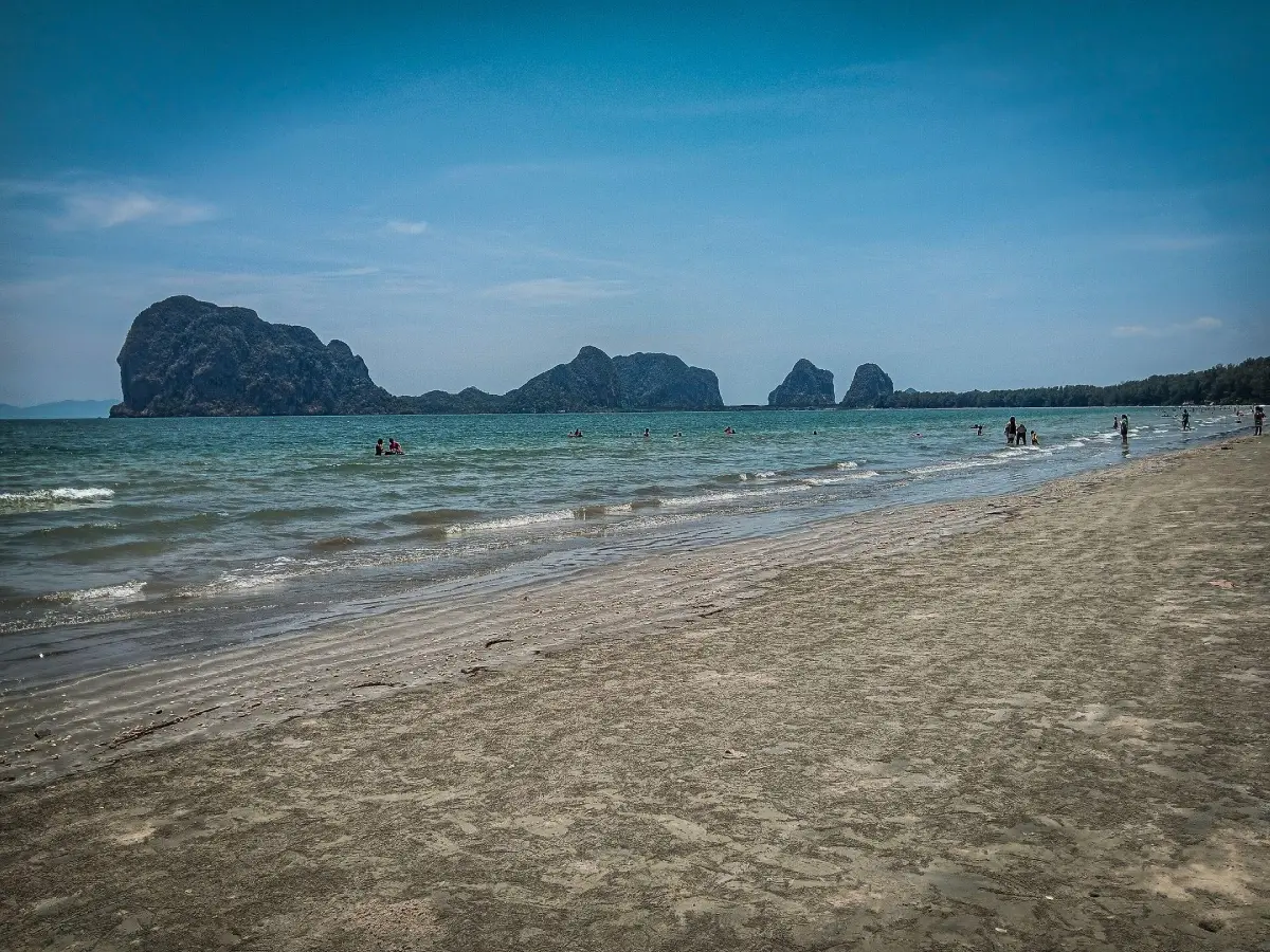
35. Pak Meng Beach, Trang Province, is a well-known coastal attraction in Mai Fat Subdistrict, Sikao District, on the Andaman Sea. Its distinctive features include a long sandy shoreline and unusual limestone island formations visible offshore. Pak Meng is both a popular place for relaxing by the sea and an important gateway for trips to the islands of Trang, including Koh Mook, Koh Kradan and other marine destinations accessible during the tourism season.
Highlights: Pak Meng Beach, views of offshore limestone islands, sunset scenery, coastal restaurants, seafood dining and convenient access to boat excursions around Trang's islands.
Pak Meng Beach is characterized by an extensive coastal landscape with sand, sea views and prominent offshore rock formations. The scenery changes throughout the day as sunlight moves across the water and nearby islands. Visitors can walk along the beachfront, relax and take photographs of the distinctive coastal geography of Trang Province.
One of Pak Meng's important roles is as a coastal tourism center connected with boat excursions to Trang's offshore islands. Travelers planning to visit Koh Mook, Koh Kradan or other nearby marine attractions may use services departing from the Pak Meng area or other designated local piers. Boat departure points and routes vary depending on operators and weather conditions, so arrangements should be confirmed before traveling.
The beach area also has seafood restaurants and facilities serving local residents and tourists. Dining beside the coast offers an opportunity to enjoy southern Thai cuisine while admiring the natural scenery. The combination of accessible roads, restaurants and nearby boat services makes Pak Meng a convenient base for visitors who want to explore Trang's mainland coast as well as its islands.
For photography enthusiasts, the offshore limestone formations provide a distinctive backdrop. Changing light during the late afternoon can create particularly attractive views across the water. Visitors should choose safe viewing areas along the coast and consider the tides and weather, especially when exploring the shoreline.
Pak Meng Beach is suitable for families, couples, casual sightseeing and travelers planning island excursions. A short visit can be combined with a meal or a coastal drive, while those hoping to explore Trang's islands should dedicate additional time to boat journeys and activities at the destinations.
Open Days: Daily Best Time to Visit: Morning or late afternoon for beach scenery. Boat services depend on operating schedules, the tourism season and sea conditions.
Getting There: Travel from Trang town toward Sikao District and continue to Mai Fat Subdistrict and Pak Meng Beach. The area is accessible by private car or hired vehicle. Travelers joining marine excursions should confirm the exact departure pier with their boat operator.
Map (GPS):View Pak Meng Beach on Google Maps
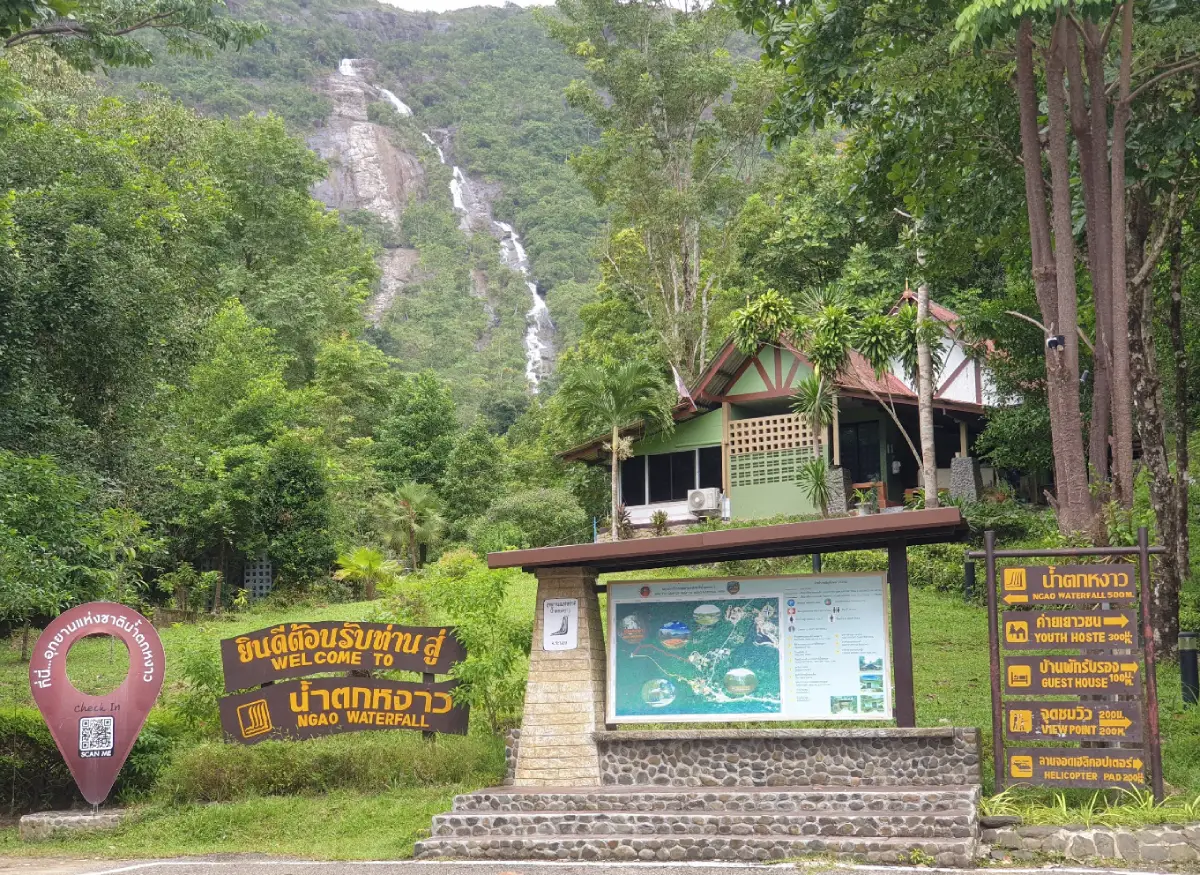
36. Namtok Ngao National Park, Ranong Province, is a natural attraction best known for Ngao Waterfall, a dramatic cascade descending from a high mountain cliff surrounded by tropical rainforest. Situated near Ranong town, the waterfall can be seen from certain nearby areas. The national park's distinctive environment includes mountainous terrain, humid evergreen forest, streams and important watershed ecosystems influenced by Ranong's exceptionally wet climate.
Highlights: Ngao Waterfall, forested mountain scenery, tropical rainforest, nature walking routes, streams and natural habitats.
Ngao Waterfall is particularly striking because of the height of its falling water and its setting against the forest-covered mountain. The visible flow varies with rainfall and seasonal conditions, making the appearance of the waterfall different at various times of the year. Visitors can appreciate the surrounding scenery and learn about the importance of forested mountains in maintaining natural water systems.
The national park protects ecosystems typical of Ranong's humid tropical environment. Dense vegetation, mountain slopes and flowing streams provide habitats for a range of plants and animals. Nature observation offers opportunities to understand how forests contribute to watershed protection, soil conservation and environmental stability.
Walking through designated areas allows travelers to experience the rainforest atmosphere and observe the surrounding landscape. Trails may be affected by heavy rainfall, and wet ground can become slippery. Visitors should wear suitable footwear and avoid entering restricted areas or approaching fast-flowing streams during unsafe weather conditions.
Namtok Ngao National Park is suitable for nature lovers, photographers and travelers who want to explore Ranong beyond its coastal islands. Because the park is located relatively close to Ranong town, it can be included in a wider itinerary exploring the province's natural attractions and local communities.
Visitors should remember that the waterfall is part of a protected natural environment. Staying on marked trails, avoiding litter and respecting wildlife help preserve the area. Activities should be adapted to prevailing weather and park announcements, particularly during periods of intense rainfall.
Open Days: Daily in authorized visitor areas Opening Hours: Subject to the national park's current visitor schedule and any temporary restrictions caused by weather.
Getting There: Travel from Ranong town by car or taxi toward Namtok Ngao National Park using the designated park access road. Check the park entrance, current trail conditions and weather before beginning nature activities.
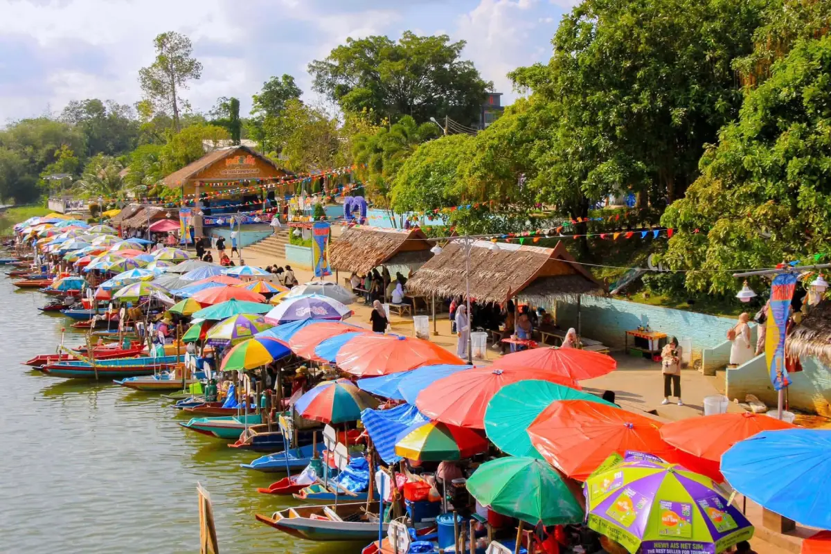
37. Khlong Hae Floating Market, Songkhla Province, is a popular destination for local food and cultural tourism in Hat Yai District. Located near the waterfront at Wat Khlong Hae in Khlong Hae Subdistrict, the market combines a traditional waterside trading atmosphere with southern Thai cuisine, local snacks and community products. Visitors can explore food stalls, sample regional dishes and enjoy a canal-side setting that offers a different experience from Hat Yai's shopping centers and urban markets.
Highlights: Waterside food vendors, traditional local dishes, southern Thai desserts, community products, canal scenery and Hat Yai's lively weekend market atmosphere.
Khlong Hae Floating Market is distinguished by its trading environment near the canal, where vendors offer food and products in a setting inspired by Thailand's traditional water-based commerce. The market's atmosphere makes it particularly appealing to travelers interested in local culinary culture and informal community experiences.
Food is one of the market's main attractions. Visitors may encounter a variety of local dishes, snacks, traditional sweets and drinks. The range of products reflects Southern Thailand's diverse food culture, including influences from Thai, Chinese and Malay traditions. Sampling different dishes is a convenient way to experience regional flavors in one location.
The market also provides opportunities for local entrepreneurs to sell products directly to visitors. Small businesses, traditional food vendors and community producers contribute to the lively atmosphere. Supporting these vendors can help sustain local livelihoods and encourage the continuation of regional culinary traditions.
Travelers who enjoy photography can capture the colorful market environment, traditional food preparation and canal scenery while respecting vendors and other visitors. The market is particularly suitable for an afternoon or evening excursion, especially when combined with sightseeing or shopping elsewhere in Hat Yai.
Because Khlong Hae Floating Market typically operates on selected days rather than throughout the week, travelers should plan their visit carefully. Market schedules and vendor availability may change during holidays or special events, so confirming the current opening arrangements is recommended.
Open Days: Generally Friday, Saturday and Sunday Opening Hours: According to the current weekend market schedule; confirm operating times before visiting.
Getting There: Travel from central Hat Yai toward Khlong Hae Subdistrict and the Wat Khlong Hae waterfront area by car, taxi or local transport. Allow additional travel time during busy weekend periods.
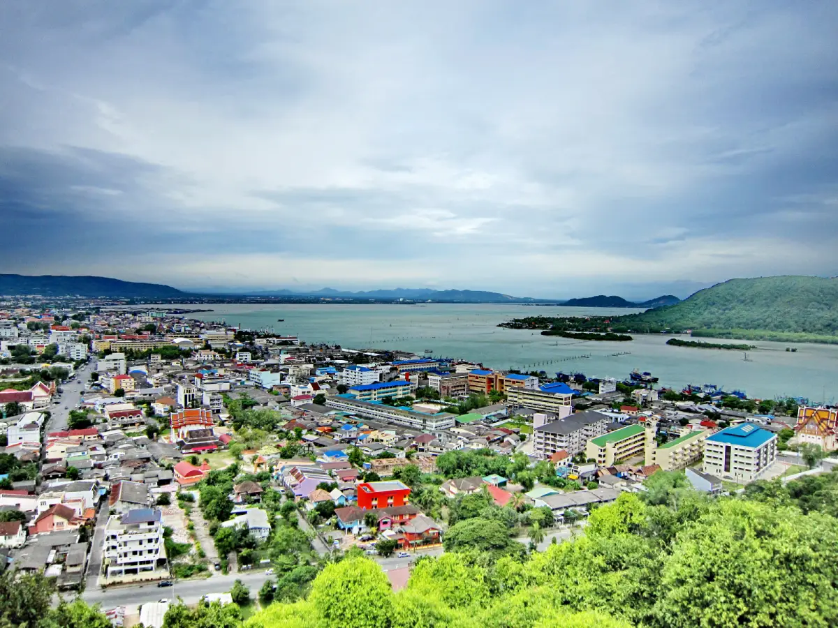
38. Khao Tang Kuan, Songkhla Province, is a prominent hill and scenic viewpoint in Mueang Songkhla District. From its summit, visitors can admire elevated views of Songkhla city, Songkhla Lake and the Gulf of Thailand coastline. A significant Buddhist chedi and areas for sightseeing are located near the top, combining natural beauty, local history and religious heritage in one destination.
Highlights: Panoramic views of Songkhla city, Songkhla Lake and the Gulf of Thailand, the hilltop Buddhist chedi, cultural heritage and elevated photography viewpoints.
Khao Tang Kuan offers one of the most recognizable viewpoints in Songkhla. Its elevated location allows visitors to observe the relationship between the city's built environment, surrounding waterways and coastal geography. On clear days, the wide views provide an excellent opportunity for understanding the landscape of this historic southern port city.
The Buddhist chedi near the summit reflects the religious significance of Khao Tang Kuan. The hill has long been associated with the spiritual and cultural life of Songkhla's communities. Visitors can appreciate the religious architecture while enjoying the surrounding scenery, although respectful behavior is important around areas used for worship.
The hill is also a popular photography location because it provides different perspectives of Songkhla Lake, the town and the distant shoreline. Morning and late-afternoon light can create attractive conditions for landscape photography. Visitors should remain within designated viewpoints and exercise care around elevated edges and steps.
Khao Tang Kuan can be included in a cultural sightseeing route combining Songkhla Old Town, coastal attractions and other historic locations in Mueang Songkhla District. This allows visitors to appreciate both the urban heritage of the city and its geographical setting from above.
Travelers should check the current arrangements for reaching the summit, as transport facilities and visitor routes may operate on specific schedules. Families and older visitors should consider the accessibility of the available route before planning their visit.
Open Days: According to the visitor access schedule Best Time to Visit: Morning or late afternoon for panoramic scenery; check current summit access arrangements before departure.
Getting There: Khao Tang Kuan is located in Songkhla city and is accessible from central urban areas by car or taxi. Continue to the designated visitor entrance and follow the permitted route or available transport service toward the summit.
Map (GPS):View Khao Tang Kuan on Google Maps
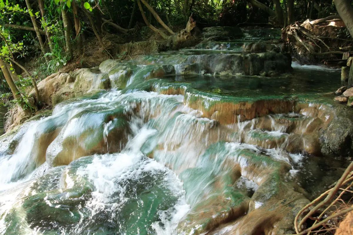
39. Khlong Thom Hot Springs (Namtok Ron), Krabi Province, is a distinctive natural attraction where warm water flows through rocky pools and small waterfall formations in a forest setting. Located in Khlong Thom District, the site differs from ordinary waterfalls because the water is naturally heated. Travelers can explore the surrounding tropical environment and appreciate the unusual appearance of the warm-water pools in designated visitor areas.
Highlights: Natural warm-water cascades, smooth rock pools, tropical forest scenery, geothermal water and a relaxing inland nature experience.
Khlong Thom Hot Springs are notable for the naturally warm water that flows through a series of rock formations. The pools and channels create a distinctive waterfall-like setting. Visitors can observe the water and geological features while enjoying the surrounding forest atmosphere. Water temperatures may vary between locations, so any bathing should take place only where it is explicitly permitted and safe.
The hot springs are part of a natural environment in which underground water and geological processes influence the temperature of water reaching the surface. This makes the site interesting not only for relaxation but also for travelers who enjoy learning about natural landscapes and the processes that shape them.
Forest vegetation surrounds the pools and walking areas, creating a shaded atmosphere that contrasts with Krabi's beaches and islands. Travelers can take photographs and observe the natural setting while remaining on designated paths. Wet rocks may be slippery, and caution is needed when approaching flowing water.
The hot springs are often included in an inland sightseeing itinerary with Emerald Pool, another popular attraction in Khlong Thom District. Combining both destinations is a practical option for travelers staying in Krabi Town or Ao Nang, although sufficient time should be reserved for road travel and walking between visitor areas.
Khlong Thom Hot Springs are suitable for nature lovers, couples and travelers seeking a relaxing break from coastal activities. Visitors with health conditions that may be affected by heat should seek appropriate medical advice before bathing in hot water. Children should remain under close supervision, and no one should enter pools or channels that are not approved for bathing.
Open Days: According to the site's visitor arrangements Opening Hours: Check the current visitor schedule and permitted bathing areas before traveling.
Getting There: Travel from Krabi Town or Ao Nang toward Khlong Thom District, then follow the road signs to the hot springs visitor area. The journey is most convenient by private car, hired vehicle or organized inland excursion.
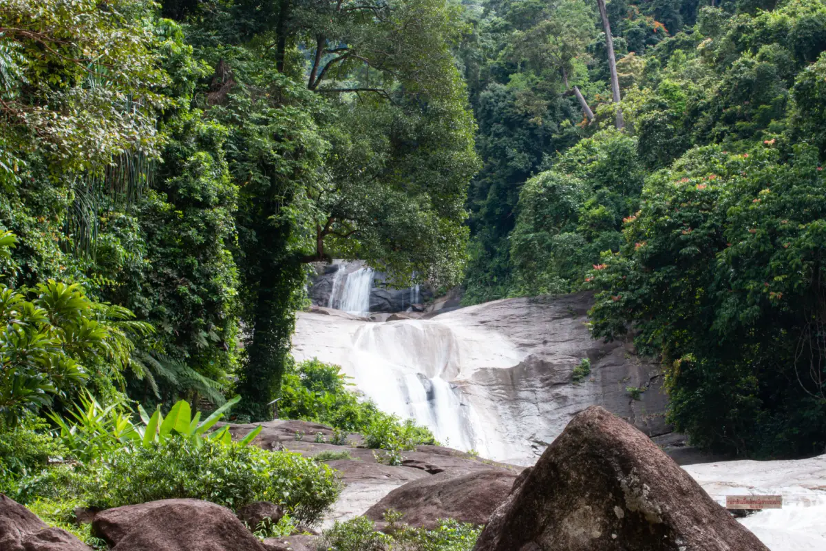
40. Khao Luang National Park, Nakhon Si Thammarat Province, is a major mountain forest conservation area that plays an important role in Southern Thailand's natural ecosystems. The park protects high mountain terrain and extensive forests associated with the Khao Luang range. It is known for its tropical rainforests, remarkable biodiversity, waterfalls and nature trails that allow visitors to learn about mountain ecosystems and the importance of forested watersheds.
Highlights: Khao Luang mountain landscapes, tropical rainforest, waterfalls, forest walking trails, native plants and wildlife, and important watershed ecosystems.
Khao Luang National Park includes mountainous landscapes with forested slopes, valleys and streams. The terrain provides a wide range of environmental conditions that support different plant communities and wildlife habitats. The mountain forests are important sources of water for surrounding areas and contribute to the ecological stability of the region.
One of the park's defining features is its rich tropical vegetation. Rainforest habitats support a complex network of trees, smaller plants, insects, birds and other wildlife. Exploring designated visitor areas provides opportunities to observe the natural diversity of Southern Thailand while learning why the protection of mountain forests is essential for biodiversity conservation.
Waterfalls and streams are important parts of the Khao Luang landscape. Their appearance and water flow vary according to rainfall and seasonal conditions. Visitors should follow authorized trails and park guidance, especially when approaching streams or steep terrain. Heavy rain may create slippery paths and increase the risk of sudden changes in water levels.
The national park is particularly appealing to travelers interested in forests, mountains, photography and environmental education. Nature walks allow visitors to experience the atmosphere of a southern rainforest, although routes differ in length, difficulty and accessibility. More demanding routes should only be attempted with appropriate preparation and guides where required.
Khao Luang National Park can form part of a wider nature-based itinerary in Nakhon Si Thammarat, including communities near the mountain range such as Ban Khiriwong. Travelers should select their intended visitor area carefully because the park covers extensive terrain and different attractions may have separate access routes. Weather forecasts and official park announcements should be checked before any mountain or forest excursion.
Open Days: In designated areas according to national park announcements Opening Hours: Follow the current visitor schedule; access to certain trails and waterfalls may be restricted during periods of heavy rain.
Getting There: Travel from Nakhon Si Thammarat toward the designated entrance or visitor area of Khao Luang National Park. Access roads vary depending on the waterfall or forest trail selected. A private vehicle or hired transport is recommended, and more demanding activities may require local guides.
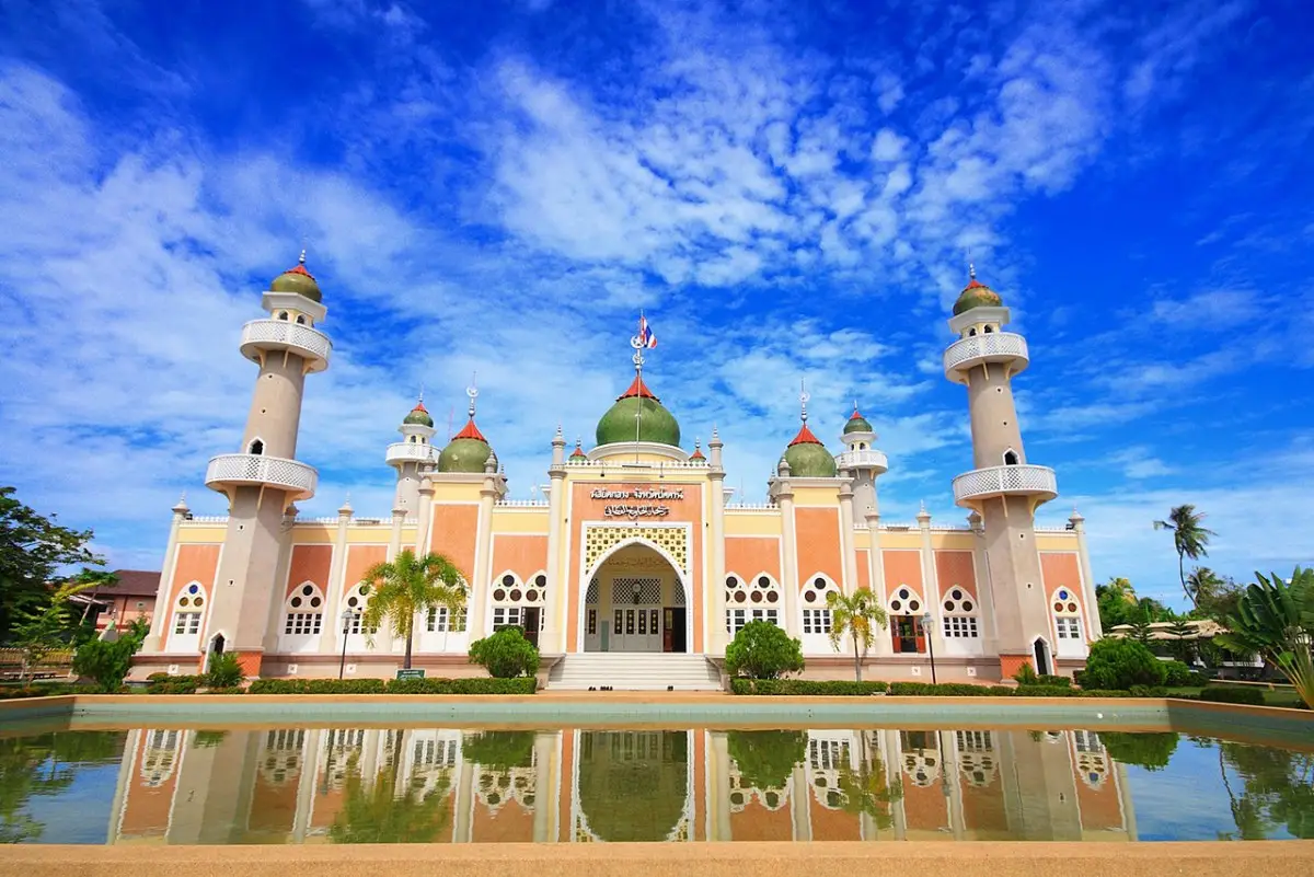
41. Pattani Central Mosque, Pattani Province, is one of Southern Thailand's most important Islamic religious landmarks and an outstanding example of mosque architecture. Located on Yarang Road in Anoru Subdistrict, Mueang Pattani District, the mosque features impressive domes, minarets and decorative elements reflecting the significance of Islam in the daily lives of local communities. A large reflecting pool in front of the building enhances its architectural beauty and creates a distinctive visual composition that has become one of Pattani's most recognizable landmarks.
Highlights: The central dome, minarets, reflecting pool, Islamic architectural details, symmetrical building design and the mosque's importance to Pattani's Muslim community.
Pattani Central Mosque is distinguished by its large dome and minarets, which are characteristic elements of Islamic religious architecture. The structure combines a prominent central section with carefully balanced architectural features on either side. From the area surrounding the reflecting pool, visitors can admire the building mirrored on the water's surface. This impressive view makes the mosque particularly attractive to travelers interested in architectural photography and cultural heritage.
The mosque's importance extends far beyond its physical appearance. It serves as an important place of worship and religious activity for the local Muslim community. Daily prayers, religious education and community gatherings are central aspects of its continuing role. Visitors should therefore remember that the mosque is an active religious institution rather than simply a sightseeing attraction, and respect the people using the building for worship.
Pattani has a long history closely connected with Malay Muslim society and culture. Religious buildings have played an important role in shaping the region's identity, and Pattani Central Mosque offers a valuable opportunity to understand the relationship between religion, architecture and community life. Observing the exterior design and surrounding grounds provides an accessible introduction to this cultural heritage without interfering with religious activities taking place inside.
Photography enthusiasts can appreciate the mosque from the reflecting pool and open areas in front of the building. However, photographing worshippers during prayers without permission should be avoided, and visitors must not enter restricted sections. Modest, respectful clothing is essential, especially for those permitted to visit interior areas. Any additional requirements concerning dress or access should be followed carefully.
Pattani Central Mosque is recommended for travelers interested in architecture, religion, history and local culture. It can be included in an itinerary with Krue Se Mosque and other historical attractions around Mueang Pattani District. Visiting both mosques offers an opportunity to compare different periods of Islamic architecture and better understand the cultural development of Pattani's communities.
Open Days: Daily Visiting Hours: Generally 08:00–17:00, subject to the mosque's regulations. Visitors should avoid disturbing scheduled prayers and religious activities.
Getting There: Pattani Central Mosque is located on Yarang Road in Mueang Pattani District. It is accessible by private car or taxi from central Pattani. Visitors should use designated parking areas and observe all rules governing access to the religious complex.
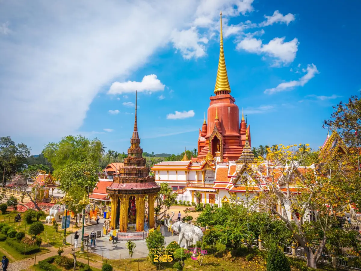
42. Wat Chang Hai Rat Buranaram, Pattani Province, is an important Buddhist temple in Khok Pho District, particularly famous for its association with Luang Pu Thuat, a highly revered monk widely remembered in Thai Buddhist tradition. The temple serves as a place of worship, a center of local religious heritage and a major destination for Buddhist pilgrims visiting Pattani. Its distinctive cultural significance comes from the longstanding connection between stories of Luang Pu Thuat and the devotion of generations of worshippers.
Highlights: The memorial stupa associated with Luang Pu Thuat, sacred images of the revered monk, Buddhist halls and religious architecture, local devotional traditions and pilgrimage activities throughout the year.
Luang Pu Thuat occupies an important place in the religious beliefs and cultural traditions of Southern Thailand. Stories about his life and miracles, including the well-known legend associated with transforming seawater into fresh water, have been passed down through Thai Buddhist tradition. His name is closely connected with Wat Chang Hai, making the temple an important pilgrimage destination for devotees who wish to pay their respects and reflect on the virtues associated with the revered monk.
The temple complex contains several important religious buildings and worship areas, especially those associated with Luang Pu Thuat. Visitors can admire Buddhist architecture, pay respects to sacred images and learn about the monk's legacy through the religious features of the temple. Spending time in the peaceful surroundings provides a deeper appreciation of Wat Chang Hai as a living place of faith rather than merely a photography destination.
Wat Chang Hai also plays an important role in the religious life of the surrounding community. On Buddhist holy days and during special temple celebrations, large numbers of devotees visit to make merit and pay their respects. These activities demonstrate the continuity of Buddhist traditions and the close relationship between the temple and communities in Pattani and nearby provinces.
The temple is particularly meaningful within the culturally diverse environment of Thailand's southern border region, where communities with different religious traditions have long lived alongside one another. A visit offers insight into Buddhist heritage in the lower South and illustrates how places of worship contribute to the preservation of community beliefs and identities.
Visitors should dress modestly, remain quiet in worship areas and follow temple regulations. Additional travel time may be needed during major Buddhist festivals or other periods when the temple receives large numbers of pilgrims. Wat Chang Hai can also be included in a cultural itinerary featuring other significant religious and historical attractions of Pattani Province.
Open Days: Daily Opening Hours: 08:00–17:00.
Getting There: Wat Chang Hai is located in Khok Pho District, Pattani Province. It can be reached by car from Pattani town or Hat Yai using the main roads leading toward Khok Pho District, followed by local roads to the temple. Travelers visiting during major religious events should allow additional time for traffic and parking.
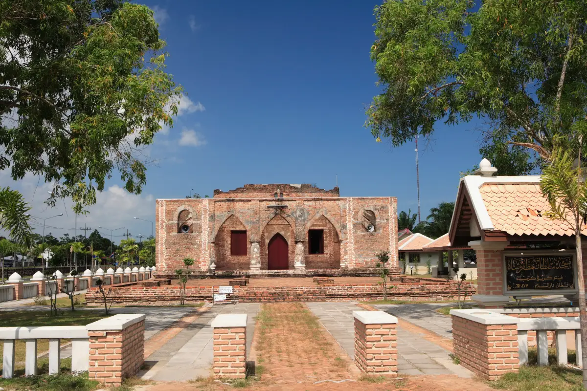
43. Krue Se Mosque, Pattani Province, is a historic mosque of considerable architectural and cultural significance. Located in the Ban Krue Se area of Tanyong Lulo Subdistrict, Mueang Pattani District, it is particularly recognizable for its old brick structure and architectural details associated with Pattani's historical development. The mosque is important both as a religious landmark and as a place for understanding the history of Malay Muslim communities in Southern Thailand.
Highlights: Historic brick architecture, distinctive entrances and brick walls, Islamic architectural influences, the history of Pattani and the mosque's cultural significance.
Krue Se Mosque is distinguished by its exposed brickwork, which reveals construction styles associated with an earlier period. Its architectural features include openings, entrances and structural details reflecting building traditions of the region. The mosque contrasts with the comparatively modern architecture of Pattani Central Mosque, making it possible for visitors to observe different expressions of Islamic religious architecture within the same province.
The history of Krue Se Mosque is closely connected with Pattani's development as an important trading and cultural center on the Malay Peninsula. Maritime trade brought the region into contact with people from different parts of Asia, encouraging exchanges of artistic styles, religious traditions and construction techniques. Historic religious buildings such as Krue Se Mosque provide tangible evidence of these connections and help explain the importance of Islam in the region's cultural development.
The mosque's surviving architectural features make it an interesting destination for visitors studying historic buildings. The brickwork, openings and structural forms offer insight into earlier construction methods and religious architecture. At the same time, Krue Se Mosque remains a place with deep significance for the surrounding community and carries historical and emotional associations that deserve respectful consideration.
Travelers interested in history can combine Krue Se Mosque with Pattani Central Mosque and other cultural attractions in Mueang Pattani District. Visiting these locations together provides an opportunity to compare architectural development over time and gain a broader understanding of Pattani's Islamic heritage, maritime history and community identity.
Krue Se Mosque is suitable for travelers interested in history, architecture, religion and heritage photography. Visitors should dress appropriately, respect religious activities and follow the instructions of site caretakers. Permission should be requested before photographing worshippers or interior areas where religious activities are taking place.
Open Days: Daily Visiting Hours: Generally 08:00–17:00, subject to the regulations of the site caretakers and religious activities.
Getting There: Krue Se Mosque is located in Tanyong Lulo Subdistrict, Mueang Pattani District. Travelers can reach the Ban Krue Se area by car or taxi from Pattani town, following the main road toward the mosque. Confirm available parking and visitor access arrangements before departure.
Map (GPS):View Krue Se Mosque on Google Maps
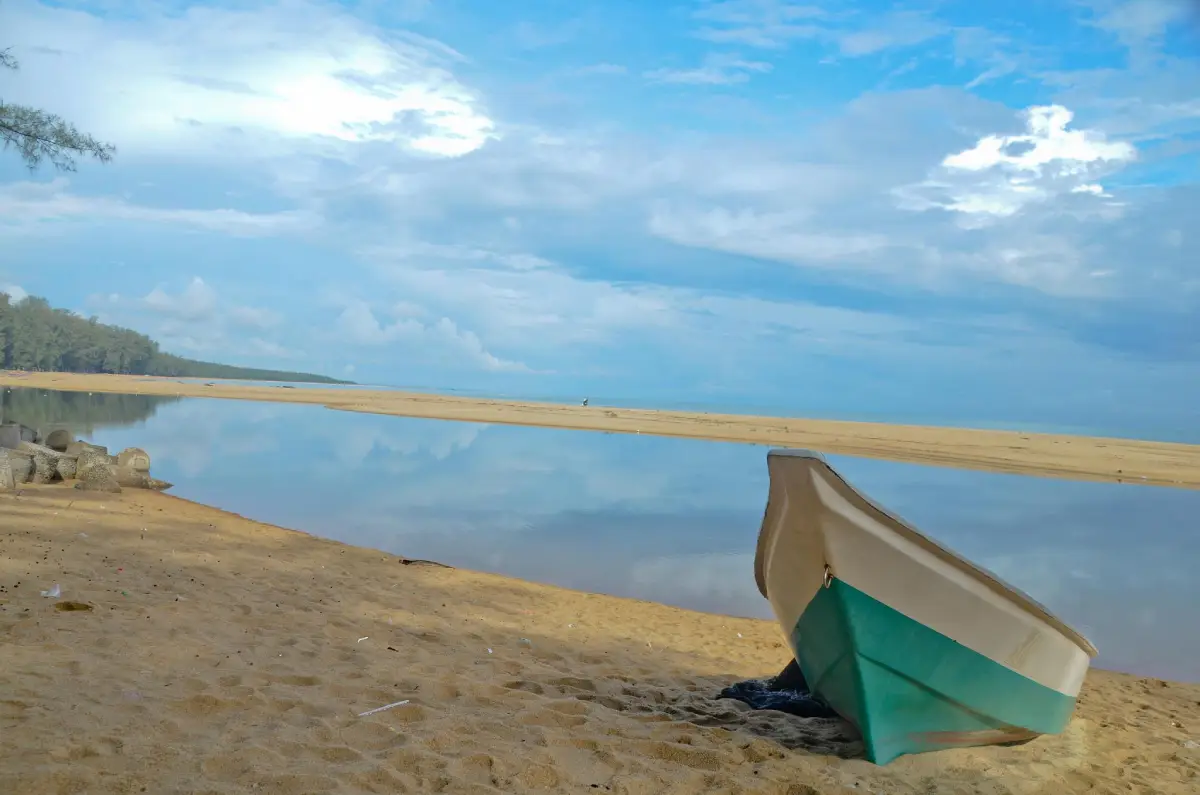
44. Ao Manao Forest Park, Narathiwat Province, is a coastal nature destination on the Gulf of Thailand, located in Kaluwo Nuea Subdistrict, Mueang Narathiwat District. The park is known for its beaches, natural vegetation and peaceful seaside scenery. Coastal trees, nearby hills and the open shoreline create an attractive landscape for travelers who want to relax away from busy tourist centers and explore the coastal environment of Thailand's lower southern region.
Highlights: Ao Manao Beach, Gulf of Thailand views, coastal trees, natural landscapes, scenic viewpoints and a quiet atmosphere suitable for seaside relaxation and photography.
Ao Manao is characterized by a coastal landscape surrounded by natural vegetation. Its beach and shaded areas provide pleasant surroundings for relaxation. Visitors can walk along the shoreline, enjoy the sea breeze and photograph views across the Gulf of Thailand. Early morning and late afternoon are particularly suitable for spending time outdoors, while any activities near the water should take account of prevailing waves and weather.
The lower Gulf coast supports natural environments associated with beach vegetation and coastal forests. Protecting these habitats helps maintain ecological balance and provides shelter for different species of wildlife. A visit to Ao Manao Forest Park offers opportunities to observe coastal landforms and understand the importance of natural areas in preserving the region's environment.
The forest park is also valued as a recreational area by residents of Narathiwat and visitors from other provinces. Its atmosphere differs from that of more heavily developed seaside destinations, making it suitable for those who prefer quiet surroundings and time spent close to nature. An unhurried walk allows travelers to appreciate the details of the coastal landscape and the distinctive character of this part of Southern Thailand.
Responsible tourism is particularly important in natural areas. Visitors should avoid littering, collecting plants or animals and disturbing wildlife. Designated visitor routes should be followed, especially in sections where access is restricted or where environmental conditions may create safety concerns.
Ao Manao Forest Park is suitable for families, nature photographers and visitors seeking a peaceful coastal outing. It can be combined with a trip to Taksin Ratchaniwet Palace or other attractions around Mueang Narathiwat District. However, access restrictions and current visitor arrangements should be checked separately for each destination before organizing a combined itinerary.
Open Days: According to current visitor access arrangements Opening Hours: Generally 08:00–17:00 in designated visitor areas.
Getting There: Travel from Narathiwat town toward Kaluwo Nuea Subdistrict by private car or hired vehicle, then follow local roads to the Ao Manao coastal area. Visitors should use authorized access routes and follow any instructions issued by park staff.
Map (GPS):View Ao Manao Forest Park on Google Maps
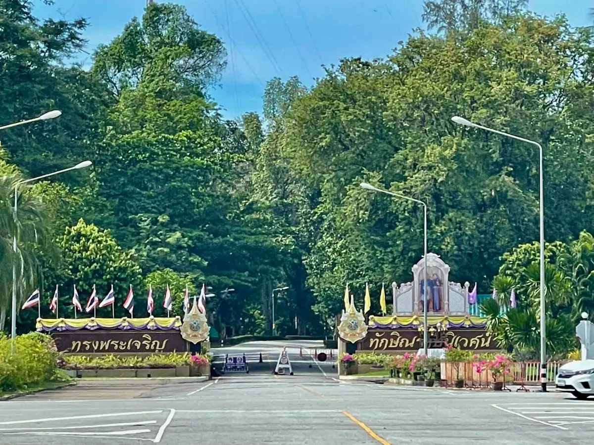
45. Taksin Ratchaniwet Palace, Narathiwat Province, is a royal residence of considerable historical importance, situated around Khao Tanyong in Kaluwo Nuea Subdistrict, Mueang Narathiwat District. The palace has served as a royal residence during visits associated with royal duties in Southern Thailand. Its distinctive surroundings include landscaped gardens, tropical vegetation and a hillside setting that contributes to the natural beauty and peaceful atmosphere of the estate.
Highlights: The palace architecture, landscaped gardens, ornamental plants, the green hillside setting of Khao Tanyong and the site's historical association with royal duties in Southern Thailand.
The palace grounds occupy a scenic hillside area surrounded by the natural landscape of Narathiwat. The arrangement of gardens and vegetation complements the terrain, creating an attractive environment of tropical plants and carefully maintained green spaces. When public access is authorized, visitors may have opportunities to appreciate designated garden areas and learn about the site's importance by following permitted visitor routes.
Taksin Ratchaniwet Palace is associated with royal activities in Southern Thailand and the historical relationship between the monarchy and communities in the region. Learning about the palace provides insight into this aspect of Thailand's history and the significance of Narathiwat as a location connected with royal visits and official responsibilities.
The Khao Tanyong area has a distinctive landscape of hills and natural surroundings near the Gulf of Thailand coastline. Ornamental gardens and tropical vegetation enhance the appearance of the palace grounds. Visitors granted access should help maintain the cleanliness and condition of the estate and avoid disturbing protected or restricted sections.
Because the palace is a royal property with specific security and operational requirements, public entry is strictly subject to permission and official regulations. Travelers must confirm whether visits are currently permitted before departure and follow all instructions concerning clothing, photography and authorized areas. Restricted sections must never be entered without permission.
Taksin Ratchaniwet Palace may interest travelers studying history, architecture, landscape design and important landmarks of Narathiwat. It can be considered alongside Ao Manao Forest Park in a wider itinerary around Mueang Narathiwat District, but visitors must verify access conditions for both places in advance. A visit to the palace should never be treated as guaranteed without explicit confirmation of public access.
Open Days: Public visits are permitted only according to official announcements and authorization from the site administrators Visiting Hours: Subject to the specific dates and daytime periods designated for public access.
Getting There: Taksin Ratchaniwet Palace is situated around Khao Tanyong in Kaluwo Nuea Subdistrict, Mueang Narathiwat District. Visitors can travel by car or taxi from Narathiwat town toward the palace entrance area. Entry beyond the authorized access point depends entirely on permission and the security regulations of the palace administration.
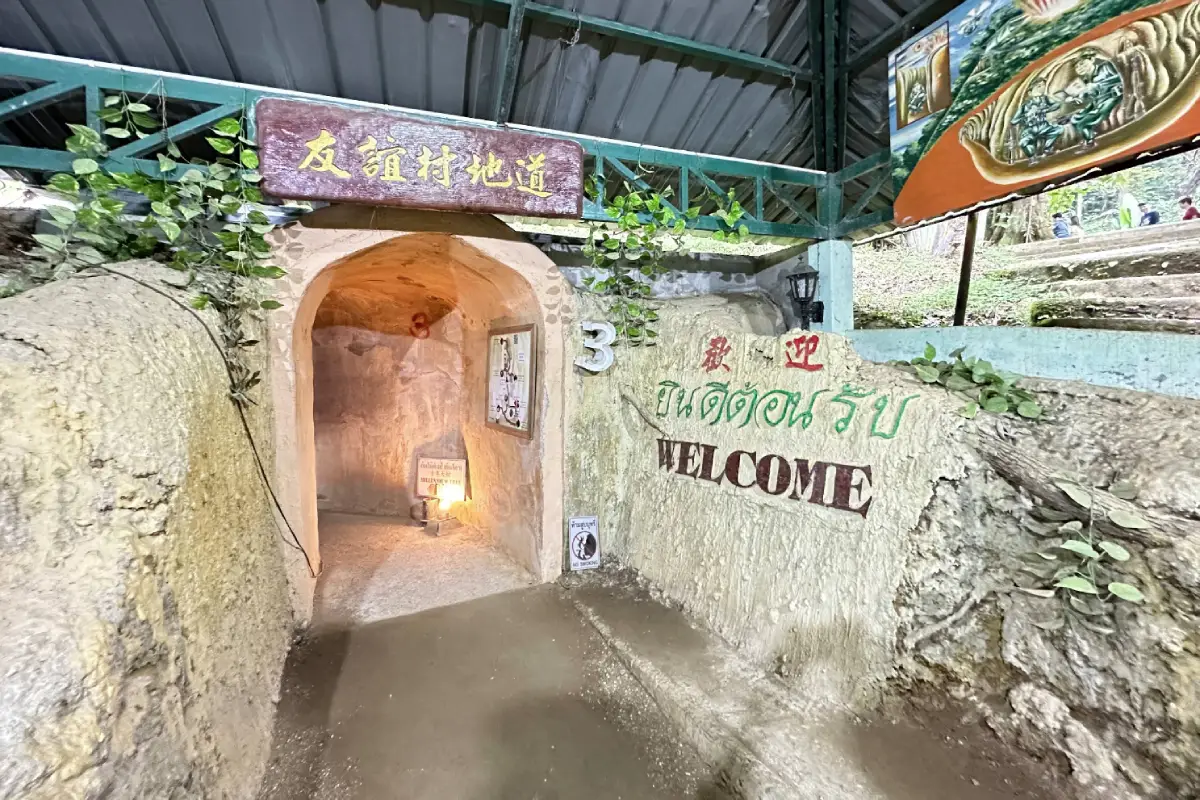
46. Piyamit Tunnel, Yala Province, is a historical attraction located near Ban Piyamit 1 in Tano Maero Subdistrict, Betong District. The tunnel is associated with the history of the Malayan Communist Party and political conflict in the region during the twentieth century. It formed part of an underground network used for shelter and movement through forested terrain. Today, Piyamit Tunnel offers visitors an opportunity to explore this history through the surviving site and the mountainous landscape of Betong.
Highlights: Underground tunnels, walking routes through the historic tunnel network, the history of the Malayan Communist Party, shaded forest surroundings and exhibits or learning areas associated with life during a period of political conflict.
The tunnel system provides tangible evidence of the ways people adapted to difficult historical circumstances in the mountainous border region. Underground passages offered shelter and allowed movement through an environment that was otherwise challenging to navigate. Visiting the site provides an opportunity to understand the practical significance of its construction and the surrounding forest terrain.
The history of Piyamit Tunnel is connected with a complex period of political conflict involving communist movements on the Malay Peninsula. The site offers a setting in which visitors can learn about the people who lived in the area, their experiences and the wider historical circumstances. Understanding this history adds depth to a visit and places the physical tunnel network within its broader regional context.
The surrounding forest contributes to the atmosphere of the attraction. Walking through shaded areas and historic passages allows visitors to experience the contrast between the natural mountain environment and structures created for human shelter. The landscape also illustrates why remote forested areas played an important role in the region's historical events.
Visitors should follow the designated tunnel route and any instructions provided by local caretakers. Underground passages may contain narrow spaces, uneven surfaces or damp sections, so comfortable footwear and attention to personal safety are important. Travelers with mobility limitations should consider the physical requirements of the walk before entering.
Piyamit Tunnel is especially suitable for travelers interested in history, cultural heritage and unusual educational experiences. It can be combined with Betong Hot Spring and other attractions around Betong District. Visiting both destinations provides a balanced itinerary that combines the region's historical background with its natural environment.
Open Days: Daily Opening Hours: Generally 08:00–16:30, subject to current site regulations.
Getting There: Travel from Betong town by car or hired vehicle toward Ban Piyamit 1 in Tano Maero Subdistrict. Follow local signs to Piyamit Tunnel and the designated visitor entrance. The surrounding roads pass through mountainous terrain, so allow adequate travel time and drive carefully.
Map (GPS):View Piyamit Tunnel on Google Maps
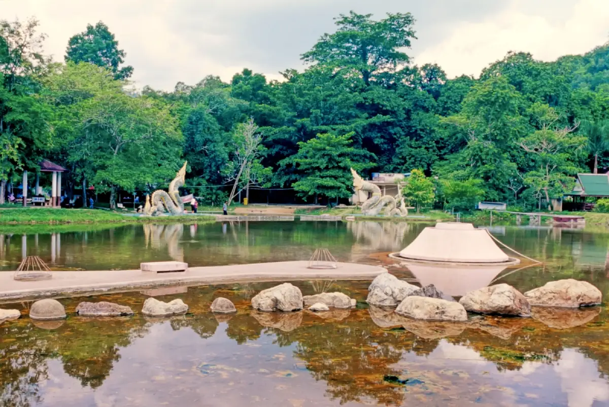
47. Betong Hot Spring, Yala Province, is a well-known natural hot spring in Betong District, situated in Tano Maero Subdistrict amid the mountainous landscape of Thailand's lower southern region. The attraction is distinguished by naturally heated water rising from underground and has been developed as a recreational destination for residents and travelers visiting Betong. Its combination of geothermal features, green surroundings and accessible visitor areas offers a different experience from Southern Thailand's coastal attractions.
Highlights: Natural hot springs, designated warm-water bathing areas, geothermal features, garden and mountain surroundings, relaxation activities and the opportunity to combine a visit with Piyamit Tunnel.
Betong Hot Spring is a natural water source heated by underground geological processes. The water reaches the surface at temperatures higher than those of ordinary streams and pools, creating a distinctive geothermal attraction. Visitors can observe the natural hot-water features and use designated facilities according to the regulations of the site caretakers. The springs also provide an opportunity to appreciate the relationship between underground water, geology and the surrounding mountain landscape.
Warm-water bathing is one of the activities associated with the site, but visitors must pay close attention to water temperature. Water emerging directly from geothermal sources can be extremely hot and may not be suitable for bathing or direct contact. Only pools specifically authorized for public use should be entered, and posted temperature warnings and recommended bathing periods must be followed.
Beyond its natural features, Betong Hot Spring serves as a recreational destination for the local community and travelers exploring the southern border region. The attraction adds variety to Betong's tourism experiences, which also include mountains, forests, history, local food and distinctive cultural traditions. Visitors can enjoy the surroundings without necessarily participating in physically demanding activities.
Betong's mountainous geography creates a landscape different from the coastal plains and islands of Southern Thailand. Visiting the hot spring offers another way to experience the district's natural environment. Piyamit Tunnel is an additional destination that can be combined with the hot spring in the same general area, allowing travelers to explore historical and natural attractions without unnecessary backtracking.
Betong Hot Spring is suitable for families, couples and travelers looking for relaxation. However, people with medical conditions that may be affected by heat should seek appropriate medical advice before using hot-water bathing facilities. Young children and older visitors require particular care, and no one should enter pools where temperatures are uncontrolled or public bathing is not permitted.
Open Days: Daily Opening Hours: 09:00–17:00.
Getting There: From Betong town, travel by car or taxi toward Tano Maero Subdistrict and follow the local route to Betong Hot Spring. The attraction can be combined with Piyamit Tunnel, although visitors should allow sufficient time for driving on mountain roads and check the opening arrangements of both sites.
Map (GPS):View Betong Hot Spring on Google Maps
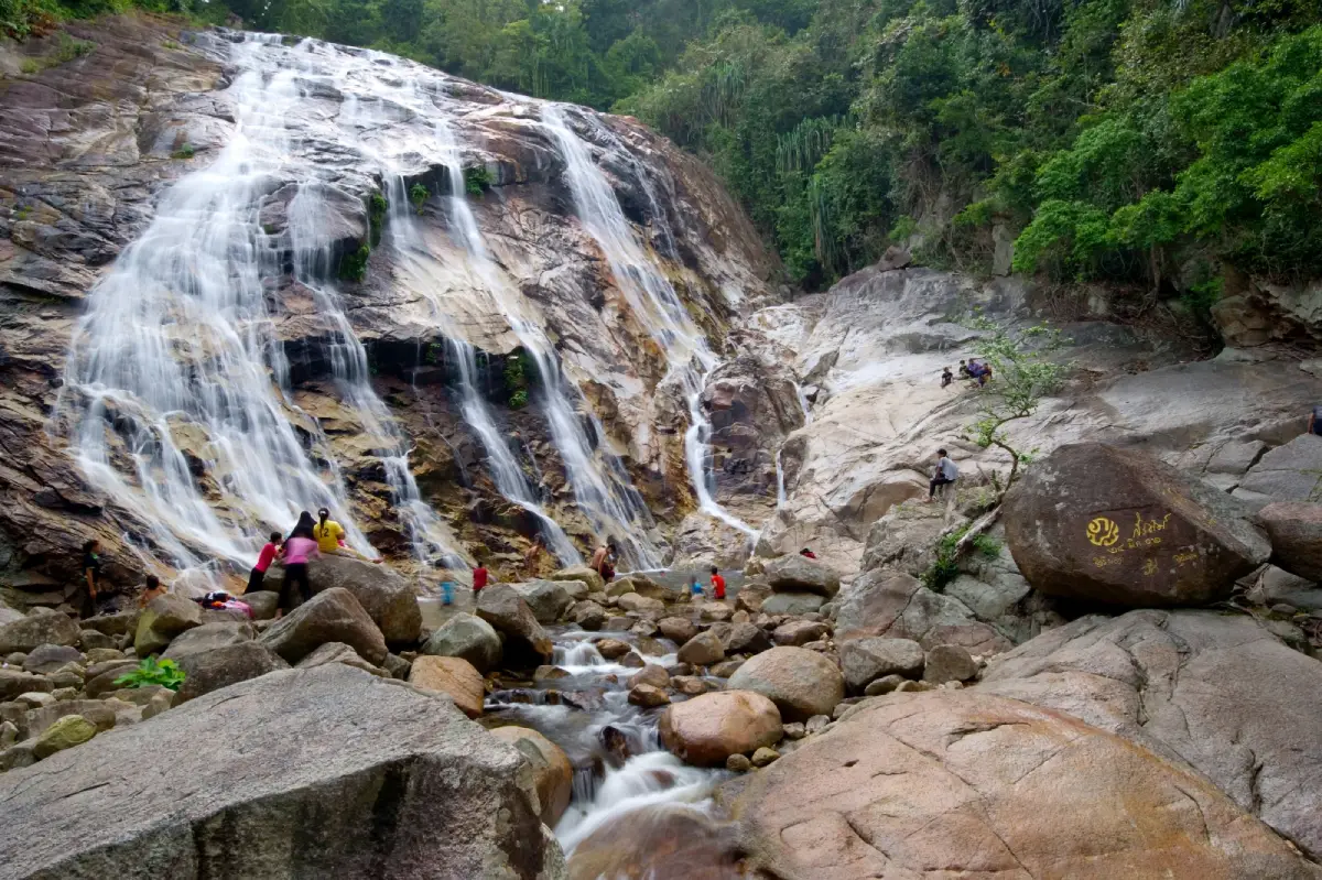
48. Pajo Babi Waterfall, Narathiwat Province, is a natural attraction located in Lubo Baya Subdistrict, Yi-ngo District. Surrounded by forest and tropical vegetation, the waterfall provides a peaceful setting that reflects the natural diversity of Thailand's lower southern region. Flowing water, forest streams and the surrounding greenery make it an appealing destination for travelers seeking relaxation and a closer connection with nature away from urban and coastal tourism areas.
Highlights: Natural waterfall, forest streams, shaded tropical vegetation, mountain scenery and the peaceful natural environment of Yi-ngo District in Narathiwat.
Pajo Babi Waterfall is a freshwater attraction surrounded by the forests of Southern Thailand. Its flowing streams and water levels are influenced by rainfall and the surrounding terrain. Visitors can enjoy the scenery from areas open to the public, where the sound of running water and the shade of tropical trees create a relaxing atmosphere. The setting also provides opportunities to learn about the characteristics of local forest ecosystems.
Narathiwat has diverse natural landscapes, including mountains, forests, wetlands and coastal areas. A visit to Pajo Babi Waterfall reveals the province's inland environment and its relationship with local communities. Maintaining cleanliness and using the area responsibly are important for protecting the waterways and vegetation on which the ecosystem depends.
Nature photographers can focus on streams, flowing water and tropical vegetation from safe viewpoints. However, wet rocks can be extremely slippery, and fast-moving water presents serious risks. Water levels at tropical waterfalls may rise rapidly after heavy rain, even when rainfall occurs upstream rather than at the attraction itself. Visitors should monitor weather conditions and follow instructions from local authorities or caretakers.
Pajo Babi Waterfall is suitable for nature lovers, families and visitors interested in relaxed outdoor activities. Walking around designated areas allows travelers to appreciate the forest environment at close range. Families with children or older relatives should choose accessible routes and avoid steep, wet or slippery terrain.
The waterfall can form part of a wider nature itinerary in Narathiwat Province. Travelers should consider the road distance and travel arrangements from Narathiwat town or other nearby locations. Combining attractions within the same geographical area helps reduce travel time and allows visitors to spend more time enjoying the natural surroundings.
Open Days: Daily Opening Hours: Generally 08:00–17:00, subject to weather and visitor safety restrictions.
Getting There: Travel from Narathiwat town toward Yi-ngo District and Lubo Baya Subdistrict, then follow local roads to the Pajo Babi Waterfall area. Private vehicles and hired cars are suitable for the journey. Road conditions and access routes should be checked during periods of heavy rainfall.
Map (GPS):View Pajo Babi Waterfall on Google Maps
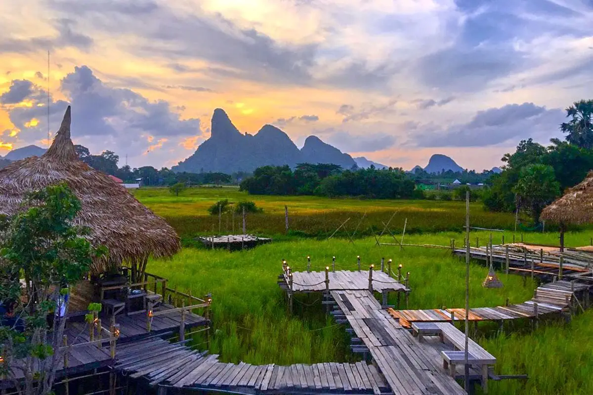
49. Na Po Kae, Phatthalung Province, is an agricultural and cultural tourism destination located in Makok Nuea Subdistrict, Khuan Khanun District. The attraction is characterized by rice fields, rural scenery and activities connected with traditional Thai farming life. Visitors can walk through the agricultural landscape, learn about rice cultivation and experience the atmosphere of communities whose livelihoods have long been associated with farming and natural food production.
Highlights: Rice fields, scenic walking paths, traditional farming practices, agricultural learning activities, local products, regional food and the rural landscapes of Phatthalung Province.
Na Po Kae is designed around the relationship between visitors and traditional agricultural life. Rice paddies and the surrounding countryside form the main elements of the landscape, while designated paths and activity areas allow visitors to appreciate the setting. The appearance of the fields changes throughout the growing cycle, from lush green young rice plants to golden mature crops. This seasonal transformation gives the attraction a different character at various times of the year.
Rice cultivation has long been an important part of the history and everyday life of farming communities in Phatthalung. Learning about planting, crop maintenance and traditional agricultural tools helps visitors understand the role of rice in rural livelihoods and the local economy. Agricultural tourism offers an accessible way to connect traditional knowledge with educational and recreational experiences.
The rural landscape is particularly appealing for walking and photography, especially in the morning or late afternoon when the sunlight is less intense. Visitors can admire the rice fields, pathways and traditional decorative features of the site. However, they should remain on designated routes and avoid stepping into cultivated plots, since the rice fields are working agricultural areas requiring ongoing care.
Local food and community products add another dimension to the visit. Travelers can sample traditional dishes or explore regional products when these services are available. Supporting local producers contributes to community income and helps preserve knowledge related to farming, food preparation and handicrafts.
Na Po Kae is suitable for families, students and travelers interested in rural Thai culture. It can be combined with Thale Noi and other attractions around Khuan Khanun District. Exploring these places together illustrates the relationship between rice fields, wetlands and farming communities in Phatthalung, providing a broader understanding of the province's natural and cultural landscape.
Open Days: Daily Opening Hours: 08:30–17:30. Certain activities depend on the agricultural season and arrangements made by the site administrators.
Getting There: Na Po Kae is located in Makok Nuea Subdistrict, Khuan Khanun District, Phatthalung Province. From Phatthalung town, travel by private car or taxi along the main route toward Khuan Khanun, then follow local signs to the attraction.
Map (GPS):View Na Po Kae on Google Maps
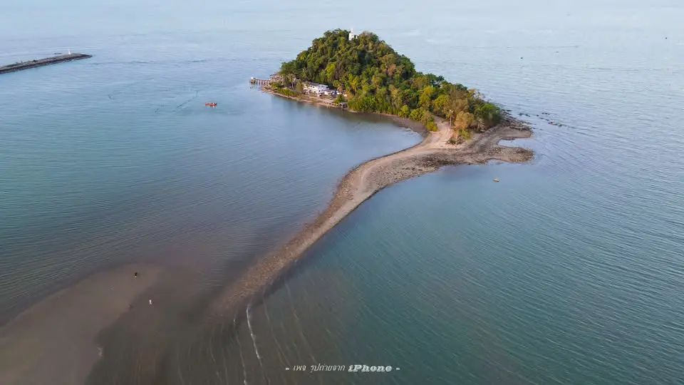
50. Ko Matphon (Koh Kaeo Matphon), Chumphon Province, is a small rocky island situated close to the Gulf of Thailand coastline in Pak Nam Subdistrict, Mueang Chumphon District. The island is notable for its Buddhist religious significance and its distinctive coastal geography. Pilgrims and travelers visit the area to pay their respects at sacred sites and enjoy the surrounding sea views. Access to the island depends on tidal levels and marine safety conditions.
Highlights: Rocky island scenery, Buddhist images and sacred sites, panoramic Gulf of Thailand views, a peaceful religious atmosphere and coastal landscapes that change with the tides.
Ko Matphon is a rocky island located near the mainland shore, providing views of the surrounding Gulf of Thailand and coastal landscape. Tidal movements influence both the appearance of the island and the conditions for accessing it. Visitors should check the tide and local safety guidance before attempting to reach the island and should never enter the area when waves or water levels make access dangerous.
The island's significance is closely associated with Buddhist devotion. Sacred images and areas used for worship attract visitors who wish to pay their respects in a setting where religious heritage and coastal nature meet. Travelers should follow the instructions of site caretakers and maintain a respectful atmosphere around religious structures and worship areas.
The surrounding landscape is also attractive to nature photographers. Views of the rocky island against the sea and sky provide opportunities for coastal photography. It is not always necessary to reach the island itself to enjoy the scenery; visitors can appreciate the landscape from suitable locations on the mainland. Photography from the shore during favorable morning or evening light may also reduce the risks associated with changing tides.
Ko Matphon can be included in a day trip with Hat Sai Ri Beach and other attractions in Mueang Chumphon District. Travelers can arrange their sightseeing and religious visit around favorable tidal conditions, then continue to nearby coastal destinations. This makes the island a practical addition for those who wish to combine nature, cultural heritage and seaside scenery without traveling long distances.
The island is suitable for travelers interested in sacred places, landscape photography and coastal tourism. Families with children and older visitors should assess the accessibility of the approach and walking surfaces before attempting to enter the island area. If the tide is high or marine conditions are unsafe, viewing the island from the mainland is the better option.
Open Days: Daily, subject to weather and tidal conditions Opening Hours: Generally 08:00–17:00. Access should only be attempted during daylight hours when tide levels and local safety conditions permit.
Getting There: Travel from Chumphon town toward Pak Nam Subdistrict and follow the coastal road to the Ko Matphon area. The mainland approach can be reached by car or taxi, but access to the island itself depends on the tide and condition of the pathway. Visitors should consult local caretakers or community representatives before attempting to cross.
Map (GPS):View Ko Matphon on Google Maps
| Article Title | 50 Best Places to Visit in Southern Thailand in 2027: Beaches, Islands, Mountains, Old Towns and Must-See Attractions |
| Travel Region | The 14 provinces of Southern Thailand: Chumphon, Surat Thani, Nakhon Si Thammarat, Phatthalung, Songkhla, Pattani, Yala, Narathiwat, Ranong, Phang Nga, Phuket, Krabi, Trang and Satun. |
| Main Attractions | The Andaman Sea, Gulf of Thailand, tropical islands, sandy beaches, rainforests, limestone mountains, waterfalls, natural hot springs, wetlands, historic towns, religious landmarks, cultural heritage and traditional communities. |
| Top 10 Must-Visit Destinations | 1. Koh Samui, Surat Thani 2. The Phi Phi Islands, Krabi 3. Koh Lipe, Satun 4. Patong Beach, Phuket 5. Koh Tao, Surat Thani 6. Ratchaprapha Dam (Cheow Lan Lake), Surat Thani 7. Khao Sok National Park, Surat Thani 8. Promthep Cape, Phuket 9. Ao Nang, Krabi 10. Emerald Pool, Krabi |
| Surat Thani Province | 1. Koh Samui 2. Koh Tao 3. Ratchaprapha Dam (Cheow Lan Dam) 4. Khao Sok National Park 5. Koh Phangan |
| Krabi Province | 1. The Phi Phi Islands 2. Ao Nang 3. Emerald Pool 4. Thale Waek (Separated Sea) 5. Khlong Thom Hot Springs |
| Phuket Province | 1. Patong Beach 2. Promthep Cape 3. Kata Beach 4. Karon Beach 5. Wat Chalong (Wat Chaiyathararam) 6. Phuket Old Town and Sino-Portuguese Architecture |
| Phang Nga Province | 1. Khao Tapu and Khao Phing Kan 2. Mu Ko Surin National Park 3. Khao Lak Beach |
| Satun Province | 1. Koh Lipe 2. Tarutao National Park 3. Mu Ko Adang–Rawi |
| Trang Province | 1. Koh Kradan 2. Koh Mook and Emerald Cave 3. Pak Meng Beach |
| Nakhon Si Thammarat Province | 1. Wat Phra Mahathat Woramahawihan 2. Ban Khiriwong 3. Hat Khanom–Mu Ko Thale Tai National Park 4. Khao Luang National Park |
| Songkhla Province | 1. Kim Yong Market 2. Songkhla Old Town 3. Ko Yo 4. Khlong Hae Floating Market 5. Khao Tang Kuan |
| Phatthalung Province | 1. Thale Noi Non-Hunting Area 2. Khao Ok Thalu 3. Na Po Kae |
| Ranong Province | 1. Koh Phayam 2. Namtok Ngao National Park |
| Chumphon Province | 1. Thung Wua Laen Beach 2. Hat Sai Ri Beach 3. Ko Matphon (Koh Kaeo Matphon) |
| Pattani Province | 1. Pattani Central Mosque 2. Wat Chang Hai Rat Buranaram 3. Krue Se Mosque |
| Narathiwat Province | 1. Ao Manao Forest Park 2. Taksin Ratchaniwet Palace 3. Pajo Babi Waterfall |
| Yala Province | 1. Piyamit Tunnel 2. Betong Hot Spring |
| Andaman Sea Destinations | 1. The Phi Phi Islands, Krabi 2. Koh Lipe, Satun 3. Patong Beach, Phuket 4. Promthep Cape, Phuket 5. Ao Nang, Krabi 6. Thale Waek, Krabi 7. Koh Kradan, Trang 8. Koh Mook and Emerald Cave, Trang 9. Mu Ko Surin National Park, Phang Nga 10. Koh Phayam, Ranong |
| Gulf of Thailand Destinations | 1. Koh Samui, Surat Thani 2. Koh Phangan, Surat Thani 3. Koh Tao, Surat Thani 4. Thung Wua Laen Beach, Chumphon 5. Hat Sai Ri Beach, Chumphon 6. Ko Matphon, Chumphon 7. Hat Khanom–Mu Ko Thale Tai National Park, Nakhon Si Thammarat 8. Ao Manao Forest Park, Narathiwat |
| Best for Families and Children | 1. Kata Beach, Phuket 2. Karon Beach, Phuket 3. Koh Samui, Surat Thani 4. Ban Khiriwong, Nakhon Si Thammarat 5. Ko Yo, Songkhla 6. Khlong Hae Floating Market, Songkhla 7. Na Po Kae, Phatthalung 8. Thung Wua Laen Beach, Chumphon Choose activities according to children's ages and physical abilities. Pay particular attention to boat safety and swimming conditions. |
| Best for History Enthusiasts | 1. Phuket Old Town and Sino-Portuguese Architecture 2. Songkhla Old Town 3. Wat Phra Mahathat Woramahawihan 4. Krue Se Mosque 5. Piyamit Tunnel 6. Tarutao National Park 7. Hat Sai Ri Beach, Chumphon |
| Best for Religious and Spiritual Tourism | 1. Wat Phra Mahathat Woramahawihan, Nakhon Si Thammarat 2. Wat Chalong, Phuket 3. Wat Chang Hai Rat Buranaram, Pattani 4. Pattani Central Mosque, Pattani 5. Krue Se Mosque, Pattani 6. Ko Matphon, Chumphon 7. Khao Tang Kuan, Songkhla |
| Best for Nature Lovers | 1. Khao Sok National Park 2. Ratchaprapha Dam 3. Thale Noi Non-Hunting Area 4. Khao Luang National Park 5. Namtok Ngao National Park 6. Emerald Pool 7. Khlong Thom Hot Springs 8. Ban Khiriwong 9. Mu Ko Surin National Park 10. Mu Ko Adang–Rawi |
| Best for Community-Based Tourism | 1. Ban Khiriwong 2. Ko Yo 3. Songkhla Old Town 4. Phuket Old Town 5. Na Po Kae 6. Khlong Hae Floating Market 7. Kim Yong Market 8. Koh Mook 9. Koh Phayam |
| Best Photography Locations | 1. Promthep Cape 2. The Phi Phi Islands 3. Thale Waek 4. Ratchaprapha Dam 5. Thale Noi 6. Khao Tang Kuan 7. Khao Ok Thalu 8. Koh Lipe 9. Phuket Old Town 10. Songkhla Old Town |
| Best for Adventure Activities | 1. Scuba diving around Koh Tao 2. Rainforest trekking in Khao Sok National Park 3. Guided nature walks in Khao Luang National Park 4. Snorkeling around the Surin Islands 5. Snorkeling around the Adang–Rawi Islands 6. Exploring Emerald Cave with an authorized guide 7. Boat excursions on Cheow Lan Lake |
| Recommended Southern Thai Dishes | 1. Gaeng Som (Southern Thai Sour and Spicy Curry) 2. Khua Kling (Dry Spicy Minced Meat Curry) 3. Gaeng Tai Pla (Fermented Fish Curry) 4. Khao Yam Rice Salad with Nam Budu 5. Southern Thai Khanom Jeen (Rice Noodles with Curry) 6. Moo Hong and Hokkien Noodles 7. Fresh Local Seafood 8. Traditional Malay-Influenced Dishes 9. Khanom La and Traditional Southern Sweets 10. Seasonal Tropical Fruits |
| Recommended Souvenirs and Local Products | 1. Ko Yo Handwoven Textiles 2. Naturally Dyed Fabrics from Ban Khiriwong 3. Krajood Sedge Handicrafts from Phatthalung 4. Cashew Nuts 5. Traditional Phuket Sweets 6. Khanom La and Local Sweets from Nakhon Si Thammarat 7. Processed Seafood Products 8. Shrimp Paste and Southern Thai Curry Pastes |
| Important Festivals and Cultural Traditions | 1. Hae Pha Khuen That Ceremony, Nakhon Si Thammarat 2. Sart Duen Sip Festival 3. Chak Phra Festival 4. Nora Traditional Dance 5. Nang Talung Shadow Puppetry 6. Traditional Ceremonies of Sea Communities 7. Baba–Nyonya Cultural Heritage, Phuket 8. Religious Traditions of Southern Muslim Communities Festival dates and event schedules vary each year according to the organizers and local communities. |
| Recommended Areas to Stay | 1. Koh Samui — Gulf of Thailand beach holidays 2. Koh Tao — Scuba diving and snorkeling 3. Koh Phangan — Beaches and nature 4. Ao Nang — Island-hopping excursions around Krabi 5. Phi Phi Don — Overnight stays in the Phi Phi Islands 6. Patong, Kata or Karon — Exploring Phuket 7. Khao Lak — Coastal relaxation and Phang Nga excursions 8. Koh Lipe — Exploring the Adang–Rawi Islands 9. Songkhla City or Hat Yai — Exploring Songkhla 10. Nakhon Si Thammarat City or Lan Saka District — Cultural and nature tourism |
| 1-Day Itinerary — Southern Phuket | 1. Begin with Wat Chalong in the morning. 2. Continue to Kata Beach. 3. Visit Karon Beach, allowing time for the connecting route. 4. Finish at Promthep Cape for sunset, adjusting the route according to the location of your accommodation. |
| 1-Day Itinerary — Krabi Nature | 1. Travel from Krabi Town or Ao Nang toward Khlong Thom District. 2. Visit Emerald Pool. 3. Continue to Khlong Thom Hot Springs. 4. Return to your accommodation in the evening, allowing sufficient time for driving and attraction closing hours. |
| 1-Day Itinerary — Songkhla City | 1. Explore Songkhla Old Town on foot. 2. Enjoy local food around Nang Ngam Road. 3. Visit Khao Tang Kuan for panoramic views. 4. Continue to Ko Yo and enjoy a lakeside meal if time permits. |
| 1-Day Itinerary — Phatthalung Nature | 1. Begin with an early morning boat excursion at Thale Noi, according to available services. 2. Visit Na Po Kae in Khuan Khanun District. 3. Return toward central Phatthalung. 4. View Khao Ok Thalu from an accessible location in the late afternoon. |
| 1-Day Itinerary — Temples and Culture | 1. Choose Nakhon Si Thammarat Province and begin at Wat Phra Mahathat Woramahawihan. 2. Explore historical areas in the city center. 3. Discover local cuisine and cultural traditions. 4. Visit additional nearby attractions if time permits rather than attempting a long interprovincial journey within the same day. |
| 2 Days, 1 Night — Khao Sok and Cheow Lan Lake | Day 1: Explore the Khao Sok National Park forest zone using trails open to visitors. Stay overnight in the Khlong Sok area. Day 2: Travel to Ratchaprapha Dam, take a scenic boat excursion on Cheow Lan Lake and view Khao Sam Kloe before returning according to the available travel schedule. |
| 2 Days, 1 Night — Nakhon Si Thammarat | Day 1: Visit Wat Phra Mahathat Woramahawihan and other cultural attractions in central Nakhon Si Thammarat. Day 2: Explore Ban Khiriwong and the natural surroundings of Lan Saka District, choosing activities appropriate to the weather and available time. |
| 3 Days, 2 Nights — Phuket | Day 1: Discover Phuket Old Town and sample traditional Phuket cuisine. Day 2: Visit Patong Beach and enjoy seaside activities. Day 3: Explore Wat Chalong, Karon Beach, Kata Beach and Promthep Cape, depending on travel time. Reduce the number of stops if departing Phuket in the afternoon. |
| 3 Days, 2 Nights — Krabi | Day 1: Stay around Ao Nang, enjoy a beach walk and watch the sunset. Day 2: Join a Thale Waek and nearby islands excursion, depending on tides and marine conditions. Day 3: Choose either an inland nature trip to Emerald Pool and Khlong Thom Hot Springs or a Phi Phi Islands excursion, according to travel arrangements. Do not attempt to combine both full-day programs. |
| 3 Days, 2 Nights — Songkhla and Hat Yai | Day 1: Explore Kim Yong Market and attractions around Hat Yai. Day 2: Visit Songkhla Old Town, Khao Tang Kuan and Ko Yo. Day 3: Explore Khlong Hae Floating Market if the day falls on Friday, Saturday or Sunday. Otherwise, visit local communities or traditional restaurants. |
| 4 Days, 3 Nights — Surat Thani | Day 1: Travel to Koh Samui and stay overnight. Day 2: Explore Koh Samui's beaches, temples and viewpoints. Day 3: Take a ferry to Koh Phangan and stay overnight. Day 4: Explore Koh Phangan's beaches or local communities before departing according to the ferry schedule. Add extra days if you also want to explore Koh Tao properly. |
| 4 Days, 3 Nights — Trang | Day 1: Travel to Trang and stay near Pak Meng Beach. Day 2: Take a boat excursion to Koh Mook and Emerald Cave when tides, weather and national park regulations permit. Day 3: Explore Koh Kradan and enjoy the beach according to available boat services. Day 4: Return to mainland Trang and continue your journey, allowing extra time for possible changes to boat schedules. |
| 5 Days, 4 Nights — Satun | Day 1: Arrive in Satun and stay near the Pak Bara coastal area. Day 2: Take a boat to Koh Lipe and relax on the beach. Day 3: Explore Koh Adang and Koh Rawi according to national park regulations and available boat routes. Day 4: Spend another relaxing day on Koh Lipe or take an additional marine excursion when conditions are suitable. Day 5: Return to the mainland by scheduled boat. Koh Tarutao can be considered as an additional excursion or substituted for another activity, depending on boat routes and available services. |
| 5 Days, 4 Nights — Phang Nga and Phuket | Day 1: Explore Phuket Old Town. Day 2: Visit Kata Beach, Karon Beach and Promthep Cape. Day 3: Travel to Phang Nga Province and stay around Khao Lak. Day 4: Relax along the Khao Lak coastline or choose a seasonal Surin Islands excursion, allowing sufficient time to reach the departure pier. Day 5: Return home. Avoid scheduling a full-day boat excursion immediately before a long-distance departure. |
| 6–7 Days — Gulf of Thailand Island Hopping | Days 1–2: Explore Koh Samui. Days 3–4: Travel to Koh Phangan and stay overnight. Days 5–6: Continue to Koh Tao for diving, snorkeling or beach activities. Day 7: Return according to the available ferry schedule, allowing sufficient connection time. Confirm actual ferry routes before selecting your departure point. |
| 6–7 Days — Northern Andaman Coast | Days 1–2: Explore Phuket and stay near your preferred beach. Day 3: Visit Phang Nga Bay, Khao Tapu and Khao Phing Kan. Day 4: Travel to Khao Lak and enjoy the coastline. Day 5: Choose a seasonal Surin Islands excursion, making suitable arrangements for reaching the departure pier. Day 6: Explore beaches and natural attractions in Phang Nga. Day 7: Travel home or use the day as a weather contingency for outdoor and marine activities. |
| Transportation Options | 1. Flights: Convenient for reaching major travel hubs such as Phuket, Krabi, Surat Thani, Hat Yai, Nakhon Si Thammarat, Trang, Chumphon and Ranong, subject to current flight routes. 2. Cars: Suitable for visiting multiple mainland attractions and connecting districts. 3. Trains: Useful for destinations served by the railway network, including Chumphon, Surat Thani, Nakhon Si Thammarat, Trang and Hat Yai. 4. Buses: Practical for interprovincial and regional travel. 5. Passenger Boats: Essential for Koh Samui, Koh Phangan, Koh Tao, the Phi Phi Islands, Koh Lipe and other islands served by seasonal or scheduled routes. |
| Best Time to Visit Southern Thailand | 1. Andaman Coast: November to April is generally favorable for island excursions and marine activities. 2. Gulf of Thailand Islands: Koh Samui, Koh Phangan and Koh Tao have seasonal weather patterns that differ from the Andaman coast. Several periods from early to mid-year can be suitable for seaside holidays. 3. Forests and Waterfalls: Check rainfall forecasts and safety announcements before traveling. 4. Wetlands and Rice Fields: Scenery varies according to seasonal conditions and agricultural cycles. 5. Marine National Parks: Confirm annual seasonal closures and conservation announcements before departure. |
| Travel Safety Precautions | 1. Check marine weather conditions before boat journeys and water activities. 2. Follow beach warning flags and lifeguard instructions. 3. Confirm national park opening dates and the status of hiking trails. 4. Prepare suitable equipment for forest walks and mountain routes. 5. Respect visitor regulations at temples, mosques and restricted sites. 6. Check road conditions and transport arrangements in remote areas. 7. Allow additional travel time for ferry connections and weather-related changes. |
| Responsible Tourism Guidelines | 1. Do not touch or stand on coral reefs. 2. Do not feed wild animals or marine life. 3. Never leave rubbish in the sea, streams or natural areas. 4. Choose operators that follow appropriate safety standards. 5. Respect local cultures, religious traditions and community privacy. 6. Support locally operated businesses and community products. 7. Follow the conservation rules of national parks and all visitor attractions. |
Frequently Asked Questions (FAQ)
Q: Which province is best for a first trip to Southern Thailand?
A: Phuket and Krabi are excellent choices for first-time visitors because they offer diverse beaches, accommodation, restaurants and tourist services. Koh Samui is a convenient option for exploring the Gulf of Thailand, while Surat Thani is particularly appealing to nature lovers interested in Khao Sok National Park and Cheow Lan Lake.
Q: How many provinces are there in Southern Thailand, and what are the main attractions?
A: Southern Thailand comprises 14 provinces. Major attractions include Koh Samui, the Phi Phi Islands, Koh Lipe, Koh Tao, Patong Beach, Cheow Lan Lake, Khao Sok National Park, Wat Phra Mahathat Woramahawihan, Songkhla Old Town and Thale Noi. The region also offers mountains, waterfalls, religious landmarks and communities with distinctive cultural traditions.
Q: How many days should I spend traveling around Southern Thailand?
A: Allow at least two or three days to explore one province. For several provinces within the same geographical area, four to seven days or longer is preferable. Travelers hoping to visit both the Andaman coast and the Gulf of Thailand should allow additional time for longer transfers to avoid an overly rushed itinerary.
Q: What is the best month to visit Southern Thailand?
A: The best period depends on the coastline and activities you choose. The Andaman coast is generally more suitable for marine tourism from November to April, while Gulf of Thailand islands have different seasonal weather patterns. Check weather forecasts and national park announcements before traveling, especially for boat excursions and diving.
Q: What is the difference between the Andaman Sea and the Gulf of Thailand?
A: The Andaman coast is particularly famous for dramatic limestone formations, beautiful islands and sandy beaches, including the Phi Phi Islands, Koh Lipe and Thale Waek. The Gulf of Thailand offers destinations such as Koh Samui, Koh Phangan, Koh Tao and the beaches of Chumphon. An important practical difference is the seasonal weather pattern, which affects the most suitable periods for marine travel.
Q: Which places in Southern Thailand are best for families with children?
A: Kata Beach, Karon Beach, Koh Samui, Ko Yo, Ban Khiriwong, Khlong Hae Floating Market and Na Po Kae offer opportunities for family-friendly activities. Choose destinations according to children's ages, transport convenience and the safety requirements of individual activities, especially swimming and boat excursions.
Q: Which Southern Thailand attractions are suitable for older travelers?
A: Consider destinations that are accessible by road and do not require strenuous hiking or long boat journeys, such as Songkhla Old Town, Ko Yo, Kim Yong Market, Wat Phra Mahathat Woramahawihan, Wat Chalong and viewpoints that can be reached by car. Check walking conditions, accessibility and available facilities before visiting.
Q: What are the best nature attractions in Southern Thailand besides beaches?
A: Khao Sok National Park, Ratchaprapha Dam, Khao Luang National Park, Ban Khiriwong, Emerald Pool, Khlong Thom Hot Springs, Namtok Ngao National Park and Thale Noi are excellent destinations for exploring mountains, forests, waterfalls, wetlands and other natural ecosystems.
Q: Which islands are best for snorkeling and scuba diving in Southern Thailand?
A: Koh Tao is particularly well known for diving courses and underwater activities. The Surin Islands, Adang–Rawi Islands, Phi Phi Islands and Koh Kradan also offer attractive snorkeling or diving opportunities. Select sites appropriate to your experience level and check sea conditions before entering the water.
Q: What are the best photography destinations in Southern Thailand?
A: Promthep Cape is popular for sunset photography. The Phi Phi Islands and Thale Waek offer striking marine and limestone landscapes, while Cheow Lan Lake is renowned for its mountain scenery rising from the water. Thale Noi is ideal for lotus flowers and waterbirds, and the historic districts of Phuket and Songkhla are excellent for architectural and street photography.
Q: Where should history and culture enthusiasts visit in Southern Thailand?
A: Recommended attractions include Wat Phra Mahathat Woramahawihan, Phuket Old Town, Songkhla Old Town, Wat Chang Hai, Krue Se Mosque, Pattani Central Mosque, Piyamit Tunnel and the historic areas of Koh Tarutao. These places illustrate different aspects of religion, architecture, maritime trade and the region's history across several periods.
Q: Can I travel around Southern Thailand without renting a car?
A: Yes. Travelers can use flights, trains, buses, taxis, local transport and organized tour transfers. Major destinations such as Phuket, Krabi, Hat Yai and Koh Samui offer a range of tourist services. However, remote mountain areas, rural communities and itineraries involving several widely separated attractions may require additional private transfers or a rental vehicle.
Q: Are Southern Thailand's marine national parks open throughout the year?
A: Not all marine national parks are open year-round. Some areas close during the monsoon season or for ecological recovery, including the Surin Islands, parts of Tarutao National Park and selected marine attractions in Trang Province. Always check the relevant national park's annual announcements and the status of individual islands before booking.
Q: What food should I try in Southern Thailand, and what souvenirs should I buy?
A: Popular dishes include Southern Thai sour and spicy curry, Khua Kling, Gaeng Tai Pla, Khao Yam, Southern Thai Khanom Jeen, Moo Hong, Hokkien noodles and fresh seafood. Recommended souvenirs include Ko Yo handwoven textiles, naturally dyed fabrics from Ban Khiriwong, Krajood handicrafts, cashew nuts, traditional sweets, processed seafood and Southern Thai curry pastes.
Q: What is the best 7-day itinerary for Southern Thailand?
A: Choose a route based on your interests and the season. For the Gulf of Thailand, a seven-day island-hopping trip can combine Koh Samui, Koh Phangan and Koh Tao. For the Andaman coast, consider Phuket, Phang Nga and Krabi, or explore Trang and Satun as a separate route. Staying within neighboring destinations reduces travel time and allows more opportunities to relax than attempting to cover several distant provinces within one short holiday.
 Category: ●Travel Articles, Recipes
 Group: ●Travel Review, Food Review
Last Update : 2 WeekAgo
 Last Update : 2 WeekAgo
Recommend

 Art, Culture and Heritage
 Historical Sites and Monuments(9)
 Landmarks and Memorials(9)
 Royal Palace(1)
 Art, Craft Centres, Tradition(12)
 Museums(5)
 Educational Places
 Educational Gardens, Farm(2)
 Places of Worship
 Temple(44)
 Mosque(2)
 Other Sacred Sites(17)
 Research and Development
 Royal Project(2)
 Suburban Living
 Village, Community(8)
 Local Market(1)
 Floating Market(1)
 Nature and Wildlife
 National Parks and Marine Reserves(6)
 Mountain (Doi)(11)
 Dam, Reservoir, Lake(10)
 Waterfalls(43)
 Hot Springs(1)
 Caves(13)
 River, Canal(3)
 Bays and Beaches(29)
 Islands(2)
 Other natural attractions(3)
 Entertainment and Agricultural
 Farms, Parks and Ecotourism(3)
 Outdoor and Adventure Activities(4)
Travel Review, Food Review(5)
 Southern Food Menu, Southern Food Recipes(18)


