
lovethailand home >South Travel Attractions >Phatthalung Travel Attractions >Muang Phatthalung >Khuha Sawan > Khao Ok Thalu
TL;DR: Khao Ok Thalu is located at Khuha Sawan Subdistrict, Mueang Phatthalung District, Phatthalung Province, with the mountain area extending into parts of Prang Mu and, open No regular holiday.
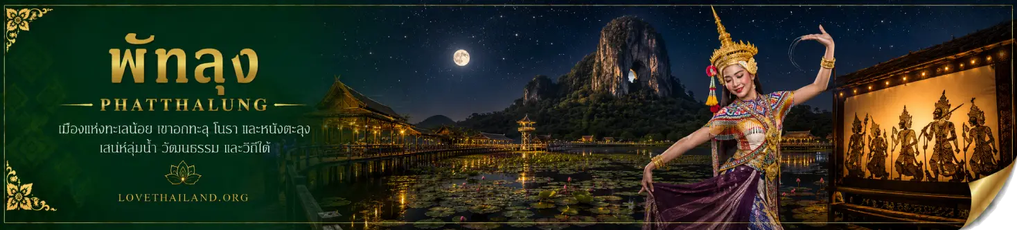
Khao Ok Thalu
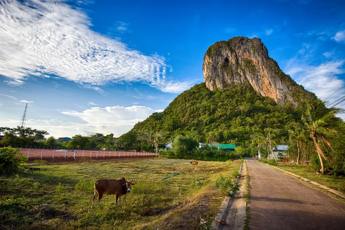
Open Days: No regular holiday
Recommended Visiting Time: Morning to late afternoon before dark
Khao Ok Thalu in Phatthalung Province is a dramatic limestone mountain rising in the heart of Phatthalung town. It is one of the strongest symbols of the province and can be seen from many parts of the city, especially around Phatthalung Railway Station and Wat Khuha Sawan. The mountain is famous for a large natural opening near its upper section, where visitors can look through the rock to the other side. This distinctive “pierced chest” feature gives the mountain its name and makes it one of the most recognizable landmarks in southern Thailand.
Khao Ok Thalu is about 245–250 meters above sea level. The limestone massif lies roughly north to south, about 2 kilometers long and around 1 kilometer wide at its broadest point. The mountain is covered with natural vegetation, while the foothills are surrounded by communities and agricultural land. Its combination of steep limestone, green slopes, city setting, and a natural hole near the summit gives it a character unlike ordinary hills.
The mountain area covers parts of Khuha Sawan, Prang Mu, and Phaya Khan subdistricts in Mueang Phatthalung District. The main visitor access is in Khuha Sawan, close to Phatthalung Railway Station and Wat Khuha Sawan Royal Monastery. Because of this central location, Khao Ok Thalu is easy to include in a city itinerary. Visitors can climb the mountain, see the provincial landmark, and continue to nearby temples, historical sites, city restaurants, and accommodation within the same day.
Khao Ok Thalu has deep cultural meaning for local people. Phatthalung residents regard it as a sacred mountain and often compare it to the spiritual pillar of the province. The mountain is associated with Chao Mae Dudi, the guardian spirit of Khao Ok Thalu. Because of this symbolic status, the image of Khao Ok Thalu and the pagoda on the summit became part of Phatthalung’s provincial emblem. The mountain’s name also appears in the provincial motto, confirming its role as both a physical landmark and a cultural symbol.
Local legend explains the mountain through a tragic family story. A man named Nai Mueang, an elephant trader, had 2 wives who often quarreled. One day, while the husband and children were away, the wives fought violently. The principal wife struck the minor wife on the head with a weaving shuttle, while the minor wife thrust a rice-pounding pestle into the principal wife’s chest. Both died and turned into mountains. The principal wife became Khao Ok Thalu, while the minor wife became Khao Hua Taek, known today as Khao Khuha Sawan. This legend links several mountains in Phatthalung into one shared cultural landscape.
Another local legend tells of a powerful figure named Nai Raeng who carried mountains to build a range near the eastern side of Songkhla Lake. When his carrying pole broke, he became angry and threw one side of the pole across the landscape. The pole struck the top of a mountain and created a hole through it, giving rise to Khao Ok Thalu. These legends show how local communities use mountains, canals, lakes, and natural formations to explain the landscape through story and memory.
Khao Ok Thalu is also important as an archaeological landscape. Records mention the discovery of many raw clay Buddha votive tablets in the Srivijaya style, dating around the 12th–13th Buddhist centuries. The surrounding canals, including Khlong Rong Truan and Khlong Tamnan, are connected with old settlements and historic communication routes linking communities such as Ban Muang, Ban Khuan Maphrao, Ban Khuan Rae, Ban Khuan San, and Ban Lam Pam before reaching Songkhla Lake. This makes Khao Ok Thalu important not only for scenery, but also for understanding the historical geography of Phatthalung.
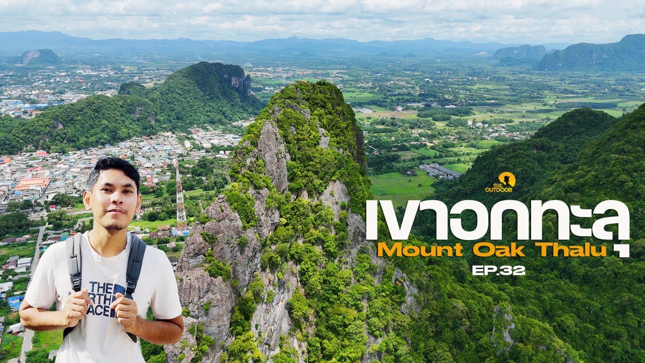
The main activity at Khao Ok Thalu is climbing the staircase to the natural hole and viewpoint. The route has about 1,066 steps and requires moderate physical effort. Visitors in good health generally take around 30–40 minutes to reach the main upper area, depending on pace and rest stops. The route passes through shaded sections and resting points, and the view gradually opens toward Phatthalung town, rice fields, nearby hills, and the wider city landscape.
The natural opening near the upper part of the mountain is the highlight of the climb. The hole is around 10 meters in diameter and allows visitors to look through the limestone wall to the sky and landscape beyond. The view through the opening is both beautiful and dramatic, but the area is steep and should be approached with care. Visitors should stay within safe areas, avoid climbing beyond barriers, and avoid standing too close to cliff edges or exposed rock surfaces.
Along the trail are religious elements and sacred points, including Buddha images and devotional areas. This makes the climb more than a physical activity; it also carries a quiet spiritual dimension. Visitors should dress respectfully, avoid loud behavior near shrines or meditation areas, and remember that local people regard the mountain as a sacred place.
The viewpoint offers wide views of Phatthalung town. On clear days, visitors can see the urban area, railway line, roads, rice fields, Khao Khuha Sawan, Khao Chai Buri, and surrounding hills. This panorama helps explain why Khao Ok Thalu is so central to the identity of the city. From below, the mountain defines the skyline; from above, visitors can see how the city, fields, canals, and mountains are connected.
The best time to climb is early morning or late afternoon before dark. Morning is cooler and safer for climbing, while late afternoon offers softer light. Visitors should not start too late because the route includes many steps and some sections can become difficult in low light. Those planning to take photographs should allow enough time for both ascent and descent.
Visitors should bring drinking water, wear shoes with good grip, and dress in breathable clothing. A hat, towel, and fully charged phone are also useful. The climb is not suitable for rushing. Anyone with heart disease, high blood pressure, respiratory problems, or knee problems should assess personal fitness carefully and stop to rest whenever necessary.
During the rainy season, extra caution is needed because stairs and natural surfaces may become slippery. Visitors should avoid climbing during heavy rain, thunderstorms, strong wind, or when the sky is already dark. A clear-weather day gives both safer conditions and better views.
Getting There is straightforward because the mountain is in Phatthalung town. From Wat Khuha Sawan, follow Highway 4047 and look toward the east of Phatthalung Railway Station, where Khao Ok Thalu rises prominently. Travelers arriving by train can get off at Phatthalung Railway Station and continue by local transport to the base of the mountain. Those traveling by car can use city roads toward Aphai Borirak Road and the local access roads near the foot of the mountain.
Visitors staying in Phatthalung town can make Khao Ok Thalu a morning activity. A practical plan is to have breakfast in town, climb the mountain, return by late morning, and continue to Wat Khuha Sawan, Phra Phuttha Nirokhantrai Chaiwat Chaturathit, the Former Governor’s Residence, or Lam Pam lakeside area. This makes it easy to combine nature, city heritage, sacred sites, and local food.
For a full-day route, start with Khao Ok Thalu in the morning, then visit Wat Khuha Sawan and Phra Phuttha Nirokhantrai Chaiwat Chaturathit. Continue to the Former Governor’s Residence in the late morning or afternoon, and end the day at Lam Pam or a local restaurant. This route gives visitors a complete view of Phatthalung through its landmark mountain, old temple, sacred Buddha image, historic residence, and lake culture.
Wat Khuha Sawan Royal Monastery is one of the best nearby places to pair with Khao Ok Thalu. It is an important historic temple in town and is connected with Khao Khuha Sawan, also known in local legend as Khao Hua Taek. Visiting both places helps travelers understand the relationship between Phatthalung’s geography, local legend, and religious heritage.
Phra Phuttha Nirokhantrai Chaiwat Chaturathit is another important nearby site. This sacred Buddha image is closely associated with Phatthalung and is enshrined in a four-sided pavilion near the provincial government area. Combining this sacred site with Khao Ok Thalu gives the city route both natural and spiritual depth.
The Former Governor’s Residence of Phatthalung adds historical value to the trip. Its traditional wooden architecture and connection with the old ruling structure of Phatthalung help visitors see how the city developed around mountain, temple, government, and community landscapes.
Lam Pam and Saen Suk Lam Pam Beach are good choices for ending the day. After experiencing the mountain landscape of Khao Ok Thalu, visitors can continue to the lakeside environment of Songkhla Lake, where food, water scenery, and local community life offer a different side of Phatthalung.
For photographers, Khao Ok Thalu offers many angles: from the foot of the mountain, from the railway and city roads, from resting points along the staircase, and from the upper viewpoint looking down over Phatthalung. Morning light gives a softer mood, while late afternoon light adds depth to the limestone face and surrounding landscape.
Khao Ok Thalu suits many types of visitors. Casual travelers can photograph the mountain from below. Active travelers can challenge themselves with the 1,066-step climb. Cultural travelers can learn about local legend and sacred beliefs. Nature lovers can enjoy the view from the mountain. In one place, the landmark combines exercise, landscape, history, culture, and identity.
Responsible behavior is important. Visitors should not litter, write on rocks or structures, climb beyond barriers, damage plants, feed animals, or climb during unsafe weather. Khao Ok Thalu is both a natural site and a sacred local landmark, so cleanliness, quiet behavior, and respect for place are essential.
The value of Khao Ok Thalu lies in the way it gathers Phatthalung’s identity into one landscape. From the city below, it is the pierced limestone mountain that defines the skyline. From the viewpoint above, it reveals the relationship between town, fields, canals, hills, and lake. Through legend, it connects people with place. Through the climb, it gives visitors a direct physical experience of the city’s most important natural symbol.
A visit to Khao Ok Thalu should therefore be more than a quick photo stop. It is a landmark, a sacred mountain, a folklore site, an archaeological landscape, a viewpoint, and a natural feature at the heart of Phatthalung. For travelers who want to understand the city deeply, this mountain is one of the clearest starting points.
| Name | Khao Ok Thalu |
| Location | Khuha Sawan Subdistrict, Mueang Phatthalung District, Phatthalung Province, with the mountain area extending into parts of Prang Mu and Phaya Khan subdistricts. |
| Address | Khuha Sawan Subdistrict, Mueang Phatthalung District, Phatthalung Province 93000, Thailand |
| Approximate Coordinates | 7.62604687821627, 100.08853510022163 |
| Highlights | Phatthalung’s iconic limestone mountain, large natural opening near the summit, 1,066-step climb, city viewpoint, Chao Mae Dudi legend, and sacred landmark status. |
| History | An important limestone mountain in Phatthalung associated with local legend, sacred belief, archaeological finds, and the provincial emblem. |
| Name Origin | The name refers to the large natural hole near the upper part of the mountain, which appears as if the mountain’s chest has been pierced through. |
| Natural Characteristics | A limestone mountain about 245–250 meters high, roughly 2 kilometers long and 1 kilometer wide, with a natural opening around 10 meters in diameter. |
| Travel Information | From Wat Khuha Sawan, follow Highway 4047. The mountain stands east of Phatthalung Railway Station and can be reached easily by car, local transport, or from the railway station area. |
| Current Status | Open as a natural attraction, city viewpoint, central landmark, and major symbol of Phatthalung Province. |
| Open Days | No regular holiday |
| Recommended Visiting Time | Morning to late afternoon before dark. Avoid heavy rain and late-evening climbs. |
| Entrance Fee | Free |
| Facilities / Activity Areas | Stairway, rest points, viewpoint, sacred areas along the route, and foothill access near the urban community. |
| Main Areas / Zones | Foothill area, 1,066-step staircase, rest points, natural opening, Phatthalung city viewpoint, natural trail sections, and sacred points on the mountain. |
| Caretaker / Local Authority | Phatthalung City Municipality and local agencies in Mueang Phatthalung District. |
| Contact Number | Phatthalung City Municipality, Tel. 074-613-007 |
| Key Activities | Climbing the staircase, viewing the natural opening, seeing Phatthalung city from above, photographing the provincial landmark, learning the legend, paying respect at sacred points, and exercising in a natural city setting. |
| Visitor Etiquette | Do not litter, climb beyond barriers, start the climb near dark, climb during heavy rain, damage plants, feed animals, or behave disrespectfully around sacred areas. |
| Nearby Tourist Attractions | 1. Wat Khuha Sawan Royal Monastery, about 2 km 2. Phatthalung Railway Station And City Photo Spots, about 2 km 3. Phra Phuttha Nirokhantrai Chaiwat Chaturathit, about 3 km 4. Former Governor’s Residence Of Phatthalung, about 6 km, Tel. 074-613-007 ext. 104 5. Saen Suk Lam Pam Beach, about 9 km |
| Nearby Restaurants | 1. Cha Khao Ok Thalu, about 1 km, Tel. 092-263-5318 2. Café Amazon PTT Khao Ok Thalu Phatthalung, about 1 km, Tel. 064-904-1678 3. Five Star PTT Khao Ok Thalu, about 1 km, Tel. 080-999-9894 4. The Original Dimsum, about 3 km, Tel. 062-532-4665 5. Khao Man Kai Bai Toei Je Muk Phatthalung, about 3 km, Tel. 089-470-0159 |
| Nearby Accommodations | 1. Follow Me Khao Ok Thalu, about 1 km, Tel. 095-425-3398 2. Grand PL Hotel, about 3 km, Tel. 074-615-705 3. Siva Royal Hotel Phatthalung, about 4 km, Tel. 074-673-999 4. Chaikanathani Hotel, about 4 km, Tel. 074-613-777 5. Sitthinard Grandview Hotel, about 4 km, Tel. 074-614-194 |
Frequently Asked Questions (FAQ)
Q: Where is Khao Ok Thalu located?
A: Khao Ok Thalu is located in Mueang Phatthalung District, Phatthalung Province. The main visitor access is in Khuha Sawan Subdistrict, near Phatthalung Railway Station and Wat Khuha Sawan Royal Monastery.
Q: Why is Khao Ok Thalu the symbol of Phatthalung?
A: It is a striking limestone mountain in the center of town, with a large natural opening near the summit. Local people regard it as a sacred mountain and spiritual pillar of the city, and it appears in the provincial emblem.
Q: How high is Khao Ok Thalu?
A: Khao Ok Thalu is about 245–250 meters above sea level and is roughly 2 kilometers long.
Q: How many steps are there to climb?
A: The climb has about 1,066 steps. Visitors in good health usually take around 30–40 minutes to reach the main upper area, depending on pace and rest stops.
Q: Is there an entrance fee?
A: No. Entrance is free.
Q: What is the best time to climb Khao Ok Thalu?
A: Morning or late afternoon before dark is best. Avoid heavy rain, thunderstorms, and late-evening climbs because the stairway and natural surfaces can become unsafe.
Q: What nearby places can visitors combine with Khao Ok Thalu?
A: Nearby places include Wat Khuha Sawan Royal Monastery, Phatthalung Railway Station, Phra Phuttha Nirokhantrai Chaiwat Chaturathit, the Former Governor’s Residence of Phatthalung, and Saen Suk Lam Pam Beach.
 Category: ●Nature and Wildlife
 Group: ●Mountain (Doi)
Last Update : 2 MonthAgo
 Last Update : 2 MonthAgo
 Click to Access the Navigation Map GPS
Khao Ok Thalu Map
Recommend

 Art, Culture and Heritage
 Historical Sites and Monuments(1)
 Landmarks and Memorials(1)
 Art, Craft Centres, Tradition(6)
 Historic Homes and Cities(1)
 Educational Places
 Educational Gardens, Farm(1)
 Places of Worship
 Temple(25)
 Other Sacred Sites(4)
 Research and Development
 Royal Project(2)
 Suburban Living
 Village, Community(3)
 National Parks and Marine Reserves(3)
Mountain (Doi)(4)
 Dam, Reservoir, Lake(7)
 Waterfalls(16)
 Hot Springs(2)
 Caves(12)
 River, Canal(5)
 Bays and Beaches(6)
 Islands(2)
 Other natural attractions(4)
 Entertainment and Agricultural
 Farms, Parks and Ecotourism(4)
 Travel Articles, Recipes
 Travel Review, Food Review(1)


