
lovethailand home >North Travel Attractions >Chiang Mai Travel Attractions > 50 Best Places to Visit in Northern Thailand in 20..
TL;DR: 50 Best Places to Visit in Northern Thailand in 2027, open The village can be visited daily. Individual shops, accommodation providers, hours Main visitor areas generally operate from 05:30 – 18:30. Hours and access.
50 Best Places to Visit in Northern Thailand in 2027
50 Best Places to Visit in Northern Thailand in 2027: A Complete Travel Guide to All 17 Provinces Discover the remarkable diversity of Northern Thailand, from the highest mountain summit in the country and breathtaking seas of mist above rolling mountain ranges to peaceful villages nestled in forested valleys, ancient temples of the Lanna Kingdom, contemporary Buddhist art, UNESCO World Heritage cities, spectacular natural attractions, and communities with distinctive cultural traditions. Northern Thailand offers something for almost every kind of traveler, whether you enjoy mountain scenery, photography, peaceful retreats, history, architecture, or authentic experiences of local culture.
Northern Thailand, as defined by the 17-province tourism region, comprises Chiang Mai, Chiang Rai, Mae Hong Son, Nan, Phayao, Phrae, Lampang, Lamphun, Uttaradit, Sukhothai, Tak, Phitsanulok, Phetchabun, Phichit, Kamphaeng Phet, Nakhon Sawan, and Uthai Thani. Each province has its own character, shaped by geography, history, religious heritage, local cuisine, and community traditions. Travelers can explore individual provinces in depth or combine several nearby destinations into one itinerary to experience the region's extraordinary variety.

Chiang Mai and Chiang Rai are particularly well known for their Lanna heritage, historic temples, and mountain attractions. Mae Hong Son is distinguished by winding mountain roads and villages that reflect the region's diverse Northern Thai traditions and culture. Nan, Phrae, Lampang, and Lamphun offer atmospheric old towns, historic architecture, and distinctive community lifestyles. Sukhothai and Kamphaeng Phet are important centers of Thai history, while Phitsanulok, Phetchabun, Tak, and Uttaradit are home to national parks, waterfalls, and impressive mountain landscapes. Phayao, Phichit, Nakhon Sawan, and Uthai Thani are especially appealing for their lakes, waterways, historic communities, and religious landmarks associated with settlements along Thailand's major river systems.
The landscape of Northern Thailand is characterized by high mountain ranges, valleys, forests, river plains, and natural freshwater resources. Differences in elevation create noticeable variations in temperature, vegetation, and ecosystems. Some high-altitude destinations remain relatively cool for much of the year, while others are at their most beautiful during the rainy season, when forests become lush and waterfalls carry greater volumes of water. This geographical diversity means that different seasons offer very different travel experiences.
The appeal of Northern Thailand extends far beyond its natural attractions. The region preserves a remarkable historical and cultural heritage that has developed over many centuries. Chiang Mai is closely associated with the founding of the Lanna Kingdom, while Lamphun preserves the legacy of the ancient Hariphunchai Kingdom. Sukhothai and Si Satchanalai were important centers of early Thai history. Visitors can explore these historical connections through temples, sacred relics, archaeological sites, museums, and traditional festivals that remain an active part of community life.

Local community life adds another dimension to traveling in the North. Many highland villages have long-standing traditions connected with tea and coffee cultivation and the careful use of natural resources. In historic towns, traditional weaving, basketry, woodworking, and local food preparation continue to reflect skills passed down through generations. Local markets and walking streets are excellent places to discover Northern Thai cuisine, including khao soi, nam phrik noom (green chili dip), nam phrik ong (tomato and minced pork chili dip), gaeng hang lay (Northern-style pork curry), sai ua (Northern Thai sausage), khanom jeen nam ngiao (rice noodles with a Northern-style broth), and regional dishes that vary from province to province.
Planning a trip through Northern Thailand requires careful consideration of weather conditions and travel distances. The cool season is particularly suitable for mountain trips, sea-of-mist viewpoints, and cool-weather experiences. The rainy season appeals to travelers who enjoy green landscapes, flowing waterfalls, and a refreshing natural atmosphere. The hot season can still be a good time to explore historic towns, temples, and museums. However, it is important to check air-quality conditions, national park announcements, and mountain-road accessibility before setting out, especially when heavy rain or dense fog is expected.
Travelers with just one or two days can focus on a single province or a nearby destination, such as Chiang Mai and Mae Kampong Village, or explore Chiang Rai's important temples and contemporary art landmarks. With three to five days, it becomes possible to extend the journey into neighboring provinces. Those hoping to explore a larger part of Northern Thailand should organize their itinerary by geographical area and allow additional time for mountain driving. Choosing routes that match your interests, the season, and the time available will help you enjoy the region's nature, history, cuisine, and traditional ways of life more fully.

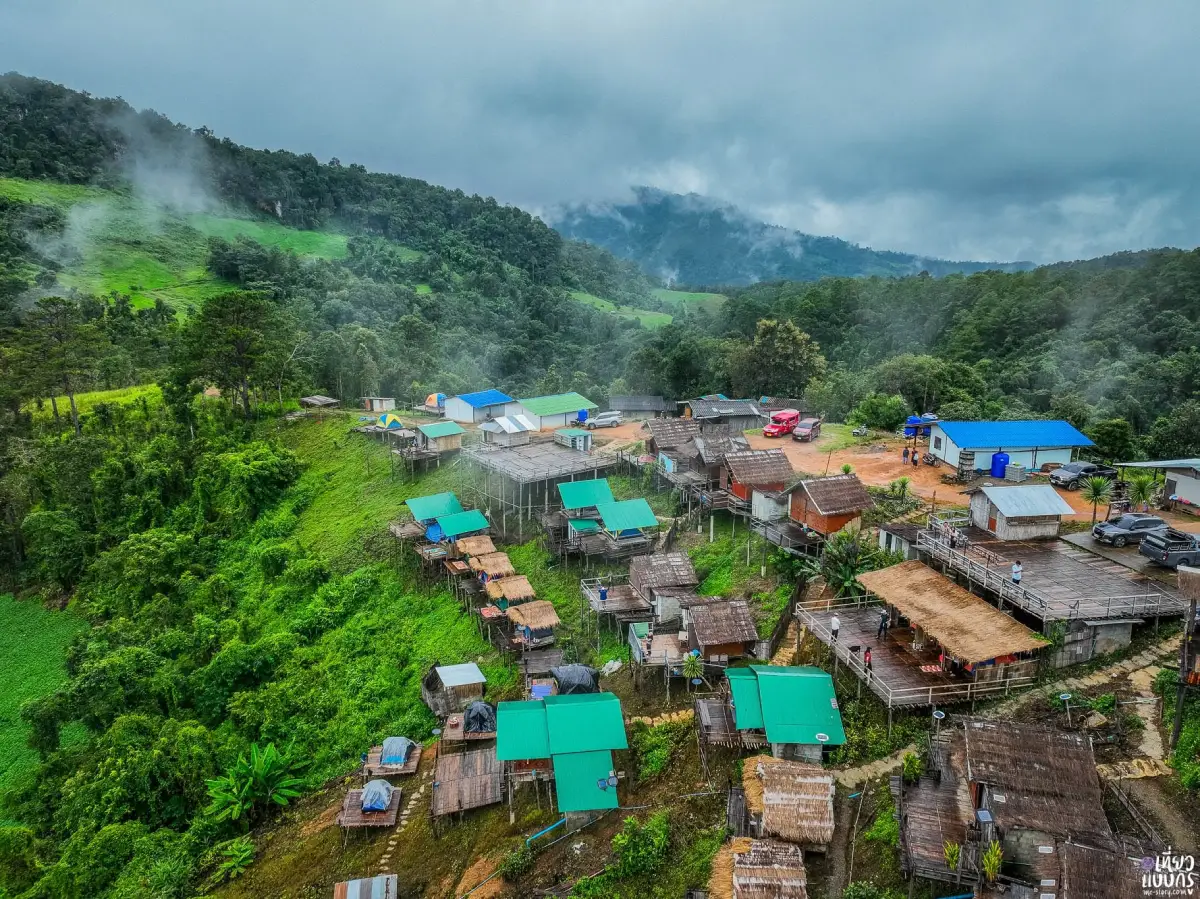
1. Mae Kampong Village, Chiang Mai is one of Northern Thailand's best-known community-based tourism destinations. Located in Huai Kaeo Subdistrict, Mae On District, Chiang Mai Province, the village lies in a secluded valley surrounded by lush green forests, with streams flowing alongside traditional houses and a pleasantly cool climate for much of the year. Mae Kampong's distinctive appeal comes from its combination of natural beauty, traditional village life, and Lanna cultural heritage. Visitors can stroll through the community, stay in a local homestay, relax at streamside cafés, and learn about traditional livelihoods directly from local residents.
Highlights: Traditional mountain village, wooden houses, streams running through the community, Wat Khantha Phueksa, Mae Kampong Waterfall, traditional miang tea gardens, coffee plantations, community homestays, streamside cafés, and mountain viewpoints.
Mae Kampong Village stands at approximately 1,300 meters above sea level. Its setting is a forested mountain valley with abundant vegetation and streams flowing through the community, creating a cool, humid, and naturally shaded environment. Houses are built along the winding village road and across the surrounding slopes, while some stand so close to the stream that the sound of flowing water can be heard throughout the day. This settlement pattern, closely adapted to the surrounding landscape, is one of the main reasons Mae Kampong feels so different from destinations in urban areas.
The history of Mae Kampong is associated with settlers who moved into the area from nearby communities more than a century ago. Tea cultivation, particularly the production of miang, became the principal traditional occupation before coffee growing and other locally produced goods developed into additional sources of income. The village's name is associated with the kampong flower, traditionally found around local streams. This connection between the name and the natural environment reflects the close relationship between village life and the surrounding forest.
Making miang is an important part of Northern Thai culinary heritage. Tea leaves harvested from local gardens are steamed and fermented using traditional methods before being eaten as a local snack. The cultivation of miang is also closely connected to forest management because tea plants thrive in moist, shaded environments. Learning about the production of miang therefore offers insights into Northern Thai food traditions, agricultural practices, and the community's approach to using natural resources.
As community-based tourism has become more popular, Mae Kampong has developed accommodation, restaurants, cafés, and local learning activities while retaining much of its traditional character. Many households have converted parts of their homes into homestays, allowing visitors to experience the village beyond a brief daytime stop. Staying overnight is particularly rewarding because the mornings and evenings are quieter, especially before day-trip visitors arrive and after they have departed.
Another important part of Mae Kampong's charm is the way its architecture blends into the natural environment. Traditional wooden houses line the narrow main road, while shops and cafés are often built beside flowing streams. Visitors can take a leisurely walk, sample Northern Thai dishes, shop for local products, and enjoy coffee while looking out over the surrounding forest. Exploring slowly reveals the details of everyday life and the relationships within the community in a way that a quick photography stop rarely can.
Wat Khantha Phueksa, also known as Wat Mae Kampong, is an important religious center for local residents. It features traditional wooden architecture and a distinctive ordination hall set amid water. The temple serves as both a spiritual center and a place for Buddhist ceremonies and community traditions. Visiting the temple provides an opportunity to understand the role of religion in a Northern Thai village, where temples remain central to cultural continuity and social life.
Mae Kampong Waterfall is another natural attraction located close to the village. Water flows down several rocky levels through a green forest environment, creating a cool and peaceful setting for nature walks and relaxation. Visitors should take care on wet rocks and slippery paths, particularly during the rainy season, when the volume of water increases and some sections may become difficult to navigate.
Travelers who want a broader view of the mountain landscape can also visit viewpoints in the hills surrounding Mae Kampong. From elevated locations, it is possible to appreciate the forested valley and surrounding mountain ridges. On some mornings, mist drifts over the treetops, adding another dimension to the scenery. Access roads to these viewpoints can be steep and winding, so weather and road conditions should be considered before traveling.
Mae Kampong can be visited throughout the year. The cool season is particularly popular because of the refreshing mountain air, while the rainy season brings especially lush vegetation and fuller streams. Travelers with only one day can explore the village, visit the temple, and stop at the waterfall. Staying overnight, however, allows more time to enjoy the atmosphere of the community during its quietest hours.
Because Mae Kampong is a living residential community rather than a purpose-built tourist attraction, visitors should be considerate of local residents. Keep noise levels low, respect private property, avoid disturbing homes, and never leave litter in the streams or surrounding forest. Supporting locally owned businesses, homestays, and community products also helps distribute tourism income among residents and encourages the preservation of the village's distinctive identity.
Open Days: The village can be visited daily. Individual shops, accommodation providers, and activities operate according to their own schedules.
Best Time to Visit: Early morning, particularly from the late rainy season through the cool season.
Getting There: From Chiang Mai city, take Highway 118 toward Doi Saket District, then follow the roads leading to Mae On District and Huai Kaeo Subdistrict. The village is approximately 50 kilometers from central Chiang Mai. Some sections of the final approach are steep and winding. Drive carefully, especially during rain or when visibility is reduced by fog.
Map (GPS):Get Directions to Mae Kampong Village
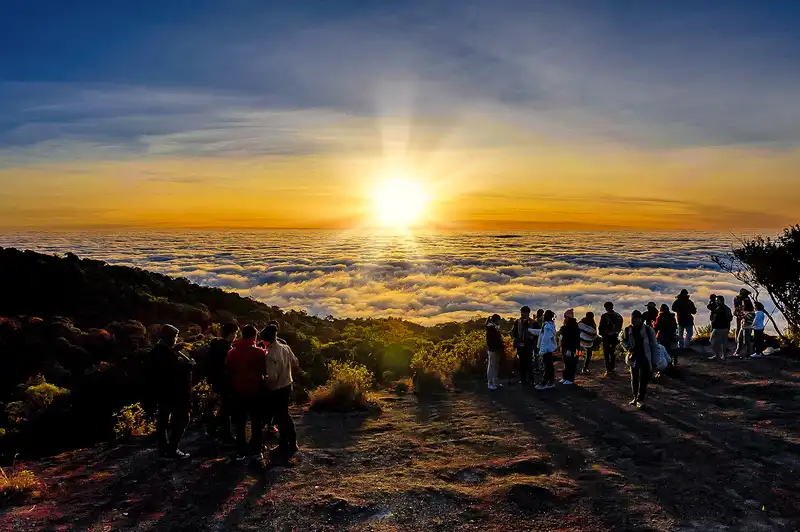
2. Doi Inthanon National Park, Chiang Mai is one of Thailand's most important natural attractions. Located in Chiang Mai Province, the park is home to Doi Inthanon, which rises approximately 2,565 meters above sea level and is the highest mountain summit in Thailand. The park contains diverse forest ecosystems, impressive waterfalls, nature trails, significant royal pagodas, and numerous viewpoints overlooking the surrounding mountains. It is an excellent destination for travelers who want to experience cool mountain weather, see a sea of mist, discover high-altitude ecosystems, and learn about the importance of watershed conservation.
Highlights: Doi Inthanon Summit, Thailand's highest point, Ang Ka Nature Trail, Kew Mae Pan Nature Trail, the Twin Royal Pagodas of Naphamethanidon and Naphaphonphumisiri, Wachirathan Waterfall, Mae Klang Waterfall, seas of mist, and high-altitude evergreen forest.
Doi Inthanon lies within the Thanon Thong Chai mountain range, one of the most important mountain systems in Northern Thailand. Considerable differences in elevation create distinct changes in climate and vegetation. As visitors travel from the foothills toward the summit, they pass through different forest environments, including forests on mountain slopes, humid montane evergreen forests, and more open areas that offer sweeping views of the surrounding ranges. This ecological diversity makes the national park an important destination for nature education and environmental conservation.
The mountain was formerly known as Doi Luang, meaning the Great Mountain, before being renamed Doi Inthanon in honor of King Inthawichayanon, the seventh ruler of Chiang Mai. He recognized the importance of preserving forests and watershed areas and expressed the wish that a portion of his remains be placed on the mountain after his death. This history gives Doi Inthanon significance not only as a natural landmark but also as a place connected with Lanna history and the cultural memory of Northern Thailand.
The summit area is one of the park's most popular destinations. Temperatures at this altitude are noticeably lower than in the surrounding lowlands, particularly during the cool season. Occasionally, temperatures fall sufficiently for frost to form, a phenomenon known locally as mae khan. The surrounding high-altitude forest supports plants adapted to cool temperatures and high humidity. Visitors should therefore bring suitable warm clothing, even when Chiang Mai city is experiencing much milder weather.
Ang Ka Nature Trail is one of the most interesting places in the park for travelers who want to explore a montane evergreen forest. This area has consistently high humidity, encouraging the growth of mosses, ferns, and epiphytic plants across tree trunks, branches, and the forest floor. The resulting environment is lush and atmospheric, quite different from forests at lower elevations. Following the designated trail allows visitors to observe these plant communities and understand how mountain forests help retain moisture.
Kew Mae Pan Nature Trail is famous for its ridgeline landscapes and expansive views across mountain valleys. Sections of the trail pass through shaded forest before emerging onto open viewpoints where travelers may see distant ridges and seas of mist in favorable weather. The trail is especially popular during the cool season, although access is managed seasonally to protect the environment. Visitors should confirm the current opening period and national park requirements before making plans.
The Twin Royal Pagodas, Phra Mahathat Naphamethanidon and Phra Mahathat Naphaphonphumisiri, are among Doi Inthanon's most recognizable landmarks. The two pagodas stand amid high mountain scenery and beautifully maintained gardens. They were built to commemorate important royal occasions associated with King Bhumibol Adulyadej (Rama IX) and Queen Sirikit. The surrounding grounds offer an opportunity to admire the pagodas, enjoy the landscaped gardens, and appreciate sweeping views of the mountain environment.
In addition to the summit and nature trails, Doi Inthanon National Park contains several impressive waterfalls, particularly Wachirathan Waterfall and Mae Klang Waterfall. Wachirathan is known for its powerful flow over a high rock face, which produces fine spray around the viewing area. Mae Klang Waterfall lies closer to the park's main approach road and makes a convenient stop while traveling into the mountains. Visitors should be cautious on wet surfaces and near strong currents, following park safety instructions at all times.
Doi Inthanon's importance goes beyond its status as Thailand's highest mountain. The park protects vital watershed areas and supports considerable biodiversity. Mountain forests help absorb and retain rainwater and moisture, sustaining streams that flow toward lower-lying communities. Many plants and animals are adapted to the specialized conditions of high-altitude forest, making the area particularly valuable for ecological research, nature education, and long-term conservation.
Travelers with only one day can plan an itinerary that includes the summit, the Twin Royal Pagodas, a nature trail, and selected waterfalls, depending on available time and access conditions. Those who want to experience the nature trails in greater detail should allow additional time and check the requirements for each route. Leaving Chiang Mai early in the morning is advisable, providing more daylight for sightseeing and the descent from the mountains.
The cool season is the most popular time to visit Doi Inthanon because of its low temperatures and opportunities to see morning mist. During the rainy season, the forests become especially green and the waterfalls carry more water. However, mountain weather can change quickly, bringing dense fog, rain, and strong winds. Visitors should check the weather forecast and prepare clothing and equipment suitable for high-altitude conditions.
Open Days: Generally open daily, although certain nature trails and attractions may close seasonally or in accordance with national park announcements.
Opening Hours: Main visitor areas generally operate from 05:30 – 18:30. Hours and access conditions may vary by location.
Getting There: From Chiang Mai city, follow Highway 108 toward Chom Thong District, then take Highway 1009 into Doi Inthanon National Park. The mountain road has steep gradients and numerous bends. Check your vehicle's condition, particularly the braking system, and review weather conditions before departure, especially during heavy rain or dense fog.
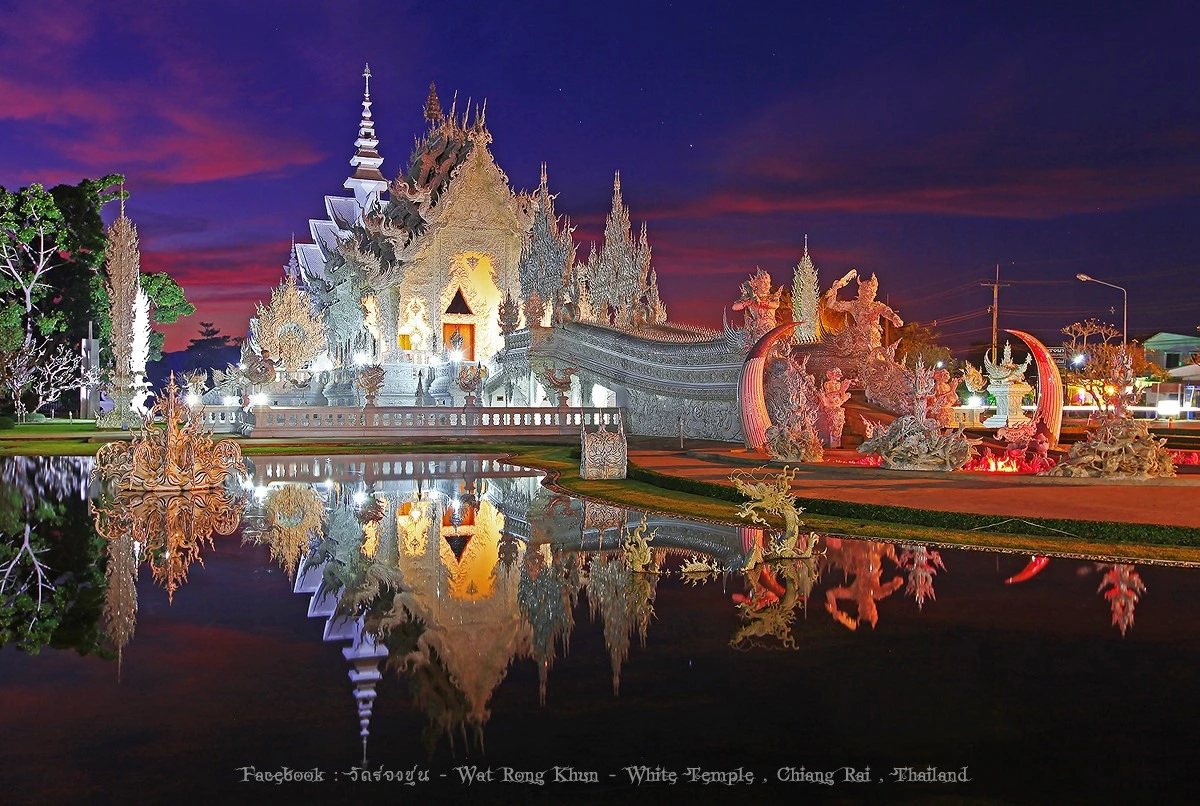
3. Wat Rong Khun (White Temple), Chiang Rai is one of Thailand's most internationally recognized artistic and cultural attractions. Located in Pa O Don Chai Subdistrict, Mueang Chiang Rai District, Chiang Rai Province, the temple is celebrated for its dazzling white ordination hall decorated with small pieces of mirrored glass and elaborate sculptures expressing Buddhist teachings. Wat Rong Khun is the visionary creation of Chalermchai Kositpipat, a renowned Thai National Artist who combines traditional Thai artistic techniques with contemporary imagination. The result has become an iconic landmark of Chiang Rai and a destination attracting visitors from around the world.
Highlights: The White Ordination Hall, Bridge to Enlightenment, sculpted hands representing the cycle of suffering, intricate stucco and mirrored decorations, the golden building, contemporary interior murals, and Buddhist-inspired art by Chalermchai Kositpipat.
Wat Rong Khun existed as a local community temple before its transformation into a major contemporary Buddhist art destination. A significant turning point came in 1997, when Chalermchai Kositpipat began redesigning and rebuilding the temple with the intention of creating an artistic offering to Buddhism. His vision was not limited to architectural beauty. Instead, the overall design uses shapes, colors, sculptures, and decorative details to communicate Buddhist philosophy and encourage visitors to reflect on spiritual development.
The white ordination hall, or ubosot, is the centerpiece of Wat Rong Khun. Its white color represents the purity of the Buddha, while the small pieces of mirrored glass covering the structure symbolize the radiance of Buddhist wisdom. Under sunlight, the building reflects countless points of light, creating a remarkable appearance that changes throughout the day. The detailed stucco work and elaborate Thai decorative patterns reveal both the skill of local craftsmen and the distinctive artistic vision behind the temple.
The bridge leading toward the ordination hall is one of the temple's most memorable features. It symbolizes the journey from the cycle of suffering and attachment toward enlightenment. Beneath the approach are numerous sculpted hands reaching upward, representing suffering, desire, greed, and human attachment. Walking across the bridge can therefore be understood as a symbolic journey away from worldly cravings and toward spiritual understanding and liberation.
Many other architectural details throughout Wat Rong Khun carry symbolic meaning. Sculptures of mythical creatures, naga serpents, lotus flowers, intricate stucco forms, and traditional Thai motifs express ideas associated with Buddhist teachings. These elements were created not simply as decoration but as a visual language about overcoming attachment and developing wisdom. Exploring the temple thoughtfully allows visitors to discover religious concepts through its artwork.
Inside the ordination hall, contemporary murals combine modern imagery and events with Buddhist philosophy. The paintings demonstrate how religious art can incorporate symbols associated with today's world to communicate enduring spiritual ideas. They encourage reflection on suffering, attachment, the changing nature of society, and the search for values beyond material possessions.
The golden building is another visually striking feature of Wat Rong Khun. Its rich golden color contrasts dramatically with the pure white ordination hall. In the temple's symbolic interpretation, gold represents the material world and attachment to external possessions, while white represents spiritual purity. This deliberate contrast communicates the difference between material wealth and inner wisdom through architecture.
Wat Rong Khun also plays an important role as a center for contemporary Thai art. Chalermchai's work has introduced Thai artistic traditions to a broad international audience, including travelers, students, artists, and people interested in religion and culture. The temple is therefore much more than an attractive photography location. It is a place where artistic imagination, religious devotion, and the craftsmanship of Thai artists come together in an unusually ambitious project.
The earthquake that struck Chiang Rai on May 5, 2014, affected some of the buildings and artworks at Wat Rong Khun. Subsequent inspections and restoration work made it possible for the temple to welcome visitors again. The event highlighted the importance of preserving delicate artistic structures and demonstrated the commitment to maintaining one of Chiang Rai's most distinctive cultural landmarks.
Visitors should allow approximately one to two hours to explore Wat Rong Khun without rushing. This provides time to admire the white ordination hall, sculptures, auxiliary buildings, and surrounding grounds. Morning visits are particularly pleasant because temperatures are generally lower and natural light brings out the details of the architecture. Visitors should dress modestly, respect the religious setting, and follow any restrictions on photography within designated areas.
Wat Rong Khun is an excellent starting point for a one-day sightseeing itinerary in Chiang Rai. It can be combined with nearby attractions such as Wat Rong Suea Ten, often called the Blue Temple, Baan Dam Museum, and other important landmarks around Chiang Rai city. Planning the stops along a practical route helps reduce travel time and allows visitors to spend more time exploring each location.
Open Days: Daily.
Opening Hours: Monday – Friday: 08:00 – 17:00. Saturday – Sunday: 08:00 – 17:30.
Getting There: Wat Rong Khun is located along Phahonyothin Road in Pa O Don Chai Subdistrict, Mueang Chiang Rai District, approximately 12 kilometers from central Chiang Rai. The temple can be reached conveniently by private car, rental car, taxi, or hired local transport. It is also suitable for a day trip that includes other cultural attractions in and around Chiang Rai.

4. Wat Phra That Pha Sorn Kaew, Phetchabun is one of the most remarkable Buddhist attractions in Northern Thailand. Located in Khaem Son Subdistrict, Khao Kho District, Phetchabun Province, the temple is surrounded by the layered ridges and valleys of the Phetchabun mountain range. It is renowned for its extraordinary contemporary Buddhist architecture, which combines colorful ceramic mosaics, decorative tiles, porcelain, and mirrored glass with religious symbolism. Its most recognizable feature is the magnificent Five Buddhas Pavilion, where five large white seated Buddha statues are arranged one behind another, alongside the elaborate, lotus-shaped Phra That Pha Sorn Kaew Pagoda.
Highlights: Five Buddhas Pavilion, five overlapping white Buddha statues, Phra That Pha Sorn Kaew Pagoda, colorful ceramic and porcelain mosaics, panoramic mountain viewpoints, mist-filled valleys, and the Khao Kho–Khaem Son scenic route.
The temple stands on a hillside in Khaem Son, an area distinguished by high mountains and deep valleys. From different parts of the grounds, visitors can admire ridgelines stretching into the distance, sometimes with layers of mist drifting between them. This spectacular setting creates an atmosphere unlike that of temples on the plains. The natural landscape forms a dramatic backdrop to the temple's architecture, making the combination of artistic creativity and mountain scenery an essential part of its character.
The temple's development is closely associated with the establishment of a peaceful Buddhist meditation and learning center. The intention was to create an environment suitable for meditation, spiritual reflection, and the study of Buddhist teachings. The architecture and landscaped surroundings were designed to encourage tranquility and contemplation. Visitors therefore encounter not only impressive religious art but also a setting that reflects the principles of inner peace and spiritual practice.
The name Pha Sorn Kaew is associated with the surrounding mountain landscape and a local legend concerning a mysterious crystal-like orb seen near the cliffs. This story has become part of the identity of the temple, connecting Buddhist devotion with the distinctive natural features of the area.
One of the temple's architectural masterpieces is Phra That Pha Sorn Kaew Pagoda, designed as a seven-level lotus-shaped structure. Its surfaces are covered with colorful tiles, porcelain, ceramic dishes, glass, and other decorative materials arranged into intricate patterns. The combination of colors, textures, and reflected light creates an appearance that changes subtly throughout the day. The pagoda is both a sacred religious structure and an exceptional example of contemporary Buddhist artistic expression.
The lotus shape carries deep meaning in Buddhist symbolism. A lotus grows from muddy water yet rises above the surface to bloom, representing purity and the development of the mind beyond worldly attachments. In this context, the ornate lotus-shaped pagoda expresses spiritual values through architectural form while inviting visitors to appreciate the craftsmanship involved in its creation.
The Five Buddhas Pavilion is perhaps the most photographed feature of Wat Phra That Pha Sorn Kaew. Five enormous white Buddha statues are arranged in a descending sequence, creating the impression of overlapping figures when viewed from the front. The white sculptures stand against a backdrop of blue sky and green mountains, producing an exceptionally striking scene. The pavilion is both a place of worship and a landmark that has become strongly associated with the Khao Kho region.
The five Buddha statues refer to a Buddhist tradition concerning the five Buddhas of the present auspicious eon, or Bhadrakalpa. Through their arrangement and scale, the sculptures translate religious concepts into a visual form that can be appreciated even by visitors unfamiliar with Buddhist art.
The temple grounds have been arranged to take advantage of the surrounding scenery. Walkways and open spaces provide different perspectives over the mountains, and early morning visitors may encounter mist hanging in the valleys. The combination of quiet surroundings, mountain air, and carefully designed architecture makes the experience particularly memorable during the cooler months.
Another distinctive feature is the extraordinary attention given to decorative detail. Ceramic fragments and colorful materials appear across the buildings, walls, walkways, and other structures. Each area reveals different patterns and artistic techniques. Visitors interested in design and craftsmanship may find that exploring the smaller details is just as rewarding as photographing the larger monuments.
Although Wat Phra That Pha Sorn Kaew is a popular tourist attraction, it remains an active Buddhist temple and meditation center. Visitors should dress modestly, remain quiet in areas used for religious practice, and respect people who are praying or meditating. Walking routes and access restrictions should also be observed.
The cool season is especially popular because of the lower temperatures and clear mountain views. The late rainy season and early cool season can be particularly beautiful, with lush green hills and the possibility of mist above the valleys. During the rainy season, visitors should exercise extra caution on wet mountain roads and in areas with reduced visibility.
Wat Phra That Pha Sorn Kaew can be combined with other attractions in Khao Kho, including mountain viewpoints, farms, flower gardens, and scenic stops along Highway 12. A practical one-day itinerary might begin with a morning visit to the temple, followed by an afternoon exploring the surrounding countryside.
Photography enthusiasts will find that morning light brings out the atmosphere of the mountains, while brighter midday light reveals the colors and textures of the mosaics. Allow approximately one to two hours to explore the pagoda, Five Buddhas Pavilion, and surrounding grounds without rushing. Always avoid obstructing worshippers or entering restricted areas while taking photographs.
Visiting Wat Phra That Pha Sorn Kaew brings together several of the experiences that make Northern Thailand appealing: mountain scenery, contemporary Buddhist art, and the living traditions of religious devotion. The temple is an outstanding destination for travelers seeking both natural beauty and cultural understanding in the Phetchabun highlands.
Open Days: Daily.
Opening Hours: 08:00 – 17:00.
Getting There: Wat Phra That Pha Sorn Kaew is located in Khaem Son Subdistrict, Khao Kho District, Phetchabun Province. Follow Highway 12, the Phitsanulok–Lom Sak route, then take the connecting road toward the temple. The final approach passes through mountainous terrain with winding and sometimes steep sections. Check road and weather conditions before traveling, particularly during heavy rain or dense fog.

5. Phu Thap Boek, Phetchabun is one of Thailand's most famous highland destinations. Located in Wang Ban Subdistrict, Lom Kao District, Phetchabun Province, it rises approximately 1,768 meters above sea level and is the highest point in Phetchabun. The area is known for its sweeping mountain views, refreshingly cool temperatures, seas of mist that appear under suitable weather conditions, and the distinctive way of life of its Hmong highland community. Travelers can experience spectacular scenery while learning about local agriculture and mountain culture.
Highlights: Morning seas of mist, panoramic mountain viewpoints, cool mountain weather, cabbage fields, Hmong community life, sunrise and sunset views, seasonal wild Himalayan cherry blossoms, and routes connecting to Phu Hin Rong Kla National Park.
Phu Thap Boek consists of high ridges, steep slopes, and open viewpoints overlooking an extensive mountain landscape. On mornings when temperature and humidity conditions are favorable, mist collects within the valleys and forms an impressive sea of clouds beneath the surrounding peaks. During the cool season, temperatures on the mountain are significantly lower than those in the lowlands, making it an attractive destination for travelers seeking cool weather without traveling to Thailand's far northern provinces.
The highland community's way of life is closely connected with mountain agriculture, particularly the cultivation of cabbage. Vegetable fields planted along the slopes have become one of the area's most recognizable features, forming distinctive patterns across the hillsides. Visiting Phu Thap Boek offers opportunities to observe local farming practices and learn about Hmong culture. Visitors should respect working farmland, avoid walking into cultivated plots, and refrain from disturbing residents during their daily activities.
Phu Thap Boek has several mountain viewpoints and a variety of accommodation options. Staying overnight is an excellent way to enjoy the changing atmosphere from afternoon to morning, especially when clear skies reveal mountain ridges extending across the horizon. Overnight stays also reduce the need to complete the steep mountain drive in a single day. However, travelers should check accommodation availability, road accessibility, and weather forecasts in advance.
The area can be combined with nearby Phu Hin Rong Kla National Park, which is known for unusual rock formations such as Lan Hin Taek and Lan Hin Pum, as well as important historical sites. Exploring both places allows visitors to experience highland scenery and learn about the region's modern history. A two-day, one-night itinerary is a practical option for combining Phu Thap Boek with Phu Hin Rong Kla.
The rainy season through the cool season is especially popular, as these months can offer misty valleys and pleasant mountain temperatures. The landscape is particularly green toward the end of the rainy season. However, a sea of mist cannot be guaranteed, because its appearance depends on actual weather conditions. Visitors should pack warm clothing and drive carefully on the narrow, steep, and winding mountain roads.
Open Days: Daily.
Opening Hours: General viewpoints are accessible throughout the day, while shops, accommodation providers, and individual visitor facilities operate according to their own schedules.
Getting There: From Phetchabun city, travel through Lom Sak toward Lom Kao District, then follow the road up to Phu Thap Boek in Wang Ban Subdistrict. The journey is approximately 90 kilometers from Phetchabun city. The mountain road includes sustained climbs and numerous sharp bends, so drivers should ensure their vehicles are in good condition and maintain safe speeds.
Map (GPS):Get Directions to Phu Thap Boek

6. Mon Jam (Doi Mon Jam), Chiang Mai is a well-known mountain viewpoint in Mae Rim District, Chiang Mai Province. It lies near the Hmong community of Nong Hoi and the highland agricultural area associated with the Royal Project Nong Hoi Development Center. Mon Jam is particularly appealing for its panoramic mountain scenery, cool air, and open ridgelines overlooking the surrounding valleys. It is a popular destination for travelers who want to experience the atmosphere of Northern Thailand's mountains without venturing too far from Chiang Mai city.
Highlights: Mon Jam mountain viewpoint, layered mountain scenery, occasional seas of mist, seasonal flower gardens, the Hmong community of Nong Hoi, highland agricultural produce, and the Mae Rim scenic route.
Mon Jam occupies a ridge that provides wide views of the surrounding mountain landscape. Visitors can enjoy the sight of distant hills extending toward the horizon and experience noticeably cooler temperatures, especially in the morning and during the cool season. Under favorable weather conditions, mist may drift through the valleys below, making Mon Jam especially appealing to photographers and travelers looking for a peaceful mountain retreat.
The development of Mon Jam is closely connected with the Royal Project Nong Hoi and agricultural development in highland communities. These initiatives have promoted the cultivation of suitable cool-climate crops and encouraged farming practices adapted to mountain environments. The area therefore has significance beyond tourism, illustrating changes in local agriculture and efforts to improve livelihoods in highland communities.
The surrounding landscape contains agricultural attractions, seasonal flower gardens, restaurants, cafés, and places to relax. Travelers may have opportunities to see cool-climate produce and learn about farming practices suited to higher elevations. Because flower gardens and individual businesses may change their operations according to the season, it is advisable to check their current availability before traveling.
Mon Jam can be explored on a day trip alongside other attractions in Mae Rim District, including the Royal Project Nong Hoi area and nearby natural destinations. Visitors who prefer more time in the mountains may stay overnight in appropriately operated accommodation, while taking local weather and site-specific access rules into account.
The cool season is the most popular time to visit Mon Jam, offering pleasant mountain temperatures and scenic views. During the late rainy season and early cool season, the landscape is especially green. Access roads include steep and winding sections, so drivers should be cautious, particularly when rain or fog reduces visibility.
Open Days: General visitor areas can be accessed daily, although individual zones and facilities operate under the arrangements of their respective managers.
Getting There: From Chiang Mai city, follow the road toward Mae Rim District, then continue through the Pong Yaeng area toward the Nong Hoi community and Mon Jam. The final mountain road contains numerous bends and steep sections. Drive carefully and check conditions before departure.
Map (GPS):Get Directions to Mon Jam

7. Ban Rak Thai, Mae Hong Son is a distinctive mountain village known for its Chinese-Yunnan cultural heritage. Located in Mok Cham Pae Subdistrict, Mueang Mae Hong Son District, near the Thailand–Myanmar border, the village surrounds a peaceful lake, with traditional houses, restaurants, and accommodation built along the surrounding hillsides. Visitors come to enjoy the cool mountain atmosphere, drink Yunnanese tea, sample regional Chinese dishes, and admire the scenery of the lake and encircling mountains.
Highlights: Ban Rak Thai Lake, early morning mist, tea plantations, Yunnanese-style architecture, traditional Chinese-Yunnan cuisine, hot tea, lakeside homestays, and the scenic route connecting Ban Rak Thai with Pang Ung.
The history of Ban Rak Thai is closely associated with the settlement of Yunnanese Chinese people and former Chinese Nationalist soldiers who moved into parts of Northern Thailand following political upheaval in China. This heritage remains visible in the village's language, cuisine, tea cultivation, and architecture, giving Ban Rak Thai a cultural identity distinct from many other communities in Mae Hong Son Province.
The lake at the center of the village is one of its defining features. Calm water reflects traditional-style buildings and the surrounding mountains. On cool mornings, when humidity and temperature conditions are favorable, a thin layer of mist may hover above the lake, creating an atmospheric scene that is particularly popular with photographers. Walking around the lakeside in the morning and evening reveals different aspects of the village as the natural light changes.
Tea cultivation is an important part of the local economy and cultural identity. The cool highland environment is suitable for growing several crops, including oolong tea, one of the village's best-known products. Visitors can purchase locally grown tea and learn about tea-drinking customs associated with Yunnanese Chinese culture while enjoying the relaxed surroundings.
The cuisine of Ban Rak Thai differs noticeably from typical Northern Thai food because of its Yunnanese Chinese influences. Popular dishes include pork leg served with steamed mantou buns, Chinese-style stir-fries, braised dishes, and food incorporating tea leaves or other highland ingredients. Enjoying a meal beside the lake is one of the most memorable cultural experiences available in the village.
Ban Rak Thai is particularly rewarding as an overnight destination because staying at least one night provides the chance to experience the lake at sunrise and the quiet atmosphere after day visitors leave. It can be combined with a visit to Pang Ung and other attractions in Mok Cham Pae Subdistrict. Travelers should allow sufficient time for the winding mountain roads leading to the area.
Open Days: The village can be visited daily. Shops, restaurants, and accommodation providers operate according to their own schedules.
Getting There: From Mae Hong Son town, follow the road toward Mok Cham Pae Subdistrict, then continue along the mountain route to Ban Rak Thai. The journey includes numerous bends and steep sections. Extra care is required during rain or dense fog.
Map (GPS):Get Directions to Ban Rak Thai

8. Khao Kho, Phetchabun is a famous mountain destination known for its cool climate, extensive mountain views, and seasonal seas of mist. Located in Khao Kho District, Phetchabun Province, the area consists of numerous hills and valleys dotted with viewpoints, accommodation, and natural attractions. It is ideal for travelers seeking a relaxing mountain getaway, scenic photography opportunities, and the chance to explore both historical landmarks and important Buddhist sites.
Highlights: Khao Kho viewpoints, seas of mist, cool weather, Khao Kho Sacrificial Monument, Khao Kho Royal Palace, farms and flower gardens, the Khao Kho–Khaem Son scenic route, and Wat Phra That Pha Sorn Kaew.
Khao Kho is characterized by mountain ridges and valleys at varying elevations, creating extensive viewpoints across the surrounding landscape. In the early morning, mist sometimes gathers over the lower valleys, forming the famous sea-of-mist scenery. Temperatures during the cool season are noticeably lower than those of nearby lowland areas, while the rainy season brings lush green forests and farmland.
The Khao Kho region also has an important place in Thailand's modern history because of past political conflict and fighting between government forces and the Communist Party of Thailand. The Khao Kho Sacrificial Monument is one of the landmarks associated with this period. Visiting historical sites adds a different dimension to a trip otherwise focused on the mountains, allowing travelers to learn more about the area's significance in contemporary Thai history.
In addition to viewpoints and historic landmarks, Khao Kho contains agricultural attractions, flower gardens, restaurants, and a wide variety of accommodation. Visitors can explore plantations, stop for a meal with mountain views, or simply relax in the cooler surroundings. Since the attractions are scattered across different hills and valleys, organizing stops along the same road is an effective way to avoid unnecessary driving.
A stay of at least two days and one night is recommended for travelers hoping to experience the early morning mist and spend time relaxing in the highlands. Khao Kho can be combined with Wat Phra That Pha Sorn Kaew, Phu Thap Boek, and nearby natural destinations, depending on the available time. Mountain-road and weather conditions should always be checked before departure.
Open Days: General tourism areas are accessible daily, although individual attractions and businesses maintain their own operating schedules.
Getting There: From Phetchabun city, follow the roads toward Khao Kho District. Alternatively, travelers coming from Phitsanulok can use Highway 12 before turning toward the Khao Kho highlands. Drive carefully on the winding mountain roads.
Map (GPS):Get Directions to Khao Kho

9. Wat Phumin, Nan is an important historic temple and cultural landmark in Nan Province. Located in Nai Wiang Subdistrict, Mueang Nan District, within Nan's historic town center, the temple is distinguished by its unusual cruciform viharn and celebrated wall paintings. Its most famous mural, commonly known as Pu Man Ya Man or the Whisper of Love, has become one of the most recognizable cultural images associated with Nan.
Highlights: Cruciform viharn, Buddha images within the temple hall, the famous Pu Man Ya Man mural, paintings depicting historical life in Nan, Lanna–Nan architecture, and walking routes through Nan's old town.
Wat Phumin is an important religious site that reflects the artistic and cultural achievements of historic Nan. The temple's main hall is unusual because it follows a cruciform plan with entrances facing four directions. Inside are Buddha images facing outward in different directions, creating an exceptionally balanced architectural arrangement. This distinctive design makes Wat Phumin stand apart from more conventional Northern Thai temple buildings.
The murals inside the viharn are among the temple's greatest treasures. They illustrate Buddhist stories alongside scenes of everyday life, including clothing, traditional houses, social relationships, and customs of the people of Nan. Their value extends beyond their artistic quality, as they provide important visual evidence of the region's historical society and cultural traditions.
The most celebrated mural is known as Pu Man Ya Man. It portrays a man and woman standing close together, apparently engaged in an intimate whispered conversation. The image has become affectionately known as the Whisper of Love. Its expressive figures, delicate linework, and subtle colors reveal the exceptional skills of the artists who created it, and it remains a defining symbol of Nan's cultural heritage.
Wat Phumin is conveniently located near other important attractions in the historic center of Nan, including Nan National Museum, Wat Phra That Chang Kham Worawihan, and the town's main public square. Visitors can explore these sites on foot and gain a deeper understanding of Nan's historical development, religious traditions, and artistic heritage without needing to travel far between stops.
Visitors should dress modestly and maintain a respectful atmosphere inside the viharn, which is both an active religious space and a place where fragile historic paintings are preserved. Do not touch the painted walls, and observe any restrictions on photography.
Open Days: Daily.
Getting There: Wat Phumin is located in Nan's historic town center, Nai Wiang Subdistrict, Mueang Nan District. It can be reached by car or bicycle and easily combined with a walking tour of Nan National Museum and nearby temples.
Map (GPS):Get Directions to Wat Phumin
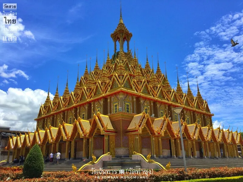
10. Wat Chantharam (Wat Tha Sung), Uthai Thani is one of the best-known Buddhist temples and pilgrimage destinations in Uthai Thani Province. Located in Nam Suem Subdistrict, Mueang Uthai Thani District, the temple is celebrated for its richly decorated religious buildings, particularly the magnificent Crystal Hall and Golden Castle. These striking structures make it a major destination for worshippers and travelers interested in contemporary Thai Buddhist architecture.
Highlights: The 100-Meter Crystal Hall, Golden Castle, revered Buddha images, mirrored interior decorations, Luang Pho Ruesi Ling Dam, and the religious and cultural landscape near the Sakae Krang River.
Wat Chantharam has a long history and underwent major development under Phra Ratchaphromyan, better known as Luang Pho Ruesi Ling Dam, a respected Buddhist monk associated with religious teaching and meditation practice. Under his leadership, the temple developed into a significant center of Buddhist faith, receiving worshippers from across Thailand. Numerous important buildings were constructed or expanded to support religious ceremonies, meditation, and pilgrimage.
The 100-Meter Crystal Hall is one of Wat Tha Sung's most famous attractions. Its interior is extensively decorated with reflective glass, creating a dazzling appearance as light moves across the surfaces. The remarkable architectural design distinguishes the hall from more conventional Buddhist assembly buildings. The interior also contains sacred religious objects revered by visitors and worshippers.
The Golden Castle is another major landmark. Its elaborate architecture and intricately decorated exterior express the dedication involved in creating an important Buddhist religious complex. Exploring both the Golden Castle and the Crystal Hall provides an opportunity to appreciate two very different yet equally striking styles of sacred architecture within the same temple.
Wat Tha Sung also remains an active center for Buddhist teaching and religious practice. Visitors should dress modestly and respect the temple's regulations, particularly because some important buildings operate on specific visiting schedules. Planning around these opening periods will help ensure sufficient time to explore the main attractions.
A visit to Wat Tha Sung can be combined with other attractions in Uthai Thani town and along the Sakae Krang River. Travelers interested in history, local cuisine, and community life can explore the province on a day trip or stay overnight to discover more of Uthai Thani's distinctive riverside atmosphere.
Open Days: Daily, although individual buildings have their own visiting schedules.
Opening Hours: Some important buildings generally admit visitors during two periods: 09:00 – 11:30 and 14:00 – 16:00.
Getting There: From Uthai Thani town, travel toward Nam Suem Subdistrict following the route to Wat Chantharam. The temple is accessible by private car or hired local transport.
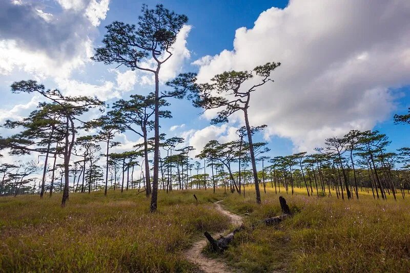
11. Phu Soi Dao National Park, Uttaradit and Phitsanulok is a celebrated mountain destination for trekking and wilderness camping. The national park covers parts of Uttaradit and Phitsanulok Provinces and is best known for Phu Soi Dao mountain and its Three-Needle Pine Plateau. These highland landscapes attract travelers who enjoy physically demanding hikes, pristine nature, and the opportunity to explore mountain ecosystems away from busy tourist areas.
Highlights: Three-Needle Pine Plateau, seasonal purple Murdannia flowers, Phu Soi Dao Waterfall, mountain trekking routes, wilderness camping, mountain panoramas, and protected watershed forests.
Phu Soi Dao is one of Thailand's most popular trekking destinations, particularly among hikers aiming to reach the Three-Needle Pine Plateau. This elevated landscape differs greatly from the forests surrounding the mountain's lower slopes. The ascent includes woodland paths and several demanding uphill sections, requiring suitable physical fitness and proper trekking equipment. Travelers should recognize that the hike is strenuous and involves an extended journey through natural terrain.
The Three-Needle Pine Plateau is an open highland landscape where pine trees grow naturally across the elevated terrain. During the rainy season, purple Murdannia flowers, known in Thai as dok ngon nak, may bloom across suitable parts of the plateau. These seasonal flowers have become one of Phu Soi Dao's best-known attractions. However, their flowering patterns and the condition of the trekking route depend on rainfall and weather conditions each year.
Phu Soi Dao Waterfall is another major attraction within the national park. Water flows through rocky levels and forested surroundings, creating a picturesque setting. Travelers who are not undertaking the full mountain trek may still be able to explore lower natural attractions in areas opened by the park. Care is required around wet rocks, slippery paths, and strong currents.
Camping on Phu Soi Dao requires advance preparation. Essential considerations include waterproof equipment, warm clothing, drinking water, food, and responsible waste management. Visitors should monitor announcements from the national park regarding trekking seasons, visitor limits, camping regulations, and any restrictions introduced for safety or ecological protection.
Phu Soi Dao is best suited to travelers with an interest in challenging outdoor experiences and close contact with nature. Sufficient time should be allowed for both the ascent and descent. The mountain should not be treated as an easy walk, and traveling with adequately prepared companions helps improve safety throughout the journey.
Open Days: Access to specific trails and mountain areas depends on seasonal opening announcements issued by the national park.
Getting There: Phu Soi Dao National Park can be accessed using routes connecting Nam Pat District in Uttaradit Province and parts of Phitsanulok Province. Visitors should verify the correct trailhead and current road conditions before setting out.
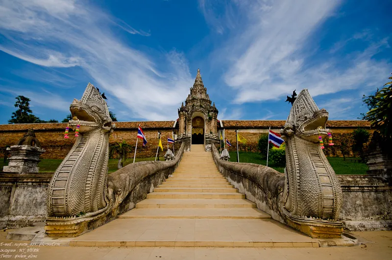
12. Wat Phra That Lampang Luang, Lampang is one of the most important ancient Buddhist temples in Northern Thailand. Located in Lampang Luang Subdistrict, Ko Kha District, Lampang Province, it is renowned for its sacred pagoda and beautifully preserved traditional Lanna architecture. The temple serves as both a center of Buddhist devotion and an important place for understanding the history and artistic traditions of the Lanna Kingdom.
Highlights: Phra That Lampang Luang, Viharn Luang, Viharn Phra Phut, Viharn Nam Taem, the ornate entrance gateway, naga staircase, and the inverted pagoda image phenomenon inside the Buddha's Footprint Shrine.
Wat Phra That Lampang Luang stands on a raised mound enclosed by walls surrounding its main sacred structures. The layout reflects traditional Lanna principles of temple design, with the principal pagoda forming the spiritual center of the complex and important viharns arranged around it. Entering through the naga staircase and elaborately decorated gateway gives visitors an immediate sense of the atmosphere of a historic Northern Thai Buddhist monastery.
Phra That Lampang Luang is a deeply revered Buddhist monument that attracts worshippers from across the region. In traditional Northern Thai belief, it is associated with the birth-year pagoda for people born in the Year of the Ox. The temple is therefore significant both to those practicing birth-year pilgrimage traditions and to visitors interested in Buddhist architecture and cultural heritage.
Viharn Luang, the main assembly hall, is particularly important for its traditional Lanna craftsmanship. Its roof structure, timber construction, and decorative details demonstrate techniques passed down through generations of Northern Thai builders. Other historic religious buildings within the temple provide further examples of architectural styles that developed over different periods.
One of the temple's most intriguing features is the phenomenon of an inverted image of the pagoda. This occurs when light passes through a small opening and projects an upside-down image onto an interior surface, following the principles of a camera obscura. The phenomenon illustrates the fascinating relationship between architecture, natural light, and optical effects.
Wat Phra That Lampang Luang can be combined with other important temples and historical attractions in Ko Kha District, including Wat Phra That Chom Ping and Wat Lai Hin Luang Kaeo Chang Yuen. A day spent exploring these sites offers an excellent introduction to several forms of Lanna religious art and architecture. Visitors should wear modest clothing and respect spaces used for worship.
Open Days: Daily.
Opening Hours: 07:30 – 17:00.
Getting There: From Lampang city, travel toward Ko Kha District and follow the signs to Lampang Luang Subdistrict. The temple is approximately 18 kilometers from central Lampang and can be reached conveniently by private car or rental vehicle.
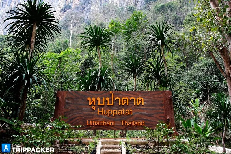
13. Hup Pa Tat, Uthai Thani is a remarkable natural attraction hidden inside a limestone valley in Lan Sak District, Uthai Thani Province. The landscape features towering limestone cliffs and a cave-like passage leading into an enclosed forest dominated by tat palms. The experience of passing through a dark rock passage and emerging into a lush green valley gives Hup Pa Tat an atmosphere unlike that of most other forest attractions in Thailand.
Highlights: Hidden tat palm forest, natural cave entrance, limestone cliffs, tropical vegetation, nature walking trail, and a humid forest ecosystem enclosed by rock formations.
The most distinctive part of visiting Hup Pa Tat is the walk through a cave and opening in the limestone mountain before entering a forest surrounded by cliffs. Inside the valley, numerous tat palms grow in a sheltered environment. These palm-like plants thrive in humid, shaded conditions, creating an unusual landscape that feels dramatically different from the vegetation outside the valley.
The limestone enclosure plays an important role in shaping the local ecosystem. It creates a specialized environment where humidity, filtered sunlight, and temperature can differ from conditions outside. The plants growing in the enclosed valley therefore offer an interesting example of the relationship between geology, microclimate, and living organisms.
Walking through Hup Pa Tat feels like exploring a hidden natural world inside the mountains. Visitors can observe limestone formations, tropical vegetation, and the changing quality of light along the route. Care is required in the cave and on damp rocks, which can become slippery. Always stay on designated paths and follow the instructions of local staff.
Hup Pa Tat is particularly appealing to nature lovers, photographers, and travelers interested in ecosystems and limestone landscapes. It can be included in a wider itinerary covering attractions in Lan Sak District and other nearby natural sites. Visiting during daylight hours is advisable, as natural light makes it easier to appreciate the features of the enclosed forest and surrounding rock formations.
Open Days: Visitor access is subject to the operating hours and regulations of the protected area.
Getting There: From Uthai Thani town, travel toward Lan Sak District and continue following signs to Hup Pa Tat. The destination can be reached by private car or rental vehicle. Check road conditions and visitor opening times before traveling.
Map (GPS):Get Directions to Hup Pa Tat

14. Bueng Si Fai Lake, Phichit is one of the most important natural landmarks and recreational attractions in Phichit Province. Located in Mueang Phichit District, this large freshwater lake has long been closely associated with the everyday lives of local communities. It serves as a natural water resource, an important freshwater ecosystem, and a place for residents and visitors to enjoy the surrounding scenery. Bueng Si Fai is also closely connected with the famous legend of Chalawan, the crocodile character from the traditional Thai literary story Krai Thong, giving the lake a distinctive cultural identity.
Highlights: Bueng Si Fai Lake, the giant Chalawan crocodile sculpture, freshwater ecosystems, lakeside recreational areas, birdwatching, sunset scenery, and the cultural heritage of Phichit.
Bueng Si Fai is an extensive freshwater lake surrounded by lowland communities and natural vegetation. Its waters provide habitats for fish, aquatic plants, waterbirds, and other freshwater organisms. The lake has also played an important role in local fishing and the use of natural water resources. Exploring Bueng Si Fai therefore offers more than an opportunity to enjoy the scenery; it also helps visitors understand the relationship between the environment and the development of communities in central Northern Thailand.
One of the best-known landmarks at Bueng Si Fai is the giant crocodile sculpture associated with Chalawan, an important character in the story of Krai Thong. This well-known Thai tale features a crocodile king and has become closely linked with the cultural identity of Phichit. The sculpture serves as a symbol of the province and is a popular photography stop for families and travelers.
The lakeside environment is suitable for leisurely walks, photography, and spending time outdoors. Different sections offer views of open water, vegetation, and the surrounding landscape. During the late afternoon, sunlight reflected across the lake creates a peaceful atmosphere, making sunset one of the most appealing times to visit.
Bueng Si Fai also has ecological importance because wetlands provide habitats for many forms of wildlife and contribute to the natural water cycle. Waterbirds, fish, and aquatic vegetation depend on the lake's changing conditions. Travelers interested in nature should observe wildlife from an appropriate distance, avoid disturbing nesting areas, and refrain from feeding animals in ways that could harm the ecosystem.
The lake can be included in a sightseeing itinerary around Phichit town, particularly for travelers interested in local history, literature, and family-friendly outdoor attractions. Visiting Bueng Si Fai provides a relaxing contrast to temple visits and historical sightseeing. It is also a convenient stop for people traveling through Phichit on longer routes across Northern Thailand.
Visitors should be aware that the lake covers a large area and different attractions may have separate entrances or operating arrangements. Choosing the correct destination on a map will help avoid unnecessary driving. Those traveling during the hotter months should bring drinking water, sun protection, and comfortable walking shoes.
Open Days: Public recreational areas are generally accessible daily.
Best Time to Visit: Early morning or late afternoon, when temperatures are more comfortable.
Getting There: Bueng Si Fai is located near Phichit town in Mueang Phichit District. Visitors can travel by private car, rental vehicle, or local transport. Follow signs toward the lake and its main recreational areas.
Map (GPS):Get Directions to Bueng Si Fai Lake
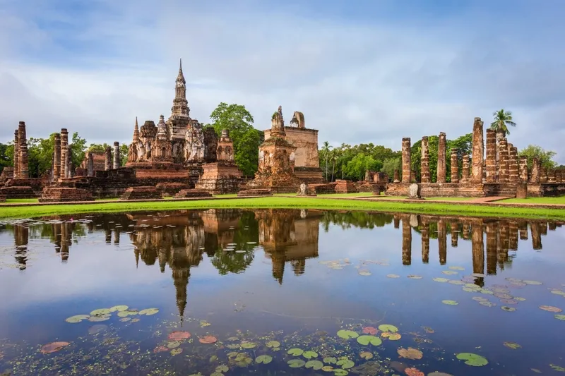
15. Sukhothai Historical Park, Sukhothai is one of Thailand's most important cultural heritage destinations. Located in Mueang Kao Subdistrict, Mueang Sukhothai District, the historical park preserves the remains of the former capital of the Sukhothai Kingdom. Its extensive grounds contain ancient temples, royal structures, pagodas, Buddha images, city walls, moats, and historic water-management systems. Sukhothai Historical Park forms part of the UNESCO World Heritage property known as the Historic Town of Sukhothai and Associated Historic Towns, which was inscribed on the World Heritage List in 1991.
Highlights: Wat Mahathat, Wat Si Sawai, Wat Sa Si, Wat Traphang Ngoen, Wat Si Chum, Sukhothai-style Buddha images, lotus-bud-shaped chedis, ancient reservoirs, historic city planning, and cycling routes between temples.
The Sukhothai Kingdom played an important role in Thai history between approximately the 13th and 15th centuries. During this period, the kingdom developed distinctive political, religious, and artistic traditions. Archaeological evidence preserved within the ancient city demonstrates the organization of a major historical settlement, including its urban layout, religious monuments, defensive structures, and water-management systems.
The ancient city was organized around religious and civic spaces, with city walls, moats, reservoirs, and canals contributing to its infrastructure. The numerous historical ponds, traditionally known as traphang, were important elements of water storage and urban life. Their presence demonstrates the close relationship between the city's development and the management of its natural environment.
Wat Mahathat is one of the most significant temple complexes within the historical park. Located near the center of the ancient city, it contains a principal chedi, assembly halls, numerous smaller monuments, and impressive Buddha images. The lotus-bud-shaped chedi is particularly associated with Sukhothai architecture and represents one of the artistic forms that distinguish the kingdom's religious monuments.
Wat Sa Si is another especially picturesque attraction. Situated on an island within a large reservoir, the temple is connected to the surrounding grounds by a bridge. Its bell-shaped chedi and Buddha image create a striking composition reflected in the water. The setting is particularly atmospheric in the early morning and late afternoon, when the changing light emphasizes the peaceful surroundings.
Wat Si Sawai is notable for its three Khmer-style prangs, which reveal architectural influences associated with earlier religious traditions. The temple is especially interesting for visitors studying the development of religious beliefs and architectural styles in the Sukhothai region. Its distinctive towers contrast with the lotus-bud and bell-shaped chedis found elsewhere in the park.
Wat Si Chum is celebrated for Phra Achana, an enormous seated Buddha image housed within a tall mondop, or square sanctuary. The building's narrow frontal opening frames the Buddha in a particularly dramatic way. The temple is also associated with historical stories and religious traditions that have contributed to its significance over the centuries.
Exploring Sukhothai Historical Park is particularly enjoyable by bicycle, as many monuments are connected by relatively accessible routes. Cycling allows visitors to travel between ancient temples while appreciating the trees, reservoirs, and open spaces that surround them. Walking is another option, although travelers should plan their route carefully because the park and associated historical areas cover considerable distances.
Visitors interested in archaeology and Thai history should consider including Ramkhamhaeng National Museum in their itinerary. The museum provides additional historical context through archaeological objects, religious sculptures, and information about Sukhothai's cultural development. Combining the museum with visits to the monuments can make the history of the ancient city easier to understand.
Sukhothai Historical Park is best experienced without rushing. A full day provides time to explore the principal temples, admire architectural details, and appreciate the historical landscape. Travelers with a strong interest in archaeology may wish to extend their stay and visit additional sites outside the main city walls.
Open Days: Daily.
Opening Hours: The main historical park generally operates from 06:30 – 19:30. Access arrangements may differ between historical zones.
Getting There: From Sukhothai town, follow Highway 12 toward Mueang Kao Subdistrict. The historical park is approximately 12 kilometers from the modern town center. Visitors can travel by private car, rental vehicle, or local transport, then explore the main archaeological area on foot or by bicycle.

16. Kwan Phayao (Phayao Lake), Phayao is one of the largest and most important freshwater lakes in Northern Thailand. Located beside the urban area of Mueang Phayao District, it is surrounded by communities and distant mountain ranges. The lake has considerable ecological, economic, and cultural importance, serving as a center for freshwater fishing, recreation, religious activities, and local community life. Visitors come to enjoy the lakeside atmosphere, watch the sunset, sample Northern Thai cuisine, and explore historical landmarks associated with the ancient city of Phayao.
Highlights: Panoramic lake scenery, sunset viewpoints, Wat Tilok Aram in the lake, King Ngam Mueang Monument, lakeside promenades, Northern Thai restaurants, traditional fishing communities, and the surrounding mountain landscape.
Kwan Phayao developed from a natural lowland basin where several streams converged, forming an important freshwater environment. Over time, the area was developed and managed as a major water resource for the province. The lake supports fishing, local livelihoods, and the ecological systems of the surrounding region. Its importance therefore extends beyond tourism to the everyday activities and cultural identity of the people of Phayao.
The lakeside promenade is one of the most enjoyable places to spend time in Phayao town. Visitors can walk along the waterfront, take photographs, or relax while looking out across the water toward the distant mountains. The late afternoon is particularly popular because the setting sun illuminates the lake and creates beautiful reflections across its surface.
Wat Tilok Aram is an important historical and religious site located within the lake. It is closely connected with the development of Buddhism and the history of Phayao. Visiting the site is a meaningful experience for those interested in religious heritage, although boat services and access arrangements depend on current local operating conditions.
The King Ngam Mueang Monument is another major landmark near the lake. King Ngam Mueang is associated with the historic city of Phayao, formerly known as Phukamyao. Visiting the monument provides an opportunity to learn about the city's history and its place within the broader political and cultural landscape of Northern Thailand.
Fishing has long played a role in the economy and traditional way of life around Kwan Phayao. The lake provides habitats for freshwater fish and supports activities closely related to the surrounding communities. Understanding this relationship between the lake and local residents helps visitors appreciate why Kwan Phayao is regarded as an important symbol of Phayao Province.
Kwan Phayao can easily be combined with Wat Si Khom Kham, the King Ngam Mueang Monument, and other attractions in Mueang Phayao District. A half-day or full-day itinerary provides enough time to explore the main landmarks and enjoy a meal overlooking the lake. Morning visits offer a relatively peaceful atmosphere, while evening visits are especially popular for the sunset.
Open Days: Daily.
Opening Hours: Public lakeside areas are accessible throughout the day. Boat services and individual attractions maintain separate operating hours.
Getting There: Kwan Phayao is located immediately beside Phayao town. Visitors can travel by private vehicle, local transport, or on foot from central areas of the town to the lakeside promenade.

17. Bueng Boraphet, Nakhon Sawan is one of Thailand's largest freshwater wetlands and an important natural attraction in Nakhon Sawan Province. The lake extends across several districts and provides habitats for numerous freshwater fish, waterbirds, aquatic plants, and other forms of wildlife. Bueng Boraphet is both an ecological conservation area and a destination for nature tourism, offering opportunities to observe wetland environments, learn about freshwater ecosystems, and experience the natural scenery of the province.
Highlights: Extensive freshwater wetland, birdwatching, aquatic ecosystems, seasonal boat excursions where available, Bueng Boraphet Aquarium, fishing-community heritage, and panoramic lakeside scenery.
Bueng Boraphet plays an important role in the regional water system, collecting water from surrounding areas and supporting a diverse wetland environment. The lake contains open-water zones, shallower areas, and extensive aquatic vegetation. Each of these environments supports different forms of plant and animal life, making the wetland particularly valuable for ecological conservation.
Birdwatching is among the most interesting activities for nature enthusiasts. The wetland provides habitats for resident waterbirds as well as certain migratory species during their seasonal movements. Visitors hoping to observe birds should bring binoculars and maintain a respectful distance from wildlife. Avoiding excessive noise and disturbance near nesting areas is essential for responsible nature tourism.
Bueng Boraphet also has a longstanding relationship with local fishing communities. Residents around the wetland have traditionally depended on freshwater resources for their livelihoods, contributing to an economy and way of life closely linked to the lake. Exploring the area can therefore provide insights into both wetland ecology and the cultural heritage of local communities.
Bueng Boraphet Aquarium is an additional attraction for families and visitors interested in freshwater biodiversity. Its exhibitions introduce aquatic species and information about freshwater environments. Opening hours and admission arrangements for the aquarium and associated attractions may differ from those of the wider wetland area.
Travelers interested in photography and birdwatching should consider visiting in the morning, when temperatures are generally more comfortable. Boat excursions, where available, should only be undertaken with suitable operators and appropriate safety equipment. Weather conditions and water levels can affect the availability of certain activities.
Bueng Boraphet makes an enjoyable half-day or full-day destination and can be combined with attractions in Nakhon Sawan town. Visitors should plan their exact destination carefully because the wetland is extensive and the aquarium, boating areas, and other access points may be located some distance apart.
Open Days: Access depends on the operating arrangements of individual visitor areas.
Opening Hours: Managed tourism facilities generally operate during daytime hours, with some areas approximately 08:30 – 18:00. Individual facilities may differ.
Getting There: From Nakhon Sawan town, follow the roads toward Bueng Boraphet. Visitors should select the appropriate destination on their navigation system, such as Bueng Boraphet Aquarium or an authorized boat departure area, because the wetland covers a large geographical area.
Map (GPS):Get Directions to Bueng Boraphet

18. Pang Ung (Royal Forest Park Project), Mae Hong Son is one of the most beautiful mountain retreats in Mae Hong Son Province. Located in Mok Cham Pae Subdistrict, Mueang Mae Hong Son District, Pang Ung is famous for its tranquil reservoir, surrounding pine forest, and picturesque mountain setting. On cool mornings, mist sometimes drifts across the lake, creating a peaceful landscape that has made Pang Ung one of the province's most recognizable destinations.
Highlights: Pang Ung Reservoir, pine forest, early morning mist, mountain scenery, lakeside photography, quiet natural surroundings, and the scenic route connecting Pang Ung with Ban Rak Thai.
The development of Pang Ung is associated with a royal initiative intended to improve forest conservation, water resources, and the rehabilitation of the surrounding environment. Forest management and the development of the reservoir helped create a landscape that later became an important nature-tourism destination. The area is valued for both its scenic beauty and its connection with environmental restoration.
The most distinctive feature of Pang Ung is the reflection of tall pine trees in the still waters of the reservoir. The surrounding mountains form a natural backdrop, while the calm surface of the water adds to the tranquil atmosphere. During the cool season, favorable humidity and temperature conditions may produce a delicate layer of mist above the lake, particularly in the early morning.
Many travelers choose to stay overnight nearby to experience Pang Ung before the busiest daytime visiting period. The quiet morning atmosphere is especially appealing for photography and enjoying the natural surroundings. However, camping, accommodation, and access to specific lakeside areas may be subject to the regulations of the organizations managing the project.
Pang Ung can conveniently be included in a trip to Ban Rak Thai, another well-known destination within Mok Cham Pae Subdistrict. Visiting both locations provides an interesting contrast between the pine-covered reservoir and the Yunnanese-influenced village around Ban Rak Thai Lake. Travelers with limited time can explore both in one day, while an overnight stay allows a more relaxed experience.
Road conditions require special attention, particularly during the rainy and cool seasons. Mountain roads may be affected by dense fog, rain, and slippery surfaces. Drivers should avoid rushing and take extra care on unfamiliar roads with limited visibility.
Visitors should respect the natural environment, avoid littering, and comply with all access rules. Preserving the area's quiet atmosphere and ecological quality is essential to maintaining Pang Ung's appeal as a peaceful mountain destination.
Open Days: Visitor access depends on the regulations and operating arrangements of the Royal Forest Park Project.
Getting There: From Mae Hong Son town, follow the road toward Mok Cham Pae Subdistrict and continue to Pang Ung. The route passes through mountainous terrain with numerous curves and steep sections. Check weather and road conditions before departure.
Map (GPS):Get Directions to Pang Ung
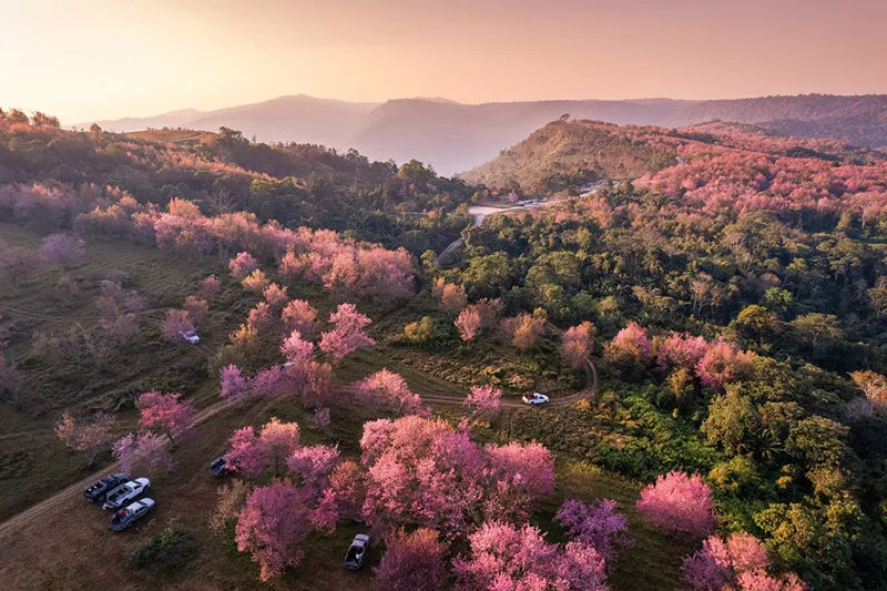
19. Phu Hin Rong Kla National Park, Phitsanulok is an exceptional natural and historical destination covering mountainous areas near the borders of Phitsanulok, Phetchabun, and Loei Provinces. Important visitor areas are located in Nakhon Thai District, Phitsanulok. The national park is distinguished by unusual geological formations, highland forests, expansive mountain views, and historical sites associated with Thailand's modern political history. It offers a combination of natural exploration and historical education rarely found in a single destination.
Highlights: Lan Hin Pum, Lan Hin Taek, Pha Chu Thong, the Political and Military School, historical sites associated with the Communist Party of Thailand, highland forests, and nature trails.
The geological landscape of Phu Hin Rong Kla consists of elevated mountain terrain, exposed rock surfaces, and large natural fissures. Weathering and erosion have gradually altered the rock formations, producing distinctive landforms. Two of the park's best-known attractions, Lan Hin Pum and Lan Hin Taek, provide striking examples of these natural processes.
Lan Hin Pum is particularly famous for its uneven rock surface covered with numerous rounded protrusions. The unusual terrain creates a distinctive landscape, and certain viewpoints offer impressive mountain scenery. The formations are a natural feature of the park and should not be damaged or altered by visitors.
Lan Hin Taek is characterized by large cracks and fissures across exposed rock surfaces. These natural gaps create dramatic patterns but also require caution. Some fissures are deep, and visitors should remain on designated paths, avoid dangerous edges, and take extra care when the rock is wet or slippery.
Phu Hin Rong Kla also occupies an important place in Thailand's modern history. During a period of political conflict, the mountains served as an area of activity associated with the Communist Party of Thailand. Several historical locations preserve evidence of this period, including the former Political and Military School. These sites provide opportunities to learn about the social and political circumstances of the time and the everyday lives of people who occupied the mountain area.
The park's vegetation and climate change with elevation. The highlands are generally cooler than surrounding lowland areas, particularly during the cool season. During the rainy season, the forests become lush and humid. Travelers interested in hiking should choose routes suited to their abilities and be prepared for rapidly changing mountain weather.
Phu Hin Rong Kla National Park can be combined with Phu Thap Boek in Phetchabun Province. A two-day, one-night trip provides a practical way to experience the mountain viewpoints of Phu Thap Boek and the geological and historical attractions within Phu Hin Rong Kla. Road conditions, opening hours, and seasonal restrictions should be checked in advance.
Open Days: Generally open daily, although some trails and areas may be restricted under national park announcements.
Opening Hours: Main visitor areas generally operate from 06:00 – 18:00.
Getting There: The national park can be reached from Nakhon Thai District in Phitsanulok Province or via connecting roads from Phetchabun Province. Mountain routes contain steep sections and curves, so visitors should check road conditions and drive carefully.
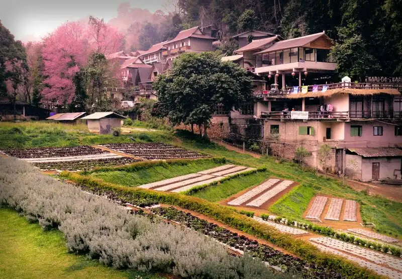
20. Doi Ang Khang and Angkhang Royal Agricultural Station, Chiang Mai is one of Northern Thailand's most famous highland agricultural attractions. Located in Fang District, Chiang Mai Province, it is known for its cool mountain climate, seasonal flower gardens, agricultural research plots, and scenic mountain surroundings. The station has particular historical significance as part of Thailand's royal initiatives to develop sustainable agricultural livelihoods in highland communities.
Highlights: Angkhang Royal Agricultural Station, cool-climate flower gardens, experimental agricultural plots, bonsai gardens, temperate fruit cultivation, mountain viewpoints, and highland community traditions.
Angkhang Royal Agricultural Station is closely associated with the development of highland agriculture under the initiatives of King Bhumibol Adulyadej (Rama IX). The project was established to encourage the cultivation of crops suitable for mountain environments and provide alternative livelihood opportunities for local communities. Its development became an important example of agricultural research, sustainable land use, and community improvement in Thailand's northern highlands.
The station contains a variety of gardens, agricultural areas, and plant collections. Visitors can observe flowers, vegetables, and fruit crops that thrive in cooler conditions, gaining an understanding of how elevation and climate influence agriculture. Seasonal displays vary throughout the year, so the appearance of individual gardens and flowering plants depends on the growing season.
The cultivation of temperate fruit and ornamental plants is particularly interesting because many of these crops require conditions different from those found in Thailand's lowland tropical regions. The highland environment around Doi Ang Khang provides opportunities to study crop adaptation and the development of farming methods suited to mountainous terrain.
The attraction of Doi Ang Khang extends beyond the agricultural station. The surrounding mountains offer beautiful landscapes, scenic roads, and communities whose livelihoods are closely connected with highland farming. During the cool season, travelers can enjoy noticeably lower temperatures and views of hills extending across the horizon.
Doi Ang Khang is suitable for a two-day, one-night trip, allowing time to explore the agricultural gardens, enjoy the mountain scenery, and visit nearby communities at a relaxed pace. Travelers interested in photography should check the flowering periods of specific plants because the gardens change with the seasons.
The road to Doi Ang Khang includes steep gradients and numerous sharp bends. Drivers should ensure that their vehicle is suitable for mountain travel and exercise caution during periods of rain or dense fog. In the cool season, warm clothing is recommended, particularly for early morning visits.
Open Days: Generally open daily according to the agricultural station's visitor arrangements.
Opening Hours: Approximately 06:00 – 18:00 for general visitor areas.
Getting There: From Chiang Mai city, travel toward Fang District and follow the designated mountain road to Doi Ang Khang. The final sections are steep and winding. Check vehicle condition, weather, and access arrangements before departure.

21. Phu Chi Fa Forest Park, Chiang Rai is one of Northern Thailand's most celebrated mountain viewpoints. Located in Po Subdistrict, Wiang Kaen District, Chiang Rai Province, near the Thailand–Laos border, the site is famous for its dramatic cliff and distinctive mountain peak projecting outward toward the sky. Travelers visit Phu Chi Fa to watch the sunrise above distant mountain ridges and, when weather conditions are favorable, admire a vast sea of mist covering the valleys below.
Highlights: Phu Chi Fa summit, sunrise viewpoint, sea of mist, Thailand–Laos border mountain scenery, open highland grassland, and routes connecting Phu Chi Fa with Doi Pha Tang.
The landscape of Phu Chi Fa is characterized by a prominent peak and exposed cliff offering wide views of the surrounding mountain ranges. Its name refers to the pointed shape of the mountain, which resembles a finger directed toward the sky. This distinctive geographical feature has become one of the most recognizable natural landmarks in Chiang Rai Province.
Sunrise is the most popular time to visit Phu Chi Fa. Before dawn, travelers make their way toward the viewpoint and wait for the first light to appear above the eastern mountains. On suitable mornings, mist fills the valleys below the cliffs, leaving mountain peaks visible above a broad layer of white clouds. The combination of sunrise, mist, and the dramatic mountain silhouette makes the experience especially memorable.
Reaching the principal viewpoint requires walking uphill from an appropriate parking area along a designated trail. Conditions vary with weather and visitor management arrangements. Travelers heading up before sunrise should carry a flashlight, wear shoes suitable for walking on uneven ground, and allow enough time to reach the viewpoint safely.
The scenery changes significantly throughout the seasons. During the cool season, temperatures can be low and the viewpoint is particularly popular. During the rainy season and early cool season, the surrounding hills become green and lush. However, the formation of a sea of mist depends on actual humidity, temperature, and wind conditions, and therefore cannot be guaranteed on every visit.
Phu Chi Fa can be combined with Doi Pha Tang and other attractions along Chiang Rai's mountain border region. Staying overnight in nearby accommodation makes it easier to reach the viewpoint before dawn without undertaking a long mountain drive in darkness.
Safety is particularly important around exposed cliffs. Travelers should remain on designated routes, avoid approaching dangerous edges, and exercise additional caution during strong winds, dense fog, or wet ground conditions. Photography should never take priority over personal safety.
Open Days: Access depends on current forest park regulations and visitor management arrangements.
Getting There: From Chiang Rai city, travel toward Thoeng District and continue toward Wiang Kaen District before following the mountain road to Phu Chi Fa. The route is winding and includes steep sections, so travelers hoping to see sunrise should plan their departure carefully.
Map (GPS):Get Directions to Phu Chi Fa Forest Park
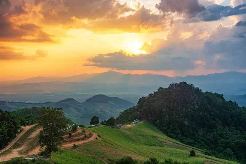
22. Doi Samer Dao in Si Nan National Park, Nan is one of the most popular mountain viewpoints and camping destinations in Nan Province. Located in Na Noi District within Si Nan National Park, Doi Samer Dao is known for its open ridgeline, panoramic views of mountain valleys, early morning mist, and opportunities for stargazing on clear nights. Its relatively open terrain creates a wide view of the sky, giving the destination a particularly memorable atmosphere after sunset and before sunrise.
Highlights: Doi Samer Dao viewpoint, sunrise scenery, seas of mist, stargazing, Pha Hua Sing, views over the Nan River landscape, and mountain ecosystems within Si Nan National Park.
Doi Samer Dao is distinguished by an exposed ridgeline overlooking the surrounding valleys and distant mountains. The natural landscape changes throughout the day, offering different perspectives at sunrise, sunset, and after dark. On mornings when humidity and temperature conditions are favorable, mist may collect in the valleys, creating a layered mountain scene that has become one of the area's most popular attractions.
Stargazing is one of the experiences most closely associated with Doi Samer Dao. On clear nights, the relatively open sky can provide good conditions for observing stars. Travelers interested in night-sky photography should consider cloud cover, moonlight, and weather conditions before planning their visit. Camping and overnight stays must follow the regulations and reservation requirements established by the national park.
Pha Hua Sing is another notable natural feature in the area. Its distinctive rocky formation and mountain scenery attract travelers interested in photography and geological landscapes. However, visitors should remain within permitted areas and observe safety instructions, particularly near steep edges and exposed viewpoints.
Si Nan National Park has important ecological value as a protected mountain and watershed area. Its forests, valleys, and river systems support a variety of plant and animal life. Visiting the park provides an opportunity to appreciate the importance of forest conservation and the relationship between mountain ecosystems and downstream water resources.
An overnight stay is a rewarding way to experience Doi Samer Dao because travelers can enjoy the changing scenery from late afternoon to early morning. Those planning to camp should confirm current park regulations, available facilities, and booking arrangements, while preparing warm clothing and equipment suitable for mountain weather.
Visitors should avoid littering, excessive noise, and entering restricted areas. Responsible use of camping facilities and proper disposal of waste help preserve the natural atmosphere that makes Doi Samer Dao such an appealing destination.
Open Days: Visitor access and camping arrangements depend on announcements and regulations issued by Si Nan National Park.
Getting There: From Nan city, travel toward Na Noi District and follow the signs to Si Nan National Park. Confirm the appropriate access road for Doi Samer Dao and current camping or viewpoint restrictions before departure.
Map (GPS):Get Directions to Si Nan National Park

23. Wat Chedi Luang Worawihan, Chiang Mai is one of the most historically significant Buddhist temples in Chiang Mai. Located on Phra Pok Klao Road in Phra Sing Subdistrict, Mueang Chiang Mai District, within the old city walls, the temple is famous for its enormous ancient chedi. Wat Chedi Luang reflects the religious importance, architectural achievements, and cultural heritage of the Lanna Kingdom. It is also closely associated with Chiang Mai's city pillar, known as Sao Inthakhin, and the annual Inthakhin religious tradition.
Highlights: Great Chedi, Viharn Luang, Chiang Mai City Pillar (Sao Inthakhin), elephant sculptures decorating the chedi, Lanna architecture, and the annual Inthakhin Flower Offering Festival.
Wat Chedi Luang is closely connected with the history of Chiang Mai during the Mangrai Dynasty. Its great chedi was developed during the period when Chiang Mai was a major center of the Lanna Kingdom. The monument demonstrates the scale and significance of religious architecture during that era. The temple also once housed the Emerald Buddha, one of the most sacred Buddha images in Thailand, before the image was moved to other important locations.
The Great Chedi is the temple's principal architectural landmark. Its massive structure rises from a substantial base and includes decorative elements associated with traditional Lanna craftsmanship. Although part of the chedi suffered damage in the past, the remaining monument continues to convey the scale and sophistication of the original construction.
Elephant sculptures arranged around parts of the chedi's base are among its most distinctive artistic features. Together with the architectural details of the monument, they provide evidence of the craftsmanship and symbolic design employed in major Lanna religious structures.
Wat Chedi Luang is also important because it houses Chiang Mai's city pillar, or Sao Inthakhin, a sacred symbol associated with the city's founding and spiritual protection. The pillar reflects the relationship between Buddhist traditions, local beliefs, and the historical identity of Chiang Mai.
The annual Inthakhin Flower Offering Festival is one of the city's most significant traditional religious events. During the festival, local residents and worshippers offer flowers and participate in ceremonies associated with the city pillar. The event demonstrates the continuing importance of traditional Lanna beliefs and the relationship between religious institutions and community life.
The temple is conveniently located within Chiang Mai's old city and can be combined with visits to Wat Phra Singh, Wat Phan Tao, and other important historic landmarks. A half-day walking route through the old city allows visitors to appreciate several different examples of Lanna architecture and learn about the city's long religious history.
Visitors should dress modestly and respect areas used for Buddhist ceremonies. Historical structures should not be climbed or touched in ways that could cause damage. Visiting in the morning is often pleasant, as temperatures are relatively comfortable and the atmosphere can be quieter.
Open Days: Daily.
Getting There: Wat Chedi Luang is located on Phra Pok Klao Road in Chiang Mai's old city. It can be reached by private car, local transport, or on foot from other attractions within the old city walls.

24. Kong Lan (Pai Canyon), Mae Hong Son is one of the most distinctive natural attractions in Pai District, Mae Hong Son Province. Known locally as Kong Lan, this unusual landscape consists of narrow earth ridges, steep slopes, and deep eroded gullies that create dramatic natural formations. The area is particularly popular for its panoramic views of the surrounding mountains and valleys, especially during the late afternoon when warm sunlight highlights the shapes and textures of the exposed terrain.
Highlights: Narrow natural ridges, eroded earth formations, steep cliffs, panoramic viewpoints, sunset scenery, unusual geological landscapes, and the scenic countryside surrounding Pai.
Pai Canyon was formed through natural processes involving the gradual erosion of soil and sedimentary rock. Over time, rainfall and surface runoff removed less resistant materials, leaving narrow ridges and steep-sided formations. The resulting landscape is sometimes compared with a miniature canyon because of its exposed earth, irregular shapes, and dramatic changes in elevation. These geological features make the area different from the forested mountain viewpoints commonly found elsewhere in Northern Thailand.
The ridges provide impressive views across the countryside of Pai, with mountains extending into the distance and valleys spreading below the viewpoint. The appearance of the landscape changes as the sun moves across the sky. During the late afternoon, warm light emphasizes the reddish and brown tones of the earth, while shadows reveal the depth of the gullies. Sunset is especially popular because of the wide horizon and the natural contrast between the exposed ridges and surrounding vegetation.
Visitors can explore the main viewing area on foot, but should approach the narrower ridges with particular care. Some sections have steep drops on either side, loose soil, and limited space for passing other visitors. The ground may become slippery after rain, making parts of the terrain unsuitable for inexperienced hikers or travelers uncomfortable with heights. Remaining on safe, designated paths is essential.
The open terrain provides relatively little shade, especially during the hotter parts of the day. Morning and late afternoon visits are therefore generally more comfortable. Travelers should wear shoes with reliable grip, bring drinking water, and avoid walking along exposed edges when visibility is poor or the ground is wet.
Pai Canyon is also an interesting destination for those who enjoy landscape photography. Different viewing angles reveal winding ridges, unusual textures, and changing patterns of light and shadow. Photographers should choose stable locations rather than approaching dangerous cliff edges to capture images.
The attraction is conveniently located along the road south of Pai town and can be combined with other destinations in the surrounding countryside. A half-day excursion may include Pai Canyon, nearby cultural landmarks, and local cafés before returning to town. Those staying overnight in Pai can visit during the late afternoon without having to complete a long drive immediately afterward.
Pai Canyon illustrates the geological diversity of Northern Thailand, where weathering and erosion have created landscapes beyond the region's familiar forested mountains. Protecting the delicate ridge formations is important, so visitors should avoid damaging the earth, leaving rubbish, or creating unofficial walking routes across unstable areas.
Open Days: Generally accessible daily, subject to local safety conditions.
Best Time to Visit: Late afternoon for panoramic scenery and sunset, or early morning when temperatures are cooler.
Getting There: From Pai town, follow Highway 1095 south toward Chiang Mai for approximately 8 kilometers, then continue to the entrance of Pai Canyon. A short uphill walk leads from the parking area to the main viewpoint. Take extra care on exposed trails and during wet weather.
Map (GPS):Get Directions to Kong Lan (Pai Canyon)

25. Kad Kong Ta Walking Street, Lampang is one of Lampang's most important historic commercial districts and cultural attractions. Located on Talat Kao Road in Suan Dok Subdistrict, Mueang Lampang District, along the Wang River, the area is distinguished by old trading houses, multicultural architecture, traditional food, handicrafts, and the atmosphere of a historic riverside community. The weekend walking street has become a popular destination for travelers interested in Lampang's history, culinary traditions, and everyday local culture.
Highlights: Kad Kong Ta weekend walking street, historic wooden houses, Chinese and Western architectural influences, Lanna cultural heritage, Northern Thai food, handmade products, Ratsadaphisek Bridge, and the Wang River.
Kad Kong Ta developed as an important trading district during the period when the Wang River served as a major transportation route. Goods and agricultural products were brought into Lampang through the river system, and merchants established businesses and residences close to the waterfront. The district became a commercial center where traders from different cultural backgrounds interacted, including local Northern Thai residents, Chinese merchants, and communities connected with the historic timber trade.
The name Kad Kong Ta reflects the area's long relationship with riverside commerce. In Northern Thai, kad means market, while kong ta refers to a riverside lane or landing area. The name therefore recalls the period when boats, river transport, and trading activities were essential to the local economy.
One of the most interesting aspects of Kad Kong Ta is its historic architecture. Along Talat Kao Road, visitors can observe wooden houses, old shophouses, brick buildings, and structures incorporating Chinese, Western, Burmese, and Lanna influences. Decorative windows, balconies, rooflines, and traditional construction techniques reveal the district's multicultural past. These surviving buildings provide a visual record of Lampang's development as an important regional trading center.
On Saturday and Sunday evenings, the old road becomes a lively pedestrian market. Stalls sell Northern Thai dishes, desserts, drinks, handicrafts, clothing, and locally made souvenirs. The combination of historic buildings and street-food culture creates an enjoyable atmosphere for visitors wishing to explore the city at a leisurely pace.
For travelers interested in photography, arriving before the evening market becomes crowded provides opportunities to photograph the architecture in natural light. After sunset, illuminated shopfronts and market stalls create a different atmosphere. Walking slowly along the street allows visitors to appreciate details that might otherwise be overlooked.
Ratsadaphisek Bridge, commonly called the White Bridge, is an important landmark close to the district. It reflects Lampang's history of river crossings and transportation infrastructure. Combining a walk through Kad Kong Ta with a visit to the bridge helps visitors understand how the riverside community developed around trade routes and the Wang River.
Kad Kong Ta can also be included in a broader Lampang itinerary with Wat Pong Sanuk, Wat Phra Kaeo Don Tao Suchadaram, Baan Sao Nak, and other historic attractions. A practical approach is to visit temples and old houses during the day, then enjoy the walking street in the evening.
Although Kad Kong Ta is a popular visitor destination, it remains a living neighborhood. Travelers should respect residential areas and private properties, keep noise at considerate levels, and support local shops and community businesses. Preserving the district's traditional atmosphere is an important part of maintaining its cultural value.
Open Days: Saturday and Sunday for the walking street. The historic neighborhood can also be explored on other days.
Opening Hours: Walking street: 17:00 – 22:00.
Getting There: Kad Kong Ta is situated on Talat Kao Road in Suan Dok Subdistrict, Mueang Lampang District. Visitors can arrive by private car, taxi, or local transport. During walking-street hours, it is advisable to park outside the pedestrian area and continue on foot.
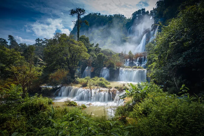
26. Thi Lo Su Waterfall, Tak is one of Thailand's most spectacular natural waterfalls. Located within Umphang Wildlife Sanctuary in Umphang District, Tak Province, the waterfall is famous for its enormous cascades flowing down a series of limestone cliffs surrounded by dense forest. Its impressive scale and remote wilderness setting make it an exceptional destination for travelers seeking natural scenery, adventure, and an appreciation of Thailand's western forest ecosystems.
Highlights: Massive cascading waterfall, limestone cliffs, forest scenery, waterfall viewpoints, nature walking routes, Umphang Wildlife Sanctuary, and the wider Umphang highland landscape.
Thi Lo Su Waterfall is formed by streams flowing through forested highlands before descending over extensive limestone formations. Instead of a single narrow stream, the waterfall consists of multiple cascading flows that spread across the rock face. This creates a broad curtain of water, particularly during periods when rainfall has increased the volume of the surrounding streams.
The waterfall's appearance changes considerably with the seasons. During wetter periods, the cascades become more powerful and the surrounding forest appears especially lush. However, heavy rainfall can also affect road access, water levels, and safety conditions. For this reason, the most dramatic waterfall conditions do not necessarily coincide with the easiest or safest travel arrangements.
Umphang Wildlife Sanctuary is part of Thailand's extensive western forest landscape. Its protected forests are valuable habitats for many plant and animal species and play an important role in preserving regional watershed systems. Visitors should appreciate that tourism takes place within a conservation area where protecting wildlife and natural resources is a priority.
The journey to Thi Lo Su is part of the overall travel experience. Umphang is reached by traveling through mountainous terrain from Mae Sot, with numerous curves along the road. The remote location means that a visit requires careful planning, sufficient travel time, and an understanding of local conditions.
Depending on the season and current conservation regulations, access to the waterfall may involve authorized transport arrangements and walking along a designated trail. Visitors should confirm the permitted travel method before departure, rather than assuming the same route is available throughout the year.
Within the visitor area, designated paths and viewpoints provide opportunities to admire the scale of the waterfall and its natural surroundings. The sound of cascading water and fine spray create a refreshing atmosphere, while the surrounding limestone and forest scenery provide attractive subjects for photography.
Safety is particularly important near the waterfall. Wet rocks, slippery ground, and strong currents can create hazardous conditions. Visitors should not approach dangerous sections of the falls, enter restricted areas, or attempt to swim where swimming is prohibited.
Thi Lo Su is especially suitable for nature enthusiasts, photographers, and travelers interested in conservation-oriented tourism. An itinerary of several days in Umphang allows more flexibility for transport, weather conditions, and additional activities in the surrounding district.
Responsible tourism is essential within Umphang Wildlife Sanctuary. Travelers should follow the instructions of conservation staff, minimize waste, avoid disturbing wildlife, and use locally operated services that comply with regulations. These practices help protect one of Thailand's most significant natural landscapes.
Open Days: Subject to seasonal access regulations and announcements by Umphang Wildlife Sanctuary.
Getting There: Travel from Tak to Mae Sot, then follow Highway 1090 through the mountains to Umphang District. From Umphang, continue using the authorized route and transport arrangements for Thi Lo Su Waterfall. Check wildlife sanctuary announcements, road conditions, and seasonal restrictions before traveling.
Map (GPS):Get Directions to Thi Lo Su Waterfall

27. Phae Mueang Phi Forest Park, Phrae is one of the most unusual geological attractions in Northern Thailand. Located in Mueang Phrae District, Phrae Province, the forest park is famous for its naturally eroded earth pillars, steep earth cliffs, and strangely shaped rock formations. These distinctive landforms developed through the gradual action of rainfall, surface runoff, and weathering over long periods, creating a landscape that looks remarkably different from the surrounding countryside.
Highlights: Natural earth pillars, unusual eroded landforms, geological formations, short nature walking routes, photography viewpoints, and local legends associated with the mysterious landscape.
The unusual terrain of Phae Mueang Phi was formed through differences in the resistance of soil and rock layers to erosion. Over time, rainfall and flowing water gradually removed softer materials, while harder portions remained standing. This natural process produced earth columns, narrow formations, and irregular cliffs that resemble towers or sculpted monuments.
Each section of the forest park reveals slightly different geological patterns. Some pillars have broad bases and narrow upper sections, while others form irregular walls or exposed slopes. Observing these shapes helps visitors understand how geological processes can transform an ordinary landscape into a striking natural attraction.
The name Phae Mueang Phi is also connected with traditional local legends and beliefs. The strange appearance of the formations encouraged stories about mysterious or supernatural places. These accounts are part of the area's cultural identity and illustrate how communities have historically interpreted unfamiliar natural phenomena through folklore.
Visitors can follow designated walking routes to view the earth pillars from several perspectives. The terrain is relatively open in places, allowing sunlight to emphasize the colors and textures of the eroded surfaces. Photography is particularly appealing during the morning or late afternoon, when the angle of the sun creates stronger shadows and reveals the formations' unusual shapes.
Although the pillars may appear solid, many sections are vulnerable to erosion and damage. Visitors should not climb the formations, carve into the soil, or walk across areas closed for conservation. Remaining on designated routes helps preserve the delicate geological features for future generations.
The forest park is suitable for families, photographers, and travelers interested in geology. A relatively short visit can provide a memorable experience, making it easy to combine with attractions in Phrae town.
Nearby cultural destinations include historic houses, temples, and old-town landmarks. A practical one-day itinerary can include Phae Mueang Phi, Wat Phra That Cho Hae, and selected attractions around central Phrae, providing a combination of natural scenery and regional history.
The exposed nature of parts of the site means conditions may become hot during the middle of the day. Visitors should bring drinking water, wear suitable footwear, and prepare sun protection. Wet conditions can make certain paths slippery or unstable, so additional caution is needed after rain.
Open Days: Subject to forest park regulations and visitor access arrangements.
Getting There: From Phrae town, travel toward Nam Cham Subdistrict and follow signs to Phae Mueang Phi Forest Park. The attraction is accessible by private car or rental vehicle.
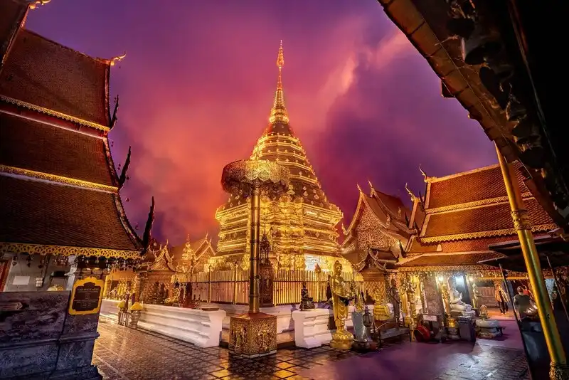
28. Wat Phra That Doi Suthep, Chiang Mai is one of Northern Thailand's most sacred Buddhist landmarks and an enduring symbol of Chiang Mai. Situated on Doi Suthep mountain in Mueang Chiang Mai District, the temple is renowned for its magnificent golden chedi, Lanna religious architecture, and panoramic viewpoints overlooking the city. It remains a major pilgrimage destination for Buddhists and one of the most important cultural attractions for visitors exploring Chiang Mai.
Highlights: Sacred golden pagoda, elaborate naga staircase, Lanna architecture, panoramic Chiang Mai viewpoints, Buddhist pilgrimage traditions, and the annual tradition of walking up Doi Suthep before Visakha Bucha Day.
The origins of Wat Phra That Doi Suthep are closely associated with the development of Buddhism in the Lanna Kingdom. According to an important local legend, sacred relics were carried up the mountain on the back of a white elephant. The elephant eventually stopped at the location where the sacred relics were to be enshrined. This story remains central to the temple's cultural identity and reflects the strong relationship between local tradition and Buddhist devotion.
The golden chedi is the spiritual centerpiece of the temple. Its elegant Lanna architectural form and reflective golden surfaces create a striking appearance within the sacred courtyard. Buddhist worshippers traditionally walk around the chedi in a clockwise direction while offering prayers and paying respect to the relics enshrined within.
Visitors can admire detailed religious decorations, ceremonial spaces, and architectural elements throughout the temple. These features illustrate the craftsmanship and artistic conventions of traditional Lanna religious buildings. The overall setting combines mountain scenery with an active Buddhist environment where religious ceremonies remain an important part of daily life.
The naga staircase is among the most recognizable features of Wat Phra That Doi Suthep. The long stairway is decorated with elaborate serpent balustrades and connects the lower entrance area with the temple above. Visitors may climb the stairs to experience the traditional approach to the sacred complex, while an alternative transport service is available for those who prefer not to make the ascent on foot.
The annual tradition of walking up Doi Suthep is especially important to the people of Chiang Mai. Before Visakha Bucha Day, many worshippers make the journey up the mountain on foot to pay respect to the sacred relics. This pilgrimage reflects the continuing devotion of local communities and preserves a longstanding religious custom.
The temple's mountain setting also offers attractive views across Chiang Mai. On clear days, visitors can see the city and surrounding lowland landscape from designated viewing areas. The perspective provides an interesting contrast between the busy urban environment below and the peaceful religious setting on the mountain.
Early morning visits are especially rewarding because the atmosphere may be quieter and temperatures are generally more comfortable. Late afternoon light can also enhance the golden surfaces of the chedi, while changing mountain conditions sometimes bring mist or cloud cover.
Wat Phra That Doi Suthep can be included in a wider sightseeing itinerary along the Doi Suthep mountain road. Other attractions and viewpoints in the surrounding area provide opportunities to explore the relationship between Chiang Mai's natural environment and its cultural heritage.
As an active Buddhist temple, Wat Phra That Doi Suthep requires respectful behavior from visitors. Dress modestly, follow instructions regarding footwear, and avoid disturbing people engaged in prayer or religious ceremonies.
Open Days: Daily.
Opening Hours: 05:00 – 19:30.
Getting There: From Chiang Mai city, travel along Huay Kaew Road and continue onto Highway 1004 toward Doi Suthep. The mountain road has numerous curves. Visitors can travel by private vehicle or use local shared transport operating on the mountain route.

29. Phra That Doi Tung, Chiang Rai is one of the most revered Buddhist pilgrimage destinations in Northern Thailand. Located on Doi Tung mountain in Mae Sai District, Chiang Rai Province, the sacred complex is associated with the enshrinement of Buddhist relics and with longstanding religious traditions of the Lanna region. It is particularly known for its twin golden stupas, mountain setting, and annual ceremonies that attract worshippers from surrounding communities.
Highlights: Twin golden stupas, sacred Buddhist relics, Lanna religious architecture, the annual Doi Tung Stupa Worship Festival, mountain scenery, and nearby attractions along the Doi Tung scenic route.
Phra That Doi Tung has longstanding religious importance in the traditions of Northern Thailand. Its history is associated with legends concerning the enshrinement of sacred Buddhist relics on the mountain. These traditions have contributed to the mountain's reputation as a sacred place where worshippers travel to make merit and pay respect to the Buddha.
The twin stupas are the most recognizable religious structures at the site. Their golden surfaces and Lanna architectural forms stand prominently within the sacred compound. Visitors can admire the pagodas and learn about their cultural significance, while Buddhist worshippers perform traditional acts of devotion in the surrounding area.
The setting on Doi Tung adds to the atmosphere of the temple. The surrounding mountains and changing weather conditions create a peaceful highland environment. Visitors may experience cool air and scenic views, particularly during the cooler months when mountain travel is especially popular.
The Doi Tung Stupa Worship Festival is an important annual religious event associated with the sacred pagodas. It is traditionally held according to the Northern Thai lunar calendar, around the full moon of the sixth Northern lunar month. Worshippers participate in ceremonies, pay respect to the relics, listen to Buddhist teachings, and continue religious customs passed down through generations.
These ceremonies demonstrate the close relationship between Buddhism and local community life. Participation by people from different communities reinforces the importance of Phra That Doi Tung as a regional center of faith and cultural identity.
A visit to Phra That Doi Tung can be combined with several well-known attractions on the mountain, including Doi Tung Royal Villa and Mae Fah Luang Garden. Together, these destinations provide a mixture of religious heritage, landscaped gardens, community development history, and mountain scenery.
The Doi Tung mountain road contains steep gradients and winding sections. Travelers should drive carefully, especially during the rainy season when wet road surfaces or dense fog may reduce visibility. Allow sufficient time to explore the religious complex and nearby attractions without rushing.
Visitors should dress respectfully and avoid disturbing religious ceremonies. The site is an active place of Buddhist worship, and maintaining a quiet, considerate atmosphere is an important part of the visiting experience.
Open Days: The religious site is generally accessible daily. The Doi Tung Stupa Worship Festival takes place annually according to the religious calendar.
Opening Hours: General visiting hours are approximately 07:30 – 17:30.
Getting There: From Chiang Rai city, travel toward Mae Chan or Mae Sai District and follow Highway 1149 along the Doi Tung mountain road. Continue toward Wat Phra That Doi Tung using the designated local signs. Drive carefully on the steep and winding sections.
Map (GPS):Get Directions to Phra That Doi Tung
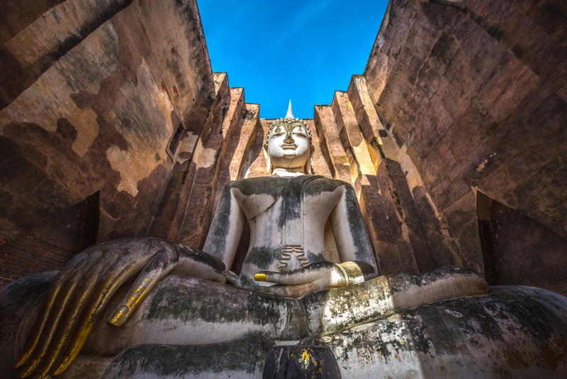
30. Wat Si Chum, Sukhothai is one of the most important ancient Buddhist monuments associated with Sukhothai Historical Park. Located outside the northern city walls of old Sukhothai, the temple is especially famous for Phra Achana, an enormous seated Buddha image enshrined inside a monumental square sanctuary known as a mondop. The image is framed by a narrow opening in the front wall, creating one of the most memorable architectural scenes in Thailand's historical temple landscape.
Highlights: Phra Achana Buddha image, monumental ancient mondop, Sukhothai Buddhist sculpture, architectural passageways, legends of the Speaking Buddha, and nearby UNESCO World Heritage monuments.
Phra Achana is an enormous Buddha image in the earth-touching posture, or marawichai, a form symbolizing the Buddha's victory over Mara. Its serene facial expression, balanced proportions, and elegant features reflect the artistic ideals of Sukhothai Buddhist sculpture. The image occupies most of the interior space of the mondop, emphasizing its spiritual and visual importance.
The distinctive design of the mondop contributes greatly to the temple's atmosphere. Its tall walls surround the Buddha image, while the vertical opening at the front creates a carefully framed view. Visitors approaching from outside gradually see the enormous figure emerging within the architectural space, producing an impressive sense of scale.
The mondop has thick walls and internal architectural features that have attracted considerable interest from historians and archaeologists. Historical evidence associated with the structure includes Buddhist narrative illustrations and architectural details that provide insight into religious beliefs and artistic practices during the Sukhothai period.
Wat Si Chum is also associated with the legend of the Speaking Buddha. The story has become part of local cultural memory and reflects how sacred places acquire additional meanings through oral traditions. Although the tale has different interpretations, it remains closely connected with the identity of this ancient temple.
The temple forms part of the wider historic landscape of Sukhothai, where numerous religious monuments demonstrate the development of Buddhist art and architecture. Visitors can combine Wat Si Chum with Wat Mahathat, Wat Sa Si, and other monuments within Sukhothai Historical Park to gain a more complete understanding of the ancient city.
The wider Sukhothai area is recognized as a UNESCO World Heritage property under the Historic Town of Sukhothai and Associated Historic Towns. This status reflects the outstanding cultural significance of the ancient settlements, their religious monuments, and their contributions to the development of Thai art and architecture.
Photography is particularly popular at Wat Si Chum because the Buddha image is dramatically framed by the entrance opening. Morning and late-afternoon light can bring out the textures of the ancient walls and the serene expression of Phra Achana. Visitors should remain respectful, avoid blocking worshippers, and follow restrictions designed to protect the monument.
Although Wat Si Chum can be visited relatively quickly, travelers interested in architecture and history should allow time to examine the surrounding structures and appreciate the atmosphere. Exploring the temple together with the main historical park makes for a rewarding cultural excursion.
Open Days: Daily.
Opening Hours: 06:30 – 19:30.
Getting There: Wat Si Chum is located outside the northern city walls of old Sukhothai. From the main historical park, visitors can reach the temple by car, bicycle, or other suitable local transport using the designated roads.
Map (GPS):Get Directions to Wat Si Chum

31. Sapan Waterfall, Nan is a peaceful natural attraction in Bo Kluea District, Nan Province. Located near Sapan Village in Dong Phaya Subdistrict, the waterfall is surrounded by forested mountains and lush vegetation. Its cascading streams, rocky levels, and humid woodland environment make it an appealing destination for travelers looking to experience the natural scenery of Nan's remote highlands.
Highlights: Sapan Waterfall, natural rock cascades, forest walking routes, mountain streams, Sapan Village, traditional community life, and the scenic Bo Kluea–Sapan mountain route.
Sapan Waterfall flows through a lush forest environment in the mountainous area of Bo Kluea. The stream descends over natural rock formations and passes through vegetation that thrives in the humid surroundings. Visitors can explore the waterfall using permitted walking routes and enjoy the cool atmosphere created by the stream and surrounding forest.
The waterfall is part of a wider natural landscape where mountain streams and forest ecosystems play an important role in sustaining local communities. Water resources support agricultural activities, vegetation, and daily life in villages throughout the valley. Visiting Sapan Waterfall therefore provides an opportunity to appreciate the relationship between natural resources and community livelihoods.
Sapan Village is one of the best-known rural destinations in Bo Kluea District. Surrounded by mountains, rice fields, and streams, the village has become popular among travelers seeking a quiet countryside experience. Its scenic setting and traditional atmosphere make it an appealing place to stay overnight and explore the surrounding landscape at a leisurely pace.
Combining a visit to Sapan Waterfall with an overnight stay in the village allows visitors to enjoy the changing atmosphere of the mountain valley. During the rainy season and early cool season, the surrounding hills and rice fields are particularly green, while the cool season brings lower temperatures and a peaceful highland environment.
The waterfall can also be included in a longer itinerary covering Bo Kluea's traditional mountain salt wells and other natural attractions. These destinations illustrate the different cultural and environmental features of the district, ranging from forest streams to the historic production of salt in the mountains.
Visitors should exercise caution when walking near wet rocks and flowing water. Slippery surfaces and sudden changes in water level may create hazardous conditions, particularly following heavy rainfall. It is important to follow local guidance and avoid entering unsafe sections of the stream.
Responsible tourism is especially important in this natural environment. Travelers should not leave litter, damage vegetation, or disturb wildlife. Respecting the surrounding villages and supporting locally operated accommodation and businesses also helps maintain the area's character.
Open Days: Access depends on the regulations of the protected area and prevailing weather conditions.
Getting There: From Nan city, travel toward Bo Kluea District, then follow Highway 1081 toward Sapan Village in Dong Phaya Subdistrict. Continue to the waterfall using the designated access route. Check mountain-road and weather conditions before departure.
Map (GPS):Get Directions to Sapan Waterfall
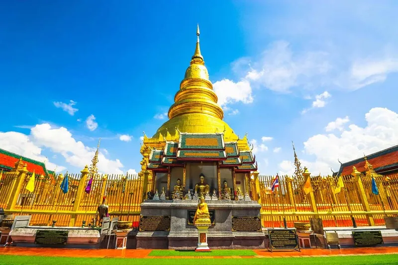
32. Wat Phra That Hariphunchai Woramahawihan, Lamphun is one of Northern Thailand's most revered Buddhist temples and an outstanding landmark of historic Lamphun. Situated in the heart of Lamphun's old town, the temple is renowned for its magnificent golden chedi, which is regarded as a sacred symbol of the former Hariphunchai Kingdom. The complex contains important religious buildings, historic architectural features, and artistic details that reflect the development of Buddhism in Northern Thailand over many centuries.
Highlights: Golden Phra That Hariphunchai Pagoda, Viharn Luang, historic entrance gateway, traditional Lanna architectural details, ancient bell structures, and the annual Hariphunchai Relic Water-Pouring Festival.
The history of Wat Phra That Hariphunchai is closely associated with the ancient city of Hariphunchai, which developed as an important political and cultural center long before the emergence of the Lanna Kingdom. The temple became a major center of Buddhist devotion and continued to develop through successive historical periods. Its buildings and religious monuments preserve evidence of the region's evolving architecture and religious traditions.
The golden chedi is the spiritual and visual centerpiece of the temple. Its elegant proportions and decorative details reflect the importance of relic worship within Northern Thai Buddhism. Worshippers traditionally walk around the pagoda and offer prayers as expressions of devotion.
Wat Phra That Hariphunchai is also associated with the traditional belief in birth-year pagodas. In Northern Thai custom, it is regarded as the sacred pagoda for people born in the Year of the Rooster. This belief attracts worshippers from different parts of Thailand who wish to participate in the long-established practice of making merit at the pagoda corresponding to their birth year.
The temple complex includes several important architectural features, notably Viharn Luang and its historic entrance structures. Their decorative details demonstrate the craftsmanship of generations of Northern Thai builders. Visitors can observe the relationship between Hariphunchai heritage and later Lanna architectural influences while exploring the grounds.
The historic entrance gateway is particularly interesting for its elaborate decorative patterns and religious symbolism. Together with the chedi, assembly halls, and ceremonial spaces, it illustrates the temple's status as a major Buddhist landmark in the region.
The annual Hariphunchai Relic Water-Pouring Festival is among Lamphun's most significant religious traditions. Buddhist worshippers gather to make offerings and participate in the ceremonial bathing of the sacred relic pagoda. The festival represents the continuity of religious devotion and the enduring relationship between the temple and the local community.
Wat Phra That Hariphunchai is located within Lamphun's historic town center, allowing visitors to combine a temple visit with nearby cultural attractions. Important destinations include Hariphunchai National Museum, Queen Chamadevi Monument, and Wat Chamadevi. Together, these places provide an introduction to the ancient kingdom's history and its continuing cultural significance.
Visitors interested in Northern Thai religious art should allow sufficient time to explore the temple grounds rather than focusing solely on the golden pagoda. Smaller architectural details, religious images, and ceremonial spaces contribute to understanding the temple's long history.
As an active Buddhist temple, Wat Phra That Hariphunchai requires respectful clothing and behavior. Visitors should observe restrictions in religious buildings, refrain from disturbing worshippers, and follow instructions intended to preserve historic structures.
Open Days: Daily.
Getting There: Wat Phra That Hariphunchai is situated in central Lamphun. From Chiang Mai, follow the Chiang Mai–Lamphun road toward Lamphun town, then continue into the historic center. The temple is accessible by private car, local transport, or on foot from nearby attractions.

33. Si Thep Historical Park, Phetchabun is one of Thailand's most important archaeological sites and a major center for understanding the country's early historical civilizations. Located in Si Thep Subdistrict, Si Thep District, Phetchabun Province, the historical park preserves the remains of an ancient city featuring moats, earthen walls, reservoirs, religious monuments, and archaeological evidence of a sophisticated settlement. The Ancient Town of Si Thep and its Associated Dvaravati Monuments were inscribed on the UNESCO World Heritage List in 2023, recognizing their outstanding cultural significance.
Highlights: Ancient Town of Si Thep, Khao Klang Nai, Khao Klang Nok, Prang Si Thep, Prang Song Phi Nong, ancient city walls and moats, Dvaravati religious art, and UNESCO World Heritage status.
The ancient city of Si Thep developed over a long period and provides important archaeological evidence of early settlements in the region. Its urban layout reflects the deliberate organization of residential, religious, and water-management areas. Archaeological remains demonstrate the importance of religious beliefs, cultural exchange, and community development in the historical landscape of central Thailand.
The city includes distinctive ancient earthworks, moats, and water reservoirs. These features illustrate the sophisticated relationship between settlement planning and the management of natural resources. The layout also provides evidence of the social and religious organization of communities that occupied the site during different periods.
Khao Klang Nai is one of the most important monuments within the historical park. The large religious structure is associated with Dvaravati artistic traditions and contains archaeological features that offer insights into early Buddhist art and sacred architecture. The surviving base and decorative elements are particularly valuable for understanding the skills and beliefs of ancient craftsmen.
Khao Klang Nok is another major archaeological monument located outside the principal ancient city area. Its large architectural form demonstrates the scale of religious construction associated with the settlement. Visiting both Khao Klang Nai and Khao Klang Nok provides a broader understanding of the relationship between the walled city and religious sites beyond its boundaries.
Prang Si Thep and Prang Song Phi Nong are further important structures associated with religious developments in the region. Their architecture reflects changing artistic influences and religious practices over time. The monuments demonstrate that Si Thep formed part of wider cultural networks extending across mainland Southeast Asia.
The Dvaravati artistic heritage of Si Thep is particularly significant because it predates the historical period most commonly associated with the Sukhothai Kingdom. The archaeological remains therefore help explain earlier stages in the development of religious art, urban settlement, and cultural interaction within the territory of present-day Thailand.
UNESCO inscribed the Ancient Town of Si Thep and its Associated Dvaravati Monuments on the World Heritage List in 2023. This recognition highlights the importance of the archaeological landscape as evidence of early cultural developments in Southeast Asia. The site's World Heritage status has also increased public interest in its preservation and historical interpretation.
Exploring Si Thep Historical Park requires sufficient time because several important monuments are distributed across different parts of the archaeological landscape. Visitors with a particular interest in history should plan to explore the main religious structures and examine available interpretive materials to better understand the development of the ancient city.
The park is especially appealing to travelers interested in archaeology, Buddhist art, ancient urban planning, and cultural history. A visit provides an opportunity to appreciate a historical civilization that developed long before many of Thailand's more widely known kingdoms.
Visitors should follow all conservation rules, avoid climbing archaeological structures, and refrain from touching delicate surfaces or removing objects from the site. Respecting these restrictions helps protect the historical remains for future research and public education.
The relatively open landscape can become hot during the middle of the day. Comfortable footwear, drinking water, and sun protection are therefore recommended. Visiting earlier in the day can make walking around the archaeological monuments more comfortable.
Open Days: Daily.
Opening Hours: 08:00 – 16:30.
Getting There: From Phetchabun city, follow Highway 21 toward Si Thep District, then continue along the designated road toward Si Thep Historical Park. The site can be reached by private car or rental vehicle. Allow sufficient time to explore the main archaeological areas.
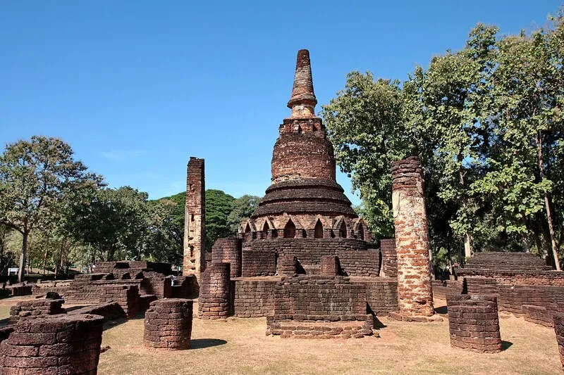
34. Wat Phra Kaeo in Kamphaeng Phet Historical Park, Kamphaeng Phet is one of the most important ancient Buddhist monuments in Kamphaeng Phet Province. Located within the historic walled city, the temple complex contains the remains of chedis, assembly halls, Buddha images, and other religious structures that reflect architectural traditions associated with the Sukhothai period. Wat Phra Kaeo is part of the wider Kamphaeng Phet Historical Park, which belongs to the UNESCO World Heritage property known as the Historic Town of Sukhothai and Associated Historic Towns, inscribed in 1991.
Highlights: Wat Phra Kaeo, ancient Buddhist chedis, historic viharn foundations, Sukhothai-style Buddha images, old city walls, Wat Phra That, Wat Chang Rop, and the archaeological landscape of Kamphaeng Phet Historical Park.
Kamphaeng Phet was historically an important fortified city associated with the Sukhothai Kingdom and its network of regional settlements. The ancient city developed along important transportation and communication routes, and its surviving monuments provide evidence of religious life, urban planning, and political relationships during the Sukhothai period. The remains of the city walls and religious complexes illustrate the scale and significance of the settlement.
Wat Phra Kaeo stands within the historic city and is distinguished by its extensive arrangement of religious structures. The surviving architectural remains include chedis, viharn foundations, and Buddha images that demonstrate the craftsmanship of earlier generations. Walking through the complex provides an opportunity to understand how Buddhist religious spaces were arranged within the urban environment.
The chedis and other structures at Wat Phra Kaeo reveal artistic characteristics associated with the Sukhothai tradition. Visitors can observe the relationships between principal monuments, smaller buildings, and ceremonial spaces. The surviving archaeological evidence helps historians interpret the temple's development and the changing religious practices of the ancient community.
Kamphaeng Phet Historical Park contains several other important monuments, particularly within the forested Aranyik area outside the old city. Wat Chang Rop is known for its chedi base decorated with elephant sculptures, while Wat Phra Si Iriyabot is associated with monumental Buddha images. Together, these temples demonstrate the diversity and sophistication of Buddhist architecture in ancient Kamphaeng Phet.
Wat Chang Rop is especially interesting because of the elephant sculptures arranged around the base of its principal monument. Elephants frequently appear in Buddhist religious art and historical architecture, and their use in monumental decoration reflects important symbolic traditions. The temple's distinctive design makes it one of the most recognizable archaeological attractions in the historical park.
Wat Phra Si Iriyabot is another important historical monument associated with large Buddha images representing different postures. The surviving sculptures and architectural remains help illustrate religious art and the development of Buddhist monuments in the region. Visiting these sites together with Wat Phra Kaeo creates a more complete picture of Kamphaeng Phet's cultural heritage.
Kamphaeng Phet Historical Park is particularly suitable for travelers interested in archaeology, Buddhist sculpture, ancient urban planning, and photography. A half-day visit can focus on Wat Phra Kaeo and the old city, while a full day allows additional time to explore the forested archaeological zone and nearby museums.
The archaeological landscape includes open spaces, trees, historic walls, and monuments exposed to the weather. Visitors should wear comfortable walking shoes, carry drinking water, and prepare sun protection. Early morning and late afternoon are often more comfortable for exploring the outdoor historical sites.
Protecting the ancient structures is essential. Visitors should not climb chedis, walk on restricted foundations, or touch fragile historic surfaces. Following the park's conservation regulations helps preserve these important remains of Thailand's cultural heritage for future generations.
Open Days: Visitor access follows the operating arrangements of Kamphaeng Phet Historical Park.
Getting There: From central Kamphaeng Phet, follow the signs toward the ancient city and Kamphaeng Phet Historical Park. Wat Phra Kaeo is located within the historic urban area and can be reached by private car or rental vehicle.

35. Wat Si Khom Kham, Phayao is one of the most important Buddhist temples in Phayao Province and an enduring religious landmark of the city. Also known locally as Wat Phra Chao Ton Luang, the temple is situated in Wiang Subdistrict, Mueang Phayao District, close to Kwan Phayao Lake. It is famous for its monumental seated Buddha image, Phra Chao Ton Luang, which has been a center of Buddhist devotion for generations. The temple also contains Lanna-style architecture and cultural exhibitions reflecting the historical and artistic heritage of Phayao.
Highlights: Phra Chao Ton Luang Buddha image, Viharn Luang, Phayao Cultural Exhibition Hall, Lanna Buddhist art, the annual Paet Peng festival, and the nearby Kwan Phayao lakeside area.
Phra Chao Ton Luang is one of the most revered Buddha images in Northern Thailand. Created during a period when Phayao maintained close cultural and political relationships with the Lanna Kingdom, the image reflects the religious art and craftsmanship of the region. Its monumental size and dignified appearance have made it an important symbol of Buddhist faith and the cultural identity of Phayao Province.
The large Buddha image is enshrined inside the temple's principal assembly hall. Visitors entering the viharn can appreciate the scale of the sculpture and the carefully arranged religious space surrounding it. The atmosphere reflects the continuous devotion of worshippers who come to make offerings, pray, and participate in Buddhist ceremonies throughout the year.
The architectural features of Wat Si Khom Kham provide important examples of Lanna religious design. The viharn and associated buildings contain artistic details that reveal the traditions of Northern Thai temple construction. Exploring the temple offers an opportunity to observe how religious architecture contributes to the identity of an important provincial landmark.
The Phayao Cultural Exhibition Hall is another attraction associated with the temple. Its displays provide opportunities to learn about the province's history, religious art, archaeological heritage, and traditional ways of life. Visitors interested in understanding Phayao beyond its natural attractions may find that the exhibition adds valuable historical and cultural context.
One of the most important religious traditions at Wat Si Khom Kham is the annual Paet Peng festival, held according to the traditional Northern Thai lunar calendar. During the festival, Buddhist worshippers gather to pay respect to Phra Chao Ton Luang, make merit, and participate in ceremonies that preserve the religious customs of the community.
The Paet Peng tradition illustrates the enduring relationship between Wat Si Khom Kham and the people of Phayao. Religious ceremonies, offerings, and community participation have maintained the temple's position as an important spiritual center across generations.
The temple's location near Kwan Phayao makes it particularly convenient for sightseeing. Travelers can begin with a visit to Phra Chao Ton Luang, continue to the King Ngam Mueang Monument, and spend the late afternoon enjoying views across the lake. This combination of religious heritage and natural scenery makes Mueang Phayao an appealing destination for a relaxed half-day or full-day itinerary.
Wat Si Khom Kham remains an active Buddhist temple, so visitors should dress modestly and maintain a respectful atmosphere. Photography and access arrangements within particular buildings may be subject to temple regulations.
Open Days: Daily.
Opening Hours: 08:00 – 18:00.
Getting There: Wat Si Khom Kham is located in Wiang Subdistrict, Mueang Phayao District, near Kwan Phayao. It is easily accessible by private vehicle or local transport from central Phayao and can be included in a walking or driving itinerary around the lake.
Map (GPS):Get Directions to Wat Si Khom Kham
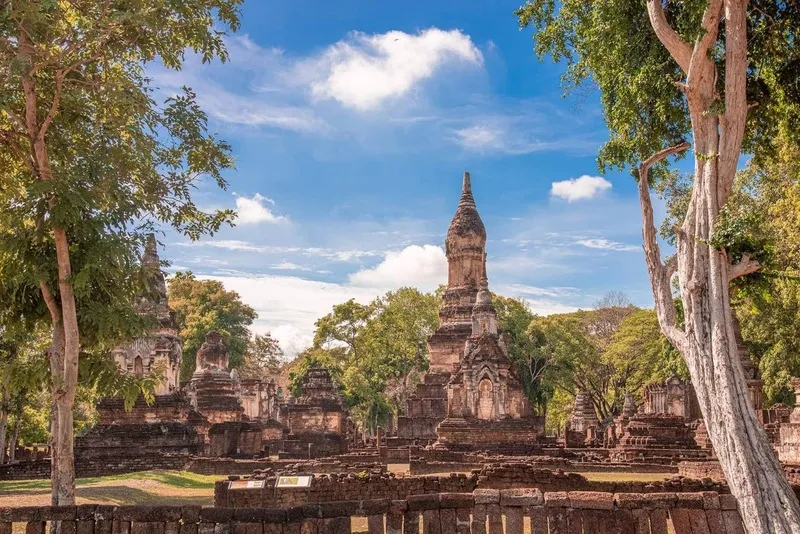
36. Si Satchanalai Historical Park, Sukhothai is one of Thailand's most important archaeological destinations, located in Si Satchanalai District, Sukhothai Province. The historical park preserves the remains of a major ancient city associated with the Sukhothai Kingdom, including Buddhist temples, chedis, viharns, defensive walls, and archaeological evidence of urban and religious development. Si Satchanalai is part of the UNESCO World Heritage property known as the Historic Town of Sukhothai and Associated Historic Towns, inscribed in 1991.
Highlights: Wat Chang Lom, Wat Chedi Chet Thaeo, Wat Nang Phaya, Wat Phra Si Rattana Mahathat Chaliang, ancient city walls, the Yom River, Sukhothai Buddhist architecture, and cycling routes through the historical landscape.
Si Satchanalai developed as an important settlement associated with the Sukhothai Kingdom and its network of regional centers. The ancient city occupied a strategically significant landscape close to the Yom River, which provided water resources and opportunities for transportation and trade. Archaeological evidence indicates the importance of religion, urban organization, and cultural exchange in the development of the settlement.
Wat Chang Lom is one of the most recognizable monuments within the historical park. Its principal chedi stands on a high base decorated with elephant sculptures arranged around the structure. The design reflects the religious symbolism and architectural traditions of the Sukhothai period. Visitors can examine the relationship between the central monument, surrounding buildings, and the wider temple layout.
Wat Chedi Chet Thaeo is particularly interesting because of its collection of chedis representing different architectural forms. The monuments provide valuable examples of the artistic diversity that developed during the Sukhothai period. Examining the variations in shape and decorative elements helps visitors understand the influences that contributed to religious architecture in the region.
Wat Nang Phaya is another important religious monument, especially notable for its surviving decorative stucco work and architectural remains. The craftsmanship evident in the temple provides valuable archaeological evidence concerning religious art and the development of decorative techniques in the ancient city.
Wat Phra Si Rattana Mahathat Chaliang is located in the wider historical landscape associated with Si Satchanalai. Its architectural features reveal religious and artistic traditions from different periods, making it an important destination for travelers interested in the historical development of the region.
Si Satchanalai also has an important history of ceramic production. The region was associated with the production of Sangkhalok pottery, which became an important element of the ancient economy and regional trade. Archaeological kiln sites and surviving ceramic objects demonstrate the technical skills of local craftsmen and the connections between the city and wider trading networks.
Exploring Si Satchanalai Historical Park is particularly enjoyable by bicycle because the monuments are distributed across a relatively extensive landscape. Cycling allows visitors to move between temple complexes while appreciating the trees, open spaces, and natural surroundings. Walking is also possible, although additional time should be allowed for traveling between the principal monuments.
Compared with more densely visited historical attractions, Si Satchanalai often provides a quieter environment for exploring ancient architecture. This peaceful atmosphere allows travelers to appreciate the scale of the monuments and the natural setting without rushing from one destination to another.
Visitors should allow at least half a day to explore the major monuments. Travelers with a particular interest in archaeology, ceramics, and early Thai history may wish to spend longer in the district and visit nearby cultural attractions associated with the ancient city.
As a protected historical site, Si Satchanalai requires responsible visitor behavior. Do not climb ancient structures, touch fragile decorative surfaces, or remove objects from archaeological areas. Following conservation regulations helps preserve this internationally significant cultural landscape.
Open Days: Daily.
Opening Hours: 08:30 – 16:30.
Getting There: From Sukhothai town, follow Highway 101 toward Si Satchanalai District, then continue toward Si Satchanalai Historical Park using the designated signs. The destination can be reached by private car or rental vehicle. Visitors may explore selected sections by bicycle.

37. Wat Chamthewi (Wat Ku Kut), Lamphun is one of the most important ancient Buddhist temples in Lamphun Province. Located on Chamthewi Road in Nai Mueang Subdistrict, Mueang Lamphun District, the temple is famous for its distinctive square, tiered chedi decorated with standing Buddha images. Wat Chamthewi is closely associated with the history of the Hariphunchai Kingdom and Queen Chamadevi, one of the most significant figures in the historical traditions of Lamphun.
Highlights: Ku Kut Chedi, Suwan Chang Kot Chedi, standing Buddha images in architectural niches, Ratana Chedi, Hariphunchai Buddhist art, Queen Chamadevi heritage, and historic Lamphun attractions.
Wat Chamthewi is especially valuable for its surviving examples of Hariphunchai religious architecture. Unlike many of the bell-shaped or lotus-bud-shaped chedis found elsewhere in Northern Thailand, its principal monument has a distinctive square plan with several superimposed levels. Each face contains niches housing standing Buddha images, creating a symmetrical and highly recognizable composition.
The principal chedi is commonly known as Ku Kut and is associated with architectural traditions of the Hariphunchai period. Its design reflects artistic connections with the ancient Mon cultural world and provides important evidence of religious architecture in Northern Thailand before the emergence of the Lanna Kingdom.
The standing Buddha images arranged within the chedi's niches are particularly interesting examples of early Buddhist artistic traditions. Their repeated placement across the tiers produces an architectural rhythm that distinguishes the monument from more conventional pagodas. The overall design reflects both religious symbolism and the craftsmanship of ancient builders.
Ratana Chedi is another important monument within the temple grounds. Its octagonal architectural form contrasts with the square structure of Ku Kut, illustrating the variety of religious designs preserved at Wat Chamthewi. Examining the different monuments together provides an opportunity to understand changes in artistic styles and temple construction.
The temple's name is associated with Queen Chamadevi, traditionally regarded as the first ruler of the ancient Hariphunchai Kingdom. Her story plays a central role in the cultural identity of Lamphun and appears in local historical traditions, religious sites, monuments, and community memory.
Visiting Wat Chamthewi provides insight into a period of Northern Thai history that predates the founding of the Lanna Kingdom. The temple is therefore particularly appealing to travelers interested in archaeology, early Buddhist art, and the development of regional civilizations.
Wat Chamthewi can be combined with Wat Phra That Hariphunchai Woramahawihan, the Queen Chamadevi Monument, and Hariphunchai National Museum. These attractions are located within the wider historic area of Lamphun and offer a rewarding introduction to the ancient city's cultural heritage.
Visitors should dress respectfully and avoid climbing or touching ancient structures. The surviving monuments are valuable historical remains that require careful conservation. Exploring the site at a relaxed pace allows visitors to appreciate the architectural details and the atmosphere of the temple grounds.
Open Days: Daily.
Opening Hours: 06:00 – 18:00.
Getting There: Wat Chamthewi is located on Chamthewi Road in Mueang Lamphun District. From Chiang Mai, follow the Chiang Mai–Lamphun road toward central Lamphun, then continue to the temple using local signs or GPS navigation.
Map (GPS):Get Directions to Wat Chamthewi

38. Wat Phra That Cho Hae, Phrae is one of the most important Buddhist pilgrimage destinations in Phrae Province. Located in Cho Hae Subdistrict, Mueang Phrae District, the temple is renowned for its magnificent golden chedi and its longstanding role as a center of religious devotion. Wat Phra That Cho Hae holds particular significance in traditional Northern Thai Buddhism because it is associated with the sacred birth-year pagoda for people born in the Year of the Tiger.
Highlights: Phra That Cho Hae golden pagoda, Lanna religious architecture, traditional viharns, sacred birth-year pilgrimage, annual Phra That Cho Hae worship festival, and mountain scenery surrounding the temple.
The principal pagoda at Wat Phra That Cho Hae is a distinctive golden religious monument reflecting important architectural traditions of Northern Thailand. Its carefully proportioned form and ornate surface decoration make it one of the province's most recognizable landmarks. The pagoda serves as the spiritual center of the temple, where Buddhist worshippers gather to pray and make offerings.
The architecture of Phra That Cho Hae reflects Lanna religious artistic traditions. The chedi's decorative details and the layout of the surrounding sacred compound illustrate the importance of relic worship within Northern Thai Buddhism. Visitors interested in Buddhist art can observe the craftsmanship and symbolism associated with the temple's principal monuments.
Wat Phra That Cho Hae is closely connected with the traditional belief in sacred pagodas corresponding to different birth years. In Northern Thai custom, Phra That Cho Hae is associated with the Year of the Tiger. Worshippers born in this zodiac year often travel to the temple to pay respect to the relic pagoda as part of a long-established religious tradition.
The annual Phra That Cho Hae worship festival is among the most significant religious events in Phrae. Activities follow the traditional Buddhist and Northern Thai lunar calendar and include merit-making, religious ceremonies, and community participation. The festival attracts local residents and worshippers from other provinces who come to pay respect to the sacred pagoda.
These religious traditions illustrate the continuing relationship between the temple and the local community. Through annual ceremonies and individual acts of devotion, Wat Phra That Cho Hae remains an important cultural and spiritual landmark of Phrae Province.
The temple grounds also contain other religious structures and architectural features worth exploring. Traditional viharns and decorative elements reflect the artistry of Northern Thai Buddhist construction and provide a peaceful setting for visitors interested in cultural heritage.
Wat Phra That Cho Hae is an excellent destination to combine with attractions in central Phrae, such as the historic governor's residence, important temples, and Phae Mueang Phi Forest Park. A one-day itinerary can include both religious heritage and unusual natural scenery.
Early morning is often a pleasant time to visit because temperatures are relatively comfortable. Visitors should dress modestly, respect religious ceremonies, and refrain from disturbing worshippers. Photography should be conducted with consideration for the sacred atmosphere.
Open Days: Daily.
Opening Hours: 06:00 – 18:00.
Getting There: From Phrae town, follow the road toward Cho Hae Subdistrict in Mueang Phrae District. The temple is accessible by private vehicle or local transport using signs to Wat Phra That Cho Hae.
Map (GPS):Get Directions to Wat Phra That Cho Hae

39. Pasaan, the Origin of the Chao Phraya River, Nakhon Sawan is a distinctive contemporary architectural landmark located in the Ko Yom area of Pak Nam Pho Subdistrict, Mueang Nakhon Sawan District. The site stands near the confluence of the Ping and Nan Rivers, where their waters join to form the Chao Phraya River. Pasaan is renowned for its sculptural, curved architecture representing the coming together of the two rivers and has become one of the most recognizable modern attractions in Nakhon Sawan Province.
Highlights: Pasaan architectural landmark, curved contemporary building, confluence of the Ping and Nan Rivers, origin of the Chao Phraya River, river viewpoints, sunset photography, and attractions around Pak Nam Pho.
The name Pasaan is associated with the concept of joining or blending, reflecting the geographical importance of Nakhon Sawan as the point where two major rivers come together. The Chao Phraya River is one of Thailand's most important waterways, flowing through the central plains toward the Gulf of Thailand. Its river system has played a major role in agriculture, trade, settlement, and the historical development of the country.
The architecture of Pasaan is distinguished by sweeping curved forms that symbolize the meeting of the Ping and Nan Rivers. The structure uses flowing lines to express the movement and connection of water, creating a striking contemporary landmark closely related to its geographical setting.
Visitors can appreciate the building from different perspectives, observing how its curved elements overlap and change appearance depending on the viewing angle. The structure is particularly appealing to photographers interested in contemporary architecture and the relationship between human design and natural landscapes.
The surrounding river scenery is another important feature. The meeting of the Ping and Nan Rivers can be observed from the nearby waterfront area, providing a visual reminder of the geographical importance of Nakhon Sawan. Under certain water conditions, differences in sediment concentration and water color may be noticeable where the rivers converge.
The location of Pasaan also provides an opportunity to understand the significance of river systems in Thailand. Water from the Ping and Nan Rivers flows onward as the Chao Phraya, supporting agriculture and communities throughout central Thailand. The landmark therefore connects contemporary architecture with the history and geography of one of the country's most important river basins.
Pasaan is especially attractive during the late afternoon, when sunlight falls across the curved architectural forms and reflects from the surrounding water. The changing light creates different patterns of shadow and color, making the landmark a popular photography destination.
Visitors can combine Pasaan with other attractions in Nakhon Sawan, including the Pak Nam Pho riverside area, local Chinese shrines, markets, and Bueng Boraphet. Exploring these destinations together provides insight into the province's river heritage, multicultural communities, and natural environment.
Travelers should follow the designated visitor routes and respect any restrictions introduced for maintenance or safety. Conditions near the waterfront can change with water levels and weather, so extra care is advisable during periods of heavy rain.
Open Days: Generally open daily according to local visitor arrangements.
Opening Hours: 10:00 – 17:00.
Getting There: Pasaan is located in the Ko Yom area near Pak Nam Pho, Mueang Nakhon Sawan District, close to the confluence of the Ping and Nan Rivers. Visitors can travel from central Nakhon Sawan using local roads toward the riverside landmark.
Map (GPS):Get Directions to Pasaan, Nakhon Sawan
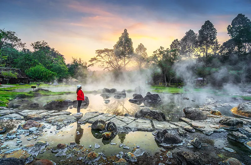
40. Chae Son National Park, Lampang is one of the most popular natural attractions in Lampang Province. Located in Mueang Pan District, the national park is especially famous for its geothermal hot springs, beautiful waterfalls, and forested mountain scenery. The combination of natural hot water, flowing streams, and protected woodland makes Chae Son an attractive destination for relaxation, nature walks, and learning about geological and ecological processes.
Highlights: Chae Son Hot Springs, Chae Son Waterfall, natural geothermal pools, designated mineral-water bathing facilities, forest walking routes, protected watershed forests, and mountain scenery.
The hot springs at Chae Son are formed through natural geothermal processes. Groundwater circulates through underground geological formations, becomes heated, and eventually rises to the surface. The resulting pools release steam and create a distinctive landscape where naturally heated water emerges among rocks and vegetation.
Some natural hot spring pools have extremely high water temperatures and are not suitable for direct contact. Visitors should observe warning signs and use only designated facilities for bathing or other permitted activities. The geothermal landscape is best appreciated as a natural phenomenon that requires careful management for visitor safety.
Chae Son Waterfall is another important attraction within the national park. Water flows through multiple rocky levels surrounded by lush vegetation, creating a refreshing forest environment. Designated walking routes allow visitors to enjoy the scenery and observe the relationship between flowing water, geological formations, and surrounding plant communities.
The waterfall's appearance changes with seasonal rainfall. During wetter periods, the volume of water increases and the forest becomes especially green. However, heavy rain can also create strong currents and slippery conditions. Visitors should follow all safety notices and avoid swimming in areas where conditions are unsafe.
One of the most interesting aspects of Chae Son National Park is that geothermal hot springs and cool forest waterfalls can be experienced within the same protected area. These contrasting natural features illustrate different geological and hydrological processes. The hot springs are related to underground heat, while the waterfalls are associated with surface water flowing through mountainous terrain.
The national park also protects important forest ecosystems and watershed areas. Forest vegetation helps retain moisture, regulate runoff, and provide habitats for a variety of plants and animals. Responsible tourism plays an important role in preserving these ecological functions.
Visitors can plan a day trip from Lampang town or stay in accommodation in the surrounding area. A practical itinerary may begin at the hot springs before continuing to the waterfall and nearby nature trails. Travelers interested in mineral bathing should verify current operating arrangements and follow the instructions provided by park staff.
The park is suitable for families, nature enthusiasts, and travelers seeking a relaxing outdoor experience. Comfortable walking shoes, sun protection, and appropriate clothing are recommended. Particular caution is necessary around hot water, wet rocks, and streams with strong currents.
Open Days: Generally open daily, although specific areas may be restricted because of weather or park management requirements.
Opening Hours: 08:00 – 18:00.
Getting There: From Lampang town, follow the road toward Mueang Pan District, then continue to Chae Son National Park using the designated signs. Some sections of the route pass through mountainous terrain and contain winding roads.
Map (GPS):Get Directions to Chae Son National Park
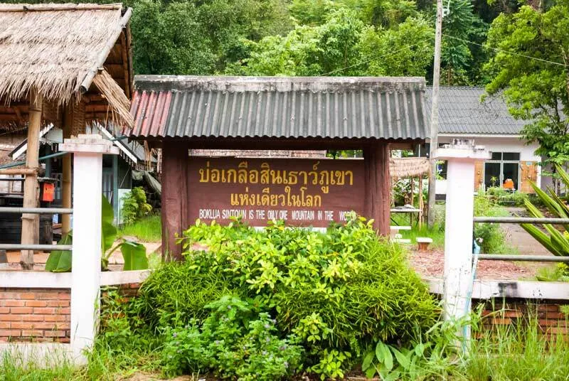
41. Bo Kluea Rock Salt Wells, Nan is an important cultural heritage attraction in Bo Kluea District, Nan Province. Located in Bo Kluea Tai Subdistrict, the site is renowned for traditional mountain salt production, a practice that has been passed down through local communities for generations. The distinctive feature of Bo Kluea is that salt is produced from naturally saline underground water rather than seawater, even though the area lies deep within the mountains of Northern Thailand.
Highlights: Traditional mountain salt wells, boiling saltwater over fire, village salt-production workshops, local craftsmanship, traditional community knowledge, handmade salt products, and the Bo Kluea–Sapan scenic route.
Bo Kluea has a long history as a source of mountain salt. Although Nan Province is far from the coast, underground water in certain parts of the district contains naturally occurring salts. Local communities learned to extract and process this resource, developing salt-making methods that became important for household consumption, trade, and the local economy.
Traditional salt production begins by drawing naturally saline water from the wells. The water is then placed in suitable containers and heated over a fire. As the water evaporates, salt crystals remain and can be collected and processed for use. This method requires time, experience, and specialized knowledge passed down through generations.
The salt-making process provides a valuable example of how communities adapt natural resources to local needs. It also illustrates the importance of traditional craftsmanship and knowledge in areas where modern industrial production was once unavailable.
Visitors can observe salt-making activities in areas where local producers welcome guests. Watching the boiling process offers a better understanding of the work involved in producing even a small quantity of salt. Because the work involves open flames and extremely hot water, travelers should remain in designated viewing areas and avoid interfering with production.
Local salt products have become popular souvenirs. Purchasing products directly from community businesses can help support the livelihoods of families who preserve traditional production techniques. Visitors may also learn about differences between locally produced mountain salt and more common commercial salt.
The cultural significance of Bo Kluea extends beyond the wells themselves. The village landscape, traditional homes, and surrounding mountain environment all contribute to the experience. Exploring the district provides opportunities to observe how mountain geography has influenced settlement, agriculture, trade, and everyday life.
Bo Kluea is conveniently combined with Sapan Village and Sapan Waterfall. Travelers with additional time can stay overnight in the mountains and enjoy the scenery of rice fields, forests, and streams. A two-day, one-night itinerary is especially suitable for those wanting to explore both cultural heritage and natural attractions.
Traditional salt production may not operate continuously throughout the year. Activities can vary according to the season, local customs, and the availability of raw materials. Visitors who specifically want to observe boiling saltwater should confirm current production arrangements before traveling.
The winding mountain roads around Bo Kluea require careful driving. Rain and fog can reduce visibility, particularly during the wet season. Travelers should allow sufficient time to reach the district and avoid rushing between destinations.
Open Days: Village access is generally available daily, while traditional salt production and workshop visits depend on local schedules and seasonal conditions.
Opening Hours: Visitor areas generally operate during daytime hours, approximately 08:00 – 17:00 where applicable.
Getting There: From Nan city, travel through the mountain roads toward Bo Kluea District, then continue to Bo Kluea Tai Subdistrict. The roads are winding and sometimes steep, so travelers should check weather and road conditions before departure.

42. Phra Ruang Hot Spring (Bueng Sap), Kamphaeng Phet is a natural geothermal attraction located in the Ban Lan Hin area of Lan Dokmai Subdistrict, Mueang Kamphaeng Phet District. The site is known for naturally heated water emerging from underground geological formations and for recreational facilities associated with the hot spring environment. It is a suitable destination for travelers interested in natural phenomena, geothermal landscapes, and relaxing outdoor activities while exploring Kamphaeng Phet Province.
Highlights: Natural geothermal spring, hot water pools, relaxing surroundings, designated mineral-water bathing facilities where available, geological processes, and the cultural heritage of the local area.
Phra Ruang Hot Spring was formed through a natural geological process in which groundwater is heated beneath the Earth's surface before rising through suitable rock formations. This produces water at a higher temperature than ordinary surface water, creating an environment that differs from typical freshwater springs.
The hot spring provides an opportunity to observe geothermal activity at the surface. Steam, heated water, and the surrounding geological conditions help demonstrate how underground heat can influence natural water systems.
The site is also known locally as Bueng Sap, a name connected with stories and beliefs associated with the area. Such place names and local traditions illustrate how communities have developed cultural interpretations of unusual natural phenomena.
Visitor facilities have been developed around the hot spring to provide places for sightseeing and relaxation. Certain areas may offer designated mineral-water bathing facilities, subject to current operating arrangements. Visitors should always use properly maintained facilities rather than entering natural hot-water pools without authorization.
Some geothermal pools contain water at temperatures high enough to cause burns. Warning signs and staff instructions must therefore be followed carefully. Travelers should not touch or enter pools intended only for viewing.
Phra Ruang Hot Spring can be combined with Kamphaeng Phet Historical Park and other attractions in Mueang Kamphaeng Phet District. A practical itinerary might include exploring archaeological monuments in the morning before relaxing at the hot spring later in the day.
Visitors interested in geology can use the opportunity to learn about the natural movement of groundwater and heat through underground rock structures. The attraction is a reminder that Northern Thailand's geological diversity includes geothermal environments as well as mountains, limestone formations, and waterfalls.
Those planning to bathe in mineral water should consider their personal health conditions, follow facility guidelines, and avoid excessive exposure to hot water. Suitable hydration and a moderate duration of bathing are important for personal comfort and safety.
Open Days: Daily.
Opening Hours: 08:30 – 16:30.
Getting There: From Kamphaeng Phet town, follow the road toward Lan Dokmai Subdistrict and Ban Lan Hin, then continue to Phra Ruang Hot Spring using local signs. The destination is accessible by private car or hired transport.
Map (GPS):Get Directions to Phra Ruang Hot Spring
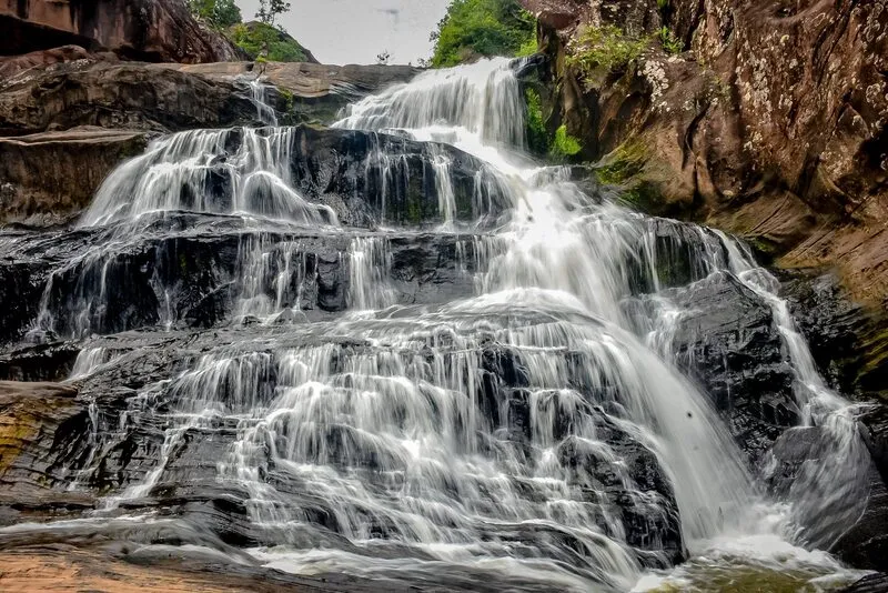
43. Namtok Chat Trakan National Park, Phitsanulok is an important protected natural area extending across parts of Chat Trakan and Nakhon Thai Districts in Phitsanulok Province. The national park is famous for its multi-level waterfall, forested mountain landscapes, and natural streams. Its protected environment offers opportunities for nature walks, ecological learning, and relaxation in a peaceful setting away from major urban areas.
Highlights: Namtok Chat Trakan, also known as Pak Rong Waterfall, multi-tiered cascades, forest walking routes, mountain ecosystems, natural streams, and archaeological locations within the wider national park.
Namtok Chat Trakan is a multi-level waterfall formed where streams descend through rocky sections of a forested mountain landscape. The different levels vary in shape and gradient, producing pools, cascades, and natural rock formations that create attractive scenery throughout the route.
The waterfall is surrounded by vegetation that thrives in the humid forest environment. Visitors can appreciate the sound of flowing water, observe plants along the streams, and experience the cooler atmosphere provided by the surrounding woodland.
The national park protects important forest and watershed ecosystems. These forests help regulate water flow, retain soil moisture, and support habitats for a variety of plant and animal species. Conservation is particularly important in mountainous areas where the condition of the forest influences water resources used by downstream communities.
In addition to its natural attractions, the wider park contains areas associated with archaeological evidence and traces of historical human activity. Certain locations are connected with ancient paintings or other archaeological remains, making the national park interesting for travelers who enjoy both nature and cultural history. Access to such areas must follow the park's regulations.
The waterfall is particularly attractive during periods when the surrounding forest is lush and the streams carry sufficient water. However, heavy rainfall can increase water levels rapidly and create strong currents. Visitors should follow safety instructions and avoid entering pools or streams during unsafe conditions.
The national park is suitable for families, nature enthusiasts, and travelers seeking a quiet outdoor experience. Visitors can explore designated walking routes and enjoy the forest scenery while learning about the importance of natural resource conservation.
Travelers should wear sturdy, non-slip footwear, bring drinking water, and prepare rain protection when necessary. Paths near the waterfall may become slippery after rainfall, and some sections may be unsuitable for those with limited mobility.
Namtok Chat Trakan National Park can be included in an itinerary through northern Phitsanulok, particularly for travelers staying around Chat Trakan or Nakhon Thai Districts. Sufficient travel time should be allowed because the routes pass through rural and mountainous areas.
Responsible tourism is essential within the protected environment. Visitors should avoid littering, disturbing wildlife, or leaving designated trails. Respecting the park's rules helps preserve the waterfall and surrounding forest ecosystems.
Open Days: Generally open daily, although access to individual areas may be restricted because of weather or conservation requirements.
Opening Hours: 08:30 – 16:30.
Getting There: From Phitsanulok city, follow the road toward Chat Trakan District and continue to Namtok Chat Trakan National Park using the designated signs. Check mountain-road and weather conditions before entering the protected area.

44. Doi Mae U Kho Bua Tong Fields, Mae Hong Son is one of Northern Thailand's most spectacular seasonal flower destinations. Located in Mae U Kho Subdistrict, Khun Yuam District, Mae Hong Son Province, the attraction is famous for its expansive mountainsides covered with bright yellow Mexican sunflower blossoms, locally known as bua tong. During the flowering season, the hills become a sea of golden flowers extending across approximately 1,000 rai, creating one of Thailand's most recognizable mountain landscapes.
Highlights: Golden bua tong flower fields, Doi Mae U Kho, mountain panoramas, seasonal wildflower displays, photography viewpoints, rolling valleys, and the scenic route through Khun Yuam District.
Doi Mae U Kho is characterized by mountain slopes and open grassland surrounded by distant ridges and valleys. The relatively open terrain allows extensive views across the highlands. During the flowering season, Mexican sunflowers cover large areas of the mountainside, producing a striking contrast between the yellow blossoms, green vegetation, and blue sky.
The bua tong flower, scientifically known as Tithonia diversifolia, is a yellow-flowering plant that thrives in certain mountainous environments. Its seasonal flowering is influenced by daylight, rainfall, and temperature conditions. Because of these environmental factors, the exact timing and intensity of the blossoms may vary from year to year.
The most popular visiting period is generally from November to December, when large numbers of flowers usually bloom across the mountains. During favorable seasons, entire hillsides appear covered in yellow. Travelers planning specifically to see the flowers should check current flowering reports before departure, rather than relying exclusively on the calendar.
The extensive flower-covered slopes are the main attraction, but the wider mountain landscape is equally rewarding. Visitors can admire distant valleys, layered ridgelines, and changing light over the highlands. Photography is particularly popular during the morning and late afternoon, when sunlight highlights the textures and contours of the flower fields.
Designated viewpoints and walking areas allow visitors to appreciate the scenery from different angles. Remaining on established paths is important because walking through dense flower growth can damage the plants and affect the appearance of the fields for other visitors.
Doi Mae U Kho can be included in a sightseeing itinerary around Khun Yuam District and other destinations in Mae Hong Son Province. Travelers interested in mountain scenery may combine the flower fields with local cultural attractions and scenic stops along the surrounding highland roads.
The approach roads pass through mountainous terrain and contain bends and steep sections. Travelers using private vehicles should ensure that their cars are suitable for the journey, maintain safe speeds, and allow sufficient time for the return trip. Weather conditions can change quickly in the mountains.
Responsible tourism is essential to protecting the seasonal flower landscape. Visitors should not pick flowers, trample plants, leave rubbish, or create unofficial paths through the fields. Respecting the natural environment helps preserve the destination's appeal for future visitors.
Open Days: Generally accessible daily, subject to local visitor arrangements and seasonal conditions.
Best Time to Visit: November to December, depending on the annual flowering period.
Getting There: From Mae Hong Son town, follow Highway 108 toward Khun Yuam District, then continue along the designated road to Mae U Kho Subdistrict and the bua tong flower fields. The mountain route includes steep sections and curves, so careful driving is recommended.
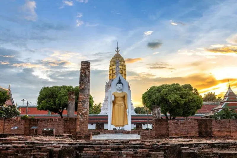
45. Wat Phra Si Rattana Mahathat Woramahawihan, Phitsanulok, commonly known as Wat Yai, is one of Thailand's most important Buddhist temples and a major religious landmark of Phitsanulok Province. Located beside the Nan River in Nai Mueang Subdistrict, Mueang Phitsanulok District, the temple is renowned for enshrining Phra Phuttha Chinnarat, a highly revered bronze Buddha image celebrated for its exceptionally beautiful proportions and artistic craftsmanship. The temple is both a spiritual center for Buddhist worshippers and an important destination for understanding the historical and artistic heritage of Phitsanulok.
Highlights: Phra Phuttha Chinnarat, Viharn Luang, elaborate flame-shaped aureole, Phra Luea, Phra Attharot, the principal prang, Sukhothai Buddhist art, and the annual Phra Phuttha Chinnarat celebration.
The history of Wat Phra Si Rattana Mahathat Woramahawihan is closely associated with the development of Phitsanulok and its historical relationship with the Sukhothai Kingdom. For centuries, the temple has served as an important center of Buddhism, religious ceremonies, and artistic patronage. Its surviving religious buildings and monuments reflect the significance of Phitsanulok as a major historical city of the lower northern region.
Phra Phuttha Chinnarat is the temple's most celebrated sacred image. Cast in bronze and depicted in the earth-touching posture, the Buddha image is distinguished by its serene facial expression, graceful proportions, and extraordinary artistic details. The elaborate flame-shaped aureole behind the figure enhances its visual magnificence and is one of its most recognizable features.
The Buddha image is regarded as one of the finest examples of Sukhothai-period Buddhist sculpture. Its artistic significance lies in the harmonious relationship between the body proportions, facial features, posture, and decorative elements. The sculpture has become a model of Buddhist artistic beauty and a powerful symbol of religious devotion.
Viharn Luang, the principal assembly hall, houses Phra Phuttha Chinnarat. The impressive interior emphasizes the sacred character of the Buddha image and provides an important space for worship, religious ceremonies, and individual prayer. The hall's architectural details and decorative elements demonstrate the longstanding devotion of the people of Phitsanulok.
Beyond the principal Buddha image, the temple contains other important religious monuments, including Phra Luea, Phra Attharot, and the principal prang. These structures contribute to the historical and artistic significance of the complex. Visitors interested in Buddhist architecture should explore the wider temple grounds rather than focusing solely on the main assembly hall.
The principal prang reflects an architectural tradition associated with ancient Buddhist religious centers. Its form and position within the temple compound illustrate the historical development of religious architecture in the region. Other monuments and religious images provide additional evidence of changing artistic styles and devotional practices.
The annual Phra Phuttha Chinnarat celebration is among the most important religious traditions associated with the temple. Buddhist worshippers gather to pay respect to the sacred image, make merit, and participate in ceremonies held according to the annual religious calendar. The event reflects the continuing importance of the temple as a center of faith and cultural identity.
The temple's location beside the Nan River connects it with the historical development of Phitsanulok as a riverside settlement. The river has long been important for transportation, commerce, and community life, while the temple has remained a prominent religious landmark near the historic city center.
Visitors can combine Wat Phra Si Rattana Mahathat with other attractions in Phitsanulok town and along the Nan River. A half-day sightseeing itinerary provides time to admire the principal Buddha image, explore the historical structures, and experience the atmosphere of the surrounding urban community.
As an active Buddhist temple, Wat Yai requires appropriate clothing and respectful behavior. Visitors should avoid disturbing worshippers, observe restrictions on photography within religious buildings, and follow all instructions concerning access to sacred areas.
Open Days: Daily.
Opening Hours: 06:00 – 18:00.
Getting There: Wat Phra Si Rattana Mahathat Woramahawihan is located on Phuttha Bucha Road in Nai Mueang Subdistrict, Mueang Phitsanulok District. It is easily reached by private car, taxi, or local transport from central Phitsanulok and nearby areas along the Nan River.

46. Doi Hua Mot, Tak is one of the best-known mountain viewpoints in Umphang District, Tak Province. Located along the road from Umphang toward Ban Pa La Tha, approximately 10 kilometers from central Umphang, the mountain is characterized by relatively open ridges, low vegetation, and wide views across the surrounding highlands. Doi Hua Mot is especially popular for sunrise photography, cool morning air, and the possibility of seeing seas of mist drifting through the valleys.
Highlights: Sunrise viewpoints, morning sea of mist, panoramic mountain scenery, seasonal wildflowers, limestone mountain landscapes, and routes connecting Umphang with Thi Lo Su Waterfall.
The unusual character of Doi Hua Mot comes from its relatively open summit and sparse large-tree vegetation compared with the surrounding forested mountains. This geographical feature is closely connected with the meaning of its local name, which refers to the largely bare appearance of the mountain's upper slopes.
The open landscape provides wide views across Umphang's extensive mountain ranges. Visitors can observe valleys and distant ridges, particularly on mornings when clouds and mist move slowly through the lower areas. The mountain offers a different experience from forest viewpoints enclosed by dense vegetation.
Sunrise is the most popular time to visit. Before dawn, the highlands are often cool, and the surrounding landscape gradually becomes visible as the sky brightens. Under favorable weather conditions, mist gathers in the valleys while the peaks remain above the white cloud layer, creating the appearance of a sea of mist.
As the sun rises, changing light creates different shades across the mountains and valleys. This transformation makes Doi Hua Mot especially rewarding for landscape photographers. However, mist formation depends on actual humidity, temperature, and wind conditions, so the phenomenon cannot be guaranteed on every visit.
The mountain's open slopes also support seasonal grasses and wildflowers. Their appearance varies according to rainfall and the time of year. Visitors can appreciate the natural vegetation while walking on designated routes, but should avoid trampling plants or damaging the surrounding environment.
Doi Hua Mot is part of the wider mountain landscape of Umphang, an area known for extensive forests and outstanding natural attractions. The region's geographical isolation has helped preserve a distinctive highland atmosphere, making it appealing to travelers who enjoy nature and journeys away from busy urban centers.
The viewpoint can be combined with a trip to Thi Lo Su Waterfall and other attractions around Umphang District. Travelers interested in both destinations should consider allowing two or three days because travel to Umphang involves mountainous roads and considerable driving time.
Reaching the viewpoint may involve walking uphill along uneven terrain. Appropriate footwear, a flashlight for predawn visits, and warm clothing are recommended. Travelers should avoid approaching steep slopes or exposed edges during foggy or wet conditions.
Visitors should keep the area clean, refrain from damaging vegetation, and avoid creating unofficial walking paths. Responsible tourism helps preserve the natural conditions that make Doi Hua Mot an attractive mountain destination.
Open Days: Generally accessible daily, subject to local conditions.
Best Time to Visit: Before sunrise and during the early morning for mountain views and possible seas of mist.
Getting There: From Umphang town, follow the road toward Ban Pa La Tha for approximately 10 kilometers, then continue to the designated viewpoint access area. Allow time for walking uphill and check weather conditions before departing, especially for early morning visits.
Map (GPS):Get Directions to Doi Hua Mot
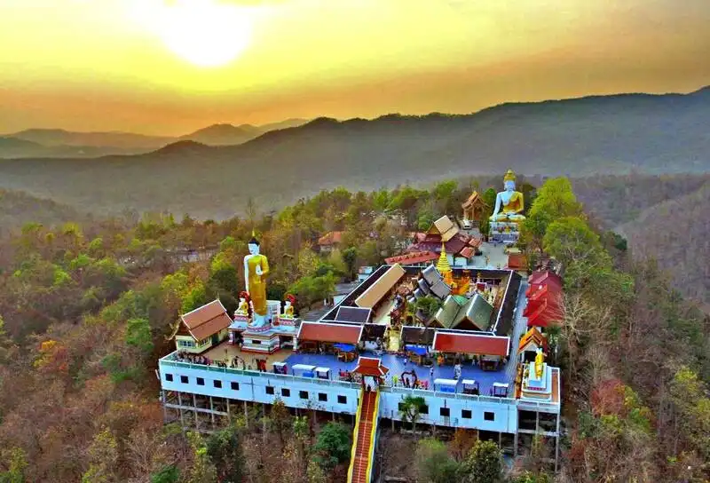
47. Wat Phra That Doi Kham, Chiang Mai is a historic Buddhist temple and popular pilgrimage destination in Chiang Mai Province. Located on a hill in Mae Hia Subdistrict, Mueang Chiang Mai District, southwest of the city center, the temple is closely associated with Lanna religious traditions. Its main attractions include an ancient sacred pagoda, important Buddha images, and viewpoints overlooking Chiang Mai and the surrounding countryside. The temple is particularly well known for Luang Pho Than Jai, a revered Buddha image associated with the tradition of making wishes and offering prayers.
Highlights: Luang Pho Than Jai, Phra That Doi Kham Pagoda, sacred Buddha images, Lanna religious architecture, panoramic Chiang Mai viewpoints, hilltop surroundings, and nearby attractions in Mae Hia and Hang Dong.
Wat Phra That Doi Kham has a long history connected with the Buddhist traditions and local legends of Chiang Mai. Its elevated location provides a peaceful mountain setting that differs from the temples within the city's historic walls. The surrounding landscape includes hills and vegetation, while the temple grounds provide an opportunity to experience Buddhist religious culture in a scenic environment.
The sacred pagoda, Phra That Doi Kham, is an important focus of devotion. Its architectural form reflects Lanna religious traditions and the longstanding Buddhist practice of enshrining sacred relics within chedis. Visitors can admire the structure and observe how religious monuments contribute to the historical identity of Northern Thai communities.
Luang Pho Than Jai is one of the temple's most famous sacred Buddha images. Many worshippers visit to pray for success, fulfillment, and personal aspirations according to local religious beliefs. The tradition has made Wat Phra That Doi Kham particularly popular among Buddhists from Chiang Mai and other parts of Thailand.
An especially recognizable custom associated with Luang Pho Than Jai is the offering of jasmine flowers. Large quantities of jasmine garlands are often seen in areas where worshippers pay respect to the Buddha image. This practice has become a distinctive expression of faith associated with the temple.
The importance of Wat Phra That Doi Kham extends beyond wish-making. The temple remains a place for traditional merit-making, paying respect to sacred relics, and maintaining religious customs passed down through generations. Visitors can therefore gain insight into the relationship between Buddhist faith and daily life in Northern Thailand.
The hilltop location also provides opportunities to admire Chiang Mai from above. On clear days, the surrounding cityscape and distant mountains can be seen from designated viewpoints. Morning and late-afternoon visits offer particularly attractive natural light for photography.
The road leading to the temple contains curves and steep sections, but the destination is accessible by private car and other suitable vehicles. Weekends and religious holidays can attract considerable numbers of visitors, so allowing extra time for travel and parking is advisable.
Wat Phra That Doi Kham can be combined with nearby attractions such as Royal Park Rajapruek and destinations around Mae Hia and Hang Dong. A half-day itinerary can begin with a visit to the temple before continuing to gardens or other cultural attractions in the surrounding area.
Travelers should dress modestly, behave respectfully, and observe the temple's regulations. Areas used for Buddhist worship should be kept peaceful, and visitors should avoid obstructing those participating in religious ceremonies.
Open Days: Daily.
Opening Hours: 06:00 – 18:00.
Getting There: From Chiang Mai city, travel toward Mae Hia Subdistrict and Hang Dong District. The route can be reached via the Canal Road before turning toward the hilltop temple. The final approach contains steep and winding sections, so drivers should proceed carefully, especially during busy periods.
Map (GPS):Get Directions to Wat Phra That Doi Kham
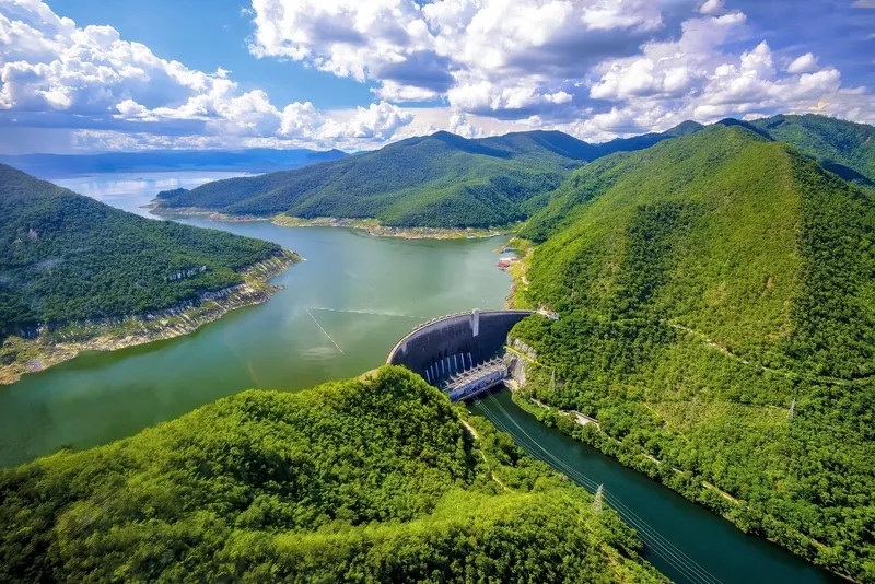
48. Bhumibol Dam, Tak is one of Thailand's most important large-scale water-resource and hydropower projects. Located in Sam Ngao Subdistrict, Sam Ngao District, Tak Province, the dam was constructed across the Ping River and was formerly known as Yanhee Dam. It is distinguished by its monumental concrete arch structure and extensive reservoir surrounded by mountains. Beyond its roles in electricity generation, irrigation, and water management, Bhumibol Dam has become a destination for travelers interested in engineering, natural scenery, and the history of Thailand's infrastructure development.
Highlights: Large concrete arch dam, Bhumibol Reservoir, mountain viewpoints, Ping River scenery, hydropower engineering, water-resource education, and designated recreational areas.
Bhumibol Dam represents an important stage in Thailand's development of water resources and electrical infrastructure. Constructed to store water from the Ping River, the project supports hydropower generation, irrigation, and the broader management of water within the Chao Phraya River basin. Its development contributed to the expansion of energy and agricultural infrastructure in Thailand.
The dam's structural design is one of its defining characteristics. As a concrete arch dam, it relies on a curved form that transfers pressure from the stored water toward the surrounding rock walls. Its construction within a narrow mountain valley demonstrates how engineering design can make use of natural geographical conditions to support a massive water-retaining structure.
The reservoir created upstream extends through a mountainous landscape and forms an impressive body of water surrounded by forested slopes and distant ridges. On clear days, the mountains may be reflected on the reservoir's surface, producing picturesque scenery that contrasts with the scale of the dam itself.
The dam plays an important role in Thailand's hydropower system. Water stored in the reservoir can be released through turbines to generate electricity, converting the potential energy of elevated water into electrical power. This illustrates one application of renewable energy technology and the relationship between water-resource management and energy production.
Bhumibol Dam also supports irrigation and water management downstream. The storage and release of water are connected with agricultural needs, electricity production, and conditions within the wider Chao Phraya River basin. Understanding these functions adds educational value to a visit beyond the scenic experience.
The mountain landscape surrounding the dam provides attractive viewpoints and opportunities for photography in areas that are open to visitors. The combination of a large engineering structure, extensive reservoir, and natural scenery makes Bhumibol Dam distinctive among Thailand's major infrastructure attractions.
The dam's importance as an operational infrastructure facility means that not all areas are open to the public. Visitors must follow restrictions concerning access, photography, drones, and movement around operational equipment. Entering restricted or secured areas without authorization is prohibited.
Bhumibol Dam can be included in a sightseeing itinerary through Sam Ngao District and other parts of Tak Province. Travelers interested in engineering and the natural environment may wish to allow sufficient time to explore permitted viewpoints and learn about the project's history.
Visiting during daylight hours is advisable because the surrounding mountain scenery is easier to appreciate and authorized visitor facilities are more likely to be operating. Travelers should confirm current access arrangements before departure.
Open Days: Public access is limited to designated visitor areas under the management of the dam authorities.
Best Time to Visit: Daytime, subject to current access regulations and authorized visiting hours.
Getting There: From Tak town, follow the road toward Sam Ngao District, then continue to Bhumibol Dam using the designated signs. Private cars and rental vehicles are convenient options, although access to certain areas may be restricted.
Map (GPS):Get Directions to Bhumibol Dam

49. Sirikit Dam, Uttaradit is one of Thailand's major dams and an important water-resource and energy project. Located near Ban Pha Som in Pha Lueat Subdistrict, Tha Pla District, Uttaradit Province, the dam was constructed across the Nan River and forms an extensive reservoir surrounded by mountains. The site is known both for its significance in hydropower production and irrigation and for its scenic views of the reservoir and forested highlands.
Highlights: Large earthfill dam, Sirikit Reservoir, Nan River landscape, mountain viewpoints, recreational areas, and learning opportunities relating to hydropower and water management.
Sirikit Dam is an earthfill dam with a clay core, designed to store water from the Nan River. Its primary functions include hydropower generation, irrigation support, and water-resource management within the Chao Phraya River basin. The project is an important part of Thailand's infrastructure for managing water used in agriculture and other economic activities.
The construction of the dam created a large reservoir extending through mountain valleys. The surrounding landscape includes forested hills, rocky slopes, and open stretches of water. These natural features make the area visually impressive, particularly when viewed from designated observation points.
The reservoir's appearance changes with water levels and seasonal conditions. During periods of clear weather, the mountain ridges can be reflected on the water, while changes in light throughout the day create different colors across the landscape.
The Nan River is one of the principal waterways contributing to the Chao Phraya River system. Water management at Sirikit Dam therefore has importance beyond the immediate surrounding area, influencing the availability of water for downstream agriculture, communities, and other users.
The dam also contributes to electricity generation through hydropower technology. Stored water is used to drive turbines that produce electrical energy. Visiting the area offers an opportunity to learn about the relationship between engineering, natural resources, and national energy infrastructure.
Tha Pla District has a mountainous landscape and a history closely connected with the Nan River. The development of Sirikit Dam significantly changed the geography and patterns of land use in parts of the surrounding basin. Understanding these changes provides additional insight into the social and environmental dimensions of large water-management projects.
Travelers can enjoy the reservoir landscape from designated visitor areas where public access is permitted. The combination of the dam, mountain scenery, and broad water views makes the destination appealing to people interested in photography and outdoor relaxation.
Because Sirikit Dam is an operational infrastructure facility, visitor access is controlled. Travelers should not enter restricted zones or attempt to approach operational structures without authorization. Regulations concerning drones and special photographic equipment must also be observed.
Sirikit Dam can be combined with other attractions in Uttaradit Province and Tha Pla District. Travelers with an interest in natural scenery and engineering may plan a half-day visit or include the dam in a longer route through the lower northern region.
Travelers should confirm current opening arrangements for public areas and any available visitor services before departure. Daytime visits are generally preferable for viewing the surrounding mountains and reservoir.
Open Days: Access to tourism areas follows the regulations and operating arrangements of the dam authorities.
Getting There: From Uttaradit town, follow the road toward Tha Pla District, then continue to Sirikit Dam using the designated signs. Private cars and rental vehicles are convenient options. Check visitor access arrangements and parking locations before arrival.
Map (GPS):Get Directions to Sirikit Dam

50. Khlong Lan Waterfall in Khlong Lan National Park, Kamphaeng Phet is one of the most spectacular waterfall destinations in lower Northern Thailand. Located in Khlong Lan District, Kamphaeng Phet Province, within Khlong Lan National Park, the waterfall is surrounded by an extensive protected forest and mountain ecosystem. Khlong Lan Waterfall is distinguished by its powerful flow dropping from a cliff approximately 100 meters high and roughly 40 meters wide. The combination of cascading water, forested cliffs, and natural streams makes it one of the province's most important nature attractions.
Highlights: Khlong Lan Waterfall, approximately 100-meter-high cliff, forested mountain landscape, natural streams, waterfall viewpoints, Khlong Nam Lai Waterfall, protected watershed forests, and nature walking routes.
Khlong Lan National Park covers approximately 187,500 rai of forested mountain landscape in Khlong Lan District, Kamphaeng Phet Province. The protected area is important for natural resource conservation and the preservation of watershed ecosystems. Its forests support a wide range of plant and animal life while contributing to streams that eventually flow into the Ping River system.
Khlong Lan Waterfall is the park's most recognizable natural feature. Water descends over a broad, high rock face into the lower area, creating an impressive curtain of cascading water. During periods of higher flow, the volume and force of the waterfall become particularly dramatic, producing fine spray around the base of the cliff.
The waterfall is surrounded by dense greenery and natural rock formations that create a refreshing atmosphere. Visitors can enjoy the scenery from designated observation areas and appreciate the contrast between the powerful waterfall and the quieter forest surroundings.
The appearance of Khlong Lan Waterfall changes throughout the year. During the rainy season, increased rainfall can produce stronger flows and lush vegetation. During periods of more moderate water levels, the surrounding environment may be more suitable for relaxed sightseeing, depending on actual park conditions.
Heavy rainfall can also increase the risk of strong currents and flash floods. Visitors should follow all safety notices, avoid restricted areas, and never enter streams or pools when conditions are unsafe. Wet rocks and walking paths may become slippery, requiring extra caution.
The park's forest ecosystems are important for regulating water flow and maintaining the health of the surrounding landscape. Forest vegetation helps retain moisture, reduce soil erosion, and support the natural hydrological cycle. Preserving these forests is therefore essential for both biodiversity and downstream water resources.
Khlong Lan National Park also contains other natural attractions, including Khlong Nam Lai Waterfall, which features water flowing across several rocky levels. Visiting different waterfalls within the same protected area allows travelers to compare distinct landforms and experience a greater variety of forest scenery.
Additional areas of the national park include streams, rocky cascades, forest trails, and designated recreational facilities. Visitors interested in nature should choose routes suitable for their abilities and follow instructions concerning access to specific areas.
Khlong Lan Waterfall is suitable for families, photographers, and nature enthusiasts. Its imposing cascade can be appreciated without necessarily undertaking a demanding mountain trek, making it an attractive destination for travelers who want to experience a major waterfall with a relatively straightforward visit.
The park can be explored as a day trip from Kamphaeng Phet town or included in a longer journey through lower Northern Thailand. Travelers may combine the waterfall with Kamphaeng Phet Historical Park, creating a route that features both natural scenery and the archaeological heritage of an ancient Thai city.
Different seasons provide different travel experiences. The late rainy season can offer lush forests and abundant waterfall flow, while the cool season is generally more comfortable for walking and outdoor activities. Visitors should check current national park announcements and weather forecasts before departure.
Responsible tourism is particularly important within a protected natural area. Visitors should remain on designated paths, avoid disturbing wildlife, carry out their rubbish, and follow all park regulations. These actions help preserve the waterfall and surrounding forest for future generations.
Open Days: Daily, subject to temporary restrictions introduced for safety or conservation.
Opening Hours: 08:30 – 16:30.
Getting There: From Kamphaeng Phet town, follow Highway 1 toward the Khlong Mae Lai area, then continue along Highway 1117 toward Khlong Lan District. At the Khlong Lan Market intersection, follow the road toward the national park and its visitor facilities. Check road conditions and national park announcements before traveling, particularly during periods of heavy rainfall.
Northern Thailand's 17 provinces offer a diverse range of experiences, including dramatic mountain scenery, misty viewpoints, historic Buddhist temples, UNESCO World Heritage sites, traditional villages, freshwater lakes, waterfalls, and remarkable natural landscapes. This table brings together all 50 attractions, with their provinces and principal highlights, to help international travelers compare destinations and plan their journeys more easily.
| No. | Attraction | Province | Key Highlights |
| 1 | Mae Kampong Village | Chiang Mai | Traditional mountain village, streams, and community culture |
| 2 | Doi Inthanon National Park | Chiang Mai | Thailand's highest summit and montane forests |
| 3 | Wat Rong Khun (White Temple) | Chiang Rai | White temple and contemporary Buddhist art |
| 4 | Wat Phra That Pha Sorn Kaew | Phetchabun | Five white Buddha statues and mountain temple architecture |
| 5 | Phu Thap Boek | Phetchabun | High mountains, seas of mist, and Hmong community life |
| 6 | Mon Jam (Doi Mon Jam) | Chiang Mai | Mountain viewpoints and highland agriculture |
| 7 | Ban Rak Thai | Mae Hong Son | Mountain lake and Yunnanese Chinese heritage |
| 8 | Khao Kho | Phetchabun | Misty mountains and cool-weather getaways |
| 9 | Wat Phumin | Nan | Famous Whisper of Love mural and historic temple |
| 10 | Wat Chantharam (Wat Tha Sung) | Uthai Thani | Crystal Hall and Golden Castle |
| 11 | Phu Soi Dao National Park | Uttaradit and Phitsanulok | Three-needle pine plateau and mountain trekking |
| 12 | Wat Phra That Lampang Luang | Lampang | Sacred pagoda and preserved Lanna architecture |
| 13 | Hup Pa Tat | Uthai Thani | Hidden palm forest inside a limestone valley |
| 14 | Bueng Si Fai Lake | Phichit | Freshwater lake and Chalawan crocodile landmark |
| 15 | Sukhothai Historical Park | Sukhothai | UNESCO World Heritage ancient capital |
| 16 | Kwan Phayao (Phayao Lake) | Phayao | Freshwater lake and sunset scenery |
| 17 | Bueng Boraphet | Nakhon Sawan | Freshwater wetland and aquatic wildlife |
| 18 | Pang Ung | Mae Hong Son | Pine forest, reservoir, and morning mist |
| 19 | Phu Hin Rong Kla National Park | Phitsanulok | Unusual rock formations and modern history |
| 20 | Doi Ang Khang and Angkhang Royal Agricultural Station | Chiang Mai | Cool-climate gardens and highland farming |
| 21 | Phu Chi Fa Forest Park | Chiang Rai | Sunrise above mountain ridges and seas of mist |
| 22 | Doi Samer Dao in Si Nan National Park | Nan | Stargazing, mountains, and seas of mist |
| 23 | Wat Chedi Luang Worawihan | Chiang Mai | Ancient pagoda and Chiang Mai City Pillar |
| 24 | Kong Lan (Pai Canyon) | Mae Hong Son | Eroded earth ridges and sunset viewpoints |
| 25 | Kad Kong Ta Walking Street | Lampang | Historic trading district and weekend walking street |
| 26 | Thi Lo Su Waterfall | Tak | Massive waterfall in the Umphang wilderness |
| 27 | Phae Mueang Phi Forest Park | Phrae | Natural earth pillars and geological formations |
| 28 | Wat Phra That Doi Suthep | Chiang Mai | Golden sacred pagoda and panoramic city views |
| 29 | Phra That Doi Tung | Chiang Rai | Twin golden stupas and religious pilgrimage tradition |
| 30 | Wat Si Chum | Sukhothai | Monumental Phra Achana Buddha image |
| 31 | Sapan Waterfall | Nan | Forest waterfall near a mountain village |
| 32 | Wat Phra That Hariphunchai Woramahawihan | Lamphun | Sacred golden pagoda of historic Hariphunchai |
| 33 | Si Thep Historical Park | Phetchabun | UNESCO World Heritage ancient Dvaravati city |
| 34 | Wat Phra Kaeo, Kamphaeng Phet Historical Park | Kamphaeng Phet | Ancient Buddhist monuments and World Heritage archaeology |
| 35 | Wat Si Khom Kham | Phayao | Phra Chao Ton Luang and Lanna religious heritage |
| 36 | Si Satchanalai Historical Park | Sukhothai | Ancient city and UNESCO World Heritage monuments |
| 37 | Wat Chamthewi (Wat Ku Kut) | Lamphun | Ku Kut chedi and Hariphunchai architecture |
| 38 | Wat Phra That Cho Hae | Phrae | Golden pagoda and Lanna religious pilgrimage |
| 39 | Pasaan | Nakhon Sawan | Contemporary architecture at the origin of the Chao Phraya River |
| 40 | Chae Son National Park | Lampang | Natural hot springs and forest waterfalls |
| 41 | Bo Kluea Rock Salt Wells | Nan | Traditional mountain salt production |
| 42 | Phra Ruang Hot Spring (Bueng Sap) | Kamphaeng Phet | Geothermal hot springs and relaxation |
| 43 | Namtok Chat Trakan National Park | Phitsanulok | Multi-level waterfall and forest ecosystems |
| 44 | Doi Mae U Kho Bua Tong Fields | Mae Hong Son | Seasonal golden Mexican sunflower fields |
| 45 | Wat Phra Si Rattana Mahathat Woramahawihan | Phitsanulok | Phra Phuttha Chinnarat and Sukhothai Buddhist art |
| 46 | Doi Hua Mot | Tak | Sunrise viewpoints and seas of mist |
| 47 | Wat Phra That Doi Kham | Chiang Mai | Luang Pho Than Jai and hilltop sacred pagoda |
| 48 | Bhumibol Dam | Tak | Concrete arch dam and mountain reservoir |
| 49 | Sirikit Dam | Uttaradit | Large earthfill dam and mountain views |
| 50 | Khlong Lan Waterfall in Khlong Lan National Park | Kamphaeng Phet | Impressive waterfall and protected watershed forest |
For cool mountain weather and possible seas of mist, Chiang Mai, Chiang Rai, Mae Hong Son, Nan, and Phetchabun offer numerous options. Travelers interested in temples and historical architecture should consider Sukhothai, Lamphun, Lampang, Phrae, and Phitsanulok. For waterfalls, forest scenery, and outdoor activities, Tak, Uttaradit, Kamphaeng Phet, and Uthai Thani provide a variety of worthwhile destinations.
The cool season is especially popular for mountain trips, while the rainy season and early cool season bring lush forests and fuller waterfalls. Historic towns, temples, and museums can generally be explored throughout the year. Travelers should always check current weather conditions, seasonal trail restrictions, and national park announcements before traveling.
Northern Thailand Attractions by Province, District and Travel Category
The 50 attractions featured in this guide can be grouped by district and travel category, including mountains and natural scenery, national parks and waterfalls, Buddhist temples, historical monuments, traditional communities, and recreational destinations. Grouping attractions by geographical area can help travelers identify nearby places and reduce unnecessary travel. However, destinations within the same district may still be separated by winding mountain roads, so actual driving routes should always be checked.
| Province | District | Attraction (Original No.) | Travel Category |
| Chiang Mai | Mae On | 1. Mae Kampong Village | Community and Nature |
| Chiang Mai | Chom Thong | 2. Doi Inthanon National Park | Mountains and National Park |
| Chiang Mai | Mae Rim | 6. Mon Jam | Mountains and Agritourism |
| Chiang Mai | Fang | 20. Doi Ang Khang and Angkhang Royal Agricultural Station | Nature and Highland Agriculture |
| Chiang Mai | Mueang Chiang Mai | 23. Wat Chedi Luang Worawihan | Temples, History and Culture |
| Chiang Mai | Mueang Chiang Mai | 28. Wat Phra That Doi Suthep | Temple and Viewpoint |
| Chiang Mai | Mueang Chiang Mai | 47. Wat Phra That Doi Kham | Temple and Pilgrimage |
| Chiang Rai | Mueang Chiang Rai | 3. Wat Rong Khun | Temple and Contemporary Buddhist Art |
| Chiang Rai | Wiang Kaen | 21. Phu Chi Fa Forest Park | Mountains and Sea of Mist |
| Chiang Rai | Mae Sai | 29. Phra That Doi Tung | Temple and Lanna Culture |
| Mae Hong Son | Mueang Mae Hong Son | 7. Ban Rak Thai | Community, Culture and Nature |
| Mae Hong Son | Mueang Mae Hong Son | 18. Pang Ung | Pine Forest and Reservoir |
| Mae Hong Son | Pai | 24. Kong Lan (Pai Canyon) | Geological Formations and Viewpoints |
| Mae Hong Son | Khun Yuam | 44. Doi Mae U Kho Bua Tong Fields | Nature and Seasonal Flowers |
| Nan | Mueang Nan | 9. Wat Phumin | Temple and Historic Art |
| Nan | Na Noi | 22. Doi Samer Dao, Si Nan National Park | Mountains, Stargazing and Sea of Mist |
| Nan | Bo Kluea | 31. Sapan Waterfall | Waterfall and Nature |
| Nan | Bo Kluea | 41. Bo Kluea Rock Salt Wells | Community Heritage and Culture |
| Phayao | Mueang Phayao | 16. Kwan Phayao (Phayao Lake) | Lake and Recreation |
| Phayao | Mueang Phayao | 35. Wat Si Khom Kham | Temple and Lanna History |
| Phrae | Mueang Phrae | 27. Phae Mueang Phi Forest Park | Geology and Nature |
| Phrae | Mueang Phrae | 38. Wat Phra That Cho Hae | Temple and Sacred Pagoda |
| Lampang | Ko Kha | 12. Wat Phra That Lampang Luang | Temple and Lanna Architecture |
| Lampang | Mueang Lampang | 25. Kad Kong Ta Walking Street | Historic Town and Walking Street |
| Lampang | Mueang Pan | 40. Chae Son National Park | Waterfall, Hot Springs and Nature |
| Lamphun | Mueang Lamphun | 32. Wat Phra That Hariphunchai Woramahawihan | Temple and Hariphunchai Heritage |
| Lamphun | Mueang Lamphun | 37. Wat Chamthewi | Temple and Archaeological Heritage |
| Uttaradit | Nam Pat (Main Visitor Access) | 11. Phu Soi Dao National Park | Trekking and Mountain Nature |
| Uttaradit | Tha Pla | 49. Sirikit Dam | Dam and Scenic Viewpoints |
| Sukhothai | Mueang Sukhothai | 15. Sukhothai Historical Park | UNESCO World Heritage and Archaeology |
| Sukhothai | Mueang Sukhothai | 30. Wat Si Chum | Ancient Temple and Sukhothai Art |
| Sukhothai | Si Satchanalai | 36. Si Satchanalai Historical Park | UNESCO World Heritage and Ancient City |
| Tak | Umphang | 26. Thi Lo Su Waterfall | Waterfall and Protected Wilderness |
| Tak | Umphang | 46. Doi Hua Mot | Mountains and Sea of Mist |
| Tak | Sam Ngao | 48. Bhumibol Dam | Dam and Scenic Viewpoints |
| Phitsanulok | Nakhon Thai | 19. Phu Hin Rong Kla National Park | Nature and Modern History |
| Phitsanulok | Chat Trakan | 43. Namtok Chat Trakan National Park | Waterfall and National Park |
| Phitsanulok | Mueang Phitsanulok | 45. Wat Phra Si Rattana Mahathat Woramahawihan | Temple and Buddhist Art |
| Phetchabun | Khao Kho | 4. Wat Phra That Pha Sorn Kaew | Temple and Mountain Viewpoint |
| Phetchabun | Lom Kao | 5. Phu Thap Boek | Mountains, Sea of Mist and Community Culture |
| Phetchabun | Khao Kho | 8. Khao Kho | Mountains and Relaxation |
| Phetchabun | Si Thep | 33. Si Thep Historical Park | UNESCO World Heritage and Archaeology |
| Phichit | Mueang Phichit | 14. Bueng Si Fai Lake | Lake and Recreation |
| Kamphaeng Phet | Mueang Kamphaeng Phet | 34. Wat Phra Kaeo, Kamphaeng Phet Historical Park | UNESCO World Heritage and Archaeology |
| Kamphaeng Phet | Mueang Kamphaeng Phet | 42. Phra Ruang Hot Spring | Hot Springs and Recreation |
| Kamphaeng Phet | Khlong Lan | 50. Khlong Lan Waterfall, Khlong Lan National Park | Waterfall and Nature |
| Nakhon Sawan | Mueang Nakhon Sawan and Nearby Areas | 17. Bueng Boraphet | Wetland and Aquatic Wildlife |
| Nakhon Sawan | Mueang Nakhon Sawan | 39. Pasaan | Architecture and River Viewpoint |
| Uthai Thani | Mueang Uthai Thani | 10. Wat Chantharam (Wat Tha Sung) | Temple and Buddhist Architecture |
| Uthai Thani | Lan Sak | 13. Hup Pa Tat | Nature and Geology |
Grouping attractions by district makes it easier to identify practical combinations. In Mueang Phayao District, Kwan Phayao and Wat Si Khom Kham can be visited together. Mueang Lamphun District is home to both Wat Phra That Hariphunchai and Wat Chamthewi. Umphang District offers Doi Hua Mot and Thi Lo Su Waterfall, while Bo Kluea District is known for its traditional salt wells and Sapan Waterfall. Nevertheless, travelers should allow extra time for destinations separated by mountain roads, even when they are in the same district.
Cross-Province Travel Itineraries in Northern Thailand: 1 Day, 2 Days and 3 Days
Traveling between neighboring provinces is an effective way to experience more of Northern Thailand without spending too much time on the road. Chiang Mai, Lamphun, and Lampang form a practical route featuring important Buddhist temples, ancient architecture, historic towns, and Lanna cultural heritage. The itinerary can be adjusted to suit a one-day excursion, a two-day overnight trip, or a more leisurely three-day journey.
| Duration | Provinces and Route | Recommended Stops | Travel Style |
| 1 Day | Chiang Mai → Lamphun | Wat Chedi Luang → Wat Chamthewi → Wat Phra That Hariphunchai | Buddhist temples and Lanna heritage, with relatively few stops |
| 2 Days, 1 Night | Lamphun → Lampang | Wat Chamthewi → Wat Phra That Hariphunchai → Wat Phra That Lampang Luang → Kad Kong Ta | Hariphunchai history, sacred pagodas, and old trading streets |
| 3 Days, 2 Nights | Chiang Mai → Lamphun → Lampang | Wat Phra That Doi Kham → Wat Chedi Luang → Wat Chamthewi → Wat Phra That Hariphunchai → Wat Phra That Lampang Luang → Kad Kong Ta | A relaxed journey through three historic Northern Thai cities |
One-Day Cross-Province Itinerary: Chiang Mai to Lamphun
This itinerary is suitable for visitors staying in Chiang Mai who would like to explore a neighboring province on a day trip. The route focuses on historic temples and Buddhist art, with three principal stops. A private car or rental vehicle offers greater flexibility for choosing departure times and visiting the sites at a comfortable pace.
| Time of Day | Destination | Activities |
| Morning | Wat Chedi Luang Worawihan, Chiang Mai | Explore the ancient pagoda and discover the history of Chiang Mai |
| Late Morning to Midday | Travel to Lamphun and visit Wat Chamthewi | Admire Ku Kut Chedi and Hariphunchai Buddhist architecture |
| Afternoon | Wat Phra That Hariphunchai Woramahawihan | Pay respect to the sacred pagoda and explore Lamphun's old town |
| Evening | Return to Chiang Mai | Return to your accommodation or continue to your next destination |
Two-Day, One-Night Cross-Province Itinerary: Lamphun to Lampang
This itinerary is ideal for travelers interested in history, ancient Buddhist temples, and historic trading neighborhoods. Spend the first day exploring Lamphun before continuing to Lampang on the second day. Following this route reduces unnecessary travel between the two provinces and allows more time to appreciate the architectural and cultural heritage of both cities.
| Day | Province | Activities and Route | Overnight Stay |
| Day 1 | Lamphun | Visit Wat Chamthewi in the morning, followed by Wat Phra That Hariphunchai and a walk through Lamphun's historic town in the afternoon | Lamphun |
| Day 2 | Lampang | Travel to Lampang, visit Wat Phra That Lampang Luang in Ko Kha District, then continue into Lampang town to explore Kad Kong Ta | Return home or continue your journey |
If the second day falls on a Saturday or Sunday, travelers can visit Wat Phra That Lampang Luang in the morning, explore other attractions in Lampang town during the afternoon, and enjoy the Kad Kong Ta weekend walking street in the evening. On weekdays, the historic neighborhood remains interesting for its architecture, but the weekend pedestrian market should not be assumed to be operating.
Three-Day, Two-Night Cross-Province Itinerary: Chiang Mai, Lamphun and Lampang
This three-day itinerary is ideal for travelers wishing to explore Lanna history and culture in greater depth. Each day focuses on one province, beginning in Chiang Mai, continuing to Lamphun, and ending in Lampang. The route provides time for religious heritage, historic architecture, and traditional townscapes without rushing through too many attractions.
| Day | Area | Recommended Route | Suggested Overnight Area |
| Day 1 | Mueang Chiang Mai District | Visit Wat Phra That Doi Kham in the morning, enjoy views of Chiang Mai, then explore Wat Chedi Luang and nearby landmarks in the old city | Chiang Mai City |
| Day 2 | Mueang Lamphun District | Travel from Chiang Mai to Lamphun, visit Wat Chamthewi and Wat Phra That Hariphunchai, and enjoy the atmosphere of the historic town | Lamphun Town |
| Day 3 | Ko Kha and Mueang Lampang Districts | Visit Wat Phra That Lampang Luang in Ko Kha District, then continue into Lampang town to explore the architecture of Kad Kong Ta | Return home or extend your stay in Lampang |
Travelers returning to Chiang Mai on the final day should allow additional time for the journey from Lampang, as this involves driving back along the route. Those continuing to another province can use Lampang as the starting point for their next trip. If the final day includes a long return drive, reducing the number of sightseeing stops may make the journey more comfortable.
Alternative Cross-Province Routes in Northern Thailand
Visitors who are not starting from Chiang Mai can choose other routes connecting nearby provinces. The following itineraries use destinations from the 50 attractions in this guide, making it easy to consult the detailed descriptions and navigation information for each stop.
| Duration | Provinces | Suggested Route | Best For |
| 1 Day | Nakhon Sawan and Uthai Thani | Pasaan → Wat Chantharam (Wat Tha Sung) | Riverside landmarks and Buddhist temple visits |
| 1 Day | Chiang Rai and Phayao | Wat Rong Khun → Wat Si Khom Kham → Kwan Phayao | Buddhist art and lakeside relaxation, with an early departure |
| 2 Days, 1 Night | Chiang Rai and Phayao | Day 1: Wat Rong Khun and Chiang Rai attractions; Day 2: Wat Si Khom Kham and Kwan Phayao | A relaxed cultural trip through two neighboring provinces |
| 2 Days, 1 Night | Phitsanulok and Sukhothai | Day 1: Wat Phra Si Rattana Mahathat Woramahawihan; Day 2: Sukhothai Historical Park and Wat Si Chum | Thai history and Sukhothai Buddhist art |
| 3 Days, 2 Nights | Chiang Rai, Phayao and Lampang | Day 1: Wat Rong Khun; Day 2: Wat Si Khom Kham and Kwan Phayao; Day 3: Wat Phra That Lampang Luang and Kad Kong Ta | A continuous route from upper Northern Thailand toward Lampang |
| 3 Days, 2 Nights | Nakhon Sawan, Uthai Thani and Kamphaeng Phet | Day 1: Pasaan and Bueng Boraphet; Day 2: Wat Chantharam and Hup Pa Tat; Day 3: Wat Phra Kaeo in Kamphaeng Phet Historical Park | Nature, temples and ancient cities, with overnight stops between provinces |
When planning a cross-province journey, the starting point and final destination are particularly important. Travelers returning to their original city should allow additional time for the return drive or reduce the number of attractions. Those traveling from one province to the next can minimize unnecessary backtracking by staying overnight along the route.
For a one-day trip, two or three attractions connected by convenient roads are usually sufficient. A two-day, one-night trip can be divided by province or district, while a three-day, two-night itinerary is suitable for exploring two or three neighboring provinces. Always allow additional time for meals, rest breaks, traffic, and weather conditions, particularly on mountain roads.
Frequently Asked Questions (FAQ)
Q: Which provinces are included in Northern Thailand's 17-province travel region?
A: The 17 provinces included in this Northern Thailand travel guide are Chiang Mai, Chiang Rai, Mae Hong Son, Nan, Phayao, Phrae, Lampang, Lamphun, Uttaradit, Sukhothai, Tak, Phitsanulok, Phetchabun, Phichit, Kamphaeng Phet, Nakhon Sawan, and Uthai Thani. Each province offers a different combination of mountains, natural attractions, historical landmarks, and local traditions.
Q: Which province is best for a first trip to Northern Thailand?
A: Chiang Mai is an excellent starting point for first-time visitors because it offers a broad range of attractions, including Doi Inthanon National Park, Mae Kampong Village, Wat Phra That Doi Suthep, Mon Jam, and important temples within the old city. Travelers can also extend their journey to neighboring Lamphun and Lampang without traveling excessively long distances.
Q: What is the best time of year to visit Northern Thailand?
A: November to February is generally the most popular period because of the cooler weather and opportunities to enjoy mountain scenery and seas of mist. The rainy season, approximately from July to October, brings particularly green landscapes and fuller waterfalls, although heavy rain may restrict access to certain trails and national parks. The most suitable travel period depends on the province, weather conditions, and types of attractions you want to visit.
Q: Where can visitors see beautiful seas of mist in Northern Thailand?
A: Popular destinations include Phu Thap Boek, Khao Kho, Phu Chi Fa, Doi Samer Dao, Doi Hua Mot, Doi Inthanon, and Pang Ung. Seas of mist depend on local temperature, humidity, and wind conditions, so they are not guaranteed on every morning. Early visits during suitable weather are generally recommended.
Q: Which UNESCO World Heritage attractions can be visited in Northern Thailand?
A: Important destinations include Sukhothai Historical Park, Si Satchanalai Historical Park, and Kamphaeng Phet Historical Park, which together form the UNESCO World Heritage property known as the Historic Town of Sukhothai and Associated Historic Towns. Si Thep Historical Park in Phetchabun is also part of the Ancient Town of Si Thep and its Associated Dvaravati Monuments, inscribed on the UNESCO World Heritage List in 2023.
Q: How should travelers plan a three-day, two-night Northern Thailand itinerary?
A: A practical approach is to focus on two or three neighboring provinces, such as Chiang Mai–Lamphun–Lampang, Chiang Rai–Phayao–Lampang, or Nakhon Sawan–Uthai Thani–Kamphaeng Phet. Group attractions by geographical area, avoid unnecessary backtracking, and leave enough time for meals, sightseeing, rest breaks, and changing road conditions.
Q: Which Northern Thailand attractions are suitable for families?
A: Family-friendly destinations include Kwan Phayao, Bueng Si Fai, Bueng Boraphet, Sukhothai Historical Park, Kad Kong Ta, Wat Phra That Lampang Luang, and Chae Son National Park. Families should choose activities suited to the ages and mobility of their group and check current facilities, walking conditions, and accessibility before departure.
Q: What should visitors prepare for a self-drive trip through Northern Thailand?
A: Check your vehicle's brakes, tires, fuel level, and navigation system before departure. Bring suitable warm clothing or rain protection according to the season, and allow additional time for winding mountain roads. Routes around Umphang, Phu Thap Boek, Doi Ang Khang, and Mae Hong Son can include steep gradients and numerous curves. Avoid driving through dense fog or heavy rain when visibility or road conditions are unsafe.
 Category: ●Travel Articles, Recipes
 Group: ●Travel Review, Food Review
Last Update : 2 WeekAgo
 Last Update : 2 WeekAgo
Recommend

 Art, Culture and Heritage
 Historical Sites and Monuments(8)
 Landmarks and Memorials(5)
 Royal Palace(2)
 Art, Craft Centres, Tradition(43)
 Museums(24)
 Educational Places
 Museum for Study(2)
 Educational Gardens, Farm(5)
 Training Center(1)
 Places of Worship
 Temple(79)
 Mosque(2)
 Other Sacred Sites(17)
 Research and Development
 Royal Project(45)
 Suburban Living
 Village, Community(41)
 Local Market(14)
 Nature and Wildlife
 National Parks and Marine Reserves(18)
 Mountain (Doi)(21)
 Dam, Reservoir, Lake(26)
 Waterfalls(43)
 Hot Springs(12)
 Caves(11)
 River, Canal(6)
 Other natural attractions(14)
 Entertainment and Agricultural
 Zoos and Aquariums(3)
 Animal camps and shows(3)
 Stadium(1)
 Farms, Parks and Ecotourism(19)
 Waterpark(2)
 Theater(1)
 Outdoor and Adventure Activities(10)
 Shopping
 Shopping and Night Market(6)
 Restaurant
 Michelin Star(1)
 Michelin Guide(23)
 Call Customer Service in Tourism
 Call Customer Service in Tourism(1)
Travel Review, Food Review(24)
 Food Menu, North Recipes(30)
 Thai Desserts, North Recipes(17)


