
lovethailand home >Central Travel Attractions >Bangkok Travel Attractions > 50 Best Places to Visit in Central Thailand in 202..
TL;DR: 50 Best Places to Visit in Central Thailand in 2027, open Generally open daily, subject to official announcements and royal ceremonies., hours Generally 08:30 – 16:30.
50 Best Places to Visit in Central Thailand in 2027
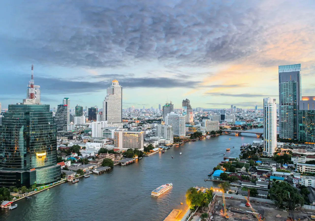
50 Best Places to Visit in Central Thailand in 2027: Complete Travel Guide to All 20 Provinces, Temples, Nature, Floating Markets and Historic Towns Central Thailand is one of the country's most historically and culturally significant regions, offering an exceptional combination of royal heritage, traditional communities, local customs, regional cuisine and diverse natural landscapes. Its fertile river plains, former royal capitals, historic temples, traditional canals, floating markets, forested mountains, waterfalls and Gulf of Thailand coastline provide experiences for almost every type of traveler. Whether you want to explore ancient ruins, discover Thai history, experience riverside communities, sample authentic local food, spend time in nature or organize a family holiday, Central Thailand offers a remarkable range of destinations. This comprehensive guide introduces 50 of the best places to visit in Central Thailand in 2027, covering all 20 provinces and highlighting their historical importance, cultural character, natural attractions and practical travel considerations.
Central Thailand comprises 20 provinces: Bangkok, Phra Nakhon Si Ayutthaya, Kanchanaburi, Phetchaburi, Chachoengsao, Ang Thong, Prachuap Khiri Khan, Ratchaburi, Chai Nat, Lop Buri, Nakhon Nayok, Nakhon Pathom, Nonthaburi, Pathum Thani, Samut Prakan, Samut Sakhon, Samut Songkhram, Saraburi, Sing Buri and Suphan Buri. Each province has its own distinctive character, ranging from major urban centers and former royal capitals to agricultural communities, fishing villages and protected natural landscapes. This diversity makes Central Thailand much more than Bangkok and Ayutthaya alone. Across the region, travelers can discover historic neighborhoods, sacred temples, traditional markets and lesser-known cultural attractions that reveal different aspects of Thai life.
The geography of Central Thailand is remarkably varied, although its most defining feature is the extensive network of fertile river plains that have supported agriculture and settlement for centuries. Major waterways such as the Chao Phraya, Tha Chin, Mae Klong and Bang Pakong rivers, together with their tributaries and canals, have shaped the region's economic development and cultural identity. These waterways have provided irrigation for farmland while serving as essential routes for transportation, commerce and communication between communities. As settlements expanded along riverbanks, temples, markets and trading districts developed around them, creating the distinctive waterside landscapes that remain central to the region's identity.
Beyond the central plains, the region also contains extensive mountains, forests and natural attractions. Kanchanaburi is particularly well known for its national parks, waterfalls, limestone caves and rugged western mountain ranges. Nakhon Nayok and Saraburi offer waterfalls, forest landscapes and accessible countryside destinations within reach of Bangkok. Meanwhile, Phetchaburi and Prachuap Khiri Khan combine mountains, mangrove forests, sandy beaches and scenic coastal environments along the Gulf of Thailand. Travelers can therefore move between historic cities and natural landscapes within the same region, choosing experiences ranging from urban sightseeing and canal cruises to hiking, waterfall visits and seaside relaxation.
Central Thailand has played a continuous role in the development of Thai civilization. Archaeological evidence from Nakhon Pathom, Suphan Buri, Lop Buri and surrounding areas reveals the presence of ancient settlements and the growth of Dvaravati culture, which contributed significantly to the spread of Buddhism and the development of religious art across the central plains. Lop Buri later became an influential cultural and political center during several historical periods. Its surviving monuments preserve evidence of Khmer artistic influences alongside architecture associated with the Ayutthaya kingdom.
Phra Nakhon Si Ayutthaya is among Thailand's most important historical provinces. It was once the center of the Ayutthaya Kingdom, a powerful capital that flourished for more than four centuries. The former city preserves numerous temples, prangs, stupas, palaces and archaeological remains, including Wat Mahathat, Wat Chaiwatthanaram, Wat Phra Si Sanphet and Wat Ratchaburana. These monuments offer insights into royal ceremonies, Buddhist beliefs, architectural development and the kingdom's extensive trading relationships across Asia. The Historic City of Ayutthaya is recognized as a UNESCO World Heritage Site, reflecting its outstanding historical and cultural significance.
During the Thonburi and Rattanakosin periods, the communities along the Chao Phraya River in present-day Bangkok developed into the country's principal political, religious and economic center. The Grand Palace, Wat Phra Kaew, Wat Arun and Wat Pho represent major achievements in Thai royal architecture, Buddhist art and traditional craftsmanship. Royal residences beyond Bangkok, including Phra Nakhon Khiri in Phetchaburi and Bang Pa-In Palace in Ayutthaya, also illustrate the evolution of Thai architecture and the growing incorporation of Chinese and Western artistic influences during the Rattanakosin period.
Central Thai Culture has developed through centuries of interaction among communities with diverse ethnic and historical backgrounds. Alongside local Thai traditions, the region has been influenced by Mon, Chinese, Lao-descended, Thai Phuan and, in certain areas, Malay-descended communities. Their cultural contributions can be seen in local languages, cuisine, clothing, religious practices, architecture, handicrafts and community festivals. Although the provinces share strong connections through agriculture and Buddhism, each preserves traditions that give it a distinctive identity.
Traditional life in Central Thailand has long been closely associated with rice cultivation and the waterways that connect agricultural communities. Before modern roads became widespread, boats were the principal means of moving people and goods. Houses were commonly built along rivers and canals, often with private landing areas that formed an essential part of daily life. Temples served as centers of religion, education and community gatherings, while floating markets and riverside marketplaces brought farmers, merchants and households together. Elements of this lifestyle remain visible at Damnoen Saduak Floating Market in Ratchaburi, Amphawa Floating Market in Samut Songkhram, Bang Nam Phueng Floating Market in Samut Prakan and traditional waterside communities in Nonthaburi and Pathum Thani.
Central Thailand is also closely associated with the development of classical Thai performing arts and regional folk entertainment. Important traditions include Khon masked dance drama, classical dance theater, traditional boat songs, Choi folk singing, E-Saew performances and other forms of musical storytelling associated with temple fairs and rural celebrations. Many folk performances reflect agricultural life, romance, humor, verbal improvisation and the relationships between members of a community. Provinces such as Suphan Buri, Ayutthaya and Ang Thong have been important centers for preserving these performing traditions.
Traditional craftsmanship represents another important aspect of the region's cultural heritage. Notable examples include Mon pottery from Ko Kret in Nonthaburi, bamboo and rattan weaving in rural communities, Benjarong ceramics from Samut Sakhon, traditional goldwork and decorative arts in Phetchaburi, and products made from palm trees, coconuts and locally available plants. These crafts demonstrate how communities have transformed natural materials into everyday objects and works of art. Many techniques continue to be passed down through families and local workshops, providing visitors with opportunities to understand traditional skills through living cultural experiences.

Traditional Festivals and Customs of Central Thailand are closely connected to Buddhism, the agricultural calendar, water-related beliefs and respect for ancestors. Widely celebrated occasions include Songkran, Loy Krathong, Buddhist merit-making ceremonies, Kathin robe-offering festivals, annual temple fairs and harvest-related rituals. Although many of these celebrations are observed throughout Thailand, individual communities have developed distinctive forms of participation that reflect their own history, beliefs and environment.
One of the region's most distinctive traditions is the Rap Bua or Yon Bua Festival, also known as the Lotus-Offering Festival, in Bang Phli District, Samut Prakan. Held around the end of Buddhist Lent, the ceremony centers on a water procession carrying a replica of the revered Luang Pho To Buddha image. Participants offer lotus flowers by tossing them toward the ceremonial boat as it moves along the canal. This tradition highlights the relationship between local waterways, Buddhist devotion and community identity, demonstrating how canals have functioned not only as transportation routes but also as important ceremonial spaces.
Tak Bat Devo, the Buddhist alms-giving ceremony associated with the Buddha's descent from the Tavatimsa Heaven, is another important tradition celebrated in many Central Thai provinces. It is particularly meaningful at temples located on hills or elevated ground, where monks can descend in procession while devotees offer food and other necessities. Usually held after the end of Buddhist Lent, the ceremony brings Buddhist teachings into a shared community ritual and reinforces the relationship between religious institutions and local people.
Several provinces preserve distinctive festivals linked to regional food and historical identity. Sing Buri is known for food-related celebrations that highlight its freshwater fish and the locally renowned Mae La snakehead fish. Lop Buri hosts historical and cultural events inspired by the reign of King Narai the Great, while Ayutthaya celebrates festivals associated with its former status as a royal capital and its extraordinary archaeological heritage. These events provide opportunities to experience local dress, performances, food and community celebrations rather than simply visiting historical monuments.
Loy Krathong remains one of Central Thailand's most recognizable festivals because of the region's deep connection to rivers and canals. Celebrations take place along waterways and ponds in provinces including Bangkok, Ayutthaya, Suphan Buri and Samut Songkhram. Traditional activities may include making krathongs from natural materials, attending cultural performances, participating in religious ceremonies and gathering with family and friends. In recent years, many communities have also emphasized environmentally responsible celebrations and reducing waste in waterways, helping preserve the connection between cultural traditions and the protection of natural resources.

Central Thai Cuisine is one of the region's greatest attractions and an essential part of understanding its culture. The fertile river plains, freshwater ecosystems, fruit orchards and coastal fishing communities provide a remarkable variety of ingredients, including rice, fish, prawns, vegetables, coconuts, herbs, spices and seasonal fruit. Central Thai cooking is widely appreciated for its careful balance of salty, sweet, sour and spicy flavors, complemented by fragrant curry pastes and fresh aromatic herbs.
Well-known Central Thai dishes include Tom Yum Goong, green curry, red curry, Panang curry, sour curry, Pad Thai, Pad Kra Pao and shrimp paste chili dip served with fried mackerel and fresh vegetables. Recipes vary between families and communities, reflecting regional ingredients and personal traditions. Some dishes originated in everyday household cooking, while others developed through royal culinary practices and centuries of cultural exchange with merchants and immigrant communities.
Royal Thai cuisine forms an important chapter in the culinary history of Central Thailand. It is distinguished by careful ingredient selection, precise preparation, decorative fruit and vegetable carving, and attention to balance in both flavor and presentation. Dishes such as Massaman curry, Khao Chae or rice served in scented chilled water, and elaborate arrangements of side dishes illustrate the sophistication of traditional court cooking. Understanding royal cuisine provides insights into the relationships among Thai history, international trade, cultural exchange and the development of modern Thai food.
Phetchaburi is particularly famous for its traditional desserts, including Khanom Mo Kaeng, Khanom Tan and sweets made with locally produced palmyra palm sugar. The distinctive fragrance and sweetness of palm sugar have become defining elements of the province's culinary heritage. Samut Songkhram is renowned for Mae Klong mackerel, coconut-based products and ingredients from riverside orchards, while Samut Sakhon is associated with seafood and fishing-related products. These local specialties demonstrate the close relationship between natural resources and regional food traditions.
Suphan Buri and Sing Buri have strong culinary traditions centered on freshwater fish and agricultural produce. Ayutthaya is especially popular for grilled giant river prawns, boat noodles and Roti Sai Mai, a sweet made with fine strands of spun sugar wrapped in thin pancakes. Nakhon Pathom has local foods and desserts associated with orchards and farming communities, while Ratchaburi offers a variety of dishes influenced by Thai, Mon and Chinese culinary traditions. Exploring local markets is often one of the most rewarding ways to experience these differences.
Seasonal fruit is another highlight of Central Thailand. Several provinces are known for their orchards and agricultural produce, including pomelos from Nakhon Pathom and Chai Nat, lychees from Samut Songkhram, mangoes from Chachoengsao and coconuts from the Mae Klong River basin. Visiting local fruit markets and orchards offers travelers a closer look at how food is grown and how agricultural landscapes influence regional cuisine.
Central Thailand is also an important center for traditional Thai desserts, including Thong Yip, Thong Yot, Foi Thong, Met Khanun, Khanom Chan, Khanom Thuai, Khanom Krok and Khanom Mo Kaeng. Many sweets have strong associations with weddings, religious merit-making and auspicious celebrations because of their names, appearance or symbolic meanings. Their careful preparation reflects the skill of traditional cooks and the transmission of culinary knowledge across generations.
Food tourism can easily be incorporated into visits to temples, historical towns and canal communities. A typical day might begin with exploring an archaeological site, continue with lunch at a traditional market and conclude with a walk through a historic riverside neighborhood or floating market. This approach allows travelers to appreciate not only the monuments and landscapes of Central Thailand, but also the flavors, agricultural products and everyday traditions that give each community its distinctive character.
Choosing Where to Visit in Central Thailand depends on individual interests. History enthusiasts will find particularly rewarding experiences in Bangkok, Ayutthaya, Lop Buri, Suphan Buri and Phetchaburi. Those interested in traditional riverside life can explore Samut Songkhram, Ratchaburi, Nonthaburi, Pathum Thani and Samut Prakan. Travelers who prefer forests, waterfalls and outdoor activities can plan visits to Kanchanaburi, Nakhon Nayok, Saraburi and nearby protected landscapes, while the coastlines of Phetchaburi and Prachuap Khiri Khan offer excellent opportunities for seaside holidays.
For travel in 2027, November through February is generally a comfortable period for exploring temples, archaeological sites and outdoor communities because temperatures are often milder than during the hottest months. The rainy season can be rewarding for forest and waterfall visits, when the vegetation is lush and waterways are fuller, although visitors should always consider rainfall, water levels and trail conditions. National parks may restrict access during periods of heavy rain, while coastal trips should be planned with prevailing winds, sea conditions and local safety announcements in mind.
Travelers who wish to experience Central Thai festivals should plan around the relevant dates. Songkran is celebrated in April, while Bang Phli's Lotus-Offering Festival takes place around the end of Buddhist Lent. Other notable occasions include the Phra Pathom Chedi Fair in Nakhon Pathom and historical festivals organized by individual provinces. Because some events follow the lunar calendar or annual local schedules, visitors should check confirmed dates for 2027 before finalizing their arrangements.
Visitors with only one day can choose destinations relatively close to Bangkok, such as Ayutthaya, Nakhon Pathom, Nonthaburi, Pathum Thani, Samut Prakan, Chachoengsao or Samut Songkhram. For a two-day, one-night journey, Kanchanaburi, Ratchaburi, Phetchaburi, Suphan Buri and Saraburi offer more time for natural attractions and local communities. Travelers with three days and two nights can connect neighboring provinces, such as Ratchaburi, Samut Songkhram and Phetchaburi, or Ayutthaya, Ang Thong and Sing Buri, to create a more varied itinerary without unnecessary backtracking.
Exploring Central Thailand is not simply about visiting famous landmarks. Its traditional neighborhoods, regional cuisine, handicrafts and long-established festivals offer equally valuable experiences. Supporting local businesses, dressing respectfully at religious sites, following heritage conservation rules and minimizing environmental impacts all contribute to responsible tourism. Taking time to engage with community life can make a journey more meaningful than moving quickly between major sightseeing attractions.
The following 50 best places to visit in Central Thailand in 2027 therefore celebrate the diversity of all 20 provinces. The collection includes magnificent royal palaces, historic Buddhist temples, ancient cities, floating markets, traditional communities, museums, wartime heritage sites, national parks, waterfalls and coastal landscapes. Each destination highlights the historical, cultural or natural qualities that make it worth visiting, together with useful information to help travelers organize their journey. From the royal monuments of Bangkok and Ayutthaya to the forests of Kanchanaburi and the seaside towns of the Gulf of Thailand, Central Thailand offers an extraordinary opportunity to discover the many layers of the country's heritage.

1. The Grand Palace, Bangkok, is one of Thailand's most important landmarks in terms of history, architecture, royal traditions and national cultural heritage. Located on Na Phra Lan Road in Phra Borom Maha Ratchawang Subdistrict, Phra Nakhon District, the palace complex has been associated with the Thai monarchy since the founding of Bangkok as the capital in 1782. Its extensive grounds contain magnificent throne halls, royal residential buildings, ceremonial structures and Wat Phra Si Rattana Satsadaram, commonly known as Wat Phra Kaew or the Temple of the Emerald Buddha. The Grand Palace is therefore an essential destination for travelers wishing to understand the origins of Bangkok and the artistic traditions of the Rattanakosin period.
Highlights: Wat Phra Kaew, the Emerald Buddha, Chakri Maha Prasat Throne Hall, Dusit Maha Prasat Throne Hall, the royal residential complex, Ramakien mural paintings, guardian giant sculptures and traditional Rattanakosin royal architecture.
King Phutthayotfa Chulalok the Great, or King Rama I, ordered the construction of the Grand Palace in 1782 when Bangkok was established as the new capital of Siam. The palace's layout drew inspiration from the former royal capital of Ayutthaya, particularly the tradition of placing the royal residence and the most important royal Buddhist temple within the same palace precinct. This arrangement reflected the close relationship between kingship, Buddhism and the administration of the kingdom in early Rattanakosin society.
The palace complex is traditionally divided into the Outer Court, Middle Court and Inner Court, each designed for different purposes. These areas were associated with royal administration, state ceremonies, official functions and the private life of the royal household. Although certain sections remain reserved for royal ceremonies or are not open to the general public, the visitor areas provide valuable insights into the scale of the palace and the functions of its principal buildings.
Wat Phra Si Rattana Satsadaram is among the most significant parts of the palace complex because it houses the Emerald Buddha, officially known as Phra Phuttha Maha Mani Rattana Patimakon. This highly revered Buddha image occupies a central position in Thai religious and royal traditions. The temple's ordination hall is richly decorated with traditional craftsmanship, while the surrounding galleries contain extensive mural paintings depicting the Ramakien, Thailand's interpretation of the Ramayana epic. These paintings demonstrate the artistic achievements of royal craftsmen and the use of literature as a subject for visual storytelling.
Chakri Maha Prasat Throne Hall is especially notable for its combination of European architectural design and traditional Thai tiered roofs. Constructed during the reign of King Rama V, it reflects a period when Siam was expanding diplomatic relationships with countries around the world and incorporating international architectural influences into royal buildings. Dusit Maha Prasat Throne Hall, by contrast, represents traditional Thai royal architecture, distinguished by its carefully proportioned tiered roof and elegant central spire.
Exploring the Grand Palace is best approached as a substantial cultural visit rather than a brief photography stop. Travelers should allow at least half a day if they wish to appreciate the architectural details, decorative artwork, religious buildings and historical significance of the complex. Arriving in the morning is generally advisable because the open courtyards can become hot during the middle of the day.
The Grand Palace can also be combined with other important landmarks in Bangkok's historic district. Nearby Wat Pho, the Tha Tien riverside neighborhood and Wat Arun across the Chao Phraya River provide opportunities to compare religious architecture, palace traditions and the development of Bangkok from the Thonburi period into the Rattanakosin era.
Visitors must follow the Grand Palace's dress code. Sleeveless tops, shorts and clothing considered inappropriate for a royal or sacred site are not permitted. Photography may also be restricted in certain buildings, particularly the Emerald Buddha's ordination hall. Respecting the posted regulations and instructions from palace staff is essential because the complex remains an important ceremonial and religious site.
Open Days: Generally open daily, subject to official announcements and royal ceremonies.
Opening Hours: Generally 08:30 – 16:30.
Getting There: Travelers can take the MRT Blue Line to Sanam Chai Station and continue toward the historic palace district. Another convenient option is the Chao Phraya Express Boat to Tha Chang Pier, followed by a short walk to Na Phra Lan Road. Visitors traveling by private car should allow extra time for traffic and limited parking in Bangkok's historic center.
Map (GPS):Get Directions to the Grand Palace
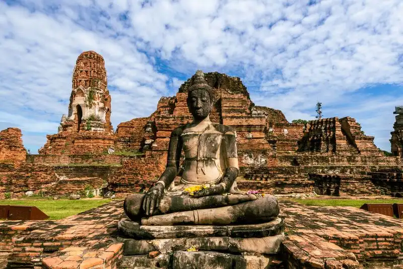
2. Wat Mahathat, Phra Nakhon Si Ayutthaya, is one of the most important archaeological monuments within Ayutthaya Historical Park. Located near Naresuan Road on Ayutthaya Island, the temple once served as a major religious center of the ancient capital. Its original architectural complex was dominated by a principal prang surrounded by stupas, assembly halls and other sacred structures. Today, Wat Mahathat is internationally recognized for the famous sandstone Buddha head embraced by the roots of a tree, one of the most memorable images associated with Thailand's UNESCO-listed historic city.
Highlights: The Buddha head enclosed in tree roots, remains of the principal prang, ancient stupas, ruined assembly halls, the ordination hall foundations, surrounding galleries and early Ayutthaya architectural features.
Wat Mahathat is closely associated with the establishment and development of the Ayutthaya Kingdom. Historical accounts connect the temple with the reigns of King Borommarachathirat I and King Ramesuan, placing its origins within the formative period of the royal capital. The establishment of a major temple associated with sacred Buddhist relics was especially significant because such monuments functioned as religious centers closely connected to royal authority and the spiritual life of the kingdom.
The principal prang reflected early Ayutthaya architectural traditions influenced by Khmer-style religious towers. Constructed primarily with brick and other masonry materials, it occupied the central position in the temple's plan. Although the principal structure has suffered extensive damage, its surviving remains help visitors understand the layout of the original complex and the importance of its central sacred monument.
The Buddha head surrounded by tree roots is undoubtedly Wat Mahathat's most recognizable attraction. Over time, the growing roots developed around the sandstone sculpture, creating an extraordinary image in which nature and ancient religious art appear inseparable. This unusual relationship has made the site a popular subject for photography and an enduring symbol of Ayutthaya. However, the sculpture remains a sacred religious object, and visitors should photograph it respectfully, following guidance about keeping their heads lower than or at an appropriate level relative to the Buddha image.
The surrounding archaeological area includes numerous stupa foundations, ruined halls, masonry platforms and remains of religious buildings. Together, these structures illustrate the arrangement of a major royal Buddhist temple during the Ayutthaya period. Observing the position of the principal prang in relation to surrounding buildings offers a clearer understanding of how religious architecture organized sacred space and ceremonial activities.
Wat Mahathat suffered extensive damage during the historical upheavals that culminated in the fall of Ayutthaya in 1767. The ruins visible today therefore tell two interconnected stories: the artistic and religious achievements of a once-prosperous capital and the destruction and transformation that followed warfare and political change. Exploring the site provides a tangible way to appreciate the importance of archaeological conservation and the historical evidence preserved within ruined monuments.
Wat Mahathat is particularly suitable for travelers interested in history, archaeology, Buddhist art and heritage photography. It can easily be combined with nearby Wat Ratchaburana, Wat Phra Si Sanphet, the former royal palace area and other monuments on Ayutthaya Island. Allowing one to two hours for the visit provides sufficient time to explore the main ruins and observe their architectural details without rushing.
Visitors should not climb on fragile structures, touch archaeological remains unnecessarily or leave designated walking routes. Some surfaces consist of uneven brickwork and stone, so comfortable walking shoes are recommended. The site is largely outdoors, making morning or late-afternoon visits more comfortable than sightseeing during the hottest hours of the day.
Open Days: Daily.
Opening Hours: Ticket sales are generally from 08:00 – 17:00, with visiting access generally available until 18:00.
Getting There: From Bangkok, travelers can follow Highway 32, commonly known as the Asian Highway, toward Phra Nakhon Si Ayutthaya before continuing onto Ayutthaya Island. The temple is located near Naresuan Road in the historical park area. Visitors arriving by train can get off at Ayutthaya Railway Station and continue by local transport or ferry. Bicycles and tuk-tuks are popular options for exploring nearby monuments.
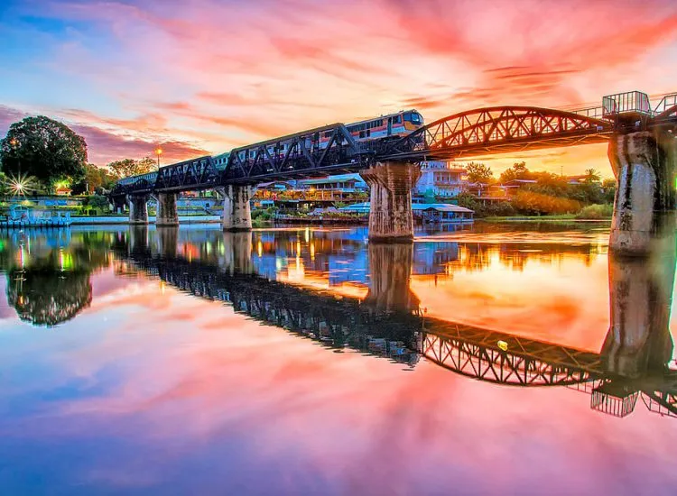
3. Bridge Over the River Kwai, Kanchanaburi Province, is one of Thailand's most internationally recognized historical landmarks. Located in Tha Makham Subdistrict, Mueang Kanchanaburi District, this steel railway bridge forms part of the former Thailand–Burma Railway, commonly known as the Death Railway. The railway was constructed during World War II under the control of the Japanese military to support its operations in Burma. Today, the bridge remains part of an operating railway line and serves as an important memorial to the Allied prisoners of war and civilian laborers who suffered and died during its construction. For travelers interested in modern history, military heritage and the human consequences of war, the Bridge Over the River Kwai is an essential destination in Central Thailand.
Highlights: The historic steel bridge over the Khwae Yai River, the Thailand–Burma Death Railway, tourist train journeys, World War II history, wartime museums, Allied war cemeteries and the dramatic railway section along the cliffs near Tham Krasae Cave.
The Thailand–Burma Railway was constructed between 1942 and 1943 to provide the Japanese military with a land transportation route for moving troops, equipment and supplies into Burma. The route crossed some of the most challenging terrain in the region, including dense forests, steep mountains, rivers and remote valleys. Construction took place under extremely harsh conditions, with workers facing inadequate food supplies, disease, exhaustion and limited medical care. Thousands of Allied prisoners of war and many more civilian laborers from across Asia lost their lives during the project, giving the railway its enduring name, the Death Railway.
The bridge visible today is an important surviving reminder of this history. Its steel framework and railway tracks illustrate the strategic role that Kanchanaburi played during World War II. Although portions of the bridge were damaged during the conflict and subsequently repaired or replaced, it remains closely associated with the construction of the railway and the suffering endured by those forced to work on it. The structure therefore holds historical significance that extends far beyond its role as a popular sightseeing attraction.
Walking around the bridge provides views of the railway tracks, steel arches and the surrounding Khwae Yai River. The riverbanks have developed into an active tourism area with restaurants, accommodation and local businesses, reflecting the bridge's importance to the modern economy of Kanchanaburi. Early morning and late afternoon are particularly attractive times for photography, when the softer natural light highlights the structure against the river and surrounding landscape.
Because the bridge remains part of an active railway, visitor safety is essential. Trains continue to cross it according to the State Railway of Thailand's operating schedule. Visitors should follow all warning signs and staff instructions, avoid standing in the path of approaching trains, and never position themselves dangerously close to moving railway vehicles for photographs. Safe observation points should always take priority over obtaining a particular camera angle.
Travelers wishing to understand the broader history of the railway should combine their visit with the Kanchanaburi War Cemetery and local museums that explain the experiences of prisoners of war and civilian workers. These institutions provide historical context through photographs, personal accounts, memorials and other materials. Visiting them helps reveal the human dimension of the railway's construction, which can otherwise be overshadowed by the impressive appearance of the bridge itself.
Another memorable experience is taking a train along the surviving railway toward the section near Tham Krasae Cave. Here, the tracks pass along a steep hillside beside the Khwae Noi River, crossing a wooden viaduct that demonstrates the engineering challenges faced during construction. The journey combines dramatic natural scenery with an opportunity to reflect on the history of one of Southeast Asia's most significant wartime infrastructure projects. Travelers should check current train schedules and station stops before planning the excursion.
The Bridge Over the River Kwai is suitable for history enthusiasts, families, photographers and visitors interested in educational travel. It can be explored during a half-day visit or combined with other attractions around Kanchanaburi town. Approaching the site with respect for those who lost their lives is an important part of understanding its enduring significance and preserving its value as a place of remembrance.
Open Days: The public areas around the bridge are generally accessible daily. Train operations follow the State Railway of Thailand's schedule.
Getting There: From central Kanchanaburi, follow Highway 323 toward Tha Makham Subdistrict and the signs for the Bridge Over the River Kwai. Visitors can travel by private car, local taxi or train. Those arriving by rail can get off at River Kwai Bridge Railway Station and walk to the attraction. The bridge is also a convenient starting point for exploring other World War II heritage sites in the province.
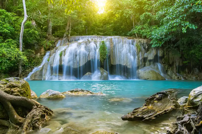
4. Erawan Waterfall, Kanchanaburi Province, is one of Thailand's most beautiful and celebrated natural attractions. Located within Erawan National Park in Tha Kradan Subdistrict, Si Sawat District, the waterfall consists of seven distinct tiers, each featuring different rock formations, forest scenery, streams and natural pools. Its most recognizable feature is the striking turquoise and emerald-blue appearance of the water in certain sections, surrounded by lush vegetation and limestone landscapes. The waterfall is particularly popular with travelers seeking nature walks, forest experiences, photography and swimming in designated areas.
Highlights: Seven waterfall tiers known as Lai Khuen Rang, Wang Matcha, Pha Nam Tok, Ok Nang Phisuea, Buea Mai Long, Dong Phrueksa and Phu Pha Erawan; clear turquoise natural pools, forest walking trails, limestone formations, freshwater streams and rich tropical ecosystems.
Erawan National Park protects a landscape of forested mountains, limestone formations and freshwater ecosystems. Erawan Waterfall is formed by streams flowing through the mountainous terrain and descending over successive rock levels. Over time, flowing water and mineral deposits have shaped the pools, rocky terraces and waterfalls that characterize the area. The limestone environment also contributes to the appearance of the water, making some pools especially photogenic when natural conditions are favorable.
The first tier, Lai Khuen Rang, marks the beginning of the waterfall trail and is relatively accessible from the main visitor area. The second tier, Wang Matcha, is known for its natural pools and freshwater fish. The third tier, Pha Nam Tok, features water flowing over a rocky drop, creating a different visual character from the lower sections. These first three tiers offer visitors a good introduction to the waterfall's varied landscape without requiring a journey to the uppermost levels.
As the trail climbs higher, the environment becomes increasingly forested and the terrain more demanding. The fourth tier, Ok Nang Phisuea, is distinguished by its unusual rock formations and flowing water. The fifth tier, Buea Mai Long, and sixth tier, Dong Phrueksa, offer a deeper sense of immersion in the natural landscape. Travelers attempting to reach these upper sections should consider their fitness, available time and the condition of the trail, particularly after rainfall.
The seventh tier, Phu Pha Erawan, marks the highest point of the main waterfall route. The name is associated with a rock formation traditionally compared to the head of the mythological elephant Erawan. Reaching this uppermost level is particularly rewarding for visitors who enjoy hiking, although it requires greater physical effort than exploring the lower waterfalls. It is important to begin early enough to complete the return walk before the trail closes.
The water's famous color is a natural phenomenon influenced by mineral content, light conditions and the state of the stream. Its appearance can change considerably throughout the year. Following heavy rainfall, the water may become cloudy or flow more forcefully, while periods of lower rainfall can expose additional rock formations and reduce the volume of the falls. Visitors should therefore expect changing natural conditions rather than assuming every pool will appear exactly as it does in promotional photographs.
Swimming is permitted only in areas designated by the national park authorities. Visitors must follow local safety instructions because water depth, currents and slippery surfaces can vary between tiers. The park may also restrict food and certain activities along the upper trail to protect the environment. Feeding fish or wildlife, leaving litter and using products that contaminate the stream should be avoided to preserve the natural ecosystem.
Erawan Waterfall is suitable for a full-day trip from Kanchanaburi town or as part of a longer itinerary that includes Srinagarind Dam and nearby nature attractions. Travelers planning to walk all seven tiers should arrive in the morning, wear shoes with good grip and carry adequate drinking water. Allowing time for rest stops and enjoying the surroundings is generally more rewarding than attempting to rush through the entire route.
Open Days: Generally open daily, subject to weather conditions and national park announcements.
Opening Hours: Generally 08:00 – 16:00. Access to the upper tiers may close earlier to allow visitors sufficient time to return safely.
Getting There: From Kanchanaburi town, travel toward Si Sawat District and Srinagarind Dam, following the signs for Erawan National Park. The waterfall can be reached by private car or by public transport operating between Kanchanaburi and Erawan Waterfall. Visitors relying on public transport should confirm the final return departure before beginning their hike.
Map (GPS):Get Directions to Erawan Waterfall

5. Wat Arun Ratchawararam Ratchaworamahawihan, Bangkok, commonly known as Wat Arun or the Temple of Dawn, is one of Thailand's most iconic Buddhist landmarks. Located on Wang Doem Road in Wat Arun Subdistrict, Bangkok Yai District, on the western bank of the Chao Phraya River, the temple is internationally recognized for its magnificent central prang decorated with intricate pieces of porcelain and glazed ceramics. Rising prominently above the riverside landscape, the prang has become one of Bangkok's most recognizable architectural symbols. Wat Arun is both an active religious site and an extraordinary example of Thai craftsmanship, royal history and Buddhist architectural traditions.
Highlights: The central prang of Wat Arun, surrounding prangs, porcelain and glazed ceramic decoration, the ordination hall, Phra Phuttha Thammisoraratchalokathatdilok Buddha image, the principal viharn, guardian giant statues and panoramic views of the Chao Phraya River.
Wat Arun has a history dating back to before the establishment of Bangkok as Thailand's capital. The temple was already an important religious site within a riverside community on the Thonburi side of the Chao Phraya River. After King Taksin established Thonburi as his capital, the temple became closely associated with the royal city and played a significant role in its religious life. For a period, it also housed the revered Emerald Buddha before the image was transferred to Wat Phra Kaew in the newly established Rattanakosin capital.
The central prang underwent major development and enlargement during the early Rattanakosin period, particularly under Kings Rama II and Rama III. Its architectural design reflects religious cosmology in which a towering central structure symbolizes the cosmic center. The gradually rising levels, surrounding architectural elements and decorative sculptures create an impression of balance and vertical grandeur. When viewed from a distance across the Chao Phraya River, the prang forms an unmistakable feature of Bangkok's historic skyline.
One of Wat Arun's most fascinating artistic features is its extensive ceramic decoration. Craftsmen arranged pieces of porcelain, glazed tiles and other ornamental materials into elaborate floral patterns and decorative compositions across the prang's surfaces. This technique demonstrates the creativity of Thai artisans in transforming materials associated with historic maritime trade into intricate religious artwork. The resulting textures and colors give the temple an appearance quite different from ordinary brick or stucco religious monuments.
The temple's ordination hall and principal viharn contain important Buddha images, religious paintings and decorative details that deserve attention alongside the famous central prang. The giant guardian figures standing near an entrance are another memorable feature, reflecting artistic traditions associated with the Ramakien epic. Exploring these different sections reveals the temple's continuing importance as a place of worship rather than merely a scenic riverside attraction.
Wat Arun's setting beside the Chao Phraya River adds greatly to its character. In the morning, visitors can appreciate the architectural details in relatively comfortable conditions, while the late-afternoon light often emphasizes the colors and textures of the decorated prang. Viewing the temple from a boat or from the opposite riverbank near Tha Tien provides a broader perspective on its relationship with Bangkok's historic riverfront.
Wat Arun can easily be combined with the Grand Palace, Wat Phra Kaew and Wat Pho as part of a historical sightseeing route through central Bangkok. Using a cross-river ferry between Tha Tien and Wat Arun is often more convenient than driving through the congested historic districts. This itinerary also offers an opportunity to understand the transition from the Thonburi capital to the Rattanakosin period through the architecture of its most important religious and royal sites.
Visitors should dress respectfully, avoid climbing on restricted architectural features and refrain from touching fragile decorative elements. Photography and access rules may vary between temple buildings, and visitors should always follow the posted guidance. As Wat Arun remains an active Buddhist temple, maintaining a respectful atmosphere is an essential part of the experience.
Open Days: Daily.
Opening Hours: Generally 08:00 – 18:00.
Getting There: The most convenient approach for many travelers is to take a cross-river ferry from Tha Tien Pier to Wat Arun Pier. Visitors arriving by MRT can get off at Sanam Chai Station and continue to the Tha Tien ferry crossing. Those traveling by road from the Thonburi side can approach the temple via Wang Doem Road in Bangkok Yai District.
Map (GPS):Get Directions to Wat Arun, Bangkok

6. Damnoen Saduak Floating Market, Ratchaburi Province, is one of Thailand's best-known traditional floating markets and a popular destination for international visitors. Located in Damnoen Saduak Subdistrict, Damnoen Saduak District, the market is famous for its colorful boats carrying fresh fruit, freshly prepared Thai food, traditional desserts and locally produced goods through a network of canals. It offers visitors a glimpse into the traditional canal-based trading culture that once formed an essential part of everyday life in Central Thailand, before modern roads became the principal means of transportation. Today, Damnoen Saduak Floating Market remains a prominent cultural attraction associated with the historic waterways of the Mae Klong River basin.
Highlights: Traditional boats selling tropical fruit and Thai food, the Damnoen Saduak Canal, canal boat tours, historic waterside houses, local orchards, regional dishes, traditional Thai desserts and the history of canal construction during the reign of King Rama IV.
The Damnoen Saduak Canal was constructed during the reign of King Mongkut, or King Rama IV, to establish a navigable connection between the Tha Chin and Mae Klong river systems. The canal greatly improved transportation, trade and communication among agricultural settlements across the central plains. By allowing farmers and merchants to move produce and supplies more efficiently, it contributed to the development of local communities and strengthened economic connections across the wider region.
In the past, floating markets were an essential feature of daily life. Boats served not only as transportation but also as mobile shops where people bought and sold agricultural produce, household necessities and cooked food. Fruit, coconuts and other products from riverside orchards could be transported directly to nearby trading points without relying on roads. These markets also functioned as important social spaces where residents exchanged news and maintained relationships between neighboring communities.
The market's most distinctive sight is the movement of colorful boats along the canal. Vendors arrange tropical fruit, vegetables, drinks and freshly cooked dishes aboard their boats, creating a lively waterside atmosphere. Visitors can observe the interaction between traders and customers, the preparation of food on small boats and the continuous flow of people and goods through the market. Although Damnoen Saduak has become a major tourism destination, its visual character remains closely connected with the region's traditional canal-based commerce.
Boat tours provide another perspective on the area. Local operators offer routes through the market and along nearby canals, allowing visitors to see wooden houses, small businesses, gardens and residential communities from the water. Some routes continue beyond the busiest trading area toward quieter waterways and agricultural neighborhoods. This contrast helps travelers appreciate the difference between the commercial floating market and the wider network of canals that has shaped local life for generations.
Food is a major attraction at Damnoen Saduak Floating Market. Visitors can sample freshly cooked Thai dishes, traditional sweets, tropical fruits and snacks made with ingredients grown in the surrounding agricultural landscape. Many foods reflect the influence of coconut orchards, river-based trade and Central Thai cooking traditions. Choosing products from local vendors offers an opportunity to support the community while experiencing familiar Thai flavors in a distinctive setting.
The morning is generally the best time to experience the market, when trading activity is livelier and temperatures are more comfortable than around midday. Visitors interested in boat tours should confirm the price, duration and itinerary before agreeing to a service. Choosing operators that provide life jackets and follow appropriate water safety practices is particularly important for families and travelers unfamiliar with canal transportation.
Damnoen Saduak Floating Market can also be combined with nearby Khlong Lat Phli Floating Market, Lao Tak Lak Floating Market and attractions in neighboring Samut Songkhram Province. These markets offer different perspectives on local history, community life and waterside commerce. As activity levels and opening schedules vary between locations, travelers should plan their visits according to the individual character and operating times of each market.
Open Days: Daily.
Opening Hours: The market is generally busiest from approximately 06:00 – 12:00.
Getting There: From Bangkok, travel along Rama II Road toward Samut Songkhram or Ratchaburi, then follow connecting roads to Damnoen Saduak District. From there, continue to the designated floating market areas and boat piers. The market can be reached by private car, hired vehicle or organized day tour from Bangkok. Visitors should confirm the exact boat departure point before arrival.
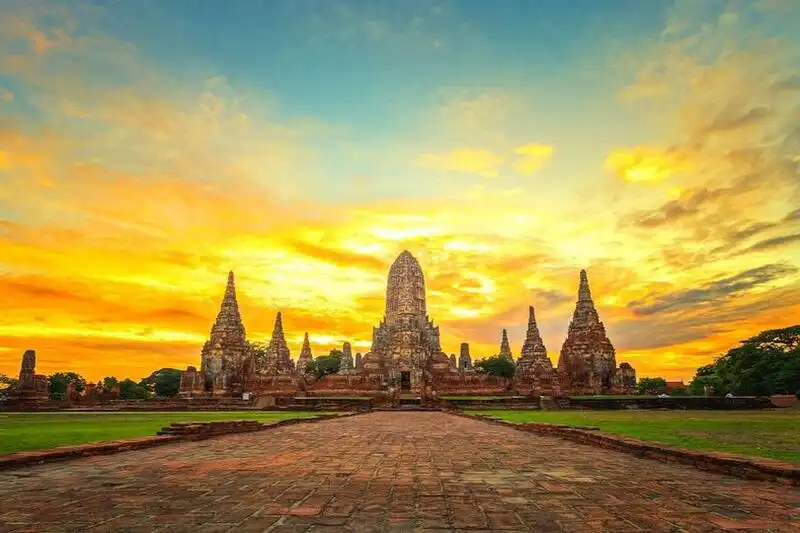
7. Wat Chaiwatthanaram, Phra Nakhon Si Ayutthaya Province, is one of the most architecturally impressive and historically significant temples of the former Ayutthaya Kingdom. Located beside the Chao Phraya River in Ban Pom Subdistrict, Mueang Phra Nakhon Si Ayutthaya District, the temple is renowned for its imposing central prang surrounded by smaller towers, galleries and religious structures arranged in a carefully balanced layout. The complex represents the artistic achievements of the middle Ayutthaya period and illustrates the relationship between Buddhist religious symbolism, royal patronage and monumental architecture. Today, it is among the most memorable places to explore Ayutthaya's historical heritage and riverside scenery.
Highlights: The central prang, surrounding prangs, covered galleries, corner towers known as meru thit and meru rai, ancient Buddha images, surviving religious building foundations, views of the Chao Phraya River and architecture associated with the reign of King Prasat Thong.
Wat Chaiwatthanaram was founded in 1630 during the reign of King Prasat Thong of Ayutthaya. The temple was built as an important royal Buddhist monument associated with merit-making and the religious traditions of the monarchy. Its location beside the Chao Phraya River reflects the importance of waterways in the historical capital, where rivers and canals connected royal residences, temples, commercial districts and surrounding communities.
The temple's architectural plan is highly symmetrical, with a dominant central prang surrounded by subsidiary towers and galleries. This arrangement reflects influences from Khmer temple architecture and religious cosmology, particularly the idea of a sacred central structure surrounded by progressively arranged spaces. The careful positioning of its architectural elements creates a sense of balance and monumentality that remains apparent even in the temple's present ruined condition.
The central prang is the most prominent element of the complex. Its tall, carefully proportioned form rises from a series of architectural levels, illustrating the skill of Ayutthaya-period craftsmen in adapting the traditional prang into a monumental Buddhist structure. The smaller surrounding towers contribute to the overall composition, forming a visual rhythm that can be appreciated from multiple viewpoints around the temple grounds.
Within the galleries and groups of surrounding structures are remains of Buddha images and other religious artwork associated with the temple's former ceremonial role. The architectural arrangement illustrates how different buildings and pathways were organized around a sacred center. Exploring these remains provides a clearer understanding of the religious beliefs and ritual activities that shaped the original design rather than viewing the site only as a collection of picturesque ruins.
Wat Chaiwatthanaram was affected by the warfare and political upheaval that culminated in the fall of Ayutthaya in 1767. The surviving structures therefore preserve evidence of both the kingdom's former prosperity and the destruction that followed its collapse. Archaeological restoration and conservation work have helped stabilize the remains and make the historical layout more understandable to present-day visitors. The site also illustrates the importance of protecting cultural heritage from further environmental and human damage.
Its riverside setting contributes considerably to the temple's appeal. In the late afternoon, sunlight falling across the central prang and surrounding structures creates warm colors, long shadows and striking architectural silhouettes. This atmosphere has made Wat Chaiwatthanaram especially popular among photographers and travelers interested in the visual beauty of ancient Ayutthaya. The Chao Phraya River also provides important historical context, reminding visitors that water transportation once connected this temple to the wider royal capital.
The temple has become a popular destination for visitors wearing traditional Thai clothing for cultural photography. This practice reflects contemporary interest in Ayutthaya's historical identity, but photography should always be conducted respectfully. Visitors should avoid climbing on ancient buildings, touching fragile surfaces or arranging activities that could damage archaeological remains.
Wat Chaiwatthanaram can be visited alongside Wat Kasattrathirat Worawihan, Wat Phutthaisawan and important temples on Ayutthaya Island. These attractions allow travelers to compare different aspects of the kingdom's religious architecture and explore the historical landscape on both sides of the Chao Phraya River. At least one hour should be allowed for the temple itself, with additional time for photography and travel between sites.
Open Days: Daily.
Opening Hours: Generally 08:00 – 18:00.
Getting There: From Ayutthaya Island, travel west across the river via the connecting road bridges toward Ban Pom Subdistrict, following signs to Wat Chaiwatthanaram. The temple can be reached by private car, local tuk-tuk or an organized historical sightseeing service. Travelers exploring several temples should allow for the additional distance between the main island and the western riverbank.

8. Wat Phra Pathom Chedi Ratchaworamahawihan, Nakhon Pathom Province, is one of Thailand's most important royal Buddhist temples and a major landmark associated with the early history of Buddhism in the central plains. Located in Phra Pathom Chedi Subdistrict, Mueang Nakhon Pathom District, the temple is dominated by Phra Pathom Chedi, an enormous golden bell-shaped stupa rising approximately 120 meters above the surrounding city. Its extraordinary scale, architectural significance and religious traditions have made it the principal symbol of Nakhon Pathom. The site is also closely associated with the history of ancient Nakhon Chai Si and the development of Buddhism in communities that flourished during the Dvaravati period.
Highlights: The monumental Phra Pathom Chedi, Phra Ruang Rojanarit Buddha image, surrounding chapels and galleries, Buddhist artwork, early Rattanakosin royal architecture, Dvaravati archaeological heritage and the annual Phra Pathom Chedi Fair.
Nakhon Pathom is an important archaeological area where evidence of ancient settlements, religious communities and Dvaravati civilization has been discovered. Buddha images, votive tablets, inscriptions and other religious artifacts demonstrate the significant presence of Buddhism in this region long before the establishment of later Thai kingdoms. These discoveries have made Nakhon Pathom essential to understanding the development of religious traditions and urban communities in the central plains of Thailand.
The present Phra Pathom Chedi underwent major reconstruction during the reign of King Mongkut, or King Rama IV. Recognizing the religious and historical importance of the ancient monument, the king initiated the construction of a much larger stupa enclosing the earlier structure. This project reflected the nineteenth-century royal interest in preserving sacred sites while restoring their importance as centers of Buddhist devotion.
The architectural form of Phra Pathom Chedi is distinguished by its immense golden bell-shaped structure rising above a series of supporting architectural elements. Its proportions make it visible from many parts of Nakhon Pathom, giving the stupa a commanding position within the city's skyline. The surrounding religious buildings, passageways and decorative features create a ceremonial environment suitable for Buddhist worship and pilgrimage.
Another important attraction is Phra Ruang Rojanarit, a highly revered standing Buddha image that draws devotees from across Thailand. Visitors can walk around the chedi, observe the religious architecture and experience the daily activities of worshippers offering flowers, incense and prayers. The temple remains an active religious center rather than solely a historical monument.
The annual Phra Pathom Chedi Fair is an important local religious festival that brings large numbers of Buddhist pilgrims and visitors to the city. Activities associated with the fair include merit-making, religious observances and local cultural events. This tradition illustrates the continuing relationship between Nakhon Pathom's ancient religious heritage and the contemporary life of its residents.
History enthusiasts should consider combining the temple with the nearby Phra Pathom Chedi National Museum, where archaeological objects from the Dvaravati period help explain the region's ancient civilization. Visiting both sites provides a richer understanding of the distinction between archaeological evidence and religious traditions that have developed around the sacred monument over centuries.
The streets surrounding the temple are part of the active city center, with local shops, markets and places to sample Nakhon Pathom's regional food. Visitors should dress respectfully, avoid disturbing religious ceremonies and follow any restrictions on photography or access to particular temple buildings.
Open Days: Daily.
Opening Hours: Generally 05:00 – 20:00.
Getting There: From Bangkok, take Phetkasem Road or Borommaratchachonnani Road toward Nakhon Pathom city and follow signs to Phra Pathom Chedi. Travelers arriving by train can get off at Nakhon Pathom Railway Station and continue toward the monument, which is located in the central urban area.
Map (GPS):Get Directions to Wat Phra Pathom Chedi
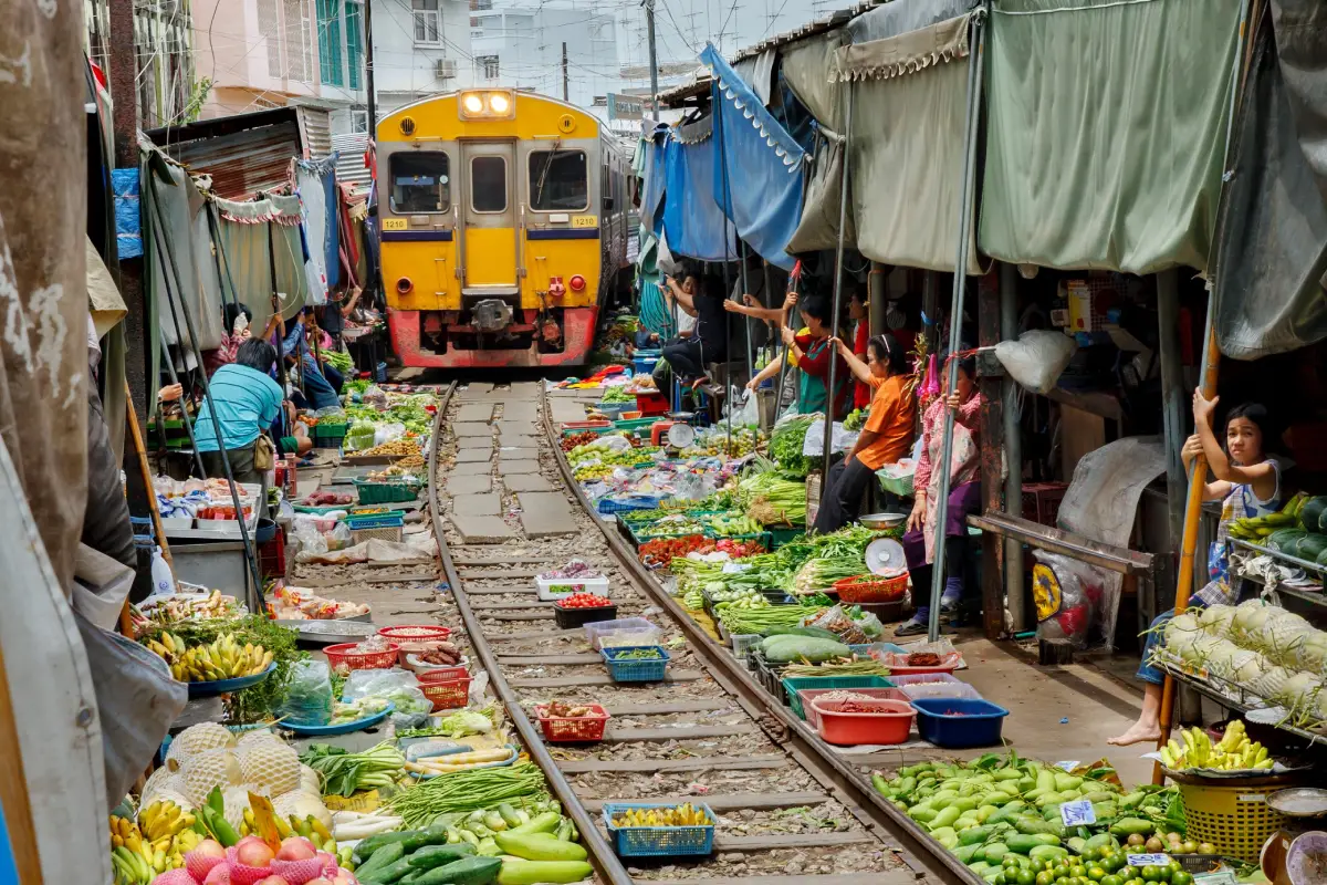
9. Mae Klong Railway Market (Rom Hoop Market), Samut Songkhram Province, is one of Thailand's most unusual traditional markets. Located beside the railway tracks near Mae Klong Railway Station in Mae Klong Subdistrict, Mueang Samut Songkhram District, the market is famous for its vendors rapidly folding their umbrellas and awnings whenever a train approaches. Once the train has passed, the sellers extend their awnings again and return their goods to their usual positions. This remarkable interaction between railway operations and everyday trading activities has made the market internationally famous and a memorable example of how local communities adapt to their surroundings.
Highlights: Trains traveling through an active market, the folding of shop awnings, Mae Klong Railway Station, fresh seafood, tropical fruit, vegetables, traditional Thai ingredients and the historic Mae Klong railway line.
Mae Klong Railway Market is part of a functioning local fresh market rather than a tourist attraction created solely for visitors. Vendors sell vegetables, fruit, seafood, meat and cooking ingredients along the railway corridor, supplying products used in everyday household meals. The unusual arrangement developed through the relationship between the railway line and the commercial activities of the surrounding community.
Between train movements, the market resembles an ordinary Thai fresh market, with merchants preparing produce and customers browsing stalls. The tracks run directly through the trading area, but the vendors have adapted their work routines to the train schedule. This coexistence requires experience, coordination and strict attention to safety.
When a train is about to enter or leave the station, sellers prepare their stalls for its passage. Awnings are folded away, goods are moved outside the clearance area and visitors are instructed to stand at safe locations. After the train has passed, the awnings reopen and trading continues. The sequence is the origin of the market's Thai name, Talat Rom Hoop, meaning the folding-umbrella market.
The market's appeal extends beyond this brief spectacle. Samut Songkhram is an important agricultural and fishing province, and its markets reflect the abundance of seafood, tropical fruit and produce from orchards near the Mae Klong River. Visitors can explore the stalls, observe local trading customs and gain a better understanding of the region's food culture.
Safety must be the priority when watching the train. Visitors should never stand on the tracks when a train is approaching, obstruct the railway, lean toward moving carriages or attempt dangerous photographs. The market remains an operating railway environment, and all instructions from railway staff and vendors must be followed immediately.
Train arrival and departure times should be checked with the State Railway of Thailand before visiting because timetables can change. Arriving in advance provides an opportunity to explore the market and select a safe observation point without rushing.
Mae Klong Railway Market can be combined with Amphawa Floating Market, Wat Phet Samut Worawihan and other attractions along the Mae Klong River. Since nearby floating markets may be most active on particular days or at certain times, organizing the itinerary carefully will help travelers experience more than one aspect of the province's traditional trading culture.
Open Days: Daily.
Opening Hours: The market generally operates around 06:00 – 18:00. Train-viewing opportunities depend on the actual railway timetable.
Getting There: From Bangkok, follow Rama II Road toward Samut Songkhram, then continue into Mae Klong town toward the railway station. Visitors can also use public transport services to Samut Songkhram and walk or take local transport to the market. Those planning a railway journey should confirm which train services and connecting routes are operating.
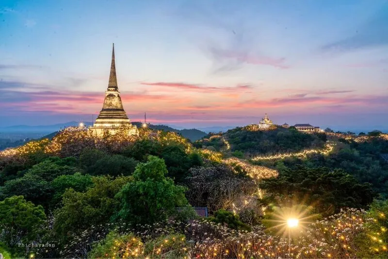
10. Phra Nakhon Khiri Historical Park (Khao Wang), Phetchaburi Province, is a remarkable royal palace and historical complex situated on three connected hilltops overlooking the center of Phetchaburi. Located in Khlong Krachaeng Subdistrict, Mueang Phetchaburi District, the site was developed during the reign of King Mongkut, or King Rama IV, as a royal retreat and a place for conducting official activities. Its extensive grounds contain throne halls, royal residences, Buddhist temples, stupas and other buildings representing a distinctive combination of Thai, Chinese and European architectural influences.
Highlights: Phet Phum Phairot Throne Hall, Pramot Mahaisawan Throne Hall, Wetchayan Wichien Prasat Throne Hall, Phra That Chom Phet, Wat Phra Kaeo Noi, Chatchawan Wiang Chai Observatory, the hillside tram and panoramic views of Phetchaburi.
Construction of Phra Nakhon Khiri began in 1859 under the direction of King Rama IV. The king selected a prominent hill near Phetchaburi town as the location for a palace that could take advantage of the elevated landscape. This choice reflected royal interest in geography, scientific observation and the relationship between architecture and natural surroundings. Unlike palaces built on flat land, Phra Nakhon Khiri was arranged across three distinct hilltops connected by paths and architectural features.
The western hill contains important royal buildings that illustrate the changing architectural preferences of the nineteenth-century Siamese court. Thai design elements appear alongside European and Chinese influences, reflecting a period of increasing diplomatic and commercial relations with foreign countries. The buildings provide insights into royal residential life, ceremonial functions and the development of international architectural styles in Thailand.
Phet Phum Phairot and Pramot Mahaisawan are among the principal throne halls associated with the royal residential complex. Their architectural forms and surrounding spaces demonstrate how buildings were adapted to the terrain and climate. Visitors can observe decorative details, the layout of courtyards and the relationship between individual structures and the views over Phetchaburi below.
The central hill is distinguished by Phra That Chom Phet, an important Buddhist stupa situated in an elevated position. Its location creates a strong visual connection between the religious monument and the wider palace landscape. From this area, visitors can appreciate the arrangement of buildings across the three hilltops and the surrounding city.
The eastern hill contains Wat Phra Kaeo Noi, a royal temple connected with the historical palace complex. Its architecture and religious features demonstrate how Buddhist sites were incorporated into royal residences during the Rattanakosin period, reflecting the continuing relationship between kingship and religious patronage.
Chatchawan Wiang Chai Observatory is another notable feature, reflecting King Rama IV's interest in astronomy and scientific knowledge. Its presence illustrates that Phra Nakhon Khiri served purposes beyond royal relaxation, becoming part of a wider architectural environment influenced by scientific observation and intellectual interests.
Visitors can reach the hilltop area on foot or use the hillside tram service. Once at the top, exploring all three hills involves additional walking on sloping pathways and occasionally uneven surfaces. Comfortable shoes, drinking water and sun protection are advisable, especially during hot weather.
Phra Nakhon Khiri is also an excellent viewpoint over Phetchaburi town, where historic temples, neighborhoods and surrounding landscapes can be seen from above. It can be combined with Wat Mahathat Worawihan, Wat Yai Suwannaram and traditional food destinations in the city. Visitors should avoid feeding the monkeys found around the hill and keep personal belongings secure.
Open Days: Daily.
Opening Hours: Generally 08:30 – 16:00.
Getting There: From Bangkok, follow Phetkasem Road toward Phetchaburi and continue into the city center. Follow the signs for Phra Nakhon Khiri or Khao Wang. Visitors may walk uphill or use the hillside tram where available. Check tram schedules and access arrangements for individual buildings before visiting.
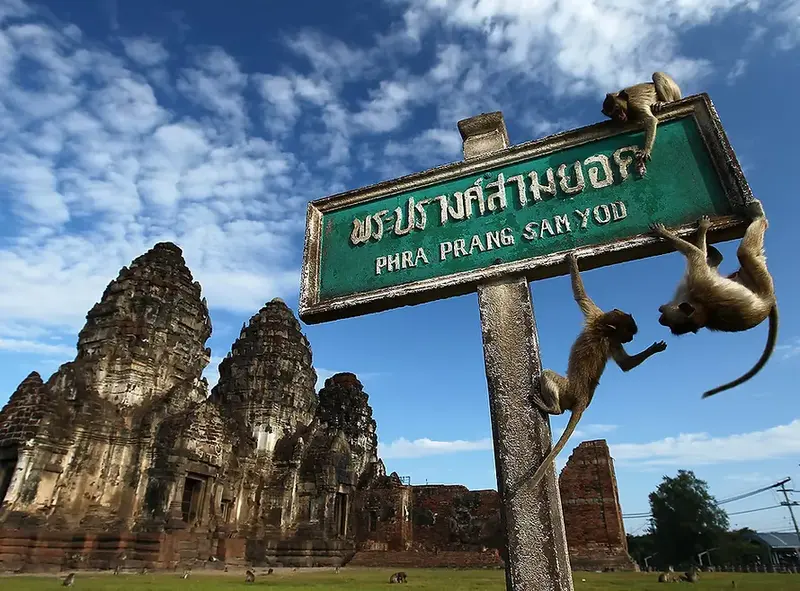
11. Phra Prang Sam Yot, Lop Buri Province, is one of Thailand's most important monuments associated with the ancient city of Lavo. Located in Tha Hin Subdistrict, Mueang Lop Buri District, close to the Phra Kan Shrine and other monuments in Lop Buri's historic center, the site is distinguished by three connected laterite towers. Its architectural features are associated with the Khmer Bayon style, generally dated to around the thirteenth century. The monument provides an important insight into the influence of Khmer civilization, religious beliefs and architectural traditions in the central plains of Thailand.
Highlights: Three connected laterite prangs, Bayon-style Khmer architecture, ancient decorative carvings, a viharn from King Narai's reign, the nearby Phra Kan Shrine and the historic streets of Lop Buri.
Lop Buri, historically known as Lavo, was an important political and cultural center with connections to the Chao Phraya River basin and the Khmer world. The construction of Phra Prang Sam Yot reflects a period when Khmer artistic traditions were influential in the area. The use of laterite, the proportions of the towers and the surviving decorative details all provide evidence of the building techniques and aesthetic conventions of this era.
The three towers are connected within a single architectural composition, originally associated with Mahayana Buddhist religious beliefs. The arrangement is traditionally linked to the Buddha, the bodhisattva Avalokiteshvara or Lokeshvara, and Prajnaparamita, the personification of transcendent wisdom. This symbolic program reveals how religious ideas from the wider Khmer cultural sphere were adopted and expressed in the city of Lavo.
The monument later experienced changes in religious use as beliefs and political influences evolved. During the reign of King Narai the Great in the Ayutthaya period, a Buddhist viharn was constructed on the eastern side of the towers. This addition allows visitors to compare two different architectural traditions within the same complex: the earlier Khmer-style sanctuary and the later Ayutthaya religious building.
Surviving ornamentation around the entrances and architectural details demonstrate the craftsmanship of the original builders. Laterite was an important construction material because of its strength and suitability for substantial masonry structures. Although some decorative elements have deteriorated over time, the overall arrangement of the towers remains clearly recognizable.
Phra Prang Sam Yot is also widely known for the macaques living around Lop Buri's old town. These animals have become part of the city's popular image, but visitors should keep food and belongings secure and avoid feeding or approaching monkeys. Maintaining a safe distance helps reduce the risk of bites, scratches and aggressive behavior.
The monument is an excellent starting point for exploring Lop Buri's history. Nearby attractions include the Phra Kan Shrine, King Narai's Palace, Wat Phra Si Rattana Mahathat and the historic residence known as Ban Wichayen. Visiting these sites together reveals Lop Buri's transformation from the ancient Lavo period to its important role under King Narai.
Visitors should remain on designated routes and avoid climbing or touching fragile masonry. The monument is particularly suitable for travelers interested in Khmer architecture, archaeology and the historical interaction between civilizations in Central Thailand.
Open Days: Generally daily.
Opening Hours: Generally 06:00 – 18:00.
Getting There: From Bangkok, follow Phahonyothin Road toward Lop Buri, then continue into the historic town center in Tha Hin Subdistrict. The monument is near Lop Buri Railway Station and the Phra Kan Shrine, making it convenient for visitors arriving by train.
Map (GPS):Get Directions to Phra Prang Sam Yot

12. Wat Phra Phutthachai, Saraburi Province, is an important Buddhist temple combining religious traditions, archaeological evidence and a natural limestone landscape. Located near Khao Pathawi in Nong Pla Lai Subdistrict, Mueang Saraburi District, the temple is best known for a sacred mark on a rock face revered as Phra Phutthachai, or the Buddha's shadow. A mondop has been constructed around the sacred feature to provide a place for worship and protection. The surrounding landscape also contains ancient paintings and engravings that reflect human activity in the area long before the development of the present religious complex.
Highlights: The sacred Buddha's shadow on the cliff, Phra Phutthachai Mondop, a revered Buddha footprint, prehistoric rock paintings, animal figures and symbolic markings, hillside steps and the natural landscape of Khao Pathawi.
The temple's name refers to the mark on the natural rock face that has long been revered by Buddhist devotees. Its position on the limestone cliff has made the location an important destination for pilgrimage, religious observances and local traditions. Over time, the construction of religious buildings and visitor facilities has helped accommodate worshippers while emphasizing the importance of protecting the sacred feature.
Reaching the main shrine involves ascending steps from the lower temple grounds toward the hillside mondop. The journey offers views of limestone formations, trees and the surrounding terrain, creating a setting where the natural environment and Buddhist architecture are closely connected. Visitors should allow enough time for the climb and exercise caution on wet or slippery steps.
The archaeological significance of Wat Phra Phutthachai is particularly interesting. Ancient pictographs and markings have been recorded on rock surfaces in the area, including representations of animals, hands and abstract symbols. These remains suggest that the hillside was meaningful to human communities in prehistoric times, although the precise dates and functions of different markings require archaeological interpretation.
The rock art provides an opportunity to learn about early human activity in Central Thailand and the importance of preserving fragile archaeological evidence. Travelers should avoid touching, rubbing or marking the rock surfaces, as even minor damage can affect ancient pigments and other surviving traces.
The temple also has a revered Buddha footprint associated with a discovery during restoration work in 1994. Together, the Buddha's shadow and footprint contribute to the site's importance as a center of religious faith and create additional points of interest for Buddhist pilgrims.
The surrounding forest and hillside environment make Wat Phra Phutthachai suitable for visitors who wish to combine a religious visit with time outdoors. It can be included in an itinerary with nearby natural attractions such as Namtok Sam Lan National Park, although visitors should consider the walking involved when planning activities for children or older travelers.
Appropriate clothing is expected when entering the temple. Visitors should observe religious etiquette and follow any restrictions designed to protect archaeological evidence and natural rock surfaces. The site is especially rewarding for those interested in Buddhism, archaeology and the ways in which sacred landscapes develop over time.
Open Days: Daily.
Opening Hours: Generally 08:00 – 17:00.
Getting There: From Saraburi town, follow the route toward Namtok Sam Lan National Park and Nong Pla Lai Subdistrict, then continue to the temple at the foot of Khao Pathawi. Private transport is convenient for combining the visit with nearby countryside attractions.
Map (GPS):Get Directions to Wat Phra Phutthachai

13. Sarika Waterfall, Nakhon Nayok Province, is one of the region's most popular natural attractions, located in Sarika Subdistrict, Mueang Nakhon Nayok District. Surrounded by forested mountains connected to the wider Khao Yai landscape, the waterfall consists of nine tiers descending over rocky cliffs, with streams, natural pools and large boulders distributed across the hillside. Its accessibility from Bangkok and its beautiful forest environment have made it a popular destination for day trips, family outings, photography and nature-based recreation.
Highlights: A nine-tiered waterfall, steep natural cliffs, streams and pools, forest walking trails, the mountainous Khao Yai landscape and other nature attractions around Sarika Subdistrict.
Sarika Waterfall is distinguished by the way its streams descend through a series of different elevations. The upper sections feature dramatic drops over rock faces, while lower areas provide opportunities to observe the waterfall and surrounding natural scenery from accessible points. The varied levels create different visual experiences, ranging from flowing water over exposed rocks to shaded pools within the forest.
The waterfall forms part of a wider mountain ecosystem that plays an important role in collecting and distributing rainwater. Rainfall on the forested hillsides gradually flows into streams and follows the contours of the terrain. Over time, the movement of water contributes to erosion and the formation of natural pools, illustrating the relationship between geology, forests and the regional water cycle.
Sarika Waterfall has long been an important leisure destination in Nakhon Nayok. Its proximity to the provincial town has encouraged the development of visitor facilities, food services and transport connections in the surrounding area. Nevertheless, its principal attraction remains the natural environment, and visitors should avoid littering or disturbing the ecosystem.
The scenery changes considerably with the seasons. During periods of adequate rainfall, the waterfall can be particularly impressive, with stronger streams and lush green vegetation. Following heavy rain, however, currents may become dangerous and certain pools or trails may be closed. In the drier months, more exposed rock formations may be visible, although the water flow can become reduced.
Visitors planning to explore the higher tiers should consider trail conditions, steep gradients and slippery rocks. Access restrictions may vary with weather conditions, and attempting to reach every level is not appropriate for all ages or fitness levels. Families with small children and older visitors may prefer the lower viewing areas where access is easier.
Sarika Waterfall can be combined with Nang Rong Waterfall, Wang Takhrai and Khun Dan Prakan Chon Dam. These destinations offer a mix of freshwater scenery, forests and reservoirs within Nakhon Nayok, although their locations should be considered when planning a day trip.
Comfortable footwear with good grip is strongly recommended. Visitors should avoid entering areas marked as unsafe, follow staff instructions and monitor weather conditions during the rainy season. Early arrival often provides a more comfortable experience and allows enough time to appreciate the waterfall without rushing.
Open Days: Generally daily, subject to weather and safety conditions.
Opening Hours: Generally 08:00 – 17:00.
Getting There: From Nakhon Nayok town, follow Highway 3049 toward Sarika Subdistrict, then turn onto Highway 3050 toward the waterfall. Private cars and locally arranged transport are convenient options.
Map (GPS):Get Directions to Sarika Waterfall

14. Ancient Siam (Muang Boran), Samut Prakan Province, is one of Thailand's largest open-air cultural museums, located in Bang Pu Mai Subdistrict, Mueang Samut Prakan District. Covering more than 800 rai, the attraction brings together representations of historic architecture, religious monuments, royal buildings and traditional communities from across Thailand. Its grounds feature reconstructed historical landmarks, architectural interpretations, decorative artwork, gardens and waterways designed to introduce visitors to the country's diverse cultural heritage. Ancient Siam is particularly suitable for travelers who want a broad introduction to Thai history, architecture and regional traditions in one destination.
Highlights: Reconstructed royal palaces, Buddhist temples, traditional houses, architectural representations of Thai historical periods, the Sanphet Prasat Palace reconstruction, gardens, waterways and exhibits illustrating Thailand's cultural regions.
Ancient Siam originated from the vision of Lek Viriyaphant and his wife Prapai, who sought to preserve and communicate Thailand's cultural heritage through a large-scale educational landscape. The project was developed to represent the country's architectural traditions and regional diversity in a setting where visitors could walk among buildings and experience their proportions, decorative details and relationship with the surrounding environment.
A particularly distinctive aspect of Ancient Siam is the arrangement of its grounds in a form inspired by the outline of Thailand. Monuments and architectural examples associated with different regions are displayed in broadly corresponding sections, creating a conceptual journey through the country's cultural geography. The collection includes reconstructions, newly interpreted structures and buildings influenced by original monuments.
Visitors can explore architectural traditions from several historical periods and cultural regions, including Dvaravati, Ayutthaya, Lanna and traditional Central Thai settlements. Comparing these buildings highlights the differences in religious beliefs, available materials, climate and artistic influences that shaped Thai architecture.
The museum's landscapes are an important part of the experience. Canals, ponds, gardens and open spaces surround the buildings, helping visitors understand the traditional connection between architectural design and natural surroundings. Some displays emphasize the importance of riverside settlements, while others recreate the visual character of palace compounds or sacred Buddhist landscapes.
It is important to recognize that many structures are reconstructions or artistic interpretations rather than original archaeological monuments. Their educational value lies in communicating architectural forms and cultural ideas, and travelers interested in specific historical sites may wish to compare the exhibits with surviving monuments elsewhere in Thailand.
Because of the museum's size, visitors should allow at least half a day, with a full day being appropriate for those interested in exploring multiple sections. Walking, cycling and internal transport services may be available depending on the operator's current arrangements. Planning a route in advance helps avoid unnecessary backtracking.
Ancient Siam is suitable for families, students, cultural travelers and international visitors. It can be combined with the Erawan Museum or attractions around Bang Pu, although time should be allocated carefully because the museum itself covers a substantial area. Visitors should check ticket conditions, transport services and special activities before arriving.
Open Days: Daily.
Opening Hours: Generally 09:00 – 19:00, with ticket sales typically ending at 18:00.
Getting There: Follow Sukhumvit Road toward Bang Pu in Samut Prakan and continue to Ancient Siam in Bang Pu Mai Subdistrict. Visitors may travel by private car or use the BTS Sukhumvit Line and continue by local transport to the entrance.
Map (GPS):Get Directions to Ancient Siam

15. Wat Chedi Hoi, Pathum Thani Province, is an unusual Buddhist temple distinguished by stupas constructed using ancient shells discovered in the surrounding soil. Located in Ban Khlong Bang Luang, Bo Ngoen Subdistrict, Lat Lum Kaeo District, the temple brings together Buddhist devotion and an intriguing aspect of the geological history of Central Thailand. Its most recognizable structures feature large quantities of fossilized shells, making the temple a destination for visitors interested in religious architecture, natural history and the changing environment of the Chao Phraya River basin.
Highlights: Shell-covered Buddhist stupas, ancient oyster fossils, the history of Luang Pho Thong Klueng Suntharo, temple ponds and grounds, and the geological heritage of Thailand's central plains.
The development of Wat Chedi Hoi is closely associated with Phra Khru Sunthon Khunthada, widely known as Luang Pho Thong Klueng Suntharo. He played an important role in transforming the area into a Buddhist religious community and developing the site into a temple. Wat Chedi Hoi was formally established in 1988 and later became widely known for the large quantities of ancient shells discovered beneath the ground.
The shells are particularly interesting because they reflect environmental changes that occurred in the central plains over a long period. Their presence in sediment layers provides clues about earlier marine or coastal conditions and the geological development of areas that are now used for agriculture and settlement.
The shell-covered stupas are the temple's most distinctive architectural features. Their construction differs greatly from conventional brick-and-plaster Buddhist monuments, demonstrating how materials found in the surrounding landscape were incorporated into religious structures. The result is a visual connection between geology, local history and Buddhist faith.
For visitors interested in natural history, the fossils offer an accessible introduction to questions about sedimentation, ancient environments and changes in landforms. Understanding their precise age and geological formation requires scientific study, but their appearance alone illustrates that the environmental history of the central plains extends far beyond the region's modern agricultural landscape.
Wat Chedi Hoi remains an active Buddhist temple, with spaces for worship, religious observances and community gatherings. The quieter rural setting provides an experience different from the larger royal temples of Bangkok and nearby urban provinces.
The temple is suitable for family visits and educational excursions. Visitors should dress respectfully, refrain from removing fossil shells and avoid touching or climbing on fragile parts of the stupas. Protecting the materials helps preserve both the religious significance and the unusual geological character of the site.
Open Days: Daily.
Opening Hours: Generally 08:00 – 16:30.
Getting There: From Bangkok, travel toward Pathum Thani and Lat Lum Kaeo District, then continue to Bo Ngoen Subdistrict and Ban Khlong Bang Luang. Private transport is convenient for visitors planning to explore additional rural attractions in the surrounding area.
Map (GPS):Get Directions to Wat Chedi Hoi

16. Ko Kret (Koh Kret), Nonthaburi Province, is a culturally distinctive island community in the Chao Phraya River, located in Ko Kret Subdistrict, Pak Kret District. Known for its Mon heritage, pottery workshops, riverside temples, traditional food and historic neighborhoods, the island offers a valuable opportunity to experience community life close to Bangkok. Ko Kret developed after the excavation of a shortcut canal changed the course of river transportation, with natural erosion gradually widening the new channel and separating the land from the mainland.
Highlights: Mon cultural traditions, Wat Paramaiyikawat, the leaning riverside chedi, traditional Mon pottery, local desserts, community markets, boat tours and the island's traditional waterside neighborhoods.
The island's origins are connected with the construction of a shortcut canal during the Ayutthaya period. The canal was intended to make navigation along a winding stretch of the Chao Phraya River more convenient. As water continued to flow through the artificial channel, erosion widened it and transformed the formerly connected land into an island. Ko Kret therefore illustrates how human engineering and natural river processes can combine to reshape a landscape.
Ko Kret became an important settlement for Mon communities who migrated to Siam during various periods of political change in the region. They brought their religious traditions, language, food and craftsmanship, many aspects of which remain visible in the island's contemporary cultural identity.
Traditional Mon pottery is one of Ko Kret's best-known cultural products. Local artisans produce both practical clay vessels and intricately decorated ceramics, including fine pierced patterns that require considerable skill. Visiting pottery workshops allows travelers to learn about shaping, decorating and firing techniques while supporting the preservation of community craftsmanship.
Wat Paramaiyikawat is among the island's principal religious landmarks. The distinctive leaning chedi beside the Chao Phraya River has become an iconic image of Ko Kret. The temple's architecture and cultural traditions reveal the historical relationship between Mon communities and Theravada Buddhism.
Food is another important part of the island experience. Travelers can sample Thai and Mon-influenced dishes, traditional sweets and locally made snacks while browsing small shops and markets. Weekends and public holidays are generally livelier than weekdays, when some businesses may remain closed.
Boat tours around Ko Kret provide views of the riverside houses, temples, landings and surrounding waterways. These experiences help visitors understand why river transport remained central to local life for generations. Visitors should select safe boat services and follow instructions regarding life jackets.
Ko Kret is well suited to a relaxed day trip from Bangkok. Visitors should respect the privacy of local residents, ask permission before photographing people or private spaces, and help reduce waste in this living community.
Open Days: The island can be visited daily. Shops and markets are generally busiest on weekends and public holidays.
Recommended Visiting Hours: Approximately 08:00 – 18:00.
Getting There: Travel from Bangkok to Pak Kret District in Nonthaburi. Cross the Chao Phraya River by ferry from a currently operating pier near Wat Sanam Nuea or another authorized crossing point. Once on the island, many attractions can be reached on foot through local community paths.
Map (GPS):Get Directions to the Ko Kret Ferry Area
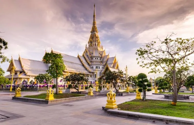
17. Wat Sothonwararam Worawihan, Chachoengsao Province, is one of Thailand's most important royal Buddhist temples and the home of Luang Pho Phuttha Sothon, a highly revered Buddha image. Located on Thep Khunakorn Road in Na Mueang Subdistrict, Mueang Chachoengsao District, beside the Bang Pakong River, the temple is closely associated with the history, religious traditions and cultural identity of Chachoengsao, also known as Paet Riu. Its monumental ordination hall, sacred Buddha image and annual religious celebrations make it a major destination for Buddhist pilgrimage and cultural tourism.
Highlights: Luang Pho Phuttha Sothon, the monumental ordination hall, elaborate contemporary Thai Buddhist architecture, religious artwork, annual Luang Pho Sothon processions and views of the Bang Pakong River.
Wat Sothonwararam has historical connections with riverside settlements dating back to the late Ayutthaya period. The temple was formerly known as Wat Hong and developed over time into one of the most important religious centers in Chachoengsao. Its position beside the Bang Pakong River reflects the central role waterways once played in transportation and communication among communities in the eastern central plains.
Luang Pho Phuttha Sothon is a seated Buddha image in the meditation posture and is traditionally associated with artistic influences from the Lan Xang cultural sphere. A well-known local legend describes the Buddha image being recovered from the Bang Pakong River. This story has become an important part of local religious identity, expressing the community's devotion and its deep connection with the river.
The principal ordination hall is distinguished by its large scale and elaborate architectural composition. Its distinctive form, decorated surfaces and carefully organized interior reflect the importance of the revered Buddha image housed within. The building is a major achievement of contemporary Thai religious architecture and has become one of the best-known landmarks in Chachoengsao.
The temple attracts worshippers who come to make merit, pay respect and seek blessings according to their beliefs. Visitors can observe how the temple continues to function as a center of religious life, bringing together local residents and pilgrims from other provinces.
One of the most important local traditions is the annual Luang Pho Sothon Fair and associated processions. These celebrations combine Buddhist ceremonies with cultural activities and community participation. The river has historically played a prominent role in the expression of devotion, reinforcing the relationship between the sacred image and the waterways of Chachoengsao.
Visitors can combine the temple with Ban Mai Market, Wat Saman Rattanaram and other attractions near the Bang Pakong River. This itinerary provides an introduction to the province's religious heritage, riverside communities and traditional food culture.
Appropriate clothing and respectful behavior are essential within the temple grounds. Visitors should follow photography restrictions inside the ordination hall and avoid disturbing people engaged in religious ceremonies. Morning visits are generally convenient for those planning a day trip from Bangkok.
Open Days: Daily.
Opening Hours: Generally 07:00 – 16:30.
Getting There: From Bangkok, travel toward Chachoengsao using the motorway or Suwinthawong Road, then continue into the town center along Thep Khunakorn Road. Visitors may also travel by train or public bus and use local transport to reach the temple beside the Bang Pakong River.
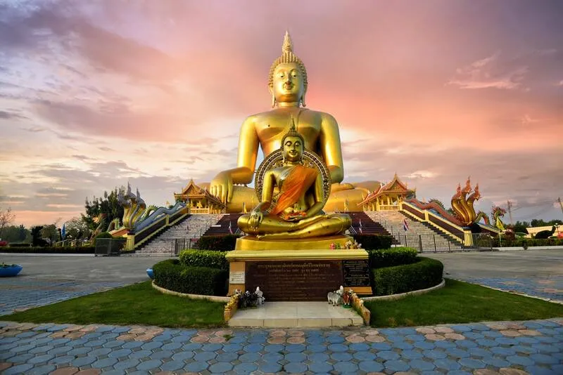
18. Wat Muang, Ang Thong Province, is a celebrated Buddhist temple best known for its enormous golden seated Buddha image, one of the largest of its kind in Thailand. Located in Hua Taphan Subdistrict, Wiset Chai Chan District, the temple is dominated by Phra Phuttha Maha Nawamin Sakayamuni Si Wiset Chai Chan, commonly called Luang Pho Yai. The image depicts the Buddha in the earth-touching posture and rises approximately 95 meters, with a lap width of about 63 meters. Its immense scale makes it visible from a considerable distance across the surrounding agricultural landscape and has established Wat Muang as one of Ang Thong's most recognizable religious landmarks.
Highlights: The giant golden Luang Pho Yai Buddha image, the earth-touching Buddha posture, the glass viharn, Buddhist moral teaching sculptures, contemporary religious artwork and the history of Wat Muang's restoration.
Wat Muang is associated with the historical development of communities in Wiset Chai Chan District. After periods of decline and abandonment, the temple underwent significant restoration during the modern era. Luang Pho Kasem Acharasubho, an important monk in the temple's recent history, played a central role in developing religious buildings and reviving the site's importance as a place of Buddhist worship.
The immense Luang Pho Yai image is the central attraction. When standing near the base, visitors can appreciate the extraordinary difference in scale between the sculpture and the surrounding buildings. Its construction required substantial architectural planning, engineering and support from Buddhist devotees, demonstrating the continued significance of large-scale religious art in modern Thailand.
The image represents the Buddha seated in the Maravijaya posture, in which the right hand reaches toward the earth. The posture is traditionally associated with the Buddha's victory over Mara and the attainment of enlightenment. This religious symbolism gives the sculpture significance beyond its remarkable physical dimensions.
Devotees frequently visit the base of the image to offer prayers and pay respect. A popular local practice involves touching the fingertips of the Buddha image according to individual beliefs. Visitors should follow the temple's current rules and avoid any activity that could damage the sculpture or interfere with religious observances.
Wat Muang also contains buildings and sculptural displays that illustrate Buddhist moral teachings through visual storytelling. Some areas use dramatic depictions to communicate concepts related to karma, merit, wrongdoing and the consequences of human actions. These exhibits can be educational, although certain images may be intense for young children.
The temple's restoration demonstrates how monastic leadership and community support can transform a declining religious site into an important center of pilgrimage and tourism. The development of new buildings and the giant Buddha image reflects the continuing role of Buddhist institutions in social and cultural life.
Wat Muang can be combined with Wat Khun Inthapramun and Wat Pa Mok Worawihan as part of an Ang Thong temple itinerary. Because much of the main viewing area is outdoors, visitors may prefer the morning or late afternoon. Respectful clothing, sun protection and adequate drinking water are recommended.
Open Days: Daily.
Opening Hours: Generally 06:00 – 18:00.
Getting There: From Bangkok, travel north through Ayutthaya or Suphan Buri toward Ang Thong Province, then continue to Wiset Chai Chan District and Hua Taphan Subdistrict. Follow the signs for Wat Muang. Private transport is convenient for visiting several temples in the area.
Map (GPS):Get Directions to Wat Muang

19. Bueng Chawak Chaloem Phrakiat, Suphan Buri Province, is an important natural wetland and educational attraction in Doem Bang Nang Buat District, near the provincial boundary with Chai Nat. Centered around a large freshwater lake, the area provides habitats for numerous aquatic species, waterbirds and wetland plants. It has also been developed with aquarium exhibits, wildlife facilities and recreational areas, making it a popular destination for families, students and visitors interested in ecology and environmental learning.
Highlights: The natural freshwater wetland, aquarium buildings, underwater exhibits, Bueng Chawak Non-Hunting Area, waterbirds, aquatic plants, wildlife displays and lakeside recreational areas.
Bueng Chawak is a large natural lake with an area of approximately 2,700 rai, extending across a landscape near the boundary of Suphan Buri and Chai Nat provinces. The wetland supports aquatic plants, freshwater fish, birds and other wildlife, making it valuable both ecologically and as a source of environmental education.
The area was designated a non-hunting wildlife sanctuary in 1983 to help protect its natural resources and wildlife habitats. Wetlands such as Bueng Chawak perform important ecological functions by providing feeding and breeding areas, supporting biodiversity and contributing to the wider balance of freshwater environments.
Bueng Chawak was subsequently developed into a recreational and educational destination with aquarium buildings, wildlife attractions and visitor facilities. These developments allow people to learn about aquatic ecosystems through a combination of displays and outdoor experiences.
The aquarium exhibits are among the site's best-known attractions. They introduce visitors to freshwater and other aquatic species while explaining their physical characteristics, behavior and ecological importance. For children, viewing aquatic animals at close range can make scientific concepts more accessible than classroom learning alone.
Outside the exhibition buildings, the natural lakeside environment offers opportunities to observe wetland vegetation and birds. Early morning can be particularly pleasant for exploring outdoor areas and appreciating the landscape. Wildlife should be observed quietly and from an appropriate distance to avoid disturbing feeding or nesting behavior.
Because the attraction consists of several separate zones, visitors should check the operating arrangements of individual buildings and plan the order of their activities. Families traveling with young children or older adults may find it useful to allow additional time for rest between exhibits.
Bueng Chawak is suitable for a full-day family excursion or as part of a wider journey through Suphan Buri and Chai Nat. Visitors should follow instructions regarding animal feeding, access to exhibits and waste disposal to protect the animals and the natural wetland environment.
Open Days: Generally daily.
Opening Hours: Generally Monday – Friday 08:30 – 16:30, and weekends and public holidays 08:30 – 17:00. Individual attractions may operate different hours.
Getting There: From Suphan Buri town, travel toward Doem Bang Nang Buat District and follow the signs for Bueng Chawak. The attraction can also be approached from Chai Nat via routes connecting to Hankha District. Private transport is convenient for traveling between the different exhibition zones.
Map (GPS):Get Directions to Bueng Chawak
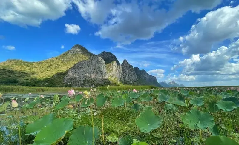
20. Sam Roi Yot National Park (Khao Sam Roi Yot National Park), Prachuap Khiri Khan Province, is Thailand's first coastal national park, protecting a remarkable landscape of limestone mountains, freshwater wetlands, mangrove forests, beaches and caves along the Gulf of Thailand. The park extends across parts of Kui Buri and Sam Roi Yot districts and is renowned for Phraya Nakhon Cave, the historic Khuha Kharuehat Pavilion, Laem Sala Beach, the Sam Roi Yot Wetland and Khao Daeng Viewpoint. Its combination of natural scenery, cultural heritage and ecological diversity makes it one of the most rewarding outdoor destinations in Central Thailand.
Highlights: Phraya Nakhon Cave, Khuha Kharuehat Pavilion, Laem Sala Beach, the Sam Roi Yot freshwater wetland, Khao Daeng Viewpoint, Khao Daeng Canal, limestone mountains, mangrove forests and natural birdwatching areas.
Sam Roi Yot National Park was established in 1966 to protect the distinctive limestone mountains, coastal habitats and important wetlands of the region. Its name is commonly associated with the numerous jagged peaks rising above the coastal plain, creating a dramatic mountain skyline that can be recognized from a considerable distance.
Phraya Nakhon Cave is the park's most famous attraction. Inside the cave stands Khuha Kharuehat Pavilion, a beautifully proportioned Thai-style royal pavilion constructed during the reign of King Rama V. It occupies a naturally illuminated chamber where sunlight can enter through an opening in the cave roof. Under favorable lighting conditions, the pavilion appears dramatically framed by light, limestone formations and surrounding vegetation.
Reaching Phraya Nakhon Cave involves traveling toward Laem Sala Beach and walking along a mountainous trail. Some sections are steep and rocky, making suitable footwear and physical preparation important. Visitors should allow sufficient time for the outward and return journeys and avoid attempting the route in unsafe weather conditions.
The Sam Roi Yot freshwater wetland is another exceptional feature of the park. It provides habitats for aquatic plants, waterbirds and other wildlife, with boardwalks in designated areas offering opportunities to observe the landscape without entering fragile habitats. The wetland illustrates the ecological significance of freshwater environments located close to the sea.
Other attractions include mangrove forests, tidal channels and Khao Daeng Canal, where visitors can observe limestone mountains and vegetation along the waterway. These environments demonstrate the connection between freshwater, brackish water and coastal ecosystems, including the role of mangroves in supporting aquatic life.
Khao Daeng Viewpoint offers panoramic views of the coastal plain, mountains and Gulf of Thailand. Reaching the viewpoint requires climbing a steep trail over uneven terrain and is best suited to visitors with appropriate fitness and footwear. Early morning is often preferred for both the scenery and the more comfortable temperature.
Sam Roi Yot National Park is also important for birdwatching and wildlife conservation. Visitors interested in observing birds should bring binoculars and avoid approaching nesting or feeding areas. Traveling quietly and staying on designated routes helps protect the animals and the habitats on which they depend.
The park can be explored during a day trip, but travelers wishing to visit the cave, wetland, canal and viewpoints should consider spreading their activities across more than one day. The attractions are not all located next to one another, and access conditions vary. Always check park announcements concerning trail closures, boat operations and safety restrictions.
Open Days: Generally daily, subject to park restrictions and weather conditions.
Opening Hours: Generally 08:00 – 16:30, with individual attractions and trails operating under separate arrangements.
Getting There: From Bangkok, take Phetkasem Road south through Phetchaburi into Prachuap Khiri Khan Province, continuing via Hua Hin and Pran Buri. Choose the appropriate entrance and connecting road for Phraya Nakhon Cave, the wetland or Khao Daeng attractions.
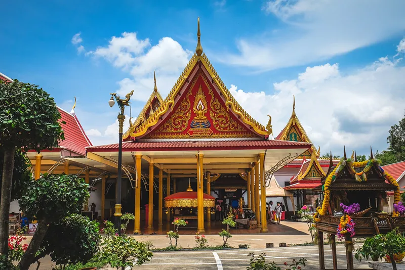
21. Wat Pak Khlong Makham Thao (Wat Luang Pu Suk), Chai Nat Province, is an important historic riverside Buddhist temple located in Makham Thao Subdistrict, Wat Sing District, near waterways associated with the Chao Phraya and Tha Chin river systems. The temple is particularly famous for Luang Pu Suk Kesaro, a highly respected Buddhist monk whose reputation and teachings have become an important part of the region's religious heritage. Wat Pak Khlong Makham Thao also preserves artwork and architectural features associated with important historical figures, making it a worthwhile destination for travelers interested in Buddhist history, traditional craftsmanship and the culture of Central Thailand's river communities.
Highlights: Luang Pu Suk Kesaro, the shrine dedicated to the revered monk, historical mural paintings associated with Prince Abhakara Kiartivongse, old religious buildings, Buddhist amulets and the riverside landscape of Chai Nat.
The temple's name reflects its geographical location near an important canal and river connection. Local history also associates the area with an old tamarind tree, linking the place name to the natural surroundings. Such river junctions were historically valuable because they provided convenient points for transportation, trade and the development of settlements.
Luang Pu Suk Kesaro is widely recognized in the history of Thailand's respected Buddhist teachers. His influence extended beyond the local community, and stories of his religious practice, teachings and sacred objects remain important to devotees. The tradition of Buddhist amulets associated with Luang Pu Suk forms part of the wider culture of religious faith in the Rattanakosin period.
The temple also has a notable historical connection with Admiral Prince Abhakara Kiartivongse, Prince of Chumphon, who respected Luang Pu Suk as a religious teacher. Artwork associated with the prince adds another dimension to the temple's significance, revealing connections between monastic communities and prominent members of the royal family.
Architectural elements within the temple include religious halls and buildings that reflect different periods of development. Visitors can observe how older structures coexist with later additions and how the temple has continued to function as an important local religious center.
The surrounding riverside landscape is another notable feature. From points near the waterways, visitors can appreciate the relationship between the Chao Phraya River, local canals and historic settlements. This environment helps explain why many of Central Thailand's oldest temples are located at river junctions or along important transportation routes.
Wat Pak Khlong Makham Thao is especially suitable for travelers interested in respected Thai monks, mural painting, local history and riverside culture. It can be combined with Chao Phraya Dam, Wat Thammamun Worawihan and other attractions in Chai Nat Province.
Visitors should dress respectfully, avoid disturbing religious activities and follow rules concerning photography inside temples. Historic paintings and decorative surfaces should never be touched, as they may be vulnerable to damage.
Open Days: Daily.
Opening Hours: Generally 08:00 – 18:00.
Getting There: From Chai Nat town, travel toward Wat Sing District and continue into Makham Thao Subdistrict, following the signs for Wat Pak Khlong Makham Thao. Private transport is convenient for combining the temple with other attractions along the river.
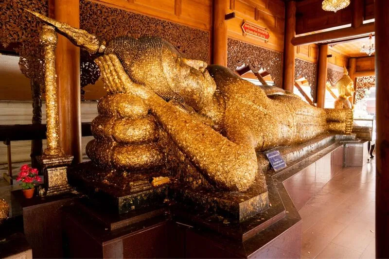
22. Wat Phra Non Chakkrasi Worawihan, Sing Buri Province, is a historic royal Buddhist temple located in Chaksi Subdistrict, Mueang Sing Buri District. It is best known for its monumental reclining Buddha image, Luang Pho Phra Non Chakkrasi, which measures approximately 47.42 meters in length. The sculpture displays graceful characteristics associated with traditional Thai Buddhist art and is deeply revered by local residents and visiting pilgrims. The temple combines religious importance, architectural heritage and long-established community traditions, making it one of Sing Buri's principal cultural attractions.
Highlights: The giant reclining Buddha image, the principal viharn, important Buddha images known as Phra Kan and Phra Kaeo, Buddhist artwork, traditional temple architecture and local ceremonies associated with the reclining Buddha.
Wat Phra Non Chakkrasi has long been associated with communities in the Chao Phraya River basin. Its history is connected with the development of Buddhist religious sites across Central Thailand, where temples served as centers of worship, education and social life. The principal reclining Buddha has become a lasting symbol of religious devotion in Sing Buri.
The reclining Buddha posture has an important role in Buddhist iconography. It depicts the Buddha lying on his right side and is closely associated with accounts of his final passing into Parinirvana. The peaceful facial expression and graceful proportions of the image convey concepts of serenity, reflection and the impermanence of life.
The image's extraordinary length influences the architectural design of its enclosing hall. The large viharn provides space for the full reclining figure and allows visitors to observe the head, hands and body from different positions. Viewing the sculpture up close reveals the relationship between the Buddha image and the building created to protect and accommodate it.
The temple remains an important center of religious activity. Devotees visit to make merit, offer prayers and participate in traditional ceremonies. These ongoing practices demonstrate that historic Buddha images have cultural significance far beyond their artistic value, continuing to serve as sources of spiritual connection for local communities.
Additional religious structures and Buddha images within the temple grounds contribute to its heritage. Travelers interested in Buddhist art can spend time examining the architectural features and the arrangement of religious buildings around the principal viharn.
Sing Buri also has a strong historical identity connected with the resistance of villagers during the final years of the Ayutthaya Kingdom. Visitors can combine the temple with the Bang Rachan Heroes Monument and Wat Pho Kao Ton for an itinerary that brings together Buddhist art and the province's historical traditions.
Wat Phra Non Chakkrasi is suitable for families, pilgrims and travelers exploring Central Thailand's temples. Visitors should wear appropriate clothing, speak quietly inside the viharn and respect those engaged in worship.
Open Days: Daily.
Opening Hours: Generally 06:00 – 17:00.
Getting There: From Bangkok, follow the Asian Highway toward Sing Buri Province, then continue to Chaksi Subdistrict in Mueang Sing Buri District. The temple can be reached by private car or local transport from the provincial town.
Map (GPS):Get Directions to Wat Phra Non Chakkrasi

23. Phanthai Norasing Historical Park, Samut Sakhon Province, is a historic memorial dedicated to Phanthai Norasing, a royal helmsman whose story has become an enduring symbol of loyalty, responsibility and adherence to duty in Thai historical tradition. Located in Phanthai Norasing Subdistrict, Mueang Samut Sakhon District, the park contains a shrine, memorial features and interpretive areas associated with the historic Khlong Khok Kham canal. Its surroundings also include coastal mangrove landscapes, making it an attraction that combines history, cultural memory and environmental learning.
Highlights: Phanthai Norasing Shrine, the historic story of the royal barge Ekachai, Khlong Khok Kham, local memorial structures, nearby mangrove habitats and the canal-based history of coastal Central Thailand.
The story of Phanthai Norasing is associated with the reign of King Sanphet VIII, commonly known as King Suea, during the late Ayutthaya period. According to the traditional historical account, the king's royal barge was traveling through the winding Khlong Khok Kham canal when its prow struck an obstruction and broke. Phanthai Norasing, responsible for steering the vessel, requested that he receive the punishment prescribed under royal law despite the king's willingness to show mercy.
The account concludes with Phanthai Norasing insisting that the law be upheld. Through generations of historical storytelling, this incident has become a widely recognized example of commitment to duty and accountability. It has appeared in educational materials and literary works and continues to hold cultural significance in Thai society.
Khlong Khok Kham is central to the story because its winding course created difficulties for river transportation. Before the development of modern roads, canals were vital routes for royal journeys, the movement of military forces and everyday commerce. The historical narrative therefore also illustrates the influence of geography on travel and administrative regulations during the Ayutthaya period.
Within the park, the Phanthai Norasing Shrine serves as a place of remembrance and respect. Visitors can explore memorial features and learn about the historical account while gaining an understanding of the area's relationship with the waterway.
The nearby mangrove environment adds another dimension to the visit. Mangrove forests are essential habitats for fish, crabs and other coastal species, and they contribute to the stability of estuarine ecosystems. Designated nature walks allow visitors to learn about the relationship between freshwater canals, tidal conditions and coastal vegetation.
Phanthai Norasing Historical Park is particularly suitable for students, families and travelers interested in Thai history. Nearby Wat Khok Kham and local canal communities provide opportunities to extend the visit into a broader exploration of the area's past.
Visitors should dress respectfully when entering the shrine and avoid disturbing wildlife or leaving litter in the surrounding natural areas. The park provides a valuable example of how historical heritage and environmental conservation can be experienced within one destination.
Open Days: Daily.
Opening Hours: Generally 08:00 – 18:00.
Getting There: From Bangkok, follow Rama II Road toward Samut Sakhon and continue into Phanthai Norasing Subdistrict. Follow signs for Phanthai Norasing Historical Park. Private transport is a convenient option for visiting nearby canal communities and historic sites.
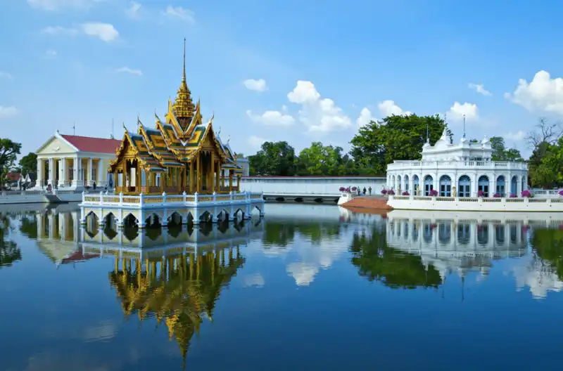
24. Bang Pa-In Palace, Phra Nakhon Si Ayutthaya Province, is an important royal palace complex illustrating the development of Thai court architecture from the Ayutthaya period into the Rattanakosin era. Located in Ban Len Subdistrict, Bang Pa-In District, beside the Chao Phraya River, the palace is distinguished by its carefully landscaped gardens, ponds and a collection of elegant buildings representing Thai, Chinese and European architectural traditions. The combination of historic royal residences and ornamental landscapes makes Bang Pa-In one of the most visually distinctive palace destinations in Central Thailand.
Highlights: Aisawan Thiphya-Art Royal Pavilion, Warophat Phiman Throne Hall, Uthayan Phumisathian Palace, Wehart Chamrun Palace, Withun Thasana Tower, landscaped royal gardens and Thai, Chinese and European architecture.
The history of Bang Pa-In Palace dates back to the Ayutthaya period, when the area was associated with royal visits and residences along the Chao Phraya River. The riverside setting made travel by boat convenient between Ayutthaya and settlements farther south. This connection to water transportation played an important role in the original development of the palace.
The complex underwent major restoration and expansion during the reigns of King Rama IV and King Rama V. During this period, Siam was strengthening its diplomatic and cultural relationships with foreign countries, and the royal court increasingly adopted architectural influences from Europe and China. Buildings created at Bang Pa-In illustrate these changes particularly clearly.
Aisawan Thiphya-Art Royal Pavilion is perhaps the palace's most recognizable structure. Standing in the middle of an ornamental pond, this elegant Thai-style pavilion features a multi-tiered roof and traditional decorative details. Its reflection in the surrounding water creates one of the most photographed scenes in the palace complex.
Warophat Phiman Throne Hall and other European-influenced buildings demonstrate Western architectural ideas through their proportions, facades, windows and interior arrangements. In contrast, Wehart Chamrun Palace is distinguished by its richly decorated Chinese-style architecture, revealing the important role of Chinese artistic traditions and craftsmanship in nineteenth-century Thailand.
Withun Thasana Tower is another distinctive structure, providing an unusual vertical architectural element within the palace landscape. The surrounding pathways, flower gardens and ornamental trees emphasize the importance of garden design as part of a royal residence rather than merely an area between buildings.
Bang Pa-In Palace is an excellent destination for travelers interested in royal history, architecture and cultural photography. It can be combined with Wat Niwet Thammaprawat and archaeological attractions in Ayutthaya to compare palace and religious architecture from different periods.
Visitors must follow the palace's dress regulations and any restrictions concerning access to individual buildings. Certain areas may close temporarily for royal functions or conservation work, so checking current visitor arrangements before traveling is advisable.
Open Days: Generally daily, subject to official arrangements.
Opening Hours: Generally 08:30 – 17:00.
Getting There: From Bangkok, follow Highway 32, the Asian Highway, toward Ayutthaya and take the connecting route into Bang Pa-In District and Ban Len Subdistrict. The palace can also be reached using rail services and local transport, depending on current connections.
Map (GPS):Get Directions to Bang Pa-In Palace

25. Wat Khun Inthapramun, Ang Thong Province, is a historic Buddhist temple celebrated for its enormous outdoor reclining Buddha image. Located in Inthapramun Subdistrict, Pho Thong District, the principal image, known as Phra Si Mueang Thong, measures approximately 50 meters in length. Its graceful facial expression and traditional Buddhist artistic features make it an important religious landmark. The remains of an ancient hall surrounding the image add archaeological interest, allowing visitors to appreciate both the original religious monument and the transformation of the temple over time.
Highlights: The approximately 50-meter reclining Buddha image, traditional Buddhist artistic features, ruins of the former viharn, local religious traditions and the historical landscape of Pho Thong District.
Wat Khun Inthapramun has a long history connected with the development of Buddhist communities in Central Thailand. The reclining Buddha is associated with older traditions of Thai religious sculpture, including artistic influences commonly identified with the Sukhothai style. Its serene expression and elegant proportions demonstrate the skill and religious devotion involved in creating monumental Buddha images.
The image was originally housed inside a large viharn. Over the centuries, the surrounding structure deteriorated and collapsed, leaving the Buddha exposed to the open air. The surviving masonry foundations and architectural traces indicate the scale of the former building and help visitors imagine its appearance during the temple's earlier periods.
The reclining posture has strong significance in Buddhist traditions, commonly associated with the Buddha's final passing into Parinirvana. Its calm facial expression invites reflection on Buddhist teachings related to peace, mindfulness and the impermanence of existence.
The temple's archaeological remains are particularly interesting because they reveal the relationship between monumental religious sculpture and the buildings that once sheltered it. Unlike temples where the principal hall remains intact, Wat Khun Inthapramun allows visitors to observe this connection directly through the surviving ruins.
Wat Khun Inthapramun remains a place of Buddhist worship and local religious traditions. Merit-making activities and ceremonies associated with the reclining Buddha reinforce the site's importance to nearby communities and demonstrate the continuity of religious practices across generations.
The temple can be combined with Wat Muang and Wat Pa Mok Worawihan for a day of exploring Ang Thong's important Buddha images and temple architecture. Morning and late-afternoon visits are generally comfortable because the principal image stands in an open-air setting.
Visitors should dress respectfully, avoid climbing on archaeological structures and never touch fragile decorative surfaces. Maintaining a respectful atmosphere helps protect the temple's religious and historical significance.
Open Days: Daily.
Opening Hours: Generally 06:00 – 18:00.
Getting There: From Ang Thong town, travel toward Pho Thong District and continue to Inthapramun Subdistrict, following the signs for Wat Khun Inthapramun. Private transport is convenient for combining the temple with Wat Muang.
Map (GPS):Get Directions to Wat Khun Inthapramun

26. Kaeng Krachan National Park, Phetchaburi Province, is Thailand's largest national park and an essential part of the Kaeng Krachan Forest Complex, a UNESCO World Heritage natural property. Located within the Tenasserim mountain range and extending across areas of Phetchaburi and Prachuap Khiri Khan provinces, the park protects extensive forests, important watersheds and habitats supporting remarkable biodiversity. Its major attractions include Kaeng Krachan Reservoir, Ban Krang, Phanoen Thung and natural areas famous for birdwatching and butterflies. The park is especially rewarding for travelers interested in tropical ecosystems, mountain scenery, conservation and outdoor exploration.
Highlights: Phanoen Thung sea-of-mist viewpoints, Ban Krang wildlife and birdwatching areas, butterfly observation, Kaeng Krachan Reservoir, the UNESCO-listed forest complex, the Tenasserim mountain landscape and diverse tropical ecosystems.
Kaeng Krachan National Park protects a vast connected forest landscape in the Tenasserim mountain range. The diversity of elevations, rainfall patterns and forest habitats supports many plant and animal species. Forest types include mixed deciduous and evergreen formations, with ecological conditions changing according to elevation and moisture. These habitats contribute to the ecological importance of western Central Thailand.
The Kaeng Krachan Forest Complex was inscribed on the UNESCO World Heritage List in 2021 in recognition of its outstanding natural importance and biodiversity. The designation acknowledges the wider ecological value of the connected forest landscape, including its role in supporting wildlife populations and conserving important ecosystems.
Ban Krang is especially popular among birdwatchers and nature enthusiasts. The area offers opportunities to observe birds, butterflies and other wildlife under suitable conditions. Species sightings depend on season, weather and natural behavior, so visitors should use binoculars and avoid approaching, feeding or disturbing animals.
Phanoen Thung is among the park's most celebrated viewpoints, particularly for the possibility of seeing mist spread across the forested valleys at sunrise. The layered mountains and changing morning light create impressive landscapes. However, the appearance of a sea of mist depends on humidity, temperature and wind conditions and cannot be guaranteed on every visit.
Access to Phanoen Thung involves mountain roads with restrictions on vehicles and travel times. Visitors should confirm the current rules with national park authorities and use appropriate transportation. Attempting to travel on restricted roads in unsuitable vehicles can create serious safety risks.
Kaeng Krachan Reservoir offers a contrasting experience, with broad views across the water toward the surrounding hills. The reservoir landscape also illustrates the relationship between upstream forests, water management and agricultural communities farther downstream.
Kaeng Krachan is suitable for birdwatching, forest photography, guided nature study and travelers interested in conservation. Visitors wishing to explore the forest and reservoir areas should allow sufficient time, often at least two days for activities in different zones. Guided excursions and accommodation arrangements may be needed for some locations.
Conservation and personal safety should guide every visit. Travelers must stay on approved routes, avoid feeding wildlife, carry out all rubbish and observe park regulations. Certain areas may close seasonally to support forest recovery or because of unsafe weather and road conditions.
Open Days: Park access varies by zone. Certain areas, including Ban Krang and Phanoen Thung, may close seasonally for ecological recovery or safety reasons.
Opening Hours: General entrance arrangements are commonly within approximately 05:00 – 17:00, but actual access times depend on the specific area and current park regulations.
Getting There: From Bangkok, travel along Phetkasem Road toward Phetchaburi and continue to Kaeng Krachan District. Follow signs for Kaeng Krachan National Park. Travelers planning to enter Ban Krang or Phanoen Thung should confirm current road access, vehicle requirements and permitted entry periods with national park staff.

27. Amphawa Floating Market, Samut Songkhram Province, is one of Thailand's most atmospheric evening floating markets. Located in Amphawa Subdistrict, Amphawa District, the market stretches along both sides of the Amphawa Canal, which connects with the Mae Klong River. Traditional wooden houses, waterside restaurants, food boats and small community shops create a distinctive setting that reflects the historic canal culture of Central Thailand. Unlike floating markets that focus primarily on early-morning trading, Amphawa is especially popular during the afternoon and evening, when visitors can enjoy food, riverside scenery and the illuminated atmosphere of the old community.
Highlights: The evening floating market, boats selling freshly prepared food, traditional wooden shophouses, Mae Klong mackerel, Thai desserts, coconut products, Wat Amphawan Chetiyaram, King Rama II Memorial Park and canal boat excursions.
Amphawa is a historic waterside settlement with a longstanding relationship with the Mae Klong River and the canal network of Samut Songkhram. Before road transport became widespread, boats were the primary means of travel and commerce. Houses, shops and temples were therefore built along the canals, with private landing points and waterside access playing an important role in daily life.
The market's character is strongly associated with its evening operating hours. During the afternoon, restaurants, stalls and food boats begin serving visitors, and activity increases along the canal. As daylight fades, the warm lights from wooden shophouses and reflections on the water create a particularly memorable atmosphere.
Food boats are one of the market's most recognizable features. Vendors prepare seafood, noodles, traditional snacks and other Thai dishes beside the canal, allowing customers to experience a form of waterside trading that reflects older commercial traditions. Although Amphawa has developed into a popular tourist destination, the historic wooden architecture remains essential to its appeal.
Samut Songkhram's local cuisine is another major reason to visit. Mae Klong mackerel, coconut products, coconut sugar and fruit from riverside orchards are particularly associated with the province. Sampling dishes made with these ingredients provides insights into the agricultural and fishing traditions of the Mae Klong River basin.
Canal boat tours allow visitors to see temples, wooden houses and local communities from the water. Some operators offer evening excursions, depending on current conditions and schedules. Visitors should prioritize safe services and avoid activities that may disturb wildlife or residents living along the canals.
Amphawa is also closely connected with important royal and cultural heritage sites. Wat Amphawan Chetiyaram and King Rama II Memorial Park provide opportunities to explore the area's relationship with early Rattanakosin history, traditional Thai arts and the royal family.
Weekends are generally the liveliest period, with more shops and restaurants open. Visitors who prefer a relaxed walking experience may wish to arrive in the early afternoon before the busiest hours. Staying overnight in the area can also provide more time to explore the community beyond the market.
Amphawa Floating Market can be combined with Mae Klong Railway Market, Wat Bang Kung and other nearby attractions. Travelers should check the market's current opening days and individual business schedules, as availability and activity levels can vary.
Open Days: Generally Friday – Sunday.
Opening Hours: Approximately 10:00 – 20:30, with individual shops operating different hours.
Getting There: From Bangkok, travel along Rama II Road toward Samut Songkhram, then continue to Amphawa District and follow signs for Amphawa Floating Market. Visitors can arrive by private car, public transport or local taxi from Mae Klong town.
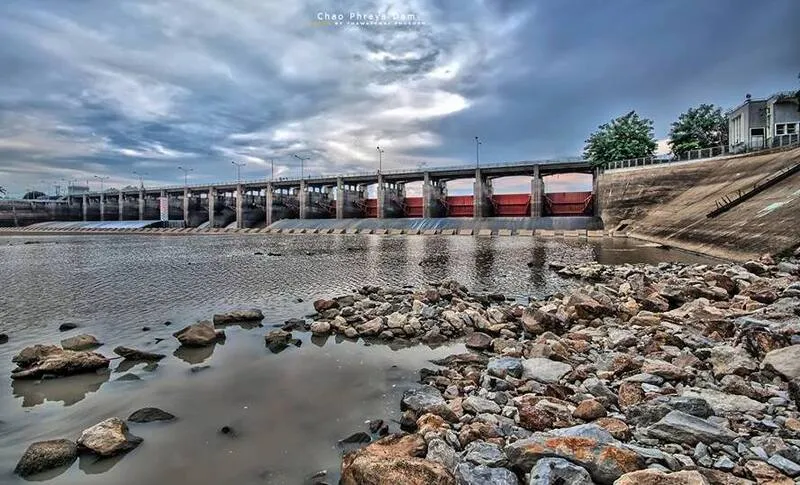
28. Chao Phraya Dam, Chai Nat Province, is Thailand's first major diversion dam and one of the most important structures in the country's irrigation system. Located near Bang Krabian in Bang Luang Subdistrict, Sapphaya District, the dam was built across the Chao Phraya River to raise water levels and distribute water through irrigation canals serving agricultural areas across the central plains. Beyond its engineering importance, the dam is also a destination for visitors interested in river landscapes, water management and the history of Thailand's agricultural development.
Highlights: The Chao Phraya River diversion structure, water-control gates, irrigation canals, navigation lock, river views and the history of water management in Thailand.
The development of Chao Phraya Dam was closely associated with Thailand's efforts to improve irrigation and agricultural productivity. Before large-scale irrigation systems were established, farming in many parts of the central plains depended heavily on seasonal rainfall and the natural rise and fall of river levels. Farmers faced uncertainty over water availability, particularly during periods of limited rainfall.
The dam was designed to regulate the river's water level and direct water into a network of irrigation canals. It is classified as a barrage or diversion dam rather than a conventional storage dam built across a mountain valley. Its primary function is to control water flow and support distribution throughout agricultural areas, particularly the rice-growing landscape of Central Thailand.
The structure measures approximately 237.5 meters in length and includes 16 water-control gates. A navigation lock allows boats to pass through the dam area under controlled conditions. These engineering features illustrate how irrigation infrastructure can support agriculture while accommodating other uses of a major river.
Chao Phraya Dam has played an important role in the development of the central plains by providing water to extensive agricultural areas. Its network of canals demonstrates the connection between engineering, food production, local economies and the daily lives of farming communities. For visitors interested in geography, agriculture or infrastructure, the site provides a practical example of how water resources are managed.
The surrounding river scenery is another reason to visit. From authorized public viewing areas, visitors can observe the water-control structures and the broad course of the Chao Phraya River. The contrast between the natural river landscape and the large-scale engineering works helps explain the continuing importance of the river to Thailand's development.
Chao Phraya Dam can be included in a day trip with Wat Pak Khlong Makham Thao and other historical attractions in Chai Nat. Visitors should remember that the dam is an active infrastructure facility. Restricted operational areas, machinery and dangerous currents must be avoided, and all posted safety instructions should be followed.
Open Days: Public viewing areas are generally accessible daily, subject to security and operational restrictions.
Getting There: From Chai Nat town, travel toward Sapphaya District and continue to Bang Luang Subdistrict, following the signs for Chao Phraya Dam. Private transport is convenient for exploring other attractions along the river.
Map (GPS):Get Directions to Chao Phraya Dam
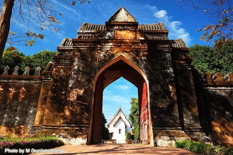
29. Phra Narai Ratchaniwet (King Narai's Palace), Lop Buri Province, is one of the most historically significant royal palace complexes from the Ayutthaya period. Located on Sorasak Road in Tha Hin Subdistrict, Mueang Lop Buri District, the palace was established during the reign of King Narai the Great, with construction beginning in 1666. It served as a royal residence and an important center for governmental and diplomatic activities when Lop Buri played a prominent role in the kingdom's administration. Today, its surviving palace buildings, archaeological remains and museum collections provide insights into royal life, architecture and international relations during one of Ayutthaya's most remarkable periods.
Highlights: The Outer, Middle and Inner Palace Courts, Dusit Sawan Thanya Maha Prasat Throne Hall, Suttha Sawan Throne Hall, the reception buildings for foreign visitors, the Twelve Royal Storehouses, historic gates and the King Narai National Museum.
King Narai the Great developed Lop Buri as an important royal center during a period of expanding diplomatic and commercial relations with foreign countries. The city provided an alternative location for royal residence and administration outside Ayutthaya. The palace was designed to accommodate the king's household, government activities and visiting diplomatic missions, reflecting the complex political and cultural environment of the seventeenth century.
The palace was divided into three principal sections: the Outer Court, Middle Court and Inner Court. Each area had different functions and access arrangements. This organization reflected the structure of the royal court, with spaces for official duties, foreign receptions and private royal activities.
Dusit Sawan Thanya Maha Prasat Throne Hall is one of the most important buildings associated with the palace. Its architectural features reflect a combination of Thai building traditions and influences associated with foreign contacts during King Narai's reign. The proportions, entrances and surviving structural details illustrate the distinctive architectural developments of this period.
Buildings within the Outer Court, including the Twelve Royal Storehouses and reception facilities, reveal the palace's administrative and diplomatic functions. Their remains help visitors understand how the complex was used for more than royal accommodation, serving as part of the kingdom's wider system of governance and foreign relations.
The Inner Court includes areas associated with the king's private residence, including the remains of Suttha Sawan Throne Hall. Although many structures survive only as foundations or partial masonry, their arrangement provides evidence of the original layout and the organization of royal space.
The palace also contains buildings added during the Rattanakosin period. Some now form part of the King Narai National Museum, where archaeological objects, historical artifacts and artwork help explain the development of Lop Buri from ancient times through later historical periods.
Phra Narai Ratchaniwet can be combined with Phra Prang Sam Yot, Ban Wichayen and Wat Phra Si Rattana Mahathat. Together, these attractions illustrate Lop Buri's long history, from the ancient Lavo culture and Khmer influences to its role as a royal city in the Ayutthaya Kingdom.
Visitors should follow museum regulations, stay away from unstable archaeological structures and avoid touching historical artifacts. Because access to the museum and archaeological areas may differ, it is advisable to check current opening arrangements before visiting.
Open Days: Palace grounds and museum buildings operate according to their respective schedules.
Recommended Visiting Hours: Approximately 09:00 – 16:30, subject to the areas open for visitors.
Getting There: From Bangkok, follow Phahonyothin Road toward Lop Buri and continue into the historic town center. The palace is located on Sorasak Road in Tha Hin Subdistrict. Visitors arriving by train at Lop Buri Railway Station can continue on foot or use local transportation.
Map (GPS):Get Directions to King Narai's Palace
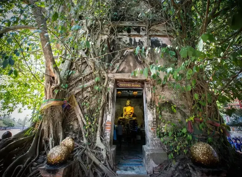
30. Wat Bang Kung, Samut Songkhram Province, is an extraordinary historic Buddhist temple known for an ancient ordination hall almost completely enclosed by the roots of large trees. Located in Bang Kung Subdistrict, Bang Khonthi District, the temple's famous Bot Prok Pho, or tree-covered ordination hall, has become one of the most recognizable cultural landmarks in the Mae Klong River basin. Inside the structure is the revered Buddha image known as Luang Pho Nin Mani or Luang Pho Dam. The site is also associated with Bang Kung Camp and important military events during the late Ayutthaya and early Thonburi periods.
Highlights: Bot Prok Pho, the tree-enclosed ordination hall, intertwined roots of Bodhi and other large trees, Luang Pho Nin Mani, Bang Kung Camp, early Thonburi history and the Mae Klong riverside landscape.
Wat Bang Kung dates back to the Ayutthaya period, when communities along the Mae Klong River played important roles in transportation, trade and regional defense. The area later became associated with military events surrounding the collapse of Ayutthaya and the establishment of the Thonburi Kingdom.
Bang Kung Camp occupies an important place in historical accounts of the period when Siam was rebuilding its political and military strength. The area's waterways were strategically important for movement and defense. These historical associations make Wat Bang Kung more than an unusual architectural attraction.
The most distinctive feature is the small ordination hall surrounded by large tree roots. Over generations, trees grew around the brick walls and roof, gradually enclosing the structure. The resulting appearance makes the building seem to have become part of the trees themselves, creating a striking combination of architecture and natural growth.
Inside the hall, Luang Pho Nin Mani, also known as Luang Pho Dam, remains the focus of Buddhist devotion. The contrast between the shaded interior and the massive network of roots outside creates a memorable atmosphere. Despite the popularity of the site among photographers, the building continues to serve as a sacred religious space.
The roots are now an essential part of the site's visual identity, but their relationship with the old masonry also requires careful conservation. Maintaining the structure involves balancing the protection of historic architectural materials with the management of living trees that have become inseparable from the monument.
Wat Bang Kung can be included in an itinerary with Amphawa Floating Market, King Rama II Memorial Park and other attractions around the Mae Klong River. This combination provides a varied introduction to Samut Songkhram's religious traditions, local history and waterside culture.
Visitors should dress appropriately, avoid pulling or damaging tree roots and never climb on the building or its surrounding vegetation. Respecting worshippers and following photography guidelines helps protect the temple's religious and historical character.
Open Days: Daily.
Opening Hours: Generally 08:00 – 16:30.
Getting There: From Bangkok, travel along Rama II Road toward Samut Songkhram, then continue toward Bang Khonthi District and Bang Kung Subdistrict. Follow signs for Wat Bang Kung. The temple is also accessible by local transport from the Amphawa area.
Map (GPS):Get Directions to Wat Bang Kung
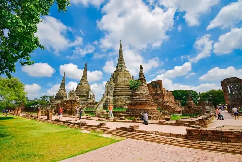
31. Wat Phra Si Sanphet, Phra Nakhon Si Ayutthaya Province, is one of the most significant monuments of the former Ayutthaya capital. Located within Ayutthaya Historical Park near the site of the ancient royal palace, the temple is internationally recognized for its three magnificent bell-shaped chedis arranged in a striking architectural composition. Wat Phra Si Sanphet once served as an important royal Buddhist temple used for state ceremonies and religious activities of the court. Unlike ordinary monastic temples, it did not function as a regular residential monastery for monks.
Highlights: The three bell-shaped royal chedis, remains of the principal viharn, the historic Phra Si Sanphetdayan Buddha image, the ancient royal palace precinct, nearby Wihan Phra Mongkhon Bophit and the UNESCO-listed historic city of Ayutthaya.
The site's history is closely connected with the development of the royal palace during the Ayutthaya period. The area originally formed part of the royal residential compound. During the reign of King Borommatrailokkanat, changes to the palace layout led to the dedication of the former palace area for religious purposes, establishing the temple as a significant royal Buddhist sanctuary.
Two of the three principal chedis were constructed during the reign of King Ramathibodi II to enshrine the royal remains of King Borommatrailokkanat and King Borommarachathirat III. A third chedi was added later. The arrangement demonstrates the importance of Buddhist monuments in commemorating members of the monarchy and maintaining the spiritual traditions of the royal court.
The chedis follow a traditional bell-shaped form with carefully proportioned bases and upper sections. Their alignment creates an impressive visual rhythm, especially when viewed from the side. The surrounding foundations indicate how religious halls and other buildings were organized around the sacred structures.
The temple once contained Phra Si Sanphetdayan, an enormous standing Buddha image covered with gold. Its scale and rich decoration reflected the wealth and religious patronage of the Ayutthaya court. The original image and its surrounding structures suffered extensive damage during the destruction of Ayutthaya in 1767, leaving archaeological remains that provide evidence of the former grandeur of the capital.
Exploring Wat Phra Si Sanphet offers an opportunity to understand the relationship between royal authority, Buddhist ceremonies and urban planning. Its proximity to the ancient palace demonstrates how sacred space and political power were closely connected in the historical capital.
Nearby Wihan Phra Mongkhon Bophit houses a monumental Buddha image and can be visited as part of the same walking route. Travelers may also combine the site with Wat Mahathat and other monuments on Ayutthaya Island for a broader understanding of the city's architecture and history.
The temple is largely outdoors. Morning and late-afternoon visits are more comfortable for walking and photography, particularly during the hot season. Visitors should avoid climbing on ancient structures or disturbing fragile masonry surfaces.
Open Days: Daily.
Opening Hours: Generally 08:00 – 18:30.
Getting There: From Bangkok, follow Highway 32 toward Ayutthaya and continue onto Ayutthaya Island. The temple is near Wihan Phra Mongkhon Bophit and the ancient royal palace area. Local tuk-tuks, bicycles and private vehicles are commonly used to explore the historical park.
Map (GPS):Get Directions to Wat Phra Si Sanphet
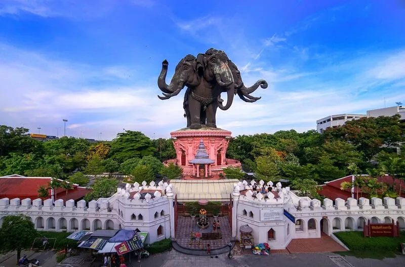
32. The Erawan Museum, Samut Prakan Province, is an extraordinary museum and cultural landmark dominated by an enormous three-headed elephant sculpture standing above its main building. Located in Bang Mueang Mai Subdistrict, Mueang Samut Prakan District, beside Sukhumvit Road, the museum combines Thai religious symbolism, traditional craftsmanship, architecture and historic art collections. Its remarkable design transforms a visit into a journey through ideas drawn from Buddhist and Hindu cosmology, presenting cultural knowledge through architectural spaces, decorative art and carefully arranged exhibits.
Highlights: The gigantic three-headed Erawan elephant, three symbolic exhibition levels, ornate staircases, stained-glass ceilings, Thai stucco decoration, antique ceramics, important Buddha images and landscaped gardens.
The Erawan Museum originated from the vision of Lek Viriyaphant, who also played a central role in creating Ancient Siam in Samut Prakan and the Sanctuary of Truth in Chon Buri. His projects sought to preserve and communicate traditional cultural values through monumental architecture and craftsmanship.
The museum's most prominent feature is the three-headed elephant, inspired by Erawan or Airavata, the mythological elephant associated with Indra. Its enormous metal structure rises above the museum and forms a distinctive landmark visible from Sukhumvit Road. The sculpture reflects both traditional mythological symbolism and the technical achievements of modern construction.
The interior is organized into three principal levels representing a symbolic progression through different realms of existence. The lower level contains exhibits associated with cultural heritage and the underworld in traditional cosmological interpretation. It includes antique objects and displays that introduce visitors to artistic and cultural traditions of Asia.
The middle level is particularly famous for its elaborate decorative art. Sculpted stairways, finely detailed stucco, stained glass and ornamental features create an impressive architectural environment. The combination of materials demonstrates the skills of craftsmen working in both traditional and contemporary styles.
The upper level is associated with the heavenly realm and contains sacred Buddhist images in a tranquil setting. Moving upward through the museum is intended to convey spiritual and cosmological meaning through the visitor's physical journey within the building.
The surrounding landscaped gardens include trees, decorative sculptures and paths that provide different views of the three-headed elephant. The contrast between the monumental exterior and richly ornamented interior makes the museum especially appealing to photographers and those interested in artistic design.
The Erawan Museum is suitable for families, international travelers and students studying Thai religious art. It can be combined with Ancient Siam in a cultural day trip through Samut Prakan, although visitors should allow enough time for both attractions.
Visitors should observe the museum's dress code and rules regarding photography, especially in sacred exhibition spaces. Touching artifacts and decorative surfaces should be avoided to protect the collections and architecture.
Open Days: Daily.
Opening Hours: Generally 09:00 – 18:00, with ticket sales ending before closing time.
Getting There: Take the BTS Sukhumvit Line to Chang Erawan Station and use Exit 2, then continue toward the museum. Travelers using private transport can follow Sukhumvit Road into Samut Prakan, where the large elephant sculpture is a prominent landmark.
Map (GPS):Get Directions to The Erawan Museum
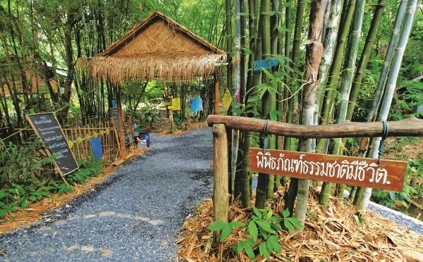
33. Bhumirak Dhamachart Centre, Nakhon Nayok Province, is an educational destination dedicated to natural resource management, environmental conservation and sustainable development inspired by the royal initiatives of King Bhumibol Adulyadej the Great, King Rama IX. Located in Ban Tha Dan, Hin Tang Subdistrict, Mueang Nakhon Nayok District, near Khun Dan Prakan Chon Dam, the center introduces practical approaches to managing soil, water, forests and agricultural land. Its demonstration areas and learning activities make it a valuable destination for students, families and visitors interested in sustainable living.
Highlights: Royal development initiatives, the Sufficiency Economy Philosophy, water management demonstrations, soil and forest conservation, New Theory Agriculture, environmental education and practical sustainability activities.
The center was developed to communicate knowledge associated with the royal development initiatives of King Rama IX. Its central approach emphasizes understanding local geography and available natural resources before designing methods of land use and environmental management. This principle recognizes that effective development must respond to the specific conditions of each community.
Water management is one of the center's major educational subjects. Demonstrations illustrate how water can be collected, slowed, distributed and conserved to support agriculture and maintain environmental balance. Such methods are closely connected with the broader relationship between upstream forests, rainfall, soil moisture and the availability of water in farming communities.
Soil conservation and forest restoration are equally important themes. Healthy soil supports food production and plant growth, while vegetation helps reduce erosion and maintain moisture. By studying these relationships, visitors can understand how responsible land management contributes to long-term ecological stability.
The center also introduces New Theory Agriculture and the Sufficiency Economy Philosophy. These concepts emphasize balanced planning, responsible resource use and resilience in the face of changing conditions. Practical demonstration plots help explain how these principles can be applied to farming, water storage and household resource management.
For children and students, the center offers a learning experience that connects environmental science, agriculture, geography and community development. Certain workshops or group activities may require advance arrangements, making it advisable to check current educational programs before arrival.
Its location near Khun Dan Prakan Chon Dam makes the center particularly suitable for an itinerary focused on water resources. Visitors can learn about the principles of water management at the center before traveling to the dam to observe large-scale infrastructure and the surrounding natural landscape.
Visitors should follow the instructions of activity leaders and avoid damaging demonstration plots or removing plants and materials. The center is particularly rewarding for travelers seeking a deeper understanding of Thailand's environmental and agricultural development.
Open Days: Generally daily; organized learning activities may require advance booking.
Opening Hours: Generally 08:00 – 17:00.
Getting There: From Nakhon Nayok town, follow the road toward Khun Dan Prakan Chon Dam and continue to Ban Tha Dan in Hin Tang Subdistrict. Follow the signs for Bhumirak Dhamachart Centre. Private transport is convenient for visiting nearby natural attractions.

34. Khao Chong Krachok, Prachuap Khiri Khan Province, is a prominent limestone hill and viewpoint near Wat Thammikaram Worawihan and the provincial government offices in Mueang Prachuap Khiri Khan District. The hill is famous for the approximately 396 steps leading to its summit and a natural opening in the rock that resembles a window or mirror frame, giving the destination its name. From the upper viewing areas, visitors can enjoy panoramic views of the town, Prachuap Bay, surrounding hills and the Gulf of Thailand.
Highlights: The 396-step stairway, the natural rock opening, the hilltop Buddhist shrine and sacred relics, panoramic views of Prachuap Bay, the surrounding coastal landscape and limestone geology.
Khao Chong Krachok forms an important part of the natural skyline of Prachuap Khiri Khan town. Its limestone structure rises close to the coastal plain, creating a distinctive contrast between urban settlements, mountains and the nearby sea. The hill can be recognized from several parts of the town.
The name Khao Chong Krachok refers to an opening in the limestone that creates a view through the rock, resembling a framed window. It is an example of a place name inspired by a distinctive natural landform and has become one of the features associated with the hill's identity.
The ascent follows a concrete stairway of approximately 396 steps. The climb is steep in places and can be demanding during hot weather. Visitors are advised to begin early in the morning or later in the afternoon, take breaks when needed and wear comfortable footwear.
At the summit, Buddhist religious structures provide a place for worship and reflection. The combination of a sacred hilltop and panoramic natural scenery reflects a tradition found in many parts of Thailand, where elevated landscapes are associated with religious significance.
The main reward for reaching the summit is the wide view of Prachuap Khiri Khan's coastal geography. From above, visitors can appreciate the relationship between the town, the surrounding limestone hills and the waters of the Gulf of Thailand. Clear mornings can offer especially attractive conditions for photography.
The hill is also inhabited by monkeys, which may approach visitors carrying food or brightly packaged items. Feeding monkeys should be avoided, and belongings should be securely stored. Maintaining a safe distance helps protect both people and wildlife.
Khao Chong Krachok can be combined with Wat Thammikaram Worawihan and nearby coastal attractions. Visitors should exercise caution on wet steps and avoid climbing during thunderstorms or unsafe weather.
Open Days: Daily.
Opening Hours: Generally 07:00 – 18:00.
Getting There: From Phetkasem Road, enter Prachuap Khiri Khan town and continue toward the provincial government offices and Wat Thammikaram Worawihan. The stairway entrance is located close to these landmarks.
Map (GPS):Get Directions to Khao Chong Krachok
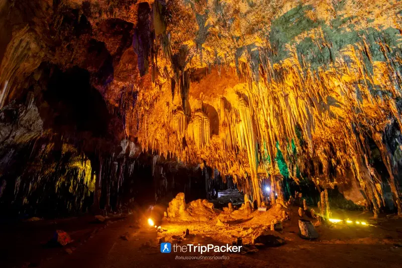
35. Khao Bin Cave, Ratchaburi Province, is a limestone cave famous for its impressive formations of stalactites, stalagmites and naturally sculpted rock chambers. Located in Hin Kong Subdistrict, Mueang Ratchaburi District, the cave contains a series of connected chambers accessible through developed visitor paths. Its remarkable underground landscape makes it one of Ratchaburi's best-known nature attractions and an accessible introduction to the geological processes that shape limestone caves.
Highlights: Limestone cave chambers, stalactites, stalagmites, mineral formations, visitor walkways, illuminated rock features and educational opportunities to learn about underground geology.
Khao Bin Cave developed through geological processes acting on limestone over very long periods. Rainwater and groundwater containing naturally occurring weak acids gradually dissolved the rock along fractures and joints. Over time, these openings expanded into passages and chambers, creating the underground spaces visible today.
Stalactites and stalagmites form through the deposition of calcium carbonate carried by dripping water. As mineral-rich water passes through the cave, small amounts of dissolved material may accumulate on ceilings and floors. Repeated over thousands of years, this process produces a wide variety of shapes and textures.
The cave is divided into several areas with different natural formations. Some resemble flowing curtains or frozen waterfalls, while others form columns or intricate mineral shapes. These differences reflect variations in water movement, mineral deposition and the physical environment of each chamber.
Lighting installed along the visitor route helps illuminate the formations and reveal the scale of the underground chambers. Nevertheless, the cave remains a natural environment with high humidity and potentially slippery surfaces, so visitors should move carefully and remain on established paths.
The cave offers a particularly useful learning experience for families and students because it demonstrates geological processes through features that can be observed directly. It encourages visitors to appreciate how slow changes in nature can create complex formations over enormous spans of time.
Conservation is essential. Visitors should never touch mineral formations, scratch the cave walls, remove stones or enter restricted passages. Contact with human skin can affect delicate mineral surfaces, while physical damage may destroy formations that took centuries to develop.
Khao Bin Cave can be included in a nature-focused day trip around Mueang Ratchaburi District. Comfortable footwear with good grip is recommended, and travelers should check current access conditions before arriving.
Open Days: Generally daily.
Opening Hours: Generally Monday – Friday 08:00 – 16:30, and weekends or public holidays 08:00 – 17:00.
Getting There: From Ratchaburi town, travel toward Hin Kong Subdistrict and follow the local signs for Khao Bin Cave. Private transport is convenient for combining the cave with other nearby attractions.
Map (GPS):Get Directions to Khao Bin Cave
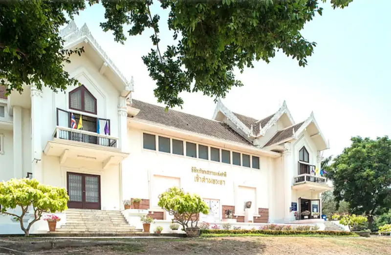
36. Chao Sam Phraya National Museum, Phra Nakhon Si Ayutthaya Province, is one of Thailand's most important museums dedicated to the history, archaeology and artistic achievements of the Ayutthaya Kingdom. Located on Rojana Road in Pratu Chai Subdistrict, Mueang Phra Nakhon Si Ayutthaya District, it is especially famous for its collection of gold artifacts and sacred objects recovered from archaeological excavations at Wat Ratchaburana and Wat Mahathat. The museum provides an essential opportunity to examine material evidence of Ayutthaya's former wealth, craftsmanship, Buddhist traditions and international cultural connections.
Highlights: Gold treasures from Wat Ratchaburana, relic containers and sacred objects, archaeological finds from Wat Mahathat, ancient Buddha images, jewelry, traditional goldwork and exhibitions on the Ayutthaya Kingdom.
The museum was established to preserve and exhibit important archaeological objects discovered during excavations and restoration work at historical sites in Ayutthaya. Many artifacts recovered from temple crypts and archaeological deposits required specialized conservation and secure storage. Creating a national museum allowed these objects to be studied, protected and presented within their historical context.
The gold treasures from Wat Ratchaburana are among the museum's most remarkable collections. These objects demonstrate the sophistication of Ayutthaya-period goldsmiths, who used techniques such as shaping, engraving, decorative setting and intricate surface ornamentation. Their craftsmanship illustrates the high artistic standards and material resources associated with the royal capital.
Objects discovered in temple crypts also reveal the relationship between religion and the donation of valuable materials. Sacred containers, ornaments and ceremonial items were often deposited as acts of devotion or merit-making. Studying these artifacts helps explain the beliefs that shaped the construction and use of monumental Buddhist temples.
The museum also houses Buddha images and sculptures representing different artistic periods. Visitors can compare changes in facial features, proportions, decorative styles and iconography, gaining a deeper appreciation of the development of religious art before and during the Ayutthaya Kingdom.
Other artifacts provide evidence of trade, material culture and daily life. Ceramics, decorative objects and architectural fragments help illustrate the wider social and economic environment of Ayutthaya beyond its royal ceremonies and Buddhist monuments.
For a particularly rewarding historical itinerary, visit Wat Ratchaburana and Wat Mahathat in combination with the museum. Observing the original archaeological sites before examining the artifacts discovered there helps connect the surviving monuments with the objects once deposited or used within them.
The museum is suitable for history enthusiasts, students, families and visitors interested in Thai craftsmanship. Photography restrictions may apply in certain galleries. Visitors should avoid touching display cases or exhibits and follow all conservation-related instructions.
Open Days: Generally Tuesday – Sunday; closed on Mondays.
Opening Hours: Generally 09:00 – 16:00.
Getting There: From Bangkok, travel to Ayutthaya Island and continue along Rojana Road toward the museum near Phranakhon Si Ayutthaya Rajabhat University. Visitors arriving at Ayutthaya Railway Station can use local transportation to reach the museum.

37. Mon Bridge (Uttamanusorn Wooden Bridge), Kanchanaburi Province, is one of Thailand's most celebrated wooden bridges and an important symbol of the multicultural communities of Sangkhlaburi District. Crossing the Songkalia River, the bridge connects the main town area with the Mon community of Ban Wang Ka. It is widely recognized for its remarkable wooden structure, mountain scenery and continuing role in community life. The bridge is more than a scenic landmark: it reflects the relationships among local ethnic communities, Buddhist traditions and everyday transportation in Thailand's western border region.
Highlights: The long wooden pedestrian bridge, the Songkalia River, Ban Wang Ka Mon community, morning alms-giving, Wat Wang Wiwekaram, boat tours to the submerged old temple area and views of the surrounding reservoir and mountains.
The bridge's official name, Uttamanusorn Bridge, honors Luang Pho Uttama, a highly respected Mon Buddhist monk who played an important role in supporting local communities and encouraging cooperation among the people of Sangkhlaburi. The bridge was developed to improve movement between settlements on opposite sides of the river, particularly at a time when road access was more limited.
The Mon community preserves distinctive cultural traditions, including language, dress, food and religious observances. Walking across the bridge offers an opportunity to observe how the structure connects communities that share the same wider landscape while maintaining their own cultural practices.
The wooden bridge extends for several hundred meters across the river landscape. Its long sequence of timber posts and decking creates a striking architectural form against the surrounding mountains. The use of wood reflects local building traditions, although continued maintenance and repairs are necessary to preserve the bridge's safety.
Early morning is especially popular, when mist may rise over the water and the surrounding hills. The nearby Mon community is also associated with morning Buddhist alms-giving traditions. Visitors who participate should dress respectfully, observe local customs and avoid disrupting residents or religious activities for photographs.
Exploring Ban Wang Ka provides opportunities to experience local foods, traditional dress and community markets. Choosing products made or sold by local residents can support the community, but visitors should respect privacy and ask permission before taking close-up photographs of individuals.
Boat trips to the submerged old temple area, often called the Sunken Temple or Underwater Temple, are another popular activity. The visibility of old structures varies with reservoir water levels, so the experience changes seasonally. Travelers should confirm boat safety arrangements and current conditions before departure.
Sangkhlaburi is most rewarding as an overnight destination because it is a considerable distance from Kanchanaburi town. The bridge can be combined with Wat Wang Wiwekaram, the Phutthakhaya Chedi and other attractions in the surrounding area.
Visitors should walk carefully, avoid running or jumping on the wooden decking and never climb on the bridge railings. Sections may be restricted during maintenance or unsafe weather. Respectful behavior helps protect a structure that remains important to local residents.
Open Days: Generally accessible daily, subject to maintenance and safety restrictions.
Recommended Visiting Hours: Early morning or late afternoon.
Getting There: From Kanchanaburi town, take Highway 323 toward Thong Pha Phum and continue to Sangkhlaburi District. Follow signs for Mon Bridge. Visitors may travel by private car or intercity bus with local transportation connections.
Map (GPS):Get Directions to Mon Bridge

38. Phra Tamnak Than Kasem (Than Kasem Royal Residence), Saraburi Province, is an important historical site associated with royal pilgrimages to the sacred Buddha footprint at Wat Phra Phutthabat during the Ayutthaya period. Located in Khun Khlon Subdistrict, Phra Phutthabat District, near the stream known as Than Thong Daeng, the residence was constructed during the reign of King Prasat Thong. Although the original buildings no longer survive intact, their foundations and associated architectural remains provide valuable evidence of royal activities and the development of historic sites surrounding the sacred footprint.
Highlights: Foundations of an Ayutthaya-period royal residence, Than Thong Daeng stream, historic brick-and-plaster water structures, traces of ancient water management, the royal pilgrimage route and nearby Phra Phutthabat heritage sites.
Phra Tamnak Than Kasem was established in 1633 during the reign of King Prasat Thong, when the Ayutthaya royal court maintained important religious connections with the sacred Buddha footprint in Saraburi. Royal visits to the site were major ceremonial occasions, requiring appropriate places for the king and members of the court to rest and perform related activities.
The residence was constructed near Than Thong Daeng, a natural stream in the Phra Phutthabat area. Its location suggests the importance of a suitable environment, access to water and the practical requirements of royal accommodation. The combination of natural surroundings and royal architecture illustrates how historical buildings were positioned in relation to existing landscapes.
Although most of the original residence has disappeared, the surviving masonry foundations and archaeological features indicate where important buildings once stood. These remains help researchers interpret the arrangement and possible functions of structures that were part of the royal pilgrimage landscape.
Traces of brick-and-plaster water structures are especially interesting because they reveal how water was incorporated into the design and management of the residence. Such features demonstrate that the planning of royal sites involved more than the construction of residential buildings, extending to practical engineering and landscape organization.
Phra Tamnak Than Kasem should be understood as part of a larger group of historic sites associated with the royal pilgrimage to Wat Phra Phutthabat. The importance of the sacred footprint influenced transportation routes, royal residences and religious ceremonies throughout the Ayutthaya period.
Visitors interested in history can combine the site with Wat Phra Phutthabat Ratchaworamahawihan and other nearby remains. Studying the wider historical setting makes the surviving foundations more meaningful and helps explain why this relatively modest archaeological site was once connected to royal activities.
Visitors should avoid climbing on fragile structures, moving old bricks or collecting archaeological materials. Respecting conservation boundaries helps preserve the remaining evidence for future study.
Open Days: Generally daily.
Opening Hours: Generally 08:00 – 17:30.
Getting There: From Saraburi town, travel toward Phra Phutthabat District and continue into Khun Khlon Subdistrict near Wat Phra Phutthabat. Follow the route toward Than Thong Daeng and the historic royal residence.
Map (GPS):Get Directions to Phra Tamnak Than Kasem
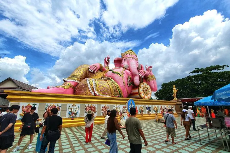
39. Wat Saman Rattanaram (Wat Mai Khun Saman), Chachoengsao Province, is a popular Buddhist temple and cultural attraction beside the Bang Pakong River. Located in Bang Kaeo Subdistrict, Mueang Chachoengsao District, it is particularly famous for a giant pink reclining Ganesha statue that has become one of the province's best-known landmarks. The temple grounds also contain Buddhist images, religious sculptures inspired by Thai and Hindu traditions, and riverside spaces that attract pilgrims and families throughout the year.
Highlights: The giant pink reclining Ganesha, representations of Ganesha in 32 forms, Luang Pho To, Phra Phuttha Maha Karunakhun Prasit, a walking Buddha image, riverside views and religious artworks.
Wat Saman Rattanaram is notable for its large-scale representation of Ganesha, a highly revered deity in Hindu traditions who has also become important in aspects of Thai religious and cultural life. Ganesha is commonly associated with wisdom, education, the arts, new beginnings and the removal of obstacles. The temple provides a setting where visitors can observe how beliefs from different traditions appear within contemporary Thai religious culture.
The principal attraction is the giant pink reclining Ganesha, depicted in a relaxed posture with elaborate ornaments and symbolic features. Its monumental size and vivid color make it an easily recognizable landmark, attracting visitors who come to pay respect, make offerings and take photographs.
Other representations of Ganesha around the main statue illustrate the deity in different forms and postures. These sculptures introduce visitors to variations in religious imagery and symbolism, reflecting the diversity of artistic interpretations associated with Hindu traditions.
Wat Saman Rattanaram also remains an active Buddhist temple. Important Buddha images and spaces for Buddhist worship include Luang Pho To and a prominent walking Buddha image beside the river. The coexistence of these religious features illustrates the layered beliefs and artistic expressions present in contemporary Thai society.
The Bang Pakong River contributes significantly to the temple's atmosphere. Its waters have historically supported transportation, agriculture and trade in Chachoengsao. The riverside setting offers open views and connects the temple with the wider cultural landscape of communities that developed along the river.
The temple is particularly suitable for a family day trip because its grounds contain several different points of interest. Visitors may wish to allow one or two hours for worship, walking and photography, with additional time during weekends and public holidays.
Wat Saman Rattanaram can be combined with Wat Sothonwararam Worawihan and other attractions in Chachoengsao. Visitors should dress respectfully, avoid climbing on statues and follow the temple's instructions regarding offerings and access to religious buildings.
Open Days: Daily.
Opening Hours: Generally 08:00 – 17:00.
Getting There: From Chachoengsao town, travel toward Bang Kaeo Subdistrict and the Bang Pakong River, following signs for Wat Saman Rattanaram. Private transport is convenient for visiting multiple temples in the province.
Map (GPS):Get Directions to Wat Saman Rattanaram

40. Hat Puek Tian Beach, Phetchaburi Province, is a coastal destination famous for its unusual combination of natural Gulf of Thailand scenery and sculptures inspired by the Thai literary epic Phra Aphai Mani. Located in Puek Tian Subdistrict, Tha Yang District, the beach is best known for the large statue of Nang Phisuea Samut, a giantess from the story, positioned offshore. Other sculptures associated with the literary characters add to the site's distinctive appearance, making it a destination for visitors interested in Thai literature, seaside photography and relaxed coastal experiences.
Highlights: The offshore Nang Phisuea Samut sculpture, other characters from Phra Aphai Mani, the Gulf of Thailand coastline, Puek Tian Canal, local seafood and the coastal community of Tha Yang District.
Hat Puek Tian is located along the upper Gulf of Thailand, where sandy beaches meet coastal settlements and fishing communities. The shoreline offers broad views of the sea and changing tidal conditions. Its relatively uncomplicated seaside setting is suitable for visitors seeking a quieter coastal experience centered on walking, photography and local food.
The beach's best-known feature is the group of sculptures inspired by Phra Aphai Mani, the celebrated literary work by Sunthorn Phu. The epic includes stories of maritime journeys, islands, mythical beings and adventures at sea, making its characters a natural source of inspiration for a coastal landmark.
Nang Phisuea Samut is one of the most memorable characters in the story. She plays an important role in the adventures of Phra Aphai Mani, including episodes connected with an island cave, a mermaid and the character Sin Samut. Her large statue at Hat Puek Tian transforms a famous literary figure into a distinctive visual feature of the landscape.
The sculptures are popular photography subjects, particularly when the tide and lighting conditions provide clear views. However, visitors should not attempt to walk or swim toward offshore sculptures when water levels, currents or seabed conditions make the area unsafe.
Near the beach, Puek Tian Canal meets the sea, creating an environment shaped by the interaction between inland waterways and coastal processes. The surrounding landscape reflects the importance of estuaries and shoreline environments to local fishing communities.
Visitors can enjoy walking, sitting by the sea and sampling seafood at local restaurants. Phetchaburi is also famous for traditional sweets made with palmyra palm sugar, providing opportunities to combine a beach visit with the province's distinctive food traditions.
Hat Puek Tian can be included in an itinerary with Cha-Am and other attractions in Tha Yang or Mueang Phetchaburi District. Morning and late afternoon are generally pleasant times for walking, but sea conditions should always be considered.
Visitors should dispose of rubbish responsibly and avoid climbing on sculptures or entering unsafe coastal areas. Protecting the beach and public artwork helps preserve the site's unique character.
Open Days: The public beach is generally accessible daily.
Recommended Visiting Hours: Morning and late afternoon. Restaurant and activity hours vary.
Getting There: From Bangkok, follow Phetkasem Road toward Phetchaburi and continue to Tha Yang District. Take the connecting road toward Puek Tian Subdistrict and the Gulf of Thailand coastline.
Map (GPS):Get Directions to Hat Puek Tian Beach
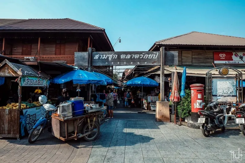
41. 100 Years Old Sam Chuk Market, Suphan Buri Province, is a historic riverside market famous for its preserved wooden shophouses and traditional trading community. Located in Sam Chuk Subdistrict, Sam Chuk District, beside the Tha Chin River, the market contains old shops, traditional coffee houses, historic pharmacies, community exhibits and local food stalls. Its architectural character and continuing commercial activities make it an important example of living heritage in Central Thailand.
Highlights: Historic wooden buildings, the Tha Chin riverside community, Khun Chamnong Chinarak House, community exhibitions, traditional coffee shops, old pharmacies, local desserts and regional cuisine.
Sam Chuk Market developed from its strategic location along the Tha Chin River, which was once one of the principal transportation routes connecting agricultural communities and trading centers in Suphan Buri. Before roads became widespread, boats transported rice, fruit, household goods and other products between riverside settlements.
Thai-Chinese merchant families played an important role in the development of the market. Many wooden shophouses combined commercial spaces on the ground floor with residential areas above or behind the shops. This arrangement reflects the traditional organization of market communities in which business and family life were closely connected.
As road transport expanded, many riverside markets experienced economic decline. The Sam Chuk community responded by working to preserve its old buildings, traditional businesses and collective memories. These conservation efforts helped transform the market into a well-known cultural destination while maintaining its role as a working community.
Khun Chamnong Chinarak House is an important historical building associated with the community. Its exhibits, photographs and preserved objects help illustrate the market's past and the role of commercial families in its development.
Food is an essential part of the Sam Chuk experience. Visitors can sample Thai desserts, regional dishes, snacks and traditional drinks while exploring the narrow lanes. Some businesses retain old counters, wooden cabinets and shop fittings, creating a setting that feels distinct from modern shopping centers.
The market is best explored on foot at a relaxed pace. Looking closely at the architecture and stopping at small community businesses provides a more meaningful experience than simply walking through the main shopping streets.
Sam Chuk Market can be combined with Bueng Chawak and other attractions in northern Suphan Buri. Visitors should respect residents' privacy, ask permission before taking photographs inside private spaces and support local businesses responsibly.
Open Days: Daily.
Opening Hours: Generally 08:00 – 17:00, although individual shops have their own schedules.
Getting There: From Bangkok, take Highway 340 toward Suphan Buri and continue to Sam Chuk District. Follow signs to the market near the district administrative offices and the Tha Chin River.
Map (GPS):Get Directions to Sam Chuk Market
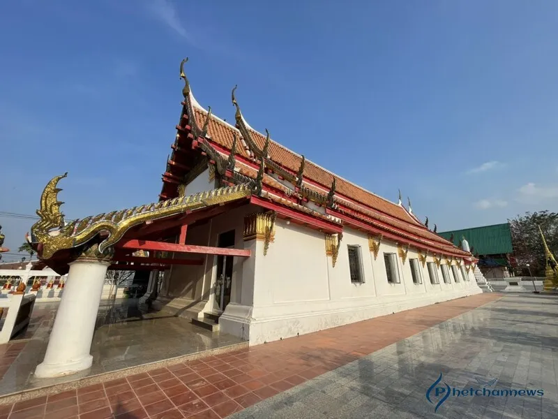
42. Wat Pa Mok Worawihan, Ang Thong Province, is a historic royal Buddhist temple on the western bank of the Chao Phraya River in Pa Mok District. It is renowned for its beautiful reclining Buddha image and the remarkable historical account of the image being moved to protect it from riverbank erosion. The temple also has important connections with the royal court during the Ayutthaya period and continues to serve as a center of Buddhist devotion in the surrounding riverside community.
Highlights: The historic reclining Buddha image, the principal viharn, the relocation of the Buddha image to protect it from erosion, Ayutthaya-period Buddhist art, the Chao Phraya River and local religious traditions.
Wat Pa Mok developed in a landscape where the Chao Phraya River played a central role in transportation, trade and community settlement. The river provided an important connection between Ayutthaya and towns farther north, making riverside temples significant centers of religious and social activity.
The temple's reclining Buddha is admired for its serene facial expression and graceful artistic proportions. The image reflects traditional Buddhist ideals of peace and spiritual reflection. Its large dimensions also demonstrate the substantial religious devotion involved in creating monumental sculpture.
One of the most remarkable events in the temple's history occurred during the reign of King Thai Sa of Ayutthaya, when the reclining Buddha was moved away from a riverbank threatened by erosion. The relocation was an extraordinary undertaking that required coordinated labor and practical engineering knowledge.
This historical event illustrates the challenges of conserving religious monuments in a constantly changing river landscape. Although waterways supported the development of communities, their natural movement could also threaten buildings and sacred objects. Preserving the Buddha image required an understanding of both structural stability and environmental conditions.
The principal viharn provides a sheltered space for worship and appreciation of the reclining image. Visitors can observe the relationship between the sculpture and the architecture designed to accommodate it, including the proportions of the hall and its decorative features.
Wat Pa Mok remains an important place for merit-making and Buddhist ceremonies. Its continuing religious activities demonstrate the relationship between historical monuments and the everyday spiritual life of local communities.
The temple can be combined with Wat Khun Inthapramun, Wat Muang and other important sites in Ang Thong. Visitors should dress appropriately, avoid disturbing worshippers and refrain from touching fragile artwork or decorative surfaces.
Open Days: Daily.
Opening Hours: Generally 08:00 – 17:00.
Getting There: From Ayutthaya or Ang Thong town, follow Highway 309 toward Pa Mok District and continue to the temple on the western side of the Chao Phraya River.
Map (GPS):Get Directions to Wat Pa Mok Worawihan

43. Hat Hua Hin (Hua Hin Beach), Prachuap Khiri Khan Province, is one of Thailand's most famous beaches and historic seaside resort destinations. Located in Hua Hin Subdistrict, Hua Hin District, the beach is known for its long sandy shoreline, views over the Gulf of Thailand and an atmosphere shaped by more than a century of leisure travel. Hua Hin became particularly prominent with the expansion of the southern railway and its association with members of the royal family during the early twentieth century. Today, it remains a popular destination for families, couples and international visitors seeking a combination of beach relaxation, local food and cultural attractions.
Highlights: Hua Hin Beach, the historic seaside resort atmosphere, Hua Hin Railway Station, old-town architecture, the night market, seafood restaurants, sunrise views and the Gulf of Thailand coastline.
Hua Hin's development as a resort town is closely connected with the construction of the southern railway during the early twentieth century. Rail transport made the coast more accessible from Bangkok, encouraging visitors to spend time beside the sea. What had previously been a relatively small coastal community gradually developed into a destination with hotels, residences and visitor facilities.
The area's association with the Thai royal family, particularly during the reigns of Kings Rama VI and Rama VII, contributed to its growing reputation. Historical landmarks such as Hua Hin Railway Station and Klai Kangwon Palace reflect the town's distinctive development as a royal seaside destination.
The beach consists of a broad stretch of sand in many areas, although its appearance changes with tides and seasonal coastal conditions. Low tide can reveal extensive open sand suitable for walking, while early mornings often offer peaceful views of the sunrise over the Gulf of Thailand.
Visitors can enjoy walking, photography, relaxing by the sea and participating in activities offered by local operators. Swimming and other water-based activities should always be considered in relation to wave conditions, weather forecasts and safety notices.
Hua Hin is also known for its varied food scene, including fresh seafood, traditional Central Thai dishes and modern restaurants. The night market and smaller local markets provide opportunities to sample regional specialties and experience the atmosphere of the resort town after sunset.
Travelers interested in cultural history can visit Hua Hin Railway Station and explore older streets to understand how the town changed with the arrival of railway tourism. Its historic identity gives Hua Hin a character that differs from many newer resort destinations.
Hua Hin Beach can be combined with Khao Takiab, nearby markets and attractions along the coast toward Cha-Am. Visitors may choose a day trip, but staying overnight provides more time to enjoy the beach, local restaurants and early-morning scenery.
Responsible beach tourism includes disposing of waste properly, following public safety rules and avoiding activities that damage coastal habitats. Visitors with children should provide close supervision near the water.
Open Days: The public beach is generally accessible daily.
Opening Hours: Public beach access is available throughout the day, while businesses and activities follow individual schedules.
Getting There: From Bangkok, follow Phetkasem Road south through Phetchaburi to Hua Hin District. Alternatively, take a southern railway service to Hua Hin Railway Station and continue to the beach using local transport.
Map (GPS):Get Directions to Hua Hin Beach

44. Don Hoi Lot, Samut Songkhram Province, is a remarkable coastal wetland and natural attraction near the mouth of the Mae Klong River. Located in Bang Cha Kreng Subdistrict, Mueang Samut Songkhram District, the site is characterized by extensive intertidal mudflats and sandbars formed through the accumulation of river sediments where freshwater meets the Gulf of Thailand. The area is particularly famous for its razor clams, known locally as hoi lot, and its strong connections with traditional fishing communities and local seafood cuisine.
Highlights: Intertidal sand and mud flats, razor clam habitats, the Mae Klong River estuary, tidal changes, coastal ecosystems, traditional fishing activities, seafood restaurants and estuary landscapes.
Don Hoi Lot developed through natural sedimentation at the mouth of the Mae Klong River. As river water reaches the sea, changes in current velocity cause some transported sediment to accumulate. Over time, these deposits create extensive intertidal areas that are continually influenced by tides, waves and changing water flow.
At high tide, much of the mudflat lies beneath the sea. When the tide recedes, broad expanses of sediment become visible, revealing the distinctive landscape for which Don Hoi Lot is known. The exact area exposed varies according to the tidal cycle, season and coastal conditions.
Razor clams are among the most important animals associated with the site. Their elongated shells and burrowing behavior allow them to live within sandy or muddy sediments. Their presence reflects the environmental characteristics of the estuary, where freshwater and seawater interact.
The collection of razor clams has long been connected with local livelihoods and food traditions. However, responsible harvesting is important because excessive extraction or harmful collection techniques can damage the sediment and the animals that depend on it. Protecting these habitats contributes to the long-term sustainability of local fisheries.
The wider estuary supports fish, crabs, shrimp and other coastal organisms. Intertidal flats and nearby mangrove environments provide feeding grounds and habitats that contribute to the local food web. Don Hoi Lot is therefore valuable not only for tourism but also for understanding the ecology of Thailand's coastal wetlands.
Seafood is another major attraction. Restaurants in the area serve local dishes using razor clams and other ingredients from the Gulf of Thailand. Sampling these specialties provides a connection between the natural environment and the food culture of Samut Songkhram.
Don Hoi Lot can be combined with Mae Klong Railway Market, Amphawa Floating Market and attractions around Samut Songkhram town. Visitors should check tidal conditions before arrival and avoid walking far onto soft mudflats without local knowledge.
Keeping the wetland clean is essential. Visitors should not leave plastic, food waste or other rubbish on the shore, and should avoid disturbing animals or their habitats.
Open Days: Public areas are generally accessible daily.
Recommended Visiting Time: During low tide, according to the local daily tide schedule.
Getting There: From Bangkok, follow Rama II Road toward Samut Songkhram, then continue to Bang Cha Kreng Subdistrict and the signs for Don Hoi Lot. Private cars and local transport from Mae Klong town are convenient options.
Map (GPS):Get Directions to Don Hoi Lot
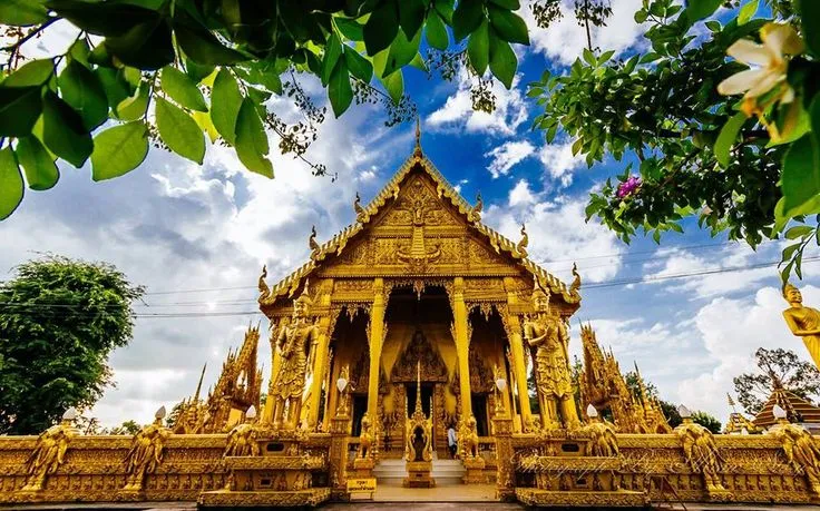
45. Wat Pak Nam Jolo (Wat Pak Nam), Chachoengsao Province, is a historic Buddhist temple in Pak Nam Subdistrict, Bang Khla District, famous for its extraordinary gold-colored ordination hall. Located near the Bang Pakong River, the temple attracts visitors interested in Buddhist architecture, religious art and local history. Its main building is decorated extensively in gold tones, producing a striking appearance that differs from many traditional temple complexes. The temple is also associated with local historical accounts relating to military activities in the Thonburi period.
Highlights: The entirely gold-colored ordination hall, elaborate Buddhist decorative art, local historical traditions, architecture along the Bang Pakong River and nearby Bang Khla cultural attractions.
Wat Pak Nam Jolo stands in an area historically connected with the Bang Pakong River, an important transportation route linking inland settlements and communities closer to the Gulf of Thailand. The river supported commerce, agriculture and movement between settlements, contributing to the development of temples and villages along its banks.
Local historical traditions connect the temple area with King Taksin the Great during the period of military mobilization that preceded the establishment of the Thonburi Kingdom. These stories form part of the cultural memory of the Bang Khla community and reflect the strategic importance of regional waterways in earlier periods.
The temple's most distinctive feature is its gold-colored ordination hall. Decorative elements across the roof, walls and architectural details create a unified appearance, giving the building a remarkable visual presence. Sunlight interacting with the ornamentation produces changing patterns of light and shadow.
The interior continues the decorative theme through Buddhist artwork and carefully arranged architectural features. Gold is traditionally associated with precious offerings and religious devotion, and its extensive use contributes to the ceremonial and sacred atmosphere of the building.
Although photography is a popular activity, the ordination hall remains a place for Buddhist religious observances. Visitors should move quietly and observe instructions concerning photography, offerings and access to particular areas.
The surrounding Bang Khla area offers opportunities to discover traditional communities and riverside attractions. Wat Pak Nam Jolo can be combined with Bang Khla Floating Market and other local temples to create a cultural day trip through Chachoengsao.
Visitors should wear respectful clothing, avoid touching decorative surfaces and never climb on religious buildings. Such precautions help preserve the temple's distinctive artistic features.
Open Days: Daily.
Opening Hours: Generally 08:00 – 17:00.
Getting There: From Chachoengsao town, travel toward Bang Khla District and continue into Pak Nam Subdistrict, following the signs for Wat Pak Nam Jolo. Private transport is convenient for combining the temple with nearby riverside attractions.
Map (GPS):Get Directions to Wat Pak Nam Jolo
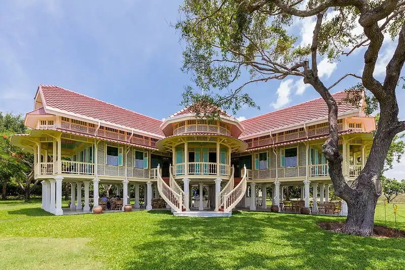
46. Mrigadayavan Palace (Maruekhathaiyawan Palace), Phetchaburi Province, is an elegant seaside royal residence celebrated for its distinctive timber architecture and its connection with King Vajiravudh, or King Rama VI. Located within the Phra Ram Hok military camp near the coast between Cha-Am and Hua Hin, the palace was created as a summer retreat overlooking the Gulf of Thailand. Its raised teak buildings, long covered walkways and open verandas demonstrate an approach to tropical architecture that combines traditional Thai principles with European influences. Mrigadayavan Palace is therefore an important destination for travelers interested in royal history, architectural design and conservation.
Highlights: Elevated teak buildings, Samut Phiman royal residence, Phisan Sakhon royal residence, Samoson Sewakamat Throne Hall, covered wooden corridors, Thai-European architectural influences and coastal garden landscapes.
Mrigadayavan Palace was constructed in 1923 during the reign of King Rama VI to provide a suitable royal residence for periods spent by the sea. The design emphasized comfort, ventilation and a close relationship with the natural environment rather than the grand monumental character of some earlier royal palaces.
Timber construction is one of the palace's defining features. The raised buildings allow air to circulate beneath the floors, helping reduce heat and moisture. Open verandas, louvered windows and long corridors encourage natural ventilation, an important consideration in Thailand's warm coastal climate.
The palace consists of groups of buildings with different functions. Samut Phiman was associated with the king's private residential space, while Phisan Sakhon formed part of the quarters used by the royal household. Samoson Sewakamat was connected with official activities and functions of the court. The arrangement reflects the need for both privacy and efficient movement between areas.
The long wooden walkways linking the buildings are especially distinctive. Supported by regularly spaced columns and sheltered by continuous roofs, these corridors create elegant architectural perspectives while protecting users from sunlight and rain.
The coastal location influenced the design of the entire complex. Orientation, openings and outdoor spaces were planned to take advantage of sea breezes and the surrounding landscape. The palace illustrates how architectural design can respond to local climate without relying entirely on modern mechanical cooling systems.
Walking through the palace provides insights into the life of the royal court during the early twentieth century. It also offers an opportunity to appreciate the challenges of conserving timber buildings in a coastal environment, where humidity, salt air and weathering can gradually damage historic materials.
Mrigadayavan Palace can be combined with Cha-Am Beach, Hua Hin Beach and other attractions along the Phetchaburi–Prachuap Khiri Khan coast. Visitors interested in architecture should allow one to two hours or longer, depending on which sections are accessible.
Because preservation work and visitor arrangements may affect access, travelers should check current opening days and restrictions before arriving. Respectful clothing is expected, and visitors should avoid touching fragile surfaces or leaning against delicate timber structures.
Open Days: Listed visitor arrangements have included Friday – Sunday, with some Thursday access for groups by prior arrangement. Current access should be confirmed before travel.
Opening Hours: Generally 09:00 – 17:00 on designated opening days, with final admission potentially earlier.
Getting There: From Bangkok, take Phetkasem Road south through Phetchaburi to Cha-Am District, then continue toward the Phra Ram Hok camp area and follow signs for Mrigadayavan Palace. Private transport or local taxis from Cha-Am and Hua Hin are convenient options.
Map (GPS):Get Directions to Mrigadayavan Palace

47. Wat Pho Kao Ton (Wat Mai Daeng), Sing Buri Province, is a historic Buddhist temple closely associated with the story of the Bang Rachan villagers who resisted Burmese military forces during the final years of the Ayutthaya Kingdom. Located in Bang Rachan Subdistrict, Khai Bang Rachan District, near the Bang Rachan Heroes Monument, the temple forms part of an important historical landscape reflecting local courage, cooperation and community memory. It remains both an active religious site and a destination for visitors interested in the history of Central Thailand.
Highlights: Wat Pho Kao Ton, the history of Bang Rachan Camp, the Bang Rachan Heroes Monument, the sacred pond, local historical traditions and Ban Rachan Thai Retro Market.
The story of the Bang Rachan villagers belongs to the final period of the Ayutthaya Kingdom, when Burmese forces were advancing through parts of Central Thailand. According to historical traditions, villagers from several communities organized themselves to defend their homes and resist invading troops.
Wat Pho Kao Ton is connected with this history through its role as part of the wider community landscape associated with Bang Rachan Camp. In traditional Thai society, temples were important centers for community meetings, religious activities and cooperation, making them significant places during periods of crisis.
The Bang Rachan story has been transmitted through chronicles, literature and later cultural interpretations. Figures remembered for their leadership and courage have become symbols of local solidarity. Visiting the historical area provides an opportunity to consider both the events traditionally associated with the villagers and the ways these stories have been remembered across generations.
The nearby Bang Rachan Heroes Monument commemorates those associated with the resistance. The monument and surrounding grounds demonstrate how historical memory can be expressed through public sculpture, ceremonial activities and educational spaces.
Wat Pho Kao Ton continues to serve the surrounding community as a Buddhist temple. Visitors can combine worship with an exploration of local history, recognizing the continuing relationship between sacred spaces and community identity.
Ban Rachan Thai Retro Market, located nearby, offers a cultural experience inspired by the province's historical traditions. Depending on its operating schedule, visitors may encounter traditional food, clothing and activities designed to evoke aspects of earlier Thai community life.
Wat Pho Kao Ton can be combined with Wat Phra Non Chakkrasi Worawihan and other attractions in Sing Buri. The route is particularly suitable for families and students interested in history, Buddhism and local cultural traditions.
Visitors should dress appropriately, respect religious ceremonies and help keep the historical area clean. Understanding the temple as both a place of worship and a site associated with important community memories adds depth to the experience.
Open Days: The temple is generally accessible daily. Nearby cultural activities and markets operate according to their own schedules.
Getting There: From Sing Buri town, follow Highway 3032 toward Khai Bang Rachan District and continue into Bang Rachan Subdistrict. Follow signs for Wat Pho Kao Ton and the Bang Rachan Heroes Monument.
Map (GPS):Get Directions to Wat Pho Kao Ton

48. Phra Pathom Chedi National Museum, Nakhon Pathom Province, is one of Thailand's important museums dedicated to the archaeological and cultural heritage of the ancient central plains. Located within the grounds of Wat Phra Pathom Chedi Ratchaworamahawihan in Mueang Nakhon Pathom District, the museum preserves and exhibits historical artifacts associated with ancient Nakhon Pathom, particularly the Dvaravati civilization. Its collections include ancient Buddha images, stone Dharmachakra wheels, inscriptions, religious sculptures, pottery and objects that illustrate the early development of Buddhism and urban communities in Central Thailand. The museum provides an essential introduction to the history of the region before the emergence of the later Sukhothai and Ayutthaya kingdoms.
Highlights: Dvaravati archaeological artifacts, ancient Buddha images, stone Dharmachakra wheels, Buddhist boundary stones, historical inscriptions, pottery, religious sculptures and exhibitions about the development of ancient Nakhon Pathom.
Nakhon Pathom is one of the most significant archaeological areas in Central Thailand. Discoveries from the province reveal evidence of ancient settlements, religious activity, craftsmanship and commercial relationships extending back many centuries. The Dvaravati period, which flourished approximately between the seventh and eleventh centuries CE, was particularly important in the development of Buddhist art and cultural traditions across the central plains. Archaeological remains from Nakhon Pathom demonstrate how local communities adopted influences from India and other parts of Asia while developing distinctive forms of religious expression.
The museum's origins are closely connected with the collection and preservation of archaeological objects discovered around Phra Pathom Chedi and nearby historical sites. During the early period of collecting, many artifacts were kept within the galleries surrounding the great stupa. As interest in the region's archaeological heritage increased, more systematic arrangements were made to protect, study and exhibit the objects.
In 1911, the collection was moved to a viharn opposite the ordination hall, creating a more organized space for the display of historical artifacts. This early museum helped visitors and scholars understand the significance of objects found around Nakhon Pathom and established an important foundation for later archaeological conservation work.
In 1934, the institution received official national museum status under the Fine Arts Department. This development strengthened its role in preserving cultural property, supporting archaeological research and presenting historical knowledge to the public. As the collection expanded, the need for a larger and more suitable exhibition space became increasingly apparent.
In 1967, a new two-story museum building was developed in an adapted Thai architectural style. Artifacts were subsequently transferred into the new exhibition areas, allowing the museum to present the history of Nakhon Pathom in a more structured and accessible way. The building became an important setting for displaying material evidence of the region's cultural development.
The museum's exhibitions are organized around three main themes. The first introduces the historical background of Nakhon Pathom, beginning with prehistoric communities and continuing through the emergence of ancient settlements and cultural connections with India. Archaeological evidence, inscriptions and decorative fragments help explain how regional communities developed and adopted new religious and artistic traditions.
The second exhibition theme focuses on religion and belief during the Dvaravati period. Visitors can examine Buddha images, Dharmachakra wheels, sculptures and architectural decorations that illustrate the importance of Buddhism in ancient society. The Dharmachakra, or Wheel of the Dharma, is particularly significant because it symbolizes the Buddha's teachings and the spread of Buddhism.
Dvaravati Buddha images differ in appearance from those of the later Sukhothai and Ayutthaya periods. Their facial features, body proportions, hand gestures and sculptural techniques provide valuable evidence of artistic development and cultural influences. Studying these images helps visitors appreciate how Buddhist art changed over time and how regional craftsmen created distinctive interpretations of religious subjects.
The third exhibition theme examines Nakhon Pathom after the Dvaravati period, including important developments during the Rattanakosin era. Exhibits cover the restoration of Phra Pathom Chedi during the reign of King Mongkut, or King Rama IV, the expansion of the city during the reign of King Chulalongkorn, or King Rama V, and the development of Sanam Chandra Palace during the reign of King Vajiravudh, or King Rama VI.
Other archaeological objects, including pottery, inscriptions and decorative architectural fragments, provide insights into everyday life, trade, craftsmanship and the social organization of ancient communities. These exhibits are especially valuable because they demonstrate that archaeological history involves more than temples and royal monuments. Ordinary objects can also reveal how people lived, worked, exchanged goods and interacted with neighboring settlements.
One of the museum's greatest advantages is its location beside Phra Pathom Chedi. Travelers can explore the archaeological collections before visiting the great golden stupa, creating a direct connection between historical evidence and a religious landmark that remains important to Thai Buddhists today. The two sites complement each other and provide a broader understanding of the development of Buddhism in Nakhon Pathom.
Phra Pathom Chedi National Museum is particularly suitable for history enthusiasts, students, researchers and families interested in Thailand's ancient civilizations. Visitors should allow approximately one to two hours to explore the exhibitions and read the interpretive information. Those with a particular interest in archaeology may wish to spend longer examining the religious sculptures, inscriptions and architectural objects.
Visitors must follow museum regulations concerning photography, flash use and access to exhibition areas. Archaeological objects should never be touched unless specifically permitted. Respecting these rules helps protect fragile historical evidence and supports the museum's role as a center for education and cultural conservation.
Open Days: Daily.
Opening Hours: 09:00 – 16:00.
Getting There: From Bangkok, take Phetkasem Road or Borommaratchachonnani Road toward Nakhon Pathom city. Continue to Wat Phra Pathom Chedi Ratchaworamahawihan, where the museum is located on the southern side of the great stupa. Travelers arriving by train can get off at Nakhon Pathom Railway Station and continue to the temple complex on foot or by local transport. The museum can easily be combined with Phra Pathom Chedi and other attractions in the city center.

49. Khlong Suan 100-Year-Old Market, Samut Prakan and Chachoengsao Provinces, is a historic canal-side market distinguished by its unusual location across the boundary of two provinces. The market extends along Khlong Prawet Burirom between Khlong Suan Subdistrict in Bang Bo District, Samut Prakan, and Theparat Subdistrict in Ban Pho District, Chachoengsao. Its traditional wooden shophouses, old-fashioned coffee shops, historic businesses, regional food and long-established trading community offer visitors an opportunity to experience the canal-based lifestyle that shaped Central Thailand during the Rattanakosin period. The market is a valuable example of living cultural heritage, where historic architecture and community traditions continue to form part of everyday life.
Highlights: Historic wooden market buildings spanning two provinces, Khlong Prawet Burirom, traditional coffee shops, old pharmacies and family businesses, Thai desserts, regional food, bridges crossing the canal and Thai-Chinese community heritage.
The development of Khlong Suan Market is closely connected with the construction and improvement of canals during the Rattanakosin period. Khlong Prawet Burirom became an important transportation route linking the Bangkok area with Chachoengsao. At a time when boats were among the most practical ways to move people and agricultural products, communities developed along the canal and at convenient stopping points.
Khlong Suan grew into an important trading center where merchants, farmers, boat operators and local residents exchanged goods and maintained social relationships. The market provided food, household necessities and agricultural supplies while also serving as a place to share news and information. For travelers moving between Bangkok and Chachoengsao, it was a familiar stop along the water route.
The market's history is particularly associated with the reign of King Chulalongkorn, or King Rama V, when transportation networks and regional commerce expanded significantly. Its name and reputation as a century-old market reflect the continuity of trading activities and settlement patterns established during this period.
The old wooden shophouses are among the market's most distinctive features. Many buildings were designed for both commercial and residential use, with trading areas occupying the ground floor and living quarters located elsewhere in the structure. This arrangement was common in traditional Central Thai market communities, where the boundary between family life and economic activity was closely connected.
Walking through the market reveals narrow passageways, traditional shopfronts, wooden facades and businesses that retain elements of their original appearance. Some shops display old furniture, cabinets and equipment that illustrate how trading was conducted before the widespread adoption of modern retail formats. These details help preserve the atmosphere of the historic market.
Traditional coffee shops have played an especially important role in the social life of Khlong Suan. Historically, they served as gathering places where people from different occupations, religious backgrounds and communities could exchange news, discuss local affairs and maintain personal relationships. Their continuing presence reflects the importance of the market as a social center rather than simply a collection of retail businesses.
Khlong Suan Market also demonstrates the cultural diversity of communities living along the canal. Thai and Thai-Chinese residents contributed to the development of local commerce, food traditions, religious activities and community institutions. This diversity remains visible through the market's businesses, traditional dishes and surrounding cultural landscape.
Food is one of the most enjoyable aspects of a visit. Travelers can find traditional Thai desserts, freshly prepared local dishes, snacks, old-style coffee and everyday market products. Some businesses have been operated by local families for generations, providing visitors with opportunities to experience recipes and trading traditions that remain closely associated with the community.
The market's position across two provinces makes it geographically unusual. The canal and bridges connect communities on both sides, illustrating how commercial and social relationships can develop according to waterways and settlement patterns rather than modern administrative boundaries. Although the market occupies areas belonging to different provinces, its historic identity is shared by the communities along the canal.
Preservation efforts have helped protect the historic wooden buildings and encourage the continued operation of traditional businesses. The market remains a living community rather than a reconstructed historical attraction. This distinction is important because its cultural value depends not only on the age of the buildings but also on the residents, shops and social relationships that continue to give the area its character.
Khlong Suan is particularly suitable for slow travel, cultural photography, traditional food experiences and visitors interested in local history. Morning and late morning are generally pleasant times to explore, although weekends may offer a livelier atmosphere with more shops operating. Visitors should allow enough time to walk along both sides of the canal and explore smaller businesses beyond the principal market passages.
The market can be combined with temples and community attractions in Bang Bo and Ban Pho districts. Travelers interested in understanding the development of Central Thailand's canal network may also find it rewarding to compare Khlong Suan with other traditional markets such as Sam Chuk Market in Suphan Buri or Amphawa Floating Market in Samut Songkhram.
Responsible tourism is essential to preserving the market's character. Visitors should respect the privacy of residents, ask permission before photographing people or private spaces, avoid obstructing narrow walkways and refrain from throwing rubbish into the canal. Supporting locally owned businesses helps maintain the economic and cultural vitality of this historic community.
Open Days: Daily.
Opening Hours: 08:00 – 16:00.
Getting There: From Bangkok, travelers can use Bang Na–Trat Road or the motorway toward the eastern provinces, then connect to Road 3001 along the On Nut–Chachoengsao route. Continue toward the Khlong Suan and Theparat communities near the provincial boundary. Visitors arriving from Chachoengsao can travel via Highway 314 and connect to Road 3001. Private transport is generally convenient, and parking is available near the market entrance.
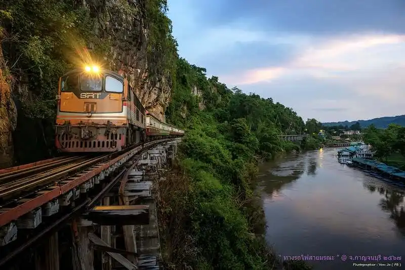
50. Death Railway (Thailand–Burma Railway), Kanchanaburi Province, is one of Southeast Asia's most historically significant railway routes. Constructed during World War II, the railway was designed to connect Thailand with Burma, now Myanmar, to support Japanese military operations. On the Thai side, the original route began at Nong Pladuk Junction in Ban Pong District, Ratchaburi Province, and continued through Kanchanaburi toward the mountainous border region. The railway became internationally known as the Death Railway because of the extreme suffering and large number of deaths among Allied prisoners of war and Asian civilian laborers who were forced to participate in its construction. Today, surviving sections remain in operation, allowing visitors to experience a remarkable historical route while learning about the human consequences of war.
Highlights: The historic Thailand–Burma Railway, Bridge Over the River Kwai, Tham Krasae wooden viaduct, the railway's dramatic cliffside section known as the Death Curve, Tham Krasae Railway Station, views of the Khwae Noi River, Allied war cemeteries and World War II museums.
The construction of the Thailand–Burma Railway began during World War II, when Japanese military authorities sought a land transportation route connecting Thailand with Burma. The railway was intended to carry troops, weapons and supplies across difficult terrain while reducing reliance on sea routes vulnerable to attack. The project required the construction of a continuous railway through forests, mountains, river valleys and areas that previously had limited transportation infrastructure.
Work proceeded at an exceptionally rapid pace between 1942 and 1943. The historical railway extended approximately 415 kilometers from Nong Pladuk Junction in Thailand to Thanbyuzayat in Burma. The enormous scale of the project, combined with the difficult landscape and wartime urgency, created severe challenges for those forced to build the line.
Allied prisoners of war and large numbers of Asian civilian laborers were compelled to work under harsh and often life-threatening conditions. Workers faced inadequate food, tropical diseases, exhaustion, limited medical treatment and severe punishment. Thousands of prisoners and many more civilian workers died during construction. Their suffering remains central to the railway's historical meaning and explains why its name continues to resonate internationally.
The railway's construction involved bridges, rock cuttings, embankments and structures built along difficult mountain slopes. Much of the work was completed using manual labor and limited equipment. The surviving infrastructure reveals the extraordinary physical demands of the project, but its engineering features cannot be separated from the immense human cost.
One of the railway's most famous landmarks is the Bridge Over the River Kwai in Mueang Kanchanaburi District. The bridge crosses the Khwae Yai River and remains part of the operational railway. Its steel structure has become an internationally recognized symbol of World War II history, attracting visitors interested in both its engineering significance and the experiences of those who constructed the line.
Another remarkable section is the wooden viaduct near Tham Krasae Cave in Sai Yok District. Here, the railway follows a steep hillside above the Khwae Noi River, supported by timber structures that create a dramatic passage between the cliff and the water. The section is widely known as the Death Curve and is considered one of the most memorable parts of the surviving railway.
Traveling by train through this area provides an experience that cannot be fully appreciated through photographs alone. As the train moves slowly along the cliffside route, passengers can observe the wooden structures, the river below and the mountains surrounding the valley. The scenery is beautiful, but the historical context invites reflection on the conditions under which the railway was originally constructed.
Tham Krasae is also an important stop for visitors traveling by road. The nearby cave and observation areas provide opportunities to learn about the railway and appreciate the landscape. However, the line remains active, and visitors must never stand on the tracks or enter areas where they cannot safely move away from approaching trains.
After World War II, parts of the original railway were dismantled, while other sections were repaired and returned to civilian use. The surviving Thai railway continues toward Nam Tok Station, allowing travelers to experience part of the historical route by regular passenger train. The original international connection through to Burma is no longer operated as a continuous passenger railway.
The history of the Death Railway is preserved at several memorial sites and museums in Kanchanaburi, including the Kanchanaburi War Cemetery, institutions documenting the experiences of Allied prisoners of war, and the Hellfire Pass Memorial Museum farther along the former railway corridor. These destinations help visitors understand the personal stories, nationalities and different groups of people involved in the railway's construction.
For a deeper historical experience, visitors should explore more than one location along the railway. The bridge provides an introduction to the route's significance, while the Tham Krasae section illustrates the engineering challenges of mountainous terrain. Museums and cemeteries add essential human context by presenting the experiences of the workers and the consequences of wartime forced labor.
The railway can also be approached as an educational journey about the importance of peace, human dignity and historical remembrance. Its continuing operation creates a direct link between the present and the wartime past, reminding travelers that places now admired for their scenery can also preserve histories of suffering and resilience.
Visitors should check the State Railway of Thailand's current timetable before planning a train journey. Departure times, service patterns and station connections can change, and some special tourist trains may operate only on particular days. Travelers using private transport can reach the Bridge Over the River Kwai and Tham Krasae by road, but sufficient travel time should be allowed between these locations.
Personal safety is especially important along the railway. Visitors must not walk on tracks when trains may be approaching, lean beyond safe viewing areas or attempt photographs in locations without adequate space to move away from a train. During wet weather, wooden walkways, rocks and nearby paths can become slippery. Following railway warnings and local instructions is essential.
The Death Railway is suitable for history enthusiasts, students, families and travelers interested in meaningful cultural experiences. Visiting the railway with respect for those who lost their lives helps preserve its significance as a place of remembrance rather than reducing it to a scenic railway attraction.
Open Days: Daily, according to the operating arrangements of the State Railway of Thailand.
Opening Hours: Train services follow the current railway timetable. Access to museums, memorials and individual viewpoints varies by location.
Getting There: Travelers can reach Kanchanaburi from Bangkok by train or by road. The historical railway route begins at Nong Pladuk Junction in Ratchaburi and continues through Kanchanaburi toward Nam Tok Station. For the famous bridge, travel to Mueang Kanchanaburi District. For the cliffside wooden viaduct and Tham Krasae section, continue along Highway 323 toward Sai Yok District. Visitors wishing to experience the operational railway should confirm departure times and stations with the State Railway of Thailand before traveling.
Summary Table: 50 Best Places to Visit in Central Thailand in 2027 Explore the following 50 attractions across 20 provinces of Central Thailand. The table brings together the region's most significant temples, royal palaces, historical landmarks, floating markets, traditional communities, museums and natural destinations. Select an attraction to explore its detailed travel information.
| No. | Attraction | Province | Highlights |
| 1 | The Grand Palace | Bangkok | Royal architecture and the Temple of the Emerald Buddha |
| 2 | Wat Mahathat | Ayutthaya | Buddha head surrounded by tree roots |
| 3 | Bridge Over the River Kwai | Kanchanaburi | World War II railway history |
| 4 | Erawan Waterfall | Kanchanaburi | Seven tiers of waterfalls and turquoise pools |
| 5 | Wat Arun | Bangkok | Porcelain-decorated riverside prang |
| 6 | Damnoen Saduak Floating Market | Ratchaburi | Traditional canal boats and local produce |
| 7 | Wat Chaiwatthanaram | Ayutthaya | Historic temple complex beside the Chao Phraya River |
| 8 | Wat Phra Pathom Chedi | Nakhon Pathom | Monumental golden Buddhist stupa |
| 9 | Mae Klong Railway Market | Samut Songkhram | Market stalls folding away for passing trains |
| 10 | Phra Nakhon Khiri Historical Park | Phetchaburi | King Rama IV's hilltop palace |
| 11 | Phra Prang Sam Yot | Lop Buri | Three ancient Khmer-style towers |
| 12 | Wat Phra Phutthachai | Saraburi | Sacred Buddha's shadow and ancient rock art |
| 13 | Sarika Waterfall | Nakhon Nayok | Nine-tier waterfall in a forested landscape |
| 14 | Ancient Siam | Samut Prakan | Open-air museum of Thai architecture |
| 15 | Wat Chedi Hoi | Pathum Thani | Buddhist stupas incorporating ancient shells |
| 16 | Ko Kret | Nonthaburi | Mon heritage and traditional pottery |
| 17 | Wat Sothonwararam Worawihan | Chachoengsao | Revered Luang Pho Sothon Buddha image |
| 18 | Wat Muang | Ang Thong | Enormous golden seated Buddha |
| 19 | Bueng Chawak | Suphan Buri | Wetland and aquatic animal exhibits |
| 20 | Sam Roi Yot National Park | Prachuap Khiri Khan | Phraya Nakhon Cave and coastal wetlands |
| 21 | Wat Pak Khlong Makham Thao | Chai Nat | Luang Pu Suk and riverside religious history |
| 22 | Wat Phra Non Chakkrasi | Sing Buri | Monumental reclining Buddha |
| 23 | Phanthai Norasing Historical Park | Samut Sakhon | Historic royal helmsman memorial |
| 24 | Bang Pa-In Palace | Ayutthaya | Thai, Chinese and European royal buildings |
| 25 | Wat Khun Inthapramun | Ang Thong | Outdoor reclining Buddha and viharn ruins |
| 26 | Kaeng Krachan National Park | Phetchaburi / Prachuap Khiri Khan | UNESCO forest complex and misty mountains |
| 27 | Amphawa Floating Market | Samut Songkhram | Evening canal market and wooden shophouses |
| 28 | Chao Phraya Dam | Chai Nat | Historic irrigation barrage |
| 29 | King Narai's Palace | Lop Buri | Ayutthaya-era palace and national museum |
| 30 | Wat Bang Kung | Samut Songkhram | Historic chapel enclosed by tree roots |
| 31 | Wat Phra Si Sanphet | Ayutthaya | Three royal stupas in the former palace grounds |
| 32 | Erawan Museum | Samut Prakan | Giant three-headed elephant sculpture |
| 33 | Bhumirak Dhamachati Nature Center | Nakhon Nayok | Environmental education and sustainable farming |
| 34 | Khao Chong Krachok | Prachuap Khiri Khan | Mountain viewpoint overlooking the Three Bays |
| 35 | Khao Bin Cave | Ratchaburi | Limestone cave with stalactites and stalagmites |
| 36 | Chao Sam Phraya National Museum | Ayutthaya | Ancient gold treasures and archaeological exhibits |
| 37 | Mon Bridge | Kanchanaburi | Long wooden bridge and Mon community culture |
| 38 | Than Kasem Palace | Saraburi | Ayutthaya royal residence archaeological remains |
| 39 | Wat Saman Rattanaram | Chachoengsao | Giant pink reclining Ganesha sculpture |
| 40 | Puek Tian Beach | Phetchaburi | Seaside sculptures inspired by Thai literature |
| 41 | Sam Chuk 100-Year-Old Market | Suphan Buri | Historic wooden market on the Tha Chin River |
| 42 | Wat Pa Mok Worawihan | Ang Thong | Reclining Buddha and historic relocation of the image |
| 43 | Hua Hin Beach | Prachuap Khiri Khan | Historic seaside resort and sandy beach |
| 44 | Don Hoi Lot | Samut Songkhram | Tidal mudflats and razor clam habitat |
| 45 | Wat Pak Nam Jolo | Chachoengsao | Distinctive golden ordination hall |
| 46 | Maruekhathaiyawan Palace | Phetchaburi | King Rama VI's coastal teak palace |
| 47 | Wat Pho Kao Ton | Sing Buri | Bang Rachan heroes and local history |
| 48 | Phra Pathom Chedi National Museum | Nakhon Pathom | Dvaravati artifacts and Buddhist archaeological heritage |
| 49 | Khlong Suan 100-Year-Old Market | Samut Prakan / Chachoengsao | Traditional wooden canal market |
| 50 | Death Railway | Kanchanaburi / Ratchaburi | World War II railway and cliffside wooden viaduct |
Suggested Central Thailand Itineraries: 1 Day, 2 Days and 3 Days Central Thailand offers excellent opportunities for short trips from Bangkok and longer journeys across neighboring provinces. Because the region includes busy cities, historic towns, mountainous national parks and coastal destinations, planning an itinerary around a manageable geographical area is generally more rewarding than trying to visit attractions in distant provinces on the same day. The following routes combine history, culture, local food and natural scenery while allowing time to enjoy each destination.
One-Day Bangkok Historical Itinerary Begin at the Grand Palace and Wat Phra Kaew in the morning, exploring the royal architecture and the Temple of the Emerald Buddha. Continue toward the Tha Tien neighborhood for lunch and take a cross-river ferry to Wat Arun in the afternoon. This route offers a concentrated introduction to Bangkok's Rattanakosin heritage, Buddhist art and the importance of the Chao Phraya River. Public transport and ferries are usually preferable to driving through the congested historic district.
One-Day Ayutthaya World Heritage Itinerary Start at Wat Mahathat to see the famous Buddha head surrounded by tree roots. Continue to Wat Phra Si Sanphet and the former royal palace grounds, then visit Chao Sam Phraya National Museum to examine ancient goldwork and archaeological artifacts. End the afternoon at Wat Chaiwatthanaram beside the Chao Phraya River. Allow sufficient time between sites and confirm the museum's opening days before traveling.
One-Day Ko Kret Cultural Itinerary Take a ferry from Pak Kret in Nonthaburi to Ko Kret, where you can explore the Mon community, Wat Paramaiyikawat, local pottery workshops and traditional food stalls. The island is particularly enjoyable on weekends, when more shops are operating. For travelers with private transport and additional time, Wat Chedi Hoi in neighboring Pathum Thani can be added as a separate afternoon stop.
Two Days, One Night: Ratchaburi and Samut Songkhram
Day 1: Visit Damnoen Saduak Floating Market in the morning to experience traditional boat trading. Continue to Khao Bin Cave in Ratchaburi for limestone formations and an introduction to underground geology. In the late afternoon, travel toward Amphawa for dinner and an overnight stay near the canal.
Day 2: Explore Mae Klong Railway Market, timing your visit around a confirmed train movement. Continue to Wat Bang Kung to see its historic chapel enclosed by tree roots. If the timing is suitable, enjoy additional food and canal attractions in Amphawa before returning to Bangkok. Weekend travelers may prefer to visit Amphawa Floating Market on the first evening.
Two Days, One Night: Saraburi and Nakhon Nayok
Day 1: Visit Wat Phra Phutthachai in Saraburi to explore the sacred cliff shrine and the area's ancient archaeological evidence. Continue toward Phra Phutthabat District to visit Than Kasem Palace and learn about the historical royal pilgrimage landscape. Stay overnight in Saraburi or Nakhon Nayok.
Day 2: Begin at Sarika Waterfall in Nakhon Nayok before exploring the Bhumirak Dhamachati Nature Center, where educational activities introduce water management, conservation and sustainable agriculture. Confirm the center's activity schedule in advance if you wish to participate in a guided program.
Three Days, Two Nights: Kanchanaburi History and Nature
Day 1: Explore the Bridge Over the River Kwai, Kanchanaburi War Cemetery and museums dedicated to World War II history. If train schedules permit, take a journey along the Death Railway toward Tham Krasae to see the cliffside wooden viaduct.
Day 2: Spend the day at Erawan National Park, following the waterfall trail according to your fitness level and current access restrictions. Start early if you hope to see several waterfall tiers, and avoid attempting upper trails during unsafe weather.
Day 3: Explore additional historic neighborhoods or riverside attractions around Kanchanaburi town before returning to Bangkok. Mon Bridge in Sangkhlaburi is much farther away and is better planned as a separate overnight excursion or as part of a longer journey.
Three Days, Two Nights: Phetchaburi, Cha-Am and Hua Hin
Day 1: Visit Phra Nakhon Khiri Historical Park to explore King Rama IV's palace and enjoy panoramic views of Phetchaburi. Spend the afternoon discovering local cuisine, especially the province's traditional desserts made with palmyra palm sugar.
Day 2: Visit Maruekhathaiyawan Palace in Cha-Am on a day when the historic buildings are open to visitors. Continue to Hua Hin Beach in the afternoon for seaside relaxation and local seafood.
Day 3: Enjoy an early morning walk along Hua Hin Beach and explore the historic railway station area before returning to Bangkok. This route combines royal heritage, architecture, food culture and coastal scenery without requiring extensive detours.
Central Thailand's Historic Temple Route: Ang Thong, Sing Buri and Chai Nat For travelers interested in Buddhist art and historic communities, a two- or three-day route can begin in Ang Thong at Wat Muang, Wat Khun Inthapramun and Wat Pa Mok Worawihan. Continue to Sing Buri for Wat Phra Non Chakkrasi and Wat Pho Kao Ton, then explore Wat Pak Khlong Makham Thao and Chao Phraya Dam in Chai Nat. This itinerary connects religious heritage, local historical traditions and the water management history of the central plains.
Travel Planning and Safety Before traveling, confirm current admission arrangements, opening days and access restrictions for royal palaces, museums and national parks. Floating markets may operate on particular days, while nature attractions can close temporarily during heavy rainfall. For Don Hoi Lot, check the tide schedule before walking near exposed mudflats. Respect temple dress codes, archaeological conservation rules and the privacy of local communities. Choosing destinations within the same geographical area will make the trip more comfortable and reduce unnecessary travel time.
Frequently Asked Questions (FAQ)
Q: How many provinces are included in Central Thailand in this travel guide?
A: This guide covers 20 provinces: Bangkok, Phra Nakhon Si Ayutthaya, Kanchanaburi, Phetchaburi, Chachoengsao, Ang Thong, Prachuap Khiri Khan, Ratchaburi, Chai Nat, Lop Buri, Nakhon Nayok, Nakhon Pathom, Nonthaburi, Pathum Thani, Samut Prakan, Samut Sakhon, Samut Songkhram, Saraburi, Sing Buri and Suphan Buri. They offer a diverse combination of royal heritage, traditional communities, natural scenery and cultural attractions.
Q: What are the best places to visit in Central Thailand in 2027?
A: Popular destinations include the Grand Palace and Wat Arun in Bangkok, Wat Mahathat and Wat Chaiwatthanaram in Ayutthaya, Erawan Waterfall and the Bridge Over the River Kwai in Kanchanaburi, Damnoen Saduak Floating Market in Ratchaburi, Mae Klong Railway Market in Samut Songkhram and Sam Roi Yot National Park in Prachuap Khiri Khan.
Q: What is the best time of year to visit Central Thailand?
A: November through February is generally a comfortable period for exploring temples, historical sites and outdoor attractions. The rainy season can be beautiful for forests and waterfalls, although heavy rainfall may affect access and safety. Coastal trips should be planned according to local weather and sea conditions.
Q: Which Central Thailand destinations are suitable for day trips from Bangkok?
A: Convenient destinations include Ayutthaya, Nonthaburi, Nakhon Pathom, Pathum Thani, Samut Prakan, Chachoengsao and Samut Songkhram. Popular examples include Ko Kret, Ancient Siam, Wat Phra Pathom Chedi, Wat Mahathat and Mae Klong Railway Market.
Q: Where should I go for a one-day trip in Central Thailand?
A: Ayutthaya is an excellent choice for historical sightseeing, with Wat Mahathat, Wat Phra Si Sanphet and Wat Chaiwatthanaram forming a rewarding route. Ko Kret in Nonthaburi is ideal for experiencing Mon culture, while Samut Songkhram is appealing for markets, canal communities and regional food.
Q: Which provinces are best for a two-day, one-night trip?
A: Ratchaburi and Samut Songkhram are excellent for markets, traditional communities and local cuisine. Saraburi and Nakhon Nayok offer temples and nature attractions, while Phetchaburi and Prachuap Khiri Khan provide royal palaces, historic towns and beaches.
Q: What are the best natural attractions in Central Thailand?
A: Major natural attractions include Erawan Waterfall in Kanchanaburi, Sarika Waterfall in Nakhon Nayok, Kaeng Krachan National Park in Phetchaburi, Sam Roi Yot National Park in Prachuap Khiri Khan, Khao Bin Cave in Ratchaburi and Don Hoi Lot in Samut Songkhram.
Q: What are the most important temples and historical sites in Central Thailand?
A: Significant sites include the Grand Palace, Wat Arun, Wat Mahathat, Wat Phra Si Sanphet, Wat Chaiwatthanaram, Phra Prang Sam Yot, King Narai's Palace, Wat Phra Pathom Chedi, Wat Muang and Wat Pa Mok Worawihan. They reflect different periods of Thai history and Buddhist art.
Q: What traditional festivals and cultural experiences can visitors enjoy in Central Thailand?
A: Important traditions include Songkran, Loy Krathong, Buddhist Lent ceremonies, Kathin robe offerings and local temple fairs. Notable events include the Lotus-Offering Festival in Bang Phli, the Phra Pathom Chedi Fair in Nakhon Pathom and historical celebrations associated with King Narai in Lop Buri. Visitors can also explore Mon pottery, classical Thai performing arts and traditional riverside markets.
Q: What local foods should I try in Central Thailand?
A: Classic Central Thai dishes include Tom Yum Goong, green curry, Panang curry, Pad Thai and Thai shrimp paste chili dip. Regional specialties include grilled giant river prawns and Roti Sai Mai in Ayutthaya, Mae Klong mackerel in Samut Songkhram, traditional desserts made with palm sugar in Phetchaburi and freshwater fish dishes in Sing Buri.
Q: Which Central Thailand attractions are suitable for families with children?
A: Family-friendly destinations include Ancient Siam and the Erawan Museum in Samut Prakan, Bueng Chawak in Suphan Buri, Chao Sam Phraya National Museum in Ayutthaya, Phra Pathom Chedi National Museum in Nakhon Pathom and Hua Hin Beach in Prachuap Khiri Khan. Waterfalls, caves and mountain trails should be selected according to children's ages and abilities.
Q: Can I explore Central Thailand without renting a car?
A: Yes. Bangkok and several nearby provinces have rail, bus, ferry and local transport connections. Ayutthaya, Nakhon Pathom and Hua Hin are accessible by train, while ferries provide access to destinations such as Wat Arun and Ko Kret. Remote national parks, waterfalls and rural attractions may require taxis, hired vehicles or organized transport.
 Category: ●Travel Articles, Recipes
 Group: ●Travel Review, Food Review
Last Update : 2 WeekAgo
 Last Update : 2 WeekAgo
Recommend

 Art, Culture and Heritage
 Historical Sites and Monuments(3)
 Landmarks and Memorials(23)
 Royal Palace(13)
 Art, Craft Centres, Tradition(35)
 Museums(59)
 Historic Homes and Cities(3)
 Art Gallery(16)
 Educational Places
 Museum for Study(6)
 Library(4)
 Places of Worship
 Temple(72)
 Church(2)
 Mosque(67)
 Other Sacred Sites(8)
 Research and Development
 Royal Project(1)
 Suburban Living
 Village, Community(5)
 Local Market(9)
 Floating Market(2)
 Nature and Wildlife
 River, Canal(3)
 Bays and Beaches(1)
 Other natural attractions(1)
 Entertainment and Agricultural
 Zoos and Aquariums(5)
 Animal camps and shows(5)
 Stadium(9)
 Farms, Parks and Ecotourism(20)
 Amusement Park(1)
 Waterpark(4)
 Theater(7)
 Cinema(1)
 Shopping
 Shopping and Night Market(20)
 Department Store(7)
 Spas and Wellness
 Spas and Wellness(1)
 Restaurant
 Michelin Star(5)
 Accommodation
 Hotel(3)
 Call Customer Service in Tourism
 Call Customer Service in Tourism(1)
Travel Review, Food Review(41)
 Royal Thai Desserts and Recipes(56)


