
lovethailand home >Northeastern Travel Attractions >Amnat Charoen Travel Attractions > 50 Best Places to Visit in Northeastern Thailand i..
TL;DR: 50 Best Places to Visit in Northeastern Thailand in 2027, open Tourist season generally runs from 1 October to 31 May; the park closes for.
50 Best Places to Visit in Northeastern Thailand in 2027
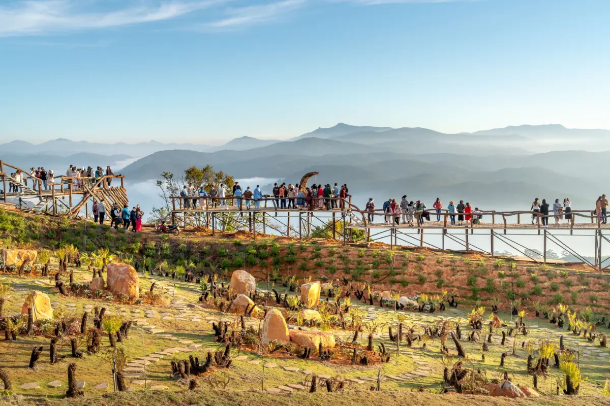
50 Best Places to Visit in Northeastern Thailand in 2027: Complete Guide to All 20 Provinces Northeastern Thailand, widely known as Isan, is one of the country's most culturally rich and geographically diverse regions. Its attractions range from mountain summits, seasonal flower fields, and dramatic sandstone formations to ancient Khmer temples, prehistoric archaeological sites, sacred Buddhist stupas, and traditional communities along the Mekong River. For travelers planning to explore Isan in 2027, some of the most rewarding destinations include Phu Kradueng National Park in Loei, Phanom Rung Historical Park in Buriram, Phimai Historical Park in Nakhon Ratchasima, Pha Taem National Park in Ubon Ratchathani, and the historic riverside community of Chiang Khan. Together, these destinations reveal the remarkable natural scenery, history, and living traditions that make northeastern Thailand a distinctive place to explore.
Northeastern Thailand comprises 20 provinces: Nakhon Ratchasima, Buriram, Surin, Si Sa Ket, Ubon Ratchathani, Yasothon, Amnat Charoen, Mukdahan, Nakhon Phanom, Sakon Nakhon, Kalasin, Maha Sarakham, Roi Et, Khon Kaen, Chaiyaphum, Loei, Nong Bua Lam Phu, Udon Thani, Nong Khai, and Bueng Kan. Much of the region lies on the Khorat Plateau, where important rivers, fertile valleys, agricultural communities, and forested highlands have influenced settlement patterns for centuries. The Mekong River shapes the geography and cultural identity of the northern and eastern borderlands, while the Dongrak Mountain Range along the southern frontier is home to several outstanding monuments of ancient Khmer civilization.
One of the greatest attractions of traveling through Isan is the contrast between its landscapes. Loei Province is known for sandstone mountains, pine forests, and misty viewpoints. Chaiyaphum is celebrated for seasonal Siam tulip fields and unusual rock formations. Ubon Ratchathani offers dramatic cliffs overlooking the Mekong, prehistoric rock paintings, and remarkable sandstone formations carved by the river. Udon Thani, meanwhile, is home to the Red Lotus Sea, where an expansive freshwater wetland turns pink during the cool season. These varied environments make northeastern Thailand suitable for everything from family holidays to hiking adventures and photography-focused journeys.
Isan is equally fascinating from a historical and archaeological perspective. Evidence of human settlement stretches back thousands of years, with Ban Chiang in Udon Thani providing important insights into prehistoric communities, pottery production, farming, and early metalworking. Monumental sanctuaries such as Phanom Rung and Phimai demonstrate the architectural achievements and religious traditions associated with ancient Khmer civilization. Visiting these places offers more than an opportunity to admire historic structures: it provides a way to understand how communities, trade routes, political power, religious beliefs, and regional landscapes developed together over time.

The culture of Isan is distinguished by its languages, traditional music, cuisine, and community festivals. Mor lam performances and the sound of the khaen, a traditional bamboo mouth organ, are central to the region's musical identity. Well-known dishes such as som tam, larb, nam tok, bamboo shoot soup, and sticky rice reflect local ingredients, culinary knowledge, and agricultural traditions. Each province also contributes its own specialties, from silk and handwoven cotton to basketry, regional handicrafts, and foods shaped by the surrounding rivers, forests, and farmland.
Major festivals include the Bun Bang Fai Rocket Festival, the Ubon Ratchathani Candle Festival, the annual Phra That Phanom worship celebrations, and the Phi Ta Khon Festival in Loei. These events reveal the close relationship between Buddhism, local spiritual traditions, agricultural life, and community identity. Many celebrations follow the Thai lunar calendar, meaning that their dates may change from year to year. Travelers hoping to experience a particular festival should therefore check the official schedule for 2027 before making arrangements.
Dividing Isan into geographic travel zones can make itinerary planning considerably easier. Upper Isan appeals to visitors interested in the Mekong River, mountains, border communities, and important Buddhist monuments. Central Isan offers prehistoric archaeology, cultural heritage, natural attractions, and traditional communities. Lower Isan is particularly notable for ancient Khmer sanctuaries, mountain landscapes, and protected forests. Planning by geographic area helps reduce unnecessary driving between distant provinces and allows more time to appreciate individual destinations.
The cool season, generally from November to February, is especially pleasant for visiting mountain viewpoints, riverside towns, and outdoor cultural sites. The rainy season and early cool season bring lush forests, waterfalls, and seasonal wildflowers, although some trails may be temporarily restricted. Certain attractions are highly seasonal: Phu Kradueng has an annual forest-recovery closure, the Red Lotus Sea is most impressive during its flowering season, and Sam Phan Bok is best seen when the Mekong's water level falls. Matching each destination to the right season is an important part of planning a successful Isan journey.
For a one-day trip, it is generally best to concentrate on attractions within one city or a nearby cluster. A two-day, one-night itinerary can include neighboring districts or provinces, while three days or more allow travelers to explore a wider route along major highways or the Mekong River. Renting a car offers greater flexibility for reaching national parks, rural temples, mountain trails, and archaeological sites that may have limited public transport connections. Whichever route you choose, Northeastern Thailand rewards travelers who make time for its scenery, heritage, and local communities rather than rushing from one landmark to another.
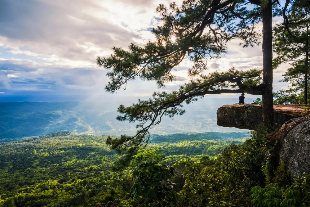
1. Phu Kradueng National Park in Loei Province is one of northeastern Thailand's most celebrated natural destinations. Located in Si Than Subdistrict, Phu Kradueng District, the park is famous for its flat-topped sandstone mountain and expansive summit plateau. Its diverse landscapes include pine forests, grasslands, streams, waterfalls, and dramatic cliffs overlooking the surrounding countryside. What makes Phu Kradueng particularly memorable is the experience of reaching the summit on foot. For generations of Thai hikers, completing the climb has been both a physical challenge and a rewarding introduction to the beauty of Thailand's highland wilderness.
Highlights: The uphill trekking route, traditional rest stops known as sam, Lang Pae, Wang Kwang Visitor Center, Pha Nok Aen, Pha Lom Sak, Pha Mak Duk, Anodard Pond, pine forests, Wang Kwang Waterfall, Phen Phop Mai Waterfall, Phon Phop Waterfall, and camping areas on the summit plateau.
Unlike the pointed peaks of many mountain ranges, Phu Kradueng has an unusually broad and relatively level summit. Reaching this plateau requires hikers to follow a demanding trail with steep sections and several rest stops before arriving at Lang Pae, the entrance to the upper mountain landscape. From there, the scenery changes significantly. Open grasslands and forest paths replace much of the steep terrain, introducing visitors to a very different environment from the foothills below.
After reaching Lang Pae, hikers continue toward the Wang Kwang Visitor Center, an important base for camping, resting, and planning activities on the plateau. The park's major viewpoints, waterfalls, and other natural features are spread across a substantial area, so exploring everything requires additional walking. Dividing the experience over more than one day allows visitors to appreciate the scenery without turning the entire visit into a race against time.
Pha Nok Aen is among the mountain's best-known sunrise viewpoints, offering expansive vistas when weather conditions are favorable. Pha Lom Sak is especially popular for its dramatic cliff scenery and evening atmosphere, with a pine tree and rock outcrop creating one of the most recognizable photographic compositions in Thai national park tourism. Pha Mak Duk provides another memorable viewpoint across the mountains and valleys below. Each location has its own character, making the journey across the summit plateau as rewarding as the climb itself.
The appearance of Phu Kradueng changes throughout the year. During wetter periods, forests become greener and the waterfalls are more active. In the cool season, crisp mountain air and clear views often create excellent conditions for hiking and photography. Mist may gather across the valleys, while the temperature can fall significantly at night. Because conditions can change quickly on the mountain, warm clothing, waterproof layers, and suitable equipment should be included in every hiking plan.
Phu Kradueng is best suited to travelers who enjoy walking and are prepared for a physically demanding journey. Comfortable, supportive footwear is essential on steep, rocky, or uneven sections. Hikers should carry drinking water and personal necessities, follow designated routes, and plan their ascent and descent according to the park's regulations. It is equally important to avoid approaching unprotected cliff edges, particularly when visibility is poor or surfaces are wet.
The park follows an annual tourism season and closes for ecological recovery during part of the year. Visitors should check current announcements regarding trekking routes, accommodation, camping, and access arrangements before traveling. Understanding these requirements in advance helps ensure that the trip is enjoyable while respecting the sensitive mountain ecosystem.
Open Days: Tourist season generally runs from 1 October to 31 May; the park closes for forest recovery from 1 June to 30 September. Opening Hours: Visitor center generally 07:00 – 16:00; separate restrictions apply to the uphill trekking route.
Getting There: From Loei city, follow Highway 201 toward Phu Kradueng District, then turn onto Highway 2019 and continue to the national park entrance. Travelers using intercity buses can get off around Ban Pha Nok Khao or another designated transfer point and arrange local transport to the park office. Allow sufficient time for registration and the ascent.
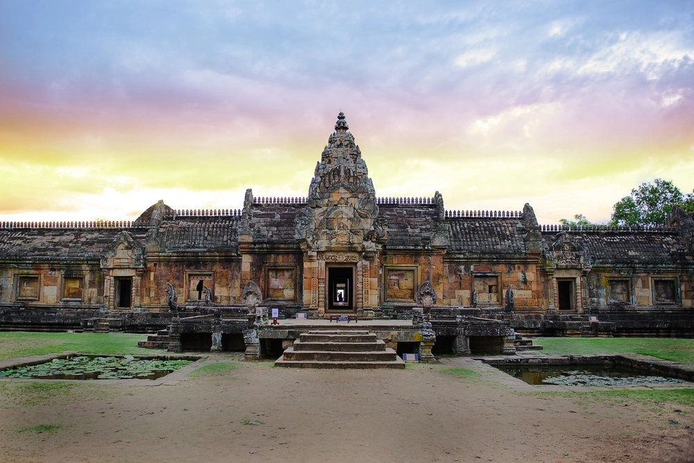
2. Phanom Rung Historical Park in Buriram Province is one of Thailand's most outstanding examples of ancient Khmer architecture. Located at Ban Ta Pek, Ta Pek Subdistrict, Chaloem Phra Kiat District, the sanctuary stands on the summit of an extinct volcano. Originally developed as a Hindu religious complex dedicated to Shiva, it was carefully designed around a ceremonial axis leading from the approach road to the principal sanctuary. Its architecture, sculptural decoration, and relationship with the surrounding landscape reveal the remarkable technical and artistic achievements of the Khmer builders.
Highlights: The main Phanom Rung sanctuary, the ceremonial approach lined with stone posts, Naga bridges, monumental staircases, principal tower, Shiva Nataraja carvings, the Narayana Reclining on Ananta lintel, the sunrise and sunset alignment through the sanctuary doorways, and the annual Phanom Rung festival.
Phanom Rung developed over several historical periods, and its surviving structures display changes in Khmer architectural style and religious expression. The location on an ancient volcanic mountain was particularly meaningful in Hindu cosmology. It evokes the concept of Mount Kailash, the sacred mountain associated with Shiva, and transforms the physical act of climbing toward the sanctuary into a symbolic journey toward a sacred realm.
The ceremonial approach is an essential part of understanding the monument. Visitors walk along a carefully constructed stone pathway bordered by upright posts before encountering a Naga bridge and the stairways leading toward the inner sanctuary. These architectural elements are not simply decorative. Together, they organize movement through the complex and express the transition from the ordinary world into a sacred religious setting.
The principal tower is built from intricately worked sandstone, with sculptural details depicting Hindu deities, decorative vegetation, and scenes from religious mythology. Among the most celebrated artworks are representations of Shiva Nataraja, showing Shiva in his cosmic dance, and the Narayana Reclining on Ananta lintel. The latter also holds an important place in Thailand's cultural heritage history because of the efforts undertaken to secure its return to the country.
Another remarkable feature of Phanom Rung is the alignment of its doorways with the rising and setting sun at particular times of the year. Under suitable conditions, sunlight passes through a series of openings along the sanctuary's central axis. This phenomenon draws visitors interested in history, astronomy, photography, and ancient architectural planning. The dates and viewing conditions vary each year, so travelers hoping to observe the alignment should consult official announcements before visiting.
The annual Phanom Rung festival connects this historic monument with Buriram's contemporary cultural identity. Activities often include traditional performances and presentations inspired by the sanctuary's history and religious symbolism. As the program and dates can change, visitors should verify the arrangements for the year of travel rather than relying on an earlier festival schedule.
Travelers with a particular interest in archaeology should allow at least half a day to explore the approach road, Naga bridges, stone carvings, gateways, and principal tower. Visiting nearby Prasat Mueang Tam afterward provides a valuable comparison between a mountaintop sanctuary and a temple complex situated on lower ground. Both sites reveal different aspects of Khmer religious architecture in southern Isan.
Open Days: Daily. Opening Hours: 06:00 – 18:00.
Getting There: From Buriram city, travel toward Nang Rong or Prakhon Chai District, then continue to Chaloem Phra Kiat District and Ban Ta Pek. A private vehicle or hired car is particularly convenient for combining Phanom Rung with Prasat Mueang Tam and other historical attractions in the province.
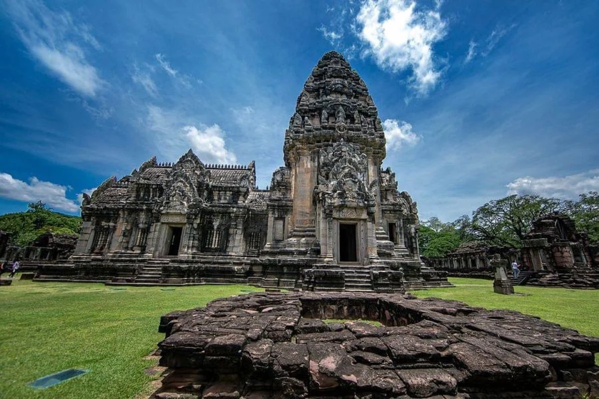
3. Phimai Historical Park in Nakhon Ratchasima Province is one of Thailand's most significant archaeological sites and a major center of ancient Khmer architecture. Located in Nai Mueang Subdistrict, Phimai District, the park preserves an impressive sandstone sanctuary within the remains of an ancient urban settlement. The site is distinguished by its monumental central tower, finely carved architectural elements, and religious imagery associated with Mahayana Buddhism. Surrounding traces of city walls, gateways, moats, and subsidiary monuments reveal that Phimai was once much more than an isolated temple.
Highlights: Prasat Hin Phimai, the principal sanctuary tower, Naga bridge, ancient gateways, carved sandstone lintels and pediments, the historic urban layout of Phimai, Phimai National Museum, and nearby archaeological sites.
Ancient Phimai was part of an extensive network of settlements and religious centers that connected communities across mainland Southeast Asia. Its architecture reflects Khmer artistic traditions while displaying distinctive Buddhist features, particularly those associated with Mahayana beliefs. The existence of such a substantial religious and urban center demonstrates the historical importance of the Nakhon Ratchasima region as a place of communication, trade, political influence, and cultural exchange.
One feature that sets Phimai apart from many other Khmer sanctuaries is its predominantly south-facing ceremonial entrance. This orientation is commonly discussed in relation to the historic route connecting Phimai with the ancient Khmer capital of Angkor. As visitors move along the entrance axis, they can observe how the Naga bridge, gateways, courtyards, and central tower were organized to create a coherent religious and architectural experience.
The principal sanctuary dominates the complex, with its stone construction and detailed carvings demonstrating the expertise of ancient builders. The decorative elements include lintels, pediments, columns, and door surrounds that combine structural functions with religious symbolism. Examining these details at close range reveals features that may be overlooked when viewing the monument as a whole.
The surrounding historic town is equally important to understanding Phimai's past. Surviving features of the ancient settlement provide evidence of urban planning, defensive arrangements, and the relationship between religious monuments and everyday life. A visit to Phimai National Museum offers further context through archaeological objects and displays that explain the area's cultural development.
Phimai Historical Park appeals to visitors interested in archaeology, architecture, religious history, and photography. Morning and late-afternoon visits are often more comfortable because much of the complex is exposed to the sun. Comfortable walking shoes, drinking water, and suitable sun protection are recommended, along with respect for signs and conservation restrictions around the ancient structures.
Travelers staying in Nakhon Ratchasima can visit Phimai as a day trip, allowing enough time for both the historical park and the national museum. Spending several hours in the area also provides an opportunity to appreciate the atmosphere of the historic town instead of treating the sanctuary as a brief photo stop.
Open Days: Daily. Opening Hours: 07:30 – 17:30.
Getting There: From Nakhon Ratchasima city, follow Highway 2 northeast and turn onto Highway 206 toward Phimai District. The historical park is situated within Phimai town. Visitors can drive independently or use transport services operating between Nakhon Ratchasima and Phimai.
Map (GPS):Get Directions to Phimai Historical Park
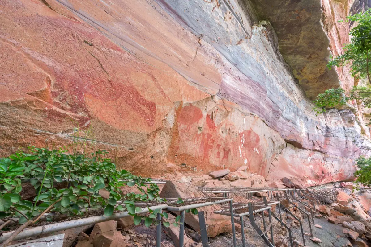
4. Pha Taem National Park in Ubon Ratchathani Province is an extraordinary destination combining protected natural landscapes with important prehistoric archaeological evidence. The park extends across parts of Khong Chiam, Si Mueang Mai, and Pho Sai districts near the Thailand–Laos border. Its most recognizable features are the towering sandstone cliffs overlooking the Mekong River and ancient rock paintings found beneath rock shelters. These attractions offer a rare opportunity to explore the relationship between human communities, geological formations, and the Mekong landscape over thousands of years.
Highlights: Pha Taem cliffs, prehistoric rock paintings, Mekong River viewpoints, Sao Chaliang rock formations, Pha Chana Dai, Soi Sawan Waterfall, Saeng Chan Waterfall or the Moonlight Waterfall, Dong Na Tham forest, and the dramatic scenery of the Thai–Lao borderlands.
The park's landscape consists of sandstone plateaus, steep cliffs, rock terraces, and different types of forest. Along the Mekong River, dramatic escarpments provide extensive views toward Laos on clear days. Changes in elevation create a variety of habitats, including dry dipterocarp forest, open sandstone terrain, and more humid environments near streams and waterfalls. This diversity makes Pha Taem valuable both as a protected ecosystem and as a destination for geological exploration.
The prehistoric paintings are among the park's most important cultural features. Found on cliff faces and beneath rock overhangs, they depict animals, human figures, hands, and abstract symbols. These images offer evidence of how people in prehistoric times observed and represented the world around them. Visitors can follow designated paths along the painted cliffs, where the natural rock surface and surrounding landscape form an essential part of the archaeological setting.
Sao Chaliang is another remarkable attraction within the park. These unusual mushroom-shaped stone formations were created as layers of rock with different levels of resistance weathered and eroded over time. Their distinctive shapes provide an accessible introduction to the geological processes that have transformed the region's sandstone formations over millions of years.
Pha Taem also contains seasonal waterfalls and forest attractions. Saeng Chan Waterfall is especially well known for the way water passes through an opening in the rock before falling to the area below. Soi Sawan Waterfall and the Dong Na Tham landscape offer additional opportunities to appreciate the region's forest scenery. However, access to individual locations can depend on rainfall, road conditions, and park regulations.
The park is a popular destination for sunrise viewing, particularly where the open terrain provides broad views toward the Mekong. Early-morning visitors should choose officially accessible viewpoints and check opening arrangements beforehand. Cliff edges, uneven stone surfaces, and changing visibility require appropriate caution, especially during wet weather.
To experience Pha Taem properly, travelers should allow at least half a day, and preferably longer when exploring both the prehistoric paintings and natural landmarks. Sturdy shoes are helpful on rocky paths, and visitors should never touch or damage the ancient paintings. These fragile traces of prehistoric life are irreplaceable and deserve careful protection.
Open Days: Daily. Opening Hours: 06:00 – 18:00.
Getting There: From Ubon Ratchathani city, travel toward Khong Chiam District, then follow Highways 2134 and 2112 toward Pha Taem National Park. A private car provides greater flexibility for visiting the cliff viewpoints, rock formations, and nearby attractions.
Map (GPS):Get Directions to Pha Taem National Park
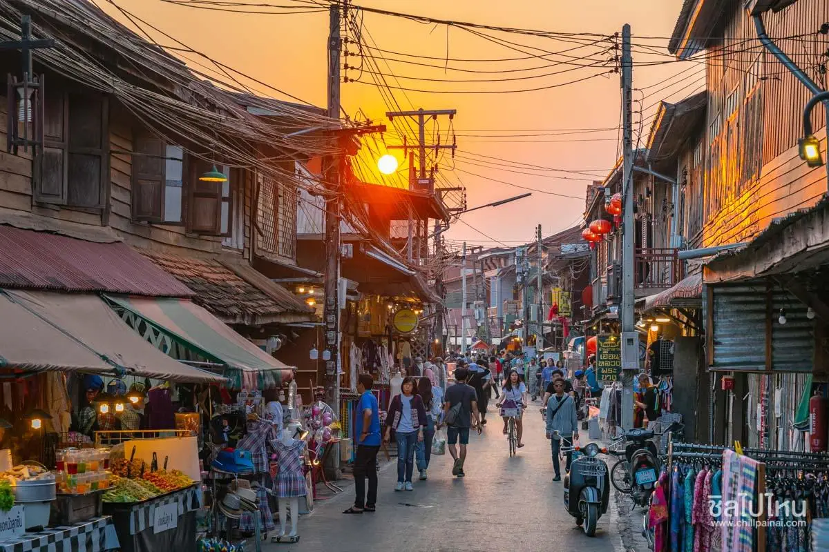
5. Ban Chiang Khan in Loei Province is a historic community along the Mekong River, celebrated for its traditional two-story wooden houses, old shopfronts, relaxed atmosphere, and riverside way of life. Located in Chiang Khan District, the community's most popular area centers on Chai Khong Road and Chiang Khan Walking Street. In the evening, local food vendors, handicraft shops, and souvenir stalls bring the old town to life. During the day, visitors can explore the wooden streets, cycle through the community, make merit at local temples, and enjoy peaceful views across the Mekong.
Highlights: Chiang Khan Walking Street, traditional wooden buildings along Chai Khong Road, old-town community life, morning alms-giving, Mekong River scenery, regional food, handicrafts, local souvenirs, and nearby attractions such as Kaeng Khut Khu.
The most recognizable feature of Chiang Khan is its collection of timber houses and shopfronts along the historic streets. Many buildings preserve architectural elements associated with the community's trading past, including wooden shutters, doors, balconies, and traditional shop signs. Together, these details reveal how the town developed as a riverside settlement closely connected with commerce and travel along the Mekong.
Walking along Chai Khong Road offers a closer look at the community's everyday character. Old homes now stand alongside guesthouses, cafés, restaurants, and small craft shops, but the experience is most rewarding when explored at a leisurely pace. Rather than driving quickly from one attraction to another, visitors can appreciate the small details of local life, from traditional food preparation to the relationship between the wooden buildings and the riverfront.
Morning alms-giving is one of Chiang Khan's best-known cultural activities. Travelers who wish to participate should dress respectfully, follow local guidance, and maintain the quiet atmosphere appropriate to a religious ceremony. Photography should never interfere with monks or residents taking part in the ritual. Approaching the experience with consideration helps preserve its spiritual significance.
In the evening, Chiang Khan Walking Street becomes a lively destination for browsing traditional foods, snacks, handmade products, and souvenirs. Warm lights illuminate the historic wooden buildings, creating a different atmosphere from the peaceful streets of the morning. Visitors can sample local specialties, support community businesses, and enjoy the town without needing a complicated itinerary.
The Mekong River adds another dimension to the Chiang Khan experience. Riverside paths provide opportunities for walking, relaxing, and watching daily life unfold along the water. Depending on river conditions and local services, travelers may also find boat excursions or other community-operated activities. Early morning and late afternoon are particularly attractive for photography and quiet riverside walks.
Chiang Khan is suitable for couples, families, photographers, and anyone seeking a slower style of travel. Spending one night in the old town makes it possible to experience both its evening walking street and peaceful morning atmosphere. Visitors with additional time can explore Kaeng Khut Khu and nearby viewpoints to discover more of Loei's riverside landscape.
Open Days: The community is accessible daily. Opening Hours: The old-town area is accessible throughout the day; Chiang Khan Walking Street generally operates around 17:00 – 22:00, although individual businesses may follow different schedules.
Getting There: From Loei city, travel to Chiang Khan District by private car or local transport. Once you reach the historic town center, park in a permitted area and explore Chai Khong Road and the walking street on foot or by bicycle. Walking is one of the best ways to appreciate the old wooden streets and riverside scenery.
Map (GPS):Get Directions to Ban Chiang Khan
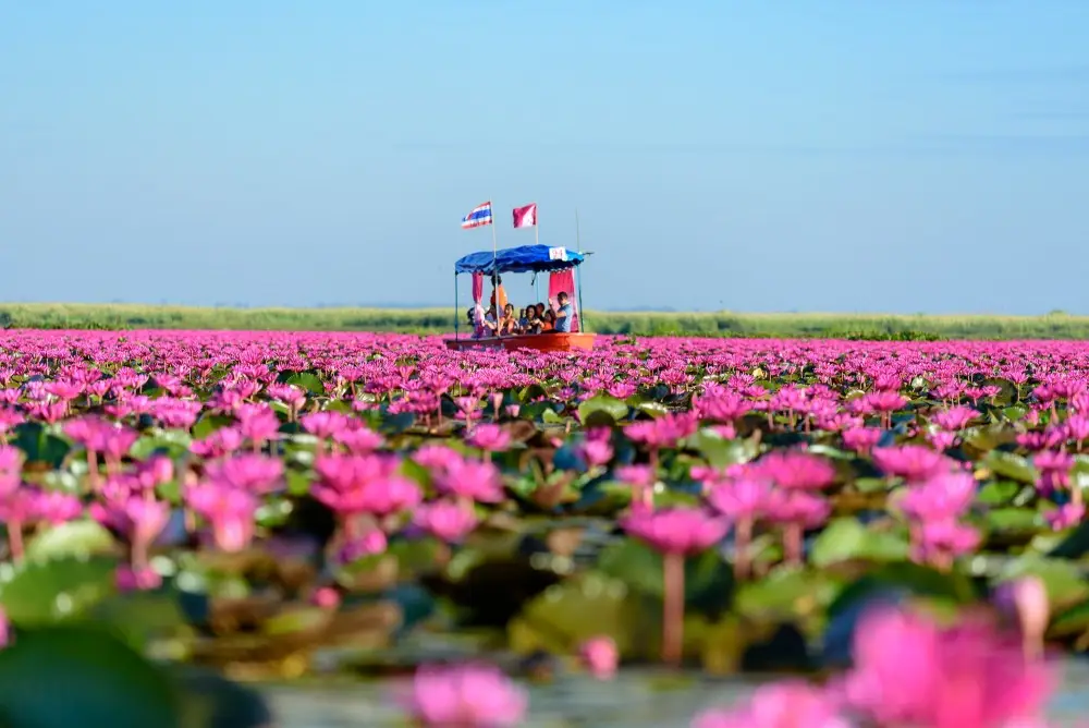
6. Red Lotus Sea in Udon Thani Province is one of northeastern Thailand's most remarkable seasonal natural attractions. Located at Nong Han Kumphawapi Lake in Kumphawapi District, it is famous for the spectacular display of pinkish-red water lilies that bloom across an enormous freshwater wetland during the cool season. When flowering conditions are favorable, the lake becomes a seemingly endless carpet of pink blossoms, creating the impression of a sea covered in flowers. Visitors can explore the landscape by boat, particularly in the early morning when the flowers are open and the soft light makes the scenery especially beautiful.
Highlights: Vast fields of blooming pink water lilies, early-morning boat trips, Ban Diem Pier, Nong Han Kumphawapi wetland scenery, aquatic birds, freshwater ecosystems, traditional lakeside communities, and community-based tourism experiences.
Nong Han Kumphawapi is an extensive freshwater wetland that plays an important ecological and cultural role in the surrounding communities. Its waters support aquatic plants, fish, birds, and numerous other species. Local residents have long depended on the lake for livelihoods and natural resources, creating a close relationship between community life and the surrounding environment. A visit to the Red Lotus Sea therefore offers more than an impressive floral display; it provides a valuable introduction to the ecological and cultural importance of wetlands in Isan.
The most popular visiting period is generally from December to February, when the flowers are at their most impressive. However, the timing and density of the bloom can vary depending on rainfall, water levels, temperature, and other environmental conditions. Because this is a natural seasonal phenomenon, travelers should check recent local reports before setting out rather than assuming that the flowers will look the same throughout the entire season.
Boat tours are the main way to experience the Red Lotus Sea. Local operators take visitors from designated piers, including Ban Diem Pier, toward areas where the flowers grow most densely. During the journey, travelers can appreciate the open lake, aquatic vegetation, and waterbirds that inhabit the wetland. The boat trip also offers a perspective that cannot be experienced from the shoreline, allowing visitors to travel directly through the flowering landscape.
Safety is an important part of any lake excursion. Visitors should wear the life jackets provided, follow the boat operator's instructions, and remain seated when required. Families traveling with young children or older relatives should take particular care when boarding or leaving the boat. Travelers with limited mobility may wish to check the suitability of the pier and available boats before arriving.
Early morning is generally the best time for photography, as the water lilies open toward the sunlight during the first part of the day. The cooler temperature and soft light help create a peaceful atmosphere, while reflections on the water add depth to the landscape. Arriving early also provides more time to enjoy the scenery before the day becomes warmer and the flowers begin to close.
The Red Lotus Sea is particularly suitable for nature lovers, couples, families, photographers, and travelers interested in local community life. Beyond the boat excursion, visitors can explore cultural attractions around Kumphawapi District or continue to other destinations in Udon Thani. Starting the journey early allows the lake visit to be combined with additional sightseeing later in the day.
Open Days: Daily during the Red Lotus Sea flowering season. Opening Hours: Boat services generally operate around 06:00 – 11:00, subject to weather and local arrangements.
Getting There: From Udon Thani city, follow Mittraphap Road toward Kumphawapi District, then continue to Chiang Wae Subdistrict and Ban Diem Pier, a popular departure point for boat tours. Check the current flowering conditions, weather forecast, and boat availability before traveling.
Map (GPS):Get Directions to the Red Lotus Sea
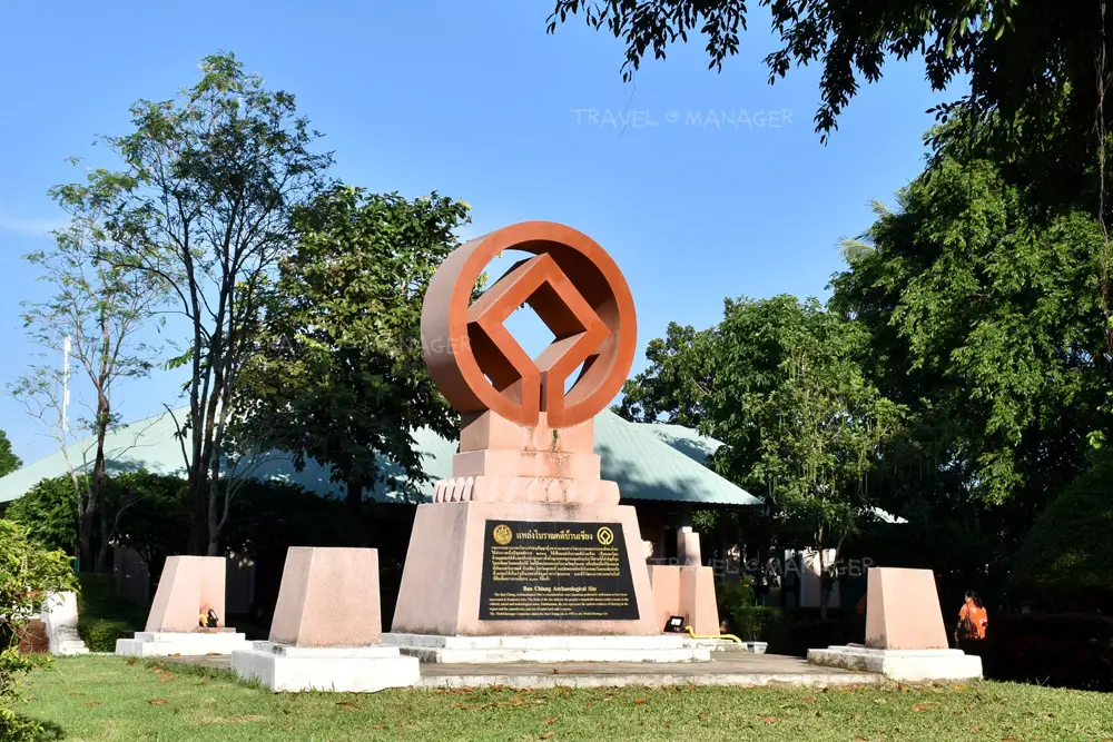
7. Ban Chiang National Museum in Udon Thani Province is one of Thailand's most important archaeological museums. Located in Ban Chiang Subdistrict, Nong Han District, the museum presents evidence of prehistoric communities that once lived in the surrounding area. Its exhibitions include distinctive painted pottery, tools, ornaments, burial evidence, and objects associated with farming and early metalworking. Ban Chiang is internationally recognized for its archaeological importance, and the Ban Chiang Archaeological Site was inscribed on the UNESCO World Heritage List in 1992.
Highlights: Ban Chiang's distinctive red-painted pottery, prehistoric burial evidence, ancient tools and ornaments, exhibitions on the development of early communities, archaeological discoveries, and the UNESCO World Heritage significance of the Ban Chiang Archaeological Site.
The Ban Chiang archaeological landscape provides valuable evidence of settlement and social development in northeastern Thailand over a long period of prehistory. Discoveries in the area have contributed to research on farming communities, pottery production, metalworking, burial customs, and technological change. The variety of artifacts allows archaeologists to investigate how everyday life, craftsmanship, beliefs, and social relationships evolved before the emergence of many of the historic kingdoms and cities familiar to travelers today.
Among the best-known objects associated with Ban Chiang are pottery vessels decorated with distinctive red patterns. Their flowing curves, circular designs, and carefully arranged lines have become recognizable symbols of the archaeological site. Beyond their visual appeal, these vessels demonstrate the technical skills and artistic expression of prehistoric craftspeople. They also provide evidence of how communities selected raw materials, produced useful objects, and developed styles of decoration over time.
Burial sites and objects recovered alongside human remains are another important area of study. Such evidence helps researchers investigate funerary customs, social relationships, and the symbolic roles of personal belongings. The interpretation of these discoveries depends not only on individual artifacts but also on their precise positions, surrounding soil layers, and association with other archaeological evidence.
This wider archaeological context is an important part of the museum experience. Objects are presented as evidence of human lives rather than simply as attractive items in display cases. Visitors who take time to read the exhibition descriptions can better understand the careful work required to reconstruct prehistoric societies from material remains.
The international recognition of Ban Chiang reflects the significance of its contribution to the understanding of prehistoric Southeast Asia. Its UNESCO World Heritage inscription in 1992 acknowledges the site's archaeological value and reinforces the importance of protecting the wider historical landscape, not merely individual objects displayed in the museum.
Ban Chiang National Museum is well suited to students, families, history enthusiasts, and travelers interested in archaeology and cultural development. The exhibitions provide an accessible introduction to a complex subject, particularly when visitors follow the chronological sequence and take time to examine the relationship between the objects and the original excavation sites.
A visit can also be combined with cultural activities around Ban Chiang and Nong Han District. Local craft traditions and community activities offer further insight into how the archaeological site's reputation continues to influence local identity. Visitors should respect protected areas and never remove archaeological objects or materials from their original locations.
Open Days: Wednesday – Sunday; closed Monday and Tuesday. Opening Hours: 09:00 – 16:00.
Getting There: From Udon Thani city, travel toward Nong Han District, then continue to Ban Chiang Subdistrict and Sutthiphong Road, where the museum is located. Visitors can drive directly or travel by public transport toward Nong Han and arrange local transportation for the remaining journey.
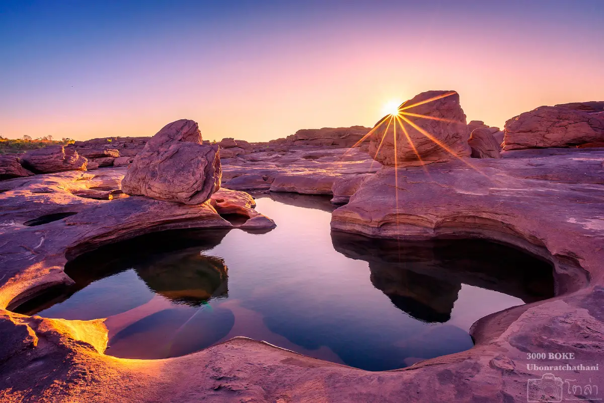
8. Kaeng Song Khon (Sam Phan Bok) in Ubon Ratchathani Province is one of the most extraordinary geological attractions along the Mekong River. Situated around Ban Song Khon in Pho Sai District, the site is famous for the thousands of holes, basins, channels, and depressions carved into its sandstone riverbed. These formations developed through the gradual erosion and abrasion caused by flowing water and sediment over immense periods of time. Sam Phan Bok is most impressive during the low-water season, when the Mekong recedes and reveals the sculpted rock landscape that remains submerged during periods of higher water.
Highlights: The sandstone potholes of Sam Phan Bok, Kaeng Song Khon, naturally sculpted rock formations, riverside rock terraces, photographic viewpoints, erosion patterns, and the contrasting scenery of the Mekong River during the low-water season.
The word bok is a local term for a depression or basin formed in rock, while sam phan means three thousand. The name therefore evokes the enormous number of rock basins scattered across the area. Although the phrase is a memorable description of the landscape, its real significance lies in the geological processes responsible for creating such a remarkable concentration of natural formations.
The Mekong River plays the central role in shaping Sam Phan Bok. During periods of high water, much of the sandstone surface disappears beneath the current. As the river level falls, the terrain gradually reappears, exposing numerous holes, channels, and unusual shapes. This dramatic seasonal transformation makes the destination closely connected with the river's annual cycle and explains why choosing the right time to visit is essential.
The sandstone landscape contains a striking variety of forms. Some holes are almost circular, while others are elongated or irregular. Narrow channels connect certain basins, and smaller pools may retain water after the surrounding riverbed has emerged. Exploring these details on foot reveals how moving water, sediment, and variations in rock hardness interact to produce complex natural patterns.
Sam Phan Bok is particularly attractive to photographers. Close-up compositions can emphasize the texture, curves, and shapes of individual rock basins, while wider views reveal the scale of the sandstone field against the Mekong and surrounding cliffs. The changing angle of sunlight alters the appearance of the formations, providing different photographic opportunities throughout the day.
Visitors should remember that the rock field is not a uniformly flat surface. Some basins are deep, certain edges are uneven, and wet areas can be slippery. Suitable footwear is recommended, and care should be taken when walking near larger depressions or exposed river channels. Swimming or entering water with strong currents should be avoided, particularly when the river level is changing rapidly.
Sam Phan Bok can be included in a wider Mekong River itinerary through Pho Sai District and nearby natural attractions. Travelers should allow time for the condition of local roads, access arrangements, and seasonal water levels. The destination is most rewarding when visited without rushing, allowing time to study the formations and appreciate the exceptional landscape.
Getting There: From Ubon Ratchathani city, travel toward Pho Sai District and continue to Ban Song Khon, the main area associated with Sam Phan Bok. Before departing, check the Mekong River's water level and local access conditions, as much of the sandstone landscape is not visible during the high-water season.
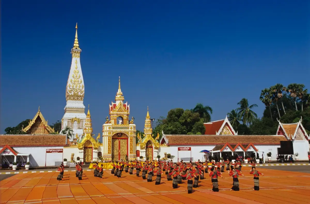
9. Phra That Phanom in Nakhon Phanom Province is one of the most revered Buddhist monuments in northeastern Thailand and the wider Mekong region. Located within Wat Phra That Phanom Woramahawihan in That Phanom District, the sacred stupa is an important pilgrimage destination for Buddhists from Thailand, Laos, and neighboring communities. Its architectural form, religious traditions, and historical significance have made it a defining cultural landmark of Nakhon Phanom. The monument is not only a place of worship but also a symbol of the long-standing relationship between Buddhism, community life, and the heritage of the Mekong basin.
Highlights: The Phra That Phanom relic stupa, Wat Phra That Phanom Woramahawihan, traditional Mekong Buddhist architecture, the annual Phra That Phanom Worship Festival, candlelit circumambulation ceremonies, religious merit-making, and the cultural atmosphere of That Phanom town.
Phra That Phanom holds a special place in Buddhist tradition because of its association with sacred relics of the Buddha. According to religious tradition, the stupa enshrines the Urangkhathat, a relic identified with the Buddha's breastbone. Stories about the original construction of the monument, its sacred character, and the devotion of surrounding communities have been passed down through generations and remain central to the spiritual identity of the region.
The stupa is distinguished by its tall, elegant architectural form and intricate decorative details. Its design reflects artistic traditions that developed across the Mekong basin and evolved through different historical periods. Visitors walking around the courtyard can admire the monument from several angles and examine the ornamentation that expresses the reverence of the generations who constructed, restored, and maintained this sacred structure.
Phra That Phanom also illustrates the cultural relationship between communities on both sides of the Mekong River. Pilgrimage, Buddhist ceremonies, shared religious beliefs, and traditional festivals have connected Thai and Lao communities for centuries. The stupa therefore carries meaning beyond the borders of a single province or country, serving as a symbol of shared religious and cultural heritage.
One of the most important annual events is the Phra That Phanom Worship Festival. Held according to the local religious calendar, the celebration brings large numbers of worshippers to the temple for merit-making, devotional ceremonies, and other Buddhist activities. Travelers planning to visit during the festival should arrange transport and accommodation carefully, since the temple and surrounding streets can become especially busy.
Beyond visiting the principal stupa, travelers can explore the surrounding religious buildings and appreciate the atmosphere of That Phanom town. The community has developed in close connection with pilgrimage traditions, and its streets offer opportunities to discover local food, souvenirs, and everyday life in the Mekong region. Combining temple exploration with a walk through the town provides a fuller understanding of the site's importance.
Phra That Phanom is suitable for Buddhist pilgrims, cultural travelers, historians, photographers, and families. Visitors should dress modestly, respect religious ceremonies, and follow temple regulations. Care should also be taken around historic architectural details, since the site continues to function as both a living religious center and an important part of the region's cultural heritage.
Open Days: Daily. Opening Hours: 05:00 – 21:00.
Getting There: From Nakhon Phanom city, follow Highway 212 south toward That Phanom District. Wat Phra That Phanom Woramahawihan is located within the district town, close to the wider Mekong riverside area. Visitors can travel by private car or use regional transport services where available.
Map (GPS):Get Directions to Phra That Phanom
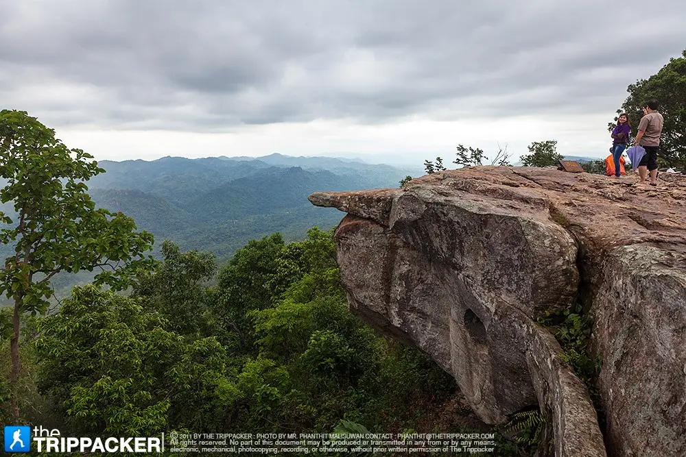
10. Pa Hin Ngam National Park in Chaiyaphum Province is one of northeastern Thailand's most distinctive natural destinations. Located in Thep Sathit District along the Phang Hoei Mountain Range, the park is best known for its seasonal Siam tulip fields, unusually shaped sandstone formations, and dramatic viewpoints. Its landscape combines open rock terraces, forest, grassland, and wildflowers, making it particularly appealing to nature lovers and photographers. During the rainy season, pink and purple blooms emerge across the highland grasslands, creating one of the region's most recognizable seasonal landscapes.
Highlights: Siam Tulip Field, Lan Hin Ngam Rock Field, Pha Sut Phaen Din Viewpoint, the Phang Hoei Mountain Range, unusual sandstone formations, Thep Phana Waterfall, Thep Prathan Waterfall, seasonal wildflowers, and nature trails.
Lan Hin Ngam, the park's celebrated rock field, features numerous unusual stone formations shaped by weathering and erosion over very long periods. Some rocks resemble animals, tools, or other familiar objects, inspiring visitors to use their imagination as they explore the area. The formations also provide an engaging introduction to the geological forces responsible for creating distinctive sandstone landscapes throughout northeastern Thailand.
The seasonal Siam tulip field is another defining attraction. These pinkish-purple flowers appear in grasslands and open forest areas during favorable rainy-season conditions, often accompanied by fresh green vegetation and drifting morning mist. Although commonly called Siam tulips, the flowers belong to the ginger family rather than the true tulip family. Their blooming patterns depend on rainfall and local environmental conditions, so the intensity and timing of the display can differ from year to year.
Pha Sut Phaen Din is one of the park's most dramatic viewpoints. From the elevated terrain, visitors can look across mountain ridges and lower landscapes stretching into the distance. The viewpoint also illustrates the geographical transition between northeastern Thailand and the central region, making it interesting for travelers who enjoy understanding the relationship between terrain and regional boundaries.
The park contains additional natural attractions, including waterfalls and forest trails. The appearance of waterfalls varies significantly according to rainfall, while some routes may become slippery during the wet season. Visitors planning to explore beyond the main rock field and flower-viewing areas should check the condition and accessibility of individual trails before setting out.
For photographers, the contrast between the delicate wildflowers and the rugged sandstone formations is especially appealing. Early morning often provides softer light, cooler temperatures, and atmospheric mist. Travelers should remain on designated walking paths and avoid stepping into the flower fields or picking plants. Even seemingly small disturbances can damage the seasonal vegetation and affect the natural landscape for future visitors.
Pa Hin Ngam is suitable for families, groups of friends, and travelers seeking beautiful natural scenery without necessarily undertaking long-distance hikes. However, walking across wet rock surfaces requires caution, and sturdy footwear is recommended during the rainy season. Visitors should follow park guidance and remain within officially accessible areas.
The national park can be combined with other attractions in Thep Sathit District and nearby areas of Chaiyaphum. Travelers interested in Siam tulip fields may also consider Sai Thong National Park, although the two parks have different landscapes and visiting arrangements. Checking the flowering season and setting aside sufficient travel time will help visitors experience both destinations without rushing.
Open Days: Daily. Opening Hours: 06:00 – 18:00.
Getting There: Travel toward Thep Sathit District in Chaiyaphum Province and follow the signs for Pa Hin Ngam National Park. A private car or rental vehicle is convenient for reaching the park and exploring surrounding attractions. Visitors should check the Siam tulip blooming reports and local weather conditions before traveling during the rainy season.
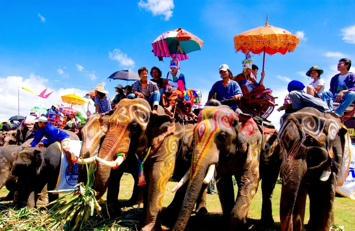
11. Surin Elephant Village is one of the most distinctive cultural attractions in northeastern Thailand. Located at Ban Ta Klang in Krapho Subdistrict, Tha Tum District, Surin Province, this community is renowned for its long-standing relationship with elephants. The village is closely associated with the Kui, also known as Kuy or Kuay, an ethnic group whose knowledge of elephant care and traditional mahout practices has been passed down through generations. Commonly known as Ban Ta Klang Elephant Village, the area is also home to the Elephant Study Center and is an important destination for travelers interested in the cultural heritage of Thailand's elephants.
Highlights: Traditional Kui community life, mahout culture, the Elephant Study Center, elephant care and conservation, traditional elephant-related ceremonies, local handicrafts, and educational activities exploring the history of elephants in Surin.
What distinguishes Ban Ta Klang from conventional elephant attractions is the close connection between elephants and the families who care for them. Historically, the Kui developed specialized knowledge of elephant behavior, handling, communication, and care. This expertise became an important part of the cultural identity of southern Isan. As lifestyles and economic conditions have changed, the community has continued adapting its traditions while facing new expectations concerning animal welfare and conservation.
Walking through the village provides an opportunity to understand the responsibilities of a mahout. Daily elephant care involves preparing food, observing behavior, monitoring physical condition, maintaining a safe environment, and building a relationship based on familiarity and experience. For visitors interested in wildlife and animal behavior, the educational value of the village lies not simply in seeing elephants up close but in learning about their physical, behavioral, and social needs.
The Elephant Study Center plays an important role in preserving and presenting Surin's elephant heritage. Visitors can explore information about the history of elephant keeping, traditional equipment, community customs, and the changing place of elephants in Thai society. These displays also help explain why Surin is nationally recognized for its elephant-related traditions and cultural celebrations.
Beyond elephant care, Kui culture includes distinctive language traditions, beliefs, ceremonies, and forms of local knowledge. Studying the community therefore offers insight into the ethnic and cultural diversity of southern northeastern Thailand. Elephant keeping is best understood as part of this wider historical setting rather than an isolated tourist activity.
Families traveling with children can use a visit to Ban Ta Klang as an opportunity to learn about responsible interactions with large animals. Visitors should follow the instructions of experienced caretakers, avoid touching or feeding elephants without permission, and choose activities that prioritize the animals' well-being. Experiences that rely on forcing elephants to perform unnatural or stressful behaviors should be avoided.
Travelers with additional time can explore the surrounding community, discover locally made handicrafts, and learn more about daily life in Tha Tum District. A meaningful visit to Surin Elephant Village is therefore not only an opportunity for photography but also an introduction to an important element of Thailand's living cultural heritage.
Open Days: Daily. Opening Hours: 07:30 – 17:00.
Getting There: From Surin city, travel north toward Tha Tum District, then continue to Krapho Subdistrict and Ban Ta Klang. Private transport or a hired vehicle offers convenient access to the Elephant Study Center and the surrounding village. Travelers interested in a particular educational program should check its schedule in advance.
Map (GPS):Get Directions to Surin Elephant Village
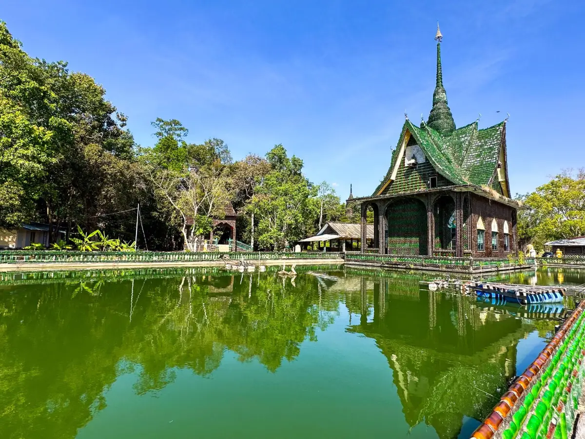
12. Wat Pa Maha Chedi Kaew (Million Bottle Temple) in Si Sa Ket Province is an extraordinary Buddhist temple celebrated for its architecture decorated with recycled glass bottles. Located near Ban Don in Khun Han District, the temple is widely known as Wat Lan Khuat, or the Million Bottle Temple. Vast numbers of discarded glass bottles have been incorporated into the surfaces and decorative elements of religious buildings, including the ordination hall, pavilions, stupas, walls, and other structures. The result is a remarkable example of craftsmanship that combines Buddhist devotion, creative reuse of materials, and environmental awareness.
Highlights: Recycled glass bottle architecture, the ordination hall over water, colorful glass patterns, bottle-decorated stupas and pavilions, creative recycling techniques, and Buddhist artworks made from reused materials.
The first thing many visitors notice is the unusual texture of the buildings. Thousands of green and brown bottles have been arranged in repeating patterns across walls, pillars, and decorative surfaces. As sunlight strikes the glass, the buildings take on changing colors, reflections, and shadows. This effect makes the architecture visually distinctive throughout the day.
The use of discarded bottles is meaningful beyond its novelty. Materials that would otherwise become waste have been collected, sorted, and transformed into useful architectural elements. The process reflects the creativity of monks and supporters who helped develop the temple, while also illustrating the potential value of resource conservation and reuse.
One of the most memorable structures is the ordination hall built over water. Its bottle-decorated surfaces create a striking contrast with the surrounding pond, while reflections from the water add to the architectural atmosphere. The setting demonstrates how recycled materials can be incorporated into the design of a sacred space without losing its religious character.
Visitors will also find bottle decorations on stupas, pavilions, bell towers, and other structures. Each building reveals different patterns, colors, and construction techniques. Those interested in architecture can compare how bottles are arranged vertically, horizontally, or in decorative compositions to create the temple's distinctive appearance.
Despite its popularity as an unusual travel destination, Wat Pa Maha Chedi Kaew remains an active Buddhist temple. Visitors should therefore dress modestly, speak quietly, and respect worshippers. Touching delicate glass surfaces or disturbing decorative pieces should be avoided, as some elements may be fragile.
The temple is particularly suitable for travelers interested in architecture, sustainable design, religious culture, photography, and creative craftsmanship. It can also be included in a wider journey through Khun Han District and other cultural attractions of southern Si Sa Ket.
Open Days: Daily. Opening Hours: 08:00 – 17:00.
Getting There: From Si Sa Ket city, travel south toward Khun Han District, then follow local signs to Wat Pa Maha Chedi Kaew near Ban Don. A private car or rental vehicle is convenient for combining the visit with nearby attractions. Search for the temple's full name to distinguish it from similarly named places.
Map (GPS):Get Directions to Wat Pa Maha Chedi Kaew
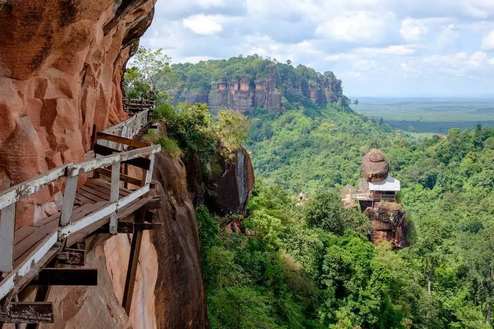
13. Phu Tok in Bueng Kan Province is a sandstone mountain of exceptional natural and spiritual significance. Located in Si Wilai District, it is closely associated with Wat Jetiyakhiri Wihan, commonly known as Wat Phu Tok, an important Buddhist forest meditation temple. The mountain is famous for its wooden stairways and cliffside walkways that wind around different levels of the rock formation. These extraordinary paths allow visitors to experience changing views of the forest and surrounding countryside while learning about Thailand's forest meditation tradition.
Highlights: Wooden cliffside walkways, stairways connecting seven mountain levels, Wat Jetiyakhiri Wihan, dramatic sandstone formations, forest viewpoints, meditation areas, and the history of Phra Ajahn Juan Kulachettho.
The name Phu Tok refers to a mountain that rises prominently above its surroundings. Its steep sandstone cliffs and forested slopes give it a distinctive appearance, clearly separating it from the lower landscape nearby. This combination of elevation, exposed rock, and woodland makes the site visually remarkable even before visitors begin the climb.
The wooden walkway system is the mountain's most extraordinary man-made feature. Built through the efforts of monks, novices, and local supporters, the pathways were developed to provide access to meditation areas at different elevations. The mountain's seven levels are commonly understood in relation to Buddhist spiritual development, giving the ascent a significance beyond sightseeing.
As visitors climb, the scenery changes with the elevation. Lower areas offer forest paths and sheltered rock formations, while higher routes run beside steep cliffs and provide increasingly expansive views over the surrounding landscape. The contrast between narrow wooden paths, towering rock walls, and distant forested plains creates a powerful sense of place.
Wat Jetiyakhiri Wihan is closely associated with Phra Ajahn Juan Kulachettho, a respected monk in the Thai forest meditation tradition. His role in developing the mountain as a place of Buddhist practice remains central to its history. The construction of the walkways illustrates the determination of religious practitioners and local supporters to establish accessible meditation spaces in a challenging natural environment.
Safety is essential when visiting Phu Tok. Some sections are narrow wooden walkways built alongside high cliffs, making them unsuitable for travelers with severe fear of heights, significant mobility limitations, or difficulty climbing stairs. Visitors should wear shoes with good traction, walk slowly, avoid crowding or running, and never lean over barriers. Access should be avoided when rain or maintenance conditions make the structures unsafe.
Because the mountain is an active Buddhist religious site, modest clothing and quiet behavior are expected. Visitors should respect meditation practitioners and allow sufficient time for a careful descent. Before traveling, check current announcements concerning seasonal restrictions, walkway maintenance, and religious activities that may temporarily limit access.
Getting There: From Bueng Kan town, travel toward Si Wilai District and continue along the local route leading to Wat Jetiyakhiri Wihan. Private transport provides the most convenient access to the base of the mountain. Follow the temple's instructions concerning parking and climbing routes.
Map (GPS):Get Directions to Phu Tok
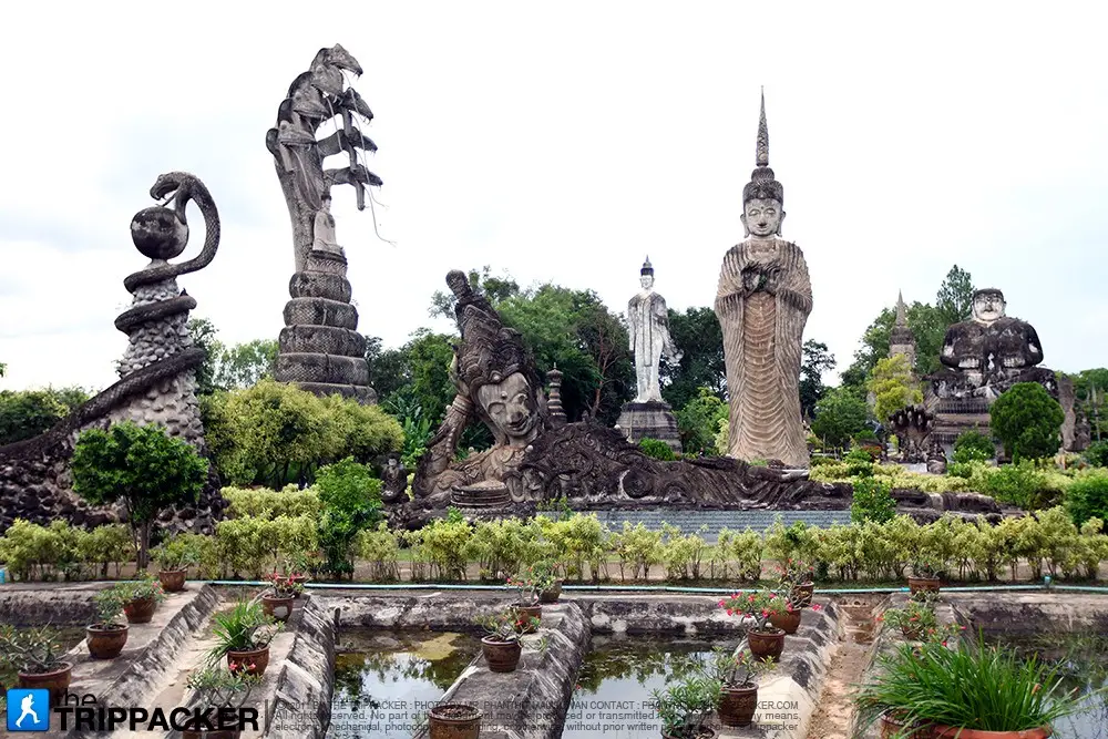
14. Wat Khaek (Sala Kaeo Ku) in Nong Khai Province is one of northeastern Thailand's most unusual religious and artistic destinations. Located in Mueang Nong Khai District, the site is an open-air sculpture park containing numerous monumental concrete figures inspired by Buddhism, Hinduism, Naga mythology, local beliefs, and philosophical teachings about human life. The sculptures combine striking visual forms with symbolic messages, making Sala Kaeo Ku a fascinating attraction for travelers interested in art, religion, and the cultural imagination of the Mekong region.
Highlights: Monumental religious sculptures, Buddhist figures, Hindu deities, Naga serpents, mythical animals, the Wheel of Life, and displays associated with the spiritual ideas of Pu Bunleua Sulilat.
The sculpture park is closely associated with Pu Bunleua Sulilat, whose personal spiritual philosophy influenced the creation of the site. Rather than following the conventions of a single religious tradition, the sculptures combine imagery from different systems of belief. Their unusual compositions invite visitors to consider how symbolic artworks can communicate ideas about existence, morality, suffering, and liberation.
Walking through the park, visitors encounter enormous standing figures, seated religious images, mythical animals, and elaborate scenes arranged across open spaces. The scale of many sculptures is particularly impressive, while their detailed forms reward careful observation. Some portray recognizable Buddhist and Hindu figures, whereas others offer more individual interpretations of spiritual themes.
The Wheel of Life is among the site's most thought-provoking compositions. Its figures and symbolic elements represent stages of human existence and the consequences of actions. Exploring this work offers an opportunity to reflect on moral ideas while appreciating how an outdoor sculpture installation can function as a place of cultural learning.
Naga sculptures are another defining feature of Sala Kaeo Ku. In the Mekong region, Nagas hold an important place in local mythology and Buddhist tradition. Their presence alongside images from other religions illustrates the complex combination of beliefs reflected in the park's design.
The sculptures are especially appealing for photography, with dramatic forms, strong shadows, and unusual architectural perspectives. However, visitors should remember that many works have religious significance. Climbing the statues, touching fragile surfaces, or entering restricted areas should be avoided.
Because Sala Kaeo Ku is located near Nong Khai city, it can easily be combined with visits to Wat Pho Chai, the Mekong riverfront, and other cultural attractions. Travelers interested in symbolic art may wish to allow extra time to read about the sculptures rather than simply walking through the site.
Open Days: Daily. Opening Hours: Outdoor sculpture park 06:00 – 18:00; third-floor shrine approximately 07:00 – 17:00.
Getting There: From Nong Khai city, head east toward Wat That Subdistrict along the route leading to Sala Kaeo Ku. Private cars, taxis, and local transport can be used for the short journey. The site is suitable for inclusion in a full-day sightseeing route around Mueang Nong Khai District.
Map (GPS):Get Directions to Sala Kaeo Ku
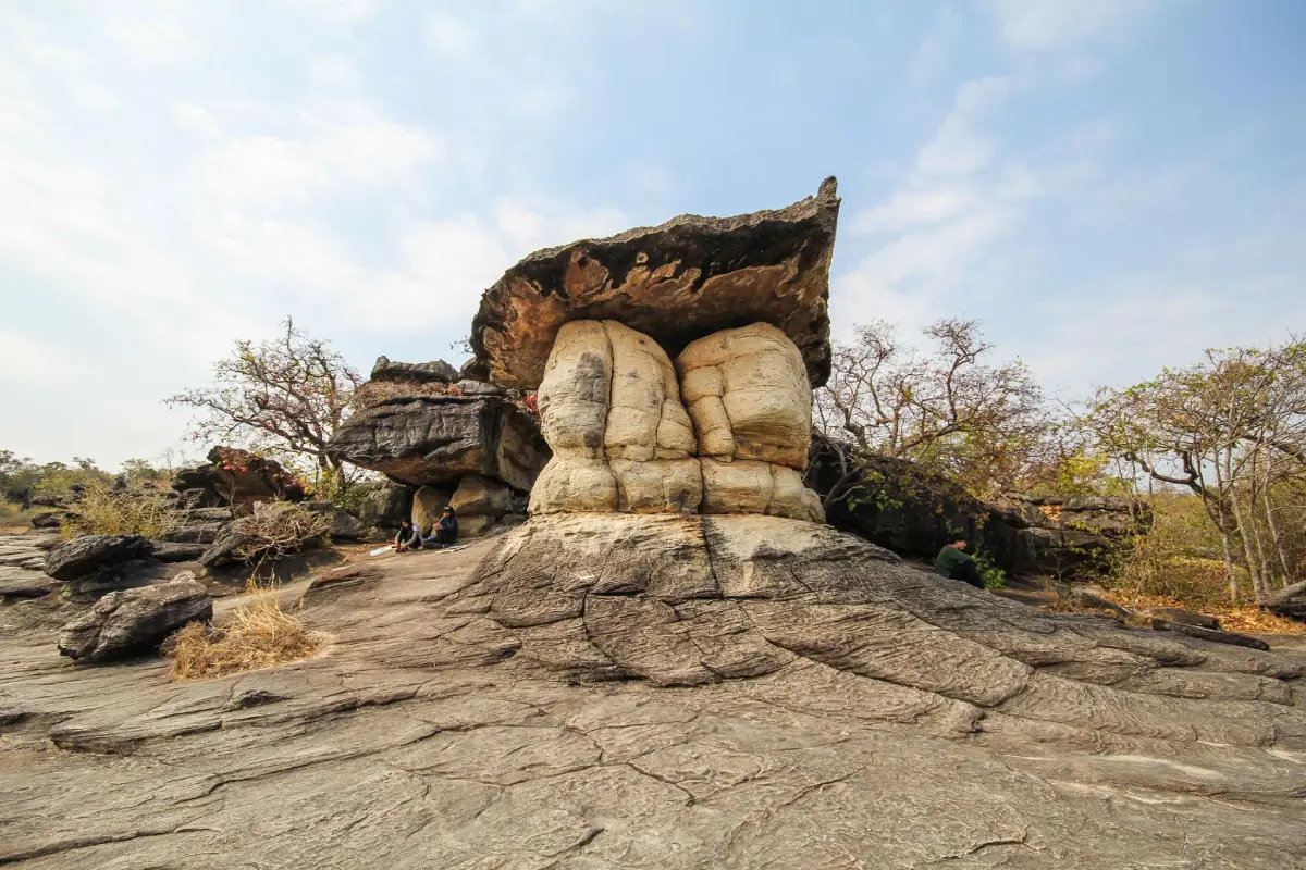
15. Phu Pha Thoep National Park in Mukdahan Province is a protected natural area renowned for its spectacular sandstone formations shaped by weathering and erosion. Situated around Mueang Mukdahan District and neighboring areas, the park contains enormous boulders, rocky plateaus, forested hills, and viewpoints associated with the eastern section of the Phu Phan mountain landscape. Its unusual rock formations make it one of Mukdahan's most distinctive attractions, offering a memorable natural experience within a relatively short journey from the provincial capital.
Highlights: Hin Thoep sandstone formations, mushroom-shaped rocks, natural stone terraces, mountain viewpoints, forest trails, seasonal wildflowers, and archaeological traces found in the protected area.
The Hin Thoep rock formations are the park's principal attraction. Many of the boulders have broad upper sections supported by narrower bases, while others appear to be balanced or stacked in unusual arrangements. These shapes developed because different layers of sandstone weather and erode at different rates under the long-term influence of water, wind, and climatic conditions.
Walking among the rock formations allows visitors to examine natural layers, cracks, erosion patterns, and the distinctive textures of sandstone. Some sections offer wide-open views of several formations at once, while others are surrounded by woodland and vegetation growing between the rocks. These contrasting environments create a varied experience along the walking routes.
The park also protects forest ecosystems associated with sandstone hills and rocky ground. Seasonal rainfall influences the appearance of the landscape, bringing greener vegetation and increased moisture during wetter periods. In drier months, the exposed rock surfaces and sculpted shapes become particularly prominent.
Phu Pha Thoep is also interesting from an archaeological perspective. Certain rock shelters and formations are associated with traces of prehistoric human activity, providing an opportunity to consider how earlier communities interacted with the sandstone landscape. Travelers interested in archaeology can explore the relationship between natural shelters and historical evidence while respecting conservation restrictions.
Families may prefer the more accessible rock formations near the main visitor areas, while hikers can consider longer trails where access is permitted. Shoes with good traction are recommended because wet sandstone can be slippery, and some areas contain uneven surfaces or natural crevices.
The national park can be visited as a half-day or full-day excursion and combined with Mukdahan's Mekong viewpoints and cultural attractions. Morning visits are often more comfortable for exploring exposed rock terraces, particularly during the hotter months.
Open Days: Daily, although some trails may close temporarily because of weather or maintenance. Opening Hours: 07:30 – 17:30.
Getting There: From Mukdahan city, travel toward Na Si Nuan Subdistrict and follow the local road to the national park headquarters. A private car or hired vehicle makes it easier to combine the sandstone formations with nearby cultural and natural attractions.
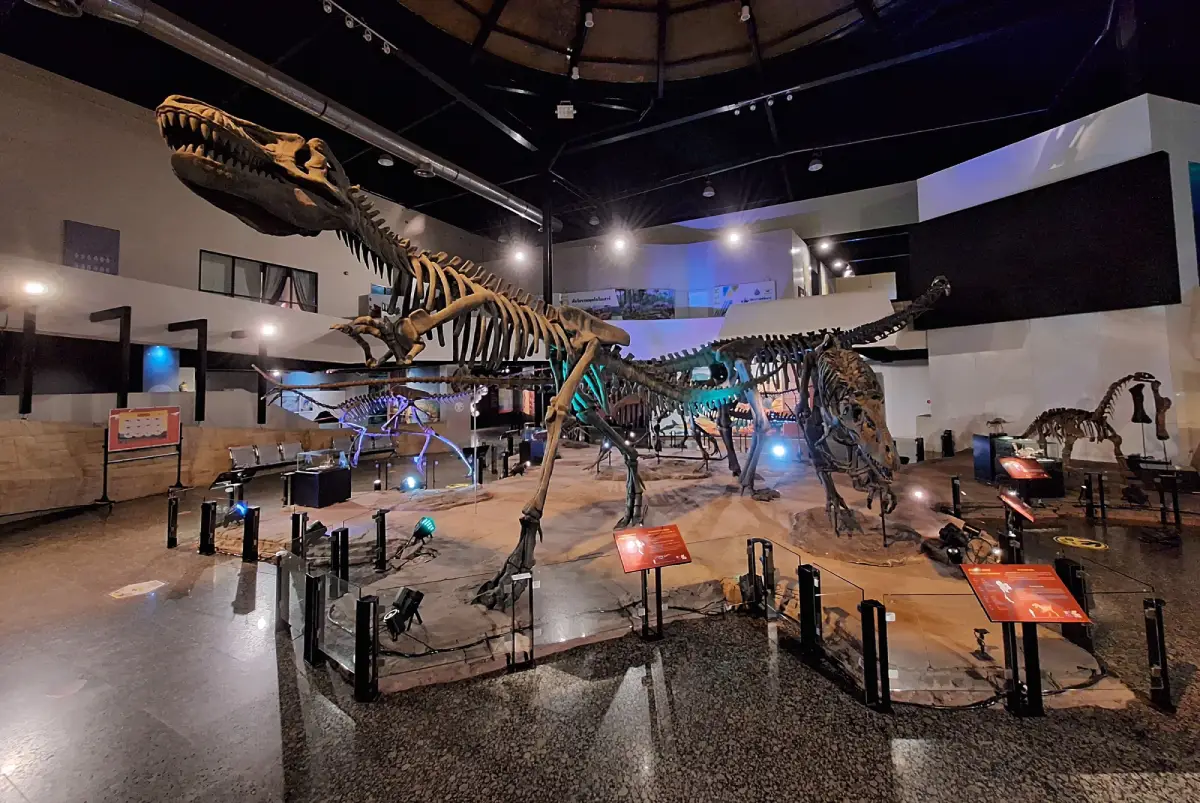
16. Sirindhorn Museum in Kalasin Province is one of Thailand's most important dinosaur museums and paleontological learning centers. Located in Non Buri Subdistrict, Sahatsakhan District, near the Phu Kum Khao dinosaur excavation site and Wat Sakkawan, the museum introduces visitors to the prehistoric history of the Earth. Its exhibitions explore the planet's formation, the evolution of living organisms, ancient environments, and the dinosaurs that once inhabited what is now northeastern Thailand. The museum successfully combines scientific evidence, geology, and engaging educational displays.
Highlights: Dinosaur fossils and skeletons, Phu Kum Khao excavation site, large dinosaur models, exhibitions on the origin of the Earth, prehistoric ecosystems, evolutionary history, and geological education.
The museum's importance is closely connected with the discovery of dinosaur fossils at Phu Kum Khao, one of Thailand's major fossil excavation sites. Skeletal remains recovered from the area have enabled scientists to investigate dinosaur species, prehistoric habitats, and changes in the landscape over millions of years. These discoveries form the scientific foundation of many exhibitions presented within the museum.
The displays are arranged to help visitors follow the development of life on Earth. Beginning with geological processes and early organisms, the exhibitions gradually introduce prehistoric environments and the age of dinosaurs. Fossils, life-size models, and interpretive displays make events from the distant past easier to understand.
Dinosaur discoveries in northeastern Thailand provide evidence that the region once had environmental conditions very different from those seen today. The rock layers containing fossils preserve information about ancient climates, ecosystems, and organisms. Visitors can therefore learn not only the names of dinosaur species but also how scientists reconstruct prehistoric environments from physical evidence.
The nearby Phu Kum Khao excavation site adds an important dimension to the museum experience. Learning how fossils are located, carefully excavated, recorded, studied, and preserved illustrates the precision required in paleontological research. The relationship between a real excavation site and the museum's displays makes the visit especially valuable for students and science enthusiasts.
Sirindhorn Museum is particularly suitable for families with children, school groups, and travelers interested in geology or natural history. The dinosaur models encourage curiosity and imagination, while more detailed scientific explanations offer additional depth for older visitors.
Travelers with additional time can combine the museum with Wat Sakkawan and the Phu Kum Khao area, allowing them to connect the exhibitions with the landscape in which the fossils were discovered. This makes Sahatsakhan District an attractive educational destination within Kalasin Province.
Open Days: Tuesday – Sunday. Opening Hours: 09:30 – 16:30.
Getting There: From Kalasin city, travel toward Sahatsakhan District and continue to Non Buri Subdistrict and Phu Kum Khao, following signs for Sirindhorn Museum. Private transport is convenient for visiting the museum, Wat Sakkawan, and nearby geological attractions in the same journey.
Map (GPS):Get Directions to Sirindhorn Museum
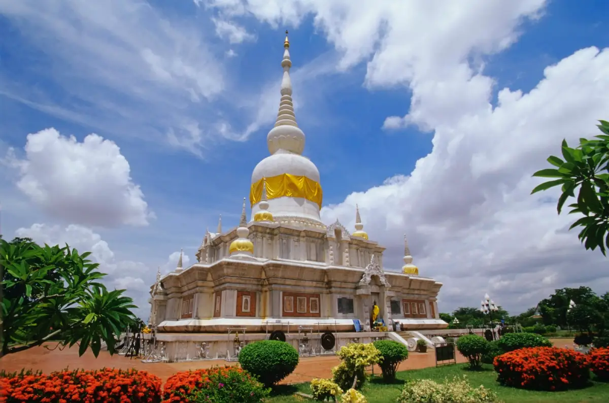
17. Phra That Na Dun in Maha Sarakham Province is an important Buddhist monument and an outstanding destination for learning about the religious history of northeastern Thailand. Located in Phra That Subdistrict, Na Dun District, it is famous for the sacred stupa constructed to enshrine Buddhist relics discovered in the area of the ancient city of Nakhon Champa Si. The surrounding landscape forms part of the Buddhist Center of Isan, where religious architecture, peaceful grounds, and archaeological history are closely connected.
Highlights: Phra That Na Dun stupa, sacred Buddhist relics, the Buddhist Center of Isan, ancient Nakhon Champa Si, Dvaravati-period archaeological heritage, Buddhist ceremonies, and landscaped areas surrounding the monument.
Na Dun District is historically associated with Nakhon Champa Si, an important ancient settlement connected with the Dvaravati cultural period. Archaeological discoveries in the area reveal evidence of community life, religious traditions, and artistic production. This historical background gives Phra That Na Dun greater significance than that of a modern Buddhist monument standing alone.
The discovery of sacred relics in the ancient settlement area was an important event leading to the construction of Phra That Na Dun as a center of worship. The monument connects contemporary Buddhist devotion with material evidence of the region's earlier religious history, illustrating the cultural continuity of Buddhism in central Isan.
Phra That Na Dun is distinguished by its tall, elegant structure and carefully arranged architectural details. The surrounding grounds provide space for worship, walking, religious ceremonies, and quiet reflection. Circling the monument allows visitors to appreciate both the proportions of the stupa and its relationship with the wider Buddhist park landscape.
The site is especially meaningful for travelers interested in Dvaravati history. Archaeological remains associated with Nakhon Champa Si demonstrate the development of Buddhist communities in northeastern Thailand long before the region's modern cities emerged. Learning about these early settlements provides a broader understanding of the region's historical and cultural connections.
Phra That Na Dun remains an important place of religious devotion. Buddhist visitors come to make merit, pay respect to the sacred relics, and participate in ceremonies on religious occasions. These practices demonstrate how an archaeological landscape can continue to hold meaning for present-day communities.
Travelers should dress respectfully and maintain a peaceful atmosphere around the stupa. Those with a particular interest in history can explore nearby archaeological and cultural sites associated with the ancient city to gain a fuller picture of Na Dun District's heritage.
Open Days: Daily. Opening Hours: 08:00 – 17:00.
Getting There: From Maha Sarakham city, travel toward Na Dun District and continue to Phra That Subdistrict and the Buddhist Center of Isan. A private car is convenient for visiting nearby archaeological attractions associated with Nakhon Champa Si.
Map (GPS):Get Directions to Phra That Na Dun
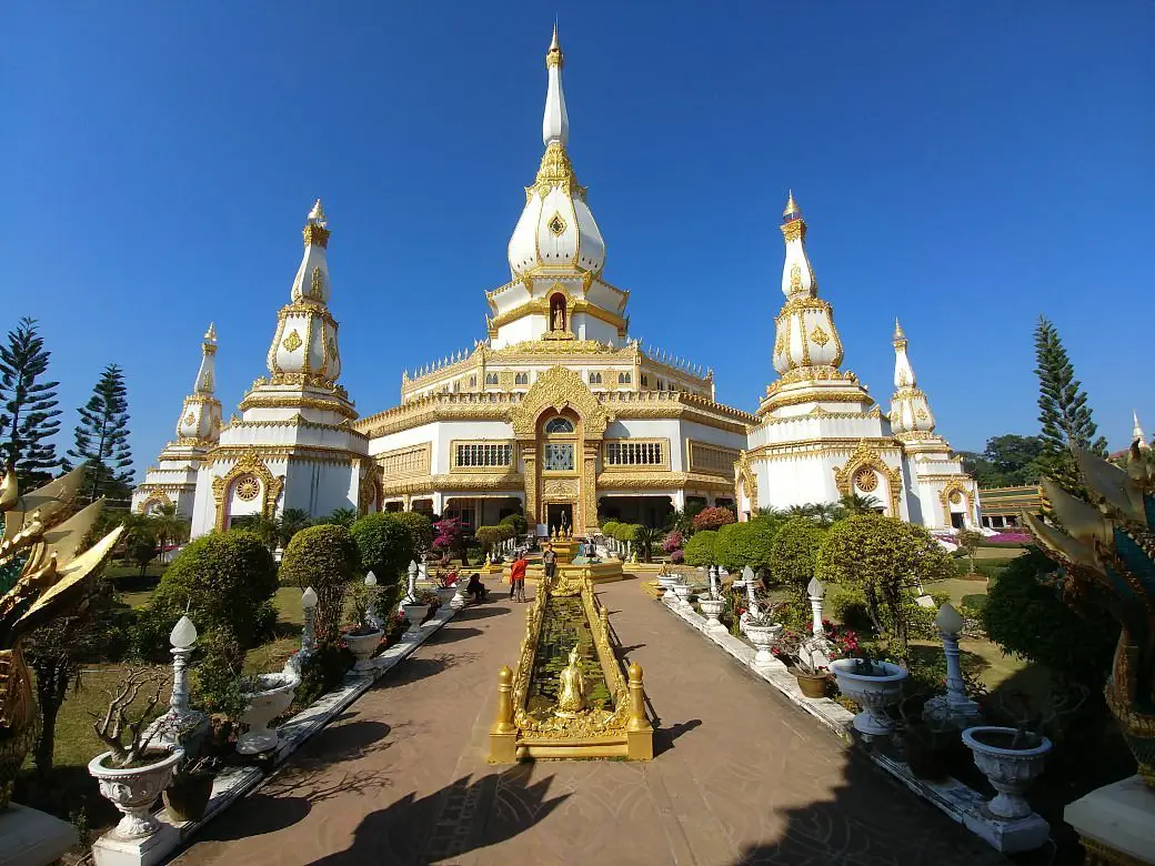
18. Pha Nam Yoi (Isan Buddhist Park) in Roi Et Province is a religious and natural attraction located in Pha Nam Yoi Subdistrict, Nong Phok District. The site is surrounded by mountains, forest, and sandstone cliffs and is especially famous for Wat Pha Nam Thip Thep Prasit Wanaram and the monumental Phra Maha Chedi Chai Mongkhon. The magnificent Buddhist stupa, together with the surrounding highland scenery, makes Pha Nam Yoi one of Roi Et's most distinctive pilgrimage destinations.
Highlights: Phra Maha Chedi Chai Mongkhon, Wat Pha Nam Thip Thep Prasit Wanaram, Pha Nam Yoi cliffs, mountain scenery, elaborate Buddhist architecture, interior decorative artwork, and elevated viewpoints.
The name Pha Nam Yoi is associated with the natural landscape of sandstone cliffs where water seeps along the rock surfaces. The surrounding forest creates a peaceful atmosphere suited to meditation and religious reflection. This connection between woodland, mountain terrain, and Buddhist practice is an important part of the site's character.
Phra Maha Chedi Chai Mongkhon is the principal architectural landmark. Its enormous scale and intricate decoration make a powerful impression on visitors. Elaborate Buddhist motifs, decorative surfaces, and carefully arranged architectural elements express the devotion of the communities involved in creating and maintaining the religious complex.
The interior of the monument contains areas dedicated to Buddhist worship and religious artworks. Exploring these spaces allows visitors to appreciate the relationship between contemporary Buddhist craftsmanship and traditional religious symbolism. The architecture is designed not only to impress visually but also to encourage reflection and devotional practice.
The surrounding highland scenery provides an important contrast to the grandeur of the stupa. From accessible elevated areas, visitors can admire forested slopes and the wider landscape. This combination of monumental architecture and nature distinguishes Pha Nam Yoi from Buddhist temples located in urban settings.
The wider Buddhist park is an important center of local faith. Religious ceremonies and merit-making activities connect the site with the traditions of the surrounding communities. Visitors who take time to observe these practices can gain a deeper understanding of the continuing significance of Buddhism in northeastern Thailand.
Pha Nam Yoi is suitable for pilgrims, families, photographers, and travelers interested in Buddhist architecture. Modest clothing and respectful conduct are expected. Travelers with limited mobility should plan their walking routes carefully and allow sufficient time for visiting the large complex.
Open Days: Daily. Opening Hours: 06:00 – 17:00.
Getting There: From Roi Et city, travel toward Nong Phok District, then continue to Pha Nam Yoi Subdistrict and Wat Pha Nam Thip Thep Prasit Wanaram. Private transport is recommended for visiting the mountain temple and surrounding rural attractions.
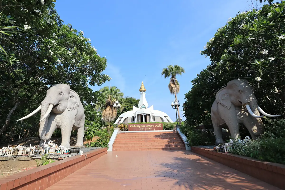
19. Wat Tham Klong Phen in Nong Bua Lam Phu Province is a respected Buddhist forest meditation temple with a strong historical connection to the Thai forest monastic tradition. Located in Non Than Subdistrict, Mueang Nong Bua Lam Phu District, near the foothills of the Phu Phan mountain range, the temple is surrounded by natural rock formations, caves, and forest. It is particularly associated with Luang Pu Khao Analayo, a revered meditation master whose teachings and disciplined way of life continue to inspire Buddhist practitioners.
Highlights: Tham Klong Phen cave, large natural sandstone boulders, meditation areas, memorials associated with Luang Pu Khao Analayo, Buddhist images, forest surroundings, and the heritage of the Thai forest meditation tradition.
Wat Tham Klong Phen is closely connected with the use of caves and natural woodland as places for meditation. Large rock formations and sheltered spaces provide an environment of quiet seclusion. These natural features have been incorporated into the religious landscape, giving the temple a distinctive atmosphere that differs from monasteries built primarily around conventional architectural structures.
Luang Pu Khao Analayo played an important role in the temple's history. He belonged to the forest meditation lineage associated with Phra Ajahn Mun Bhuridatta and became widely respected for his commitment to meditation and disciplined Buddhist practice. His association with Wat Tham Klong Phen established the monastery as a significant pilgrimage destination for followers of the Thai forest tradition.
The cave and surrounding rock formations are among the temple's most interesting features. Visitors can observe the relationship between natural shelters, Buddhist images, and religious spaces. The landscape also helps explain why forest monks often selected remote locations for meditation, seeking quiet environments away from the distractions of everyday life.
Forest vegetation contributes to the peaceful character of the temple. Walking through the designated paths allows visitors to experience the natural surroundings while appreciating their relationship with spiritual practice. The preservation of trees and the quiet atmosphere remain important to the monastery's identity.
Beyond paying respect to Buddhist images and learning about Luang Pu Khao, visitors can spend time observing the temple's serene environment. Those interested in Buddhist history may find the memorial areas particularly meaningful. However, meditation practitioners and resident monks should be given privacy, and photography should never interfere with religious activities.
Wat Tham Klong Phen is appropriate for pilgrims, cultural travelers, and visitors seeking a quiet natural setting. Modest clothing is recommended, along with shoes suitable for walking over uneven stone surfaces. Care should be taken around damp caves and rocky paths, particularly when traveling with older visitors.
The temple can be included in a half-day itinerary with other cultural and natural attractions around Nong Bua Lam Phu city. Allowing sufficient time for a peaceful visit makes the experience more meaningful than a brief sightseeing stop.
Open Days: Daily. Opening Hours: 07:00 – 17:00.
Getting There: From Nong Bua Lam Phu city, travel toward Non Than Subdistrict and follow local signs to Wat Tham Klong Phen near the foothills. Private cars and local hired vehicles provide convenient access. Follow temple instructions for parking and walking routes.
Map (GPS):Get Directions to Wat Tham Klong Phen
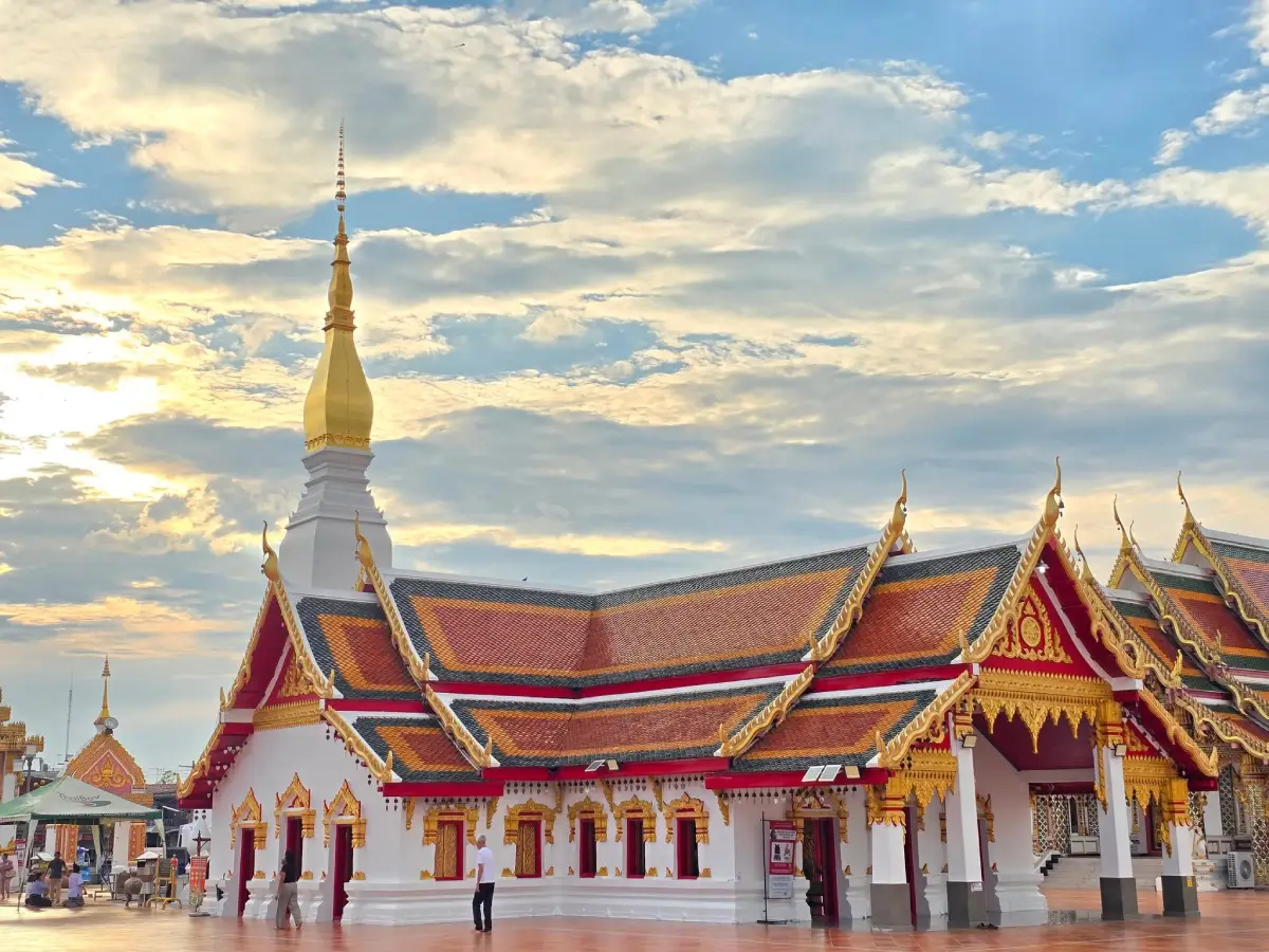
20. Wat Phra That Choeng Chum in Sakon Nakhon Province, also known as Wat Phra That Choeng Chum Worawihan, is one of the most important Buddhist temples in the provincial capital. Its central landmark is the elegant white Phra That Choeng Chum stupa, which is revered by local communities and Buddhist pilgrims. The temple is also home to Luang Pho Phra Ong Saen, an important Buddha image, and is associated with traditional beliefs about sacred Buddha footprints. Together, these features make the temple a major religious and cultural symbol of Sakon Nakhon.
Highlights: Phra That Choeng Chum stupa, Luang Pho Phra Ong Saen, white stupa architecture, traditional beliefs about Buddha footprints, Wat Phra That Choeng Chum Worawihan, annual religious ceremonies, and the history of Buddhism in Sakon Nakhon.
The Phra That Choeng Chum stupa is a brick-and-plaster structure built on a square base, with its white upper sections rising elegantly above the temple grounds. Its architectural form reflects religious artistic traditions that developed through different periods in northeastern Thailand and the Mekong region. The monument's distinctive white appearance makes it one of the most recognizable landmarks in Sakon Nakhon.
According to local Buddhist tradition, Phra That Choeng Chum is associated with sacred footprints of several Buddhas. These religious narratives have been preserved through generations and remain an important part of the temple's spiritual significance. They also demonstrate the relationship between sacred landmarks, inherited beliefs, and the historical identity of local communities.
Luang Pho Phra Ong Saen is another central focus of devotion at the temple. Many visitors come to pay respect to this revered Buddha image as well as the stupa. These activities are particularly meaningful during Buddhist holy days and religious festivals, when worshippers gather for merit-making and prayer.
The temple has long played an important role in Sakon Nakhon's religious life. Its architecture and sacred spaces reflect the continuing relationship between Buddhism and the development of the provincial capital. Exploring the grounds helps travelers appreciate how religious centers have influenced community identity over time.
The annual Phra That Choeng Chum worship festival is an important expression of local faith. During the celebration, Buddhist ceremonies and traditional activities bring the community together. The temple is also associated with Sakon Nakhon's distinctive Wax Castle Procession, held around the end of Buddhist Lent, when decorated wax structures are created as offerings and expressions of artistic devotion.
Because the temple is located in the city center, it can easily be included in a wider Sakon Nakhon itinerary. Visitors may continue to museums, historical landmarks, or the Nong Han Lake area to explore the province's religious heritage alongside its natural and community attractions.
Travelers should dress modestly, respect worshippers, and observe temple regulations. Photography should be carried out considerately, particularly during ceremonies. Historic architectural elements and religious objects should not be touched unnecessarily.
Open Days: Daily. Opening Hours: 08:00 – 18:00.
Getting There: Wat Phra That Choeng Chum is located in central Mueang Sakon Nakhon District, accessible from Charoen Mueang Road and Rueang Sawat Road. Private cars, taxis, and local transport are suitable for reaching the temple and continuing to nearby attractions.
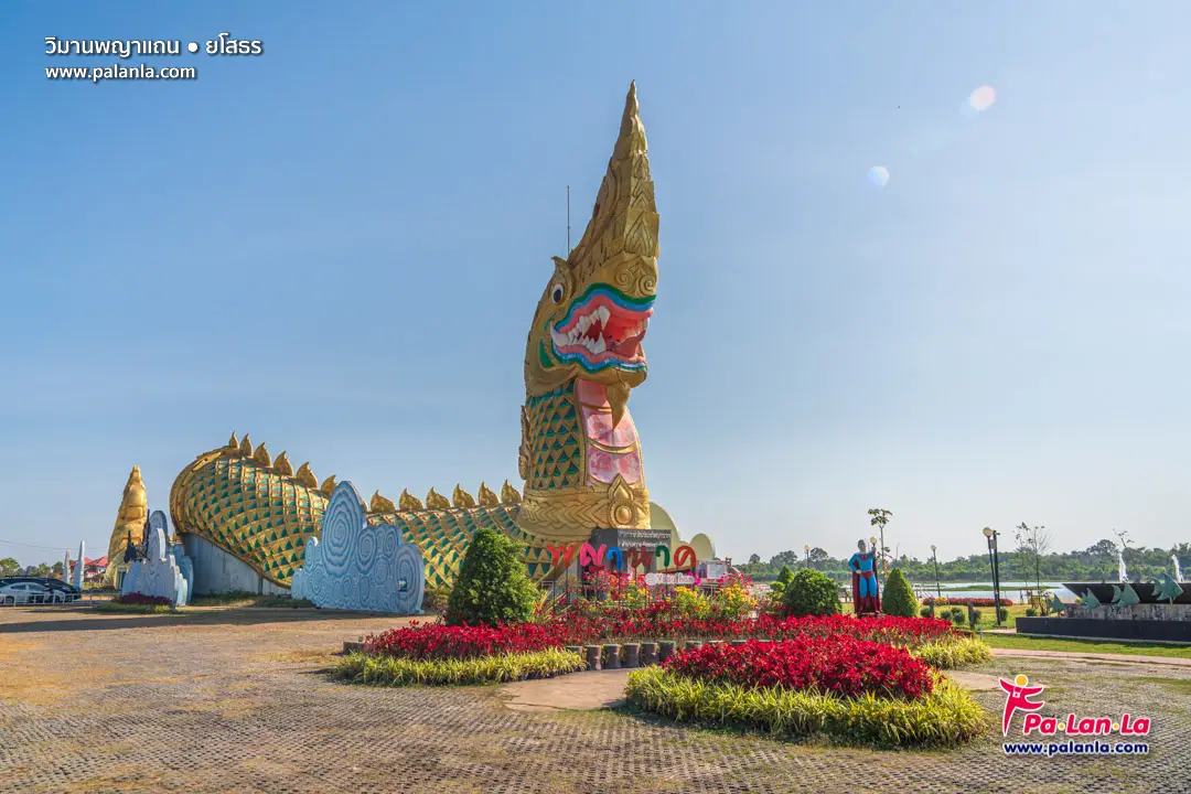
21. Phaya Thaen Public Park in Yasothon Province is an important recreational and cultural landmark in the provincial capital. Located along Chaeng Sanit Road in Mueang Yasothon District, the park serves as a green space for local residents, a venue for public activities, and a destination closely associated with the province's famous Bun Bang Fai Rocket Festival. Its name refers to Phaya Thaen, the rain deity in traditional Isan beliefs, whose role in agricultural life and seasonal rainfall is deeply connected with the region's cultural heritage.
Highlights: Public gardens and walking paths, Lam Thuan waterside scenery, the nearby Phaya Khan Khak Museum, traditional Naga-inspired architecture, the Bun Bang Fai Rocket Festival, local folklore, and opportunities to learn about the relationship between rainmaking traditions and agricultural communities.
Phaya Thaen is a significant figure in northeastern Thai folklore, traditionally associated with rain, fertility, and the agricultural cycle. In a region where rice farming has long depended on seasonal rainfall, ceremonies connected with rain deities developed as expressions of hope for a successful harvest. The Bun Bang Fai Rocket Festival is one of the best-known examples of these beliefs, combining ceremonial practices with music, processions, artistic performances, and community celebrations.
What makes Phaya Thaen Public Park especially interesting is its combination of recreational space and cultural interpretation. Visitors can enjoy the landscaped gardens, relax beside the water, and explore nearby structures associated with Isan mythology. The surrounding area is also connected with the story of Phaya Khan Khak, the mythical toad king whose conflict with Phaya Thaen is central to local explanations of the rainmaking tradition.
The Phaya Khan Khak Museum is one of the area's most recognizable landmarks. Its unusual architecture takes inspiration from the mythical toad character and serves as a visual representation of the region's folklore. The legend illustrates how traditional communities used storytelling to explain natural phenomena, social relationships, and the importance of rainfall to everyday life. Learning about these stories provides context for Yasothon's Rocket Festival beyond the excitement of the celebrations themselves.
Outside festival periods, the park is an important part of everyday life in Yasothon. Residents use its paths and open areas for walking, exercise, family outings, and community gatherings. Early morning and late afternoon are particularly pleasant times to experience the gardens and observe the relaxed rhythm of the city.
During the annual Rocket Festival, Yasothon attracts visitors interested in traditional performances, elaborate rocket parades, local music, and community festivities. The park and nearby public spaces contribute to the festive atmosphere. Since event dates and programs may change each year, travelers hoping to attend the festival in 2027 should check announcements from the provincial organizers before booking accommodation.
Phaya Thaen Public Park is suitable for families, cultural travelers, and visitors exploring Yasothon city. It can be combined with the historic Ban Sing Tha neighborhood, Wat Mahathat, and other local attractions to create an itinerary that connects the city's history, folklore, religious traditions, and contemporary community life.
Open Days: Daily. Opening Hours: The public park generally operates from 05:00 – 20:00. Museum opening hours may differ.
Getting There: Phaya Thaen Public Park is located within Yasothon Municipality along Chaeng Sanit Road, near Lam Thuan. It is accessible by private car, local taxi, or transport within the provincial capital. The Phaya Khan Khak Museum is a useful nearby landmark when navigating to the park.
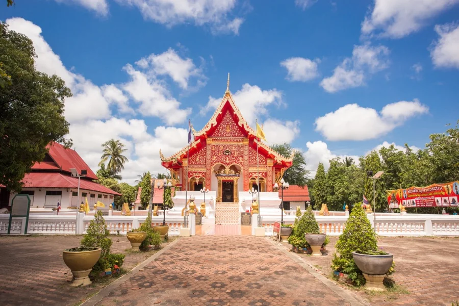
22. Wat Phra Lao Thep Nimit in Amnat Charoen Province is an important Buddhist temple known for its revered principal Buddha image and distinctive religious architecture. Located in Phana Subdistrict, Phana District, the temple preserves artistic traditions associated with the cultural connections between Lanna and Lan Xang. Its significance lies not only in the beauty of the sacred image but also in its role as a spiritual center for the local community and a reminder of the historical development of Buddhism in northeastern Thailand.
Highlights: Phra Lao Thep Nimit Buddha image, the principal ordination hall, artistic influences from Lanna and Lan Xang, traditional Buddhist architecture, the historical community of Phana, and the temple's continuing religious traditions.
Wat Phra Lao Thep Nimit was formerly known as Wat Si Pho Chaiyaram Kham Wa before becoming closely identified with its important Buddha image. The present temple name reflects the significance of Phra Lao Thep Nimit as a focus of local devotion. The history of the temple demonstrates how sacred objects can become central to a community's identity, with religious traditions preserved across generations.
Phra Lao Thep Nimit is a seated Buddha image in the posture of subduing Mara. Its elegant proportions and carefully shaped features reflect the skills of Buddhist artisans working within the cultural traditions of the Mekong region. The image is particularly interesting because its artistic characteristics reveal connections between different regional schools of Buddhist sculpture.
The principal ordination hall is another important reason to visit. Its architectural forms and decorative details reflect traditional craftsmanship and the influence of neighboring cultural regions. By examining the roof structure, decorative elements, and interior arrangement, travelers can gain a greater appreciation of how Buddhist architecture developed in local communities rather than following a single uniform style throughout Thailand.
The temple's importance extends beyond art history. For residents of Phana District, it remains a place for worship, merit-making, Buddhist ceremonies, and important community gatherings. These activities demonstrate the continuing role of temples in sustaining religious and social relationships within rural Isan.
Travelers interested in cultural history will find Wat Phra Lao Thep Nimit a valuable complement to northeastern Thailand's better-known Khmer temples. While the ancient Khmer sanctuaries of southern Isan demonstrate one strand of regional history, Phra Lao Thep Nimit highlights the development of Buddhist imagery and architecture shaped by the cultural exchanges of the Mekong basin.
Visitors should dress modestly, maintain a respectful atmosphere, and follow any restrictions concerning entry into religious buildings or photography. The temple can be combined with other cultural attractions in Phana District and Mueang Amnat Charoen District for a fuller exploration of the province.
Open Days: Daily. Daytime visits are recommended.
Getting There: From Amnat Charoen city, travel toward Phana District, then follow Highway 2134 to Wat Phra Lao Thep Nimit, located near the district center. Private cars, motorcycles, and hired local vehicles offer convenient access.
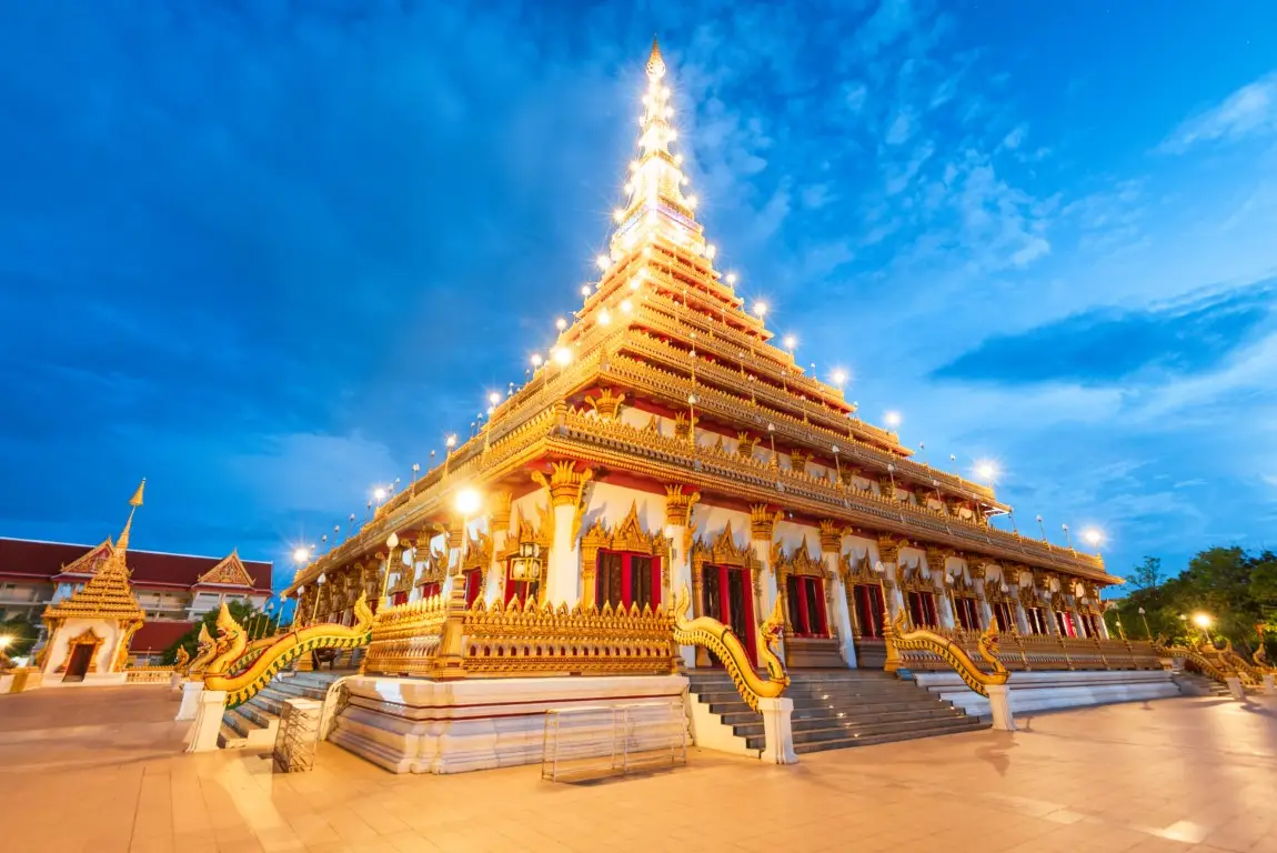
23. Phra Mahathat Kaen Nakhon (Wat Nong Wang) in Khon Kaen Province is one of the city's most recognizable Buddhist landmarks. Located beside Bueng Kaen Nakhon Lake on Klang Mueang Road in Nai Mueang Subdistrict, Mueang Khon Kaen District, the temple is famous for its magnificent nine-story stupa, known as Phra Mahathat Kaen Nakhon. The building combines religious worship, Buddhist art, cultural displays, and panoramic views of Khon Kaen. Its distinctive architecture and accessible city-center location make it an essential destination for travelers interested in northeastern Thailand's spiritual and artistic heritage.
Highlights: The nine-story Phra Mahathat Kaen Nakhon stupa, approximately 80-meter-high architecture, sacred Buddhist relics, mural paintings, traditional Isan woodcarving, religious artworks, views over Bueng Kaen Nakhon Lake, and panoramic scenery of Khon Kaen city.
Wat Nong Wang has long played an important role in the religious life of Khon Kaen. Its best-known architectural feature, the nine-story stupa, was created as a monumental center for worship and cultural learning. From the outside, the building resembles a traditional Buddhist reliquary monument, while its interior contains multiple levels designed for different religious, educational, and artistic purposes.
The architecture of Phra Mahathat Kaen Nakhon draws inspiration from northeastern Thai religious traditions, including the symbolic importance of sacred stupas and the distinctive decorative vocabulary of Isan craftsmanship. The tall structure rises prominently above the surrounding city, making it visible from several areas around Bueng Kaen Nakhon.
Inside the building, the different floors contain Buddhist images, decorative artworks, paintings, and cultural displays. Moving upward through the stupa allows visitors to explore a variety of religious themes and artistic techniques. The experience combines pilgrimage with an opportunity to study how traditional Buddhist ideas have been expressed through a major contemporary religious monument.
The building's upper levels are particularly attractive because of the views they offer over Khon Kaen. From accessible viewing areas, travelers can look across Bueng Kaen Nakhon Lake, surrounding streets, temples, and the city's expanding urban landscape. The contrast between the peaceful temple interior and the modern city beyond provides an interesting perspective on the continuing importance of Buddhism in urban Thailand.
Bueng Kaen Nakhon, located close to the temple, is an important public recreation area. Visitors can combine a morning visit to the stupa with a walk around the lake or a relaxing break in the surrounding neighborhood. This arrangement offers an enjoyable introduction to both the spiritual and everyday character of Khon Kaen.
Wat Nong Wang is suitable for pilgrims, families, architecture enthusiasts, photographers, and international travelers seeking a significant cultural landmark without traveling far outside the city. Visitors should dress respectfully, remove shoes where required, and maintain a quiet atmosphere in areas used for worship.
Those with additional time can continue to other city attractions, including cultural museums, the Khon Kaen City Pillar Shrine, and local food districts. The combination of religious architecture, waterfront scenery, and urban culture makes this an excellent stop on a one-day Khon Kaen itinerary.
Open Days: Daily. Opening Hours: 08:00 – 18:00.
Getting There: Wat Nong Wang is located on Klang Mueang Road beside Bueng Kaen Nakhon in central Khon Kaen. Visitors can travel by private car, taxi, or local transport. The nine-story stupa is a prominent landmark that can easily be identified from the surrounding neighborhood.
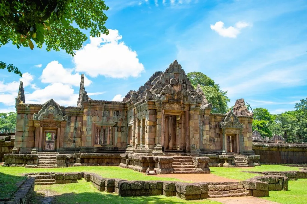
24. Prasat Hin Mueang Tam in Buriram Province is an important ancient Khmer sanctuary located at Ban Khok Mueang in Chorakhe Mak Subdistrict, Prakhon Chai District. Situated near Phanom Rung Historical Park, the monument is especially famous for its carefully balanced architectural layout, four L-shaped ponds, sandstone Naga balustrades, and five brick towers arranged within the inner sanctuary. The site preserves remarkable examples of Khmer religious architecture and offers important insights into the relationship between Hindu beliefs, water, sacred space, and the surrounding landscape.
Highlights: Five brick sanctuary towers, four L-shaped ponds, five-headed Naga stone balustrades, sandstone gateways, covered galleries, laterite enclosure walls, carved lintels, and the nearby Phanom Rung Historical Park.
Prasat Hin Mueang Tam belongs to the architectural and religious traditions of ancient Khmer civilization. Its artistic features are associated with the Khleang and Baphuon styles, reflecting the cultural development of the region around the 10th to 12th centuries. The sanctuary was originally associated with Hindu religious practices, particularly traditions connected with Shiva and the symbolism of the sacred temple.
One of the most distinctive elements of the monument is its arrangement of four L-shaped ponds within the outer enclosure. Their edges are decorated with beautifully carved sandstone Nagas, whose five heads create a striking visual rhythm around the water. In the Hindu religious setting of the original sanctuary, water had symbolic significance associated with purification and sacred geography.
The five brick towers are arranged on a common laterite platform within the inner gallery. Although parts of the structures have deteriorated over time, the surviving remains reveal the original organization of the sanctuary. Walking along the approach to the central towers allows visitors to appreciate how gateways, ponds, walls, and ceremonial spaces were deliberately aligned.
Stone carvings on lintels, doorways, and architectural fragments provide further evidence of ancient Khmer craftsmanship. These details reflect religious imagery and the technical abilities of builders who worked with brick, laterite, and sandstone. Visitors interested in architecture should take time to compare the different materials and observe how each was used for structural or decorative purposes.
Prasat Mueang Tam offers a valuable contrast to Phanom Rung. The latter stands on an extinct volcanic summit and is approached through a dramatic ceremonial ascent, while Mueang Tam occupies lower ground and places greater visual emphasis on its ponds and symmetrical layout. Exploring both monuments provides a more complete understanding of the diversity of Khmer sanctuary design in southern Isan.
The site is especially rewarding for archaeology enthusiasts, cultural travelers, photographers, and visitors interested in Southeast Asian history. Morning and late-afternoon light can highlight the textures of the sandstone and its reflections in the ponds. Visitors should remain on permitted paths and avoid climbing on ancient structures.
Open Days: Daily. Opening Hours: 07:00 – 18:00.
Getting There: From Phanom Rung Historical Park, drive toward Chorakhe Mak Subdistrict in Prakhon Chai District. Travelers starting in Buriram city can head toward Prakhon Chai and continue to Ban Khok Mueang. A private vehicle is convenient for visiting both historical parks on the same day.
Map (GPS):Get Directions to Prasat Hin Mueang Tam
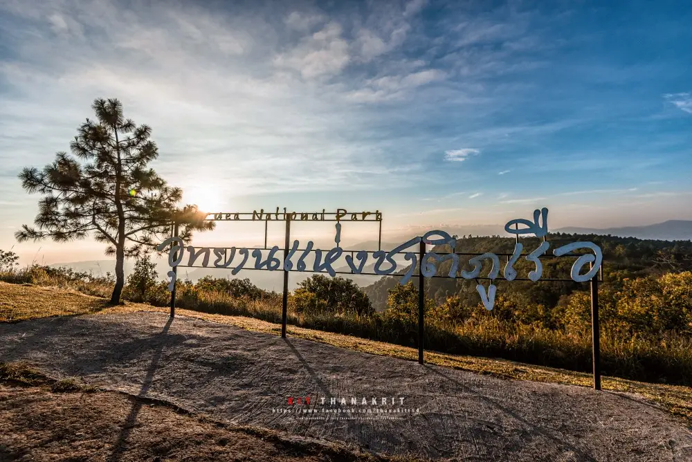
25. Phu Ruea National Park in Loei Province is a highland national park famous for its cool climate, mountain scenery, and panoramic sunrise viewpoints. Located across parts of Phu Ruea and Tha Li districts, the park contains forested mountains, pine trees, grasslands, rocky terraces, cliffs, and waterfalls. The summit of Phu Ruea rises to approximately 1,365 meters above sea level, creating a cooler environment than the surrounding lowlands. During the cool season, visitors are drawn to the summit for misty mountain views, early-morning sunlight, and the possibility of experiencing particularly low temperatures.
Highlights: Phu Ruea Summit, sunrise viewpoints, Pha Lon Noi, Decho Viewpoint, Pha Sam Thong, pine forests, Huai Phai Waterfall, mountain mist, and occasional frost during exceptionally cold conditions.
The name Phu Ruea refers to the mountain's distinctive shape, which resembles part of a large boat. Its elevated ridges and unusual cliff formations have made the mountain recognizable within Loei's highland landscape. From several viewpoints, travelers can see overlapping mountain ranges, forested valleys, and expansive countryside stretching toward the horizon.
The park contains a variety of ecosystems shaped by changes in elevation, climate, and soil conditions. Pine forests, montane vegetation, open grasslands, and moist areas near streams support different plant communities. Traveling through the park allows visitors to observe how the environment changes between the lower mountain roads and the summit.
Phu Ruea Summit is the main destination for travelers hoping to see the sunrise. On clear mornings, the first light of day illuminates the surrounding ridges, while mist may gather in the valleys below. Pine trees and exposed rock formations provide distinctive foregrounds for mountain photography. The appearance of mist depends on weather conditions and cannot be guaranteed on every visit.
Phu Ruea is also known for occasional frost, locally called mae khaning, which can form on grass and low vegetation when temperatures become sufficiently cold. This phenomenon is highly dependent on local weather and does not occur every morning during the cool season. Visitors hoping to experience very cold conditions should monitor weather reports and bring suitable warm clothing.
Other attractions include Pha Lon Noi, Pha Sam Thong, additional mountain viewpoints, and Huai Phai Waterfall. These locations provide opportunities to appreciate different aspects of the park, from open landscapes to forest streams. Travelers should check individual access conditions, particularly after heavy rain or during periods of thick mist.
Phu Ruea is suitable for mountain lovers, photographers, families, and visitors seeking a cool-season getaway. Drivers should be careful on winding roads and steep sections, especially when traveling before sunrise. Suitable footwear is also recommended for walking across rocky or potentially slippery viewpoints.
Visitors can combine the national park with other attractions in Phu Ruea District, including agricultural landscapes and local communities. Staying overnight near the park provides a convenient base for an early-morning summit visit and allows additional time to explore the mountain scenery.
Open Days: Daily, subject to temporary weather-related restrictions. Opening Hours: 05:00 – 20:00.
Getting There: From Loei city, follow Highway 203 toward Phu Ruea District, then take the marked road into Phu Ruea National Park. The mountain road includes bends and steep sections, so drivers should proceed carefully, particularly during cold mornings when mist may reduce visibility.
Map (GPS):Get Directions to Phu Ruea National Park
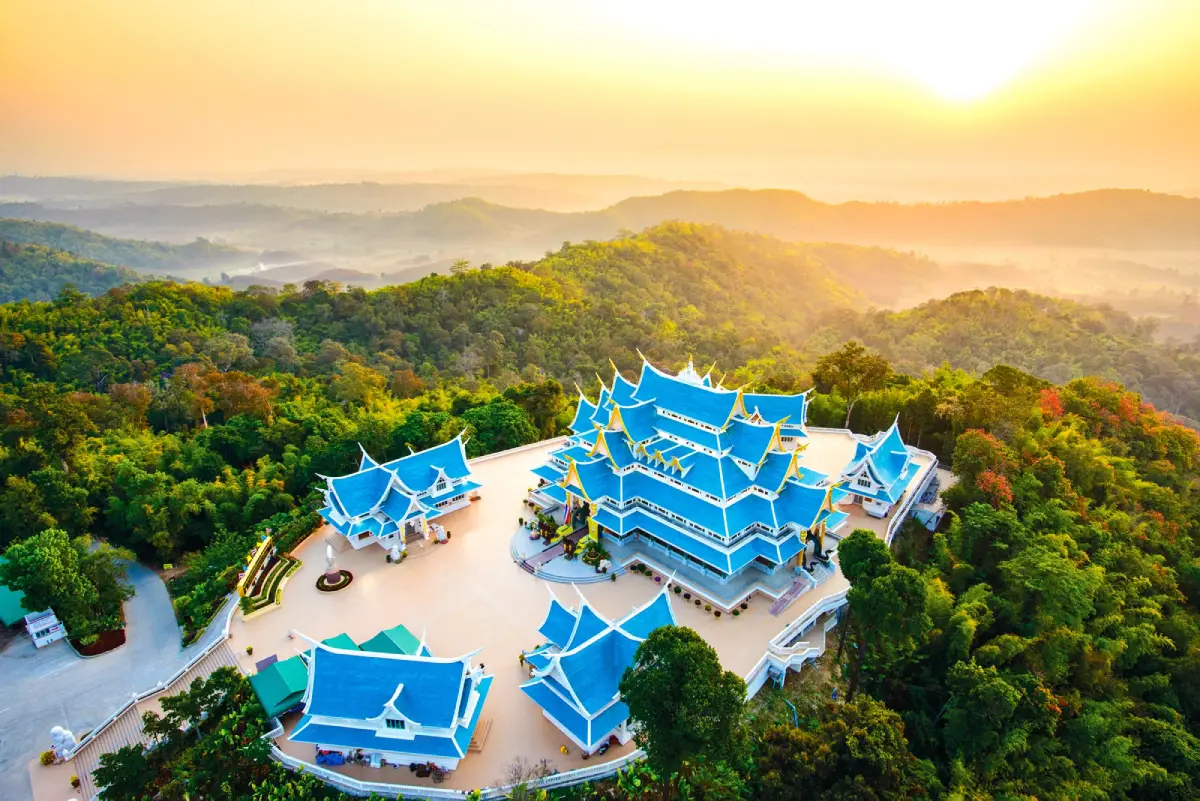
26. Wat Pa Phu Kon in Udon Thani Province is a remarkable Buddhist forest temple surrounded by mountain scenery and protected woodland. Located near Ban Na Kham Yai in Ban Kong Subdistrict, Na Yung District, the temple is set within the Na Yung and Nam Som forest landscape. Its most famous attraction is a monumental reclining Buddha carved from white marble, housed inside the elegantly designed Vihara Sangkhapidok. The temple's blue-toned roofs, detailed Buddhist architecture, and peaceful natural surroundings make it one of the most distinctive spiritual destinations in upper northeastern Thailand.
Highlights: The approximately 20-meter-long white marble reclining Buddha, Vihara Sangkhapidok, Phra Pathom Rattana Buraphachan Maha Chedi, contemporary Buddhist craftsmanship, meditation areas, forest conservation, and panoramic mountain scenery.
The development of Wat Pa Phu Kon reflects an effort to establish a Buddhist sanctuary while preserving the surrounding forest. The mountainous area forms part of an important natural landscape, where woodland and watersheds support the local ecosystem. Maintaining the natural environment is therefore closely related to the temple's identity as a place of meditation and spiritual reflection.
Vihara Sangkhapidok is the principal architectural landmark. Its blue roofs contrast beautifully with the surrounding green mountains, creating a memorable image when viewed from suitable approaches. Inside, the white marble reclining Buddha is the central focus of worship. The carefully proportioned figure demonstrates the technical skill and artistic refinement of contemporary Buddhist sculpture.
The reclining Buddha was created in connection with a project commemorating King Bhumibol Adulyadej the Great. Its scale, material, and detailed craftsmanship give the image particular artistic importance. For Buddhist visitors, the serene expression and reclining posture provide a focus for devotion and quiet contemplation.
Another notable feature of the temple is Phra Pathom Rattana Buraphachan Maha Chedi, a religious monument associated with respect for distinguished Buddhist teachers and the preservation of Buddhist traditions. The wider temple grounds contain areas for worship and reflection, with religious buildings carefully arranged within the mountainous environment.
What distinguishes Wat Pa Phu Kon from temples in urban areas is the close visual relationship between its buildings and the surrounding forest. From accessible viewpoints, visitors can see mountain ridges and woodland extending into the distance. This peaceful atmosphere reinforces the temple's role as a place of Buddhist practice rather than simply a scenic landmark.
Visitors should dress respectfully, remain quiet within the vihara, and observe any photography restrictions. The mountain approach involves winding roads and changes in elevation, so particular care is required when driving during rain or mist. Travelers with additional time can explore other natural and cultural attractions in Na Yung District.
Open Days: Daily. Opening Hours: Vihara access 08:30 – 17:00.
Getting There: From Udon Thani city, follow Highway 2 toward Nong Khai, then turn onto Highway 2021 toward Ban Phue and Na Yung. Continue to Ban Na Kham Yai and follow the temple access road. A private car or hired vehicle is recommended because the temple is situated in a mountainous area away from the provincial capital.
Map (GPS):Get Directions to Wat Pa Phu Kon
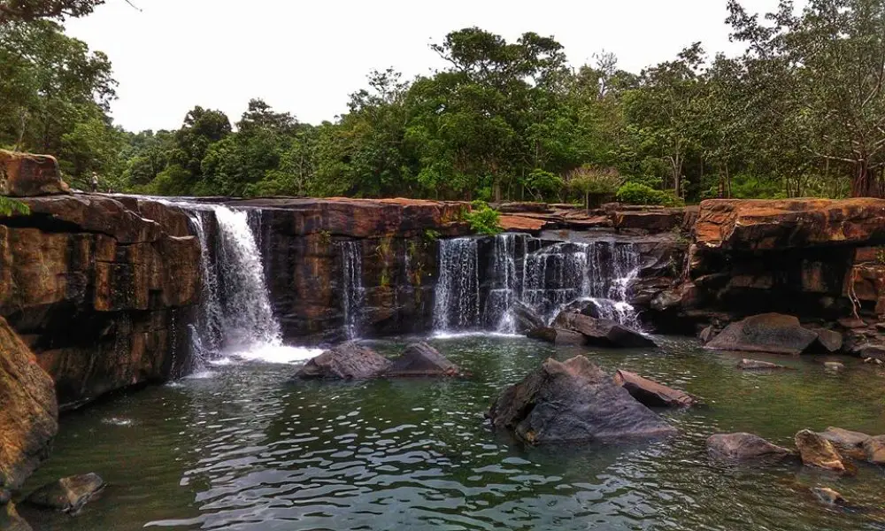
27. Tat Ton National Park in Chaiyaphum Province is a popular natural destination famous for Tat Ton Waterfall and the forested landscape of the Phu Laen Kha mountain range. Located in Na Fai Subdistrict, Mueang Chaiyaphum District, the park is particularly well known for the waterfall's wide sandstone terraces, where water flows across an extensive rock surface before descending into a natural pool. Its relatively convenient access from Chaiyaphum city makes it a rewarding destination for families, photographers, and travelers seeking a relaxed outdoor experience.
Highlights: Tat Ton Waterfall, extensive sandstone terraces, forest nature trails, the Phu Laen Kha mountain ecosystem, shaded streams, photography viewpoints, camping areas, and seasonal scenery.
Tat Ton Waterfall differs from waterfalls that plunge vertically from a single high cliff. Much of its character comes from the broad, sloping sandstone surface over which the water flows before descending through several levels. This creates changing patterns of moving water and rock that are particularly beautiful when water levels are favorable.
The park protects forest ecosystems associated with the Phu Laen Kha mountain range. The surrounding woodland, streams, and rock formations support different forms of plant and animal life. Preserving this environment is important not only for tourism but also for water management and maintaining the natural balance of the wider landscape.
During the rainy season, the waterfall often becomes more powerful and the surrounding forest turns a vibrant green. However, strong currents and slippery sandstone can make certain areas hazardous. Visitors should remain within permitted viewing locations and avoid entering water where swimming is prohibited or conditions are unsafe.
When water levels are lower, more of the sandstone terrace becomes visible, allowing travelers to appreciate the natural structure of the waterfall. The appearance of the landscape therefore changes throughout the year, offering different experiences depending on rainfall and seasonal conditions.
Families can enjoy the main waterfall viewing area and nearby resting places, while visitors interested in nature can explore additional paths where access is permitted. Appropriate footwear is important because stone surfaces may be uneven or slippery. Children should be supervised closely near running water, and older visitors should choose routes suited to their mobility.
Tat Ton National Park is also convenient for a day trip from Chaiyaphum city. Travelers can combine the waterfall with cultural attractions and local restaurants in the provincial capital, creating a varied itinerary without the need for long-distance travel.
Open Days: Daily. Opening Hours: 08:00 – 18:00.
Getting There: From Chaiyaphum city, travel toward Na Fai Subdistrict and the Phu Laen Kha mountain range, following signs for Tat Ton National Park. A private car or rental vehicle provides convenient access. Check current visitor announcements before entering the waterfall area, particularly during periods of heavy rainfall.
Map (GPS):Get Directions to Tat Ton National Park
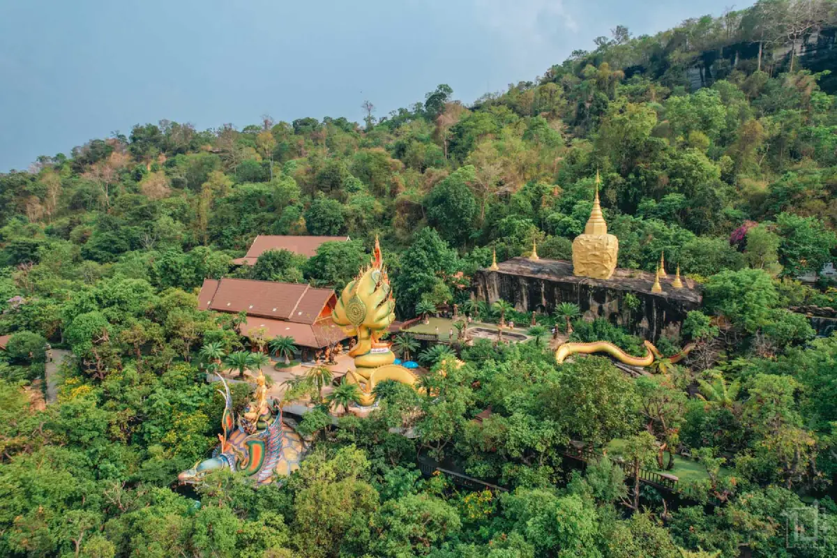
28. Wat Tham Pha Daen in Sakon Nakhon Province is a Buddhist mountain temple distinguished by impressive religious sculptures and panoramic natural scenery. Located near Ban Dong Noi in Dong Mafai Subdistrict, Mueang Sakon Nakhon District, the temple occupies a forested setting within the Phu Phan mountain range. Its most recognizable features include Buddhist figures carved into natural sandstone cliffs, large religious sculptures, landscaped gardens, and viewpoints overlooking the surrounding hills. The combination of contemporary Buddhist art and dramatic mountain scenery makes Wat Tham Pha Daen a particularly memorable destination.
Highlights: Large Naga-protected Buddha image, sandstone reclining Buddha relief, replicas of sacred Buddha footprints, golden rock stupa, Phu Pha Daen turtle sculpture, wooden pavilions, flower gardens, and panoramic viewpoints across the Phu Phan mountains.
Wat Tham Pha Daen is associated with the history of Buddhist forest meditation in northeastern Thailand. Mountain and woodland settings have long been valued by monks seeking quiet environments for religious practice. The temple's natural rock formations and forest surroundings continue to reflect this connection between Buddhism and the landscape.
The most striking artistic feature is the use of sandstone cliff surfaces as the foundation for Buddhist sculpture. Large religious images have been carved or arranged in close relationship with the natural rock, making them appear integrated into the mountain itself. This approach creates a distinctive visual connection between human craftsmanship and geological form.
The Naga-protected Buddha is another significant feature. In Buddhist tradition, the Naga is associated with the protection of the Buddha, and Naga symbolism also has deep roots in the cultural beliefs of communities along the Mekong River. The sculptures at Wat Tham Pha Daen combine these traditions with contemporary religious artistic expression.
The landscaped gardens and viewing areas provide additional attractions. Visitors can walk among religious sculptures, natural rocks, and flowering plants while enjoying views of the forested mountains. The garden environment softens the appearance of the sandstone terrain and creates a setting suitable for quiet exploration.
Wat Tham Pha Daen appeals to travelers interested in Buddhist art, photography, mountain scenery, and temple architecture. Because the temple is situated on elevated ground, the approach requires attention to road conditions and traffic arrangements. Visitors should follow designated parking procedures and use local uphill transportation when required.
Respectful clothing and quiet behavior are important. Visitors should never climb sculptures or cliff carvings, and photography should not interfere with people engaged in worship. Taking care around uneven rock surfaces and steep paths also helps ensure a safe visit.
The temple can be combined with Wat Phra That Choeng Chum in Sakon Nakhon city or attractions within the Phu Phan mountain area. This provides a varied itinerary featuring Buddhist heritage, contemporary sculpture, and the natural scenery of northeastern Thailand.
Open Days: Daily. Opening Hours: 06:00 – 17:00.
Getting There: From Sakon Nakhon city, travel toward Dong Mafai Subdistrict and Ban Dong Noi. Visitors normally park at the lower parking area and follow the temple's current local transportation arrangements for reaching the upper complex. The mountain access road is steep and winding.
Map (GPS):Get Directions to Wat Tham Pha Daen
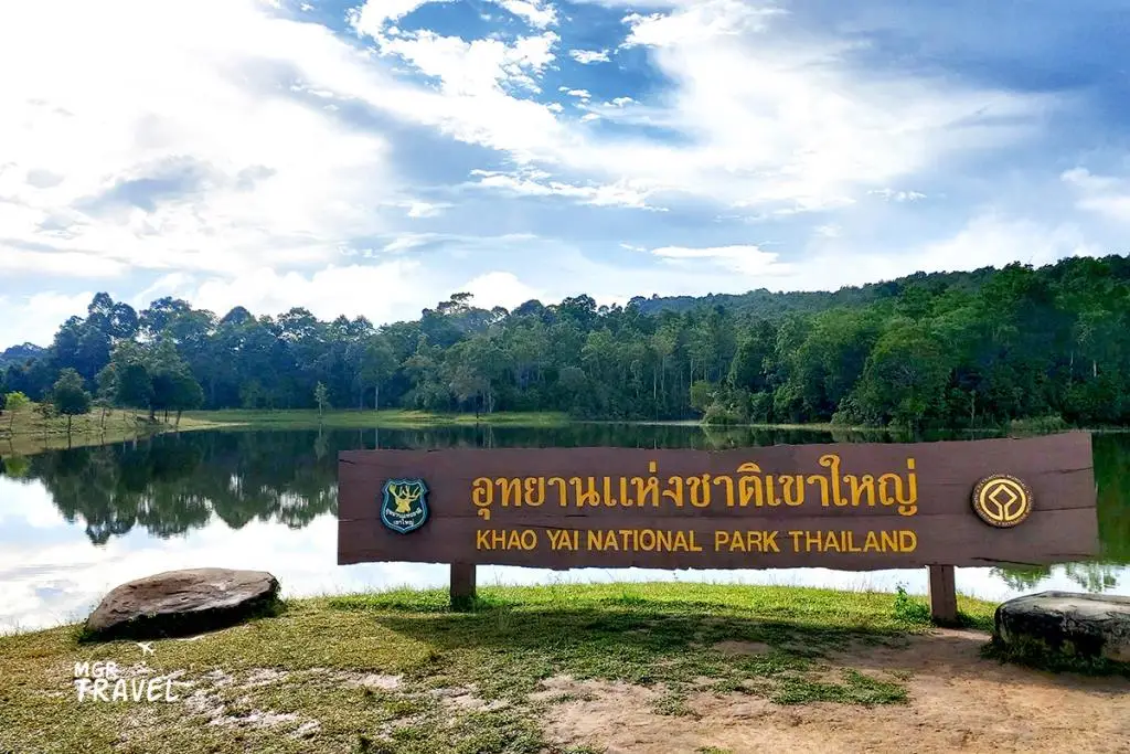
29. Khao Yai National Park in Nakhon Ratchasima Province is Thailand's first national park and one of the country's most important protected forest landscapes. Covering areas of Nakhon Ratchasima, Saraburi, Prachin Buri, and Nakhon Nayok provinces, the park is commonly accessed from the Pak Chong side of Nakhon Ratchasima. Its diverse scenery includes forested mountains, grasslands, streams, waterfalls, and wildlife habitats. Khao Yai is also part of the Dong Phayayen–Khao Yai Forest Complex, a UNESCO World Heritage Site recognized for its outstanding biodiversity and conservation importance.
Highlights: Haew Suwat Waterfall, Haew Narok Waterfall, Pha Kluai Mai Waterfall, Kong Kaew Waterfall, Nong Phak Chi Wildlife Observation Tower, Mo Singto Wildlife Observation Tower, Sai Sorn Reservoir, Pha Diao Dai viewpoint, Khao Khiao, the visitor center, nature trails, and opportunities to observe wildlife in its natural environment.
Khao Yai was established as Thailand's first national park on 18 September 1962, marking an important milestone in the development of the country's national park system. The protection of its forest landscape helps conserve major watersheds, mountain ecosystems, and wildlife habitats in an area surrounded by expanding communities and agricultural land.
Biodiversity is one of the park's defining characteristics. Different forest environments and grasslands provide habitats for elephants, gaur, deer, gibbons, hornbills, and many other species. Seeing wildlife in its natural environment can be a memorable experience, but sightings depend on animal behavior, seasonal conditions, and chance. Visitors should never approach or feed wild animals.
Haew Suwat Waterfall is one of Khao Yai's best-known natural landmarks, celebrated for its waterfall scenery surrounded by forest. Haew Narok is another major waterfall, distinguished by dramatic elevation changes and steep terrain. Both locations require visitors to remain within designated viewing areas because slippery surfaces and cliff edges can be dangerous.
Nature trails and viewpoints provide opportunities to experience the park's ecosystems in greater depth. Some trails are suitable for short walks, while others require registration, an authorized guide, or specific access arrangements. Choosing a route that matches your fitness level and available time helps make the experience both enjoyable and responsible.
The Dong Phayayen–Khao Yai Forest Complex was inscribed on the UNESCO World Heritage List in 2005 because of its important biodiversity and conservation value. This recognition emphasizes that Khao Yai is not simply a scenic recreational area but also part of a larger ecological system whose protection benefits numerous species.
Khao Yai is suitable for family trips, hiking, birdwatching, wildlife photography, and nature education. Travelers who want to visit several waterfalls and viewpoints should allow at least one full day, while a longer stay provides more time for guided activities and careful wildlife observation.
Driving within the park requires particular caution. Animals, including wild elephants, may cross the road unexpectedly. Visitors should obey speed limits, keep a safe distance from wildlife, and follow ranger instructions. Feeding animals, littering, and stopping vehicles in hazardous locations should be avoided.
Open Days: Daily. Opening Hours: Main entry and exit generally 06:00 – 18:00; individual attractions and activities may have separate schedules.
Getting There: From Bangkok, travel through Saraburi along Mittraphap Road toward Pak Chong District in Nakhon Ratchasima. Continue along Thanarat Road to the Pak Chong entrance of Khao Yai National Park. Travelers arriving by bus or train can reach Pak Chong and arrange local transport onward to the park.
Map (GPS):Get Directions to Khao Yai National Park
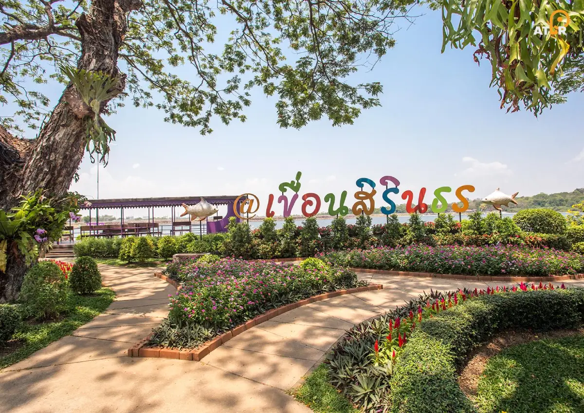
30. Sirindhorn Dam in Ubon Ratchathani Province is an important multipurpose dam and scenic attraction associated with water management and renewable energy. Located in Nikhom Lam Dom Noi Subdistrict, Sirindhorn District, the dam was built across the Lam Dom Noi River, a tributary of the Mun River. Its large reservoir, landscaped grounds, and educational facilities provide opportunities for sightseeing and learning about hydropower. The site is also internationally notable for its floating solar power project, which combines solar electricity generation with the dam's existing hydropower infrastructure.
Highlights: Sirindhorn Dam crest, Lam Dom Noi Reservoir, scenic lake viewpoints, nature walkways, landscaped gardens, energy education facilities, the hydro-floating solar hybrid project, and recreational areas overlooking the reservoir.
Sirindhorn Dam plays an important role in the development of southern northeastern Thailand. Its functions include electricity generation, water management, and supporting various activities associated with the reservoir. The construction of the dam transformed part of the Lam Dom Noi landscape into a substantial body of water that continues to influence the surrounding communities and regional infrastructure.
The structure is a rock-fill dam with a clay core, designed to retain water and support hydropower production. Visitors interested in engineering can learn about the basic relationship between water storage and electricity generation through the educational information and visitor facilities available at the site.
One of Sirindhorn Dam's most interesting modern developments is its floating solar power system. Solar panels mounted on floating platforms generate electricity from sunlight while the associated hydropower facilities continue to support the wider energy system. The combination demonstrates how different renewable energy technologies can be integrated to make use of existing infrastructure.
The reservoir itself is a major scenic attraction. Its broad water surface and surrounding hills create an open, peaceful landscape, contrasting with the forest trails and religious monuments found elsewhere in Isan. Early morning and late afternoon are pleasant times to enjoy the scenery, especially when sunlight reflects across the water.
Landscaped gardens and visitor walkways offer opportunities for relaxed exploration. Families and students can combine sightseeing with learning about renewable energy and environmental management. Access to some technical areas may be restricted because the site remains an operating power-generation facility.
Sirindhorn Dam can be combined with other attractions in Sirindhorn District, including Wat Sirindhorn Wararam Phu Phrao, Chong Mek, and sites around the reservoir. Planning these stops within the same area creates a varied itinerary combining energy education, Buddhist culture, and natural scenery.
Visitors should follow the instructions of dam personnel, remain outside restricted operational zones, and avoid unauthorized water activities. Observing safety rules is particularly important around engineering infrastructure and areas where water levels or access conditions may change.
Open Days: Daily. Opening Hours: Public tourist areas generally 06:00 – 20:00; exhibition buildings and individual activities may have different schedules.
Getting There: From Ubon Ratchathani city, follow Highway 217 toward Sirindhorn District and turn onto the access road to Sirindhorn Dam. Traveling by private car or rental vehicle is convenient for combining the reservoir with other attractions around Chong Mek and Sirindhorn District.
Map (GPS):Get Directions to Sirindhorn Dam
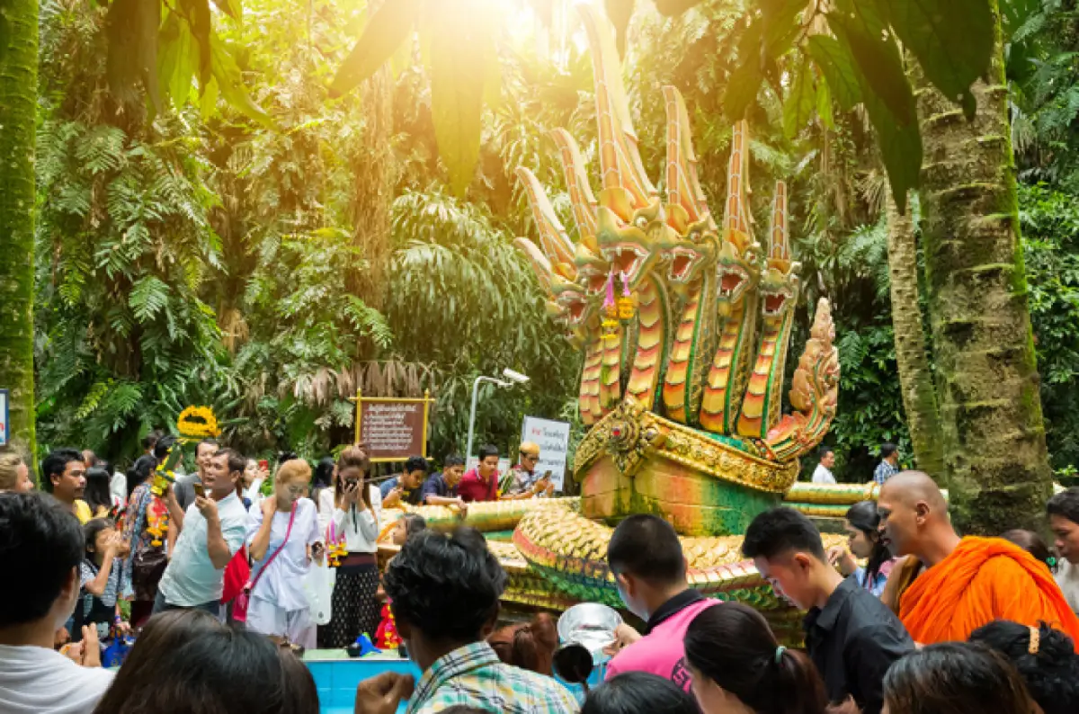
31. Kham Chanot City in Udon Thani Province is one of northeastern Thailand's most distinctive spiritual and cultural destinations. Located near Ban Non Mueang in Ban Dung District, the site is famous for its remarkable grove of Chanot palms growing on wetland terrain and for its association with traditional Naga beliefs. Devotees travel here to pay respect to Chao Pu Si Suttho and Chao Ya Si Pathumma, revered figures in the local spiritual tradition. The combination of unusual vegetation, religious customs, folklore, and a peaceful forest atmosphere makes Kham Chanot a significant destination for visitors seeking to understand the living belief systems of Isan.
Highlights: The sacred Chanot palm forest, shrines dedicated to Chao Pu Si Suttho and Chao Ya Si Pathumma, a sacred well, elevated walkways, Naga mythology, traditional worship practices, and the wetland environment surrounding the sanctuary.
One of Kham Chanot's most remarkable features is its landscape. The grove resembles a small island of palms surrounded by wet ground and water-sensitive vegetation. Chanot palms, with their distinctive trunks and leaves, create a dense canopy that contrasts with the surrounding agricultural landscape. Entering the forest along the designated walkway gives visitors a strong sense of moving from an ordinary community setting into a place considered sacred by generations of local residents.
According to regional folklore, Kham Chanot is closely associated with the realm of the Nagas, mythical serpent beings believed to inhabit waterways and subterranean worlds. Chao Pu Si Suttho and Chao Ya Si Pathumma are central figures in the site's religious identity. For devotees, the sanctuary is a place to express respect and seek blessings. For cultural travelers, it provides an opportunity to learn how beliefs about water, fertility, protection, and spiritual power have developed in communities across the Mekong basin.
The shrines and sacred well are important points along the visiting route. Worshippers commonly participate in ceremonies and make offerings according to established local practices. Visitors who do not share these beliefs can still appreciate the site's cultural significance by remaining quiet, following the designated sequence of movement, and treating ceremonies with respect.
Kham Chanot is also interesting from an environmental perspective. Its palm grove and wetland vegetation create a distinctive natural habitat. The relationship between the forest and the community's beliefs helps explain why particular landscapes acquire special cultural meaning and receive protection through customary traditions.
The site can become busy during weekends, holidays, and important religious occasions. Visitors should allow additional time for entering the sanctuary and follow instructions concerning offerings, photography, and restricted areas. Plants and other natural materials should never be removed from the grove, and all waste should be disposed of responsibly.
Kham Chanot is particularly suitable for travelers interested in Naga mythology, local spiritual practices, and the cultural heritage of upper Isan. It can be combined with attractions around Ban Dung District, although the distance from central Udon Thani makes it advisable to plan transportation carefully.
Open Days: Daily. Opening Hours: 06:00 – 18:00.
Getting There: From Udon Thani city, travel toward Ban Dung District and continue to Ban Non Mueang, following signs for Kham Chanot. A private car or hired vehicle provides convenient access. Visitors should use designated parking areas and follow the organized entrance route.
Map (GPS):Get Directions to Kham Chanot
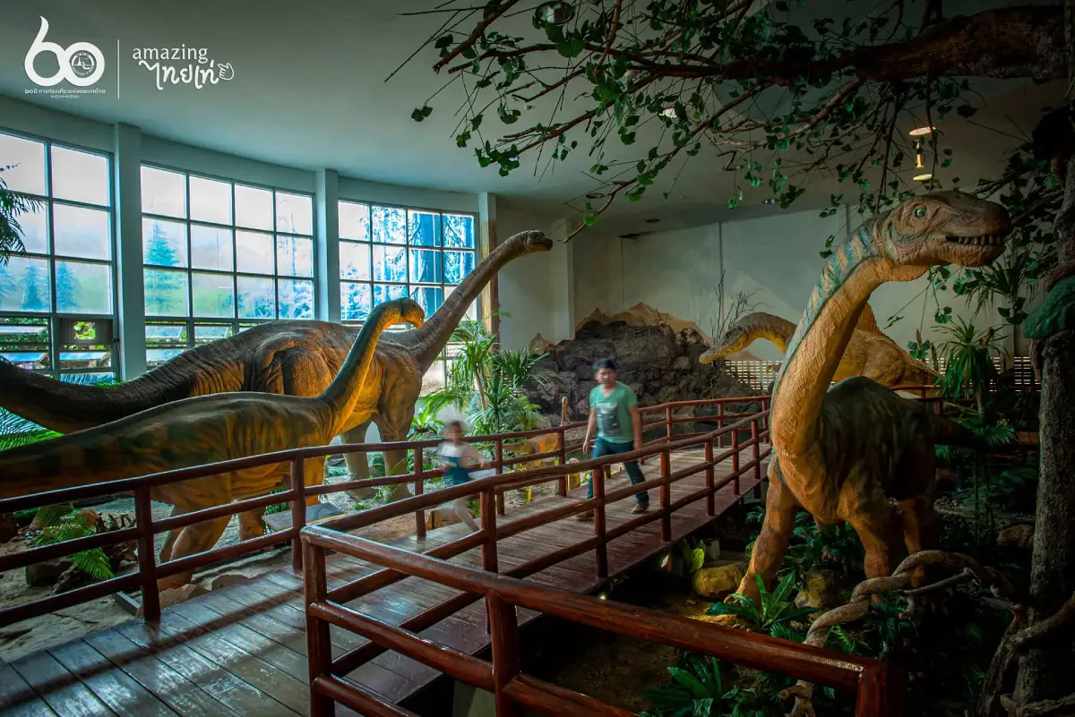
32. Phu Wiang Dinosaur Museum in Khon Kaen Province is an important center for learning about dinosaurs, fossils, geology, and prehistoric life in Thailand. Located in Wiang Kao District near the sandstone mountains of Phu Wiang, the museum presents archaeological and paleontological discoveries that have transformed scientific understanding of ancient life in northeastern Thailand. Through fossil specimens, dinosaur models, geological exhibitions, and interpretive displays, visitors can explore how researchers reconstruct ecosystems that existed millions of years before modern human settlement.
Highlights: Thai dinosaur fossils, dinosaur skeleton models, the history of fossil discoveries at Phu Wiang, paleontological exhibitions, geological displays, prehistoric ecosystems, and nearby dinosaur excavation sites.
Phu Wiang holds a special place in Thailand's scientific history because dinosaur fossils were discovered in the region during geological surveys in 1976. These finds encouraged further excavation and systematic scientific investigation, establishing northeastern Thailand as an important area for studying dinosaurs and other ancient vertebrates.
The museum helps visitors understand how such discoveries are made. Fossils are not simply objects found in isolation; they must be studied in relation to surrounding rock layers, their original positions, and associated geological evidence. Exhibitions introduce the methods used to excavate, preserve, compare, and interpret ancient bones, revealing the complexity of paleontological research.
Among the subjects presented are dinosaur species identified from fossils discovered in Thailand. These findings have helped scientists compare prehistoric animals from the Khorat Plateau with related species elsewhere in Asia and investigate the evolutionary relationships among different dinosaur groups.
The displays also explain how landscapes and ecosystems have changed over geological time. Rock formations preserve traces of environments that existed long before today's mountains, forests, and agricultural plains. Learning about these changes helps visitors understand why fossils appear in particular types of sedimentary rock.
Life-size models and reconstructed skeletons make the museum especially engaging for children. They provide a sense of the scale and physical characteristics of dinosaurs, while scientific explanations offer deeper information for older students and adults. Families can follow the exhibitions together and learn how researchers distinguish evidence from artistic reconstructions.
A visit to Phu Wiang Dinosaur Museum becomes even more rewarding when combined with nearby Phu Wiang National Park and authorized fossil excavation areas. Seeing the surrounding geological landscape helps connect the exhibits to the locations where prehistoric evidence was actually discovered.
The museum is suitable for school groups, families, science enthusiasts, and anyone interested in the natural history of Southeast Asia. Visitors should allow time to read the exhibitions and follow restrictions designed to protect original fossil material.
Open Days: Tuesday – Sunday; closed Monday. Opening Hours: 09:30 – 16:30.
Getting There: From Khon Kaen city, travel toward Phu Wiang and Wiang Kao districts, then follow signs to Phu Wiang Dinosaur Museum. A private vehicle is useful for combining the museum with national park attractions and other geological sites.
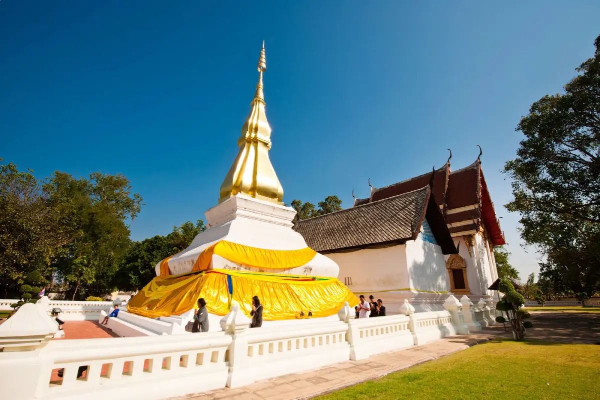
33. Phra That Kham Kaen in Khon Kaen Province is a revered Buddhist monument located within Wat Chetiyaphum at Ban Kham, Ban Kham Subdistrict, Nam Phong District. Regarded as one of Khon Kaen's important sacred landmarks, the stupa is distinguished by its graceful white structure and golden upper section. The site is closely associated with a traditional story about the miraculous revival of a tamarind tree, which also provides an explanation for the monument's name. Phra That Kham Kaen therefore offers visitors a meaningful combination of religious architecture, folklore, and local cultural history.
Highlights: Phra That Kham Kaen stupa, Wat Chetiyaphum, the legend of the tamarind tree, traditional northeastern Buddhist architecture, annual worship ceremonies, and the religious traditions of Ban Kham community.
The legend of Phra That Kham Kaen tells of a group traveling with sacred relics who stopped overnight near a dead tamarind tree. According to the story, the tree later unexpectedly produced new branches and leaves. The event was interpreted as an auspicious sign and became associated with the establishment of a sacred monument at the site.
As with many Buddhist landmarks in northeastern Thailand, the legend has value as an expression of collective memory and religious identity. It explains how a familiar natural object, the tamarind tree, became connected with sacred history and eventually gave its name to an important local monument.
The stupa's appearance reflects the restrained elegance of regional Buddhist architecture. White surfaces contrast with the golden spire, giving the monument a recognizable silhouette against the surrounding sky. The courtyard and religious grounds provide space for offerings, worship, and ceremonies throughout the year.
Wat Chetiyaphum remains closely connected with the surrounding community. Local residents participate in Buddhist observances, make merit, and preserve customs associated with the sacred stupa. The continuing use of the grounds demonstrates how temples function as places of spiritual and social importance beyond their architectural value.
During annual worship celebrations, the community gathers for traditional ceremonies and religious activities. The dates may follow the local Buddhist calendar, so travelers interested in attending a festival should consult the current schedule rather than relying on an earlier year's arrangements.
Phra That Kham Kaen is suitable for pilgrims, families, and cultural travelers. It can be included in a wider journey through Nam Phong District and other parts of Khon Kaen Province, offering a quieter rural contrast to the religious monuments of the provincial capital.
Visitors should dress modestly, remain respectful around worshippers, and avoid touching or climbing the stupa. Taking time to learn the local legend adds depth to the experience and helps explain the importance of the site to the community.
Open Days: Daily. Opening Hours: 05:00 – 19:00.
Getting There: From Khon Kaen city, head toward Nam Phong District, then continue through Ban Kham Subdistrict to Wat Chetiyaphum. Private transport is convenient for visiting the temple and exploring nearby attractions.
Map (GPS):Get Directions to Phra That Kham Kaen
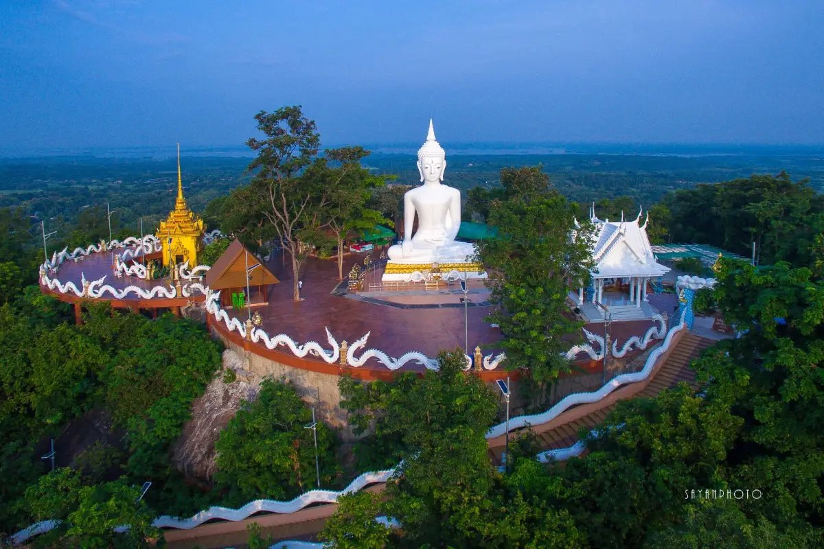
34. Phu Sing Buddhist Sanctuary in Kalasin Province, also known as Wat Phutthawat Phu Sing, is a hilltop Buddhist sanctuary in Sahatsakhan District. It is famous for the large white Phra Phrom Phumipalo Buddha image, which stands prominently above the surrounding countryside. The elevated site also provides sweeping views toward Lam Pao Reservoir, forested hills, and nearby communities, making it a destination that combines Buddhist devotion with one of the area's memorable mountain panoramas.
Highlights: Phra Phrom Phumipalo Buddha image, the hilltop sanctuary, panoramic Lam Pao Reservoir views, the long stairway leading up Phu Sing, road access to the summit, forest scenery, and traditional Buddhist worship.
Phu Sing rises approximately 346 meters above sea level, giving visitors an elevated perspective over Sahatsakhan District. From the upper grounds, the landscape opens toward the reservoir, agricultural areas, forested hills, and surrounding settlements. The combination of water and mountain scenery is one of the principal attractions of the site.
Phra Phrom Phumipalo, the monumental white Buddha image in the posture of subduing Mara, is the visual centerpiece of Phu Sing. Its large scale and serene appearance make it visible from surrounding areas, while the bright white surface contrasts with the blue sky and green mountain vegetation.
Visitors can reach the sanctuary by road or by climbing the long stairway, which has approximately 417 steps. Those who enjoy a physical challenge may find the ascent rewarding, but the stairs require reasonable fitness and care in warm or wet weather. Travelers with mobility limitations may prefer vehicle access where available.
The views toward Lam Pao Reservoir are particularly attractive on clear days. The broad water surface and surrounding landscape reveal the relationship between the local hills, agriculture, and water management. Morning and late-afternoon light can create favorable conditions for photography.
Phu Sing is also a place of Buddhist worship and reflection. Local devotees visit the sanctuary to pay respect to the Buddha image and participate in religious activities. Travelers should therefore approach the grounds with the same consideration expected at any active temple.
The sanctuary can be combined with Sirindhorn Museum, Phu Kum Khao, and other attractions in Sahatsakhan District. This makes the area particularly suitable for a full-day itinerary combining dinosaur history, religious culture, and scenic viewpoints.
Open Days: Daily. Opening Hours: 06:00 – 18:00.
Getting There: From Kalasin city, follow Highway 227 toward Sahatsakhan District, then use the marked road leading to Phu Sing Buddhist Sanctuary. Drivers should take care on the hillside approach and follow parking instructions near the summit.
35. Isan Art and Culture Center in Maha Sarakham Province is an educational and cultural institution associated with Rajabhat Maha Sarakham University in Mueang Maha Sarakham District. The center preserves and presents the traditions, craftsmanship, literature, and everyday knowledge of communities throughout northeastern Thailand. Through displays of textiles, traditional tools, agricultural equipment, basketry, and cultural artifacts, visitors can explore the rich heritage of Isan beyond its famous temples and natural landscapes.
Highlights: Isan cultural exhibitions, traditional textiles and weaving, regional fabric patterns, basketry, agricultural tools, palm-leaf manuscripts, local literature, community craftsmanship, and traditional northeastern Thai lifestyles.
Maha Sarakham is widely recognized as an important educational center in northeastern Thailand. Its academic institutions have contributed to research and the preservation of local history and culture. The Isan Art and Culture Center reflects this role by bringing together material evidence and knowledge associated with the region's diverse communities.
Traditional weaving is among the most distinctive forms of craftsmanship represented in Isan culture. Textile techniques and patterns are often connected with the identity of particular communities, family traditions, ceremonies, and local resources. Studying these fabrics provides insight into how artistic expression and everyday life have developed together across generations.
Basketry and agricultural equipment offer another perspective on rural life. Materials such as bamboo, rattan, and natural fibers have been used to produce baskets, containers, fishing equipment, and household objects. These artifacts demonstrate how communities adapted their practical knowledge to the resources available in forests, rivers, and agricultural landscapes.
Palm-leaf manuscripts and local literature are particularly valuable because they preserve religious teachings, traditional narratives, moral stories, and regional language traditions. Historically, such texts were connected with Buddhist temples and communal learning, where oral recitation and storytelling helped transmit knowledge across generations.
The center is suitable for students, researchers, families, and travelers interested in ethnography and cultural history. Taking time to study the objects and exhibition explanations provides a broader understanding of how different groups across Isan have maintained distinctive traditions within a shared regional identity.
A visit can be combined with Wat Mahachai, the Maha Sarakham City Pillar Shrine, and other attractions around the provincial capital. Because the center is located within a university environment, visitors should follow current campus entrance and exhibition access arrangements.
Open Days: Monday – Friday. Opening Hours: 08:30 – 16:30.
Getting There: The center is associated with Rajabhat Maha Sarakham University on Nakhon Sawan Road in Mueang Maha Sarakham District. Visitors can travel by private car, taxi, or local transport and ask university personnel for directions to the exhibition area.
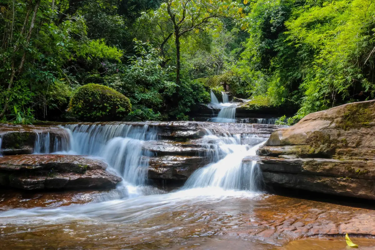
36. Tad Kinnaree Waterfall in Bueng Kan Province is a distinctive natural attraction within the Phu Langka National Park area, near Ban Na Ang in Pho Mak Khaeng Subdistrict, Bueng Khong Long District. The waterfall is known for its streams flowing over several levels of sandstone, surrounded by forest and naturally eroded rock formations. Particularly memorable are the unusual boulders whose shapes resemble dolphins, adding a unique geological feature to the landscape. Tad Kinnaree is an appealing destination for travelers who enjoy forest scenery, flowing water, and the natural sandstone terrain of upper northeastern Thailand.
Highlights: Multi-level sandstone cascades, natural rock terraces, dolphin-shaped boulders, forest streams, freshwater pools, nature trails, and the ecological scenery of Phu Langka National Park.
The waterfall is formed by streams flowing from the forested Phu Langka highlands. As water travels across sandstone layers, differences in elevation and rock resistance create small cascades, channels, hollows, and pools. Over long periods, flowing water and sediment gradually reshape the rock surface, producing the unusual natural features visible today.
Tad Kinnaree is often described as having five levels, each offering a different combination of water flow, rock terraces, and forest surroundings. Some sections feature broad, relatively gentle cascades, while others contain narrower channels or deeper pools. Exploring the permitted routes allows visitors to appreciate the variety of geological formations within a relatively compact landscape.
Among the most recognizable features are rocks resembling dolphins. Their distinctive shapes resulted from natural weathering and erosion rather than human carving. They are particularly popular with photographers because their forms create striking compositions against the surrounding water and sandstone.
The surrounding forest is an important part of the Phu Langka ecosystem. Trees and other vegetation help retain moisture, regulate water flow, and provide habitat for wildlife. During the rainy season, the forest becomes especially lush and streams may carry greater volumes of water, but these conditions can also increase the risk of slippery surfaces and sudden changes in stream flow.
Travelers should wear shoes suitable for wet rocks and uneven walking paths. Climbing on boulders beside fast-moving water should be avoided, particularly during or immediately after heavy rain. Visitors should remain within officially accessible areas and follow national park announcements concerning closures, trail maintenance, and water safety.
Tad Kinnaree can be included in a broader itinerary through Bueng Khong Long District, where visitors may also explore the wetland environment of Bueng Khong Long and other attractions in the Phu Langka landscape. The trip is particularly suited to travelers who appreciate quieter natural settings and are willing to plan around seasonal access conditions.
Getting There: From Bueng Kan town, travel toward Bueng Khong Long District, then continue to Pho Mak Khaeng Subdistrict and Ban Na Ang. Follow local signs toward Tad Kinnaree Waterfall. A private car is convenient, but visitors should confirm the condition of the final access road and walking trail before setting out.
Map (GPS):Get Directions to Tad Kinnaree Waterfall
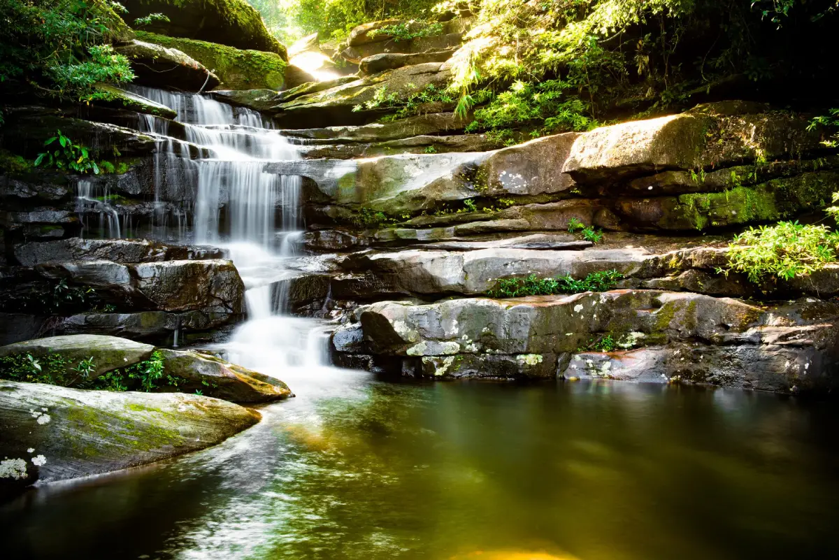
37. Tat Pho Waterfall in Nakhon Phanom Province is a multi-level waterfall within Phu Langka National Park, located around Phai Lom Subdistrict, Ban Phaeng District. The waterfall is formed by streams flowing through the forested mountains before descending over sandstone layers and rocky slopes. Surrounded by dense vegetation and mountain scenery, Tat Pho offers an opportunity to experience the natural environment of northeastern Thailand beyond the temples and Mekong riverside landmarks for which Nakhon Phanom is better known.
Highlights: Four waterfall levels, sandstone cliffs and terraces, mountain streams, forest nature trails, Phu Langka's protected woodland, wildlife habitats, and seasonal waterfall scenery.
The waterfall originates from mountain streams within the Phu Langka forest system. Rainwater collected across the highlands gradually flows into tributaries and descends toward lower elevations. Where the streams pass over sandstone ledges, they form cascades, pools, and sections of exposed rock that give Tat Pho its distinctive appearance.
The waterfall's character varies throughout the year. During periods of sufficient rainfall, the cascades may become more powerful and the surrounding vegetation takes on a vivid green appearance. In drier conditions, the volume of water may decrease, revealing additional rock surfaces and the geological structure beneath the streams.
The surrounding forest is valuable as part of a wider mountain ecosystem. Vegetation helps stabilize soils, retain moisture, and sustain streams that flow down from the highlands. For travelers interested in nature, the journey to the waterfall offers opportunities to observe the relationship between forest cover, sandstone geology, and freshwater habitats.
Some visiting routes may require walking through uneven or steep terrain. Accessibility can vary according to seasonal weather conditions and national park management. Travelers wishing to reach the upper waterfall levels should consult park personnel about the route, available guidance, and any current access restrictions.
Appropriate walking shoes, drinking water, and weather protection are recommended. Wet sandstone can be slippery, and water levels may change after heavy rain. Visitors should avoid swimming in restricted pools, climbing unstable rocks, or entering closed sections of the forest.
Tat Pho is suitable for hikers, nature photographers, and travelers seeking a quiet forest experience. It can be combined with other attractions around Ban Phaeng District, although adequate time should be allowed for access roads and walking routes. Checking national park announcements before traveling is particularly important during the rainy season.
Getting There: From Nakhon Phanom city, follow Highway 212 north toward Ban Phaeng District, then continue toward Phai Lom Subdistrict and the Phu Langka National Park access routes. Confirm trail conditions and registration requirements with park personnel before attempting longer walks.
Map (GPS):Get Directions to Tat Pho Waterfall
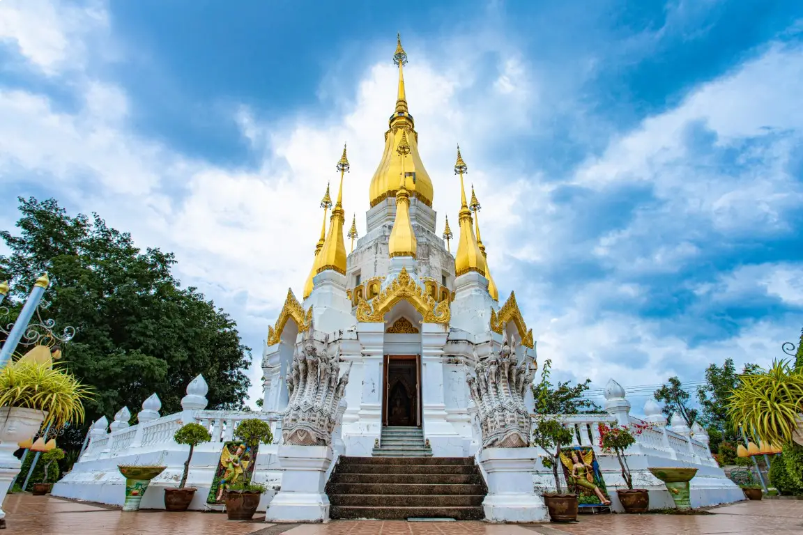
38. Wat Tham Khuha Sawan in Ubon Ratchathani Province is an important Buddhist temple and cultural attraction in Khong Chiam District. Situated near the Mekong River, the temple occupies elevated terrain offering scenic views of the surrounding river landscape and, in suitable conditions, the hills across the border in Laos. Wat Tham Khuha Sawan is particularly associated with Luang Pu Kham Khaning Chulamanee, a respected meditation monk, and contains natural caves, a prominent religious stupa, a large ceremonial gong, and Buddhist devotional spaces.
Highlights: Tham Khuha Sawan cave, memorials associated with Luang Pu Kham Khaning Chulamanee, Phra Tham Chedi Si Traiphum, a monumental gong, Buddhist images, Mekong River viewpoints, and the cultural landscape of Khong Chiam.
The temple's religious history is closely connected with the traditions of Buddhist meditation in northeastern Thailand. Luang Pu Kham Khaning Chulamanee is remembered as a respected monk whose spiritual practice and teachings attracted devotion from Buddhist communities. The cave environment and quiet surroundings reflect the importance of secluded natural settings within the forest meditation tradition.
The natural cave is one of the temple's most important locations. It contains spaces associated with Buddhist worship and the history of Luang Pu Kham Khaning. Its rocky interior and sheltered atmosphere provide an experience distinct from that of a conventional temple hall. Visitors should move carefully where stone surfaces are uneven or damp and maintain a quiet atmosphere for religious practitioners.
Phra Tham Chedi Si Traiphum is a prominent architectural feature with religious symbolism associated with Buddhist cosmological ideas. Together with other structures in the grounds, it reflects the temple's role in preserving spiritual traditions and honoring respected Buddhist teachers.
The large gong is another recognizable attraction. Ceremonial instruments have an important place in Buddhist practice and regional cultural traditions, and the gong has become a notable visual landmark within the temple. Visitors should follow posted instructions concerning photography or contact with ceremonial objects.
The temple's elevated position allows visitors to appreciate the scenery of Khong Chiam and the Mekong basin. From accessible viewing areas, the river, mountains, and settlements create a broad panorama that demonstrates the relationship between local communities and the waterways of the Thai–Lao border region.
Wat Tham Khuha Sawan can be combined with Pha Taem National Park, Khong Chiam's riverside viewpoints, and the confluence of the Mun and Mekong rivers. This makes it a convenient stop on an itinerary exploring the natural and religious heritage of eastern Ubon Ratchathani.
Visitors should dress modestly, respect worshippers and meditation practitioners, and avoid disturbing religious ceremonies. Care is also needed around cave entrances, elevated viewing points, and rocky paths, especially during wet weather.
Open Days: Daily. Opening Hours: 08:00 – 18:00.
Getting There: From Ubon Ratchathani city, travel toward Khong Chiam District, then follow local roads connecting with Highway 2222 to Wat Tham Khuha Sawan near the district center. Private transport is convenient for combining the temple with nearby Mekong viewpoints.
Map (GPS):Get Directions to Wat Tham Khuha Sawan
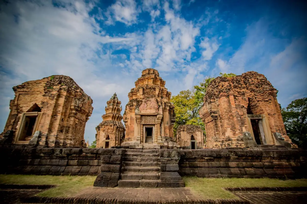
39. Prasat Sikhoraphum in Surin Province is an important ancient Khmer sanctuary located at Ban Prasat in Ra-Ngaeng Subdistrict, Sikhoraphum District. It is distinguished by five brick towers arranged on a common laterite platform, with a central sanctuary surrounded by four smaller towers. The monument is particularly famous for its intricately carved sandstone lintel depicting Shiva Nataraja, or Shiva performing the cosmic dance. Its unusual architectural arrangement and surviving decorative sculptures make Prasat Sikhoraphum one of the most rewarding archaeological sites in southern northeastern Thailand.
Highlights: Five brick sanctuary towers, the Shiva Nataraja lintel, carved sandstone decorations, Baphuon and Angkor Wat artistic influences, laterite foundations, ancient doorways, surrounding enclosure features, and the religious history of Khmer civilization.
Prasat Sikhoraphum was constructed within the cultural sphere of the ancient Khmer Empire, with major architectural features associated with approximately the 12th century. Its original religious setting was Hindu, particularly connected with the worship of Shiva. Later developments in the region brought changes to religious practice, and the sanctuary became associated with Buddhist use in subsequent periods.
The architectural plan consists of five brick towers arranged on a single laterite base. The principal tower stands in the center, while four subsidiary towers occupy the corners. This composition reflects religious ideas about sacred space and the arrangement of a central divine realm surrounded by associated structures.
The Shiva Nataraja lintel is one of the site's most important surviving artworks. It portrays Shiva in a dancing posture associated with cosmic power and transformation. Its detailed figures and decorative motifs reveal the technical achievements of Khmer sculptors and provide valuable evidence for the study of religious iconography.
Different construction materials were used according to their structural and artistic purposes. Brick formed much of the towers, laterite supported important foundations, and sandstone was employed for highly detailed architectural elements such as lintels, door frames, and decorative columns. Examining these materials helps visitors understand the engineering and craftsmanship involved in ancient Khmer temple construction.
The surrounding remains also provide clues about the original sanctuary layout and its relationship with the wider landscape. Walking around the monument allows visitors to appreciate the symmetry of the five-tower arrangement and the way architectural details change from one side of the complex to another.
Prasat Sikhoraphum is suitable for archaeology enthusiasts, photographers, architecture students, and travelers interested in Southeast Asian history. It can be included in a wider route exploring ancient Khmer monuments in Surin and Buriram, offering a useful comparison with larger temple complexes such as Phanom Rung and Mueang Tam.
Visitors should remain on designated paths and avoid climbing, scratching, or touching fragile stone carvings. Morning and late afternoon offer comfortable conditions for exploring the open-air site and examining the sandstone decorations.
Open Days: Daily. Opening Hours: 07:00 – 18:00.
Getting There: From Surin city, follow Highway 226 toward Sikhoraphum District, then continue to Ra-Ngaeng Subdistrict and Ban Prasat. The archaeological site is located near the district center and is convenient to visit by private car or rental vehicle.
Map (GPS):Get Directions to Prasat Sikhoraphum
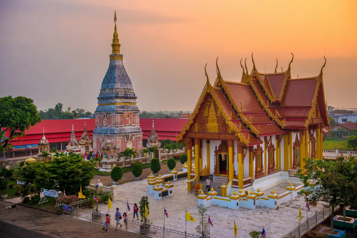
40. Phra That Renu Nakhon in Nakhon Phanom Province is a revered Buddhist stupa located within Wat That Renu in Renu Nakhon District. Distinguished by its pinkish-white exterior and golden decorative elements, the monument is closely associated with the cultural heritage and religious traditions of the Phu Thai communities who inhabit the surrounding area. Its graceful architecture and the local community's continuing devotion make it one of the most recognizable religious landmarks in southern Nakhon Phanom.
Highlights: Phra That Renu Nakhon stupa, pink-and-white Buddhist architecture, Wat That Renu, the revered Phra Ong Saen Buddha image, Phu Thai traditions, local woven textiles, and the annual Phra That Renu worship celebrations.
The stupa was developed during the early 20th century, drawing inspiration from the historical form of Phra That Phanom. Its tall, elegant structure reflects the religious architectural traditions of the Mekong basin. The distinctive color scheme gives the monument a memorable appearance, especially when sunlight illuminates the pink and white surfaces.
Phra That Renu Nakhon rises to approximately 35 meters and stands on a square base. Decorative niches and architectural elements contribute to its appearance, while the golden upper section creates a focal point above the temple courtyard. Visitors can walk around the monument to appreciate its proportions and ornamental details.
The significance of the stupa extends beyond its architecture. Renu Nakhon is strongly associated with Phu Thai culture, whose traditions include distinctive language, weaving, music, dance, dress, and community ceremonies. The monument serves as a spiritual center within this cultural landscape and remains an important part of local identity.
Phra Ong Saen, a revered Buddha image within Wat That Renu, is another focus of devotion. Buddhist visitors often pay respect to the image alongside their visit to the stupa. These practices reflect the continuing religious importance of the temple to residents and pilgrims.
The annual Phra That Renu worship celebration is an important local tradition. Buddhist ceremonies are accompanied by community activities that may include expressions of Phu Thai cultural heritage, such as traditional dress, music, or performances. The dates and program depend on the religious calendar and local organizers.
Travelers interested in cultural tourism can explore the surrounding Phu Thai community, learn about textile traditions, and discover regional crafts. Combining Phra That Renu Nakhon with Phra That Phanom also allows visitors to compare two important Buddhist monuments with closely related architectural and religious histories.
The site is suitable for pilgrims, families, photographers, and travelers interested in local heritage. Visitors should dress respectfully, maintain a quiet atmosphere during worship, and follow temple regulations concerning access and photography.
Open Days: Daily. Opening Hours: Generally 05:00 – 19:00; individual religious buildings may have different schedules.
Getting There: From Nakhon Phanom city, travel toward Renu Nakhon District, then continue into the town center to Wat That Renu along Kaeo Komon Road. The temple can be included in a broader itinerary connecting Phra That Phanom with the cultural attractions of Renu Nakhon.
Map (GPS):Get Directions to Phra That Renu Nakhon
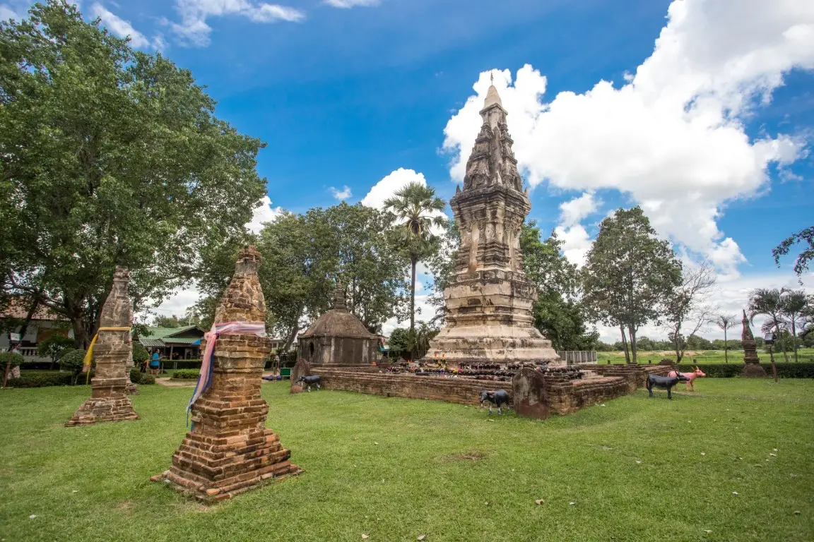
41. Phra That Kong Khao Noi in Yasothon Province is an important historic Buddhist monument distinguished by its traditional architecture and its close association with one of northeastern Thailand's best-known moral folktales. Located in Tat Thong Subdistrict, Mueang Yasothon District, the stupa is built of brick and plaster and has a distinctive form resembling a traditional sticky rice container known locally as a kong khao. The monument is famous for the legend of Kong Khao Noi Kha Mae, or the small rice basket and the killing of a mother, a story that teaches the importance of gratitude, self-control, and the consequences of uncontrolled anger. The site combines religious heritage, architectural history, and the storytelling traditions of Isan in a particularly meaningful way.
Highlights: Phra That Kong Khao Noi stupa, traditional brick-and-plaster architecture, decorative stucco details, the Kong Khao Noi Kha Mae folktale, ancient sandstone boundary markers, and the cultural landscape of Ban Tat Thong.
Phra That Kong Khao Noi is also known as Phra That Tat Thong, a name reflecting the community in which the monument stands. The structure has a square base and a tiered upper section, with decorative niches and surviving plaster ornamentation. Its architectural character reflects local Buddhist building traditions, including influences associated with artistic developments from the late Ayutthaya period into the Rattanakosin era. The monument's distinctive form has made it one of the recognizable cultural landmarks of Yasothon.
The best-known story associated with the stupa tells of a young man working in a rice field who became impatient while waiting for his mother to bring him lunch. When she finally arrived carrying a small container of sticky rice, he assumed that the food would be insufficient. Overcome by anger, he attacked his mother, causing her death. Only afterward did he discover that the small rice basket contained tightly packed rice in an amount sufficient for his meal. Filled with remorse, he is said to have constructed a religious monument in dedication to his mother.
This legend has been passed down across northeastern Thailand as a warning against anger, impatience, and a lack of gratitude toward parents. It is an example of how local communities use storytelling to communicate moral teachings through familiar settings and objects from agricultural life. The sticky rice basket is particularly meaningful because sticky rice has long been central to the daily food culture of Isan.
Although the legend is a work of traditional folklore, Phra That Kong Khao Noi is also significant as a physical historic monument. Architectural details and archaeological features in the surrounding area, including sandstone sema or Buddhist boundary markers, provide evidence of the development of religious communities around Tat Thong. Visitors can therefore explore the difference between historical material evidence and oral traditions while appreciating how both contribute to local cultural identity.
A visit is best experienced by walking around the stupa and examining its proportions, base, decorative details, and surrounding religious features. The compact scale of the monument encourages close observation, revealing how traditional architectural forms can carry meanings connected with everyday rural objects and community memory.
Phra That Kong Khao Noi is suitable for travelers interested in folklore, local history, Buddhist architecture, and cultural heritage. It can be combined with Phaya Thaen Public Park, the Phaya Khan Khak Museum, and the historic Ban Sing Tha neighborhood for a broader introduction to Yasothon's traditions and urban history.
Visitors should dress respectfully, avoid climbing on the stupa, and refrain from touching fragile plaster decoration or other historic features. Preserving these details is essential for maintaining the archaeological and cultural significance of the monument.
Getting There: From Yasothon city, follow Chaeng Sanit Road or Highway 23 toward Tat Thong Subdistrict, then continue along Thammaphiban Road to Phra That Kong Khao Noi. A private car or local hired vehicle is suitable for combining the monument with other attractions in Mueang Yasothon District.
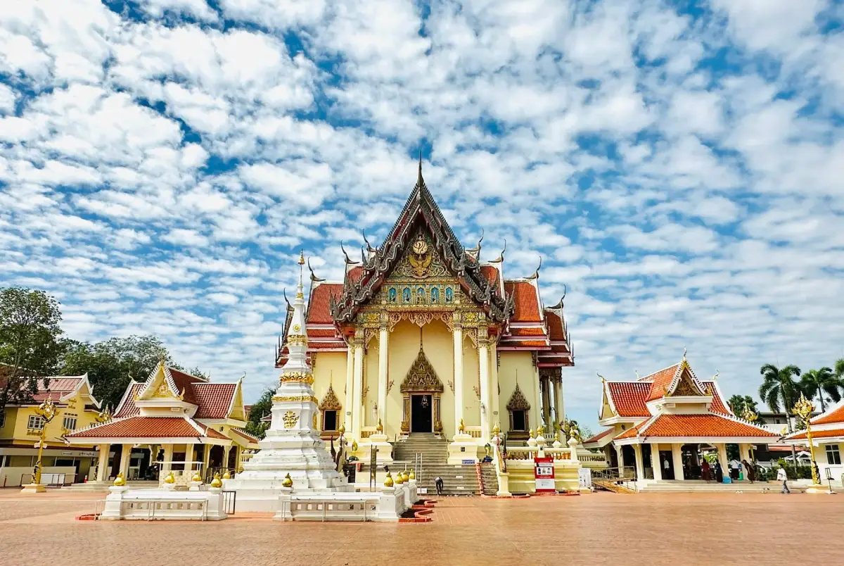
42. Wat Pho Chai in Nong Khai Province is a revered royal Buddhist temple and one of the most important spiritual landmarks of the provincial capital. Located in Nai Mueang Subdistrict, Mueang Nong Khai District, the temple is best known as the home of Luang Pho Phra Sai, a sacred Buddha image deeply respected by residents and pilgrims from the wider Mekong region. Wat Pho Chai is also significant for its connections with the history of Lan Xang Buddhism, regional artistic traditions, and local festivals that continue to be celebrated today. For travelers interested in the cultural relationship between Thailand and Laos, the temple offers a particularly valuable introduction to shared religious heritage along the Mekong River.
Highlights: Luang Pho Phra Sai Buddha image, the principal ordination hall, traditional mural paintings, Lan Xang artistic influences, the annual Songkran procession and bathing ceremony for Luang Pho Phra Sai, local rocket festival traditions, and the religious heritage of Nong Khai.
Luang Pho Phra Sai is a seated Buddha image in the posture of subduing Mara. Its history is connected with the movement of important Buddhist images through communities associated with the former Lan Xang cultural region. According to traditional narratives, three celebrated Buddha images were known as Phra Suk, Phra Soem, and Phra Sai. Stories about their origins and journeys reflect the religious connections that have long linked settlements on both sides of the Mekong.
After Luang Pho Phra Sai became enshrined at Wat Pho Chai, the image developed into a central focus of devotion for Nong Khai residents. Worshippers regularly visit the temple to make offerings, pray, and seek blessings. The image's importance extends beyond the temple itself, forming an integral part of the city's religious identity.
The ordination hall contains religious artworks and decorative features that contribute to the temple's cultural value. Its paintings and ornamentation communicate Buddhist teachings and regional traditions, while architectural details reflect influences from the wider Mekong basin. Taking time to examine these elements helps visitors understand why Wat Pho Chai is both a place of worship and a repository of religious art.
One of the most important annual traditions is the ceremonial procession of Luang Pho Phra Sai during the Songkran Festival. The sacred image is brought out so that residents can participate in traditional water-pouring ceremonies associated with the Thai New Year. This celebration is an important expression of collective faith and one of Nong Khai's distinctive seasonal events.
The temple is also associated with rocket festival customs, demonstrating the relationship between Buddhist worship and older regional traditions connected with rainfall and agricultural life. Such customs illustrate how different elements of Isan cultural heritage have developed alongside one another rather than existing as completely separate belief systems.
Wat Pho Chai is conveniently located within Nong Khai city, making it easy to combine with Sala Kaeo Ku, Tha Sadet Market, the Mekong riverfront, and other nearby attractions. Visiting the temple first provides useful historical context for exploring the wider city's cultural landscape.
Visitors should dress modestly, remove shoes where required, and maintain a quiet atmosphere inside the ordination hall. During religious festivals, allow additional time because large numbers of worshippers may gather at the temple. Photography should never interfere with ceremonies or the activities of local devotees.
Getting There: Wat Pho Chai is located around Prachak Sinlapakhom Road in central Nong Khai, near the Phra Sai neighborhood. It is accessible by private car, tuk-tuk, taxi, or local transport from the railway station, bus terminal, and Mekong riverfront area.
Map (GPS):Get Directions to Wat Pho Chai

43. Ho Kaeo Mukdahan Chaloem Phra Kiat Kanchanaphisek in Mukdahan Province is an observation tower and cultural landmark overlooking the city and the Mekong River. Located in Si Bun Rueang Subdistrict, Mueang Mukdahan District, along the Mukdahan–Don Tan road, the tower rises approximately 65.5 meters and was constructed to commemorate the Golden Jubilee of King Bhumibol Adulyadej, marking the 50th anniversary of his accession to the throne. Its combination of panoramic views, regional history exhibitions, and information about local ethnic communities makes it a useful starting point for exploring Mukdahan and the surrounding Mekong borderlands.
Highlights: The approximately 65.5-meter observation tower, panoramic city views, the Mekong River and Savannakhet in Laos, local history exhibits, displays on regional ethnic communities, traditional culture, and the distinctive glass-like structure at the tower's summit.
The tower was developed as part of the celebrations marking the Golden Jubilee of King Bhumibol Adulyadej and opened in 1996. Its establishment reflected the province's intention to create a landmark that would serve both as a commemorative monument and as a public venue for presenting the cultural heritage of Mukdahan.
Architecturally, the structure is recognizable by its nine-sided base and tall cylindrical tower, topped by a distinctive form associated with the symbolic meaning of Mukdahan's name. The design gives the building a unique appearance within the city's skyline, making it readily identifiable from surrounding roads.
The lower exhibition areas introduce aspects of Mukdahan's history, local communities, and cultural traditions. These displays are especially valuable because the province has long been connected with trade, settlement, and cultural exchange along the Mekong. Visitors can learn how the river has influenced transportation, markets, family relationships, and regional identity.
Mukdahan is known for its diverse ethnic heritage, including communities with distinctive languages, clothing, music, craft traditions, and festivals. Exhibitions relating to these groups provide context for understanding why the province is more than a border-crossing destination. Its cultural character has developed through centuries of interaction among people living across the wider Mekong basin.
The observation deck is one of the tower's principal attractions. When the weather is clear, visitors can see Mukdahan's urban landscape, the Mekong River, and Savannakhet on the opposite bank in Laos. This elevated perspective provides an excellent introduction to the geographic relationship between the two cities and the importance of the river as both a boundary and a cultural connection.
Travelers can use the tower as the starting point for a broader Mukdahan itinerary before continuing to the Mekong waterfront, local markets, or Phu Pha Thoep National Park. The combination of city history, regional culture, and scenic views makes it a convenient destination for families and first-time visitors.
Visitors should follow the site's regulations concerning lifts, exhibition spaces, and observation areas. Access to particular floors may depend on maintenance and operating arrangements, so the availability of the observation deck should be checked before making it the main purpose of a visit.
Getting There: From Mukdahan city, follow the Mukdahan–Don Tan road or Highway 2034 southward. The observation tower is a prominent roadside landmark and can be reached by private car or local taxi.
Map (GPS):Get Directions to Ho Kaeo Mukdahan
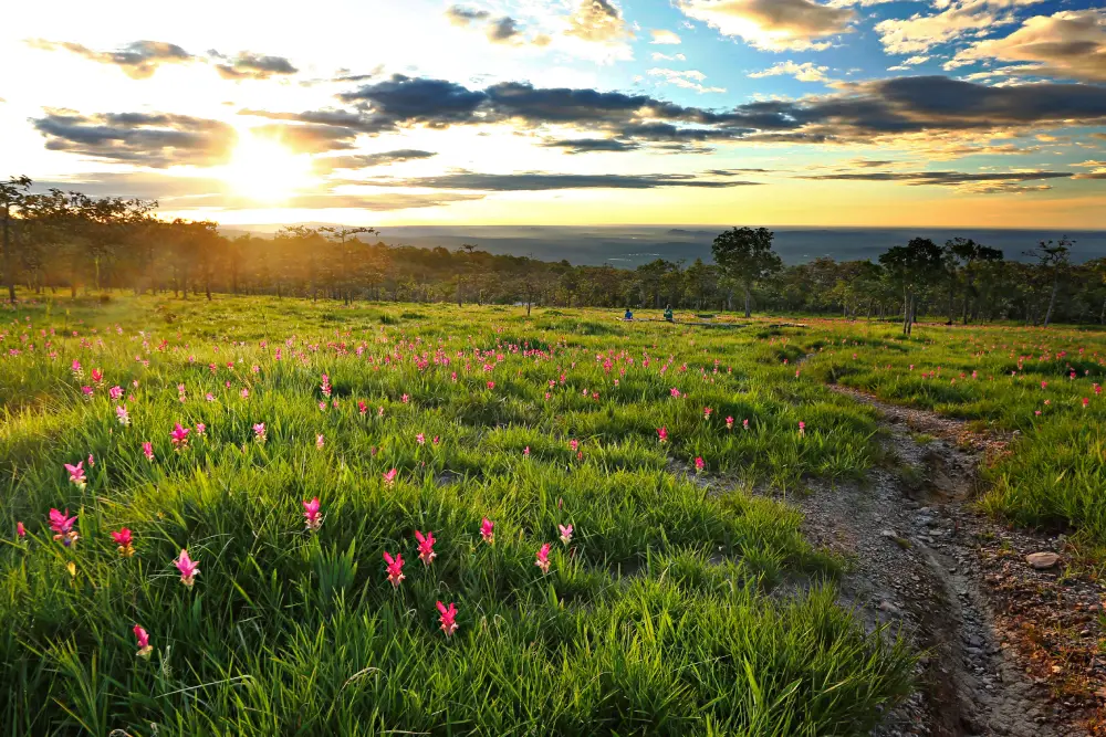
44. Sai Thong National Park in Chaiyaphum Province is a protected mountain landscape celebrated for its seasonal Siam tulip fields, dramatic cliff viewpoints, waterfalls, and forest scenery. Located along the Phang Hoei Mountain Range, with major tourist attractions accessible from Nong Bua Rawe District, the park is especially well known for Thung Bua Sawan, where pinkish-purple Siam tulips appear among grasslands during favorable rainy-season conditions. Its most adventurous landmark is Pha Ham Hot, a dramatic rock projection that has become one of Chaiyaphum's best-known natural viewpoints.
Highlights: Thung Bua Sawan Siam tulip fields, Pha Ham Hot cliff, Pha Pho Mueang, Pha Phloen Chai, Pha Athit Atsadong, Sai Thong Waterfall, Wang Ngueak, sandstone landscapes, and nature trails through the Phang Hoei highlands.
Thung Bua Sawan is a major seasonal attraction of Sai Thong National Park. When rainfall and environmental conditions are favorable, the grasslands become dotted with Siam tulips, flowers belonging to the ginger family rather than the true tulip family. Their pinkish-purple blossoms stand out against the green vegetation, especially when morning mist moves across the mountain slopes. The timing and density of flowering vary each year according to weather conditions.
The park's geological landscape is equally impressive. Sandstone formations and elevated ridges create natural terraces and cliffs overlooking the surrounding countryside. These features developed through long-term geological processes and provide habitats for plants adapted to exposed rocky ground and seasonal changes in rainfall.
Pha Ham Hot is among the park's most famous viewpoints. Its narrow rock ledge projects outward from a steep cliff, creating a dramatic setting for panoramic views and photography. However, this is a high-risk natural feature if approached carelessly. Visitors should follow the instructions of park personnel, remain within permitted areas, and never attempt dangerous poses near the cliff edge.
Other viewpoints, including Pha Pho Mueang and Pha Phloen Chai, provide different perspectives on the surrounding mountains. Walking between the viewpoints and flower fields offers an opportunity to observe changes in vegetation and terrain. Some sections can become slippery during the wet season, making supportive footwear and careful walking essential.
Sai Thong Waterfall is another important attraction within the national park. Streams descending across sandstone layers create cascades and natural pools surrounded by forest. Their appearance changes according to rainfall, and stronger currents during the wet season may restrict access to certain areas.
The national park protects important forest habitats within the Phang Hoei Mountain Range. Visitors should stay on designated paths, avoid picking flowers, and take all litter away. Even minor damage caused by walking through flowering grasslands can affect delicate plants and the appearance of the landscape for other visitors.
Travelers wishing to see the seasonal flowers should monitor the park's current blooming reports. A trip to Sai Thong can also be combined with Pa Hin Ngam National Park, although the two destinations have different routes and landscapes. Allowing sufficient time, or planning an overnight stay, is preferable to rushing between the parks.
Getting There: From Chaiyaphum city, travel toward Nong Bua Rawe District and Wang Takhe Subdistrict, following the signs for Sai Thong National Park. Private transportation is the most practical option. Visitors should check current access procedures, parking arrangements, and trail conditions before visiting the flower fields and cliff viewpoints.

45. Phu Wiang National Park in Khon Kaen Province is a protected natural area of exceptional paleontological and geological significance. Located around Wiang Kao District and neighboring parts of Khon Kaen, the park encompasses sandstone mountains, forests, waterfalls, rock terraces, and several important dinosaur fossil excavation sites. Phu Wiang is especially significant because discoveries made here helped establish Thailand as a country with valuable dinosaur fossil evidence, contributing to scientific research on prehistoric life in Southeast Asia.
Highlights: Dinosaur fossil excavation sites, prehistoric fossil evidence, sandstone geological formations, dinosaur footprints, forest nature trails, Tat Fa Waterfall, caves and natural rock shelters, and the mountainous landscape of Phu Wiang.
Phu Wiang occupies an important place in the history of Thai paleontology. Dinosaur bones were discovered during geological exploration in 1976, leading to further excavations and systematic scientific investigations. These discoveries demonstrated that the area now forming northeastern Thailand was once home to large prehistoric animals and environments very different from those seen today.
The national park's sandstone mountains preserve geological evidence of sediment accumulation and environmental change over immense periods of time. Layers of rock formed from ancient sediments later became exposed through geological processes and erosion. Fossils embedded in these layers provide scientists with clues about prehistoric ecosystems, ancient climates, and the animals that lived in the region.
Excavation areas within the park have contributed important evidence to the study of dinosaurs. Researchers investigate fossils in relation to their geological layers, preserving information about location, orientation, and surrounding materials. These details are essential for understanding the age, environment, and biological significance of discoveries.
Beyond its scientific importance, Phu Wiang National Park contains forests, mountain streams, and natural scenery that support a variety of plants and animals. Waterfalls and forest paths allow visitors to appreciate present-day ecosystems alongside the geological record of ancient life. This contrast highlights how landscapes and biological communities can change dramatically over millions of years.
The park is particularly interesting when visited together with Phu Wiang Dinosaur Museum. Museum exhibitions explain the scientific discoveries, while the national park provides the opportunity to experience the actual geological landscape where fossils were found. Exploring both destinations offers a more complete understanding of how scientific knowledge develops from field evidence.
Travelers should follow designated routes and respect all conservation restrictions around fossil excavation sites. Removing fossils, rock fragments, or other scientific material is prohibited without authorization. Appropriate shoes, drinking water, and sufficient time should be planned for walks through mountainous terrain.
Phu Wiang National Park is suitable for families, students, geology enthusiasts, and travelers interested in nature and ancient history. A full-day itinerary or an overnight stay nearby provides more time to explore the museum, archaeological features, and natural scenery without rushing.
Getting There: From Khon Kaen city, follow Highway 12 toward Chum Phae, then turn onto Highway 2038 toward Phu Wiang and Wiang Kao districts. Continue to the national park entrance and permitted fossil excavation routes. A private vehicle is convenient for visiting the museum and multiple attractions in the area.
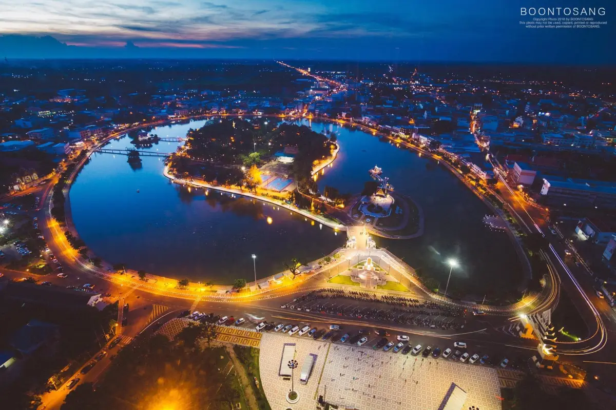
46. Bueng Phlan Chai in Roi Et Province is one of the city's most recognizable landmarks and an important public recreational space. Located in Nai Mueang Subdistrict, Mueang Roi Et District, the park centers on a large lake surrounded by landscaped gardens, shady trees, walking paths, and cultural landmarks. An island within the lake adds to its distinctive character, while religious monuments and public gathering spaces make the area meaningful to local residents. Bueng Phlan Chai is not simply a scenic urban park; it is a place where community life, recreation, cultural activities, and local traditions come together.
Highlights: Central city lake, island gardens, Roi Et City Pillar Shrine, walking paths, landscaped flower gardens, Buddhist images, public exercise areas, family recreation spaces, and community festivals.
Bueng Phlan Chai has long contributed to the landscape and identity of Roi Et. The transformation of the lakeside area into a public park created a central gathering place where people could enjoy outdoor activities, cultural events, and a natural setting within the urban environment. The lake remains the defining feature of the park, providing open views and a refreshing contrast to the surrounding city streets.
The island within the lake is one of the park's most distinctive elements. It contains areas associated with worship, reflection, and recreational activities. Among the important cultural landmarks is the City Pillar Shrine, reflecting the traditional belief that sacred places can serve as symbolic centers of a city and its community.
Buddhist images and other religious features contribute to the park's cultural atmosphere. Their presence demonstrates how public landscapes in Thailand can combine recreational functions with places of spiritual significance. Visitors can appreciate the gardens and lake while also learning about the local traditions associated with these sacred spaces.
Early morning and late afternoon are especially enjoyable times to visit. Residents gather for walking, jogging, exercise, and family outings, creating a lively but relaxed atmosphere. Observing these everyday activities offers travelers a perspective on life in Roi Et beyond its temples and major tourist landmarks.
The park is also used for public celebrations and cultural activities. Depending on the annual schedule, its open areas may host community gatherings and events that reflect the traditions of the province. This continuing role in public life makes Bueng Phlan Chai an important part of Roi Et's contemporary identity.
Visitors can combine the park with nearby attractions such as Ho Wot 101, Wat Bueng Phra Lan Chai, Roi Et National Museum, and the city's food districts. Because these destinations are located within the urban area, they are suitable for a relaxed half-day or full-day sightseeing itinerary.
Bueng Phlan Chai is particularly suitable for families, couples, photographers, and travelers looking for a peaceful break in the provincial capital. Visitors should respect other park users, keep the grounds clean, and avoid throwing rubbish into the lake.
Getting There: Bueng Phlan Chai is located in central Roi Et and can be reached by private car, taxi, or local transport from the bus terminal and surrounding city neighborhoods. The park and nearby Ho Wot 101 are prominent landmarks.
Map (GPS):Get Directions to Bueng Phlan Chai
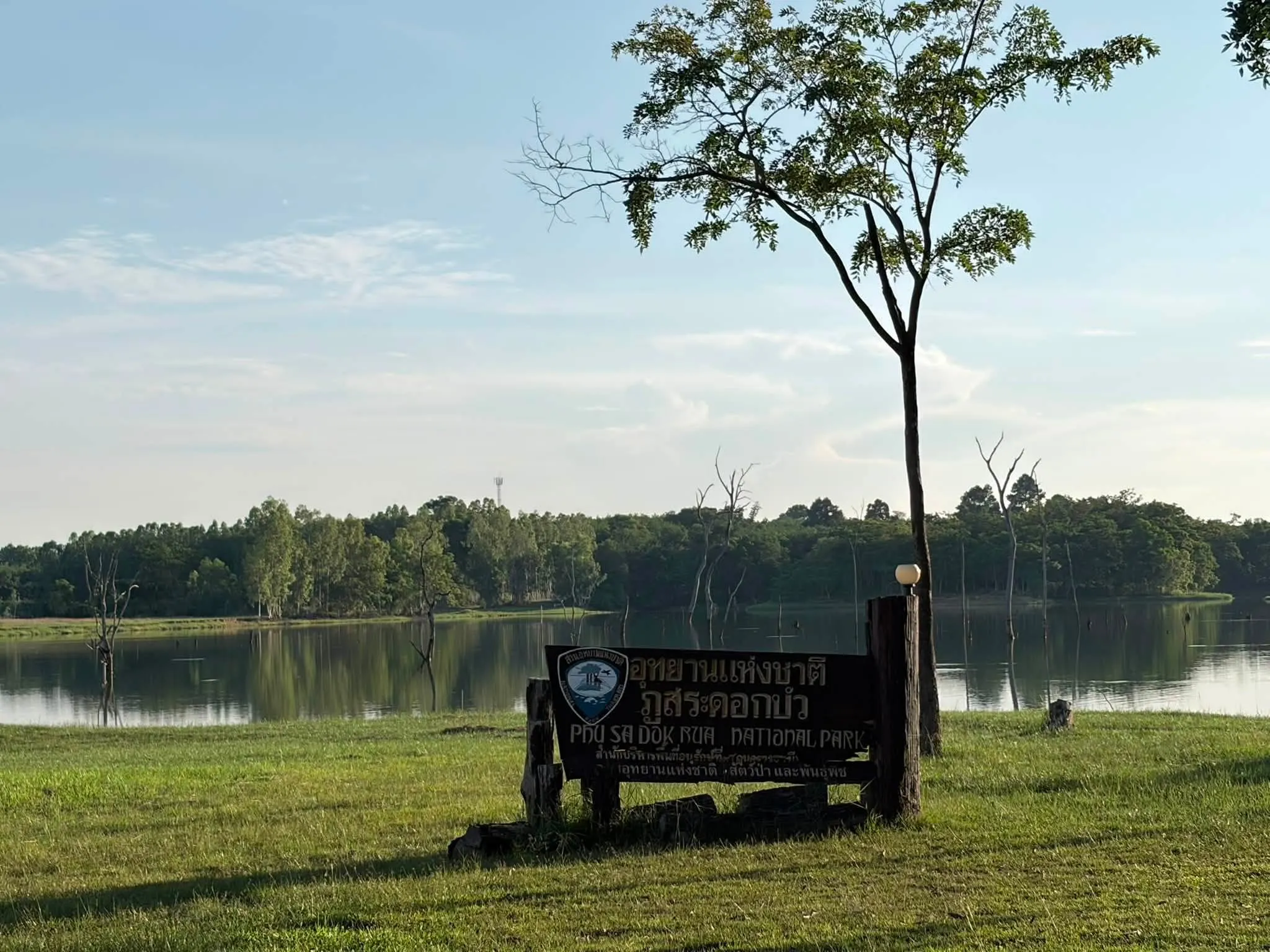
47. Phu Sa Dok Bua National Park is a protected mountain landscape extending across parts of Amnat Charoen, Mukdahan, and Yasothon provinces in northeastern Thailand. The park is characterized by sandstone mountains, forest, rocky plateaus, natural pools, and cliffs of both geological and historical interest. It takes its name from small natural pools on sandstone terraces where lotus plants grow. The park also contains prehistoric rock paintings and distinctive mountain viewpoints, making it a rewarding destination for travelers interested in geology, archaeology, ecology, and less-visited natural landscapes.
Highlights: Natural lotus pools on sandstone terraces, Phu Sa Dok Bua mountain, prehistoric paintings at Phu Pha Taem, Pha Makluea, Phu Pha Hom, Phu Pha Taek, sandstone rock fields, forest ecosystems, and nature trails.
The park's landscape forms part of a mountain system extending across several provincial boundaries. Sandstone is a major geological component, creating open rocky surfaces, natural crevices, shallow pools, and cliffs. Over long periods, weathering and erosion have shaped these formations into features that support unusual plant communities adapted to thin soils and seasonal variations in water availability.
The natural pools that inspired the park's name are among its most distinctive attractions. Formed within sandstone surfaces, these depressions collect water under suitable seasonal conditions and support small aquatic plants, including lotus species. The presence of water plants on exposed rock terraces creates an unusual combination of geological form and wetland ecology.
Another important feature is the prehistoric rock painting area associated with Phu Pha Taem. These paintings provide evidence of human interaction with the mountain landscape in ancient times. Rock shelters and cliff surfaces offered places where earlier communities left symbolic images, helping archaeologists study how people used and understood their environment.
Visitors should appreciate these archaeological features without touching the painted surfaces. Even small physical contact or inappropriate cleaning can damage fragile pigments and the rock layers that preserve them. Maintaining a safe viewing distance helps protect this valuable evidence for future research.
Other natural features include sandstone cliffs and viewpoints such as Pha Makluea and Phu Pha Hom. From accessible elevated areas, travelers can enjoy views over forested hills and the surrounding landscape. Nature trails also reveal the contrast between exposed rock terraces and woodland areas where deeper soils allow denser vegetation to develop.
Phu Sa Dok Bua National Park protects important forest environments within the border region of three provinces. Its vegetation, streams, and wildlife habitats contribute to the conservation of the wider landscape. Travelers should stay on designated paths, avoid removing plants or rocks, and take all waste away.
Because some attractions require walking across uneven sandstone or forest paths, sturdy shoes, drinking water, sun protection, and suitable clothing are recommended. Access conditions may change with rainfall and park management requirements. Visitors should ask park personnel about the available routes and any restrictions before starting longer walks.
The park is suitable for hikers, photographers, archaeology enthusiasts, and travelers seeking quiet natural scenery. As its territory spans multiple provinces, it is important to choose the correct entrance and visitor area for the attractions you intend to see rather than assuming that every landmark can be reached from the same road.
Getting There: Access routes connect the Loei Nok Tha area of Yasothon with Don Tan District in Mukdahan, including sections of Highway 2277. Travelers approaching from Amnat Charoen should plan the journey according to the specific park entrance and attraction they wish to visit. A private vehicle is recommended.
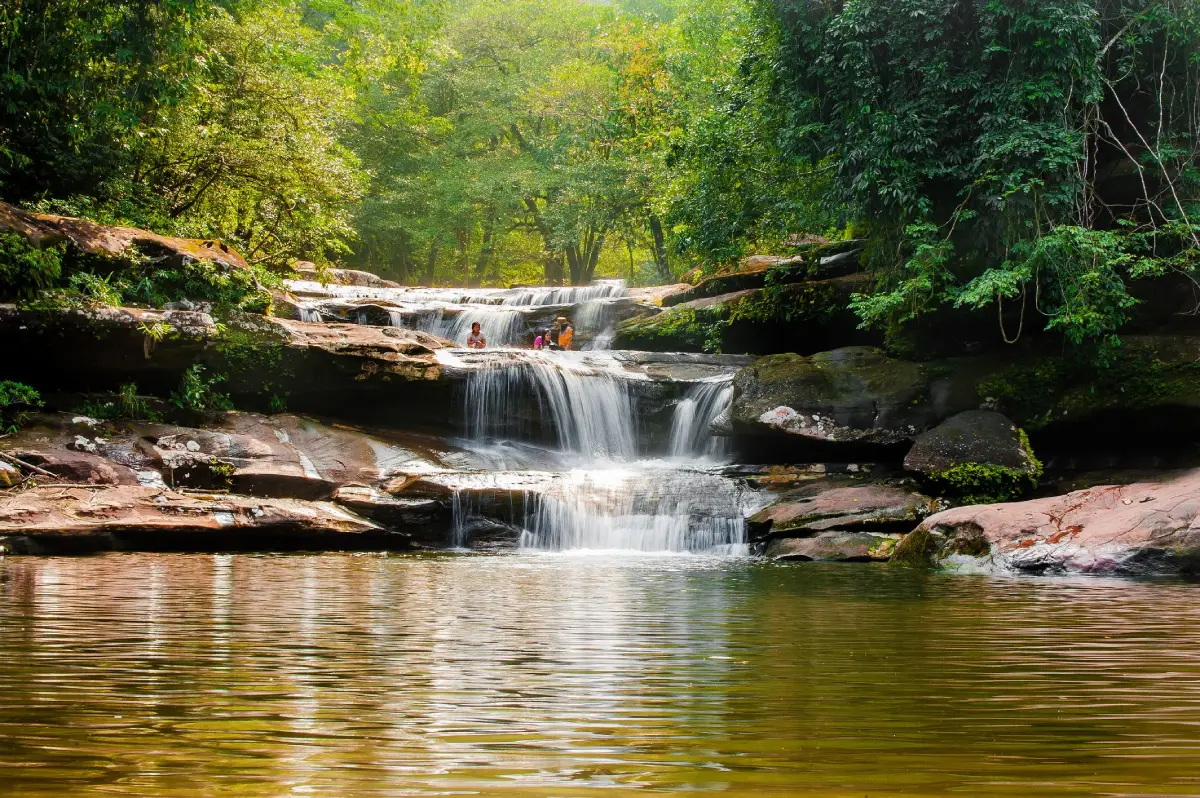
48. Tat Kham Waterfall in Nakhon Phanom Province is a natural waterfall located within the Phu Langka National Park landscape near Na Ngua Subdistrict, Ban Phaeng District. Surrounded by sandstone mountains and forest, the waterfall is formed by streams descending from the highlands and flowing across several rocky levels. Its combination of cascades, natural pools, and dense vegetation offers a peaceful setting for nature lovers and travelers interested in the region's mountain ecosystems.
Highlights: Four levels of Tat Kham Waterfall, sandstone terraces, natural streams, mountain forest, freshwater pools, nature trails, and the ecological landscape of Phu Langka National Park.
The waterfall originates from mountain streams within the Phu Langka forest system. Rainwater collected at higher elevations flows into smaller channels before joining the streams that descend toward the foothills. Where the water passes over sandstone ledges, the changing terrain creates a sequence of cascades and natural pools.
Different sections of the waterfall have their own characteristics. Some form broad, shallow channels over stone surfaces, while others descend through narrower passages into deeper basins. The shapes of these formations have developed through long-term erosion and the movement of water and sediment across the sandstone.
The appearance of Tat Kham changes significantly with the seasons. During periods of sufficient rainfall, the waterfall becomes more active and the surrounding forest takes on a lush green appearance. When rainfall decreases, the flow may become gentler and more of the sandstone landscape is exposed. This natural variation means that visitors should consider the season when planning photography or other activities.
The surrounding forest is important to the wider Phu Langka ecosystem. Trees and other vegetation help retain moisture, protect soils, and support streams that provide freshwater habitats. Observing the waterfall therefore offers an opportunity to understand the relationship between forest conservation, mountain geology, and the water cycle.
Access to individual waterfall levels may require walking along natural paths and uneven ground. Wet rocks can be slippery, particularly after heavy rain, and some pools may have unexpected depths. Visitors should wear footwear with good traction, follow marked paths, and avoid entering water when currents are strong or access is restricted.
Tat Kham is particularly suitable for travelers who enjoy quiet forest scenery, nature photography, and exploring lesser-known waterfalls. Visitors should allow sufficient time to appreciate the surrounding landscape rather than treating the waterfall as a short roadside stop.
The waterfall can be combined with Tat Pho Waterfall and other attractions around Ban Phaeng District, depending on current trail conditions and national park regulations. Seasonal closures or restrictions may apply to protect sensitive forest habitats and ensure visitor safety.
Getting There: From Nakhon Phanom city, follow Highway 212 toward Ban Phaeng District, then continue to Na Ngua Subdistrict and the access route for Tat Kham Waterfall. Private transport is convenient for reaching the visitor area. Check national park announcements before traveling, particularly during the rainy season.
Map (GPS):Get Directions to Tat Kham Waterfall
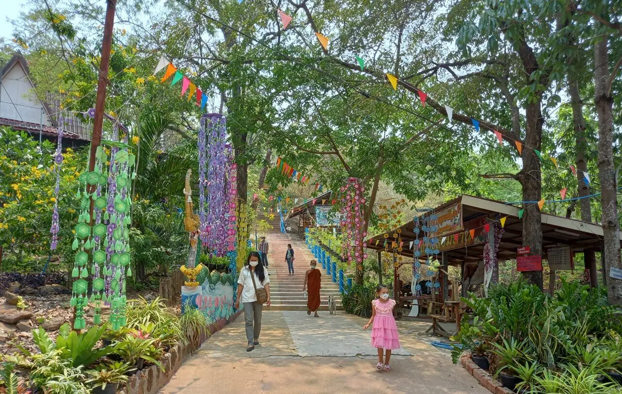
49. Phutthasathan Phu Po in Kalasin Province is an important Buddhist archaeological site located within the grounds of Wat Inthraprathan Phon in Phu Po Subdistrict, Mueang Kalasin District. The site is best known for two ancient reclining Buddha images carved directly into natural sandstone cliff faces at different elevations. These remarkable sculptures are valuable examples of Buddhist art in northeastern Thailand and provide important evidence of the development of religious imagery in the region. The combination of historic rock reliefs, forested mountain scenery, and continuing Buddhist devotion makes Phu Po a meaningful destination for cultural and historical travelers.
Highlights: Two ancient reclining Buddha reliefs carved into sandstone, Dvaravati-period Buddhist art, artistic influences from later periods, natural rock shelters, the stairway to the upper Buddha relief, Wat Inthraprathan Phon, mountain viewpoints, and local Buddha bathing traditions.
Phu Po is a sandstone mountain surrounded by woodland and agricultural communities. Its natural cliffs and rock overhangs provided suitable surfaces for the creation of large Buddhist relief sculptures. Unlike statues carved separately and then placed inside temples, the images here form part of the mountain itself, making the relationship between religious art and the natural landscape especially significant.
The lower reclining Buddha is carved beneath a rock overhang near the foot of the mountain. The figure lies on its right side in the traditional reclining posture. Its artistic features are associated with Dvaravati-period Buddhist traditions in northeastern Thailand, providing evidence of the region's early religious development and the spread of Buddhist art across ancient communities.
The upper reclining Buddha is situated higher on the mountain and can be reached by climbing a stairway. Its artistic characteristics show developments associated with later Buddhist styles, including influences linked to Sukhothai art. The presence of two reclining Buddha images at different elevations makes the site particularly valuable for comparing sculptural forms from different periods.
The climb to the upper relief is part of the visitor experience. The stairway passes through forested and rocky terrain, with occasional views over the surrounding countryside. Visitors should take their time on the ascent, especially during hot or wet weather. Older travelers and those with limited mobility may prefer to remain near the more accessible lower relief.
Phutthasathan Phu Po continues to have religious importance for the surrounding community. Traditional ceremonies, including the bathing of the reclining Buddha images, connect the historic sculptures with present-day Buddhist devotion. These practices illustrate how archaeological sites can remain active cultural and spiritual places long after their original creation.
The rock reliefs are fragile and require careful conservation. Visitors should never touch, rub, climb, or apply substances to the sculpted surfaces. Natural stone deteriorates gradually through weathering, and unnecessary contact can accelerate damage to details preserved for centuries.
Phu Po is suitable for pilgrims, art historians, photographers, and travelers interested in ancient Buddhist sculpture. It can be combined with Sirindhorn Museum, Phu Sing Buddhist Sanctuary, and other Kalasin attractions to create an itinerary exploring both natural history and Buddhist cultural heritage.
Getting There: From Kalasin city, travel north along Highway 213, then follow local roads toward Phu Po Subdistrict and Wat Inthraprathan Phon. Visitors can reach the lower religious area by road and use the designated stairway to visit the upper reclining Buddha.
Map (GPS):Get Directions to Phutthasathan Phu Po
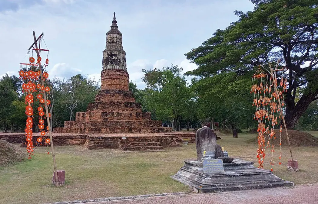
50. Phra That Ya Khu (Phra That Yai) in Kalasin Province is one of the most significant Buddhist archaeological monuments within the ancient city of Fa Daet Song Yang. Located near Ban Sema in Nong Paen Subdistrict, Kamalasai District, the stupa is a substantial brick-built structure showing evidence of architectural development and restoration across several historical periods. Its design contains elements associated with Dvaravati, Ayutthaya, and Rattanakosin artistic traditions. The monument is important both as an active place of Buddhist devotion and as archaeological evidence of the long history of settlement, religion, and cultural development in central northeastern Thailand.
Highlights: Phra That Ya Khu stupa, ancient octagonal architectural elements, Fa Daet Song Yang archaeological site, carved sandstone sema boundary markers, Dvaravati Buddhist art, traditional stupa worship ceremonies, and the colorful Isan Thung flag festival.
Fa Daet Song Yang was an important ancient settlement in the lowland river system of northeastern Thailand. Its archaeological landscape is associated with an oval-shaped town surrounded by earthworks and moats, indicating organized settlement and community development. Discoveries from the area include brick monuments, pottery fragments, sandstone boundary markers, and objects connected with Buddhist worship.
Phra That Ya Khu is among the most substantial surviving monuments within the ancient settlement. The lower part of the stupa preserves features associated with Dvaravati traditions, while the octagonal architectural elements reflect changes during later historical periods. Additional restoration and development during the Rattanakosin era contributed to the form visible today. These layers of architectural history make the monument valuable for studying the evolution of Buddhist sacred architecture.
The name Ya Khu is related to a traditional term of respect for senior Buddhist monks or revered religious teachers. According to local beliefs, the stupa is associated with the commemoration or enshrinement of remains connected with an important monk. Such traditions reveal how communities linked sacred monuments with respected religious figures and preserved those associations through collective memory.
The wider Fa Daet Song Yang archaeological area is particularly famous for sandstone sema markers decorated with Buddhist imagery. Some bear reliefs associated with the life of the Buddha and Jataka narratives, which recount the Buddha's previous lives. These artworks provide valuable evidence of religious beliefs and artistic traditions during the Dvaravati period.
Visitors interested in archaeology should explore Phra That Ya Khu in relation to the surrounding ancient settlement rather than viewing it as an isolated monument. The combination of the surviving stupa, archaeological landscape, and carved boundary markers provides a more complete understanding of the site's historical significance.
Phra That Ya Khu also remains a focus of community religious activity. Traditional bathing ceremonies and merit-making events express local Buddhist devotion, while the Isan Thung festival transforms the surrounding area with colorful fabric flags. These ceremonial flags are important elements of regional Buddhist culture and are used as expressions of faith and offerings in religious celebrations.
The relationship between ancient architecture and living tradition makes Phra That Ya Khu especially interesting. The brick monument preserves evidence of the past, while festivals and worship demonstrate that the location continues to have meaning for present-day communities. The site therefore illustrates how cultural heritage can remain part of everyday religious and social life rather than existing only as a historical exhibit.
Travelers should allow time to explore the stupa and nearby archaeological features. Those with a deeper interest in Dvaravati history can continue to Wat Pho Chai Semaram and other places associated with the ancient city. A private vehicle is useful for moving between the different archaeological locations.
Visitors should dress modestly, avoid climbing on ancient brick structures, and refrain from touching carved sandstone markers. These objects are irreplaceable historical evidence and require careful protection to ensure their survival for future generations.
Getting There: From Kalasin city, follow Highway 214 toward Kamalasai District, then continue along Highway 2367 and local roads toward Ban Sema in Nong Paen Subdistrict. Follow signs for the Fa Daet Song Yang archaeological area and Phra That Ya Khu. A private car is recommended for exploring other nearby historical sites.
Map (GPS):Get Directions to Phra That Ya Khu
Summary Table: 50 Best Places to Visit in Northeastern Thailand in 2027 Northeastern Thailand offers a remarkable variety of destinations across all 20 provinces. This summary table provides a quick reference to the 50 attractions featured in this guide, including their locations and main highlights. Select an attraction to explore its dedicated English-language travel guide.
| No. | Attraction | Province | Main Highlights |
| 1 | Phu Kradueng National Park | Loei | Mountain trekking, pine forests, Pha Lom Sak and spectacular viewpoints |
| 2 | Phanom Rung Historical Park | Buriram | Ancient Khmer sanctuary on an extinct volcano and astronomical alignments |
| 3 | Phimai Historical Park | Nakhon Ratchasima | Monumental Khmer architecture and an important ancient town |
| 4 | Pha Taem National Park | Ubon Ratchathani | Prehistoric rock paintings, sandstone cliffs and Mekong River views |
| 5 | Ban Chiang Khan | Loei | Historic wooden houses, Mekong riverside life and a walking street |
| 6 | Red Lotus Sea | Udon Thani | Boat trips through seasonal pink water lily fields |
| 7 | Ban Chiang National Museum | Udon Thani | Prehistoric pottery, archaeology and UNESCO World Heritage |
| 8 | Kaeng Song Khon (Sam Phan Bok) | Ubon Ratchathani | Thousands of sandstone potholes revealed during low Mekong water levels |
| 9 | Phra That Phanom | Nakhon Phanom | Sacred Buddhist relic stupa and Mekong pilgrimage traditions |
| 10 | Pa Hin Ngam National Park | Chaiyaphum | Siam tulip fields, unusual rocks and mountain viewpoints |
| 11 | Surin Elephant Village | Surin | Kui culture, traditional elephant care and community heritage |
| 12 | Wat Pa Maha Chedi Kaew (Million Bottle Temple) | Si Sa Ket | Buddhist architecture decorated with recycled glass bottles |
| 13 | Phu Tok | Bueng Kan | Cliffside wooden walkways and forest meditation heritage |
| 14 | Wat Khaek (Sala Kaeo Ku) | Nong Khai | Monumental religious sculptures, Nagas and mythical figures |
| 15 | Phu Pha Thoep National Park | Mukdahan | Unusual sandstone boulders and forest landscapes |
| 16 | Sirindhorn Museum | Kalasin | Dinosaur fossils, life-size models and prehistoric science |
| 17 | Phra That Na Dun | Maha Sarakham | Buddhist relic stupa and ancient Nakhon Champa Si heritage |
| 18 | Pha Nam Yoi (Isan Buddhist Park) | Roi Et | Phra Maha Chedi Chai Mongkhon and forested mountain scenery |
| 19 | Wat Tham Klong Phen | Nong Bua Lam Phu | Forest meditation, natural caves and Luang Pu Khao Analayo |
| 20 | Wat Phra That Choeng Chum | Sakon Nakhon | White sacred stupa, Luang Pho Phra Ong Saen and Buddhist festivals |
| 21 | Phaya Thaen Public Park | Yasothon | Rainmaking mythology, Rocket Festival traditions and public gardens |
| 22 | Wat Phra Lao Thep Nimit | Amnat Charoen | Revered Buddha image and regional Buddhist architecture |
| 23 | Phra Mahathat Kaen Nakhon (Wat Nong Wang) | Khon Kaen | Nine-story Buddhist stupa and panoramic city views |
| 24 | Prasat Hin Mueang Tam | Buriram | Khmer sanctuary, five towers and Naga-bordered ponds |
| 25 | Phu Ruea National Park | Loei | Cool mountain weather, pine forests and sunrise viewpoints |
| 26 | Wat Pa Phu Kon | Udon Thani | White marble reclining Buddha in a forested mountain temple |
| 27 | Tat Ton National Park | Chaiyaphum | Wide sandstone waterfall and Phu Laen Kha forest scenery |
| 28 | Wat Tham Pha Daen | Sakon Nakhon | Buddhist sandstone carvings and Phu Phan mountain viewpoints |
| 29 | Khao Yai National Park | Nakhon Ratchasima | UNESCO World Heritage forests, waterfalls and wildlife |
| 30 | Sirindhorn Dam | Ubon Ratchathani | Reservoir scenery and floating solar–hydropower technology |
| 31 | Kham Chanot City | Udon Thani | Sacred Chanot palm forest and traditional Naga beliefs |
| 32 | Phu Wiang Dinosaur Museum | Khon Kaen | Dinosaur fossils, scientific exhibitions and ancient ecosystems |
| 33 | Phra That Kham Kaen | Khon Kaen | Sacred white stupa and the legendary tamarind tree |
| 34 | Phu Sing Buddhist Sanctuary | Kalasin | Monumental white Buddha and Lam Pao Reservoir viewpoints |
| 35 | Isan Art and Culture Center | Maha Sarakham | Regional textiles, traditional crafts and cultural heritage |
| 36 | Tad Kinnaree Waterfall | Bueng Kan | Sandstone cascades and dolphin-shaped rock formations |
| 37 | Tat Pho Waterfall | Nakhon Phanom | Multi-level waterfall and Phu Langka forest trails |
| 38 | Wat Tham Khuha Sawan | Ubon Ratchathani | Buddhist cave, meditation heritage and Mekong views |
| 39 | Prasat Sikhoraphum | Surin | Five Khmer brick towers and Shiva Nataraja carvings |
| 40 | Phra That Renu Nakhon | Nakhon Phanom | Pink-and-white stupa and Phu Thai cultural traditions |
| 41 | Phra That Kong Khao Noi | Yasothon | Historic stupa and a famous Isan moral folktale |
| 42 | Wat Pho Chai | Nong Khai | Luang Pho Phra Sai and traditional Songkran ceremonies |
| 43 | Ho Kaeo Mukdahan | Mukdahan | Observation tower, cultural exhibitions and Mekong panorama |
| 44 | Sai Thong National Park | Chaiyaphum | Seasonal Siam tulips, Pha Ham Hot and mountain scenery |
| 45 | Phu Wiang National Park | Khon Kaen | Dinosaur excavation sites and sandstone mountain ecosystems |
| 46 | Bueng Phlan Chai | Roi Et | City-center lake, island gardens and community recreation |
| 47 | Phu Sa Dok Bua National Park | Amnat Charoen / Mukdahan / Yasothon | Lotus pools, sandstone cliffs and prehistoric rock paintings |
| 48 | Tat Kham Waterfall | Nakhon Phanom | Four waterfall levels and Phu Langka forest scenery |
| 49 | Phutthasathan Phu Po | Kalasin | Ancient reclining Buddha reliefs carved into sandstone cliffs |
| 50 | Phra That Ya Khu (Phra That Yai) | Kalasin | Ancient Dvaravati stupa and Fa Daet Song Yang archaeological heritage |
Attractions by Province, District and Travel Category Use this table to find destinations by location and travel interest. Categories distinguish national parks, waterfalls, Buddhist temples, archaeological sites, museums, cultural communities, and scenic attractions.
| No. | Attraction | Province | District | Travel Category |
| 1 | Phu Kradueng National Park | Loei | Phu Kradueng | National Park / Hiking |
| 2 | Phanom Rung Historical Park | Buriram | Chaloem Phra Kiat | Khmer Sanctuary / History |
| 3 | Phimai Historical Park | Nakhon Ratchasima | Phimai | Archaeology / History |
| 4 | Pha Taem National Park | Ubon Ratchathani | Khong Chiam | National Park / Rock Paintings |
| 5 | Ban Chiang Khan | Loei | Chiang Khan | Historic Community / Riverside |
| 6 | Red Lotus Sea | Udon Thani | Kumphawapi | Wetland / Boat Tour |
| 7 | Ban Chiang National Museum | Udon Thani | Nong Han | Museum / UNESCO Heritage |
| 8 | Sam Phan Bok | Ubon Ratchathani | Pho Sai | Geology / Mekong River |
| 9 | Phra That Phanom | Nakhon Phanom | That Phanom | Sacred Stupa / Pilgrimage |
| 10 | Pa Hin Ngam National Park | Chaiyaphum | Thep Sathit | Wildflowers / National Park |
| 11 | Surin Elephant Village | Surin | Tha Tum | Living Heritage / Community |
| 12 | Million Bottle Temple | Si Sa Ket | Khun Han | Temple / Architecture |
| 13 | Phu Tok | Bueng Kan | Si Wilai | Forest Temple / Cliff Walk |
| 14 | Sala Kaeo Ku | Nong Khai | Mueang Nong Khai | Sculpture Park / Culture |
| 15 | Phu Pha Thoep National Park | Mukdahan | Mueang Mukdahan | National Park / Geology |
| 16 | Sirindhorn Museum | Kalasin | Sahatsakhan | Dinosaur Museum / Science |
| 17 | Phra That Na Dun | Maha Sarakham | Na Dun | Buddhist Heritage / Archaeology |
| 18 | Pha Nam Yoi | Roi Et | Nong Phok | Temple / Mountain Viewpoint |
| 19 | Wat Tham Klong Phen | Nong Bua Lam Phu | Mueang Nong Bua Lam Phu | Forest Temple / Meditation |
| 20 | Wat Phra That Choeng Chum | Sakon Nakhon | Mueang Sakon Nakhon | Temple / Sacred Stupa |
| 21 | Phaya Thaen Public Park | Yasothon | Mueang Yasothon | Public Park / Folklore |
| 22 | Wat Phra Lao Thep Nimit | Amnat Charoen | Phana | Temple / Buddhist Art |
| 23 | Phra Mahathat Kaen Nakhon | Khon Kaen | Mueang Khon Kaen | Temple / City Viewpoint |
| 24 | Prasat Hin Mueang Tam | Buriram | Prakhon Chai | Khmer Sanctuary / Archaeology |
| 25 | Phu Ruea National Park | Loei | Phu Ruea | National Park / Mountain Views |
| 26 | Wat Pa Phu Kon | Udon Thani | Na Yung | Forest Temple / Architecture |
| 27 | Tat Ton National Park | Chaiyaphum | Mueang Chaiyaphum | Waterfall / National Park |
| 28 | Wat Tham Pha Daen | Sakon Nakhon | Mueang Sakon Nakhon | Temple / Buddhist Sculpture |
| 29 | Khao Yai National Park | Nakhon Ratchasima | Pak Chong (Main Entrance) | National Park / UNESCO Nature |
| 30 | Sirindhorn Dam | Ubon Ratchathani | Sirindhorn | Dam / Renewable Energy |
| 31 | Kham Chanot City | Udon Thani | Ban Dung | Spiritual Heritage / Naga Beliefs |
| 32 | Phu Wiang Dinosaur Museum | Khon Kaen | Wiang Kao | Museum / Paleontology |
| 33 | Phra That Kham Kaen | Khon Kaen | Nam Phong | Temple / Sacred Stupa |
| 34 | Phu Sing Buddhist Sanctuary | Kalasin | Sahatsakhan | Buddhist Sanctuary / Viewpoint |
| 35 | Isan Art and Culture Center | Maha Sarakham | Mueang Maha Sarakham | Cultural Museum / Crafts |
| 36 | Tad Kinnaree Waterfall | Bueng Kan | Bueng Khong Long | Waterfall / Geology |
| 37 | Tat Pho Waterfall | Nakhon Phanom | Ban Phaeng | Waterfall / Forest Trail |
| 38 | Wat Tham Khuha Sawan | Ubon Ratchathani | Khong Chiam | Cave Temple / River Viewpoint |
| 39 | Prasat Sikhoraphum | Surin | Sikhoraphum | Khmer Sanctuary / Archaeology |
| 40 | Phra That Renu Nakhon | Nakhon Phanom | Renu Nakhon | Sacred Stupa / Phu Thai Culture |
| 41 | Phra That Kong Khao Noi | Yasothon | Mueang Yasothon | Historic Stupa / Folklore |
| 42 | Wat Pho Chai | Nong Khai | Mueang Nong Khai | Buddhist Temple / Pilgrimage |
| 43 | Ho Kaeo Mukdahan | Mukdahan | Mueang Mukdahan | Observation Tower / Museum |
| 44 | Sai Thong National Park | Chaiyaphum | Nong Bua Rawe | National Park / Wildflowers |
| 45 | Phu Wiang National Park | Khon Kaen | Wiang Kao | National Park / Fossils |
| 46 | Bueng Phlan Chai | Roi Et | Mueang Roi Et | Public Park / City Lake |
| 47 | Phu Sa Dok Bua National Park | Amnat Charoen / Mukdahan / Yasothon | Multiple Districts Across Three Provinces | National Park / Nature / Archaeology |
| 48 | Tat Kham Waterfall | Nakhon Phanom | Ban Phaeng | Waterfall / Nature |
| 49 | Phutthasathan Phu Po | Kalasin | Mueang Kalasin | Buddhist Rock Reliefs / Archaeology |
| 50 | Phra That Ya Khu | Kalasin | Kamalasai | Ancient Stupa / Dvaravati Heritage |
Suggested Northeastern Thailand Itineraries: 1 Day, 2 Days and 3 Days
Planning a trip through northeastern Thailand is easier when destinations are grouped by geography rather than simply choosing the highest-ranked attractions. Isan covers a large area, and some national parks, historic temples, and rural communities require considerable travel time from the nearest city. A well-planned itinerary allows more time for sightseeing and cultural experiences while reducing unnecessary driving. The following routes offer practical starting points for travelers with different interests and lengths of stay.
One-Day Itinerary: Discovering Khon Kaen City
For travelers spending one day in Khon Kaen, begin with Phra Mahathat Kaen Nakhon at Wat Nong Wang. Explore the nine-story Buddhist stupa, its religious artworks, and accessible viewpoints overlooking Bueng Kaen Nakhon Lake and the surrounding city. The monument provides an excellent introduction to Khon Kaen's Buddhist architecture and cultural identity.
After visiting the temple, take a leisurely walk around Bueng Kaen Nakhon, where public gardens and lakeside areas provide a relaxing setting. The surrounding neighborhood also offers opportunities to discover regional food and everyday city life. During the afternoon, consider visiting a museum or cultural attraction within the city before enjoying an Isan-style dinner featuring local specialties.
This itinerary is suitable for families, older travelers, and visitors who prefer shorter journeys. Those who wish to include Phra That Kham Kaen in Nam Phong District should reduce the number of other stops and allow additional driving time, as the sacred stupa is located outside central Khon Kaen.
Two Days and One Night: The Ancient Khmer Temples of Buriram
Day 1: Phanom Rung and Prasat Mueang Tam. Begin at Phanom Rung Historical Park in Chaloem Phra Kiat District. Follow the ancient ceremonial approach, cross the Naga bridges, and examine the principal sandstone sanctuary and its intricate carvings. Learning about Shiva worship and the architectural symbolism of the monument adds depth to the visit. Allow sufficient time to explore the complex without rushing.
Continue to Prasat Hin Mueang Tam in Prakhon Chai District. The lower-lying sanctuary provides a fascinating contrast to Phanom Rung, particularly through its five brick towers and four L-shaped ponds decorated with sandstone Nagas. Visiting both monuments on the same day reveals different approaches to religious architecture, sacred water, and landscape planning in the Khmer period. Stay overnight in Nang Rong, Prakhon Chai, or another convenient nearby area.
Day 2: Local Culture and Community Heritage. Use the second day to explore additional historic attractions or community-based experiences in Buriram. Depending on the availability of local activities, travelers may visit a traditional silk-weaving community or learn about regional handicrafts. This creates a balanced itinerary combining ancient monuments with the living cultural heritage of the province.
The Buriram route is particularly suitable for visitors interested in archaeology, Southeast Asian history, Khmer architecture, and traditional craftsmanship. A rental car or private vehicle makes travel between the dispersed historical sites significantly more convenient.
Three Days and Two Nights: Ubon Ratchathani and the Mekong River
Day 1: Khong Chiam and Buddhist Heritage. Travel from Ubon Ratchathani city to Khong Chiam District and visit Wat Tham Khuha Sawan. Explore the temple's cave environment, monuments associated with Luang Pu Kham Khaning Chulamanee, and the viewpoints overlooking the Mekong landscape. Continue to the riverfront and the area around the confluence of the Mun and Mekong rivers. Spend the night in Khong Chiam to provide a convenient starting point for the following day's national park excursion.
Day 2: Pha Taem National Park. Begin the morning at Pha Taem National Park, where sandstone cliffs offer expansive views toward Laos. Explore the prehistoric rock painting route and visit the extraordinary Sao Chaliang formations. Depending on weather conditions, time, and access arrangements, add another natural attraction within the park. A slower pace is recommended because parts of the sightseeing route require walking on uneven sandstone or forest paths.
Day 3: Sirindhorn Dam and Renewable Energy. Travel toward Sirindhorn District to visit Sirindhorn Dam. Enjoy the reservoir scenery and learn about its combined floating solar and hydropower project. If access arrangements permit, continue to a cultural attraction or local community in the district before returning to Ubon Ratchathani city.
Sam Phan Bok is another outstanding attraction in Ubon Ratchathani, but it lies on a different route from Sirindhorn Dam and much of the Khong Chiam area. Travelers wishing to include Sam Phan Bok should consider adding a day or organizing a separate excursion during the Mekong's low-water season. Trying to include every major attraction within three days can result in excessive driving and limited sightseeing time.
Buddhist Heritage Route: Nakhon Phanom and Mukdahan Travelers interested in sacred stupas and Mekong culture can begin at Phra That Phanom in That Phanom District, one of the region's most respected Buddhist pilgrimage destinations. After exploring the temple and surrounding community, continue to Phra That Renu Nakhon to appreciate its pink-and-white stupa and the cultural traditions of the Phu Thai people.
With an overnight stay and an additional day, the itinerary can continue toward Mukdahan along the Mekong corridor. Visit Ho Kaeo Mukdahan for panoramic views and exhibitions introducing the province's history and ethnic diversity. The route is ideal for visitors interested in Buddhism, regional architecture, traditional textiles, and communities connected by the Mekong River.
Family Learning Route: Kalasin and Khon Kaen Families interested in prehistoric animals and science can begin at Sirindhorn Museum in Sahatsakhan District, Kalasin Province. Explore the dinosaur fossils, life-size models, and displays about the discoveries made at Phu Kum Khao. If time allows, visit Phu Sing Buddhist Sanctuary in the same district to see the large white Buddha and scenic views toward Lam Pao Reservoir.
On the following day, travel to Khon Kaen Province and explore Phu Wiang Dinosaur Museum. The museum's exhibits explain the fossils and prehistoric environments associated with the Phu Wiang region. Continue to Phu Wiang National Park where the available access routes allow visitors to observe the surrounding geological landscape. Visiting both the museums and relevant natural areas creates an engaging combination of indoor education and outdoor discovery.
Essential Tips for Planning an Isan Road Trip Check seasonal conditions before visiting national parks, waterfalls, flowering wetlands, and river attractions. Phu Kradueng has a seasonal closure for forest recovery, Siam tulip fields depend on rainfall, the Red Lotus Sea is most impressive during the cool-season flowering period, and the sandstone formations at Sam Phan Bok become visible when Mekong water levels are low. Mountain routes and waterfall trails may also close temporarily during periods of heavy rain.
Travelers should allow generous time for driving through rural districts and mountain landscapes. Some destinations have limited public transportation, so private transport or a rental car may be the most practical choice. When visiting Buddhist temples, wear respectful clothing and follow local customs. For national parks, use designated walking routes and observe conservation regulations. Checking official opening arrangements and weather forecasts before departure will help make the journey safer and more enjoyable.
Frequently Asked Questions (FAQ)
Q: How many provinces are there in Northeastern Thailand?
A: Northeastern Thailand, commonly known as Isan, has 20 provinces: Nakhon Ratchasima, Buriram, Surin, Si Sa Ket, Ubon Ratchathani, Yasothon, Amnat Charoen, Mukdahan, Nakhon Phanom, Sakon Nakhon, Kalasin, Maha Sarakham, Roi Et, Khon Kaen, Chaiyaphum, Loei, Nong Bua Lam Phu, Udon Thani, Nong Khai, and Bueng Kan. Each province offers its own combination of natural scenery, historical sites, Buddhist temples, food traditions, and local culture.
Q: What are the best places to visit in Northeastern Thailand in 2027?
A: Some of the most rewarding destinations include Phu Kradueng National Park, Phanom Rung Historical Park, Phimai Historical Park, Pha Taem National Park, Ban Chiang Khan, the Red Lotus Sea, Ban Chiang National Museum, Sam Phan Bok, and Phra That Phanom. The ideal destinations depend on your interests, the length of your trip, and seasonal conditions.
Q: What is the best time of year to visit Isan?
A: November to February is generally a pleasant period for mountain viewpoints, riverside towns, outdoor cultural sites, and many sightseeing activities because temperatures tend to be cooler. The rainy season brings greener forests, waterfalls, and seasonal Siam tulip flowers. However, certain attractions have their own ideal visiting periods, so travelers should check the conditions of individual destinations before planning a trip.
Q: Which Isan provinces are best for a three-day trip?
A: For history and ancient architecture, Nakhon Ratchasima and Buriram are good choices, with attractions such as Phimai, Phanom Rung, and Prasat Mueang Tam. For Mekong scenery and nature, Ubon Ratchathani offers Khong Chiam, Pha Taem National Park, and Sirindhorn Dam. Travelers interested in Buddhist heritage and local culture may prefer Nakhon Phanom and Mukdahan.
Q: Which places in northeastern Thailand are suitable for families with children?
A: Family-friendly attractions include Sirindhorn Museum in Kalasin, Phu Wiang Dinosaur Museum in Khon Kaen, Bueng Phlan Chai in Roi Et, Phaya Thaen Public Park in Yasothon, and the Red Lotus Sea in Udon Thani. When choosing boat excursions, waterfalls, or mountain routes, consider children's ages, mobility, and the availability of appropriate safety facilities.
Q: Where can I go hiking or experience nature in Isan?
A: Popular natural destinations include Phu Kradueng National Park, Phu Ruea National Park, Pha Taem National Park, Pa Hin Ngam National Park, Sai Thong National Park, Khao Yai National Park, and the Phu Langka forest area. Travelers can also visit waterfalls such as Tat Pho, Tat Kham, and Tad Kinnaree when access conditions allow. Check official park announcements, trail requirements, and weather conditions before hiking.
Q: What are the best historical and archaeological attractions in northeastern Thailand?
A: Notable historical destinations include Phanom Rung Historical Park and Prasat Hin Mueang Tam in Buriram, Phimai Historical Park in Nakhon Ratchasima, Prasat Sikhoraphum in Surin, the Ban Chiang archaeological area in Udon Thani, and the ancient city of Fa Daet Song Yang in Kalasin. These sites illustrate different periods of prehistoric and historic cultural development in the region.
Q: Do I need to rent a car to travel around Isan?
A: Renting a car is not essential for attractions within major cities or places served by public transport. However, a private vehicle or rental car provides considerably more flexibility when visiting national parks, rural temples, mountain viewpoints, waterfalls, and archaeological sites far from city centers. Travelers without a car should plan around local bus services, taxis, and available private transfers.
Q: Which attractions in Isan are UNESCO World Heritage Sites?
A: The Ban Chiang Archaeological Site in Udon Thani is a UNESCO World Heritage Site recognized for its prehistoric archaeological significance. Khao Yai National Park is part of the Dong Phayayen–Khao Yai Forest Complex, a UNESCO World Heritage Site recognized for its biodiversity and conservation value. The museums and other attractions associated with these sites provide useful background for understanding their importance.
Q: Where can I see the Mekong River in northeastern Thailand?
A: The Mekong River can be experienced in several provinces, including Loei, Nong Khai, Bueng Kan, Nakhon Phanom, Mukdahan, Amnat Charoen, and Ubon Ratchathani. Popular destinations include Chiang Khan, Nong Khai's riverside area, Khong Chiam, Pha Taem National Park, and viewpoints around Mukdahan. Some locations emphasize traditional communities, while others offer river panoramas, temples, and distinctive geological landscapes.
Q: What are the best places to visit in Isan during the rainy season?
A: The rainy season is especially attractive for visitors interested in green landscapes, waterfalls, and seasonal wildflowers. Pa Hin Ngam and Sai Thong national parks are known for their Siam tulip fields, while forest waterfalls in Chaiyaphum, Nakhon Phanom, and Bueng Kan may have increased water flow. Heavy rain can also make trails dangerous or temporarily inaccessible, so safety announcements should always take priority over sightseeing plans.
Q: How many days do I need to explore all 20 provinces of Isan?
A: Exploring all 20 provinces in a meaningful way requires substantially more time than a typical short holiday. Travelers with three to five days should concentrate on one geographic area, while a trip of one to two weeks can cover several neighboring provinces. Visiting all 20 provinces with adequate time for major attractions, local culture, and rest is better approached as an extended road trip or a series of separate journeys.
 Category: ●Travel Articles, Recipes
 Group: ●Travel Review, Food Review
Last Update : 2 WeekAgo
 Last Update : 2 WeekAgo

 Art, Culture and Heritage
 Historical Sites and Monuments(1)
 Art, Craft Centres, Tradition(4)
 Museums(1)
 Places of Worship
 Temple(30)
 Other Sacred Sites(8)
 Suburban Living
 Village, Community(4)
 Nature and Wildlife
 National Parks and Marine Reserves(3)
 Mountain (Doi)(6)
 Dam, Reservoir, Lake(5)
 Waterfalls(3)
 Caves(2)
 River, Canal(5)
 Other natural attractions(5)
 Entertainment and Agricultural
 Zoos and Aquariums(1)
 Farms, Parks and Ecotourism(4)
 Shopping
 Shopping and Night Market(1)
Travel Review, Food Review(3)


