
lovethailand home >Northeastern Travel Attractions >Amnat Charoen Travel Attractions >Senangkha Nikhom >Phon Thong > Phu Sa Dok Bua National Park
TL;DR: Phu Sa Dok Bua National Park is located at Mukdahan, Yasothon, and Amnat Charoen Provinces, Thailand, open Open Daily, hours 08.00 – 16.30.

Phu Sa Dok Bua National Park
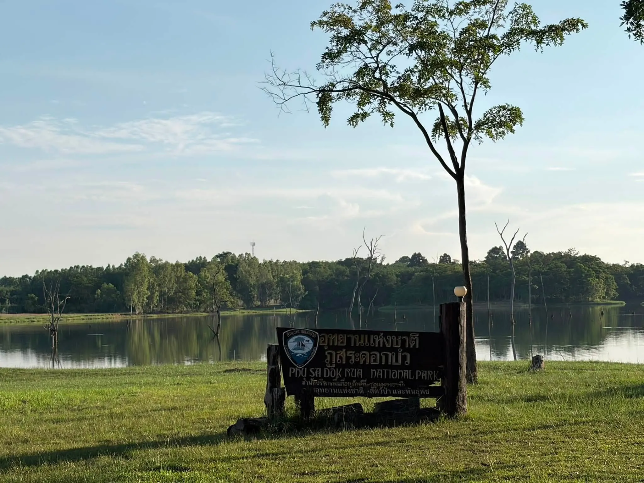
Open Days: Open Daily
Opening Hours: 08.00 – 16.30
Phu Sa Dok Bua National Park is a major national park in northeastern Thailand, covering a mountainous forest area along the boundary of 3 provinces: Mukdahan, Yasothon, and Amnat Charoen. The park includes areas in Nikhom Kham Soi and Don Tan districts of Mukdahan Province, Loeng Nok Tha District of Yasothon Province, and Senangkhanikhom District of Amnat Charoen Province. With an area of about 252 square kilometers, the park is known for complex mountain ranges, sandstone cliffs, broad rock platforms, prehistoric paintings, forest ecosystems, and historical traces connected with Thailand’s political conflicts in the past.
The landscape of Phu Sa Dok Bua National Park is formed by mountain ranges stretching from the northwest toward the southeast. The area is covered by mixed deciduous forest, dry evergreen forest, dry dipterocarp forest, and large open rock platforms locally called “dan.” These rock platforms appear throughout the forest and create a distinctive landscape that differs from many other national parks in Thailand. For foreign travelers, this park offers a chance to understand the sandstone terrain, dry forest ecosystems, and cultural history of the lower northeastern region.
The park is suitable for visitors who enjoy nature with depth and context. It is not only a place for scenic viewpoints. It is also a place where travelers can observe geological formations, prehistoric human traces, forest adaptation, historical caves, and local landscape memory. The combination of cliffs, rock shelters, lotus pools on a mountain summit, dwarf dry dipterocarp forest, and wide viewpoints makes Phu Sa Dok Bua a highly distinctive destination.
The forest provides habitat for many wild animals, including barking deer, wild boar, wild rabbits, monkeys, flying lemurs, porcupines, mouse deer, pheasants, junglefowl, and other birds. This variety of wildlife reflects the ecological value of the park. Visitors should travel responsibly by keeping quiet, avoiding littering, not feeding wildlife, and staying on appropriate trails. These simple practices help protect the forest and allow wildlife to remain in its natural habitat.
Phu Pha Taem is one of the most important attractions in the national park. This cliff contains prehistoric handprints and rock paintings. The paintings are located around 7 – 12 meters above the floor of the rock shelter, and the shelter extends for about 60 meters. The site is valuable because it preserves traces of ancient human activity and is comparable in cultural significance to other prehistoric rock art sites in northeastern Thailand.
The landscape around Phu Pha Taem is also impressive. The cliff has a cave-like appearance because sections of sandstone have shifted and formed a natural overhang. This creates a dramatic rock shelter where archaeology and geology meet. Visitors should never touch, scratch, or damage the rock paintings because they are irreplaceable cultural evidence.
Pha Makluea is a peaceful resting point near Phu Pha Taem. It is a rocky terrace under a shaded overhang, surrounded by trees. The atmosphere is calm and suitable for resting during a nature walk. Travelers can stop here before continuing to other viewpoints or rock formations inside the park.
The rock terrace on Phu Wat is a local gathering place, especially during Songkran and important Buddhist days. This area shows how the national park is connected with nearby communities. It is not only a natural site for outside visitors, but also a place that local people use for social, religious, and seasonal activities.
Phu Pha Hom is one of the most beautiful viewpoints in the Phu Pha Taem mountain range. At about 366 meters above sea level, it offers wide views toward the west. From this point, visitors can see distant mountains such as Phu Mu, Phu Phaeng Ma, Phu Mai Sang, Phu Song, and Phu Akkharachat. The viewpoint is especially popular in the late afternoon when travelers come to watch the sunset and take photographs.
Phu Sa Dok Bua is the mountain that gives the national park its name. The summit is about 423 meters high and lies near the boundary of 3 provinces. On the summit, several natural rock basins, about 2 – 5 meters wide, hold water throughout the year. Small lotus plants grow naturally in these pools, and when they bloom, the view is especially beautiful. This unusual image of lotus flowers growing in water-filled rock basins on a mountain summit is the origin of the name Phu Sa Dok Bua.
Near the same area, there is a large cave that was once used as a shelter by communist insurgent groups during a period of political conflict in Thailand. The cave can hold around 100 people. This gives Phu Sa Dok Bua National Park historical significance in addition to its natural value. The park is therefore a place where visitors can learn about geology, ecology, prehistoric culture, and modern Thai history in one landscape.
Phu Pha Taek, also known by its military name “Hill 420,” is another scenic and historically meaningful viewpoint. From the northern side, visitors can see the mountain range of Phu Pha Thoep National Park in the distance. This viewpoint shows how terrain and history are closely connected, especially in landscapes that once had strategic importance.
Large rock platforms and dwarf dry dipterocarp forest are among the most distinctive natural features of the park. Some rock platforms cover 20 – 40 rai and are surrounded by dwarf trees and pek grass. These landscapes can be found around Phu Pha Hom, behind Phu Pha Dang, behind Phu Sa Dok Bua, Phu Kobok, and Phu Hua Nak. The small trees and hardy plants growing in shallow soil create a beautiful and unusual forest scene.
For photography, Phu Sa Dok Bua National Park offers many strong visual subjects: sandstone cliffs, prehistoric paintings, lotus pools, dwarf forest, rock terraces, caves, and sunset viewpoints. Morning and late afternoon are the best times for photography because the light enhances the texture of the rock and forest. Visitors who want to see lotus flowers should plan their trip when the natural rock pools contain water.
Getting There is most convenient by private car. Use Highway 2277 on the Loeng Nok Tha – Don Tan route. The park entrance is located between kilometer markers 24 and 26, about 1 km from the main highway. The park headquarters are located near Huai Hin Kho Reservoir at Ban Nong Mek, Village No. 3, Pa Rai Subdistrict, Don Tan District, Mukdahan Province. The park is about 60 km from Amnat Charoen Province.
Travelers should allow at least half a day to 1 full day for a visit. A shorter visit can include the park headquarters, Phu Pha Taem, Pha Makluea, and nearby rock platforms. A fuller trip that includes Phu Sa Dok Bua, multiple viewpoints, and historical sites should be planned as a full-day nature route. Visitors should ask park officers about trail conditions before entering deeper areas.
Essential items include proper walking shoes, drinking water, a hat, mosquito repellent, breathable clothing, and a bag for carrying rubbish out of the park. During the rainy season, rock surfaces can become slippery, and some routes may be more difficult. Visitors should avoid walking alone on unfamiliar trails and should follow park guidance at all times.
Phu Sa Dok Bua National Park is suitable for hikers, archaeology enthusiasts, nature photographers, families, cultural travelers, and foreign visitors who want to see a quieter side of Thailand’s national parks. Its greatest strength is the way it combines natural scenery, prehistoric rock art, forest ecosystems, rock formations, and historical memory in one place.
In summary, Phu Sa Dok Bua National Park is a deep and rewarding destination for travelers who want more than a simple viewpoint. Phu Pha Taem, Pha Makluea, Phu Pha Hom, Phu Sa Dok Bua, Phu Pha Taek, large rock terraces, and dwarf dry dipterocarp forest make this park one of the most distinctive natural and cultural landscapes in northeastern Thailand.
| Name | Phu Sa Dok Bua National Park |
| Location | Mukdahan, Yasothon, and Amnat Charoen Provinces, Thailand |
| Address | Phu Sa Dok Bua National Park Headquarters, Ban Nong Mek, Pa Rai Subdistrict, Don Tan District, Mukdahan Province 49120, Thailand |
| Coordinates | 6QMJ+76J, Pa Rai Subdistrict, Don Tan District, Mukdahan Province |
| Highlights | Phu Pha Taem, prehistoric rock paintings, Pha Makluea, Phu Pha Hom, Phu Sa Dok Bua, Phu Pha Taek, rock terraces, and dwarf dry dipterocarp forest |
| Area | About 252 square kilometers |
| Distinctive Features | Complex mountain ranges, large sandstone rock platforms locally called dan, mixed deciduous forest, dry evergreen forest, dry dipterocarp forest, and historical traces |
| Main Areas / Zones | Phu Pha Taem, Pha Makluea, Phu Wat Rock Terrace, Phu Pha Hom, Phu Sa Dok Bua, Phu Pha Taek / Hill 420, Rock Terraces and Dwarf Dry Dipterocarp Forest, Phu Kobok, Phu Hua Nak, and the headquarters near Huai Hin Kho Reservoir |
| Wildlife | Barking deer, wild boar, wild rabbits, monkeys, flying lemurs, porcupines, mouse deer, pheasants, junglefowl, and various birds |
| Travel Information | Use Highway 2277 on the Loeng Nok Tha – Don Tan route. The entrance is between kilometer markers 24 and 26, about 1 km from the highway and about 60 km from Amnat Charoen Province. |
| Current Status | Open as a national park and natural attraction in lower northeastern Thailand |
| Open Days | Open Daily |
| Opening Hours | 08.00 – 16.30 |
| Fees | Thai Adult 20 THB, Thai Child 10 THB / Foreigner Adult 200 THB, Foreigner Child 100 THB |
| Caretaker | Department of National Parks, Wildlife and Plant Conservation / Phu Sa Dok Bua National Park |
| Main Contact Number | 042-619077, 042-620615 |
| Official Website / Official Page | Phu Sa Dok Bua National Park |
| Nearby Tourist Attractions | 1. Phu Pha Thoep National Park, about 55 km 2. Ho Kaeo Mukdahan Observation Tower, about 63 km 3. Wat Roi Phra Phutthabat Phu Manorom, about 67 km 4. Mekong River Viewpoint in Mukdahan, about 65 km 5. Wat Phra Lao Thep Nimit, Amnat Charoen Province, about 70 km |
| Nearby Restaurants | 1. Krua Ton Kla Don Tan, about 26 km, Tel. 088-478-1764 2. Krua Sam Sahai, Don Tan District, about 27 km 3. Yai Sang Lap Ped, Don Tan District, about 27 km 4. Hai Lam Chicken Rice, Don Tan District, about 27 km 5. Nong Nan Restaurant, Don Tan District, about 28 km |
| Nearby Accommodations | 1. Phu Sa Dok Bua National Park Accommodation, at the park headquarters 2. Mekong View Guesthouse, Don Tan District, about 28 km 3. Had Hin Restaurant & Resort, about 34 km, Tel. 062-107-1255, 097-049-3423 4. Accommodations in Mueang Mukdahan, about 63 km 5. Accommodations in Mueang Amnat Charoen, about 70 km |
Frequently Asked Questions (FAQ)
Q: Where is Phu Sa Dok Bua National Park located?
A: Phu Sa Dok Bua National Park covers areas in Mukdahan, Yasothon, and Amnat Charoen provinces. The park headquarters are located at Ban Nong Mek, Pa Rai Subdistrict, Don Tan District, Mukdahan Province.
Q: What are the main highlights of Phu Sa Dok Bua National Park?
A: The main highlights include Phu Pha Taem with prehistoric rock paintings, Pha Makluea, Phu Pha Hom, Phu Sa Dok Bua, Phu Pha Taek, large rock terraces, and dwarf dry dipterocarp forest.
Q: Why is it called Phu Sa Dok Bua?
A: The name comes from natural rock basins on the mountain summit that hold water throughout the year and contain small lotus plants that bloom beautifully.
Q: What are the opening hours of Phu Sa Dok Bua National Park?
A: The park is open daily from 08.00 to 16.30.
Q: How much is the entrance fee?
A: The entrance fee is 20 THB for Thai adults and 10 THB for Thai children. For foreign visitors, it is 200 THB for adults and 100 THB for children.
Q: How can visitors get to Phu Sa Dok Bua National Park?
A: Use Highway 2277 on the Loeng Nok Tha – Don Tan route. The entrance is between kilometer markers 24 and 26, about 1 km from the main highway.
Q: Why is Phu Pha Taem important?
A: Phu Pha Taem contains prehistoric rock paintings and handprints on a cliff, making it an important cultural and archaeological site inside the national park.
Q: What should visitors prepare before visiting?
A: Visitors should bring proper walking shoes, drinking water, a hat, mosquito repellent, and should ask park officers about trail conditions before entering deeper nature routes.
 Category: ●Nature and Wildlife
 Group: ●National Parks and Marine Reserves
Last Update : 3 MonthAgo
 Last Update : 3 MonthAgo
 Click to Access the Navigation Map GPS
Phu Sa Dok Bua National Park Map

 Art, Culture and Heritage
 Historical Sites and Monuments(1)
 Art, Craft Centres, Tradition(3)
 Museums(1)
 Places of Worship
 Temple(30)
 Other Sacred Sites(7)
 Suburban Living
 Village, Community(3)
National Parks and Marine Reserves(3)
Village, Community(3)
National Parks and Marine Reserves(3)
 Mountain (Doi)(5)
 Dam, Reservoir, Lake(5)
 Waterfalls(3)
 Caves(2)
 River, Canal(3)
 Other natural attractions(5)
 Entertainment and Agricultural
 Zoos and Aquariums(1)
 Farms, Parks and Ecotourism(4)
 Shopping
 Shopping and Night Market(1)


