
lovethailand home >Northeastern Travel Attractions >Nakhon Phanom Travel Attractions >Ban Phaeng >Na Ngua > Tat Kham Waterfall
TL;DR: Tat Kham Waterfall is located at Phu Langka National Park, Na Ngua Subdistrict, Ban Phaeng District, Nakhon Phanom Province, Thailand, open Daily, except during the annual ecological recovery closure from 1–31 May and, hours 07:00 – 15:30.

Tat Kham Waterfall
Open Days: Daily, except during the annual ecological recovery closure from 1–31 May and on days when the national park temporarily suspends access because of weather or safety conditions
Opening Hours: 07:00 – 15:30
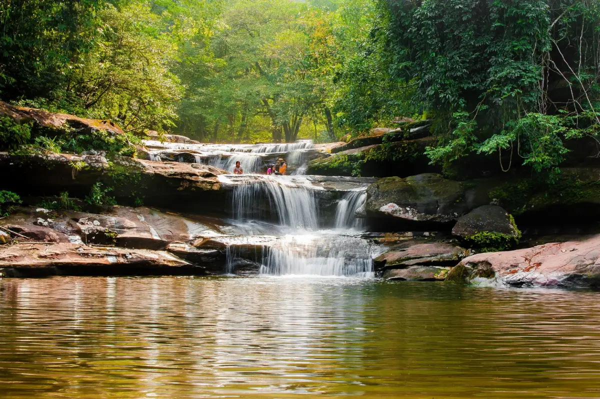
Tat Kham Waterfall in Nakhon Phanom Province, also written as Tad Kham Waterfall, is an important natural recreation area for residents of Na Ngua Subdistrict and Ban Phaeng District. The waterfall lies within Phu Langka National Park, surrounded by the sandstone landscape and watershed forest of the Phu Langka mountain range. Several streams descend from the highlands and combine to form Huai Kham before flowing over natural rock terraces, cliffs, and pools to create four principal waterfall tiers. The area is known for its cool atmosphere, forest shade, relaxing sound of running water, and a pool at the final tier that retains water throughout the year, although the strength of the visible waterfall changes with seasonal rainfall.
Essential travel information Tat Kham Waterfall is approximately 5 kilometres from the community of Na Ngua and around 8 kilometres from Ban Phaeng town. A private car, motorcycle, or locally arranged vehicle is more practical than public transportation. The visitor area is open from 07:00 to 15:30 and closes for ecological recovery from 1–31 May each year. It normally reopens on 1 June when weather and trail conditions are safe. The most rewarding period for seeing a substantial flow is the rainy season and early cool season, particularly from June through October.
National park admission is 20 baht for Thai adults and 10 baht for Thai children. Foreign adults pay 200 baht and foreign children 100 baht. Vehicle charges are collected separately, with motorcycles charged 20 baht and four-wheel vehicles 30 baht. Carrying sufficient cash is advisable because mobile reception and electronic payment systems may not operate consistently in a forested mountain area.
The natural form of Tat Kham Waterfall differs from a waterfall consisting of one very high vertical drop. Water flows gradually across several levels of sandstone, broad rock terraces, short cliffs, and natural pools. Sandstone has been shaped over a long period by rainfall and stream erosion, producing channels, hollows, water basins, and irregular cliff edges. Forest surrounding the waterfall retains moisture and shades the ground, giving the waterfall area a noticeably cooler atmosphere than nearby settlements.
Rain falling across the elevated Phu Langka watershed enters the soil and follows numerous mountain channels. These streams eventually combine to form Huai Kham, the principal watercourse feeding the waterfall. Water volume responds directly to rainfall in the upstream forest. During the rainy season, the stream becomes wider and more forceful, producing fine spray and stronger sound. During the dry season, visible flow decreases, but the final natural pool can retain water because of the shape of the rock and the continuing contribution of the watershed.
The description of Tat Kham as a waterfall with water throughout the year does not mean that the flow is identical in every month. In the middle of the rainy season, the stream can be powerful and fast. From the end of the rainy season into the early cool season, the water is often clearer and the trail becomes easier to use. During the dry season, sandstone ledges, channels, and pools are more exposed, while the falling water becomes considerably narrower.
Tat Kham Waterfall has four principal tiers, each with a different combination of water, rock terraces, and forest surroundings. The route begins near the parking and visitor service area before entering streamside forest. Lower sections are easier to access, while the upper route includes soil, rocks, exposed roots, and damp surfaces. Visitors should select a section appropriate to their available time, health, mobility, and experience on natural trails.
The first tier is the easiest area to reach and is suitable for families, older travelers, and visitors who wish to relax without walking a long distance. Water crosses a relatively low rock level and spreads toward the lower terrace. Large trees provide shade and create a pleasant place to sit and enjoy the natural breeze. This accessible section is particularly popular among residents of Na Ngua and Ban Phaeng on weekends.
Despite its easy access, wet stone near the first tier can be extremely slippery because of algae and constant moisture. Visitors should walk slowly, use footwear with reliable grip, and avoid running across rock surfaces. Children must remain under close adult supervision, particularly immediately after rain or when the stream begins to rise.
The second tier lies farther upstream, where the water begins to descend more clearly over layered rock. The current passes through sandstone channels before falling into a pool below. This section is quieter and more forested than the first tier, providing a stronger sense of being inside a natural landscape without requiring the longest upper walk. The sound of water, insects, and birds creates a calm atmosphere along the route.
During the rainy season, parts of the path between the first and second tiers may be wet or crossed by shallow runoff. Secure shoes are necessary, while smooth-soled sandals should be avoided. Cameras and mobile phones should be protected in a waterproof bag while crossing slippery sections so that both hands remain available for balance.
The third tier has a more natural setting and requires greater physical effort. Huai Kham flows among larger rocks and through humid forest containing ferns, moss, shrubs, and mature trees. The section is suitable for visitors with appropriate footwear and equipment who have allowed enough time to return before the end of the access period.
Visitors should not begin the third-tier route late in the afternoon. Light disappears more quickly inside a dense forest than in an open area, and descending wet rock can take longer than climbing. A turnaround time should be established in advance, and nobody should be pressured to continue when tired, injured, or uncomfortable.
The fourth tier contains a natural pool capable of retaining water throughout the year. The rock structure holds part of the water arriving through Huai Kham before it continues toward the lower waterfall. This feature explains the local description of Tat Kham as a year-round waterfall. Travelers should nevertheless distinguish between water remaining in a pool and a large waterfall flow, which still depends on rainfall.
The natural pool may have an uneven depth, submerged grooves, holes, or branches that cannot be seen from the surface. Visitors should not jump from rocks or dive into areas of unknown depth. Swimming is appropriate only where the park permits it and after officers have determined that the current and weather are safe.
The forest of Phu Langka makes Tat Kham much more than a place for swimming. It offers an opportunity to understand a watershed ecosystem. The mountain contains dry evergreen forest, mixed deciduous forest, dry dipterocarp forest, and plant communities adapted to sandstone terraces. Streamside areas remain more humid than exposed slopes, allowing ferns, moss, lichen, and small plants to grow in cracks during the rainy season.
Large trees provide shade, reduce ground temperature, and help maintain humidity. Their roots hold soil in place and reduce erosion during heavy rain. Fallen leaves decompose into nutrients supporting soil organisms and young plants. These ecological processes are directly connected with both the quantity and quality of water reaching Tat Kham Waterfall.
Butterflies, dragonflies, forest birds, and small animals become more noticeable during the wet season and early cool season. Butterflies often gather on damp soil or shallow mineral-rich areas. They should be observed from a suitable distance without being captured, chased, or attracted with food and sweet liquids, which can alter natural behaviour.
Sandstone geology determines the form of the waterfall. Individual rock layers have different levels of hardness and contain natural fractures. Softer material erodes more quickly than harder sections, gradually forming ledges, terraces, channels, and pools. This geological transformation has continued for a very long time and still occurs whenever water and sediment move across the rock.
Sand, gravel, branches, and other material transported by the stream help polish and deepen rock surfaces. During high water, however, the same material becomes dangerous to anyone standing in the channel. If the water becomes muddy, the level rises rapidly, or an unusual amount of debris begins moving downstream, visitors must leave the stream and move to higher ground immediately.
The best period to visit begins in June after the annual ecological closure and extends to approximately October. June through September usually brings the greenest forest and the highest probability of strong waterfall flow. October is the later rainy season, when temperatures begin to fall and sections of the trail may become drier, making the area attractive to visitors who prefer walking without continuous heavy rain.
From November through the beginning of the hot season, access remains possible when the park is open. The final pool retains water, although the stream descending over the terraces becomes smaller as rainfall decreases. An advantage of the dry period is that trails are less slippery and sandstone formations are easier to observe.
Morning is the most suitable time to arrive. Temperatures are lower, visitor numbers are often lighter, and there is sufficient time to walk between waterfall tiers before closing. Travelers intending to visit several sections should arrive between 07:00 and 09:00 and ask park officers about trail conditions, water levels, and approved swimming areas before beginning.
The annual ecological recovery closure takes place from 1–31 May. Temporarily removing visitor pressure allows streamside plants and trail surfaces to recover and gives officers an opportunity to inspect paths, signs, bridges, drainage, visitor facilities, and hazardous locations before the next season. Travelers should not enter the waterfall area during the closure.
In addition to the scheduled May closure, Phu Langka National Park may temporarily suspend access during heavy rain, flash-flood risk, strong wind, landslides, fallen trees, or trail damage. Same-day information is essential even when Ban Phaeng town appears dry, because substantial rain can fall in the upper watershed without being visible from the entrance.
Flash-flood safety is the most important consideration at a mountain waterfall. Warning signs include muddy or rapidly changing water, an unusual increase in the sound of the stream, a sudden rise in water level, and large quantities of leaves, branches, or debris moving downstream. Anyone observing these signs must leave the stream immediately without stopping for photographs or attempting to cross the current.
Rain in the upstream mountains can reach the waterfall quickly. Conditions at the parking area alone are therefore not a reliable safety guide. Park officers monitor the wider area and possess local knowledge of the watershed. When officers instruct visitors to leave, everyone should comply immediately.
Safe swimming requires choosing calm areas approved by the park. Do not swim directly beneath falling water, where a submerged current can pull a person off balance. Do not climb cliff edges, jump from boulders, or enter the water when it is muddy or flowing more strongly than normal.
Children, older people, and inexperienced swimmers should remain in shallow areas under close supervision. A life jacket provides additional protection but does not replace an assessment of current and weather. Alcohol should never be consumed before swimming because it reduces balance, judgement, and emergency response.
Clothing and footwear should be lightweight, quick-drying, and suitable for a humid climate. A thin long-sleeved shirt protects against insects and scratches, while flexible long trousers make climbing easier. Closed shoes or hiking footwear with a gripping sole are preferable, and smooth sandals should not be used on the upper trail.
During the rainy season, carry a compact rain jacket, waterproof bag, and protection for electronic equipment. A large umbrella can catch on branches and interfere with balance on a narrow trail. Dry clothing left in the vehicle is useful after rain or swimming.
Recommended equipment includes drinking water, energy-rich food, personal medication, a small first-aid kit, insect repellent, a towel, a fully charged phone, and a bag for removing all waste. Visitors walking toward upper sections should carry enough water for the entire route because shops and refill points are not available beyond the service area.
Food should be easy to carry and packaged with minimal waste. Glass containers should not be taken onto the trail because broken glass is dangerous to people and wildlife. All food scraps and packaging must be removed rather than left for animals, as access to human food changes natural behaviour.
Visitor facilities are concentrated near the entrance and lower waterfall. They include parking, toilets, a contact point for officers, basic visitor information, and places to rest. Facilities become limited after entering the upper trail, so visitors should use toilets and organize water and equipment before starting.
A natural waterfall cannot provide the same accessibility as an urban park. Some paths include roots, rocks, uneven surfaces, and elevation changes. Wheelchair users and people with limited mobility should ask officers which areas are accessible. Older travelers can enjoy the lower section but should avoid steep terrain when affected by knee, balance, heart, or respiratory problems.
The visitor service and parking zone is the starting point. Vehicles should be parked only in designated spaces without blocking emergency access. Valuables should not be left visible in vehicles. This is also the place to pay admission, check current notices, and speak with officers before entering.
The lower recreation zone is suitable for families and visitors who wish to remain close to nature without undertaking a long walk. People can rest beneath trees, listen to the water, and eat prepared food in approved areas. Waste must be removed, music should be kept off, and shared spaces should not be occupied for an unreasonable period.
The nature trail zone connects the waterfall tiers and reveals changes in vegetation, soil, moisture, and rock form. Visitors should walk in a single line when the path is busy, remain within the marked route, and avoid trampling seedlings, moss, and plants along the edges.
The upper waterfall and natural pool zone requires greater caution because it is farther from visitor services and contains wet surfaces. Travelers must monitor time, remain with companions, and avoid any pool not approved for swimming. When the sky darkens, thunder is heard, or rain begins in the mountains, the group should return without delay.
A family visit can focus on the lower tier, shaded resting areas, and simple environmental learning beside the stream. Parents can explain how forests store water, why sandstone develops different forms, and why every piece of waste must be carried out. Children can enjoy the experience without needing to complete every waterfall tier.
Families with young children should choose a safe area and allow frequent rest. Forcing a long route can lead to fatigue, frustration, and accidents on slippery ground. Leaving before heavy rain or peak visitor periods often makes the journey more comfortable.
Nature photography is best in the morning or under cloud cover, when light is softer and the forest and waterfall can be exposed more evenly. A tripod can be used for long-exposure water photographs only when it does not obstruct the trail or require the photographer to stand on unsafe rock.
Phones and cameras should have a secure strap or remain in a waterproof bag while crossing stones. Nobody should leave the trail to obtain a different angle. Drone flights in a national park require compliance with Thai law and prior permission from relevant authorities, and must not disturb wildlife or visitors.
Bird and butterfly observation is most rewarding in the morning. Visitors should speak quietly, avoid speakers, and never use recorded calls to draw animals closer. Binoculars allow forest birds to be observed without approaching them, while butterflies should be photographed without capture or interference at mineral-gathering sites.
A 2–3 hour visit is suitable for travelers staying in Ban Phaeng or nearby. Begin by checking conditions with officers, continue to the first and second tiers, and allow time to rest and take photographs before returning to the parking area. This unhurried program works well for families and leaves time to continue to Tat Pho Waterfall.
A half-day visit should begin in the morning. Walk only as far as the group can safely manage, rest in an approved area, and return before the afternoon. When time and weather permit, visitors can drive approximately 4 kilometres to Tat Pho Waterfall, although each site has separate access conditions that should be checked.
A full-day Ban Phaeng itinerary can begin at Tat Kham Waterfall, continue to Tat Pho Waterfall, and finish at a Mekong riverside area or local temple. Sufficient time must be reserved for meals, rest, and the return journey. Several demanding mountain routes should not be compressed into one day.
Travel from Nakhon Phanom city follows Highway 212 toward Tha Uthen and Ban Phaeng districts. Ban Phaeng is approximately 100 kilometres from the provincial city. From Ban Phaeng, continue toward Na Ngua and follow signs for Tat Kham Waterfall. The complete drive normally takes around 1 hour 30 minutes to 2 hours, depending on traffic and stops.
Travel from Ban Phaeng follows local roads toward Na Ngua for approximately 8 kilometres. Signs direct drivers toward the waterfall and Phu Langka National Park area. Speed should be reduced on the final approach during the rainy season, when soil, leaves, and runoff may cover the road surface.
Travel from Na Ngua covers approximately 5 kilometres. A car or motorcycle is the most practical option. Travelers unfamiliar with the route can ask local residents and use navigation together with road signs. Unmarked shortcuts should be avoided during rain because dirt roads may become slippery or eroded.
Public transportation can bring travelers to Ban Phaeng, but the final journey requires a local hired vehicle or transfer arranged by an accommodation provider. There is no continuous scheduled service to the waterfall entrance. Agree on the price, return time, meeting point, and driver’s telephone number before entering the park.
Travelers renting a car in Nakhon Phanom should inspect the tires, brakes, and fuel level. Although the waterfall is not far from Ban Phaeng, repair services and fuel stations are not located beside the nature trail. An offline map should be downloaded before departure in case mobile reception becomes weak.
Management of Tat Kham Waterfall is the responsibility of Phu Langka National Park under Thailand’s Department of National Parks, Wildlife and Plant Conservation. In 2026, the park superintendent was Mr. Aksorn Manawong (นายอักษร มานะวงศ์). Officers are responsible for safety, trail inspection, watershed conservation, forest-fire prevention, visitor assistance, and regulation of activities within the protected area.
Phu Langka National Park can be contacted at 084-792-3505, 081-725-2684, and 042-530-766. Visitors should confirm access, weather, water conditions, temporary closures, and current regulations before departure, particularly during public holidays or after continuous heavy rain.
Leave-no-trace travel begins by removing every piece of waste. Tissues, bottles, plastic bags, food packaging, and scraps must not be left on rocks or beside the stream. Soap, shampoo, and cleaning chemicals must never be used in natural water because they harm water quality and aquatic organisms.
Do not pick flowers, collect plants, break branches, remove stones, or write on trees and cliffs. A single natural object may appear insignificant, but cumulative removal by many visitors changes the site. Photography, drawing, and written observations preserve memories without damaging the environment.
Loud music and shouting disturb both wildlife and other visitors. Normal conversation allows everyone to experience the sound of water, wind, and forest. Anyone wishing to bring a pet should check park regulations in advance, as domestic animals can disturb wildlife and face a risk of injury or becoming lost.
Importance to the Na Ngua community Tat Kham Waterfall is a nearby recreation area and a natural asset attracting visitors to Ban Phaeng District. Travelers who eat locally, purchase supplies, hire transportation, or stay overnight contribute income to residents and small businesses.
Community benefits increase when visitors choose genuine local services, pay fair prices, and respect everyday life. Vehicles should not block houses, excessive noise should be avoided at night, and private property should not be entered for photography without permission.
Restaurants near the waterfall are concentrated in Ban Phaeng town, approximately 8–10 kilometres away. Visitors should eat or purchase supplies before entering the forest. Local choices include Isan food, cooked-to-order meals, Vietnamese dishes, Japanese street food, cafés, and casual restaurants.
Opening hours should be confirmed by telephone because smaller establishments may close on particular days or change schedules seasonally. Food taken into the forest should have minimal packaging, remain in sealed containers, and be carried out completely after use.
Accommodation near Tat Kham is available in Ban Phaeng and nearby communities, generally 8–11 kilometres from the waterfall. Staying overnight makes an early start easier and avoids a tiring drive from Nakhon Phanom immediately before walking. Options include small hotels, resorts, and homestays suitable for different budgets.
Rooms and check-in arrangements should be confirmed by telephone, especially during public holidays and the rainy-season travel period. Guests departing early should ask in advance about breakfast, packed food, or nearby shops.
The closest connected attraction is Tat Pho Waterfall, approximately 4 kilometres from Tat Kham and also within Phu Langka National Park. Tat Pho offers several nature-trail levels and access toward Naki Cave and Pha Naki Viewpoint, making it suitable for travelers with more time and hiking preparation.
Visitors interested in local life can return to Ban Phaeng to experience the Mekong riverside, visit community temples, eat locally, and stay overnight. Combining a waterfall with community sites presents the natural, religious, and everyday dimensions of northern Nakhon Phanom.
Visiting Tat Kham and Tat Pho on the same day is possible when starting early and choosing shorter routes. Attempting demanding upper walks at both waterfalls creates unnecessary fatigue and risk. It is better to select one as the principal destination and visit only the lower section of the other.
Health considerations for overseas visitors include heat and humidity. The waterfall may feel cooler than Ban Phaeng, but high humidity still causes substantial perspiration. Drink regularly rather than waiting to feel thirsty. Travelers arriving from cooler climates may become tired more quickly than expected.
Mosquitoes and insects are part of the natural environment, especially in the morning, evening, and after rain. Use insect repellent and avoid touching unknown insects or plants. Anyone with a history of serious insect allergy should carry prescribed medication and explain emergency procedures to companions.
Walking as a group improves safety. A person familiar with the route should lead, while another remains with the slowest walker. Members should not separate for photography. Everyone should know the meeting point, expected return time, and national park telephone numbers.
If someone is seriously injured, do not move the person unnecessarily when a fracture or head injury is suspected. Contact officers, describe the location or waterfall tier, and send a companion for assistance while at least one person remains with the injured traveler. Coordinates and photographs of trail markers can help rescuers locate the group.
Tat Kham as an outdoor learning site is suitable for families, schools, and youth groups studying watershed forests, the water cycle, sandstone erosion, and responsible resource use. Large groups should coordinate with the park in advance to arrange an appropriate time and avoid disrupting other visitors.
Nature study should rely on photography, sketching, or note-taking rather than collecting specimens. Some plants may be toxic or rare, while small animals perform important ecological functions. Removing them is inappropriate and may violate conservation law.
Reasons to visit Tat Kham Waterfall include convenient access from Ban Phaeng, shaded forest, four waterfall tiers, and its importance as a community recreation area. Travelers can choose anything from a relaxed visit to the lower terrace to a longer exploration of the upper tiers according to fitness and conditions.
The waterfall also reveals a side of Nakhon Phanom beyond Mekong scenery and major temples. It represents the mountains, watershed forest, and natural diversity of Ban Phaeng District, making it suitable for nature travelers, families, photographers, and anyone seeking a quiet break from urban activity.
Getting There A private or rental vehicle is the most convenient option. From Nakhon Phanom city, follow Highway 212 toward Tha Uthen and Ban Phaeng. From Ban Phaeng, continue approximately 8 kilometres toward Na Ngua and follow local signs to Tat Kham Waterfall. The waterfall is approximately 5 kilometres from Na Ngua community. Arrive in the morning and telephone Phu Langka National Park to confirm access before every journey.
Tat Kham Waterfall is both a community recreation area and a protected natural attraction that demonstrates the relationship between the Phu Langka mountains, watershed forest, Huai Kham, and life in Ban Phaeng District. Traveling carefully, complying with park regulations, and removing all waste will help preserve its water, forest, and cool atmosphere for local residents and future visitors.
| Name | Tat Kham Waterfall |
| Alternative English Name | Tad Kham Waterfall |
| Location | Phu Langka National Park, Na Ngua Subdistrict, Ban Phaeng District, Nakhon Phanom Province, Thailand |
| Address | Ban Don Bak area, Moo 6, Na Ngua Subdistrict, Ban Phaeng District, Nakhon Phanom 48140, Thailand |
| Coordinates | 17.9510, 104.1537 |
| Highlights | Four waterfall tiers descending from the Phu Langka range, cool forest surroundings, and a final natural pool that retains water throughout the year |
| Distinctive Features | Several mountain streams combine to form Huai Kham before crossing sandstone terraces and natural pools |
| Number of Tiers | Four principal tiers |
| Water Source | Streams descending from the upper Phu Langka watershed and combining as Huai Kham |
| Main Areas / Zones | 1. Visitor service and parking zone 2. Lower recreation area and first tier 3. Second waterfall tier 4. Nature trail and third tier 5. Natural pool and fourth waterfall tier |
| Best Travel Period | June–October, with generally higher water levels and greener forest from June through September |
| Open Days | Daily, except during the annual ecological closure from 1–31 May and temporary safety closures announced by the park |
| Opening Hours | 07:00 – 15:30 |
| Admission Fees | Thai visitors: Adults 20 baht, children 10 baht Foreign visitors: Adults 200 baht, children 100 baht |
| Vehicle Fees | Motorcycles 20 baht and four-wheel vehicles 30 baht |
| Facilities | Parking, toilets, park officer contact point, visitor information, and resting areas near the lower waterfall |
| Travel Information | From Nakhon Phanom city, follow Highway 212 to Ban Phaeng. Continue approximately 8 kilometres toward Na Ngua. The waterfall is around 5 kilometres from Na Ngua community. |
| Current Status | Open after the 1–31 May 2026 ecological closure. Access remains subject to weather and park safety announcements. |
| Caretaker | Phu Langka National Park, Department of National Parks, Wildlife and Plant Conservation. The park superintendent in 2026 was Mr. Aksorn Manawong (นายอักษร มานะวงศ์). |
| Main Contact Numbers | 084-792-3505, 081-725-2684, and 042-530-766 |
| Official Website / Official Page | Phulangka National Park Thailand official page and the Department of National Parks, Wildlife and Plant Conservation website |
| Nearby Tourist Attractions | 1. Tat Pho Waterfall, 4 km 2. Phu Langka National Park Headquarters, 9 km 3. Naki Cave Trailhead, 9 km 4. Pha Naki Trailhead, 9 km 5. Ban Phaeng Mekong Riverside Viewpoint, 10 km |
| Nearby Restaurants | 1. Kru Thai Restaurant, 9 km, Tel. 086-638-3183, 083-456-3370 2. IMM JANG Restaurant Ban Phaeng, 9 km, Tel. 082-270-3315 3. KOJI Japanese Street Food Ban Phaeng, 9 km, Tel. 064-067-7686 4. Kan Eng Cafe & Hang Out, 9 km, Tel. 092-865-2566 5. Krua Ban Don, 10 km, Tel. 080-644-3501 |
| Nearby Accommodations | 1. JB Place Hotel, 9 km, Tel. 088-884-4419 2. Tian Kham Resort, 9 km, Tel. 063-814-4381 3. Florence Home Style Ban Pho Homestay, 9 km, Tel. 083-783-2273 4. Langkalagoon Hotel, 10 km, Tel. 098-498-3000 5. Chom Dao Resort, 10 km, Tel. 082-477-5704, 082-116-5942 |
Frequently Asked Questions (FAQ)
Q: Where is Tat Kham Waterfall located?
A: Tat Kham Waterfall is inside Phu Langka National Park in Na Ngua Subdistrict, Ban Phaeng District, Nakhon Phanom Province. It is approximately 5 kilometres from Na Ngua community and around 8 kilometres from Ban Phaeng town.
Q: How many tiers does Tat Kham Waterfall have?
A: Tat Kham Waterfall has four principal tiers, each with different rock terraces and natural pools. The final tier contains a pool capable of retaining water throughout the year.
Q: Does Tat Kham Waterfall have water throughout the year?
A: The pool at the final tier retains water throughout the year, but the volume and strength of the falling water change seasonally. The greatest flow normally occurs during the rainy season.
Q: What are the opening hours and annual closure dates?
A: The waterfall is open from 07:00 to 15:30 and closes annually for ecological recovery from 1–31 May. Temporary closures may also occur during heavy rain or flash-flood risk.
Q: Is there an admission fee?
A: Thai adults pay 20 baht and Thai children 10 baht. Foreign adults pay 200 baht and foreign children 100 baht. Vehicle fees are charged separately.
Q: What is the best time to visit Tat Kham Waterfall?
A: June through October is generally the best period. Water levels and forest greenery are normally at their highest from June to September. Always check current park announcements before traveling.
Q: Is Tat Kham Waterfall suitable for children and older visitors?
A: The lower waterfall and recreation area are suitable for many families, but upper sections should be avoided by anyone with mobility, balance, knee, heart, or respiratory limitations. Children require continuous adult supervision.
Q: What should travelers bring?
A: Bring footwear with reliable grip, rain protection, drinking water, energy-rich food, personal medication, insect repellent, a waterproof bag, and a separate bag for carrying every piece of waste out of the park.
 Category: ●Nature and Wildlife
 Group: ●Waterfalls
Last Update : 3 MonthAgo
 Last Update : 3 MonthAgo
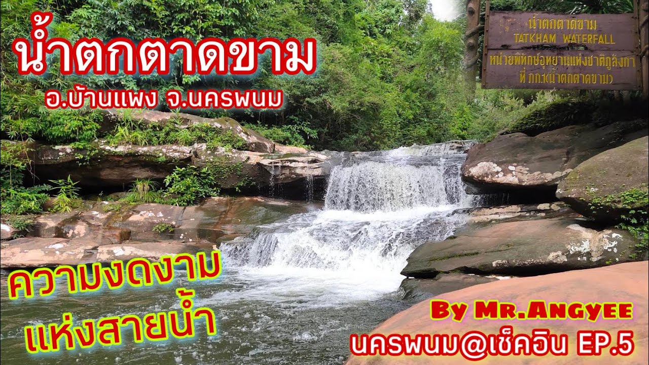
 Click to Access the Navigation Map GPS
Tat Kham Waterfall Map
Recommend

 Art, Culture and Heritage
 Historical Sites and Monuments(3)
 Landmarks and Memorials(2)
 Art, Craft Centres, Tradition(3)
 Museums(3)
 Educational Places
 Library(1)
 Places of Worship
 Temple(23)
 Church(1)
 Other Sacred Sites(11)
 Suburban Living
 Village, Community(5)
 National Parks and Marine Reserves(1)
 Dam, Reservoir, Lake(5)
Waterfalls(2)
 River, Canal(3)
 Bays and Beaches(3)
 Other natural attractions(2)
 Entertainment and Agricultural
 Zoos and Aquariums(1)
 Farms, Parks and Ecotourism(2)
 Shopping
 Shopping and Night Market(1)
 Travel Articles, Recipes
 Travel Review, Food Review(1)


