
lovethailand home >Northeastern Travel Attractions >Mukdahan Travel Attractions >Muang Mukdahan >Na Sinuan > Phu Pha Thoep National Park
TL;DR: Phu Pha Thoep National Park, Mukdahan attractions : Nature and Wildlife, National Parks and Marine Reserves.

Phu Pha Thoep National Park
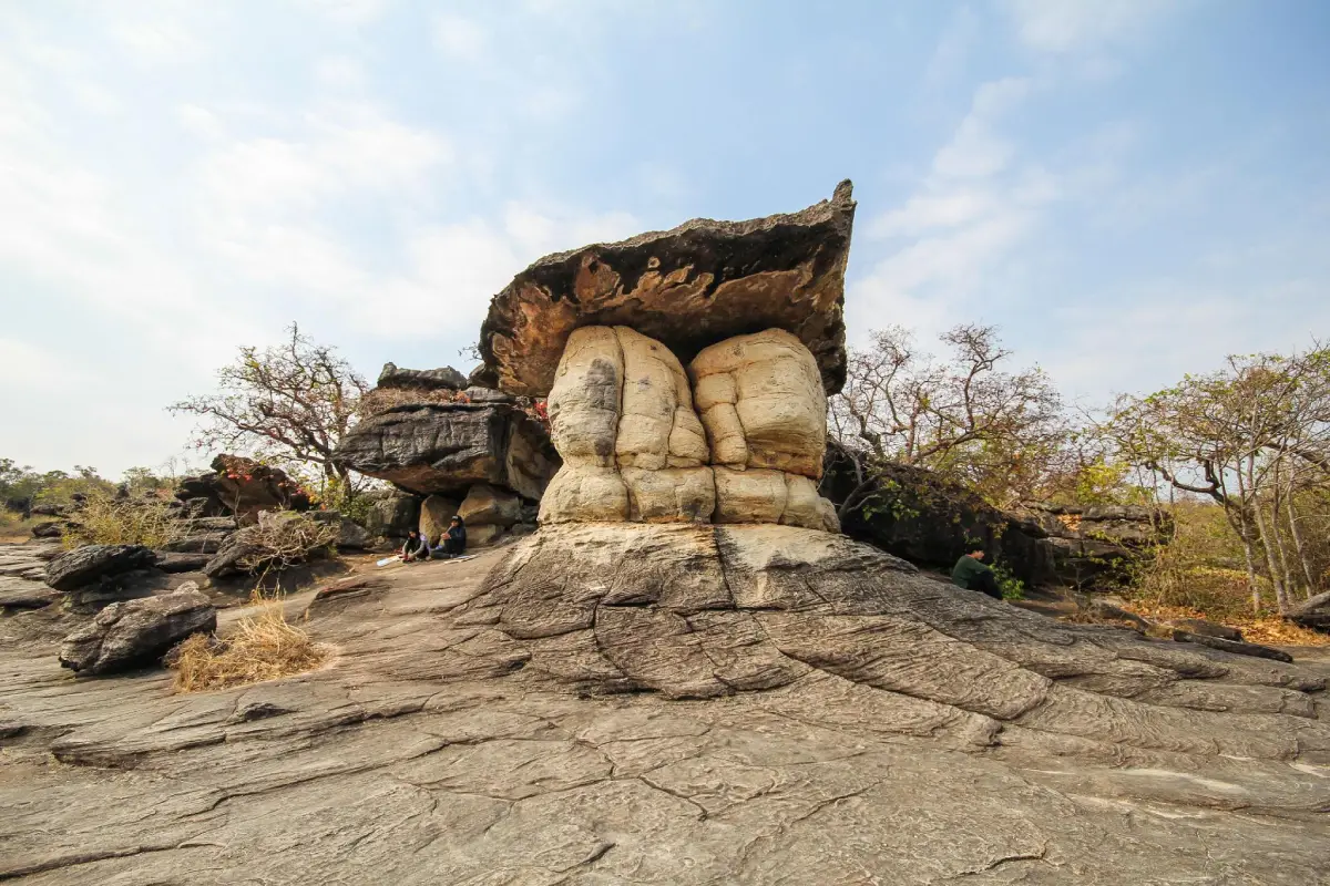
Open Days: Daily. Nature trails, caves, waterfalls, and selected areas may be temporarily restricted because of weather, maintenance, wildfire risk, or visitor safety.
Opening Hours: 07.30 – 17.30. Visitors should enter longer trails early and return to the headquarters area before closing.
Phu Pha Thoep National Park in Mukdahan Province is a protected natural area best known for its unusual sandstone formations, broad rock plateaus, cliffs, viewpoints, seasonal wildflowers, waterfalls, caves, and archaeological evidence. The park forms the eastern end of the Phu Phan mountain system and lies only a short drive from Mukdahan city. Travelers can therefore move from the urban Mekong riverfront to a landscape of forest, exposed sandstone, mountain streams, and prehistoric cultural remains within the same day.
The park was originally established as Mukdahan National Park. It was officially declared on 28 December 1988 as Thailand’s 59th national park and was later renamed Phu Pha Thoep National Park to reflect the distinctive thoep rock formations for which the area became widely known. The current officially recorded area is approximately 48.4 square kilometres, or 30,245.67 rai, covering parts of Mueang Mukdahan and Don Tan districts.
Older guidebooks and promotional descriptions sometimes give a rounded area of 48.5 square kilometres or 30,312.5 rai. The difference results from rounding, older datasets, and later administrative updates. Current official figures should be used for reference. Although Phu Pha Thoep is relatively compact compared with many Thai national parks, it contains an unusually concentrated combination of geology, dry forest, seasonal plants, waterways, wildlife habitat, sacred places, and prehistoric evidence.
The landscape consists of connected sandstone hills with an undulating form. Most ridges follow a north–south direction and run roughly parallel to the Mekong River, which lies approximately 4 km away. Elevation ranges from about 170 to 420 metres above mean sea level. Phu Chom Si is the highest summit at approximately 420 metres. The ridges function as water-catchment areas, wildlife habitat, forest corridors, and viewpoints over Mukdahan, the Mekong, and parts of Laos when visibility is clear.
Major hills within the protected area include Phu Mak Yang, Phu Mano, Phu Prong, Phu Rang, Phu Chom Nang, Phu Mak Mi, Phu Pha Thoep, Phu Nang Hong, Phu Tham Phra, Phu Lak Se, and Phu Chom Si. Each section has a different physical character. Some areas contain open sandstone plateaus and ridges, some form high cliffs, and others support dry dipterocarp or mixed deciduous forest. Moist gullies and shaded valleys hold denser vegetation than the exposed rock surfaces.
The local word “thoep” refers to a large stone slab or rock mass that overlaps and projects outward to form a natural shelter from sun, rain, or wind. Phu Pha Thoep takes its name from these visible structures. Many formations have narrow bases, broad upper layers, or apparently balanced blocks. Visitors have compared them with mushrooms, umbrellas, crowns, temples, swans, camels, crocodiles, and many other forms according to their own imagination.
The rocks were not stacked by human hands. Their shapes are the result of a long geological process. Individual sandstone layers differ in hardness, density, and resistance to weathering. Rainwater, wind, running water, temperature change, and chemical weathering act on the rock continuously. Softer sections erode more rapidly than harder layers, producing undercut bases, projecting caps, cracks, shelters, and balanced-looking formations.
The formations may once have been covered by more soil and weathered material than can be seen today. As loose sediment and softer layers were removed, harder sandstone structures gradually emerged. The present landscape is therefore only one stage of an ongoing process. The rocks continue to weather and change, although most change occurs too slowly to be noticed within an ordinary human lifetime.
The principal Hin Thoep rock group is located close to the visitor centre and park headquarters and is the first destination for most visitors. The route begins near the information area and rises onto the exposed rock surface. Travelers can examine bedding layers, cracks, drainage channels, and sculpted formations from close range. They must remain in permitted areas, avoid climbing unsupported formations, and never jump across deep cracks or stand beneath a section marked as unstable.
Although the main rock route is short and close to park services, the ground is natural rather than paved. Sloping sandstone, loose sand, cracks, and rainy-season algae can create slippery conditions. Shoes should provide reliable grip and secure the heel. Flat-soled sandals and loose footwear are unsuitable. Older visitors, children, and people with knee problems should walk slowly and avoid attempting to match the pace of stronger hikers.
Broad sandstone plateaus are another important feature. Some sections receive direct sunlight throughout the day and contain only a thin accumulation of soil. These areas can appear dry and barren during part of the year, yet they support small plants adapted to shallow soil, seasonal moisture, strong light, and extreme temperature changes. Many species grow, flower, and produce seed during a short favourable period before reducing activity in the dry season.
Lan Mutchalin is a popular plateau and viewpoint, especially during the late rainy season and early cool season from approximately October to November. Depending on rainfall, visitors may see small wildflowers such as Soi Suwanna, Dusita, Thip Keson, Mani Thewa, and other species growing in moist cracks and shallow depressions. Purple, yellow, white, and pink flowers create a vivid contrast with grey and brown sandstone.
The flowering period does not occur on exactly the same dates every year. Rainfall, temperature, water retention, sunlight, and soil conditions affect the number of flowers and the peak period. Visitors interested in wildflowers should check current photographs and park announcements rather than relying solely on old travel reviews. Flowering can begin several weeks earlier or later than expected.
These plateau plants are small and have delicate root systems. A single footprint can destroy flowers, leaves, seedlings, and the shallow habitat where future seeds would germinate. Visitors must remain on the route indicated by park staff, avoid sitting among the plants, and never place a bag or tripod on a flower patch. A zoom lens or macro equipment should be used instead of stepping into vegetation for a closer photograph.
During the wildflower season, the park and local authorities may arrange special nature walks, educational activities, cultural presentations, or community food events. These are scheduled programs rather than daily services. Travelers should check the official dates and prepare for additional traffic, parking controls, and larger crowds during festival weekends.
Viewpoints along the ridges can reveal surrounding hills, agricultural land, Mukdahan city, the Mekong River, and parts of Laos on a clear day. Visibility depends on haze, smoke, humidity, dust, and cloud. A distant international view cannot be guaranteed. Morning light is gentle and temperatures are lower, while afternoon sunlight emphasizes the rock surfaces but creates considerably greater heat.
Phu Mano and surrounding ridges contribute to the park’s wider mountain scenery. Some routes require more time and physical effort than the main rock group. Visitors should ask park staff which sections are open, how far they extend, and whether a guide is required. They should never follow an unmarked track because dry forest and sandstone surfaces can look similar in several directions, making orientation difficult when signs are no longer visible.
Fa Mue Daeng Cave, or the Red Hand Cave, is an important archaeological site. Red hand impressions estimated to be approximately 3,000–5,000 years old survive on the rock surface. These marks demonstrate that Phu Pha Thoep has value beyond its natural landscape. Human communities once used the caves, shelters, and surrounding terrain for occupation, activity, communication, ritual, or other purposes whose complete meanings remain a subject of study.
Visitors must never touch the red handprints or the painted surface. Oil, moisture, and dirt from the skin can accelerate deterioration. Water must not be sprayed onto the pigment to intensify its colour, and no object should be placed against the wall for scale. Scratching, writing, tracing, or repeated flash photography can damage irreplaceable archaeological evidence.
Tham Phra is another site where natural rock shelters and religious practice meet. Buddha images and small wooden figures are kept within the cave area. The place demonstrates how natural formations have been used for worship, meditation, and quiet refuge. Visitors should dress respectfully, keep their voices low, avoid moving religious objects, and never light candles or incense outside the places permitted by the park.
Tham Phra Waterfall is seasonal. Water is most likely during the rainy season and after sustained rainfall, while the flow decreases significantly during dry months. At certain times, only damp rock or a small flow remains. Travelers specifically seeking a waterfall should contact the park before visiting. Heavy rain can also make the trail slippery and increase the risk of falling branches, unstable soil, and rapidly changing stream conditions.
Wang Duean Ha Waterfall is another rainy-season attraction. Reaching it can require a longer walk through forest, rock surfaces, and sloping ground than the route near the visitor centre. The trail and water conditions must be confirmed before departure. Travelers should not begin this route late in the afternoon because returning after the park’s closing time creates unnecessary risk.
Several streams originate in or flow through the park, including Huai Ta Lueak, Huai Sing, Huai Ruea, Huai Male, and Huai Chang Chon. They provide moisture for forest ecosystems, wildlife, and agricultural areas below the hills. Water volume changes sharply between seasons. Protecting the forest catchment therefore benefits surrounding communities as well as wildlife and tourism.
The principal forest types are dry dipterocarp and mixed deciduous forest. Dry dipterocarp forest occupies shallow and relatively dry soils and contains tree species adapted to seasonal drought. Mixed deciduous forest supports a broader combination of trees that lose leaves at different times. Bamboo grows in belts along some lower slopes and moister areas. Together these plants stabilize soil, retain moisture, and provide food and shelter for wildlife.
During the dry season, fallen leaves and dry vegetation accumulate on the forest floor, increasing wildfire risk. Visitors must never light a fire outside designated areas, discard cigarette ends, or burn rubbish. Smoke or fire should be reported to park staff immediately. Entering a burning slope without training is dangerous because wind can change the direction and speed of a forest fire within minutes.
The park supports muntjac, wild boar, civets, squirrels, small mammals, forest birds, reptiles, and other wildlife adapted to dry forest and sandstone habitats. In 2026, rehabilitated native animals were returned to the protected area, demonstrating its continuing conservation role. Most visitors are more likely to find tracks, calls, droppings, or feeding signs than to encounter large animals directly.
Not seeing many animals does not mean that the forest is empty. Most wildlife avoids people and is active when visitor traffic is low. Travelers should speak quietly, avoid loudspeakers, and never feed an animal. Feeding changes natural behaviour, encourages animals to approach people, and increases the risk of injury, disease, and conflict.
Birdwatchers should arrive in the morning, carry binoculars, and move quietly. Neutral clothing reduces visual disturbance. Birds may be found along forest edges, streams, and fruiting trees, although sightings depend on season and weather. Repeated playback of bird calls and approaching nests should be avoided because they can disrupt breeding and parental care.
The visitor centre should be the first stop before any walk. Staff can provide current information about trail openings, waterfall flow, maintenance work, weather risk, and route duration. A park map and direct advice are more reliable than a general navigation application, which cannot show slippery rock, flooded channels, damaged bridges, or temporary closures.
Facilities near the headquarters include parking, toilets, information services, a welfare shop, a campsite, and national park accommodation subject to availability. Facilities are functional rather than resort-like. Travelers should bring drinking water, personal medication, necessary food, and basic supplies, particularly on weekdays when small food stalls may be fewer than on holidays.
The welfare shop and local food stalls operate according to visitor numbers and vendor availability. A complete restaurant service should not be assumed throughout the day. Families, older travelers, and people with dietary restrictions should prepare suitable food in advance. Every container and item of waste must be removed or placed in the official collection points.
The campsite allows visitors to experience the forest atmosphere in the evening and early morning. Camping charges are separate from admission. Tent, bedding, and equipment rental should be confirmed with the park because stock is limited and prices may change. Advance reservation is particularly important during public holidays and the wildflower season.
Tents may be erected only in the designated camping area. Camping on a rock plateau, viewpoint, cliff edge, wildlife trail, or forest route is prohibited. Cooking must take place in an approved area. Food should be sealed so that it does not attract wildlife, and all scraps must be removed. Noise must be controlled at night.
National park houses are suitable for families and travelers who do not wish to camp, but the number of rooms is limited. Reservations should be made through the Department of National Parks system or directly with the park. Guests must confirm occupancy, check-in time, payment conditions, bedding, and available facilities rather than relying on prices published in old reviews.
Mobile-phone coverage may be available around the headquarters and open ground but varies by network and terrain. A telephone should not be the only safety measure. Travelers should share their route, save the park’s contact number, keep the group together, and download necessary maps or information before leaving the city.
Current admission for Thai citizens is 20 baht for adults and 10 baht for children. International admission is 100 baht for adults and 50 baht for children. The vehicle fee is 20 baht for a motorcycle and 30 baht for a car. Charges may be revised under future Department of National Parks regulations.
Young children, older people, monks, persons with disabilities, or other eligible visitors may receive exemptions or reductions under national park regulations. Appropriate identification should be carried and eligibility confirmed at the ticket point. Conditions applied at another park should not automatically be assumed to apply in the same way.
Travelers should begin early, especially when planning more than the principal rock formations. Arriving before 09.00 reduces heat and leaves sufficient time for orientation. A short visit of approximately 2–3 hours can include the visitor centre, Hin Thoep, the nearby plateau, and a viewpoint. Caves, waterfalls, and deeper routes require additional time.
A half-day itinerary is suitable for travelers staying in Mukdahan city. Leave the city at approximately 07.30–08.00, obtain current trail information, walk through Hin Thoep and Lan Mutchalin, and visit a nearby viewpoint before returning to headquarters around midday. During the wildflower season, extra time should be allowed for slow, careful photography.
A full-day itinerary may include an open cave or seasonal waterfall route. The number of destinations should be adjusted to trail length, weather, and group fitness. Attempting to collect every attraction in one day is unsafe when rain or long distances are involved. Returning in low light increases the risk of route errors, slippery rock, and wildlife encounters.
A 2-day, 1-night program allows camping or use of park accommodation. The first day can focus on the main formations, viewpoints, and geology. A longer trail can begin early on the second morning under staff guidance. An overnight stay removes the need to drive back to the city immediately after hiking, but accommodation, food, and equipment must be arranged in advance.
The cool season from approximately November to February provides the most comfortable walking conditions. Mornings and evenings can be windy and cooler than the city, making a light jacket useful. The dry dipterocarp forest begins changing colour and losing leaves, while plateau wildflowers are generally most prominent from the late rainy season into early cool season.
The hot season from approximately March to May brings high temperatures and intense heat on exposed rock. Shade is limited on the plateau, and midday walking increases the risk of dehydration and heat illness. Start early, wear breathable sun-protective clothing, use a hat and sunscreen, and carry sufficient water. People with heart, blood-pressure, or heat-sensitivity conditions should select a short route.
The rainy season from approximately June to October creates green forest and seasonal waterfalls, while also making rock and soil slippery. Weather can change quickly. Rain falling upstream may raise a stream even when the immediate location remains dry. Stream crossings and waterfall areas should only be approached under current park guidance.
During thunderstorms, exposed rock plateaus, ridge tops, isolated trees, and viewpoints are unsafe because of lightning. Visitors should leave high ground when instructed and avoid carrying a metal tripod or standing beneath a single tree. A trail closure must be respected even when travelers have come a long distance or already paid for accommodation.
Hiking shoes or sports shoes with deep tread are the most suitable footwear. Clothing should allow movement, release heat, and protect the skin from sun and vegetation. Essential equipment includes water, a hat, sunscreen, insect repellent, a compact rain jacket, personal medication, energy food, a charged telephone, and a bag for waste.
Trekking poles can improve balance on slopes but should not damage small plants or sandstone. They must be controlled carefully in crowded areas. Wearing headphones in both ears is unsuitable because it prevents hikers from hearing warnings, wildlife, vehicles, or rising water.
Leave-no-trace principles apply throughout the park. Bottles, caps, tissues, cigarette ends, wrappers, and food waste must not be left behind. Fruit peel is also inappropriate because it may not be part of the natural diet of local wildlife and can change animal behaviour.
Rocks, flowers, seeds, wood, animal remains, nests, and archaeological objects must remain in the park. One small rock or flower may appear insignificant, but repeated collection by many visitors causes permanent loss. Photography, notes, and observation preserve memories without removing the resource.
Drone use requires prior permission from the Department of National Parks and other relevant authorities. An apparently open landscape is not an automatic flight zone. Drone noise disturbs wildlife, visitors, and park operations, while ridge winds can change rapidly.
Rock climbing, abseiling, and leaving official trails require specific authorization. Weathered sandstone can break under weight and should not be treated like harder climbing rock. Standing on an overhang or pulling against a fragile edge can cause both serious injury and irreversible damage.
Families can use Hin Thoep as an outdoor geology classroom. Children can learn about erosion, rock layers, dry forest, wildflowers, and conservation. An adult must supervise them at all times. Running across rock, climbing formations, approaching cliff edges, and walking out of sight are unsafe.
Older visitors may be able to explore the formations closest to headquarters according to their physical condition. The route is not entirely level and includes natural steps, slopes, and cracks. Wheelchairs can reach some service areas but are unsuitable for most rock plateaus and nature trails.
Travelers with medical conditions should carry necessary medicine and inform their companions. Chest pain, breathing difficulty, dizziness, muscle cramps, or loss of balance require an immediate stop and assistance. Honest assessment of physical ability is more important than completing a planned route.
Sunrise and sunset create attractive light, but park hours and route rules take priority. Ordinary visitors must not enter before opening or remain after closing for photography. Special access requires advance permission from the park.
Photographers should place tripods without blocking a trail or crushing plants. Portrait photography must not involve climbing rocks or approaching cliff edges for dramatic images. Busy viewpoints should be shared fairly with other visitors.
Getting There by private car from Mukdahan city: follow Highway 2034 toward Don Tan for approximately 15 km, turn right at the national park sign, and continue about 2 km to headquarters. The total road distance from central Mukdahan is approximately 17 km.
The park address is 25 Moo 5, Ban Khon Sai, Na Si Nuan Subdistrict, Mueang Mukdahan District, Mukdahan 49000. Approximate headquarters coordinates are 16.439625, 104.756818. Navigation applications may display separate pins for the headquarters, rock formations, or the wider park boundary, so the visitor centre pin should be selected.
Public-transport travelers can take an interprovincial bus to Mukdahan Bus Terminal and then use a local vehicle travelling along Highway 2034 toward Don Tan. Passengers can be dropped near the park access road. The final 2 km to headquarters has no regular public transport and requires a prearranged transfer.
The 5-baht and 10-baht songthaew fares found in older travel information are obsolete and should not be used for current planning. Fares, boarding points, schedules, and the last return service must be confirmed on the travel date. Return transport should be arranged before entering the park.
A rental car or hired vehicle is more practical for families, international groups, and travelers combining several attractions. The waiting time, meeting place, fare, and driver’s telephone number should be agreed upon clearly. Vehicles must not block the park entrance, emergency access, or turning areas.
Mukdahan Province has no commercial airport. Nakhon Phanom, Sakon Nakhon, and Ubon Ratchathani airports are common gateways, followed by a rental car, van, or bus to Mukdahan. Travelers arriving late in the afternoon should visit the park the following morning rather than beginning a trail with insufficient daylight.
Mukdahan has no railway station. Rail travelers can use Ubon Ratchathani Station and continue by road for more than 160 km. Staying overnight in Mukdahan and visiting the park after rest is safer than beginning a sandstone walk immediately after a long train and road journey.
Wat Roi Phra Phutthabat Phu Manorom is approximately 11 km from the park and can be combined with the same itinerary. The temple offers a high viewpoint over the Mekong and a monumental naga image. Visiting Phu Pha Thoep in the morning and Phu Manorom in the afternoon reduces heat exposure on the open rock plateau.
Mukdahan Tower is approximately 15 km away and provides provincial interpretation and elevated views during its operating hours. Indochina Market, Wat Si Mongkhon Tai, and the Mekong riverfront are approximately 17 km away and are suitable for late-afternoon shopping, food, and an urban cultural visit.
Restaurant options immediately outside the park are limited and opening times vary. Restaurants with established public contact details are concentrated in Mukdahan city, approximately 13–17 km away. Travelers should eat breakfast before leaving, carry suitable snacks, and plan lunch or dinner in the city.
Visitors seeking a nature stay can use the park campsite or accommodation. Travelers wanting air conditioning, elevators, full restaurants, and extended service hours can stay in Mukdahan city, approximately 16–18 km away. A city hotel is convenient for a half-day park visit followed by markets, temples, and the Mekong.
Phu Pha Thoep is a national park and therefore has no abbot. It is managed by Thailand’s Department of National Parks, Wildlife and Plant Conservation. The current park chief is Ms. Benjamas Salanoi. The park telephone number is +66 82 107 8097 for current information about trails, waterfalls, camping, accommodation, and safety restrictions.
Tourism benefits conservation when visitors pay the required fees, follow regulations, support nearby communities, and avoid creating waste. Protection is not the responsibility of rangers alone. Every visitor influences the condition in which rocks, flowers, archaeological paintings, streams, and wildlife remain.
Phu Pha Thoep National Park is suited to travelers interested in geology, short hikes, nature photography, seasonal wildflowers, forest ecology, and human history. Its importance extends beyond rock shapes resembling familiar objects. It lies in the continuing transformation of sandstone, the survival of tiny plants on exposed plateaus, and the relationship between the mountain catchment and surrounding communities.
Travelers who prepare properly, begin early, check routes with rangers, carry sufficient water, wear safe footwear, and respect every restriction can understand the park in greater depth. Walking slowly enough to observe rock layers, small flowers, bird calls, drainage channels, and animal tracks creates a more meaningful experience than rushing through the principal photograph locations.
Phu Pha Thoep is an outdoor geology classroom, a forest catchment, a wildlife conservation area, an archaeological landscape, and an important recreation site for Mukdahan. Its future depends on cooperation among rangers, local communities, researchers, businesses, and visitors. Responsible use will allow the thoep formations and surrounding ecosystems to continue telling the story of nature and human life for generations.
| Name | Phu Pha Thoep National Park |
| Former Name | Mukdahan National Park |
| National Park Number | Thailand’s 59th national park |
| Declaration Date | 28 December 1988 |
| Area | Approximately 48.4 sq km or 30,245.67 rai, covering parts of Mueang Mukdahan and Don Tan districts |
| Address | 25 Moo 5, Ban Khon Sai, Na Si Nuan Subdistrict, Mueang Mukdahan District, Mukdahan 49000, Thailand |
| Approximate Headquarters Coordinates | 16.439625, 104.756818 |
| Attraction Type | National park, sandstone geomorphology site, nature-trail destination, seasonal wildflower habitat, waterfall area, cave system, and archaeological landscape |
| Landscape | Connected sandstone hills at the eastern end of the Phu Phan Range, with plateaus, cliffs, streams, and elevations of approximately 170–420 metres |
| Highest Summit | Phu Chom Si, approximately 420 metres above mean sea level |
| Major Hills | Phu Mak Yang, Phu Mano, Phu Prong, Phu Rang, Phu Chom Nang, Phu Mak Mi, Phu Pha Thoep, Phu Nang Hong, Phu Tham Phra, Phu Lak Se, and Phu Chom Si |
| Forest Types | Dry dipterocarp forest, mixed deciduous forest, bamboo belts, and shallow-soil plateau vegetation |
| Water Sources | Huai Ta Lueak, Huai Sing, Huai Ruea, Huai Male, Huai Chang Chon, and seasonal waterfalls |
| Meaning of Thoep | A local term for overlapping or projecting rock slabs that create a natural shelter from sun, rain, or wind |
| Current Status | Open to visitors; selected routes may be temporarily restricted because of weather, wildfire, high water, or maintenance |
| Open Days | Daily |
| Opening Hours | 07.30 – 17.30 |
| Thai Admission | Adult 20 baht; child 10 baht |
| International Admission | Adult 100 baht; child 50 baht |
| Vehicle Fee | Motorcycle 20 baht; car 30 baht, subject to current national park regulations |
| Camping Fee | Approximately 30 baht per person per night, excluding tent, bedding, and equipment rental |
| Main Areas / Zones | 1. Headquarters and Visitor Centre 2. Hin Thoep Rock Formations 3. Sandstone Plateau and Lan Mutchalin 4. Phu Mano and Ridge Viewpoints 5. Fa Mue Daeng Cave 6. Tham Phra and Tham Phra Waterfall 7. Wang Duean Ha Waterfall 8. Dry-Forest Nature Trails 9. Campsite 10. National Park Accommodation and Service Area |
| Wildflower Highlights | Soi Suwanna, Dusita, Thip Keson, Mani Thewa, and other small plateau flowers, generally prominent from the late rainy season to early cool season |
| Main Activities | Rock-form viewing, geology study, nature walking, wildflower observation, birdwatching, photography, viewpoints, seasonal caves and waterfalls, camping, and archaeological learning |
| Facilities | Visitor centre, parking, toilets, welfare shop, campsite, park houses, nature trails, interpretation signs, and ranger services |
| Managing Authority | Department of National Parks, Wildlife and Plant Conservation |
| Park Chief | Ms. Benjamas Salanoi |
| Contact Number | +66 82 107 8097 |
| Getting There | From Mukdahan city, follow Highway 2034 toward Don Tan for approximately 15 km, turn right at the park sign, and continue about 2 km. Total distance is approximately 17 km. |
| Public Transport | Use a local Mukdahan–Don Tan vehicle and alight near the park access road. The final 2 km has no regular service, so a transfer and return transport should be arranged in advance. |
| Recommended Season | November–February for comfortable walking; October–November for seasonal wildflowers; the rainy season for waterfalls, subject to slippery trails and temporary closures |
| Recommended Duration | Approximately 2–3 hours for Hin Thoep and nearby plateaus; a half or full day for caves, waterfalls, and additional viewpoints |
| Visitor Rules | Remain on official routes, do not climb cliffs, crush flowers, touch ancient paintings, remove rocks or plants, feed wildlife, or leave waste, and always follow ranger instructions |
| Attractions Inside and Nearby | 1. Hin Thoep Rock Formations, about 0.2 km from the Visitor Centre 2. Lan Mutchalin, about 0.8 km 3. Fa Mue Daeng Cave and Tham Phra Waterfall, about 3 km by nature trail 4. Wang Duean Ha Waterfall, about 4 km along an internal route 5. Wat Roi Phra Phutthabat Phu Manorom, about 11 km 6. Mukdahan Tower, about 15 km 7. Indochina Market and Wat Si Mongkhon Tai, about 17 km |
| Nearby Restaurants | 1. Nudpob Rimkhong Restaurant, about 13 km, Tel. +66 86 459 6263, +66 61 929 2459, or +66 89 711 6063 2. Ban Lao Yuan Na Rim Khong, about 15 km, Tel. +66 65 142 3915 or +66 42 611 111 3. Goodmook Traveller Cafe, about 16 km, Tel. +66 85 841 2185 or +66 42 042 198 4. Krua Saigon Mukdahan, about 16 km, Tel. +66 42 615 303 or +66 81 320 1318 5. Or Aem Vietnamese Food, about 17 km, Tel. +66 82 787 2360 |
| Nearby Accommodations | 1. Phu Pha Thoep National Park Houses and Campsite, inside the park, about 0 km, Tel. +66 82 107 8097 2. Ploy Palace Hotel, about 16 km, Tel. +66 42 614 988 3. Hotel Muq, about 16 km, Tel. +66 63 787 5555 or +66 42 040 888 4. HOP INN Mukdahan, about 16 km, Tel. +66 2 080 2222 5. Riverfront Hotel Mukdahan, about 17 km, Tel. +66 42 612 948-9 or +66 81 703 1705 6. Hotel de Ladda, about 18 km, Tel. +66 42 611 499 or +66 42 611 497 |
Frequently Asked Questions (FAQ)
Q: Which days and hours is Phu Pha Thoep National Park open?
A: The park is open daily from 07.30 to 17.30. Caves, waterfalls, viewpoints, and selected trails may close temporarily because of heavy rain, wildfire, high water, or maintenance.
Q: How much is the admission fee?
A: Thai admission is 20 baht for adults and 10 baht for children. International admission is 100 baht for adults and 50 baht for children. Motorcycle entry is 20 baht and car entry is 30 baht, subject to current regulations.
Q: Is Hin Thoep far from the park headquarters?
A: The principal formations are approximately 0.2 km from the visitor centre. The route is short but crosses natural sandstone that can be sloping or slippery, especially during rain.
Q: When is the best time to see wildflowers at Lan Mutchalin?
A: Wildflowers are generally most prominent from the late rainy season into the early cool season, approximately October–November. The exact peak depends on rainfall and temperature, so current park updates should be checked.
Q: Do Tham Phra and Wang Duean Ha waterfalls have water throughout the year?
A: No. They are seasonal waterfalls and usually have the clearest flow during the rainy season and after sustained rain. Routes may close when water or slippery conditions create a safety risk.
Q: Can visitors camp or stay overnight?
A: Yes. Visitors can use the designated campsite or reserve available national park accommodation. Camping is approximately 30 baht per person per night, while tent rental and room rates should be confirmed directly with the park.
Q: Can the park be reached by public transport?
A: A local Mukdahan–Don Tan vehicle can drop passengers near the access road, but the final 2 km to headquarters has no regular public transport. A transfer and return journey should be arranged in advance.
Q: How can travelers contact Phu Pha Thoep National Park?
A: Contact the park at +66 82 107 8097 for current opening information, trail conditions, waterfall status, camping, accommodation, and safety restrictions.
 Category: ●Nature and Wildlife
 Group: ●National Parks and Marine Reserves
Last Update : 2 MonthAgo
 Last Update : 2 MonthAgo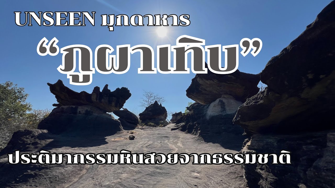
 Click to Access the Navigation Map GPS
Phu Pha Thoep National Park Map
Gellery
Recommend

 Art, Culture and Heritage
 Historical Sites and Monuments(2)
 Landmarks and Memorials(3)
 Art, Craft Centres, Tradition(2)
 Museums(1)
 Places of Worship
 Temple(17)
 Other Sacred Sites(3)
 Suburban Living
 Village, Community(4)
 Local Market(2)
National Parks and Marine Reserves(4)
Local Market(2)
National Parks and Marine Reserves(4)
 Mountain (Doi)(5)
 Dam, Reservoir, Lake(3)
 Waterfalls(5)
 Caves(2)
 River, Canal(2)
 Bays and Beaches(1)
 Other natural attractions(1)
 Entertainment and Agricultural
 Farms, Parks and Ecotourism(1)


