
lovethailand home >South Travel Attractions >Nakhon Si Thammarat Travel Attractions > 50 Best Beaches and Islands in Southern Thailand f..
TL;DR: 50 Best Beaches and Islands in Southern Thailand for a Summer Holiday.

50 Best Beaches and Islands in Southern Thailand for a Summer Holiday
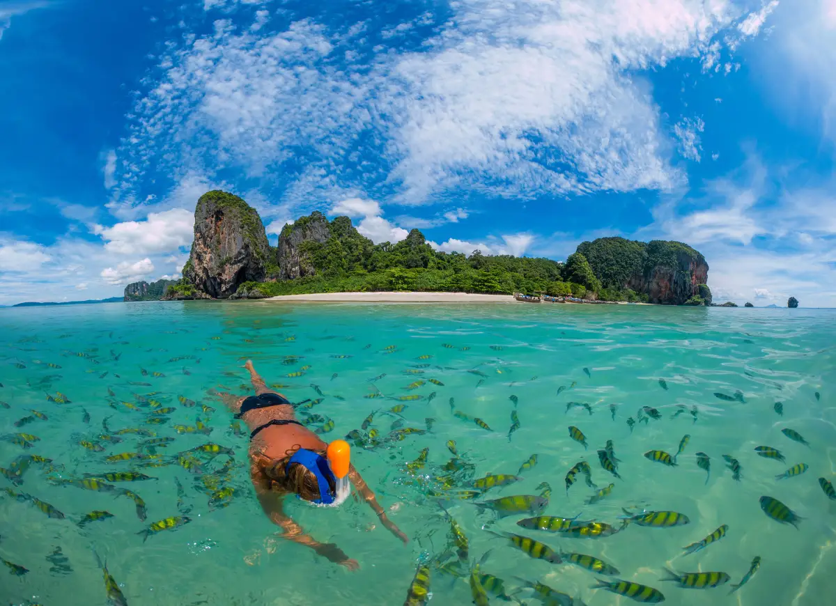
50 Best Beaches and Islands in Southern Thailand for a Summer Holiday is a comprehensive guide to fifty coastal destinations across the Andaman Sea and Gulf of Thailand. Discover Phuket, Krabi, Phang Nga, Trang, Satun, Ranong, Chumphon, Surat Thani, Nakhon Si Thammarat, Songkhla, Pattani and Narathiwat—from lively resort beaches to quiet islands and protected marine national parks.
Southern Thailand’s appeal extends far beyond clear blue water and white sand. Limestone cliffs rise over sheltered coves, forested islands sit beyond the shoreline, and traditional fishing communities maintain a close relationship with the sea. Travelers can choose busy coastal towns with hotels and restaurants or slower journeys built around nature and local life.
The western Andaman coast encompasses Ranong, Phang Nga, Phuket, Krabi, Trang and Satun. It is especially celebrated for dramatic limestone formations, granite islands, reef ecosystems and beaches facing the sunset. Railay, the Phi Phi Islands, Similan Islands, Surin Islands, Koh Kradan and Koh Lipe demonstrate the variety of experiences found along this coast.
The eastern Gulf coast runs through Chumphon, Surat Thani, Nakhon Si Thammarat, Songkhla, Pattani and Narathiwat. Koh Samui, Koh Phangan, Koh Tao and Koh Nang Yuan draw island travelers, while Sichon, Khanom, Thung Wua Laen, Samila and other mainland beaches combine coastal scenery with local traditions.
Timing matters as much as destination choice. Many Andaman island services operate during a main tourism season running approximately from November through April. Gulf conditions vary by subregion, and monsoon periods do not align perfectly with those of the Andaman Sea. Check forecasts for the precise destination, not merely the region, along with park notices and boat departure schedules.
Families may prefer easily reached beaches with nearby services; photographers often enjoy headlands, tidal scenery and sunsets; and experienced divers may seek protected reef destinations. No attractive beach is automatically safe for swimming. Follow beach flags, lifeguard advice and the instructions of marine-park staff.
Beyond the water, southern coastal culture adds another dimension to a holiday. Regional seafood, spicy curries, fishing villages, Thai-Chinese heritage and Malay Muslim cultural traditions create meaningful opportunities to learn about the people who live along these shores.
Short trips are easiest when centered on one base, such as Ao Nang or Phuket, while longer holidays can include overnight island stays. Allow sufficient time for transfers from airports to ports, boat journeys and changes caused by sea conditions, especially when arranging an onward flight.
Responsible travel protects what makes these places special. Carry reusable water bottles, avoid single-use plastics, never step on coral or feed marine wildlife, respect private and community spaces, and choose operators who follow safety and conservation regulations.
The fifty destinations below include individual highlights, local context, travel advice, original photographs and map directions. The province is stated clearly in each destination’s opening description, without repeating it unnecessarily in the linked title.
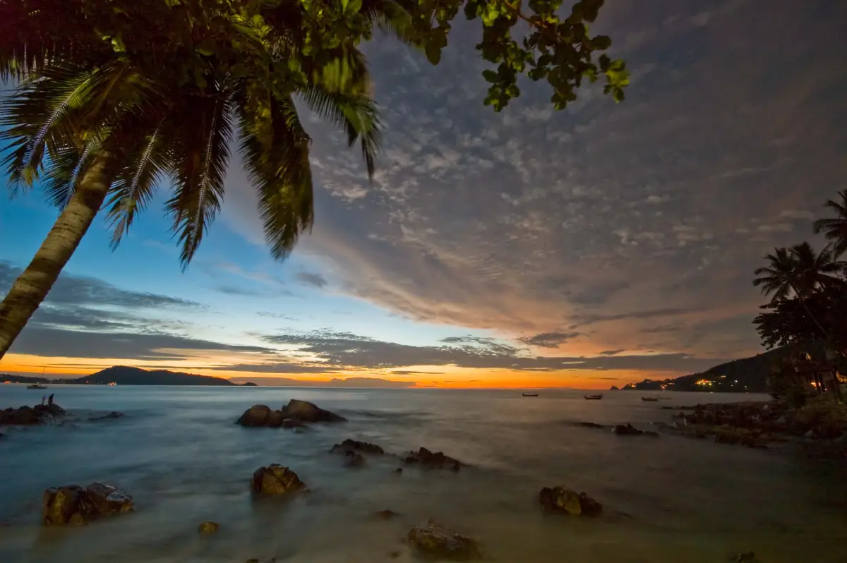
1. Patong Beach Patong Beach is a coastal attraction in Phuket Province, Southern Thailand. A lively curved bay, a long sandy beachfront and Phuket’s largest concentration of visitor services. The destination is part of the region’s wider choice of summer beach breaks, marine excursions and nature-based travel.
Highlights: A lively curved bay, a long sandy beachfront and Phuket’s largest concentration of visitor services.
The character of Patong Beach comes from its particular coastal setting. A lively curved bay, a long sandy beachfront and Phuket’s largest concentration of visitor services. Rather than treating every beach or island as interchangeable, visitors can appreciate the shape of the shoreline, surrounding vegetation, changing light and relationship to the neighboring communities. These details are particularly rewarding during unhurried walks and photography stops.
The beachfront combines an expansive bay with a particularly dense concentration of dining, shopping, water activities and nightlife. Travelers seeking quieter nights should choose their accommodation zone carefully.
For an Andaman Sea itinerary, the calmer-water season is often from roughly November to April, although individual days can still bring strong surf and boat cancellations. Marine national parks may close areas seasonally, so always check current notices before booking.
Patong Beach can be included in a broader itinerary around Phuket Province, but the best pace depends on whether travel is by road or boat. Those staying overnight can enjoy the quieter morning and evening periods; day-trippers should allow sufficient time to return before transport services end. Carry drinking water, sun protection and essential medication, and leave fragile coastal habitats undisturbed.
Getting There: Travel to Phuket Province by an available road, rail or air connection, then continue toward Patong Beach using local road access or authorized transport. Confirm the exact entrance, parking arrangements and any restricted areas before leaving.
Map (GPS):Get directions to Patong Beach
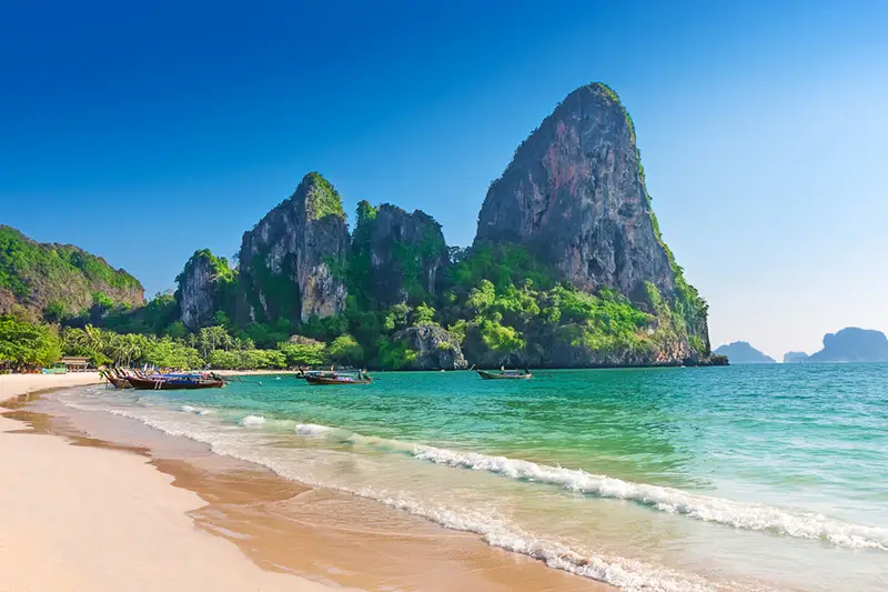
2. Railay Beach Railay Beach is a coastal attraction in Krabi Province, Southern Thailand. A boat-access peninsula framed by towering limestone cliffs, white sand and famous climbing routes. The destination is part of the region’s wider choice of summer beach breaks, marine excursions and nature-based travel.
Highlights: A boat-access peninsula framed by towering limestone cliffs, white sand and famous climbing routes.
The character of Railay Beach comes from its particular coastal setting. A boat-access peninsula framed by towering limestone cliffs, white sand and famous climbing routes. Rather than treating every beach or island as interchangeable, visitors can appreciate the shape of the shoreline, surrounding vegetation, changing light and relationship to the neighboring communities. These details are particularly rewarding during unhurried walks and photography stops.
Although Railay is technically part of the mainland, steep limestone cliffs prevent normal road access. Arriving by long-tail boat from Ao Nang is part of the experience; climbers should choose qualified guides and suitable equipment.
For an Andaman Sea itinerary, the calmer-water season is often from roughly November to April, although individual days can still bring strong surf and boat cancellations. Marine national parks may close areas seasonally, so always check current notices before booking.
Railay Beach can be included in a broader itinerary around Krabi Province, but the best pace depends on whether travel is by road or boat. Those staying overnight can enjoy the quieter morning and evening periods; day-trippers should allow sufficient time to return before transport services end. Carry drinking water, sun protection and essential medication, and leave fragile coastal habitats undisturbed.
Getting There: Take a long-tail boat from Ao Nang or another operating Railay access point. The Ao Nang crossing commonly takes around 10–15 minutes in suitable conditions; check return services before setting out.
Map (GPS):Get directions to Railay Beach
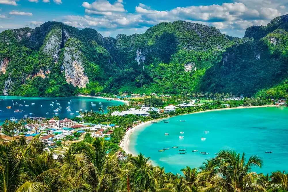
3. Phi Phi Islands Phi Phi Islands is a coastal attraction in Krabi Province, Southern Thailand. Dramatic limestone islands, aquamarine coves, beaches and popular snorkeling waters. The destination is part of the region’s wider choice of summer beach breaks, marine excursions and nature-based travel.
Highlights: Dramatic limestone islands, aquamarine coves, beaches and popular snorkeling waters.
The character of Phi Phi Islands comes from its particular coastal setting. Dramatic limestone islands, aquamarine coves, beaches and popular snorkeling waters. Rather than treating every beach or island as interchangeable, visitors can appreciate the shape of the shoreline, surrounding vegetation, changing light and relationship to the neighboring communities. These details are particularly rewarding during unhurried walks and photography stops.
Phi Phi Don accommodates visitors and overnight stays, while surrounding bays and protected marine areas have varying conservation rules. Do not assume that every beach or snorkeling spot is open each day.
For an Andaman Sea itinerary, the calmer-water season is often from roughly November to April, although individual days can still bring strong surf and boat cancellations. Marine national parks may close areas seasonally, so always check current notices before booking.
Phi Phi Islands can be included in a broader itinerary around Krabi Province, but the best pace depends on whether travel is by road or boat. Those staying overnight can enjoy the quieter morning and evening periods; day-trippers should allow sufficient time to return before transport services end. Carry drinking water, sun protection and essential medication, and leave fragile coastal habitats undisturbed.
Getting There: First reach the relevant mainland port or transport hub for Krabi Province. Continue to Phi Phi Islands by an operating boat route or local island transfer when required. Check departure times, sea conditions, seasonal access and return transport in advance.
Map (GPS):Get directions to Phi Phi Islands
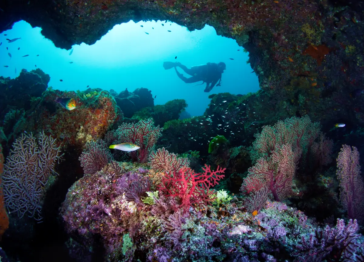
4. Mu Ko Similan National Park Mu Ko Similan National Park is a coastal attraction in Phang Nga Province, Southern Thailand. Offshore islands, giant granite boulders, white beaches and protected dive sites. The destination is part of the region’s wider choice of summer beach breaks, marine excursions and nature-based travel.
Highlights: Offshore islands, giant granite boulders, white beaches and protected dive sites.
The character of Mu Ko Similan National Park comes from its particular coastal setting. Offshore islands, giant granite boulders, white beaches and protected dive sites. Rather than treating every beach or island as interchangeable, visitors can appreciate the shape of the shoreline, surrounding vegetation, changing light and relationship to the neighboring communities. These details are particularly rewarding during unhurried walks and photography stops.
The Similan islands are famed for unusually shaped granite rocks and underwater habitats. Access is subject to national-park seasons and designated landing points.
For an Andaman Sea itinerary, the calmer-water season is often from roughly November to April, although individual days can still bring strong surf and boat cancellations. Marine national parks may close areas seasonally, so always check current notices before booking.
Mu Ko Similan National Park can be included in a broader itinerary around Phang Nga Province, but the best pace depends on whether travel is by road or boat. Those staying overnight can enjoy the quieter morning and evening periods; day-trippers should allow sufficient time to return before transport services end. Carry drinking water, sun protection and essential medication, and leave fragile coastal habitats undisturbed.
Getting There: First reach the relevant mainland port or transport hub for Phang Nga Province. Continue to Mu Ko Similan National Park by an operating boat route or local island transfer when required. Check departure times, sea conditions, seasonal access and return transport in advance.
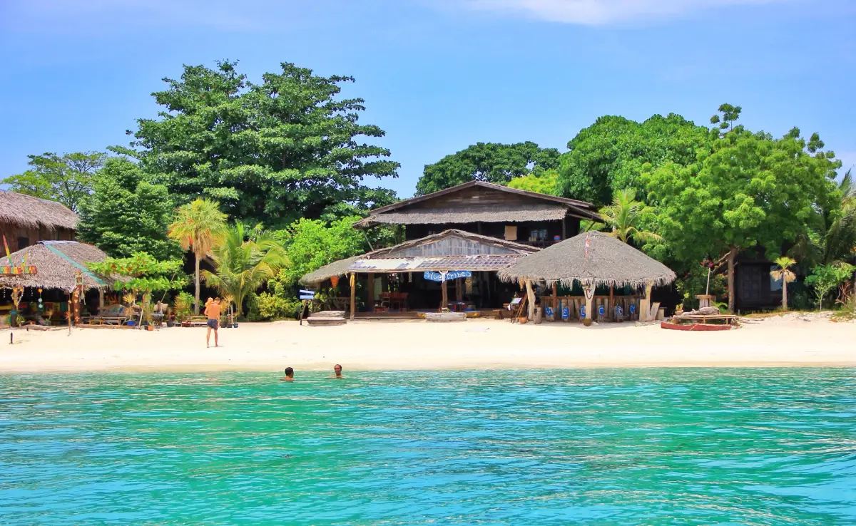
5. Koh Lipe Koh Lipe is a coastal attraction in Satun Province, Southern Thailand. White sandy beaches, clear Andaman waters, coral reefs and the maritime traditions of the Urak Lawoi community. The destination is part of the region’s wider choice of summer beach breaks, marine excursions and nature-based travel.
Highlights: White sandy beaches, clear Andaman waters, coral reefs and the maritime traditions of the Urak Lawoi community.
The character of Koh Lipe comes from its particular coastal setting. White sandy beaches, clear Andaman waters, coral reefs and the maritime traditions of the Urak Lawoi community. Rather than treating every beach or island as interchangeable, visitors can appreciate the shape of the shoreline, surrounding vegetation, changing light and relationship to the neighboring communities. These details are particularly rewarding during unhurried walks and photography stops.
Koh Lipe offers beaches facing different directions and has longstanding ties to the Urak Lawoi sea people. Respect residents and check which Adang–Rawi excursions are permitted.
For an Andaman Sea itinerary, the calmer-water season is often from roughly November to April, although individual days can still bring strong surf and boat cancellations. Marine national parks may close areas seasonally, so always check current notices before booking.
Koh Lipe can be included in a broader itinerary around Satun Province, but the best pace depends on whether travel is by road or boat. Those staying overnight can enjoy the quieter morning and evening periods; day-trippers should allow sufficient time to return before transport services end. Carry drinking water, sun protection and essential medication, and leave fragile coastal habitats undisturbed.
Getting There: Travel to Pak Bara Pier in Satun Province, then board a scheduled boat or speedboat to Koh Lipe, subject to seasonal services and sea conditions.
Map (GPS):Get directions to Koh Lipe
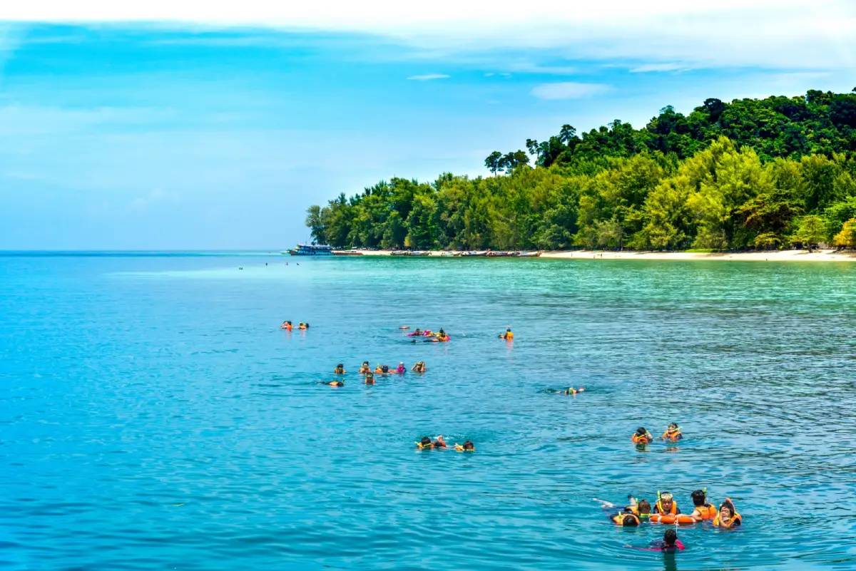
6. Koh Kradan Koh Kradan is a coastal attraction in Trang Province, Southern Thailand. White sand and shallow-water coral habitats on an island associated with Hat Chao Mai National Park. The destination is part of the region’s wider choice of summer beach breaks, marine excursions and nature-based travel.
Highlights: White sand and shallow-water coral habitats on an island associated with Hat Chao Mai National Park.
The character of Koh Kradan comes from its particular coastal setting. White sand and shallow-water coral habitats on an island associated with Hat Chao Mai National Park. Rather than treating every beach or island as interchangeable, visitors can appreciate the shape of the shoreline, surrounding vegetation, changing light and relationship to the neighboring communities. These details are particularly rewarding during unhurried walks and photography stops.
Some areas are managed within Hat Chao Mai National Park. Snorkel only where permitted and never stand on coral, even in shallow water.
For an Andaman Sea itinerary, the calmer-water season is often from roughly November to April, although individual days can still bring strong surf and boat cancellations. Marine national parks may close areas seasonally, so always check current notices before booking.
Koh Kradan can be included in a broader itinerary around Trang Province, but the best pace depends on whether travel is by road or boat. Those staying overnight can enjoy the quieter morning and evening periods; day-trippers should allow sufficient time to return before transport services end. Carry drinking water, sun protection and essential medication, and leave fragile coastal habitats undisturbed.
Getting There: First reach the relevant mainland port or transport hub for Trang Province. Continue to Koh Kradan by an operating boat route or local island transfer when required. Check departure times, sea conditions, seasonal access and return transport in advance.
Map (GPS):Get directions to Koh Kradan
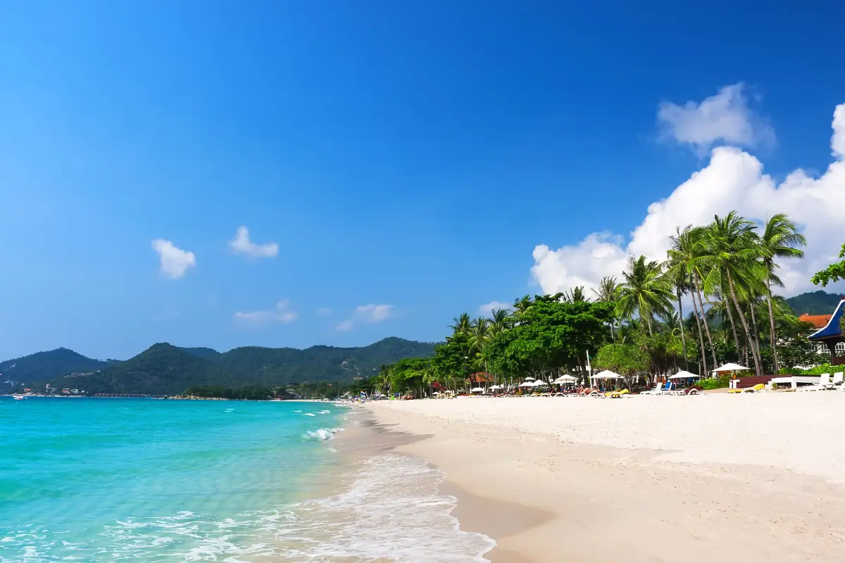
7. Chaweng Beach Chaweng Beach is a coastal attraction in Surat Thani Province, Southern Thailand. An expansive east-facing beach on Koh Samui with hotels, restaurants and a lively resort atmosphere. The destination is part of the region’s wider choice of summer beach breaks, marine excursions and nature-based travel.
Highlights: An expansive east-facing beach on Koh Samui with hotels, restaurants and a lively resort atmosphere.
The character of Chaweng Beach comes from its particular coastal setting. An expansive east-facing beach on Koh Samui with hotels, restaurants and a lively resort atmosphere. Rather than treating every beach or island as interchangeable, visitors can appreciate the shape of the shoreline, surrounding vegetation, changing light and relationship to the neighboring communities. These details are particularly rewarding during unhurried walks and photography stops.
The eastern side of Koh Samui provides opportunities for early-morning coastal photography. Hotel zones along the beach range from lively to relatively relaxed.
Gulf of Thailand conditions vary by month and by location. Check local wind and wave forecasts rather than assuming that weather suitable for Phuket or Krabi is suitable here; a sunny sky does not guarantee safe swimming.
Chaweng Beach can be included in a broader itinerary around Surat Thani Province, but the best pace depends on whether travel is by road or boat. Those staying overnight can enjoy the quieter morning and evening periods; day-trippers should allow sufficient time to return before transport services end. Carry drinking water, sun protection and essential medication, and leave fragile coastal habitats undisturbed.
Getting There: First reach the relevant mainland port or transport hub for Surat Thani Province. Continue to Chaweng Beach by an operating boat route or local island transfer when required. Check departure times, sea conditions, seasonal access and return transport in advance.
Map (GPS):Get directions to Chaweng Beach
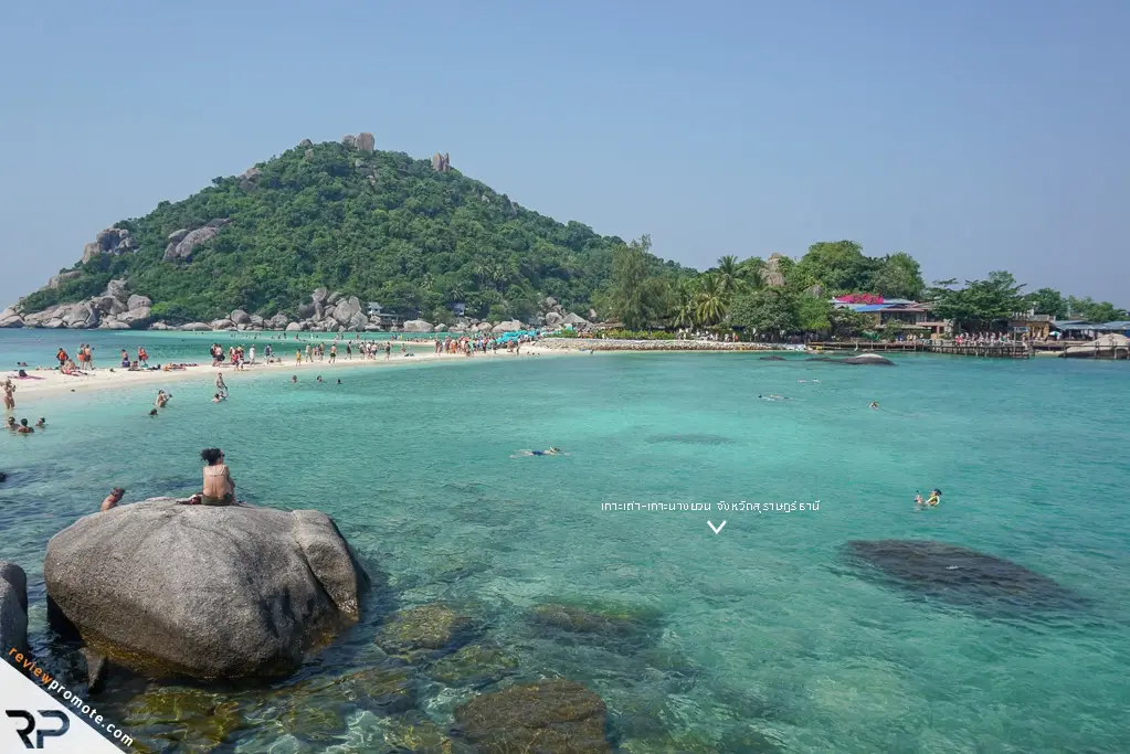
8. Koh Tao Koh Tao is a coastal attraction in Surat Thani Province, Southern Thailand. A major Gulf of Thailand diving destination, with small bays, hilltop viewpoints and dive schools. The destination is part of the region’s wider choice of summer beach breaks, marine excursions and nature-based travel.
Highlights: A major Gulf of Thailand diving destination, with small bays, hilltop viewpoints and dive schools.
The character of Koh Tao comes from its particular coastal setting. A major Gulf of Thailand diving destination, with small bays, hilltop viewpoints and dive schools. Rather than treating every beach or island as interchangeable, visitors can appreciate the shape of the shoreline, surrounding vegetation, changing light and relationship to the neighboring communities. These details are particularly rewarding during unhurried walks and photography stops.
Koh Tao is noted for dive instruction at different levels. Shore roads can be steep, and dive operators should match each activity to participants’ training and conditions.
Gulf of Thailand conditions vary by month and by location. Check local wind and wave forecasts rather than assuming that weather suitable for Phuket or Krabi is suitable here; a sunny sky does not guarantee safe swimming.
Koh Tao can be included in a broader itinerary around Surat Thani Province, but the best pace depends on whether travel is by road or boat. Those staying overnight can enjoy the quieter morning and evening periods; day-trippers should allow sufficient time to return before transport services end. Carry drinking water, sun protection and essential medication, and leave fragile coastal habitats undisturbed.
Getting There: Reach Koh Tao by an operating passenger-boat service from the Chumphon coast or via Koh Samui and Koh Phangan, checking the precise pier and schedule.
Map (GPS):Get directions to Koh Tao
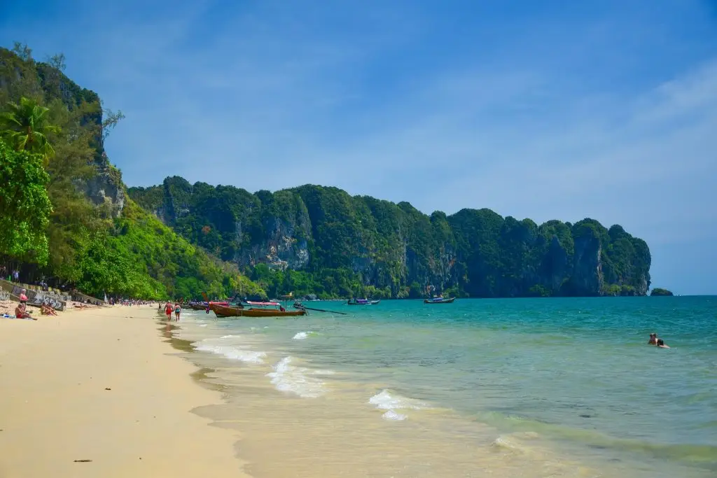
9. Ao Nang Ao Nang is a coastal attraction in Krabi Province, Southern Thailand. A convenient coastal base for long-tail boat trips, with limestone scenery, restaurants and accommodation. The destination is part of the region’s wider choice of summer beach breaks, marine excursions and nature-based travel.
Highlights: A convenient coastal base for long-tail boat trips, with limestone scenery, restaurants and accommodation.
The character of Ao Nang comes from its particular coastal setting. A convenient coastal base for long-tail boat trips, with limestone scenery, restaurants and accommodation. Rather than treating every beach or island as interchangeable, visitors can appreciate the shape of the shoreline, surrounding vegetation, changing light and relationship to the neighboring communities. These details are particularly rewarding during unhurried walks and photography stops.
Ao Nang functions as a base for Railay and several island routes. Boat piers, destinations and return schedules should be confirmed on the travel day.
For an Andaman Sea itinerary, the calmer-water season is often from roughly November to April, although individual days can still bring strong surf and boat cancellations. Marine national parks may close areas seasonally, so always check current notices before booking.
Ao Nang can be included in a broader itinerary around Krabi Province, but the best pace depends on whether travel is by road or boat. Those staying overnight can enjoy the quieter morning and evening periods; day-trippers should allow sufficient time to return before transport services end. Carry drinking water, sun protection and essential medication, and leave fragile coastal habitats undisturbed.
Getting There: Drive or take a transfer from Krabi Town toward Ao Nang, about 15–20 km away, and use an operating local boat service for excursions to Railay or nearby islands.
Map (GPS):Get directions to Ao Nang
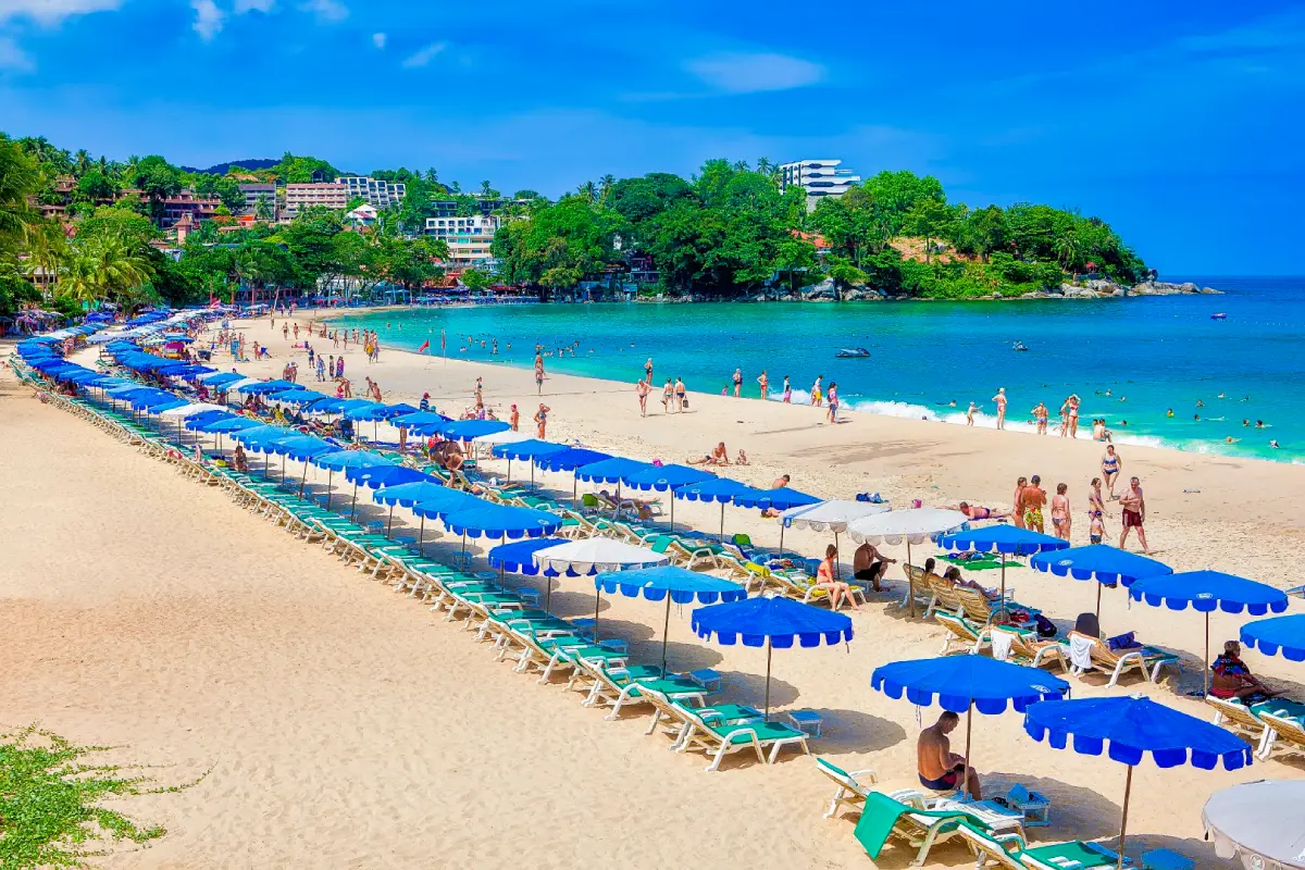
10. Kata Beach Kata Beach is a coastal attraction in Phuket Province, Southern Thailand. A gently curving beach with light sand, views toward Koh Pu and access to southern Phuket’s viewpoints. The destination is part of the region’s wider choice of summer beach breaks, marine excursions and nature-based travel.
Highlights: A gently curving beach with light sand, views toward Koh Pu and access to southern Phuket’s viewpoints.
The character of Kata Beach comes from its particular coastal setting. A gently curving beach with light sand, views toward Koh Pu and access to southern Phuket’s viewpoints. Rather than treating every beach or island as interchangeable, visitors can appreciate the shape of the shoreline, surrounding vegetation, changing light and relationship to the neighboring communities. These details are particularly rewarding during unhurried walks and photography stops.
Kata combines beach facilities with views toward Koh Pu, and can be paired with Karon, Kata Noi and scenic southern Phuket viewpoints.
For an Andaman Sea itinerary, the calmer-water season is often from roughly November to April, although individual days can still bring strong surf and boat cancellations. Marine national parks may close areas seasonally, so always check current notices before booking.
Kata Beach can be included in a broader itinerary around Phuket Province, but the best pace depends on whether travel is by road or boat. Those staying overnight can enjoy the quieter morning and evening periods; day-trippers should allow sufficient time to return before transport services end. Carry drinking water, sun protection and essential medication, and leave fragile coastal habitats undisturbed.
Getting There: Travel to Phuket Province by an available road, rail or air connection, then continue toward Kata Beach using local road access or authorized transport. Confirm the exact entrance, parking arrangements and any restricted areas before leaving.
Map (GPS):Get directions to Kata Beach
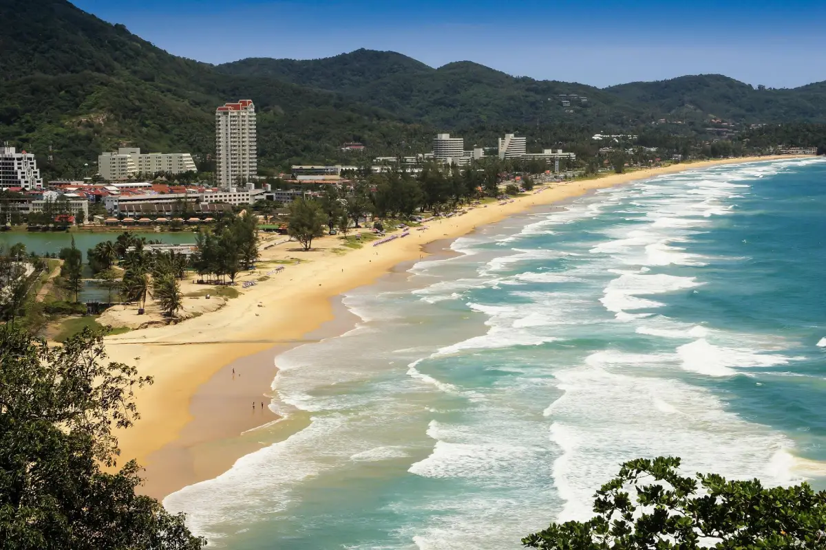
11. Karon Beach Karon Beach is a coastal attraction in Phuket Province, Southern Thailand. A long open sandy shoreline on Phuket’s west coast, ideal for beach walks and sunset scenery. The destination is part of the region’s wider choice of summer beach breaks, marine excursions and nature-based travel.
Highlights: A long open sandy shoreline on Phuket’s west coast, ideal for beach walks and sunset scenery.
The character of Karon Beach comes from its particular coastal setting. A long open sandy shoreline on Phuket’s west coast, ideal for beach walks and sunset scenery. Rather than treating every beach or island as interchangeable, visitors can appreciate the shape of the shoreline, surrounding vegetation, changing light and relationship to the neighboring communities. These details are particularly rewarding during unhurried walks and photography stops.
For an Andaman Sea itinerary, the calmer-water season is often from roughly November to April, although individual days can still bring strong surf and boat cancellations. Marine national parks may close areas seasonally, so always check current notices before booking.
Karon Beach can be included in a broader itinerary around Phuket Province, but the best pace depends on whether travel is by road or boat. Those staying overnight can enjoy the quieter morning and evening periods; day-trippers should allow sufficient time to return before transport services end. Carry drinking water, sun protection and essential medication, and leave fragile coastal habitats undisturbed.
Getting There: Travel to Phuket Province by an available road, rail or air connection, then continue toward Karon Beach using local road access or authorized transport. Confirm the exact entrance, parking arrangements and any restricted areas before leaving.
Map (GPS):Get directions to Karon Beach
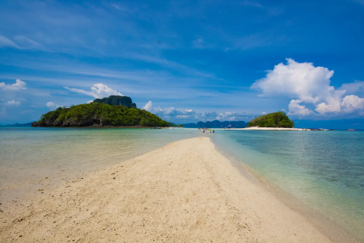
12. Noppharat Thara Beach Noppharat Thara Beach is a coastal attraction in Krabi Province, Southern Thailand. A tree-lined mainland beach near Ao Nang, with extensive tidal flats at low water. The destination is part of the region’s wider choice of summer beach breaks, marine excursions and nature-based travel.
Highlights: A tree-lined mainland beach near Ao Nang, with extensive tidal flats at low water.
The character of Noppharat Thara Beach comes from its particular coastal setting. A tree-lined mainland beach near Ao Nang, with extensive tidal flats at low water. Rather than treating every beach or island as interchangeable, visitors can appreciate the shape of the shoreline, surrounding vegetation, changing light and relationship to the neighboring communities. These details are particularly rewarding during unhurried walks and photography stops.
For an Andaman Sea itinerary, the calmer-water season is often from roughly November to April, although individual days can still bring strong surf and boat cancellations. Marine national parks may close areas seasonally, so always check current notices before booking.
Noppharat Thara Beach can be included in a broader itinerary around Krabi Province, but the best pace depends on whether travel is by road or boat. Those staying overnight can enjoy the quieter morning and evening periods; day-trippers should allow sufficient time to return before transport services end. Carry drinking water, sun protection and essential medication, and leave fragile coastal habitats undisturbed.
Getting There: First reach the relevant mainland port or transport hub for Krabi Province. Continue to Noppharat Thara Beach by an operating boat route or local island transfer when required. Check departure times, sea conditions, seasonal access and return transport in advance.
Map (GPS):Get directions to Noppharat Thara Beach
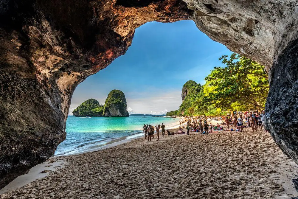
13. Phra Nang Cave Beach Phra Nang Cave Beach is a coastal attraction in Krabi Province, Southern Thailand. A spectacular beach below Railay’s cliffs, associated with a coastal cave and local beliefs. The destination is part of the region’s wider choice of summer beach breaks, marine excursions and nature-based travel.
Highlights: A spectacular beach below Railay’s cliffs, associated with a coastal cave and local beliefs.
The character of Phra Nang Cave Beach comes from its particular coastal setting. A spectacular beach below Railay’s cliffs, associated with a coastal cave and local beliefs. Rather than treating every beach or island as interchangeable, visitors can appreciate the shape of the shoreline, surrounding vegetation, changing light and relationship to the neighboring communities. These details are particularly rewarding during unhurried walks and photography stops.
For an Andaman Sea itinerary, the calmer-water season is often from roughly November to April, although individual days can still bring strong surf and boat cancellations. Marine national parks may close areas seasonally, so always check current notices before booking.
Phra Nang Cave Beach can be included in a broader itinerary around Krabi Province, but the best pace depends on whether travel is by road or boat. Those staying overnight can enjoy the quieter morning and evening periods; day-trippers should allow sufficient time to return before transport services end. Carry drinking water, sun protection and essential medication, and leave fragile coastal habitats undisturbed.
Getting There: First reach the relevant mainland port or transport hub for Krabi Province. Continue to Phra Nang Cave Beach by an operating boat route or local island transfer when required. Check departure times, sea conditions, seasonal access and return transport in advance.
Map (GPS):Get directions to Phra Nang Cave Beach
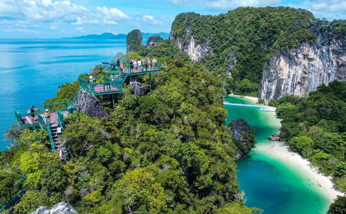
14. Hong Islands Hong Islands is a coastal attraction in Krabi Province, Southern Thailand. Limestone islets, a hidden lagoon, a beautiful bay and protected national-park scenery. The destination is part of the region’s wider choice of summer beach breaks, marine excursions and nature-based travel.
Highlights: Limestone islets, a hidden lagoon, a beautiful bay and protected national-park scenery.
The character of Hong Islands comes from its particular coastal setting. Limestone islets, a hidden lagoon, a beautiful bay and protected national-park scenery. Rather than treating every beach or island as interchangeable, visitors can appreciate the shape of the shoreline, surrounding vegetation, changing light and relationship to the neighboring communities. These details are particularly rewarding during unhurried walks and photography stops.
The sheltered lagoon and surrounding limestone formations are part of a protected area. Boat access may depend on tides, weather and park instructions.
For an Andaman Sea itinerary, the calmer-water season is often from roughly November to April, although individual days can still bring strong surf and boat cancellations. Marine national parks may close areas seasonally, so always check current notices before booking.
Hong Islands can be included in a broader itinerary around Krabi Province, but the best pace depends on whether travel is by road or boat. Those staying overnight can enjoy the quieter morning and evening periods; day-trippers should allow sufficient time to return before transport services end. Carry drinking water, sun protection and essential medication, and leave fragile coastal habitats undisturbed.
Getting There: First reach the relevant mainland port or transport hub for Krabi Province. Continue to Hong Islands by an operating boat route or local island transfer when required. Check departure times, sea conditions, seasonal access and return transport in advance.
Map (GPS):Get directions to Hong Islands
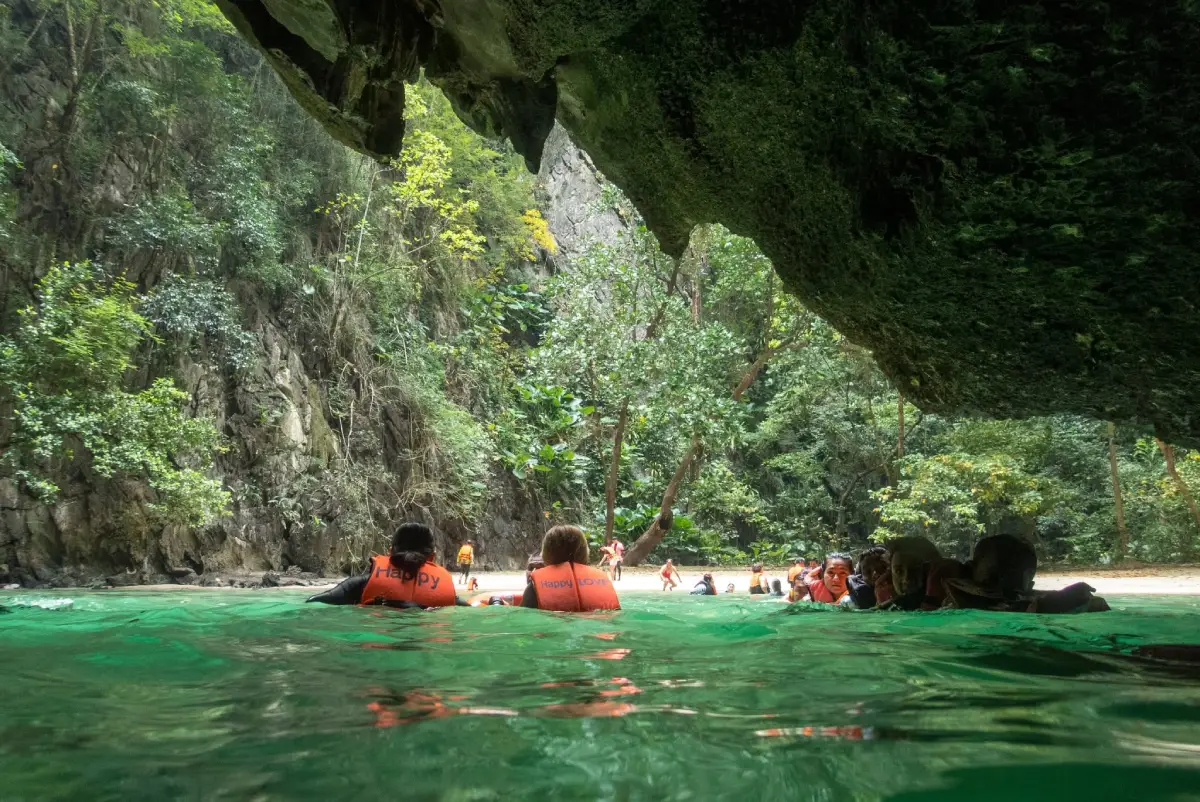
15. Koh Mook and Emerald Cave Koh Mook and Emerald Cave is a coastal attraction in Trang Province, Southern Thailand. A sea cave whose tide-dependent passage leads into a secluded beach enclosed by limestone walls. The destination is part of the region’s wider choice of summer beach breaks, marine excursions and nature-based travel.
Highlights: A sea cave whose tide-dependent passage leads into a secluded beach enclosed by limestone walls.
The character of Koh Mook and Emerald Cave comes from its particular coastal setting. A sea cave whose tide-dependent passage leads into a secluded beach enclosed by limestone walls. Rather than treating every beach or island as interchangeable, visitors can appreciate the shape of the shoreline, surrounding vegetation, changing light and relationship to the neighboring communities. These details are particularly rewarding during unhurried walks and photography stops.
Entering Emerald Cave requires an experienced guide and attention to tides and wave conditions. Never attempt the dark passage alone or without suitable flotation equipment.
For an Andaman Sea itinerary, the calmer-water season is often from roughly November to April, although individual days can still bring strong surf and boat cancellations. Marine national parks may close areas seasonally, so always check current notices before booking.
Koh Mook and Emerald Cave can be included in a broader itinerary around Trang Province, but the best pace depends on whether travel is by road or boat. Those staying overnight can enjoy the quieter morning and evening periods; day-trippers should allow sufficient time to return before transport services end. Carry drinking water, sun protection and essential medication, and leave fragile coastal habitats undisturbed.
Getting There: Depart from a suitable Trang mainland pier by licensed boat, then enter Emerald Cave only on a tide-appropriate guided trip with safety equipment.
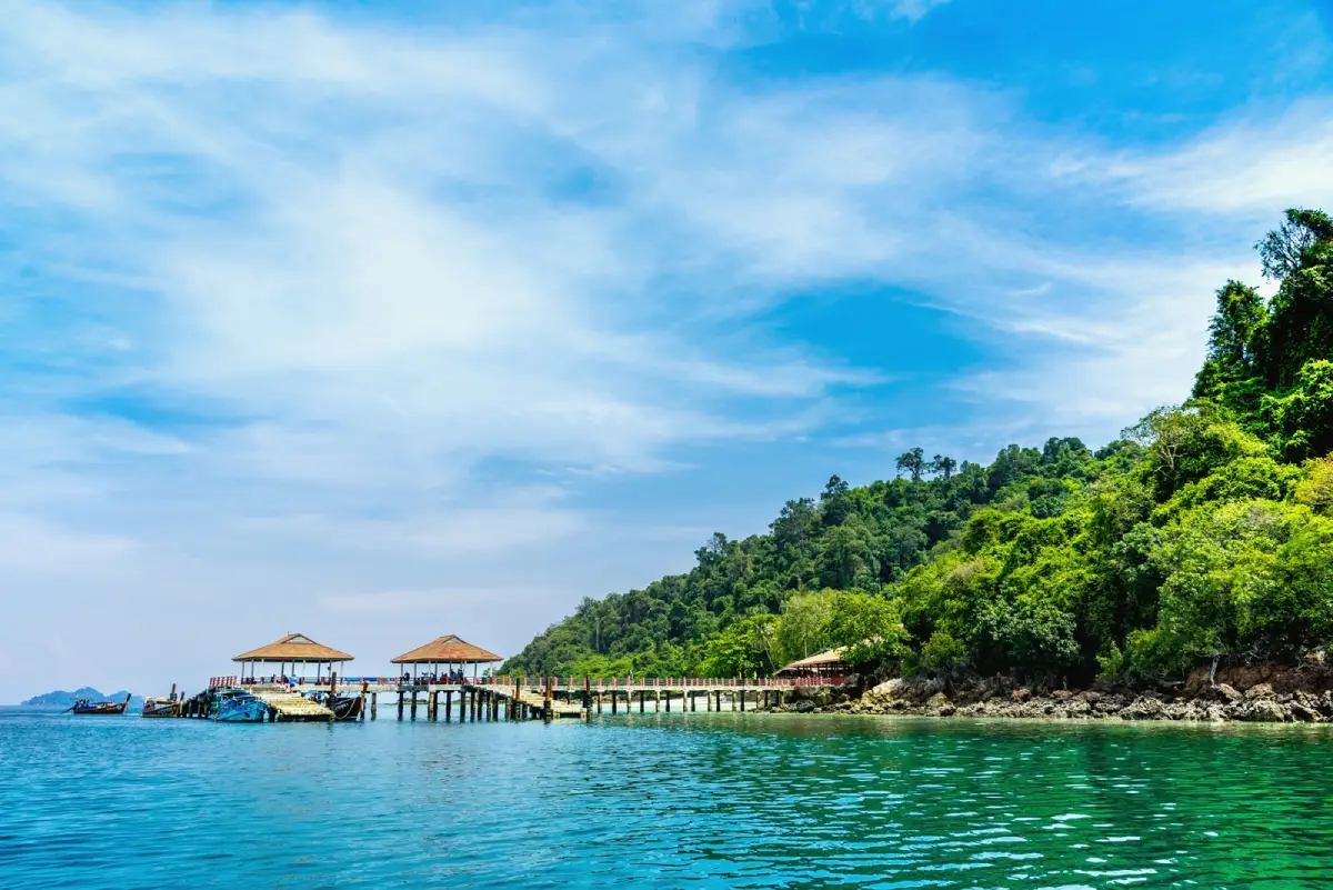
16. Koh Ngai Koh Ngai is a coastal attraction in Trang Province, Southern Thailand. A tranquil island with light sand, clear seas in favorable conditions and views across the Trang–Krabi islands. The destination is part of the region’s wider choice of summer beach breaks, marine excursions and nature-based travel.
Highlights: A tranquil island with light sand, clear seas in favorable conditions and views across the Trang–Krabi islands.
The character of Koh Ngai comes from its particular coastal setting. A tranquil island with light sand, clear seas in favorable conditions and views across the Trang–Krabi islands. Rather than treating every beach or island as interchangeable, visitors can appreciate the shape of the shoreline, surrounding vegetation, changing light and relationship to the neighboring communities. These details are particularly rewarding during unhurried walks and photography stops.
For an Andaman Sea itinerary, the calmer-water season is often from roughly November to April, although individual days can still bring strong surf and boat cancellations. Marine national parks may close areas seasonally, so always check current notices before booking.
Koh Ngai can be included in a broader itinerary around Trang Province, but the best pace depends on whether travel is by road or boat. Those staying overnight can enjoy the quieter morning and evening periods; day-trippers should allow sufficient time to return before transport services end. Carry drinking water, sun protection and essential medication, and leave fragile coastal habitats undisturbed.
Getting There: First reach the relevant mainland port or transport hub for Trang Province. Continue to Koh Ngai by an operating boat route or local island transfer when required. Check departure times, sea conditions, seasonal access and return transport in advance.
Map (GPS):Get directions to Koh Ngai
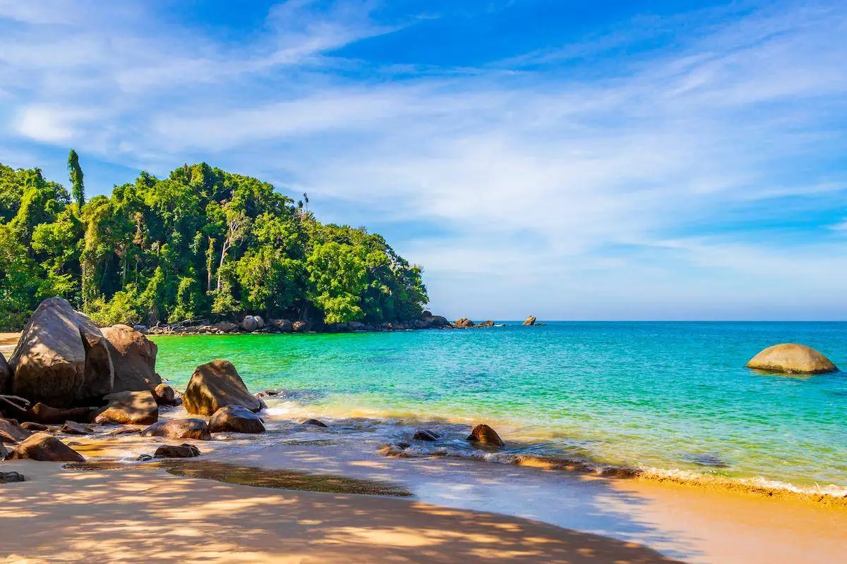
17. Khao Lak Coast Khao Lak Coast is a coastal attraction in Phang Nga Province, Southern Thailand. Long west-facing beaches, coastal forest and a calmer resort atmosphere north of Phuket. The destination is part of the region’s wider choice of summer beach breaks, marine excursions and nature-based travel.
Highlights: Long west-facing beaches, coastal forest and a calmer resort atmosphere north of Phuket.
The character of Khao Lak Coast comes from its particular coastal setting. Long west-facing beaches, coastal forest and a calmer resort atmosphere north of Phuket. Rather than treating every beach or island as interchangeable, visitors can appreciate the shape of the shoreline, surrounding vegetation, changing light and relationship to the neighboring communities. These details are particularly rewarding during unhurried walks and photography stops.
For an Andaman Sea itinerary, the calmer-water season is often from roughly November to April, although individual days can still bring strong surf and boat cancellations. Marine national parks may close areas seasonally, so always check current notices before booking.
Khao Lak Coast can be included in a broader itinerary around Phang Nga Province, but the best pace depends on whether travel is by road or boat. Those staying overnight can enjoy the quieter morning and evening periods; day-trippers should allow sufficient time to return before transport services end. Carry drinking water, sun protection and essential medication, and leave fragile coastal habitats undisturbed.
Getting There: First reach the relevant mainland port or transport hub for Phang Nga Province. Continue to Khao Lak Coast by an operating boat route or local island transfer when required. Check departure times, sea conditions, seasonal access and return transport in advance.
Map (GPS):Get directions to Khao Lak Coast
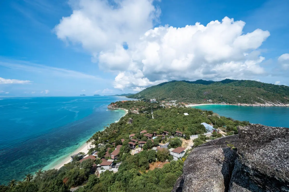
18. Koh Phangan Koh Phangan is a coastal attraction in Surat Thani Province, Southern Thailand. An island of varied beaches, hills and coastal communities, with energetic areas and quiet coves. The destination is part of the region’s wider choice of summer beach breaks, marine excursions and nature-based travel.
Highlights: An island of varied beaches, hills and coastal communities, with energetic areas and quiet coves.
The character of Koh Phangan comes from its particular coastal setting. An island of varied beaches, hills and coastal communities, with energetic areas and quiet coves. Rather than treating every beach or island as interchangeable, visitors can appreciate the shape of the shoreline, surrounding vegetation, changing light and relationship to the neighboring communities. These details are particularly rewarding during unhurried walks and photography stops.
Gulf of Thailand conditions vary by month and by location. Check local wind and wave forecasts rather than assuming that weather suitable for Phuket or Krabi is suitable here; a sunny sky does not guarantee safe swimming.
Koh Phangan can be included in a broader itinerary around Surat Thani Province, but the best pace depends on whether travel is by road or boat. Those staying overnight can enjoy the quieter morning and evening periods; day-trippers should allow sufficient time to return before transport services end. Carry drinking water, sun protection and essential medication, and leave fragile coastal habitats undisturbed.
Getting There: First reach the relevant mainland port or transport hub for Surat Thani Province. Continue to Koh Phangan by an operating boat route or local island transfer when required. Check departure times, sea conditions, seasonal access and return transport in advance.
Map (GPS):Get directions to Koh Phangan
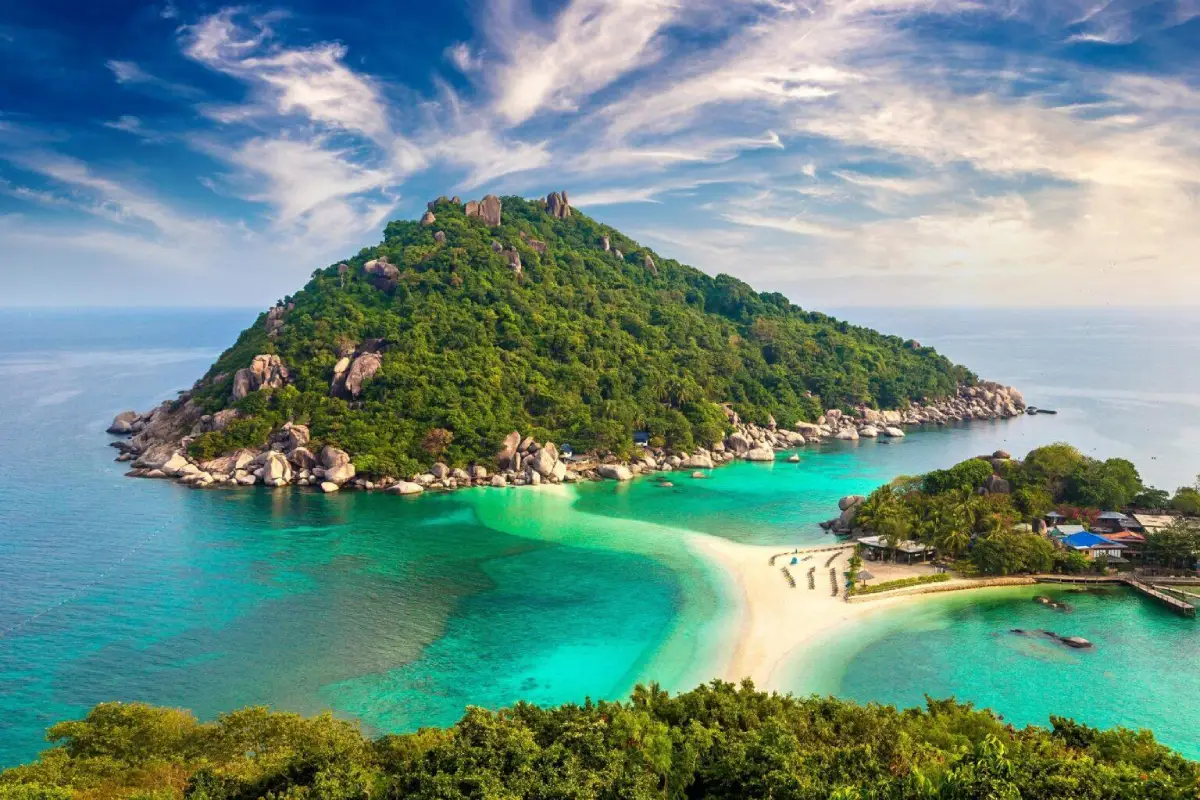
19. Koh Nang Yuan Koh Nang Yuan is a coastal attraction in Surat Thani Province, Southern Thailand. Small islands connected by a distinctive sandbar near Koh Tao, with an elevated viewpoint. The destination is part of the region’s wider choice of summer beach breaks, marine excursions and nature-based travel.
Highlights: Small islands connected by a distinctive sandbar near Koh Tao, with an elevated viewpoint.
The character of Koh Nang Yuan comes from its particular coastal setting. Small islands connected by a distinctive sandbar near Koh Tao, with an elevated viewpoint. Rather than treating every beach or island as interchangeable, visitors can appreciate the shape of the shoreline, surrounding vegetation, changing light and relationship to the neighboring communities. These details are particularly rewarding during unhurried walks and photography stops.
The natural sandbar linking the islets is the signature view. Day-visitor access and conservation rules should be checked before departing from Koh Tao.
Gulf of Thailand conditions vary by month and by location. Check local wind and wave forecasts rather than assuming that weather suitable for Phuket or Krabi is suitable here; a sunny sky does not guarantee safe swimming.
Koh Nang Yuan can be included in a broader itinerary around Surat Thani Province, but the best pace depends on whether travel is by road or boat. Those staying overnight can enjoy the quieter morning and evening periods; day-trippers should allow sufficient time to return before transport services end. Carry drinking water, sun protection and essential medication, and leave fragile coastal habitats undisturbed.
Getting There: Reach Koh Tao first and continue by local boat to Koh Nang Yuan. Check authorized visiting hours, fees and boat services before departure.
Map (GPS):Get directions to Koh Nang Yuan
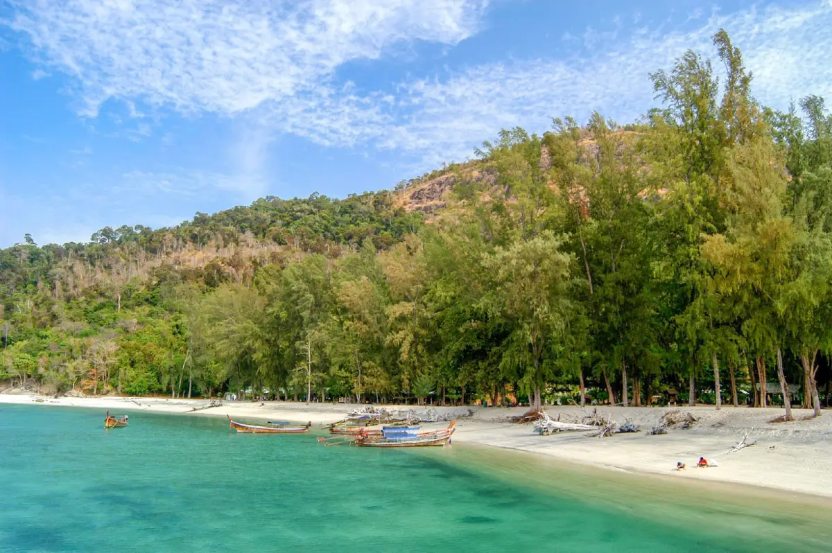
20. Adang–Rawi Islands Adang–Rawi Islands is a coastal attraction in Satun Province, Southern Thailand. Forested islands, pale sandy beaches and protected marine habitats near Koh Lipe. The destination is part of the region’s wider choice of summer beach breaks, marine excursions and nature-based travel.
Highlights: Forested islands, pale sandy beaches and protected marine habitats near Koh Lipe.
The character of Adang–Rawi Islands comes from its particular coastal setting. Forested islands, pale sandy beaches and protected marine habitats near Koh Lipe. Rather than treating every beach or island as interchangeable, visitors can appreciate the shape of the shoreline, surrounding vegetation, changing light and relationship to the neighboring communities. These details are particularly rewarding during unhurried walks and photography stops.
For an Andaman Sea itinerary, the calmer-water season is often from roughly November to April, although individual days can still bring strong surf and boat cancellations. Marine national parks may close areas seasonally, so always check current notices before booking.
Adang–Rawi Islands can be included in a broader itinerary around Satun Province, but the best pace depends on whether travel is by road or boat. Those staying overnight can enjoy the quieter morning and evening periods; day-trippers should allow sufficient time to return before transport services end. Carry drinking water, sun protection and essential medication, and leave fragile coastal habitats undisturbed.
Getting There: First reach the relevant mainland port or transport hub for Satun Province. Continue to Adang–Rawi Islands by an operating boat route or local island transfer when required. Check departure times, sea conditions, seasonal access and return transport in advance.
Map (GPS):Get directions to Adang–Rawi Islands
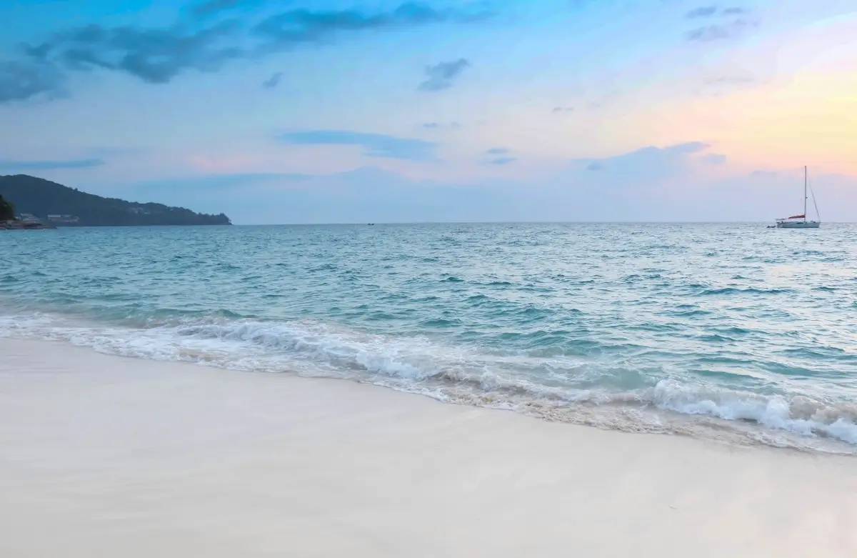
21. Surin Beach Surin Beach is a coastal attraction in Phuket Province, Southern Thailand. Light-colored sand and casuarina trees backed by hills, with west-facing sunset views. The destination is part of the region’s wider choice of summer beach breaks, marine excursions and nature-based travel.
Highlights: Light-colored sand and casuarina trees backed by hills, with west-facing sunset views.
The character of Surin Beach comes from its particular coastal setting. Light-colored sand and casuarina trees backed by hills, with west-facing sunset views. Rather than treating every beach or island as interchangeable, visitors can appreciate the shape of the shoreline, surrounding vegetation, changing light and relationship to the neighboring communities. These details are particularly rewarding during unhurried walks and photography stops.
For an Andaman Sea itinerary, the calmer-water season is often from roughly November to April, although individual days can still bring strong surf and boat cancellations. Marine national parks may close areas seasonally, so always check current notices before booking.
Surin Beach can be included in a broader itinerary around Phuket Province, but the best pace depends on whether travel is by road or boat. Those staying overnight can enjoy the quieter morning and evening periods; day-trippers should allow sufficient time to return before transport services end. Carry drinking water, sun protection and essential medication, and leave fragile coastal habitats undisturbed.
Getting There: Travel to Phuket Province by an available road, rail or air connection, then continue toward Surin Beach using local road access or authorized transport. Confirm the exact entrance, parking arrangements and any restricted areas before leaving.
Map (GPS):Get directions to Surin Beach
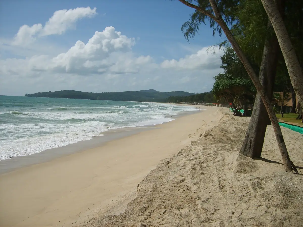
22. Bang Tao Beach Bang Tao Beach is a coastal attraction in Phuket Province, Southern Thailand. An extended shoreline with quieter sections and the resort area around Laguna Phuket. The destination is part of the region’s wider choice of summer beach breaks, marine excursions and nature-based travel.
Highlights: An extended shoreline with quieter sections and the resort area around Laguna Phuket.
The character of Bang Tao Beach comes from its particular coastal setting. An extended shoreline with quieter sections and the resort area around Laguna Phuket. Rather than treating every beach or island as interchangeable, visitors can appreciate the shape of the shoreline, surrounding vegetation, changing light and relationship to the neighboring communities. These details are particularly rewarding during unhurried walks and photography stops.
For an Andaman Sea itinerary, the calmer-water season is often from roughly November to April, although individual days can still bring strong surf and boat cancellations. Marine national parks may close areas seasonally, so always check current notices before booking.
Bang Tao Beach can be included in a broader itinerary around Phuket Province, but the best pace depends on whether travel is by road or boat. Those staying overnight can enjoy the quieter morning and evening periods; day-trippers should allow sufficient time to return before transport services end. Carry drinking water, sun protection and essential medication, and leave fragile coastal habitats undisturbed.
Getting There: Travel to Phuket Province by an available road, rail or air connection, then continue toward Bang Tao Beach using local road access or authorized transport. Confirm the exact entrance, parking arrangements and any restricted areas before leaving.
Map (GPS):Get directions to Bang Tao Beach
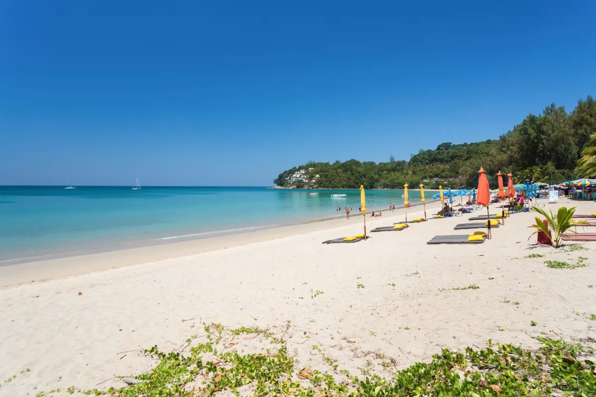
23. Kamala Beach Kamala Beach is a coastal attraction in Phuket Province, Southern Thailand. A curved west-coast bay combining a settled fishing community with hotels and restaurants. The destination is part of the region’s wider choice of summer beach breaks, marine excursions and nature-based travel.
Highlights: A curved west-coast bay combining a settled fishing community with hotels and restaurants.
The character of Kamala Beach comes from its particular coastal setting. A curved west-coast bay combining a settled fishing community with hotels and restaurants. Rather than treating every beach or island as interchangeable, visitors can appreciate the shape of the shoreline, surrounding vegetation, changing light and relationship to the neighboring communities. These details are particularly rewarding during unhurried walks and photography stops.
For an Andaman Sea itinerary, the calmer-water season is often from roughly November to April, although individual days can still bring strong surf and boat cancellations. Marine national parks may close areas seasonally, so always check current notices before booking.
Kamala Beach can be included in a broader itinerary around Phuket Province, but the best pace depends on whether travel is by road or boat. Those staying overnight can enjoy the quieter morning and evening periods; day-trippers should allow sufficient time to return before transport services end. Carry drinking water, sun protection and essential medication, and leave fragile coastal habitats undisturbed.
Getting There: Travel to Phuket Province by an available road, rail or air connection, then continue toward Kamala Beach using local road access or authorized transport. Confirm the exact entrance, parking arrangements and any restricted areas before leaving.
Map (GPS):Get directions to Kamala Beach
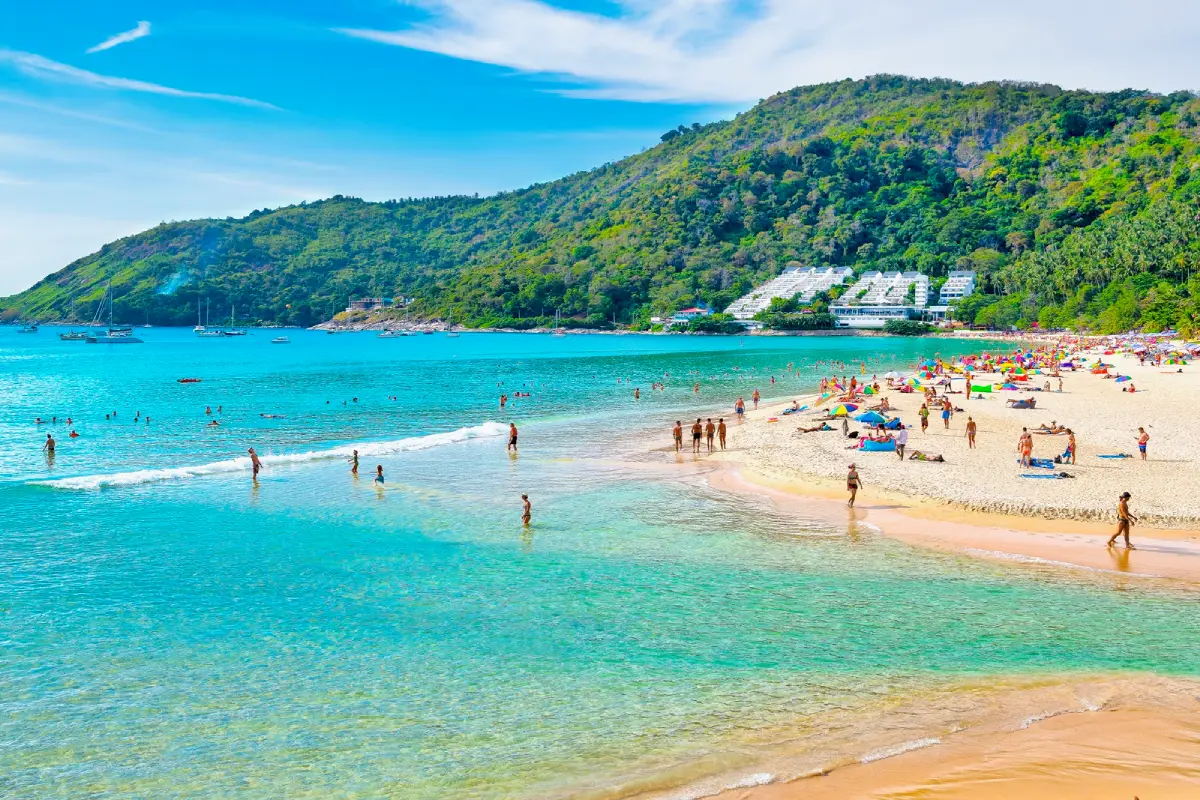
24. Nai Harn Beach Nai Harn Beach is a coastal attraction in Phuket Province, Southern Thailand. A compact southern Phuket bay backed by hills, with a freshwater lagoon behind the beach. The destination is part of the region’s wider choice of summer beach breaks, marine excursions and nature-based travel.
Highlights: A compact southern Phuket bay backed by hills, with a freshwater lagoon behind the beach.
The character of Nai Harn Beach comes from its particular coastal setting. A compact southern Phuket bay backed by hills, with a freshwater lagoon behind the beach. Rather than treating every beach or island as interchangeable, visitors can appreciate the shape of the shoreline, surrounding vegetation, changing light and relationship to the neighboring communities. These details are particularly rewarding during unhurried walks and photography stops.
For an Andaman Sea itinerary, the calmer-water season is often from roughly November to April, although individual days can still bring strong surf and boat cancellations. Marine national parks may close areas seasonally, so always check current notices before booking.
Nai Harn Beach can be included in a broader itinerary around Phuket Province, but the best pace depends on whether travel is by road or boat. Those staying overnight can enjoy the quieter morning and evening periods; day-trippers should allow sufficient time to return before transport services end. Carry drinking water, sun protection and essential medication, and leave fragile coastal habitats undisturbed.
Getting There: Travel to Phuket Province by an available road, rail or air connection, then continue toward Nai Harn Beach using local road access or authorized transport. Confirm the exact entrance, parking arrangements and any restricted areas before leaving.
Map (GPS):Get directions to Nai Harn Beach
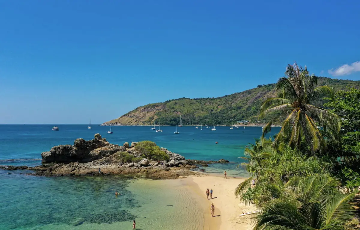
25. Ya Nui Beach Ya Nui Beach is a coastal attraction in Phuket Province, Southern Thailand. A small rocky-edged bay near Nai Harn and Promthep Cape, looking toward Koh Man. The destination is part of the region’s wider choice of summer beach breaks, marine excursions and nature-based travel.
Highlights: A small rocky-edged bay near Nai Harn and Promthep Cape, looking toward Koh Man.
The character of Ya Nui Beach comes from its particular coastal setting. A small rocky-edged bay near Nai Harn and Promthep Cape, looking toward Koh Man. Rather than treating every beach or island as interchangeable, visitors can appreciate the shape of the shoreline, surrounding vegetation, changing light and relationship to the neighboring communities. These details are particularly rewarding during unhurried walks and photography stops.
For an Andaman Sea itinerary, the calmer-water season is often from roughly November to April, although individual days can still bring strong surf and boat cancellations. Marine national parks may close areas seasonally, so always check current notices before booking.
Ya Nui Beach can be included in a broader itinerary around Phuket Province, but the best pace depends on whether travel is by road or boat. Those staying overnight can enjoy the quieter morning and evening periods; day-trippers should allow sufficient time to return before transport services end. Carry drinking water, sun protection and essential medication, and leave fragile coastal habitats undisturbed.
Getting There: Travel to Phuket Province by an available road, rail or air connection, then continue toward Ya Nui Beach using local road access or authorized transport. Confirm the exact entrance, parking arrangements and any restricted areas before leaving.
Map (GPS):Get directions to Ya Nui Beach
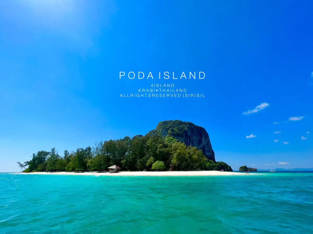
26. Poda Islands Poda Islands is a coastal attraction in Krabi Province, Southern Thailand. Sandy islands and striking limestone formations on Krabi’s well-known four-island excursions. The destination is part of the region’s wider choice of summer beach breaks, marine excursions and nature-based travel.
Highlights: Sandy islands and striking limestone formations on Krabi’s well-known four-island excursions.
The character of Poda Islands comes from its particular coastal setting. Sandy islands and striking limestone formations on Krabi’s well-known four-island excursions. Rather than treating every beach or island as interchangeable, visitors can appreciate the shape of the shoreline, surrounding vegetation, changing light and relationship to the neighboring communities. These details are particularly rewarding during unhurried walks and photography stops.
For an Andaman Sea itinerary, the calmer-water season is often from roughly November to April, although individual days can still bring strong surf and boat cancellations. Marine national parks may close areas seasonally, so always check current notices before booking.
Poda Islands can be included in a broader itinerary around Krabi Province, but the best pace depends on whether travel is by road or boat. Those staying overnight can enjoy the quieter morning and evening periods; day-trippers should allow sufficient time to return before transport services end. Carry drinking water, sun protection and essential medication, and leave fragile coastal habitats undisturbed.
Getting There: First reach the relevant mainland port or transport hub for Krabi Province. Continue to Poda Islands by an operating boat route or local island transfer when required. Check departure times, sea conditions, seasonal access and return transport in advance.
Map (GPS):Get directions to Poda Islands
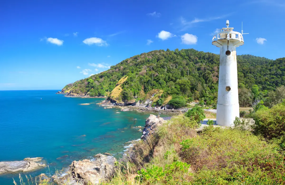
27. Mu Ko Lanta National Park Mu Ko Lanta National Park is a coastal attraction in Krabi Province, Southern Thailand. A protected island-and-sea landscape, including the landmark lighthouse at Laem Tanod. The destination is part of the region’s wider choice of summer beach breaks, marine excursions and nature-based travel.
Highlights: A protected island-and-sea landscape, including the landmark lighthouse at Laem Tanod.
The character of Mu Ko Lanta National Park comes from its particular coastal setting. A protected island-and-sea landscape, including the landmark lighthouse at Laem Tanod. Rather than treating every beach or island as interchangeable, visitors can appreciate the shape of the shoreline, surrounding vegetation, changing light and relationship to the neighboring communities. These details are particularly rewarding during unhurried walks and photography stops.
For an Andaman Sea itinerary, the calmer-water season is often from roughly November to April, although individual days can still bring strong surf and boat cancellations. Marine national parks may close areas seasonally, so always check current notices before booking.
Mu Ko Lanta National Park can be included in a broader itinerary around Krabi Province, but the best pace depends on whether travel is by road or boat. Those staying overnight can enjoy the quieter morning and evening periods; day-trippers should allow sufficient time to return before transport services end. Carry drinking water, sun protection and essential medication, and leave fragile coastal habitats undisturbed.
Getting There: First reach the relevant mainland port or transport hub for Krabi Province. Continue to Mu Ko Lanta National Park by an operating boat route or local island transfer when required. Check departure times, sea conditions, seasonal access and return transport in advance.
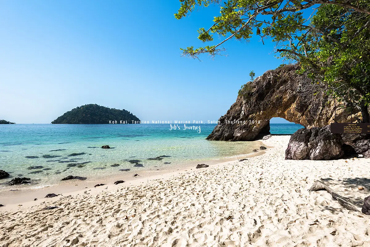
28. Koh Khai Koh Khai is a coastal attraction in Satun Province, Southern Thailand. A small island known for its natural stone arch within Tarutao National Park. The destination is part of the region’s wider choice of summer beach breaks, marine excursions and nature-based travel.
Highlights: A small island known for its natural stone arch within Tarutao National Park.
The character of Koh Khai comes from its particular coastal setting. A small island known for its natural stone arch within Tarutao National Park. Rather than treating every beach or island as interchangeable, visitors can appreciate the shape of the shoreline, surrounding vegetation, changing light and relationship to the neighboring communities. These details are particularly rewarding during unhurried walks and photography stops.
The island’s naturally eroded stone arch is a particularly recognizable landmark. Avoid climbing the formation or disturbing the surrounding shoreline.
For an Andaman Sea itinerary, the calmer-water season is often from roughly November to April, although individual days can still bring strong surf and boat cancellations. Marine national parks may close areas seasonally, so always check current notices before booking.
Koh Khai can be included in a broader itinerary around Satun Province, but the best pace depends on whether travel is by road or boat. Those staying overnight can enjoy the quieter morning and evening periods; day-trippers should allow sufficient time to return before transport services end. Carry drinking water, sun protection and essential medication, and leave fragile coastal habitats undisturbed.
Getting There: First reach the relevant mainland port or transport hub for Satun Province. Continue to Koh Khai by an operating boat route or local island transfer when required. Check departure times, sea conditions, seasonal access and return transport in advance.
Map (GPS):Get directions to Koh Khai
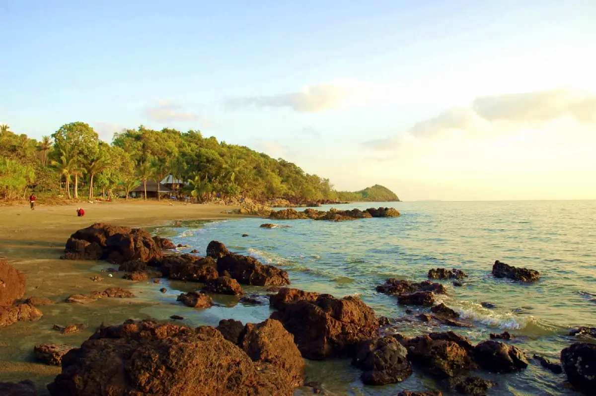
29. Koh Sukorn Koh Sukorn is a coastal attraction in Trang Province, Southern Thailand. An inhabited island of fishing villages, agricultural land and quiet coastal scenery. The destination is part of the region’s wider choice of summer beach breaks, marine excursions and nature-based travel.
Highlights: An inhabited island of fishing villages, agricultural land and quiet coastal scenery.
The character of Koh Sukorn comes from its particular coastal setting. An inhabited island of fishing villages, agricultural land and quiet coastal scenery. Rather than treating every beach or island as interchangeable, visitors can appreciate the shape of the shoreline, surrounding vegetation, changing light and relationship to the neighboring communities. These details are particularly rewarding during unhurried walks and photography stops.
Unlike resort-centered islands, Koh Sukorn is particularly rewarding for observing fishing villages and agricultural landscapes. Ask permission before photographing residents.
For an Andaman Sea itinerary, the calmer-water season is often from roughly November to April, although individual days can still bring strong surf and boat cancellations. Marine national parks may close areas seasonally, so always check current notices before booking.
Koh Sukorn can be included in a broader itinerary around Trang Province, but the best pace depends on whether travel is by road or boat. Those staying overnight can enjoy the quieter morning and evening periods; day-trippers should allow sufficient time to return before transport services end. Carry drinking water, sun protection and essential medication, and leave fragile coastal habitats undisturbed.
Getting There: First reach the relevant mainland port or transport hub for Trang Province. Continue to Koh Sukorn by an operating boat route or local island transfer when required. Check departure times, sea conditions, seasonal access and return transport in advance.
Map (GPS):Get directions to Koh Sukorn
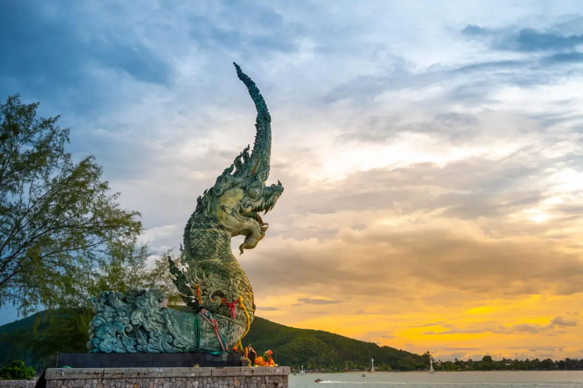
30. Laem Son On Laem Son On is a coastal attraction in Songkhla Province, Southern Thailand. A city waterfront viewpoint where Songkhla Lake meets the Gulf of Thailand, close to the naga water sculpture. The destination is part of the region’s wider choice of summer beach breaks, marine excursions and nature-based travel.
Highlights: A city waterfront viewpoint where Songkhla Lake meets the Gulf of Thailand, close to the naga water sculpture.
The character of Laem Son On comes from its particular coastal setting. A city waterfront viewpoint where Songkhla Lake meets the Gulf of Thailand, close to the naga water sculpture. Rather than treating every beach or island as interchangeable, visitors can appreciate the shape of the shoreline, surrounding vegetation, changing light and relationship to the neighboring communities. These details are particularly rewarding during unhurried walks and photography stops.
The waterfront is close to the point where Songkhla Lake connects with the Gulf, and can be explored alongside Samila and Songkhla Old Town.
Gulf of Thailand conditions vary by month and by location. Check local wind and wave forecasts rather than assuming that weather suitable for Phuket or Krabi is suitable here; a sunny sky does not guarantee safe swimming.
Laem Son On can be included in a broader itinerary around Songkhla Province, but the best pace depends on whether travel is by road or boat. Those staying overnight can enjoy the quieter morning and evening periods; day-trippers should allow sufficient time to return before transport services end. Carry drinking water, sun protection and essential medication, and leave fragile coastal habitats undisturbed.
Getting There: Travel to Songkhla Province by an available road, rail or air connection, then continue toward Laem Son On using local road access or authorized transport. Confirm the exact entrance, parking arrangements and any restricted areas before leaving.
Map (GPS):Get directions to Laem Son On
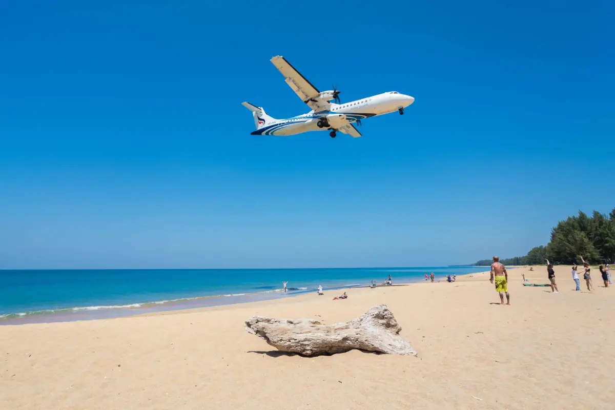
31. Mai Khao Beach Mai Khao Beach is a coastal attraction in Phuket Province, Southern Thailand. A long northern Phuket beach, coastal woodland and aircraft-viewing areas near the airport. The destination is part of the region’s wider choice of summer beach breaks, marine excursions and nature-based travel.
Highlights: A long northern Phuket beach, coastal woodland and aircraft-viewing areas near the airport.
The character of Mai Khao Beach comes from its particular coastal setting. A long northern Phuket beach, coastal woodland and aircraft-viewing areas near the airport. Rather than treating every beach or island as interchangeable, visitors can appreciate the shape of the shoreline, surrounding vegetation, changing light and relationship to the neighboring communities. These details are particularly rewarding during unhurried walks and photography stops.
Parts of Mai Khao are close to Phuket International Airport flight paths. Stay only in authorized public areas, away from fences and restricted airport land.
For an Andaman Sea itinerary, the calmer-water season is often from roughly November to April, although individual days can still bring strong surf and boat cancellations. Marine national parks may close areas seasonally, so always check current notices before booking.
Mai Khao Beach can be included in a broader itinerary around Phuket Province, but the best pace depends on whether travel is by road or boat. Those staying overnight can enjoy the quieter morning and evening periods; day-trippers should allow sufficient time to return before transport services end. Carry drinking water, sun protection and essential medication, and leave fragile coastal habitats undisturbed.
Getting There: Travel to Phuket Province by an available road, rail or air connection, then continue toward Mai Khao Beach using local road access or authorized transport. Confirm the exact entrance, parking arrangements and any restricted areas before leaving.
Map (GPS):Get directions to Mai Khao Beach
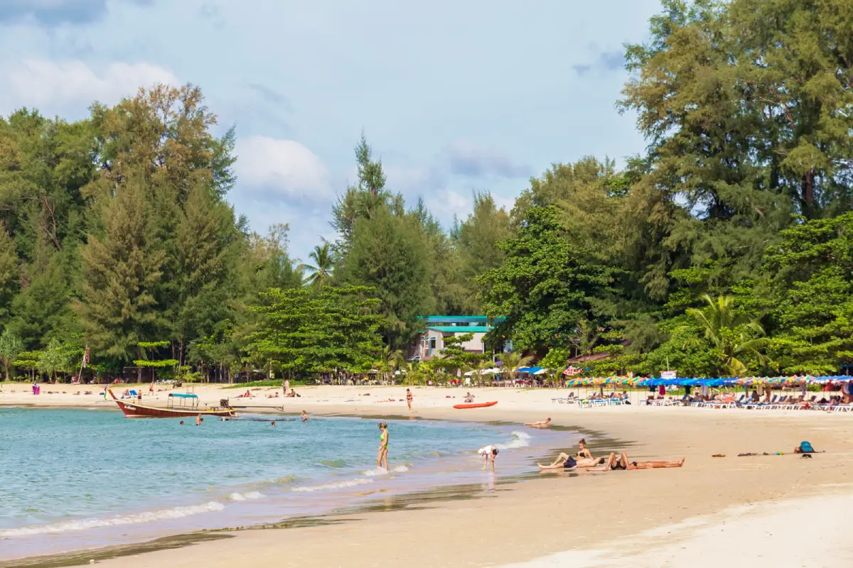
32. Sirinat National Park (Nai Yang Beach) Sirinat National Park (Nai Yang Beach) is a coastal attraction in Phuket Province, Southern Thailand. Nai Yang’s shaded beach, coastal forest and protected ecosystems near Phuket airport. The destination is part of the region’s wider choice of summer beach breaks, marine excursions and nature-based travel.
Highlights: Nai Yang’s shaded beach, coastal forest and protected ecosystems near Phuket airport.
The character of Sirinat National Park (Nai Yang Beach) comes from its particular coastal setting. Nai Yang’s shaded beach, coastal forest and protected ecosystems near Phuket airport. Rather than treating every beach or island as interchangeable, visitors can appreciate the shape of the shoreline, surrounding vegetation, changing light and relationship to the neighboring communities. These details are particularly rewarding during unhurried walks and photography stops.
For an Andaman Sea itinerary, the calmer-water season is often from roughly November to April, although individual days can still bring strong surf and boat cancellations. Marine national parks may close areas seasonally, so always check current notices before booking.
Sirinat National Park (Nai Yang Beach) can be included in a broader itinerary around Phuket Province, but the best pace depends on whether travel is by road or boat. Those staying overnight can enjoy the quieter morning and evening periods; day-trippers should allow sufficient time to return before transport services end. Carry drinking water, sun protection and essential medication, and leave fragile coastal habitats undisturbed.
Getting There: Travel to Phuket Province by an available road, rail or air connection, then continue toward Sirinat National Park (Nai Yang Beach) using local road access or authorized transport. Confirm the exact entrance, parking arrangements and any restricted areas before leaving.
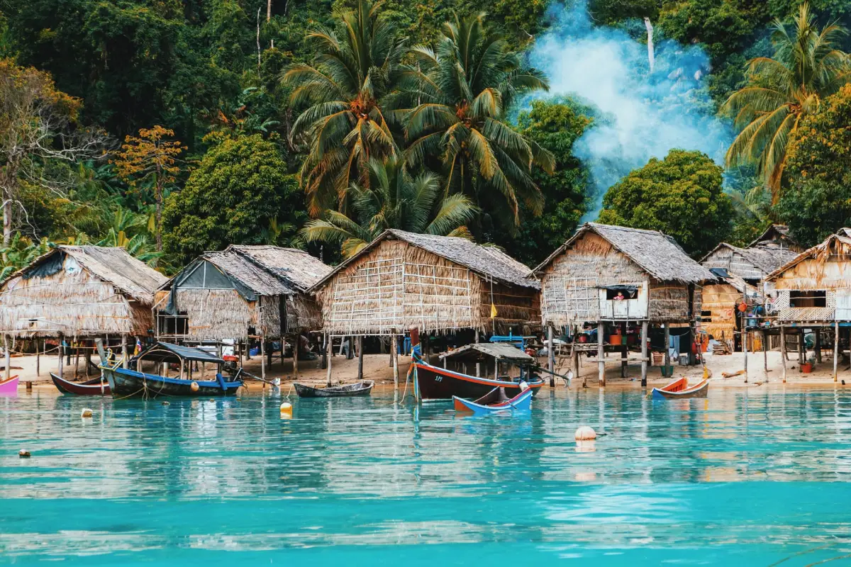
33. Mu Ko Surin National Park Mu Ko Surin National Park is a coastal attraction in Phang Nga Province, Southern Thailand. Protected reefs, marine wildlife and the maritime heritage of the Moken community. The destination is part of the region’s wider choice of summer beach breaks, marine excursions and nature-based travel.
Highlights: Protected reefs, marine wildlife and the maritime heritage of the Moken community.
The character of Mu Ko Surin National Park comes from its particular coastal setting. Protected reefs, marine wildlife and the maritime heritage of the Moken community. Rather than treating every beach or island as interchangeable, visitors can appreciate the shape of the shoreline, surrounding vegetation, changing light and relationship to the neighboring communities. These details are particularly rewarding during unhurried walks and photography stops.
Shallow reef ecosystems and the heritage of the Moken community are major attractions. National-park restrictions and respectful community visits are essential.
For an Andaman Sea itinerary, the calmer-water season is often from roughly November to April, although individual days can still bring strong surf and boat cancellations. Marine national parks may close areas seasonally, so always check current notices before booking.
Mu Ko Surin National Park can be included in a broader itinerary around Phang Nga Province, but the best pace depends on whether travel is by road or boat. Those staying overnight can enjoy the quieter morning and evening periods; day-trippers should allow sufficient time to return before transport services end. Carry drinking water, sun protection and essential medication, and leave fragile coastal habitats undisturbed.
Getting There: First reach the relevant mainland port or transport hub for Phang Nga Province. Continue to Mu Ko Surin National Park by an operating boat route or local island transfer when required. Check departure times, sea conditions, seasonal access and return transport in advance.
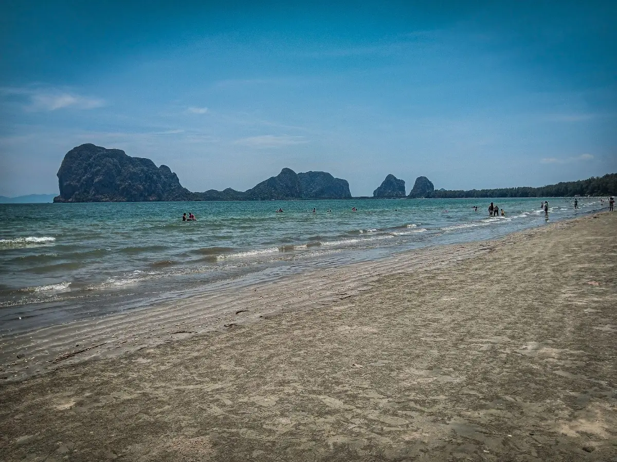
34. Pak Meng Beach Pak Meng Beach is a coastal attraction in Trang Province, Southern Thailand. A long crescent-shaped beach with casuarina shade, offshore limestone islands and a pier for Trang boat trips. The destination is part of the region’s wider choice of summer beach breaks, marine excursions and nature-based travel.
Highlights: A long crescent-shaped beach with casuarina shade, offshore limestone islands and a pier for Trang boat trips.
The character of Pak Meng Beach comes from its particular coastal setting. A long crescent-shaped beach with casuarina shade, offshore limestone islands and a pier for Trang boat trips. Rather than treating every beach or island as interchangeable, visitors can appreciate the shape of the shoreline, surrounding vegetation, changing light and relationship to the neighboring communities. These details are particularly rewarding during unhurried walks and photography stops.
For an Andaman Sea itinerary, the calmer-water season is often from roughly November to April, although individual days can still bring strong surf and boat cancellations. Marine national parks may close areas seasonally, so always check current notices before booking.
Pak Meng Beach can be included in a broader itinerary around Trang Province, but the best pace depends on whether travel is by road or boat. Those staying overnight can enjoy the quieter morning and evening periods; day-trippers should allow sufficient time to return before transport services end. Carry drinking water, sun protection and essential medication, and leave fragile coastal habitats undisturbed.
Getting There: First reach the relevant mainland port or transport hub for Trang Province. Continue to Pak Meng Beach by an operating boat route or local island transfer when required. Check departure times, sea conditions, seasonal access and return transport in advance.
Map (GPS):Get directions to Pak Meng Beach
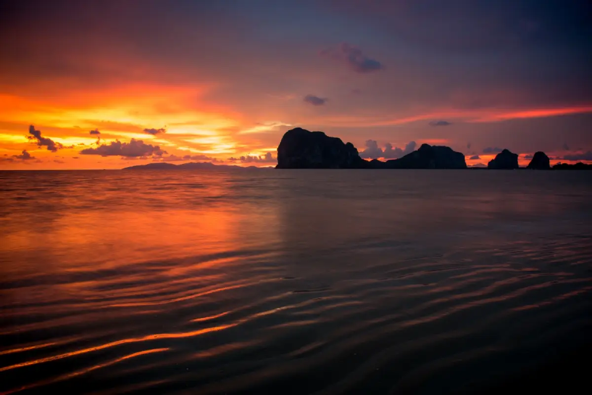
35. Hat Chao Mai National Park Hat Chao Mai National Park is a coastal attraction in Trang Province, Southern Thailand. A protected mix of beaches, limestone formations, mangroves and seagrass habitat important to dugongs. The destination is part of the region’s wider choice of summer beach breaks, marine excursions and nature-based travel.
Highlights: A protected mix of beaches, limestone formations, mangroves and seagrass habitat important to dugongs.
The character of Hat Chao Mai National Park comes from its particular coastal setting. A protected mix of beaches, limestone formations, mangroves and seagrass habitat important to dugongs. Rather than treating every beach or island as interchangeable, visitors can appreciate the shape of the shoreline, surrounding vegetation, changing light and relationship to the neighboring communities. These details are particularly rewarding during unhurried walks and photography stops.
Trang’s seagrass beds are valuable habitat for dugongs. Keep vessels away from wildlife and avoid disturbing coastal and underwater ecosystems.
For an Andaman Sea itinerary, the calmer-water season is often from roughly November to April, although individual days can still bring strong surf and boat cancellations. Marine national parks may close areas seasonally, so always check current notices before booking.
Hat Chao Mai National Park can be included in a broader itinerary around Trang Province, but the best pace depends on whether travel is by road or boat. Those staying overnight can enjoy the quieter morning and evening periods; day-trippers should allow sufficient time to return before transport services end. Carry drinking water, sun protection and essential medication, and leave fragile coastal habitats undisturbed.
Getting There: First reach the relevant mainland port or transport hub for Trang Province. Continue to Hat Chao Mai National Park by an operating boat route or local island transfer when required. Check departure times, sea conditions, seasonal access and return transport in advance.
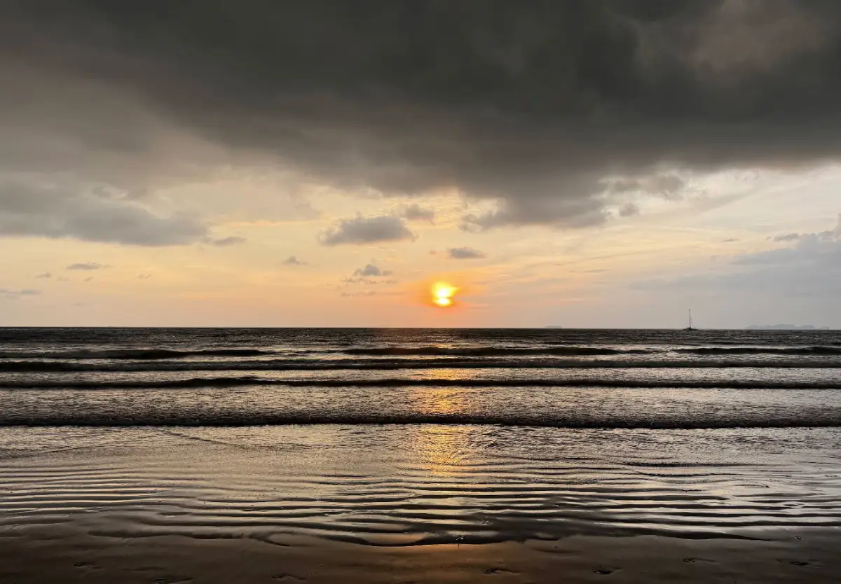
36. Klong Dao Beach Klong Dao Beach is a coastal attraction in Krabi Province, Southern Thailand. A long accessible west-coast beach on Koh Lanta, convenient to Saladan and sunset dining. The destination is part of the region’s wider choice of summer beach breaks, marine excursions and nature-based travel.
Highlights: A long accessible west-coast beach on Koh Lanta, convenient to Saladan and sunset dining.
The character of Klong Dao Beach comes from its particular coastal setting. A long accessible west-coast beach on Koh Lanta, convenient to Saladan and sunset dining. Rather than treating every beach or island as interchangeable, visitors can appreciate the shape of the shoreline, surrounding vegetation, changing light and relationship to the neighboring communities. These details are particularly rewarding during unhurried walks and photography stops.
For an Andaman Sea itinerary, the calmer-water season is often from roughly November to April, although individual days can still bring strong surf and boat cancellations. Marine national parks may close areas seasonally, so always check current notices before booking.
Klong Dao Beach can be included in a broader itinerary around Krabi Province, but the best pace depends on whether travel is by road or boat. Those staying overnight can enjoy the quieter morning and evening periods; day-trippers should allow sufficient time to return before transport services end. Carry drinking water, sun protection and essential medication, and leave fragile coastal habitats undisturbed.
Getting There: First reach the relevant mainland port or transport hub for Krabi Province. Continue to Klong Dao Beach by an operating boat route or local island transfer when required. Check departure times, sea conditions, seasonal access and return transport in advance.
Map (GPS):Get directions to Klong Dao Beach
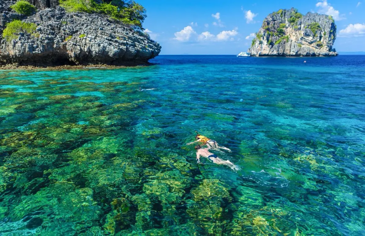
37. Koh Rok Nai Koh Rok Nai is a coastal attraction in Krabi Province, Southern Thailand. A protected offshore island of rugged cliffs and reef habitat in the Koh Rok group. The destination is part of the region’s wider choice of summer beach breaks, marine excursions and nature-based travel.
Highlights: A protected offshore island of rugged cliffs and reef habitat in the Koh Rok group.
The character of Koh Rok Nai comes from its particular coastal setting. A protected offshore island of rugged cliffs and reef habitat in the Koh Rok group. Rather than treating every beach or island as interchangeable, visitors can appreciate the shape of the shoreline, surrounding vegetation, changing light and relationship to the neighboring communities. These details are particularly rewarding during unhurried walks and photography stops.
For an Andaman Sea itinerary, the calmer-water season is often from roughly November to April, although individual days can still bring strong surf and boat cancellations. Marine national parks may close areas seasonally, so always check current notices before booking.
Koh Rok Nai can be included in a broader itinerary around Krabi Province, but the best pace depends on whether travel is by road or boat. Those staying overnight can enjoy the quieter morning and evening periods; day-trippers should allow sufficient time to return before transport services end. Carry drinking water, sun protection and essential medication, and leave fragile coastal habitats undisturbed.
Getting There: First reach the relevant mainland port or transport hub for Krabi Province. Continue to Koh Rok Nai by an operating boat route or local island transfer when required. Check departure times, sea conditions, seasonal access and return transport in advance.
Map (GPS):Get directions to Koh Rok Nai
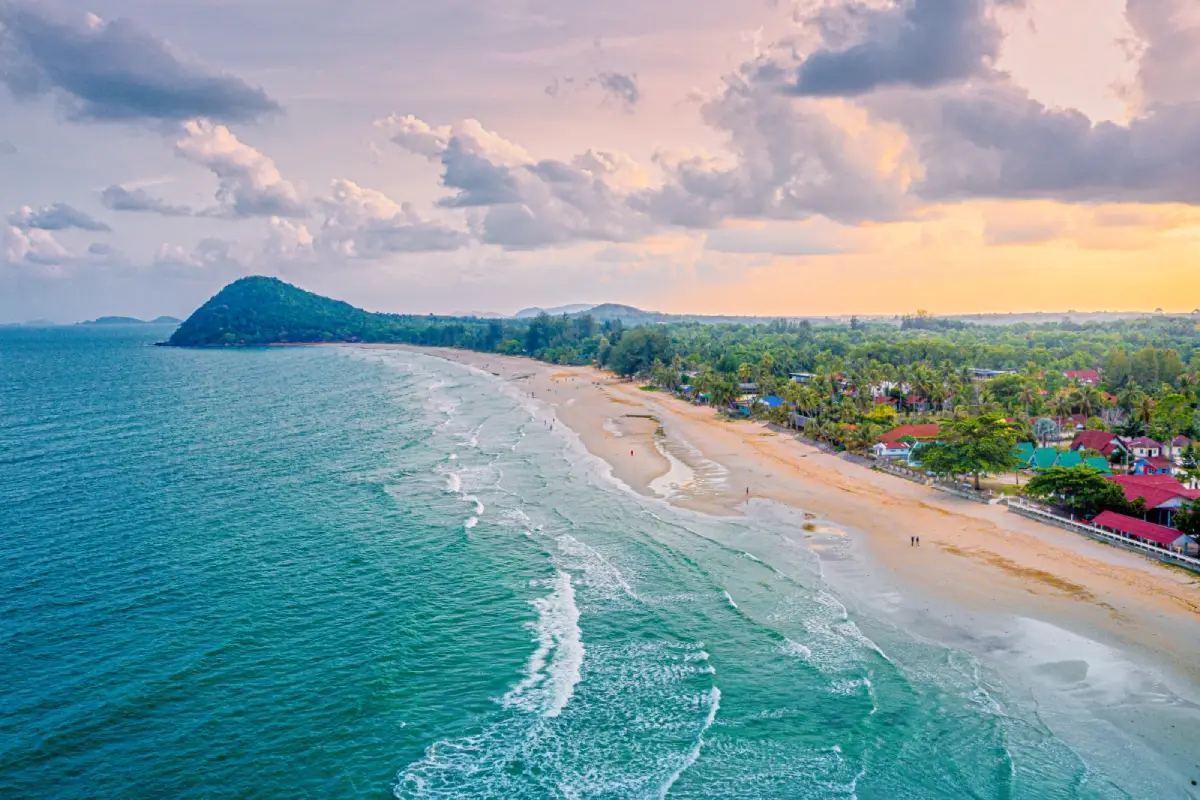
38. Thung Wua Laen Beach Thung Wua Laen Beach is a coastal attraction in Chumphon Province, Southern Thailand. Fine light-colored sand, an open Gulf shoreline and accommodation close to Chumphon. The destination is part of the region’s wider choice of summer beach breaks, marine excursions and nature-based travel.
Highlights: Fine light-colored sand, an open Gulf shoreline and accommodation close to Chumphon.
The character of Thung Wua Laen Beach comes from its particular coastal setting. Fine light-colored sand, an open Gulf shoreline and accommodation close to Chumphon. Rather than treating every beach or island as interchangeable, visitors can appreciate the shape of the shoreline, surrounding vegetation, changing light and relationship to the neighboring communities. These details are particularly rewarding during unhurried walks and photography stops.
Gulf of Thailand conditions vary by month and by location. Check local wind and wave forecasts rather than assuming that weather suitable for Phuket or Krabi is suitable here; a sunny sky does not guarantee safe swimming.
Thung Wua Laen Beach can be included in a broader itinerary around Chumphon Province, but the best pace depends on whether travel is by road or boat. Those staying overnight can enjoy the quieter morning and evening periods; day-trippers should allow sufficient time to return before transport services end. Carry drinking water, sun protection and essential medication, and leave fragile coastal habitats undisturbed.
Getting There: Travel to Chumphon Province by an available road, rail or air connection, then continue toward Thung Wua Laen Beach using local road access or authorized transport. Confirm the exact entrance, parking arrangements and any restricted areas before leaving.
Map (GPS):Get directions to Thung Wua Laen Beach
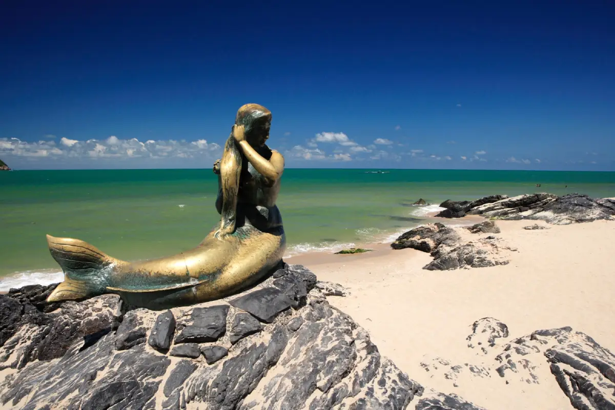
39. Laem Samila Laem Samila is a coastal attraction in Songkhla Province, Southern Thailand. Songkhla’s landmark mermaid sculpture, tree-lined waterfront and views to the Mouse and Cat Islands. The destination is part of the region’s wider choice of summer beach breaks, marine excursions and nature-based travel.
Highlights: Songkhla’s landmark mermaid sculpture, tree-lined waterfront and views to the Mouse and Cat Islands.
The character of Laem Samila comes from its particular coastal setting. Songkhla’s landmark mermaid sculpture, tree-lined waterfront and views to the Mouse and Cat Islands. Rather than treating every beach or island as interchangeable, visitors can appreciate the shape of the shoreline, surrounding vegetation, changing light and relationship to the neighboring communities. These details are particularly rewarding during unhurried walks and photography stops.
Gulf of Thailand conditions vary by month and by location. Check local wind and wave forecasts rather than assuming that weather suitable for Phuket or Krabi is suitable here; a sunny sky does not guarantee safe swimming.
Laem Samila can be included in a broader itinerary around Songkhla Province, but the best pace depends on whether travel is by road or boat. Those staying overnight can enjoy the quieter morning and evening periods; day-trippers should allow sufficient time to return before transport services end. Carry drinking water, sun protection and essential medication, and leave fragile coastal habitats undisturbed.
Getting There: Travel to Songkhla Province by an available road, rail or air connection, then continue toward Laem Samila using local road access or authorized transport. Confirm the exact entrance, parking arrangements and any restricted areas before leaving.
Map (GPS):Get directions to Laem Samila
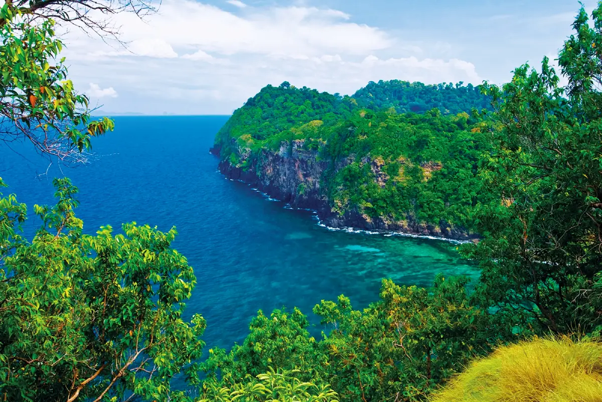
40. Koh Rok Nok Koh Rok Nok is a coastal attraction in Krabi Province, Southern Thailand. A pale sandy beach and marine habitats in the protected Koh Rok group. The destination is part of the region’s wider choice of summer beach breaks, marine excursions and nature-based travel.
Highlights: A pale sandy beach and marine habitats in the protected Koh Rok group.
The character of Koh Rok Nok comes from its particular coastal setting. A pale sandy beach and marine habitats in the protected Koh Rok group. Rather than treating every beach or island as interchangeable, visitors can appreciate the shape of the shoreline, surrounding vegetation, changing light and relationship to the neighboring communities. These details are particularly rewarding during unhurried walks and photography stops.
For an Andaman Sea itinerary, the calmer-water season is often from roughly November to April, although individual days can still bring strong surf and boat cancellations. Marine national parks may close areas seasonally, so always check current notices before booking.
Koh Rok Nok can be included in a broader itinerary around Krabi Province, but the best pace depends on whether travel is by road or boat. Those staying overnight can enjoy the quieter morning and evening periods; day-trippers should allow sufficient time to return before transport services end. Carry drinking water, sun protection and essential medication, and leave fragile coastal habitats undisturbed.
Getting There: First reach the relevant mainland port or transport hub for Krabi Province. Continue to Koh Rok Nok by an operating boat route or local island transfer when required. Check departure times, sea conditions, seasonal access and return transport in advance.
Map (GPS):Get directions to Koh Rok Nok
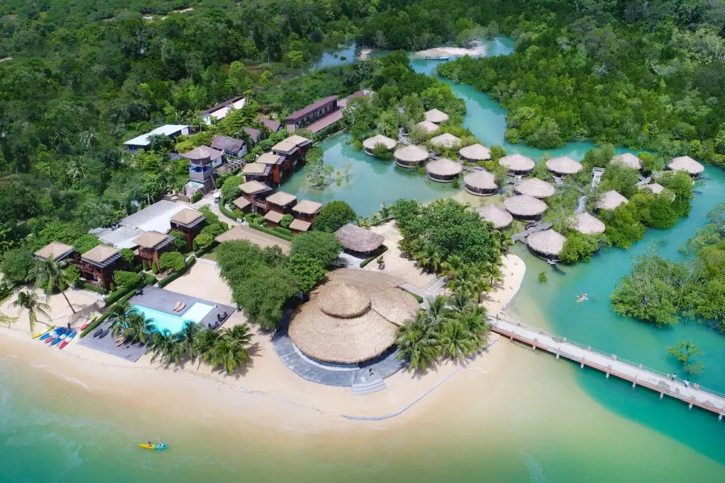
41. Koh Phayam Koh Phayam is a coastal attraction in Ranong Province, Southern Thailand. Quiet bays, tropical forest and a low-key island lifestyle around Ao Yai and Ao Khao Kwai. The destination is part of the region’s wider choice of summer beach breaks, marine excursions and nature-based travel.
Highlights: Quiet bays, tropical forest and a low-key island lifestyle around Ao Yai and Ao Khao Kwai.
The character of Koh Phayam comes from its particular coastal setting. Quiet bays, tropical forest and a low-key island lifestyle around Ao Yai and Ao Khao Kwai. Rather than treating every beach or island as interchangeable, visitors can appreciate the shape of the shoreline, surrounding vegetation, changing light and relationship to the neighboring communities. These details are particularly rewarding during unhurried walks and photography stops.
Ao Yai and Ao Khao Kwai offer contrasting coastal scenery. Several nights on the island allow enough time to explore without rushing boat schedules.
For an Andaman Sea itinerary, the calmer-water season is often from roughly November to April, although individual days can still bring strong surf and boat cancellations. Marine national parks may close areas seasonally, so always check current notices before booking.
Koh Phayam can be included in a broader itinerary around Ranong Province, but the best pace depends on whether travel is by road or boat. Those staying overnight can enjoy the quieter morning and evening periods; day-trippers should allow sufficient time to return before transport services end. Carry drinking water, sun protection and essential medication, and leave fragile coastal habitats undisturbed.
Getting There: Travel from Ranong town to an operating passenger-boat pier, then take the scheduled ferry or speedboat to the island. Check return departures in advance.
Map (GPS):Get directions to Koh Phayam
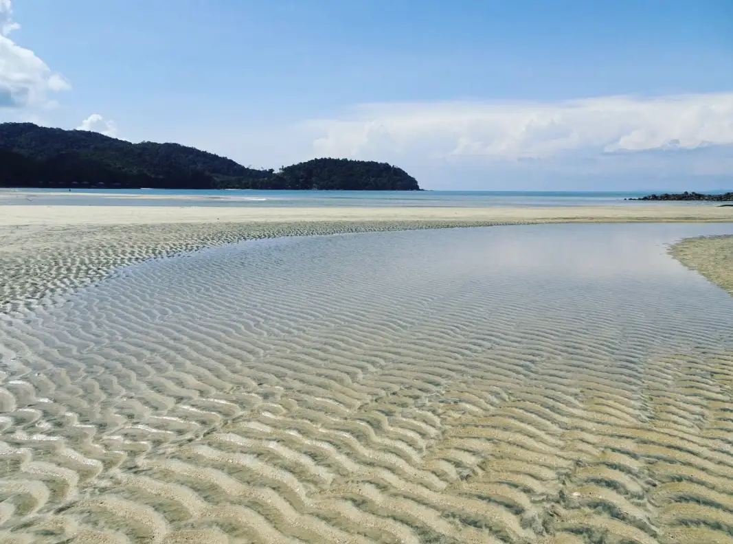
42. Koh Chang, Ranong Koh Chang, Ranong is a coastal attraction in Ranong Province, Southern Thailand. A forested Ranong island with fishing settlements, beaches and a peaceful atmosphere. The destination is part of the region’s wider choice of summer beach breaks, marine excursions and nature-based travel.
Highlights: A forested Ranong island with fishing settlements, beaches and a peaceful atmosphere.
The character of Koh Chang, Ranong comes from its particular coastal setting. A forested Ranong island with fishing settlements, beaches and a peaceful atmosphere. Rather than treating every beach or island as interchangeable, visitors can appreciate the shape of the shoreline, surrounding vegetation, changing light and relationship to the neighboring communities. These details are particularly rewarding during unhurried walks and photography stops.
This is Koh Chang in Ranong, not the better-known Koh Chang in Trat. Accommodation and transport are relatively low-key, so arrange logistics beforehand.
For an Andaman Sea itinerary, the calmer-water season is often from roughly November to April, although individual days can still bring strong surf and boat cancellations. Marine national parks may close areas seasonally, so always check current notices before booking.
Koh Chang, Ranong can be included in a broader itinerary around Ranong Province, but the best pace depends on whether travel is by road or boat. Those staying overnight can enjoy the quieter morning and evening periods; day-trippers should allow sufficient time to return before transport services end. Carry drinking water, sun protection and essential medication, and leave fragile coastal habitats undisturbed.
Getting There: Travel from Ranong town to an operating passenger-boat pier, then take the scheduled ferry or speedboat to the island. Check return departures in advance.
Map (GPS):Get directions to Koh Chang, Ranong
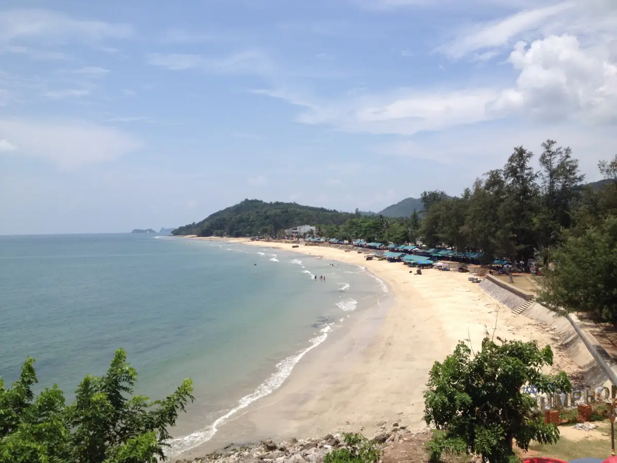
43. Sai Ri Beach Sai Ri Beach is a coastal attraction in Chumphon Province, Southern Thailand. A Chumphon beach connected with the shrine commemorating Prince of Chumphon and Thai naval history. The destination is part of the region’s wider choice of summer beach breaks, marine excursions and nature-based travel.
Highlights: A Chumphon beach connected with the shrine commemorating Prince of Chumphon and Thai naval history.
The character of Sai Ri Beach comes from its particular coastal setting. A Chumphon beach connected with the shrine commemorating Prince of Chumphon and Thai naval history. Rather than treating every beach or island as interchangeable, visitors can appreciate the shape of the shoreline, surrounding vegetation, changing light and relationship to the neighboring communities. These details are particularly rewarding during unhurried walks and photography stops.
The beach is closely associated with the shrine of Prince of Chumphon, widely honored for his role in the development of Thailand’s navy.
Gulf of Thailand conditions vary by month and by location. Check local wind and wave forecasts rather than assuming that weather suitable for Phuket or Krabi is suitable here; a sunny sky does not guarantee safe swimming.
Sai Ri Beach can be included in a broader itinerary around Chumphon Province, but the best pace depends on whether travel is by road or boat. Those staying overnight can enjoy the quieter morning and evening periods; day-trippers should allow sufficient time to return before transport services end. Carry drinking water, sun protection and essential medication, and leave fragile coastal habitats undisturbed.
Getting There: First reach the relevant mainland port or transport hub for Chumphon Province. Continue to Sai Ri Beach by an operating boat route or local island transfer when required. Check departure times, sea conditions, seasonal access and return transport in advance.
Map (GPS):Get directions to Sai Ri Beach

44. Sichon Beach (Hua Hin Sichon) Sichon Beach (Hua Hin Sichon) is a coastal attraction in Nakhon Si Thammarat Province, Southern Thailand. A Gulf-facing beach in Sichon district with local restaurants and a relaxed coastal-town atmosphere. The destination is part of the region’s wider choice of summer beach breaks, marine excursions and nature-based travel.
Highlights: A Gulf-facing beach in Sichon district with local restaurants and a relaxed coastal-town atmosphere.
The character of Sichon Beach (Hua Hin Sichon) comes from its particular coastal setting. A Gulf-facing beach in Sichon district with local restaurants and a relaxed coastal-town atmosphere. Rather than treating every beach or island as interchangeable, visitors can appreciate the shape of the shoreline, surrounding vegetation, changing light and relationship to the neighboring communities. These details are particularly rewarding during unhurried walks and photography stops.
Gulf of Thailand conditions vary by month and by location. Check local wind and wave forecasts rather than assuming that weather suitable for Phuket or Krabi is suitable here; a sunny sky does not guarantee safe swimming.
Sichon Beach (Hua Hin Sichon) can be included in a broader itinerary around Nakhon Si Thammarat Province, but the best pace depends on whether travel is by road or boat. Those staying overnight can enjoy the quieter morning and evening periods; day-trippers should allow sufficient time to return before transport services end. Carry drinking water, sun protection and essential medication, and leave fragile coastal habitats undisturbed.
Getting There: Travel to Nakhon Si Thammarat Province by an available road, rail or air connection, then continue toward Sichon Beach (Hua Hin Sichon) using local road access or authorized transport. Confirm the exact entrance, parking arrangements and any restricted areas before leaving.
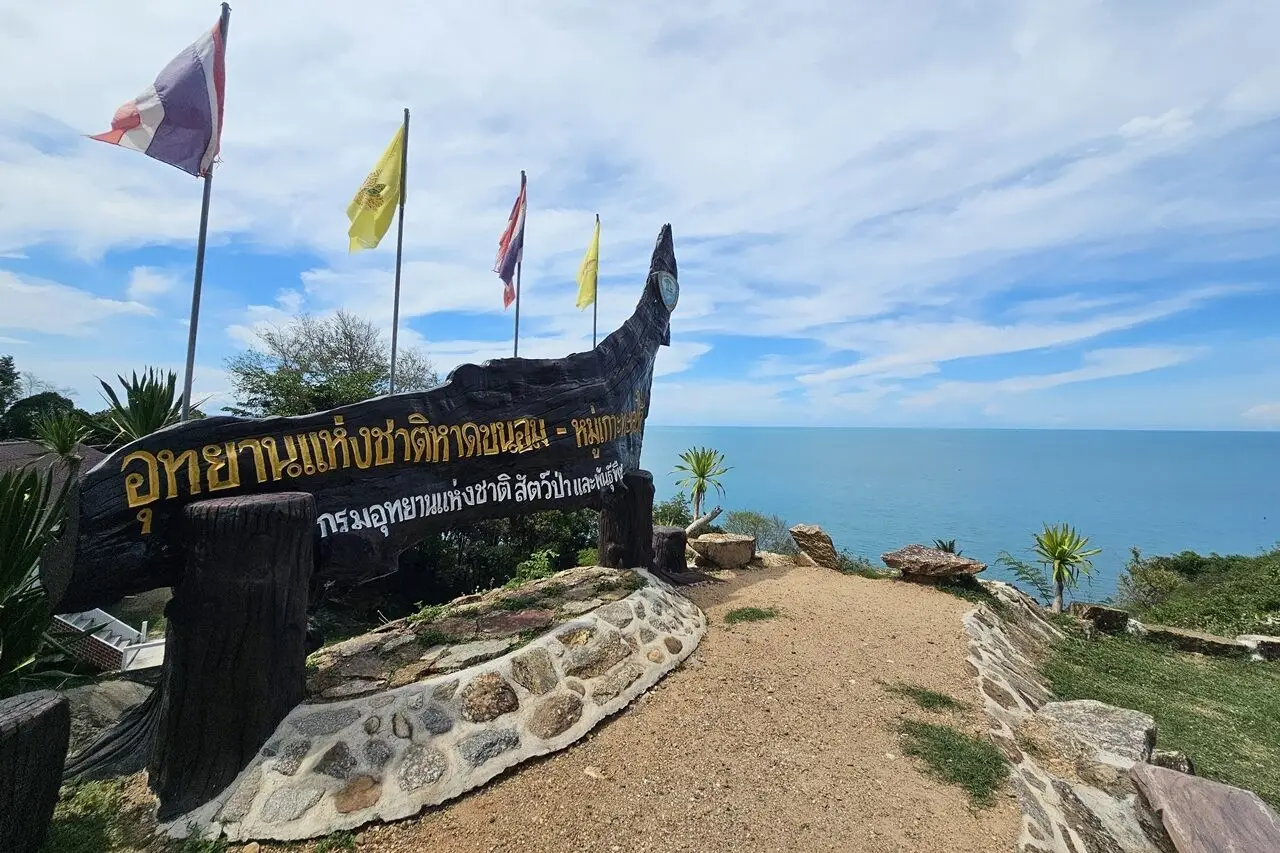
45. Hat Khanom–Mu Ko Thale Tai National Park Hat Khanom–Mu Ko Thale Tai National Park is a coastal attraction in Nakhon Si Thammarat Province, Southern Thailand. Khanom’s wooded headlands, coastal islands and marine habitats known for Indo-Pacific humpback dolphins. The destination is part of the region’s wider choice of summer beach breaks, marine excursions and nature-based travel.
Highlights: Khanom’s wooded headlands, coastal islands and marine habitats known for Indo-Pacific humpback dolphins.
The character of Hat Khanom–Mu Ko Thale Tai National Park comes from its particular coastal setting. Khanom’s wooded headlands, coastal islands and marine habitats known for Indo-Pacific humpback dolphins. Rather than treating every beach or island as interchangeable, visitors can appreciate the shape of the shoreline, surrounding vegetation, changing light and relationship to the neighboring communities. These details are particularly rewarding during unhurried walks and photography stops.
Khanom is associated with Indo-Pacific humpback dolphins, sometimes called pink dolphins. Wildlife sightings are never guaranteed; responsible boat operators should not chase or feed animals.
Gulf of Thailand conditions vary by month and by location. Check local wind and wave forecasts rather than assuming that weather suitable for Phuket or Krabi is suitable here; a sunny sky does not guarantee safe swimming.
Hat Khanom–Mu Ko Thale Tai National Park can be included in a broader itinerary around Nakhon Si Thammarat Province, but the best pace depends on whether travel is by road or boat. Those staying overnight can enjoy the quieter morning and evening periods; day-trippers should allow sufficient time to return before transport services end. Carry drinking water, sun protection and essential medication, and leave fragile coastal habitats undisturbed.
Getting There: Travel to Nakhon Si Thammarat Province by an available road, rail or air connection, then continue toward Hat Khanom–Mu Ko Thale Tai National Park using local road access or authorized transport. Confirm the exact entrance, parking arrangements and any restricted areas before leaving.
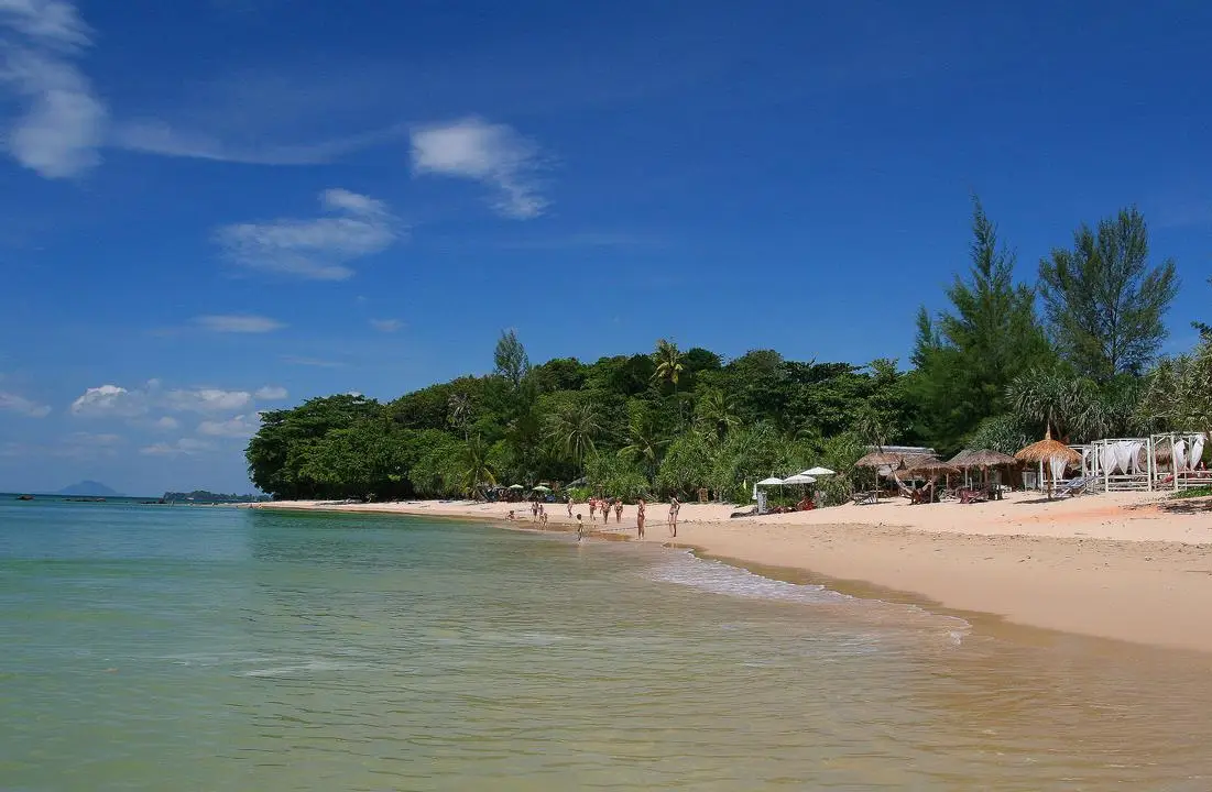
46. Klong Nin–Klong Toab Beaches Klong Nin–Klong Toab Beaches is a coastal attraction in Krabi Province, Southern Thailand. West-facing beaches on Koh Lanta with a mix of long sandy stretches and rocky edges. The destination is part of the region’s wider choice of summer beach breaks, marine excursions and nature-based travel.
Highlights: West-facing beaches on Koh Lanta with a mix of long sandy stretches and rocky edges.
The character of Klong Nin–Klong Toab Beaches comes from its particular coastal setting. West-facing beaches on Koh Lanta with a mix of long sandy stretches and rocky edges. Rather than treating every beach or island as interchangeable, visitors can appreciate the shape of the shoreline, surrounding vegetation, changing light and relationship to the neighboring communities. These details are particularly rewarding during unhurried walks and photography stops.
For an Andaman Sea itinerary, the calmer-water season is often from roughly November to April, although individual days can still bring strong surf and boat cancellations. Marine national parks may close areas seasonally, so always check current notices before booking.
Klong Nin–Klong Toab Beaches can be included in a broader itinerary around Krabi Province, but the best pace depends on whether travel is by road or boat. Those staying overnight can enjoy the quieter morning and evening periods; day-trippers should allow sufficient time to return before transport services end. Carry drinking water, sun protection and essential medication, and leave fragile coastal habitats undisturbed.
Getting There: First reach the relevant mainland port or transport hub for Krabi Province. Continue to Klong Nin–Klong Toab Beaches by an operating boat route or local island transfer when required. Check departure times, sea conditions, seasonal access and return transport in advance.
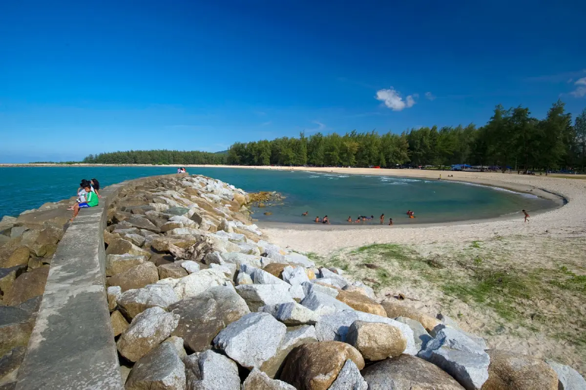
47. Narathat Beach Narathat Beach is a coastal attraction in Narathiwat Province, Southern Thailand. A long Gulf of Thailand shoreline, shaded areas and coastal community life near Narathiwat town. The destination is part of the region’s wider choice of summer beach breaks, marine excursions and nature-based travel.
Highlights: A long Gulf of Thailand shoreline, shaded areas and coastal community life near Narathiwat town.
The character of Narathat Beach comes from its particular coastal setting. A long Gulf of Thailand shoreline, shaded areas and coastal community life near Narathiwat town. Rather than treating every beach or island as interchangeable, visitors can appreciate the shape of the shoreline, surrounding vegetation, changing light and relationship to the neighboring communities. These details are particularly rewarding during unhurried walks and photography stops.
Gulf of Thailand conditions vary by month and by location. Check local wind and wave forecasts rather than assuming that weather suitable for Phuket or Krabi is suitable here; a sunny sky does not guarantee safe swimming.
Narathat Beach can be included in a broader itinerary around Narathiwat Province, but the best pace depends on whether travel is by road or boat. Those staying overnight can enjoy the quieter morning and evening periods; day-trippers should allow sufficient time to return before transport services end. Carry drinking water, sun protection and essential medication, and leave fragile coastal habitats undisturbed.
Getting There: Travel to Narathiwat Province by an available road, rail or air connection, then continue toward Narathat Beach using local road access or authorized transport. Confirm the exact entrance, parking arrangements and any restricted areas before leaving.
Map (GPS):Get directions to Narathat Beach
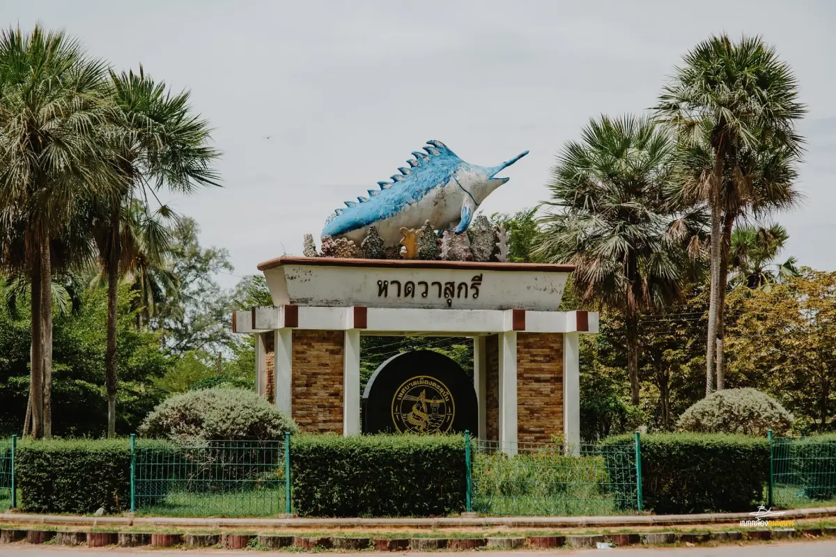
48. Wasukri Beach (Patatimo Beach) Wasukri Beach (Patatimo Beach) is a coastal attraction in Pattani Province, Southern Thailand. A quiet Pattani beach whose landscape reflects fishing traditions and the local Malay Muslim community. The destination is part of the region’s wider choice of summer beach breaks, marine excursions and nature-based travel.
Highlights: A quiet Pattani beach whose landscape reflects fishing traditions and the local Malay Muslim community.
The character of Wasukri Beach (Patatimo Beach) comes from its particular coastal setting. A quiet Pattani beach whose landscape reflects fishing traditions and the local Malay Muslim community. Rather than treating every beach or island as interchangeable, visitors can appreciate the shape of the shoreline, surrounding vegetation, changing light and relationship to the neighboring communities. These details are particularly rewarding during unhurried walks and photography stops.
The locality offers a connection to the Malay Muslim cultural heritage of southern Thailand. Visitors should respect local customs and ask before photographing people.
Gulf of Thailand conditions vary by month and by location. Check local wind and wave forecasts rather than assuming that weather suitable for Phuket or Krabi is suitable here; a sunny sky does not guarantee safe swimming.
Wasukri Beach (Patatimo Beach) can be included in a broader itinerary around Pattani Province, but the best pace depends on whether travel is by road or boat. Those staying overnight can enjoy the quieter morning and evening periods; day-trippers should allow sufficient time to return before transport services end. Carry drinking water, sun protection and essential medication, and leave fragile coastal habitats undisturbed.
Getting There: Travel to Pattani Province by an available road, rail or air connection, then continue toward Wasukri Beach (Patatimo Beach) using local road access or authorized transport. Confirm the exact entrance, parking arrangements and any restricted areas before leaving.
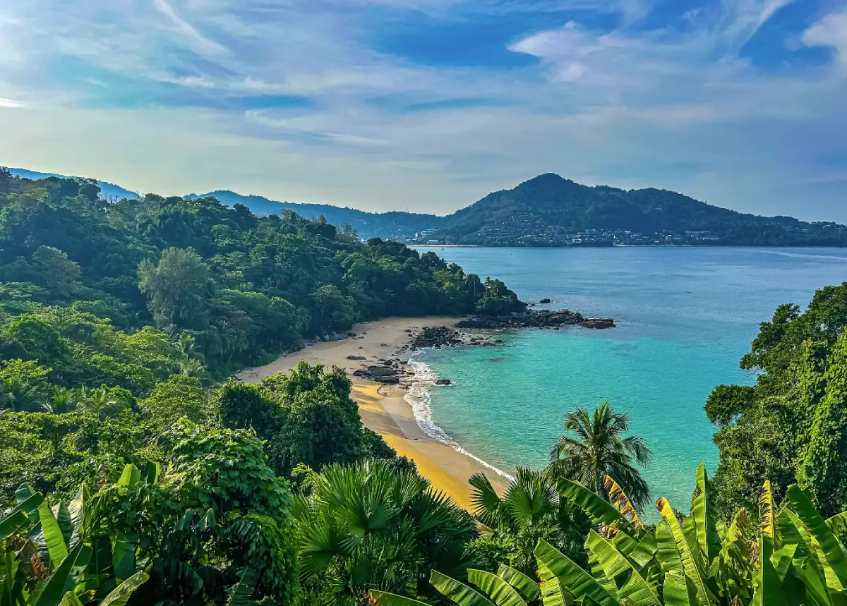
49. Laem Sing Laem Sing is a coastal attraction in Phuket Province, Southern Thailand. A small cove between Surin and Kamala beaches, viewed from the coastal road above. The destination is part of the region’s wider choice of summer beach breaks, marine excursions and nature-based travel.
Highlights: A small cove between Surin and Kamala beaches, viewed from the coastal road above.
The character of Laem Sing comes from its particular coastal setting. A small cove between Surin and Kamala beaches, viewed from the coastal road above. Rather than treating every beach or island as interchangeable, visitors can appreciate the shape of the shoreline, surrounding vegetation, changing light and relationship to the neighboring communities. These details are particularly rewarding during unhurried walks and photography stops.
Access to the sand below Laem Sing has had restrictions, so confirm permitted paths and do not cross private property. The road above provides coastal views.
For an Andaman Sea itinerary, the calmer-water season is often from roughly November to April, although individual days can still bring strong surf and boat cancellations. Marine national parks may close areas seasonally, so always check current notices before booking.
Laem Sing can be included in a broader itinerary around Phuket Province, but the best pace depends on whether travel is by road or boat. Those staying overnight can enjoy the quieter morning and evening periods; day-trippers should allow sufficient time to return before transport services end. Carry drinking water, sun protection and essential medication, and leave fragile coastal habitats undisturbed.
Getting There: Travel to Phuket Province by an available road, rail or air connection, then continue toward Laem Sing using local road access or authorized transport. Confirm the exact entrance, parking arrangements and any restricted areas before leaving.
Map (GPS):Get directions to Laem Sing
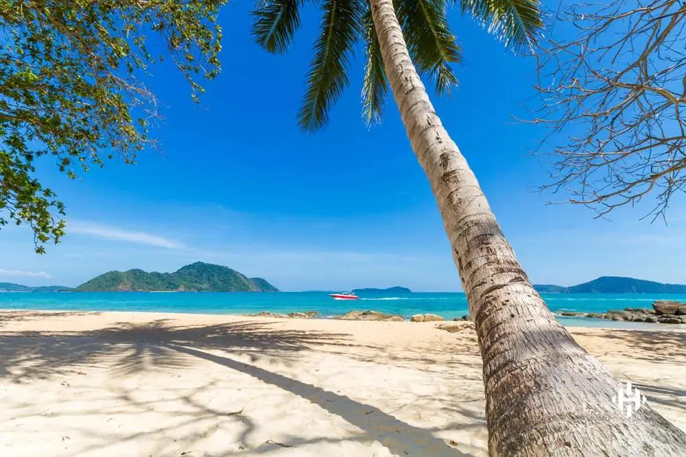
50. Laem Ka Yai Laem Ka Yai is a coastal attraction in Phuket Province, Southern Thailand. A rocky southern Phuket headland close to the traditional coastal communities of Rawai. The destination is part of the region’s wider choice of summer beach breaks, marine excursions and nature-based travel.
Highlights: A rocky southern Phuket headland close to the traditional coastal communities of Rawai.
The character of Laem Ka Yai comes from its particular coastal setting. A rocky southern Phuket headland close to the traditional coastal communities of Rawai. Rather than treating every beach or island as interchangeable, visitors can appreciate the shape of the shoreline, surrounding vegetation, changing light and relationship to the neighboring communities. These details are particularly rewarding during unhurried walks and photography stops.
This rocky headland is primarily suited to scenic appreciation rather than unrestricted swimming. Beware slippery rock surfaces and changing tides.
For an Andaman Sea itinerary, the calmer-water season is often from roughly November to April, although individual days can still bring strong surf and boat cancellations. Marine national parks may close areas seasonally, so always check current notices before booking.
Laem Ka Yai can be included in a broader itinerary around Phuket Province, but the best pace depends on whether travel is by road or boat. Those staying overnight can enjoy the quieter morning and evening periods; day-trippers should allow sufficient time to return before transport services end. Carry drinking water, sun protection and essential medication, and leave fragile coastal habitats undisturbed.
Getting There: Travel to Phuket Province by an available road, rail or air connection, then continue toward Laem Ka Yai using local road access or authorized transport. Confirm the exact entrance, parking arrangements and any restricted areas before leaving.
Map (GPS):Get directions to Laem Ka Yai
Summary Table: 50 Southern Thailand Coastal Destinations
| Category | Details |
| Overview | 50 beaches, islands, marine national parks, viewpoints and coastal-community destinations across 12 Southern Thai provinces on both the Andaman Sea and Gulf of Thailand. |
| Phuket Province | 1. Patong Beach 10. Kata Beach 11. Karon Beach 21. Surin Beach 22. Bang Tao Beach 23. Kamala Beach 24. Nai Harn Beach 25. Ya Nui Beach 31. Mai Khao Beach 32. Sirinat National Park (Nai Yang Beach) 49. Laem Sing 50. Laem Ka Yai |
| Krabi Province | 2. Railay Beach 3. Phi Phi Islands 9. Ao Nang 12. Noppharat Thara Beach 13. Phra Nang Cave Beach 14. Hong Islands 26. Poda Islands 27. Mu Ko Lanta National Park 36. Klong Dao Beach 37. Koh Rok Nai 40. Koh Rok Nok 46. Klong Nin–Klong Toab Beaches |
| Phang Nga Province | 4. Mu Ko Similan National Park 17. Khao Lak Coast 33. Mu Ko Surin National Park |
| Satun Province | 5. Koh Lipe 20. Adang–Rawi Islands 28. Koh Khai |
| Trang Province | 6. Koh Kradan 15. Koh Mook and Emerald Cave 16. Koh Ngai 29. Koh Sukorn 34. Pak Meng Beach 35. Hat Chao Mai National Park |
| Surat Thani Province | 7. Chaweng Beach 8. Koh Tao 18. Koh Phangan 19. Koh Nang Yuan |
| Songkhla Province | 30. Laem Son On 39. Laem Samila |
| Chumphon Province | 38. Thung Wua Laen Beach 43. Sai Ri Beach |
| Ranong Province | 41. Koh Phayam 42. Koh Chang, Ranong |
| Nakhon Si Thammarat Province | 44. Sichon Beach (Hua Hin Sichon) 45. Hat Khanom–Mu Ko Thale Tai National Park |
| Narathiwat Province | 47. Narathat Beach |
| Pattani Province | 48. Wasukri Beach (Patatimo Beach) |
| Andaman Sea | Ranong, Phang Nga, Phuket, Krabi, Trang and Satun. The main marine tourism season in many areas is approximately November to April; protected parks follow their own opening schedules. |
| Gulf of Thailand | Chumphon, Surat Thani, Nakhon Si Thammarat, Songkhla, Pattani and Narathiwat. Monsoon conditions differ among the northern and southern Gulf. |
| Family-Friendly Options | Kata Beach; Karon Beach; Klong Dao Beach; Thung Wua Laen Beach; Laem Samila; Sichon Beach. Always follow current swimming safety advice. |
| Diving and Snorkeling | Similan Islands; Surin Islands; Phi Phi Islands; Koh Tao; Koh Lipe; Koh Kradan; Koh Rok. Choose sites according to skill and weather. |
| Sunset Beaches | Patong; Karon; Surin; Bang Tao; Nai Harn; Klong Dao; Pak Meng. |
| Community and Culture | Koh Sukorn; Koh Phayam; Koh Chang (Ranong); Wasukri Beach; Narathat Beach; Koh Lipe. |
| Nature and Conservation | Mu Ko Surin National Park; Mu Ko Similan National Park; Hat Chao Mai National Park; Sirinat National Park; Mu Ko Lanta National Park; Khanom coastal park. |
| Traditional Food | Fresh seafood, Southern Thai sour curry, khao yam rice salad, khua kling, local seafood products, roti and regional Chinese and Malay-influenced cuisine. |
| Suggested Accommodation Areas | Patong, Kata and Karon (Phuket); Ao Nang and Koh Lanta (Krabi); Khao Lak (Phang Nga); Pak Meng (Trang); Pak Bara and Koh Lipe (Satun); Koh Samui, Koh Phangan and Koh Tao (Surat Thani); Ranong town and its islands; Chumphon town and its beaches; Sichon and Khanom; Songkhla town. |
| Transport | Fly, drive, take a train or use an intercity coach to the nearest hub. Arrange onward road transport and licensed boats where required. |
| Safety | Check wave forecasts and park notices, wear a life jacket on boats, observe beach-warning flags, never touch coral and keep a buffer from marine wildlife. |
Suggested Southern Thailand Beach Itineraries: 1–7 Days
| Itinerary | Suggested Route |
| 1 Day — Southern Phuket | Karon Beach, Kata Beach, Nai Harn Beach and Ya Nui Beach, selecting stops according to available time. |
| 1 Day — Krabi Coast | Noppharat Thara Beach and Ao Nang, followed by a boat trip to Railay and a walk to Phra Nang Cave Beach if services and time allow. |
| 1 Day — Songkhla | Laem Samila, the Golden Mermaid statue, Laem Son On and the waterfront where Songkhla Lake meets the Gulf. |
| 2 Days / 1 Night — Phuket | Day 1: Patong, Kamala and Surin beaches. Day 2: Bang Tao Beach, Sirinat National Park and Mai Khao Beach. |
| 2 Days / 1 Night — Krabi | Day 1: Ao Nang, Railay Beach and Phra Nang Cave Beach. Day 2: Choose either a Poda Islands excursion or Hong Islands excursion, depending on local boat conditions. |
| 3 Days / 2 Nights — Trang | Day 1: Pak Meng Beach and the coastal parts of Hat Chao Mai National Park. Day 2: Koh Mook and Emerald Cave, plus Koh Kradan when boat and tide conditions permit. Day 3: Relax or visit Koh Ngai if suitable services allow before returning to the mainland. |
| 3 Days / 2 Nights — Satun | Day 1: Boat from Pak Bara Pier to Koh Lipe. Day 2: Adang–Rawi Islands excursion, respecting national-park access rules. Day 3: Return by boat; stop near Koh Khai only if the service and park rules permit. |
| 4 Days / 3 Nights — Samui, Phangan and Tao | Day 1: Chaweng Beach on Koh Samui. Day 2: Transfer to Koh Phangan. Day 3: Take the scheduled boat to Koh Tao. Day 4: Visit Koh Nang Yuan only if there is sufficient time before the return journey. |
| 5 Days / 4 Nights — Phuket and Phang Nga | Day 1: Kata and Karon. Day 2: Patong, Kamala and Surin. Day 3: Travel north via Mai Khao to Khao Lak. Day 4: Similan Islands excursion only if the national park is open and seas are safe. Day 5: Enjoy Khao Lak before departure. |
| 6 Days / 5 Nights — Krabi and Koh Lanta | Day 1: Ao Nang and Noppharat Thara Beach. Day 2: Railay Beach and Phra Nang Cave Beach. Day 3: Phi Phi Islands boat trip. Day 4: Travel to Koh Lanta and stay near Klong Dao Beach. Day 5: Klong Nin–Klong Toab and Mu Ko Lanta National Park. Day 6: Relax before departure, or substitute a Koh Rok excursion if the park is open and conditions are suitable. |
| 7 Days / 6 Nights — Ranong and Chumphon | Day 1: Arrive in Ranong and arrange ferry services. Days 2–3: Stay on Koh Phayam. Day 4: Return to Ranong and transfer to Chumphon. Day 5: Sai Ri Beach and the Prince of Chumphon shrine. Day 6: Thung Wua Laen Beach. Day 7: Return journey; Koh Chang in Ranong can be substituted for Koh Phayam. |
| Planning Note | These are geographic itinerary examples, not confirmed boat schedules. Check departure times, park opening seasons, sea conditions and transfer times before booking. |
Frequently Asked Questions (FAQ)
Q: Which southern Thai province is best for a summer beach holiday?
A: Phuket and Krabi offer convenient services and varied beaches. Phang Nga, Satun, Trang and Surat Thani are particularly attractive for island and diving trips. Ranong, Chumphon, Nakhon Si Thammarat, Songkhla, Pattani and Narathiwat offer additional coastal scenery and local culture.
Q: What is the difference between the Andaman Sea and Gulf of Thailand?
A: The Andaman coast is known for limestone islands, white beaches and many offshore dive sites. The Gulf includes Koh Samui, Koh Phangan, Koh Tao and mainland coastal towns. Seasonal wind and wave patterns differ, so check conditions for the exact area.
Q: Where should I go for a beach holiday in April?
A: April often falls within a favorable period for many Andaman beaches, as well as numerous Gulf destinations. Phuket, Krabi, Trang, Satun and Gulf islands may be considered, subject to weather forecasts and national-park opening notices.
Q: Should first-time visitors choose Phuket or Krabi?
A: Choose Phuket for a wide range of serviced beaches, restaurants and accommodation. Choose Krabi for limestone cliffs, Railay and boat excursions to islands. Both work well for short and longer stays.
Q: Where can I go for a three-day, two-night trip?
A: Choose one base such as Phuket, Krabi, Trang or Koh Lipe and avoid moving accommodation every night. Leave time for boat departures and changing weather.
Q: Which beaches are suitable for families with children?
A: Kata, Karon, Klong Dao, Thung Wua Laen, Sichon and Laem Samila are accessible options. Suitability for a family outing does not mean the water is safe for swimming every day; always supervise children and follow warning signs.
Q: Can older travelers enjoy Southern Thailand beaches?
A: Yes. Prefer beaches reached easily by road, such as Ao Nang, Sichon, Thung Wua Laen and Laem Samila, and limit steep access paths or repeated boat transfers according to mobility needs.
Q: Where are the best-known snorkeling and diving areas?
A: The Similan and Surin islands, Phi Phi Islands, Koh Tao, Koh Lipe, Koh Kradan and Koh Rok are well-known options. Choose authorized sites and operators appropriate to your experience.
Q: Are the Similan and Surin islands open all year?
A: No. These protected marine areas have seasonal closures. Their general visitor season commonly falls around mid-October to mid-May, but always follow the specific annual national-park announcement.
Q: How many days should I stay on Koh Lipe?
A: About three days and two nights offers time to enjoy the beaches at a more relaxed pace. Allow additional time for Adang–Rawi trips if weather and park access permit.
Q: Where can I see the sunset over the sea?
A: West-facing beaches such as Patong, Karon, Surin, Bang Tao, Nai Harn, Klong Dao and Pak Meng offer sunset views when the weather is clear.
Q: Can I travel without renting a car?
A: Yes, especially from well-served hubs such as Patong, Ao Nang and Khao Lak. However, transport options are more limited on some islands and quieter mainland beaches.
Q: What should I pack for a summer beach holiday?
A: Bring sun protection, a hat, comfortable clothing, water, medication, suitable footwear and waterproof protection for valuables. For boating, use a life jacket and follow operator safety instructions.
Q: What should I do if strong waves or rain disrupt my plans?
A: Avoid unsafe swimming and boat departures. Switch to mainland activities such as local food, cultural sites, museums or historic neighborhoods until conditions improve.
Q: How can I visit the coast responsibly?
A: Take rubbish away, reduce disposable plastics, never touch or stand on coral, do not feed marine animals, respect community customs and choose responsible tourism operators.
 Category: ●Travel Articles, Recipes
 Group: ●Travel Review, Food Review
Last Update : 2 DayAgo
 Last Update : 2 DayAgo
Recommend

 Art, Culture and Heritage
 Historical Sites and Monuments(9)
 Landmarks and Memorials(9)
 Royal Palace(1)
 Art, Craft Centres, Tradition(12)
 Museums(5)
 Educational Places
 Educational Gardens, Farm(2)
 Places of Worship
 Temple(44)
 Mosque(2)
 Other Sacred Sites(17)
 Research and Development
 Royal Project(2)
 Suburban Living
 Village, Community(8)
 Local Market(1)
 Floating Market(1)
 Nature and Wildlife
 National Parks and Marine Reserves(6)
 Mountain (Doi)(11)
 Dam, Reservoir, Lake(10)
 Waterfalls(43)
 Hot Springs(1)
 Caves(13)
 River, Canal(3)
 Bays and Beaches(29)
 Islands(2)
 Other natural attractions(3)
 Entertainment and Agricultural
 Farms, Parks and Ecotourism(3)
 Outdoor and Adventure Activities(4)
Travel Review, Food Review(5)
 Southern Food Menu, Southern Food Recipes(18)


