
lovethailand home >North Travel Attractions >Chiang Mai Travel Attractions > 50 Best Waterfalls in Thailand
TL;DR: 50 Best Waterfalls in Thailand, open Daily Opening Hours: 08:00 – 16:00, hours 08:00 – 17:00.

50 Best Waterfalls in Thailand
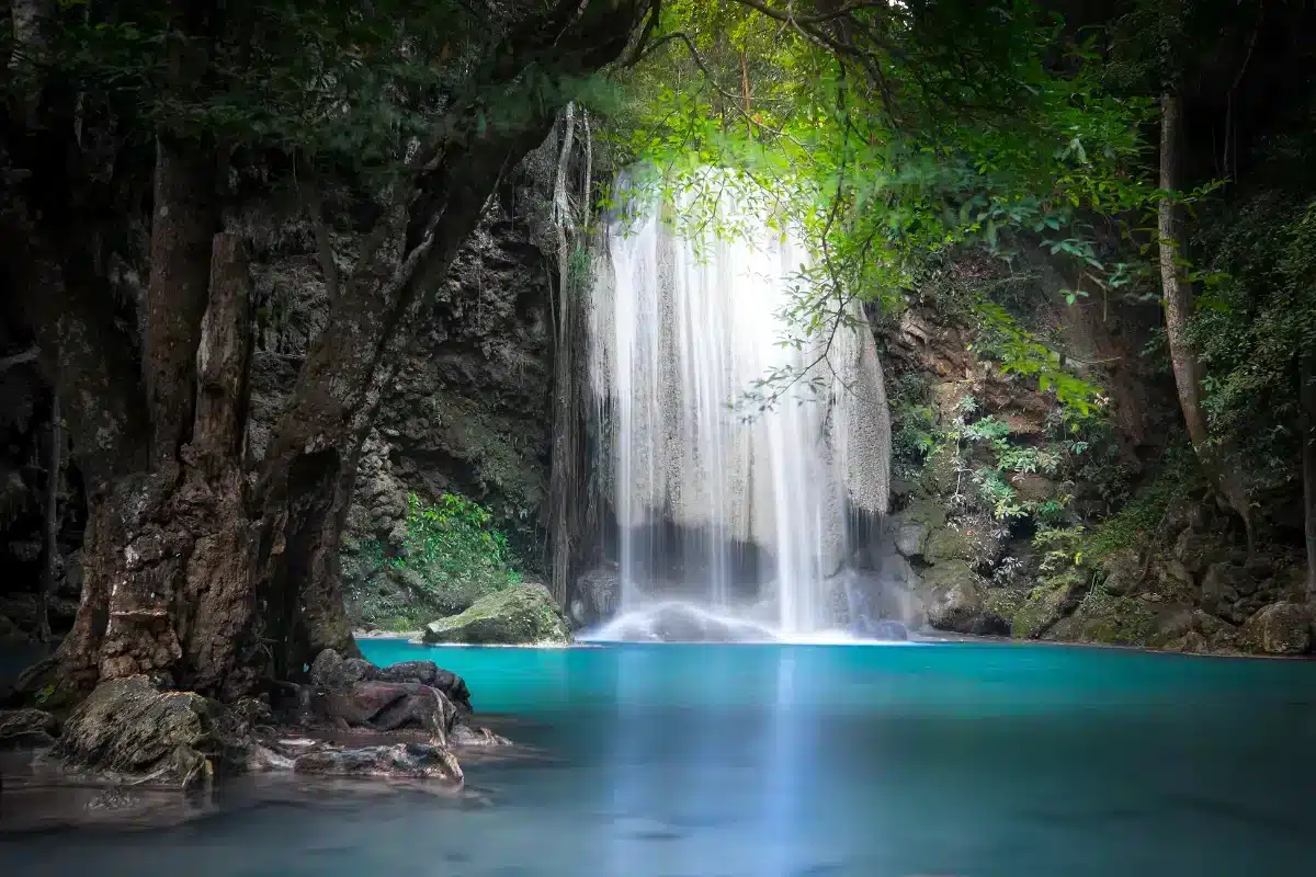
50 Best Waterfalls in Thailand Thailand is home to beautiful waterfalls scattered across every region of the country, from multi-tiered cascades hidden in the northern mountains and limestone waterfalls with emerald-green pools in western Thailand to dramatic waterfalls surrounded by eastern forests and remote streams deep within the southern rainforest. Each destination has its own landscape, ecosystem, and travel experience. Choosing the right waterfall is therefore about more than height or size. Seasonal beauty, accessibility, trail conditions, and safety are equally important considerations when planning a journey.
For travelers who enjoy exploring multi-tiered waterfalls and natural swimming pools, Erawan Waterfall and Huai Mae Khamin Waterfall in Kanchanaburi are particularly attractive destinations. Thi Lo Su Waterfall in Tak is famous for its immense curtain of water surrounded by the wilderness of Umphang, while Mae Ya Waterfall in Chiang Mai stands out for its broad rock face and graceful streams that descend through multiple levels. Other remarkable destinations include Phlio Waterfall, Krung Ching Waterfall, and Khun Korn Waterfall, each offering a different opportunity to experience Thailand's natural landscapes.
Every waterfall has its own character shaped by the surrounding terrain. Some limestone waterfalls feature turquoise or greenish-blue pools and terraces formed through mineral deposition. Mountain waterfalls may plunge over steep cliffs, filling the surrounding air with fine mist. Waterfalls deep inside tropical rainforests are often framed by dense vegetation and humid conditions, while cascades flowing across broad rock platforms reveal the patterns of running water and the natural erosion of stone over time.
The season can significantly influence the experience of visiting a waterfall. During the rainy season, many waterfalls carry more water and the surrounding forests become lush and green. However, these beautiful conditions may also bring flash floods, strong currents, and slippery rocks. The transition from the rainy season to the cool season can be particularly attractive for forest scenery and flowing waterfalls in many regions. Nevertheless, water levels depend on local rainfall and upstream conditions, so the ideal time to visit one waterfall should not automatically be applied to every destination in Thailand.
Families should prioritize waterfalls with accessible paths and convenient resting areas. Travelers who enjoy hiking can explore more remote waterfalls reached by longer nature trails, provided they consider their physical fitness, footwear, equipment, and the regulations of protected areas. Photography enthusiasts may prefer visiting when natural light illuminates the falling water and rock formations, or when seasonal changes create different compositions along the streams.
Responsible waterfall tourism plays an essential role in protecting Thailand's headwater forests. Visitors should remain on designated trails, swim only where permitted, take all rubbish away, avoid feeding wildlife, and never remove plants or rocks from protected areas. Approaching dangerous cliff edges or fast-flowing water for photographs should be avoided. Before traveling, always check the latest access arrangements, weather conditions, and announcements from the responsible authorities to ensure a safe visit that respects the natural environment.
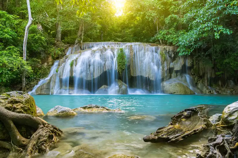
1. Erawan Waterfall in Kanchanaburi is one of Thailand's most celebrated waterfalls. Located within Erawan National Park in Si Sawat District, it is famous for its seven cascading tiers, which wind through natural forest and limestone formations. Each level has its own distinctive appearance, from turquoise pools and flowing rock terraces to shaded areas surrounded by mature trees. Its beauty comes not only from the clarity of the water but also from the geology that has created a variety of pools and cascades along the trail.
Highlights: Seven waterfall tiers, emerald-colored pools, shaded forest, and nature trails that allow visitors to experience several types of waterfalls in one location.
Erawan Waterfall is fed by streams originating in the forests of Kanchanaburi. As the water flows through limestone terrain, it forms natural pools whose colors sometimes appear blue-green because of the water's properties, minerals in the rock, and the way sunlight interacts with the surface. The color and clarity may vary depending on the viewing angle, rainfall, and season.
One of the greatest attractions of Erawan is the opportunity to walk from the lower waterfall levels toward the upper tiers. Along the way, visitors encounter cascades spreading across rock platforms, pools of different sizes, and trails that gradually enter denser forest. Both the distance and gradient increase farther uphill, so visitors should assess their fitness and allow enough time for the return journey.
For families traveling with children or older visitors, exploring only the more accessible lower tiers is a sensible option. Walking all seven levels is not necessary to appreciate the waterfall's beauty. Those continuing toward the upper sections should wear secure footwear with good grip, as parts of the trail include damp earth and slippery rocks.
After prolonged rainfall, water levels can rise and the stream becomes more powerful than during the dry season. Visitors must remain alert to flash flood risks, avoid swimming in restricted areas, and follow park officers' instructions. Travelers spending several days in Kanchanaburi may also plan a visit to Huai Mae Khamin Waterfall, but should calculate travel times according to the actual route.
Open Days: Daily Opening Hours: 08:00 – 16:00
Getting There: From Kanchanaburi town, travel toward Si Sawat District and follow the route to Erawan National Park. Private vehicles and bus services from Kanchanaburi town are available. Check current bus schedules and the permitted access times for the upper waterfall levels before traveling.
Map (GPS):Directions to Erawan Waterfall
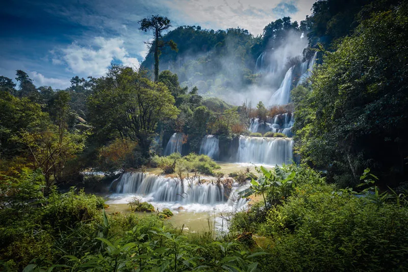
2. Thi Lo Su Waterfall in Tak Province is an enormous waterfall surrounded by the forests of Umphang Wildlife Sanctuary in Umphang District. It is renowned for its vast curtain of water descending over several sections of a broad cliff, creating striking white cascades against the surrounding green forest. The waterfall is a major destination for nature enthusiasts and adventure travelers, as reaching it requires more preparation than visiting a waterfall close to a town.
Highlights: An immense waterfall deep in the Umphang wilderness, mist rising from the cliffs, and a remarkably rich forest environment.
Thi Lo Su is particularly impressive because the water does not fall from a single narrow opening. Instead, it spreads across the rock formations and the width of the cliff, producing a vast series of cascades. When water levels are high, the flowing water creates an especially dramatic sight as it moves over the rocks surrounded by tropical vegetation. Its enormous scale gives Thi Lo Su a character unlike that of many smaller Thai waterfalls.
The forests of Umphang form part of the extensive western forest landscape, which is essential to watershed protection and biodiversity. Dense woodland and rugged mountains maintain moisture within the ecosystem and support a wide range of wildlife. Tourism therefore operates under wildlife sanctuary regulations designed to protect animals, plants, and the surrounding environment.
The journey to Thi Lo Su is itself a memorable part of the experience. Roads leading to Umphang District include numerous bends, while access to the waterfall depends on road conditions, the season, and announcements from the responsible authorities. Travelers should allow generous journey times, avoid overly ambitious schedules, and use authorized local services whenever required.
Heavy rainfall can make the waterfall even more powerful, but it may also result in restricted access because of slippery roads, high water levels, or conservation measures. Visitors should never base their travel plans solely on photographs or seasonal information from previous years. Swimming in prohibited areas is dangerous because of strong currents and submerged rocks.
Getting There: Travel to Tak Province, continue through Mae Sot District, and follow the mountain road to Umphang District. Confirm the current route into Umphang Wildlife Sanctuary with the responsible officers. The final journey to the waterfall must follow access regulations and the permitted visiting season.
Map (GPS):Directions to Thi Lo Su Waterfall

3. Mae Ya Waterfall in Chiang Mai is located within Doi Inthanon National Park in Chom Thong District. This magnificent waterfall is distinguished by streams that spread across several levels of a broad rocky cliff, resembling a white curtain surrounded by lush forest. Its beauty comes from the height of the rock face, the width of the flowing water, and the headwater forest that embraces the entire landscape.
Highlights: A broad, multi-tiered curtain of water, natural rock formations, lush forest, and viewpoints offering outstanding views of the waterfall.
Mae Ya differs from waterfalls where water plunges through a narrow channel. Here, the water spreads across the face of the rock, creating countless delicate streams that flow continuously down its surface. During periods of high water, the curtain-like shape becomes even more striking. Where the falling water strikes the rocks, fine spray increases moisture in the surrounding vegetation.
The approach to the waterfall passes through shaded forest. Visitors can observe differences in vegetation associated with changing moisture levels, from large trees beside the pathway to plants growing on rocks near the stream. Exploring the area is therefore rewarding for both relaxation and learning about headwater forest ecosystems.
Mae Ya is particularly appealing to landscape photographers because the water and layered rocks create varied natural compositions. Morning light or softly overcast conditions can help reveal detail in the cascading water. Photography should nevertheless be undertaken from permitted locations, without climbing slippery rocks or approaching areas where the water strikes the ground forcefully.
Travelers spending several days in Chiang Mai can combine Mae Ya Waterfall with other attractions in the Doi Inthanon area. However, the access road to the waterfall and the route toward the mountain summit form separate parts of the journey. Planning enough time for each destination allows visitors to explore without rushing.
Getting There: Travel from Chiang Mai city toward Chom Thong District. Continue toward Doi Inthanon National Park and follow the signs for the road branching toward Mae Ya Waterfall. Check the latest trail access announcements and weather conditions before departure.
Map (GPS):Directions to Mae Ya Waterfall
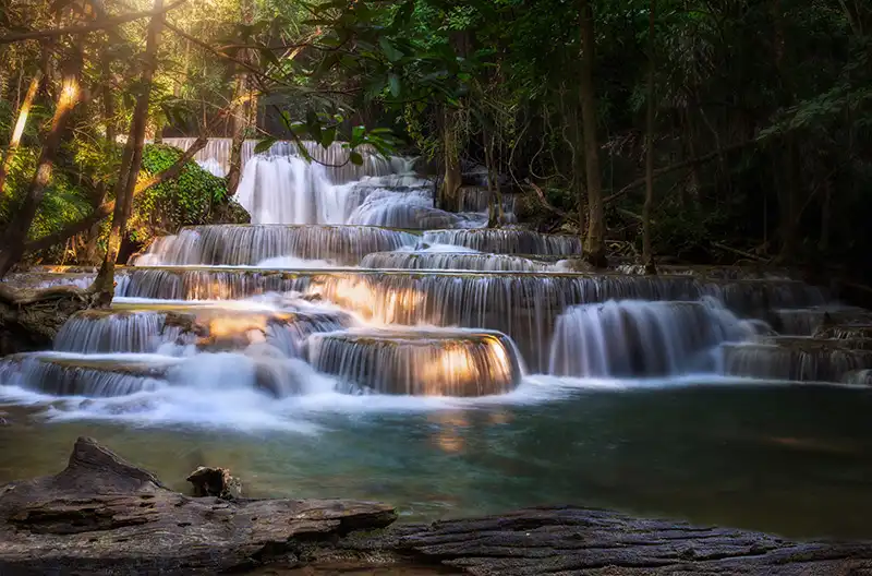
4. Huai Mae Khamin Waterfall in Kanchanaburi is a beautiful natural attraction within Khuean Srinagarindra National Park in Si Sawat District. The waterfall consists of limestone terraces through which water flows over natural pools and broad rock platforms, creating a picturesque landscape of clear streams surrounded by shaded forest. It is an excellent destination for travelers seeking a peaceful waterfall experience in Kanchanaburi.
Highlights: Multiple waterfall tiers with distinctive shapes, limestone terraces, natural pools, streamside walking trails, and a tranquil forest atmosphere.
Huai Mae Khamin consists of seven cascading levels, each shaped by variations in the gradient and formation of the underlying rocks. In some sections, water spreads into thin curtains over the stone, while elsewhere it collects in pools before flowing down to the next level. These features are the result of interactions between running water, rock formations, and mineral deposition.
The surrounding headwater forest helps maintain moisture in the streams. Vegetation along the trails provides welcome shade and creates an inviting atmosphere for relaxation. Walking between the waterfall levels reveals changing patterns of flowing water, from small connected terraces to sections where the stream collects in wider pools.
Water clarity and color vary according to rainfall and sediment levels. When conditions are clear, the rocks beneath the surface are easily visible. After heavy rain, the water may become cloudy and flow more strongly. Visitors must observe the swimming regulations for each location and should never assume that clear-looking water is necessarily safe.
Huai Mae Khamin is especially suitable for travelers who enjoy unhurried nature walks. Families may choose the more accessible areas, while those exploring multiple tiers should wear shoes appropriate for slippery surfaces and allow enough time to return before dark.
Because it lies in the Srinagarindra Dam area, Huai Mae Khamin is well suited to an overnight trip in Kanchanaburi. It may be combined with Erawan Waterfall, but visitors should check road routes and any vehicle ferry connections across the reservoir because actual travel times depend on the route selected.
Getting There: From Kanchanaburi town, travel to Si Sawat District and continue toward Khuean Srinagarindra National Park. Depending on the route, travelers may use roads or vehicle ferry services at designated crossings. Check current routes and operating schedules before setting out.
Map (GPS):Directions to Huai Mae Khamin Waterfall

5. Phlio Waterfall in Chanthaburi is located within Namtok Phliu National Park in Mueang Chanthaburi District. Known for both its natural beauty and historical importance, the waterfall flows across rocks and natural pools surrounded by rich tropical rainforest. The park also contains historical monuments associated with King Chulalongkorn, Rama V, giving Phlio a distinctive combination of forest scenery and Thai royal history.
Highlights: A rainforest waterfall, natural pools, fish living in the streams, and important historical monuments within the national park.
Phlio Waterfall forms part of a stream that flows around large boulders and descends through changes in the surrounding terrain. Water from the forest maintains the area's moisture, supporting dense tropical vegetation along the walking paths. The sound of flowing water, the shade of mature trees, and the humid forest atmosphere distinguish the waterfall from more exposed natural attractions.
One memorable feature is the opportunity to observe fish swimming in the natural pools. These fish form part of the stream ecosystem and play a role in its ecological balance. Visitors should observe them without catching, disturbing, or feeding them, as feeding wild aquatic animals can alter their behavior and affect water quality over time.
Beyond its natural attractions, Phlio has historical connections to the reign of King Rama V. The park contains places associated with royal visits and the commemoration of Queen Sunanda Kumariratana. Exploring these sites allows travelers interested in history to appreciate monuments and royal heritage alongside the surrounding rainforest.
Phlio is suitable for families and travelers who prefer a relaxing walk through shaded forest rather than a long-distance hike. Nevertheless, rocks and natural pools can be slippery, while currents may become stronger after heavy rainfall upstream.
Visitors spending more time in Chanthaburi can combine a trip to Phlio with the historic communities and cultural attractions of Chanthaburi town. A relaxed itinerary offers enough time to appreciate both the natural environment and the province's history.
Open Days: Daily Opening Hours: 08:30 – 17:30
Getting There: From Chanthaburi town, travel toward Khom Bang Subdistrict in Mueang Chanthaburi District, following the signs for Namtok Phliu National Park. Private vehicles can reach the designated visitor parking area.
Map (GPS):Directions to Phlio Waterfall
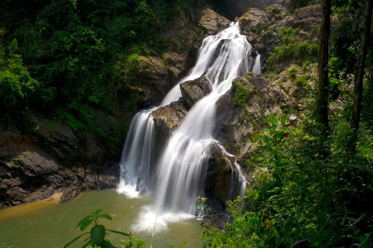
6. Krung Ching Waterfall in Nakhon Si Thammarat is located in Nopphitam District, within the forests of Khao Luang National Park. It is known for its multiple waterfall levels and nature trails passing through remarkably rich tropical rainforest. Visiting Krung Ching is therefore more than an opportunity to admire falling water. It is also a journey into the ecosystems of southern Thailand, where diverse plant life and humid forest conditions accompany visitors along the trail.
Highlights: Rainforest waterfalls, dramatic cliffs and cascades, forest hiking trails, and the important headwater ecosystems of the Khao Luang mountain range.
Krung Ching Waterfall originates from streams flowing through mountainous forest with varying gradients. As the water passes over rocky terraces and cliffs, it creates several waterfall levels. Some sections are streams winding around boulders, while others plunge over more prominent rock faces. These geographical features provide varied scenery throughout the nature walk.
The surrounding forest forms part of an important watershed system in Nakhon Si Thammarat. The tropical rainforest supports vegetation at several levels, from large trees to ferns, mosses, and moisture-loving plants. Its dense canopy offers shade along the pathways and provides habitat for wildlife.
Reaching the main waterfall levels requires considerably more walking and physical effort than visiting an easily accessible roadside viewpoint. Visitors should carry drinking water, suitable food, shoes with reliable grip, and rain protection when necessary. Planning the return journey is essential because some rainforest trails become dark earlier than open areas.
The rainy season brings lush vegetation, but heavy rainfall can rapidly increase stream levels and make trails slippery. Some sections may be temporarily closed for safety. Visitors must check current park announcements and must not enter restricted forest areas.
Krung Ching is particularly appealing to hikers, nature photographers, and travelers interested in the ecosystems of southern Thailand's tropical rainforests. Staying in the Nopphitam area allows additional time to appreciate local communities and natural landscapes without rushing to return after a demanding forest walk.
Getting There: Travel to Nakhon Si Thammarat Province and continue toward Nopphitam District and Krung Ching Subdistrict, following the route to the relevant section of Khao Luang National Park. Confirm the trail starting point, current access conditions, and any requirements for an official guide before hiking.
Map (GPS):Directions to Krung Ching Waterfall

7. Haew Narok Waterfall in Nakhon Nayok is located within Khao Yai National Park. This enormous waterfall is distinguished by water plunging over towering cliffs into a deep basin below. Its dramatic landscape demonstrates the power of flowing water to shape the terrain over time, making it one of the major natural attractions in the Khao Yai forest complex.
Highlights: A spectacular high-cliff waterfall, the powerful sound of cascading water echoing through the valley, natural forest scenery, and designated viewpoints.
Haew Narok differs from waterfalls that descend through shallow pools and gentle terraces. Here, the stream plunges into a deep gorge, creating powerful currents and considerable spray. The destination is therefore best appreciated through sightseeing and observing the landscape rather than swimming.
The forest around the waterfall is part of the extensive Khao Yai ecosystem, which plays a vital role in protecting wildlife and maintaining headwater resources. Visitors can experience the forest through designated walking routes, observing natural features and changes in vegetation along the way.
The route to the viewpoint includes sloping sections and stairs that require a reasonable level of physical fitness. Older visitors and people with mobility limitations should consider the difficulty of the path before starting. Secure footwear is important, particularly when the stairs are damp.
Safety is especially important at Haew Narok. Visitors must not approach cliff edges, leave the designated pathways, or enter restricted areas for photographs. Slippery surfaces and the height of the gorge create serious hazards. Even when no rain is falling at the viewpoint, upstream rainfall can change the water flow.
Travelers exploring Khao Yai can combine Haew Narok with other viewpoints and nature trails that are open on the day of their visit. Selecting a manageable number of attractions is preferable to rushing between distant sections of the national park.
Open Days: Daily Opening Hours: 08:00 – 17:00
Getting There: Enter Khao Yai National Park from the Nakhon Nayok or Prachin Buri side and follow the internal park road toward the Haew Narok parking area. Continue on foot along the designated path to the viewpoint, allowing enough time for the stairs and the return journey.
Map (GPS):Directions to Haew Narok Waterfall

8. Khun Korn Waterfall in Chiang Rai is located within Khun Korn Waterfall Forest Park in Mueang Chiang Rai District. The waterfall plunges from a high cliff surrounded by natural forest and is particularly admired for its long, graceful curtain of water. A shaded woodland trail leads visitors toward the waterfall, making it a rewarding destination for those seeking a nature experience while exploring Chiang Rai.
Highlights: A high-cliff waterfall, shaded forest trails, mist near the viewpoint, and vegetation thriving in the humid environment.
Khun Korn Waterfall is formed by a mountain stream that reaches a steep rock face before plunging into the valley below. The falling water creates a striking white curtain against the surrounding green forest. Because of the height, fine spray spreads around the base, producing a cool, moist atmosphere and the distinctive sound of falling water.
The walk to the waterfall is an important part of the experience. Visitors pass through woodland containing large trees and a variety of other plants. The trail includes both relatively level sections and slopes, so travelers should allow time for rest and carry sufficient drinking water.
The ecosystem around the waterfall depends on headwater streams and the moisture retained by the forest. Areas receiving spray provide favorable conditions for ferns, mosses, and other moisture-loving plants. A visit therefore offers opportunities to observe forest vegetation as well as admire the waterfall itself.
Khun Korn is suitable for nature walks and waterfall photography. However, approaching the base requires care because spray makes the rocks and pathways slippery. During periods of heavy rainfall, visitors should avoid hazardous areas and obey any trail closure announcements.
Travelers spending several days in Chiang Rai can combine Khun Korn with other natural and community attractions in Mueang Chiang Rai District. The forest walk should be scheduled during daylight, with sufficient time to return before evening.
Open Days: Daily Opening Hours: 08:00 – 17:00
Getting There: From Chiang Rai city, travel toward Mae Kon and Huai Chomphu, following the signs to Khun Korn Waterfall Forest Park. From the parking area, continue along the nature trail to the waterfall. Check weather and trail conditions before setting out.
Map (GPS):Directions to Khun Korn Waterfall

9. Khlong Nam Lai Waterfall (Pang Kwai Waterfall) in Kamphaeng Phet is located in Khlong Nam Lai Subdistrict, Khlong Lan District. Its water flows over natural rock terraces and through pools at different levels, surrounded by shaded mountain forest. The waterfall is distinguished by the changing appearance of the stream across its multiple levels, making it an attractive destination for nature walks and exploration of Kamphaeng Phet's forest landscapes.
Highlights: Nine waterfall levels, natural rock platforms, pools formed along the stream, and shaded woodland paths.
Khlong Nam Lai has several waterfall tiers created by changes in the gradient of the stream and the underlying rock formations. Each section has a different appearance. Water spreads across broad surfaces in some places, while elsewhere it drops between boulders. Walking between the levels reveals a variety of cascades and natural pools.
The surrounding area forms part of the mountainous forest landscape of western Kamphaeng Phet, an important headwater region. Moisture from the stream supports vegetation on the forest floor and rocks. Beneath the dense forest canopy, the environment often feels cooler and more humid than in exposed areas.
The waterfall is suitable for sightseeing, relaxation, and nature photography. Visitors can choose viewpoints according to their fitness and the accessibility of the trails. Exploring all nine levels is not necessary, particularly when traveling with children or older family members.
After prolonged rainfall, the stream carries more water and the waterfall takes on a more powerful appearance. Stronger currents can also make certain pools unsuitable for swimming. Visitors should avoid standing on slippery rocks and pay attention to local safety announcements.
Khlong Nam Lai can be included in a nature itinerary around Khlong Lan District together with Khlong Lan Waterfall. The two destinations require proper planning for road distances and travel times, so each can be enjoyed without unnecessary rushing.
Open Days: Daily Opening Hours: 08:00 – 16:30
Getting There: Travel to Khlong Lan District in Kamphaeng Phet Province, then continue toward Khlong Nam Lai Subdistrict and follow the signs for the waterfall. Check the latest trail access arrangements and road conditions, especially after heavy rain.
Map (GPS):Directions to Khlong Nam Lai Waterfall

10. Khlong Lan Waterfall in Kamphaeng Phet is a magnificent waterfall within Khlong Lan National Park in Khlong Lan District. The waterfall is characterized by water plunging over a high cliff surrounded by mountainous forest. It is one of the province's most impressive natural landmarks, where the white waterfall contrasts with rock formations and lush green vegetation. The destination is suitable for both leisure travel and learning about the geography of headwater forests.
Highlights: A large waterfall descending from a high cliff, mist near the base, mountain forest scenery, and an impressive natural landscape.
Khlong Lan Waterfall is formed by water flowing through mountainous terrain before plunging over a steep rock face. The resulting curtain of water is visible from designated viewing areas. The powerful sound and spray create a distinctive atmosphere, especially when water levels are high. The waterfall also illustrates the dramatic change in elevation between the upper stream and the valley below.
The forests of Khlong Lan National Park play an important role in protecting the ecosystem and headwater resources of western Kamphaeng Phet. Forest vegetation maintains moisture and provides habitats for various forms of wildlife. Visitors should respect the protected environment and avoid disturbing its natural resources.
For photographers, Khlong Lan offers natural compositions combining the cliff, flowing water, and surrounding forest. Photographing the waterfall from a suitable distance allows visitors to appreciate the scale and breadth of the cascades without approaching hazardous areas near the base.
Khlong Lan is suitable for family trips and short nature excursions in Kamphaeng Phet. Those wishing to explore more than one waterfall can combine it with Khlong Nam Lai, located in the same district, while allowing sufficient time for driving and relaxation.
During the rainy season, the volume of water can increase significantly, bringing risks of flash floods, slippery rocks, and restricted areas. Visitors should remain at safe viewing locations and avoid swimming wherever warning signs or strong currents are present.
Open Days: Daily Opening Hours: 08:30 – 16:30
Getting There: From Kamphaeng Phet town, travel to Khlong Lan District and follow the signs to Khlong Lan National Park and the waterfall area. The site can be reached by private vehicle. Check the latest park access arrangements before departure.
Map (GPS):Directions to Khlong Lan Waterfall
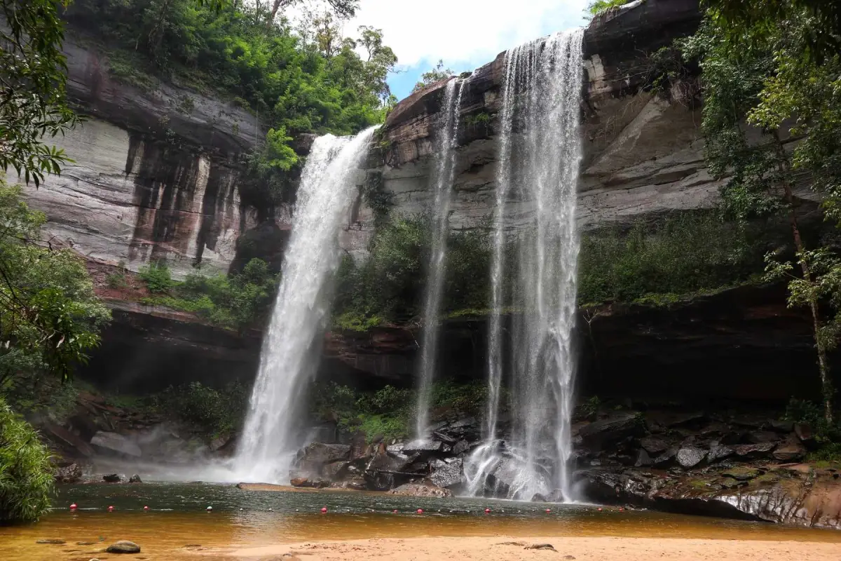
11. Huai Luang Waterfall (Tham Bak Teo Waterfall) in Ubon Ratchathani is a magnificent waterfall within Phu Chong Na Yoi National Park in Na Chaluai District. It is distinguished by water plunging from a towering cliff into a natural pool below, surrounded by the extensive forests and mountains of northeastern Thailand. Unlike waterfalls that flow across gently sloping rock terraces, Huai Luang combines a dramatic cliff, rising mist, and a large natural basin to create an impressive landscape.
Highlights: A waterfall approximately 45 meters high, a natural pool with greenish water under suitable lighting conditions, a sandy area near the base, and beautiful mountain forest scenery.
Huai Luang Waterfall is formed by a mountain stream flowing through forest before descending abruptly over a rocky cliff. When the falling water strikes the basin below, it creates fine spray that spreads across the surrounding area. Sand accumulating near the pool is produced by natural sediment deposition, resulting in a distinctive combination of a waterfall, cliff face, and sandy area within the forest.
The waterfall's volume changes throughout the year. After prolonged rainfall, the curtain of water becomes broader and more powerful. When water levels decrease, the contours of the cliff and underlying rock formations become easier to observe. In every season, visitors must follow the regulations governing swimming, because plunge pools beneath high waterfalls may contain powerful currents, turbulence, and submerged rocks.
The route descending toward the lower waterfall includes steep sections and stairs. Suitable footwear is important, and visitors should allow enough energy for the uphill return. Older travelers and those with limited mobility should assess their physical fitness before beginning the descent. Upper viewing areas also provide opportunities to appreciate the waterfall and surrounding landscape without walking all the way to the pool.
Travelers interested in the natural attractions of Ubon Ratchathani can combine Huai Luang Waterfall with other areas of Phu Chong Na Yoi National Park. The itinerary should account for the distance from Ubon Ratchathani city and the time required to travel within the park. Arriving earlier in the day allows more time to explore without rushing before the visitor areas close.
Getting There: Travel from Ubon Ratchathani city toward Na Chaluai District and enter Phu Chong Na Yoi National Park using an authorized access route. From the parking area, follow the designated walking path toward the waterfall. Check the weather and trail conditions before traveling.
Map (GPS):Directions to Huai Luang Waterfall

12. Sarika Waterfall in Nakhon Nayok is a well-known waterfall in Sarika Subdistrict, Mueang Nakhon Nayok District. Surrounded by mountains and forests connected to the Khao Yai landscape, it features streams cascading down several levels of a rocky cliff, producing beautiful views of flowing water, boulders, and lush vegetation. Sarika is a popular destination for short nature escapes from Bangkok and neighboring provinces.
Highlights: Multi-tiered cascades along a rocky cliff, shaded forest surroundings, and a convenient location for combining several natural attractions in Nakhon Nayok.
Sarika Waterfall is distinguished by water flowing over rock formations at different elevations. As the stream travels downhill, its appearance changes according to the shape of the terrain. During periods of abundant water, the cascades become more continuous and the sound of falling water grows stronger. In drier conditions, the rock surfaces and individual channels become more visible. The waterfall's appearance therefore depends on rainfall and water flowing from upstream areas.
The surrounding forest offers shade and a refreshing atmosphere, making Sarika attractive to travelers seeking a break from city life. Photography enthusiasts can capture the interplay between cliffs, water, and vegetation from permitted viewpoints. Climbing onto wet rocks to obtain photographs should be avoided because the surfaces can be dangerously slippery.
Although Sarika is relatively accessible, exploring the different waterfall areas still requires attention to changes in elevation and water flow. Families traveling with children or older adults should choose viewpoints that can be reached safely and avoid entering pools where swimming is prohibited.
A visit to Sarika Waterfall can be combined with Nang Rong Waterfall and the Wang Takhrai area, as these destinations form part of Nakhon Nayok's popular nature tourism routes. Weekend traffic can be heavy, so visitors should allow additional travel time and focus on a manageable number of destinations rather than rushing through several attractions.
Open Days: Daily
Opening Hours: 08:00 – 17:00
Getting There: From Nakhon Nayok town, take Highway 3049 toward Sarika Subdistrict and then Highway 3050, following signs for Sarika Waterfall. A private car is convenient for travelers planning to visit other nearby waterfalls.
Map (GPS):Directions to Sarika Waterfall

13. Nang Rong Waterfall in Nakhon Nayok is located in Hin Tang Subdistrict, Mueang Nakhon Nayok District. Popular with travelers seeking relaxation in natural surroundings, the waterfall consists of streams flowing across rock platforms and boulders, forming pools and small cascades along the landscape. Its main attractions are the shaded environment and relatively easy accessibility compared with waterfalls situated deep inside remote forests.
Highlights: Streams flowing between natural rocks, a series of pools, shaded forest surroundings, and convenient access to other nature destinations in Nakhon Nayok.
Nang Rong Waterfall is formed by water moving across sloping rock surfaces and natural stream channels. The varying terrain creates calmer sections as well as faster-flowing cascades. Where the stream encounters large boulders, its direction changes and water can be heard flowing around the rocks, creating a pleasant atmosphere for relaxation and nature observation.
Although some areas are easy to reach, water depth and current strength are not constant. Following heavy rainfall in upstream areas, the current may increase considerably, while walking paths and rocks can become slippery. Young children should remain under adult supervision at all times, and swimming must be limited to designated areas.
The waterfall is well suited to a relaxing day trip. Visitors who do not wish to undertake a long hike can enjoy the natural surroundings from accessible locations. Photographers may find attractive views near safe rock platforms, where the moving water contrasts with the surrounding trees.
Nang Rong can also be included in a Nakhon Nayok itinerary combining nature and local communities. Travelers may continue toward Sarika Waterfall or Wang Takhrai depending on their available time. Allowing sufficient time to return before dark is particularly helpful during busy holiday periods.
Open Days: Daily
Opening Hours: 08:00 – 16:00
Getting There: From Nakhon Nayok town, follow Highway 3049 along the Sarika–Nang Rong route and continue toward Nang Rong Waterfall in Hin Tang Subdistrict. Check current water conditions and visitor regulations before departure.
Map (GPS):Directions to Nang Rong Waterfall

14. Mae Klang Waterfall in Chiang Mai is situated in Chom Thong District along the route leading into Doi Inthanon National Park. This large waterfall can be reached without undertaking a lengthy forest hike. Its main feature is the powerful stream descending across a broad rocky cliff, surrounded by trees and the foothill landscape. It is an appealing stop for travelers exploring the Chom Thong–Doi Inthanon route.
Highlights: An impressive waterfall near the Doi Inthanon access road, dramatic natural rock formations, and convenient viewpoints for travelers stopping along the mountain route.
Mae Klang Waterfall is formed by a mountain stream flowing down the slopes of Doi Inthanon. When the water reaches the cliff, it descends with a width and force that vary according to seasonal rainfall. After prolonged rain, the waterfall can become especially dramatic, although the resulting stronger currents and slippery rocks require additional caution.
Its location near a major tourism route makes Mae Klang convenient for travelers who wish to enjoy nature without entering remote forest areas. Visitors can explore designated viewing points and observe the boulders shaped by moving water, while also learning about the relationship between the waterfall and the headwater forests of Doi Inthanon.
Families should choose safe viewpoints and avoid approaching the waterfall's base when currents are strong. Children require close supervision. The waterfall's proximity to a road does not eliminate natural hazards, as slippery rocks and powerful water can occur even at easily accessible destinations.
Mae Klang can be combined with Mae Ya Waterfall and other attractions around Chom Thong District. Travelers continuing toward the summit of Doi Inthanon should plan sufficient time because the mountain road is long and winding. Driving too quickly is particularly dangerous during fog or rain.
Getting There: From Chiang Mai city, follow Highway 108 toward Chom Thong District, then turn onto Highway 1009, the Chom Thong–Doi Inthanon road. Follow the signs to Mae Klang Waterfall near the lower section of the mountain route.
Map (GPS):Directions to Mae Klang Waterfall
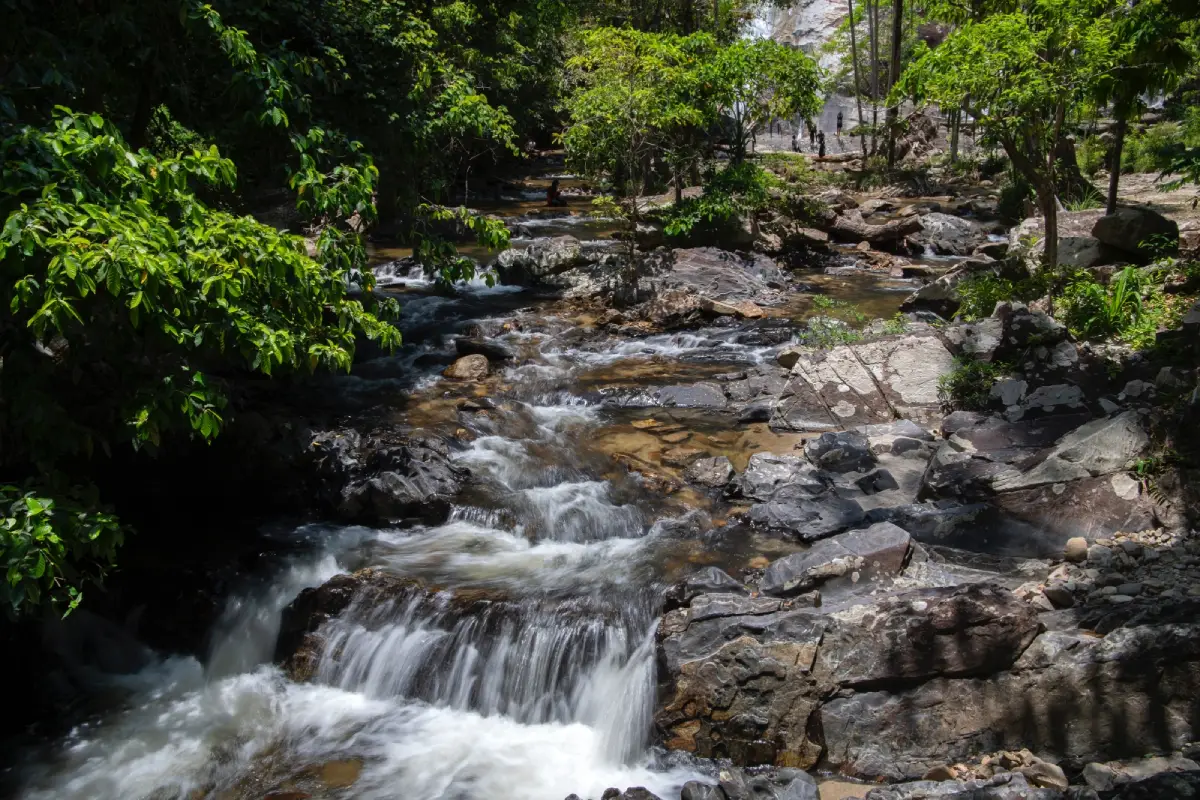
15. Ton Nga Chang Waterfall in Songkhla is an important natural attraction within Ton Nga Chang Wildlife Sanctuary in Thung Tam Sao Subdistrict, Hat Yai District. It is famous for its multiple cascades flowing through the rocky terrain of tropical rainforest, particularly a level where the water divides into two streams resembling elephant tusks. This distinctive formation inspired the waterfall's name and has become its most recognizable feature.
Highlights: Twin streams resembling elephant tusks, several waterfall tiers, natural rock platforms, and a tropical rainforest atmosphere within a protected wildlife sanctuary.
Ton Nga Chang Waterfall is formed by a stream flowing through sloping forest terrain. As the water encounters differently shaped rock formations, it creates cascades and pools at various levels. The section where the stream divides into two branches is an especially memorable natural feature and a popular photographic subject.
The forests of Ton Nga Chang Wildlife Sanctuary are essential to watershed protection and provide habitat for wildlife. Visitors must therefore follow conservation regulations, including using only designated public routes, refraining from feeding wild animals, and keeping the streams free from litter.
Travelers can explore the accessible sections of the waterfall according to their fitness and available time. Reaching higher levels may involve steep paths and wet rocks, so appropriate outdoor footwear is recommended. Visitors should never enter areas closed by sanctuary officers.
Ton Nga Chang is a good option for visitors staying in Hat Yai who wish to experience nature outside the city. A day trip is possible depending on travel arrangements, but visitors should prepare for the frequent rainfall of southern Thailand and remain aware of flash flood hazards.
Getting There: From Hat Yai city, travel toward Thung Tam Sao Subdistrict and follow the road leading to Ton Nga Chang Wildlife Sanctuary. From the parking area, continue on designated waterfall paths and follow current sanctuary access regulations.
Map (GPS):Directions to Ton Nga Chang Waterfall
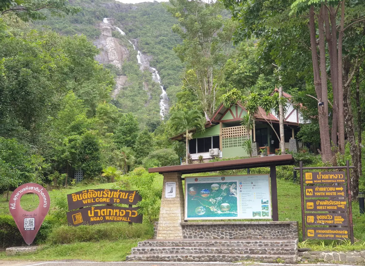
16. Ngao Waterfall in Ranong is located within Namtok Ngao National Park. It is famous for water cascading down a high mountain cliff surrounded by lush forest. The waterfall's most distinctive feature is its mountainous setting, where dense vegetation and the exceptionally humid climate of Ranong create a rich natural landscape. The province is known for its abundant rainfall, which contributes to the surrounding forest environment.
Highlights: A high waterfall visible from a considerable distance, tropical rainforest covering the surrounding mountains, and a nature destination that can be combined with a visit to Ranong town.
Water flows down the mountainside and appears as a long white streak contrasting with the dark green forest, particularly during periods of abundant rainfall. Visitors can observe the relationship between steep mountain terrain and moving water, as well as the role of forests in maintaining moisture within headwater areas.
The natural appeal of the area extends beyond the waterfall itself. The surrounding landscape contains tropical vegetation and environments suitable for learning about rainforest ecosystems. Walking through designated nature areas allows visitors to observe differences between vegetation growing within the forest and plants thriving beside streams.
Because Ranong receives substantial rainfall, visitors should take particular care on slippery trails and remain alert to flash flood warnings and temporary closures. Photographs should be taken from safe locations rather than from wet boulders or unauthorized pathways.
Ngao Waterfall is an attractive destination for travelers seeking nature near Ranong town. It can be combined with other provincial attractions, provided enough time is allocated for sightseeing and travel according to the day's weather conditions.
Open Days: Daily
Opening Hours: 08:30 – 16:30
Getting There: From Ranong town, travel toward Bang Rin Subdistrict and follow the signs to Namtok Ngao National Park. Check current trail access announcements and weather conditions before departure.
Map (GPS):Directions to Ngao Waterfall
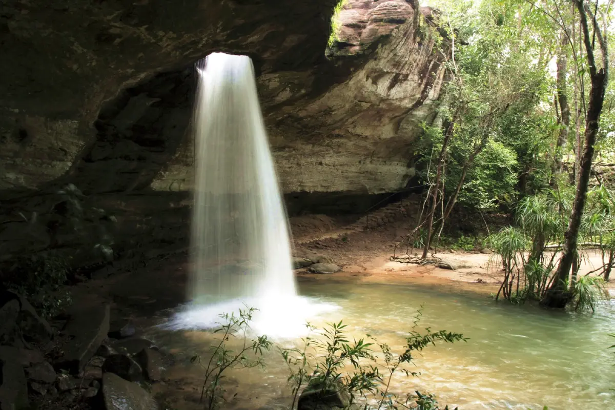
17. Saeng Chan Waterfall (Namtok Long Ru) in Ubon Ratchathani is located near Ban Thung Na Mueang in Na Pho Klang Subdistrict, Khong Chiam District. It is one of Thailand's most unusual waterfalls because the stream passes through a natural opening in a rock formation before dropping into the area below. This distinctive feature has given the waterfall its alternative name, Namtok Long Ru, meaning a waterfall that flows through a hole.
Highlights: Water passing through a natural opening in the rock, sandstone cliffs, and a landscape that clearly demonstrates the erosive power of moving water.
Saeng Chan Waterfall is defined by an opening formed through natural geological processes. As water has moved through cracks and weaknesses in the rock over time, erosion has created a passage through which the stream can descend. The sight of water dropping vertically through the opening, framed by the surrounding cliff, creates a distinctive composition unlike that of conventional waterfalls.
The landscape consists largely of sandstone shaped over long periods by flowing water, weathering, and temperature changes. Visitors can observe the rock surfaces and patterns of erosion, making this an interesting destination for learning about geography and geology alongside nature tourism.
The volume of water passing through the opening varies seasonally. When levels are high, the descending water becomes more powerful and produces more spray. However, wet rock surfaces and cliff edges require particular care. Visitors should not approach the opening or stand in potentially hazardous areas to obtain photographs.
Travelers exploring Khong Chiam can combine Saeng Chan Waterfall with Soi Sawan Waterfall and other natural attractions within the Pha Taem National Park area. The itinerary should account for seasonal conditions and road distances, which may require more travel time than a general map suggests.
Getting There: Travel from Ubon Ratchathani city to Khong Chiam District, then continue toward Ban Thung Na Mueang in Na Pho Klang Subdistrict. Follow the access road to Saeng Chan Waterfall and check current road and viewpoint conditions before departure.
Map (GPS):Directions to Saeng Chan Waterfall
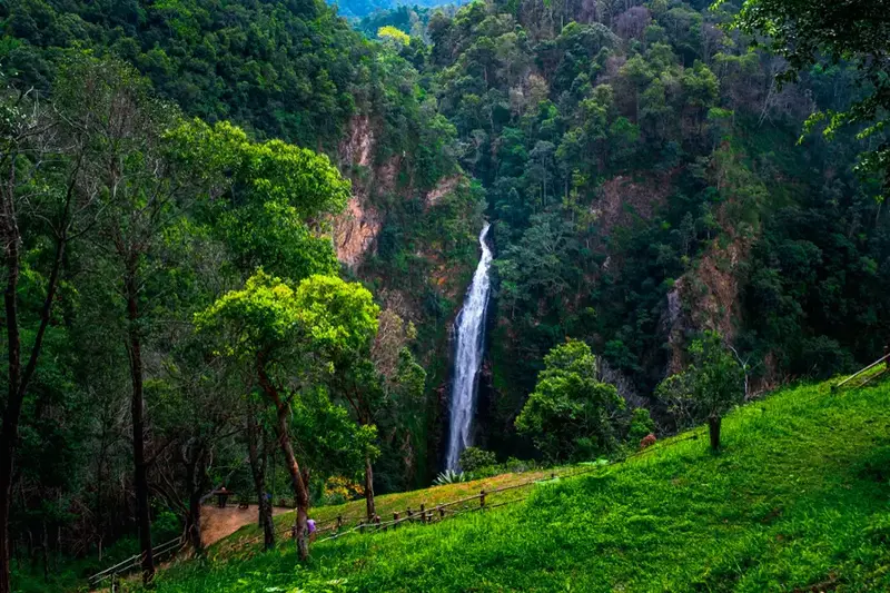
18. Mae Surin Waterfall in Mae Hong Son is famous for its dramatic stream plunging over a high cliff into a deep mountain valley within Namtok Mae Surin National Park. The surrounding landscape consists of rugged mountains and natural forests, offering striking views of white water descending against a backdrop of steep rock faces and lush vegetation.
Highlights: A large waterfall dropping from a high cliff, scenic mountain valleys, surrounding forested peaks, and the headwater environment of Mae Hong Son.
Mae Surin is particularly impressive because water drops from a considerable height into the valley below, revealing the dramatic differences in elevation across the landscape. Viewing the waterfall from designated areas allows travelers to appreciate the cliff and surrounding mountains, making it an excellent destination for landscape photography without having to approach the base.
The surrounding forests play an important role in protecting headwater resources and maintaining the environmental balance of northern Thailand's mountains. Moisture from streams supports vegetation within the valleys, while the forests help regulate runoff and protect mountain soils.
The waterfall changes with rainfall and weather conditions. After prolonged rain, the falling water becomes more powerful and visually prominent. However, mountain roads may also become slippery, while mist and landslide risks can make traveling more difficult. Visitors should remain at authorized viewpoints and avoid leaving designated routes.
Mae Surin Waterfall is suited to nature enthusiasts and travelers who enjoy exploring the mountain landscapes of Mae Hong Son. A visit can be combined with the Bua Tong flower fields of Doi Mae U Kho during the flowering season. Drivers should allow enough time for the winding mountain roads and avoid rushing between destinations.
Getting There: Travel to Mae Hong Son Province and follow the mountain roads toward Namtok Mae Surin National Park. Confirm the current visitor access points and road conditions with park authorities, particularly after heavy rainfall.
Map (GPS):Directions to Mae Surin Waterfall
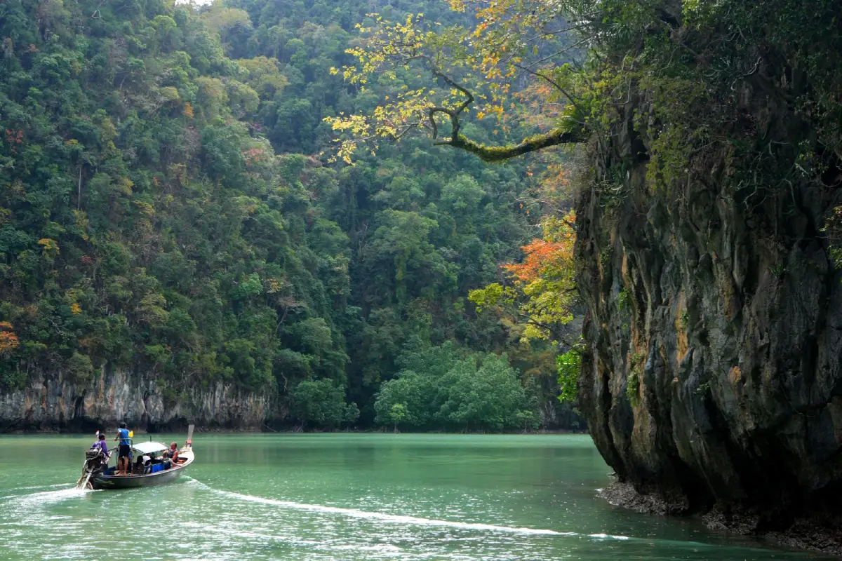
19. Than Bok Khorani Waterfall in Krabi is a natural cascade within Than Bok Khorani National Park in Ao Luek District. Its main attraction is a clear stream flowing over limestone terraces and through natural pools surrounded by dense vegetation. Unlike waterfalls that plunge from towering cliffs, Than Bok Khorani consists of flowing channels and pools at different levels, closely enclosed by the surrounding forest.
Highlights: Emerald-colored water under suitable lighting conditions, limestone pools, shaded forest, and walking paths near the national park headquarters.
The natural landscape of Than Bok Khorani is closely connected to the limestone terrain found throughout Krabi. Over time, flowing water moving across the rocks has formed pools and channels with different shapes. Beneath the shade of trees, some sections of the water appear greenish-blue, contributing to the tranquil atmosphere of the area.
The walking paths pass through tropical vegetation and humid surroundings, providing opportunities for visitors to explore nature at a relaxed pace. From designated areas, travelers can observe water flowing between limestone formations and differences in the vegetation growing beside the stream and higher above the water.
Than Bok Khorani is suitable for families and visitors wishing to enjoy a natural water attraction near the main roads of Ao Luek District. However, limestone surfaces can be slippery, and water levels may change after rainfall. Visitors should not enter restricted pools or cross protective barriers for photographs.
Travelers spending additional time in Krabi can include nearby caves and nature attractions in the Ao Luek area. Selecting destinations along a practical route is preferable to combining numerous inland sites and distant boat excursions into a single day.
Getting There: Travel from Krabi town toward Ao Luek District and follow the signs to Than Bok Khorani National Park. The waterfall area is located within the park's mainland visitor zone and does not require a boat trip.
Map (GPS):Directions to Than Bok Khorani Waterfall

20. Wang Takhrai Waterfall in Nakhon Nayok is a natural recreation area in Hin Tang Subdistrict, Mueang Nakhon Nayok District. Known for streams flowing across rocks and through attractive green surroundings, it is a popular destination for travelers seeking riverside relaxation and nature close to Bangkok. The area is characterized more by streams, natural pools, and rocky channels than by a single towering cliff waterfall.
Highlights: Flowing streams across natural rock platforms, shaded parkland, and riverside recreation in areas open to visitors.
Wang Takhrai is particularly appealing because its streams flow among boulders of different sizes and across varying gradients. This creates natural pools and sections with different currents. Trees lining the waterways provide shade, making the area attractive for relaxing walks and enjoying the scenery.
Visitors interested in riverside activities should use only swimming areas officially open on the day of their visit. Water levels can rise rapidly after rainfall in the upstream watershed, even when there is no rain at the park itself. Submerged rocks and wet stone surfaces can also create slipping hazards.
Wang Takhrai is suitable for families, groups of friends, and travelers seeking a short nature break. Visitors should consider the needs of children and older adults when choosing places to rest, while respecting local regulations concerning recreational activities and food within the park.
Wang Takhrai can be included in an itinerary with Nang Rong Waterfall and Sarika Waterfall, depending on travel time and weather conditions. Choosing a manageable number of destinations allows more time to enjoy the natural surroundings, particularly during weekends when roads and visitor areas may be busy.
Getting There: From Nakhon Nayok town, follow Highway 3049 toward Hin Tang Subdistrict and the Wang Takhrai area. Check current opening arrangements, permitted activities, and stream conditions before traveling.
Map (GPS):Directions to Wang Takhrai Waterfall
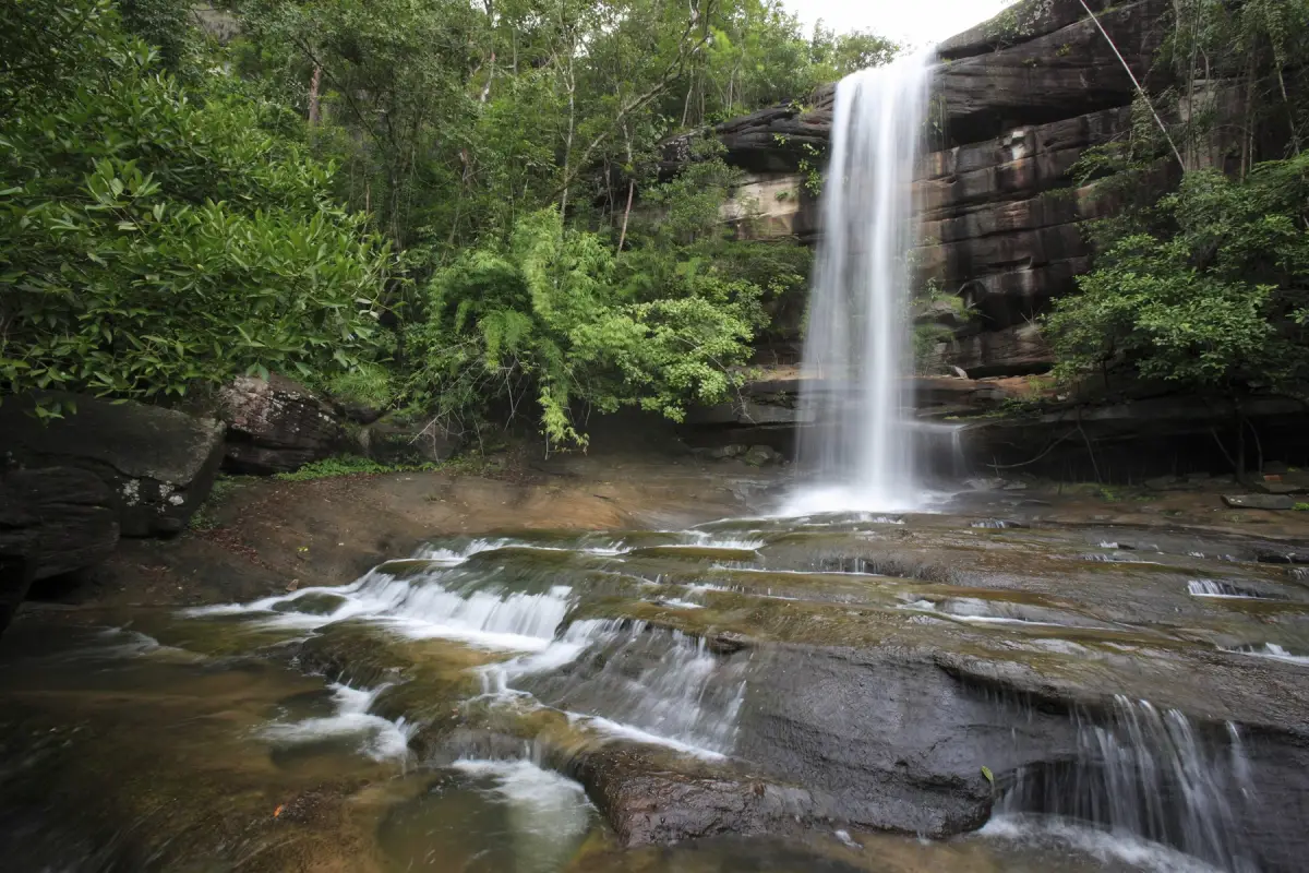
21. Soi Sawan Waterfall in Ubon Ratchathani is located within Pha Taem National Park in Khong Chiam District. Its distinctive feature is the convergence of streams near a cliff before the water plunges into the area below. Surrounded by sandstone formations and the natural forests of northeastern Thailand, the waterfall is particularly beautiful during periods of rainfall, when the volume of water increases and the surrounding landscape becomes lush and green.
Highlights: Streams converging before flowing over a cliff, sandstone landscapes, and verdant forest scenery during the rainy season.
Soi Sawan Waterfall is known for the way separate streams meet near the cliff edge, creating a distinctive waterfall formation. Water flowing across sandstone and sloping terrain gradually shapes channels and rock surfaces through erosion. Visitors can therefore observe the relationship between the natural drainage system and the geological features of the landscape.
During the rainy season, the surrounding forests, ground vegetation, and grasslands become greener and more humid. However, heavy rainfall can make the walking paths slippery and cause stream levels to rise rapidly. Visitors should follow designated trails and avoid approaching unprotected cliff edges.
The waterfall is particularly appealing to nature photographers and travelers interested in sandstone geology, as both the rock formations and falling water can be appreciated in one location. Suitable footwear and sufficient time for the return walk are important, especially when the trails are wet.
Travelers with several days available can combine Soi Sawan Waterfall with Saeng Chan Waterfall and other attractions in Khong Chiam District. The itinerary should reflect seasonal conditions and travel distances rather than attempting to visit too many sites in one day.
Getting There: Travel from Ubon Ratchathani city toward Khong Chiam District and continue into Pha Taem National Park along an authorized access road. Check current trail openings and seasonal restrictions before departure.
Map (GPS):Directions to Soi Sawan Waterfall
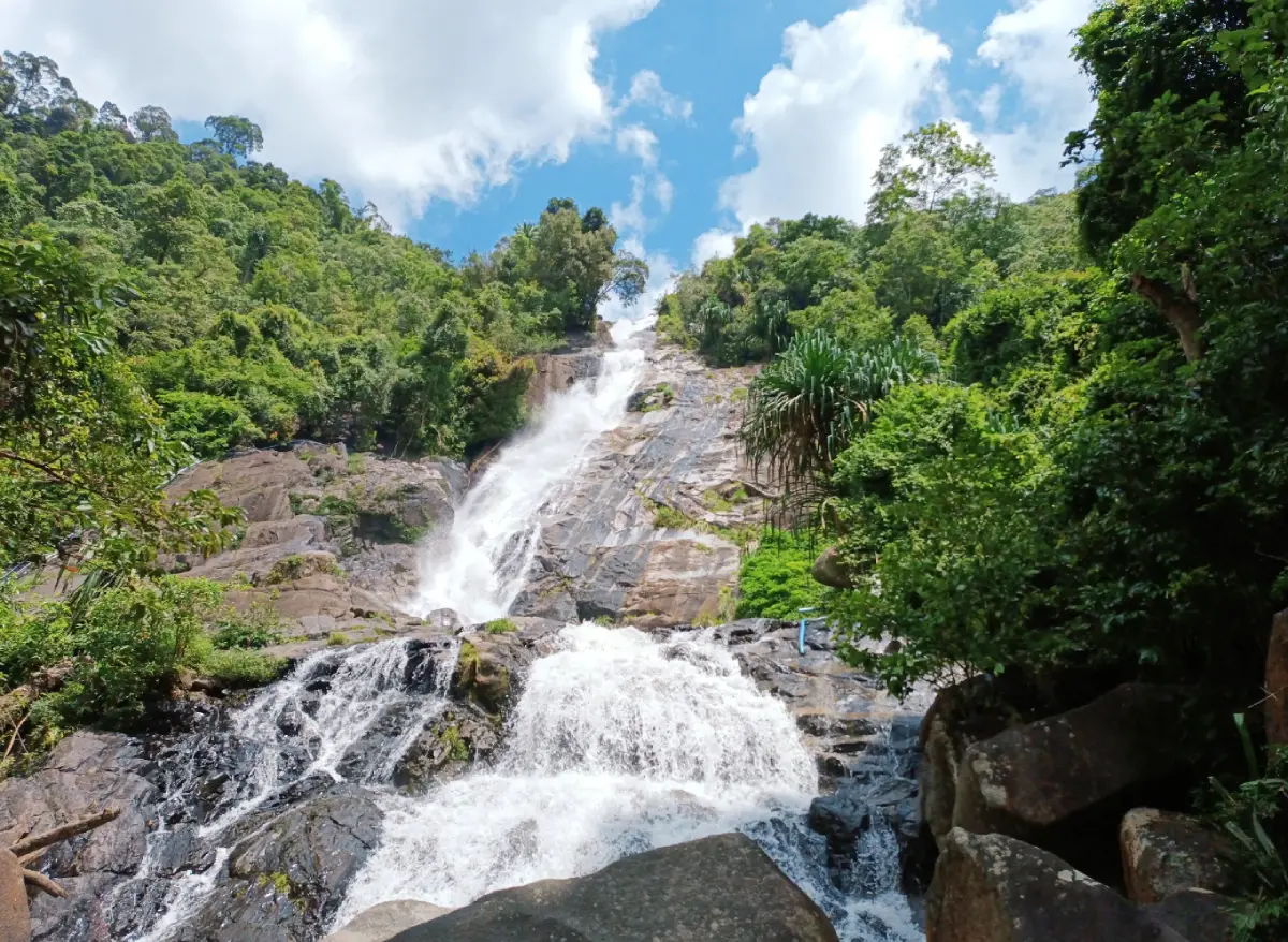
22. Ton Plew Waterfall in Songkhla is a natural attraction in Rattaphum District, where water flows through forested terrain and across rocks of varying sizes. The waterfall is surrounded by shady vegetation and offers a peaceful setting for visitors wishing to enjoy nature outside the urban area of Hat Yai.
Highlights: Forest streams, natural boulders, shaded surroundings, and cascades shaped by the changing gradient of the terrain.
The appeal of Ton Plew Waterfall lies in the movement of water across rocks and natural terraces. In some sections, the stream spreads over broad rock surfaces, while elsewhere it narrows into more clearly defined channels. These different forms of flowing water, framed by woodland, create a relaxing atmosphere for nature walks.
The area's humid southern climate supports trees and vegetation along the stream. Visitors can observe how plants growing close to the water differ from those in areas higher above the streambed, where the soil and moisture conditions change.
After heavy rainfall, the stream can rise rapidly and the rocks may become dangerously slippery. Swimming should be avoided whenever warnings or restrictions are in place. Visitors should also remain within permitted areas rather than entering unmarked forest paths.
Ton Plew is suitable for travelers interested in exploring Songkhla's natural attractions. It can be combined with destinations around Rattaphum District, depending on actual travel distances. An earlier departure provides enough daylight for sightseeing and a safe return.
Getting There: Travel from Hat Yai toward Rattaphum District, then follow local roads to Ton Plew Waterfall. Check road conditions and visitor access regulations, particularly during the rainy season.
Map (GPS):Directions to Ton Plew Waterfall

23. Mae Sakut Luang Waterfall in Mae Hong Son is located in Pha Bong Subdistrict, Mueang Mae Hong Son District. Surrounded by mountains and humid forest, the waterfall is suitable for travelers seeking lesser-known natural attractions beyond the viewpoints and misty mountain scenery commonly associated with Mae Hong Son.
Highlights: A waterfall surrounded by mountain forest, natural streams, and a peaceful environment for observing forest ecosystems.
Mae Sakut Luang Waterfall forms part of a network of mountain streams. Water descends across variations in the surrounding terrain, creating cascades along natural rock levels. Trees and streamside plants benefit from the humidity of the water and the shade provided by the forest canopy, resulting in an atmosphere distinctly different from exposed mountain roads.
Nature photographers can capture the movement of water, rock formations, and surrounding vegetation from accessible trails. Particular care is required where the ground is damp or algae cover the rock surfaces, as these conditions can cause serious slips and falls.
Mountain roads in Mae Hong Son contain numerous bends and can be affected by heavy rainfall. Visitors should check road conditions, ensure their vehicles are suitable for the journey, and travel during daylight. Entering restricted forest trails should be avoided.
Mae Sakut Luang is particularly suitable for travelers looking for quiet natural surroundings and those spending time exploring Mae Hong Son Province. Nearby attractions should be selected according to geographical location to avoid unnecessary driving on winding mountain roads.
Getting There: From Mae Hong Son town, travel toward Pha Bong Subdistrict and continue toward the Mae Sakut Luang Waterfall area. Confirm the access route and its current condition with local authorities or the responsible site operator before traveling.
Map (GPS):Directions to Mae Sakut Luang Waterfall
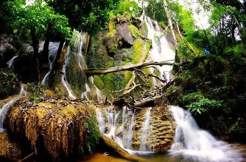
24. Pha Sawan Waterfall in Kanchanaburi is a natural waterfall in the mountainous forests of Thong Pha Phum District. Water flows through multiple rocky levels and cliff formations, creating a waterfall landscape within the forests of western Thailand. The destination is especially appealing to nature enthusiasts who are prepared for travel that may involve remote protected forest routes.
Highlights: Waterfalls within western Thailand's forests, natural cliffs and rocky terraces, and opportunities for nature-focused exploration in mountainous terrain.
Pha Sawan Waterfall is part of a headwater system flowing through forested mountains. Variations in elevation create separate cascade levels as the water descends over rocks and continues downstream. These natural processes gradually shape the surrounding landscape.
The forests around the waterfall play a significant role in maintaining moisture and protecting watershed resources. Visitors should keep the area free of rubbish, avoid leaving food waste, and remain on approved trails rather than entering sensitive habitats in search of photographs.
Access to waterfalls situated deeper within protected forests requires special attention to seasonal conditions and visitor restrictions. Heavy rain can make roads slippery, flood walking paths, and strengthen currents. Traveling with an authorized guide or responsible officer, where required, reduces the risks of visiting an unfamiliar area.
Travelers interested in Kanchanaburi's waterfalls should consider Pha Sawan as a separate nature excursion with sufficient time allocated for access and exploration. It should not be combined casually with Erawan and Huai Mae Khamin without first checking the actual distances and travel arrangements.
Getting There: Travel to Thong Pha Phum District in Kanchanaburi and confirm the current access route with the responsible protected-area authority. Prepare for road and trail conditions in accordance with local requirements.
Map (GPS):Directions to Pha Sawan Waterfall
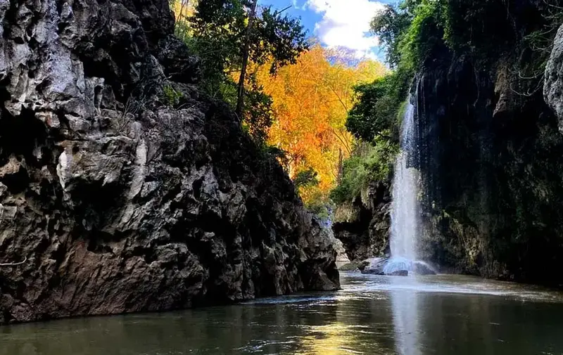
25. Thi Lo Le Waterfall in Tak is located in Umphang District and is distinguished by its setting within the extensive forests of western Thailand. Mountain streams, river valleys, and rugged terrain contribute to its appeal as an adventure destination. Reaching the waterfall requires careful preparation and compliance with local access regulations.
Highlights: A waterfall in the Umphang wilderness, forested river valleys, and opportunities for adventure-oriented nature tourism.
Umphang is characterized by rugged mountains, extensive forests, and rivers winding through steep valleys. Thi Lo Le Waterfall forms part of this interconnected water system. Flowing water passes over rocky terrain and changes elevation, creating natural cascades within the surrounding forest ecosystem.
Visiting Thi Lo Le requires consideration of the route and any activities involving rivers or natural waterways. Access conditions depend on water levels, the season, and regulations issued by the responsible authorities. Visitors should not attempt unfamiliar routes without current information or appropriate safety equipment.
Photographers and nature enthusiasts should allow sufficient time for the journey rather than focusing solely on reaching the waterfall and returning immediately. The forests, streams, mountains, and nearby communities of Umphang contribute to the wider experience.
Thi Lo Le is best planned as a dedicated adventure excursion, particularly for travelers using experienced and authorized local operators. Checking the seasonal water conditions and access arrangements before departure is essential for everyone's safety.
Getting There: Travel to Umphang District in Tak Province, then contact the responsible authorities or an authorized local tour operator to confirm the route and season during which Thi Lo Le Waterfall can be visited.
Map (GPS):Directions to Thi Lo Le Waterfall

26. Thi Lo Cho Waterfall (Sai Fon Waterfall) in Tak is located in Umphang District. Also known as Sai Fon, or Rainfall Waterfall, it is distinguished by its streams and fine spray resembling falling rain within the surrounding forest. It is a memorable natural attraction for travelers exploring the rivers and mountain landscapes of Umphang.
Highlights: Fine water spray resembling rain, a picturesque river setting, and the forests of the Umphang area.
The name Sai Fon refers to the waterfall's distinctive pattern of falling water, which spreads into fine droplets as it moves over the cliff. When sunlight reaches the spray, the waterfall takes on a particularly delicate appearance, while the continuing moisture supports surrounding vegetation.
Thi Lo Cho is situated in an environment of rivers and extensive forests. Visiting the waterfall can involve travel along natural waterways, with access influenced by water levels and local regulations. Travelers should not rely exclusively on conventional road maps when planning to reach the site.
The safest time to visit depends on the conditions of the waterways and the availability of permitted transport services. When traveling by boat or raft, visitors should wear life jackets and follow the instructions of experienced operators. Dangerous currents and restricted areas must be avoided.
Travelers planning a wider Umphang itinerary may consider Thi Lo Cho alongside Thi Lo Su or other natural attractions, but should first confirm the routes, travel duration, and seasonal accessibility of each activity.
Getting There: Travel to Umphang District in Tak Province and check current river transport services and authorized tour arrangements for reaching Thi Lo Cho Waterfall. Do not enter restricted waterways or forest areas without permission.
Map (GPS):Directions to Thi Lo Cho Waterfall

27. Phet Cha Kho Waterfall in Kamphaeng Phet is a natural waterfall within Khlong Lan National Park, associated with a forest protection unit in Khlong Lan District. It is characterized by the natural surroundings of mountain forest and streams flowing through rugged terrain, making it an interesting destination for travelers seeking to understand waterfall ecosystems in Kamphaeng Phet.
Highlights: A waterfall within Khlong Lan National Park, natural streams, and forest scenery suited to nature enthusiasts.
Phet Cha Kho is part of the mountainous landscape of western Kamphaeng Phet. Streams descend along slopes and rocky terraces shaped by natural erosion, creating waterfalls and channels whose appearance varies according to the season and rainfall.
The surrounding forest plays an important role in protecting headwater resources and biodiversity. Visitors should keep the environment clean, avoid disturbing wildlife, and remain on approved paths.
Access to waterfalls deeper within forest protection areas may differ from access to the main public attractions of the national park. Visitors should confirm whether the route is currently open and whether an officer or guide is required before planning the excursion.
Travelers spending several days around Khlong Lan District may investigate Phet Cha Kho alongside Khlong Lan and Khlong Nam Lai waterfalls, provided each route is open and weather conditions allow safe travel.
Getting There: Travel to Khlong Lan District in Kamphaeng Phet Province, then contact Khlong Lan National Park or the responsible forest protection unit to confirm access to Phet Cha Kho. The map location should not be treated as confirmation of the forest trail starting point.
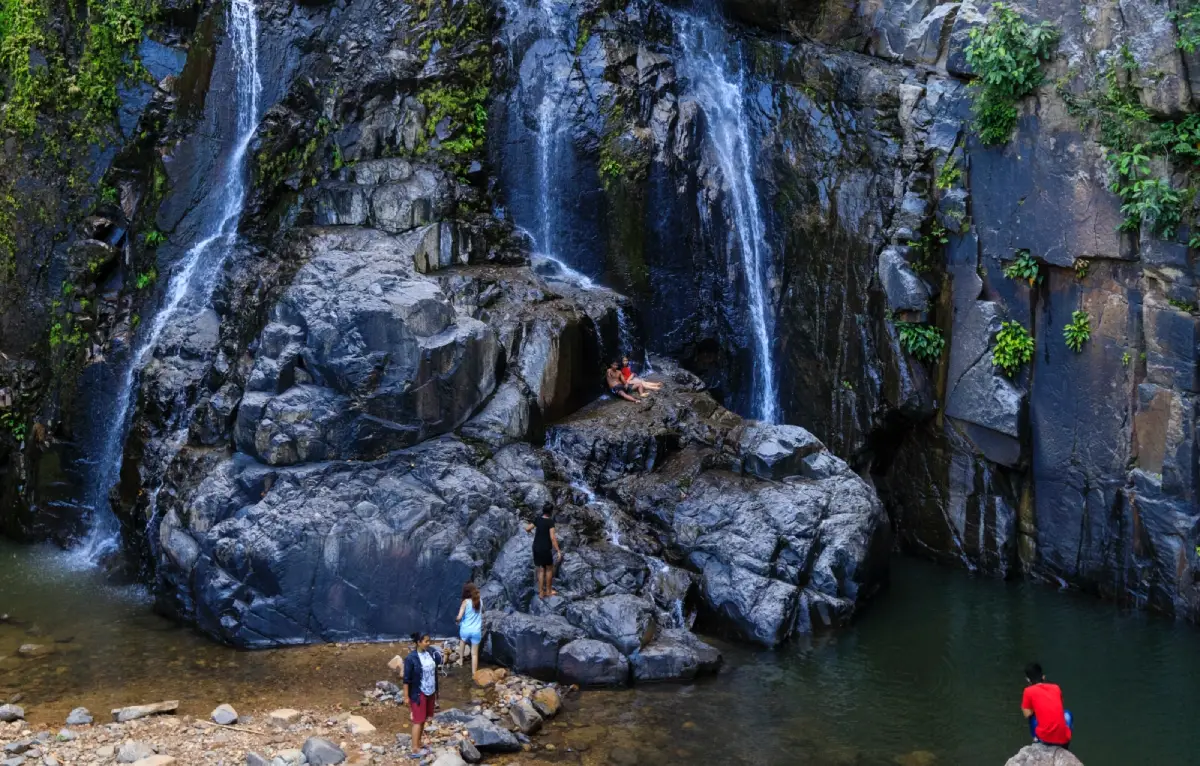
28. Khao Nan Mia Waterfall in Nakhon Si Thammarat is located in Krung Ching Subdistrict, Nopphitam District. Surrounded by mountains and tropical rainforest, this natural waterfall reflects the rich environment of the Krung Ching area, an important headwater region of Nakhon Si Thammarat.
Highlights: A waterfall surrounded by tropical rainforest, forest streams, and a natural environment suitable for studying mountain ecosystems.
The Krung Ching area receives substantial rainfall and contains extensive mountain forests, creating streams that flow through valleys and descend over changes in elevation. Khao Nan Mia Waterfall is part of this landscape, with its water flow varying according to the season and rainfall conditions.
Nature enthusiasts can observe tropical rainforest vegetation and the environment along the stream from authorized trails. The dense forest canopy and humid conditions provide suitable habitats for many species of plants and animals. Visitors should avoid collecting plants or disturbing wildlife.
Southern rainforest routes require special attention to rainfall because stream levels can rise rapidly and paths may become slippery or inaccessible. Travelers should obtain reliable access information from those responsible for the area and avoid entering remote forest routes alone.
Khao Nan Mia can be included in a more extensive nature itinerary in Nopphitam District. Travelers should select destinations that are officially open to visitors and allow sufficient time for returning from forest areas before dark.
Getting There: Travel from Nakhon Si Thammarat town to Nopphitam District and Krung Ching Subdistrict. Confirm the route to Khao Nan Mia Waterfall with local authorities or the responsible site operator before departure.
Map (GPS):Directions to Khao Nan Mia Waterfall

29. Makok Waterfall in Chanthaburi is located in Khlung District, where streams and forested hills create a peaceful natural landscape. It is an appealing destination for travelers seeking to discover Chanthaburi's lesser-known nature attractions beyond more famous waterfalls such as Phlio.
Highlights: Streams flowing through forested terrain, shady natural surroundings, and seasonal changes in the appearance of the water.
Makok Waterfall is characterized by its forest environment and the relationship between flowing water and the surrounding vegetation. As the stream moves across rocky levels, it forms small cascades and natural channels. The sound of water moving over rocks contributes to the peaceful atmosphere.
The surrounding forest contains streamside plants supported by humidity and the rainfall characteristic of eastern Thailand. Visitors can observe the rocks, vegetation, and changing flow of water from safe areas without entering potentially hazardous sections of the stream.
Rainfall can increase the waterfall's volume and enhance the lushness of the surrounding forest. However, strong currents, wet rocks, and changes to local access routes also become more likely. Current local announcements should be checked before visiting.
Travelers spending several days in Chanthaburi can combine Makok Waterfall with local communities and natural attractions around Khlung District, selecting routes that minimize unnecessary travel time.
Open Days: Daily
Opening Hours: 08:00 – 17:00
Getting There: Travel to Khlung District in Chanthaburi Province, then continue toward Map Phai Subdistrict and the access road to Makok Waterfall. Check road conditions and current visitor access arrangements with the responsible authorities.
Map (GPS):Directions to Makok Waterfall

30. Mae Tia Waterfall in Chiang Mai is located in Doi Kaeo Subdistrict, Chom Thong District. Associated with the forest landscapes of Ob Luang National Park, it features streams flowing through woodland and the mountainous terrain of southern Chiang Mai. The waterfall is particularly suitable for travelers seeking natural attractions in Chom Thong and the surrounding area.
Highlights: A waterfall and forest streams in a shaded natural environment, with mountain scenery typical of southern Chiang Mai.
Mae Tia Waterfall forms part of a mountain stream system flowing through forests in Chom Thong District. The water descends across changes in elevation and natural rock formations, creating cascades and pools along certain sections of the waterway.
The surrounding woodland plays an important role in maintaining moisture within the headwater system. Large trees and ground vegetation help slow surface runoff and reduce soil erosion. Visitors can gain a better understanding of the relationship between healthy forests and natural streams by observing the environment.
Access conditions should be checked according to the season, because prolonged rain can make the ground slippery and cause streams to rise rapidly. Visitors should remain at safe viewing points, avoid crossing strong currents, and never enter closed trails.
Mae Tia is suitable for travelers looking for an unhurried nature excursion around Chom Thong District. It can be considered alongside Mae Klang Waterfall and other nearby attractions, with the itinerary planned according to actual road distances and conditions.
Getting There: From Chiang Mai city, travel toward Chom Thong District and continue to Doi Kaeo Subdistrict along the route to Mae Tia Waterfall. Check the entrance location and current trail status with the responsible authority, especially during the rainy season.
Map (GPS):Directions to Mae Tia Waterfall

31. Chet Sao Noi Waterfall in Saraburi is located in Muak Lek Subdistrict, Muak Lek District. This limestone waterfall consists of seven relatively low cascading tiers separated by natural pools and rock terraces. Unlike waterfalls plunging from towering cliffs, Chet Sao Noi is characterized by a gentle sequence of cascades and a shaded streamside environment. Its accessibility makes it popular with families and travelers seeking a nature escape within reach of Bangkok.
Highlights: Seven limestone waterfall levels, natural pools, streamside walking paths, and shaded areas suitable for short nature excursions.
Chet Sao Noi Waterfall was formed as streams flowed across limestone formations at different elevations. Natural pools and continuous cascades developed between the rock terraces. Visitors can observe the structure of the waterfall from designated areas, appreciating a landscape quite different from that of larger waterfalls with high vertical drops.
The name Chet Sao Noi is associated with the local Ban Sao Noi name and the waterfall's seven levels. The area was previously designated as a forest park before becoming a national park, reflecting the importance of protecting the stream and its surrounding natural environment despite its relatively convenient accessibility.
Visitors can relax beside the water and explore walking paths and rest areas. Swimming is permitted only in designated locations and when conditions are safe. Young children must remain under adult supervision because algae-covered limestone rocks can be extremely slippery even where the water appears shallow.
For photographers, the flowing water across rock terraces and the shadows of streamside trees provide interesting compositions. Visitors can explore the different levels without entering restricted areas or standing on rocks in the current.
Chet Sao Noi is suitable for a day trip from Bangkok, Saraburi, and neighboring provinces. Travelers with more time may combine the waterfall with other natural attractions around Muak Lek, allowing for weekend traffic and the return journey.
Open Days: Daily
Opening Hours: 08:00 – 17:00
Getting There: Follow Mittraphap Road toward Muak Lek District in Saraburi Province, then continue along the signposted route to Chet Sao Noi Waterfall. Private transport is convenient for families, while visitors using public transport can travel to Muak Lek and arrange a local transfer.
Map (GPS):Directions to Chet Sao Noi Waterfall

32. Pa La U Waterfall in Prachuap Khiri Khan is located in Huai Sat Yai Subdistrict, Hua Hin District, within Kaeng Krachan National Park. Surrounded by the forests of the western mountain range near the Thai–Myanmar border, the waterfall consists of eleven levels flowing over natural rock formations. Its rich forest ecosystem makes it a rewarding destination for travelers exploring nature beyond Hua Hin's beaches.
Highlights: Eleven waterfall levels, extensive natural forest, streamside trails, and opportunities to observe butterflies and forest vegetation.
Pa La U is formed by streams moving through mountain forests and descending across multiple rock levels. Some sections spread across broad surfaces, while others flow through steeper terrain. Reaching the higher levels requires progressively greater effort and additional hiking time.
The surrounding forest plays a significant role in watershed conservation and wildlife protection. The area is also connected with local communities that maintain Karen cultural traditions. Visitors should respect conservation regulations as well as the customs and privacy of nearby communities.
Humidity supports diverse vegetation, and butterflies can sometimes be seen near the stream or other suitable natural habitats. Wildlife photographers should observe them without handling or disturbing the animals or their feeding areas.
For families and casual visitors, exploring the accessible lower sections is generally more practical than attempting the upper levels. Higher trails can include narrow sections and slippery rocks. Visitors should follow official trail restrictions, particularly during the rainy season when water levels may change rapidly.
Pa La U can be explored as a nature excursion from Hua Hin, provided sufficient time is allocated for the drive into the forest and walking to the waterfall. Traveling in daylight is preferable to returning along forest roads after dark, and drivers should remain alert to wildlife near the road.
Open Days: Daily
Opening Hours: 08:00 – 16:30
Getting There: From Hua Hin, travel toward Huai Sat Yai Subdistrict and follow the route to Pa La U Waterfall, approximately 65 kilometers from Hua Hin. Prepare the vehicle for the journey and check the latest Kaeng Krachan National Park access announcements.
Map (GPS):Directions to Pa La U Waterfall
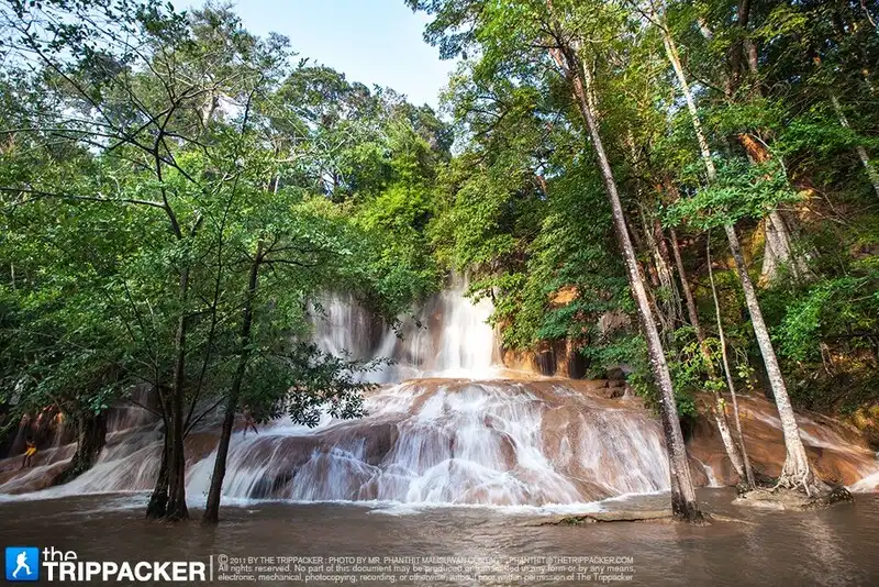
33. Sai Yok Noi Waterfall in Kanchanaburi, also known as Khao Phang Waterfall, is located in Sai Yok District. Its water flows over limestone terraces and vegetation along the foothills. Located close to Highway 323, it is a convenient stop for travelers heading from Kanchanaburi town toward Thong Pha Phum or Sangkhlaburi.
Highlights: Accessible limestone cascades near a major road, natural rock formations and tree roots along the stream, and a convenient stopping point on journeys through western Kanchanaburi.
Sai Yok Noi is characterized by water spreading across rocks and vegetation rather than plunging over a single high cliff. Limestone terraces and roots growing near the stream create a distinctive natural composition that changes with seasonal water levels.
The waterfall is also closely associated with tourism and transport routes in Kanchanaburi, lying near a major road leading toward the province's western districts. It is an attractive rest stop where visitors can experience the region's natural landscape without undertaking a lengthy forest hike.
During the rainy season, water levels generally increase and the surrounding vegetation becomes greener. In some periods of the dry season, the stream may diminish considerably. Visitors should remain cautious around damp limestone surfaces and enter only areas officially open to the public.
Sai Yok Noi is suitable for family groups, older visitors who are comfortable with short walks, and travelers who prefer not to undertake long hikes. Those staying overnight in Sai Yok can also consider Sai Yok Yai Waterfall or historical attractions within the district.
Open Days: Daily
Opening Hours: 08:30 – 16:30
Getting There: From Kanchanaburi town, follow Highway 323 toward Sai Yok District. The waterfall is situated close to the main road and can be reached by private vehicle. Visitors using public transport should confirm appropriate stopping points and local connections.
Map (GPS):Directions to Sai Yok Noi Waterfall
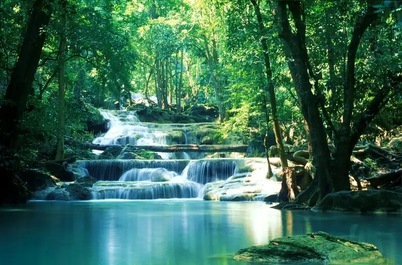
34. Sai Yok Yai Waterfall (Khao Chon Waterfall) in Kanchanaburi is located within Sai Yok National Park in Sai Yok District. Its most distinctive characteristic is the way the water descends directly into the Khwae Noi River. The waterfall forms part of a landscape combining limestone terrain, forest, and one of the province's important rivers, making it different from waterfalls hidden around pools deep within the forest.
Highlights: A waterfall flowing directly into the Khwae Noi River, riverside scenery, natural woodland, and viewpoints illustrating the relationship between a waterfall and its surrounding river system.
Sai Yok Yai is particularly notable for water descending over a limestone cliff into the Khwae Noi River. Viewing the waterfall from designated riverside locations allows visitors to appreciate the falling water, rocky cliff, trees, and flowing river together, creating an experience distinct from smaller forest waterfalls.
The Khwae Noi River is an important geographical feature of Kanchanaburi and has long been associated with local communities and their livelihoods. Sai Yok Yai therefore has value both as a natural attraction and as a place where visitors can experience the forest and river landscapes of western Thailand.
Visitors can explore riverside areas and viewpoints that are open to the public. Boat trips and other water-based activities should be undertaken only with operators observing appropriate safety standards. Approaching areas where the waterfall strikes the river without proper safety measures should be avoided.
Sai Yok Yai is suitable for sightseeing, photography, and overnight nature excursions around Sai Yok District. Travelers can combine a visit with Sai Yok Noi, allowing sufficient time for each site and avoiding an unnecessarily rushed itinerary.
Open Days: Daily
Opening Hours: 08:00 – 16:30
Getting There: From Kanchanaburi town, follow Highway 323 toward Sai Yok District and enter Sai Yok National Park along the designated route. Check current visitor access and riverside activity restrictions before departure.
Map (GPS):Directions to Sai Yok Yai Waterfall

35. Mae Kampong Waterfall in Chiang Mai is located within Mae Kampong Village in Huai Kaeo Subdistrict, Mae On District. This waterfall flows through a mountain valley surrounded by forest and a highland community. Rather than plunging from a single enormous cliff, it consists of smaller cascades moving over rocks and vegetation in a cool, humid environment. Travelers can therefore enjoy the waterfall alongside the traditional community landscape.
Highlights: Cascades within a mountain valley, cool forest surroundings, streamside paths, and opportunities to experience Mae Kampong Village.
Mae Kampong is situated in a valley with mountains on both sides and streams flowing through the community. The village has a history closely connected with forests and highland agriculture. The waterfall forms part of a wider landscape in which natural water resources and local ways of life are closely linked.
Mae Kampong Waterfall consists of streams descending across several rock levels. Visitors can follow designated paths and observe the moisture-loving plants growing near the water. The sound of running streams and the shade of the trees make the area particularly suitable for an unhurried nature walk.
Travelers should respect the community by avoiding obstructive parking, entering private homes or land without permission, and leaving rubbish in streams. Those wishing to experience village culture can support local restaurants and community-run accommodation.
The rainy season brings lush greenery and increased stream flow, but walking surfaces can be slippery and some mountain roads are steep. Drivers should exercise caution and avoid unfamiliar routes after dark.
Getting There: From Chiang Mai city, travel toward San Kamphaeng and Mae On, then follow Highway 1317 and the mountain road to Mae Kampong Village. The final approach includes narrow, winding sections, so check vehicle condition and weather before departure.
Map (GPS):Directions to Mae Kampong Waterfall

36. Mae Sa Waterfall in Chiang Mai is located in Mae Rim District. It is renowned for its streams cascading over numerous rocky levels within a natural forest. Situated along the Mae Rim tourism route, the waterfall can be combined with other mountain and community attractions. It is especially appealing to visitors seeking a waterfall and forest stream experience without traveling far from Chiang Mai city.
Highlights: Multiple waterfall levels, streamside walking paths, shaded vegetation, and resting viewpoints that offer different perspectives of the flowing water.
Mae Sa Waterfall consists of streams descending over successive rock levels, creating different landscapes along the trail. Each tier has its own combination of boulders, natural pools, and flowing water. Visitors with more time can explore the sections connected by designated paths, while those preferring an easier outing may choose more accessible levels.
The moisture of the stream and the shade of the surrounding forest give Mae Sa Waterfall a cool atmosphere. Travelers can observe plants growing beside the water and on damp rocks while listening to the changing sounds of the stream as it moves across different gradients.
Reaching higher levels requires an assessment of physical fitness because some sections involve slopes and steps. Rocks that remain damp may be covered with algae and become dangerously slippery. Swimming is permitted only where officially authorized, and visitors should avoid strong currents.
Mae Sa is suitable for families, photographers, and travelers exploring Mae Rim District. A day trip can include other nearby nature attractions, provided time is allocated for road conditions and weekend traffic.
Getting There: From Chiang Mai city, follow Highway 107 toward Mae Rim District, then turn onto the Mae Rim–Samoeng route and follow the signs for Mae Sa Waterfall. Check current trail openings and weather conditions before visiting.
Map (GPS):Directions to Mae Sa Waterfall
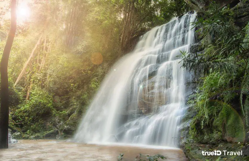
37. Dat Fa Waterfall in Chaiyaphum, also locally called Tat Fa Waterfall, is located near Ban Na Wang in Na Siao Subdistrict, Mueang Chaiyaphum District, in the eastern part of Tat Ton National Park. It is distinguished by water flowing across a long, broad, sloping rock platform, creating a sheet-like cascade that moves down the natural stone surface. Its form differs considerably from conventional waterfalls plunging over high cliffs.
Highlights: Extensive sloping rock platforms, water flowing in broad sheets over stone, and mixed deciduous forest along the stream.
Dat Fa Waterfall was shaped by the gradient of its broad rock surface. As the stream flows downhill, it spreads through grooves and across the stone, creating natural patterns similar to water sliding across a large rock sheet. Visitors can observe variations in erosion and water flow from designated viewing areas.
The surrounding mixed deciduous forest provides shade and contributes to the local headwater ecosystem. Walking along the approved route gives visitors opportunities to study the relationship between streams, moisture-loving plants, and woodland growing at different distances from the water.
Although the rock formation may resemble a natural waterslide, visitors must not use it for sliding or attempt to descend with the current. The gradient and wet stone surface can cause serious injuries. Sightseeing should be limited to the safe paths and areas designated by park officers.
Dat Fa Waterfall is suitable for nature excursions and photography in Chaiyaphum. Travelers may also consider Tat Ton Waterfall, but should distinguish the access roads to the two sites and allow enough time between them.
Open Days: Daily
Opening Hours: 06:00 – 18:00
Getting There: Travel from Chaiyaphum town toward Na Siao Subdistrict and Ban Na Wang, following local signs to Dat Fa Waterfall. Continue on foot from the parking area using the approved path and check water conditions after heavy rainfall.
Map (GPS):Directions to Dat Fa Waterfall
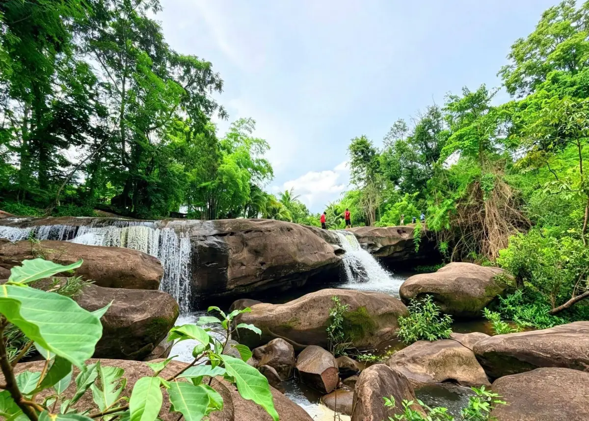
38. Tad Fa Waterfall in Nong Bua Lamphu is located in the Phu Kao section of Phu Kao–Phu Phan Kham National Park. It is a small seasonal waterfall where streams flow through mixed deciduous forest and descend over natural rock formations. The peaceful setting appeals to travelers looking for lesser-known nature destinations in Nong Bua Lamphu.
Highlights: A small waterfall in mixed deciduous forest, seasonal flows that become more visible during the rainy season, and the natural landscape of the Phu Kao area.
Tad Fa Waterfall is formed by a stream descending over a rock ledge approximately seven meters high into a natural pool below. Its appeal lies in the surrounding forest atmosphere and seasonal changes rather than the scale of the cliff.
During the rainy season, water levels increase and the waterfall becomes more prominent. In the dry season, the stream may diminish substantially. Visitors should therefore consider the actual rainfall conditions of the year when planning a trip. Photography should be undertaken from safe areas without climbing rocks or trampling streamside vegetation.
Mixed deciduous forests around Phu Kao change significantly with the seasons. A nature walk offers opportunities to observe deciduous trees and plants growing along the stream, where greater moisture supports different vegetation communities.
Tad Fa is well suited to travelers who enjoy quiet forest attractions and nature study. It may be combined with viewpoints and other natural sites in the Phu Kao section, but the national park covers a large area and access roads to individual attractions may not connect directly.
Open Days: Daily
Opening Hours: 08:30 – 16:30
Getting There: Travel toward Non Sang District in Nong Bua Lamphu Province and enter the Phu Kao section of Phu Kao–Phu Phan Kham National Park. Confirm the route and current access conditions with park officers before visiting Tad Fa Waterfall.

39. Phu Sang Waterfall in Phayao is located in Phu Sang District within Phu Sang National Park. This waterfall is distinguished by naturally warm water flowing over a rocky ledge into the pool below. Its unusual water temperature makes it an interesting destination for visitors exploring northern Thailand, particularly those interested in natural warm springs and forest streams.
Highlights: Naturally warm waterfall water, cascades over rock formations, and conveniently accessible forest scenery near the national park headquarters.
Phu Sang differs from most mountain waterfalls, which are supplied by cool streams. Here, the water is associated with a naturally warm source. The stream flows over rock terraces at different elevations and forms a waterfall that is noteworthy both for its landscape and its unusual hydrological characteristics.
The surrounding forest and waterways form an important part of the Phu Sang ecosystem. Visitors can walk along designated paths to observe the rock formations, flowing water, and vegetation near the stream. The relatively convenient access makes this an attractive destination for families.
Warm water does not mean that every part of the stream is safe for swimming. Visitors must follow official regulations and avoid strong currents or temporarily closed areas. Protecting the natural water source from rubbish and pollution is important for maintaining the ecosystem.
Phu Sang Waterfall can be included in a trip through the Chiang Kham–Phu Sang area, with opportunities to explore nearby communities and attractions in northern Phayao. Travelers should plan according to available time and mountain road conditions.
Open Days: Daily
Opening Hours: 08:30 – 18:00
Getting There: From Phayao town, travel toward Chiang Kham District and continue to Phu Sang District, following the signs to Phu Sang National Park. The waterfall is near the park headquarters and can be viewed along designated walking routes.
Map (GPS):Directions to Phu Sang Waterfall
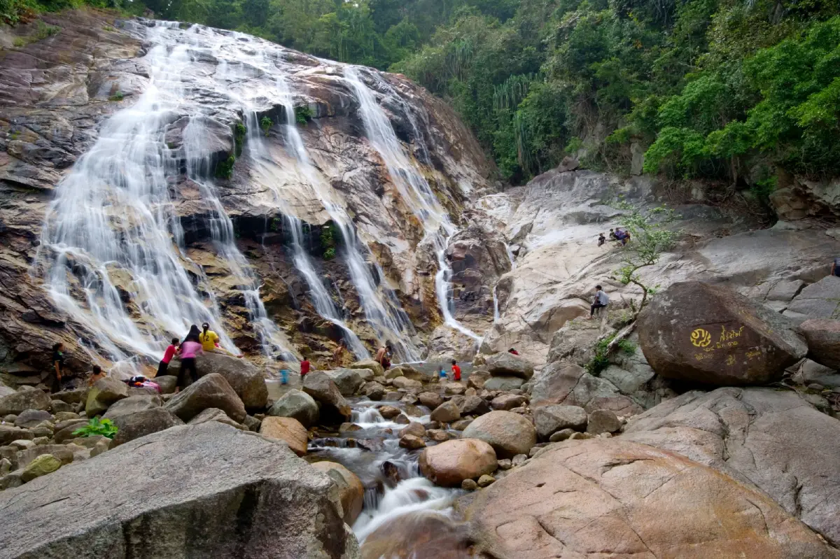
40. Pajo Babi Waterfall in Narathiwat is located in Lubo Baya Subdistrict, Yi-ngo District. It is a natural waterfall associated with the forests and streams of the Budo mountain range. The attraction is important to local nature tourism and offers opportunities to understand the relationships between forests, water resources, and community life in Thailand's far south.
Highlights: Forest streams and natural boulders, the environment surrounding Lubo Baya communities, and the mountain landscapes of the Budo region.
Pajo Babi Waterfall is characterized by streams flowing through mountainous terrain and rocky channels. The movement and appearance of the water change with differences in elevation and seasonal rainfall. These natural features make the waterfall a place for relaxation and observation of stream ecosystems in southern Thailand.
Surrounding communities maintain ways of life connected to agriculture and forest resources. Community-based tourism can allow visitors to appreciate the environment while learning about the people living nearby. Travelers should respect community practices, private land, and the cleanliness of the area.
Seasonal rainfall in southern Thailand directly affects the stream's level and safety. Swimming should be avoided following heavy rain or when the water becomes unusually muddy, and visitors should remain in areas officially open to tourists.
Pajo Babi is suitable for travelers interested in local nature destinations around Yi-ngo District. It can be combined with community visits and other attractions in Narathiwat, provided weather, local access conditions, and travel arrangements are checked before departure.
Open Days: Daily
Opening Hours: 08:00 – 17:00
Getting There: Travel to Yi-ngo District in Narathiwat Province and continue to Lubo Baya Subdistrict, following the route to Pajo Babi Waterfall. Check current access information and weather conditions with local authorities before visiting.
Map (GPS):Directions to Pajo Babi Waterfall
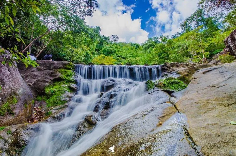
41. Huai Yang Waterfall in Prachuap Khiri Khan is located within Huai Yang Waterfall National Park in Thap Sakae District. Surrounded by the eastern slopes of the Tenasserim mountain range, the waterfall descends over natural rock formations within a forested landscape. It offers a refreshing alternative to the province's well-known seaside attractions, giving travelers an opportunity to explore mountain forests, streams, and nature trails.
Highlights: Multi-tiered forest waterfalls, streamside walking trails, the natural landscapes of the Tenasserim Range, and shaded surroundings ideal for nature enthusiasts.
Huai Yang Waterfall is formed by streams flowing through mountainous forest before descending over natural rock terraces. Some sections are relatively gentle, with water moving around boulders, while others have more pronounced drops. Walking along the designated trails allows visitors to observe changes in vegetation and terrain as they move between waterfall levels.
The forests of the national park are essential to protecting headwater resources and biodiversity. Studying the trees and plants growing beside the stream provides an insight into the relationship between flowing water and mountain ecosystems. Visitors should remain on designated paths to minimize their impact on the protected environment.
Those wishing to reach higher waterfall levels should wear suitable trekking shoes and allow sufficient time for the return walk. Some paths are steep, while soil and rocks may become slippery after rainfall. Access to certain areas may be restricted when water levels are high.
Huai Yang is suitable for travelers seeking forest walks and natural scenery rather than beaches. It can be included in a trip with Kha On Waterfall, another attraction in Prachuap Khiri Khan, provided visitors check the access routes to both sites and allow adequate time.
Open Days: Daily
Opening Hours: 08:00 – 16:30
Getting There: Follow Highway 4, Phetkasem Road, toward Thap Sakae District in Prachuap Khiri Khan Province, then take the signposted access road to Huai Yang Waterfall National Park. Check current trail conditions and official announcements before traveling.
Map (GPS):Directions to Huai Yang Waterfall

42. Pha Charoen Waterfall in Tak is situated in Phop Phra District, within Namtok Pha Charoen National Park. It is famous for water cascading over numerous limestone terraces, creating a broad sequence of natural steps amid the forests of western Thailand. The waterfall is an attractive stop for travelers journeying between Mae Sot and Phop Phra.
Highlights: Numerous limestone waterfall terraces, water spreading over natural rock steps, shaded forest, and convenient access from the Phop Phra tourism route.
Pha Charoen Waterfall is distinguished by its continuous limestone formations. Rather than plunging from one enormous cliff, the water flows across many small changes in elevation, creating delicate patterns over the rock surface. These naturally formed steps give the waterfall its distinctive appearance and make it an appealing subject for photography from designated viewpoints.
The national park protects forests and mountains that help maintain the streams supplying the waterfall. Walking through visitor areas provides opportunities to observe the connection between forest vegetation, moisture, and flowing water within the ecosystem of western Tak.
Although the rock terraces resemble a staircase, visitors should never attempt to climb directly on wet limestone surfaces outside approved paths. These rocks can be extremely slippery, and even a relatively small drop may result in injury. Photography should be undertaken from safe walkways and viewing areas.
Travelers spending several days in Tak can combine Pha Charoen with Thararak Waterfall and nearby attractions around Mae Sot and Phop Phra. Planning the itinerary according to actual road distances and mountain conditions allows visitors to explore without rushing.
Open Days: Daily
Opening Hours: 08:00 – 17:00
Getting There: From Mae Sot District, travel toward Phop Phra District on the Mae Sot–Umphang route and follow signs to Namtok Pha Charoen National Park. The waterfall is accessible from the park's visitor area. Check the weather before departure.
Map (GPS):Directions to Pha Charoen Waterfall

43. Thararak Waterfall (Pha Chan Waterfall) in Tak is located near Ban Chedi Kho in Maha Wan Subdistrict, Mae Sot District. Water flows over a limestone cliff into natural pools below, creating an attractive waterfall landscape with nearby viewpoints. Compared with waterfalls deep inside remote forests, Thararak is relatively accessible and can be combined with community and sightseeing stops along the Mae Sot route.
Highlights: A limestone cliff waterfall, natural pools, viewpoints, and mountain scenery around Mae Sot.
Thararak Waterfall is formed by water flowing through limestone terrain before descending over a cliff. The falling water contrasts with the rock surface, becoming more prominent during periods of abundant flow. Both the sound of the waterfall and the spray increase as more water reaches the cliff, while its appearance varies from season to season.
Visitors can enjoy views of the waterfall from permitted locations, including areas near the natural pools. The surrounding scenery includes limestone formations and mountain landscapes. Walking requires care where slopes are steep or spray has made surfaces wet.
The waterfall is suitable for relaxation and landscape photography. Visitors should avoid entering restricted pools or standing beneath strong cascades, where flowing water and submerged rocks can create dangerous conditions.
Travelers exploring the Mae Sot area can combine Thararak with Pha Charoen Waterfall and destinations around Phop Phra. Visiting during daylight and allowing enough time for the return drive helps reduce risks on mountain roads.
Open Days: Daily
Opening Hours: 08:00 – 17:00
Getting There: From Mae Sot town, travel toward Maha Wan Subdistrict and Ban Chedi Kho, following the signs to Thararak Waterfall. Check access conditions and road safety before departure.
Map (GPS):Directions to Thararak Waterfall
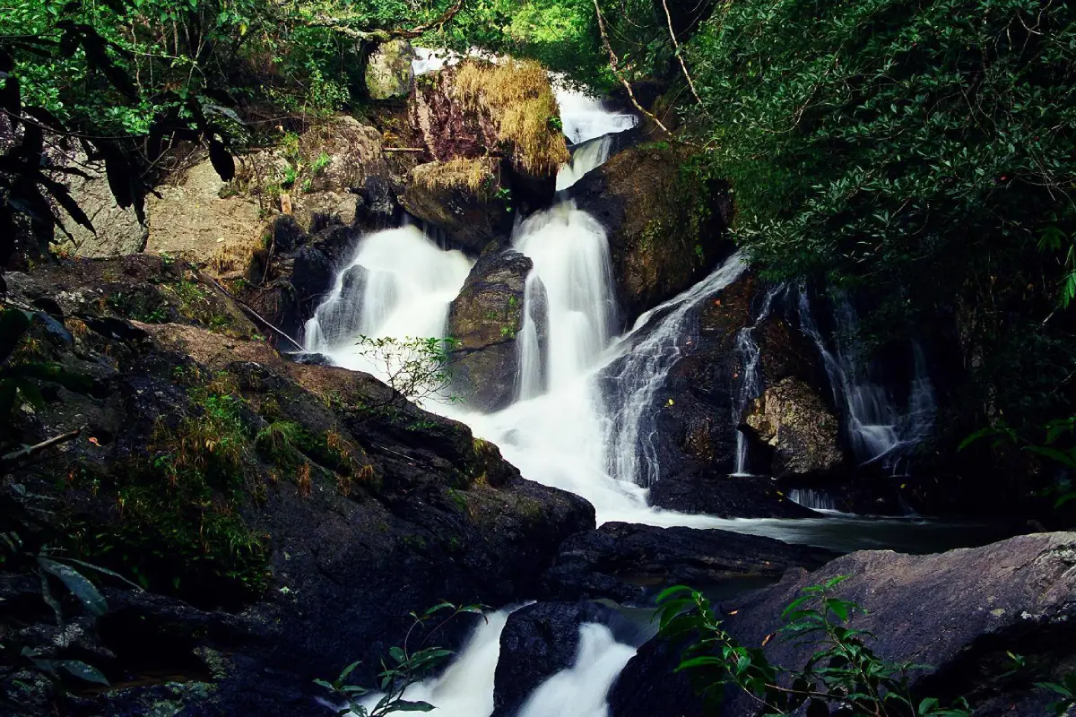
44. Pha Kluai Mai Waterfall in Nakhon Ratchasima is located within Khao Yai National Park in Pak Chong District. The waterfall flows across natural rock terraces surrounded by forest. Its name is associated with wild orchids, which form part of the rich vegetation growing in the park. The waterfall is particularly appealing to travelers interested in nature trails and forest stream ecosystems.
Highlights: A forest waterfall, natural pools, moisture-loving streamside plants, wild orchids, and nature trails within Khao Yai National Park.
Pha Kluai Mai Waterfall consists of streams descending across rock formations at different elevations and collecting in a natural basin below. The surrounding humid environment supports ferns, mosses, orchids, and other plants adapted to shaded forest conditions.
Khao Yai National Park is an important protected ecosystem. Walking toward the waterfall offers visitors an opportunity to understand the connections between forests, streams, and the many plants and animals inhabiting the area. Travelers should remain quiet and avoid disturbing wildlife.
Visitors should check which walking trails are currently open because seasonal weather and conservation measures may restrict access to certain sections. Non-slip footwear is particularly important after rainfall, when rock surfaces and forest paths become wet.
Pha Kluai Mai is ideal for visitors who enjoy walking, forest photography, and the natural environment of Khao Yai. It can be combined with Haew Narok Waterfall or other national park attractions, provided adequate time is allowed for driving within the park and exploring each destination.
Open Days: Daily
Opening Hours: 06:00 – 18:00
Getting There: Enter Khao Yai National Park through an authorized entrance and follow the park road toward the Pha Kluai Mai area. Continue along designated walking paths. Confirm the trail's current condition and relevant wildlife regulations before setting out.
Map (GPS):Directions to Pha Kluai Mai Waterfall
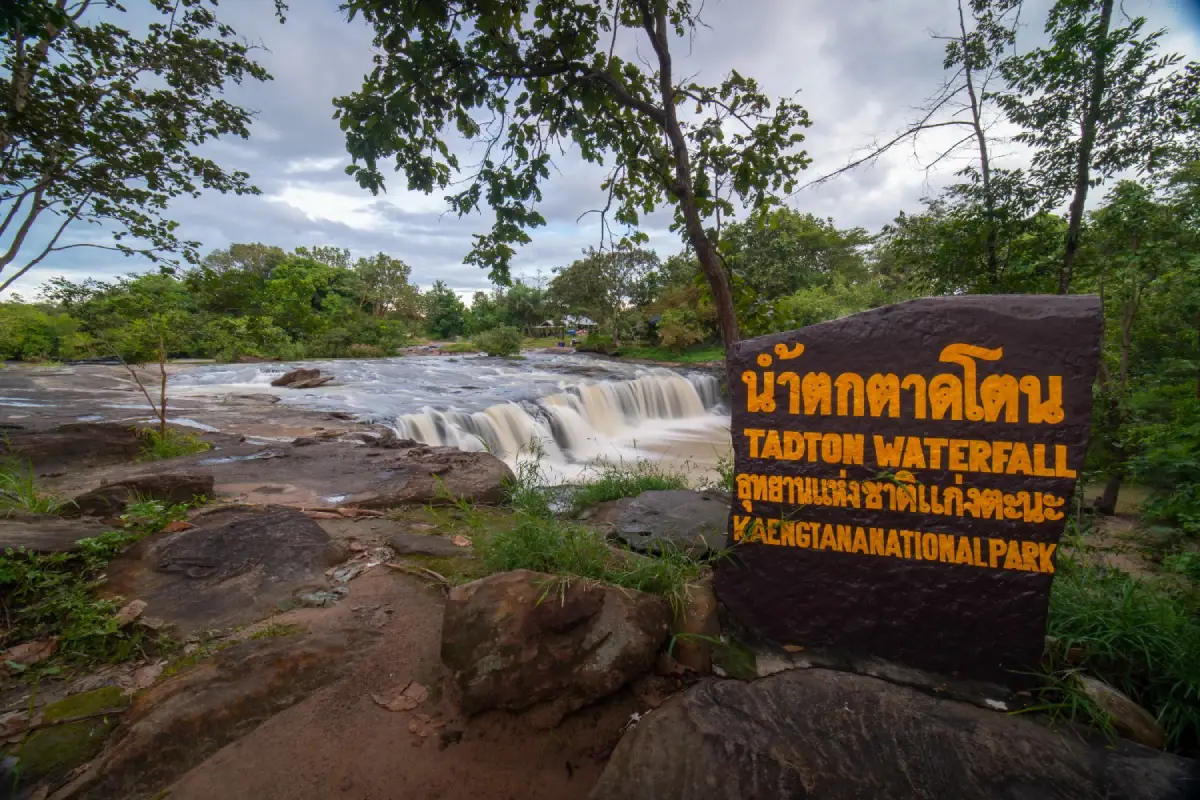
45. Tad Ton Waterfall in Ubon Ratchathani is situated in Kham Khuean Kaeo Subdistrict, Sirindhorn District. It is distinguished by streams flowing across wide sandstone platforms and descending into natural pools. The waterfall reflects the distinctive rocky landscapes of northeastern Thailand rather than the steep vertical cliffs found at some other destinations.
Highlights: Broad sandstone platforms, water flowing across natural rock terraces, and forest-fringed pools within Sirindhorn District.
Tad Ton Waterfall is formed by a stream flowing over sloping rock formations. Water spreads across different surfaces before descending to lower sections and pooling naturally. When stream levels are high, the water covers more of the rock platform, while lower water levels reveal the stone surfaces and natural channels.
The sandstone landscape is particularly interesting for nature observation and photography. Visitors should use safe viewing locations, as wet rock surfaces are slippery and currents can vary significantly across the waterfall.
Vegetation around the stream provides shade and contributes to the local watershed ecosystem. Keeping the area free of rubbish and food waste helps protect water quality and the surrounding environment.
Tad Ton is suitable for travelers seeking a peaceful natural attraction within Sirindhorn District. With additional time, it can be combined with Kaeng Tana or other sites around Khong Chiam, while allowing for actual road distances and visitor access arrangements.
Open Days: Daily
Opening Hours: 08:00 – 17:00
Getting There: Travel from Ubon Ratchathani city toward Sirindhorn District and continue to Kham Khuean Kaeo Subdistrict, following the road to Tad Ton Waterfall. Check stream and road conditions after heavy rainfall.

46. Kha On Waterfall in Prachuap Khiri Khan is situated near Ang Thong Subdistrict, Thap Sakae District, close to the boundary with Bang Saphan District. It is a natural waterfall surrounded by mountainous forests, where streams flow through rock terraces and descend from the western hills. The area is attractive to travelers seeking the province's natural landscapes beyond its beaches and coastal attractions.
Highlights: Forest streams, natural rock terraces and pools, and shaded mountain scenery in western Prachuap Khiri Khan.
Kha On Waterfall forms part of a stream system originating in the surrounding mountain forests. The water descends across rock formations at varying elevations, creating cascades and natural pools. The landscape is closely connected with runoff from the Tenasserim Range.
The surrounding woodland helps maintain moisture and provides habitats for local plants and wildlife. Visitors should stay within designated areas, avoid disturbing stream ecosystems, and refrain from leaving rubbish or removing natural materials.
Trail conditions and water levels vary by season. The rainy months bring stronger streams and lush forests but also increase the risks of slippery ground and sudden flooding. Suitable walking shoes and caution around fast-flowing water are important.
Kha On Waterfall is suitable for travelers interested in quiet nature excursions. It can be combined with Huai Yang Waterfall when sufficient time is available, provided both access routes are checked in advance.
Open Days: Daily
Opening Hours: 08:00 – 17:00
Getting There: Travel toward Thap Sakae District in Prachuap Khiri Khan Province and continue to Ang Thong Subdistrict along local roads leading to Kha On Waterfall. Check current access conditions before departure, particularly after heavy rainfall.
Map (GPS):Directions to Kha On Waterfall

47. Mok Fa Waterfall in Chiang Mai is located in Mae Taeng District near the Mae Malai–Pai route. It is distinguished by a stream descending from a rocky cliff surrounded by forest, with fine spray gathering near the base. The waterfall is an appealing stop for travelers journeying between Chiang Mai and Mae Hong Son who wish to enjoy nature along the way.
Highlights: A cliff waterfall, forest mist, a short nature path to the viewpoint, and shaded surroundings near the Mae Malai–Pai road.
Mok Fa Waterfall is formed by a mountain stream descending over a steep rock face into a natural pool below. When stream levels are high, fine spray spreads across the surrounding area, and the sound of flowing water can be heard from the pathway approaching the waterfall.
The forest maintains a humid, shaded environment around the cascade. Areas receiving moisture from the falling water provide suitable growing conditions for ferns and plants living on damp rocks. A walk to the waterfall allows visitors to appreciate the headwater forest as well as the scenery.
Travelers approaching the base should take care on wet rocks and avoid swimming in restricted areas. After heavy rainfall, water levels can increase rapidly. Photographs taken from designated viewpoints can capture the waterfall and rock face without climbing into hazardous sections.
Mok Fa can be included as a stop on the Chiang Mai–Pai route or combined with attractions around Mae Taeng District. Visitors should allow sufficient time for the walk and for continued driving along winding mountain roads.
Getting There: Travel from Chiang Mai toward Mae Taeng District and follow Highway 1095, the Mae Malai–Pai road. Follow the signs for Mok Fa Waterfall, then continue on foot from the parking area along the permitted nature trail.
Map (GPS):Directions to Mok Fa Waterfall

48. Man Daeng Waterfall in Phitsanulok is situated within Phu Hin Rong Kla National Park in Nakhon Thai District. Hidden in mountainous forest, the waterfall has multiple cascades and requires a demanding hike to reach. It is particularly suitable for experienced nature enthusiasts seeking to explore the forests of Thailand's lower northern region.
Highlights: Multi-tiered waterfalls within the forests of Phu Hin Rong Kla, challenging trekking routes, and humid streamside vegetation.
Man Daeng Waterfall is supplied by streams flowing through steep terrain in Phu Hin Rong Kla. Changes in elevation and rock formations create several waterfall levels, each with distinctive patterns of flowing water. The surrounding forest remains humid because of the mountain streams and the shaded environment.
One of the defining aspects of Man Daeng is the journey required to reach it. The trail passes through relatively remote forest and includes steep ground and stream crossings. Travelers should prepare suitable footwear, rain protection, drinking water, and adequate physical fitness, while observing any requirements for park staff or authorized guides.
During the rainy season, the forest is especially green and the streams may carry more water. However, the trails become muddier and more slippery, and water crossings can be hazardous. Park announcements and official assessments of access conditions should always determine whether a trek is undertaken.
Man Daeng is best suited to travelers experienced in forest hiking and interested in mountain ecosystems. It should not be planned as a brief stop during a driving itinerary. A full day should be allowed for the walking route, with arrangements made through the relevant park authority.
Getting There: Travel to Phu Hin Rong Kla National Park via Nakhon Thai District in Phitsanulok, then contact park officers to confirm the trailhead and current access arrangements for Man Daeng Waterfall. Do not begin the hike without any required authorization or guidance.
Map (GPS):Directions to Man Daeng Waterfall
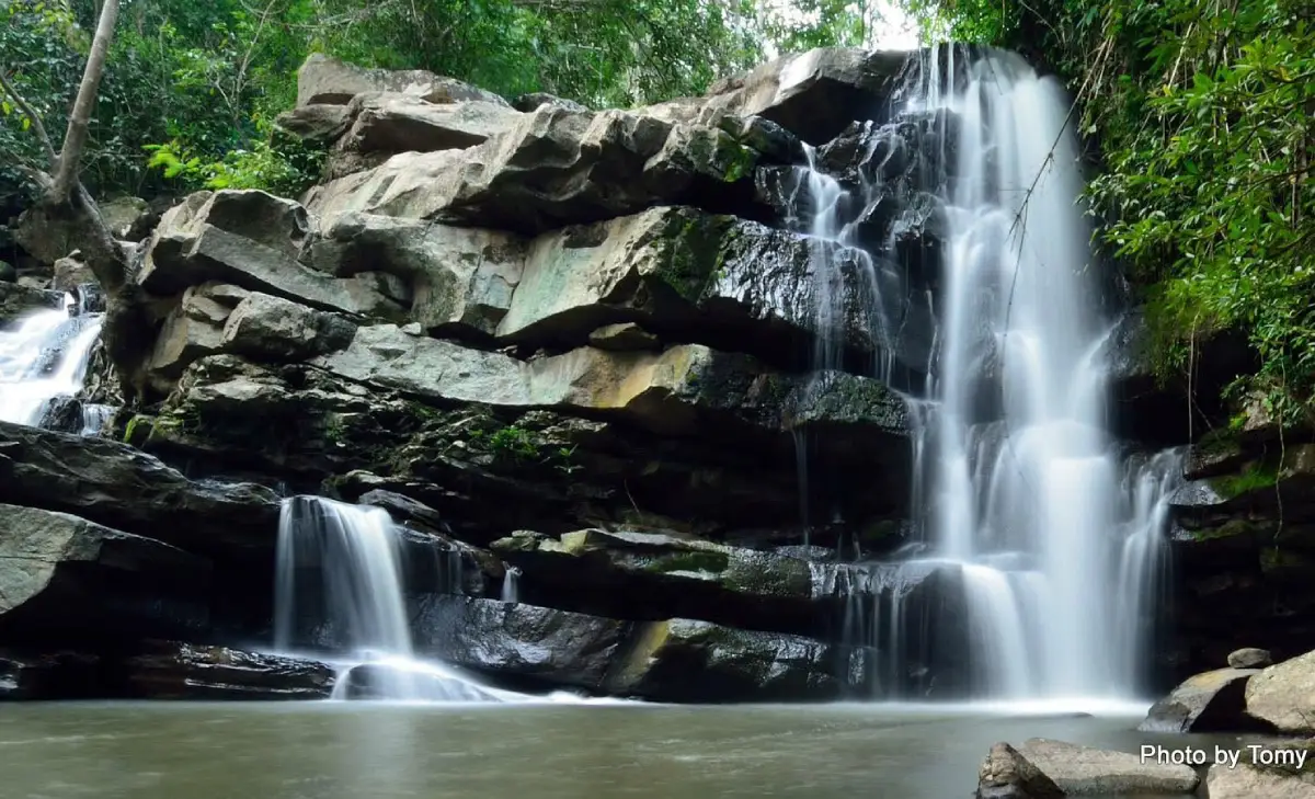
49. Sam Thep Waterfall in Udon Thani is located near Ban Na Luang in Kham Duang Subdistrict, Ban Phue District. This natural waterfall is surrounded by woodland and streams flowing between rocky sections. Its main appeal lies in the tranquil forest atmosphere and the way the streams move through the natural terrain, creating an attractive destination for relaxation and nature study.
Highlights: Several streams flowing among natural rocks, shaded forest, and peaceful surroundings suitable for nature-based tourism.
Sam Thep Waterfall forms part of the headwater system in the forested landscape of Ban Phue District. Water moves across rocky terrain at different gradients, forming pools and channels. The streams converge naturally, creating a distinctive feature within the surrounding woodland.
Vegetation alongside the water benefits from the moisture of the stream and shade of nearby trees. Visitors can enjoy nature photography, focusing on the movement of water, rock formations, and woodland scenery.
Although the area is suitable for relaxing, visitors must consider water conditions and local regulations before swimming. During the rainy season, water levels can rise and pathways may become slippery. Fast currents and unauthorized shortcuts through the forest should be avoided.
Sam Thep is a pleasant attraction for travelers exploring Ban Phue District. A visit can be combined with nearby community and cultural destinations, provided the route is planned around available time and road conditions.
Open Days: Daily
Opening Hours: 08:00 – 17:00
Getting There: Travel from Udon Thani city toward Ban Phue District, then continue to Kham Duang Subdistrict and Ban Na Luang. Check current road and access information before departure.
Map (GPS):Directions to Sam Thep Waterfall
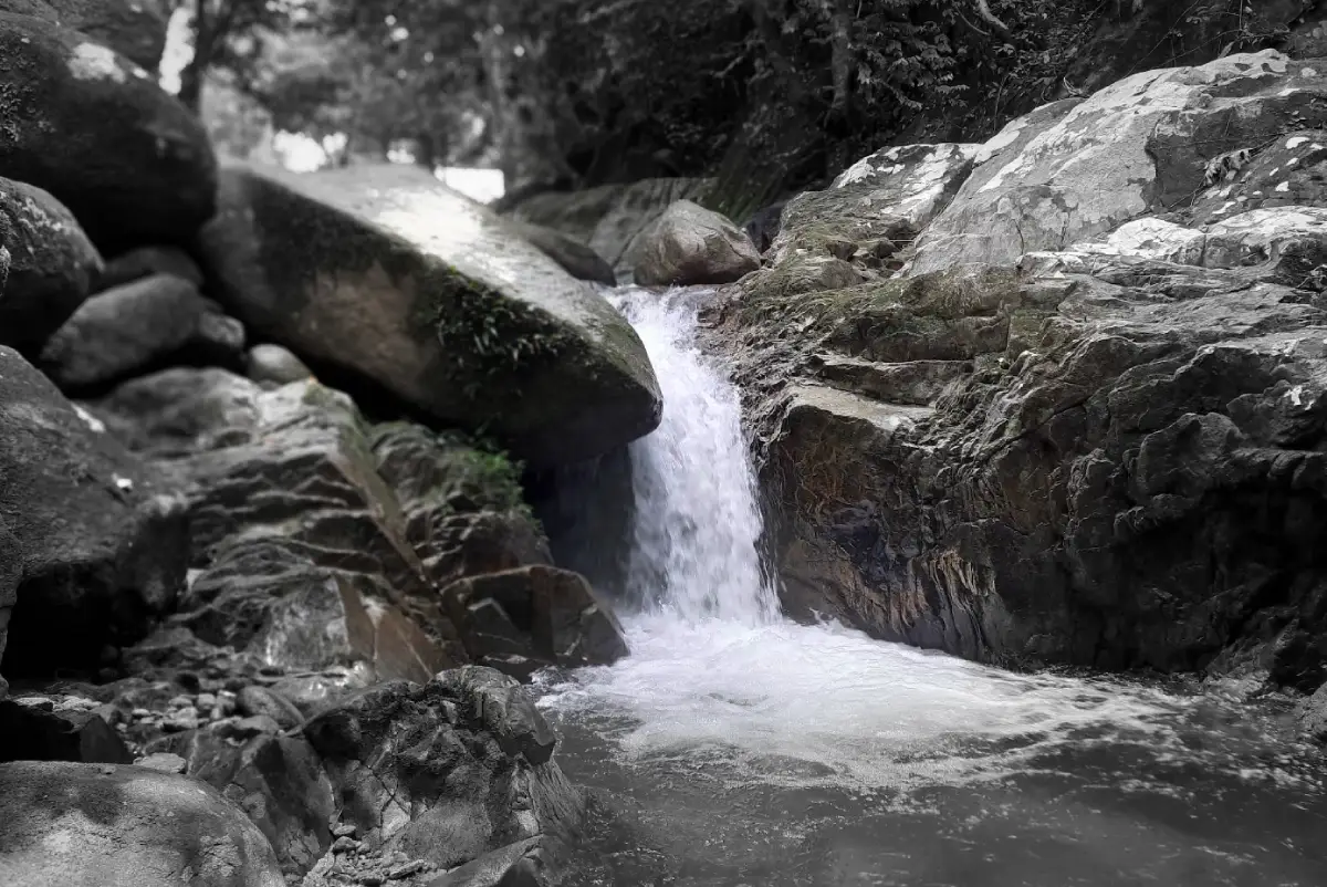
50. Chatwarin Waterfall in Narathiwat is located in To Deng Subdistrict, Su-ngai Padi District. Surrounded by the forests of Thailand's far south, the waterfall flows over a series of rocky sections and natural pools. It is an attractive destination for travelers seeking nature and opportunities to explore the forest ecosystems of Narathiwat.
Highlights: Cascades flowing among natural boulders, shaded forest, humid tropical surroundings, and relaxing streamside scenery.
Chatwarin Waterfall is formed by streams moving across rocky terraces and slopes within the forest. Differences in terrain create cascading water and natural pools, while the humid environment supports tropical plants adapted to the wet climate of southern Thailand.
The surrounding vegetation benefits from stream moisture and the substantial rainfall typical of the area. This provides habitat for forest plants and animals and contributes to the health of the watershed ecosystem. Visitors should avoid leaving rubbish, damaging vegetation, or disturbing wildlife.
The waterfall is suitable for sightseeing, relaxation, and stream photography. Visitors should remain in designated areas, as rocks may become very slippery after rainfall and currents can change according to upstream weather conditions.
Travelers exploring Narathiwat can include Chatwarin Waterfall in a Su-ngai Padi itinerary alongside nearby cultural attractions and communities. Trip planning should reflect weather conditions, local access regulations, and transport arrangements.
Open Days: Daily
Opening Hours: 08:30 – 17:00
Getting There: Travel to Su-ngai Padi District in Narathiwat Province and continue toward To Deng Subdistrict, following the road to Chatwarin Waterfall. Check current access and road conditions before departure.
Map (GPS):Directions to Chatwarin Waterfall
| Article Title | 50 Best Waterfalls in Thailand: Beautiful Cascades, National Parks and Nature Trails |
| Number of Destinations | 50 waterfalls across Thailand, including limestone cascades, multi-tiered waterfalls, towering cliff waterfalls, rainforest streams, naturally warm waterfalls and community nature attractions. |
| Large Waterfalls and High-Cliff Cascades | 1. Thi Lo Su Waterfall, Tak 2. Mae Ya Waterfall, Chiang Mai 3. Haew Narok Waterfall, Nakhon Nayok 4. Khlong Lan Waterfall, Kamphaeng Phet 5. Huai Luang Waterfall, Ubon Ratchathani 6. Mae Surin Waterfall, Mae Hong Son 7. Ngao Waterfall, Ranong 8. Khun Korn Waterfall, Chiang Rai 9. Mok Fa Waterfall, Chiang Mai 10. Thararak Waterfall, Tak |
| Limestone and Multi-Tiered Waterfalls | 1. Erawan Waterfall, Kanchanaburi 2. Huai Mae Khamin Waterfall, Kanchanaburi 3. Chet Sao Noi Waterfall, Saraburi 4. Pha Charoen Waterfall, Tak 5. Sai Yok Noi Waterfall, Kanchanaburi 6. Than Bok Khorani Waterfall, Krabi 7. Mae Sa Waterfall, Chiang Mai 8. Khlong Nam Lai Waterfall, Kamphaeng Phet 9. Pa La U Waterfall, Prachuap Khiri Khan 10. Ton Nga Chang Waterfall, Songkhla |
| Waterfalls with Unusual Natural Features | 1. Saeng Chan Waterfall (Namtok Long Ru), Ubon Ratchathani 2. Phu Sang Waterfall, Phayao 3. Sai Yok Yai Waterfall, Kanchanaburi 4. Dat Fa Waterfall, Chaiyaphum 5. Soi Sawan Waterfall, Ubon Ratchathani 6. Pha Sawan Waterfall, Kanchanaburi 7. Tad Ton Waterfall, Ubon Ratchathani |
| Waterfalls for Hiking and Nature Exploration | 1. Krung Ching Waterfall, Nakhon Si Thammarat 2. Thi Lo Le Waterfall, Tak 3. Man Daeng Waterfall, Phitsanulok 4. Pha Sawan Waterfall, Kanchanaburi 5. Huai Yang Waterfall, Prachuap Khiri Khan 6. Pha Kluai Mai Waterfall, Nakhon Ratchasima 7. Khao Nan Mia Waterfall, Nakhon Si Thammarat 8. Phet Cha Kho Waterfall, Kamphaeng Phet |
| Accessible Waterfalls and Relaxing Nature Destinations | 1. Sarika Waterfall, Nakhon Nayok 2. Nang Rong Waterfall, Nakhon Nayok 3. Wang Takhrai Waterfall, Nakhon Nayok 4. Mae Klang Waterfall, Chiang Mai 5. Mae Kampong Waterfall, Chiang Mai 6. Phlio Waterfall, Chanthaburi 7. Ton Plew Waterfall, Songkhla 8. Chatwarin Waterfall, Narathiwat 9. Sam Thep Waterfall, Udon Thani |
| Waterfalls and Community Nature Attractions | 1. Pajo Babi Waterfall, Narathiwat 2. Makok Waterfall, Chanthaburi 3. Mae Sakut Luang Waterfall, Mae Hong Son 4. Mae Tia Waterfall, Chiang Mai 5. Tad Fa Waterfall, Nong Bua Lamphu 6. Kha On Waterfall, Prachuap Khiri Khan 7. Thi Lo Cho Waterfall, Tak |
| Recommended Travel Seasons | The late rainy season and early cool season provide attractive conditions at many waterfalls, with flowing streams and lush forests. However, the best visiting periods vary by region, particularly in southern Thailand, where rainfall patterns differ from those of northern and central Thailand. Always check current weather and protected-area access announcements. |
| Recommended Activities | Waterfall sightseeing, nature walks, landscape photography, learning about headwater ecosystems, and swimming only in designated areas where conditions are safe. |
| Safety Precautions | Beware of flash floods, strong currents, slippery rocks and seasonal trail closures. Never enter restricted zones or undertake forest routes without an authorized guide where one is required. |
| Responsible Tourism | Take rubbish away, never feed wildlife, do not remove plants or rocks, protect stream ecosystems, and comply with the regulations of national parks and other protected areas. |
Recommended Waterfall Itineraries in Thailand: 1–5 Day Trips
1. Nakhon Nayok Waterfalls — 1 Day: Begin at Nang Rong Waterfall, continue to the Wang Takhrai nature area, and visit Sarika Waterfall if time permits. This route is suitable for travelers coming from Bangkok and nearby provinces who want a nature escape without staying overnight. Allow extra time for weekend traffic and crowds at popular attractions.
2. Kanchanaburi Waterfalls — 2 Days, 1 Night: Spend the first day exploring Erawan Waterfall and stay overnight around Si Sawat District. On the second day, visit Huai Mae Khamin Waterfall. Check the available road routes and any vehicle ferry connections in advance. This itinerary is ideal for travelers who enjoy multi-tiered limestone waterfalls and the forest landscapes of Kanchanaburi.
3. Sai Yok Waterfalls — 2 Days, 1 Night: On the first day, stop at Sai Yok Noi Waterfall along Highway 323 and stay overnight in Sai Yok District. On the second day, explore Sai Yok National Park and admire Sai Yok Yai Waterfall, which flows directly into the Khwae Noi River. This trip is suitable for travelers who appreciate riverside landscapes and prefer not to undertake long-distance hikes.
4. Chiang Mai Waterfalls — 3 Days, 2 Nights: On the first day, visit Mae Sa Waterfall in Mae Rim District. Spend the second day exploring Chom Thong District, including Mae Klang and Mae Ya waterfalls, allowing sufficient time to travel between them. On the third day, consider Mae Kampong Village and Mae Kampong Waterfall before returning. This itinerary combines accessible waterfalls, a large mountain cascade, and a traditional highland community. Accommodation should be selected according to the driving distances for each day.
5. Kamphaeng Phet Waterfalls — 2 Days, 1 Night: Visit Khlong Lan Waterfall on the first day and stay overnight in Khlong Lan District. On the second day, explore Khlong Nam Lai Waterfall. Travelers interested in Phet Cha Kho Waterfall should first confirm with park officers whether the access route is open and whether special arrangements are required.
6. Ubon Ratchathani Waterfalls — 3 Days, 2 Nights: Begin by exploring Khong Chiam District and visiting Saeng Chan Waterfall. On the second day, visit Soi Sawan Waterfall when the trail is open and water conditions are suitable. On the third day, consider Tad Ton Waterfall in Sirindhorn District. Travelers wishing to see Huai Luang Waterfall in Na Chaluai District should add another day or plan a separate route, as it is located far from the Khong Chiam waterfall group.
7. Tak Waterfalls — 3 Days, 2 Nights: Stay in Mae Sot District and visit Thararak Waterfall and Pha Charoen Waterfall along the Mae Sot–Phop Phra route. This itinerary is suitable for travelers interested in limestone cliffs and multi-tiered cascades. Thi Lo Su, Thi Lo Le, and Thi Lo Cho waterfalls should be planned as a separate Umphang adventure because their travel distances, road conditions, and access regulations differ considerably.
8. Prachuap Khiri Khan Waterfalls — 3 Days, 2 Nights: On the first day, visit Pa La U Waterfall from Hua Hin and stay in a location convenient for the next day's journey. Travel south toward Thap Sakae District on the second day. On the third day, explore Huai Yang Waterfall or Kha On Waterfall according to the current access conditions. The itinerary combines forest and mountain scenery in a province better known for its coastal destinations.
9. Southern Thailand Waterfalls — 3 Days, 2 Nights: Travelers based in Hat Yai can explore Ton Nga Chang and Ton Plew waterfalls in Songkhla, scheduling visits according to local road and weather conditions. Krung Ching and Khao Nan Mia waterfalls in Nakhon Si Thammarat are better explored on a separate trip because of the longer distances and more demanding forest access.
10. Northern Thailand Waterfall Trekking — 3–5 Days: Select one primary hiking area, such as Man Daeng Waterfall in Phu Hin Rong Kla National Park or Mae Surin Waterfall in Mae Hong Son. Allocate time for mountain driving, equipment preparation, and checking trail regulations. Remote waterfalls requiring lengthy hikes should not be combined into a single-day itinerary, as exhaustion and changing weather can substantially increase travel risks.
Frequently Asked Questions (FAQ)
Q: What are the most beautiful waterfalls in Thailand?
A: Thailand has many beautiful waterfalls with different natural features. Notable examples include Thi Lo Su Waterfall in Tak, Erawan and Huai Mae Khamin waterfalls in Kanchanaburi, Mae Ya Waterfall in Chiang Mai, Khlong Lan Waterfall in Kamphaeng Phet, and Krung Ching Waterfall in Nakhon Si Thammarat. The most beautiful choice depends on the scenery, season, accessibility, and individual preferences of the traveler.
Q: What is the best time of year to visit waterfalls in Thailand?
A: Many waterfalls in northern, central, and northeastern Thailand have good water flow during the rainy season and early cool season. However, visiting conditions depend on rainfall, water levels, and safety. Travelers exploring southern Thailand should check regional weather patterns separately, as the rainy season can differ from that in other parts of the country.
Q: Which waterfalls near Bangkok are suitable for a day trip?
A: Chet Sao Noi Waterfall in Saraburi, together with Sarika Waterfall, Nang Rong Waterfall, and the Wang Takhrai area in Nakhon Nayok, are practical options for short excursions from Bangkok. Travel time, road traffic, and water conditions should be considered before departure.
Q: Which waterfalls in Thailand are suitable for families?
A: Popular options include Chet Sao Noi Waterfall, Sai Yok Noi Waterfall, Mae Klang Waterfall, Phu Sang Waterfall, and Phlio Waterfall. Their suitability depends on the ages and mobility of family members, together with the accessibility of paths and availability of designated swimming areas.
Q: What is the difference between Erawan Waterfall and Huai Mae Khamin Waterfall?
A: Both are multi-tiered limestone waterfalls in Kanchanaburi. Erawan is famous for its blue-green natural pools and a trail passing seven waterfall levels. Huai Mae Khamin features a series of cascades and limestone terraces surrounded by the forests of Khuean Srinagarindra National Park. Their road access and internal walking routes differ, so each requires separate travel planning.
Q: Which waterfalls are recommended for hiking enthusiasts?
A: Man Daeng Waterfall in Phitsanulok, Krung Ching Waterfall in Nakhon Si Thammarat, and Pha Sawan Waterfall in Kanchanaburi are options for travelers who enjoy forest trekking. Some routes in Umphang also require special arrangements. Always confirm trail distances, difficulty, and requirements for guides or park officers before setting out.
Q: Which Thai waterfalls have unusual natural features?
A: Saeng Chan Waterfall in Ubon Ratchathani is known for water falling through a natural hole in the rock. Phu Sang Waterfall in Phayao features naturally warm water, while Sai Yok Yai Waterfall in Kanchanaburi is notable for flowing directly into the Khwae Noi River.
Q: Is it safe to swim at waterfalls during the rainy season?
A: Swimming safety depends on each site's regulations and the water conditions on the day of the visit. Heavy upstream rainfall can cause sudden flash floods even when it is not raining at the waterfall. Swim only in authorized areas, never ignore warning signs, and immediately follow any evacuation instructions from park officers.
Q: What should travelers bring when visiting waterfalls in Thailand?
A: Essential items include footwear with good grip, drinking water, weather-appropriate clothing, rain protection, personal medication, and reliable route information. For waterfalls requiring longer hikes, additional equipment and authorized guiding services may be necessary.
Q: Can visitors explore several waterfalls in one day?
A: Yes, provided the waterfalls are relatively close and accessible. Groups of attractions in Nakhon Nayok or parts of Sai Yok District in Kanchanaburi can be combined into a day trip. Remote waterfalls involving long hikes or substantial driving distances should not be combined without carefully checking actual travel times.
Q: What should travelers check before visiting a waterfall in a national park?
A: Check current opening days and hours, seasonal closures, trail conditions, water levels, admission fees, and any requirements for official guides. Information from the responsible park authority is especially important during heavy rainfall or when weather warnings are in effect.
Q: How can tourists help protect Thailand's waterfalls and headwater forests?
A: Take all rubbish away, never feed wildlife, do not remove plants or rocks, avoid contaminating streams, and use only designated walking routes. Supporting responsible local tourism businesses also contributes to sustainable travel and environmental protection.
 Category: ●Travel Articles, Recipes
 Group: ●Travel Review, Food Review
Last Update : 1 DayAgo
 Last Update : 1 DayAgo
Recommend

 Art, Culture and Heritage
 Historical Sites and Monuments(8)
 Landmarks and Memorials(5)
 Royal Palace(2)
 Art, Craft Centres, Tradition(43)
 Museums(24)
 Educational Places
 Museum for Study(2)
 Educational Gardens, Farm(5)
 Training Center(1)
 Places of Worship
 Temple(79)
 Mosque(2)
 Other Sacred Sites(17)
 Research and Development
 Royal Project(45)
 Suburban Living
 Village, Community(41)
 Local Market(14)
 Nature and Wildlife
 National Parks and Marine Reserves(18)
 Mountain (Doi)(21)
 Dam, Reservoir, Lake(26)
 Waterfalls(43)
 Hot Springs(12)
 Caves(11)
 River, Canal(6)
 Other natural attractions(14)
 Entertainment and Agricultural
 Zoos and Aquariums(3)
 Animal camps and shows(3)
 Stadium(1)
 Farms, Parks and Ecotourism(19)
 Waterpark(2)
 Theater(1)
 Outdoor and Adventure Activities(10)
 Shopping
 Shopping and Night Market(6)
 Restaurant
 Michelin Star(1)
 Michelin Guide(23)
 Call Customer Service in Tourism
 Call Customer Service in Tourism(1)
Travel Review, Food Review(24)
 Food Menu, North Recipes(30)
 Thai Desserts, North Recipes(17)


