
lovethailand home >North Travel Attractions >Chiang Mai Travel Attractions > 40 Royal Project Destinations in Thailand
TL;DR: 40 Royal Project Destinations in Thailand, open Daily Opening Hours: 06:00 – 18:00, hours 06:00 – 18:00.
40 Royal Project Destinations in Thailand
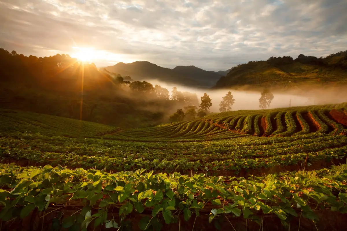
40 Royal Project Destinations in Thailand: Royal Agricultural Stations, Research Stations and Development Centers Nationwide The Royal Project is among Thailand's most important approaches to highland development, addressing agriculture, occupations, the quality of community life and protection of headwater forests. It originated in 1969 from the royal initiatives of King Bhumibol Adulyadej the Great, who sought to help highland communities establish secure livelihoods by cultivating crops suited to local terrain and climate, reducing dependence on opium production and farming methods that placed pressure on forests.
This guide covers 40 Royal Project Foundation operating sites in seven provinces: Chiang Mai, Chiang Rai, Phayao, Mae Hong Son, Lamphun, Tak and Buriram. The first 39 are in northern Thailand, while Non Din Daeng in Buriram is the 40th station, extending the development approach to the northeastern plateau. The list includes royal agricultural stations, research stations and Royal Project development centers, each with different responsibilities reflecting altitude, terrain, communities, natural resources and crop-growing potential. Some focus on widely recognized cool-climate crop research; others primarily advance occupations and living standards in remote villages.
For travelers, Royal Project destinations are much more than flower gardens or cool-climate vegetable plots. They are places of learning that connect nature, agricultural science, community cultures and Thailand's development history. Visiting them offers opportunities to observe changes in highland livelihoods, soil and water management, climate-adapted crop cultivation and agricultural systems intended to protect the environment while providing income.
Angkhang Royal Agricultural Station in Chiang Mai is one of the key places associated with the beginning of highland agricultural research and development. Its temperate crop trials, fruit trees and flower gardens are well known. Inthanon Royal Agricultural Station is another important center for understanding crop production and agricultural research in cool high-mountain conditions. Their scientific and educational roles add a dimension beyond conventional scenic tourism.
In Mae Rim District, Chiang Mai, Nong Hoi Royal Project Development Center is noted for cool-climate vegetables and highland agriculture in a mountainous area accessible on routes around Mon Jam. Teen Tok Royal Project Development Center in Mae On District is associated with Ban Than Thong, agricultural livelihoods and headwater forests, making it relevant to visitors interested in farming and the connections between communities and natural resources.
Royal Project sites across Mae Taeng, Mae Wang, Chiang Dao and Chom Thong Districts in Chiang Mai occupy landscapes with varying altitudes and agricultural activities. Mon Ngo combines mountain scenery with livelihood promotion; Ka Noi serves culturally diverse communities in Chiang Dao; and Khun Pae and Tung Luang illustrate occupational development and conservation in different mountain settings.
Chiang Rai also contains important Royal Project areas, including Phatang in Wiang Kaen District on the Thai–Lao border, where highland development relates directly to mountain communities. Mae Hong Son's Mae La Noi center serves mountainous villages in which cultural diversity and farming shape everyday life. Together, these places show how development approaches differ according to local landscapes and communities.
A central principle of the Royal Project is to create occupations suited to each place through agricultural research and scientific knowledge. Testing crop varieties, refining cultivation techniques, managing produce quality and developing marketing systems all help create economic opportunities for highland farmers. Such work also reduces pressure on forests by encouraging appropriate land use and protection of headwater catchments.
Royal Project travel can take several forms. Agricultural enthusiasts may study trial plots for vegetables, flowers and fruit. Nature lovers can choose destinations with forested mountains and scenic viewpoints, while cultural travelers may explore local customs, knowledge, food and community traditions. Some visits require advance appointments or staff permission because many centers are operating agricultural facilities, not commercial visitor attractions with unrestricted access.
Winter brings cool weather to many northern centers and is well suited to mountain scenery and temperate crops. During the rainy season, forests and cultivated land become lush, but heavy rainfall and slippery mountain roads can make access difficult. Choose the season according to crop cycles, available activities and road conditions, especially when traveling to remote centers.
For a one-day outing, centers in districts relatively close to Chiang Mai city, such as Mae Rim, Mae On and Hang Dong, reduce travel time and work well for short agricultural learning visits. With two or three days, routes such as Angkhang–Fang or Inthanon–Mae Wang reveal contrasting mountain agriculture and scenery. Travelers seeking deeper study across several centers should group visits by province and district rather than rush between distant locations.
The real value of a Royal Project visit is seeing firsthand how livelihoods and conservation are connected. Crop research, highland farming, produce quality and environmental management all affect local communities. Traveling responsibly, respecting working areas and supporting locally produced goods help protect the long-term value of these development initiatives.
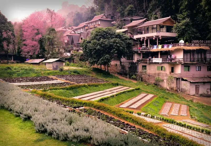
1. Angkhang Royal Agricultural Station, Chiang Mai Province Ang Khang Royal Agricultural Station in Chiang Mai is a landmark in the history of Thailand's highland development. Located on Doi Ang Khang in Fang District, it serves as a pioneering center for research and demonstrations of cool-climate crops under royal initiatives. The surrounding high mountains provide a comparatively cool environment suitable for testing temperate fruit trees, flowers and vegetables that cannot readily be cultivated in the lowlands. The station combines agricultural knowledge with one of northern Thailand's best-known educational travel destinations.
Highlights: Thailand's first Royal Agricultural Station; temperate crop trials; flower gardens; highland fruit; Doi Ang Khang landscapes; agricultural alternatives to opium growing; and highland community life.
The Royal Project began in 1969 with royal initiatives to develop sustainable livelihoods for highland communities through research into crops suited to local climates. Temperate fruit in particular offered a viable income alternative to opium cultivation. Work at Doi Ang Khang played an important role in changing agricultural practices from dependence on former crops toward a system built on research, appropriate production methods, and organized handling of agricultural produce.
Within the station, experimental and demonstration plots illustrate the diversity of highland agricultural research. Vegetables, fruit trees and flowers require different temperature ranges, allowing visitors to learn about each crop's needs for soil, water and climate. Variety selection, maintenance and production quality are also central themes. Exploring designated experimental areas provides a practical example of applying scientific knowledge to the mountain environments of Thailand.
Doi Ang Khang is appealing to travelers for its layered mountain scenery, cool weather and plants that change with the seasons. Winter is particularly popular for its temperate flowers and highland atmosphere. Photography enthusiasts can capture flowering plots, mountain ridges and carefully arranged agricultural landscapes, while remaining on the routes and within the areas designated for visitors.
The station's importance also extends to nearby highland communities with diverse cultural backgrounds. Agricultural development has created sources of income and promoted occupations suited to mountain conditions. Visitors can therefore learn about advances in farming as well as changes in the local economy and livelihoods of the surrounding communities during the same trip.
Visitors should allow at least half a day to explore the sections open to the public. Staying overnight on Doi Ang Khang or in Fang District is an option for those wishing to explore more of the surrounding nature. Mountain access roads have steep gradients and many bends; check the vehicle's condition and avoid rushing when fog is thick or rain makes driving difficult.
Ang Khang Royal Agricultural Station is well suited to families, students, agricultural enthusiasts and travelers seeking to understand the beginnings of the Royal Project firsthand. Beyond its scenery, it demonstrates how research, livelihood development and environmental conservation can be pursued together.
Open Days: Daily Opening Hours: 06:00 – 18:00
Getting There: From Chiang Mai city, take Highway 107 toward Fang District and then use the open mountain road to Doi Ang Khang. Confirm current road conditions and visiting hours, particularly during the busy winter season.
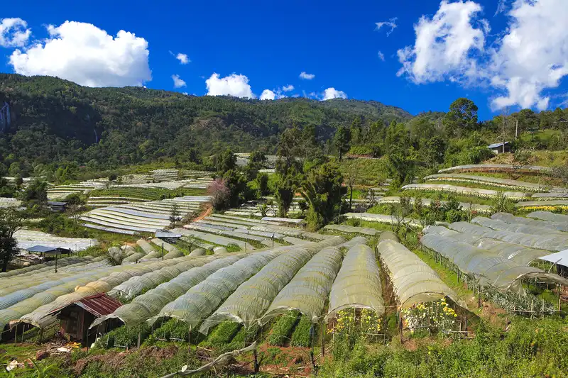
2. Inthanon Royal Agricultural Station, Chiang Mai Province Inthanon Royal Agricultural Station operates in Chom Thong District, Chiang Mai Province, near Ban Khun Klang in Ban Luang Subdistrict. Its high-mountain setting offers cool weather and rich plant diversity. The station researches, promotes and develops agricultural practices suitable for higher elevations, linking livelihood opportunities for farmers with natural-resource conservation around Doi Inthanon.
Highlights: Highland agriculture; cool-climate crop research; ornamental plants and vegetables; Doi Inthanon landscapes; cool weather; mountain forests; and Royal Project community development.
Doi Inthanon has substantial changes in elevation and climate, making it valuable for studying crops that need lower temperatures than those found in the lowlands. The station investigates plant varieties and quality crop production and transfers practical knowledge to local farmers so that they can work productively within the constraints of mountainous land.
Highland farming differs from lowland agriculture in temperature, slopes, water management and soil characteristics. Research into suitable crops gives communities additional economic options. Appropriate soil and water management also helps to limit the environmental impacts associated with cultivating steep terrain.
Visitors can explore authorized learning areas to understand cool-climate farming and the principles of highland development. Available activities vary with the season and the station's operational priorities. Groups planning an educational visit should arrange their program with staff in advance to avoid disrupting research or work in experimental plots.
The surrounding landscape forms part of the ecological setting of Doi Inthanon National Park, including montane evergreen forests, water sources and high-elevation habitats. A visit to the station can be combined with viewpoints and nature trails that are officially open in the national park, provided the separate access hours and restrictions of each site are observed.
Inthanon Royal Agricultural Station appeals to visitors interested in temperate crops, highland land management, agricultural tourism and nature studies. It reveals that topography and climate are not simply scenic attractions: they directly influence agricultural research, food production and farmers' livelihoods.
Getting There: From Chiang Mai city, follow Highway 108 to Chom Thong, then take Highway 1009 up Doi Inthanon. Continue to Ban Khun Klang in Ban Luang Subdistrict and follow signs to the station.
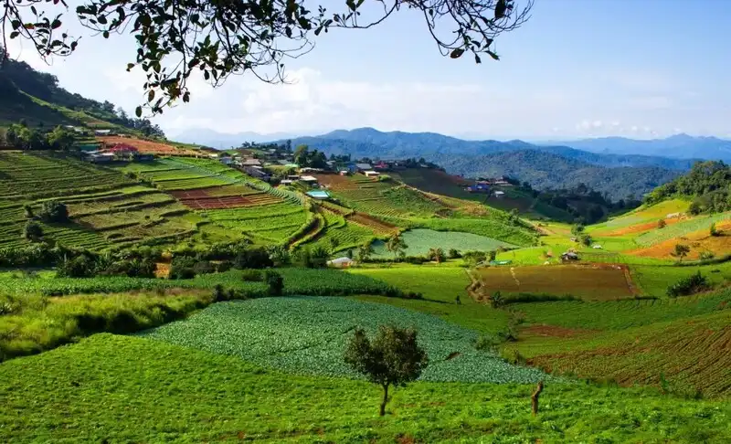
3. Nong Hoi Royal Project Development Center, Chiang Mai Province Nong Hoi Royal Project Development Center is located at Ban Nong Hoi Kao, Moo 7, Mae Raem Subdistrict, Mae Rim District, Chiang Mai. The center plays an important role in highland farming and community development in the Mae Rim mountains. It is noted for cool-climate vegetables, studies of crop-production technology and agritourism, with access to the popular Mon Jam area nearby.
Highlights: Agricultural demonstration plots; cool-climate and organic vegetables; soilless cultivation; medicinal plants; agricultural technology; and routes around Mon Jam.
The center supports the livelihoods of mountain communities through crops matched to local climatic conditions and market demand. Agricultural extension services help farmers improve product quality, reduce growing losses and build more efficient production systems through the use of appropriate knowledge and practical techniques.
Agricultural learning activities cover several methods, including soil-based cultivation, methods designed to reduce chemical inputs and soilless growing systems. Hydroponic techniques allow nutrients and irrigation water to be controlled more precisely. These approaches demonstrate how highland farming benefits from a combination of science, practical management and responsible resource use.
The terrain around the center comprises steep mountain slopes with fields distributed across hillsides. Visitors can enjoy the cool air and see how farming areas are adapted to this topography. The center can be included in a route covering Mon Jam and other attractions around Mae Rim, depending on the available time.
Nong Hoi is suitable for families, school groups, university students and visitors curious about quality vegetable production. A visit shows how agricultural knowledge and new technology can be transferred to local farmers while also creating opportunities to support the produce and services of highland communities.
Visitors should use only designated areas and follow staff instructions, particularly around experimental plots and working farms. On holidays, allow extra time for traffic on the roads climbing toward Mon Jam, which can become busy during popular periods.
Open Days: Daily Opening Hours: 08:00 – 17:00
Getting There: Follow Highway 107 from Chiang Mai toward Mae Rim, then take the Mae Raem route to Ban Nong Hoi Kao and follow the center's signs. Check Mon Jam traffic and visiting arrangements.

4. Teen Tok Royal Project Development Center, Chiang Mai Province Teen Tok Royal Project Development Center is situated near Ban Than Thong, Moo 8, Huai Kaeo Subdistrict, Mae On District, Chiang Mai. Its mountain environment includes forests, natural streams and farming villages. The center develops local agricultural occupations and appropriate crop-production systems, connecting improved farmers' livelihoods with the conservation of soil, water and headwater forests.
Highlights: Highland farming; Ban Than Thong community life; watershed management; crop-production learning; Mae On mountain scenery; and nature attractions around Huai Kaeo.
The center is important as a working area for developing agricultural livelihoods among mountain communities. Encouraging crops suited to the climate and local farmland provides additional income options. Systematic training in crop production also contributes to more appropriate use of land and water resources.
Ban Than Thong and the Huai Kaeo area are characterized by mountains and streams, making headwater forests and community ecosystems particularly important. Farming in such conditions must take account of slope gradients, soil erosion, and the balance between cultivated areas and forest cover.
Teen Tok is ideal for travelers who want to study agriculture alongside nature rather than simply photograph crop fields. It offers insights into the way community livelihoods depend on understanding local terrain and applying the right techniques. Educational visits should be coordinated with staff to ensure access only to approved working areas.
Travelers from Chiang Mai city can combine a scheduled visit with natural attractions around Mae On and Huai Kaeo. Travel time on mountain roads and each site's visitor rules should be considered. A relaxed itinerary leaves room to observe the environment and learn about community life.
The center is especially relevant to those interested in farming, community development and conservation. Its value lies in observing real work taking place within the local environment, rather than expecting a conventional leisure attraction focused solely on recreation or photography.
Getting There: Travel from Chiang Mai city toward Mae On and Huai Kaeo Subdistrict, then take local roads to Ban Than Thong. Contact the center before visiting agricultural areas or arranging group study activities.
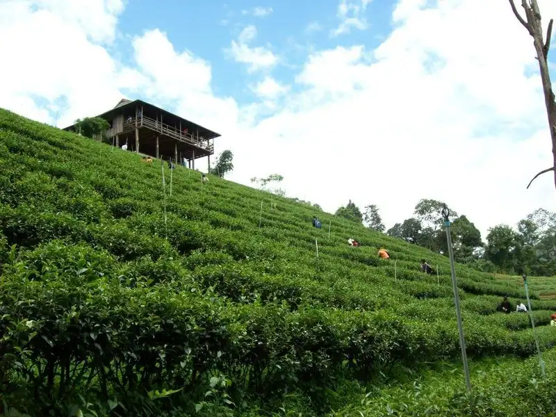
5. Mon Ngo Royal Project Development Center, Chiang Mai Province Mon Ngo Royal Project Development Center is located in Mueang Kai Subdistrict, Mae Taeng District, Chiang Mai, amid fertile high mountains with community farmland distributed along the slopes. Its development work supports occupations suited to mountainous terrain, seeks to improve residents' quality of life and emphasizes the protection of forests and headwater catchments.
Highlights: Highland livelihood development; Mae Taeng mountain views; Mueang Kai communities; agricultural learning; watershed conservation; and Doi Mon Ngo viewpoints.
Mon Ngo has a complex landscape of mountains and valleys with considerable variation in elevation. Steep slopes affect both crop selection and field management. Agricultural livelihood programs therefore draw on knowledge of soils, erosion prevention and water conservation to help communities cultivate their land with less environmental disturbance.
The center promotes farming practices connected to the everyday livelihoods of highland residents, who face different conditions from farmers on the plains. Applying agricultural expertise and technology helps communities improve the quality of their produce and increase their economic opportunities.
The Mon Ngo area is also recognized for its natural beauty, with mountain ridges overlooking broad stretches of forest and valleys. Travelers visiting for agricultural learning may combine their visit with scenic viewpoints around Doi Mon Ngo, depending on road conditions and local access rules. Leisure activities should be distinguished from visits to the center's operational plots.
Nature lovers and people interested in mountain communities can learn about crop production and the relationship between residents and their environment. Agricultural students and professional visitors may focus on resource management and livelihood creation under challenging highland conditions. Advance appointments are advisable for organized groups.
Mon Ngo is best approached as a combined nature-and-agriculture learning trip. It illustrates the Royal Project's work in difficult mountain landscapes where highland communities remain central to long-term development.
Open Days: Monday–Friday Opening Hours: 08:00 – 16:30
Getting There: Drive from Chiang Mai to Mae Taeng District, then follow local roads toward Mueang Kai and Mon Ngo. Check mountain-road conditions and arrange study-group access in advance, especially after heavy rain.
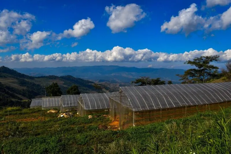
6. Phatang Royal Project Development Center, Chiang Rai Province Pha Tang Royal Project Development Center is based in Ban Pha Tang, Po Subdistrict, Wiang Kaen District, Chiang Rai. Situated in the mountains along the Thai–Lao border, it has elevations and climatic conditions suitable for cool-climate farming. The center promotes agricultural occupations and improves highland community livelihoods while connecting high-value crop production with responsible management of steep mountain landscapes.
Highlights: Cool-climate farming along the mountain border; elevations of approximately 1,300–1,500 meters; Ban Pha Tang culture; Wiang Kaen scenery; hillside resource management; and Doi Pha Tang.
The Pha Tang landscape follows the mountain ranges along the Thailand–Laos frontier. High elevations and pronounced slopes require careful soil and water management. Promoting crops adapted to the climate helps residents grow quality produce while limiting environmental impacts associated with hillside cultivation.
The center's activities support the livelihoods of people living in mountainous communities with constraints in transportation and land use. Sharing production skills and appropriate post-harvest techniques helps create employment opportunities and improve the stability of household income.
Pha Tang's cultural character reflects its mountain communities and Yunnanese Chinese influences. Visitors can explore local ways of life alongside highland agriculture. Respect for residents' privacy and thoughtful use of locally owned services make tourism more beneficial for the community.
Doi Pha Tang nearby is a celebrated viewpoint overlooking mountain scenery and distant stretches of the Mekong River. A two-day, one-night visit can combine scheduled Royal Project learning activities with the borderland landscape. Time for the development center and the natural viewpoints should be planned separately.
Pha Tang is particularly suitable for people interested in highland agriculture, community culture and frontier mountain tourism. It provides a clear example of adapting livelihoods and crop-production systems to demanding terrain.
Open Days: Daily Opening Hours: 08:00 – 16:00
Getting There: From Chiang Rai, travel through Thoeng District to Wiang Kaen, then take Highway 1093 toward Po Subdistrict and Ban Pha Tang. Verify mountain-road conditions and make appointments for study groups.

7. Mae La Noi Royal Project Development Center, Mae Hong Son Province Mae La Noi Royal Project Development Center is located near Ban Dong, Huai Hom Subdistrict, Mae La Noi District, Mae Hong Son. This development area occupies a mountainous landscape of forests and highland settlements scattered through valleys. Its activities promote agriculture and local livelihoods while respecting community life and conserving natural resources in important headwater areas.
Highlights: Highland farming; Mae La Noi village life; valleys and seasonal terraced fields; community occupations; headwater conservation; and Ban Huai Hom.
Mae La Noi District is dominated by overlapping mountain ranges, with limited flat land for farming. Communities have therefore adapted their cultivation practices to slopes and seasonal water supplies. Royal Project livelihood programs help develop crop production and broaden economic opportunities while emphasizing appropriate soil and water management.
The district is home to communities with diverse ethnic and cultural traditions, many of which remain closely linked to agriculture and local natural resources. Educational visits can deepen understanding of how livelihood development, resource management and social circumstances interact in highland settlements.
Nearby Ban Huai Hom is known for its coffee and wool-weaving traditions, reflecting both local craftsmanship and income-generating enterprises. Travelers can combine a visit to the development center with community-based learning about agriculture and handmade products, arranging activities through local groups that welcome visitors.
Mountain roads around Mae La Noi offer a quiet atmosphere and scenery that changes with the seasons. Rainy months bring green fields and forests, while winter offers cooler conditions. Some roads are winding and affected by rain, so travelers should check access conditions before departure.
Mae La Noi is recommended for those interested in community development, cultural travel and agriculture on mountainous land. An overnight stay allows more time to understand the area and experience local ways of life without rushing between destinations.
Open Days: Daily Opening Hours: 08:00 – 18:00
Getting There: From Mae Sariang, use Highway 108 toward Mae La Noi, then follow the road to Huai Hom Subdistrict and Ban Dong. Allow extra time for mountain access and confirm the route to the center.
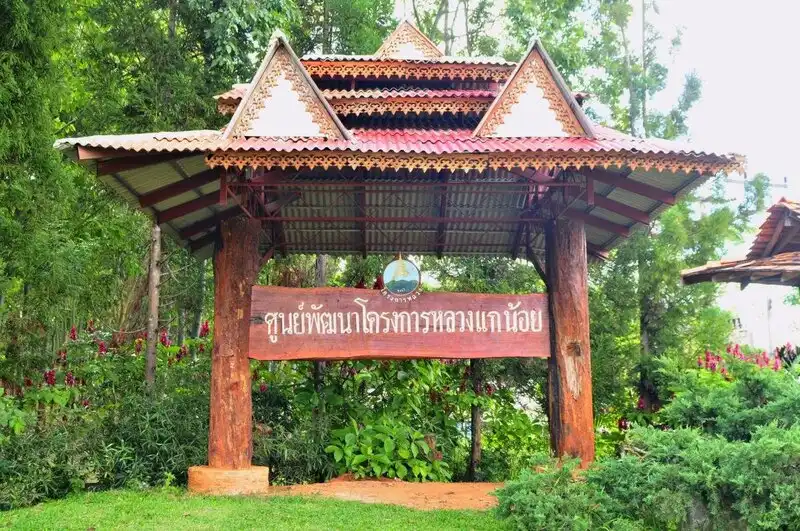
8. Ka Noi Royal Project Development Center, Chiang Mai Province Kae Noi Royal Project Development Center operates in Mueang Na Subdistrict, Chiang Dao District, Chiang Mai. It develops agricultural livelihoods for highland communities near the border, within a landscape of complex mountains and culturally diverse villages. Its work brings together appropriate crop production, improvements in produce quality and responsible use of natural resources.
Highlights: Agricultural demonstration plots; highland vegetables and fruits; Chiang Dao communities; mountain border landscapes; conservation; and rural livelihood learning.
Chiang Dao contains high mountains and valleys whose climates vary with altitude. Some communities also face difficulties in transportation and access to economic opportunities. Agriculture suited to the terrain can provide farmers with alternative livelihoods, higher-value produce and more consistent household income.
Kae Noi transfers practical agricultural knowledge and supports improved crop management. Better production techniques can enhance produce quality and income stability, but they must be adapted to local soil, water availability and the limitations imposed by steep mountain slopes.
Visitors interested in the Royal Project's work in a border area can learn about agriculture and village livelihoods through approved activities. Experimental plots and operational areas should be entered only with permission and guidance from the center's personnel.
The wider Chiang Dao mountains are attractive for their natural ecosystems and cultural variety. Travelers with extra time may add approved nature attractions in the district to their itinerary, taking care to check driving distances, road access and vehicle suitability.
The center is well suited to school and university study groups, agricultural visitors and people interested in rural livelihoods. Learning on site shows why highland development requires scientific research, active community cooperation and stewardship of natural resources.
Open Days: Daily Opening Hours: 08:00 – 16:30
Getting There: From Chiang Mai, take Highway 107 toward Chiang Dao, then continue through Mueang Na Subdistrict to Ban Ka Noi on local roads. Confirm access arrangements before visiting, particularly during the rainy season.
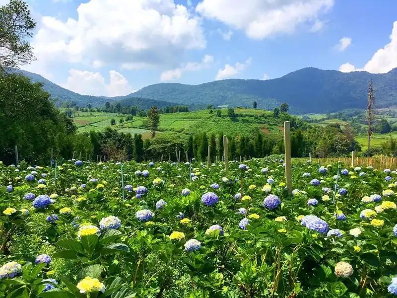
9. Khun Pae Royal Project Development Center, Chiang Mai Province Khun Pae Royal Project Development Center is in the Ban Khun Pae area, Ban Pae Subdistrict, Chom Thong District, Chiang Mai. The center promotes agriculture and livelihoods among highland residents in a landscape of mountains, valleys and valuable natural resources. Its work emphasizes crops suited to local conditions, improvements in produce quality and responsible resource use.
Highlights: Khun Pae community agriculture; mountain crop fields; livelihood development; resource management; Chom Thong landscapes; and mountain-community learning.
Ban Khun Pae has steep terrain and limited farmland, requiring cultivation methods suited to soil conditions and water availability. Suitable income-generating crops and well-managed farming methods can help farmers improve production and reduce risks associated with working against the natural characteristics of the land.
The center works with residents to develop occupations and transfer agricultural knowledge. Successful highland development must take economic, social and environmental factors into account, since farming communities depend directly on forests, water sources and the physical limitations of the landscape.
Visitors interested in agriculture may observe crop production and land management in approved areas. Visits are particularly useful for students and organizations studying community development. Advance appointments allow staff to explain the work and arrange activities without disrupting the center's daily operations.
Around Khun Pae, mountain scenery and farmland change with the seasons. Travelers can experience cool air and a highland village atmosphere on the journey, but should drive cautiously on steep roads and verify conditions after heavy rainfall.
Khun Pae is best for visitors seeking to understand development work in a community rather than a large commercial tourist attraction. Its significance lies in supporting agricultural occupations adapted to the lived environmental conditions of mountain residents.
Getting There: Take Highway 108 from Chiang Mai to Chom Thong, then use the local route through Ban Pae to Ban Khun Pae. Check your destination and the final road conditions before traveling, particularly for organized visits.
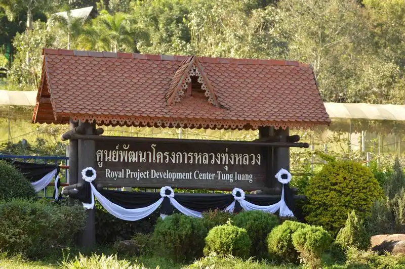
10. Tung Luang Royal Project Development Center, Chiang Mai Province Thung Luang Royal Project Development Center is situated in Mae Win Subdistrict, Mae Wang District, Chiang Mai. Operating since 1979, it promotes agricultural livelihoods and community well-being in mountain villages. Farmland and settlements lie among forested hills, so the center combines agricultural extension with natural-resource management and the protection of headwater ecosystems.
Highlights: Agricultural livelihood development since 1979; highland vegetables and fruits; Mae Win communities; mountain scenery; farming landscapes; and headwater conservation.
Thung Luang was established under the highland development approach that prioritizes local welfare and access to sustainable occupations. Encouraging suitable crops and improved production practices helps farmers use cultivated land effectively while also reducing pressure on surrounding forests.
Mae Win's valleys and mountain slopes vary in elevation and steepness. Crop production must therefore be adapted to soils, water availability and climatic conditions at different heights. Sharing cultivation techniques and post-harvest knowledge supports greater livelihood security for farming households.
The center is also valuable as a place to study community development. Improving agricultural systems cannot be separated from people's daily lives, and livelihood programs depend on cooperation among staff, farmers and residents in applying appropriate knowledge to local conditions.
Mae Wang District offers striking mountain landscapes and routes connecting several villages. Visitors may pair an arranged visit to Thung Luang with nature activities or cultural learning in Mae Win, provided they first confirm visitor arrangements and available activities.
The drive from Chiang Mai includes both level roads and winding mountain sections. Travelers should allow sufficient time, check their vehicle before departure and arrange appointments with center staff so the visit fits around normal operations.
Thung Luang is suitable for those interested in the history of highland development, community agriculture and resource stewardship. It demonstrates the collaboration between agricultural expertise and local ways of life needed to make development viable in mountainous environments.
Getting There: From Chiang Mai, take Highway 108 toward Hot via San Pa Tong, then turn toward Mae Wang and Mae Win. Continue toward Wat Phra That Si Phutthiwong; the center is approximately 500 meters from the temple. Drive carefully on the winding uphill sections.
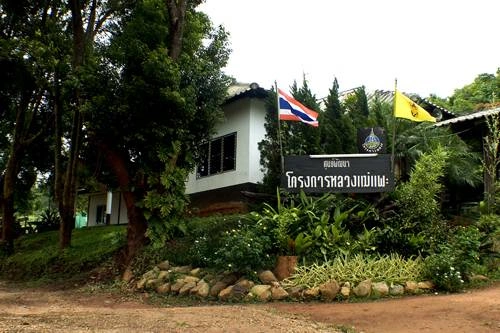
11. Mae Phae Royal Project Development Center, Chiang Mai Province Mae Phae Royal Project Development Center is located in Ban Mae Phae, Samoeng Nuea Subdistrict, Samoeng District, Chiang Mai. Its operations support agricultural occupations and livelihoods for highland communities amid mountains, valleys and cultivated hillsides. The center offers visitors an opportunity to understand how agricultural expertise must be integrated with topography, natural resources and the daily lives of rural communities.
Highlights: Highland agricultural development; Ban Mae Phae community; Samoeng mountains; soil and water conservation; farmers' livelihoods; and rural cultural learning.
Mae Phae lies at an elevation of approximately 874 meters above sea level. Its steep terrain and variable heights make it necessary to choose crops and cultivation techniques suited to local conditions. Soil and water management is especially important, as sloping fields can lose topsoil during heavy rain. Promoting conservation practices helps preserve agricultural land over the long term.
Highland development involves more than raising crop yields. It also seeks stable employment, improved produce quality and wider economic opportunities for farming families. Transferring practical agricultural skills helps farmers evaluate crop suitability and organize production more effectively.
For agritourism visitors, Mae Phae functions as an educational setting where community development can be studied firsthand. Authorized areas reveal the links among farming, livelihoods and resource use, particularly for those seeking to understand agricultural extension under conditions different from those in the lowlands.
Samoeng District has attractive mountain scenery and a tranquil rural atmosphere. The rainy season turns cultivated areas and forests lush green, while winter is cooler and pleasant for exploring local communities. Visitors should distinguish public community attractions from experimental plots or operational areas that require staff permission.
Those traveling through Samoeng can combine an arranged visit to Mae Phae with Thung Rao Royal Project Development Center. The route should be planned using actual locations and allowing time for mountain roads. Rushing through several villages leaves little opportunity to observe the work and learn from center staff.
Mae Phae suits students, rural-development study groups and those interested in responsible resource management in the mountains. Its strength lies in being a working community-development site where agriculture, people and headwater forests are closely connected, rather than merely a photographic attraction.
Getting There: From Chiang Mai, travel to Samoeng District, then use local roads to Samoeng Nuea and Ban Mae Phae. Contact the center beforehand for agricultural visits and study groups.

12. Mae Sariang Royal Project Development Center, Mae Hong Son Province Mae Sariang Royal Project Development Center operates near Ban Om Pai Tai, Pa Pae Subdistrict, Mae Sariang District, Mae Hong Son. It promotes agricultural occupations and a better quality of life among highland communities. The surrounding environment comprises mountainous ridges, valleys and important forest resources. Its main appeal lies in the relationship among agricultural development, mountain lifestyles and conservation.
Highlights: Highland agriculture and occupations; Ban Om Pai Tai; Mae Sariang landscapes; local cultural diversity; watershed conservation; and community well-being.
The center operates at an elevation of approximately 863 meters above sea level. Soils, slope gradients and access to water vary across the area, requiring careful decisions about crops and farmland management. Suitable practices help prevent topsoil loss and maintain the productive capacity of the landscape into the future.
Agricultural extension work includes helping farmers improve produce quality and develop production practices appropriate to mountain conditions. Success is measured not solely by output, but also by household welfare and a community's capacity to look after the resources on which its livelihoods depend.
Mae Sariang is known for diverse ethnic and cultural backgrounds. Many villages have longstanding connections to agriculture, forests and the mountains. Studying development work here provides insight into the ways communities adapt to limitations in transport and land use and how staff and residents work together.
Travelers interested in culture and nature can also explore Mae Sariang's town history and settlements along the Yuam River. An overnight stay makes it easier to combine an educational visit with the town's attractions without driving hurriedly on mountain roads after dark.
Seasonal conditions matter when reaching the center, particularly during heavy rainfall when village roads can become slippery or difficult to access. Contact the center before attending agricultural activities so visits can be arranged around its daily work.
Mae Sariang is appropriate for those interested in community development, highland farming and educational travel connecting mountain ecosystems with local culture. It illustrates the importance of long-term livelihood support alongside natural-resource conservation.
Open Days: Daily Opening Hours: 08:00 – 17:00
Getting There: From Mae Sariang town, travel toward Pa Pae Subdistrict and follow local roads to Ban Om Pai Tai. Check the entrance, road conditions and access arrangements before arriving with an educational group.
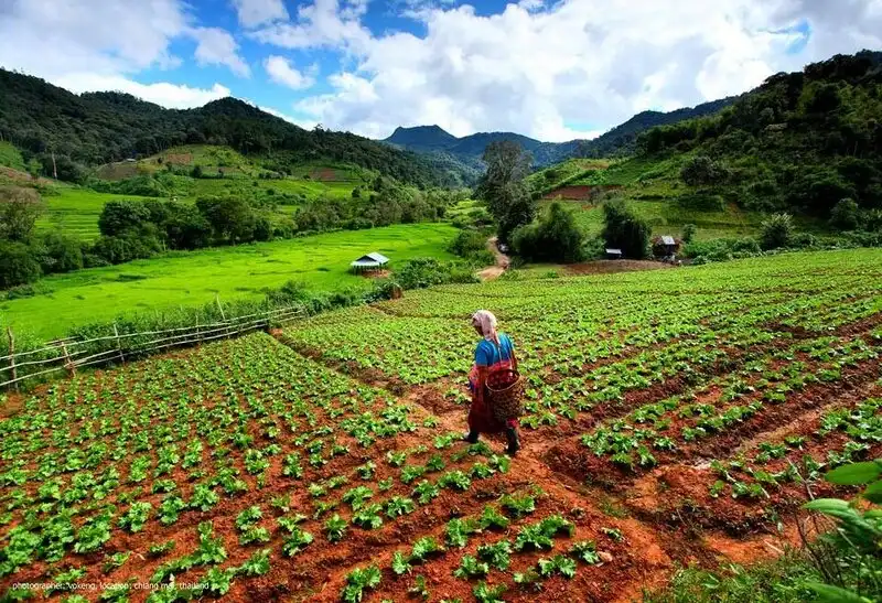
13. Tung Rua Royal Project Development Center, Chiang Mai Province Thung Rao Royal Project Development Center operates around Ban Thung Rao, Samoeng Tai Subdistrict, Samoeng District, Chiang Mai. The area has mountain ranges and agricultural valleys. The center develops crop-production systems and agricultural occupations under Royal Project principles, emphasizing produce quality, efficient use of water and land management suited to the community's environment.
Highlights: Ban Thung Rao agricultural extension; Samoeng livelihood development; soil and water management; valley farming; crop-production learning; and Mae Rim–Samoeng nature routes.
The Thung Rao operating area lies around 732 meters above sea level, with both mountain slopes and valley land suitable for certain types of cultivation. Livelihood development must consider soils, water supplies and access to markets so farming households can maintain productive occupations over time.
Agricultural extension promotes knowledge of cultivation, field management and produce quality. The development of water sources and water-saving techniques is also essential to the security of agricultural livelihoods, particularly where rainfall and supplies fluctuate with the seasons.
Samoeng's scenery includes fertile valleys and mountain slopes with a variety of agricultural activities. Travelers can see planted fields and villages along the route, making an educational visit an opportunity to connect the landscape with local food production and resource management.
Unlike a large Royal Agricultural Station with extensive visitor displays, Thung Rao focuses primarily on development work and community livelihoods. Those interested in study visits should make an appointment to learn about activities that are genuinely available rather than expecting ornamental gardens or recreational facilities.
A visit to Thung Rao can be paired with Mae Phae and other agricultural destinations in Samoeng. Choose the itinerary based on actual locations and allow enough time between villages. Study tours are more valuable when participants can observe and discuss processes rather than making only brief stops.
Thung Rao is suitable for visitors interested in farming, water management and highland livelihood development. Its special character comes from agricultural extension carried out as part of farmers' everyday lives, an essential component of ongoing mountain-area development.
Getting There: Travel from Chiang Mai to Samoeng via either the Mae Rim–Samoeng or Hang Dong–Samoeng road. Continue to Samoeng Tai and Ban Thung Rao, confirming the correct center entrance with staff before departure.
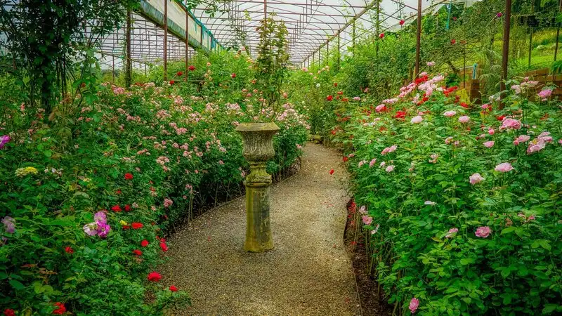
14. Tung Roeng Royal Project Development Center, Chiang Mai Province Thung Roeng Royal Project Development Center is near Ban Mae Khanin Nuea, Ban Pong Subdistrict, Hang Dong District, Chiang Mai. It supports agricultural occupations and community development in foothill terrain. The surrounding lower slopes and mountains are linked by roads to Hang Dong and Samoeng, offering opportunities to learn about the relationships among crop production, rural life and resource management.
Highlights: Farming occupations; foothill community development; Ban Mae Khanin Nuea; soil and water management; and Hang Dong–Samoeng landscapes.
At approximately 626 meters above sea level, Thung Roeng is lower than many of the high-mountain centers. Its different climate and topography influence crop choice and farming methods. Livelihood programs must therefore be adapted to local resources and constraints rather than simply reproducing farming practices used at much higher elevations.
The center works with farmers and residents to strengthen agricultural production. Advice on suitable crops, production planning and produce quality helps improve livelihood opportunities and the capacity to adapt to economic and climatic changes.
Soil and water management is critical because cultivating sloping land without precautions can accelerate erosion. Knowledge about proper land use and environmental care supports both the long-term viability of agriculture and the quality of natural resources.
For travelers, Thung Roeng provides an opportunity to study foothill community development relatively close to Chiang Mai city. Farming and village life may be explored through activities arranged with the center. As this is an operational facility, not every area is freely accessible like a public park.
Hang Dong also connects to villages and mountain attractions along Ban Pong and the Samoeng road. A day trip is best organized around one substantial educational activity, supplemented by a nearby public nature attraction, rather than spending most of the day driving between sites.
Thung Roeng is useful for people studying agricultural livelihoods and collaborative community development. It illustrates how agricultural knowledge is adapted to the landscape to support viable, continuous employment for local residents.
Getting There: From Chiang Mai city, drive toward Hang Dong, then follow Highway 1269 toward Ban Pong Subdistrict and Ban Mae Khanin Nuea. Confirm the local access road and make an appointment before visiting.
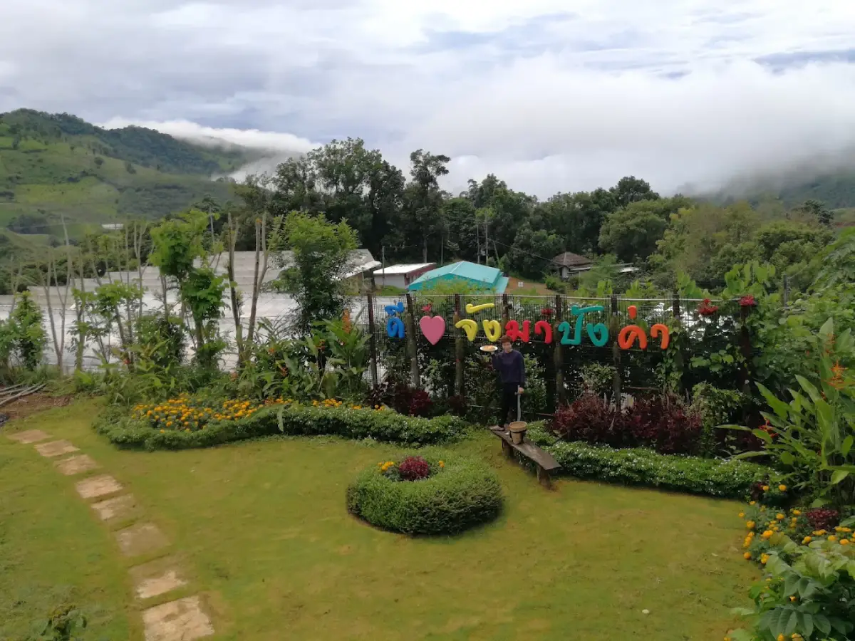
15. Pangka Royal Project Development Center, Phayao Province Pang Kha Royal Project Development Center is located in Pha Chang Noi Subdistrict, Pong District, Phayao. Surrounded by complex northern mountain ranges, it promotes agriculture and livelihoods for highland communities, especially farmers cultivating hillsides and valleys. Its work is closely connected to Hmong and Mien (Yao) communities as well as mountain scenery associated with the Phu Langka area.
Highlights: Highland farming in Phayao; Hmong and Mien communities; Phu Langka scenery; hillside crop fields; livelihood development; and Pong District nature trips.
The center operates in terrain approximately 668 meters above sea level. Highlands and differing slope angles shape agricultural practices in the surrounding villages. Promoting suitable crops together with effective soil and water management expands income opportunities and reduces the effects of cultivating physically demanding land.
The center's significance extends beyond crop production to the well-being of culturally diverse communities. Working with residents requires sensitivity to their livelihoods and priorities. Appropriate knowledge and technology support agricultural employment and improved household security.
Pong District is characterized by mountain ridges and valleys, particularly around Pha Chang Noi and the Phu Langka landscape. Visitors can combine an arranged Royal Project learning experience with sightseeing, but should first check actual distances and the condition of mountain roads.
Hmong and Mien communities maintain distinctive cultural practices and local knowledge. Visitors should respect private spaces, request permission before taking photographs and support locally made goods and services when available. Community encounters add insight into the lives of mountain residents beyond the views themselves.
With two days and one night, travelers can stay in Pong District or near Phu Langka, setting aside separate time for learning about agricultural livelihoods and enjoying nature. Such pacing reduces mountain-driving fatigue and allows more meaningful experiences at each destination.
Pang Kha suits people interested in highland agriculture, ethnic community culture and natural attractions in Phayao. It demonstrates how the Royal Project responds to varying landscapes and ways of life.
Getting There: Travel from Phayao city to Pong District and then to Pha Chang Noi Subdistrict using roads connected to the Phu Langka area. Contact the center to confirm which operational site welcomes educational visitors.
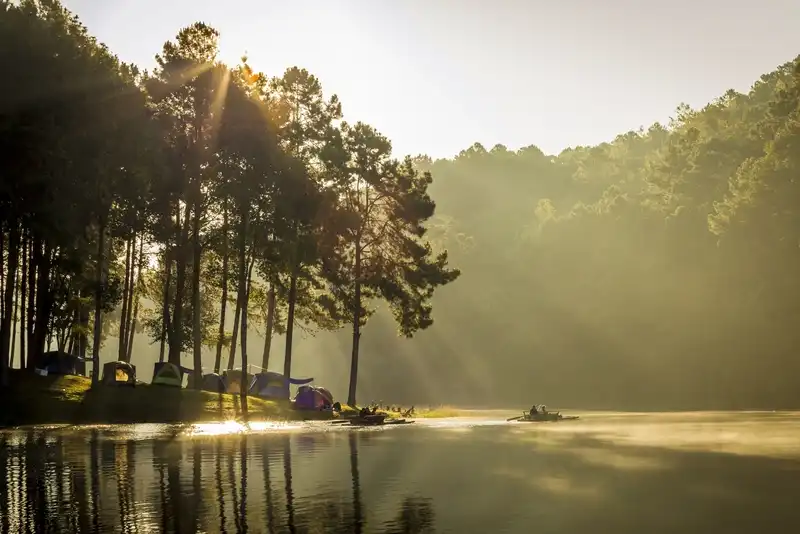
16. Pang Ung Royal Project Development Center, Chiang Mai Province Pang Ung Royal Project Development Center operates in Mae Suek Subdistrict, Mae Chaem District, Chiang Mai, covering Pang Ung community areas and mountain farmland at varying elevations. The center develops agricultural occupations and crops suited to highland conditions while creating economic opportunities and conserving natural resources. Mae Chaem's mountains, headwater forests and valleys have long shaped local farming livelihoods.
Highlights: Mae Chaem mountain agriculture; Pang Ung community livelihoods; highland farming traditions; headwater forests; and soil and water management on steep slopes.
The center operates in mountainous terrain approximately 1,359 meters above sea level. Elevation and climate affect suitable crop varieties, while steep slopes make soil and water management essential. Agricultural extension therefore aims to improve crop quality while protecting the surrounding environment.
The center supports farmers by transferring knowledge appropriate to the landscape and its constraints. Promoting higher-value crops and systematic post-harvest management expands economic opportunities for households and improves the sustainability of their livelihoods.
Mae Chaem is an important headwater landscape. Agricultural activities must balance land use with forest conservation, since changes on hillsides can alter runoff and increase erosion. Learning in Royal Project areas helps visitors appreciate the need for ongoing stewardship of these resources.
The center appeals to travelers interested in farming in a mountain environment and in the lives of communities far from major towns. Visitors can enjoy the landscape of Mae Chaem on the way and learn about livelihood development through activities authorized by the center's personnel.
Pang Ung Royal Project Development Center in Chiang Mai is not the same destination as Pang Ung, the scenic reservoir and pine-forest attraction in Mae Hong Son. Although the names are identical, the locations, responsible organizations and visitor experiences differ. Always check the province and district before navigating.
Pang Ung offers insights into highland livelihood development and conservation in mountain communities. Advance coordination is important because some sections remain working agricultural areas and are not freely accessible to tourists.
Getting There: From Chiang Mai, travel to Mae Chaem District and then toward Mae Suek Subdistrict and Ban Pang Ung using local mountain roads. Verify access conditions, particularly during the rainy season.

17. Pa Miang Royal Project Development Center, Chiang Mai Province Pa Miang Royal Project Development Center is located near Ban Pang Bong, Thep Sadet Subdistrict, Doi Saket District, Chiang Mai. It works with mountain communities whose livelihoods have long involved forests and highland agriculture. The center promotes occupations and living standards while caring for local natural resources. Its name reflects the northern Thai tradition of gathering and processing tea leaves known as miang.
Highlights: Agricultural occupations; Pa Miang and Thep Sadet communities; traditional fermented tea leaves; headwater forests; mountain cultivation; and links between nature and local traditions.
The area lies around 1,010 meters above sea level amid moist mountain forests. Elevation and humidity shape both ecosystems and community agriculture, so crop promotion needs to reflect environmental conditions along with careful soil and water management.
Miang culture is part of northern Thailand's mountain heritage. Miang refers to fermented tea leaves traditionally consumed in local communities. Gathering and processing the leaves draws on inherited plant knowledge and reflects a connection among forest vegetation, livelihoods and the food culture of the Lanna region.
The center develops agricultural production systems that generate community income while fitting the local terrain and resource base. Improving produce quality and sharing appropriate techniques help farmers strengthen their livelihoods without losing sight of forest and water conservation.
Thep Sadet Subdistrict is also known for Arabica coffee cultivation in Chiang Mai's mountains. Interested travelers can combine educational activities about miang and coffee, choosing only experiences that communities or operators officially offer and seeking permission before entering private gardens or farmland.
The journey to Pa Miang suits visitors looking for tranquil mountain life away from the city. Roads pass forests and cultivated slopes but include bends and steep sections. Travel with a roadworthy vehicle and drive cautiously, particularly in wet conditions.
Pa Miang is well suited to cultural travelers, agricultural enthusiasts and those interested in local plant knowledge and forest resources. The area demonstrates how livelihood development can remain connected to a community's cultural heritage.
Open Days: Daily Opening Hours: 08:00 – 17:00
Getting There: Travel from Chiang Mai through Doi Saket to Thep Sadet Subdistrict and Ban Pang Bong. It is possible to pair the route with local miang tea or coffee learning activities; contact the center in advance for group visits.

18. Huai Tom Royal Project Development Center, Lamphun Province Phra Bat Huai Tom Royal Project Development Center is in Na Sai Subdistrict, Li District, Lamphun. It promotes agricultural occupations and community well-being in an area known for the distinctive culture of the Karen Pga K'nyau community at Phra Bat Huai Tom. Local beliefs, handicrafts and ways of life give a visit significance beyond agriculture, encompassing social and cultural development.
Highlights: Phra Bat Huai Tom community agriculture; Pga K'nyau culture; vegetarian traditions; textile weaving; silver handicrafts; and local Buddhist heritage.
The center stands around 495 meters above sea level, with terrain and climate different from those of much higher mountain stations. Agricultural programs therefore need crops and production practices suited to local conditions. Livelihood development alongside careful land and water management strengthens community income and economic resilience.
Phra Bat Huai Tom is distinctive for the enduring customs and shared values of its Pga K'nyau residents. Vegetarian dietary practices are among its best-known characteristics. Textile weaving and silverwork also form part of the community's cultural identity while providing opportunities for income.
The area has strong religious connections with Wat Phra Bat Huai Tom, a center of Buddhist worship and community faith. Visitors may learn about local customs at religious sites that welcome the public, dressing respectfully, following temple rules and observing community practices.
Studying Royal Project work at Phra Bat Huai Tom illustrates development that goes beyond agricultural yields. Effective livelihood programs must consider community organization, cultural traditions and occupations consistent with local ways of life. Links between farming, handicrafts and traditional knowledge offer a valuable view of integrated community development.
Travelers can combine a scheduled visit to the center with Wat Phra Bat Huai Tom and local handicraft learning activities. Arrange visits with organizers to respect community schedules. Purchasing products made by local craftspeople also supports their income directly.
Phra Bat Huai Tom is suitable for families, educational groups, people interested in Karen culture and travelers studying how livelihood initiatives can preserve community identity. It offers a clear example of development involving economic, social and cultural dimensions.
Open Days: Daily Opening Hours: 08:30 – 16:30
Getting There: From Lamphun city, travel to Li District and then through Na Sai Subdistrict to Phra Bat Huai Tom community. Use the same general route as Wat Phra Bat Huai Tom and arrange learning activities in advance.
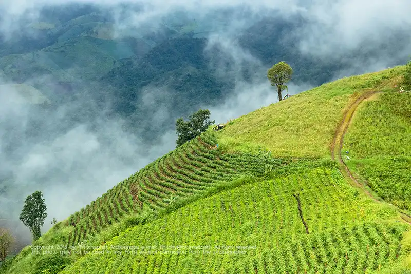
19. Mae Tho Royal Project Development Center, Chiang Mai Province Mae Tho Royal Project Development Center is based near Ban Mae Tho, Bo Sali Subdistrict, Hot District, Chiang Mai. It operates in a northern mountain landscape to promote farming occupations and improve highland community welfare. Its remote ridges and valleys make transportation and the responsible use of soil and water central challenges for livelihood development.
Highlights: Highland agricultural extension; Mae Tho community; Hot District mountains; farmers' occupations; headwater protection; and responsible hillside land use.
The center lies at an elevation of approximately 1,169 meters above sea level, where slopes and climate differ markedly from the lowlands. Elevation and moisture affect both crop choice and the growing calendar. Agricultural extension must therefore combine knowledge of plants, soils and water with careful production planning.
The center helps mountain communities gain alternative employment opportunities. Agricultural training and improved produce management can raise crop quality and income, while transportation costs and moving produce from remote villages remain important economic considerations.
Environmental care is essential because forests and headwater areas regulate moisture and supplies of agricultural water. Cultivating steep slopes without suitable management can accelerate erosion. Extension work therefore helps farmers produce crops while protecting the resources needed for future livelihoods.
Mae Tho is most suitable for visitors seeking an understanding of livelihood development rather than conventional photography-focused tourism. Operational areas are closely linked to community farming, and entering plots or demonstration areas should be arranged with and authorized by responsible staff.
The surrounding roads cross mountain ridges and villages that reflect agricultural life in Hot District. Travelers can explore the natural scenery and local culture if they have time, but should check distances and mountain-road conditions, especially after heavy rainfall.
Mae Tho offers useful learning opportunities for agricultural and community-development study groups. It reveals how Royal Project initiatives address difficult terrain while advancing livelihoods and natural-resource management together.
Getting There: From Chiang Mai, take Highway 108 toward Hot, then follow local roads through Bo Sali Subdistrict to Ban Mae Tho. Confirm the entrance and access conditions with staff before setting out.

20. Mae Tha Nuea Royal Project Development Center, Chiang Mai Province Mae Tha Nuea Royal Project Development Center is situated near Ban Huai Nam Dip, Tha Nuea Subdistrict, Mae On District, Chiang Mai. The foothills and mountains contain farming communities distributed across valleys. The center improves occupations, crop production and local welfare by applying Royal Project principles to the available soil, water and geographical conditions.
Highlights: Foothill agriculture; farmers' occupations; Ban Huai Nam Dip; soil and water management; Tha Nuea landscapes; and community development with conservation.
Operations take place around 522 meters above sea level, much lower than many stations on high peaks. Crop selection and production systems must therefore suit different temperatures, humidity levels and natural resources. This illustrates the Royal Project principle of adapting development methods to each community's particular circumstances.
The center supports agricultural livelihoods by improving produce quality and creating economic opportunities. Knowledge of field management, responsible resource use and production planning provides a basis for more secure farming occupations.
Tha Nuea's landscape includes water sources and mountains that support community livelihoods. Maintaining the quality of soil and water is important for both farming and daily life. Highland development in this setting therefore needs to balance economic activity with careful natural-resource management.
For study groups, Mae Tha Nuea offers an example of agricultural and community development in foothill conditions, rather than on a high summit. Visitors can learn about agricultural extension and resource management through approved activities, preferably arranged with staff beforehand.
The route toward Tha Nuea also passes forested hills and mountain scenery characteristic of Mae On. Additional community or nature visits are possible, but check actual routes because sites may be spread apart and approached by separate village roads.
The center suits visitors interested in agricultural development, natural-resource management and community livelihoods. It shows how Royal Project methods are adapted to different landscapes and local economic conditions.
Getting There: Travel from Chiang Mai to Mae On District, then take local roads through Tha Nuea Subdistrict to Ban Huai Nam Dip. Confirm where the educational group should meet and which farming areas can be visited.

21. Wat Chan Royal Project Development Center, Chiang Mai Province Wat Chan Royal Project Development Center is situated in Ban Chan Subdistrict, Galyani Vadhana District, Chiang Mai. It promotes farming occupations and better livelihoods among highland residents, especially Pga K'nyau communities around Ban Wat Chan. The mountainous surroundings feature pine forests and important headwater catchments. As a result, the center offers learning opportunities in agricultural development, conservation and traditional community culture.
Highlights: Pga K'nyau livelihoods; Wat Chan pine forest; highland agriculture; forest and watershed conservation; local knowledge; and Galyani Vadhana mountain scenery.
Wat Chan's mountain environment differs greatly from urban agricultural areas. Villages are surrounded by forests at elevations with climates suited to particular crops. Extension work must consider temperatures, rainfall, slopes and limited farmland. Agricultural knowledge enables farmers to select crops and develop systems appropriate to their surroundings.
The center's role extends beyond promoting agricultural output to building occupational stability and conserving natural resources. Working alongside residents connects crop-production knowledge to soil and water management, essential to mountain livelihoods and especially significant in stream-source and headwater areas.
Pga K'nyau communities around Ban Chan have a longstanding relationship with forests and agriculture, including cultivation traditions, forest stewardship and knowledge of local plants. Studying the center offers insight into how livelihoods relate to mountain landscapes. Visitors should respect private property and obtain permission before photographing residents or participating in village activities.
Galyani Vadhana District is also known for Wat Chan's distinctive pine forests. Travelers can combine an arranged Royal Project learning visit with pine-forest scenery, but should distinguish public visitor destinations from the center's operational areas, where field access may require prior authorization.
Wat Chan is cool and pleasant for nature tourism in winter, while the rainy season brings lush forests and farmland. Roads to the communities are mountainous and winding, so travelers should check vehicle readiness and allow more time than they would for equivalent distances on lowland roads.
The center suits people interested in conservation-oriented agriculture, Pga K'nyau culture and highland community development. It shows why income generation and forest protection must advance together if mountain communities are to sustain their livelihoods.
Getting There: From Chiang Mai, travel through Mae Rim and Samoeng, or use a route via Pai depending on your starting point. Continue toward Galyani Vadhana District and Ban Chan, checking vehicle suitability and access appointments.
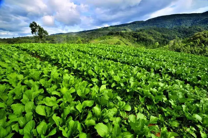
22. Huai Som Poi Royal Project Development Center, Chiang Mai Province Huai Som Poi Royal Project Development Center is in Doi Kaeo Subdistrict, Chom Thong District, Chiang Mai. Active since 2000, it develops agricultural livelihoods and local well-being while protecting natural resources in a mountainous headwater setting. The surrounding landscape is associated with the wider natural environments of Doi Inthanon and Op Luang National Parks, giving the center significance for both agriculture and environmental stewardship.
Highlights: Highland livelihood development since 2000; headwater management; appropriate land use; Chom Thong villages; and agriculture near conservation forests.
Steep mountain terrain and forest ecosystems are central to the center's operating environment. Cultivation here must account for topsoil loss, soil moisture and the irrigation water needed for crops. Appropriate production methods help sustain farming livelihoods and the health of natural resources over the long term.
Royal Project livelihood programs transfer knowledge of crop selection, production planning and improvements in produce quality in response to climate and market demand. Such support gives farmers additional choices without encouraging expansion into forest areas that are important for conservation.
Huai Som Poi is also a place to study community resource management. Water use and care of headwaters affect not only local agriculture but also the people downstream. Work at the center illustrates the wider connections among food production, occupational security and ecosystem protection.
Educational visitors should contact staff beforehand to learn which areas and activities can be accessed. The center is an active working facility, not a botanical garden or recreational attraction open in its entirety. Advance arrangements allow visitors to study operational activities without disrupting research plots or farming work.
Journeys through Chom Thong and Doi Kaeo pass mountains, forests and agricultural villages. During the rains the landscape becomes particularly green, but local roads may be slippery or affected by downpours. A roadworthy vehicle and up-to-date route information are important.
Huai Som Poi is particularly appropriate for agricultural, watershed-conservation and community-development study groups. It offers a practical understanding of livelihood creation where mountain farming and valuable forest ecosystems need to coexist.
Getting There: Take Highway 108 from Chiang Mai toward Chom Thong, then follow the local route through Doi Kaeo Subdistrict toward Huai Som Poi. Confirm the available approach and center arrangements, especially during the rains.

23. Huai Nam Rin Royal Project Development Center, Chiang Rai Province Huai Nam Rin Royal Project Development Center is in Ban Huai Nam Rin, Moo 8, Mae Chedi Mai Subdistrict, Wiang Pa Pao District, Chiang Rai. It has supported highland agricultural occupations and changes in community farming systems since 1982. The work seeks alternatives to opium cultivation and harmful land-use practices by promoting crops and agricultural knowledge suited to the mountains of Wiang Pa Pao.
Highlights: Livelihood development since 1982; highland commercial crops; Ban Huai Nam Rin; watershed conservation; and changing mountain farming systems.
The Huai Nam Rin mountains have elevations and climates favorable to several crops, but steep slopes and land-use constraints require careful management. Agricultural extension therefore combines selection of suitable crops with conservation of soil fertility, allowing farming to continue while reducing pressure on neighboring natural resources.
Historically, a number of northern highland communities depended on opium growing and shifting cultivation. Royal Project initiatives introduced alternative income crops supported by research, better production systems and market access. These changes helped farmers build more reliable occupations while reducing pressure on forested land.
The center transfers expertise in cultivation, quality control and technologies matched to local conditions. Such work connects agriculture to the community economy: higher yields alone are insufficient when farmers still face challenges in quality, transport or access to customers.
The surrounding mountains are home to communities with diverse cultural backgrounds. Interested visitors can learn about village life and local knowledge through activities welcomed by residents, while respecting people's privacy and avoiding unauthorized entry into homes or farmland.
Wiang Pa Pao lies on a route linking Chiang Rai and Chiang Mai. Travelers may plan a trip to Huai Nam Rin together with Huai Pong Royal Project Development Center in the same district, but should check actual distances and access roads: separate mountain villages can require considerably longer driving than a map first suggests.
Huai Nam Rin is recommended for those studying the history of highland development and changes in community agriculture. It exemplifies how crop research and resource management can create new economic opportunities while supporting forest conservation.
Open Days: Daily
Opening Hours: 06:00 – 18:00
Getting There: From Chiang Rai, follow Highway 118 toward Wiang Pa Pao, then take local roads through Mae Chedi Mai to Ban Huai Nam Rin. Confirm the center entrance before studying plots or arranging organized activities.
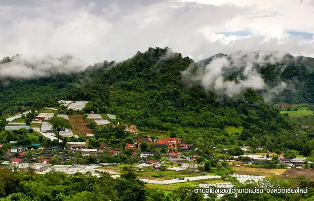
24. Mae Sa Mai Royal Project Development Center, Chiang Mai Province Mae Sa Mai Royal Project Development Center is located in Pong Yaeng Subdistrict, Mae Rim District, Chiang Mai. It promotes agriculture and livelihoods among highland communities and is linked to the earliest history of Royal Project work. The center occupies a mountainous area whose climate supports certain crops, with farming settlements distributed along the slopes. It offers an educational perspective on agricultural development and resource management in Mae Rim.
Highlights: Early Royal Project history; temperate crops; agricultural research and technology transfer; Mae Sa Mai communities; headwater management; and Mae Rim mountains.
The history of Mae Sa Mai is connected to the Royal Project's beginnings in 1969, when agricultural practices and living conditions in mountain villages were studied to identify appropriate livelihood alternatives. Highland development therefore required more than introducing a new crop: the conditions of each place and the needs of farmers also had to be understood.
The center applies agricultural knowledge to community occupations through suitable crop choices, soil and water management, and improvements in produce quality. Better organized production can help farmers use limited farmland responsibly and create more stable long-term income opportunities.
Mae Sa Mai is mountainous and steep. Agriculture in this landscape requires precautions against erosion and changes in seasonal water supply. Cultivation methods suited to natural constraints help maintain productive land and reduce impacts on headwater forests.
For educational travelers, Mae Sa Mai provides a setting for studying the links between agricultural development and changes in community economic life. Visits should be authorized by local managers, especially when they involve experimental plots or the regular working activities of personnel and farmers.
Mae Rim is a tourism district with mountain scenery and several agriculture-related learning destinations. Visitors can combine Mae Sa Mai with sites around Pong Yaeng and Mae Raem, planning routes from actual locations rather than assuming everything within one district is nearby.
The center is relevant to students and visitors interested in the Royal Project's early highland-development history. It illustrates how agricultural knowledge can expand occupational choices while protecting natural resources in mountainous areas.
Open Days: Daily
Opening Hours: 08:00 – 17:00
Getting There: From Chiang Mai, follow Highway 107 to Mae Rim and continue on local roads into Pong Yaeng Subdistrict. Contact the center to confirm access and educational activities in advance.
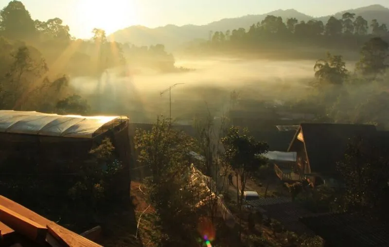
25. Huai Pong Royal Project Development Center, Chiang Rai Province Huai Pong Royal Project Development Center is in Ban Huai Pong, Moo 13, Mae Chedi Mai Subdistrict, Wiang Pa Pao District, Chiang Rai. The center operates in steep mountain country whose climate suits certain highland crops. Its work promotes agricultural occupations, produce quality and community welfare, connecting economic development with the protection of soil, water and forests.
Highlights: Farming on steep mountainsides; cool-climate vegetables; Ban Huai Pong occupations; soil and water management; highland farming and Wiang Pa Pao scenery.
A defining feature of Huai Pong is its steep terrain, with some fields occupying clearly inclined hillsides. This affects field layout and water use. Farming must be matched to the available land and supported by methods that prevent topsoil loss and maintain natural fertility.
Royal Project livelihood development has helped highland villages move from limited cropping choices and production methods toward more systematic cultivation, suitable crop selection and quality management. These improvements support continuous income generation and can reduce pressure to expand farmland into headwater forests.
The highland climate differs from the plains during parts of the year, allowing the cultivation of selected vegetables, flowers or fruits when appropriate. Production plans need to account for temperatures, seasonal water supplies and the times at which produce can be transported to market.
The center's tourism value comes from learning how crops can be grown under difficult physical conditions, rather than visiting a large ornamental garden. Organized study groups may explore hillside land management, livelihood promotion and resource conservation through activities approved by staff.
Wiang Pa Pao has attractive mountain scenery and farming communities. Travelers can consider visiting Huai Pong and Huai Nam Rin on the same trip, provided they check actual road conditions and journey times. Roads to hillside settlements can be winding and difficult during heavy rain.
Huai Pong is suitable for anyone interested in hillside agriculture and community livelihoods. Its work demonstrates why applying agricultural knowledge together with soil and water conservation is vital for sustainable farming in the highlands.
Open Days: Daily
Opening Hours: 06:00 – 18:00
Getting There: Travel from Chiang Rai via Highway 118 to Wiang Pa Pao, then use local roads through Mae Chedi Mai to Ban Huai Pong. Check wet-season road conditions and make appointments for field studies.

26. Huai Laeng Royal Project Development Center, Chiang Rai Province Huai Laeng Royal Project Development Center is based near Ban Huai Laeng, Tha Kham Subdistrict, Wiang Kaen District, Chiang Rai, in the mountain borderlands between Thailand and Laos. It promotes highland farming, occupational development and farmers' quality of life. The surrounding hills feature steep slopes and cultivated areas, while cooler conditions during parts of the year permit selected crops that require particular temperatures.
Highlights: Cool-climate farming; Thai–Lao border mountains; Ban Huai Laeng; commercial crop promotion; resource conservation; and highland community occupations.
The Huai Laeng mountains vary in elevation and steepness. Crop choice and field management therefore depend on detailed knowledge of temperature, humidity and the soil's capacity to retain water. Suitable production can improve crop value without requiring farmers to clear additional forest land.
The center improves community welfare by transferring agricultural skills and promoting alternative occupations. Development is not limited to commercial crops; it includes managing the resources on which farming depends and adapting production systems to market demand.
Wiang Kaen has diverse landscapes and cultures, especially along its mountain border with Laos. Forests, farmland and settlements together illustrate how topography shapes local lifestyles. Visitors should respect private property and avoid disrupting farmers' daily work.
Educational tourism at Huai Laeng is suited to people interested in crop production, conservation and community development. Visitors should arrange access beforehand, since experimental plots and working areas may not be open to independent travelers.
A visit to Huai Laeng can be combined with Pha Tang Royal Project Development Center in the same district. It is sensible to schedule educational activities separately from scenic viewpoints and allow an overnight stay for unhurried driving and more thorough learning.
Winter brings cooler air and appealing mountain scenery around Wiang Kaen, though mist and slippery roads can affect driving. Travelers should check their vehicles and keep speeds moderate on mountain roads with frequent bends.
Huai Laeng exemplifies Royal Project operations in a border community facing challenges in land, agriculture and transport. It offers a practical picture of livelihood development and resource conservation in the mountains.
Open Days: Daily
Opening Hours: 05:00 – 18:00
Getting There: From Chiang Rai, travel through Thoeng to Wiang Kaen, then continue by local roads to Tha Kham Subdistrict and Ban Huai Laeng. Confirm roads and agricultural study visits with center staff.

27. Sa Ngo Royal Project Development Center, Chiang Rai Province Sa Ngo Royal Project Development Center is in Ban Sa Ngo, Moo 7, Si Don Mun Subdistrict, Chiang Saen District, Chiang Rai. It develops highland agriculture and community occupations near the Golden Triangle. The surrounding rolling hills provide views toward northern border landscapes, while Sa Ngo is culturally diverse, notably for its Akha residents. This makes the area a place for learning about farming, nature and community heritage together.
Highlights: Sa Ngo agricultural livelihoods; Akha culture; Golden Triangle views; hillside farming; conservation; and Chiang Saen cultural itineraries.
The center uses agricultural knowledge adapted to the available land and resources to strengthen farmers' occupations. Suitable crops, improved produce quality and well-planned production help raise incomes and make livelihoods more stable.
The Sa Ngo landscape includes hills and inclined farmland, making careful soil and water management necessary. Responsible cultivation reduces erosion and helps maintain productive land. Royal Project development therefore links environmental conservation with the growth of the village economy.
Ban Sa Ngo has a distinctive cultural identity, including Akha traditions and daily practices closely tied to family, community and farming. Visitors should respect local beliefs and customs, obtain permission for photographs and support community products and services where appropriate.
The center is not far from the Golden Triangle, an area where the histories and landscapes of Thailand, Laos and Myanmar converge. Travelers can connect agricultural learning with border geography and the history of Chiang Saen, visiting approved viewpoints overlooking mountains and the Mekong River before or after their appointment.
A visit to Sa Ngo can be planned over one or two days. Agricultural enthusiasts can arrange time with the development center and explore Chiang Saen's cultural attractions during the rest of the trip, gaining a broader understanding than a quick tour of farming plots alone.
Sa Ngo is particularly appealing to visitors interested in community livelihoods, Akha culture and the Golden Triangle's regional history. The center demonstrates how highland agricultural development can take place while respecting cultural identity.
Open Days: Daily
Opening Hours: 08:00 – 17:00
Getting There: Travel from Chiang Rai to Chiang Saen, then follow signs toward Si Don Mun Subdistrict and Ban Sa Ngo. The route can be combined with the Golden Triangle; prearrange agricultural learning activities at the center.

28. Huai Siao Royal Project Development Center, Chiang Mai Province Huai Siao Royal Project Development Center operates in Ban Pong Subdistrict, Hang Dong District, Chiang Mai. It promotes farming and occupations among communities in the foothills and nearby mountains. With slopes and cultivated areas requiring careful management of soil and water, the center offers an example of how agricultural livelihoods can be strengthened while conserving local natural resources.
Highlights: Agricultural occupations in Hang Dong; foothill crop production; soil and water care; Ban Pong communities; Hang Dong–Samoeng scenery; and headwater protection.
Huai Siao's main interest is its adaptation of agricultural methods to foothill conditions rather than the climate of high mountain summits. Choosing appropriate crops requires an understanding of temperature, humidity, water supplies and soils. Effective production depends on field management and planting schedules as much as elevation.
The center assists communities with farmland scattered along the lower mountain slopes. Agricultural training helps farmers improve produce quality and use resources appropriately, especially through soil and water conservation that protects the productivity of their land.
Ban Pong's scenery and community life reflect farming practiced alongside the use of natural resources. Educational visitors can study how livelihood development depends on social and economic circumstances as well as technical agricultural knowledge.
Huai Siao is suitable for school groups, university students and people interested in foothill farming. Visitors should contact the center before coming, as operational plots and activities may not be freely accessible. Arrangements with personnel make the visit both more informative and less disruptive.
Those with one day available can consider Huai Siao together with Thung Roeng or nearby communities in Hang Dong. Choose stops based on actual distances and road conditions, as some routes reach villages along narrow mountain roads.
Huai Siao shows how Royal Project development takes place even close to a city where physical constraints of mountainous land remain. Appropriate farming practices and resource conservation respond to the distinct needs of local communities.
Getting There: From Chiang Mai, take Highway 108 toward Hang Dong, then Highway 1269 toward Samoeng. Continue into Ban Pong Subdistrict, checking the center entrance and any narrow or unpaved final roads.
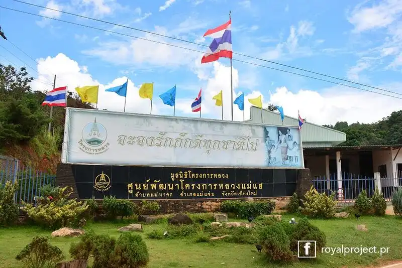
29. Mae Hae Royal Project Development Center, Chiang Mai Province Mae Hae Nuea Royal Project in Chiang Mai is an operating area of the Mae Hae Royal Project Development Center near Mae Hae communities in Mae Na Chon Subdistrict, Mae Chaem District. It promotes agriculture and livelihoods among highland residents, particularly villages affected by difficult transport and limited cultivable land. Activities support changes in agricultural practices, improvements in produce quality and protection of natural resources essential to local life.
Highlights: Mae Hae development work; Ban Mae Hae Nuea; highland livelihoods; Mae Chaem mountain scenery; headwater conservation; and agricultural transition.
Mae Hae's history is linked to the development of mountain communities that formerly faced difficulties with income, transportation and resource use. Royal initiatives introduced crops and production methods designed to create suitable incomes while helping to protect forests and headwater ecosystems.
Mae Hae Royal Project Development Center transfers agricultural skills and broadens livelihood opportunities. Crop suitability, climate, terrain, production planning and transporting harvests out of the mountains are all important considerations for household economic security.
Soil and water management are especially significant in Mae Hae's steep mountainous landscape. Agricultural development must limit erosion and encourage responsible land use. Protecting headwater ecosystems also preserves resources required by the community for daily living.
Visiting Mae Hae Nuea is most valuable to people interested in community development and mountain agriculture. Authorized activities reveal the connections among occupations and resource management; contact local staff beforehand because working agricultural plots and regular farming activities require appropriate access arrangements.
Mae Chaem has diverse landscapes and village cultures. Travelers may combine a learning visit to the Royal Project area with nearby nature and community attractions, while allowing for driving distances along mountain roads rather than attempting too many villages in a single day.
In the rainy season, check road conditions because mountain routes can become slippery or suffer damage after heavy rainfall. Winter is cooler and suitable for landscape study, but travelers should still bring warm clothing and provisions appropriate for remote areas.
Mae Hae Nuea is appropriate for visitors examining the promotion of agricultural livelihoods and the conservation of mountain resources. It reflects the Royal Project's role in supporting economic and social change while protecting important highland ecosystems.
Getting There: From Chiang Mai, travel toward Mae Chaem, then use local roads to Mae Na Chon Subdistrict and the Mae Hae area. Ask staff to confirm the final approach and mountain-road conditions before organized visits.

30. Huai Nam Khun Royal Project Development Center, Chiang Rai Province Huai Nam Khun Royal Project Development Center is situated near Ban Huai Nam Khun, Tha Ko Subdistrict, Mae Suai District, Chiang Rai. Since February 1983 it has helped highland communities develop agricultural occupations and improve their quality of life. Its objectives include promoting income crops suited to the landscape and climate while managing the natural resources on which farming depends.
Highlights: Royal Project operations since 1983; highland crops; Ban Huai Nam Khun; soil and water management; headwater conservation; and Mae Suai mountain scenery.
Huai Nam Khun's terrain consists of steep mountain ridges and agricultural valleys. Cultivation needs crop choices matched to temperature, rainfall and soil conditions. Agricultural extension combines scientific farming knowledge with responsible land and water management to achieve better produce quality while limiting problems associated with cultivation on slopes.
Development at the center is connected to the transformation of highland livelihoods in an area once affected by opium cultivation and agricultural practices that placed pressure on forests. Promoting appropriate income crops requires knowledge transfer, close cooperation with farmers and marketing channels that improve opportunities for household earnings.
The center teaches crop production, quality management and agricultural planning, supporting farmers in selecting methods appropriate for their land. These measures help strengthen the local economy and reduce pressure on natural resources.
Mae Suai's mountain communities have diverse cultural backgrounds. Learning about local ways of life adds a cultural dimension to an agricultural visit. Travelers should respect traditions and privacy, seek permission before taking photographs and avoid entering residents' workplaces without consent.
Huai Nam Khun offers learning opportunities for students, educational groups and those interested in rural occupations. Visits to activities or experimental fields should be booked in advance, allowing staff to arrange access around the work being performed at the time.
Travelers can combine the center with natural attractions elsewhere in Mae Suai if routes and mountain-road distances permit. During the rains, take particular care with slippery roads, fog and limited visibility on winding uphill sections.
Huai Nam Khun demonstrates highland development that addresses occupations, village economies and resource conservation together. A visit illustrates the importance of choosing farming systems suited to the terrain and using knowledge to improve mountain-community well-being.
Open Days: Daily
Opening Hours: 06:00 – 18:00
Getting There: From Chiang Rai, take Highway 118 toward Mae Suai, then local roads to Tha Ko Subdistrict and Ban Huai Nam Khun. Confirm rainy-season road conditions and visiting arrangements for educational groups.
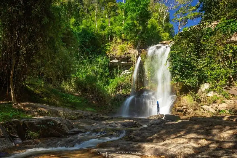
31. Mae Sa Pok Royal Project Development Center, Chiang Mai Province Mae Sapok Royal Project Development Center is located near Ban Mae Sapok Nuea, Mae Win Subdistrict, Mae Wang District, Chiang Mai. It has supported highland agricultural occupations since 1983 in valleys and mountains behind the Doi Inthanon range. The area's Pga K'nyau Karen heritage, farmland, forests and streams make the center an appealing place to learn about livelihoods, nature and community traditions together.
Highlights: Agricultural work since 1983; cool-climate and organic vegetables; Pga K'nyau traditions; seasonal terraced fields; streams; mountain recreation; and resource management.
The center provides alternative occupations for mountain communities that previously faced obstacles in transport, farmland and market access. Encouraging crops suited to the local climate helps farmers improve production and obtain income from quality produce while accounting for limitations in soil and water resources.
Farming practices change with the seasons and include leafy vegetables, salad crops, organic produce and plants suited to the valley climate. Field management requires attention to moisture, drainage and soil quality, especially on slopes. Studying such systems reveals why highland farming depends on planning and technical knowledge, not merely selecting crop species.
The Mae Sapok community maintains Pga K'nyau cultural traditions expressed through farming, textile weaving and local ceremonies. Visitors can learn through community activities open to outsiders, while respecting private property and seeking consent before photographing residents or attending village events. Cultural encounters add meaning beyond the scenery.
The surrounding Mae Wang landscape contains natural streams and waterfalls that can be included in a trip when routes and opening conditions permit. Travelers wishing to stay overnight should ask the center about accommodation or camping arrangements, as capacity and rules can change with operational needs and the season.
Winter is popular for cool mountain weather, while rainy months bring lush forests and fields. Some village roads can become slippery or visibility can deteriorate during the rains. Plan sufficient travel time and drive slowly on winding mountain sections.
Mae Sapok is suitable for families, school and university groups and visitors interested in community livelihoods. The setting offers insights into crop production, resource management, headwater conservation and Pga K'nyau culture within the same mountain landscape.
Getting There: From Chiang Mai, take Highway 108 toward San Pa Tong, then Highway 1013 toward Mae Wang and Mae Win before turning to Ban Mae Sapok Nuea. Check the last section of road and coordinate access with the center.
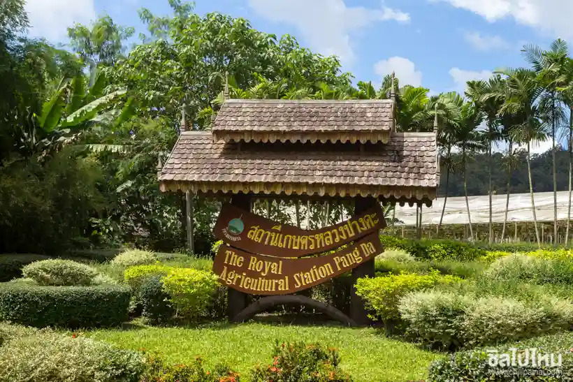
32. Pang Da Royal Agricultural Station, Chiang Mai Province Pang Da Royal Agricultural Station is located in Ban Pang Da, Samoeng Tai Subdistrict, Samoeng District, Chiang Mai. It is an important highland agricultural research and development station set amid plains, low hills and the surrounding mountains of Samoeng. The station studies crop production, plant varieties and farming methods appropriate for upland climates, generating knowledge that can be used to improve farmers' occupations.
Highlights: Agricultural research and demonstrations; highland vegetables and commercial crops; plant varieties; cultivation technology; Samoeng farmland; and Royal Project research.
Pang Da differs from many Royal Project development centers because it focuses on agricultural research and testing. Work can include selecting varieties suited to local weather, improving cultivation techniques and enhancing produce quality. Research results can subsequently support agricultural extension in other highland production areas.
Samoeng's climate changes across seasons and elevations, making it suitable for studying several crop types. Research examines how temperature, water, soil and plant growth interact, as well as techniques that can improve both crop performance and consistency of quality.
The station's value lies in producing agricultural knowledge rather than merely displaying attractive plantations. Visitors interested in agriculture may learn about research and demonstrations through staff-approved activities. Groups should arrange visits beforehand to avoid interfering with experiments.
Pang Da can be connected with agritourism elsewhere in Samoeng District, where valleys and cultivated land provide varied rural scenery. A one-day visit could make the station the main educational activity, followed by community attractions or public visitor sites on the return route.
Students and agricultural professionals benefit from seeing why crops must be tested before cultivation is expanded. A plant performing well in one location may struggle in another with different soil, altitude or temperature. Research is therefore indispensable to successful agricultural livelihood development.
Pang Da is suited to students, researchers, farmers and agritourism visitors who want to understand how practical experiments support better produce and occupational opportunities for highland communities.
Getting There: Travel from Chiang Mai to Samoeng District, then continue to Samoeng Tai and Ban Pang Da. Contact station staff before accessing experimental fields or arranging an academic visit.
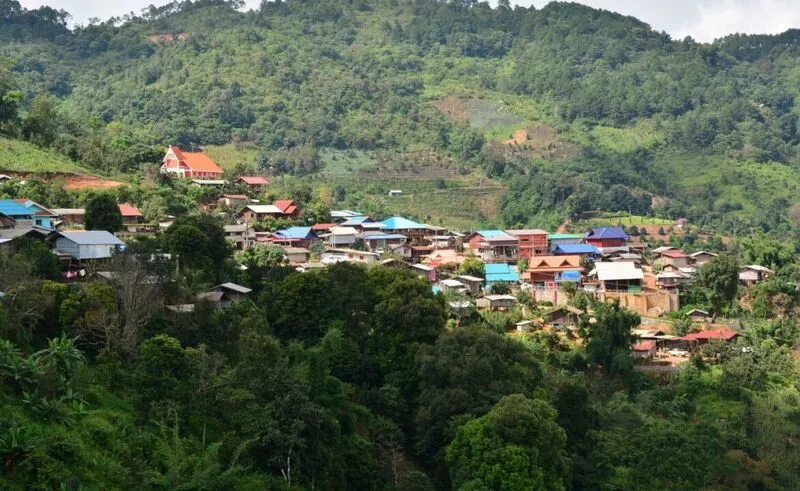
33. Mae Poon Luang Royal Project Development Center, Chiang Rai Province Mae Pun Luang Royal Project Development Center is associated with the mountainous Wiang Pa Pao area of Chiang Rai, while the Royal Project's operating context also extends toward Ban Khun Chae Bon, Mae Waen Subdistrict, Phrao District, Chiang Mai. This reflects a connected mountain landscape crossing provincial boundaries. The center develops commercial crops and highland livelihoods in an environment of complex ridges, cooler conditions and mountain farming communities.
Highlights: Highland crops; mountain borderlands between Chiang Rai and Chiang Mai; community livelihoods; conservation of forested watersheds; and agricultural learning.
Mae Poon Luang's elevation and cooler conditions than the plains create potential for crops that require lower temperatures. Mountain farming must account for crop selection, soil suitability and irrigation, since steep slopes can increase the risk of topsoil erosion during the rainy season.
The center develops occupations and transfers agricultural knowledge so farmers can grow quality crops aligned with market demand. Improving production efficiency while limiting the risks of inappropriate resource use contributes to the economic security of highland households.
Mae Poon Luang's mountains are important to headwater forest ecosystems: rainfall collected on the ridges feeds streams flowing toward lower ground. Agricultural livelihood development must therefore protect forest cover and reduce soil erosion, preserving water quality and long-term farming opportunities.
For educational tourism, Mae Poon Luang is appropriate for people interested in cool-climate crop production and community development in remote areas. Contact staff in advance to confirm which plots may be studied or visited, because some fields are operational farmland not freely accessible to tourists.
Winter brings pleasantly cool mountain weather, while the late rainy season and early winter offer lush green forests and hillsides. Travelers should bring warm clothes and check their vehicles before leaving, as the mountain roads have steep sections and numerous bends.
Mae Poon Luang stands out as a livelihood-development area where farming methods must be adapted to the altitude and terrain of communities near a provincial boundary. It illustrates the application of agricultural knowledge alongside the protection of natural resources.
Getting There: Confirm the actual destination with staff because the operating area is described in connection with both Wiang Pa Pao in Chiang Rai and the Phrao mountain communities in Chiang Mai. Check roads before traveling across the provincial border.
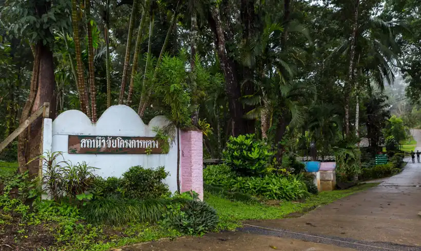
34. Mae Lod Royal Project Research Station, Chiang Mai Province Mae Lod Royal Project Research Station is located near Ban Mae Lod Nuea, Sop Poeng Subdistrict, Mae Taeng District, Chiang Mai. The station studies crops and agricultural systems suited to the highlands amid Mae Taeng's mountains and farming areas. Its role is to test and develop knowledge applicable to farmers' livelihoods, taking account of terrain, climate, natural resources and crop-production systems.
Highlights: Royal Project agricultural research; suitable crop varieties; highland production techniques; sustainable soil and water management; and practical agricultural demonstrations.
Research stations and Royal Project development centers have different but connected duties. Research stations generate and test knowledge, while development centers transfer and apply it to help local farming communities. The results of agricultural experiments can thus guide production practices suited to real conditions in each area.
Mae Taeng's landscape includes foothills, valleys and high mountain ranges. Mae Lod's location allows researchers to examine interactions between the environment and crop cultivation, including soil properties, temperature, humidity, water supplies and the ways plants respond to different methods of care.
Research also helps improve produce quality and reduce risk to farmers. Introducing a new crop without supporting evidence can lead to losses in yield or income. Trials and evaluations before wider adoption are therefore essential to sound, systematic agricultural development.
For organized study groups, Mae Lod offers a valuable setting for learning how agricultural research and demonstrations operate. Arrange suitable activities with staff before visiting and never enter experimental fields without permission, since interference can disrupt research or compromise the accuracy of its results.
A trip to Mae Taeng can be combined with nearby natural attractions, but research-learning sessions should be planned separately from general leisure activities to allow enough time for detailed study. Choose routes according to real driving distances and road conditions.
Mae Lod is suitable for students, farmers and visitors interested in agricultural science. It highlights the importance of research as the foundation of livelihood promotion and highland development in Thailand.
Getting There: Confirm the exact Mae Lod research-station location and visiting arrangements with its personnel before traveling in the Chiang Mai mountains. Check local road conditions and do not enter experimental plots without permission.
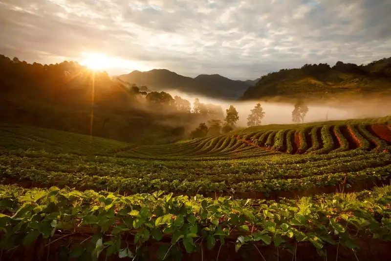
35. Nong Khiao Royal Project Development Center, Chiang Mai Province Nong Khiao Royal Project Development Center is located in Mueang Na Subdistrict, Chiang Dao District, Chiang Mai, and promotes agriculture and living standards in highland communities near the border. Its work is associated with Ban Nong Khiao, Ban Nong Wua Daeng and Ban Mai Samakkhi. The surrounding mountains, forests and culturally diverse farming villages make the center significant for agricultural development and responsible resource use.
Highlights: Ban Nong Khiao agricultural livelihoods; diverse mountain cultures; Chiang Dao farming; soil and water management; and Mueang Na–Arunothai nature routes.
The center creates economic opportunities by encouraging crops suited to the climate and terrain. Practical cultivation methods and improved management of produce can help farmers raise production quality and develop their occupations despite farmland being scattered along mountain slopes.
Highland development here also involves conservation of natural resources. The settlements are connected to headwater forests and mountain ecosystems, so good soil and water management helps control erosion and ensures responsible use of land needed for future farming livelihoods.
Mueang Na is culturally diverse, reflecting several mountain communities. Travelers can learn about village life, traditions and agricultural knowledge through activities welcomed by residents. Respect for local culture and support for community-produced goods are important parts of responsible tourism.
For agritourism visitors, Nong Khiao offers opportunities to understand crop production systems and the extension of highland occupations. It is especially useful for students and people studying community development. Access to plots and operational areas should be approved by center staff to avoid disrupting farmers.
A trip can be linked with other learning destinations in Chiang Dao District, but driving distances and access between separate communities must be checked. Some mountain roads are winding and can be affected by heavy rainfall.
Nong Khiao appeals to people interested in agriculture, community culture and highland development. It demonstrates how occupational opportunities can be advanced together with the protection of forest and water resources near Thailand's northern border.
Getting There: From Chiang Mai, follow Highway 107 toward Chiang Dao, then continue through Mueang Na Subdistrict to Ban Nong Khiao. Confirm the entrance and any group-visit appointments with center staff.
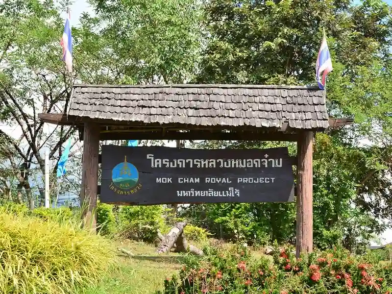
36. Mok Cham Royal Project Development Center, Chiang Mai Province Mok Cham Royal Project Development Center is near Ban Huai Sala, Tha Ton Subdistrict, Mae Ai District, Chiang Mai. It promotes agricultural livelihoods in the Kok River basin, where mountains, farmland and culturally diverse settlements form the surrounding landscape. Its work develops crop-production systems, responsible resource use and better income opportunities for local farmers.
Highlights: Kok River basin agriculture; Ban Huai Sala; highland livelihoods; soil and water conservation; Mae Ai mountain landscapes; and Royal Project crop-production learning.
Mok Cham's geography is influenced by the Kok River basin and nearby mountains. Agriculture must account for soil characteristics, irrigation water and seasonal climate. Promoting suitable crops supports consistent production quality and income for farming communities.
The center transfers agricultural knowledge to residents, including crop choice, field management and improvements in produce quality. These practices help farmers adapt to resource limitations and changes in weather while strengthening their occupations.
The relationship between agriculture and water resources is important in Mok Cham, where natural waterways support both cultivation and daily village life. Efficient water use and forest conservation are therefore vital for maintaining productive farming systems over the long term.
Tha Ton and Mae Ai feature diverse community cultures. Visitors may learn about local lifestyles and farming traditions through activities open to the public, respecting privacy and supporting locally produced goods and services.
Agricultural learning can be combined with views of the Kok River basin and communities around Tha Ton, depending on travel time. However, the center remains an agricultural working area, and plot visits or organized activities should be coordinated with its staff beforehand.
Mok Cham is suitable for those interested in agricultural livelihood development and conservation within a river-basin and mountain setting. It reflects the connections among economic security, environmental management and village life.
Getting There: From Chiang Mai, use Highway 107 toward Fang and Mae Ai, then continue toward Tha Ton and Ban Huai Sala on local roads. Confirm the correct destination and arrange educational visits in advance.

37. Huai Luek Royal Project Development Center, Chiang Mai Province Huai Luek Royal Project Development Center is in Ping Khong Subdistrict, Chiang Dao District, Chiang Mai. It promotes agricultural occupations and highland community development in an area of plains, hills and surrounding mountains. Fields and settlements are scattered across valleys, making the center a useful place to study crop production and resource management along the Chiang Mai–Fang travel corridor.
Highlights: Highland agricultural demonstrations; Royal Project produce; Ping Khong village life; Huai Luek watershed management; Chiang Dao scenery; and suitable crop-production systems.
Huai Luek has elevations of approximately 500–900 meters above sea level, producing varied microclimates and agricultural conditions. Crop selection and production need to suit soils, humidity and seasonal water supplies. Appropriate methods help farmers raise produce quality and make efficient use of land.
The Huai Luek watershed forms part of the upper Ping River basin, an important source of water for the region. Agricultural development therefore needs to protect forests and manage irrigation appropriately to avoid creating excessive pressure on the surrounding ecosystems.
The center provides agricultural training, including cultivation techniques, produce management and improvements in production efficiency. Such work helps farmers build more secure occupations while encouraging responsible use of natural resources.
Travelers can arrange an agricultural learning stop at Huai Luek along the Chiang Mai–Fang road. Depending on what is open, activities may include authorized demonstration plots and seasonal produce. Groups should confirm arrangements before setting out.
Surrounding communities reveal highland farming practices closely linked to land and natural resources. Respect private property and do not enter working fields without permission. Buying produce from authorized community outlets can provide local economic support.
Huai Luek is suitable for families, students and travelers interested in agriculture. It illustrates farming development at mid-range mountain elevations and the importance of watersheds and conservation.
Open Days: Daily
Opening Hours: 09:00 – 16:00
Getting There: Take Highway 107 from Chiang Mai toward Chiang Dao and Fang. Near kilometer marker 95, use the turnoff leading approximately 500 meters to the center, checking the entrance and visitor activities beforehand.
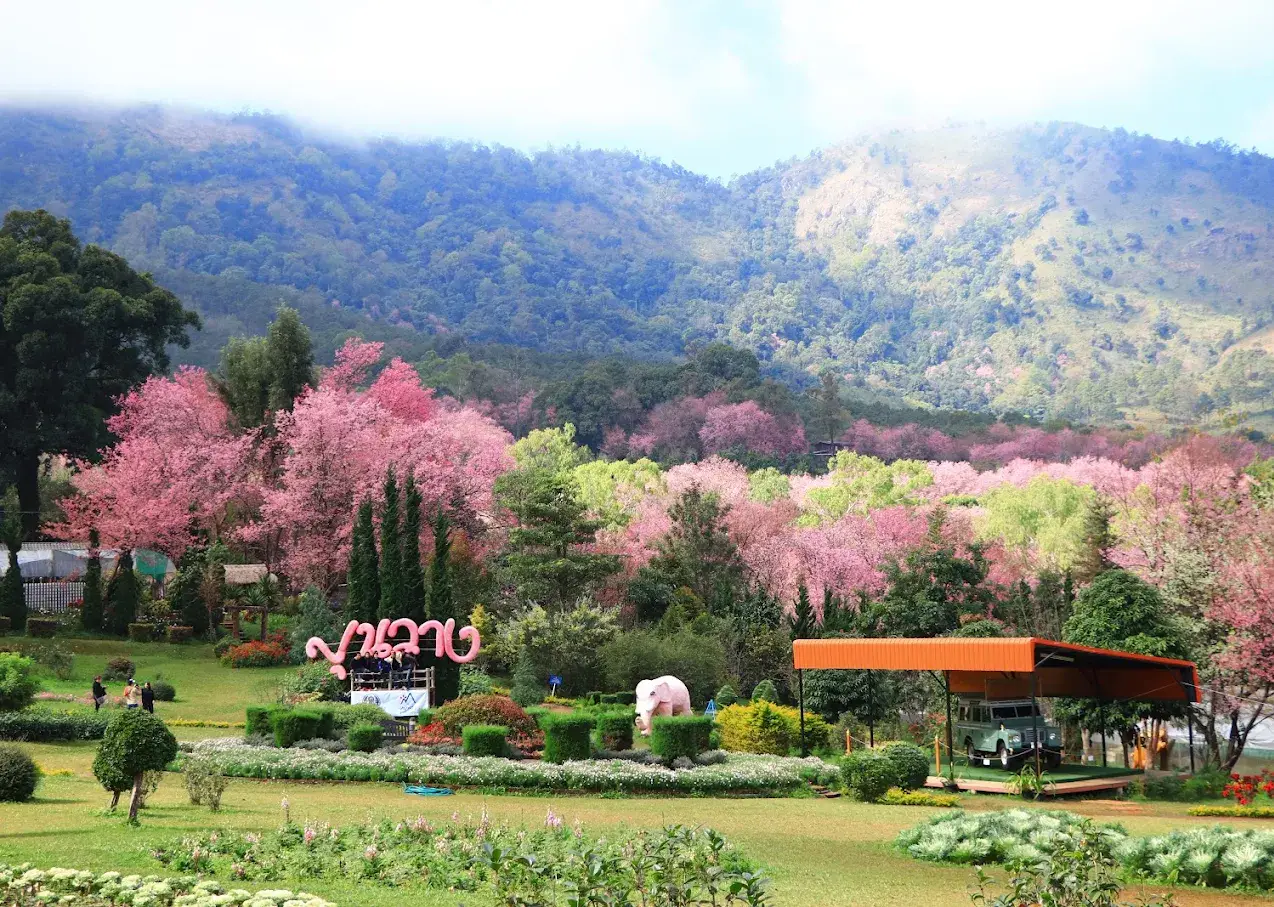
38. Khun Wang Royal Project Development Center, Chiang Mai Province Khun Wang Royal Project Development Center is located at 112 Moo 12, Ban Khun Wang, Mae Win Subdistrict, Mae Wang District, Chiang Mai. Established in 1985, the center promotes agricultural livelihoods, community development and natural-resource conservation in the mountains around Doi Inthanon. The landscape ranges from approximately 900 to 1,400 meters above sea level and supports various cool-climate vegetables, fruits and flowers. It demonstrates how agricultural expertise can support incomes while protecting mountain ecosystems.
Highlights: Development work since 1985; highland vegetables and temperate fruit; crop trials and demonstrations; Pga K'nyau and Hmong villages; headwater conservation; and Doi Inthanon scenery.
The center's history is connected to the highland-development initiatives of King Bhumibol Adulyadej the Great. During a visit to Ban Khun Wang in 1975, His Majesty called for agencies to work together to improve local livelihoods. The Khun Wang center was subsequently established in 1985 to promote occupations as alternatives to opium growing, reduce shifting cultivation and support stable agricultural livelihoods.
Its area of responsibility covers approximately 29,704 rai, including four villages and seven settlement groups inhabited by Pga K'nyau and Hmong communities. Operations emphasize income from commercial crops suited to the highland environment, improvements in living standards and practical training in agricultural production.
With an average temperature of approximately 18 degrees Celsius, Khun Wang can produce many temperate crops. Important products include cos lettuce, Royal Project tomatoes, broccoli, passion fruit, cape gooseberries, avocados, chrysanthemums, snow fungus mushrooms, Tea No. 17 and wheat. The crops have different requirements for heat, moisture and care, making technical knowledge and careful production planning essential.
The center's experimental and demonstration plots help identify locally suitable varieties and cultivation methods that improve produce quality and consistency. Work considers not only the volume produced but also operating costs, harvesting, post-harvest handling and market demand, each of which directly affects farmers' incomes.
Vegetables such as cos lettuce and broccoli require careful soil and water management and appropriate protection against crop pests. Fruit crops such as passion fruit and avocado have different growth periods and maintenance requirements. Encouraging a variety of commercial crops gives farmers more livelihood options and reduces the risk of relying on just one product.
Khun Wang also promotes safe food-production systems to improve quality and consumer confidence. The approach covers selecting agricultural inputs, irrigation, field care, pest management and maintaining quality before products reach the market, strengthening agricultural standards within highland communities.
Conservation is another important duty. Steep terrain and important headwater forests demand measures to limit soil erosion, manage water and use farmland appropriately. Activities include supporting the principle of 'three kinds of forest, four benefits' and planting vetiver grass to help protect soil and water.
On the social side, the center works with Pga K'nyau and Hmong communities whose cultures and ways of life are closely connected to the mountains. Livelihood promotion takes account of community priorities, land use and household needs. Farmers' participation is essential to making development relevant to real local circumstances.
For travelers, Khun Wang is an agricultural and highland-development learning destination that can be combined with nature tourism around Doi Inthanon. Winter brings cool weather and attractive mountain scenery; the wider Khun Wang area is also known for seasonal wild Himalayan cherry blossoms, a popular draw during their blooming period.
Visitors should distinguish Khun Wang Royal Project Development Center from Chiang Mai Royal Agricultural Research Center (Khun Wang). They are separate organizations even though both operate in the Khun Wang mountains. Checking the correct name and location before travel is especially important for groups with scheduled appointments.
Khun Wang is suitable for families, students, farmers and visitors interested in sustainable agriculture. It highlights how scientific research, commercial crop production, community income and natural-resource conservation can reinforce one another in the highlands.
Open Days: Daily
Opening Hours: 08:00 – 16:00
Getting There: From Chiang Mai, drive through Mae Wang District to Mae Win Subdistrict and follow mountain roads to Ban Khun Wang. Use a roadworthy vehicle, check weather conditions and arrange study visits with staff in advance.
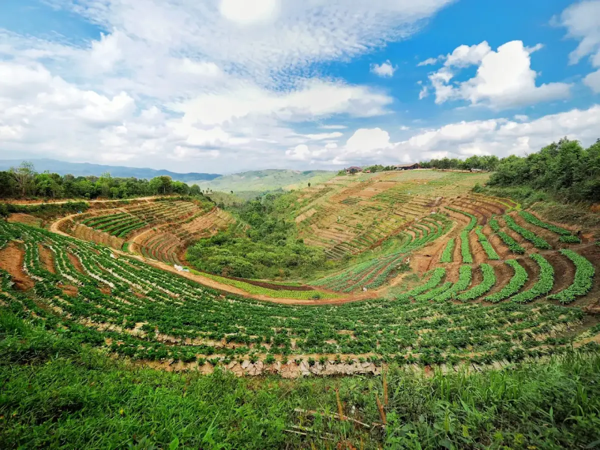
39. Ler Tor Royal Project Development Center, Tak Province Lertor Royal Project Development Center is based at Ban Lertor, Moo 13, Mae Tuen Subdistrict, Mae Ramat District, Tak. Established on October 17, 2016, it became the Royal Project Foundation's 39th development center. The center addresses opium cultivation, promotes agricultural occupations and improves livelihoods among Pga K'nyau communities in the Mae Ramat National Reserved Forest area. Its remote, steep mountain setting poses significant challenges for agriculture and transportation.
Highlights: The Foundation's 39th center; established in 2016; livelihoods replacing opium; highland vegetables and fruits; Arabica coffee; agroforestry; Pga K'nyau communities; and conservation.
The center's history is closely connected with the difficulties of opium growing and poverty in remote mountain communities. In the past, residents faced limited employment and access to markets, and reliance on economically vulnerable crops created pressure on forest land. Royal Project work introduced sustainable occupational alternatives through appropriate agriculture, knowledge transfer and support for marketing.
On October 17, 2016, Prince Bhisadej Rajani, then Chairman of the Royal Project Foundation, directed the establishment of the Foundation's 39th development center at Ban Lertor. Its mission was to help address opium cultivation and improve local quality of life. The center's work continued under the principles of preserving, building upon and extending the royal legacy of highland development.
Lertor serves communities in Mae Ramat and Tha Song Yang Districts of Tak Province. Its operating structure has two important areas: the office and demonstration plots at Ban Lertor, and an operational unit at Ban Cho Khi. Both contribute to agricultural extension, crop trials, the transfer of knowledge and produce management to improve livelihoods.
The mountains around Lertor range from approximately 500 to 1,200 meters above sea level; Ban Lertor itself is around 900 meters high. Much of the landscape is steep, with limited level ground and heavy rainfall during many months of the year. Agriculture thus requires careful management of soil and water, appropriate crops and thoughtful planning.
Important vegetables promoted by the center include baby bok choy, Chinese flowering cabbage, Hong Kong kale, Chinese cabbage and headed cabbage. Such crops can provide income over successive growing cycles but depend on suitable preparation of land, irrigation, pest management and harvesting techniques to preserve quality before marketing.
Strawberries and sweet passion fruit are among the fruit crops promoted as alternative sources of highland income. Fruit cultivation calls for careful assessment of climate and continual maintenance. Post-harvest handling and transport are particularly significant because produce must travel from remote mountain communities without losing quality.
Arabica coffee is another commercial crop supported by the center. When integrated with shade trees, it can contribute to a more diverse agricultural system and provide longer-term income. Suitable coffee-based agroforestry also supports landscape rehabilitation and offers an alternative to dependence on a single annual crop in some areas.
Lertor also develops produce grading, packing and post-harvest handling systems. Ban Cho Khi plays an important role in agricultural demonstrations and improvements in produce management. Quality sorting and careful handling reduce losses during transport and help farmers gain better market access.
Natural-resource conservation is central to the center's work because Lertor's steep slopes are vulnerable to soil erosion. Activities include promoting the 'three kinds of forest, four benefits' principle, vetiver planting, compost production and cultivating coffee together with forest trees. These methods help protect soil and water while supporting livelihoods.
Pga K'nyau people form the principal community in the area, with longstanding traditions and local knowledge associated with forests, mountains and agriculture. Development work must be carried out in cooperation with residents and respect local priorities, so occupational changes remain practical without undermining cultural identity.
For educational visitors, Lertor offers an opportunity to study livelihood development and resource conservation in a remote mountain setting. Approved activities can illustrate commercial crops, agricultural systems and cooperation with local communities. Advance contact is required because Lertor is a working development center rather than a site open for unrestricted tourism.
Access to Lertor requires travel along winding, steep mountain roads. During the rainy season surfaces may be slippery and some approaches difficult to use. Choose suitable transport and confirm conditions in advance. The route to Pi Tu Gro Waterfall in Umphang District must not be substituted for the route to the center in Mae Tuen Subdistrict, Mae Ramat District: they lead to different places.
Lertor is particularly relevant to visitors interested in community development, agricultural alternatives to opium production, watershed conservation and Pga K'nyau traditions. It illustrates how economic, social and environmental goals can be pursued together through Royal Project approaches.
Open Days: Monday – Friday (Office Hours)
Opening Hours: 08:00 – 16:00 (Office Hours)
Getting There: From Tak city, travel through Mae Sot and Mae Ramat, then take mountain roads toward Mae Tuen Subdistrict and Ban Lertor. Confirm the route, current road conditions and group-study arrangements with the center, particularly during the rainy season.
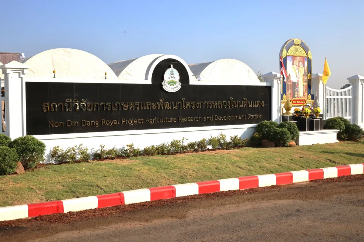
40. Non Din Daeng Royal Project Agricultural Research and Development Station, Buriram Province Non Din Daeng Royal Project Agricultural Research and Development Station is located in Non Din Daeng District, Buriram Province, with its Foundation-listed office at 119/53 Moo 9, Non Din Daeng Subdistrict, Non Din Daeng District, Buriram 31260. Officially established on May 4, 2025, it is the Royal Project Foundation's 40th station and the first model for adapting its highland-development principles to the plateau landscapes of northeastern Thailand. Its missions include commercial crop research, agricultural occupations, soil and water management and improvements in local farmers' quality of life.
Highlights: The Foundation's 40th station; expansion to the northeastern plateau; the Lahan Sai development history; Royal Food Processing Factory No. 4; agricultural research greenhouses; economic crops; and water management.
The development of Non Din Daeng is rooted in royal initiatives during 1978–1979 to address hardship among residents of the northeastern borderlands. At that time, communities around Lahan Sai faced insecurity, limited agricultural opportunities, insufficient water and difficulties in social and economic development. Royal development efforts emphasized water supplies and better everyday living conditions.
Construction of Royal Food Processing Factory No. 4 in Lahan Sai began in December 1981 to purchase and process farm produce, give communities an outlet for their crops and create local employment. By integrating cultivation with value-added food processing, this approach extended beyond producing raw crops. Operations ended in 2000 after the effects of Thailand's economic crisis.
In 2003, the Royal Project Foundation coordinated with King Mongkut's University of Technology Thonburi and relevant agencies to restore productive use of the area and support community enterprises. This cooperation contributed to the development of a local business-incubation approach and the registration of the Non Din Daeng Royal Food Processing Factory Community Enterprise on February 25, 2008.
On February 1, 2025, royal permission was granted to adapt the Royal Project's highland-development approach to the northeastern plateau. The new Non Din Daeng Royal Project Agricultural Research and Development Station was formally established on May 4, 2025, extending agricultural knowledge and integrated community-development practices beyond the Foundation's original northern operating region.
The station occupies a total of 94 rai and 75 square wah across three separate plots. The landscape consists of plateau terrain and gently rolling hills, roughly 208–233 meters above sea level, with an average temperature around 30 degrees Celsius. These conditions differ considerably from the cooler mountain stations and require a distinct agricultural research program.
Research includes economic crops such as cherry tomatoes, melons, Japanese cucumbers, passion fruit, Hong Kong kale, mulberries and figs, alongside other experimental varieties. The station studies which crops and cultivation techniques are suited to local soil, heat, water availability and markets, and seeks to build practical models that can be transferred to farmers.
Water management is central to agriculture in Non Din Daeng. The Lam Nang Rong water system and Lam Nang Rong Dam support cultivation and community life, while research and infrastructure improvements examine efficient irrigation and better matching of water supplies to crop requirements. Responsible use of water is particularly important in a plateau climate with seasonal variation.
Major operational areas include the administrative building, experimental greenhouses, agricultural demonstration plots, outdoor trials and supporting water-management systems. The administrative building has a floor area of 505 square meters and was officially brought into use on January 14, 2026, supporting the station's ongoing activities.
The station's community-development area includes Ban Sap Sombun, Ban Pa Mai Sahakon, Ban Khlong Hin, Ban Khlong Pong and Ban Nong Samet. Its work connects research and demonstration activities with the transfer of practical knowledge, occupational opportunities and efforts to enhance the value of local agricultural produce.
For educational travelers, Non Din Daeng offers a setting to study both modern agriculture and the history of royal rural-development initiatives in the Northeast. As an active research facility, it requires advance coordination for study visits, and access to individual research plots depends on operational and safety requirements.
The station can be connected with other attractions in Non Din Daeng District, including Lam Nang Rong Dam, Lam Nang Rong Beach, Rao Su Monument, Nong Hong Sanctuary and Pha Daeng Viewpoint. These places illuminate different aspects of the area's water resources, borderland history, cultural heritage and natural landscape.
As the Royal Project Foundation's 40th station, Non Din Daeng demonstrates how decades of agricultural experience can be adapted to a new region. By combining research, appropriate technology, community cooperation and stewardship of natural resources, it provides a model for more resilient farming and sustainable livelihoods on Thailand's northeastern plateau.
Operational Status: Operating as an agricultural research and development station
Study Visits: Contact the Royal Project Foundation in advance
Getting There: From Buriram city, travel by road to Non Din Daeng District in the south of the province, then proceed to the station's designated meeting point. As research facilities occupy several plots, confirm the correct office or demonstration area with staff.
Map (GPS):Get Directions to Non Din Daeng Royal Project Agricultural Research and Development Station
Summary Table: 40 Royal Project Destinations in Thailand
| No. | Place Name (Details) | Province | Highlights | Map |
| 1 | Angkhang Royal Agricultural Station, Chiang Mai Province | Chiang Mai | Thailand's first Royal Agricultural Station; temperate crop trials; flower gardens; highland fruit; Doi Ang Khang landscapes; agricultural alternatives to opium growing; and highland community life. | GPS Map |
| 2 | Inthanon Royal Agricultural Station, Chiang Mai Province | Chiang Mai | Highland agriculture; cool-climate crop research; ornamental plants and vegetables; Doi Inthanon landscapes; cool weather; mountain forests; and Royal Project community development. | GPS Map |
| 3 | Nong Hoi Royal Project Development Center, Chiang Mai Province | Chiang Mai | Agricultural demonstration plots; cool-climate and organic vegetables; soilless cultivation; medicinal plants; agricultural technology; and routes around Mon Jam. | GPS Map |
| 4 | Teen Tok Royal Project Development Center, Chiang Mai Province | Chiang Mai | Highland farming; Ban Than Thong community life; watershed management; crop-production learning; Mae On mountain scenery; and nature attractions around Huai Kaeo. | GPS Map |
| 5 | Mon Ngo Royal Project Development Center, Chiang Mai Province | Chiang Mai | Highland livelihood development; Mae Taeng mountain views; Mueang Kai communities; agricultural learning; watershed conservation; and Doi Mon Ngo viewpoints. | GPS Map |
| 6 | Phatang Royal Project Development Center, Chiang Rai Province | Chiang Rai | Cool-climate farming along the mountain border; elevations of approximately 1,300–1,500 meters; Ban Pha Tang culture; Wiang Kaen scenery; hillside resource management; and Doi Pha Tang. | GPS Map |
| 7 | Mae La Noi Royal Project Development Center, Mae Hong Son Province | Mae Hong Son | Highland farming; Mae La Noi village life; valleys and seasonal terraced fields; community occupations; headwater conservation; and Ban Huai Hom. | GPS Map |
| 8 | Ka Noi Royal Project Development Center, Chiang Mai Province | Chiang Mai | Agricultural demonstration plots; highland vegetables and fruits; Chiang Dao communities; mountain border landscapes; conservation; and rural livelihood learning. | GPS Map |
| 9 | Khun Pae Royal Project Development Center, Chiang Mai Province | Chiang Mai | Khun Pae community agriculture; mountain crop fields; livelihood development; resource management; Chom Thong landscapes; and mountain-community learning. | GPS Map |
| 10 | Tung Luang Royal Project Development Center, Chiang Mai Province | Chiang Mai | Agricultural livelihood development since 1979; highland vegetables and fruits; Mae Win communities; mountain scenery; farming landscapes; and headwater conservation. | GPS Map |
| 11 | Mae Phae Royal Project Development Center, Chiang Mai Province | Chiang Mai | Highland agricultural development; Ban Mae Phae community; Samoeng mountains; soil and water conservation; farmers' livelihoods; and rural cultural learning. | GPS Map |
| 12 | Mae Sariang Royal Project Development Center, Mae Hong Son Province | Mae Hong Son | Highland agriculture and occupations; Ban Om Pai Tai; Mae Sariang landscapes; local cultural diversity; watershed conservation; and community well-being. | GPS Map |
| 13 | Tung Rua Royal Project Development Center, Chiang Mai Province | Chiang Mai | Ban Thung Rao agricultural extension; Samoeng livelihood development; soil and water management; valley farming; crop-production learning; and Mae Rim–Samoeng nature routes. | GPS Map |
| 14 | Tung Roeng Royal Project Development Center, Chiang Mai Province | Chiang Mai | Farming occupations; foothill community development; Ban Mae Khanin Nuea; soil and water management; and Hang Dong–Samoeng landscapes. | GPS Map |
| 15 | Pangka Royal Project Development Center, Phayao Province | Phayao | Highland farming in Phayao; Hmong and Mien communities; Phu Langka scenery; hillside crop fields; livelihood development; and Pong District nature trips. | GPS Map |
| 16 | Pang Ung Royal Project Development Center, Chiang Mai Province | Chiang Mai | Mae Chaem mountain agriculture; Pang Ung community livelihoods; highland farming traditions; headwater forests; and soil and water management on steep slopes. | GPS Map |
| 17 | Pa Miang Royal Project Development Center, Chiang Mai Province | Chiang Mai | Agricultural occupations; Pa Miang and Thep Sadet communities; traditional fermented tea leaves; headwater forests; mountain cultivation; and links between nature and local traditions. | GPS Map |
| 18 | Huai Tom Royal Project Development Center, Lamphun Province | Lamphun | Phra Bat Huai Tom community agriculture; Pga K'nyau culture; vegetarian traditions; textile weaving; silver handicrafts; and local Buddhist heritage. | GPS Map |
| 19 | Mae Tho Royal Project Development Center, Chiang Mai Province | Chiang Mai | Highland agricultural extension; Mae Tho community; Hot District mountains; farmers' occupations; headwater protection; and responsible hillside land use. | GPS Map |
| 20 | Mae Tha Nuea Royal Project Development Center, Chiang Mai Province | Chiang Mai | Foothill agriculture; farmers' occupations; Ban Huai Nam Dip; soil and water management; Tha Nuea landscapes; and community development with conservation. | GPS Map |
| 21 | Wat Chan Royal Project Development Center, Chiang Mai Province | Chiang Mai | Pga K'nyau livelihoods; Wat Chan pine forest; highland agriculture; forest and watershed conservation; local knowledge; and Galyani Vadhana mountain scenery. | GPS Map |
| 22 | Huai Som Poi Royal Project Development Center, Chiang Mai Province | Chiang Mai | Highland livelihood development since 2000; headwater management; appropriate land use; Chom Thong villages; and agriculture near conservation forests. | GPS Map |
| 23 | Huai Nam Rin Royal Project Development Center, Chiang Rai Province | Chiang Rai | Livelihood development since 1982; highland commercial crops; Ban Huai Nam Rin; watershed conservation; and changing mountain farming systems. | GPS Map |
| 24 | Mae Sa Mai Royal Project Development Center, Chiang Mai Province | Chiang Mai | Early Royal Project history; temperate crops; agricultural research and technology transfer; Mae Sa Mai communities; headwater management; and Mae Rim mountains. | GPS Map |
| 25 | Huai Pong Royal Project Development Center, Chiang Rai Province | Chiang Rai | Farming on steep mountainsides; cool-climate vegetables; Ban Huai Pong occupations; soil and water management; highland farming and Wiang Pa Pao scenery. | GPS Map |
| 26 | Huai Laeng Royal Project Development Center, Chiang Rai Province | Chiang Rai | Cool-climate farming; Thai–Lao border mountains; Ban Huai Laeng; commercial crop promotion; resource conservation; and highland community occupations. | GPS Map |
| 27 | Sa Ngo Royal Project Development Center, Chiang Rai Province | Chiang Rai | Sa Ngo agricultural livelihoods; Akha culture; Golden Triangle views; hillside farming; conservation; and Chiang Saen cultural itineraries. | GPS Map |
| 28 | Huai Siao Royal Project Development Center, Chiang Mai Province | Chiang Mai | Agricultural occupations in Hang Dong; foothill crop production; soil and water care; Ban Pong communities; Hang Dong–Samoeng scenery; and headwater protection. | GPS Map |
| 29 | Mae Hae Royal Project Development Center, Chiang Mai Province | Chiang Mai | Mae Hae development work; Ban Mae Hae Nuea; highland livelihoods; Mae Chaem mountain scenery; headwater conservation; and agricultural transition. | GPS Map |
| 30 | Huai Nam Khun Royal Project Development Center, Chiang Rai Province | Chiang Rai | Royal Project operations since 1983; highland crops; Ban Huai Nam Khun; soil and water management; headwater conservation; and Mae Suai mountain scenery. | GPS Map |
| 31 | Mae Sa Pok Royal Project Development Center, Chiang Mai Province | Chiang Mai | Agricultural work since 1983; cool-climate and organic vegetables; Pga K'nyau traditions; seasonal terraced fields; streams; mountain recreation; and resource management. | GPS Map |
| 32 | Pang Da Royal Agricultural Station, Chiang Mai Province | Chiang Mai | Agricultural research and demonstrations; highland vegetables and commercial crops; plant varieties; cultivation technology; Samoeng farmland; and Royal Project research. | GPS Map |
| 33 | Mae Poon Luang Royal Project Development Center, Chiang Rai Province | Chiang Rai | Highland crops; mountain borderlands between Chiang Rai and Chiang Mai; community livelihoods; conservation of forested watersheds; and agricultural learning. | GPS Map |
| 34 | Mae Lod Royal Project Research Station, Chiang Mai Province | Chiang Mai | Royal Project agricultural research; suitable crop varieties; highland production techniques; sustainable soil and water management; and practical agricultural demonstrations. | GPS Map |
| 35 | Nong Khiao Royal Project Development Center, Chiang Mai Province | Chiang Mai | Ban Nong Khiao agricultural livelihoods; diverse mountain cultures; Chiang Dao farming; soil and water management; and Mueang Na–Arunothai nature routes. | GPS Map |
| 36 | Mok Cham Royal Project Development Center, Chiang Mai Province | Chiang Mai | Kok River basin agriculture; Ban Huai Sala; highland livelihoods; soil and water conservation; Mae Ai mountain landscapes; and Royal Project crop-production learning. | GPS Map |
| 37 | Huai Luek Royal Project Development Center, Chiang Mai Province | Chiang Mai | Highland agricultural demonstrations; Royal Project produce; Ping Khong village life; Huai Luek watershed management; Chiang Dao scenery; and suitable crop-production systems. | GPS Map |
| 38 | Khun Wang Royal Project Development Center, Chiang Mai Province | Chiang Mai | Development work since 1985; highland vegetables and temperate fruit; crop trials and demonstrations; Pga K'nyau and Hmong villages; headwater conservation; and Doi Inthanon scenery. | GPS Map |
| 39 | Ler Tor Royal Project Development Center, Tak Province | Tak | The Foundation's 39th center; established in 2016; livelihoods replacing opium; highland vegetables and fruits; Arabica coffee; agroforestry; Pga K'nyau communities; and conservation. | GPS Map |
| 40 | Non Din Daeng Royal Project Agricultural Research and Development Station, Buriram Province | Buriram | The Foundation's 40th station; expansion to the northeastern plateau; the Lahan Sai development history; Royal Food Processing Factory No. 4; agricultural research greenhouses; economic crops; and water management. | GPS Map |
Suggested Royal Project Travel Routes
| Chiang Mai – Mae Rim | Nong Hoi, Mae Sa Mai, Mon Ngo | Study temperate crops and enjoy the mountain landscapes around Mae Rim and Mae Taeng. |
| Chiang Mai – Doi Inthanon and Mae Wang | Inthanon Royal Agricultural Station, Khun Wang, Mae Sapok, Tung Luang | Explore cool-climate crops, community traditions and headwater forest conservation. |
| Chiang Mai – Samoeng | Pang Da Royal Agricultural Station, Tung Rua, Mae Phae | Learn about agricultural research and the development of farming livelihoods in the valleys. |
| Chiang Mai – Chiang Dao and Fang | Angkhang Royal Agricultural Station, Ka Noi, Nong Khiao, Huai Luek, Mok Cham | Study community agriculture and the landscapes of northern Chiang Mai. |
| Chiang Mai – Mae On and Doi Saket | Teen Tok, Mae Tha Nuea, Pa Miang | Discover community agriculture, headwater forests and the traditions of fermented tea leaves. |
| Chiang Rai – Wiang Pa Pao and Mae Suai | Huai Nam Rin, Huai Pong, Mae Poon Luang, Huai Nam Khun | Study crop-production systems and soil and water management on steep slopes. |
| Chiang Rai – Wiang Kaen and Chiang Saen | Phatang, Huai Laeng, Sa Ngo | Learn about borderland agriculture and culturally diverse mountain communities. |
| Mae Hong Son – Lamphun – Tak | Mae La Noi, Mae Sariang, Huai Tom, Ler Tor | Plan separate trips by province because these destinations are far apart. |
| Buriram – Non Din Daeng | Non Din Daeng Royal Project Agricultural Research and Development Station | Study plateau agricultural development and the history of royal development initiatives. |
Frequently Asked Questions (FAQ)
Q: How many Royal Project locations are there in Thailand?
A: The list used in this guide comprises 40 locations, including royal agricultural stations, research stations and Royal Project development centers.
Q: In how many provinces are the 40 Royal Project locations situated?
A: They are located in seven provinces: Chiang Mai, Chiang Rai, Mae Hong Son, Phayao, Lamphun, Tak and Buriram.
Q: Where is the 40th Royal Project station?
A: The 40th station is the Non Din Daeng Royal Project Agricultural Research and Development Station in Non Din Daeng District, Buriram Province.
Q: When was the Non Din Daeng station established?
A: It was officially established on May 4, 2025, as the Royal Project Foundation’s 40th station.
Q: How is Non Din Daeng different from the Royal Project sites in northern Thailand?
A: It is a pioneering station adapting highland-development principles to the plateau of northeastern Thailand, where climate and agricultural conditions differ from the northern mountains.
Q: What was the first Royal Agricultural Station?
A: Angkhang Royal Agricultural Station in Chiang Mai was an important pioneering site in the Royal Project’s early development.
Q: How does a research station differ from a Royal Project development center?
A: Research stations focus on study, trials and agricultural knowledge, while development centers emphasize transferring and applying that knowledge to help farmers develop their livelihoods.
Q: Are all Royal Project locations open to tourists?
A: No. Many are working agricultural or research facilities without unrestricted visitor access. Contact their staff before making a trip.
Q: When is the best time to visit the Royal Project locations?
A: Winter is well suited to experiencing cool weather and temperate crops at many northern destinations. Visits to Non Din Daeng should be arranged according to the station’s educational-visit schedule.
Q: Is Khun Wang Royal Project Development Center different from Chiang Mai Royal Agricultural Research Center (Khun Wang)?
A: Yes. They are separate organizations. Check the precise name and map coordinates of the destination you intend to visit.
Q: How can I travel to Non Din Daeng station?
A: Travel to Non Din Daeng District in Buriram Province and contact station personnel to confirm the correct meeting place and research or demonstration plots.
 Category: ●Travel Articles, Recipes
 Group: ●Travel Review, Food Review
Last Update : 1 DayAgo
 Last Update : 1 DayAgo
Recommend

 Art, Culture and Heritage
 Historical Sites and Monuments(8)
 Landmarks and Memorials(5)
 Royal Palace(2)
 Art, Craft Centres, Tradition(43)
 Museums(24)
 Educational Places
 Museum for Study(2)
 Educational Gardens, Farm(5)
 Training Center(1)
 Places of Worship
 Temple(79)
 Mosque(2)
 Other Sacred Sites(17)
 Research and Development
 Royal Project(45)
 Suburban Living
 Village, Community(41)
 Local Market(14)
 Nature and Wildlife
 National Parks and Marine Reserves(18)
 Mountain (Doi)(21)
 Dam, Reservoir, Lake(26)
 Waterfalls(43)
 Hot Springs(12)
 Caves(11)
 River, Canal(6)
 Other natural attractions(14)
 Entertainment and Agricultural
 Zoos and Aquariums(3)
 Animal camps and shows(3)
 Stadium(1)
 Farms, Parks and Ecotourism(19)
 Waterpark(2)
 Theater(1)
 Outdoor and Adventure Activities(10)
 Shopping
 Shopping and Night Market(6)
 Restaurant
 Michelin Star(1)
 Michelin Guide(23)
 Call Customer Service in Tourism
 Call Customer Service in Tourism(1)
Travel Review, Food Review(24)
 Food Menu, North Recipes(30)
 Thai Desserts, North Recipes(17)


