lovethailand home >North Travel Attractions >Chiang Mai Travel Attractions >Mae Chaem >Mae Suek > Pang Ung Royal Project Development Center
TL;DR: Pang Ung Royal Project Development Center, Chiang Mai attractions : Research and Development, Royal Project.

Pang Ung Royal Project Development Center

Open Days: Daily (calling ahead is recommended, especially for accommodation and pre-ordering meals)
Opening Hours: Recommended 08.00–17.00 (actual hours may vary depending on field operations and season)
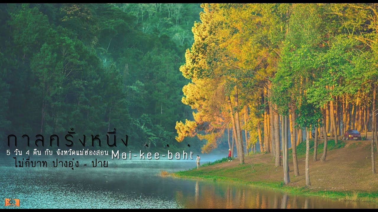
Pang Ung Royal Project Development Center If you are looking for a quiet, restorative escape in Chiang Mai that comes with cool air, mountain views, and the kind of learning you only get by walking through real highland life, Pang Ung Royal Project Development Center is a destination with a distinct charm. The heart of this place is not tourism as a display, but long-term livelihood and permanent agriculture development under the Royal Project approach—work that gradually strengthens the balance of life in mountain communities while moving alongside watershed forest protection and the fragile ecology of the highlands.
The center was established in 1979 on an area of 10 rai, with Chiang Mai Provincial Agricultural Office assigned to oversee operations and coordinate development efforts. The development direction focuses on supporting crop production to meet local needs, testing and selecting new crops to replace opium, promoting permanent agriculture, emphasizing temperate fruits and long-term crops, and improving basic infrastructure so communities can move toward better social standards. Seen as a whole, this is not a place “made pretty for tourists” but a real working landscape of highland development.
The Pang Ung Royal Project Development Center is located within a national reserved forest. The area sits at roughly 1,000–1,500 meters above sea level, with an average temperature of around 20°C. The terrain is largely complex mountain ranges, with flatter land appearing in valley pockets. Important headwaters flow through the area, including Mae Yot Stream and Pang Kia Stream. This headwater character means both agriculture and tourism need to be practiced with care—soil, water systems, and resource use must stay balanced, because everything is connected in one chain, from forest to farm plots to community life.
In terms of development scale, the center oversees an area of about 76.91 square kilometers, or approximately 45,930.88 rai, covering 17 villages with a total of 1,061 households. Most residents are Hmong and Karen communities who have been settled in this area for a long time. This matters for visitors because it signals clearly that this is a living community space, not a staged attraction. Walking around, photographing, or observing daily life should be done respectfully, with permission when appropriate, and with care not to intrude on private areas.
Agritourism is a key highlight that makes a visit feel like more than just fresh air. You can explore plots of potatoes, carrots, and avocados, along with demonstration areas for Arabica coffee, seedless grapes, and temperate vegetables such as tomatoes and cabbage, as well as other seasonal crops. Walking through these plots helps you see how highland farming requires layered management—choosing sites by sun exposure, arranging water in dry months, coping with heavy rain, and protecting topsoil from erosion.
Another compelling angle is seeing how production follows seasons rather than forcing them. Examples include visiting off-season lychee orchards managed by local farmers and observing how certain crops are chosen to spread income across the year. Together with the permanent agriculture approach, this shows the center is not only a demonstration site but also a long-term support mechanism for highland livelihood stability.
On the cultural side, many visitors remember the chance to glimpse Hmong and Karen ways of life, including community details that reflect authentic living patterns, such as large shared Hmong households and traditional games that can sometimes be seen in the area: wooden spinning tops, Hmong mouth organ music, ball tossing, spinning-top contests, and wooden wheeled sliders. These are not only entertainment; they are cultural language—about living together, training skills, and passing knowledge from generation to generation.
If you want a clearer sense of community rhythm, annual ethnic festivals are especially meaningful times to visit, such as Hmong New Year (December–January), Karen New Year (February), and the Karen new rice ceremony (August). During festival periods, it is best to come as a polite observer: ask before taking photos, and give priority to the ceremony itself, because the meaning belongs to the community—not to how “photogenic” the moment looks.
For nature lovers, a signature experience is the Doi Mue Ka Dor nature trail, which leads to a viewpoint at about 1,927 meters above sea level. It suits travelers who want a more serious highland forest encounter: rhododendrons, native forest flora, birdwatching, and the possibility of spotting wildlife in certain seasons, plus dramatic sea-of-mist viewpoints. Preparation matters here—good footwear, drinking water, rain gear in the wet season, and checking weather conditions before setting out, because highland weather can change quickly.
Beyond the walking trail, there are nearby natural spots that many people connect into a broader route. One is the famous Mexican sunflower fields at Doi Mae U Kho in Khun Yuam District, roughly 40 kilometers from the center, typically at peak bloom around November. Another is Pang Kia Waterfall, a small waterfall in a green, refreshing setting that can be suitable for a short stop and water play when conditions allow. These locations help you shape a single trip that blends agriculture, culture, and nature without exhausting yourself by trying to cover too many provinces in one go.
Local products make for satisfying souvenirs because they are rooted in community work. Look for seasonal fresh vegetables, Hass avocados, and seedless grapes, as well as hemp-fiber woven crafts such as shoulder bags, shirts, and pants, often found around Ban Pang Ung and Ban Pa Kia. Another distinctive category is Karen backstrap-loom textiles, which reflect deep skill and patience in traditional weaving. Choosing these kinds of souvenirs is also a direct way to support the local economy, helping tourism benefits circulate back to the community.
For accommodation and food, the center has 3 guest houses, a camping area, and tent rental services with sleeping bags. If you bring your own tent, there may be a site maintenance fee. One important point is that there is no on-site restaurant where you can simply walk in and order; however, you can pre-order meals in advance before staying. In nearby villages, there are local shops and eateries serving visitors. Recommended dishes often mentioned include red bean chili dip and black-boned chicken soup, which fit perfectly with cool highland evenings.
Getting There From Chiang Mai city, take Highway 108 (Chiang Mai–Hot), passing through the Hang Dong, San Pa Tong, Chom Thong, Mae Sariang, and Mae La Noi areas. At the junction toward Khun Yuam District, turn right onto Highway 1263 and continue toward Ban Pang Ung; the center is on the right-hand side. According to the provided information, all vehicle types can access the route, and there is no regular public hired transport service, which makes planning essential—fuel, snacks, motion-sickness medicine, and extra travel time for winding mountain roads, especially in rain or heavy fog.
If you want this trip to feel balanced rather than rushed, think “slow but deep”: take time to walk the plots, speak with staff when appropriate, and absorb what the development work looks like in real life. Then add a nearby nature stop or stay overnight to catch the early-morning atmosphere, because mornings in the highlands often deliver the best scenes—soft light, mist, and a quiet that helps you hear yourself more clearly.
| Place Name | Pang Ung Royal Project Development Center |
| Location | Ban Pang Ung, Mae Suek Subdistrict, Mae Chaem District, Chiang Mai |
| Key Characteristics | Highland agritourism, temperate crop demonstration plots, ethnic community development, mountain views, cool climate, and nature trails |
| Period / Established | Established in 1979 |
| Key Evidence / Significance | A permanent agriculture development area replacing opium, promoting temperate fruits and long-term crops, and improving community infrastructure in highland villages |
| Name Origin | Named after the local area/community known as “Pang Ung” in Mae Chaem District (Chiang Mai) |
| Travel | From Chiang Mai city, take Highway 108 (Chiang Mai–Hot), then connect to Highway 1263 toward Ban Pang Ung (prepare for winding mountain roads and allow extra time) |
| Current Status | Open for visits (contact ahead is recommended, especially for accommodation, meals, and field activities) |
| Contact Phone | 053-318-523, 099-367-0022 |
| Facilities | Limited guest houses, camping area, tent/sleeping bag rental (details may vary by season and center management) |
| Fees | A site maintenance fee may apply for camping (please confirm before traveling) |
| Nearby Tourist Attractions with Distance | Doi Mae U Kho (Mexican sunflower fields) – approx. 40 km Pang Kia Waterfall – near Ban Pang Kia (ask the center for the latest route details) Doi Mue Ka Dor nature trail (viewpoint at 1,927 m) – distance/start point depends on the selected route (contact staff for guidance) Mae Chaem District center (basic services) – distance depends on the route used Ban Pa Kia – within the Mae Suek area (good for community crafts/souvenirs) |
| Popular Restaurants Nearby with Distance and Phone | Village eateries/shops around Ban Pang Ung – very close to the center (no verified phone number available, so not listed) Local eateries around Ban Pang Kia – near the community area (no verified phone number available, so not listed) Restaurants in the Mae Chaem town area – suitable for a stop before heading up to the highlands (no verified phone number available, so not listed) Common pre-ordered dishes when staying: red bean chili dip, black-boned chicken soup (confirm ordering conditions with the center) |
| Popular Accommodations Nearby with Distance and Phone | Center guest houses (limited availability) – on-site (contact 053-318-523, 099-367-0022) On-site camping area – on-site (contact the center to confirm maintenance fees/equipment) Homestays/community accommodations around Ban Pang Ung / Ban Pang Kia – close to the center (no verified phone number available, so not listed) Accommodations in Mae Chaem town – for travelers who prefer easier access to services (no verified phone number available, so not listed) |
Frequently Asked Questions (FAQ)
Q: Which province is the Pang Ung Royal Project Development Center in, and is it the same as Pang Oung in Mae Hong Son?
A: This center is in Mae Suek Subdistrict, Mae Chaem District, Chiang Mai, and it is not the same place as Pang Tong 2 (Pang Oung) in Mae Hong Son, even though the names are similar.
Q: What time of year is best to visit?
A: Generally, the cool season from late rainy season into winter is comfortable for travel, and crops/plots vary by season. If you want to see specific produce or activities, it is best to call the center before you go.
Q: Is there an on-site restaurant where you can order meals on arrival?
A: There is no walk-in restaurant on-site, but you can pre-order meals in advance before staying, and nearby villages have shops and eateries for visitors.
Q: Can you stay overnight or camp there?
A: Yes. There are limited guest houses, an on-site camping area, and tent/sleeping bag rental. Bringing your own tent may involve a maintenance fee. Contact the center to book and confirm the latest conditions.
Q: Is the Doi Mue Ka Dor trail suitable for beginners?
A: It is a highland forest walk, so you should prepare physically, bring appropriate gear, and check weather in advance. If unsure, contact staff for trail details, start points, and safety guidance.
Q: What should you prepare before heading up?
A: Make sure your vehicle is ready (fuel, brakes, tires), bring warm layers/rain gear depending on season, carry any personal medication, pack essential snacks, and allow extra travel time for winding mountain roads and fast-changing weather.
Tel : 053318326
Mobile : 0869223403
![]() Category: ●Research and Development
Category: ●Research and Development
![]() Group: ●Royal Project
Group: ●Royal Project
Last Update : 7 MonthAgo
Pang Ung Royal Project Development Center Map
Recommend


