
lovethailand home >Central Travel Attractions >Bangkok Travel Attractions > 40 Beautiful Caves in Thailand with GPS Locations
TL;DR: 40 Beautiful Caves in Thailand with GPS Locations, open According to the Hat Chao Mai National Park tourism season and official. Highlights include GPS Coordinates.

40 Beautiful Caves in Thailand with GPS Locations
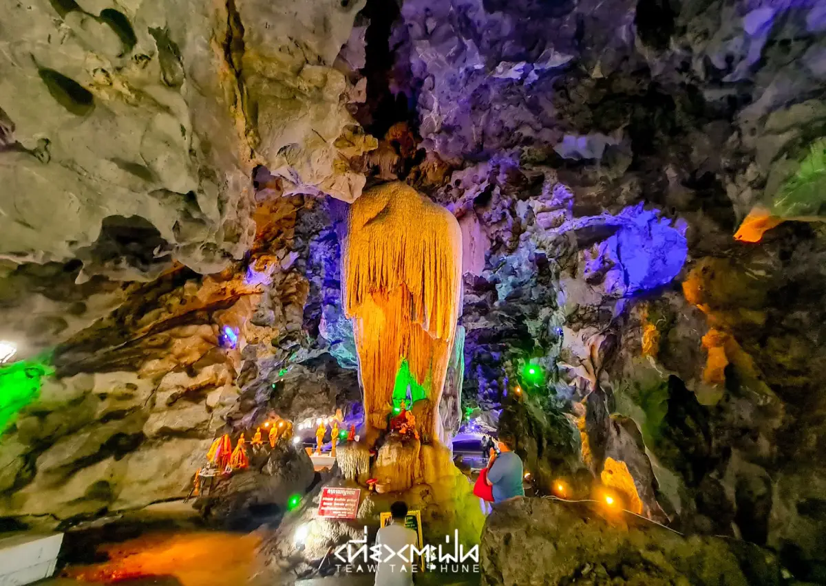
40 Beautiful Caves in Thailand with GPS Locations brings together remarkable destinations for travelers who want to discover the wonders hidden beneath Thailand's mountains. From limestone caves decorated with extraordinary stalactites and stalagmites to sea caves that require visitors to float through rocky passages to reach secluded beaches, and from underground rivers explored by boat to sacred caves containing Buddha images, ancient monuments, and traces of history, Thailand offers an extraordinary variety of underground landscapes. These caves are found throughout the country, making them suitable for family trips, nature tourism, photography, geological exploration, and adventure travel.
Thailand has limestone mountains in many regions, particularly in the North, West, and South. These mountains were shaped by geological processes that continued over immense periods of time. When limestone comes into contact with naturally occurring mildly acidic water, the rock gradually dissolves along fractures and openings, eventually developing into cavities, tunnels, and cave systems of different sizes. Some caves contain underground streams that flow throughout the year, while others are dry caves where visitors can walk through enormous chambers. These differences give each cave its own distinctive character and create a wide range of experiences for travelers.
Among the most remarkable features of natural caves are their stalactites and stalagmites. These formations develop when water carrying dissolved calcium carbonate slowly deposits minerals over long periods. Stalactites grow downward from cave ceilings, while stalagmites rise from cave floors. When this process continues long enough, the two formations may eventually meet to create a continuous limestone column. Other formations take the shape of flowing curtains, delicate tubes, pillars, or clusters resembling animals and everyday objects. Such unusual shapes often inspire the names of individual cave chambers and become part of local legends.
Some caves hold significance far beyond their geological beauty. They are also archaeological sites that preserve evidence of how people lived in ancient times. Prehistoric paintings, stone tools, pottery, skeletal remains, and traces of human activity provide valuable information about early societies in Thailand. Other caves have developed into Buddhist sanctuaries, with Buddha images and religious structures placed within natural rock chambers. The relationship between caves, religion, and traditional beliefs allows visitors to explore history, art, culture, and local knowledge alongside the surrounding natural environment.
Northern Thailand is particularly notable for its limestone mountains and underground water systems. Chiang Dao Cave in Chiang Mai and the caves of Pang Mapha District in Mae Hong Son are excellent examples. Visitors can explore chambers filled with stalactites and stalagmites, follow routes that require local guides and lanterns, and discover archaeological sites containing evidence of prehistoric human activity. Chiang Rai is also home to Tham Luang–Khun Nam Nang Non, a major cave system of geological and conservation importance that became internationally known through a significant event in modern history.
Central and Western Thailand offer caves where natural beauty is closely connected with history and religion. Khao Luang Cave in Phetchaburi contains numerous Buddha images and is celebrated for sunlight streaming through openings in the cave ceiling. Khao Bin Cave in Ratchaburi is known for its remarkable stalactites and stalagmites and its organized visitor pathways, while Chomphon Cave, also in Ratchaburi, is associated with historic royal visits and distinctive limestone formations.
Southern Thailand has an especially diverse collection of caves, including limestone caves in the mountains, river caves with flowing underground streams, and sea caves scattered among the islands of the Andaman coast. Emerald Cave in Trang is a well-known example of a sea cave where visitors float through a dark tunnel before reaching a hidden beach. Tham Le Khao Kob, also in Trang, is famous for its paddle-boat journey beneath a limestone mountain, while Phu Pha Phet Cave in Satun is distinguished by vast chambers and glittering stalactites and stalagmites. This variety makes Southern Thailand a major destination for travelers who enjoy natural attractions and outdoor adventures.
Choosing a cave to visit should begin with understanding the type of experience it offers. Some caves have constructed pathways and lighting systems, making them more convenient for casual sightseeing. Others require visitors to hike uphill, travel by paddle boat, or float through underground waterways. Caves with narrow passages or dark chambers are best explored with experienced local guides. Visitors who are uncomfortable in confined spaces, have limited mobility, or are traveling with young children or older family members should carefully check the route conditions before deciding to enter.
Weather is another essential consideration, especially for caves containing streams and for sea caves, where water levels can change according to rainfall, currents, and tides. Entering a cave during heavy rain may be dangerous because flash flooding can occur rapidly, even when there is no rain at the cave entrance itself. Travelers should therefore check current access arrangements, national park announcements, and guidance from local authorities before every visit.
For travelers with only one day available, choosing caves located relatively close to a town and equipped with clearly defined visitor routes makes trip planning easier. Examples include Khao Luang Cave in Phetchaburi and Khao Bin Cave or Chomphon Cave in Ratchaburi. With two or three days, travelers can expand their itinerary to destinations requiring longer journeys or additional activities, such as Tham Le Khao Kob and Tham Khao Pina in Trang, or Chiang Dao Cave and the surrounding mountain communities in Chiang Mai. Those planning to visit several caves should group destinations by region to avoid unnecessary backtracking and allow sufficient time to appreciate each location.
Responsible cave tourism is essential for protecting these natural environments. Many types of stalactites and stalagmites take extremely long periods to develop, and touching or damaging their surfaces may interfere with mineral deposition and reduce their natural value. Visitors should never break or handle cave formations, write on cave walls, remove archaeological objects, or disturb animals living inside caves. Bats and other cave-dwelling species are particularly sensitive to changes in their surroundings.
These 40 beautiful cave destinations in Thailand are therefore much more than places for sightseeing and photography. They are natural classrooms that reveal the hidden world beneath the ground, underground water systems, geological processes, historical events, and the relationship between people and nature. Careful planning, choosing routes appropriate to each traveler's abilities, and respecting visitor regulations will help make cave exploration memorable, safe, and meaningful while supporting long-term conservation.
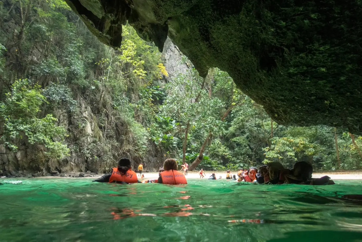
1. Emerald Cave, Koh Mook, Trang Province is one of Thailand's most famous sea caves. It is located on Koh Mook in Ko Libong Subdistrict, Kantang District, Trang Province, within Hat Chao Mai National Park. Unlike mountain caves that are celebrated for enormous stalactites and stalagmites, Emerald Cave is famous for its natural tunnel connecting the open sea with a small beach concealed within an enclosure of towering limestone cliffs. Entering the cave requires suitable tidal conditions and supervision by experienced guides, making the visit a remarkable combination of adventure and natural beauty.
Highlights: An approximately 80-meter sea-cave tunnel, emerald-green seawater created by reflected sunlight, a hidden white-sand beach surrounded by limestone cliffs, floating through the cave with a guide, and island-hopping opportunities connecting Koh Mook with Koh Kradan, Koh Chueak, and nearby islands.
Koh Mook has two distinctly different coastal landscapes. The eastern side is home to a fishing community, pier, accommodations, restaurants, and beaches, while the western side consists mainly of high limestone cliffs facing the Andaman Sea. Emerald Cave lies along this western coastline. The cave was formed through the long-term erosion and alteration of limestone under the influence of waves, seawater, and geological processes, eventually creating a passage leading into an enclosed area within the island.
The excitement begins at the cave entrance, a natural opening visible from the sea. Visitors must wear life jackets and float or swim through a passage approximately 80 meters long. Some sections of the tunnel are completely dark, with a limestone ceiling overhead. As visitors move through the deepest part of the passage toward the other end, natural light gradually appears, revealing a white-sand beach enclosed by towering cliffs and lush vegetation. The scene resembles a secret natural chamber hidden in the middle of the island.
The name Emerald Cave refers to the remarkable light effect visible near its entrance. When sunlight reflects through the seawater under suitable conditions, the water takes on a brilliant emerald-green appearance. The intensity and shade vary according to the time of day, water clarity, direction of sunlight, and weather. These changing natural conditions give each visit its own distinctive character.
The beach inside the cave is relatively small compared with ordinary island beaches, but its setting is exceptional. High limestone walls surround almost the entire sandy area, while vegetation grows along cracks and ledges in the rock. Visitors can admire the cliffs and greenery from designated areas. The contrast between the dark tunnel and the bright, enclosed beach is one of the most memorable features of Emerald Cave and a major reason for its continued popularity.
Safety is essential because tides and currents can change throughout the day. Visitors must wear life jackets, enter with an authorized guide or experienced tour operator, and stay with their group throughout the tunnel. Those who are not confident swimmers or who feel uncomfortable in darkness or confined waterways should inform their guide before beginning the activity.
Koh Mook is also important for its local culture and coastal ecosystem. The island has a traditional fishing community, seagrass habitats, and natural environments associated with dugong conservation. A visit to Emerald Cave can therefore be combined with an overnight stay on Koh Mook, opportunities to learn about island life, and excursions to other islands in the Trang Sea. Travelers should choose operators with appropriate safety procedures and avoid leaving rubbish in the sea or on the hidden beach.
Open Days: According to the Hat Chao Mai National Park tourism season and official announcements. Opening Hours: Access depends on boat schedules, tides, and sea conditions rather than a fixed daily schedule.
Getting There: From Trang city, travel to a pier offering boat services to Koh Mook, such as Khuan Tung Ku Pier. Continue by boat to the island and the Emerald Cave entrance. Travelers can join an island-hopping tour or arrange a private boat with an experienced local boatman. To enter the cave, visitors leave the boat and float or swim through the tunnel under the guide's supervision. Check seasonal national park closures before traveling.
GPS Coordinates: 7.368546, 99.284631
Google Maps:Emerald Cave, Koh Mook, Trang Province

2. Chiang Dao Cave, Chiang Mai Province is located at the foot of Doi Luang Chiang Dao in Chiang Dao Subdistrict, Chiang Dao District, Chiang Mai Province. It is a well-known limestone cave destination popular with both Thai and international visitors. Inside are interconnected chambers and several walking routes featuring beautiful stalactites, stalagmites, and sacred Buddha images in selected areas. What makes Chiang Dao Cave particularly special is the combination of underground natural beauty and the peaceful atmosphere of the temple situated near its entrance. Visitors can therefore experience spiritual tranquility and geological wonders in the same destination.
Highlights: A large limestone cave system at the foot of Doi Luang Chiang Dao, walking routes of varying difficulty, numerous stalactites and stalagmites, Buddha images inside the cave, a clear-water pool near the entrance, and deeper cave passages explored with local guides and lanterns.
Chiang Dao Cave was formed through the natural dissolution of limestone by water. Rainwater gradually seeped into fractures within the rock, enlarging existing openings until they developed into large chambers and tunnels. At the same time, water carrying dissolved calcium carbonate dripped from the ceiling and deposited minerals that formed stalactites, while droplets reaching the cave floor produced stalagmites over long periods. These geological processes created many different formations, including curtain-like sheets, columns, and delicate mineral deposits that glimmer beautifully under artificial light.
The cave's visitor routes vary in difficulty. Some sections have installed lighting and can be explored relatively comfortably, while deeper routes extend farther into the mountain and require local guides carrying lanterns. Commonly mentioned sections include Phra Non Cave, Kaew Cave, Nam Cave, Muet Cave, and Ma Cave. Some routes focus on Buddha images and religious features, while others emphasize natural limestone formations. Visitors should choose a route suited to their available time and physical condition.
Near the cave entrance is a cool, clear-water pool fed by water emerging from the mountain. Fish live in the pool, while surrounding trees provide pleasant shade. This peaceful area offers a place to rest before or after exploring the cave and is one of the distinctive features that make Chiang Dao Cave memorable. The flowing water also illustrates the relationship between the underground cave system and the natural groundwater network within the mountain.
The temple grounds near the entrance are important places of worship where visitors pay respects to Buddha images. Travelers should dress appropriately, respect the religious setting, and avoid making noise that could disturb worshippers or meditation practitioners. Inside the cave, shoes with good traction are recommended because some sections are damp and slippery. Visitors should also avoid touching stalactites and stalagmites or moving objects within the cave.
A visit to Chiang Dao Cave can be combined with scenic views of Doi Luang Chiang Dao, nearby caves and religious sites, restaurants, and communities around Chiang Dao District. Travelers with more than one day available can stay overnight to enjoy the mountain atmosphere in the morning before continuing to other natural attractions. The cool season is especially popular because of its comfortable temperatures and suitability for mountain travel.
Open Days: Generally daily, although some routes may close temporarily due to weather or water levels inside the cave. Opening Hours: 08:00 – 17:00.
Getting There: From Chiang Mai city, take Highway 107 through Mae Rim and Mae Taeng districts toward Chiang Dao District. Follow signs to Wat Tham Chiang Dao and the cave entrance. A private car or rental vehicle is convenient. Travelers using public transportation can travel to Chiang Dao town and continue to the cave using available local transport.
GPS Coordinates: 19.393702, 98.928602
Google Maps:Chiang Dao Cave, Chiang Mai Province
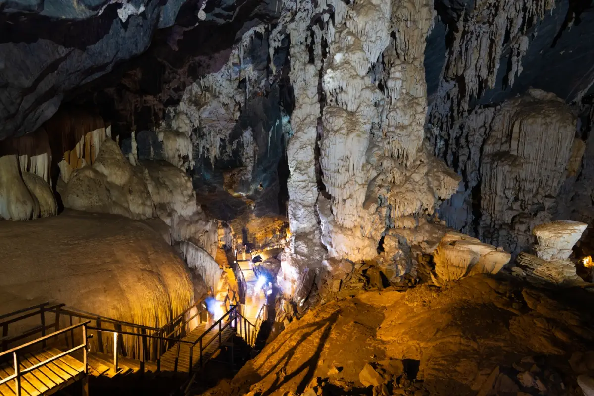
3. Phu Pha Phet Cave, Satun Province is located around Moo 9, Ban Pa Phon and Ban Khuan Din Dam, Palm Phatthana Subdistrict, Manang District, Satun Province. This enormous limestone cave is famous for its spacious chambers, high ceilings, and countless stalactites and stalagmites that sparkle when illuminated. The interior contains numerous chambers with distinctive geological features. Some are decorated with curtain-like formations, others contain limestone columns, and several feature calcite surfaces that reflect light like tiny diamond crystals. These glittering formations inspired the name Phu Pha Phet, meaning Diamond Cliff Mountain.
Highlights: A vast limestone cave containing more than 20 chambers, glittering stalactites and stalagmites resembling diamond flakes, the Curtain Room, Coral Room, Mushroom Room, Chedi Room, Diamond Stone Dome Room, Phu Pha Phet Room, Emerald Light Room, and archaeological evidence of human activity in prehistoric times.
Phu Pha Phet Cave is distinguished by the extensive cave system that developed within its limestone mountain. Underground water gradually dissolved the rock and created large cavities on several levels. Over time, calcium carbonate accumulated as stalactites, stalagmites, and other mineral formations. Some chambers have remarkably high ceilings and expansive floors, allowing visitors to appreciate the immense scale of an underground landscape shaped slowly by nature over geological time.
The names of the cave's different rooms were inspired by natural formations resembling familiar objects. In the Curtain Room, thin sheets of limestone hang from the ceiling like draped fabric. The Coral Room features mineral formations resembling clusters of coral, while the Mushroom Room contains rocks shaped like mushrooms. These variations make the journey through the chambers more engaging, inviting travelers to use their imagination while learning about geological processes.
The Emerald Light Room is another particularly memorable area. Its natural openings allow daylight to enter the cave, creating a dramatic contrast between illuminated sections and the surrounding darkness. Green vegetation outside and sunlight passing through the opening give this chamber a distinctive atmosphere. The Phu Pha Phet Room and Diamond Stone Dome Room are also notable for their scale and intricate rock formations.
Phu Pha Phet Cave is also archaeologically significant because evidence suggests that people used the cave in ancient times. Archaeological findings associated with the site have been described as approximately 3,000 years old, indicating that the cave may once have served as a temporary shelter or another place of human activity during prehistoric periods. This historical dimension adds to the cave's importance, connecting its geological features with the study of early human communities.
Visitors must climb the designated approach route to reach the cave entrance. Once inside, wooden walkways and lighting installations provide access to important areas. Although some sections are relatively easy to walk through, exploring the cave requires a fair amount of time and physical effort. Comfortable shoes with good traction are recommended because of damp surfaces and changes in elevation. Visitors should also bring drinking water for breaks after the walk.
Phu Pha Phet Cave is suitable for travelers interested in nature, geology, photography, and cave exploration. It can be combined with a visit to Chet Khot Cave or other natural attractions in Manang District, depending on the availability and accessibility of each site. Visitors should observe cave regulations, avoid touching stalactites and stalagmites, never write on cave walls, and remain on designated pathways to protect the delicate underground environment.
Open Days: Daily. Opening Hours: 08:30 – 15:30.
Getting There: From Satun city, travel toward Manang District and Palm Phatthana Subdistrict. Continue along local roads toward Ban Pa Phon and Ban Khuan Din Dam, following signs to Phu Pha Phet Cave. A private car or rental vehicle is recommended because the cave is located away from the town center. After reaching the parking area, visitors must walk uphill to the cave entrance.
GPS Coordinates: 7.126470, 99.997020
Google Maps:Phu Pha Phet Cave, Satun Province
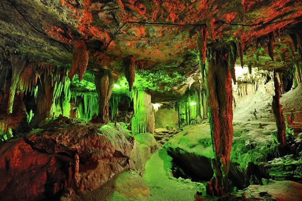
4. Tham Le Khao Kob, Trang Province is located in the Khao Kob area of Huai Yot District, Trang Province. It is a limestone cave with an underground stream flowing beneath the mountain and is famous for guided paddle-boat excursions. The most memorable feature is a section with such a low ceiling that passengers must lie flat in their boats to pass underneath the limestone. This unusual experience distinguishes Tham Le Khao Kob from caves explored mainly on foot and has made it one of Trang's most distinctive tourist attractions.
Highlights: A guided paddle-boat journey beneath a limestone mountain, a low-ceiling tunnel where passengers must lie flat, natural stalactites and stalagmites, an underground river system, and community-operated boat tours led by experienced local boatmen.
The cave system developed as flowing water gradually eroded and enlarged fractures within the limestone mountain over a very long period. This process created an interconnected network of chambers and water passages. Some sections open into spaces where visitors can clearly admire stalactites and stalagmites, while others are so narrow or have such low ceilings that walking through them normally is impossible. These conditions make paddle boats the most suitable means of exploration.
Navigating the cave requires experienced boatmen familiar with its passages. They must carefully maneuver through bends, narrow channels, and areas where stalactites descend close to the water. During the journey, visitors can admire limestone walls with many shapes and textures. Some formations resemble columns, while others resemble curtains or have intricate mineral patterns. When illuminated by the boatmen's lights, these surfaces reveal details and natural colors that would otherwise remain hidden in the darkness.
The cave's most famous experience takes place in the low-ceiling tunnel, where passengers must lie back completely in their boats and follow the boatmen's instructions to pass safely beneath the rock. Moving through a passage with the cave ceiling so close overhead creates an exciting and unforgettable experience. However, this activity may not be suitable for people with severe claustrophobia or physical conditions that prevent them from lying flat.
Water levels are a critical factor in determining whether boat trips can operate. During heavy rainfall or periods of flooding, the boatmen and site operators may need to suspend activities for safety. Travelers should therefore confirm whether services are operating before arriving, particularly during the rainy season or after prolonged heavy rainfall. Water conditions inside the cave can change even when no rain is falling near the entrance.
Tham Le Khao Kob also plays an important role in the local economy. Boat tours depend on the knowledge and skills of community members who paddle the boats and look after visitors. These activities generate local income while giving travelers an opportunity to learn about the relationship between the community and its natural cave environment.
A visit can be combined with Tham Khao Pina and other attractions in Huai Yot District. Visitors should wear comfortable clothing, protect electronic devices in waterproof bags, and follow the boatmen's instructions at all times. Never reach out to touch stalactites or stalagmites, and do not attempt to stand up when the boat is passing beneath a low ceiling.
Getting There: From Trang city, travel toward Huai Yot District and continue to the Khao Kob area, following local tourist signs. At the boat landing, contact the local boat operators to arrange a cave tour. A private car is convenient for combining this attraction with Tham Khao Pina and other destinations nearby.
GPS Coordinates: 7.791845, 99.573949
Google Maps:Tham Le Khao Kob, Trang Province
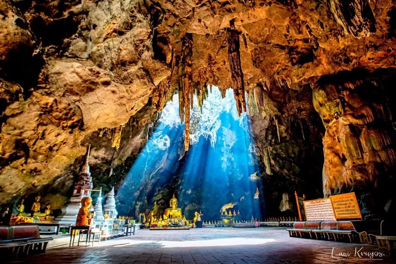
5. Khao Luang Cave, Phetchaburi Province is located within Khao Luang in Mueang Phetchaburi District, Phetchaburi Province. This limestone cave is famous for the beautiful sunlight that streams through openings in the ceiling and illuminates the chambers below. Numerous Buddha images are enshrined inside, and the cave holds considerable historical and religious importance, particularly through its connections with Thai monarchs of the Rattanakosin period. Khao Luang Cave is therefore an exceptional destination where natural beauty and the peaceful atmosphere of a Buddhist sanctuary come together.
Highlights: Natural sunlight entering through openings in the cave ceiling, Buddha images enshrined within limestone chambers, a tranquil Buddhist sanctuary atmosphere, stalactites and stalagmites, and historical associations with the Thai royal court during the Rattanakosin period.
Khao Luang Cave consists of large limestone chambers formed within a mountain. Openings in parts of the ceiling allow sunlight to reach the cave floor at certain times of day. When these rays fall across Buddha images and natural rock surfaces, they create a beautiful interplay of light and shadow. The effect is especially striking on clear days when direct sunlight passes through the ceiling openings, making the cave a popular destination for photographers interested in both nature and religious architecture.
Numerous Buddha images of different sizes are enshrined throughout the cave, positioned within its chambers and along the rock walls. These sacred images reflect the cave's role as a place of Buddhist worship and religious activity. Visitors should therefore dress respectfully, behave quietly, and avoid disturbing people paying their respects, especially near the principal Buddha images.
Khao Luang Cave is historically significant because it received royal patronage and developed as a Buddhist sanctuary during the Rattanakosin period. It is particularly associated with King Mongkut, Rama IV, and King Chulalongkorn, Rama V. These royal connections add substantial cultural and artistic value to the cave alongside its remarkable natural limestone environment.
One of the most popular areas is the chamber where sunlight falls through openings in the ceiling and illuminates Buddha images and the cave floor. The direction and intensity of the light change according to the time of day, season, and weather. Travelers hoping to photograph the rays should choose a clear day and allow enough time for the light to appear naturally. Photography should always be carried out respectfully and without disturbing worshippers.
Visitors reach the cave chambers by walking down a flight of stairs. Some sections may have numerous steps or damp surfaces. Older travelers and people with limited mobility should consider their physical condition before descending, while families with young children should supervise them carefully on the stairs and pathways.
Khao Luang Cave is well suited to a sightseeing itinerary around Phetchaburi city. Nearby cultural attractions include Phra Nakhon Khiri Historical Park, Wat Mahathat Worawihan, Wat Yai Suwannaram, and other historic landmarks. A one-day trip can combine important temples, the history of Phetchaburi, and the natural beauty of Khao Luang Cave. Visitors interested in photography may prefer to begin with the cave during favorable natural lighting conditions before continuing to other sites.
Getting There: From Phetchaburi city center, follow the local roads and signs toward Khao Luang. After arriving at the parking area, walk to the staircase leading into the cave. A private vehicle or local taxi is convenient for combining the cave with other attractions in the city.
GPS Coordinates: 13.137548, 99.933250
Google Maps:Khao Luang Cave, Phetchaburi Province
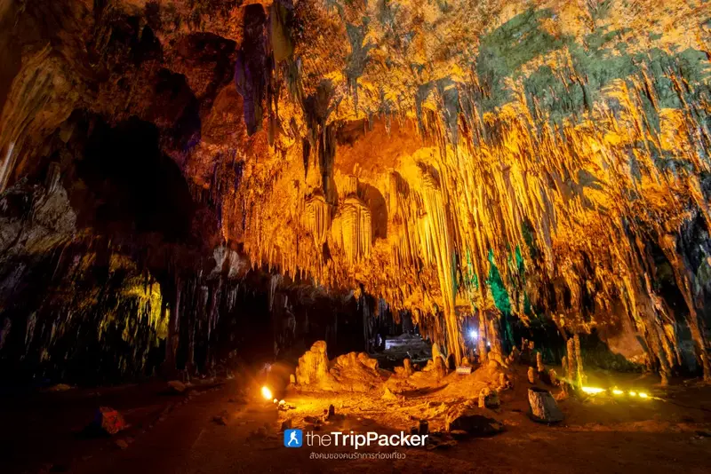
6. Khao Bin Cave, Ratchaburi Province is a famous limestone cave known for its beautiful stalactites, stalagmites, and chambers containing numerous natural formations. Located in Ratchaburi Province, the cave has organized walking routes and lighting that allow visitors to appreciate the details of its rock formations. Its most distinctive features include the great variety of natural shapes, ranging from limestone columns and curtains to clusters resembling sculptures. Khao Bin Cave is therefore one of Ratchaburi's most popular natural attractions.
Highlights: Large limestone chambers, stalactites and stalagmites in numerous shapes, designated visitor pathways, interior lighting, and intricate mineral surfaces resembling natural sculptures.
Khao Bin Cave was formed through the natural erosion and dissolution of limestone by water. Over time, mineral-rich water moved through cracks and openings in the rock, creating cavities and chambers of various sizes. Meanwhile, calcium carbonate deposited by dripping water gradually accumulated into stalactites and stalagmites. These geological processes took place over extremely long periods and gave Khao Bin Cave its characteristic rock formations and natural beauty.
The organized visitor route makes it possible to explore different parts of the cave in sequence, passing formations with distinctly different appearances. In some sections, stalactites descend from the ceiling in long rows. Elsewhere, columns connect the floor to the ceiling, while thin sheets of flowstone spread across the rock like hanging curtains. These formations developed slowly through natural processes and should be viewed from an appropriate distance rather than touched.
Much of Khao Bin Cave's beauty comes from the interplay of light and shadow. When artificial lights illuminate formations with different textures and shapes, they reveal details that might otherwise remain invisible in the darkness. Visitors have opportunities to photograph stalactites, stalagmites, and cave chambers from a variety of viewpoints. However, all photography should follow the site's regulations, and equipment that could disturb other visitors or affect the cave environment should be avoided.
Khao Bin Cave is suitable for people who want to walk through a cave without taking a boat or undertaking a demanding climbing adventure. Nevertheless, visitors should still be careful around damp surfaces and stairs, particularly when traveling with older family members or young children. Shoes with good grip will make the visit safer and more comfortable.
Ratchaburi has several attractions that can be combined with Khao Bin Cave, including Chomphon Cave, museums, cultural sites in the city, and natural attractions in the surrounding mountains. Travelers with one day available can visit Khao Bin Cave and Chomphon Cave on the same itinerary, while those staying overnight can continue toward Suan Phueng and other destinations in the province.
Getting There: From Ratchaburi city, follow roads leading toward the Khao Bin area and the route connecting Mueang Ratchaburi with Chom Bueng District. Follow the signs to Khao Bin Cave. A private car or rental vehicle is convenient for visiting the cave and nearby attractions.
GPS Coordinates: 13.593348, 99.666903
Google Maps:Khao Bin Cave, Ratchaburi Province

7. Chomphon Cave, Ratchaburi Province is located in Chom Bueng District, Ratchaburi Province. It is a limestone cave of both natural and historical significance. Inside are cave chambers filled with beautiful stalactites and stalagmites, especially a distinctive formation resembling a military officer's shoulder insignia, which is associated with the name Chomphon, meaning Field Marshal. Beyond its geological attractions, the cave is closely connected with stories of royal visits by Thai monarchs and holds an important place in the local history of Ratchaburi.
Highlights: A stalactite resembling a military officer's shoulder insignia, historical royal visits, spacious limestone chambers, varied stalactites and stalagmites, and the natural surroundings of Khao Chomphon.
Chomphon Cave consists of limestone chambers formed through the gradual dissolution and erosion of rock by underground water over a long geological period. Some areas have high ceilings, while others contain stalactites and stalagmites that have accumulated along the floor and roof. The formations vary according to water supply, flow direction, and mineral deposition rates, creating natural details unique to different parts of the cave.
The name Chomphon Cave is connected with a stalactite whose shape resembles a military rank insignia and with historical accounts associated with King Chulalongkorn, Rama V. A visit therefore provides an opportunity to learn about both the natural limestone landscape and the history of royal journeys through Ratchaburi Province.
Visitors walking through Chomphon Cave will encounter groups of stalactites hanging from the ceiling in different shapes. Some form sheets resembling curtains, others are long and slender, and several have developed into large columns connecting the floor and ceiling. Artificial lighting reveals differences in the rock surfaces, natural textures, and colors, creating a beautiful underground landscape.
Shady trees surround the cave entrance and nearby mountain area, providing pleasant places to rest during the visit. Nevertheless, visitors should be careful on steps and interior walkways, as damp conditions can make some surfaces slippery. Well-fitting footwear with good grip is recommended, and travelers should remain on the designated routes.
Chomphon Cave can be visited together with Khao Bin Cave and other attractions in Chom Bueng District. It is suitable for a one-day nature and history excursion from Ratchaburi city or as a stop while traveling toward Suan Phueng and other destinations in the western part of the province.
Getting There: From Ratchaburi city, travel toward Chom Bueng District and follow signs to Chomphon Cave. After reaching the parking area, continue on foot to the cave entrance. A private vehicle is convenient for combining the visit with Khao Bin Cave and other attractions in Chom Bueng District.
GPS Coordinates: 13.624895, 99.586793
Google Maps:Chomphon Cave, Ratchaburi Province
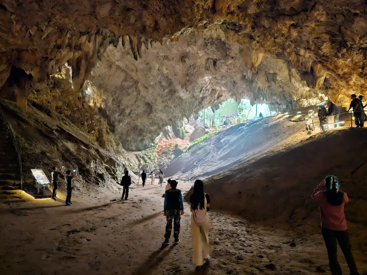
8. Tham Luang–Khun Nam Nang Non, Chiang Rai Province is located in Pong Pha Subdistrict, Mae Sai District, Chiang Rai Province. It is an important natural area recognized for its extensive limestone cave system and watershed forests, as well as its historical significance following the successful rescue of a youth football team and their coach in 2018. Tham Luang and Khun Nam Nang Non lie within the Doi Nang Non mountain range, whose elongated outline resembles a reclining woman when viewed from certain angles, making it a distinctive landmark of Mae Sai District.
Highlights: An extensive limestone cave system, the reclining-woman silhouette of Doi Nang Non, the historic 2018 rescue operation, the watershed forests of Khun Nam Nang Non, and opportunities to learn about geology, underground water systems, and nature conservation.
Tham Luang is a limestone cave system with interconnected passages and chambers extending deep inside the mountain. It was formed as water flowed through fractures and rock layers over very long periods, gradually developing tunnels and chambers at different elevations. The cave is closely connected with underground water and rainfall draining from the surrounding mountains. During the rainy season, water can enter the system and cause levels to rise rapidly. This characteristic is a major factor behind the site's safety measures and access restrictions.
Doi Nang Non is a mountain range with an elongated silhouette resembling a woman lying on her back when seen from certain viewpoints. This landscape inspired local legends about the Sleeping Princess, known as Nang Non. The stories illustrate the relationship between geography and traditional beliefs among communities in Chiang Rai and the Thai–Myanmar border region. As a result, the area is significant not only geologically but also culturally.
In 2018, Tham Luang became known around the world when a youth football team and their coach, a total of 13 people, became trapped inside the cave system as water levels rose. The search and rescue operation brought together Thai authorities, specialist cave divers, and volunteers from many countries. All 13 people were eventually brought out safely. The mission became an important event in modern history, demonstrating international cooperation, courage, and the importance of specialist knowledge in responding to dangerous and complex underground conditions.
Today, the Tham Luang–Khun Nam Nang Non area plays an important role in conservation and education. Visitors can learn about limestone geology, underground water systems, and the story of the rescue operation in areas officially open to the public. Entry into the cave or restricted sections must comply with regulations and announcements issued by the responsible authorities because water levels and geological conditions may create significant safety risks.
Khun Nam Nang Non is another important part of the protected natural landscape, particularly for its watershed forests and ecological value. Visitors can learn how water moving through the mountains connects underground caves with springs and surface waterways. These relationships make the destination valuable not only for tourism but also for geological education and the study of water-resource management.
Travelers should check current access arrangements before every visit, particularly during the rainy season, when restrictions may change in response to weather, water levels, and official safety assessments. Visitors must not enter the cave independently or cross barriers. They should also treat places associated with those who made sacrifices during the rescue operation with appropriate respect.
A visit to Tham Luang can be combined with attractions in Mae Sai District and other nearby natural areas. Travelers should allow enough time to learn about the site's history and follow visitor guidelines. This destination should not be viewed merely as a photography stop or an adventure attraction, since it also represents conservation values and a significant shared memory for people in Thailand and around the world.
Getting There: From Chiang Rai city, travel toward Mae Sai District and continue to Pong Pha Subdistrict, following signs to Tham Luang–Khun Nam Nang Non. On arrival, contact the visitor center or park staff to confirm which areas are open. A private car or rental vehicle is convenient for visiting the site and other attractions in Mae Sai District.
GPS Coordinates: 20.381558, 99.867466
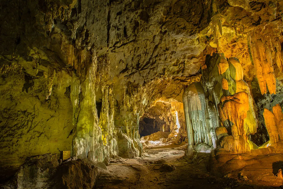
9. Tham Khao Pina, Trang Province is located within Wat Khao Pina in Moo 7, Na Wong Subdistrict, Huai Yot District, Trang Province. The cave occupies an isolated limestone hill shaped like an overturned pan. Inside, several levels of interconnected chambers can be reached using stairways. Tham Khao Pina is significant for its natural beauty, religion, archaeology, and history. It contains Buddha images and ancient objects, along with evidence of historic visits by Thai monarchs.
Highlights: An isolated limestone hill resembling an overturned pan, interconnected cave levels, a reclining Buddha image, Phra Banthom Cave, Chedi Cave, Champa Cave or Sawoei Cave, the royal monogram of King Prajadhipok, Rama VII, and archaeological evidence of ancient human activity.
Khao Pina is an isolated limestone hill rising above the surrounding lowlands and communities of Huai Yot District. From outside, the mountain resembles an overturned pan, but inside it contains cavities and passages on several levels extending toward the upper part of the hill. These geological features distinguish Tham Khao Pina from caves consisting of a single large chamber. Visitors can walk through different sections and observe how the rock formations change with elevation.
Wat Khao Pina stands at the foot of the hill, giving the caves a longstanding religious role in the local community. Several Buddha images and sacred places are found inside, including Phra Banthom Cave, associated with a reclining Buddha image. Visitors should dress respectfully and maintain a quiet manner, particularly in areas where people are worshipping or participating in religious activities.
In addition to its religious importance, Tham Khao Pina is an archaeological site where evidence of ancient human activity has been discovered. Findings include tripod pottery, stone tools, and polished stone axes. These artifacts indicate that people used the cave area over a long period, both in prehistoric times and during later periods when settlements and religious sites developed nearby.
One of the cave's most famous historical features is the royal monogram of King Prajadhipok, Rama VII, inscribed on the upper rock shelter of Champa Cave. This inscription connects the destination with the history of the Thai monarchy and adds to its significance as a historical attraction.
Exploring Tham Khao Pina involves climbing stairs connecting different cave levels. Along the route, visitors encounter chambers, Buddha images, and openings that provide views of the surrounding landscape. Photography enthusiasts can capture both intricate limestone formations and the countryside surrounding the hill. However, caution is needed on stairways and damp rock surfaces.
Tham Khao Pina can be combined with Tham Le Khao Kob and other attractions in Huai Yot District. It is an excellent destination for travelers interested in nature, history, Buddhist temples, and archaeology. Depending on the itinerary, visitors can spend half a day or a full day exploring several nearby attractions.
Open Days: Daily. Opening Hours: 09:00 – 17:00.
Getting There: From Trang city, take Phetkasem Road toward Huai Yot District and continue to Na Wong Subdistrict, approximately 45 kilometers from Trang city. Turn off the main road and travel about 2 kilometers to Wat Khao Pina. From the parking area, visitors can enter the temple grounds and climb the stairs to explore the cave chambers.
GPS Coordinates: 7.749358, 99.527386
Google Maps:Tham Khao Pina, Trang Province
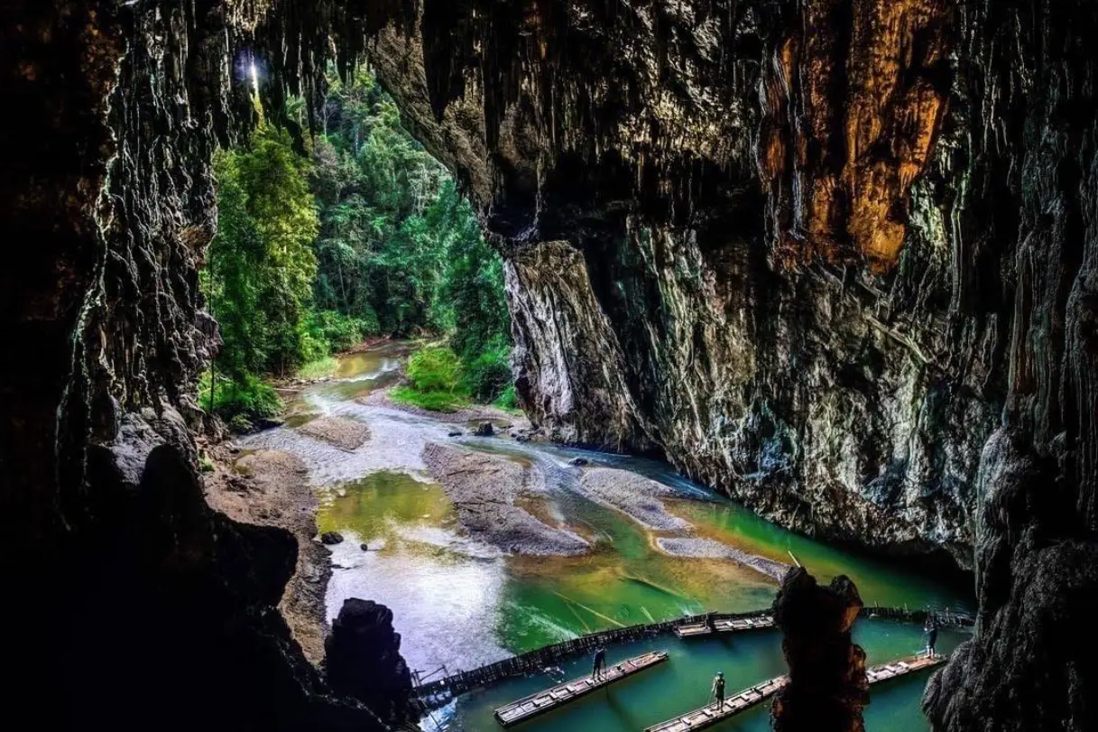
10. Doll Cave, Mae Hong Son Province is located within the Tham Lod Wildlife and Nature Education Center in Tham Lod Subdistrict, Pang Mapha District, Mae Hong Son Province. It is one of the important chambers of the Tham Lod cave system, which is famous for its underground stream and numerous stalactites and stalagmites. Doll Cave is particularly distinctive because of its dense groups of small stalagmites that resemble tiny dolls standing together on the cave floor. These unusual formations create a memorable natural scene for travelers exploring the Tham Lod system.
Highlights: Numerous small doll-shaped stalagmites, the Tham Lod cave system with the Lang River flowing through it, large limestone chambers, bamboo raft travel to certain sections of the system, and a visitor route connecting Sao Hin Luang Cave and Phi Man Cave.
Doll Cave forms part of the Tham Lod system, created by the erosion and dissolution of limestone by underground water. The Lang River flows through passages inside the mountain and has played an important role in shaping its large chambers. The principal sections of Tham Lod include Sao Hin Luang Cave, Doll Cave, and Phi Man Cave. Each has different characteristics, allowing visitors to experience several types of underground landscape during one guided excursion.
The name Doll Cave comes from the many small stalagmites standing across the cave floor in shapes resembling dolls. Some formations are only about a handspan high, while others reach roughly the length of a forearm. When viewed together, they resemble a collection of miniature figures arranged across the floor, even though they were formed entirely through the slow deposition of natural minerals over long periods.
The beauty of Doll Cave differs from that of caves dominated by enormous columns or towering ceilings. Its appeal lies in the intricate details of individual stalagmites. Some have rounded, knobby surfaces, others resemble tiny people or everyday objects, and some appear in clusters like miniature sculptures created by nature. Appreciating Doll Cave therefore rewards careful observation and imagination rather than simply admiring the overall scale of the chamber.
Visiting Doll Cave requires following the designated Tham Lod visitor route, which includes walking and, when conditions permit, bamboo raft travel in certain sections. Travelers should use local guides and follow their instructions when moving through damp passages or areas with limited lighting. The cave system contains flowing water, and conditions can change with the seasons.
Doll Cave has considerable conservation value because its small stalagmites are fragile and take a very long time to develop. Stepping on or touching these formations can cause damage that cannot be repaired quickly. Visitors should observe the formations from designated paths, avoid leaving established routes, and never remove rocks or other objects from the cave.
Pang Mapha District is also important for its numerous natural caves and archaeological sites. A visit to Doll Cave can be combined with Sao Hin Luang Cave, Phi Man Cave, and other places associated with ancient human history. The area is especially suitable for travelers interested in nature, archaeology, and conservation-focused tourism. Sufficient time should be allowed for arranging a local guide and traveling along the mountain roads.
Open Days: Daily. Opening Hours: 08:00 – 17:00.
Getting There: From Mae Hong Son city or Pai District, take Highway 1095 toward Pang Mapha District, then follow signs to Tham Lod Subdistrict and the Tham Lod Wildlife and Nature Education Center. On arrival, contact the visitor service point to arrange a local guide, lanterns, and bamboo raft travel according to the available tour routes. A private car or rental vehicle is convenient for exploring other attractions in Pang Mapha District.
GPS Coordinates: 19.568722, 98.279280
Google Maps:Doll Cave, Mae Hong Son Province

11. Phraya Nakhon Cave, Prachuap Khiri Khan Province is located within Khao Sam Roi Yot National Park in Prachuap Khiri Khan Province. It is one of Thailand's most famous limestone caves, celebrated for its magnificent chambers, large openings in the cave ceiling that allow natural sunlight to enter, and the elegant Kuha Karuhas Pavilion standing within the cavern. The image of this royal pavilion illuminated by sunlight streaming through the natural skylight has become an important symbol of Khao Sam Roi Yot National Park and an iconic landmark of Prachuap Khiri Khan, widely recognized by both Thai and international travelers.
Highlights: The historic Kuha Karuhas Pavilion, enormous limestone chambers, natural skylights in the cave ceiling, vegetation growing inside the cavern, the uphill walking trail from Laem Sala Beach, and the spectacular limestone landscape of Khao Sam Roi Yot National Park.
Phraya Nakhon Cave developed through geological processes affecting the limestone mountains of the Sam Roi Yot range. Over immense periods, rainwater and groundwater gradually dissolved limestone along cracks and openings, eventually creating large cavities and chambers. Later, sections of the cave ceiling changed and opened into wide gaps, allowing sunlight to reach the interior. These unusual openings give Phraya Nakhon Cave an atmosphere quite different from completely dark caves. Natural light reaches certain sections, and vegetation can grow beneath the exposed roof openings.
The cave's most important feature is the Kuha Karuhas Pavilion, constructed during the reign of King Chulalongkorn, Rama V. This elegant four-sided royal pavilion stands within the main chamber. When sunlight enters at a favorable angle, its roof and architectural details become especially striking against the enormous limestone walls. The combination of traditional Thai architecture and an extraordinary natural setting gives the cave exceptional historical, artistic, and tourism value.
Reaching Phraya Nakhon Cave is an important part of the experience and requires a reasonable level of physical fitness. Visitors begin at Ban Bang Pu, where they can either walk over a hill or take a boat to Laem Sala Beach when sea conditions permit. From the beach, the route continues uphill toward the cave entrance along a trail of approximately 430 meters, including stairs and steep sections. Although the distance may appear short, the climb can take longer than expected, particularly for visitors unfamiliar with hiking.
Along the uphill trail, visitors encounter occasional views of limestone mountains and surrounding forest. On reaching the cave entrance, the route descends into the main cavern. The experience changes dramatically from a bright mountain pathway to an immense limestone chamber with different air and humidity conditions. Looking toward the Kuha Karuhas Pavilion beneath the opening in the ceiling reveals the remarkable relationship between architecture and the natural landscape that has made Phraya Nakhon Cave famous.
Travelers hoping to photograph the pavilion illuminated by natural sunlight should visit in the morning and choose a day with clear skies. However, the direction and appearance of the sunlight vary with the seasons and weather conditions, so the same lighting effect cannot be guaranteed every day. Starting early also helps visitors avoid the hottest part of the day during the uphill walk and allows more time for rest.
Phraya Nakhon Cave is ideal for travelers interested in nature, history, and photography, but visitors must be prepared for a demanding uphill and downhill walk. Shoes with good grip, drinking water, and occasional breaks are recommended. Older visitors and people with mobility limitations should assess the trail conditions carefully before starting. It is important not to rush or continue climbing when feeling excessively tired.
A trip to Phraya Nakhon Cave can be combined with Laem Sala Beach, the Sam Roi Yot wetlands, Khao Daeng Viewpoint, and other natural attractions within Khao Sam Roi Yot National Park. Travelers should allow sufficient time because these attractions are located in different parts of the park and require different approaches.
Open Days: Daily, subject to official national park access announcements. Opening Hours: 08:00 – 16:30.
Getting There: From Bangkok, follow Phetkasem Road toward Sam Roi Yot District in Prachuap Khiri Khan Province. Continue to Ban Bang Pu and Laem Sala Beach. When sea conditions are suitable, visitors can take a boat from Ban Bang Pu to the beach or walk over the hill. From Laem Sala Beach, follow the designated uphill trail to Phraya Nakhon Cave.
GPS Coordinates: 12.197486, 100.011334
Google Maps:Phraya Nakhon Cave, Prachuap Khiri Khan Province
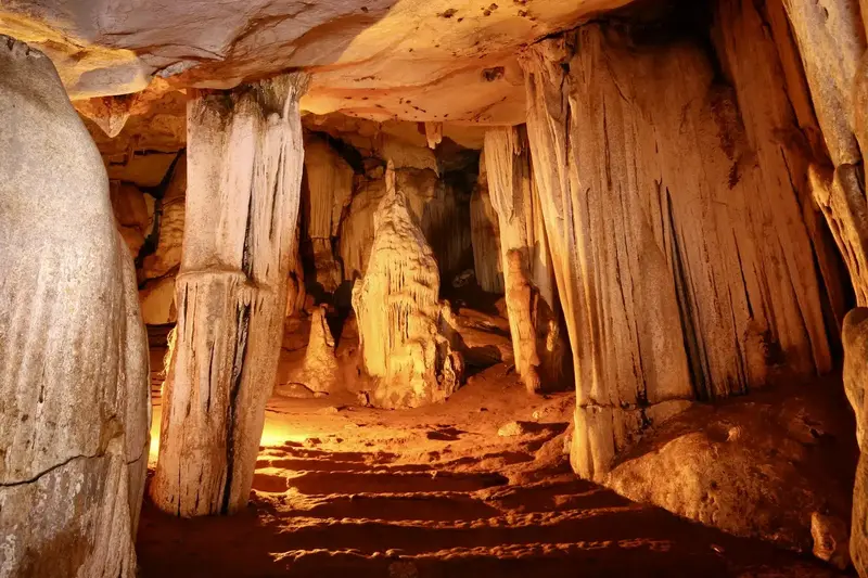
12. Tham Lawa Cave, Kanchanaburi Province is located within Sai Yok National Park in Sai Yok District, Kanchanaburi Province. It is a large limestone cave containing numerous chambers and an impressive variety of stalactites and stalagmites. The interior features spacious caverns, passages connecting different chambers, and mineral formations created through natural deposition over long geological periods. What makes Tham Lawa Cave particularly appealing is the opportunity to experience the mountains and forests of Western Thailand alongside the Khwae Noi River, one of the defining natural features of Sai Yok District.
Highlights: Large limestone chambers, stalactites and stalagmites in many shapes, curtain-like flowstone and limestone columns, the forest environment of Sai Yok National Park, and travel routes connected with the Khwae Noi River.
Tham Lawa Cave was formed as limestone gradually changed under the influence of underground water. Over long periods, water seeped through fractures in the rock, enlarging existing cavities until they connected to form an extensive cave system. Water carrying dissolved calcium carbonate also played an important role in creating the stalactites and stalagmites found inside. These formations accumulated slowly and developed different shapes according to water movement and the texture of the limestone surfaces.
Upon entering the cave, visitors discover that the interior is much larger than the entrance might suggest. Some chambers have high ceilings with impressive stalactites and stalagmites extending from the roof and rising from the floor. In certain areas, layers of flowstone resemble hanging curtains, while elsewhere slender mineral formations descend from the ceiling and almost reach the cave floor.
The beauty of Tham Lawa Cave lies not only in the size of its chambers but also in the diversity of formations encountered along the visitor route. Looking closely reveals different rock textures. Some surfaces are smooth and polished, others have flowing ridges, while some appear rough because of mineral deposits. Together, these formations create the impression of a natural sculpture gallery, shaped entirely by geological processes.
A visit to Tham Lawa Cave can be combined with exploring the Khwae Noi River and the forests of Sai Yok National Park. Some travel routes traditionally involve taking a boat from the Pak Saeng pier area to reach the cave. Visitors should confirm the current access routes and boat services before traveling, as availability and access arrangements may change according to local conditions.
Tham Lawa Cave is suitable for travelers who want to explore a natural cave without necessarily undertaking an adventure involving extensive crawling or climbing through narrow passages. Nevertheless, the cave floor may be damp, and limestone surfaces can be slippery. Visitors should wear appropriate shoes, use suitable lighting where required, and remain on routes designated by park staff.
Travelers with two days and one night available can combine Tham Lawa Cave with other attractions around Sai Yok District, including Sai Yok Waterfall, the Khwae Noi River, and local historical sites. An overnight stay allows visitors to explore at a comfortable pace without having to return late in the evening.
Open Days: Daily, subject to national park announcements. Opening Hours: 08:00 – 16:30.
Getting There: From Kanchanaburi city, take Highway 323 toward Sai Yok District, then continue toward Tham Lawa Cave using the route recommended by national park staff. If traveling by water, contact local boat operators and confirm which piers are operating before departure.
GPS Coordinates: 14.298702, 98.981267
Google Maps:Tham Lawa Cave, Kanchanaburi Province
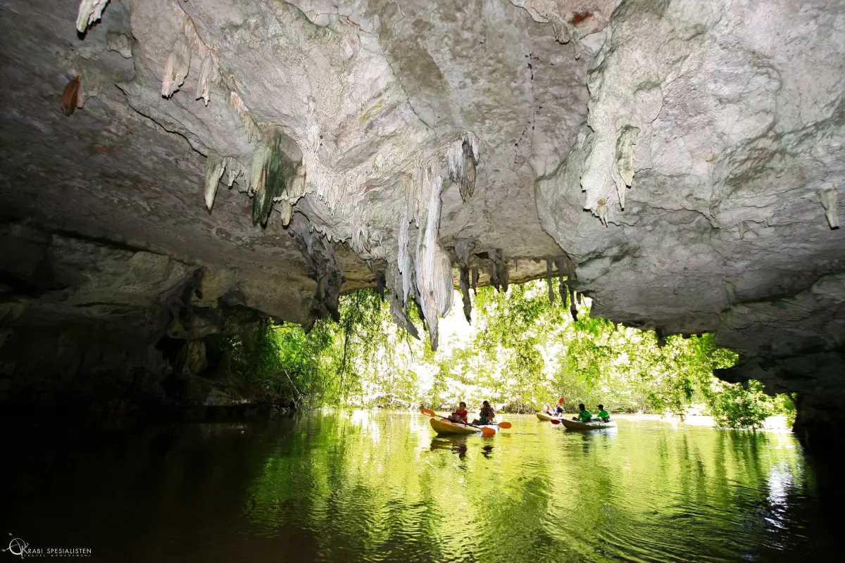
13. Tham Lod and Phi Hua To Cave, Krabi Province is located around Ban Bo Tho in Ao Luek Tai Subdistrict, Ao Luek District, Krabi Province, within the area of Than Bok Khorani National Park. It is one of Southern Thailand's most important natural and archaeological attractions. The limestone caves are surrounded by waterways and mangrove forests, while their walls preserve numerous prehistoric paintings. Reaching the caves generally involves traveling by long-tail boat or kayak along the canals, allowing visitors to experience limestone mountains, mangrove ecosystems, and evidence of ancient human activity in a single journey.
Highlights: Prehistoric cave paintings estimated to be approximately 2,000–3,000 years old, limestone caves around Ban Bo Tho, boat routes through mangrove-lined canals, natural limestone tunnels at Tham Lod, and opportunities to learn about the coastal communities of Ao Luek District.
Phi Hua To Cave is a limestone cave with relatively spacious chambers, some of which receive natural daylight. Ancient paintings on the cave walls provide evidence of how people used this area in the distant past. The images include human figures, animals, and symbols interpreted in connection with the daily lives and beliefs of prehistoric communities along the Andaman coast.
One of the cave's most recognizable paintings resembles a human figure with an unusually large head. Its proportions differ noticeably from those of an ordinary person, making it a distinctive image associated with the cave's popular name. Other paintings remain visible on the walls, helping visitors appreciate the archaeological significance of the site and its role in the cultural history of the region.
The landscape around Ban Bo Tho consists of brackish canals winding between limestone cliffs and mangrove forests. Reaching the caves is therefore different from visiting caves on inland mountains. Travelers navigate through waterways bordered by mangrove trees before arriving at the cave area. Along the journey, they can observe mangrove root systems, towering limestone cliffs, and habitats that support aquatic life within the coastal ecosystem.
Tham Lod is another important feature of the Ban Bo Tho tourism route. It is a natural limestone passage through which water flows and, depending on water levels, boats can travel. Access depends on the selected tour route and conditions on the day of the visit. Travelers choosing kayaking activities should be physically prepared and follow the instructions of local guides and operators carefully.
The archaeological importance of Phi Hua To Cave makes conservation of its ancient paintings essential. Visitors must never touch, scrape, or write on the cave walls. Equipment or activities that could damage prehistoric artwork should also be avoided. These paintings are irreplaceable cultural evidence, and once damaged, their original historical value cannot be restored.
A visit to Phi Hua To Cave can be organized as a half-day excursion combined with a boat journey through the mangrove forests around Ban Bo Tho. Travelers can also continue to Than Bok Khorani and other natural attractions in Ao Luek District. Photography enthusiasts should protect their equipment from water and choose experienced local operators who understand both the routes and conservation requirements.
Open Days: Generally daily. Opening Hours: 08:30 – 16:30. Boat activities depend on weather and water conditions.
Getting There: From Krabi town, travel toward Ao Luek District and Ao Luek Tai Subdistrict. Continue to Ban Bo Tho and contact a local boat tour operator. Travel through the mangrove canals to Tham Lod and Phi Hua To Cave by long-tail boat or kayak, depending on the services available.
GPS Coordinates: 8.382222, 98.687044
Google Maps:Tham Lod and Phi Hua To Cave, Krabi Province

14. Kaew Komol Cave, Mae Hong Son Province is located around Ban Huai Mafai in Mae La Noi Subdistrict, Mae La Noi District, Mae Hong Son Province. It is a cave of exceptional geological beauty, distinguished from ordinary limestone caves by the numerous white calcite crystals covering its walls and ceilings. When illuminated, these formations sparkle like crystals or flakes of ice. Kaew Komol Cave is consequently regarded as one of Mae Hong Son's most distinctive natural attractions and an important site for geological conservation.
Highlights: White calcite crystals resembling sparkling gemstones, chambers containing delicate mineral formations, unusual geological beauty, and the history of the cave receiving its royal name, Kaew Komol.
The remarkable appearance of Kaew Komol Cave results from the crystallization of calcite from mineral-rich underground water. Under suitable environmental conditions, the minerals gradually accumulate into crystals of many shapes, including delicate pointed structures and clusters resembling flowers or ice flakes. Some formations are exceptionally white and glossy, producing striking reflections when illuminated.
Kaew Komol Cave also holds historical significance because Her Majesty Queen Sirikit visited the cave on February 19, 2001, and bestowed the name Kaew Komol. The name reflects the beauty of the mineral crystals found inside the cave and has remained associated with the destination ever since.
Visiting Kaew Komol Cave differs from exploring natural caves where travelers can walk freely. Its mineral crystals are extremely delicate and vulnerable to damage caused by touching them or altering the cave environment. Access should therefore be supervised by the responsible authorities and limited to designated visitor routes. Travelers must not touch the crystals or approach the cave walls more closely than permitted.
The surrounding landscape consists of mountains and forests in Mae La Noi District. The area has a peaceful atmosphere quite different from crowded tourist destinations. Traveling to the cave allows visitors to enjoy mountain scenery and experience rural life in Mae Hong Son. The visit also provides an opportunity to learn about mineral crystallization and the importance of protecting fragile natural resources.
Visitors interested in photography should ask the staff about equipment restrictions before entering the cave. Certain activities may be limited to protect the mineral formations and the underground environment. Suitable walking shoes are recommended, and all instructions from the site staff should be followed carefully.
Open Days: Daily, subject to site management arrangements. Opening Hours: 08:30 – 16:30.
Getting There: From Mae Hong Son city, follow Highway 108 toward Mae La Noi District. Continue to Ban Huai Mafai and the Kaew Komol Cave area, following local signs. A vehicle suitable for mountain roads is recommended. Visitors should confirm access arrangements before traveling.
GPS Coordinates: 18.396451, 97.968237
Google Maps:Kaew Komol Cave, Mae Hong Son Province
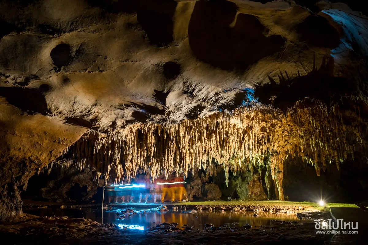
15. Tham Khao Chang Hai, Trang Province is located in Na Muen Si Subdistrict, Na Yong District, Trang Province. It is a limestone cave known for its beautiful stalactites and stalagmites and several interconnected chambers. Concrete walkways and electric lighting have been installed to make visits more convenient, with guided entry organized according to scheduled rounds. The cave is particularly interesting for its natural limestone formations and the local legend of a young elephant that disappeared into the mountain, giving rise to the name Khao Chang Hai, meaning Lost Elephant Hill.
Highlights: Stalactites and stalagmites in numerous shapes, interconnected cave chambers, an approximately 850-meter walking route, installed lighting, the legend of the lost elephant, and the traditional weaving culture of Na Muen Si.
Tham Khao Chang Hai developed as underground water gradually dissolved limestone over long periods, eventually forming a network of connected chambers. Inside are tall caverns, winding passages, and numerous stalactites and stalagmites. The shapes of these formations resulted from the slow deposition of natural minerals, creating different textures and colors according to conditions within each chamber.
The cave consists of several named sections, including Tham Chang Hai, Tham Pheka, Tham Sai Thong, Tham Ong, Tham Lom, and Tham Mae Thao Klai. These names reflect both the natural characteristics of the formations and the imagination of local communities. Visitors can follow the designated route while learning about the different rock shapes and their connections with local legends.
According to local folklore, a young elephant disappeared into the cave while accompanying a procession of travelers heading toward the Phra Borommathat Chedi in Nakhon Si Thammarat. The story became part of the community's collective memory and inspired the cave's name. Although it is a traditional legend, it illustrates the relationship between natural landscapes and the cultural beliefs of local people.
Visits to Tham Khao Chang Hai follow scheduled guided rounds. The walking route extends approximately 850 meters and generally takes about 30–60 minutes, depending on the arrangement of each tour and the visitors' pace. Important sections are illuminated, but travelers should still be careful of damp ground and slippery rock surfaces, particularly in narrow passages.
The cave is closely associated with the Na Muen Si community, which is famous for traditional woven textiles and cultural activities such as the Luk Lom Festival. Combining a cave visit with community-based activities gives travelers an opportunity to appreciate both the underground natural environment and the local way of life in a single day.
Visitors should enter the cave only during the scheduled rounds, remain on designated walkways, avoid touching limestone formations, and follow their guide's instructions. Families traveling with young children or older relatives should choose a relaxed visit and wear shoes suitable for walking on potentially damp surfaces.
Open Days: Daily, with entry according to scheduled guided rounds. Opening Hours: Monday–Friday: 09:00, 11:00, 13:30, and 15:00. Saturday, Sunday, and public holidays: 09:30, 10:30, 11:30, 13:30, 14:30, and 15:30. Visitors should confirm the current schedule with the visitor service center before traveling.
Getting There: From Trang city, travel toward Na Yong District and Na Muen Si Subdistrict. Follow local roads to Tham Khao Chang Hai. A private car is convenient for combining the cave with other attractions and the traditional weaving community of Na Muen Si.
GPS Coordinates: 7.590271, 99.668706
Google Maps:Tham Khao Chang Hai, Trang Province
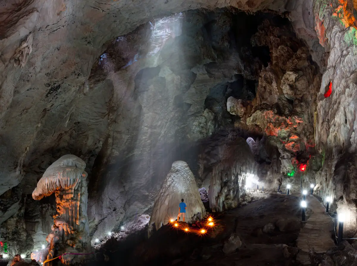
16. Tham Erawan Cave, Nong Bua Lamphu Province is located near Ban Pha In Plaeng in Wang Thong Subdistrict, Na Wang District, Nong Bua Lamphu Province. It is a large limestone cave situated on a mountain whose outline resembles a reclining elephant. The site's most distinctive features include a stairway of more than 600 steps leading to the cave entrance, an enormous Buddha image near the entrance, spacious chambers with spectacular stalactites and stalagmites, and the local legend of Nang Phom Hom. These features make Tham Erawan Cave an important natural attraction, religious sanctuary, and cultural learning destination in Northeastern Thailand.
Highlights: An elephant-shaped limestone mountain, more than 600 steps leading to the cave, the Phra Phuttha Chai Si Maha Muni Trilokkanat Buddha image, spacious limestone chambers, natural skylights and cave formations, panoramic mountain viewpoints, and the legend of Nang Phom Hom.
Tham Erawan Cave is situated within a mountain locally known as Pha Tham Chang, which has a distinctive elephant-like silhouette when viewed from the surrounding plains. This unusual shape inspired local beliefs and traditional stories. The cave itself developed inside limestone through the continuing action of underground water, gradually creating chambers and cavities containing columns, stalactites, stalagmites, and natural roof openings.
Climbing to the cave entrance is an important part of the experience and requires considerable physical effort because visitors must ascend more than 600 concrete steps. At the entrance stands a large Buddha image that serves as an important center of devotion for the local community. Phra Phuttha Chai Si Maha Muni Trilokkanat is particularly striking because of its position high on the mountain, where it can also be seen from the surrounding lower ground.
Inside Tham Erawan Cave is an enormous chamber containing numerous stalactites, stalagmites, and limestone columns. Natural openings allow sunlight to enter certain sections, creating a dramatic contrast between illuminated areas and darker portions of the cavern. The sight of large limestone formations surrounded by sunlight filtering through the ceiling adds to the extraordinary atmosphere of the visit.
The legend of Nang Phom Hom is an important traditional story associated with the cave and Pha Tham Chang mountain. It reflects local beliefs that connect human beings, the natural environment, and a mythical elephant. The story has been passed down through generations, giving the cave cultural significance alongside its geological beauty.
In addition to exploring the cavern, visitors can enjoy views from the cave entrance, looking across the surrounding mountains and plains from an elevated position. Morning visits or days with relatively cool weather are preferable for climbing the stairs, as they reduce the discomfort of walking in strong heat. People with mobility difficulties or medical conditions should carefully assess their fitness before undertaking the climb.
Tham Erawan Cave is ideal for travelers interested in a combination of nature, religion, and traditional culture. Visitors should dress respectfully when approaching the Buddha image, avoid littering, and refrain from touching limestone formations. Drinking water and shoes suitable for climbing a long stairway are strongly recommended.
Open Days: Daily. Opening Hours: 07:00 – 16:30.
Getting There: From Nong Bua Lamphu city, travel toward Na Wang District and Wang Thong Subdistrict. Continue to Ban Pha In Plaeng, following signs to Tham Erawan Cave. On reaching the parking area, climb the stairway to the cave entrance. A private vehicle is convenient for visitors combining the cave with attractions in Loei Province or nearby areas.
GPS Coordinates: 17.345578, 102.018615
Google Maps:Tham Erawan Cave, Nong Bua Lamphu Province
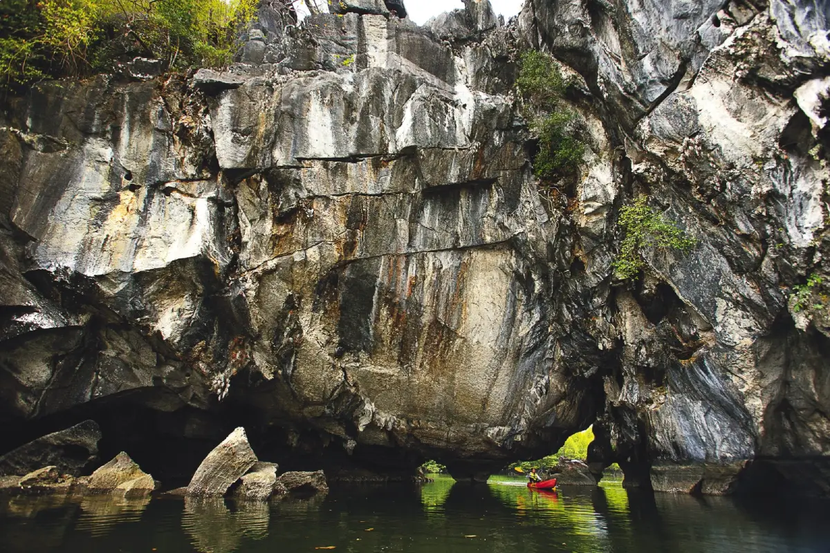
17. Tham Lod Puyu, Satun Province is located around Khao Ka Yang in Puyu Subdistrict, Mueang Satun District, Satun Province. It is a natural limestone tunnel through which the Tha Chin Canal flows, with mangrove forests growing along both banks. Exploring Tham Lod Puyu differs from visiting mountain caves reached by climbing uphill. Travelers instead take a boat through waterways, mangrove forests, and limestone cliffs before entering the cave passage. The experience combines water-based nature tourism with the geological beauty of the Andaman coastal landscape.
Highlights: A natural limestone cave with a canal flowing through it, boat journeys beneath towering limestone rock, mangrove forests and mangrove root systems, the Tha Chin Canal, Khao Ka Yang mountain, and the traditional fishing communities of Puyu Subdistrict.
Tham Lod Puyu developed within a limestone mountain containing a natural water passage. The gradual erosion and dissolution of limestone created a tunnel-like opening through which water could flow. As boats approach the entrance, visitors see high limestone walls and interior areas receiving different amounts of natural light. Some sections of the ceiling and walls contain stalactites and stalagmites formed by mineral deposits carried by water seeping through the rock.
The distinctive beauty of Tham Lod Puyu comes from the combination of limestone mountains and mangrove ecosystems. Mangrove trees and other salt-tolerant plants grow along both sides of the canal. Their root systems help stabilize sediments and create habitats for young aquatic animals. The surrounding landscape therefore has ecological significance as well as natural tourism value.
Traveling by boat through the cave creates a particularly memorable atmosphere. The journey begins along an open canal before the boat enters the shadow of the limestone mountain. The sound of water against the boat and the changing light give visitors the feeling of exploring a natural tunnel. Looking through the passage toward the opening on the opposite side also provides a clear illustration of how a through-cave develops within a limestone landscape.
Puyu Subdistrict has longstanding connections with the Andaman Sea and traditional coastal fishing. Local communities have used the canals and surrounding waters for transportation and livelihoods over many generations. Visiting Tham Lod Puyu therefore provides an opportunity to learn about the lives of coastal residents and the importance of mangrove forests to sustainable natural-resource use.
Travelers should use boats operated by experienced local boatmen and follow all safety instructions. Water levels and weather conditions must be considered before entering the cave because access to some sections can change with the tides. Visitors should wear life jackets when required, protect belongings from water, avoid reaching out to touch limestone walls, and refrain from damaging vegetation along the canal.
Tham Lod Puyu is suitable for a half-day excursion combined with visits to nearby coastal communities and other natural attractions in Mueang Satun District. Travelers interested in conservation-focused tourism can learn about limestone caves, waterways, and mangrove ecosystems within a single route. Choosing experienced operators who prioritize environmental protection helps support responsible tourism.
Getting There: From Satun city, travel toward Puyu Subdistrict and the local boat service area. Take a boat along the Tha Chin Canal through mangrove forests and past Khao Ka Yang to reach Tham Lod Puyu. Contact local boat operators in advance and confirm water conditions before departure.
GPS Coordinates: 6.487005, 100.108503
Google Maps:Tham Lod Puyu, Satun Province

18. Pha Nang Khoi Cave, Phrae Province is located near Ban Pha Mu in Rong Kwang Subdistrict, Rong Kwang District, Phrae Province. This limestone cave is known for its beautiful stalactites and stalagmites and a traditional legend about a woman who waits for her loved one. The cave contains winding passages and chambers, including a rock formation resembling a woman, which has become its most recognizable feature. The connection between natural formations and local storytelling gives Pha Nang Khoi Cave a distinctive appeal combining geology and cultural heritage.
Highlights: The Hin Nang Khoi rock formation that symbolizes the cave, limestone chambers with attractive stalactites and stalagmites, winding underground passages, a local legend of a woman waiting for her beloved, and mountain scenery around Rong Kwang District.
Pha Nang Khoi Cave is situated on a cliff approximately 50 meters above the surrounding ground. Its main passage extends for about 150 meters and reaches a width of roughly 10 meters in certain sections. Rather than running straight through the mountain, the cave contains several bends, making the walking route varied and interesting. Its floor and walls developed through geological processes in which water gradually dissolved limestone and created connected cavities and passages.
Inside the cave are numerous stalactites and stalagmites. Some hang from the ceiling in long, slender shapes, while others have accumulated into limestone columns and curtain-like formations. When illuminated, they reveal detailed mineral textures created by the deposition of naturally dissolved minerals. These formations took extremely long periods to develop and contribute significantly to the cave's atmosphere.
The cave's most famous feature is Hin Nang Khoi, a natural rock formation resembling a woman waiting for someone. This unusual shape is linked to a traditional story about love and longing that has been passed down through the local community. The legend adds cultural meaning to the visit, allowing travelers to appreciate both geological beauty and the imagination with which people have interpreted the landscape.
Visitors must ascend to the cave entrance before following the internal walking route, which includes both spacious areas and winding sections shaped by natural cavities. Suitable footwear is recommended for walking across rock surfaces, and care should be taken on stairs or damp ground. Older visitors and families with young children should proceed at a comfortable pace rather than rushing.
The surrounding area consists of mountains and natural forests in Rong Kwang District. Travelers interested in a one-day excursion can combine Pha Nang Khoi Cave with other natural and cultural attractions in Phrae Province. The journey from Phrae city takes some time, so an early departure is recommended to allow sufficient time for exploring the cave.
Photography enthusiasts should use permitted viewpoints and avoid touching Hin Nang Khoi or other stalactites and stalagmites. Natural limestone surfaces can be damaged by repeated contact, and responsible tourism is essential for protecting the cave so that future generations can continue to appreciate it.
Open Days: Daily. Opening Hours: 08:00 – 17:00.
Getting There: From Phrae city, take Highway 101 toward Rong Kwang District. Continue to Ban Pha Mu, following signs to Pha Nang Khoi Cave. The distance from Phrae city is approximately 34–40 kilometers, depending on the starting point. After reaching the parking area, visitors must walk uphill to the cave entrance.
GPS Coordinates: 18.368750, 100.354404
Google Maps:Pha Nang Khoi Cave, Phrae Province
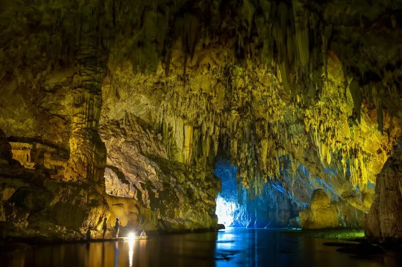
19. Tham Lod Cave, Mae Hong Son Province is located within the Tham Lod Wildlife and Nature Education Center in Tham Lod Subdistrict, Pang Mapha District, Mae Hong Son Province. It is an extensive river cave system through which the Lang River flows beneath a limestone mountain. The cave contains several important chambers, including large stalactites and stalagmites, miniature formations resembling dolls, and archaeological sites that contribute to the study of ancient human life. Visitors must explore with local guides carrying lanterns, and some parts of the journey may involve bamboo rafts. These features make Tham Lod one of Mae Hong Son's most distinctive nature-based adventures.
Highlights: The Lang River flowing through the mountain, three principal chambers known as Sao Hin Luang Cave, Doll Cave, and Phi Man Cave, enormous stalactites and stalagmites, bamboo rafting, guided exploration using lanterns, and significant archaeological evidence.
Tham Lod Cave developed through the erosion and dissolution of limestone by the Lang River, which flowed through fractures and openings in the mountain over extremely long periods. These processes eventually formed large cavities through which water passes from one side of the mountain to the other. The cave system extends for approximately one kilometer and contains three principal chambers, each with its own distinctive natural characteristics.
Sao Hin Luang Cave is particularly notable for its enormous stalactites, stalagmites, and limestone columns, which developed through the deposition of minerals over long geological periods. The chamber has a high ceiling and imposing limestone walls. When lantern light falls across the rock surfaces, it reveals intricate shapes and textures. Visitors can learn about the formation of limestone columns and other cave features while walking through the chamber with their guide.
Doll Cave is another distinctive section, famous for its many small stalagmites standing together on the cave floor in shapes resembling dolls. Some formations are only about a handspan high, while others rise in clusters of varying heights, creating the appearance of a gallery of miniature natural sculptures. This chamber is particularly memorable for visitors interested in the fine details of cave formations.
Phi Man Cave is archaeologically significant because it is associated with evidence of ancient human activity, particularly prehistoric wooden coffins discovered within cave systems and nearby areas of Pang Mapha. These findings shed light on traditional beliefs, burial practices, and the use of caves as important cultural spaces in ancient societies. Exploring Tham Lod therefore provides an opportunity to learn about human history as well as the natural environment.
Visitors must use local guides equipped with lanterns according to the site's visitor arrangements. Some chambers are completely dark, and the walking routes may be difficult to follow without proper illumination. Certain sections require bamboo raft travel along the Lang River, allowing visitors to experience the sound of flowing water, the cool humid air, and the silence of the underground limestone environment.
Water levels in the cave change with the seasons, especially after heavy rain in upstream areas. Travelers should confirm that the visitor routes are open before arriving and must never attempt to enter independently without a guide. People with mobility limitations or those uncomfortable with rafting should ask about suitable visitor options before deciding to participate.
Tham Lod is an excellent destination for an itinerary combining natural caves and local communities in Pang Mapha District. It also fits into a journey between Pai and Mae Hong Son city. Allowing approximately half a day for the cave provides enough time to explore the different chambers without rushing and to learn about their features from experienced local guides.
Open Days: Daily, subject to site conditions. Opening Hours: 08:00 – 17:00.
Getting There: From Mae Hong Son city, take Highway 1095 toward Pang Mapha District. Around kilometers 138–139, turn toward Ban Tham Lod and continue for approximately 9 kilometers to the Tham Lod Wildlife and Nature Education Center. Visitors traveling from Pai can use the same highway toward Pang Mapha and follow signs to Ban Tham Lod.
GPS Coordinates: 19.568283, 98.279731
Google Maps:Tham Lod Cave, Mae Hong Son Province

20. Tham Phet Pho Thong, Sa Kaeo Province is located around Ban Khao Lueam in Khlong Hat District, Sa Kaeo Province. It is a limestone cave distinguished by its creamy-white stalactites and stalagmites and unusual patterns on the walls resembling golden Bodhi leaves. The cave contains several chambers with different limestone formations, including the Diamond-Decorated Chamber, where mineral surfaces sparkle when illuminated. These natural features make Tham Phet Pho Thong an attractive destination for travelers seeking unusual limestone caves in Eastern Thailand.
Highlights: Four main cave sections, creamy-white stalactites and stalagmites, the Diamond-Decorated Chamber, golden Bodhi-leaf-like patterns on the cave walls, a walking route through a forest containing Chan Pha trees, and the mountain landscape of Khlong Hat District.
Tham Phet Pho Thong developed through the gradual dissolution of limestone by underground water. Over time, cavities inside the mountain expanded into chambers and passages. Meanwhile, mineral-rich water dripping and flowing across limestone surfaces deposited calcium carbonate, creating stalactites and stalagmites with many different shapes and textures. Certain mineral surfaces sparkle like gemstones when illuminated.
One of the cave's principal attractions is the Diamond-Decorated Chamber, where limestone surfaces and mineral crystals reflect light in a way that resembles diamonds embedded in the rock walls. Visitors walking through the chamber can observe differences between smooth mineral surfaces, delicate textures, and deposits that developed slowly through natural geological processes.
The name Tham Phet Pho Thong is also associated with patterns on the limestone walls resembling golden Bodhi leaves. These markings developed through natural processes involving water and mineral deposits. Their distinctive shapes and colors differ from ordinary stalactites and stalagmites, inspiring local interpretations and ultimately becoming part of the cave's name.
The surrounding landscape consists of limestone mountains and natural forests, including dry evergreen forest and deciduous dipterocarp forest. Groups of Chan Pha trees are particularly important to the Ban Khao Lueam community's conservation efforts. Walking toward the cave therefore provides an opportunity to observe local vegetation and learn about community efforts to restore and protect natural resources.
The trail to the cave includes sloping ground and natural rock surfaces. Visitors should wear secure footwear suitable for light hiking. During the rainy season, the trail may become slippery, and some sections of the access road may be affected by rainfall. Travelers wishing to explore the cave thoroughly should allow sufficient time and contact local guides before visiting.
Tham Phet Pho Thong is suitable for visitors interested in nature, geology, and conservation-focused tourism. In addition to its beautiful limestone formations, the cave is significant for its surrounding Chan Pha forest and the local community's role in protecting the landscape. Visitors should not touch or remove limestone formations, write on the cave walls, or leave litter along the trail.
Open Days: Daily, with advance contact with a local guide recommended. Opening Hours: 08:00 – 16:00.
Getting There: From Sa Kaeo city, follow Highway 317 toward Khlong Hat District. Continue along local roads toward Ban Khao Lueam, following signs to Tham Phet Pho Thong. Some sections consist of rural roads and uphill approaches. A vehicle suitable for local road conditions is recommended, especially during the rainy season.
GPS Coordinates: 13.413959, 102.325325
Google Maps:Tham Phet Pho Thong, Sa Kaeo Province
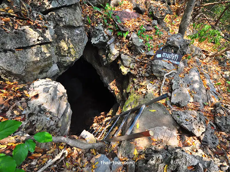
21. Tham Kaeo Cave, Prachuap Khiri Khan Province is located around Ban Bang Pu in Sam Roi Yot Subdistrict, Sam Roi Yot District, Prachuap Khiri Khan Province, within Khao Sam Roi Yot National Park. This limestone cave is distinguished by its stalactites, stalagmites, and natural mineral crystals that sparkle when illuminated. Unlike Phraya Nakhon Cave, which features an enormous open chamber and the historic Kuha Karuhas Pavilion, Tham Kaeo offers a more adventurous experience of exploring rocky passages characterized by darkness, humidity, and a complex natural interior. Visitors can experience the underground world of the limestone mountains while learning about cave formation and the importance of conserving fragile limestone environments.
Highlights: Sparkling stalactites and stalagmites, a natural limestone cave within Khao Sam Roi Yot National Park, an adventurous walking route that requires care, dramatic limestone mountain scenery, and opportunities to combine the visit with Phraya Nakhon Cave and Bang Pu Beach.
Tham Kaeo Cave formed through the natural dissolution of limestone by water. Rainwater entering fractures in the mountain gradually dissolved minerals and enlarged underground openings until they developed into cave passages and chambers. Later, water carrying dissolved calcium carbonate dripped from the ceiling and deposited minerals that formed stalactites, stalagmites, and delicate crystal deposits. Some limestone surfaces are glossy and reflect light particularly well, inspiring the name Tham Kaeo, or Crystal Cave, which describes the sparkling mineral formations created slowly by nature.
The surrounding landscape forms part of the Sam Roi Yot limestone mountain range, where steep peaks alternate with plains, coastal areas, and natural wetlands. This geological diversity makes the area particularly interesting for learning about limestone landscapes. Visitors can observe the contrast between the mountain and coastal environments outside and the underground passages shaped by groundwater over immense periods of time.
Exploring Tham Kaeo differs from visiting caves equipped with concrete walkways and continuous electric lighting. Some sections consist of uneven natural rock surfaces, changes in elevation, and narrow or damp passages. Travelers should contact national park staff to confirm the current visitor route and access requirements before entering. Suitable flashlights and any other equipment recommended by the authorities are important. Walking without adequate lighting or leaving designated routes can create risks of tripping, slipping, or becoming disoriented.
The beauty of Tham Kaeo lies particularly in the fine details of its limestone formations rather than the grandeur of enormous chambers alone. When light falls on different surfaces, visitors can observe delicate textures and patterns. Some formations resemble curtains, others resemble columns, and certain areas contain clusters of sparkling crystals. Exploring slowly allows visitors to appreciate these natural features without touching them or interfering with ongoing mineral deposition.
Tham Kaeo can be included in an itinerary with Phraya Nakhon Cave, Laem Sala Beach, and other attractions in Khao Sam Roi Yot National Park. Travelers planning to visit several caves in one day should begin early because each destination requires different travel arrangements and walking times. Phraya Nakhon Cave involves an uphill hike, while Tham Kaeo requires careful movement through natural cave passages.
People who experience claustrophobia, have difficulty walking on uneven rock, or face mobility limitations should assess their ability to complete the route before entering. Visitors should also avoid using flames or heat-producing equipment near cave walls, never touch stalactites and stalagmites, and leave no belongings or rubbish inside. Cave ecosystems are delicate environments that can be affected easily by human activity.
Open Days: Generally daily, subject to national park announcements. Opening Hours: 08:00 – 16:30.
Getting There: From Sam Roi Yot District, travel toward Ban Bang Pu and Khao Sam Roi Yot National Park. Tham Kaeo is located within the wider tourism area around Phraya Nakhon Cave. Visitors can drive to the designated starting point, then contact national park staff to confirm access arrangements and follow the approved walking route.
GPS Coordinates: 12.202996, 99.992590
Google Maps:Tham Kaeo Cave, Prachuap Khiri Khan Province
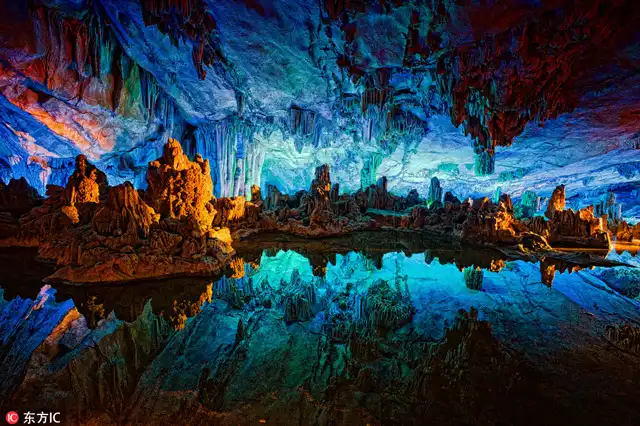
22. Tham Wang Badan Cave, Kanchanaburi Province also known as Tham Sawan Wang Badan, is located in Tha Sao Subdistrict, Sai Yok District, Kanchanaburi Province. This limestone cave is notable for its multi-level structure and beautiful stalactites and stalagmites. Inside are chambers decorated with natural mineral formations and areas associated with an underground water system. Reaching the cave involves walking approximately 1,500 meters along a natural trail from the starting point, making it suitable for travelers who want to combine a short forest hike with the exploration of an underground limestone landscape.
Highlights: A two-level limestone cave, the Moon Curtain Chamber, the Narai Needle Chamber, stalactites, stalagmites and flowstone curtains, underground waterways, and a nature trail through the forests of Sai Yok.
A defining feature of Tham Wang Badan is its division into upper and lower sections. The upper level contains limestone chambers decorated with stalactites and stalagmites, while the lower section is associated with natural waterways. This structure reflects the development of a cave system shaped by water flowing at different elevations within the limestone mountain. Over time, water gradually dissolved the rock and enlarged underground openings, producing chambers, tunnels, and traces of water movement with different characteristics.
The Moon Curtain Chamber is one of the most remarkable sections because of its beautiful curtain-like stalactites. Such formations develop when a thin sheet of mineral-rich water flows over rock surfaces and slowly deposits successive layers of calcium carbonate. Over long periods, these deposits create folded or layered limestone resembling hanging fabric. When illuminated, the formations reveal intricate patterns that invite visitors to imagine different shapes and objects.
The Narai Needle Chamber is distinguished by slender formations resembling needles or pointed rods. These structures develop as mineral-rich water drips from limestone surfaces. When the water loses carbon dioxide or evaporates, calcium carbonate gradually deposits and accumulates into various shapes. The formations require exceptionally long periods to reach the size visible today.
Another appealing feature of visiting Tham Wang Badan is the approximately 1,500-meter nature trail leading to the cave entrance. Along the route, travelers can experience forest vegetation, sloping terrain, and the natural surroundings of Kanchanaburi. Visitors interested in ecosystems and plants can learn about the local forest environment while traveling toward the cave.
Exploring the interior requires suitable lighting equipment and adherence to instructions from the responsible staff. Some passages are narrow, sloping, or damp. Travelers should move carefully, pay attention to their footing, and avoid separating from the group, particularly where the trail involves significant changes in elevation.
Tham Wang Badan is ideal for travelers who enjoy short forest hikes and natural cave exploration. It can be combined with destinations around Sai Yok District, Sai Yok Noi Waterfall, and attractions along the Khwae Noi River, depending on the available time and access conditions. Visitors should allow enough time to complete both the inward and return walks before the permitted visiting period ends.
Open Days: Generally daily, subject to local site management. Opening Hours: 08:00 – 16:30.
Getting There: From Kanchanaburi city, follow Highway 323 toward Sai Yok District and continue into Tha Sao Subdistrict along the route to Tham Wang Badan. After reaching the trailhead, walk approximately 1,500 meters along the nature trail. Visitors should confirm the condition of the trail and seek guidance from the responsible staff before entering the cave.
GPS Coordinates: 14.251017, 99.074826
Google Maps:Tham Wang Badan Cave, Kanchanaburi Province
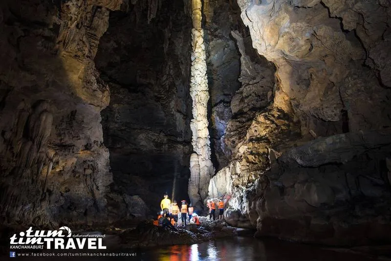
23. Tham Sao Hin Cave, Kanchanaburi Province is located within Lam Khlong Ngu National Park in Thong Pha Phum District, Kanchanaburi Province. It is an extraordinary limestone cave known for its geological features and adventure-based tourism, particularly an enormous natural limestone column standing inside the cavern. This giant formation is one of the most important attractions of the cave. Travelers wishing to visit must prepare carefully because the route is not an ordinary sightseeing trail. Access involves forest trekking, difficult terrain, and activities that must be undertaken under the supervision of national park officials.
Highlights: An enormous natural limestone column, a remarkable geological formation of national significance, an underground cave and water system, adventure activities in Lam Khlong Ngu National Park, and access that requires advance reservations and compliance with national park safety regulations.
The giant limestone column formed through the continuous deposition of calcium carbonate over an immense period. As a stalactite grows downward from the ceiling and a stalagmite rises from the floor, the two may eventually join to form a single structure extending between the floor and ceiling. Tham Sao Hin is particularly remarkable because of the enormous size of its column compared with formations found in ordinary tourist caves. This impressive structure illustrates the extraordinary duration and complexity of natural geological processes.
Lam Khlong Ngu National Park consists of limestone mountains and a network of waterways flowing through valleys and caves. These features make the area important for the study of geology, natural ecosystems, and underground water systems. Traveling to Tham Sao Hin is therefore more than an opportunity to admire an enormous limestone column. It also provides an understanding of how water, rock, and landscape have interacted and changed over geological time.
Access to Tham Sao Hin is considerably more restricted than access to ordinary tourist caves. Visitors must be physically prepared and use suitable equipment for traveling through natural terrain. Participants are required to follow the national park's conditions and travel with authorized officials or guides. The route may involve forest trekking, slippery rock surfaces, and water crossings. It is not suitable for independent exploration without professional supervision.
The visiting season may be restricted because of water conditions and seasonal weather. Cave systems containing flowing streams can be affected quickly by rainfall and rising water levels, particularly during the rainy season. Decisions about opening the site therefore depend on official safety assessments. Travelers should never assume they can enter immediately without confirming availability and arranging a reservation in advance.
The giant limestone formations of Tham Sao Hin have exceptional conservation value. Visitors must never touch, damage, or attempt to climb the column. Moving rocks or objects within the cave is also prohibited. Respecting visitor limits, following official instructions, and avoiding litter are essential for preserving the cave as a natural attraction and a geological learning site.
Tham Sao Hin is suitable for travelers with outdoor activity experience and a serious interest in adventurous trekking. Visitors should prepare physically and consult Lam Khlong Ngu National Park about age restrictions, health requirements, equipment, reservations, and activity conditions before departure. Safety must always take priority over attempting to reach the destination according to a fixed itinerary.
Open Days: Seasonal opening according to the guided activity schedule established by Lam Khlong Ngu National Park. Advance confirmation and reservation are required.
Getting There: From Kanchanaburi city, travel toward Thong Pha Phum District and continue to the Lam Khlong Ngu National Park area or the official meeting point designated by park staff. Participants must follow the arranged activity schedule and guided route. Independent entry into the cave without authorized supervision is not permitted.
GPS Coordinates: 14.943982, 98.810110
Google Maps:Tham Sao Hin Cave, Kanchanaburi Province
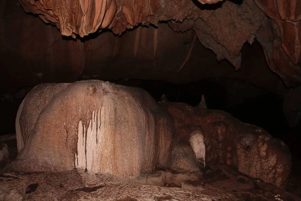
24. Tham Silp Cave, Yala Province is located near Ban Bannang Luwa, Moo 2, Na Tham Subdistrict, Mueang Yala District, Yala Province. It is an important archaeological and cultural site, especially known for ancient paintings on its cave walls. These include Buddhist religious imagery and figures of different kinds. Although many paintings have faded over time, they remain valuable evidence of historical beliefs and human activity in the region. Tham Silp is therefore distinguished from natural caves whose principal attractions are stalactites and stalagmites, as its greatest significance lies in its artistic and historical heritage.
Highlights: Ancient wall paintings, Buddha images depicted in different postures, a painting of three women standing together, evidence of historical art associated with Southern Thailand, and a stairway leading to a limestone cave entrance above ground level.
Tham Silp is a relatively small cave, but its importance comes from the paintings preserved on its limestone walls. Some images are associated with Buddhism, including depictions of the Buddha in different postures and human figures reflecting artistic traditions of the past. Studying these paintings offers insights into the cave's former role as a place of religious and cultural activity within the local community.
Another notable group of paintings depicts three women standing together, making it one of the cave's recognizable artistic features. These images are of interest to researchers studying historical artistic styles and archaeology. They can also contribute to discussions about clothing, artistic composition, and the possible significance of human figures in ancient paintings. However, detailed historical interpretations require evidence from academic research.
The distinctive significance of Tham Silp lies in the relationship between limestone geography and the cultural traditions of Southern Thailand. Na Tham Subdistrict and nearby areas contain sites associated with Buddhism and long-established communities. Tham Silp therefore illustrates how natural caves were adapted for religious purposes and used as places for artistic expression by people in the past.
The interior is dark and requires appropriate lighting equipment. Visitors should contact the caretaker or person responsible for the cave key before approaching the entrance, as access may be controlled to protect the paintings. Travelers must never touch or scrape the cave walls, use objects against the paintings, or undertake activities that could damage these irreplaceable historical surfaces.
Reaching the cave entrance involves climbing stairs along the limestone hill. The entrance is situated approximately 28 meters above the surrounding ground. Visitors should wear suitable footwear and be careful on the steps, particularly during rainy weather or when surfaces are damp. Those with mobility limitations should assess the climb before proceeding.
A visit to Tham Silp can be combined with Wat Tham Khuha Phimuk and other cultural attractions in Mueang Yala District. Exploring these sites together helps visitors understand the relationship between limestone caves and the history of Buddhism in Southern Thailand, while offering an opportunity to appreciate artistic heritage preserved over many generations.
Open Days: Generally daily, but visitors must contact the caretaker and confirm access arrangements before traveling.
Getting There: From Yala city, travel toward Wat Tham Khuha Phimuk. Continue for approximately 1 kilometer, turn left, and follow the local road for about another kilometer, passing Ban Tham Silp School. Proceed to the cave access area and contact the caretaker before entering.
GPS Coordinates: 6.522318, 101.233303
Google Maps:Tham Silp Cave, Yala Province

25. Tham Khao Wong Forest Park, Uthai Thani Province is located around Ban Hin Tum, Moo 3, Ban Rai Subdistrict, Ban Rai District, Uthai Thani Province. It is a natural attraction distinguished by limestone mountains, forests, and beautiful cave systems. Phu Wai Cave, a major limestone cave within the forest park, is particularly notable for its spacious chambers, stalactites, stalagmites, and natural exploration trails. The destination is well suited to travelers interested in short forest hikes, geological study, and conservation-focused tourism in Western Thailand.
Highlights: Phu Wai Cave, limestone chambers and natural formations, limestone mountains in Ban Rai District, nature trails, and a forest environment ideal for conservation-based tourism.
Tham Khao Wong Forest Park is significant for its limestone landscape, which supports the formation of several natural caves. Groundwater flowing through cracks in the limestone over long periods created cavities and chambers of different sizes. At the same time, water carrying dissolved minerals deposited calcium carbonate that gradually formed stalactites and stalagmites. Together with the forests covering the surrounding mountains, these features give the park considerable value for nature conservation and environmental education.
Phu Wai Cave is an important destination for visitors to Tham Khao Wong Forest Park. The cave contains relatively spacious chambers and receives some air circulation in certain areas. Visitors can admire limestone formations of many different shapes and learn about the slow natural processes that create them. Exploration should follow officially accessible routes and the instructions of the responsible staff.
The beauty of Phu Wai Cave comes from changes in its underground chambers and rock formations along the route. Some areas contain limestone columns connecting the floor and ceiling, while others feature hanging curtains and clusters of stalactites. Certain sections are dark and may require artificial lighting. Visitors should carry a suitable flashlight and avoid entering parts of the cave that are not officially open for exploration.
Beyond the cave itself, the forest park is interesting for its vegetation and the mountain landscape of Ban Rai District, an area containing numerous natural attractions. Travelers can observe plants along the walking routes and learn about the relationship between watershed forests and underground water systems that contribute to limestone cave development.
Tham Khao Wong Forest Park can be visited together with Wat Tham Khao Wong and other natural attractions in Ban Rai District. However, Tham Khao Wong Forest Park and Wat Tham Khao Wong are separate destinations. Visitors should carefully check the names and locations on their maps to avoid confusing the natural cave area with the similarly named Buddhist temple.
Visitors planning to explore the cave should bring footwear suitable for rocky trails, a flashlight, drinking water, and other basic supplies. They should also ask the responsible staff about access to Phu Wai Cave before traveling, particularly during the rainy season when forest trails and rock surfaces may become slippery. Touching stalactites and stalagmites or leaving rubbish in the forest park should be avoided.
Open Days: Generally daily. Opening Hours: 09:00 – 16:00.
Getting There: From Uthai Thani city, travel toward Ban Rai District via Highway 3011, then continue on local roads to Ban Hin Tum. On reaching the forest park, contact the staff for information about visiting Phu Wai Cave and the available nature trails.
GPS Coordinates: 15.012552, 99.444339
Google Maps:Tham Khao Wong Forest Park, Uthai Thani Province

26. Khao Chong Phran Cave, Ratchaburi Province is located within Wat Khao Chong Phran in Tao Pun Subdistrict, Photharam District, Ratchaburi Province. It is a natural and religious attraction famous for Phra Non Cave and the remarkable sight of vast numbers of bats flying out of the mountain at dusk. The temple grounds contain a cave with Buddha images and other important religious features, while the surrounding limestone mountain provides shelter for a large bat population. This combination makes Khao Chong Phran distinctive for its natural environment, Buddhist traditions, and cave-dwelling wildlife.
Highlights: Phra Non Cave within Wat Khao Chong Phran, sacred Buddha images, the spectacular evening emergence of bats flying in long streams across the sky, and the limestone landscape of Photharam District.
Khao Chong Phran is a limestone mountain containing natural caves formed through the gradual dissolution and erosion of rock by water. The underground spaces provide suitable habitats for bats because their darkness, humidity, and temperature support the animals while they rest during the day. As evening approaches, the bats leave the caves to search for insects and other food sources.
Phra Non Cave is an important religious area within Wat Khao Chong Phran. Buddha images are enshrined inside, and visitors can observe the natural limestone chambers that form part of the temple landscape. Travelers should dress respectfully and behave quietly, as the area remains an active place of worship used by monks and Buddhist devotees.
The most popular time to visit is near dusk, when the bats begin leaving the cave to forage. Large numbers of bats moving across the evening sky in long, continuous streams create an impressive natural spectacle. Their flight patterns and timing may vary according to the season, weather, and other natural factors. Visitors should therefore allow sufficient time rather than expecting the bats to emerge at exactly the same moment every evening.
Bats play an important ecological role, particularly in controlling insect populations. The presence of a large bat colony illustrates the significance of limestone mountains as wildlife habitats. Visitors should observe the bats from designated viewing areas, avoid making excessive noise, and refrain from using flash photography or strong lights that might disturb the animals unnecessarily.
The temple grounds also contain scenic viewpoints and Phra Borommathat Bowon Wisutthi Chedi, another important sacred landmark. Travelers with enough time can begin their visit by paying respects to Buddha images and exploring the cave in the afternoon before waiting for the bats to emerge in the evening. This makes it possible to enjoy both religious and nature-based activities in a single visit.
Khao Chong Phran can be included in an itinerary with other attractions in Photharam District and Ratchaburi city. Travelers should arrive before dusk to allow time to find a suitable, safe viewing location. It is important to stay away from restricted bat habitats and respect the temple's regulations.
Open Days: Generally daily. Recommended Bat-Watching Time: From approximately 17:30 onward, depending on the bats' natural behavior and weather conditions.
Getting There: From Bangkok, follow Phetkasem Road toward Ratchaburi Province. Continue into Photharam District and take Highway 3089 toward Wat Khao Chong Phran in Tao Pun Subdistrict. A private car or rental vehicle is convenient for combining the visit with other attractions in Ratchaburi.
GPS Coordinates: 13.719072, 99.772936
Google Maps:Khao Chong Phran Cave, Ratchaburi Province
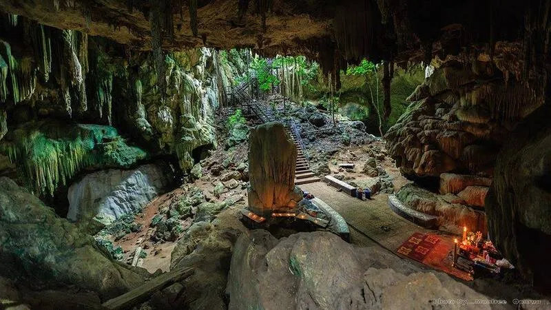
27. Tham Chaloei Cave, Kanchanaburi Province is located in Lum Sum Subdistrict, Sai Yok District, Kanchanaburi Province. It is a limestone cave associated with the landscape and history of the Thai–Burma Railway, widely known as the Death Railway. The cave lies within an area containing several important historical landmarks, particularly Tham Krasae Cave and the railway tracks running along a cliff above the Khwae Noi River. Tham Chaloei therefore offers an interesting opportunity to combine natural cave exploration with learning about the history of World War II.
Highlights: A natural limestone cave in Sai Yok District, its association with the Death Railway landscape, nearby travel routes connecting Tham Krasae Cave and Wang Pho Railway Station, and opportunities to learn about the history of World War II.
Tham Chaloei is a natural cave formed when groundwater gradually dissolved and eroded limestone, creating cavities within the mountain. Although it is not as extensive as Tham Lawa or Tham Sao Hin, it has an atmosphere shaped by the surrounding limestone landscape, which includes cliffs, forests, and a historically significant transportation corridor.
Sai Yok and Lum Sum were important areas during the construction of the Thai–Burma Railway in World War II, a project involving large numbers of forced laborers and Allied prisoners of war. Building the railway through mountainous terrain and along rivers required extremely difficult labor, and many people lost their lives. This history gives the wider landscape around Tham Chaloei an important role in remembering the suffering and events of the war.
Traditional accounts associated with the name Tham Chaloei refer to wartime events and the use of caves and surrounding terrain along the railway as places of shelter during fighting or aerial attacks. Although specific details require supporting historical evidence, the cave's association with the Death Railway area adds meaning to a visit beyond the appreciation of natural limestone formations.
Visitors should take care when walking through the cave because some surfaces may be damp or uneven. Suitable lighting is recommended, and travelers should remain on designated routes. Families with young children or older visitors should allow adequate time and check the condition of the entrance before beginning their visit.
Tham Chaloei can be combined with Tham Krasae Cave, Wang Pho Railway Station, and the historic wooden railway structures running along the cliff. Travelers interested in World War II history can continue to museums and other significant sites in Kanchanaburi Province to develop a deeper understanding of railway construction and its consequences for the people involved.
Extra care is required near active railway areas. Visitors should never stand on railway tracks or enter unsafe locations for photographs because trains still operate along parts of the line. Sightseeing should take place only at permitted viewpoints, and all warning signs should be followed.
Open Days: Generally daily. Opening Hours: Monday–Friday: 08:00 – 16:30; Saturday–Sunday: 08:30 – 16:30.
Getting There: From Kanchanaburi city, follow Highway 323 toward Sai Yok District and Lum Sum Subdistrict. Continue toward the Tham Chaloei area, which is close to Tham Krasae and Wang Pho Railway Station. Travelers using the railway can take the Kanchanaburi–Nam Tok line to an appropriate station and continue with local transport, depending on available services.
GPS Coordinates: 14.097720, 99.179976
Google Maps:Tham Chaloei Cave, Kanchanaburi Province

28. Tham Krasae Cave, Kanchanaburi Province is located in Lum Sum Subdistrict, Sai Yok District, Kanchanaburi Province. This limestone cave is famous for its position beside the historic Death Railway, which curves along a steep cliff above the Khwae Noi River. Inside the cave is a revered Buddha image known locally as Luang Pho Tham Krasae. From the cave entrance, visitors can admire the railway, the wooden structures supporting its cliffside route, and the river flowing below. These features make Tham Krasae one of Kanchanaburi's most important destinations combining nature, religion, and history.
Highlights: Luang Pho Tham Krasae Buddha image, the historic Death Railway, a wooden railway viaduct along the cliff, panoramic views of the Khwae Noi River, passing trains on the historic route, and opportunities to learn about World War II.
Tham Krasae is a relatively open limestone cave that does not extend as deeply into the mountain as some of Kanchanaburi's larger caves. It contains a sacred Buddha image and serves as a place of worship for visitors. The cave itself developed through the natural dissolution of limestone by water, the same geological process responsible for many other caves in the mountains of Sai Yok District.
The cave's most distinctive feature is its location immediately beside the Kanchanaburi–Nam Tok railway line, part of the Thai–Burma Railway constructed during World War II. The railway passes through a landscape of steep limestone cliffs and the Khwae Noi River. Building the line required wooden structures to support sections of track running along the rock face, creating an extraordinary scene of engineering set against a dramatic natural landscape.
From designated viewpoints, travelers can see the railway curving around the limestone cliff with the Khwae Noi River flowing below and forested mountains extending into the distance. The contrast between the railway infrastructure and the natural landscape has made Tham Krasae one of Kanchanaburi's most frequently photographed historic attractions.
When a train passes, visitors may observe it moving slowly along the wooden viaduct from a safe, permitted viewing location. However, standing on the tracks or entering dangerous areas to take photographs must be avoided. The railway remains in active use, and approaching the tracks without proper caution presents a serious risk of accidents.
Tham Krasae also holds historical significance because of its association with the construction of the Thai–Burma Railway during World War II. The project involved the labor of many Allied prisoners of war and forced laborers working under extremely difficult conditions. Visiting the cave offers an opportunity to learn about and remember those affected by the war while appreciating the natural beauty that remains in the area today.
Travelers can combine Tham Krasae with Tham Chaloei, Wang Pho Railway Station, Sai Yok Noi Waterfall, and other attractions in Sai Yok District. Those traveling by train may choose to disembark at Tham Krasae Station and explore the officially designated area before continuing their journey according to the railway timetable.
Open Days: Generally daily. Opening Hours: 08:00 – 17:00.
Getting There: From Kanchanaburi city, take Highway 323 toward Sai Yok District and follow signs to Tham Krasae and Tham Krasae Railway Station. Alternatively, travel on the Kanchanaburi–Nam Tok railway line and disembark at Tham Krasae Station, then walk to the cave and designated viewpoints.
GPS Coordinates: 14.106089, 99.165762
Google Maps:Tham Krasae Cave, Kanchanaburi Province

29. Tham Khao Khong Chai, Uthai Thani Province is located in Lan Sak District, Uthai Thani Province. It is a limestone cave with natural, archaeological, and ecological significance. The mountain contains a broad, tunnel-like cave and evidence of prehistoric human activity, including stone tools, pottery fragments, and other archaeological remains. The area also provides a habitat for large numbers of bats, which often emerge from the cave in the evening. Tham Khao Khong Chai is therefore an interesting destination for travelers seeking to learn about both natural history and human history in the same place.
Highlights: A broad, tunnel-like limestone cave, a limestone mountain approximately 353 meters high, prehistoric archaeological evidence, stone tools and pottery fragments, ancient paintings, and the evening emergence of a large bat colony.
Tham Khao Khong Chai formed through geological processes affecting the limestone mountain, particularly the action of underground water and natural erosion. Over long periods, water gradually enlarged fractures and openings in the rock, creating cavities of different sizes. Certain areas developed into shallow, spacious passages resembling natural tunnels, allowing some daylight to enter and producing conditions different from those found deep inside completely enclosed caves.
One of the cave's most important features is its archaeological value. Discoveries associated with the site include stone tools, polished stone axes, pottery fragments, and other evidence connected with prehistoric human activity. These findings indicate that people used the cave area in ancient times, possibly for shelter, daily activities, or other purposes consistent with the needs of communities living in different historical periods.
Ancient paintings found in the cave area are also important for understanding the beliefs and artistic expression of prehistoric people. Such paintings can provide evidence of how humans interpreted and interacted with their natural environment. Preserving them is therefore essential. Visitors should never touch or write on the cave walls and must not remove any objects found at the site without authorization.
In addition to its historical significance, Tham Khao Khong Chai is an important ecological habitat for bats. The cave provides a place where the animals can rest during the day. In the evening, large numbers may emerge to forage, sometimes forming long streams across the sky. Travelers interested in this natural spectacle should observe from safe locations and avoid disturbing the bats with excessive noise or strong lighting.
Lan Sak District and nearby areas contain several natural attractions, including Hup Pa Tat, Tham Prathun Wildlife Non-Hunting Area, Thap Salao Dam, and other limestone mountains. These destinations can be combined into an itinerary according to the available time. Beginning the trip in the morning provides an opportunity to explore the cave and surrounding attractions before watching the bats in the evening.
Visitors should exercise caution on rocky surfaces and in areas where bat droppings may accumulate. Animals living in the cave should not be disturbed, and travelers should not enter deeper passages without appropriate supervision. Because the site also contains archaeological evidence, preserving its original condition and following the responsible authorities' regulations are especially important.
Recommended Visiting Time: Daytime for exploring the cave and learning about the natural environment; evening for observing bats. Visitors should confirm access arrangements before traveling.
Getting There: From Uthai Thani city, travel toward Lan Sak District and continue along local roads to the Tham Khao Khong Chai area. A private car or rental vehicle is convenient for combining the cave with Hup Pa Tat, Thap Salao Dam, and other natural attractions in Lan Sak District.
GPS Coordinates: 15.433203, 99.579589
Google Maps:Tham Khao Khong Chai, Uthai Thani Province

30. Wat Tham Phra That, Kanchanaburi Province is located in Tha Kradan Subdistrict, Si Sawat District, Kanchanaburi Province. It is a Buddhist religious site associated with the cave and limestone mountain landscape of the Si Sawat area. The destination is suitable for travelers interested in religious tourism and natural environments. Its principal attractions include the peaceful temple atmosphere and surrounding mountain scenery, part of the diverse landscape of Western Thailand featuring forests, mountains, and waterways.
Highlights: A Buddhist religious site in Si Sawat District, a limestone mountain setting, a peaceful atmosphere suitable for paying respects to Buddha images, and opportunities to combine the visit with other natural attractions in Kanchanaburi Province.
Si Sawat District contains extensive mountainous terrain and forests, including geological formations favorable to the development of natural caves in certain areas. The gradual dissolution of limestone by water is one of the principal processes that creates cavities and openings within mountains. Over time, some of these natural spaces may become places used for religious activities or by surrounding communities.
Wat Tham Phra That is important as a sacred place for local residents. Visitors should dress respectfully and follow temple regulations, avoiding loud noise or activities that might disturb worshippers or people participating in religious practices. Natural areas within the temple grounds should be explored only where access is permitted, particularly around caves and mountain passages.
A visit to Wat Tham Phra That can be combined with natural attractions in Si Sawat District, including routes around Srinagarind Dam and waterfalls in the surrounding area. However, the destinations are separated by varying distances and different road conditions. Travelers should check maps and driving times before arranging an itinerary to avoid unnecessary backtracking.
Travelers interested specifically in natural caves and stalactites or stalagmites should ask the temple's caretakers which sections are currently accessible before visiting. Religious sites may have different access rules from established tourist caves, and visitors should not enter unapproved passages or natural cavities without appropriate supervision.
Open Days: Daily. Opening Hours: 08:00 – 17:00, according to the original place listing.
Getting There: From Kanchanaburi city, travel toward Si Sawat District and continue into Tha Kradan Subdistrict, following local roads to Wat Tham Phra That. A private car or rental vehicle is suitable for this mountainous area, where attractions are spread over considerable distances. Check road conditions before traveling during periods of heavy rainfall.
GPS Coordinates: 14.400451, 99.082153
Google Maps:Wat Tham Phra That, Kanchanaburi Province
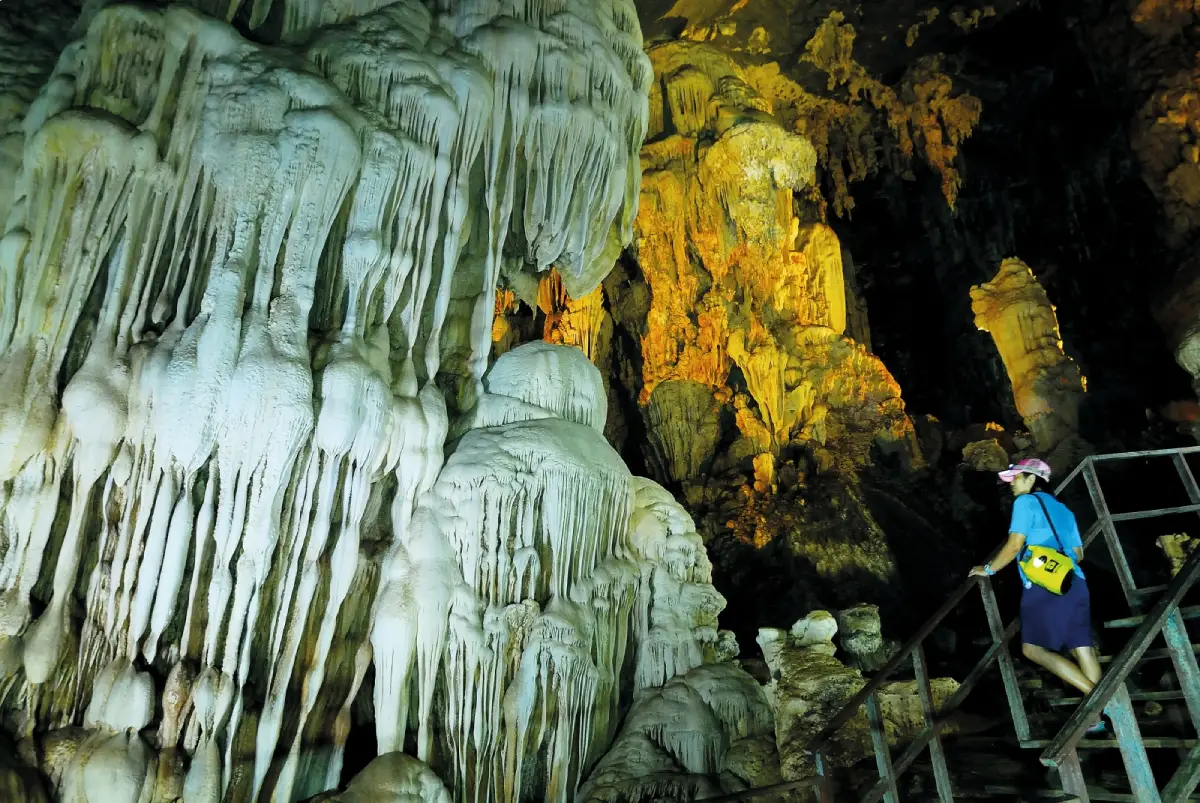
31. Chet Khot Cave, Satun Province is located in Moo 5, Palm Phatthana Subdistrict, Manang District, Satun Province. It is a remarkable limestone cave distinguished by a river flowing beneath the mountain and a series of winding underground passages. Inside are enormous chambers, stalactites and stalagmites, natural sandy areas, and openings through which daylight enters certain sections. Exploring Chet Khot Cave therefore combines underground cave exploration, water-based travel, and the natural limestone scenery of the Satun UNESCO Global Geopark area.
Highlights: A river cave with spacious chambers, a winding route through seven major sections, stalactites and stalagmites in various forms, glittering natural sandy areas inside the cave, guided boat activities, and the forested mountain scenery of Manang District.
Chet Khot Cave is particularly notable for its geological structure, created as flowing water gradually eroded and dissolved limestone over immense periods. These processes formed interconnected chambers and waterways inside the mountain. Some chambers are approximately 70–80 meters wide and 40–50 meters high, producing an impressive sense of scale when visitors enter. The effect is especially striking where daylight reaches the cave through natural openings and reflects from limestone walls and the surface of the water.
The name Chet Khot is associated with the winding nature of the cave passages and their several major bends. The cave is also known as Tham Sat Khuha, referring to its multiple chambers. Each section contains different limestone formations. Some stalactites resemble hanging curtains, while certain stalagmites suggest the shapes of pagodas. Elsewhere, mineral surfaces glitter when illuminated, revealing the intricate details of natural limestone deposition.
The underground stream is an essential part of the cave's natural system. Besides shaping the passages, flowing water deposits sand and sediment in places where the current changes direction. Some sandy areas contain light-colored grains that sparkle under illumination, creating scenery quite different from that found in dry limestone caves.
Depending on water levels and the activities arranged by local operators, exploring Chet Khot Cave may involve kayaking, inflatable boats, or walking through certain sections. Visitors must use appropriate safety equipment and should enter with experienced guides because parts of the cave are dark, contain flowing water, and have complex natural passages.
Chet Khot Cave is suitable for travelers interested in nature and supervised adventure activities. It can be combined with Wang Sai Thong Waterfall and Phu Pha Phet Cave in Manang District. However, adequate time should be reserved because guided boating and cave exploration generally take longer than stopping at ordinary roadside viewpoints.
Visitors must not touch or damage stalactites and stalagmites, leave rubbish in the waterways, or separate from their group without a guide. During the rainy season, water levels and cave access conditions require particular attention because underground streams can rise rapidly after heavy rainfall.
Open Days: Generally daily, depending on water conditions and activity arrangements. Opening Hours: 08:30 – 16:30, according to the original place listing.
Getting There: From Satun city, travel toward Manang District and Palm Phatthana Subdistrict using roads connecting with Highway 4137. Continue along local roads following signs to Chet Khot Cave. The cave is located within the natural tourism area near Wang Sai Thong Waterfall. Visitors should contact a local tour operator beforehand to confirm the starting point, available activities, and required equipment.
GPS Coordinates: 7.111458, 99.933753
Google Maps:Chet Khot Cave, Satun Province
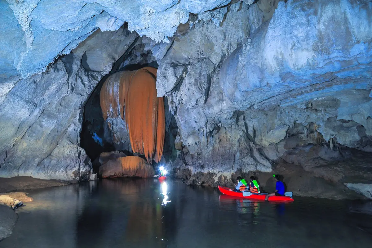
32. Tham Le Stegodon, Satun Province is located around Ban Khiri Wong, Moo 7, Thung Wa Subdistrict, Thung Wa District, Satun Province. It is a limestone river cave famous for its geological beauty and the discovery of fossils belonging to Stegodon, a prehistoric elephant relative that inspired the cave's name. A water passage extends approximately 4 kilometers through the mountain, with stalactites, stalagmites, and unusual limestone formations along the route. Exploring the cave requires a canoe or kayak and participation in a guided tour arranged according to official schedules, making it one of the most distinctive nature activities within the Satun UNESCO Global Geopark.
Highlights: An underground river passage approximately 4 kilometers long, prehistoric Stegodon fossils, beautiful stalactites and stalagmites, guided canoeing through limestone chambers, a heart-shaped cave exit, and a route connected with the mangrove forests of Thung Wa.
Tham Le Stegodon is particularly important as a fossil discovery site that contributes to scientific understanding of prehistoric animals. Fossils associated with Stegodon provide evidence of animals that inhabited this region hundreds of thousands of years ago. The discoveries have made the cave an important destination for paleontological education and contribute to the scientific significance of the Satun UNESCO Global Geopark.
The cave consists of limestone passages shaped by water flowing through the mountain. Over long periods, the erosion and dissolution of limestone created cavities and tunnels at different levels. Meanwhile, mineral deposits accumulated along the cave walls and ceiling, producing stalactites and stalagmites in different shapes. Some resemble hanging curtains, others form columns, and certain sections display patterns created by repeated water movement and mineral deposition.
Traveling by canoe through the cave is an important part of the experience, allowing visitors to encounter the darkness, quiet atmosphere, and sounds of flowing water beneath the mountain. Life jackets must be worn, and all instructions from the guides should be followed throughout the journey. Some passages have low ceilings or narrow openings, requiring careful boat handling.
Tham Le Stegodon is closely connected with the coastal ecosystem because the underground water passage is influenced by tides and the surrounding mangrove environment. Tour schedules must therefore be arranged according to suitable tidal conditions. After passing through the cave system, visitors may continue toward the mangrove forests and Tha Oi Pier, depending on the itinerary organized by local community operators.
Thung Wa District also contains educational attractions devoted to fossils and geology, particularly the Satun Geopark Museum and the local prehistoric elephant museum. Visiting these learning centers before entering the cave can help travelers better understand the region's geological background and the significance of its fossil discoveries.
Tourism at Tham Le Stegodon plays an important role in supporting the local economy. Community members participate in providing boats, guiding services, safety supervision, and related tourism activities. Visitors can support community-based tourism by choosing authorized operators and observing all conservation regulations.
Open Days: Guided visits operate according to scheduled rounds, and advance reservations are required. Opening Hours: Tour times depend on tides and the suitability of water conditions.
Getting There: From Satun city, travel approximately 76 kilometers toward Thung Wa District. Contact the visitor service arrangements associated with the Thung Wa Subdistrict Administrative Organization to confirm the tour schedule and meeting point. Continue to Ban Khiri Wong as directed by the operator. Advance booking is recommended to arrange the boat, guide, and transportation from the cave exit.
GPS Coordinates: 7.123886, 99.798525
Google Maps:Tham Le Stegodon, Satun Province
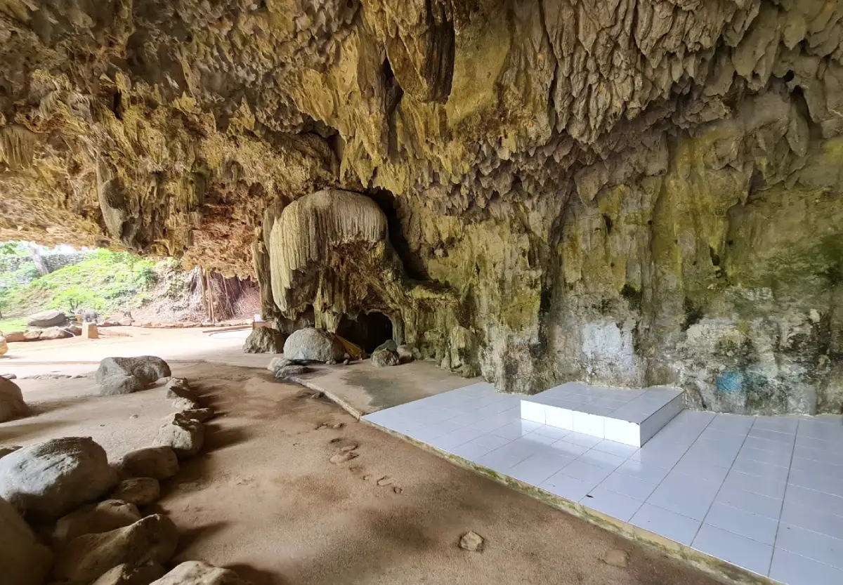
33. Tham Phung Chang, Phang Nga Province is located within the grounds of Wat Praphat Prachim Khet, behind the Phang Nga Provincial Hall in Mueang Phang Nga District, Phang Nga Province. This large limestone cave is hidden inside Khao Chang, an elephant-shaped mountain that is a prominent landmark of Phang Nga town. The cave is distinguished by an underground stream flowing through its limestone chambers and a visitor experience combining canoeing, bamboo rafting, and wading through water. These activities make Tham Phung Chang different from caves explored entirely on foot.
Highlights: Canoeing and bamboo rafting inside a cave, walking through shallow underground water, beautiful stalactites and stalagmites, an underground stream, and views of Khao Chang mountain in central Phang Nga.
Tham Phung Chang formed through geological processes in which water flowed through and eroded limestone over immense periods, eventually creating large cavities and interconnected waterways within the mountain. Water seeping from above also deposited calcium carbonate, creating stalactites and stalagmites that give the cave walls and ceilings their distinctive formations.
The visitor experience begins with boat travel into the water-filled sections of the cave. The method of travel changes according to the conditions of different passages, including canoeing, bamboo rafting, and walking through shallow water. Along the route, visitors can observe stalactites, stalagmites, and underground streams while local guides provide directions and supervise safety.
Some sections of the cave are completely dark and rely mainly on artificial lighting. When light falls across the limestone walls, it reveals patterns created by natural mineral deposition. Some formations hang from the ceiling in long shapes, while others resemble animals or everyday objects. Traveling through the water passages provides a viewpoint quite different from that experienced in ordinary walking caves.
Khao Chang is an important geographical landmark of Phang Nga because it is a large limestone mountain standing close to the town center. Its distinctive elephant-like shape is visible from a distance. Visiting Tham Phung Chang can therefore be combined with sightseeing around the mountain and other attractions in Mueang Phang Nga District, including Ruesi Sawan Cave, Luk Suea Cave, and Sa Nang Manora Forest Park.
Visitors should bring clothing suitable for getting wet, footwear appropriate for slippery surfaces, and waterproof protection for phones or cameras. Parts of the tour involve wading and boat travel. People with mobility limitations or those uncomfortable with water-based activities should ask the operator about the route before deciding to participate.
Particular caution is required during the rainy season because water levels inside the cave can change according to rainfall and local conditions. Visitors should confirm whether tours are operating before traveling and follow the guides' instructions throughout the activity. A typical visit takes approximately 1–1.5 hours, depending on the route and conditions on the day.
Open Days: Generally daily. Opening Hours: 08:30 – 16:00.
Getting There: From Phang Nga town center, travel to Wat Praphat Prachim Khet behind the Phang Nga Provincial Hall and contact the cave tour service point. The cave is relatively accessible from town by private car or local taxi.
GPS Coordinates: 8.442173, 98.516846
Google Maps:Tham Phung Chang, Phang Nga Province
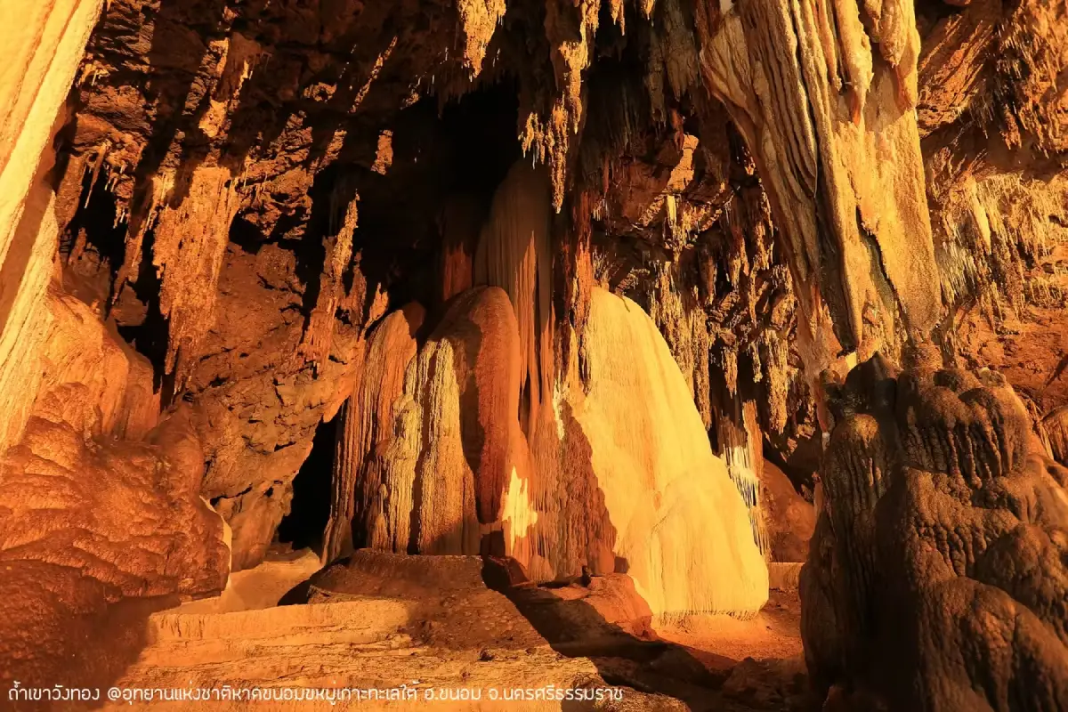
34. Khao Wang Thong Cave, Nakhon Si Thammarat Province is located in Khuan Thong Subdistrict, Khanom District, Nakhon Si Thammarat Province. It is a limestone cave known for its beautiful stalactites and stalagmites and chambers containing formations of many different shapes. Some limestone structures resemble pagodas, waterfalls, fish skin, custard apples, and natural basins. When illuminated, the surfaces sparkle, creating a memorable atmosphere for visitors. This cave is ideal for travelers wishing to experience a different side of Khanom District beyond its famous beaches and coastal scenery.
Highlights: Stalactites and stalagmites resembling pagodas, waterfalls, fish skin, custard apples, and water basins; several limestone chambers; sparkling mineral surfaces; and an itinerary that can be combined with Khanom's beaches.
Khao Wang Thong Cave developed through the gradual dissolution of limestone by underground water and rainwater seeping through rock layers. Over time, this process formed underground cavities and chambers at different levels. Water carrying dissolved calcium carbonate also deposited minerals along the walls and ceiling, creating formations with shapes that vary according to the direction of water flow and local conditions.
The distinctive appeal of Khao Wang Thong Cave lies in groups of limestone formations resembling familiar objects and features of the natural world. Examples include structures shaped like pagodas and others resembling custard apples. These names reflect the imagination of people who have observed the cave and help create an engaging experience that goes beyond simply looking at limestone formations.
In certain sections, stalactites and stalagmites have accumulated in layers, with some developing into natural limestone columns. When light reaches these surfaces, visitors can observe differences in texture and natural coloration. Care is needed while walking because parts of the cave may be damp or uneven. Footwear with good traction helps reduce the risk of slipping.
Another interesting aspect of Khao Wang Thong Cave is its setting within Khanom District, which contains limestone mountains, rubber plantations, rural communities, and coastline along the Gulf of Thailand. Traveling to the cave allows visitors to experience the contrast between mountain and coastal landscapes within the same district.
Travelers with one day available can explore Khao Wang Thong Cave in the morning before continuing to Khanom Beach, Na Dan Beach, or Nai Phlao Beach in the afternoon. Those seeking a more varied nature itinerary can combine the cave with Suan Ta San and other outdoor attractions in Khanom District, depending on the time available and weather conditions.
Visitors should respect cave conservation regulations by avoiding contact with stalactites and stalagmites, refraining from writing on cave walls, and never removing rocks from the site. Natural mineral formations require extraordinarily long periods to develop, and preserving the cave's original condition helps maintain its educational and tourism value.
Open Days: Generally daily. Opening Hours: 08:30 – 16:00.
Getting There: From Khanom District, follow Highway 4014 and connect to Highway 4142 before continuing along local roads through the Khuan Thong area toward Khao Wang Thong Cave. Some sections pass rubber plantations and rural communities, so careful driving is recommended, particularly during rainfall.
GPS Coordinates: 9.204904, 99.774138

35. Tham Khao Yoi Cave, Phetchaburi Province is located in Khao Yoi District, Phetchaburi Province, close to Phetkasem Road and the Khao Yoi District Office. It is a limestone cave of Buddhist religious significance and a cultural attraction that is relatively easy to reach. Several Buddha images are enshrined inside, with a reclining Buddha serving as the principal image and a sacred golden Buddha footprint attracting Buddhist worshippers. The cave's beauty lies in the combination of natural limestone chambers, sacred images, and the peaceful atmosphere of a religious sanctuary.
Highlights: A reclining Buddha image inside the cave, a golden Buddha footprint, various Buddha images, natural limestone chambers, and convenient access from Phetkasem Road.
Tham Khao Yoi Cave developed through the natural dissolution of limestone by underground water, creating cavities and chambers suitable for religious activities and worship. Its development into a Buddhist sanctuary has given the cave a role in the local community beyond that of a natural attraction. It has become a place where people make merit and participate in religious ceremonies.
The principal reclining Buddha image is an important focus of worship inside the cave. Visitors commonly pay respects to the image and explore other sacred Buddha images arranged around the chambers. The peaceful atmosphere and natural rock walls create a setting different from that of an ordinary temple hall above ground.
The golden Buddha footprint is another important sacred feature respected by visitors. Travelers interested in religion and culture can learn about Buddhist beliefs associated with Buddha footprints and the use of natural caves as places of worship, a tradition found in many parts of Thailand.
Tham Khao Yoi is conveniently located for travelers driving from Bangkok toward Phetchaburi because it is close to Highway 4. Those with limited time can stop to rest and pay respects to Buddha images before continuing to Phetchaburi city or the beaches of Cha-am.
Travelers interested in visiting religious caves in Phetchaburi can combine Tham Khao Yoi with Khao Luang Cave and important temples in the provincial capital. However, the two caves are in different districts, so travel time should be considered. Starting early provides enough time to appreciate both destinations without rushing.
Visitors should dress appropriately, avoid making excessive noise, and respect people participating in religious activities. Flash photography or equipment that disturbs others should be avoided, and natural stalactites and stalagmites must not be touched or damaged.
Open Days: Daily. Opening Hours: 08:00 – 17:00.
Getting There: From Bangkok, take Rama II Road and connect to Phetkasem Road toward Phetchaburi Province. On reaching Khao Yoi District, turn toward the district center and follow signs to Wat Tham Khao Yoi. The cave is near the Khao Yoi District Office and can be reached conveniently by private car or local taxi.
GPS Coordinates: 13.234870, 99.828222
Google Maps:Tham Khao Yoi Cave, Phetchaburi Province
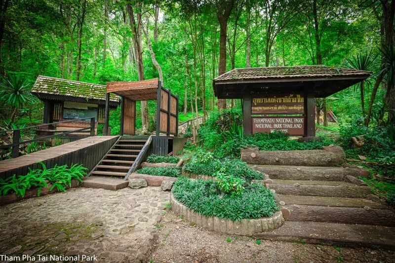
36. Tham Pha Thai Cave, Lampang Province is located within Tham Pha Thai National Park in Lampang Province, with the principal cave area situated in Ngao District. This limestone cave is notable for its natural and geological features, including underground chambers, stalactites, stalagmites, and rock structures developed through mineral deposition over immense periods. Tham Pha Thai National Park also protects an extensive forest landscape covering several districts of Lampang Province, giving the area importance for cave tourism, forest ecosystems, and watershed conservation.
Highlights: A limestone cave within a national park, natural chambers with stalactites and stalagmites, limestone mountains in Ngao District, mixed deciduous forests, deciduous dipterocarp forests, and opportunities to learn about the natural environment of Lampang Province.
Tham Pha Thai National Park has a mountainous landscape with several forest types and limestone formations that support the development of natural caves. Water seeping through the rock gradually dissolved limestone, creating cavities and chambers. Meanwhile, minerals deposited from dripping water developed into stalactites and stalagmites with distinctive shapes.
The Tham Pha Thai cave area is an important place for geological education because it illustrates the relationship between limestone mountains, groundwater, and natural mineral deposition. Some parts of the cave receive daylight, while others require artificial lighting. Visitors should remain on officially designated routes to reduce the risk of accidents in dark areas or on slippery rock surfaces.
The cave's natural beauty is reflected in its stalactites, stalagmites, and peaceful underground atmosphere. In some areas, stalactites hang in groups from the ceiling, while elsewhere stalagmites rise from the floor. Certain formations may eventually join into columns. When illuminated, their varied surfaces and shapes become more visible.
The national park is also ecologically important because it contains mixed deciduous forest, deciduous dipterocarp forest, and dry evergreen forest at different elevations. The diversity of vegetation and wildlife means that a cave visit can be combined with learning about the surrounding natural environment. Visitors should maintain cleanliness and avoid disturbing wildlife throughout the park.
Tham Pha Thai is suitable for travelers interested in nature, geology, and peaceful outdoor experiences. It can be combined with natural attractions around Ngao District or included in an itinerary between Lampang and Phrae, depending on travel time and available routes. Those driving independently should check road conditions and national park announcements before entering the area.
Conserving the cave is essential because stalactites and stalagmites take extremely long periods to develop. Visitors should not touch, mark, or break limestone formations and should remain on designated pathways to protect both the geological environment and the cave ecosystem.
Open Days: Generally daily, subject to national park announcements. Opening Hours: 08:30 – 16:30.
Getting There: From Lampang city, travel toward Ngao District and continue toward Ban Huat Subdistrict and Tham Pha Thai National Park, following signs along the route. Contact national park staff to confirm the starting point of the cave trail and which areas are currently open to visitors.
GPS Coordinates: 18.604191, 99.897939
Google Maps:Tham Pha Thai National Park, Lampang Province

37. Tham Than Lot National Park, Kanchanaburi Province also associated with the area known as Chaloem Rattanakosin National Park, is located in Si Sawat District, Kanchanaburi Province. It is a natural destination distinguished by limestone cave systems, streams flowing through mountain passages, waterfalls, and forest trails surrounded by abundant vegetation. The principal attractions include Tham Than Lot Noi and Tham Than Lot Yai, connected by a nature trail that allows visitors to experience caves, streams, and forest environments within a single excursion.
Highlights: Tham Than Lot Noi, Tham Than Lot Yai, the Lam Kraphoi stream flowing through the caves, Trai Trueng Waterfall, an approximately 2.5-kilometer forest trail, and the natural forest environment of Western Thailand.
The national park's landscape consists largely of limestone mountains shaped by water erosion over long periods. These processes created caves of different sizes and underground water passages. Water systems played a major role in developing the caves and continue to support the surrounding forest ecosystems, providing essential resources for plants and wildlife.
The well-known nature trail begins at Tham Than Lot Noi, where Lam Kraphoi flows through a limestone cave. From there, the route continues approximately 1.5 kilometers through the forest to Trai Trueng Waterfall before extending another kilometer toward Tham Than Lot Yai. The total walking distance is approximately 2.5 kilometers, making it suitable for visitors interested in a moderately demanding nature walk.
Tham Than Lot Noi is distinctive because of the stream running through its interior, creating a cool and humid atmosphere accompanied by the sound of flowing water. The cave contains stalactites, stalagmites, and limestone walls formed through natural mineral deposition. Walking through the cave offers an opportunity to observe the relationship between underground waterways and limestone geology at close range.
Trai Trueng Waterfall is an important resting point along the trail. This natural waterfall lies within the surrounding forest, allowing travelers to pause, enjoy the scenery, and observe vegetation near the stream before continuing toward Tham Than Lot Yai, a larger cave containing spacious, relatively open chambers.
Visitors walking the nature trail should wear suitable hiking shoes, bring drinking water, and prepare basic supplies for a journey of several kilometers. During periods of heavy rain, slippery paths and changes in water levels may create additional risks. Travelers should therefore confirm trail access and follow national park guidance before beginning the walk.
The area is valuable for learning about cave ecosystems and watershed forests. Visitors should never leave rubbish in streams, touch limestone formations, or leave designated pathways because these actions can damage both geological features and organisms living in the damp underground environment.
Open Days: Generally daily, subject to national park announcements. Opening Hours: 08:00 – 16:30.
Getting There: From Kanchanaburi city, travel toward Bo Phloi and Nong Prue districts before continuing along the route to Chaloem Rattanakosin National Park in the Si Sawat area. On arrival, contact park staff for information about the forest trail and the caves currently open to visitors.
GPS Coordinates: 14.669016, 99.289190

38. Tham Than Lot Noi Cave, Kanchanaburi Province is located within Chaloem Rattanakosin National Park in Khao Chot Subdistrict, Si Sawat District, Kanchanaburi Province. It is a limestone cave through which a natural stream flows continuously. The cave is distinguished by its combination of stalactites, stalagmites, and an underground water system, creating a cool, humid atmosphere. It is suitable for travelers interested in exploring natural caves and learning how water contributes to the development of limestone passages.
Highlights: Lam Kraphoi stream flowing through the cave, natural stalactites and stalagmites, limestone chambers, a nature trail connecting Trai Trueng Waterfall and Tham Than Lot Yai, and conservation-focused tourism within Chaloem Rattanakosin National Park.
Tham Than Lot Noi formed as water gradually eroded and dissolved limestone along fractures within the mountain. As the underground passage expanded, the stream continued to flow through it, producing a river cave rather than a completely dry underground chamber.
Inside are stalactites and stalagmites of many shapes. Some developed from mineral-rich water dripping from the ceiling and depositing calcium carbonate on the cave floor, while others formed from minerals accumulating on the ceiling itself. Over time, these processes created different shapes and textures according to water movement and the underground environment.
Walking through Tham Than Lot Noi allows visitors to experience its cool humidity and the sound of naturally flowing water. Daylight passing through certain openings creates a contrast between the interior and exterior environments. Following the nature trail also provides opportunities to observe limestone structures and the ecosystems associated with damp underground conditions.
Tham Than Lot Noi is also the starting point of the nature trail toward Trai Trueng Waterfall and Tham Than Lot Yai. Visitors with sufficient time and physical fitness can continue along officially accessible routes. Traveling farther toward Tham Than Lot Yai provides an opportunity to compare a stream cave with larger limestone chambers within the same landscape.
Visitors should be careful on limestone surfaces and in areas where water flows because the ground may be slippery and water levels can change after rainfall in upstream areas. Shoes suitable for wet surfaces are recommended, and visitors must not enter sections that are closed to the public.
Conservation of Tham Than Lot Noi is especially important because its underground stream is connected to the surrounding forest and external water systems. Rubbish or chemicals entering the stream could affect aquatic organisms and water quality. Visitors should maintain cleanliness and follow national park regulations carefully.
Open Days: Generally daily, subject to national park announcements. Opening Hours: 08:30 – 16:30.
Getting There: From Kanchanaburi city, travel to Chaloem Rattanakosin National Park in Si Sawat District. On arrival, contact national park staff to confirm the route to Tham Than Lot Noi and the availability of the walking trail toward Trai Trueng Waterfall and Tham Than Lot Yai.
GPS Coordinates: 14.662912, 99.305645
Google Maps:Tham Than Lot Noi Cave, Kanchanaburi Province
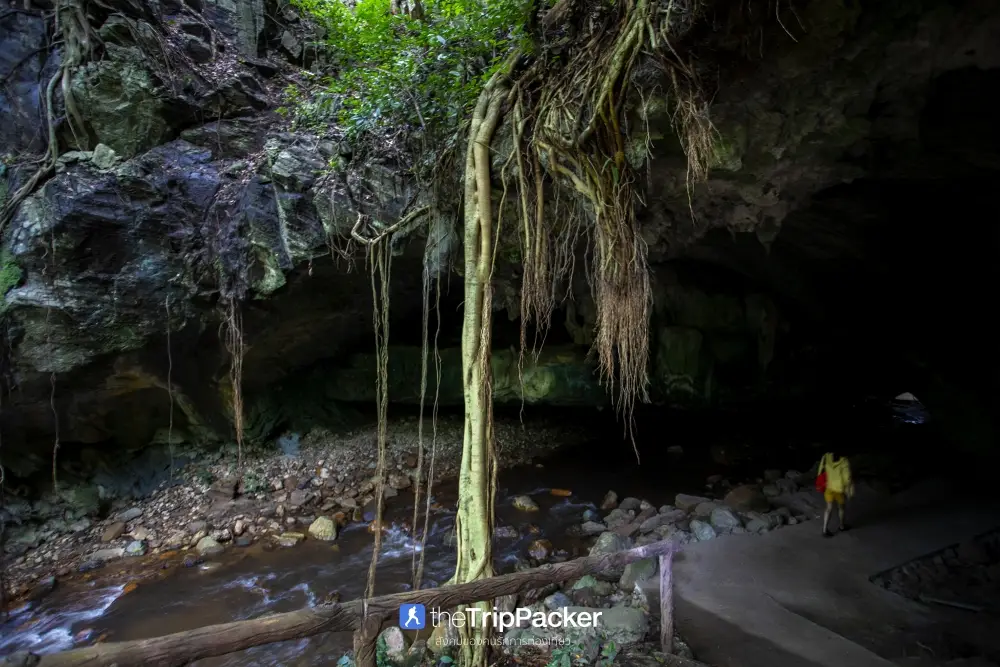
39. Nam Lod Noi Cave, Chumphon Province is located around Ban Nam Lod Noi, Moo 10, Thung Raya Subdistrict, Sawi District, Chumphon Province. It is a natural limestone cave with a small stream flowing through its interior and archaeological significance because evidence of ancient human activity has been discovered in the area. Findings include pottery, tools, and animal bones. The cave is therefore valuable for understanding geology, underground waterways, and the history of early communities in Sawi District.
Highlights: A natural stream flowing through the cave, limestone passages, archaeological evidence of prehistoric human activity, pottery including tripod vessels, and the peaceful rural landscape of Sawi District.
Nam Lod Noi Cave is an example of a river cave formed as flowing water gradually dissolved and eroded limestone over a long period. The stream enlarged natural openings within the mountain until they became cave passages. Because water continues to flow through the cave, the underground environment remains humid and differs considerably from that of dry limestone caves.
Another important aspect of Nam Lod Noi Cave is its archaeological significance. Evidence of ancient human activity includes fragments of plain pottery, cord-marked pottery, tripod vessels, and animal bones. These findings are relevant to the study of prehistoric communities and help researchers understand human life in Southern Thailand several thousand years ago.
Throughout history, natural caves have served as temporary shelters, activity areas, and places where people used local resources. Nam Lod Noi Cave illustrates the relationship between cave environments and human life before the development of modern settlements. Learning about its archaeological evidence helps visitors appreciate the cave as more than a natural attraction or photography destination.
The surrounding area consists of rural communities and natural landscapes in Sawi District. Its peaceful atmosphere suits travelers interested in educational tourism and discovering lesser-known natural attractions. Visitors who wish to learn about underground water systems and archaeology can observe the cave's structure and surrounding landscape in areas where access is permitted.
A visit to Nam Lod Noi Cave can be combined with Wat Phra Borommathat Sawi and other attractions in Sawi District. Travelers with one day available can begin with the cave in the morning before visiting cultural landmarks in the afternoon, gaining an understanding of both local history and the natural environment of Chumphon Province.
Visitors must not touch or remove archaeological objects found at the site, write on cave walls, or leave rubbish in the stream. Preserving archaeological evidence in its original position is essential for scientific research because moving artifacts can destroy valuable information about their historical context.
Open Days: Generally daily. Opening Hours: 08:00 – 17:00.
Getting There: From Chumphon city, travel toward Sawi District and continue along local roads to Thung Raya Subdistrict and Ban Nam Lod Noi, Moo 10. A private vehicle is recommended. Visitors may wish to confirm the final approach with the local community because some roads are rural and directional signs may be limited.
GPS Coordinates: 10.234072, 98.944939
Google Maps:Nam Lod Noi Cave, Chumphon Province
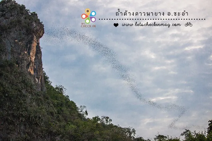
40. Tham Na Yang, Phetchaburi Province is located in Na Yang Subdistrict, Cha-am District, Phetchaburi Province. This natural attraction is famous for the remarkable sight of large numbers of bats emerging from a limestone cave at dusk to forage during the night. The bats form long, continuous streams across the evening sky, creating an extraordinary spectacle. Unlike caves primarily celebrated for stalactites and stalagmites, Tham Na Yang is particularly notable for its wildlife and the ecological behavior of cave-dwelling bats.
Highlights: Large numbers of bats flying out of a limestone cave in long streams at dusk, the limestone mountain landscape of Na Yang Subdistrict, opportunities to learn about bat behavior, and a nature activity that can be combined with a visit to Cha-am Beach.
Tham Na Yang is located within a limestone mountain containing natural cave passages formed through the gradual dissolution and erosion of rock by water over immense periods. The interior provides a dark environment suitable for bats to rest during the day. As sunlight begins to fade, the animals leave the cave to search for food in the surrounding landscape.
The evening bat emergence is particularly impressive because of the enormous numbers of bats gathering and moving together. Around dusk, they begin leaving the cave in successive groups, forming long streams through the sky. From a distance, the movement may resemble a dark river or ribbon extending across the horizon. The exact flight pattern changes with wind conditions, temperature, and weather.
Bats play an important role in natural ecosystems, especially insect-eating species that help control insect populations. Protecting their cave habitats is therefore important for ecological balance and nearby agricultural landscapes. Visitors should understand that this spectacle is not simply a photography opportunity but part of the animals' natural daily life cycle.
The best time to observe the bats is around dusk. Travelers should arrive before approximately 17:30 to find a safe viewing position without disturbing the animals. Bat emergence may begin around 18:00, but the timing cannot be guaranteed because it depends on natural conditions and the bats' behavior.
Tham Na Yang is located relatively close to Cha-am Beach, approximately 12 kilometers away depending on the starting point. Travelers can therefore spend the daytime enjoying the coast before continuing to the cave in the evening. This itinerary combines beach tourism with an opportunity to learn about limestone cave ecosystems in a single day.
Photography should take place only from permitted viewing areas. Visitors should avoid flash photography or shining strong lights into the cave entrance and should never enter roosting areas to disturb the bats. Maintaining a safe distance and a quiet atmosphere allows the animals to continue their natural foraging behavior.
Travelers interested in conservation tourism can visit Tham Na Yang to learn about cave-dwelling animals and ecosystems in Phetchaburi Province. It can be combined with natural attractions around Cha-am District. Appropriate photography equipment and a check of the weather forecast are recommended because heavy rain may affect the visibility and timing of the bat emergence.
Open Days: Generally daily. Recommended Bat-Watching Time: Arrive before 17:30; bats often begin emerging around 18:00, depending on natural conditions.
Getting There: From Bangkok or Phetchaburi city, follow Phetkasem Road toward Cha-am District. Continue to Na Yang Subdistrict using local roads and signs. Travelers beginning at Cha-am Beach can drive to the Tham Na Yang area and should aim to arrive before dusk to prepare for the viewing experience.
GPS Coordinates: 12.873025, 99.938964
Google Maps:Tham Na Yang, Phetchaburi Province
Summary Table: 40 Beautiful Caves in Thailand with GPS Coordinates and Google Maps This comprehensive table brings together 40 remarkable cave destinations across Thailand, including limestone caves, underground river caves, sea caves, prehistoric archaeological sites, and caves associated with Buddhist traditions and historical events. The attractions are organized by geographical region to help travelers plan their journeys more efficiently. Each destination includes a link to its English information page, its province, distinctive highlights, GPS coordinates, and a Google Maps link. Some caves require hiking, boat travel, local guides, or advance reservations, while others may be accessible only during specific seasons or when weather and water conditions are suitable.
| No. | Cave Attraction | Province | Highlights | GPS Coordinates | Google Maps |
| Northern Thailand — 7 Attractions | |||||
| 2 | Chiang Dao Cave | Chiang Mai | Limestone chambers at the foot of Doi Luang Chiang Dao, stalactites and stalagmites, sacred Buddha images, and guided exploration with lanterns. | 19.393702, 98.928602 | Google Maps |
| 8 | Tham Luang–Khun Nam Nang Non | Chiang Rai | An extensive limestone cave system, the Doi Nang Non mountain silhouette, the historic 2018 rescue operation, and watershed forest conservation. | 20.381558, 99.867466 | Google Maps |
| 10 | Doll Cave | Mae Hong Son | Numerous miniature stalagmites resembling dolls inside the Tham Lod cave system in Pang Mapha District. | 19.568722, 98.279280 | Google Maps |
| 14 | Kaew Komol Cave | Mae Hong Son | Delicate white calcite crystals resembling sparkling gemstones, with exceptional geological and conservation significance. | 18.396451, 97.968237 | Google Maps |
| 18 | Pha Nang Khoi Cave | Phrae | The Hin Nang Khoi formation, a traditional legend of a waiting woman, winding passages, and limestone stalactites and stalagmites. | 18.368750, 100.354404 | Google Maps |
| 19 | Tham Lod Cave | Mae Hong Son | The Lang River flowing beneath a limestone mountain, Sao Hin Luang Cave, Doll Cave, Phi Man Cave, bamboo rafting, and archaeological sites. | 19.568283, 98.279731 | Google Maps |
| 36 | Tham Pha Thai Cave | Lampang | Limestone chambers and formations within Tham Pha Thai National Park, surrounded by forest ecosystems and geological learning sites. | 18.604191, 99.897939 | Google Maps |
| Northeastern Thailand — 1 Attraction | |||||
| 16 | Tham Erawan Cave | Nong Bua Lamphu | An elephant-shaped limestone mountain, a giant Buddha image, more than 600 steps, spectacular cave chambers, and the Nang Phom Hom legend. | 17.345578, 102.018615 | Google Maps |
| Central and Western Thailand — 18 Attractions | |||||
| 5 | Khao Luang Cave | Phetchaburi | Sacred Buddha images, sunlight entering through natural ceiling openings, and historical connections with the Rattanakosin royal court. | 13.137548, 99.933250 | Google Maps |
| 6 | Khao Bin Cave | Ratchaburi | Large limestone chambers, spectacular stalactites and stalagmites, organized visitor pathways, and interior lighting. | 13.593348, 99.666903 | Google Maps |
| 7 | Chomphon Cave | Ratchaburi | A stalactite resembling a military shoulder insignia, historical royal visits, and beautiful natural limestone chambers. | 13.624895, 99.586793 | Google Maps |
| 11 | Phraya Nakhon Cave | Prachuap Khiri Khan | The historic Kuha Karuhas Pavilion, enormous chambers, natural skylights, and an uphill trail from Laem Sala Beach. | 12.197486, 100.011334 | Google Maps |
| 12 | Tham Lawa Cave | Kanchanaburi | A large limestone cave in Sai Yok National Park with spectacular stalactites, stalagmites, and proximity to the Khwae Noi River. | 14.298702, 98.981267 | Google Maps |
| 21 | Tham Kaeo Cave | Prachuap Khiri Khan | Sparkling mineral crystals, stalactites and stalagmites, and adventurous limestone passages in Khao Sam Roi Yot National Park. | 12.202996, 99.992590 | Google Maps |
| 22 | Tham Wang Badan Cave | Kanchanaburi | A two-level limestone cave, Moon Curtain Chamber, Narai Needle Chamber, mineral formations, and a forest nature trail. | 14.251017, 99.074826 | Google Maps |
| 23 | Tham Sao Hin Cave | Kanchanaburi | An enormous natural limestone column in Lam Khlong Ngu National Park, with adventure activities requiring advance reservations. | 14.943982, 98.810110 | Google Maps |
| 25 | Tham Khao Wong Forest Park | Uthai Thani | Phu Wai Cave, limestone chambers, stalactites and stalagmites, and natural forest trails in Ban Rai District. | 15.012552, 99.444339 | Google Maps |
| 26 | Khao Chong Phran Cave | Ratchaburi | Phra Non Cave at Wat Khao Chong Phran and the spectacular emergence of large bat colonies at dusk. | 13.719072, 99.772936 | Google Maps |
| 27 | Tham Chaloei Cave | Kanchanaburi | A natural limestone cave linked to the landscape and wartime history of the Death Railway near Tham Krasae. | 14.097720, 99.179976 | Google Maps |
| 28 | Tham Krasae Cave | Kanchanaburi | Luang Pho Tham Krasae, the historic Death Railway, a wooden cliffside viaduct, and views of the Khwae Noi River. | 14.106089, 99.165762 | Google Maps |
| 29 | Tham Khao Khong Chai | Uthai Thani | A limestone cave containing ancient paintings, stone tools, prehistoric archaeological evidence, and an evening bat colony. | 15.433203, 99.579589 | Google Maps |
| 30 | Wat Tham Phra That | Kanchanaburi | A Buddhist religious site in Si Sawat District, surrounded by a limestone mountain landscape and peaceful natural scenery. | 14.400451, 99.082153 | Google Maps |
| 35 | Tham Khao Yoi Cave | Phetchaburi | A reclining Buddha, a golden Buddha footprint, and limestone chambers used as a Buddhist sanctuary near Phetkasem Road. | 13.234870, 99.828222 | Google Maps |
| 37 | Tham Than Lot National Park | Kanchanaburi | Tham Than Lot Noi and Tham Than Lot Yai, Trai Trueng Waterfall, and a forest trail connecting limestone caves and streams. | 14.669016, 99.289190 | Google Maps |
| 38 | Tham Than Lot Noi Cave | Kanchanaburi | Lam Kraphoi stream flowing through limestone chambers, stalactites and stalagmites, and a nature trail toward Tham Than Lot Yai. | 14.662912, 99.305645 | Google Maps |
| 40 | Tham Na Yang | Phetchaburi | The spectacular emergence of large numbers of bats from a limestone cave at dusk near Cha-am. | 12.873025, 99.938964 | Google Maps |
| Eastern Thailand — 1 Attraction | |||||
| 20 | Tham Phet Pho Thong | Sa Kaeo | Creamy-white stalactites, sparkling mineral surfaces, golden Bodhi-leaf-like patterns, and a forest route with Chan Pha trees. | 13.413959, 102.325325 | Google Maps |
| Southern Thailand — 13 Attractions | |||||
| 1 | Emerald Cave, Koh Mook | Trang | An approximately 80-meter sea-cave tunnel, emerald-green water, and a hidden beach surrounded by towering limestone cliffs. | 7.368546, 99.284631 | Google Maps |
| 3 | Phu Pha Phet Cave | Satun | Enormous limestone chambers, numerous stalactites and stalagmites, and sparkling mineral deposits resembling diamond flakes. | 7.126470, 99.997020 | Google Maps |
| 4 | Tham Le Khao Kob | Trang | Guided paddle-boat journeys beneath a limestone mountain, extremely low cave ceilings, and underground limestone formations. | 7.791845, 99.573949 | Google Maps |
| 9 | Tham Khao Pina | Trang | Multi-level limestone caves, Buddha images, archaeological objects, and the royal monogram of King Prajadhipok, Rama VII. | 7.749358, 99.527386 | Google Maps |
| 13 | Tham Lod and Phi Hua To Cave | Krabi | Prehistoric cave paintings, limestone passages among the Ban Bo Tho mangroves, and boat or kayak excursions. | 8.382222, 98.687044 | Google Maps |
| 15 | Tham Khao Chang Hai | Trang | Interconnected limestone chambers, guided cave walks, the legend of a lost elephant, and the Na Muen Si weaving community. | 7.590271, 99.668706 | Google Maps |
| 17 | Tham Lod Puyu | Satun | Boat travel through a natural limestone tunnel, the Tha Chin Canal, mangrove forests, and traditional fishing communities. | 6.487005, 100.108503 | Google Maps |
| 24 | Tham Silp Cave | Yala | Ancient wall paintings, Buddhist imagery, historical human figures, and archaeological evidence preserved in a limestone cave. | 6.522318, 101.233303 | Google Maps |
| 31 | Chet Khot Cave | Satun | A river cave with seven major sections, enormous limestone chambers, underground streams, sandy areas, and guided boat activities. | 7.111458, 99.933753 | Google Maps |
| 32 | Tham Le Stegodon | Satun | An underground river cave, prehistoric Stegodon fossils, guided canoeing, and geological learning within the Satun UNESCO Global Geopark. | 7.123886, 99.798525 | Google Maps |
| 33 | Tham Phung Chang | Phang Nga | An underground river inside Khao Chang mountain, explored by canoe, bamboo raft, and walking through shallow water. | 8.442173, 98.516846 | Google Maps |
| 34 | Khao Wang Thong Cave | Nakhon Si Thammarat | Limestone formations resembling pagodas, waterfalls, fish skin, and custard apples in the mountains of Khanom District. | 9.204904, 99.774138 | Google Maps |
| 39 | Nam Lod Noi Cave | Chumphon | A natural river cave containing archaeological evidence, including prehistoric pottery, tripod vessels, and ancient tools. | 10.234072, 98.944939 | Google Maps |
Important Travel Information: The GPS coordinates in this table are reference points for planning journeys and do not necessarily indicate locations directly accessible by car. Attractions such as Emerald Cave, Phraya Nakhon Cave, Tham Lod Puyu, Tham Le Stegodon, and Tham Sao Hin require additional travel by boat or on foot. Some destinations also require local guides, advance bookings, or special safety arrangements. Before traveling, visitors should confirm current access conditions, national park announcements, weather forecasts, water levels, and any restrictions on cave entry.
8 Recommended Cave Travel Routes in Thailand: Nature, History, and Adventure Exploring Thailand's caves can be planned in many ways, from easy day trips along established walking routes to multi-day journeys involving boating, bamboo rafting, hiking, and geological exploration. Choosing an itinerary that suits the available time and the abilities of everyone in the group allows travelers to appreciate each cave without rushing or spending unnecessary time retracing their route. Families with young children or older relatives should prioritize caves with well-defined pathways, while adventure enthusiasts can choose underground river caves and more challenging routes under the supervision of qualified local guides.
Route 1: Chiang Mai–Chiang Dao — Limestone Caves and the Natural Beauty of Doi Luang Chiang Dao The Chiang Mai–Chiang Dao route is ideal for travelers who want to experience natural caves alongside the mountain scenery of Northern Thailand. It can be completed as a day trip from Chiang Mai city or extended to an overnight stay for a more relaxed exploration of the area. Chiang Dao Cave is the principal attraction of this itinerary.
The journey begins in Chiang Mai city and follows Highway 107 through Mae Rim and Mae Taeng districts toward Chiang Dao. Along the way, travelers can enjoy mountain scenery and rural communities. On reaching Wat Tham Chiang Dao, visitors can pay respects to Buddha images and admire the clear-water pool near the cave entrance before choosing a cave route suited to their interests and physical condition.
Chiang Dao Cave contains both illuminated sections suitable for relatively comfortable walking and deeper passages that require local guides carrying lanterns. Travelers interested in geology can learn about stalactites, stalagmites, and underground water systems, while those interested in local culture can appreciate the sacred Buddha images and peaceful temple setting near the entrance.
After exploring the cave, visitors can continue to viewpoints overlooking Doi Luang Chiang Dao or stop at restaurants and communities around Chiang Dao District. Travelers staying overnight can enjoy the mountain atmosphere the following morning before visiting other attractions. The cool season is especially popular, although morning and evening temperatures can be considerably lower than those in Chiang Mai city.
Recommended Duration: 1–2 days.
Suitable For: Families, nature enthusiasts, mountain lovers, and travelers interested in combining cave exploration with Buddhist cultural experiences.
Route 2: Pai–Pang Mapha–Mae Hong Son — Explore Tham Lod and Doll Cave The Pai–Pang Mapha–Mae Hong Son route is suitable for travelers seeking adventurous cave experiences and opportunities to learn about ancient human history. The main attraction is the Tham Lod cave system, which includes Sao Hin Luang Cave, Doll Cave, and Phi Man Cave. These interconnected chambers contain remarkable stalactites and stalagmites as well as archaeological evidence of human activity in prehistoric times.
Travelers can begin in Pai District and follow Highway 1095 toward Pang Mapha District before turning toward Tham Lod Subdistrict. On arrival at the Tham Lod Wildlife and Nature Education Center, visitors should contact the local guide service to arrange a suitable tour according to current water conditions and available activities.
One of the most distinctive experiences at Tham Lod is exploring enormous underground chambers while the Lang River flows beneath the mountain. Some sections require bamboo rafting and lanterns. Sao Hin Luang Cave contains impressive limestone columns formed when stalactites and stalagmites eventually joined together. Doll Cave is known for its numerous miniature stalagmites resembling dolls, while Phi Man Cave is significant for archaeological evidence of how ancient people used cave environments.
Travelers interested in geology can compare the limestone formations in different chambers, while those interested in archaeology and history can learn about the relationship between prehistoric communities and cave environments. Every section should be explored according to the guide's instructions because some passages are dark and water levels can change.
With two or three days available, travelers can stay overnight in Pang Mapha or continue toward Mae Hong Son city to explore other natural and cultural attractions. Driving requires caution because Highway 1095 contains numerous sharp bends and steep mountain sections.
Recommended Duration: 2–3 days.
Suitable For: Adventure travelers, archaeology enthusiasts, geology enthusiasts, and visitors interested in conservation-focused tourism.
Route 3: Phetchaburi–Sam Roi Yot — Natural Sunbeams and a Royal Pavilion Inside a Cave The Phetchaburi–Sam Roi Yot route is ideal for travelers who want to combine cave exploration with history and outstanding natural scenery. Important destinations include Khao Luang Cave, Tham Khao Yoi, Phraya Nakhon Cave, and Tham Kaeo. Travelers can visit selected attractions in a single day or organize a two-day trip to allow sufficient time for driving and hiking.
The journey can begin in Bangkok, heading toward Phetchaburi Province. Tham Khao Yoi is a convenient first stop because it is located near Phetkasem Road. Travelers can then continue into Phetchaburi city to visit Khao Luang Cave, famous for its Buddha images and natural sunlight streaming through openings in the limestone ceiling.
Khao Luang Cave is particularly appealing to photographers and visitors interested in Buddhist heritage. Sunlight changes direction throughout the day, creating different effects across the cave chambers. Visitors should dress respectfully and take care when descending the stairs, especially older travelers and people with mobility limitations.
On the following day, travelers can continue to Khao Sam Roi Yot National Park in Prachuap Khiri Khan Province to visit Phraya Nakhon Cave, where the historic Kuha Karuhas Pavilion stands inside an enormous limestone chamber. Reaching the cave requires traveling to Laem Sala Beach and then hiking uphill, so suitable footwear, drinking water, and sufficient rest time are essential.
Tham Kaeo is another attraction within Khao Sam Roi Yot National Park, suitable for visitors interested in natural cave exploration. It contains sparkling mineral formations and stalactites and stalagmites. However, some passages are dark and uneven, making it important to check current access arrangements and guide requirements before visiting.
Recommended Duration: 2 days and 1 night.
Suitable For: Travelers interested in history, Buddhist heritage, nature photography, and short mountain hikes.
Route 4: Ratchaburi–Photharam–Chom Bueng — Limestone Caves and Evening Bat Watching Ratchaburi Province has several caves suitable for a day trip from Bangkok, particularly Khao Bin Cave, Chomphon Cave, and Khao Chong Phran Cave. Each offers a different experience, ranging from natural limestone formations to history and the remarkable evening emergence of large bat colonies.
Travelers can begin in the morning at Khao Bin Cave, where designated pathways lead through several chambers containing beautiful stalactites and stalagmites. The journey can then continue to Chomphon Cave in Chom Bueng District, a historically important cave known for a stalactite resembling a military officer's shoulder insignia.
In the afternoon, visitors can travel to Wat Khao Chong Phran in Photharam District to pay respects to Buddha images and wait for bats to emerge from the cave near dusk. The sight of large numbers of bats moving in long streams across the sky is a remarkable natural spectacle. However, the exact timing varies according to weather conditions and animal behavior.
This route is suitable for families and travelers who want to visit several caves within a relatively short period. Nevertheless, the attractions are spread across different districts, so driving time must be considered. Visitors with only half a day available may prefer to focus on Khao Bin and Chomphon caves or combine Khao Chong Phran with nearby attractions in Photharam District.
Recommended Duration: 1–2 days.
Suitable For: Families, travelers from Bangkok, limestone cave enthusiasts, and visitors interested in observing wildlife in its natural environment.
Route 5: Kanchanaburi–Sai Yok–Si Sawat — Natural Caves and the History of the Death Railway Kanchanaburi Province contains a wide variety of cave attractions, including limestone chambers decorated with stalactites and stalagmites, caves close to the Khwae Noi River, sites connected with World War II, and underground river caves within national parks. Travelers can choose routes according to their interests and the amount of time available.
The first itinerary is suitable for history enthusiasts. Begin at Tham Krasae Cave and the nearby Death Railway, where the revered Luang Pho Tham Krasae Buddha image is enshrined inside the cave and viewpoints overlook the Khwae Noi River. Travelers can then continue toward Tham Chaloei and other historical sites around Sai Yok District.
Visitors interested in limestone formations can choose Tham Lawa in Sai Yok National Park or Tham Wang Badan, which contains chambers at different levels and a nature trail through the forest. Those interested in underground waterways can plan a visit to Chaloem Rattanakosin National Park to explore Tham Than Lot Noi and, where permitted, continue along the trail toward Tham Than Lot Yai.
For physically prepared adventure travelers, Tham Sao Hin in Lam Khlong Ngu National Park is another remarkable destination because of its enormous natural limestone column. However, access is subject to seasonal conditions, guided activity schedules, and strict safety regulations. Reservations and official confirmation are required, and travelers should not arrive expecting independent entry.
Because these attractions are scattered across several districts, attempting to visit all of them in a single day is impractical. Travelers with two or three days should divide the itinerary between the Sai Yok and Si Sawat areas or choose attractions located relatively close together to reduce driving time on mountain roads.
Recommended Duration: 2–3 days, or longer for adventure-based activities.
Suitable For: World War II history enthusiasts, geology enthusiasts, hikers, and travelers interested in the natural environment of the Khwae Noi River.
Route 6: Trang–Huai Yot–Koh Mook — Sea Caves, Underground River Passages, and Sacred Caves Trang Province is an important destination for travelers interested in different types of caves. Its attractions include sea caves reached by floating through tunnels, underground river caves explored by paddle boat, and inland limestone caves containing Buddha images and historical features. Visitors can organize a two-day or three-day itinerary depending on their chosen activities.
The first day can begin at Tham Le Khao Kob in Huai Yot District, famous for its guided paddle-boat journey through limestone tunnels. The most unusual part of the experience involves passing beneath an extremely low ceiling, requiring passengers to lie flat in their boats according to the boatmen's instructions. Access depends on water levels and the availability of boat services, so visitors should check conditions beforehand.
Travelers can then continue to Tham Khao Pina, situated within the grounds of Wat Khao Pina, where several cave levels contain Buddha images and historical evidence. Alternatively, they can visit Tham Khao Chang Hai in Na Yong District to admire limestone formations and learn about the local legend of a lost elephant.
On the following day, visitors can travel to a pier offering excursions to Koh Mook and take a boat into the Trang Sea to visit Emerald Cave. This remarkable sea cave conceals a beach inside towering limestone cliffs. Reaching the beach requires wearing a life jacket and passing through a dark sea tunnel under the supervision of an experienced guide. Entry depends on tides, currents, and sea conditions.
Emerald Cave is most suitable for visiting when the sea is calm and suitable boat services are operating. Travelers should check the current access announcements issued by Hat Chao Mai National Park and must never enter the tunnel independently without supervision because currents and conditions at the passage can change.
Recommended Duration: 2–3 days.
Suitable For: Sea and cave enthusiasts, families prepared for water-based activities, and adventure travelers.
Route 7: Krabi–Phang Nga — Prehistoric Cave Paintings and Underground River Adventures The Krabi–Phang Nga route is ideal for travelers who want to combine natural exploration with archaeological learning. Its main destinations are Phi Hua To Cave and Tham Phung Chang, both of which involve water-based access and limestone mountains but offer distinctly different experiences.
Phi Hua To Cave is located around Ban Bo Tho in Ao Luek District, Krabi Province. Visitors travel by boat through mangrove-lined canals before reaching the cave. Inside are prehistoric paintings associated with ancient human activity, making the site important for archaeology and the conservation of cultural heritage.
Visitors can combine Phi Hua To Cave with Tham Lod and a boat journey through the Ban Bo Tho mangrove ecosystem. Local operators with experience in water conditions and the natural routes are recommended. Ancient paintings must not be touched or marked because any damage could permanently destroy archaeological evidence.
Continuing to Phang Nga Province, travelers can visit Tham Phung Chang near the provincial town center. Its principal attraction is the unusual combination of canoeing, bamboo rafting, and wading through underground water passages. This offers visitors a close encounter with subterranean streams and limestone formations.
Travelers planning to visit both caves should divide the itinerary into two days to allow enough time and avoid rushing between provinces. This is particularly important during the rainy season when underground water levels and weather conditions can affect access.
Recommended Duration: 2 days and 1 night.
Suitable For: Archaeology enthusiasts, visitors interested in river caves, boating, mangrove forests, and nature tourism.
Route 8: Satun–Manang–Thung Wa — Discover the Caves of the Satun UNESCO Global Geopark Satun Province is renowned for its geological features and limestone cave systems, particularly in Manang and Thung Wa districts. Important attractions include Phu Pha Phet Cave, Chet Khot Cave, and Tham Le Stegodon. Exploring these caves is especially suitable for travelers interested in limestone landscapes, fossils, and the relationship between underground water and geological formations.
The journey can begin in Satun city and continue to Manang District to visit Phu Pha Phet Cave, known for its enormous chambers and varied stalactites and stalagmites. The cave contains numerous underground rooms, and certain mineral surfaces sparkle like diamond flakes. It is an excellent destination for geology enthusiasts and natural landscape photography.
Chet Khot Cave is another attraction in Manang District. It contains a stream flowing through winding limestone passages and multiple chambers. Exploring the cave may involve boats or other supervised water activities depending on conditions. Visitors should choose an appropriate tour and use guides and safety equipment as required.
On the following day, travelers can continue to Thung Wa District to explore Tham Le Stegodon, famous for prehistoric Stegodon fossils and its extensive underground river system. Visits require advance reservations and schedules arranged around tidal conditions. Travelers should therefore contact the responsible operators before fixing their travel dates.
Those interested in geology can also visit museums and learning centers within the Satun UNESCO Global Geopark area. This kind of itinerary is suitable for students, families, and nature enthusiasts who want a deeper understanding of geological history beyond simply photographing scenic locations.
Recommended Duration: 2–3 days.
Suitable For: Geology enthusiasts, fossil enthusiasts, travelers interested in river cave exploration, and conservation-focused tourism.
How to Choose the Best Cave Experience in Thailand Choosing a cave begins with deciding what kind of experience you want. Travelers who prefer relatively straightforward sightseeing with limestone formations can consider Chiang Dao Cave, Khao Bin Cave, Khao Luang Cave, or Tham Khao Yoi. These destinations have more clearly defined visitor routes than many remote adventure caves, although access conditions, stairs, and uneven surfaces should still be checked before traveling.
Travelers who enjoy boating and underground waterways can consider Tham Le Khao Kob, Tham Lod, Tham Phung Chang, Chet Khot Cave, or Tham Le Stegodon. These destinations are notable for journeys through water passages and limestone mountains. However, their activities are affected by water levels, safety equipment requirements, and the need for experienced local guides. Advance booking or confirmation is therefore essential.
For visitors interested in history and archaeology, Phi Hua To Cave, Tham Silp, Tham Khao Pina, and Tham Khao Khong Chai are especially interesting because they are associated with prehistoric paintings, ancient tools, or evidence of human activity. Phraya Nakhon Cave, Khao Luang Cave, Chomphon Cave, and Tham Krasae also have additional importance through their connections with Thai history and religion.
Photography enthusiasts may prefer Phraya Nakhon Cave and Khao Luang Cave for natural sunbeams or Kaew Komol Cave and Phu Pha Phet Cave for beautiful mineral crystals and stalactites. Wildlife enthusiasts can consider watching the evening emergence of bats at Khao Chong Phran Cave or Tham Na Yang.
For experienced adventure travelers, Tham Sao Hin within Lam Khlong Ngu National Park is a demanding destination requiring considerable physical preparation. Access is restricted to approved guided activities and seasonal schedules. Travelers should carefully assess their health, fitness, experience, and the requirements of the responsible authorities before choosing such a route.
Cave Safety Guide: Essential Things to Know Before Exploring Natural Caves Cave exploration differs from ordinary outdoor sightseeing because underground environments can involve darkness, high humidity, slippery surfaces, changes in elevation, and narrow passages. Some caves contain flowing water throughout the year, while others may experience rapid changes in water levels after rainfall upstream. Planning ahead and understanding the risks of each destination are therefore essential for safe cave exploration.
Before traveling, visitors should confirm whether the cave is open to the public. This is particularly important for caves within national parks or protected areas, where access may be temporarily restricted for safety or environmental restoration. Destinations requiring advance reservations should be contacted before departure to confirm visitor limits, guiding arrangements, and necessary equipment.
Clothing should be comfortable and appropriate for the cave environment. Shoes with good grip help reduce the risk of slipping. Quick-drying clothing is useful for caves involving boats or water crossings, while flashlights and spare batteries may be necessary for unlit passages. Some caves require visitors to use specific equipment or travel only under the supervision of authorized guides.
Families traveling with young children or older relatives should check the number of stairs, walking distance, steepness, and general accessibility of the route. For example, Phraya Nakhon Cave and Tham Erawan require considerable uphill climbing. Tham Le Khao Kob, meanwhile, includes a passage with a very low ceiling where visitors must lie flat in a boat. Such experiences may not be suitable for people with certain mobility limitations or severe claustrophobia.
River caves and sea caves require particular attention to water levels. Heavy rain in upstream areas can cause water to enter underground passages rapidly even when no rain is falling at the cave entrance. Sea caves such as Emerald Cave also require favorable tides and wave conditions. Travelers should never enter restricted water caves independently when authorized guides or boat operators are required.
Environmental conservation is another essential part of responsible cave tourism. Stalactites and stalagmites develop through mineral deposition over extremely long periods, and touching or breaking them can permanently damage their natural form. Visitors should never write on cave walls, remove archaeological objects, or disturb cave formations. This is especially important in caves containing prehistoric paintings or historical evidence.
In caves inhabited by bats and other wildlife, visitors should observe animals only from permitted areas, avoid excessive noise, and refrain from using flash photography or strong lights that may disturb the animals. Protecting bats and cave ecosystems is important because these animals help control insect populations and contribute to ecological balance.
Above all, travelers must respect official closures and instructions from park staff. If a route is unsafe because of flooding, falling rocks, or unsuitable weather, the best decision is to choose a safer destination. Responsible cave tourism is not about reaching a destination at any cost, but about experiencing nature appropriately and returning safely.
Frequently Asked Questions (FAQ)
Q: What are the most beautiful caves to visit in Thailand?
A: Thailand has many beautiful caves, including Chiang Dao Cave in Chiang Mai, Phraya Nakhon Cave in Prachuap Khiri Khan, Khao Luang Cave in Phetchaburi, Phu Pha Phet Cave in Satun, Emerald Cave in Trang, Tham Le Khao Kob in Trang, and Tham Lod in Mae Hong Son. Each offers a different experience, from limestone formations and sea caves to underground waterways and historically significant chambers.
Q: Which caves in Thailand are suitable for families?
A: Khao Luang Cave in Phetchaburi, Khao Bin Cave in Ratchaburi, and Tham Khao Yoi in Phetchaburi are options for families interested in natural caves and religious attractions without highly demanding adventure activities. However, visitors should still check the number of stairs, pathway conditions, and accessibility before traveling, especially with young children or older family members.
Q: Do visitors have to swim to enter Emerald Cave in Trang?
A: Visitors generally need to float or swim through a sea tunnel approximately 80 meters long, wearing life jackets and accompanied by an experienced guide. Access depends on tides, currents, and sea conditions. Boat schedules and national park access announcements should be checked before traveling.
Q: How difficult is the hike to Phraya Nakhon Cave?
A: Visitors must first reach Laem Sala Beach and then follow an uphill trail of approximately 430 meters to Phraya Nakhon Cave. The route includes stairs and steep sections, making it physically demanding despite the relatively short distance. Drinking water, suitable hiking shoes, and time for rest breaks are recommended.
Q: Which caves in Thailand have the most impressive stalactites and stalagmites?
A: Phu Pha Phet Cave in Satun, Kaew Komol Cave in Mae Hong Son, Khao Bin Cave in Ratchaburi, Chiang Dao Cave in Chiang Mai, and Khao Wang Thong Cave in Nakhon Si Thammarat are notable for their limestone formations and mineral crystals. Each has a different character, depending on the shapes of its formations, the scale of its chambers, and its lighting conditions.
Q: Where can travelers see prehistoric cave paintings in Thailand?
A: Phi Hua To Cave in Krabi and Tham Silp Cave in Yala are examples of sites containing prehistoric or ancient wall paintings of archaeological and artistic importance. Visitors must never touch or mark the cave walls, as doing so may permanently damage historical evidence.
Q: Which caves in Thailand can be explored by boat?
A: Tham Le Khao Kob in Trang, Tham Phung Chang in Phang Nga, Chet Khot Cave and Tham Le Stegodon in Satun, and Tham Lod in Mae Hong Son are examples of caves with water-based activities. Depending on the location, visitors may travel by paddle boat, canoe, kayak, or bamboo raft. Water levels and weather conditions must always be checked before participating.
Q: Which caves in Thailand are suitable for adventure travelers?
A: Tham Sao Hin in Kanchanaburi is a notable destination for physically prepared adventure travelers because it lies within Lam Khlong Ngu National Park and has special access requirements. Tham Le Khao Kob, Tham Phung Chang, Tham Le Stegodon, and Tham Lod also provide experiences beyond ordinary cave walking, including guided underground water activities.
Q: What is the best time of year to explore caves in Thailand?
A: Many caves can be visited throughout the year when officially open, but the dry season is often more suitable for caves with underground streams because water levels may be more stable than during heavy rainfall. Sea caves require particular attention to tides, waves, and seasonal weather. Visitors should never enter caves during warnings of heavy rain, flooding, or unsafe sea conditions.
Q: What should travelers bring when visiting caves in Thailand?
A: Suitable items include shoes with good grip, comfortable clothing, drinking water, a flashlight where required, and waterproof protection for belongings during boat trips or water crossings. Some caves require advance bookings, local guides, or specialized equipment. Travelers should also confirm opening arrangements, admission fees, weather conditions, water levels, and the actual visitor entrance before departure.
Conclusion These 40 beautiful cave attractions in Thailand demonstrate the diversity of the country's underground landscapes, from vast limestone caverns and sea caves to underground river passages, glittering mineral formations, and caves of historical, religious, or archaeological importance. Each region offers distinctive experiences. Northern Thailand is notable for mountain caves and archaeological sites, Central and Western Thailand feature caves associated with historical events and national parks, while Southern Thailand is known for sea caves and underground waterways connected with coastal ecosystems and geological heritage.
Choosing the right cave should depend on travelers' interests, physical abilities, and safety considerations. Those who prefer relaxed sightseeing can select caves with clearly defined walking routes, while adventure enthusiasts can choose supervised boat journeys or more demanding cave exploration. Checking current access conditions and preparing appropriate equipment will make visits safer, more comfortable, and better organized.
Above all, natural caves are valuable environments formed over immense periods, with significance for ecosystems, archaeology, and the study of human history. Responsible tourism means avoiding contact with stalactites and stalagmites, protecting ancient paintings, respecting cave-dwelling animals, and leaving no rubbish behind. These practices help preserve Thailand's remarkable underground landscapes so that future generations can continue to discover and appreciate their beauty.
 Category: ●Travel Articles, Recipes
 Group: ●Travel Review, Food Review
Last Update : 1 DayAgo
 Last Update : 1 DayAgo
Recommend

 Art, Culture and Heritage
 Historical Sites and Monuments(3)
 Landmarks and Memorials(23)
 Royal Palace(13)
 Art, Craft Centres, Tradition(35)
 Museums(59)
 Historic Homes and Cities(3)
 Art Gallery(16)
 Educational Places
 Museum for Study(6)
 Library(4)
 Places of Worship
 Temple(72)
 Church(2)
 Mosque(67)
 Other Sacred Sites(8)
 Research and Development
 Royal Project(1)
 Suburban Living
 Village, Community(5)
 Local Market(9)
 Floating Market(2)
 Nature and Wildlife
 River, Canal(3)
 Bays and Beaches(1)
 Other natural attractions(1)
 Entertainment and Agricultural
 Zoos and Aquariums(5)
 Animal camps and shows(5)
 Stadium(9)
 Farms, Parks and Ecotourism(20)
 Amusement Park(1)
 Waterpark(4)
 Theater(7)
 Cinema(1)
 Shopping
 Shopping and Night Market(20)
 Department Store(7)
 Spas and Wellness
 Spas and Wellness(1)
 Restaurant
 Michelin Star(5)
 Accommodation
 Hotel(3)
 Call Customer Service in Tourism
 Call Customer Service in Tourism(1)
Travel Review, Food Review(41)
 Royal Thai Desserts and Recipes(56)


