
lovethailand home >North Travel Attractions >Chiang Mai Travel Attractions > 40 Waterfalls in Northern Thailand to Visit During..
TL;DR: 40 Waterfalls in Northern Thailand to Visit During the Rainy Season. Northern Thailand is home to a remarkable variety of waterfalls, from immense cascades tumbling down high mountain cliffs to tiered streams.

40 Waterfalls in Northern Thailand to Visit During the Rainy Season
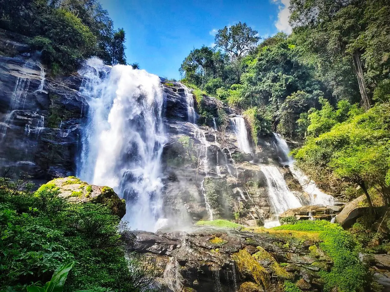
40 Waterfalls in Northern Thailand to Visit During the Rainy Season Northern Thailand is home to a remarkable variety of waterfalls, from immense cascades tumbling down high mountain cliffs to tiered streams tucked away in green forest. When the rainy season arrives, mountain-fed waterways swell, woodland becomes beautifully lush and the landscape takes on deep shades of green. But more water also means stronger currents, slippery trails and the possibility of sudden flash floods. Choosing the right destination and checking conditions are essential.
This guide to 40 waterfalls in Northern Thailand brings together scenic nature destinations in Chiang Mai, Chiang Rai, Mae Hong Son, Tak and other northern provinces. It covers the character of each waterfall, its surrounding landscape, the type of visit it suits, travel directions and what to consider before setting out. Some are accessible as short road-trip stops; others require walking, local expertise or dedicated outdoor preparation.
Northern Thailand's mountain ranges form some of the country's important watersheds. The Thanon Thong Chai and Doi Luang ranges, together with the highlands extending towards Thailand's borders, create valleys, creeks and waterfalls. Following these streams is also a way to understand the connection between forests, water supplies and communities. Visitors encounter different types of woodland and plants according to altitude, rainfall and seasonal humidity.
Chiang Mai offers far more than Doi Inthanon. Mae Sa Waterfall in Mae Rim features several forested levels; Bua Tong Waterfall and its Seven-Color Spring in Mae Taeng are especially interesting for their mineral formations; and Mae Kampong Waterfall sits close to a distinctive mountain village. Each offers a different experience, whether it is walking beside a stream, exploring limestone geology or spending time in a community surrounded by forest.
In Chiang Rai, Khun Korn Waterfall rewards a forest walk with a high waterfall, while Pu Kaeng Waterfall introduces visitors to the mountain environment of Doi Luang National Park. Mae Hong Son is known for dramatic hills and broad forest landscapes, including Pha Suea Waterfall and the Mae Surin cascade. Journeys between these places deserve generous travel time, and an overnight stay is often more practical than attempting to collect too many stops in one day.
Tak province is home to the celebrated Thi Lo Su Waterfall. However, any journey to Thi Lo Su must respect the regulations of Umphang Wildlife Sanctuary. During the rainy season, access roads and visitor routes may be closed. The beauty of a waterfall never justifies entering a closed area or taking an unsafe route.
When planning a rainy-season waterfall visit, distinguish between admiring a waterfall and swimming in its pools. Many waterfalls are best appreciated from a viewpoint, especially after heavy rainfall. Water levels can rise even when it is not raining at the viewing area, because storms upstream feed the same channel. Always check weather forecasts, posted warnings and park announcements, and never cross a stream that is rising.
Families should select waterfalls with approach paths suitable for everyone in the group. Wear grippy shoes, carry rain protection and keep phones and other valuables in waterproof bags. For waterfalls requiring a hike, begin early enough to return in daylight and never leave marked trails. Getting closer to the water for a photograph is not worth the risk.
Waterfall trips also offer opportunities to explore northern food and communities, from Chom Thong and Mae Rim to Mae Kampong, Chiang Rai and the mountain villages of Mae Hong Son. Allowing time for local cuisine and village visits turns a simple list of photo stops into a fuller understanding of the people who live around these forests and watersheds.
The following 40 places include famous cascades and lesser-known natural sites. Each listing provides its principal appeal, travel considerations and a Google Maps directions link. Before travelling in the wet season, verify access on the day itself, particularly for national parks, wildlife sanctuaries and remote forest trails.

1. Mae Ya Waterfall Located in the Chom Thong area, Mae Ya is one of Chiang Mai's most impressive large waterfalls. Water spreads across successive rock ledges rather than descending in a single narrow stream, while surrounding forest sustains the cool, humid setting and the streams below.
Highlights: A dramatic, broad cascade spilling over high rock terraces in Doi Inthanon National Park
In the rainy season, the forest turns lush and the waterfall becomes more powerful. Spray, wet rock and fast-moving water also increase the risks; admire the cascade only from areas open to visitors, and never step beyond a safety barrier.
Visiting in the rainy season requires checking the latest access rules, upstream weather and trail conditions. Remain on authorised routes, take rubbish away with you and keep a safe distance from strong currents. If local authorities close the area, choose another destination rather than attempting entry.
Getting There: Travel from Chiang Mai towards Chom Thong and follow the Doi Inthanon-area approach and the signed waterfall turnoff. Allow time for mountain driving; the visit can be combined with other stops around Chom Thong when access is permitted.
Map (GPS):Get directions to Mae Ya Waterfall

2. Mae Sa Waterfall Mae Sa Waterfall lies in the Mae Rim area, among the forested slopes associated with the Doi Suthep–Pui landscape. Its successive sections feature different combinations of rock, flowing water and shade, making a visit more varied than a quick look at a single cascade.
Highlights: A series of forested waterfall levels in Chiang Mai's Mae Rim district
Visitors can choose how far to walk according to their fitness and the conditions on the day. Rain brings richer vegetation and higher water, but muddy paths, slippery steps and temporary closures may limit access to particular levels.
Visiting in the rainy season requires checking the latest access rules, upstream weather and trail conditions. Remain on authorised routes, take rubbish away with you and keep a safe distance from strong currents. If local authorities close the area, choose another destination rather than attempting entry.
Getting There: From Chiang Mai, head towards Mae Rim and follow local signs to the waterfall entrance. Mae Sa works particularly well as a nature stop in a wider Mae Rim day trip without returning to central Chiang Mai between attractions.
Map (GPS):Get directions to Mae Sa Waterfall
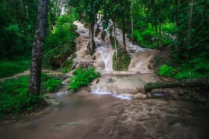
3. Bua Tong Waterfall and the Seven-Color Spring In Mae Taeng district on the Chiang Mai–Phrao side of the province, Bua Tong stands apart for its light-coloured, mineral-encrusted limestone formations. The nearby Seven-Color Spring adds another natural feature and makes the area especially interesting to visitors curious about geology.
Highlights: Pale limestone terraces and a distinctive natural spring
The rock's texture has made the waterfall famous for guided climbing and walking, but it must never be assumed that every wet surface is safe. Use only designated access points and obey instructions when strong currents or wet-weather restrictions apply.
Visiting in the rainy season requires checking the latest access rules, upstream weather and trail conditions. Remain on authorised routes, take rubbish away with you and keep a safe distance from strong currents. If local authorities close the area, choose another destination rather than attempting entry.
Getting There: Drive north-east from Chiang Mai on the Chiang Mai–Phrao route and follow signs towards Bua Tong Waterfall. Set aside time to see both the limestone cascades and the spring rather than rushing through the site.

4. Mae Kampong Waterfall Mae Kampong Waterfall lies near Mae Kampong village in Huai Kaew subdistrict, Mae On district. Streams descend through cool, moist woodland, connecting the natural setting of the waterfall with the nearby mountain community and its slower pace of life.
Highlights: A shaded forest waterfall above the mountain village of Mae Kampong
Rain makes the forest richly green but can turn narrow paths and rock steps slippery. Follow the routes managed by the community or relevant authorities and avoid entering closed or hazardous sections.
Visiting in the rainy season requires checking the latest access rules, upstream weather and trail conditions. Remain on authorised routes, take rubbish away with you and keep a safe distance from strong currents. If local authorities close the area, choose another destination rather than attempting entry.
Getting There: Travel from Chiang Mai towards Mae On and Mae Kampong village, then continue to the designated waterfall access. An overnight stay in the village allows time for the waterfall, local food and community life without a rushed schedule.
Map (GPS):Get directions to Mae Kampong Waterfall

5. Khun Korn Waterfall Khun Korn Waterfall rises out of densely wooded hills to the west of Chiang Rai city. Its tall drop is the reward for a forest walk, during which visitors can observe trees, stream habitats and the changing sounds of water before arriving at the cascade.
Highlights: A high forest waterfall reached by a nature trail west of Chiang Rai
The wet season intensifies the fall but also changes the condition of earthen paths and stream crossings. Start in daylight, follow any guidance from the forest park staff and stay clear of dangerous cliff edges or high-water zones.
Visiting in the rainy season requires checking the latest access rules, upstream weather and trail conditions. Remain on authorised routes, take rubbish away with you and keep a safe distance from strong currents. If local authorities close the area, choose another destination rather than attempting entry.
Getting There: From Chiang Rai city, head towards the Mae Korn area and the trailhead. This is a better choice for visitors prepared for some walking than for those seeking a roadside photo stop.
Map (GPS):Get directions to Khun Korn Waterfall

6. Pu Kaeng Waterfall Pu Kaeng Waterfall is in Phan district in southern Chiang Rai, amid the mountainous terrain associated with Doi Luang National Park. Its varied rock formations and streams create a rewarding setting for learning about upland forest and watershed environments.
Highlights: A rock-stepped waterfall in the forest of Doi Luang National Park
After heavy rain, conditions can shift quickly. A scenic cascade is not automatically safe for swimming; observe warning signs and do not enter fast water or inaccessible sections.
Visiting in the rainy season requires checking the latest access rules, upstream weather and trail conditions. Remain on authorised routes, take rubbish away with you and keep a safe distance from strong currents. If local authorities close the area, choose another destination rather than attempting entry.
Getting There: Take the Chiang Rai–Phayao road and turn towards Ban Pu Kaeng following the national park signs. Combine the visit with time in Phan district and wear appropriate footwear for the natural trail.
Map (GPS):Get directions to Pu Kaeng Waterfall

7. Pha Suea Waterfall In Mok Cham Pae subdistrict, Pha Suea Waterfall tumbles over large rocks against a backdrop of mountain forest. Different water levels change the appearance of the cascade and how it can be viewed from its established lookout areas.
Highlights: A rocky waterfall amid the hills near Mae Hong Son town
Rain can make the waterfall more dramatic, but upstream downpours may raise the flow even when skies near the viewpoint seem clear. Stay back from the stream and follow current site warnings.
Visiting in the rainy season requires checking the latest access rules, upstream weather and trail conditions. Remain on authorised routes, take rubbish away with you and keep a safe distance from strong currents. If local authorities close the area, choose another destination rather than attempting entry.
Getting There: Drive from Mae Hong Son town towards Pang Tong and follow the signs to Pha Suea Waterfall. It can form part of a wider mountain itinerary with nearby communities and the Pang Ung area if travel times allow.
Map (GPS):Get directions to Pha Suea Waterfall
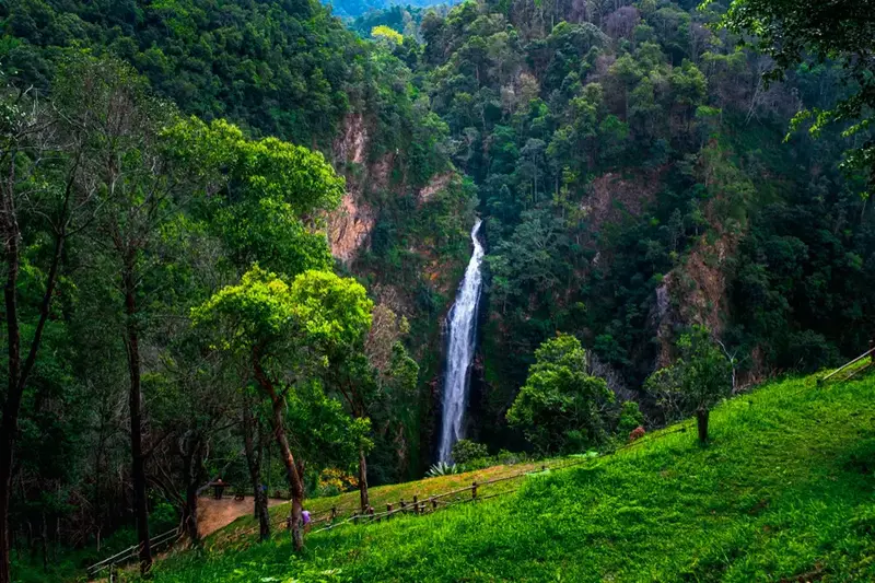
8. Namtok Mae Surin National Park Namtok Mae Surin National Park protects rugged mountains, forested watersheds and the high Mae Surin cascade. Water drops into a deep valley, producing a striking landscape where viewing the waterfall is closely tied to an appreciation of the wider protected forest.
Highlights: A towering waterfall set in a remote Mae Hong Son national park
The rainy season may bring impressive flow as well as muddy roads, difficult slopes and limited access. Use designated viewpoints and do not attempt to descend into restricted terrain.
Visiting in the rainy season requires checking the latest access rules, upstream weather and trail conditions. Remain on authorised routes, take rubbish away with you and keep a safe distance from strong currents. If local authorities close the area, choose another destination rather than attempting entry.
Getting There: Plan a separate mountain excursion within Mae Hong Son rather than assuming it is a quick town stop. Check road access and official visitor arrangements before setting out, and allow extra time in poor weather.
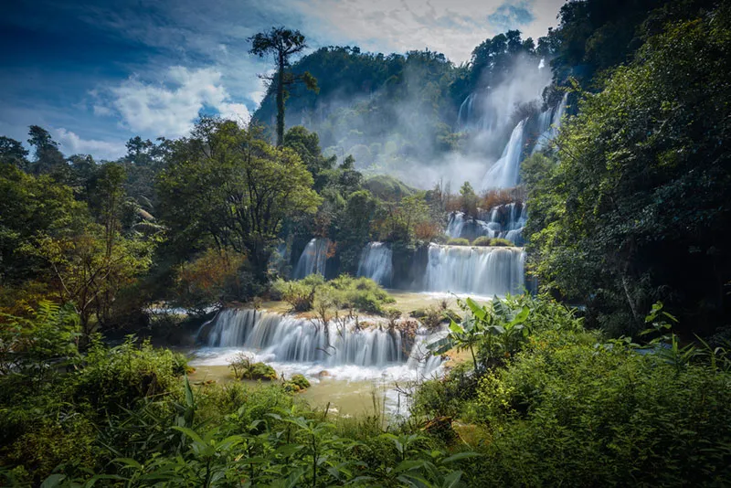
9. Thi Lo Su Waterfall Thi Lo Su is one of Tak province's best-known natural landmarks, with broad curtains of water running over a large forested cliff. Its remote position in Umphang Wildlife Sanctuary makes the journey and the conservation regulations integral to the visit.
Highlights: A vast, multi-stream waterfall within Umphang Wildlife Sanctuary
The road and visitor routes can be closed or restricted during the rainy season. Do not assume that stronger flows mean the waterfall is open; check the sanctuary's current announcements and use only approved guides and routes where required.
Visiting in the rainy season requires checking the latest access rules, upstream weather and trail conditions. Remain on authorised routes, take rubbish away with you and keep a safe distance from strong currents. If local authorities close the area, choose another destination rather than attempting entry.
Getting There: First travel to Umphang district, allowing ample time on the winding mountain road. Confirm the sanctuary's authorised access arrangements before arranging onward transport or excursions.
Map (GPS):Get directions to Thi Lo Su Waterfall

10. Mae Klang Waterfall Mae Klang Waterfall in Chom Thong is an impressive cascade over large boulders, conveniently placed near the approach to Doi Inthanon National Park. It provides an accessible introduction to the streams descending from the mountains.
Highlights: A major waterfall near the foothill approach to Doi Inthanon
Rain brings stronger currents and slippery rocks. Keep clear of dangerous pools, stay behind barriers and regard swimming restrictions seriously, especially after storms upstream.
Visiting in the rainy season requires checking the latest access rules, upstream weather and trail conditions. Remain on authorised routes, take rubbish away with you and keep a safe distance from strong currents. If local authorities close the area, choose another destination rather than attempting entry.
Getting There: From Chiang Mai drive towards Chom Thong and the Doi Inthanon route, following the signs for Mae Klang Waterfall. It is a practical stop within a day of exploring the Chom Thong area.
Map (GPS):Get directions to Mae Klang Waterfall

11. Koh Luang Waterfall Koh Luang Waterfall lies in Mae Ping National Park in Li district, Lamphun. Water runs down light-coloured limestone shelves into pools that can appear blue-green in favourable light and water conditions, creating a distinctive scene in a protected forest.
Highlights: Turquoise-tinged limestone pools in Mae Ping National Park
The wet season replenishes the forest streams, but the colour and clarity of the pools vary with rainfall. Limestone surfaces can be slippery, and swimming is not appropriate where park staff restrict access or water runs strongly.
Visiting in the rainy season requires checking the latest access rules, upstream weather and trail conditions. Remain on authorised routes, take rubbish away with you and keep a safe distance from strong currents. If local authorities close the area, choose another destination rather than attempting entry.
Getting There: Travel through Li district towards Mae Ping National Park and use only the park routes currently open to Koh Luang. Other natural sights within the park can be considered if there is enough time.
Map (GPS):Get directions to Koh Luang Waterfall

12. Mae Phun Waterfall Mae Phun Waterfall is in Mae Phun subdistrict, Lablae district, Uttaradit. The stream flows through rocky greenery not far from settled communities, making it a different experience from long forest treks.
Highlights: An accessible waterfall in the fruit-growing Lablae countryside
Its location near local roads and farms makes the outing compatible with sightseeing in Lablae. Nevertheless, water can rise after heavy rain and wet rocks remain dangerous, so supervise children closely and avoid entering strong currents.
Visiting in the rainy season requires checking the latest access rules, upstream weather and trail conditions. Remain on authorised routes, take rubbish away with you and keep a safe distance from strong currents. If local authorities close the area, choose another destination rather than attempting entry.
Getting There: Travel from Uttaradit city towards Lablae and Mae Phun subdistrict, following the posted waterfall access. Combine the visit with local produce, food and community stops where seasonal conditions permit.
Map (GPS):Get directions to Mae Phun Waterfall

13. Sila Phet Waterfall Sila Phet Waterfall lies in Sila Phet subdistrict, Pua district. Water passes over broad natural rock layers surrounded by greenery, in a landscape of villages, farmland and mountains.
Highlights: A rocky stream waterfall amid the rural landscape of Pua, Nan
The gently layered rocks are attractive for photography but can be extremely slick with algae and rain. Stay on secure approaches and do not wade into swift sections.
Visiting in the rainy season requires checking the latest access rules, upstream weather and trail conditions. Remain on authorised routes, take rubbish away with you and keep a safe distance from strong currents. If local authorities close the area, choose another destination rather than attempting entry.
Getting There: From Pua, follow local roads towards Sila Phet subdistrict, confirming the final access point before leaving the main road. Allow extra time to explore nearby rural landscapes and village life.
Map (GPS):Get directions to Sila Phet Waterfall

14. Mae U Kho Waterfall Mae U Kho Waterfall lies in Mae U Kho subdistrict, Khun Yuam district, Mae Hong Son. Its water runs down a large natural rock groove, giving it a distinctive shape within the area's mountain landscape.
Highlights: A single-drop waterfall with broad natural rock channels near Doi Mae U Kho
The appearance of the flow varies with rainfall; wet-season visitors should watch for rising currents and slick rock and enjoy the waterfall from designated viewpoints.
Visiting in the rainy season requires checking the latest access rules, upstream weather and trail conditions. Remain on authorised routes, take rubbish away with you and keep a safe distance from strong currents. If local authorities close the area, choose another destination rather than attempting entry.
Getting There: Reach Khun Yuam and follow the mountain route towards Doi Mae U Kho, using locally posted directions. Consider combining the waterfall with other landscape and village stops in the district, allowing extra time for the winding road.
Map (GPS):Get directions to Mae U Kho Waterfall

15. Than Sawan Waterfall Than Sawan Waterfall lies in Chiang Muan district, Phayao, within Doi Phu Nang National Park. Its stream flows across rock ledges under forest canopy, illustrating a little-known side of Phayao beyond the provincial lake.
Highlights: A forest waterfall in Doi Phu Nang National Park
Lush vegetation and higher flow enhance the rainy-season scenery, but high water makes streamside access risky. Ask park staff which paths and viewpoints are open on the day.
Visiting in the rainy season requires checking the latest access rules, upstream weather and trail conditions. Remain on authorised routes, take rubbish away with you and keep a safe distance from strong currents. If local authorities close the area, choose another destination rather than attempting entry.
Getting There: Travel towards Chiang Muan and Ban Mang subdistrict before entering the authorised national park visitor area. Allow time on smaller rural roads and avoid driving back in darkness after heavy rain.
Map (GPS):Get directions to Than Sawan Waterfall

16. Tat Mok Waterfall Tat Mok Waterfall sits in Na Pa subdistrict, Mueang Phetchabun, where a forested mountain stream descends through rugged terrain. This is a destination for travellers willing to spend time on the approach and experience the protected woodland.
Highlights: A remote mountain waterfall in Tat Mok National Park
Wet-season paths may be muddy or steep. Carry drinking water, rain protection and grippy shoes, and stop if heavy rain or flash-flood conditions develop.
Visiting in the rainy season requires checking the latest access rules, upstream weather and trail conditions. Remain on authorised routes, take rubbish away with you and keep a safe distance from strong currents. If local authorities close the area, choose another destination rather than attempting entry.
Getting There: From Phetchabun town, continue towards Na Pa and the Tat Mok National Park access. Check with park staff whether hiking, guiding or other restrictions apply before setting out.
Map (GPS):Get directions to Tat Mok Waterfall

17. Khlong Nam Lai Waterfall (Pang Kwai Waterfall) Also known as Pang Kwai Waterfall, Khlong Nam Lai Waterfall flows down several levels of natural rock in Kamphaeng Phet's forested western hills. The different tiers give visitors a variety of stream and woodland views.
Highlights: A multi-tiered waterfall in the forests of Khlong Lan district
During the rainy season, water runs more vigorously and the paths between tiers can become slippery. Do not attempt to reach every level if conditions are poor; follow the site's access restrictions.
Visiting in the rainy season requires checking the latest access rules, upstream weather and trail conditions. Remain on authorised routes, take rubbish away with you and keep a safe distance from strong currents. If local authorities close the area, choose another destination rather than attempting entry.
Getting There: From Kamphaeng Phet travel towards Khlong Lan district and Khlong Nam Lai subdistrict, then continue to the designated waterfall facilities and trails.

18. Huay Kaew Waterfall Huay Kaew Waterfall is close to Chiang Mai city in Suthep subdistrict, near the road leading uphill towards Doi Suthep. Its rocky creek and tree cover make it an accessible contrast to the busy urban streets.
Highlights: A quick nature escape at the foot of Doi Suthep
Despite its location near town, wet-season currents and slippery boulders demand caution. Do not climb wet rocks or swim during heavy rain; use the clearly accessible viewing areas.
Visiting in the rainy season requires checking the latest access rules, upstream weather and trail conditions. Remain on authorised routes, take rubbish away with you and keep a safe distance from strong currents. If local authorities close the area, choose another destination rather than attempting entry.
Getting There: Take Huay Kaew Road from central Chiang Mai towards the Doi Suthep foothills and follow signs to the waterfall entrance. It fits naturally into a short city-and-nature excursion.
Map (GPS):Get directions to Huay Kaew Waterfall

19. Thi Lo Cho Waterfall (Sai Fon Waterfall) Thi Lo Cho, sometimes called Sai Fon or Rainfall Waterfall, is a mountain waterfall in Umphang district, Tak. Water sprays down its rock face like a curtain of rain, and visitors often encounter it in connection with authorised river tourism in the area.
Highlights: A veil-like waterfall linked to river excursions in Umphang
The ways to view it depend on river levels, seasonal access and local operator arrangements. Avoid river activities during heavy rain or flood warnings and choose properly equipped, safety-conscious providers.
Visiting in the rainy season requires checking the latest access rules, upstream weather and trail conditions. Remain on authorised routes, take rubbish away with you and keep a safe distance from strong currents. If local authorities close the area, choose another destination rather than attempting entry.
Getting There: Reach Umphang district first, then ask local guides or approved tour operators about the route in use for Thi Lo Cho and the day's river conditions. Allow more than one day for the district.

20. Mae Pan Waterfall Mae Pan Waterfall is a nature destination in Mueang Pan district, associated with the landscape around Chae Son National Park. It offers a cooler, more wooded contrast to the historic streets and temples of Lampang city.
Highlights: A forest waterfall in Lampang's Mueang Pan district
Water flow and the condition of trails change with the season. Wet ground and rocky stream edges require secure footwear; ask about the distance and condition of the approach before bringing children or older visitors.
Visiting in the rainy season requires checking the latest access rules, upstream weather and trail conditions. Remain on authorised routes, take rubbish away with you and keep a safe distance from strong currents. If local authorities close the area, choose another destination rather than attempting entry.
Getting There: Travel from Lampang towards Mueang Pan and the Chae Son National Park area, then follow the local access signs. Plan the visit with other nearby natural attractions only if routes are open.
Map (GPS):Get directions to Mae Pan Waterfall

21. Huai Rong Waterfall (Huai Long Waterfall) Huai Rong, also known as Huai Long Waterfall, lies in Rong Kwang district, Phrae. The stream runs over rock formations beneath forest trees, providing a peaceful break from the principal road north of Phrae.
Highlights: A quiet rocky waterfall along the Phrae–Nan corridor
The surrounding woodland feels especially fresh in the wet season, but muddy paths, wet boulders and suddenly discoloured streams are warning signs. Stay out of the water when conditions are unsafe.
Visiting in the rainy season requires checking the latest access rules, upstream weather and trail conditions. Remain on authorised routes, take rubbish away with you and keep a safe distance from strong currents. If local authorities close the area, choose another destination rather than attempting entry.
Getting There: Follow Highway 101 from Phrae towards Rong Kwang; the source identifies a turnoff around kilometre 78 with a further roughly four kilometres to the waterfall area. Confirm road conditions after rain.

22. Nam Min Waterfall Nam Min Waterfall is found near Ban Nam Min, Mae Lao subdistrict, Chiang Kham district. Natural rock steps, stream pools and green forest offer a quieter excursion than the province's main urban attractions.
Highlights: A tranquil stream and rock pools near Ban Nam Min in Phayao
Rain makes the surrounding hills lush, but it also increases the risk of hidden depths and faster water. Observe the creek from firm ground and keep away from pools whose depth is unknown.
Visiting in the rainy season requires checking the latest access rules, upstream weather and trail conditions. Remain on authorised routes, take rubbish away with you and keep a safe distance from strong currents. If local authorities close the area, choose another destination rather than attempting entry.
Getting There: From Chiang Kham follow local roads towards Mae Lao subdistrict and Ban Nam Min, using the published coordinates and local signs where available. Check access after prolonged rain.
Map (GPS):Get directions to Nam Min Waterfall

23. Dao Dueng Waterfall Dao Dueng Waterfall lies near Ban Thung Ruang Thong, Mae La Noi subdistrict, Mae Hong Son. Water cascades between rocks in several stages, surrounded by greenery and the mountainous countryside of Mae La Noi.
Highlights: A multi-tiered stream waterfall near Mae La Noi communities
In the rainy season the falls carry more water but tracks can become slick. Avoid wading across the stream or climbing rocks when flows are strong, and check local site advice.
Visiting in the rainy season requires checking the latest access rules, upstream weather and trail conditions. Remain on authorised routes, take rubbish away with you and keep a safe distance from strong currents. If local authorities close the area, choose another destination rather than attempting entry.
Getting There: From Mae La Noi district town, head towards Ban Thung Ruang Thong on local roads and check the final approach. The waterfall can be combined with villages and mountain scenery in a relaxed district itinerary.
Map (GPS):Get directions to Dao Dueng Waterfall
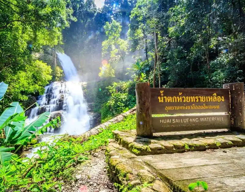
24. Huai Sai Lueang Waterfall Huai Sai Lueang Waterfall lies in the mountainous Mae Chaem area, on the route linking the Doi Inthanon region with Mae Chaem. Its attraction is the forest atmosphere and headwater stream away from the most crowded viewpoints.
Highlights: A secluded waterfall on the Doi Inthanon–Mae Chaem mountain side
The wet-season forest grows lush with greenery and moss, while stones and trails become more slippery. Avoid entering the creek during upstream rainfall and remain on authorised routes.
Visiting in the rainy season requires checking the latest access rules, upstream weather and trail conditions. Remain on authorised routes, take rubbish away with you and keep a safe distance from strong currents. If local authorities close the area, choose another destination rather than attempting entry.
Getting There: Use the Doi Inthanon-side mountain road connecting towards Mae Chaem, near the Highway 1009 and Highway 1192 corridor. Check the last approach and visibility if rain or fog is forecast.

25. Mae Tia Waterfall Mae Tia Waterfall lies in Doi Kaew subdistrict, Chom Thong district, within the forest area associated with Ob Luang National Park. It is more a forest expedition than an easy roadside sightseeing stop.
Highlights: A remote forest waterfall in Ob Luang National Park
The wet season increases streamflow while making dirt paths, slopes and creek banks hazardous. Visitors should confirm access, guiding requirements and the weather with the park before attempting the route.
Visiting in the rainy season requires checking the latest access rules, upstream weather and trail conditions. Remain on authorised routes, take rubbish away with you and keep a safe distance from strong currents. If local authorities close the area, choose another destination rather than attempting entry.
Getting There: Reach Doi Kaew in Chom Thong and contact Ob Luang National Park staff about the approved way to access Mae Tia. Leave enough time for a safe return and avoid making it a rushed add-on.
Map (GPS):Get directions to Mae Tia Waterfall

26. Su Sa Waterfall Su Sa Waterfall is near Ban Mae Su Ya, Huai Pha subdistrict, Mueang Mae Hong Son. Its water passes through rocky channels in dense forest, and reaching it may require a combination of walking, four-wheel-drive travel or organised rafting, depending on conditions.
Highlights: An adventurous waterfall in the forests of Mae Hong Son
High rainfall can cause sudden water rises and severe access problems. Travellers need route knowledge, appropriate outdoor equipment and assistance from experienced local operators rather than attempting an unplanned visit.
Visiting in the rainy season requires checking the latest access rules, upstream weather and trail conditions. Remain on authorised routes, take rubbish away with you and keep a safe distance from strong currents. If local authorities close the area, choose another destination rather than attempting entry.
Getting There: From Mae Hong Son town, travel towards Huai Pha and Ban Mae Su Ya, then follow locally authorised transport or guiding arrangements appropriate to the day.
Map (GPS):Get directions to Su Sa Waterfall

27. Man Daeng Waterfall Man Daeng Waterfall lies inside Phu Hin Rong Kla National Park in Nakhon Thai district, Phitsanulok. The many levels and humid forest surroundings appeal to keen hikers seeking more than a roadside viewpoint.
Highlights: A demanding mountain hike to a multi-level waterfall
The longer hiking route includes steep, slippery sections and stream crossings. National park rules, trail closures and any required ranger or guide arrangements must take priority, particularly during heavy rain.
Visiting in the rainy season requires checking the latest access rules, upstream weather and trail conditions. Remain on authorised routes, take rubbish away with you and keep a safe distance from strong currents. If local authorities close the area, choose another destination rather than attempting entry.
Getting There: Enter Phu Hin Rong Kla National Park via the Nakhon Thai route and enquire at the park about the Man Daeng trail and ranger guidance before setting out.
Map (GPS):Get directions to Man Daeng Waterfall
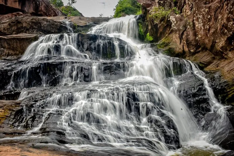
28. Namtok Chat Trakan National Park Namtok Chat Trakan National Park protects forests in the Chat Trakan and Nakhon Thai areas of Phitsanulok. Its principal waterfall descends through seven levels; the wider landscape also includes cliffs, caves and natural habitats.
Highlights: A seven-tier waterfall within a biodiverse national park
Each level offers a different experience, but access depends on physical ability and trail conditions. Watch for slippery slopes and changing stream levels, and use only paths that remain open.
Visiting in the rainy season requires checking the latest access rules, upstream weather and trail conditions. Remain on authorised routes, take rubbish away with you and keep a safe distance from strong currents. If local authorities close the area, choose another destination rather than attempting entry.
Getting There: Travel from Phitsanulok towards Chat Trakan district and the park entrance. Choose how many waterfall levels to visit after consulting park staff.

29. Phet Cha Kho Waterfall Phet Cha Kho Waterfall lies near a forest protection unit in the Khlong Lan National Park area of Kamphaeng Phet. A stepped stream runs across varied rock ledges, making this an appealing destination for visitors comfortable with nature trails.
Highlights: Several forest waterfall tiers within Khlong Lan National Park
Rainfall increases the flow and brings fresh forest colours, but difficult rock surfaces and high water are hazards. Do not enter restricted stream pools or leave the marked paths.
Visiting in the rainy season requires checking the latest access rules, upstream weather and trail conditions. Remain on authorised routes, take rubbish away with you and keep a safe distance from strong currents. If local authorities close the area, choose another destination rather than attempting entry.
Getting There: Reach Khlong Lan district and contact the relevant national park unit about access near protection unit KL 4. Return well before dark on wet-weather days.
Map (GPS):Get directions to Phet Cha Kho Waterfall

30. Namtok Tat Khwan Forest Park Namtok Tat Khwan Forest Park is in Tat Khwan subdistrict, Phaya Mengrai district, Chiang Rai. The waterfall flows through a leafy forest setting with streams that are part of the surrounding watershed.
Highlights: A single-drop waterfall in a peaceful Chiang Rai forest park
After rainfall the greenery is vibrant, but slippery earth and rapid rises in the stream require care. Follow site notices and avoid entering the water when the current is strong.
Visiting in the rainy season requires checking the latest access rules, upstream weather and trail conditions. Remain on authorised routes, take rubbish away with you and keep a safe distance from strong currents. If local authorities close the area, choose another destination rather than attempting entry.
Getting There: Travel to Phaya Mengrai district and continue to Ban Tat Khwan, village 6, following the forest park directions and local road information.

31. Tad Thong Waterfall Tad Thong Waterfall lies around Ban Pang Hai, Na Rai Luang subdistrict, Song Khwae district. A rocky mountain stream runs through a quiet wooded landscape in a less-travelled part of Nan.
Highlights: A natural stream waterfall near Ban Pang Hai in Nan
The rainy season deepens the green surroundings but can increase streamflow rapidly. View from a secure position rather than climbing wet boulders or crossing the creek.
Visiting in the rainy season requires checking the latest access rules, upstream weather and trail conditions. Remain on authorised routes, take rubbish away with you and keep a safe distance from strong currents. If local authorities close the area, choose another destination rather than attempting entry.
Getting There: Reach Song Khwae district and follow the local approach towards Ban Pang Hai. The source describes both paved and unpaved road sections; check their condition before travelling in wet weather.
Map (GPS):Get directions to Tad Thong Waterfall

32. Mae Saked Luang Waterfall Mae Saked Luang Waterfall lies in a remote mountain setting in Mae Hong Son. Its attraction is the forest, cool headwater environment and a quieter nature experience beyond the major tourist routes.
Highlights: A mountain-forest waterfall in Mae Hong Son
Trail conditions and stream levels vary after rain. Use established paths, wear grippy shoes and do not climb into fast-flowing water or attempt a return trek after dark.
Visiting in the rainy season requires checking the latest access rules, upstream weather and trail conditions. Remain on authorised routes, take rubbish away with you and keep a safe distance from strong currents. If local authorities close the area, choose another destination rather than attempting entry.
Getting There: Use the location shown on the waterfall's official listing and confirm the current access route with local caretakers before departure, allowing time for potentially difficult mountain roads.

33. Tad Pu Kheng Waterfall Tad Pu Kheng Waterfall lies in Ban Mang subdistrict, Chiang Muan district, Phayao. The water spreads over a relatively broad rocky terrace and steps down several levels, creating a different scale of waterfall scenery.
Highlights: A small stepped cascade across broad rock terraces in Chiang Muan
Even apparently flat rock becomes slippery when wet. Visitors should stay out of fast water, wear shoes with good grip and observe local swimming restrictions.
Visiting in the rainy season requires checking the latest access rules, upstream weather and trail conditions. Remain on authorised routes, take rubbish away with you and keep a safe distance from strong currents. If local authorities close the area, choose another destination rather than attempting entry.
Getting There: From Chiang Muan continue to Ban Mang subdistrict and follow local signs to the waterfall. It can be paired with Than Sawan Waterfall, also in Chiang Muan, when access permits.
Map (GPS):Get directions to Tad Pu Kheng Waterfall

34. Pong Phra Bat Waterfall Pong Phra Bat Waterfall is in Ban Du subdistrict, Mueang Chiang Rai. Water passes over natural rapids and rock formations in greenery, making it a convenient destination for a half-day trip from town.
Highlights: A rocky forest stream close to Chiang Rai city
The water and slippery stones are more hazardous after heavy rain. Enjoy the area from secure viewing points, avoid climbing rocks and keep the stream clean.
Visiting in the rainy season requires checking the latest access rules, upstream weather and trail conditions. Remain on authorised routes, take rubbish away with you and keep a safe distance from strong currents. If local authorities close the area, choose another destination rather than attempting entry.
Getting There: Travel north from Chiang Rai city towards Ban Du and follow signs to Pong Phra Bat Waterfall. A visit can be combined with attractions closer to town without excessive driving.

35. Huai Mae Sai Waterfall Huai Mae Sai Waterfall is near Ban Huai Mae Sai, Mae Yao subdistrict, Mueang Chiang Rai. Its forested valley and stream provide a more adventurous setting than waterfalls located close to major highways.
Highlights: A lesser-visited waterfall beyond the rural Mae Yao area
Local approach roads can become muddy, and some sections may call for a suitable four-wheel-drive vehicle or local transport. Avoid unfamiliar crossings and seek guidance from people who know the route.
Visiting in the rainy season requires checking the latest access rules, upstream weather and trail conditions. Remain on authorised routes, take rubbish away with you and keep a safe distance from strong currents. If local authorities close the area, choose another destination rather than attempting entry.
Getting There: From Chiang Rai, head into Mae Yao subdistrict and towards Ban Huai Mae Sai. Confirm the final route with the community, particularly after prolonged rain.
Map (GPS):Get directions to Huai Mae Sai Waterfall
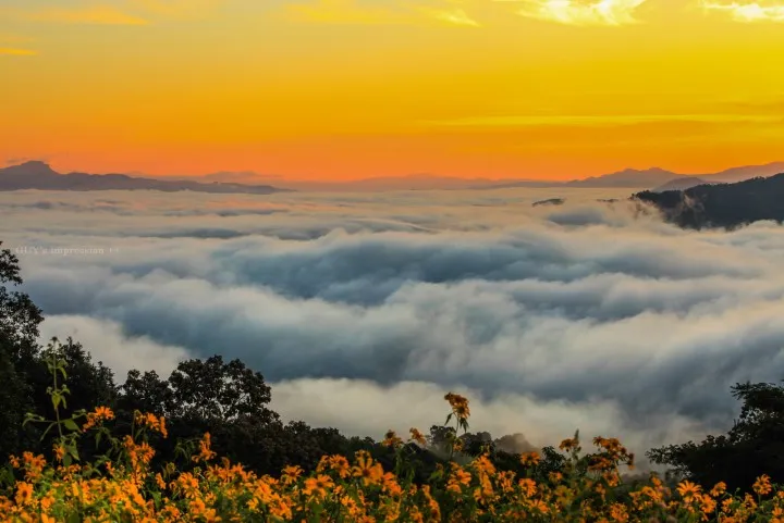
36. Huai Mae Kham Waterfall Forest Park Huai Mae Kham Waterfall Forest Park lies in Mae Salong Nai subdistrict, Mae Fa Luang district, Chiang Rai. The area encompasses steep mountains, upland woodland and several streams or waterfall locations.
Highlights: Highland streams and waterfalls in Mae Fa Luang district
Wet-season scenery is especially green, but fog, steep roads and increased headwater runoff can make access challenging. Follow site guidance and avoid closed trails.
Visiting in the rainy season requires checking the latest access rules, upstream weather and trail conditions. Remain on authorised routes, take rubbish away with you and keep a safe distance from strong currents. If local authorities close the area, choose another destination rather than attempting entry.
Getting There: Travel towards Mae Fa Luang district and Mae Salong Nai, then use local directions to the forest park. Plan carefully around the highland roads and weather.

37. Kaeng Sopha Waterfall Kaeng Sopha Waterfall is a prominent scenic stop in Phitsanulok. Water travels over large rock formations in broad cascading steps against a wooded mountain backdrop, providing dramatic views when river conditions permit.
Highlights: A wide, stepped cascade among Phitsanulok's rocky hills
Stronger rainy-season currents and spray make the rocks and viewing margins hazardous. Observe the waterfall only from safe public viewpoints and avoid cliff edges or restricted areas.
Visiting in the rainy season requires checking the latest access rules, upstream weather and trail conditions. Remain on authorised routes, take rubbish away with you and keep a safe distance from strong currents. If local authorities close the area, choose another destination rather than attempting entry.
Getting There: Use the main route leading to Kaeng Sopha Waterfall in Phitsanulok and confirm the entrance and current access arrangements before your visit.
Map (GPS):Get directions to Kaeng Sopha Waterfall

38. Mae Sawan Noi Waterfall Mae Sawan Noi Waterfall offers a quieter glimpse of Mae Hong Son's mountainous forests and headwater streams. The site appeals to visitors who value natural scenery over busy tourist facilities.
Highlights: A peaceful forest stream waterfall in Mae Hong Son
Heavy rainfall can transform access conditions quickly. Stay on firm ground and keep clear of stream crossings and pools during periods of high flow.
Visiting in the rainy season requires checking the latest access rules, upstream weather and trail conditions. Remain on authorised routes, take rubbish away with you and keep a safe distance from strong currents. If local authorities close the area, choose another destination rather than attempting entry.
Getting There: Navigate using the location shown on its published Detail page and check locally for the correct road and access point, allowing time for mountain travel.

39. Tad Yao Waterfall Tad Yao Waterfall lies in Mae Waen subdistrict, Phrao district, Chiang Mai. The stream and the surrounding woodland introduce visitors to rural Chiang Mai beyond its more heavily travelled districts.
Highlights: A quiet stream waterfall in the mountains of Phrao
Rain brings fresh foliage but can also mean slippery pathways and fast-flowing water. Stay within the designated area and avoid the stream during storms.
Visiting in the rainy season requires checking the latest access rules, upstream weather and trail conditions. Remain on authorised routes, take rubbish away with you and keep a safe distance from strong currents. If local authorities close the area, choose another destination rather than attempting entry.
Getting There: Drive from Chiang Mai towards Phrao and on to Mae Waen subdistrict, checking the local road and waterfall entrance before the final approach.
Map (GPS):Get directions to Tad Yao Waterfall

40. Tad Fah Waterfall Tad Fah Waterfall lies near Ban Nam Ko in Nam Ko subdistrict, Lom Sak district, among the Phetchabun mountains. Its stream descends over natural rock and cliff faces, with two waterfall levels and rock terraces.
Highlights: A two-tiered mountain waterfall near Ban Nam Ko in Phetchabun
The wet season brings greener forest and higher water, but the approach may include natural paths and slippery ground. Stay clear of steep cliff edges and rushing currents.
Visiting in the rainy season requires checking the latest access rules, upstream weather and trail conditions. Remain on authorised routes, take rubbish away with you and keep a safe distance from strong currents. If local authorities close the area, choose another destination rather than attempting entry.
Getting There: From Lom Sak travel towards Nam Ko subdistrict and Ban Nam Ko, using the local approach that is actually open on the day. Allow time for mountain roads and weather-related delays.
Map (GPS):Get directions to Tad Fah Waterfall
Summary: 40 Waterfalls in Northern Thailand for the Rainy Season
| Destinations | 40 waterfalls in 13 provinces across northern and lower northern Thailand, as covered in this guide |
| What to Expect | Major cascades, multi-level waterfalls, limestone formations, convenient city-area stops, and remote forest waterfalls requiring hiking or local guides |
| Best For | Nature lovers, families choosing easy-access routes, landscape photographers and experienced hikers |
| When to Visit | During periods of lighter rain or after rain has stopped, subject to same-day park announcements, river levels and road conditions |
| Transport | A private car or rental vehicle is useful for most areas; remote walks or river excursions may require registered local guides and authorised operators |
| Rainy-Season Access | Trail and swimming access may change daily, especially in national parks and wildlife sanctuaries |
| Essential Safety | Do not enter fast or muddy water, cross rising streams, climb slippery rocks or ignore safety barriers and ranger instructions |
All 40 Waterfalls, Grouped by Province
| Chiang Mai | |
| Chiang Rai | |
| Mae Hong Son | 26. Su Sa Waterfall |
| Tak | |
| Lamphun | |
| Lampang | |
| Nan | |
| Phayao | |
| Phrae | |
| Uttaradit | |
| Kamphaeng Phet | |
| Phitsanulok | |
| Phetchabun |
Choose a Waterfall by Travel Style
12 Practical Rainy-Season Waterfall Itineraries
| Chiang Mai, 1 Day — Mae Rim | Base: Chiang Mai or Mae Rim. Main stop: Mae Sa Waterfall. Explore the different levels of Mae Sa Waterfall that are open and enjoy the Mae Rim area rather than rushing across Chiang Mai to distant districts. |
| Chiang Mai, 1 Day — Doi Inthanon Area | Base: Chiang Mai or Chom Thong. Stops: Mae Klang Waterfall and Mae Ya Waterfall. Begin at Mae Klang, then continue towards Mae Ya using authorised access roads. Do not assume there is time for the summit of Doi Inthanon as well. |
| Chiang Mai, 2 Days / 1 Night — Two Areas | Base: Mae Rim or Chiang Mai. Day 1: Mae Sa Waterfall in Mae Rim. Day 2: Bua Tong Waterfall and the Seven-Color Spring on the Mae Taeng–Phrao side. Keep the two districts on separate days to reduce unnecessary driving. |
| Chiang Mai, 2 Days / 1 Night — Mae Kampong | Base: Mae Kampong village. Spend a night near Mae Kampong Waterfall and explore the mountain community and stream at an unhurried pace; avoid combining this with Chom Thong on the same day. |
| Chiang Rai, 1 Day — Near the City | Base: Chiang Rai city. Visit Pong Phra Bat Waterfall first; consider Huai Mae Sai Waterfall only if the approach road is safe and a suitable vehicle or local transport is available. |
| Chiang Rai, 2 Days / 1 Night — Forest Waterfalls | Base: Chiang Rai or Phan. Day 1: walk to Khun Korn Waterfall if the trail is open. Day 2: head south to Pu Kaeng Waterfall near Phan rather than rushing both hikes into one day. |
| Nan, 2 Days / 1 Night — Pua Countryside | Base: Pua. Visit Sila Phet Waterfall and explore Pua villages and surrounding scenery. Add other nearby sites only when they lie conveniently along the actual travel route. |
| Phayao, 2 Days / 1 Night — Chiang Muan | Base: Chiang Muan. Explore Than Sawan Waterfall and Tad Pu Kheng Waterfall on separate outings or at a comfortable pace, checking park access and rainy-season conditions. |
| Mae Hong Son, 2 Days / 1 Night — Town Area | Base: Mae Hong Son town. Consider Pha Suea Waterfall and Mae Saked Luang Waterfall if current road and visitor access arrangements permit. Do not assume mountain roads remain open after heavy rain. |
| Mae Hong Son, 3 Days / 2 Nights — Mountain Scenery | Bases: Mae Hong Son and Khun Yuam. Divide visits to Pha Suea Waterfall, Mae U Kho Waterfall and Namtok Mae Surin National Park across the different mountain areas, with enough time for road checks and viewpoints. |
| Phitsanulok, 2 Days / 1 Night — Wang Thong | Base: Wang Thong or Phitsanulok city. Visit Kaeng Sopha Waterfall and consider other nature stops along the same road when the weather and site access allow. |
| Kamphaeng Phet, 2 Days / 1 Night — Khlong Lan | Base: Khlong Lan. Divide Khlong Nam Lai Waterfall (Pang Kwai Waterfall) and Phet Cha Kho Waterfall into separate outings as needed, depending on park authorisation and trail conditions. |
Rainy-Season Safety and Responsible Travel Checklist
| Before You Go | Check rainfall and forecasts for upstream catchments as well as your destination, plus park notices, visitor access, road conditions and open viewpoints. |
| During the Visit | Travel in daylight, remain on marked paths, stand only on firm ground for photographs and wear non-slip footwear. |
| If Heavy Rain Begins | Stop streamside activities and move away from flood-prone areas. Never cross a river or enter a closed trail. |
| Travelling with Children or Older Visitors | Choose short, accessible routes near established viewpoints, and reassess the actual trail conditions before setting out. |
| Hiking and River Activities | Confirm guiding requirements, life jackets and authorised operators. Cancel activities if water and weather conditions are unsafe. |
| Travel Responsibly | Do not remove plants or rocks, feed wildlife or use soap in waterways; carry all rubbish out of the area. |
Frequently Asked Questions (FAQ)
Q: What is the best time to visit waterfalls in Northern Thailand?
A: The rainy season and the period shortly after rainfall often bring lush green forests and fuller waterfalls. However, no particular month guarantees that every site will be open or safe. Check upstream rainfall and official site announcements on the day of travel.
Q: Which waterfalls are best for a one-day trip?
A: From Chiang Mai, consider Mae Sa Waterfall in Mae Rim, or Mae Klang and Mae Ya in the Chom Thong area if the roads are open. From Chiang Rai city, Pong Phra Bat Waterfall is a convenient option.
Q: Which waterfalls are suitable for families with children?
A: Consider waterfalls with relatively straightforward viewing access, such as Mae Sa, Mae Klang, Mae Phun and Huay Kaew. Check paths and swimming restrictions on the day and supervise children closely.
Q: Which waterfalls are best for hiking and adventure?
A: Man Daeng, Mae Tia, Su Sa and Thi Lo Su require more preparation than an ordinary sightseeing stop. Certain approaches require guides, permits or special access arrangements, and some routes close in the wet season.
Q: Can I visit Thi Lo Su Waterfall during the rainy season?
A: Access depends on the current notices of Umphang Wildlife Sanctuary and on the condition of the approach routes. Confirm the latest rules before booking and never enter areas that are closed.
Q: Can visitors walk or climb anywhere on Bua Tong Waterfall?
A: No. Use only the designated ascent and descent routes and follow staff instructions. Some limestone surfaces are slippery or exposed to strong currents, especially during and after rain.
Q: Can I visit northern waterfalls without my own car?
A: Some waterfalls near towns can be reached using local hired transport, but many mountain locations require a private or rental vehicle. Others also involve a hike or local guide. Arrange return transportation in advance.
Q: Which Chiang Mai waterfalls fit into a two-day itinerary?
A: Visit Mae Sa in Mae Rim on the first day and Bua Tong in Mae Taeng on the second. Alternatively, make a separate trip for Mae Klang and Mae Ya in Chom Thong to avoid excessive travel between distant areas.
Q: Which waterfalls in Nan are good for nature lovers?
A: Sila Phet in Pua and Tad Thong in Song Khwae provide different mountain and stream settings. Choose based on where you are staying and the road journey, rather than squeezing both districts into a short half-day outing.
Q: How can I photograph waterfalls safely in the wet season?
A: Use firm, authorised viewpoints. Do not climb wet rocks, approach cliff edges or place a tripod in a water channel or a restricted area.
Q: What warning signs mean I should leave a waterfall immediately?
A: Persistent heavy rain, rapidly rising or muddy water, unusually strong currents and warnings from park staff are reasons to stop streamside activities and leave the danger area immediately.
Q: Which waterfalls are especially interesting for limestone scenery?
A: Bua Tong Waterfall and the Seven-Color Spring in Chiang Mai and Koh Luang Waterfall in Lamphun have notable limestone landscapes. Access and swimming must still follow local site rules.
Q: What should I pack for a waterfall trip?
A: Bring non-slip shoes, a rain jacket, drinking water, waterproof protection for your phone, any personal medication and a backup itinerary in case routes close. For longer walks, check guiding and opening-hour requirements.
Q: Can I see all 40 waterfalls in a single trip?
A: They are spread across many provinces and mountain areas, so a short trip is impractical. Plan visits by province or neighbouring districts, and keep spare time for rain-related changes.
Q: Will a Google Maps pin take me directly to the waterfall?
A: Not necessarily. A pin helps you find the destination, but you may need to park and continue on foot or enter via an authorised park gate. Confirm the current vehicle access and trailhead before travelling.
 Category: ●Travel Articles, Recipes
 Group: ●Travel Review, Food Review
Last Update : 2 WeekAgo
 Last Update : 2 WeekAgo
Recommend

 Art, Culture and Heritage
 Historical Sites and Monuments(8)
 Landmarks and Memorials(5)
 Royal Palace(2)
 Art, Craft Centres, Tradition(43)
 Museums(24)
 Educational Places
 Museum for Study(2)
 Educational Gardens, Farm(5)
 Training Center(1)
 Places of Worship
 Temple(79)
 Mosque(2)
 Other Sacred Sites(17)
 Research and Development
 Royal Project(45)
 Suburban Living
 Village, Community(41)
 Local Market(14)
 Nature and Wildlife
 National Parks and Marine Reserves(18)
 Mountain (Doi)(21)
 Dam, Reservoir, Lake(26)
 Waterfalls(43)
 Hot Springs(12)
 Caves(11)
 River, Canal(6)
 Other natural attractions(14)
 Entertainment and Agricultural
 Zoos and Aquariums(3)
 Animal camps and shows(3)
 Stadium(1)
 Farms, Parks and Ecotourism(19)
 Waterpark(2)
 Theater(1)
 Outdoor and Adventure Activities(10)
 Shopping
 Shopping and Night Market(6)
 Restaurant
 Michelin Star(1)
 Michelin Guide(23)
 Call Customer Service in Tourism
 Call Customer Service in Tourism(1)
Travel Review, Food Review(25)
 Food Menu, North Recipes(30)
 Thai Desserts, North Recipes(17)


