
lovethailand home >North Travel Attractions >Chiang Mai Travel Attractions > 50 Best Mountain Destinations in Northern Thailand..
TL;DR: 50 Best Mountain Destinations in Northern Thailand for Winter, open Seasonal, generally during the flowering period from November to December.
50 Best Mountain Destinations in Northern Thailand for Winter
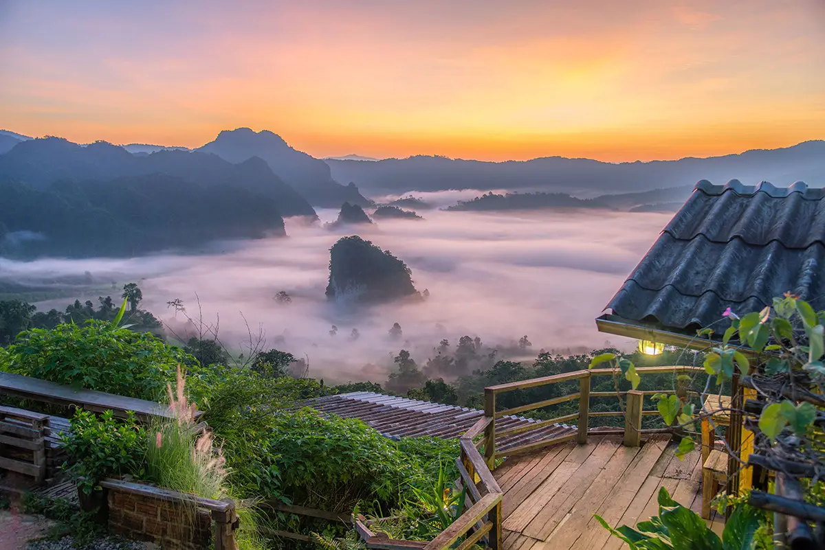
50 Best Mountain Destinations in Northern Thailand for Winter brings together 50 mountain attractions and highland destinations for travelers seeking cool weather, morning seas of mist, sunrise views, forest adventures, and the distinctive cultures of Thailand's mountain communities. From Doi Inthanon and Doi Ang Khang in Chiang Mai to Phu Chi Fa and Doi Mae Salong in Chiang Rai, the journey continues through the highlands of Mae Hong Son, Nan, Phayao, and Phetchabun. Each destination has its own landscapes, atmosphere, and cultural identity, offering memorable experiences for families, couples, nature lovers, and anyone wishing to discover the beauty of Thailand's winter season.
When winter arrives, Northern Thailand's mountains take on a different character. The lush greenery of the rainy season gives way to cooler temperatures and clearer skies in many areas. Early in the morning, mist often settles into the valleys below mountain ridges. On some days, an extraordinary sea of mist stretches across the landscape while the first sunlight gradually illuminates the peaks and forests. These beautiful scenes make mountain travel especially appealing to visitors who want to escape everyday routines and spend time surrounded by nature.
Northern Thailand is characterized by extensive mountain ranges and valleys spread across several provinces, particularly Chiang Mai, Chiang Rai, Mae Hong Son, and Nan. These areas contain high mountains, watershed forests, and numerous highland communities. Each destination offers something different. Some are celebrated for sunrise views and seas of mist, while others feature winter flower gardens, tea plantations, and mountain agriculture. Many are also excellent places for nature walks, forest exploration, and learning about the relationship between local communities and their environment.
Chiang Mai is one of the leading destinations for winter mountain tourism. Its attractions include Doi Inthanon National Park, home to Thailand's highest peak; Doi Ang Khang, known for highland agriculture; and mountain routes through Mae Rim, Mae Taeng, and Chiang Dao districts. Travelers can choose between easily accessible viewpoints and more remote natural areas that require hiking or additional travel preparation.
Chiang Rai's mountains are closely connected to borderland geography and the traditions of diverse highland communities. Destinations such as Phu Chi Fa and Doi Mae Salong are distinctive for their mountain scenery, misty viewpoints, and local history. Photography enthusiasts can spend the early morning capturing layered mountain landscapes, while visitors interested in culture can explore villages, regional cuisine, agricultural traditions, and locally made products.
Mae Hong Son is another outstanding province for winter travel. Its winding mountain roads and deep valleys create dramatic scenery, while the close relationship between nature and local communities adds cultural depth to the journey. Mountain villages, terraced fields, and viewpoints around Pai, Pang Mapha, and Khun Yuam are particularly appealing. Travelers driving through the province should plan realistic daily distances and avoid rushing along winding roads.
In Nan Province, mountain ranges, valleys, and extensive forests create a peaceful setting for nature-focused travel. Mountain roads connect scenic attractions with traditional communities, allowing visitors to experience local culture alongside natural landscapes. Phetchabun, meanwhile, is known for its mountain viewpoints and seas of mist, making it a popular cool-season escape for travelers from central Thailand.
The most popular period for winter mountain travel generally runs from November to February. However, conditions differ according to altitude and geography. Temperatures on high peaks can drop considerably before sunrise, while valleys may experience dense fog and reduced visibility. Seas of mist depend on humidity, wind, and daily weather conditions, so they cannot be guaranteed on every visit.
Popular winter activities include watching the sunrise, walking nature trails, photographing mountain landscapes and seas of mist, visiting cool-climate flower gardens, exploring tea plantations, and staying overnight in highland communities. Travelers interested in trekking should choose routes suited to their physical abilities and follow national park regulations. Some trails require authorized guides or are open only during certain times of the year.
Mountain travel also provides opportunities to discover Northern Thailand's cultural heritage through regional food, handicrafts, traditional textiles, and agricultural knowledge. Visitors can eat at community restaurants, support local products, and choose accommodations that operate responsibly. These choices help connect travel experiences with the lives of people who have lived in the mountains for generations.
If you have only one day, choose a mountain or scenic route within a reasonable distance of your accommodation and limit the itinerary to a few main stops. A two- or three-day journey allows an overnight stay in the mountains and time to enjoy both morning and evening scenery. Travelers with four or five days can explore several districts or neighboring provinces, provided they allow sufficient time for winding mountain roads and changing weather.
Before heading into the mountains, check weather forecasts, road conditions, access restrictions, and national park announcements. Bring warm clothing, suitable footwear, drinking water, and essential outdoor supplies. Drivers should inspect their brakes, tires, and lights, particularly before traveling on steep roads or through dense fog.
Protecting the natural environment is an important part of responsible mountain tourism. Stay on designated trails, avoid collecting plants or natural materials, do not disturb wildlife, and carry all rubbish out of the area. When visiting communities, respect local customs and ask permission before photographing residents or private activities.
The following 50 destinations introduce the remarkable diversity of Northern Thailand's mountains, from famous peaks, sea-of-mist viewpoints, and national parks to highland communities and peaceful natural attractions. Choosing destinations that match your interests and available travel time will help you make the most of each journey.
1. Doi Inthanon National Park is located in Chiang Mai Province and encompasses high mountain landscapes across several districts. Doi Inthanon's summit, approximately 2,565 meters above sea level, is Thailand's highest point. The park is a favorite winter destination for its cool climate, montane evergreen forests, and scenery within the Thanon Thong Chai mountain range.
Highlights: Thailand's highest summit, Ang Ka Nature Trail, Kew Mae Pan Nature Trail, the King and Queen Pagodas, mountain viewpoints, and possible seas of mist under suitable weather conditions.
The variation in elevation creates different forest communities and climatic conditions along the mountain road. Visitors can explore moist mountain forests, learn about native ecosystems, and appreciate the importance of the watershed areas that support communities throughout Chiang Mai.
Winter is particularly popular, especially in the early morning when temperatures can be very low. Individual attractions and nature trails within the park may operate under different seasonal regulations, so visitors should check official park announcements before arriving.
Getting There: From Chiang Mai city, take Highway 108 toward Chom Thong District and turn onto Highway 1009 to ascend Doi Inthanon. Check your vehicle before departure and drive carefully on the mountain road.

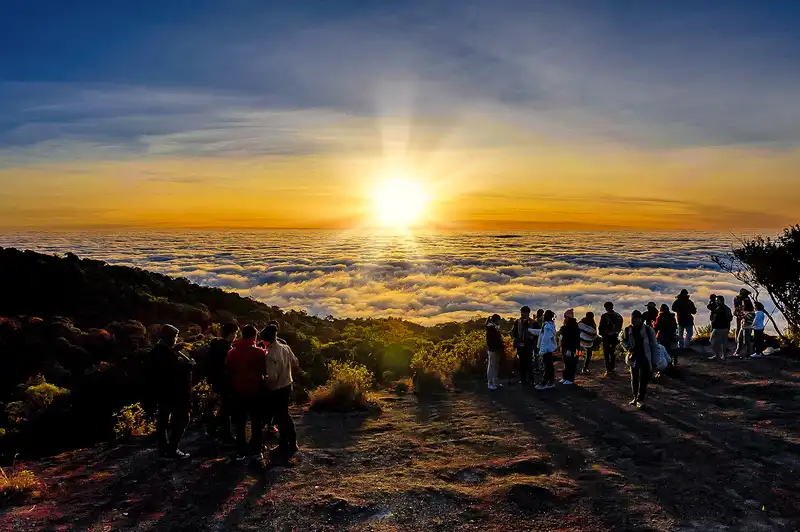
2. Phu Chi Fa Forest Park lies near the Thai–Lao border in Thoeng District, Chiang Rai Province. It is one of Northern Thailand's best-known sunrise and sea-of-mist viewpoints. Its distinctive peak and cliff face extend toward Laos, creating expansive views across layers of mountains.
Highlights: Sunrise over the mountains, mist-filled valleys, dramatic cliffs and ridgelines, and views along the Thai–Lao border.
Visitors usually begin the walk to the viewpoint before sunrise to witness the first light of day. Some sections of the trail are steep, and dew can make the ground slippery. Sturdy shoes and appropriate warm clothing are recommended.
Phu Chi Fa is especially suitable for landscape photographers and travelers looking for a memorable mountain morning. The visit can also be combined with nearby highland communities and other mountain attractions in Chiang Rai.
Getting There: Travel from Chiang Rai city toward Thoeng District and follow the road toward Phu Chi Fa. From the designated parking area, continue on foot along the marked trail to the viewpoint.
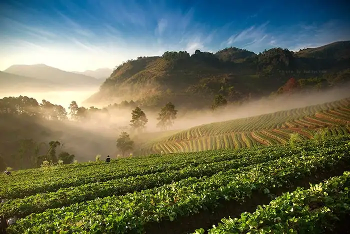
3. Doi Ang Khang is located in Fang District, Chiang Mai Province. This highland destination is renowned for cool-climate agriculture and mountain landscapes. It has played an important role in the development of agricultural practices suited to high elevations and remains a popular destination during winter.
Highlights: Royal Agricultural Station Ang Khang, cool-climate crops, flower gardens, mountain scenery, and the atmosphere of surrounding highland communities.
Doi Ang Khang combines natural scenery with agricultural knowledge. Visitors can admire cultivated fields arranged along hillsides, discover crops adapted to cool mountain weather, and experience the peaceful surroundings of villages nestled among the mountains.
The ascent includes numerous curves and steep sections. Daytime travel is advisable, especially for drivers who are unfamiliar with mountain roads.
Getting There: From Chiang Mai city, travel toward Fang District and follow the signs leading up to Doi Ang Khang. Check road and vehicle conditions before departure.
Map (GPS):Open Google Maps – Doi Ang Khang
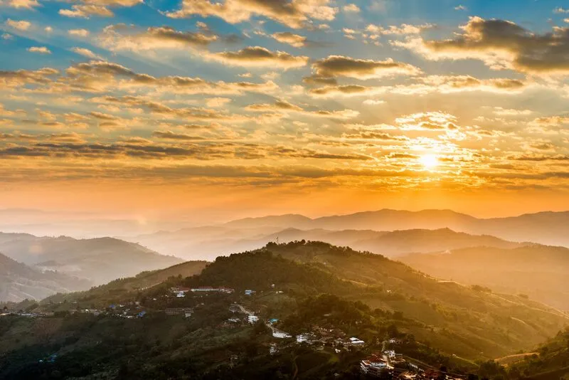
4. Doi Mae Salong is situated in Mae Fa Luang District, Chiang Rai Province. This mountain community is distinguished by its Chinese-Yunnanese heritage, tea plantations, and beautiful scenery. It is particularly rewarding for travelers interested in nature, regional food, and local culture.
Highlights: Hillside tea plantations, Chinese-Yunnanese traditions, local cuisine, mountain viewpoints, and cool winter mornings.
A visit to Doi Mae Salong can combine sightseeing with an exploration of community history. Travelers can experience tea-drinking traditions, purchase locally made products, and admire the tea plantations that have become an enduring symbol of the area.
The winter climate makes overnight stays especially appealing. Early mornings may offer attractive views of mist and sunlight above the surrounding mountains when weather conditions are favorable.
Getting There: From Chiang Rai city, travel toward Mae Chan District and follow the signs to Doi Mae Salong. The mountain road includes steep and winding sections.
Map (GPS):Open Google Maps – Doi Mae Salong
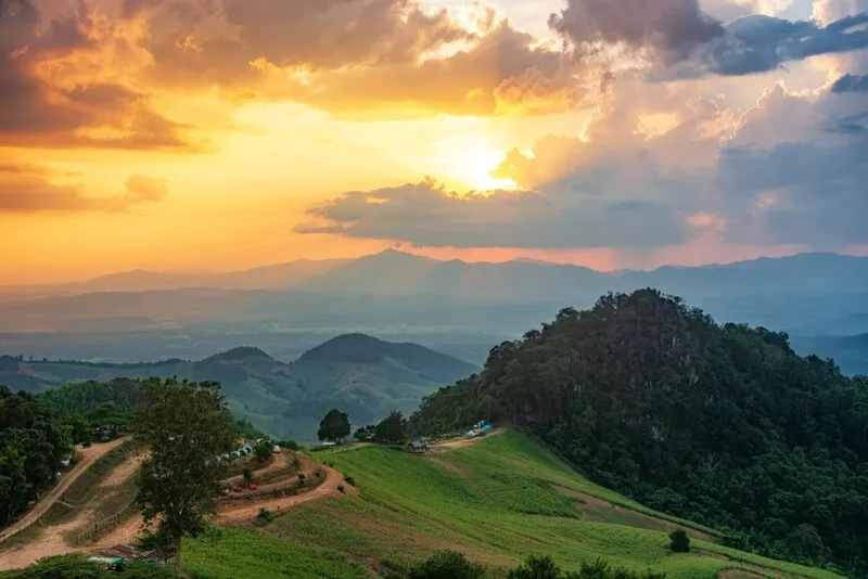
5. Si Nan National Park is located in Nan Province and protects a landscape of mountains, cliffs, forests, and scenic viewpoints. Doi Samer Dao is among its most famous areas, attracting travelers who want to watch the sunrise, admire sunsets, and look for seas of mist.
Highlights: Doi Samer Dao, Pha Hua Sing, views of the Nan River, and natural viewpoints throughout the park.
The park's open ridges and cliffs create broad views of the surrounding terrain, particularly on clear days. Travelers can enjoy the scenery, explore approved nature trails, and relax in a quiet mountain environment.
Visitors planning to watch the stars or morning mist should bring adequate warm clothing and review the park's regulations concerning overnight stays and designated camping areas.
Getting There: Travel from Nan city toward Na Noi District, then follow the designated roads and visitor access points into Si Nan National Park.
Map (GPS):Open Google Maps – Si Nan National Park

6. Doi Chiang Dao is located in Chiang Dao District, Chiang Mai Province. Its striking limestone mountain is one of Northern Thailand's most recognizable natural landmarks. Doi Chiang Dao supports remarkable biodiversity and features a landscape quite different from many other mountain peaks.
Highlights: Panoramic views of Doi Luang Chiang Dao, limestone mountains, high-altitude vegetation, and the natural setting around Chiang Dao District.
The mountain can be admired from several viewpoints in the surrounding area. Access to the summit lies within Chiang Dao Wildlife Sanctuary and is subject to specific conservation restrictions. It is not a freely accessible hiking destination.
Travelers can also stay in communities around the mountain's foothills, enjoy views of its dramatic limestone formations, and learn about the importance of the local ecosystem without climbing to the summit.
Getting There: Take Highway 107 north from Chiang Mai city toward Chiang Dao District, then continue to the selected viewpoint or visitor area.
Map (GPS):Open Google Maps – Doi Chiang Dao

7. Doi Mon Jam is located in Mae Rim District, Chiang Mai Province. It is a popular mountain destination known for hillside views, flower gardens, and pleasantly cool weather. Its proximity to Chiang Mai makes it suitable for both day trips and overnight getaways.
Highlights: Mountain viewpoints, cultivated hillsides, seasonal flower gardens, and peaceful morning scenery.
Mon Jam's open terrain provides attractive views across ridges and valleys. Travelers can take photographs, enjoy the scenery, and discover aspects of highland agriculture. Individual gardens and privately operated attractions may have their own admission conditions.
The area can be combined with other attractions in Mae Rim District, making it an appealing option for families, couples, and travelers who prefer mountain scenery without a demanding trek.
Getting There: From Chiang Mai city, drive toward Mae Rim District and follow the signs to Mon Jam. The final section passes through mountainous terrain and should be driven carefully.
Map (GPS):Open Google Maps – Doi Mon Jam
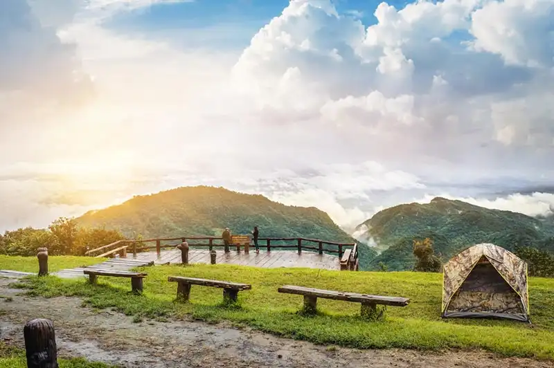
8. Doi Pha Hom Pok National Park occupies mountainous terrain in northern Chiang Mai, including areas around Fang District. The park is recognized for its high-elevation forests, cool climate, and mountain travel routes near Thailand's northern border.
Highlights: Doi Pha Hom Pok summit, mountain panoramas, highland forests, and nature-based activities for trekking enthusiasts.
The park appeals to travelers seeking a more adventurous mountain experience. Conditions at higher elevations differ considerably from those of the lowlands, and some access routes require suitable vehicles and compliance with park regulations.
Anyone planning to trek to the summit should check seasonal trail openings, reservation procedures, guide requirements, and overnight-stay rules before traveling.
Getting There: Travel from Chiang Mai city to Fang District and continue to the designated national park access point. Some upper-mountain roads are steep and require advance preparation.

9. Phu Thap Boek is situated in Lom Kao District, Phetchabun Province. This high mountain destination is famous for cool weather, spectacular seas of mist, and cabbage fields cultivated across the hillsides. It is a popular winter retreat for travelers seeking mountain scenery and fresh air.
Highlights: Early morning seas of mist, expansive mountain views, highland agricultural fields, and sunrise viewpoints.
Phu Thap Boek has a different atmosphere in each season. Winter attracts visitors looking for cool temperatures, while favorable humidity and weather conditions can create mist floating through the valleys and along the mountain ridges.
The mountain contains community areas and several viewpoints. Visitors should respect farmland and private property and take extra care when traveling through dense fog or heavy traffic.
Getting There: Travel into Phetchabun Province toward Lom Kao District, then follow the mountain road leading to Phu Thap Boek. Expect steep gradients and numerous curves.
Map (GPS):Open Google Maps – Phu Thap Boek
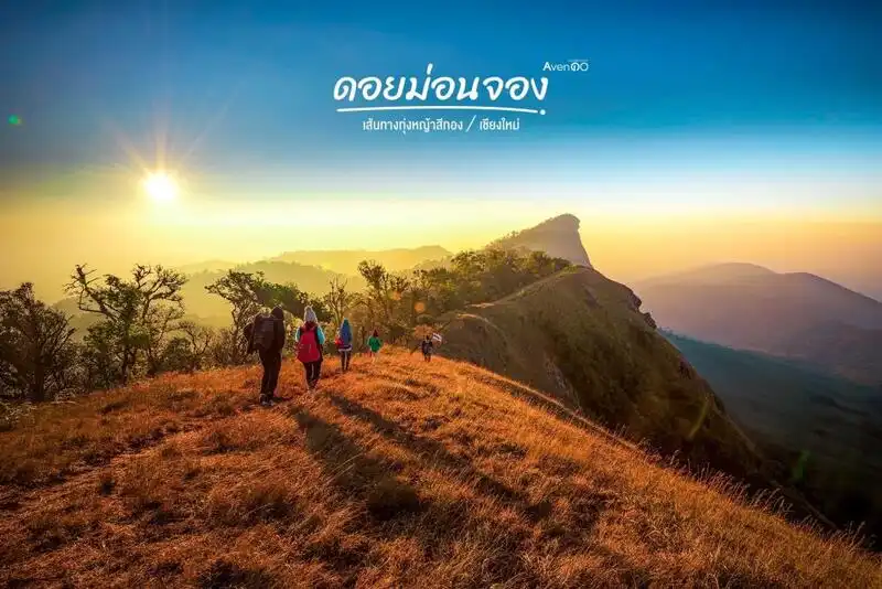
10. Doi Mon Chong is located in Omkoi District, Chiang Mai Province. It is known among trekking enthusiasts for its ridgelines, high-altitude grasslands, and impressive natural scenery.
Highlights: Mountain ridges, highland grasslands, natural viewpoints, and trekking through elevated landscapes.
Doi Mon Chong lies within Omkoi Wildlife Sanctuary, an important conservation area. Visitors must follow access regulations and obtain permission from the responsible authorities before entering restricted sections.
The destination is particularly suitable for experienced hikers or travelers who have prepared physically for mountain trekking. Conditions differ greatly from easily accessible roadside viewpoints, so visitors should confirm the trekking season, booking arrangements, and guide requirements.
Getting There: Travel from Chiang Mai city toward Omkoi District and contact the relevant wildlife sanctuary authorities to arrange authorized access and the appropriate trekking route.
Map (GPS):Open Google Maps – Doi Mon Chong
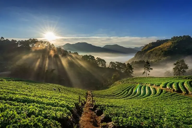
11. Doi Suthep–Pui National Park is located in Chiang Mai Province and is an important conservation area for mountain forests, watersheds, and Lanna cultural heritage. Its convenient location near Chiang Mai city makes it an excellent destination for experiencing cool mountain weather without a long journey. The park contains forests, viewpoints, nature trails, and significant religious landmarks closely connected to Chiang Mai's history.
Highlights: Elevated views of Chiang Mai city, Wat Phra That Doi Suthep, Hmong Doi Pui Village, montane evergreen forests, and varied nature attractions.
The park consists of interconnected mountain ranges west of Chiang Mai. Changes in elevation and climate support several types of vegetation, from lower mountain forests to high-altitude woodland. During winter, the cool temperatures make shaded trails and forest walks especially pleasant.
Wat Phra That Doi Suthep is among the best-known attractions in the park. This important Buddhist temple is a spiritual landmark of Lanna culture and offers attractive views across Chiang Mai. Hmong Doi Pui Village provides another opportunity to learn about the culture, occupations, and traditions of highland communities.
For nature enthusiasts, the journey through Doi Suthep–Pui offers more than a temple visit. Travelers can explore forest scenery, stop at designated viewpoints, and enjoy relaxing natural surroundings along the mountain road. Morning visits are ideal for cool weather, while selected viewpoints offer attractive city scenery later in the day.
The park is suitable for families, couples, older travelers visiting accessible viewpoints, and visitors interested in combining culture with nature. It can easily be paired with Wat Phra That Doi Suthep and other Chiang Mai attractions in a one-day itinerary. Travelers should select routes appropriate to their abilities and follow park regulations.
Getting There: From Chiang Mai city, follow Huay Kaew Road toward the foot of Doi Suthep and continue along the mountain road to your chosen attraction. Private cars and local transport operate on parts of the route. Drive carefully through the continuous curves.

12. Doi Mon Ngo is located in the mountains of Mae Taeng District, Chiang Mai Province. It is a scenic viewpoint known for layered mountain landscapes and morning seas of mist. The elevated terrain provides broad views across valleys and surrounding ridges, making it appealing to travelers seeking a peaceful winter atmosphere.
Highlights: Sunrise viewpoints, mist-filled valleys, dramatic ridgelines, and the atmosphere of nearby highland communities.
Doi Mon Ngo is particularly popular among travelers who want to watch the first sunlight of the day. Under suitable conditions, mist fills the valleys while sunlight gradually reaches the mountain peaks. These changes in morning light make the destination especially attractive to nature photographers.
The surrounding terrain consists of steep mountains and community agricultural areas. A visit therefore offers opportunities not only to enjoy the views but also to understand highland livelihoods and the relationship between local agriculture and the mountain environment.
Winter mornings can be cold and misty. Visitors should bring warm clothing, shoes suitable for uneven ground, and a flashlight if traveling before sunrise. Since seas of mist depend on weather conditions, allow time to enjoy the mountain scenery even if the mist does not appear.
Doi Mon Ngo is well suited to visitors who prioritize scenic views and relaxation. It can be combined with other attractions in Mae Taeng District, and staying overnight in an authorized accommodation area makes early morning sightseeing more convenient.
Getting There: Travel from Chiang Mai city to Mae Taeng District and follow the signs toward Mon Ngo. The mountain road has winding and sometimes steep sections. Check road conditions before traveling, particularly during rain or heavy fog.
Map (GPS):Open Google Maps – Doi Mon Ngo
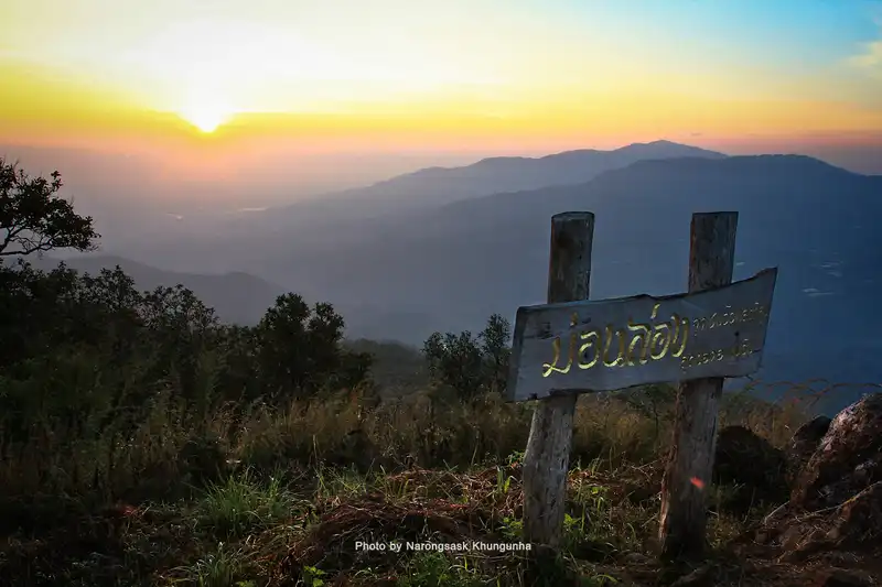
13. Doi Mon Long is a mountain destination in Chiang Mai Province distinguished by peaceful natural surroundings and extensive views. Its terrain consists of rolling highland hills and ridges, providing scenery that differs considerably from the urban landscape of Chiang Mai.
Highlights: Rolling mountain scenery, ridgelines, natural viewpoints, and cool winter weather.
Doi Mon Long is particularly attractive to travelers seeking quiet mountain landscapes. The atmosphere changes throughout the day, with possible mist in the valleys during early morning and clearer views of the mountains as sunlight strengthens.
Open spaces, grass-covered slopes, and distant ridges create appealing opportunities for photography and relaxation. Visitors should nevertheless follow access regulations and avoid entering restricted areas or leaving authorized paths.
The mountain can be included in a longer Chiang Mai highland itinerary. Daytime travel and advance weather checks are recommended to improve visibility and make the journey more comfortable.
Photographers should prepare equipment for windy and cool conditions. Anyone walking across natural terrain should wear footwear with good traction and carry all rubbish away from the site.
Getting There: Start from Chiang Mai city and follow the GPS route toward Doi Mon Long. Check the final approach with local operators or the responsible land manager, as some sections may consist of mountain roads or natural access tracks.
Map (GPS):Open Google Maps – Doi Mon Long

14. Hadu Bi Viewpoint is a highland viewpoint in Chiang Mai Province offering natural scenery and views of Northern Thailand's mountain ranges. It is an appealing destination for visitors looking for a quieter mountain experience away from more heavily visited attractions.
Highlights: Elevated mountain views, layered ridgelines, a peaceful atmosphere, and attractive morning scenery.
The viewpoint offers perspectives across connected mountains and valleys. The scenery changes with the time of day, with mornings after sunrise often providing good light for sightseeing and photography when the sky is clear.
Travelers interested in exploring mountain routes can incorporate Hadu Bi into a wider journey through Chiang Mai's highlands. Careful planning is recommended because remote viewpoints may have limited facilities and challenging access roads.
Winter temperatures at elevation can be noticeably cooler than in the city, particularly before sunrise and after sunset. Warm clothing, drinking water, and reliable communications equipment are useful for visits to remote areas.
Hadu Bi Viewpoint is best suited to nature enthusiasts and landscape photographers rather than visitors expecting extensive tourist facilities. Respect nearby communities, avoid disturbing private activities, and keep the area clean.
Getting There: Use the GPS position to plan your journey from Chiang Mai city. Check the final road conditions and access arrangements before departure, particularly if driving a private vehicle.
Map (GPS):Open Google Maps – Hadu Bi Viewpoint
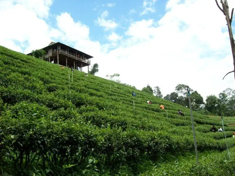
15. Mon Ngo Royal Project Development Center is located in Chiang Mai Province and is associated with highland agricultural development and livelihood improvement under the Royal Project approach. Its work supports agricultural practices suited to mountain environments while contributing to the well-being of local communities.
Highlights: Highland agriculture, cultivated mountain landscapes, community livelihoods, and the natural atmosphere around Mon Ngo.
Royal Project development areas play an important role in supporting appropriate mountain agriculture, introducing crops suited to local conditions, and promoting sustainable resource management. A visit to Mon Ngo offers insight into the connection between farming, communities, and the surrounding mountain environment.
Travelers interested in agricultural tourism may learn about local produce and cultivation activities in areas open to visitors. The journey also reveals how landscapes change from the lowlands to mountain areas used for farming.
Cool winter weather is pleasant for outdoor visits. The combination of mountain scenery and community activities makes the destination interesting for educational travel, although exhibitions and visitor access depend on the center's operations and farming seasons.
The center is particularly suitable for families, students, and travelers interested in agricultural knowledge. It can be combined with Doi Mon Ngo and nearby mountain attractions for a trip that includes both nature and local livelihoods.
Getting There: Travel from Chiang Mai city toward the highland area where the center is located, following its GPS position and local signs. Check whether visitors are being accepted before entering operational areas.

16. Doi Pha Hee is a highland destination in Chiang Rai Province known for village life and mountain coffee culture. The community is surrounded by impressive mountain scenery, allowing visitors to discover both natural beauty and the traditions of local residents.
Highlights: Locally grown coffee, highland community life, mountain viewpoints, and the peaceful atmosphere of a mountain village.
Highland agriculture, particularly coffee cultivation, has become an important part of Doi Pha Hee's economy and identity. Visitors can learn how coffee is grown, processed, and prepared, gaining an appreciation of the region's distinctive products.
Enjoying coffee with a mountain view is among the most popular experiences. The village setting provides a relaxed atmosphere, especially during cool mornings when the surrounding ridges are beautifully illuminated.
Beyond its coffee culture, Doi Pha Hee is interesting for its community traditions and daily life. Travelers should respect private property, request permission before photographing residents, and support locally produced goods whenever possible.
The destination suits community-tourism enthusiasts, couples, and photographers. It can be included in a Chiang Rai mountain itinerary, with sufficient driving time allowed for winding roads and steep gradients.
Getting There: From Chiang Rai city, travel toward Mae Sai District and follow the signs to Pha Hee Village. The route climbs through mountain terrain and includes many curves.
Map (GPS):Open Google Maps – Doi Pha Hee
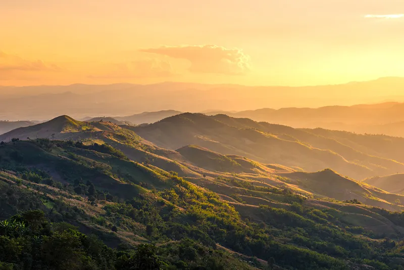
17. Doi Chang is a highland destination in Chiang Rai Province renowned for Arabica coffee cultivation and beautiful mountain scenery. The area demonstrates the close connection between terrain, cool weather, and the development of agricultural livelihoods in Northern Thailand.
Highlights: Arabica coffee plantations, mountain views, coffee culture, local communities, and a pleasant highland climate.
Doi Chang is widely recognized as one of Thailand's important coffee-growing regions. Its elevation and cool climate favor Arabica cultivation, making coffee production a central part of the area's economy and identity. Visitors can appreciate both the agricultural landscape and the surrounding mountains.
Popular activities include admiring coffee plantations, tasting locally produced coffee, and learning about processing methods at locations open to visitors. The journey also reveals how agriculture has adapted to steep slopes and mountain conditions.
Winter provides a particularly pleasant atmosphere for photography and relaxation. Early morning sunlight often brings out the beauty of the ridges and cultivated hillsides, and the visit can be combined with other attractions around Mae Suai District.
Doi Chang appeals to both nature and coffee enthusiasts. Purchasing products directly from local producers and respecting community life can make the travel experience more meaningful.
Getting There: From Chiang Rai city, travel toward Mae Suai District and follow the mountain road to Doi Chang. Check vehicle conditions before ascending the steep and winding route.
Map (GPS):Open Google Maps – Doi Chang

18. Phu Fa Thai is a mountain destination in Chiang Rai Province distinguished by natural scenery and the atmosphere of the northern border highlands. It is suitable for travelers seeking peaceful surroundings and expansive views of connected mountain ranges.
Highlights: Mountain viewpoints, cool highland weather, layered ridgelines, and natural scenery.
Phu Fa Thai offers an opportunity to admire mountains and valleys from an elevated position. Early morning sunlight can reveal the contours of the ridges, while changing weather conditions create different scenic moods throughout the day.
During winter, temperatures are generally cooler than in nearby lowland areas. Travelers visiting at dawn should bring warm clothing and check weather forecasts because highland conditions can change quickly.
The destination is particularly appealing to nature lovers and photographers looking for wide mountain views. It can also be incorporated into a broader itinerary exploring Chiang Rai's scenic highland attractions.
Visitors should prioritize safety and environmental care by staying on designated routes, respecting local communities, and removing all rubbish from the mountain area.
Getting There: Travel from Chiang Rai city using the GPS location for Phu Fa Thai and check the final mountain access route before departure. Daytime travel is preferable for drivers unfamiliar with the area.
Map (GPS):Open Google Maps – Phu Fa Thai

19. Phaya Phi Phak Forest Park is a mountain conservation area in Chiang Rai Province with scenic ridges and natural forest landscapes. It offers an appealing environment for travelers interested in nature and quiet highland recreation.
Highlights: Mountain scenery, natural viewpoints, forest landscapes, and peaceful highland surroundings.
The forest park consists of mountain terrain connected to natural woodland. Visitors can appreciate the scenery while learning about the importance of forest protection and ecological balance in Northern Thailand.
The cool season is generally pleasant for mountain sightseeing. Mist may occasionally form in the valleys during suitable weather conditions, while clear mornings reveal impressive ridgelines and forested slopes.
Landscape photographers can enjoy viewpoints that are open to visitors. Those exploring forest trails should follow the guidance of responsible authorities and avoid entering restricted or closed areas.
The park is well suited to visitors who appreciate natural surroundings and quiet exploration. It can be combined with other Chiang Rai mountain viewpoints when access arrangements and road conditions allow.
Getting There: Travel from Chiang Rai city toward the forest park using its GPS position. Check the access road and visitor entry arrangements, particularly during rainy weather or heavy fog.
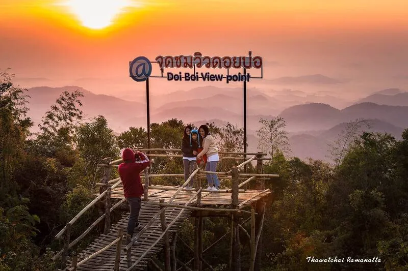
20. Doi Bo Royal Initiative Project is located in Chiang Rai Province and is associated with development efforts inspired by royal initiatives. Its significance lies in natural resource management and the improvement of highland communities, within a landscape of mountains and forests characteristic of Northern Thailand.
Highlights: Highland development, mountain scenery, conservation practices, and community livelihoods connected to the natural environment.
Development initiatives in mountain areas play an important role in balancing resource use with conservation. Learning about the Doi Bo project provides insight into the relationships between watersheds, forests, agriculture, and communities.
The surrounding highland environment is attractive for its mountain scenery and natural atmosphere. Winter weather is generally suitable for exploring the area, while educational visits may provide opportunities to learn about activities in sections officially open to visitors.
Access regulations are particularly important at working development projects because some areas may be operational facilities or private community spaces rather than public attractions. Visitors should follow instructions from the responsible staff.
The project is suitable for travelers interested in nature, environmental conservation, and community development. It may be included in a wider Chiang Rai itinerary focused on educational and responsible tourism.
Getting There: Travel from Chiang Rai city using the GPS position of the Doi Bo Royal Initiative Project. Check visitor access procedures before entering operational areas.
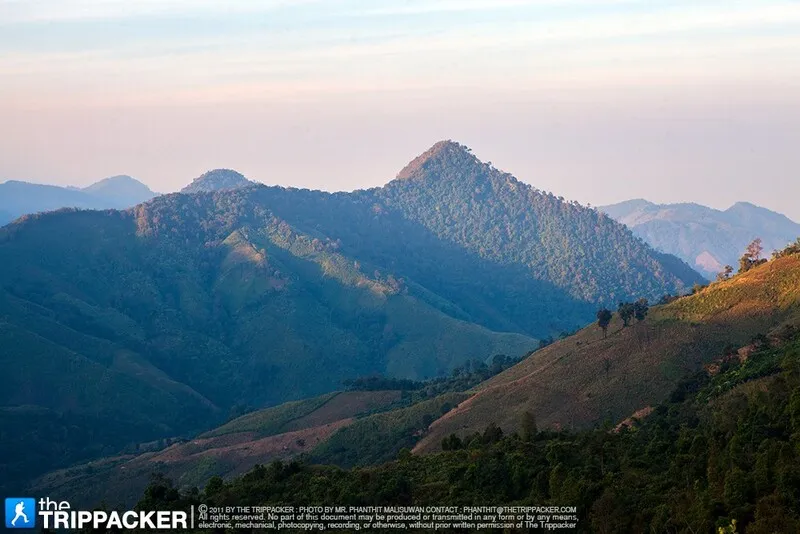
21. Doi Phu Kha National Park is located in Nan Province, with important areas around Pua District and mountain ranges extending across several districts. It is one of Northern Thailand's major mountain forest landscapes, valued for its biodiversity, watershed ecosystems, and rare plant species. Its extensive ridges and varied elevations create a wide range of natural environments suited to winter sightseeing and ecological learning.
Highlights: The scenic Pua–Bo Kluea mountain road, Viewpoint 1715, the rare Chomphu Phu Kha tree, montane evergreen forests, natural pine forests, and scenery around Doi Phu Wae.
The national park consists of connected high mountains supporting several forest types, including moist evergreen woodland, pine forests, and mixed deciduous vegetation at lower elevations. These different habitats provide conditions for many plants and animals, including the rare Chomphu Phu Kha, an important botanical symbol of the park.
One of the most popular routes is Highway 1256 between Pua and Bo Kluea districts. The road winds through forests and mountains, providing opportunities to stop at designated viewpoints and admire layered ridges. The journey is particularly appealing during cool weather and on clear days.
Beyond the scenic drive, visitors can explore designated natural areas and approved nature trails. Travelers interested in trekking should check park regulations and access restrictions because some sections protect sensitive habitats.
Doi Phu Kha is especially suitable for nature enthusiasts, photographers, and travelers spending several days in Nan Province. A visit can be combined with Pua, Bo Kluea, and surrounding mountain communities, allowing sufficient time for winding roads and scenic stops.
Getting There: Travel from Nan city to Pua District, then take Highway 1256 toward Doi Phu Kha National Park. The road includes steep gradients and continuous curves, so prepare your vehicle and check weather conditions before departure.

22. Doi Tee Duu is located near Ban Song Khwae in Sanian Subdistrict, Mueang Nan District, Nan Province. It is a mountain viewpoint known for misty mornings and layered ridges. Its elevated location offers wide views and a peaceful atmosphere, making it an appealing winter destination without requiring an exceptionally long journey from Nan town.
Highlights: Sea-of-mist viewpoints, sunrise scenery, connected mountain ranges, and the natural surroundings of Ban Song Khwae.
Doi Tee Duu attracts landscape photographers because the terrain provides extensive views across valleys and surrounding hills. Under suitable conditions, mist gathers in lower areas and creates beautiful scenery as sunlight reaches the mountains.
The viewpoint has previously been known for walkways and photography platforms extending toward the hillside. Outdoor structures may change over time, so visitors should use only areas that remain officially open and safe. Avoid stepping onto damaged or closed structures.
Another attraction is the opportunity to experience a rural mountain community. Travelers can enjoy the changing landscapes between Nan town and the surrounding highlands. Morning visitors should bring warm clothing and shoes suitable for ground that may be damp with dew.
Doi Tee Duu is suitable for photography and scenic sightseeing, especially for travelers already exploring Mueang Nan District. Check the current access status before departure, as community-managed viewing areas may have changing arrangements.
Getting There: Travel from Nan town toward Sanian Subdistrict and Ban Song Khwae, then follow the community access route to Doi Tee Duu Viewpoint. Confirm road conditions before ascending the mountain.
Map (GPS):Open Google Maps – Doi Tee Duu

23. Doi Suan Ya Luang is located near Ban San Charoen, Pha Thong Subdistrict, Tha Wang Pha District, Nan Province. This highland viewpoint is known for ridges and valleys stretching across the mountain landscape. The summit area offers quiet surroundings and cool weather, making it suitable for winter sightseeing.
Highlights: Seas of mist, sunrise viewpoints, layered mountain ranges, and the highland community of Ban San Charoen.
The appeal of Doi Suan Ya Luang comes from its panoramic position above the surrounding valleys. On favorable mornings, mist forms below the ridges while sunlight gradually illuminates the mountains, creating scenery that changes throughout the day and across seasons.
The area is closely connected to Ban San Charoen, where livelihoods are associated with highland agriculture. A visit provides an opportunity to appreciate both the natural beauty and local community atmosphere. Respect cultivated land, avoid disturbing residents, and keep viewing areas clean.
Winter mornings can be cold, especially before sunrise. Visitors should prepare warm clothing, flashlights, and footwear suited to slopes and uneven ground. Weather checks are important because dense fog may reduce visibility on roads and at viewpoints.
The mountain is well suited to photographers and nature enthusiasts. It can be included in a trip through Tha Wang Pha District and nearby natural attractions, provided enough time is allowed for the mountain roads.
Getting There: Travel from Nan city to Tha Wang Pha District, continue toward Pha Thong Subdistrict and Ban San Charoen, then follow the local road to Doi Suan Ya Luang Viewpoint.
Map (GPS):Open Google Maps – Doi Suan Ya Luang

24. Tham Pha Tub Forest Park is located in Pha Sing Subdistrict, Mueang Nan District, Nan Province. This natural attraction is distinguished by limestone mountains and caves formed through geological processes over long periods. It is ideal for travelers interested in mountain forests and terrain that differs from the high peaks and sea-of-mist viewpoints found elsewhere in the region.
Highlights: Limestone mountains, natural caves, stalactites and stalagmites, limestone forest vegetation, and nature trails.
The park's distinctive limestone formations contain caves and rock cavities shaped by natural erosion and geological processes. Some caves feature stalactites and stalagmites, offering opportunities to learn how water and limestone have influenced the development of the landscape.
The surrounding vegetation has adapted to limestone terrain, creating a forest environment quite different from high-altitude evergreen woodland. Visitors can observe cliffs, plants, and natural features associated with limestone ecosystems.
Cave exploration requires care because some surfaces may be slippery and lighting may be limited. Stay on designated paths, do not touch or damage delicate rock formations, and follow guidance from park staff.
Tham Pha Tub Forest Park is suitable for families interested in nature, geology enthusiasts, and travelers looking for a natural attraction near Nan town. It can be visited as part of a half-day itinerary combined with other attractions in Mueang Nan District.
Getting There: From Nan town, take Highway 1080 on the Nan–Pua–Thung Chang route for approximately 12 kilometers and follow the signs to the forest park entrance.
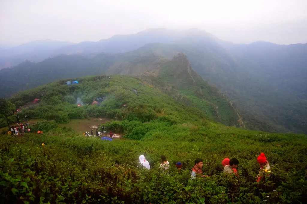
25. Doi Phu Wae Fossil Shell Site is located in the mountain area associated with Ban Manee Phruek, Nan Province. This natural and geological attraction is known for ancient fossilized shells preserved in rock layers at high elevation. It provides an opportunity to learn about the region's geological history and environmental changes over time.
Highlights: Fossil shells embedded in rock, mountain geology, views of Doi Phu Wae, and the natural atmosphere of the Ban Manee Phruek area.
The fossil shell deposits are the defining feature of the site. Their presence in mountain rock layers provides evidence of geological processes and past environmental conditions. Visitors can examine the natural setting while appreciating the long history represented by these formations.
Surrounding forests and mountain ridges create scenery different from conventional sea-of-mist viewpoints. During cool weather, clear skies can make the landscape particularly attractive for photography, including images of rock formations and surrounding highland terrain.
Doi Phu Wae is associated with Ban Manee Phruek, a mountain community where travelers can experience the local atmosphere. Visitors should respect farmland, community areas, and regulations concerning natural attractions.
Anyone exploring the surrounding mountain terrain should bring suitable walking shoes, drinking water, and essential equipment. Fossils and stones should never be removed because they are valuable natural resources for geological study and conservation.
Getting There: Travel from Nan city toward Thung Chang District and continue to Ban Manee Phruek. Follow local mountain routes toward the fossil shell site, checking road and access conditions before departure.

26. Huai Nam Dang National Park covers parts of Chiang Mai and Mae Hong Son provinces, with popular tourist areas in the mountains between Mae Taeng and Pai districts. It is one of Northern Thailand's leading winter destinations for seas of mist, sunrise views, and dramatic mountain scenery.
Highlights: Doi Kiew Lom Viewpoint, morning seas of mist, sunrise over mountain ranges, watershed forests, and other natural attractions within the park.
The park consists of connected mountains and deep valleys. From suitable viewpoints, visitors can admire ridgelines and mist in the early morning. On some days, clouds fill the valleys to create a sea of white beneath the peaks, while clear mornings reveal the detail of the surrounding terrain.
Huai Nam Dang also protects important watershed forests linking ecological systems in Chiang Mai and Mae Hong Son. Its forest habitats provide valuable opportunities to understand the importance of mountain conservation.
Sea-of-mist viewing is especially popular during winter. Many visitors stay overnight to enjoy the scenery before sunrise. Bring warm clothing and check the park's regulations concerning camping, overnight accommodation, and visitor access.
The park suits nature enthusiasts, couples, families, and photographers. It can be combined with Pai and other mountain destinations along the Chiang Mai–Mae Hong Son route, with enough travel time allowed for winding roads and possible fog.
Getting There: Take Highway 107 from Chiang Mai toward Mae Taeng, then turn onto Highway 1095 toward Pai. Follow the signs to Huai Nam Dang National Park.

27. Pang Ung, or the Royal Forest Park Project is located in Mok Cham Pae Subdistrict, Mueang Mae Hong Son District. It is famous for its reservoir surrounded by pine forests and mountains. Mist rising above the water on cold mornings makes Pang Ung one of the region's most sought-after winter destinations.
Highlights: A reservoir within a mountain valley, pine forests, morning mist above the water, surrounding mountain scenery, and peaceful natural surroundings.
Pang Ung's charm lies in the combination of calm water and pine trees lining the reservoir. On cold mornings with favorable humidity, delicate mist may drift over the surface while sunlight filters through the trees, creating an especially tranquil atmosphere.
The area is associated with the Pang Tong highland development initiative under royal projects, which emphasizes natural resource protection and community development. A visit therefore provides opportunities to appreciate the importance of forests, water resources, and mountain livelihoods.
Visitors can walk around designated reservoir areas and photograph the scenery, particularly in the early morning. Anyone planning an overnight stay should check booking requirements and visitor restrictions because accommodation and camping arrangements may be managed to protect the environment.
Pang Ung suits couples, families, and travelers seeking quiet relaxation. It can be combined with Ban Rak Thai and other attractions around Mueang Mae Hong Son District.
Getting There: Travel from Mae Hong Son town toward Ban Mok Cham Pae and follow the signs to Pang Ung. The road crosses mountainous terrain with numerous curves, so daytime travel is advisable for unfamiliar drivers.
Map (GPS):Open Google Maps – Pang Ung

28. Bua Tong Fields at Doi Mae U Kho are located in Mae U Kho Subdistrict, Khun Yuam District, Mae Hong Son Province. This mountain attraction is famous for golden-yellow Mexican sunflower blooms covering the hillsides during the transition from the rainy season to early winter. The landscape becomes particularly impressive when flowers bloom across large sections of the rolling mountains.
Highlights: Yellow Bua Tong flowers covering hillsides, mountain viewpoints, seasonal flower photography, and the scenery of Khun Yuam District.
The flowers are distinctly seasonal, with the most popular visiting period generally falling between November and December. Blooming conditions vary by year. From the viewpoints, travelers can admire yellow flowers spread across the hills against the surrounding green mountains.
The rolling terrain provides several scenic perspectives. Visitors should use designated walkways and photography areas rather than stepping into the flowers or other protected natural sections.
The journey through Khun Yuam's mountain landscape is also part of the attraction. Drivers can appreciate the surrounding terrain along the way, although additional care is needed on mountain roads during the busy flowering season.
Doi Mae U Kho is suitable for families, couples, and flower photographers. Plan the trip around the blooming period because the hills do not remain covered in yellow flowers throughout the year.
Open Days: Seasonal, generally during the flowering period from November to December. Opening Hours: Access according to the current rules of the responsible authority.
Getting There: From Mae Hong Son town, travel toward Khun Yuam District and follow the signs into Mae U Kho Subdistrict and the Bua Tong fields. Check the flowering conditions before departure.
Map (GPS):Open Google Maps – Doi Mae U Kho

29. Doi Kiew Lom is located along the road between Pai and Pang Mapha districts in Mae Hong Son Province. This roadside mountain viewpoint is known for its broad views across valleys and ridgelines on both sides of the road, making it a convenient stop during a journey through the province.
Highlights: Scenic viewpoints along Highway 1095, layered mountains, cool highland weather, and a convenient stop on the Pai–Pang Mapha route.
The viewpoint's ridge-top position creates expansive views in different directions. The winding highway and changing elevations are part of the experience, revealing the complex mountain terrain of Mae Hong Son.
Winter weather is often cool, especially in the morning and evening. On favorable days, mist may settle in the valleys, while clear weather reveals distant ridges and forested slopes.
Doi Kiew Lom is a useful scenic stop for travelers driving between Pai and Pang Mapha. Cars should be parked only in designated safe areas, and visitors should avoid standing on the roadway or near dangerous bends while taking photographs.
Families can enjoy the viewpoint without a long hike, although warm clothing may be needed in windy conditions and care should be taken near steep edges.
Getting There: Follow Highway 1095 between Pai and Pang Mapha and stop at the marked Doi Kiew Lom viewpoint. Drive carefully through the many curves and steep sections.
Map (GPS):Open Google Maps – Doi Kiew Lom
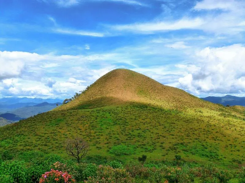
30. Doi Pui Luang is a mountain nature destination in Mae Hong Son Province known for forest landscapes, ridgelines, and peaceful highland surroundings. The destination offers opportunities to experience the province's mountain environment away from more crowded tourist locations.
Highlights: Mountain panoramas, ridgelines, highland forests, tranquility, and nature-focused exploration.
Doi Pui Luang consists of rugged mountain terrain connected to the extensive forests of Mae Hong Son. The journey reveals changing scenery between local settlements, forested slopes, and higher elevations. Cool-season weather is particularly appealing for enjoying panoramic views on clear days.
Mountain forests play an important role in watershed protection and ecological balance. Visitors should travel responsibly, remain on authorized paths, and avoid collecting plants or other natural resources.
Morning scenery and distant ridges offer attractive subjects for photography. Mist can create additional depth in the landscape, while clear skies reveal more detail across forests and mountains.
Doi Pui Luang is best suited to nature enthusiasts and experienced travelers exploring the mountains of Mae Hong Son. Confirm access arrangements with local communities or the responsible authority because some roads and forest trails may not be appropriate for ordinary vehicles.
Getting There: Travel into Mae Hong Son Province and use the GPS position to plan the route. Check the authorized entry point and final mountain access conditions before departure.
Map (GPS):Open Google Maps – Doi Pui Luang

31. Doi Pui Ko is located in Mae Khatuan Subdistrict, Sop Moei District, Mae Hong Son Province. It is a mountain destination famous for grasslands near its summit and impressive views of layered ridges. Its open terrain creates broad perspectives over mountains and valleys, especially during the cool season when conditions are pleasant for trekking.
Highlights: Summit grasslands, mountain ridges, sunrise and sunset viewpoints, panoramic scenery, and highland trekking.
Unlike heavily forested mountains, Doi Pui Ko has open grassland areas and exposed ridgelines that offer uninterrupted views. Visitors can admire the surrounding mountains in morning sunlight or watch the sky change color over the grasslands at sunset. Mist may appear in valleys when the weather is favorable.
The destination suits travelers interested in hiking and outdoor relaxation. The ascent requires care because of the mountain terrain. Bring suitable walking shoes, drinking water, warm clothing, and necessary outdoor supplies, especially if setting out before sunrise.
The experience includes more than the summit. Forests and mountains along the approach provide opportunities to appreciate the diversity of Mae Hong Son's natural landscapes and enjoy surroundings that are less crowded than major tourist attractions.
Doi Pui Ko is suitable for nature travelers, groups of friends, and landscape photographers. Contact local community representatives or land managers before the journey to confirm the authorized route and safety arrangements.
Getting There: Travel from Mae Hong Son toward Sop Moei District and Mae Khatuan Subdistrict, then follow local routes toward Doi Pui Ko. Coordinate with the local community regarding the final approach and vehicle suitability.
Map (GPS):Open Google Maps – Doi Pui Ko

32. Tung Bua Tong Doi Mae Ho is located in Mae Ho Subdistrict, Mae Sariang District, Mae Hong Son Province. It is a seasonal mountain flower attraction where bright yellow Bua Tong blossoms appear against the surrounding hills. Situated near Highway 108, the site is a convenient stop for travelers traveling between Mae Sariang and southern Chiang Mai.
Highlights: Yellow flowers covering mountain slopes, scenic photography spots, mountain views, and a convenient stop on the Mae Sariang–Hot route.
Doi Mae Ho is known for the seasonal flowering of Bua Tong. When the flowers bloom, sections of the green hills turn bright yellow against the mountain backdrop, creating excellent opportunities for photography. The timing and intensity of the blooms depend on each year's weather.
The attraction is also interesting for its mountain scenery and the road crossing the highlands. Visitors can stop while traveling between Mae Sariang and Hot District without undertaking a lengthy mountain trek.
Visitors should use designated paths and photography areas, avoid trampling plants, and never remove flowers. Families traveling with children should take particular care near steep ground and the roadside.
Doi Mae Ho suits couples, families, and photographers. It can be combined with other attractions in Mae Sariang and Khun Yuam districts. If the flowers are the main purpose of the trip, check the current blooming conditions before departure.
Open Days: Daily. Opening Hours: 06:00–18:00.
Getting There: From Mae Sariang, follow Highway 108 toward Hot District in Chiang Mai and stop at the marked Bua Tong flower fields. Park in a safe location away from moving traffic.
Map (GPS):Open Google Maps – Doi Mae Ho

33. Yun Lai Viewpoint is located near Santichon Village in Pai District, Mae Hong Son Province. The mountain viewpoint is famous for morning seas of mist and panoramic scenery across the Pai Valley. Its elevated position reveals layered mountains and the town of Pai, particularly during cool mornings when the weather favors mist formation.
Highlights: Morning seas of mist, sunrise views, the Pai Valley, and the Chinese-Yunnanese cultural atmosphere of Santichon Village.
The name Yun Lai is connected to the Chinese-Yunnanese cultural heritage of the local community. The attraction therefore offers more than mountain scenery because it is also associated with Santichon Village and its distinctive food, architecture, and traditions.
Travelers commonly arrive before sunrise to watch the first light appear over the mountains. Under favorable conditions, mist fills the valley as the sky changes color, making this one of Pai's popular photography destinations.
After visiting the viewpoint, travelers can explore Santichon Village and sample food influenced by Chinese-Yunnanese traditions. This combination provides an opportunity to enjoy both natural scenery and community heritage in a single day.
Yun Lai suits couples, families, groups of friends, and photographers. Bring warm clothes for early morning visits and be careful on the steep access road, particularly when visibility is reduced by fog.
Open Days: Daily. Opening Hours: 06:00–18:00.
Getting There: From Pai town, travel toward Santichon Village and follow the road up to Yun Lai Viewpoint. Confirm road conditions and available local transport if you are unfamiliar with the steep ascent.
Map (GPS):Open Google Maps – Yun Lai Viewpoint

34. Ban Yot Doi is located in Huai Pong Subdistrict, Mueang Mae Hong Son District. This highland community is known for Hmong culture and local traditions, and is sometimes referred to as the Hmong Microwave Village. Surrounded by mountains, the village offers a peaceful setting for cultural tourism alongside winter nature sightseeing.
Highlights: Hmong highland lifestyles, traditional knowledge and culture, mountain scenery, and the atmosphere of a rural mountain community.
Ban Yot Doi reflects the settlement patterns of highland communities whose livelihoods are closely connected to mountain environments. Agriculture, traditional occupations, and cultural continuity contribute to the area's identity. Visitors interested in educational community tourism can experience the atmosphere of village life.
The surrounding landscape consists of mountains at different elevations, with selected areas providing views over forests and valleys. Winter temperatures are often cooler than those in Mae Hong Son town, making a community visit feel quite different from sightseeing in the lowlands.
Visitors should respect local customs, particularly when photographing residents, houses, or private activities. Permission should be requested before taking photographs, and purchasing locally made products can help support the community economy.
Ban Yot Doi suits culture enthusiasts, families, and travelers looking to explore Mae Hong Son beyond its natural viewpoints. It can be combined with other mountain attractions in Mueang Mae Hong Son District.
Open Days: Daily. Opening Hours: 08:00–17:00.
Getting There: Travel from Mae Hong Son town toward Huai Pong Subdistrict and continue along local mountain roads to Ban Yot Doi. Check road conditions and travel during daylight when possible.
Map (GPS):Open Google Maps – Ban Yot Doi

35. Tham Pla–Pha Suea National Park is located in Mae Hong Son Province and protects a landscape of mountains, forests, streams, and varied natural attractions. Its rugged terrain and watershed forests make the park important for the province's ecological conservation.
Highlights: Fish Cave, Pha Suea Waterfall, mountain forests, natural water sources, and ecosystem learning.
Fish Cave is one of the park's principal attractions. Its streams and rock cavities provide habitat for freshwater fish in a shaded natural environment. The site is suitable for short nature walks and learning about the relationship between water ecosystems and rock formations.
Pha Suea Waterfall is another major attraction, with water flowing over rock formations amid the forest. Water volume changes with the seasons, especially following heavy rain. Visitors should follow safety signs and avoid swimming in hazardous sections.
The park has conservation value because its forests and streams form part of the region's mountain ecosystems. Exploring the area helps visitors understand the importance of protecting watershed forests and freshwater habitats.
The park suits families, older travelers visiting accessible natural attractions, and visitors exploring Mae Hong Son over several days. It can be combined with Pang Ung, Ban Rak Thai, and other destinations near the provincial capital.
Open Days: Daily. Opening Hours: 08:00–17:00.
Getting There: Travel from Mae Hong Son town toward the national park. Fish Cave and Pha Suea Waterfall have different access locations, so select the appropriate destination and route before departure.
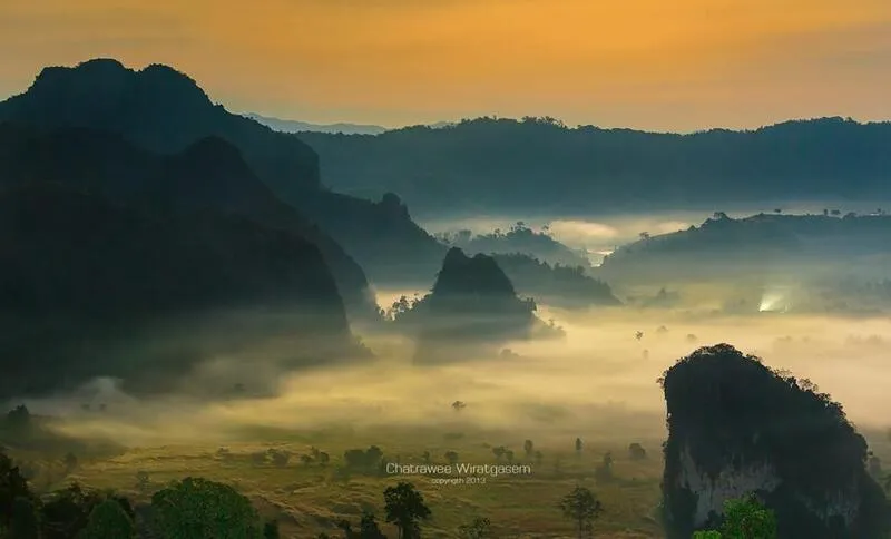
36. Phu Langka Forest Park is located in Pha Chang Noi Subdistrict, Pong District, Phayao Province. This mountain conservation area is known for seas of mist, evergreen forests, and cool weather. Its rugged landscape offers expansive views of ridges and valleys, making it an important winter destination for nature enthusiasts.
Highlights: Sea-of-mist viewpoints, layered mountain ranges, montane evergreen forests, highland plants, and cool mountain weather.
Phu Langka protects an important mountain ecosystem in which vegetation has adapted to highland conditions. Moist forests contribute to the cool atmosphere, while winter is a particularly popular season for sunrise photography and mist-filled valleys.
When humidity is favorable, mist settles into the valleys, leaving mountain peaks emerging above the cloud layer. This distinctive scene attracts photographers from different parts of Thailand. Even on clear days, the forested ridges offer beautiful scenery.
A visit can be combined with the communities of Pha Chang Noi Subdistrict and mountain routes around Pong District. Travelers should remain on officially open trails and follow the instructions of park staff to protect sensitive habitats.
The forest park is suitable for nature lovers and photographers seeking quiet highland scenery. Allow enough time for winding roads and early morning travel if planning to view the sunrise.
Open Days: Daily. Opening Hours: 05:00–18:00.
Getting There: Travel from Phayao city toward Pong District and continue to Pha Chang Noi Subdistrict. Follow the signs to Phu Langka Forest Park and take care on steep mountain roads.
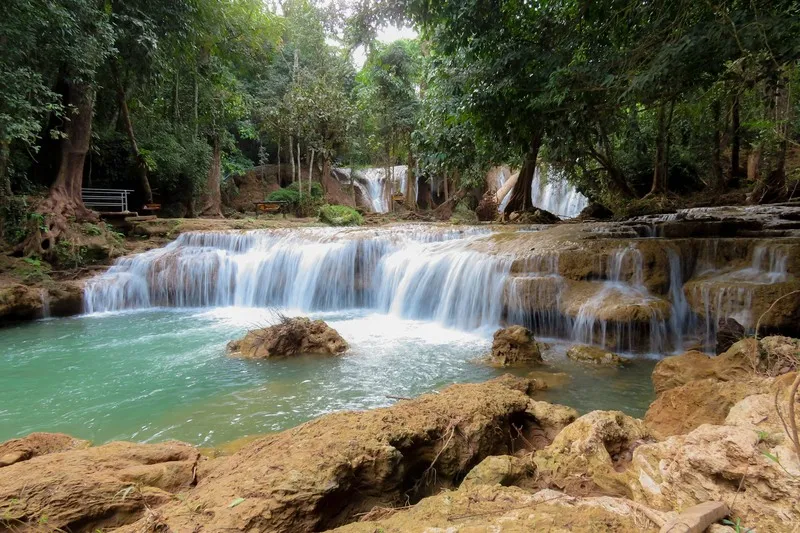
37. Doi Phu Nang National Park covers parts of Chiang Muan, Pong, and Dok Khamtai districts in Phayao Province. The park protects important forest ecosystems and wildlife habitats across mountains, woodlands, and streams. It is particularly known for its population of green peafowl and natural attractions suited to peaceful outdoor recreation.
Highlights: Green peafowl, Than Sawan Waterfall, mixed deciduous forest, dry dipterocarp forest, and ecological learning.
The park supports several forest types, particularly mixed deciduous and dry dipterocarp woodland that provide habitats for wildlife. Green peafowl are among its most notable animals, although sightings depend on natural behavior and environmental conditions.
Than Sawan Waterfall is another attraction, offering a forest setting for nature walks and relaxation. Visitors should check water conditions and current access rules before approaching streams or participating in activities near the waterfall.
A visit provides opportunities to learn about mountain forests and wildlife conservation. Avoid feeding animals, keep noise to a minimum, and follow ranger instructions, particularly when observing birds or other wildlife.
The park suits families, nature lovers, and travelers more interested in ecological exploration than sea-of-mist viewpoints. It can be combined with other natural attractions in Chiang Muan and Pong districts.
Open Days: Daily. Opening Hours: 08:00–16:30.
Getting There: Travel from Phayao city toward Chiang Muan District and follow signs into the national park. Check your intended visitor center or attraction because the park extends across several districts.

38. Phu Langka Fin Jaboh is located in Pha Chang Noi Subdistrict, Pong District, Phayao Province. This mountain attraction is known for viewpoints and morning mist in a landscape connected to the Phu Langka mountain range.
Highlights: Phu Langka viewpoints, seas of mist, sunrise scenery, ridgelines, and panoramic mountain photography.
The destination is appealing for its elevated views. Under suitable morning conditions, mist fills the valleys, leaving mountain ridges visible above the clouds and creating the distinctive scenery associated with Pong District.
The surrounding landscape includes forests, ridges, and highland communities. Sunrise provides soft light for photography, while clearer conditions later in the morning reveal more detail across the mountains and valleys.
Visitors should remain on designated paths, protect the environment, and avoid disturbing local residents. Anyone planning a pre-dawn visit should bring warm clothing and make appropriate arrangements for traveling in darkness.
Phu Langka Fin Jaboh suits couples, groups of friends, and landscape photographers. It can be combined with Phu Langka Forest Park and other attractions in Pong District. Overnight accommodation nearby may make sunrise visits more convenient.
Open Days: Daily. Opening Hours: 08:00–17:00.
Getting There: Travel from Phayao city toward Pong District and Pha Chang Noi Subdistrict, then follow the GPS route to Phu Langka Fin Jaboh. Check road and parking conditions before departure.
Map (GPS):Open Google Maps – Phu Langka Fin Jaboh

39. Phu Sang National Park is located in Phayao Province, with important visitor attractions in Phu Sang District. The park is particularly known for a naturally warm waterfall and mountain forest ecosystems. The unusual water temperature makes Phu Sang Waterfall different from many other waterfalls in Thailand.
Highlights: Naturally warm Phu Sang Waterfall, mountain forests, natural water sources, and ecological sightseeing.
Phu Sang Waterfall is the park's main attraction. Its water is warmer than that of typical waterfalls because of the local natural water source. Surrounded by trees and mountain terrain, the waterfall provides a distinctive combination of forest and freshwater scenery.
The park also protects watershed forests and habitats for various native plants and wildlife. Walking around the waterfall offers opportunities to relax while learning about the relationship between forest ecosystems and natural water systems.
Cool winter weather is suitable for outdoor sightseeing. Visitors should follow safety signs near the waterfall because wet rocks and streamside surfaces can be slippery, especially after rain.
Phu Sang National Park is suitable for families, older travelers, and visitors interested in accessible natural attractions rather than demanding mountain treks. It can be combined with other destinations around Phu Sang District.
Open Days: Daily. Opening Hours: 08:30–18:00.
Getting There: From Phayao city, travel toward Phu Sang District and follow the signs to Phu Sang National Park. Private vehicles can reach designated visitor areas and accessible waterfall attractions.

40. Huai Chomphu–Pha Thewada Reservoir is described in the original article as being in San Khong Subdistrict, Dok Khamtai District, Phayao Province. It is a natural recreation area with a reservoir surrounded by mountains and forests, while the nearby Pha Thewada rock landscape adds interest to the scenery.
Highlights: A reservoir amid mountains, Pha Thewada rock scenery, forest views, natural water landscapes, and opportunities for relaxation and nature observation.
The reservoir is surrounded by mountains and woodland, creating a quiet setting for sightseeing. When the wind is calm, the water reflects nearby trees and ridges, making the area attractive for morning and late-afternoon photography.
Pha Thewada adds another distinctive landscape feature through its rock formations and cliff terrain. Visitors exploring steep natural areas should check which routes are open and seek guidance when appropriate.
The area illustrates the connection between mountains, forests, and water resources. Travelers should keep the reservoir clean, avoid dumping rubbish, and refrain from activities that disturb wildlife or damage vegetation.
This destination suits travelers seeking quiet scenery without climbing a high summit. Anyone interested in hiking or adventure activities near Pha Thewada should coordinate with the responsible land manager beforehand.
Getting There: From Phayao city, travel toward Dok Khamtai District and San Khong Subdistrict, then follow local roads toward Huai Chomphu–Pha Thewada Reservoir using the GPS reference.

41. Khao Kho Sea of Mist is located in Khao Kho District, Phetchabun Province. It is one of Thailand's popular highland destinations for mist-filled valleys and layered mountain scenery. The combination of ridges and lower valleys can create the appearance of a white sea of clouds when humidity and weather conditions are favorable.
Highlights: Morning seas of mist, sunrise scenery, mountain panoramas, viewpoints around Khao Kho, and a relaxing highland atmosphere.
Khao Kho consists of hills and valleys at varying elevations. Humidity and changes in temperature can cause mist to form in the valleys, especially during suitable morning conditions. The sight of clouds between mountain ridges is one of the area's most appealing natural experiences.
Khao Kho offers more than mist viewing. Its terrain is ideal for scenic drives and relaxation, with several viewpoints where visitors can admire mountains and changing skies throughout the day. Even when no sea of mist appears, the landscape remains attractive.
Winter visitors should prepare warm clothing, particularly when setting out before sunrise. Dense fog can reduce road visibility, making careful driving and realistic travel schedules essential.
Khao Kho suits couples, families, friends, and photographers. It can be combined with Phu Thap Boek, Thung Salaeng Luang National Park, and other attractions in Phetchabun, preferably by grouping nearby areas rather than repeatedly driving between distant locations.
Getting There: Travel from Phetchabun city toward Khao Kho District and continue to the chosen viewpoint using the GPS reference. Check road conditions and use safe parking areas, especially before dawn.
Map (GPS):Open Google Maps – Khao Kho Sea of Mist

42. Phu Kho Viewpoint is located in Nam Nao District, Phetchabun Province, along Highway 12 between Lom Sak and Chum Phae. The mountain viewpoint is known for broad scenery and a cool highland atmosphere, especially at sunrise on clear mornings.
Highlights: Sunrise views, distant scenery toward Phu Kradueng and Phu Pha Chit, layered mountain ranges, and a roadside viewpoint along Highway 12.
Phu Kho is a convenient place to stop while traveling along Highway 12 through the mountains between Phetchabun and northeastern Thailand. Its elevated position offers wide views of mountains and valleys, particularly on clear days.
Early morning is popular for sunrise photography because low sunlight creates contrasting colors and shadows across the mountains. Mist may appear in suitable conditions, while clearer weather reveals the shapes of distant peaks.
The location is ideal for travelers driving between provinces who want to stop and enjoy the scenery. Vehicles should be parked only in designated areas, and visitors should take care near roads and steep slopes.
Phu Kho Viewpoint suits families, couples, and photographers. It can be combined with Nam Nao National Park and other attractions around Nam Nao District without requiring a long trek.
Getting There: Follow Highway 12 on the Lom Sak–Chum Phae route toward Nam Nao District. The viewpoint is near kilometer marker 46. Watch for road signs and park safely.
Map (GPS):Open Google Maps – Phu Kho Viewpoint
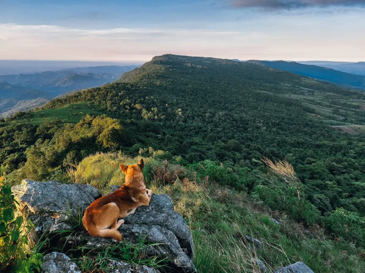
43. Doi Tang Peng is a mountain attraction in Phetchabun Province recognized for ridge scenery and a peaceful highland atmosphere. The area is associated with the mountain landscapes around Khao Kho and the routes extending toward Phu Thap Boek, making it appealing to visitors who enjoy scenic drives.
Highlights: Layered mountain landscapes, possible seas of mist, cool weather, and scenic highland routes.
Doi Tang Peng features elevated hills and ridges with broad views of the surrounding terrain. Mist may gather in the valleys on favorable mornings, creating layers of scenery, while clear weather reveals ridgelines and forested hills.
The area is suitable for visitors looking for mountain scenery away from the busiest attractions. Travelers can enjoy sightseeing and photography but should park safely and avoid obstructing roads.
During winter, temperatures may be low before sunrise and in the evening. Bring warm clothing and take care on winding roads, particularly when dense fog reduces visibility.
Doi Tang Peng is suitable for nature enthusiasts and landscape photographers. It can be included in a trip through Khao Kho and Phu Thap Boek, with sufficient time allowed at each stop.
Getting There: From Phetchabun city or Lom Sak District, travel toward the Khao Kho area and continue to Doi Tang Peng using the GPS reference. Check the final route before departure.
Map (GPS):Open Google Maps – Doi Tang Peng

44. Nam Nao National Park is located in Phetchabun Province and extends into areas connected with Chaiyaphum Province. It is an important conservation area for forests and mountain ecosystems, including pine woodland, evergreen forests, and mixed deciduous forests that provide habitats for diverse wildlife. Winter temperatures can be pleasantly cool, making the park attractive for natural recreation.
Highlights: Natural pine forests, nature trails, sunrise and sunset viewpoints, mountain scenery, and forest ecology.
The park protects extensive mountain forests with vegetation that varies according to elevation and local conditions. Pine forests are particularly distinctive, creating appealing scenery when morning sunlight filters through trees and occasional mist.
Several nature trails and visitor attractions offer opportunities to learn about mountain forest ecosystems. Travelers can observe native plants, woodland environments, and signs of wildlife on approved paths. Park regulations should always be followed.
The cool season is popular for enjoying fresh air and forest surroundings. Families may choose short nature walks or viewpoints, while experienced hikers should confirm requirements for longer routes.
Nam Nao National Park is also part of a scenic travel corridor between Phetchabun and northeastern Thailand. It can be combined with Phu Kho Viewpoint and other attractions around Nam Nao District.
Open Days: Daily. Opening Hours: 06:00–18:00.
Getting There: Travel from Phetchabun toward Lom Sak District, then take Highway 12 toward Nam Nao District and follow signs to the park entrance.
Map (GPS):Open Google Maps – Nam Nao National Park

45. Tat Mok National Park is located in Na Pa Subdistrict, Mueang Phetchabun District, Phetchabun Province. This protected natural area is distinguished by mountains, forests, and waterfalls within the woodland. It appeals to visitors interested in nature trails and mountain ecosystems.
Highlights: Tat Mok Waterfall, Song Nang Waterfall, mountain forests, nature trails, and natural scenery in Phetchabun.
The park's rugged terrain contains streams and waterfalls, with Tat Mok Waterfall among its principal attractions. Water cascading over high rock formations amid surrounding forests creates a moist and shaded environment.
Walking trails toward the waterfalls offer opportunities to observe mountain vegetation and streamside ecosystems. Visitors should bring footwear suitable for rocky and uneven ground and follow ranger instructions.
Winter weather is often pleasant for walking, although waterfall flow may differ from the rainy season. Check trail conditions and opening arrangements because some natural routes may be subject to safety restrictions.
Tat Mok National Park is suitable for hikers, nature enthusiasts, and groups interested in outdoor recreation. A visit can be combined with attractions around Mueang Phetchabun District, allowing time for walking and rest.
Getting There: From Phetchabun city, travel toward Na Pa Subdistrict and follow the signs to Tat Mok National Park. Contact park staff for information about waterfall trails and current access.
Map (GPS):Open Google Maps – Tat Mok National Park

46. Thung Salaeng Luang National Park (Nong Mae Na) is located in Nong Mae Na Subdistrict, Khao Kho District, Phetchabun Province. It forms part of Thung Salaeng Luang National Park, an area known for broad grasslands, pine forests, and landscapes resembling savanna. The destination is particularly attractive to travelers seeking open natural scenery during winter.
Highlights: Savanna-like grasslands, Thung Salaeng Luang plains, natural pine forests, mountain views, and the natural atmosphere of Nong Mae Na.
The national park is characterized by expansive grasslands surrounded by forests and mountains. Nong Mae Na is among the popular access areas for visitors who want to see this landscape, which differs from the dense mountain forests found elsewhere in the region.
Winter brings cooler air and breezes across open grasslands. Visitors can admire the scenery and learn about grassland ecosystems, which support wildlife and biodiversity. Stay on approved roads and avoid driving across protected vegetation.
The park is valuable for conservation because it provides habitats for many native plants and animals. Visitors should minimize noise, avoid disturbing wildlife, and leave all natural resources untouched.
Thung Salaeng Luang is suitable for nature enthusiasts, photographers, and travelers who enjoy pine forests and grassland scenery. It can be combined with Khao Kho and other attractions in Phetchabun Province.
Open Days: Daily. Opening Hours: 06:00–18:00.
Getting There: From Khao Kho District, travel toward Nong Mae Na Subdistrict and continue into Thung Salaeng Luang National Park along designated roads. Check visitor access points and road conditions before departure.
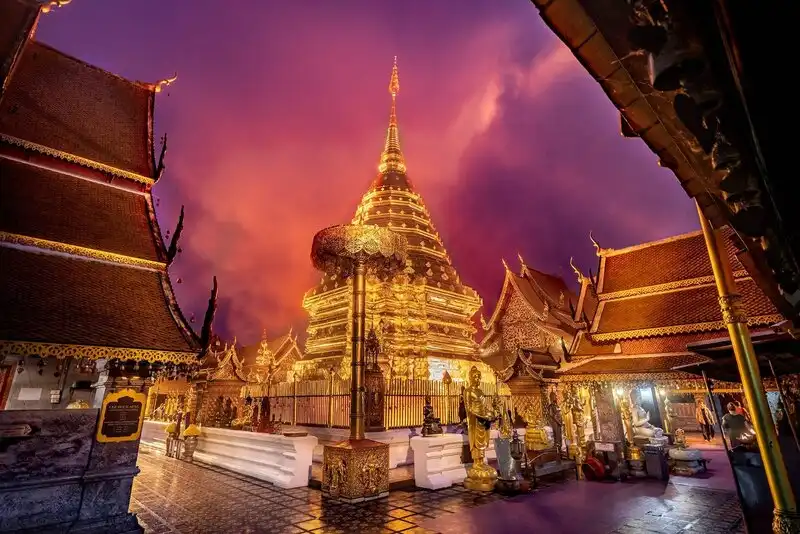
47. Wat Phra That Doi Suthep is located on Doi Suthep in Suthep Subdistrict, Mueang Chiang Mai District. It is one of Northern Thailand's most important Buddhist temples and a spiritual landmark of Lanna culture. Its elevated position also offers views of Chiang Mai city, making it a destination combining history, religion, architecture, and nature.
Highlights: The golden Doi Suthep chedi, Lanna architecture, the Naga staircase, views over Chiang Mai city, and the atmosphere of a mountaintop temple.
Wat Phra That Doi Suthep is deeply connected to the history and religious beliefs of the Lanna people. It enshrines Buddhist relics and has been an important pilgrimage destination for generations. The golden chedi and artistic details reflect the distinctive architecture of Northern Thailand.
Visitors can reach the temple area via the famous Naga staircase, one of its most recognizable features. Once inside, they can pay respects at the sacred relic shrine, appreciate the architecture, and enjoy views over Chiang Mai.
Winter mornings are often cooler and quieter than the city below. Visitors should dress respectfully, remove shoes where required, and avoid disturbing worshippers during religious activities.
The temple is suitable for families, older travelers, cultural tourists, and first-time visitors to Chiang Mai. It can be combined with Doi Suthep–Pui National Park and nearby city attractions in a single day.
Open Days: Daily. Opening Hours: 05:00–19:30.
Getting There: From Chiang Mai city, follow Huay Kaew Road toward Doi Suthep and ascend the mountain road to the temple. Private vehicles and local transport services are available on the route.
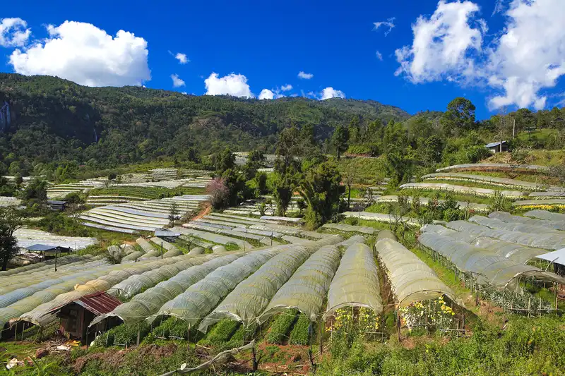
48. The Royal Agricultural Station Inthanon is located near Ban Khun Klang, Ban Luang Subdistrict, Chom Thong District, Chiang Mai Province. It is an important highland agricultural development center operating under the Royal Project approach, supporting research and the cultivation of cool-climate crops suited to Doi Inthanon's geography and weather. The station is also a popular winter agricultural tourism destination.
Highlights: Cool-climate flower gardens, experimental crop plots, highland vegetables and flowers, Doi Inthanon scenery, and educational activities related to Royal Project agriculture.
The station demonstrates the importance of agricultural development in Northern Thailand's mountains. Its activities involve research, local livelihood support, and appropriate natural resource management, helping communities cultivate crops suited to cool highland conditions.
Visitors can explore gardens and cultivation areas that are open to the public. Winter is particularly attractive because certain cool-climate plants thrive in the conditions. The experience offers an opportunity to appreciate flower varieties, agricultural products, and adaptation to mountain environments.
The station appeals to visitors interested in flower photography and agricultural landscapes. Mountain surroundings and cool weather add to its appeal, although displays and activities may change according to seasons and operational needs.
It is suitable for families, students, and travelers interested in agricultural education. The station can be visited together with Doi Inthanon National Park and other attractions around Chom Thong District.
Open Days: Daily. Opening Hours: Generally 08:30–16:30.
Getting There: From Chiang Mai city, take Highway 108 toward Chom Thong, then Highway 1009 up Doi Inthanon. Continue to Ban Khun Klang and follow the signs to the Royal Agricultural Station Inthanon.

49. Wat Phra That Doi Saket is located in Choeng Doi Subdistrict, Doi Saket District, Chiang Mai Province. This important hilltop temple is distinguished by Lanna art and views of the Doi Saket area. Its elevated setting combines Buddhist cultural heritage with peaceful natural scenery.
Highlights: The Doi Saket relic shrine, Lanna architecture, views over Doi Saket District, and the atmosphere of a hilltop Buddhist temple.
The temple is important to the religious and cultural life of the local community, with its sacred chedi serving as a focus of devotion. Its architecture and artistic details reflect Northern Thai traditions and their connection to local history.
Visitors can enjoy the tranquil hilltop atmosphere while paying respects at the temple. Designated viewing areas also provide perspectives across Doi Saket and its surroundings.
Cool-season weather is generally pleasant for walking around the temple and photographing its architecture. Visitors should dress respectfully, keep noise to a minimum, and follow temple rules, especially during religious ceremonies.
Wat Phra That Doi Saket is suitable for families, older visitors, and travelers interested in Lanna heritage. It can be included in an itinerary exploring Doi Saket District and eastern Chiang Mai.
Open Days: Daily. Opening Hours: 06:00–18:00.
Getting There: From Chiang Mai city, take Highway 118 toward Doi Saket District, then continue to Choeng Doi Subdistrict and follow the signs to Wat Phra That Doi Saket.
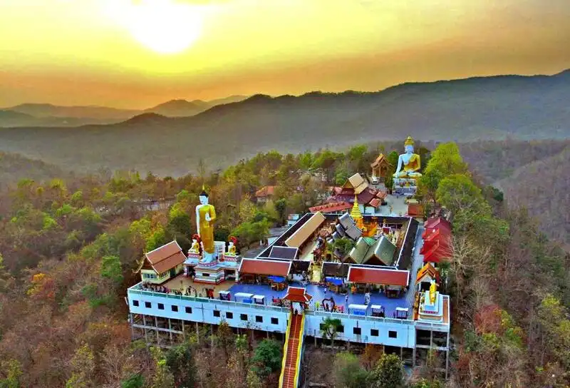
50. Wat Phra That Doi Kham is located in Mae Hia Subdistrict, Mueang Chiang Mai District. This important hilltop temple is famous for its religious significance and elevated views of Chiang Mai. It is a popular destination combining Lanna cultural heritage, Buddhist devotion, and mountain scenery.
Highlights: Doi Kham relic shrine, Luang Pho Than Jai Buddha image, Lanna architecture, city viewpoints, and a peaceful temple setting.
Wat Phra That Doi Kham is an important place of worship for Chiang Mai residents and visitors. Its relic shrine and Luang Pho Than Jai attract devotees, while the architecture reflects distinctive elements of Lanna artistic and religious traditions.
The temple's hillside location provides views over Chiang Mai and surrounding areas. Travelers can walk around the temple, pay respects at sacred shrines, and enjoy a more peaceful atmosphere than in the city below, particularly during cool mornings.
Visitors should dress modestly, respect the religious environment, and follow temple regulations. During busy periods, avoid obstructing walkways or areas used for prayers and ceremonies.
The temple suits families, older visitors, and travelers interested in Chiang Mai's Buddhist heritage. It can easily be combined with attractions south of the city without requiring a lengthy high-mountain drive.
Open Days: Daily. Opening Hours: 06:00–18:00.
Getting There: From Chiang Mai city, travel toward Mae Hia Subdistrict and follow the road signs to Wat Phra That Doi Kham. Private cars and local taxi services can be used.
Summary Table: 50 Best Mountain Destinations in Northern Thailand for Winter
| Article Title | 50 Best Mountain Destinations in Northern Thailand for Winter |
| Travel Regions | Chiang Mai, Chiang Rai, Nan, Mae Hong Son, Phayao, and Phetchabun provinces |
| Main Attractions | High mountains, seas of mist, sunrise viewpoints, evergreen forests, pine forests, summit grasslands, winter flower gardens, tea and coffee plantations, highland communities, national parks, and hilltop temples |
| Recommended Travel Season | November–February for cool-season travel, depending on local weather and seasonal attractions |
| Chiang Mai Destinations | 1. Doi Inthanon National Park 2. Doi Ang Khang 3. Doi Chiang Dao 4. Doi Mon Jam 5. Doi Pha Hom Pok National Park 6. Doi Mon Chong 7. Doi Suthep–Pui National Park 8. Doi Mon Ngo 9. Doi Mon Long 10. Hadu Bi Viewpoint 11. Mon Ngo Royal Project Development Center 12. Wat Phra That Doi Suthep 13. The Royal Agricultural Station Inthanon 14. Wat Phra That Doi Saket 15. Wat Phra That Doi Kham |
| Chiang Rai Destinations | 1. Phu Chi Fa Forest Park 2. Doi Mae Salong 3. Doi Pha Hee 4. Doi Chang 5. Phu Fa Thai 6. Phaya Phi Phak Forest Park 7. Doi Bo Royal Initiative Project |
| Nan Destinations | 1. Si Nan National Park 2. Doi Phu Kha National Park 3. Doi Tee Duu 4. Doi Suan Ya Luang 5. Tham Pha Tub Forest Park 6. Doi Phu Wae Fossil Shell Site |
| Mae Hong Son Destinations | 1. Huai Nam Dang National Park 2. Pang Ung 3. Bua Tong Fields at Doi Mae U Kho 4. Doi Kiew Lom 5. Doi Pui Luang 6. Doi Pui Ko 7. Tung Bua Tong Doi Mae Ho 8. Yun Lai Viewpoint 9. Ban Yot Doi 10. Tham Pla–Pha Suea National Park |
| Phayao Destinations | 1. Phu Langka Forest Park 2. Doi Phu Nang National Park 3. Phu Langka Fin Jaboh 4. Phu Sang National Park 5. Huai Chomphu–Pha Thewada Reservoir |
| Phetchabun Destinations | 1. Phu Thap Boek 2. Khao Kho Sea of Mist 3. Phu Kho Viewpoint 4. Doi Tang Peng 5. Nam Nao National Park 6. Tat Mok National Park 7. Thung Salaeng Luang National Park (Nong Mae Na) |
| Popular Sea-of-Mist Viewpoints | 1. Phu Chi Fa, Chiang Rai 2. Doi Mon Ngo, Chiang Mai 3. Doi Samer Dao in Si Nan National Park, Nan 4. Huai Nam Dang, Chiang Mai–Mae Hong Son 5. Yun Lai Viewpoint, Mae Hong Son 6. Phu Langka, Phayao 7. Khao Kho, Phetchabun 8. Phu Thap Boek, Phetchabun |
| Suitable for Families with Children | 1. Doi Mon Jam, Chiang Mai 2. Wat Phra That Doi Suthep, Chiang Mai 3. The Royal Agricultural Station Inthanon, Chiang Mai 4. Pang Ung, Mae Hong Son 5. Phu Sang National Park, Phayao 6. Khao Kho, Phetchabun |
| Suitable for Trekking Enthusiasts | 1. Doi Chiang Dao, Chiang Mai 2. Doi Mon Chong, Chiang Mai 3. Doi Pha Hom Pok National Park, Chiang Mai 4. Doi Pui Ko, Mae Hong Son 5. Doi Phu Kha National Park, Nan 6. Tat Mok National Park, Phetchabun 7. Nam Nao National Park, Phetchabun Some trails require authorization or an approved guide. |
| Culture and Community Experiences | 1. Doi Mae Salong, Chiang Rai 2. Doi Pha Hee, Chiang Rai 3. Doi Chang, Chiang Rai 4. Ban Yot Doi, Mae Hong Son 5. Wat Phra That Doi Suthep, Chiang Mai 6. Wat Phra That Doi Kham, Chiang Mai 7. Wat Phra That Doi Saket, Chiang Mai |
| Winter Flower Destinations | 1. Doi Ang Khang, Chiang Mai 2. The Royal Agricultural Station Inthanon, Chiang Mai 3. Bua Tong Fields at Doi Mae U Kho, Mae Hong Son 4. Tung Bua Tong Doi Mae Ho, Mae Hong Son Check actual blooming conditions before traveling. |
| Highland Agricultural Learning | 1. Doi Ang Khang, Chiang Mai 2. The Royal Agricultural Station Inthanon, Chiang Mai 3. Mon Ngo Royal Project Development Center, Chiang Mai 4. Doi Chang, Chiang Rai 5. Doi Pha Hee, Chiang Rai 6. Doi Mae Salong, Chiang Rai |
| Local Food and Products | 1. Northern Thai dishes such as nam prik num, sai ua, and gaeng hang lay 2. Chinese-Yunnanese cuisine in Doi Mae Salong and Santichon Village 3. Tea and tea products from Doi Mae Salong 4. Arabica coffee from Doi Chang and Doi Pha Hee 5. Handwoven textiles and handicrafts from highland communities 6. Seasonal cool-climate agricultural produce |
| Recommended Accommodation Areas | 1. Chiang Mai city — suitable for Doi Suthep and day trips 2. Mae Rim–Mae Taeng — suitable for Mon Jam and nearby mountains 3. Fang — suitable for Doi Ang Khang and Doi Pha Hom Pok 4. Chiang Rai city–Mae Chan — suitable for Doi Mae Salong and northern highlands 5. Pua–Bo Kluea — suitable for Doi Phu Kha 6. Pai — suitable for Yun Lai, Huai Nam Dang, and Doi Kiew Lom 7. Mae Hong Son town — suitable for Pang Ung and Tham Pla–Pha Suea 8. Pong District — suitable for Phu Langka 9. Khao Kho — suitable for sea-of-mist trips in Phetchabun |
| Recommended Transportation | A private car or rental vehicle offers the greatest flexibility, provided it and its driver are suited to mountain roads. Some places require local transport, walking, or advance permission from the responsible authorities. |
| What to Bring | Warm clothing, sturdy footwear, a flashlight, drinking water, personal medication, communications equipment, offline maps, and information about rest stops. |
| Safety Considerations | Dense fog, steep roads, winding mountain routes, cold temperatures before sunrise, protected-area entry restrictions, and different opening arrangements at individual sites. |
| Responsible Tourism | Do not litter, leave designated trails, remove natural resources, disturb wildlife, or disrespect local traditions. Follow conservation regulations and support local communities responsibly. |
Suggested Northern Thailand Mountain Itineraries: 1–7 Days
| 1 Day — Chiang Mai: Doi Suthep and Lanna Culture | 1. Morning — Visit Wat Phra That Doi Suthep 2. Late morning — Explore accessible natural attractions in Doi Suthep–Pui National Park 3. Afternoon — Return to Chiang Mai city and relax |
| 1 Day — Chiang Mai: Doi Inthanon | 1. Early morning — Leave Chiang Mai for Doi Inthanon 2. Morning — Visit Thailand's highest summit and approved nature trails 3. Afternoon — Explore the Royal Agricultural Station Inthanon 4. Evening — Return to Chom Thong or Chiang Mai |
| 1 Day — Chiang Rai: Doi Mae Salong Culture | 1. Morning — Travel from Chiang Rai to Doi Mae Salong 2. Late morning — Enjoy tea plantation scenery and the local community 3. Afternoon — Taste tea and traditional food 4. Evening — Return to Chiang Rai |
| 1 Day — Phetchabun: Khao Kho | 1. Morning — Look for a sea of mist at Khao Kho 2. Late morning — Enjoy a scenic drive through the district 3. Afternoon — Visit nearby natural attractions that are open to visitors 4. Evening — Relax in Khao Kho |
| 2 Days, 1 Night — Chiang Mai: Mae Rim and Mae Taeng | 1. Day 1 — Visit Doi Mon Jam and other attractions around Mae Rim; stay overnight in the Mae Rim–Mae Taeng area 2. Day 2 — Explore Doi Mon Ngo or Mon Ngo Royal Project Development Center before returning to Chiang Mai |
| 2 Days, 1 Night — Phayao: Phu Langka | 1. Day 1 — Travel to Pong District and Pha Chang Noi Subdistrict, enjoy Phu Langka viewpoints, and stay nearby 2. Day 2 — Watch the morning mist from an accessible viewpoint, then return |
| 3 Days, 2 Nights — Chiang Mai: Doi Inthanon and Nature | 1. Day 1 — Travel to Chom Thong District and stay overnight 2. Day 2 — Explore Doi Inthanon National Park, viewpoints, and approved nature trails 3. Day 3 — Visit the Royal Agricultural Station Inthanon before returning to Chiang Mai |
| 3 Days, 2 Nights — Nan: Pua and Doi Phu Kha | 1. Day 1 — Travel from Nan city to Pua District and stay overnight 2. Day 2 — Visit Doi Phu Kha National Park and viewpoints along Highway 1256; stay in Pua or Bo Kluea 3. Day 3 — Enjoy local community scenery on the return journey to Nan |
| 3 Days, 2 Nights — Mae Hong Son: Pai and Huai Nam Dang | 1. Day 1 — Travel from Chiang Mai through Huai Nam Dang National Park to Pai; stay overnight 2. Day 2 — Watch the morning mist at Yun Lai Viewpoint, then explore Santichon Village and Pai 3. Day 3 — Return to Chiang Mai by the same route |
| 4 Days, 3 Nights — Chiang Rai: Phu Chi Fa and Doi Mae Salong | 1. Day 1 — Travel from Chiang Rai city to the Phu Chi Fa area and stay overnight 2. Day 2 — Watch the sunrise at Phu Chi Fa, then return to Chiang Rai city 3. Day 3 — Travel to Doi Mae Salong, visit tea plantations, and stay overnight 4. Day 4 — Return to Chiang Rai with scenic stops along the way |
| 4 Days, 3 Nights — Mae Hong Son: Pai, Pang Mapha, and Mae Hong Son Town | 1. Day 1 — Travel from Chiang Mai to Pai and stay overnight 2. Day 2 — Visit Yun Lai Viewpoint and Doi Kiew Lom, then continue to Mae Hong Son town 3. Day 3 — Explore Pang Ung and Tham Pla–Pha Suea National Park, then stay in Mae Hong Son town 4. Day 4 — Return with sufficient time for mountain roads |
| 5 Days, 4 Nights — Nan: Nan Town, Pua, and Si Nan National Park | 1. Day 1 — Arrive in Nan city and stay overnight 2. Day 2 — Visit Tham Pha Tub Forest Park, then continue to Pua 3. Day 3 — Explore Doi Phu Kha National Park and the Pua–Bo Kluea route 4. Day 4 — Return through Nan city toward Na Noi District and stay overnight 5. Day 5 — Visit scenic areas in Si Nan National Park before departing |
| 5 Days, 4 Nights — Phetchabun: Khao Kho, Phu Thap Boek, and Nam Nao | 1. Day 1 — Arrive in Khao Kho and stay overnight 2. Day 2 — Enjoy Khao Kho viewpoints and Thung Salaeng Luang National Park 3. Day 3 — Travel to Phu Thap Boek and admire the mountain landscape 4. Day 4 — Travel from the Lom Sak area toward Nam Nao and Phu Kho Viewpoint 5. Day 5 — Explore accessible attractions in Nam Nao National Park before returning |
| 6–7 Days — Chiang Mai and Mae Hong Son | 1. Day 1 — Explore Chiang Mai and Wat Phra That Doi Suthep 2. Day 2 — Travel from Chiang Mai through Mae Taeng and Huai Nam Dang to Pai 3. Day 3 — Visit Yun Lai Viewpoint and explore Pai 4. Day 4 — Travel through Doi Kiew Lom and Pang Mapha to Mae Hong Son town 5. Day 5 — Visit Pang Ung and Tham Pla–Pha Suea National Park 6. Day 6 — Travel from Mae Hong Son toward Mae Sariang, stopping at seasonal attractions 7. Day 7 — Return to Chiang Mai via Hot District |
Frequently Asked Questions (FAQ)
Q: What is the best month to visit the mountains of Northern Thailand?
A: November through February is generally the most popular period because of the cooler weather and pleasant mountain scenery. The ideal time varies according to elevation, local conditions, and the type of attraction, especially seasonal flower fields.
Q: Where are the best places to see a sea of mist in Northern Thailand?
A: Popular locations include Phu Chi Fa in Chiang Rai, Doi Samer Dao in Nan, Huai Nam Dang and Yun Lai Viewpoint in Mae Hong Son, Phu Langka in Phayao, and Khao Kho and Phu Thap Boek in Phetchabun. Seas of mist depend on humidity, wind, temperature, and daily weather conditions.
Q: Where should first-time visitors start a Northern Thailand mountain trip?
A: Travelers based in Chiang Mai can begin with Doi Suthep, Doi Mon Jam, or Doi Inthanon, depending on their available time. From Chiang Rai, Doi Mae Salong is an attractive choice. Visitors in Phetchabun can begin with Khao Kho, which offers several scenic attractions and places to relax.
Q: Which mountain destination is best for a one-day trip?
A: Choose a destination within a reasonable driving distance of your accommodation. Examples include Wat Phra That Doi Suthep and Doi Suthep–Pui National Park from Chiang Mai city, or Khao Kho for travelers staying in Phetchabun. Focusing on one or two major stops helps avoid rushing along mountain roads.
Q: What is the difference between Doi Inthanon and Doi Ang Khang?
A: Doi Inthanon is known for Thailand's highest summit, evergreen mountain forests, and nature trails. Doi Ang Khang is best known for its agricultural station, cool-climate crops, flower gardens, and highland communities. Both are excellent winter destinations but offer different experiences.
Q: Which Northern Thailand mountain destinations are suitable for families with young children?
A: Consider Doi Mon Jam, Wat Phra That Doi Suthep, the Royal Agricultural Station Inthanon, Pang Ung, and Phu Sang National Park. Choose accessible viewpoints and routes appropriate for the children's ages and abilities.
Q: Can older travelers enjoy mountain attractions in Northern Thailand?
A: Yes. Accessible destinations such as Wat Phra That Doi Suthep, Doi Mon Jam, Khao Kho, and natural attractions with established visitor facilities can be suitable. Avoid steep terrain and demanding treks when these are not appropriate for individual fitness and mobility.
Q: Which mountains are recommended for trekking enthusiasts?
A: Doi Chiang Dao, Doi Mon Chong, Doi Pha Hom Pok, and Doi Pui Ko are attractive options. However, some routes require booking, permits, designated visiting seasons, or authorized guides. Always confirm current regulations before traveling.
Q: Is it possible to visit mountain destinations without a private car?
A: Some destinations are accessible by taking public transport to a nearby city or district and continuing with local vehicles, hired drivers, or guided tours. Many mountain viewpoints have no direct public transport, so advance planning is important.
Q: Where can visitors explore tea and coffee plantations in the mountains?
A: Doi Mae Salong in Chiang Rai is well known for tea plantations and Chinese-Yunnanese culture. Doi Chang and Doi Pha Hee are important highland coffee destinations where visitors can learn about local production and buy community products at locations open to the public.
Q: What should travelers pack for a winter mountain trip?
A: Bring warm clothing, sturdy shoes, a flashlight, drinking water, personal medication, communications equipment, and backup route information. Drivers should inspect brakes, tires, and lights before using steep or foggy mountain roads.
Q: Where can travelers see winter flowers in Northern Thailand?
A: Doi Ang Khang and the Royal Agricultural Station Inthanon in Chiang Mai are known for cool-climate flowers. Doi Mae U Kho and Doi Mae Ho in Mae Hong Son are known for seasonal Bua Tong fields. Always check flowering conditions before departure.
Q: Which province is best for a three-day, two-night mountain trip?
A: Chiang Mai is suitable for Doi Inthanon or the Mae Rim–Mae Taeng routes. Nan is ideal for Pua and Doi Phu Kha, while Mae Hong Son offers Pai and Huai Nam Dang. Concentrating on one geographic area usually allows more sightseeing time.
Q: What safety precautions are important when traveling in the mountains during winter?
A: Watch for very cold temperatures at higher elevations, dense fog, steep roads, and winding mountain routes. Some national parks and wildlife sanctuaries also restrict entry. Check the latest official announcements and follow ranger instructions.
Q: How can travelers protect nature and support mountain communities?
A: Stay on designated trails, take all rubbish away, avoid collecting plants or rocks, do not disturb wildlife, and ask permission before photographing residents. Supporting local products and services also helps make tourism more beneficial to nearby communities.
 Category: ●Travel Articles, Recipes
 Group: ●Travel Review, Food Review
Last Update : 2 WeekAgo
 Last Update : 2 WeekAgo
Recommend

 Art, Culture and Heritage
 Historical Sites and Monuments(8)
 Landmarks and Memorials(5)
 Royal Palace(2)
 Art, Craft Centres, Tradition(43)
 Museums(24)
 Educational Places
 Museum for Study(2)
 Educational Gardens, Farm(5)
 Training Center(1)
 Places of Worship
 Temple(79)
 Mosque(2)
 Other Sacred Sites(17)
 Research and Development
 Royal Project(45)
 Suburban Living
 Village, Community(41)
 Local Market(14)
 Nature and Wildlife
 National Parks and Marine Reserves(18)
 Mountain (Doi)(21)
 Dam, Reservoir, Lake(26)
 Waterfalls(43)
 Hot Springs(12)
 Caves(11)
 River, Canal(6)
 Other natural attractions(14)
 Entertainment and Agricultural
 Zoos and Aquariums(3)
 Animal camps and shows(3)
 Stadium(1)
 Farms, Parks and Ecotourism(19)
 Waterpark(2)
 Theater(1)
 Outdoor and Adventure Activities(10)
 Shopping
 Shopping and Night Market(6)
 Restaurant
 Michelin Star(1)
 Michelin Guide(23)
 Call Customer Service in Tourism
 Call Customer Service in Tourism(1)
Travel Review, Food Review(24)
 Food Menu, North Recipes(30)
 Thai Desserts, North Recipes(17)


