
lovethailand home >North Travel Attractions >Mae Hong Son Travel Attractions >Sop Moei >Mae Suat > Doi Pui Luang
TL;DR: Doi Pui Luang, Mae Hong Son attractions : Nature and Wildlife, Mountain (Doi).
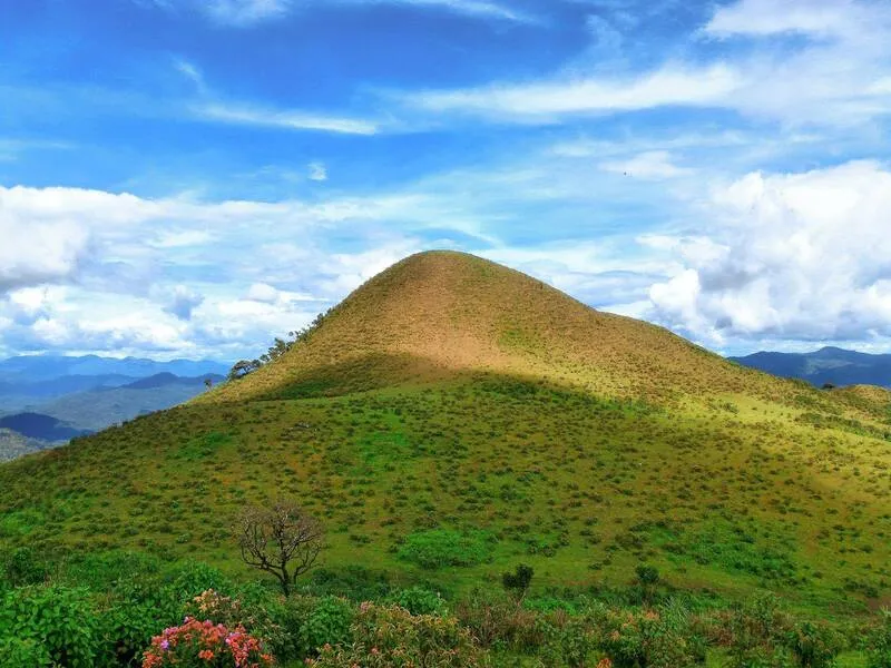
Doi Pui Luang
Open Days: Open Daily
Opening Hours: Accessible throughout the day, with early morning and late afternoon being the best times for views
Doi Pui Luang is one of Mae Hong Son’s most rewarding mountain destinations for travelers who enjoy forests, panoramic viewpoints, and a quieter side of northern Thailand. Its appeal lies in the combination of highland scenery, cool weather, sea-of-mist views in the cold season, and the strong cultural connection between the mountain and the surrounding ethnic Karen communities. Rather than being just another viewpoint, Doi Pui Luang offers a deeper travel experience shaped by landscape, local identity, and the rhythm of mountain life.
Travel information about Doi Pui Luang in Mae Hong Son is often linked to two connected contexts. One is the broader mountain zone associated with Mae Ngao National Park, where Doi Pui and Doi Pui Luang are recognized as major viewpoints. The other is the well-known trekking route from Ban Huai Hi in Mueang Mae Hong Son District, which is currently the route most familiar to hikers and nature travelers. Together, these references show that Doi Pui Luang is part of a wider mountain landscape with multiple community access routes and several local ways of experiencing the area.
From the information you provided, Doi Pui Luang is also connected with the area near Ban Mae Pa Luang and can be approached from two routes: the Huai Muang – Mae Pa Luang route, which allows vehicle access, and the Ban Kong Um route, which is better suited to trekking and adventure-style travel. In current tourism use, however, the Ban Huai Hi route remains one of the best-known gateways to the summit. This makes Doi Pui Luang attractive to different kinds of travelers, from those who prefer cultural nature routes through villages to those who want a straightforward trek to a dramatic mountain viewpoint.
The mountain itself stands out for its rugged highland terrain, layered ridgelines, and extensive natural forest. The wider Mae Hong Son mountain zone is known for its steep topography, healthy watershed forest, and a landscape where evergreen and seasonal vegetation create a rich ecological backdrop. In practical travel terms, this means the route to Doi Pui Luang is not only about reaching the summit, but also about passing through an environment that still feels genuinely wild, spacious, and relatively undisturbed.
The viewpoint is the main reason many people come here. In clear conditions, the mountain opens up to a wide panorama that stretches across distant ridges and valleys, with some descriptions noting views reaching toward the Omkoi area. During the cool season, low clouds often collect between the mountain layers, creating beautiful waves of mist. This is when Doi Pui Luang feels especially dramatic: the cold air, soft morning light, and endless mountain silhouettes combine to create one of the most memorable highland scenes in Mae Hong Son.
Doi Pui Luang is also rich in cultural meaning. Among the Pga K’nyau, or Karen community, the mountain is known as “Cho Khua Kho” or “Doi Ching,” a name linked to its shape, which is said to resemble a traditional cymbal. The Thai name “Doi Pui Luang” is associated with the once-common presence of pui trees across the area. These names do more than identify a location – they preserve the local way of seeing the landscape and reflect the close relationship between mountain geography and community knowledge.
Another reason Doi Pui Luang is so appealing is the changing character of the route across the seasons. In some periods, travelers find white wildflowers spreading across the mountain slopes, while along the trail fragrant wild orchids such as Ueang Sae can appear in the forest. January is often considered particularly charming because the cold weather, forest scent, and floral details add depth to the trekking experience. Even before reaching the viewpoint, the route itself becomes part of the attraction.
This destination works well for several kinds of travelers. Beginners who want a manageable trekking experience often choose the Ban Huai Hi approach because it is widely used and offers a strong reward in terms of scenery. More experienced hikers may prefer routes that connect villages and ridge sections more deeply across the broader mountain landscape. In both cases, planning ahead matters, because mountain weather, road conditions, and community access arrangements can shape the trip significantly.
Unlike highly developed mountain attractions, Doi Pui Luang still feels simple and close to nature. Visitors should prepare properly with trekking shoes, warm clothing, drinking water, and rain protection when needed. Those planning to stay overnight either on the mountain or in nearby villages should coordinate with the local community or a guide in advance. This kind of preparation helps preserve both safety and the low-impact style of travel that suits the area best.
Overall, Doi Pui Luang is one of the most compelling nature destinations in Mae Hong Son because it brings together mountain scenery, sea-of-mist viewpoints, forest trekking, and Karen community culture in one journey. For some travelers, the summit view is the highlight. For others, the deeper value lies in the slower route through village landscapes and forest paths. Either way, Doi Pui Luang offers a version of Mae Hong Son that feels expansive, peaceful, and deeply rooted in place.
Getting There is most commonly done via Ban Huai Hi in Huai Pu Ling Subdistrict, Mueang Mae Hong Son District, where many current trekking trips begin. At the same time, local route information also refers to access through Huai Muang, Mae Pa Luang, and Ban Kong Um in the wider mountain zone. Travelers unfamiliar with the route should arrange transport or a local guide in advance.
| Name | Doi Pui Luang |
| Location | Travel area linked with Ban Huai Hi, Huai Pu Ling Subdistrict, Mueang Mae Hong Son District, and the wider mountain zone associated with Mae Ngao National Park |
| Address | Huai Pu Ling Subdistrict, Mueang Mae Hong Son District, Mae Hong Son 58000 |
| Coordinates | 17.76844, 98.09436 |
| Highlights | Sea of mist in the cool season, panoramic mountain views, natural trekking routes, and Karen cultural experiences |
| History | A long-valued natural mountain destination shaped by forest ecosystems and local highland community use |
| Name Origin | The Thai name refers to pui trees once found widely across the area, while the Pga K’nyau name reflects the mountain’s cymbal-like shape |
| Distinctive Features | A high summit around 1,600–1,722 meters with ridge views, natural grassland sections, and rich mountain forest scenery |
| Travel Information | The most widely used access point today is Ban Huai Hi, while local route information also mentions Huai Muang, Mae Pa Luang, and Ban Kong Um |
| Current Status | Open for travel depending on weather conditions and route/community readiness |
| Open Days | Open Daily |
| Opening Hours | Accessible throughout the day, with mornings and evenings best for views |
| Facilities | Community trailhead, seasonal camping possibility, local guides, trekking routes, and nearby village homestays |
| Main Areas / Zones | Ban Huai Hi, summit trail, sea-of-mist viewpoint, seasonal flower and grassland sections |
| Main Contact Number | Ban Huai Hi Community 081-289-0128, Local Guide 084-040-6210, Mae Ngao National Park 084-372-4036, regional tourism info 053-681-323 / 053-683-210 |
| Official Website / Official Page | Amazing Thailand: Mae Ngao National Park, Ban Huai Hi community information, Mae Ngao National Park page |
| Nearby Tourist Attractions | 1. Ban Huai Hi Community – 0 km 2. Wat Phra That Doi Kong Mu – 28 km 3. Nong Chong Kham – 30 km 4. Huay Suea Thao Village – 33 km 5. Pha Suea Waterfall – 39 km |
| Nearby Restaurants | 1. Bai Fern – 31 km Tel: 053-611-374 2. Baan Yai Bon – 32 km Tel: 053-611-289, 096-678-8804 3. Indira – 31 km Tel: 053-681-529 4. Praewa – 31 km Tel: 053-612-453 5. Ruen Mai – 31 km Tel: 053-612-681 |
| Nearby Accommodations | 1. Ngamta Hotel – 31 km Tel: 053-612-794 2. Baiyoke Chalet Hotel – 31 km Tel: 053-613-132 3. Palmhouse Normal Loft – 31 km Tel: 085-969-0989 4. Mae Hong Son Mountain Inn – 31 km Tel: 053-611-802 5. The Imperial Mae Hong Son Resort – 34 km Tel: 053-684-444 |
Frequently Asked Questions (FAQ)
Q: Where is Doi Pui Luang located?
A: The most commonly used travel route is linked with Ban Huai Hi in Huai Pu Ling, Mueang Mae Hong Son District, while broader tourism information also connects the mountain with the Mae Ngao National Park zone.
Q: What is the best season to visit Doi Pui Luang?
A: The late rainy season through the cool season is especially attractive because the weather is cooler and sea-of-mist conditions are often beautiful.
Q: Do visitors need to trek to reach Doi Pui Luang?
A: The best-known current route involves trekking from Ban Huai Hi, although local information also refers to other access routes through nearby villages in the same mountain range.
Q: How high is Doi Pui Luang?
A: Tourism information places the summit at around 1,600 to 1,722 meters above sea level, depending on the reference point used.
Q: What makes Doi Pui Luang special?
A: Its strongest appeal lies in panoramic mountain views, winter mist, natural trekking routes, and the cultural setting of Karen highland communities.
Q: What should travelers prepare before going?
A: It is best to arrange a local guide or community contact in advance and bring suitable trekking shoes, warm clothing, drinking water, and weather-appropriate gear.
 Category: ●Nature and Wildlife
 Group: ●Mountain (Doi)
Last Update : 6 MonthAgo
 Last Update : 6 MonthAgo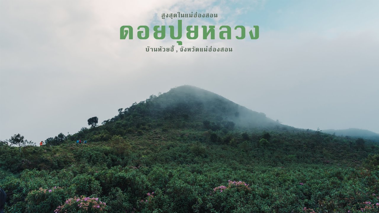
 Click to Access the Navigation Map GPS
Doi Pui Luang Map
Recommend

 Art, Culture and Heritage
 Historical Sites and Monuments(1)
 Landmarks and Memorials(1)
 Art, Craft Centres, Tradition(10)
 Museums(3)
 Educational Places
 Educational Gardens, Farm(1)
 Places of Worship
 Temple(81)
 Other Sacred Sites(1)
 Research and Development
 Royal Project(4)
 Suburban Living
 Village, Community(19)
 Local Market(4)
 National Parks and Marine Reserves(5)
Mountain (Doi)(5)
National Parks and Marine Reserves(5)
Mountain (Doi)(5)
 Dam, Reservoir, Lake(2)
 Waterfalls(12)
 Hot Springs(6)
 Caves(13)
 Flower Field(2)
 River, Canal(3)
 Other natural attractions(1)
 Entertainment and Agricultural
 Farms, Parks and Ecotourism(2)
 Shopping
 Shopping and Night Market(1)
 Travel Articles, Recipes
 Travel Review, Food Review(1)


