
lovethailand home >North Travel Attractions >Nan Travel Attractions >Na Noi >Si Sa Ket > Si Nan National Park
TL;DR: Si Nan National Park is located at Si Saket Subdistrict, Na Noi District, Nan Province, Thailand, open Daily, hours Approximately 05:00 – 20:00.

Si Nan National Park
Open Days: Daily
Opening Hours: Approximately 05:00 – 20:00
Si Nan National Park in Nan Province is one of northern Thailand’s most scenic national parks, covering parts of Wiang Sa, Na Noi, and Na Muen districts. The park covers approximately 640,237.50 rai, or 1,023.38 square kilometers, and is known for mountain ranges, the Nan River, misty viewpoints, stargazing areas, geological formations, wildlife habitats, and some of Nan’s most famous natural attractions, including Doi Samer Dao, Doi Pha Chu, Pha Hua Sing, Sao Din Na Noi, Khok Suea, Kaeng Luang, and Pak Nai.
The landscape of Si Nan National Park is shaped by complex mountain ranges running mainly from north to south. These mountains divide the area into western and eastern sections, while the Nan River flows through the park for more than 60 kilometers. Along both sides of the river are mixed deciduous forest and dry dipterocarp forest, which become especially beautiful in February when the forest changes color.
The higher mountain zones contain hill evergreen forest, dry evergreen forest, and pine forest. These habitats support many species of wildlife, including peafowl, leopard, black panther, bear, deer, wolf, dhole, and important large mammals such as wild elephants, banteng, and gaur. Some large animals move between forest areas near the Thailand–Laos border, making the park an important conservation landscape.
Doi Pha Chu is one of the park’s most important attractions and is also the location of the national park office. The area is marked by a large rock cliff rising among the mountains. In the cool season, visitors can see a sea of mist from the summit, and when the mist clears, the Nan River appears winding through the forest below. The trail to the summit is about 2 kilometers and takes around 1 hour for a round trip. The upper section has sharp rocks, so visitors should wear proper shoes and contact park officers for a guide before hiking.
Doi Pha Chu is also famous for having one of the longest Thai national flag lines in the country. The flag line stretches around 200 meters from the ground to the summit of the cliff. The site is also connected to a local legend about Chao Ueang Phueng, Chao Chan Pha, and Chao Chuang, a tragic love story that gave rise to the name “Pha Chu.”
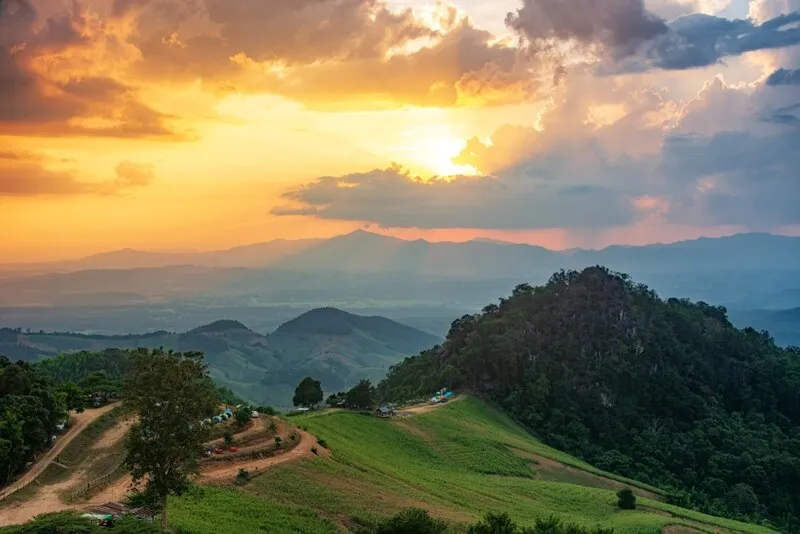
Doi Samer Dao and Pha Hua Sing are located around kilometer marker 16 on the Na Noi–Pang Hai route. Doi Samer Dao is a broad ridge suitable for camping, stargazing, sunset viewing, sunrise viewing, and morning mist. Pha Hua Sing, a cliff shaped like a lion’s head, offers 360-degree views. Visitors who want to hike to Pha Hua Sing should contact park officers for guidance, as the route is about 2 kilometers and passes through natural forest with distinctive chan pha trees.
Kaeng Luang is about 35 kilometers from Na Noi District and is a natural rapid area formed by the Nan River flowing through scattered rocks. During the rainy season, the river current is strong and the sound of water hitting the rocks can be heard clearly. In the dry season, visitors can see long lines of rocks and white sandbanks along the river. Swimming is suitable only in the dry season, especially around April, while the rainy season is dangerous due to strong currents.
Pak Nai is located in Na Tha Nung Subdistrict, Na Muen District, around 27 kilometers from the district center and about 63 kilometers from the national park office. It is a large freshwater lake landscape created by water above Sirikit Dam flooding the former forest area. Visitors can take boat rides, eat at floating raft restaurants, enjoy mountain lake scenery, and travel onward toward Uttaradit Province.
Sao Din Na Noi, also known locally as Hom Chom, is a striking earth pillar landscape formed by natural erosion from water and wind. The area covers about 50 rai and contains red earth, laterite, and unusual eroded formations. The shapes change every year due to natural collapse and erosion. On 10 November 1995, Princess Maha Chakri Sirindhorn visited the area with teachers and students from Chulachomklao Royal Military Academy to study the landscape, geology, and ancient objects found in the area.
Khok Suea is located about 800 meters from Sao Din Na Noi. It has similar eroded earth formations but on a smaller scale. The name comes from a local story that tigers once lived in the area and attacked villagers’ livestock. Villagers later drove the tigers into the eroded pit, giving the place the name “Khok Suea,” meaning tiger enclosure.
The scenery along both sides of the Nan River is another major highlight of Si Nan National Park. The river runs through the park from north to south, creating landscapes of rapids, rocks, sandbanks, cliffs, green forests, and wildlife habitats. Boat and raft trips allow visitors to experience this natural corridor more closely. Important features along the river include Pha Ngam, a large cliff standing among green forest, and Pha Khwang, a large cliff crossing the Nan River landscape.
Si Nan National Park provides accommodation and camping areas at several locations, including the national park office area at Doi Pha Chu, the Doi Samer Dao and Pha Hua Sing area, and the pine forest camping area at Doi Pha Chu. Visitors planning to stay overnight should prepare food and necessary equipment, especially during the cool season when many travelers come for misty views and stargazing.
Getting There from Nan town, visitors can travel toward Na Noi District using Highway 1083, then continue to the Doi Pha Chu and Doi Samer Dao area. Main roads are paved, but some routes to Kaeng Luang, Khok Suea, or Pha Hua Sing require caution, especially during the rainy season when dirt roads may become slippery.
| Name | Si Nan National Park |
| Location | Si Saket Subdistrict, Na Noi District, Nan Province, Thailand |
| Coordinates | 18.3664, 100.8041 |
| Highlights | Doi Samer Dao, Doi Pha Chu, Pha Hua Sing, Sao Din Na Noi, Khok Suea, Kaeng Luang, Pak Nai, and the Nan River |
| Area Size | Approximately 640,237.50 rai or 1,023.38 square kilometers |
| Distinctive Features | Mountain ranges, seasonal forest colors, Nan River scenery, misty viewpoints, stargazing areas, and geological formations |
| Travel Information | From Nan town, take Highway 1083 toward Na Noi District and continue to Doi Pha Chu and Doi Samer Dao |
| Current Status | Open as a national park, nature destination, camping area, and ecological learning site |
| Open Days | Daily |
| Opening Hours | Approximately 05:00 – 20:00 |
| Fees | Thai Adults 20 Baht, Thai Children 10 Baht / Foreign Adults 100 Baht, Foreign Children 50 Baht |
| Facilities | Park accommodation, camping areas, restrooms, viewpoints, stargazing areas, and guide services on selected trails |
| Main Areas / Zones | Doi Pha Chu, Doi Samer Dao, Pha Hua Sing, Kaeng Luang, Pak Nai, Sao Din Na Noi, Khok Suea, Pha Ngam, and Pha Khwang |
| Caretaker | Department of National Parks, Wildlife and Plant Conservation |
| Main Contact Number | 054-701-106, 098-685-3293, 081-224-0800 |
| Official Website / Official Page | Si Nan National Park Official Facebook Page |
| Nearby Tourist Attractions | 1. Doi Samer Dao, about 1 km 2. Pha Hua Sing, about 2 km 3. Sao Din Na Noi, about 24 km 4. Khok Suea, about 25 km 5. Pak Nai, about 63 km |
| Nearby Restaurants | 1. Krua Kamonwan Doi Samer Dao, about 1 km 2. Krua Malai Ahan Tam Sang, about 1 km 3. Krua Kan Eng Khai Kratha, about 2 km 4. Krua Phonsawan Doi Samer Dao, about 2 km 5. Huen Fai Mae Champi, about 14 km |
| Nearby Accommodations | 1. Doi Samer Dao Camping Ground, about 1 km, Tel. 093-242-2914 2. Doi Pha Chu Accommodation And Camping Area, about 2 km, Tel. 098-685-3293 3. Mon Chom Dao Na Nan, about 4 km 4. Doi Samer Dao Hostel, about 5 km 5. Accommodation In Na Noi District, about 35 km |
Frequently Asked Questions (FAQ)
Q: Where is Si Nan National Park located?
A: Si Nan National Park is located in Nan Province, covering Wiang Sa, Na Noi, and Na Muen districts, with the main park office in the Doi Pha Chu area of Na Noi District.
Q: Is Doi Samer Dao part of Si Nan National Park?
A: Yes. Doi Samer Dao is part of Si Nan National Park and is one of Nan’s most famous places for stargazing, sunrise, sunset, and misty morning views.
Q: What is the entrance fee for Si Nan National Park?
A: Thai adults pay 20 Baht and Thai children pay 10 Baht. Foreign adults pay 100 Baht and foreign children pay 50 Baht.
Q: Do visitors need a guide for Doi Pha Chu or Pha Hua Sing?
A: Yes. Visitors should contact park officers before hiking to Doi Pha Chu or Pha Hua Sing because some sections are rocky and require caution.
Q: When is the best time to visit Si Nan National Park?
A: November to February is ideal for cool weather, mist, stargazing, and camping. February is also a good time to see seasonal forest colors.
Q: Does Si Nan National Park provide accommodation?
A: Yes. The park provides accommodation and camping areas at Doi Pha Chu, Doi Samer Dao, and nearby pine forest areas. Advance booking is recommended in the cool season.
Tel : 054701106
 Tel : 054701106
 Category: ●Nature and Wildlife
 Group: ●National Parks and Marine Reserves
Last Update : 6 MonthAgo
 Last Update : 6 MonthAgo
 Click to Access the Navigation Map GPS
Si Nan National Park Map
Gellery
Recommend

 Art, Culture and Heritage
 Landmarks and Memorials(6)
 Art, Craft Centres, Tradition(6)
 Museums(4)
 Historic Homes and Cities(1)
 Art Gallery(1)
 Educational Places
 Educational Gardens, Farm(1)
 Places of Worship
 Temple(68)
 Church(1)
 Other Sacred Sites(19)
 Research and Development
 Royal Project(2)
 Suburban Living
 Village, Community(13)
 Local Market(1)
National Parks and Marine Reserves(9)
Local Market(1)
National Parks and Marine Reserves(9)
 Mountain (Doi)(6)
 Dam, Reservoir, Lake(16)
 Waterfalls(28)
 Hot Springs(1)
 Caves(11)
 River, Canal(5)
 Other natural attractions(10)
 Entertainment and Agricultural
 Farms, Parks and Ecotourism(4)
 Outdoor and Adventure Activities(2)
 Travel Articles, Recipes
 Travel Review, Food Review(1)


