
lovethailand home >North Travel Attractions >Chiang Mai Travel Attractions > 100 Beautiful Villages and Homestays in Thailand
TL;DR: 100 Beautiful Villages and Homestays in Thailand.

100 Beautiful Villages and Homestays in Thailand
100 Beautiful Villages and Homestays in Thailand: Experience Local Life, Culture, and Nature Across Thailand brings together remarkable community-based travel destinations from across the country, ranging from mountain villages hidden in lush valleys and traditional wooden houses beside flowing streams to terraced rice farming communities, ethnic villages, and historic settlements rich in cultural heritage. These destinations are ideal for travelers seeking a peaceful escape into nature, authentic homestay experiences, opportunities to learn about traditional ways of life, regional cuisine, and the distinctive charm of slow travel in Thailand.
Thailand is home to beautiful villages and community-based tourism destinations spread throughout every region. Each has its own character shaped by geography, history, local culture, and the everyday lives of its residents. Mountain villages in Northern Thailand are known for their cool weather, forests, streams, and mist-covered landscapes. Communities in Northeastern Thailand stand out for their agricultural traditions, local festivals, and handicrafts. Meanwhile, the Central, Western, Eastern, and Southern regions offer an equally diverse range of experiences, from riverside settlements and fruit-growing communities to former mining villages and traditional fishing villages whose livelihoods have remained closely connected to the sea and natural environment for generations.
The real attraction of village tourism goes far beyond beautiful scenery or taking photographs at famous viewpoints. It offers visitors an opportunity to experience a lifestyle that follows the rhythms of nature. Travelers can wake up to fresh mountain air, listen to birdsong and flowing streams, explore tea and coffee plantations or rice fields, learn traditional weaving and cooking techniques, and talk with local residents about the history and knowledge passed down through generations. These experiences create memories unlike those of conventional city tourism because visitors discover not only beautiful places but also the people, traditions, and living cultures that give each community its identity.
Staying in a homestay is another meaningful way to connect with local communities. Homestays in Thailand range from traditional wooden houses and streamside accommodation to cottages surrounded by orchards and hillside properties overlooking rice terraces and misty valleys. Some communities invite guests to share meals with their hosts, learn to prepare regional dishes, participate in agricultural activities, discover traditional food-processing techniques, and experience everyday customs. An overnight stay therefore becomes much more than accommodation; it becomes an opportunity to understand the community's culture, values, and traditional way of life.
For travelers who love mountains and cooler temperatures, Northern Thailand offers an outstanding selection of villages. Chiang Mai, Chiang Rai, Nan, and Mae Hong Son are particularly well known for destinations that combine natural beauty with rich cultural traditions. Mae Kampong Village is famous for its traditional wooden houses beside a stream, while Ban Rak Thai features Yunnanese Chinese culture and a picturesque reservoir surrounded by mountains. Ban Pa Bong Piang is celebrated for its expansive terraced rice fields, and Ban Jabo attracts visitors with dramatic mountain viewpoints and early-morning mist. Travelers can explore these communities on day trips or stay overnight to appreciate how their atmosphere changes from morning to evening.
Agricultural tourism villages provide another rewarding experience, allowing visitors to discover how local people use natural resources and traditional knowledge in their daily lives. Ban Mae Klang Luang is known for its terraced rice fields and Arabica coffee, while Ban Huai Hom is recognized for coffee cultivation and distinctive sheep-wool weaving. Doi Pha Mee, a highland Akha community, has developed a strong identity around locally grown coffee. Visiting these villages provides insight into how the landscape, climate, and generations of experience influence the products and livelihoods of each community.
For those interested in history and cultural heritage, many villages have fascinating stories to tell. Santichon Village in Pai is distinguished by its Yunnanese Chinese traditions, while Ban E-Tong in Kanchanaburi preserves the history of an old mining community in the Tenasserim Mountains. Ban Khiri Wong in Nakhon Si Thammarat is known for its traditional orchards and the community's approach to managing natural resources in a mountain valley. These examples show that village tourism is valuable not only for scenery but also for preserving collective memories, local knowledge, and cultural heritage across Thailand.
The best time to visit depends on the landscape and activities offered by each destination. During the rainy season, forests become lush and green, waterfalls carry more water, and terraced rice fields begin to flourish. The cool season is ideal for mountain stays, misty viewpoints, and comfortable outdoor activities. For agricultural villages, travelers should check planting and harvesting schedules before visiting, as the appearance of the fields and the availability of community activities change throughout the year.
Community-based tourism also plays an important role in distributing tourism income to local residents. Choosing locally operated homestays, eating traditional food, purchasing handmade products, and hiring community guides help support households and small businesses. Responsible tourism can also encourage communities to protect natural resources and preserve traditional knowledge. Visitors should respect local customs, avoid disturbing private property, reduce single-use plastics, and help keep villages and natural attractions clean.
Before setting off, travelers should research road conditions and the geography of each village, particularly in mountainous areas where roads may be steep and winding. Some destinations are easily accessible by ordinary vehicles, while others may require four-wheel-drive transportation or a local transfer service. Homestays should be booked in advance, and visitors should confirm facilities, meals, and transportation arrangements with their hosts. It is also advisable to bring suitable warm clothing, rain gear, comfortable walking shoes, and cash, especially when visiting remote communities with limited access to banking services.
This guide brings together 100 beautiful villages and distinctive community tourism destinations across Thailand's 77 provinces. The selection highlights natural landscapes, cultural heritage, traditional livelihoods, homestay experiences, and opportunities for travelers to engage meaningfully with local communities. It is designed to help visitors discover new destinations and plan journeys around their own interests. The following villages offer a starting point for exploring the diversity of Thailand beyond its major cities and conventional tourist attractions.

1. Mae Kampong Village, Chiang Mai Mae Kampong Village is located in Huai Kaeo Subdistrict, Mae On District, Chiang Mai Province. It is one of Thailand's best-known conservation-oriented tourism villages, celebrated for its setting among lush mountains and forests at an elevation of approximately 1,300 meters above sea level. The mountain location provides relatively cool weather and a stream that flows through the community. Traditional wooden houses line the village road and the sloping sides of the valley, creating a picturesque landscape that reflects the close relationship between the residents and their natural surroundings.
Mae Kampong has a history extending back more than 100 years. Some of the village's early settlers migrated from Doi Saket District to establish homes and pursue agricultural livelihoods. One of their traditional occupations was the production of miang, a local specialty made from tea leaves that are steamed and fermented using techniques passed down through generations. Miang is eaten as a traditional snack and has long been offered to guests as part of Lanna hospitality. Its production represents both an established livelihood and a cultural heritage closely associated with the relationship between the community and the surrounding forest.
One of Mae Kampong's most appealing experiences is walking through the village while listening to flowing water and admiring the traditional wooden houses lining both sides of the road. Visitors can stop at small cafés overlooking the stream, explore wooden bridges and local residences, and talk with villagers about traditional miang production and Arabica coffee cultivation, another important source of income for the community. Early mornings are particularly peaceful, with cool air and fewer visitors, making this an ideal time for photography and a relaxed stroll before the village becomes busier later in the day.
Staying overnight in a Mae Kampong homestay is ideal for travelers seeking an unhurried mountain retreat. Accommodation includes traditional wooden houses beside the stream, hillside properties, and small locally operated guesthouses. Visitors can choose a stay according to their preferred level of comfort and surroundings. Spending a night in the village allows travelers to appreciate the quieter evening atmosphere and fresh mountain air in the morning, providing a different experience from a short daytime visit.
An important landmark is Wat Kanthaphrueksha, also known as Wat Mae Kampong, the spiritual center of the community. Its wooden architecture reflects the distinctive characteristics of Northern Thai design. Another attraction is Mae Kampong Waterfall, where water cascades over a series of rocky levels amid shady forest. Visitors can also include Kew Fin Viewpoint in their itinerary to enjoy panoramic mountain scenery and the fresh air of the highlands. Road and weather conditions should be checked before traveling to viewpoints outside the village.
Highlights: Mountain valley village, traditional wooden houses beside a stream, community homestays, miang production, coffee cultivation, Wat Kanthaphrueksha, and Mae Kampong Waterfall.
Getting There From Chiang Mai city, travelers can drive or rent a car and travel through either Doi Saket or San Kamphaeng toward Mae On District, then continue to Huai Kaeo Subdistrict and Mae Kampong Village. The journey is approximately 50 kilometers and generally takes around 1–1.5 hours. The final section follows mountain roads with curves and steep gradients. Drive carefully, particularly during rainfall or when thick mist reduces visibility.
Map (GPS): GPS Coordinates: 18.865746, 99.351006 Open Google Maps directions to Mae Kampong Village

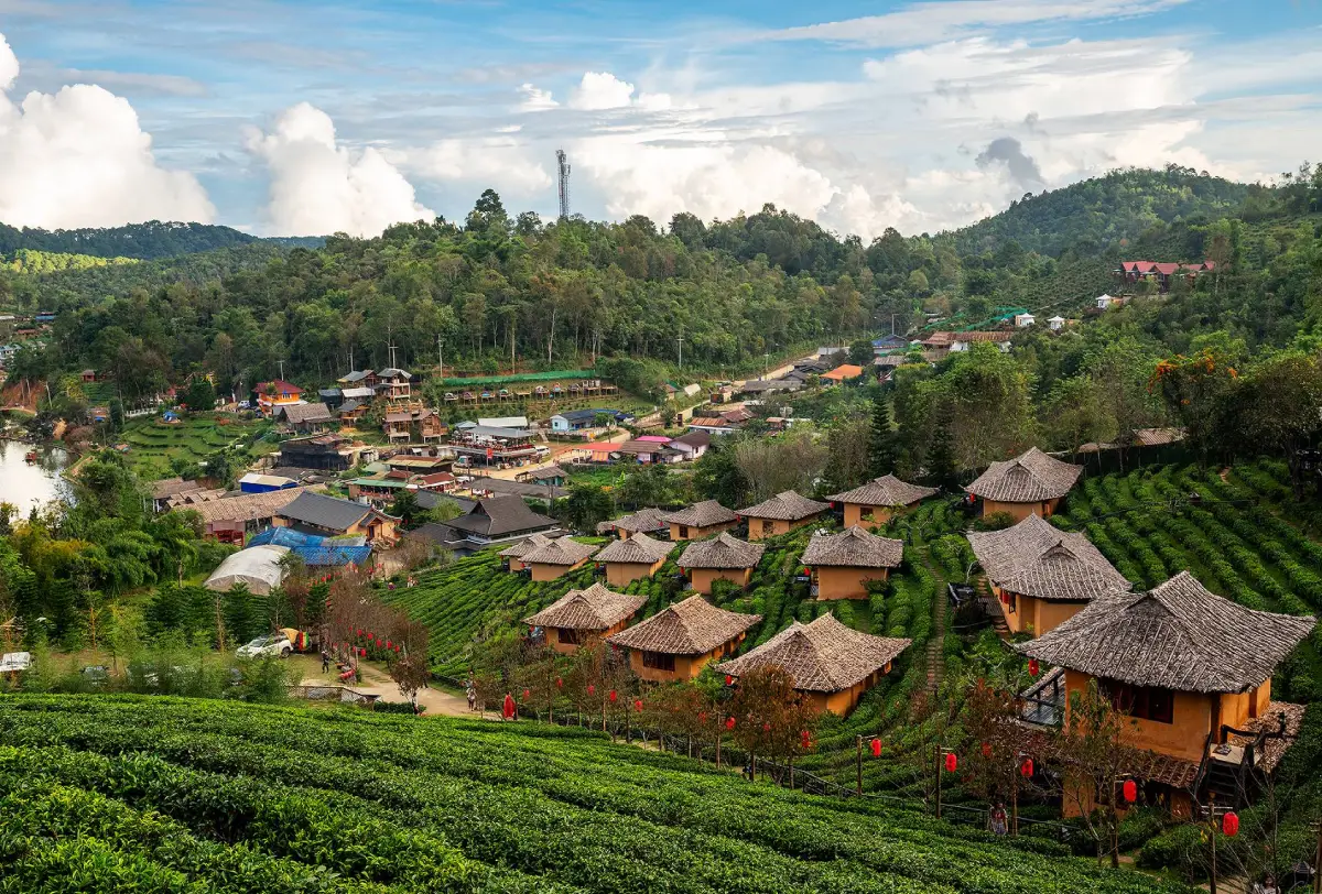
2. Ban Rak Thai, Mae Hong Son Ban Rak Thai is located in Mok Cham Pae Subdistrict, Mueang Mae Hong Son District, Mae Hong Son Province. This distinctive mountain village is known for its Yunnanese Chinese heritage and picturesque reservoir surrounded by hills. Situated near the Thailand–Myanmar border, it offers an atmosphere quite different from that of many other northern villages, with earthen houses, traditional tea shops, Yunnanese cuisine, and a central lake that has become a favorite place for relaxation and photography.
Ban Rak Thai's history is closely connected to Yunnanese Chinese settlers who migrated to the border region during a period of political change in China. They brought their language, cuisine, customs, and tea-growing knowledge, all of which became important elements of the village's identity. The settlement was formerly known as Ban Mae Aw before becoming widely recognized as Ban Rak Thai. Today, it is one of Mae Hong Son's most popular cultural and nature-oriented travel destinations.
The village's most recognizable feature is the reservoir at its center, surrounded by guesthouses, restaurants, and tea shops along the waterfront. On cool winter mornings, visitors may see delicate layers of mist drifting across the water while the mountain slopes and village buildings reflect on its surface. This atmospheric scenery has made Ban Rak Thai especially popular among photographers and travelers seeking a peaceful lakeside retreat.
Tea culture is another essential part of the experience. Oolong tea grown in the surrounding highlands has become an important local product, and visitors can stop at village tea shops to sample different varieties and learn about Yunnanese tea-drinking traditions. Regional dishes such as braised pork leg served with mantou buns, Yunnanese-style stir-fried vegetables, and other Chinese specialties offer a culinary introduction to the community's heritage.
Overnight stays are particularly popular because travelers can choose between lakeside accommodation and hillside guesthouses overlooking the village. In the evening, Ban Rak Thai becomes quieter as temperatures fall, while the morning is ideal for walking around the reservoir, enjoying a hot cup of tea, and watching the mist over the water. Visitors interested in local history can also spend time speaking with residents about the community's origins and the Yunnanese traditions that have been maintained through generations.
Highlights: Yunnanese Chinese village, mountain reservoir, traditional earthen houses, oolong tea plantations, Yunnanese cuisine, and lakeside accommodation.
Getting There From Mae Hong Son town, follow Highway 1095 and take the road toward Pha Suea Waterfall and Pang Ung before continuing to Ban Rak Thai. The journey is approximately 44 kilometers. Some sections are winding and steep, so travelers should ensure that their vehicle is in good condition, particularly during the rainy and cool seasons when mist may affect visibility.
Map (GPS): GPS Coordinates: 19.586673, 97.942228 Open Google Maps directions to Ban Rak Thai
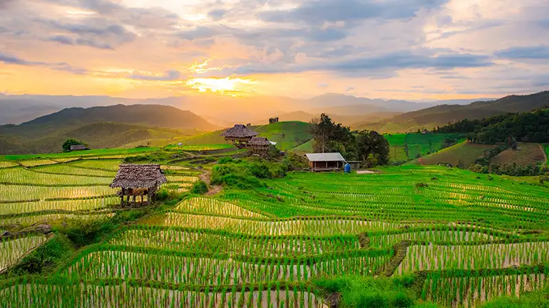
3. Ban Pa Bong Piang, Chiang Mai Ban Pa Bong Piang is located in Mae Chaem District, Chiang Mai Province. This Pgakenyaw Karen village is famous for its beautiful terraced rice fields, which descend in graceful layers along the surrounding hillsides and valleys. The terraces are both productive farmland and one of Northern Thailand's most distinctive natural landscapes. The village is particularly popular during the rice-growing season, when the paddies gradually change from vivid green to golden yellow as the rice matures.
The beauty of Ban Pa Bong Piang is closely linked to the agricultural knowledge of highland communities. Terraced farming allows steep mountain slopes to be adapted for rice cultivation while helping retain irrigation water and slow the movement of water downhill. Every cultivated terrace is therefore more than a scenic feature; it forms part of a working agricultural system and a local way of life shaped by seasonal rhythms and the surrounding environment.
Travelers generally visit between the rainy season and the beginning of the cool season, when the fields become lush and mist may drift through the valley. Before the rice harvest, the paddies turn golden, creating a different but equally striking landscape. Visitors should confirm the planting and harvesting schedule for the particular year because the appearance of the fields depends on rainfall and the farmers' cultivation plans.
Homestays in Ban Pa Bong Piang are intentionally simple, emphasizing immersion in nature rather than the extensive facilities found in large hotels. Some accommodations consist of wooden cabins or modest cottages overlooking the terraces and nearby mountains. Guests can spend the day reading, enjoying the countryside, watching the evening light spread across the fields, and waking up to fresh mountain air. Depending on the property, traditional local meals may also be included.
Ban Pa Bong Piang is ideal for travelers looking for tranquility and a closer understanding of agricultural life. Visitors should respect the community's farming areas, stay on appropriate walking routes, avoid entering rice paddies without permission, and take care not to damage the narrow embankments separating the terraces. Photography from designated or suitable viewpoints allows travelers to appreciate the scenery without disturbing the farmers' crops or daily work.
Highlights: Mountain rice terraces, Pgakenyaw Karen agricultural traditions, rural cottages overlooking the paddies, and seasonal mist during the rainy season.
Getting There From Chiang Mai city, travel toward Chom Thong District and Doi Inthanon before following the connecting mountain roads toward Mae Chaem and Ban Pa Bong Piang. The final part of the route includes steep mountain roads and sections where the road surface may be difficult, especially during the rainy season. Travelers unfamiliar with mountain driving should consider arranging a transfer with a local driver and avoid traveling after dark.
Map (GPS): GPS Coordinates: 18.536207, 98.445051 Open Google Maps directions to Ban Pa Bong Piang
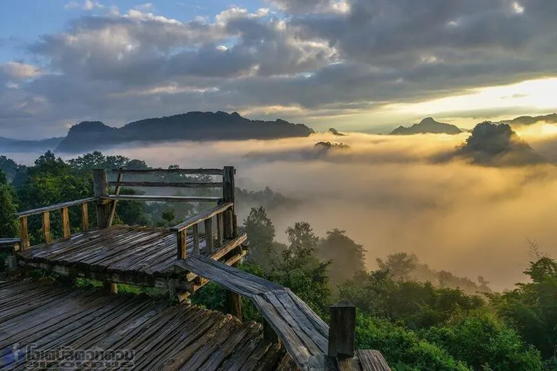
4. Ban Jabo, Mae Hong Son Ban Jabo is located in Pang Mapha District, Mae Hong Son Province. This Lahu village is known for its dramatic mountain scenery and beautiful morning mist. Set high above the surrounding valleys, the village offers viewpoints overlooking layers of mountains stretching into the distance. Its appeal extends beyond the landscape, however, to the traditions, community life, and settlement history of the Lahu people who have made this mountainous area their home for generations.
The lives of local residents remain closely connected to agriculture, forest resources, and strong family and community relationships. Although Ban Jabo has attracted growing numbers of visitors, the community continues to maintain its cultural identity and traditional practices. Tourism gives travelers an opportunity to learn about highland ethnic communities while enjoying the area's distinctive natural surroundings.
One of Ban Jabo's best-known experiences is eating noodles at a hillside restaurant where guests sit with their legs hanging over the edge of a viewing platform. From the restaurant, visitors can admire mountain ridges and a deep valley below while enjoying a simple meal. This combination of local food, fresh mountain air, and extraordinary scenery has become a signature experience associated with Ban Jabo.
On suitable mornings during the cool season, mist may gather in the valleys surrounding Ban Jabo, creating a sea of clouds between the mountain ridges. This landscape is particularly attractive to photographers. Staying overnight provides the opportunity to wake up early and enjoy the scenery without having to make a long journey from another town before sunrise.
Beyond the viewpoints, travelers can learn about the community through traditional food, conversations with residents, and visits to appropriate areas around the village. Ban Jabo can also be combined with Tham Nam Lod and other natural attractions in Pang Mapha District. It is a good destination for a two-day, one-night journey or as a memorable stop while traveling between Pai and Mae Hong Son town.
Highlights: Traditional Lahu community, early-morning sea of mist, hanging-leg noodle restaurant, panoramic mountain viewpoints, and community homestays.
Getting There Follow Highway 1095, the mountain road connecting Pai and Mae Hong Son, toward Pang Mapha District. The route includes many curves and steep sections. Travelers should drive carefully and allow additional journey time, particularly during rainy weather or periods of thick fog.
Map (GPS): GPS Coordinates: 19.583870, 98.206680 Open Google Maps directions to Ban Jabo
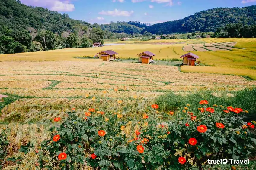
5. Ban Mae Klang Luang, Chiang Mai Ban Mae Klang Luang is located in Ban Luang Subdistrict, Chom Thong District, Chiang Mai Province, along the road to Doi Inthanon National Park. This Pgakenyaw Karen village is celebrated for its terraced rice fields, mountain landscapes, and a traditional way of life closely connected to forests and highland agriculture. It is an ideal destination for visitors who want to experience nature and community life without traveling far from Doi Inthanon's main sightseeing route.
The village's most distinctive feature is its terraced rice fields, arranged in beautiful layers along the hillsides. During the growing season, the green paddies contrast with the surrounding forests and mountains. As harvest time approaches, the landscape gradually turns golden. Rice cultivation is not merely an agricultural occupation here; it also represents local knowledge of water management and the careful adaptation of farmland to steep mountain terrain.
Coffee is another important product of Ban Mae Klang Luang. The community cultivates Arabica coffee in the highlands, and local cafés offer opportunities to sample coffee grown nearby. Interested travelers can learn about coffee planting, harvesting, and processing from community producers. These experiences add an educational dimension to the visit, allowing travelers to move beyond sightseeing and gain a deeper understanding of local agricultural livelihoods.
Homestays in Ban Mae Klang Luang are well suited to visitors who want to spend more time surrounded by nature. Many properties are located beside the rice fields or within the village, offering views of the mountains. Mornings are cool and peaceful, accompanied by the sounds of nature, while evenings are ideal for strolling near the terraces and relaxing. Visitors should respect cultivated areas and avoid entering rice paddies without permission.
Ban Mae Klang Luang can also be included in a wider trip to Doi Inthanon National Park. Nearby attractions include Wachirathan Waterfall, Sirithan Waterfall, and viewpoints along the mountain road. Travelers may choose to stay overnight in the village before exploring other natural attractions the following day, combining a peaceful community experience with sightseeing and outdoor activities.
Highlights: Pgakenyaw Karen village, Doi Inthanon rice terraces, Arabica coffee farms, highland agricultural traditions, and nature-oriented accommodation.
Getting There From Chiang Mai city, follow Highway 108 toward Chom Thong District, then turn onto Highway 1009, the main route leading into Doi Inthanon National Park. Ban Mae Klang Luang is located along this mountain road and is accessible by private car or rental vehicle. Travelers should check weather conditions and any relevant national park regulations before entering the area.
Map (GPS): GPS Coordinates: 18.541007, 98.549240 Open Google Maps directions to Ban Mae Klang Luang

6. Doi Pha Mee, Chiang Rai Doi Pha Mee is located in Wiang Phang Kham Subdistrict, Mae Sai District, Chiang Rai Province. This Akha community sits high in the mountains near the Thailand–Myanmar border and is distinguished by its natural scenery, ethnic traditions, and Arabica coffee cultivation. Its elevated location provides relatively cool temperatures and panoramic views of mountain ranges stretching across the surrounding landscape.
The history of Ban Pha Mee is closely connected to the settlement of Akha communities in the northern highlands. The Akha people have their own language, traditional clothing, and cultural practices. Agriculture was historically central to the community's livelihood, and coffee cultivation subsequently developed into an important source of income. Today, Doi Pha Mee is especially well known among travelers interested in Thai specialty coffee and cultural tourism.
Arabica coffee production illustrates the close relationship between the community and its mountainous environment. The cool weather and high elevation provide conditions suitable for coffee varieties that prefer relatively lower temperatures. Travelers can visit community cafés to sample locally grown coffee and learn about the production process, from cultivation and harvesting to roasting and brewing.
Beyond its coffee culture, Doi Pha Mee offers scenic viewpoints overlooking mountains and valleys. Several cafés and small accommodations are built on the slopes, with terraces and seating areas positioned to make the most of the surrounding landscape. Mornings and late afternoons are ideal for enjoying the scenery and taking photographs, particularly during the cool season when mist may gather along the mountainsides.
Staying in a Doi Pha Mee homestay is an opportunity to gain a closer understanding of Akha community life. Visitors can choose small locally operated accommodation, support traditional restaurants, and purchase coffee directly from community producers. Doi Pha Mee can also be combined with Doi Pha Hi, Tham Luang–Khun Nam Nang Non, and other attractions around Mae Sai District.
Highlights: Highland Akha community, Arabica coffee, mountain-view cafés, homestays, panoramic viewpoints, and traditional ethnic lifestyles.
Getting There From Chiang Rai city, follow Highway 1, also known as Phahonyothin Road, toward Mae Sai District. Turn toward Wiang Phang Kham Subdistrict and continue along the mountain road to Ban Pha Mee. The uphill sections include steep gradients and sharp curves, so travelers should use a well-maintained vehicle and drive carefully.
Map (GPS): GPS Coordinates: 20.399710, 99.850867 Open Google Maps directions to Doi Pha Mee
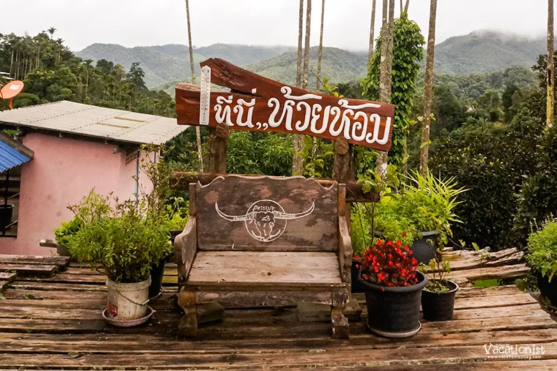
7. Ban Huai Hom, Mae Hong Son Ban Huai Hom is located in Huai Hom Subdistrict, Mae La Noi District, Mae Hong Son Province. This highland Pgakenyaw Karen community is known for its coffee cultivation and distinctive local handicrafts. Surrounded by mountains and forests, the village has a peaceful atmosphere and relatively cool weather, making it ideal for travelers who want to learn about traditional community life rather than simply visit popular sightseeing spots.
Ban Huai Hom is particularly well known for Arabica coffee grown in the highlands. Coffee production has developed into an important community product, supporting local incomes and contributing to efforts to improve residents' livelihoods. Visitors can learn about the entire coffee journey, from planting and harvesting to processing and tasting coffee produced from beans grown in the surrounding area.
Another distinctive feature of Ban Huai Hom is its sheep-wool weaving, a handicraft that reflects the community's knowledge and craftsmanship. Producing woven textiles requires patience, technical skill, and experience passed down through generations. Travelers interested in traditional crafts can learn about the production process and purchase locally made products directly from the villagers, supporting household incomes and helping preserve the community's weaving traditions.
The atmosphere in Ban Huai Hom differs from that of busy tourist destinations. Agriculture and traditional community activities remain central to everyday life. Walking through the village provides opportunities to experience a slower pace of life, discover Pgakenyaw Karen traditions, and appreciate the close relationship between the residents and the surrounding mountains and forests.
Staying in a Ban Huai Hom homestay is suitable for travelers who want to enjoy nature and learn about local culture in greater depth. An overnight visit allows more time to explore community activities, sample traditional food, and experience the cool morning air. Visitors should arrange accommodation and activities in advance so that local hosts can prepare appropriately.
Highlights: Pgakenyaw Karen community, Arabica coffee, sheep-wool textiles, traditional handicrafts, homestays, and peaceful mountain surroundings.
Getting There From Mae La Noi District, follow Highway 108 and turn onto Highway 1266 toward Ban Huai Hom. The route passes through mountainous terrain with numerous bends. Check the weather and drive carefully, particularly during the rainy season.
Map (GPS): GPS Coordinates: 18.378438, 98.067134 Open Google Maps directions to Ban Huai Hom

8. Santichon Village, Mae Hong Son Santichon Village is located in Wiang Tai Subdistrict, Pai District, Mae Hong Son Province. The village is distinguished by its Yunnanese Chinese cultural heritage and the traditions of Chinese Haw communities that have settled in the Pai area for generations. It is a cultural tourism destination where visitors can discover earthen-house architecture, regional cuisine, and experiences reflecting the distinctive identity of the local Yunnanese community.
The village's most recognizable features are the buildings and structures inspired by Yunnanese Chinese architecture, particularly its earthen houses and cultural activity areas. Visitors can walk around the village, take photographs, and learn about the settlement traditions of communities whose migration history brought them to Northern Thailand.
Yunnanese cuisine is another important reason to visit. Travelers can enjoy regional dishes such as braised pork leg with mantou buns, stir-fried vegetables, and other foods associated with Yunnanese Chinese culinary traditions. Tea shops also offer opportunities to sample different teas and purchase local products as souvenirs. Food provides an accessible way to explore the community's heritage through distinctive flavors and cooking methods passed down over generations.
Santichon Village is particularly suitable for families and travelers interested in cultural attractions because visitors can explore its buildings, take photographs, and enjoy traditional meals during a single visit. The village can easily be combined with Wat Nam Hoo and other attractions around Pai, making it a worthwhile stop on a wider Mae Hong Son itinerary.
Although the village has developed facilities for cultural tourism, local residents continue to maintain customs and traditions connected to their Yunnanese Chinese heritage. Visitors should respect residential areas and consider supporting locally operated shops and businesses during their stay.
Highlights: Yunnanese Chinese cultural village, traditional earthen houses, regional Chinese cuisine, tea tasting, and an old-village atmosphere near Pai town.
Getting There From Pai town, travel toward Wat Nam Hoo and Santichon Village by private car, rental vehicle, or motorcycle. The village is suitable for a half-day trip or can be visited together with nearby attractions.
Map (GPS): GPS Coordinates: 19.371055, 98.402720 Open Google Maps directions to Santichon Village
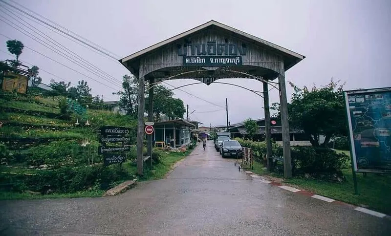
9. Ban E-Tong, Kanchanaburi Ban E-Tong is located in Pilok Subdistrict, Thong Pha Phum District, Kanchanaburi Province. This small village in the Tenasserim Mountains near the Thailand–Myanmar border is known for its cool climate and seasonal mist. Historically, the area was an important mining settlement before developing into a distinctive travel destination featuring old buildings, narrow streets, mountain scenery, and the atmosphere of a former mining community.
The Pilok area once supported significant mining activities, particularly the extraction of tin and other minerals. Mining operations attracted workers and businesses to the mountains, creating a settlement closely tied to the industry. When mining gradually declined, the community adapted to other livelihoods and tourism. Stories of the mining era remain an important part of local memory and historical identity, which visitors can discover through the landscape, surviving sites, and residents' accounts.
One of the village's most popular areas is Ban E-Tong Market, where restaurants, cafés, souvenir shops, and small guesthouses line the streets. Travelers can stroll through the village, enjoy local dishes, and photograph its distinctive surroundings. Early mornings can be particularly atmospheric, with cool air and mist settling around the buildings, giving the settlement a character quite different from larger tourist towns.
Staying overnight in Ban E-Tong is recommended for travelers who want to appreciate the peaceful mountain environment. Accommodation mainly consists of small guesthouses and locally operated homestays. Guests can spend the evening exploring the market, enjoying a meal, and relaxing in the cool air. In the morning, the changing light and possible mist create beautiful scenery for walking and photography.
Nearby attractions include Noen Chang Suek, a viewpoint overlooking the mountains and border region, and Jokkradin Waterfall, a scenic cascade surrounded by forest. A two-day, one-night itinerary provides enough time to explore the village and its natural surroundings at a comfortable pace.
Highlights: Historic mining village in the Tenasserim Mountains, morning mist, village market, traditional accommodation, and natural attractions near the Thailand–Myanmar border.
Getting There From Thong Pha Phum District, follow Highway 3272 toward Pilok Subdistrict and Ban E-Tong. The journey from Thong Pha Phum town is approximately 70 kilometers. The mountain road has numerous sharp bends and steep sections, so travelers should inspect their vehicles, check the weather, and avoid driving at night if unfamiliar with the route.
Map (GPS): GPS Coordinates: 14.679104, 98.369570 Open Google Maps directions to Ban E-Tong

10. Ban Khiri Wong, Nakhon Si Thammarat Ban Khiri Wong is located in Kamlon Subdistrict, Lan Saka District, Nakhon Si Thammarat Province. It is one of Southern Thailand's best-known ecotourism villages, situated among mountains near the foothills of Khao Luang. Streams flow through the community, while fertile orchards cover much of the surrounding landscape. The name Khiri Wong refers to a village enclosed by mountains, an appropriate description of its distinctive geography.
Ban Khiri Wong has a long history and was formerly known as Ban Khun Nam because of its location near water sources flowing down from the Khao Luang mountain range. Most residents traditionally practiced mixed fruit cultivation, locally known as suan somrom, in which different crops grow together within the same orchard. These include mangosteen, durian, longkong, rambutan, and other local plants. This farming system reflects generations of knowledge about using land productively while maintaining a close relationship with the natural environment.
One of the most recognizable landmarks is Khiri Wong Bridge, which crosses a stream with the mountains forming a beautiful backdrop. It is a popular photography location, especially in the morning when the air is fresh and the light is gentle. Visitors can also walk or cycle through the village, passing traditional houses, orchards, and small local shops surrounded by greenery.
Ban Khiri Wong is recognized for its community-based ecotourism and local natural resource management. The village received a Thailand Tourism Award in 1998 in recognition of its achievements as a town and community tourism destination. This reflects the community's commitment to environmental conservation and the development of tourism connected to traditional livelihoods. Local occupational groups also produce handmade goods that create income while drawing on knowledge and resources found within the village.
Popular community products include naturally dyed textiles, herbal products, handicrafts, and processed fruit. Natural tie-dye fabrics are particularly distinctive, using colors derived from natural materials and showcasing the creativity of local artisans. Travelers can visit community production groups, learn about their techniques, and buy products directly from the makers, helping support household income and the preservation of traditional skills.
Staying in a Ban Khiri Wong homestay is a rewarding choice for travelers who want to relax amid nature and learn about orchard farming. Accommodation ranges from community homestays and streamside cottages to small locally operated guesthouses. Spending the night allows visitors to appreciate the peaceful evening atmosphere, wake up to fresh mountain air, and enjoy unhurried walks through the orchards and village.
Other activities include cycling around the community and visiting natural streams, particularly when water levels and weather conditions are safe. Travelers can stroll along village routes, taste seasonal fruit, and learn about mixed-orchard farming from residents. Extra care is necessary during heavy rain because the village lies near steep mountains where water levels can rise rapidly and flash flooding may occur.
Ban Khiri Wong appeals to families, couples, groups of friends, and travelers interested in ecotourism. Visitors can choose from relaxed sightseeing, cultural learning, photography, orchard visits, and locally guided activities. The village can also be combined with other attractions in Lan Saka District and the surrounding areas of Nakhon Si Thammarat Province.
Highlights: Mountain valley village, Khiri Wong Bridge, clear streams, traditional mixed-fruit orchards, homestays, naturally dyed fabrics, and community-based ecotourism.
Getting There From Nakhon Si Thammarat city, follow Highway 4016 toward Lan Saka District, then take the road leading to Ban Khiri Wong. The village is approximately 25 kilometers from the city and can be reached by private car, rental vehicle, or local transport services operating toward Lan Saka. Travelers planning to stay overnight should book accommodation in advance, particularly during weekends and peak holiday periods.
Map (GPS): GPS Coordinates: 8.432906, 99.782523 Open Google Maps directions to Ban Khiri Wong

11. Doi Pha Hi, Chiang Rai Doi Pha Hi is located in Pong Ngam Subdistrict, Mae Sai District, Chiang Rai Province. This highland Akha village is distinguished by its sweeping mountain landscapes, ethnic traditions, and Arabica coffee cultivation. Situated near the Thailand–Myanmar border, the village occupies a landscape of mountain ridges and valleys extending into the distance. Its elevated location provides expansive natural scenery, particularly during the early morning when the air is cool and mist may drift along the surrounding hills.
The Ban Pha Hi community has long been associated with the traditional way of life of the Akha people, who established settlements in the northern highlands. Their livelihoods have involved agriculture, the sustainable use of natural resources, and the preservation of cultural practices passed down through generations. Arabica coffee has developed into an important local product, generating income for residents and playing a significant role in the development of community-based tourism. Travelers can therefore discover the village's identity through its coffee culture, traditional food, and conversations with local residents.
One of Doi Pha Hi's greatest attractions is its collection of coffee shops and viewpoints situated along the mountain ridge. Visitors can enjoy a cup of coffee made from locally grown beans while admiring panoramic views of the surrounding mountains. Coffee cultivation in these highland conditions also reflects the community's understanding of soil, temperature, and seasonal growing cycles. For coffee enthusiasts, visiting Doi Pha Hi offers an opportunity to appreciate the journey from coffee plantation to finished cup while experiencing the natural environment in which the beans are produced.
Travelers wishing to spend the night can choose from small guesthouses and community homestays that emphasize the mountain atmosphere. An overnight stay allows visitors to watch the changing colors of the hills in the evening and wake up to fresh air the following morning. Doi Pha Hi can also be combined with Doi Pha Mee and attractions around Doi Tung, making it suitable for a two-day, one-night itinerary. Advance accommodation reservations are recommended during weekends and the cool season.
Highlights: Highland Akha village, Arabica coffee, mountain-view cafés, community homestays, scenic viewpoints, and opportunities to experience traditional ethnic lifestyles.
Getting There From Chiang Rai city, travel toward Mae Sai District before turning onto the mountain roads leading through Doi Pha Mee to Ban Pha Hi. An alternative approach is via Doi Tung and Doi Chang Mub. The mountain roads have several steep sections and sharp curves. Travelers should use a well-maintained vehicle and drive carefully, particularly during rainfall or periods of dense fog.
Map (GPS): GPS Coordinates: 19.717482, 100.256090 Open Google Maps directions to Doi Pha Hi
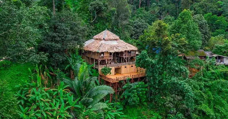
12. Ban Mae Mae, Chiang Mai Ban Mae Mae is situated in Chiang Dao District, Chiang Mai Province. This small mountain village lies within a peaceful valley surrounded by lush forest. Local livelihoods are closely connected to nature, particularly the harvesting and processing of miang, or traditionally fermented tea leaves, an occupation passed down through generations. Houses are scattered along the mountain slopes, while streams and community forest areas form an important part of the surrounding ecosystem. Ban Mae Mae is therefore an attractive destination for travelers seeking a quiet retreat from urban life and an opportunity to experience a traditional, nature-oriented lifestyle.
Miang is central to the cultural identity and daily life of Ban Mae Mae. Residents possess generations of knowledge about caring for tea plants, harvesting their leaves, selecting suitable materials, and processing them through traditional methods. Miang production is not only a means of earning a living but also forms part of Northern Thailand's culinary heritage and social traditions. Visitors can learn about this distinctive process and gain a better understanding of how the surrounding forest supports the community's livelihood.
In addition to miang production, Ban Mae Mae preserves traditional knowledge of medicinal plants and local handicrafts, including basket weaving and the use of natural materials in everyday life. Popular activities include walking through the village, studying the surrounding environment, following short forest trails used by residents, and learning about traditional community skills. Some experiences require a local guide or advance arrangements to ensure visitor safety and minimize disturbance to the natural environment.
Homestays in Ban Mae Mae are especially appealing to travelers who want to slow down and enjoy the cool mountain air and sounds of nature. Accommodation is generally simple and designed to fit the character of the community. Guests can relax, explore miang gardens, enjoy Northern Thai dishes, and speak with their hosts about local customs and forest conservation. The tranquil setting makes the village better suited to an unhurried stay than to a rushed sightseeing itinerary with numerous stops.
Highlights: Forest village in Chiang Dao, traditional miang production, medicinal plants, basket weaving, nature walks, streams, and community homestays.
Getting There From Chiang Mai city, follow the Chiang Mai–Chiang Dao route toward Chiang Dao District, then continue along the local road to Ban Mae Mae through the Ban Huai Jo area. Some sections of the access road are winding and relatively narrow. Travelers should use a vehicle in good condition and plan to arrive before dark, especially during the rainy season when the road can become slippery.
Map (GPS): GPS Coordinates: 19.319786, 98.885030 Open Google Maps directions to Ban Mae Mae
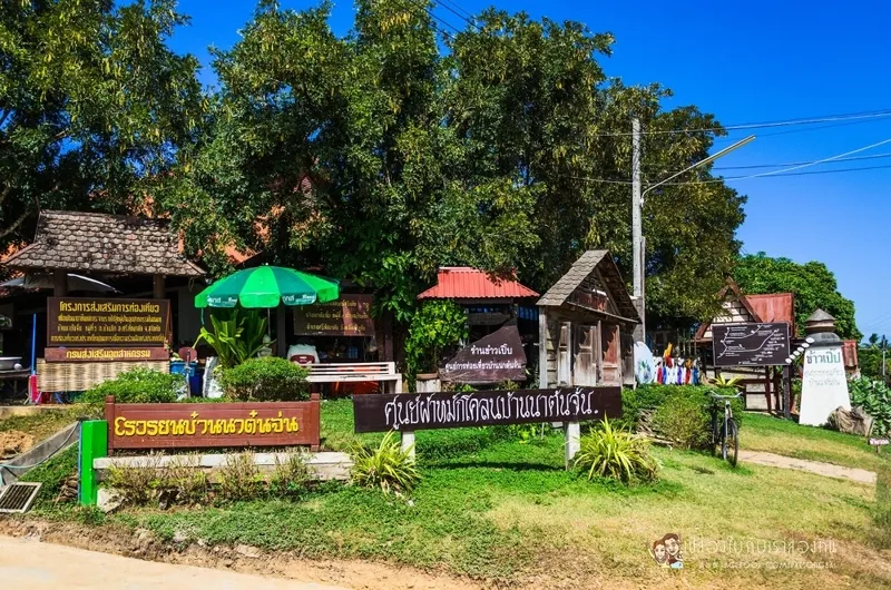
13. Ban Na Ton Chan, Sukhothai Ban Na Ton Chan is located in Ban Tuek Subdistrict, Si Satchanalai District, Sukhothai Province. It is a conservation-oriented tourism village known for its community homestays and traditional rural experiences. The community continues to preserve local customs, agricultural livelihoods, handicrafts, and strong relationships among its residents. A visit to Ban Na Ton Chan therefore offers much more than views of rice fields and mountains. Travelers can stay with local families and participate in everyday activities, gaining firsthand experience of village life and cultural traditions.
The history and culture of Ban Na Ton Chan are connected to the traditional communities of the Si Satchanalai area and Northern Thai cultural influences that have been passed down through generations. Agriculture, fruit cultivation, and the production of everyday household items remain important parts of local life. The village has developed community-based tourism by transforming existing traditions and occupations into meaningful visitor experiences, with an emphasis on creating household income while preserving the community's distinctive identity.
One of the village's signature activities is riding an e-taek, a traditional agricultural vehicle, through the community and surrounding farmland. This experience allows visitors to enjoy rice fields, orchards, and rural roads at a pace that reflects local life. Other popular activities include cycling around the village and visiting Huai Ton Hai Viewpoint, where travelers can admire forests, mountains, and seasonal mist when weather conditions are suitable.
A distinctive handicraft associated with Ban Na Ton Chan is mud-fermented cloth, a traditional textile product developed using local knowledge and techniques. Visitors can learn about the cloth-making process and purchase finished products directly from community producers. Traditional meals prepared by homestay hosts provide another opportunity to discover local culture. Together, these activities demonstrate how community-based tourism can create value from traditional skills and everyday practices.
Ban Na Ton Chan homestays are suitable for families, groups of friends, and travelers interested in cultural tourism. Guests can stay in local households, share regional meals, and participate in activities according to their interests. Spending the night also allows time to stroll through the village in the peaceful morning and evening hours, when the countryside is particularly attractive for photography and relaxation.
Highlights: Community homestays, e-taek agricultural vehicle tours, mud-fermented textiles, Huai Ton Hai Viewpoint, traditional farming, local cuisine, and cycling through rural landscapes.
Getting There From Sukhothai town, travel toward Si Satchanalai District before continuing to Ban Tuek Subdistrict and Ban Na Ton Chan. The village can be reached by private car or rental vehicle. Visitors planning to stay overnight or participate in community activities should contact the homestay providers in advance so that accommodation, meals, and activities can be arranged appropriately.
Map (GPS): GPS Coordinates: 17.588494, 99.806146 Open Google Maps directions to Ban Na Ton Chan

14. Ban Mae La Na, Mae Hong Son Ban Mae La Na is located in Pang Mapha Subdistrict, Pang Mapha District, Mae Hong Son Province. This community-based tourism village is distinguished by its traditional lifestyle and the mountainous natural environment surrounding it. The village has a peaceful atmosphere and maintains close relationships between local residents and their environment. It is an ideal destination for travelers interested in highland community life, nature exploration, and overnight stays in locally operated homestays.
Ban Mae La Na occupies a valley surrounded by forests and mountain ranges. Local livelihoods are closely connected to agriculture and the responsible use of natural resources. Everyday village life reflects the community's traditions of cooperation, shared responsibilities, and cultural continuity. Visitors can learn about these practices through community-organized activities and conversations with their homestay hosts.
Activities in Ban Mae La Na include learning about traditional farming, walking through the village, and exploring the surrounding natural environment. Pang Mapha District is characterized by limestone mountains and numerous natural caves, allowing visitors to combine a village stay with nearby geological and cultural attractions. Forest walks and cave exploration should be undertaken with knowledgeable local guides, and travelers must follow the safety rules of the community and any relevant conservation areas.
Staying in a Ban Mae La Na homestay is particularly suitable for travelers who want to understand local traditions rather than simply book conventional tourist accommodation. Guests can experience regional cuisine, daily household activities, and cultural experiences organized according to community availability. Advance arrangements are important because certain activities require guides, equipment, or preparation by local residents.
Highlights: Traditional mountain village, community homestays, agricultural experiences, nature walks, local culture, and limestone cave attractions in Pang Mapha District.
Getting There From Pai or Mae Hong Son town, follow Highway 1095 toward Pang Mapha District, then turn onto the local access road leading to Ban Mae La Na. Roads in the area include steep mountain sections and sharp curves. Travelers should plan to arrive before dark and contact the community in advance if they intend to stay overnight or participate in guided activities.
Map (GPS): GPS Coordinates: 19.591632, 98.216261 Open Google Maps directions to Ban Mae La Na
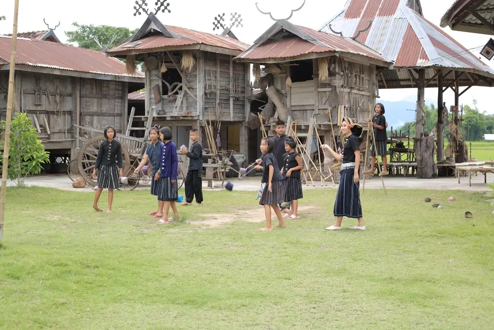
15. Tai Dam Cultural Village, Loei Tai Dam Cultural Village is situated in Ban Na Pa Nat, Khao Kaeo Subdistrict, Chiang Khan District, Loei Province. It is a community-based cultural tourism destination distinguished by the preservation of Tai Dam heritage, including language, traditional clothing, weaving, house architecture, customs, beliefs, and everyday practices. The village serves as an important cultural learning center where visitors can discover Tai Dam traditions through direct interaction with the community and activities designed to preserve its distinctive identity.
The Tai Dam people have a history of migration and settlement connected to the Mekong River region. They brought their language, customs, and traditional knowledge to Ban Na Pa Nat, where these practices have continued through generations. Dark-colored traditional garments, distinctive woven patterns, the Tai Dam language, and ancestral ceremonies are important expressions of the community's identity. Together, these traditions make the village a valuable example of living cultural heritage.
Among the village's most distinctive activities are visits to traditional houses and demonstrations of textile weaving. Travelers can study the design and patterns of traditional garments, gaining insight into techniques passed down through generations. Visitors may also learn about the making of tum nok tum noo, traditional decorative handicrafts associated with Tai Dam beliefs and cultural knowledge. These experiences reveal both the technical skill involved in local craftsmanship and the symbolic meanings incorporated into everyday objects.
Beyond handicrafts, visitors can enjoy traditional cuisine and gain an understanding of daily life in the community. Cultural demonstrations and performances may be organized on certain occasions, depending on local availability. Staying in a community homestay provides additional time to learn about customs and interact with residents. The village is particularly well suited to travelers interested in ethnic heritage, history, and tourism that places local people at the center of the experience.
Tai Dam Cultural Village can be conveniently combined with a visit to Chiang Khan. Travelers may spend the daytime learning about Tai Dam culture at Ban Na Pa Nat before continuing to the historic riverside town along the Mekong River in the evening. This makes it possible to combine cultural learning with a relaxing visit to a traditional small town within the same trip.
Highlights: Tai Dam heritage, Ban Na Pa Nat, traditional weaving, ethnic clothing, tum nok tum noo handicrafts, traditional houses, regional cuisine, and community homestays.
Getting There From Loei town, follow the Loei–Chiang Khan route toward Khao Kaeo Subdistrict and Ban Na Pa Nat. Visitors can travel by private car or rental vehicle. Local transport can also be arranged from Chiang Khan. Those interested in weaving demonstrations, cultural activities, or homestay experiences should contact community organizers before traveling.
Map (GPS): GPS Coordinates: 17.797826, 101.731657 Open Google Maps directions to Tai Dam Cultural Village
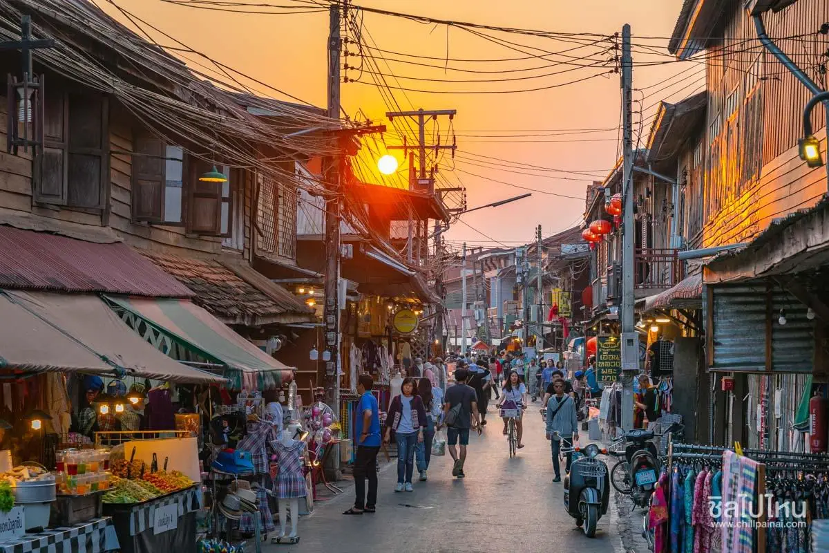
16. Ban Chiang Khan, Loei Ban Chiang Khan is situated in Chiang Khan District, Loei Province. It is a historic community along the Mekong River, celebrated for its traditional wooden houses, narrow streets, peaceful atmosphere, and riverside way of life. Chiang Khan combines the charm of an old settlement with contemporary tourism while preserving buildings, shops, and religious landmarks that reflect the history of this distinctive Mekong River town.
Chiang Khan's history is closely associated with settlement and commerce along the Mekong River, which served as an important transportation route for communities throughout the region. Many houses were constructed from timber and built in rows along the streets of the old town. Their architectural style reflects a way of life in which family homes often served as both residences and places of business. Today, numerous historic buildings have been renovated into guesthouses, restaurants, and cafés while retaining much of their traditional wooden character.
One of the most popular experiences is exploring Chiang Khan Walking Street in the evening. The street is lined with shops selling regional dishes, snacks, souvenirs, handicrafts, and community products. Visitors can admire traditional wooden buildings, sample local food, and enjoy an evening atmosphere that feels very different from that of a large city. Chai Khong Road, running through the old riverside area, is at the heart of Chiang Khan's visitor experience.
Chiang Khan is equally charming in the morning, when the riverside community is peaceful and the daily rhythms of local life become more apparent. Travelers can walk or cycle past historic houses, watch the morning light over the Mekong River, and observe traditional Buddhist almsgiving activities where appropriate. Visitors should respect the local community, particularly in residential areas and during religious activities.
Accommodation in Chiang Khan ranges from homestays and renovated wooden houses to guesthouses and small riverside hotels. Staying for at least one night is recommended because it allows time to experience the walking street in the evening and the quieter atmosphere the following morning. A visit can also be combined with Kaeng Khut Khu, Phu Thok, and Tai Dam Cultural Village.
Highlights: Historic wooden houses beside the Mekong River, Chiang Khan Walking Street, community homestays, cycling through the old town, traditional regional food, and peaceful riverside mornings.
Getting There From Loei town, follow Highway 201 toward Chiang Khan District, then continue to the historic riverside area. Travelers can arrive by private car, public transport, or hired local vehicle. Vehicle access to the walking street is restricted during certain periods, so visitors should park in an appropriate area and explore the old town on foot.
Map (GPS): GPS Coordinates: 17.893095, 101.659000 Open Google Maps directions to Ban Chiang Khan

17. Ban Manee Pruek, Nan Ban Manee Pruek is located in Ngop Subdistrict, Thung Chang District, Nan Province. This highland community is distinguished by its natural surroundings and the development of agriculture in mountainous terrain. Surrounded by forests and mountain ranges, the area has a relatively cool climate suitable for growing certain cool-weather crops and studying mountain ecosystems. Travelers visiting Ban Manee Pruek can experience a highland village, learn about mountain agriculture, and enjoy scenery that contrasts with the lowland landscapes of Nan Province.
Ban Manee Pruek is associated with a development project established to support security, livelihoods, and improvements in the quality of life of highland communities. The project area serves as an agricultural learning site where suitable crops are cultivated under local climatic conditions. It includes plots of cool-weather plants and natural areas that provide opportunities to study mountain ecosystems. Such development has helped create livelihood alternatives while supporting the conservation of local natural resources.
Natural attractions in the surrounding area include sites for viewing seasonal cool-weather plants and routes suitable for nature study. The cool season is particularly attractive when temperatures fall and certain flowering plants bloom. The mountains around Ban Manee Pruek also contain natural features such as Pha Phueng Cave and Doi Pha Phueng. These locations may appeal to travelers interested in outdoor exploration and natural landscapes, provided that activities are undertaken with experienced local guides and appropriate safety arrangements.
Community life around Ban Manee Pruek also reflects the traditions of highland ethnic groups, including Hmong and Lua residents, whose languages, cultural practices, and local knowledge contribute to the area's diversity. Visiting the community offers opportunities to understand settlement history, agricultural livelihoods, and the practical challenges of living and farming in steep mountainous terrain.
Travelers planning to stay overnight should confirm accommodation and available activities in advance because the village is located in a remote highland area. Ban Manee Pruek is particularly suitable for visitors who want to experience mountain nature and learn about highland agricultural practices rather than those expecting the comprehensive facilities of a large tourist town.
Highlights: Highland village in the Doi Phu Kha mountain region, cool-weather agriculture, ethnic community lifestyles, seasonal flowers, mountain landscapes, and Pha Phueng Cave.
Getting There From Nan town, follow Highway 1080 toward Thung Chang District, then turn onto the mountain road leading to Ban Manee Pruek in Ngop Subdistrict. Certain sections are steep and winding. Travelers should use a suitable vehicle and check road conditions in advance, particularly during the rainy season.
Map (GPS): GPS Coordinates: 19.433473, 101.091769 Open Google Maps directions to Ban Manee Pruek
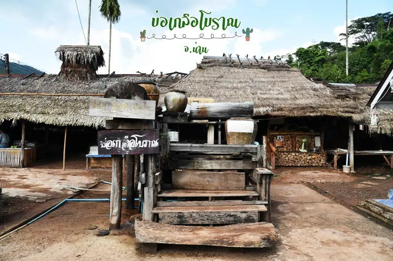
18. Bo Kluea Mountain Salt Wells, Nan Bo Kluea Mountain Salt Wells are located in Ban Bo Yuak, Bo Kluea Nuea Subdistrict, Bo Kluea District, Nan Province. This cultural and traditional-knowledge destination is distinguished by the production of natural salt in a mountainous area far from the sea. Although the district lies deep within the northern highlands, underground saline water has long provided a source of salt for local communities. Salt production has consequently become an important part of local identity and is closely associated with the name Bo Kluea, meaning salt well.
The traditional salt-boiling knowledge of Ban Bo Yuak reflects the community's ability to make practical use of locally available natural resources. Saline water is collected from natural wells and heated until much of the water evaporates, allowing salt crystals to form. The process requires experience in controlling heat, selecting suitable equipment, and identifying the correct stage of crystallization. These skills have been passed down through generations through practical work and family-based learning.
Historically, salt was a valuable resource used in cooking, preserving food, and exchanging goods between mountain communities and other settlements. The mountain salt wells therefore played a role not only in the local economy but also in the history of trade and everyday life in Nan Province. Visitors can learn how salt was traditionally produced and used, providing insight into the importance of this natural resource to highland communities.
Bo Kluea District also offers beautiful mountain landscapes, streams, and small villages surrounded by nature. Travelers can combine a visit to the salt wells with Pua District, Doi Phu Kha National Park, and Sapan Village. A journey through Bo Kluea therefore offers a combination of cultural learning, traditional craftsmanship, and relaxing mountain scenery.
Purchasing salt and locally made products directly from community producers is a useful way to support local livelihoods. However, visitors should follow the instructions of the people operating the salt-boiling areas because hot equipment and large boiling vessels are used during production. Particular care is necessary near the furnaces, and visitors should not touch tools or equipment without permission.
Highlights: Natural mountain salt wells, traditional salt boiling, local craftsmanship, the history of salt trading, and the scenic landscapes of Bo Kluea District.
Getting There From Nan town, travel through Pua District and follow the scenic road through the Doi Phu Kha National Park area toward Bo Kluea District. Continue to Ban Bo Yuak in Bo Kluea Nuea Subdistrict. The route follows winding mountain roads with several viewpoints along the way. Drive carefully and allow extra time for breaks and sightseeing.
Map (GPS): GPS Coordinates: 19.146888, 101.154005 Open Google Maps directions to Bo Kluea Mountain Salt Wells

19. Ban Nam Chiao, Trat Ban Nam Chiao is located in Nam Chiao Subdistrict, Laem Ngop District, Trat Province. This cultural and coastal fishing community is known for the peaceful coexistence of people from different religious and cultural backgrounds. The village lies beside Khlong Nam Chiao, a canal connected to mangrove forests and the sea. Local livelihoods are closely linked to fishing, seafood processing, and traditional handicrafts. Ban Nam Chiao is therefore an ideal destination for travelers interested in coastal community life and natural environments beyond conventional beach tourism.
One of Ban Nam Chiao's defining characteristics is the coexistence of people from different religions and cultural backgrounds, including Buddhist, Muslim, and Thai-Chinese communities. This diversity is reflected in local cuisine, traditional celebrations, religious landmarks, and everyday community activities. The village is consequently recognized as an example of how residents with different traditions can live together with mutual respect and shared community values.
The village's most famous handicraft is the Ngop Nam Chiao, a traditional woven hat made using natural materials and techniques passed down through generations. These hats have long been associated with outdoor work and daily life in the community. Watching the hat-weaving process allows visitors to appreciate the patience and skill required to create each piece and to understand how locally available resources are transformed into distinctive handicrafts.
Another popular experience is taking a boat trip through the mangrove forests and along the canal. Visitors can learn about the ecological importance of mangroves as breeding and nursery habitats for marine life while observing fishing boats, waterfront houses, and the daily activities of people whose livelihoods depend on the sea. Saphan Wat Jai, commonly known as the Bridge of Courage, is another recognizable attraction where travelers can admire the village scenery and take photographs.
Ban Nam Chiao offers community homestays and locally organized tourism activities that allow visitors to gain a deeper understanding of village life. Guests can enjoy traditional meals, participate in activities with residents, and learn about fishing and seafood-processing practices. Advance arrangements are recommended for boat excursions, homestays, and other programs so that the community can prepare suitable services for the number of visitors.
Highlights: Two religions and three cultural traditions, Ngop Nam Chiao woven hats, Saphan Wat Jai, mangrove boat tours, traditional fishing, local seafood, and community homestays.
Getting There From Trat town, follow the Trat–Laem Ngop road toward Nam Chiao Subdistrict. The village is approximately 8 kilometers from the town center and can be reached by private car, rental vehicle, or local taxi. Visitors wishing to take a mangrove boat trip or stay in a community homestay should contact the organizers in advance to confirm schedules and weather conditions.
Map (GPS): GPS Coordinates: 12.189086, 102.456986 Open Google Maps directions to Ban Nam Chiao
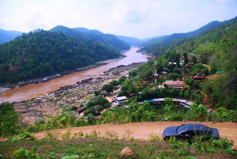
20. Ban Mae Sam Laep, Mae Hong Son Ban Mae Sam Laep is located in Mae Sam Laep Subdistrict, Sop Moei District, Mae Hong Son Province. This remote border village lies beside the Salween River, surrounded by high mountains along the Thailand–Myanmar border. Houses are built along the village roads and slopes descending toward the riverbank. The community has a simple atmosphere shaped by river transportation, mountain geography, and a way of life closely connected to one of mainland Southeast Asia's important waterways.
The Salween River is central to the identity of Ban Mae Sam Laep because of its importance to the area's geography, history, and the livelihoods of border communities. The village serves as a riverside settlement and a point of connection for boat transportation in Sop Moei District. Visitors can experience dramatic scenery, with mountain ranges stretching along both riverbanks, and observe a way of life that differs considerably from that of inland mountain villages.
One of the best-known experiences at Ban Mae Sam Laep is a boat journey along the Salween River. A popular route follows the river between Ban Mae Sam Laep and the Sop Moei area, where the landscape and river system are particularly distinctive. From the boat, travelers can admire mountains, forests, and riverside settlements from a perspective unavailable by road. Boat trips, however, depend on water levels, weather conditions, and the availability of safe local transport services.
The village has small shops and modest accommodation for travelers who wish to spend the night near the border. Facilities may be more limited than in major tourist towns, but the peaceful atmosphere and riverside scenery provide an opportunity to experience the natural surroundings at close range. Visitors should plan accommodation, meals, and return transportation carefully, particularly when arranging boat journeys or traveling farther into remote areas.
Ban Mae Sam Laep is suitable for travelers interested in nature, community livelihoods, and the geography of border regions. Before visiting, travelers should check weather and local conditions because travel restrictions or limitations on river activities may apply at certain times. Those planning a boat excursion should use experienced local operators with suitable safety equipment and follow the guidance of local authorities.
Highlights: Riverside border village on the Salween River, scenic boat journeys, mountain landscapes on both banks, traditional river-based livelihoods, and the geography of the Thailand–Myanmar border region.
Getting There From Mae Sariang District, travel south toward Sop Moei District before following the local mountain road to Mae Sam Laep Subdistrict and the village on the Salween River. The route is relatively long and includes many bends. Check weather and road conditions before traveling, and obtain up-to-date information about boat services and the border situation from local operators or authorities.
Map (GPS): GPS Coordinates: 17.980461, 97.739101 Open Google Maps directions to Ban Mae Sam Laep
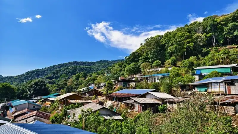
21. Doi Pui Hmong Village, Chiang Mai Doi Pui Hmong Village is located in Suthep Subdistrict, Mueang Chiang Mai District, Chiang Mai Province, within the mountainous landscape of Doi Suthep–Pui National Park. The village is an important cultural tourism destination associated with the traditions and everyday lives of the Hmong people. Its elevated location offers relatively cool weather, beautiful mountain scenery, and an opportunity to explore a highland community without traveling far from Chiang Mai city.
The Hmong people have their own distinctive language, clothing, traditions, and cultural practices. Traditional clothing is particularly recognizable for its colorful embroidery, decorative patterns, and careful craftsmanship. In Doi Pui Village, visitors can encounter shops offering embroidered textiles, ethnic clothing, handmade accessories, and other local products. These items reflect both the cultural heritage of the Hmong people and the importance of handicrafts to household livelihoods.
One of the main activities is walking through the village to explore the traditional atmosphere, local markets, and garden areas. Some shops offer Hmong clothing for visitors who wish to take photographs in traditional outfits. Travelers can also learn about the cultural significance of clothing, the use of mountain plants, and the agricultural practices that have historically supported highland communities. Visitors should ask permission before photographing residents or entering private areas.
Doi Pui is surrounded by forests and mountain ridges that form part of the Doi Suthep–Pui ecosystem. The scenery changes with the seasons, and the cool-season months are generally comfortable for exploring on foot. Its location also allows visitors to combine the village with Wat Phra That Doi Suthep and Bhubing Palace, making it a convenient cultural and nature-oriented day trip from Chiang Mai.
Although Doi Pui has become a popular visitor destination, the community remains a living residential village. Responsible travel involves respecting residents' privacy, supporting locally produced crafts, and avoiding damage to plants and village property. Those interested in learning more about Hmong heritage should take time to appreciate the traditions and stories behind the objects sold in local shops.
Highlights: Hmong ethnic culture, colorful traditional clothing, embroidery, local handicrafts, mountain gardens, traditional village atmosphere, and scenic highland surroundings.
Getting There From Chiang Mai city, follow Huay Kaew Road toward Wat Phra That Doi Suthep and continue past Bhubing Palace toward Doi Pui Hmong Village. The final road is paved but winding, with several steep sections. Private cars and local transport can reach the village, although travelers should drive carefully and check conditions during heavy rain.
Map (GPS): GPS Coordinates: 18.816557, 98.883349 Open Google Maps directions to Doi Pui Hmong Village

22. Ban Nong Khao, Kanchanaburi Ban Nong Khao is located in Nong Khao Subdistrict, Tha Muang District, Kanchanaburi Province. It is a traditional Central Thai community celebrated for preserving its rural lifestyle, agricultural heritage, folk performances, and local handicrafts. Unlike destinations focused primarily on dramatic natural landscapes, Ban Nong Khao offers visitors an opportunity to discover the cultural character of an old farming community whose identity remains closely connected to everyday village life.
The village is particularly known for its handwoven phakhao ma, a versatile traditional Thai cloth. The community's distinctive Hundred-Colored Phakhao Ma features colorful patterns produced using traditional weaving techniques. Local weavers work with carefully arranged threads to create textiles that combine practical use with creativity. Visitors can learn about the weaving process, observe traditional looms, and purchase textiles directly from local producers.
Agriculture continues to shape the identity of Ban Nong Khao. Traditional wooden houses, rice fields, and household activities reflect the history of a community built around farming. Cultural activities may include rice pounding, local dessert preparation, demonstrations of traditional agricultural skills, and performances of regional folk songs. These activities help travelers understand how work, family relationships, and celebrations were connected in rural Thai society.
Another attraction is the community's preservation of local traditions associated with religious festivals and village ceremonies. Folk performances such as Phuang Malai and Yoei songs are part of this cultural heritage. Watching or learning about these performances gives visitors insight into the way music and storytelling have traditionally supported social interaction and communal celebrations.
Ban Nong Khao is suitable for families, students, cultural travelers, and anyone interested in traditional Thai crafts. It can be included in a day trip from Kanchanaburi town, with additional time set aside for handicraft demonstrations or community activities. Advance arrangements are recommended for groups wishing to participate in organized learning programs.
Highlights: Hundred-Colored Phakhao Ma textiles, traditional weaving, wooden village houses, rice farming, local desserts, folk songs, and Central Thai cultural heritage.
Getting There From Kanchanaburi town, travel toward Tha Muang District and continue to Nong Khao Subdistrict. The village is approximately 12 kilometers from the town area and is accessible by private car or local transport. Groups planning cultural activities should contact the community in advance.
Map (GPS): GPS Coordinates: 14.085651, 99.586634 Open Google Maps directions to Ban Nong Khao
23. Ko Phithak, Chumphon — Ko Phithak Community is a small island fishing village off the coast of Bang Nam Chuet Subdistrict, Lang Suan District, Chumphon Province. The island is known for its peaceful atmosphere, traditional fishing livelihood, and community-based homestays. Unlike major island resorts, Ko Phithak has retained the character of a small coastal settlement where local people continue to depend on the sea and welcome visitors interested in their everyday way of life.
The island's identity is closely connected to fishing and coastal resource management. Residents have traditionally used local knowledge of tides, weather, fishing grounds, and marine species to sustain their households. Travelers who stay in the community can learn how coastal livelihoods change with the seasons and how the sea influences food, transport, and daily routines.
Community homestays are among the most appealing experiences on Ko Phithak. Accommodation generally emphasizes simplicity and direct contact with local families rather than extensive resort facilities. Guests can enjoy freshly prepared seafood, observe fishing activities, walk around the village, and spend quiet evenings surrounded by the sea. A night on the island allows travelers to experience the morning routines of the fishing community.
Another enjoyable activity is exploring the island on foot and appreciating the surrounding coastal landscape. Depending on sea conditions and local arrangements, visitors may also participate in fishing-related learning activities or short boat excursions. Travelers should follow the advice of community operators and avoid damaging coral, collecting marine animals unnecessarily, or leaving rubbish on the island.
Ko Phithak is suitable for families, couples, and slow travelers seeking an authentic coastal experience. The island's greatest attraction is the opportunity to spend time with a working fishing community and discover a quieter side of Chumphon. Homestays, boat transfers, and meals should be arranged in advance, especially during weekends and public holidays.
Highlights: Fishing village homestays, traditional coastal life, fresh seafood, peaceful island scenery, community activities, and boat travel across the Gulf of Thailand.
Getting There From Chumphon town, travel south toward Lang Suan District and continue to Bang Nam Chuet Subdistrict and the boat departure point serving Ko Phithak. Take a local boat to the island. Confirm departure times, sea conditions, and homestay arrangements with the community before traveling.

24. Pak Nam Prasae, Rayong Pak Nam Prasae is located in Pak Nam Prasae Subdistrict, Klaeng District, Rayong Province. It is an old fishing community situated near the mouth of the Prasae River, where the river meets the Gulf of Thailand. The village has a history linked to river trade, fishing, coastal agriculture, and the movement of goods along Eastern Thailand's waterways. Today, Pak Nam Prasae combines its traditional community character with nature-oriented tourism.
The community developed around its river-mouth location, which provided access to both inland waterways and the sea. Fishing boats, canals, and traditional waterfront houses remain important parts of the local landscape. Fishing, seafood processing, and agriculture have supported households for generations, and visitors can still observe the connection between these livelihoods and the natural environment.
One of the best-known attractions near Pak Nam Prasae is Thung Prong Thong, a mangrove conservation area with an elevated wooden walkway through golden-green mangrove vegetation. The changing colors of the mangrove canopy and its peaceful surroundings attract nature lovers and photographers. Visitors can learn about coastal ecosystems and understand the role of mangroves in protecting shorelines and supporting marine life.
Another landmark is HTMS Prasae, a former Royal Thai Navy vessel displayed near the coast. The ship has become an important historical attraction that can be combined with a visit to the fishing community. Nearby beaches, seafood restaurants, and community shops add variety to the experience, while locally operated homestays provide opportunities for an overnight stay.
Pak Nam Prasae is best explored at a relaxed pace. Travelers can walk through the old settlement, photograph traditional riverside scenery, sample local seafood, and visit nearby coastal attractions. An overnight stay allows more time to experience both the working community and its natural surroundings.
Highlights: Historic fishing village, Thung Prong Thong mangrove forest, HTMS Prasae, riverside houses, fresh seafood, boat excursions, and community homestays.
Getting There From Rayong town, travel toward Klaeng District along Sukhumvit Road, then turn toward Pak Nam Prasae Subdistrict. Follow local roads to the riverside village and nearby coastal attractions. Private transport is convenient for visiting several destinations in one trip.
Map (GPS): GPS Coordinates: 12.712038, 101.703408 Open Google Maps directions to Pak Nam Prasae
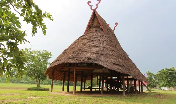
25. Thai Song Dam Cultural Tourism Village, Phetchaburi Thai Song Dam Village is located in Khao Yoi District, Phetchaburi Province. It is a cultural learning destination that preserves the history, traditions, language, and traditional way of life of the Thai Song Dam people, also known as Lao Song. The community is particularly recognizable for its dark traditional clothing, textile weaving, distinctive houses, and beliefs handed down through generations.
The Thai Song Dam community has historical roots associated with population movements from the Tai Dam cultural region of mainland Southeast Asia. Families settling in Phetchaburi brought their own language, religious beliefs, weaving methods, and household traditions. Over time, these practices became part of the cultural landscape of Khao Yoi while retaining recognizable characteristics of Tai Dam heritage.
Traditional clothing is an important expression of identity. The use of dark-colored fabrics, distinctive embroidery, and carefully designed textiles reflects cultural knowledge passed between generations. Visitors can learn about weaving methods, clothing traditions, and the role of particular garments and patterns in community celebrations and everyday life.
The village also offers opportunities to study traditional houses, tools, basketry, and customs relating to family and ancestral beliefs. Cultural demonstrations may introduce visitors to local performing arts, music, and ceremonies. These activities are meaningful because they show how cultural heritage remains connected to living communities rather than existing only as museum exhibits.
Thai Song Dam Cultural Tourism Village is suitable for families, students, historians, and travelers interested in Thailand's ethnic diversity. Visitors should contact local organizers in advance if they want cultural performances, weaving demonstrations, or a structured learning program.
Highlights: Thai Song Dam heritage, traditional houses, dark-colored ethnic clothing, weaving, basketry, cultural ceremonies, and community-based learning activities.
Getting There From Bangkok or Phetchaburi town, follow Highway 4, Phetkasem Road, toward Khao Yoi District. Turn toward the Thai Song Dam cultural area near Ban Wang School and continue along the local road to the community learning center.
Map (GPS): GPS Coordinates: 13.228105, 99.828154 Open Google Maps directions to Thai Song Dam Cultural Village

26. Khlong Nam Chiao Ecotourism Village, Phetchaburi Khlong Nam Chiao Village is located in Nong Pla Lai Subdistrict, Khao Yoi District, Phetchaburi Province. This canal-side farming community is known for its traditional agricultural livelihoods, coconut-related products, and a natural environment characterized by canals and waterside vegetation. The village offers travelers an opportunity to experience a quieter aspect of Phetchaburi beyond its well-known historical monuments and beaches.
Waterways have traditionally played an important role in the settlement and livelihood of the community. Canals have supported agriculture, transportation, and household activities, while the surrounding vegetation contributes to the local ecosystem. Exploring the village helps visitors understand how water has shaped settlement patterns and economic activities in rural Central Thailand.
A distinctive local occupation involves coconut cultivation and the production of traditional coconut sugar. This process requires knowledge of coconut flowering, collecting sap, and heating it to produce a concentrated sweetener. Learning about coconut sugar offers insight into a form of agricultural craftsmanship that remains strongly associated with Phetchaburi's culinary heritage.
Community-based activities may include canal excursions, observation of riverside vegetation, and visits to local agricultural production areas. A boat trip provides a different view of the landscape, allowing travelers to see canals, palms, village houses, and natural surroundings from the water. Such experiences depend on local arrangements and suitable weather conditions.
The village is suitable for visitors interested in rural life, agricultural knowledge, and ecotourism. Travelers should arrange activities with the community beforehand, particularly if they want guided boat trips or demonstrations of traditional food production.
Highlights: Canal-side village, traditional coconut sugar making, farming culture, riverside vegetation, nature boat trips, and community-based ecotourism.
Getting There Follow Highway 4 toward Khao Yoi District, then use local roads to reach Nong Pla Lai Subdistrict and Khlong Nam Chiao Village. Contact the community beforehand to confirm the meeting point and the availability of canal-based activities.
Map (GPS): GPS Coordinates: 12.956310, 99.690747 Open Google Maps directions to Khlong Nam Chiao Ecotourism Village
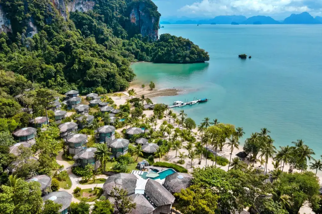
27. Koh Yao Communities, Phang Nga Koh Yao refers to the island communities of Koh Yao Noi and Koh Yao Yai in Ko Yao District, Phang Nga Province. Situated in Phang Nga Bay between Phuket and Krabi, these islands are known for their peaceful atmosphere, traditional Muslim fishing villages, rice fields, coconut and rubber plantations, and spectacular views of limestone islands rising from the Andaman Sea.
The communities have traditionally depended on small-scale fishing, agriculture, and the use of coastal natural resources. Fishing boats, local piers, fish cages, rice paddies, and plantations remain important parts of island life. Community-based tourism has developed as an additional livelihood, providing visitors with opportunities to learn about local culture while helping residents benefit from tourism.
Koh Yao Noi is particularly well known for community tourism experiences that include cycling through villages, learning about fishing and fish-cage farming, visiting rice fields, and participating in batik workshops. Local residents produce textiles and handicrafts inspired by the sea and the surrounding landscape. Homestays allow visitors to spend more time with local families, sample regional dishes, and gain a closer understanding of island life.
The natural scenery is another major attraction. Quiet beaches, coastal viewpoints, and boat routes provide views of Phang Nga Bay's distinctive limestone formations. Travelers can explore the islands by bicycle, motorcycle, or locally arranged transport, stopping at village shops and restaurants along the way. The islands are especially appealing to those who prefer peaceful surroundings over busy nightlife and large commercial resorts.
Visitors should respect the Muslim communities by dressing modestly in residential and religious areas and asking permission before photographing residents. Boat transfers and marine excursions depend on weather and sea conditions, so schedules should be checked before traveling.
Highlights: Koh Yao Noi and Koh Yao Yai, Muslim fishing communities, homestays, rice farming, batik, coastal scenery, island cycling, and limestone views of Phang Nga Bay.
Getting There Boats depart from selected piers in Phuket, Phang Nga, and Krabi. A common route from Phuket is via Bang Rong Pier to Koh Yao Noi or Koh Yao Yai. On arrival, travelers can arrange local transport or accommodation transfers. Confirm boat services in advance, particularly during the monsoon season.
Map (GPS): Reference Coordinates: 9.218056, 98.356667 Open Google Maps for Koh Yao communities
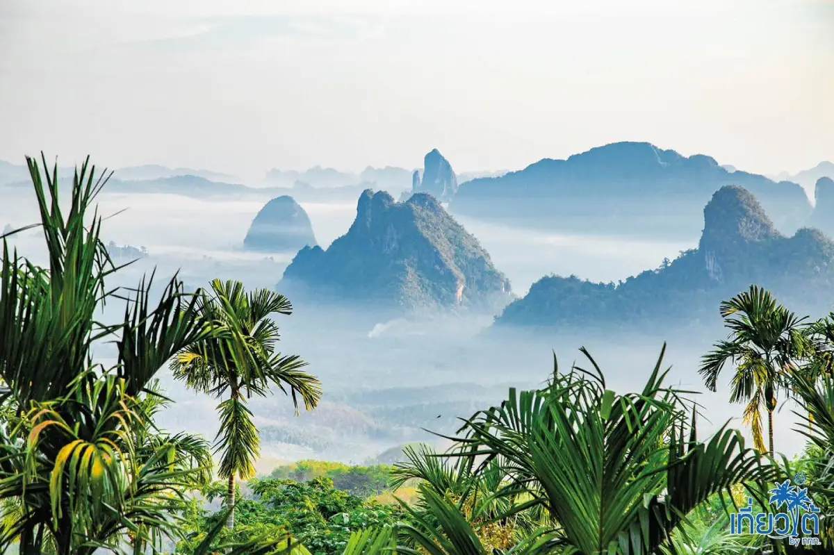
28. Doi Ta Pang, Chumphon Doi Ta Pang is located in Ban Bon Doi, Khao Thalu Subdistrict, Sawi District, Chumphon Province. It is a mountain viewpoint known for spectacular sunrise scenery, seasonal morning mist, and views of Khao Thalu, a mountain distinguished by a natural opening through its rock formation. The viewpoint stands approximately 500 meters above sea level and overlooks mountains, forests, and agricultural valleys.
Although Chumphon is commonly associated with beaches and coastal islands, Doi Ta Pang reveals a different landscape of Southern Thailand. From the viewpoint, visitors can admire mountain ridges extending toward the horizon. On suitable mornings, mist may settle within the valleys below, creating a sea-of-clouds effect. The appearance of mist varies with temperature, rainfall, humidity, and wind.
One of the most recognizable features of the panorama is Khao Thalu, whose distinctive rocky opening makes it a major landmark of the region. Sunrise is especially popular because the changing light transforms the mountain and surrounding valleys. Photography enthusiasts often arrive before dawn to prepare their equipment and find a suitable viewpoint.
The viewpoint is associated with the Ban Bon Doi community, whose residents provide local transport and visitor services. The access road to the upper viewpoint is steep, narrow, and partly rough, so local four-wheel-drive vehicles operated by experienced drivers are recommended. This arrangement helps travelers reach the mountain safely while supporting community income.
Some areas may accommodate camping depending on local arrangements. Travelers should confirm space and available facilities in advance, bring appropriate clothing for early-morning temperatures, and carry their rubbish back down the mountain. Doi Ta Pang can be combined with coffee-growing communities and other nature attractions in Sawi District.
Highlights: Sunrise viewpoint, seasonal sea of mist, Khao Thalu's natural mountain opening, panoramic valley scenery, community-operated four-wheel-drive transfers, and nature photography.
Getting There Travel to Ban Bon Doi in Khao Thalu Subdistrict, Sawi District. Park at the designated lower meeting point and arrange a local four-wheel-drive transfer to the viewpoint. The uphill journey generally takes about 15–20 minutes. Arrive early for sunrise and check the weather before traveling.
Map (GPS): GPS Coordinates: 10.180000, 98.900497 Open Google Maps directions to Doi Ta Pang
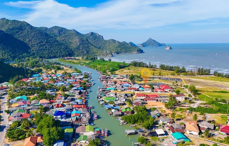
29. Ban Bang Pu, Prachuap Khiri Khan Ban Bang Pu is located in Sam Roi Yot District, Prachuap Khiri Khan Province. It is a traditional fishing village surrounded by coastal plains, limestone mountains, canals, and natural habitats associated with Khao Sam Roi Yot National Park. The community offers an opportunity to experience working fishing life alongside some of the most distinctive coastal landscapes in Western Thailand.
The village developed in an environment where tidal waterways and the sea provided access to abundant marine resources. Local residents have long depended on fishing and related coastal occupations. Boats, fishing gear, waterside houses, and seafood businesses remain visible parts of the community, allowing visitors to observe how everyday life is shaped by the tides and the surrounding marine ecosystem.
Ban Bang Pu is also a gateway to natural attractions around Sam Roi Yot. Nearby Bang Pu Beach provides views of limestone mountains and the Gulf of Thailand, while Laem Sala Beach connects with the route to Phraya Nakhon Cave. The cave is particularly famous for its royal pavilion illuminated by natural sunlight at suitable times of day. Travelers may also include other attractions in Khao Sam Roi Yot National Park according to available time and weather conditions.
Walking through the village reveals a quieter form of coastal tourism than the busy resort districts farther north. Visitors can photograph boats, enjoy local seafood, and appreciate the surrounding scenery. Some accommodation options allow travelers to stay close to the village and explore nearby caves and beaches over two days rather than attempting every activity in a single afternoon.
Because the community lies near coastal conservation areas, visitors should follow national park rules, use designated routes, and avoid disturbing wildlife. Boat services and cave visits may be affected by weather and sea conditions, so it is advisable to confirm arrangements before setting out.
Highlights: Traditional fishing community, Bang Pu Beach, limestone mountain scenery, coastal canals, Khao Sam Roi Yot National Park, and access to Phraya Nakhon Cave.
Getting There From Bangkok, travel south along Rama II Road and Phetkasem Road toward Sam Roi Yot District. Follow the local route to Ban Bang Pu and the coastal tourism area. Visitors planning to continue to Phraya Nakhon Cave should check boat services and the current national park access arrangements.
Map (GPS): GPS Coordinates: 12.206277, 100.010662 Open Google Maps directions to Ban Bang Pu

30. Mirror Foundation Tribal Tourism Project, Chiang Rai Mirror Foundation Tribal Tourism Project is based in Mae Yao Subdistrict, Mueang Chiang Rai District, Chiang Rai Province. The project provides opportunities for visitors to learn about highland ethnic communities through carefully organized cultural and nature-based activities. Its emphasis is on meaningful interaction, community participation, and the creation of tourism benefits for residents rather than presenting local cultures as performances for outside visitors.
Chiang Rai is home to several ethnic communities whose traditions reflect the cultural diversity of the northern highlands. Languages, clothing, agriculture, and cultural beliefs vary between communities, and these differences form an important part of the region's heritage. A community-based program can help travelers understand the relationships between local livelihoods, history, and natural environments through direct experiences.
Possible activities include guided village visits, learning about traditional farming, observing handicraft production, exploring local landscapes, and taking part in cultural exchanges arranged with community consent. Each program depends on local availability and appropriate arrangements. Travelers should approach activities as opportunities for mutual learning and respectful interaction, rather than expecting every aspect of community life to be open for public viewing.
Homestay experiences may form part of organized programs, allowing participants to spend time with local families and experience everyday village routines. Such stays require advance coordination to ensure suitable accommodation, meals, and activities. The project is particularly appropriate for students, educational groups, responsible travelers, and people seeking a deeper understanding of Thailand's ethnic and cultural diversity.
Respect for community rights is essential throughout the experience. Visitors should ask before photographing individuals, avoid entering private houses without permission, and follow the guidance of local organizers. Responsible tourism can strengthen local livelihoods while supporting the preservation of cultural knowledge and community autonomy.
Highlights: Highland ethnic community learning, guided village experiences, local agriculture, traditional handicrafts, cultural exchange, community participation, and responsible tourism.
Getting There From Chiang Rai city, travel to Mae Yao Subdistrict and the Mirror Foundation project location. Organized visits and village activities should be arranged with the project in advance, as schedules and destinations depend on community participation and local conditions.
Map (GPS): GPS Coordinates: 19.994872, 99.750335 Open Google Maps directions to the Mirror Foundation Tribal Tourism Project
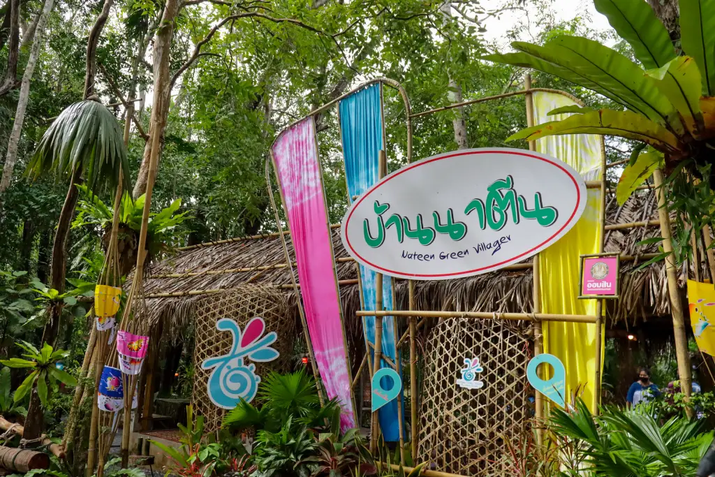
31. Ban Na Teen Village, Krabi Ban Na Teen is located in Ao Nang Subdistrict, Mueang Krabi District, Krabi Province. This Muslim community-based tourism village is known for traditional handicrafts, homestays, and local livelihoods associated with agriculture and the sea. Situated near Ao Nang and Noppharat Thara Beach, the village offers a different perspective on Krabi beyond its famous beaches and offshore islands.
The name Ban Na Teen reflects the area's agricultural history, when the land was used for farming before developing into a settled community. Residents have traditionally depended on activities such as rubber cultivation, fishing, coconut farming, and other local occupations. These livelihoods remain important to the identity of the village, even as community-based tourism has become an additional source of income.
One of the most distinctive local skills is the production of handicrafts from coconut shells. Since the community began developing coconut-shell products in the late twentieth century, artisans have transformed ordinary natural materials into decorative and practical objects. Products include small accessories, household items, ornaments, and souvenirs. Visitors can learn about the stages of production, from selecting and shaping the shells to polishing and assembling finished items.
Other community products include batik textiles, pineapple-fiber paper, and miniature long-tail boats. These handicrafts reflect the relationship between the village, its natural resources, and the surrounding coastal environment. Traditional cooking, rubber-farming demonstrations, and fishing-related activities may also be arranged with local organizers, allowing visitors to learn directly from residents.
Community homestays provide an opportunity to spend more time in Ban Na Teen, enjoy regional meals, and experience daily village life. Visitors should dress modestly, respect Muslim customs, and book organized activities in advance. The village can easily be combined with a visit to Ao Nang or Noppharat Thara Beach.
Highlights: Coconut-shell handicrafts, batik, miniature long-tail boats, Muslim community culture, homestays, fishing traditions, and agricultural learning experiences.
Getting There From Krabi town, travel toward Ao Nang along Highway 4202. Before reaching Noppharat Thara Beach, take the local road toward Ban Na Teen. The village is accessible by private car, rental vehicle, or locally arranged transport. Contact the community in advance for workshops or overnight stays.
Map (GPS): GPS Coordinates: 8.062129, 98.814713 Open Google Maps directions to Ban Na Teen Village
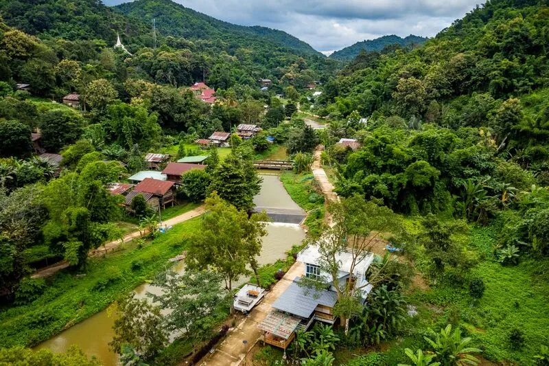
32. Ban Na Tong, Phrae Ban Na Tong is located in Cho Hae Subdistrict, Mueang Phrae District, Phrae Province. This small mountain village is surrounded by forest, streams, and a quiet natural environment. Its character is closely connected to highland agriculture, forest conservation, and traditional community life. The village offers a peaceful alternative to Phrae's better-known historic temples and wooden mansions.
Ban Na Tong has a long settlement history associated with families who moved into the mountain valley and established agricultural livelihoods. The community developed knowledge of local plants, tea-leaf production, and the management of natural resources. Water from the surrounding forests has played an important role in village life, contributing to agriculture and the community's environmental identity.
Natural attractions around Ban Na Tong include Natong Cave and Pha Bong Waterfall. Visitors can enjoy mountain landscapes and learn about the ecological importance of watershed forests. The area is also associated with conservation of the rare big-headed turtle, known locally as Tao Pu Lu, an animal that has become an important symbol of environmental awareness in the community.
Staying overnight allows travelers to experience the quiet village atmosphere and learn more about local livelihoods. Homestays and small accommodation options may be available, but advance arrangements are advisable because services are limited compared with larger tourist towns. Visitors should follow local guidance when exploring natural sites and should not disturb protected wildlife.
Ban Na Tong is suitable for nature lovers, families interested in environmental education, and travelers seeking a slow-paced mountain retreat. Its location also allows visitors to combine a village experience with Wat Phra That Cho Hae and other cultural attractions around Phrae.
Highlights: Mountain homestays, watershed forests, Natong Cave, Pha Bong Waterfall, traditional agricultural life, and big-headed turtle conservation.
Getting There From Phrae town, travel toward Wat Phra That Cho Hae and continue through Cho Hae Subdistrict toward Ban Na Tong. The final section follows mountain roads that may become difficult during heavy rain. A suitable vehicle and advance contact with local hosts are recommended.
Map (GPS): GPS Coordinates: 17.999787, 100.254643 Open Google Maps directions to Ban Na Tong

33. Ban Tha Khwai, Nan Ban Tha Khwai is located in Chai Watthana Subdistrict, Pua District, Nan Province. This traditional Northern Thai village lies beside the Pua River and is known for its agricultural lifestyle, riverside scenery, and local history. The community provides an opportunity to understand the relationship between farming, water, and settlement patterns in the Pua valley.
The village was formerly known as Ban Lap, a name associated with a riverside location where the steep bank prevented evening sunlight from reaching certain areas. Over time, the community became known as Ban Tha Khwai, referring to a place where villagers brought buffaloes to rest or enter the water. The name preserves the memory of the important role buffaloes once played in traditional rice farming.
The Pua River remains an important element of the village landscape. In the past, riverside areas supported agricultural activities, household needs, and the movement of people and animals. Travelers can learn about this history while observing fields and village surroundings. The area's gentle rural scenery contrasts with the higher mountain landscapes for which Nan is widely known.
Traditional celebrations, including Songkran and Bai Sri Su Khwan blessing ceremonies, are part of the local cultural heritage. These customs reflect community relationships, respect for elders, and the importance of shared rituals. Travelers who wish to learn about particular traditions should coordinate with local residents or community representatives.
Ban Tha Khwai can be included in a wider journey through Pua District, where attractions such as Wat Phuket, Wat Phra That Beng Sakat, and nearby Tai Lue villages provide opportunities to explore Northern Thai culture, temples, and rural scenery in one itinerary.
Highlights: Pua River scenery, history of buffalo-based farming, traditional agricultural life, Songkran customs, Bai Sri Su Khwan ceremonies, and cultural excursions around Pua District.
Getting There From Nan town, travel toward Pua District, approximately 66 kilometers away, before continuing to Chai Watthana Subdistrict. Ban Tha Khwai is about 6 kilometers from Pua town and is accessible by private car or rental vehicle.
Map (GPS): GPS Coordinates: 19.198475, 100.891649 Open Google Maps directions to Ban Tha Khwai
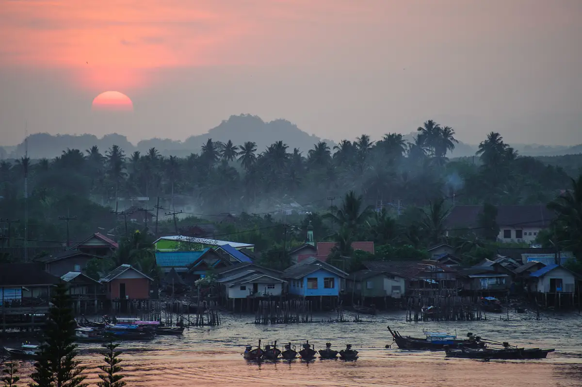
34. Ban Ko Klang Community, Krabi Ban Ko Klang is located in Khlong Prasong Subdistrict, Mueang Krabi District, Krabi Province. This island community lies near the mouth of the Krabi River, surrounded by mangrove forests, waterways, and the Andaman Sea. Although it is only a short boat ride from Krabi town, the village has preserved a peaceful way of life shaped by traditional fishing, agriculture, Muslim culture, and local handicrafts.
Fishing remains an important occupation in Ban Ko Klang. Boats, fish cages, and seafood-related activities are part of the daily landscape. The community also practices rice cultivation, and Sangyod rice has become a distinctive agricultural product associated with the area. Visitors can learn how local residents balance fishing and farming livelihoods in an island environment influenced by tides and seasonal conditions.
Traditional handicrafts are another highlight. Community producers make miniature long-tail boats that reflect the importance of water transport in Krabi, as well as batik and pateh textiles inspired by local culture. Visitors can learn about craft techniques and purchase handmade souvenirs directly from local artisans.
Community tours may include visiting rice fields, observing traditional fishing practices, sampling local seafood, and learning about Muslim village life. Many travelers explore the island using local sidecar tricycles, motorcycles, bicycles, or walking routes. This relaxed form of travel is well suited to the community's narrow roads and peaceful atmosphere.
Overnight homestays allow visitors to experience the island beyond a short day trip. Spending time with local hosts provides opportunities to enjoy regional cuisine and understand everyday village routines. Travelers should dress modestly, respect local customs, and arrange accommodation and activities in advance.
Highlights: Traditional fishing village, mangrove forests, Sangyod rice fields, miniature long-tail boats, batik and pateh textiles, local seafood, and community homestays.
Getting There From Krabi town, take a local boat from Thara Park Pier or Chao Fah Pier to the island. The crossing generally takes about 5–10 minutes, depending on the departure point. Continue by local sidecar tricycle, motorcycle, or bicycle to explore the community.
Map (GPS): GPS Coordinates: 8.040021, 98.926088 Open Google Maps for Ban Ko Klang and plan the boat crossing

35. Chanthaboon Waterfront Community, Chanthaburi is a historic riverside settlement in Mueang Chanthaburi District, Chanthaburi Province. The community is celebrated for its traditional houses, distinctive architecture, and multicultural heritage. Located along the Chanthaburi River, it developed through generations of trade and settlement, resulting in a neighborhood where Thai, Chinese, Vietnamese, and European architectural influences can be seen in close proximity.
The history of Chanthaboon Waterfront Community is closely associated with river transportation and regional commerce. The river once served as an important route for trading goods, connecting the settlement to surrounding agricultural areas and coastal destinations. Merchants and families established houses and businesses along the waterfront, helping create a lively commercial neighborhood that became an important part of Chanthaburi town.
Many historic buildings retain architectural features such as wooden shutters, decorative balconies, narrow shopfronts, and carefully designed facades. Some structures show influences from Western architectural styles, while others reflect traditional Chinese and Thai building methods. Walking through the old neighborhood allows travelers to appreciate how these styles developed through cultural exchange.
Today, the community contains cafés, small museums, restaurants, local craft shops, and traditional businesses. Visitors can enjoy regional Chanthaburi cuisine, explore lanes beside the river, and photograph the preserved streetscape. The atmosphere is particularly attractive in the morning and late afternoon, when the light reveals the details of old buildings.
The waterfront community can be combined with the Cathedral of the Immaculate Conception and other attractions in central Chanthaburi. It is suitable for a half-day cultural walk or a more relaxed overnight stay in nearby accommodation. Visitors should respect the privacy of residents and help preserve the historic environment.
Highlights: Historic riverside houses, Thai–Chinese–Western architecture, traditional commerce, local cuisine, cafés, cultural heritage, and walking routes through old Chanthaburi.
Getting There From central Chanthaburi, travel toward the old waterfront neighborhood along the Chanthaburi River. The community is best explored on foot. Park in an appropriate public parking area and walk through the historic streets.
Map (GPS): GPS Coordinates: 12.611072, 102.114344 Open Google Maps directions to Chanthaboon Waterfront Community
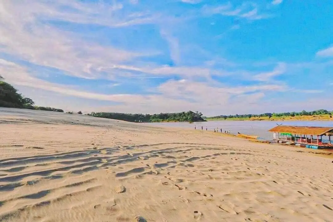
36. Ban Lat Charoen and Hat Sai Sung Community, Ubon Ratchathani Ban Lat Charoen and Hat Sai Sung is associated with riverside community life and the seasonal natural scenery of the Mekong River in Khemarat District, Ubon Ratchathani Province. The area is characterized by riverbanks, sandy formations, and a landscape influenced by changes in water levels throughout the year. It offers travelers a chance to experience community life near one of Southeast Asia's major rivers.
River systems have shaped settlement and everyday livelihoods in this part of Northeastern Thailand. Residents have historically depended on agriculture, fishing, and other activities linked to the river and nearby land. Seasonal changes affect where people can fish, cultivate crops, or access the riverbanks, making environmental knowledge an important part of community life.
Hat Sai Sung, meaning high sand beach, is associated with sandy areas that become visible when river levels are suitable. These natural formations create open riverside scenery that differs significantly between the wet and dry seasons. Visitors may enjoy photography, relaxing near the river, and learning about the relationship between the community and the Mekong landscape.
The surrounding community also provides an opportunity to explore local food and rural customs. Travelers can observe agricultural activities, learn about seasonal river use, and discover how riverside settlements have adapted to changing conditions. Visiting with a knowledgeable local resident or guide can provide more meaningful context than simply stopping for photographs.
Because the landscape depends on water levels, travelers should check current river conditions before visiting. Swimming or entering the river is not advisable without clear local safety guidance, particularly during periods of strong currents or rising water.
Highlights: Seasonal Mekong River sandbanks, riverside village life, traditional fishing, agriculture, natural landscapes, and community-based cultural learning.
Getting There From Ubon Ratchathani town, follow Highway 2050 toward Trakan Phuet Phon District and continue toward Khemarat District. Ban Lat Charoen is located in Na Waeng Subdistrict, with local roads leading to Hat Sai Sung beside the Mekong River. Confirm seasonal river conditions and the accessibility of the sand formations before departure.
Map (GPS): GPS Coordinates: 16.004702, 105.418832 Open Google Maps directions to Ban Lat Charoen and Hat Sai Sung
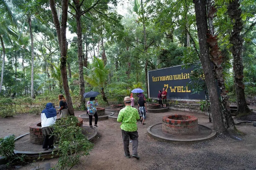
37. Bo Chet Luk Community, Satun Ban Bo Chet Luk is located in Pak Nam Subdistrict, La-ngu District, Satun Province. This traditional coastal community is known for its seven ancient wells, fishing culture, quiet beaches, and natural scenery associated with the Andaman coast. The village is an appealing destination for travelers who want to explore Satun beyond the province's famous islands and enjoy a combination of local history and nature.
The name Bo Chet Luk means seven wells, referring to a group of old freshwater wells that remain an important part of the community's history. The wells are associated with early coastal settlement and the need for reliable fresh water near the sea. They have become a distinctive cultural landmark and a reminder of how communities adapted to the challenges of living in coastal environments.
Fishing has traditionally been an important occupation in Ban Bo Chet Luk. Residents have relied on local knowledge of tides, coastal conditions, and marine resources to support their livelihoods. Fishing boats, local seafood, and Muslim community traditions remain visible elements of village life.
Nearby natural attractions include Hat Kasing, Hat Nui, and coastal limestone formations. Local boat trips may allow visitors to explore Prasat Hin Phan Yod and Ko Khao Yai, where striking rock formations create memorable landscapes. Marine activities must be arranged according to weather, tides, and any seasonal restrictions imposed by the authorities responsible for nearby protected areas.
Travelers may choose a short visit to the wells and community or spend a full day exploring beaches and taking a boat excursion. Some local accommodation and homestay options may be available by arrangement. Respect for Muslim cultural practices, coastal conservation, and community privacy is important throughout the visit.
Highlights: Seven ancient freshwater wells, traditional fishing community, Muslim coastal culture, Hat Kasing, Hat Nui, limestone islands, and boat trips to Prasat Hin Phan Yod.
Getting There From Satun town, travel toward La-ngu District and continue to Pak Nam Subdistrict and Ban Bo Chet Luk. Visitors can also arrange a local boat connection from the Pak Bara area depending on available services. Confirm boat schedules and weather conditions in advance.
Map (GPS): GPS Coordinates: 6.876141, 99.718390 Open Google Maps directions to Bo Chet Luk
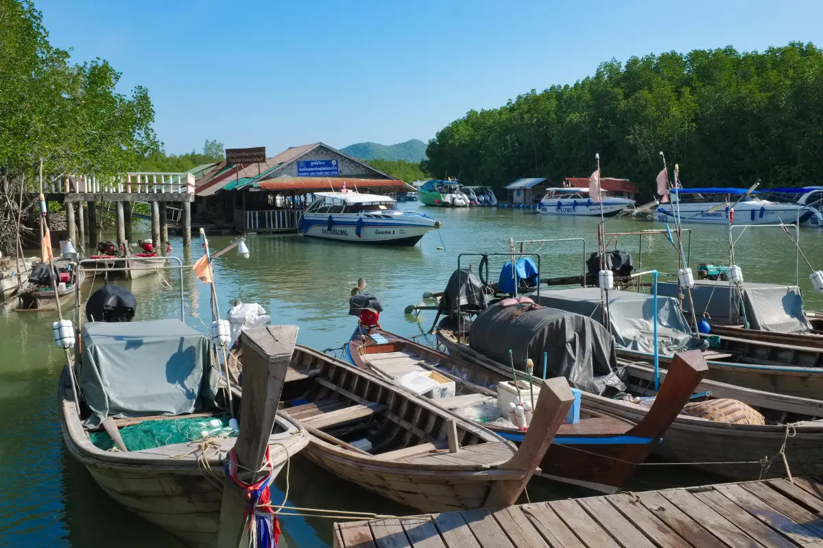
38. Ban Bang Rong Community, Phuket is located in Pa Khlok Subdistrict, Thalang District, Phuket Province. This community-based tourism village offers visitors a different perspective on Phuket, focusing on coastal nature, traditional Muslim lifestyles, and locally organized activities rather than the island's busy beaches and entertainment districts. The village is surrounded by mangrove forests, waterways, and natural landscapes that have supported local fishing and agricultural livelihoods for generations.
Mangrove forests play an important role in the local ecosystem because they provide habitats and nursery areas for aquatic animals while helping protect the shoreline. Ban Bang Rong has developed activities that allow visitors to explore these environments and learn how residents use and conserve natural resources.
One of the community's popular activities is kayaking through mangrove waterways. Depending on tides and weather conditions, visitors can paddle through calm channels while observing vegetation and the distinctive characteristics of the coastal ecosystem. Guided activities provide opportunities to learn about mangrove conservation and the relationships between local livelihoods and the environment.
The village also reflects Muslim cultural traditions that shape food, everyday customs, and community relationships. Travelers can enjoy local cuisine, learn about small-scale fishing and agriculture, and participate in activities arranged by community tourism groups. Visitors should dress modestly in residential and religious areas and respect local customs.
Ban Bang Rong is suitable for nature lovers, families, and travelers interested in responsible tourism. It can be combined with other destinations in northern and eastern Phuket, including nearby coastal areas and piers serving Phang Nga Bay. Kayaking and organized experiences should be booked in advance whenever possible.
Highlights: Mangrove kayaking, Muslim community culture, coastal ecology, traditional fishing, local food, and community-based nature tourism.
Getting There From Phuket town, travel north toward Thalang District and continue to Pa Khlok Subdistrict and Ban Bang Rong. Private cars and rental vehicles are convenient. Contact community operators in advance to confirm kayaking schedules, meeting points, and tide conditions.
Map (GPS): GPS Coordinates: 8.050533, 98.412949 Open Google Maps directions to Ban Bang Rong Community
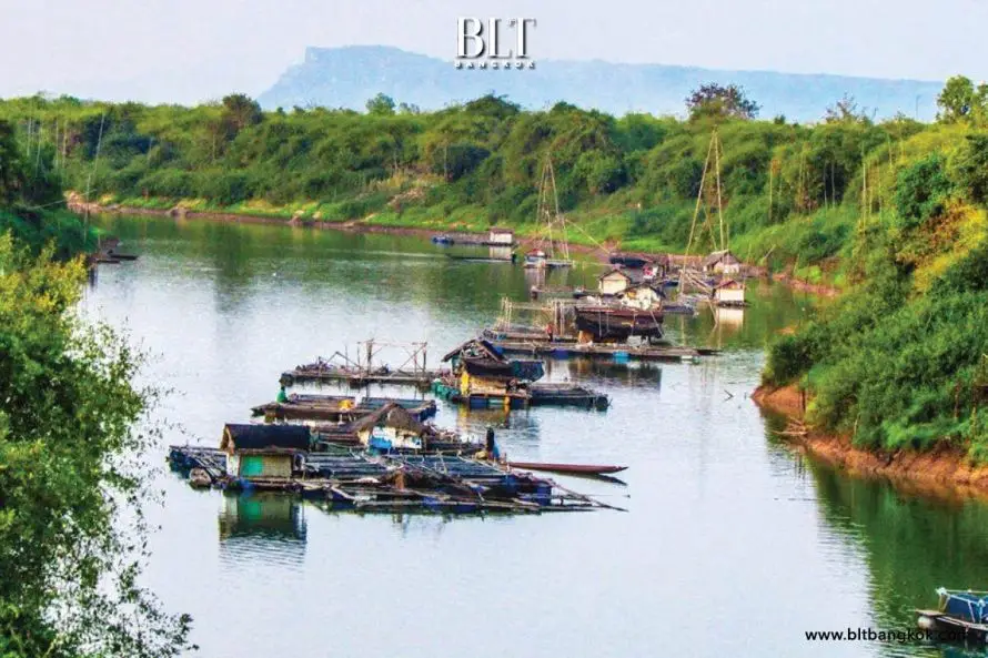
39. Songkhram River Basin Communities, Nakhon Phanom Songkhram River Basin Communities are traditional riverside communities associated with the Songkhram River and its extensive wetland ecosystems in Northeastern Thailand. The basin contains seasonally flooded forests, waterways, and floodplains that support freshwater fishing and local agricultural livelihoods. Community life in the area reflects a long relationship between human settlement and the annual changes in river levels.
A particularly important feature of the landscape is the seasonally flooded forest ecosystem, locally known as pa bung pa tham. During the rainy season, river water spreads into low-lying forests and wetlands, creating habitats for fish and other aquatic animals. When the water recedes, different parts of the landscape become accessible, and the pattern of fishing and resource use changes accordingly.
Fishing is central to the identity of many Songkhram River communities. Local knowledge includes the use of traditional fishing equipment, understanding fish migration and breeding patterns, and adapting fishing activities to seasonal conditions. Visitors interested in ecological and cultural tourism can learn about these practices through appropriately organized community visits.
The Songkhram wetlands are also important for biodiversity and environmental conservation. A visit provides an opportunity to understand why floodplain ecosystems matter to freshwater fish populations and to the long-term livelihoods of communities that depend on natural resources.
Tourism in the basin is best approached as a learning experience rather than a conventional sightseeing trip. Activities may include community walks, guided boat trips when water levels permit, and visits to local conservation areas. Travelers should arrange activities with community representatives and respect local rules governing fishing and wetland access.
Highlights: Songkhram River, seasonally flooded forests, freshwater fisheries, wetland biodiversity, traditional fishing knowledge, and community-based ecological learning.
Getting There From Nakhon Phanom town, travel toward communities in the Songkhram River basin using local roads. The basin covers a broad area, so visitors should identify the specific community or activity location before departing. Access conditions may vary substantially between the dry and rainy seasons.
Map (GPS): Reference Coordinates: 17.855350, 103.952652 Open Google Maps directions to the Songkhram River Basin area

40. Ban Pa Miang and Chae Son Area, Lampang is a mountain community associated with traditional miang production and the natural landscape around Chae Son in Lampang Province. The village is surrounded by forests and highland terrain that support a peaceful way of life closely connected to tea plants, local agriculture, and natural resources. Ban Pa Miang offers travelers an opportunity to experience mountain village culture beyond Lampang's better-known temples and historic urban attractions.
Miang production is an important part of the community's identity. Miang is made from tea leaves processed through traditional methods and is closely connected to Northern Thai food culture. Local residents have developed knowledge of harvesting leaves, preparing them, and maintaining tea-growing areas in the mountain environment. Learning about miang helps visitors appreciate the relationship between forest ecosystems and traditional livelihoods.
The village has an atmosphere of wooden houses, forest vegetation, and mountain roads. Visitors can walk through the community, learn about tea-leaf production, and enjoy the cool mountain air. Depending on community arrangements, travelers may also have opportunities to sample local dishes and stay overnight in simple accommodation.
The surrounding Chae Son area offers additional natural attractions, including forests, hot springs, and waterfalls. Kew Fin Viewpoint is another destination associated with mountain panoramas and early-morning scenery. A journey combining Ban Pa Miang and nearby natural sites allows travelers to experience both village culture and Lampang's highland environment.
Responsible travel is particularly important in villages located near forest conservation areas. Visitors should use appropriate walking routes, avoid damaging tea plants or cultivated land, and follow guidance from local residents. Overnight stays and organized cultural activities should be arranged in advance.
Highlights: Traditional miang tea-leaf production, forest village, mountain homestays, Northern Thai food culture, Chae Son natural attractions, and Kew Fin Viewpoint.
Getting There From Lampang town, travel toward Chae Son National Park and the mountain communities in the surrounding area. Continue along local roads to Ban Pa Miang. Mountain roads may have steep and winding sections, so travelers should check weather conditions and plan to arrive before dark.
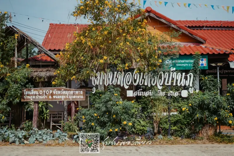
41. Ban Nong Lom Ecotourism Village, Mukdahan Ban Nong Lom is located in Pho Sai Subdistrict, Don Tan District, Mukdahan Province. This community-based tourism village lies close to the Mekong River and is known for its traditional rural lifestyle, local cultural heritage, and tourism activities organized by residents. The surrounding landscape includes agricultural areas, village houses, and the river environment that has supported local livelihoods for generations. Visitors can experience the atmosphere of a northeastern Thai village while learning about the relationship between farming, fishing, religion, and community traditions.
Ban Nong Lom has a distinctive cultural identity associated with the traditions of the local Phu Thai community and the wider Mekong region. Residents continue to preserve traditional customs, local food, handicrafts, and community ceremonies. Cultural activities may include Bai Sri Su Khwan welcoming rituals, traditional performances, weaving demonstrations, and learning experiences related to everyday village life. These activities offer visitors a meaningful opportunity to understand local culture through direct participation rather than simply observing a tourist attraction.
The Mekong River is an important part of the village's identity. Its changing water levels influence fishing, agricultural activities, and the appearance of the surrounding landscape throughout the year. When local conditions permit, visitors may be able to join organized boat excursions to appreciate the scenery along the river. Traditional fishing knowledge and the preparation of regional dishes also provide insight into the community's close relationship with natural resources.
Another important element of local culture is the community's Buddhist heritage. Wat Mutchalin serves as a spiritual center, and Phra Mutchalin is a revered Buddha image associated with local faith and tradition. A visit to the temple helps travelers appreciate the role of religion in village life and the importance of shared cultural practices.
Community accommodation provides an opportunity to spend more time in Ban Nong Lom. Visitors may be able to arrange homestay accommodation, simple bamboo huts, traditional meals, and activities according to the community's current arrangements. Advance reservations are important because services depend on the availability of local hosts and activity organizers. Travelers should respect private property, follow community guidelines, and support locally produced goods whenever possible.
Highlights: Phu Thai cultural heritage, Mekong River scenery, community homestays, Bai Sri Su Khwan ceremonies, weaving, traditional fishing, Wat Mutchalin, and local food.
Getting There From Mukdahan town, travel south toward Don Tan District and continue to Pho Sai Subdistrict and Ban Nong Lom. The journey is approximately 50 kilometers depending on the selected route. A private car or prearranged local transfer is recommended. Visitors should contact the community before traveling to confirm accommodation, activities, and the meeting point.
Map (GPS): GPS Coordinates: 16.405684, 104.859740 Open Google Maps directions to Ban Nong Lom

42. Ban Huai Ta, Uttaradit Ban Huai Ta is located in Nang Phaya Subdistrict, Tha Pla District, Uttaradit Province. This distinctive waterside community lies within the reservoir landscape above Sirikit Dam, surrounded by mountains, orchards, and freshwater fishing areas. Unlike conventional villages connected primarily by roads, local life here has adapted to an environment in which boats and waterways play an important role in transportation and everyday activities.
The history of Ban Huai Ta is closely associated with changes in the landscape following the development of Sirikit Dam and the surrounding reservoir system. The community adapted to the water-based environment while continuing to practice fishing, agriculture, and other traditional occupations. Residents developed knowledge of reservoir conditions, seasonal water levels, and the use of boats for transportation, creating a way of life that distinguishes Ban Huai Ta from many other communities in Northern Thailand.
One of the most memorable experiences is traveling by boat through the reservoir. Visitors can admire mountains rising above the water and observe houses, fishing boats, and areas used for local livelihoods. The broad expanse of water creates a peaceful landscape that changes with the weather and seasons. Photography enthusiasts will appreciate the contrast between the reservoir, forested hills, and rural settlement.
Freshwater fishing is central to the community's identity. Local residents have knowledge of fish species, seasonal fishing patterns, and the preparation of regional dishes using freshwater fish. Travelers interested in cultural and ecological learning can gain an understanding of these activities through community-organized experiences and conversations with local hosts.
Homestays and raft-style accommodation may be available through advance arrangements. Staying overnight allows more time to enjoy the tranquil reservoir atmosphere and learn about the village's daily routines. Visitors should carry suitable personal supplies, protect electronic equipment from water, and follow all boat-safety instructions. Boat journeys depend on weather conditions, water levels, and arrangements made with local operators.
Highlights: Reservoir village above Sirikit Dam, boat travel, freshwater fishing, mountain scenery, orchards, local cuisine, and community homestays or raft accommodation.
Getting There From Uttaradit town, travel toward Tha Pla District and continue to Nang Phaya Subdistrict. Boat access to Ban Huai Ta should be coordinated with local contacts or accommodation providers in advance. The journey requires planning because transport arrangements and access conditions differ from those of an ordinary roadside village.
Map (GPS): GPS Coordinates: 17.990958, 100.476991 Open Google Maps to the Ban Huai Ta area; arrange boat access separately

43. Ban Pak Lee Fishing Village, Nan is located in Ping Luang Subdistrict, Na Muen District, Nan Province. This nature-oriented rural community is distinguished by freshwater fishing livelihoods and the scenic reservoir landscape surrounded by mountains. The village provides an opportunity to discover a different side of Nan, where life is closely connected not only to forests and highland agriculture but also to the use of freshwater resources. Its peaceful surroundings and working village atmosphere make it particularly appealing to travelers interested in traditional livelihoods and community-based tourism.
The daily lives of Ban Pak Lee residents are closely associated with freshwater fishing, boats, and agriculture in the surrounding area. Local knowledge includes understanding fishing seasons, recognizing different freshwater species, and selecting traditional fishing equipment suitable for particular water conditions. This practical experience has been developed through generations of working with the local environment. Learning about these occupations helps visitors appreciate the relationship between natural resources, food production, and the economic life of the community.
The scenery around the village combines mountain ridges, open water, and houses situated within a quiet rural landscape. Mornings are generally pleasant for enjoying the natural surroundings, while the late afternoon offers attractive reflections of changing light across the reservoir. Travelers interested in photography can appreciate the contrast between mountains and water, although access to working areas and private property should always be arranged with the residents.
Traditional food is another attraction of Ban Pak Lee, particularly dishes prepared from freshwater fish and locally available ingredients. Visitors may have opportunities to learn about regional cooking and traditional fish-processing methods, including techniques used to preserve fish for later consumption. These practices demonstrate how local knowledge supports food security and household livelihoods while contributing to the cultural identity of the community.
Travelers wishing to spend the night can inquire about community accommodation or suitable places to stay in nearby areas. An overnight visit provides more time to appreciate the natural surroundings and speak with residents about their daily work. Ban Pak Lee is more suitable for travelers seeking a quiet rural experience than those expecting the extensive facilities of a large tourist destination.
The village is also relevant to travelers interested in ecotourism, freshwater ecosystems, and the traditional economy of Northern Thailand. Because the community is some distance from major urban centers, visitors should plan transportation carefully, prepare necessary personal supplies, and confirm any boat excursions or community activities before arriving. Responsible tourism includes protecting the environment, observing fishing activities without interference, and respecting the people who live and work in the village.
Highlights: Freshwater fishing livelihoods, reservoir-side village, traditional fish dishes, mountain scenery, peaceful natural surroundings, and opportunities to learn about community life.
Getting There From Nan town, travel toward Na Muen District and continue to Ping Luang Subdistrict and Ban Pak Lee. Local access routes should be checked in advance because travel conditions may vary with geography and seasonal water levels. Visitors planning community or boat activities should contact local operators beforehand.

44. Ban Tha Pa Pao, Lamphun Ban Tha Pa Pao is located in Tha Pla Duk Subdistrict, Mae Tha District, Lamphun Province. It is an ecotourism village recognized for community forest management and the joint conservation efforts of local residents. The village demonstrates how traditional knowledge and community cooperation can help protect forests and natural resources while also supporting rural livelihoods. Its natural surroundings make it a suitable destination for travelers interested in environmental education, local culture, and peaceful community-based tourism.
Ban Tha Pa Pao is an example of participatory natural resource management. Residents work together to establish rules governing forest use and protect local watershed areas so that natural resources can continue to support the community over the long term. These collective efforts reflect an understanding that healthy forests contribute to water supplies, soil protection, biodiversity, and agricultural productivity. The community's conservation approach also helps pass environmental knowledge to younger generations.
Ecotourism activities are particularly interesting because visitors can learn directly about the village's forest conservation practices. Guided nature walks provide opportunities to study local plants, understand the traditional uses of certain natural resources, and explore how the community organizes forest protection. Walking activities should be arranged with knowledgeable local guides and follow community rules to avoid damaging sensitive forest environments.
Local livelihoods remain connected to agriculture and the responsible use of natural resources. Regional cuisine often reflects ingredients and vegetables available in different seasons, while traditional household knowledge illustrates how people have adapted to the surrounding environment. Through community activities, travelers may learn about local cooking methods, agricultural occupations, and the relationship between food and the natural landscape.
Homestays provide a meaningful way to experience Ban Tha Pa Pao beyond a short visit. Travelers can stay with local families, enjoy regional meals, and participate in activities related to forest conservation and traditional village life. An overnight stay offers time for conversation with hosts and a closer understanding of community values. Advance reservations are recommended because accommodation and activities depend on local arrangements.
Ban Tha Pa Pao received an Outstanding Award in the ecotourism attraction category at the Thailand Tourism Awards in 2008. This recognition reflects the community's achievements in combining tourism with environmental conservation. The village is particularly suitable for educational groups, ecotourism enthusiasts, and travelers interested in practical examples of sustainable community development.
Highlights: Community forests, ecotourism, guided nature walks, traditional natural resource management, homestays, and local agricultural lifestyles.
Getting There From Lamphun or Chiang Mai, travel toward Mae Tha District before continuing to Tha Pla Duk Subdistrict and Ban Tha Pa Pao. Private transport is recommended for convenient access. Contact the community before traveling if you wish to join nature walks, environmental learning activities, or homestay programs.
Map (GPS): GPS Coordinates: 18.478313, 99.187548 Open Google Maps directions to Ban Tha Pa Pao
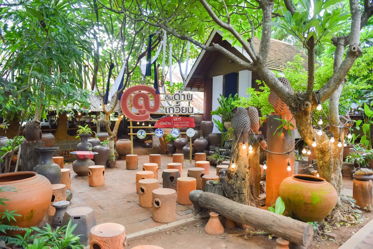
45. Dan Kwian Pottery Village, Nakhon Ratchasima Dan Kwian Pottery Village is located in Dan Kwian Subdistrict, Chok Chai District, Nakhon Ratchasima Province. This historic handicraft community is famous for its distinctive earthenware, recognizable by its natural colors, texture, and traditional production techniques. Pottery shops and workshops are spread throughout the village, offering visitors an opportunity to discover one of the best-known ceramic traditions in Northeastern Thailand.
The history of Dan Kwian is connected to traditional transportation and trade routes. The area once served as a resting point for ox-cart caravans traveling between regional towns, and its name reflects this historical role. As residents began using locally available clay to produce household pottery, the village gradually developed a reputation for durable earthenware. Over generations, pottery production became an important occupation and a defining element of community identity.
Dan Kwian ceramics are distinguished by the composition of local clay and the natural colors that emerge during firing. Mineral content contributes to reddish-brown, dark brown, and sometimes bronze-like surfaces, depending on production conditions. Traditional products included water jars, cooking pots, and storage vessels, while contemporary artisans have expanded their work to include planters, decorative sculptures, home accessories, and garden ornaments.
Travelers can walk through the pottery village, visit workshops, and explore shops displaying both traditional and contemporary designs. At participating workshops, visitors can observe clay preparation, shaping, surface decoration, and the steps involved in preparing pieces for firing. These activities illustrate the expertise required to transform raw clay into finished ceramic products.
Hands-on pottery-making is another appealing experience for families and travelers interested in art. Some workshops offer opportunities to shape clay or create simple pieces under the guidance of local artisans. Working with clay helps visitors appreciate the patience, precision, and technical understanding required in traditional ceramic production.
Visitors wishing to study the village's craft heritage in greater depth may choose accommodation in Dan Kwian or the surrounding area. Spending more time allows visits to several workshops and conversations with experienced artisans. The village can also be combined with other cultural destinations around Nakhon Ratchasima, creating an itinerary focused on local history, craftsmanship, and community life.
Highlights: Dan Kwian earthenware, traditional kilns, pottery workshops, locally made ceramics, hands-on clay activities, handicraft shops, and community accommodation.
Getting There From Nakhon Ratchasima city, follow Highway 224 toward Chok Chai District. Dan Kwian is approximately 15 kilometers from the city, with pottery shops and workshops located along the main route and nearby village roads. A private car is convenient for visiting different workshops and transporting purchased ceramics.
Map (GPS): GPS Coordinates: 14.857613, 102.189714 Open Google Maps directions to Dan Kwian Pottery Village

46. Ban Don Luang Cotton Weaving Village, Lamphun is located in Mae Raeng Subdistrict, Pa Sang District, Lamphun Province. It is a renowned traditional handicraft community specializing in handwoven cotton textiles and preserving the cultural heritage of the Yong people. The village reflects generations of weaving knowledge and Northern Thai cultural traditions, offering visitors a chance to experience a working craft community where handmade fabrics remain part of everyday life and household livelihoods.
The history of Ban Don Luang is associated with the migration and settlement of Yong people in Lamphun around 1809. The community was formerly known as Ban Ko Thon before becoming Ban Don Luang, a name associated with its elevated land and the gradual expansion of the settlement. Residents continued to preserve aspects of their language, clothing, weaving traditions, and cultural practices, contributing to the distinctive Yong heritage found in Pa Sang District.
The village is especially attractive to visitors interested in traditional weaving. Local artisans produce handwoven cotton using techniques passed down through families. Travelers can learn about preparing cotton yarn, arranging patterns, setting up traditional looms, and finishing fabric. Four-heddle weaving is among the techniques associated with the community's textile craftsmanship, requiring precise control of threads to create patterns and textures.
One of the village's most recognized cultural events is the Taeng Si Uat Lai Don Luang Cotton Festival, first organized in 2003 and traditionally associated with April. The event celebrates the community's handwoven cotton, local crafts, and regional products. It provides an opportunity for artisans to display their work, share technical knowledge, and present the cultural significance of textile production. Travelers planning to attend should confirm the official dates and program for the relevant year.
Purchasing cotton products directly from Ban Don Luang artisans helps support the local economy. Products include traditional clothing, scarves, bags, table coverings, and household fabrics. Visitors can speak with weavers about patterns, production methods, and the time required to make each item. Such encounters highlight the difference between handmade textiles and mass-produced fabrics and help preserve the value of traditional craftsmanship.
Ban Don Luang is suitable for cultural travelers, craft enthusiasts, educational groups, and visitors interested in Lanna and Yong heritage. A visit can be combined with Ban Nong Ngueak, another textile-producing community in Pa Sang District, and cultural attractions in Lamphun town. Those wishing to observe weaving demonstrations or participate in workshops should contact local groups in advance.
Highlights: Handwoven cotton, Yong cultural heritage, four-heddle weaving, traditional handicrafts, the Taeng Si Uat Lai festival, weaving demonstrations, and community textile products.
Getting There From Lamphun town, travel toward Pa Sang District and continue to Mae Raeng Subdistrict and Ban Don Luang. Private vehicles are convenient for exploring textile shops and workshops. Visitors interested in demonstrations or organized community activities should arrange them beforehand.
47. Ban Pang Manao, Kamphaeng Phet Ban Pang Manao is located in Pang Makha Subdistrict, Khanu Woralaksaburi District, Kamphaeng Phet Province. This highland community is known for its Lahu, also called Muser, cultural heritage and a way of life closely connected to agriculture and mountainous natural environments. The village is associated with conservation-oriented community development and offers opportunities to learn about traditional customs and livelihoods in a rural highland setting.
The landscape around Ban Pang Manao consists of mountains and forests that play an important role in supporting community life. Highland agricultural practices must adapt to differences in elevation, rainfall, soil conditions, and available water. Learning about these practices helps visitors understand how rural communities manage their livelihoods in environments that differ considerably from lowland farming regions.
Lahu culture has distinctive expressions through language, clothing, food, and traditional customs. Community-based visits may provide opportunities to learn about cultural practices through conversations with residents, observation of handicrafts, and participation in activities organized with community consent. Travelers should remember that the village is a living settlement and respect its social customs and private spaces.
Ban Pang Manao is also relevant to nature-oriented tourism because of its surrounding mountain and forest ecosystems. Visitors may be able to participate in guided nature walks or community learning activities where arrangements exist. Knowledgeable local guides can explain the use of natural resources and the importance of environmental conservation while ensuring that visits do not damage sensitive areas.
Community homestays may provide an opportunity to learn about everyday Lahu life, local food, and household occupations. Accommodation and activity availability depend on current local arrangements, so visitors should confirm details before traveling. Respectful participation and support for local products contribute to the benefits that tourism can bring to residents.
Ban Pang Manao is particularly suitable for travelers interested in ethnic cultures, sustainable tourism, highland development, and nature. Preparing suitable clothing and equipment for mountain travel is recommended, and visitors should follow community guidance regarding cultural practices, photography, and access to village areas.
Highlights: Lahu cultural heritage, mountain agriculture, community-based tourism, nature learning, local handicrafts, homestay experiences, and highland environments.
Getting There From Kamphaeng Phet town, travel toward Khanu Woralaksaburi District and Pang Makha Subdistrict before continuing to Ban Pang Manao. Some connecting roads pass through hilly terrain. Check access conditions and arrange local assistance where necessary.
Map (GPS): GPS Coordinates: 15.958900, 99.426700 Open Google Maps directions to Ban Pang Manao
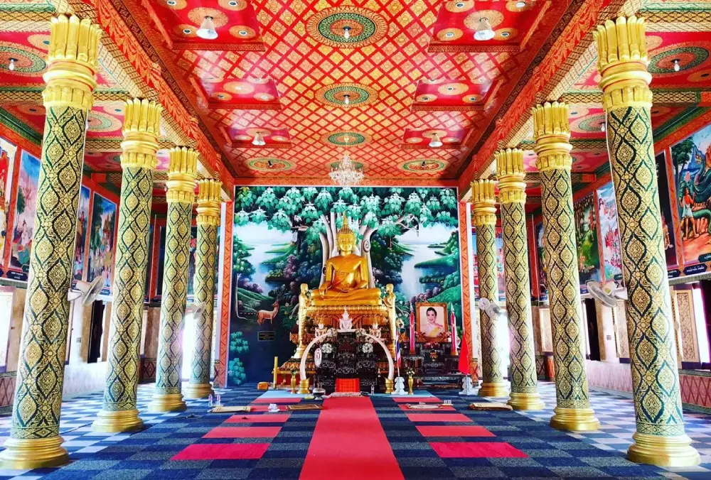
48. Ban Sanuan Nok Community, Buriram Ban Sanuan Nok is located in Sanuan Subdistrict, Huai Rat District, Buriram Province. This cultural tourism village is known for traditional silk weaving, Thai-Khmer heritage, and the preservation of local customs in Southern Isan. The community combines agriculture, handicrafts, traditional performing arts, and religious activities, making it an appealing destination for travelers who want to learn about the cultural identity of rural Buriram.
Silk production is an important form of local knowledge in Ban Sanuan Nok. Traditional processes include growing mulberry trees, raising silkworms, reeling silk, preparing threads, and weaving. The village is particularly associated with hang krarok silk, which has a distinctive appearance created by combining differently colored silk threads. These techniques have been passed down through generations and adapted into textile products that provide income for local households.
Another distinctive cultural expression is the traditional Trott dance, a form of folk performance associated with Khmer-influenced communities in the region. Its music, rhythms, and movements are connected to local celebrations and merit-making traditions. Learning about the performance provides insight into the relationship between community beliefs, social gatherings, and the preservation of cultural identity.
The village also contains traditional houses and community learning areas displaying household objects and items associated with rural life in earlier generations. Visitors can study local architecture, agricultural tools, and customs that reflect the historical development of the settlement. These exhibits and cultural experiences help connect the material heritage of the community with living traditions.
Wat Sanuan Nok is an important religious center for residents. The temple serves as a place for Buddhist ceremonies, merit-making, and other community activities. Travelers can include a respectful temple visit while learning about the importance of Buddhism to local village life. Appropriate clothing and consideration for religious practices are essential.
Community homestays provide an opportunity to discover local culture more closely. Visitors may enjoy regional dishes, participate in handicraft demonstrations, and experience everyday routines. Traditional foods, including local desserts, form part of the community's culinary knowledge. Visitors wishing to attend cultural performances or stay overnight should make arrangements in advance.
Highlights: Hang krarok silk, mulberry and silkworm cultivation, traditional Trott dance, old houses, Thai-Khmer culture, Wat Sanuan Nok, local food, and community homestays.
Getting There From Buriram town, travel toward Huai Rat District and continue to Sanuan Subdistrict and Ban Sanuan Nok. Private transport is convenient. Contact local community organizers if you wish to participate in weaving activities, cultural performances, or homestay programs.
Map (GPS): GPS Coordinates: 14.937190, 103.182512 Open Google Maps directions to Ban Sanuan Nok
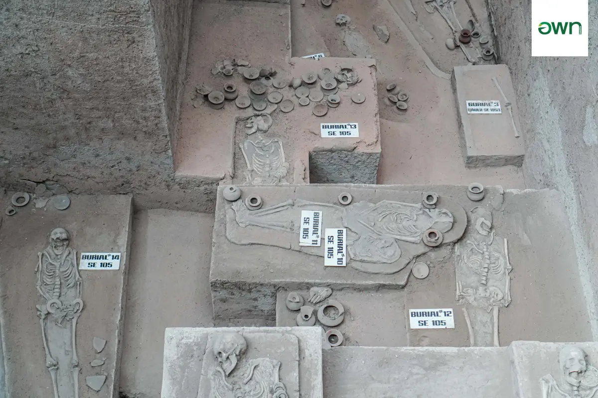
49. Ban Prasat Community, Nakhon Ratchasima Ban Prasat is located in Than Prasat Subdistrict, Non Sung District, Nakhon Ratchasima Province. It is a cultural tourism village known for the Ban Prasat Archaeological Site and the traditional lifestyle of a rural community in Northeastern Thailand. The village combines a living settlement with archaeological discoveries that reveal important evidence of prehistoric human occupation.
Excavations at Ban Prasat have revealed human skeletal remains, pottery, ornaments, and other objects associated with ancient settlement and burial practices. Archaeologists use these discoveries to understand how people lived, developed technology, and expressed beliefs over thousands of years. The artifacts provide valuable evidence of the cultural history of Northeastern Thailand.
Exploring the archaeological site is particularly rewarding for history enthusiasts and families interested in educational travel. Several excavation areas have been preserved to allow visitors to observe ancient remains in their original archaeological context. Displays and interpretation help explain the discovery of the objects, the significance of burial evidence, and the importance of archaeological conservation.
The village surrounding the site also maintains traditional agricultural and community activities. Cultural tourism programs may introduce visitors to local handicrafts, regional food, and household occupations. These experiences provide a broader understanding of Ban Prasat as a living community rather than simply an archaeological destination.
Homestays and community-based activities provide opportunities for travelers to spend more time in the village and learn about local life. Staying overnight can make it easier to participate in organized activities and explore the surroundings without rushing. Visitors should confirm the availability of accommodation and programs before traveling.
Ban Prasat can be combined with Phimai Historical Park and other cultural destinations in Nakhon Ratchasima Province. Visitors should respect excavation areas, remain behind protective barriers, and avoid touching archaeological objects. Protecting the site ensures that the evidence can continue to be studied and appreciated by future generations.
Highlights: Prehistoric archaeological discoveries, preserved excavation pits, ancient pottery, burial objects, local handicrafts, traditional agricultural life, and community homestays.
Getting There From Nakhon Ratchasima city, follow Highway 2 toward Non Sung District before continuing to Than Prasat Subdistrict and Ban Prasat Archaeological Site. Private transport is recommended for combining the visit with nearby historical attractions.
Map (GPS): GPS Coordinates: 15.245658, 102.371042 Open Google Maps directions to Ban Prasat Archaeological Site
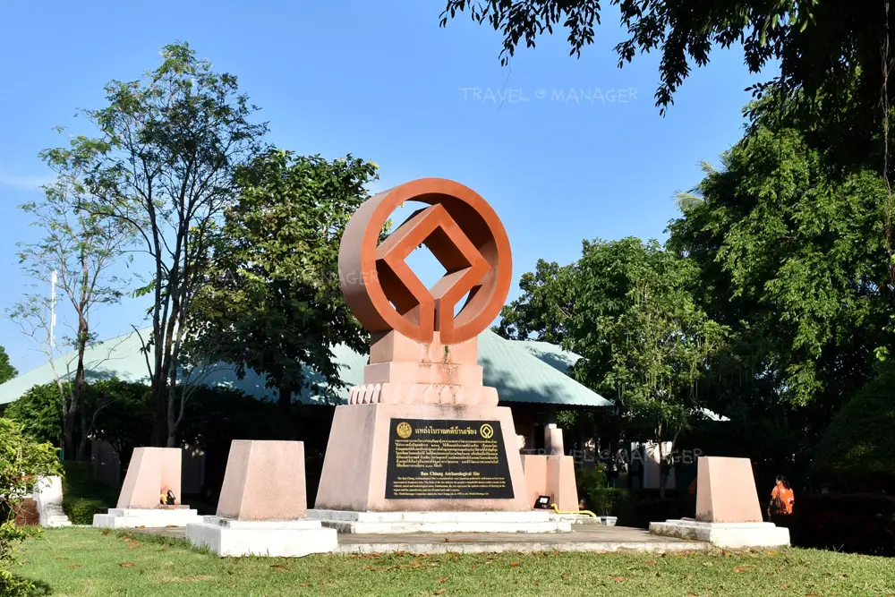
50. Ban Chiang Community, Udon Thani Ban Chiang is located in Ban Chiang Subdistrict, Nong Han District, Udon Thani Province. This historic community is associated with the internationally recognized Ban Chiang Archaeological Site, a UNESCO World Heritage property important for understanding prehistoric settlement, burial customs, pottery, and technological development in mainland Southeast Asia. The village combines cultural heritage, archaeological learning, traditional crafts, and the everyday atmosphere of a Northeastern Thai community.
Ban Chiang became internationally known following archaeological discoveries that revealed ancient human settlements and distinctive pottery traditions. Excavated objects include ceramic vessels decorated with red-painted patterns, ornaments, tools, and evidence of burial practices. These discoveries have contributed substantially to understanding the development of prehistoric societies in the region and have become important symbols of Udon Thani's cultural identity.
The most important attraction is Ban Chiang National Museum, which presents artifacts and interpretive exhibitions explaining the history of the site. Visitors can study pottery, archaeological evidence, and information about ancient communities. Nearby Wat Pho Si Nai includes a preserved archaeological excavation area that helps connect the museum's collections to the original settlement landscape.
Traditional pottery and handicrafts inspired by Ban Chiang's archaeological designs are significant local products. Artisans produce ceramics and souvenirs incorporating patterns associated with prehistoric pottery. Travelers can explore craft shops, learn about the production of contemporary ceramic pieces, and purchase items directly from local producers. These activities help connect the area's ancient history with the livelihoods of present-day residents.
Ban Chiang is also a living community with regional food, religious traditions, and agricultural life. Travelers interested in cultural experiences may explore village surroundings and participate in community activities when available. Accommodation in the wider area provides opportunities to spend more time learning about local heritage and visiting nearby attractions.
The community is suitable for families, students, researchers, and anyone interested in archaeology or Thai cultural history. Visitors should respect archaeological protection rules and avoid touching or removing ancient objects. Learning about Ban Chiang through its museum and community provides a meaningful understanding of how heritage conservation and local tourism can support one another.
Highlights: UNESCO World Heritage archaeology, Ban Chiang National Museum, prehistoric pottery, Wat Pho Si Nai excavation site, local ceramics, community culture, and historical learning.
Getting There From Udon Thani city, travel toward Nong Han District and continue to Ban Chiang Subdistrict. The museum and archaeological areas can be reached by private car or rental vehicle. Confirm current museum opening arrangements before departure.
Map (GPS): GPS Coordinates: 17.407280, 103.236594 Open Google Maps directions to Ban Chiang National Museum
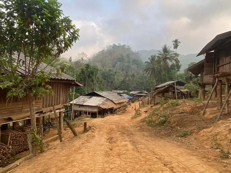
51. Hill Tribe Villages, Tak Hill Tribe Villages are located around Ban Sam Muen Thung, Village No. 4, and Ban Pang Sang Kham, Village No. 5, in Phawo Subdistrict, Mae Sot District, Tak Province. These highland communities are associated with the cultural heritage of the Lisu, Karen, and Lahu peoples. Surrounded by mountains, forests, and agricultural landscapes near the Thailand–Myanmar border, the villages offer travelers an opportunity to learn about the distinctive lifestyles, languages, traditional clothing, and customs of highland ethnic communities.
The cultural identities of these communities have developed through their histories of migration and settlement in the mountainous border region. Different ethnic groups maintain their own traditional dress, languages, ceremonies, and household practices. Agricultural work remains important to many families, while weaving, bamboo crafts, and other practical skills form part of the cultural knowledge shared between generations.
Local agriculture reflects the environmental conditions of the highlands. Residents cultivate suitable crops according to elevation, climate, seasonal rainfall, and available land. Visitors interested in agricultural tourism can learn about vegetable cultivation, coffee, and other community products where local activities have been arranged. Such experiences demonstrate how the surrounding landscape influences food production and everyday work.
Traditional handicrafts provide another way to discover the communities' cultural identities. Clothing, textiles, embroidery, and bamboo products reflect the creativity and skills of local artisans. The designs and methods differ between ethnic groups, and travelers should appreciate these distinctions rather than treating all highland cultures as interchangeable. Purchasing locally made products can help support household livelihoods and the continuation of traditional craftsmanship.
The mountainous surroundings also offer scenic views and opportunities for nature-oriented learning. Community-approved walking routes may allow visitors to appreciate agricultural landscapes, local vegetation, and the relationship between highland settlements and nearby forests. Cultural activities and visits to village areas should be arranged with residents or local representatives in advance.
Respectful tourism is particularly important when visiting ethnic communities. Travelers should obtain permission before photographing people, entering homes, or observing religious ceremonies. They should also avoid making assumptions about traditions or requesting activities that residents do not wish to share. Organized visits can provide more meaningful cultural understanding while protecting the communities' privacy.
Highlights: Lisu, Karen, and Lahu cultural heritage, traditional clothing, weaving, bamboo crafts, mountain agriculture, coffee, local cuisine, and highland scenery.
Getting There From Mae Sot town, travel toward Phawo Subdistrict and continue along local mountain roads to Ban Sam Muen Thung or Ban Pang Sang Kham. A private car, pickup truck, or vehicle suitable for mountain conditions is recommended. Confirm the specific community and meeting point with local representatives before traveling.
Map (GPS): Reference Coordinates: 16.599081, 98.789746 Open Google Maps directions to the Hill Tribe Village area
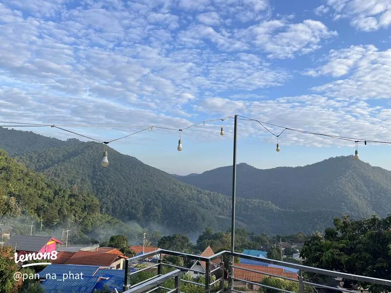
52. Ban Pang Pu Lo Highland Village, Phayao is located in Village No. 13, Si Thoi Subdistrict, Mae Chai District, Phayao Province. This mountain community is associated with the cultural heritage of the Mien, also known as Yao, people. Surrounded by forests and agricultural landscapes, the village preserves aspects of highland ethnic life through its language, clothing, customs, and traditional farming practices. It offers an alternative cultural experience for visitors exploring Phayao beyond its well-known lakeside attractions.
The Mien people have distinctive cultural traditions, including colorful embroidered clothing and decorative patterns that require considerable skill to produce. Textile craftsmanship is particularly important because traditional garments can express community identity, cultural beliefs, and the knowledge of previous generations. Visitors interested in ethnic culture may have opportunities to learn about these traditions through appropriate community activities.
Agriculture is central to everyday life in Ban Pang Pu Lo. The mountain environment supports various crops, including fruit cultivation and coffee in suitable growing areas. Local residents adapt planting practices to the terrain, rainfall, and seasonal conditions. Agricultural knowledge is therefore an important part of the community's identity and a useful subject for visitors interested in rural livelihoods.
Fruit orchards contribute to the appearance of the surrounding landscape, while forested mountain slopes create a peaceful natural setting. Visitors may be able to learn about lychee and other fruit-growing activities when local farmers are available and the season is appropriate. The experience reveals how crop cultivation is connected to the environment and household economy.
Nature-oriented tourism can provide opportunities to explore the scenery around the village and understand local plant life. Such activities should be organized with knowledgeable residents and carried out without disturbing agricultural land or forest resources. Travelers interested in photography should ask permission before entering orchards or photographing private homes.
Ban Pang Pu Lo is suitable for travelers who want to discover ethnic culture, rural agriculture, and mountain nature. Accommodation and activities should be confirmed before departure because the village is a working community rather than a large commercial resort. Spending time with local hosts can provide a deeper understanding of the Mien traditions and the community's relationship with the landscape.
Highlights: Mien cultural heritage, traditional embroidery, highland agriculture, lychee orchards, coffee cultivation, mountain forests, and rural community life.
Getting There From Phayao town, travel toward Mae Chai District and continue to Si Thoi Subdistrict and Ban Pang Pu Lo. The final approach passes through hilly terrain, so travelers should check the weather and road conditions, particularly during the rainy season.
Map (GPS): GPS Coordinates: 19.354928, 99.711759 Open Google Maps directions to Ban Pang Pu Lo
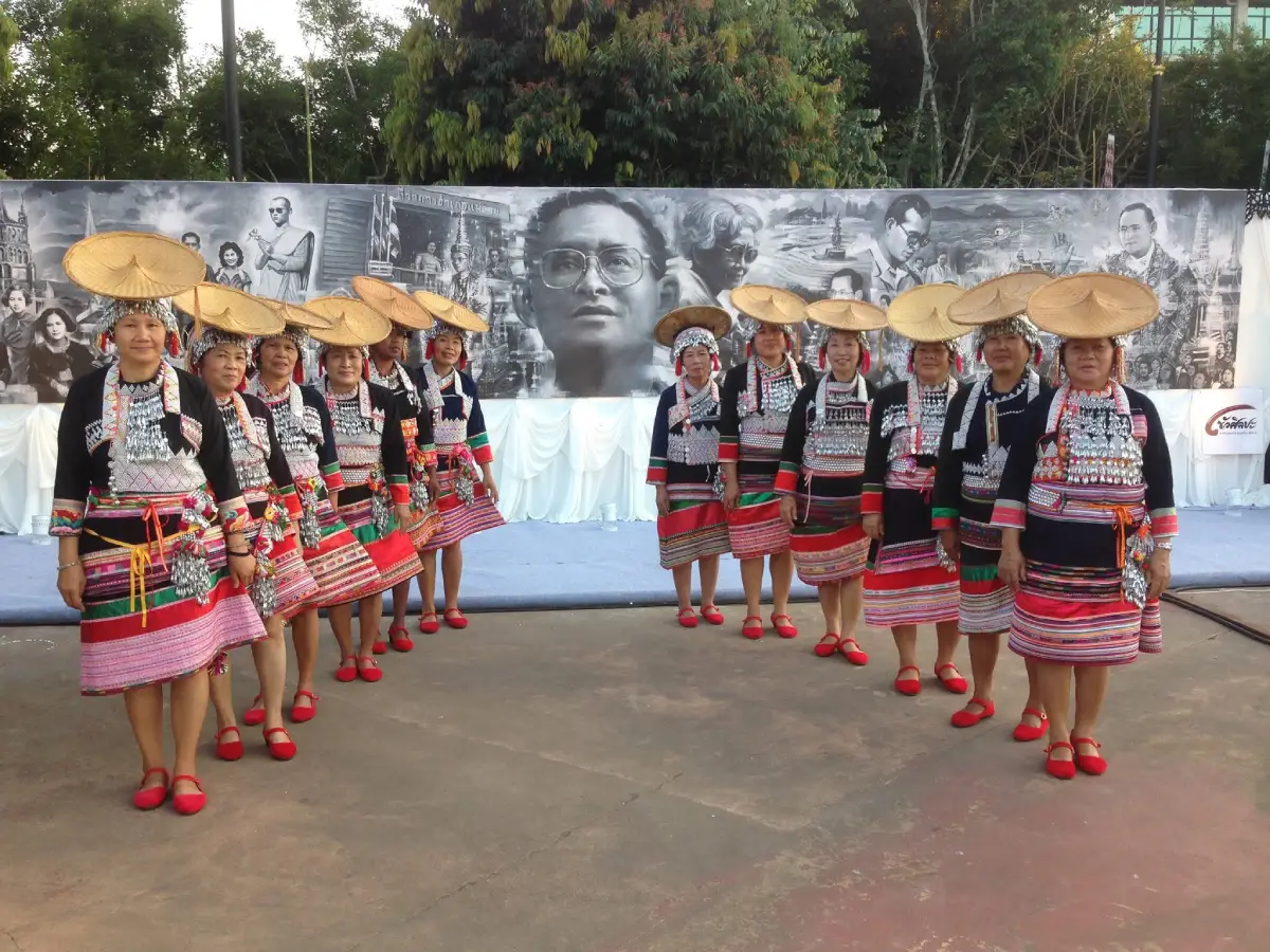
53. Ban Huai Khrai Nyah Kur Village, Phetchabun is located in Village No. 5, Tabo Subdistrict, Mueang Phetchabun District, Phetchabun Province. This rural community is associated with the cultural heritage of the Nyah Kur people, historically known in some Thai sources as Chao Bon. The village provides an opportunity to learn about a distinctive ethnic group whose language, customs, and traditional way of life form an important part of Thailand's cultural diversity.
The Nyah Kur are an indigenous ethnolinguistic community whose language belongs to the Monic branch of the Austroasiatic language family. Their cultural heritage has developed over a long history of settlement in upland and rural areas of Thailand. Traditional language, household customs, local beliefs, and ways of life contribute to their distinctive identity. Preserving this heritage is important because traditional knowledge and minority languages can become vulnerable as societies change.
Agriculture has long shaped life in rural communities such as Ban Huai Khrai. Residents use local knowledge of seasons, soil conditions, and suitable crops to support household livelihoods. Traditional relationships between families, farms, and the natural environment are reflected in the organization of village life and the sharing of practical knowledge between generations.
Visitors interested in cultural tourism may learn about the Nyah Kur language, traditional food, and community history through activities arranged with residents. Listening to local stories can provide insight into the community's past and the changes affecting its present-day life. Such experiences should be approached with respect and a willingness to learn, rather than treating cultural identity as a staged attraction.
The village's rural surroundings also offer opportunities to appreciate the countryside of Phetchabun Province. Agricultural land, local roads, and natural scenery illustrate how community life remains connected to the landscape. Travelers should respect cultivated fields and avoid entering private properties without permission.
Ban Huai Khrai is particularly suitable for educational visits, cultural researchers, and travelers interested in Thailand's ethnic heritage. Anyone wishing to arrange a group visit should contact the appropriate local representatives beforehand to confirm available activities and ensure that the visit respects community preferences and everyday routines.
Highlights: Nyah Kur cultural heritage, traditional language, rural agriculture, community history, local customs, and ethnic cultural learning.
Getting There From Phetchabun town, travel toward Tabo Subdistrict and Ban Huai Khrai in Mueang Phetchabun District. Private transportation is convenient for visiting the rural area. Travelers should confirm the specific community location and arrangements before departure.
Map (GPS): Reference Coordinates: 16.322050, 101.248430 Open Google Maps directions to Ban Huai Khrai

54. Huai Nam Sai Mon Village, Ratchaburi Huai Nam Sai Mon Village is located in Village No. 3, Suan Phueng Subdistrict, Suan Phueng District, Ratchaburi Province. Surrounded by mountains, forests, and streams, the village is a cultural tourism destination distinguished by its Mon heritage and peaceful natural setting. Its atmosphere has attracted travelers seeking traditional village scenery and cultural experiences away from busy city environments.
The village's location near the Thailand–Myanmar border contributes to a cultural landscape in which Thai and Mon traditions meet. Language, food, clothing, religious practices, and household customs reflect the history of Mon communities in Western Thailand. Visitors can appreciate these traditions while exploring the village's streets and learning about the people who continue to live there.
Local food is one of the most appealing aspects of a visit. Visitors can sample traditional dishes, regional snacks, and products sold by community businesses. On days when markets and food stalls operate, the village becomes a lively meeting place for residents and travelers. These activities support local livelihoods while providing an accessible introduction to Mon cultural heritage.
The surrounding natural landscape is another major attraction. Mountain slopes, streams, and green vegetation create an appealing atmosphere for photography and relaxation. Visitors can walk through accessible areas of the village, appreciate traditional houses, and enjoy the cooler surroundings, particularly during the winter months.
Religious and cultural practices remain important to community identity. Travelers may encounter traditional activities associated with Buddhist merit-making and community celebrations. Any participation should be carried out respectfully and according to the guidance of residents. Photography of religious ceremonies or private activities should only be undertaken with permission.
Although tourism has become an important part of the village economy, Huai Nam Sai remains a living community. Visitors should avoid creating excessive noise, respect private property, and support local producers. Those wishing to spend more time in Suan Phueng can combine the village with nearby natural attractions and accommodation in the surrounding countryside.
Highlights: Mon cultural village, Thai–Mon traditions, traditional houses, local food, mountain scenery, natural streams, and the peaceful surroundings of Suan Phueng.
Getting There From Ratchaburi town, follow the main route toward Suan Phueng District and continue to Suan Phueng Subdistrict and Huai Nam Sai Mon Village. Private transport is convenient. Visitors should check local traffic and market arrangements, particularly during weekends and public holidays.
Map (GPS): GPS Coordinates: 13.648051, 99.216576 Open Google Maps directions to Huai Nam Sai Mon Village
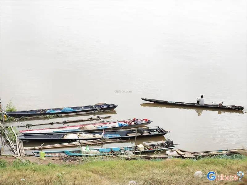
55. Freshwater Fishing Village, Nong Khai Freshwater Fishing Village is located in Kong Nang Subdistrict, Tha Bo District, Nong Khai Province. This working community is known for freshwater aquaculture and livelihoods closely connected to the Mekong River. Situated along the route between Tha Bo and Si Chiang Mai, it offers visitors an opportunity to understand how local fish farming, traditional knowledge, and rural economic activities contribute to food production and everyday life.
Freshwater fish farming is an important source of household income in the area. The community raises several species, including silver barb, common carp, freshwater mud carp, rohu, silver carp, and African catfish. Managing these species requires knowledge of fish growth, appropriate feed, water quality, pond and cage maintenance, and seasonal conditions. Such skills have developed through long experience and are essential to the community's livelihood.
The village also participates in the distribution of freshwater fish to markets in other parts of Thailand. The work therefore extends beyond household consumption and contributes to the wider regional food economy. Visitors interested in agricultural and food-production tourism may gain an understanding of how fish are raised, harvested, transported, and prepared for sale. Working fish-farming areas should only be visited with permission.
The atmosphere around the village reflects rural life beside the Mekong River. Agricultural land, local roads, boats, fish ponds, and community houses contribute to a landscape in which work and daily routines remain closely connected to water resources. Seasonal changes in river conditions influence certain local activities, making environmental knowledge especially important.
Traditional freshwater fish dishes provide another reason to explore the wider Tha Bo area. Local food may include grilled fish, soups, and preparations associated with northeastern Thai cuisine. Learning about the production of fish helps travelers better understand the connection between regional food and the natural resources that support it.
Freshwater Fishing Village is more suitable for educational and cultural visits than for conventional resort tourism. Families, students, and travelers interested in local economies can learn about fish farming and the challenges of managing freshwater resources. Visitors should keep a safe distance from slippery banks, fish ponds, and cages and avoid interfering with residents' work.
Highlights: Freshwater fish farming, Mekong riverside livelihoods, aquaculture ponds and cages, local fish products, rural community economy, and traditional northeastern Thai food.
Getting There From Nong Khai town, travel toward Tha Bo District and continue along the Tha Bo–Si Chiang Mai route to Kong Nang Subdistrict. A private car, rental car, or locally hired vehicle is convenient. Visitors wishing to observe fish production should arrange permission with community representatives or operators.
Map (GPS): GPS Coordinates: 17.898756, 102.605295 Open Google Maps directions to Freshwater Fishing Village
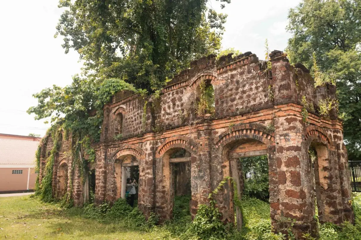
56. Ban Tha Rae Catholic Community, Sakon Nakhon is located in Tha Rae Subdistrict, Mueang Sakon Nakhon District, Sakon Nakhon Province. This historic community beside Nong Han Lake is renowned for its Roman Catholic heritage and old buildings influenced by Western architecture. Its history, religious traditions, and distinctive cultural landscape have made Tha Rae one of the most recognizable Christian communities in Northeastern Thailand.
The history of Tha Rae is closely connected to the settlement of Catholic families near Nong Han Lake. Religious life has played an important role in the development of the community, with the Archangel Michael Cathedral serving as a center of faith and worship. Several historic houses display architectural characteristics influenced by European and Vietnamese building traditions, reflecting cultural exchanges that shaped the settlement over time.
Walking through the old village streets is one of the most rewarding activities. Visitors can admire historical buildings, photograph architectural details, and learn about the history of families and businesses that have contributed to the community. Old facades, windows, decorative features, and traditional street patterns provide visual evidence of the settlement's development.
The most celebrated cultural event is the Christmas Star Parade, a major annual tradition of the Catholic community. Illuminated star decorations and decorated vehicles form part of the festivities, expressing the community's faith and creating a distinctive festive atmosphere. The event attracts visitors interested in religious heritage and local traditions. Travelers should check the official program for the relevant year before planning a visit.
Nong Han Lake is another important part of Tha Rae's setting. This large freshwater lake contributes to the geography, environment, and traditional livelihoods of the Sakon Nakhon area. Visitors can combine a cultural walk around the village with other attractions near the lake and in Sakon Nakhon town.
Tha Rae is suitable for travelers interested in history, architecture, religious traditions, and cultural tourism. The community is particularly atmospheric during its annual celebrations, but it is also worthwhile at quieter times of year. Visitors should respect religious spaces and the private homes of local residents.
Highlights: Historic Catholic community, colonial-influenced buildings, Archangel Michael Cathedral, Christmas Star Parade, old houses, and the Nong Han Lake landscape.
Getting There From Sakon Nakhon town, follow Highway 22 toward Nakhon Phanom. Ban Tha Rae is approximately 21 kilometers from the city. Park in an appropriate area and explore the historic streets on foot. During festival periods, check traffic arrangements and event schedules in advance.
Map (GPS): GPS Coordinates: 17.254120, 104.181700 Open Google Maps directions to Ban Tha Rae
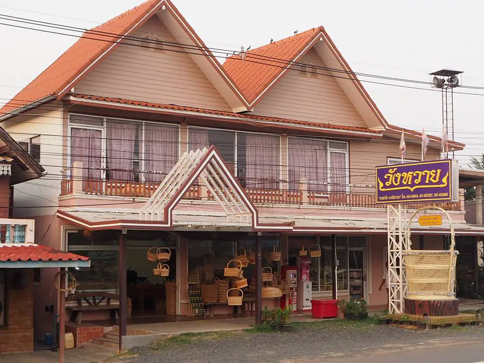
57. Ban Butom Basket Weaving Village, Surin is located in Village No. 4, Mueang Thi Subdistrict, Mueang Surin District, Surin Province. This traditional handicraft village is famous for its fine rattan weaving, a skill preserved and passed down through local families for generations. The community represents the cultural value of traditional craftsmanship, where natural materials are transformed into practical and decorative products through experience, patience, and careful workmanship.
The village is particularly known for its fine rattan weaving using slender strands of rattan, often associated with the material known locally as wai hang nu. Producing these handicrafts requires careful material preparation and precise weaving techniques. Finished products include baskets, containers, household accessories, and decorative items in various forms. Each piece reflects the skill and creativity of the artisan who produced it.
Rattan handicraft production contributes to the household economy of Ban Butom, particularly during periods outside the main rice-growing season. Family members can devote time to weaving as a supplementary occupation, while experienced artisans and older residents pass on their knowledge to younger generations. This relationship between agriculture and handicrafts illustrates how traditional rural households have maintained diverse sources of income.
Travelers can visit participating craft groups to observe the weaving process and learn how rattan is prepared, shaped, and interlaced into finished products. Watching artisans at work gives visitors a greater appreciation of the time and precision involved in handmade crafts. Purchasing products directly from local producers helps support the village economy and encourages the preservation of traditional skills.
Ban Butom is suitable for visitors interested in handicrafts, local culture, and educational tourism. The village can be included in a half-day cultural excursion or combined with other attractions around Surin town. For detailed weaving demonstrations or hands-on workshops, travelers should contact local craft groups before arriving.
Highlights: Fine rattan basket weaving, traditional containers, handicraft demonstrations, household craft production, rice-farming lifestyles, and community products from Surin.
Getting There From Surin town, follow Highway 226 toward Sikhoraphum for approximately 12 kilometers, then turn toward Mueang Thi Subdistrict and Ban Butom. Private transport is convenient. Arrange workshop visits in advance if you wish to observe artisans at work.
Map (GPS): GPS Coordinates: 14.884522, 103.641663 Open Google Maps directions to Ban Butom
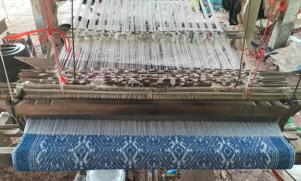
58. Ban Non Sela, Chaiyaphum is located in Village No. 6, Nong Tum Subdistrict, Phu Khiao District, Chaiyaphum Province. The village is renowned for traditional khit weaving, an important textile craft of Northeastern Thailand. Local artisans have preserved weaving knowledge through generations, creating patterned fabrics and household products that contribute to community income and cultural identity.
Ban Non Sela khit textiles are distinguished by their weaving technique, in which carefully selected threads are lifted to create decorative patterns and raised designs. The process requires skill in arranging threads, managing pattern sequences, and controlling the loom. The finished fabrics reflect considerable patience and craftsmanship and demonstrate the importance of weaving as a traditional form of artistic expression.
In the past, residents produced woven textiles for household use and religious celebrations. Over time, the community developed craft groups to produce and sell a wider range of products. These now include khit pillows, shawls, table coverings, bags, clothing, and home decorations. The development of new products has expanded opportunities for household income while helping preserve traditional weaving skills.
Visitors can learn about khit weaving and purchase textiles directly from local artisans. Observing the production process reveals how each piece begins with thread preparation and the planning of decorative patterns before weaving can begin. Some craft groups may offer demonstrations or introductory activities for visitors by prior arrangement.
The atmosphere of Ban Non Sela continues to reflect agricultural village life. Many households use their homes as both residential spaces and places for textile production. This close relationship between daily routines and handicrafts is part of the village's character. Buying locally made goods helps support the people who maintain these skills.
Ban Non Sela is suitable for cultural travelers, families, textile enthusiasts, and educational groups. A visit provides insight into the traditional craft economy of rural Isan and the role of weaving in community identity. Travelers wishing to study the process in depth should make arrangements with a local weaving group in advance.
Highlights: Ban Non Sela khit textiles, traditional weaving looms, patterned pillows, cotton and silk products, local handicrafts, and weaving demonstrations.
Getting There From Chaiyaphum town, travel toward Phu Khiao District before continuing to Nong Tum Subdistrict and Ban Non Sela. A private car or locally hired vehicle is convenient. Contact the village weaving group before visiting for demonstrations or workshops.
Map (GPS): GPS Coordinates: 16.353721, 102.054186 Open Google Maps directions to Ban Non Sela
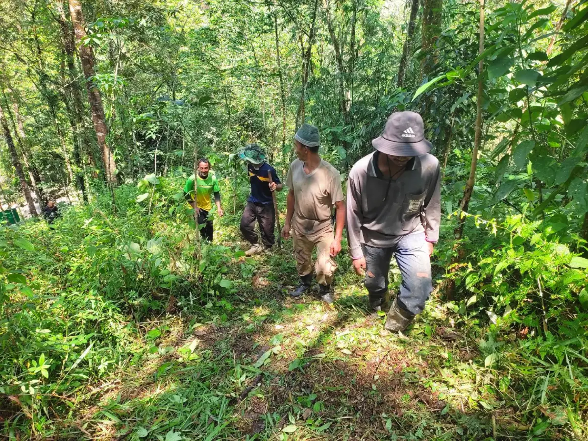
59. Ban Nam Cha, Trang is located in Village No. 2, Wang Maprang Subdistrict, Wang Wiset District, Trang Province. This rural community is notable for its community forest, which residents work together to conserve and maintain. Agricultural land and local vegetation surround the village, creating an environment in which the relationship between everyday livelihoods and natural resource management is particularly important.
The Village No. 2 community forest is an important local learning resource. It contains various types of vegetation, including mature trees, indigenous plants, and medicinal species associated with the environment and traditional community knowledge. Collective forest protection helps conserve biodiversity and contributes to the maintenance of local ecological conditions.
Nature study is one of the activities that may be arranged in the community forest. Visitors can learn about different plant species, the practical uses of natural materials, and the role of forest ecosystems in supporting local water sources and environmental stability. Walking activities should follow routes approved by the community and be accompanied by knowledgeable guides when required.
Residents' livelihoods remain closely connected to agriculture and the responsible use of local resources. Traditional knowledge concerning medicinal plants, forest management, and environmental care reflects the experience of people living alongside natural landscapes. A visit offers an opportunity to learn how community action can support conservation while preserving rural traditions.
Ban Nam Cha is suitable for travelers interested in environmental education, community conservation, and sustainable rural development. Visits may be arranged as short educational excursions or field-study programs, depending on local availability. Visitors should avoid collecting plants, disturbing wildlife, damaging vegetation, or leaving litter in the forest.
Highlights: Ban Nam Cha community forest, medicinal plants, indigenous vegetation, nature walks, conservation knowledge, and traditional agricultural life.
Getting There From Trang town, travel toward Wang Wiset District and continue to Wang Maprang Subdistrict and Ban Nam Cha, Village No. 2. Private transport is recommended. Those wishing to enter the community forest should coordinate with its caretakers or local authorities to confirm access and suitable walking routes.
Map (GPS): GPS Coordinates: 7.705660, 99.406270 Open Google Maps directions to Ban Nam Cha
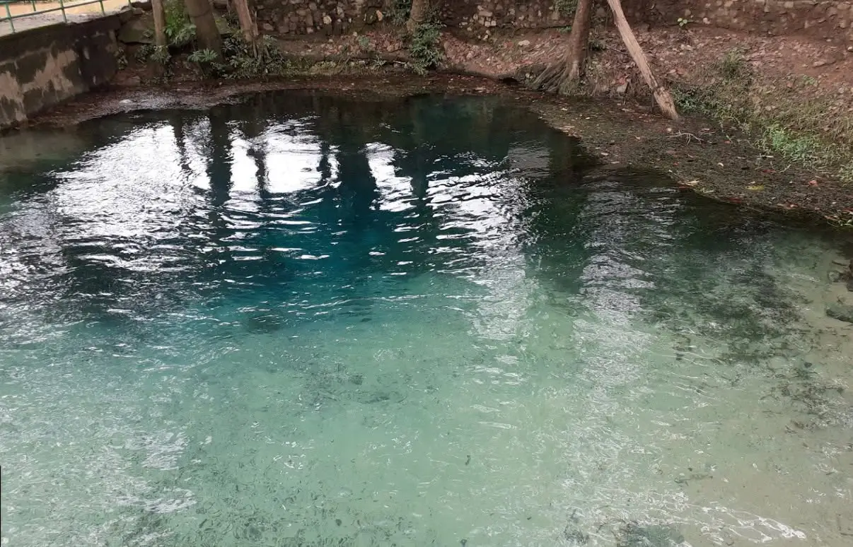
60. Ban Sa Kaeo, Surat Thani Ban Sa Kaeo is located in Village No. 4, Bang Sawan Subdistrict, Phra Saeng District, Surat Thani Province. This rural community is notable for its natural freshwater attraction and agricultural way of life. The surrounding area contains rubber plantations, oil palm plantations, and other agricultural landscapes typical of inland Southern Thailand. Its natural environment makes Ban Sa Kaeo suitable for travelers seeking a quiet countryside experience.
Sa Kaeo is a natural freshwater pool associated with local memories and community beliefs. The water and surrounding trees create a shady environment that attracts visitors interested in relaxing amid nature. The pool is an important feature of the landscape, offering a glimpse of how local water sources contribute to the character of rural settlements.
Village life is closely connected to agriculture and natural resources. Rubber trees, oil palms, and other crops are important to household livelihoods in the surrounding area. Visiting Ban Sa Kaeo can provide an understanding of the agricultural environment of Phra Saeng District and the relationship between waterways, plantations, and community life.
The natural area around Sa Kaeo is particularly pleasant for daytime relaxation. Shade from surrounding trees and the presence of freshwater create a calm atmosphere, especially during warm weather. Visitors can take photographs, enjoy the countryside, and spend time with family in areas open to the public. Anyone considering entering the water should first confirm that swimming is permitted and that conditions are safe.
Ban Sa Kaeo can be combined with natural attractions and agricultural communities in Bang Sawan Subdistrict and the wider Phra Saeng area. Travelers interested in environmental learning can study how local water sources relate to agricultural life. Visitors should avoid disturbing plants or aquatic habitats and respect private farmland.
For overnight accommodation, travelers can choose places to stay in Phra Saeng District or nearby areas according to their needs. Ban Sa Kaeo is primarily a countryside and nature destination suited to a day visit rather than a large organized homestay center. Checking current access conditions in advance will help visitors plan an enjoyable trip.
Highlights: Sa Kaeo natural freshwater pools, Khlong Ipan, clear water, rubber plantations, oil palm cultivation, agricultural livelihoods, and the peaceful countryside of Phra Saeng District.
Getting There From Surat Thani town, travel toward Phra Saeng District and continue to Bang Sawan Subdistrict and Ban Sa Kaeo. Private transport is convenient for exploring the surrounding countryside. Check local road conditions and any current access restrictions before traveling.
Map (GPS): GPS Coordinates: 8.622031, 98.967205 Open Google Maps directions to Sa Kaeo
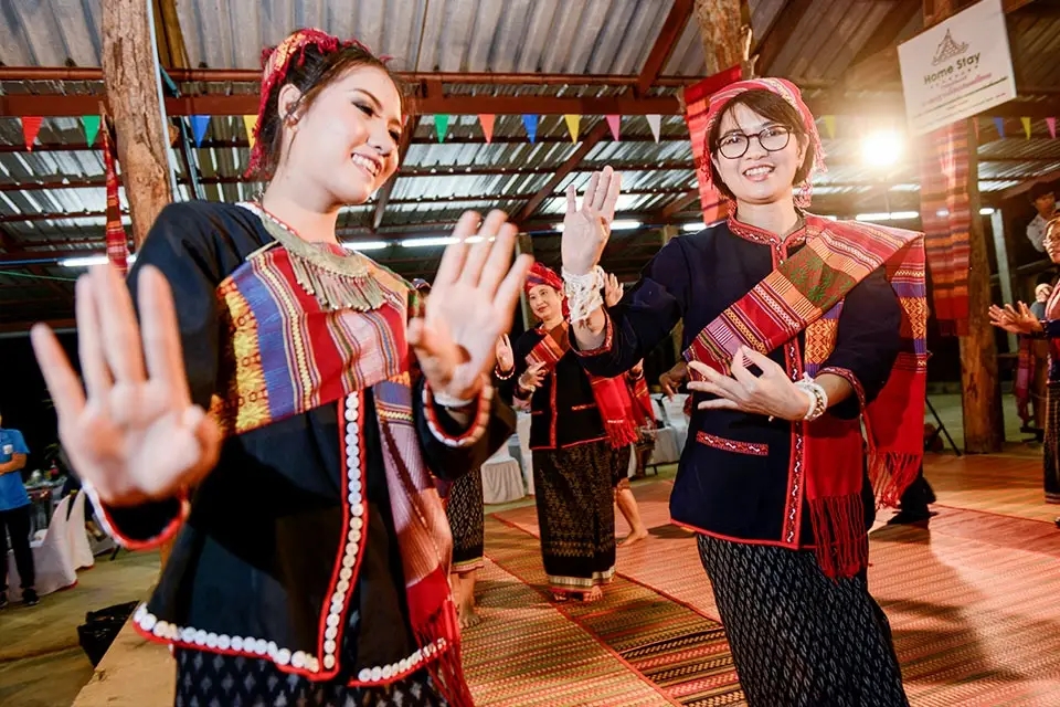
61. Ban Khok Kong Phu Thai Cultural Village, Kalasin is located in Village No. 5, Kut Wa Subdistrict, Kuchinarai District, Kalasin Province. Situated near the foothills of the Phu Phan Mountains, it is a cultural tourism village renowned for preserving the distinctive way of life of the Phu Thai people. Residents continue to maintain their language, traditional clothing, cuisine, weaving, and local customs. The landscape of hills, forests, and agricultural land makes the village a rewarding destination for travelers interested in both cultural heritage and rural nature.
Ban Khok Kong has developed community-based cultural tourism through its cultural learning center and homestay activities. Its cultural tourism initiatives began in 1998, with the aim of giving visitors opportunities to experience Phu Thai traditions through everyday community life. Guests can stay with local families, enjoy regional meals, and participate in activities organized by residents. This approach allows travelers to appreciate cultural heritage through meaningful interaction with people who continue to practice these traditions.
One of the village's distinctive experiences is the Bai Sri Su Khwan welcoming ceremony, which expresses goodwill and hospitality toward visitors. The community also preserves knowledge of the Yao ritual, associated with traditional Phu Thai beliefs and cultural practices. Learning about these ceremonies offers insight into the relationships between spiritual beliefs, families, and community identity. Visitors should respect the significance of these traditions and follow the guidance of local hosts when participating.
Traditional weaving and basketry are other important aspects of Ban Khok Kong's cultural identity. Skilled artisans produce textiles and practical household objects using techniques passed down through generations. Patterns and designs reflect the artistic knowledge of the Phu Thai people. Travelers can observe handicraft production and purchase items directly from community makers, supporting local income and helping preserve traditional craftsmanship.
Natural attractions around Ban Khok Kong include forest walking routes associated with Phu Pha Wua Forest Park and the Tad Sung and Tad Yao waterfalls. Travelers interested in outdoor activities may arrange guided nature walks to study local vegetation and appreciate the mountainous surroundings. Weather and trail conditions should be checked before setting out, particularly during the rainy season when forest paths may become slippery.
Staying in a community homestay provides time to enjoy local food, cultural performances, household activities, and traditional hospitality. Ban Khok Kong is especially suitable for families, students, educational groups, and travelers interested in the living heritage of Northeastern Thailand. Advance arrangements are recommended for accommodation, welcoming ceremonies, and organized activities.
Highlights: Phu Thai homestays, Bai Sri Su Khwan ceremony, Yao ritual, traditional Phu Thai meals, weaving, basketry, cultural performances, and Tad Sung–Tad Yao waterfalls.
Getting There From Kalasin town, travel toward Kuchinarai District, then continue to Kut Wa Subdistrict and Ban Khok Kong. Private cars or rental vehicles are convenient. Visitors wishing to stay in a homestay or participate in a cultural welcoming ceremony should contact the community before traveling.
Map (GPS): GPS Coordinates: 16.532567, 104.189388 Open Google Maps directions to Ban Khok Kong
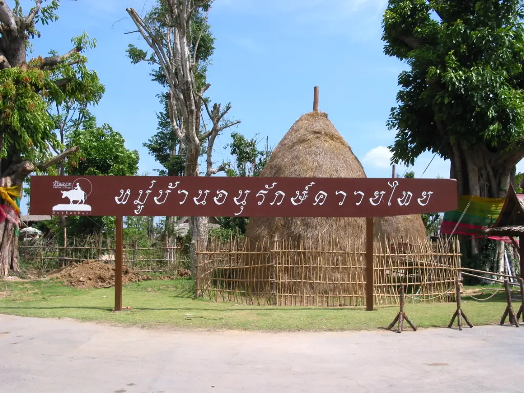
62. Thai Buffalo Conservation Village, Khon Kaen is situated in the Ban Non Udom and Ban Non Sawang areas of Na Wa Subdistrict, Phu Wiang District, Khon Kaen Province. This agricultural learning destination focuses on conserving native Thai buffaloes and preserving knowledge of their importance to traditional rice farming. Buffaloes have played a central role in the history of Northeastern Thailand, providing labor for agricultural work and forming an enduring part of rural culture.
Before agricultural machinery became widely available, buffaloes were essential for plowing rice fields and preparing soil for cultivation. Farmers needed practical knowledge of breeding, feeding, training, and caring for the animals. The relationship between farmers and their buffaloes extended beyond agricultural labor, involving long-term care, cooperation, and skills passed between generations within farming families.
A visit to the conservation village offers opportunities to understand the traditional role of buffaloes in farming communities. Travelers can learn how buffaloes were used to prepare rice fields and study the agricultural tools associated with earlier farming methods. Where educational activities are organized, visitors may also discover the principles of buffalo care and the value of preserving native breeds.
The surrounding Phu Wiang area is characterized by agricultural landscapes, rice fields, and traditional Isan village life. Combining a visit to the buffalo conservation village with learning about rice production helps visitors understand the historical relationships between farmers, animals, land, and food. The experience is particularly suitable for children and young people who may be unfamiliar with traditional farming before the introduction of tractors and other machinery.
Conserving Thai buffaloes also contributes to preserving native animal genetic resources and maintaining diversity within agricultural systems. Traditional knowledge of animal husbandry forms part of Thailand's rural cultural heritage. Educational visits can encourage greater appreciation of these animals and the practical skills that supported farming households over many generations.
Highlights: Native Thai buffaloes, traditional rice farming, agricultural tools, buffalo care, rural cultural heritage, and the farming communities of Phu Wiang.
Getting There From Khon Kaen city, travel toward Phu Wiang District, then continue to Na Wa Subdistrict and the Ban Non Udom–Ban Non Sawang area. Private transport is recommended. Confirm the visitor reception point and availability of educational activities before departure.
Map (GPS): GPS Coordinates: 16.703508, 102.559289 Open Google Maps directions to Thai Buffalo Conservation Village

63. Ban Mo Pottery Village, Maha Sarakham is located in Village No. 11, Khwao Subdistrict, Mueang Maha Sarakham District, Maha Sarakham Province. It is a traditional handicraft community renowned for producing handmade earthenware. Generations of local potters have preserved techniques for making clay pots and household vessels, transforming earth, water, and fire into objects that once played essential roles in everyday life throughout Northeastern Thailand.
In the past, Ban Mo residents produced clay containers used for cooking, storing water, and preparing food. Traditional products included water pots, cooking pots, and other vessels commonly found in rural households before metal and plastic containers became widespread. The knowledge required to select suitable clay and control firing temperatures was therefore important to both domestic life and the local economy.
The pottery-making process begins with selecting and preparing clay, kneading it to achieve the appropriate consistency, and shaping it into the intended form. Potters use their hands and traditional tools to build and refine vessels before allowing them to dry. The pieces are then fired using established techniques. Every stage requires experience, particularly when controlling the shape, wall thickness, drying conditions, and heat to produce a usable finished vessel.
Visitors can explore pottery-making areas, observe artisans at work, and learn about traditional production techniques. Contemporary products include both practical household objects and decorative items adapted from older designs. Purchasing pottery directly from producers provides income for local households and supports the continuation of traditional skills. Educational clay-shaping activities may also be suitable for families and school groups when arranged with community artisans.
Ban Mo can be included in a cultural itinerary through Khwao Subdistrict and the surrounding area. Nearby historical and cultural attractions include Ku Mahathat and the Ban Chiang Hian Museum. Combining these destinations allows travelers to explore the connections between regional history, traditional crafts, and the development of rural communities in Maha Sarakham.
Highlights: Traditional earthenware, clay water pots and cooking vessels, pottery kilns, skilled potters, household craftsmanship, and pottery learning activities.
Getting There From Maha Sarakham town, travel toward Khwao Subdistrict and Ban Mo, Village No. 11. The village is accessible by private car or local taxi. Groups wishing to watch demonstrations or try pottery-making should contact local producers beforehand.
Map (GPS): GPS Coordinates: 16.144327, 103.403271 Open Google Maps directions to Ban Mo Pottery Village
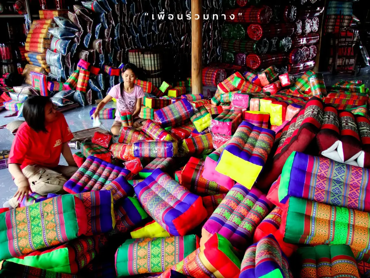
64. Ban Si Than Khit Pillow Village, Yasothon is located in Si Than Subdistrict, Pa Tio District, Yasothon Province. It is a traditional handicraft village famous for khit pillows and other textile products made from intricately patterned woven fabrics. Residents have preserved this important Isan craft through generations, combining agricultural livelihoods with weaving, sewing, and the production of household textiles that provide supplementary income.
Khit fabric is distinguished by its decorative patterns created using a supplementary-weft technique in which selected threads are raised during weaving. Artisans must carefully prepare the pattern sequence and control the loom to achieve consistent designs. The work requires patience, technical knowledge, and experience. Khit textiles have traditionally been used in household objects and religious merit-making activities, making them an important part of Northeastern Thai cultural heritage.
Ban Si Than produces a wide range of traditional and contemporary textile products. These include axe-shaped khit pillows, triangular cushions, folding mattresses, sectional mattresses, neck pillows, decorative cushions, and seat pads. While many items retain recognizable traditional forms and patterns, others have been adapted for modern homes and consumer preferences. This development helps the community maintain its weaving heritage while creating additional economic opportunities.
Visitors can learn about the stages of khit pillow production, from preparing patterned fabric to measuring, cutting, sewing, stuffing, and finishing each item. Some traditional products use kapok or other suitable filling materials. Observing the work of experienced artisans reveals the care required to produce finished textiles and the important role of household-based manufacturing in the village economy.
Ban Si Than is particularly suitable for travelers interested in traditional handicrafts, textile design, and Isan cultural heritage. It can be included as a stop while traveling between Yasothon, Pa Tio, and Amnat Charoen. Visitors wishing to study the production process in detail should contact a local weaving or pillow-making group before arriving.
Highlights: Khit pillows, traditional axe-shaped and triangular cushions, patterned khit textiles, sewing craftsmanship, and community handicraft production.
Getting There From Yasothon town, follow Highway 202 toward Pa Tio District. Around kilometers 18–19, take the turn toward Ban Si Than and continue approximately 3 kilometers to the village. Private cars and local taxis provide convenient access.
Map (GPS): GPS Coordinates: 15.776146, 104.330985 Open Google Maps directions to Ban Si Than
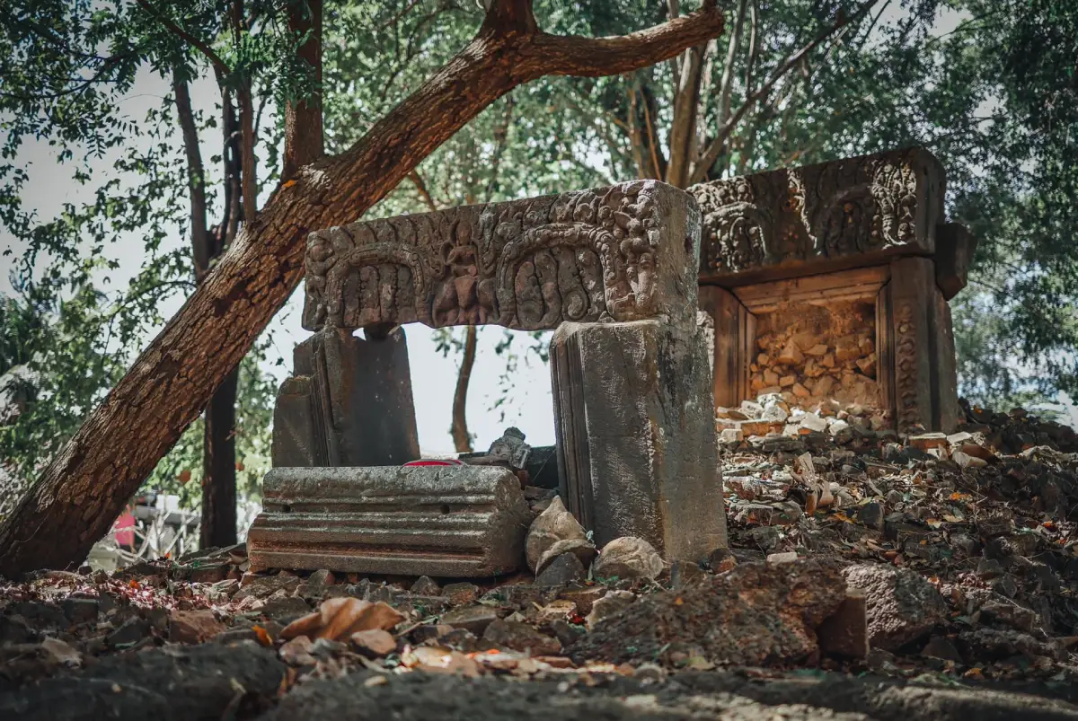
65. Ban Prasat Yoe, Si Sa Ket is located in Prasat Yoe Subdistrict, Phrai Bueng District, Si Sa Ket Province. This historic village is associated with the ethnic Yoe community and the archaeological heritage of Southern Isan. It has a distinctive identity shaped by its language, beliefs, traditions, local cuisine, and agricultural lifestyle. Ancient remains within the village add an important historical dimension to its living cultural heritage.
The Yoe people are an ethnic group with their own language and cultural traditions. Their settlement history and rural livelihoods are closely associated with the agricultural communities and waterways of Si Sa Ket Province. Learning about the Yoe language, customary practices, and community history helps travelers appreciate the considerable cultural diversity within Northeastern Thailand.
An important local landmark is Prasat Yoe, an ancient Khmer archaeological site located near Wat Prasat Yoe Nuea. Its remains are connected to the history of settlement and religious life in the area. Visitors can explore the temple and learn about the archaeological structures while observing appropriate conservation rules. Ancient masonry and other historic features should not be touched or disturbed.
Village life continues to involve rice farming, weaving, and the preparation of traditional food. Exploring the settlement offers opportunities to understand how ethnic identity is expressed through everyday occupations and customs. Conversations with knowledgeable residents can provide additional insight into the history of the community and the meaning of its cultural practices.
Ban Prasat Yoe is suitable for visitors interested in archaeology, ethnic history, and cultural tourism. It can be included in a trip through Phrai Bueng District and surrounding parts of Si Sa Ket. Travelers should respect village traditions, religious activities, and the preservation requirements of the archaeological site.
Highlights: Yoe ethnic heritage, Yoe language, ancient Khmer sanctuary, Wat Prasat Yoe Nuea, traditional handicrafts, and Southern Isan agricultural life.
Getting There From Si Sa Ket town, travel toward Phayu and Phrai Bueng districts before continuing to Prasat Yoe Subdistrict. The journey is approximately 35 kilometers depending on the route. Use designated parking areas when visiting the temple and archaeological remains.
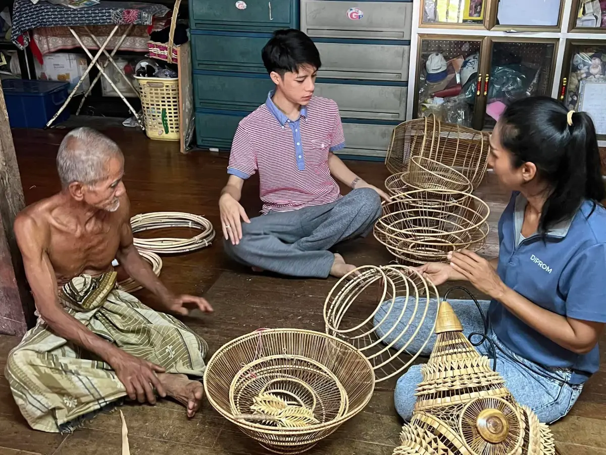
66. Traditional Birdcage-Making Villages, Songkhla are found in Chana District, Songkhla Province, particularly in Ban Sakom of Sakom Subdistrict, communities in Ban Na Subdistrict, and Ban Hua Din Nuea in Pa Ching Subdistrict. These villages are known for producing traditional zebra dove cages, a specialized handicraft requiring considerable precision and skill. Their work reflects the long-standing relationship between Southern Thai bird-keeping culture, woodworking, and decorative craftsmanship.
Birdcage production in Chana is important both as a practical craft and as an artistic tradition. A well-made cage requires suitable dimensions, a carefully designed structure, and precise assembly. Artisans select and shape materials for the frame, vertical bars, roof, and other components. Decorative details and patterns are then added to enhance the appearance of the finished cage while maintaining its practical function.
Zebra dove keeping is part of a wider cultural tradition in Southern Thailand associated with an appreciation of birdsong, social gatherings among bird enthusiasts, and singing competitions. Birdcage production has consequently developed both economic and cultural significance. Artisans have adapted designs and decorative techniques to suit different preferences while preserving the skills that distinguish handmade cages from mass-produced alternatives.
Visitors interested in craftsmanship can explore participating workshops and observe artisans producing birdcages. The process involves measuring, shaping, smoothing, assembling, and decorating numerous small components. Watching these stages helps travelers understand the concentration and experience required to complete each product. Purchasing directly from local makers supports household livelihoods and the continuation of the craft.
Because production takes place across several communities rather than at a single visitor complex, travelers should identify an active workshop and contact its owner in advance. The villages are especially suitable for visitors interested in woodworking, traditional Southern Thai crafts, and the cultural history of bird keeping.
Highlights: Zebra dove cages, traditional woodworking, decorative cage patterns, bird-keeping culture, Sakom communities, and Chana handicraft workshops.
Getting There From Songkhla town, travel toward Chana District and continue to Sakom Subdistrict or the specific birdcage-making community arranged for the visit. Important production areas include Ban Sakom, Ban Na, and Ban Hua Din Nuea. Private cars or rental vehicles are convenient for reaching individual workshops.
Map (GPS): GPS Coordinates: 6.943175, 100.798286 Open Google Maps directions to the Birdcage-Making Village area
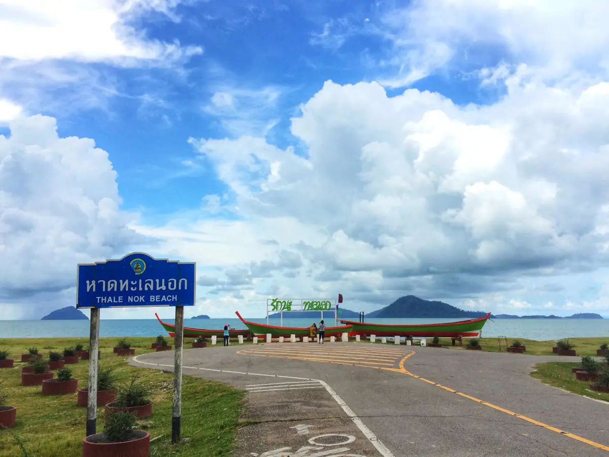
67. Ban Thale Nok, Ranong is located in Village No. 1, Kamphuan Subdistrict, Suk Samran District, Ranong Province. This coastal ecotourism community is known for traditional fishing livelihoods, mangrove forests, and homestay experiences beside the Andaman Sea. Its peaceful atmosphere and natural surroundings make it an appealing destination for travelers wishing to discover a traditional coastal community away from major resort centers.
The daily lives of Ban Thale Nok residents have long been connected to the sea. Many families belong to the local Muslim community and engage in small-scale fishing and occupations related to coastal resources. Their knowledge of tides, fishing seasons, weather, and marine species plays an important role in household livelihoods. A community visit allows travelers to understand these traditions and appreciate how coastal ecosystems support local life.
Homestays are among the village's most appealing experiences. Staying with a local family provides an opportunity to enjoy traditional seafood dishes, spend time near the beach, and learn about fishing and community routines. Accommodation generally emphasizes simplicity and hospitality rather than the extensive facilities found in large resorts. The relaxed surroundings are especially suitable for travelers seeking a slower pace of life.
Popular activities include walking along the beach, exploring the mangrove environment, learning about fishing, and joining locally arranged nature boat trips. Depending on weather conditions and operator availability, excursions may also reach nearby coastal or island areas. Mangrove forests are particularly important because they provide habitats and nursery grounds for marine animals and contribute to the health of the coastal ecosystem.
Spending at least one night in Ban Thale Nok allows visitors to enjoy the changing coastal scenery, particularly during the morning and evening. Sunset views and the peaceful village atmosphere are important parts of the experience. Boat activities should only be arranged with responsible operators using appropriate safety equipment, especially during the monsoon season when sea conditions may become difficult.
Highlights: Fishing village homestays, Thale Nok Beach, mangrove forests, local seafood, Muslim coastal traditions, nature boat trips, and sunsets over the Andaman coast.
Getting There From Ranong town, follow Highway 4 toward Suk Samran District, then turn toward Kamphuan Subdistrict and Ban Thale Nok. The connecting road from Phetkasem Road to the village is approximately 5 kilometers. Contact homestay hosts or boat operators in advance for accommodation and marine activities.
Map (GPS): Thale Nok Beach Reference Coordinates: 9.462442, 98.443478 Open Google Maps directions to Thale Nok Beach and Ban Thale Nok
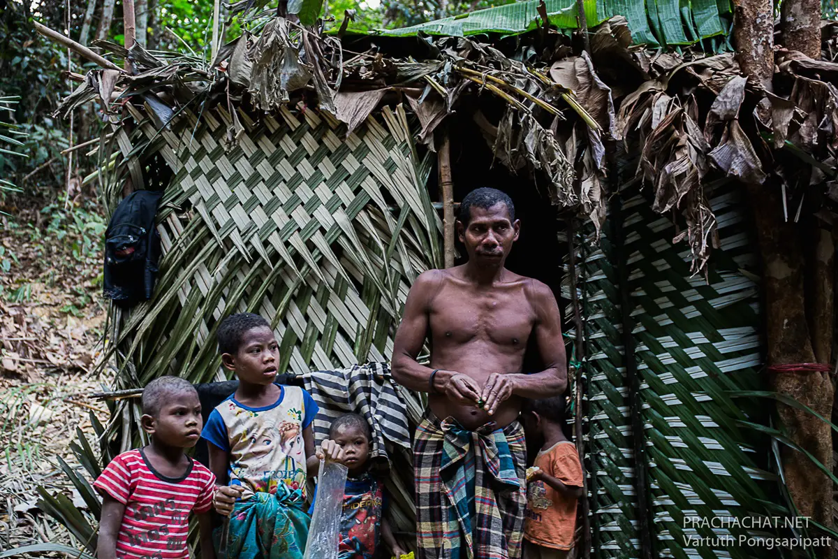
68. Ban Lo Han and Mani Cultural Landscape, Phatthalung is located in Village No. 7, Thung Nari Subdistrict, Pa Bon District, Phatthalung Province. The area is associated with the cultural heritage of the Mani people and the natural environment of the Banthat mountain range. Surrounded by tropical rainforest, streams, and mountain valleys, Ban Lo Han provides opportunities to learn about the relationship between forest ecosystems and the diverse communities of Southern Thailand.
The Mani people possess extensive traditional knowledge of tropical forest environments, including local plants, natural foods, medicinal resources, and survival skills. Such knowledge has been passed down through experience and learning within families and communities. Their cultural traditions reflect a relationship with the forest that differs from the agricultural livelihoods and permanent settlement patterns of many neighboring rural villages.
The natural environment around Ban Lo Han is connected to Khlong Pa Bon Reservoir and the watershed forests of the Banthat Mountains. Streams, waterfalls, and forest vegetation contribute to a diverse landscape that plays an important ecological role. Travelers interested in nature can learn about forest conservation, watershed protection, and the relationship between healthy ecosystems and local livelihoods.
Any activity associated with learning about Mani culture must respect the rights, dignity, and privacy of community members. Travelers should never enter residential areas without permission, photograph individuals without consent, or treat people as exhibits for tourists. Cultural exchanges should only take place when participants have freely agreed and when appropriate organizers understand the community's circumstances and preferences.
For nature enthusiasts, guided walks may be arranged in forest areas officially open to visitors, subject to local regulations. Knowledgeable guides are important for safety and environmental protection. Visitors should not collect plants, disturb animals, or remove natural materials. Those wishing to stay overnight should choose established accommodation in Pa Bon District or nearby areas rather than intruding on private community spaces.
Highlights: Mani cultural heritage, Banthat mountain rainforest, Khlong Pa Bon Reservoir, medicinal plants, watershed environments, and responsible nature education.
Getting There From Phatthalung town, travel toward Pa Bon District, then continue to Thung Nari Subdistrict and Ban Lo Han. Use publicly accessible roads and designated visitor areas. Cultural learning activities should only be arranged through suitable local representatives and with community consent.
Map (GPS): Community Reference Coordinates: 7.174669, 100.100513 Open Google Maps to the Ban Lo Han area
69. Ban Santitham, Chachoengsao is located in Lat Krathing Subdistrict, Sanam Chai Khet District, Chachoengsao Province. This agroforestry and self-sufficiency learning center combines natural farming methods, medicinal plant conservation, and traditional knowledge of simple living. The grounds are surrounded by a variety of trees and vegetation, creating a shaded environment suitable for educational activities and learning about sustainable resource management.
The central concept of Ban Santitham is the development of practical knowledge that supports self-reliance. Its educational approach emphasizes basic needs such as food, medicinal plants, housing, and responsible natural resource management. Activities draw on traditional farming methods and the practical uses of indigenous plants, allowing visitors to consider how this knowledge may be adapted to their own households or communities.
The site contains a variety of plants and herbs used for learning about botanical characteristics and natural garden management. Visitors can study plant diversity and explore the important roles that trees play in retaining soil moisture, creating shade, and supporting ecological balance in agricultural environments. The learning areas illustrate how agroforestry combines trees and productive land use.
Another interesting feature is the presence of traditional Thai wooden houses and a reconstructed rice granary. These structures help explain earlier styles of rural housing and agricultural storage. Visitors can learn how households organized living space, stored produce, and used locally available materials, connecting traditional architectural knowledge with contemporary ideas about self-sufficiency.
Ban Santitham is suitable for students, families, educational groups, and people interested in natural agriculture and sustainable living. Certain activities may be organized as workshops or learning camps. Advance coordination is recommended to ensure that the available programs match visitors' interests and that appropriate guidance can be arranged.
Highlights: Agroforestry, medicinal plants, natural agriculture, traditional Thai wooden houses, reconstructed rice granary, self-sufficiency, and environmental education.
Getting There From Chachoengsao town, travel toward Sanam Chai Khet District before continuing to Lat Krathing Subdistrict and Ban Santitham. Private transport is convenient. Groups wishing to participate in organized learning activities should contact the center before traveling.
Map (GPS): GPS Coordinates: 13.544212, 101.648389 Open Google Maps directions to Ban Santitham

70. Thai Buffalo Village, Suphan Buri is located in Si Prachan Subdistrict, Si Prachan District, Suphan Buri Province. This cultural attraction focuses on the historical relationship between Thai farmers and buffaloes, which were essential to rice cultivation in Central Thailand before agricultural machinery became widespread. Traditional Thai houses, farming tools, and educational activities provide opportunities to learn about rural life and Thailand's agricultural heritage.
In earlier generations, buffaloes supplied the strength needed to plow rice fields and prepare soil for planting. Farmers developed practical knowledge of choosing, training, feeding, and caring for buffaloes. These animals were important not only as agricultural workers but also as valued members of rural households. The relationship between farmers and their buffaloes became part of traditional stories, customs, and the cultural identity of rice-growing communities.
Thai Buffalo Village introduces visitors to this heritage through displays of agricultural tools, traditional houses, and activities related to farming. Visitors can learn how rice cultivation was carried out before the widespread use of tractors and mechanical equipment. Such experiences help explain the physical work and practical skills involved in producing rice in earlier rural societies.
The attraction may also present demonstrations featuring buffaloes and aspects of traditional agricultural life according to its current visitor program. These activities are particularly relevant to families and children who wish to understand the role of animals in farming. Animal welfare and safe interaction should remain priorities; visitors should follow the instructions of caretakers and avoid approaching animals without permission.
Traditional Thai architecture, household objects, and rural cultural presentations provide additional learning opportunities. Visitors can consider how agricultural work influenced family life, housing, food storage, and village cooperation. The attraction may be included in an educational day trip through Suphan Buri, particularly for those interested in agricultural history.
Highlights: Thai buffaloes, traditional rice farming, agricultural tools, Thai wooden houses, rural cultural heritage, educational demonstrations, and family activities.
Getting There From Suphan Buri town, travel toward Si Prachan District and continue to Thai Buffalo Village in Si Prachan Subdistrict. The attraction is accessible by private car or local transport. Check current operating arrangements and scheduled activities before visiting.
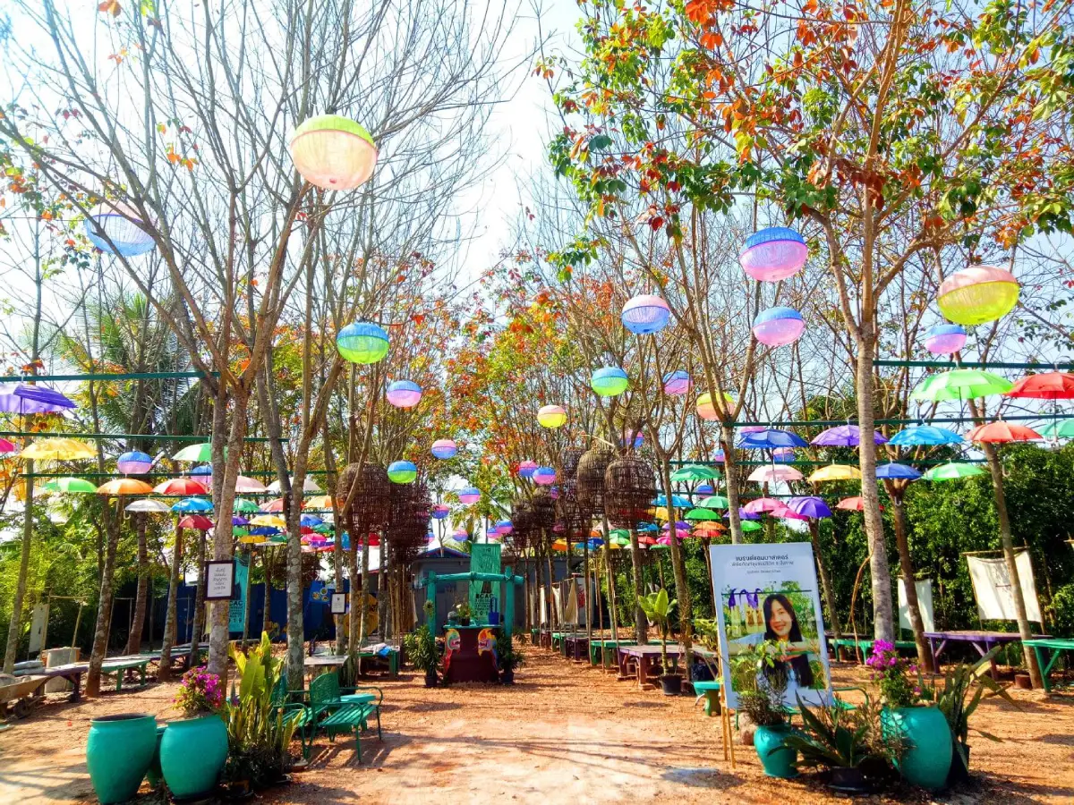
71. Ban Khi Lek Yai, Bueng Kan is located in Village No. 7, Nong Phan Tha Subdistrict, So Phisai District, Bueng Kan Province. This cultural community is associated with a living community museum that preserves traditional Isan houses, local handicrafts, and the history of rural life. The village provides an opportunity for travelers to explore a living cultural landscape in which old buildings, artistic expressions, and everyday community traditions remain important.
The preservation of traditional wooden houses is a distinctive part of Ban Khi Lek Yai's identity. Such buildings reflect earlier architectural knowledge, including the use of local materials and the arrangement of living spaces suited to the climate and family life of Northeastern Thailand. Exploring the community allows visitors to learn about the relationship between traditional houses, household objects, and agricultural occupations.
The living community museum presents local history through buildings, objects, cultural displays, and activities connected to the village's heritage. Artistic features, including murals inspired by the Naga, a mythical serpent important to Mekong-region beliefs, add a distinctive visual character. These creative elements connect traditional cultural symbols with contemporary community expression.
Local crafts provide additional opportunities for cultural learning. Basketry, weaving, and other household skills illustrate how residents historically produced useful objects from locally available materials. Visitors can appreciate handmade products and may be able to learn about craft techniques through activities organized by community groups.
The village retains the peaceful atmosphere of rural Isan, with residential houses and agricultural surroundings forming part of the experience. Travelers interested in local culture can enjoy walking through areas open to visitors, appreciating old wooden buildings and learning about the community's history. Purchasing local products helps support the residents who preserve these traditions.
Ban Khi Lek Yai is particularly suitable for families, students, photographers, and visitors interested in community museums and local heritage. Organized activities should be arranged with museum caretakers or community representatives in advance, especially for larger groups.
Highlights: Living community museum, traditional wooden Isan houses, Naga street art, basketry, woven textiles, rural cultural heritage, and local history.
Getting There From Bueng Kan town, travel toward So Phisai District, then continue to Nong Phan Tha Subdistrict and Ban Khi Lek Yai, Village No. 7. Private cars or local taxis are convenient. Contact museum caretakers before traveling if you wish to participate in an organized community activity.
Map (GPS): GPS Coordinates: 18.099386, 103.404947 Open Google Maps directions to Ban Khi Lek Yai
72. Ban Pla Khao Molam Village, Amnat Charoen is located in Pla Khao Subdistrict, Mueang Amnat Charoen District, Amnat Charoen Province. This cultural village is renowned for its connection to molam, the traditional singing and performing arts of Northeastern Thailand. The community has long been associated with folk singers, musicians, and performers whose skills form an important part of local identity and the wider cultural heritage of Isan.
Ban Pla Khao has a settlement history associated with Phu Thai communities and the preservation of Northeastern Thai traditions. With a history extending back approximately 200 years, the village is recognized for its connection to several forms of molam, including molam klon, molam phuen, molam mu, and molam sing. The presence of numerous singers and performance groups demonstrates the importance of folk entertainment to the community's cultural and economic life.
One of the most interesting experiences is learning about the work behind a molam performance. Traditional artists develop skills in singing, composing poetic verses, rehearsing music, preparing costumes, and organizing performances for festivals and community events. Visitors interested in folk music may gain insight into how the lyrics, the sound of the khaen mouth organ, rhythmic accompaniment, and storytelling techniques combine in different styles of molam.
In addition to performing arts, Ban Pla Khao preserves local handicrafts, cuisine, and customs connected to Phu Thai and Isan cultural traditions. Travelers can explore the village, speak with residents, and attend performances when suitable activities are organized. Supporting cultural programs helps provide income for local artists while encouraging the transmission of performance knowledge to younger generations.
Ban Pla Khao is especially suitable for travelers interested in traditional music, performing arts, cultural history, and living community heritage. Visitors wishing to watch rehearsals, meet performers, or arrange a private cultural program should contact local organizers in advance because performance schedules depend on the availability and commitments of the artists.
Highlights: Molam village, folk singers, molam klon and molam mu performances, khaen music, Phu Thai heritage, traditional costumes, and learning about performance preparation.
Getting There From Amnat Charoen town, travel toward Pla Khao Subdistrict and Ban Pla Khao. The village can be reached by private car or local taxi. Travelers interested in music performances or cultural exchanges should contact community organizers before departure.
Map (GPS): GPS Coordinates: 15.755081, 104.776673 Open Google Maps directions to Ban Pla Khao Molam Village
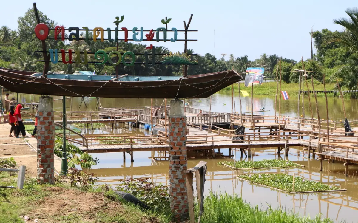
73. Ban Yakang Village, Narathiwat is located in Mueang Narathiwat District, Narathiwat Province. This historic village is distinguished by its Thai Muslim way of life, local Malay cultural heritage, and traditional household skills. Situated a short distance from Narathiwat town, it offers travelers an opportunity to learn about community history, religious customs, local food, and handicrafts within the distinctive cultural landscape of Thailand's southern border provinces.
The daily lives of Ban Yakang residents are closely connected to agriculture, household occupations, and community relationships in which Islam plays an important role. Language, traditional clothing, food, and customs reflect Malay cultural influences alongside the wider Thai social context. Exploring the village provides an opportunity to appreciate the cultural diversity of the region and the ways in which heritage continues to be expressed in everyday life.
Local handicrafts and community products are among the village's attractions. Residents maintain practical skills connected to traditional household activities and the preparation of regional food. Visitors may be able to learn about these occupations through activities arranged by local groups, supporting small producers by purchasing their products directly.
The atmosphere of Ban Yakang reflects that of an older neighborhood, with residential houses, narrow roads, and religious buildings forming part of the local environment. Travelers can walk through accessible areas and learn about community history through conversations with knowledgeable residents. Modest clothing is appropriate, and permission should always be requested before photographing people, homes, or religious activities.
Ban Yakang can be combined with a wider cultural itinerary through Narathiwat town. Nearby destinations include Narathiwat Central Mosque, Narathat Beach, and Kow Leng Ji Shrine. Together, these places illustrate the diversity of religious and cultural traditions found within the province.
Highlights: Historic village, Malay cultural heritage, Thai Muslim lifestyles, regional food, traditional handicrafts, and cultural sightseeing around Narathiwat town.
Getting There From Narathiwat town, follow Highway 4055 toward Ra-ngae for approximately 4 kilometers, then turn into Yakang 1 Road, Soi 6, and continue approximately 700 meters. The village is accessible by private car or local taxi.
Map (GPS): GPS Coordinates: 6.398489, 101.814743 Open Google Maps directions to Ban Yakang Village
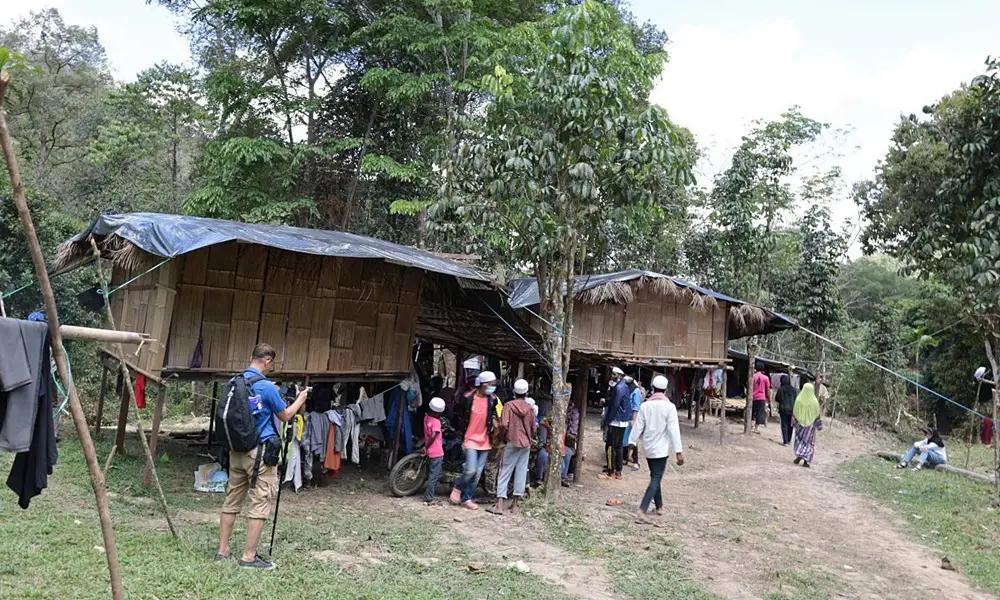
74. Sakai Village and Mani Cultural Landscape, Yala is associated with the Mani ethnic community in Ban Rae Subdistrict, Than To District, Yala Province. This mountainous part of Southern Thailand contains forests, streams, and a varied natural landscape. The area is relevant to learning about indigenous cultural heritage and the relationships between people and tropical rainforest environments.
The Mani people possess extensive knowledge of living in tropical forest environments, including identifying indigenous plants, using natural food resources, and understanding ecological relationships. Such knowledge is transmitted through experience and learning within the community. It is an important part of Thailand's cultural diversity and offers valuable insight into how human societies have adapted to different natural environments.
The Ban Rae area contains agricultural settlements as well as forests and natural landscapes associated with life in Than To District. Travelers interested in cultural history can learn about settlement patterns and community circumstances through appropriate local organizations and activities arranged with the consent of residents. Private residential areas should never be entered without permission.
Travel in this area should place particular importance on the rights and dignity of Mani community members. Visitors should not photograph people without consent, distribute items in ways that disrupt everyday life, or treat residents as performers or exhibits. Meaningful cultural learning depends on mutual respect, voluntary participation, and arrangements that genuinely benefit the community.
Nature enthusiasts may arrange forest-related excursions in officially accessible areas of Than To District. Visitors should check local regulations and travel with experienced guides where appropriate. For overnight accommodation, established hotels or guesthouses in Than To or nearby districts are preferable to entering private living areas without invitation.
Highlights: Mani cultural heritage, Than To mountain landscapes, tropical rainforest, indigenous plants, local community history, and responsible cultural learning.
Getting There From Yala town, travel toward Than To District and continue to Ban Rae Subdistrict using routes recommended by local authorities. Cultural learning visits should be organized in advance and limited to activities for which the community has given consent.
Map (GPS): Area Reference Coordinates: 6.105981, 101.157729 Open Google Maps to the Than To cultural landscape
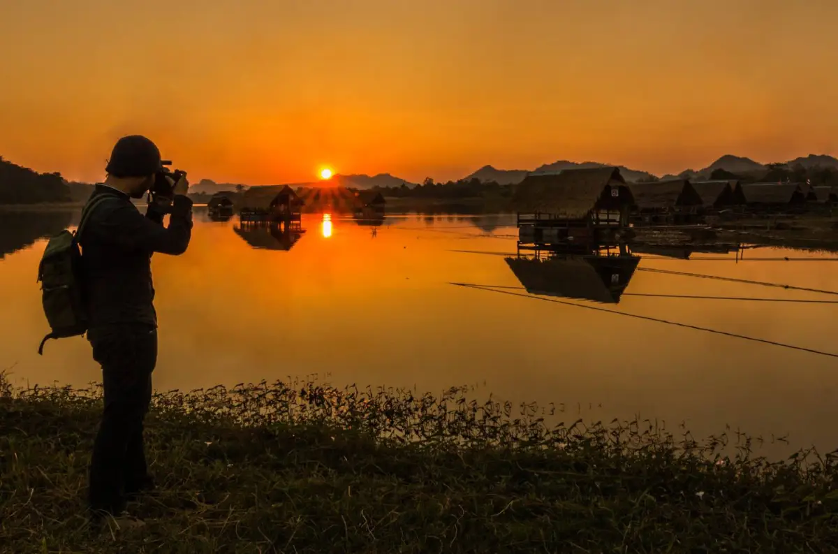
75. Ban Thai Niyom, Nong Bua Lam Phu is located in Wang Thong Subdistrict, Na Wang District, Nong Bua Lam Phu Province. The community is associated with the scenic Huai Pha Wang Reservoir, surrounded by mountains and peaceful rural landscapes. This freshwater attraction provides opportunities for relaxation, nature photography, and enjoying the countryside of Northeastern Thailand.
Huai Pha Wang Reservoir is connected to the use and management of water resources by surrounding communities. Water supports agriculture and everyday life while contributing to local aquatic ecosystems. Its position among hills creates an attractive landscape in which visitors can appreciate the relationship between natural scenery, water management, and rural livelihoods.
One of the area's popular leisure activities is relaxing beside the reservoir or using locally operated raft services when available. Visitors can enjoy regional meals, admire the mountain scenery, and spend time with family or friends in a peaceful environment. Raft activities depend on water levels, weather conditions, and service arrangements, so travelers should follow safety guidance and confirm availability before traveling.
The reservoir is also attractive for landscape photography, especially during the morning and evening when sunlight reflects across the water and surrounding hills. Visitors can explore designated lakeside areas and appreciate the changing atmosphere throughout the day. Responsible behavior is essential, including avoiding littering or disposing of waste in the reservoir.
Ban Thai Niyom is suitable for travelers who want a relaxing nature outing rather than an intensive sightseeing program. It can be combined with attractions in Na Wang District, including Erawan Cave and other nearby natural destinations. Visitors should verify road conditions and raft services before departure.
Highlights: Huai Pha Wang Reservoir, mountain scenery, leisure rafts, traditional local food, lakeside viewpoints, and the rural atmosphere of Na Wang District.
Getting There From Nong Bua Lam Phu town, follow Highway 210 toward Na Wang District, then take the local road to Ban Thai Niyom in Wang Thong Subdistrict and Huai Pha Wang Reservoir. Private cars and rental vehicles are convenient.
Map (GPS): Huai Pha Wang Reservoir Coordinates: 17.307110, 102.039599 Open Google Maps directions to Huai Pha Wang Reservoir
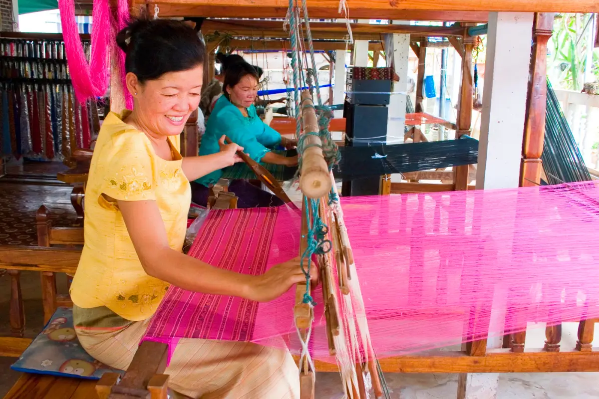
76. Ban Wai Luem, Roi Et is located in Ma Ba Subdistrict, Thung Khao Luang District, Roi Et Province. This traditional handicraft village is renowned for handwoven silk, a form of local knowledge passed down through generations. The community lies within the agricultural landscapes of Northeastern Thailand, where rice farming remains an important livelihood alongside textile production. The combination of agriculture and craftsmanship contributes to the village's distinctive cultural identity.
Silk weaving in Ban Wai Luem has both cultural and economic importance. Local artisans possess skills in preparing silk threads, dyeing, designing patterns, and weaving fabric on traditional looms. The process requires patience, technical knowledge, and considerable experience. Handmade silk is therefore not only clothing or a commercial product but also part of the community's inherited craftsmanship and cultural heritage.
Visitors can learn about the work of weaving groups, observe traditional patterns, and purchase silk products directly from the artisans. Watching the production process provides insight into the numerous stages involved, from thread preparation to the creation of finished fabric. This experience also helps travelers understand the difference between handmade textiles and mass-produced products.
The village has the peaceful atmosphere of rural Isan. Houses, rice fields, and agricultural land reflect the community's relationship with seasonal farming. Travelers may learn about local cuisine, merit-making traditions, and customs connected to everyday life. Taking time to explore these aspects of the village can provide a deeper appreciation of Roi Et's culture than simply stopping to purchase silk products.
Ban Wai Luem is suitable for textile enthusiasts, craft lovers, and cultural travelers. It can be included in a journey through Roi Et town and Thung Khao Luang District. Visitors wishing to observe a detailed weaving demonstration should contact local weaving groups in advance.
Highlights: Handwoven silk, traditional textile patterns, silk-thread preparation, local weaving groups, rice-farming lifestyles, and community-made silk products.
Getting There From Roi Et town, follow Highway 23 toward Yasothon and Thung Khao Luang District, then continue to Ma Ba Subdistrict and Ban Wai Luem. Private cars or locally hired vehicles are convenient.
Map (GPS): GPS Coordinates: 16.030609, 103.881378 Open Google Maps directions to Ban Wai Luem
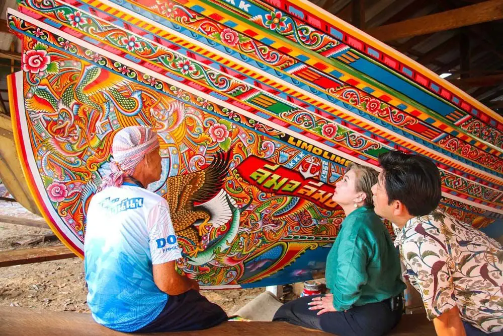
77. Ban Paseyawo, Pattani is a coastal village in Pattani Province known for its traditional kolae boat-building craftsmanship. Kolae boats are distinctive wooden fishing vessels associated with Malay coastal communities in Southern Thailand. Their construction combines practical knowledge of the sea, woodworking skills, and colorful decorative art. Ban Paseyawo offers a valuable opportunity to learn about an important form of traditional maritime craftsmanship.
The history of kolae boat building is closely linked to fishing livelihoods in Thailand's southern border provinces. Boat builders must understand suitable timber, hull design, structural assembly, and the requirements of operating a vessel in coastal waters. Building each boat demands considerable experience and time. The decoration of the bow and hull with elaborate, colorful patterns gives each vessel a recognizable artistic identity.
Visitors can learn about the construction of kolae boats and their importance to the local economy and cultural heritage. Observing experienced craftsmen reveals how woodworking techniques and practical maritime knowledge come together. Decorative patterns also provide an opportunity to appreciate the influence of Malay cultural aesthetics and the creativity of local artisans.
Life in Ban Paseyawo remains connected to fishing, selling seafood, and household occupations. The village offers a traditional coastal atmosphere where travelers may observe fishing boats and learn about the role of the sea in supporting community livelihoods. Visitors should respect local religious practices and ask permission before entering boat-building workshops or photographing workers.
Ban Paseyawo is particularly suitable for cultural tourism and the study of traditional handicrafts. It can be combined with other coastal attractions in Pattani Province. Anyone wishing to observe boat construction should contact the community beforehand because workshop activity depends on current orders and the artisans' work schedules.
Highlights: Traditional kolae boats, wooden boat construction, colorful painted patterns, small-scale fishing, Malay cultural heritage, and coastal craftsmanship.
Getting There From Pattani town, travel toward Ban Paseyawo along the relevant local roads. Private cars or locally hired vehicles are convenient. Contact a community representative or boat builder in advance if you wish to visit a working construction area.
Map (GPS): GPS Coordinates: 6.724778, 101.624683 Open Google Maps directions to Ban Paseyawo

78. Ban Chong Samaesan, Chon Buri is located in Samaesan Subdistrict, Sattahip District, Chon Buri Province. This traditional coastal fishing village is known for its connection to the sea, nearby islands, and local fishing livelihoods. Situated near the southern end of the Sattahip Peninsula, the village overlooks a marine landscape dotted with small islands, making it an appealing destination for travelers seeking a combination of coastal community life and nature-oriented activities.
Fishing has long been central to the livelihood of Ban Chong Samaesan residents. The community contains fishing boats, piers, seafood businesses, and households whose daily routines are influenced by weather, tides, and the availability of marine resources. Visitors can explore suitable areas near the piers and seafood restaurants to appreciate the role of fishing in the local economy.
One of the main attractions is the opportunity to visit Samaesan Island and nearby marine environments. Depending on regulations and available services, activities may include visiting beaches, studying marine ecosystems, and snorkeling in designated areas. Island access and the number of visitors may be controlled by the organizations responsible for managing the area, so travelers should confirm current arrangements before departure.
The village atmosphere combines waterfront houses, piers, fishing boats, and traditional seafood restaurants. Travelers can enjoy local dishes prepared with seafood and admire the coastal scenery during the morning or evening. A relaxed walk through publicly accessible areas provides an opportunity to see the everyday life of a working fishing community.
Visitors wishing to stay overnight can choose from small guesthouses and seaside accommodation in Samaesan and the wider Sattahip area. A two-day, one-night itinerary allows time to explore the village, visit nearby islands, and enjoy the coastal atmosphere without rushing. Supporting local operators helps distribute tourism income to residents, while responsible behavior includes avoiding marine litter and following conservation regulations.
Highlights: Chong Samaesan fishing village, local piers, Samaesan Island, fresh seafood, authorized snorkeling activities, and traditional coastal community life.
Getting There From Chon Buri or Pattaya, follow Highway 3 toward Sattahip District and continue to Samaesan Subdistrict and Ban Chong Samaesan. Private cars and rental vehicles are convenient. Travelers planning an island excursion should check the appropriate pier, boat timetable, and current access regulations before traveling.
Map (GPS): GPS Coordinates: 12.603013, 100.961220 Open Google Maps directions to Ban Chong Samaesan
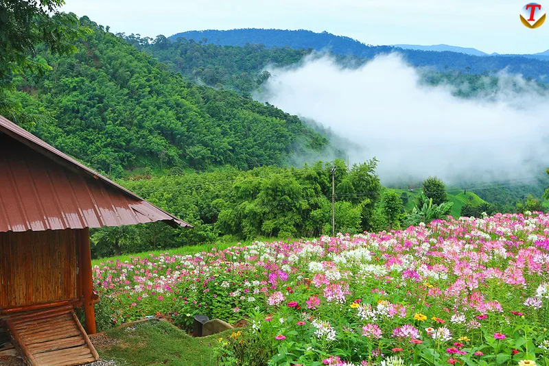
79. Ban Nam Chuang–Thap Si, Phitsanulok refers to highland communities in Chat Trakan District, Phitsanulok Province. The villages are distinguished by their mountain landscapes, seasonal rice fields, and agricultural livelihoods. Surrounded by hills and forests, the area has a peaceful atmosphere and offers travelers an opportunity to discover rural life in the mountains of Lower Northern Thailand.
The scenery around Ban Nam Chuang and Ban Thap Si reflects how residents adapt agricultural land to the surrounding geography. Rice fields and other cultivated areas extend through mountain valleys and along slopes. During the growing season, the landscape becomes green, while ripening rice may turn the fields golden before harvest. Travelers interested in photography can plan their visit according to the appearance of the rice fields they wish to see.
Community livelihoods remain closely connected to agriculture, water management, and the protection of local natural resources. Residents possess knowledge of planting seasons and the practical use of mountainous land. Exploring the village provides opportunities to appreciate how highland agriculture differs from farming on broad lowland plains, particularly in the layout of fields, irrigation methods, and the labor required by households.
One of the main attractions is the quiet atmosphere of the rural mountain environment. Travelers can admire views of surrounding hills, walk along routes open to visitors, and learn about everyday community life through conversations with residents. Visitors should respect cultivated areas and avoid entering rice fields or orchards without permission.
An overnight stay in the wider area may appeal to travelers wishing to enjoy the mountain scenery and village atmosphere at a slower pace. Accommodation should be checked and arranged before departure because the region has fewer tourist facilities than major destinations. Suitable clothing and careful preparation are recommended for mountain roads and changing weather conditions.
Highlights: Mountain villages, traditional agriculture, seasonal rice fields, highland scenery, rural community life, and the natural environment of Chat Trakan District.
Getting There From Phitsanulok town, travel toward Chat Trakan District before continuing along local roads to the Ban Nam Chuang and Ban Thap Si area. The final sections cross mountainous terrain and may include winding or steep roads. Check road conditions in advance and plan to arrive before dark.
Map (GPS): GPS Coordinates: 17.445144, 100.679986 Open Google Maps directions to Ban Nam Chuang–Thap Si

80. Traditional Thai Phuan House, Nakhon Nayok is a cultural learning destination in Nakhon Nayok Province dedicated to preserving the history and traditions of the Thai Phuan people. Its distinctive heritage includes traditional houses, language, local food, household customs, and stories of settlement associated with communities whose cultural roots are connected to the Mekong River region. Thai Phuan communities in Central Thailand have contributed significantly to the preservation of local knowledge and the cultural diversity of Nakhon Nayok.
The history of the Thai Phuan people is closely connected to migration and settlement from the historical Muang Phuan region. Families brought their language, beliefs, cuisine, and customary practices into communities in Central Thailand. As they adapted to their new surroundings, they maintained important aspects of their cultural identity through family traditions, temples, and community activities.
Traditional houses form an important part of learning about Thai Phuan culture because they reflect earlier residential arrangements and everyday life. Visitors can study vernacular architecture, household tools, and objects used in agriculture and daily routines. Such items illustrate how traditional housing knowledge developed in response to environmental conditions, available materials, and cultural practices.
Thai Phuan cuisine is another valuable part of the cultural experience. Traditional dishes use local ingredients and cooking methods passed down within families. Community customs are also connected to religious merit-making, food preparation, and social gatherings. Learning about these traditions from knowledgeable residents helps visitors understand the continuity of cultural practices and their role in contemporary community life.
The Traditional Thai Phuan House is suitable for travelers interested in local history, cultural heritage, and educational tourism. It can be combined with other attractions in Nakhon Nayok Province. Those wishing to study Thai Phuan culture in depth or arrange a group visit should contact the site's caretakers or local organizers in advance to confirm visiting arrangements and available activities.
Highlights: Thai Phuan cultural heritage, traditional houses, Thai Phuan language, regional cuisine, settlement history, antique household objects, and community cultural learning.
Getting There From Nakhon Nayok town, travel to the Traditional Thai Phuan House using the route indicated on the map. Private cars or local taxis are convenient. Organized cultural visits and educational group activities should be arranged in advance with the site's caretakers.
Map (GPS): GPS Coordinates: 14.204500, 101.230600 Open Google Maps directions to Traditional Thai Phuan House
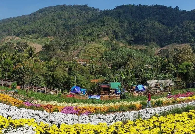
81. Ban E Mad–E Sai, Uthai Thani is a highland community in Ban Rai District, Uthai Thani Province, known for its Karen cultural heritage and traditional lifestyle closely connected to the forests of Western Thailand. Surrounded by mountains and peaceful natural landscapes, the community is home to the Ban E Mad–E Sai Hill Tribe Cultural Center, an important place for learning about local history, language, traditional clothing, and the knowledge passed down through generations.
Daily life in the community is closely associated with highland agriculture, responsible use of natural resources, and knowledge shared within families. Living in a mountainous environment has given residents a deep understanding of seasonal changes, water sources, and local plants. This knowledge is reflected in traditional food, household tools, and the ways in which residents manage their agricultural land.
One of the most interesting aspects of a visit is learning about Karen culture through traditional weaving, clothing, and stories of everyday life. Textile production is an important expression of cultural identity, involving the selection of threads, the creation of distinctive patterns, and the making of traditional garments. Visitors can appreciate the meaning of these handicrafts and understand the patience and expertise involved in producing each item.
The surrounding forests and mountains create a peaceful atmosphere for travelers who enjoy nature and cultural learning. Guided nature walks may provide opportunities to study the highland ecosystem and understand the relationship between the community and its environment. Travelers should use knowledgeable local guides and avoid entering protected forests or private farmland without permission.
Respect for cultural traditions is essential when visiting Ban E Mad–E Sai. Visitors should ask permission before photographing residents, avoid disturbing private ceremonies or residential areas, and support locally made products whenever possible. Anyone wishing to stay overnight or participate in community activities should confirm current arrangements before traveling.
Highlights: Karen cultural heritage, hill tribe cultural center, traditional weaving, ethnic clothing, mountain forests, and community-based cultural learning.
Getting There From Uthai Thani town, travel toward Ban Rai District and continue to the Ban E Mad–E Sai highland area. Some roads pass through mountainous terrain. Check road conditions and travel during daylight, particularly in the rainy season.
Map (GPS): GPS Coordinates: 15.110705, 99.391148 Open Google Maps directions to Ban E Mad–E Sai

82. Thai Song Dam Village, Nakhon Pathom Thai Song Dam Village is a cultural tourism destination in Nakhon Pathom Province that preserves the heritage of the Thai Song Dam, also known as Tai Dam. The community is distinguished by its language, traditional clothing, house architecture, weaving, and customs associated with ancestral beliefs. Visiting the village provides an opportunity to explore Thailand's ethnic diversity through living traditions passed down through generations.
The Thai Song Dam people have cultural roots connected to the Tai Dam communities of mainland Southeast Asia. After settling in Central Thailand, families continued to preserve important elements of their language, customs, and traditional knowledge while adapting to their new environment. Dark-colored clothing and distinctive decorative patterns remain recognizable expressions of cultural identity.
Textile weaving is an important part of Thai Song Dam heritage. Skilled artisans understand how to prepare threads, create patterns, and make garments associated with traditional customs. These textiles reflect both artistic craftsmanship and social meanings connected to family life and community identity. Visitors can appreciate the weaving techniques and support local producers by purchasing handmade products.
Traditional houses, household tools, and local food provide further insights into the community's way of life. Visitors can study the arrangement of living spaces, the relationship between households and community activities, and the cultural significance of religious and family ceremonies. Learning from actual village surroundings helps explain how cultural traditions continue to remain relevant today.
Thai Song Dam Village is suitable for visitors interested in ethnic history, traditional crafts, and community-based learning. It can be combined with other cultural attractions in Nakhon Pathom. Travelers should contact local caretakers or community organizers in advance if they wish to arrange weaving demonstrations or cultural activities for a group.
Highlights: Thai Song Dam heritage, traditional clothing, handwoven textiles, vernacular houses, ethnic language, regional food, and community history.
Getting There From Nakhon Pathom town or Bangkok, travel toward the Thai Song Dam community using the main roads and connecting local routes. Confirm the visitor reception point before traveling, particularly when planning a cultural learning activity.
Map (GPS): GPS Coordinates: 13.965843, 100.148076 Open Google Maps directions to Thai Song Dam Village

83. Ban Tha Kha, Samut Songkhram is located in Tha Kha Subdistrict, Amphawa District, Samut Songkhram Province. This traditional orchard community is famous for its canal-side lifestyle, coconut plantations, and Tha Kha Floating Market, which preserves aspects of the old trading traditions of Central Thailand. With its network of waterways and agricultural gardens, Ban Tha Kha is an appealing destination for travelers seeking an authentic riverside community experience.
The canals of Tha Kha have long played an important role in transportation and commerce. Before roads became the main means of travel, residents used boats to visit neighbors and transport produce from their orchards to floating markets. This heritage remains visible at Tha Kha Floating Market, where vendors sell agricultural products, traditional dishes, and household goods in a setting closely associated with canal-based trade.
Coconut plantations are an important part of the village landscape and economy. Traditional coconut sugar production requires knowledge of collecting sap from coconut flower stalks and heating it until the desired concentration is achieved. Visitors can learn about the process from local producers and purchase coconut sugar and other community-made products.
Boat excursions through the canals and orchards provide another memorable experience. Traveling by water allows visitors to see traditional houses, coconut groves, fruit gardens, and everyday agricultural activities from a different perspective. Using locally operated boats also contributes directly to household income in the community.
Ban Tha Kha is suitable for families and travelers interested in peaceful canal-side life. It can be combined with Amphawa Floating Market, temples, and other orchard communities in Samut Songkhram. Visitors who wish to stay overnight should confirm homestay availability, while those planning to visit the floating market should check its current operating days and boat services.
Highlights: Tha Kha Floating Market, canal-side orchards, coconut sugar production, traditional boat trading, orchard boat tours, and regional cuisine.
Getting There From Bangkok, follow Rama II Road toward Samut Songkhram, then continue to Amphawa District and Tha Kha Subdistrict. Private transport is convenient. Check the floating market schedule and boat activity arrangements before departure.
Map (GPS): GPS Coordinates: 13.471519, 100.015372 Open Google Maps directions to Ban Tha Kha

84. Bamboo Handicraft Village, Prachin Buri Bamboo Handicraft Village is a traditional craft community in Prachin Buri Province known for producing baskets, household utensils, and decorative items from bamboo. The village reflects generations of knowledge about using natural materials, an important part of rural Thai life. Bamboo has long been used to make containers, agricultural tools, and everyday household objects because of its strength, flexibility, and versatility.
Bamboo weaving requires knowledge of selecting suitable bamboo, cutting and preparing the stems, splitting them into thin strips, and interlacing the strips to create different shapes and patterns. Each stage depends on the experience of the artisan to ensure that the finished object is both strong and attractive. Traditional weaving therefore combines practical craftsmanship with a detailed understanding of the properties of natural materials.
The village produces a range of bamboo products, including baskets, trays, containers, and household decorations. Some items follow older functional designs, while others have been adapted for contemporary uses. Despite these changes, traditional weaving techniques remain central to the production process. Visitors can purchase handmade goods directly from community artisans.
A visit to the village is suitable for people interested in handicrafts and cultural learning. Travelers may observe craft production and learn about the time and skill required to make individual products. When workshops are available, visitors may be able to learn introductory techniques such as splitting bamboo strips or weaving simple objects under the guidance of local artisans.
Bamboo Handicraft Village is suitable for a half-day visit or as part of a wider itinerary through Prachin Buri. Travelers should contact local craft groups in advance when planning demonstrations or educational visits, because production schedules depend on orders and the availability of artisans.
Highlights: Traditional bamboo weaving, baskets, trays, bamboo strips, local craftsmanship, handmade household products, and community workshops.
Getting There From Prachin Buri town, travel toward the Bamboo Handicraft Village using the main provincial and local roads. Confirm the location of the active craft group and the availability of demonstrations before traveling.
Map (GPS): GPS Coordinates: 14.100213, 101.508877 Open Google Maps directions to Bamboo Handicraft Village
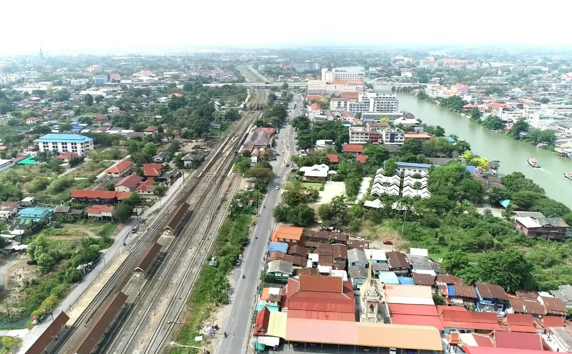
85. Ban Sarai Village, Phra Nakhon Si Ayutthaya is a rural community in Phra Nakhon Si Ayutthaya Province that reflects the agricultural traditions of Thailand's central plains. Its way of life is closely connected to rice cultivation, water management, and farming communities that developed alongside rivers and canals. Ayutthaya's extensive network of waterways has historically influenced settlement patterns, transportation, and agriculture throughout the province.
The appeal of visiting Ban Sarai lies in learning about community history and the traditional knowledge associated with everyday resource use. Travelers can observe village houses, agricultural landscapes, and occupations where suitable community activities are available. This type of visit provides a different perspective on Ayutthaya from the famous temples and monuments within its historic city.
Agriculture is an important element of the cultural heritage of Central Thailand. Farmers traditionally developed knowledge of preparing soil, managing irrigation water, and growing crops according to seasonal conditions. Visiting an agricultural community helps travelers appreciate the relationship between residents and their changing environment, as well as the importance of farming to local food production and the rural economy.
Ban Sarai is suitable for visitors interested in rural cultural tourism and traditional community life. Travelers should respect private property and avoid disturbing farming activities. Permission should always be requested before photographing people or entering residential areas. Educational visits should be coordinated with local caretakers or community representatives.
The village can be included in a wider itinerary through Phra Nakhon Si Ayutthaya Province. Combining rural community experiences with visits to historical attractions helps travelers understand both the heritage of Thailand's former capital and the lives of people in the surrounding region today.
Highlights: Traditional Ayutthaya community, rice farming, rural heritage, waterways, agricultural lifestyles, and community cultural learning.
Getting There From Ayutthaya town, follow the main provincial roads and connecting rural routes toward Ban Sarai. Confirm the exact visiting point and community arrangements before departure.
Map (GPS): GPS Coordinates: 14.512841, 100.647027 Open Google Maps directions to Ban Sarai

86. Ban Chai Phatthana, Sa Kaeo is a rural community in Sa Kaeo Province associated with local livelihoods and community development in Eastern Thailand. The province contains agricultural plains, natural resources, and culturally diverse settlements near the Cambodian border. Visiting Ban Chai Phatthana offers an opportunity to learn about rural life and the relationship between agriculture, environmental conditions, and local community development.
Sa Kaeo's geography includes lowland farming areas and mountainous border regions, creating a variety of settlement patterns and occupations. Communities adapt agricultural practices and natural resource use to local conditions. Ban Chai Phatthana provides a setting for learning how residents manage everyday livelihoods and how community development is connected to their surrounding environment.
Visitors interested in agricultural and community learning can explore available activities related to farming, household production, and local development. Learning from residents helps demonstrate the relationship between traditional knowledge and changing economic conditions. Entry to private farms or working areas should only take place with the permission of landowners or organizers.
Community tourism does not necessarily depend on large attractions or numerous commercial facilities. Meaningful experiences can come from listening to local stories and understanding how residents organize their daily lives. Ban Chai Phatthana is therefore more suitable for educational visits and community learning than for travelers expecting resort-style facilities.
Visitors planning a community activity should confirm local arrangements before traveling. Ban Chai Phatthana can be combined with other natural and cultural destinations in Sa Kaeo Province. Responsible travel includes supporting local businesses, minimizing waste, and respecting village customs and residential areas.
Highlights: Rural Sa Kaeo lifestyles, community development, local agriculture, traditional knowledge, and countryside scenery.
Getting There From Sa Kaeo town, travel to Ban Chai Phatthana using provincial and local roads. Confirm the local meeting point in advance when planning an organized community visit.
Map (GPS): GPS Coordinates: 13.537147, 102.041565 Open Google Maps directions to Ban Chai Phatthana

87. Ban Mon, Nakhon Sawan Ban Mon is located in Ban Kaeng Subdistrict, Mueang Nakhon Sawan District, Nakhon Sawan Province. This traditional community preserves aspects of Mon cultural heritage, including its settlement history and local craftsmanship. The village offers opportunities to learn about cultural exchange and community life in the upper Central Thai region.
Mon culture has contributed significantly to Thai history, particularly in religion, craftsmanship, food, and local traditions. As Mon families established settlements in different parts of Thailand, they exchanged cultural knowledge with neighboring communities while preserving aspects of their own identity. Ban Mon reflects this process through its community history and traditional occupations.
Pottery is an important local craft associated with Ban Mon. The community's history is connected to families who settled in an area with suitable clay and developed the production of earthenware. Visitors can learn about the selection and preparation of clay, traditional shaping methods, and the manufacture of pots and containers used in everyday life.
The village also provides an opportunity to appreciate the relationship between local craftsmanship and the wider history of Nakhon Sawan, a major transport and commercial center connecting Northern and Central Thailand. Traditional products, buildings, and residents' accounts help reveal the historical development of the settlement.
Ban Mon is suitable for travelers interested in ethnic history, pottery, and cultural learning. It can be combined with attractions around Nakhon Sawan town. Visitors seeking a craft demonstration or detailed community history should contact local organizers or producers beforehand.
Highlights: Mon cultural heritage, traditional pottery, settlement history, local craftsmanship, and upper Central Thai community life.
Getting There From Nakhon Sawan town, travel north toward Ban Kaeng Subdistrict and Ban Mon, approximately 16 kilometers from the city center. Private cars or local taxis are convenient.
Map (GPS): GPS Coordinates: 15.805660, 100.077842 Open Google Maps directions to Ban Mon

88. Ban Din So Phong, Lop Buri Ban Din So Phong is a traditional handicraft community in Lop Buri Province known for producing din so phong, a fine white powder made from naturally occurring marl. This material has been used in Thai life for generations, particularly in traditional skincare preparations and festive activities. The village offers visitors an opportunity to learn about the production process and the relationship between natural resources and local knowledge.
The production of din so phong involves selecting suitable raw material and processing it through a series of traditional steps. Producers dissolve the material in water, filter out impurities, allow the fine particles to settle, and shape the processed material into small pieces that are dried before use. Each stage requires practical experience to achieve a consistent texture and suitable finished product.
Din so phong has historically been used for different purposes, including traditional cosmetic applications and activities associated with the Songkran festival. Production has therefore been closely connected to changing seasonal demand and local trade. Learning about this craft helps visitors understand how knowledge of natural materials developed into a specialized community occupation.
Travelers may observe traditional production at participating workshops and purchase products from local producers. Visitors should follow the instructions of workshop owners and avoid handling raw materials or equipment without permission. This is particularly important because production areas are working spaces rather than purpose-built tourist exhibitions.
Ban Din So Phong is suitable for those interested in traditional handicrafts and local knowledge. It can be combined with Phra Prang Sam Yot, King Narai's Palace, and other historical attractions in Lop Buri town. Visitors should contact local producers if they wish to observe the production process directly.
Highlights: Din so phong white powder, traditional filtering and settling processes, shaping and drying techniques, local craftsmanship, and traditional Thai products.
Getting There From Lop Buri town, travel toward Ban Din So Phong using local roads. Confirm which production workshops are open to visitors before departure.
Map (GPS): GPS Coordinates: 14.811280, 100.633644 Open Google Maps directions to Ban Din So Phong
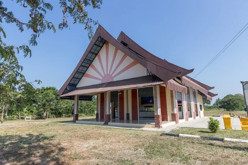
89. Ban Khu Mueang, Ang Thong Ban Khu Mueang is a historic community in Ang Thong Province associated with the remains of an ancient settlement in Central Thailand. The name is connected to an old town moat, reflecting the area's archaeological and historical significance. The surrounding region contains traditional villages, temples, and agricultural landscapes that developed alongside the rivers and waterways of the central plains.
The history of Ban Khu Mueang is associated with settlement patterns dating to the Dvaravati period. Archaeological evidence includes traces of ancient moats and earthen embankments, pottery fragments, and objects related to former habitation. Such remains help explain the development of early communities and the relationship between settlement locations, defensive features, water management, and agricultural land.
Visitors interested in archaeology can study the landscape and surviving evidence of the ancient settlement. Understanding the position of former moats and earthworks reveals how the community was organized and how the surrounding environment influenced its development. Local historical accounts can provide additional context for the name and importance of the village.
The present-day community retains elements of rural life in Central Thailand, including agricultural surroundings and traditional settlements. Travelers can appreciate the relationship between the historic site and contemporary village life while learning about the continuity of occupation in the region.
Ban Khu Mueang is suitable for historical and educational tourism. It can be combined with temples and cultural attractions in Ang Thong Province. Visitors should follow archaeological conservation rules, avoid moving artifacts, and respect private land.
Highlights: Ancient town moat, Dvaravati-period history, earthen embankments, archaeological remains, and rural Central Thai heritage.
Getting There From Ang Thong town, travel toward Sawaeng Ha District and Ban Phai Subdistrict, then continue to Ban Khu Mueang. Daytime visits are preferable for observing the historic landscape.
Map (GPS): GPS Coordinates: 14.792353, 100.327829 Open Google Maps directions to Ban Khu Mueang

90. Tree Transplanting Village, Saraburi is a horticultural community in Saraburi Province known for its expertise in preparing and relocating mature trees. The community produces and sells ornamental plants and trees for landscaping, using techniques that require an understanding of root systems, soil conditions, and plant care. It is a worthwhile destination for visitors interested in horticulture, garden design, and agricultural knowledge.
Tree transplanting involves preparing a tree's roots and lifting it with a suitable soil ball so that it can be moved to another location while minimizing damage. The process requires careful planning according to the species, age, size, and characteristics of each tree. Different types of trees respond differently to transplanting, so experienced growers must choose appropriate methods and timing.
Local expertise is reflected in the stages of preparing trees, pruning branches, digging around the root system, wrapping the soil ball, and transporting plants to their new locations. Each stage must be performed carefully to help the tree recover and continue growing after replanting. The work combines agricultural experience with technical skills and practical knowledge of plant physiology.
Production areas may contain many species used in gardening and landscape architecture, including shade trees, flowering trees, and ornamental plants. Visitors interested in horticulture can learn about plant characteristics and discuss post-transplanting care with experienced growers. Buying plants directly from producers can also support the community's agricultural economy.
The village is suitable for visitors interested in gardening, landscape architecture, plant production, and educational tourism. Visitors should not enter active transplanting areas without permission, because heavy equipment and large vehicles may be in use. Advance contact with a grower is recommended for demonstrations or professional learning visits.
Highlights: Mature tree transplanting, root preparation, ornamental trees, landscaping plants, nursery production, and local horticultural expertise.
Getting There From Saraburi town, travel to the Tree Transplanting Village using local roads. Confirm the nursery or participating operator that is open to visitors before departure.
Map (GPS): GPS Coordinates: 14.649500, 101.100500 Open Google Maps directions to Tree Transplanting Village
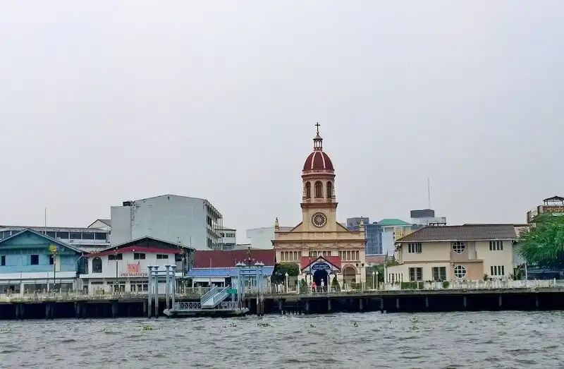
91. Kudi Chin Community, Bangkok Kudi Chin is a historic riverside neighborhood in Thon Buri District, Bangkok. The community is distinguished by the coexistence of different ethnic, religious, and cultural traditions, particularly those associated with Thai people of Portuguese and Chinese descent, alongside Muslim communities. Its history is closely connected to settlement during the early Thonburi period, while religious buildings, traditional houses, food, and everyday community relationships continue to preserve its distinctive cultural identity.
The history of Kudi Chin is associated with Portuguese settlers who established homes on the Thonburi side of the Chao Phraya River following the transition from the Ayutthaya Kingdom to the Thonburi Kingdom. As people from different backgrounds moved into the area, a multicultural settlement developed in which residents maintained their customs and religious traditions while sharing the same neighborhood. This history remains visible through the community's religious landmarks and traditional food.
Santa Cruz Church is one of the neighborhood's most important landmarks. Its distinctive architecture overlooks the Chao Phraya River, and the church continues to serve the local Roman Catholic community. Nearby Chinese shrines and other religious sites illustrate the long history of cultural coexistence. Visitors can walk through the narrow lanes, observe older houses, and appreciate the relationship between the neighborhood and the river.
A particularly famous local specialty is khanom farang kudi chin, a traditional baked cake associated with Portuguese culinary influences. The cake has a firm texture and is often decorated with raisins or dried fruit. Sampling this dessert at a local bakery provides a culinary connection to the settlement's history and illustrates how international traditions have been adapted within Thai communities.
The Baan Kudichin Museum is another valuable cultural attraction. Through photographs, objects, and historical information, visitors can learn about community settlement, religion, river trade, and everyday life. The museum and surrounding neighborhood offer a rewarding experience for people interested in the history of Bangkok beyond its major royal and religious monuments.
Kudi Chin is best explored on foot and can be combined with Wat Kanlayanamit, Wat Prayurawongsawat, and other cultural attractions along the Chao Phraya River. Visitors should respect the privacy of residents, avoid disturbing religious activities, and ask permission before photographing private homes or interiors.
Highlights: Multicultural riverside community, Santa Cruz Church, Portuguese-influenced khanom farang kudi chin, Baan Kudichin Museum, historic houses, and Thonburi walking routes.
Getting There Travel by MRT to Sanam Chai Station, then use an appropriate river crossing or local transport to reach the Thonburi side. Travelers arriving by car should use designated parking areas and explore the neighborhood on foot because many lanes are narrow.
Map (GPS): GPS Coordinates: 13.738764, 100.493463 Open Google Maps directions to Kudi Chin Community

92. Sala Daeng Nuea Community, Pathum Thani is located in Chiang Rak Noi Subdistrict, Sam Khok District, Pathum Thani Province. This historic Mon community beside the Chao Phraya River is known for its cultural heritage, settlement history, and religious architecture. Wat Sala Daeng Nuea is an important landmark and spiritual center that reflects the long relationship between the community and the river.
Mon communities have played an important role in the cultural history of Pathum Thani, particularly around Sam Khok District, where Mon settlements have existed for generations. Language, cuisine, Buddhist traditions, and handicrafts form part of this heritage. Temples continue to serve as important places for cultural activities and the transmission of traditions.
Wat Sala Daeng Nuea provides an appropriate starting point for learning about local history. Its buildings and religious features reflect aspects of Mon cultural influence. Visitors can study the importance of the temple to the community while appreciating the quieter riverside surroundings that contrast with the modern urban landscape of nearby Bangkok.
The surrounding village contains traditional residential areas and riverside spaces that reflect the importance of the Chao Phraya River to transportation, agriculture, and settlement. Walking through publicly accessible parts of the community helps travelers understand the connection between waterways and everyday life in Central Thailand.
Mon cultural heritage is also preserved through traditional food and community celebrations, particularly activities associated with Buddhist religious festivals. Visitors interested in learning about these practices should coordinate with knowledgeable residents or community representatives and avoid disturbing private ceremonies.
Sala Daeng Nuea is suitable for travelers interested in ethnic culture and riverside history. It can be included in a cultural itinerary through Sam Khok District. Visitors to the temple should dress modestly and respect religious customs.
Highlights: Historic Mon community, Wat Sala Daeng Nuea, Mon-influenced architecture, Chao Phraya riverside life, cultural traditions, and settlement history.
Getting There From Bangkok, travel toward Pathum Thani and Sam Khok District via the Rangsit–Pathum Thani route or Highway 347. Continue to Chiang Rak Noi Subdistrict and Wat Sala Daeng Nuea. Private cars and local taxis provide convenient access.
Map (GPS): Wat Sala Daeng Nuea Reference Coordinates: 14.094662, 100.544803 Open Google Maps directions to Wat Sala Daeng Nuea

93. Koh Kret Community, Nonthaburi Koh Kret is located in Pak Kret District, Nonthaburi Province. This historic island community in the Chao Phraya River is famous for its Mon cultural heritage, pottery, traditional cuisine, and peaceful riverside atmosphere. The island developed after a shortcut canal was excavated during the Ayutthaya period, gradually creating a distinct area surrounded by water. Today, Koh Kret remains one of the most interesting cultural destinations within easy reach of Bangkok.
The history of Koh Kret is closely connected to the settlement of Mon communities along the Chao Phraya River. They brought traditional pottery knowledge, language, cuisine, and customs, all of which became important features of the island's identity. Local pottery is especially recognizable for its carved and perforated decorative patterns, including intricately designed water pots that demonstrate the skills of experienced artisans.
Visitors can explore pottery workshops and shops around the island to learn about clay preparation, shaping, decoration, and firing. Some businesses offer opportunities to try basic pottery-making techniques. Purchasing handmade ceramics directly from local producers helps support the village economy and preserve traditional craftsmanship.
Wat Poramaiyikawat Worawihan is one of Koh Kret's most important religious landmarks. Its architecture and cultural features are associated with Mon heritage, while the leaning pagoda beside the river has become a recognizable symbol of the island. Visitors can explore the temple and continue through local streets on foot or by bicycle, passing pottery shops, traditional houses, orchards, and eateries.
Food is another important part of the Koh Kret experience. Visitors can sample Mon dishes, traditional Thai desserts, and local specialties such as fried kala shoots. Weekend markets provide a wide range of food and handmade products, while weekdays are generally quieter and more suitable for travelers who prefer a relaxed atmosphere.
Koh Kret is suitable for walking, cycling, cultural learning, and food tourism. Travelers can visit on a day trip or stay in local accommodation where available. Ferry services should be checked before traveling, and visitors should remember that parts of the island have narrow paths shared by residents and cyclists.
Highlights: Mon cultural community, Koh Kret pottery, Wat Poramaiyikawat, the leaning pagoda, traditional desserts, kala shoot dishes, cycling, and Chao Phraya riverside scenery.
Getting There Travel to Pak Kret District and a ferry pier serving Koh Kret, such as the pier near Wat Sanam Nuea. Cross the river by ferry, then explore the island on foot or by bicycle. Cars cannot be driven directly to the island via the ordinary visitor ferry.
Map (GPS): GPS Coordinates: 13.911446, 100.476190 Open Google Maps for Koh Kret and plan the ferry crossing

94. Bang Nam Phueng Community, Samut Prakan is located in Bang Nam Phueng Subdistrict, Phra Pradaeng District, Samut Prakan Province. This traditional orchard community in the Bang Kachao area is known for its green surroundings, canals, agricultural gardens, and Bang Nam Phueng Floating Market. Despite its proximity to Bangkok, the community retains a relatively peaceful atmosphere and a lifestyle connected to fruit growing, coconut plantations, and local waterways.
The low-lying geography of Bang Nam Phueng and the wider Bang Kachao area has long supported orchards and canal-side settlements. Waterways influenced transportation, agricultural practices, and everyday household activities. The green landscape also plays an important environmental role within the densely developed Bangkok metropolitan area.
Bang Nam Phueng Floating Market is a major attraction offering traditional food, Thai desserts, fruit, agricultural products, and handmade goods. Visitors can walk through the market, sample local dishes, and purchase products directly from community businesses. The market helps create income while maintaining connections to local food and trading traditions.
Cycling is another popular way to explore Bang Nam Phueng. Small roads and shaded routes pass through orchards, houses, and canals, allowing travelers to appreciate the area's green character at a slower pace. Cycling also provides opportunities to observe village life and the relationships between homes, gardens, and waterways.
The wider Bang Kachao area contains additional nature-oriented attractions, including parks and designated green spaces suitable for relaxing outdoors. Travelers can combine Bang Nam Phueng Floating Market with a cycling trip through neighboring communities. They should avoid entering private orchards without permission and take care on narrow roads.
Bang Nam Phueng is suitable for families and travelers looking for a green escape close to Bangkok. A half-day or full-day visit is convenient, particularly when combining the market with cycling. Accommodation may be available in the wider Bang Kachao area, while market operating times should be checked before departure.
Highlights: Bang Nam Phueng Floating Market, orchard communities, canals, traditional Thai food, cycling through Bang Kachao, and green countryside near Bangkok.
Getting There From Bangkok, travel toward Phra Pradaeng District and continue to Bang Nam Phueng Subdistrict. Another option is to cross the Chao Phraya River by a suitable ferry serving Bang Kachao and continue by bicycle or local transport. Confirm market operating days before traveling.
Map (GPS): Bang Nam Phueng Floating Market Coordinates: 13.679641, 100.574024 Open Google Maps directions to Bang Nam Phueng Floating Market

95. Don Kai Dee Benjarong Village, Samut Sakhon is located in Don Kai Dee Subdistrict, Krathum Baen District, Samut Sakhon Province. This traditional craft community is renowned for producing benjarong porcelain, a form of decorative Thai ceramic art distinguished by intricate patterns and carefully applied colors. The village is home to skilled artisans who preserve traditional painting methods while developing new designs suited to contemporary homes and decorative uses.
Benjarong has a long history in Thai decorative arts. Its distinctive appearance comes from the use of several colors to create detailed patterns on glazed porcelain. Common motifs draw inspiration from Thai flowers, traditional ornamental patterns, and classical design. Producing these patterns requires exceptional control and accuracy, particularly when painting fine lines and symmetrical details by hand.
Don Kai Dee has become an important community center for benjarong craftsmanship. Local artisans and workshops produce cups, plates, bowls, vases, decorative objects, and souvenirs in a wide range of styles. Some preserve historical patterns, while others adapt traditional decorative techniques to modern designs.
Visitors may be able to observe the production process, including preparing ceramic pieces, sketching patterns, applying colors, and firing decorated porcelain. Participating workshops sometimes organize demonstrations or introductory painting activities, allowing travelers to experience aspects of the craft under the guidance of skilled artisans.
Purchasing benjarong directly from village producers helps support local livelihoods and preserve specialized artistic knowledge. Visitors can speak with artisans about the meanings of decorative patterns, production techniques, and the time required to complete individual pieces.
Don Kai Dee is particularly suitable for cultural travelers, art enthusiasts, families, and educational groups. It can be combined with local markets and cultural attractions in Krathum Baen District. Groups wishing to participate in demonstrations should make advance arrangements with workshops.
Highlights: Traditional benjarong porcelain, hand-painted Thai patterns, decorative ceramics, artisan workshops, demonstrations, and locally made souvenirs.
Getting There From Bangkok, follow Phetkasem Road or the connecting route toward Krathum Baen District, then continue to Don Kai Dee Subdistrict and the benjarong village. Private cars and local taxis provide convenient access.
Map (GPS): GPS Coordinates: 13.643347, 100.253715 Open Google Maps directions to Don Kai Dee Benjarong Village

96. Bueng Pho Riam Community, Sing Buri is located in Ngio Rai Subdistrict, In Buri District, Sing Buri Province. The community is associated with a freshwater wetland and rural ecosystem that supports local agriculture and natural habitats. The peaceful landscape includes water, vegetation, and surrounding farmland, making the area suitable for travelers interested in rural nature and the environmental importance of freshwater resources.
Bueng Pho Riam contributes to the local wetland environment by providing space for freshwater ecosystems and seasonal water storage. Vegetation around the wetland offers shelter for aquatic and other wildlife. The landscape illustrates how wetlands support biodiversity and interact with agricultural land in the central plains.
Local livelihoods have traditionally been connected to agriculture and the use of freshwater resources. Wetlands and water bodies influence the environmental conditions that support farming and everyday household needs. Visiting the community helps travelers understand why wetland conservation contributes to the long-term well-being of residents.
The wetland's peaceful surroundings are suitable for nature photography and relaxation. Morning and late afternoon are often pleasant times to appreciate the scenery. Visitors should use accessible walking areas, take care around slippery banks, and avoid entering water where safety arrangements are not provided.
Bueng Pho Riam can be included as a quiet stop during a trip through In Buri District, combined with temples and other cultural attractions in Sing Buri. Visitors should protect the wetland environment by taking their rubbish away and avoiding disturbance to plants and aquatic wildlife.
Highlights: Freshwater wetland, aquatic ecosystems, natural vegetation, traditional agriculture, rural scenery, and community environmental learning.
Getting There From Sing Buri town, travel toward In Buri District and continue to Ngio Rai Subdistrict and Bueng Pho Riam. Private transport is convenient. Check the entrance and parking area before departure.
Map (GPS): GPS Coordinates: 14.884655, 100.274293 Open Google Maps directions to Bueng Pho Riam Community
97. Mueang Dong Khon Community, Chai Nat is a historic area in Chai Nat Province associated with the Mueang Dong Khon Archaeological Site. The location preserves traces of earlier settlement and provides insight into the development of communities in the upper Central Thai region. Its historical landscape reflects the importance of agricultural resources, water, and transportation in determining where people established their homes.
The Mueang Dong Khon Archaeological Site is important for understanding early settlement in this part of Thailand. Archaeological remains help researchers investigate how people used the surrounding environment and developed communities over time. Studying the site provides an opportunity to connect local history with broader patterns of settlement in Central Thailand.
Visitors interested in archaeology can observe the landscape and areas officially open to the public. Studying historical sites in their original surroundings helps explain how geography, water sources, and agricultural land influenced settlement. Visitors should not dig, remove objects, or disturb archaeological evidence.
The present-day community around the site reflects the continuing agricultural character of the region. Farmland, rural houses, and local roads demonstrate the relationship between historical settlement and contemporary life. Such surroundings provide a useful context for appreciating how communities change while retaining connections to earlier periods.
Mueang Dong Khon is suitable for educational travel and visitors interested in archaeology and community history. It can be combined with temples and other historic attractions in Chai Nat Province. Groups wishing to study the archaeological site in detail should contact the relevant local authority beforehand.
Highlights: Mueang Dong Khon Archaeological Site, settlement history, early community landscapes, agricultural heritage, and local historical learning.
Getting There From Chai Nat town, follow the provincial and local roads to Mueang Dong Khon Archaeological Site. Check the access route and any visiting requirements before departure.
Map (GPS): Archaeological Site Reference Coordinates: 15.021848, 100.156992 Open Google Maps directions to Mueang Dong Khon Archaeological Site
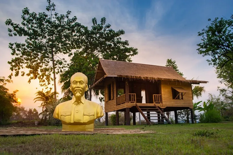
98. Ban Dong Community, Phichit is a historic community in Phichit Province associated with Thai people of Vietnamese descent and the history of Ho Chi Minh, an important figure in modern Vietnamese history. The Ban Dong Ho Chi Minh Museum provides a setting for learning about the historical movement of people, cultural exchange, and relationships between communities in mainland Southeast Asia.
The history of Ban Dong is connected to the settlement of Vietnamese families in Thailand. These residents brought language, food, and cultural traditions that became part of the local social landscape. Over time, interactions between Vietnamese and Thai communities contributed to a shared history of settlement and cultural exchange.
The Ban Dong Ho Chi Minh Museum presents historical material associated with these connections. Visitors can learn about the wider social and political circumstances affecting Vietnamese communities in Thailand, including the historical period associated with Ho Chi Minh. Exhibitions and historical information provide context for understanding the community's importance in regional history.
Beyond the museum, Ban Dong reflects the everyday life of a rural community with a diverse cultural background. Visitors can learn about local settlement history and appreciate how Vietnamese cultural influences became part of the surrounding Thai social environment.
Ban Dong is particularly suitable for travelers interested in modern history, Thai–Vietnamese cultural relations, and community heritage. It can be combined with other attractions in Phichit Province. Visitors should confirm current museum access arrangements before departure.
Highlights: Ban Dong Ho Chi Minh Museum, Thai–Vietnamese settlement history, cultural exchange, community heritage, and Southeast Asian historical learning.
Getting There From Phichit town, travel to the Ban Dong Ho Chi Minh Museum using local roads. Private transport or local taxis are convenient. Check visiting hours and museum arrangements beforehand.
Map (GPS): Museum Reference Coordinates: 16.463415, 100.387321 Open Google Maps directions to Ban Dong Ho Chi Minh Museum
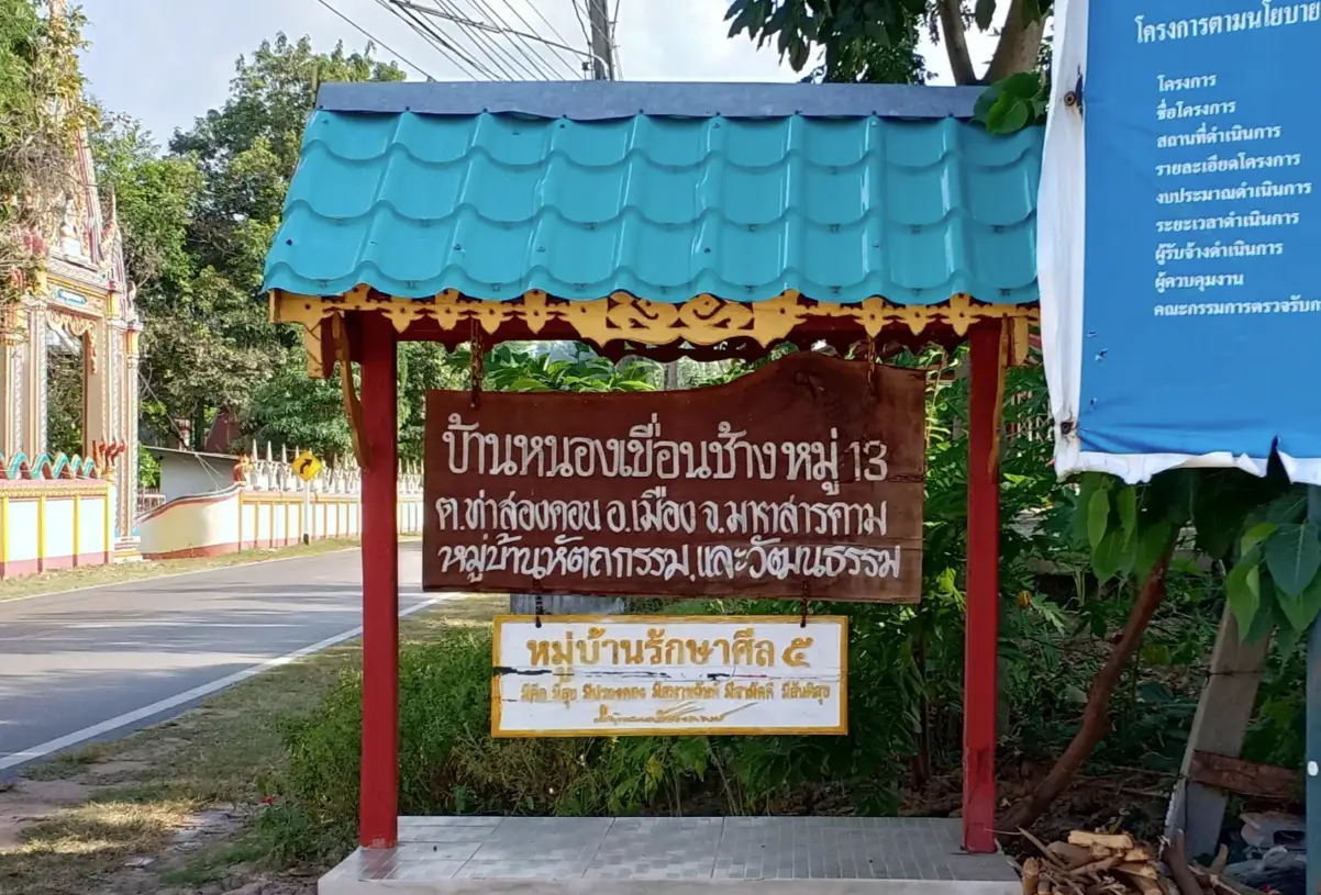
99. Ban Nong Khuean Chang Handicraft Village, Maha Sarakham is a traditional craft community in Maha Sarakham Province where residents preserve local handicraft knowledge alongside agricultural livelihoods. The village reflects the importance of household craftsmanship to rural communities in Northeastern Thailand, with handmade products serving both practical and cultural purposes.
Traditional handicrafts have long been important to rural life because residents once made many household items from locally available materials. Knowledge of preparing materials, shaping objects, and producing useful goods was passed down within families. Such skills reflect community creativity and the practical adaptation of craftsmanship to everyday needs.
Visiting Ban Nong Khuean Chang provides opportunities to learn about local producers and the work involved in making handcrafted products. Demonstrations may show how materials are selected and prepared, how products are designed, and how finished goods are made for sale. Educational activities should be arranged with local production groups when available.
The wider village landscape reflects rural Isan, where agriculture and household crafts often contribute together to family income. Walking through areas open to visitors and speaking with artisans can reveal the value of traditional knowledge and the creativity needed to develop practical goods.
Ban Nong Khuean Chang is suitable for cultural travelers, families, and educational groups. Purchasing locally made products helps support producers and encourages younger generations to appreciate inherited craft traditions. Visitors should contact community organizers before traveling for demonstrations or workshops.
Highlights: Traditional handicrafts, local artisan skills, community-made products, rural agriculture, and cultural learning activities.
Getting There From Maha Sarakham town, travel toward Ban Nong Khuean Chang using the local road network. Confirm the craft group's location and the availability of demonstrations before departure.
Map (GPS): GPS Coordinates: 16.168455, 103.190452 Open Google Maps directions to Ban Nong Khuean Chang

100. Bang Nam Chiao Thai Phuan Community, Sing Buri is located in Bang Nam Chiao Subdistrict, Phrom Buri District, Sing Buri Province. The community is known for preserving Thai Phuan cultural heritage through the Thai Phuan Arts and Cultural Center at Wat Kudi Thong. The center introduces visitors to local settlement history, language, food, clothing, household objects, and traditional knowledge associated with the Thai Phuan people.
The Thai Phuan people have cultural roots connected to the historical Muang Phuan region. Families brought their language, customs, and traditional knowledge into Central Thailand, where these practices were passed down through family life, temples, and community activities. Their heritage contributes to the cultural diversity of the Sing Buri region.
The Thai Phuan Arts and Cultural Center preserves community history through displays of traditional houses, agricultural tools, basketry, household equipment, and objects associated with everyday life. Visitors can learn how homes were organized, how people worked, and how practical knowledge was adapted to the environment.
Traditional food and celebrations are other important elements of Thai Phuan heritage. Regional cooking relies on local ingredients and methods passed down between generations, while customary ceremonies express relationships between language, beliefs, and family life. Learning directly from knowledgeable residents adds meaning to the objects and displays presented at the cultural center.
Wat Kudi Thong serves as a spiritual center for residents and a setting for the preservation of cultural traditions. The temple's role in Buddhist ceremonies and community activities illustrates the relationship between religious life and ethnic heritage. Visitors should dress modestly and follow guidance from caretakers.
The community is suitable for families, students, and travelers interested in local history and ethnic culture. It can be included in a cultural itinerary through Phrom Buri District. Educational groups should contact the center beforehand to confirm visiting arrangements and the availability of cultural learning activities.
Highlights: Thai Phuan Arts and Cultural Center, Wat Kudi Thong, traditional houses, basketry, ethnic clothing, community history, and local cultural knowledge.
Getting There From Sing Buri town, travel toward Phrom Buri District, then continue to Bang Nam Chiao Subdistrict and Wat Kudi Thong in Village No. 3. Private cars and local taxis provide convenient access. Groups should arrange cultural center visits in advance.
Map (GPS): Thai Phuan Arts and Cultural Center Coordinates: 14.788371, 100.453072 Open Google Maps directions to the Thai Phuan Arts and Cultural Center
| Region | Province | Village / Community and Highlights | Google Maps |
|---|---|---|---|
| Northern Thailand | Kamphaeng Phet | 47. Ban Pang Manao — Lahu cultural heritage, highland agriculture, mountain forests, and traditional community life. | 47. View Map |
| Chiang Rai | 6. Doi Pha Mee — Akha village, Arabica coffee, and panoramic highland scenery. 11. Doi Pha Hi — Mountain coffee village, viewpoints, and Akha cultural heritage. 30. Mirror Foundation Tribal Tourism Project — Community-based ethnic cultural learning and responsible tourism. | ||
| Chiang Mai | 1. Mae Kampong Village — Traditional wooden houses, streams, waterfalls, and mountain homestays. 3. Ban Pa Bong Piang — Spectacular terraced rice fields and peaceful hillside stays. 5. Ban Mae Klang Luang — Karen rice terraces, Arabica coffee, and Doi Inthanon scenery. 12. Ban Mae Mae — Forest village, traditional miang tea production, and nature retreats. 21. Doi Pui Hmong Village — Traditional Hmong clothing, embroidery, mountain gardens, and handicrafts. | ||
| Tak | 51. Hill Tribe Villages — Lisu, Karen, and Lahu cultures, traditional weaving, and mountain agriculture. | 51. View Map | |
| Nakhon Sawan | 87. Ban Mon — Mon community history, traditional pottery, and cultural heritage. | 87. View Map | |
| Nan | 17. Ban Manee Pruek — Highland agriculture, ethnic communities, and mountain forests. 18. Bo Kluea Mountain Salt Wells — Traditional mountain salt production and cultural heritage. 33. Ban Tha Khwai — Agricultural traditions and riverside life along the Pua River. 43. Ban Pak Lee Fishing Village — Freshwater fishing and scenic mountain reservoir landscapes. | ||
| Phayao | 52. Ban Pang Pu Lo — Mien cultural heritage, traditional embroidery, fruit orchards, and coffee cultivation. | 52. View Map | |
| Phichit | 98. Ban Dong Community — Ho Chi Minh Museum, Thai–Vietnamese settlement history, and cultural exchange. | 98. View Map | |
| Phitsanulok | 79. Ban Nam Chuang–Thap Si — Mountain farming villages, seasonal rice fields, and natural scenery. | 79. View Map | |
| Phetchabun | 53. Ban Huai Khrai — Nyah Kur ethnic heritage, traditional language, and rural agricultural life. | 53. View Map | |
| Phrae | 32. Ban Na Tong — Watershed forests, waterfalls, caves, and mountain village life. | 32. View Map | |
| Mae Hong Son | 2. Ban Rak Thai — Yunnanese Chinese village, tea plantations, and lakeside scenery. 4. Ban Jabo — Lahu village, sea of mist, and mountain noodle restaurant. 7. Ban Huai Hom — Karen community, Arabica coffee, and sheep-wool weaving. 8. Santichon Village — Yunnanese Chinese culture, earthen houses, and regional cuisine. 14. Ban Mae La Na — Mountain homestays, traditional village life, and limestone caves. 20. Ban Mae Sam Laep — Salween River scenery, border community, and riverboat experiences. | ||
| Lampang | 40. Ban Pa Miang and Chae Son Area — Fermented tea leaves, mountain homestays, waterfalls, and forest scenery. | 40. View Map | |
| Lamphun | 44. Ban Tha Pa Pao — Community forest conservation, nature walks, and ecotourism homestays. 46. Ban Don Luang — Yong cultural heritage, traditional cotton weaving, and handicrafts. | ||
| Sukhothai | 13. Ban Na Ton Chan — Traditional homestays, mud-fermented textiles, rural activities, and mountain viewpoints. | 13. View Map | |
| Uttaradit | 42. Ban Huai Ta — Sirikit Dam reservoir village, boat travel, freshwater fishing, and mountain scenery. | 42. View Map | |
| Uthai Thani | 81. Ban E Mad–E Sai — Karen highland heritage, traditional weaving, and mountain forests. | 81. View Map | |
| Northeastern Thailand | Kalasin | 61. Ban Khok Kong Phu Thai Cultural Village — Phu Thai traditions, homestays, weaving, and welcoming ceremonies. | 61. View Map |
| Khon Kaen | 62. Thai Buffalo Conservation Village — Native Thai buffaloes, traditional rice farming, and agricultural learning. | 62. View Map | |
| Chaiyaphum | 58. Ban Non Sela — Khit textile weaving, traditional pillows, and community craftsmanship. | 58. View Map | |
| Nakhon Phanom | 39. Songkhram River Basin Communities — Seasonally flooded forests, wetland ecology, and freshwater fishing. | 39. View Map | |
| Nakhon Ratchasima | 45. Dan Kwian Pottery Village — Traditional earthenware, ceramic workshops, and local craftsmanship. 49. Ban Prasat Community — Prehistoric archaeology, excavation sites, and community heritage. | ||
| Bueng Kan | 71. Ban Khi Lek Yai — Living community museum, traditional wooden houses, and Naga street art. | 71. View Map | |
| Buriram | 48. Ban Sanuan Nok Community — Silk weaving, Thai-Khmer culture, folk dances, and community traditions. | 48. View Map | |
| Maha Sarakham | 63. Ban Mo Pottery Village — Traditional Isan earthenware and clay-pot production. 99. Ban Nong Khuean Chang — Local handicrafts and rural community craftsmanship. | ||
| Mukdahan | 41. Ban Nong Lom — Phu Thai cultural traditions, Mekong River life, and community homestays. | 41. View Map | |
| Yasothon | 64. Ban Si Than — Traditional khit pillows, woven textiles, and local handicrafts. | 64. View Map | |
| Roi Et | 76. Ban Wai Luem — Traditional silk weaving, handmade textiles, and rural Isan culture. | 76. View Map | |
| Loei | 15. Tai Dam Cultural Village — Tai Dam houses, traditional clothing, weaving, and ethnic heritage. 16. Ban Chiang Khan — Historic wooden houses, Mekong River scenery, and walking street. | ||
| Si Sa Ket | 65. Ban Prasat Yoe — Yoe ethnic heritage, ancient Khmer remains, and traditional agricultural life. | 65. View Map | |
| Sakon Nakhon | 56. Ban Tha Rae — Historic Catholic community, old architecture, and Christmas Star Parade. | 56. View Map | |
| Surin | 57. Ban Butom — Traditional rattan basket weaving and local craft production. | 57. View Map | |
| Nong Khai | 55. Freshwater Fishing Village — Aquaculture, traditional freshwater fishing, and local food production. | 55. View Map | |
| Nong Bua Lam Phu | 75. Ban Thai Niyom — Huai Pha Wang Reservoir, mountain scenery, and lakeside relaxation. | 75. View Map | |
| Amnat Charoen | 72. Ban Pla Khao — Traditional molam performers, Phu Thai cultural heritage, and folk music. | 72. View Map | |
| Udon Thani | 50. Ban Chiang Community — UNESCO World Heritage archaeology, ancient pottery, and local cultural history. | 50. View Map | |
| Ubon Ratchathani | 36. Ban Lat Charoen and Hat Sai Sung — Seasonal Mekong River sandbanks and traditional riverside life. | 36. View Map | |
| Central Thailand | Bangkok | 91. Kudi Chin Community — Portuguese-influenced history, multicultural heritage, historic houses, and traditional desserts. | 91. View Map |
| Chai Nat | 97. Mueang Dong Khon Community — Archaeological remains, early settlement history, and rural heritage. | 97. View Map | |
| Nakhon Nayok | 80. Traditional Thai Phuan House — Thai Phuan culture, traditional houses, settlement history, and local customs. | 80. View Map | |
| Nakhon Pathom | 82. Thai Song Dam Village — Tai Dam ethnic heritage, traditional clothing, weaving, and cultural learning. | 82. View Map | |
| Nonthaburi | 93. Koh Kret Community — Mon pottery, traditional food, riverside temples, and cycling. | 93. View Map | |
| Pathum Thani | 92. Sala Daeng Nuea Community — Historic Mon community, Wat Sala Daeng Nuea, and Chao Phraya riverside life. | 92. View Map | |
| Phra Nakhon Si Ayutthaya | 85. Ban Sarai — Traditional agricultural community, rural heritage, and Central Thai waterways. | 85. View Map | |
| Lop Buri | 88. Ban Din So Phong — Traditional white marl powder production and local craftsmanship. | 88. View Map | |
| Samut Prakan | 94. Bang Nam Phueng Community — Floating market, canal-side orchards, local food, and Bang Kachao cycling. | 94. View Map | |
| Samut Songkhram | 83. Ban Tha Kha — Floating market, traditional canal trading, orchards, and coconut sugar. | 83. View Map | |
| Samut Sakhon | 95. Don Kai Dee Benjarong Village — Hand-painted benjarong porcelain and traditional ceramic craftsmanship. | 95. View Map | |
| Saraburi | 90. Tree Transplanting Village — Mature tree relocation, plant nurseries, and horticultural knowledge. | 90. View Map | |
| Sing Buri | 96. Bueng Pho Riam Community — Freshwater wetland, rural scenery, and local ecology. 100. Bang Nam Chiao Thai Phuan Community — Thai Phuan cultural center, traditional houses, and community history. | ||
| Suphan Buri | 70. Thai Buffalo Village — Native buffalo conservation, agricultural heritage, and traditional farming exhibits. | 70. View Map | |
| Ang Thong | 89. Ban Khu Mueang — Ancient settlement, Dvaravati history, and archaeological remains. | 89. View Map | |
| Eastern Thailand | Chanthaburi | 35. Chanthaboon Waterfront Community — Historic riverside architecture, multicultural heritage, and local cuisine. | 35. View Map |
| Chachoengsao | 69. Ban Santitham — Agroforestry, medicinal plants, traditional houses, and self-sufficiency learning. | 69. View Map | |
| Chon Buri | 78. Ban Chong Samaesan — Traditional fishing village, fresh seafood, and Samaesan Island excursions. | 78. View Map | |
| Trat | 19. Ban Nam Chiao — Multicultural fishing village, traditional woven hats, and mangrove tours. | 19. View Map | |
| Prachin Buri | 84. Bamboo Handicraft Village — Traditional bamboo baskets, weaving techniques, and local handicrafts. | 84. View Map | |
| Rayong | 24. Pak Nam Prasae — Historic fishing village, mangroves, HTMS Prasae, and seafood. | 24. View Map | |
| Sa Kaeo | 86. Ban Chai Phatthana — Rural community development, agriculture, and local cultural learning. | 86. View Map | |
| Western Thailand | Kanchanaburi | 9. Ban E-Tong — Historic mining village, mountain mist, and border landscapes. 22. Ban Nong Khao — Traditional woven textiles, farming culture, and local folklore. | |
| Prachuap Khiri Khan | 29. Ban Bang Pu — Traditional fishing community, coastal scenery, and Sam Roi Yot limestone mountains. | 29. View Map | |
| Phetchaburi | 25. Thai Song Dam Cultural Tourism Village — Tai Dam heritage, traditional textiles, and ethnic customs. 26. Khlong Nam Chiao Ecotourism Village — Canal-side agriculture, coconut sugar, and traditional community life. | ||
| Ratchaburi | 54. Huai Nam Sai Mon Village — Mon cultural heritage, local cuisine, mountain scenery, and village markets. | 54. View Map | |
| Southern Thailand | Krabi | 31. Ban Na Teen — Coconut-shell handicrafts, batik, and Muslim community culture. 34. Ban Ko Klang — Fishing village, Sangyod rice, miniature long-tail boats, and homestays. | |
| Chumphon | 23. Ko Phithak — Island fishing community, homestays, and fresh seafood. 28. Doi Ta Pang — Sunrise viewpoint, mountain mist, and views of Khao Thalu. | ||
| Trang | 59. Ban Nam Cha — Community forest, medicinal plants, biodiversity, and rural conservation. | 59. View Map | |
| Nakhon Si Thammarat | 10. Ban Khiri Wong — Mountain streams, mixed-fruit orchards, natural-dye textiles, and homestays. | 10. View Map | |
| Narathiwat | 73. Ban Yakang — Historic Thai Muslim village, Malay cultural heritage, and traditional community life. | 73. View Map | |
| Pattani | 77. Ban Paseyawo — Traditional kolae fishing boats, colorful boat painting, and Malay coastal culture. | 77. View Map | |
| Phang Nga | 27. Koh Yao Communities — Traditional fishing, Muslim island culture, rice fields, batik, and Phang Nga Bay. | 27. View Map | |
| Phatthalung | 68. Ban Lo Han — Mani cultural heritage, tropical rainforest, and Banthat mountain landscapes. | 68. View Map | |
| Phuket | 38. Ban Bang Rong — Mangrove kayaking, Muslim community traditions, and coastal ecotourism. | 38. View Map | |
| Yala | 74. Sakai Village and Mani Cultural Landscape — Indigenous cultural heritage, forest environments, and traditional ecological knowledge. | 74. View Map | |
| Ranong | 67. Ban Thale Nok — Andaman fishing village, coastal homestays, mangroves, and local seafood. | 67. View Map | |
| Songkhla | 66. Traditional Birdcage-Making Villages — Decorative zebra dove cages, traditional woodworking, and skilled artisans. | 66. View Map | |
| Satun | 37. Bo Chet Luk — Seven ancient freshwater wells, fishing traditions, coastal beaches, and limestone islands. | 37. View Map | |
| Surat Thani | 60. Ban Sa Kaeo — Natural freshwater pools, agricultural countryside, and quiet rural scenery. | 60. View Map |
Frequently Asked Questions (FAQ)
Q: What are some of the most interesting beautiful villages and tourist communities among the 100 destinations across Thailand?
A: Thailand offers many types of beautiful villages and community-based tourism destinations. Mae Kampong Village in Chiang Mai is ideal for experiencing nature in a forest setting, while Ban Rak Thai in Mae Hong Son is distinguished by its Yunnanese Chinese cultural heritage. Ban Pa Bong Piang in Chiang Mai is famous for its spectacular terraced rice fields, and Ban Khiri Wong in Nakhon Si Thammarat is known for its streams and fruit orchards. Ban Thale Nok in Ranong offers an opportunity to experience traditional fishing life, while Ban Tha Kha in Samut Songkhram is suitable for learning about canal-side orchard communities. Travelers can select destinations according to their interests in nature, culture, food, and community activities.
Q: Which tourist villages in Thailand are best for homestay experiences?
A: Villages well known for homestay experiences include Mae Kampong Village in Chiang Mai, Ban Jabo and Ban Huai Hom in Mae Hong Son, Ban Na Ton Chan in Sukhothai, Ban Khiri Wong in Nakhon Si Thammarat, Ban Khok Kong in Kalasin, Ban Thale Nok in Ranong, and Ban Ko Klang in Krabi. Accommodation styles vary between communities. Some homestays allow guests to stay with local families, while others provide separate rooms or private accommodation. Travelers should contact accommodation providers in advance to confirm availability and the community activities they can participate in.
Q: Which mountain villages in Thailand offer the most beautiful natural scenery?
A: Mountain villages with outstanding scenery include Mae Kampong, Ban Pa Bong Piang, and Ban Mae Klang Luang in Chiang Mai; Ban Jabo and Ban Rak Thai in Mae Hong Son; Ban Pa Miang in Lampang; Ban Nam Chuang–Thap Si in Phitsanulok; and Ban Pang Pu Lo in Phayao. Each destination has different natural attractions, including seas of mist, forests, streams, terraced rice fields, tea plantations, and traditional highland lifestyles. Travelers should choose their destinations according to the type of landscape they wish to experience and the most suitable season.
Q: Which tourist villages in Thailand are best for viewing a sea of mist and sunrise?
A: Recommended destinations for misty mountain scenery include Ban Jabo and Ban Rak Thai in Mae Hong Son, Doi Pha Hi and Doi Pha Mee in Chiang Rai, and the Kew Fin Viewpoint area near Ban Pa Miang in Lampang. The appearance of a sea of mist depends on weather conditions, humidity, and daily temperature changes. Early mornings during the cool season generally offer better opportunities to see mist, although visibility cannot be guaranteed on every travel date.
Q: Where should travelers visit to see beautiful terraced rice fields in Thailand?
A: Villages known for beautiful terraced rice fields include Ban Pa Bong Piang and Ban Mae Klang Luang in Chiang Mai, as well as the mountain farming landscapes around Ban Nam Chuang–Thap Si in Phitsanulok. Visitors can admire rice terraces following the natural contours of mountain slopes while learning about farming techniques adapted to steep terrain. During the growing season, the fields are green, while rice approaching harvest turns golden yellow. Travelers should check the local planting and harvesting schedules before visiting.
Q: Which months are best for visiting terraced rice field villages in Thailand?
A: For Ban Pa Bong Piang and Ban Mae Klang Luang, July to September is generally a suitable period for viewing green rice fields. In some years, October to November is when the rice begins turning golden before harvest. However, planting and harvesting periods can vary depending on rainfall and local water management. Travelers should check current field conditions with accommodation providers or community coordinators before departure.
Q: Which villages in Northern Thailand are recommended during the cool season?
A: Villages suitable for cool-season travel include Ban Rak Thai, Ban Jabo, and Ban Huai Hom in Mae Hong Son; Mae Kampong Village in Chiang Mai; Doi Pha Hi and Doi Pha Mee in Chiang Rai; Ban Pa Miang in Lampang; and Ban Pang Pu Lo in Phayao. November to February generally brings cooler and more comfortable temperatures, especially in higher mountain areas. This period is suitable for homestay experiences, nature sightseeing, drinking locally grown coffee, and enjoying the atmosphere of highland communities.
Q: Which tourist villages in Southern Thailand are best for a relaxing coastal holiday?
A: Interesting coastal communities include Ban Thale Nok in Ranong, Ko Phithak in Chumphon, Ban Ko Klang and Ban Na Teen in Krabi, Ban Bang Rong in Phuket, the Koh Yao communities in Phang Nga, and Ban Chong Samaesan in Chon Buri. Each destination has distinctive experiences involving traditional fishing, seafood, boat trips, and coastal ecosystem learning. Travelers should choose a period with suitable wind and sea conditions for either the Gulf of Thailand or the Andaman coast and check weather forecasts before participating in water-based activities.
Q: Which tourist villages near Bangkok are suitable for day trips?
A: Destinations that are convenient to reach from Bangkok include Kudi Chin Community in Bangkok, Koh Kret Community in Nonthaburi, Bang Nam Phueng Community in Samut Prakan, Don Kai Dee Benjarong Village in Samut Sakhon, Ban Tha Kha in Samut Songkhram, Sala Daeng Nuea Community in Pathum Thani, and Thai Song Dam Village in Nakhon Pathom. These destinations are suitable for cultural sightseeing, traditional handicraft activities, sampling local food, and exploring community lifestyles within a single day.
Q: Which tourist villages in Thailand are suitable for families with young children?
A: Family-friendly destinations include Koh Kret Community in Nonthaburi, where children can learn about pottery; Don Kai Dee Benjarong Village in Samut Sakhon, which offers opportunities to explore traditional decorative arts; Ban Tha Kha in Samut Songkhram, known for its floating market and coconut orchards; Thai Buffalo Village in Suphan Buri; and Ban Mo Pottery Village in Maha Sarakham. Families should select activities appropriate for their children's ages, review transportation arrangements, and supervise children closely near water or animals.
Q: Which villages in Thailand are best for learning about ethnic minority cultures?
A: Villages with distinctive ethnic cultural heritage include Ban Khok Kong in Kalasin, known for Phu Thai traditions; Thai Song Dam Village in Nakhon Pathom; Thai Song Dam Cultural Tourism Village in Phetchaburi; Ban Sanuan Nok in Buriram, which preserves the culture of Thai people of Khmer heritage; Ban Prasat Yoe in Si Sa Ket, associated with the Yoe ethnic community; Ban Pang Pu Lo in Phayao, known for Mien culture; and Ban E Mad–E Sai in Uthai Thani, which is connected to Karen heritage. Visitors should respect local customs and obtain community consent before taking photographs or entering private spaces.
Q: Which tourist villages in Thailand are famous for traditional handicrafts?
A: Notable handicraft villages include Dan Kwian Pottery Village in Nakhon Ratchasima, famous for traditional earthenware; Don Kai Dee Benjarong Village in Samut Sakhon; Ban Don Luang in Lamphun, known for handwoven cotton; Ban Butom in Surin, famous for rattan basket weaving; Ban Si Than in Yasothon, known for khit pillows; Ban Non Sela in Chaiyaphum, associated with khit-patterned textiles; and Ban Paseyawo in Pattani, known for traditional kolae boat-building craftsmanship. Visitors can learn about production processes and support artisans by purchasing handmade products directly from local producers.
Q: Which villages offer interesting traditional food and local products?
A: Destinations with distinctive food traditions include Ban Rak Thai in Mae Hong Son, known for Yunnanese Chinese cuisine and tea; Kudi Chin Community in Bangkok, famous for khanom farang kudi chin, a traditional Portuguese-influenced cake; Koh Kret Community in Nonthaburi, known for Mon dishes and fried kala shoot fritters; Ban Tha Kha in Samut Songkhram, associated with coconut sugar and traditional desserts; Ban Ko Klang in Krabi, which offers Muslim cuisine and seafood; and Ban Thale Nok in Ranong, where visitors can learn about the food traditions of coastal fishing communities.
Q: How is staying in a village homestay different from staying in a hotel?
A: A homestay emphasizes experiencing everyday life and learning about local culture with a host family or community members. Guests may enjoy traditional meals, participate in community activities, and learn directly from local residents. Hotels, by contrast, generally focus on accommodation services and facilities provided according to the standards of each establishment. Homestays differ in room arrangements, bathrooms, meals, and available activities, so travelers should check the details carefully before making a reservation.
Q: How much does it cost to stay at a village homestay in Thailand?
A: Homestay prices depend on the destination, season, accommodation type, number of guests, and services included in the package, such as meals, cultural learning activities, or guided excursions. Some providers charge per person, while others charge per room or accommodation unit. Travelers should request the latest rates directly from the provider and check whether meals and activities are included so they can plan an appropriate travel budget.
Q: Is it necessary to book village homestays in advance?
A: Advance reservations are recommended, especially during long holidays, the cool season, and popular travel periods. Many villages have a limited number of rooms, and local hosts may need additional time to prepare meals or organize community activities. Booking ahead also allows travelers to confirm the route, transport from meeting points, available facilities, and important customs or guidelines to follow during their stay.
Q: Can travelers visit tourist villages in Thailand without a private car?
A: Many destinations can be reached without a private car by taking a public bus, train, or flight to the destination province and then arranging a taxi, rental vehicle, or community transport service to the village. However, some mountain villages and remote settlements do not have direct public transport connections. Villages located on islands or within reservoir areas may also require boat transfers. Travelers should coordinate with their accommodation provider or local operator before departure to confirm pickup points and related transport costs.
Q: What should travelers prepare before visiting mountain villages or remote communities?
A: Travelers should check weather forecasts and road conditions before departure and prepare suitable walking shoes, rainwear or warm clothing according to the season, personal medication, cash, and communication equipment. Those driving should inspect their vehicle's brakes, tires, and fuel level, particularly when traveling on steep and winding mountain roads. Some villages have limited mobile coverage or medical services, so travelers should share their itinerary with someone they trust and avoid unfamiliar routes after dark.
Q: How can travelers visit local communities respectfully while protecting their culture and natural environment?
A: Travelers should dress modestly when visiting temples, mosques, or cultural areas; ask permission before photographing people or homes; avoid entering private property without consent; and follow the guidance of local hosts. Visitors should not litter, collect plants or animals from natural areas, or make excessive noise that disturbs residents. When learning about ethnic communities, particular importance should be placed on the rights, dignity, and consent of community members. Supporting locally owned businesses and purchasing community-made products also helps ensure that tourism income benefits local residents.
Q: How should travelers plan a journey to visit beautiful villages across all 77 provinces of Thailand?
A: Travelers should organize their itinerary by region and transportation routes, beginning with neighboring provinces that can be visited conveniently on the same trip. Suggested regional routes include Chiang Mai–Lamphun–Lampang, Chiang Rai–Phayao–Nan, Nakhon Ratchasima–Buriram–Surin, Samut Songkhram–Ratchaburi–Phetchaburi, and Krabi–Phang Nga–Phuket. Select villages offering activities that match your interests, check the best travel seasons and accommodation availability in advance, and allow additional travel time for mountain and island destinations. Dividing the journey into several trips provides more opportunities to experience each community's way of life rather than focusing solely on visiting as many places as possible.
 Category: ●Travel Articles, Recipes
 Group: ●Travel Review, Food Review
Last Update : 4 HourAgo
 Last Update : 4 HourAgo
Recommend

 Art, Culture and Heritage
 Historical Sites and Monuments(8)
 Landmarks and Memorials(5)
 Royal Palace(2)
 Art, Craft Centres, Tradition(43)
 Museums(24)
 Educational Places
 Museum for Study(2)
 Educational Gardens, Farm(5)
 Training Center(1)
 Places of Worship
 Temple(79)
 Mosque(2)
 Other Sacred Sites(17)
 Research and Development
 Royal Project(45)
 Suburban Living
 Village, Community(41)
 Local Market(14)
 Nature and Wildlife
 National Parks and Marine Reserves(18)
 Mountain (Doi)(21)
 Dam, Reservoir, Lake(26)
 Waterfalls(43)
 Hot Springs(12)
 Caves(11)
 River, Canal(6)
 Other natural attractions(14)
 Entertainment and Agricultural
 Zoos and Aquariums(3)
 Animal camps and shows(3)
 Stadium(1)
 Farms, Parks and Ecotourism(19)
 Waterpark(2)
 Theater(1)
 Outdoor and Adventure Activities(10)
 Shopping
 Shopping and Night Market(6)
 Restaurant
 Michelin Star(1)
 Michelin Guide(23)
 Call Customer Service in Tourism
 Call Customer Service in Tourism(1)
Travel Review, Food Review(25)
 Food Menu, North Recipes(30)
 Thai Desserts, North Recipes(17)


