
lovethailand home >Northeastern Travel Attractions >Ubon Ratchathani Travel Attractions >Khemarat >Na Waeng > Sai Sung Beach
TL;DR: Sai Sung Beach, Ubon Ratchathani attractions : Nature and Wildlife, Bays and Beaches.
Sai Sung Beach
Open Days: Accessible daily depending on Mekong River water levels and seasonal conditions
Opening Hours: No ticketed gate-style opening hours; best visited from 09.00 – 11.00 and 13.00 – 15.00
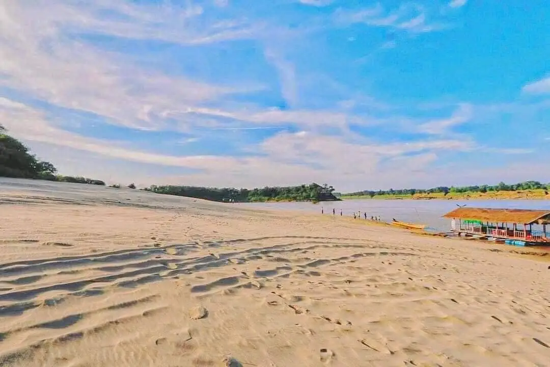
Hat Sai Sung in Ubon Ratchathani is a seasonal freshwater sand dune beach along the Mekong River at Ban Lat Charoen, Moo 10, Na Waeng Subdistrict, Khemarat District. Formed by Mekong River sediment and wind action, the beach becomes a high sandy ridge during the dry season, with dune-like scenery, wind-shaped sand patterns, dramatic photography angles, riverside views, and a close connection with Ban Lat Charoen community-based tourism. The best travel season is from March to May.
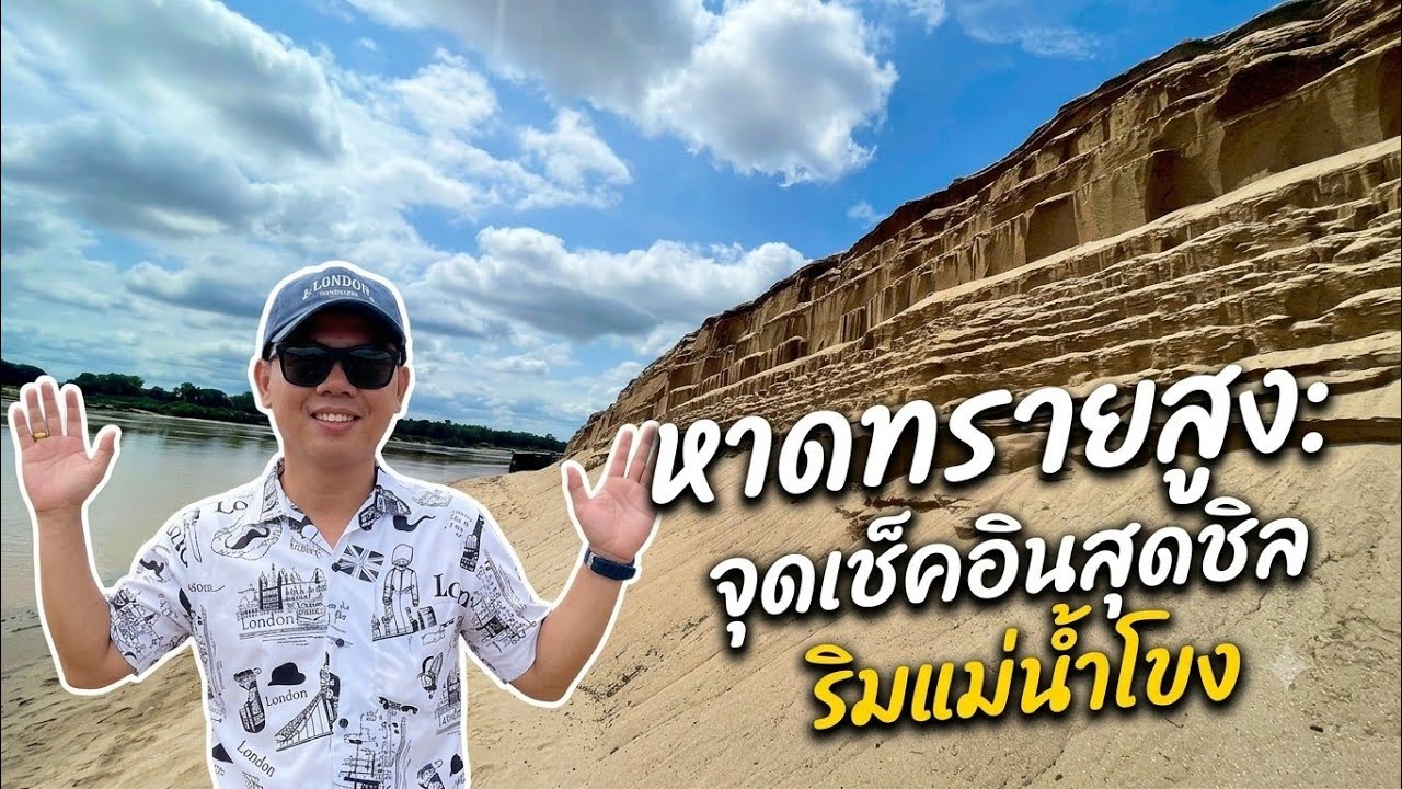
Hat Sai Sung in Ubon Ratchathani is one of the most distinctive natural attractions along the Mekong River in Khemarat District. It is not a sea beach and not an ordinary flat riverside sandbank. It is a seasonal freshwater sand dune formed by Mekong River sediment and wind, creating a high sandy ridge that appears most clearly when the river level drops during the dry season. In some areas, the sand rises almost as high as a person, giving the landscape a rare desert-like appearance beside one of Southeast Asia’s great rivers.
Hat Sai Sung is located at Ban Lat Charoen, Moo 10, Na Waeng Subdistrict, Khemarat District, Ubon Ratchathani Province. Ban Lat Charoen is a riverside community on the Thai bank of the Mekong River, facing Laos across the water. The village is known for several natural and cultural attractions, including Hat Sai Sung, Khon Moo, Khon Wua, Khua Nang Nee, the twin Java plum trees, and riverside rock formations. A visit to Hat Sai Sung is therefore not only a visit to a sand dune, but also an introduction to a Mekong riverside community with local food, boat trips, homestays, and traditional hospitality.
The natural form of Hat Sai Sung comes from the long-term movement of sand. The Mekong River carries sediment along its course, and during the dry season the falling water level exposes large areas of accumulated sand. Wind then shapes the surface, creating ripples, slopes, ridges, and dune-like formations. The result is a wide sandy riverside landscape with striking height and texture. In good light, the wind-formed sand patterns become especially clear, creating natural lines that look like small waves across the ground.
The landscape is different from many other Mekong riverside attractions because it feels partly like a miniature desert. Travelers can photograph high sandy ridges, wide open sand surfaces, footprints, blue sky, and the Mekong River in the same frame. The combination of sand, river, light, and wind gives the place a very unusual visual identity. This is why Hat Sai Sung has become popular for photography, fashion shoots, and advertising-style images.
The best season to visit Hat Sai Sung is from March to May, when the dry season reaches its strongest phase and the Mekong River level drops enough for the sand dune formations to become clearly visible. In some years, parts of the beach may appear from February, while in other years the shape and timing may shift according to river conditions, rainfall, and upstream water levels. Travelers should understand Hat Sai Sung as a seasonal natural landscape. Its beauty is real, but it is also changeable.
The best visiting times are 09.00 – 11.00 and 13.00 – 15.00. In the morning, the heat is still manageable and the light is clear enough for walking and photography. In the afternoon, the sun is still strong but the angle can reveal sand texture and dune shadows effectively. Midday can be extremely hot. The site is open and exposed, with no trees on the sand area, so visitors should avoid staying under direct sun for too long.
Hat Sai Sung is especially suitable for photography. Travelers can use the sandy ridge as a foreground, the sky as a background, and the natural wind patterns as the main visual element. Low-angle shots make the ridge look dramatic. Wide shots show the sand stretching toward the river. Portrait shots against the dune can look completely different from ordinary riverside photographs in Thailand. With the right light, the shadows of the sand ridge add depth and make the landscape look more sculptural.
There are no shops, food stalls, or drink services directly on the sand area of Hat Sai Sung. Visitors should bring drinking water, light snacks, a hat, an umbrella, sunglasses, sun protection, and footwear suitable for hot sand. During the middle of the day, the sand can become intensely hot, and the open area can increase the risk of heat exhaustion. Preparation is essential, especially for families, elderly travelers, and visitors who plan to spend time taking photographs.
Suitable activities at Hat Sai Sung include walking on the sand, viewing the Mekong River, photographing the dune-like landscape, observing wind-shaped sand patterns, learning about seasonal river geography, and combining the visit with Ban Lat Charoen community activities. Travelers who want a deeper experience can continue with local boat trips, Khon Moo, Khon Wua, the twin Java plum trees, Khua Nang Nee, and riverside rock formations, all of which are part of the wider Ban Lat Charoen tourism landscape.
Ban Lat Charoen is the key to understanding Hat Sai Sung properly. The village has developed community-based tourism by connecting nature, local history, riverside life, homestays, food, traditional welcome ceremonies, and Mekong River activities. Visitors staying overnight can experience a local dinner, Bai Si Su Khwan welcoming ceremony, traditional performances, dishes made with Mekong River fish, herbal tea made from local balm-scented leaves, and other community products. This wider context turns Hat Sai Sung from a photo stop into a meaningful cultural route.
Hat Sai Sung is also often combined with Hat Chom Dao or Kaeng Chom Dao, another well-known Mekong riverside attraction. The two places are connected by the same seasonal river logic: both are most beautiful when the Mekong River level drops. However, their character is different. Hat Sai Sung is known for high sand dunes and rippled sand, while Hat Chom Dao is known for rock formations, river channels, and dramatic stone textures. Visiting both places creates a more complete Mekong dry-season itinerary.
Getting There from Ubon Ratchathani city follows the same general route as Hat Chom Dao. Take Highway 2050 through Trakan Phuet Phon District, then turn right onto Highway 2337. Continue until Highway 2337 meets Highway 2112 at the Khong Chiam – Khemarat junction. Turn left and continue for about 22 km until the right-hand turn into Ban Lat Charoen. Follow the main village road to the end, where Hat Sai Sung is located. The route is best suited to a private car, rental car, or chartered van.
From Khemarat town, travelers can take the Mekong riverside strategic route, Highway 2112, toward Na Waeng Subdistrict and Ban Lat Charoen. The distance from Khemarat town to Ban Lat Charoen is about 25 km. This route is scenic and peaceful, making it suitable for travelers staying in Khemarat who want a half-day visit to Hat Sai Sung and nearby community attractions.
Travelers starting from Ubon Ratchathani city should allow a full day. The distance to Khemarat and Ban Lat Charoen is considerable, and the best experience comes from leaving early in the morning. Arriving before the harshest heat gives enough time for photography, walking, and community-based activities. On the return trip, visitors can stop in Khemarat town for riverside food, old-town atmosphere, temples, or an overnight stay.
Hat Sai Sung is suitable for many traveler types. Photographers will appreciate the dune-like forms and sand textures. Families can use the site to introduce children to natural river landscapes, but children should be closely supervised because the sand ridge can be high and the river is nearby. Groups of friends can enjoy a short scenic trip and photography session. Foreign travelers can see a rare side of Thailand: a seasonal sand dune beside the Mekong River, shaped by water, wind, and time.
Safety is important. The beach is open and hot, especially around midday. Walking barefoot on the sand can burn the feet. Visitors should wear suitable footwear, drink water regularly, and avoid long exposure to direct sun. Steep sand edges should be approached carefully, especially where the surface looks loose or recently shifted by wind. After rain or during unstable conditions, the sand structure may be less firm.
Environmental care is also essential. Hat Sai Sung is a natural formation that changes every year. Sand ridges, wind patterns, and slopes are shaped by natural processes. Visitors should avoid driving onto the sand unnecessarily, digging into the dune, leaving waste, or damaging the surface. The beauty of the place comes from slow natural formation, and responsible behavior helps preserve it for future visitors and the local community.
For overnight stays, Ban Lat Charoen Homestay is the closest and most community-oriented option. It is suitable for travelers who want to learn about Mekong riverside life in depth. Travelers who prefer hotels, restaurants, and easier town services can stay in Khemarat town. This allows visitors to travel to Hat Sai Sung during the day and return to town for dinner, riverside walking, or accommodation in the evening.
A deeper route should begin with Ban Lat Charoen itself. The village is connected with agriculture, local fishing, cross-border riverside trade, community tourism, homestays, local wisdom, and natural river sites. When Hat Sai Sung is seen through this wider community context, it becomes more than a beautiful photo location. It becomes part of a cultural landscape shaped by the Mekong River and the people who live beside it.
Hat Sai Sung also reflects the changing nature of the Mekong River. The appearance of the sand depends on water level each year. Some years the dune may appear wide, high, and dramatic. Other years it may be visible for a shorter period or in a different shape. This change is part of the identity of the place. The sand forms are never exactly the same, and that is one reason the destination remains interesting.
For slow travelers, Hat Sai Sung offers quietness rather than entertainment. The main sounds are wind, sand, river, and nature. The place allows visitors to pause and notice small details: the shadow of the dune, footprints, fine sand lines, and changing light over the Mekong River. This calm atmosphere is one of the strongest qualities of the destination.
For photography, clothing that contrasts with the sand can work well. Dark colors, white, and earth tones often stand out clearly. Visitors should avoid standing too close to unstable steep sand edges and should protect cameras and phones from fine sand. Drone or professional photography should be done respectfully, without disturbing local residents or other visitors.
For foreign travelers, Hat Sai Sung helps explain the diversity of Thailand. The country is not only tropical islands, mountains, and temples. It also has seasonal freshwater sand dunes along the Mekong River, formed by natural forces and connected with a living border community. A visit here gives foreign travelers a chance to understand the Mekong River, Thai-Lao border landscapes, seasonal geography, and community-based tourism in Ban Lat Charoen.
In conclusion, Hat Sai Sung in Ubon Ratchathani is a natural and cultural destination of high value. It is a freshwater sand dune beach created by the Mekong River and wind, most impressive during the dry season from March to May. It is ideal for photography, riverside scenery, slow travel, and community-based exploration. Travelers who prepare properly, visit at the right season, and take time to connect the beach with Ban Lat Charoen, Hat Chom Dao, and Khemarat town will experience one of the most distinctive Mekong landscapes in Ubon Ratchathani.
| Name | Hat Sai Sung, Ubon Ratchathani |
| Location | Ban Lat Charoen, Moo 10, Na Waeng Subdistrict, Khemarat District, Ubon Ratchathani Province |
| Address | Ban Lat Charoen, Moo 10, Na Waeng Subdistrict, Khemarat District, Ubon Ratchathani 34170 |
| Highlights | High Mekong River sand dune, ridge almost as high as a person, long sandy stretch, wind-shaped ripples, desert-like photo angles, and scenic Mekong River views |
| History | A natural attraction of Ban Lat Charoen formed by Mekong River sediment accumulation and developed as part of Ban Lat Charoen community-based tourism, homestay activities, and Mekong riverside travel routes |
| Name Origin | The name Hat Sai Sung means high sand beach, referring to the unusually high Mekong riverside sand ridge that rises prominently along the riverbank. |
| Distinctive Features | A seasonal freshwater sand dune along the Mekong River, clearly visible during the dry season, with high sandy ridges, natural wind patterns, and a peaceful Thai-Lao border community atmosphere |
| Travel Information | From Ubon Ratchathani city, take Highway 2050 through Trakan Phuet Phon District, turn right onto Highway 2337, continue to the Highway 2112 junction, turn left for about 22 km, then turn right into Ban Lat Charoen and follow the main road to the beach. |
| Current Status | Open as a seasonal natural attraction of Na Waeng Subdistrict and part of Ban Lat Charoen community-based tourism in Khemarat District |
| Open Days | Accessible daily depending on Mekong River water levels and seasonal conditions |
| Opening Hours | No ticketed gate-style opening hours; best visited from 09.00 – 11.00 and 13.00 – 15.00 |
| Fees | No general admission ticket for the beach area. Boat trips, homestays, meals, community activities, and other services are charged by individual providers. |
| Facilities | Parking area, restrooms at the tourism site, community signboards, electricity and clean water in the village, visitor service center, community homestays, local boat trips, restaurants, and souvenir shops in Ban Lat Charoen community |
| Main Areas / Zones | 1. High Mekong sand dune zone 2. Wind-ripple sand and desert-style photography zone 3. Sloping sand-to-river viewpoint zone 4. Mekong curve and Laos-facing viewpoint zone 5. Ban Lat Charoen boat activity connection zone 6. Community, homestay, and visitor service zone |
| Caretaker | Na Waeng Subdistrict Administrative Organization, Ban Lat Charoen community, Ban Lat Charoen Homestay Group, and local community-based tourism operators |
| Main Contact Number | Na Waeng Subdistrict Administrative Organization Tel. 045-251506-7 Ban Lat Charoen Coordination Center Tel. 082-7186904, 089-9347689 |
| Official Website / Local Information Sources | Na Waeng Subdistrict Administrative Organization website CBT Thailand / DASTA website Ubon Ratchathani Provincial Office of Tourism and Sports |
| Nearby Tourist Attractions | 1. Khon Moo, Ban Lat Charoen, about 2 km 2. Khon Wua, Ban Lat Charoen, about 2 km 3. Twin Java Plum Trees, Ban Lat Charoen, about 2 km 4. Khua Nang Nee, Ban Lat Charoen, about 3 km 5. Hat Chom Dao or Kaeng Chom Dao, about 24 km 6. Khemarat Walking Street, about 25 km 7. Wat Pho Khemarat, about 25 km |
| Nearby Restaurants | 1. Ban Lat Charoen Community Food Rafts, about 1 km 2. Khemarat Kung Sod Kung Phao, about 25 km, Tel. 089-425-0457, 088-580-8539 3. Shabu Indy Khemarat, about 25 km, Tel. 080-468-5164 4. Lae Khong Restaurant Khemarat, about 26 km 5. Por Rak Khemarat, about 25 km, Tel. 082-366-4499 6. Krua Ban To, about 27 km, Tel. 089-424-0496, 081-718-3789 7. Ban Khun Ya Restaurant, about 30 km, Tel. 088-224-2042 |
| Nearby Accommodations | 1. Ban Lat Charoen Homestay, about 1 km, Tel. 045-217-007 2. The Khong @ Khemarat, about 25 km, Tel. 063-038-9888, 080-010-8999 3. Ladda Mansion Khemarat, about 25 km, Tel. 083-748-1691 4. Khong Thara Hotel, about 25 km, Tel. 081-999-3711 5. Rattana Resort, about 30 km, Tel. 045-491-654 6. Yanisa Rooms Khemarat, about 25 km, Tel. 088-583-2082 |
Frequently Asked Questions (FAQ)
Q: Where is Hat Sai Sung located?
A: Hat Sai Sung is located at Ban Lat Charoen, Moo 10, Na Waeng Subdistrict, Khemarat District, Ubon Ratchathani Province, along the Mekong River.
Q: When is the best time to visit Hat Sai Sung?
A: The best time to visit is from March to May, when the Mekong River level drops and the high sand dune becomes clearly visible.
Q: Is there an admission fee for Hat Sai Sung?
A: There is no general admission ticket for the beach area. Visitors pay separately for boat trips, homestays, meals, community activities, or other local services.
Q: Are there shops or food services directly at Hat Sai Sung?
A: There are no shops, food stalls, or drink services directly on the sand area. Visitors should bring water, snacks, sun protection, and suitable footwear. Food and homestay services are available in Ban Lat Charoen and Khemarat town.
Q: What time of day is best for visiting Hat Sai Sung?
A: The recommended periods are 09.00 – 11.00 and 13.00 – 15.00, when the light is suitable for photography and the visit can avoid the most intense midday heat.
Q: What kind of photography is Hat Sai Sung known for?
A: It is known for desert-like sand dune photography, wind-ripple sand patterns, high sandy ridges, wide Mekong River views, and portrait shots using the dune as a natural background.
Q: What nearby places can be visited with Hat Sai Sung?
A: Nearby places include Khon Moo, Khon Wua, the twin Java plum trees, Khua Nang Nee, Hat Chom Dao, Khemarat Walking Street, and Wat Pho Khemarat.
Q: Is Hat Sai Sung suitable for foreign travelers?
A: Yes. It is suitable for foreign travelers who want to experience a rare Mekong River sand dune landscape, Thai-Lao border scenery, nature photography, and Ban Lat Charoen community-based tourism.
 Category: ●Nature and Wildlife
 Group: ●Bays and Beaches
Last Update : 3 MonthAgo
 Last Update : 3 MonthAgo
 Click to Access the Navigation Map GPS
Sai Sung Beach Map
Recommend

 Art, Culture and Heritage
 Historical Sites and Monuments(5)
 Landmarks and Memorials(2)
 Royal Palace(1)
 Art, Craft Centres, Tradition(7)
 Museums(3)
 Places of Worship
 Temple(37)
 Other Sacred Sites(4)
 Research and Development
 Royal Project(2)
 Suburban Living
 Village, Community(2)
 Local Market(4)
 National Parks and Marine Reserves(5)
 Mountain (Doi)(6)
 Dam, Reservoir, Lake(8)
 Waterfalls(12)
 Hot Springs(1)
 Caves(2)
 River, Canal(11)
Bays and Beaches(8)
 Islands(2)
 Other natural attractions(6)
 Entertainment and Agricultural
 Zoos and Aquariums(2)
 Animal camps and shows(1)
 Farms, Parks and Ecotourism(1)
 Waterpark(1)
 Travel Articles, Recipes
 Travel Review, Food Review(1)


