
lovethailand home >South Travel Attractions >Trang Travel Attractions >Si Kao >Mai Fat > Hat Chao Mai National Park
TL;DR: Hat Chao Mai National Park is located at Kantang District and Sikao District, Trang Province, open Daily, for the park headquarters, coastal areas, and sites not affected by, hours Monday, Tuesday, Thursday, Friday, Saturday 08.30 – 16.30 / Wednesday and.
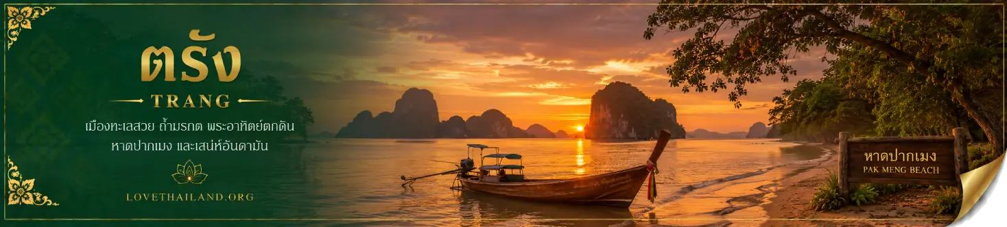
Hat Chao Mai National Park
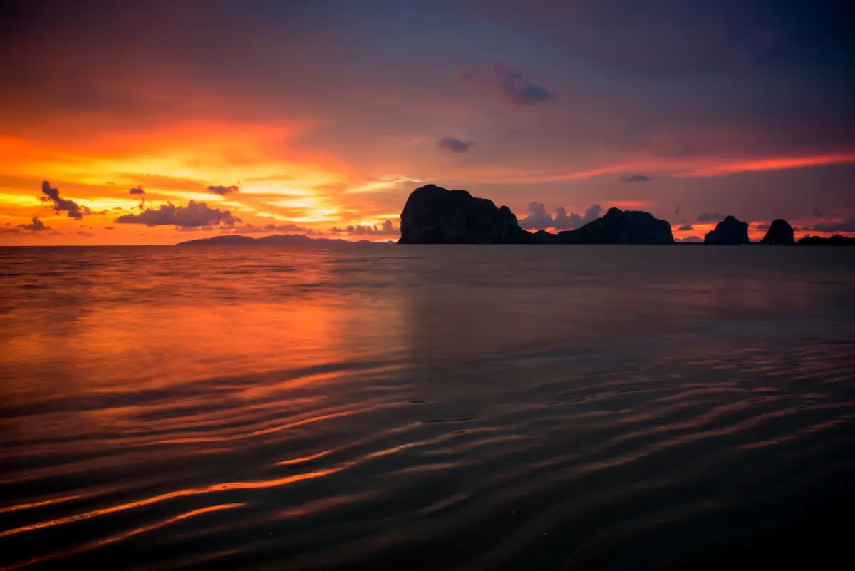
Open Days: Daily, for the park headquarters, coastal areas, and sites not affected by seasonal closure announcements
Opening Hours: Monday, Tuesday, Thursday, Friday, Saturday 08.30 – 16.30 / Wednesday and Sunday 08.00 – 16.30
Hat Chao Mai National Park in Trang Province is one of southern Thailand’s important marine national parks on the Andaman coast. The park covers coastal and island areas in Kantang and Sikao districts, with an approximately 20-kilometre coastline and a wide range of natural habitats, including beaches, mangroves, seagrass beds, coral reefs, coastal caves, limestone hills, offshore islands, and marine habitats for rare species. The park is especially important for the conservation of dugongs, which are closely connected with Trang’s seagrass ecosystems. Hat Chao Mai is therefore not only a seaside recreation area, but also a protected coastal and marine landscape where tourism, ecology, local coastal life, and conservation meet.
The park headquarters is located at 142/18 Moo 5, Mai Fat Subdistrict, Sikao District, Trang 92150, in the Hat Chang Lang area. This quiet and shaded coastline is the best starting point for understanding the park as a whole. Visitors arriving at the headquarters area can find tourist services, beach areas, coastal learning points, and routes linking to other attractions in the park, such as Hat Yong Ling, Hat San, Hat Chao Mai, Khao Ba Nae, and boat routes to the islands of the Trang Sea.
Hat Chao Mai National Park was officially declared a national park on 14 October 1981. It is one of Thailand’s important early marine national parks. The park protects both land and sea ecosystems, which makes travel here highly varied. Visitors who do not want to take a boat can explore beaches and coastal nature sites on the mainland, while those who want a fuller Trang sea experience can arrange seasonal boat trips to Ko Muk, Ko Kradan, Ko Chueak, Ko Waen, and other islands under the park’s protection.
The park can be understood in two main parts: the mainland coastal zone and the island zone. The mainland zone includes Hat Pak Meng, Hat Chang Lang, Hat Yao, Hat Yong Ling, Hat San, Hat Chao Mai, and Tham Chao Mai. Each site has a different character. Hat Pak Meng is a viewpoint and a gateway to Trang island boat routes. Hat Chang Lang is the headquarters area. Hat Yong Ling and Hat San are quieter beaches suitable for relaxation. Hat Chao Mai is a broad, shallow-water beach connected with coastal nature and seagrass habitats.
The island zone includes Ko Muk, Ko Kradan, Ko Chueak, Ko Pling, Ko Waen, Ko Meng, and Ko Chao Mai. These islands are a major reason why the Trang Sea is known among travelers who love clear water, white beaches, and underwater life. Ko Muk is home to the famous Emerald Cave. Ko Kradan is known for white sand, clear water, and nearshore coral. Ko Chueak and Ko Waen are snorkeling sites with coral and sea fans. Ko Meng is the iconic island seen from Hat Pak Meng, recognized for its shape that resembles a reclining person when viewed from the shore.
Emerald Cave on Ko Muk is one of the best-known attractions within Hat Chao Mai National Park. Its defining feature is a sea-cave entrance that visitors enter by floating or swimming through the cave passage during suitable low-tide conditions. After passing through the tunnel, visitors arrive at a small hidden beach enclosed by high limestone cliffs, creating the feeling of a secret chamber in the sea. Visiting Emerald Cave requires careful attention to safety, tides, sea conditions, and guidance from local operators or guides who know the route well.
Ko Kradan is another major part of the park and one of Trang’s increasingly popular island destinations. The eastern beach has fine white sand, clear water, and the Ko Kradan ranger unit of Hat Chao Mai National Park. This is where many visitors land for beach relaxation, snorkeling, and Andaman Sea views. Ko Kradan is suitable for travelers looking for clear water and a peaceful island atmosphere, but visitors should always check the latest park announcements before traveling because the island is affected by seasonal closure periods.
Ko Chueak and Ko Waen are popular snorkeling points on Trang sea routes because of their coral, sea fans, and marine life. Snorkeling at these sites is best during calm sea conditions. Visitors must follow park rules strictly: do not step on coral, do not touch marine animals, do not remove shells or living organisms, and do not leave waste in the sea. Coral reefs are fragile ecosystems that recover slowly and are easily damaged by irresponsible tourism behavior.
Hat Chao Mai National Park is also ecologically important because of its seagrass beds and dugongs. The park’s wetland habitats include mangroves, nipa palm areas, mudflats, sandy beaches, coral reefs, and seagrass beds. Seagrass provides food, shelter, and nursery habitats for young marine animals, especially fish, shrimp, crabs, and dugongs. This makes Hat Chao Mai more than a scenic coastline. Its coastal habitats play a key role in the life cycles of marine animals and the ecological health of the Trang Sea.
The Marine Nature Study Center in the park area supports learning and research related to seagrass, a key Andaman coastal resource and the main food source of dugongs. Visitors interested in marine nature can see that conservation is not limited to keeping beaches clean. It also involves protecting feeding grounds, nursery areas, coastal habitats, and regulating marine activities so that tourism does not create excessive pressure on sensitive ecosystems.
Khao Ba Nae, also known as Khao Chao Mai, is another important point where natural scenery and archaeology meet. It is a solitary limestone hill by the sea, with a distinctive form often compared to a shark fin. Red prehistoric paintings can be found on the rock face. These paintings show that the coastal landscape has human history as well as natural value, making Hat Chao Mai significant not only for marine scenery but also for archaeology and coastal cultural landscapes.
A visit to Khao Ba Nae should take tidal conditions into account. Close access to the painted rock face is possible only during low tide. During high tide or rough sea conditions, visitors should view the site from a safe distance and follow park staff instructions. The site is suitable for travelers interested in nature photography, geology, archaeology, and coastal scenery because it brings together limestone formations, shoreline views, and cultural evidence in one place.
Hat Yong Ling and Hat San are quieter coastal areas with attractive natural settings. Hat Yong Ling is a curved sandy beach bordered by hills and cave-like formations, making it suitable for relaxation, swimming during safe sea conditions, and nature viewing. Hat San is nearby and works well as a stop along the coastal route. Travelers who want to enjoy the mainland side of the park without taking a boat can plan a one-day route linking Hat Pak Meng, Hat Chang Lang, Hat Yong Ling, Hat San, and Khao Ba Nae.
Hat Pak Meng is the main gateway for Trang sea travel. It functions as a beach for relaxation, a viewpoint for Ko Meng, and a connection point for boat trips to the islands. Restaurants and accommodations are available around Hat Pak Meng, making it a convenient base for visiting Hat Chao Mai National Park and the Trang Sea. From Hat Pak Meng, travelers can continue to the park headquarters, Hat Chang Lang, and Hat Chao Mai within a short drive.
The best general period for visiting the Trang Sea and Hat Chao Mai National Park is from November to April, especially during calm sea conditions suitable for boat trips, snorkeling, and island visits. During the monsoon season, visitors must follow park closure announcements closely because several islands and marine activities close for safety and ecological recovery. For 2026, Ko Chueak and Ko Waen are closed from 1 June to 30 September, Ko Muk and Ko Kradan are closed from 1 August to 30 September, and Emerald Cave is closed from 1 to 30 September.
Seasonal closures are an essential part of marine national park management. Monsoon conditions can bring stronger waves and higher boating risks, while marine ecosystems also need time to recover. Travelers who want to visit Ko Muk, Emerald Cave, Ko Kradan, Ko Chueak, or Ko Waen should plan for the open season and check the latest park announcements before departure. The headquarters and mainland coastal areas that are not affected by closure announcements remain useful options during the park’s daily operating hours.
The entrance fee for Hat Chao Mai National Park follows the national park Group 2 rate: 40 baht for Thai adults, 20 baht for Thai children, 200 baht for foreign adults, and 100 baht for foreign children. Fee collection points vary by travel route and may include the office area, Pak Meng Pier, Ko Kradan, the Emerald Cave area, and Hat Yong Ling. Visitors traveling to multiple points on the same day should keep their tickets for inspection by park staff.
Facilities around the park headquarters include a visitor service center, toilets, rest areas, park accommodation, and a camping area through the national park service system. Overnight stays should be checked in advance because some accommodation or camping areas may close temporarily due to weather, water supply, maintenance, or resource management measures. Travelers who prefer more convenience can stay around Hat Pak Meng or Sikao District, where private resorts and guesthouses are available.
Activities in Hat Chao Mai National Park include beach relaxation, viewing Ko Meng from Hat Pak Meng, walking along Hat Chang Lang, visiting Hat Yong Ling and Hat San, studying the red paintings at Khao Ba Nae, learning about seagrass and dugongs, taking a boat to Ko Muk and Emerald Cave, snorkeling around Ko Chueak and Ko Waen, and relaxing on Ko Kradan. Each activity depends on season, sea conditions, and visitor readiness, so plans should be matched with available time, weather, and park announcements.
For families or travelers who do not want to take a boat, the mainland route is safer and more flexible. A good itinerary can begin at Hat Pak Meng for views and food, continue to the park headquarters at Hat Chang Lang, stop at Khao Ba Nae for coastal scenery, and finish at Hat Yong Ling or Hat San in the afternoon. This route allows visitors to experience Trang’s coast without relying on boat travel and is especially useful when some islands are seasonally closed.
Travelers planning island trips should prepare more carefully. Essential items include life jackets, sun protection, drinking water, personal medication, a dry bag, and a booking with a reliable boat operator. Trips to Emerald Cave and snorkeling sites should always follow guide and park staff instructions. Visitors should not separate from the group, enter the water without flotation support, or travel during strong wave warnings. The Trang Sea is most rewarding when visited safely and in the right season.
Getting There from Trang city is straightforward by private car or rental car. Take the Trang – Sikao – Pak Meng route using Highway 4046 and then Highway 4162. At Hat Pak Meng, turn left and continue along the coastal road for about 7 km to the park headquarters at Hat Chang Lang. The total distance from Trang city is about 47 km. Having a private vehicle makes it easier to combine Hat Pak Meng, Hat Yong Ling, Hat San, and other Sikao coastal attractions in one trip.
Travel to Ko Muk, Emerald Cave, Ko Kradan, Ko Chueak, and Ko Waen usually uses boat services from Pak Meng Pier or Khuan Tung Ku Pier, depending on available routes and the travel season. Visitors should check island opening dates, boat schedules, prices, group size, and safety conditions before booking, especially during seasonal transition periods when sea conditions may be uncertain.
Hat Chao Mai National Park suits many kinds of travelers: beach lovers, families, snorkelers, divers, photographers, students, people interested in dugongs and seagrass, and travelers who want to understand Andaman coastal ecosystems. The park’s strength is the diversity of experiences. Visitors can choose a relaxed mainland beach route or plan a full-day sea trip to the islands depending on time, weather, and personal readiness.
Responsible travel is essential in Hat Chao Mai National Park. Visitors should keep the area clean, carry waste out, avoid removing natural materials, avoid disturbing marine animals, keep noise low in natural areas, park only in designated areas, and avoid flying drones without permission. Marine national park travel should consider impacts on coral, seagrass, dugongs, sea turtles, coastal birds, and local communities, because these resources are the main reason the area remains valuable.
Overall, Hat Chao Mai National Park offers a complete Trang sea experience in one protected area: beaches, islands, snorkeling, sea caves, mangroves, seagrass, dugongs, and prehistoric coastal evidence. A visit here should not be treated only as a beach stop. The park is best appreciated as a protected landscape that preserves both nature and the coastal story of Trang. With proper seasonal planning, updated park information, and respect for conservation rules, Hat Chao Mai is one of the most meaningful ways to experience the Trang Sea.
| Name | Hat Chao Mai National Park |
| Thai Name | อุทยานแห่งชาติหาดเจ้าไหม |
| Location | Kantang District and Sikao District, Trang Province |
| Park Headquarters Address | 142/18 Moo 5, Mai Fat Subdistrict, Sikao District, Trang 92150, Thailand |
| Coordinates Of Park Headquarters | 7.4262648, 99.335869 |
| Highlights | Marine national park in Trang with beaches, mangroves, seagrass beds, coral reefs, Emerald Cave, Ko Kradan, Ko Muk, and dugong habitat |
| History | Declared a national park on 14 October 1981 |
| Distinctive Features | Approximately 20 km of coastline with beaches, mangroves, mudflats, coral reefs, seagrass beds, limestone hills, and Trang Sea islands |
| Mainland Areas | Hat Pak Meng, Hat Chang Lang, Hat Yao, Hat Yong Ling, Hat San, Hat Chao Mai, Tham Chao Mai, and Khao Ba Nae |
| Islands Within The Park | Ko Muk, Ko Kradan, Ko Chueak, Ko Pling, Ko Waen, Ko Meng, and Ko Chao Mai |
| Activities | Beach relaxation, snorkeling, diving, kayaking, island boat trips, Emerald Cave visits, seagrass learning, Khao Ba Nae sightseeing, and coastal photography |
| Best Travel Period | November – April, especially during calm sea conditions for boat trips and island visits |
| Travel Information | From Trang city, take Highway 4046 and Highway 4162 via the Trang – Sikao – Pak Meng route. At Hat Pak Meng, turn left and follow the coastal road for about 7 km to the park headquarters at Hat Chang Lang. The total distance is about 47 km. |
| Current Status | The park headquarters, coastal areas, and sites not under seasonal closure are open during operating hours. In 2026, Ko Chueak and Ko Waen are closed from 1 June – 30 September, Ko Muk and Ko Kradan are closed from 1 August – 30 September, and Emerald Cave is closed from 1 – 30 September. |
| Open Days | Daily, for the park headquarters, coastal areas, and sites not affected by seasonal closure announcements |
| Opening Hours | Monday, Tuesday, Thursday, Friday, Saturday 08.30 – 16.30 / Wednesday and Sunday 08.00 – 16.30 |
| Fees | Thai adult 40 baht, Thai child 20 baht / foreign adult 200 baht, foreign child 100 baht |
| Facilities | Visitor service center, toilets, park accommodation, camping area, beach rest area, and national park accommodation booking system |
| Main Areas / Zones | Hat Chang Lang headquarters, Hat Pak Meng, Hat Yong Ling, Hat San, Hat Chao Mai, Khao Ba Nae, Marine Nature Study Center, Ko Muk, Emerald Cave, Ko Kradan, Ko Chueak, and Ko Waen |
| Caretaker / Park Chief | Mr. Dome Chansuwan, Chief of Hat Chao Mai National Park |
| Main Contact Number | 075-829-967 |
| Visitor Center / Accommodation / Tent Contact | 080-572-2583 |
| Official Website / Official Page | Department of National Parks, Wildlife and Plant Conservation |
| Nearby Tourist Attractions | 1. Khao Ba Nae / Khao Chao Mai, about 150 m 2. Hat Chang Lang, about 0.5 km 3. Hat Yong Ling, about 6 km 4. Hat Pak Meng, about 7 km 5. Pak Meng Pier, about 8 km 6. Rajamangala Trang Aquarium, about 20 km, Tel. 075-274-169 |
| Nearby Restaurants | 1. Dugong Cafe @ Dugong Village, about 3 km, Tel. 075-290-878 2. Kru Khit Restaurant, Hat Pak Meng, about 7 km, Tel. 083-966-4636 3. Yok Yor Restaurant, Hat Pak Meng, about 7 km, Tel. 075-274-014 4. LayTrang Pak Meng, about 8 km, Tel. 075-274-027 5. Kiang Dao Seafood, Hat Pak Meng, about 8 km, Tel. 095-025-4491 6. Suan Son Restaurant, Hat Pak Meng, about 8 km, Tel. 086-953-8132 |
| Nearby Accommodations | 1. Dugong Village, about 3 km, Tel. 075-270-878 2. Pakmeng Resort, about 6 km, Tel. 075-274-111, 075-274-112 3. Yok Yor Resort, about 7 km, Tel. 075-274-014 4. Pak Meng Guesthouse, about 8 km, Tel. 084-407-9679 5. Saithong Resort Hat Pak Meng, about 9 km, Tel. 083-646-6558 6. LayTrang Pakmeng Marina Spa and Resort, about 9 km, Tel. 098-882-8790 |
Frequently Asked Questions (FAQ)
Q: Where is Hat Chao Mai National Park located?
A: Hat Chao Mai National Park is located in Trang Province, covering Kantang and Sikao districts. The park headquarters is at 142/18 Moo 5, Mai Fat Subdistrict, Sikao District, Trang 92150.
Q: What are the main highlights of Hat Chao Mai National Park?
A: The park is a marine national park with beaches, mangroves, seagrass beds, coral reefs, Emerald Cave, Ko Kradan, Ko Muk, Ko Chueak, Ko Waen, and dugong habitat.
Q: When is the best time to visit Hat Chao Mai National Park?
A: November to April is generally the best period for sea travel, boat trips, snorkeling, and island visits because the Andaman Sea is usually calmer.
Q: Is there an entrance fee?
A: Yes. The entrance fee is 40 baht for Thai adults, 20 baht for Thai children, 200 baht for foreign adults, and 100 baht for foreign children.
Q: Are Ko Muk, Ko Kradan, Ko Chueak, Ko Waen, and Emerald Cave open all year?
A: No. They are affected by seasonal closures. In 2026, Ko Chueak and Ko Waen are closed from 1 June to 30 September, Ko Muk and Ko Kradan are closed from 1 August to 30 September, and Emerald Cave is closed from 1 to 30 September.
Q: How can travelers get to Hat Chao Mai National Park?
A: From Trang city, take Highway 4046 on the Trang – Sikao route, then Highway 4162 toward Hat Pak Meng. At Hat Pak Meng, turn left and continue along the coastal road for about 7 km to the park headquarters at Hat Chang Lang.
Q: What should travelers visit if they have limited time?
A: Travelers with limited time should visit Hat Pak Meng, Hat Chang Lang, the park headquarters, Khao Ba Nae, Hat Yong Ling, and Hat San because these mainland sites are easy to access without a boat.
Q: Who is Hat Chao Mai National Park suitable for?
A: The park is suitable for beach travelers, families, snorkelers, divers, photographers, people interested in dugongs and seagrass, and anyone who wants a conservation-focused Trang Sea experience.
 Category: ●Nature and Wildlife
 Group: ●National Parks and Marine Reserves
Last Update : 4 WeekAgo
 Last Update : 4 WeekAgo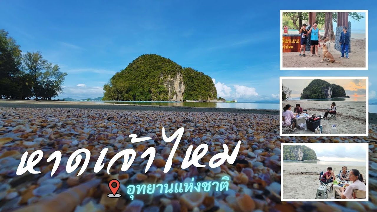
 Click to Access the Navigation Map GPS
Hat Chao Mai National Park Map
Gellery
Recommend

 Art, Culture and Heritage
 Historical Sites and Monuments(1)
 Landmarks and Memorials(2)
 Art, Craft Centres, Tradition(3)
 Museums(2)
 Places of Worship
 Temple(15)
 Mosque(1)
 Other Sacred Sites(6)
 Research and Development
 Royal Project(1)
 Suburban Living
 Village, Community(5)
National Parks and Marine Reserves(6)
Village, Community(5)
National Parks and Marine Reserves(6)
 Mountain (Doi)(8)
 Dam, Reservoir, Lake(1)
 Waterfalls(20)
 Hot Springs(1)
 Caves(11)
 Bays and Beaches(11)
 Islands(12)
 Other natural attractions(3)
 Entertainment and Agricultural
 Farms, Parks and Ecotourism(8)
 Outdoor and Adventure Activities(1)
 Travel Articles, Recipes
 Travel Review, Food Review(1)
 Southern Food Menu, Southern Food Recipes(1)


