lovethailand home >Eastern Travel Attractions >Trat Travel Attractions >Koh Chang >Koh Chang > Mu Ko Chang National Park
TL;DR: Mu Ko Chang National Park is located at Trat Province, covering Ko Chang and surrounding islands in the Gulf of Thailand, open Daily, hours Open according to the operating hours of each national park area and official.

Mu Ko Chang National Park

Open Days: Daily
Opening Hours: Open according to the operating hours of each national park area and official site regulations
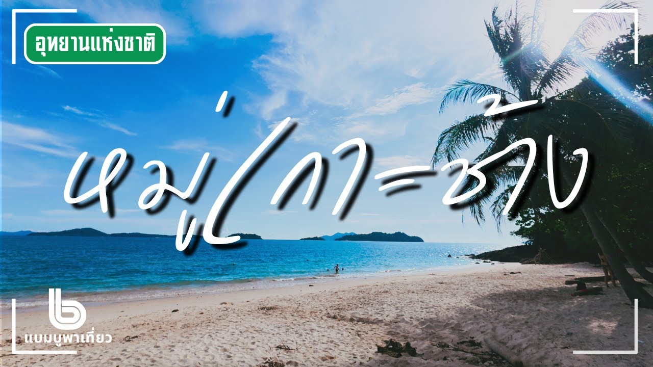
Mu Ko Chang National Park in Trat Province is one of eastern Thailand’s most important marine national parks. Covering approximately 650 square kilometers, the park includes more than 50 islands, with Ko Chang as the main island and the second-largest island in Thailand after Phuket. The park stretches across the sea areas of Trat Province and combines mountains, tropical forest, waterfalls, beaches, coral reefs, fishing villages, and the historical waters of the Battle of Ko Chang. For foreign travelers, this is one of the most complete destinations in Thailand because it offers both island relaxation and meaningful natural and historical experiences.
Ko Chang and its surrounding islands are surrounded by the sea, creating a generally comfortable island climate suitable for holidays. The weather is influenced by both the northeast monsoon and the southwest monsoon. This seasonal pattern affects sea travel significantly. During the southwest monsoon season, roughly from May to October, the western coast of Ko Chang faces stronger winds and waves, making boat travel to smaller islands less suitable on some days. From around November to May, the sea is usually calmer, and travel to Ko Chang, Ko Wai, Ko Ngam, Ko Rang, and other nearby islands is generally more convenient.
For travelers planning a trip, Mu Ko Chang National Park is ideal for beach holidays, waterfall visits, light jungle walks, snorkeling, island-hopping, scenic viewpoints, and learning about Thai naval history. The western side of Ko Chang is home to popular beaches such as White Sand Beach, Klong Prao Beach, Kai Bae Beach, and Bailan Bay. The eastern and southern sides are quieter and more community-based, with places such as Salak Phet, Ban Rong Than, and Bang Bao fishing village. Travelers who want easier sea conditions should visit between November and May, while those visiting during the rainy season should check boat schedules and weather warnings carefully.
The national park headquarters is located on the eastern side of Ko Chang near Khlong Than Mayom. The area includes park facilities, a pier area, and access to Than Mayom Waterfall. Several ranger stations are also located around the island, including areas near Ao Klong Son, the entrance to Khlong Phlu Waterfall, and Salak Phet village. These units help manage visitor safety, collect entrance fees where required, protect natural resources, and provide information about trails, waterfalls, and park regulations.
Historically, Ko Chang was not always a densely settled island. In earlier times, it was important as a sheltered anchorage where sailors could escape monsoon winds, obtain fresh water, and gather food supplies. Salak Phet Bay and nearby sheltered coves were especially well known among seafarers, including pirates, Hainanese Chinese, and Vietnamese sailors. Over time, permanent communities developed on the island, and today Ko Chang has several villages whose livelihoods are connected with fishing, forests, tourism, and the sea.
The landscape of Ko Chang is dominated by steep mountains, rocky slopes, and dense forest. The highest peak is Khao Salak Phet, rising about 744 meters above sea level. Much of the island remains forested, with humid evergreen forest serving as a watershed for streams and waterfalls. This is why Ko Chang has several waterfalls, including Than Mayom Waterfall, Khlong Phlu Waterfall, Khlong Nonsi Waterfall, Khiri Phet Waterfall, and Khlong Nueng Waterfall. The island’s interior forest is therefore essential to both wildlife habitats and the freshwater system that supports local communities.
The western coast of Ko Chang is the most developed tourism area. White Sand Beach is one of the island’s most popular beach zones, with many resorts, restaurants, shops, and tourist services. Klong Prao Beach and Laem Chai Chet offer a long and open beach setting suitable for relaxing and longer stays. Kai Bae Beach balances convenience with a more relaxed atmosphere, while Bailan Bay is quieter and better suited to travelers who prefer a simple and slower island experience.
Klong Prao Beach and Laem Chai Chet form a long coastal stretch that continues toward Kai Bae. Some sections have gently sloping sand suitable for swimming when the sea is calm. The northern end near Laem Chai Chet has rocky scenery and beautiful sunset views, although some rocky areas are not suitable for swimming. Travelers should always choose safe swimming areas and observe local warnings, especially during the monsoon season.
Kai Bae Beach is another well-known beach with a moderate slope and a scenic view toward small islands offshore. The area has accommodation, restaurants, cafés, and boat services, making it a convenient base for families, couples, and travelers who want to explore both the beach and nearby viewpoints. Its balance of services and scenery makes it one of the most practical places to stay on Ko Chang.
Bailan Bay lies beyond Kai Bae and has a quieter atmosphere. In earlier times, footpaths crossed the hills between beach areas, offering views of mountains, forest, and coastline. Today Bailan remains attractive for travelers who prefer calm surroundings, simple beach stays, and a less crowded setting. Swimming is suitable when the sea is calm and conditions are safe.
Ao Klong Son is located at the northern end of Ko Chang’s western side and is home to Ban Klong Son community. The area includes a bay, beach scenery, nearby coral areas, and accommodation options. Because it is relatively close to the ferry arrival area, it is convenient for travelers who want easier access to the northern part of the island.
Khlong Phlu Waterfall is one of Ko Chang’s most popular waterfalls. Located not far from Klong Prao, the entrance is about 3 kilometers from the beach area, followed by a forest walk of around 20 minutes. The waterfall has 3 tiers, with water falling from a cliff into a large pool below. It is a favorite place for travelers who want to take a break from the beach and enjoy freshwater, forest shade, and a natural swimming area.
Than Mayom Waterfall is located behind the national park headquarters. Visitors walk through a garden and forested path for about 500 meters to reach the waterfall. It is a medium-sized waterfall with 4 tiers, and the 3rd tier is often regarded as the most beautiful. Than Mayom is historically significant because King Rama V, King Rama VII, and Queen Rambhai Barni visited the site. A royal monogram of King Rama V is carved on a rock face near the upper waterfall, giving this natural attraction an important cultural and historical dimension.
Khlong Nonsi Waterfall is a smaller waterfall on the northeastern side of Ko Chang. It can be reached by walking from Ban Dan Mai along a trail of about 3 kilometers or from the national park headquarters for about 4 kilometers. It is suitable for travelers who want a quieter forest walk and a less crowded waterfall experience away from the main western beach areas.
Khiri Phet Waterfall is located near Salak Phet village in the southern part of Ko Chang. It is a single-tier waterfall reached by passing through local plantation areas. Nearby, Khlong Nueng Waterfall is a smaller but dramatic waterfall near Ban Rong Than and Salak Phet. It lies about 2 kilometers from the community, followed by a short walk of around 480 meters. The waterfall drops through a narrow rocky channel from a height of about 120 meters and can be visited when conditions are safe.
Salak Phet is the largest and oldest community on Ko Chang. Located in the southern part of the island, it has long been connected with coastal fishing. Salak Phet Bay is the largest bay on Ko Chang and is protected by surrounding mountains and islands, making it a safe anchorage in rougher weather. The village is home to Wat Salak Phet, an old temple built during the reign of King Rama V when he visited Ko Chang. This area is ideal for travelers interested in fishing communities, local food, and a quieter side of the island.
Ban Rong Than is a small community near Salak Phet Bay. Travelers visit the area for scenic views of Khao Salak Phet, misty mountain ridges, Ko Maphrao Nai, and the landscape around Laem Yai. From the hill near Atulaphon Banphot monastery, visitors can see wide views over Salak Phet Bay. This area offers a more local and less commercial experience than the western beaches.
Bang Bao fishing village is one of Ko Chang’s most recognizable coastal communities. Many houses are built on stilts over the sea and linked by wooden walkways. The ancestors of many residents are connected with the Salak Phet community, and traditional livelihoods were based on small-scale coastal fishing. Bang Bao Bay is naturally sheltered by mountains and nearby islands, making it a good anchorage. Today Bang Bao is a fishing village, seafood area, pier, and departure point for snorkeling and island tours.
The waters around Ko Chang are also historically important because of the Battle of Ko Chang on 17 January 1941. The area around Salak Phet Bay, Salak Khok Bay, Ko Ngam, Ko Wai, Ko Klum, and nearby waters became part of a major naval confrontation between Thailand and France. The Royal Thai Navy managed to force the invading fleet to retreat, but Thailand lost ships and brave naval personnel. The event is commemorated every year on 17 January at the Ko Chang Naval Battle Memorial in Laem Ngop District.
Ko Ngam became the first confrontation point when French aircraft entered the area for reconnaissance and bombing. Ko Wai was the area where a French reconnaissance aircraft was shot down by HTMS Songkhla and HTMS Chonburi. These islands therefore carry both scenic and historical significance. Their role in the Battle of Ko Chang gives travelers a deeper appreciation of the waters around the national park.
The French naval force consisted of 7 vessels led by the cruiser Lamotte-Picquet, accompanied by sloops and gunboats. The force entered the waters south of Ko Chang in separate groups, moving through areas near Ko Wai, Ko Bai Tang, Ko Klum, and Laem Bang Bao. The waters that are now associated with snorkeling, fishing, and island travel were once an important naval battlefield.
Ko Mai Si is a small private island not far from Ko Kut. It has clear water, natural beaches, abundant fish, and coral areas suitable for snorkeling when access is permitted. Historically, the area was connected with the naval confrontation between Lamotte-Picquet and HTMS Thonburi, which came to assist HTMS Songkhla and HTMS Chonburi after they were damaged. HTMS Thonburi was later severely damaged and eventually grounded near Laem Ngop.
Ko Wai, Ko Ngam, Ko Rang, Ko Lao Ya, and Ko Klum add variety to Mu Ko Chang National Park. Ko Wai is known for clear water and coral reefs. Ko Rang is one of the most important snorkeling areas in Trat, with coral and fish visible in suitable sea conditions. Ko Ngam has unusual coastal scenery, while Ko Lao Ya and Ko Klum are associated with beautiful sea views and island-hopping routes.
Getting around Ko Chang is possible by shared songthaew from the ferry piers to major areas such as White Sand Beach, Klong Prao, and Kai Bae. More distant areas such as Bang Bao, Salak Phet, Long Beach, and the eastern coast may require chartered transport or rental vehicles. Roads on Ko Chang can be steep and winding, especially on the western side between beach areas and viewpoints. Drivers should be cautious, avoid speeding, and be especially careful if riding motorcycles.
The most commonly used ferry route to Ko Chang today is from Ao Thammachat Ferry Pier. Local travel information for 2026 states that ferries generally begin around 06.30 and the last ferry is around 18.30. Crossing time is usually short, and vehicles can be taken across. However, ferry schedules and fares can change depending on weather, holidays, and traffic volume. Travelers should arrive early, especially during long weekends and public holidays.
Other pier routes in the Laem Ngop area have historically served Ko Chang, Ko Mak, Ko Wai, and other islands, including Laem Ngop Pier, Center Point Ferry, and the pier near the Ko Chang Naval Battle Memorial. Current routes, prices, and schedules may vary by operator and season, so travelers should always check directly with ferry companies before departure.
National park entrance fees apply in designated fee-collection areas such as waterfalls and certain park-managed sites. The current standard fee is 40 baht for Thai adults and 20 baht for Thai children, while foreign visitors pay 200 baht for adults and 100 baht for children. Visitors should keep their tickets in case they need to show them at another park-managed area on the same day.
Mu Ko Chang National Park has camping areas for visitors who bring their own tents, and the island also offers a wide range of resorts, hotels, bungalows, guesthouses, and homestays. Travelers who want to camp should contact the national park in advance to check available areas, toilets, water supply, regulations, and current conditions. Those who prefer comfort will find many accommodation choices along the western beaches and in local communities.
Safe travel in Mu Ko Chang National Park depends strongly on the season. November to May is generally better for boat trips, snorkeling, and island-hopping. May to October is the southwest monsoon season, when waves can be stronger and heavy rain can make waterfall trails slippery. If operators or authorities announce boat cancellations or weather warnings, travelers should follow the instructions and avoid forcing sea activities in unsafe conditions.
Snorkeling should be done with responsible operators that provide safety equipment, life jackets, and guides. Travelers should not step on coral, touch marine animals, collect shells or living organisms, or feed fish. Responsible marine tourism is essential for protecting the coral reefs and marine ecosystems of the Ko Chang archipelago.
For families, the most convenient areas are White Sand Beach, Klong Prao, and Kai Bae, where accommodation, food, transport, and beach access are easier. Travelers who prefer quieter surroundings can stay around Salak Phet, Bang Bao, Bailan, or the eastern side of the island. Each area offers a different version of Ko Chang, from lively beach towns to slow fishing communities.
Mu Ko Chang National Park is therefore much more than a large island destination. It is a protected area where mountains, rainforest, waterfalls, coral reefs, fishing villages, naval history, and island life come together. Travelers should allow at least 3 days and 2 nights to experience the island properly. With more time, the trip can be extended to Ko Wai, Ko Mak, Ko Kut, or Ko Rang for a broader view of Trat’s marine landscape.
| Name | Mu Ko Chang National Park |
| Location | Trat Province, covering Ko Chang and surrounding islands in the Gulf of Thailand |
| Address | Mu Ko Chang National Park headquarters, eastern side of Ko Chang near Khlong Than Mayom, Trat Province, Thailand |
| Coordinates | Ko Chang area, Trat Province, approx. 12.1030, 102.3520 |
| Highlights | Large marine national park with Ko Chang, Ko Wai, Ko Ngam, Ko Rang, Ko Klum, Ko Lao Ya, Khlong Phlu Waterfall, Than Mayom Waterfall, Bang Bao fishing village, Salak Phet community, and the historical waters of the Battle of Ko Chang |
| Area | Approximately 650 square kilometers |
| Number of Islands | More than 50 islands, with Ko Chang as the main island and Thailand’s second-largest island |
| History | Ko Chang was once an anchorage for ships escaping monsoon winds and later became historically significant during the Battle of Ko Chang on 17 January 1941 before developing into one of Trat’s major natural travel destinations |
| Name Origin | The park is named after Ko Chang, the largest and most prominent island in the archipelago |
| Distinctive Features | Mountainous island terrain, rainforest, waterfalls, beaches, coral reefs, snorkeling sites, fishing villages, and naval history |
| Best Travel Season | November – May is generally best for sea travel. May – October is the southwest monsoon season, when travelers should check waves, boat schedules, and weather warnings. |
| Travel Information | Travel from Trat town or Laem Ngop area to Ao Thammachat Ferry Pier or other operating piers, then take a ferry to Ko Chang. On the island, shared songthaews connect the pier with White Sand Beach, Klong Prao, Kai Bae, and other main areas. |
| Current Status | Open as a national park and major travel destination in Trat Province. Marine activities depend on weather, sea conditions, and official announcements. |
| Open Days | Daily |
| Opening Hours | Open according to the operating hours of each national park area and official site regulations |
| Fees | Thai visitors: Adult 40 baht, Child 20 baht / Foreign visitors: Adult 200 baht, Child 100 baht |
| Facilities | National park headquarters, ranger stations, fee collection points, waterfall trails, camping areas, piers, visitor service points, restaurants, accommodations, songthaew transport, and island tour boat services |
| Main Areas / Zones | Khlong Than Mayom headquarters zone, Khlong Phlu Waterfall zone, Than Mayom Waterfall zone, Ao Klong Son zone, Salak Phet zone, Bang Bao zone, western beach zone, and snorkeling island zones such as Ko Wai, Ko Ngam, and Ko Rang |
| Caretaker | Mu Ko Chang National Park, under the Department of National Parks, Wildlife and Plant Conservation |
| Main Contact Number | Mu Ko Chang National Park Tel. 0 3955 5080, 0 3955 5084 / Department of National Parks, Wildlife and Plant Conservation Tel. 0 2562 0760 |
| Official Website / Official Page | https://nps.dnp.go.th/parksdetail.php?id=11 |
| Nearby Tourist Attractions | 1. Than Mayom Waterfall, about 0 km 2. Khlong Phlu Waterfall, about 18 km 3. Klong Prao Beach, about 20 km 4. Kai Bae Beach, about 25 km 5. Bang Bao Fishing Village, about 35 km 6. Salak Phet Village, about 25 km 7. Ko Chang Naval Battle Memorial in Laem Ngop District, about 35 km |
| Nearby Restaurants | 1. Salakphet Seafood & Resort, about 25 km, Tel. 039-553-099 2. Iyara Seafood Koh Chang, about 20 km, Tel. 039-557-005 3. Nong Bua Seafood, about 25 km, Tel. 039-551-595 4. The Fisherman Hut Bang Bao, about 35 km 5. Seafood restaurants in Bang Bao Fishing Village, about 35 km 6. Restaurants and cafés around Klong Prao Beach, about 20 km |
| Nearby Accommodations | 1. Santhiya Tree Koh Chang Resort, about 20 km, Tel. 039-619-040 2. Awa Resort Koh Chang, about 25 km, Tel. 039-510-761 3. Klong Prao Resort Koh Chang, about 20 km, Tel. 039-551-115 4. The Dewa Koh Chang, about 23 km, Tel. 039-557-339 5. KC Grande Resort Koh Chang, about 25 km, Tel. 039-552-111 6. Salakphet Resort, about 25 km, Tel. 039-553-099 |
Frequently Asked Questions (FAQ)
Q: Where is Mu Ko Chang National Park located?
A: Mu Ko Chang National Park is located in Trat Province and covers Ko Chang and surrounding islands in the Gulf of Thailand. The park headquarters is on the eastern side of Ko Chang near Khlong Than Mayom.
Q: How many islands are in Mu Ko Chang National Park?
A: The park includes more than 50 islands, with Ko Chang as the main island. Other important islands include Ko Wai, Ko Ngam, Ko Rang, Ko Klum, and Ko Lao Ya.
Q: What is the best time to visit Ko Chang?
A: November to May is generally the best period for sea travel and island-hopping because the sea is calmer. May to October is the southwest monsoon season, so travelers should check weather and boat conditions before traveling.
Q: How much is the entrance fee for Mu Ko Chang National Park?
A: The entrance fee in designated fee-collection areas is 40 baht for Thai adults and 20 baht for Thai children. Foreign visitors pay 200 baht for adults and 100 baht for children.
Q: What are the main waterfalls on Ko Chang?
A: Important waterfalls include Khlong Phlu Waterfall, Than Mayom Waterfall, Khlong Nonsi Waterfall, Khiri Phet Waterfall, and Khlong Nueng Waterfall. Khlong Phlu is one of the most popular waterfalls on the island.
Q: How do travelers get to Ko Chang?
A: Travelers usually go from Trat town or the Laem Ngop area to Ao Thammachat Ferry Pier, then take a ferry to Ko Chang. On the island, shared songthaews connect the pier with major beach areas such as White Sand Beach, Klong Prao, and Kai Bae.
Q: Does Mu Ko Chang National Park have accommodation?
A: The park has camping areas for visitors who bring their own tents. Resorts, hotels, bungalows, guesthouses, and homestays are widely available around Ko Chang’s beaches and communities.
Q: Who should visit Mu Ko Chang National Park?
A: The park is suitable for beach travelers, families, couples, snorkelers, waterfall lovers, visitors interested in fishing villages, and travelers who want to learn about the Battle of Ko Chang and Trat’s marine history.
![]() Category: ●Nature and Wildlife
Category: ●Nature and Wildlife
![]() Group: ●National Parks and Marine Reserves
Group: ●National Parks and Marine Reserves
Last Update : 4 WeekAgo
Mu Ko Chang National Park Map
Gellery
Recommend


