
lovethailand home >North Travel Attractions >Tak Travel Attractions >Tha Song Yang >Mae Song > Mae Moei National Park
TL;DR: Mae Moei National Park is located at Mae Song and Mae Usu Subdistricts, Tha Song Yang District, Tak Province 63150, Thailand, open Visitor access is available in designated areas, subject to seasonal.
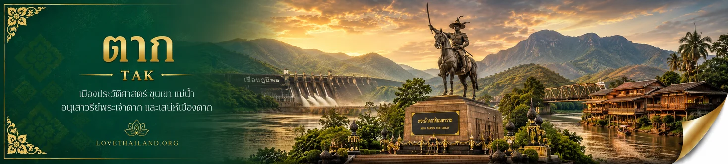
Mae Moei National Park
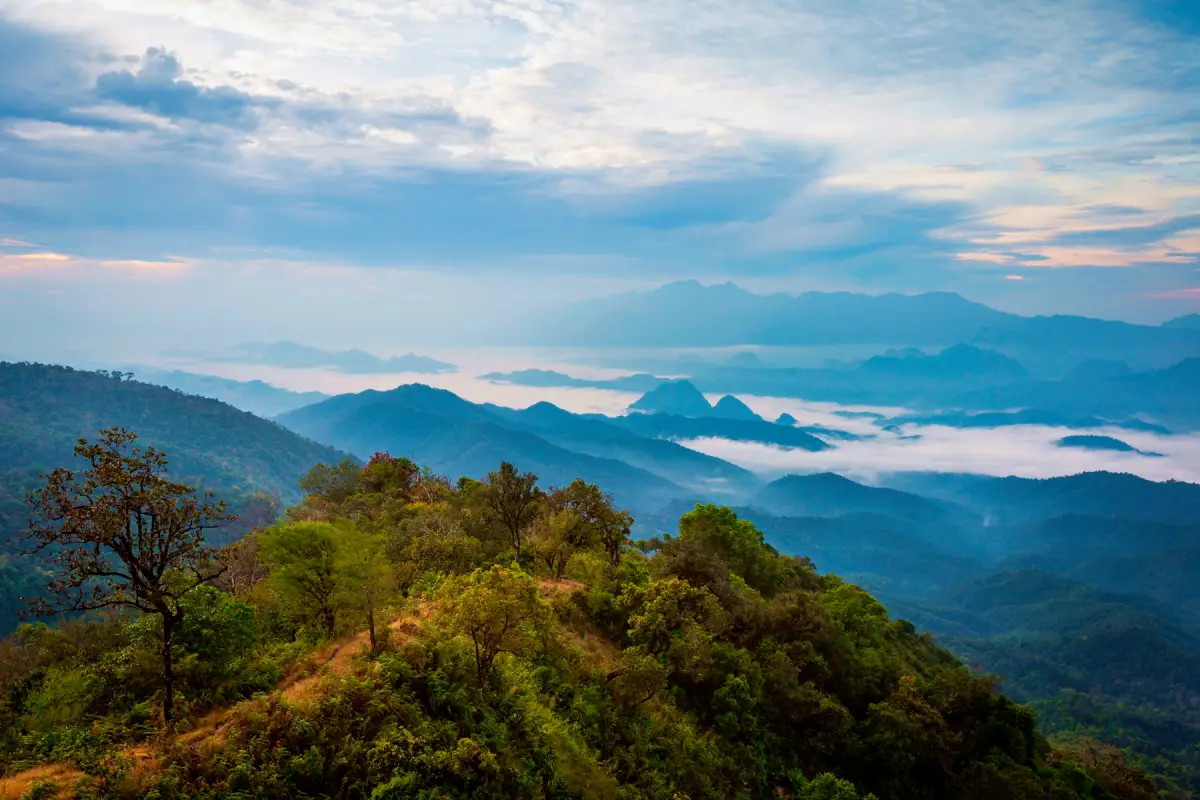
Open Days: Visitor access is available in designated areas, subject to seasonal arrangements and park regulations.
Mae Moei National Park is a protected natural area located in Tha Song Yang District, Tak Province, in western Thailand. The park is renowned for its mountain landscapes, spectacular seas of mist, forests, waterfalls, caves, and distinctive geographical setting along the Thailand–Myanmar border. Covering approximately 115,800 rai, or 185.28 square kilometers, the national park was officially established on May 20, 1999. The Moei River forms an important part of the western border landscape, while the mountains of the Thanon Thong Chai Range contribute to the park's rugged and beautiful terrain.
One of the defining attractions of Mae Moei National Park is the magnificent sea of mist that blankets its mountain valleys in the early morning. The phenomenon is especially associated with Mon Kiew Lom, Mon Khru Ba Sai, and Mon Phun Suda, three of the park's best-known viewpoints. From these elevated locations, visitors can admire successive layers of mountains, extensive forested valleys, and the changing colors of sunlight as the sun rises above the mist. The peaceful surroundings create an atmosphere that distinguishes Mae Moei from more heavily developed tourist destinations.
Beyond its famous viewpoints, the park contains a variety of other natural attractions, including Mae Usu Cave, Mae Ramoeng Waterfall, Mae Salit Noi Waterfall, Chao Doi Waterfall, and forest nature trails. These sites illustrate the diversity of the landscape, ranging from exposed mountain ridges and steep cliffs to forest streams and large natural caves. Each environment provides a different perspective on the geological and ecological character of Thailand's western border highlands.
Mae Moei National Park is also distinguished by its proximity to Myanmar. The Moei River is an important waterway associated with the international border and has an unusual geographical characteristic: much of its course flows northward. This direction contrasts with the common assumption that rivers normally flow from north to south. In reality, river flow is determined by elevation, gradient, and drainage patterns rather than by compass direction.
The significance of Mae Moei National Park extends well beyond its scenic viewpoints. Its protected forests support important watersheds, provide habitats for wildlife, and form part of the natural environment on which surrounding communities depend. Exploring the park therefore offers both an enjoyable outdoor experience and an opportunity to appreciate the long-term importance of forest and water conservation.
History of Mae Moei National Park began with forestry surveys undertaken in Tha Song Yang District in 1989. The work was carried out under the National Parks Division of the Royal Forest Department, then part of Thailand's Ministry of Agriculture and Cooperatives. The objective was to identify important forest areas suitable for conservation while recognizing the natural attractions and landscape features of Tak Province.
The original survey area was considerably larger than the land eventually designated as the national park. It included parts of the Tha Song Yang National Reserved Forest and extensive mountain areas associated with the Thanon Thong Chai Range. The area under consideration covered approximately 713,750 rai, equivalent to 1,142 square kilometers, extending across the highlands from the Mae Tan area through Mae Song toward Tha Song Yang. Its considerable size demonstrated the importance of the forest landscape along the international border.
The surveys were concerned with much more than scenery or tourism potential. Forestry authorities had to consider forest conditions, watershed protection, geographical continuity, terrain, and the relationships between the forests and surrounding settlements. With much of the region characterized by steep slopes and difficult access, establishing a manageable protected area required careful consideration of natural conditions and long-term administrative responsibilities.
An important part of the proposed conservation landscape was the area associated with Mae Usu Cave Forest Park. Mae Usu Cave was already recognized as a remarkable natural attraction because of its extensive interior spaces and geological features. Bringing this area within the broader national park framework helped establish a more comprehensive approach to protecting forest habitats, waterways, caves, and visitor destinations.
Mae Moei National Park was officially established under a Royal Decree designating parts of the Tha Song Yang National Reserved Forest in Mae Song and Mae Usu subdistricts, Tha Song Yang District, Tak Province. The declaration appeared in the Royal Thai Government Gazette, Volume 116, Part 40 Kor, dated May 20, 1999. The designated park covered approximately 115,800 rai, or 185.28 square kilometers, which remains the official area associated with the national park.
National park designation placed these forests under a formal conservation and management framework intended to protect natural resources, prevent environmental degradation, and support appropriate educational and recreational activities. The protection of rivers, streams, and upland forests was particularly important because these natural systems are connected to the environmental health of neighboring communities.
The name Mae Moei National Park comes from the Moei River, an important river flowing through the Thailand–Myanmar border region. In several sections, the river serves as a natural international boundary. Its association with the national park reflects the importance of the river to regional geography, settlement patterns, local history, and the lives of communities in Tha Song Yang District.
Geography and Natural Landscape are fundamental to the character of Mae Moei National Park. The terrain consists mainly of complex mountain formations, steep slopes, deep valleys, and relatively small flat areas scattered among the hills. The average elevation is approximately 680 meters above sea level, while the highest elevations reach around 1,250 meters. These differences in altitude influence temperature, humidity, cloud formation, and the movement of water through the surrounding watersheds.
The Thanon Thong Chai Range, which extends through western and northern Thailand, forms an important part of the area's geographical setting. Its mountains create continuous ridges separated by valleys shaped over long periods by natural erosion and flowing water. Because of the steep terrain, road travel within the national park involves winding mountain routes, changes in elevation, and sections requiring careful driving.
The forests of Mae Moei contribute to several important watersheds, including the Mae Song, Mae Usu, and Mae Salit Luang streams and their tributaries. Rain falling on the highlands moves through forest soils and natural drainage systems before reaching lower settlements and the Moei River. Forest cover plays a valuable role in retaining soil, moderating runoff, maintaining moisture, and supporting the ecological condition of these waterways.
During the rainy season, the mountains receive substantial moisture. Forest vegetation becomes lush and green, streams carry greater volumes of water, and mist frequently moves along the ridges and through the valleys. The same conditions that create beautiful scenery can also increase the risk of flash floods, slippery paths, reduced visibility, and damage to forest access routes.
The cooler season brings particularly attractive conditions to the park's highland viewpoints. Falling nighttime temperatures encourage cool air to collect in valleys. When sufficient moisture is present, water vapor condenses into suspended droplets, producing the layers of fog commonly described as a sea of mist. Viewed from above, the fog creates a white expanse broken by the silhouettes of mountain ridges.
The beauty of Mae Moei's misty landscapes comes not only from the density of the fog but also from the arrangement of the mountains. Early sunlight gradually illuminates the valleys, changing the appearance of the fog from pale gray to soft gold. On some mornings, thick mist fills the landscape; on others, thin clouds drift between the hills. Clear mornings provide equally impressive views of distant ridges and extensive forest cover.
How the Sea of Mist Forms is closely related to the park's mountainous geography. Mist develops when moist air cools sufficiently for water vapor to condense into tiny droplets. Valleys surrounded by elevated terrain can trap cool air, creating favorable conditions for fog formation. From a viewpoint above the valley, the accumulated mist resembles a sea extending across the forested landscape.
The appearance of the scenery varies between viewpoints because each location has a different elevation, orientation, and relationship with the surrounding mountains. Mon Kiew Lom is particularly associated with sunrise views above the mist, while Mon Khru Ba Sai and Mon Phun Suda offer additional perspectives over valleys and mountain ridges. Exploring these locations reveals the considerable variety within Mae Moei's highland landscape.
Mon Kiew Lom is one of the most famous viewpoints in Mae Moei National Park. Located approximately 12 kilometers from the park headquarters according to the Department of National Parks' service-zone information, it occupies an elevated position overlooking mountains and forested valleys. The viewpoint is popular among visitors wishing to photograph sunrise, admire the sea of mist, or spend the night in the designated camping area.
Early mornings at Mon Kiew Lom are particularly memorable because mountain ridges extend into the distance in successive layers. When fog accumulates below the viewpoint, the rising sun gradually illuminates the landscape, changing the colors of the mist and surrounding mountains. The scenery is constantly shifting as clouds move and sunlight increases, ensuring that different visits can provide distinctly different visual experiences.
Mon Kiew Lom has a designated camping area listed in the national park's official accommodation system. Staying overnight allows visitors to experience the mountain environment in the evening and enjoy the morning landscape without having to travel uphill before dawn. Camping in this location is associated with cool weather and scenic views, but visitors must comply with regulations concerning tent placement, waste disposal, noise, and personal safety near elevated terrain.
The name Mon Kiew Lom reflects the physical characteristics of a windswept mountain ridge. In northern Thai usage, mon refers to a hill or small mountain, while kiew is associated with a narrow ridge or mountain pass. Together, the words evoke an elevated landscape exposed to mountain winds, where visitors can enjoy broad views of the surrounding highlands.
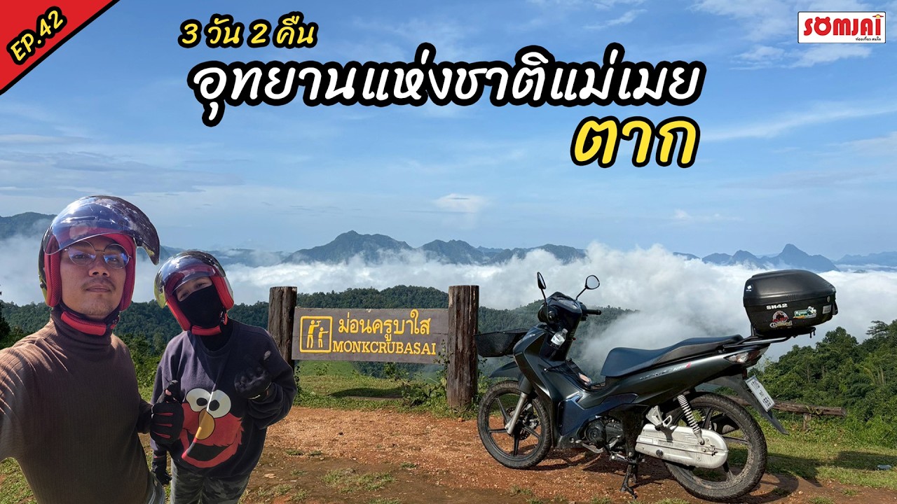
Mon Khru Ba Sai is another significant viewpoint within Mae Moei National Park. According to the Department of National Parks, it lies approximately 7 kilometers from the park headquarters. The location is included among the park's main camping service zones and occupies elevated terrain overlooking the surrounding forests and mountains.
Mon Khru Ba Sai is valued for its peaceful atmosphere and expansive scenery. It appeals to nature photographers and visitors seeking a quieter mountain experience. Morning and evening provide different lighting conditions: early sunlight reveals details within the valleys, while evening light can emphasize the shapes of distant mountain ridges.
The viewpoint is also conveniently associated with Mon Phun Suda, which lies nearby. Visiting both locations allows travelers to appreciate different perspectives of the same mountain landscape without undertaking a long journey between viewpoints. Visitors should remain within designated viewing areas and take particular care near steep slopes, especially after rain or when the ground is wet with morning dew.
Mon Phun Suda is another celebrated sea-of-mist viewpoint, located approximately 200 meters from Mon Khru Ba Sai according to government tourism information. Its name honors Poon Kasemsan, an influential Thai photographer, and his wife Suda. The naming recognizes the photographer's association with documenting the natural beauty of the area and helping bring attention to the mountain scenery.
The viewpoint provides impressive panoramas of mountain ridges and deep valleys. When mist fills the lower landscape, isolated summits appear above the fog, creating striking compositions particularly suited to landscape photography. Soft morning light enhances the visual separation between the mountains and contributes to the location's enduring popularity among photographers.
The story behind the name Mon Phun Suda also highlights the role of photography in introducing remote natural destinations to a wider audience. Images of mountain forests, morning fog, and changing light have encouraged travelers to explore landscapes that were once less widely known. The viewpoint therefore has significance not only as a scenic attraction but also as part of the history of nature photography in the region.
Mon Pui Mok is another mountain viewpoint mentioned in tourism information about Mae Moei National Park. It is associated with forest trekking and the opportunity to observe mist from elevated terrain. Unlike viewpoints reached directly by road, certain remote viewpoints involve walking through natural forest environments and require additional preparation.
Exploring remote viewpoints on foot is a different experience from traveling by vehicle to Mon Kiew Lom. Forest routes can include steep sections, streams, and ground conditions that change significantly with the seasons. Such activities require appropriate physical fitness, suitable equipment, and compliance with national park permission and guiding arrangements. Routes requiring ranger supervision should never be attempted independently.
Mae Ramoeng Waterfall is another natural attraction associated with the mountain route linking several of the park's viewpoints. The waterfall consists of a natural stream flowing through a forested environment and can form part of a journey that includes Mon Khru Ba Sai, Mon Phun Suda, and Mon Kiew Lom when the relevant areas are open to visitors.
The waterfall's appearance changes according to rainfall and seasonal water levels. During wetter periods, increased flow creates stronger cascades and greater humidity. In drier conditions, water volume can decline naturally. Observing the waterfall provides an opportunity to understand the relationship between upstream forests, mountain streams, rock formations, and the gradual erosive action of water.
Waterfall environments can become dangerous during heavy rainfall. Mountain streams may rise rapidly following rain in upstream catchments, even when the weather at the waterfall appears relatively calm. Visitors should avoid slippery rocks, fast-moving water, and restricted areas, and should always follow instructions issued by park personnel.
Mae Usu Cave is an important natural attraction with a direct connection to the history of protected-area management in Mae Moei. The surrounding landscape was formerly managed as Mae Usu Cave Forest Park before its inclusion in the national park establishment process. Located in Mae Usu Subdistrict, Tha Song Yang District, the cave is among the region's notable geological attractions.
Mae Usu Cave is known for its substantial interior chambers, natural openings that admit daylight, and geological features shaped by the long-term interaction of water and rock. The cave environment differs greatly from the park's exposed mountain viewpoints. As a result, visitors can experience two contrasting aspects of the region's natural geography within the same protected area.
Caves are important ecological environments because their temperatures, humidity, lighting, and air movement differ from those of surrounding forests. Certain organisms are adapted to these conditions, while rock formations and underground water systems require careful protection. Cave conservation therefore involves preserving natural geological and ecological processes as well as maintaining safe visitor access.
Access to Mae Usu Cave is subject to seasonal restrictions, especially when heavy rainfall affects water levels and safety conditions. Visitors must respect official opening arrangements, remain on authorized routes, and use appropriate lighting. Entering closed or unmanaged sections of a cave presents risks and can damage sensitive natural features.
Mae Salit Noi Waterfall and Chao Doi Waterfall are other natural attractions mentioned in tourism information about Mae Moei National Park. Their flowing streams are associated with the forested mountains and humid environments of the area. The form and appearance of each waterfall depend on slope gradient, rock formations, and the volume of water carried by the surrounding streams.
Waterfalls have ecological importance beyond their recreational appeal. Streams and natural pools provide moisture for vegetation and serve as water sources for wildlife. Streamside environments support plants adapted to humid conditions and contribute to the movement of nutrients through the forest ecosystem. Protecting these areas requires careful waste management and minimal disturbance of natural habitats.
Nature Trails allow visitors to experience the ecological variety of Mae Moei at closer range. Certain routes pass through forests, mountain slopes, and stream environments, providing opportunities to observe plants, soils, rock formations, and smaller wildlife. The changing conditions along a trail can reveal how elevation, drainage, and sunlight influence forest vegetation.
Forest trekking requires greater preparation than ordinary sightseeing. Trails may include uneven surfaces, stream crossings, steep ground, or muddy sections. Appropriate footwear, drinking water, suitable clothing, and awareness of weather conditions are important. Where ranger guides are required, the activity must be arranged through the national park to protect both visitors and the forest environment.
Nature walks also provide insight into relationships between terrain and vegetation. Steep slopes often drain differently from valley floors, while areas near streams generally retain more moisture than exposed mountain ridges. These variations help determine where particular plants and animals occur, making the forest a valuable setting for environmental education.
Forests and Biodiversity are central to Mae Moei National Park's conservation importance. The protected landscape contains habitats for mammals, birds, reptiles, insects, and other organisms. Its combination of higher elevations, humid valleys, and natural streams creates ecological conditions that support different types of vegetation and wildlife.
Tourism information about the park mentions wildlife such as deer, Eld's deer, junglefowl, and various bird species. These references reflect the ecological value of the broader landscape, although seeing wild animals during a visit is never guaranteed. Wildlife activity depends on habitat, feeding patterns, time of day, weather, and human disturbance. Animals should be observed without approaching, handling, or feeding them.
Birds contribute to forest ecology through processes such as seed dispersal, while insects and smaller animals participate in pollination and nutrient cycling. These interactions support the continuity and regeneration of natural vegetation. Maintaining suitable habitats allows ecological relationships to continue and contributes to the resilience of forest systems over time.
Forest conservation also protects mountain watersheds. Tree roots help stabilize soil on steep slopes, while leaf litter and organic matter slow surface runoff and retain moisture. These processes are important for reducing erosion and maintaining the ecological health of streams. The value of the park's forests therefore extends to communities and agricultural areas situated downstream.
The Moei River and Border Geography give the national park an additional geographical identity. The river flows through the Thailand–Myanmar border region and has long been associated with settlements, travel, and local livelihoods. Along parts of its course, the river forms the international boundary between the two countries.
One notable characteristic of the Moei River is its predominantly northward flow. This is a consequence of the regional landscape and drainage gradient. The river offers an interesting geographical example of why watercourses follow elevation differences rather than fixed compass directions.
Within Tha Song Yang District, the Moei River and its tributaries form part of the environmental setting of local communities. Forested uplands contribute to the water systems connected with the river, illustrating the close relationship between protected mountain landscapes and the resources used by people living in surrounding valleys and settlements.
Local Communities and Traditional Livelihoods surrounding Mae Moei National Park are closely connected with the mountains and border geography. Tha Song Yang District contains communities distributed across valleys, riversides, and accessible road corridors. Local economic activities include agriculture, trade, and services associated with transport and travel.
Mountainous terrain influences settlement patterns and the availability of agricultural land. Communities are frequently associated with more accessible areas and natural water resources, while steep slopes and protected forests impose constraints on land development. Balancing local livelihoods with environmental protection is therefore an important consideration in the wider region.
Nature tourism creates economic connections between the national park and nearby communities. Visitors require food, accommodation, shops, and transportation, supporting a range of local services. At the same time, responsible waste management and appropriate use of natural resources are essential to ensure that tourism does not undermine the environmental qualities that attract visitors.
The significance of Mae Moei to surrounding communities also includes the protection of forest and water resources. Travelers visiting misty viewpoints or staying on mountain ridges are entering an environment with ecological importance extending far beyond tourism. Responsible visitor behavior contributes to conserving resources that support wildlife and local livelihoods.
Main Visitor Zones of Mae Moei National Park are divided into three principal service areas in the Department of National Parks' reservation system: the National Park Headquarters Zone, Mon Kiew Lom Zone, and Mon Khru Ba Sai Zone. Each serves different visitor needs according to its location, facilities, and geographical conditions.
The Headquarters Zone is the central area for visitor coordination and park administration. Its listed facilities include park accommodation, meeting facilities, tents, and camping grounds. Travelers can use the official park contact channels to obtain information about access routes, overnight stays, regulations, and visitor services.
The Mon Kiew Lom Zone is approximately 12 kilometers from park headquarters. It provides camping facilities in an elevated location known for its sunrise scenery and sea of mist. Staying in this zone offers the advantage of experiencing the morning landscape without needing to travel up the mountain before dawn. All camping activities must follow designated arrangements and ranger instructions.
The Mon Khru Ba Sai Zone is approximately 7 kilometers from the headquarters and also offers tent and camping services. The area is known for its broad mountain views and its proximity to Mon Phun Suda. Facilities and practical camping conditions can vary between the different zones because of terrain and local service arrangements.
Accommodation Within Mae Moei National Park includes park houses listed in the Department of National Parks' reservation system. The identified units in the headquarters area include Mae Moei 101, Phrai Phiman, and Mae Moei 103, Khu Phrueksa. These accommodation options serve visitors who prefer to stay in a park house rather than a tent.
The park reservation system also lists Mae Moei Camping Ground, Mon Kiew Lom Camping Ground, and Mon Khru Ba Sai Camping Ground. Other listed services include three-person tents at the headquarters area and equipment such as sleeping bags, sleeping mats, and pillows. These options accommodate different styles of outdoor recreation and overnight stays.
Camping at Mae Moei National Park is particularly popular among travelers who wish to watch sunrise above the mountains and enjoy the cooler atmosphere of the highlands. Each camping zone has a different character. The headquarters area is convenient for communication with park personnel, while Mon Kiew Lom and Mon Khru Ba Sai emphasize elevated scenery and proximity to natural viewpoints.
Mountain camping requires careful preparation because temperatures can fall significantly overnight, especially during the cooler season. Winds may be stronger on exposed ridges than within sheltered valleys, while mist and dew can leave tents and equipment damp. Appropriate tents, bedding, warm clothing, and suitable personal supplies are therefore important.
Tents must be placed only in authorized areas, away from dangerous slopes and cliff edges. Quiet hours should be respected to avoid disturbing other campers and wildlife. Food waste and rubbish must be managed carefully because discarded food can attract wild animals and damage the surrounding environment.
Seasons and Weather at Mae Moei National Park influence both the landscape and visitor activities. The rainy season, generally from May to October, brings abundant rainfall and high humidity. Forests become particularly green, and many natural streams carry more water. However, heavy rainfall can cause slippery roads, dense fog, flash floods, and unsafe conditions on trails or near waterways.
The transition from the rainy season into the cooler months often combines green vegetation with atmospheric conditions favorable for mist formation. When temperatures fall and the sky begins to clear, layers of fog may remain suspended over forested valleys. Nevertheless, sea-of-mist conditions depend on daily weather and cannot be guaranteed on every morning.
November through February is a particularly popular period for visitors interested in cooler temperatures, camping, and sunrise photography. Highland areas can become cold at night and during early morning hours. Travelers gathering at viewpoints before sunrise should prepare warm clothing and protection from wind.
During the warmer months, approximately March and April, daytime temperatures increase and mist conditions may become less frequent as atmospheric humidity changes. Clear mountain views can still be attractive, particularly for visitors interested in landscape photography. Travelers should take prevailing air quality, weather, and any local restrictions into consideration during this season.
Things to Do at Mae Moei National Park include watching the sea of mist, photographing sunrise, observing mountain scenery, exploring forest ecosystems, camping, trekking, and visiting waterfalls or caves when access is permitted. Each activity requires a different level of preparation and time, particularly because attractions are spread across several parts of the protected area.
Landscape photography is especially rewarding because the visual character of the mountains changes throughout the day. Soft morning light reveals delicate layers of mist, brighter midday conditions make forest details more visible, and evening light creates dramatic silhouettes along mountain ridges. Weather and seasonal vegetation produce additional variations in the scenery.
Environmental observation provides another reason to visit the park. Travelers can examine differences in vegetation between mountain ridges and valleys, observe natural drainage patterns, and consider how moisture, sunlight, and elevation influence plant growth. Such observations help explain why forest ecosystems are complex systems rather than simply collections of trees.
Longer forest treks require greater physical readiness than visits to roadside viewpoints. Visitors should assess weather conditions, route requirements, and their own fitness before participating. Ranger-guided trails must be arranged through the national park, and travelers should remain on approved paths to protect wildlife habitats and avoid becoming lost.
Attractions Around Mae Moei National Park can be combined into several travel routes through Tha Song Yang District. Destinations within or associated with the park include Mon Kiew Lom, Mon Khru Ba Sai, Mon Phun Suda, Mae Ramoeng Waterfall, and Mae Usu Cave. The wider border region also includes viewpoints overlooking the Moei River and communities along the main highway.
A scenic route within the park can begin at the headquarters and continue toward Mon Khru Ba Sai and nearby Mon Phun Suda before proceeding to Mon Kiew Lom along authorized roads. This route allows visitors to experience several perspectives of the highland scenery and arrange their visits according to favorable lighting conditions.
Mae Usu Cave and natural attractions situated away from the main viewpoint route require separate travel planning. Mountain roads are often winding, and journeys can take longer than expected when compared with travel over flat terrain. Allowing sufficient time between destinations makes it possible to appreciate the scenery without unnecessary pressure.
Getting to Mae Moei National Park is most practical by private car or rental vehicle. Travelers approaching from Mae Sot District, Tak Province, can follow Highway 105 toward Tha Song Yang District. Near Mae Salit Luang village, a connecting road leads to Highway 1267, which climbs toward the national park headquarters and the mountain viewpoints.
Highway 1267 is the principal access route for several of the park's visitor areas. It includes uphill and downhill sections, winding bends, and changing elevations. Driving requires particular care during rain, fog, or wet road conditions. Vehicle brakes, tires, and general mechanical condition should be checked before beginning the mountain journey.
Travelers starting from Tak city can travel toward Mae Sot and continue north toward Tha Song Yang. Those approaching from Mae Sariang in Mae Hong Son Province can use Highway 105 toward Tha Song Yang from the north. The most suitable route depends on the starting point, road conditions, and the specific attraction being visited.
Public transport users generally need to arrange onward transportation from settlements or transport points in the wider district. The park's viewpoints and natural attractions are spread across separate locations and are not all served directly by regular public transportation. Private vehicles or prearranged local transfers therefore offer greater flexibility for a multi-stop visit.
Visitor Rules and Responsible Tourism are essential to protecting Mae Moei National Park. Visitors should not collect plants, remove natural materials, leave rubbish, feed wildlife, or enter restricted areas. Park regulations are designed to maintain the ecological condition of the forests and ensure that natural attractions remain suitable for future visitors.
At mountain viewpoints, travelers should remain within designated visitor areas and avoid approaching unprotected cliff edges. Wet ground, strong winds, and steep terrain can create dangerous conditions, particularly after rainfall. Photography should never involve climbing restricted structures or entering unsafe positions.
Campers should respect designated quiet periods, avoid loud music, and remove food waste from their camping areas. Discarded food can attract wildlife and create risks for both animals and people. Responsible waste disposal and considerate campsite behavior help preserve the peaceful atmosphere of the park.
During the rainy season, visitors should pay special attention to park safety announcements. Mountain areas can experience flash floods, landslides, slippery roads, and reduced visibility from fog. Temporary restrictions on trails, waterfalls, caves, or viewpoints must be respected to protect visitors and allow park personnel to manage conditions safely.
Mae Moei National Park in Tak Province combines dramatic mountains, forested valleys, spectacular misty viewpoints, natural waterfalls, and important caves within a protected border landscape. Mon Kiew Lom, Mon Khru Ba Sai, and Mon Phun Suda provide some of the best-known mountain panoramas, while Mae Usu Cave, Mae Ramoeng Waterfall, and forest ecosystems reveal the region's greater environmental diversity.
The park's enduring value lies in the connection between its scenic beauty, natural resources, and surrounding border communities. Visiting Mae Moei offers opportunities to appreciate landscapes different from those of more developed destinations while understanding the importance of forest and watershed conservation. The peaceful mountains and beautiful seas of mist are therefore only part of what makes Mae Moei National Park a significant natural heritage destination in western Thailand.
| Name | Mae Moei National Park, Tak Province, Thailand |
| Location | Mae Song and Mae Usu Subdistricts, Tha Song Yang District, Tak Province 63150, Thailand |
| Category | National Park, Protected Forest, Mountain and Sea-of-Mist Tourism Destination |
| Area | 115,800 rai, or 185.28 square kilometers |
| Establishment Date | May 20, 1999 |
| Managing Authority | Department of National Parks, Wildlife and Plant Conservation, Thailand |
| Landscape | Forested Mountains, Deep Valleys, Streams, Waterfalls, Caves and Border Landscapes Along the Moei River |
| Elevation | Average elevation approximately 680 meters; highest areas approximately 1,250 meters above mean sea level |
| Name Origin | Named after the Moei River, an important river along the Thailand–Myanmar border |
| Highlights | Sea of Mist, Sunrise Views, Mon Kiew Lom, Mon Khru Ba Sai, Mon Phun Suda, Waterfalls and Mae Usu Cave |
| Main Visitor Zones | 1. National Park Headquarters Zone – Park Houses, Meeting Facilities, Tents and Camping Ground 2. Mon Kiew Lom Zone – Approximately 12 km from Headquarters; Tents and Camping Ground 3. Mon Khru Ba Sai Zone – Approximately 7 km from Headquarters; Tents and Camping Ground |
| Park Houses | Mae Moei 101 (Phrai Phiman) and Mae Moei 103 (Khu Phrueksa) |
| Camping Areas | Mae Moei Camping Ground, Mon Kiew Lom Camping Ground and Mon Khru Ba Sai Camping Ground |
| Activities | Sea-of-Mist Viewing, Sunrise Photography, Nature Observation, Trekking, Waterfall and Cave Visits, and Camping in Authorized Areas |
| Entrance Fees for Thai Visitors | Adults: THB 40; Children: THB 20 |
| Entrance Fees for Foreign Visitors | Adults: THB 200; Children: THB 100 |
| Best Time to Visit | Cool Season for Sea of Mist and Camping; Rainy Season for Lush Forest Scenery, Subject to Safe Access Conditions |
| Getting There | Follow Highway 105 toward Tha Song Yang, then turn onto Highway 1267 near Mae Salit Luang village to reach the national park |
| Contact Number | +66 61 352 3703 |
| Official Website | https://booking.dnp.go.th/parksdetail.php?id=100 |
| Nearby and In-Park Attractions | 1. Mon Khru Ba Sai – Approximately 7 km from Park Headquarters 2. Mon Phun Suda – Approximately 7 km from Park Headquarters 3. Mon Kiew Lom – Approximately 12 km from Park Headquarters 4. Mae Ramoeng Waterfall 5. Mae Usu Cave 6. Moei River Viewpoint 7. Mae Salit Noi Waterfall 8. Chao Doi Waterfall |
| Restaurants in Tha Song Yang District | 1. New Mae Salit Restaurant, Mae Song 2. View Moei Cafe, Mae Tan, Tel. +66 98 797 8542 3. Baan Nun Cafe, Mae Tan |
| Accommodation in Tha Song Yang District and Surrounding Areas | 1. Tha Song Yang Hill Resort, Tel. +66 82 882 8292 2. Mae Salit Resort, Tel. +66 93 232 1198 3. B.P. Resort, Tel. +66 90 203 5509 4. Baan Than Khun, Tel. +66 84 491 9787 5. Wong Tawan Resort, Tel. +66 55 589 083 6. Ozone Homestay, Tel. +66 81 041 9029 |
Frequently Asked Questions (FAQ)
Q: Where is Mae Moei National Park located?
A: Mae Moei National Park is located in Tha Song Yang District, Tak Province, Thailand. It covers parts of Mae Song and Mae Usu subdistricts near the Thailand–Myanmar border, where the Moei River forms an important geographical feature.
Q: How much is the entrance fee to Mae Moei National Park?
A: Admission costs THB 40 for Thai adults and THB 20 for Thai children. Foreign visitors pay THB 200 for adults and THB 100 for children. Vehicle entry, accommodation, and camping services may involve additional charges.
Q: What are the most famous sea-of-mist viewpoints in Mae Moei National Park?
A: The best-known viewpoints are Mon Kiew Lom, Mon Khru Ba Sai, and Mon Phun Suda. Mon Kiew Lom is especially popular for sunrise above the mist, while Mon Khru Ba Sai and Mon Phun Suda are close together and offer impressive mountain panoramas.
Q: Can visitors camp at Mae Moei National Park?
A: Yes. The Department of National Parks lists designated camping grounds at Mae Moei, Mon Kiew Lom, and Mon Khru Ba Sai. Camping is subject to park regulations and the operating arrangements of each area.
Q: Why is Mae Usu Cave important?
A: Mae Usu Cave is a significant natural attraction in Tha Song Yang District. Its surrounding area was previously protected as Mae Usu Cave Forest Park before becoming part of Mae Moei National Park. The cave is known for its large chambers and distinctive geological features.
Q: What is the best time to visit Mae Moei National Park?
A: November through February is popular for cooler temperatures, camping, and viewing the sea of mist. The transition from the rainy season to the cooler months often brings lush vegetation and favorable mist conditions, although fog depends on the weather each day.
Q: How can travelers get to Mae Moei National Park?
A: Travelers can drive from Mae Sot along Highway 105 toward Tha Song Yang District, then turn onto Highway 1267 near Mae Salit Luang village to reach the national park headquarters and mountain viewpoints.
Q: When was Mae Moei National Park established?
A: Mae Moei National Park was officially established on May 20, 1999, under a declaration published in the Royal Thai Government Gazette, Volume 116, Part 40 Kor. It covers approximately 115,800 rai, or 185.28 square kilometers.
 Category: ●Nature and Wildlife
 Group: ●National Parks and Marine Reserves
Last Update : 2 WeekAgo
 Last Update : 2 WeekAgo
 Click to Access the Navigation Map GPS
Mae Moei National Park Map
Recommend

 Art, Culture and Heritage
 Historical Sites and Monuments(2)
 Landmarks and Memorials(3)
 Art, Craft Centres, Tradition(6)
 Historic Homes and Cities(2)
 Educational Places
 Educational Gardens, Farm(2)
 Places of Worship
 Temple(22)
 Other Sacred Sites(9)
 Research and Development
 Royal Project(1)
 Suburban Living
 Village, Community(5)
 Local Market(3)
National Parks and Marine Reserves(11)
 Mountain (Doi)(9)
 Dam, Reservoir, Lake(14)
 Waterfalls(23)
 Hot Springs(2)
 Caves(6)
 River, Canal(1)
 Bays and Beaches(1)
 Islands(1)
 Other natural attractions(1)
 Entertainment and Agricultural
 Farms, Parks and Ecotourism(5)
 Outdoor and Adventure Activities(4)
 Travel Articles, Recipes
 Travel Review, Food Review(1)


