
lovethailand home >North Travel Attractions >Uttaradit Travel Attractions >Nam Pad >Nam Khrai > Ton Sak Yai National Park
TL;DR: Ton Sak Yai National Park, open General visitor areas operate according to Ton Sak Yai National Park's current.
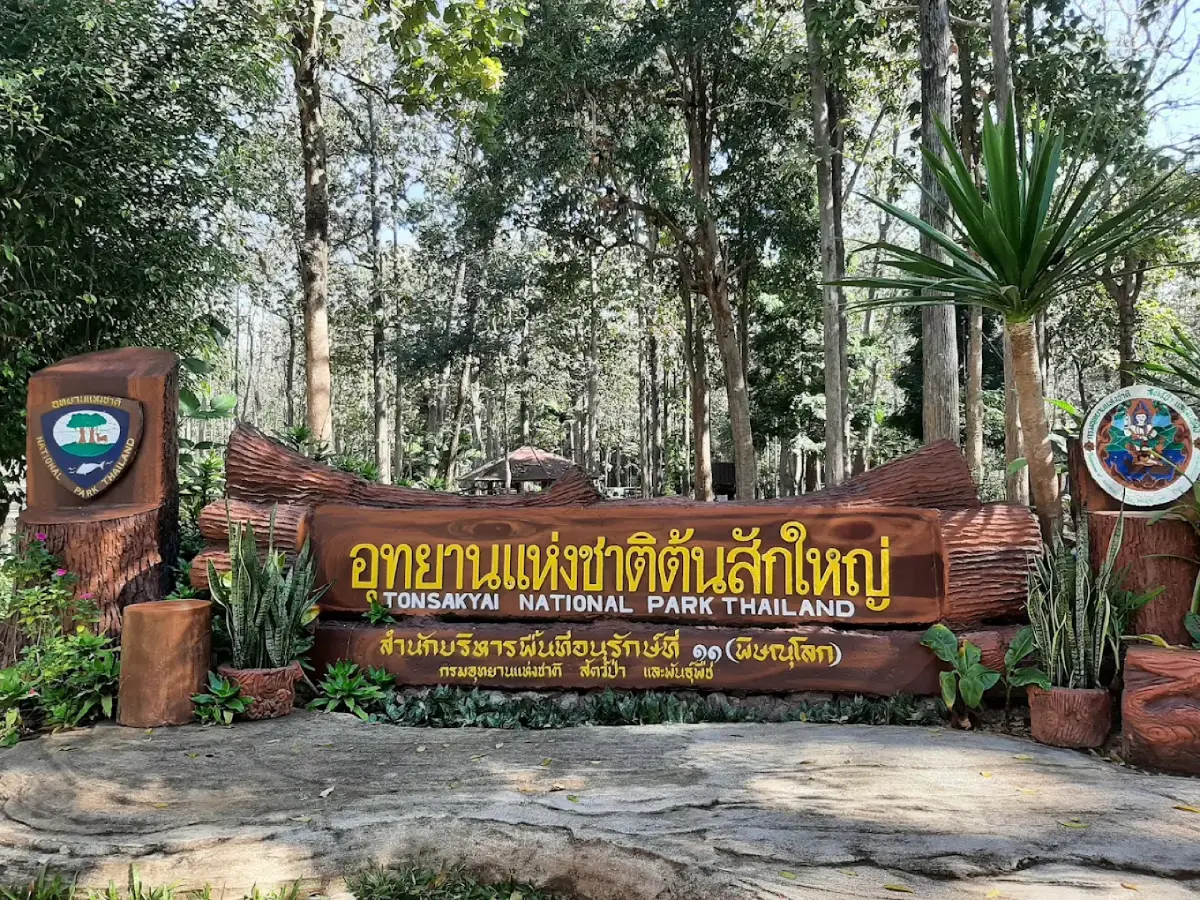
Ton Sak Yai National Park
Open Days: General visitor areas operate according to Ton Sak Yai National Park's current arrangements. Mountain trekking routes, waterfalls and selected camping locations require authorization from park officials.
Ton Sak Yai National Park, Uttaradit Province, Thailand, is an important conservation area in the lower northern region of Thailand. Its most celebrated natural landmark is an enormous ancient teak tree known as Mahesak, estimated to be approximately 1,500 years old and recognized internationally for its extraordinary size. The national park lies in Uttaradit Province, covering parts of Nam Pat, Tha Pla, Thong Saen Khan and Mueang Uttaradit districts. It occupies approximately 324,240.80 rai, or 518.80 square kilometers. The landscape includes mixed deciduous forests, dry dipterocarp forests, dry evergreen forests, hill evergreen forests, mountains, streams, waterfalls and caves distributed throughout the Nan River watershed.
Ton Sak Yai National Park is distinctive because it combines Thailand's forestry heritage with the conservation of an extensive natural forest landscape. The ancient Mahesak teak tree is remarkable not only for its immense trunk but also for the extraordinary length of time it has survived. The tree represents centuries of forest growth, changing environmental conditions and continued efforts by conservation authorities to protect a living natural landmark that has become deeply associated with Uttaradit Province.
Visitors can appreciate the ancient teak from designated viewing paths surrounded by a mixture of forest trees. The setting is suitable for peaceful walks, observing forest vegetation and learning about teak conservation. Travelers interested in more demanding outdoor experiences can also explore the park's wider natural attractions, including Phu Miang Mountain, Khlong Tron Waterfall, Huai Niam Waterfall, Huai Khom Waterfall and several caves. Access arrangements for these remote attractions differ substantially from those for the main teak-tree visitor area.
The forest has long been connected with communities in Nam Pat District. Mountains and waterways form part of the environment supporting settlements, agriculture and travel through the valleys. Conserving the park's watersheds helps maintain the streams that eventually flow into the Nan River. Tourism also gives the public opportunities to understand the value of ancient trees and the importance of using natural resources responsibly.
History of Ton Sak Yai National Park begins with conservation efforts in the forests of Nam Pat and Khlong Tron, which form part of the Nan River watershed. Uttaradit was historically associated with valuable natural teak forests and the timber trade of northern Thailand. The discovery of an exceptionally large teak tree near Ban Pang Kluea drew attention to the importance of protecting this particular tree and its surrounding habitat.
The ancient teak became widely recognized around 1927 in the Ban Pang Kluea area of Nam Khrai Subdistrict, Nam Pat District. The surrounding landscape was connected with commercial timber operations in earlier times, but the giant teak was preserved because of its exceptional dimensions and natural importance. Its survival provides evidence of the impressive teak trees that once grew in the region's extensive forests.
As the tree's significance became more widely recognized, Uttaradit authorities and the Royal Forest Department began efforts to conserve the surrounding area. In 1968, proposals were made to establish a protected forest park centered on the giant teak, with the aim of conserving both the tree and nearby forest vegetation. These efforts marked an early stage in the development of a visitor area focused on the preservation of a remarkable living tree.
The history of the giant teak conservation site should be distinguished from that of Khlong Tron National Park. The teak tree and its immediate surroundings were protected and known as a natural attraction before the larger national park was established. Khlong Tron National Park was intended to protect a much broader watershed forest spanning several districts. The subsequent change of the national park's name brought its most recognizable natural symbol into the identity of the larger protected area.
In 1989, the Royal Forest Department commissioned surveys of the Khlong Tron reserved forests on both sides of the stream in Uttaradit Province. The surveys assessed forest condition, terrain, streams, waterfalls and other natural resources. They identified well-preserved forest landscapes and notable attractions, including Huai Niam Waterfall, Huai Khom Waterfall and the distinctive mountains known as Khao Khwam Ruea and Khao Ngai Ruea.
The survey findings in 1990 supported the proposed establishment of Khlong Tron National Park. The name referred to an important stream receiving water from smaller mountain tributaries before flowing toward the Nan River. The stream system and surrounding watershed forests were central to the conservation proposal because they support freshwater resources and provide habitats for wildlife.
On November 8, 1994, the National Park Committee approved the proposal to establish the area as a national park. The subsequent legal process culminated on December 4, 2003, when Khlong Tron National Park was officially established as Thailand's 103rd national park, covering approximately 324,240.80 rai.
On July 12, 2012, the Department of National Parks, Wildlife and Plant Conservation changed the name from Khlong Tron National Park to Ton Sak Yai National Park. The new name reflected the ancient giant teak that had become the most familiar natural landmark associated with the area. The renaming did not diminish the importance of the Khlong Tron watershed; rather, it connected the park's identity with a distinctive symbol of Uttaradit's natural heritage.
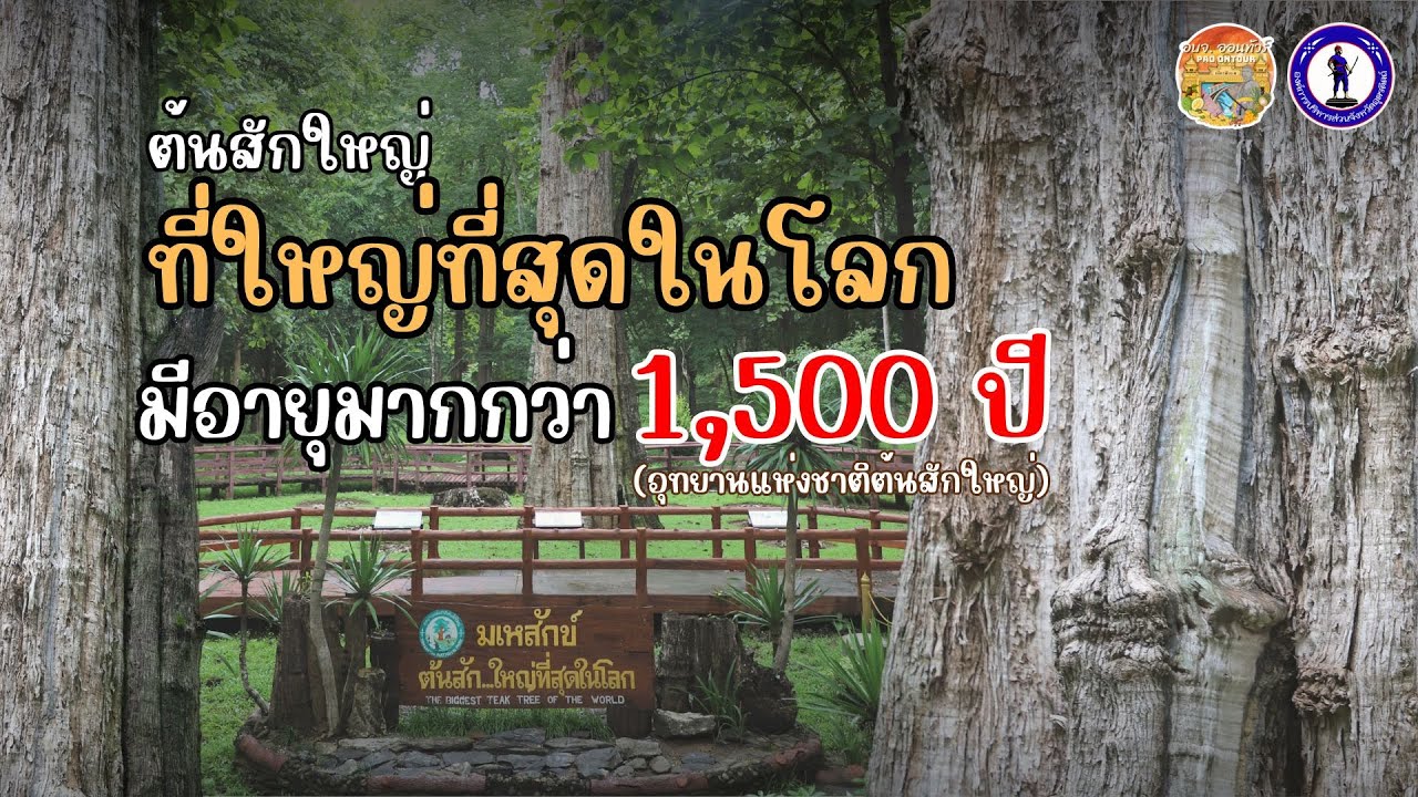
The Ancient Mahesak Teak Tree is the park's most celebrated natural feature. Estimated to be approximately 1,500 years old, the tree has an exceptionally large trunk and a commanding presence within the surrounding forest. Its great age reflects an extraordinary period of growth, and its preservation has required attention to its trunk, roots and environmental conditions.
According to official information published in 2024, Mahesak stands approximately 38.50 meters tall and has a trunk circumference of about 10.22 meters. These measurements describe the tree after damage sustained during an earlier storm. Although part of its crown broke off, the main trunk survived and has received continuing conservation care.
On April 18, 1977, a storm damaged the upper section of the giant teak. Historical records describe the tree as approximately 47.80 meters tall before the damage. Following the loss of part of its crown, management focused on maintaining the strength and condition of the remaining trunk and protecting the root area. Such changes are part of the natural life of an ancient tree exposed to centuries of wind, rain and other environmental forces.
The importance of Mahesak does not imply that an ancient tree remains unchanged. All living trees continue to grow, age and respond to their environments. Conservation therefore focuses on maintaining suitable conditions, preventing unnecessary disturbance to roots and the trunk, and monitoring the tree's condition so that it can survive for as long as possible.
Royal History Associated with Mahesak's Conservation is an important part of the site's significance. On January 14, 1998, Queen Sirikit, Queen Consort of King Bhumibol Adulyadej, visited the giant teak and expressed the wish that it be cared for and preserved for as long as possible. This royal initiative became an important foundation for the continuing conservation program.
Following the royal visit in 1998, a committee was appointed to oversee conservation of the ancient teak. Measures included monitoring the tree's condition, protecting the surrounding ground and reducing activities that might damage its roots. The continuation of these efforts makes Mahesak an important example of the long-term care of monumental trees in Thailand.
On September 29, 2009, Princess Maha Chakri Sirindhorn bestowed the name Mahesak upon the giant teak. The name means a great deity or powerful divine being. This royal name further strengthened the tree's significance as both a living ecological treasure and a cultural landmark recognized by the people of Thailand.
The name Mahesak has special meaning to local communities. A tree that was once simply part of the forest has become a symbol of endurance, continuity and conservation. Its identity also encourages visitors to understand that teak has value far beyond its commercial timber, as a living organism capable of connecting nature, history and human memory.
Teak in the Forestry History of Northern Thailand has played an important economic role for generations. Teak is a valuable hardwood used for building and many forms of woodworking. Historical timber concessions influenced the development and use of northern forests. The continued survival of Mahesak offers modern visitors a rare opportunity to see the scale that naturally growing teak can achieve over an exceptionally long lifetime.
Uttaradit has long been connected with trade and transportation in Thailand's lower northern region. Forest products were historically important to local economic activity. As conservation gained greater importance, attention shifted toward recognizing old-growth forests and ancient trees as ecological and natural heritage assets rather than merely sources of timber.
Botanical Characteristics of Teak include a relatively straight trunk, brownish bark and large leaves. Teak is a deciduous tree whose leaves may feel rough and can be considerably larger than those of many other species in mixed deciduous forests. During the dry season, teak sheds its leaves to reduce water loss. Fresh green foliage appears when rainfall returns.
Teak produces clusters of small flowers and fruits that contribute to natural regeneration. Its growth depends on sunlight, soil, moisture and sufficient space for its root system. The survival of an extremely old natural teak tree therefore reflects environmental conditions that have supported its life across many generations.
Natural teak grows as part of a mixed deciduous forest ecosystem, alongside many other tree species. The forest contains different canopy heights, shrubs and ground vegetation. Each layer contributes to shade, nutrient cycling and habitats for wildlife.
The Mahesak Viewing Walkway is a central feature of the visitor area. Pathways and protective barriers allow people to appreciate the giant trunk from appropriate distances without walking freely across its root zone. These measures reduce soil compaction around the tree and help protect its living root system.
Approaching Mahesak reveals a trunk far larger than those of many surrounding trees. Deep bark textures and the broad base emphasize its great age. Viewing the tree from different parts of the walkway provides an appreciation of its scale and helps explain the importance of carefully managed visitor access.
The tree stands in a natural forest environment with varied vegetation. In the morning, sunlight filters through the canopy, while the surrounding trees provide shade during brighter hours. The atmosphere is peaceful and suitable for observing the forest as well as the giant teak itself.
The Giant Teak Exhibition Area forms part of the park's educational attractions. Visitor facilities have included exhibits related to the tree, teak conservation and forestry history, as well as an exhibition structure inspired by the form of a large tree trunk. These displays help connect the living landmark with the broader story of Thailand's forests.
Interpretive exhibits add depth to a visit because they provide historical and ecological context. Visitors can learn about changing approaches to forest resources, the special conservation requirements of ancient trees and the place of Mahesak in Uttaradit's heritage. The site is particularly relevant to students, families and those interested in environmental history.
The Teak Forest Nature Study Trail has been described in earlier tourism information as a walking route of approximately 2 kilometers. It passes natural forest vegetation associated with teak and other tree species. The trail provides opportunities to examine leaves, bark, tree shapes and seasonal forest changes, subject to current authorization and access arrangements.
One interesting feature of the forest is the contrast between trees at different stages of growth. Smaller teak trees differ considerably in proportion and form from an ancient giant. Vegetation also varies between shaded locations and places receiving more sunlight. Such observations help explain forest regeneration and ecological change.
During the rainy season, teak forests are lush and the soil retains greater moisture. In the dry season, many trees shed their leaves and the forest floor becomes covered with leaf litter. These changes illustrate the seasonal adaptations of vegetation and the role of organic matter in maintaining soil fertility.
Geography of Ton Sak Yai National Park includes rugged mountain ranges and numerous valleys. Important mountains include Phu Miang, Khao Khwam Ruea, Khao Ngai Ruea, Khao Sam Liam, Khao Yuak, Khao Thanon, Khao Daet, Khao Mai Pha, Khao Tak Bon, Khao Nam Yoi, Khao Phak Khuang and Khao Chan. These mountains contribute to the park's varied elevations and the streams that connect with the Nan River.
Much of the terrain consists of steep forested slopes, rolling ridges and narrow valleys. Some locations contain prominent cliffs, while other areas have gentler hills. The range of topographic conditions creates varied habitats and means that individual attractions require different access routes and levels of preparation.
Phu Miang Mountain is one of the most important highland features within Ton Sak Yai National Park. Located in the eastern part of the protected landscape, it rises to approximately 1,500 meters above sea level. Its cliffs provide extensive views of forests and surrounding settlements under suitable conditions. The mountain is particularly interesting to experienced hikers and travelers seeking remote highland scenery.
Trekking to Phu Miang differs considerably from an easy walk around Mahesak. The route passes mountainous terrain and requires physical preparation, time and appropriate equipment. Weather at higher elevations can be markedly different from that in the valleys, particularly during mist, rain and strong winds.
Several viewpoints associated with the trekking route have been described by the names Pha Roeng Rom, Pha Daeng, Pha Chom Mok and Pha Wat Chai. Their cliffs and viewing directions offer varied mountain scenery. Such areas are part of guided forest trekking experiences that require appropriate safety arrangements and authorization.
The Sea of Mist at Phu Miang can form when cool, humid air produces cloud or fog in the valleys below. From an elevated ridgeline, visitors may see the mist spreading between the mountains. Its visibility depends on temperature, moisture and wind conditions, and it is not guaranteed on every visit.
Views from Phu Miang provide a broad perspective on the extensive forest landscape. Unlike close-range observations along a forest nature trail, mountain panoramas reveal the connections among ridges, valleys and watersheds. This makes the experience valuable for understanding the geography of the protected area.
The Phu Miang Trekking Route includes natural landmarks such as Noen Dong Kathue, Noen Hoen Weha and Noen Wihok Thalalom. These names are associated with hills and elevated sections of the trail. Some locations have been used for overnight stops during organized trekking activities, but camping in remote forest areas requires park permission and the use of designated locations.
Long-distance trekking requires preparation for food, drinking water, lighting, weather protection and communication. Remote sections may have no facilities comparable to those near the park headquarters. Participants must consider the physical demands of the route and follow the arrangements established by park rangers.
Khlong Tron Waterfall is particularly significant to the park's history because Khlong Tron was the protected area's original name and remains an important watershed stream. The waterfall system is associated with forested mountain streams and includes two notable waterfall locations along a natural walking route.
The first Khlong Tron waterfall has four tiers and a published height of approximately 20 meters. The second is approximately 1.5 kilometers farther along the stream and is about 30 meters high. Reaching these waterfalls requires forest trekking; they are not roadside attractions accessible directly by ordinary vehicles.
Waterfall conditions change according to rainfall in the upper watershed. Heavy rain can increase the strength and depth of the flow, while drier periods may reduce water levels. Slippery rocks and steep terrain create additional hazards, making ranger guidance and weather assessment important before entering the area.
Huai Khom Waterfall is another important stream attraction in Nam Phai Subdistrict, Nam Pat District. Published surveys describe three separate waterfall sections. The first is a single-tier fall approximately 15 meters high. The second, about 200 meters farther along, has two tiers and a height of approximately 15 meters. The third lies approximately 30 meters beyond the second and is a single-tier waterfall about 20 meters high.
The waterfall area is reached by walking approximately 5 kilometers from Ban Huai Khom because road access does not extend directly to the site. This remote setting helps preserve the surrounding natural forest. Visits therefore require suitable preparation and arrangements with knowledgeable, authorized personnel.
Huai Niam Waterfall is another important waterfall recognized during the surveys that led to the establishment of Khlong Tron National Park. It forms part of the mountain stream network and contributes to the scenic diversity of the protected landscape. Access requires consideration of trail conditions and seasonal water levels.
Kok Mon Kaeo Waterfall is also listed among the park's natural attractions. Located within the forest and stream environment, it contributes to the moist habitats supporting plants and animals. Protecting its surrounding watershed is essential to maintaining the freshwater ecosystem.
The park's waterfalls are significant for more than their visual beauty. They are components of the freshwater system carrying rainwater from mountain slopes into larger streams. Forest cover helps slow runoff and reduces the transport of sediment into waterways, benefiting both ecological habitats and communities downstream.
Tham Chan Cave is a natural cave described in surveys of the Khlong Tron forest area. It is of medium size, with a published passage depth of approximately 200 meters from the entrance and a width of about 15 meters. Its interior contains stalactites and stalagmites, and it provides habitat for bats. These characteristics give the cave geological and ecological significance.
Stalactites and stalagmites form as water deposits dissolved minerals over long periods. Their shapes vary according to water movement and the physical conditions inside the cave. Touching or damaging these formations can harm structures that took an extremely long time to develop.
Tham Chedi, Tham Suea Dao and Tham Pha Tang are other caves associated with Ton Sak Yai National Park. Their access conditions and internal terrain differ by location. Natural cave exploration requires attention to darkness, moisture, slippery rock surfaces and underground hazards and must follow park regulations.
Caves also provide habitats for specialized animals, including bats and small invertebrates adapted to low-light conditions. Unnecessary disturbance and excessive noise can interfere with their natural behavior. Responsible cave visits should therefore minimize disruption and protect fragile underground environments.
Forests of Ton Sak Yai National Park include mixed deciduous forest, dry dipterocarp forest, dry evergreen forest, hill evergreen forest and pine forest. These forest types occur according to terrain, moisture and elevation. Together, they support biodiversity and form important watershed environments for streams flowing into the Nan River.
Mixed Deciduous Forest is particularly important because teak grows naturally alongside many other tree species. This forest type changes noticeably with the seasons. Many trees shed their leaves during dry months, while the return of rain brings fresh foliage and greater humidity.
Bamboo and various hardwood species grow together in the mixed deciduous forests. Large trees create shade, while lower vegetation provides food and shelter for smaller wildlife. Fallen leaves and branches decompose into organic matter that contributes to soil fertility.
Dry Dipterocarp Forest occurs in relatively dry environments where plants are adapted to seasonal moisture shortages. The woodland is generally more open than evergreen forest, and some trees lose their leaves during the dry season. Leaf litter makes wildfire prevention especially important in these areas.
Dry Evergreen and Hill Evergreen Forests help maintain moisture and protect upland watersheds. Dry evergreen forests retain substantial green vegetation under suitable conditions, while hill evergreen forests occupy cooler and more humid mountain environments. Roots and understory vegetation slow runoff and help stabilize soil on steep slopes.
Pine Forest occurs in some higher mountain areas. Pine trees have foliage and growth forms distinct from broadleaf species found in mixed deciduous woodland. Their presence contributes to botanical diversity and the characteristic scenery of northern Thai highlands.
Wildlife in Ton Sak Yai National Park reflects the diversity of its forests and freshwater habitats. The Department of National Parks lists mammals such as serow, bears, barking deer, mouse deer, clouded leopards, fishing cats, civets, hares, wild boar, monkeys, slow lorises, mongooses, squirrels, tree shrews and porcupines, together with various birds and reptiles.
Some species depend on cliffs and high ridges, while others use dense forests or areas close to streams. The continuity of the protected forest allows animals to move between feeding areas and places of refuge. Conserving a broad landscape is therefore important to maintaining ecological balance.
Forest birds contribute to seed dispersal and the control of insect populations. Areas with varied tree heights provide habitats for different bird species. Quiet observation along authorized forest paths can offer opportunities to appreciate these ecological relationships without entering remote habitats.
The Khlong Tron Watershed is one of the park's principal environmental features. Numerous streams originate in eastern mountain areas and flow westward toward the Nan River system. Forest cover helps absorb rainfall, slow runoff and reduce erosion on mountain slopes.
Mountain streams support wildlife and communities at lower elevations. Heavy rainfall can cause water levels to rise rapidly and carry sediment through valleys. Healthy forests therefore contribute to reducing erosion and protecting water quality over the long term.
Watershed conservation includes not only the visible streams but also soils, vegetation and root networks across the mountains. When forest cover is lost, rainfall reaches exposed soil more directly and can increase erosion. Protecting vegetation is essential to the ecological condition of the wider Nan River watershed.
Communities Around Ton Sak Yai National Park are connected with forests and agriculture in Nam Pat District. Settlements and roads follow the valleys and areas where land can be used for everyday activities. Tourism offers opportunities to understand the relationship between local communities and the protected natural landscape.
Ban Pang Kluea is especially important to the history of Mahesak because the ancient teak stands in its surrounding area. The village's name is therefore closely associated with the story of the giant tree and the conservation heritage of Uttaradit.
Nam Pat District contains lowland settlements between mountains and forested hills. Roads connecting the villages pass farmland and natural areas. Traveling through the district reveals the characteristic environment of lower northern Thailand, where community life is closely connected with forests and water resources.
Mahesak's Role in Uttaradit Society extends beyond tourism. The tree symbolizes endurance, continuity and shared conservation values. It is one of the province's best-known natural landmarks and has served as a setting for local ceremonies and public activities.
On February 14, 2024, Uttaradit Province organized a marriage registration event at Ton Sak Yai National Park under the theme of the giant teak witnessing lasting love. Ten couples participated. The event connected the tree's extraordinary age with the symbolism of a long and enduring relationship.
Such events give the giant teak contemporary cultural significance. The living tree becomes part of people's personal memories as well as the collective heritage of the province. Its conservation therefore protects not only an ecological resource but also a place meaningful to the community.
Winter at Ton Sak Yai National Park brings cooler temperatures to the mountains and can provide comfortable conditions for walking through forested areas. Some deciduous trees begin to change color or shed their leaves. Higher areas around Phu Miang are cooler than the valleys, creating a different atmosphere for organized trekking and camping.
On some winter mornings, mist may gather in the valleys. As sunlight increases, cloud formations move or dissipate according to weather conditions. These natural scenes depend on humidity and temperature and are not identical every day.
Summer at Ton Sak Yai National Park brings more pronounced leaf loss in mixed deciduous and dry dipterocarp forests. Dry leaves accumulate on the ground and moisture decreases. Visitors should prepare for heat, while forest management places particular importance on wildfire prevention and protecting air quality.
The Rainy Season brings fresh green growth to the forests and increased water in streams. Rainfall supports vegetation and waterfalls, but trails can become slippery and mountain streams may rise suddenly. Access to remote waterfalls, caves and highlands must therefore follow ranger safety assessments.
Heavy rainfall is particularly hazardous near mountain streams because water can descend quickly from the upper watershed, even when rain is not falling at the visitor's location. Staying on authorized routes and respecting closures is essential.
Camping at Ton Sak Yai National Park is supported by facilities listed in the Department of National Parks' reservation system, including Ton Sak Yai Camping Ground near the main park headquarters. Camping allows visitors to spend more time in the natural environment, subject to current space availability and park regulations.
The park also lists Sak Yai 201, known as Pha Kluai Mai, as a visitor accommodation unit. Certain camping equipment, including tents, sleeping mats and pillows, appears among the services provided through the reservation system.
The Ton Khanun Ranger Station Service Zone is another managed area located approximately 45 kilometers from the park headquarters. The reservation system lists accommodation and camping facilities for this zone. It is separate from the main headquarters service area and provides access to another part of the wider park landscape.
The existence of different visitor zones illustrates the considerable size of Ton Sak Yai National Park. The protected area extends well beyond Mahesak and includes forests, mountains, caves, waterfalls and remote streams. Visitors should distinguish between the main park headquarters, the giant teak viewing area and other service zones when planning their journey.
Getting to Ton Sak Yai National Park from Uttaradit City generally involves traveling toward Nam Pat District on Highway 1045 and then connecting with Highway 1212 toward the park service area. Published travel information gives approximately 68 kilometers from Uttaradit city to Nam Pat District, followed by roughly 23 kilometers toward the Ban Ton Khanun area along the route used to approach the park.
Mahesak stands in Nam Khrai Subdistrict near Ban Pang Kluea. Its access route is connected with local roads through the surrounding communities and forests. It is important to distinguish the ancient tree viewing location from the park headquarters because these visitor destinations do not share exactly the same access point.
Traveling by Private Vehicle is practical for exploring the park and the surrounding Nam Pat area because attractions are distributed across rural roads and mountain landscapes. Some remote trails and trekking destinations require additional arrangements beyond normal road access.
Roads in the district pass hilly areas and settlements separated by considerable distances. Daytime travel provides better visibility of road conditions and signs. During the rainy season, drivers should remain cautious about slippery surfaces, runoff, erosion and sudden changes in mountain weather.
Nearby and Connected Attractions include natural and community destinations across Nam Pat and Tha Pla districts. Sirikit Dam, Lam Nam Nan National Park and Pak Pat Forest Park are among the destinations associated with the wider region. Each offers an environment and visitor experience different from the ancient teak and highland forests.
Sirikit Dam is an important attraction in Tha Pla District. It is known for its large reservoir, mountain scenery and role in water management and electricity production. Situated on the Nan River, it is connected with the wider river basin receiving water from the forests of Uttaradit. Combining the dam with Ton Sak Yai provides contrasting perspectives on watershed forests and large-scale water management.
Lam Nam Nan National Park is a separate protected area associated with the Nan River and the landscape around Sirikit Reservoir. Its mountain and water scenery differs from the natural teak forest and inland mountains of Ton Sak Yai. Exploring both areas reveals the diversity of the river basin.
Pak Pat Forest Park is another nature destination in Nam Pat District that can be considered within a wider regional itinerary. It has its own conservation setting and management arrangements, separate from the Mahesak visitor area.
Restaurants in Nam Pat District serve travelers passing through local communities on their way to the park. Dining options are concentrated around Saen To Subdistrict and nearby settlements, including local food shops, cafés and community markets. These places provide opportunities to experience everyday life in the district.
Nam Pat Municipal Food Market reflects the area's local commerce, with food and agricultural products sold in a community setting. A visit to the market offers another perspective on the relationship between farming and daily life outside the protected forest.
Accommodation in Nam Pat District includes small resorts and community lodging around Saen To, along with the designated camping and lodging services of Ton Sak Yai National Park. Staying in town provides convenient access to restaurants and local services, while staying within the park offers a more direct experience of the natural surroundings.
Overnight stays in remote areas require attention to weather, facility availability and park rules. Private resorts and national park accommodation operate under different management and reservation systems, making it important to distinguish between them.
Safety When Viewing Mahesak begins with protecting the tree and its root environment. Visitors must not climb the trunk, damage the bark, carve names into the wood or cross protective barriers. The designated walkway provides opportunities for photography and observation without disturbing the tree.
The soil surrounding an ancient tree is an important part of its living environment. Roots absorb water and minerals, while excessive trampling can compact the soil and reduce air movement. Remaining on designated paths therefore contributes to the long-term conservation of Mahesak.
Safety on Phu Miang and Remote Waterfall Trails requires additional preparation. Some routes are far from settlements and cross steep terrain. Visitors need appropriate clothing, drinking water, food and navigation arrangements, and must use authorized guides where required. Leaving the established routes can create serious risks of injury or becoming lost.
Exposed cliffs can be dangerous in strong winds or wet conditions. Visitors must keep a safe distance from unprotected edges. At waterfalls, slippery rocks and strong currents require caution, especially after heavy rainfall.
Wildfire Prevention is an important duty of park personnel, particularly where dry leaves accumulate in seasonal forests. Wildfires threaten trees, animals and air quality. Visitors must not light unauthorized fires or discard materials that could ignite dry vegetation.
Waste Management and Cleanliness help protect both forests and waterways. Rubbish left along trails or in streams can affect wildlife and downstream communities. Food waste may also attract animals and change their behavior. Keeping the natural environment clean reduces ecological damage and safety problems.
Environmental Education for Families is an important value of the Mahesak visitor area. The tree provides an excellent starting point for learning about plant growth, roots, seasonal leaf changes and the long life spans of certain species. Seeing a teak estimated to be 1,500 years old helps younger visitors understand natural time scales far beyond ordinary human experience.
The history of the tree also connects environmental education with the forestry heritage of Uttaradit and Thailand. Visitors can consider the difference between viewing teak solely as timber and recognizing an ancient living tree as part of a shared natural heritage.
Long-Term Conservation of Mahesak depends on consistent cooperation among rangers, specialists and local communities. The health of an ancient tree is influenced by its roots, trunk, branches, soil and surrounding environment. Monitoring its condition and managing visitor activity are therefore essential for preserving its life.
Protecting the giant teak is also an example of cooperation between public authorities and local communities. The tree has ecological, historical and emotional meaning. Its continued preservation benefits not only today's visitors but also future generations.
Ton Sak Yai National Park, Uttaradit Province, is distinguished by the ancient Mahesak teak, a living landmark estimated to be approximately 1,500 years old. Beyond this remarkable tree, the park protects the forests of Khlong Tron, Phu Miang Mountain, waterfalls, caves and extensive watershed landscapes. Its importance lies in the survival of an extraordinary tree, the history of long-term forest conservation and the environmental role of the mountains of the Nan River basin.
Experiencing Mahesak and learning about the surrounding forests creates a connection between the past and the present. From the time when teak was a major economic resource of northern Thailand to the present recognition of ancient trees as protected natural heritage, the park illustrates changing values in forest management. Conserving its trees, waterways and wildlife habitats helps preserve an important part of Thailand's natural heritage for generations to come.
| Place Name | Ton Sak Yai National Park, Uttaradit Province, Thailand |
| Former Name | Khlong Tron National Park |
| Park Headquarters Address | Moo 3, Nam Khrai Subdistrict, Nam Pat District, Uttaradit Province 53110, Thailand |
| Mahesak Teak Tree Location | Ban Pang Kluea, Moo 4, Nam Khrai Subdistrict, Nam Pat District, Uttaradit Province |
| Giant Teak Location Coordinates | 17.65688, 100.56821 |
| Geographical Coverage | Nam Pat, Tha Pla, Thong Saen Khan and Mueang Uttaradit Districts |
| Establishment Date | December 4, 2003 |
| Renaming Date | July 12, 2012, from Khlong Tron National Park to Ton Sak Yai National Park |
| National Park Number | 103rd National Park of Thailand |
| Area | Approximately 324,240.80 rai, or 518.80 square kilometers |
| Managing Authority | Department of National Parks, Wildlife and Plant Conservation; Protected Areas Regional Office 11, Phitsanulok |
| Park Contact Number | +66 89 958 6759 |
| Visitor Access | General visitor services operate according to park arrangements; remote trekking and nature areas require authorization |
| Giant Teak Admission | The government tourism directory lists free admission to the giant teak visitor attraction |
| Important Tree | Mahesak, an ancient teak estimated to be approximately 1,500 years old |
| Mahesak Tree Dimensions | Approximately 38.50 meters tall, with a trunk circumference of 10.22 meters, according to 2024 official information |
| Approximate Discovery Period | Around 1927 |
| Royal Naming Date | September 29, 2009 |
| Meaning of Mahesak | A Great Deity or Powerful Divine Being |
| Landscape | Forested Mountains, Watersheds, Waterfalls, Caves, Cliffs and Streams Connected to the Nan River System |
| Important Mountain | Phu Miang, approximately 1,500 meters above sea level |
| Forest Types | Mixed Deciduous, Dry Dipterocarp, Dry Evergreen, Hill Evergreen and Pine Forests |
| Main Visitor Areas and Service Zones | 1. National Park Headquarters – Visitor Facilities, Park Accommodation and Camping 2. Mahesak Giant Teak Area – Ancient Tree Viewing and Forest Walks 3. Giant Teak Exhibition Area – Forestry History and Conservation Learning 4. Ton Khanun Ranger Station – Approximately 45 km from Headquarters, with Accommodation and Camping 5. Phu Miang – Highland Trekking Area 6. Waterfall and Cave Areas – Access Subject to Park Permission |
| Important Waterfalls | Khlong Tron, Huai Khom, Huai Niam and Kok Mon Kaeo Waterfalls |
| Important Caves | Tham Chan, Tham Chedi, Tham Suea Dao and Tham Pha Tang |
| Phu Miang Viewpoints | Pha Roeng Rom, Pha Daeng, Pha Chom Mok and Pha Wat Chai |
| Park Accommodation | Sak Yai 201 (Pha Kluai Mai) and Ton Sak Yai Camping Ground, listed in the Department of National Parks' reservation system |
| Facilities | Park Headquarters, Giant Teak Viewing Walkway, Interpretive Displays, Accommodation, Camping Ground and Camping Equipment Services |
| Nearby and In-Park Attractions | 1. Mahesak Giant Teak – Within the Conservation Area 2. Teak Forest Nature Trail – Approximately 2 km Walking Route 3. Phu Miang – Highland Area Within the Park 4. Khlong Tron Waterfall – Within the Park 5. Huai Khom Waterfall – Approximately 5 km on Foot from Ban Huai Khom 6. Pak Pat Forest Park – Nam Pat District 7. Sirikit Dam – Tha Pla District 8. Lam Nam Nan National Park – Nan River Watershed |
| Restaurants and Cafés in Nam Pat District | 1. Aroi Na Nam Pat – Saen To Subdistrict, Tel. +66 96 696 1958 2. Saen To Café – Saen To Subdistrict, Tel. +66 93 157 1499 3. Headman Café – Saen To Subdistrict, Tel. +66 63 395 4993 4. Jungle Café, Nam Pat Branch – Saen To Subdistrict, Tel. +66 81 765 5868 5. Muen Muen Café – Den Lek Subdistrict, Tel. +66 92 346 5743 |
| Accommodation in Nam Pat District and the Park | 1. Sak Yai 201 (Pha Kluai Mai) – Park Visitor Area, Tel. +66 89 958 6759 2. Ton Sak Yai Camping Ground – Park Visitor Area, Tel. +66 89 958 6759 3. Takayai Resort – Saen To Subdistrict, Tel. +66 88 272 2303 4. Nam Pat Resort – Saen To Subdistrict 5. Ban Viwat Resort – Nam Pat–Fak Tha Road, Saen To Subdistrict 6. Wang Nam Yen Hill – Saen To Subdistrict 7. Iew Huai Mun Resort – Huai Mun Subdistrict |
| Getting There | Travel from Uttaradit City toward Nam Pat District on Highway 1045 and connect with Highway 1212 toward the park. Follow the appropriate local route for either the headquarters or Mahesak Giant Teak. |
| Park Reservation Website | https://booking.dnp.go.th/parksdetail.php?id=79 |
Frequently Asked Questions (FAQ)
Q: Where is Ton Sak Yai National Park located?
A: Ton Sak Yai National Park is in Uttaradit Province, covering parts of Nam Pat, Tha Pla, Thong Saen Khan and Mueang Uttaradit districts. The Mahesak Giant Teak stands near Ban Pang Kluea in Nam Khrai Subdistrict, Nam Pat District.
Q: How old is the Mahesak Giant Teak Tree?
A: Mahesak is estimated to be approximately 1,500 years old. Official information published in 2024 describes it as approximately 38.50 meters tall, with a trunk circumference of around 10.22 meters.
Q: What does Mahesak mean, and who bestowed the name?
A: Mahesak means a great deity or powerful divine being. The name was bestowed by Princess Maha Chakri Sirindhorn on September 29, 2009.
Q: What was the former name of Ton Sak Yai National Park?
A: The park was originally known as Khlong Tron National Park. It was established on December 4, 2003, and renamed Ton Sak Yai National Park on July 12, 2012.
Q: What are the main attractions within Ton Sak Yai National Park?
A: Major attractions include the Mahesak Giant Teak, the teak forest nature trail, Phu Miang Mountain, Khlong Tron Waterfall, Huai Khom Waterfall, Huai Niam Waterfall, Kok Mon Kaeo Waterfall, Tham Chan Cave, Tham Chedi Cave, Tham Suea Dao Cave and Tham Pha Tang Cave.
Q: Can visitors camp at Ton Sak Yai National Park?
A: The park provides Ton Sak Yai Camping Ground and accommodation near the main service area. Additional camping and accommodation are listed at the Ton Khanun Ranger Station, approximately 45 kilometers from the headquarters. Stays depend on current availability and park regulations.
Q: How high is Phu Miang, and what activities are available?
A: Phu Miang rises approximately 1,500 meters above sea level. The highland area is associated with forest trekking, cliff viewpoints and opportunities to see mist over the valleys. Access requires authorized routes and appropriate safety arrangements.
Q: Is there an entrance fee for Ton Sak Yai National Park?
A: The government tourism directory lists the giant teak attraction as free to visit. Entry to other protected areas, accommodation and special activities is subject to the Department of National Parks' applicable regulations and charges.
 Category: ●Nature and Wildlife
 Group: ●National Parks and Marine Reserves
Last Update : 2 WeekAgo
 Last Update : 2 WeekAgo
 Click to Access the Navigation Map GPS
Ton Sak Yai National Park Map
Recommend

 Art, Culture and Heritage
 Historical Sites and Monuments(2)
 Landmarks and Memorials(8)
 Art, Craft Centres, Tradition(3)
 Museums(1)
 Historic Homes and Cities(1)
 Places of Worship
 Temple(42)
 Other Sacred Sites(6)
 Suburban Living
 Village, Community(4)
National Parks and Marine Reserves(5)
 Mountain (Doi)(3)
 Dam, Reservoir, Lake(3)
 Waterfalls(11)
 Caves(3)
 River, Canal(3)
 Other natural attractions(3)
 Entertainment and Agricultural
 Farms, Parks and Ecotourism(1)
 Travel Articles, Recipes
 Travel Review, Food Review(1)


