
lovethailand home >Northeastern Travel Attractions >Mukdahan Travel Attractions > 30 Best Places to Visit in Mukdahan
TL;DR: 30 Best Places to Visit in Mukdahan. Mukdahan is a border province along the Mekong River that brings together natural landscapes, history, religion, ethnic cultures.
30 Best Places to Visit in Mukdahan
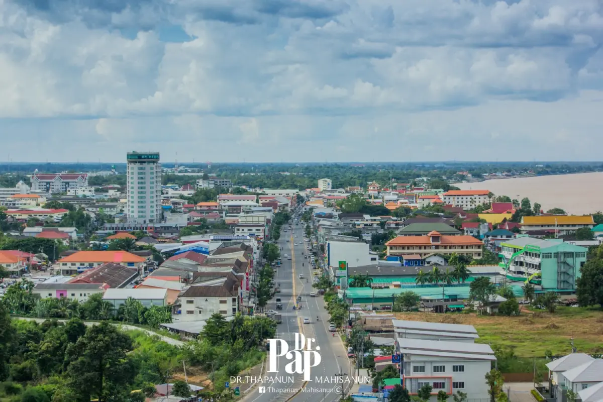
30 Best Places to Visit in Mukdahan Mukdahan is a border province along the Mekong River that brings together natural landscapes, history, religion, ethnic cultures, cross-border trade, and the mountainous terrain of the Phu Phan Range within a single destination. The province lies opposite Savannakhet Province in the Lao People’s Democratic Republic and plays an important role as a gateway linking Thailand with Laos and Vietnam through the East-West Economic Corridor. This strategic location gives Mukdahan a distinctive atmosphere compared with many other provinces in Northeastern Thailand, particularly in its commerce, food, languages, ways of life, and cultural diversity.
The Mekong River is central to Mukdahan’s landscape and history. Many important settlements and communities developed along the river, which has long served as a transportation route, food source, trading area, and connection between communities on both banks. Before bridges were built across the Mekong, travel between Mukdahan and Savannakhet relied mainly on boats and river piers. That long relationship can still be seen today through the province’s markets, communities, temples, shrines, cuisine, and riverside ways of life.
The history of Mukdahan dates back to the late Ayutthaya period, when Chao Kinnari led people across the Mekong River to establish a settlement near the mouth of Huai Muk. The community later developed into the city of Mukdahan and was formally established during the reign of King Taksin the Great. Following administrative reforms during the reign of King Rama V, Mukdahan became part of Nakhon Phanom before eventually being separated and officially established as Mukdahan Province in 1982. Traveling through the province therefore reveals both the legacy of an old border town and the growth of a modern economic center shaped by its geographical position.
One of Mukdahan’s most important characteristics is the diversity of ethnic communities and Mekong River cultures. The province is home to Isan Thai, Tai Yo, Phu Thai, Kaso, Kaleng, Kha, and communities of Vietnamese and Chinese descent who settled here during different periods. This diversity is expressed through language, clothing, food, merit-making traditions, folk music, weaving, and ritual practices, and forms the foundation of the provincial identity often described through the phrase “eight Thai ethnic cultures.”
Mukdahan’s natural attractions extend well beyond views of the Mekong River. The province also contains sandstone mountains, dry dipterocarp forest, mixed deciduous forest, rock plateaus, cliffs, caves, waterfalls, and headwater forests along the Phu Phan Range. Phu Pha Thoep National Park is famous for unusually shaped rock formations and broad sandstone plateaus. Phu Sa Dok Bua National Park features rocky landscapes, natural pools on mountain summits, prehistoric rock paintings, and dwarf dry dipterocarp forest, while Phu Mu Forest Park offers mountain views, reservoir scenery, and forest landscapes around Nikhom Kham Soi.
Travelers who want to experience Mekong riverside life should focus on Mueang Mukdahan and Wan Yai districts. Mukdahan Indochina Market is a good starting point for understanding the province’s role in cross-border trade before continuing to riverside shrines and old temples. From there, visitors can drive north toward Wan Yai to visit Wat Song Khon, Kaeng Kabao, Wat Mano Phirom, and several other attractions connected with communities along the Mekong River.
For nature-focused travelers, the Nikhom Kham Soi–Don Tan–Dong Luang–Kham Cha-i route is suitable for a multi-day trip because it includes reservoirs, mountains, waterfalls, protected forests, and national parks. During the rainy season, visitors should always check trail conditions and announcements from the relevant authorities before traveling because some waterfalls, forest trails, and conservation areas may be seasonally closed or temporarily restricted for safety and ecological recovery.
Mukdahan cuisine clearly reflects the province’s border identity. In addition to classic Isan dishes such as som tam, larb, nam tok, gaeng om, and sticky rice, visitors will find food influenced by Vietnamese communities, including khao piak sen, Vietnamese-style noodle soup, moo yor, and Vietnamese breakfast dishes. Mekong River fish are also important local ingredients, including pla chok, sheatfish, and other freshwater species prepared in spicy soups, sour soups, fried dishes, or traditional local recipes.
Planning a Mukdahan trip is easier when the province is divided into zones. The Mueang Mukdahan and Mekong Riverside Zone is suitable for Mukdahan Indochina Market, Ho Kaeo Mukdahan, the Second Thai–Lao Friendship Bridge, Chao Mae Song Nang Phi Nong Shrine, and the Night Market. The Wan Yai Zone includes Kaeng Kabao, Wat Song Khon, Wat Mano Phirom, and Wat Phra Si Maha Pho. The Nikhom Kham Soi Zone features Phu Mu Forest Park, Huai Khilek Reservoir, and Wat Phu Dan Tae. The Don Tan Zone includes Phu Sa Dok Bua National Park, the Mahorathuek Drum, and natural learning sites, while the Kham Cha-i–Dong Luang–Nong Sung Zone is well suited to mountain, waterfall, forest, and community-based travel.
Travelers with only 1 day can focus on Mukdahan city and the Mekong riverside, beginning with Mukdahan Indochina Market, Ho Kaeo Mukdahan, and Chao Mae Song Nang Phi Nong Shrine before ending the day by the river. With 2–3 days, add Kaeng Kabao, Wat Song Khon, Phu Pha Thoep National Park, and Nikhom Kham Soi. A 4–5 day itinerary allows time for Phu Sa Dok Bua National Park, Dong Luang, Kham Cha-i, Nong Sung, and community-based routes, giving travelers a much more complete view of Mukdahan through its border city, religion, nature, history, and local ways of life.
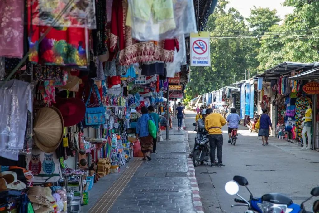
1. Mukdahan Indochina Market is located on Samran Chai Khong Road in Si Bun Rueang Subdistrict, Mueang Mukdahan District. It is one of the province’s most recognizable landmarks and one of the clearest places to experience Mukdahan’s identity as a border-trading city. The market stands close to the Mekong River and the old town, allowing visitors to combine shopping, temple visits, shrine visits, and a riverside walk within the same area.
Highlight: Cross-border trade, products from Thailand, Laos, Vietnam, and China, woven textiles, souvenirs, local food, underground market areas, Samran Chai Khong Road, and the atmosphere of a border city connected with Kaysone Phomvihane in Laos.
The history of the market is closely tied to commerce across the Mekong River. Before the Second Thai–Lao Friendship Bridge was built, many people and goods traveled between Mukdahan and Savannakhet by boat. Areas near the river pier therefore became gathering points for goods and trade among communities from both sides of the river. The market gradually expanded as Mukdahan developed into a major center of cross-border commerce.
Products range from clothing, local textiles, mudmee fabrics, bags, household goods, dried foods, and souvenirs to a variety of imported items. Visitors should check product quality, place of manufacture, labels, expiration dates, and warranty conditions before purchasing, particularly for processed foods, electrical products, and goods without Thai-language labeling.
In recent years, parts of the market have been renovated and reorganized, with some vendors moving into buildings and underground areas. Visitors who have not been here for several years may therefore find the current market different from older photographs and reviews. It is worth exploring the lower shopping areas rather than judging the market only by the shops visible along the street above.
Mukdahan Indochina Market is suitable for travelers of all ages, especially those interested in border trade, souvenirs, food, and Mekong culture. It can easily be combined with Wat Yot Kaeo Si Wichai, Chao Mae Song Nang Phi Nong Shrine, the Night Market, and other riverside attractions in the city.
Getting There: Located on Samran Chai Khong Road, Si Bun Rueang Subdistrict, Mueang Mukdahan District, Mukdahan Province 49000, in front of Wat Si Mongkhon Tai. Open daily from 08.00–17.00. Individual shops may open and close at different times, with approximately 09.00–15.00 generally being the best period for shopping.
Map (GPS): https://www.google.com/maps/dir/?api=1&destination=16.540753,104.732169&travelmode=driving
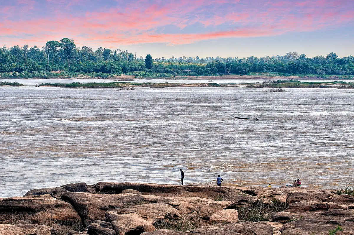
2. Kaeng Kabao is located at Ban Na Kae Noi, Pong Kham Subdistrict, Wan Yai District. It is one of Mukdahan’s best-known Mekong riverside attractions, distinguished by exposed rock formations and broad stone surfaces that become particularly visible during the dry season when water levels fall and reveal rapids, sandbars, and rocky islands in the river.
Highlight: Mekong River rock formations, the large white Phaya Si Phuchong Mukda Nakarat Naga sculpture, the 12-zodiac plaza, an eight-ethnic-group cultural area, views toward Xaybouly on the Lao side, and Kaeng Kabao’s famous roasted suckling pig.
Kaeng Kabao is one of the best places to observe the seasonal transformation of the Mekong River. During periods of high water, many rocks disappear beneath the river surface, but when the dry season arrives and water levels recede, stone terraces, sandbanks, and rocky islands become clearly visible, dramatically changing the landscape.
The area has been developed as a public recreation space with riverside walkways, activity areas, photography points, and a large Naga sculpture that has become one of Kaeng Kabao’s best-known landmarks. The design combines the natural Mekong setting with beliefs surrounding the Naga and the cultural diversity of Mukdahan’s ethnic communities.
Food is another important part of a visit. Roasted suckling pig has long been associated with Kaeng Kabao, while restaurants around the attraction also serve Isan dishes, Mekong River fish, and local specialties. A practical itinerary is to arrive around midday, have lunch, and then spend the afternoon exploring the riverfront.
Morning and late afternoon provide the most comfortable temperatures and the best light for photography. Visitors should take care on wet rocks and should not enter areas with strong currents or sections not designated for walking.
Getting There: Located at Ban Na Kae Noi, Pong Kham Subdistrict, Wan Yai District, Mukdahan Province, approximately 35 kilometers from Mukdahan city. The public riverside area is accessible daily throughout the day, with 06.00–18.00 recommended for sightseeing.
Map (GPS): https://www.google.com/maps/dir/?api=1&destination=16.805075,104.732897&travelmode=driving

3. Ho Kaeo Mukdahan Chaloem Phra Kiat Kanchanaphisek is located in Si Bun Rueang Subdistrict, Mueang Mukdahan District. It is one of the province’s major landmarks and an elevated viewpoint from which visitors can see the urban structure of Mukdahan, the Mekong River, and areas across the river in Savannakhet.
Highlight: A 65.50-meter observation tower, panoramic city views, exhibitions about the province and its ethnic cultures, Phra Phuttha Nawaming Mongkhon Mukdahan, and the Mukdahan crystal displayed in the upper section of the tower.
The tower was built to honor King Rama IX on the occasion of the 50th anniversary of his accession to the throne. Its tall cylindrical form was designed to serve several purposes at once, functioning as an observation tower, museum, and learning space about the history and cultures of Mukdahan.
Inside are displays about the province and the lifestyles of its different ethnic communities. These exhibitions can help first-time visitors understand Mukdahan before traveling to individual districts and communities, making the tower a useful early stop in a provincial itinerary.
From the upper observation area, visitors can see the city, major roads, communities along the Mekong River, and parts of Laos when visibility is good. The elevated perspective also makes it easier to understand how Mukdahan developed along the river and how the cross-border bridge connects urban areas on both sides.
The attraction is suitable for families, children, students, older travelers, and photographers looking for an elevated view of Mukdahan. It can be combined with Mukdahan Indochina Market, Chao Mae Song Nang Phi Nong Shrine, and other riverside attractions in the city.
Getting There: Located in Si Bun Rueang Subdistrict, Mueang Mukdahan District, along the Mukdahan–Don Tan route approximately 2 kilometers from the city center. Open daily from 08.00–18.00.
Map (GPS): https://www.google.com/maps/dir/?api=1&destination=16.526141,104.732625&travelmode=driving
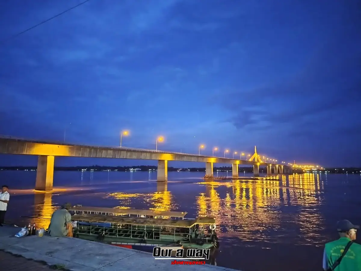
4. Second Thai–Lao Friendship Bridge connects Mukdahan Province in Thailand with Savannakhet Province in the Lao People’s Democratic Republic. It is major infrastructure for trade, tourism, transportation, and international relations and is one of the strongest symbols of Mukdahan’s role as a “Gateway to Indochina.”
Highlight: A Mekong River crossing linking Mukdahan and Savannakhet, an important section of the East-West Economic Corridor, international border travel, and views of the Mekong River and the Thai–Lao border landscape.
The bridge links Ban Song Pueai in Bang Sai Yai Subdistrict, Mueang Mukdahan District, on the Thai side with Ban Na Kae in Kaysone Phomvihane City, Savannakhet Province, on the Lao side. Its opening transformed cross-border movement by shifting much passenger and freight transport from river boats to a faster road connection capable of handling significantly larger volumes of traffic.
The bridge is important not only to Thailand and Laos. It forms part of the East-West Economic Corridor, connecting transport routes from Vietnam through Laos into Thailand and onward toward Myanmar. This has strengthened Mukdahan’s role in logistics, trade, and international tourism.
For travelers, the bridge is both a landmark and a starting point for crossing into Savannakhet. Anyone planning international travel should check passport requirements, vehicle documents, visa or immigration conditions, and the current operating hours of the border checkpoint before departure.
Visitors who are not crossing the border can still view the area from the Thai side and learn about Mukdahan’s role in the regional Mekong transport network. However, visitors should remain within permitted areas and should not stop vehicles or walk in restricted traffic-control sections of the bridge.
Getting There: The Thai side is located at Ban Song Pueai, Bang Sai Yai Subdistrict, Mueang Mukdahan District, connecting with Ban Na Kae, Kaysone Phomvihane City, Savannakhet Province, Laos. The international checkpoint operates daily from 06.00–22.00.
Map (GPS): https://www.google.com/maps/dir/?api=1&destination=16.600456,104.740077&travelmode=driving
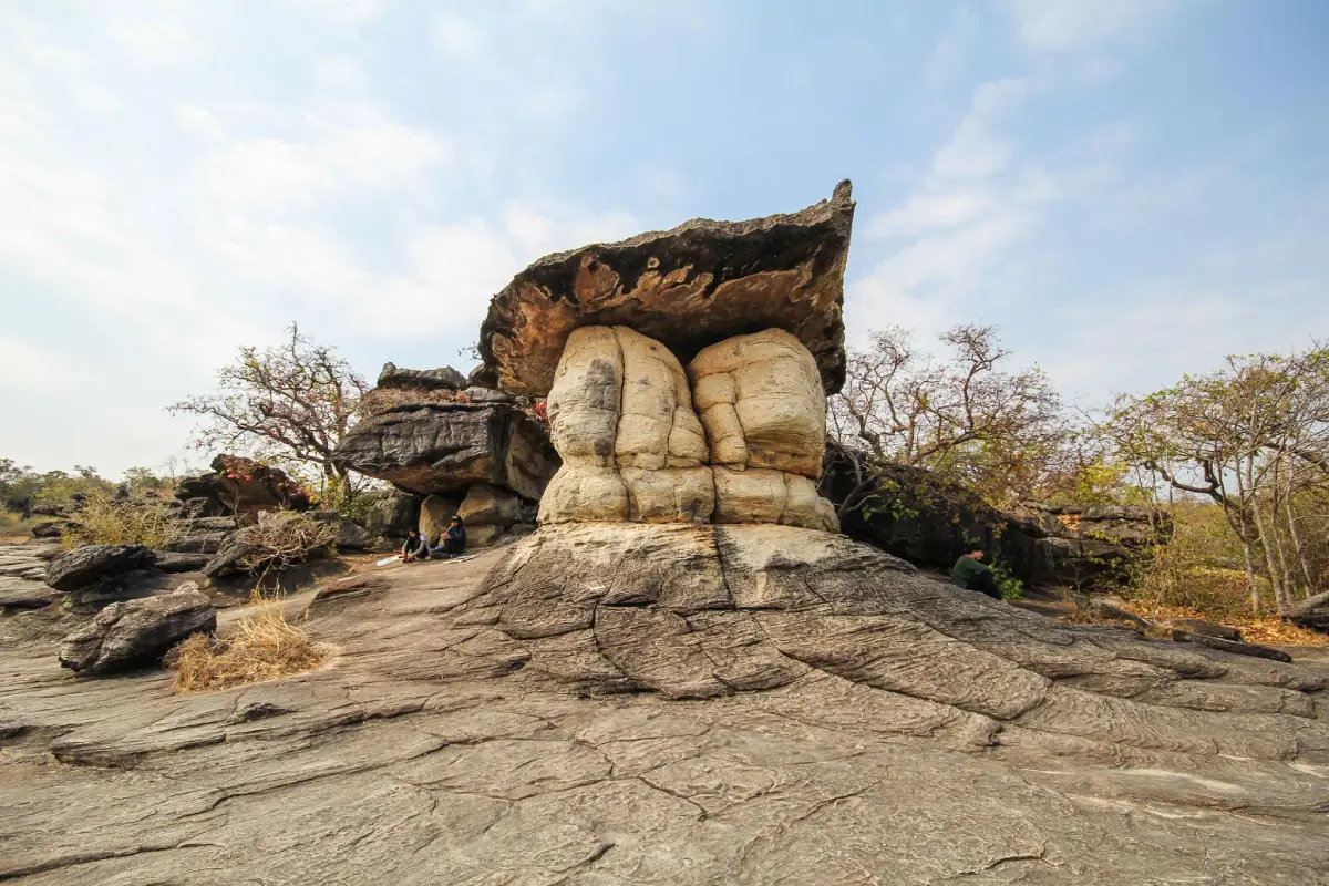
5. Phu Pha Thoep National Park is one of Mukdahan Province’s best-known national parks, covering areas of Mueang Mukdahan and Don Tan districts. Its main attractions are sandstone mountains, massive naturally eroded rock formations, broad rock plateaus, forest, seasonal plants, and nature trails located relatively close to the city.
Highlight: Unusually shaped Thoep rock formations, Lan Muchalin, Phu Tham Phra, seasonal wildflower fields, cliffs, nature trails, and sandstone landscapes associated with the Phu Phan Range.
The park was originally known as Mukdahan National Park and was officially declared a national park in 1988. Its name was later changed to Phu Pha Thoep National Park to reflect the distinctive Thoep rock formations that have become the best-known natural feature of the area.
Most of the landscape consists of connected sandstone mountains. Differences in the hardness of individual rock layers combined with long-term weathering and erosion have created enormous rock masses stacked in forms that resemble mushrooms, shelters, or imagined structures. Several of these formations can be reached along trails not far from the park headquarters.
During certain times of the year, small wildflowers emerge from cracks and moist areas across the rock plateaus, bringing additional color to the otherwise rugged sandstone landscape. Visitors should remain on designated routes, avoid stepping on plants growing on the rock surface, and not climb formations where signs prohibit access or where there is a risk of falling.
The park is suitable for families, students, photographers, geology enthusiasts, and travelers who want a nature walk without traveling far from Mukdahan city. Some trails, waterfalls, caves, and natural areas may have seasonal restrictions depending on rainfall, weather conditions, and safety measures, so current park announcements should be checked before visiting.
Getting There: Located across areas of Na Si Nuan Subdistrict, Mueang Mukdahan District, and adjoining areas of Don Tan District. The park is open daily, with the visitor-service area and principal attractions generally accessible from around 07.30–17.30. Some natural trails and attractions may be seasonally restricted.
Map (GPS): https://www.google.com/maps/dir/?api=1&destination=16.434703,104.805554&travelmode=driving
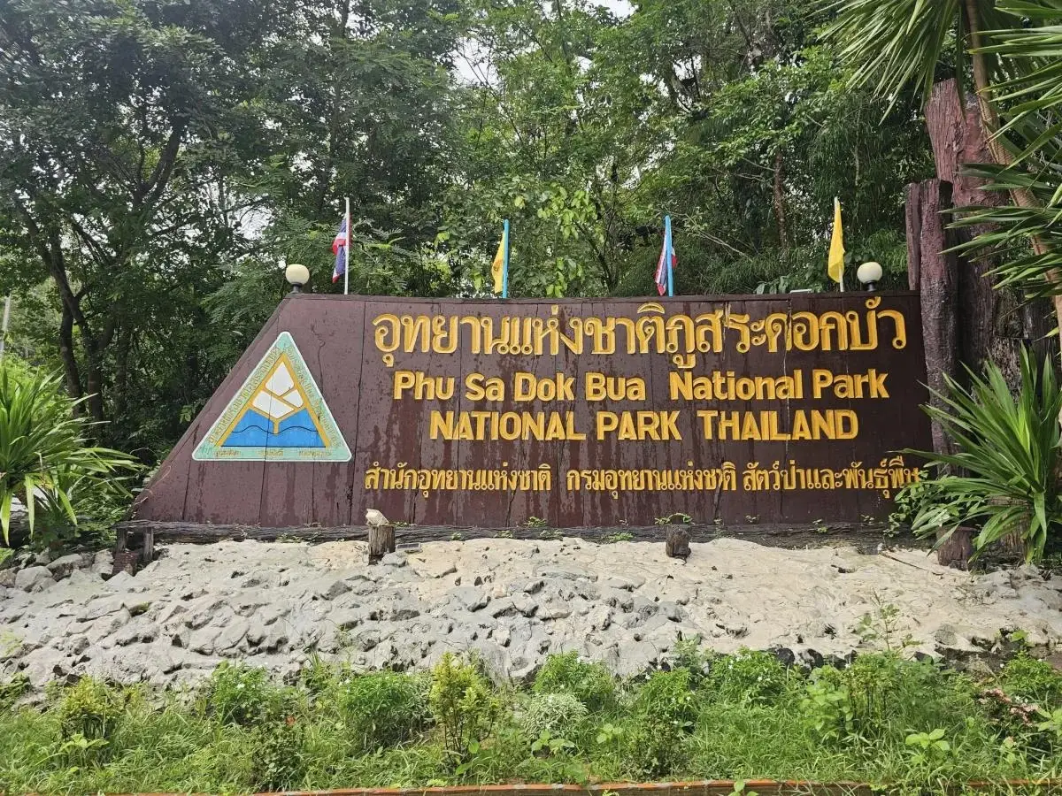
6. Phu Sa Dok Bua National Park is a large conservation area spanning the borders of Mukdahan, Yasothon, and Amnat Charoen provinces. The Mukdahan section covers parts of Nikhom Kham Soi and Don Tan districts. The park is distinguished by sandstone mountains, rock plateaus, dry dipterocarp forest, prehistoric rock paintings, and natural pools on mountain summits where lotus plants grow.
Highlight: Phu Sa Dok Bua, prehistoric paintings at Phu Pha Taem, Phu Wat, Phu Pha Hom, Phu Mu, rock plateaus, dwarf dry dipterocarp forest, and sunset viewpoints.
The name Phu Sa Dok Bua comes from natural rock basins on elevated terrain that retain water and support lotus growth. This creates a landscape quite different from typical sandstone mountains. During the rainy season and other moist periods, the pools and vegetation across the rock plateaus give the area a greener and more colorful appearance.
Phu Pha Taem is especially important archaeologically because prehistoric paintings and human handprints have been found there. These traces provide evidence that people used and inhabited areas of the Phu Phan landscape long before the emergence of historically documented communities.
Attractions within the park are widely dispersed, so visitors should plan routes in advance. Some trails require coordination with park staff, particularly longer hikes, overnight stays, or entry into areas where heavy rain and flash flooding can create safety risks.
The park is suitable for nature lovers, hikers, geology enthusiasts, history enthusiasts, and travelers seeking quiet areas away from the city. Carry sufficient drinking water, wear shoes with good grip, use sun protection, and check the weather forecast before entering the area.
Getting There: The national park covers border areas of Mukdahan, Yasothon, and Amnat Charoen provinces, with major Mukdahan access points in Nikhom Kham Soi and Don Tan districts. The park is open daily, with the visitor center generally open from around 08.30–16.30. Some routes may be temporarily closed according to season and weather conditions.
Map (GPS): https://www.google.com/maps/dir/?api=1&destination=16.126537,104.747420&travelmode=driving
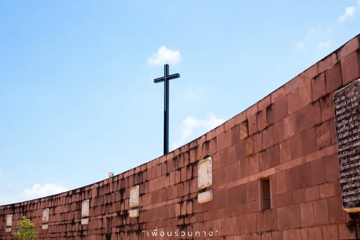
7. Wat Song Khon is located at Ban Song Khon, Pong Kham Subdistrict, Wan Yai District. It is an important Roman Catholic religious site associated with the Blessed Martyrs of Thailand, who died for their faith during a period of religious and political conflict in 1940.
Highlight: The Shrine of Our Lady of the Martyrs of Thailand, the story of the 7 Blessed Martyrs, peaceful modern architecture, a Mekong riverside setting, and the history of Christianity in Northeastern Thailand.
Wat Song Khon differs from most religious sites in Mukdahan because it is a center of Catholic faith in the Mekong region. The story of the 7 martyrs reflects a period when religious belief and international political tensions deeply affected the lives of people in this border community.
The shrine complex was designed to create a calm atmosphere suitable for remembrance and prayer. Its contemporary architecture differs from conventional European church design, giving the site a distinctive religious and architectural identity.
A meaningful visit should include time to learn about the history of the martyrs and the social circumstances surrounding the events, rather than focusing only on photography. Visitors who are not Catholic are welcome, but should remain quiet, dress respectfully, and avoid disturbing religious services.
Wat Song Khon lies on the same route as Kaeng Kabao and other attractions in Wan Yai District, making it easy to create a 1-day religion–culture–Mekong itinerary.
Getting There: Located at Ban Song Khon, Pong Kham Subdistrict, Wan Yai District, Mukdahan Province. The shrine grounds are open daily from approximately 06.00–17.00. Access to particular buildings and activities should follow current service schedules or local instructions.
Map (GPS): https://www.google.com/maps/dir/?api=1&destination=16.775006,104.738212&travelmode=driving
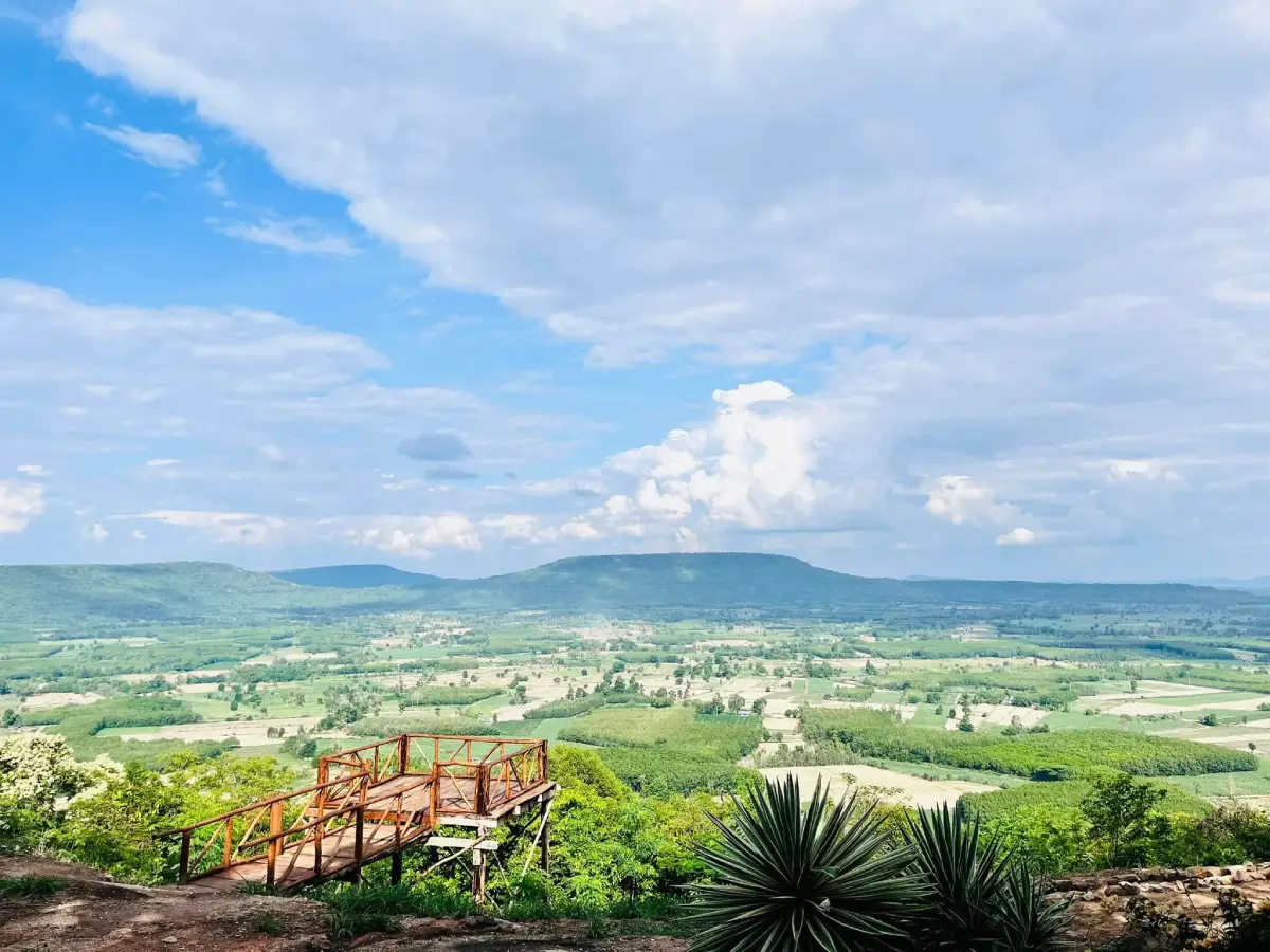
8. Phu Mu Forest Park is located around Ban Dan Mon, Nikhom Kham Soi Subdistrict, Nikhom Kham Soi District. The area is now managed in connection with Phu Sa Dok Bua National Park and is a destination for travelers interested in forest, mountains, viewpoints, and a quieter atmosphere than Mukdahan’s main urban attractions.
Highlight: Viewpoints in several directions, Pha Rabiang Tawan, the Pha Phop Rak–Pha Song Tawan trail, reservoir views, Phu Phan forest landscapes, sunrise and sunset scenery, and historical traces associated with a former communications station.
Phu Mu consists of sandstone mountains and natural forest. From higher areas, visitors can see surrounding mountains and plains in several directions. During suitable seasons and weather conditions, light mist may form above lower terrain or reservoirs in the morning.
The area also has historical connections with the Indochina War period and the use of elevated terrain for communications. Phu Mu therefore offers more than scenery; it also reveals the strategic importance that mountains could have in a border province.
Some access roads and nature trails require extra caution, especially after rain. Visitors should use a suitable vehicle, wear appropriate footwear, check road conditions before ascending, and leave the mountain within the times set by the authorities.
Phu Mu Forest Park is suitable for photographers, hikers, couples, groups of friends, and travelers who enjoy quiet mountain landscapes. It can be combined with Huai Khilek Reservoir and Wat Phu Dan Tae in Nikhom Kham Soi District.
Getting There: Located around Ban Dan Mon, Nikhom Kham Soi Subdistrict, Nikhom Kham Soi District, Mukdahan Province. The area is open on days without temporary trail closures or ecological-restoration restrictions, generally from 06.00–18.00. Day visitors should descend before access closes.
Map (GPS): https://www.google.com/maps/dir/?api=1&destination=16.319953,104.554785&travelmode=driving
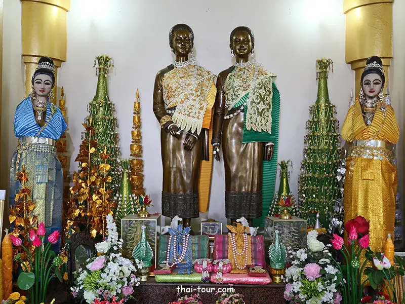
9. Chao Mae Song Nang Phi Nong Shrine is located along Samran Chai Khong Road in Mukdahan Municipality. This sacred shrine has long-standing connections with the history of the city, local beliefs, and ways of life along the Mekong River.
Highlight: Images of the 2 revered female spirits, a riverside shrine, architecture combining Thai and Chinese elements, traditional offerings, and beliefs associated with protection of the city and people traveling by river.
Mukdahan developed as a city where people of several ethnic backgrounds and belief systems came to trade and settle. Chao Mae Song Nang Phi Nong Shrine reflects this cultural mixture through its architecture, colors, offerings, and worship practices.
Many local residents and business owners visit the shrine to pray for good fortune, safety, and success. These beliefs are closely linked with the city’s past, when people frequently relied on the Mekong River for travel and the movement of goods.
The shrine is close to Mukdahan Indochina Market and other important riverside sites, making it easy to include in a walking route. Visitors can pay respect at the shrine and then continue to the market and riverfront without repeatedly moving their vehicle.
Visitors should dress respectfully, remain quiet, avoid obstructing worshippers, and follow the shrine’s rules regarding incense and offerings for safety.
Getting There: Located on southern Samran Chai Khong Road beside the Mekong River in Mukdahan Municipality, Mueang Mukdahan District. It is easily reached from Mukdahan Indochina Market and the old town area.
Map (GPS): https://www.google.com/maps/dir/?api=1&destination=16.544151,104.731441&travelmode=driving
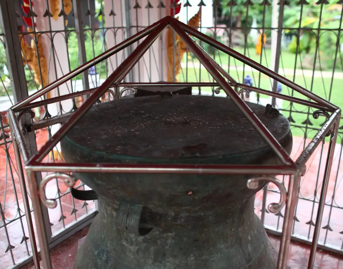
10. Mahorathuek Drum is an important bronze archaeological artifact of Mukdahan Province. It is currently preserved at Wat Matchimawat, also known locally as Wat Klang, in Don Tan Subdistrict, Don Tan District. The large drum bears decorative motifs connected with the sun, rainfall, fertility, and ritual beliefs of ancient communities.
Highlight: A single-headed bronze drum, a drum face approximately 86 centimeters in diameter, a 14-pointed sun motif, 4 frog figures around the rim, and major archaeological significance connecting Mukdahan with the broader bronze-drum cultures of Southeast Asia.
The drum was discovered in 1938 along the Mekong riverbank on the Lao side opposite Don Tan. It was later brought into the care of the local community and eventually preserved at Wat Matchimawat. Its discovery has made the drum an artifact connecting the historical memory of communities on both sides of the Mekong River.
The sun motif in the center and the frog figures around the rim are especially significant. The sun is associated with light, seasons, and agricultural timekeeping, while frogs are linked with rainfall, water, and fertility. These symbols indicate that the object was not simply a musical instrument but was also connected with ritual and belief.
Bronze drums of this type have been found across many parts of Southeast Asia and are associated with the wider Dong Son cultural tradition. Casting such a large object required advanced knowledge of metallurgy, access to raw materials, and substantial labor, making the drum evidence of both technological skill and social organization in ancient times.
Wat Matchimawat also contains an old sim ordination hall and other historic structures, allowing visitors to learn about both the artifact and the development of the Don Tan community in one place. It is particularly suitable for students, archaeologists, historians, and visitors interested in Mekong cultural history.
Getting There: The Mahorathuek Drum is preserved at Wat Matchimawat, or Wat Klang, Don Tan Subdistrict, Don Tan District, Mukdahan Province. Open daily from 08.00–17.00.
Map (GPS): https://www.google.com/maps/dir/?api=1&destination=16.315330,104.926930&travelmode=driving

11. Ban Phu Cultural Tourism Community is located in Villages No. 1 and No. 2 of Ban Pao Subdistrict, Nong Sung District. This Phu Thai community is particularly notable for preserving its language, traditional clothing, weaving, food, rituals, and agricultural way of life while developing community-based tourism. A visit therefore offers more than sightseeing, allowing travelers to learn directly through interaction and participation with local residents.
Highlight: Phu Thai culture, Bai Si Su Kwan welcoming ceremonies, traditional Pha Laeng meals, Phu Thai dance, handwoven textiles, natural dyeing, homestays, community learning centers, Wat Si Nantharam, and a village landscape surrounded by farmland and mountains.
The community’s correct name is “Ban Phu,” even though it is located in Ban Pao Subdistrict. The village was originally known as “Ban Lup Phu,” a name referring to a low-lying hollow surrounded by mountains. Residents later moved their settlement to higher ground, and the name gradually evolved into Ban Phu. This history reflects the close relationship between geography and the way earlier communities selected places to establish permanent settlements.
The ancestors of the Phu Thai people of Ban Phu have a migration history connected with Phu Thai communities on the eastern side of the Mekong River before eventually settling in the Nong Sung area. These movements created shared memories of former homelands, temple building, agricultural land management, and the preservation of language and traditions within families.
The main appeal of Ban Phu is its participatory tourism. Visitors can join a traditional Phu Thai welcome ceremony, enjoy a Pha Laeng dinner, watch traditional dance and music, try weaving, learn natural-dye techniques, or walk and cycle through the village, farmland, and important local temples.
Women in the community play an important role in preserving local knowledge through weaving, food preparation, performances, homestay management, and visitor hospitality. Tourism therefore helps generate household income while also supporting the transmission of cultural skills to younger generations.
The community is suitable for families, students, cultural travelers, textile enthusiasts, food travelers, and anyone interested in community-based tourism. Because most activities are not continuously available for walk-in visitors, advance arrangements are recommended, especially for Pha Laeng dinners, performances, weaving activities, and homestays.
Getting There: Located at Ban Phu, Villages No. 1 and No. 2, Ban Pao Subdistrict, Nong Sung District, Mukdahan Province. Visitors are welcomed daily by advance arrangement. Daytime community activities are generally organized between 08.00–17.00, while homestay check-in and check-out times depend on arrangements confirmed with the community.
Map (GPS): https://www.google.com/maps/dir/?api=1&destination=16.444932,104.334150&travelmode=driving
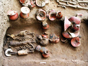
12. Hoi Samai Hin is located around Khok Hin Daeng at Ban Na Yo, Lao Mi Subdistrict, Don Tan District. This open-air geological learning site contains numerous ancient shell remains embedded in soil and rock layers, revealing another side of Mukdahan beyond the Mekong River and mountain scenery. The site preserves natural evidence of environmental changes that took place over a very long period of time.
Highlight: Ancient shell remains in limestone, natural sediment layers, an outdoor geology-learning site, rural landscapes of Lao Mi Subdistrict, and an opportunity to study the relationship between fossils and past environments.
The shells found here are commonly described by local residents as resembling conch shells and occur together within limestone layers. Their presence gives the area educational value because they help demonstrate that land now used for farming has passed through environmental conditions very different from those seen today.
Visiting Hoi Samai Hin is best suited to travelers who enjoy careful observation rather than large-scale recreational activities. Spending time learning about the rock layers, shell characteristics, and fossilization process will provide a much better understanding of the site than simply stopping for photographs.
Ban Na Yo is a quiet rural community surrounded by farmland and the landscapes of Don Tan District. Traveling here therefore reveals a more peaceful side of Mukdahan away from the busy riverside commercial districts. It can be combined with the Mahorathuek Drum and Phu Sa Dok Bua National Park on a Don Tan itinerary.
Visitors should not dig, chip, damage, or remove shells or pieces of rock from the site. These remains have the greatest scientific and educational value when preserved in their original geological context, allowing local communities, students, and future visitors to continue learning from them.
Getting There: Located around Khok Hin Daeng, Ban Na Yo, Lao Mi Subdistrict, Don Tan District, Mukdahan Province. Open daily from 08.00–17.00.
Map (GPS): https://www.google.com/maps/dir/?api=1&destination=16.371901,104.817538&travelmode=driving
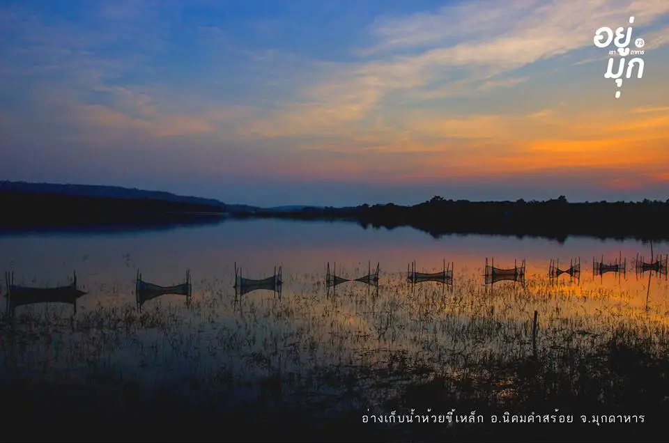
13. Huai Khi Lek Irrigation Reservoir is located at Ban Dan Yao, Na Kok Subdistrict, Nikhom Kham Soi District. This medium-sized reservoir serves both irrigation and community recreation, with a broad water surface surrounded by mountains, agricultural land, and the rural scenery of Mukdahan.
Highlight: A broad reservoir, mountain views, sunrise and sunset scenery, lakeside recreation areas, local fishing and agriculture, and convenient access from Highway 212.
The reservoir has a normal storage capacity of approximately 26.75 million cubic meters and a maximum storage capacity of around 30 million cubic meters. It provides water for agriculture, domestic use, and seasonal water management, making it both important infrastructure and a significant part of the landscape of Nikhom Kham Soi.
Morning and late afternoon are the most pleasant times for walking, enjoying the breeze, and taking photographs. Cooler temperatures and reflections on the water make the surrounding mountain ridges more visible, while the exposed lakeside areas can become quite hot during the middle of the day.
The reservoir is a convenient rest stop on the Mukdahan–Nikhom Kham Soi–Amnat Charoen route. Visitors do not need to spend an entire day here and can easily combine the reservoir with Phu Mu Forest Park and Wat Phu Dan Tae.
Visitors should take care along sloping banks, avoid swimming in unsupervised areas, and never leave food waste or rubbish in the water because the reservoir is an important working water source for surrounding communities.
Getting There: Located at Ban Dan Yao, Village No. 8, Na Kok Subdistrict, Nikhom Kham Soi District, approximately 23 kilometers from Mukdahan city. Open daily from 06.00–18.30.
Map (GPS): https://www.google.com/maps/dir/?api=1&destination=16.353943,104.564071&travelmode=driving
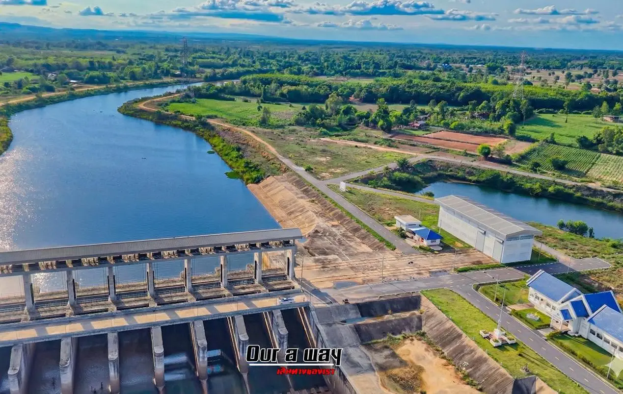
14. Huai Bang Sai is an important natural stream originating in the Phu Phan Range and flowing through several communities in Dong Luang District before continuing toward lower areas of the province. One of the main local recreation points is Tha Kaeng Duea near Ban Phon Hai, where residents use the stream and rocky rapids for seasonal leisure activities.
Highlight: A natural stream, rocky rapids, community recreation areas, freshwater ecosystems, traditional fishing, agricultural landscapes, and the rural atmosphere of Dong Luang District.
Huai Bang Sai is much more than a swimming spot. The stream is closely connected with agriculture, fishing, water storage, and the ecosystems of the Phu Phan area. Several communities developed along the watercourse and continue to depend on it as an important local resource.
When water levels are suitable, rocky sections and exposed stone surfaces along the stream become popular recreation areas for local residents. Travelers can sit beside the water, enjoy the breeze, and experience a natural environment that has not been heavily developed for commercial tourism.
The appearance of the stream changes significantly with the seasons. During the dry season, some sections become shallow and easier to explore, while in the rainy season water levels can rise rapidly because of runoff from upstream mountain areas. Visitors should therefore assess actual water conditions before entering the stream.
The area is suitable for families, groups of friends, photographers, and travelers who enjoy simple community-based nature trips. Visitors should not enter the water during heavy rain, when the water is muddy, when currents are strong, or when local authorities issue warnings.
Getting There: The main local recreation point is around Tha Kaeng Duea near Ban Phon Hai in the Huai Bang Sai watershed, Dong Luang District. The public riverside area is accessible daily and does not operate with formal opening gates, but visiting between 06.00–18.00 is recommended. Check current water levels before traveling.
Map (GPS): https://www.google.com/maps/dir/?api=1&destination=16.725403,104.228342&travelmode=driving
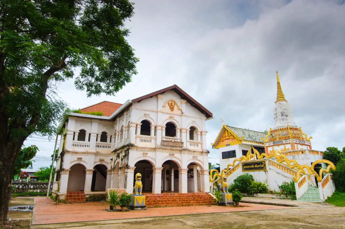
15. Wat Phra Si Maha Pho is located at Ban Wan Yai, Wan Yai Subdistrict, Wan Yai District. This historic temple beside the Mekong River is significant for Buddhism, local history, architecture, and Isan folk art, particularly its old sim ordination hall built by Vietnamese craftsmen and the traditional hoop taem murals preserved inside.
Highlight: An old sim built in 1916, hoop taem murals depicting the Vessantara Jataka, a principal Buddha image in the Maravijaya posture, a painting of Prince Damrong Rajanubhab, and a 2-story building that once served as the Wan Yai administrative office.
The old sim is the architectural heart of the temple. Its design reflects the work of Vietnamese craftsmen who played an important role in architecture across several Mekong River towns from the late 19th to early 20th centuries. The combination of local forms and Vietnamese craftsmanship gives the building a distinctive identity.
The interior hoop taem murals illustrate the Vessantara Jataka and scenes of local life. Other paintings are associated with the provincial inspection journeys of Prince Damrong Rajanubhab, giving the murals value both as folk art and as historical evidence.
A 2-story building within the temple compound was formerly connected with the local administration of Wan Yai, demonstrating that the temple historically served functions extending beyond religious ceremonies alone.
The temple’s position near the Mekong River also reveals the close relationship between temples, settlements, river transport, and commerce in old riverside communities. It can be combined with Wat Mano Phirom, Wat Latthikawan, Wat Song Khon, and Kaeng Kabao on the same route.
Getting There: Located at Ban Wan Yai, Wan Yai Subdistrict, Wan Yai District, Mukdahan Province. From Mukdahan city, follow the Mekong riverside route north for approximately 33 kilometers. Open daily from 08.30–16.30.
Map (GPS): https://www.google.com/maps/dir/?api=1&destination=16.713982,104.754627&travelmode=driving
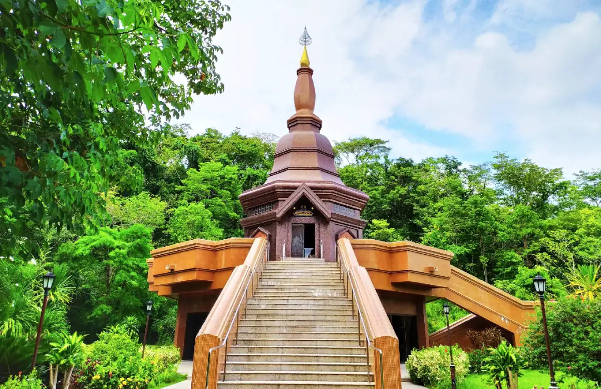
16. Wat Phu Chok Ko (Wat Banphot Kiri) is located on Phu Chok Ko at Ban Waeng, Nong Sung Tai Subdistrict, Nong Sung District. This forest temple is important to the history of the meditation tradition associated with Luang Pu Mun Bhuridatta and was the residence and practice site of Luang Pu La Khemmapatto, a highly respected meditation master of Northeastern Thailand.
Highlight: Khemmapatta Chedi, the Luang Pu La Museum, relics and monastic belongings, a statue of Luang Pu La, approximately 260 steps leading up the mountain, natural forest, and a secluded atmosphere on elevated terrain.
The temple’s official name is Wat Banphot Kiri, but local residents commonly call it Wat Phu Chok Ko after the mountain on which it stands. Both “banphot” and “kiri” carry meanings related to mountains, reflecting the temple’s setting among forest, rocks, and elevated terrain.
The temple is closely associated with Luang Pu La Khemmapatto, who used the site for meditation practice. After his passing, Khemmapatta Chedi was built to enshrine his relics, while a museum was established to preserve his biography, monastic belongings, and objects connected with his life as a monk.
Visitors can reach the principal area by climbing approximately 260 steps, although a less steep alternative route is also available. Older visitors or those with knee problems should assess their physical condition and choose the most appropriate route.
The mountain setting gives the temple a peaceful environment well suited to meditation and quiet reflection. Visitors should keep noise to a minimum, behave respectfully, and remember that the site remains an active place of religious practice rather than merely a photography destination.
Getting There: Located on Phu Chok Ko at Ban Waeng, Village No. 3, Nong Sung Tai Subdistrict, Nong Sung District, Mukdahan Province. Open daily from 08.00–17.00. No admission fee.
Map (GPS): https://www.google.com/maps/dir/?api=1&destination=16.372741,104.375717&travelmode=driving
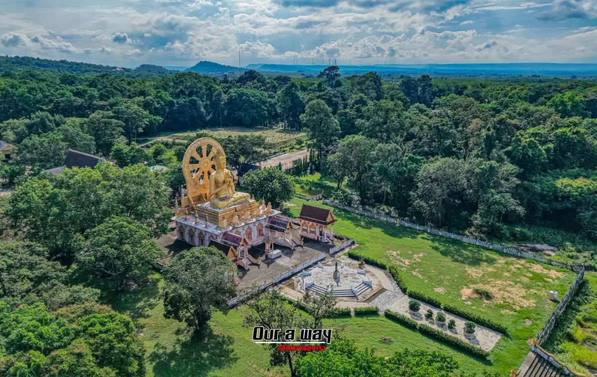
17. Wat Phuttho Thammatharo, also known locally as Wat Phu Dan Tae, is located at Ban Chai Mongkhon, Chok Chai Subdistrict, Nikhom Kham Soi District. The temple is easily recognized by “Luang Pho Thammachak,” a large Buddha image in the First Sermon posture positioned above the ordination hall, together with a Dharma Wheel and sculptures representing the 5 ascetics.
Highlight: Luang Pho Thammachak, a large Buddha image depicting the First Sermon, the Dharma Wheel behind the image, the 5 ascetic disciples, natural rock terraces, a hillside setting, and convenient access from Highway 212.
The arrangement of the Buddha image, Dharma Wheel, and disciples represents the Buddha’s First Sermon, when he taught the Dhammacakkappavattana Sutta to the group of 5 ascetics. The large-scale Buddhist artwork therefore serves not only as a striking visual landmark but also as a symbolic presentation of a major event in Buddhist history.
The temple stands on land characterized by natural rock surfaces and hills, creating a landscape quite different from temples in densely settled communities. Its open setting allows the Buddha image to be seen from a considerable distance and makes the temple a convenient stop along the Mukdahan–Nikhom Kham Soi route.
The temple is known by several spellings and names, including Wat Phu Dan Tae and Wat Phuttho Thammatharo, but these refer to the same religious site. Travelers using navigation systems should confirm the location at Ban Chai Mongkhon in Chok Chai Subdistrict to avoid confusion.
The temple is suitable for Buddhist pilgrims, families, older travelers, and visitors interested in Buddhist art. It can be combined with Huai Khi Lek Irrigation Reservoir and Phu Mu Forest Park within the same day.
Getting There: Located at 133, Village No. 1, Ban Chai Mongkhon, Chok Chai Subdistrict, Nikhom Kham Soi District, Mukdahan Province, close to Highway 212. Open daily from 06.00–20.00.
Map (GPS): https://www.google.com/maps/dir/?api=1&destination=16.337255,104.518284&travelmode=driving
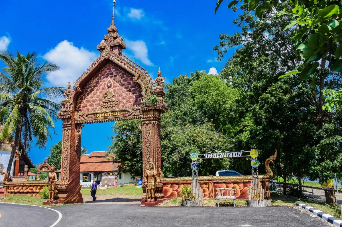
18. Wat Manophirom is located at Ban Chanot, Chanot Subdistrict, Wan Yai District. This ancient temple beside the Mekong River is distinguished by Lan Xang art and craftsmanship associated with artisans from Vientiane. It contains several important Buddha images and an old viharn that reflects the artistic and cultural connections between communities on both sides of the Mekong.
Highlight: An ancient Lan Xang-style viharn, Phra Ong Tue, Phra Ong Saen, a standing Buddha in the Calming the Ocean posture, a Naga-protected principal Buddha image, an ivory-carved Buddha image, and views of the riverside community at Ban Chanot.
The viharn contains architectural features including its base, stucco door surrounds, carved wooden pediments, and roof details that reflect Mekong-region craftsmanship. These elements make the temple important evidence of the movement of artisans, artistic styles, and religious beliefs between cities along the Mekong River.
The temple’s Buddha images vary in style and material, demonstrating the accumulation of religious devotion over several periods. Phra Ong Tue, Phra Ong Saen, and the ivory Buddha are particularly significant for both their artistic value and their role in local belief.
The temple’s location near the Mekong River also shows how religious sites historically developed alongside transport routes. Communities relied on the river for travel, trade, fishing, and communication with settlements across the river in Laos.
Travelers interested in old temples and Lan Xang art should include Wat Manophirom in a Wan Yai itinerary together with Wat Phra Si Maha Pho, Wat Latthikawan, Wat Song Khon, and Kaeng Kabao to gain a broader understanding of the cultural development of Mekong riverside communities.
Getting There: Located at Ban Chanot, Chanot Subdistrict, Wan Yai District, approximately 17 kilometers from Mukdahan city. Open daily from 08.30–16.30. No admission fee.
Map (GPS): https://www.google.com/maps/dir/?api=1&destination=16.682392,104.752199&travelmode=driving
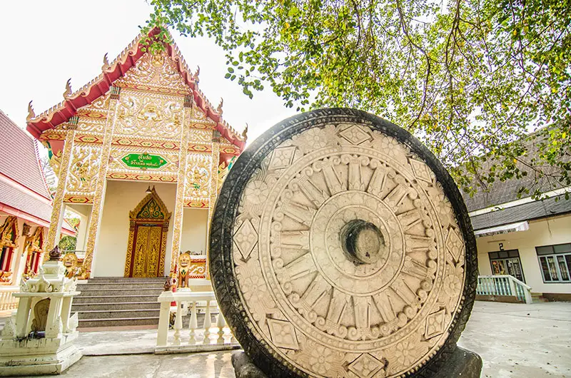
19. Wat Si Bun Rueang (Ban Tai) is located on southern Samran Chai Khong Road in Si Bun Rueang Community, Mueang Mukdahan District. This historic temple is closely connected with the founding history of Mukdahan and enshrines Phra Phuttha Sing Song, an important bronze Buddha image in the Lan Xang artistic tradition that local residents revere as one of the city’s sacred images.
Highlight: Phra Phuttha Sing Song, Lan Xang art, the old ordination hall, the history of Chao Kinnari as founder of Mukdahan, the Songkran Buddha-bathing tradition, and a location within the old Mekong riverside quarter.
The temple is associated with Chao Kinnari, the first governor of Mukdahan, and the establishment of the early riverside settlement. Local tradition connects Phra Phuttha Sing Song with the movement of sacred Buddha images from the upper Mekong region into Mukdahan. The image was once enshrined at Wat Si Mongkhon Tai before being transferred to Wat Si Bun Rueang.
Phra Phuttha Sing Song is a bronze Buddha image influenced by Lan Xang and northern Thai Buddhist art. Its calm and solid appearance reflects artistic networks that spread through the Mekong region via monks, craftsmen, rulers, and communities.
During the Songkran festival, the community traditionally brings the Buddha image out for local residents to perform ritual bathing. This practice connects an ancient sacred image with contemporary community life and ensures that the temple continues to serve as a spiritual center of Mukdahan city.
Because the temple is close to Mukdahan Indochina Market, Wat Yot Kaeo Si Wichai, Chao Mae Song Nang Phi Nong Shrine, and the riverside old town, it fits naturally into a walking itinerary and reduces the need to move a vehicle repeatedly between attractions.
Getting There: Located on southern Samran Chai Khong Road, Si Bun Rueang Community, Si Bun Rueang Subdistrict, Mueang Mukdahan District. Open daily from 08.00–16.30. The ordination hall may occasionally close during monastic activities or religious ceremonies.
Map (GPS): https://www.google.com/maps/dir/?api=1&destination=16.535580,104.732954&travelmode=driving
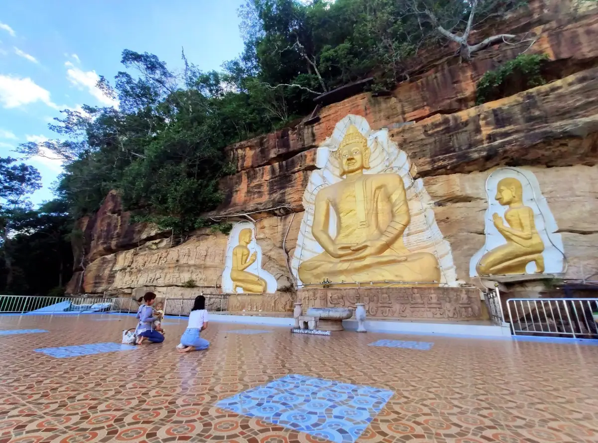
20. Wat Tham Phu Pha Khao (Wat Tham Som) is located on an east-facing cliff of Phu Khao Khiao in Ban Pao Subdistrict, Nong Sung District. This forest temple and meditation site is distinguished by a large Buddha image carved directly into the cliff face, accompanied by broad views over Ban Pao community, agricultural land, and the mountain landscape of Nong Sung.
Highlight: A large golden Buddha carved into the cliff, 4 accompanying Buddha images, structures built directly against the rock face, stairways ascending the mountain, viewpoints, natural forest, and the peaceful atmosphere of a forest temple.
The name “Wat Tham Som” is the traditional name used by Phu Thai residents in the area, while Wat Tham Phu Pha Khao is more commonly used in tourism information. Both names refer to the same religious site and reflect the local language as well as the cave-and-cliff geography of the mountain.
The principal Buddha image is carved into the natural cliff wall and finished in gold, with 4 smaller Buddha images positioned symmetrically nearby. The rock face itself therefore functions almost like the monumental wall of an open-air viharn, creating a striking combination of Buddhist devotion and natural landscape.
The concept behind creating a Buddha image directly on the cliff was partly inspired by the destruction of the Bamiyan Buddhas in Afghanistan in 2001. The idea of a monumental mountain-carved Buddha was then adapted to the landscape and religious faith of Ban Pao community.
The temple faces east, making the morning particularly suitable for viewing the Buddha image and surrounding scenery. Early sunlight illuminates the gold surface of the sculpture, while the plains, villages, farmland, and mountain ridges below can be seen clearly from the elevated area.
Visitors should wear footwear suitable for stairs and sloping terrain, remain quiet, and respect meditation areas. The temple can be combined with Ban Phu Cultural Tourism Community and Wat Phu Chok Ko on a Nong Sung itinerary.
Getting There: Located on Phu Khao Khiao in Ban Pao Subdistrict, Nong Sung District, Mukdahan Province. Open daily from 08.00–17.00.
Map (GPS): https://www.google.com/maps/dir/?api=1&destination=16.422414,104.324257&travelmode=driving
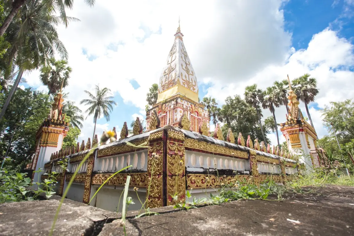
21. Wat Latthikawan is located at Ban Chanot, Village No. 2, Chanot Subdistrict, Wan Yai District. This historic temple in a Mekong riverside community is particularly notable for its traditional Isan sim ordination hall, hoop taem murals, and religious landscape influenced by Mekong and Vientiane cultural traditions. It lies close to Wat Manophirom, making both temples easy to visit on the same day.
Highlight: An old open-style sim, a stucco principal Buddha image in the Maravijaya posture, statues of the 5 ascetics, hoop taem murals depicting Traiphum cosmology and the Ten Jatakas, green-glass bottle balustrades, a pavilion containing a replica Buddha footprint, a reclining Buddha, Phra Tham Chedi, and the atmosphere of an old forest temple in Ban Chanot.
Wat Latthikawan was established on July 15, 1915 by Phra Nandawaro, also known as Phra Achan Bu, who had previously been involved in the restoration of Wat Manophirom. He later developed the forest area known as Non Rang into a new temple. Remains of bricks, damaged Buddha images, and traces of earlier structures had already been found in the area, indicating that Buddhist religious activity may have existed here before the present temple was established.
The name “Latthikawan” refers to a grove of young palmyra palms. Phra Nandawaro planted many palm trees around the temple, creating a distinctive landscape that led local residents to call it “Wat Pa Tan,” or Palm Forest Temple. The combination of palms, forest, and religious architecture gives the temple a very different atmosphere from urban temples.
The old sim is relatively small, but its artistic details are highly significant. The hoop taem murals illustrate Traiphum cosmology, the Ten Jatakas, and Buddhist concepts, while the unusual use of green glass bottles as part of the balustrade demonstrates the creative adaptation of everyday materials in local craftsmanship.
Wat Latthikawan is suitable for visitors interested in Isan sim architecture, folk murals, community history, Mekong-region art, and architectural photography. It can be combined with Wat Manophirom, Wat Phra Si Maha Pho, Wat Song Khon, and Kaeng Kabao on a Wan Yai itinerary.
Getting There: Located at Ban Chanot, Village No. 2, Chanot Subdistrict, Wan Yai District, Mukdahan Province, approximately 18 kilometers from Mukdahan city. Open daily from 08.00–17.00. No admission fee.
Map (GPS): https://www.google.com/maps/dir/?api=1&destination=16.686303,104.750096&travelmode=driving
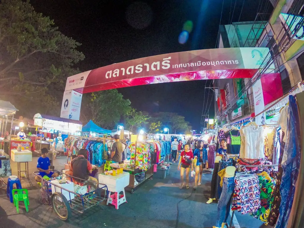
22. Mukdahan Night Market is located on Song Nang Sathit Road in front of Mukdahan Provincial Hall near the city pillar area. This evening market is one of the best places to experience the everyday food culture and shopping habits of local residents after sunset without leaving the city center.
Highlight: Isan food, Vietnamese-influenced dishes, ready-to-eat meals, snacks, fruit, local desserts, take-home dishes for local residents, and a lively evening atmosphere from around 17.00–20.00.
The market was not created specifically for tourists. It is a genuine daily marketplace used by Mukdahan residents. After work, people come here to buy dinner, meet family members, or stop for food, giving visitors a direct view of local eating habits and everyday urban life.
Vendors begin setting up in the late afternoon and the market becomes busiest in the early evening. Food includes som tam, larb, grilled chicken, grilled pork, fried dishes, fish, sticky rice, sweets, fruit, and foods influenced by Mukdahan’s Vietnamese communities.
The market is a convenient way to end a day of sightseeing in Mukdahan city after visiting Ho Kaeo Mukdahan, Mukdahan Indochina Market, historic temples, and riverside shrines. Carrying some cash is useful because smaller vendors may not support every electronic payment method.
Approximately 17.00–19.30 is usually the best period to visit because most stalls are open and the widest variety of food remains available. Popular vendors may begin selling out or packing up before the official market closing time.
Getting There: Located on Song Nang Sathit Road in front of Mukdahan Provincial Hall near the city pillar area, Mukdahan Subdistrict, Mueang Mukdahan District. Open daily from 16.00–21.00, although individual vendors may operate on different schedules.
Map (GPS): https://www.google.com/maps/dir/?api=1&destination=16.543155,104.727053&travelmode=driving
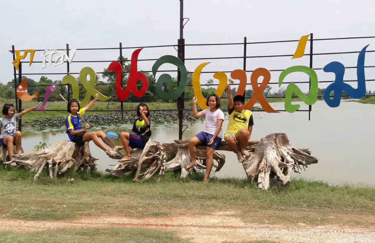
23. Ban Non Lom is located at Village No. 3, Pho Sai Subdistrict, Don Tan District. This Phu Thai community beside the Mekong River has developed community-based tourism through homestays and local activities. It is best suited to travelers who want to spend meaningful time in the community rather than simply stopping for photographs, because the main experience comes from local culture, food, crafts, and the relationship between the community and the Mekong River.
Highlight: Phu Thai community homestays, Bai Si Su Kwan welcoming ceremonies, Lam Phaya performances, weaving, basketry, traditional food, Mekong River boat trips, and worship of Phra Mutcharin, an important old Buddha image revered by local residents.
Ban Non Lom has a settlement history connected with Phu Thai people who migrated from areas on the eastern side of the Mekong River before choosing land with suitable water resources and farmland as their permanent home. Local life therefore developed through rice farming, fishing, livestock raising, use of riverside resources, and exchange with nearby communities.
A homestay allows visitors to experience the community at times of day that ordinary day trips cannot capture. Travelers can share meals with host families, take part in Phu Thai welcoming traditions, listen to local language and stories, and learn handicrafts directly from community members.
Boat trips provide another perspective on the Mekong landscape and local fishing culture, but availability depends on river levels, weather conditions, and arrangements made by the community. Visitors should therefore not arrive expecting boat activities to be available immediately without prior booking.
Ban Non Lom is suitable for families, students, educational groups, international travelers, and visitors interested in Phu Thai culture. Advance reservations help the community prepare accommodation, meals, performers, boats, and local knowledge-holders according to the size and interests of each group.
Getting There: Located at Ban Non Lom, Village No. 3, Pho Sai Subdistrict, Don Tan District, Mukdahan Province. The community accepts visitors daily by advance arrangement. Community visits, boat trips, and cultural activities follow times confirmed with local coordinators, while homestay check-in and check-out depend on the agreed schedule.
Map (GPS): https://www.google.com/maps/dir/?api=1&destination=16.383468,104.862974&travelmode=driving
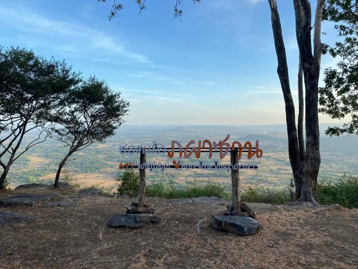
24. Phu Pha San is located around Ban Maet, Villages No. 5 and No. 10, Ban Lao Subdistrict, Kham Cha-i District. This mountain and conservation-tourism area combines rock plateaus, viewpoints, forest, caves, and the grounds of Wat Pa Phu Pha San, bringing together nature walking, mountain landscapes, and a peaceful religious setting.
Highlight: A summit approximately 617 meters above sea level, a rock plateau of around 5 rai, Tham Lot cave, unusual rock formations, viewpoints over Kham Cha-i and Nong Sung, Phu Phan forest landscapes, and the peaceful atmosphere of Wat Pa Phu Pha San.
Phu Pha San is also known locally as “Phu Mae Nang Mon,” reflecting the mountain’s connection with local beliefs and community memory. The elevated terrain has long served as a natural landmark and is linked with surrounding forest, water sources, agricultural land, and religious sites.
From the rock plateau near the summit, visitors can see alternating mountain ridges, plains, villages, farmland, and extensive forest in several directions. On clear days, the landscape can be viewed over a considerable distance, making the summit an excellent location for panoramic photography.
The ascent requires more physical effort than ordinary sightseeing. Parts of the route include rock surfaces, slopes, and natural trails. Visitors should wear footwear with good traction, carry sufficient drinking water, and avoid climbing during heavy rain when the rocks may become slippery.
Phu Pha San is suitable for hikers, photographers, Buddhist travelers, and visitors interested in the landscapes of the Phu Phan Range. First-time visitors should follow established routes and ask local caretakers for guidance before ascending.
Getting There: Located around Ban Maet, Villages No. 5 and No. 10, Ban Lao Subdistrict, Kham Cha-i District, Mukdahan Province. Open daily from 08.30–16.30.
Map (GPS): https://www.google.com/maps/dir/?api=1&destination=16.648799,104.374297&travelmode=driving
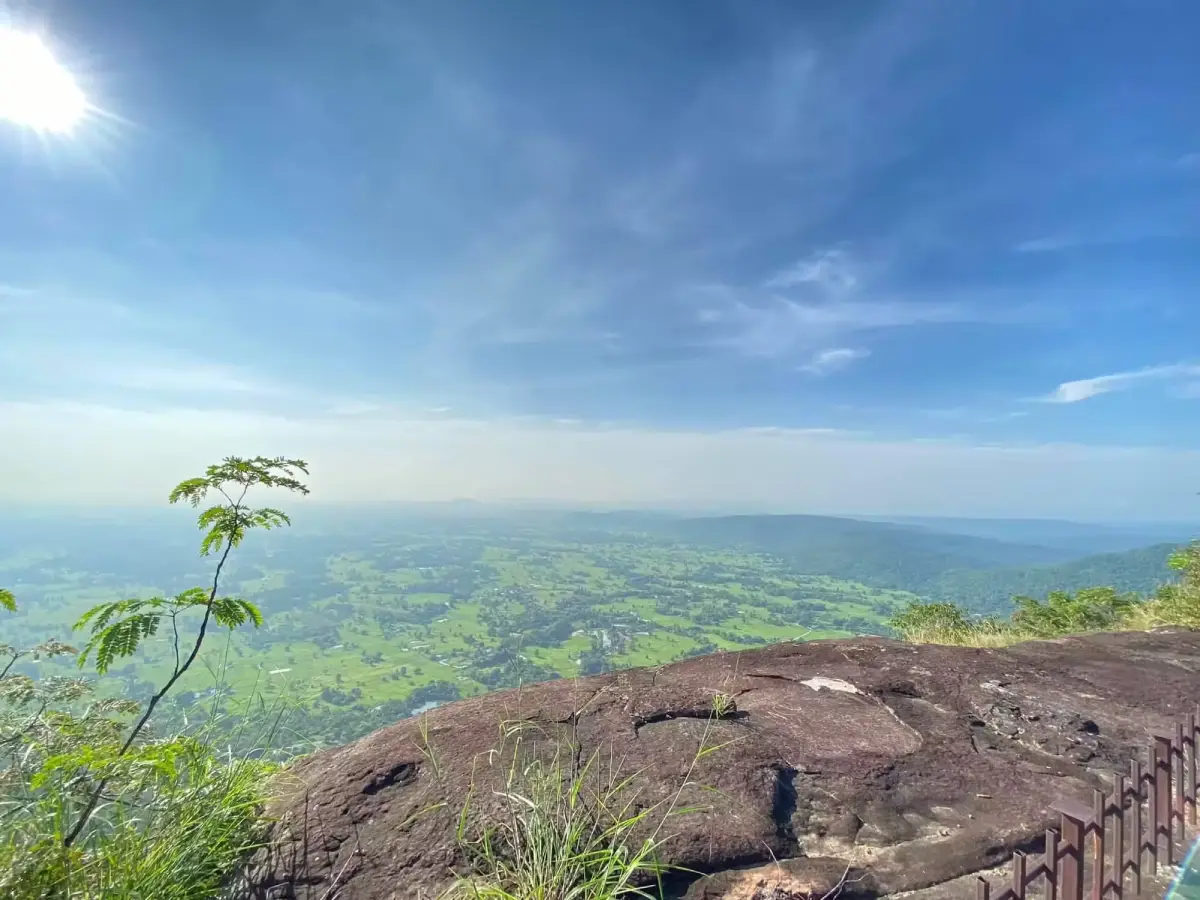
25. Phu Pha Jia, corresponding to the Thai attraction name Phu Pha Kia, is located relatively close to Mukdahan city, with Wat Weluwanaram or Wat Phu Pha Jia serving as a common starting point near the foothill. The area contains a trail leading to ridges, rock plateaus, cliffs, caves, and viewpoints overlooking Mukdahan city and the Mekong River.
Highlight: Views over Mukdahan city, the Mekong River, and Laos, an approximately 1-kilometer uphill trail, Tham Suea Yai, Tham Phra, rock plateaus, open woodland, and Wat Weluwanaram at the base of the mountain.
Phu Pha Jia is suitable for visitors who want a nature walk close to the city without traveling as far as a national park. The main viewpoint is not extremely far from the trailhead, but the route includes slopes, rock surfaces, dry leaves, and several junctions, so suitable footwear and enough time to return before dark are important.
From the elevated ridge, visitors can look back toward Mukdahan city and the Mekong River. This provides a different perspective from the city views seen from Ho Kaeo Mukdahan and helps reveal the relationship between the urban area, surrounding mountains, and the Mekong lowlands.
The caves and forest are also natural habitats for bats and other wildlife. Visitors should avoid making loud noises, approaching animals, or using unnecessary bright light inside caves, and should remain on routes regularly used by local visitors.
There are no formal fixed opening hours for the mountain trail, and first-time visitors are advised to ask temple caretakers or local residents about current conditions before ascending. Entering the trail during daylight is strongly recommended.
Getting There: Located in Mukdahan Subdistrict, Mueang Mukdahan District, with Wat Weluwanaram or Wat Phu Pha Jia serving as a common access point. Temple access follows normal daily temple activities, while the mountain trail is best used from 06.00–17.00. Visitors should leave the trail before dark.
Map (GPS): https://www.google.com/maps/dir/?api=1&destination=16.576025,104.665933&travelmode=driving
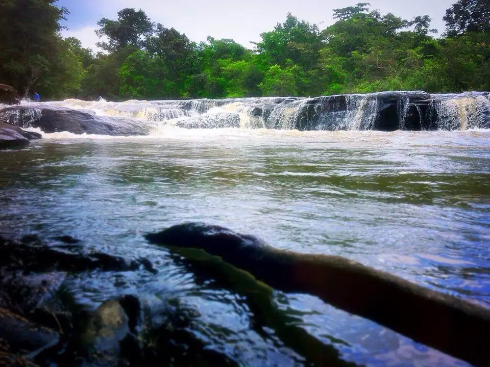
26. Kaeng Pho Waterfall is located at Ban Na Hin Kong, Village No. 8, Kok Tum Subdistrict, Dong Luang District, within Phu Pha Yon National Park. This forest waterfall in the Phu Phan landscape forms a broad curtain of water flowing across sandstone terraces into rocky pools below, surrounded by dry dipterocarp and mixed deciduous forest.
Highlight: A waterfall approximately 14 meters wide and 10 meters high, sandstone terraces, a nature-study trail of around 2 kilometers, Phu Phan forest, the Phung watercourse, and designated camping areas managed by park authorities.
The waterfall differs from narrow waterfalls dropping from high cliffs because its water spreads across a broad rock surface. During periods of strong flow, a wide white curtain forms across the rocks, while lower water levels reveal the channels, rock textures, and natural pools more clearly.
Water can flow throughout the year, although its appearance and strength depend on rainfall and upstream conditions. The period from late rainy season into early winter often combines relatively good water levels, green forest, and more comfortable weather for nature walking.
The nature trail allows visitors to learn about headwater forest and the sandstone geology of the Phu Phan Range rather than treating the area only as a swimming destination. Travelers who want to camp or undertake longer activities should coordinate with Phu Pha Yon National Park before arrival.
The waterfall contains uneven rock surfaces and possible submerged holes or crevices. Visitors should not jump from rock levels or enter areas closed by park authorities, particularly during the rainy season when flash-flood conditions can develop rapidly.
Getting There: Located at Ban Na Hin Kong, Village No. 8, Kok Tum Subdistrict, Dong Luang District, Mukdahan Province, within Phu Pha Yon National Park. Open daily from 08.00–16.00. Check weather conditions and current park announcements before visiting during the rainy season.
Map (GPS): https://www.google.com/maps/dir/?api=1&destination=16.757687,104.241355&travelmode=driving
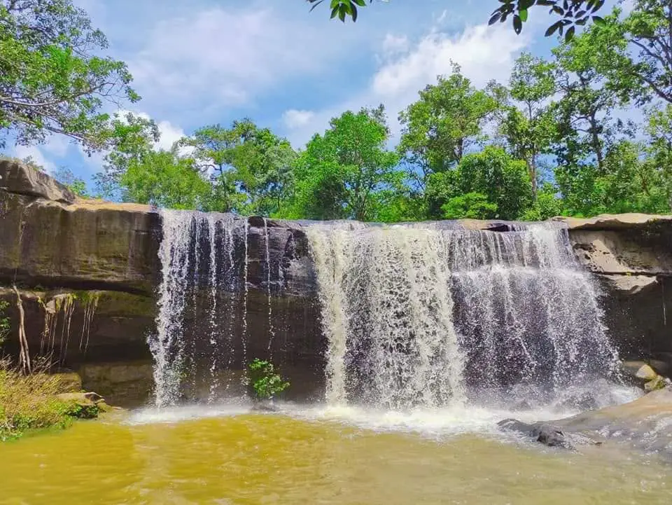
27. Huai Lao Waterfall is located at Ban Huai Lao, Village No. 7, Phang Daeng Subdistrict, Dong Luang District, within Phu Pha Yon National Park. This compact natural waterfall flows across rock terraces and boulders before descending in several levels through a quiet Phu Phan forest setting.
Highlight: A main waterfall approximately 4 meters high, rock terraces, natural pools, shaded forest, the sound of flowing water, and a peaceful atmosphere suitable for relaxation and nature photography.
The waterfall’s appearance depends strongly on rainfall in the upstream area. The rainy season through early winter generally provides the best water flow. When conditions are suitable, water spreads across the rock surface before collecting in pools below.
Although the waterfall is not especially high, its appeal lies in the natural combination of stream, forest, and rock terraces. Visitors can rest in safe areas and enjoy the sound of flowing water without having to undertake a long or demanding forest hike.
The site is managed by Phu Pha Yon National Park and follows an annual seasonal opening system to allow natural resources to recover. It opens from June 1–January 31 and closes every year from February 1–May 31.
During periods of heavy rain, visitors should be alert to flash floods and slippery rock surfaces. Do not enter the water when authorities issue warnings, when the water becomes muddy, or when currents are strong. Water conditions should be checked before departure because they can change rapidly.
Getting There: Located at Ban Huai Lao, Village No. 7, Phang Daeng Subdistrict, Dong Luang District, Mukdahan Province. Open seasonally from June 1–January 31, daily from 08.00–17.00, and closed annually for ecological recovery from February 1–May 31.
Map (GPS): https://www.google.com/maps/dir/?api=1&destination=16.743840,104.351131&travelmode=driving
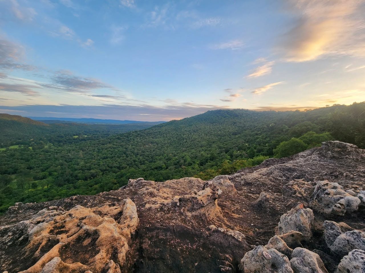
28. Phu Si Than Wildlife Sanctuary is a large protected forest area along the lower Phu Phan Range, spanning the border between Mukdahan and Kalasin provinces. On the Mukdahan side, the forest is connected with Kham Cha-i, Dong Luang, and Nong Sung districts. Its primary importance is the conservation of wildlife habitat and headwater ecosystems rather than conventional mass tourism.
Highlight: A protected area of approximately 189,541 rai, complex mountain terrain, several forest types, headwater ecosystems, rock plateaus, seasonal waterfalls, wildlife feeding grounds, nature-study routes, wildlife observation, camping, and stargazing when authorized by sanctuary staff.
This area differs from a national park or public recreation space because its primary mission is wildlife protection, anti-poaching, ecosystem restoration, and watershed conservation. Tourism is therefore secondary and visitors cannot enter every part of the sanctuary freely.
Visitors who receive permission to enter can experience relatively intact forest landscapes. Some routes have no shops, limited or inconsistent phone coverage, and few tourism facilities, so travelers should prepare sufficient water, food, personal medication, hiking equipment, and appropriate communication devices.
Activities such as trekking, wildlife observation, stargazing, and camping must follow routes, schedules, and group sizes approved by officials. Having authorized staff or local guides reduces risks both for visitors and for wildlife.
The sanctuary is most appropriate for experienced hikers, birdwatchers, wildlife enthusiasts, researchers, and travelers interested in natural ecosystems. It is not suitable for spontaneous independent entry without prior coordination.
Getting There: The Mukdahan section extends through forest areas of Kham Cha-i, Dong Luang, and Nong Sung districts. Entry to designated nature-tourism routes requires advance permission and coordination with sanctuary staff. Office contact hours are generally 08.30–16.30, while trekking, wildlife observation, and overnight activities follow individually approved plans.
Map (GPS): https://www.google.com/maps/dir/?api=1&destination=16.620565,104.311944&travelmode=driving
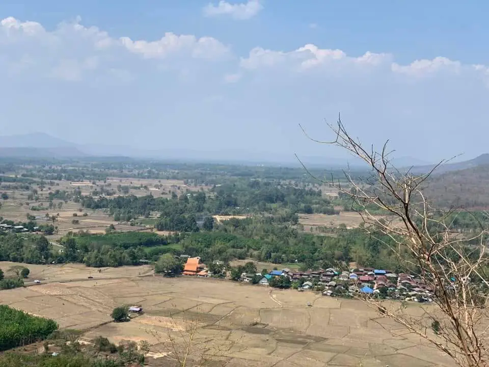
29. Phu Pha Kut lies along the mountain range in Kham Bok Subdistrict, Kham Cha-i District, extending toward Phu Wong Subdistrict in Nong Sung District. This large conservation area is particularly important as a natural medicinal-plant resource and contains high plateaus, cliffs, valleys, streams, caves, waterfalls, and ecological learning routes.
Highlight: An area of approximately 10,500 rai, at least 322 recorded medicinal plant species, rare plants, local traditional-healer knowledge, moist forest, valleys, streams, caves, waterfalls, and areas associated with Buddhist meditation.
Phu Pha Kut is especially important for medicinal plants. Surveys have recorded a large number of species used as food, traditional remedies, and protected plants, including red kwao krua and large fern species. This diversity makes the area comparable to a natural genetic and medicinal-plant reservoir for Mukdahan.
The landscape includes ridges, cliffs, slopes, and moisture-retaining valleys, creating several microhabitats within a relatively limited area. Shaded stream corridors support moisture-loving vegetation, while exposed ridges contain plant communities adapted to stronger sunlight and drier conditions.
Visitors should never collect medicinal plants for personal experimentation. Many species can look similar, and some may be toxic if the wrong part or dosage is used. The responsible way to learn is by observing, photographing, and walking with knowledgeable local guides or officials without uprooting plants, cutting branches, or removing bark.
The area forms part of the Tham Pha Nam Thip Non-Hunting Area and adjoining protected forest. Visitors cannot freely leave established routes, and groups entering deeper areas should coordinate with forest authorities, community leaders, or trail caretakers in advance.
Getting There: Located along the mountain range of Kham Bok Subdistrict, Kham Cha-i District, extending toward Phu Wong Subdistrict, Nong Sung District, Mukdahan Province. The area is accessible daily, but advance coordination with local caretakers is recommended. Suggested visiting hours are 08.00–17.00.
Map (GPS): https://www.google.com/maps/dir/?api=1&destination=16.472541,104.393760&travelmode=driving
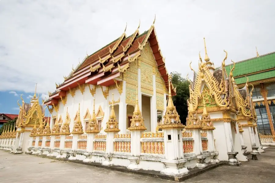
30. Wat Yot Kaeo Si Wichai, commonly called “Wat Klang” by local residents, is located in Si Mongkhon Yot Kaeo Community near Samran Chai Khong Road and Mukdahan Indochina Market. This historic temple has been closely connected with the growth of Mukdahan for around 200 years and is one of the most important religious sites that can be visited conveniently as part of an old-town Mekong riverside itinerary.
Highlight: A viharn decorated with gold-colored motifs, a large Buddha image in a blessing posture, a replica of Phra That Phanom, 2 chedis, the history of patronage by Mukdahan’s governors, and a location close to Mukdahan Indochina Market and the Mekong River.
The temple was established in 1826 by Phraya Chan Suriyawong, the second governor of Mukdahan, and his wife. At that time, Mukdahan was still a major settlement relying heavily on the Mekong River for transportation and trade. Building the temple therefore formed part of the development of a religious and social center for the growing town.
In 1846, Phra Chan Suriyawong, their son, carried out an important restoration and gave the temple the name “Wat Yot Kaeo Si Wichai.” The local name “Wat Klang,” meaning Central Temple, comes from its former position near the heart of the old community before Mukdahan expanded into a much larger urban area.
Counting from its founding year, the temple reached its 200th anniversary in 2026. It has therefore remained part of Mukdahan through many stages of change, from riverboat travel and waterfront trade to road development, Mukdahan’s establishment as a province, and the growth of modern cross-border commerce.
The viharn and chedis are suitable for both worship and learning about the history of Mukdahan city. Visitors can combine Wat Yot Kaeo Si Wichai with Mukdahan Indochina Market, Chao Mae Song Nang Phi Nong Shrine, Wat Si Bun Rueang, and Mukdahan Night Market to explore the old city without unnecessary backtracking.
Getting There: Located in Si Mongkhon Yot Kaeo Community near Samran Chai Khong Road and Mukdahan Indochina Market, Mueang Mukdahan District, Mukdahan Province. Open daily from 08.00–17.00.
Map (GPS): https://www.google.com/maps/dir/?api=1&destination=16.540641,104.731565&travelmode=driving
| Topic | Details |
| Province Overview | Mukdahan is a border province along the Mekong River known for Mekong culture, cross-border trade, ethnic diversity, religion, history, and the natural landscapes of the Phu Phan Range. The province is suitable for trips ranging from 1 day to 4–5 days. Organizing the itinerary by travel zones helps reduce unnecessary backtracking. |
| Top 10 Highlights | 1. Mukdahan Indochina Market 2. Kaeng Kabao 3. Ho Kaeo Mukdahan Chaloem Phra Kiat Kanchanaphisek 4. Second Thai–Lao Friendship Bridge 5. Phu Pha Thoep National Park 6. Phu Sa Dok Bua National Park 7. Wat Song Khon 8. Phu Mu Forest Park 9. Chao Mae Song Nang Phi Nong Shrine 10. Mahorathuek Drum |
| Mueang Mukdahan Zone | 1. Mukdahan Indochina Market 2. Ho Kaeo Mukdahan Chaloem Phra Kiat Kanchanaphisek 3. Second Thai–Lao Friendship Bridge 4. Chao Mae Song Nang Phi Nong Shrine 5. Mukdahan Night Market 6. Wat Si Bun Rueang (Ban Tai) 7. Phu Pha Jia 8. Wat Yot Kaeo Si Wichai Suitable for a 1-day trip focusing on border-city life, urban history, religion, markets, food, and views of the Mekong River. |
| Wan Yai Zone | 1. Kaeng Kabao 2. Wat Song Khon 3. Wat Phra Si Maha Pho 4. Wat Manophirom 5. Wat Latthikawan Recommended for travelers interested in Mekong riverside landscapes, old temples, Lan Xang art, Isan sim architecture, Christianity, and border-community culture. |
| Nikhom Kham Soi Zone | 1. Phu Mu Forest Park 2. Huai Khi Lek Irrigation Reservoir 3. Wat Phuttho Thammatharo Suitable for travelers who want to combine mountains, viewpoints, reservoir scenery, and a visit to a large Buddhist monument within the same route. |
| Don Tan Zone | 1. Phu Sa Dok Bua National Park 2. Mahorathuek Drum 3. Hoi Samai Hin 4. Ban Non Lom This zone combines nature, archaeology, Phu Thai culture, and Mekong riverside community life. |
| Nong Sung Zone | 1. Ban Phu Cultural Tourism Community 2. Wat Phu Chok Ko (Wat Banphot Kiri) 3. Wat Tham Phu Pha Khao (Wat Tham Som) 4. Phu Pha Kut Recommended for travelers interested in Phu Thai culture, forest temples, Buddhist meditation traditions, mountains, and medicinal-plant knowledge. |
| Kham Cha-i Zone | 1. Phu Pha San 2. Phu Si Than Wildlife Sanctuary 3. Phu Pha Kut Suitable for hiking, viewpoints, botanical learning, medicinal forests, and conservation travel that benefits from advance planning. |
| Dong Luang Zone | 1. Huai Bang Sai 2. Kaeng Pho Waterfall 3. Huai Lao Waterfall 4. Phu Si Than Wildlife Sanctuary Best suited to nature travelers interested in waterfalls, Phu Phan forests, and routes where weather conditions or advance coordination with authorities should be checked before travel. |
| Mekong Riverside Attractions | Mukdahan Indochina Market, Kaeng Kabao, Wat Song Khon, Wat Phra Si Maha Pho, Wat Manophirom, Chao Mae Song Nang Phi Nong Shrine, Ban Non Lom, and Mukdahan’s old-town riverside area are especially useful for understanding the relationship between communities, trade, religion, and the Mekong River. |
| Nature and Mountains | 1. Phu Pha Thoep National Park 2. Phu Sa Dok Bua National Park 3. Phu Mu Forest Park 4. Phu Pha San 5. Phu Pha Jia 6. Phu Si Than Wildlife Sanctuary 7. Phu Pha Kut |
| Waterfalls and Water Attractions | 1. Kaeng Kabao 2. Huai Khi Lek Irrigation Reservoir 3. Huai Bang Sai 4. Kaeng Pho Waterfall 5. Huai Lao Waterfall Several waterfalls and streams are strongly seasonal, so current water levels and official access announcements should be checked before traveling. |
| Temples and Sacred Sites | 1. Wat Song Khon 2. Chao Mae Song Nang Phi Nong Shrine 3. Wat Phra Si Maha Pho 4. Wat Phu Chok Ko (Wat Banphot Kiri) 5. Wat Phuttho Thammatharo 6. Wat Manophirom 7. Wat Si Bun Rueang (Ban Tai) 8. Wat Tham Phu Pha Khao (Wat Tham Som) 9. Wat Latthikawan 10. Wat Yot Kaeo Si Wichai |
| Historic Temples and Mekong Art | Wat Phra Si Maha Pho, Wat Manophirom, Wat Si Bun Rueang, Wat Latthikawan, and Wat Yot Kaeo Si Wichai are particularly suitable for visitors interested in traditional Isan sim architecture, hoop taem murals, Lan Xang art, Vietnamese craftsmanship, and the history of Mekong riverside communities. |
| History and Archaeology | 1. Mahorathuek Drum 2. Hoi Samai Hin 3. Prehistoric rock paintings in Phu Sa Dok Bua National Park 4. Historic temples in Wan Yai and Mueang Mukdahan |
| Communities and Ethnic Culture | 1. Ban Phu Cultural Tourism Community — Phu Thai community 2. Ban Non Lom — Phu Thai Mekong riverside community Both are suitable for learning about language, clothing, woven textiles, traditional food, Bai Si Su Kwan ceremonies, folk performances, and community ways of life. |
| Best for Families | Mukdahan Indochina Market, Kaeng Kabao, Ho Kaeo Mukdahan, Wat Song Khon, Huai Khi Lek Irrigation Reservoir, Mukdahan Night Market, Wat Yot Kaeo Si Wichai, and Ban Phu Cultural Tourism Community. |
| Best for Children | Ho Kaeo Mukdahan, Mukdahan Indochina Market, Kaeng Kabao, Ban Phu Cultural Tourism Community, Ban Non Lom, and Phu Pha Thoep National Park are suitable choices. Adults should closely supervise children near rivers, waterfalls, cliffs, and other natural hazards. |
| Best for Older Travelers | Mukdahan Indochina Market, Ho Kaeo Mukdahan, Kaeng Kabao, Wat Song Khon, Wat Phra Si Maha Pho, Wat Manophirom, Wat Si Bun Rueang, Wat Yot Kaeo Si Wichai, and Mukdahan Night Market are relatively easy to access and do not require long-distance hiking. |
| Best for Photography | 1. Kaeng Kabao 2. Ho Kaeo Mukdahan 3. Phu Pha Thoep National Park 4. Phu Sa Dok Bua National Park 5. Phu Mu Forest Park 6. Wat Tham Phu Pha Khao 7. Phu Pha San 8. Phu Pha Jia 9. Kaeng Pho Waterfall 10. Phu Pha Kut |
| Best for Hiking and Adventure | Phu Pha Thoep National Park, Phu Sa Dok Bua National Park, Phu Mu Forest Park, Phu Pha San, Phu Pha Jia, Kaeng Pho Waterfall, Huai Lao Waterfall, Phu Si Than Wildlife Sanctuary, and Phu Pha Kut. |
| Local Food | Mukdahan’s food includes som tam, larb, nam tok, gaeng om, sticky rice, Mekong River fish, Kaeng Kabao roasted suckling pig, and foods influenced by Vietnamese communities such as khao piak sen, Vietnamese-style noodle soup, and moo yor. |
| Souvenirs | 1. Phu Thai woven textiles 2. Basketry and community handicrafts 3. Moo yor and processed local foods 4. Goods from Mukdahan Indochina Market 5. Community products from districts throughout Mukdahan |
| 1 Day — Mueang Mukdahan | Morning: Ho Kaeo Mukdahan Chaloem Phra Kiat Kanchanaphisek Late Morning: Mukdahan Indochina Market – Chao Mae Song Nang Phi Nong Shrine – Wat Yot Kaeo Si Wichai Afternoon: Wat Si Bun Rueang – Second Thai–Lao Friendship Bridge Evening: Mukdahan Night Market |
| 1 Day — Wan Yai | Morning: Wat Phra Si Maha Pho – Wat Manophirom – Wat Latthikawan Late Morning–Afternoon: Wat Song Khon Late Afternoon–Evening: Kaeng Kabao and dinner beside the Mekong River |
| 1 Day — Nikhom Kham Soi | Morning: Wat Phuttho Thammatharo Late Morning: Huai Khi Lek Irrigation Reservoir Afternoon: Phu Mu Forest Park. Check road conditions and current access times before ascending. |
| 1 Day — Nong Sung | Morning: Wat Phu Chok Ko Late Morning: Ban Phu Cultural Tourism Community Afternoon: Wat Tham Phu Pha Khao If planning to explore Phu Pha Kut, allocate a separate day and coordinate with local caretakers in advance. |
| 2 Days, 1 Night | Day 1: Mukdahan city – Mukdahan Indochina Market – Ho Kaeo Mukdahan – Chao Mae Song Nang Phi Nong Shrine – Mukdahan Night Market Day 2: Wat Phra Si Maha Pho – Wat Manophirom – Wat Song Khon – Kaeng Kabao |
| 3 Days, 2 Nights | Day 1: Mukdahan city and the Mekong riverside Day 2: Wan Yai–Kaeng Kabao Day 3: Phu Pha Thoep National Park, or Nikhom Kham Soi–Phu Mu Forest Park |
| 4–5 Days | Add Phu Sa Dok Bua National Park, Don Tan, Nong Sung, Kham Cha-i, and Dong Luang to experience Phu Thai communities, Phu Phan forests, waterfalls, Phu Pha San, Phu Pha Kut, and conservation areas at a more comfortable pace. |
| Best Time to Visit | Mukdahan can be visited throughout the year. November–February generally offers cooler weather and is ideal for urban sightseeing, temples, and mountains. The rainy season is suitable for forests, waterfalls, and natural landscapes, but visitors should check trail closures, flash-flood warnings, and current access conditions before traveling. |
| Huai Lao Waterfall | Open seasonally from June 1–January 31, daily from 08.00–17.00, and closed for annual ecological recovery from February 1–May 31. |
| Places Requiring Advance Coordination | Ban Phu Cultural Tourism Community, Ban Non Lom, Phu Si Than Wildlife Sanctuary, and some routes at Phu Pha Kut should be contacted or booked in advance, particularly for homestays, boat trips, trekking, camping, and entry into protected areas. |
| Getting Around the Province | A private car or rental vehicle is the most convenient option because attractions are spread across several districts and many natural attractions are not directly served by public transport. Organize the itinerary into Mueang Mukdahan, Wan Yai, Nikhom Kham Soi, Don Tan, Nong Sung, Kham Cha-i, and Dong Luang zones. |
| Safety | Take extra care around slippery rock surfaces, flash floods, cliffs, and mountain trails during the rainy season. Do not swim in restricted areas or strong currents, leave forest trails before dark, and follow the instructions of national park and wildlife-sanctuary staff. |
| Responsible Travel | Do not collect plants, medicinal herbs, fossils, or other natural materials. Do not feed wildlife, leave designated routes, or dispose of rubbish in rivers and streams. Support community products and respect religious sites, ceremonies, and local cultural practices. |
Frequently Asked Questions (FAQ)
Q: What are the must-visit attractions in Mukdahan?
A: Major highlights include Mukdahan Indochina Market, Kaeng Kabao, Ho Kaeo Mukdahan Chaloem Phra Kiat Kanchanaphisek, the Second Thai–Lao Friendship Bridge, Phu Pha Thoep National Park, Phu Sa Dok Bua National Park, Wat Song Khon, Phu Mu Forest Park, Chao Mae Song Nang Phi Nong Shrine, and the Mahorathuek Drum.
Q: Where should I go if I have only 1 day in Mukdahan?
A: First-time visitors should focus on the city zone, beginning with Ho Kaeo Mukdahan, Mukdahan Indochina Market, Chao Mae Song Nang Phi Nong Shrine, and Wat Yot Kaeo Si Wichai, then ending at Mukdahan Night Market. Alternatively, choose Wan Yai for historic temples, Wat Song Khon, and Kaeng Kabao.
Q: How many days should I spend in Mukdahan?
A: 2–3 days are suitable for Mukdahan city, Wan Yai, and Phu Pha Thoep National Park. If you also want to visit Don Tan, Nong Sung, Kham Cha-i, Dong Luang, Phu Sa Dok Bua National Park, and additional nature destinations, allow around 4–5 days.
Q: What is Mukdahan known for besides the Mekong River?
A: Mukdahan also has sandstone mountains, unusual rock formations, national parks, Phu Phan forests, waterfalls, Phu Thai communities, Lan Xang art, historic temples, archaeological sites, and important cross-border trade routes.
Q: When is the best time to visit Kaeng Kabao?
A: The dry season is particularly attractive because lower Mekong water levels reveal more rock formations, stone terraces, and sandbanks. Morning and late afternoon are best for sightseeing and photography because temperatures are more comfortable.
Q: What is special about Phu Pha Thoep National Park?
A: The park is famous for its unusually shaped sandstone formations created by natural erosion, broad rock plateaus, nature trails, cliffs, and seasonal wildflowers. It is especially suitable for nature and geology enthusiasts.
Q: What can I see at Phu Sa Dok Bua National Park?
A: Highlights include rock plateaus, natural mountain pools, prehistoric rock paintings, dwarf dry dipterocarp forest, viewpoints, and several nature trails. Some routes require advance coordination with park officials.
Q: Why is Wat Song Khon important?
A: Wat Song Khon is an important Catholic religious site associated with the 7 Blessed Martyrs of Thailand. It is significant to the history of Christianity in Northeastern Thailand and to the religious history of Mekong border communities.
Q: What are the best cultural attractions in Mukdahan?
A: Recommended places include Ban Phu Cultural Tourism Community, Ban Non Lom, Wat Phra Si Maha Pho, Wat Manophirom, Wat Latthikawan, the Mahorathuek Drum, Wat Si Bun Rueang, and Wat Yot Kaeo Si Wichai.
Q: Are there community homestays in Mukdahan?
A: Yes. Ban Phu Cultural Tourism Community in Nong Sung District and Ban Non Lom in Don Tan District offer community-based experiences and homestay activities. Advance reservations are recommended so local residents can prepare accommodation, meals, performances, and activities.
Q: Where can I go hiking in Mukdahan?
A: Recommended hiking destinations include Phu Pha Thoep National Park, Phu Sa Dok Bua National Park, Phu Mu Forest Park, Phu Pha San, Phu Pha Jia, Phu Si Than Wildlife Sanctuary, and Phu Pha Kut. Some protected areas require advance permission or authorized guides.
Q: When is Huai Lao Waterfall open?
A: Huai Lao Waterfall is open seasonally from June 1–January 31, daily from 08.00–17.00, and closes for ecological recovery from February 1–May 31 every year.
Q: When is the best time to visit Kaeng Pho Waterfall?
A: Late rainy season through early winter is generally a good period because water levels are usually stronger and the forest is green. Check current weather and Phu Pha Yon National Park announcements before traveling because flash-flood conditions can develop quickly.
Q: What is special about Phu Pha Kut?
A: Phu Pha Kut is a major conservation and medicinal-plant area where at least 322 plant species have been recorded. The landscape also includes valleys, streams, caves, waterfalls, and ecological learning routes. Advance coordination is recommended for deeper forest routes.
Q: Which attractions are suitable for older travelers?
A: Mukdahan Indochina Market, Ho Kaeo Mukdahan, Kaeng Kabao, Wat Song Khon, Wat Phra Si Maha Pho, Wat Manophirom, Wat Si Bun Rueang, Wat Yot Kaeo Si Wichai, and Mukdahan Night Market are relatively accessible and do not require long-distance trekking.
Q: What food should I try in Mukdahan?
A: Recommended dishes include som tam, larb, gaeng om, Mekong River fish, Kaeng Kabao roasted suckling pig, khao piak sen, Vietnamese-style noodle soup, and moo yor, reflecting both Isan food culture and Vietnamese influence.
Q: What souvenirs should I buy in Mukdahan?
A: Popular choices include Phu Thai woven textiles, basketry, community handicrafts, moo yor, processed local foods, and products from Mukdahan Indochina Market. Check labels, quality, and origin when purchasing imported goods.
Q: Can I travel from Mukdahan to Laos?
A: Yes. Travelers can cross the Second Thai–Lao Friendship Bridge to Kaysone Phomvihane in Savannakhet Province, Laos. Valid travel documents and compliance with current immigration requirements are necessary, so check entry conditions and checkpoint operating hours before departure.
Q: Can I travel around Mukdahan without a private car?
A: Local transport and hired vehicles can reach some city and riverside attractions, but natural destinations in Nikhom Kham Soi, Don Tan, Dong Luang, Kham Cha-i, and Nong Sung are widely dispersed. A private car, rental vehicle, or hired car with a driver is generally more convenient.
Q: How should I plan a Mukdahan itinerary to avoid backtracking?
A: Divide the province into travel zones: Mueang Mukdahan, Wan Yai, Nikhom Kham Soi, Don Tan, Nong Sung, Kham Cha-i, and Dong Luang. Complete the attractions within one zone before moving to the next area to reduce driving time and unnecessary distance.
 Category: ●Travel Articles, Recipes
 Group: ●Travel Review, Food Review
Last Update : 3 WeekAgo
 Last Update : 3 WeekAgo
Recommend

 Art, Culture and Heritage
 Historical Sites and Monuments(2)
 Landmarks and Memorials(3)
 Art, Craft Centres, Tradition(2)
 Museums(1)
 Places of Worship
 Temple(17)
 Other Sacred Sites(4)
 Suburban Living
 Village, Community(4)
 Local Market(2)
 Nature and Wildlife
 National Parks and Marine Reserves(4)
 Mountain (Doi)(5)
 Dam, Reservoir, Lake(3)
 Waterfalls(5)
 Caves(2)
 River, Canal(2)
 Bays and Beaches(1)
 Other natural attractions(1)
 Entertainment and Agricultural
 Farms, Parks and Ecotourism(1)
Travel Review, Food Review(1)


