
lovethailand home >Northeastern Travel Attractions >Mukdahan Travel Attractions >Khamcha-i >Khamcha-i > Phu Si Than Wildlife Sanctuary
TL;DR: Phu Si Than Wildlife Sanctuary, Mukdahan attractions : Nature and Wildlife, National Parks and Marine Reserves.

Phu Si Than Wildlife Sanctuary
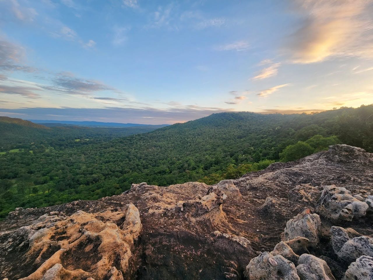
Open Days: Visitor access is available only with prior permission and an appointment with sanctuary officers. Travellers must not enter forest trails, wildlife observation areas, waterfalls, or campsites without authorisation.
Opening Hours: Office contact hours are 08:30–16:30. Hiking, wildlife watching, stargazing, camping, and overnight access follow the schedule approved by sanctuary officers.
Phu Si Than Wildlife Sanctuary is a large protected forest within the lower Phu Phan mountain range, extending across the border between Mukdahan and Kalasin provinces in northeastern Thailand. The best-known visitor areas on the Mukdahan side are located in Khamcha-i, Dong Luang, and Nong Sung districts. The sanctuary is distinguished by connected mountain ridges, high plateaus, several forest communities, important headwater streams, sandstone pavements, seasonal waterfalls, and a broad grassland used by wildlife. Carefully managed activities include hiking, wildlife observation, camping, nature study, and stargazing.
For travellers searching for hiking destinations in Mukdahan, Phu Si Than offers an experience very different from that of an ordinary public attraction. It is not a recreational park where visitors can drive freely between viewpoints. Its primary functions are to protect wildlife habitat, prevent hunting, restore ecosystems, safeguard watersheds, and maintain undisturbed areas for breeding and feeding. Tourism is a secondary use and is therefore limited by permits, route availability, group size, weather, patrol operations, and wildlife conditions.
Authorised visitors enter a landscape that retains a high degree of wilderness. Shops, continuous mobile reception, paved roads, and commercial services are absent from most forest routes. Travellers must carry sufficient water, food, personal medication, hiking equipment, and reliable lighting. Following an officer or authorised local guide is essential, both for personal safety and for minimising disturbance to animals whose feeding and movement routes may cross visitor trails.
The sanctuary covers approximately 189,541 rai, equivalent to about 303.27 square kilometres. It includes portions of Dong Phu Si Than National Reserved Forest, Dong Mu Plot 3 Forest, and Dong Dan Yae Forest. On the Mukdahan side, the protected landscape extends through parts of Dong Luang, Khamcha-i, and Nong Sung districts. On the Kalasin side, it reaches parts of Khao Wong and Kuchinarai districts, linking the ecosystems and water sources of both provinces.
Phu Si Than was declared a wildlife sanctuary under a Royal Decree published on 12 June 1990. Before formal protection, sections of the forest had been affected by commercial logging concessions and increasing pressure on natural resources. Communities surrounding the mountains recognised the importance of the forest as a source of water and livelihoods and contributed to efforts to end destructive use and establish long-term protection for wildlife.
The history of Phu Si Than demonstrates that legal designation alone does not preserve a forest. Protection requires cooperation among sanctuary officers, surrounding communities, village leaders, conservation organisations, and residents who depend on local water sources. Current work includes smart patrols, camera-trap surveys, wildfire prevention, suppression of illegal hunting, habitat restoration, environmental education, and the regulation of visitor activities.
The terrain consists of mountains and elevated plateaus within the lower Phu Phan range. Elevation varies from approximately 200 to 592 metres above sea level. The highest point is Phu Moei, which reaches approximately 592 metres on the Kalasin side. Connected ridges, slopes, shallow valleys, cliffs, sandstone surfaces, and open plateaus produce a range of habitats within a relatively compact area.
Much of the terrain slopes northward towards Khamcha-i and Dong Luang districts in Mukdahan. This topography creates several streams, including Huai Phai, Huai Yang, Huai Krasae, Huai Nok Ten, Huai Ta Poe, and Huai Lao. These waterways eventually connect with the Huai Bang Sai system and supply water to agricultural land and communities below the mountains.
Forest vegetation, leaf litter, roots, and undisturbed soil slow the movement of rainwater and reduce erosion. When mountain forest is removed, runoff reaches lowland areas more rapidly, soil enters streams, and water sources become less reliable during the dry season. Protecting Phu Si Than is therefore directly connected to water security, farming, local environmental quality, and the daily lives of communities beyond the sanctuary boundary.
Vegetation includes dry evergreen forest, dry dipterocarp forest, mixed deciduous forest, grassland, and specialised plant communities growing on shallow soil and sandstone. Deeper, moister areas support taller trees and a denser canopy. Exposed ridges and rock surfaces support drought-tolerant trees, shrubs, grasses, and seasonal plants. This diversity allows different wildlife species to select appropriate feeding, resting, breeding, and sheltering areas.
During the rainy season, Phu Si Than becomes intensely green, streams and waterfalls carry more water, and ground vegetation expands rapidly. In the cool season, lower temperatures and reduced rainfall make several authorised trails more comfortable. The hot season brings leaf fall in dry dipterocarp forest, dry ground conditions, and elevated wildfire risk. Access must therefore respond to natural conditions rather than following an identical year-round schedule.
Wildlife includes medium-sized herbivores, small carnivores, nocturnal mammals, forest birds, reptiles, and amphibians. Thung Non Pa Ko is particularly important as a wildlife learning area associated with Eld’s deer, sambar deer, hog deer, barking deer, and wild boar. These animals feed in open grassland while using the surrounding forest for shelter and movement between water sources.
Seeing wildlife does not justify approaching, chasing, calling, or feeding an animal. Many species are highly sensitive to sound, artificial light, human scent, and food odours. Wildlife observation must take place from a tower, hide, or location selected by sanctuary officers. Visitors should speak quietly, wear subdued colours, avoid strong fragrances, and never shine a powerful light directly into an animal’s eyes.
Camera traps are used to document species that are difficult to observe during a normal visit. They record activity during the day and night without requiring a person to remain nearby. The resulting images reveal how predators, herbivores, water sources, forest edges, and natural movement corridors are connected. Officers use this information to plan patrols, identify vulnerable areas, and evaluate long-term habitat recovery.
A visit remains meaningful even when large mammals do not appear. Tracks, droppings, feeding marks, disturbed soil, hair caught on vegetation, alarm calls, and movement in the canopy all provide evidence of wildlife activity. An experienced guide can interpret these signs and explain the likely species, direction of travel, feeding time, and habitat use. Success should not be measured only by the number of animals photographed.
Thung Non Pa Ko is a broad grassland and plateau area in Khamcha-i Subdistrict, Khamcha-i District, Mukdahan. Covering approximately 3,000 rai, the open habitat is an important feeding ground for several herbivorous species. Animals often emerge during the early morning or near dusk, while the surrounding forest provides cover and a route back to water and resting areas.
The grassland is suitable for controlled wildlife education because it has an observation tower and designated viewing locations. Visitors should enter in small groups, minimise movement, and remain patient. Sitting quietly at a suitable distance offers a greater chance of observing natural behaviour than walking across the grassland in search of animals.
Thung Non Pa Ko is also one of Mukdahan’s important stargazing areas. Its open landscape provides a nearly 360-degree view of the sky, while its distance from major urban lighting produces darker conditions than those found in towns. On clear nights, visitors may observe the Milky Way, the Pleiades, the Orion Nebula, seasonal constellations, and meteor showers when astronomical conditions are favourable.
The site is registered as a Dark Sky Park for the 2025–2027 period. This status reflects both the quality of the night sky and efforts to control unnecessary lighting. Stargazers should use red-light torches or dimmable lamps, switch off vehicle headlights after parking, and avoid continuous white light. Even a small bright lamp can destroy night vision and disturb nocturnal wildlife.
Facilities at Thung Non Pa Ko include a visitor centre, a four-bedroom guesthouse, toilets, a multipurpose building, a wildlife observation tower, and a campground. These facilities do not mean that accommodation is available without notice. Every visitor must confirm dates, capacity, conditions of use, food arrangements, lighting restrictions, and waste-management requirements before travelling.
Camping at Thung Non Pa Ko reveals a marked contrast between day and night. During daylight, visitors can examine the grassland, forest edge, tracks, and feeding areas. After dark, insects, frogs, night birds, and movement beyond the campsite become more noticeable. Campers must not leave the designated area alone, enter tall grass for photography, or leave shoes and equipment outside without checking them carefully.
Food must be stored in sealed containers, and every scrap must be removed from the sanctuary. Soup, oil, food residue, and wastewater must never be poured on the ground. Food odours can attract wild boar, rodents, and other animals to the campsite. Once an animal associates visitors with food, its behaviour changes and the risk of conflict increases.
Saksit Waterfall, also known as Kaeng Chang Niam Waterfall, is located near Ban Kaeng Chang Niam in Khamcha-i Subdistrict, Khamcha-i District, Mukdahan. It lies within the Phu Si Than protected forest and is a small waterfall approximately 20 metres high. Water descends over rock ledges surrounded by well-preserved dry evergreen forest before collecting in pools and continuing into the lower stream system.
The waterfall is most attractive from the rainy season into the beginning of the cool season. During the dry months, flow may decrease substantially or remain only in certain channels. Travellers should confirm current water and road conditions instead of assuming that photographs taken during heavy rain represent the site throughout the year. Intense rain can also produce sudden changes in water level and make sandstone extremely slippery.
The waterfall is significant beyond its scenic value. Kaeng Chang Niam is one of Mukdahan’s sacred water sources and has supplied water for official consecration ceremonies connected with important royal occasions. This role links the protected watershed with local belief, cultural practice, and community respect for mountain water.
A sandstone area near the waterfall may be used for rest and, on approved occasions, controlled camping. Visitors must never assume that tents can be erected without permission. Officers must consider water level, storms, falling branches, wildlife movement, wildfire conditions, cultural use of the site, and ecological impact. When the waterfall area is unsuitable, visitors may be directed to the established campground at Thung Non Pa Ko.
The waterfall should be treated with particular care. Soap, shampoo, detergent, coins, candles, incense, garlands, food, and rubbish must not be placed in the water. Even an object left with religious intentions can become pollution. Moving rocks to create private pools alters water flow and disturbs small aquatic habitats.
Swimming is subject to current instructions and water conditions. Pools may contain uneven rock, hidden branches, slippery surfaces, and rapid changes in depth. Flow following rainfall can be stronger than it appears from the bank. Children require continuous adult supervision, and jumping from rocks into water of unknown depth is unsafe.
Phu Pha Phueng is another area used for learning about geology, mountain forest, and sandstone weathering. Routes may include exposed rock, sloping ground, and forest sections. Hikers need shoes with strong grip and must avoid open stone plateaus during thunderstorms because of lightning risk. Access should be confirmed directly with officers, including whether a guide is required.
The Kalasin side contains additional natural and cultural sites, including handprint caves, the reservoir near the main office, and approaches towards Phu Moei. These locations are on the opposite side of the mountain system from Khamcha-i’s visitor areas. They should not be combined according to straight-line map distance, as roads may require long detours and forest tracks may not be open to public vehicles.
Phu Si Than is most suitable for travellers who are prepared for controlled wilderness access. Short educational walks can be appropriate for beginners when led by officers, while summit or long-distance routes require greater fitness. Visitors with heart disease, respiratory problems, high blood pressure, knee conditions, limited balance, or severe allergies should discuss their condition with companions and officers before starting.
Hiking footwear should have reliable tread and should already be broken in. Clothing should be breathable, quick-drying, and sufficiently protective against sun, insects, branches, and sharp grass. A lightweight rain jacket, hat, spare socks, waterproof telephone pouch, and headlamp are advisable even when the planned return is before sunset.
Visitors must carry enough drinking water for the route and temperature. Clear stream water is not automatically safe to drink because it may contain microorganisms, sediment, or contamination from wildlife. Food should be compact, energy-rich, and low in packaging. Reusable boxes and bottles are preferable to multiple disposable wrappers.
A personal first-aid kit should contain regular medication, allergy medicine, elastic bandage, wound dressings, antiseptic, a whistle, and emergency supplies. A charged power bank and offline map are useful, but a telephone should not be the only navigation method. Battery failure and inaccurate positioning beneath forest canopy remain possible.
Groups should remain within visual contact, never overtake the guide, and never separate without informing others. Anyone stopping for photography or equipment adjustment should notify the people immediately ahead and behind. At an unmarked junction, visitors must not guess the direction. A lost hiker should stop, use a whistle, and avoid following a stream without route knowledge.
Rainy-season hazards include leeches, insects, unstable soil, slippery rock, and branches weakened by water and wind. Equipment and clothing should be checked during rest stops. During thunderstorms, visitors must leave exposed plateaus, high points, and isolated trees according to officer instructions. Continuing merely to reach a planned viewpoint is not worth the risk.
The dry season brings wildfire danger. Fallen leaves and grass can ignite rapidly. Fires are prohibited outside authorised cooking areas, cigarette ends must never be discarded, and open-flame equipment must not be used beside dry vegetation. Smoke, a burning smell, or an advancing fire line must be reported immediately.
Wild animals require a safe distance. If a deer, wild boar, or other medium-sized mammal appears on a trail, visitors should stop and allow it to leave. They must not run towards it, block its route, or approach for a close photograph. Females with young may display stronger defensive behaviour than expected.
Pets must not be released or walked inside the sanctuary. Domestic animals may chase wildlife, transmit disease, become lost, or establish feral populations. Barking, pet food, and unfamiliar scent also disturb animals using grassland and campsite edges.
Drones, commercial filming, powerful lighting, and large organised events require specific permission. Drone noise can disturb birds and mammals, particularly during breeding and nesting periods. It also disrupts wildlife observation and the quiet conditions required for stargazing. Open terrain is not permission to launch an aircraft.
Wildlife photographers should use long lenses from approved positions. Bait, food, recorded calls, or artificial scent must never be used to draw animals closer. Repeated bird calls from a speaker can force territorial animals to waste energy, especially during nesting. Ethical photography records behaviour rather than manipulating it.
Stargazing is best planned for a clear night close to the new moon, although mountain weather can change quickly. Visitors should bring a groundsheet, wind protection, insect repellent, and moisture protection for cameras. Tripods and telescopes must remain within the assigned area so that they do not obstruct paths or wildlife routes.
Many animals begin feeding soon after sunset. Walking between the campsite, observation tower, and stargazing area must therefore follow the designated route. Visitors should not enter tall grass or the forest edge to improve a camera angle. A low torch directed at the ground is preferable to sweeping the landscape with bright light.
Families with children may join activities around Thung Non Pa Ko when authorised, but children must not run beyond the campsite, climb the tower without supervision, or approach water alone. Waterfall and sandstone routes may be unsuitable for pushchairs, older travellers with limited balance, or small children after rain.
Overnight equipment should match the season. Cool-season nights may be considerably colder than Khamcha-i town, while rainy-season humidity can cause condensation inside tents. Tents need a rain fly and groundsheet. Campers must not dig drainage trenches, as this damages the established site.
Guesthouse and toilet capacity is limited. Water should be used carefully, and wet wipes, sanitary products, tissues, and rubbish must not be flushed. Keeping facilities in good condition allows more sanctuary resources to be directed towards patrol work and wildlife conservation.
Getting There to the Mukdahan visitor sector generally begins in Khamcha-i District, approximately 37 kilometres from Mukdahan city via Highway 12. From the district town, travellers continue to a meeting point specified by officers, such as Thung Non Pa Ko, Ban Kaeng Chang Niam, or a responsible protection unit. Entering “Phu Si Than Wildlife Sanctuary” into a map without confirming the destination may lead to the wrong side of the forest.
The main sanctuary office is at P.O. Box 2, Nong Hang Subdistrict, Kuchinarai District, Kalasin, on the opposite side of the mountains from the Mukdahan visitor areas. Travellers must state clearly whether they intend to visit Thung Non Pa Ko, Saksit Waterfall, a hiking trail, or a Kalasin-side location. Officers can then provide the correct meeting coordinates, road information, vehicle requirements, and arrival time.
A private or rental vehicle is the most practical form of transport. Limited public transport may reach Khamcha-i, but no regular service operates along the internal forest approaches. Ordinary cars can reach several villages and service points in normal weather. Muddy tracks, steep roads, and post-rain conditions may require a pickup truck or four-wheel-drive vehicle.
Vehicles should be refuelled in the district town. Travellers should inspect the spare tyre, jack, brakes, and lights and save an offline map. Parking is permitted only in designated places and must not obstruct patrol routes, emergency access, or animal crossings. A stuck vehicle should be reported rather than driven off-road through vegetation.
A two-day, one-night itinerary is suitable for experiencing Thung Non Pa Ko. Visitors can reach Khamcha-i in the afternoon, purchase supplies, meet officers, enter at the approved time, and prepare the campsite. The evening can be used for wildlife observation and stargazing. The following morning can include the observation tower and an authorised nature trail before leaving the sanctuary.
Saksit Waterfall is best planned as a daytime visit during a season with sufficient flow. Current road and water conditions should be confirmed first. When camping is approved, tents must remain in the assigned location, away from drainage channels and cliff bases. Combining the waterfall and Thung Non Pa Ko in a single day should be attempted only when officers confirm that travel time and route closure times permit it.
The late rainy season and cool season are generally best for hiking because the forest remains green, water sources are active, and temperatures are more comfortable. Trails must still be checked for rain damage. Stargazing is best on a clear, moonless night, while wildlife observation is often most productive around dawn and dusk under officer supervision.
Most established restaurants, shops, and fuel services are in Khamcha-i town or along Highway 12. Food, drinking water, and essential supplies should be purchased before entering the sanctuary. Local restaurant hours can change, so groups and late-returning travellers should telephone in advance.
Accommodation outside the sanctuary includes small resorts in Khamcha-i and along the main highway. Travellers who prefer not to camp can stay in town and meet officers early the following morning. The four-bedroom guesthouse at Thung Non Pa Ko has limited capacity and must be specifically confirmed; its inclusion in visitor information does not guarantee daily availability.
The sanctuary is currently supervised by Mr Khamkrit Samphetcharoen, Head of Phu Si Than Wildlife Sanctuary. The main office can be contacted at 043-840422. Information about Thung Non Pa Ko, the guesthouse, camping, wildlife observation, and visitor activities is also available at 099-0197307. Contact should be made before the travel date rather than from a forest entrance where mobile reception may be unreliable.
As of 17 July 2026, Phu Si Than continues active conservation, patrol, and wildlife-monitoring operations, while Thung Non Pa Ko remains available for controlled educational tourism. Trail, waterfall, campsite, and observation-area status may change because of weather, wildfire, patrol requirements, habitat restoration, or animal activity. Direct confirmation is therefore mandatory before every visit.
No single publicly announced admission rate covers every visitor activity. Permission, accommodation, camping, guides, vehicles, or specialised programmes may involve different conditions and charges. Travellers must confirm the total cost, payment procedure, and included services directly with sanctuary officers. National park fee schedules should not be assumed to apply to a wildlife sanctuary.
Phu Si Than is best suited to travellers who want to understand a forest rather than simply collect photographs. Its value lies not only in waterfalls, sandstone, grassland, and visible wildlife but also in the relationship between open feeding areas, forest cover, mountain streams, and darkness at night. Regulations concerning light, noise, waste, and group size are essential to maintaining those relationships.
Every visitor can contribute to conservation by removing all rubbish, refusing to feed animals, remaining on approved routes, leaving plants and rocks untouched, and limiting noise after dark. Responsible tourism does not require access to every part of a forest. It recognises that some habitats should remain closed and undisturbed.
Phu Si Than represents the recovery of a forest once exposed to logging and resource pressure. It now protects wildlife, headwater streams, several forest communities, open grassland, sacred water, and one of Mukdahan’s recognised dark-sky sites. Behind its quiet scenery are continuous patrols, ecological restoration, scientific monitoring, and cooperation between officers and surrounding communities.
| Name | Phu Si Than Wildlife Sanctuary |
| Thai Name | เขตรักษาพันธุ์สัตว์ป่าภูสีฐาน |
| Protected-Area Type | Wildlife sanctuary. Visitor access requires advance permission and must follow officer instructions. |
| Location | The border region of Mukdahan and Kalasin provinces. The main Mukdahan visitor areas are in Khamcha-i, Dong Luang, and Nong Sung districts. |
| Main Office Address | P.O. Box 2, Nong Hang Subdistrict, Kuchinarai District, Kalasin 46110, Thailand |
| Main Office Coordinates | 16.5828, 104.1425 |
| Area | Approximately 189,541 rai or 303.27 square kilometres |
| Established | Declared a wildlife sanctuary on 12 June 1990 |
| Elevation | Approximately 200–592 metres above sea level. The highest point is Phu Moei at about 592 metres. |
| Highlights | Hiking, Thung Non Pa Ko grassland, wildlife observation, dark-sky stargazing, Saksit Waterfall, sandstone plateaus, dry evergreen forest, dry dipterocarp forest, and mountain watersheds |
| Landscape | Mountains and high plateaus in the lower Phu Phan range, with ridges, sandstone, grassland, valleys, and headwater streams |
| Forest Types | Dry evergreen forest, dry dipterocarp forest, mixed deciduous forest, grassland, and sandstone plant communities |
| Notable Wildlife | Eld’s deer, sambar deer, hog deer, barking deer, wild boar, small mammals, forest birds, reptiles, and amphibians |
| Headwater Streams | Huai Phai, Huai Yang, Huai Krasae, Huai Nok Ten, Huai Ta Poe, Huai Lao, and tributaries of Huai Bang Sai |
| Main Areas / Zones | 1. Thung Non Pa Ko Grassland 2. Dark Sky And Stargazing Area 3. Wildlife Observation Tower 4. Thung Non Pa Ko Campground And Guesthouse 5. Saksit / Kaeng Chang Niam Waterfall 6. Waterfall Sandstone Camping Area 7. Phu Pha Phueng Nature And Geology Route 8. Phu Moei 9. Handprint Caves On The Kalasin Side 10. Main Office Reservoir Area |
| Open Days | Access is available by prior permission. Individual routes may close because of season, conservation work, weather, or wildfire conditions. |
| Opening Hours | Office contact hours are 08:30–16:30. Activity and overnight schedules are determined by officers. |
| Entry Requirements | Visitors must provide the travel date, group size, destination, planned activity, and requested access time before travelling. |
| Fees And Service Charges | No single standard public fee covers all activities. Accommodation, camping, guides, vehicles, and specialised services must be confirmed directly with officers. |
| Facilities | Visitor centre, four-bedroom guesthouse, toilets, multipurpose building, wildlife observation tower, and campground at Thung Non Pa Ko |
| Activities | Hiking, wildlife observation, birdwatching, stargazing, astrophotography, meteor-shower viewing, camping, and sacred-water interpretation |
| Best Season | Late rainy season through the cool season for hiking and waterfall visits; clear moonless nights for stargazing |
| Recommended Duration | Half a day for a short activity and 2 days / 1 night for wildlife observation, stargazing, and camping at Thung Non Pa Ko |
| Travel Information | Take Highway 12 from Mukdahan city to Khamcha-i, approximately 37 km, then continue to the meeting point supplied by sanctuary officers. |
| Suitable Vehicles | Private or rental vehicle. Some forest roads may require a pickup truck or four-wheel drive. |
| Sanctuary Head | Mr Khamkrit Samphetcharoen, Head of Phu Si Than Wildlife Sanctuary |
| Main Contact Numbers | 043-840422, 099-0197307 |
| Official Channels | Facebook: Phu Si Than Wildlife Sanctuary; Email: phusithan.wildlife@gmail.com |
| Current Status | Active conservation and patrol operations continue. Thung Non Pa Ko remains available for authorised educational tourism as of 17 July 2026. |
| Visitor Guidelines | Do not hunt, feed wildlife, collect plants or rocks, leave rubbish, light unauthorised fires, bring pets, or fly a drone without permission. |
| Nearby Tourist Attractions | Approximate distances from central Khamcha-i, the practical preparation point for the Mukdahan sector 1. Huai Khan Tae Yai Reservoir, 8 km 2. Mae Chi Kaew Sianglam Nunnery, 9 km 3. Wat Tham Luang Pu Sao, 11 km 4. Phra That Phothiyan At Wat Pa Suphattaram, 12 km 5. Phu Pha San Monastic Retreat, 16 km 6. Wat Pa Wiwek Watthanaram / Wat Luang Pu Cham, 20 km |
| Nearby Restaurants | Approximate distances from central Khamcha-i 1. Pha Yat Cafe And Son, 5 km, Tel. 084-2949292 2. Lan Khun Ta Mukda Cafe, 6 km, Tel. 061-4478533 3. Ban Rao Cafe And Restaurant, 6 km, Tel. 093-4850849 4. Wang Cha Cafe By Krua Chao Wang, 7 km, Tel. 093-4757381, 092-5452324 5. Cafe Seosulla Mukdahan, 12 km, Tel. 091-8670604 |
| Nearby Accommodations | Approximate distances from central Khamcha-i, except the accommodation inside Thung Non Pa Ko 1. Thung Non Pa Ko Guesthouse And Campground, 0 km, Tel. 043-840422, 099-0197307 2. PT Resort Khamcha-i, 5 km, Tel. 093-5188327 3. Mayu Resort, 7 km, Tel. 065-3174573 4. Ban Yai Nan Resort, 8 km, Tel. 084-0825832 5. Chonlathan Resort Khamcha-i, 10 km, Tel. 083-2843088 |
Frequently Asked Questions (FAQ)
Q: Which provinces does Phu Si Than Wildlife Sanctuary cover?
A: The sanctuary extends across Mukdahan and Kalasin provinces. Thung Non Pa Ko and Saksit Waterfall, the main visitor areas discussed here, are in Khamcha-i District, Mukdahan.
Q: Can travellers enter Phu Si Than Wildlife Sanctuary without an appointment?
A: No. Visitors should contact sanctuary officers in advance and provide the travel date, group size, destination, and intended activities. Routes may change because of conservation operations, wildlife, weather, or fire risk.
Q: What time does Phu Si Than Wildlife Sanctuary open?
A: Office contact hours are 08:30–16:30. Actual hiking, wildlife observation, stargazing, and camping times follow the schedule authorised by officers.
Q: Is camping available at Thung Non Pa Ko?
A: Yes. The area has a campground, guesthouse, toilets, multipurpose building, and wildlife observation tower, but availability and permission must be confirmed before travelling.
Q: Does Saksit Waterfall have water throughout the year?
A: Flow changes seasonally. The rainy season and early cool season generally provide the best conditions, while water can decrease substantially during the dry season.
Q: Can visitors camp beside Saksit Waterfall?
A: Camping may be authorised on a designated sandstone area when conditions are suitable. Travellers must not camp independently. Officers may direct visitors to Thung Non Pa Ko instead.
Q: When is the best time to stargaze at Thung Non Pa Ko?
A: Choose a clear night close to the new moon. The site offers a broad sky view and is registered as a Dark Sky Park for the 2025–2027 period.
Q: How can visitors contact Phu Si Than Wildlife Sanctuary?
A: Contact the main office at 043-840422 or call 099-0197307 for information about Thung Non Pa Ko, accommodation, camping, and authorised visitor activities.
 Category: ●Nature and Wildlife
 Group: ●National Parks and Marine Reserves
Last Update : 3 MonthAgo
 Last Update : 3 MonthAgo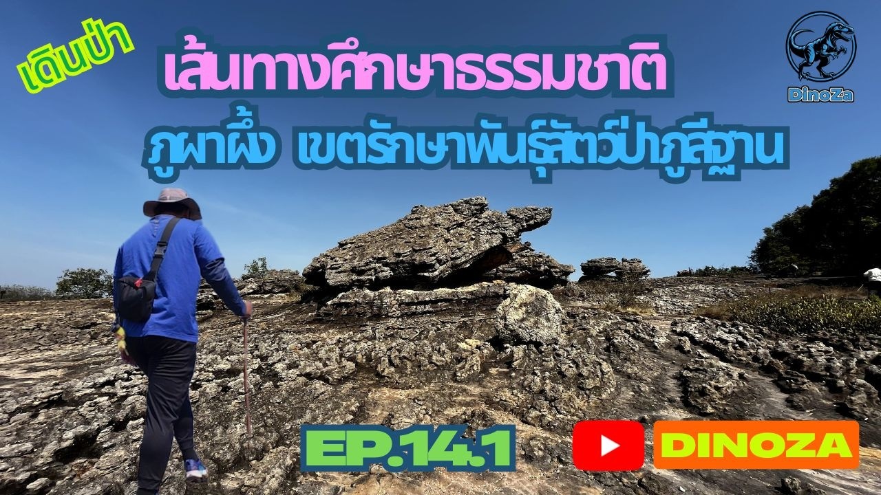
 Click to Access the Navigation Map GPS
Phu Si Than Wildlife Sanctuary Map
Recommend

 Art, Culture and Heritage
 Historical Sites and Monuments(2)
 Landmarks and Memorials(3)
 Art, Craft Centres, Tradition(2)
 Museums(1)
 Places of Worship
 Temple(17)
 Other Sacred Sites(4)
 Suburban Living
 Village, Community(4)
 Local Market(2)
National Parks and Marine Reserves(4)
Local Market(2)
National Parks and Marine Reserves(4)
 Mountain (Doi)(5)
 Dam, Reservoir, Lake(3)
 Waterfalls(5)
 Caves(2)
 River, Canal(2)
 Bays and Beaches(1)
 Other natural attractions(1)
 Entertainment and Agricultural
 Farms, Parks and Ecotourism(1)
 Travel Articles, Recipes
 Travel Review, Food Review(1)


