
lovethailand home >Northeastern Travel Attractions >Mukdahan Travel Attractions >Don Tan >Lao Mi > Phu Sa Dok Bua National Park
TL;DR: Phu Sa Dok Bua National Park, Mukdahan attractions : Nature and Wildlife, National Parks and Marine Reserves.

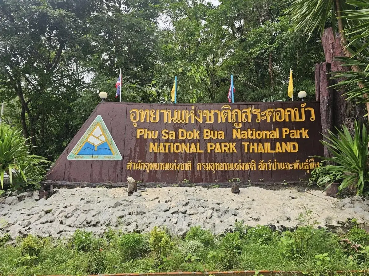
Phu Sa Dok Bua National Park
Open Days: Daily. Individual attractions and hiking routes may be temporarily closed because of seasonal conservation, weather, wildfire risk, maintenance, or safety conditions.
Opening Hours: 08:30–16:30 for the visitor centre. Long-distance hikes, remote viewpoints, and overnight activities must be arranged with park officers in advance.
Phu Sa Dok Bua National Park is one of northeastern Thailand’s most distinctive protected landscapes. The park stretches across the provincial boundaries of Mukdahan, Yasothon, and Amnat Charoen, covering forested mountains in Nikhom Kham Soi and Don Tan districts of Mukdahan, Loeng Nok Tha District of Yasothon, and Chanuman and Senangkhanikhom districts of Amnat Charoen. Its most famous natural feature is a group of water-filled rock pools on the summit of Phu Sa Dok Bua, where small white-and-pink aquatic flowers resembling miniature lotus plants grow naturally. Other highlights include prehistoric handprints and red-pigment paintings at Phu Pha Taem, seasonal wildflowers on the Phu Wat rock plateau, sunset views from Phu Pha Hom, the Phu Mu mountain landscape, and broad sandstone pavements known locally as “dan.”
The park cannot realistically be explored in a few hours. Its attractions are spread across different mountain sectors, and the routes range from easily accessible recreational areas near the headquarters to full-day wilderness hikes. Visitors seeking a relaxed experience can spend time around Huai Hin Kho Reservoir, the visitor centre, and the camping area. Those intending to see the summit lotus pools, remote cliffs, rock art, or distant viewpoints need more time, suitable hiking equipment, and advance coordination with park officers. The summit route to Phu Sa Dok Bua itself normally occupies most of a day.
Phu Sa Dok Bua was officially declared Thailand’s 75th national park on 30 December 1992. Its protected area covers approximately 144,375 rai, equivalent to about 231 square kilometres. Because the boundary follows a connected chain of mountains across three provinces, the park is important not only as a tourism destination but also as a watershed, a wildlife habitat, an ecological corridor, and a protected setting for archaeological evidence preserved on cliffs and beneath sandstone shelters.
The landscape consists of complex ridges running generally from northwest to southeast. Most of the terrain lies between approximately 350 and 450 metres above sea level, while the highest summit, Phu Krasae, reaches about 491 metres. Although the mountains are lower than many peaks in northern Thailand, the terrain remains demanding. Narrow ridges, exposed sandstone, steep slopes, stream channels, broken cliffs, and long distances between trailheads can make a route considerably more challenging than its elevation suggests.
One of the park’s defining geological features is its extensive sandstone pavement. Local people call these open rock surfaces “dan.” Some pavements cover many rai and appear almost level, while others are split by deep cracks, shallow drainage channels, weathered hollows, and irregular formations. Rainwater collects in natural depressions and creates small, isolated aquatic habitats. Some pools retain water for long periods, including the famous summit basins that gave Phu Sa Dok Bua its name.
The mountain range forms the headwaters of several streams, including Huai Thom and Huai Kan Lueang. Water descends through forested valleys before reaching the agricultural plains and communities surrounding the park. Forest cover plays an essential role in this system. Tree canopies, undergrowth, leaf litter, and intact soil slow surface runoff, reduce erosion, and retain moisture after the rainy season. Visitors travelling in the late monsoon period can see this relationship clearly in the full rock pools, green forest canopy, active streams, and flowering plants across the sandstone plateaus.
Vegetation varies according to elevation, moisture, soil depth, and exposure. Important forest communities include mixed deciduous forest, dry evergreen forest, dry dipterocarp forest, and dwarf dry dipterocarp woodland growing on shallow soil above the rock pavement. Deeper and moister valleys support taller trees and denser canopy, while exposed ridges are characterised by smaller, twisted trees adapted to drought, strong wind, and intense daytime heat.
Notable trees include makha mong, red padauk, Siamese rosewood, chingchan rosewood, and several species typical of dry dipterocarp forest. Open rock areas support bamboo grass, low shrubs, insectivorous plants, and seasonal wildflowers. When rainfall begins to decrease but moisture remains trapped in cracks and thin soil, numerous small flowers bloom almost simultaneously. The dark sandstone can then be dotted with purple, white, pink, and yellow, transforming a landscape that appears dry and austere during the hot season.
Wildlife recorded within the park includes barking deer, wild boar, hares, macaques, porcupines, mouse deer, and other small mammals. Birds include junglefowl and species associated with dry woodland, evergreen forest, and water sources. Large animals are rarely seen beside popular visitor areas, but observant hikers may notice tracks, feeding marks, droppings, alarm calls, or movement in the canopy. Remaining quiet and never leaving food behind reduces disturbance and helps prevent animals from becoming accustomed to human campsites.
The name Phu Sa Dok Bua refers to a mountain approximately 423 metres high. At its summit are 11 natural rock basins, each roughly 2–3 metres wide. Water remains in the pools for much of the year, supporting small white-and-pink aquatic flowers traditionally described as lotus. Local residents have known these unusual summit pools for generations and regard the plants as naturally established. Because lotus is normally associated with lowland ponds rather than isolated basins on a mountain, the site became known as the “mountain of lotus pools,” or Phu Sa Dok Bua.
The summit pools are extremely fragile microhabitats. Their water comes primarily from rainfall and is retained by the natural form of the sandstone. Water level, sediment, and plant growth therefore change with the season. Visitors must not enter the pools, touch or remove the plants, throw coins, wash equipment, or leave any substance in the water. Even limited trampling can damage roots, disturb sediment, and affect small aquatic organisms. The pools should be observed only from the route and viewing positions indicated by park officers.
Reaching the summit generally requires a full-day hike rather than a casual walk. Hikers need sufficient drinking water, food, proper footwear, sun protection, rain gear, personal medication, and a headlamp. The journey should begin early and follow the schedule established by the park. Starting late or entering without route information increases the risk of losing the trail, failing to return before dark, or encountering rapidly changing weather on an exposed ridge.
Phu Pha Taem combines a scenic cliff with one of the park’s most important archaeological sites. The sandstone has shifted and fractured to form a long overhang resembling a shallow cave. Approximately 98 red handprints and painted symbols appear on the rock face, generally 3–5 metres above the floor. Some prints clearly show fingers, while other images consist of lines, geometric forms, and symbols that may have been associated with communication, ritual activity, or collective identity.
The paintings are around 3,000 years old and share characteristics with prehistoric rock art elsewhere in northeastern Thailand, including the red hand imagery at Pha Taem National Park in Ubon Ratchathani. They demonstrate that cliffs and rock shelters in the greater Mekong region were used by prehistoric communities for residence, temporary shelter, organised activity, or ceremonial purposes. Visitors must never touch the paintings, pour water on the rock to intensify the colour, use flash at close range when restricted, or add modern markings. Skin oil, moisture, abrasion, and chemicals accelerate the loss of ancient pigment.
A visit to Phu Pha Taem normally takes about two hours, although the duration depends on the trailhead, weather, and the amount of time spent studying the paintings. The route includes soil, stone pavement, and sloping sections, so shoes with reliable grip are important after rain. The cliff is also known as a sunrise viewpoint. Early light reveals the shape of the surrounding ridges and the layered sandstone while creating a quieter atmosphere beneath the overhang.
Pha Makluea lies near the Phu Pha Taem area. It consists of open rock, a shaded overhang, and woodland that provides a comfortable resting place during a longer walk. Its appeal comes from the contrast between the sun-exposed pavement and the cooler, more humid environment beneath the cliff. Small ferns, mosses, weathering patterns, and plants adapted to shaded rock can be observed without leaving the established route.
The Phu Wat Wildflower Plateau is a broad sandstone surface where small flowering plants grow in cracks and pockets of thin soil. Characteristic species include en-a, kradum ngoen, and dusita. The most favourable period is from the end of the rainy season into the beginning of the cool season, when sufficient moisture remains but continuous heavy rain has eased. The flowers are small and delicate rather than forming a cultivated field, and their colours stand out against the dark rock and surrounding dry dipterocarp woodland.
Local communities once used the Phu Wat area for religious and belief-related activities, linking the mountain landscape with the social and spiritual life of nearby villages. Visitors should remain on existing paths because many flowering plants rise only a few centimetres above the ground and are difficult to see against the rock. Sitting, placing bags, or stepping outside the trail for a photograph can destroy an entire group of plants before their seeds mature.
Phu Pha Hom is one of the park’s principal sunset viewpoints. The summit area is approximately 386 metres above sea level and is reached by walking about 4 kilometres west from Ban Phu Pha Hom. The route passes bamboo woodland, sandstone pavement, and dry dipterocarp forest. Changes in soil depth and slope produce noticeable transitions in vegetation, from low plants rooted in rock cracks to taller forest in sheltered depressions.
From the viewpoint, visitors can see several neighbouring ridges, including Phu Mu, Phu Phaeng Ma, Phu Mai Sang, Phu Song, and Phu Akkharachat. The west-facing landscape is especially attractive around sunset, when successive ridges appear in layers. Anyone remaining for the sunset must carry a headlamp and return with an authorised guide or officer. Darkness falls quickly, cracks in the sandstone become difficult to see, and a route that is obvious in daylight may become confusing at night.
Phu Pha Taek is another viewpoint characterised by fractured rock, cliff formations, and wide northern views. In clear weather, distant mountain ranges of Mukdahan can be seen from the area. The site is also associated with memories of political conflict in the twentieth century. This combination of geological features and modern history gives the landscape meaning beyond its scenic value.
Several ridges, shelters, and hidden sections of the park preserve traces connected with periods of political tension in northeastern Thailand. Complex terrain could serve as an observation point, movement corridor, and place of refuge. These stories should be approached with sensitivity and respect for the experiences of local communities and people on all sides of the conflict. They form part of the region’s social history and help explain why some apparently remote cliffs remain important in local memory.
Phu Mai Sang requires more demanding access than areas near the headquarters. The route from Ban Khok Kham Lian to the summit is suitable for four-wheel-drive vehicles and may take approximately three hours, depending on road conditions. Pha Lap Fa on the western side offers sunset views towards Phu Phaeng Ma and Phu Mu. Visitors should enter only with appropriate vehicles, drivers experienced on forest roads, and current instructions from park staff.
Phu Mu, in Nikhom Kham Soi District of Mukdahan, has become known for its rock terraces, dry woodland, sunrise and sunset views, and seasonal ground orchids. The dragon-tongue orchid, locally called ueang lin mangkon, flowers during the rainy season and grows close to the ground among rocks and grasses. Because the plants are easily overlooked and damaged, visitors must remain within the designated walking corridor.
The Phu Mu protection unit is periodically closed for ecological restoration, wildfire management, and facility maintenance. In 2026, tourism and overnight stays in the Phu Mu sector were suspended from 1 March through 15 May, with the season reopening on 16 May. Seasonal dates can vary from year to year. Travellers should therefore check the park’s latest announcement even when the main headquarters and visitor centre remain open.
Huai Hin Kho Reservoir is located beside the national park headquarters and is considerably easier to reach than the remote summits. The reservoir provides a peaceful setting for relaxation, morning and evening light, and overnight stays. The headquarters area contains the visitor centre, park accommodation, a campsite, toilets, parking, and basic visitor facilities. Staying here allows hikers to begin early, check their equipment, and receive current trail information before departure.
Park houses and campsite availability should be confirmed in advance, particularly during the cool season, long weekends, and peak wildflower periods. Overnight visitors should bring food, drinking water, insect repellent, rubbish bags, and personal equipment. Shops are limited inside the forest and along remote routes. Cooking is permitted only in designated areas, fires must never be made on bare sandstone or beneath trees, and all food waste must be secured to prevent wildlife from entering the campsite.
Travellers who do not want a strenuous hike can remain around the visitor centre, Huai Hin Kho Reservoir, and any short-access attraction confirmed as open by the staff. A half-day visit can focus on Phu Pha Taem and Pha Makluea or on one viewpoint appropriate to the weather. Attempting to combine multiple sectors based only on map distance is not recommended, because actual travel time depends on forest-road conditions, transport arrangements, walking speed, official access times, and seasonal restrictions.
For a full-day excursion, the summit trail to Phu Sa Dok Bua should normally be treated as the day’s principal activity. An alternative is to combine Phu Pha Taem with a nearby wildflower or viewpoint area when access arrangements permit. Limiting the plan to one or two major locations provides time for rest, interpretation, and a safe return before dark. It also produces a more meaningful experience than rushing through several sites without observing the landscape.
The late rainy season and early cool season bring the greatest concentration of colour. Forest vegetation is fully revived, water fills natural depressions, and small plants such as en-a, kradum ngoen, and dusita begin to flower. Skies often clear dramatically after rain, creating changing cloud formations and good visibility. However, wet sandstone is slippery, drainage channels may still be active, and thunderstorms can develop quickly over exposed mountains.
The cool season is generally suitable for hiking, sunrise and sunset viewing, and camping. Early morning and nighttime temperatures are more comfortable, and drier trails are easier to walk. Nevertheless, exposed sandstone can remain hot during the middle of the day. Hikers need ample water, sun protection, and breathable long-sleeved clothing even when the morning begins with cool air.
During the hot season, dry dipterocarp trees shed leaves and reveal the underlying structure of the ridges and sandstone. The open scenery can be visually striking, but surface temperatures on the rock rise rapidly. Long walks should begin very early. The dry months also coincide with heightened wildfire risk, and individual areas may be restricted for safety. Smoking, discarded cigarette ends, open flames, and any activity capable of producing sparks are prohibited.
Photographers should plan according to the direction of light. Phu Pha Taem and east-facing viewpoints are best suited to morning light, while Phu Pha Hom, Pha Lap Fa, and western ridges are associated with sunset. Wildflowers are easier to photograph when the sun is less intense and details are not lost in harsh contrast. A close-focusing lens allows visitors to record small plants without stepping into fragile vegetation.
Drone operation inside a Thai national park requires authorisation under the applicable regulations. Open terrain is not an invitation to launch an aircraft without permission. Noise and downdraft can disturb birds, wildlife, other visitors, and park operations. Winds around cliffs and ridges can also change direction abruptly, increasing the chance of a crash and leaving equipment in an inaccessible natural area.
Getting There requires travelling on Highway 2277 between Loeng Nok Tha and Don Tan, then turning towards Ban Nong Mek in Pa Rai Subdistrict, Don Tan District, Mukdahan. The headquarters access junction is around kilometre markers 24–26. The park is approximately 28 kilometres from central Loeng Nok Tha and about 22 kilometres from Don Tan. A private or rental vehicle is the most practical option because public transport into the park is limited.
Travellers should refuel and purchase food and water in one of the district towns before continuing to the park. An ordinary passenger car can normally reach the headquarters, but routes to Phu Mai Sang and several remote sectors may require four-wheel drive or park-arranged transport. A standard car should never be taken onto a forest road without approval, as mud, erosion channels, loose stones, and steep gradients can immobilise or damage a vehicle.
The headquarters coordinates are 16.2331, 104.7789. Visitors should save an offline map because mobile reception can become unreliable in valleys and forested areas. The travel plan, intended destination, and estimated return time should be shared with companions, relatives, and park officers before entering a long trail.
The visitor centre operates daily from 08:30 to 16:30 and should be the first point of contact. Officers can provide information about open and closed areas, road and trail conditions, transport, expected walking time, guiding arrangements, and weather restrictions. An open entrance or visitor centre does not mean every wilderness route is available. Each sector is managed according to safety, ecological restoration, fire prevention, and local conditions.
Admission fees are 20 baht for Thai adults and 10 baht for Thai children. Foreign adults pay 200 baht and foreign children pay 100 baht. Admission does not include accommodation, camping, vehicles, equipment, transport, or guiding services, which are charged separately according to the service used. Carrying some cash is advisable because internet coverage and electronic payment systems may be inconsistent in remote locations.
Essential hiking equipment includes shoes with deep tread, spare socks, drinking water, energy-rich food, a hat, rain protection, a headlamp, a fully charged telephone, a power bank, personal medication, and a compact first-aid kit. Clothing should offer reasonable protection from sun, insects, and branches while remaining breathable. Long-distance hikers should avoid carrying loose objects in both hands, as hands may be needed for balance on sloping or broken rock.
Families travelling with young children or older adults should prioritise the headquarters, reservoir, and locations confirmed by officers as easy to access. Routes involving cliffs, slippery rock, or several hours of walking are unsuitable for small children. Visitors with heart conditions, high blood pressure, joint problems, severe allergies, or limited mobility should evaluate their condition carefully and inform their companions before entering a trail.
Responsible travel begins with leaving no rubbish, removing no stones or plants, feeding no wildlife, and keeping noise low. Every food wrapper and container taken into the forest must be carried out again. Food waste must not be buried or thrown beneath trees, as it changes animal behaviour and attracts wildlife to campsites. Reusable bottles and containers reduce waste far more effectively than bringing multiple layers of disposable packaging.
The rock paintings, summit pools, wildflower plateaus, and dwarf woodland are all easily damaged. Ancient pigment cannot be restored after vandalism. Some flowers remain in bloom for only a few weeks, and the summit pools are small enough for minor contamination to affect the entire habitat. Remaining on the established trail and observing from a respectful distance are therefore integral parts of the experience rather than unnecessary restrictions.
Phu Sa Dok Bua National Park is particularly rewarding for travellers who want to understand the variety of northeastern Thailand’s upland environment in one protected area. Sandstone pavements, dry dipterocarp woodland, dry evergreen forest, cliffs, summit pools, seasonal flowers, prehistoric rock art, and modern historical memories occur within the same mountain system. A good visit is not measured by the number of viewpoints photographed but by choosing a realistic route, following local guidance, and noticing the smaller details of the forest.
Travellers with two days and one night can arrive in the afternoon, contact the visitor centre, settle into a park house or campsite, and spend the evening near Huai Hin Kho Reservoir. The principal hike can then begin early the following morning. This plan avoids driving a long distance and immediately entering a strenuous trail. Visitors who prefer not to stay in the park can use accommodation in Don Tan or Loeng Nok Tha, approximately 22–30 kilometres from the headquarters.
Most established restaurants and larger convenience shops are located in Don Tan and Loeng Nok Tha. Meals, water, and trail provisions should therefore be arranged before entering the forest. Don Tan offers riverside dining options suitable for an evening meal after leaving the park, while Loeng Nok Tha has local restaurants, cafés, and coffee shops. Calling a restaurant or accommodation before departure is advisable because local opening times can change for private holidays or special events.
The park is currently managed by Ms Pinpinat Hasanam, Head of Phu Sa Dok Bua National Park. The headquarters is at Ban Nong Mek, Pa Rai Subdistrict, Don Tan District, Mukdahan 49120. For information about trail status, park houses, camping, remote hikes, or four-wheel-drive access, contact the park directly at 042-620615. Advance coordination is essential for the summit, isolated viewpoints, and routes away from the headquarters.
As of 17 July 2026, no park-wide tourism closure is listed for Phu Sa Dok Bua National Park. The Phu Mu sector reopened after its 2026 seasonal closure ended on 15 May. Heavy rain, wildfire, road repairs, or ecological restoration may still result in short-notice restrictions at individual locations. Checking the park’s official Facebook announcement and calling the office should therefore be the final step before every visit.
The significance of Phu Sa Dok Bua lies in the many layers preserved within one landscape. Sandstone records the slow formation and weathering of the mountains. Cliff walls retain handprints created thousands of years ago. Forest and streams sustain present-day communities and wildlife, while local names and memories connect modern residents with the mountains. Approaching the park with this wider understanding turns a sightseeing trip into an encounter with the natural and cultural history of northeastern Thailand.
| Name | Phu Sa Dok Bua National Park |
| Thai Name | อุทยานแห่งชาติภูสระดอกบัว |
| Location | The border region of Mukdahan, Yasothon, and Amnat Charoen provinces in northeastern Thailand |
| Headquarters Address | Ban Nong Mek, Pa Rai Subdistrict, Don Tan District, Mukdahan 49120, Thailand |
| Coordinates | 16.2331, 104.7789 |
| Area | Approximately 144,375 rai, equivalent to about 231 square kilometres |
| Established | 30 December 1992 as Thailand’s 75th national park |
| Protected Districts | Nikhom Kham Soi and Don Tan in Mukdahan; Loeng Nok Tha in Yasothon; and Chanuman and Senangkhanikhom in Amnat Charoen |
| Highest Point | Phu Krasae, approximately 491 metres above sea level |
| Highlights | Eleven summit rock pools with natural aquatic flowers, approximately 98 prehistoric handprints and painted symbols, seasonal wildflower plateaus, dwarf dipterocarp woodland, rock formations, sunrise and sunset viewpoints |
| Name Origin | Named after water-filled rock pools on the 423-metre summit where small white-and-pink lotus-like plants grow naturally |
| Landscape | Forested ridges, cliffs, rock shelters, sandstone pavements known as dan, summit pools, headwater valleys, and seasonal streams |
| Forest Types | Mixed deciduous forest, dry evergreen forest, dry dipterocarp forest, dwarf dry dipterocarp woodland, grassland, and rock-pavement plant communities |
| Notable Flora And Fauna | Makha mong, red padauk, Siamese rosewood, chingchan rosewood, en-a, kradum ngoen, dusita, dragon-tongue orchid, barking deer, wild boar, hares, macaques, porcupines, mouse deer, junglefowl, and forest birds |
| Main Areas / Zones | 1. Headquarters and Huai Hin Kho Reservoir 2. Phu Pha Taem prehistoric rock-art cliff 3. Pha Makluea 4. Phu Wat Wildflower Plateau 5. Phu Pha Hom 6. Phu Sa Dok Bua summit 7. Phu Pha Taek 8. Phu Mai Sang and Pha Lap Fa 9. Phu Mu 10. Sandstone pavements and dwarf woodland around Phu Bok, Phu Hua Nak, and neighbouring ridges |
| Open Days | Daily, although individual routes may close seasonally or because of weather, restoration, or wildfire risk |
| Opening Hours | 08:30–16:30 for the visitor centre |
| Admission Fees | Thai visitors: adults 20 baht, children 10 baht Foreign visitors: adults 200 baht, children 100 baht Accommodation, camping, vehicles, transport, and other services are charged separately |
| Facilities | Visitor centre, park houses, campsite, toilets, parking, and a recreational area beside Huai Hin Kho Reservoir |
| Activities | Hiking, nature study, rock-art viewing, wildflower observation, birdwatching, sunrise and sunset viewing, photography, and camping |
| Best Season | Late rainy season through the cool season for wildflowers, green forest, viewpoints, and more comfortable hiking |
| Recommended Duration | 2–4 hours near the headquarters, approximately half a day for Phu Pha Taem, a full day for the Phu Sa Dok Bua summit, and 2 days / 1 night for a more complete hiking visit |
| Travel Information | Take Highway 2277 between Loeng Nok Tha and Don Tan and turn towards Ban Nong Mek around kilometre markers 24–26. The headquarters is approximately 28 kilometres from Loeng Nok Tha and 22 kilometres from Don Tan. |
| Suitable Vehicles | Ordinary vehicles can reach the headquarters. Four-wheel drive and prior coordination are required for Phu Mai Sang and certain forest routes. |
| Park Head | Ms Pinpinat Hasanam, Head of Phu Sa Dok Bua National Park |
| Main Contact Number | 042-620615 |
| Official Channels | Facebook: Phu Sa Dok Bua National Park and the Department of National Parks’ national park accommodation reservation system |
| Current Status | Open for tourism as of 17 July 2026. The Phu Mu sector reopened after its seasonal closure ended on 15 May 2026. |
| Visitor Guidelines | Contact officers before long hikes, never touch rock paintings, do not enter the summit pools, do not pick flowers or feed wildlife, obtain permission before flying a drone, and carry all rubbish out of the park |
| Nearby Tourist Attractions | Approximate driving distances from the park headquarters 1. Phu Kham Dueai Viewpoint, Chanuman, 10 km 2. Phu Sung Charoen Tham Buddhist Park, 15 km 3. Phu Wat, 17 km 4. Ban Rai Rung Tawan, 17 km 5. Wat Matchimawat and the Mahorathuk Drum, 18 km 6. Phu Mu, Nikhom Kham Soi District, 35 km |
| Nearby Restaurants | Approximate driving distances from the park headquarters 1. Had Hin Restaurant & Resort, Don Tan, 25 km, Tel. 062-1071255, 097-0493423 2. Gho Dang Khao Chaiyakul Farm Outlet, Loeng Nok Tha, 29 km, Tel. 099-2683819 3. Organic Cafe, Loeng Nok Tha, 29 km, Tel. 063-6326644 4. Passion Coffee & Roaster, Loeng Nok Tha, 29 km, Tel. 099-8188968 5. Tiao Lop Soi, Loeng Nok Tha, 29 km |
| Nearby Accommodations | Approximate driving distances from the park headquarters 1. Phu Sa Dok Bua National Park Houses And Campsite, 0 km, Tel. 042-620615 2. Rim Khong View, Don Tan, 25 km, Tel. 091-0502107 3. Had Hin Restaurant & Resort, Don Tan, 25 km, Tel. 062-1071255, 097-0493423 4. Google House Hotel Loeng Nok Tha Resort, 29 km 5. Ban Rai Chai Nam Resort, Loeng Nok Tha, 30 km, Tel. 081-9392913 6. Nok Noi Resort, Loeng Nok Tha, 31 km, Tel. 084-6596270 |
Frequently Asked Questions (FAQ)
Q: Which province is Phu Sa Dok Bua National Park in?
A: The park extends across Mukdahan, Yasothon, and Amnat Charoen provinces. Its headquarters is at Ban Nong Mek, Pa Rai Subdistrict, Don Tan District, Mukdahan.
Q: Is Phu Sa Dok Bua National Park open every day?
A: The visitor centre is open daily from 08:30 to 16:30. Individual trails may close because of seasonal conservation, heavy rain, wildfire risk, maintenance, or restoration, so visitors should contact the park before travelling.
Q: How much is the entrance fee?
A: Thai adults pay 20 baht and Thai children 10 baht. Foreign adults pay 200 baht and foreign children 100 baht. Accommodation, camping, vehicles, and other services are charged separately.
Q: What is the best time to visit Phu Sa Dok Bua National Park?
A: The late rainy season through the cool season is best for seasonal wildflowers, green forest, viewpoints, and comfortable hiking. Wet sandstone may still be slippery immediately after rain.
Q: Can the Phu Sa Dok Bua summit be visited as a day trip?
A: Yes, when the route is officially open and park officers approve access. It is a full-day hike that should begin early and requires water, food, suitable footwear, rain protection, and compliance with the park’s route instructions.
Q: How long does it take to visit the Phu Pha Taem rock paintings?
A: The visit normally takes about two hours or longer, depending on the trailhead, weather, walking speed, and the time spent studying the prehistoric paintings.
Q: Are camping and park accommodation available?
A: Park houses and a campsite are available near Huai Hin Kho Reservoir at the headquarters. Availability should be checked in advance by calling 042-620615 or using the Department of National Parks’ reservation system.
Q: Can an ordinary car reach every attraction?
A: An ordinary car can normally reach the headquarters. Phu Mai Sang and several remote forest routes require four-wheel drive, current road information, and advance coordination with park officers.
 Category: ●Nature and Wildlife
 Group: ●National Parks and Marine Reserves
Last Update : 3 MonthAgo
 Last Update : 3 MonthAgo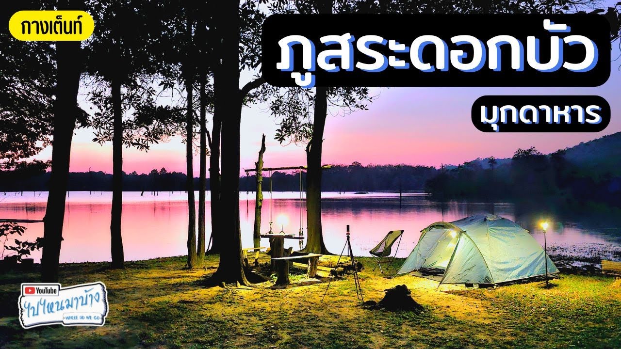
 Click to Access the Navigation Map GPS
Phu Sa Dok Bua National Park Map
Recommend

 Art, Culture and Heritage
 Historical Sites and Monuments(2)
 Landmarks and Memorials(3)
 Art, Craft Centres, Tradition(2)
 Museums(1)
 Places of Worship
 Temple(17)
 Other Sacred Sites(3)
 Suburban Living
 Village, Community(4)
 Local Market(2)
National Parks and Marine Reserves(4)
Local Market(2)
National Parks and Marine Reserves(4)
 Mountain (Doi)(5)
 Dam, Reservoir, Lake(3)
 Waterfalls(5)
 Caves(2)
 River, Canal(2)
 Bays and Beaches(1)
 Other natural attractions(1)
 Entertainment and Agricultural
 Farms, Parks and Ecotourism(1)
 Travel Articles, Recipes
 Travel Review, Food Review(1)


