
lovethailand home >North Travel Attractions >Sukhothai Travel Attractions > 40 Places to Visit in Sukhothai Northern Thailand
TL;DR: 40 Places to Visit in Sukhothai Northern Thailand, open Daily Opening Hours: 06:30 – 19:30.
40 Places to Visit in Sukhothai Northern Thailand
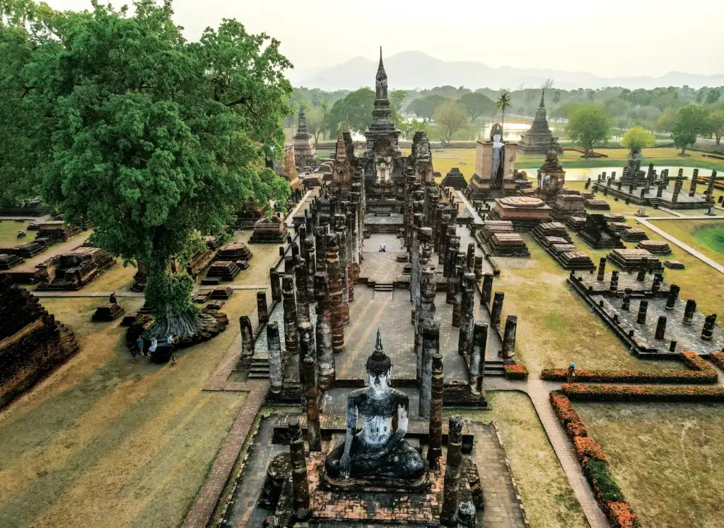
40 Places to Visit in Sukhothai: Must-See Attractions in Northern Thailand Sukhothai is an ideal destination for travelers who want to experience World Heritage history, early Thai art, ancient temples and archaeological sites, mountain landscapes, local communities, traditional crafts, and regional cuisine. The image most people associate with Sukhothai is the old city, where ancient stupas, Buddha images, and historic reservoirs are scattered among mature trees. Beyond Sukhothai Historical Park, however, the province offers many other types of attractions, from Si Satchanalai and Ban Na Ton Chan to the Khao Luang mountain range, forests, national parks, and waterfalls in the northern part of the province. Travelers with only 1 day should begin with Old Sukhothai and its major monuments. With 2–3 days, Si Satchanalai and Ban Na Ton Chan can be added, while a 4–5 day trip allows enough time to explore Khao Luang, national parks, and nature trails in greater depth.
Sukhothai is located in Thailand’s Lower North, connecting the Yom River basin with mountain ranges to the west and north. This varied geography played an important role in the development of settlements from ancient times. The plains were suitable for permanent communities and agriculture, while the mountains provided headwaters, forests, and natural resources. Ancient moats, reservoirs known locally as traphang, dams, and waterways that remain visible around Old Sukhothai demonstrate that the people of the past did more than build temples and cities; they also developed systematic knowledge of water management and the use of the natural landscape.
Sukhothai’s importance in Thai history is closely associated with the Sukhothai Kingdom, which flourished between the 13th and 15th centuries and left an enduring legacy in art, Buddhism, governance, language, craftsmanship, and urban planning. Sukhothai art developed distinctive characteristics that can be seen in Buddha images, lotus-bud stupas, and graceful sculptural forms. Old Sukhothai and Si Satchanalai therefore function almost like vast open-air museums, allowing visitors to study the development of art and religious beliefs directly within the historic landscape rather than only through objects displayed behind museum glass.
Sukhothai Historical Park and Si Satchanalai Historical Park form part of the UNESCO World Heritage property known as the Historic Town of Sukhothai and Associated Historic Towns, which was inscribed in 1991. Visiting both historic cities provides a more complete understanding of Sukhothai. Sukhothai served as an important political and religious center, while Si Satchanalai played major roles in religion, craftsmanship, Sangkhalok ceramic production, and regional trade networks. Although the two areas share several architectural and artistic characteristics, their atmosphere and surrounding landscapes are distinctly different.
Sukhothai is also associated with one of Thailand’s most recognizable cultural traditions, the Loy Krathong and Candle Festival held in the historic city. The celebration combines illuminated ancient monuments with candlelight, floating krathong, cultural performances, and historical storytelling. Beyond major festivals, communities in Si Satchanalai and rural districts continue to preserve traditional crafts, local cuisine, weaving, mud-dyed textiles, woodwork, and agricultural lifestyles, meaning that a journey through Sukhothai extends far beyond archaeological sightseeing.
The province’s best-known local dish is Sukhothai-style noodles, which combine sweet, sour, salty, and spicy flavors in a single bowl and are commonly served with barbecued pork, long beans, peanuts, and characteristic seasonings. Ban Na Ton Chan is also known for khao poep, while other districts offer Lower Northern Thai cuisine and seasonal agricultural products. Popular souvenirs include Sangkhalok ceramics, mud-dyed textiles, locally woven fabrics, wooden handicrafts, and community products made by local groups.
Dividing Sukhothai into travel zones makes itinerary planning easier. Old Sukhothai is best suited to travelers interested in history, temples, museums, and cycling. Si Satchanalai combines a World Heritage city, Sangkhalok ceramics, and Ban Na Ton Chan, while Khiri Mat and Ban Dan Lan Hoi are well suited to hiking and trips to Khao Luang. Northern areas of the province contain national parks, waterfalls, caves, and headwater forests. This variety makes Sukhothai suitable for families, couples, history enthusiasts, photographers, cyclists, and travelers who enjoy outdoor activities.
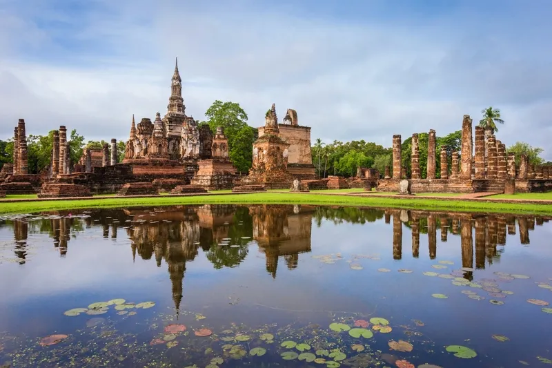
1. Sukhothai Historical Park, also known as Old Sukhothai, is located in Mueang Kao Subdistrict, Mueang Sukhothai District, approximately 12 kilometers from the modern city center. It is the heart of tourism in the province and one of the principal areas within the World Heritage property of the Historic Town of Sukhothai and Associated Historic Towns. The park contains numerous ancient monuments, including temples, royal structures, city walls, moats, gateways, reservoirs, and historic water-management systems that demonstrate the sophisticated urban planning of the Sukhothai period.
Highlights: Wat Mahathat, Wat Sa Si, Wat Si Sawai, Wat Traphang Ngoen, the King Ramkhamhaeng Monument, city walls, moats, historic reservoirs, cycling routes, and the distinctive World Heritage atmosphere that is particularly enjoyable in the morning and evening.
The historic city extends far beyond the central zone inside the city walls. Important archaeological sites are scattered in several directions. To the north are Wat Si Chum and Wat Phra Phai Luang, while the western zone contains Wat Saphan Hin and the Saritphong Dam. Other sections preserve additional temples and components of the ancient hydraulic network. Travelers who want to understand the city in depth should therefore allow at least one full day.
One of the most popular ways to explore the park is by bicycle. Distances between the principal monuments are relatively manageable and much of the terrain is flat. Cycling also makes it easier to notice sections of the city wall, reservoirs, tree-lined roads, and smaller temples that can easily be overlooked when traveling only by car.
Morning is particularly suitable for Wat Mahathat, Wat Sa Si, and the central zone because temperatures are cooler and the softer light is excellent for photography. In the evening, stupas and reservoirs often produce beautiful reflections on the water. Travelers interested in history should consider visiting Ramkhamhaeng National Museum before or after exploring the archaeological area to connect the monuments with objects excavated from the site.
Open Days: Daily Opening Hours: 06:30 – 19:30
Getting There: From central Sukhothai, follow Highway 12 west for approximately 12 kilometers. Visitors can travel by private car, rental car, local songthaew serving Old Sukhothai, or taxi. Within the historical park, visitors can walk, cycle, or use sightseeing trams to explore the monuments.
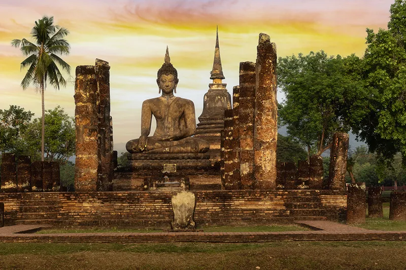
2. Wat Mahathat is one of the most important archaeological sites in Sukhothai Historical Park. Located at the center of the ancient city, it once served as the principal royal temple of the capital. Its location reflects the concept of placing an important religious sanctuary at the heart of the city, where it functioned as a ceremonial area, center of Buddhist devotion, and symbol of royal authority.
Highlights: The lotus-bud principal stupa, 8 surrounding stupas, the main assembly hall, mandapas with monumental standing Buddha images, numerous Buddha sculptures, satellite stupas, and surviving stucco work that reflects the elegance of Sukhothai art.
The temple complex is extensive and architecturally sophisticated. It includes stupas, assembly halls, mandapas, an ordination hall, and numerous smaller monuments, demonstrating that Wat Mahathat once functioned as a major religious center serving both the royal court and the wider urban population. Standing among laterite columns, stupas, and monumental Buddha images gives visitors a clear impression of the original scale of the sanctuary.
The lotus-bud principal stupa is one of the temple’s most distinctive features and is closely associated with classical Sukhothai architecture. The main monument, surrounded by subsidiary stupas and the remains of assembly halls, creates one of the most recognizable views in Old Sukhothai and makes Wat Mahathat an essential place for studying architecture and photography.
Visitors should allow at least 45 minutes to 1 hour, and longer if they want to photograph the complex in detail. Morning and late-afternoon light accentuate the texture of the laterite and the form of the stupas particularly well. Wat Si Sawai, Wat Sa Si, and the King Ramkhamhaeng Monument are all within easy reach.
Open Days: Daily Opening Hours: Monday–Friday and Sunday 06:30 – 19:30 / Saturday 06:30 – 21:00
Getting There: Travel approximately 12 kilometers from central Sukhothai to Mueang Kao and enter the central zone of Sukhothai Historical Park. Wat Mahathat is located near the center of the ancient city and can be explored on foot, by bicycle, or by sightseeing tram.
Map (GPS):Open Google Maps – Wat Mahathat
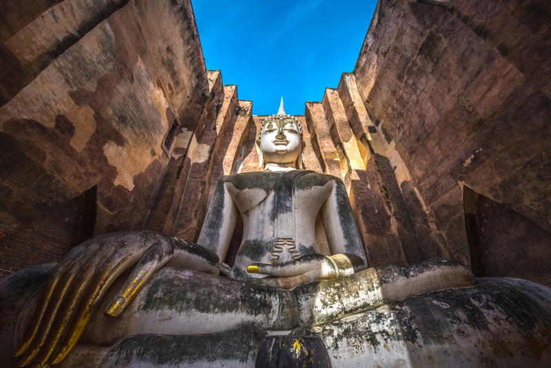
3. Wat Si Chum is one of the most recognizable symbols of Sukhothai. Located outside the northern city wall of the historical park, the temple is famous for its massive mandapa containing Phra Achana, a monumental stucco Buddha image in the posture of subduing Mara. The image fills much of the interior space and has a serene, gentle expression that feels particularly powerful when viewed through the tall opening in the front of the mandapa.
Highlights: The monumental Phra Achana Buddha image, thick-walled mandapa, passageway inside the walls, the story of the “speaking Buddha,” Sukhothai-period art, and the iconic photographic view of the Buddha’s hand and face.
Phra Achana has a lap width of more than 11 meters and sits inside a mandapa designed so that visitors standing outside can see the Buddha through a high vertical opening. The surrounding walls frame the image, creating a visual experience very different from that of a free-standing outdoor Buddha and making Wat Si Chum an important example of sacred-space design during the Sukhothai period.
The well-known story of the “speaking Buddha” is associated with a passageway inside the thick walls of the mandapa, which could carry sound from the upper part of the structure to people below. The story became part of the historical memory of Wat Si Chum and adds architectural, historical, and legendary dimensions to the site.
Wat Si Chum is suitable for visitors interested in history, Buddhist art, and photography. Visitors should avoid touching or climbing the ancient structures. The temple can be combined with Wat Phra Phai Luang or followed by a return to the central zone for Wat Mahathat and Ramkhamhaeng National Museum.
Getting There: Wat Si Chum lies north of Sukhothai Historical Park, approximately 2 kilometers from Wat Mahathat. It can be reached by bicycle, car, motorcycle, or sightseeing routes through the Old Sukhothai area.
Map (GPS):Open Google Maps – Wat Si Chum
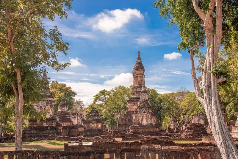
4. Si Satchanalai Historical Park is another World Heritage city essential to understanding the history of Sukhothai. Located in Si Satchanalai District among the Yom River, hills, and forests, the site reveals another dimension of the Sukhothai world. While Old Sukhothai reflects the role of a royal capital, Si Satchanalai provides insight into an important city associated with religion, craftsmanship, Sangkhalok ceramics, trade, and regional administration.
Highlights: Wat Chang Lom, Wat Chedi Chet Thaeo, Wat Nang Phaya, Wat Khao Phanom Phloeng, ancient Chaliang, cycling routes, and a spacious, tree-filled historic landscape.
Si Satchanalai developed from the earlier settlement of Chaliang before its role and identity changed as the Sukhothai Kingdom flourished. The monuments therefore reflect several historical phases, including pre-Sukhothai traditions, classical Sukhothai architecture, and later influences. Exploring the area is particularly rewarding when compared with Old Sukhothai.
Cycling is especially suitable for the historical park because monuments are spread through a quiet and shaded landscape with abundant greenery. A route from Wat Chang Lom to Wat Chedi Chet Thaeo and Wat Nang Phaya allows visitors to compare architectural forms while also seeing how the temples relate to surrounding hills.
Travelers spending 2–3 days in Sukhothai should ideally devote one full day to Si Satchanalai. The historical park can also be combined with Ban Na Ton Chan, allowing visitors to experience both World Heritage archaeology and living community culture.
Open Days: Daily Opening Hours: 08:30 – 16:30
Getting There: From Sukhothai city, follow Highway 101 toward Si Satchanalai District and continue to the old city around Kaeng Luang. A private car or rental vehicle is the most convenient option, especially for continuing to Ban Na Ton Chan and other attractions around the district.
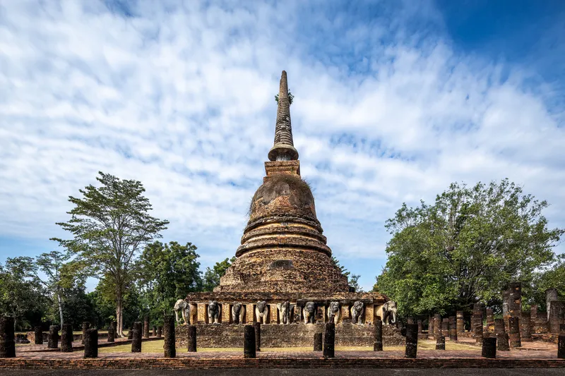
5. Wat Chang Lom is one of the most famous monuments in Si Satchanalai Historical Park. Located on the plain near Khao Phanom Phloeng, its most distinctive feature is a large Sri Lankan-style bell-shaped stupa with a base surrounded by full-bodied stucco elephants.
Highlights: The bell-shaped principal stupa, 39 stucco elephants, circumambulatory base, assembly hall, subsidiary stupas, and a temple plan that reflects the sanctuary’s importance in ancient Si Satchanalai.
The elephants are not merely decorative features but carry symbolic associations with the support of Buddhism, strength, and stability. Elephants at the corners are larger than the others, and traces of decorative stucco remain visible around the neck and legs of some figures.
A large assembly hall once stood in front of the stupa, while subsidiary stupas and smaller archaeological structures surround the complex. This demonstrates that Wat Chang Lom was an important religious site rather than an isolated stupa. Visitors should walk around the base to observe the elephants from several sides and appreciate the overall temple layout.
Wat Chang Lom can easily be combined with Wat Chedi Chet Thaeo and Wat Nang Phaya because the three monuments stand close together. Walking or cycling between them is generally more enjoyable than repeatedly returning to a vehicle.
Open Days: Daily Opening Hours: 08:00 – 17:00
Getting There: Wat Chang Lom is located inside Si Satchanalai Historical Park and can be reached from the visitor center by bicycle, tram, or other transport permitted along the park routes.
Map (GPS):Open Google Maps – Wat Chang Lom
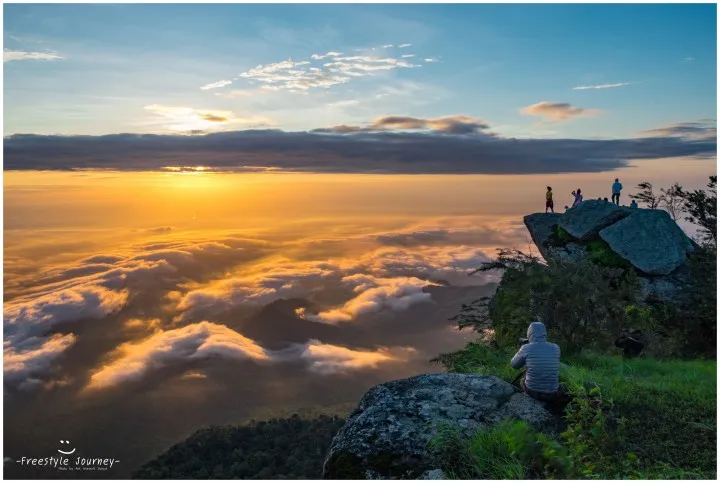
6. Ramkhamhaeng National Park (Khao Luang) is one of Sukhothai’s most important natural areas, extending across Khiri Mat, Mueang Sukhothai, and Ban Dan Lan Hoi districts. The park contains high mountains, forests, waterfalls, medicinal plants, caves, and traces of historic routes. Its best-known destination is Khao Luang, one of the most popular trekking areas in Thailand’s Lower North.
Highlights: Khao Luang summit, panoramic viewpoints and mist, Sai Rung Waterfall, hiking routes, native medicinal plants, mixed deciduous and montane forest, and historical traces associated with Sukhothai.
The trail to Khao Luang requires considerably more physical preparation than sightseeing in the old city. The route climbs through mountainous terrain and normally requires several hours of walking. Travelers planning an overnight stay should check current rules regarding camping, registration, and trail access, especially during periods when sections may be closed for ecological recovery or unsafe weather.
From higher elevations, visitors gain wide views across the surrounding Sukhothai landscape, offering a completely different perspective from the plains below. The journey also helps reveal the relationship between mountain ranges, headwater forests, and the historic settlements at lower elevations. Additional natural attractions within the park are suitable for visitors who do not intend to complete the full summit trek.
The park is especially suitable for hikers, nature photographers, and travelers who want to add an outdoor dimension to a Sukhothai itinerary. On longer trips, it is best to dedicate a separate day or overnight stay to Khao Luang instead of combining a demanding hike with a full day of archaeological sightseeing.
Getting There: From Sukhothai city, travel toward Khiri Mat District and continue to Ramkhamhaeng National Park headquarters. A private car is the most convenient option, particularly for visitors carrying trekking or camping equipment.
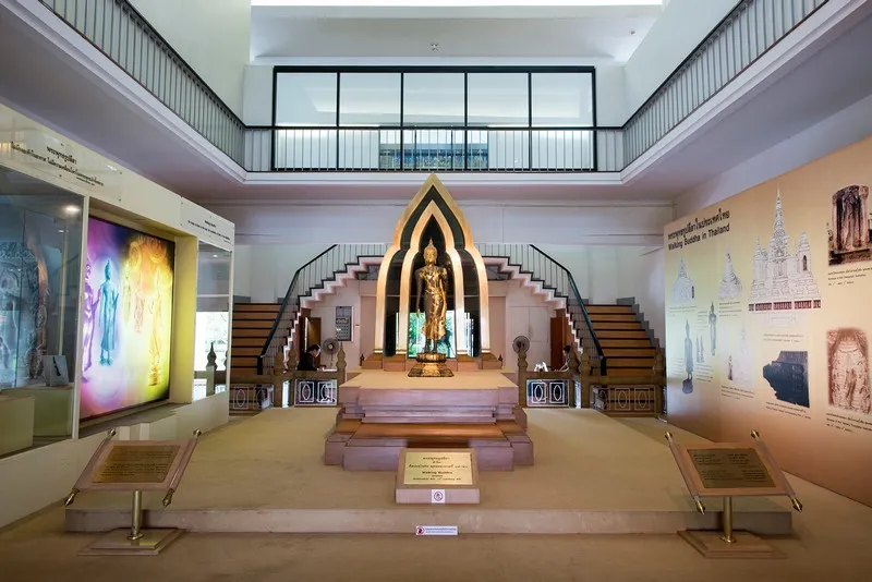
7. Ramkhamhaeng National Museum is located near Sukhothai Historical Park and is an important museum operated by Thailand’s Fine Arts Department. It helps explain the context of ancient Sukhothai through archaeological objects, artworks, sculptures, Sangkhalok ceramics, and excavated evidence displayed systematically.
Highlights: Sukhothai-style Buddha images, archaeological finds from Old Sukhothai, Sangkhalok ceramics, inscriptions, sculptures, historic household objects, and exhibitions explaining the development of the Sukhothai Kingdom.
The museum is particularly useful before exploring the historic city because it helps visitors understand the origins and significance of the stupas, Buddha images, and archaeological remains seen outside. It can also be visited afterward to connect the many individual sites into a more coherent historical narrative.
The collection extends beyond religious art and also reflects everyday life, trade, craftsmanship, and Sukhothai’s relationships with other cities. Sangkhalok ceramics are particularly important evidence of a sophisticated production and trading system that contributed to the regional economy.
The museum is suitable for families, students, and travelers who want a stronger understanding of history before exploring the archaeological landscape. Wat Mahathat, Wat Si Sawai, and the King Ramkhamhaeng Monument are all nearby.
Open Days: Daily Opening Hours: 09:00 – 16:00
Getting There: The museum is located on Charot Withi Thong Road in Mueang Kao Subdistrict, near the entrance to the central zone of Sukhothai Historical Park. It can be reached by private car, rental car, songthaew, taxi, bicycle, or on foot from accommodation in Old Sukhothai.
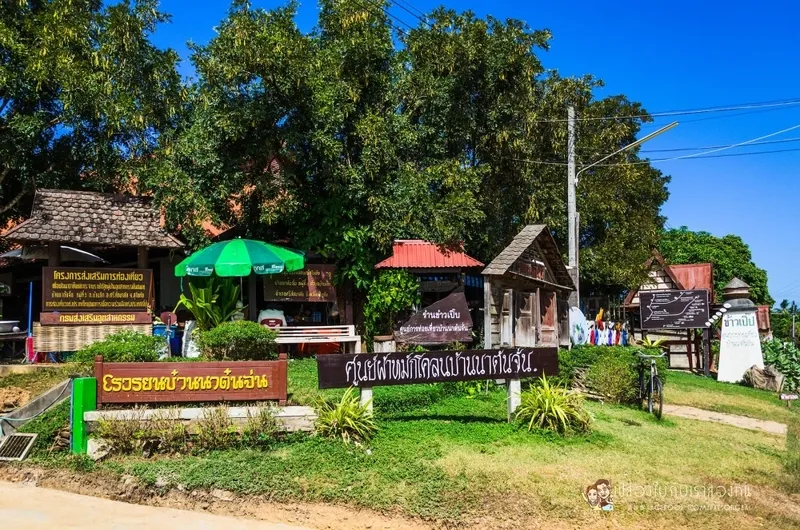
8. Ban Na Ton Chan is a community-based tourism village in Ban Tuek Subdistrict, Si Satchanalai District. The village is surrounded by rice fields, fruit orchards, mountains, and agricultural land. Its cultural roots are associated with Northern Thai communities and historical connections with Laplae, while local speech, food, handicrafts, and close-knit community traditions remain clearly visible.
Highlights: Community homestays, local tractor tours, Huai Ton Hai viewpoint, mud-dyed textiles, khao poep, seasonal orchards, handicrafts, cycling through rice fields, and opportunities to learn directly from local residents.
Staying in a community homestay is an important part of the experience because it allows visitors to spend time with local people, enjoy home-cooked food, and understand a rhythm of life different from a hotel stay. Travelers are not simply observing a destination but can learn through activities and conversations with residents.
One of the community’s most famous traditions is mud-dyed textile production, which developed from local weaving and a process of treating fabric with mud to create distinctive characteristics. Wooden handicrafts, seasonal agricultural products, and food such as khao poep are also important parts of the Ban Na Ton Chan experience.
Ban Na Ton Chan is suitable for travelers with at least half a day, but spending 1 night provides a fuller experience, particularly in the evening and early morning. Visitors who want a homestay, tractor tour, meals, or organized group activities should contact the community in advance.
Getting There: From Sukhothai city, follow Highway 101 toward Si Satchanalai District, then continue into Ban Tuek Subdistrict and Ban Na Ton Chan. A private car or rental vehicle is the most convenient option, and the village can easily be combined with Si Satchanalai Historical Park.
Map (GPS):Open Google Maps – Ban Na Ton Chan
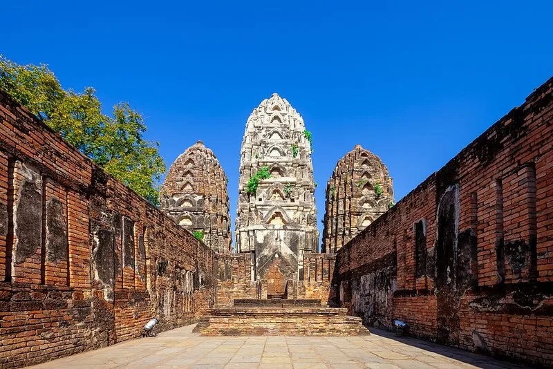
9. Wat Si Sawai is an important archaeological site within the walls of Old Sukhothai and differs markedly from most other Sukhothai temples. Its 3 prang towers show strong Khmer and Lopburi artistic influences, making the site important evidence of cultural and religious transitions before Sukhothai developed into a major center of Theravada Buddhism.
Highlights: 3 prang towers, Khmer- and Lopburi-influenced architecture, traces of an earlier Brahmanical-Hindu sanctuary, stucco decoration, and the later adaptation of the site for Buddhist use.
The form of the prang towers contrasts strongly with the lotus-bud stupas seen at Wat Mahathat and other Sukhothai monuments. Wat Si Sawai is therefore particularly valuable for travelers who want to understand Sukhothai as a city shaped by several cultural traditions rather than a civilization that developed in isolation.
The temple stands close to Wat Mahathat and can easily be reached on foot or by bicycle. Visiting both sites on the same route clearly demonstrates the contrast between Khmer-influenced architecture and the distinctive Sukhothai style that developed later.
Visitors interested in archaeology and architecture should walk around the towers to observe their forms from several angles while avoiding touching, scratching, or climbing the monuments. Wat Sa Si, Wat Traphang Ngoen, and Ramkhamhaeng National Museum can be visited afterward.
Getting There: Wat Si Sawai is located in the central zone of Sukhothai Historical Park near Wat Mahathat. It can be reached on foot, by bicycle, or by the park’s sightseeing tram.
Map (GPS):Open Google Maps – Wat Si Sawai
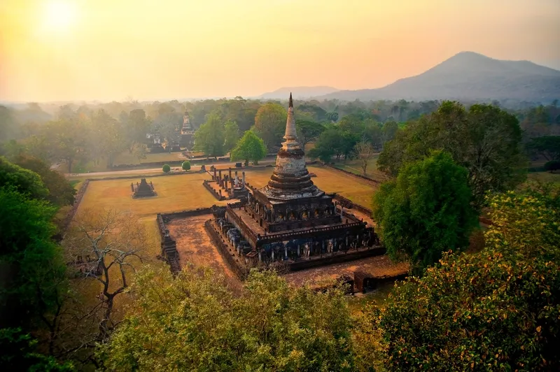
10. Si Satchanalai National Park protects a large headwater forest area in Si Satchanalai District and adjoining landscapes. It reveals a completely different side of Si Satchanalai from the ancient city. Instead of stupas and old temples, the park contains forests, waterfalls, caves, streams, nature trails, and mountain landscapes suitable for nature-based travel.
Highlights: Tat Duean Waterfall, Huai Sai Khao Waterfall, Tad Dao Waterfall, Bat Cave, Thara Wasan Cave, nature trails, mixed deciduous forest, dry dipterocarp forest, montane forest, and headwater areas associated with the Mae Nam Tha Phae watershed.
Tat Duean Waterfall is relatively close to the park headquarters and is easier to reach than some of the other waterfalls, making it suitable for families and general visitors. Travelers looking for a more demanding forest experience can choose Tad Dao Waterfall or longer nature trails that require more time and physical preparation.
The park contains several forest ecosystems due to differences in elevation and topography, including mixed deciduous, dry dipterocarp, and montane forests. The area is therefore important as a headwater forest and wildlife habitat rather than simply a recreational waterfall destination.
Travelers spending 2 days around Si Satchanalai can use the first day for the historical park, Wat Chang Lom, and Ban Na Ton Chan, then dedicate another day to Si Satchanalai National Park. This reduces unnecessary rushing and provides enough time to select a nature trail suitable for individual fitness levels.
Visitors planning to walk to waterfalls or caves should wear shoes with good traction, carry drinking water and insect repellent, and prepare rain protection when appropriate. Park announcements should be checked before traveling because some routes may occasionally be restricted due to weather or conservation measures.
Getting There: From Sukhothai city, follow Highway 101 toward Si Satchanalai and continue to Ban Kaeng Subdistrict and the national park headquarters. A private car is the most convenient option for reaching the park and connecting with Si Satchanalai’s historical area.
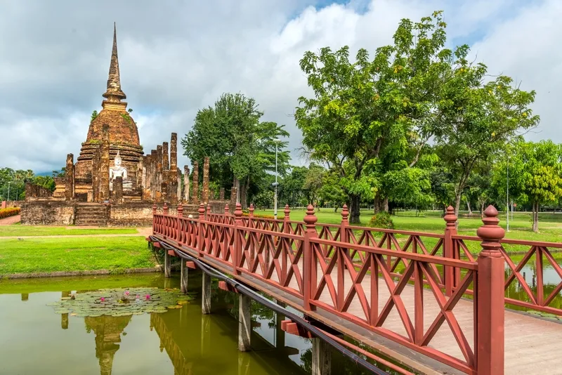
11. Wat Sa Si is one of the most atmospheric archaeological sites inside Sukhothai Historical Park. It stands on an island in a large reservoir known as Traphang Trakuan, northwest of Wat Mahathat. Placing the sanctuary within a body of water gives Wat Sa Si architectural, historical, and landscape significance and clearly illustrates the relationship between religion, water, and urban space in ancient Sukhothai.
Highlights: Sri Lankan-style bell-shaped principal stupa, assembly hall, stucco Buddha image in the subduing-Mara posture, water-surrounded ordination hall associated with the udakukkhepa-sima tradition, subsidiary stupas, and beautiful reflections of the monuments on the water during the morning and evening.
The principal stupa is a bell-shaped monument showing clear Sri Lankan Buddhist influence. In front are an assembly hall and Buddha image. When viewed from across the reservoir, the stupa, Buddha, water, and surrounding trees create a calm and balanced composition unlike the larger temple complexes in the center of the ancient city.
The ordination hall standing amid the water is particularly interesting because the water acted as a ritual boundary for monastic ceremonies. The reservoir therefore served not only an aesthetic purpose but also carried religious meaning by helping define sacred space.
Early morning and the period before sunset are particularly attractive at Wat Sa Si. Soft light creates reflections of the stupa and Buddha image on the water, and calm weather can produce especially clear mirror-like views. Photographers should therefore allow more time here than for a quick stop.
Wat Sa Si can easily be combined with Wat Mahathat, the King Ramkhamhaeng Monument, and Phra Ruang Palace Mound because all are located within the central zone. Walking or cycling allows visitors to enjoy the reservoirs and ancient city walls more fully.
Open Days: Daily Opening Hours: Monday–Friday and Sunday 06:30 – 19:30 / Saturday 06:30 – 21:00
Getting There: Wat Sa Si is in the central zone of Sukhothai Historical Park, northwest of Wat Mahathat. Visitors can walk, cycle, or use a sightseeing tram from the park entrance.
Map (GPS):Open Google Maps – Wat Sa Si
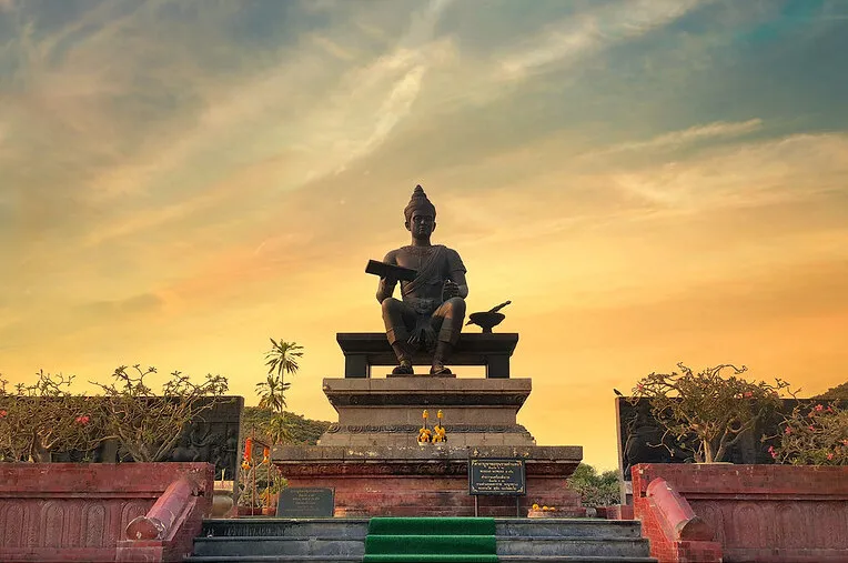
12. The King Ramkhamhaeng Monument stands within Sukhothai Historical Park and is an important place where visitors often pay respect before exploring the ancient city. The monument commemorates one of Sukhothai’s most important monarchs, whose memory is strongly associated with governance, language, culture, and the prosperity of the Sukhothai Kingdom.
Highlights: The bronze statue of King Ramkhamhaeng seated on the Manangkhasila throne, a Thai manuscript in his right hand, an open ceremonial plaza, and a location surrounded by major monuments of Old Sukhothai.
The bronze statue depicts the king seated with dignity, and its design reflects historical interpretations of Sukhothai royal imagery. The manuscript held in his hand symbolizes the strong cultural association between King Ramkhamhaeng, language, and learning.
The surrounding open plaza provides clear views of the monument from several angles. Visitors commonly stop here to pay respect before continuing to Wat Mahathat, Wat Sa Si, and Phra Ruang Palace Mound, making it a convenient starting point for the central zone.
Travelers interested in history should also visit Ramkhamhaeng National Museum, where inscriptions, archaeological objects, and artistic evidence provide additional context for the historic city.
Open Days: Daily Opening Hours: 06:30 – 19:30
Getting There: The monument is located in the central zone of Sukhothai Historical Park near Wat Mahathat and can be reached on foot, by bicycle, or by sightseeing tram.
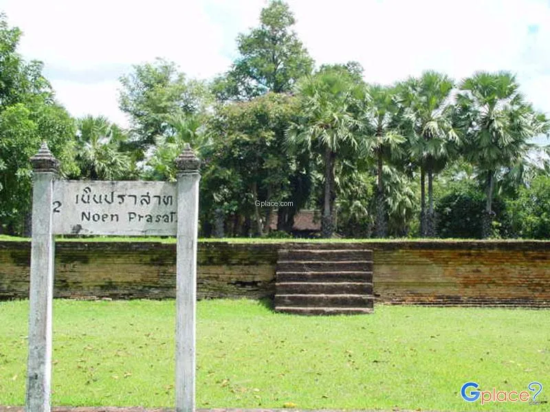
13. Phra Ruang Palace Mound is an archaeological site in the central area of Old Sukhothai, east of Wat Mahathat. Although its name suggests a royal palace, archaeological research has produced a more complex interpretation, indicating that the structure may have been associated with a religious building, large hall, or important civic activity rather than a royal residence in the conventional sense.
Highlights: A large rectangular building foundation, front and rear stairways, its location beside Wat Mahathat, and ceramic evidence from several sources reflecting historic trade connections.
The name Phra Ruang Palace Mound originated during early studies of Sukhothai when the area was thought to represent a palace or royal compound. Later archaeological excavation revealed a building platform measuring approximately 27.50 x 51.50 meters together with evidence that encouraged new interpretations of the site’s function.
Ceramic and pottery remains from several cultural traditions are particularly interesting because they demonstrate Sukhothai’s connections with wider trade networks. Visiting the site therefore adds dimensions of daily life, economics, and urban activity beyond temples and religious monuments.
Because the mound is extremely close to Wat Mahathat, it can be visited without requiring much additional travel time. Reading interpretive information before exploring the relatively simple foundations makes the site much more meaningful and illustrates how archaeological interpretations evolve over time.
Open Days: Daily Opening Hours: 06:30 – 19:30
Getting There: The site is east of Wat Mahathat within the central zone of Sukhothai Historical Park and is best explored on foot or by bicycle together with Wat Mahathat, Wat Si Sawai, and Wat Sa Si.
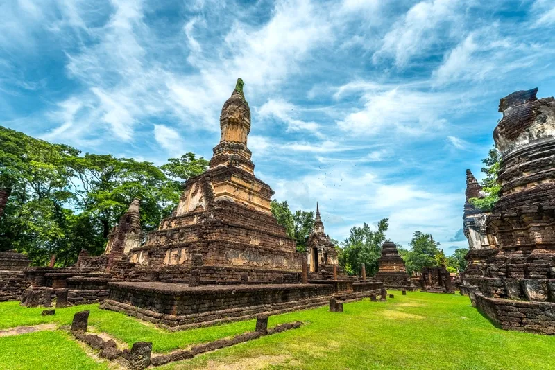
14. Wat Chedi Chet Thaeo is one of the most important monuments in Si Satchanalai and is located close to Wat Chang Lom. It is renowned for bringing several forms of stupa architecture together within a single religious complex. More than 30 stupas and associated structures have been identified, making the temple an important place for studying the development of Buddhist architecture during the Sukhothai period and related cultural traditions.
Highlights: Lotus-bud principal stupa, Sri Lankan-style stupas, prasat-form stupas, a shrine influenced by Pagan architecture, a Buddha image sheltered by a naga, numerous subsidiary stupas, and a complex temple layout.
The temple’s name refers to the many stupas that local people saw arranged in rows. Although later surveys identified more structures and rows than the name literally suggests, the traditional name has remained and is now an important part of the site’s identity.
The diversity of the stupas deserves careful observation because each monument differs in form and detail. Some reflect Sri Lankan traditions while others show connections with Pagan and other regional artistic influences. Wat Chedi Chet Thaeo therefore demonstrates that Sukhothai and Si Satchanalai were part of a much broader Buddhist world in which artistic ideas and architectural forms circulated widely.
Some interpretations suggest that the temple may have been associated with members of the ruling elite or used as a memorial area for important individuals. Although historical interpretations continue to rely on archaeological evidence, its location in the inner city near Wat Chang Lom clearly indicates the sanctuary’s high status.
Wat Chedi Chet Thaeo should be visited on the same route as Wat Chang Lom and Wat Nang Phaya. Walking or cycling between the three sites makes it easier to compare their artistic differences without repeatedly returning to a vehicle.
Open Days: Daily Opening Hours: 08:00 – 17:00
Getting There: The temple is inside Si Satchanalai Historical Park near Wat Chang Lom. From Sukhothai city, follow Highway 101 to Si Satchanalai District, enter the historical park, and continue on foot or by bicycle.
Map (GPS):Open Google Maps – Wat Chedi Chet Thaeo
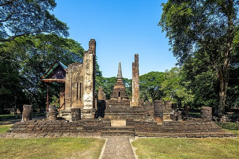
15. Wat Nang Phaya is an important monument in Si Satchanalai Historical Park, particularly famous for its surviving stucco decoration. Although the temple’s name may evoke stories associated with noble women, its greatest artistic significance lies in the delicate decorative work preserved on the walls of the assembly hall, providing valuable evidence of craftsmanship from the late Sukhothai to early Ayutthaya periods.
Highlights: Sri Lankan-style principal stupa, laterite assembly hall, floral stucco patterns, decorative work on walls and pillars, and artistic forms reflecting influences from Sukhothai, early Ayutthaya, Lanna, and China.
The surviving stucco should be examined carefully because the beauty of Wat Nang Phaya is not based solely on the scale of its architecture. Much of its value lies in small details such as vine patterns, floral motifs, and ornamental compositions that demonstrate the skill of historic craftsmen.
The stucco patterns of Wat Nang Phaya have also inspired contemporary crafts and jewelry in Si Satchanalai, showing that archaeological heritage can continue to influence modern craftsmanship rather than remaining confined to ancient monuments.
The temple stands close to Wat Chedi Chet Thaeo and Wat Chang Lom and is therefore ideal for a continuous walking or cycling route. Visitors should avoid touching the surviving stucco because many details are several centuries old and vulnerable to deterioration.
Open Days: Daily Opening Hours: 08:00 – 17:00
Getting There: Wat Nang Phaya is located among the inner-city monuments of Si Satchanalai Historical Park and can easily be reached on foot or by bicycle from Wat Chedi Chet Thaeo and Wat Chang Lom.
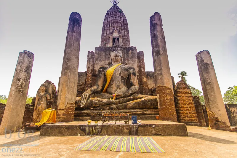
16. Wat Phra Sri Rattana Mahathat Worawihan (Wat Phra Prang) is located in the historic Chaliang area of Si Satchanalai District. It is a royal temple and an archaeological site with a history extending further back than many temples in the Si Satchanalai group. The site reflects the transition from pre-Sukhothai Chaliang into an important religious center in later periods.
Highlights: The laterite principal prang, Luang Pho To, Sukhothai-style Buddha images, ancient assembly hall, boundary wall, laterite gateways, Phra That Mutao, and the atmosphere of an active monastery where monks continue to reside within a historic setting.
The principal prang is the temple’s most important architectural feature. Its form reflects artistic transformations across several historical periods and differs clearly from the classic Sukhothai stupas found in the inner city of Si Satchanalai, allowing visitors to compare artistic development within the same region.
Luang Pho To, a large Buddha image enshrined inside the assembly hall, remains an important focus of local devotion. Because the temple continues to function as an active Buddhist monastery, the atmosphere differs from abandoned monuments in the historical park. Visitors experience archaeological remains, religious practice, and contemporary community life within the same place.
Allow approximately 1 hour to explore the principal prang, assembly hall, surrounding walls, and archaeological features. The journey can then continue to Wat Chom Chuen, ancient Chaliang, and other monuments in Si Satchanalai Historical Park.
Open Days: Daily Opening Hours: 08:00 – 17:00
Getting There: From Sukhothai city, follow Highway 101 to Si Satchanalai District, a journey of approximately 1 hour. The temple is in the historic Chaliang area near the Yom River and not far from Si Satchanalai Historical Park.
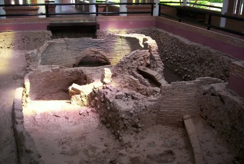
17. Sangkhalok Kiln Study and Conservation Centre is located around Ban Ko Noi, Nong O Subdistrict, Si Satchanalai District. The center reveals another side of Sukhothai’s prosperity through the Sangkhalok ceramic industry. This area once contained a major concentration of kilns and played an important role in producing ceramics distributed throughout the region and to overseas markets.
Highlights: Ancient kilns known as Thuriang kilns, remains of kilns from several periods, Sangkhalok ceramics, pottery fragments, explanations of ceramic production, and exhibitions about firing technology used by craftspeople in Si Satchanalai.
Examining the kilns helps visitors understand that Sangkhalok ceramics depended not only on artistic design but also on knowledge of clay, water, fire, temperature, and kiln construction. Craftspeople had to control long firing processes to achieve the desired characteristics of the clay body and glaze.
Numerous kiln remains have been found around Ko Noi, demonstrating that this was once a major production area. Their concentration provides insight into historic craft communities and an industrial system that required labor, raw materials, fuel management, and transportation networks.
The center is suitable for students, families, designers, and travelers interested in ceramics. It can be combined with Si Satchanalai Historical Park, Wat Chang Lom, Wat Chedi Chet Thaeo, and Wat Nang Phaya to explore religion, craftsmanship, and the ancient urban economy within the same day.
Open Days: Daily Opening Hours: 09:00 – 16:00
Getting There: From Si Satchanalai Historical Park, continue toward Ban Ko Noi in Nong O Subdistrict, approximately 7–8 kilometers away. A private car or rental vehicle is the most convenient option.
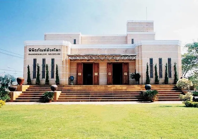
18. Sangkhalok Museum is a private museum in Mueang Sukhothai District displaying Sangkhalok ceramics, archaeological objects, Buddha images, tools, and artifacts reflecting everyday life in the past. It is particularly suitable for travelers who want to understand Sukhothai beyond ancient stupas and temples by exploring craftsmanship, trade, technology, and daily life.
Highlights: A large collection of Sangkhalok ceramics, celadon-glazed vessels, black underglaze designs, terracotta figurines, architectural ornaments, Buddha images, and artifacts several centuries old.
The museum developed from a collection assembled by people who recognized the importance of local artworks and wanted to make them available for public learning. Its atmosphere differs from that of a state archaeological museum, while the large number of displayed objects demonstrates the variety of ceramic forms, glaze colors, decoration, and functions.
Sangkhalok ceramics are significant not only as beautiful objects but also as evidence of historic economic and trade systems. Some vessels were intended for domestic use, others for ritual purposes, and others for commercial exchange. Studying these objects helps reveal Sukhothai as a society with skilled craftspeople and complex networks of exchange.
The museum is a useful option during hot weather or as a break from outdoor archaeological sightseeing. It can be visited before or after Sukhothai Historical Park and is particularly suitable for families, students, collectors, and visitors interested in historic ceramics.
Open Days: Daily Opening Hours: 08:00 – 17:00
Getting There: The museum is located around Mueang Ek Plaza on the bypass road in Ban Lum Subdistrict, Mueang Sukhothai District. It can be reached by private car, rental car, or taxi from the city and provides convenient onward access to Old Sukhothai.
Map (GPS):Open Google Maps – Sangkhalok Museum
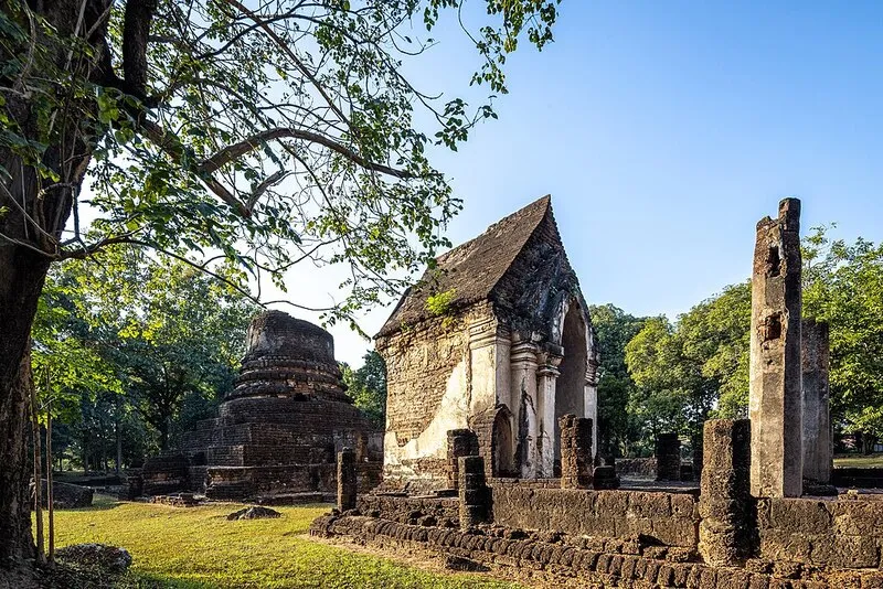
19. Wat Chom Chuen is an important archaeological site in the Chaliang and Si Satchanalai area beside the Yom River. Its significance extends beyond the stupa, assembly hall, and mandapa because the site also contains a preserved archaeological excavation building where visitors can see evidence of human settlement from several periods within the same location.
Highlights: Circular stupa, laterite assembly hall, mandapa behind the hall, protected excavation pit, ancient human remains, and archaeological evidence demonstrating continuous occupation across several historical periods.
Archaeological excavations revealed evidence extending from late prehistoric periods through Dvaravati, Khmer-influenced culture, Sukhothai, Ayutthaya, and later periods. Wat Chom Chuen therefore demonstrates that Si Satchanalai did not suddenly appear as a major city but developed from settlements and land use extending far back in time.
Inside the protected excavation building, visitors can learn about human skeletons, pottery, and archaeological soil layers. This makes the past more tangible than viewing temple ruins alone, which often emphasize only architecture surviving above ground.
Wat Chom Chuen is particularly suitable for archaeology enthusiasts, students, and travelers seeking a deeper understanding of Si Satchanalai. It can easily be combined with Wat Phra Sri Rattana Mahathat Worawihan, Wat Chao Chan, Wat Nang Phaya, and Si Satchanalai Historical Park.
Open Days: Daily Opening Hours: 08:00 – 17:00
Getting There: Travel from Sukhothai city to Si Satchanalai District in approximately 1 hour, then continue into the Chaliang area beside the Yom River. The site is close to Wat Phra Sri Rattana Mahathat Worawihan.
Map (GPS):Open Google Maps – Wat Chom Chuen
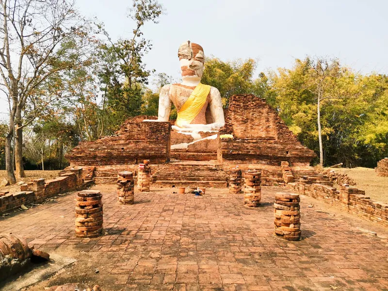
20. Wat Pa Daeng is an archaeological site in the forest-monastery area west of Old Sukhothai. Surrounded by hills, woodland, and temples historically associated with forest monks, the site has fewer surviving structures than Wat Mahathat or Wat Si Chum, but its peaceful setting and location reveal another dimension of Sukhothai Buddhism in which spaces for religious practice were separated from the center of the city.
Highlights: Foundation of an open assembly hall, principal stupa base, remains of the stupa structure, laterite construction, and the quiet atmosphere of Sukhothai’s western forest-monastery zone.
The concept of an aranyik or forest monastery is associated with religious practice in wooded areas away from dense communities. Several monasteries west of Sukhothai are therefore distributed around foothills and natural routes. Visiting Wat Pa Daeng together with Wat Saphan Hin and other western monuments helps demonstrate that Sukhothai Buddhism included both urban temples and forest monasteries serving different functions.
Although most structures survive only as foundations, examining the orientation of the assembly hall, stupa, and surrounding topography helps visitors imagine how the area was used in the past. Travelers who enjoy quieter archaeological sites away from large crowds may find Wat Pa Daeng particularly rewarding.
The area is best visited in the morning or late afternoon when temperatures are more comfortable. Carry drinking water and wear suitable walking shoes. Cyclists exploring the western zone can include Wat Pa Daeng on the same route as Wat Saphan Hin and other forest monasteries.
Open Days: Daily Opening Hours: 06:30 – 19:30
Getting There: From the central area of Sukhothai Historical Park, travel west toward the forest-monastery zone. Car, motorcycle, rental vehicle, or bicycle can be used. A park map is useful because the temple is relatively small and is not located on the busiest sightseeing route.
Map (GPS):Open Google Maps – Wat Pa Daeng
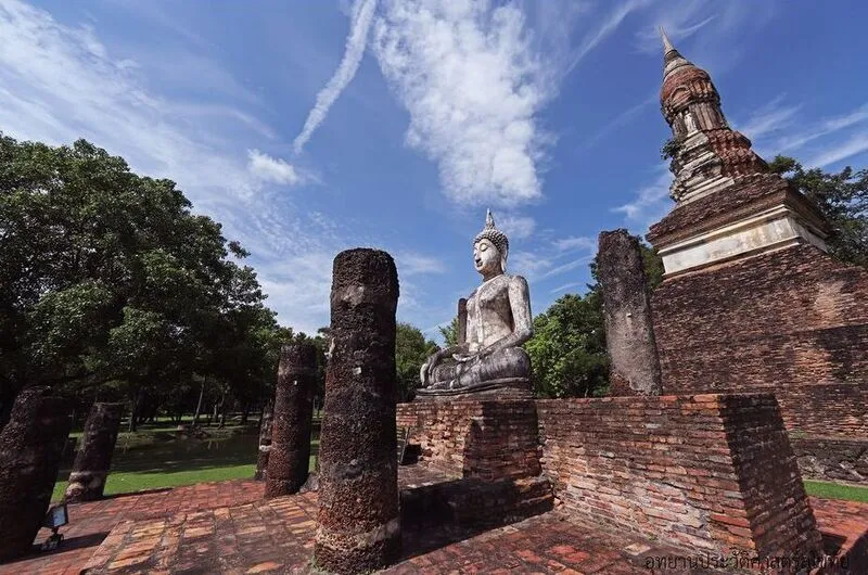
21. Wat Traphang Ngoen is an important monument in the central zone of Sukhothai Historical Park, approximately 300 meters west of Wat Mahathat beside Traphang Ngoen reservoir. Its layout harmoniously connects stupa, assembly hall, Buddha images, and water, reflecting both the beauty of Sukhothai art and the sophisticated use of landscape within the ancient city.
Highlights: Lotus-bud principal stupa, niches on all 4 sides, walking Buddha images, seated Buddha image in the subduing-Mara posture, assembly hall, Traphang Ngoen reservoir, lotus flowers, and a water-surrounded ordination hall associated with the traditional monastic boundary concept.
The principal stupa is the most distinctive architectural feature. Its lotus-bud form is strongly associated with Sukhothai art. Niches around the central structure contain standing and walking Buddha images, adding depth to the monument and allowing visitors to appreciate the elegance of Sukhothai Buddhist sculpture from several directions.
In front of the stupa is an assembly hall containing a stucco Buddha image. To the east, the temple connects visually with Traphang Ngoen, where an ordination hall stands on an island. The use of water relates both to monastic ritual boundaries and to the broader landscape design of the ancient city.
Morning and evening are particularly attractive because softer light enhances the stupa and Buddha images while lotus ponds and reflections create a peaceful atmosphere. Wat Traphang Ngoen can easily be combined with Wat Mahathat, Wat Sa Si, Wat Si Sawai, and Ramkhamhaeng National Museum.
Open Days: Daily Opening Hours: Monday–Friday and Sunday 06:30 – 19:30 / Saturday 06:30 – 21:00
Getting There: From Sukhothai city, travel approximately 12 kilometers to Mueang Kao and enter the central zone of Sukhothai Historical Park. Wat Traphang Ngoen lies about 300 meters west of Wat Mahathat and is easily reached on foot, by bicycle, or by tram.
Map (GPS):Open Google Maps – Wat Traphang Ngoen
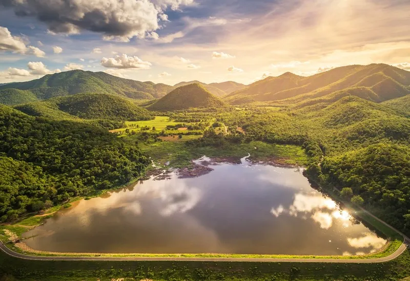
22. Saritphong Dam, traditionally known as Thamnop Phra Ruang, is important evidence of ancient Sukhothai’s water-management knowledge. Located west of the old city near the Khao Prathak range, the dam collected water from mountain catchments before distributing it into the urban water system. It demonstrates that Sukhothai’s prosperity depended not only on temples and art but also on systematic management of natural resources.
Highlights: Ancient earth dam, reservoir landscape, Khao Prathak range, the historic irrigation system of Sukhothai, and the natural scenery west of the historical park.
Sukhothai occupied a landscape that required effective water management. Ancient residents used mountains and valleys to collect water before directing it through canals and reservoirs into the city for agriculture, daily use, and maintaining the ecological balance of settlements.
Visiting Saritphong Dam provides a broader understanding of Sukhothai beyond Buddhism because water infrastructure made large-scale urban life possible. Connecting the dam with reservoirs, canals, and city moats reveals how deeply urban planning was integrated with the natural environment.
The surrounding area is suitable for scenic viewing and photography in the morning or evening. It can be combined with Wat Saphan Hin and western forest monasteries to illustrate the relationship between mountains, religion, and water management.
Getting There: From the central zone of Sukhothai Historical Park, travel west toward the Khao Prathak range. Car or motorcycle is more practical than walking from the central monuments.
Map (GPS):Open Google Maps – Saritphong Dam
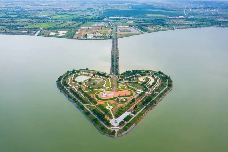
23. Thung Talay Luang is a large recreational and water-storage area in Sukhothai, recognizable for its expansive lake and heart-shaped island. Its open landscape differs completely from the archaeological atmosphere of Old Sukhothai and provides a relaxing alternative after a day of temple sightseeing.
Highlights: Heart-shaped island, broad water views, sunset scenery, walking and recreational areas, open skies, and a peaceful setting not far from Sukhothai city.
The heart-shaped island is the feature most closely associated with Thung Talay Luang. The area has been developed both as a water-storage project and as a public recreational space, allowing visitors to enjoy the scenery, exercise, or spend a quiet evening after exploring Old Sukhothai.
Evening is especially suitable because temperatures become more comfortable and the setting sun reflects across the water. The open surroundings provide broad views of the sky, making the area suitable for families, couples, and photographers seeking a landscape different from ancient stupas and temples.
Thung Talay Luang works well as a late-afternoon stop after visiting Sukhothai Historical Park or before returning to accommodation in town, adding a contemporary recreational dimension to an otherwise history-focused itinerary.
Getting There: From Sukhothai city, travel by car or motorcycle to the Thung Talay Luang area. The journey from the city is relatively short and the destination is particularly suitable for late afternoon and evening.
Map (GPS):Open Google Maps – Thung Talay Luang

24. Tad Dao Waterfall is a natural waterfall within Si Satchanalai National Park, surrounded by headwater forest and mountains in northern Sukhothai. It is particularly suitable for travelers who want to experience forests and nature trails rather than focusing exclusively on archaeological monuments.
Highlights: Forest waterfall, water flowing across cliffs and rock formations, headwater forest, nature trail, and the quiet atmosphere of Si Satchanalai National Park.
Reaching the waterfall requires walking through natural terrain and is therefore best suited to visitors with reasonable fitness who enjoy outdoor activities. Along the trail, travelers can observe forest vegetation, ecosystems, and streams forming part of Si Satchanalai’s headwater environment.
The rainy season and beginning of the cool season often bring stronger water flow and lush green forest, but trails can also become slippery. Visitors should wear appropriate footwear, carry drinking water, and check park announcements before traveling because trail conditions can change after rainfall.
Travelers planning to walk to Tad Dao Waterfall should allow sufficient time and avoid scheduling too many archaeological sites on the same day. It works best as a dedicated nature day in a Si Satchanalai itinerary.
Getting There: Enter Si Satchanalai National Park and follow internal park routes toward the trailhead. Visitors should check current trail conditions with park staff before beginning the walk.
Map (GPS):Open Google Maps – Tad Dao Waterfall

25. Tat Duean Waterfall is a waterfall inside Si Satchanalai National Park that is easier to reach than Tad Dao Waterfall, making it suitable for families and general visitors who want to experience forest, streams, and headwater environments without a long trek.
Highlights: Natural waterfall surrounded by forest, streams, rock formations, shaded surroundings, and a route suitable for a half-day nature excursion.
Large trees and moisture from the stream create a cooler feeling than in exposed areas. Walking beside the water and resting while listening to the stream are among the main pleasures of the site, making it a refreshing alternative to archaeological sightseeing under the sun.
After periods of sufficient rainfall, the waterfall becomes particularly attractive and the forest is lush, although visitors should be cautious around slippery rocks and strong currents. All rubbish should be taken out of the area and plants and wildlife should not be disturbed.
Tat Duean Waterfall can be combined with other natural attractions in Si Satchanalai National Park. Travelers with limited time may prefer this waterfall to routes requiring longer treks because it is easier to reach while still providing a clear forest experience.
Getting There: From Si Satchanalai National Park headquarters, follow internal park routes toward Tat Duean Waterfall. During the rainy season, visitors should confirm road and trail conditions with park staff before traveling.
Map (GPS):Open Google Maps – Tat Duean Waterfall

26. Nong Krasa is a local wetland and recreational area that reveals another side of Sukhothai’s landscape. The open setting around the water is suitable for travelers who prefer simple countryside experiences, scenic views, and community landscapes away from the principal World Heritage route.
Highlights: Natural water area, rural atmosphere, broad open landscape, sunrise or sunset views, and the peaceful surroundings of nearby communities.
Wetland areas play important roles in community ecology, water storage, and local livelihoods. Nong Krasa is therefore especially suitable for travelers interested in local landscapes rather than major built attractions or commercial tourism activities.
Morning and evening are generally more pleasant than midday because temperatures are cooler and light across the water is more attractive. Travelers interested in rural photography can use Nong Krasa as a stop while traveling between districts or communities.
Getting There: Travel by car or motorcycle along local roads into the surrounding community area. Private transport is the most convenient because the site lies outside the principal Old Sukhothai tourism route.
Map (GPS):Open Google Maps – Nong Krasa

27. Suan Luang Rama IX is a green public space that adds another dimension to travel in Sukhothai beyond historic monuments. It is suitable for local residents, families, people exercising, and travelers who want a relaxing stop during their journey.
Highlights: Public park space, shaded atmosphere, recreational areas, walking and exercise routes, trees, and landscaped surroundings suitable for mornings and evenings.
The park has particular value as a space genuinely used by the local community. Travelers can observe contemporary life in Sukhothai rather than spending the entire journey in historic parks and museums. Walking and resting here can therefore connect the experience of historical heritage with the modern city.
Morning is suitable for exercise, while evening generally brings a livelier atmosphere and cooler temperatures. The park is particularly appropriate for families and older visitors who want a comfortable place to walk without demanding physical activity.
Getting There: The park can be reached conveniently by car, motorcycle, or local transport from surrounding areas and can serve as a stop when traveling between Sukhothai and Si Satchanalai.
Map (GPS):Open Google Maps – Suan Luang Rama IX

28. Wat Ko Mai Daeng is a local temple that reflects the continuing role of Buddhist monasteries as centers of faith and community life in Sukhothai. Its peaceful atmosphere differs from the abandoned temples of the historical parks because it remains an active religious place used for Buddhist ceremonies and community activities.
Highlights: Local temple atmosphere, religious buildings, merit-making activities, and contemporary Buddhist community life outside the ancient city.
Visiting an active community temple demonstrates that Buddhism in Sukhothai is not simply a legacy of the past but remains part of everyday life. The temple serves as a place for merit-making, religious ceremonies, and community gatherings.
Visitors should dress respectfully, remain quiet, and avoid disturbing monks or community activities. During important Buddhist observances, travelers may have opportunities to see merit-making traditions that reflect local religious life.
Getting There: Travel by car or motorcycle into the local community following the map coordinates. The temple lies outside the principal historical-park route and is particularly suitable for travelers who want to experience a more local side of Sukhothai.
Map (GPS):Open Google Maps – Wat Ko Mai Daeng
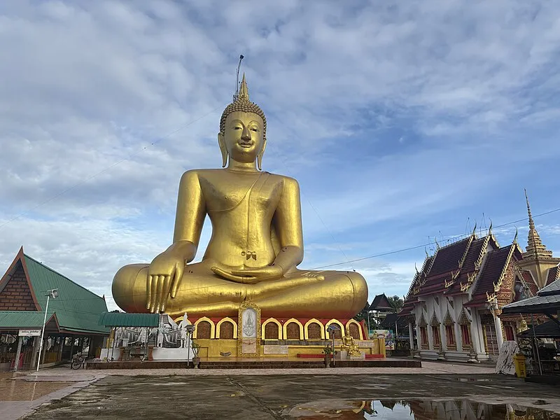
29. Wat Sopharam is another local temple that illustrates contemporary Buddhist life in Sukhothai communities. Its surroundings are simple and peaceful, making it suitable for visitors who want to pay respect and learn about communities beyond the province’s principal tourist routes.
Highlights: Religious buildings, shaded temple surroundings, community merit-making, and the continuing role of a local Buddhist monastery in daily life.
The value of visiting this type of temple lies partly in comparing it with ancient temples in Old Sukhothai. Religious architecture has changed over time, but the temple’s role as a center of devotion, ritual, and community life continues.
The temple is suitable for travelers interested in secondary routes away from the busiest attractions. Visitors should dress respectfully and choose the morning or afternoon for a quiet visit.
Getting There: Travel by car or motorcycle following the temple’s coordinates. The site can be included while exploring local communities in central Sukhothai Province.
Map (GPS):Open Google Maps – Wat Sopharam
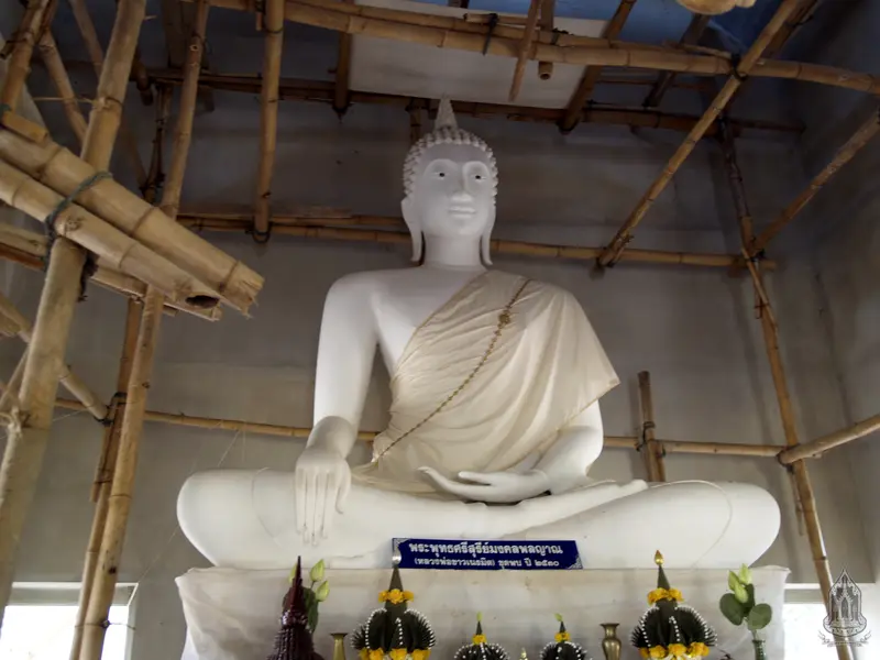
30. Luang Pho Khao is enshrined at Wat Ban San in Ban San Subdistrict, Si Samrong District. This historic stucco Buddha image in the subduing-Mara posture has been revered by the community for generations. Its artistic form resembles Chiang Saen-style Buddhist art and it is approximately 500 years old, giving the image importance in Buddhist art, history, and local cultural memory.
Highlights: Historic stucco Buddha image in the subduing-Mara posture, lotus-bud-like ushnisha, robe extending toward the abdomen, evenly aligned fingers, local devotional stories, and traditions associated with Wat Ban San.
Luang Pho Khao is approximately 140 centimeters high with a lap width of around 110 centimeters. Although much smaller than Phra Achana at Wat Si Chum, its significance comes from its role as a community Buddha image preserved and revered by local residents for generations.
Local stories describe a historic fire around the assembly hall that did not damage the Buddha image, as well as a large palm tree that once fell without destroying Luang Pho Khao. These stories form part of the community’s cultural memory and faith, giving the image meaning beyond its age and artistic characteristics.
Wat Ban San also maintains traditions involving processions and ritual bathing of important Buddha images, reflecting the close relationship between sacred images and community life in Si Samrong District.
Open Days: Daily Opening Hours: Daytime
Getting There: Luang Pho Khao is enshrined at Wat Ban San, Moo 2, Ban San Subdistrict, Si Samrong District. Car or motorcycle is recommended, and the visit can be combined with other temples and communities around Si Samrong.

31. Chao Ram Cave Wildlife Sanctuary is a large protected area covering forest landscapes along the border between Sukhothai and Lampang provinces. It is important for ecosystems, headwater protection, biodiversity, and environmental education. Its best-known feature is Chao Ram Cave, a large limestone cave that provides habitat for large numbers of insect-eating bats.
Highlights: Chao Ram Cave, evening bat flights, limestone mountains, natural forest, headwater ecosystems, and conservation-oriented tourism in an area rich in wildlife and plant diversity.
The wildlife sanctuary covers approximately 213,171 rai, or around 341 square kilometers, including forested mountains, valleys, streams, and limestone terrain. The continuity of the forest makes it important as wildlife habitat, a reservoir of plant genetic diversity, and a headwater area supporting surrounding communities.
Evening is the most popular time to visit because large groups of bats can be seen leaving the cave to search for food. The sight of many bats moving across the sky is one of the sanctuary’s most distinctive natural spectacles and helps visitors understand the ecological role of the cave.
Because this is a wildlife sanctuary, visitors should strictly follow staff regulations, avoid loud noise near the cave, never disturb wildlife, and remain within authorized areas. The site is suitable for nature enthusiasts, students, photographers, and families interested in conservation.
Open Days: Daily Opening Hours: 08:00 – 17:00
Getting There: The sanctuary lies in western Sukhothai along a forest corridor connecting Si Samrong, Thung Saliam, Ban Dan Lan Hoi, and parts of Lampang. Private transport is the most convenient, and travelers should check access routes with staff before entering the protected area.
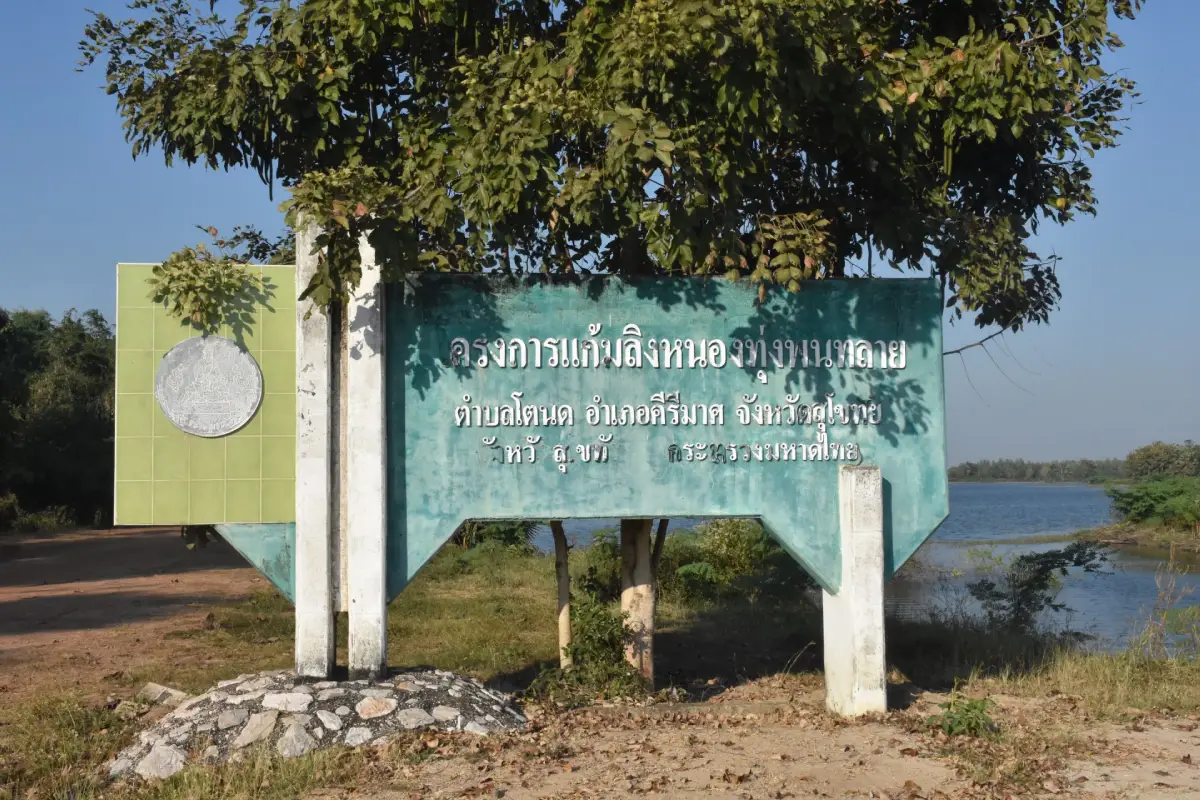
32. Pantalai Reservoir, also known locally as Thung Phang Thalai Reservoir, is located at Ban Nong Kok in Tanot Subdistrict, Khiri Mat District. It is a community water resource supporting agriculture, fish farming, and recreation and is suitable for travelers who want to experience rural Sukhothai and agricultural landscapes beyond the World Heritage areas.
Highlights: Broad water views, open skies, rice-field scenery, agricultural community life, peaceful atmosphere, and sunrise or sunset viewpoints.
The surroundings are simple and have not been heavily developed for commercial tourism. The appeal therefore comes from experiencing an authentic rural landscape of farmland, vegetation, water, and everyday community activities.
The reservoir also demonstrates the importance of water to Khiri Mat District by storing water for periods of need and supporting local agriculture. A visit is therefore suitable for travelers interested in landscapes and local livelihoods rather than photography alone.
Morning and evening are the most pleasant times because temperatures are cooler and reflections on the water are more attractive. The reservoir can be used as a stop while traveling toward Ramkhamhaeng National Park or other natural attractions in Khiri Mat.
Open Days: Daily Opening Hours: Open throughout the day
Getting There: The reservoir is located around Ban Nong Kok, Moo 6, Tanot Subdistrict, Khiri Mat District. Private car or motorcycle is the most practical way to reach the area.
Map (GPS):Open Google Maps – Pantalai Reservoir
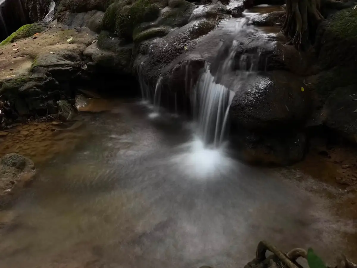
33. Pha Nam Rin Waterfall is a natural waterfall inside Ramkhamhaeng National Park in Khiri Mat District. Water originating from springs around Khao Luang forms streams before descending over approximately 5 levels of rocky cliffs, each around 5–7 meters high. The waterfall offers a close look at the headwater system of the Khao Luang range.
Highlights: Approximately 5 waterfall levels, water flowing over rocky cliffs, shaded forest, streams originating from Khao Luang, natural pools, and the atmosphere of a headwater forest.
The waterfall’s appeal does not come from a single enormous drop but from water gradually flowing across several rock levels. Its Thai name, meaning water gently flowing over a cliff, reflects this character particularly well.
The area is suitable for relaxing, nature walks, photography, and ecological learning. Visitors who want to enter the water should use only safe areas and avoid swimming when currents are strong, particularly after heavy rainfall.
The waterfall can be combined with Narai Cave, Phra Mae Ya Cave, and other natural attractions in Ramkhamhaeng National Park, although sufficient time should be allowed because forest trails generally require more time than archaeological sightseeing in Old Sukhothai.
Open Days: Daily Opening Hours: 08:00 – 17:00
Getting There: From Sukhothai city, travel to Khiri Mat District and enter Ramkhamhaeng National Park. Continue along internal park routes toward the waterfall trailhead. During the rainy season, visitors should confirm current trail conditions with staff.
Map (GPS):Open Google Maps – Pha Nam Rin Waterfall
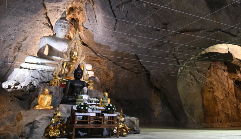
34. Narai Cave (Khao Wong Cave) is a natural and archaeological attraction inside Ramkhamhaeng National Park near the route to Khao Luang, approximately 3 kilometers from park headquarters. Its interest comes from the connection between mountains, caves, and historical artistic evidence once discovered in the area.
Highlights: Natural cave, Khao Luang forest atmosphere, history of an ancient sandstone deity image discovered in the cave, nature route, and local beliefs associated with the name Narai Cave.
The cave received its name after a sandstone deity resembling Vishnu, or Narai in Thai tradition, was discovered inside. The important sculpture was later moved to Ramkhamhaeng National Museum for conservation and historical study.
The site is therefore interesting in two dimensions. One is the experience of a cave and forest within the Khao Luang range, while the other is an understanding that mountains and caves played roles in past belief systems and rituals rather than functioning only as natural landscapes outside the historic city.
Visitors should wear appropriate footwear and carry a flashlight when necessary. Cave surfaces should never be touched or damaged, and travelers should remain on routes designated by park staff.
Open Days: Daily Opening Hours: Daytime
Getting There: Enter Ramkhamhaeng National Park and follow the route toward Khao Luang. The cave is approximately 3 kilometers from park headquarters. Visitors should ask staff about current trail conditions before traveling.

35. Phra Mae Ya Cave is located in Na Choeng Khiri Subdistrict, Khiri Mat District, within the wider Ramkhamhaeng National Park area. The site has religious, historical, and natural significance because it is directly associated with reverence for Phra Mae Ya, one of the most important sacred figures in Sukhothai local belief.
Highlights: Natural rock shelter, shallow cave, cool shaded forest, history as the original location associated with Phra Mae Ya, and beliefs connecting Sukhothai communities with the Khao Luang landscape.
This is not a deep or extensive cave but rather a natural rock shelter containing a shallow cave area. Its primary significance comes from its association with Phra Mae Ya before the sacred image was moved to the Phra Mae Ya Shrine in Sukhothai city.
Visiting the cave demonstrates that local Sukhothai belief is not limited to urban temples but is also connected with mountains, forests, and natural spaces. The peaceful environment is suitable for paying respect and learning about local traditions without rushing.
Visitors should dress respectfully, remain quiet in sacred areas, avoid littering, and protect the surrounding natural environment.
Open Days: Daily Opening Hours: 08:00 – 16:30
Getting There: The cave is located around Na Choeng Khiri and Ramkhamhaeng National Park. Private car is the most practical transport, followed by a walk along the designated route to the cave area.
Map (GPS):Open Google Maps – Phra Mae Ya Cave
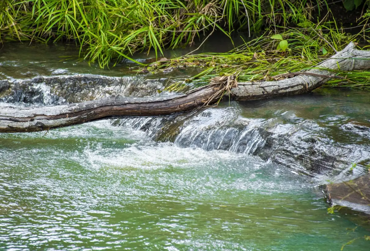
36. Hin Rang Waterfall is a relatively compact waterfall inside Ramkhamhaeng National Park and connects with the Khlong Phra Ruang nature trail. Its appeal therefore extends beyond swimming or seeing the waterfall because the route also introduces visitors to mixed deciduous forest, rock formations, and local stories associated with Phra Ruang.
Highlights: Water flowing through natural rock channels, Khlong Phra Ruang nature trail, mixed deciduous forest, Lan Phama Lap Hok, Phra Ruang Cave, and local stories associated with Phra Ruang.
The waterfall flows through natural grooves and rocks. It is not particularly large but works well as a resting point on the nature trail. The sound of water and forest shade create a peaceful atmosphere very different from crowded tourist attractions.
The Khlong Phra Ruang nature trail adds considerable value because visitors can learn about ecology and local legends along the same route. It is suitable for travelers who want a moderate forest walk combined with stories of local history and folklore.
The rainy season through early cool season usually brings more water and greener forest, although trails can become slippery. Appropriate walking shoes and a weather check are recommended.
Open Days: Daily Opening Hours: 08:00 – 17:00
Getting There: Enter Ramkhamhaeng National Park and ask staff for the starting point of the Khlong Phra Ruang nature trail. It is best to begin during the morning or early afternoon.
Map (GPS):Open Google Maps – Hin Rang Waterfall

37. Khlong Khang Nai Reservoir, also known as Tha Din Daeng Reservoir, is an irrigation reservoir and recreational area in Si Khiri Mat Subdistrict, Khiri Mat District. With the Khao Luang mountain range as a backdrop, the combination of water, mountains, and open sky creates an attractive landscape for relaxation and photography.
Highlights: Views of Khao Luang, broad water scenery, viewpoints, picnicking, boating, fishing, swimming in suitable areas, and waterbirds in the morning.
The reservoir was completed in 1989 and has a capacity of approximately 9 million cubic meters. Its dam is around 770 meters long and approximately 14 meters high, supporting an irrigation area of roughly 15,000 rai and therefore playing an important role in local agriculture.
The main tourism appeal is the view of Khao Luang rising behind the water, especially on cool mornings when light mist may appear along the mountain range. Evening is also suitable for watching reflections across the water before returning to accommodation.
The site is suitable for families, photographers, and travelers who want an easily accessible nature stop without a full trekking experience. It can be combined with attractions in Khiri Mat and Ramkhamhaeng National Park.
Open Days: Saturday, Sunday, and Public Holidays Opening Hours: 08:00 – 18:00
Getting There: The reservoir is in Si Khiri Mat Subdistrict, Khiri Mat District. Private car is the most convenient transport and the route can be combined with Khao Luang and nearby natural attractions.
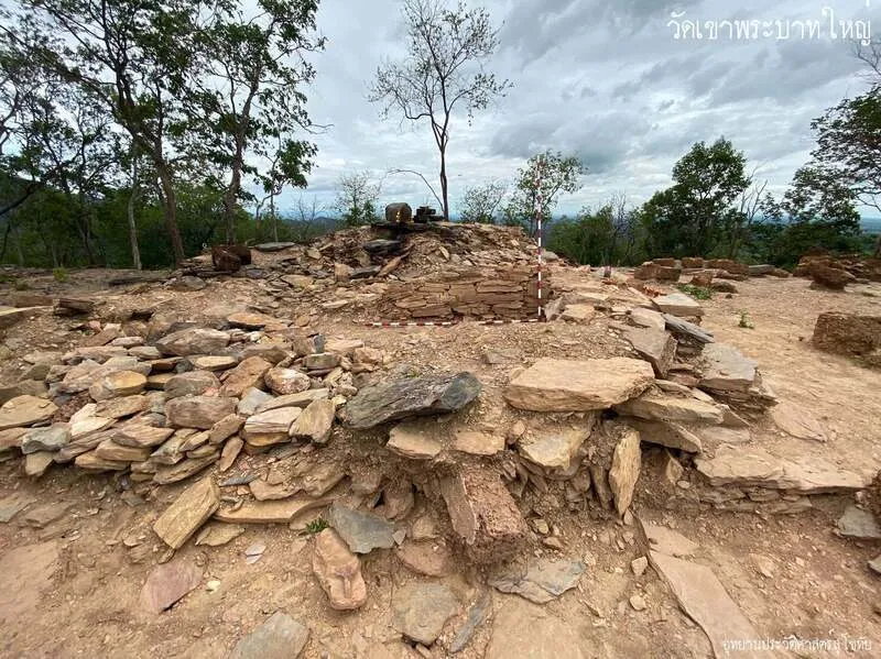
38. Khao Phra Bat is a historic and sacred hill southwest of Old Sukhothai, associated with the archaeological remains of Wat Khao Phra Bat Yai and a low hill that once contained a Buddha footprint carved into granite.
Highlights: Hill approximately 40 meters high, open woodland atmosphere, sacred landscape, remains of Wat Khao Phra Bat Yai, and the history of a Buddha footprint carved in granite.
The hill is relatively low compared with Khao Luang and is therefore suitable for visitors wanting a less demanding climb. The route provides light exercise as well as an opportunity to learn how Buddhist devotion became associated with elevated landscapes in the Sukhothai period.
The tradition of placing a Buddha footprint on a mountain transformed elevated land into sacred space. Climbing the hill therefore once carried religious and pilgrimage significance rather than serving merely as a scenic excursion.
Khao Phra Bat can be combined with Saritphong Dam, western forest monasteries, and other archaeological sites west of Sukhothai Historical Park to demonstrate the importance of landscapes outside the city walls.
Open Days: Daily
Getting There: Khao Phra Bat lies southwest of Old Sukhothai. Visitors can travel by car, motorcycle, or bicycle and then walk along the route up the hill.
Map (GPS):Open Google Maps – Khao Phra Bat

39. Pratu Makha Waterfall is located at Moo 2, Na Choeng Khiri Subdistrict, Khiri Mat District. This natural 7-level waterfall is fed by streams flowing through forested hills and carries water during several periods of the year. It is suitable for travelers seeking quiet nature and the foothill communities of Sukhothai.
Highlights: 7 waterfall levels, natural streams, pools, rocks, a short forest trail, and the shaded atmosphere of Na Choeng Khiri.
Access begins with approximately 2 kilometers of unpaved road, followed by a nature walk of around 1 kilometer. Streams and forest encountered on the way make the journey part of the experience rather than simply a route to the final waterfall.
Each waterfall level has different water patterns, rocks, and pools. Lower levels are suitable for resting, while higher levels feel more natural and remote. Visitors should assess their physical condition before continuing through all levels.
Shoes with good grip are recommended, especially during the rainy season, and swimming should be avoided after heavy rainfall. Travelers wanting to explore several levels should begin in the morning and carry sufficient drinking water.
Open Days: Daily Opening Hours: Open throughout the day
Getting There: Travel to Na Choeng Khiri Subdistrict in Khiri Mat District, follow an unpaved road for approximately 2 kilometers, then walk about 1 kilometer along the natural trail to the waterfall.
Map (GPS):Open Google Maps – Pratu Makha Waterfall

40. Klieo Thong Waterfall is a natural attraction in Moo 9, Na Choeng Khiri Subdistrict, Khiri Mat District. The area is shaded and surrounded by clear water, streams, and foothill landscapes. Its principal appeal is tranquility and natural surroundings, making it a suitable final stop for travelers who want to end a Sukhothai journey with forests and streams rather than archaeological monuments.
Highlights: Clear streams, a relatively low waterfall, reservoir near the entrance, foothill forest, recreational areas, and the rural lifestyle of Na Choeng Khiri.
A medium-sized reservoir near the entrance is approximately 10 meters deep, allowing visitors to stop and enjoy the water and surrounding landscape before continuing to the waterfall. The reservoir also feeds the stream flowing toward the waterfall area.
The waterfall is not known for exceptional height or scale. Its charm comes instead from water flowing over streams and rocks beneath shaded forest. It is suitable for walking beside the stream, photography, relaxing, and swimming only in safe areas.
A journey around Na Choeng Khiri can combine Klieo Thong Waterfall with Pratu Makha Waterfall, Phra Mae Ya Cave, and nearby communities, revealing another side of Sukhothai shaped by agriculture, forest, water resources, and rural life.
Visitors should check weather conditions before traveling, particularly during the rainy season, wear appropriate footwear for wet surfaces, and avoid entering the water when currents are strong.
Open Days: Daily Opening Hours: Open throughout the day
Getting There: The waterfall is located at Moo 9, Na Choeng Khiri Subdistrict, Khiri Mat District. Private car or motorcycle is recommended, followed by a walk along the stream and natural trail toward the waterfall.
Map (GPS):Open Google Maps – Klieo Thong Waterfall
| Old Sukhothai Zone | 1. Sukhothai Historical Park 2. Wat Mahathat 3. Wat Si Chum 4. Ramkhamhaeng National Museum 5. Wat Si Sawai 6. Wat Sa Si 7. The King Ramkhamhaeng Monument 8. Phra Ruang Palace Mound 9. Wat Traphang Ngoen 10. Wat Pa Daeng 11. Saritphong Dam 12. Khao Phra Bat |
| Si Satchanalai Zone | 1. Si Satchanalai Historical Park 2. Wat Chang Lom 3. Ban Na Ton Chan 4. Si Satchanalai National Park 5. Wat Chedi Chet Thaeo 6. Wat Nang Phaya 7. Wat Phra Sri Rattana Mahathat Worawihan 8. Sangkhalok Kiln Study and Conservation Centre 9. Wat Chom Chuen 10. Suan Luang Rama IX |
| Khiri Mat and Khao Luang Zone | 1. Ramkhamhaeng National Park (Khao Luang) 2. Pantalai Reservoir 3. Pha Nam Rin Waterfall 4. Narai Cave (Khao Wong Cave) 5. Phra Mae Ya Cave 6. Hin Rang Waterfall 7. Khlong Khang Nai Reservoir 8. Pratu Makha Waterfall 9. Klieo Thong Waterfall |
| Other Nature and Community Attractions | 1. Chao Ram Cave Wildlife Sanctuary 2. Thung Talay Luang 3. Tad Dao Waterfall 4. Tat Duean Waterfall 5. Nong Krasa 6. Wat Ko Mai Daeng 7. Wat Sopharam 8. Luang Pho Khao at Wat Ban San 9. Sangkhalok Museum |
| Top Highlights for First-Time Visitors | 1. Sukhothai Historical Park – World Heritage city and center of the province’s most important monuments 2. Wat Mahathat – Principal sanctuary and symbol of Sukhothai art 3. Wat Si Chum – Phra Achana and its iconic mandapa 4. Si Satchanalai Historical Park – A quieter World Heritage city surrounded by greenery 5. Wat Chang Lom – Sri Lankan-style stupa surrounded by stucco elephants 6. Ramkhamhaeng National Park – Khao Luang trekking and natural landscapes 7. Ban Na Ton Chan – Homestays, mud-dyed textiles, khao poep, and community life 8. Ramkhamhaeng National Museum – An excellent starting point for understanding Sukhothai history |
| Best for History | 1. Sukhothai Historical Park 2. Wat Mahathat 3. Wat Si Chum 4. Ramkhamhaeng National Museum 5. Phra Ruang Palace Mound 6. Si Satchanalai Historical Park 7. Wat Chedi Chet Thaeo 8. Wat Phra Sri Rattana Mahathat Worawihan 9. Wat Chom Chuen 10. Sangkhalok Kiln Study and Conservation Centre |
| Best for Buddhist Art | 1. Wat Mahathat 2. Wat Si Chum 3. Wat Sa Si 4. Wat Si Sawai 5. Wat Traphang Ngoen 6. Wat Chang Lom 7. Wat Chedi Chet Thaeo 8. Wat Nang Phaya 9. Wat Phra Sri Rattana Mahathat Worawihan 10. Luang Pho Khao at Wat Ban San |
| Best for Nature | 1. Ramkhamhaeng National Park 2. Si Satchanalai National Park 3. Chao Ram Cave Wildlife Sanctuary 4. Tad Dao Waterfall 5. Tat Duean Waterfall 6. Pha Nam Rin Waterfall 7. Hin Rang Waterfall 8. Pratu Makha Waterfall 9. Klieo Thong Waterfall 10. Khlong Khang Nai Reservoir |
| Best for Community and Culture | 1. Ban Na Ton Chan – Homestays and community life 2. Sangkhalok Kiln Study and Conservation Centre – Traditional Sangkhalok craftsmanship 3. Sangkhalok Museum – Ceramics and traditional crafts 4. Luang Pho Khao at Wat Ban San – Faith and community traditions 5. Wat Ko Mai Daeng – Local temple life 6. Wat Sopharam – Community religious center |
| Best for Families | 1. Sukhothai Historical Park 2. Ramkhamhaeng National Museum 3. Wat Si Chum 4. Si Satchanalai Historical Park 5. Ban Na Ton Chan 6. Thung Talay Luang 7. Tat Duean Waterfall 8. Khlong Khang Nai Reservoir 9. Sangkhalok Museum |
| Best for Photography | 1. Wat Mahathat – Stupas and Buddha images in morning and evening light 2. Wat Si Chum – Phra Achana framed by the mandapa 3. Wat Sa Si – Reflections across the reservoir 4. Wat Traphang Ngoen – Stupa and lotus pond 5. Si Satchanalai Historical Park – Ancient monuments among large trees 6. Ban Na Ton Chan – Rice fields and rural landscapes 7. Thung Talay Luang – Water and open skies 8. Khlong Khang Nai Reservoir – Khao Luang reflected above the water 9. Tad Dao Waterfall – Forest waterfall 10. Chao Ram Cave Wildlife Sanctuary – Evening bat flights |
| Adventure / Outdoor | 1. Hike Khao Luang in Ramkhamhaeng National Park 2. Hike to Tad Dao Waterfall 3. Explore the Pha Nam Rin Waterfall trail 4. Trek through the 7 levels of Pratu Makha Waterfall 5. Walk the Hin Rang Waterfall–Khlong Phra Ruang nature trail 6. Explore Narai Cave 7. Visit Phra Mae Ya Cave 8. Watch bats at Chao Ram Cave Wildlife Sanctuary 9. Cycle through Sukhothai Historical Park 10. Cycle through Si Satchanalai Historical Park |
| Foods to Try | 1. Sukhothai-style noodles 2. Khao Poep at Ban Na Ton Chan 3. Lower Northern Thai cuisine 4. Dishes made with local vegetables and ingredients 5. Community cuisine in Si Satchanalai 6. Seasonal agricultural products |
| Souvenirs | 1. Sangkhalok ceramics 2. Ban Na Ton Chan mud-dyed textiles 3. Local woven fabrics 4. Wooden and community handicrafts 5. Agricultural products 6. Sukhothai World Heritage souvenirs |
| Important Traditions and Festivals | 1. Loy Krathong and Candle Festival at Sukhothai Historical Park 2. Buddhist festivals and ceremonies at community temples 3. Traditions associated with Luang Pho Khao at Wat Ban San 4. Cultural and craft activities in Si Satchanalai and Ban Na Ton Chan |
| Recommended Areas to Stay | 1. Old Sukhothai: Best for first-time visitors, cycling, and early-morning or evening monument visits 2. Sukhothai City: Best for restaurants, markets, and convenient transport 3. Si Satchanalai: Best for the historical park and Sangkhalok kiln sites 4. Ban Na Ton Chan: Best for homestays and immersive community experiences 5. Khiri Mat: Best for hikers and travelers planning to climb Khao Luang |
| Getting Around Sukhothai | Old Sukhothai is well suited to cycling, walking, and sightseeing trams inside the historical park. For Si Satchanalai, Khiri Mat, national parks, and natural attractions, a private car or rental car is generally more convenient because distances between zones are substantial and public transport has limited access to many nature sites. |
| Best Time to Visit | November to February is well suited to archaeological sightseeing, cycling, and outdoor activities because temperatures are generally more comfortable. Late rainy season through early cool season is attractive for waterfalls and green forests, but visitors should always check national park route closures and weather conditions before traveling. |
| Safety Advice | Khao Luang, Tad Dao Waterfall, Pha Nam Rin Waterfall, Pratu Makha Waterfall, and cave routes require suitable walking shoes, drinking water, and weather checks. Begin nature routes in the morning or early afternoon, remain on designated trails, and avoid entering forest areas after dark. |
| Responsible Travel | Do not climb or touch archaeological monuments, carve or write on historic structures, remove Sangkhalok fragments, litter in forests or waterfalls, or feed wildlife. Whenever possible, support products and services offered directly by local communities. |
1-Day Sukhothai Itinerary – Classic Old Sukhothai If you have only 1 day, spend the full day in Old Sukhothai. Begin at Ramkhamhaeng National Museum to understand the overall history of the Sukhothai Kingdom, then enter Sukhothai Historical Park to visit Wat Mahathat, the King Ramkhamhaeng Monument, Wat Sa Si, Wat Traphang Ngoen, and Wat Si Sawai. In the afternoon, continue to Wat Si Chum before returning to the central zone in the evening to photograph the stupas and reservoirs in softer light.
Travelers using bicycles can rent one in the morning and explore the old city throughout the day. Most of the terrain is relatively flat, but cycling under the strongest midday sun should be avoided. Stop for Sukhothai-style noodles or other local food before beginning the afternoon route.
2 Days 1 Night in Sukhothai
Day 1: Ramkhamhaeng National Museum – Wat Mahathat – Wat Sa Si – Wat Traphang Ngoen – Wat Si Sawai – Wat Si Chum – Overnight in Old Sukhothai
Day 2: Travel to Si Satchanalai Historical Park and visit Wat Chang Lom, Wat Chedi Chet Thaeo, Wat Nang Phaya, and Wat Phra Sri Rattana Mahathat Worawihan, then stop at the Sangkhalok Kiln Study and Conservation Centre before returning.
This 2-day itinerary is particularly suitable for travelers focused on World Heritage history because it covers both the center of ancient Sukhothai and the important city of Si Satchanalai without excessive rushing.
3 Days 2 Nights in Sukhothai
Day 1: Old Sukhothai – Wat Mahathat – Wat Si Chum – Wat Sa Si – Wat Si Sawai – Ramkhamhaeng National Museum
Day 2: Si Satchanalai Historical Park – Wat Chang Lom – Wat Chedi Chet Thaeo – Wat Nang Phaya – Sangkhalok Kilns
Day 3: Ban Na Ton Chan – Try Khao Poep – See Mud-Dyed Textiles – Take a Local Tractor Ride or Cycle Through the Community – Return Journey
Adding Ban Na Ton Chan makes a 3-day trip more balanced because the first 2 days emphasize archaeological monuments and museums while the third introduces travelers to people, food, handicrafts, and living rural landscapes.
4 Days 3 Nights in Sukhothai
Day 1: Old Sukhothai and Major Archaeological Sites
Day 2: Si Satchanalai and the Sangkhalok Kiln Area
Day 3: Ban Na Ton Chan and Communities Around Si Satchanalai
Day 4: Choose Ramkhamhaeng National Park, Khlong Khang Nai Reservoir, Phra Mae Ya Cave, or Pha Nam Rin Waterfall according to fitness level and weather conditions.
Travelers who do not want to hike can instead use Day 4 for Thung Talay Luang, Sangkhalok Museum, and recreational attractions around Sukhothai city.
5 Days 4 Nights in Sukhothai
Day 1: Full-Day Exploration of Sukhothai Historical Park
Day 2: Western Old Sukhothai – Saritphong Dam – Khao Phra Bat – Forest Monastery Zone – Sangkhalok Museum
Day 3: Si Satchanalai Historical Park – Sangkhalok Kilns – Wat Phra Sri Rattana Mahathat Worawihan
Day 4: Ban Na Ton Chan and Communities Around Si Satchanalai
Day 5: Khao Luang in Ramkhamhaeng National Park or a nature route such as Pha Nam Rin Waterfall, Hin Rang Waterfall, Pratu Makha Waterfall, or Khlong Khang Nai Reservoir
If you intend to hike to the summit of Khao Luang and stay overnight, it is better to treat the activity as a dedicated program because it requires considerably more time and energy than ordinary sightseeing stops. Check national park announcements regarding trails, accommodation, and area access before traveling.
Frequently Asked Questions (FAQ)
Q: Where should first-time visitors start in Sukhothai?
A: Begin with Sukhothai Historical Park, Wat Mahathat, Wat Si Chum, Wat Sa Si, and Ramkhamhaeng National Museum. Together, these sites provide the strongest introduction to the history, art, and overall character of ancient Sukhothai.
Q: Can Sukhothai be visited in one day?
A: Yes. If you have only 1 day, focus exclusively on Old Sukhothai. Begin at Ramkhamhaeng National Museum, then visit Wat Mahathat, Wat Sa Si, Wat Traphang Ngoen, Wat Si Sawai, and Wat Si Chum. Avoid adding Si Satchanalai because the additional travel time would make the schedule unnecessarily rushed.
Q: Is 2 days and 1 night enough for Sukhothai?
A: Yes for travelers primarily interested in history. Spend the first day at Sukhothai Historical Park and the second at Si Satchanalai Historical Park. Travelers who also want community and nature experiences should allow at least 3–4 days.
Q: How many hours should I spend at Sukhothai Historical Park?
A: Allow at least 4–6 hours for the central zone and principal monuments. If you also want to explore the northern and western zones, plan for a full day.
Q: Is cycling recommended in Old Sukhothai?
A: Yes. Most of the terrain is relatively flat and many important monuments are located fairly close together. Cycling also makes it easier to stop at smaller temples, reservoirs, and sections of the ancient city wall.
Q: What is special about Wat Si Chum?
A: Its main attraction is Phra Achana, a monumental stucco Buddha image enshrined inside a large mandapa. The temple is also associated with the story of the “speaking Buddha,” connected with passageways built inside the thick walls.
Q: Should Sukhothai and Si Satchanalai be visited on the same day?
A: It is not recommended for travelers who want to explore both areas properly. Each historical park contains numerous monuments, so dedicating one day to Old Sukhothai and another to Si Satchanalai creates a much more comfortable itinerary.
Q: Is it worth staying overnight at Ban Na Ton Chan?
A: Yes if time allows. Spending 1 night provides a chance to experience the community during both evening and morning, join activities with local residents, try local food, see mud-dyed textiles, and visit viewpoints or agricultural areas without rushing.
Q: What are the best nature attractions in Sukhothai?
A: Major nature destinations include Ramkhamhaeng National Park, Si Satchanalai National Park, Chao Ram Cave Wildlife Sanctuary, Tad Dao Waterfall, Tat Duean Waterfall, Pha Nam Rin Waterfall, Hin Rang Waterfall, Pratu Makha Waterfall, and Klieo Thong Waterfall.
Q: Is hiking Khao Luang difficult?
A: It requires considerably more physical preparation than ordinary sightseeing. Begin at the time specified by the national park, carry sufficient water and suitable equipment, and check current announcements regarding trail access and overnight stays.
Q: Are there attractions suitable for children and older travelers?
A: Yes. Suitable options include Sukhothai Historical Park, Ramkhamhaeng National Museum, Wat Si Chum, Thung Talay Luang, Si Satchanalai Historical Park, and Ban Na Ton Chan. Khao Luang and waterfalls requiring long walks should be considered according to individual fitness levels.
Q: What souvenirs are Sukhothai famous for?
A: Popular souvenirs include Sangkhalok ceramics, Ban Na Ton Chan mud-dyed textiles, locally woven fabrics, wooden handicrafts, community crafts, and agricultural products.
Q: How are Sukhothai-style noodles different from ordinary Thai noodles?
A: They are known for combining sweet, sour, salty, and spicy flavors directly in the bowl and commonly include barbecued pork, long beans, peanuts, and characteristic seasonings that distinguish them from ordinary noodle soups and tom yum noodles.
Q: What is the best month to visit Sukhothai?
A: November to February is particularly suitable for exploring Old Sukhothai, cycling, and outdoor activities. Travelers wanting waterfalls and lush green forests can consider the late rainy season through early cool season, but should always check weather conditions and announcements regarding access to natural areas.
Q: Can I travel around Sukhothai without a private car?
A: Old Sukhothai can be explored using local songthaews, taxis, bicycles, and walking. For Si Satchanalai, Ban Na Ton Chan, Khiri Mat, and national parks, a rental car or private vehicle is considerably more convenient.
 Category: ●Travel Articles, Recipes
 Group: ●Travel Review, Food Review
Last Update : 3 WeekAgo
 Last Update : 3 WeekAgo
Recommend

 Art, Culture and Heritage
 Historical Sites and Monuments(4)
 Landmarks and Memorials(5)
 Art, Craft Centres, Tradition(11)
 Museums(5)
 Places of Worship
 Temple(40)
 Other Sacred Sites(10)
 Suburban Living
 Village, Community(3)
 Nature and Wildlife
 National Parks and Marine Reserves(3)
 Mountain (Doi)(2)
 Dam, Reservoir, Lake(4)
 Waterfalls(8)
 Caves(4)
 River, Canal(2)
 Entertainment and Agricultural
 Farms, Parks and Ecotourism(3)
Travel Review, Food Review(1)


