
lovethailand home >Northeastern Travel Attractions >Ubon Ratchathani Travel Attractions > 40 Best Places to Visit in Ubon Ratchathani
TL;DR: 40 Best Places to Visit in Ubon Ratchathani.
40 Best Places to Visit in Ubon Ratchathani
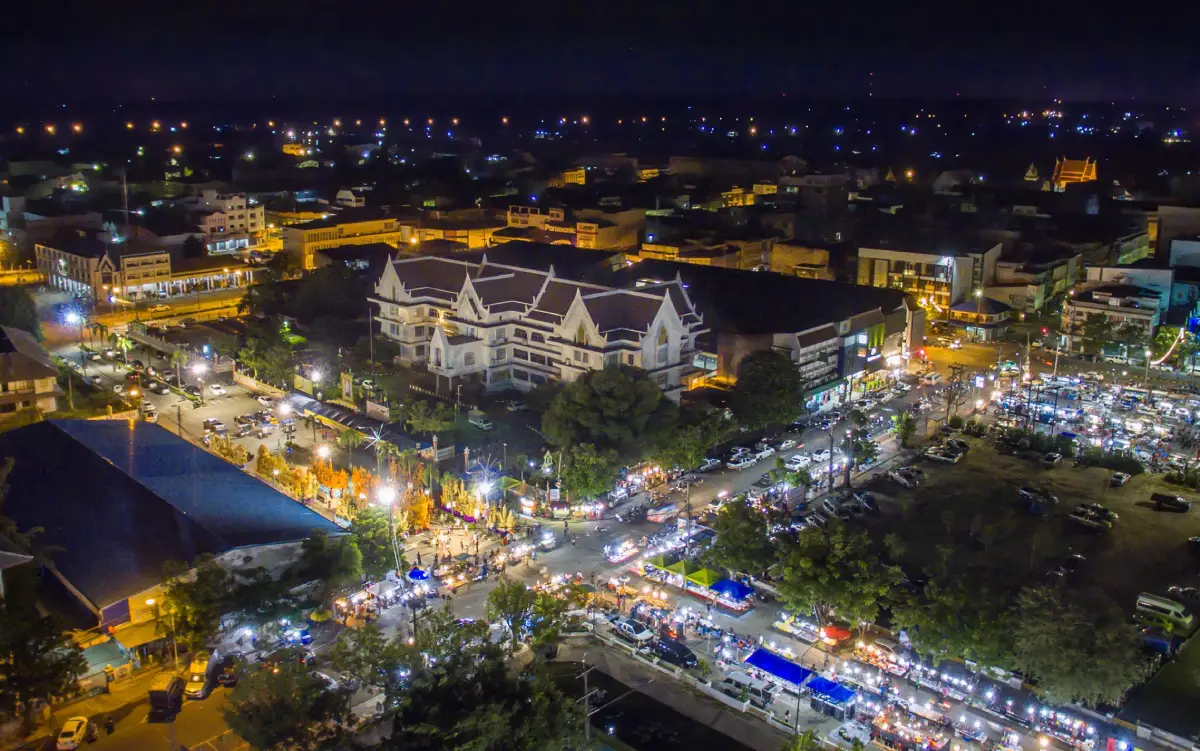
40 Best Places to Visit in Ubon Ratchathani – Explore Northeastern Thailand Ubon Ratchathani is one of the most diverse destinations in Northeastern Thailand, combining Buddhism, urban history, Mun River culture, Lan Xang art, community life, traditional crafts, the Ubon Ratchathani Candle Festival, sandstone landscapes along the Mekong River, national parks, waterfalls, dams, rapids, and the Thailand–Laos border. Travellers can plan anything from a short city break to a 5–7 day journey covering several districts across the province.
For a first visit, begin in Ubon Ratchathani city with Wat Thung Si Muang, Wat Nong Bua, Wat Maha Wanaram, Ubon Ratchathani National Museum, and Thung Si Mueang. Continue to Wat Nong Pah Pong and Wat Pah Nanachat before travelling east to Khong Chiam for Pha Taem National Park, the prehistoric rock paintings, Sao Chaliang, Pha Chana Dai, Soi Sawan Waterfall, Saeng Chan Waterfall, the Two Color River, and Kaeng Tana. With additional time, extend the trip to Sirindhorn, Phibun Mangsahan, Sam Phan Bok, Khemarat, Na Tan, and Phu Chong Na Yoi National Park for a fuller picture of the province’s cities, forest monasteries, Mekong landscapes, communities, food, and nature.
Ubon Ratchathani has a long urban history and has served as an important center of southern Isan. Several old temples reveal connections among Isan, Lan Xang, and Rattanakosin artistic traditions. Wat Thung Si Muang is especially known for its scripture hall standing over water, Wat Maha Wanaram houses the revered Phra Chao Yai In Plaeng Buddha image, and Wat Nong Bua is distinguished by its monumental chedi, one of the city’s most recognizable Buddhist landmarks.
The province also occupies an important place in the history of the Thai Forest Tradition. Wat Nong Pah Pong became the center of the teachings of Luang Pu Chah Subhaddo, whose influence spread through branch monasteries in Thailand and overseas. Wat Pah Nanachat in Warin Chamrap District developed as a monastery where international monks study Buddhist discipline and meditation, giving Ubon Ratchathani an important role in international Buddhist practice.
Travelling east, the landscape changes from urban and agricultural areas to sandstone cliffs, dry dipterocarp forest, rock plateaus, and the Mekong River. Pha Taem National Park anchors this route with sunrise cliffs, prehistoric paintings, Sao Chaliang rock formations, and nature trails linked to several waterfalls. Dong Na Tham Forest and Pha Chana Dai reveal another side of Ubon Ratchathani as a borderland province with extensive natural areas and spectacular eastern sunrise viewpoints.
The Mekong River has also shaped distinctive landscapes such as Sam Phan Bok, Hat Salueng, Hat Chom Dao, and a series of rocky rapids that become most visible when river levels fall. The dry season is therefore particularly suitable for the upper Mekong route, while the rainy season through early winter is better for waterfalls and lush forests. Choosing the right season has a major effect on the Ubon Ratchathani travel experience.
Culturally, Ubon Ratchathani is famous nationwide for the Ubon Ratchathani Candle Festival. Local communities and skilled artisans spend considerable time creating large carved and molded candle sculptures for the Buddhist Lent procession. Thung Si Mueang is therefore more than a city park: it is a civic space connected with major traditions, the city pillar, monuments, and important provincial events.
Traditional handicrafts are another major attraction. Ban Pa Ao is known for ancient-style brass casting and local silk weaving, while Ban Khampun is nationally recognized for preserving and developing Northeastern Thai textiles. Visiting these communities demonstrates that Ubon Ratchathani’s artistic heritage is not confined to temples and museums but remains alive in homes, workshops, and the skills of contemporary artisans.
Ubon Ratchathani’s food culture combines Mun River Isan cuisine, freshwater fish, seasonal vegetables, and Thai–Lao influences. Dishes worth trying include Ubon-style kuay jap, larb, koi, kaeng om, som tam, grilled chicken, fish from the Mun and Mekong rivers, jaew dipping sauces, mushrooms, bamboo shoots, and local vegetables. Morning markets, community restaurants, and old-town neighborhoods often provide a more direct taste of local food culture than large restaurants.
Ubon-style kuay jap is one of the foods most strongly associated with the city. Its distinctive noodles are served in a hot, peppery broth and are popular from morning until evening. Travellers staying in Khong Chiam should also try Mekong fish and riverside dishes, while those travelling through rural districts will encounter seasonal local recipes that vary from community to community.
Accommodation in Ubon Ratchathani is best planned according to the travel route rather than staying in one place for the entire trip. Visitors focusing on temples, museums, restaurants, and the Candle Festival should stay in Ubon Ratchathani city or around Thung Si Mueang for easy access to the airport and dining areas. Those visiting Wat Nong Pah Pong, Ban Khampun, or arriving by train may also find Warin Chamrap a convenient base.
Travellers focusing on Pha Taem, waterfalls, Kaeng Tana, the Two Color River, and the Mekong route should spend at least one night in Khong Chiam. The area has hotels, resorts, and riverside accommodation and allows an earlier start while reducing long drives back to the city. Those visiting Sirindhorn Dam, Pattaya Noi, and Chong Mek can instead stay around Sirindhorn District.
For southern nature routes such as Phu Chong Na Yoi National Park, Huai Luang Waterfall, and the Na Chaluai–Nam Yuen area, consider staying close to the attractions or using authorized conservation-area accommodation when available. These sites are relatively far from the provincial capital, so changing overnight bases reduces fatigue and gives more time for nature exploration.
For trips north toward Sam Phan Bok, Hat Chom Dao, Hat Salueng, Khemarat, and Na Tan, staying in Khemarat or another Mekong-side community reduces backtracking and also allows travellers to experience old-town streets, local markets, and riverside life during the quieter morning and evening hours.
A practical Ubon Ratchathani itinerary should therefore be divided into zones: Ubon city–Warin Chamrap, Khong Chiam–Pha Taem–Dong Na Tham, Sirindhorn–Chong Mek, Phibun Mangsahan, Pho Sai–Na Tan–Khemarat, and Na Chaluai–Nam Yuen. With 5–7 days, travellers can cover the province efficiently while leaving enough time for food, communities, and rest rather than simply rushing from one photo stop to another.
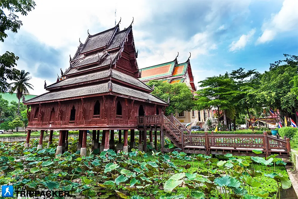
1. Wat Thung Si Muang is located on Luang Road in Nai Mueang Subdistrict, Mueang Ubon Ratchathani District. It is one of the city’s oldest temples and most important cultural landmarks. Its historic structures combine Isan, Lan Xang, and Rattanakosin influences, with the Ho Trai Klang Nam, or scripture hall standing over water, as the temple’s signature feature.
Highlights: The scripture hall over water, historic ordination hall, Phra Chao Yai Si Mueang, mural paintings, and traditional wooden architecture displaying the skills of local Ubon craftsmen.
The scripture hall was built in the middle of a pond to store the Tripitaka and palm-leaf manuscripts. Placing the building over water helped protect sacred texts from termites and insects, while its architecture became an important surviving example of traditional Northeastern Thai craftsmanship.
The temple’s murals and decorative arts also reveal connections between Ubon Ratchathani and other cultural centers including Bangkok, Vientiane, and the wider Lan Xang world, making the temple especially rewarding for visitors interested in art history.
Its location near Thung Si Mueang, Ubon Ratchathani National Museum, and the old-town area makes Wat Thung Si Muang easy to include in a walking or short-driving route through central Ubon.
Getting There: Located on Luang Road, Nai Mueang Subdistrict, Mueang Ubon Ratchathani District. Open daily from 08:00–18:00.
Map (GPS): https://www.google.com/maps/dir/?api=1&destination=15.229751,104.860897&travelmode=driving
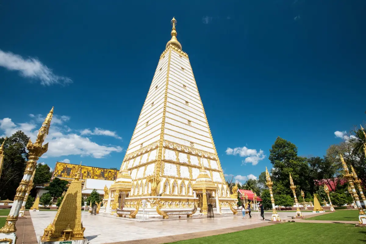
2. Wat Nong Bua is an important temple in Mueang Ubon Ratchathani, distinguished by its large chedi whose architectural concept was inspired by Bodh Gaya in India. The monument has become one of the province’s most recognizable Buddhist landmarks.
Highlights: Sri Maha Pho Chedi, sacred Buddhist relics, elaborate stucco and decorative motifs, landscaped temple grounds, and a major worship space for both Buddhist pilgrims and architecture enthusiasts.
The chedi was created as a focal point of faith and as a symbolic link to one of Buddhism’s most sacred places in India. Its tall profile and elaborate surrounding elements distinguish it from more traditional Isan chedis.
Visitors should take time to examine the decorative details around the chedi, which incorporate Buddhist symbolism and fine ornamental work. Modest clothing and respectful behavior are expected within the worship area.
The temple is within the city and can easily be combined with Wat Sa Prasan Suk, Thung Si Mueang, and Wat Maha Wanaram.
Map (GPS): https://www.google.com/maps/dir/?api=1&destination=15.263313,104.839016&travelmode=driving
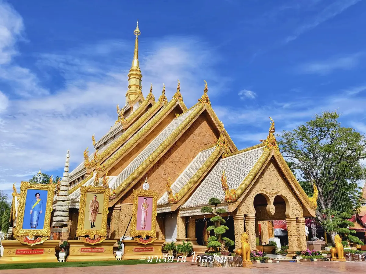
3. Wat Maha Wanaram, also known as Wat Pa Yai, is an important royal temple in central Ubon Ratchathani and home to Phra Chao Yai In Plaeng, a revered Buddha image closely associated with the city’s history and religious identity.
Highlights: Phra Chao Yai In Plaeng, Lan Xang artistic influences, links with the founding history of Ubon Ratchathani, and the traditional bathing and gilding ceremony held in honor of the sacred image.
Phra Chao Yai In Plaeng reflects Lao–Lan Xang artistic traditions and is regarded as a protective Buddha image of the city. Worshippers visit throughout the year, particularly on important Buddhist and local occasions.
The temple also has historical connections with early rulers and the development of Ubon Ratchathani, making it a useful starting point for understanding the city before visiting Thung Si Mueang, the national museum, and other historic temples.
Travellers visiting during the annual bathing and gilding ceremony can observe the temple’s continuing role in community religious life rather than seeing it merely as a historic attraction.
Getting There: Located in central Ubon Ratchathani with convenient access from Thung Si Mueang and Ubon Ratchathani National Museum. Open daily.
Map (GPS): https://www.google.com/maps/dir/?api=1&destination=15.234967,104.863377&travelmode=driving
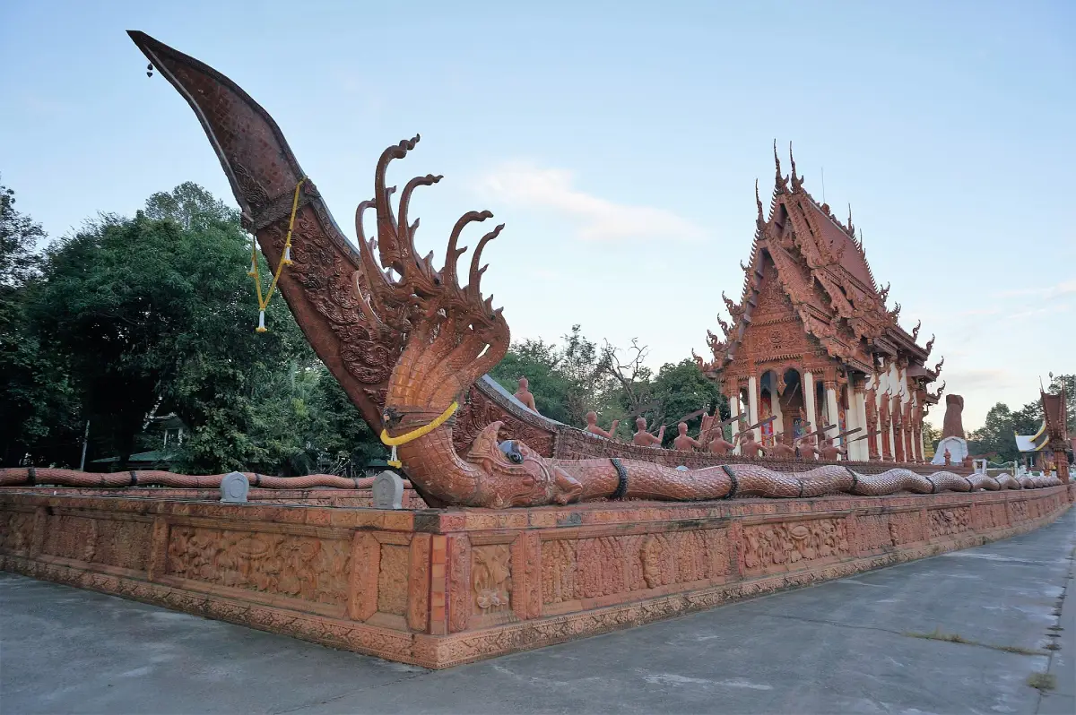
4. Wat Sa Prasan Suk, also known as Wat Ban Na Mueang, is located at Ban Na Mueang in Rai Noi Subdistrict, Mueang Ubon Ratchathani District. The temple is notable for highly distinctive contemporary Buddhist architecture incorporating boats, Naga imagery, the Erawan elephant, and elaborate decorative materials.
Highlights: The ceramic-covered Suphannahong boat-shaped ordination hall, the Dharma Naga boat pavilion over water, the gateway depicting Indra riding the 3-headed Erawan elephant, bell tower, and Luang Pu Bun Mi Museum.
The most memorable structure is the large Suphannahong-shaped ordination hall, whose boat form creates both a dramatic visual identity and symbolic Buddhist meaning.
The Dharma Naga boat pavilion and the monumental Indra-on-Erawan gateway add further layers to the temple’s architectural composition. Visitors interested in craftsmanship should allow time to examine the details rather than only photographing the main structure.
The temple is also associated with Luang Pu Bun Mi Chotipalo, an important monk who played a major role in its development and in strengthening local faith.
Getting There: Located at Ban Na Mueang, Moo 2, Rai Noi Subdistrict, Mueang Ubon Ratchathani District. Open daily from 07:00–19:00.
Map (GPS): https://www.google.com/maps/dir/?api=1&destination=15.262166,104.873744&travelmode=driving
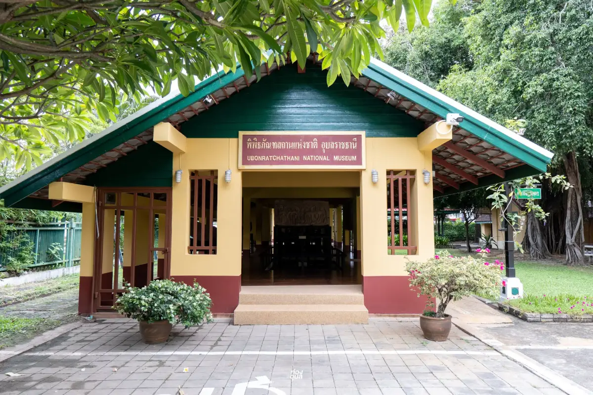
5. Ubon Ratchathani National Museum stands near Thung Si Mueang in the former provincial hall and is one of the best places to understand Ubon Ratchathani before exploring its temples, communities, and archaeological landscapes. Exhibitions cover geography, city history, archaeology, Buddhist art, textiles, and local culture.
Highlights: The historic former provincial hall, archaeological objects from Ubon Ratchathani, development from prehistoric to historic periods, Dvaravati–Chenla–Khmer art, Thai–Lao culture, textiles, and traditional household objects.
The displays demonstrate that Ubon Ratchathani developed as part of a broad Mun–Mekong cultural network in which people, religions, artistic styles, and technologies circulated for centuries.
Travellers planning to visit Pha Taem, Ban Pa Ao, or historic city temples benefit from visiting the museum first because it provides context for interpreting what they later see at the actual sites.
Getting There: Located at 318 Khuean Thani Road, Nai Mueang Subdistrict, Mueang Ubon Ratchathani District. Open Wednesday–Sunday from 09:00–16:00. Closed Monday, Tuesday, and public holidays. Admission is 20 baht for Thai visitors and 100 baht for foreign visitors.
Map (GPS): https://www.google.com/maps/dir/?api=1&destination=15.227774,104.857625&travelmode=driving
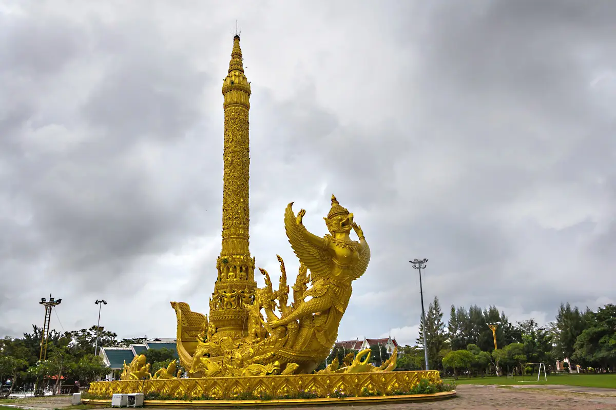
6. Thung Si Mueang is a central public space closely connected with everyday life in Ubon Ratchathani. It functions as a recreation park, exercise area, civic event ground, and major venue for provincial traditions, especially the Ubon Ratchathani Candle Festival.
Highlights: Candle Festival sculptures, the city pillar shrine, the monument to Phra Pathum Worarat Suriyawong or Chao Kham Phong, health and exercise areas, children’s facilities, and the surrounding old-town atmosphere.
The park has entrances on 4 sides and forms an open civic space connecting streets, temples, markets, restaurants, and government buildings, making it a practical starting point for exploring central Ubon on foot.
During the Candle Festival, Thung Si Mueang becomes especially important as a display and activity area for monumental candle sculptures. At other times, residents use the park for walking, jogging, exercise, and relaxation, especially in the morning and evening.
The surrounding district also contains numerous restaurants and local food shops, making it a convenient place to finish a city itinerary with dinner or an evening walk.
Getting There: Located in Nai Mueang Subdistrict, Mueang Ubon Ratchathani District. Open daily. Morning and evening are particularly pleasant. Admission is free.
Map (GPS): https://www.google.com/maps/dir/?api=1&destination=15.230072,104.857287&travelmode=driving
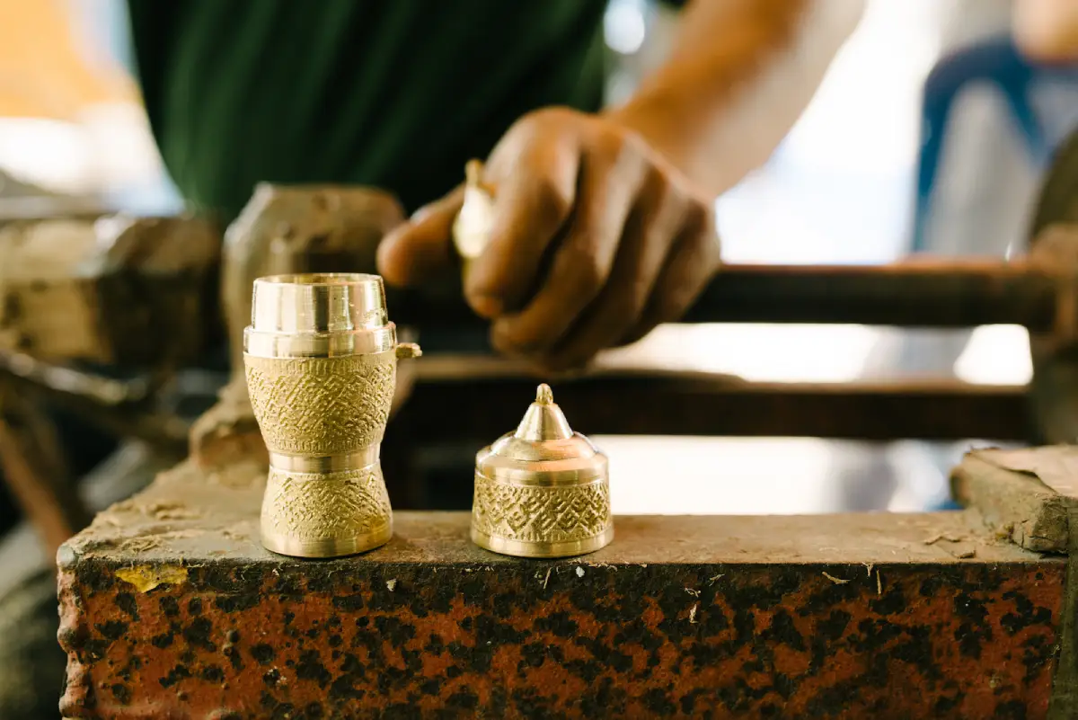
7. Ban Pa Ao is a long-established handicraft community in Mueang Ubon Ratchathani District, well known for traditional brass casting and local silk weaving. It is ideal for travellers who want to observe Isan craftsmanship in a living production community rather than in a reconstructed museum setting.
Highlights: Traditional brass casting, brassware, handwoven silk, community learning activities, and a historic village where craftsmanship has been passed down through generations.
Ban Pa Ao brassware requires knowledge of materials, mold making, casting, and finishing. Visitors can therefore appreciate each object as the result of a complex production process rather than simply a finished souvenir.
The community also produces silk and other local handicrafts. Purchasing directly from local makers supports community income and helps sustain traditional skills over the long term.
Getting There: Located at Ban Pa Ao, Pa Ao Subdistrict, Mueang Ubon Ratchathani District. Take Chaeng Sanit Road, Highway 23 toward Yasothon, then turn into the village. Open daily from 08:00–17:00.
Map (GPS): https://www.google.com/maps/dir/?api=1&destination=15.357800,104.728284&travelmode=driving
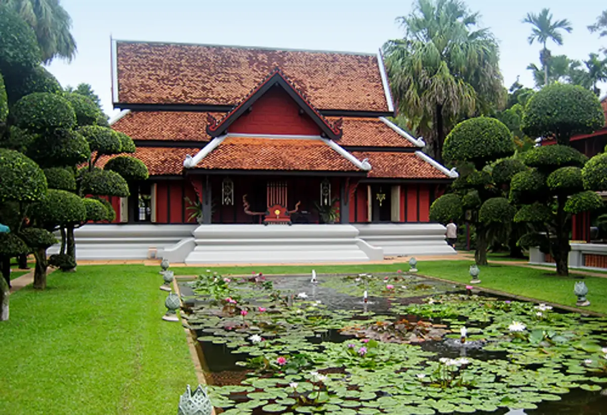
8. Ban Khampun is located in Warin Chamrap District and is one of Ubon Ratchathani’s most celebrated centers for handwoven textile art and the preservation of Northeastern Thai fabrics. The property contains historic textiles, weaving knowledge, Isan architecture, and the story of a family whose work has had a major influence on Thai textile culture.
Highlights: Isan handwoven textiles, antique fabrics, textile art, traditional Northeastern houses, and the special “Open Ban Khampun” event held around the Candle Festival period.
Ban Khampun does not operate as a public museum with its production areas open every day. Access to its important spaces is tied to special opening periods, particularly the annual Open Ban Khampun activities associated with the Candle Festival.
The site demonstrates that Isan textiles are more than clothing; they are works of art combining silk, dyes, patterns, time, and highly specialized artisan knowledge.
Travellers wanting to visit the interior should check the current activity schedule before travelling and should not assume that the weaving or museum areas are open for general access every day.
Map (GPS): https://www.google.com/maps/dir/?api=1&destination=15.195578,104.827181&travelmode=driving
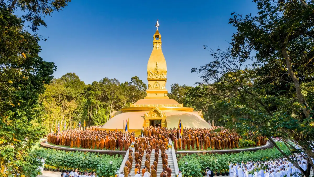
9. Wat Nong Pah Pong is located in Non Phueng Subdistrict, Warin Chamrap District. It is one of the most important monasteries in the Thai Forest Tradition and was established and developed by Luang Pu Chah Subhaddo, whose teaching emphasized simplicity, monastic discipline, and mindfulness in everyday life.
Highlights: The Luang Pu Chah memorial stupa and museum, shaded forest grounds, Thai Forest Tradition practice, places associated with Luang Pu Chah’s life, and a quiet atmosphere suitable for learning about Dhamma.
Wat Nong Pah Pong developed from a strict forest monastery into the center of a large network of branch monasteries in Thailand and overseas. Luang Pu Chah’s teachings have therefore reached Buddhist practitioners of many nationalities and languages.
An important annual period is the Luang Pu Chah Achariya Puja in January, when monks, novices, disciples, and lay Buddhists gather for meditation, Dhamma practice, and remembrance of their teacher.
Visitors should remain quiet, dress modestly, and remember that this is an active meditation monastery rather than an entertainment attraction.
Map (GPS): https://www.google.com/maps/dir/?api=1&destination=15.158912,104.828539&travelmode=driving
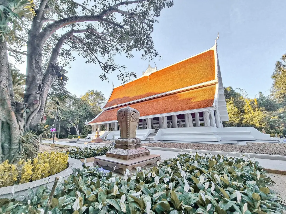
10. Wat Pah Nanachat is located at Ban Bung Wai, Bung Wai Subdistrict, Warin Chamrap District. It is a branch monastery of Wat Nong Pah Pong established for international monks who come to study Buddhist discipline and practice meditation in the tradition of Luang Pu Chah Subhaddo.
Highlights: International monks, Thai Forest Tradition monastic practice, a simple and quiet environment, use of English in some contexts, and strong connections with Luang Pu Chah monasteries around the world.
Wat Pah Nanachat demonstrates how the forest-monastery tradition that developed in Ubon Ratchathani crossed linguistic and cultural boundaries. Monks from many countries live under the same Vinaya discipline, learn Thai and Pali, and practice within a traditional Isan forest-monastery environment.
The architecture is intentionally simple rather than monumental. The most important elements are the atmosphere, practice, and monastic way of life. Visitors should behave quietly and avoid interrupting meditation or monastic routines.
Travellers interested in the Thai Forest Tradition should visit Wat Nong Pah Pong and Wat Pah Nanachat on the same day because the monasteries are directly connected and both are in Warin Chamrap District.
Getting There: Located at Ban Bung Wai, Bung Wai Subdistrict, Warin Chamrap District, approximately 14 km from Ubon Ratchathani city via Highway 226. Open daily from 08:30–16:30.
Map (GPS): https://www.google.com/maps/dir/?api=1&destination=15.164467,104.775766&travelmode=driving
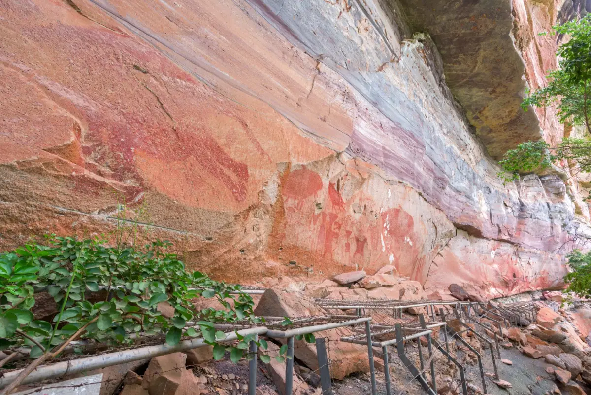
11. Pha Taem National Park is one of Ubon Ratchathani’s most important attractions, covering areas around Khong Chiam and the Mekong River. Its main features include sandstone landscapes, high cliffs, dry dipterocarp forest, prehistoric rock paintings, Sao Chaliang rock formations, waterfalls, and viewpoints overlooking Laos.
Highlights: Pha Taem viewpoint, prehistoric paintings along the cliff, Sao Chaliang, Soi Sawan Waterfall, Saeng Chan Waterfall, nature trails, and Mekong River scenery.
Pha Taem is important both naturally and archaeologically. Prehistoric paintings on the cliffs depict people, animals, hands, tools, and activities, demonstrating that the Mekong-side landscape has been used by human communities for thousands of years.
The park’s cliffs, rock pillars, and plateaus developed through the long-term erosion of sandstone by water, wind, and weather, creating some of the most distinctive landforms in eastern Isan.
Morning is suitable for sunrise and Mekong views. Visitors walking to the paintings should carry water, wear comfortable footwear, and avoid the strongest midday heat because parts of the route are exposed.
Getting There: From Ubon Ratchathani city, travel toward Khong Chiam and continue to Pha Taem National Park, approximately 90–100 km away. Check park announcements on the day of travel, especially during heavy rain or when specific routes are restricted.
Map (GPS): https://www.google.com/maps/dir/?api=1&destination=15.402201,105.500044&travelmode=driving
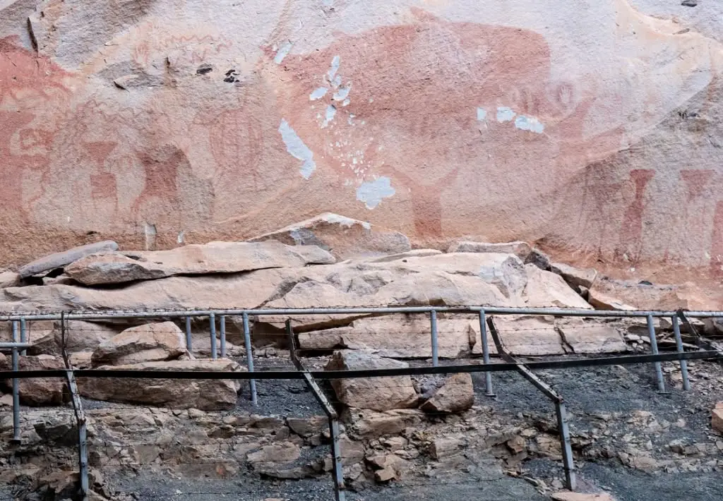
12. Pha Taem Prehistoric Rock Paintings are among the most important prehistoric archaeological records in Northeastern Thailand. They appear along sandstone cliffs within Pha Taem National Park and demonstrate that the Mekong landscape was used by human communities thousands of years ago.
Highlights: Red images of hands, fish, animals, people, tools, and scenes of human activity painted directly on the sandstone cliff.
The paintings are divided into several groups along the cliff and vary in size, form, and subject. Some appear to show fishing and other activities, while others depict animals or human hands, providing clues about the relationship between prehistoric communities and their environment.
The walking route descends along the cliff and covers a considerable distance. Visitors wishing to see the full sequence should allow enough time and be prepared for uphill and downhill sections.
Do not touch the rock surfaces or paintings. Sweat, skin oils, scratching, and graffiti can permanently damage archaeological evidence that has survived for thousands of years.
Getting There: Follow the designated trail from the Pha Taem National Park visitor area to the cliff and painting zones, and obey all signs and ranger instructions.
Map (GPS): https://www.google.com/maps/dir/?api=1&destination=15.399435,105.511837&travelmode=driving
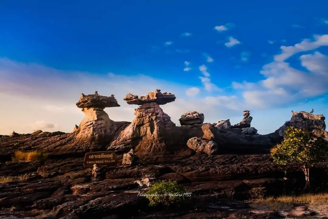
13. Sao Chaliang is a group of sandstone formations resembling giant pillars topped by broad slabs. Formed by long-term natural erosion, it is one of the clearest places to observe the geology of Pha Taem National Park.
Highlights: Mushroom-shaped rocks, natural stone pillars, sandstone plateaus, and a short walking route suitable for visitors who want to see distinctive landforms without a long hike.
The formations developed because different layers of sandstone erode at different rates. Softer lower layers weathered faster than the more resistant upper layers, leaving pillar-like structures supporting larger slabs.
Sao Chaliang is easy to combine with Pha Taem because it lies on the same route and does not require much time. Visitors can view the formations from several angles without climbing on them.
Avoid climbing or writing on the rocks, as natural erosion is still taking place and human activity can accelerate damage.
Getting There: Located inside Pha Taem National Park in Huai Phai Subdistrict, Khong Chiam District. Access follows park operating conditions, so check current notices before travelling.
Map (GPS): https://www.google.com/maps/dir/?api=1&destination=15.404401,105.502061&travelmode=driving
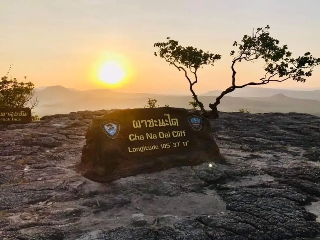
14. Pha Chana Dai lies within Dong Na Tham Forest, part of Pha Taem National Park, and is one of Thailand’s best-known sunrise viewpoints. The east-facing cliff overlooks the Mekong River and Laos across a wide horizon.
Highlights: Sunrise views, sandstone cliffs, Mekong scenery, Dong Na Tham Forest, rock plateaus, and rich natural surroundings.
Pha Chana Dai is particularly memorable at dawn, when the horizon over Laos gradually changes color and the first sunlight spreads across the Mekong landscape.
The surrounding area includes twin Sao Chaliang formations, rock plateaus, and Dong Na Tham nature routes. It is better planned as a full-day or overnight trip rather than a rushed return journey from Ubon city.
The access road can be affected by rainfall and road conditions, especially during the wet season. Check national park announcements before every visit.
Map (GPS): https://www.google.com/maps/dir/?api=1&destination=15.620802,105.617411&travelmode=driving
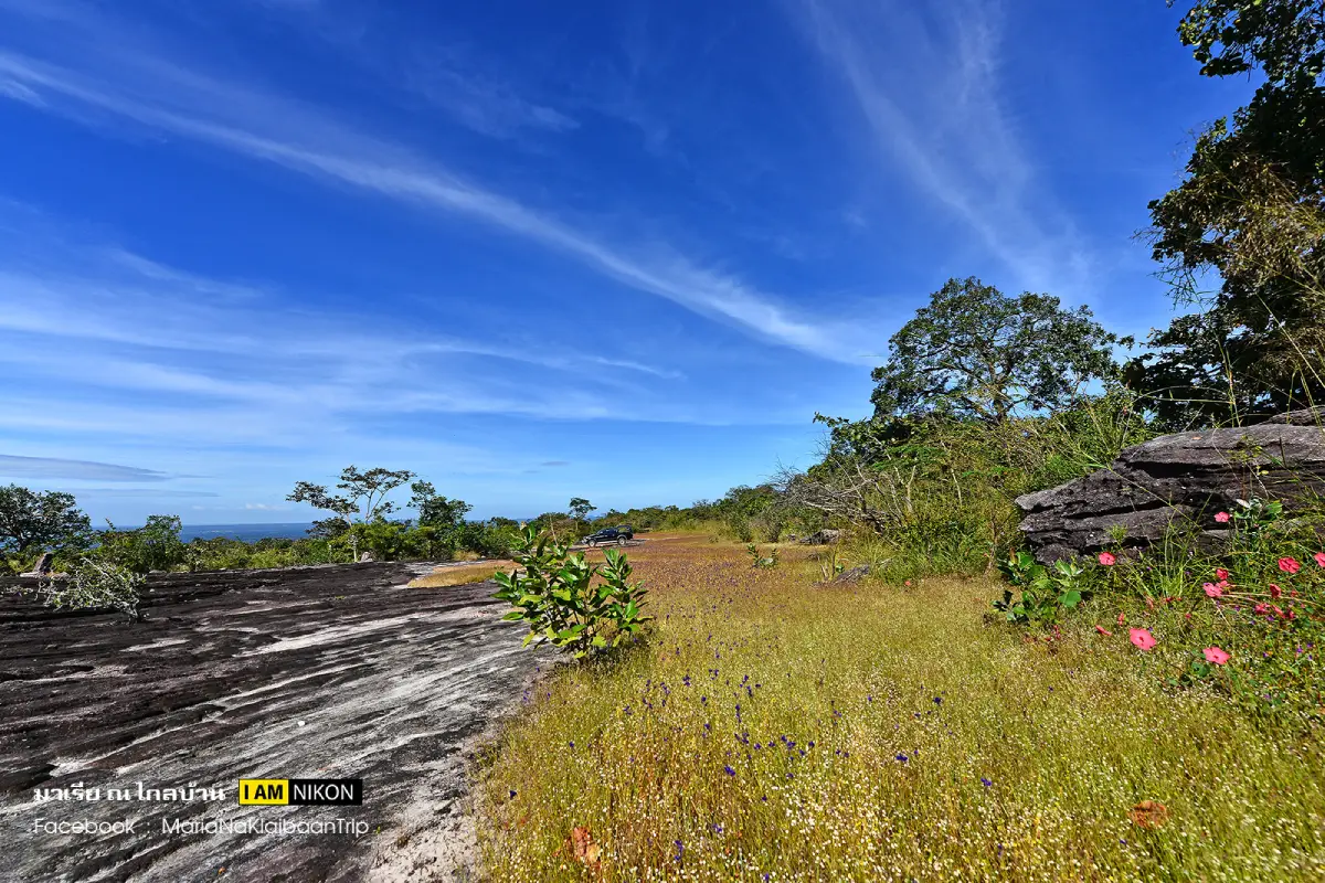
15. Dong Na Tham Forest is a large natural area in the northern part of Pha Taem National Park. It contains dry dipterocarp forest, sandstone plateaus, cliffs, seasonal flower fields, small waterfalls, and multiple viewpoints over the Mekong River.
Highlights: Pha Chana Dai, twin Sao Chaliang formations, sandstone plateaus, dry dipterocarp forest, seasonal wildflowers, and viewpoints toward Laos.
The landscape developed through long-term sandstone erosion, creating depressions, cliffs, and open rock surfaces alternating with forest. These variations support different plant communities and microhabitats.
At certain times of year, small wildflowers bloom across rock plateaus, giving the landscape a very different appearance from the dry season. Winter conditions are generally more comfortable for longer walks.
Visitors should carry sufficient water and food, wear proper hiking footwear, and confirm access conditions with park staff because some areas are remote and seasonally restricted.
Map (GPS): https://www.google.com/maps/dir/?api=1&destination=15.581984,105.547358&travelmode=driving
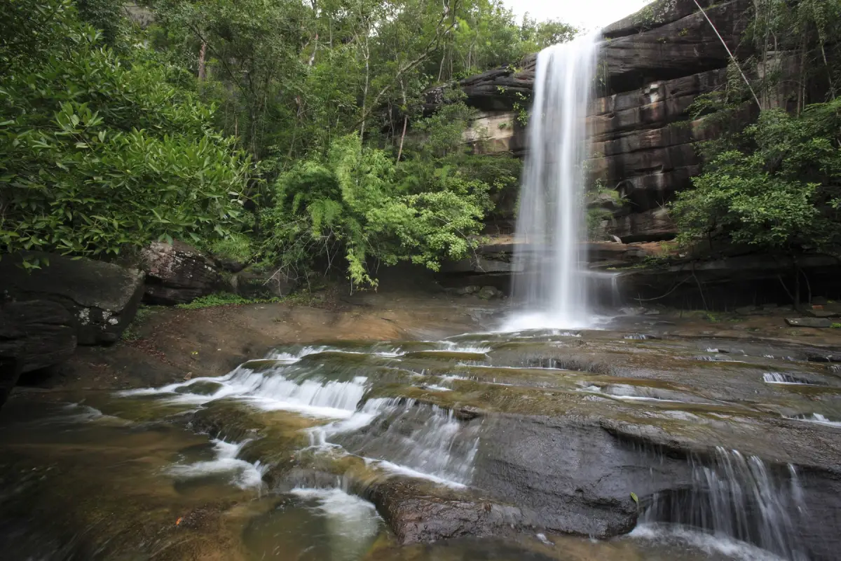
16. Soi Sawan Waterfall is a major waterfall in Pha Taem National Park, formed where 2 streams descend from sandstone cliffs and converge below. The twin streams resemble hanging strands, giving rise to the name “Soi Sawan,” or “Heavenly Necklace.”
Highlights: Two waterfall streams descending from high cliffs, valley viewpoints, sandstone plateaus, and seasonal wildflower fields nearby.
The waterfall is at its best from the rainy season into early winter, when water flow is strong and vegetation is lush. During the dry season the volume can decrease significantly.
The nearby rock plateau is also known for small seasonal wildflowers, allowing visitors to experience both waterfall scenery and rock-plateau ecology on the same visit.
Take care on slippery rock surfaces and remain well back from cliff edges, particularly after heavy rainfall.
Getting There: Located inside Pha Taem National Park, Khong Chiam District. Access depends on weather and current park announcements.
Map (GPS): https://www.google.com/maps/dir/?api=1&destination=15.459577,105.579050&travelmode=driving
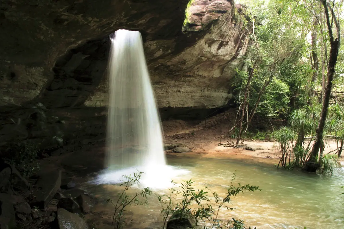
17. Saeng Chan Waterfall (Namtok Long Ru) is one of Ubon Ratchathani’s most unusual waterfalls. Water flows through a natural opening in the sandstone above before dropping into the area below, creating the impression that the stream is falling through a hole in the rock ceiling.
Highlights: The natural rock opening, sandstone cliff, pool below the waterfall, and forest atmosphere of the Pha Taem zone.
The waterfall’s unusual form developed through long-term erosion of the sandstone until water created an opening through which the stream now descends.
Water volume is highly seasonal. The rainy season through early winter generally provides the clearest waterfall flow, while the dry season may bring substantially lower water levels.
Parts of the trail are rocky and wet. Wear footwear with good traction and avoid areas with strong water flow or slippery cliff edges.
Map (GPS): https://www.google.com/maps/dir/?api=1&destination=15.515949,105.590320&travelmode=driving
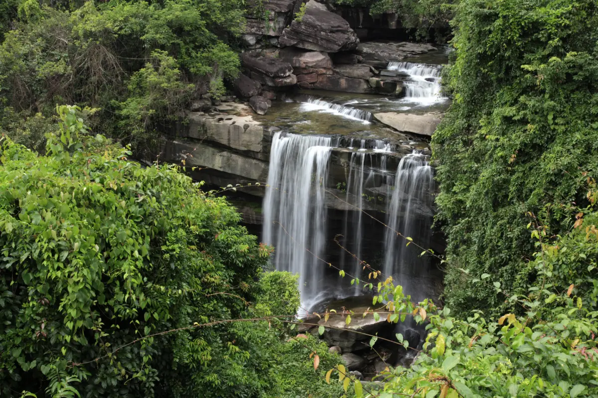
18. Thung Na Mueang Waterfall is another waterfall in the Khong Chiam nature zone, located not far from Saeng Chan Waterfall and suitable for visiting on the same day. Its main features are streams flowing across sandstone layers and shaded forest surroundings.
Highlights: Sandstone formations, streams, seasonal waterfall flow, green forest, and easy combination with Saeng Chan Waterfall and nearby natural attractions.
The waterfall changes significantly with the season and water level. Following sustained rainfall, the stream becomes fuller and the surrounding forest is at its greenest.
The natural terrain includes wet rocks and uneven walking surfaces. Wear suitable footwear and take extra care when travelling with children or older visitors.
Combining Thung Na Mueang Waterfall with Saeng Chan Waterfall reduces backtracking and works well for a full day of waterfall exploration in the Pha Taem area.
Map (GPS): https://www.google.com/maps/dir/?api=1&destination=15.533294,105.596979&travelmode=driving
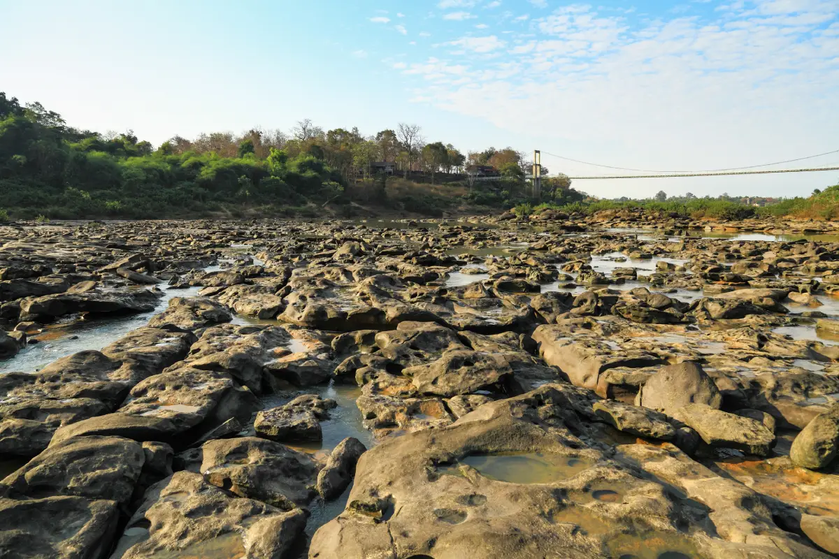
19. Kaeng Tana National Park protects an important natural area along the Mun River before it reaches the Mekong. The landscape features large rapids, strong currents, riverside forest, a suspension bridge, and several viewpoints.
Highlights: Kaeng Tana rapids, suspension bridge, Mun River viewpoints, natural forest, and convenient links with Khong Chiam, Pak Mun Dam, and the Two Color River.
The appearance of the rapids changes with Mun River levels. During lower water, more rock formations are exposed, while high-water periods produce powerful currents and a very different landscape.
The national park provides insight into the Mun River system and its ecology, making it more rewarding for visitors interested in landscapes and rivers than for those seeking only a quick photo stop.
Follow ranger instructions closely around the water because river levels and currents can change with both natural conditions and upstream water management.
Getting There: Located in Khong Chiam District near Pak Mun Dam and the Two Color River. These sites can be combined into a half-day or full-day route.
Map (GPS): https://www.google.com/maps/dir/?api=1&destination=15.299547,105.476831&travelmode=driving
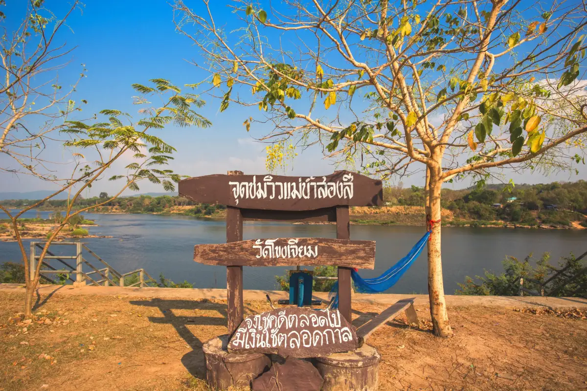
20. Two Color River is the confluence where the Mun River meets the Mekong at Khong Chiam and is one of Ubon Ratchathani’s best-known natural landmarks. Differences in sediment, light, water level, and current can make the waters of the 2 rivers appear different in color before they mix.
Highlights: The meeting of the Mun and Mekong rivers, views toward Laos, riverside atmosphere, and convenient access to Wat Tham Khuha Sawan, Kaeng Tana, and Pak Mun Dam.
The name “Two Color River” refers to periods when visitors can visually distinguish the colors of the 2 rivers before they blend. The contrast is not equally clear every day because it varies with season, rainfall, sediment, and river conditions.
Morning and late afternoon are comfortable times for viewing, with softer light across the water. Staying in Khong Chiam makes it easy to enjoy the river without rushing.
Khong Chiam also has restaurants specializing in river fish and Isan cuisine, making the Two Color River a useful lunch or evening stop after visiting Pha Taem.
Getting There: Located in Khong Chiam District. The riverside viewpoints are accessible throughout the day and there is no admission fee.
Map (GPS): https://www.google.com/maps/dir/?api=1&destination=15.320786,105.489017&travelmode=driving
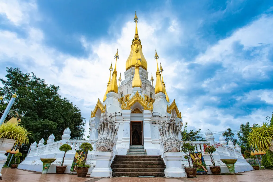
21. Wat Tham Khuha Sawan is an important temple in Khong Chiam District, located on elevated ground near the confluence of the Mun and Mekong rivers. It combines Buddhist religious significance with one of the area’s most attractive river landscapes.
Highlights: Views of the Mun and Mekong rivers, cave areas within the temple, religious structures on elevated ground, and a peaceful atmosphere overlooking Khong Chiam.
The temple is associated with Buddhist meditation practice and the religious history of Khong Chiam. Its elevated position allows visitors to see the relationship among the town, surrounding communities, and the rivers below.
Its proximity to the Two Color River is one of its main attractions. Morning and late afternoon are more comfortable than midday and provide pleasant light over the Mekong landscape.
Visitors should dress modestly, remain quiet, and avoid disturbing monks or meditation areas.
Map (GPS): https://www.google.com/maps/dir/?api=1&destination=15.322768,105.487676&travelmode=driving
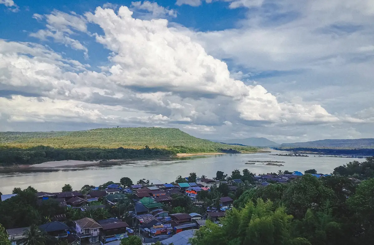
22. Khong Chiam is one of Ubon Ratchathani’s most important Mekong-side districts and an excellent base for visiting Pha Taem, the Two Color River, Kaeng Tana, Wat Tham Khuha Sawan, Pak Mun Dam, and borderland nature routes.
Highlights: Mekong views, a border-town atmosphere, river-fish restaurants, sunrise scenery, riverside accommodation, and easy connections to multiple natural attractions.
Khong Chiam’s identity is closely tied to the river. For generations, the Mekong has functioned as a transport route, food source, and livelihood base, giving the town a noticeably different character from Ubon city.
Evening is ideal for riverside walks, local fish dishes, and views toward Laos. Staying overnight also allows an early departure for Pha Taem without a long drive from the provincial capital.
Travellers planning 2 or more days in the Pha Taem area should consider at least 1 night in Khong Chiam to reduce backtracking.
Map (GPS): https://www.google.com/maps/dir/?api=1&destination=15.438344,105.523991&travelmode=driving
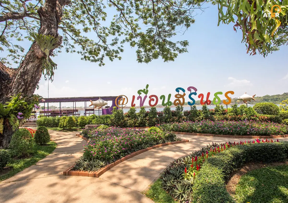
23. Sirindhorn Dam is located in Sirindhorn District and plays important roles in electricity generation, irrigation, and water management for Northeastern Thailand. The reservoir has also developed into a large recreation area with expansive views.
Highlights: Dam crest, reservoir, viewpoints, recreation areas, and convenient connections to Pattaya Noi and Chong Mek.
The dam contributes to regional energy and water systems, while the reservoir landscape has become a popular place for relaxation among local residents and visitors.
Late afternoon is especially pleasant because temperatures are cooler and evening light spreads across the reservoir, making it suitable for walking and photography.
Travellers staying in Sirindhorn can conveniently combine the dam, Pattaya Noi, and Chong Mek in one day.
Map (GPS): https://www.google.com/maps/dir/?api=1&destination=15.206349,105.429145&travelmode=driving
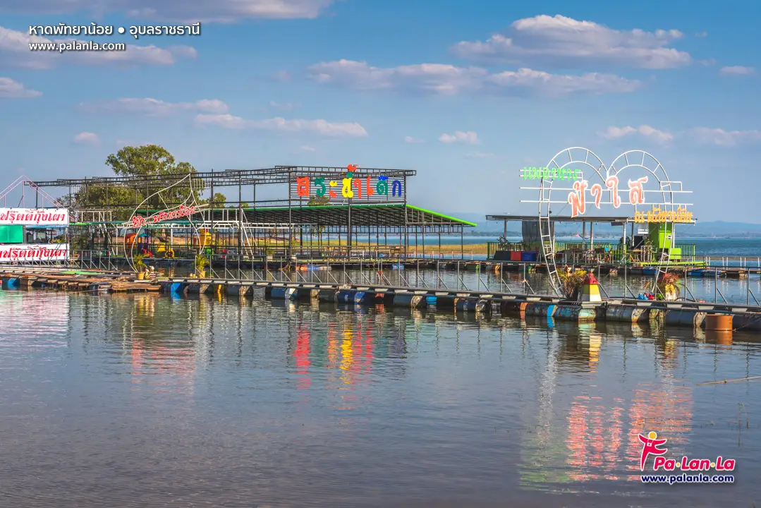
24. Pattaya Noi (Isan Sea) is a popular recreation area on Sirindhorn Reservoir. Its broad waters, waterside restaurants, and leisure activities create a beach-like atmosphere despite being located inland in Northeastern Thailand.
Highlights: Reservoir-side restaurants, floating leisure platforms, open-water views, water activities, and a relaxed lakefront atmosphere.
The nickname “Pattaya Noi” comes from its waterfront atmosphere, restaurants, and recreation activities resembling a small beach destination, even though the site is part of a reservoir.
Weekends and holidays can be busy. Visitors seeking quieter surroundings may prefer weekdays or mornings.
For floating platforms or water activities, choose operators with appropriate safety equipment and always wear a life jacket.
Map (GPS): https://www.google.com/maps/dir/?api=1&destination=15.174253,105.358584&travelmode=driving
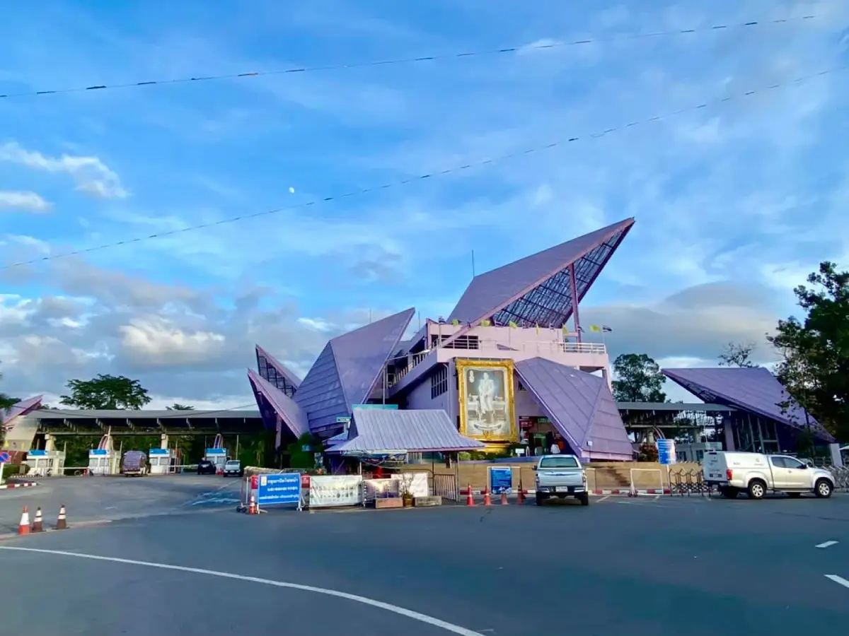
25. Chong Mek is located in Sirindhorn District and is an important permanent border crossing between Thailand and the Lao PDR. It provides a major overland gateway from Ubon Ratchathani to Champasak Province and southern Laos.
Highlights: Thailand–Laos border facilities, border market, cross-border trade atmosphere, and onward connections toward Pakse and attractions in southern Laos.
Chong Mek serves both tourism and trade. Travellers can observe freight vehicles, passenger movement, shops, and businesses that reflect the economic relationship between Ubon Ratchathani and southern Laos.
Anyone planning to cross the border should check the latest entry documents, border operating hours, and immigration rules before travelling because these conditions can change.
Even without crossing into Laos, travellers can visit the market and border area and combine Chong Mek with Sirindhorn Dam and Pattaya Noi.
Map (GPS): https://www.google.com/maps/dir/?api=1&destination=15.135118,105.459255&travelmode=driving
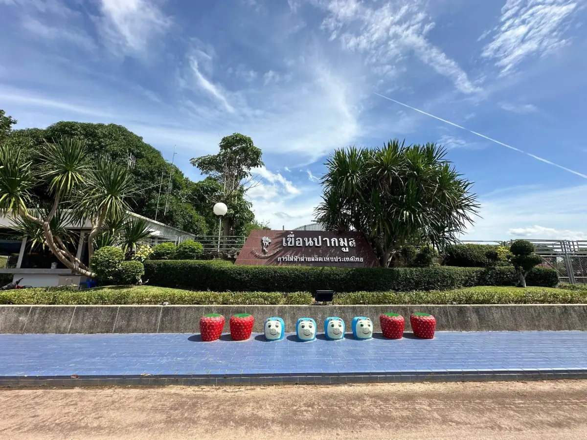
26. Pak Mun Dam stands on the Mun River before it joins the Mekong and is an important hydropower facility in eastern Ubon Ratchathani.
Highlights: The dam structure, Mun River scenery, water-system viewpoints, and convenient links with Kaeng Tana, Khong Chiam, and the Two Color River.
The site provides an opportunity to see the relationship between water management, electricity generation, and the ecology of the Mun River, one of the most important waterways in Northeastern Thailand.
The surrounding landscape changes with river levels and the season. High-water and low-water periods reveal very different views of the river and rocky features.
Follow all signs and access restrictions because some areas are operational infrastructure and are not open to visitors.
Map (GPS): https://www.google.com/maps/dir/?api=1&destination=15.274239,105.458512&travelmode=driving
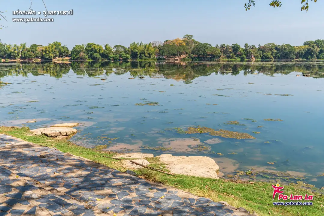
27. Kaeng Saphue is a long-famous rocky rapid in the Mun River at Phibun Mangsahan. It is most visible during the dry season when river levels fall and extensive rock formations emerge.
Highlights: Rocky rapids, Mun River scenery, viewpoints, riverside recreation areas, and the atmosphere of Phibun Mangsahan town.
Kaeng Saphue shows how exposed rock controls the Mun River’s flow. At lower water levels, channels and rock surfaces become much more visible, making the dry season the best period for seeing the rapids.
The riverside area is suitable for walking and relaxing, and the attraction can easily be combined with Wat Phu Khao Kaew.
During high-water periods, much of the rock formation may disappear beneath the river, so the appearance of the site changes naturally with seasonal water levels.
Map (GPS): https://www.google.com/maps/dir/?api=1&destination=15.245652,105.243270&travelmode=driving
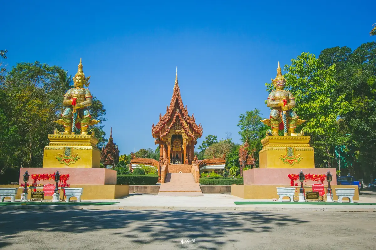
28. Wat Phu Khao Kaew is a hilltop temple in Phibun Mangsahan, noted for white architecture that stands out from a distance and for elevated views over the town and Mun River.
Highlights: White temple architecture, religious structures on elevated ground, views across Phibun Mangsahan, and proximity to Kaeng Saphue.
The hillside setting creates an atmosphere very different from temples on the flat urban plain. Visitors can explore the structures while looking over the Mun River and surrounding community.
It works particularly well with Kaeng Saphue: visit the temple in the morning or afternoon and continue to the river in the cooler evening hours.
Visitors should dress modestly and remain respectful within the religious grounds.
Map (GPS): https://www.google.com/maps/dir/?api=1&destination=15.241973,105.227014&travelmode=driving
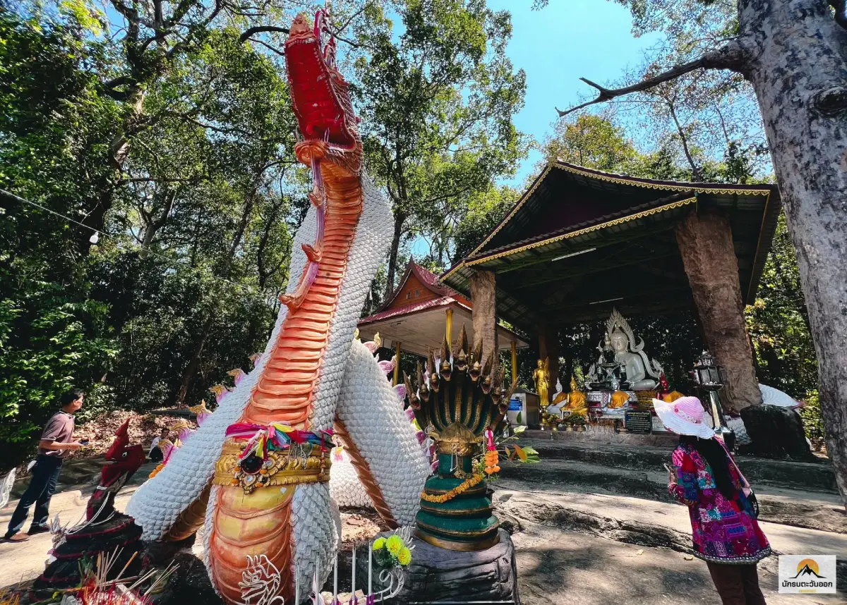
29. Wat Don That is a forest monastery situated on an island or raised land within the Mun River in Phibun Mangsahan District. It is connected with the history of Northeastern Thai forest monks and has a particularly quiet atmosphere because it is surrounded by water and nature.
Highlights: Forest monastery setting in the Mun River, tranquil surroundings, associations with the meditation tradition, and a landscape separated from the mainland community.
The island setting naturally supports meditation and seclusion from busy community life, which is one of the monastery’s defining characteristics.
Visitors interested in forest-monastery history can connect Wat Don That with Wat Nong Pah Pong and Wat Pah Nanachat to gain a broader understanding of meditation traditions in Ubon Ratchathani.
Access can depend on river levels and may involve boat travel during certain periods, so local access conditions should be checked before travelling.
Map (GPS): https://www.google.com/maps/dir/?api=1&destination=15.265868,105.301732&travelmode=driving
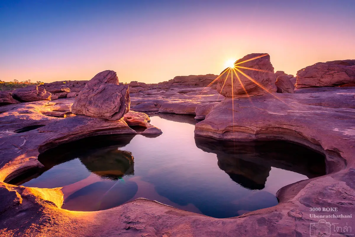
30. Kaeng Song Khon (Sam Phan Bok) is one of Ubon Ratchathani’s most famous Mekong landscapes, located in Pho Sai District. Thousands of rock pools were created by swirling currents during high-water periods and become visible when the Mekong recedes.
Highlights: Thousands of differently shaped rock pools, vast rock terraces, Mekong views, sunrise and sunset photography, and easy connections to Hat Salueng, Hat Chom Dao, and Na Tan.
The local word “bok” refers to a depression or pool in the rock. When water levels fall, visitors can see pools of many sizes and shapes, some of which have been given names based on their resemblance to animals or familiar forms.
Sam Phan Bok is strongly seasonal. Low-water periods are best because the rock terraces and pools are much more visible than during the Mekong’s high-water season.
Morning and evening are best for walking because temperatures are lower. Carry water, wear a hat, and use footwear with good grip because some rock surfaces are uneven.
Staying around Khemarat or Pho Sai allows Sam Phan Bok to be combined with Hat Salueng and Hat Chom Dao without returning to Ubon city.
Map (GPS): https://www.google.com/maps/dir/?api=1&destination=15.788619,105.410900&travelmode=driving
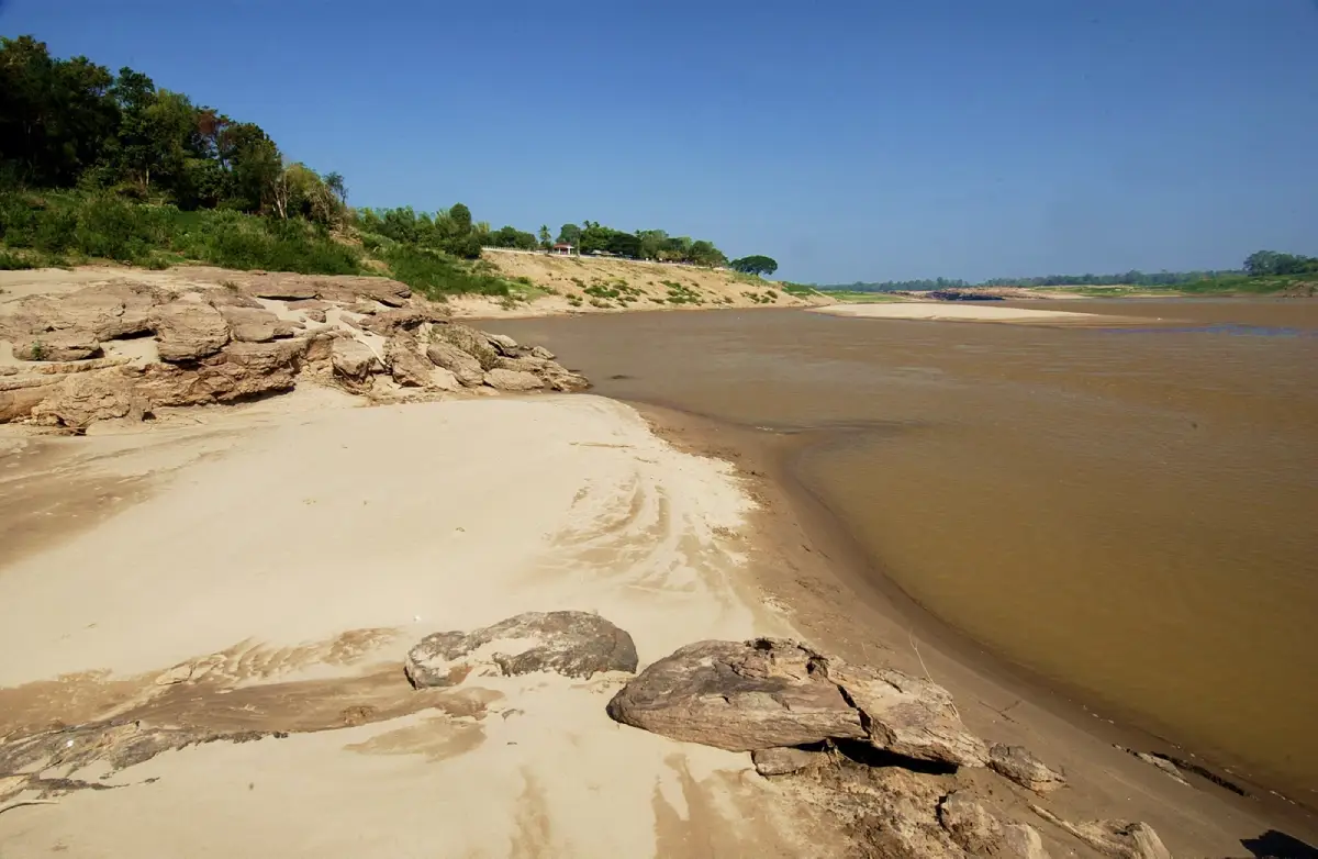
31. Hat Salueng is a seasonal Mekong beach at Ban Song Khon, Song Khon Subdistrict, Pho Sai District. During the dry season, falling river levels expose a broad stretch of pale sand that becomes both a local recreation area and a departure point for nearby Mekong attractions.
Highlights: Mekong sandy beach, views toward Laos, Songkran atmosphere, boat departure point for Sam Phan Bok, riverside food, and connections with upper-Mekong attractions.
The beach is generally at its best from approximately January–May, when the river is lower and more sand is exposed. Morning and evening are more comfortable than midday because the sand can become extremely hot.
The name “Hat Salueng” is associated with a local story about being challenged to walk or run across the hot beach at midday in April in exchange for one salueng, an old Thai monetary unit.
The beach is also used as a boat departure point for Sam Phan Bok and nearby Mekong sites, making it a useful base for a full-day nature trip in Pho Sai.
Getting There: From Ubon Ratchathani city, take Highway 2050 through Trakan Phuet Phon toward Pho Sai and Ban Song Khon. The site can be visited daily depending on seasonal Mekong levels.
Map (GPS): https://www.google.com/maps/dir/?api=1&destination=15.822776,105.387004&travelmode=driving
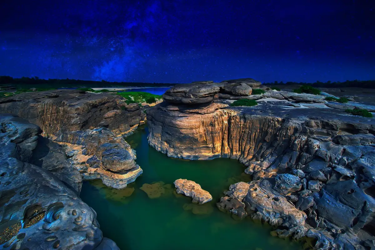
32. Hat Chom Dao is a Mekong-side attraction in the Na Tan area, known for broad rock terraces, channels, pools, and unusual erosion forms that become visible as river levels fall.
Highlights: Mekong rock terraces, natural pools, channels, sunrise and sunset views, and a landscape that changes dramatically with water levels.
Hat Chom Dao resembles Sam Phan Bok in showing the erosive work of the Mekong, but it often feels broader and quieter, making it suitable for travellers who prefer a slower riverside experience.
The dry season is the best period because lower river levels reveal more rock formations and pools. During high water, many of these features disappear beneath the Mekong.
Wear footwear with good grip because the rock terraces contain smooth surfaces, deep grooves, and areas that may become slippery from moisture or algae.
Map (GPS): https://www.google.com/maps/dir/?api=1&destination=15.907509,105.340695&travelmode=driving
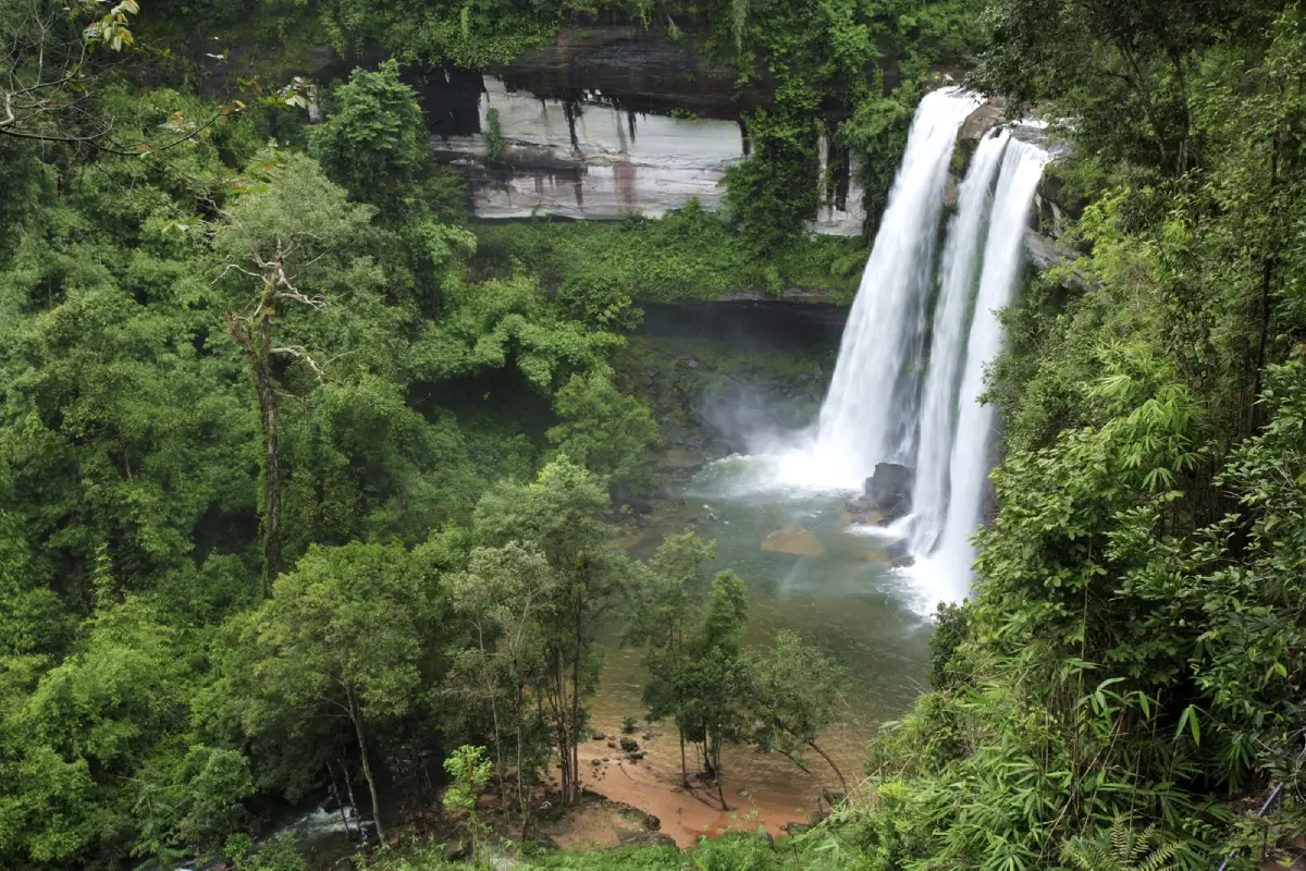
33. Phu Chong Na Yoi National Park is a major protected area in southern Ubon Ratchathani covering forest and mountain landscapes along the Phanom Dong Rak range. Ecosystems include dry dipterocarp forest, mixed deciduous forest, dry evergreen forest, streams, waterfalls, and mountain terrain close to the border region.
Highlights: Huai Luang Waterfall, natural forest, nature trails, rocky rapids, viewpoints, and the ecosystems of southern Ubon Ratchathani.
The park is well suited to travellers who want a deeper nature experience than a simple roadside viewpoint because it serves as a base for waterfalls, forest walks, and several natural attractions around Na Chaluai.
The rainy season through early winter brings greener forest and stronger waterfall flow, while winter is more comfortable for hiking. Some nature routes may have seasonal or weather-related access restrictions.
Check national park announcements before entering, particularly for deeper trails or during heavy rainfall, and follow ranger instructions carefully.
Map (GPS): https://www.google.com/maps/dir/?api=1&destination=14.450943,105.323873&travelmode=driving
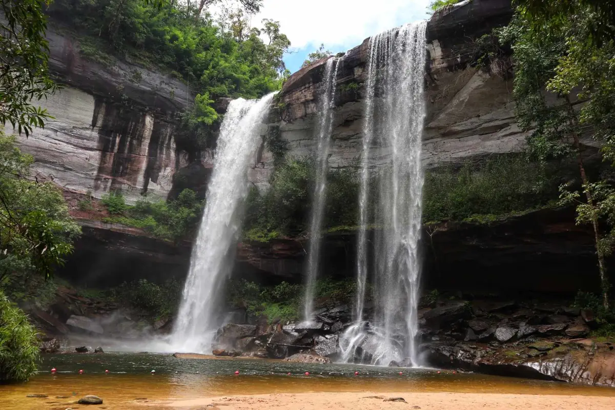
34. Huai Luang Waterfall, also known locally as Namtok Tham Bak Teo, is a major waterfall inside Phu Chong Na Yoi National Park and one of the defining nature attractions of southern Ubon Ratchathani. Water drops from a high cliff into a pool surrounded by forest and mountains.
Highlights: Large waterfall, high rock cliff, pool below, green forest, and nature trails within the national park.
The waterfall is particularly impressive from the rainy season into early winter, when water volume is strong and surrounding vegetation is lush. Water levels naturally decrease during the dry season.
The route down to the waterfall includes significant elevation change. Visitors travelling with older people or children should consider physical ability and allow sufficient time for the climb back.
Around the waterfall and lower pool, take care on slippery rocks and be aware that water levels and currents can change quickly after heavy rain.
Getting There: Located within Phu Chong Na Yoi National Park in Na Chaluai District. Check current road and park conditions before travelling.
Map (GPS): https://www.google.com/maps/dir/?api=1&destination=14.441840,105.274220&travelmode=driving
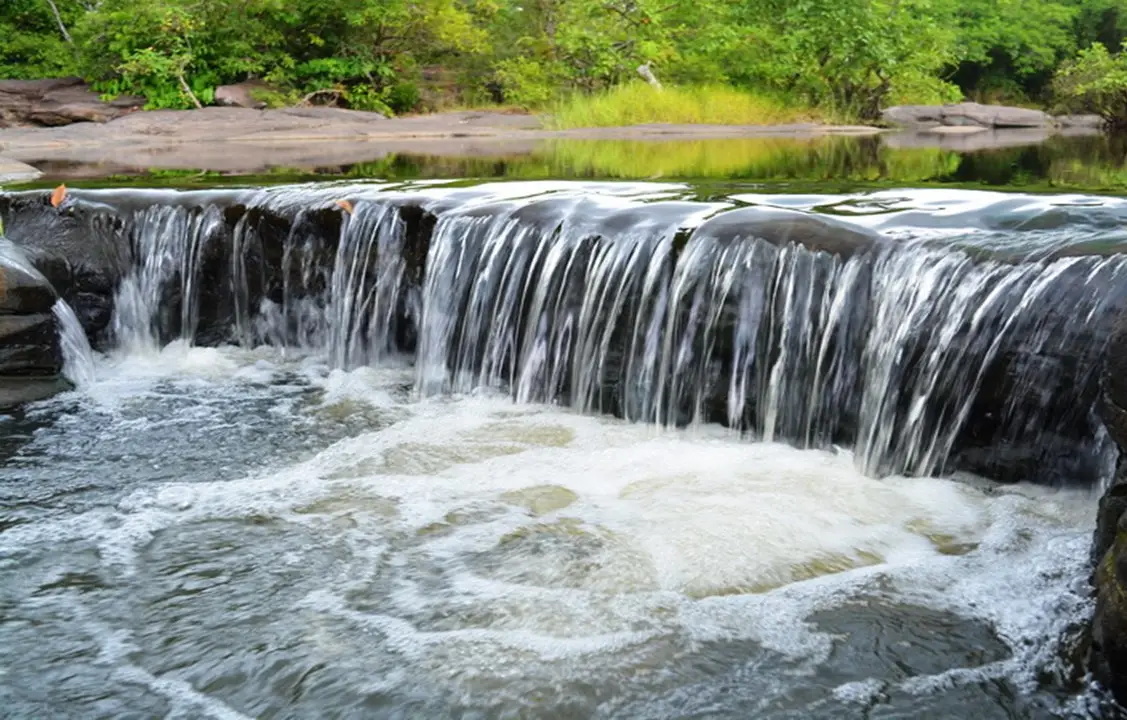
35. Kaeng Lamduan Waterfall is located in the Ubon Ratchathani Nature and Wildlife Education Center area in Dom Pradit Subdistrict, Nam Yuen District. It consists of rocky rapids along Lam Dom Yai, surrounded by clear water and shade from local vegetation, especially lamduan trees.
Highlights: Approximately 200 meters of rocky rapids, Lam Dom Yai stream, swimming and nature areas, caves, smaller rapids, and the nationally famous walking shrimp phenomenon.
The rainy season brings lush surroundings and stronger water flow, making the river ecosystem particularly dynamic. Greater caution is required around slippery rocks and fast-moving water.
The walking shrimp phenomenon occurs during the rainy season and is most commonly seen from late August through September, depending on annual rainfall and current strength. Hairy-clawed freshwater shrimp leave the strongest current and move across exposed rocks.
Visitors observing the shrimp must follow staff instructions: do not catch them, block their route, use excessive light, or stand where natural movement could be disturbed.
Getting There: From Nam Yuen, take Highway 2248 toward Na Chaluai for approximately 14 km, then turn into the Nature and Wildlife Education Center. Open daily from 08:30–16:00. Admission is free. Check the annual announcement before travelling specifically for the walking shrimp phenomenon.
Map (GPS): https://www.google.com/maps/dir/?api=1&destination=14.434900,105.105433&travelmode=driving
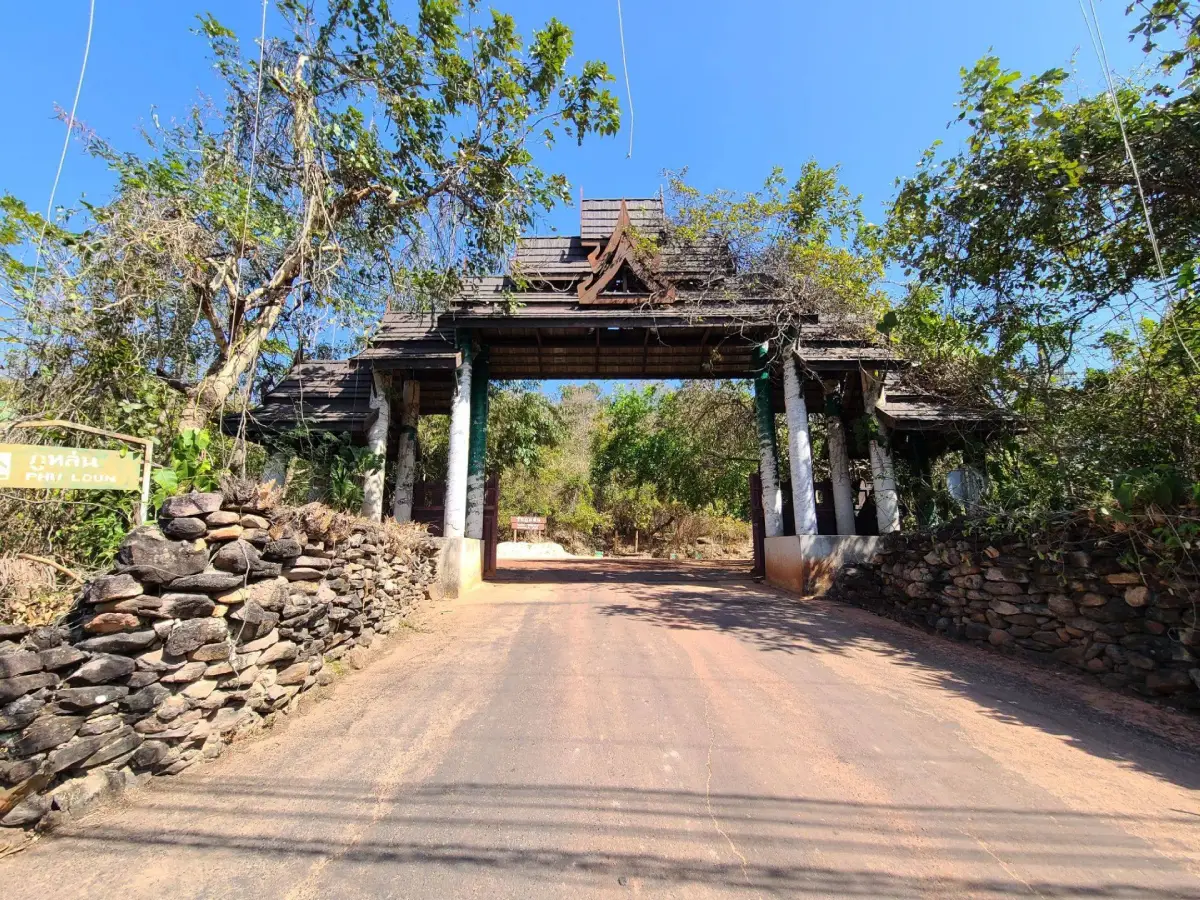
36. Wat Phu Lon is located in Song Yang Subdistrict, Si Mueang Mai District. This meditation site on a modest rocky hill is highly significant in the history of the Thai Forest Tradition because it is regarded as an early major meditation site of Luang Pu Mun Bhuridatta.
Highlights: Rocky hilltop terraces, natural rock shelters, places associated with Luang Pu Sao Kantasilo and Luang Pu Mun Bhuridatta, a statue of Luang Pu Mun, exhibition areas, and a secluded atmosphere suited to meditation.
Around 1897, Luang Pu Sao Kantasilo brought Luang Pu Mun to Phu Lon for meditation and spiritual training. At that time, the area was still heavily forested and very secluded, making it an important formative location before Luang Pu Mun continued his wandering meditation practice elsewhere.
Phu Lon is not far from Ban Kham Bong, Luang Pu Mun’s birthplace, allowing travellers to connect the place of his birth with an early site of intensive practice.
The appeal of the temple lies not in monumental architecture but in the simplicity of the hill, rock shelters, open stone surfaces, and surrounding forest. Visitors should remain quiet and respectful of meditation areas.
Getting There: Located in Song Yang Subdistrict, Si Mueang Mai District, approximately 20 km from the district center. Open daily from 08:30–16:30.
Map (GPS): https://www.google.com/maps/dir/?api=1&destination=15.636279,105.276625&travelmode=driving
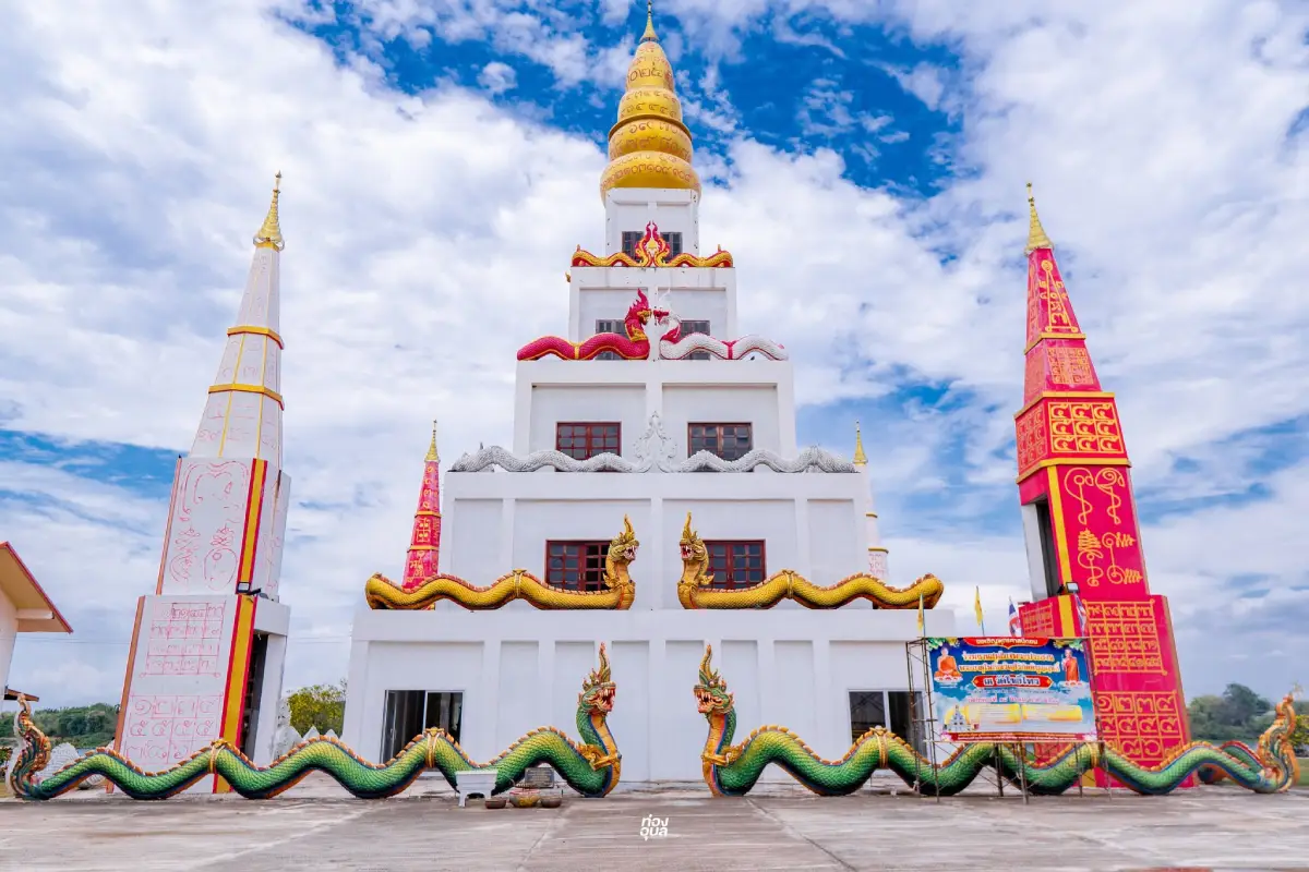
37. Wat Pho is located on Kong Phaniang Road in Khemarat Subdistrict, Khemarat District. It is an old temple closely associated with the historic Mekong-side town and has long served as a center of local faith.
Highlights: Phra Chao Yai Ong Saen, the revered Buddha image of Khemarat, Phra Phuttha Khemmarat Woramongkhon, the Buddha-relic pavilion, Ashoka pillar, Emerald Buddha image, and proximity to the walking street and Mekong viewpoint.
The temple’s history is linked with population movements from the Vientiane side of the Mekong. Local tradition places its establishment around 1788 before it was moved to the present location, where a large Bodhi tree and Buddha image were found.
The most important sacred image is Phra Chao Yai Ong Saen, an old Buddha in the Mara-Vijaya posture revered as one of Khemarat’s spiritual symbols.
The temple is well placed for exploring the old town, with Khemarat Walking Street, historic wooden houses, community heritage areas, and Mekong viewpoints nearby.
Getting There: Located at 109 Kong Phaniang Road, Khemarat Subdistrict, Khemarat District. Open daily from 08:00–17:00.
Map (GPS): https://www.google.com/maps/dir/?api=1&destination=16.042906,105.223496&travelmode=driving
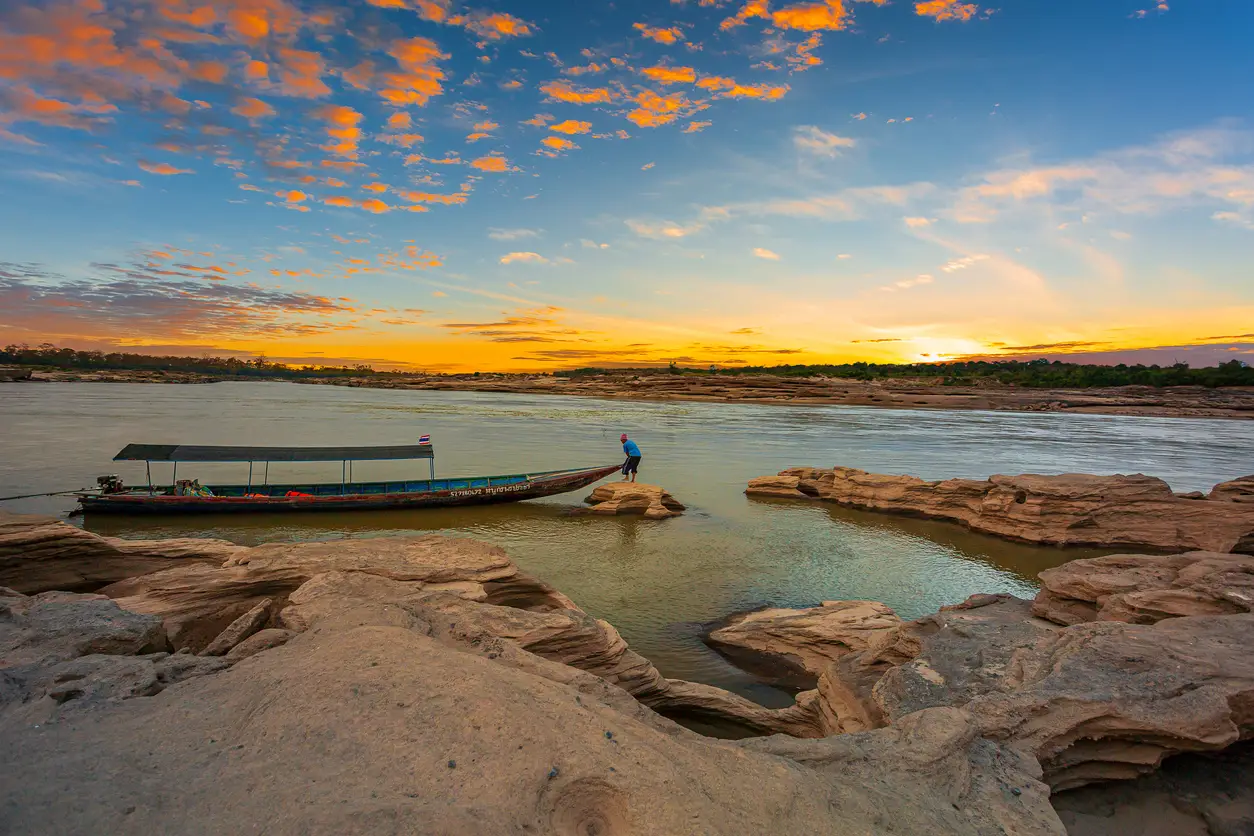
38. Kaeng Kabao is a Mekong natural attraction where rocky rapids and broad exposed surfaces become especially visible during low-water periods. It fits well into a Pho Sai–Na Tan–Khemarat route for travellers wanting to see another type of Mekong landscape beyond Sam Phan Bok and sandy beaches.
Highlights: Rocky rapids, Mekong rock terraces, natural channels, views toward Laos, and scenery that changes with river level.
The rapids formed through long-term erosion by the Mekong, producing grooves, pools, and textured rock surfaces. More of this geological detail becomes visible as the river recedes.
Seasonal planning is important because many rock features disappear beneath the river during high-water periods, while the dry season exposes them more clearly.
Morning and evening are the most comfortable times for walking. Take care on uneven rock and remain away from deep or fast-flowing water.
Map (GPS): https://www.google.com/maps/dir/?api=1&destination=15.883220,105.343940&travelmode=driving
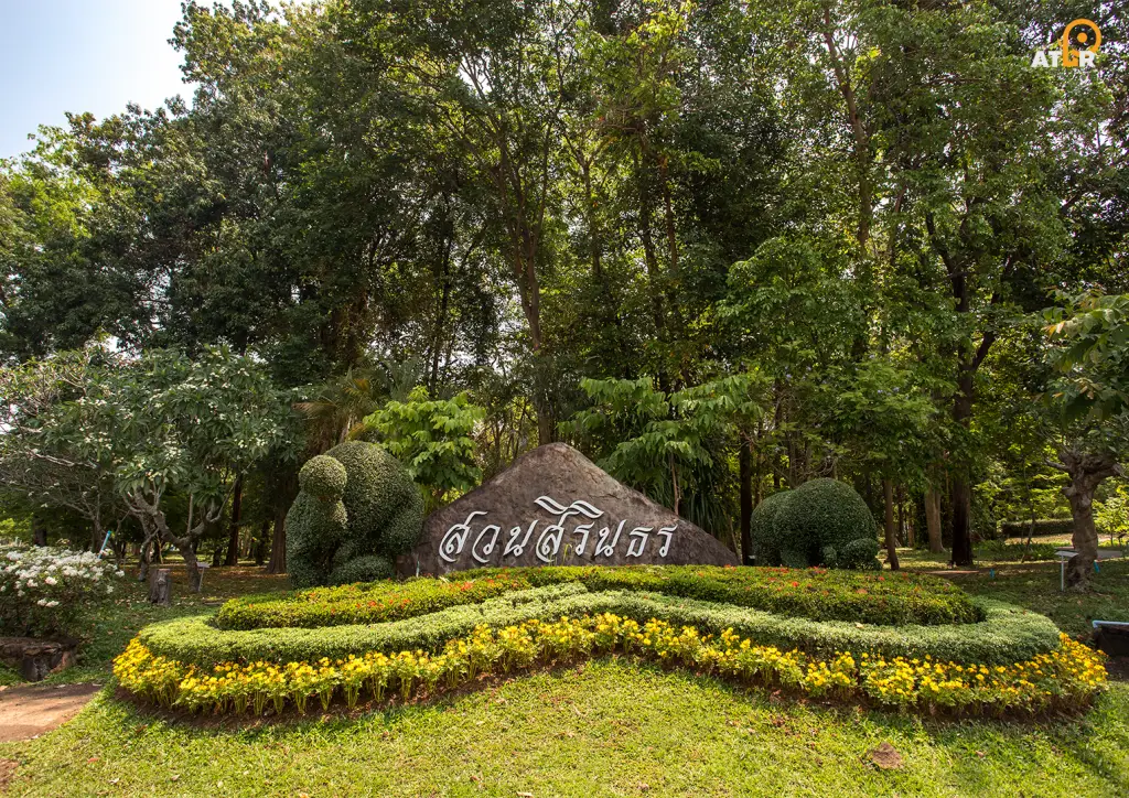
39. Sirindhorn Park is located within Sirindhorn Dam in Nikhom Lam Dom Noi Subdistrict, Sirindhorn District. The commemorative park was created by the Electricity Generating Authority of Thailand amid the reservoir landscape and green areas surrounding the dam.
Highlights: Approximately 40 rai of landscaped forest, botanical areas, fountains, rest pavilions, purple flowering plants, the Thai initials “สธ,” and a sculpture of 3 elephants playing musical instruments.
The park was designed to blend with the existing dam environment and is suitable for walking, relaxation, photography, and learning about plants without requiring difficult trails. It is appropriate for families, children, and older visitors.
The area also introduces visitors to the role of Sirindhorn Dam in electricity generation, irrigation, fisheries, and water management alongside tourism and recreation.
Sirindhorn Park can conveniently be combined with Sirindhorn Dam, Pattaya Noi, Chong Mek, and other attractions in the Sirindhorn zone.
Getting There: Located within Sirindhorn Dam, Nikhom Lam Dom Noi Subdistrict, Sirindhorn District. Open daily from 08:00–17:00. Admission to the park is free.
Map (GPS): https://www.google.com/maps/dir/?api=1&destination=15.170045,105.347908&travelmode=driving
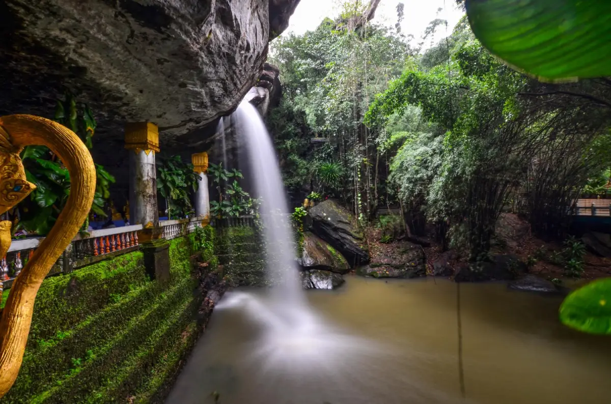
40. Tham Heo Sin Chai Cave, also known as Wat Tham Heo Sin Chai, is a cave temple and meditation site in Khong Chiam District where a sandstone overhang, reclining Buddha, waterfall, and forest environment come together in one distinctive setting.
Highlights: Reclining Buddha inside the cave, waterfall flowing from the cliff near the Buddha image, natural rock shelter, multiple sacred images, and the peaceful atmosphere of a forest monastery.
The temple was established by Luang Pu Kham La Pakuno, a respected meditation monk in the Khong Chiam area. After discovering the secluded site and recognizing its suitability for meditation, local residents helped develop it into a temple and practice center.
One of its most distinctive features is a small stream descending from the cliff above and passing the cave area before falling below. The water curtain is most visible toward the end of the rainy season, when surrounding vegetation is also particularly green.
A reclining Buddha is enshrined inside the cave. Visitors should remain quiet, avoid climbing on the rock formations, and take care on slippery surfaces after rain.
The site lies on the same general route as Kaeng Tana and Khong Chiam, making it easy to include in a half-day or full-day itinerary combining Buddhism and nature.
Getting There: Take Highway 2222. Approximately 7 km before Khong Chiam, turn toward the Kaeng Tana National Park side and continue about 200 meters. Open daily from 08:30–16:30.
Map (GPS): https://www.google.com/maps/dir/?api=1&destination=15.308967,105.485313&travelmode=driving
| Topic | Details |
| Province Overview | Ubon Ratchathani is a major province of southern Northeastern Thailand known for historic temples, the Thai Forest Tradition, the Candle Festival, handicrafts, the Mun and Mekong rivers, sandstone cliffs, prehistoric paintings, waterfalls, national parks, dams, and border towns. Trips can range from 1 day to 5–7 days. |
| 40 Attractions in This Guide | 1. Wat Thung Si Muang 2. Wat Nong Bua 3. Wat Maha Wanaram 4. Wat Sa Prasan Suk 5. Ubon Ratchathani National Museum 6. Thung Si Mueang 7. Ban Pa Ao 8. Ban Khampun 9. Wat Nong Pah Pong 10. Wat Pah Nanachat 11. Pha Taem National Park 12. Pha Taem Prehistoric Rock Paintings 13. Sao Chaliang 14. Pha Chana Dai 15. Dong Na Tham Forest 16. Soi Sawan Waterfall 17. Saeng Chan Waterfall (Namtok Long Ru) 18. Thung Na Mueang Waterfall 19. Kaeng Tana National Park 20. Two Color River 21. Wat Tham Khuha Sawan 22. Khong Chiam 23. Sirindhorn Dam 24. Pattaya Noi (Isan Sea) 25. Chong Mek 26. Pak Mun Dam 27. Kaeng Saphue 28. Wat Phu Khao Kaew 29. Wat Don That 30. Kaeng Song Khon (Sam Phan Bok) 31. Hat Salueng 32. Hat Chom Dao 33. Phu Chong Na Yoi National Park 34. Huai Luang Waterfall 35. Kaeng Lamduan Waterfall 36. Wat Phu Lon 37. Wat Pho 38. Kaeng Kabao 39. Sirindhorn Park 40. Tham Heo Sin Chai Cave |
| Top 10 for First-Time Visitors | 1. Wat Nong Bua 2. Wat Thung Si Muang 3. Wat Nong Pah Pong 4. Pha Taem National Park 5. Pha Taem Prehistoric Rock Paintings 6. Pha Chana Dai 7. Two Color River 8. Sirindhorn Dam 9. Kaeng Song Khon (Sam Phan Bok) 10. Huai Luang Waterfall |
| Ubon Ratchathani City Zone | 1. Wat Thung Si Muang 2. Wat Nong Bua 3. Wat Maha Wanaram 4. Wat Sa Prasan Suk 5. Ubon Ratchathani National Museum 6. Thung Si Mueang 7. Ban Pa Ao Suitable for 1–2 days focused on temples, urban history, crafts, food, and the Candle Festival. |
| Warin Chamrap Zone | 1. Ban Khampun 2. Wat Nong Pah Pong 3. Wat Pah Nanachat Ideal for Isan textiles, Thai Forest Tradition Buddhism, and following the legacy of Luang Pu Chah Subhaddo. |
| Pha Taem–Khong Chiam Zone | 1. Pha Taem National Park 2. Pha Taem Prehistoric Rock Paintings 3. Sao Chaliang 4. Soi Sawan Waterfall 5. Saeng Chan Waterfall 6. Thung Na Mueang Waterfall 7. Kaeng Tana National Park 8. Two Color River 9. Wat Tham Khuha Sawan 10. Khong Chiam 11. Pak Mun Dam 12. Tham Heo Sin Chai Cave Allow at least 1–2 nights if visiting several sites at a relaxed pace. |
| Pha Chana Dai–Dong Na Tham Zone | 1. Pha Chana Dai 2. Dong Na Tham Forest Best for sunrise, hiking, sandstone plateaus, dry dipterocarp forest, and deeper nature travel. Check road and national park conditions before departure. |
| Sirindhorn–Chong Mek Zone | 1. Sirindhorn Dam 2. Pattaya Noi (Isan Sea) 3. Chong Mek 4. Sirindhorn Park Suitable for reservoir landscapes, waterside food, recreation, and the Thailand–Laos border atmosphere. |
| Phibun Mangsahan Zone | 1. Kaeng Saphue 2. Wat Phu Khao Kaew 3. Wat Don That Suitable for combining Mun River scenery, temples, and forest-monastery heritage. |
| Pho Sai–Na Tan Zone | 1. Kaeng Song Khon (Sam Phan Bok) 2. Hat Salueng 3. Hat Chom Dao 4. Kaeng Kabao Best during low Mekong water when rock terraces, pools, and sandy beaches become visible. |
| Khemarat Zone | 1. Wat Pho Suitable for old-town streets, the walking street, historic temple culture, local food, and Mekong scenery. |
| Na Chaluai–Nam Yuen Zone | 1. Phu Chong Na Yoi National Park 2. Huai Luang Waterfall 3. Kaeng Lamduan Waterfall Best for waterfalls, forest, and ecology, particularly from the rainy season into early winter. |
| Si Mueang Mai Zone | 1. Wat Phu Lon Ideal for travellers interested in the Thai Forest Tradition and the histories of Luang Pu Sao Kantasilo and Luang Pu Mun Bhuridatta. |
| Temples and Buddhism Route | 1. Wat Thung Si Muang 2. Wat Nong Bua 3. Wat Maha Wanaram 4. Wat Sa Prasan Suk 5. Wat Nong Pah Pong 6. Wat Pah Nanachat 7. Wat Tham Khuha Sawan 8. Wat Phu Khao Kaew 9. Wat Don That 10. Wat Phu Lon 11. Wat Pho 12. Tham Heo Sin Chai Cave |
| Thai Forest Tradition Route | 1. Wat Nong Pah Pong – Luang Pu Chah Subhaddo 2. Wat Pah Nanachat – international branch monastery network 3. Wat Phu Lon – early meditation training site of Luang Pu Mun Bhuridatta 4. Wat Don That – forest monastery in the Mun River |
| History and Culture Route | 1. Ubon Ratchathani National Museum 2. Pha Taem Prehistoric Rock Paintings 3. Ban Pa Ao 4. Ban Khampun 5. Wat Pho, Khemarat 6. Thung Si Mueang and the Candle Festival |
| Nature and National Parks Route | 1. Pha Taem National Park 2. Sao Chaliang 3. Pha Chana Dai 4. Dong Na Tham Forest 5. Soi Sawan Waterfall 6. Saeng Chan Waterfall 7. Thung Na Mueang Waterfall 8. Kaeng Tana National Park 9. Phu Chong Na Yoi National Park 10. Huai Luang Waterfall 11. Kaeng Lamduan Waterfall |
| Mekong River Route | 1. Two Color River 2. Khong Chiam 3. Kaeng Song Khon (Sam Phan Bok) 4. Hat Salueng 5. Hat Chom Dao 6. Kaeng Kabao 7. Wat Pho, Khemarat |
| Food to Try | Ubon-style kuay jap, larb, koi, som tam, kaeng om, grilled chicken, Mun River fish, Mekong fish, jaew dipping sauces, mushrooms, bamboo shoots, local vegetables, and seasonal dishes. Khong Chiam is especially suitable for river fish, while Ubon city has many kuay jap and Isan restaurants. |
| Ubon-Style Kuay Jap | One of the foods most closely identified with Ubon Ratchathani, characterized by distinctive noodles and a hot peppery broth. It can be enjoyed for breakfast, lunch, or dinner and fits easily into a city itinerary. |
| Souvenirs | Ubon textiles, silk, Ban Pa Ao brassware, community products, processed foods, local rice, and products from Mekong-side communities. |
| Where to Stay: Ubon City | Best for temples, museums, Thung Si Mueang, restaurants, and air travel. Accommodation in the city or around Thung Si Mueang provides convenient access to major city attractions and the airport. |
| Where to Stay: Warin Chamrap | Suitable for Wat Nong Pah Pong, Wat Pah Nanachat, Ban Khampun, and travellers arriving by train. It also works as a convenient base south of Ubon city. |
| Where to Stay: Khong Chiam | The best base for Pha Taem, the Two Color River, Kaeng Tana, waterfalls, and Mekong routes. Accommodation is available both in town and along the river. Consider at least 1–2 nights when visiting multiple attractions. |
| Where to Stay: Sirindhorn | Suitable for Sirindhorn Dam, Sirindhorn Park, Pattaya Noi, and Chong Mek and reduces driving from Ubon city when focusing on the eastern part of the province. |
| Where to Stay: Khemarat–Pho Sai | Suitable for Sam Phan Bok, Hat Salueng, Hat Chom Dao, Mekong rapids, and Khemarat Old Town. Staying locally makes sunrise and sunset visits easier without returning to Ubon city. |
| Where to Stay: Na Chaluai–Nam Yuen | Suitable for Phu Chong Na Yoi National Park, Huai Luang Waterfall, and Kaeng Lamduan. Because these areas are far from Ubon city, choose accommodation near the district centers or properly authorized conservation-area accommodation when available. |
| Best Overall Travel Period | November–February is generally best for temples, old towns, Pha Taem, and outdoor sightseeing. The rainy season through early winter is better for waterfalls, lush forest, and walking shrimp, while Sam Phan Bok, Hat Salueng, and Mekong rock terraces are best during the dry-season low-water period. |
| 1 Day in Ubon City | Morning: Wat Maha Wanaram – Wat Thung Si Muang – Ubon Ratchathani National Museum Afternoon: Wat Nong Bua – Wat Sa Prasan Suk Evening: Thung Si Mueang – Ubon-style kuay jap and local food |
| 2 Days / 1 Night | Day 1: Ubon city – temples – museum – Thung Si Mueang Day 2: Wat Nong Pah Pong – Wat Pah Nanachat – Ban Pa Ao or Ban Khampun when open to visitors |
| 3 Days / 2 Nights | Day 1: Ubon city and Warin Chamrap Day 2: Pha Taem – prehistoric paintings – Sao Chaliang – Two Color River Day 3: Pha Taem waterfalls – Kaeng Tana – Tham Heo Sin Chai Cave |
| 4 Days / 3 Nights | Add Sirindhorn Dam – Sirindhorn Park – Pattaya Noi – Chong Mek, staying in Khong Chiam or Sirindhorn to avoid returning to Ubon city every day. |
| 5 Days / 4 Nights | Add Sam Phan Bok – Hat Salueng – Hat Chom Dao – Khemarat and spend 1 night in the upper Mekong zone. |
| 6 Days / 5 Nights | Add Pha Chana Dai – Dong Na Tham Forest or the Si Mueang Mai–Wat Phu Lon route depending on season and road conditions. |
| 7 Days / 6 Nights | Add Phu Chong Na Yoi National Park – Huai Luang Waterfall – Kaeng Lamduan Waterfall, allowing 1–2 days for southern Ubon Ratchathani so nature travel is not rushed. |
| Getting Around the Province | Local transport is relatively convenient in Ubon city, but major attractions are widely dispersed, especially Pha Taem, Khong Chiam, Sam Phan Bok, Khemarat, Phu Chong Na Yoi, and Nam Yuen. A private car, rental car, or hired vehicle with driver is the most practical option for a multi-zone trip. |
| National Park Safety | Check park announcements on the day of travel, especially for Pha Chana Dai, Dong Na Tham, waterfalls, and hiking routes. Carry water, wear suitable footwear, take care on slippery rock, and remain on designated trails. |
| Mekong River Safety | River levels change seasonally. Sam Phan Bok, Hat Salueng, Hat Chom Dao, and rocky rapids are best during low water. Use local operators for boat activities, wear a life jacket, and avoid boating during strong currents or unsuitable weather. |
| Temple and Community Etiquette | Dress modestly, speak quietly, do not disturb monks or meditation practitioners, ask permission before photographing people or community activities, and support locally made products where appropriate. |
Frequently Asked Questions (FAQ)
Q: What are the must-visit attractions in Ubon Ratchathani?
A: First-time visitors should consider Wat Nong Bua, Wat Thung Si Muang, Wat Nong Pah Pong, Pha Taem National Park, the Pha Taem Prehistoric Rock Paintings, Sao Chaliang, the Two Color River, Sam Phan Bok, and Huai Luang Waterfall because together they represent the province’s religion, history, culture, and natural landscapes.
Q: Where should I go if I have only 1 day in Ubon Ratchathani?
A: Focus on the city. Start with Wat Maha Wanaram, Wat Thung Si Muang, and Ubon Ratchathani National Museum, continue to Wat Nong Bua and Wat Sa Prasan Suk, then finish at Thung Si Mueang with local food.
Q: How many days should I spend in Ubon Ratchathani?
A: 3 days are enough for Ubon city, Warin Chamrap, and Khong Chiam. To include Pha Taem, Sam Phan Bok, Khemarat, Sirindhorn, and Phu Chong Na Yoi, allow approximately 5–7 days.
Q: What is the best time of year to visit Ubon Ratchathani?
A: November–February is generally comfortable for sightseeing. Travellers interested in waterfalls should consider the rainy season through early winter, while Sam Phan Bok and Mekong beaches are best during the dry-season low-water period.
Q: Where should I stay when visiting Pha Taem?
A: Khong Chiam is the most convenient base for Pha Taem National Park, the Two Color River, Kaeng Tana, waterfalls, and cave temples. Stay at least 1 night if visiting several attractions.
Q: Is Pha Chana Dai accessible all year?
A: Access to Pha Chana Dai and Dong Na Tham Forest depends on road conditions and national park announcements, particularly during the rainy season. Check with Pha Taem National Park before travelling.
Q: Why are the prehistoric paintings at Pha Taem important?
A: They are important archaeological evidence of prehistoric life along the Mekong, depicting people, hands, animals, fish, and activities on sandstone cliffs.
Q: When should I visit Sam Phan Bok?
A: Visit during the dry-season low-water period, when numerous rock pools and terraces are exposed. During high Mekong water, much of the landscape is submerged.
Q: When is the best time to visit Hat Salueng?
A: Approximately January–May is generally best because falling Mekong levels expose the sandy beach, making it suitable for recreation and boat trips to nearby attractions.
Q: When can I see the walking shrimp at Kaeng Lamduan?
A: The phenomenon occurs during the rainy season and is commonly strongest from late August through September. Exact timing depends on annual rainfall and current strength, so check the official seasonal announcement before travelling.
Q: Which temples are important in Ubon Ratchathani city?
A: Wat Thung Si Muang, Wat Nong Bua, Wat Maha Wanaram, and Wat Sa Prasan Suk are among the city’s most important temples and collectively represent Buddhist art, history, architecture, and local faith.
Q: Where should I go if I am interested in Luang Pu Chah?
A: Visit Wat Nong Pah Pong, the center of Luang Pu Chah Subhaddo’s teachings, and continue to Wat Pah Nanachat, the international monastery established within the same forest-monastery tradition.
Q: Where should I go in Ubon Ratchathani if I am interested in Luang Pu Mun?
A: Wat Phu Lon in Si Mueang Mai District is highly significant because it is associated with the period when Luang Pu Sao Kantasilo guided Luang Pu Mun Bhuridatta in intensive meditation practice early in his spiritual life.
Q: What food should I try in Ubon Ratchathani?
A: Try Ubon-style kuay jap, larb, koi, som tam, kaeng om, grilled chicken, Mun River fish, Mekong fish, jaew dipping sauces, mushrooms, bamboo shoots, and seasonal local vegetables.
Q: What souvenirs should I buy in Ubon Ratchathani?
A: Ubon textiles, silk, Ban Pa Ao brassware, community handicrafts, and processed local foods are good choices that reflect the province’s identity.
Q: Which area should I stay in for a multi-day Ubon Ratchathani trip?
A: Divide your stays according to the route: Ubon city for temples and museums, Khong Chiam for Pha Taem and the Mekong, Sirindhorn for the dam and Chong Mek, Khemarat or the upper Mekong zone for Sam Phan Bok, and Na Chaluai or Nam Yuen for Phu Chong Na Yoi and Kaeng Lamduan.
Q: Can I travel around Ubon Ratchathani without a private car?
A: Local transport works reasonably well within Ubon city, but many major attractions are widely dispersed. A private car, rental car, or hired vehicle with driver is much more convenient for visiting several districts.
Q: Can I cross into Laos at Chong Mek?
A: Chong Mek is a permanent Thailand–Laos border crossing, but immigration documents, border operating hours, and entry requirements can change. Check the latest information from immigration and border authorities before travelling.
Q: What is Ubon Ratchathani’s most famous festival?
A: The Ubon Ratchathani Candle Festival is one of Thailand’s major Buddhist cultural events. Communities and artisans create large carved and molded candle sculptures for the procession held around the beginning of Buddhist Lent.
Q: How should I plan an Ubon Ratchathani itinerary to avoid backtracking?
A: Divide the province into zones: Ubon city–Warin Chamrap, Khong Chiam–Pha Taem, Sirindhorn–Chong Mek, Phibun Mangsahan, Pho Sai–Na Tan–Khemarat, and Na Chaluai–Nam Yuen. Complete the main attractions within one zone before moving to the next overnight base.
 Category: ●Travel Articles, Recipes
 Group: ●Travel Review, Food Review
Last Update : 3 WeekAgo
 Last Update : 3 WeekAgo
Recommend

 Art, Culture and Heritage
 Historical Sites and Monuments(5)
 Landmarks and Memorials(2)
 Royal Palace(1)
 Art, Craft Centres, Tradition(7)
 Museums(3)
 Places of Worship
 Temple(37)
 Other Sacred Sites(4)
 Research and Development
 Royal Project(2)
 Suburban Living
 Village, Community(2)
 Local Market(4)
 Nature and Wildlife
 National Parks and Marine Reserves(5)
 Mountain (Doi)(6)
 Dam, Reservoir, Lake(8)
 Waterfalls(12)
 Hot Springs(1)
 Caves(2)
 River, Canal(11)
 Bays and Beaches(8)
 Islands(2)
 Other natural attractions(6)
 Entertainment and Agricultural
 Zoos and Aquariums(2)
 Animal camps and shows(1)
 Farms, Parks and Ecotourism(1)
 Waterpark(1)
Travel Review, Food Review(1)


