
lovethailand home >Northeastern Travel Attractions >Ubon Ratchathani Travel Attractions >Na Cha Luai >Na Cha Luai > Phu Chong Na Yoi National Park
TL;DR: Phu Chong Na Yoi National Park is located at Ban Kaeng Rueang, Na Chaluai Subdistrict, Na Chaluai District, Ubon Ratchathani Province, Covering Buntharik, Na Chaluai, And Nam Yuen, open Daily, hours 08.30 – 16.30.
Phu Chong Na Yoi National Park
Open Days: Daily
Opening Hours: 08.30 – 16.30
Phu Chong Na Yoi National Park in Ubon Ratchathani is one of the largest and most significant protected forest areas in southern Isan. Covering Buntharik, Na Chaluai, and Nam Yuen districts, the park extends over about 428,750 rai, or approximately 686 square kilometers. It lies along the Phanom Dong Rak mountain range and borders both Lao PDR and the Kingdom of Cambodia. This geographic position gives the park a strong identity as part of the “Emerald Triangle,” a forested border landscape where Thailand, Laos, and Cambodia meet through mountains, forest, watersheds, and protected natural areas. The park was declared a national park on 1 June 1987 and is recognized for its rich forest, waterfalls, sandstone formations, border viewpoints, and ecological importance.
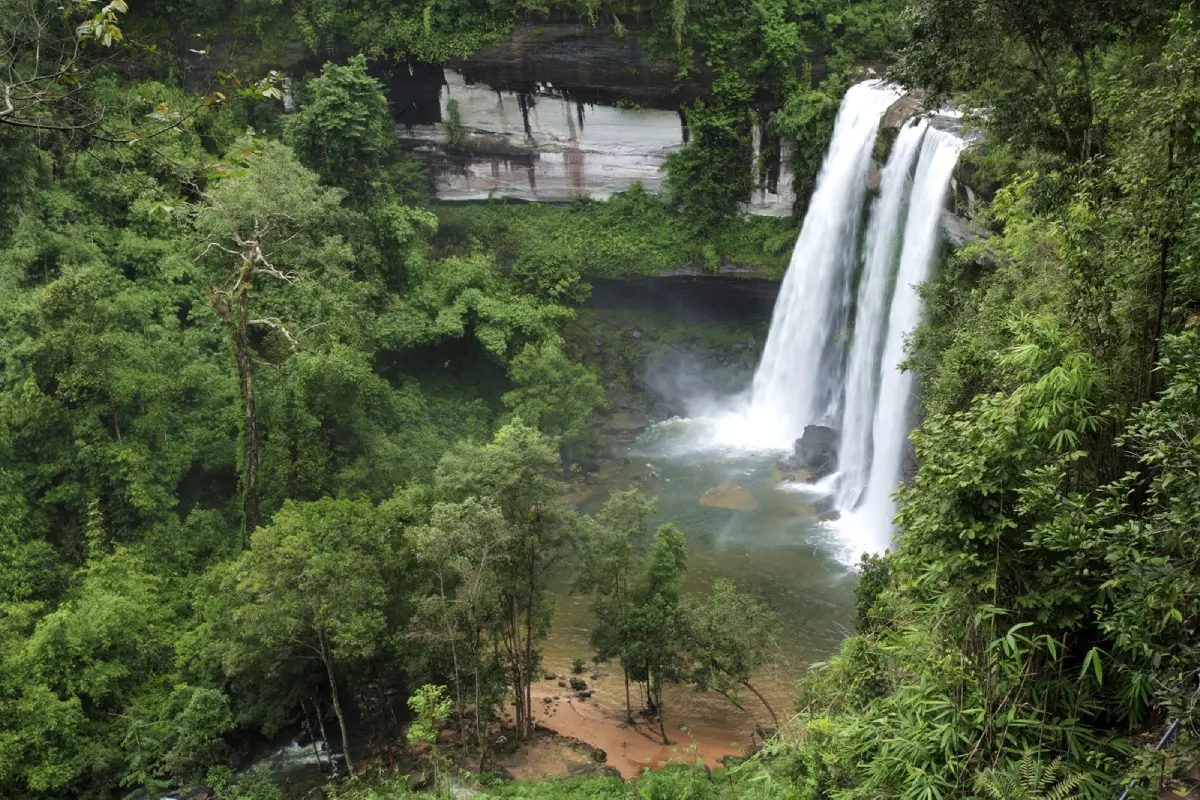
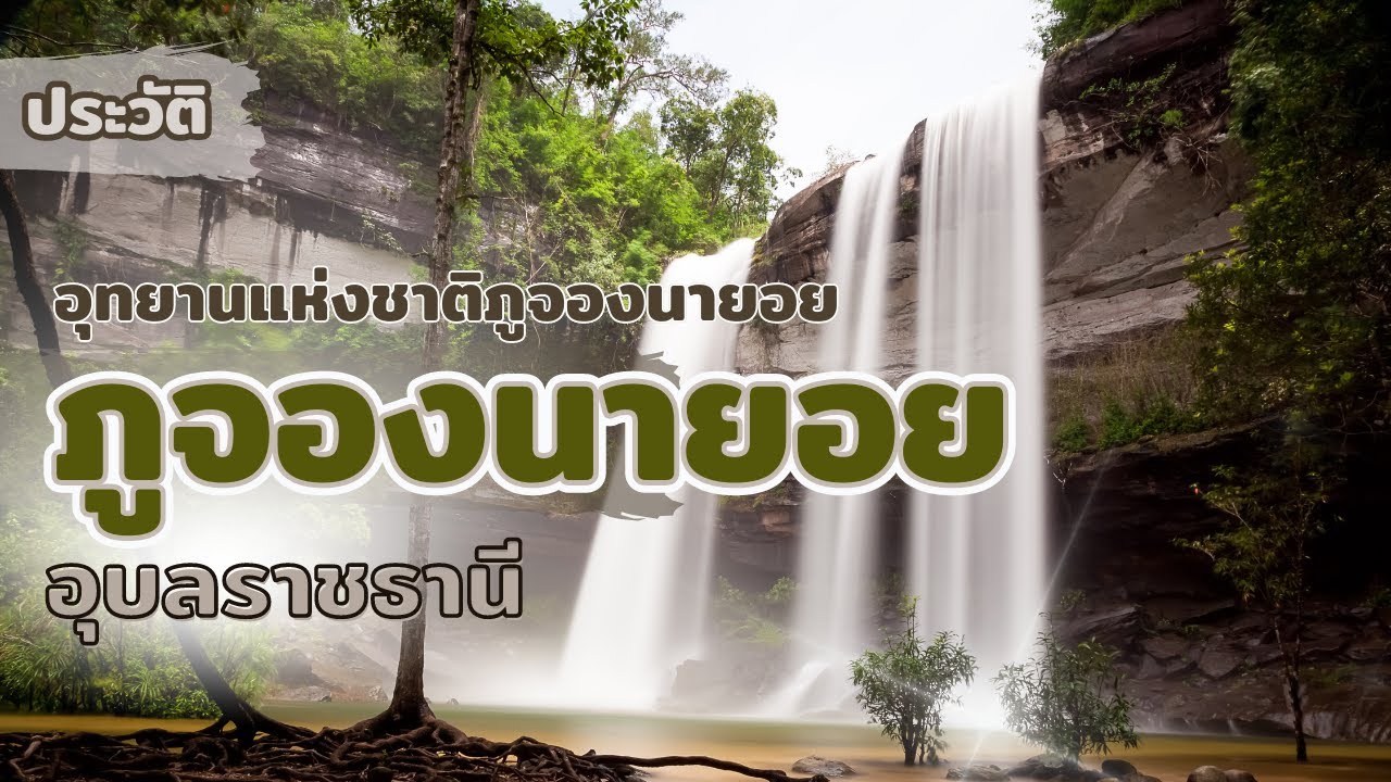
The main image many travelers associate with Phu Chong Na Yoi is Huai Luang Waterfall, also known locally as Bak Teo Waterfall. Located about 3.5 kilometers from the park office, it is accessible by a paved road and is the park’s most iconic attraction. The waterfall drops from a high cliff into a large pool below, where the water often appears emerald green and a white sandy area spreads along the base. The setting is dramatic because visitors can see the cliff face, falling water, forest, pool, and sandy bottom in one view. For travelers who want to experience the natural depth of Ubon Ratchathani, Huai Luang Waterfall is one of the most rewarding places in the province.
The old local name, Bak Teo Waterfall, is connected with a local legend about a man named Teo who entered the cliff area to collect honey and lost his life in an accident. The name was later changed to Huai Luang Waterfall after the stream that forms the waterfall. This story gives the site both a natural and cultural dimension. Visitors walking down the long staircase to the base of the waterfall do not simply see a beautiful cascade; they enter a place with local memory, forest atmosphere, and a strong sense of place. From below, the high cliff and falling water create a powerful impression of the park’s scale and wilderness.
The best period to visit Huai Luang Waterfall is from August to February, especially from the late rainy season into the early cool season. During this time, the waterfall carries more water, the forest is fresh and green, and the temperature is more comfortable for walking. The lower pool and sandy area are especially attractive in good conditions. Visitors can swim only in designated safe areas and should follow park rules, as water levels and currents can change according to rainfall. In the cool season, the waterfall becomes a more relaxed nature retreat suitable for photography, walking, and quiet rest.
A trail from Huai Luang Waterfall leads toward Chum Chim Waterfall, also known as Pra-on La-or Waterfall. This smaller waterfall is formed by water that continues downstream from Huai Luang. The route adds depth to the visit because it shows how the stream continues through rock, forest, and lower waterfall levels. It is suitable for visitors who want to move beyond the main viewpoint and understand the water system of the park more closely. While Huai Luang provides a grand landscape, Chum Chim gives a quieter and more intimate forest-waterfall experience.
Kaeng Sila Thip is another important site near the park office, located about 3 kilometers away. It is a broad sandstone rapid created by Huai Luang Stream flowing across a rock terrace. The highlight is a geological feature known as potholes or rounded rock holes formed when current and small stones swirl repeatedly over the sandstone surface. These holes vary in size and depth, creating a striking natural pattern across the rock. Kaeng Sila Thip is therefore an excellent place for travelers interested in geology, river erosion, and the way water shapes sandstone over long periods of time.
Kaeng Kalao is a nearby stream and rock-rapid area with a shady atmosphere and a broader, gentler watercourse. It is suitable for a short nature walk, relaxation, and observing small ecosystems along the stream. While Huai Luang Waterfall is dramatic and vertical, Kaeng Kalao is calmer and more horizontal, showing another side of the park’s water landscape. Visitors can see how the same forested mountain area produces both high waterfalls and low rock rapids within a short distance.
Kaeng Lamduan Waterfall is located in the area of the Ubon Ratchathani Wildlife Conservation Development and Promotion Station. It flows across rocky terrain under the shade of trees, especially lamduan trees, which are abundant in the area. The waterfall can be suitable for swimming when water conditions are safe. It is reached via Highway 2248 between Nam Yuen and Na Chaluai, then by turning at Ban Nong Bon for the local access route. Kaeng Lamduan adds another nature route for visitors who want to explore the Nam Yuen side of the protected forest landscape.
Suan Hin Phlan Yao is a wide rock garden with unusual sandstone formations scattered across the area. Long-term weathering and erosion have shaped the rocks into varied natural forms, including upright stones, flat stone surfaces, shelters, and sculptural shapes. This area is suitable for walking, photography, and observing the sandstone character of the park. It shows that Phu Chong Na Yoi is not only a waterfall destination but also a sandstone mountain landscape with distinctive rock formations.
Pha Phueng Viewpoint is located beyond Suan Hin Phlan Yao and offers wide views toward the Lao and Cambodian border landscapes. The cliff area includes small caves, beautiful rock forms, and large beehives that give the viewpoint its name. This site is meaningful because it allows visitors to see the cross-border geography of the Emerald Triangle from a natural cliff edge. Standing at Pha Phueng, travelers can understand how forested mountains connect Thailand, Laos, and Cambodia through one continuous landscape.
Koeng Mae Phong Waterfall lies south of Huai Luang Waterfall and is reached by a forest trail. It is formed by the Lam Dom Noi water system and is suitable for experienced nature walkers who have enough time and proper preparation. This route is deeper than the main visitor area and should be approached as a real forest walk rather than a casual roadside stop. The site reflects the wilder side of the park, where waterfalls, streams, and forest remain closely connected.
Phlan Kong Kwian is a wide sandstone plain with natural rock shelters at the front. Wildflowers and plants grow in patches across the stone surface. The name is connected with old travel culture: “phlan” refers to a wide open stone area, while “kong kwian” relates to the covering or canopy of an ox cart. The rock shelters in the area suggest places where travelers in the past could rest from sun and rain. This gives Phlan Kong Kwian both natural and cultural meaning, linking the stone landscape with older movement routes through the forest.
Phu Hin Dang is one of the most distinctive geological viewpoints associated with Phu Chong Na Yoi National Park. Located in the Ban Nong Mek area of Huai Kha Subdistrict, Buntharik District, it is about 58 kilometers from the park office. The site is known for sandstone surfaces marked with natural pink, red, and multicolored mineral patterns. These colors are the result of geological processes and mineral deposition over long periods of time. The viewpoint also offers scenery toward the Lao and Cambodian border landscapes and can be associated with misty views in the cool season. Phu Hin Dang adds a strong geological and scenic dimension to the park.
The wider landscape of Phu Chong Na Yoi is part of the Phanom Dong Rak mountain range, which acts as both a watershed and a natural border zone. The forest supports many plant communities, wildlife habitats, streams, and seasonal waterfalls. It also protects upstream water sources that flow toward local communities and agricultural areas below. The park is therefore important not only as a travel destination but also as a natural system that protects water, soil, forest, and biodiversity in the southern part of Ubon Ratchathani.
There are 2 main travel routes to the park. The first route goes from Ubon Ratchathani to Det Udom, Nam Yuen, and Na Chaluai, for about 140 kilometers. About 10 kilometers before Na Chaluai, visitors turn right for another 8 kilometers to reach the park. The second route goes from Ubon Ratchathani to Det Udom, Buntharik, and Na Chaluai. After passing Na Chaluai for about 10 kilometers, visitors turn left for another 8 kilometers. A private car or rental vehicle is the most practical option because the park is far from Ubon Ratchathani city and its attractions are spread across several zones.
The park office is located at Ban Kaeng Rueang in Na Chaluai District, about 150 kilometers from Ubon Ratchathani city. It is the best starting point for first-time visitors. Travelers can contact officials, pay entrance fees, check road and trail conditions, and plan the route before going to Huai Luang Waterfall, Kaeng Sila Thip, Kaeng Kalao, and nearby areas. With more time, travelers can continue to Suan Hin Phlan Yao, Pha Phueng, Phlan Kong Kwian, Phu Hin Dang, or longer forest routes.
Phu Chong Na Yoi National Park provides accommodation and camping areas for visitors who want to stay overnight. Staying inside the park allows travelers to experience the forest in the morning and spend more time exploring the waterfalls and rock landscapes. Visitors who want easier access to restaurants and local services can stay in Na Chaluai town, which is closer than Ubon Ratchathani city and works well as a base for entering the park early in the day.
The entrance fee follows Thailand’s national park group 2 fee rate. Thai adults pay 40 baht and Thai children pay 20 baht. Foreign adults pay 200 baht and foreign children pay 100 baht. Vehicle fees are charged separately, such as 20 baht for motorcycles and 30 baht for four-wheel cars. Visitors should keep the ticket while traveling inside the park, as different attractions are located in separate zones.
The main visitor areas of the park are open, especially Huai Luang Waterfall, which has reopened for tourism and overnight stays after earlier border-related restrictions were lifted. Some specific areas are closed indefinitely for resource management and visitor safety, including Noen 500, Phlan Suea Upper Reservoir, and Jaruat Waterfall. This distinction is important: the park itself is open in the main visitor zones, while a few specific areas remain restricted.
Phu Chong Na Yoi is suitable for many types of travelers. Waterfall lovers can focus on Huai Luang, Chum Chim, Koeng Mae Phong, and Kaeng Lamduan. Geology enthusiasts can explore Kaeng Sila Thip, Suan Hin Phlan Yao, Phlan Kong Kwian, and Phu Hin Dang. Viewpoint seekers can visit Pha Phueng and the high sandstone areas. Travelers interested in border landscapes can study the Emerald Triangle and the way the forested Phanom Dong Rak range connects Thailand, Laos, and Cambodia.
For foreign travelers, Phu Chong Na Yoi is an excellent place to understand the natural character of southern Isan. It is very different from Mekong riverside towns and urban temples in Ubon Ratchathani. This park presents large forests, border mountains, a major waterfall, sandstone geology, and a cross-border landscape linked to Laos and Cambodia. It shows that Ubon Ratchathani is not only a cultural province but also a province of deep forest, waterfalls, and protected mountain ecosystems.
A complete visit requires good time planning. With half a day, travelers can focus on Huai Luang Waterfall, Kaeng Sila Thip, and Kaeng Kalao. With a full day, Suan Hin Phlan Yao, Pha Phueng, and Phlan Kong Kwian can be added. With 2 days and 1 night, travelers can stay in the park or Na Chaluai and include farther zones such as Phu Hin Dang or selected forest trails. The park is best experienced slowly because its value comes from the combination of water, forest, stone, cliff, and border geography.
Overall, Phu Chong Na Yoi National Park is one of Ubon Ratchathani’s most complete nature destinations. It combines the Emerald Triangle forest, Huai Luang Waterfall, Kaeng Sila Thip, Kaeng Kalao, Suan Hin Phlan Yao, Pha Phueng, Phlan Kong Kwian, Phu Hin Dang, Kaeng Lamduan Waterfall, and several nature routes within one protected area. Visitors can experience a large waterfall, emerald water, sandstone landforms, forest trails, border views, local legends, and the wider geography of Thailand, Laos, and Cambodia. For travelers seeking depth, nature, and a quieter side of Ubon Ratchathani, Phu Chong Na Yoi is a highly meaningful destination.
| Name | Phu Chong Na Yoi National Park |
| Location | Ban Kaeng Rueang, Na Chaluai Subdistrict, Na Chaluai District, Ubon Ratchathani Province, Covering Buntharik, Na Chaluai, And Nam Yuen Districts |
| Address | Phu Chong Na Yoi National Park, Village No. 3, Na Chaluai Subdistrict, Na Chaluai District, Ubon Ratchathani 34280 |
| Coordinates | 14.4667, 105.2667 |
| Highlights | Huai Luang Waterfall, Chum Chim Waterfall, Kaeng Sila Thip, Kaeng Kalao, Suan Hin Phlan Yao, Pha Phueng, Phlan Kong Kwian, Phu Hin Dang, Kaeng Lamduan Waterfall, And The Emerald Triangle Forest |
| History / Importance | Declared a national park on 1 June 1987 as Thailand’s 53rd national park, important for border forest conservation, the Phanom Dong Rak mountain range, watersheds, waterfalls, and the Emerald Triangle landscape between Thailand, Laos, and Cambodia |
| Area | About 428,750 Rai, Or Approximately 686 Square Kilometers |
| Distinctive Features | Phanom Dong Rak Mountain Forest, Dry Evergreen Forest, Mixed Deciduous Forest, Dry Dipterocarp Forest, Waterfalls, Cliffs, Sandstone Terraces, Viewpoints, And Thai – Lao – Cambodian Border Geography |
| Travel Information | Route 1: Ubon Ratchathani – Det Udom – Nam Yuen – Na Chaluai, About 140 Km, Then Turn Right About 8 Km Before Reaching Na Chaluai Route 2: Ubon Ratchathani – Det Udom – Buntharik – Na Chaluai, Then Continue About 10 Km Past Na Chaluai And Turn Left For About 8 Km |
| Current Status | Open In Main Visitor Areas And Overnight Areas Around Huai Luang Waterfall Under The Management Of Phu Chong Na Yoi National Park |
| Open Days | Daily |
| Opening Hours | 08.30 – 16.30 |
| Fees | Thai Visitors: Adult 40 Baht, Child 20 Baht Foreign Visitors: Adult 200 Baht, Child 100 Baht Vehicle Fees: Motorcycle 20 Baht, Four-Wheel Car 30 Baht |
| Facilities | Park Office, Visitor Center, Accommodation, Camping Ground, Toilets, Parking Area, Viewpoints, Nature Trails, And Service Areas Around Huai Luang Waterfall |
| Main Areas / Zones | Park Office And Accommodation Zone Huai Luang Waterfall / Bak Teo Waterfall Zone Chum Chim Waterfall / Pra-on La-or Waterfall Zone Kaeng Sila Thip And Kaeng Kalao Zone Suan Hin Phlan Yao And Pha Phueng Viewpoint Zone Phlan Kong Kwian Zone Phu Hin Dang Zone Kaeng Lamduan Waterfall Zone Forest Trail And Emerald Triangle Border Forest Zone |
| Restricted Areas By Announcement | Noen 500, Phlan Suea Upper Reservoir, And Jaruat Waterfall Are Closed Indefinitely Under The 2026 Park Announcement |
| Caretaker | Phu Chong Na Yoi National Park, Department Of National Parks, Wildlife And Plant Conservation Park Chief: Mr. Jinna Samsri |
| Main Contact Number | Phu Chong Na Yoi National Park, Tel. 045-210-706, 064-232-5741 Department Of National Parks, Wildlife And Plant Conservation, Tel. 0-2562-0760 |
| Official Website / Official Page | Phu Chong Na Yoi National Park, Department Of National Parks, Wildlife And Plant Conservation / Facebook: Phu Chong Na Yoi National Park |
| Best Seasonal Highlights | August – February: Good Season For Huai Luang Waterfall Late Rainy To Early Cool Season: Green Forest And Strong Waterfall Flow Cool Season: Suitable For Viewpoints, Phu Hin Dang, And Occasional Mist |
| Nearby Tourist Attractions | 1. Huai Luang Waterfall / Bak Teo Waterfall, About 3.5 Km 2. Kaeng Kalao, About 2.5 Km 3. Kaeng Sila Thip, About 3 Km 4. Chum Chim Waterfall / Pra-on La-or Waterfall, About 4 Km 5. Suan Hin Phlan Yao, About 5 Km 6. Pha Phueng Viewpoint, About 6 Km 7. Koeng Mae Phong Waterfall, About 12 Km 8. Phu Hin Dang, Ban Nong Mek, About 58 Km 9. Kaeng Lamduan Waterfall, About 55 Km |
| Nearby Restaurants | 1. UFA Cafe Na Chaluai, About 18 Km, Tel. 099-391-6035 2. Phet Lamphu Restaurant Na Chaluai, About 18 Km, Tel. 083-385-9408 3. Mae Loi Khao Pun Sao Na Chaluai, About 18 Km, Tel. 085-027-6768 4. Thong Phun Moo Kratha Na Chaluai, About 18 Km, Tel. 087-450-5729, 089-578-6924 5. Chok Amnuay Restaurant Na Chaluai, About 18 Km, Tel. 045-379-128 6. Sai Ngam Restaurant Na Chaluai, About 18 Km, Tel. 045-379-029 |
| Nearby Accommodations | 1. Phu Chong Na Yoi National Park Accommodation, Inside The Park, Tel. 045-210-706, 064-232-5741 2. Huai Luang Resort, About 5 Km, Tel. 085-302-9342 3. Arnarin Resort Na Chaluai, About 18 Km, Tel. 081-999-0380 4. Huai Lok Riverside Resort Na Chaluai, About 18 Km, Tel. 087-993-1859 5. Our Home Resort Na Chaluai, About 18 Km, Tel. 096-956-0526 6. Buntharika Resort Na Chaluai, About 20 Km, Tel. 085-413-1417 |
Frequently Asked Questions (FAQ)
Q: What Time Does Phu Chong Na Yoi National Park Open?
A: Phu Chong Na Yoi National Park is open daily from 08.30 to 16.30. The main visitor areas and Huai Luang Waterfall zone operate under park staff supervision.
Q: How Much Is The Entrance Fee?
A: Thai adults pay 40 baht and Thai children 20 baht. Foreign adults pay 200 baht and foreign children 100 baht. Vehicle fees are charged separately, such as 20 baht for motorcycles and 30 baht for four-wheel cars.
Q: What Are The Main Highlights Of The Park?
A: The main highlights are the Emerald Triangle forest, Huai Luang Waterfall, Kaeng Sila Thip, Kaeng Kalao, Suan Hin Phlan Yao, Pha Phueng, Phlan Kong Kwian, Phu Hin Dang, and the natural routes of the Phanom Dong Rak mountain range.
Q: When Is The Best Time To Visit Huai Luang Waterfall?
A: August to February is the best period for Huai Luang Waterfall. The late rainy season to early cool season offers stronger water flow, greener forest, and comfortable weather.
Q: Is There Accommodation Or Camping In The Park?
A: Yes. The park provides accommodation and camping areas. Additional accommodation is available in Na Chaluai District for visitors who prefer easier access to restaurants and local services.
Q: Is Phu Hin Dang Part Of Phu Chong Na Yoi National Park?
A: Yes. Phu Hin Dang is located in the park area around Ban Nong Mek, Huai Kha Subdistrict, Buntharik District. It is known for natural colored sandstone and border viewpoints toward Laos and Cambodia.
Q: Are Any Areas Closed Indefinitely?
A: Yes. Noen 500, Phlan Suea Upper Reservoir, and Jaruat Waterfall are closed indefinitely under the park’s 2026 announcement, while the main visitor areas such as Huai Luang Waterfall remain open.
Q: Is Phu Chong Na Yoi Suitable For Foreign Travelers?
A: Yes. It is suitable for foreign travelers interested in border forests, large waterfalls, the Phanom Dong Rak mountain range, sandstone geology, and the Emerald Triangle landscape linking Thailand, Laos, and Cambodia.
 Category: ●Nature and Wildlife
 Group: ●National Parks and Marine Reserves
Last Update : 3 MonthAgo
 Last Update : 3 MonthAgo
 Click to Access the Navigation Map GPS
Phu Chong Na Yoi National Park Map
Recommend

 Art, Culture and Heritage
 Historical Sites and Monuments(5)
 Landmarks and Memorials(2)
 Royal Palace(1)
 Art, Craft Centres, Tradition(7)
 Museums(3)
 Places of Worship
 Temple(37)
 Other Sacred Sites(4)
 Research and Development
 Royal Project(2)
 Suburban Living
 Village, Community(2)
 Local Market(4)
National Parks and Marine Reserves(5)
 Mountain (Doi)(6)
 Dam, Reservoir, Lake(8)
 Waterfalls(12)
 Hot Springs(1)
 Caves(2)
 River, Canal(11)
 Bays and Beaches(8)
 Islands(2)
 Other natural attractions(6)
 Entertainment and Agricultural
 Zoos and Aquariums(2)
 Animal camps and shows(1)
 Farms, Parks and Ecotourism(1)
 Waterpark(1)
 Travel Articles, Recipes
 Travel Review, Food Review(1)


