
lovethailand home >Northeastern Travel Attractions >Yasothon Travel Attractions > 30 Best Places to Visit in Yasothon Northeastern T..
TL;DR: 30 Best Places to Visit in Yasothon Northeastern Thailand.
30 Best Places to Visit in Yasothon Northeastern Thailand
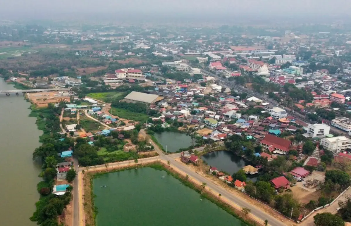
30 Best Places to Visit in Yasothon: Top Attractions in Northeastern Thailand Yasothon is one of the provinces that expresses the cultural identity of northeastern Thailand particularly well. It is known for the Bun Bang Fai Rocket Festival, beliefs associated with Phaya Thaen, the historic Ban Sing Tha quarter, important temples and stupas, handicraft communities, organic farming, wetlands, forests, hills, and reservoirs scattered across the province. This variety makes Yasothon suitable for both a short city break and a multi-day journey through rural communities and cultural landscapes.
For first-time visitors, Mueang Yasothon District is the most practical place to begin. Several of the province's signature attractions are concentrated here, including Phaya Thaen Public Park and the Phaya Thaen cultural complex, Wat Mahathat, Ban Sing Tha Old Town, Phra That Kong Khao Noi, Ban Tat Thong Archaeological Site, and the Phra Sunthon Ratchawongsa Monument. From the city, travelers can extend their route to Kham Khuean Kaeo, Sai Mun, Pa Tio, Kut Chum, Loeng Nok Tha, Thai Charoen, Kho Wang, and other districts.
Yasothon's history is closely connected with migration and settlement along the Mekong and Chi River cultural spheres. Ban Sing Tha became an important early community before the area developed into the town of Yasothon. Traces of that growth remain visible in temples, shrines, old buildings, historic neighborhoods, archaeological sites, and community landscapes throughout the province.
Another reason Yasothon is worth exploring is that its archaeological story reaches much further back than the modern city. Sites such as Don Mueang Toei, Ban Tat Thong, and Ban Mak Mai preserve evidence of ancient settlements, religious practices, earthen town plans, pottery, sema boundary stones, and cultural interaction that predated the later urban development of Yasothon by many centuries.
Traditions and culture in Yasothon are central to the province's identity. The best-known event is the Bun Bang Fai Rocket Festival, one of the most recognizable traditions of northeastern Thailand. Its roots are linked to agriculture, rainmaking beliefs, and Phaya Thaen, the celestial figure associated with rain in local folklore. Communities prepare elaborately decorated rockets, procession floats, traditional dances, music, and ceremonies before the beginning of the rice-growing season.
The Rocket Festival is not simply an entertainment event. It reflects community cooperation through rocket construction, decoration, food preparation, music, performance, ritual activity, and the participation of different villages. Travelers who visit during the festival therefore experience a living community tradition rather than only the spectacle of rockets being launched.
Yasothon also preserves other local traditions, including the Tum Ka lantern-lighting tradition associated with the end of Buddhist Lent, the Malai Khao Tok tradition in which popped rice is made into garlands as a Buddhist offering, annual stupa worship ceremonies, and merit-making customs connected with the northeastern Thai Heet Sip Song ritual calendar.
Handicrafts are another important part of Yasothon's identity. Ban Si Than is particularly famous for khit pillows, triangular cushions, and traditional reclining pillows produced by local households. Other communities preserve bamboo basketry, sticky-rice containers, woodworking, and practical crafts developed from locally available materials. Visiting these villages reveals the skills and labor behind products that are often seen only as souvenirs.
Food in Yasothon is rooted in northeastern Thai cooking and seasonal local ingredients. Typical dishes include som tam, larb, koi, tom saep, kaeng om, grilled chicken, river fish, jaew dipping sauces, local vegetables, fermented foods, and sticky rice. The flavors often emphasize heat, acidity, saltiness, herbs, and fermented fish, reflecting the broader culinary culture of Isan.
Yasothon is also strongly associated with jasmine rice and organic agriculture. Large parts of the countryside are rice-growing areas, so scenery changes dramatically through the farming cycle. Early in the rainy season the fields turn green, while the period before harvest brings broad expanses of golden rice. Driving between districts is therefore part of the travel experience rather than simply a transfer between attractions.
Travelers who want to experience local food should look beyond standard tourist restaurants and try neighborhood eateries, morning markets, and places used by local residents. Seasonal ingredients can include river fish, mushrooms, bamboo shoots, wild and cultivated vegetables, and produce from nearby farms. Eating within each district also helps reduce unnecessary driving back to the city during a multi-stop itinerary.
Where to stay in Yasothon depends largely on the route. Mueang Yasothon is the best general base for Phaya Thaen Public Park, Ban Sing Tha, Wat Mahathat, Phra That Kong Khao Noi, Ban Tat Thong, restaurants, markets, and day trips to surrounding districts.
Travelers concentrating on northern Yasothon, including Loeng Nok Tha, Phu Tham Phra, Wat Phu Sung, Huai Sabaek Reservoir, and Ban Song Yae Christian Church, may benefit from spending a night in the Loeng Nok Tha area. Kham Khuean Kaeo, Pa Tio, and Sai Mun can generally be explored as day trips from the city if attractions are grouped efficiently by zone.
With 3–4 days, a zone-based itinerary works best. A first day can focus on Mueang Yasothon and Ban Sing Tha, a second on archaeological and religious sites in Kham Khuean Kaeo and Tat Thong, a third on Pa Tio, Kut Chum, Sai Mun, or local craft communities, and a fourth on Loeng Nok Tha and Thai Charoen. This provides a balanced view of historic neighborhoods, religion, archaeology, handicrafts, rural life, and natural landscapes without spending most of the trip backtracking by road.
The best time to visit depends on the experience you want. May is the key period for the Bun Bang Fai Rocket Festival, while November to February generally offers more comfortable weather for temples, communities, archaeological sites, and outdoor attractions. The rainy season brings greener forests, wetlands, and reservoirs, although road and trail conditions should be checked before visiting remote natural areas.
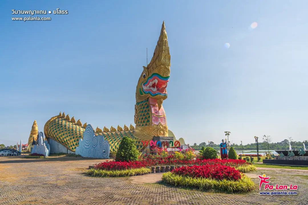
1. Phaya Thaen Public Park is one of Yasothon's best-known urban landmarks. Located near Lam Thuan and Highway 23 in Mueang Yasothon, the park combines recreation, local folklore, family facilities, and cultural interpretation connected with the Bun Bang Fai Rocket Festival.
Highlights: The giant Toad Museum, the Naga building, Lam Thuan, exercise areas, children's spaces, open lawns, and cultural features associated with Yasothon's rocket-festival identity. The enormous toad-shaped building is one of the most recognizable modern symbols of the province.
The concept of the park is rooted in the local legend of Phaya Khan Khak and Phaya Thaen, a story explaining the relationship between people, rain, agriculture, and the supernatural world. Phaya Thaen is associated with rain in northeastern Thai belief, while the launching of rockets is traditionally linked with requests for rain before the rice-growing season.
The giant toad-shaped museum introduces visitors to local history, folklore, the Rocket Festival, and amphibian-related displays. The nearby Naga structure adds another layer of symbolism connected with water, fertility, and beliefs shared across the Mekong cultural region.
The park works well for different types of visitors. Families can use the recreational areas, residents come for walking and exercise, and cultural travelers can use the site as an introduction before visiting historic neighborhoods, temples, and community attractions elsewhere in Yasothon.
Morning is generally quieter, while late afternoon and early evening offer softer light for photography around the large landmark structures and the water. During major Rocket Festival activities, visitors should allow additional time for traffic and crowds around the park and central Yasothon.
Getting There: From central Yasothon, follow Chaeng Sanit Road or Highway 23 toward Lam Thuan. The large toad-shaped building is easy to recognize from the surrounding area. Private cars, rental cars, and local hired vehicles are practical options.
Map (GPS):https://www.google.com/maps/dir/?api=1&destination=15.783774,104.153786&travelmode=driving
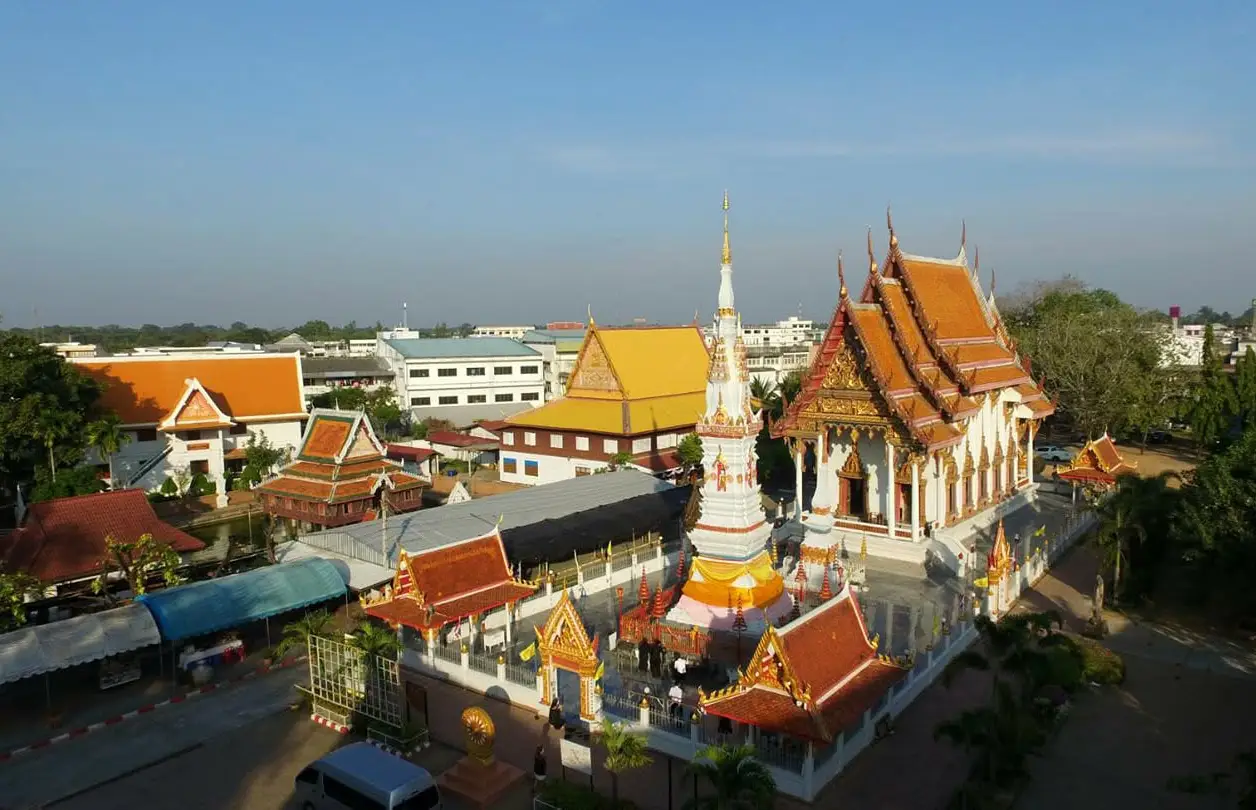
2. Wat Mahathat is one of the most important temples in central Yasothon and a major religious landmark of the province. The temple preserves sacred images, stupas, architectural details, and cultural connections that reflect the history of Yasothon and the wider Lao-Isan and Lan Xang cultural sphere.
Highlights: Phra Phuttha Bussayarat, also known locally as the Crystal Dewdrop Buddha, Phra That Anon, historic religious structures, and architectural elements associated with northeastern Thai and Lan Xang traditions.
Phra Phuttha Bussayarat is especially revered by local residents and has long been connected with the spiritual identity of Yasothon. Visiting the temple is therefore more than an opportunity to see an important Buddha image; it is also a way to understand one of the principal centers of local faith.
Phra That Anon is another major feature of the temple. Its religious and architectural significance, together with the surrounding sacred structures, illustrates cultural links between Yasothon and communities throughout the Mekong region.
The temple's location near Ban Sing Tha Old Town makes it easy to combine both places in a single walking or driving route. A useful plan is to visit Wat Mahathat in the morning, then continue to Ban Sing Tha, its old streets, community landmarks, and historic buildings.
Wat Mahathat remains an active religious site. Visitors should dress respectfully, keep voices low around sacred buildings, and avoid interrupting monks or worshippers. Morning visits are often quieter and more comfortable for observing architectural details.
Getting There: Wat Mahathat is in central Yasothon and is easily reached from the clock-tower area, restaurants, markets, and hotels in the city. It can be combined with Ban Sing Tha and Phaya Thaen Public Park in the same day.
Map (GPS):https://www.google.com/maps/dir/?api=1&destination=15.793861,104.142052&travelmode=driving
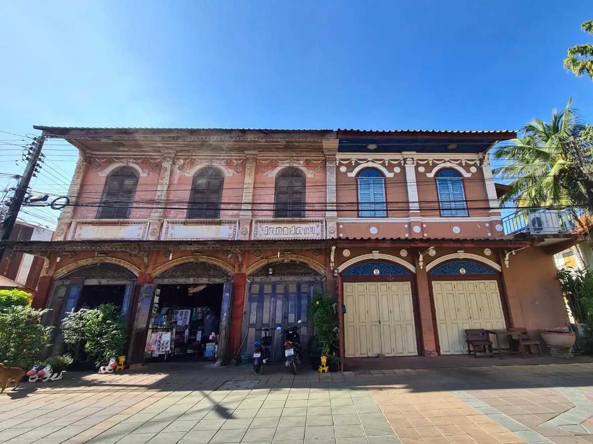
3. Ban Sing Tha Old Town is the historic quarter of Yasothon and one of the best places to understand how the modern city developed. The district retains old houses, shophouses, temples, shrines, residential lanes, and an urban layout that reflects the commercial and social history of the community.
Highlights: Historic streets, traditional houses and shophouses, community architecture, nearby Wat Mahathat, local shrines, and an old-town atmosphere that remains integrated with everyday life rather than functioning as a reconstructed tourist zone.
Ban Sing Tha is closely connected with the early settlement and growth of Yasothon. Its location supported trade, residence, and community life before modern roads and urban expansion transformed the city. Walking through the district helps visitors visualize an earlier phase of Yasothon's development.
The architecture varies from wooden houses to older commercial buildings and later masonry structures, showing how the town changed over time. The attraction is therefore not a single monument but the collective streetscape and the continuity of a living neighborhood.
Morning and late afternoon are good times for photography because the light is softer and walking is more comfortable. Shops, homes, temples, and local activity give the area an authentic atmosphere that differs from heritage districts designed primarily for tourism.
Visitors with more time can explore the district together with Wat Mahathat and other central landmarks. Because the major sites are relatively close, parking once and walking through part of the old quarter is often the best way to notice architectural details.
Getting There: Ban Sing Tha is in central Yasothon near Wat Mahathat. Travelers can arrive by private car or local transport, park in a suitable area, and continue on foot through the historic streets.
Map (GPS):https://www.google.com/maps/dir/?api=1&destination=15.792545,104.144617&travelmode=driving
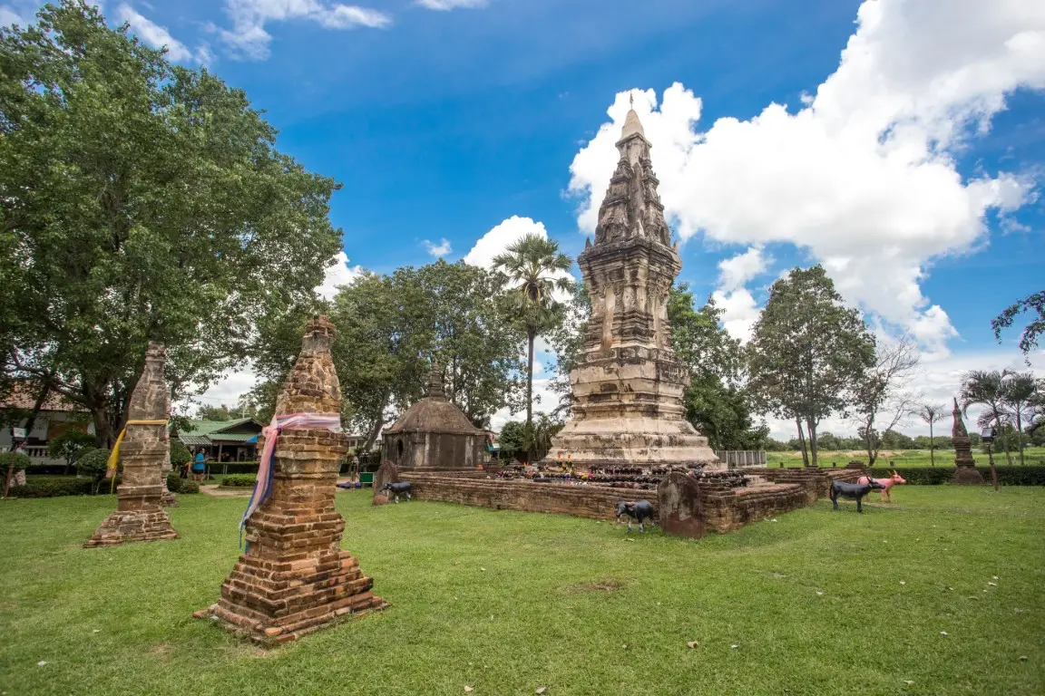
4. Phra That Kong Khao Noi, also associated locally with Phra That Tat Thong, is one of Yasothon's most recognizable historical and religious monuments. Located in Tat Thong Subdistrict, it is widely known for the local folktale Kong Khao Noi Kha Mae, a moral story about anger, remorse, and gratitude toward one's parents.
Highlights: A distinctive brick-and-plaster stupa, the Kong Khao Noi Kha Mae folktale, religious significance, archaeological context, and its close relationship with the ancient settlement landscape of Ban Tat Thong.
The local legend tells of a young farmer who waited for his mother to bring food while he worked in the fields. When she arrived late with what appeared to be a small rice container, he became angry and attacked her. Only after eating did he realize that the rice had been more than enough. Overcome with remorse, he built a stupa as an act of atonement.
The story became an important northeastern Thai moral tale emphasizing gratitude, patience, and the danger of uncontrolled anger. This has given the stupa a cultural role that extends beyond its architecture and religious function.
The surrounding Tat Thong area is also archaeologically significant. Travelers interested in history should therefore combine the stupa with Ban Tat Thong Archaeological Site, where traces of an ancient settlement, moat, embankment, pottery, and sema stones provide a much broader historical context.
Morning and late afternoon are the most comfortable times to visit. Visitors should dress respectfully and remember that the site continues to hold religious meaning for the local community.
Getting There: From Yasothon city center, take Highway 23 toward Tat Thong Subdistrict. The site is roughly 9 km from central Yasothon and can easily be combined with other city and Tat Thong attractions.
Map (GPS):https://www.google.com/maps/dir/?api=1&destination=15.763515,104.207039&travelmode=driving
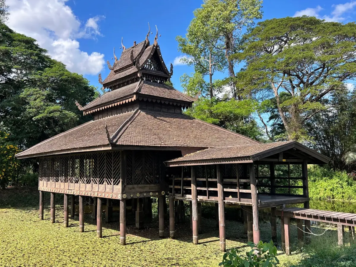
5. Ho Trai Wat Sa Trai Nurak is a historic wooden scripture library standing in a pond at Wat Sa Trai Nurak in Ban Na Wiang, Sai Mun District. It is one of Yasothon's most distinctive examples of vernacular religious architecture and reflects the traditional relationship between Buddhist monasteries, manuscripts, craftsmanship, and local knowledge.
Highlights: The wooden scripture hall in the middle of a pond, Isan and Lan Xang architectural influence, traditional timber craftsmanship, palm-leaf manuscript culture, and the quiet atmosphere of a rural temple.
Building scripture libraries over water was a practical solution used by monasteries in several parts of Thailand and Laos. The surrounding water helped reduce access by termites and insects that could damage palm-leaf manuscripts and other religious documents.
The building also demonstrates the skill of local carpenters through its proportions, roof form, structural system, and decorative details. Travelers interested in traditional architecture should take time to view the hall from several angles around the pond.
The significance of the site extends beyond architecture. In earlier periods, monasteries were important repositories of knowledge, and manuscript libraries preserved Buddhist texts, sermons, local histories, and other written traditions for future generations.
The temple is best experienced slowly. Morning offers soft light and cooler weather, while late afternoon can create attractive reflections and shadows around the pond and timber building.
Getting There: From Yasothon city, travel toward Sai Mun District and continue to Ban Na Wiang. Private transport is the most convenient option, and the site can be combined with other attractions in the Sai Mun area.
Map (GPS):https://www.google.com/maps/dir/?api=1&destination=16.069666,104.143603&travelmode=driving
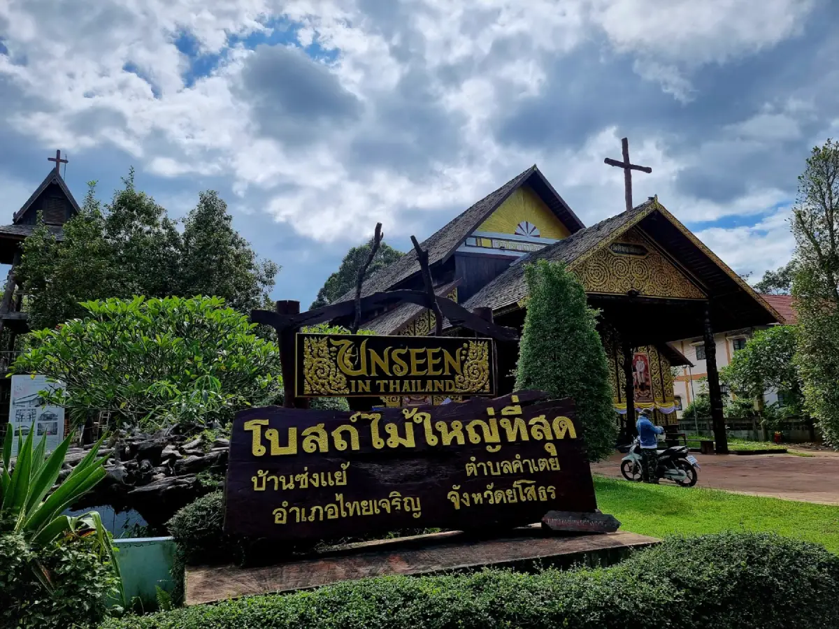
6. Ban Song Yae Christian Church, officially associated with St. Michael the Archangel, is a remarkable Catholic church in Ban Nong Song Yae, Thai Charoen District. Its large timber structure and long relationship with the local Christian community make it one of the most distinctive religious attractions in Yasothon.
Highlights: The large wooden church, traditional timber construction, local Christian history, a peaceful village setting, and the way Catholic faith has developed within a rural northeastern Thai cultural environment.
The church is notable for its extensive use of wood and its strong structural rhythm of columns, roof framing, and open interior space. Unlike masonry churches commonly seen in larger towns, Song Yae presents a particularly local architectural character.
Its importance also comes from the community that continues to use the church for worship and religious gatherings. Visitors therefore experience a living place of faith rather than a historic structure preserved solely for tourism.
Inside, the design is relatively restrained and focused on worship. Travelers interested in architecture can observe the timber structure and the practical craftsmanship that allowed local builders to create a large communal religious building.
Visitors should dress respectfully and avoid disturbing Mass or other ceremonies. Photography should be undertaken with sensitivity, especially when worshippers are present.
Getting There: From Yasothon city, travel north toward Thai Charoen District, then continue to Kham Toei Subdistrict and Ban Nong Song Yae. A private car is the most practical option because public transport to the village is limited.
Map (GPS):https://www.google.com/maps/dir/?api=1&destination=16.069721,104.373762&travelmode=driving
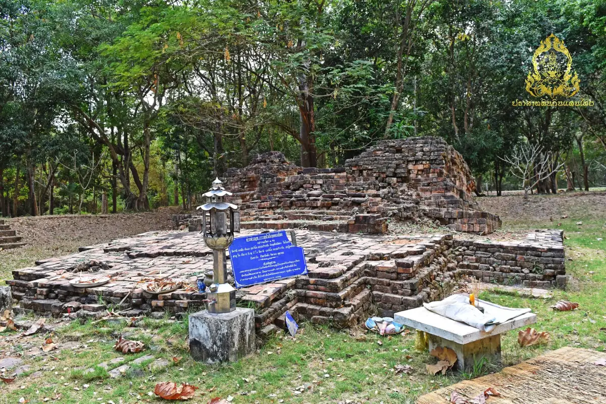
7. Don Mueang Toei Archaeological Site in Song Pueai Subdistrict, Kham Khuean Kaeo District, is one of the province's most significant archaeological areas. The site demonstrates that important communities existed here centuries before the development of modern Yasothon.
Highlights: Ancient settlement remains, moat and embankment traces, brick architectural foundations, inscriptions, religious evidence, and connections with early historic cultures in the lower Chi River region.
The area preserves traces of an organized ancient community with brick structures and planned space. These remains indicate a society with established religious practice, settlement organization, and cultural relationships beyond the immediate village area.
Don Mueang Toei is particularly valuable for understanding Yasothon's place within wider cultural networks across northeastern Thailand. Evidence from the site connects local history with larger patterns of religion, language, political influence, and exchange in mainland Southeast Asia.
Visitors should not expect a fully reconstructed stone sanctuary. The importance of the site lies in archaeological context: earthworks, foundations, brick remains, landscape form, and the relationship between these elements.
It is useful to combine Don Mueang Toei with Ku Chan and Phra That Phon Than in Kham Khuean Kaeo District. Together they create a route that connects archaeology, religious monuments, and the continuing faith of local communities.
Getting There: From Yasothon city, travel toward Kham Khuean Kaeo District and continue to Song Pueai Subdistrict. Private transport is recommended, and GPS is useful when entering local roads near the archaeological area.
Map (GPS):https://www.google.com/maps/dir/?api=1&destination=15.640173,104.258091&travelmode=driving
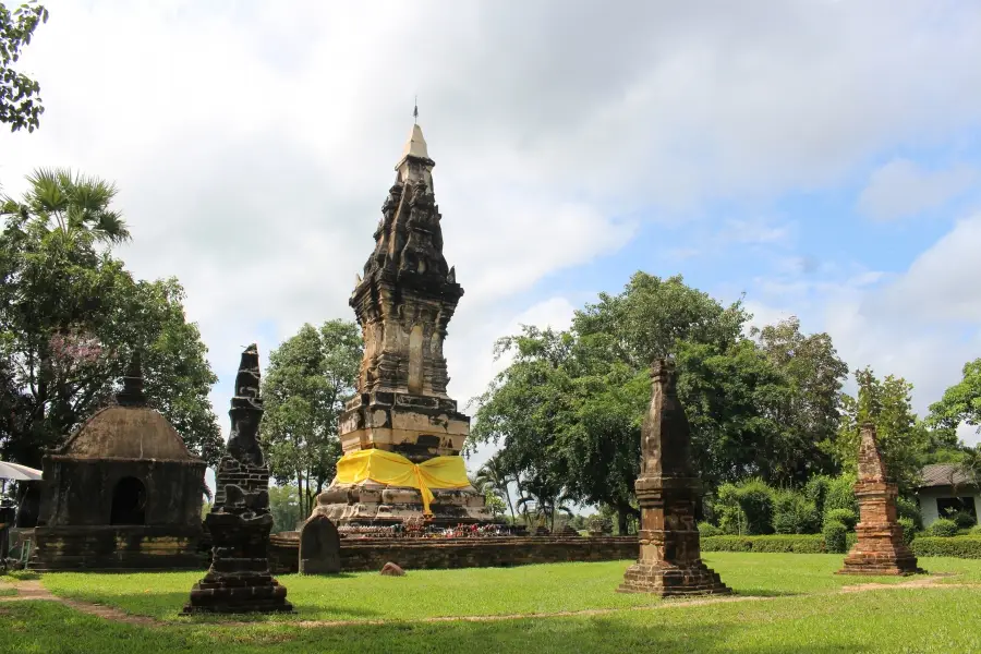
8. Ban Tat Thong Archaeological Site is an ancient settlement in Tat Thong Subdistrict, Mueang Yasothon District. It preserves a long sequence of human occupation extending from the late prehistoric period through Dvaravati, Khmer cultural influence, and later Tai-Lao settlement.
Highlights: A large oval ancient town, an earthen mound around 3 meters high, moat and embankment traces, burial evidence, painted pottery, red sandstone sema stones, and a close relationship with Phra That Tat Thong or Phra That Kong Khao Noi.
The ancient settlement measures roughly 500 meters wide and 650 meters long. Its organized earthworks indicate deliberate land use, water management, community boundaries, and a close relationship with the agricultural landscape.
Archaeological finds include extended burials and painted pottery associated with a settled agricultural community dating back approximately 2,500 years. These remains reveal not only everyday life but also ritual practices and beliefs surrounding death and community identity.
During the Dvaravati period, Buddhist influence became more visible through sema boundary stones. Later evidence also indicates cultural interaction with Khmer traditions. The result is a layered archaeological landscape rather than a site belonging to only one historical period.
Today Highway 23 crosses part of the ancient settlement, and modern houses, farmland, and roads coexist with older archaeological features. This makes Ban Tat Thong particularly interesting as a living cultural landscape where ancient and modern land use overlap.
Getting There: From central Yasothon, take Highway 23 toward Tat Thong Subdistrict or Kham Khuean Kaeo District for about 7–9 km, then turn into Ban Tat Thong. Private cars, rental cars, and local hired vehicles are suitable.
Map (GPS):https://www.google.com/maps/dir/?api=1&destination=15.7597792165,104.203552625&travelmode=driving
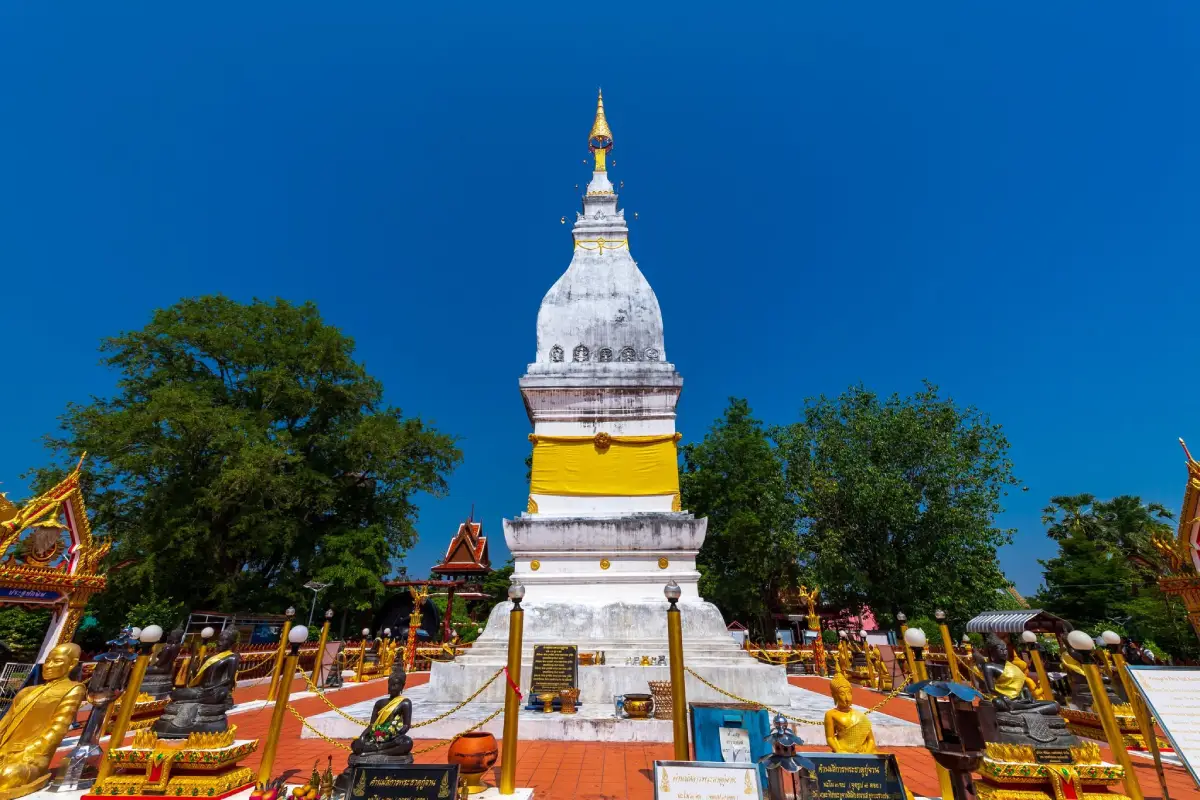
9. Ku Chan, also known locally as Phra That Ku Chan, is an important sacred site in Kham Khuean Kaeo District. It combines local religious devotion with architectural and archaeological elements that reflect the long cultural history of the area.
Highlights: The stupa, sema stones and other old remains, local worship traditions, and the continuing role of the site as a spiritual center for nearby communities.
The stupa reflects northeastern Thai religious architecture and broader cultural connections across the Mekong region. Although it is not a monumental site on the scale of major regional stupas, its significance lies in its relationship with local belief and community history.
Old sema stones and other evidence around the site suggest a long-standing sacred role. These remains are useful for travelers interested in the spread and development of Buddhism in Yasothon and the lower Chi River region.
Ku Chan is not simply an archaeological remnant. Local people continue to use the site for worship and annual religious activities, giving visitors the opportunity to see how older sacred places remain meaningful in contemporary community life.
Morning and late afternoon are suitable for photography and quiet visits. The site can be combined with Don Mueang Toei and Phra That Phon Than to create a cultural route through Kham Khuean Kaeo District.
Getting There: From Kham Khuean Kaeo District, continue to Ku Chan Subdistrict and Ban Ngio using local roads. Private transport is recommended, especially when combining several archaeological and religious sites in one day.
Map (GPS):https://www.google.com/maps/dir/?api=1&destination=15.680897,104.382547&travelmode=driving
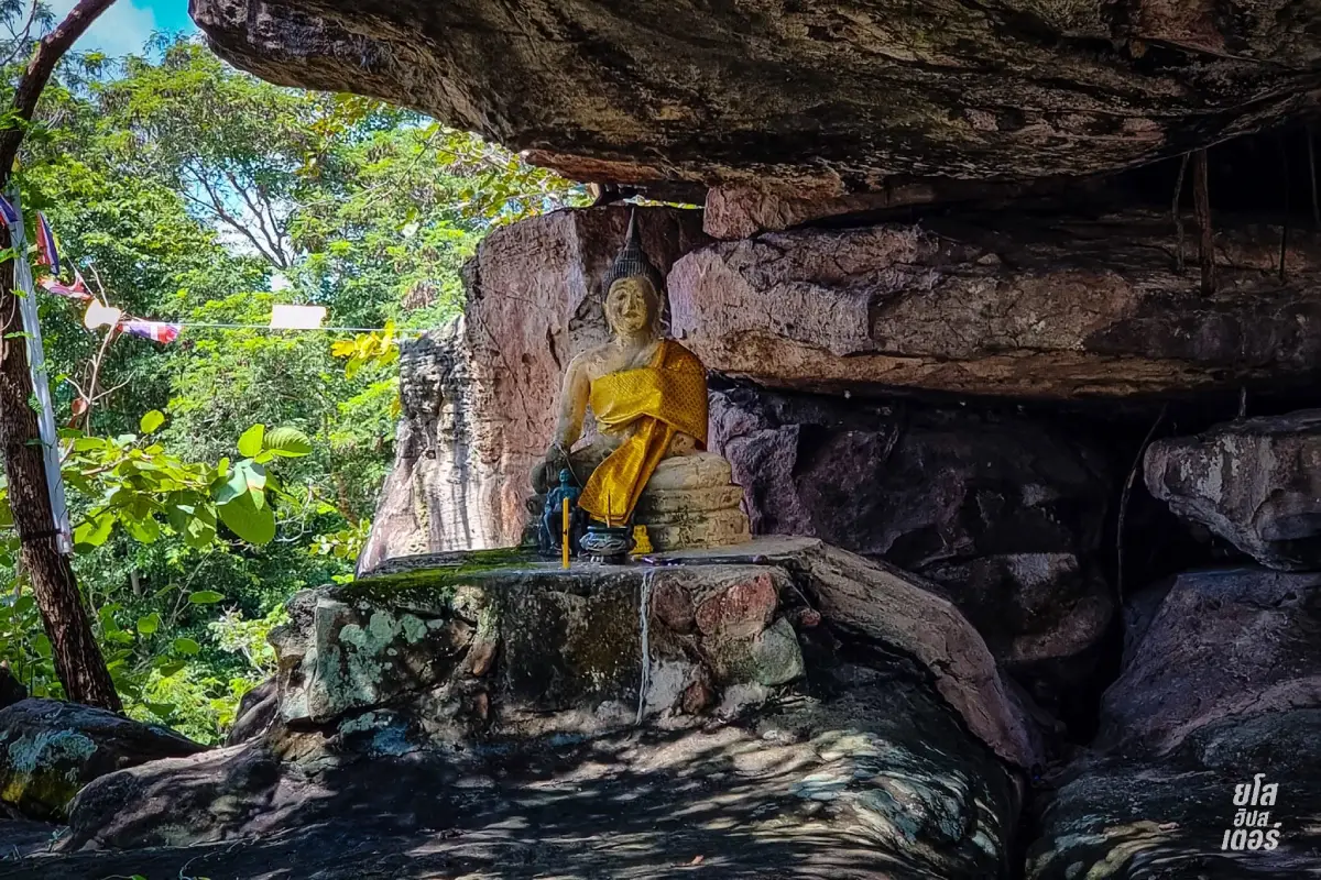
10. Phu Tham Phra in Loeng Nok Tha District combines a forest-temple atmosphere, natural caves, rocky terrain, and elevated landscapes. It is a good choice for travelers who want a more natural setting after exploring the historic neighborhoods and temples of central Yasothon.
Highlights: Natural caves, Buddhist images, forest surroundings, rocky formations, elevated viewpoints, and a peaceful environment suited to both worship and light outdoor exploration.
The landscape differs clearly from the flatter terrain around Mueang Yasothon. As visitors approach the hills, forest, rock outcrops, and sloping ground become more prominent, creating a quieter and more secluded atmosphere.
The cave area is one of the site's main features. Buddhist images and devotional spaces are found around the natural rock environment, creating a setting associated with meditation and forest-monastery traditions.
Some walking sections require suitable footwear, particularly in the rainy season when rock surfaces can become slippery. Morning is usually the best time for walking because temperatures are lower.
Elevated points around the area provide views across the surrounding countryside and forest. Travelers interested in photography should allow time to explore several viewpoints rather than visiting only the lower temple area.
Phu Tham Phra can be combined with Wat Phu Sung and Huai Sabaek Reservoir on a northern Yasothon route. Staying in or near Loeng Nok Tha can reduce driving time when several attractions in this area are included.
Getting There: From Loeng Nok Tha, follow local roads toward the Phu Tham Phra area. Private transport is the most practical choice, and GPS is recommended for the final local-road section.
Map (GPS):https://www.google.com/maps/dir/?api=1&destination=16.277190,104.562337&travelmode=driving
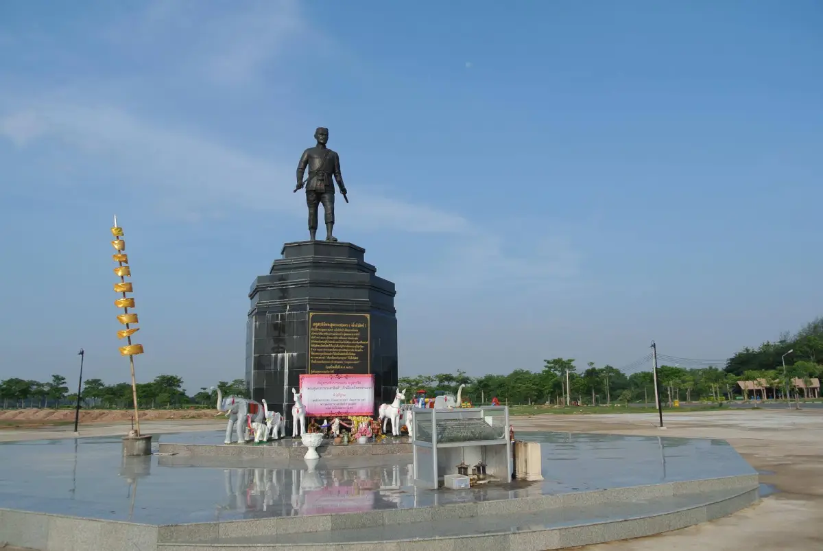
11. Phra Sunthon Ratchawongsa Monument stands within Bueng Noi–Bueng Yai Public Park in Mueang Yasothon and commemorates Phra Sunthon Ratchawongsa, the first governor of Yasothon. The monument is both a historical landmark and part of a public recreation area used by local residents.
Highlights: The monument to Yasothon's first governor, the surrounding Bueng Noi–Bueng Yai parkland, activity areas, an octagonal pavilion, open public space, and its role in civic ceremonies associated with the history of the province.
The monument helps visitors connect the modern city with the early administrative history of Yasothon. Rather than functioning only as a photo stop, it represents local memory and respect for a figure associated with the establishment and development of the town.
The surrounding park has landscaped areas, open space, and places for walking and exercise. This makes the monument easy to include in a city itinerary without requiring a separate long excursion.
The site also has a ceremonial role during important provincial events. Local commemorative activities reinforce its meaning as a living civic landmark rather than a static memorial.
Morning and early evening are the most comfortable times to visit. Travelers can combine the monument with Wat Mahathat, Ban Sing Tha, and Phaya Thaen Public Park as part of a compact central Yasothon route.
Getting There: From central Yasothon, follow local city roads toward Bueng Noi–Bueng Yai Public Park. The monument is close to other major city attractions and is convenient by private car or local hired transport.
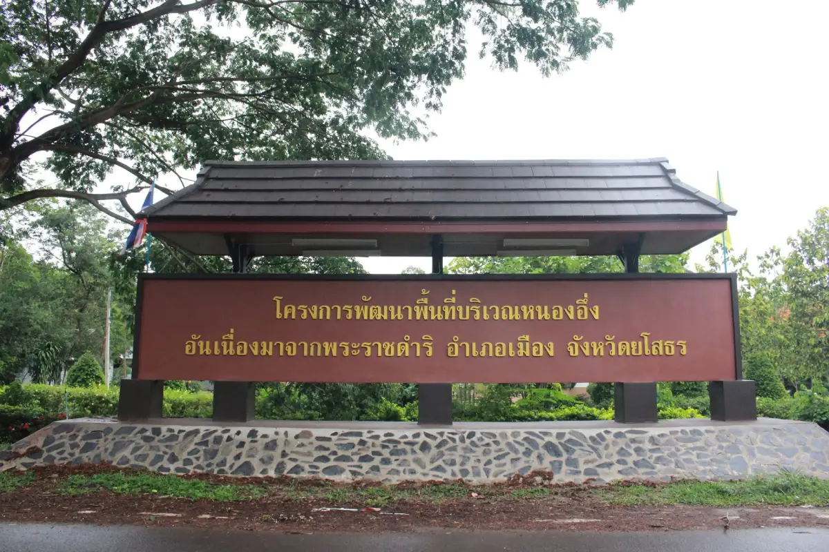
12. Nong Ueng Royal Development Project in Kho Nuea Subdistrict, Mueang Yasothon District, is a learning destination focused on community development, water resources, forest management, agriculture, and local livelihoods. It is particularly suitable for visitors interested in sustainable rural development rather than conventional sightseeing.
Highlights: Community forest management, water-resource development, agricultural learning, livelihood projects, and practical examples of how local communities can use natural resources while maintaining long-term ecological value.
Nong Ueng and the surrounding area are important to local livelihoods as water sources, agricultural land, food resources, and community-managed natural assets. Development here emphasizes appropriate use of resources rather than turning the landscape into a large-scale tourist facility.
One of the most interesting aspects is the relationship between community forest resources and household economies. Local people can benefit from forest products and agricultural activities while maintaining rules intended to protect shared resources.
The landscape includes water, forest, agricultural plots, and rural settlements. Rainy-season visits reveal lush vegetation, while the cooler season is more comfortable for walking and learning activities.
The site is useful for school groups, families, students, development practitioners, and travelers interested in sustainability. It can be visited as a half-day excursion from Mueang Yasothon.
Getting There: From Yasothon city, travel toward Kho Nuea Subdistrict and continue along local roads to the project area. Private transport is the most convenient option, and GPS is useful near the community roads.
Map (GPS):https://www.google.com/maps/dir/?api=1&destination=15.826188,104.053906&travelmode=driving
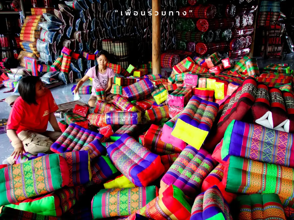
13. Ban Si Than Khit Pillow Village in Pa Tio District is one of Yasothon's best-known handicraft communities. It is especially famous for khit pillows, triangular cushions, and traditional reclining pillows that have become strongly associated with the province.
Highlights: Khit pillows, triangular cushions, reclining pillows, household textile production, local sewing skills, and opportunities to buy products directly from community makers.
Pillow making developed from household textile knowledge passed between generations. What began as practical domestic production evolved into a recognizable local industry, with colors, sizes, and forms adapting to changing markets while retaining traditional construction techniques.
The production process requires careful selection and cutting of fabric, sewing, shaping, and filling. The durability and final form of each cushion depend heavily on the maker's experience and accuracy.
Products are no longer limited to traditional triangular pillows. Local makers also produce seat cushions, decorative pillows, and other household items that allow the craft to remain commercially relevant.
Buying directly from the village supports local households and gives travelers access to a wider range of sizes and designs. Speaking with producers also helps visitors understand the work behind each finished product.
Getting There: From Yasothon city, take Highway 202 toward Pa Tio District, then continue to Si Than Subdistrict along local roads. Private transport is the easiest option.
Map (GPS):https://www.google.com/maps/dir/?api=1&destination=15.776146,104.330985&travelmode=driving
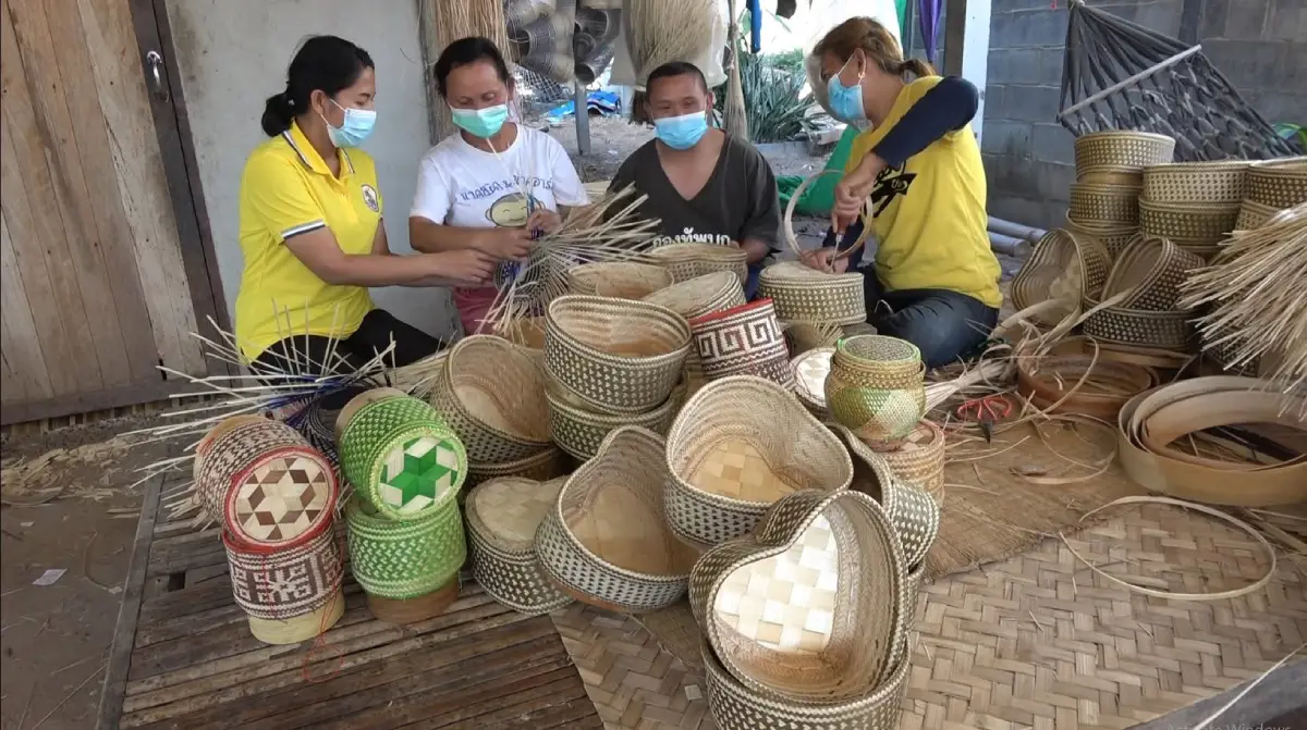
14. Ban Thung Nang Ok is a community attraction in Mueang Yasothon District that reflects local craftsmanship and rural life, particularly the use of bamboo for practical household products and basketry.
Highlights: Bamboo basketry, household crafts, local artisan knowledge, village life, and examples of how natural materials are transformed into useful everyday objects.
Bamboo has long been important in northeastern Thai rural life. It has been used in construction, farming tools, containers, household equipment, and craft production, making basketry a practical skill rather than merely a decorative tradition.
The process requires selecting suitable bamboo, preparing strips of consistent thickness, and controlling the tension and pattern of the weave. Experienced makers can produce durable objects that remain useful for many years.
A visit offers insight into how cultural knowledge survives through everyday activities. Travelers can observe production, speak with community members, and buy products directly from makers.
The surrounding landscape retains a rural character with agricultural land and village homes. Morning visits are especially suitable for observing everyday community activity.
Getting There: From Yasothon city, travel toward Thung Nang Ok Subdistrict and follow local roads into the village. Private transport is the most convenient choice.
Map (GPS):https://www.google.com/maps/dir/?api=1&destination=15.879640,104.166810&travelmode=driving
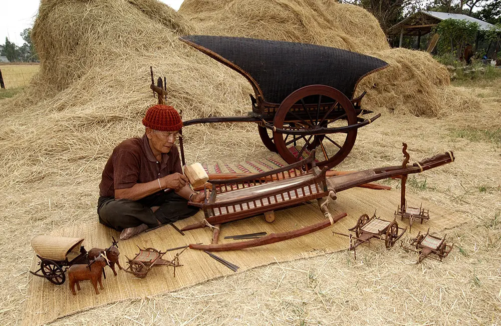
15. Ban Na Samai Village in Mueang Yasothon District is known for local handicrafts, especially bamboo weaving, sticky-rice containers, woodworking, and practical household products made from natural materials.
Highlights: Sticky-rice baskets, bamboo weaving, woodworking, community craftsmanship, and products that show the close connection between local handicrafts and everyday northeastern Thai life.
The sticky-rice container is one of the objects most closely associated with Isan food culture. Its woven construction helps keep steamed sticky rice warm while allowing air to circulate, making it both lightweight and practical.
The quality of the work can be seen in the preparation of bamboo strips, the regularity of weaving patterns, and the accuracy of the final shape. Even simple-looking objects require experience and careful material preparation.
The village also produces other bamboo and wood items. Adapting traditional skills to contemporary products helps create income and gives younger generations a reason to continue learning local crafts.
Travelers interested in handmade goods can spend time talking with producers and buying directly from the community. Ban Na Samai also combines well with nearby rural and wetland attractions.
Getting There: From Yasothon city, travel toward Na Samai Subdistrict and continue into the village using local roads. A private car is the most convenient option.
Map (GPS):https://www.google.com/maps/dir/?api=1&destination=15.881346,104.241330&travelmode=driving
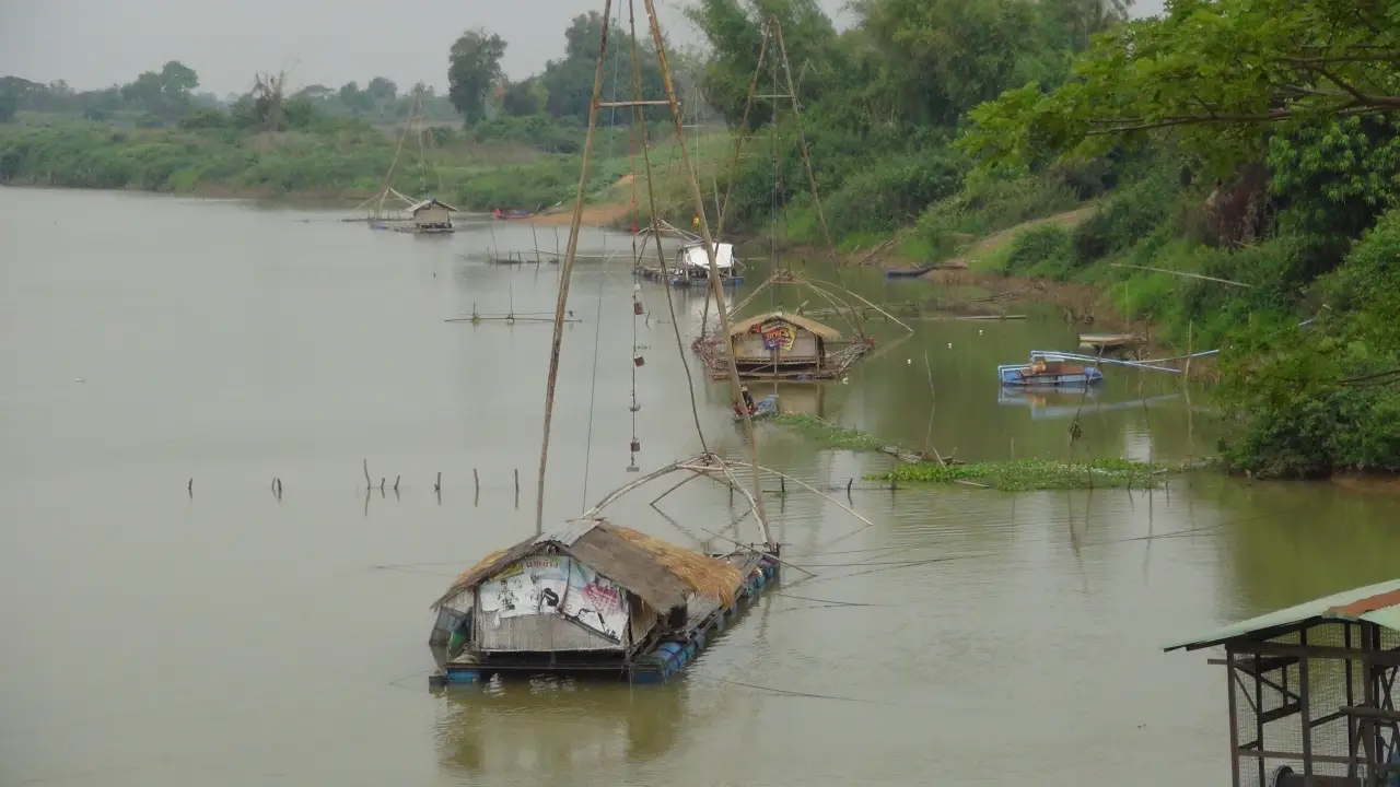
16. Chi River is one of the major rivers of northeastern Thailand and has a direct influence on Yasothon's landscape, agriculture, settlement patterns, food culture, and rural economy.
Highlights: River scenery, riverside communities, agricultural land, seasonal water-level changes, and a broader understanding of how one of Isan's major rivers supports everyday life.
The Chi River supplies water to large agricultural areas and has long supported settlements along its course. Farming communities depend on seasonal water conditions, making the river an important part of both ecology and local livelihoods.
The landscape changes noticeably between rainy and dry seasons. High water and green vegetation characterize wetter months, while lower water levels can reveal more of the riverbanks and surrounding land during the dry season.
Morning and late afternoon are best for photography, especially when softer light reflects across the water. The wide horizon also creates attractive sunset conditions in open riverside areas.
The river also helps explain local food culture. Fish and other aquatic resources contribute to regional cuisine, while fertile lowlands support agriculture in nearby communities.
Getting There: From Yasothon city, travel toward Khueang Kham Subdistrict and follow local roads to accessible riverside areas. Private transport is the most flexible option.
Map (GPS):https://www.google.com/maps/dir/?api=1&destination=15.787985,104.138925&travelmode=driving
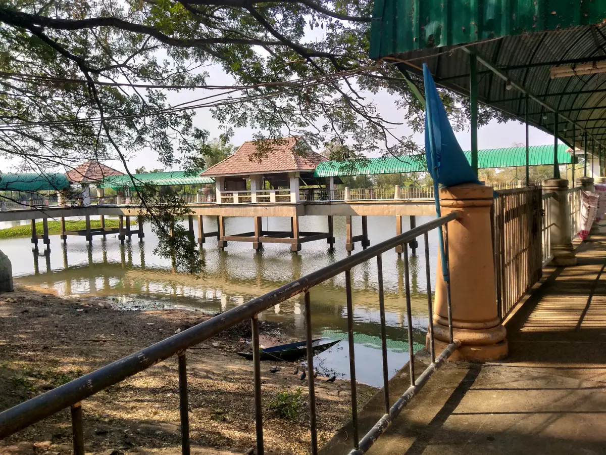
17. Wang Matcha is a community waterside attraction in the Khueang Kham area of Mueang Yasothon. It is known for its fish sanctuary atmosphere and functions as a quiet local recreation area.
Highlights: Fish in the protected water area, shaded riverside surroundings, opportunities to feed fish, and a calm community environment suitable for families and short stops.
The name Wang Matcha refers to a deep or protected fish area where large numbers of fish are found. Similar community conservation zones are common in northeastern Thailand, where local rules and religious values often help protect aquatic life.
This type of conservation has both ecological and cultural dimensions. Merit-making practices, local cooperation, and respect for protected water areas can all contribute to maintaining fish populations.
The site is best approached as a place to relax rather than a major activity attraction. Families and older travelers can enjoy a slower stop before continuing to other sites in Mueang Yasothon.
Visitors should use appropriate fish food and avoid dropping plastic or other waste into the water. Protecting water quality is essential for the fish and the surrounding community.
Getting There: From Yasothon city, travel toward Khueang Kham Subdistrict and Ban Kwang. Private transport is convenient, and the visit can be combined with Chi River viewpoints.
Map (GPS):https://www.google.com/maps/dir/?api=1&destination=15.758735,104.168088&travelmode=driving
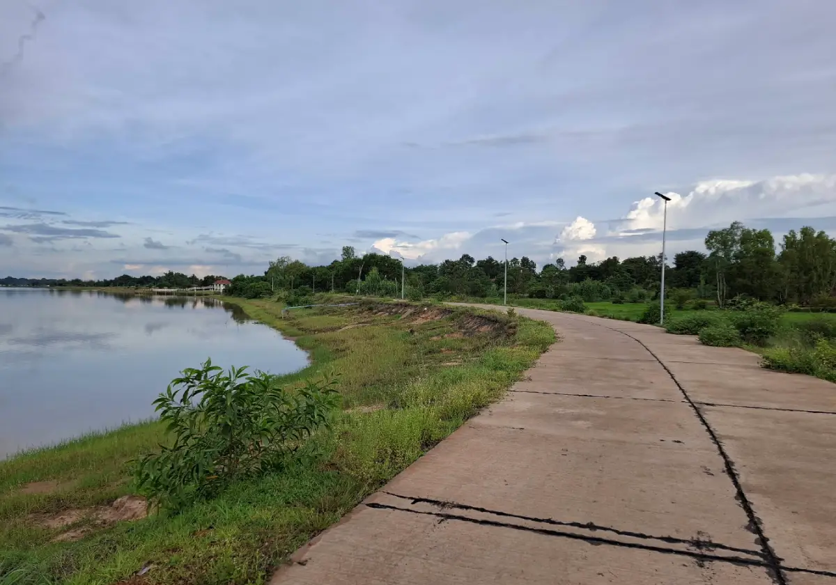
18. Kut Kaloeb is a natural water and wetland area in Mueang Yasothon District. It has ecological value for surrounding communities and provides a peaceful rural landscape for visitors interested in nature, birdlife, and sunset photography.
Highlights: Open water, wetland habitat, rural scenery, birdwatching opportunities, and broad sunset views across the surrounding landscape.
In Isan geography, the term “kut” is commonly associated with natural water bodies or old river channels separated from a main stream. Such environments provide habitat for aquatic species, birds, and wetland vegetation.
Kut Kaloeb is appealing because it remains relatively undeveloped. Visitors experience open rural scenery rather than a heavily landscaped recreational park.
Morning is suitable for birdwatching, while late afternoon is best for sunset views and reflections across the water. Seasonal water levels can significantly change the appearance of the site.
As facilities are limited, travelers should carry drinking water and basic supplies. Swimming is not recommended in areas where depth and underwater conditions are unknown.
Getting There: From Yasothon city, travel toward the Nong Hin area and use local roads to reach accessible points around Kut Kaloeb. GPS is useful for identifying the most convenient approach.
Map (GPS):https://www.google.com/maps/dir/?api=1&destination=15.856921,104.309461&travelmode=driving
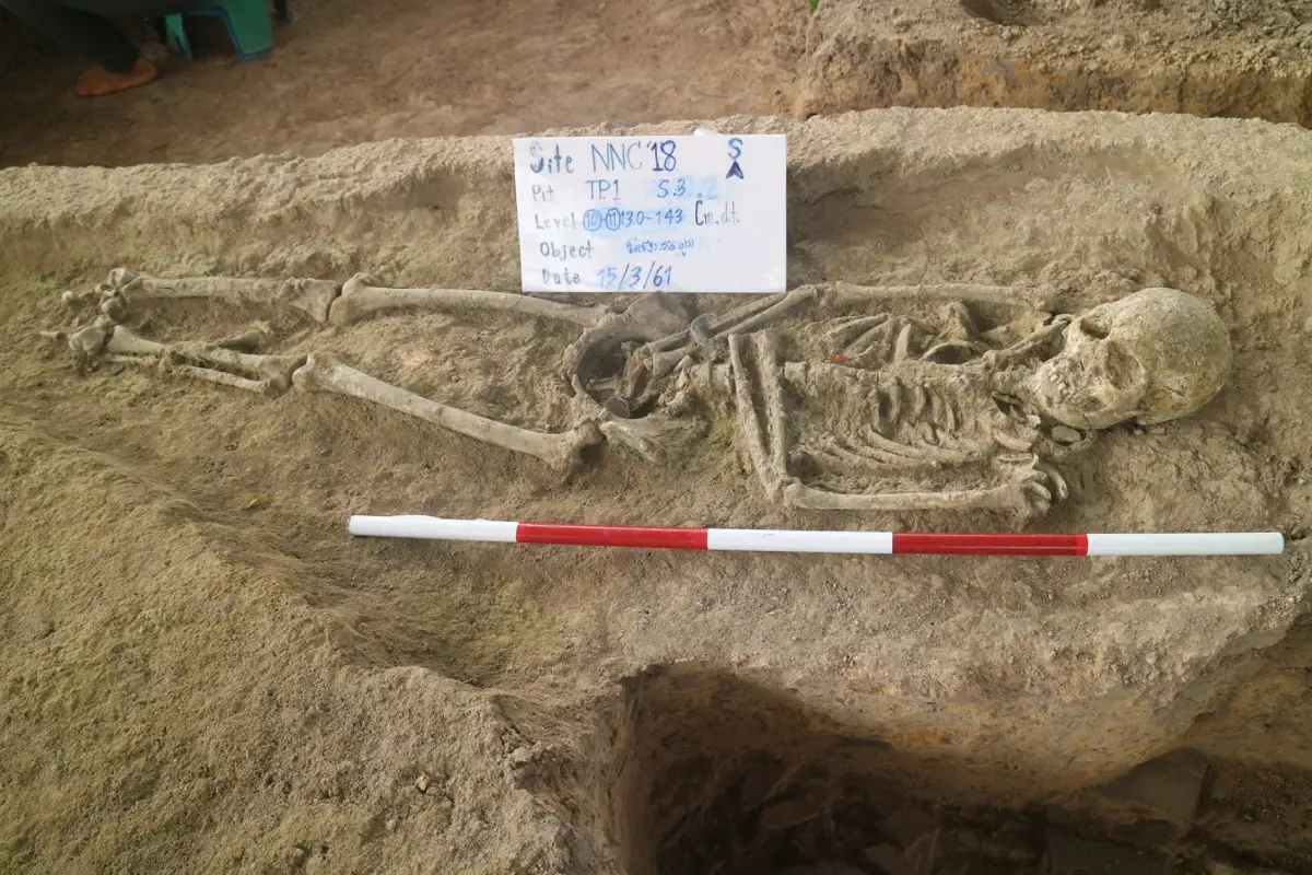
19. Ban Mak Archaeological Site is an ancient settlement at Ban Mak Mai in Kho Wang District. The site helps explain early settlement in southern Yasothon through an elevated habitation mound, surrounding moat, ancient ponds, sema stones, pottery, and its relationship with Huai Phra Bang.
Highlights: An ancient settlement mound rising about 2–3 meters above the surrounding rice fields, a surrounding moat, 3 ancient ponds, Huai Phra Bang, sema boundary stones, and coarse orange and pale pottery fragments.
The settlement is estimated to date from roughly 1,500–1,000 years ago and shows influence from Dvaravati and Khmer cultural traditions. Its location on slightly higher ground near water sources reflects practical decisions about settlement, agriculture, and access to natural resources.
Sema stones are important evidence of Buddhist influence during the Dvaravati cultural period, while the broader context suggests later interaction with Khmer traditions. This makes the site useful for understanding how smaller rural communities participated in wider regional cultural networks.
Pottery fragments provide evidence of everyday domestic life, including food preparation, water storage, and household activity. When considered together with the moat, ponds, mound, and stream, these finds create a fuller picture of the ancient community.
The best way to experience Ban Mak is to read the landscape as a whole. Visitors should observe the settlement mound, old water features, stream alignment, current village, and agricultural fields rather than looking for a single monumental ruin.
Getting There: Use the road between Kho Wang District in Yasothon and Rasi Salai District in Si Sa Ket, then turn east toward Ban Mak Mai for about 1 km. Private transport is recommended.
Map (GPS):https://www.google.com/maps/dir/?api=1&destination=15.350385,104.355673&travelmode=driving
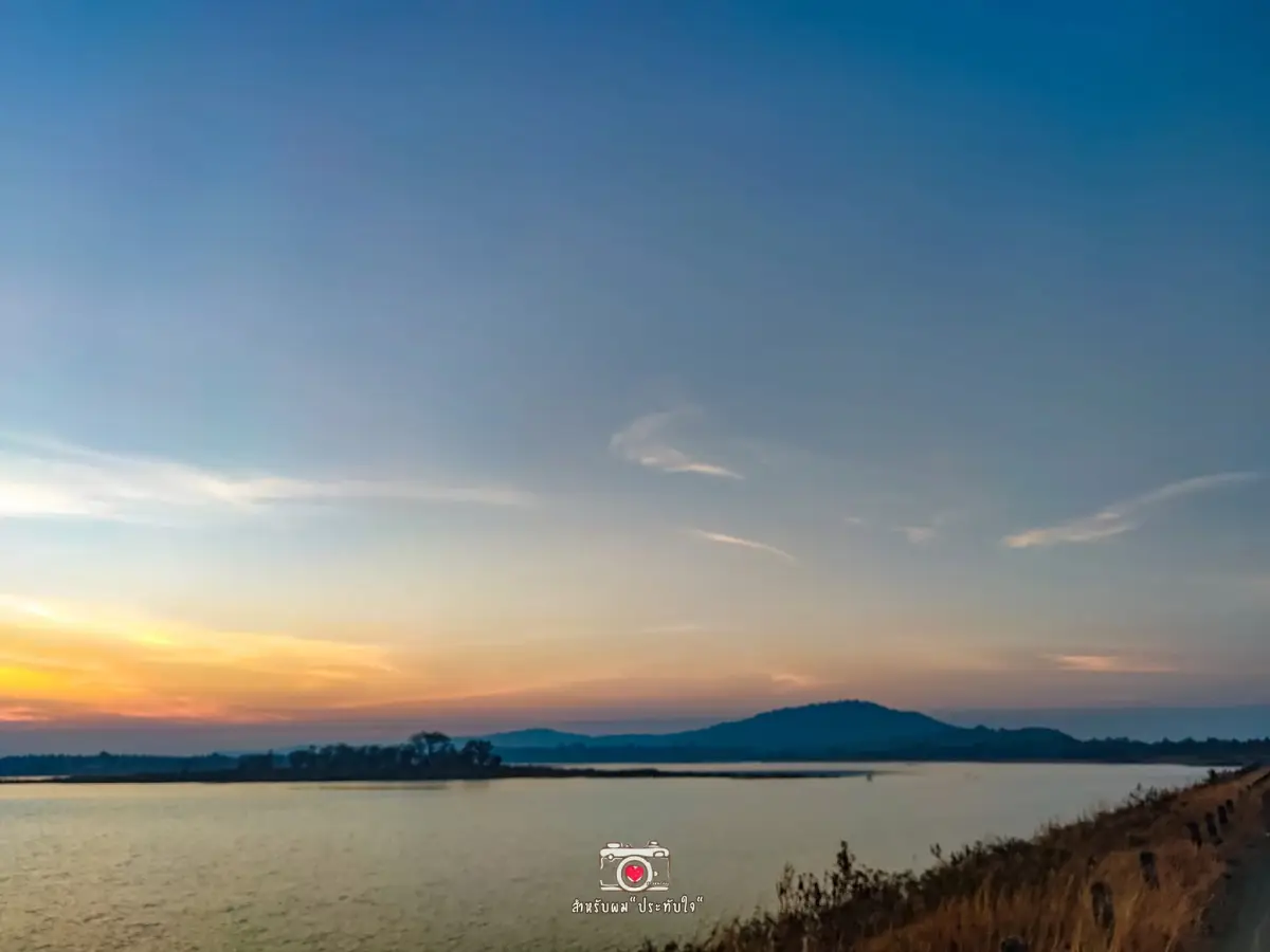
20. Huai Sabaek Reservoir in Bung Kha Subdistrict, Loeng Nok Tha District, is an important agricultural water source and a quiet recreational stop with broad reservoir views and a natural landscape.
Highlights: Wide water views, the reservoir embankment, surrounding hills and countryside, a peaceful atmosphere, and a convenient location for combining with Wat Phu Sung and other northern Yasothon attractions.
The reservoir's primary role is water management for surrounding agricultural areas. It therefore illustrates the close relationship between rural livelihoods, farming, and water infrastructure in Yasothon.
For visitors, the attraction is the open landscape and the contrast between water and surrounding higher ground. The environment is quieter than major city attractions and works well as a rest stop during a longer driving route.
Late afternoon is particularly pleasant because temperatures are lower and the light creates stronger reflections across the reservoir. Seasonal water levels can significantly change the appearance of the shoreline.
Visitors should avoid swimming in areas not designated for recreation and should take all rubbish away. The reservoir remains a working water resource for nearby communities.
Getting There: From Loeng Nok Tha, travel toward Bung Kha Subdistrict and follow local roads to Huai Sabaek Reservoir. Private transport is the most practical option.
Map (GPS):https://www.google.com/maps/dir/?api=1&destination=16.163595,104.701057&travelmode=driving
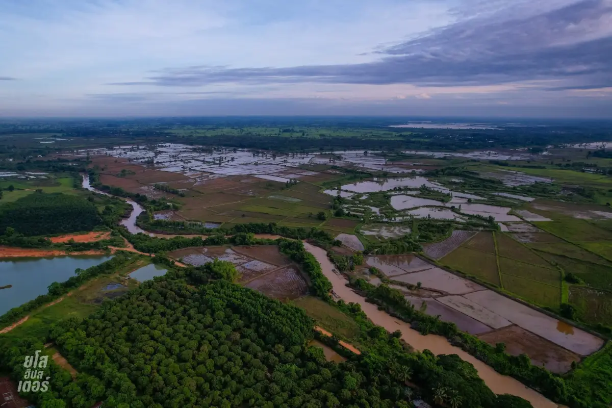
21. Yang Dam is an overflow weir on the Yang River near Ban Mai Chumphon in Mueang Yasothon District. It is important for local water management and agriculture while also offering a quiet riverside landscape.
Highlights: The broad overflow-weir structure, flowing water during periods of higher water levels, rural scenery, and a clear view of how water infrastructure supports nearby farming communities.
The Yang River is an important local waterway, and the weir helps slow and retain water for agricultural use. When water levels are high, water spreads across the structure in a wide sheet, creating a very different appearance from the drier months.
The surrounding countryside is especially green during the rainy season and after sustained rainfall. During drier periods, the structure of the weir and the form of the river channel become more visible.
The site also illustrates the close connection between water management and rice farming in Yasothon. Many surrounding fields depend on seasonal water availability and local irrigation systems.
Visitors should take extra care when water is high. Strong currents and slippery surfaces near the weir can be dangerous, so entering the water or approaching fast-flowing sections is not recommended.
Getting There: From Yasothon city, travel toward Doet Subdistrict and Ban Mai Chumphon, then follow local roads toward the Yang River. Private transport is the most convenient option.
Map (GPS):https://www.google.com/maps/dir/?api=1&destination=15.962860,104.033140&travelmode=driving
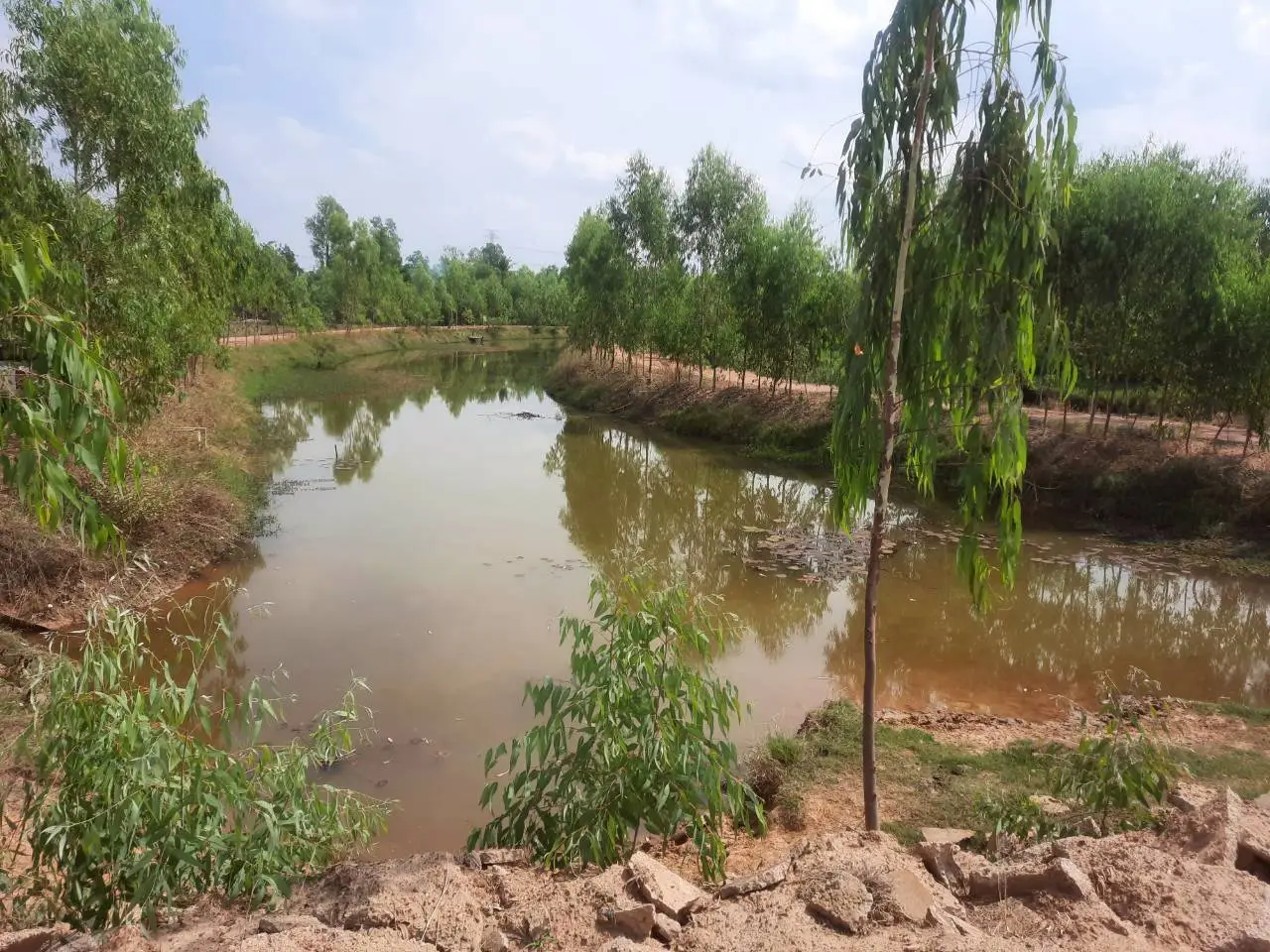
22. Bueng Phue Hi is a wetland in the Ban Phue Hi area of Na Samai Subdistrict, Mueang Yasothon District. It is valuable both ecologically and as a peaceful rural landscape for nature observation.
Highlights: Open wetland scenery, broad water views, birdwatching, rural surroundings, and attractive morning and evening light.
Wetlands such as Bueng Phue Hi provide habitat for birds, aquatic animals, and wetland plants while also supporting local communities with water and natural resources.
Morning is a good time for birdwatching and cooler temperatures, while late afternoon offers softer light and reflections across the water. On clear days, the open horizon creates a particularly calm atmosphere.
The wetland changes through the year. Rainy-season and post-rainy-season visits usually reveal higher water levels and greener vegetation, while drier months expose more shallow areas and wetland plants.
Bueng Phue Hi combines well with Ban Na Samai Village, allowing travelers to experience both local craft culture and a natural wetland landscape in the same route.
Getting There: From Yasothon city, travel toward Na Samai Subdistrict and Ban Phue Hi. Private transport is recommended for flexibility.
Map (GPS):https://www.google.com/maps/dir/?api=1&destination=15.921900,104.240600&travelmode=driving
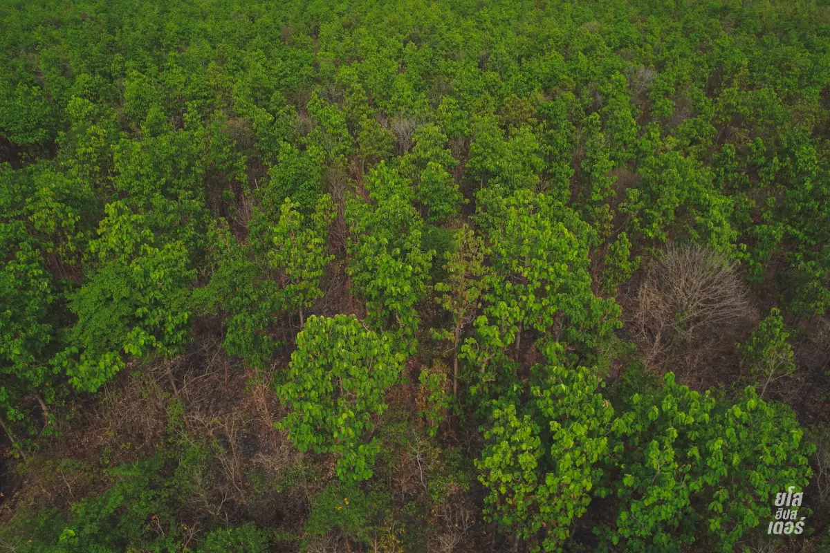
23. Dong Mafai National Forest Reserve is an important forest area in the Sai Mun region of Yasothon. It contributes to watershed protection, biodiversity, local food resources, and the ecological stability of surrounding agricultural communities.
Highlights: Natural forest, native vegetation, local ecological knowledge, community relationships with forest resources, and opportunities to understand the dry-forest landscapes of northeastern Thailand.
The forest supports surrounding communities in several ways, including moisture retention, habitat conservation, and seasonal resources such as mushrooms, bamboo shoots, and edible plants where community rules allow their collection.
A national forest reserve is different from a highly developed national park. Facilities and marked tourism routes may be limited, so visitors should regard conservation as the primary purpose of the area.
Seasonal change is pronounced. The rainy season brings dense green vegetation, while the dry season reveals a different forest structure and makes certain walking areas easier to access.
Travelers who want to enter deeper forest areas should obtain local guidance or check with responsible authorities rather than leaving established access routes.
Getting There: From Sai Mun District, travel toward Dong Mafai Subdistrict and surrounding forest areas. Private transport is recommended, and local advice should be sought before entering less accessible sections.
Map (GPS):https://www.google.com/maps/dir/?api=1&destination=15.994444,104.166111&travelmode=driving
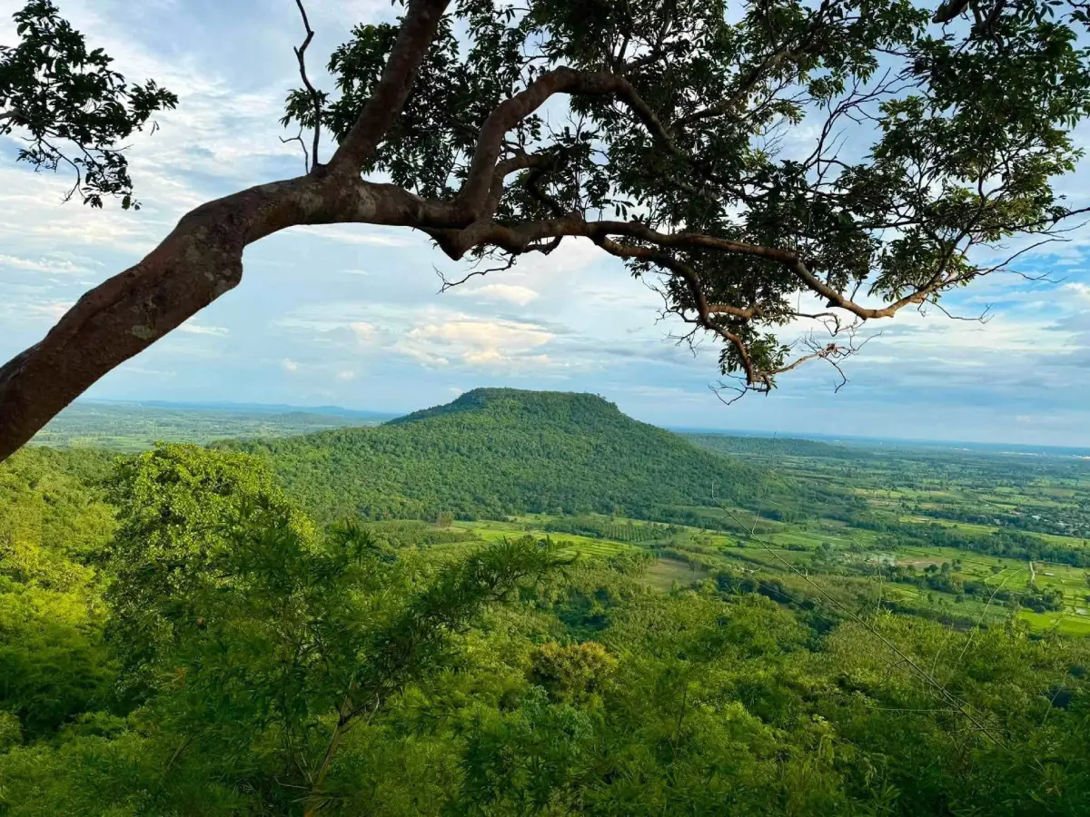
24. Dong Por and Dong Bang I National Forest Reserve is a large forest area in northern Yasothon with ecological importance for watershed protection, biodiversity, and communities living along the forest edge.
Highlights: Forest landscapes, higher terrain, watershed areas, native vegetation, and the relationship between conserved forest and nearby rural communities.
The forest helps store water, reduce soil erosion, and maintain habitat for plants and wildlife. Such forest areas are especially important in agricultural provinces where surrounding communities depend on reliable water and healthy soils.
Rainy-season conditions are lush and green, while the cooler months are generally more comfortable for nature observation and walking along accessible areas.
Visitors should focus on low-impact nature observation and avoid activities that disturb the forest. Birdwatching and plant observation are appropriate along accessible routes.
Road conditions can change after heavy rain, particularly on smaller tracks near the forest. Travelers should check local conditions before attempting remote access.
Getting There: From Loeng Nok Tha, travel toward the forest zone using local roads. Private transport is the most practical choice, and rainy-season road conditions should be checked before departure.
Map (GPS):https://www.google.com/maps/dir/?api=1&destination=16.103411,104.257023&travelmode=driving
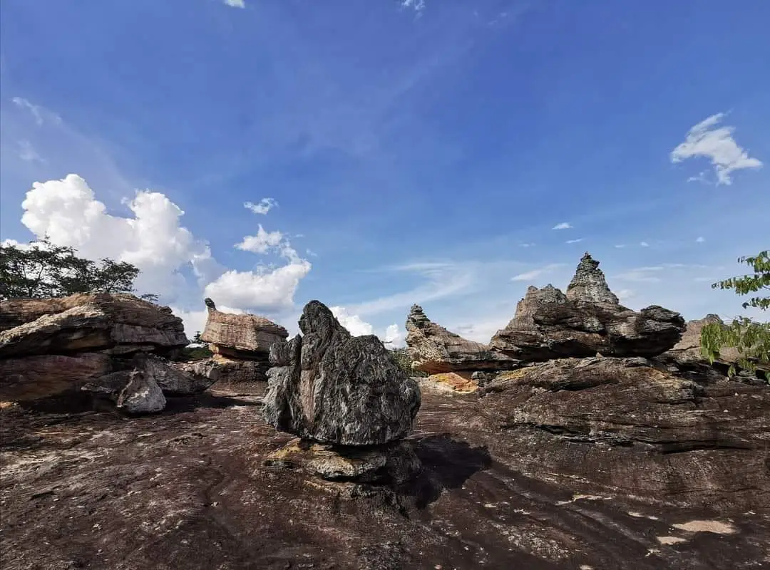
25. Phu Hin Pun is a forest-temple and hill destination in Kut Chum District. It combines Buddhist practice, natural surroundings, and elevated terrain in a quieter environment than temples in urban areas.
Highlights: A forest-temple setting, hill scenery, quiet natural surroundings, Buddhist devotional areas, and viewpoints across the surrounding countryside.
The site has a very different atmosphere from city temples because forest and higher ground remain important parts of the environment. This makes it suitable for travelers seeking a slower and more contemplative experience.
Forest monasteries traditionally favor quiet settings removed from dense settlement. The landscape therefore supports meditation, religious practice, and a simpler relationship between monastic life and nature.
Visitors should dress respectfully, keep noise low, and avoid disturbing monks or people practicing meditation. Suitable walking shoes and drinking water are useful, especially in hot weather.
Phu Hin Pun can be combined with Phu Mak Phrik as part of a Kut Chum nature-and-temple route. Rainy-season visits require extra care on wet or slippery paths.
Getting There: From Kut Chum District, travel toward Ban Na Mon and continue along local roads toward Phu Hin Pun. Private transport and GPS are recommended.
Map (GPS):https://www.google.com/maps/dir/?api=1&destination=16.141371,104.283650&travelmode=driving
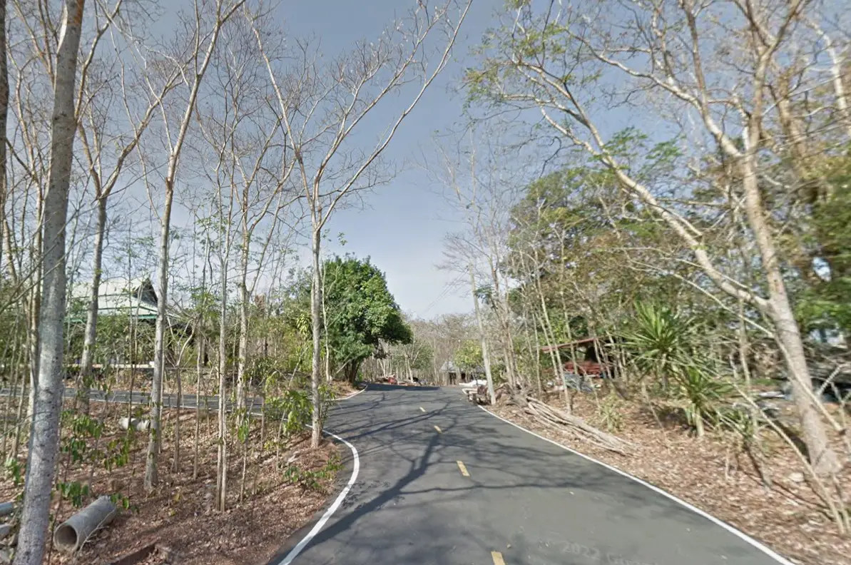
26. Phu Mak Phrik in Kut Chum District is a natural and religious hill area surrounded by forest. It is suitable for travelers looking for a peaceful environment rather than a heavily developed tourist attraction.
Highlights: Hill terrain, forest, a quiet temple atmosphere, natural scenery, and opportunities for slow exploration in a rural setting.
As the road approaches the hill, the landscape shifts from farmland and village areas toward denser vegetation and higher ground. This transition gives the destination a secluded character.
The attraction is well suited to travelers interested in nature and Buddhist forest traditions. Its value lies in quiet surroundings, natural sound, and the opportunity to spend time away from busier urban sites.
Visitors should bring suitable shoes and drinking water. The cooler season and early morning are particularly comfortable, while rainy-season trails can become slippery.
Phu Mak Phrik can be paired with Phu Hin Pun for a full-day route through the Kut Chum area, especially for travelers who prefer forest landscapes and religious sites.
Getting There: From Kut Chum District, continue toward Ban Thong Samrit and use local roads leading toward Phu Mak Phrik. Private transport is recommended.
Map (GPS):https://www.google.com/maps/dir/?api=1&destination=16.160258,104.296665&travelmode=driving
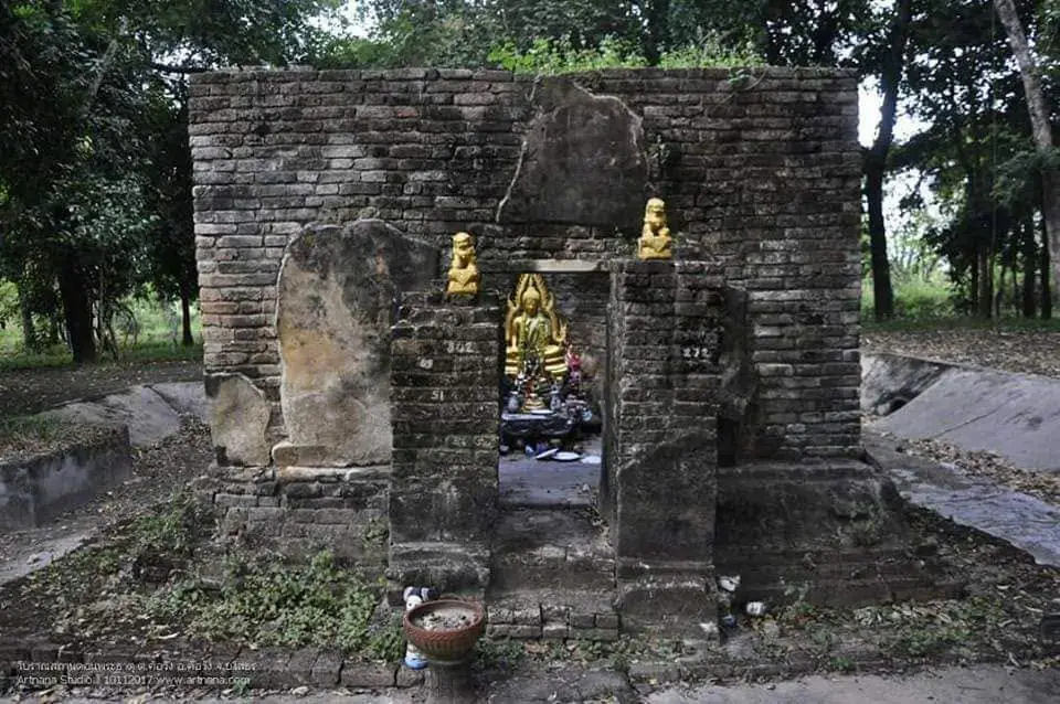
27. Don Phra That is an archaeological site in the Kho Wang area of southern Yasothon. Ancient brick remains and sacred-site traces lie within a community-forest setting, creating an atmosphere very different from the province's better-known urban attractions.
Highlights: Brick structural remains, traces of an old religious site, community forest, a quiet rural setting, and the relationship between archaeological heritage and the surrounding village landscape.
The surviving structures indicate that the area once had religious significance. The gradual return of vegetation around the remains also illustrates how former human spaces can become part of a natural landscape over time.
The attraction is not defined by a fully preserved monument. Its value lies in archaeological traces and the opportunity to read the location in relation to the surrounding community and forest.
Because the site lies in a community-forest environment, visitors should remain on established paths and avoid moving bricks, stones, or other archaeological material.
Don Phra That can be combined with Ban Mak Archaeological Site to create a cultural route through Kho Wang District and southern Yasothon.
Getting There: From Kho Wang District, travel toward the Ban Phi Phuan area and use local roads toward the community forest. Private transport and GPS are recommended.
Map (GPS):https://www.google.com/maps/dir/?api=1&destination=15.370000,104.320000&travelmode=driving
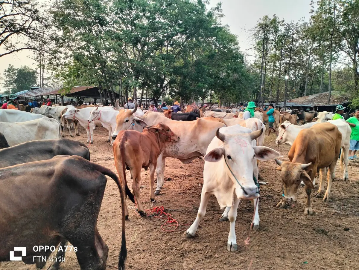
28. Cow-Krabue Market near Ban Chiang Wang in Mueang Yasothon is a livestock market that provides a direct view of the rural economy of northeastern Thailand. Unlike a conventional tourist market, its central activity is the actual trading of cattle and buffalo among farmers, livestock owners, and traders.
Highlights: Traditional livestock trading, cattle and buffalo, farmer-to-trader negotiation, and an authentic view of rural economic life.
Cattle and buffalo have long played important roles in Isan agriculture as working animals, household assets, and livestock. Although machinery has replaced much animal labor, livestock markets continue to be economically important.
The atmosphere differs greatly from a souvenir or food market. Visitors may see animals being inspected, negotiated over, moved, and loaded, alongside conversations between buyers and sellers from different areas.
The market is most interesting when trading activity is underway. Visitors should stay aware of large animals, avoid standing directly behind them, and never touch or feed livestock without the owner's permission.
For travelers interested in agriculture, rural society, and living economic traditions, the market offers a side of Yasothon that contrasts sharply with temples, old towns, and natural attractions.
Getting There: From Yasothon city, travel toward Ban Chiang Wang in Samran Subdistrict. Private transport is the most convenient option.
Map (GPS):https://www.google.com/maps/dir/?api=1&destination=15.832876,104.111151&travelmode=driving
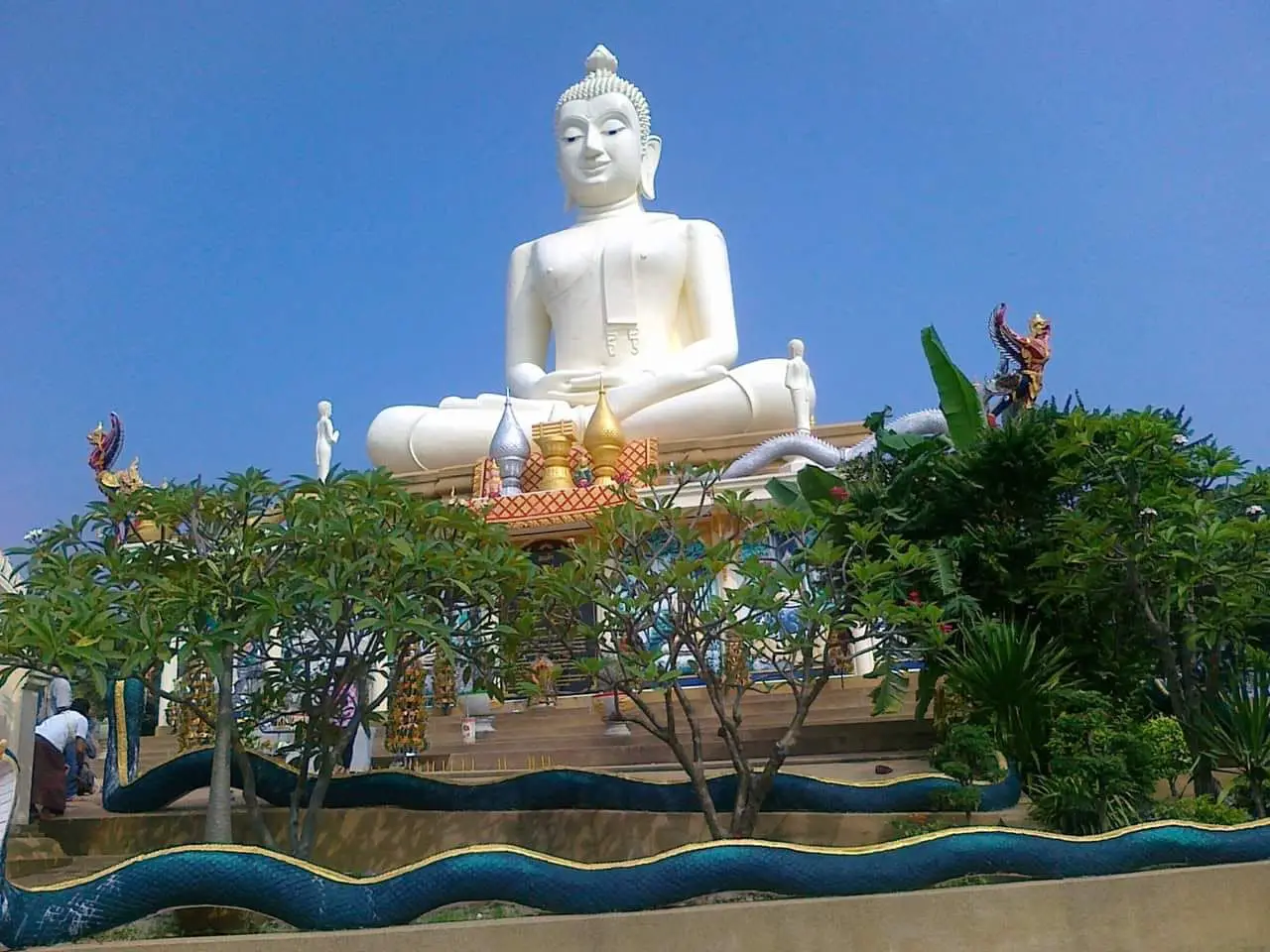
29. Wat Phu Sung, also known as Phu Sung Buddhist Park, is a hilltop temple in Bung Kha Subdistrict, Loeng Nok Tha District. It combines religious devotion with elevated views across the surrounding landscape.
Highlights: A large white Buddha image, hilltop viewpoints, forest and mountain scenery, Buddhist devotional areas, and a peaceful atmosphere suited to worship and quiet reflection.
The large white Buddha image is the visual focus of the site and can be seen from surrounding areas. Its elevated position gives the temple a distinctive identity within the Loeng Nok Tha landscape.
From higher areas visitors can look across forest, farmland, and surrounding countryside. Morning and late afternoon provide cooler temperatures and better light for photography.
The hilltop environment also creates a quieter atmosphere than many lowland temples. Visitors should dress respectfully and keep noise low around meditation or worship areas.
Wat Phu Sung works particularly well with Huai Sabaek Reservoir as part of a northern Yasothon route.
Getting There: From Loeng Nok Tha, travel toward Bung Kha Subdistrict and Ban Nong Khae Noi, then follow local roads up to the temple area. Private transport is the easiest option.
Map (GPS):https://www.google.com/maps/dir/?api=1&destination=16.157944,104.643217&travelmode=driving
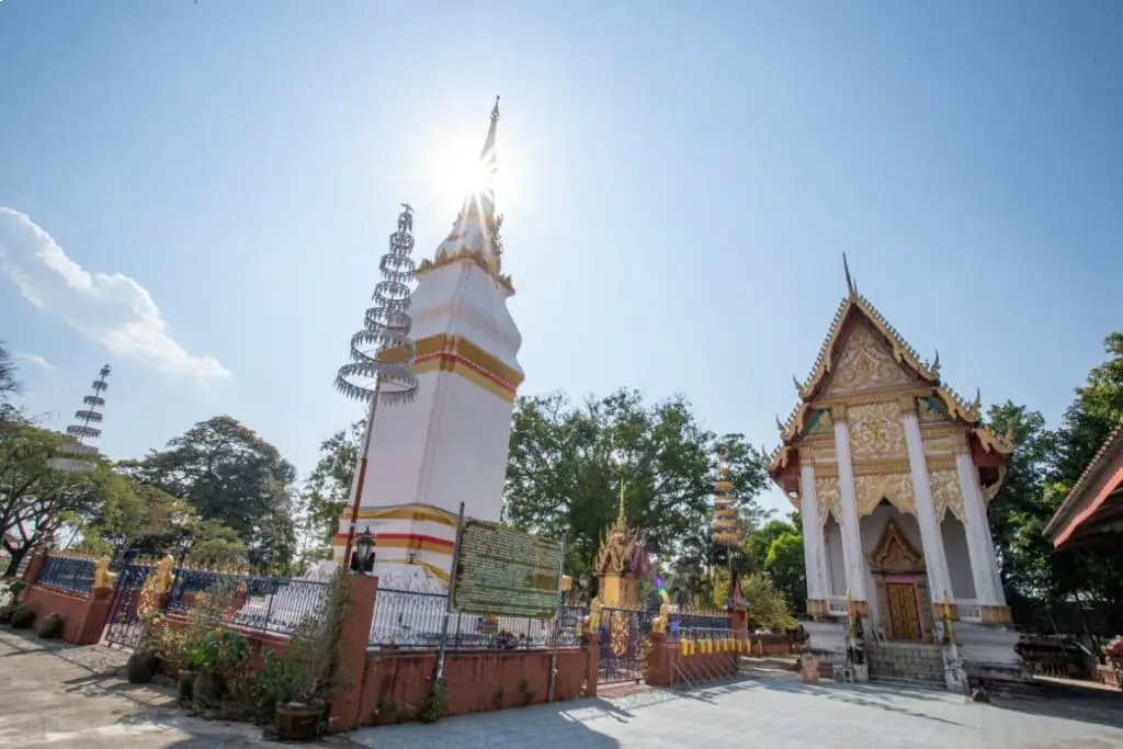
30. Phra That Phon Than in Kham Khuean Kaeo District is a local sacred stupa that remains closely connected with community faith. Like many stupas in northeastern Thailand, it functions as a religious monument, ritual space, and focal point of local identity.
Highlights: The stupa itself, local religious devotion, a peaceful rural temple atmosphere, and a convenient location for combining with Ku Chan and Don Mueang Toei Archaeological Site.
In Isan communities, stupas often hold meaning beyond architecture. They may be connected with local history, annual merit-making, worship, and community memory, giving them an active role in present-day religious life.
Phra That Phon Than has a quiet local atmosphere and is particularly suitable for travelers who prefer community religious sites without large tourist crowds.
Visitors should dress respectfully and avoid disturbing ceremonies or worship. Observing how local people use and care for the site can provide useful insight into the everyday role of Buddhism in rural Yasothon.
For travelers interested in history and archaeology, the stupa can be the final stop on a Kham Khuean Kaeo route beginning at Don Mueang Toei and continuing to Ku Chan.
Getting There: From Kham Khuean Kaeo District, travel into Phon Than Subdistrict using local roads. Private transport is the most practical option.
Map (GPS):https://www.google.com/maps/dir/?api=1&destination=15.687746,104.267863&travelmode=driving
Suggested Yasothon Itineraries: 1–4 Days Yasothon's attractions are spread across several districts, so grouping destinations by area is the most efficient way to reduce backtracking and spend more time at each place.
1 Day: Focus on Mueang Yasothon. Start at Phaya Thaen Public Park, continue to Wat Mahathat and Ban Sing Tha Old Town, then visit Phra Sunthon Ratchawongsa Monument, Ban Tat Thong Archaeological Site, and Phra That Kong Khao Noi. Return to the city for an Isan dinner in the evening.
2 Days: Use the first day for central Yasothon. On the second day, travel to Kham Khuean Kaeo District for Don Mueang Toei Archaeological Site, Ku Chan, and Phra That Phon Than. This route gives a strong introduction to archaeology, religious history, and community heritage.
3 Days: Add a craft-and-community day with Ban Si Than Khit Pillow Village, Ban Thung Nang Ok, and Ban Na Samai Village, finishing at Bueng Phue Hi or Kut Kaloeb in the late afternoon.
4 Days: Use the final day for northern Yasothon. A practical route can include Ban Song Yae Christian Church, Phu Tham Phra, Wat Phu Sung, and Huai Sabaek Reservoir. Travelers interested in southern archaeology can alternatively dedicate the day to Ban Mak Archaeological Site and Don Phra That in Kho Wang District.
| Central Yasothon Zone | Phaya Thaen Public Park, Wat Mahathat, Ban Sing Tha Old Town, Phra That Kong Khao Noi, Ban Tat Thong Archaeological Site, and Phra Sunthon Ratchawongsa Monument. Best for first-time visitors, city history, temples, and Yasothon's cultural identity. |
| Kham Khuean Kaeo Zone | Don Mueang Toei Archaeological Site, Ku Chan, and Phra That Phon Than. Best for archaeology, ancient settlement history, sacred sites, and rural cultural landscapes. |
| Sai Mun–Kut Chum Zone | Ho Trai Wat Sa Trai Nurak, Dong Mafai National Forest Reserve, Phu Hin Pun, and Phu Mak Phrik. Best for vernacular architecture, forest temples, hills, and nature. |
| Loeng Nok Tha–Thai Charoen Zone | Phu Tham Phra, Wat Phu Sung, Huai Sabaek Reservoir, and Ban Song Yae Christian Church. Best for mountain scenery, religious diversity, and northern Yasothon road trips. |
| Temples and Sacred Sites | Wat Mahathat, Phra That Kong Khao Noi, Ho Trai Wat Sa Trai Nurak, Ku Chan, Phra That Phon Than, Wat Phu Sung, Phu Tham Phra, and Ban Song Yae Christian Church. |
| History and Archaeology | Ban Sing Tha Old Town, Don Mueang Toei Archaeological Site, Ban Tat Thong Archaeological Site, Ban Mak Archaeological Site, Phra Sunthon Ratchawongsa Monument, Phra That Kong Khao Noi, and Don Phra That. |
| Communities and Handicrafts | Ban Si Than Khit Pillow Village, Ban Thung Nang Ok, Ban Na Samai Village, and Nong Ueng Royal Development Project. |
| Nature and Water Attractions | Chi River, Wang Matcha, Kut Kaloeb, Bueng Phue Hi, Yang Dam, Huai Sabaek Reservoir, Dong Mafai National Forest Reserve, Dong Por and Dong Bang I National Forest Reserve, Phu Hin Pun, and Phu Mak Phrik. |
| Food to Try | Som tam, larb, koi, tom saep, kaeng om, grilled chicken, river fish, jaew dipping sauces, seasonal vegetables, sticky rice, and dishes made with locally grown agricultural ingredients. |
| Souvenirs | Khit pillows and reclining pillows from Ban Si Than, bamboo basketry, sticky-rice containers, community products, jasmine rice, and locally processed agricultural goods. |
| Where to Stay: Mueang Yasothon | The best general base for city attractions, restaurants, markets, and day trips to surrounding districts. |
| Where to Stay: Loeng Nok Tha | Useful for travelers focusing on Phu Tham Phra, Wat Phu Sung, Huai Sabaek Reservoir, and other northern attractions. |
| Best Time to Visit | November–February for comfortable outdoor travel; May for the Bun Bang Fai Rocket Festival; rainy season and early cool season for greener forests, wetlands, and reservoirs. |
| Getting Around | Central attractions are relatively easy to reach, but many destinations are spread across rural districts. A private car, rental car, or hired vehicle is the most practical option for multi-zone itineraries. |
| Outdoor Safety | Check weather and road conditions in the rainy season, wear suitable footwear, avoid slippery rocks and unknown water depths, and remain on established routes in forest areas. |
| Temple and Community Etiquette | Dress respectfully, keep voices low, avoid interrupting ceremonies, ask permission before photographing people, and support local producers by buying directly from communities when possible. |
Frequently Asked Questions (FAQ)
Q: What are the must-see attractions in Yasothon?
A: First-time visitors should prioritize Phaya Thaen Public Park, Wat Mahathat, Ban Sing Tha Old Town, Phra That Kong Khao Noi, Ban Tat Thong Archaeological Site, and Ho Trai Wat Sa Trai Nurak. Travelers interested in nature can add Phu Tham Phra, Wat Phu Sung, Huai Sabaek Reservoir, and the province's forest and wetland areas.
Q: What should I visit if I only have 1 day in Yasothon?
A: Focus on Mueang Yasothon. Visit Phaya Thaen Public Park, Wat Mahathat, Ban Sing Tha Old Town, Phra Sunthon Ratchawongsa Monument, Ban Tat Thong Archaeological Site, and Phra That Kong Khao Noi, then return to the city for dinner.
Q: How many days should I spend in Yasothon?
A: One day is enough for the main city attractions, but 3–4 days are better if you want to include Kham Khuean Kaeo, craft villages, Kut Chum, Loeng Nok Tha, Thai Charoen, and southern archaeological sites.
Q: What is the best time of year to visit Yasothon?
A: November to February is generally the most comfortable period for outdoor travel. May is especially important for the Bun Bang Fai Rocket Festival, while the rainy season is best for greener landscapes, wetlands, forests, and reservoirs.
Q: What is Yasothon's most famous festival?
A: The Bun Bang Fai Rocket Festival is Yasothon's best-known tradition. It is connected with rainmaking beliefs, Phaya Thaen, agriculture, procession culture, music, dance, and the beginning of the rice-growing season.
Q: Where should history and archaeology travelers go?
A: Don Mueang Toei Archaeological Site, Ban Tat Thong Archaeological Site, Ban Mak Archaeological Site, Phra Sunthon Ratchawongsa Monument, Ku Chan, Phra That Phon Than, Don Phra That, and Phra That Kong Khao Noi are particularly relevant.
Q: Where can I experience local handicrafts?
A: Ban Si Than is the best-known community for khit pillows, while Ban Thung Nang Ok and Ban Na Samai are useful for learning about bamboo basketry, sticky-rice containers, woodworking, and household crafts.
Q: What natural attractions are worth visiting?
A: Phu Tham Phra, Phu Hin Pun, Phu Mak Phrik, Dong Mafai National Forest Reserve, Dong Por and Dong Bang I National Forest Reserve, Huai Sabaek Reservoir, Bueng Phue Hi, Kut Kaloeb, the Chi River, and Yang Dam are among the main nature-oriented options.
Q: What food should I try in Yasothon?
A: Try som tam, larb, koi, tom saep, kaeng om, grilled chicken, river fish, jaew, seasonal vegetables, sticky rice, and dishes using fermented fish and locally grown ingredients.
Q: What should I buy as a souvenir from Yasothon?
A: Popular choices include khit pillows and reclining pillows from Ban Si Than, bamboo basketry, sticky-rice containers, jasmine rice, and locally processed agricultural products.
Q: Where should I stay for a multi-day Yasothon trip?
A: Mueang Yasothon is the most convenient overall base. Travelers spending substantial time in northern Yasothon can consider staying around Loeng Nok Tha to reduce driving.
Q: Can I travel around Yasothon without a private car?
A: Some central attractions can be reached by local transport, but many sites are spread across rural districts. A private car, rental car, or hired vehicle is much more practical for a multi-stop itinerary.
Q: How should I group attractions to avoid backtracking?
A: Organize the trip by zones: central Yasothon, Kham Khuean Kaeo, Pa Tio–Sai Mun–Kut Chum, Loeng Nok Tha–Thai Charoen, and Kho Wang. Complete one area before moving to the next.
Q: What should I prepare for forest, hill, and reservoir attractions?
A: Check the weather and road conditions, especially during the rainy season. Bring drinking water, suitable footwear, and sun or rain protection, and avoid unknown water depths or unmarked forest routes.
Q: What should I know before visiting during the Rocket Festival?
A: Book accommodation early, allow extra travel time, expect heavier traffic around central Yasothon, and follow designated viewing areas and event safety instructions.
 Category: ●Travel Articles, Recipes
 Group: ●Travel Review, Food Review
Last Update : 3 WeekAgo
 Last Update : 3 WeekAgo

 Art, Culture and Heritage
 Historical Sites and Monuments(6)
 Landmarks and Memorials(1)
 Art, Craft Centres, Tradition(4)
 Museums(1)
 Historic Homes and Cities(1)
 Places of Worship
 Temple(22)
 Church(1)
 Other Sacred Sites(10)
 Research and Development
 Royal Project(2)
 Suburban Living
 Village, Community(3)
 Local Market(1)
 Nature and Wildlife
 National Parks and Marine Reserves(2)
 Mountain (Doi)(2)
 Dam, Reservoir, Lake(7)
 River, Canal(2)
 Bays and Beaches(1)
 Other natural attractions(2)
 Entertainment and Agricultural
 Farms, Parks and Ecotourism(1)
Travel Review, Food Review(2)


