
lovethailand home >Northeastern Travel Attractions >Bueng Kan Travel Attractions > 30 Best Places to Visit in Bueng Kan Northeastern ..
TL;DR: 30 Best Places to Visit in Bueng Kan Northeastern Thailand, open Friday and Saturday Opening Hours: 17:00 – 20:00.
30 Best Places to Visit in Bueng Kan Northeastern Thailand
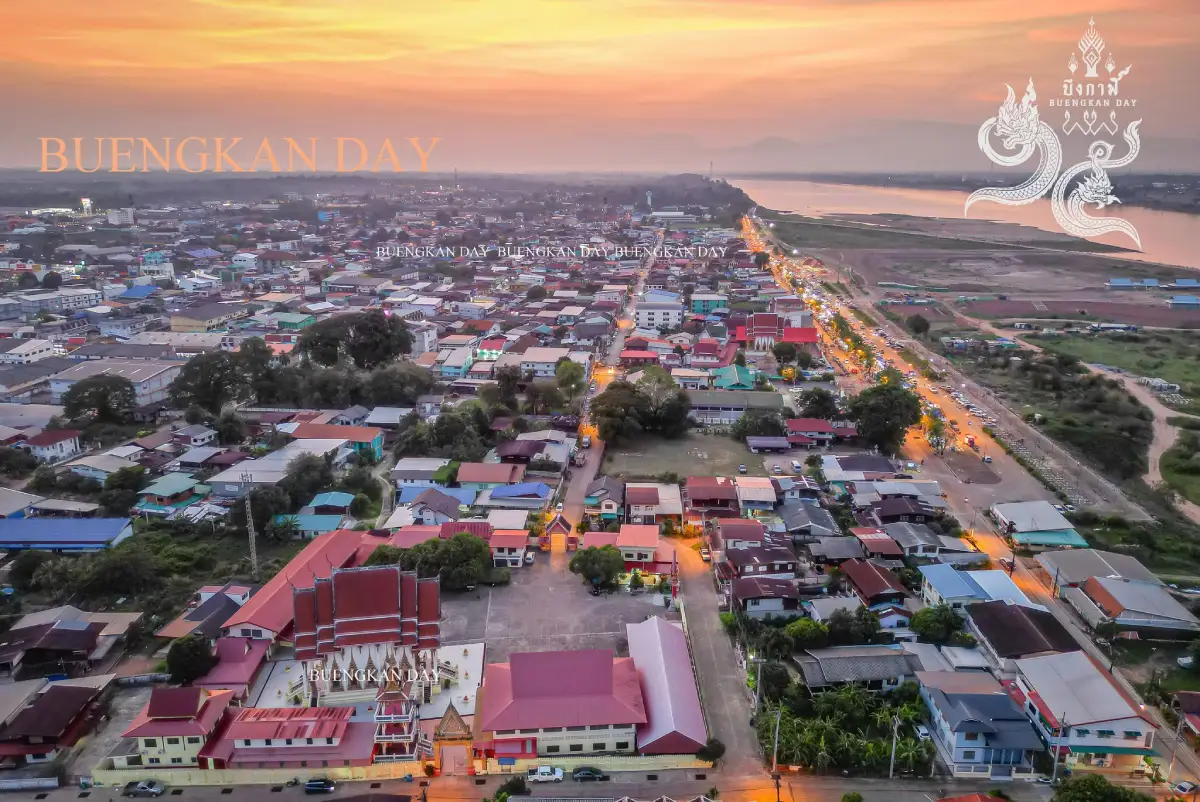
30 Best Places to Visit in Bueng Kan, Northeastern Thailand Bueng Kan offers 30 distinctive attractions, from Phu Thok, Bueng Khong Long and Phu Wua Wildlife Sanctuary to Wat Ahong Silawat, Kaeng Ahong, Three Whale Rock and Naka Cave. This Mekong-border province combines sandstone mountains, waterfalls, wetlands, Buddhist landmarks and community culture. One day is best devoted to the town and riverfront; two or three days allow time for Phu Sing, Phu Thok and Bueng Khong Long. Access to protected waterfalls and trails depends on official announcements.
Bueng Kan became Thailand’s 77th province on 23 March 2011 after separating from Nong Khai. It comprises eight districts: Mueang Bueng Kan, Pak Khat, Bung Khla, Seka, Phon Charoen, Si Wilai, Bueng Khong Long and So Phisai. The Mekong River defines much of the provincial setting, while inland forests and sandstone highlands offer markedly different landscapes.
The town and riverfront are well suited to discovering local life, temples and the border landscape. Phu Sing and Three Whale Rock are famous for sandstone scenery, while Phu Thok is known for its cliffside wooden walkways. The Bueng Khong Long and Phu Langka areas bring together wetlands, Naka Cave and devotional destinations. The Phu Wua forest contains several waterfalls with seasonal access conditions.
Local livelihoods are shaped by agriculture, border trade and northeastern Thai culture. Regional food features sticky rice, herbs, vegetables and fish. Merit-making traditions and Naga folklore remain prominent in community stories, creating travel experiences that combine natural scenery with religion, cuisine and everyday life.
Planning by area is more practical than moving repeatedly between distant districts. The city and Mekong are suitable for a first day, with Phu Sing and Three Whale Rock grouped together. Bueng Khong Long and Phu Langka deserve separate time. Visits to Phu Wua waterfalls depend on the routes authorized by rangers and water conditions on the day.
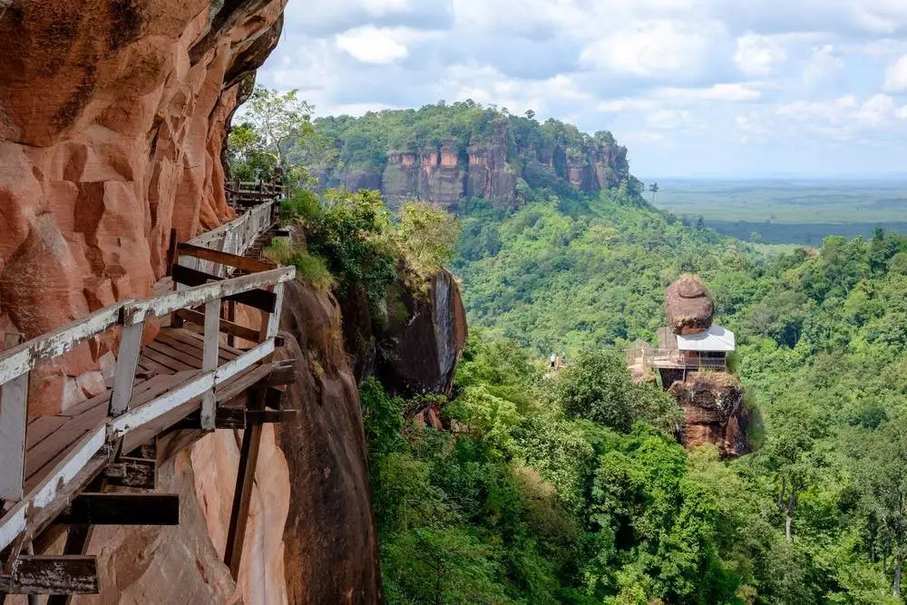
1. Phu Thok A sandstone mountain housing Wat Jetiyakhiri Wihan, known for wooden walkways winding around seven levels of cliffs. It is both a meditation site and a dramatic viewpoint.
Highlights: Wooden cliff walkways and a Buddhist sanctuary
The defining character of Phu Thok changes with the seasons and the condition of the surrounding landscape. Sandstone, streams, forests and wetlands create different views during wetter and drier periods. The experience is therefore shaped by rainfall, vegetation, water levels and the trails that are officially accessible.
Bueng Kan’s natural areas are closely connected to its forests and drainage systems. Its combination of sandstone mountains and lowland waters offers contrasting ecosystems, making geographic planning more useful than treating every attraction as an identical roadside stop.
Outdoor safety at Phu Thok depends on current conditions. Natural paths may contain slippery rock, channels or steep sections; sites within protected areas have rules that differ from ordinary public spaces. Visitors must follow the routes and entry conditions established by local authorities.
Beyond the viewpoint itself, Phu Thok reveals the natural character of Si Wilai. Combined with attractions in the same district, it helps illustrate a province shaped by mountains, the Mekong and major wetlands.
Getting There: Reach Wat Jetiyakhiri Wihan from Si Wilai District, then follow the designated mountain paths
Map (GPS):Open Google Maps – Phu Thok
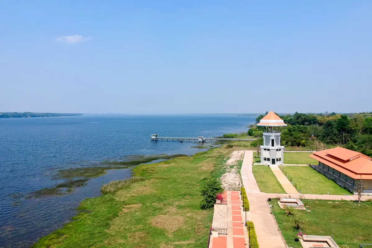
2. Bueng Khong Long Wetland A major wetland supporting aquatic habitats and fishing communities, closely associated with stories of Pu U Lue and Naga traditions.
Highlights: Lake scenery and waterside community life
The defining character of Bueng Khong Long Wetland changes with the seasons and the condition of the surrounding landscape. Sandstone, streams, forests and wetlands create different views during wetter and drier periods. The experience is therefore shaped by rainfall, vegetation, water levels and the trails that are officially accessible.
Bueng Kan’s natural areas are closely connected to its forests and drainage systems. Its combination of sandstone mountains and lowland waters offers contrasting ecosystems, making geographic planning more useful than treating every attraction as an identical roadside stop.
Outdoor safety at Bueng Khong Long Wetland depends on current conditions. Natural paths may contain slippery rock, channels or steep sections; sites within protected areas have rules that differ from ordinary public spaces. Visitors must follow the routes and entry conditions established by local authorities.
Beyond the viewpoint itself, Bueng Khong Long Wetland reveals the natural character of Bueng Khong Long. Combined with attractions in the same district, it helps illustrate a province shaped by mountains, the Mekong and major wetlands.
Getting There: Reach Bueng Khong Long District and use public access areas along the lakeshore
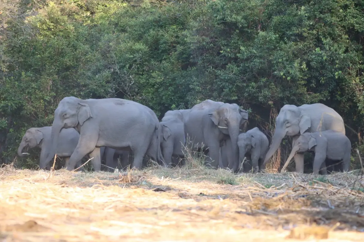
3. Phu Wua Wildlife Sanctuary A protected sandstone mountain forest supporting watersheds, wildlife and several waterfalls.
Highlights: Protected forest and wildlife conservation
The defining character of Phu Wua Wildlife Sanctuary changes with the seasons and the condition of the surrounding landscape. Sandstone, streams, forests and wetlands create different views during wetter and drier periods. The experience is therefore shaped by rainfall, vegetation, water levels and the trails that are officially accessible.
Bueng Kan’s natural areas are closely connected to its forests and drainage systems. Its combination of sandstone mountains and lowland waters offers contrasting ecosystems, making geographic planning more useful than treating every attraction as an identical roadside stop.
Outdoor safety at Phu Wua Wildlife Sanctuary depends on current conditions. Natural paths may contain slippery rock, channels or steep sections; sites within protected areas have rules that differ from ordinary public spaces. Visitors must follow the routes and entry conditions established by local authorities.
Beyond the viewpoint itself, Phu Wua Wildlife Sanctuary reveals the natural character of Seka and Bung Khla. Combined with attractions in the same district, it helps illustrate a province shaped by mountains, the Mekong and major wetlands.
Getting There: Contact the sanctuary for officially accessible nature-study routes
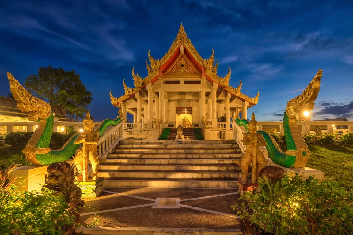
4. Wat Ahong Silawat A Mekong-side Buddhist temple associated with Kaeng Ahong and the local belief concerning the navel of the Mekong.
Highlights: Mekong-side temple grounds and Kaeng Ahong
Wat Ahong Silawat is part of Bueng Kan’s religious landscape, where Buddhism and local traditions are deeply connected to community life. Religious sites serve as spaces for merit-making, ceremonies and quiet reflection, as well as places of cultural interest.
The appeal of Wat Ahong Silawat includes its devotional setting and the surrounding landscape. Visitors can observe local customs while respecting worshippers, dressing appropriately and avoiding disruption to religious activities.
Bueng Kan offers different forms of spiritual tourism, from riverside temples to mountain sanctuaries and shrines connected with local legends. Together, these places show how communities attach cultural meanings to their natural surroundings.
Exploring Wat Ahong Silawat together with other places in Mueang Bueng Kan provides a more complete understanding of local traditions and community history, with ample time to appreciate the setting.
Getting There: Follow Highway 212 from central Bueng Kan to Wat Ahong Silawat
Map (GPS):Open Google Maps – Wat Ahong Silawat
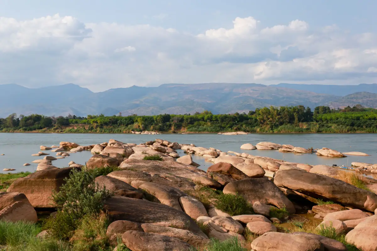
5. Kaeng Ahong A Mekong rapid near Wat Ahong Silawat, significant for river scenery and traditions concerning the navel of the Mekong.
Highlights: Mekong rapids and local river traditions
Kaeng Ahong adds another perspective to visiting Bueng Kan, reflecting how the area of Mueang Bueng Kan has developed beyond its well-known mountains and Buddhist sites.
The appeal of the destination is connected to its local setting, community activities and the experience of exploring a less familiar part of the province.
It makes sense to combine this destination with others in the same geographic area rather than repeatedly crossing long distances between districts.
Kaeng Ahong therefore adds variety to a journey through the province, linking local life, the landscape and regional travel.
Getting There: Travel via Highway 212 to Wat Ahong Silawat and use permitted riverside viewing areas
Map (GPS):Open Google Maps – Kaeng Ahong
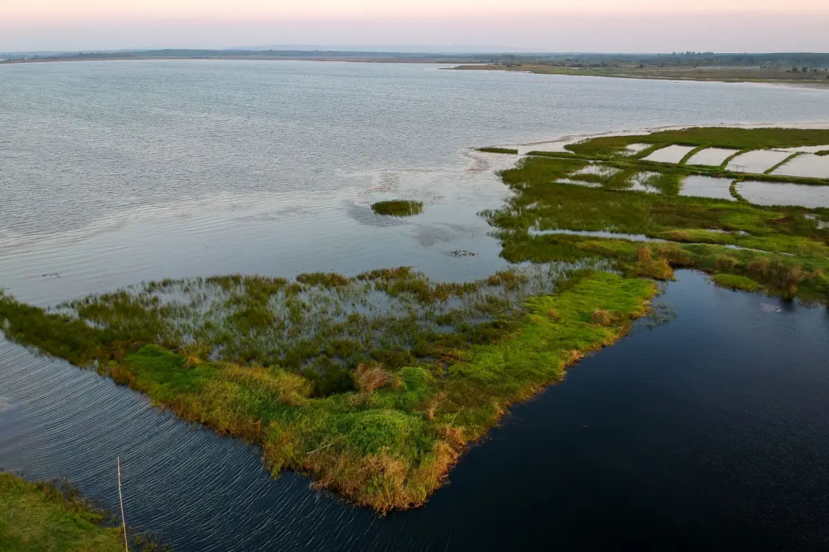
6. Nong Kut Thing Wetland An ecologically important wetland supporting aquatic biodiversity and surrounding community life.
Highlights: Wetland ecology and open-water scenery
The defining character of Nong Kut Thing Wetland changes with the seasons and the condition of the surrounding landscape. Sandstone, streams, forests and wetlands create different views during wetter and drier periods. The experience is therefore shaped by rainfall, vegetation, water levels and the trails that are officially accessible.
Bueng Kan’s natural areas are closely connected to its forests and drainage systems. Its combination of sandstone mountains and lowland waters offers contrasting ecosystems, making geographic planning more useful than treating every attraction as an identical roadside stop.
Outdoor safety at Nong Kut Thing Wetland depends on current conditions. Natural paths may contain slippery rock, channels or steep sections; sites within protected areas have rules that differ from ordinary public spaces. Visitors must follow the routes and entry conditions established by local authorities.
Beyond the viewpoint itself, Nong Kut Thing Wetland reveals the natural character of Mueang Bueng Kan. Combined with attractions in the same district, it helps illustrate a province shaped by mountains, the Mekong and major wetlands.
Getting There: Travel from central Bueng Kan toward Nong Kut Thing Wetland
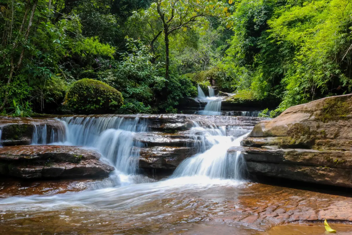
7. Tat Kinnaree Waterfall A sandstone waterfall and stream in Pho Mak Khaeng, associated with the Phu Langka forest landscape.
Highlights: Sandstone cascades near Phu Langka
The defining character of Tat Kinnaree Waterfall changes with the seasons and the condition of the surrounding landscape. Sandstone, streams, forests and wetlands create different views during wetter and drier periods. The experience is therefore shaped by rainfall, vegetation, water levels and the trails that are officially accessible.
Bueng Kan’s natural areas are closely connected to its forests and drainage systems. Its combination of sandstone mountains and lowland waters offers contrasting ecosystems, making geographic planning more useful than treating every attraction as an identical roadside stop.
Outdoor safety at Tat Kinnaree Waterfall depends on current conditions. Natural paths may contain slippery rock, channels or steep sections; sites within protected areas have rules that differ from ordinary public spaces. Visitors must follow the routes and entry conditions established by local authorities.
Beyond the viewpoint itself, Tat Kinnaree Waterfall reveals the natural character of Bueng Khong Long. Combined with attractions in the same district, it helps illustrate a province shaped by mountains, the Mekong and major wetlands.
Getting There: Travel to Pho Mak Khaeng and follow the access route available to visitors
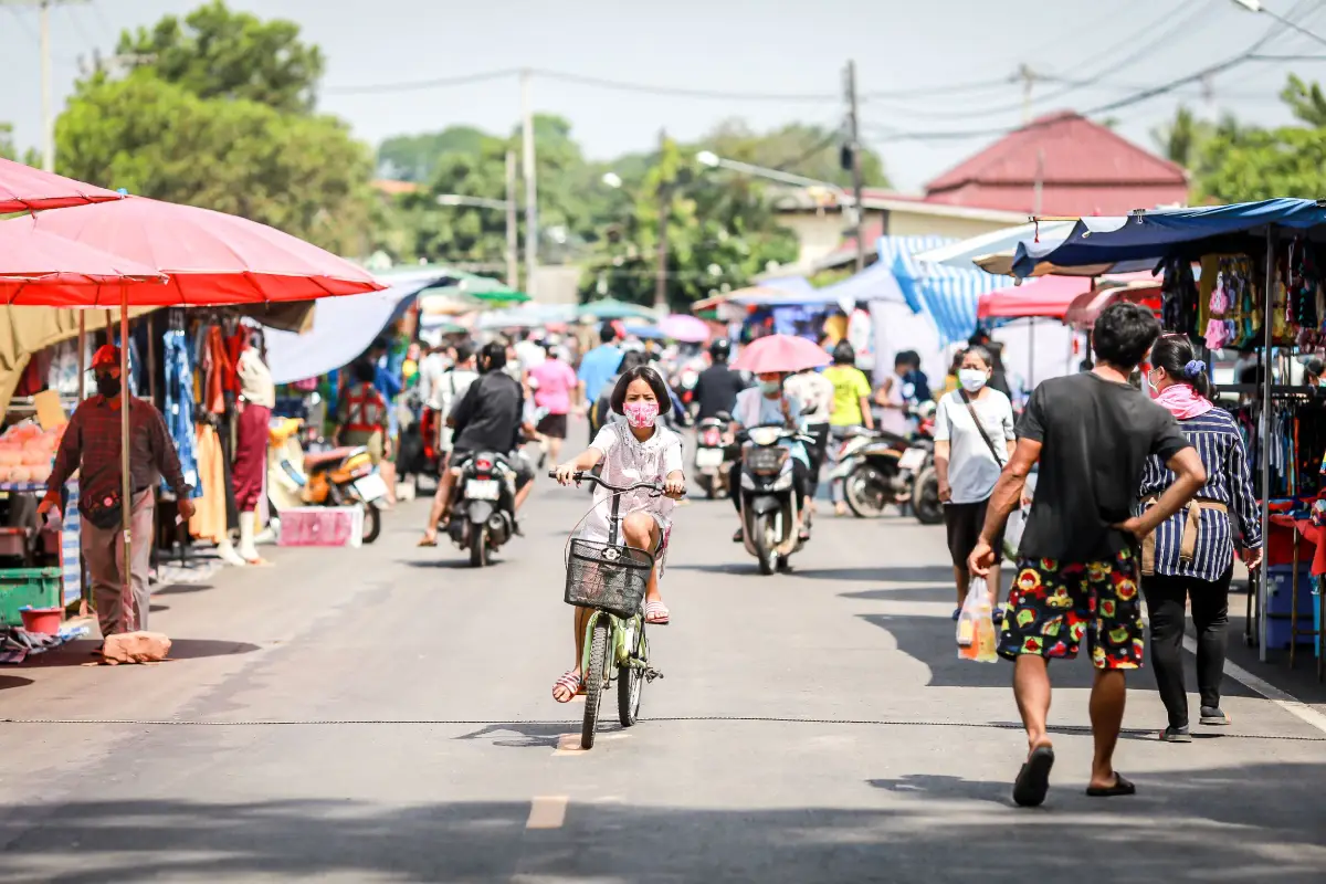
8. Bueng Kan Thai–Lao Market A local border market reflecting trade and everyday life between communities on both sides of the Mekong, distinct from the evening walking street.
Highlights: Agricultural produce and border trade
The defining character of Bueng Kan Thai–Lao Market changes with the seasons and the condition of the surrounding landscape. Sandstone, streams, forests and wetlands create different views during wetter and drier periods. The experience is therefore shaped by rainfall, vegetation, water levels and the trails that are officially accessible.
Bueng Kan’s natural areas are closely connected to its forests and drainage systems. Its combination of sandstone mountains and lowland waters offers contrasting ecosystems, making geographic planning more useful than treating every attraction as an identical roadside stop.
Outdoor safety at Bueng Kan Thai–Lao Market depends on current conditions. Natural paths may contain slippery rock, channels or steep sections; sites within protected areas have rules that differ from ordinary public spaces. Visitors must follow the routes and entry conditions established by local authorities.
Beyond the viewpoint itself, Bueng Kan Thai–Lao Market reveals the natural character of Mueang Bueng Kan. Combined with attractions in the same district, it helps illustrate a province shaped by mountains, the Mekong and major wetlands.
Getting There: Reach the Thai–Lao market area in central Bueng Kan
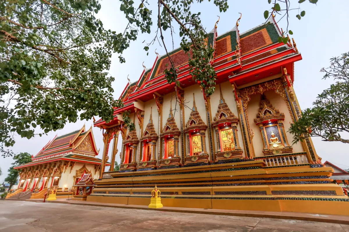
9. Wat Photharam An important temple at Ban Tha Khrai, housing Luang Pho Phra Yai, a revered Buddha image among local communities.
Highlights: Revered Luang Pho Phra Yai Buddha image
Wat Photharam is part of Bueng Kan’s religious landscape, where Buddhism and local traditions are deeply connected to community life. Religious sites serve as spaces for merit-making, ceremonies and quiet reflection, as well as places of cultural interest.
The appeal of Wat Photharam includes its devotional setting and the surrounding landscape. Visitors can observe local customs while respecting worshippers, dressing appropriately and avoiding disruption to religious activities.
Bueng Kan offers different forms of spiritual tourism, from riverside temples to mountain sanctuaries and shrines connected with local legends. Together, these places show how communities attach cultural meanings to their natural surroundings.
Exploring Wat Photharam together with other places in Mueang Bueng Kan provides a more complete understanding of local traditions and community history, with ample time to appreciate the setting.
Getting There: Travel from central Bueng Kan to Ban Tha Khrai via the Highway 212 corridor
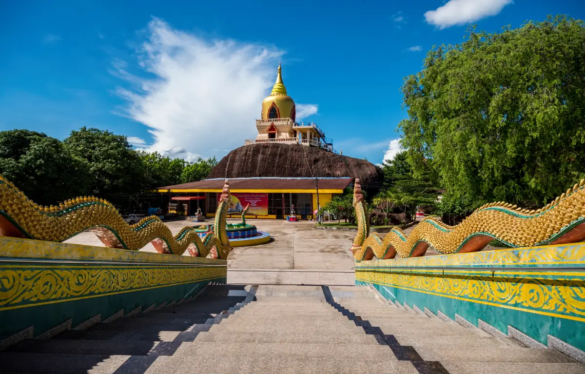
10. Wat Sawang Arom (Wat Tham Si Thon) A Buddhist temple combining rocky hill scenery and a place of worship in the Pak Khat area.
Highlights: Rocky temple setting and surrounding views
The defining character of Wat Sawang Arom (Wat Tham Si Thon) changes with the seasons and the condition of the surrounding landscape. Sandstone, streams, forests and wetlands create different views during wetter and drier periods. The experience is therefore shaped by rainfall, vegetation, water levels and the trails that are officially accessible.
Bueng Kan’s natural areas are closely connected to its forests and drainage systems. Its combination of sandstone mountains and lowland waters offers contrasting ecosystems, making geographic planning more useful than treating every attraction as an identical roadside stop.
Outdoor safety at Wat Sawang Arom (Wat Tham Si Thon) depends on current conditions. Natural paths may contain slippery rock, channels or steep sections; sites within protected areas have rules that differ from ordinary public spaces. Visitors must follow the routes and entry conditions established by local authorities.
Beyond the viewpoint itself, Wat Sawang Arom (Wat Tham Si Thon) reveals the natural character of Pak Khat. Combined with attractions in the same district, it helps illustrate a province shaped by mountains, the Mekong and major wetlands.
Getting There: Travel into Pak Khat District and follow local access roads to the temple
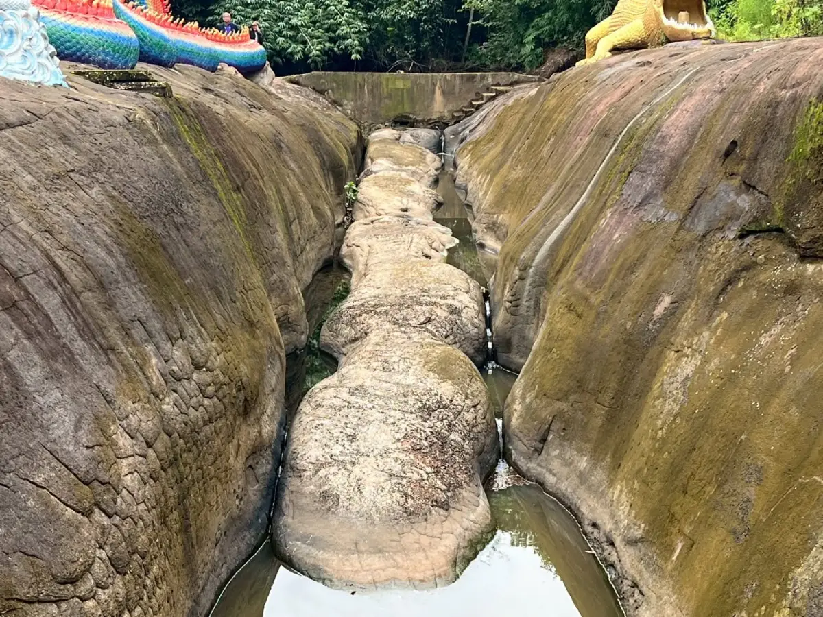
11. Huai Hin Haep A distinctive rock formation within Huai Hin Haep Monastery at Ban Non Sila, resembling a crocodile or Naga resting in a narrow water channel.
Highlights: Crocodile-shaped rock and Naga-related devotional features
The defining character of Huai Hin Haep changes with the seasons and the condition of the surrounding landscape. Sandstone, streams, forests and wetlands create different views during wetter and drier periods. The experience is therefore shaped by rainfall, vegetation, water levels and the trails that are officially accessible.
Bueng Kan’s natural areas are closely connected to its forests and drainage systems. Its combination of sandstone mountains and lowland waters offers contrasting ecosystems, making geographic planning more useful than treating every attraction as an identical roadside stop.
Outdoor safety at Huai Hin Haep depends on current conditions. Natural paths may contain slippery rock, channels or steep sections; sites within protected areas have rules that differ from ordinary public spaces. Visitors must follow the routes and entry conditions established by local authorities.
Beyond the viewpoint itself, Huai Hin Haep reveals the natural character of Bueng Khong Long. Combined with attractions in the same district, it helps illustrate a province shaped by mountains, the Mekong and major wetlands.
Getting There: Travel to Ban Non Sila in Pho Mak Khaeng Subdistrict, Bueng Khong Long
Map (GPS):Open Google Maps – Huai Hin Haep
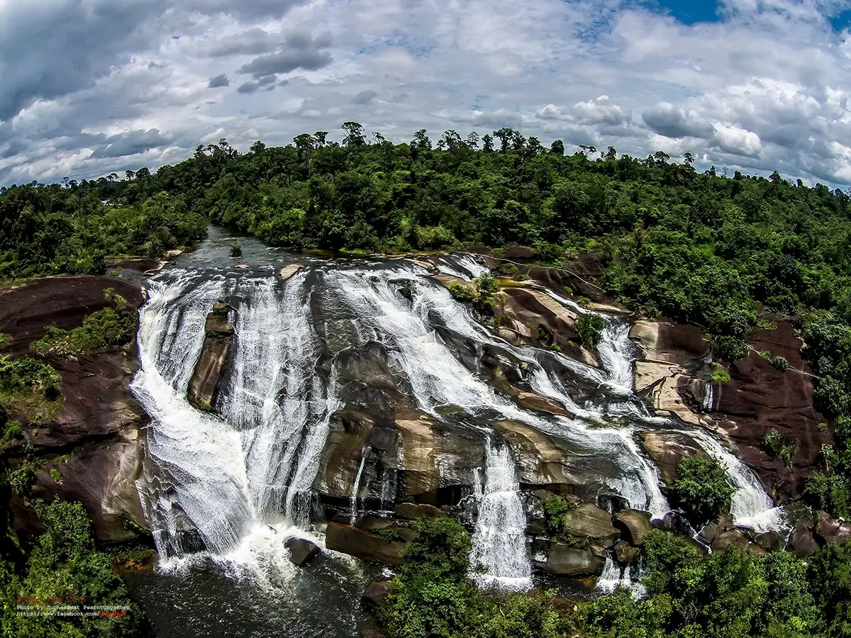
12. Tat Chanaen Waterfall A sandstone waterfall in Phu Wua with two principal levels and Khua Hin, a natural stone bridge under which a stream flows.
Highlights: Khua Hin natural stone bridge and sandstone streams
The defining character of Tat Chanaen Waterfall changes with the seasons and the condition of the surrounding landscape. Sandstone, streams, forests and wetlands create different views during wetter and drier periods. The experience is therefore shaped by rainfall, vegetation, water levels and the trails that are officially accessible.
Bueng Kan’s natural areas are closely connected to its forests and drainage systems. Its combination of sandstone mountains and lowland waters offers contrasting ecosystems, making geographic planning more useful than treating every attraction as an identical roadside stop.
Outdoor safety at Tat Chanaen Waterfall depends on current conditions. Natural paths may contain slippery rock, channels or steep sections; sites within protected areas have rules that differ from ordinary public spaces. Visitors must follow the routes and entry conditions established by local authorities.
Beyond the viewpoint itself, Tat Chanaen Waterfall reveals the natural character of Seka and Bung Khla. Combined with attractions in the same district, it helps illustrate a province shaped by mountains, the Mekong and major wetlands.
Tat Chanaen is known for Khua Hin, a naturally formed stone bridge under which a stream flows, and two principal waterfall levels within Phu Wua. Entry remains subject to wildlife sanctuary permissions.
Getting There: Approach via Ban Chaiyaphon and Ban Phu Ngoen, subject to Chanaen ranger access restrictions
Map (GPS):Open Google Maps – Tat Chanaen Waterfall
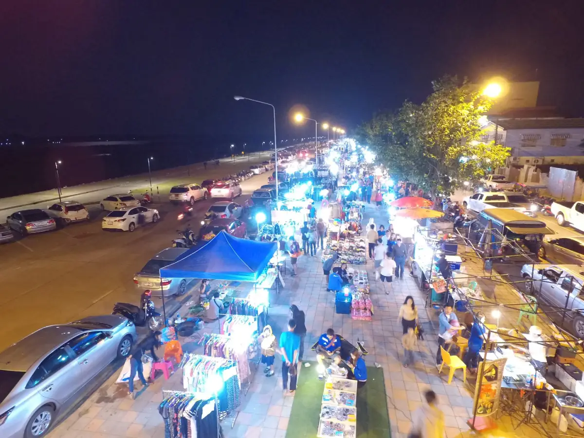
13. Bueng Kan Walking Street An evening walking street on Khao Mao Riverside Road, combining local food stalls and community life with views of the Mekong.
Highlights: Local food and the evening Mekong waterfront
The defining character of Bueng Kan Walking Street changes with the seasons and the condition of the surrounding landscape. Sandstone, streams, forests and wetlands create different views during wetter and drier periods. The experience is therefore shaped by rainfall, vegetation, water levels and the trails that are officially accessible.
Bueng Kan’s natural areas are closely connected to its forests and drainage systems. Its combination of sandstone mountains and lowland waters offers contrasting ecosystems, making geographic planning more useful than treating every attraction as an identical roadside stop.
Outdoor safety at Bueng Kan Walking Street depends on current conditions. Natural paths may contain slippery rock, channels or steep sections; sites within protected areas have rules that differ from ordinary public spaces. Visitors must follow the routes and entry conditions established by local authorities.
Beyond the viewpoint itself, Bueng Kan Walking Street reveals the natural character of Mueang Bueng Kan. Combined with attractions in the same district, it helps illustrate a province shaped by mountains, the Mekong and major wetlands.
Open Days: Friday and Saturday Opening Hours: 17:00 – 20:00
Getting There: Travel to central Bueng Kan and continue to Khao Mao Riverside Road
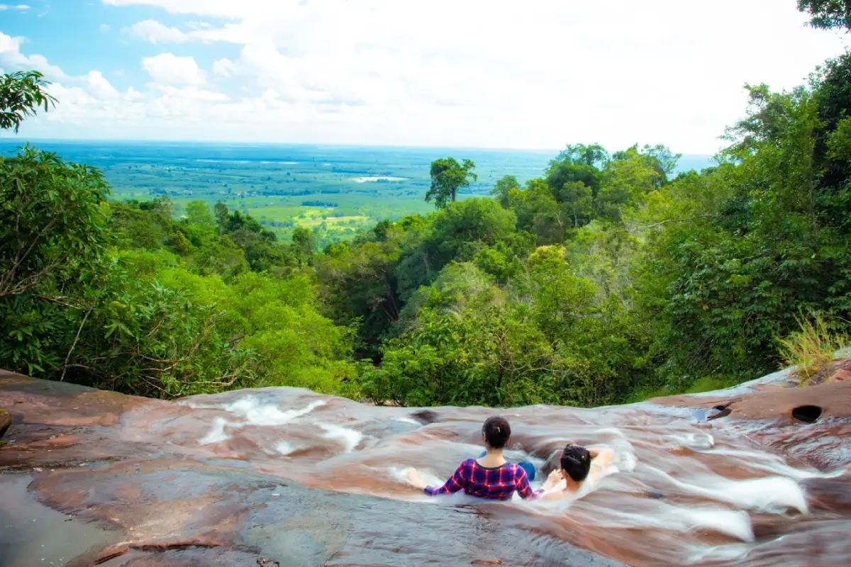
14. Tat Wimanthip Waterfall A multi-level sandstone waterfall in the Phu Langka forest, with seasonal flow and natural approach trails.
Highlights: Cascades and sandstone terraces
The defining character of Tat Wimanthip Waterfall changes with the seasons and the condition of the surrounding landscape. Sandstone, streams, forests and wetlands create different views during wetter and drier periods. The experience is therefore shaped by rainfall, vegetation, water levels and the trails that are officially accessible.
Bueng Kan’s natural areas are closely connected to its forests and drainage systems. Its combination of sandstone mountains and lowland waters offers contrasting ecosystems, making geographic planning more useful than treating every attraction as an identical roadside stop.
Outdoor safety at Tat Wimanthip Waterfall depends on current conditions. Natural paths may contain slippery rock, channels or steep sections; sites within protected areas have rules that differ from ordinary public spaces. Visitors must follow the routes and entry conditions established by local authorities.
Beyond the viewpoint itself, Tat Wimanthip Waterfall reveals the natural character of Bueng Khong Long. Combined with attractions in the same district, it helps illustrate a province shaped by mountains, the Mekong and major wetlands.
Getting There: Approach through Pho Mak Khaeng Subdistrict, subject to authorized trail access
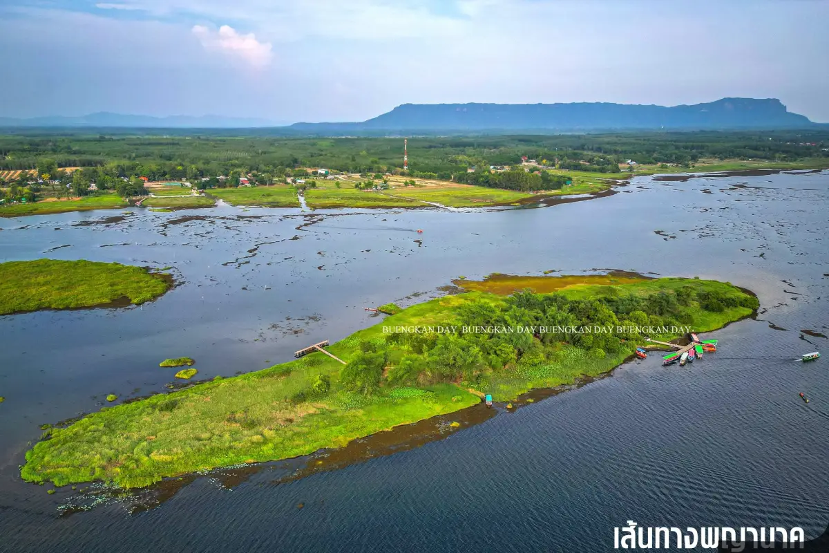
15. Ko Don Pho An island associated with the Bueng Khong Long waterscape and local traditions, providing a different perspective on the lake.
Highlights: Island scenery and the surrounding wetland
The defining character of Ko Don Pho changes with the seasons and the condition of the surrounding landscape. Sandstone, streams, forests and wetlands create different views during wetter and drier periods. The experience is therefore shaped by rainfall, vegetation, water levels and the trails that are officially accessible.
Bueng Kan’s natural areas are closely connected to its forests and drainage systems. Its combination of sandstone mountains and lowland waters offers contrasting ecosystems, making geographic planning more useful than treating every attraction as an identical roadside stop.
Outdoor safety at Ko Don Pho depends on current conditions. Natural paths may contain slippery rock, channels or steep sections; sites within protected areas have rules that differ from ordinary public spaces. Visitors must follow the routes and entry conditions established by local authorities.
Beyond the viewpoint itself, Ko Don Pho reveals the natural character of Bueng Khong Long. Combined with attractions in the same district, it helps illustrate a province shaped by mountains, the Mekong and major wetlands.
Getting There: Travel to Bueng Khong Long District and use locally authorized island access
Map (GPS):Open Google Maps – Ko Don Pho
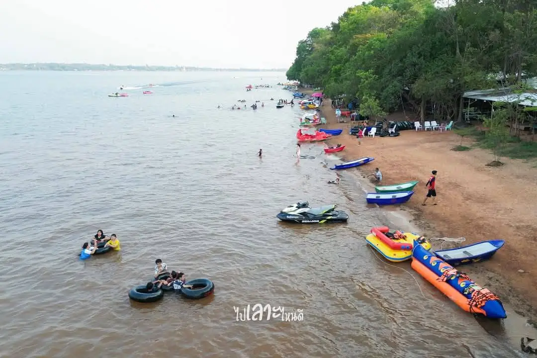
16. Hat Kham Sombun A recreational lakeshore area with dining options and wide-open wetland views, contrasting with nearby mountain attractions.
Highlights: Relaxing and dining beside Bueng Khong Long
The defining character of Hat Kham Sombun changes with the seasons and the condition of the surrounding landscape. Sandstone, streams, forests and wetlands create different views during wetter and drier periods. The experience is therefore shaped by rainfall, vegetation, water levels and the trails that are officially accessible.
Bueng Kan’s natural areas are closely connected to its forests and drainage systems. Its combination of sandstone mountains and lowland waters offers contrasting ecosystems, making geographic planning more useful than treating every attraction as an identical roadside stop.
Outdoor safety at Hat Kham Sombun depends on current conditions. Natural paths may contain slippery rock, channels or steep sections; sites within protected areas have rules that differ from ordinary public spaces. Visitors must follow the routes and entry conditions established by local authorities.
Beyond the viewpoint itself, Hat Kham Sombun reveals the natural character of Bueng Khong Long. Combined with attractions in the same district, it helps illustrate a province shaped by mountains, the Mekong and major wetlands.
Getting There: Travel from Bueng Khong Long town to Hat Kham Sombun on the lakeshore
Map (GPS):Open Google Maps – Hat Kham Sombun
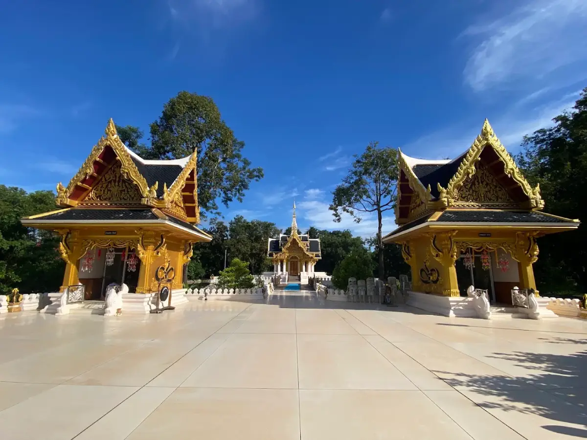
17. Pu U Lue Nakarat Shrine A shrine closely associated with the legend of Pu U Lue and the Naga traditions of Bueng Khong Long.
Highlights: Shrine worship and the legend of Pu U Lue
Pu U Lue Nakarat Shrine is part of Bueng Kan’s religious landscape, where Buddhism and local traditions are deeply connected to community life. Religious sites serve as spaces for merit-making, ceremonies and quiet reflection, as well as places of cultural interest.
The appeal of Pu U Lue Nakarat Shrine includes its devotional setting and the surrounding landscape. Visitors can observe local customs while respecting worshippers, dressing appropriately and avoiding disruption to religious activities.
Bueng Kan offers different forms of spiritual tourism, from riverside temples to mountain sanctuaries and shrines connected with local legends. Together, these places show how communities attach cultural meanings to their natural surroundings.
Exploring Pu U Lue Nakarat Shrine together with other places in Bueng Khong Long provides a more complete understanding of local traditions and community history, with ample time to appreciate the setting.
Getting There: Reach Bueng Khong Long District and follow local roads to the shrine
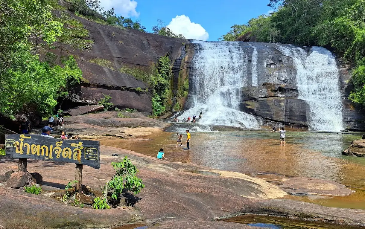
18. Chet Si Waterfall A waterfall in Phu Wua Wildlife Sanctuary where spray may reflect rainbow colours under suitable sunlight, surrounded by natural forest trails.
Highlights: Sunlit spray and Phu Wua forest
The defining character of Chet Si Waterfall changes with the seasons and the condition of the surrounding landscape. Sandstone, streams, forests and wetlands create different views during wetter and drier periods. The experience is therefore shaped by rainfall, vegetation, water levels and the trails that are officially accessible.
Bueng Kan’s natural areas are closely connected to its forests and drainage systems. Its combination of sandstone mountains and lowland waters offers contrasting ecosystems, making geographic planning more useful than treating every attraction as an identical roadside stop.
Outdoor safety at Chet Si Waterfall depends on current conditions. Natural paths may contain slippery rock, channels or steep sections; sites within protected areas have rules that differ from ordinary public spaces. Visitors must follow the routes and entry conditions established by local authorities.
Beyond the viewpoint itself, Chet Si Waterfall reveals the natural character of Seka. Combined with attractions in the same district, it helps illustrate a province shaped by mountains, the Mekong and major wetlands.
Getting There: Enter through the authorized Chet Si Waterfall access point in Seka District
Map (GPS):Open Google Maps – Chet Si Waterfall
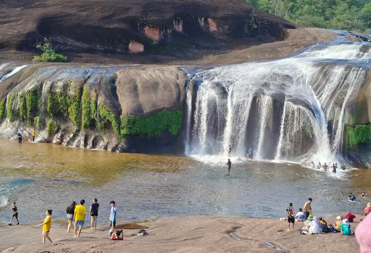
19. Tham Phra Waterfall A broad sandstone waterfall in the Phu Wua forest landscape, reached through seasonal boat and walking access arrangements.
Highlights: Broad sheets of water over sandstone
The defining character of Tham Phra Waterfall changes with the seasons and the condition of the surrounding landscape. Sandstone, streams, forests and wetlands create different views during wetter and drier periods. The experience is therefore shaped by rainfall, vegetation, water levels and the trails that are officially accessible.
Bueng Kan’s natural areas are closely connected to its forests and drainage systems. Its combination of sandstone mountains and lowland waters offers contrasting ecosystems, making geographic planning more useful than treating every attraction as an identical roadside stop.
Outdoor safety at Tham Phra Waterfall depends on current conditions. Natural paths may contain slippery rock, channels or steep sections; sites within protected areas have rules that differ from ordinary public spaces. Visitors must follow the routes and entry conditions established by local authorities.
Beyond the viewpoint itself, Tham Phra Waterfall reveals the natural character of Seka. Combined with attractions in the same district, it helps illustrate a province shaped by mountains, the Mekong and major wetlands.
Getting There: Go to the designated Tham Phra access area in Seka District and follow the operating boat or trail arrangements
Map (GPS):Open Google Maps – Tham Phra Waterfall
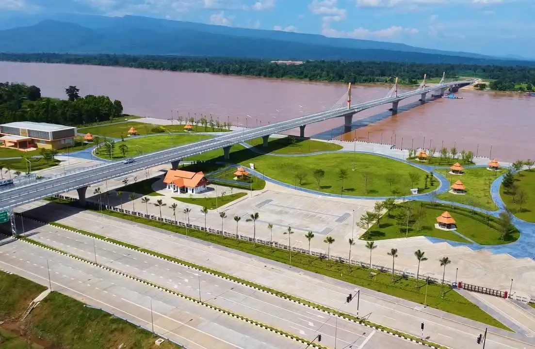
20. Fifth Thai–Lao Friendship Bridge A major cross-border transport link connecting Bueng Kan with Bolikhamxay in Laos across the Mekong River.
Highlights: Cross-border bridge and Mekong panorama
Fifth Thai–Lao Friendship Bridge adds another perspective to visiting Bueng Kan, reflecting how the area of Mueang Bueng Kan has developed beyond its well-known mountains and Buddhist sites.
The appeal of the destination is connected to its local setting, community activities and the experience of exploring a less familiar part of the province.
It makes sense to combine this destination with others in the same geographic area rather than repeatedly crossing long distances between districts.
Fifth Thai–Lao Friendship Bridge therefore adds variety to a journey through the province, linking local life, the landscape and regional travel.
Getting There: Follow the bridge approach road in Bueng Kan and remain within authorized public areas
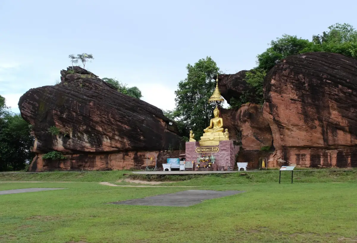
21. Phu Sing A broad forest and sandstone landscape containing unusual rock formations, viewpoints and Three Whale Rock.
Highlights: Sandstone landscapes and nature viewpoints
The defining character of Phu Sing changes with the seasons and the condition of the surrounding landscape. Sandstone, streams, forests and wetlands create different views during wetter and drier periods. The experience is therefore shaped by rainfall, vegetation, water levels and the trails that are officially accessible.
Bueng Kan’s natural areas are closely connected to its forests and drainage systems. Its combination of sandstone mountains and lowland waters offers contrasting ecosystems, making geographic planning more useful than treating every attraction as an identical roadside stop.
Outdoor safety at Phu Sing depends on current conditions. Natural paths may contain slippery rock, channels or steep sections; sites within protected areas have rules that differ from ordinary public spaces. Visitors must follow the routes and entry conditions established by local authorities.
Beyond the viewpoint itself, Phu Sing reveals the natural character of Mueang Bueng Kan. Combined with attractions in the same district, it helps illustrate a province shaped by mountains, the Mekong and major wetlands.
Getting There: Use the designated Phu Sing protected-area entrance in Mueang Bueng Kan
Map (GPS):Open Google Maps – Phu Sing
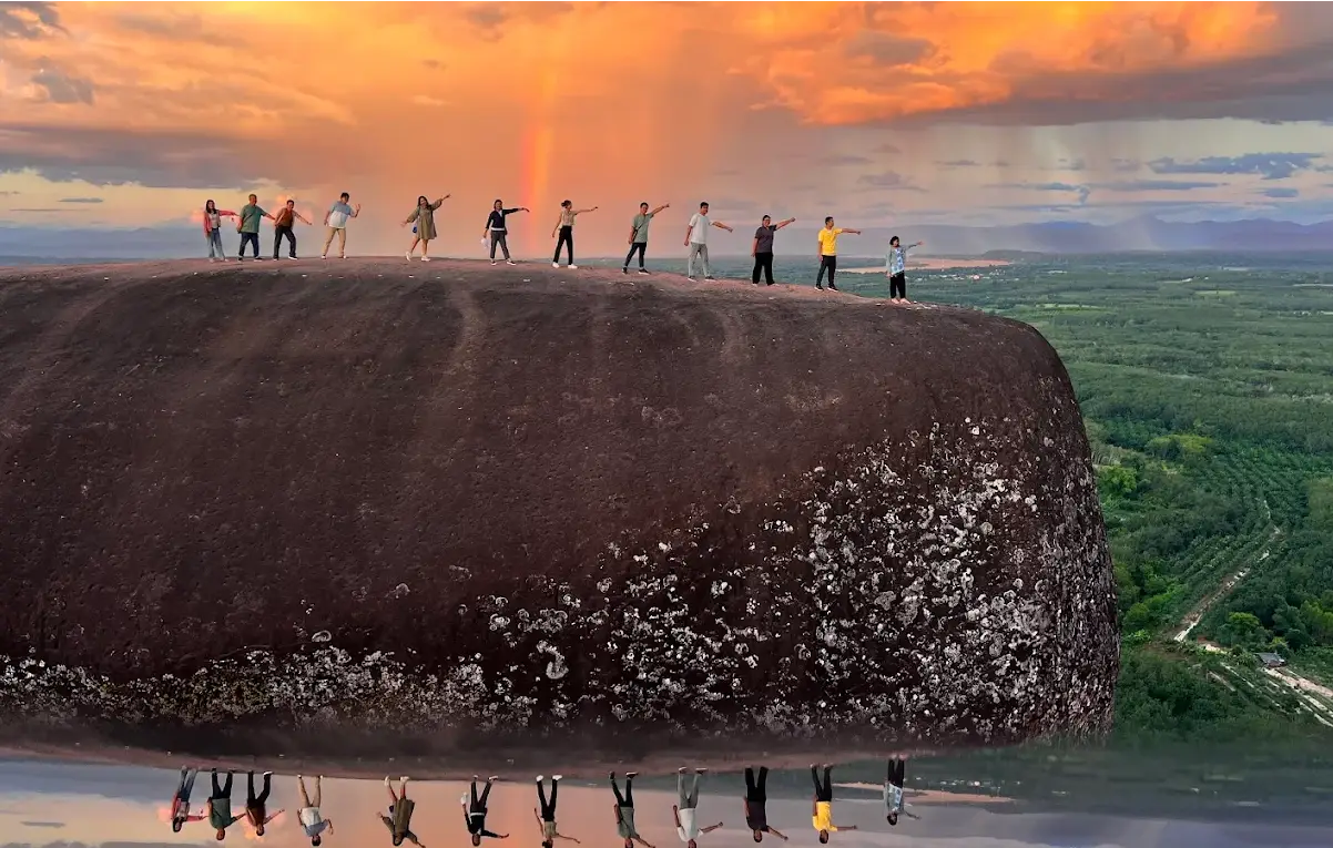
22. Three Whale Rock Three huge sandstone formations resembling whales on the Phu Sing highlands, overlooking extensive forest and rolling terrain.
Highlights: Whale-shaped rocks and forest panoramas
The defining character of Three Whale Rock changes with the seasons and the condition of the surrounding landscape. Sandstone, streams, forests and wetlands create different views during wetter and drier periods. The experience is therefore shaped by rainfall, vegetation, water levels and the trails that are officially accessible.
Bueng Kan’s natural areas are closely connected to its forests and drainage systems. Its combination of sandstone mountains and lowland waters offers contrasting ecosystems, making geographic planning more useful than treating every attraction as an identical roadside stop.
Outdoor safety at Three Whale Rock depends on current conditions. Natural paths may contain slippery rock, channels or steep sections; sites within protected areas have rules that differ from ordinary public spaces. Visitors must follow the routes and entry conditions established by local authorities.
Beyond the viewpoint itself, Three Whale Rock reveals the natural character of Mueang Bueng Kan. Combined with attractions in the same district, it helps illustrate a province shaped by mountains, the Mekong and major wetlands.
Open Days: Daily Opening Hours: 05:00 – 17:00
Getting There: Travel to the Phu Sing protected forest in Mueang Bueng Kan and use the authorized local viewpoint transport
Map (GPS):Open Google Maps – Three Whale Rock
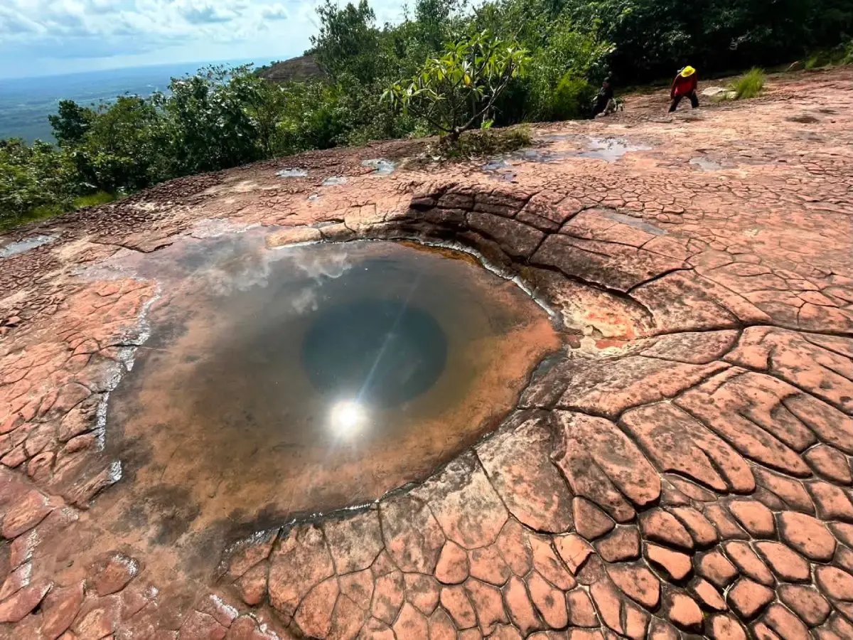
23. Naka Cave A national-park mountain trail leading to sandstone surfaces with patterns resembling Naga scales, combining geology and regional traditions.
Highlights: Scale-like sandstone and a regulated mountain hike
The defining character of Naka Cave changes with the seasons and the condition of the surrounding landscape. Sandstone, streams, forests and wetlands create different views during wetter and drier periods. The experience is therefore shaped by rainfall, vegetation, water levels and the trails that are officially accessible.
Bueng Kan’s natural areas are closely connected to its forests and drainage systems. Its combination of sandstone mountains and lowland waters offers contrasting ecosystems, making geographic planning more useful than treating every attraction as an identical roadside stop.
Outdoor safety at Naka Cave depends on current conditions. Natural paths may contain slippery rock, channels or steep sections; sites within protected areas have rules that differ from ordinary public spaces. Visitors must follow the routes and entry conditions established by local authorities.
Beyond the viewpoint itself, Naka Cave reveals the natural character of Bueng Khong Long. Combined with attractions in the same district, it helps illustrate a province shaped by mountains, the Mekong and major wetlands.
Getting There: Enter Phu Langka National Park from Bueng Khong Long and follow the officially authorized hiking route
Map (GPS):Open Google Maps – Naka Cave
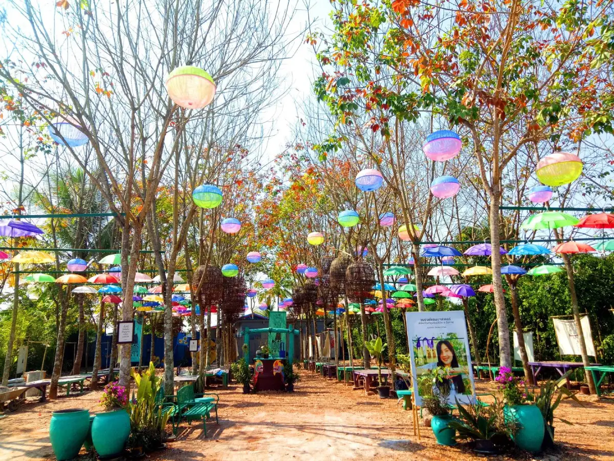
24. Living Community Museum A community museum in an old wooden house at Ban Khi Lek Yai, displaying Isan household traditions and Naga-themed murals around the village.
Highlights: Historic wooden house, everyday objects and village murals
Living Community Museum adds another perspective to visiting Bueng Kan, reflecting how the area of So Phisai has developed beyond its well-known mountains and Buddhist sites.
The appeal of the destination is connected to its local setting, community activities and the experience of exploring a less familiar part of the province.
It makes sense to combine this destination with others in the same geographic area rather than repeatedly crossing long distances between districts.
Living Community Museum therefore adds variety to a journey through the province, linking local life, the landscape and regional travel.
An old wooden house at Ban Khi Lek Yai displays household utensils, traditional textiles and historical photographs, while Naga-themed murals connect community life with contemporary art.
Getting There: Travel to Ban Khi Lek Yai, Nong Phan Tha Subdistrict, from So Phisai town
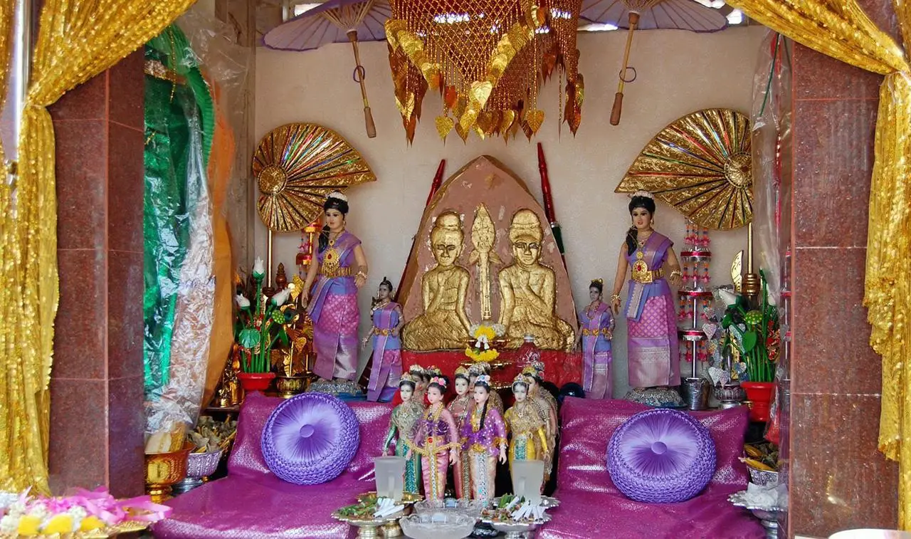
25. Chao Mae Song Nang Shrine A locally revered shrine connected with traditional beliefs of the Mekong riverside communities.
Highlights: A major local spiritual landmark
Chao Mae Song Nang Shrine is part of Bueng Kan’s religious landscape, where Buddhism and local traditions are deeply connected to community life. Religious sites serve as spaces for merit-making, ceremonies and quiet reflection, as well as places of cultural interest.
The appeal of Chao Mae Song Nang Shrine includes its devotional setting and the surrounding landscape. Visitors can observe local customs while respecting worshippers, dressing appropriately and avoiding disruption to religious activities.
Bueng Kan offers different forms of spiritual tourism, from riverside temples to mountain sanctuaries and shrines connected with local legends. Together, these places show how communities attach cultural meanings to their natural surroundings.
Exploring Chao Mae Song Nang Shrine together with other places in Mueang Bueng Kan provides a more complete understanding of local traditions and community history, with ample time to appreciate the setting.
Getting There: Travel within central Bueng Kan to Chao Mae Song Nang Shrine
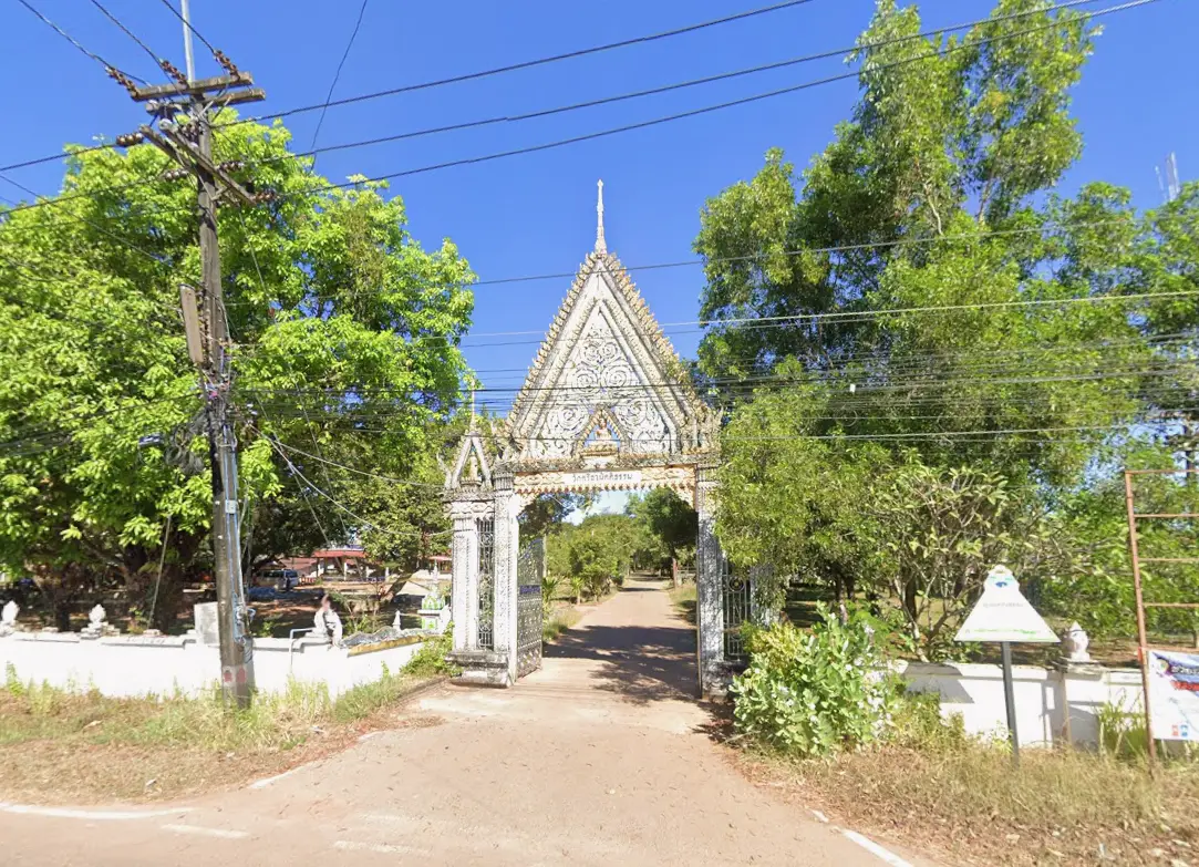
26. Wat Khan Samakkhi Tham A temple on rocky terrain in Chaiyaphon Subdistrict, featuring a Guanyin statue and peaceful religious grounds.
Highlights: Guanyin statue and temple structures on rocky ground
Wat Khan Samakkhi Tham is part of Bueng Kan’s religious landscape, where Buddhism and local traditions are deeply connected to community life. Religious sites serve as spaces for merit-making, ceremonies and quiet reflection, as well as places of cultural interest.
The appeal of Wat Khan Samakkhi Tham includes its devotional setting and the surrounding landscape. Visitors can observe local customs while respecting worshippers, dressing appropriately and avoiding disruption to religious activities.
Bueng Kan offers different forms of spiritual tourism, from riverside temples to mountain sanctuaries and shrines connected with local legends. Together, these places show how communities attach cultural meanings to their natural surroundings.
Exploring Wat Khan Samakkhi Tham together with other places in Mueang Bueng Kan provides a more complete understanding of local traditions and community history, with ample time to appreciate the setting.
Getting There: Travel to Chaiyaphon Subdistrict in Mueang Bueng Kan and follow local access roads
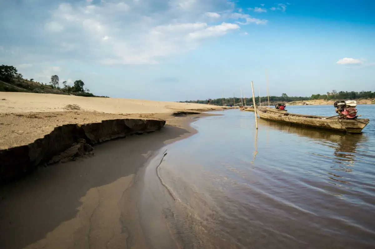
27. Hat Sai Khao Hat Sai Khao is a natural riverside attraction on the Mekong in Mueang Bueng Kan District. Sandbanks become more visible as the river level changes, particularly during lower-water periods. Unlike a coastal beach, the landscape is shaped by a major river, seasonal sediment movement, and fluctuating currents.
Highlights: Seasonal sandbanks and river scenery on the Mekong
The riverside setting offers insight into the close relationship between Bueng Kan and the Mekong. Changes in water level affect the exposed sand and the areas accessible along the bank. The site is therefore as much a place for observing the river landscape and local life as it is a location for relaxing and taking photographs.
Morning and late-afternoon light can be particularly attractive along the river. The shape of the sandbanks changes throughout the year, and areas that look firm may be affected by soft sediment or strong currents. Visitors should not treat the exposed sand as a permanently stable bathing beach.
Hat Sai Khao can be visited alongside Wat Ahong Silawat, Kaeng Ahong, Chao Mae Song Nang Shrine and other Mekong attractions around Bueng Kan. The changing colours of the water, sand and sky make it appealing to landscape photographers, while riverbank safety deserves attention in every season.
Getting There: Follow the Mekong riverside roads from central Bueng Kan toward Hat Sai Khao, using the verified map location and accessible public riverbank areas.
Map (GPS):Open Google Maps – Hat Sai Khao
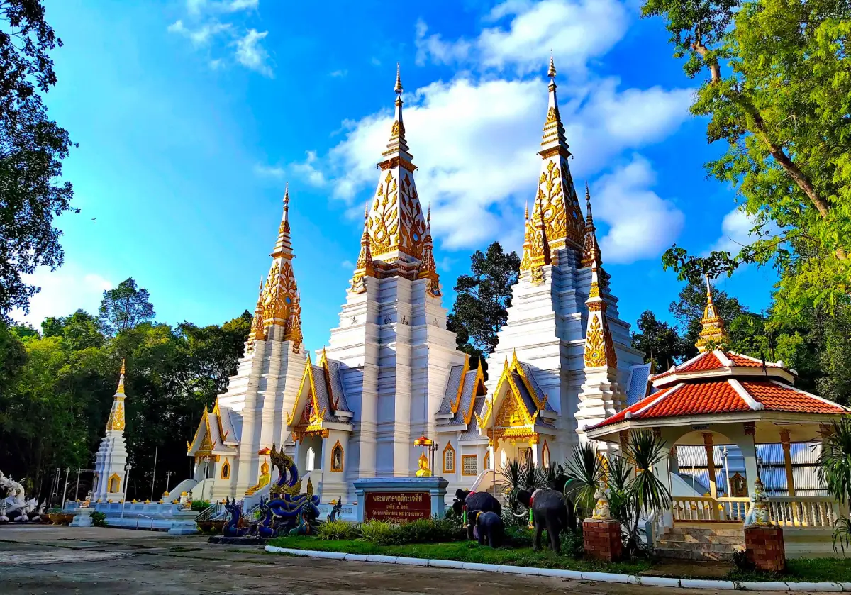
28. Wat Seka Chetiyaram Wat Seka Chetiyaram is a royal Buddhist temple in Seka District, Bueng Kan Province. It is a major centre for Buddhist worship and community activities. Important features include three white stupas associated with Phra Maha That Tika Chedi, the revered Phra Chao Mun Mueang Seka Buddha image, the ordination hall and commemorative ceremonial buildings.
Highlights: Royal temple, white stupas, a revered Buddha image and ceremonial halls
The temple’s history is associated with Luang Pu Thepha Phuripanyo, who stayed in the forested area in 1974. The site developed into a temple in the following years, with its establishment recorded in 1975 and official permission for construction granted in 1980. Its growth reflects the historical and religious development of the Seka community.
The ordination hall houses Phra Chao Mun Mueang Seka, while other significant structures include Phra That Katanyu and spaces used for Buddhist ceremonies. The combination of stupas, halls, open grounds and mature trees creates a setting where travelers can appreciate architecture as well as the living practices of a royal temple.
Wat Seka Chetiyaram is particularly rewarding for travelers interested in Buddhist art, local history and pilgrimage routes. It can be included in a multi-day itinerary through Seka District, Phu Thok and Bueng Khong Long.
Open Days: Daily, 08:30 – 16:30
Getting There: Travel to Seka town and continue toward the temple in Seka Subdistrict, using the verified Google Maps destination.
Map (GPS):Open Google Maps – Wat Seka Chetiyaram
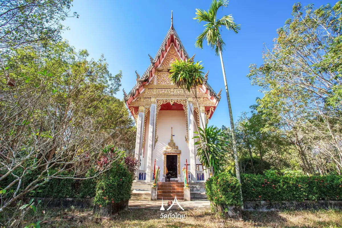
29. Wat Bueng Sararat Wat Bueng Sararat is a Buddhist community temple in Ban Khok Kwang, Khok Kwang Subdistrict, Bung Khla District, Bueng Kan Province. It belongs to the Maha Nikaya monastic tradition and has long served the community as a place for religious ceremonies, shared merit-making and local cultural life.
Highlights: Historic community temple, ordination hall and village Buddhist traditions
The temple’s development is associated with land donated by Si Chan Yi Kho. Its grounds cover approximately 12 rai and 2 ngan, and it received a royal grant of consecrated boundaries on 22 November 1988. Its history is closely connected with village settlement in an area shaped by local wetlands and woodland.
The grounds include an ordination hall, a preaching hall, monks’ residences and open spaces used for ceremonies. Buddhist Lent and annual kathin robe-offering activities demonstrate the importance of the temple in everyday community life, beyond its physical buildings.
The temple can be included in a cultural route through Bung Khla District, together with Wat Chittaphawan Nathi, nearby Mekong communities and the Phu Wua natural area. It is well suited to visitors interested in village history and living Buddhist traditions.
Getting There: Follow Highway 212 from Bueng Kan toward Bung Khla, then turn into Khok Kwang Subdistrict and Ban Khok Kwang.
Map (GPS):Open Google Maps – Wat Bueng Sararat
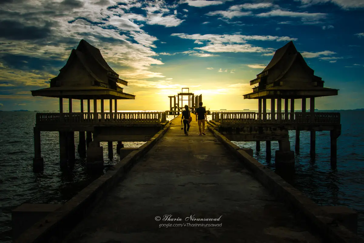
30. Wat Chittaphawan Nathi Wat Chittaphawan Nathi is a historic Buddhist community temple in Ban Tha Sirikhan, Khok Kwang Subdistrict, Bung Khla District, Bueng Kan Province. Located in the wider Mekong riverside landscape, it remains an important place for worship, village ceremonies and the preservation of community history.
Highlights: Historic Mekong-side temple and traditional village worship
The temple’s origins are associated with a wandering monk named Phra Sing, who stayed in the area, and local residents who established the temple in 1929. The area was historically associated with the community name Ban Nong Bo Tha. Its development illustrates how religious places became centres of village identity and shared cultural life along the Mekong.
The temple provides spaces for Buddhist observances and merit-making activities undertaken by local residents. Its quiet rural setting offers an insight into everyday religious practice beyond the busier, more prominent landmarks visited by most tourists.
Wat Chittaphawan Nathi pairs naturally with Wat Bueng Sararat and community routes in Bung Khla District. For visitors interested in Bueng Kan’s local history, it offers an opportunity to understand the social and spiritual traditions of villages along the Mekong.
Getting There: Take Highway 212 from Bueng Kan toward Bung Khla, then follow local roads to Ban Tha Sirikhan in Khok Kwang Subdistrict.
| 1. Phu Thok | Si Wilai — Wooden cliff walkways and a Buddhist sanctuary |
| 2. Bueng Khong Long Wetland | Bueng Khong Long — Lake scenery and waterside community life |
| 3. Phu Wua Wildlife Sanctuary | Seka and Bung Khla — Protected forest and wildlife conservation |
| 4. Wat Ahong Silawat | Mueang Bueng Kan — Mekong-side temple grounds and Kaeng Ahong |
| 5. Kaeng Ahong | Mueang Bueng Kan — Mekong rapids and local river traditions |
| 6. Nong Kut Thing Wetland | Mueang Bueng Kan — Wetland ecology and open-water scenery |
| 7. Tat Kinnaree Waterfall | Bueng Khong Long — Sandstone cascades near Phu Langka |
| 8. Bueng Kan Thai–Lao Market | Mueang Bueng Kan — Agricultural produce and border trade |
| 9. Wat Photharam | Mueang Bueng Kan — Revered Luang Pho Phra Yai Buddha image |
| 10. Wat Sawang Arom (Wat Tham Si Thon) | Pak Khat — Rocky temple setting and surrounding views |
| 11. Huai Hin Haep | Bueng Khong Long — Crocodile-shaped rock and Naga-related devotional features |
| 12. Tat Chanaen Waterfall | Seka and Bung Khla — Khua Hin natural stone bridge and sandstone streams |
| 13. Bueng Kan Walking Street | Mueang Bueng Kan — Local food and the evening Mekong waterfront |
| 14. Tat Wimanthip Waterfall | Bueng Khong Long — Cascades and sandstone terraces |
| 15. Ko Don Pho | Bueng Khong Long — Island scenery and the surrounding wetland |
| 16. Hat Kham Sombun | Bueng Khong Long — Relaxing and dining beside Bueng Khong Long |
| 17. Pu U Lue Nakarat Shrine | Bueng Khong Long — Shrine worship and the legend of Pu U Lue |
| 18. Chet Si Waterfall | Seka — Sunlit spray and Phu Wua forest |
| 19. Tham Phra Waterfall | Seka — Broad sheets of water over sandstone |
| 20. Fifth Thai–Lao Friendship Bridge | Mueang Bueng Kan — Cross-border bridge and Mekong panorama |
| 21. Phu Sing | Mueang Bueng Kan — Sandstone landscapes and nature viewpoints |
| 22. Three Whale Rock | Mueang Bueng Kan — Whale-shaped rocks and forest panoramas |
| 23. Naka Cave | Bueng Khong Long — Scale-like sandstone and a regulated mountain hike |
| 24. Living Community Museum | So Phisai — Historic wooden house, everyday objects and village murals |
| 25. Chao Mae Song Nang Shrine | Mueang Bueng Kan — A major local spiritual landmark |
| 26. Wat Khan Samakkhi Tham | Mueang Bueng Kan — Guanyin statue and temple structures on rocky ground |
| 27. Hat Sai Khao | Mueang Bueng Kan District — Mekong riverside. Seasonal sandbanks and river scenery on the Mekong. |
| 28. Wat Seka Chetiyaram | Seka District — Buddhist heritage. Royal temple, white stupas, a revered Buddha image and ceremonial halls. |
| 29. Wat Bueng Sararat | Bung Khla District — Community temple. Historic community temple, ordination hall and village Buddhist traditions. |
| 30. Wat Chittaphawan Nathi | Bung Khla District — Buddhist heritage. Historic Mekong-side temple and traditional village worship. |
| Province Overview | A Mekong-border province with eight districts, sandstone highlands, wetlands, forests, temples and community traditions |
| Town And Mekong Area | Wat Ahong Silawat, Kaeng Ahong, Thai–Lao Market, Wat Photharam, Chao Mae Song Nang Shrine, Walking Street and Nong Kut Ting |
| Phu Sing Area | Three Whale Rock and Phu Sing for sandstone geology and forest panoramas |
| Si Wilai And So Phisai | Phu Thok and Living Community Museum |
| Bueng Khong Long And Phu Langka | Bueng Khong Long, Naka Cave, Huai Hin Haep, Hat Kham Sombun, Ko Don Pho, Pu U Lue Shrine and Tat Wimanthip |
| Phu Wua Area | Phu Wua Wildlife Sanctuary, Tat Chanaen, Chet Si and Tham Phra waterfalls, subject to opening restrictions |
| Best For Families | Living Community Museum, Thai–Lao Market, Walking Street, urban riverfront and Hat Kham Sombun |
| Religion And Pilgrimage | Phu Thok, Wat Ahong Silawat, Wat Photharam, Wat Sawang Arom and Pu U Lue Shrine |
| Nature Experiences | Three Whale Rock, Phu Sing, Bueng Khong Long, Nong Kut Ting and officially accessible waterfalls |
| Photography | Three Whale Rock, Phu Thok, Mekong waterfront, Phu Sing and Bueng Khong Long |
| Community And Culture | Living Community Museum, Thai–Lao Market and Bueng Kan Walking Street |
| 1-Day City Route | Wat Photharam – Chao Mae Song Nang – Wat Ahong Silawat – Kaeng Ahong – Walking Street when operating |
| 1-Day Nature Route | Phu Sing – Three Whale Rock and authorized surrounding viewpoints |
| 2 Days / 1 Night | Day 1: city and Mekong; Day 2: Phu Sing and Three Whale Rock |
| 3 Days / 2 Nights | Day 1: town and Mekong; Day 2: Phu Thok and So Phisai; Day 3: Bueng Khong Long and Pu U Lue Shrine |
| 4 Days / 3 Nights | City – Phu Sing – Phu Thok and Living Community Museum – Bueng Khong Long |
| 5 Days / 4 Nights | City, Phu Sing, Si Wilai, So Phisai and Bueng Khong Long, adding waterfalls only if open |
| Recommended Accommodation Areas | Central Bueng Kan for the Mekong and Phu Sing; Bueng Khong Long for Naka Cave and Phu Langka |
| Regional Food | Sticky rice, spicy salads, freshwater fish, soups and dishes featuring local herbs |
| Local Products | Agricultural goods, community products and seasonal foods |
| Getting Around | A rental or private car is practical between districts; use authorized services in protected areas |
| Best Season | Cool season for comfortable sightseeing; rainy season for waterfall flow when access is permitted |
| Safety | Cliff edges, slippery rock, flash floods, wildlife and seasonal trail restrictions |
| Responsible Travel | Avoid littering, disturbing wildlife or entering closed areas; respect religious settings |
Frequently Asked Questions (FAQ)
Q: Where should first-time visitors begin?
A: Start with the town and Mekong riverfront or devote a separate day to Phu Sing and Three Whale Rock.
Q: Which areas fit a two- or three-day visit?
A: Combine the town, Phu Sing and either Phu Thok or Bueng Khong Long according to your interests.
Q: What are the key natural attractions?
A: Three Whale Rock, Phu Sing, Bueng Khong Long, Nong Kut Ting and waterfalls in Phu Wua and Phu Langka.
Q: Are all waterfalls open year-round?
A: No. Some lie inside protected areas with seasonal access and ranger-controlled opening periods.
Q: Are Naka Cave and Phu Thok suitable for everyone?
A: Both involve elevated walking routes and specific rules; consider fitness and weather before planning a visit.
Q: Which attractions suit families and older travelers?
A: Living Community Museum, markets and central-town attractions offer alternatives to demanding mountain hikes.
Q: Where can visitors explore local culture?
A: Important temples, Chao Mae Song Nang Shrine, Pu U Lue Shrine, Living Community Museum and local markets.
Q: How should travelers get around?
A: A private or rental car is useful for connecting districts, while protected areas may require local authorized transport.
Q: Where should travelers stay?
A: Central Bueng Kan is convenient for the Mekong and Phu Sing; Bueng Khong Long suits Naka Cave and Phu Langka.
Q: What is the best travel season?
A: The cool season is more comfortable for outdoor sightseeing; waterfalls flow more strongly during rain but trails may close.
 Category: ●Travel Articles, Recipes
 Group: ●Travel Review, Food Review
Last Update : 2 WeekAgo
 Last Update : 2 WeekAgo
Recommend

 Art, Culture and Heritage
 Landmarks and Memorials(1)
 Museums(1)
 Places of Worship
 Temple(12)
 Other Sacred Sites(4)
 Suburban Living
 Local Market(1)
 Nature and Wildlife
 National Parks and Marine Reserves(1)
 Mountain (Doi)(3)
 Waterfalls(5)
 Caves(1)
 River, Canal(4)
 Bays and Beaches(1)
 Islands(1)
 Entertainment and Agricultural
 Waterpark(1)
 Shopping
 Shopping and Night Market(1)
Travel Review, Food Review(1)


