
lovethailand home >Northeastern Travel Attractions >Bueng Kan Travel Attractions >Seka >Sok Kam > Tham Phra Waterfall
TL;DR: Tham Phra Waterfall, Bueng Kan attractions : Nature and Wildlife, Waterfalls.

Tham Phra Waterfall
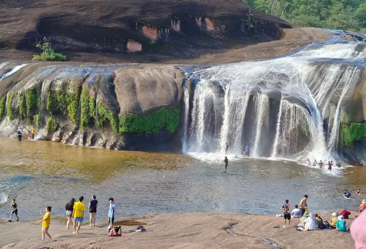
Open Days: Open seasonally according to announcements from Phu Wua Wildlife Sanctuary
Opening Hours: 08:30 – 16:30 during the published tourism operating period
Tham Phra Waterfall in Bueng Kan Province, also known as Tham Phra Phu Wua Waterfall, is one of the notable natural attractions in upper northeastern Thailand. Situated near Ban Tham Phra in Sok Kam Subdistrict, Seka District, Bueng Kan Province, the waterfall lies within Phu Wua Wildlife Sanctuary. Its most distinctive feature is water flowing over an expansive sandstone formation, descending across several levels and spreading along rock ledges before continuing into natural streams and pools surrounded by forest. Over a long period, running water has shaped and polished parts of the sandstone into smooth channels and sloping surfaces resembling natural water slides. These formations have become one of the best-known features of the waterfall. The attraction is also unusual because visitors reach it by traveling along a forest waterway by boat before continuing on foot. The journey offers an opportunity to experience the forest, river environment, and sandstone landscape before arriving at the waterfall itself.
Tham Phra Waterfall forms part of the natural ecosystem of Phu Wua Wildlife Sanctuary, an important protected area in Bueng Kan Province. The sanctuary contains sandstone mountains, forests, rock platforms, streams, and several waterfalls. Its terrain varies according to elevation and the paths followed by natural waterways. The surrounding forest contributes to the environmental conditions of the streams and gives Tham Phra Waterfall its shaded atmosphere. Trees growing along the waterways provide a natural setting, while the connection between mountains, woodland, and water creates the distinctive character of the destination. During the rainy season, increased stream flow produces white cascades against the reddish-brown sandstone.
Unlike waterfalls where water plunges down a single narrow channel, Tham Phra Waterfall spreads across broad sandstone surfaces and descends through several sloping sections. In some places, the water forms wide curtains falling over ledges. Elsewhere, it gathers into channels that follow smooth, rounded rock formations. The result is a landscape containing stronger cascades, gently spreading water, and natural pools with differing conditions. This variety allows visitors to observe how moving water shapes sandstone and creates distinctive geological patterns over time.
The waterfall is located near Ban Tham Phra in Sok Kam Subdistrict, an area of Seka District closely connected with forested hills and natural waterways. Visitors cannot drive directly to the main cascade. Instead, they first reach a local boat service area and continue along the waterway. This journey connects tourism with services provided by surrounding communities, particularly boat operators and businesses associated with visitor transport. Tham Phra Waterfall therefore has both environmental and local economic importance, provided that tourism activities respect the conservation rules and safety requirements of the protected area.
The name Tham Phra Waterfall is associated with Buddhist religious features near the natural attraction. Rock shelters and nearby areas contain Buddha images, including plaster and carved wooden figures described in the historical accounts of the site. The presence of these religious objects contributed to the name Tham Phra, referring to the connection between the cave-like environment and Buddhist imagery. This relationship gives the destination cultural significance beyond its waterfalls and bathing pools, linking the natural landscape with local religious traditions and spiritual values.
A monastic residence or religious retreat is also associated with the waterfall area. Its forested and rocky surroundings create a quiet environment suited to contemplation. The use of forests and mountains for Buddhist religious practice is a familiar tradition in many parts of Thailand, particularly in the northeast, where forest meditation has a long history. At Tham Phra Waterfall, religious and natural features exist within the same landscape. Visitors should therefore show respect near Buddha images and religious areas while maintaining cleanliness and peaceful behavior throughout the protected environment.
Phu Wua Wildlife Sanctuary covers approximately 116,562 rai, or about 186 square kilometers, across several districts of Bueng Kan Province. The landscape contains sandstone hills and forests with varying elevations. Its vegetation includes dry dipterocarp forest, dry evergreen forest, and moist evergreen forest in suitable locations. The ecological diversity gives the sanctuary an important role in protecting wildlife and plants. Streams flowing from or through its mountains contribute to the formation of waterfalls where the water encounters sandstone ledges and changes in elevation.
Tham Phra Waterfall is one of several important waterfalls within Phu Wua, alongside Chet Si Waterfall, Tham Fun Waterfall, and Tat Nok Khian Waterfall. Each occupies a different stream system and geological setting, producing variations in shape and atmosphere. Tham Phra is particularly noted for its broad sandstone platforms and boat access. Chet Si is known for cascades that produce fine spray, while other waterfalls offer distinct combinations of rocky terrain and forest scenery. Together, they demonstrate that Phu Wua is a substantial natural destination with numerous attractions rather than a forest containing only one waterfall.
The flow of Tham Phra Waterfall depends strongly on seasonal rainfall. During the rainy season, water from surrounding forests and uplands feeds the stream, causing cascades to spread over a larger area of sandstone. During the dry season, the volume decreases considerably, and parts of the watercourse may dry out. As a result, the waterfall does not maintain a powerful year-round flow. Seasonal changes affect not only the scenery but also visitor safety and the authorities' decisions about opening the attraction to tourists.
The waterfall generally carries substantial water between July and September, when northeastern Thailand receives sustained seasonal rain. During these months, increased runoff from the uplands produces broad cascades and more noticeable sounds of flowing water. The forest is lush and green, with vegetation receiving plentiful moisture. However, stronger flow does not make every section suitable for swimming. Fast currents can create hazardous conditions in channels, deep pools, and areas where the rock surface drops sharply.
The tourism season at Tham Phra Waterfall is therefore determined partly by the safety assessment of responsible officials. In some years, access begins early in the rainy season, while heavy rainfall or the threat of flash flooding may require temporary closures. Such management reflects the sanctuary's responsibility to protect both visitors and natural resources. A destination described as seasonally open should not be understood to offer unrestricted access every day of the year.
The importance of safety measures was demonstrated on August 2, 2023, when Phu Wua Wildlife Sanctuary temporarily closed Tham Phra Waterfall and several other natural attractions because of heavy rainfall and flash-flooding risks. Visitor access resumed from August 10, 2023, after water conditions returned to safer levels. This event illustrates how temporary closures are used to prevent accidents rather than signify the permanent abandonment of a tourism site.
For the 2025 rainy season, tourism information advertised the reopening of Tham Phra Waterfall from June 14. Local tourism service providers published operating hours and boat service information for visitors. In 2026, information about the waterfall and its access route continued to be published, reflecting its ongoing importance as a natural destination in Bueng Kan. Nevertheless, practical access on any particular day remains dependent on the seasonal operating arrangements and the sanctuary's assessment of conditions.
Traveling to Tham Phra Waterfall is different from visiting a waterfall accessible directly from a roadside car park. The journey begins at a pier or designated boat service point. Visitors then board a locally operated boat and travel along a waterway surrounded by forest. The boat trip generally takes around 10 minutes before passengers disembark and continue along a walking route. The experience begins well before the waterfall comes into view, as the boat provides close views of vegetation, the stream environment, and the changing appearance of the waterway.
The boat route is associated with the Huai Bang Bat water system, part of Phu Wua's wider network of natural waterways. Traveling along the forest stream allows visitors to see vegetation growing along both banks. In some places, branches extend above the water and create shade. Other sections offer more open views of the forest and sky. The appearance and behavior of the stream vary with water levels and seasonal conditions, particularly when continuing rain causes currents to change rapidly.
The local boat service connects tourism with surrounding communities. Rather than requiring a road to extend all the way to the waterfall, boats provide access along an existing natural watercourse. The journey is both a transportation service and an important part of the visitor experience. Boat operators are responsible for carrying passengers between designated boarding points, while travelers must follow safety instructions and passenger-capacity requirements. Organized use of the service helps reduce accidents and supports appropriate management of entry and exit.
After disembarking, visitors walk approximately 500 meters along the designated route to the waterfall. The path passes through natural forest and areas containing streams and sandstone. Some sections have improved walking surfaces or small bridges that make it easier to cross rocks and channels. Although the distance is relatively short compared with a strenuous mountain trek, the ground requires caution, especially during rain when rocks and soil can become slippery.
The walking approach is a valuable part of the visit. Trees, smaller plants, and natural stone features line the route. As travelers draw closer to the cascades, the sound of running water becomes more noticeable, and the environment feels increasingly moist. Sunlight sometimes filters through gaps in the canopy, creating patterns of light and shade across the path. The walk is therefore more than a transfer from the pier. It provides an opportunity to appreciate the forest ecosystem and observe how the stream interacts with the surrounding terrain.
At the waterfall, visitors encounter a broad sandstone platform and cliff-like ledges over which water flows in several stages. The scenery is shaped by surfaces with different slopes, depressions, and natural channels. Water may run through narrow grooves, spread across wide sections, or fall over distinct rock edges. These changes produce a continuous sound of moving water and fine spray where streams strike lower surfaces. The combination of natural rock and flowing water gives Tham Phra its characteristic appearance.
The watercourse can be understood as a series of different sections. Upstream areas include channels feeding the sandstone platforms and natural pools. Middle sections contain relatively broad rock surfaces with varying gradients. Farther downstream, water descends from ledges into lower terrain. The different flow patterns create places where water moves gently and others where currents become strong. Recognizing these differences is important for understanding the waterfall's geology and the safety conditions associated with each area.
The formations resembling natural water slides are among the reasons Tham Phra Waterfall is widely known. In some sections, running water has eroded and polished sandstone into smooth channels with downward slopes. When water flows through them, they resemble slides leading toward lower areas. However, an appearance similar to a recreational slide does not mean every section is safe to use. Water speed, the depth of the receiving pool, and submerged rocks can vary considerably. Any swimming or sliding activity must be restricted to locations and conditions expressly permitted by officials.
The sandstone itself is central to understanding the waterfall's geological character. Sandstone is a sedimentary rock formed from accumulated sand grains that gradually become compacted and cemented together. Once exposed at the Earth's surface, rainfall and moving water can erode sections that are less resistant. This creates grooves, steps, and ledges, while more durable rock may remain in place. Differential weathering and erosion explain why the same stream can contain rock ridges, pools, and small cliffs of different shapes and sizes.
The reddish-brown sandstone provides a striking contrast with the white cascades. Variations in rock color, water flow, and green vegetation produce a distinctive landscape, especially when abundant water creates spray above the ledges. Plants grow in some fractures and damp crevices, adding patches of green to the exposed stone. The appearance of the sandstone also changes with moisture and the angle of sunlight, making different sections visually interesting at different times.
The broad rock platform allows visitors to observe how water moves across a natural surface. From a secure position, it is possible to see that currents are not distributed evenly. Water tends to collect in lower sections and previously formed grooves. As the volume increases, it may spread onto rock that remains dry during periods of lower flow. These changes illustrate that a waterfall is a dynamic environment rather than a fixed feature whose conditions remain identical throughout the year.
Natural pools are another important part of the Tham Phra landscape. They form where water flows through depressions and lower sections of the rock. Each pool has its own shape, depth, and underlying surface. Some may appear shallow from above while containing deeper grooves or submerged rocks. Others may develop circulating currents that are difficult to recognize from the surface. Water clarity alone cannot determine whether swimming is safe, because depth and current strength can change unexpectedly.
The formation of pools and channels is connected with moving sediment and the gradual erosion of sandstone. Flowing water can carry small particles and sand across the rock, wearing down areas exposed to repeated contact. Over long periods, some surfaces become smoother while channels and depressions deepen. These processes explain why sandstone streams can develop intricate patterns and shapes different from those found in waterfalls flowing over other types of rock.
When water levels are high, the sound of cascades moving across the cliffs creates a powerful atmosphere. During lower flow, the grooves and details of the sandstone become more visible. Each season reveals a different aspect of the waterfall, including changes in water volume, forest color, and exposed rock surfaces. Nevertheless, extremely strong currents may require access restrictions or temporary closure to protect visitors from hazardous conditions.
Tham Phra Waterfall is particularly attractive for nature appreciation and landscape photography. Its defining elements include broad sandstone ledges, white cascades, forest vegetation, and natural pools. Photographs taken from stable locations can capture the flow of water without requiring people to stand on slippery rock. High-water conditions emphasize the white curtains and spray, while lower-water conditions reveal the textures carved into the stone. Changing sunlight and shadows from nearby trees provide further photographic variety.
Visitors interested in the Buddhist images and religious area near the waterfall should dress and behave respectfully. Religious spaces serve a different purpose from recreational swimming areas, and loud or inappropriate activities should be avoided near sacred objects. Buddha images and other belongings should not be moved or handled without permission. Respecting local traditions allows visitors to appreciate the cultural significance of Tham Phra while preserving the quiet atmosphere of the monastic surroundings.
Tham Phra is situated inside a wildlife sanctuary rather than a purpose-built water park with engineered safety equipment. Visitor safety depends strongly on natural conditions and compliance with official restrictions. During periods of substantial flow, water can carry debris and develop strong currents through narrow channels. Swimming near ledges or steep drops can therefore be dangerous. Entering water without assessing the conditions or ignoring designated swimming boundaries is inappropriate in this environment.
Parents visiting with children should supervise them closely throughout the boat ride, forest walk, and time near the water. Children may be unable to judge stream depth or current strength accurately. Running across wet sandstone or approaching fast-flowing channels without supervision creates unnecessary hazards. The ground can change level abruptly, while some submerged surfaces may be difficult to see. Families should select secure resting and viewing areas where children can remain within sight.
Older adults and visitors with mobility limitations should consider both the boat transfer and the forest walking route before choosing activities. Boarding and leaving the boat may require balance, while moist ground and natural rock surfaces differ from paved, level walkways. Choosing an appropriate level of activity is important. Visitors can enjoy the landscape from safe locations without swimming or reaching every part of the waterfall.
Suitable footwear is essential because the route involves soil, sandstone, and areas that may be wet. Shoes should fit securely and have soles that provide reliable grip. Clothing should allow comfortable movement in warm, humid weather. A water-resistant bag is useful for protecting personal belongings from spray, rain, and accidental splashes during the boat journey.
Carrying drinking water and a reasonable amount of food can make a longer visit more comfortable. However, bringing food into protected areas must comply with sanctuary regulations. Packaging and food scraps should never be left along the path or on the rock platform. Food waste can attract animals and disturb natural behavior, while plastic litter may be carried downstream and harm the aquatic ecosystem. Cleanliness is therefore an important part of both visitor responsibility and conservation.
Phu Wua Wildlife Sanctuary has rules designed to protect natural resources and maintain order. Visitors must not damage plants, write on rocks, leave litter, or disturb wildlife. A previously published reopening notice also prohibited bringing alcoholic beverages into the designated tourism areas. These rules help keep recreation compatible with the sanctuary's primary purpose of protecting wildlife and natural ecosystems.
Returning from the waterfall requires the same walking and boat route used on arrival. Visitors should allow enough time to walk back to the pier and board the return boat within the designated operating period. Remaining at the waterfall until the end of service may create pressure to rush across slippery terrain. Appropriate scheduling allows travelers to enjoy the site without compromising their safety during the return journey.
Tourism expenses at Tham Phra Waterfall may include both an entry fee for the protected area and a separate boat transport charge. Published rates list admission for Thai visitors at 30 baht for adults and 20 baht for children, and for foreign visitors at 200 baht for adults and 100 baht for children. Published boat fares are 50 baht for adults and 30 baht for children. Actual collection is subject to the rates and arrangements in effect during the visit. The boat fare pays for transportation to the waterfall and is not the same as the sanctuary admission charge.
Separating the admission fee from the boat fare makes the tourism system easier to understand. The waterfall lies within a government-managed conservation area, while access also depends on local passenger transport. The two services have different functions: the protected-area fee relates to visitor management, and the boat charge relates to transporting passengers along the waterway. Groups and families should therefore consider these as separate components of travel expenses.
Passengers using the boat service should follow capacity limits and safety requirements. They should remain seated appropriately, avoid unnecessary movement while the boat is underway, and follow the boat operator's instructions. Particular care is needed when currents are stronger or water levels are elevated. Boarding and disembarking also require attention because landing areas may be wet and slippery. Children and passengers who have difficulty maintaining balance need additional assistance.
Weather has a greater influence on a forest waterfall than on an indoor tourism attraction. Rain falling in upstream areas can increase water levels at Tham Phra even when no rain is falling directly at the waterfall. Changes in water color, height, and current strength can therefore signal rising risk. Sanctuary staff are responsible for assessing access conditions and determining whether the route is safe for visitors.
Flash flooding is a major hazard at waterfalls in mountainous areas because rainfall from higher ground can enter stream channels rapidly. Water levels may rise, previously shallow channels can develop strong currents, and walking routes or boat landing areas may become difficult to use. When authorities announce a temporary closure, visitors must comply. Such measures are intended to prevent serious accidents rather than merely regulate convenience.
The difference between Tham Phra and an artificial water attraction is that its water and rock conditions change naturally. Smooth sandstone can become more slippery because of algae, moisture, or fine sediment. A channel that appeared safe during low water may become dangerous after prolonged rain. Pools may also contain submerged rocks not easily visible from above. Swimming conditions must therefore be judged according to current conditions and official restrictions rather than photographs or accounts from previous visits.
The waterfall's beauty is not confined to places where visitors may enter the water. Rounded sandstone formations, channels shaped by natural erosion, and wide rock platforms create an impressive geological landscape. Flowing water produces white lines across the darker stone, while surrounding forest enhances the atmosphere. Walking along permitted routes provides opportunities to appreciate these features without entering the stream.
The ecosystem surrounding the waterfall is strongly influenced by moisture from the stream and water spray. Plants grow in rock fractures and places where soil has accumulated, while larger trees provide shade over the route and watercourse. Vegetation helps protect soil and influences how rainfall moves across the terrain. The forest is therefore an essential part of the waterfall system, not simply a scenic background. Protecting the surrounding vegetation contributes to the long-term ecological balance of the streams.
Phu Wua contains a variety of natural habitats, including upland forests, streams, and seasonal water environments. Its designation as a wildlife sanctuary reflects the importance of these habitats to animals and plants. Tourism activities must remain within designated areas because wildlife depends on relatively undisturbed surroundings. Entering restricted forest sections or creating excessive noise can affect the environment and increase risks for visitors.
The boat route illustrates how a local waterway can serve both transportation and ecological functions. It connects the access point to the waterfall while forming part of the drainage network of the surrounding mountains. Water quality is important for both tourism and the ecosystem. Visitors must never discard plastic bottles, bags, food scraps, or other waste into the stream, as these materials can be carried downstream and affect aquatic life.
Boat operators and local residents play a significant role in connecting road travel with the waterfall. Their service reflects how communities can respond to opportunities created by nature-based tourism. Visitors benefit from transport operated by people familiar with the local waterway, while communities can earn income from tourism-related activities. Maintaining this relationship depends on protecting the environment that attracts visitors in the first place.
Ban Tham Phra and Sok Kam Subdistrict serve as a connection between surrounding communities and the protected forest. Travelers pass through local roads and service points before boarding boats. The rural atmosphere differs from the more urban environment of Bueng Kan town, creating a gradual transition from settlements and agricultural areas toward woodland and streams. This sequence is part of the distinctive travel experience associated with the waterfall.
The relationship between the waterfall and its Buddha images adds another cultural dimension. In many parts of northeastern Thailand, rock shelters, caves, and forest areas have been used for Buddhist worship or contemplative practice. Such places combine natural tranquility with religious meaning. Tham Phra is an example of a natural attraction whose name reflects this connection, even though many visitors primarily associate it with waterfalls and sandstone channels.
The older Buddha images associated with the site give it a character different from that of an ordinary recreational waterfall. Religious objects kept in natural surroundings may be affected by humidity and the passage of time. Maintaining cleanliness, avoiding unnecessary touching, and leaving objects in their proper locations help protect their cultural value. Visitors can pay their respects according to appropriate local customs without disturbing monastic activities.
As a tourism destination, Tham Phra is well suited to visitors who enjoy a combination of activities. A typical visit may include a boat journey, a relatively short forest walk, views of sandstone cascades, and observation of natural stream channels. These activities require different degrees of mobility and physical readiness. Some visitors may prefer photography and geological observation, while others may wish to enter the water where permitted. The variety makes the destination appealing, but all activities remain subject to conservation and safety restrictions.
Nature enthusiasts can use the waterfall to learn about geology and the movement of water across upland terrain. The channels illustrate how water follows slopes and differences in rock resistance, while changes in elevation produce pools and small cliffs. The surrounding forest demonstrates the relationship between moisture and vegetation. Observing these features directly adds depth to the experience beyond viewing the waterfall as a scenic photograph.
Chet Si Waterfall is another important natural attraction that can be included in a broader exploration of Phu Wua Wildlife Sanctuary. It is known for water cascading over sandstone cliffs and producing fine spray. Under suitable lighting, sunlight interacting with the spray can produce visible colors, giving the waterfall its name, which refers to seven colors. Comparing the two sites reveals differences between broad cliff cascades and Tham Phra's extensive sandstone channels and platforms. Access to either location remains subject to the sanctuary's operating arrangements.
Tham Fun Waterfall is another natural attraction within the Phu Wua region. Its flow is associated with sandstone terrain and becomes more noticeable during the rainy season. The access route is in a different part of the sanctuary from Tham Phra, so the two waterfalls should not be treated as directly connected by a short walking path. Visiting both requires road travel and sufficient time for their separate access arrangements. Together, they reveal the variety of waterfalls that develop across one sandstone mountain landscape.
Tat Nok Khian Waterfall is another site that has been included alongside Tham Phra, Chet Si, and Tham Fun in official visitor-management notices for Phu Wua Wildlife Sanctuary. The presence of several waterfalls within the same conservation area demonstrates the relationship between sandstone mountains and the drainage network formed by their streams. These places are important not only for recreation but also for the protection of forest environments and natural water systems.
Phu Thok is another important destination in Bueng Kan Province. Located in Si Wilai District, it is famous for a sandstone mountain with wooden walkways built along its cliffs. It is also associated with Luang Pu Juan Kulachettho, a respected monk in Thailand's forest meditation tradition. Phu Thok offers a different experience from Tham Phra Waterfall because it focuses on mountain paths and Buddhist religious heritage. Travelers interested in both nature and contemplative traditions can include these destinations in a longer provincial itinerary.
Bueng Khong Long is an internationally significant wetland in Bueng Kan Province. Its landscape consists of a large freshwater lake surrounded by communities and natural environments. The wetland is associated with aquatic biodiversity and birdlife as well as local recreation. Traveling from Tham Phra Waterfall to Bueng Khong Long creates a contrast between a forest stream and a wide, open freshwater landscape. The two destinations reveal different aspects of the province's aquatic ecosystems.
Hat Kham Somboon is a popular recreational area along Bueng Khong Long. Its freshwater beach atmosphere and seasonal leisure activities distinguish it from Tham Phra, where access involves a boat ride followed by a forest walk. Visiting Hat Kham Somboon together with the wetland provides another opportunity to experience the area's water landscapes in a setting closer to local communities.
Naka Cave in Phu Langka National Park is another major destination for travelers interested in sandstone formations and regional folklore. Located in Bueng Khong Long District, it is known for rocks displaying patterns resembling the scales of a mythical Naga serpent and for its uphill forest trail. Visiting Naka Cave requires considerably more physical effort and time than a short walk at Tham Phra Waterfall. It is therefore better treated as a separate major excursion rather than a brief stop following an afternoon at the waterfall.
Wat Tham Chai Mongkhon and other places of Buddhist devotion in Bueng Khong Long District add a cultural dimension to travel in this part of Bueng Kan. Visitors interested in local Naga traditions and religious stories can explore temples and lakeside communities alongside natural attractions. Such journeys reveal how landscapes and beliefs interact without confusing geological explanations of sandstone with religious or folkloric narratives.
Travelers planning to stay overnight before visiting Tham Phra may choose accommodation in Seka District or Bueng Khong Long District, depending on their route. Accommodation around central Seka provides access to local restaurants, shops, and the district road network. Staying in Bueng Khong Long is convenient for travelers planning to continue to the lake, Hat Kham Somboon, or Naka Cave. The preferred location depends on the number of travel days and the range of attractions included in the itinerary.
Restaurants and coffee shops in communities around Seka and Bueng Khong Long provide services for visitors to the region. Travelers can experience northeastern Thai food, including som tam, laab, spicy soups, and everyday local dishes. Dining in a nearby community before or after the waterfall excursion can reduce the amount of food carried into the forest while supporting local businesses.
Families visiting Tham Phra should plan around the needs and abilities of each member. The journey includes boarding a boat and walking a short distance through natural terrain. Those traveling with young children or older adults should allow sufficient time for boarding, disembarking, and resting during the walk. At the waterfall, secure viewing areas are preferable to exposed rock ledges or strong currents. A rewarding experience does not require everyone to swim or reach the most hazardous parts of the stream.
Tham Phra is also suitable for environmental education because several subjects can be explored together: upland drainage, sandstone erosion, forest ecosystems, local transport, and community involvement in tourism. The journey demonstrates how roads, waterways, and walking paths connect human settlements with natural areas under controlled access conditions. These observations are valuable for students and visitors who wish to understand the relationships between people and protected landscapes.
Tham Phra Waterfall is important to Bueng Kan for more than the images of its natural rock slides. It forms part of Phu Wua Wildlife Sanctuary and the region's natural stream system. Conserving upstream forests and managing visitor access are essential for protecting the site over time. Litter, damage to sandstone, and disruptive activities can affect both the ecosystem and the quality of the visitor experience.
Tourism management must balance public access with the prevention of environmental damage. This is particularly important at sandstone platforms and natural pools where visitor numbers can increase during the rainy season. Designated walking routes, managed boat services, and temporary restrictions during dangerous water conditions help protect visitors while preserving the forest's natural character. Cooperation among authorities, local operators, and travelers is therefore essential for the sustainable use of the area.
Getting There: Tham Phra Waterfall can be reached by private car or rental vehicle through Seka District in Bueng Kan Province. Continue along local roads toward Sok Kam Subdistrict and Ban Tham Phra, following the access route to the designated boat service point. Travelers approaching from Bung Khla District can use Highway 212 toward Ban Tha Dok Kham before continuing along the local route toward the Huai Bang Bat area. Upon reaching the parking and boat service point, visitors board a community-operated boat for a journey of approximately 10 minutes and then walk around 500 meters along the designated forest trail to the sandstone platforms and waterfall.
Travelers arriving from other provinces can enter Bueng Kan via the regional highway network before continuing toward Seka District. Enough time should be allocated for road travel, waiting for a boat, walking to the waterfall, and returning before the service period ends. Because the attraction lies within a natural forest environment, it should not be approached in the same way as a roadside stop. Appropriate scheduling helps visitors enjoy the destination without rushing along slippery paths or missing the return transport.
Tham Phra Waterfall is one of Bueng Kan's distinctive natural attractions, combining seasonal streams, sandstone geology, and a forest landscape. Its broad rock platforms, natural channels, cascades, and boat-based access create an experience unlike that of many conventional waterfalls. Buddhist images and religious features near the site add cultural depth to the scenery. A visit therefore offers opportunities to appreciate forest ecosystems, observe geological processes, and understand the relationship between local communities and nature, with responsible access and safety remaining essential to the protection of this remarkable destination.
| Place Name | Tham Phra Waterfall, also known as Tham Phra Phu Wua Waterfall |
| Attraction Type | Sandstone waterfall within a wildlife sanctuary |
| Address | Ban Tham Phra, Sok Kam Subdistrict, Seka District, Bueng Kan Province 38150, Thailand |
| Protected Area | Phu Wua Wildlife Sanctuary, Bueng Kan Province |
| Responsible Authority | Phu Wua Wildlife Sanctuary, Department of National Parks, Wildlife and Plant Conservation |
| Wildlife Sanctuary Area | Approximately 116,562 rai (186 square kilometers) |
| Natural Characteristics | A broad sandstone waterfall featuring cliff cascades, natural water channels, pools, and surrounding forest |
| Highlights | Forest boat journey, short nature walk, multi-level cascades, and naturally formed rock channels resembling water slides |
| Name Origin | Associated with Buddha images and Buddhist religious features near the waterfall |
| Religious Features | Plaster Buddha images, carved wooden Buddha images, and a nearby monastic retreat area |
| Tourism Season | Rainy season, with actual opening dates determined by announcements from the responsible authorities |
| High-Water Period | Generally July – September |
| Published Visiting Hours | 08:30 – 16:30 during the designated tourism season |
| Published Admission Fees | Thai nationals: adults 30 baht, children 20 baht; foreign visitors: adults 200 baht, children 100 baht. Actual rates are subject to the responsible authority's applicable fee schedule. |
| Published Boat Fares | Adults 50 baht, children 30 baht. The boat service charge is separate from sanctuary admission. |
| Access | Road travel to the boat service point, approximately 10 minutes by boat, followed by a walk of around 500 meters |
| Visitor Areas | Boat service point, designated forest walking trail, sandstone platforms, permitted waterfall and pool areas, and nearby religious features |
| Visitor Facilities | Community-operated boat transport, parking near the access point, and a designated trail to the waterfall |
| Safety Considerations | Flash flooding, strong currents, deep pools, slippery sandstone, and restricted swimming areas |
| Wildlife Sanctuary Contact | +66 85 464 6363 |
| Boat Service Contact | +66 85 725 6371 |
| Attractions In The Wider Area | 1. Chet Si Waterfall – Ban Tong Subdistrict, Seka District 2. Tham Fun Waterfall – Phu Wua Wildlife Sanctuary area 3. Tat Nok Khian Waterfall – Phu Wua Wildlife Sanctuary area 4. Phu Wua Wildlife Sanctuary – the protected forest containing Tham Phra 5. Bueng Khong Long Wetland – Bueng Khong Long District 6. Hat Kham Somboon – beside Bueng Khong Long 7. Naka Cave – Phu Langka National Park 8. Phu Thok – Si Wilai District |
| Restaurants And Cafes In Connected Areas | 1. Krua Khun Mae – Sok Kam Subdistrict, Seka District, Tel. +66 87 944 9568 2. Nicha Coffee – Ban Non Samran, Sok Kam Subdistrict, Tel. +66 86 226 2933 3. Huai Rai Cafe – Sok Kam Subdistrict, Seka District 4. Sum Hua Na Seka – Seka Subdistrict, Tel. +66 64 271 7152 5. Bueng Khong Long Cafe – Bueng Khong Long District, Tel. +66 97 318 2200 |
| Accommodation In Connected Areas | 1. Seka Resort – Seka District, Tel. +66 64 535 7457 2. Yoga Homestay Seka – Seka District, Tel. +66 98 617 2875 3. Kran Da House – Seka District, Tel. +66 81 469 6664 4. Saowalak Villa Hotel – Seka District, Tel. +66 85 741 0974 5. HR Resort Bueng Khong Long – Bueng Khong Long District, Tel. +66 99 735 8789 6. Ruenthai Guesthouse – Bueng Khong Long District, Tel. +66 83 442 9560 |
Frequently Asked Questions (FAQ)
Q: Where is Tham Phra Waterfall located?
A: Tham Phra Waterfall is located near Ban Tham Phra in Sok Kam Subdistrict, Seka District, Bueng Kan Province, Thailand, within Phu Wua Wildlife Sanctuary. It is known for broad sandstone formations, natural pools, and seasonal cascades.
Q: Is Tham Phra Waterfall open all year?
A: No. Tham Phra Waterfall operates as a seasonal tourism attraction. The strongest water flow usually occurs during the rainy season, and visitor access depends on official sanctuary announcements and safety conditions.
Q: What are the opening hours of Tham Phra Waterfall?
A: The published tourism operating hours are approximately 08:30 to 16:30 during the designated season. Visitors must follow the applicable boat schedules and instructions from sanctuary personnel.
Q: How much are the admission and boat fees?
A: Published admission rates are 30 baht for Thai adults and 20 baht for Thai children, and 200 baht for foreign adults and 100 baht for foreign children. Published boat fares are 50 baht for adults and 30 baht for children. Admission and boat transport are separate charges, with actual rates subject to the applicable official and operator schedules.
Q: Do visitors need to take a boat to reach Tham Phra Waterfall?
A: Yes. Visitors use a locally operated boat for approximately 10 minutes and then walk around 500 meters along a designated forest trail to reach the waterfall.
Q: Does Tham Phra Waterfall really have natural water slides?
A: The sandstone contains smooth channels and slopes shaped by running water that resemble natural water slides. However, swimming or sliding is permitted only in approved areas and when current water conditions are considered safe by sanctuary personnel.
Q: Why is it called Tham Phra Waterfall?
A: The name is associated with Buddha images and Buddhist religious features near the waterfall, including plaster and carved wooden Buddha images connected with the site's history.
Q: What other attractions can be combined with Tham Phra Waterfall?
A: Attractions in the wider Bueng Kan region include Chet Si Waterfall, Tham Fun Waterfall, Tat Nok Khian Waterfall, Bueng Khong Long Wetland, Hat Kham Somboon, Naka Cave, and Phu Thok. Each has different access routes, travel distances, and visitor conditions.
 Category: ●Nature and Wildlife
 Group: ●Waterfalls
Last Update : 2 WeekAgo
 Last Update : 2 WeekAgo
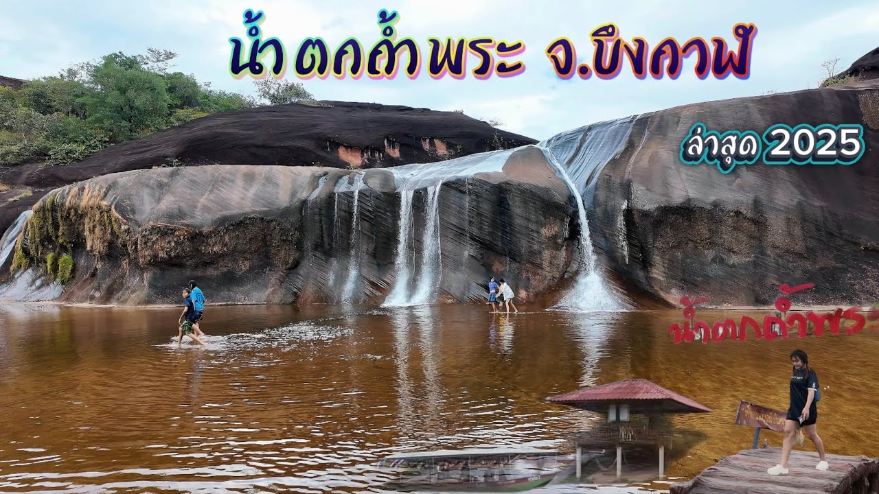
 Click to Access the Navigation Map GPS
Tham Phra Waterfall Map
Recommend

 Art, Culture and Heritage
 Landmarks and Memorials(1)
 Museums(1)
 Places of Worship
 Temple(12)
 Other Sacred Sites(4)
 Suburban Living
 Local Market(1)
 National Parks and Marine Reserves(1)
 Mountain (Doi)(3)
Waterfalls(5)
 Caves(1)
 River, Canal(4)
 Bays and Beaches(1)
 Islands(1)
 Entertainment and Agricultural
 Waterpark(1)
 Shopping
 Shopping and Night Market(1)
 Travel Articles, Recipes
 Travel Review, Food Review(1)


