
lovethailand home >Northeastern Travel Attractions >Amnat Charoen Travel Attractions > Northeastern Thailand (Isan) Map with All 20 Provi..
TL;DR: Northeastern Thailand (Isan) Map with All 20 Provinces and Major Tourist Attractions.
Northeastern Thailand (Isan) Map with All 20 Provinces and Major Tourist Attractions
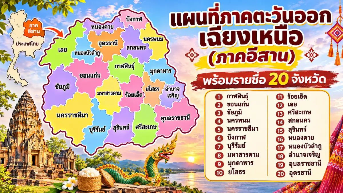
Northeastern Thailand (Isan) Map with All 20 Provinces and Major Tourist Attractions is a guide to understanding the locations, geographical boundaries, and distinctive characteristics of the provinces in northeastern Thailand. The region comprises 20 provinces on the Khorat Plateau, encompassing mountains, lowland basins, the Mekong, Chi, and Mun river basins, historic towns, border communities, and major tourist attractions spread across the region. A map helps readers identify where each province is located, which provinces border one another, and how to link different types of attractions into practical travel routes.
Isan comprises 20 provinces: Kalasin, Khon Kaen, Chaiyaphum, Nakhon Phanom, Nakhon Ratchasima, Bueng Kan, Buri Ram, Maha Sarakham, Mukdahan, Yasothon, Roi Et, Loei, Si Sa Ket, Sakon Nakhon, Surin, Nong Khai, Nong Bua Lam Phu, Amnat Charoen, Udon Thani, and Ubon Ratchathani. This list corresponds to the Northeastern Thailand regional grouping used by Thailand's National Statistical Office and the Tourism Authority of Thailand. Bueng Kan was established as a separate province from Nong Khai in 2011 and consequently appears as its own province on present-day maps.
Examining Isan's terrain reveals that the region is not an entirely flat plateau. It includes varying elevations, mountain ranges, and upland margins surrounding parts of the interior. Its principal geographical features include the Khorat Basin, which covers much of the Chi and Mun river systems, and the Sakon Nakhon Basin north of the Phu Phan mountain range. Both basins are closely linked to settlement patterns, agricultural livelihoods, and the distribution of major towns and villages throughout the region.
The Mekong River is a defining feature of the Isan map because it runs through or forms a natural boundary along several provinces bordering Laos, including Loei, Nong Khai, Bueng Kan, Nakhon Phanom, Mukdahan, and Ubon Ratchathani. The Chi and Mun rivers are the principal waterways of the plateau's interior. For generations, these rivers have influenced farming, settlement, community beliefs, and local culture. They have also given rise to natural attractions, riverside temples, local markets, and festivals that remain important parts of life in the region.
Historically, Isan has archaeological evidence reaching back to prehistoric times, including the Ban Chiang archaeological site in Udon Thani and dinosaur fossil discoveries in Khon Kaen and Kalasin. The region also preserves stone sanctuaries associated with ancient Khmer civilization in Nakhon Ratchasima, Buri Ram, Surin, and Si Sa Ket. Its religious heritage includes many significant Buddhist relic stupas and temples, reflecting the connections between Buddhism, local beliefs, and the communities of the northeastern plateau.
Isan also has a diverse cultural identity; it does not have just one language or one kind of food. Different areas preserve the dialects and traditions of different ethnic communities, including the Isan language, which is closely related to Lao, Thai Khmer dialects, and the Kuy language. Major traditions include the Bun Bang Fai rocket festival, the Candle Festival, Phi Ta Khon, Bun Phawet, and festivals for paying homage to sacred Buddhist stupas. Local dishes such as som tam, larb, sticky rice, jaew chili dips, and fermented or pickled foods form part of everyday life and reflect the region's landscapes and local ingredients.
For travel planning, an Isan map makes it easier to group destinations geographically. For example, a Mekong riverside route can connect Nong Khai, Bueng Kan, Nakhon Phanom, and Mukdahan; a stone-sanctuary heritage route can run from Nakhon Ratchasima through Buri Ram to Surin; a western Isan nature route can link Chaiyaphum and Loei; and a central Isan cultural route can connect Khon Kaen, Maha Sarakham, Roi Et, and Kalasin. Choosing provinces that are close to one another makes it easier to manage travel time than selecting numerous popular attractions without checking their actual locations.
The following table lists the provinces in the order of their Thai names for convenient reference. It includes each province's English name, principal geographical characteristics, and important tourist attractions. The sections that follow explain the provinces themselves, highlight places to visit, and give practical travel guidance. This makes the article useful both for learning to read a map of Isan and for planning an actual journey through Northeastern Thailand.
| Province | Geographical Characteristics and Major Tourist Attractions |
| 1. Kalasin (กาฬสินธุ์) | Phu Phan foothills and the Pao River Basin — Sirindhorn Museum, Phra That Ya Khu, and Lam Pao Dam |
| 2. Khon Kaen (ขอนแก่น) | A regional transport and education center — Phra Mahathat Kaen Nakhon, Phu Wiang Dinosaur Museum, and Phra That Kham Kaen |
| 3. Chaiyaphum (ชัยภูมิ) | Mountains and headwaters along the edge of the plateau — Pa Hin Ngam's Siam tulip fields, Sai Thong National Park, and Mo Hin Khao |
| 4. Nakhon Phanom (นครพนม) | A Mekong riverside town and center of Buddhist devotion — Phra That Phanom, the Phaya Sri Sattanakarat monument, and the Mekong promenade |
| 5. Nakhon Ratchasima (นครราชสีมา) | Gateway to Isan and home to Khmer-style sanctuaries — Phimai Historical Park, Khao Yai, and the Thao Suranari Monument |
| 6. Bueng Kan (บึงกาฬ) | Sandstone mountains and Mekong scenery — Hin Sam Wan (Three Whale Rock), Phu Thok, and Naka Cave |
| 7. Buri Ram (บุรีรัมย์) | Ancient stone sanctuaries and extinct volcanoes — Phanom Rung, Muang Tam Sanctuary, and Chang Arena |
| 8. Maha Sarakham (มหาสารคาม) | An education center with Dvaravati heritage — Phra That Na Dun, Ku Santarat, and traditional reed-mat weaving communities |
| 9. Mukdahan (มุกดาหาร) | A Thai–Lao border town on the Mekong — Phu Pha Thoep, Mukdahan Tower, and the Indochina Market |
| 10. Yasothon (ยโสธร) | Traditional rocket festivals and historic neighborhoods — Phra That Kong Khao Noi, Bun Bang Fai, and Ban Sing Tha |
| 11. Roi Et (ร้อยเอ็ด) | A central Isan town in the Chi River Basin — Bueng Phalan Chai, Phra Maha Chedi Chai Mongkhon, and Ho Wot 101 Tower |
| 12. Loei (เลย) | Cool-season highlands and Mekong communities — Phu Kradueng, Chiang Khan, and Phu Ruea |
| 13. Si Sa Ket (ศรีสะเกษ) | Southern Isan and local Khmer cultural traditions — Wat Lan Khuat, Prasat Sa Kamphaeng Yai, and volcanic-soil durian orchards |
| 14. Sakon Nakhon (สกลนคร) | The Sakon Nakhon Basin and indigo textile heritage — Phra That Choeng Chum, Nong Han Lake, and indigo-dyed fabrics |
| 15. Surin (สุรินทร์) | Khmer temple heritage and elephant-related culture — Prasat Sikhoraphum, Ban Ta Klang Elephant Village, and Surin silk |
| 16. Nong Khai (หนองคาย) | A Mekong border town and the Thai–Lao Friendship Bridge — Sala Kaeo Ku, Wat Pho Chai, and Tha Sadet Market |
| 17. Nong Bua Lam Phu (หนองบัวลำภู) | Forest temples and the Phu Phan mountain landscape — Wat Tham Klong Phen, Phu Kao–Phu Phan Kham National Park, and archaeological sites around Non Sang |
| 18. Amnat Charoen (อำนาจเจริญ) | Buddhist art and rural community life — Wat Phra Lao Thep Nimit, Phra Mongkhon Ming Mueang Buddhist Park, and Phu Sa Dok Bua National Park |
| 19. Udon Thani (อุดรธานี) | An upper Isan transport center and prehistoric heritage area — the Red Lotus Sea, Ban Chiang World Heritage Site, and Kham Chanot |
| 20. Ubon Ratchathani (อุบลราชธานี) | Mekong and Mun rivers, ancient cliff art, and traditions — Pha Taem, Sam Phan Bok, Wat Sirindhorn Wararam, and the Candle Festival |
When the names of all 20 provinces are viewed alongside the map, it becomes clear that neighboring places can have very different attractions. Loei has mountains and highlands, Nong Khai is a Mekong riverside town, and Buri Ram has ancient stone sanctuaries on extinct volcanic terrain, while Kalasin and Khon Kaen offer places to learn about fossils and dinosaurs. Understanding where the provinces are located consequently helps travelers plan meaningful routes rather than relying solely on lists of popular attractions.
Kalasin Province lies in the central-to-northern part of Isan. Parts of its territory are associated with the Phu Phan mountain range and the Pao River Basin. Its landscape includes agricultural plains, reservoirs, and hills. Many communities maintain livelihoods connected with rice cultivation, the weaving of Phrae Wa silk, and the local cultures of the Chi and Pao river basins. Kalasin brings together geological discoveries, local history, and traditional craftsmanship in a particularly distinctive way.
An important attraction is Sirindhorn Museum in Sahatsakhan District, an educational center devoted to fossils, dinosaurs, and the geological history of Northeastern Thailand. A museum visit can be combined with nearby excavation sites and the scenery around Lam Pao Dam. The province is also home to Phra That Ya Khu in the ancient town of Fa Daet Song Yang, which preserves evidence of Dvaravati culture, and Phrae Wa weaving communities whose work plays an important role in safeguarding Isan's textile traditions.
Kalasin can be reached conveniently by road from Khon Kaen, Maha Sarakham, and neighboring provinces. Visitors interested in Sirindhorn Museum should plan the journey to Sahatsakhan District separately from sightseeing in the provincial center, because the destinations are in different areas. Travelers seeking cultural experiences should allow time for weaving communities and religious sites rather than stopping only for photographs. Doing so helps reveal the connections between the province's landscape, fossils, and distinctive handicrafts.
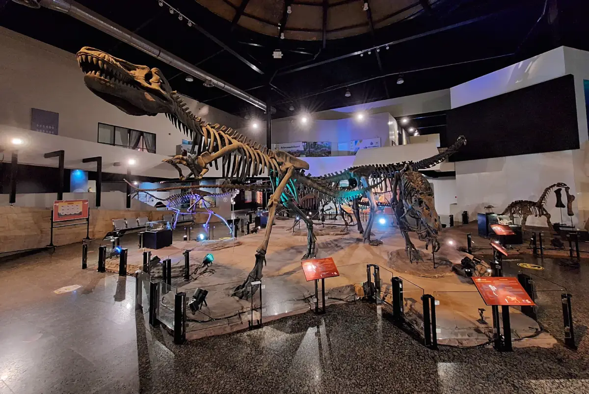
Sirindhorn Museum, Kalasin Province
Khon Kaen Province is a major city and regional center in central Isan, with important roles in education, healthcare, the economy, commerce, and transport between the provinces of the Khorat Plateau. The province includes urban districts, agricultural areas, and natural attractions toward the west, particularly around Phu Wiang and the sandstone mountain formations. Khon Kaen consequently shows how modern urban growth can coexist with evidence of local civilizations and longstanding artistic and craft traditions.
One of its major attractions is Wat Nong Waeng, a royal Buddhist temple beside Bueng Kaen Nakhon Lake whose Phra Mahathat Kaen Nakhon stupa is a prominent landmark of the city. Visitors can appreciate Buddhist artistic craftsmanship while learning about the history of Khon Kaen's urban communities. Other notable destinations include Phu Wiang Dinosaur Museum, which presents important dinosaur fossil discoveries in Thailand; Phra That Kham Kaen, an object of local Buddhist devotion; and mudmee silk-weaving communities in Chonnabot District.
Khon Kaen has an airport, a railway station, and several major highways, making it a convenient base for planning travel throughout Isan. A city itinerary can combine Wat Nong Waeng, Bueng Kaen Nakhon, and local dining neighborhoods within one day. Trips to Phu Wiang and traditional craft communities require additional time. Travelers should distinguish between attractions in the city and those in outlying districts when deciding the order of their journey.
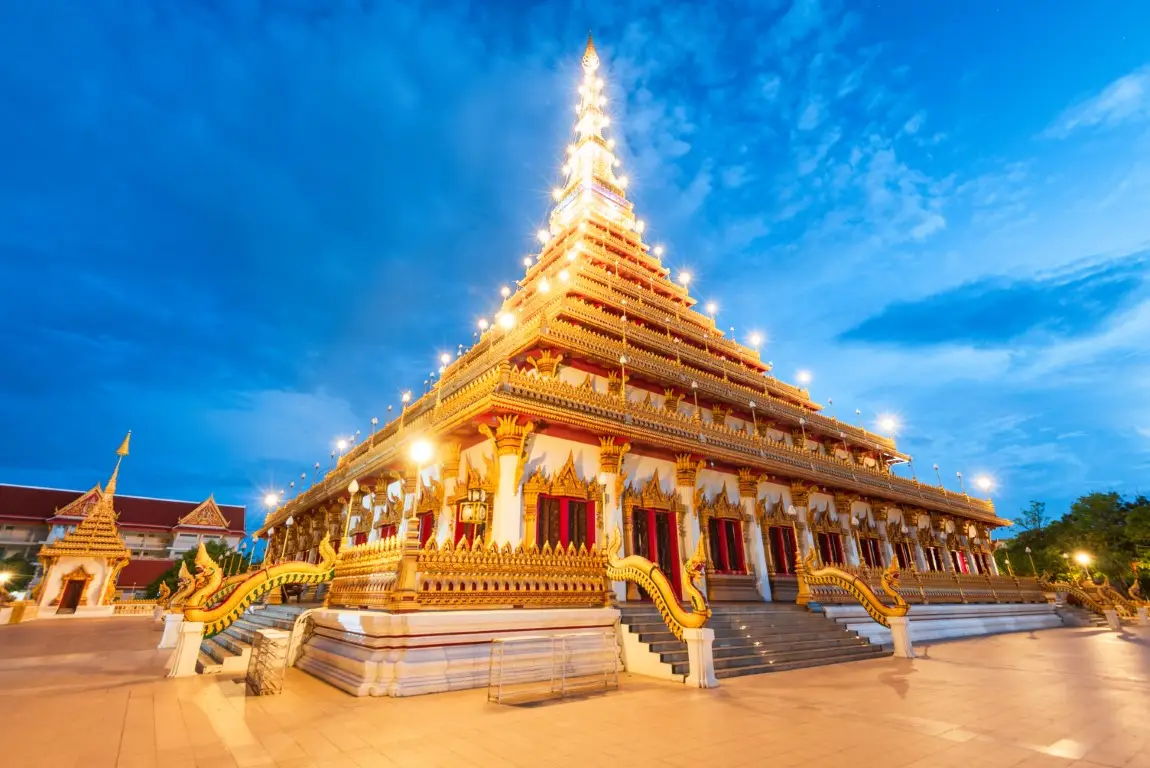
Wat Nong Waeng (Phra Mahathat Kaen Nakhon), Khon Kaen Province
Chaiyaphum Province lies on the western side of Isan, where the edge of the Khorat Plateau meets mountain ranges and extensive forests. Its varied terrain includes mountains, cliffs, rocky plateaus, streams, and agricultural land. Chaiyaphum is particularly known for seasonal natural scenery, especially during the rainy season when forests become lush and fields of wildflowers begin to bloom. This diversity offers a striking contrast to the common misconception that Isan consists only of dry landscapes.
Pa Hin Ngam National Park is one of Chaiyaphum's best-known attractions, famous for unusually shaped rock formations and fields of Siam tulips, or dok krajiao, during their flowering season. Sai Thong National Park also has Siam tulip fields and popular mountain scenery. Another notable attraction is Mo Hin Khao, where distinctive natural stone pillars illustrate how rock and landscape have changed over time through natural processes.
Routes into Chaiyaphum connect with Nakhon Ratchasima, Khon Kaen, and nearby provinces. Visitors hoping to see the Siam tulip fields should check the flowering season and national park announcements, because flower conditions depend on rainfall and the actual weather. For hiking or visits to elevated viewpoints, suitable footwear and compliance with park regulations are important for personal safety and for avoiding damage to natural ecosystems.
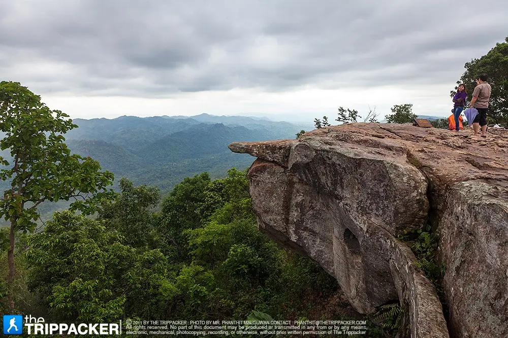
Pa Hin Ngam National Park, Chaiyaphum Province
Nakhon Phanom Province is situated in northeastern Isan, where the Mekong River is a major geographical feature and links the province culturally and economically with communities across the river in the Lao People's Democratic Republic. Nakhon Phanom has a distinctive riverside atmosphere and traces of several cultural influences, including local Thai communities, Thai people of Vietnamese ancestry, and the wider cultures of the Mekong Basin. Many settlements and religious sites developed alongside the river's routes for commerce and travel.
Phra That Phanom in That Phanom District is a profoundly important religious monument for communities on both the Thai and Lao sides of the Mekong. The sacred stupa is a focus of Buddhist devotion and is associated with the longstanding Phra That Phanom worship festival and pilgrimage traditions. Other attractions include the Phaya Sri Sattanakarat landmark, Nakhon Phanom's old town, and the riverside promenade, all of which let visitors experience the atmosphere of a border city and the beliefs shared by communities on both banks of the river.
Nakhon Phanom is accessible by road and transport connections from Sakon Nakhon, Mukdahan, and other Mekong provinces. Visitors wishing to see both Phra That Phanom and the old-town district should allow sufficient time, as they are located in different districts. A morning or evening walk along the Mekong is an enjoyable way to become familiar with the city. At the sacred stupa, visitors should dress modestly and respect the activities of worshippers.
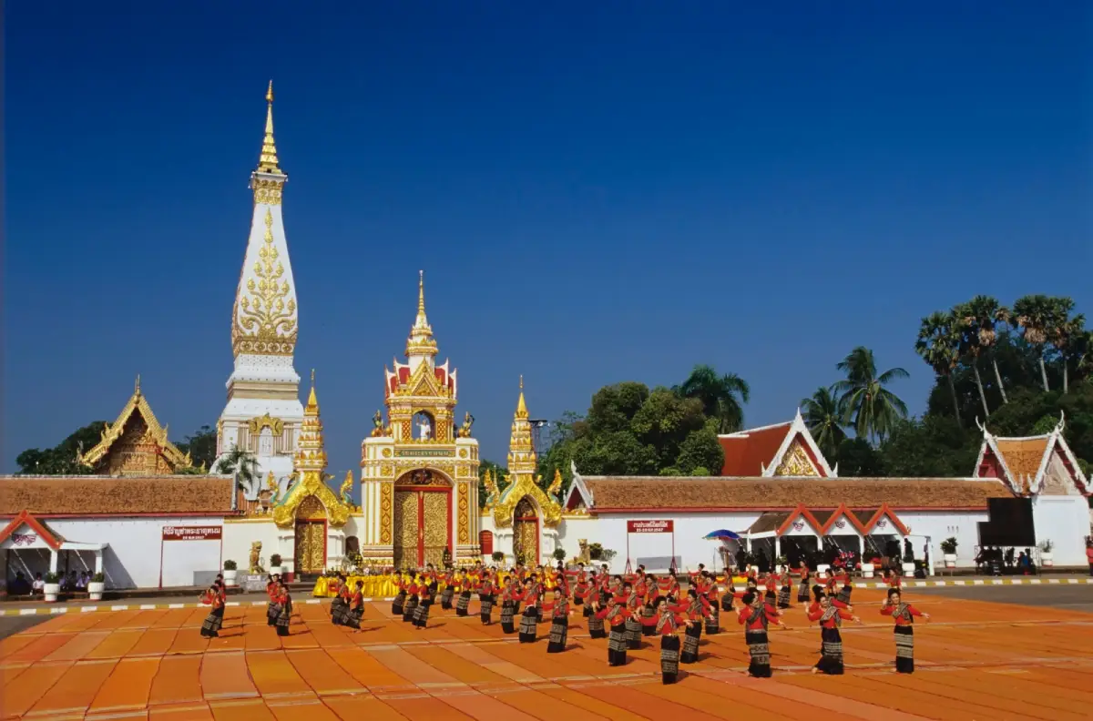
Phra That Phanom, Nakhon Phanom Province
Nakhon Ratchasima Province, commonly called Khorat, is geographically extensive and lies on the principal approach from Central Thailand to the Khorat Plateau. For this reason, it is often described as the gateway to Isan. The province combines a major city, agricultural land, mountains, and important historical heritage. In earlier periods, transportation routes and settlements around Khorat helped connect the people of the central plains with those living on the plateau. The area subsequently developed into a major economic and transportation center of Northeastern Thailand.
Phimai Historical Park is among Thailand's most important Khmer archaeological and architectural sites. Its sandstone sanctuary reflects the construction techniques and religious beliefs of the past. Nakhon Ratchasima also contains Khao Yai National Park, an important natural area; the Thao Suranari Monument in the city center; and silk-weaving communities in Pak Thong Chai, renowned for their textile skills. Together, these destinations make it possible to explore history, art, and nature within the same province.
Travelers can reach Nakhon Ratchasima from Bangkok via Mittraphap Road or by train. Further journeys to Phimai, Khao Yai, and other attractions should be planned as separate geographical areas, because the province is large and its main destinations are not all close together. Visitors interested in ancient cities may devote a day to Phimai, while nature enthusiasts should reserve sufficient time for Khao Yai National Park and check appropriate entrance routes before traveling.
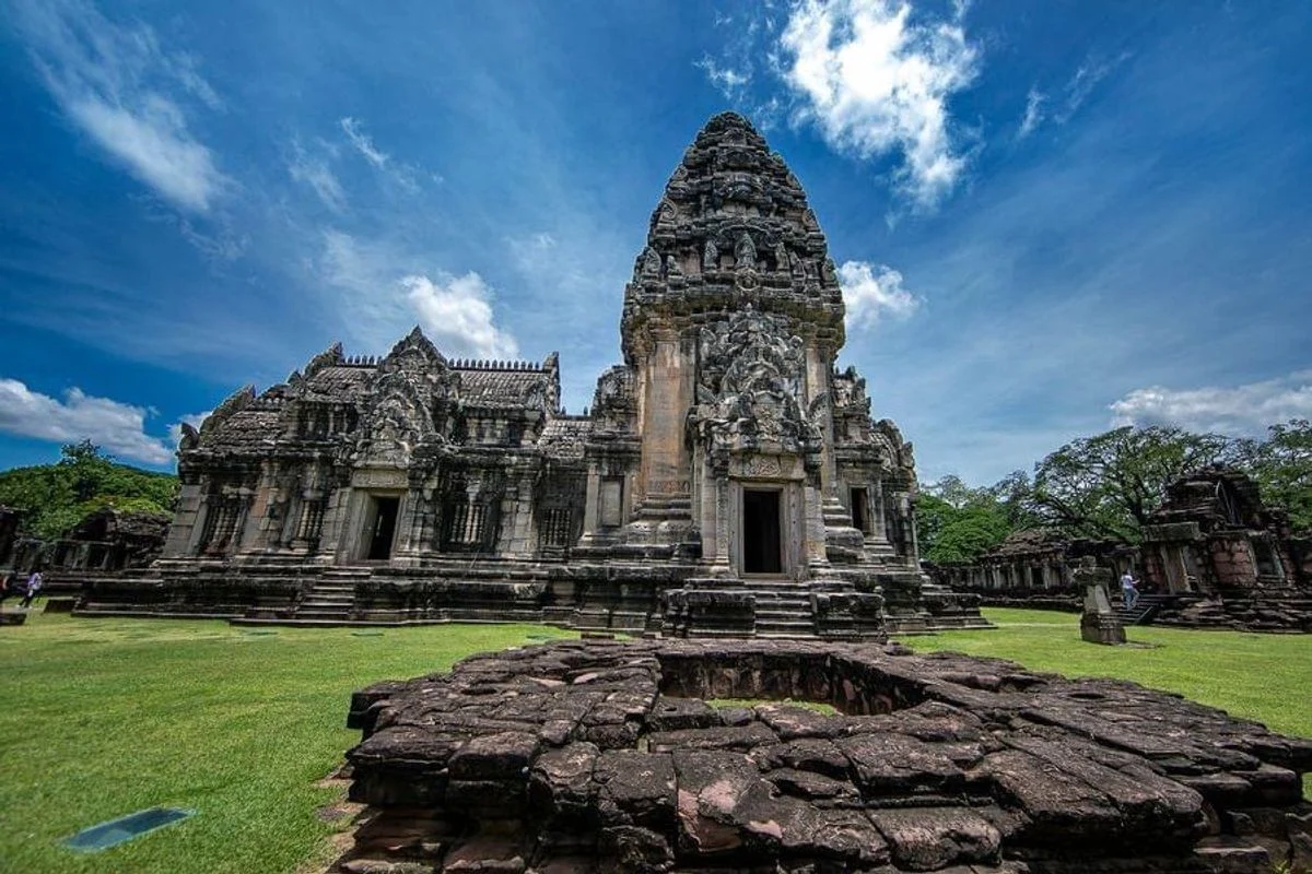
Phimai Historical Park, Nakhon Ratchasima Province
Bueng Kan Province lies in the far northeastern part of Isan, with the Mekong River forming an important natural feature along the Thai–Lao border. It was established as a separate province from Nong Khai in 2011, making it Thailand's most recently established province. Its diverse terrain includes Mekong lowlands, forests, sandstone mountains, and extensive rock platforms. These features have given Bueng Kan a distinctive identity for nature-based tourism and religious travel.
Hin Sam Wan, also known as Three Whale Rock, is a sandstone viewpoint in the Phu Sing area. Its three rock formations resemble whales lying in a row above a forested cliff. From the elevated viewpoint, visitors can appreciate the remarkable shapes of the rocks and the surrounding landscape. Other attractions include Phu Thok, or Wat Chetiya Khiri Wihan, which is associated with cliffside walkways and meditation, and Naka Cave, a natural site reached along a controlled hiking route in a protected area with specific safety requirements.
Travel in Bueng Kan should be organized around separate destinations, since Phu Sing, Phu Thok, and Naka Cave lie in different areas and offer different activities. Hin Sam Wan is a natural cliff environment where visitors must follow designated routes and staff instructions carefully, especially during rain when rocks may be slippery. Anyone planning a hike should check current entry sessions and advance booking requirements imposed by the responsible authorities.
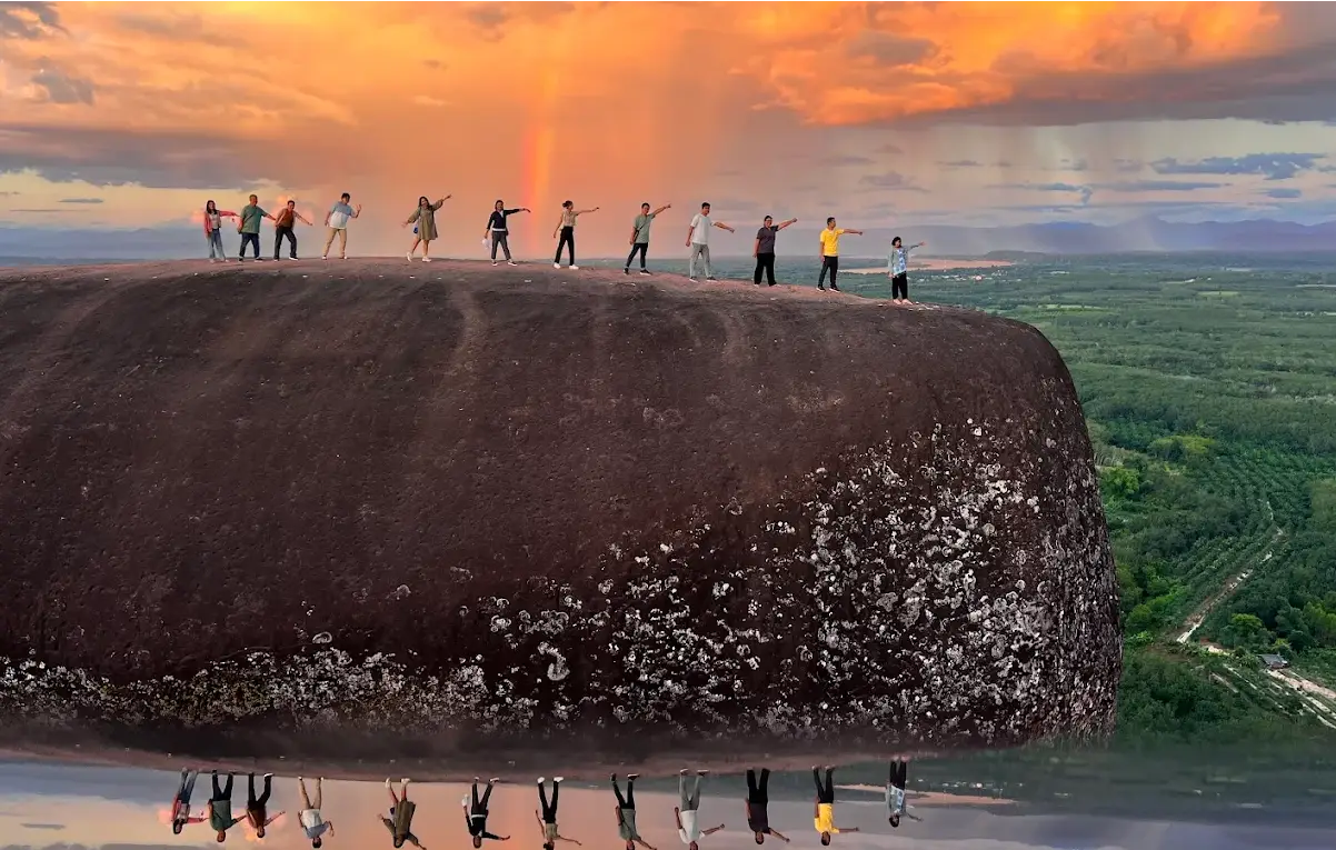
Hin Sam Wan (Three Whale Rock), Bueng Kan Province
Buri Ram Province is situated in southern Isan and has a rich historical heritage connected with ancient Khmer civilization and landscapes shaped by former volcanic activity. Several religious monuments are built from stone and have layouts that reflect the surrounding hills and historical religious beliefs. The province also preserves traditional weaving communities and crafts with distinctive local patterns. Modern Buri Ram is additionally associated with sports and the hosting of international competitions.
Phanom Rung Historical Park is a major attraction situated on an extinct volcano. Its Khmer-style stone sanctuary is celebrated for the alignment of its buildings and its finely carved stone decoration. Nearby is Muang Tam Sanctuary, whose reservoirs and architectural features make it particularly worthwhile to visit alongside Phanom Rung. Together, these two monuments help visitors understand the relationships between religious sanctuaries, ancient routes, and communities on the northeastern plateau.
The journey from Buri Ram city to Phanom Rung requires travel toward Chaloem Phra Kiat District, so visitors should allow adequate time and bring sun protection when exploring outdoor archaeological sites. Those who also wish to see Muang Tam should arrange the two sites in a convenient sequence. Buri Ram can also be linked with Surin and Si Sa Ket on a wider itinerary focused on Khmer-style temples and the cultural history of southern Isan.
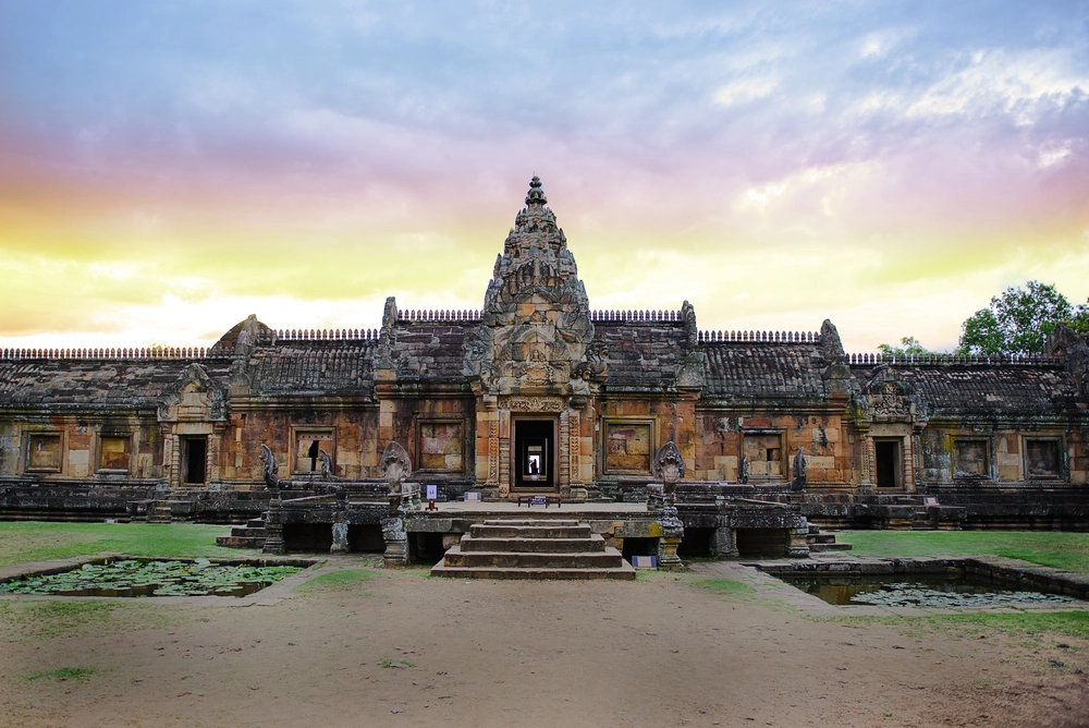
Phanom Rung Historical Park, Buri Ram Province
Maha Sarakham Province occupies a central position in Northeastern Thailand. Its terrain consists of plains, low hills, and agricultural areas connected to the Chi River Basin. The province is known as a center of education and is also home to communities that preserve various crafts, including reed-mat weaving, textile weaving, and traditions linked to agricultural life. Maha Sarakham's importance extends beyond its educational institutions to archaeological sites and religious monuments that illustrate the historical development of central Isan.
Phra That Na Dun in Na Dun District is an important Buddhist monument associated with evidence of Dvaravati culture around the ancient town of Champa Si. The architecture of the stupa and its surroundings offers opportunities to learn about Buddhist heritage. Other attractions include Ku Santarat, an ancient laterite structure, and community learning centers where local people preserve the knowledge of reed-mat weaving and other traditional handicrafts.
Maha Sarakham is conveniently situated for travel between Khon Kaen, Roi Et, and Kalasin. Visitors planning to see Phra That Na Dun should allow travel time from the provincial center, as the monument is in another district. Those interested in culture can combine Buddhist sites with traditional craft communities to discover how religious beliefs and skills used to make everyday objects remain connected with life in Isan.
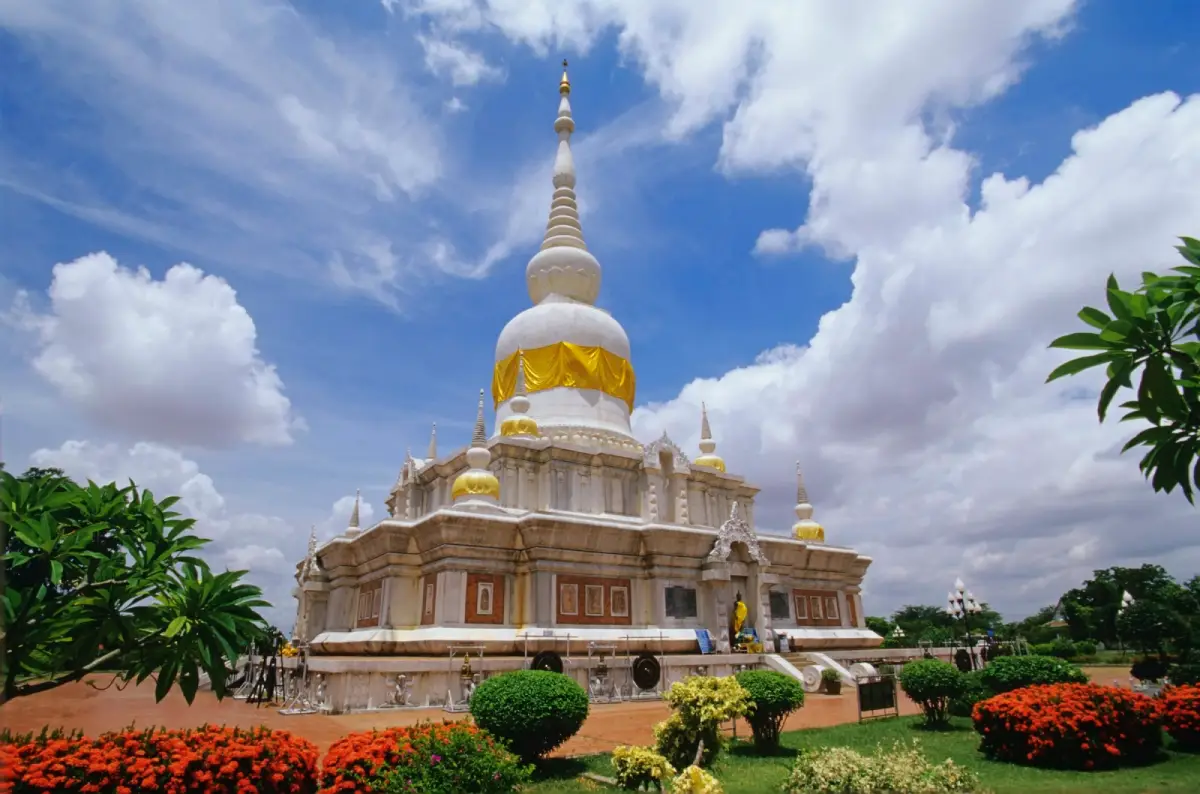
Phra That Na Dun, Maha Sarakham Province
Mukdahan Province is located on the Mekong River along the Thai–Lao border. It plays a significant role in cross-border trade and has close connections with Savannakhet in Laos. The geography includes river plains, farming communities, and sandstone mountain formations with unusual shapes. The province's diversity of ethnic communities and history of trade have produced a distinctive blend of food cultures, languages, and community lifestyles.
Phu Pha Thoep National Park is an important natural attraction, featuring rocky platforms and striking formations created by natural weathering and erosion. The province also has Mukdahan Tower, a prominent city landmark with displays relating to local history, and the Indochina Market beside the Mekong, which reflects the town's role as a border trading center connecting people and goods across national boundaries.
Mukdahan can be reached along road routes from Nakhon Phanom, Yasothon, Amnat Charoen, and neighboring provinces. Visitors to Phu Pha Thoep should allocate enough time to explore the rock formations and nature trails. The riverside area is particularly pleasant in the morning or evening. It is useful to plan urban sightseeing and national park exploration as separate activities to allow time for both the natural environment and community life.
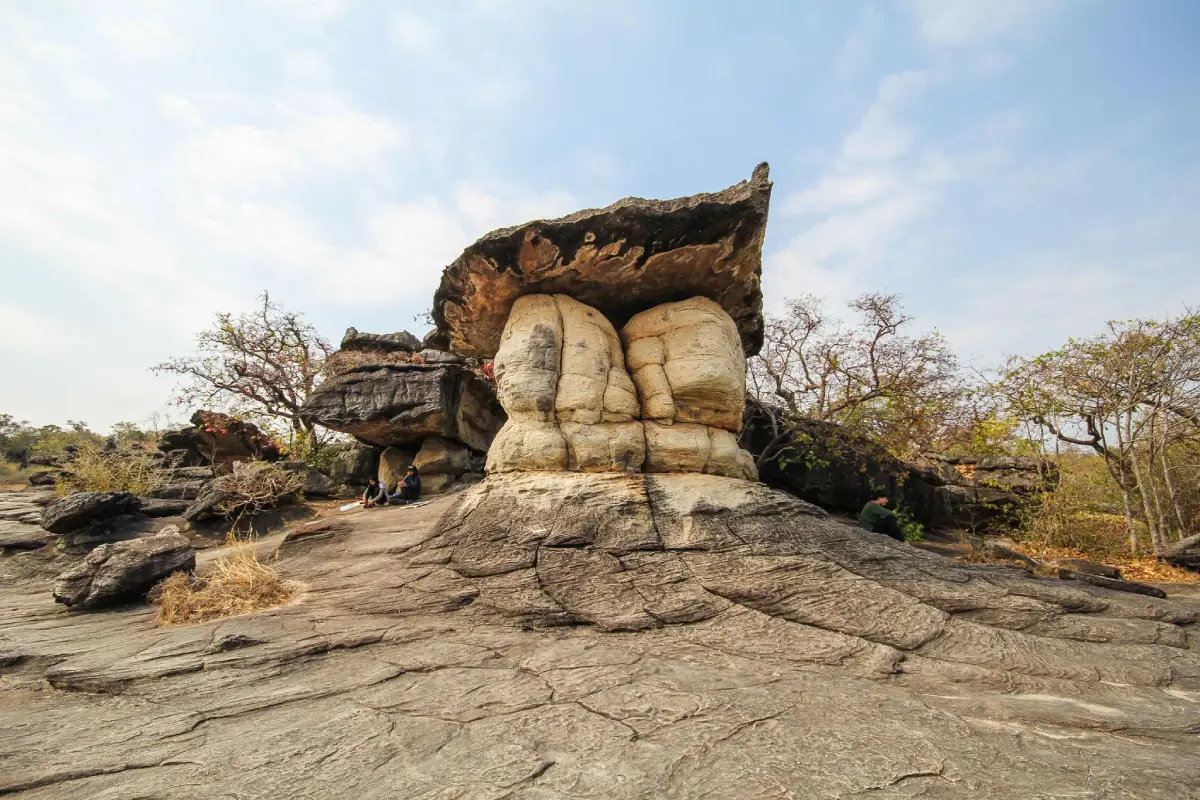
Phu Pha Thoep National Park, Mukdahan Province
Yasothon Province lies on the Khorat Plateau, with agricultural land and communities whose lives are closely tied to rice farming and Isan's merit-making traditions. The Bun Bang Fai rocket festival is one of the province's most recognizable cultural events. Rituals and community activities associated with hopes for rainfall illustrate the relationships among agriculture, nature, and local belief systems. Yasothon also preserves old buildings and trading communities that reflect its historical urban development.
Phra That Kong Khao Noi is a well-known religious monument associated with a local legend about filial gratitude and a moral lesson. Its distinctive stupa architecture can be appreciated alongside the traditional story. Other places of interest include the historic Ban Sing Tha neighborhood, known for its old houses and shops, and Phaya Thaen Public Park, which is linked to the city's rocket-festival identity.
Yasothon is connected by road to Roi Et, Ubon Ratchathani, and Mukdahan. Visitors interested in Bun Bang Fai should consult the annual festival schedule, since the dates may change according to organizer announcements and local conditions; dates from previous years should not be assumed to apply. Outside the festival period, travelers can still visit Phra That Kong Khao Noi, historic neighborhoods, and local cultural attractions when they are open to visitors.
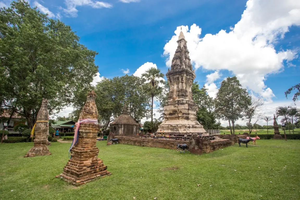
Phra That Kong Khao Noi, Yasothon Province
Roi Et Province is located in central Isan, with agricultural plains and waterways forming part of the Chi River Basin. The history of its towns and community networks is connected with longstanding settlement in the region. Today, Roi Et combines a developing urban center with important Buddhist temples, rice fields, and community learning sites. Traveling here offers opportunities to connect local history with the agricultural culture of Northeastern Thailand.
Bueng Phalan Chai is a major public park and recreational area in the heart of Roi Et, with a lake and green surroundings that reflect the role of urban wetlands in community life. Another attraction is Ho Wot 101, a modern landmark whose distinctive shape is inspired by the wot, a traditional Isan musical instrument. Phra Maha Chedi Chai Mongkhon is a large Buddhist religious monument recognized for its architecture and its importance to worshippers.
Roi Et is connected by road with Maha Sarakham, Kalasin, Yasothon, and Surin. A city itinerary can begin at Bueng Phalan Chai and Ho Wot before continuing to temples or attractions in other districts. Travelers wishing to visit Phra Maha Chedi Chai Mongkhon should allow additional journey time and dress respectfully when entering a Buddhist religious site.
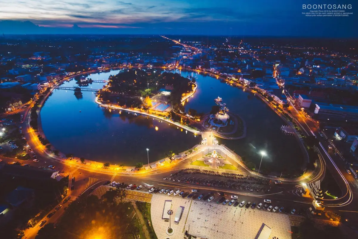
Bueng Phalan Chai, Roi Et Province
Loei Province lies in northwestern Isan and is characterized by mountain ranges, valleys, and extensive highland areas. Parts of the province border the Mekong River and the Thai–Lao frontier. Compared with many low-lying parts of Isan, Loei experiences cooler weather during the winter season, making it a major destination for mountain trips and nature-based relaxation. Local communities also preserve distinctive traditions, especially the Phi Ta Khon festival in Dan Sai District.
Phu Kradueng National Park is a major natural attraction known for its flat-topped mountain, challenging uphill walking route, viewpoints, and highland scenery popular among hikers. Other destinations include Chiang Khan, a historic community on the Mekong with old houses and the atmosphere of a small riverside town, and Phu Ruea National Park, another destination for scenic landscapes and seasonally cool conditions.
Travelers should organize Loei into separate geographical areas, such as Phu Kradueng, Phu Ruea, Chiang Khan, and Dan Sai, because winding roads and the distances between destinations can require considerable time. Before climbing Phu Kradueng, visitors must check the park's seasonal opening periods, entry regulations, and their own physical readiness. Those planning to attend Phi Ta Khon should rely on the official schedule announced for the relevant year.
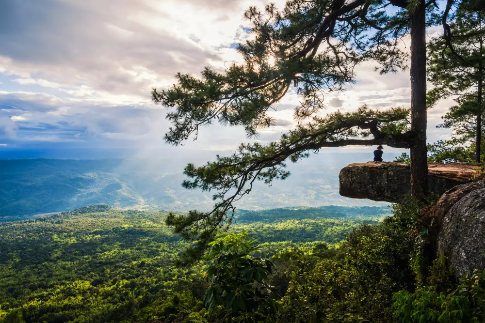
Phu Kradueng National Park, Loei Province
Si Sa Ket Province is located in southern Isan and shares a border with Cambodia. It is home to diverse local cultural groups, whose languages, traditions, food, and handicrafts contribute to the province's identity. Its landscape includes agricultural lowlands and elevated areas near the Phanom Dong Rak mountain range. The province preserves archaeological monuments influenced by Khmer artistic traditions and is also known for seasonal fruit-growing areas, particularly durian orchards in districts with soils associated with former volcanic landscapes.
Wat Pa Maha Chedi Kaew, widely known as Wat Lan Khuat or the Million Bottle Temple, is a distinctive attraction where large numbers of glass bottles have been reused as decorative materials and components of religious buildings. The site demonstrates creativity and practical knowledge in reusing materials. Other places of interest include Prasat Sa Kamphaeng Yai, an important ancient sanctuary, cultural communities of southern Isan, and seasonal fruit orchards that offer insights into the local economy.
Si Sa Ket can be reached from Ubon Ratchathani or Surin by road and by rail services operating along the relevant routes. Visitors interested in archaeological heritage can combine Wat Lan Khuat with ancient stone sanctuaries and other religious sites. Anyone traveling near the border should check current official announcements and safety regulations rather than relying on outdated information about access or routes.
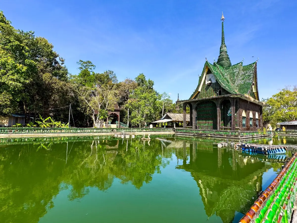
Wat Pa Maha Chedi Kaew (Wat Lan Khuat), Si Sa Ket Province
Sakon Nakhon Province lies in the Sakon Nakhon Basin north of the Phu Phan mountain range. Nong Han Lake is an important body of water, with communities established around its shores. The province is significant for Buddhist religious life and cultural heritage, especially the tradition of indigo-dyed textiles, a defining skill of many local weaving communities. The relationships among forests, mountains, lakes, and livelihoods give Sakon Nakhon a distinctive identity in both nature and craftsmanship.
Wat Phra That Choeng Chum Worawihan is an important city temple and a center of Buddhist devotion for the local population. The province also has forest temples and meditation centers associated with the history of Thailand's northeastern forest meditation tradition, as well as Nong Han Lake, a defining element of the urban landscape. Visitors can explore indigo-weaving communities to learn how natural dyes are prepared and how local textile patterns are created.
Major roads connect Sakon Nakhon with Udon Thani, Nakhon Phanom, Kalasin, and nearby provinces. Wat Phra That Choeng Chum can be combined with city sightseeing and visits to indigo textile learning centers within a single day. Journeys toward the Phu Phan mountains or outlying villages require additional time. Visitors should dress modestly at religious sites and observe local community etiquette.
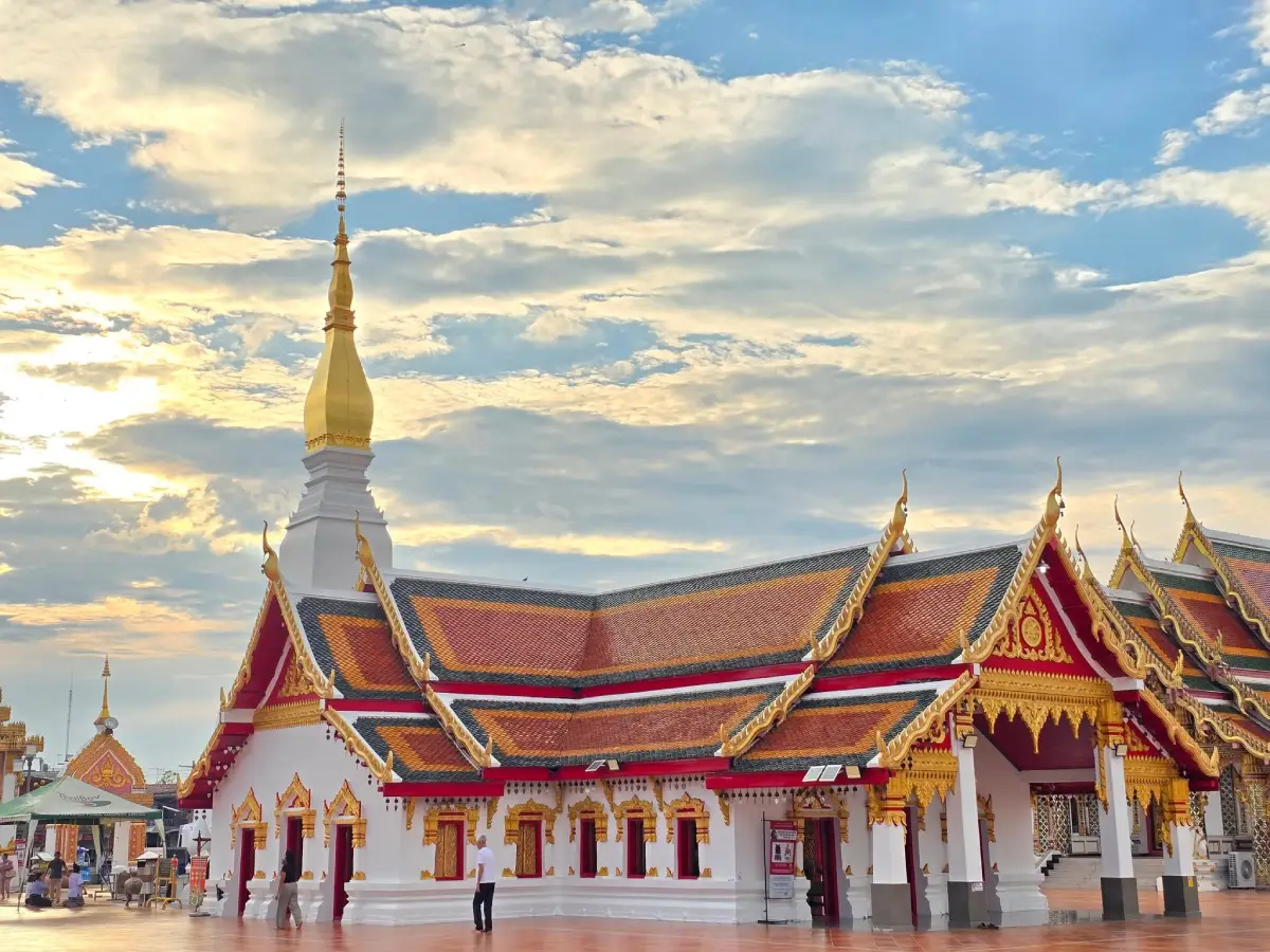
Wat Phra That Choeng Chum, Sakon Nakhon Province
Surin Province is situated in southern Isan and has strong cultural links with Khmer, Kuy, and other ethnic communities established in the region. Its local history is reflected in Khmer-style monuments, elephant-related traditions, and well-known silk production. The province contains extensive agricultural land and continues to preserve traditional crafts that remain part of community life, including silk weaving and local silversmithing.
Prasat Sikhoraphum is an important ancient sanctuary displaying Khmer architectural characteristics through its group of brick towers and decorative artistic details. Other notable places include the elephant-keeping community of Ban Ta Klang in Tha Tum District, which reflects the traditional relationships between people and elephants, and Surin's silk-weaving communities, known for their range of techniques and designs. These destinations are best understood as parts of the province's living community heritage rather than simply as photographic landmarks.
Surin can be reached by road and train services connecting it with Buri Ram and Si Sa Ket. Visitors planning to see Prasat Sikhoraphum should allow time to travel from the provincial center. For elephant-related experiences, choose services that prioritize animal welfare and respect community lifestyles. A Surin–Buri Ram–Si Sa Ket itinerary is well suited to visitors wishing to study Khmer civilization and the broader cultural heritage of southern Isan.
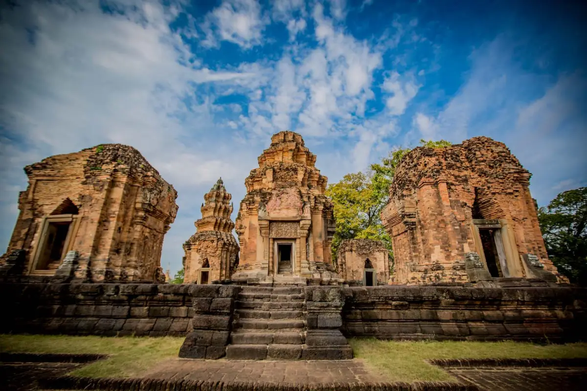
Prasat Sikhoraphum, Surin Province
Nong Khai Province lies along the Mekong River in northern Isan and is important for commerce, transportation, and relations between Thai and Lao communities. The provincial town features a riverside road, markets, and Buddhist religious sites associated with borderland life. It also has the First Thai–Lao Friendship Bridge, a major international transportation link. Its riverside setting makes Nong Khai a good place to learn about cultures on both banks of the Mekong and the changing character of border communities.
Sala Kaeo Ku is a distinctive attraction containing large sculptures inspired by a blend of religious and spiritual ideas. Nong Khai also has Wat Pho Chai, home to the revered Luang Pho Phra Sai Buddha image, and Tha Sadet Market beside the Mekong, which reflects the atmosphere of cross-border trade. The province has scenic river viewpoints and traditional events connected with local beliefs, especially the naga, which holds an important place in the culture of Mekong communities.
Nong Khai can be reached from Udon Thani by road or rail. Visitors can explore Sala Kaeo Ku, Wat Pho Chai, and the riverside district in a one-day itinerary. Those planning to cross the international border must check the travel-document requirements applicable to their nationality and the official regulations in effect at the time, as conditions may change. An evening walk beside the Mekong is a pleasant way to appreciate the city's atmosphere and everyday community life.
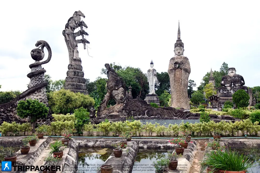
Sala Kaeo Ku, Nong Khai Province
Nong Bua Lam Phu Province lies in upper Isan and is connected with Udon Thani, Loei, and Khon Kaen. Its terrain combines agricultural plains and hills associated with the Phu Phan mountain system and several headwater areas. The province is important for Buddhist religious heritage and community history, particularly forest monasteries and places connected with respected meditation masters. It also offers natural attractions suitable for family and community recreation.
Wat Tham Klong Phen is closely associated with Luang Pu Khao Analayo, a widely respected monk of the Thai forest meditation tradition. The monastery's forests and natural rock formations create an appropriate setting for learning about the history of forest meditation in Isan. Other attractions include Phu Kao–Phu Phan Kham National Park, with mountains and a reservoir, as well as archaeological learning sites and traditional communities in different parts of the province.
Nong Bua Lam Phu is easily reached by road from Udon Thani or Loei. Those visiting Wat Tham Klong Phen should allow time to explore the monastery quietly and dress modestly because it is associated with Buddhist meditation practice. For visits to Phu Kao–Phu Phan Kham, check national park access points and road conditions in advance, particularly when planning nature walks or trips into higher terrain.
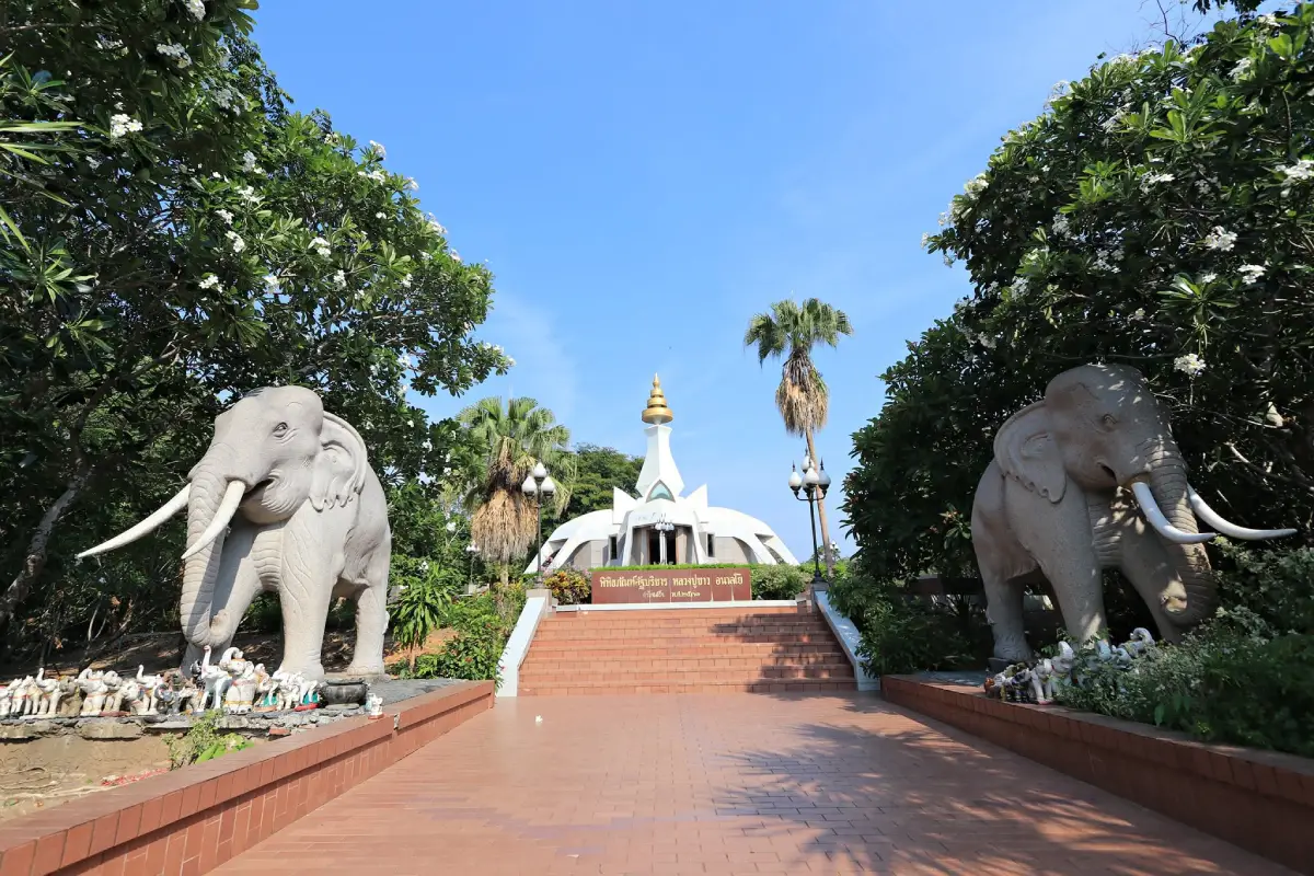
Wat Tham Klong Phen, Nong Bua Lam Phu Province
Amnat Charoen Province is located in eastern Isan and is characterized by agricultural plains, rural communities, and local cultures connected with the Mun River Basin and its tributary waterways. It is known for Buddhist religious sites, traditional merit-making festivals, and textile-weaving skills. Many livelihoods remain connected with rice cultivation and temple-centered communities, giving the province a quieter travel atmosphere than that of larger, more densely populated cities.
Wat Phra Lao Thep Nimit is a well-known Buddhist temple admired for its revered Buddha image and religious artistic heritage. Other attractions include Phra Mongkhon Ming Mueang Buddhist Park, a significant place of worship, and Phu Sa Dok Bua National Park, which encompasses mountains, forests, and natural areas extending toward neighboring provinces. Together, these sites make Amnat Charoen suitable for cultural exploration and unhurried nature-based recreation.
Amnat Charoen can be reached by road from Ubon Ratchathani, Yasothon, and Mukdahan. Travelers planning a pilgrimage can arrange a route between Phra Mongkhon Ming Mueang Buddhist Park and Wat Phra Lao Thep Nimit according to the sites they intend to visit. Before visiting natural areas, check protected-area regulations and road conditions. Admission charges or opening hours should never be assumed without checking current information.
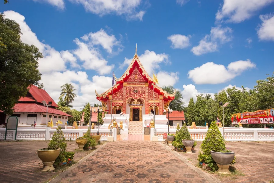
Wat Phra Lao Thep Nimit, Amnat Charoen Province
Udon Thani Province is an important center of upper Isan, with major roles in regional transportation, commerce, education, and services. Its territory contains urban districts, agricultural plains, natural lakes, and internationally recognized archaeological sites. Udon Thani thus combines the character of a modern regional city with evidence of human settlement dating back to prehistoric times.
The Red Lotus Sea at Nong Han Kumphawapi is a famous seasonal nature attraction. Large numbers of lotus flowers bloom across the lake, turning expanses of the water pink when conditions are favorable. Visitors can take sightseeing boats under the local operating arrangements. Other important destinations include the Ban Chiang World Heritage Site, which preserves significant prehistoric archaeological evidence, and Kham Chanot, a place closely associated with naga beliefs and local devotional practices.
Udon Thani is accessible by air, train, and road. Visitors hoping to see the Red Lotus Sea should check both the flowering season and the best time of day, because the abundance and appearance of blooms depend on actual seasonal and weather conditions. Ban Chiang is in a different area from the Red Lotus Sea and Kham Chanot, so the itinerary and number of travel days should be planned accordingly. Those interested in history should allow sufficient time at the archaeological site to appreciate its significance.
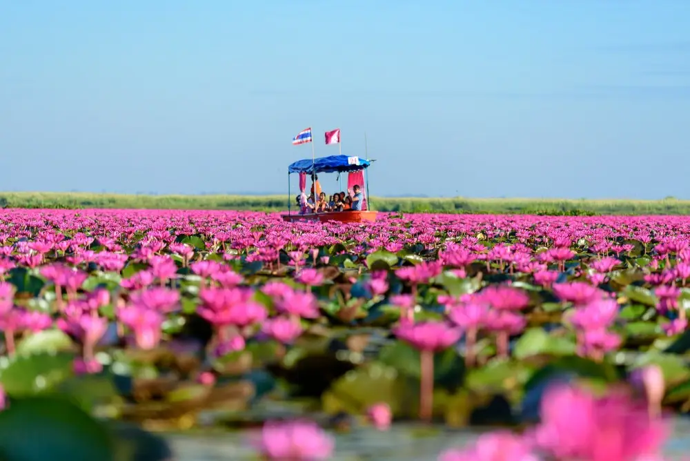
Red Lotus Sea, Udon Thani Province
Ubon Ratchathani Province is located in eastern Isan, with a diverse landscape extending from the lowlands of the Mun and Chi rivers to forests and sandstone formations near the Mekong. The province is a longstanding cultural and religious center with a rich history of settlement. Its identity is particularly associated with the Candle Festival, woven textiles, Buddhist traditions, and the diverse communities of the Thai–Lao–Cambodian border region.
Pha Taem National Park is an important attraction near the Mekong, with cliffs and prehistoric rock paintings that preserve traces of human life in the distant past. The park also offers viewpoints and remarkable sandstone landscapes. Other major destinations include Sam Phan Bok, where erosion by the Mekong has created unusual rock formations, and Wat Sirindhorn Wararam Phu Phrao, a temple known for its distinctive artistic features. Visitors interested in culture can also learn about Ubon Ratchathani's Candle Festival and its elaborate candle craftsmanship, an important part of the city's heritage.
Ubon Ratchathani is accessible by air, train, and road. Those planning to visit Pha Taem and Sam Phan Bok should consider the season and travel distances, since the attractions lie in different districts and riverside scenery changes with the Mekong's water levels. For areas near borders and within national parks, consult the current entry regulations issued by the authorities responsible. Visitors hoping to attend the Candle Festival should use the officially announced dates and events for that year.

Pha Taem National Park, Ubon Ratchathani Province
The 20 provinces of Isan clearly demonstrate the geographical diversity of Thailand. The region ranges from major cities and agricultural plains in the Khorat Basin to the forests of Phu Phan, sandstone formations, ancient volcanoes, and borderlands beside the Mekong River. Every province has its own geographical and historical character, closely connected with the languages, foods, arts, beliefs, and lifestyles of its communities. Reading an Isan map is therefore a starting point for understanding both the places and the people of Northeastern Thailand.
Those interested in ancient civilizations can follow a Phimai–Phanom Rung–Sikhoraphum route to study the archaeological monuments of southern Isan, or combine Ban Chiang and Kalasin to explore prehistoric evidence and fossils. Nature enthusiasts can plan mountain trips in Loei and Chaiyaphum. Travelers who want to experience Mekong riverside life can choose among Nong Khai, Bueng Kan, Nakhon Phanom, Mukdahan, and Ubon Ratchathani according to their interests. In every case, allow for travel distances between provinces and check road conditions and current access regulations for tourist areas before departure.
Frequently Asked Questions (FAQ)
Q: How many provinces are there in Northeastern Thailand?
A: Northeastern Thailand, also known as Isan, comprises 20 provinces according to the regional classifications used by Thailand's National Statistical Office and the Tourism Authority of Thailand.
Q: What are the names of all the provinces in Isan?
A: The 20 provinces are Kalasin, Khon Kaen, Chaiyaphum, Nakhon Phanom, Nakhon Ratchasima, Bueng Kan, Buri Ram, Maha Sarakham, Mukdahan, Yasothon, Roi Et, Loei, Si Sa Ket, Sakon Nakhon, Surin, Nong Khai, Nong Bua Lam Phu, Amnat Charoen, Udon Thani, and Ubon Ratchathani.
Q: Which numbered province is Bueng Kan in Thailand?
A: Bueng Kan is Thailand's 77th province. It was established in 2011 after being separated from Nong Khai and belongs to Northeastern Thailand.
Q: Where is Isan located in Thailand?
A: Isan occupies the northeastern part of Thailand on the Khorat Plateau. It borders Laos to the north and east and has areas along the Cambodian border to the south.
Q: Why is Isan called the Khorat Plateau?
A: Much of the region consists of an elevated plateau with mountainous margins along some sides. The Khorat Basin and Sakon Nakhon Basin are important parts of its geography. This does not mean that all 20 provinces are completely flat.
Q: What are the major rivers in Northeastern Thailand?
A: The principal rivers are the Mekong, Chi, and Mun. They have long influenced agriculture, settlement, culture, and transportation throughout the region.
Q: Which Isan provinces have historical attractions and Khmer stone sanctuaries?
A: Nakhon Ratchasima has Phimai Historical Park; Buri Ram has Phanom Rung Historical Park and Muang Tam Sanctuary; Surin has Prasat Sikhoraphum; and Si Sa Ket has Prasat Sa Kamphaeng Yai.
Q: Which Isan provinces are best for nature-based tourism?
A: Examples include Loei for Phu Kradueng and Phu Ruea; Chaiyaphum for Pa Hin Ngam and Sai Thong; Bueng Kan for Three Whale Rock; Ubon Ratchathani for Pha Taem; and Udon Thani for the seasonal Red Lotus Sea.
Q: What are the major traditional festivals of Isan?
A: Notable events include Yasothon's Bun Bang Fai rocket festival, Ubon Ratchathani's Candle Festival, and Loei's Phi Ta Khon festival, as well as the Heet Sip Song cycle of merit-making traditions and festivals honoring sacred Buddhist stupas in several provinces.
Q: How should I plan a trip around Isan using a map?
A: Plan routes around groups of connected provinces, such as Nakhon Ratchasima–Buri Ram–Surin for Khmer stone sanctuaries, or Udon Thani–Nong Khai–Bueng Kan for Mekong riverside destinations. Check actual road distances and conditions before traveling.
Q: When is the best time to visit Isan?
A: It depends on the destination. Cooler weather is suitable for mountain trips, while the rainy season can be favorable for forests and some seasonal flower fields. The Red Lotus Sea and local festivals have specific seasonal windows, so check up-to-date information before planning.
Q: How can an Isan map and province list help travelers?
A: They help identify neighboring provinces, group routes by geography, estimate travel times, and select historical, natural, or cultural attractions according to individual interests.
 Category: ●Travel Articles, Recipes
 Group: ●Travel Review, Food Review
Last Update : 1 DayAgo
 Last Update : 1 DayAgo

 Art, Culture and Heritage
 Historical Sites and Monuments(1)
 Art, Craft Centres, Tradition(4)
 Museums(1)
 University
 Public university(1)
 Places of Worship
 Temple(30)
 Other Sacred Sites(8)
 Suburban Living
 Village, Community(4)
 Nature and Wildlife
 National Parks and Marine Reserves(3)
 Mountain (Doi)(6)
 Dam, Reservoir, Lake(5)
 Waterfalls(3)
 Caves(2)
 River, Canal(5)
 Other natural attractions(5)
 Entertainment and Agricultural
 Zoos and Aquariums(1)
 Farms, Parks and Ecotourism(4)
 Shopping
 Shopping and Night Market(1)
Travel Review, Food Review(4)


