
lovethailand home >Northeastern Travel Attractions >Maha Sarakham Travel Attractions > 30 Best Places to Visit in Maha Sarakham
TL;DR: 30 Best Places to Visit in Maha Sarakham. Maha Sarakham is a province in central Northeastern Thailand with a character very different from major tourism cities. Its appeal does not.
30 Best Places to Visit in Maha Sarakham
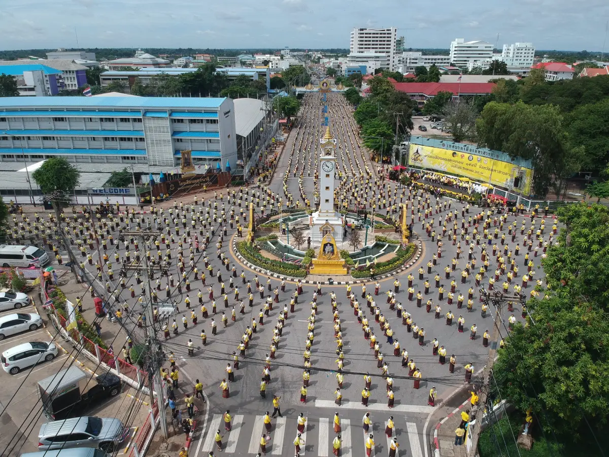
30 Best Places to Visit in Maha Sarakham Maha Sarakham is a province in central Northeastern Thailand with a character very different from major tourism cities. Its appeal does not come from high mountains or large entertainment districts, but from the combination of an education-centered city, ancient civilizations, Buddhism, traditional folk art, the Chi River ecosystem, and Isan community life that can still be experienced in everyday settings. For first-time visitors, major places not to miss include Phra That Na Dun, Ku Santarat, Ku Mahathat or Prang Ku Ban Khwa, Wat Phuttha Mongkhon, Wat Pa Lelai, Wat Photharam, Kosamphi Forest Park, Dun Lam Phan Non-Hunting Area, Kaeng Loeng Chan, and Ban Mo Pottery Village. Together, these destinations cover religion, archaeology, nature, art and culture, and community wisdom.
Maha Sarakham lies on the Khorat Plateau, with most of the province consisting of gently undulating plains and agricultural land. The Chi River is one of its most important waterways, supporting communities through agriculture, fisheries, water resources, and settlement. Although the landscape may appear relatively simple at first, the province contains several distinct ecosystems, ranging from riverside forest at Kosamphi Forest Park and freshwater seep forest at Dun Lam Phan to reservoirs, wetlands, and farming communities that clearly reflect the landscape of central Isan.
The modern history of Maha Sarakham is connected with the establishment of the city during the reign of King Rama IV, but the area’s cultural roots extend much further into the past. Na Dun District in particular is associated with the ancient city of Nakhon Champasri and Dvaravati culture. In later periods, several areas came under Khmer cultural influence, leaving archaeological evidence in religious monuments and Arokayasala hospital sanctuaries such as Ku Santarat and Ku Mahathat. These sites make Maha Sarakham a particularly rewarding destination for travelers interested in history and archaeology.
Buddhism plays a major role in the identity of the province. Phra That Na Dun is regarded as an important center of Buddhist faith in Northeastern Thailand, while Wat Phuttha Mongkhon and the ancient standing Buddha images of Kantharawichai are connected with artistic developments dating to the Dvaravati period. Wat Pa Lelai and Wat Photharam in Na Dun, meanwhile, preserve examples of traditional Isan sim ordination halls and folk murals known as hoop taem, which record community worldviews, beliefs, and ways of life through temple wall paintings.
Another defining aspect of Maha Sarakham is its reputation as the “Takshila of Isan,” a reference to its strong role as an educational center and university city. This gives the provincial capital a noticeably different atmosphere from the surrounding districts. Visitors can spend time in the city exploring museums, cultural centers, public parks, and recreation areas before continuing to Na Dun, Kantharawichai, Kosum Phisai, Na Chueak, Borabue, or Wapi Pathum to experience the different cultural and natural contexts of the province.
Maha Sarakham’s culture is also closely linked with the traditional Isan Heet Sip Song annual cycle of customs and merit-making festivals. Important examples include the Phra That Na Dun worship festival, Bun Bang Fai rocket festivals, Bun Phawet, Bun Samha, and Buddhist community ceremonies held throughout the year. Mor lam, the khaen mouth organ, woven textiles, basketry, pottery, and traditional food remain part of daily community life and local economies. Traveling in Maha Sarakham can therefore extend beyond visiting landmarks to learning directly from local wisdom and supporting products made within the communities themselves.
Maha Sarakham cuisine shares many characteristics with food found across central Isan. Common dishes include som tam, larb, nam tok, tom saep, gaeng om, bamboo-shoot soup, jaew dipping sauces, sticky rice, fish dishes, and foods prepared from local ingredients of the Chi River basin. Local markets and district communities are good places to experience this food in context, including seasonal vegetables, herbs, fermented foods, seasonal dishes, and processed products made by local producers.
Dividing the province into travel zones makes itinerary planning much easier. The Maha Sarakham City Zone is suitable for Ku Mahathat, Kaeng Loeng Chan, Ban Mo Pottery Village, museums, and cultural centers. The Na Dun Zone includes Phra That Na Dun, Ku Santarat, Wat Pa Lelai, Wat Photharam, and nature-learning sites. The Kantharawichai Zone features Wat Phuttha Mongkhon, Phra Buddha Ming Mueang, and natural attractions connected with the Chi River. The Kosum Phisai Zone is known for Kosamphi Forest Park, wetlands, and riverside areas, while the Na Chueak Zone is suitable for Dun Lam Phan, reservoirs, and quieter nature-based travel.
Travelers with only 1 day should focus on 1–2 nearby zones, such as Maha Sarakham City–Kantharawichai or Phra That Na Dun–Ku Santarat. With 2–3 days, Kosum Phisai and Na Chueak can also be added. A 4–5 day trip allows time to continue to Borabue, Wapi Pathum, Kae Dam, and other communities, giving visitors a much fuller picture of Maha Sarakham through its city, religion, archaeological sites, natural environments, and local lifestyles.
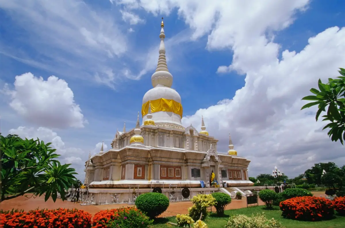
1. Phra That Na Dun, also known as Phra Borommathat Na Dun, is located in the Khok Dong Kheng area of Phra That Subdistrict, Na Dun District. It is one of the most important sacred sites in Maha Sarakham and is widely regarded as the “Buddhist Center of Isan.” The chedi enshrines sacred relics of the Buddha discovered in the area of the ancient city of Nakhon Champasri, giving the site major religious, historical, archaeological, and cultural significance.
Highlight: The white-and-gold chedi, sacred Buddha relics, the Buddhist ceremonial grounds, a large worship plaza, the history of ancient Nakhon Champasri, and the annual Phra That Na Dun worship festival, one of the province’s major merit-making events.
The Na Dun area contains important evidence of settlement and prosperity during the Dvaravati period. The discovery of sacred Buddha relics and archaeological objects made Na Dun a major location for the study of ancient civilization in central Isan. The chedi built later therefore functions as more than a religious monument; it connects contemporary Buddhist devotion with the ancient history of Nakhon Champasri.
The white-and-gold chedi rises prominently above the broad surrounding grounds and can be seen from a considerable distance. The area around it has been arranged for worship, walking, and religious ceremonies. Its spacious layout helps maintain a calm atmosphere even when large numbers of visitors arrive.
The annual Phra That Na Dun worship festival is the liveliest period of the year, with Buddhist activities and cultural events that reflect the site’s role as a major spiritual center for people in Maha Sarakham and neighboring provinces. Visitors looking for a quieter atmosphere should come on a weekday or early in the morning.
Phra That Na Dun is suitable for Buddhist pilgrims, families, older travelers, students, historians, and visitors interested in Dvaravati civilization. It can be combined in the same route with Ku Santarat, Wat Pa Lelai, Wat Photharam, and the Walai Rukhavej Botanical Research Institute.
Getting There: Located at Ban Na Dun in the Khok Dong Kheng area, Phra That Subdistrict, Na Dun District, Maha Sarakham Province. It is easily reached by car from Maha Sarakham city to Na Dun District. Open daily from 08.00–17.00.
Map (GPS): https://www.google.com/maps/dir/?api=1&destination=15.701074,103.226258&travelmode=driving
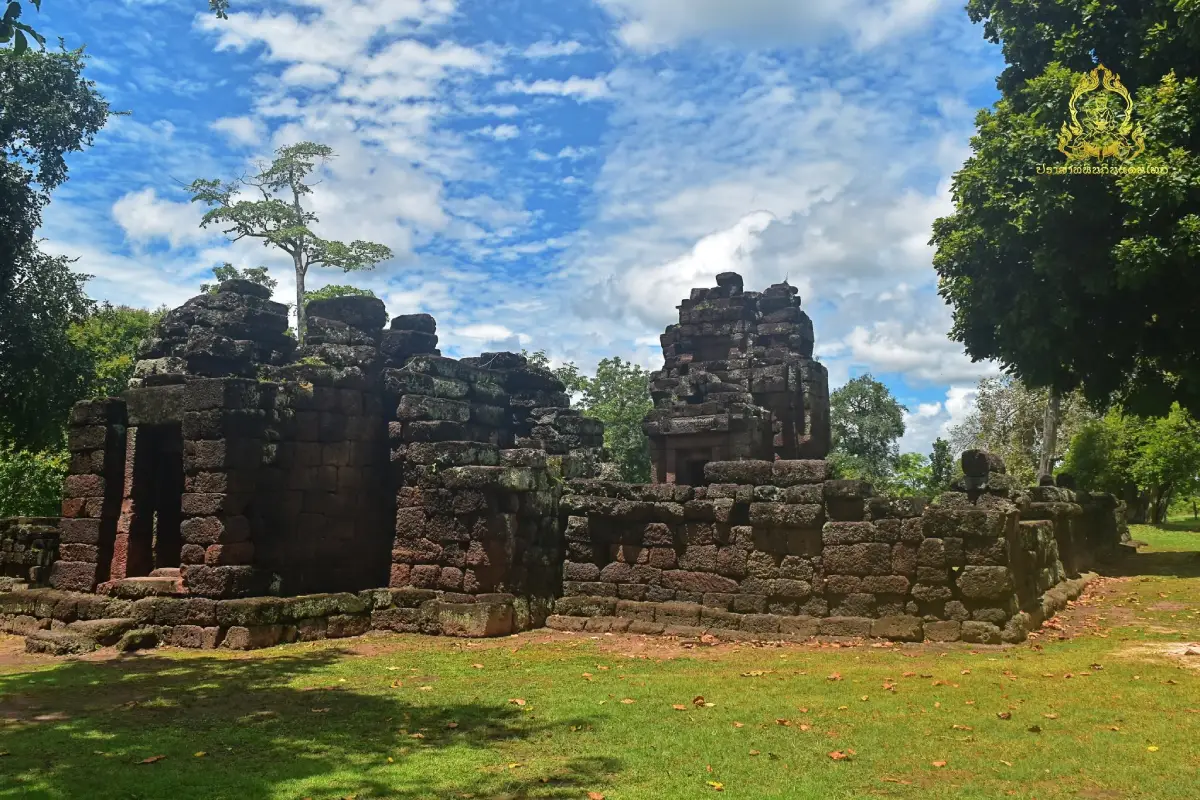
2. Ku Santarat is located in Ku Santarat Subdistrict, Na Dun District. It is one of Maha Sarakham’s important Bayon-style Khmer archaeological sites. Built mainly from laterite, the complex contains the characteristic elements of an Arokayasala, a religious sanctuary associated with the hospital network established during the reign of King Jayavarman VII.
Highlight: The laterite principal sanctuary, library building, gopura gateway, enclosure wall, pond, and the layout of an Arokayasala from the reign of King Jayavarman VII, which helps visitors understand the relationship between religion, healthcare, and communities in the ancient Khmer Empire.
The principal sanctuary has a square plan with indented corners and faces east, with a projecting porch at the front. Within the enclosure wall is an additional building identified as a library, while the eastern side contains the main gopura entrance. This arrangement reflects the standardized planning commonly found in the network of Arokayasala sanctuaries.
Arokayasala sanctuaries of the Jayavarman VII period were associated with Mahayana Buddhism and concepts of healing and compassion. Ku Santarat should therefore be understood as more than the ruins of an ancient temple. It was once part of a wider social, religious, and administrative network connecting communities throughout the region.
Although Ku Santarat is smaller than some of Thailand’s better-known Khmer monuments, its surviving layout is relatively easy to understand, making it a valuable learning site for students, archaeology enthusiasts, and travelers who want to study Bayon-period Khmer architecture directly in the landscape where it was built.
Ku Santarat is located only a short distance from Phra That Na Dun, so both sites are best visited on the same day. Morning or late afternoon is generally more comfortable for walking around the archaeological site than the hotter middle part of the day.
Getting There: Located in Ku Santarat Subdistrict, Na Dun District, approximately 4 kilometers from the Na Dun District Office. Open daily from 08.00–17.15.
Map (GPS): https://www.google.com/maps/dir/?api=1&destination=15.715084,103.264077&travelmode=driving
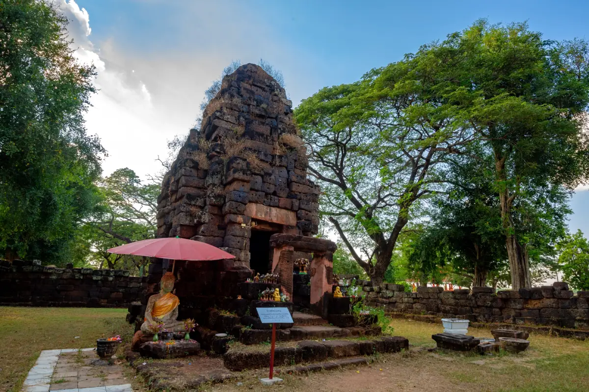
3. Ku Mahathat (Prang Ku Ban Khwa) is located at Ban Khwa, Khwa Subdistrict, Mueang Maha Sarakham District. It is another important Bayon-style Khmer archaeological site and Arokayasala in the province. Because it lies relatively close to Maha Sarakham city, it is particularly convenient for visitors who want to begin exploring the province’s history without traveling far.
Highlight: A laterite principal sanctuary, enclosure wall, gopura gateway, library building, Arokayasala plan, and archaeological evidence demonstrating ancient Khmer influence on the Khorat Plateau.
Ku Mahathat is also known as Prang Ku Ban Khwa. The archaeological complex follows an organized plan, with the main sanctuary facing east, a library positioned according to Khmer religious architectural principles, and an enclosure wall defining the sacred precinct.
The site is associated with the network of Arokayasala sanctuaries established during the reign of King Jayavarman VII across many parts of Northeastern Thailand. Having both Ku Mahathat and Ku Santarat within Maha Sarakham allows visitors to compare the plans, building materials, and contexts of 2 monuments that belonged to the same wider cultural system.
The surrounding Khwa Subdistrict is also connected with local handicrafts and a long history of settlement. A visit to Ku Mahathat can therefore be combined naturally with Ban Mo Pottery Village and Ban Chiang Hian Museum.
Ku Mahathat is suitable for historians, students, architectural photographers, and travelers interested in Khmer civilization. Visitors should help preserve the site by avoiding climbing on ancient structures or touching archaeological stonework unnecessarily.
Getting There: Located at Ban Khwa, Khwa Subdistrict, Mueang Maha Sarakham District. From the city, follow Chaeng Sanit Road or the Maha Sarakham–Roi Et route for approximately 13 kilometers. Open daily from 08.00–17.00.
Map (GPS): https://www.google.com/maps/dir/?api=1&destination=16.157709,103.416821&travelmode=driving
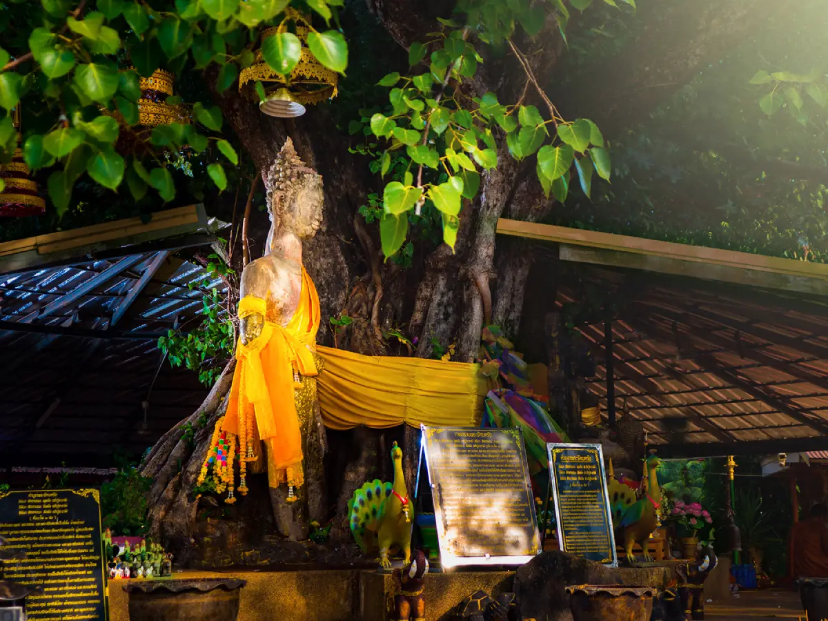
4. Wat Phuttha Mongkhon, also widely known as Wat Phra Yuen, is located at Ban Sa, Khanthararat Subdistrict, Kantharawichai District. The temple enshrines Luang Pho Phra Yuen, also known as Phra Phuttha Mongkhon, an ancient standing Buddha image revered as one of the most important sacred images of Kantharawichai.
Highlight: Luang Pho Phra Yuen, an ancient standing Buddha approximately 4 meters high, artistic features associated with Dvaravati culture, strong local devotion, and the atmosphere of an old temple along the Maha Sarakham–Kalasin route.
The standing Buddha is the temple’s most distinctive feature. Its elegant upright posture differs from the seated Buddha images commonly seen in Isan temples. The image has been respected by the local community for generations and is closely connected with the history of ancient Kantharawichai.
Kantharawichai contains cultural and archaeological evidence from several periods, making Wat Phuttha Mongkhon an important site for understanding how religion relates to the development of ancient settlement in the area. A visit can naturally be combined with Phra Buddha Ming Mueang and other nearby attractions.
The temple has a peaceful, shaded atmosphere and is easy to reach. It is suitable for Buddhist travelers, families, older visitors, those interested in Buddhist art, and travelers looking for a meaningful stop along the Maha Sarakham–Kalasin route.
Visitors should dress respectfully and maintain a quiet atmosphere around the Buddha image, particularly when local residents are worshipping or participating in religious ceremonies.
Getting There: Located at Ban Sa on Thinanon Road, Village No. 2, Khanthararat Subdistrict, Kantharawichai District, Maha Sarakham Province. Open daily from 08.00–17.00.
Map (GPS): https://www.google.com/maps/dir/?api=1&destination=16.308381,103.300556&travelmode=driving
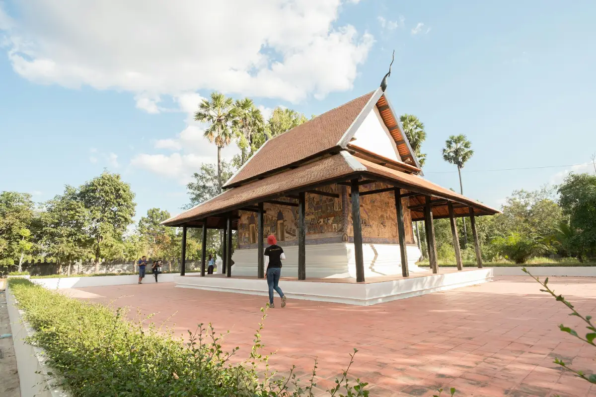
5. Wat Pa Lelai is located at Ban Nong Phok, Dong Bang Subdistrict, Na Dun District. This historic temple is particularly well known for its traditional Isan sim ordination hall and old folk murals, making it one of the province’s most important places for studying vernacular Isan art in its original community setting.
Highlight: A traditional brick-and-plaster Isan sim, Naga stairways, small window openings, murals painted both inside and outside the building, and scenes depicting Buddhist narratives and local literature.
The sim has a simple architectural form that reflects community craftsmanship rather than royal architectural conventions. The building is relatively small, with solid walls and limited openings, creating an interior atmosphere noticeably different from that of modern ordination halls.
The hoop taem murals are the temple’s greatest artistic treasure. They function almost like visual records of the past, conveying religion, moral ideas, stories, clothing, community life, and the imagination of local painters. Their lines and compositions are relatively free in style and clearly reflect the identity of vernacular Isan art.
Wat Pa Lelai is particularly suitable for students, artists, historians, cultural travelers, and architectural photographers. Visitors should avoid touching the walls or paintings directly in order to help preserve the historic murals.
The temple can be combined with nearby Wat Photharam in Dong Bang Subdistrict, followed by Phra That Na Dun or Ku Santarat, creating a complete art-and-history route through Na Dun District within a single day.
Getting There: Located at Ban Nong Phok, Dong Bang Subdistrict, Na Dun District, Maha Sarakham Province. From the provincial capital, travel toward Na Dun District and continue into Dong Bang Subdistrict. Open daily from 08.00–17.00.
Map (GPS): https://www.google.com/maps/dir/?api=1&destination=15.659265,103.243077&travelmode=driving
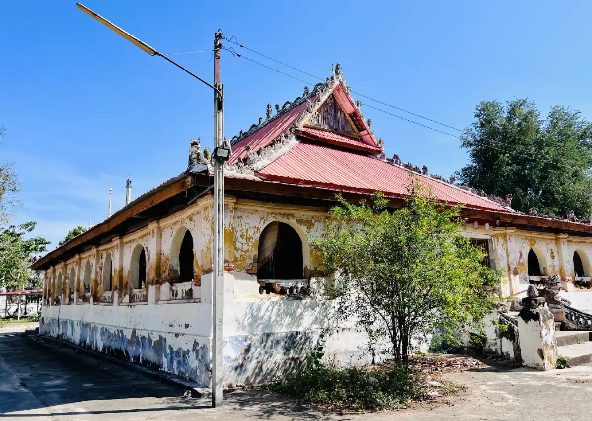
6. Wat Photharam is located at Ban Dong Bang, Village No. 5, Dong Bang Subdistrict, Na Dun District. This historic temple is important for its architecture, community history, and connections with the migration of people from Vientiane into the Maha Sarakham area.
Highlight: A traditional Isan sim, vernacular hoop taem murals, the history of a community with roots connected to migrants from Vientiane, local craftsmanship, and the strong Thai–Lao cultural character of Ban Dong Bang.
The temple developed within a community established during the early Rattanakosin period. Ban Dong Bang has historical connections with Lao migrants from Vientiane, and the establishment of the temple became an important part of building the community and preserving shared religious traditions.
The sim and hoop taem murals reflect art created by local craftsmen rather than formal central Thai court styles. The paintings contain not only Buddhist stories but also details of clothing, people, household objects, and the imagination of earlier Isan society.
Visiting Wat Photharam together with Wat Pa Lelai allows travelers to compare different examples of Isan sim architecture and folk mural painting within the same area, making it possible to study local religious art without having to travel across several districts.
The temple is suitable for travelers interested in art, culture, religion, history, and photography. Allow at least 30–60 minutes to observe the architecture and paintings without rushing.
Getting There: Located at Ban Dong Bang, Village No. 5, Dong Bang Subdistrict, Na Dun District, Maha Sarakham Province. From Maha Sarakham city, travel toward Na Dun District and continue into Dong Bang Subdistrict. Open daily from 08.00–17.00.
Map (GPS): https://www.google.com/maps/dir/?api=1&destination=15.660540,103.249583&travelmode=driving

7. Kosamphi Forest Park is located in Hua Khwang Subdistrict, Kosum Phisai District, along the Chi River. Covering approximately 125 rai, this natural forest lies close to the local community and is one of the province’s important green areas. Its best-known feature is a large population of long-tailed macaques, including distinctive golden-haired individuals.
Highlight: Chi River forest, large mature trees, long-tailed macaques, golden-haired macaques, nature trails, a shaded atmosphere, and convenient access from central Kosum Phisai.
The forest park developed from a public forest along the Chi River that has long been important to both the local community and wildlife. Its designation as a forest park brought more systematic conservation while still allowing people to use the area for recreation and nature education.
Long-tailed macaques are the most visible animals in the park and are relatively easy to encounter. Visitors should maintain a safe distance, avoid feeding them without authorization, and never tease or provoke the animals. Feeding can alter natural behavior and increase risks for both visitors and the macaques.
The riverside forest contains several tree species, including yang, tabaek, krathum, khoi, bamboo, and Java plum. These trees provide shade and help retain moisture, making the area a useful example of a Chi River riparian ecosystem that can be explored without a long forest hike.
Kosamphi Forest Park is suitable for families, children, students, older travelers, nature enthusiasts, and photographers. It can be combined with Bueng Bon, Sa Due Isan, or Hat Wang Ko on the same Kosum Phisai route.
Getting There: From Maha Sarakham city, follow Highway 208 on the Maha Sarakham–Kosum Phisai–Khon Kaen route for approximately 28–30 kilometers. Open daily from 08.30–16.30.
Map (GPS): https://www.google.com/maps/dir/?api=1&destination=16.254968,103.068133&travelmode=driving
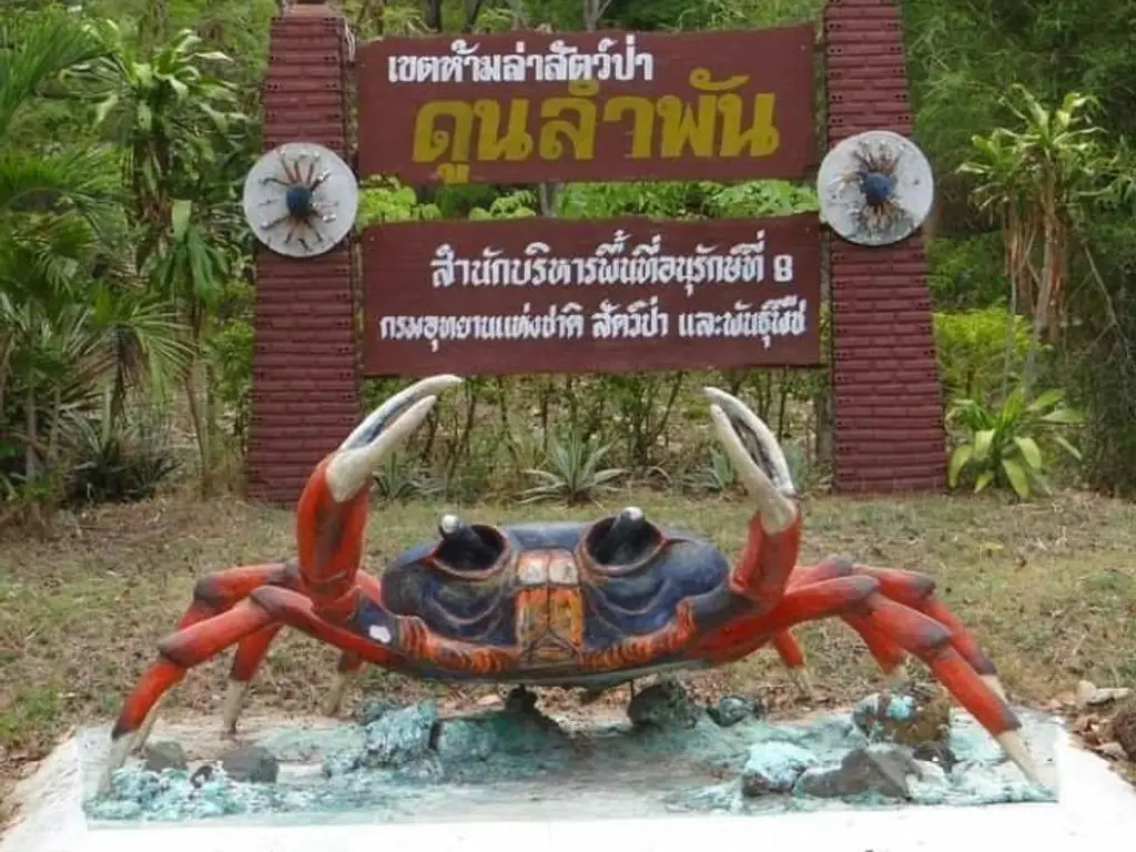
8. Dun Lam Phan Non-Hunting Area is located in Na Chueak District. This protected area has an ecosystem very different from the usual image of Isan forest because it contains freshwater seep forest and wetland habitats where groundwater naturally emerges and maintains moisture throughout the year.
Highlight: Freshwater seep forest, aquatic and wetland vegetation, biodiversity, and the Princess Crab, locally known as Pu Paeng, a colorful freshwater crab closely associated with the unique ecosystem of Dun Lam Phan.
The Isan word “dun” is associated with water that naturally rises or seeps from the ground. This groundwater seepage allows the area to remain moist even in a region with a clearly defined dry season, creating a specialized ecosystem supporting aquatic plants, fish, crabs, insects, and many other organisms.
The species that has made Dun Lam Phan particularly well known is the Princess Crab, also called Pu Paeng by local residents. Its distinctive coloration and restricted habitat have made it an important natural symbol of Maha Sarakham.
Visitors should experience the area as a conservation site rather than simply as a photography location. Stay on designated routes, do not catch animals, avoid disturbing the water sources, and never leave food waste or rubbish that could affect water quality.
The area is suitable for students, researchers, families, nature watchers, and visitors interested in biodiversity. It can be combined with Ban Khok Kong Arts and Crafts Promotion Center, Huai Kho Reservoir, and other attractions in Na Chueak District.
Getting There: Travel to Na Chueak District and follow the Na Chueak–Phayakkhaphum Phisai route toward Dun Lam Phan Non-Hunting Area. Open daily from 08.30–16.30.
Map (GPS): https://www.google.com/maps/dir/?api=1&destination=15.770321,103.030290&travelmode=driving

9. Kaeng Loeng Chan is located in Kaeng Loeng Chan Subdistrict, Mueang Maha Sarakham District. It is a large reservoir and one of the city’s important recreation areas, with broad water views, green spaces, walking and running routes, viewpoints, and a pavilion over the water. It is particularly pleasant in the morning or late afternoon.
Highlight: A large reservoir, sunset views, health and exercise areas, walking and running routes, cycling space, a pavilion over the water, and an open landscape close to the city center.
Kaeng Loeng Chan is more than a tourist attraction. It is a genuine public space used by local residents and university students for exercise, relaxation, meeting friends, and enjoying the breeze along the reservoir. This makes it a good place to experience everyday life in Maha Sarakham city.
The name is connected with local geography and Isan language. The word “loeng” refers to a low-lying area or wetland, while “chan” is associated with the flame tree or thong kwao found locally. The name Kaeng Loeng Chan therefore has a direct relationship with the natural characteristics of the area.
The reservoir also plays a role in local water systems and freshwater ecology. Areas around it are associated with research and aquaculture, giving the site practical importance beyond recreation.
Kaeng Loeng Chan is suitable for families, runners, cyclists, couples, students, and older travelers. The period close to sunset usually offers the most pleasant atmosphere and the best light for photographing the water.
Getting There: Located in Kaeng Loeng Chan Subdistrict, Mueang Maha Sarakham District, close to the city area and easily reached by car or local transport. The area is open daily and accessible 24 hours.
Map (GPS): https://www.google.com/maps/dir/?api=1&destination=16.175735,103.267791&travelmode=driving

10. Ban Mo Pottery Village is located at Ban Mo, Village No. 11, Khwa Subdistrict, Mueang Maha Sarakham District. The community is well known for traditional pottery-making and continues to preserve knowledge passed down through generations.
Highlight: Hand-forming pottery, locally sourced clay, drying and firing processes, traditional Isan earthenware, souvenir products, and the opportunity to learn directly from local pottery makers.
The name “Ban Mo,” meaning Pottery Village, directly reflects the traditional occupation of the community. Local craftspeople are skilled at kneading clay, shaping vessels, decorating them, and firing them into practical household objects such as water jars, cooking pots, and kitchenware.
The main appeal of visiting the village is seeing the process in a real working community. The pottery is not produced on an industrial assembly line. Instead, the craftspeople rely on experience to judge clay moisture, form each piece, control wall thickness, dry the pottery correctly, and manage temperatures during firing.
Today, production is no longer limited to traditional household vessels. Local makers have adapted designs into decorative objects, practical products, and souvenirs. Purchasing directly from the community therefore supports local income and helps ensure that pottery knowledge continues to be passed to future generations.
Ban Mo Pottery Village is suitable for families, students, designers, cultural travelers, and anyone interested in handmade crafts. It can be combined with Ku Mahathat and Ban Chiang Hian Museum within the Khwa Subdistrict area.
Getting There: Located at Ban Mo, Village No. 11, Khwa Subdistrict, Mueang Maha Sarakham District, Maha Sarakham Province. It is easily reached from the city by traveling toward Khwa Subdistrict. Open daily from 08.00–17.00.
Map (GPS): https://www.google.com/maps/dir/?api=1&destination=16.144327,103.403271&travelmode=driving
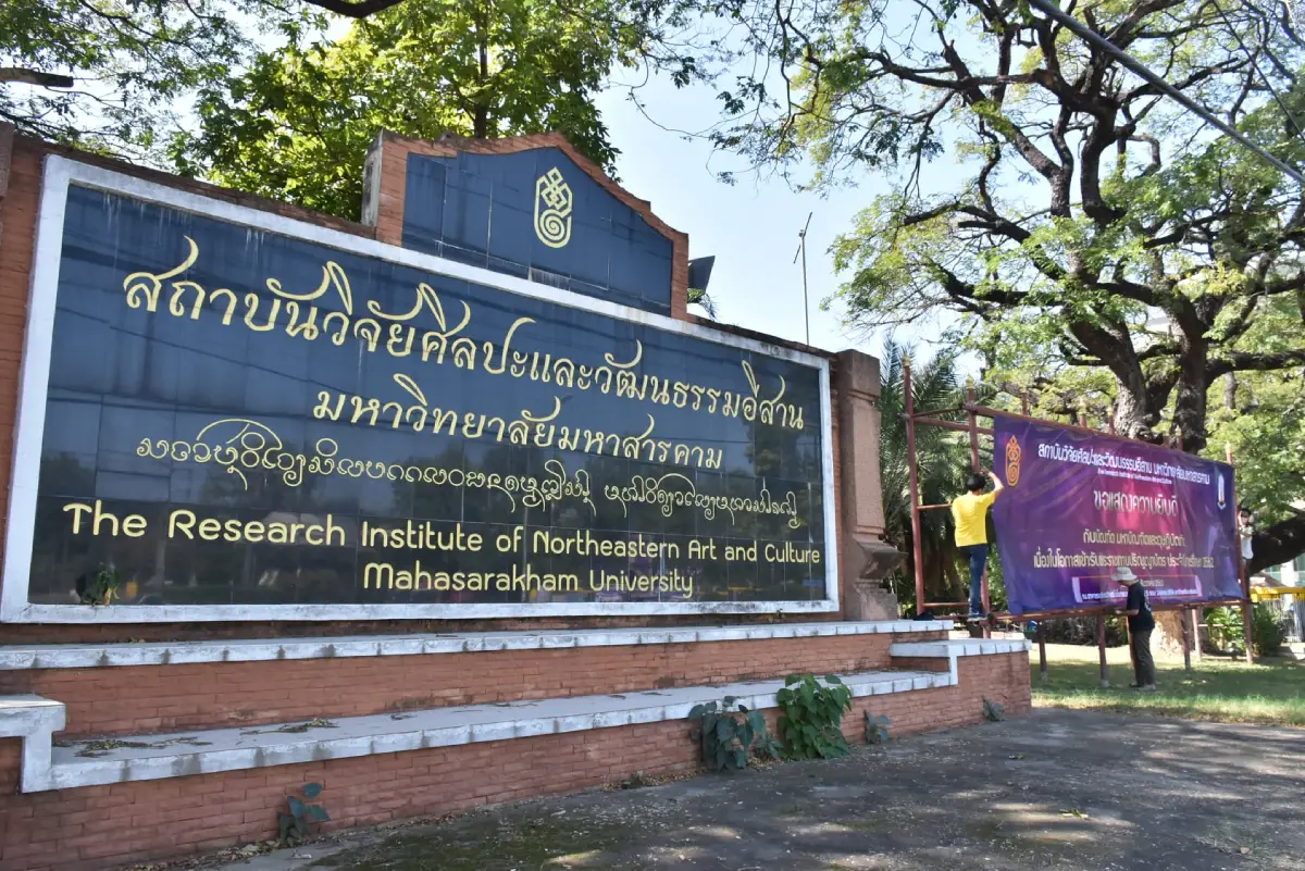
11. Isan Art and Culture Center is located within Rajabhat Maha Sarakham University in Talat Subdistrict, Mueang Maha Sarakham District. It is an important learning center dedicated to the art, culture, traditions, and local wisdom of Northeastern Thailand, helping visitors understand Isan ways of life through displayed objects, handicrafts, ancient documents, and systematically collected cultural knowledge.
Highlight: Isan arts and crafts, traditional woven textiles, basketry, household tools, palm-leaf manuscripts, local literature, exhibitions about regional traditions, and cultural knowledge presented within the university grounds.
Maha Sarakham is widely known as an education center, and the Isan Art and Culture Center clearly reflects that role. It connects academic study with the cultural heritage of local communities, preserving knowledge that was once maintained mainly within villages, temples, and households and making it more accessible to younger generations and visitors.
Exhibitions present stories about weaving, textile patterns, agricultural tools, household objects, basketry, and palm-leaf literature. These objects help explain that Isan culture is not separate from everyday life but developed from the ways people adapted to local geography, seasonal conditions, agriculture, religious beliefs, and community traditions.
Visitors interested in Heet Sip Song, Khong Sip Si, merit-making festivals, traditional craftsmanship, or the development of Isan society can gain a deeper understanding here because actual cultural objects are presented together with the contexts in which they were used.
The center is suitable for school students, university students, researchers, families, cultural travelers, and visitors who want to understand Maha Sarakham as an education-centered province. It can be combined with Maha Sarakham City Museum, Wat Mahachai Museum, Maha Sarakham City Pillar Shrine, and Kaeng Loeng Chan.
Getting There: Located within Rajabhat Maha Sarakham University on Nakhon Sawan Road, Talat Subdistrict, Mueang Maha Sarakham District. Open Monday–Friday from 08.30–16.30.
Map (GPS): https://www.google.com/maps/dir/?api=1&destination=16.195726,103.272185&travelmode=driving
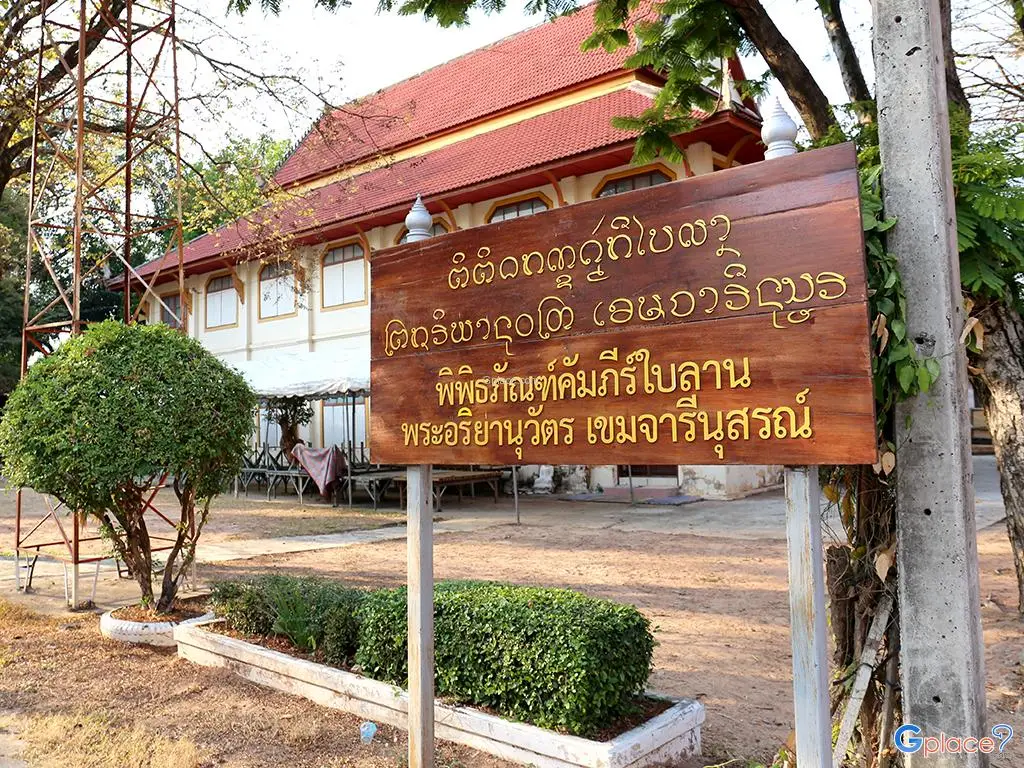
12. Wat Mahachai Museum, also known as the Northeastern Local Museum at Wat Mahachai, is located within Wat Mahachai Royal Monastery in Talat Subdistrict, Mueang Maha Sarakham District. It is an important collection of archaeological objects, art objects, ancient documents, and religious artifacts that reflect the history and local wisdom of Northeastern Thailand across many periods.
Highlight: Dvaravati stone boundary markers, ancient Buddha images, carved wooden Buddha images, pottery, deity figures, palm-leaf manuscripts, gilded scripture cabinets, carved woodwork, and numerous examples of regional cultural heritage.
The museum is valuable because many of its objects are more than simply old artifacts. Together they help explain the development of communities, religion, art, and education in Isan. Visitors can observe continuity from ancient archaeological materials to manuscripts and objects associated with temples and everyday community life.
Stone sema boundary markers and ancient Buddha images provide evidence of Buddhism during the Dvaravati period, while palm-leaf manuscripts and scripture cabinets demonstrate the historical role of temples as centers of education and knowledge preservation before the development of modern school systems.
Carved wooden objects and architectural components on display also demonstrate the skill of traditional Isan craftsmen through their decorative patterns, belief systems, and use of local materials, making the museum particularly valuable for visitors interested in vernacular art.
The museum is suitable for students, researchers, historians, Buddhist travelers, and visitors who want a deeper understanding of Maha Sarakham. Allow approximately 1–2 hours and contact the museum in advance before visiting.
Getting There: Located within Wat Mahachai Royal Monastery, Talat Subdistrict, Mueang Maha Sarakham District. Open daily from 09.00–16.00. Advance contact is recommended before visiting.
Map (GPS): https://www.google.com/maps/dir/?api=1&destination=16.184367,103.306919&travelmode=driving
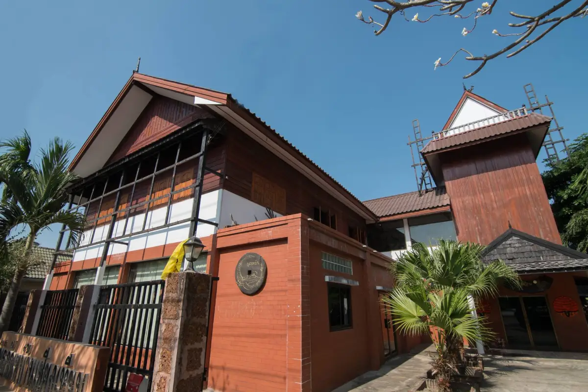
13. Ban Chiang Hian Museum is located at Ban Chiang Hian, Khwa Subdistrict, Mueang Maha Sarakham District. This local museum developed from the collection and preservation of cultural objects by Ajarn Boonman Khamsa-at, with the collection later maintained by his family as a learning space dedicated to community life and local cultural roots.
Highlight: Agricultural tools, household objects, art objects, folk collections, traditional tools, religious objects, and stories of Isan community life collected over many decades of personal experience.
The appeal of Ban Chiang Hian Museum lies in its development as a community-based museum rather than a large institutional project. Each object is closely connected to real life, including farming, cooking, house building, craftsmanship, beliefs, and religious activities.
Seeing older household objects together in one setting helps visitors understand how earlier Isan communities depended heavily on locally available resources and the ability to make many everyday tools themselves. These objects therefore reflect thrift, creativity, and adaptation to the surrounding environment.
For visitors interested in social history, this type of museum adds an important perspective that large archaeological monuments cannot provide because it focuses on ordinary people and objects used in everyday households.
The museum can be combined with Ku Mahathat and Ban Mo Pottery Village, both located in the Khwa Subdistrict area, creating a route that includes archaeology, handicrafts, and community history.
Getting There: Located at Ban Chiang Hian, Khwa Subdistrict, Mueang Maha Sarakham District, approximately 7–8 kilometers from the city along the Maha Sarakham–Roi Et route. There is no fixed public visiting schedule, so advance arrangements should be made before traveling.
Map (GPS): https://www.google.com/maps/dir/?api=1&destination=16.154773,103.372648&travelmode=driving
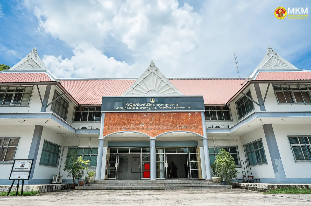
14. Maha Sarakham City Museum is located within Nong Kha Public Park in Talat Subdistrict, Mueang Maha Sarakham District. It is a learning center that presents the development of the city, local history, community memories, and the relationship between modern urban growth and the rural roots of Maha Sarakham.
Highlight: The story of the city’s establishment, the concept of a “city layered over rural life,” Maha Sarakham community traditions, development of education, local culture, and community products.
A key concept of the museum is the presentation of Maha Sarakham as a city that has grown through education, government administration, and a modern economy while still retaining rural structures and memories within its urban fabric. The city therefore remains closely connected with rice fields, villages, and traditional culture.
The exhibitions help visitors understand that Maha Sarakham’s growth resulted from several factors, including the establishment of the city, development of government institutions, education, markets, transportation, and movement of people from surrounding districts into the urban area.
The museum is also useful as a starting point for a provincial trip because it provides an overview before visitors continue to Phra That Na Dun, Kantharawichai, Kosum Phisai, or Na Chueak. This background helps travelers understand more clearly how the provincial capital differs from the surrounding communities.
The museum is suitable for families, school students, university students, and visitors interested in urban history. Allow around 1 hour and combine the visit with Maha Sarakham City Pillar Shrine, the Isan Art and Culture Center, and Kaeng Loeng Chan.
Getting There: Located within Nong Kha Public Park, Talat Subdistrict, Mueang Maha Sarakham District. Open Monday–Friday from 08.30–16.30. On Saturdays, Sundays, and public holidays, visits are available for groups that make advance arrangements.
Map (GPS): https://www.google.com/maps/dir/?api=1&destination=16.200799,103.290445&travelmode=driving
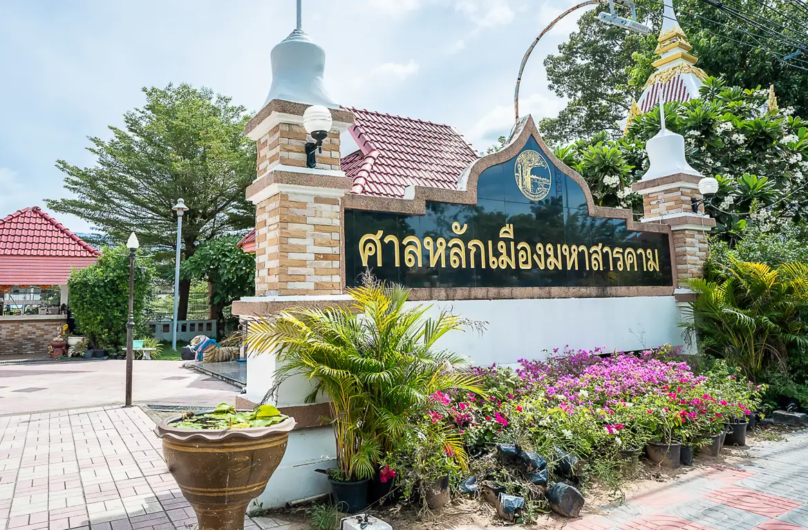
15. Maha Sarakham City Pillar Shrine is an important sacred site of Maha Sarakham and is deeply respected by local residents. People visit to pay respect and pray for good fortune. The shrine is closely connected with the history of the city’s establishment and traditional beliefs surrounding the city pillar as a spiritual center for the community.
Highlight: The city pillar, the guardian shrine, beliefs associated with protection of the city, the history of Maha Sarakham’s establishment, and the atmosphere of an important sacred site in the city center.
The city pillar carries meaning beyond being a symbolic object. Within the traditional Thai urban context, a city pillar represents the center of a community and is associated with protection, stability, prosperity, and the spiritual well-being of the city.
The history of Maha Sarakham is associated with Thao Mahachai, later known as Phra Charoen Ratchadet, the city’s first governor. Visiting the shrine therefore connects the story of the modern city’s foundation with a physical place and makes a suitable starting point before exploring other important attractions in the province.
Local residents commonly come to pay respect on significant occasions, before traveling, when beginning new work, or when seeking blessings for stability and success. Visitors should maintain a respectful atmosphere and follow local customs at the shrine.
The site is suitable for spiritual travelers, families, older visitors, and anyone interested in the history of Maha Sarakham city. It can be combined conveniently with Maha Sarakham City Museum and the Isan Art and Culture Center.
Getting There: Located on Nakhon Sawan Road in front of Lak Mueang Maha Sarakham School, Talat Subdistrict, Mueang Maha Sarakham District. Open daily from 06.00–18.00.
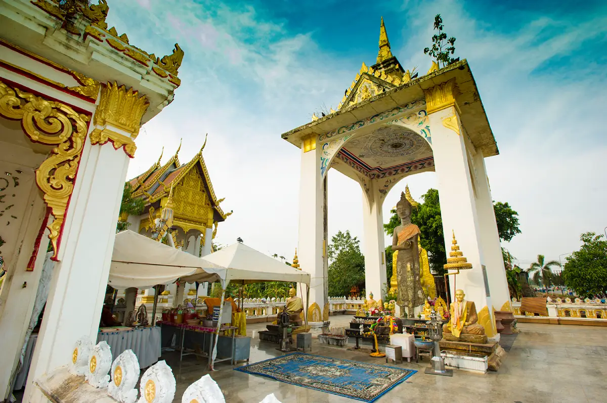
16. Phra Buddha Ming Mueang (Phra Buddha Suwan Mali) is enshrined at Wat Suwannawat in Ban Khok Phra, Khok Phra Subdistrict, Kantharawichai District. This ancient standing Buddha image is important for local faith, history, and the artistic heritage of Kantharawichai.
Highlight: An ancient standing Buddha image made from red sandstone, artistic characteristics associated with the Dvaravati period, beliefs related to prosperity and seasonal rainfall, and its status as one of the sacred Buddha images of Kantharawichai.
The image is a large standing Buddha and has been revered by local communities for generations. Its use of red sandstone gives the sculpture a distinctive appearance and reflects ancient techniques of Buddha-image production found in Northeastern Thailand.
The importance of Phra Buddha Ming Mueang is closely connected with Wat Phuttha Mongkhon, also located in Kantharawichai District. Together, the 2 sites provide important evidence of the long history of settlement and the spread of Buddhism in this area.
In local belief, the Buddha image is associated with peace, agricultural abundance, and suitable rainfall. This reflects the close historical relationship between religion and agricultural life in Isan communities.
The site is suitable for Buddhist travelers, visitors interested in Buddhist art, historians, and families. Travelers heading from Maha Sarakham city toward Kalasin can conveniently combine Phra Buddha Ming Mueang with Wat Phuttha Mongkhon on the same route.
Getting There: Enshrined at Wat Suwannawat, Ban Khok Phra, Khok Phra Subdistrict, Kantharawichai District, along Highway 213 on the Maha Sarakham–Kalasin route. Open daily from 08.00–18.00.
Map (GPS): https://www.google.com/maps/dir/?api=1&destination=16.322310,103.298862&travelmode=driving

17. Sa Due Isan, also known as Bueng Kui, is located in Kosum Phisai District. The landmark combines the idea of a symbolic geographical center of Northeastern Thailand with the landscape of a large wetland and the everyday life of surrounding communities.
Highlight: The Sa Due Isan landmark, large Bueng Kui wetland, open water views, lakeside recreation areas, photography spots, and the spacious rural atmosphere of central Isan.
The name “Sa Due Isan,” meaning the “Navel of Isan,” has made the site known as a geographical symbol of Maha Sarakham. However, the value of the area extends beyond the landmark itself because Bueng Kui is a large natural water body that has long been connected with surrounding communities.
The wetland serves as a water source, food resource, recreation area, and part of the local ecosystem. Broad views of the water and open sky make the morning and late afternoon particularly suitable for walking, enjoying the breeze, and photography.
The area is suitable for families, older travelers, cyclists, and visitors who prefer relaxed travel. It can be included in a Kosum Phisai route together with Kosamphi Forest Park, Bueng Bon, and Hat Wang Ko.
Because the area is relatively open, midday temperatures can be quite hot. Morning or evening visits are therefore more comfortable and generally provide better light for photography.
Getting There: Located around Bueng Kui in Kosum Phisai District, Maha Sarakham Province. The area is open daily and accessible 24 hours.
Map (GPS): https://www.google.com/maps/dir/?api=1&destination=16.227704,103.075530&travelmode=driving
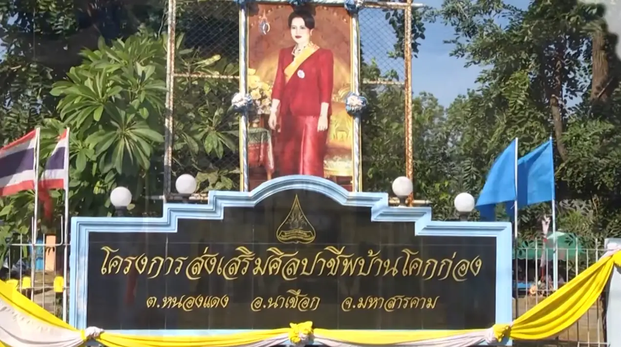
18. Ban Khok Kong Arts and Crafts Promotion Center is located at Ban Khok Kong, Village No. 7, Nong Daeng Subdistrict, Na Chueak District. It is a learning and community-development center focused on mulberry cultivation, silkworm raising, and silk weaving, developed through arts and crafts promotion initiatives that created supplementary occupations and income for local households.
Highlight: Isan silk, weaving, silkworm raising, weaving knowledge, community-made products, and the story of occupational development connected with arts and crafts promotion programs.
Na Chueak has an agricultural landscape and has historically faced periods of drought. Developing existing household weaving skills into additional income opportunities therefore helped strengthen local livelihoods while also preventing silk and textile knowledge from disappearing as the economy changed.
Silk production involves many stages, beginning with growing mulberry trees and raising silkworms, followed by reeling silk, preparing the threads, dyeing, designing patterns, and weaving on traditional looms. Every stage requires time and experience, giving each finished textile greater value than an ordinary mass-produced product.
For travelers, visiting the center provides an opportunity to understand the work behind silk products and to purchase directly from community producers. Income from these purchases returns to local households and helps support the continuation of traditional weaving skills.
The center is suitable for students, designers, textile enthusiasts, cultural travelers, and visitors interested in supporting local products. It can be combined with Dun Lam Phan Non-Hunting Area and Huai Kho Reservoir on the same Na Chueak route.
Getting There: Located at Ban Khok Kong, Village No. 7, Nong Daeng Subdistrict, Na Chueak District, Maha Sarakham Province. Open daily from 08.00–17.00.
Map (GPS): https://www.google.com/maps/dir/?api=1&destination=15.881758,102.938304&travelmode=driving
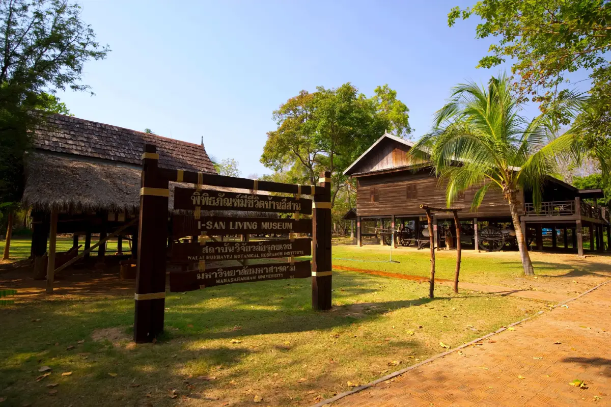
19. Walai Rukhavej Botanical Research Institute is a learning center focused on botany, biodiversity, medicinal plants, and Isan local wisdom. It is located in Na Dun District near Phra That Na Dun. Its distinctive feature is the way scientific knowledge is combined with local culture and everyday ways of life.
Highlight: Plant study areas, medicinal herb gardens, a bamboo park, natural-history exhibitions, an Isan ox-cart museum, an Isan house museum, and learning areas devoted to biodiversity.
The institute plays an important role in research, conservation, propagation, and the study of plant species in Northeastern Thailand. It therefore has value for both education and tourism, allowing visitors to learn how different plants have traditionally been connected with food, medicine, housing, and everyday life in Isan.
The medicinal herb garden presents plants that historically played important roles in traditional healthcare, while the Isan house and ox-cart displays help explain transportation, agriculture, and the use of local resources in earlier periods.
By presenting natural history and culture within the same area, the institute allows visitors to understand the relationship between environment and human society rather than viewing them as separate subjects.
The site is suitable for families, school students, university students, researchers, medicinal-plant enthusiasts, and educational travelers. It is best combined with Phra That Na Dun and Ku Santarat so that a Na Dun itinerary includes religion, history, and natural learning.
Getting There: Located near Phra That Na Dun in Na Dun District, Maha Sarakham Province. Open daily from 08.00–17.00.
Map (GPS): https://www.google.com/maps/dir/?api=1&destination=16.274446,103.249616&travelmode=driving

20. Hat Phu Ngoen is located at Ban Tha Song Khon, Tha Song Khon Subdistrict, Mueang Maha Sarakham District. It is a natural recreation area along the Chi River with a seasonal riverbank beach and riverside woodland, making it suitable for a relaxed nature stop relatively close to the city.
Highlight: A beach-like riverbank along the Chi River, natural woodland, river views, recreation areas, the atmosphere of Tha Song Khon community, and an opportunity to experience the lifestyle of people closely connected with the river.
Hat Phu Ngoen differs from a coastal beach because it is a riverside area along the Chi River. The size and appearance of the exposed riverbank change with the seasons and water levels, creating the distinctive atmosphere of an inland river recreation area in Northeastern Thailand.
Tha Song Khon community has long depended on the Chi River for agriculture, fishing, transportation, and the use of riverside resources. A visit therefore offers more than a place to sit and relax; it also reveals the importance of the river to everyday life across the lowland areas of Maha Sarakham.
Morning and late afternoon are more suitable for enjoying the breeze, views, and photography than midday. Visitors should take care around changing water levels and currents, especially during the rainy season or periods when the Chi River is high.
Hat Phu Ngoen is suitable for families, groups of friends, self-drive travelers, and visitors looking for a relaxing place near the city without committing an entire day. It can be combined with Chi Long Forest Park and other attractions around Tha Song Khon.
Getting There: Located at Ban Tha Song Khon, Tha Song Khon Subdistrict, Mueang Maha Sarakham District, Maha Sarakham Province. Open daily from 08.00–17.00.
Map (GPS): https://www.google.com/maps/dir/?api=1&destination=16.196544,103.192360&travelmode=driving

21. Chi Long Forest Park is located at Ban Wang Wa, Village No. 6, Tha Khon Yang Subdistrict, Kantharawichai District. This natural area along the Chi River has a distinctive landscape created by changes in the river’s course in the past, forming an area that resembles an island with water surrounding it on several sides and maintaining moisture throughout the year.
Highlight: Mixed deciduous forest along the Chi River, an island-like landscape, the Chi Long watercourse, natural water-retention areas, nature trails, and a shaded environment relatively close to Maha Sarakham city.
The distinctive character of Chi Long Forest Park developed through changes in the course of the Chi River. When parts of the former river channel were cut off or redirected, land within an old river bend became surrounded by water on several sides. This process created an ecosystem noticeably different from the surrounding agricultural landscape.
The park contains mature trees and mixed deciduous forest that provide shade and make the area suitable for nature walks and observing native plants. Visitors can spend time at a relaxed pace learning about the relationship between forest, water, and the Chi River, which together form an important part of Maha Sarakham’s landscape.
The site is suitable for families, students, nature enthusiasts, photographers, and travelers who want to visit a natural attraction without traveling far from the city. Morning or late afternoon is generally more comfortable than midday and makes walking through the area more pleasant.
Chi Long Forest Park can be combined conveniently with Wat Phuttha Mongkhon, Phra Buddha Ming Mueang, and attractions around Tha Khon Yang, allowing visitors to experience religion, history, and nature within the Kantharawichai area in a single day.
Getting There: Located at Ban Wang Wa, Village No. 6, Tha Khon Yang Subdistrict, Kantharawichai District. From Maha Sarakham city, follow the Maha Sarakham–Kalasin route toward Ban Tha Khon Yang, then continue onto Rural Road MK 4053. Open daily from 08.00–17.00.
Map (GPS): https://www.google.com/maps/dir/?api=1&destination=16.233996,103.282526&travelmode=driving
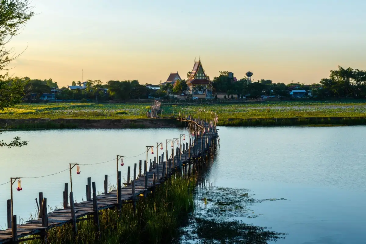
22. Nong Kae Dam Reservoir is located at Ban Kae Dam, Village No. 1, Kae Dam Subdistrict, Kae Dam District. It is an important local water source and recreation area characterized by broad water views, wetland landscapes, and the rural scenery of central Isan.
Highlight: A broad reservoir, wetlands, diverse aquatic plants, an old wooden bridge connecting Ban Kae Dam with Ban Hua Khua, rural landscapes, and photography opportunities during the morning and evening.
The reservoir plays a role far beyond tourism. It functions as a water source, fish-breeding area, food resource, and community activity space. Life around the reservoir therefore remains closely connected with water and seasonal environmental conditions.
Lotus plants, duckweed, algae, and other aquatic vegetation grow around parts of the reservoir, creating scenery that changes throughout the year. Travelers interested in photographing nature and local ways of life will find more here than a simple reservoir landscape.
The wooden bridge connecting communities around the reservoir is one of the area’s most distinctive features. Walking near the bridge and along the water in the late afternoon provides a calm atmosphere and makes a pleasant stop when traveling between Maha Sarakham city and Kae Dam District.
The reservoir is suitable for families, couples, photographers, cyclists, and visitors who enjoy open landscapes. Avoid swimming in unsupervised areas and help protect the reservoir by not leaving rubbish in or around the water.
Getting There: Located at Ban Kae Dam, Village No. 1, Kae Dam Subdistrict, Kae Dam District, Maha Sarakham Province. The area is open daily and accessible 24 hours.
Map (GPS): https://www.google.com/maps/dir/?api=1&destination=16.027304,103.390491&travelmode=driving

23. Bueng Bon is located in Hua Khwang Subdistrict, Kosum Phisai District. This large wetland lies close to Kosamphi Forest Park and is suitable for relaxation, walking, running, cycling, and enjoying a community wetland landscape.
Highlight: A wetland covering approximately 120 rai, a road around the water, walking, running, and cycling areas, open scenery, and a location very close to Kosamphi Forest Park.
Bueng Bon has an average depth of approximately 2.50 meters and a road around the wetland extending for more than 2 kilometers. This makes it particularly suitable for outdoor activities in the morning and evening, when visitors can relax or exercise alongside local residents.
One of Bueng Bon’s main advantages is its proximity to other Kosum Phisai attractions, especially Kosamphi Forest Park. It does not need to be treated as a separate full-day destination and works particularly well as a convenient stop along a wider district itinerary.
The atmosphere around the wetland provides a view of how public spaces are used in a small Isan town. Local residents often come here to exercise and relax in the evening, giving the area a more everyday character than destinations created specifically for tourists.
Bueng Bon is suitable for families, older travelers, runners, cyclists, and anyone looking for a relaxing stop. It can be combined with Kosamphi Forest Park, Sa Due Isan, and Hat Wang Ko.
Getting There: Located in Hua Khwang Subdistrict, Kosum Phisai District, approximately 100 meters from Kosamphi Forest Park and about 2 kilometers from the district center. Open daily and accessible 24 hours.
Map (GPS): https://www.google.com/maps/dir/?api=1&destination=16.254498,103.064567&travelmode=driving
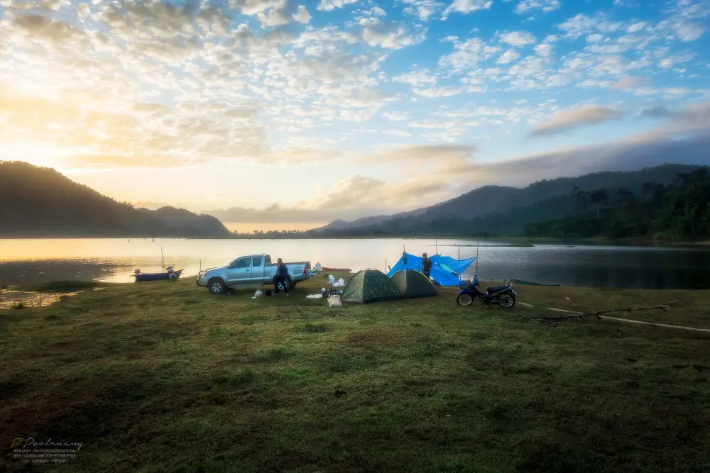
24. Rong Hua Chang Reservoir is located at Ban Nong Tup, Nong Ko Subdistrict, Borabue District. This medium-sized reservoir is important for local agriculture and surrounding communities and also offers a peaceful rural landscape suitable for a quiet stop.
Highlight: Broad water views, open skies, agricultural land surrounding the reservoir, cool breezes, a quiet atmosphere, and a convenient rest stop along the Maha Sarakham–Borabue route.
The reservoir covers approximately 1.780 square kilometers, or around 1,125 rai, with a catchment area of approximately 16.75 square kilometers. It therefore plays an important role in water storage and supporting agricultural land in the surrounding area.
The main appeal of the reservoir lies in its simplicity. Visitors do not come for major organized activities but to take a break from driving, enjoy the breeze, look across the water, and experience the landscape of a farming community.
Morning and evening are the best times for photography because reflections on the water and the open sky give the landscape more depth. Midday can be hot and there is relatively limited shade in some areas.
The reservoir is suitable for self-drive travelers, families, couples, and nature photographers. It can also serve as a rest stop while traveling toward other attractions in Borabue District or Ku Bua Mat.
Getting There: Located at Ban Nong Tup, Nong Ko Subdistrict, Borabue District, Maha Sarakham Province. From the provincial capital, follow Chaeng Sanit Road toward Borabue District. Open daily from 08.00–17.00.
Map (GPS): https://www.google.com/maps/dir/?api=1&destination=16.083175,103.159699&travelmode=driving

25. Huai Kho Reservoir is located at Ban Nong Saeng, Khwao Rai Subdistrict, Na Chueak District. It is a large reservoir that plays an important role in local water management, fisheries, agriculture, and community recreation.
Highlight: A large reservoir, broad embankment, open views, cool breezes, local fishing, exercise areas, and the rural atmosphere of Na Chueak District.
The reservoir has a capacity of approximately 31,481,500 cubic meters, a catchment area of around 208 square kilometers, and a water-surface area of more than 6,000 rai, making it one of the important water resources in Na Chueak District.
Morning and evening are suitable for walking along the embankment, enjoying the open sky, and photographing the water. The broad reservoir landscape creates a very different atmosphere from forest attractions such as Dun Lam Phan, even though both are located within the same district.
Communities around the reservoir continue to use the area for local fishing and other water-related activities. Visitors can therefore observe how the reservoir functions as part of everyday life rather than simply as a recreation site.
Huai Kho Reservoir can be combined with Pattaya Na Chueak 1, which is located in the same reservoir area, as well as Ban Khok Kong Arts and Crafts Promotion Center and Dun Lam Phan Non-Hunting Area. Together they create a Na Chueak route combining nature, water landscapes, and local culture.
Getting There: Located at Ban Nong Saeng, Khwao Rai Subdistrict, Na Chueak District, Maha Sarakham Province. Open daily and accessible 24 hours.
Map (GPS): https://www.google.com/maps/dir/?api=1&destination=15.824543,103.039412&travelmode=driving

26. Pattaya Na Chueak 1 is located at Ban Nong Saeng, Village No. 6, Khwao Rai Subdistrict, Na Chueak District. It is a local recreation area along Huai Kho Reservoir where residents come to relax, eat, and enjoy views across the water.
Highlight: Views over Huai Kho Reservoir, recreation areas along the embankment, Ko Kha or Non Kha natural island, and a freshwater ecosystem supporting several aquatic species.
The name “Pattaya Na Chueak” reflects the way the reservoir shoreline is used as a community recreation area. Although it is not a seaside destination, the broad water surface and open landscape create a relaxed atmosphere similar to a local waterfront retreat.
Ko Kha, also known as Non Kha, is an interesting natural feature within the reservoir and provides habitat for various freshwater species, adding both ecological diversity and visual interest to the landscape.
The area is suitable for families, groups of friends, and travelers looking for a casual destination that does not require extensive walking. Visitors can enjoy food, relax by the reservoir, or watch the late-afternoon light over the water.
Visitors should take care near the water and avoid swimming in places without safety supervision or clear signs indicating that swimming is permitted.
Getting There: Located at Ban Nong Saeng, Village No. 6, Khwao Rai Subdistrict, Na Chueak District, Maha Sarakham Province. Open daily from 08.00–17.00.
Map (GPS): https://www.google.com/maps/dir/?api=1&destination=15.827565,103.043719&travelmode=driving

27. Hat Wang Ko is located at Ban Tha Duea, Nong Bon Subdistrict, Kosum Phisai District. It is a recreation area along the Chi River known among local residents as a place to cool down, relax, and spend time with family.
Highlight: A riverbank beach along the Chi River, seating areas, food stalls, hammocks and umbrellas along the riverbank, a freshwater-beach atmosphere, and leisure activities beside the river.
Hat Wang Ko reveals another side of Kosum Phisai. In addition to forest and wetland attractions, the district also has riverside spaces used by local residents for recreation. The size and character of the exposed riverbank change according to water levels and seasonal conditions.
The hot season is generally when the area becomes more popular. Local residents come to enjoy the breeze, eat together, and spend time beside the river, creating a very different atmosphere from conservation-focused destinations such as Kosamphi Forest Park.
Anyone considering entering the water should first assess the current and water conditions carefully, particularly during the rainy season or when the Chi River is high. Children should remain under close adult supervision at all times.
Hat Wang Ko is suitable for families, groups of friends, and travelers looking for a break along the Maha Sarakham–Kosum Phisai–Khon Kaen route. It can be combined with Kosamphi Forest Park, Bueng Bon, and Sa Due Isan.
Getting There: Located at Ban Tha Duea, Nong Bon Subdistrict, Kosum Phisai District, Maha Sarakham Province. Open daily from 08.00–18.00.
Map (GPS): https://www.google.com/maps/dir/?api=1&destination=16.304155,103.020661&travelmode=driving
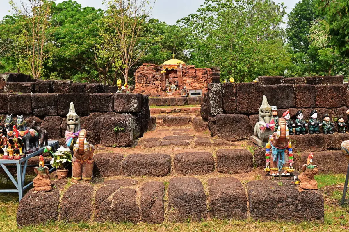
28. Ku Bua Mat Archaeological Site is located at Ban Kok Kok, Bua Mat Subdistrict, Borabue District. This Khmer archaeological site contains several architectural components, including a principal sanctuary, gopura gateway, library building, enclosure wall, and moat.
Highlight: A brick principal sanctuary on a laterite base, gopura gateway, library building, enclosure wall, U-shaped moat, archaeological evidence associated with Khmer religious beliefs, and the community tradition of Song Ku Bua Mat.
The principal sanctuary has a base measuring approximately 6.50 × 6.50 meters. It faces east and has only 1 functional entrance, while the other 3 sides are designed as false doorways. This arrangement reflects established planning principles in Khmer religious architecture.
The surrounding complex includes an enclosure wall, auxiliary buildings, and a moat, allowing visitors to understand more of the overall religious layout rather than viewing only the main sanctuary tower.
Ku Bua Mat also remains connected with local traditions, particularly the community ceremony known as Song Ku. This demonstrates how an ancient monument has continued to function within contemporary belief and cultural practice rather than existing only as an archaeological ruin.
The site is suitable for visitors interested in Khmer art, archaeology, history, and community culture. It can be combined with Rong Hua Chang Reservoir and other attractions in Borabue District.
Getting There: Located at Ban Kok Kok, Bua Mat Subdistrict, Borabue District, Maha Sarakham Province. Open daily from 08.00–17.00.
Map (GPS): https://www.google.com/maps/dir/?api=1&destination=15.896142,103.207812&travelmode=driving
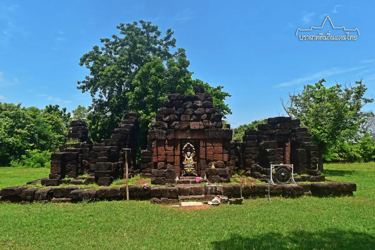
29. Ku Ban Daeng is located at Ban Daeng, Village No. 12, Nong Saeng Subdistrict, Wapi Pathum District. Although relatively small, this laterite archaeological site is important for the study of Bayon-style Khmer art and Mahayana Buddhism.
Highlight: A group of 3 laterite sanctuary towers arranged on a single base, a west-facing layout, and artistic evidence associated with the Naga-protected Buddha, Avalokitesvara Bodhisattva, and Prajnaparamita.
Although parts of the sanctuary structures have collapsed, the surviving foundations and building plan still make it possible to understand the original arrangement. One of the most significant features is the placement of 3 small sanctuary towers on a single shared base.
Archaeological and artistic evidence reflects Bayon-period Mahayana Buddhist beliefs dating to around the 13th century CE. Ku Ban Daeng is therefore important for understanding how Khmer art and religious concepts spread into what is now Northeastern Thailand.
The archaeological site stands within a rural community and agricultural landscape. Visiting the site therefore also reveals the relationship between ancient monuments and farmland that has continued to develop around them for centuries.
Ku Ban Daeng is suitable for historians, students, archaeology enthusiasts, and travelers looking for cultural sites away from crowded tourism areas. Visitors should avoid climbing on or unnecessarily touching the ancient structures.
Getting There: Located at Ban Daeng, Village No. 12, Nong Saeng Subdistrict, Wapi Pathum District, along the Wapi Pathum–Na Dun route on Highway 2040. Open daily from 08.00–17.00.
Map (GPS): https://www.google.com/maps/dir/?api=1&destination=15.801728,103.343378&travelmode=driving
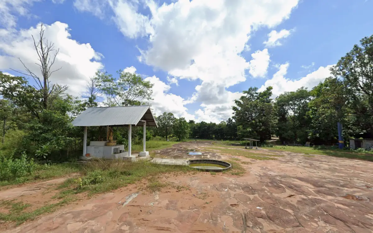
30. Wat Pa Hin Rong, also known locally as Wat Pa Hin Long, is located in Don Klang Subdistrict, Kosum Phisai District. This forest temple is distinguished by a large natural rock field containing numerous depressions and rock holes scattered across a forest area of approximately 100 rai.
Highlight: Natural rock fields, numerous large and small rock depressions, pools of water collecting in rock holes, a peaceful forest-temple atmosphere, local stories about ancient human footprints, and a landscape unlike most other attractions in Maha Sarakham.
The rock field gives the temple its distinctive character. Numerous depressions of different shapes appear across the rock surface, with some retaining water and others forming natural basins. Together they create a landscape that appears as though it has been gradually sculpted by natural processes over a long period of time.
The site is best understood through both religious and natural perspectives. As a forest temple, it offers a peaceful environment suitable for meditation and contemplation, while the exposed rock formations also provide opportunities for visitors interested in geomorphology and natural landscapes.
Local stories about ancient human footprints form part of the community’s cultural memory and beliefs, adding another layer of meaning to the site. Visitors should approach these stories as part of local intangible heritage while also observing the physical landscape itself.
Wat Pa Hin Rong is suitable for Buddhist travelers, photographers, nature enthusiasts, and visitors who prefer quiet destinations. Shoes with good traction are recommended when walking on the rocks, particularly after rain when surfaces may become slippery.
Getting There: Located in Don Klang Subdistrict, Kosum Phisai District, Maha Sarakham Province. From Maha Sarakham city, travel toward Kosum Phisai District and continue into Don Klang Subdistrict. Open daily from 08.00–17.00.
Map (GPS): https://www.google.com/maps/dir/?api=1&destination=16.188549,102.870296&travelmode=driving
| Topic | Details |
| Province Overview | Maha Sarakham is a province in central Northeastern Thailand known for Buddhism, archaeology, Isan arts and culture, its role as an education center, the Chi River ecosystem, wetlands, reservoirs, and community wisdom. The province is suitable for trips ranging from 1 day to 4–5 days, and organizing travel by zones helps reduce unnecessary driving time. |
| Top 10 Highlights | 1. Phra That Na Dun 2. Ku Santarat 3. Ku Mahathat (Prang Ku Ban Khwa) 4. Wat Phuttha Mongkhon 5. Wat Pa Lelai 6. Wat Photharam 7. Kosamphi Forest Park 8. Dun Lam Phan Non-Hunting Area 9. Kaeng Loeng Chan 10. Ban Mo Pottery Village |
| Maha Sarakham City Zone | 1. Ku Mahathat (Prang Ku Ban Khwa) 2. Kaeng Loeng Chan 3. Ban Mo Pottery Village 4. Isan Art and Culture Center 5. Wat Mahachai Museum 6. Ban Chiang Hian Museum 7. Maha Sarakham City Museum 8. Maha Sarakham City Pillar Shrine 9. Hat Phu Ngoen Suitable for a half-day to 1-day trip focusing on urban history, museums, handicrafts, recreation areas, and archaeological sites close to the provincial capital. |
| Na Dun Zone | 1. Phra That Na Dun 2. Ku Santarat 3. Wat Pa Lelai 4. Wat Photharam 5. Walai Rukhavej Botanical Research Institute One of the most important zones for travelers interested in Buddhism, ancient Nakhon Champasri, Khmer art, traditional Isan sim ordination halls, hoop taem murals, and nature-learning sites. |
| Kantharawichai Zone | 1. Wat Phuttha Mongkhon 2. Phra Buddha Ming Mueang (Phra Buddha Suwan Mali) 3. Chi Long Forest Park Ideal for visiting ancient standing Buddha images, learning about the historical development of Kantharawichai, and experiencing Chi River nature within the same day. |
| Kosum Phisai Zone | 1. Kosamphi Forest Park 2. Sa Due Isan 3. Bueng Bon 4. Hat Wang Ko 5. Wat Pa Hin Rong Suitable for nature travelers interested in Chi River recreation areas, wetlands, riverside forest, and a forest temple with distinctive natural rock formations. |
| Na Chueak Zone | 1. Dun Lam Phan Non-Hunting Area 2. Ban Khok Kong Arts and Crafts Promotion Center 3. Huai Kho Reservoir 4. Pattaya Na Chueak 1 Suitable for learning about specialized ecosystems, silk weaving and community wisdom, and relaxing beside a large reservoir. |
| Borabue Zone | 1. Rong Hua Chang Reservoir 2. Ku Bua Mat Archaeological Site Recommended for travelers who want to experience rural landscapes, reservoirs, and Khmer archaeological sites away from heavily visited tourism areas. |
| Kae Dam Zone | 1. Nong Kae Dam Reservoir Known for broad water views, wetlands, community life, and the old wooden bridge linking communities around the reservoir. Morning and evening are particularly suitable for photography and relaxation. |
| Wapi Pathum Zone | 1. Ku Ban Daeng Suitable for travelers interested in Bayon-style Khmer art and Mahayana Buddhism and can be combined conveniently with a Na Dun itinerary. |
| Archaeology and Ancient Civilizations | 1. Phra That Na Dun and the ancient Nakhon Champasri area 2. Ku Santarat 3. Ku Mahathat 4. Ku Bua Mat Archaeological Site 5. Ku Ban Daeng Together these sites demonstrate cultural development from the Dvaravati period through later ancient Khmer influence in Maha Sarakham. |
| Temples and Sacred Sites | 1. Phra That Na Dun 2. Wat Phuttha Mongkhon 3. Phra Buddha Ming Mueang 4. Wat Pa Lelai 5. Wat Photharam 6. Maha Sarakham City Pillar Shrine 7. Wat Pa Hin Rong |
| Isan Sim and Hoop Taem Murals | Wat Pa Lelai and Wat Photharam are important places for viewing traditional Isan sim ordination halls and hoop taem folk murals depicting Buddhism, literature, clothing, community life, and the craftsmanship of local painters. |
| Nature and Ecosystems | 1. Kosamphi Forest Park 2. Dun Lam Phan Non-Hunting Area 3. Chi Long Forest Park 4. Kaeng Loeng Chan 5. Nong Kae Dam Reservoir 6. Bueng Bon 7. Rong Hua Chang Reservoir 8. Huai Kho Reservoir 9. Hat Phu Ngoen 10. Hat Wang Ko |
| Notable Wildlife and Ecosystems | Kosamphi Forest Park is known for long-tailed macaques, including golden-haired individuals, while Dun Lam Phan Non-Hunting Area protects a freshwater seep-forest ecosystem and the Princess Crab, one of the province’s distinctive native species. |
| Handicrafts and Local Wisdom | 1. Ban Mo Pottery Village 2. Ban Khok Kong Arts and Crafts Promotion Center 3. Isan Art and Culture Center Recommended for visitors interested in pottery, silk, weaving, basketry, and traditional Isan craftsmanship. |
| Museums and Learning Centers | 1. Isan Art and Culture Center 2. Wat Mahachai Museum 3. Ban Chiang Hian Museum 4. Maha Sarakham City Museum 5. Walai Rukhavej Botanical Research Institute |
| Best for Families | Phra That Na Dun, Kosamphi Forest Park, Kaeng Loeng Chan, Ban Mo Pottery Village, Maha Sarakham City Museum, Sa Due Isan, Bueng Bon, Nong Kae Dam Reservoir, and Huai Kho Reservoir. |
| Best for Children | Ban Mo Pottery Village, Isan Art and Culture Center, Maha Sarakham City Museum, Kosamphi Forest Park, Kaeng Loeng Chan, and Walai Rukhavej Botanical Research Institute are suitable choices. Adults should supervise children carefully around water and wildlife. |
| Best for Older Travelers | Phra That Na Dun, Wat Phuttha Mongkhon, Phra Buddha Ming Mueang, Maha Sarakham City Pillar Shrine, Kaeng Loeng Chan, Bueng Bon, and Nong Kae Dam Reservoir are relatively easy to access and do not require long hikes. |
| Best for Photography | 1. Phra That Na Dun 2. Ku Santarat 3. Wat Pa Lelai 4. Wat Photharam 5. Kosamphi Forest Park 6. Kaeng Loeng Chan 7. Nong Kae Dam Reservoir 8. Hat Wang Ko 9. Ku Bua Mat Archaeological Site 10. Wat Pa Hin Rong |
| Best for History Lovers | Phra That Na Dun, Ku Santarat, Ku Mahathat, Ku Bua Mat Archaeological Site, Ku Ban Daeng, Wat Mahachai Museum, Ban Chiang Hian Museum, and Maha Sarakham City Museum. |
| Local Food | Common local dishes include som tam, larb, nam tok, tom saep, gaeng om, bamboo-shoot soup, jaew dipping sauces, sticky rice, fish dishes, and foods made from local ingredients, including seasonal produce from agricultural communities and the Chi River basin. |
| Souvenirs | 1. Pottery from Ban Mo Pottery Village 2. Silk and community products from Ban Khok Kong Arts and Crafts Promotion Center 3. Woven textiles and Isan handicrafts 4. Community products and locally processed foods |
| Important Traditions | The annual Phra That Na Dun worship festival is one of the province’s major events. Maha Sarakham also observes traditions associated with the Isan Heet Sip Song cycle, including Bun Bang Fai, Bun Phawet, Bun Samha, and Buddhist community ceremonies held throughout the year. |
| 1 Day — Na Dun Zone | Morning: Phra That Na Dun Late Morning: Ku Santarat Afternoon: Wat Pa Lelai – Wat Photharam Evening: Walai Rukhavej Botanical Research Institute or stay overnight in Na Dun District |
| 1 Day — Maha Sarakham City | Morning: Maha Sarakham City Pillar Shrine – Maha Sarakham City Museum Late Morning: Isan Art and Culture Center or Wat Mahachai Museum Afternoon: Ku Mahathat – Ban Mo Pottery Village Evening: Kaeng Loeng Chan |
| 1 Day — Kantharawichai–Kosum Phisai | Morning: Wat Phuttha Mongkhon – Phra Buddha Ming Mueang Late Morning: Chi Long Forest Park Afternoon: Kosamphi Forest Park – Bueng Bon Evening: Sa Due Isan or Hat Wang Ko |
| 1 Day — Na Chueak | Morning: Dun Lam Phan Non-Hunting Area Late Morning–Afternoon: Ban Khok Kong Arts and Crafts Promotion Center Late Afternoon: Huai Kho Reservoir – Pattaya Na Chueak 1 |
| 2 Days, 1 Night | Day 1: Maha Sarakham City – Ku Mahathat – Ban Mo Pottery Village – Kaeng Loeng Chan Day 2: Phra That Na Dun – Ku Santarat – Wat Pa Lelai – Wat Photharam |
| 3 Days, 2 Nights | Day 1: Maha Sarakham City Day 2: Na Dun and archaeological sites Day 3: Kantharawichai–Kosum Phisai, or choose Na Chueak if you prefer nature and community wisdom. |
| 4–5 Days | Add Na Chueak, Borabue, Kae Dam, and Wapi Pathum to include reservoirs, Ku Bua Mat, Ku Ban Daeng, Dun Lam Phan, and additional natural attractions around the province without having to rush between destinations. |
| Best Time to Visit | Maha Sarakham can be visited throughout the year. November–February generally offers cooler weather and is well suited to archaeological sites, temples, and outdoor attractions. The rainy season brings greener natural landscapes and wetlands, but visitors should check water levels when traveling near the Chi River or other wetland areas. |
| Getting Around the Province | A private car or rental vehicle is the most convenient option because attractions are spread across several districts. Organize the itinerary by zones such as Maha Sarakham City–Kantharawichai, Na Dun, Kosum Phisai, Na Chueak, and Borabue to reduce unnecessary backtracking. |
| Safety | Take extra care around water during the rainy season, avoid swimming in unsupervised areas, keep a safe distance from monkeys at Kosamphi Forest Park, do not feed wildlife, and wear suitable footwear when walking on rocky or wet surfaces. |
| Responsible Travel | Do not climb or unnecessarily touch archaeological structures, do not catch wildlife or disturb natural habitats, avoid leaving rubbish in water sources, support local handicrafts and community products, and follow the rules of temples, museums, and conservation areas. |
Frequently Asked Questions (FAQ)
Q: What are the must-visit attractions in Maha Sarakham?
A: Major highlights include Phra That Na Dun, Ku Santarat, Ku Mahathat, Wat Phuttha Mongkhon, Wat Pa Lelai, Wat Photharam, Kosamphi Forest Park, Dun Lam Phan Non-Hunting Area, Kaeng Loeng Chan, and Ban Mo Pottery Village. Together they cover religion, archaeology, nature, and local culture.
Q: Where should I go if I have only 1 day in Maha Sarakham?
A: Choose only 1 main zone. Maha Sarakham City is suitable for museums, Ku Mahathat, Ban Mo Pottery Village, and Kaeng Loeng Chan, while the Na Dun Zone is ideal for Phra That Na Dun, Ku Santarat, Wat Pa Lelai, and Wat Photharam.
Q: How many days should I spend in Maha Sarakham?
A: 2–3 days are suitable for Maha Sarakham City, Na Dun, and either Kantharawichai or Kosum Phisai. If you also want to include Na Chueak, Borabue, Kae Dam, and Wapi Pathum, allow around 4–5 days.
Q: Why is Phra That Na Dun important?
A: Phra That Na Dun enshrines sacred Buddha relics discovered in the area of ancient Nakhon Champasri and is regarded as an important Buddhist center of Isan. It therefore has major religious, historical, and archaeological significance.
Q: What is the difference between Ku Santarat and Ku Mahathat?
A: Both are archaeological sites associated with the Arokayasala network from the reign of King Jayavarman VII, but they are located in different districts. Ku Santarat is in Na Dun District, while Ku Mahathat, also known as Prang Ku Ban Khwa, is in Mueang Maha Sarakham District. Visiting both allows travelers to compare similar Khmer religious structures in different local settings.
Q: Where can I see traditional Isan sim ordination halls and hoop taem murals?
A: Wat Pa Lelai and Wat Photharam in Na Dun District are 2 important places to see traditional Isan sim architecture and hoop taem murals depicting Buddhism, literature, community life, clothing, and local craftsmanship.
Q: What are the best nature attractions in Maha Sarakham?
A: Recommended nature attractions include Kosamphi Forest Park, Dun Lam Phan Non-Hunting Area, Chi Long Forest Park, Kaeng Loeng Chan, Nong Kae Dam Reservoir, Bueng Bon, Huai Kho Reservoir, Hat Phu Ngoen, and Hat Wang Ko.
Q: Where can I see the Princess Crab in Maha Sarakham?
A: Dun Lam Phan Non-Hunting Area in Na Chueak District is the key site. Its freshwater seep-forest ecosystem provides habitat for the Princess Crab, locally known as Pu Paeng. Visitors should observe the crabs without catching them or disturbing the habitat.
Q: What is special about Kosamphi Forest Park?
A: The park is known for its Chi River forest, large mature trees, long-tailed macaques, and distinctive golden-haired macaques. It is shaded, easy to reach from Maha Sarakham city, and suitable for nature observation.
Q: Are there attractions in Maha Sarakham suitable for children and families?
A: Yes. Good choices include Ban Mo Pottery Village, Isan Art and Culture Center, Maha Sarakham City Museum, Kosamphi Forest Park, Kaeng Loeng Chan, and Walai Rukhavej Botanical Research Institute, which offer both learning opportunities and recreation.
Q: Which attractions are suitable for older travelers?
A: Phra That Na Dun, Wat Phuttha Mongkhon, Phra Buddha Ming Mueang, Maha Sarakham City Pillar Shrine, Kaeng Loeng Chan, Bueng Bon, and Nong Kae Dam Reservoir are relatively accessible and do not require strenuous hiking.
Q: Where can I learn about local handicrafts in Maha Sarakham?
A: Ban Mo Pottery Village is recommended for traditional pottery, while Ban Khok Kong Arts and Crafts Promotion Center is suitable for learning about silk production, silkworm raising, and weaving traditions.
Q: Which museums should I visit in Maha Sarakham?
A: Recommended choices include Wat Mahachai Museum, Ban Chiang Hian Museum, Maha Sarakham City Museum, Isan Art and Culture Center, and Walai Rukhavej Botanical Research Institute. Some locations are best visited after making advance arrangements.
Q: What attractions are located along the Chi River?
A: Kosamphi Forest Park, Chi Long Forest Park, Hat Phu Ngoen, and Hat Wang Ko are directly associated with the Chi River and are suitable for recreation, nature learning, and experiencing riverside community life.
Q: What is the best time to visit Maha Sarakham?
A: November–February is generally the most comfortable period for outdoor travel because temperatures are cooler. The rainy season is suitable for greener nature and wetland landscapes, although visitors should check water levels and road conditions before traveling.
Q: Can I travel around Maha Sarakham without a private car?
A: Public transport can reach the main districts, but many attractions are located in villages or along local roads. A private car, rental vehicle, or hired car with a driver is more convenient, especially for Na Dun, Na Chueak, Borabue, and Kosum Phisai.
Q: Which attractions are best for history lovers?
A: Phra That Na Dun, Ku Santarat, Ku Mahathat, Ku Bua Mat Archaeological Site, Ku Ban Daeng, Wat Mahachai Museum, and Ban Chiang Hian Museum are among the most important destinations for travelers interested in history, archaeology, and Isan culture.
Q: What souvenirs should I buy in Maha Sarakham?
A: Recommended souvenirs include pottery from Ban Mo Pottery Village, silk and community products from Ban Khok Kong Arts and Crafts Promotion Center, woven textiles, Isan handicrafts, and locally processed foods.
Q: How should I plan a Maha Sarakham itinerary to avoid backtracking?
A: Divide the province into travel zones such as Maha Sarakham City–Kantharawichai, Na Dun, Kosum Phisai, Na Chueak, and Borabue. Complete the attractions within one zone before moving to the next area to reduce driving time and unnecessary distance.
 Category: ●Travel Articles, Recipes
 Group: ●Travel Review, Food Review
Last Update : 3 WeekAgo
 Last Update : 3 WeekAgo

 Art, Culture and Heritage
 Historical Sites and Monuments(4)
 Art, Craft Centres, Tradition(5)
 Museums(3)
 Places of Worship
 Temple(17)
 Other Sacred Sites(7)
 Research and Development
 Royal Project(2)
 Suburban Living
 Village, Community(5)
 Nature and Wildlife
 National Parks and Marine Reserves(3)
 Dam, Reservoir, Lake(10)
 River, Canal(2)
 Bays and Beaches(2)
 Other natural attractions(2)
 Entertainment and Agricultural
 Farms, Parks and Ecotourism(3)
Travel Review, Food Review(1)
 Food Menu, Northeastern Recipes(1)


