
lovethailand home >North Travel Attractions >Kamphaeng Phet Travel Attractions > 40 Best Places to Visit in Kamphaeng Phet Northern..
TL;DR: 40 Best Places to Visit in Kamphaeng Phet Northern Thailand, open Daily Opening Hours: 08:30 – 16:30.
40 Best Places to Visit in Kamphaeng Phet Northern Thailand
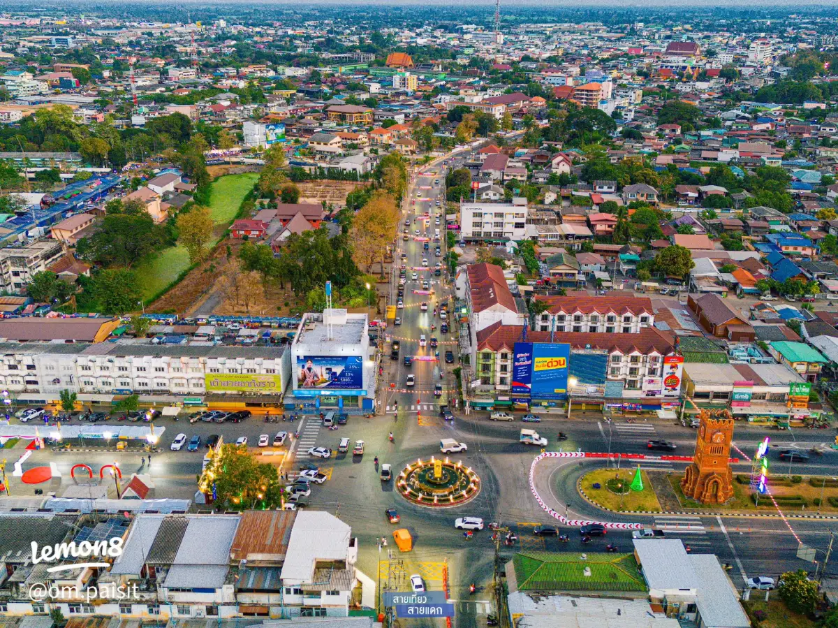
40 Best Places to Visit in Kamphaeng Phet – Unmissable Attractions in Northern Thailand Kamphaeng Phet is one of the most rewarding destinations in Lower Northern Thailand for travelers who want to combine UNESCO World Heritage sites, ancient cities, important temples, traditional communities, mountains, waterfalls, hot springs, and agricultural landscapes in a single trip. For a first visit, the essential highlights are Kamphaeng Phet Historical Park, Khlong Lan National Park, Mae Wong National Park, Wat Phra Kaeo, Wat Phra Si Iriyabot, and Wat Chang Rop. Travelers with 2–3 days should also include Wat Phra Borommathat Nakhon Chum, Phra Ruang Hot Spring, Kamphaeng Phet Provincial Museum, and local community and souvenir stops such as the Banana Market. With 4–5 days, the trip can be expanded into Khlong Lan, Pang Sila Thong, Khlong Khlung, Phran Kratai, and the province’s outer natural areas, giving visitors a fuller picture of Kamphaeng Phet through history, nature, and local life.
Kamphaeng Phet lies in Lower Northern Thailand, with the Ping River forming one of the province’s most important geographical and cultural lifelines. The eastern side and the river basin consist largely of plains suited to settlement and agriculture, while the western side rises toward mountain ranges and extensive forest. This creates a diverse landscape ranging from ancient cities on the lowlands to evergreen forest, waterfalls, reservoirs, and high mountain viewpoints. Few provinces allow travelers to combine major archaeological sites and large protected forests so naturally within the same itinerary.
Historically, Kamphaeng Phet was a strategic city in the Sukhothai state and an important southern defensive center. Its ancient urban system included strong city walls, moats, and fortifications, contributing to the meaning of the name “Kamphaeng Phet,” or “Diamond Wall.” Evidence of this prosperity survives in temples, Buddha images, stupas, assembly halls, and numerous laterite structures. The most important concentration is Kamphaeng Phet Historical Park, part of the UNESCO World Heritage property Historic Town of Sukhothai and Associated Historic Towns, and one of Thailand’s most valuable places for studying Sukhothai-era art, architecture, and town planning.
The old city has a different atmosphere from many archaeological sites because large trees, open woodland, and laterite hills surround numerous monuments. Walking between old temples therefore feels less like crossing an exposed ruin field and more like exploring an ancient city slowly reclaimed by nature. Wat Phra Kaeo represents the importance of the sacred precinct inside the old city wall, while Wat Phra Si Iriyabot and Wat Chang Rop reveal the scale and character of the forest monasteries in the Aranyik area outside the fortified city.
Across the Ping River lies Nakhon Chum, another historic settlement that remains a living community today. Wat Phra Borommathat Nakhon Chum is a major religious center connected with the Sukhothai period, King Lithai, and the Nop Phra Len Phleng tradition. Nakhon Chum also offers old neighborhoods, markets, local food, and stories linked to sacred amulets, especially Phra Sum Kor, one of the famous amulet types associated with Kamphaeng Phet.
Beyond the historic city, Kamphaeng Phet has some of the richest natural environments in Lower Northern Thailand. Khlong Lan National Park is known for Khlong Lan Waterfall, watershed forest, streams, and nature routes. Mae Wong National Park forms part of the Western Forest Complex and includes Chong Yen, birdwatching areas, mountain viewpoints, and the famous Mokochu trail. Travelers who prefer a less strenuous experience can relax at Phra Ruang Hot Spring, which is much closer to the city and is better suited to wellness-oriented travel.
Kamphaeng Phet also has a strong agricultural identity, particularly through Kluai Khai, the small sweet egg banana that has become a symbol of the province. The Banana Market on Phahonyothin Road is more than a roadside fruit stop; it reflects the relationship between farmers, local produce, northbound road travel, and community income. Visitors can buy fresh bananas, banana chips, dried bananas, and other processed products before continuing north or returning home.
Local food includes Central and northern-influenced Thai dishes, noodles, freshwater fish, traditional sweets, and foods from Nakhon Chum communities. Souvenirs range from bananas and banana products to local crafts, OTOP products, and religious objects. A well-planned itinerary can therefore combine ruins, forest, food, and local shopping without repeatedly backtracking across the province.
For practical trip planning, Kamphaeng Phet can be divided into several travel zones. The city center and historical park form the main heritage and museum zone. Nakhon Chum works well as a faith and old-community zone. Khlong Lan and nearby districts are best for waterfalls, forests, and mountain landscapes, while the outer districts add community temples, agricultural attractions, riverside scenery, and smaller natural sites. Organizing a trip by zone reduces driving time and makes each area easier to understand.
If you have only 1 day, focus on Kamphaeng Phet Historical Park, Wat Phra Kaeo, Wat Phra Si Iriyabot, Wat Chang Rop, and Wat Phra Borommathat Nakhon Chum. With 2 days, add Kamphaeng Phet Provincial Museum, Phra Ruang Hot Spring, and the Banana Market. Travelers with 3 days or more should spend at least one full day in Khlong Lan or Mae Wong to experience the natural side of the province in depth.
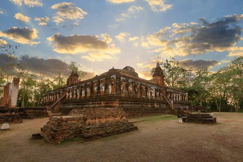
1. Kamphaeng Phet Historical Park is one of the most important attractions in the province and the best place to understand the historical identity of Kamphaeng Phet. The archaeological remains extend across both the fortified old city and the Aranyik forest-monastery zone to the north, with temples, stupas, assembly halls, Buddha images, city walls, defensive structures, and other remains that reflect the city’s importance within the Sukhothai world.
Highlights: UNESCO World Heritage setting, Wat Phra Kaeo, Wat Phra That, the Aranyik zone, Wat Phra Si Iriyabot, Wat Phra Non, Wat Chang Rop, laterite city walls, fortifications, and ancient monuments shaded by large trees.
Kamphaeng Phet Historical Park forms part of the UNESCO World Heritage property Historic Town of Sukhothai and Associated Historic Towns together with Sukhothai and Si Satchanalai. Its value is not limited to the number of temples: the park preserves evidence of a wider network of Sukhothai-period cities, control over the Ping River corridor, defensive planning, and the spread of Buddhism across Lower Northern Thailand.
Inside the fortified city are major religious monuments associated with the administrative center, including Wat Phra Kaeo and Wat Phra That. The Aranyik area outside the city wall contains large forest monasteries such as Wat Phra Si Iriyabot, Wat Phra Non, and Wat Chang Rop. Visiting both zones makes it possible to compare an urban sacred center with the more secluded forest-monastery tradition.
Laterite is one of the defining materials of Kamphaeng Phet. It was used for stupa bases, walls, viharns, and other architectural elements. The reddish-brown laterite surfaces against the green forest create a distinctive atmosphere, particularly in the early morning and late afternoon when the side light reveals the texture of the ruins.
History enthusiasts should allow at least half a day, while visitors who want to explore both the inner city and Aranyik areas carefully should plan a full day. A bicycle or private vehicle is useful because the historical park is extensive and the major monuments are spread over a wide area.
Open Days: Daily Opening Hours: 08:30 – 16:30
Getting There: The historical park is in Mueang Kamphaeng Phet District. From the city center, visitors can use a private car, rental car, local transport, or hired vehicle. From Bangkok, follow Highway 1 through Nakhon Sawan toward Kamphaeng Phet and then follow signs to the old city and historical park.

2. Khlong Lan National Park is one of Kamphaeng Phet’s major nature destinations, covering mountainous forest in Khlong Lan District. The park includes a large waterfall, streams, rocky cascades, watershed forest, and nature routes. It is ideal for travelers who want to move from the UNESCO heritage city into the Western Forest landscape without leaving the province.
Highlights: Khlong Lan Waterfall, approximately 100 meters high, watershed forest, streams, shaded natural surroundings, picnic areas, photography viewpoints, and routes connecting with other nature attractions in Khlong Lan District.
The national park covers about 187,500 rai and was officially declared on December 25, 1982. It forms part of Thailand’s western forest system and contains dry dipterocarp, mixed deciduous, and dry evergreen forest. These forests serve as headwaters for several streams before the water eventually reaches the Ping River system.
Khlong Lan Waterfall is the park’s signature attraction. Water drops from a cliff roughly 100 meters high and about 40 meters wide, forming an impressive curtain during periods of high flow. One major advantage is that the main waterfall can be reached relatively easily without a long trek, making it suitable for families, older visitors, and travelers who want a dramatic natural attraction with moderate physical effort.
The period from the end of the rainy season into early winter usually offers lush scenery and strong water flow, while the cool season brings more comfortable temperatures. Visitors should follow park regulations and avoid entering water where currents are strong or areas have been closed for safety.
Travelers with more than one day can stay in Khlong Lan District and connect the trip with Mae Wong National Park or nearby nature sites. This reduces the need to drive back to Kamphaeng Phet city and allows more time in the cooler morning and evening hours.
Open Days: Daily Opening Hours: 08:30 – 16:30
Getting There: From Kamphaeng Phet city, drive toward Khlong Lan District and continue to Khlong Lan Phatthana Subdistrict following signs for the national park. A private car is the most practical option for travelers who plan to continue to other natural attractions in the area.
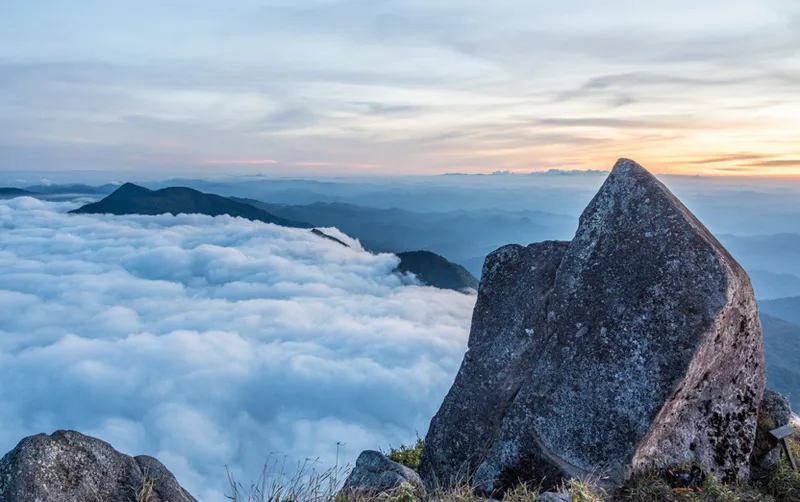
3. Mae Wong National Park protects one of Thailand’s most important forest landscapes, extending across Kamphaeng Phet and Nakhon Sawan provinces and linking with the larger Western Forest Complex. The park is ideal for visitors interested in mountains, montane forest, cool weather, birdwatching, waterfalls, and more demanding hiking routes.
Highlights: Chong Yen, Kio Krathing viewpoint, montane forest, birdwatching, waterfalls, camping areas, and Mokochu Peak at approximately 1,964 meters above sea level.
Mae Wong National Park covers about 558,750 rai, or around 894 square kilometers. It connects ecologically with Khlong Lan National Park, Huai Kha Khaeng Wildlife Sanctuary, and other major protected areas, making it extremely important for wildlife, plant diversity, and mountain ecosystems.
Chong Yen is one of the park’s best-known destinations. At roughly 1,340 meters above sea level, it is cool, windy, and often misty. The surrounding montane forest contains tree ferns, orchids, and epiphytes, making the area especially popular with campers and birdwatchers.
Mokochu is a nationally known long-distance trekking route, but access is seasonal and controlled by the national park. Hikers must prepare physically, bring suitable equipment, and follow official registration or park procedures rather than assuming that the trail is available year-round.
Travelers who do not want a strenuous trek can still enjoy Mae Wong by road, stopping at viewpoints, Chong Yen, and designated camping areas. Vehicles should be checked carefully before climbing into higher areas because some sections are steep and winding, and fog can reduce visibility.
Open Days: Daily Opening Hours: 06:00 – 18:00
Getting There: From Kamphaeng Phet, use Highway 1117 toward Khlong Lan–Umphang or connect through the Lat Yao–Khlong Lan route to the park headquarters. A private car is recommended. Drivers continuing to Chong Yen should check brakes, tires, fuel, and general vehicle condition before climbing.

4. Phra Ruang Hot Spring (Bueng Sap) is a natural hot spring and one of Kamphaeng Phet’s main wellness attractions. Located at Ban Lan Hin in Lan Dok Mai Subdistrict, Mueang Kamphaeng Phet District, it is suitable for travelers who want to rest, soak in mineral water, or recover after a long day exploring the historical park.
Highlights: Natural hot water at roughly 40–65°C, foot-soaking pools, mineral bathing rooms, rest areas, facilities suitable for older visitors, and local legends connected with Phra Ruang.
The hot water rises naturally from underground sources at several points before being managed for wellness use. Visitors can choose foot soaking, mineral bathing, or simple relaxation in the surrounding area. Water temperature varies, so visitors should use the pools appropriately and follow local guidance.
The name is linked to a local Phra Ruang legend telling how sacred speech created hot water for scalding a chicken and cold water for washing it. This folklore gives the hot spring a cultural dimension in addition to its geological and recreational importance.
The site has service buildings, mineral bathing rooms, toilets, ramps, parking, and rest areas, making it more accessible for families and older travelers than nature attractions that require long walks. Visitors who do not want a full-body soak can simply use the foot baths.
Open Days: Daily Opening Hours: 08:30 – 16:30
Getting There: From Kamphaeng Phet city, take Highway 101 toward Phran Kratai and turn onto local roads toward Lan Dok Mai and Ban Lan Hin. A private car is the easiest way to reach the hot spring.
Map (GPS):Open Google Maps – Phra Ruang Hot Spring
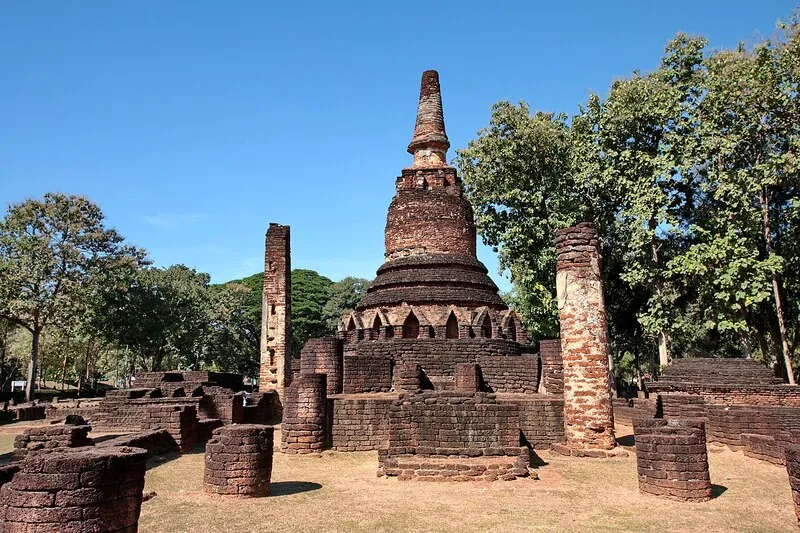
5. Wat Phra Kaeo is one of the most important monuments in Kamphaeng Phet Historical Park. Located inside the ancient fortified city, it is the largest temple complex in the inner-city zone. Although no monks reside here today, its stupas, viharns, Buddha images, and building foundations clearly reveal its former status as a major urban temple.
Highlights: Main stupa, stucco Buddha images, standing Buddha figures, elephant-surrounded and lion-surrounded stupas, viharns, mandapas, and extensive laterite architecture representing several periods of artistic development.
Wat Phra Kaeo is now an archaeological monument under the care of Thailand’s Fine Arts Department. It is therefore best understood as a place for learning about history, archaeology, urban temple planning, and the role of Buddhism in the structure of ancient Kamphaeng Phet.
The structures were not all created in the same period. Construction, restoration, and additions over time make Wat Phra Kaeo particularly useful for studying changes from Sukhothai to Ayutthaya artistic traditions.
Laterite dominates the foundations and walls, contrasting with stucco Buddha images and different stupa forms. Morning and late-afternoon light reveal the rough laterite surfaces particularly well, making the temple one of the strongest architectural photography locations in the inner city.
Open Days: Daily Opening Hours: 08:30 – 16:30
Getting There: Wat Phra Kaeo lies inside the inner-city zone of Kamphaeng Phet Historical Park. Visitors can drive or take a hired vehicle to the park and then explore Wat Phra Kaeo together with nearby monuments on foot.
Map (GPS):Open Google Maps – Wat Phra Kaeo
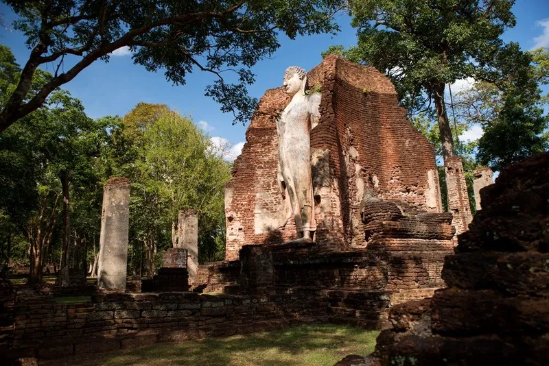
6. Wat Phra Si Iriyabot, also known locally as Wat Phra Yuen, is a major monument in the Aranyik zone of Kamphaeng Phet Historical Park. Its defining feature is a four-sided mandapa that once contained monumental Buddha images in four postures: walking, sitting, standing, and reclining. The standing Buddha remains the most visually complete today.
Highlights: Four Buddha postures, four-sided mandapa, monumental standing Buddha, stucco work, laterite architecture, and a peaceful forest-monastery atmosphere.
The concept of placing four monumental Buddha images in different postures around one mandapa reflects both Buddhist symbolism and the technical skill of ancient craftsmen. Walking around the structure allows visitors to encounter a different posture on each side.
Although several of the images survive only in fragmentary form, the standing Buddha remains a powerful landmark. Its height and proportions are particularly impressive when viewed from the lower ground around the mandapa.
The temple lies in the Aranyik forest zone outside the old city wall, giving it a quieter setting than the monuments inside the fortified city. Nearby routes connect it with Wat Phra Non, Wat Chang Rop, and other forest temples, making the area suitable for walking or cycling.
Open Days: Daily Opening Hours: 08:30 – 16:30
Getting There: The temple is in the Aranyik zone of Kamphaeng Phet Historical Park in Nong Pling Subdistrict. It can be reached by private car, rental bicycle, or other local transport from the old-city zone.
Map (GPS):Open Google Maps – Wat Phra Si Iriyabot

7. Wat Chang Rop is one of the most distinctive monuments in the Aranyik zone and one of the strongest visual symbols of Kamphaeng Phet’s ancient art. Its main bell-shaped stupa rises above a massive circumambulatory base surrounded by 68 half-bodied stucco elephants that appear to support the structure.
Highlights: Elephant-surrounded stupa, 68 stucco elephants, large circumambulatory platform, four stairways, stucco ornament, and a raised setting among the forest temples.
Elephant-surrounded stupas are found in Sukhothai and related artistic traditions. The elephant symbolizes strength, stability, and support for Buddhism, so the animals function both visually and symbolically around the sacred structure.
Because the monument stands on relatively high ground, climbing to the upper platform gives visitors a clearer view of the temple plan and the surrounding woodland. The scale of the base makes the stupa appear especially monumental.
The surviving stucco on the elephants and decorative sections deserves close inspection. Although weathering has damaged many details, the remaining forms still show the quality of the original craftsmanship.
Open Days: Daily Opening Hours: 08:30 – 16:30
Getting There: Wat Chang Rop is in the Aranyik zone of Kamphaeng Phet Historical Park in Nong Pling Subdistrict. It is easily reached by car or bicycle from Wat Phra Si Iriyabot and Wat Phra Non.
Map (GPS):Open Google Maps – Wat Chang Rop

8. Wat Phra Borommathat Nakhon Chum is the major spiritual center of historic Nakhon Chum on the western side of the Ping River. The temple is dominated by a large golden relic stupa and has historical links to the Sukhothai period and King Lithai, bringing together history, religion, and the living community of Nakhon Chum.
Highlights: Golden Phra Borommathat stupa, Buddha relics, historical links to King Lithai, sacred Bodhi tree, Sukhothai foundations combined with later Burmese-influenced architecture, and the Nop Phra Len Phleng tradition.
Nakhon Chum was an important historic settlement connected closely with Kamphaeng Phet and the Sukhothai political network. Wat Phra Borommathat therefore represents more than a local temple: it is evidence of the establishment of Buddhism and the relationship between Ping River cities and the Sukhothai center.
The stupa’s history is associated with King Lithai. Earlier structures included three lotus-bud-shaped stupas on a shared base containing sacred relics. Later restoration transformed the monument into the tall golden form seen today, with visible influence from Burmese architectural traditions.
The temple remains active, with monks and community religious activities continuing today. Visitors should dress respectfully, remain quiet around worshippers, and remember that this is a living religious site rather than an abandoned archaeological monument.
Open Days: Daily Opening Hours: Open for worship throughout the day
Getting There: From Kamphaeng Phet city, cross the Ping River to Nakhon Chum and continue to the temple. Private cars, rental vehicles, hired transport, and local transport can all reach the site easily.
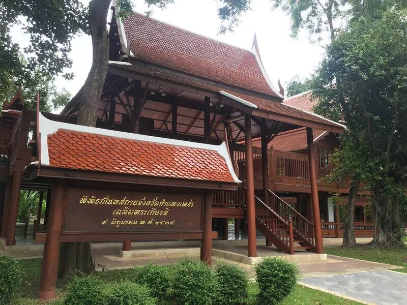
9. Kamphaeng Phet Provincial Museum, often called the Thai House Museum, is a cultural and historical learning center near the old city. Its teak Thai-house complex and exhibitions introduce Kamphaeng Phet through nature, history, ancient towns, ethnic groups, local knowledge, and traditional crafts.
Highlights: Teak Thai-house complex, Kamphaeng Phet history, ethnology, local heritage, natural history, arts and crafts, and family-friendly learning displays.
The museum is useful before visiting the archaeological sites because it connects old towns, ancient monuments, amulets, ethnic communities, natural resources, and local ways of life in one place. This broader context can make the historical park easier to understand.
The architecture is part of the experience. Raised floors, wooden construction, verandas, and the arrangement of several traditional houses allow visitors to experience a form of Thai domestic architecture rather than simply entering a modern exhibition building.
Ethnographic and local-knowledge exhibitions add information that ruins cannot provide, including clothing, handicrafts, beliefs, and the ways communities adapted over time. This makes the museum particularly suitable for students and families.
Open Days: Daily Opening Hours: 09:00 – 16:00
Getting There: The museum is on Pin Damri Road in Nai Mueang Subdistrict, Mueang Kamphaeng Phet District, close to the historical park and other major heritage attractions.

10. Banana Market, widely known as Mo Kluai Khai Market, is a famous roadside market on Highway 1 between Kamphaeng Phet and Nakhon Sawan, around kilometer marker 343. It is one of the province’s best places for buying local produce and understanding the agricultural identity of Kamphaeng Phet.
Highlights: Kamphaeng Phet egg bananas, banana chips, honey-baked bananas, crispy banana snacks, seasonal agricultural produce, local souvenirs, and a traditional northbound roadside-market atmosphere.
Kluai Khai is closely associated with Kamphaeng Phet. The fruit is relatively small, with thin skin, a yellow color when ripe, a sweet taste, and a pleasant aroma. It is excellent fresh and also suited to processing into products that can be stored longer.
The market grew from small roadside produce stalls as traffic between Bangkok and northern Thailand increased. As travelers began buying egg bananas as souvenirs, local sellers expanded into banana chips, honey-baked bananas, and other processed products, helping create an important income source for local households.
The fruit’s provincial identity became even stronger through the Sart Thai Kluai Khai Mueang Kamphaeng festival, first held in 1984. Today, the phrase “Kamphaeng Phet egg banana” is connected with agriculture, food, souvenirs, and local culture.
Open Days: Daily Opening Hours: Throughout the day, depending on individual vendors
Getting There: The market is on Highway 1, Phahonyothin Road, around kilometer marker 343 on the Kamphaeng Phet–Nakhon Sawan route. From Bangkok, follow Highway 32 to Nakhon Sawan and then Highway 1 north toward Kamphaeng Phet.
Map (GPS):Open Google Maps – Banana Market
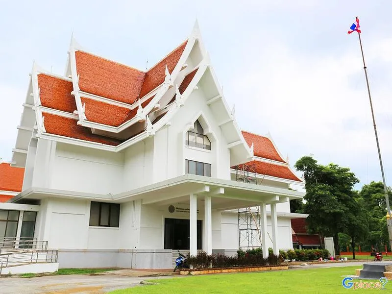
11. Kamphaeng Phet National Museum is one of the province’s most important centers for history, archaeology, and art. Located on Pin Damri Road near Kamphaeng Phet Historical Park, the City Pillar Shrine, and other major monuments, the museum displays evidence from prehistory through the Dvaravati, Lopburi, Sukhothai, Ayutthaya, and Rattanakosin periods.
Highlights: Bronze Shiva image, stone inscriptions, Buddha heads, Sangkhalok ceramics, stucco figures of giants, deities and humans, archaeological objects from the province, and chronological exhibitions on the development of Kamphaeng Phet.
The museum preserves, studies, and presents artifacts recovered from ancient towns and archaeological sites throughout Kamphaeng Phet. Construction began in 1967 and the museum officially opened on March 19, 1971, later developing into the province’s main center for archaeological learning.
The displays demonstrate that settlement in the Ping River basin predates the Sukhothai era. Dvaravati- and Lopburi-period material helps explain the cultural background before Kamphaeng Phet became a major city in the Sukhothai network.
The Sukhothai-period collection is especially useful after visiting Wat Phra Kaeo, Wat Phra Si Iriyabot, and Wat Chang Rop because visitors can examine Buddha heads, stucco, ceramics, and architectural pieces at close range.
Open Days: Wednesday – Sunday Opening Hours: 09:00 – 16:00
Getting There: The museum is on Pin Damri Road, Nai Mueang Subdistrict, Mueang Kamphaeng Phet District. It is easy to reach by private car, rental car, or hired transport and can be combined directly with the historical park.

12. Kamphaeng Phet City Pillar Shrine is an important sacred place in the old city near Wat Phra Kaeo and the ancient urban monuments. Many local residents and visitors stop here to pay respect before exploring the historical area and to learn about traditional beliefs associated with the founding and protection of a city.
Highlights: Laterite city pillar, guardian spirits, four-sided shrine architecture, and a location directly connected with the ancient fortified city.
The city pillar is a round laterite column approximately 2 meters long, with part of it set below ground. Laterite is closely associated with Kamphaeng Phet because it appears throughout the city walls, stupa foundations, viharns, and ancient temples.
The shrine demonstrates the close relationship between religion, protective beliefs, and ancient urban planning. Its location near major religious monuments reflects a city center in which governance and sacred space were closely connected.
Open Days: Daily Opening Hours: 07:00 – 17:00
Getting There: The shrine is in the old city near Wat Phra Kaeo in Mueang Kamphaeng Phet District and is easily reached from the city center by private car or hired transport.

13. Wat Phra Sing is another important monument in the Aranyik zone of Kamphaeng Phet Historical Park. Its viharn, stupa, and laterite structures illustrate the form of a forest monastery built outside the ancient city wall among wooded hills.
Highlights: Laterite viharn, principal stupa, ancient building foundations, typical Kamphaeng Phet construction, and a quiet woodland setting.
The Aranyik zone is particularly important for understanding forest-monastery traditions. Temples were located away from dense settlement to create an environment more suitable for religious practice. Wat Phra Sing belongs to the same wider landscape as Wat Phra Non, Wat Phra Si Iriyabot, and Wat Chang Rop.
Laterite is again the dominant material. Its rough reddish-brown texture against the surrounding trees creates a distinctive atmosphere that appeals to architecture enthusiasts and photographers.
Open Days: Daily Opening Hours: 08:00 – 17:00
Getting There: Wat Phra Sing is in the Aranyik zone of Kamphaeng Phet Historical Park and can be reached by car or bicycle from Wat Phra Si Iriyabot and Wat Chang Rop.
Map (GPS):Open Google Maps – Wat Phra Sing

14. Khlong Nam Lai Waterfall (Pang Kwai Waterfall) is an important waterfall inside Khlong Lan National Park in Khlong Nam Lai Subdistrict. Water descends across several rock levels through lush forest, making it a good alternative for visitors who want more than the main Khlong Lan Waterfall.
Highlights: Multi-tiered waterfall, natural pools, lush forest, camping areas, quiet atmosphere, and a route that can be combined with Khlong Nam Lai Reservoir and Phet Cha Kho Waterfall.
Unlike a single high drop, Khlong Nam Lai Waterfall flows over a sequence of rock shelves and terraces. Some levels contain broader pools while others form narrow streams over exposed rock, creating varied scenery for walking and photography.
The surrounding forest is part of a watershed system that feeds streams and agricultural areas below. Forest condition is therefore directly connected with water availability and the wider ecology of Khlong Lan District.
The rainy season and early cool season are often the most attractive periods, but visitors must be cautious of flash floods, slippery rock, and strong currents.
Open Days: Daily Opening Hours: 08:00 – 16:30
Getting There: From Khlong Lan town, drive toward Khlong Nam Lai Subdistrict and follow national-park signs. A private car is recommended, and road conditions should be checked during the rainy season.

15. Kaeng Ko Roi is a natural stream-and-rapid area within Khlong Lan National Park. Water flows around many rocks and small natural islets, creating a quieter riverside setting than the province’s larger waterfalls.
Highlights: Clear stream, rocky rapids, small natural islets, shaded forest, riverside rest areas, and scenery that changes according to seasonal water levels.
The name refers to the large number of rocks and small islands visible along the stream. During lower water levels, individual rocks and islets become clearer; when the flow rises, water moves rapidly through channels between them, creating numerous small rapids.
The main appeal is the relaxed riverside atmosphere rather than one single landmark. Visitors can sit beside the water, listen to the stream, walk along the riverbank, and photograph the rocks and surrounding forest.
Open Days: Daily Opening Hours: 08:00 – 18:00
Getting There: Kaeng Ko Roi lies within the Khlong Lan National Park area. A private car is the easiest option, and road conditions should be checked during the rainy season.
Map (GPS):Open Google Maps – Kaeng Ko Roi
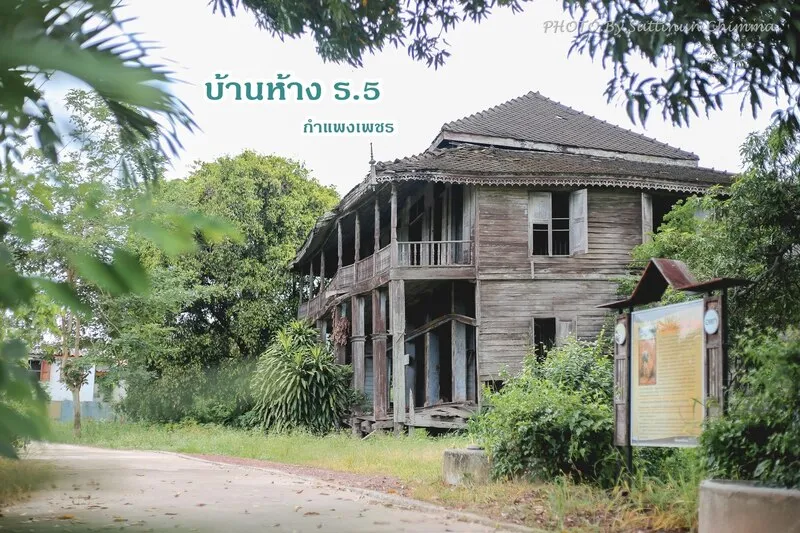
16. Baan Hang Rama V is a historic building in the Nakhon Chum community that reveals a later chapter of Kamphaeng Phet’s history during the Rattanakosin period. In contrast with the province’s many Sukhothai ruins, this site helps visitors understand the transition toward trade, timber activity, and river-based community life.
Highlights: Historic building in Nakhon Chum, stories of trade and the economy around Khlong Suan Mak, links with Ban Pho Po, and the atmosphere of an old community west of the Ping River.
Nakhon Chum has long played a role in commerce and travel because of its position near the Ping River and Khlong Suan Mak. The area therefore contains not only temples and ancient monuments but also houses, shops, and traces of economic activity from later periods.
Baan Hang Rama V is associated with memories of timber work, trade, and the people who shaped Nakhon Chum during the Rattanakosin era. It demonstrates that Kamphaeng Phet remained economically active long after the Sukhothai period.
The site is best appreciated together with Wat Phra Borommathat Nakhon Chum, Khlong Suan Mak, Wat Sawang Arom, and other Nakhon Chum landmarks. Visitors should respect private or restricted areas because the building does not operate like a conventional museum with fixed indoor visiting hours.
Getting There: Baan Hang Rama V is in Nakhon Chum Subdistrict. Cross the Ping River from Kamphaeng Phet city and follow local roads through the community. A bicycle or private car works well for visiting several nearby sites.
Map (GPS):Open Google Maps – Baan Hang Rama V
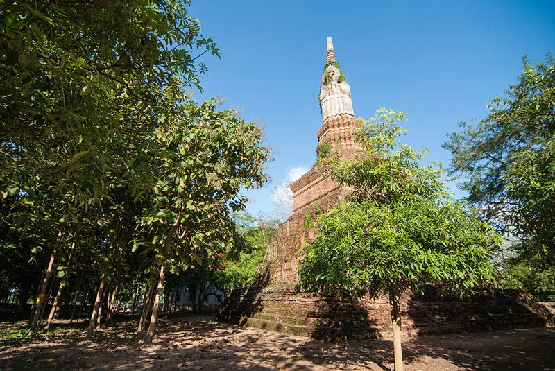
17. Trai Trueng Ancient Town is another historic settlement in Kamphaeng Phet Province, located in Trai Trueng Subdistrict about 18 km from the provincial city. Moats, earthen ramparts, archaeological remains, and local legends broaden the historical picture beyond Kamphaeng Phet Historical Park itself.
Highlights: Ancient town boundaries, moat, earthen defensive works, Wat Wang Phra That, the legend of Thao Saen Pom, and evidence of settlement in the lower Ping River basin.
Trai Trueng demonstrates that ancient Kamphaeng Phet consisted of a network of settlements rather than only the fortified city and Nakhon Chum. Their distribution was related to waterways, agricultural land, and regional transport routes.
The surviving town boundary and moat make it possible to understand the scale of the old settlement. The experience is different from the managed historical park because the archaeological remains are more closely integrated with modern community landscapes.
The legend of Thao Saen Pom adds a strong layer of local folklore. The story is connected with shrines, temples, and locations around Trai Trueng, allowing visitors to combine archaeology with local literary and cultural traditions.
Open Days: Daily Opening Hours: Outdoor areas are best visited during daylight hours
Getting There: Trai Trueng lies about 18 km from Kamphaeng Phet city. Use Highway 1 south toward Nakhon Sawan and then follow local roads and signs to the ancient-town area.
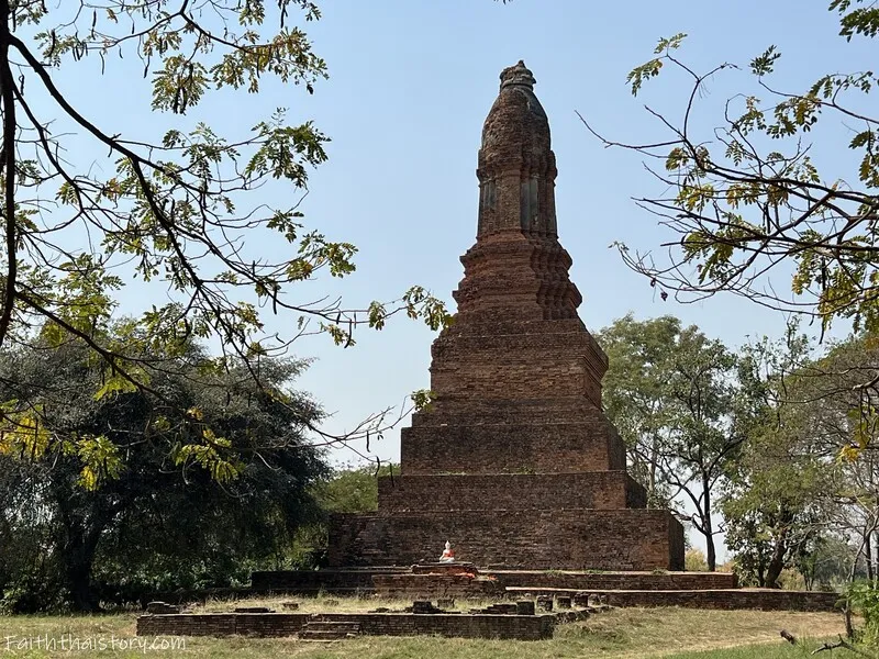
18. Wat Chedi Klang Thung is an archaeological site in the ancient Nakhon Chum area, notable for a stupa standing prominently within open lowland and modern community surroundings. The site illustrates how ancient sacred landscapes overlap with present-day local life.
Highlights: Ancient stupa in an open field, laterite remains, Nakhon Chum archaeology, and a route that connects with Wat Sum Kor, Thung Setthi monuments, and Wat Phra Borommathat Nakhon Chum.
Nakhon Chum contains archaeological sites scattered beyond temples that remain active today. Wat Chedi Klang Thung therefore shows that religious centers once extended across a broader urban and community landscape.
The stupa and surviving structures reveal the use of laterite and brick, important construction materials in the Kamphaeng Phet region. Even where details have been lost, the basic form still helps visitors understand the scale and arrangement of the original sacred site.
Open Days: Daily Opening Hours: Accessible throughout the day
Getting There: Located in Nakhon Chum Subdistrict, the site is a short drive from Wat Phra Borommathat Nakhon Chum and works well as part of a wider Nakhon Chum archaeological route.
Map (GPS):Open Google Maps – Wat Chedi Klang Thung

19. Thai Sirichit Park Cultural Conservation Grounds is a public cultural and recreational space beside the Ping River in Kamphaeng Phet city. It combines parkland, community activities, and cultural events, making it a good evening stop after a day of temples, museums, or archaeological sites.
Highlights: Cultural activity area, outdoor stage, Ping River park, open public space, local performances, festivals, and evening city atmosphere.
The grounds connect the historic identity of Kamphaeng Phet with contemporary community life. Cultural activity is not confined to museums or ruins; music, dance, traditions, and public events are also presented in spaces that local people continue to use.
The surrounding park is suitable for walking, relaxing, and exercise even when no major event is taking place. The riverfront location is particularly pleasant in the evening when temperatures fall and more residents use the area.
Open Days: Daily Opening Hours: 05:00 – 21:00
Getting There: Located in Sirichit Park on Sirichit Road in central Kamphaeng Phet, close to the Ping River. It is easy to reach by car, bicycle, or local hired transport.

20. Phet Cha Kho Waterfall is a natural waterfall in Khlong Lan National Park suited to travelers who want a quieter forest-and-waterfall experience. The waterfall has 4 tiers descending across cliffs and rock levels; each tier is more than 30 meters high, while the upper tier rises more than 70 meters.
Highlights: Four waterfall tiers, high cliffs, watershed forest, a walking trail of about 1.5 km, natural atmosphere, and good conditions for light trekking and waterfall photography.
Part of the attraction is the approach through the forest. The experience begins before reaching the water, with trees, streams, roots, rocks, and forest sounds along the route.
The walking distance from the park ranger area is about 1.5 km. The route is not a long expedition, but wet ground, roots, and slippery rocks mean that proper shoes and sufficient drinking water are important.
The rainy season brings strong water flow and deep green forest, but also the highest risk of flash floods and slippery conditions. Visitors should follow all park closures and safety instructions. Early winter is often easier for walking because the air is cooler and the trail is generally drier.
Open Days: Daily, subject to Khlong Lan National Park announcements Opening Hours: 08:00 – 16:30
Getting There: Follow the route toward Khlong Nam Lai for about 10 km to Ranger Unit KL.4, then continue on foot for approximately 1.5 km. Check weather and park announcements before traveling.

21. Shiva Shrine is an important Hindu archaeological and sacred site in the old city of Kamphaeng Phet. It reflects the religious diversity of the historic city and stands close to Kamphaeng Phet National Museum, Wat Phra Kaeo, and the City Pillar Shrine.
Highlights: Laterite shrine base, replica Shiva image, inscription connected with the installation of the deity in 1510, and evidence of Hindu belief in Ayutthaya-period Kamphaeng Phet.
The important Shiva image associated with the shrine is a bronze sculpture about 210 cm high. An inscription at its base records its installation in 1510. The original is now preserved at Kamphaeng Phet National Museum, while a replica at the shrine allows worship and interpretation at the original sacred location.
The laterite shrine base is rectangular and faces east. Archaeological investigation has also found evidence connected with Shiva, Vishnu, and female deities, demonstrating that this was once an important Hindu sacred area.
The inscription also refers to support for Buddhism, temple repair, canal excavation, and water management, providing valuable evidence of local administration, religion, and public works during the Ayutthaya period.
Open Days: Daily
Getting There: The shrine is in Nai Mueang Subdistrict near the old city and Kamphaeng Phet National Museum, and is easily reached by private car or local hired transport.
Map (GPS):Open Google Maps – Shiva Shrine

22. Luang Pho Umong, Wat Sawang Arom is an important sacred Buddha image of the Nakhon Chum community. Enshrined at Wat Sawang Arom in Nakhon Chum Subdistrict, it has artistic, historical, and spiritual significance for local residents.
Highlights: Chiang Saen-style stucco Buddha image in the Subduing Mara posture, lap width of about 2.87 meters, height of nearly 3 meters, and an annual worship tradition around the full moon of the fourth lunar month.
The Buddha image has a calm, powerful appearance, with a rounded face, prominent chest, and lotus base. Its style reflects northern artistic influence and helps demonstrate cultural connections between Kamphaeng Phet and other northern cities.
The name “Luang Pho Umong,” meaning the Tunnel Buddha, is associated with the narrow tunnel-like entrance around the original setting of the image and has become a distinctive local name.
Open Days: Daily Opening Hours: 09:00 – 16:00
Getting There: The temple is in Nakhon Chum Subdistrict. Cross the Ping River from Kamphaeng Phet city and continue through the Nakhon Chum community.
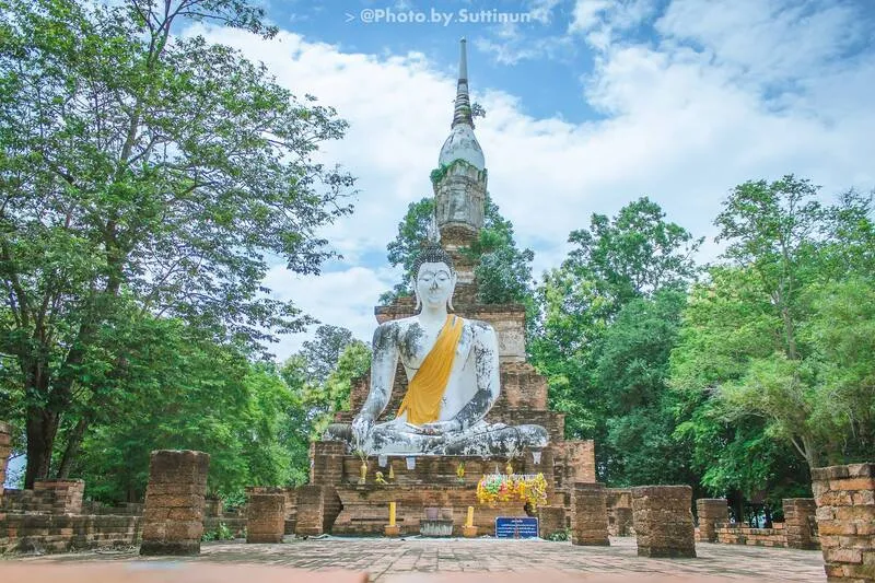
23. Wat Wang Phra That (Wat Thao Saen Pom) is an old temple beside the Ping River in Trai Trueng Subdistrict and one of the key landmarks on the Trai Trueng heritage route. It combines religious significance, archaeology, and local legends connected with Thao Saen Pom.
Highlights: Laterite prang, ancient riverside temple, Thao Saen Pom legend, and a location connected with Trai Trueng Ancient Town and Thao Saen Pom Shrine.
The temple forms part of the wider Trai Trueng settlement, an ancient Ping River town with moats, embankments, and archaeological remains. Its setting helps explain the relationship between religious monuments, community life, and historic urban planning.
The prang and laterite remains are its main architectural features and reflect construction traditions found throughout ancient Kamphaeng Phet.
Open Days: Daily Opening Hours: 08:00 – 17:00
Getting There: The temple is in Trai Trueng Subdistrict, south of Kamphaeng Phet city. Follow Highway 1 south and turn toward Ban Wang Phra That.
Map (GPS):Open Google Maps – Wat Wang Phra That

24. Thao Saen Pom Shrine stands in front of Wat Wang Phra That in Trai Trueng Subdistrict. It is both a place of local faith and a site associated with the Thao Saen Pom legend, adding an important cultural and narrative dimension to a visit to the ancient town.
Highlights: Shrine linked with the Thao Saen Pom legend, local community devotion, and a location close to Wat Wang Phra That and Trai Trueng Ancient Town.
The legend has been passed down locally and linked with the historical memory of Trai Trueng. Although the story belongs partly to folklore, it remains valuable for understanding community identity and the cultural meaning attached to the landscape.
The shrine continues to be used for worship and prayer, so visitors should behave respectfully and regard it as a living sacred place rather than only a photo stop.
Open Days: Daily Opening Hours: Open for worship during normal temple hours
Getting There: The shrine is in front of Wat Wang Phra That at Ban Wang Phra That, Trai Trueng Subdistrict, using the same route as the temple.
Map (GPS):Open Google Maps – Thao Saen Pom Shrine

25. Khlong Nam Lai Reservoir is a water resource and scenic relaxation area in Khlong Nam Lai Subdistrict, Khlong Lan District. The broad water surface against mountain ridges and agricultural land makes it a pleasant stop between Khlong Lan National Park, Khlong Nam Lai Waterfall, and nearby natural attractions.
Highlights: Reservoir views, mountain scenery, sunrise and sunset photography, peaceful atmosphere, and an easy connection with Khlong Nam Lai Waterfall.
In addition to its water-management role, the reservoir has become a local leisure area. Open views make it especially attractive for landscape photography when the mountain ridges are reflected on calm water.
Morning and late afternoon are usually the most pleasant times because temperatures are lower and the light is softer.
Open Days: Daily
Getting There: The reservoir lies around Moo 16 and Moo 17 in Khlong Nam Lai Subdistrict, Khlong Lan District. A private car is the easiest way to connect it with nearby nature sites.

26. Kamphaeng Phet Night Bazar is an evening market near the Ping River in the city center, ideal for finding dinner after a day of museums and historical sites. Stalls sell ready-to-eat food, sweets, drinks, clothing, and general goods.
Highlights: Local food, dinner stalls, desserts, drinks, everyday products, and an authentic local night-market atmosphere.
This is a market used by local residents rather than a tourist-only development, making it a good place to experience everyday evening life in Kamphaeng Phet.
It works well after visiting Kamphaeng Phet Historical Park, Sirichit Park, the Thai Cultural Conservation Grounds, or the 12 Zodiac Fountain Plaza.
Open Days: Daily Opening Hours: Approximately 16:00 – 21:00
Getting There: The market is around Thetsaban 1 Road and Sirichit Road near the Ping River in central Kamphaeng Phet. It is easy to reach by car, motorcycle, or local hired transport.
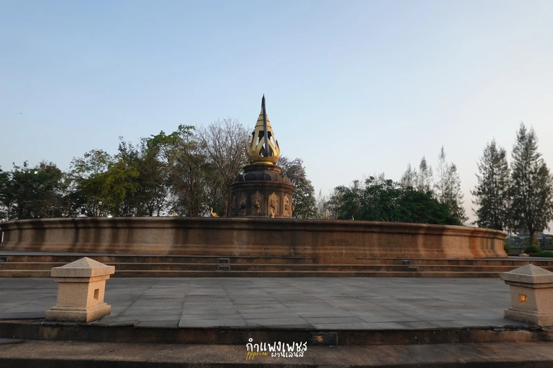
27. 12 Zodiac Fountain Plaza is a recreational area within Sirichit Park beside the Ping River. It is suited to evening walks, light exercise, photography, and a relaxed break before continuing to the Night Bazar or other riverfront areas.
Highlights: Fountain plaza, 12 zodiac symbols, Ping River parkland, event space, and a location close to evening food areas.
The plaza gives visitors a more relaxed experience after spending the day among archaeological sites and temples. In the evening, cooler weather and local residents using the park create a pleasant everyday-city atmosphere.
Special activities, fountain operation, and public events may vary, so visitors coming specifically for an event should check current announcements.
Open Days: Daily
Getting There: Located inside Sirichit Park beside the Ping River in Mueang Kamphaeng Phet District, close to the Thai Cultural Conservation Grounds.

28. Wat Ka Lo Thai is an old temple in the Kamphaeng Phet city area with historical and architectural significance. Its main feature is a lotus-bud or lotus-bud-shaped stupa, a form strongly associated with Sukhothai architecture.
Highlights: Lotus-bud stupa, laterite construction, ancient urban setting, and evidence of Kamphaeng Phet’s continuity from the Sukhothai period into later eras.
The lotus-bud stupa is one of the best-known architectural forms associated with Sukhothai art. Finding this form in Kamphaeng Phet demonstrates political, religious, and artistic links between the city and the Sukhothai center.
The temple is best suited to visitors interested in architecture and history and can be combined with Wat Bang, Shiva Shrine, and Kamphaeng Phet National Museum.
Open Days: Daily
Getting There: The temple is on Ka Lo Thai Road in Nai Mueang Subdistrict and can be reached easily from central Kamphaeng Phet by car or motorcycle.
Map (GPS):Open Google Maps – Wat Ka Lo Thai

29. Luang Pho Phet (Wat Bang) is a revered Buddha image and one of the important sacred objects associated with Kamphaeng Phet city. Enshrined at Wat Bang, it serves both as a spiritual center for local residents and as a significant example of historic Buddhist art.
Highlights: Bronze Chiang Saen-style Buddha image in the Subduing Mara posture, active urban temple, and long-standing local devotion.
Luang Pho Phet has a strong and balanced appearance, with a calm face and proportions associated with early Chiang Saen artistic traditions. The image is valued for both artistic and religious reasons.
The name Wat Bang is related to the former geography of the area, where a water channel branching from the Ping River was locally called a “bang.” The temple name therefore reflects the relationship between the old community and the city’s waterways.
Local worshippers visit to pray for health, safety, work, and general auspiciousness, so the temple remains a living religious site rather than only a historic attraction.
Open Days: Daily Opening Hours: 09:00 – 20:00
Getting There: Wat Bang is in Nai Mueang Subdistrict, Mueang Kamphaeng Phet District, close to the city center and the Ping River.

30. Tao Dam Waterfall is a large waterfall deep inside Khlong Wang Chao National Park and one of the province’s more demanding nature attractions. Water falls across dark rock cliffs in several levels, surrounded by relatively intact forest far from major settlements.
Highlights: Three large waterfall tiers, dark rock cliffs, large natural pools, forest setting, adventurous access road, and more than 600 steps from the parking area down to the viewpoint.
The waterfall is especially dramatic when water flow is strong, with bright white water contrasting sharply against dark rock and green forest.
Access requires more preparation than most attractions. From Khlong Wang Chao National Park headquarters, the route is about 34 km, and some sections involve mountain roads, dirt surfaces, and stream crossings. Road conditions should be checked with park staff before traveling.
From the parking area, visitors descend more than 600 steps and must climb them again on the return journey. Travelers with knee problems, heart conditions, or difficulty on steep stairs should assess their physical condition carefully.
Open Days: Daily, subject to national-park announcements Opening Hours: 08:00 – 16:30
Getting There: Tao Dam Waterfall lies inside Khlong Wang Chao National Park. A vehicle suitable for nature roads is recommended, and road conditions should always be checked with park staff, especially in the rainy season.
Map (GPS):Open Google Maps – Tao Dam Waterfall

31. Wat Thep Molee is an important active temple in Kamphaeng Phet city with links to the historic Chakangrao area. Its principal sacred object is Luang Pho Thep Molee, locally known as Luang Pho Mo, a large brick-and-stucco Buddha image in the Subduing Mara posture that has long been revered by local residents.
Highlights: Luang Pho Thep Molee, large Subduing Mara Buddha image, long-standing community faith, and a central location that connects easily with Wat Bang, Shiva Shrine, the national museum, and the historical park.
The Buddha image measures roughly 10 sok and 1 kuep across the lap and around 13 sok and 1 kuep high. Restoration retained the earlier sacred image within the later structure, preserving the religious continuity of the site.
The Subduing Mara posture symbolizes the Buddha’s victory over Mara before enlightenment and is commonly associated with steadfastness, endurance, and overcoming obstacles.
Open Days: Daily Opening Hours: 08:00 – 17:00
Getting There: The temple is near Ratchadamnoen 1 Soi 2 in Nai Mueang Subdistrict and can be reached easily from central Kamphaeng Phet.
Map (GPS):Open Google Maps – Wat Thep Molee

32. Wat Nong Phikun is an important archaeological site in the ancient Nakhon Chum area on the western side of the Ping River. It is particularly interesting for travelers who want to study Sukhothai-period temple planning outside the better-known historical park.
Highlights: Principal mandapa, rectangular temple plan, moat functioning as an udaka-sima or water boundary, remains of a viharn, and local stories connected with Nang Phikun.
The principal mandapa stands behind the viharn and functions in the position normally occupied by the main stupa. It rises on a high base, with solid brick walls on three sides and an entrance facing east. A large stucco Buddha image once stood inside.
The site is surrounded by water channels on all four sides, forming an udaka-sima, a sacred boundary defined by water for monastic ceremonies and a feature associated with Sukhothai religious traditions.
One explanation of the temple’s name links it to Nang Phikun, the daughter of a wealthy family associated with the Thung Setthi area; another explanation connects the name with former ponds and bullet-wood trees in the landscape. Both stories add cultural context to the ruins.
Open Days: Daily
Getting There: The site is in Nakhon Chum Subdistrict. Cross the Ping River from the city and follow local roads to the archaeological cluster.
Map (GPS):Open Google Maps – Wat Nong Phikun
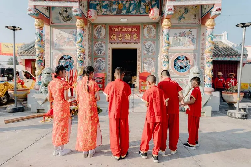
33. Chom Thong Shrine is a long-established Chinese shrine in Salok Bat Market, Khanu Woralaksaburi District. It has served as a spiritual and social center for Thai-Chinese families and other local residents for generations.
Highlights: Historic Chinese shrine, devotion to Chao Pho Chom Thong, Thai-Chinese community traditions, and a location in the heart of Salok Bat market district.
The shrine’s development is closely connected with the growth of Salok Bat, an important settlement on routes linking central and northern Thailand. As Chinese merchants settled in the area, the shrine functioned as both a religious place and a community meeting point.
During Chinese festivals and religious events, the area becomes more active and reveals the blended Thai and Chinese cultural identity of the community.
Open Days: Daily Opening Hours: 08:00 – 17:00
Getting There: The shrine is in Salok Bat Market, Salok Bat Subdistrict, Khanu Woralaksaburi District. From Kamphaeng Phet city, follow Highway 1 south.
Map (GPS):Open Google Maps – Chom Thong Shrine

34. Wang Chomphu Waterfall is a natural waterfall near Ban Mo Suea Du in Phet Chomphu Subdistrict, Kosamphi Nakhon District. It is suited to travelers who prefer a smaller community-level nature site rather than one of the province’s major national-park waterfalls.
Highlights: Forest stream, natural pools, rock formations, shaded surroundings, and a location that can be combined with Khlong Wang Chao National Park.
The waterfall is quieter and smaller in scale than Khlong Lan or the major waterfalls of Khlong Wang Chao, making it suitable for a short nature stop and photography.
Water volume varies strongly by season. The rainy season and the period immediately after it generally provide stronger flow, while dry-season water can be much lower. Visitors should also watch for slippery rock and changing water conditions after heavy rain.
Open Days: Daily Opening Hours: Daylight hours recommended
Getting There: The waterfall is near Ban Mo Suea Du, Phet Chomphu Subdistrict, Kosamphi Nakhon District. A private car is recommended because some access sections use local roads.

35. Rim Fang Mae Nam Song Si is a riverside viewpoint in Khlong Khlung District where the Ping River meets Khlong Khlung. The attraction is the meeting of two bodies of water with different sediment and color characteristics, together with a relaxed riverside atmosphere.
Highlights: Confluence of the Ping River and Khlong Khlung, river views, local riverside atmosphere, photography, and evening relaxation.
The Ping River has shaped Kamphaeng Phet since ancient times, while Khlong Khlung is an important local waterway serving communities and agricultural areas. Their confluence is therefore interesting both geographically and culturally.
The “two-color” effect varies according to season, rainfall, and sediment. Visitors should not expect the separation of colors to look equally clear throughout the year.
Open Days: Daily Opening Hours: Public riverside area; daytime to early evening recommended
Getting There: The viewpoint is in Khlong Khlung District at the meeting point of the Ping River and Khlong Khlung and can be reached by private car from the district center.

36. Chaloem Phra Kiat Water Park is a family recreation facility in Kamphaeng Phet city near Sirichit Road, the public park, and the Ping River. It is suitable for travelers with children who want a simple water activity after visiting outdoor heritage sites during the day.
Highlights: Children’s pool, adult pool, exercise areas, and a location near Sirichit Park, the 12 Zodiac Fountain Plaza, and the Night Bazar.
The facility functions more as a local recreation and exercise area than a large commercial theme park, making it suitable for families seeking an accessible and straightforward water activity.
Open Days: Monday – Tuesday and Thursday – Sunday Opening Hours: Children’s pool 16:00 – 19:00 / Adult pool 16:00 – 20:00
Getting There: Located on Sirichit Road in Nai Mueang Subdistrict near Sirichit Park and the Ping River.

37. Sirikit Oil Field is an important onshore petroleum production area in Lan Krabue District and presents a very different side of Kamphaeng Phet from its World Heritage ruins, temples, and national parks.
Highlights: Major onshore oil-production area, energy industry, opportunities to learn about geology and petroleum, and the economic role of Lan Krabue District.
Lan Krabue has played a significant role in Thailand’s petroleum industry because exploration and development created an important onshore production base within Kamphaeng Phet Province.
This is not a walk-in tourist attraction. It is an operational industrial area with strict safety and access controls. Educational visits or study tours are possible only when officially permitted.
When study visits are available, participants can learn about petroleum geology, production processes, safety procedures, and environmental management, making the location more suitable for students and organized study groups than casual tourists.
Open Days: Advance permission required Opening Hours: According to approved visit schedules and site regulations
Getting There: Located in the S1 Project area, Lan Krabue District. Visitors seeking an educational visit must contact the responsible organization in advance.
Map (GPS):Open Google Maps – Sirikit Oil Field

38. Khlong Wang Chao National Park is a large protected area extending across Kamphaeng Phet and Tak provinces. It contains mountains, watershed forest, waterfalls, streams, camping areas, and diverse ecosystems, making it ideal for travelers who want a deeper nature experience.
Highlights: Khlong Wang Chao Waterfall, Tao Dam Waterfall, watershed forest, nature trails, camping, and mountain landscapes linking Kamphaeng Phet with Tak.
The forest includes mixed deciduous, dry dipterocarp, dry evergreen, and moist valley environments. This ecological diversity supports many plant and animal species and contributes to the watershed system connected with the Ping River.
Khlong Wang Chao Waterfall is one of the main attractions and is suitable for visitors seeking a relatively accessible forest-and-waterfall experience. Those looking for a more demanding excursion can continue toward Tao Dam Waterfall, which requires more time and preparation.
Rainy-season forest is especially lush, but nature routes may be affected by heavy rain or flash floods. Visitors should always check park announcements before traveling.
Open Days: Daily Opening Hours: 08:30 – 16:30
Getting There: The park covers western Kamphaeng Phet and connects with Tak Province. A private car is recommended, and visitors should check road conditions with staff before entering remote sections.
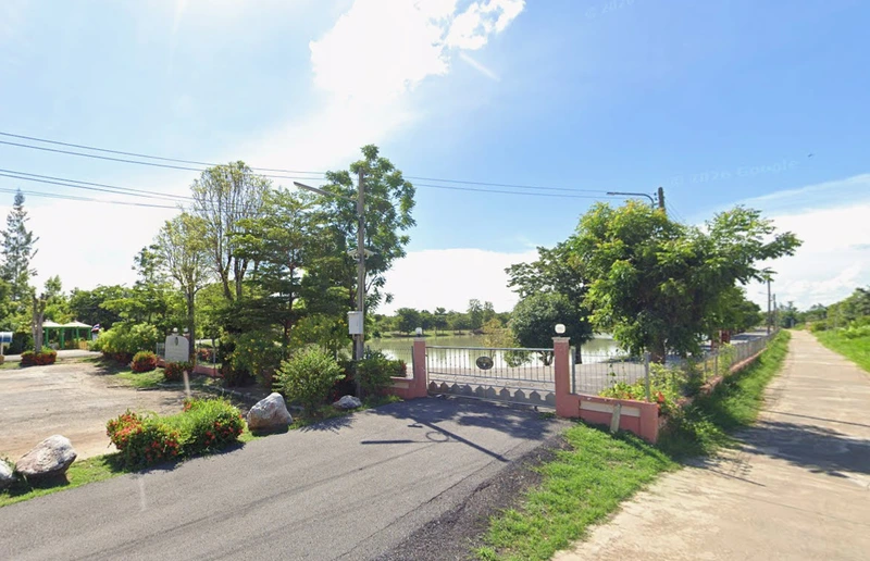
39. Nong Khlong Wua Public Park is an important community park in Salok Bat, Khanu Woralaksaburi District. Created in 2007, it provides space for exercise, recreation, and local community activities.
Highlights: Walking and jogging routes, outdoor exercise equipment, football field, basketball court, children’s area, boating space, and a genuine local-community park atmosphere.
The attraction is not a major landmark but a place to experience how residents use public space in everyday life. In the evening, families, children, teenagers, and older residents gather for exercise and recreation.
Morning and evening are the best times because temperatures are more comfortable. Families with children can use the park as a rest stop while exploring other places in Khanu Woralaksaburi District.
Open Days: Daily Opening Hours: 06:00 – 19:00
Getting There: The park is at Ban Nong Khlong Wua in Salok Bat Subdistrict. From Phahonyothin Road, follow local roads into the park area.

40. Pattaya Khanu Beach is a riverside recreation area on the Ping River in Khanu Woralaksaburi District, on the eastern bank near the local municipality. Its defining features are the seasonal sandy riverbank, open views, and simple local leisure atmosphere.
Highlights: Freshwater sandy riverbank, picnicking, walking, photography, and riverside activities when water levels are suitable.
The name “Pattaya Khanu” is a playful comparison with a seaside beach, but this is a freshwater beach on the Ping River rather than the sea. Its appeal lies in local atmosphere, open space, and sandbanks that appear or shrink depending on the season.
When water levels are appropriate, visitors can sit on mats, walk along the riverbank, and enjoy family activities. The area is especially popular in hotter months, while higher water levels may reduce the available sandy area.
Morning and late afternoon are best for photography and relaxation. Anyone entering the water should assess currents carefully and supervise children closely.
Open Days: Daily Opening Hours: 24 hours; daylight visits recommended
Getting There: The beach is on the eastern bank of the Ping River in front of Khanu Woralaksaburi Municipality and can be reached easily from Phahonyothin Road through the district center.
Map (GPS):Open Google Maps – Pattaya Khanu Beach
| Travel Category | Recommended Places |
| World Heritage & Ancient Towns | 1. Kamphaeng Phet Historical Park 2. Wat Phra Kaeo 3. Wat Phra Si Iriyabot 4. Wat Chang Rop 5. Wat Phra Sing 6. Trai Trueng Ancient Town 7. Wat Chedi Klang Thung 8. Wat Nong Phikun |
| Temples & Spiritual Sites | 1. Wat Phra Borommathat Nakhon Chum 2. Luang Pho Umong, Wat Sawang Arom 3. Wat Wang Phra That 4. Thao Saen Pom Shrine 5. Luang Pho Phet, Wat Bang 6. Wat Thep Molee 7. Shiva Shrine 8. Kamphaeng Phet City Pillar Shrine 9. Chom Thong Shrine |
| Nature & Waterfalls | 1. Khlong Lan National Park 2. Mae Wong National Park 3. Khlong Wang Chao National Park 4. Khlong Nam Lai Waterfall 5. Phet Cha Kho Waterfall 6. Tao Dam Waterfall 7. Wang Chomphu Waterfall 8. Kaeng Ko Roi |
| Waterfront & Relaxation | 1. Khlong Nam Lai Reservoir 2. Rim Fang Mae Nam Song Si 3. Pattaya Khanu Beach 4. Nong Khlong Wua Public Park 5. 12 Zodiac Fountain Plaza 6. Thai Sirichit Park Cultural Conservation Grounds |
| Wellness & Family Recreation | 1. Phra Ruang Hot Spring (Bueng Sap) 2. Chaloem Phra Kiat Water Park |
| Museums & Learning | 1. Kamphaeng Phet National Museum 2. Kamphaeng Phet Provincial Museum 3. Baan Hang Rama V 4. Sirikit Oil Field |
| Markets, Food & Souvenirs | 1. Banana Market 2. Kamphaeng Phet Night Bazar 3. Nakhon Chum community and local food area |
| Best for Families & Children | 1. Kamphaeng Phet Historical Park 2. Kamphaeng Phet Provincial Museum 3. Kamphaeng Phet National Museum 4. Phra Ruang Hot Spring 5. Chaloem Phra Kiat Water Park 6. Nong Khlong Wua Public Park 7. Khlong Nam Lai Reservoir 8. Kamphaeng Phet Night Bazar |
| Best for Photography | 1. Wat Chang Rop 2. Wat Phra Si Iriyabot 3. Kamphaeng Phet Historical Park 4. Khlong Lan Waterfall 5. Mae Wong National Park 6. Tao Dam Waterfall 7. Khlong Nam Lai Reservoir 8. Rim Fang Mae Nam Song Si 9. Pattaya Khanu Beach |
| Best for Hiking & Adventure | 1. Mae Wong National Park 2. Khlong Wang Chao National Park 3. Tao Dam Waterfall 4. Phet Cha Kho Waterfall 5. Khlong Nam Lai Waterfall |
| Kamphaeng Phet City Zone | Kamphaeng Phet Historical Park, Wat Phra Kaeo, Wat Phra Si Iriyabot, Wat Chang Rop, Wat Phra Sing, City Pillar Shrine, Shiva Shrine, Kamphaeng Phet National Museum, Kamphaeng Phet Provincial Museum, Wat Thep Molee, Wat Bang, Kamphaeng Phet Night Bazar, and the 12 Zodiac Fountain Plaza |
| Nakhon Chum Zone | Wat Phra Borommathat Nakhon Chum, Luang Pho Umong at Wat Sawang Arom, Baan Hang Rama V, Wat Chedi Klang Thung, and Wat Nong Phikun |
| Khlong Lan Zone | Khlong Lan National Park, Khlong Nam Lai Waterfall, Phet Cha Kho Waterfall, Kaeng Ko Roi, and Khlong Nam Lai Reservoir |
| Mae Wong Zone | Mae Wong National Park for birdwatching, forest scenery, camping, and seasonal long-distance trekking |
| Kosamphi Nakhon – Khlong Wang Chao Zone | Khlong Wang Chao National Park, Tao Dam Waterfall, Wang Chomphu Waterfall, and natural areas near the Kamphaeng Phet–Tak boundary |
| Trai Trueng Zone | Trai Trueng Ancient Town, Wat Wang Phra That, and Thao Saen Pom Shrine |
| Khanu Woralaksaburi Zone | Chom Thong Shrine, Nong Khlong Wua Public Park, and Pattaya Khanu Beach |
| Khlong Khlung Zone | Rim Fang Mae Nam Song Si and riverside community attractions along the Ping River |
| Lan Krabue Zone | Sirikit Oil Field, suitable for authorized educational groups and study visits |
| 1-Day World Heritage Route | City Pillar Shrine → Kamphaeng Phet National Museum → Wat Phra Kaeo → Wat Phra Si Iriyabot → Wat Chang Rop → Wat Phra Borommathat Nakhon Chum → Kamphaeng Phet Night Bazar |
| 1-Day Nature Route | Khlong Lan National Park → Khlong Lan Waterfall → Khlong Nam Lai Waterfall → Khlong Nam Lai Reservoir |
| 1-Day Nakhon Chum Route | Wat Phra Borommathat Nakhon Chum → Luang Pho Umong, Wat Sawang Arom → Baan Hang Rama V → Wat Nong Phikun → Wat Chedi Klang Thung |
| Kamphaeng Phet 2 Days / 1 Night | Day 1: Historical Park → National Museum → Wat Phra Borommathat Nakhon Chum → Night Bazar Day 2: Khlong Lan National Park → Khlong Lan Waterfall → Khlong Nam Lai Waterfall → Khlong Nam Lai Reservoir |
| Kamphaeng Phet 3 Days / 2 Nights | Day 1: Old city and World Heritage attractions Day 2: Khlong Lan and waterfalls Day 3: Nakhon Chum → Phra Ruang Hot Spring → Banana Market before departure |
| Kamphaeng Phet 4–5 Days | Suitable for covering the Historical Park, Nakhon Chum, Khlong Lan, Mae Wong, Khlong Wang Chao, Trai Trueng, Khanu Woralaksaburi, and outer communities. Divide accommodation by zone to reduce driving time. |
| Best Time to Visit | November – February is best for heritage walks, camping, and hiking. The period after the rainy season is best for strong waterfalls and lush scenery. Summer works for riverside activities, but midday walks among exposed ruins can be very hot. |
| Getting Around the Province | A private car or rental car is the most convenient option, especially for Khlong Lan, Mae Wong, Khlong Wang Chao, Trai Trueng, and outer districts. In the city center, bicycles, motorcycles, and local hired transport are practical alternatives. |
| Popular Souvenirs | Kamphaeng Phet egg bananas, banana chips, dried bananas, processed banana products, agricultural products, OTOP products, and community-made souvenirs |
Frequently Asked Questions (FAQ)
Q: Where should first-time visitors go in Kamphaeng Phet?
A: Start with Kamphaeng Phet Historical Park, especially Wat Phra Kaeo, Wat Phra Si Iriyabot, and Wat Chang Rop. Then cross the Ping River to Wat Phra Borommathat Nakhon Chum. If you have more time, add Khlong Lan National Park to experience the province’s natural side.
Q: Is one day enough for Kamphaeng Phet?
A: One day is enough for the main attractions in the city and Nakhon Chum, but it will not cover the major nature areas of Khlong Lan, Mae Wong, or Khlong Wang Chao. At least 2–3 days are recommended for a balanced history-and-nature trip.
Q: What is a good 2-day, 1-night Kamphaeng Phet itinerary?
A: Spend the first day at Kamphaeng Phet Historical Park, Kamphaeng Phet National Museum, and Nakhon Chum. On the second day, visit Khlong Lan National Park, Khlong Lan Waterfall, Khlong Nam Lai Waterfall, and Khlong Nam Lai Reservoir.
Q: What are the best historical attractions in Kamphaeng Phet?
A: Major historical sites include Kamphaeng Phet Historical Park, Wat Phra Kaeo, Wat Phra Si Iriyabot, Wat Chang Rop, Wat Phra Sing, Kamphaeng Phet National Museum, Trai Trueng Ancient Town, Wat Wang Phra That, and the archaeological sites of Nakhon Chum.
Q: Is Kamphaeng Phet a UNESCO World Heritage destination?
A: Yes. Kamphaeng Phet Historical Park forms part of the UNESCO World Heritage property Historic Town of Sukhothai and Associated Historic Towns together with Sukhothai and Si Satchanalai.
Q: What are the best nature attractions in Kamphaeng Phet?
A: Highlights include Khlong Lan National Park, Mae Wong National Park, Khlong Wang Chao National Park, Khlong Nam Lai Waterfall, Phet Cha Kho Waterfall, Tao Dam Waterfall, Wang Chomphu Waterfall, Kaeng Ko Roi, and Khlong Nam Lai Reservoir.
Q: Which waterfall is best for a first visit?
A: Khlong Lan Waterfall is the best choice for most first-time visitors because it is large, impressive, and relatively easy to access. Travelers who want more nature walking can add Khlong Nam Lai Waterfall and Phet Cha Kho Waterfall.
Q: Where should hikers go in Kamphaeng Phet?
A: Mae Wong National Park is excellent for hiking and birdwatching, especially around Chong Yen and seasonal trekking routes. Khlong Wang Chao National Park and Tao Dam Waterfall are better for travelers seeking a deeper forest experience. Always check current park access before traveling.
Q: Are there family-friendly attractions in Kamphaeng Phet?
A: Yes. Good options include Kamphaeng Phet National Museum, Kamphaeng Phet Provincial Museum, Phra Ruang Hot Spring, Chaloem Phra Kiat Water Park, Nong Khlong Wua Public Park, Khlong Nam Lai Reservoir, and Kamphaeng Phet Night Bazar.
Q: Which temples should travelers visit in Kamphaeng Phet?
A: Important temples and sacred sites include Wat Phra Borommathat Nakhon Chum, Wat Phra Kaeo, Wat Phra Si Iriyabot, Wat Chang Rop, Luang Pho Umong at Wat Sawang Arom, Wat Wang Phra That, Luang Pho Phet at Wat Bang, and Wat Thep Molee.
Q: What is worth visiting in Nakhon Chum?
A: Nakhon Chum is ideal for travelers interested in history, faith, and community life. Key places include Wat Phra Borommathat Nakhon Chum, Luang Pho Umong at Wat Sawang Arom, Baan Hang Rama V, Wat Nong Phikun, and Wat Chedi Klang Thung, together with local food and old-community areas west of the Ping River.
Q: Where can travelers go in Kamphaeng Phet in the evening?
A: Walk around Sirichit Park, the 12 Zodiac Fountain Plaza, and the Thai Cultural Conservation Grounds, then continue to Kamphaeng Phet Night Bazar. Outside the city, evening scenery is also attractive at Khlong Nam Lai Reservoir, Rim Fang Mae Nam Song Si, and Pattaya Khanu Beach.
Q: What is the most famous souvenir from Kamphaeng Phet?
A: The best-known souvenir is the Kamphaeng Phet egg banana, together with banana chips, dried bananas, other processed banana products, agricultural products, and OTOP goods. The Banana Market is one of the easiest places to buy them before leaving the province.
Q: What is the best time of year to visit Kamphaeng Phet?
A: November to February is generally the most comfortable period for sightseeing, heritage walks, camping, and forest travel. The period just after the rainy season is best for waterfalls and lush scenery.
Q: Can travelers explore Kamphaeng Phet without a private car?
A: Yes, some city-center and old-city attractions can be reached by local hired transport or rental vehicle. However, a private car or rental car is much more convenient for Khlong Lan, Mae Wong, Khlong Wang Chao, Trai Trueng, and the outer districts.
Q: How many days are needed to visit all 40 attractions?
A: To visit all 40 places without rushing, allow about 5–7 days. Attractions are spread across several districts, and some natural sites require longer drives or walking. Dividing the trip by geographic zone is the most efficient and safest approach.
 Category: ●Travel Articles, Recipes
 Group: ●Travel Review, Food Review
Last Update : 3 WeekAgo
 Last Update : 3 WeekAgo
Recommend

 Art, Culture and Heritage
 Historical Sites and Monuments(4)
 Landmarks and Memorials(1)
 Art, Craft Centres, Tradition(4)
 Museums(4)
 Historic Homes and Cities(1)
 Places of Worship
 Temple(25)
 Other Sacred Sites(8)
 Research and Development
 Royal Project(2)
 Suburban Living
 Village, Community(2)
 Local Market(2)
 Nature and Wildlife
 National Parks and Marine Reserves(4)
 Mountain (Doi)(2)
 Dam, Reservoir, Lake(4)
 Waterfalls(4)
 Hot Springs(1)
 River, Canal(3)
 Bays and Beaches(2)
 Other natural attractions(1)
 Entertainment and Agricultural
 Farms, Parks and Ecotourism(5)
 Waterpark(1)
 Shopping
 Shopping and Night Market(1)
Travel Review, Food Review(1)


