
lovethailand home >South Travel Attractions >Phang Nga Travel Attractions > 40 Popular Places to Visit in Phang Nga Southern T..
TL;DR: 40 Popular Places to Visit in Phang Nga Southern Thailand.
40 Popular Places to Visit in Phang Nga Southern Thailand
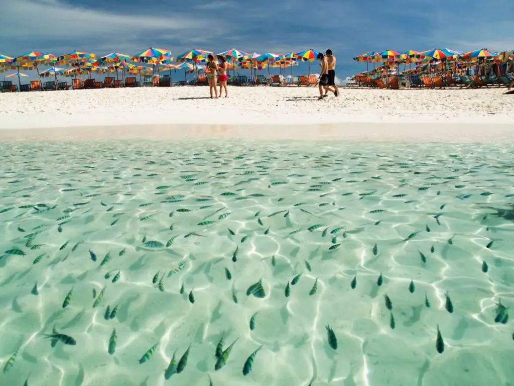
Phang Nga is one of Southern Thailand’s most important tourism provinces on the Andaman coast, offering an exceptional combination of bays, limestone mountains, world-class islands, beaches, mangrove forests, tropical rainforest, waterfalls, caves, archaeological sites, and culturally diverse communities. The key places to prioritize on a first trip include Ao Phang Nga National Park, Khao Tapu, Khao Phing Kan, Koh Panyee, Mu Ko Similan National Park, Mu Koh Surin National Park, Khao Lak Beach, Ko Phra Thong, Wat Suwan Khuha, and Thai Mueang Beach. Travelers with 4–5 days can plan a route through Phang Nga Town–Phang Nga Bay–Khao Lak–Takua Pa–Thai Mueang, or extend the journey to Khura Buri and Ko Yao to experience the province more completely through its sea, nature, history, and community life.
40 Popular Places to Visit in Phang Nga, Southern Thailand Phang Nga is one of the most important travel provinces in Southern Thailand and along the Andaman Sea. It is famous for a landscape that differs clearly from that of many other coastal provinces. Its shoreline is filled with unusually shaped limestone mountains, large and small islands, mangrove forests, tidal channels, sheltered bays, and natural caves, while inland areas contain mountain ranges, tropical rainforest, waterfalls, and historic communities. A trip to Phang Nga can therefore range from boat tours, diving, and beach holidays to journeys focused on history, culture, local communities, and inland nature.
One of the defining images of Phang Nga is Phang Nga Bay, where limestone mountains rise dramatically from green water and extensive mangrove forests form an essential part of the ecosystem. Attractions such as Khao Tapu, Khao Phing Kan, Koh Panyee, Tham Lot, Khao Khian, and Ko Hong can be connected by boat routes within the bay. Traveling through this area is therefore much more than visiting a famous photo landmark; a single journey can reveal karst landscapes, mangrove ecosystems, archaeological sites, and communities built over the water.
In the open Andaman Sea, Phang Nga is home to the Similan Islands and Surin Islands, internationally renowned diving destinations. Clear seawater, white sandy beaches, coral reefs, and rich marine biodiversity have made these island groups major destinations for divers from around the world. The islands operate according to seasonal tourism periods and close during the monsoon season for safety and ecological recovery, so travelers should always check national park announcements before making the journey.
Phang Nga also has a coastline well suited to longer beach stays, especially Khao Lak, where long sandy beaches have developed into one of the province’s principal accommodation areas while retaining a calmer atmosphere than many larger seaside destinations. Thai Mueang Beach, meanwhile, preserves a more natural coastal character and forms part of an ecosystem connected with Khao Lampi–Hat Thai Mueang National Park and sea turtle conservation areas. Phang Nga’s coastline therefore combines active tourism zones with important conservation landscapes.
In the northern part of the province lies Ko Phra Thong, an island very different from the usual image of a tropical beach island. In addition to beaches and mangroves, it contains extensive grassland, Melaleuca forest, peat swamp, and open landscapes resembling savanna. The island is particularly suited to slow travel, birdwatching, cycling, nature observation, and learning about local communities rather than rushing from one photo stop to another in a single day.
The history of Phang Nga reaches back to prehistoric times. Archaeological evidence discovered in caves and rock shelters, including ancient paintings, stone tools, and traces of human settlement, shows that people have used resources from the forests, limestone mountains, and sea for thousands of years. Later, as maritime trade networks developed, Takua Pa and Takua Thung became increasingly important through their connections with people from outside the region, including artistic and cultural influences from India and China.
During the Rattanakosin period, particularly when tin mining expanded, Phang Nga and Takua Pa became important economic areas along the Andaman coast. The arrival of Chinese workers and merchants led to communities with distinctive architecture, food, and traditions, especially in Takua Pa Old Town. As the tin-mining industry gradually declined, the regional economy increasingly shifted toward agriculture, fishing, and tourism.
Phang Nga gained even greater international recognition after Phang Nga Bay was used as a filming location for the 1974 James Bond movie The Man with the Golden Gun. Images of Khao Tapu and the bay’s limestone formations were shown around the world and eventually became some of the most recognizable symbols of Thai tourism. However, the value of Phang Nga Bay extends far beyond its film fame because the entire area forms a large coastal ecosystem containing mangrove forests, sea caves, limestone islands, and fishing communities.
Today, Phang Nga Province is divided into 8 districts: Mueang Phang Nga, Kapong, Ko Yao, Khura Buri, Takua Thung, Takua Pa, Thap Put, and Thai Mueang. Each district has a different character. Mueang Phang Nga is known for limestone mountains, Phang Nga Bay, and Koh Panyee. Takua Thung contains Wat Suwan Khuha and important Phang Nga Bay routes. Takua Pa is home to Khao Lak, the old town, and waterfalls. Khura Buri is the gateway to the Surin Islands and Ko Phra Thong, while Thai Mueang connects beaches, forests, waterfalls, and the Similan Islands.
Phang Nga’s local cuisine reflects a mixture of Southern Thai food, Malay culture, Muslim cuisine, and Chinese-community influences. Dishes worth trying include khao yam, nam budu, southern-style sour curry with sea fish, gaeng tai pla, khua kling, shrimp-paste chili dip with fresh vegetables, roti, murtabak, khao mok, and fresh seafood from Andaman coastal communities, including fish, shrimp, crab, shellfish, and squid. Local cooking commonly emphasizes fresh ingredients, aromatic herbs, and the bold seasoning associated with Southern Thai food.
The Takua Pa area also has food and traditional sweets influenced by Chinese–Peranakan culture, while Koh Panyee, Ko Yao, Khura Buri, and coastal communities are known for halal food and seafood dishes that strongly reflect fishing lifestyles. Eating at markets, community restaurants, or locally run food stalls can therefore provide a deeper understanding of Phang Nga through its ingredients and flavors than dining only in major tourism zones.
Important traditions and cultures in Phang Nga developed through the coexistence of Thai Buddhists, Thai Muslims, Thai Chinese communities, and sea peoples. Chinese communities in Takua Pa maintain the Vegetarian Festival, a faith-based tradition involving rituals, processions, and religious activities. Muslim communities on the islands and along the coast maintain lifestyles closely associated with mosques, fishing, halal cuisine, and important Islamic religious observances.
Another distinctive culture is the traditional way of life of the Moken people in the Surin Islands, who have passed down detailed knowledge of the sea, currents, seasons, and coastal resources over many generations. Travelers should visit the community respectfully, avoid treating residents’ daily lives simply as a backdrop for photographs, and ask permission before photographing individuals or entering private spaces.
Phang Nga also has traditions connected with natural-resource conservation, especially sea turtle release activities and traditions in the Thai Mueang area. These events connect local communities with beach conservation and the life cycle of sea turtles. Such activities demonstrate that tourism in Phang Nga is not based only on using natural resources, but also includes efforts to protect and restore them.
For trip planning, travelers with 3 days can spend the first day visiting Phang Nga Bay, Khao Tapu, Khao Phing Kan, and Koh Panyee; the second day exploring Khao Lak or Takua Pa; and the third day choosing a Similan Islands trip during the open season or a land-based route combining Wat Suwan Khuha and Thai Mueang Beach. Travelers with 4–5 days should add Khura Buri, Ko Phra Thong, the Surin Islands, or Ko Yao to experience the province more fully through its sea, communities, history, and inland nature.
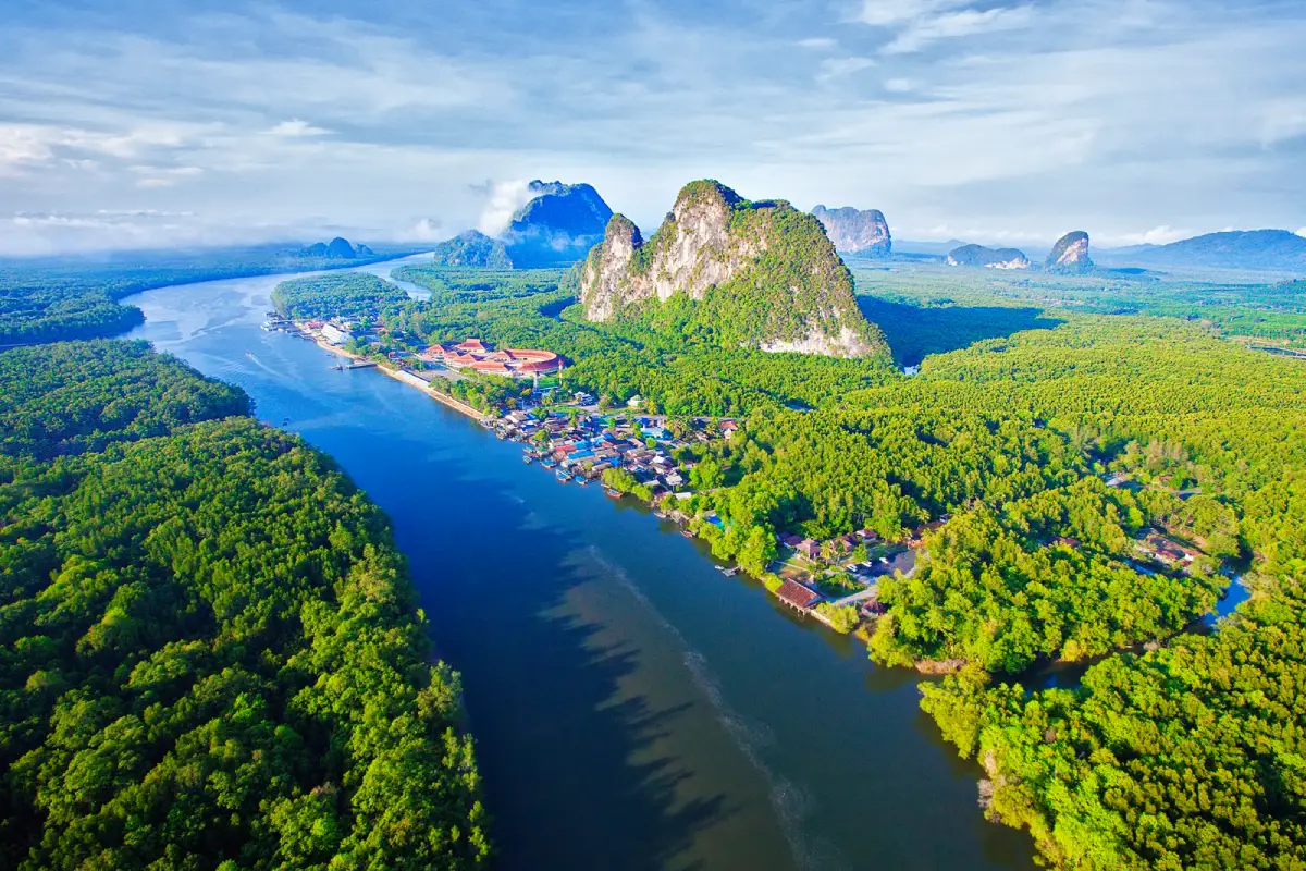
1. Ao Phang Nga National Park is one of the most important marine and coastal tourism areas in Southern Thailand, covering approximately 400 square kilometers across Mueang Phang Nga, Takua Thung, and Ko Yao districts. Its main characteristics are numerous limestone mountains rising from the sea, extensive mangrove forests, sea caves, tidal channels, islands of various sizes, and communities established within the distinctive shallow-water landscape of Phang Nga Bay.
The iconic appearance of Phang Nga Bay does not come from a single island but from the entire landscape. Travelers taking a boat from Ban Tha Dan or piers on the Takua Thung side gradually pass through mangrove forests and limestone mountains rising directly from the water before reaching important locations such as Khao Khian, Khao Ma Chu, Koh Panyee, Khao Phing Kan, Khao Tapu, Tham Lot, Ko Hong, and Ko Phanak. This makes a journey through the bay considerably more diverse than visiting only one famous landmark.
The mangrove system of Phang Nga Bay is extremely important to aquatic life and fishing communities because it provides food, shelter, and nursery grounds for young marine animals. At the same time, limestone mountains and caves create a complex landscape formed through geological processes over an immense period. Travelers interested in nature should therefore view Phang Nga Bay as a large interconnected ecosystem rather than focusing only on the famous image of Khao Tapu.
The national park is open daily, with its main service areas generally operating from around 08:00–16:30. Boat travel depends on weather conditions, tides, and daily safety assessments. Visitors should never throw rubbish into the sea, feed wildlife, write on cave walls, or remove rocks, shells, or living organisms from the protected area.
Getting There: From Phang Nga Town, take Highway 4 and turn onto Highway 4144 toward Ban Tha Dan and Ao Phang Nga National Park headquarters, approximately 8 kilometers from town. From there, continue by sightseeing boat into Phang Nga Bay.
Map (GPS): https://maps.app.goo.gl/3LJYQtd1oxeTWh696
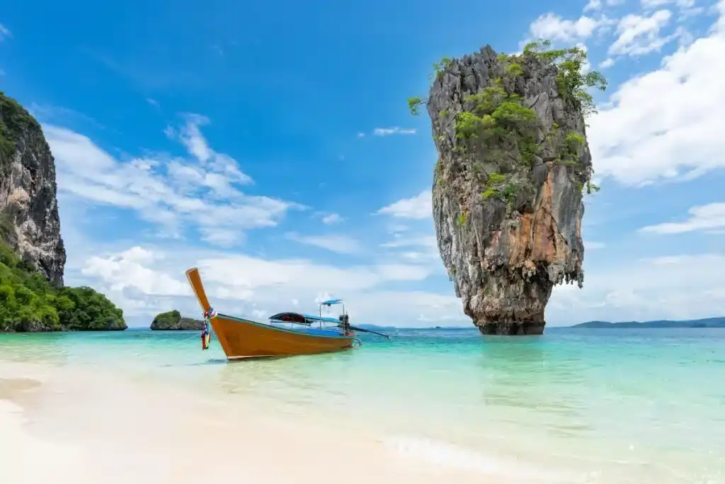
2. Khao Tapu is one of the most famous landmarks in Phang Nga Province. It is located within Ao Phang Nga National Park in Kalai Subdistrict, Takua Thung District. The formation is a relatively small limestone sea stack standing prominently in the water, with a narrow base and wider upper section that resembles a large nail driven vertically into the sea.
Khao Tapu became internationally famous through the James Bond film The Man with the Golden Gun, filmed here in 1974. The area subsequently became widely known among international travelers as James Bond Island. However, Khao Tapu is a fragile natural rock formation, and visitors are not permitted to land on or climb the sea stack itself.
The principal viewing area is at nearby Khao Phing Kan, which has a small beach and areas where visitors can walk. After landing at Khao Phing Kan, travelers can look across the water toward Khao Tapu from a suitable photographic viewpoint. Visits are therefore commonly included in the same itinerary as Khao Phing Kan, Koh Panyee, Tham Lot, and sea-canoeing routes.
Although this is an extremely popular photo stop, visitors should avoid approaching the rock too closely, never attempt to climb restricted areas, and avoid leaving rubbish on the beach or in the sea. The large number of visitors arriving each day can place considerable pressure on the environment, making responsible behavior especially important.
Getting There: Take a sightseeing boat from Ban Tha Dan Pier, Surakul Pier, or another pier operating Phang Nga Bay routes, then continue to Khao Phing Kan to view Khao Tapu from the designated area.
Map (GPS): https://maps.app.goo.gl/bvef8P22RZkPanrP8
3. Khao Phing Kan is located in the same area as Khao Tapu within Ao Phang Nga National Park. The Thai name refers to the appearance of large limestone masses leaning toward each other as though two parts of the mountain were naturally resting against one another. It is an excellent example of a limestone landscape shaped by geological change, rock movement, and erosion over a very long period.
Khao Phing Kan has an area where visitors can land, walk beneath the cliffs, follow short paths, and explore a small beach. From one section of the island, Khao Tapu can be seen standing prominently in the water, which is why the two attractions are almost always mentioned together even though their geological forms and individual characteristics are different.
Walking around Khao Phing Kan requires care because some rocks can be wet, surfaces are uneven, and the shoreline changes with the tide. Particular caution is needed on rainy or rough-sea days. Visitors should remain within areas open for walking, avoid climbing cliffs, and stay away from zones where falling rocks may present a risk.
For travelers interested in geology, Khao Phing Kan provides an opportunity to observe limestone layers and natural deformation at close range. It is worth spending time looking carefully at the formation rather than simply stopping for a photograph of Khao Tapu before immediately moving on.
Getting There: Use the same boat route as Khao Tapu, traveling from the Phang Nga mainland or on a tour program from nearby areas. Boats stop at Khao Phing Kan for visitors to go ashore according to the itinerary.
Map (GPS): https://maps.app.goo.gl/emszBxBrkgG5AWf46
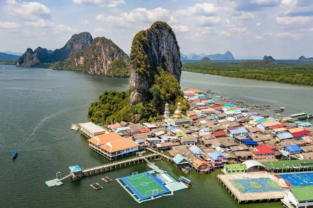
4. Koh Panyee is located in Moo 2, Ko Panyi Subdistrict, Mueang Phang Nga District. It is a Muslim fishing village built on stilts above the waters of Phang Nga Bay, with a large limestone mountain forming a dramatic backdrop. Raised walkways connect homes, a school, mosque, restaurants, souvenir shops, and different sections of the community.
Koh Panyee developed originally as a fishing community. Local residents made their living through fishing, fish farming in floating cages, shellfish cultivation, and maritime trade. As tourism grew, some homes were adapted into restaurants and souvenir shops, but the village remains a genuine residential community with a mosque, school, and daily routines continuing throughout the year.
Another famous feature is the floating football pitch, created by young people in the community who wanted a place to play football despite the lack of flat land on the island. The story became a symbol of the creativity and adaptability of people living in a settlement surrounded by water.
Visitors should dress and behave appropriately because Koh Panyee is a Muslim community. Close-up photographs of residents should not be taken without permission, and private homes should not be entered without invitation. Buying seafood and locally made products in a respectful way can also help distribute tourism income directly within the community.
Getting There: Take a boat from Ban Tha Dan Pier, Surakul Pier, or Ban Hin Rom Pier. Koh Panyee is commonly included in the same route as Phang Nga Bay, Khao Tapu, and Khao Phing Kan, and can be visited as part of either a half-day or full-day trip.
Map (GPS): https://maps.app.goo.gl/MbtyQUQAuUCxC69X8
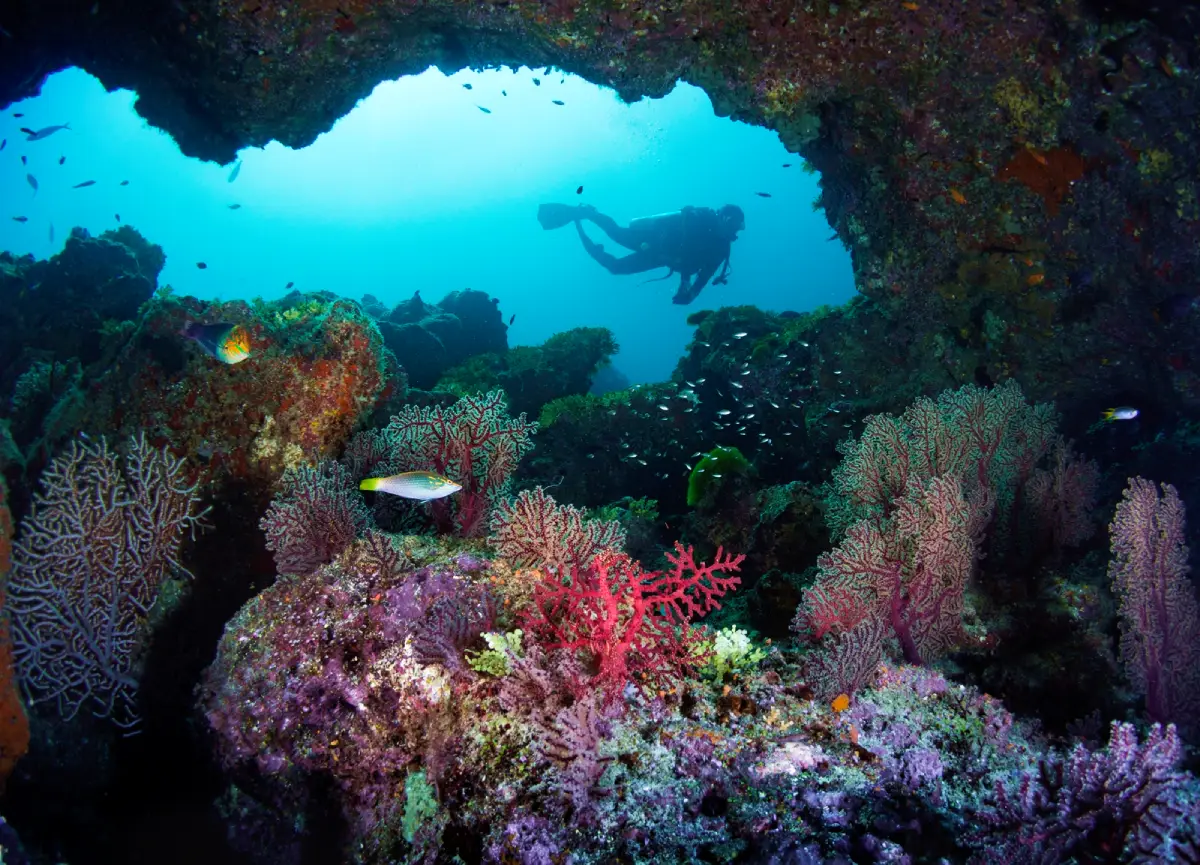
5. Mu Ko Similan National Park is a world-class marine national park in Phang Nga Province, famous for turquoise-blue seawater, fine white sand, enormous granite boulders, and an underwater world rich in coral reefs and marine life. The word “Similan” originates from Malay or Yawi and means “nine,” referring to the original nine-island group.
The most recognizable location is Island No. 8, or Ko Similan, where the famous Sail Rock rises above the beach and serves as one of the archipelago’s principal viewpoints. Other islands provide a range of snorkeling and scuba-diving environments. Divers can encounter coral reefs, schools of fish, and varied underwater landscapes throughout the national park.
The Similan Islands operate according to a seasonal tourism schedule, generally from 15 October to 15 May, with the monsoon-season closure extending from around 15 May to 15 October. The closure reduces risks from waves and strong winds while giving the natural environment time to recover. Exact opening and closing dates should always be confirmed with the national park before booking a trip each year.
Visitors should follow conservation rules strictly. Never stand on or touch coral, feed fish, or remove marine resources. Life jackets should be worn according to operator instructions because the journey crosses open sea and is more exposed to waves and wind than travel within sheltered Phang Nga Bay.
Getting There: The main departure point is Thap Lamu Pier in Thai Mueang District. A speedboat from the mainland generally takes approximately 1.5 hours to reach the islands, depending on sea conditions and the type of boat.
Map (GPS): https://maps.app.goo.gl/JHdzu9bZK7zPTC5D6
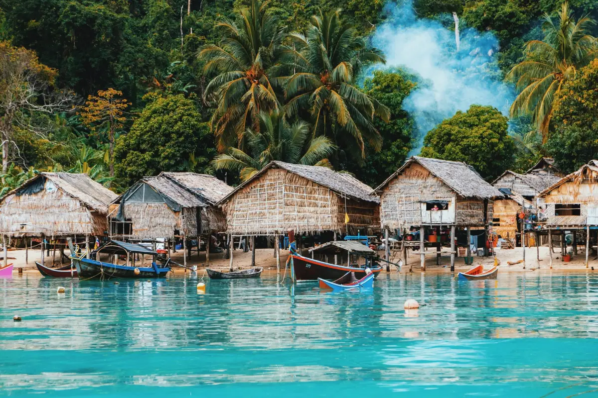
6. Mu Koh Surin National Park is located in the Andaman Sea off Khura Buri District and is another internationally renowned marine destination, particularly for snorkeling and scuba diving. Its main attractions are healthy coral reefs, clear seawater, sandy beaches, and a marine ecosystem connecting several islands within the national park.
The Surin Islands are particularly suitable for travelers who want to experience an underwater environment with high biodiversity. Many snorkeling sites offer opportunities to see schools of fish, coral, and marine life around rocky and reef environments, while nearby deeper-water areas are also well known among experienced scuba divers.
Another important element of the Surin Islands is the Moken community, whose relationship with the sea extends back for generations. Their way of life, language, beliefs, and knowledge of currents, seasons, and marine resources form an important part of their identity. Travelers should enter the community respectfully and avoid disturbing residents’ private spaces.
The national park operates seasonally, similar to the Similan Islands, generally from around 15 October to 15 May before closing through the monsoon period. Travelers should always check wave conditions, national park announcements, and boat schedules before departure, especially when planning overnight stays or several days of diving.
Getting There: Khura Buri Pier is the principal departure point for the Surin Islands. The islands lie approximately 60 kilometers offshore, and a speedboat generally takes a little over 1 hour depending on sea conditions and the type of boat.
Map (GPS): https://maps.app.goo.gl/eBpi3bfkR2R7wurX6
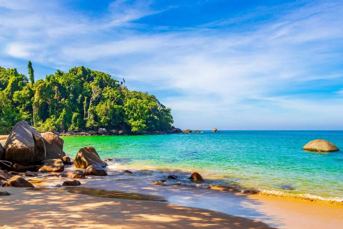
7. Khao Lak Beach is one of the principal coastal tourism areas of Takua Pa District, with several long beaches stretching continuously along the shoreline and a generally calmer atmosphere than many of Southern Thailand’s larger seaside tourism centers. The Khao Lak area combines sandy beaches, coastal rocks, sunset viewpoints, accommodation, restaurants, and a full range of traveler services.
Khao Lak’s appeal lies in the balance between convenience and nature. Travelers can stay beside the sea for several nights without needing to plan activities every day. Different stretches of the coast have different characteristics, ranging from busier areas close to restaurants and services to quieter beaches that are particularly suitable for families, couples, and travelers seeking relaxation.
Khao Lak is also an important base for trips to the Similan Islands, waterfalls within the Khao Lak–Lam Ru area, Takua Pa Old Town, Ban Nam Khem, and attractions in Thai Mueang District. It therefore works well for a 2–3 night stay, with travelers using a car to explore surrounding areas during the day.
During the Andaman monsoon season, waves can become very strong. Although the beaches remain naturally open, visitors should always check warning flags and actual sea conditions before swimming. When the sea is rough, beach walking, sunset viewing, or visiting inland natural attractions are safer alternatives.
Getting There: From Phang Nga Town, take Highway 4 toward Takua Pa District and Khao Lak. From Phuket International Airport, cross Sarasin Bridge and continue north through Thai Mueang toward Khao Lak.
Map (GPS): https://maps.app.goo.gl/75RGPy62DmbpL5Te7
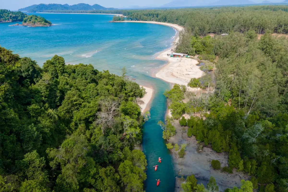
8. Ko Phra Thong is located in Ko Phra Thong Subdistrict, Khura Buri District. It is a large island with a landscape very different from the usual image of a tropical sea island. In addition to beaches and mangrove forests, it contains extensive grassland, Melaleuca forest, peat swamp, and broad open areas with a savanna-like atmosphere that have become one of the island’s defining characteristics.
Activities particularly suited to Ko Phra Thong include cycling, riding local vehicles across the grasslands, birdwatching, walking along the beach, watching the sunset, kayaking, and learning about peat-swamp and Melaleuca ecosystems. Travelers interested in wildlife should move quietly and avoid noisy activities because some parts of the island provide habitat for birds and animals sensitive to disturbance.
Communities on the island are closely associated with fishing and coastal life. Visitors should enter community areas respectfully, avoid entering homes or private property without permission, and not treat local people merely as subjects for photography. Staying for at least 1 night provides enough time to experience both morning and evening on the island rather than making a rushed day trip.
The island has no fixed opening and closing hours like a gated attraction, but transportation depends on boat schedules, tides, waves, and arrangements made by accommodation providers or local operators. Travelers should prepare cash, drinking water, insect repellent, and necessary personal supplies because services are more limited than in urban areas.
Getting There: Travel to Khura Buri District and continue to Khura Buri Pier or Hua Thanon Pier. From there, take a long-tail boat or a boat arranged by accommodation on Ko Phra Thong. The journey generally takes around 45 minutes to a little over 1 hour depending on the departure point and sea conditions.
Map (GPS): https://maps.app.goo.gl/Fj4fLmdvnB9PXT6n9
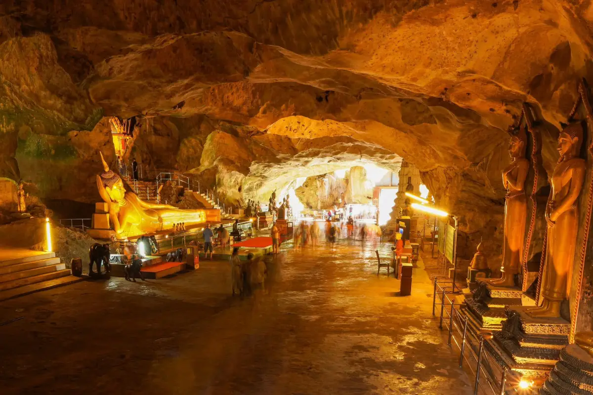
9. Wat Suwan Khuha, locally known as “Wat Tham” or the Cave Temple, is located in Moo 2, Krasom Subdistrict, Takua Thung District. It is an ancient temple and one of Phang Nga’s important historic monuments. The temple is set within a limestone hill containing several interconnected caves, creating an unusual setting in which religion and nature form a single landscape.
The main cave functions as a natural Buddhist sanctuary. Inside is a large reclining Buddha together with numerous other Buddha images and historical evidence connected with visits by Thai kings and members of the royal family. Other caves, including Tham Chaeng and Tham Mued, have different environments and allow visitors to observe the limestone structure more closely.
Wat Suwan Khuha combines Buddhism, history, archaeology, and cave geology in one place. It is particularly suitable for travelers who want to explore Phang Nga without taking a boat and can easily be combined with Phang Nga Town, Tham Phung Chang Cave, or a journey toward Phang Nga Bay within the same day.
Monkeys live around the cave entrance. Visitors should not feed them, hold visible food to attract them, or approach too closely because the animals may try to take personal belongings. Inside the cave, visitors should dress respectfully, remain quiet, and take care on uneven or damp surfaces.
Getting There: From Phang Nga Town, take Highway 4 on the Phang Nga–Phuket route toward Krasom Subdistrict for approximately 9 kilometers, then follow the signs and turn onto the access road for about another 1 kilometer to the temple.
Map (GPS): https://maps.app.goo.gl/YF7xwaPMrUKPdNmD8
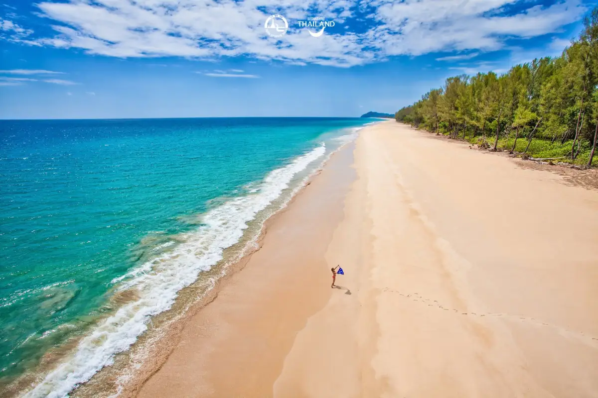
10. Thai Mueang Beach is located in Thai Mueang Subdistrict, Thai Mueang District, and forms part of the wider Khao Lampi–Hat Thai Mueang National Park area. The beach extends for several kilometers and retains a relatively natural character, with a peaceful atmosphere and a coastal ecosystem connected with beach forest, Melaleuca areas, and important sea turtle conservation zones.
Thai Mueang Beach differs from heavily developed resort beaches because much of the coastline remains open and natural. It is suitable for long beach walks, sunset viewing, picnics, and relaxed visits without a fixed schedule. Travelers can also combine the beach with Lam Pi Waterfall, Ton Phrai Waterfall, Khao Na Yak, and other locations within the national park area.
The Thai Mueang coast is important for sea turtle conservation because sections of the beach serve as nesting habitat. The local community also holds sea turtle conservation and release activities at certain times of year. Visitors should therefore avoid disturbing potential nesting areas, never drive vehicles onto protected beach zones, and follow national park regulations carefully.
Swimming should always be based on actual sea conditions. Waves and currents along the Andaman coast change according to season, and swimming should be avoided when the sea is rough. In such conditions, the beach is better used for walking or photography. Families with children should supervise them especially closely near the water.
Getting There: From Phang Nga Town, take Highway 4 toward Thai Mueang District, then turn through the district area onto the road leading to the beach. Private cars and rental vehicles provide the most convenient access.
Map (GPS): https://maps.app.goo.gl/JM8xPf8oszSd1gmM6
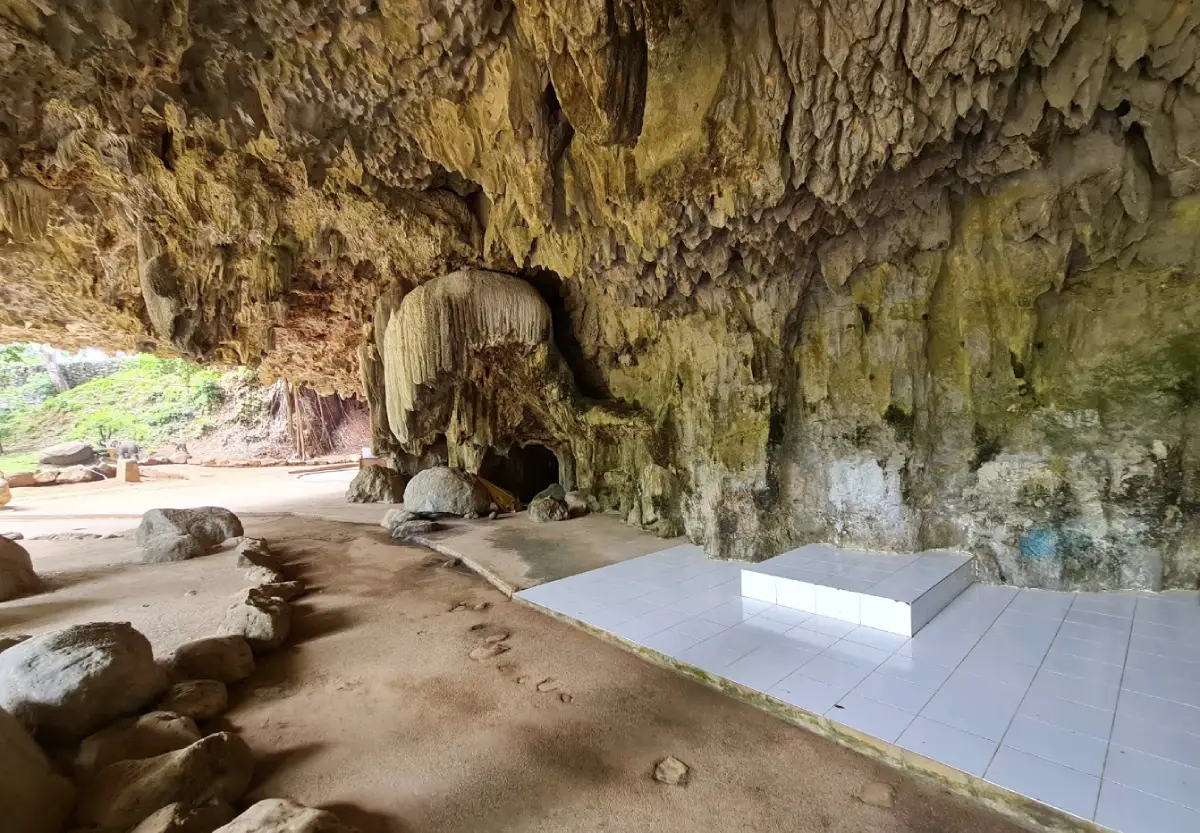
11. Tham Phung Chang Cave is located within the grounds of Wat Praphat Prachimkhet, behind Phang Nga Provincial Hall in Mueang Phang Nga District. It is one of the most distinctive limestone caves in Southern Thailand because visiting it involves much more than simply walking inside to look at stalactites and stalagmites. The route combines canoeing, bamboo rafting, and wading through an underground stream, creating a semi-adventure experience that allows visitors to explore the cave system at close range.
The name “Tham Phung Chang” is connected with Khao Chang, the large limestone mountain in central Phang Nga that resembles a reclining elephant when viewed from certain angles. The cave lies in an area compared to the elephant’s belly, which explains the Thai name meaning “Elephant Belly Cave.” Inside, water flows throughout the year, while different chambers contain stalactites, stalagmites, and unusually shaped limestone walls formed through the slow accumulation of minerals over a very long period.
The complete route generally takes around 1–1.5 hours. Visitors should wear clothes that can get wet and footwear with good traction because some sections require walking through water and across damp rock surfaces. Exploring with a local guide improves safety and also provides a better understanding of the cave formations, underground stream, and local stories connected with the mountain.
The cave is generally open daily from approximately 08:30–16:00 and is especially suitable for travelers who want a nature experience close to Phang Nga Town without going out to sea. It can be combined conveniently with central Phang Nga, Sa Nang Manora Forest Park, Wat Suwan Khuha, or a journey toward Phang Nga Bay within the same day.
Getting There: From central Phang Nga, travel to Wat Praphat Prachimkhet behind Phang Nga Provincial Hall. The cave is only a short distance from the town center and can be reached conveniently by car or motorcycle.
Map (GPS): https://maps.app.goo.gl/qgVRj3obnSv3kqN28
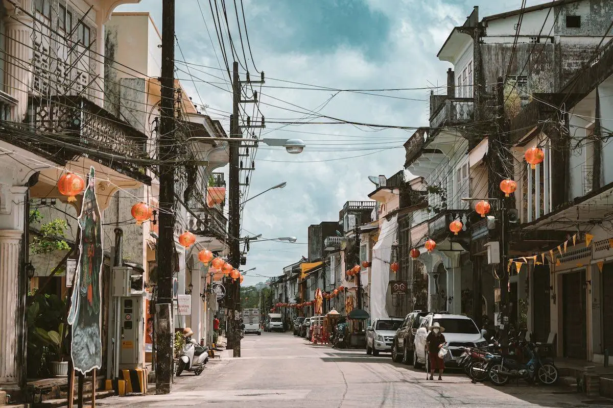
12. Takua Pa Old Town is centered around Si Takua Pa Road, Udom Thara Road, and the Talat Yai area in Takua Pa District. It is one of the clearest places on the Andaman coast for understanding the prosperity of the former tin-mining era. The district is distinguished by Sino-Portuguese buildings, historic shophouses, old streets, Chinese shrines, local restaurants, and a living community that continues to use the old town as part of everyday life.
Takua Pa became important as both a port town and a mining center that attracted merchants, craftsmen, and workers from many areas, especially Hokkien Chinese. The resulting mixture of local, Chinese, and Western cultural influences can still be seen in the arcades, ventilation openings, stucco details, windows, and two-storey shophouses lining the streets.
The old town can be explored on any day, but it becomes particularly lively during the Takua Pa Old Town Cultural Street, usually held on Sundays during the tourism season from around 14:00–20:00. The event features local food, traditional sweets, community products, handicrafts, and cultural activities, making an evening visit especially rewarding for travelers who want to experience more than the architecture alone.
Visitors should allow at least 2–3 hours to walk through the streets, look at historic buildings, sample local food, take photographs, and learn about the area’s history. With additional time, the route can be extended to Khok Khanun Iron Bridge, the old Takua Pa city wall, Narai Park, and nearby markets or historic community areas to gain a fuller picture of Takua Pa as an important historical town.
Getting There: From Khao Lak, follow Highway 4 toward Takua Pa District, then turn into the Talat Yai area and Si Takua Pa Road. A private car is convenient for reaching the area, after which it is best to park and explore the old town on foot.
Map (GPS): https://maps.app.goo.gl/kRWqCoyE9YfrCT7NA
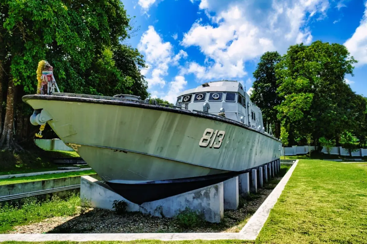
13. Tsunami Memorial – Patrol Boat T.813 is located in Moo 5, Ban Bang Niang, Khuk Khak Subdistrict, Takua Pa District. It commemorates the Indian Ocean tsunami of 26 December 2004, which caused devastating loss along the Andaman coast, particularly around Khao Lak and Takua Pa. The central feature is Police Patrol Boat T.813, which was carried inland by the enormous wave and came to rest approximately 2 kilometers from the shoreline.
The boat has been preserved near the position where the tsunami left it, serving as physical evidence of the power of the disaster and as a memorial reminding visitors of the importance of warning systems, evacuation procedures, and coastal disaster preparedness. Information around the site also helps visitors understand just how far and how forcefully tsunami waves can travel inland.
A visit here should focus on learning and remembrance rather than treating the site merely as a photo stop. Visitors should remain respectful, avoid inappropriate behavior, and read any exhibitions or information about those affected by the disaster with consideration for the victims, survivors, and communities that experienced the event directly.
The outdoor memorial can generally be visited daily and does not operate on a strict timed-entry system, although daytime through early evening is the most practical period to visit. Travelers staying in Khao Lak can reach it easily and may combine the visit with Khao Lak Beach, Bang Niang Market, or other sites related to tsunami education in the area.
Getting There: From the Khao Lak area, follow Phetkasem Road toward Ban Bang Niang in Khuk Khak Subdistrict, then turn onto the local road leading to the Patrol Boat T.813 memorial. Directional signs are available in the area.
Map (GPS): https://maps.app.goo.gl/HYje1o3m6B9bb3jFA
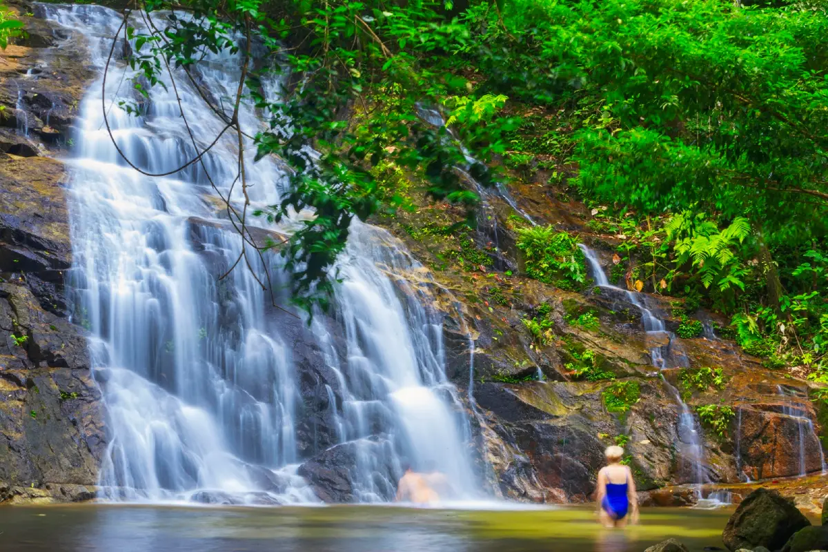
14. Khao Lak–Lam Ru National Park is a highly diverse national park containing mountain ranges, tropical rainforest, coastline, sandy beaches, rocky shores, waterfalls, streams, and scenic viewpoints within the same protected area. Covering approximately 125 square kilometers, the park extends across parts of Takua Pa, Thai Mueang, Kapong, and Mueang Phang Nga districts.
The park headquarters are located beside Phetkasem Road near Khao Lak, making this section more accessible than many remote forest areas. From the visitor area, travelers can follow a coastal nature trail toward a small beach, walk through rainforest that reaches almost to the sea, and enjoy elevated views of the Andaman coast from nearby cliffs.
The wider national park also contains several waterfalls, including Ton Chong Fa Waterfall, Lam Ru Waterfall, Lam Phrao Waterfall, and Hin Lat Waterfall. The mountain areas function as important watersheds and support healthy tropical rainforest, making the park suitable both for travelers looking for an easy nature experience close to the coast and those interested in hiking, waterfalls, and Southern Thailand’s rainforest ecosystem.
Normal visiting hours are generally around 08:30–16:30. Some tourism areas or overnight zones may close seasonally; in 2026, certain sections have a seasonal closure period approximately from 1 June to 31 August. Travelers should always check the latest park announcements before entering nature trails or waterfall areas.
Getting There: The national park headquarters are located beside Highway 4 in the Khao Lak area of Khuk Khak Subdistrict, Takua Pa District. It can be reached quickly from Khao Lak and is also convenient for travelers driving north from Thai Mueang or Phuket International Airport.
Map (GPS): https://maps.app.goo.gl/9vhf4C3SDmrSFmR57
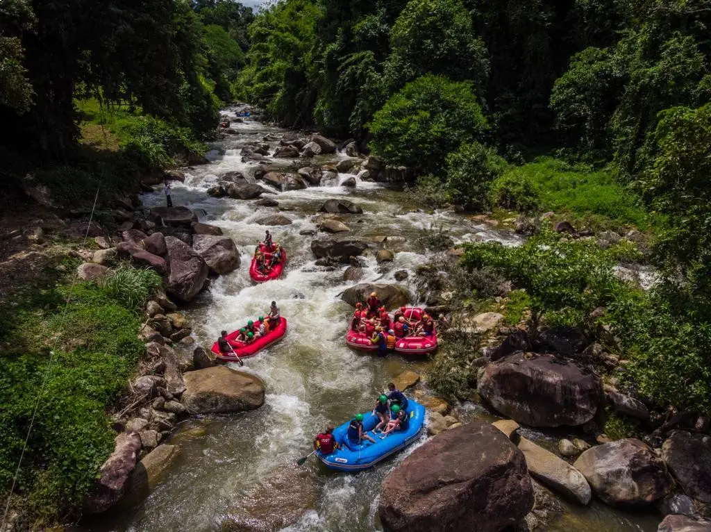
15. Ton Pariwat Waterfall, also locally known as “Song Phraek Waterfall,” is located within Ton Pariwat Wildlife Sanctuary in Song Phraek Subdistrict, Mueang Phang Nga District. It is a rainforest waterfall in an important watershed area and is especially suitable for travelers who want to experience a side of Phang Nga that is very different from its beaches and islands.
The waterfall flows across rocks and into natural pools shaded by tropical rainforest. Some sections have pools where visitors can rest or swim when water levels are safe, although wet rocks and algae can make surfaces extremely slippery, particularly after rain. The word “Ton” is a Southern Thai term commonly used for waterfalls, which is why a number of waterfall names in Phang Nga begin with this word.
The area around the waterfall also has a nature trail of approximately 2 kilometers, allowing visitors to learn about watershed forest, local plant species, traces of former mining activity, birds, and biodiversity. During suitable periods of the year, the area can also support unusually large and locally significant plant species, including Rafflesia when natural conditions allow it to bloom.
The waterfall area is generally open daily from around 06:00–18:00. Swimming should be avoided during heavy rain. If the water suddenly becomes unusually muddy or begins rising rapidly, visitors should leave the stream immediately. Shoes suitable for wet forest surfaces are recommended, and visitors should remain on designated trails.
Getting There: From Phang Nga Town, travel toward Song Phraek Subdistrict and continue into Ton Pariwat Wildlife Sanctuary. A private or rental car is the most practical transportation for this route.
Map (GPS): https://maps.app.goo.gl/wUqxT8s3bZpgCHqi6
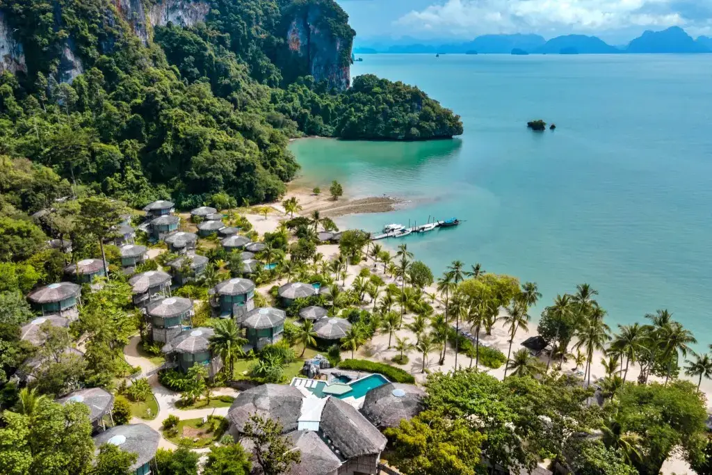
16. Ko Yao is an island group in the middle of Phang Nga Bay consisting of two main islands, Ko Yao Noi and Ko Yao Yai, positioned between Phang Nga, Phuket, and Krabi. Its appeal is not limited to beaches. The islands are also known for Muslim community life, traditional fishing, coconut plantations, rice fields, lobster farming in floating cages, and a slower atmosphere that differs greatly from larger resort islands.
Ko Yao Noi has a relatively good range of accommodation, restaurants, cafés, and tourism services, making it convenient for travelers who want to explore by motorcycle, bicycle, or local transport. Popular areas include Pa Sai Beach, Tha Khao Beach, and the eastern coastline, where visitors can enjoy views of the limestone islands of Phang Nga Bay and the Krabi coast.
Ko Yao Yai is larger and many areas retain a particularly strong community and natural atmosphere. Exploring both islands comfortably requires at least 2–3 days so that travelers do not need to rush. Time can be spent relaxing by the sea, cycling, visiting communities, eating local seafood, or taking boats to smaller surrounding islands.
The majority of residents are Muslim. Visitors should dress and behave appropriately in villages and around mosques, avoid alcohol in areas where the community does not permit it, and ask permission before photographing individuals or community activities.
Getting There: Ko Yao can be reached by boat from piers in Phang Nga, Phuket, or Krabi. Boat schedules vary by pier and season, so travelers should check departure times in advance, especially when coordinating onward transport or accommodation on the islands.
Map (GPS): https://maps.app.goo.gl/kqkvt5nK9bbqZPUA6
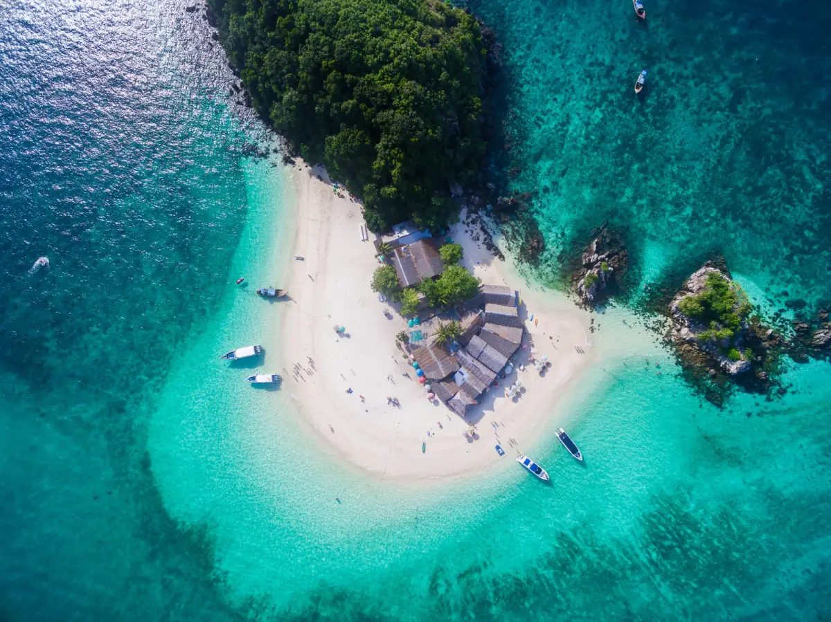
17. Khai Islands are located in Phru Nai Subdistrict, Ko Yao District, between Phuket and Ko Yao Yai. The group consists of small islands famous for white sandy beaches, clear water, and shallow coral areas, making them suitable for half-day or full-day marine trips without traveling as far offshore as the Similan or Surin Islands.
The group commonly includes Khai Nok, Khai Nai, and Khai Nui, each with a slightly different character. Khai Nok is known for its curved sandy beach and swimming areas, Khai Nai has sandy shoreline and shallow water near the coast, while Khai Nui is more suitable for snorkeling than for spending time on a broad beach.
Easy access has made the Khai Islands particularly popular with families and travelers with limited time. However, high visitor numbers also create greater pressure on the marine ecosystem. Visitors should never feed fish, stand on or touch coral, or remove marine animals, shells, or natural materials from the area.
The islands have no fixed opening and closing hours like a gated attraction, but trips depend on tour-boat schedules, waves, and weather conditions. Travel should be postponed when marine warnings are issued, and visitors should choose operators that provide life jackets and follow appropriate safety procedures.
Getting There: Speedboat and sightseeing-boat services operate from Phuket, Ko Yao Yai, and nearby departure points. Travel time is relatively short compared with offshore island groups farther from the mainland.
Map (GPS): https://maps.app.goo.gl/6Eck7yfXg3Dda3o87
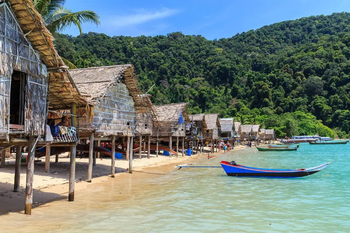
18. Moken Village is located around Ao Bon Yai, or Ao Bon, on Ko Surin Tai within Mu Koh Surin National Park in Khura Buri District. It is an indigenous sea-community settlement with a long relationship with the Andaman Sea and is one of the most important cultural learning sites that can be visited alongside the natural attractions of the Surin Islands.
The Moken have passed down detailed knowledge of waves, currents, coral reefs, seasons, fish, shellfish, crabs, and coastal plants over many generations. In the past, their way of life was semi-nomadic, with boats serving as transportation, living spaces, and essential tools for daily life. Today, the Surin Islands community lives in houses along the beach while continuing to preserve aspects of its language, beliefs, and traditional knowledge of the sea.
A visit to the Moken Village should focus on learning rather than simply taking photographs. Visitors should ask permission before photographing people, avoid entering homes or private areas without invitation, and should not distribute gifts directly to children or residents without coordination because such behavior can create long-term social impacts within the community.
The village is accessible according to the seasonal opening period of Mu Koh Surin National Park and is visited according to boat schedules or national park programs. A visit should therefore be planned as part of a Surin Islands trip, with current national park announcements checked before departure.
Getting There: Take a boat from Khura Buri Pier to the Surin Islands, then continue according to the route arranged by the national park or tour operator. The Moken Village is located on Ko Surin Tai.
Map (GPS): https://maps.app.goo.gl/kTfkk9RR2jBsDm5fA
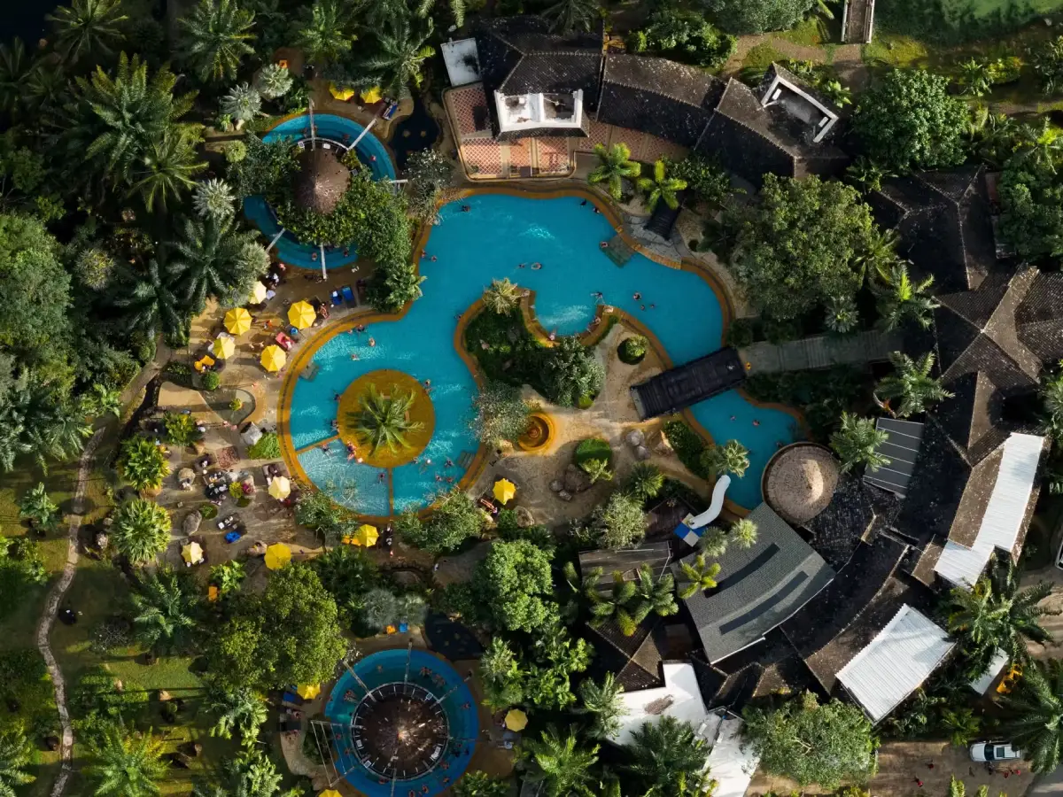
19. Ban Bor Dan Hot Spring is located at Ban Bor Dan in Na Toei Subdistrict, Thai Mueang District. It is a natural mineral hot spring and wellness destination offering a completely different experience from Phang Nga’s marine attractions. Its principal feature is naturally heated mineral water at approximately 45 degrees Celsius, developed into hot mineral pools, a cold-water pool, swimming pool, spa areas, and landscaped gardens.
The site is located within a private resort area and is suitable as a rest stop along the Khok Kloi–Na Tai–Thai Mueang route. Travelers driving a long distance from Phuket or returning from marine activities can spend time soaking in the hot water to relax without necessarily staying overnight if day-use services are available.
Hot-water bathing should be done in moderation. Visitors should avoid soaking continuously for excessive periods and should drink enough water. Elderly visitors, young children, and people with heart conditions, high or low blood pressure, or other health concerns should consider whether hot-water bathing is appropriate. Anyone experiencing dizziness, palpitations, or discomfort should leave the pool immediately.
The hot spring is generally open daily from approximately 08:00–20:00, making it suitable as a late-afternoon or evening stop after visiting beaches or natural attractions in Thai Mueang. It can be combined conveniently with Na Tai Beach, Bor Dan Beach, Wat Tha Sai, or routes around Khok Kloi.
Getting There: From Phang Nga Town, follow the Phang Nga–Khok Kloi route. At Khok Kloi Intersection, continue straight for approximately 2 kilometers, then follow signs toward the hot spring for about another 3 kilometers. A private or rental car is the most convenient option.
Map (GPS): https://maps.app.goo.gl/KXC5eqrfDJtzWSsi9
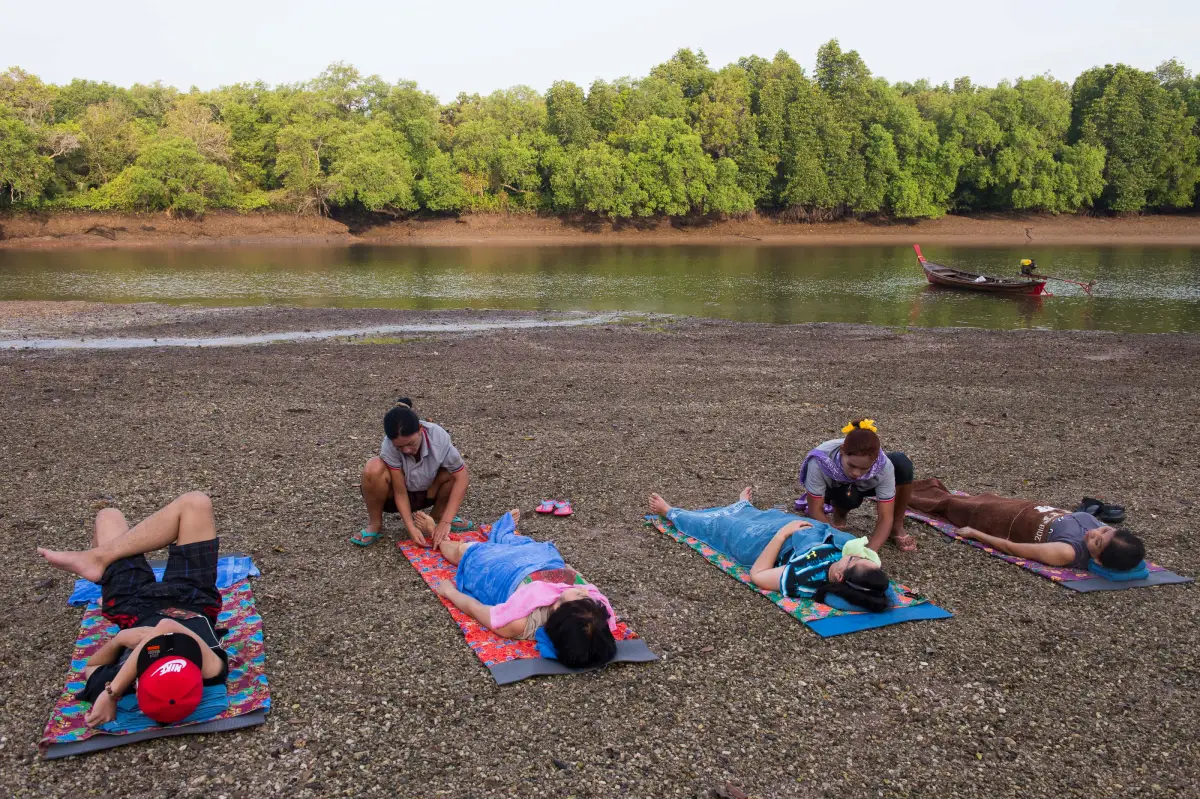
20. Hon Hot Spring, or Khlong Marui Hot Beach is located around Khlong Marui in Marui Subdistrict, Thap Put District. It is an unusual natural attraction because it is not a conventional hot-spring pool that visitors can enter at any time. Instead, it is a mangrove and sandbar environment where hot water, heated mud, and warm sand become accessible when the sea level falls.
The underground heat in this area is associated with the Khlong Marui Fault Zone, causing some sections to be noticeably hotter than the surrounding environment. At low tide, visitors may observe rising steam, naturally heated saline water, and warm mud. The local community has developed hot-mud spa activities and ecological learning experiences around the creek alongside nature-based tourism.
The main attraction is that visitors must travel according to the “rhythm of nature.” It is not possible simply to arrive at any hour and expect the activity area to be accessible. Travelers should arrange their visit with the Ban Khok Khrai community in advance so local guides can identify the appropriate low-tide period and organize a boat and guide to reach the site.
The general visiting period is approximately 08:00–16:00, but the most suitable time depends directly on the tides. Visitors should not walk into the hot areas independently without a local guide because some sections may reach high temperatures and the depth of soft mud varies. Traveling with community supervision improves safety while also helping tourism income reach local residents directly.
Getting There: Travel to Marui Subdistrict in Thap Put District, then contact the Ban Khok Khrai community to arrange a boat and local activity program to Khlong Marui Hot Beach. Advance arrangements are recommended because the visiting schedule depends on the tide.
Map (GPS): https://maps.app.goo.gl/QNjgwJ797A4eQo9G9
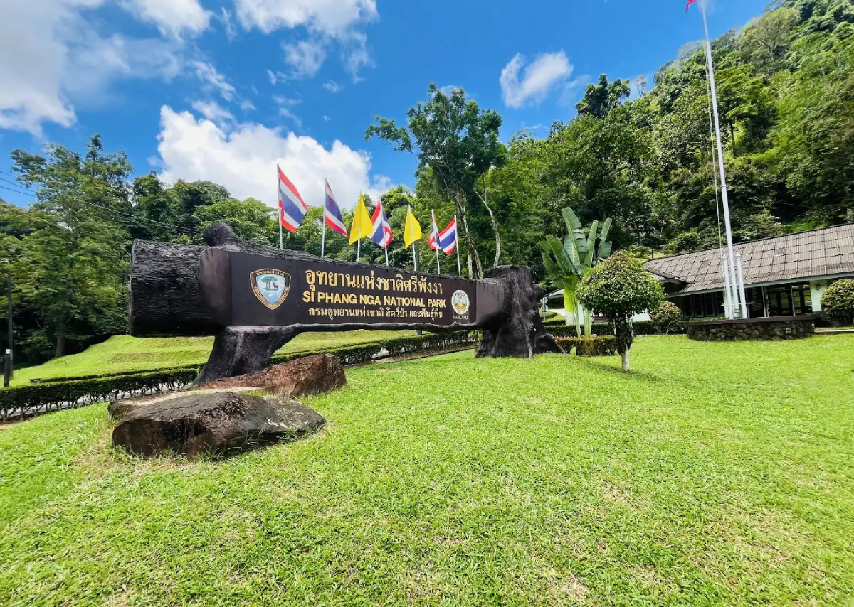
21. Si Phang Nga National Park is a large tropical rainforest area covering parts of Khura Buri and Takua Pa districts. With an area of approximately 153,800 rai, it is one of the most important natural areas in northern Phang Nga. Its main features include complex mountain ranges, watershed forest, streams, large waterfalls, schools of soro brook carp, hornbills, and nature trails that provide an excellent introduction to the rainforest ecosystem of Southern Thailand.
The national park is especially suitable for travelers who want to experience a side of Phang Nga very different from its islands and beaches. The landscape is dominated by humid tropical rainforest, large trees, ferns, mosses, orchids, and numerous native plant species. Several streams flow through the forest and create important waterfalls such as Tam Nang Waterfall, Ton Ton Toei Waterfall, Ton Ton Sai Waterfall, and Suan Mai Waterfall.
Another distinctive feature is the large number of soro brook carp living in the park’s clear streams, reflecting the health of the freshwater ecosystem. Birdwatchers and hikers may also have opportunities to observe hornbills and other wildlife in their natural habitat. Visitors should remain on designated trails, keep noise to a minimum, and never feed wild animals.
The national park is generally open daily from approximately 08:00–16:30. During the rainy season the forest becomes especially lush and the waterfalls carry more water, but trails may become slippery and streams more powerful. Visitors should check national park announcements and weather conditions before entering, especially when planning longer walks or visiting several waterfalls.
Getting There: Travel toward Khura Buri District and continue to Bang Wan Subdistrict, then follow signs to Si Phang Nga National Park. A private or rental car is the most convenient option.
Map (GPS): https://maps.app.goo.gl/FZS5RM1nqz9RY86P8
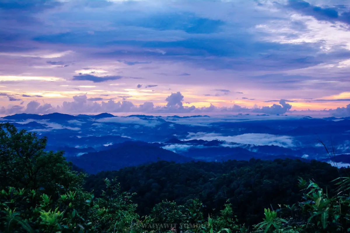
22. Phu Ta Jor is located in Moo 1, Le Subdistrict, Kapong District. It is a mountain viewpoint famous for its sea of mist and adds an entirely different dimension to travel in Phang Nga. Instead of beaches and islands, visitors experience layered mountain ridges, tropical rainforest, drifting morning mist, and cooler highland weather. During some periods, temperatures may fall to approximately 10–20 degrees Celsius.
Phu Ta Jor was once associated with an old tin-mining area locally known as “Mueang Ta Jor” before being developed into a scenic viewpoint and adventure destination. Today, travelers commonly travel up the mountain before sunrise and wait for mist to gather in the valleys. On clear mornings, the viewpoint can provide an almost 360-degree panorama across the surrounding landscape.
The route up the mountain requires four-wheel-drive vehicles operated by experienced local drivers because the road passes through forest and includes steep sections. In some areas, visitors must continue on foot. Ordinary vehicles should not be driven up independently without local experience. Using community-based transportation improves safety and also helps distribute tourism income to local residents.
The viewpoint operates according to local arrangements and weather conditions rather than conventional fixed opening hours. The best period is before sunrise through the early morning. Visitors should prepare a light jacket or windbreaker, trekking shoes, a flashlight, drinking water, and should check the weather forecast in advance.
Getting There: Travel to Le Subdistrict in Kapong District and arrange local four-wheel-drive transportation around Ban Chang Chue or another meeting point specified by the local operator. Driving a normal private car to the summit is not recommended.
Map (GPS): https://maps.app.goo.gl/Be173x1GAXhLAEws6
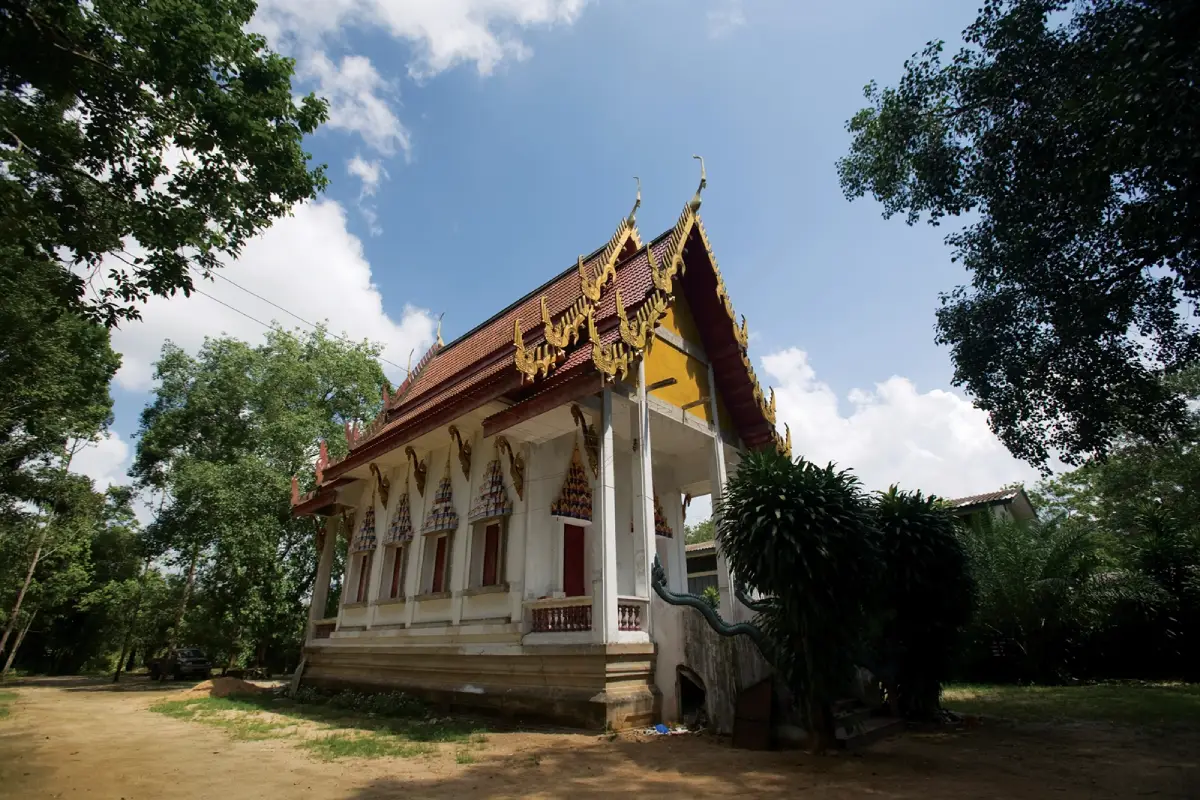
23. Wat Narainikaram, also known locally as “Wat Le,” is located in Moo 3, Le Subdistrict, Kapong District. It is an old community temple with importance extending far beyond its role as a Buddhist religious site because the area is associated with archaeological evidence reflecting historical connections between the Andaman coast, South Indian culture, and maritime trade networks more than a thousand years ago.
Important objects associated with the site include replicas of statues of Vishnu, Lakshmana, and Sita, together with archaeological evidence connected with the ancient port city of Takola. These discoveries indicate that the area was not an isolated local settlement but part of a broader network of cross-peninsular and maritime trade that linked the Andaman coast with distant regions.
The temple as a formal Buddhist institution was registered in 1927 and received its official boundary for monastic use in 1935, but the historical importance of the surrounding area is much older. The archaeological objects and stories connected with Indian cultural influence make the temple particularly valuable for travelers interested in Buddhism, history, archaeology, and the development of early trading communities.
The temple is generally open daily from approximately 06:00–17:00. Visitors should dress respectfully, avoid touching archaeological objects without permission, and spend time reading interpretive information so that the significance of the site can be understood beyond simply stopping to make merit or pay respects.
Getting There: From Kapong District, travel into Le Subdistrict and continue to Moo 3. The temple is accessible by car or motorcycle and can be combined with Phu Ta Jor as part of a Kapong District itinerary.
Map (GPS): https://maps.app.goo.gl/ZXLifKyeqkD6s23k6
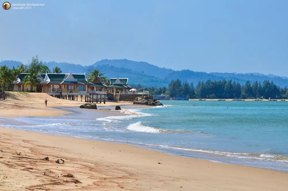
24. Ko Kho Khao is located near the mouth of the Takua Pa River, close to Ban Nam Khem in Takua Pa District. It is particularly suitable for travelers who want a quiet island stay. The island is characterized by long beaches, coastal casuarina and coconut trees, flat lowland areas, small communities, and a peaceful atmosphere that is considerably less crowded than Khao Lak or larger resort islands.
A visit to Ko Kho Khao is best suited to a stay of 1–2 nights, allowing time for cycling, driving around the island, walking along the beaches, or stopping at local restaurants. The island’s appeal lies in its slow rhythm rather than in having a large number of conventional sightseeing landmarks. Roads connect villages, agricultural land, mangrove areas, resorts, and different stretches of beach.
The island is also historically important because of the archaeological site at Ban Thung Tuk, which is associated with ancient maritime trade routes. Travelers interested in the history of Thailand’s Andaman coast can therefore combine the island’s natural scenery with archaeological and trading history.
Ko Kho Khao does not have fixed opening or closing hours, but boats and vehicle ferries generally operate around 08:00–17:00. Travelers should check the final crossing time before returning to the mainland, particularly if they are not staying overnight on the island.
Getting There: From Takua Pa District or Khao Lak, travel to Ban Nam Khem, then take a local boat or vehicle ferry across to Ko Kho Khao. The crossing takes only a short time.
Map (GPS): https://maps.app.goo.gl/4eHcjDG6csWgt2vS7
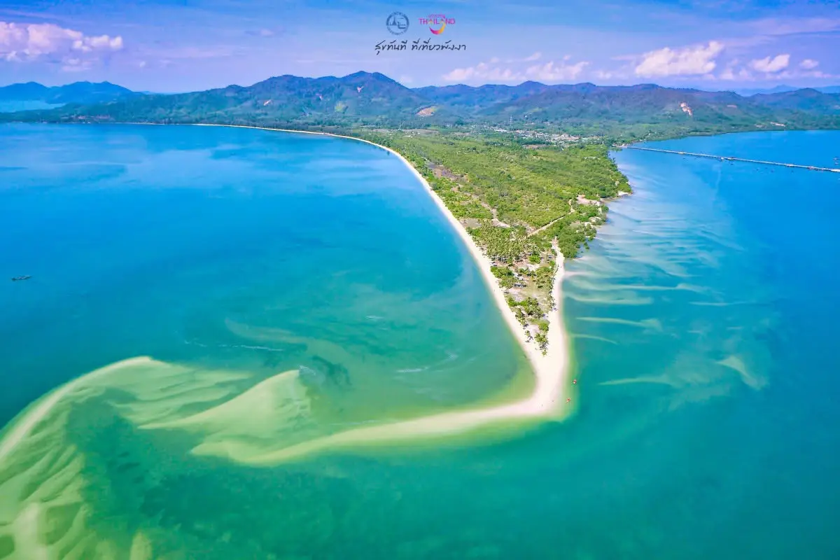
25. Laem Had Beach is located in Moo 2, Ko Yao Yai Subdistrict, Ko Yao District. It is one of the most recognizable beaches on Ko Yao Yai because at low tide a long pale sandbar extends dramatically into the sea, with water on both sides creating the appearance of a natural walkway stretching out from the island.
The shape and length of the sandbar change according to the tides, making the beach look different throughout the day. Travelers who want to see the sandbar at its most prominent should check the tide table before visiting. At high tide, sections of the sandbar may disappear beneath the water and visitors will not be able to walk as far out.
Laem Had Beach is suitable for walking, photography, viewing Ko Yao Noi, and simply relaxing beside the sea. The atmosphere is peaceful and has not been developed on the scale of major resort beaches, making it particularly attractive to travelers who want to experience the quieter natural character of Ko Yao Yai.
The beach is naturally open throughout the day, but the best visiting period depends on tide level and available daylight. Visitors should avoid walking too far along the sandbar when the tide is beginning to rise and should monitor changing water levels carefully. All rubbish should be taken away from the beach.
Getting There: From a pier on Ko Yao Yai, travel by motorcycle, rental vehicle, or local transport to Moo 2 and Laem Had Beach. Staying overnight on Ko Yao Yai makes it easier to plan a visit around low tide.
Map (GPS): https://maps.app.goo.gl/TyHM85UKF6C16hHh8
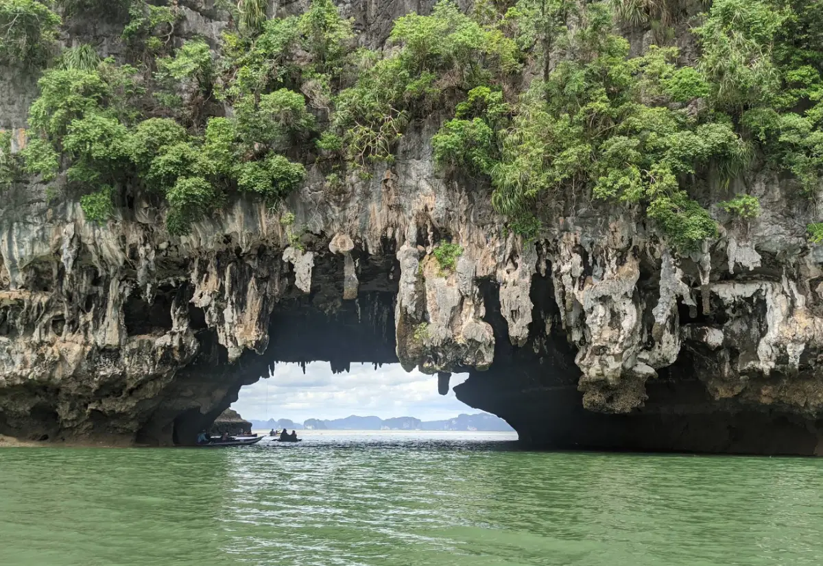
26. Tham Lot is located around Ko Thalu within Ao Phang Nga National Park. It is a sea cave with a natural water passage running through a limestone mountain. Small boats or canoes can travel through the cave when tide levels are suitable, allowing visitors to see the cave ceiling, stalactites, and natural light entering from openings in the rock.
The cave is approximately 50 meters long and around 20 meters wide on average. Its limestone structure and the effects of continuous marine erosion can be observed clearly from the water. Traveling through the cave by small boat allows visitors to experience Phang Nga Bay’s karst landscape much more closely than simply viewing the islands from a larger sightseeing boat.
Tham Lot is commonly included in the same itinerary as Khao Tapu, Khao Phing Kan, Koh Panyee, Ko Hong, or other sea-canoeing routes in Phang Nga Bay. It is particularly suitable for travelers who want their bay excursion to include both famous landmarks and more immersive nature activities.
The area is generally accessible from around 08:00–16:30, but entry into the cave depends directly on tides and sea conditions. Visitors should never touch stalactites or write on cave walls and should wear life jackets throughout all water-based activities.
Getting There: Take a sightseeing boat from a pier serving Phang Nga Bay, such as Ban Tha Dan, then transfer to a canoe or small boat according to the cave-tour program.
Map (GPS): https://maps.app.goo.gl/Xhz5gL7ZuCG5DbWQA
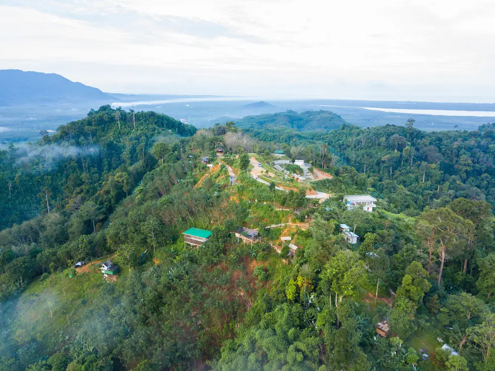
27. Khao Khai Nui Sea of Mist is located in Moo 3, Ban Fai Tha, Thung Maphrao Subdistrict, Thai Mueang District. It is one of Phang Nga’s best-known sea-of-mist viewpoints and one of Southern Thailand’s notable mountain sunrise destinations. Visitors can experience morning mist, sunrise, mountain scenery, and on clear days even distant views toward the Andaman Sea.
Khao Khai Nui rises approximately 200 meters above sea level. Although it is not particularly high compared with mountains in Northern Thailand, its position among mountain ridges and the moisture moving inland from the Andaman Sea frequently create mist in the surrounding valleys, especially after rainfall or when temperatures fall overnight.
The recommended visiting period is approximately 05:00–08:00 to wait for sunrise and the morning mist. Visitors should arrange local transportation or accommodation in advance because some sections of the access road are unsuitable for ordinary vehicles. Travelers planning photography should allow extra time and prepare equipment for rain or high humidity.
One of the advantages of Khao Khai Nui is that it can be visited during much of the year, although a sea of mist can never be guaranteed because its formation depends on humidity, rain, wind, and temperature. The trip should therefore be appreciated as a mountain-nature experience rather than being judged only by whether mist appears on a particular morning.
Getting There: From Thai Mueang District, travel toward Thung Maphrao Subdistrict and Ban Fai Tha, then use local transport or a transfer service operated by drivers familiar with the route to the viewpoint. Advance arrangements are recommended.
Map (GPS): https://maps.app.goo.gl/ZXHyb4ZiipHnqx41A
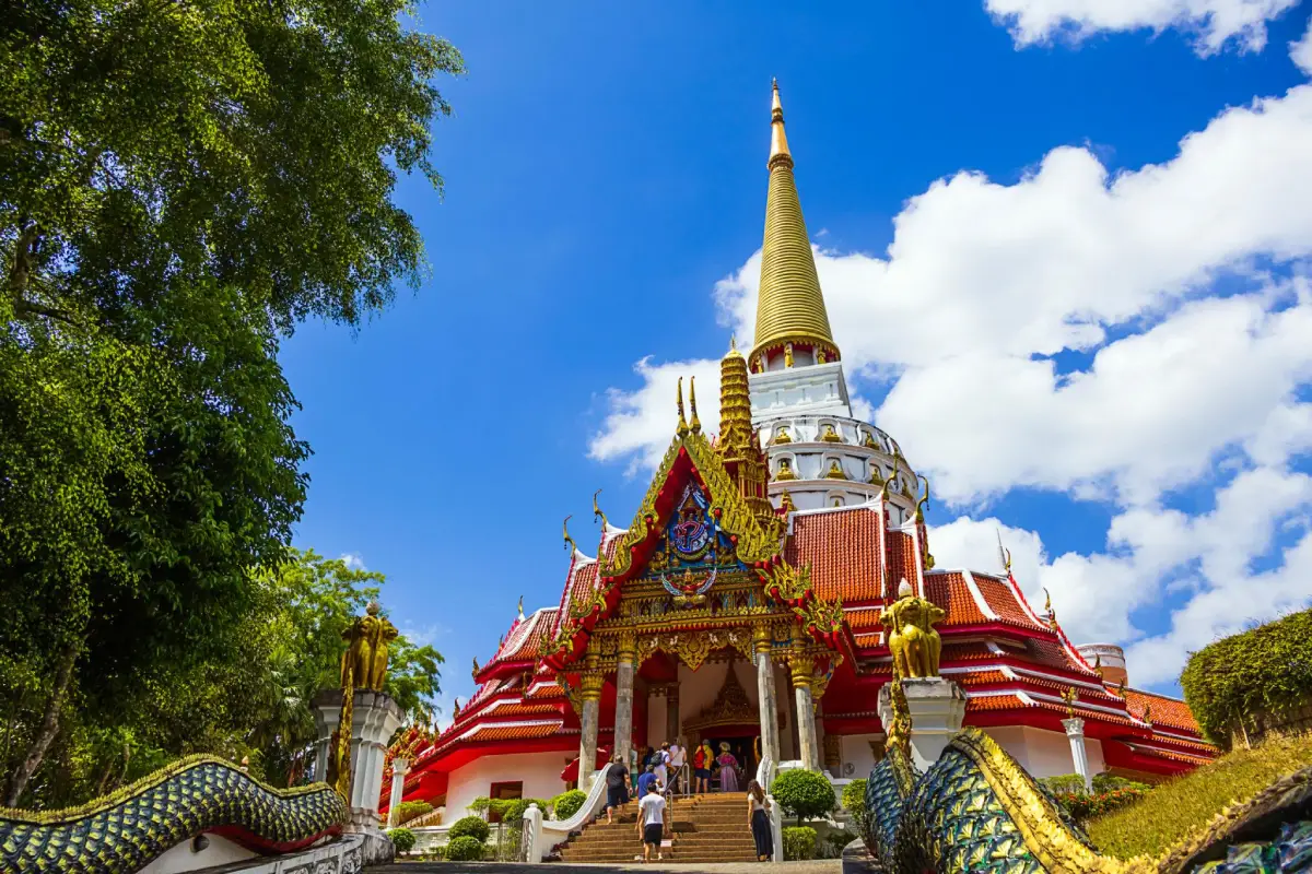
28. Wat Rat Uppatham (Wat Bang Riang) is located in Bang Riang Subdistrict, Thap Put District. It is an important Buddhist temple surrounded by mountains and forest, with the Phra Mahathat Chedi Phutthatham Banlue standing prominently on Khao Lan as one of the defining landmarks of the complex. Visible from a considerable distance, it is one of Phang Nga’s most scenic religious sites.
The great stupa rises approximately 109 meters and has a three-level, octagonal structure incorporating the form of an inverted-bell chedi. The wider temple grounds also contain important Buddha images, a Guanyin statue, Phra Phuttha Atthi Mongkhon Chai Nak Prok, and other religious objects associated with the faith of local communities.
The temple has a history extending back to the early 20th century and has been continuously developed into an important spiritual center of Thap Put District. Visitors can make merit, pay respects, and enjoy views of the surrounding mountain landscape from the elevated temple grounds, creating an experience very different from visiting an urban temple.
Wat Bang Riang is generally open daily from approximately 09:00–16:00. Visitors should dress respectfully and maintain a quiet manner around religious areas. Those walking through higher sections of the complex should carry drinking water and take additional care when surfaces are wet after rain.
Getting There: From Thap Put District Office, follow Highway 4118 toward Ban Bang Riang for approximately 11 kilometers, then follow signs to the temple. The route passes rubber plantations, orchards, and mountain scenery.
Map (GPS): https://maps.app.goo.gl/NMxqUajZ9XFPgd646
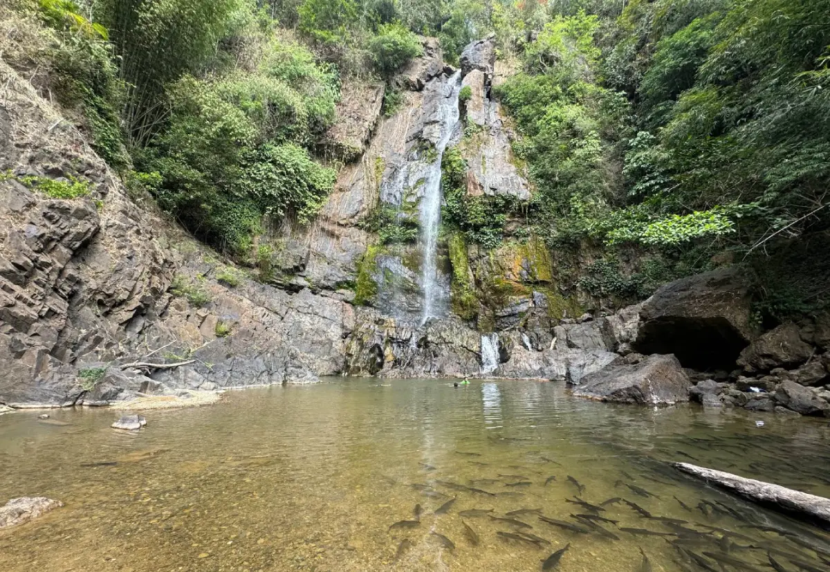
29. Tam Nang Waterfall is located in Moo 2, Bang Wan Subdistrict, Khura Buri District, within Si Phang Nga National Park. It is a large two-tier waterfall where water drops from a cliff approximately 60 meters high into a broad natural pool below, surrounded by tropical rainforest and large trees.
The attraction is not limited to the waterfall itself. Clear streams containing schools of soro brook carp, the sound of water echoing through the valley, and the shaded rainforest environment all contribute to the experience. Access is easier than at many deeper-forest waterfalls, making Tam Nang Waterfall one of the most popular places for visitors who want to experience Si Phang Nga National Park without undertaking a long trek.
The pool below the waterfall can be used for relaxation or swimming when water levels are safe, but visitors should stay away from strong currents and the base of the cliff. Rocks can be extremely slippery because of moisture and algae, so footwear with good grip is recommended and climbing wet boulders should be avoided.
The waterfall is generally open daily from approximately 06:00–18:00. After prolonged heavy rain, visitors should ask park staff about current conditions before entering because upstream rainfall can cause the water level to rise quickly. Fish should not be fed, and no rubbish should be left in the stream or forest.
Getting There: From Khura Buri District, travel into Bang Wan Subdistrict and Si Phang Nga National Park. From the park service area, continue on foot to the waterfall along the designated route.
Map (GPS): https://maps.app.goo.gl/xkcwbQUvathxPcgMA
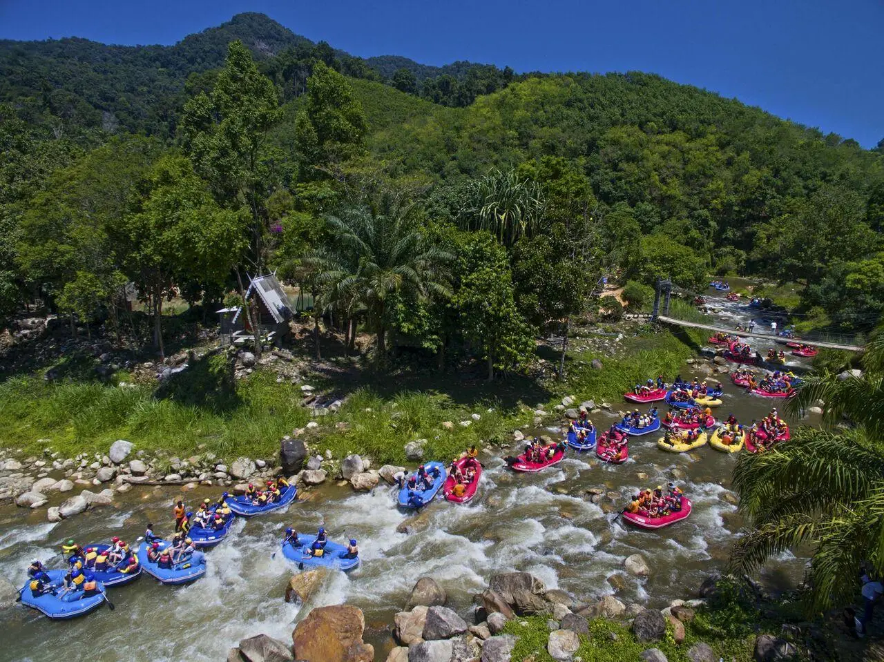
30. Khlong Song Phraek Rafting is located in Song Phraek Subdistrict, Mueang Phang Nga District, near Ton Pariwat Wildlife Sanctuary. It is one of Southern Thailand’s best-known white-water rafting activities. Inflatable rafts travel along streams flowing from the watershed forest and Ton Pariwat Waterfall, passing rocky rapids, boulders, bends, and channels of varying intensity.
The activity uses inflatable rafts accompanied by guides or rafting staff. Participants are required to wear helmets and life jackets throughout the route. A standard rafting course is approximately 4–5 kilometers long and generally takes around 45 minutes to 1 hour, depending on water level, current speed, and the program offered by each operator.
The enjoyment of Khlong Song Phraek comes from alternating sections of calmer water with stronger rapids. Participants need to paddle together and balance the raft according to instructions from the guide. The activity is particularly suitable for groups of friends, families with older children, and travelers who want an active outdoor experience rather than sightseeing alone.
Water conditions are extremely important. During the rainy season, currents may become considerably stronger, while in drier periods some operators schedule trips according to water releases or adjust programs to suit actual conditions. Activities generally operate from around 08:00–17:00, but travelers should check rafting schedules and current safety requirements before arriving.
Getting There: From Phang Nga Town, travel toward Song Phraek Subdistrict along the route to Ton Pariwat Wildlife Sanctuary, then continue to the activity base of the rafting operator booked in advance.
Map (GPS): https://maps.app.goo.gl/nkiRS4vbmcfzEH5g7
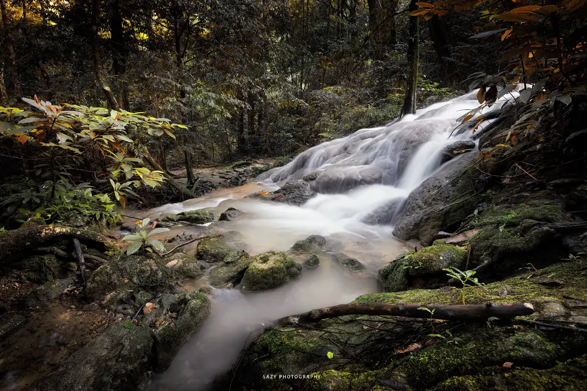
31. Sa Nang Manora Forest Park is located in Nop Pring Subdistrict, Mueang Phang Nga District. It is a nature attraction close to Phang Nga Town that combines tropical forest, streams, small waterfalls, limestone hills, caves, and nature trails within a compact area. Although the forest park covers only around 180 rai and is much smaller than a national park, its shaded and humid environment makes it a convenient place for travelers who want to experience inland nature without traveling far from the provincial center.
Streams inside the forest park flow from the watershed through limestone terraces and natural pools, creating small cascades and swimming areas. Some pools are suitable for relaxing or bathing when water conditions are safe. Large trees provide extensive shade, helping the area remain cool and humid in the characteristic style of Southern Thailand’s tropical rainforest.
The name “Sa Nang Manora” is connected with the traditional story of Phra Suthon and Manora. According to local legend, kinnari maidens once descended to bathe in the pools here before Hunter Bun captured Nang Manora and brought her to Prince Suthon. This story adds a layer of local folklore and literary heritage to the site beyond its natural features.
The forest park is generally open daily from approximately 09:00–16:30. Visitors should take care on slippery rocks during rainy weather, remain on designated trails, and avoid swimming when currents are strong. The site can be combined conveniently with Tham Phung Chang Cave and attractions in central Phang Nga.
Getting There: From Phang Nga Town, travel toward Nop Pring Subdistrict. The forest park is located only a short distance from the town center and is easily reached by car or motorcycle.
Map (GPS): https://maps.app.goo.gl/pzh95nMhbVmTLTSEA
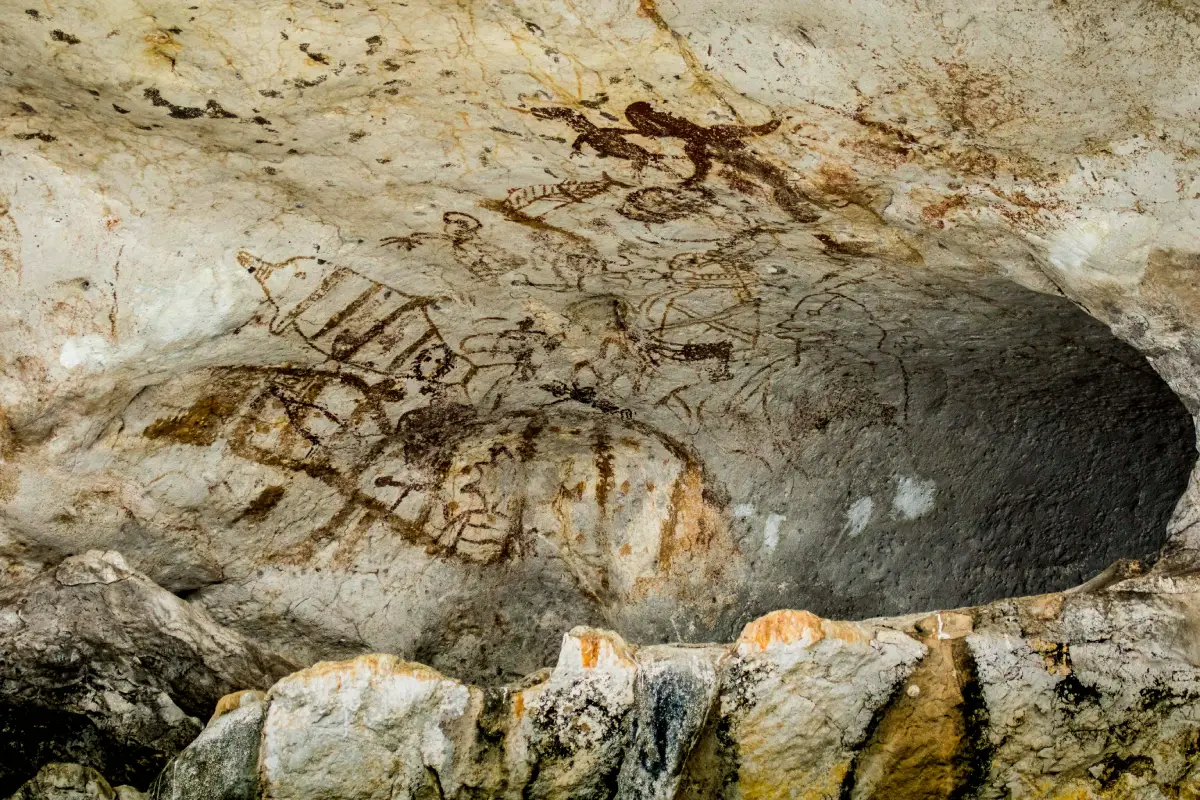
32. Khao Khian is located north of Koh Panyee within Ao Phang Nga National Park. It is one of Phang Nga’s important prehistoric rock-painting sites, with ancient images appearing on limestone rock shelters close to sea level. Visitors can view the paintings directly from a boat, making Khao Khian a particularly interesting place where the natural environment of Phang Nga Bay and evidence of ancient human activity can be experienced together.
The paintings include human figures, boats, fish, marine animals, birds, land animals, and symbolic forms. They reflect the close relationship between early communities, the sea, travel, and coastal resources. The paintings are several thousand years old and demonstrate that Phang Nga Bay was used by people long before the development of modern tourism.
One of the unusual characteristics of Khao Khian is that visitors do not need to climb a cliff or hike through forest to see the archaeological evidence. Boats can approach the rock face closely enough for passengers to observe the images from the water, making it easy to combine this site with Koh Panyee, Tham Lot, Khao Tapu, and Khao Phing Kan.
Visitors should never touch, scrape, write on, or approach the rock paintings more closely than necessary because the ancient pigments are fragile and already affected by long-term natural weathering. Visiting times depend on boat schedules and national park operations, generally around 08:30–16:30.
Getting There: Take a sightseeing boat on a Phang Nga Bay route from Ban Tha Dan or another authorized pier, then include Khao Khian as a stop before or after Koh Panyee.
Map (GPS): https://maps.app.goo.gl/bJREdQ9EzjtZ56M59
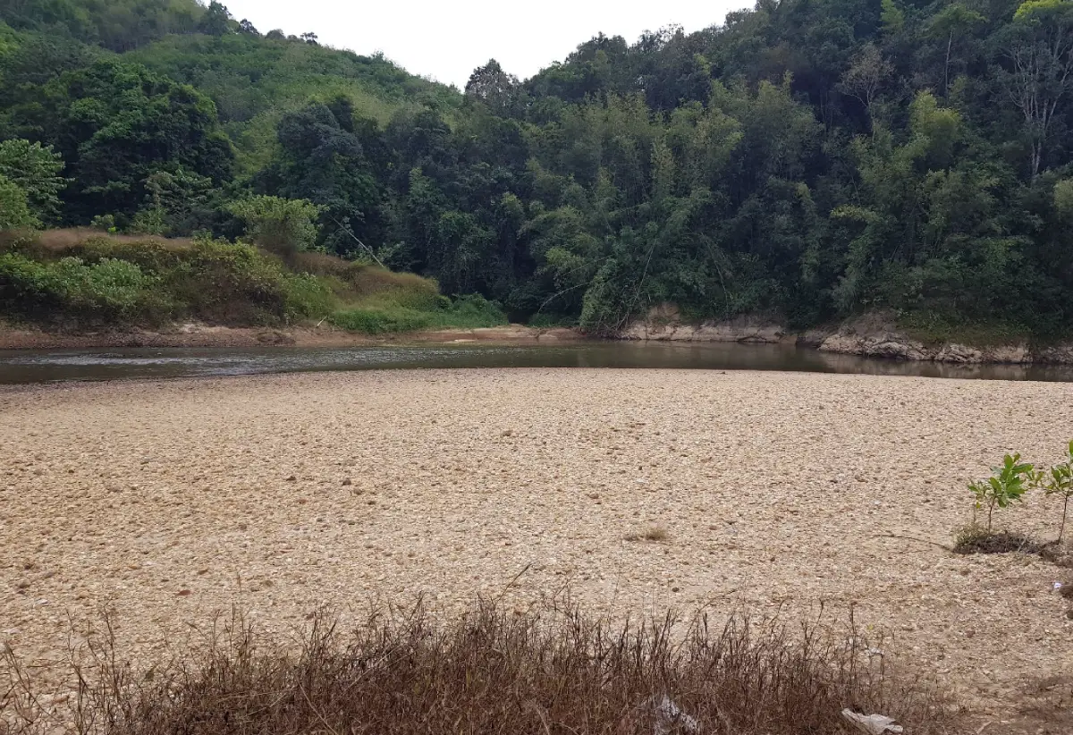
33. Khao Narai is located in Le Subdistrict, Kapong District. It is an important archaeological site that helps explain the historical connections between ancient Takola, maritime trade routes along the Andaman coast, and South Indian cultural influences. The area is associated with the discovery of Hindu sculptures and inscriptions that are significant to the study of the southern Thai peninsula.
Evidence linked with Khao Narai includes images of Vishnu, Lakshmana, and Sita, together with inscriptions using Pallava script and Tamil language. These finds indicate the influence of Hindu religious culture and South Indian trading communities. They are important for understanding cross-peninsular trade routes and the historical development of the ancient Takua Pa region.
The landscape is located close to waterways and river junctions that would have been important for movement, trade, and settlement in the past. Visiting Khao Narai therefore helps travelers understand that Phang Nga’s connections with the outside world began centuries before the later tin-mining era.
The site can be combined with Wat Narainikaram, which preserves information and evidence connected with the same historical context. Visitors should travel during daylight, avoid touching or moving archaeological objects, and focus on understanding the site’s historical value rather than treating it only as a sightseeing stop.
Getting There: Travel to Kapong District and continue to Le Subdistrict. Khao Narai can be combined with Wat Narainikaram and other historical attractions in the Kapong area.
Map (GPS): https://maps.app.goo.gl/JTpe36Fqkr6z3e927
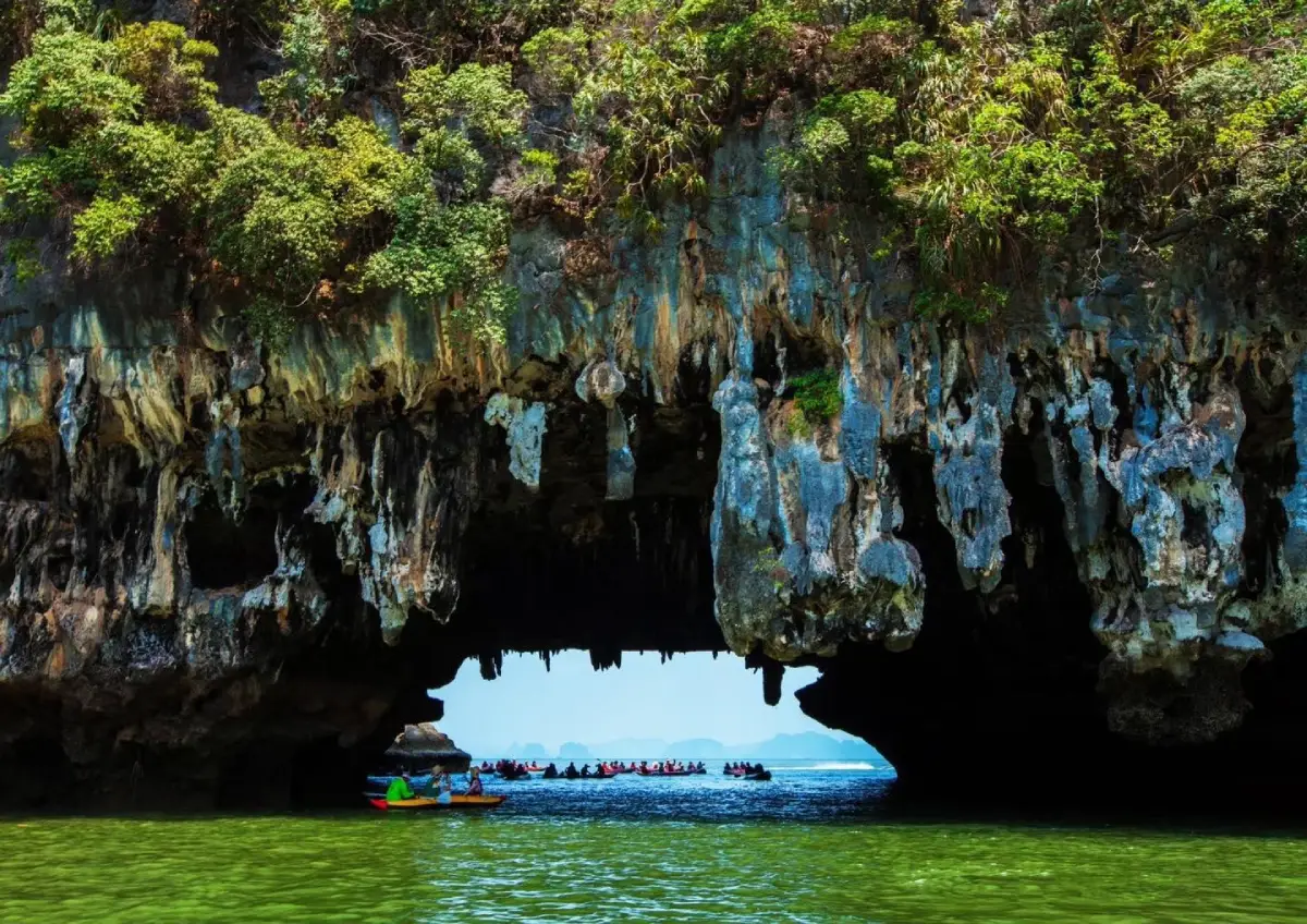
34. Ko Phanak is located in Khlong Khian Subdistrict, Takua Thung District, within Ao Phang Nga National Park. It is a large limestone island famous for sea caves, interior lagoons known as hongs, natural rock openings, stalactites, stalagmites, and canoe routes whose accessibility changes according to the tides.
The appeal of Ko Phanak does not come from a broad sandy beach but from the hidden landscape inside the limestone island. Some caves can be entered by canoe when tide levels are suitable, while certain passages are accessible only when the water drops enough to allow a boat beneath low cave ceilings. Beyond these narrow openings, visitors may reach enclosed lagoons surrounded by high limestone walls.
Long-term erosion and dissolution of limestone have created numerous internal passages, cavities, and waterways. Because accessibility depends directly on tide levels, local guides and canoe operators play an important role in choosing safe routes. Visitors should not attempt to enter caves independently without experienced guidance.
The area generally operates from around 08:00–16:30 according to national park hours and sightseeing-boat schedules. Visitors should wear life jackets, avoid touching stalactites and stalagmites, and never leave rubbish inside caves or lagoons because enclosed environments are especially sensitive to disturbance.
Getting There: Travel by sightseeing boat from the Phang Nga mainland or on Phang Nga Bay routes from Phuket, then transfer to a canoe for the interior caves and lagoons. Ko Phanak is commonly included in full-day programs with Ko Hong and other bay attractions.
Map (GPS): https://maps.app.goo.gl/9euJNqe8YUgExJpf9
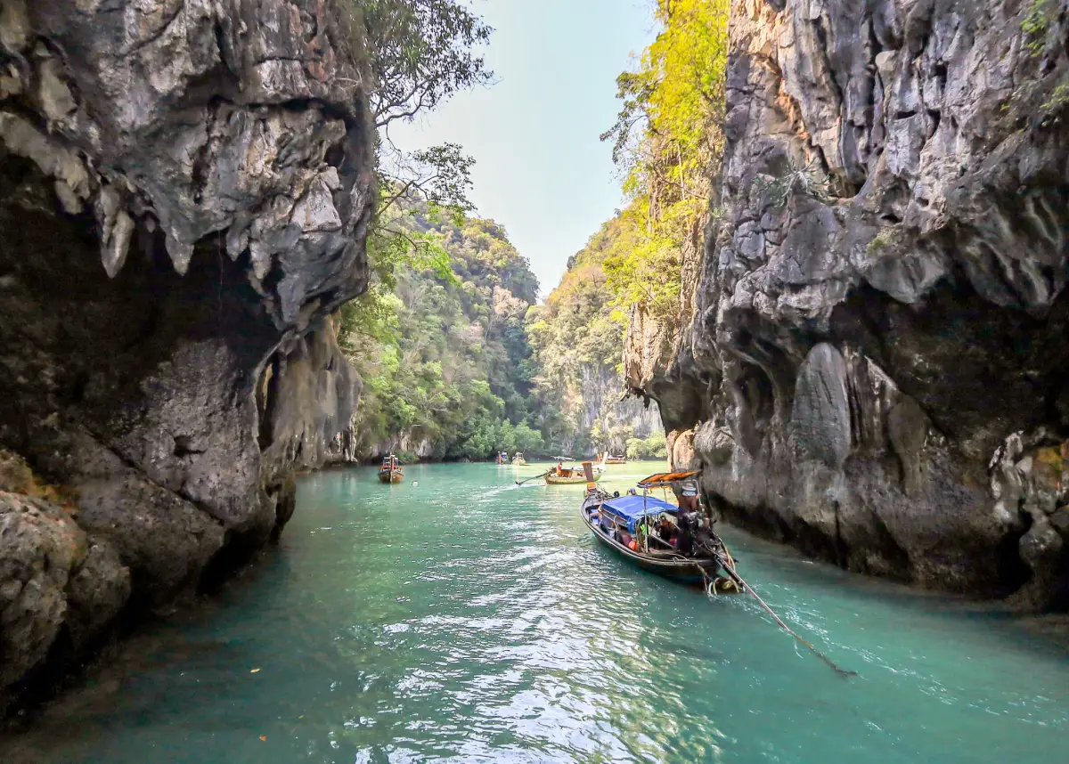
35. Ko Hong, Phang Nga is located in Khlong Khian Subdistrict, Takua Thung District, within Ao Phang Nga National Park. The limestone island is formed by several high rock masses surrounding an interior body of water, creating a natural chamber or “room” with narrow openings that function like entrances. It is one of Phang Nga Bay’s popular sea-canoeing destinations.
Once inside, visitors are surrounded by high limestone cliffs and green seawater in a lagoon that feels much quieter than the open sea outside. The Thai word “Hong” means “room,” referring to this enclosed natural formation. Its appearance changes with both tide level and light conditions throughout the day.
This is Ko Hong in Phang Nga Province and should not be confused with the better-known Hong Islands in Krabi Province. Travelers should check the itinerary carefully before booking because the two destinations share a similar name but are located in different provinces and offer different types of experiences.
Canoeing should be done with operators who understand tide conditions because the entrances can become difficult to navigate when the water is too high or too low. The area generally operates from around 08:00–16:30 according to national park hours and boat schedules.
Getting There: Travel on a sightseeing boat through Phang Nga Bay, then transfer to a canoe to enter the interior lagoon. Ko Hong is commonly combined with Ko Phanak, Khao Tapu, Khao Phing Kan, or Koh Panyee.
Map (GPS): https://maps.app.goo.gl/THSrY8ZrF4k6qscX7
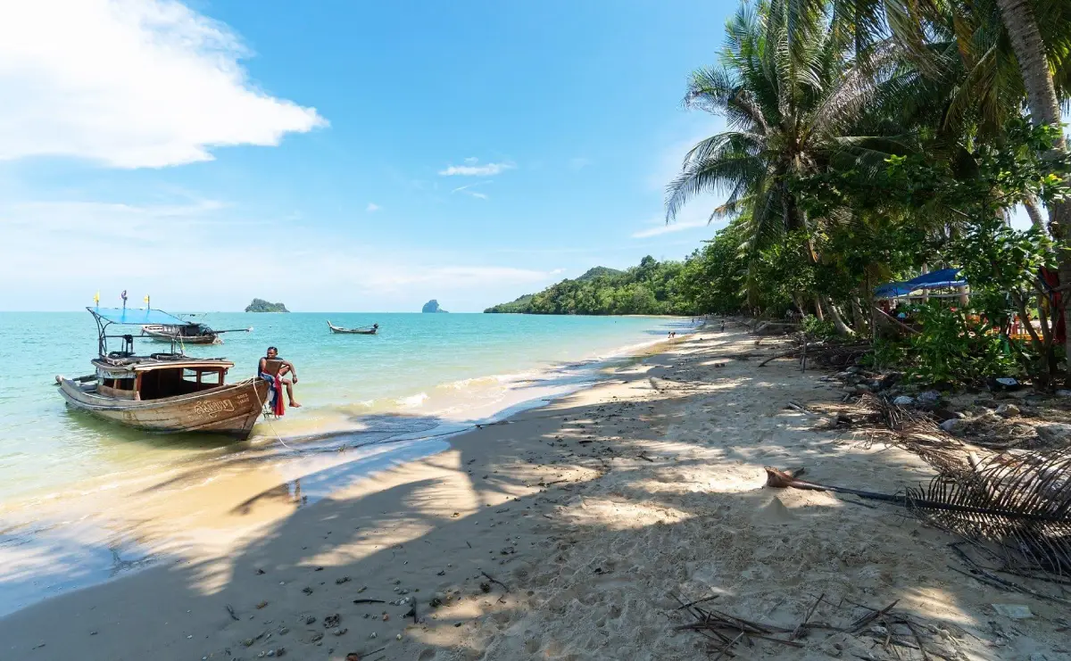
36. Pa Sai Beach is located on Ko Yao Noi in Ko Yao District. It is one of the island’s better-known beaches and is particularly suitable for travelers seeking a peaceful coastal atmosphere. The beach has pale sand, trees providing natural shade, and open views toward the limestone islands of Phang Nga Bay and the Krabi coast.
The attraction of Pa Sai Beach lies less in a large number of activities and more in its simplicity and wide scenery. It is suitable for walking, stopping during a cycling route around the island, photographing sunrise, or simply sitting beside the water without having to rush between sightseeing points.
The beach is surrounded by Muslim communities on Ko Yao Noi, allowing travelers to combine a seaside visit with local food, fishing lifestyles, community tourism, and agricultural areas around the island. Staying at least 1 night on Ko Yao Noi gives travelers greater flexibility to experience the beach at different times of day.
The beach is naturally open, but swimming conditions depend on tide level and waves. At low tide, broad shallow areas may become exposed. Visitors should take care when walking far from the shoreline and remain aware of changing tide levels.
Getting There: From a pier on Ko Yao Noi, use a motorcycle, local taxi, or bicycle to reach Pa Sai Beach. It is easy to include as part of a circular route around the island.
Map (GPS): https://maps.app.goo.gl/5NUenhb6z29wJXw17
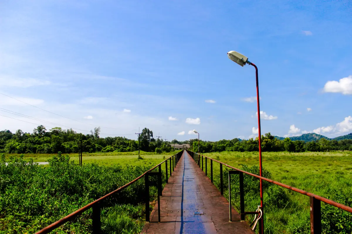
37. Khok Khanun Iron Bridge is located around Ban Khok Khanun in Takua Pa District. It is another site reflecting the historical tin-mining era of Takua Pa through its iron structure and surrounding landscape, which are connected with transportation systems and economic activity from the town’s industrial past.
Takua Pa was once one of the major tin-mining centers of the Andaman coast. Movement of people, equipment, and goods depended on roads, waterways, and bridges. The bridge therefore represents part of the town’s industrial memory and development rather than functioning only as a picturesque structure.
Today, the bridge and its surroundings are suitable for walking, photography, and inclusion in a historical Takua Pa route. Travelers interested in mining history, old architecture, and the development of the town can combine it with Takua Pa Old Town, surviving city-wall areas, and Phra Narai Park.
The site does not operate on a strict timed-entry schedule, but daytime visits are recommended for safety. Visitors should not climb parts of the structure that are not intended as walkways and should take care on wet surfaces after rain.
Getting There: From Takua Pa Old Town, follow local roads toward Ban Khok Khanun. The bridge can be reached by car or motorcycle and is easy to include in the same historical sightseeing route.
Map (GPS): https://maps.app.goo.gl/eH2YMRkc6VRReYbc6
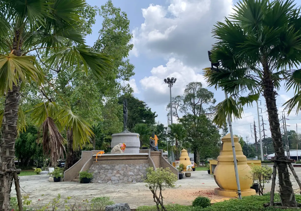
38. Phra Narai Park is located in Bang Nai Si Subdistrict, Takua Pa District, close to the town area. It is a public space combining local faith, historical memory, and the long-standing influence of Hindu culture in the Takua Pa and Kapong regions.
The park contains replicas of Vishnu and accompanying deities for public worship. Vishnu, known in Thai as Phra Narai, is one of the principal deities in Hinduism, and the Takua Pa region has produced several archaeological finds connected with Indian culture, including sculptures and inscriptions discovered in nearby areas.
The park therefore serves several functions at once: a recreational space for local residents, an exercise area, a venue for community activities, and a place of worship. It demonstrates how ancient historical influences remain connected with contemporary community identity rather than existing only as archaeological information.
The park is generally open daily from approximately 08:00–17:00. It is convenient to visit before or after exploring Takua Pa Old Town and can be combined with Khok Khanun Iron Bridge, historic city areas, and other attractions associated with the town’s past.
Getting There: The park is located in Bang Nai Si Subdistrict near Takua Pa municipal areas and is easily reached by car, motorcycle, or as part of a wider old-town itinerary.
Map (GPS): https://maps.app.goo.gl/MkJbVvLSXd3DWb5b6
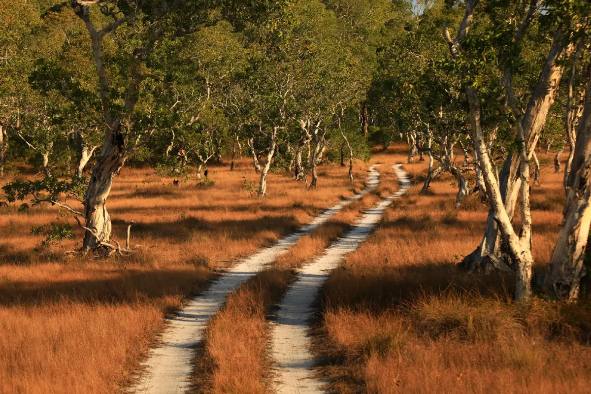
39. Ko Phra Thong Savanna is located in the central part of Ko Phra Thong in Khura Buri District. It is a rare landscape in Thailand because an island in the Andaman Sea contains broad grassland, white Melaleuca forest, peat swamp, and wetlands arranged in a landscape that strongly resembles tropical savanna.
During the dry season, the grass turns golden and white-barked Melaleuca trees appear scattered across the open plain, creating a landscape completely different from the beaches and mangroves around the island. During the rainy season, some sections become wetlands and the vegetation turns much greener, allowing visitors to experience different versions of the same ecosystem depending on the season.
Suitable activities include traveling by local vehicle, cycling, birdwatching, and photography. Morning and late afternoon offer softer light and cooler temperatures. The area is also valuable for learning about plant communities on sandy soils, Melaleuca forest, and ecosystems that change according to rainfall and water levels.
Visits are best made between approximately 06:00–18:00 and should ideally be arranged with accommodation providers, local residents, or operators on Ko Phra Thong. The savanna lies inland, services are limited, and some access routes can change with rainfall and water levels.
Getting There: Travel to Ko Phra Thong from Khura Buri District, then use local transport to reach the island’s interior. Staying at least 1 night is much more practical than attempting a rushed same-day return trip.
Map (GPS): https://maps.app.goo.gl/NXxFwtzZbzmMQwPG7
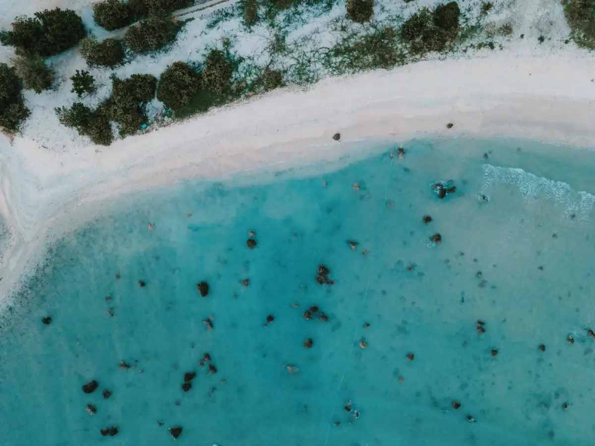
40. Pakarang Cape is located in Moo 2, Khuk Khak Subdistrict, Takua Pa District, along the Khao Lak coastline. The cape has a distinctive landscape formed by a combination of sandy beach, rocky shore, shallow water, coastal casuarina trees, and large quantities of coral fragments naturally deposited by waves.
The coral fragments scattered along the shoreline inspired the Thai name “Laem Pakarang,” meaning Coral Cape, and make the area look very different from an ordinary sandy beach. These fragments are part of the natural coastal environment and should never be collected as souvenirs or removed from the beach.
The cape is better suited to walking, photography, and sunset viewing than to serious swimming because some areas contain rocks and coral fragments beneath the water. Sea conditions also change according to the tide and season, so visitors should observe wave conditions carefully before approaching the water.
Pakarang Cape is naturally open throughout the day and can be combined with Khao Lak Beach, Khuk Khak Beach, Pak Weep Beach, or Bang Sak Beach. Late afternoon is particularly suitable because the light becomes softer and temperatures are more comfortable.
Getting There: From Phetkasem Road in Khuk Khak Subdistrict, take the turn toward the coast around kilometer marker 78–79, then continue approximately 5 kilometers to Pakarang Cape.
Map (GPS): https://maps.app.goo.gl/jL9PobLRD1Nbye2y9
| Topic | Details |
| Province | Phang Nga, Southern Thailand, on the Andaman Sea coast |
| Travel Overview | Phang Nga is distinguished by dramatic bays and limestone mountains rising from the sea, world-class island groups, beaches, mangrove forests, tropical rainforest, waterfalls, caves, hot springs, archaeological sites, historic towns, Muslim communities, Moken communities, and traditional fishing lifestyles. The province is suitable for sightseeing cruises, scuba diving, snorkeling, sea canoeing, rafting, trekking, beach holidays, community-based tourism, and learning about the history of Thailand’s Andaman coast. |
| Top 10 Attractions | 1. Ao Phang Nga National Park 2. Khao Tapu 3. Khao Phing Kan 4. Koh Panyee 5. Mu Ko Similan National Park 6. Mu Koh Surin National Park 7. Khao Lak Beach 8. Ko Phra Thong 9. Wat Suwan Khuha 10. Thai Mueang Beach |
| Mueang Phang Nga District | 1. Ao Phang Nga National Park 2. Koh Panyee 3. Tham Phung Chang Cave 4. Ton Pariwat Waterfall 5. Khlong Song Phraek Rafting 6. Sa Nang Manora Forest Park 7. Khao Khian |
| Takua Thung District | 1. Khao Tapu 2. Khao Phing Kan 3. Wat Suwan Khuha 4. Tham Lot 5. Ko Phanak 6. Ko Hong, Phang Nga |
| Takua Pa District | 1. Khao Lak Beach 2. Takua Pa Old Town 3. Tsunami Memorial – Patrol Boat T.813 4. Khao Lak–Lam Ru National Park 5. Ko Kho Khao 6. Khok Khanun Iron Bridge 7. Phra Narai Park 8. Pakarang Cape |
| Khura Buri District | 1. Mu Koh Surin National Park 2. Ko Phra Thong 3. Moken Village 4. Si Phang Nga National Park 5. Tam Nang Waterfall 6. Ko Phra Thong Savanna |
| Thai Mueang District | 1. Mu Ko Similan National Park 2. Thai Mueang Beach 3. Ban Bor Dan Hot Spring 4. Khao Khai Nui Sea of Mist |
| Kapong District | 1. Phu Ta Jor 2. Wat Narainikaram 3. Khao Narai |
| Ko Yao District | 1. Ko Yao 2. Khai Islands 3. Laem Had Beach 4. Pa Sai Beach |
| Thap Put District | 1. Hon Hot Spring, or Khlong Marui Hot Beach 2. Wat Rat Uppatham (Wat Bang Riang) |
| Sea, Islands and Beaches | 1. Phang Nga Bay 2. Khao Tapu and Khao Phing Kan 3. Similan Islands 4. Surin Islands 5. Khao Lak Beach 6. Ko Phra Thong 7. Thai Mueang Beach 8. Ko Kho Khao 9. Ko Yao 10. Khai Islands 11. Laem Had Beach 12. Ko Phanak 13. Ko Hong, Phang Nga 14. Pa Sai Beach 15. Pakarang Cape |
| Forests, Mountains and Waterfalls | 1. Khao Lak–Lam Ru National Park 2. Si Phang Nga National Park 3. Ton Pariwat Waterfall 4. Tam Nang Waterfall 5. Sa Nang Manora Forest Park 6. Phu Ta Jor 7. Khao Khai Nui Sea of Mist 8. Ko Phra Thong Savanna |
| Caves and Limestone Landscapes | 1. Tham Phung Chang Cave 2. Wat Suwan Khuha 3. Tham Lot 4. Ko Phanak 5. Ko Hong, Phang Nga 6. Khao Khian 7. Limestone landscapes in Ao Phang Nga National Park |
| History and Archaeology | 1. Takua Pa Old Town 2. Khao Khian 3. Wat Narainikaram 4. Khao Narai 5. Phra Narai Park 6. Khok Khanun Iron Bridge 7. Ko Kho Khao and the Ban Thung Tuk Archaeological Site |
| Temples and Religious Sites | 1. Wat Suwan Khuha 2. Wat Narainikaram 3. Wat Rat Uppatham (Wat Bang Riang) |
| Communities and Local Lifestyles | 1. Koh Panyee – Muslim community in Phang Nga Bay 2. Moken Village – indigenous sea community in the Surin Islands 3. Ko Yao – Muslim community life, fishing and agriculture 4. Takua Pa Old Town – Chinese heritage and tin-mining history 5. Ko Phra Thong – coastal communities and traditional fishing |
| Adventure Activities | 1. Scuba diving and snorkeling in the Similan Islands 2. Scuba diving and snorkeling in the Surin Islands 3. Canoeing at Tham Lot 4. Canoeing at Ko Phanak 5. Canoeing at Ko Hong, Phang Nga 6. Khlong Song Phraek Rafting 7. Exploring Tham Phung Chang Cave 8. Trekking in Si Phang Nga National Park 9. Four-wheel-drive journey to Phu Ta Jor 10. Sunrise and sea-of-mist trip to Khao Khai Nui |
| Hot Springs and Wellness | 1. Ban Bor Dan Hot Spring 2. Hon Hot Spring, or Khlong Marui Hot Beach |
| Local Food to Try | Khao yam, nam budu, southern-style sour curry with fish, gaeng tai pla, khua kling, shrimp-paste chili dip with fresh vegetables, roti, murtabak, khao mok, fresh seafood, turmeric-fried fish, and Chinese–Peranakan-influenced dishes in the Takua Pa area. Halal food is also an important part of local cuisine in Koh Panyee, Ko Yao, and other coastal Muslim communities. |
| Important Culture | Phang Nga is culturally diverse, with Thai Buddhist, Thai Muslim, Thai Chinese, and Moken communities. Important cultural traditions include the Takua Pa Vegetarian Festival, Muslim fishing lifestyles and halal food culture, the maritime knowledge of the Moken, and sea turtle conservation activities around Thai Mueang. |
| Important Traditions and Activities | 1. Takua Pa Vegetarian Festival 2. Sea turtle release and conservation activities in Thai Mueang 3. Religious and cultural activities in Muslim communities 4. Traditional Moken beliefs, rituals, and maritime way of life in the Surin Islands |
| Recommended For | Families, couples, scuba divers, snorkelers, canoeing enthusiasts, adventure travelers, hikers, photographers, history enthusiasts, community-tourism travelers, beach lovers, and visitors who want a Southern Thailand trip combining the sea, forest, and local culture. |
| Getting to Phang Nga | Phang Nga does not have its own commercial airport. Most travelers fly to Phuket International Airport or Krabi International Airport, then continue by private car, rental car, van, or bus into Phang Nga Province. Travel to the islands requires an additional boat transfer from the appropriate pier. |
| Getting Around the Province | A private or rental car is the most convenient way to explore Phang Nga Town, Khao Lak, Takua Pa, Kapong, Thap Put, Khura Buri, and Thai Mueang. Phang Nga Bay, the Similan Islands, Surin Islands, Ko Yao, Ko Phra Thong, Ko Phanak, Ko Hong, and the Khai Islands require boats or organized tours. |
| Suggested 3-Day Itinerary | Day 1: Ao Phang Nga National Park – Khao Tapu – Khao Phing Kan – Koh Panyee – Tham Lot Day 2: Khao Lak – Tsunami Memorial, Patrol Boat T.813 – Takua Pa Old Town – Pakarang Cape Day 3: Choose the Similan Islands during the open season, or visit Wat Suwan Khuha – Tham Phung Chang Cave – Sa Nang Manora Forest Park |
| Suggested 4–5 Day Itinerary | Add the Surin Islands and Moken Village, or stay around Khura Buri and continue to Ko Phra Thong for 1–2 nights. Travelers who prefer a slower island trip can add Ko Yao and stay there for 1–2 nights. Mountain travelers can include Phu Ta Jor, Khao Khai Nui Sea of Mist, or Si Phang Nga National Park. |
| For Travelers Who Do Not Focus on the Sea | A land-based route can include Tham Phung Chang Cave – Sa Nang Manora Forest Park – Ton Pariwat Waterfall – Khlong Song Phraek Rafting – Wat Suwan Khuha – Takua Pa Old Town – Phu Ta Jor – Wat Bang Riang – Khao Khai Nui Sea of Mist without requiring an island trip. |
| Best Time for Marine Travel | Periods with calmer Andaman Sea conditions are more suitable for the Similan Islands, Surin Islands, Ko Yao, Khai Islands, and Phang Nga Bay. The Similan and Surin national parks operate according to seasonal opening and closure periods, so current national park announcements should be checked every year before travel. |
| What to Check Before Island Trips | Check wave and wind conditions, weather forecasts, marine warnings, boat schedules, national park opening and closure status, entrance fees, departure points, journey times, and conservation measures for each destination, particularly the Similan Islands, Surin Islands, and Phang Nga Bay. |
| Forest, Waterfall and Adventure Safety | Avoid streams and waterfalls during heavy rain. Watch for flash floods, slippery trails, and wet rocks. Rafting, canoeing, cave exploration, and mountain trips should be undertaken with experienced local operators using appropriate safety equipment. Do not leave established routes without reliable local information. |
| Responsible Travel | Do not collect coral, shells, rocks, archaeological objects, or living organisms. Do not feed marine animals or wildlife, never stand on coral, do not write on cave walls or cliffs, reduce plastic use, take rubbish away, and respect religious sites, Muslim communities, and Moken communities. |
Frequently Asked Questions (FAQ)
Q: What are the main attractions in Phang Nga?
A: Phang Nga has a wide variety of major attractions, including Ao Phang Nga National Park, Khao Tapu, Khao Phing Kan, Koh Panyee, the Similan Islands, the Surin Islands, Khao Lak, Ko Phra Thong, Thai Mueang Beach, Wat Suwan Khuha, Takua Pa Old Town, Phu Ta Jor, Ko Yao, and many inland nature attractions. The province is therefore suitable for travelers interested in the sea, rainforest, history, and local culture.
Q: Where should first-time visitors go in Phang Nga?
A: First-time visitors should begin with Phang Nga Bay, Khao Tapu, Khao Phing Kan, and Koh Panyee, then stay around Khao Lak and visit Takua Pa Old Town. During the island-opening season, travelers should add either the Similan Islands or Surin Islands to experience Phang Nga’s world-class marine environment.
Q: How many days are recommended for Phang Nga?
A: Three days is enough to experience major attractions around Phang Nga Bay, Khao Lak, and Takua Pa. Travelers who also want to visit the Surin Islands, Ko Phra Thong, Ko Yao, Kapong, or Khura Buri should allow around 4–6 days or more.
Q: Are the Similan Islands open throughout the year?
A: No. Mu Ko Similan National Park generally opens from around mid-October to mid-May and closes during the monsoon season. The exact dates can change according to national park announcements and weather conditions, so travelers should always check current information before departure.
Q: Are the Surin Islands suitable for snorkeling?
A: Yes. The Surin Islands have shallow coral reefs and numerous snorkeling areas where visitors can see schools of fish and a wide variety of marine life. A trip can also be combined with a visit to the Moken Village on Ko Surin Tai to learn about the traditional maritime culture of the community.
Q: Can Phang Nga Bay be visited on a half-day trip?
A: Yes, but travelers who want to visit Khao Tapu, Khao Phing Kan, Koh Panyee, Tham Lot, Ko Phanak, or Ko Hong without rushing should choose a full-day program because boat travel and some activities depend on tide conditions.
Q: Are Khao Tapu and Khao Phing Kan the same place?
A: No. Khao Tapu is the limestone sea stack standing in the water and visitors are not permitted to land on it. Khao Phing Kan is the nearby island where visitors can go ashore and is the principal viewing point for Khao Tapu. The two attractions are close together and are therefore commonly included in the same tour.
Q: Does Phang Nga have sea-of-mist viewpoints?
A: Yes. Important viewpoints include Phu Ta Jor in Kapong District and Khao Khai Nui in Thai Mueang District. Both are best visited before sunrise, but the formation of mist depends on humidity, rainfall, wind, and temperature and cannot be guaranteed every morning.
Q: What can I visit in Phang Nga if I do not want to go to the sea?
A: There are many inland attractions, including Tham Phung Chang Cave, Sa Nang Manora Forest Park, Ton Pariwat Waterfall, Khlong Song Phraek Rafting, Si Phang Nga National Park, Tam Nang Waterfall, Takua Pa Old Town, Wat Suwan Khuha, Wat Bang Riang, Phu Ta Jor, and Khao Khai Nui Sea of Mist.
Q: What is interesting about Takua Pa Old Town?
A: Takua Pa Old Town is known for Sino-Portuguese architecture, historic shophouses, Chinese shrines, local food, cultural street activities, and its tin-mining history. The town reflects a mixture of Chinese, local Southern Thai, and Western influences and is especially pleasant to explore from the afternoon into the evening.
Q: How is Ko Phra Thong different from a typical tropical island?
A: Ko Phra Thong combines beaches, mangrove forests, Melaleuca forest, peat swamp, and broad savanna-like grasslands. It is therefore suited not only to beach holidays but also to birdwatching, cycling, local vehicle tours, ecological learning, and slow travel. Staying at least 1 night is recommended.
Q: What type of traveler is Ko Yao suitable for?
A: Ko Yao is suitable for travelers who prefer slow travel, local communities, fishing lifestyles, beaches, and nature rather than the nightlife of larger tourism islands. Ko Yao Noi has more tourism services, while Ko Yao Yai offers broader areas of natural and community landscapes.
Q: What local food should visitors try in Phang Nga?
A: Recommended dishes include khao yam, nam budu, southern-style sour curry with fish, gaeng tai pla, khua kling, shrimp-paste chili dip with fresh vegetables, turmeric-fried fish, roti, murtabak, khao mok, and fresh seafood. Takua Pa also has dishes and traditional sweets influenced by Chinese–Peranakan culture.
Q: What are the important cultural traditions of Phang Nga?
A: Phang Nga has Thai Buddhist, Muslim, Thai Chinese, and Moken cultural traditions. Important examples include the Takua Pa Vegetarian Festival, sea turtle conservation and release activities in Thai Mueang, Muslim community life in Koh Panyee and Ko Yao, and the language, beliefs, and traditional maritime knowledge of the Moken in the Surin Islands.
Q: Is it necessary to rent a car in Phang Nga?
A: Travelers taking only Phang Nga Bay tours or organized island packages may not need a rental car. However, a private or rental vehicle is much more convenient for Khao Lak, Takua Pa, Kapong, Thap Put, Khura Buri, Thai Mueang, and the many inland attractions spread across the province.
Q: What should travelers check before taking a boat trip in Phang Nga?
A: Check the latest weather forecast, wave and wind conditions, marine warnings, boat schedules, national park opening and closure status, fees, and specific regulations for each destination. If high-wave warnings are issued or operators cancel trips for safety reasons, travelers should not attempt to go to sea.
 Category: ●Travel Articles, Recipes
 Group: ●Travel Review, Food Review
Last Update : 3 WeekAgo
 Last Update : 3 WeekAgo
Recommend

 Art, Culture and Heritage
 Historical Sites and Monuments(2)
 Landmarks and Memorials(6)
 Art, Craft Centres, Tradition(3)
 Places of Worship
 Temple(18)
 Other Sacred Sites(8)
 Suburban Living
 Village, Community(3)
 Nature and Wildlife
 National Parks and Marine Reserves(12)
 Mountain (Doi)(8)
 Waterfalls(21)
 Hot Springs(2)
 Caves(12)
 River, Canal(4)
 Bays and Beaches(28)
 Islands(11)
 Other natural attractions(7)
 Entertainment and Agricultural
 Animal camps and shows(2)
 Farms, Parks and Ecotourism(2)
 Waterpark(3)
 Outdoor and Adventure Activities(3)
Travel Review, Food Review(1)
 Southern Food Menu, Southern Food Recipes(1)


