
lovethailand home >South Travel Attractions >Phang Nga Travel Attractions >Takua Thung >Kra Som > Ao Phang Nga National Park
TL;DR: Ao Phang Nga National Park is located at Ko Panyi Subdistrict, Mueang Phang Nga District, Phang Nga Province, open Daily, hours 08.00 – 16.30.

Ao Phang Nga National Park
Open Days: Daily
Opening Hours: 08.00 – 16.30
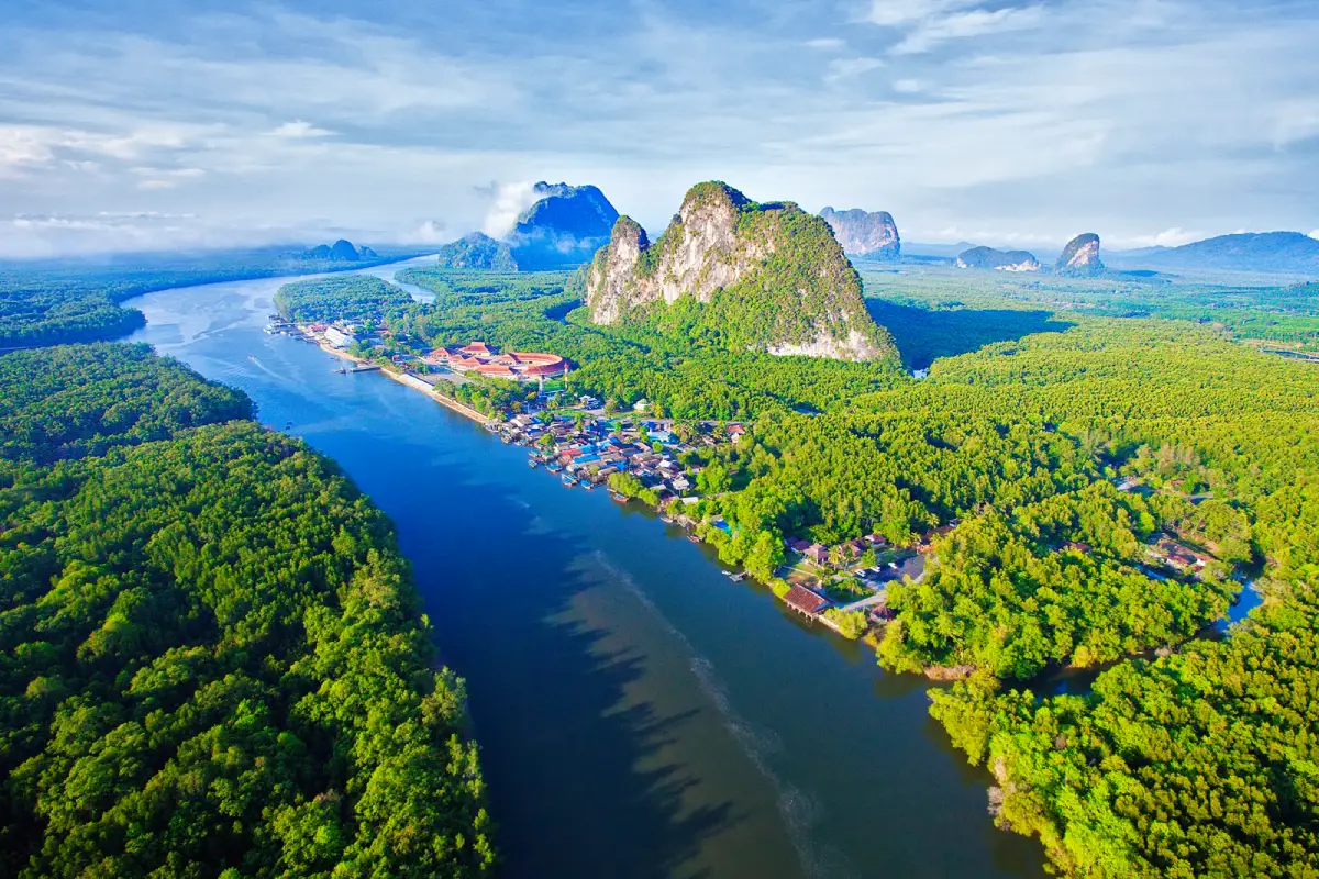
Ao Phang Nga National Park in Phang Nga Province is one of southern Thailand’s most remarkable marine and coastal national parks. Covering parts of Takua Thung District, Mueang Phang Nga District, and Ko Yao District, the park spans about 400 square kilometers, or roughly 250,000 rai. It is best known for its shallow bay landscape, limestone karsts, mangrove forests, sea caves, tidal channels, and island communities whose way of life has long been connected to the Andaman Sea.
The defining image of Ao Phang Nga is a wide green bay filled with limestone towers rising from the water. Among its most famous landmarks are Khao Tapu, also known as James Bond Island, and Khao Phing Kan, a striking limestone formation where massive rock faces appear to lean against one another. These two sites are often the centerpiece of boat trips through the park, but Ao Phang Nga offers far more than a single photo stop. It also includes Tham Lot, Ko Hong, Ko Phanak, Khao Khian, Ko Panyi, Khao Ma Chu, Ko Lawa Yai, and many other islands and natural formations.
Ao Phang Nga National Park was declared Thailand’s 25th national park on 29 April 1981. Its protected area includes coastal and marine zones in Krasom, Kalai, Khlong Khian, Ko Panyi, Ko Yao Noi, and Ko Yao Yai. The park was established to conserve a landscape of national importance, combining dramatic karst scenery, mangrove ecosystems, archaeological traces, island communities, and marine tourism resources. Today, it remains one of the most iconic protected seascapes in Thailand.
The park’s landscape is shaped by limestone geology, sea erosion, tidal movement, and the long-term sinking and reshaping of the western coastal plain. This created a coastline full of inlets, channels, caves, cliffs, and isolated karst islands. A boat trip from the Phang Nga side reveals the landscape gradually: first mangrove-lined waterways, then open bay views, then tall limestone islands rising sharply from the surface. Unlike beach-focused destinations, Ao Phang Nga is valued for scenery, geology, ecological richness, and cultural routes rather than open-water swimming.
Khao Tapu is the park’s most recognized landmark. This small limestone sea stack has a narrow base and a wider upper section, giving it the appearance of a nail standing in the water. It lies near Khao Phing Kan, about 15 km by water from the park office along the Ko Panyi channel. Visitors cannot land on Khao Tapu itself. The proper way to view it is from a boat or from the designated viewing areas on Khao Phing Kan. This protects the fragile rock formation while still allowing visitors to appreciate one of the most famous views in Phang Nga Bay.
Khao Phing Kan adds geological character to the trip. The name refers to the way large limestone masses appear to lean against each other. The island consists of two limestone hills connected by sand, creating a distinctive natural setting where visitors can walk in designated areas and look out toward Khao Tapu. For travelers interested in earth science, Khao Phing Kan helps explain how limestone landscapes respond to wave action, erosion, gravity, and sediment accumulation over long periods of time.
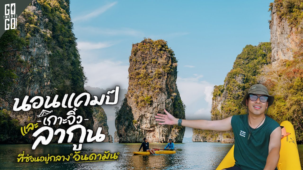
Tham Lot, or the sea cave route, is another important highlight. It is a limestone formation with a tunnel-like passage that can be explored by small boat or canoe when water levels are suitable. Inside, visitors can see cave walls, hanging formations, filtered light, and the cool atmosphere of a tidal cave. This experience is very different from simply cruising through the bay because it brings travelers close to the hidden interior of the karst landscape. Visitors should enter with experienced boatmen or canoe guides because water levels and routes vary with the tide.
Ko Hong and Ko Phanak are well suited for canoe-based exploration. Ko Hong is known for enclosed lagoon-like spaces surrounded by limestone walls, giving the feeling of entering a natural chamber. Ko Phanak has caves, tunnels, and interior formations, with some areas connected to mangrove ecosystems. These areas are ideal for travelers who want a quieter, closer look at the bay beyond the main sightseeing circuit.
Ko Panyi is one of the most distinctive communities in the park. Built beside a limestone cliff and partly over the water, the village has houses, walkways, restaurants, shops, and community spaces raised on stilts. Most residents are Muslim and have long relied on fishing, trading, and tourism. Many boat routes stop here for lunch, seafood, souvenirs, and a walk through the village. The floating football field is one of Ko Panyi’s best-known symbols, showing how the community adapted creatively to limited land space.
Khao Khian gives Ao Phang Nga an archaeological dimension. Ancient rock paintings appear on limestone surfaces along the bay route, showing human figures, fish, crabs, birds, and symbolic forms. The site can be viewed from a boat and should not be touched or climbed on. Khao Khian shows that this bay has been part of human movement, shelter, and maritime life since prehistoric times. It turns Ao Phang Nga from a scenic marine route into a layered cultural landscape.
The mangrove ecosystem is one of Ao Phang Nga’s most important natural assets. Mangroves protect the coastline, reduce erosion, serve as nursery grounds for marine life, and provide habitat for birds, reptiles, fish, crustaceans, and invertebrates. The park contains many important mangrove species, including Rhizophora, Bruguiera, Sonneratia, Avicennia, and other plants adapted to brackish tidal zones. The mix of open bay and narrow mangrove channels gives boat trips through Ao Phang Nga a varied rhythm: wide seascapes, shaded waterways, limestone cliffs, and quiet forest edges.
The park also supports rare plants and diverse wildlife. Limestone cliffs provide habitat for the rare yellow Phang Nga lady’s slipper orchid, while mangrove and coastal habitats support mammals, birds, reptiles, amphibians, fish, shrimp, shellfish, and other marine organisms. Wildlife recorded in the area includes macaques, dusky leaf monkeys, otters, sea eagles, egrets, kingfishers, mudskippers, seabass, shrimps, and many organisms that depend on mangrove and shallow-water habitats. This biodiversity is a major reason why tourism here must be managed carefully.
The best time to visit Ao Phang Nga is generally from November to April, when sea conditions are usually calmer. From May to October, the southwest monsoon brings heavier rain and stronger winds on some days. Although Phang Nga Bay is sheltered by limestone formations in many areas, boat trips still depend on actual weather, tide, and safety announcements. Morning departures are often preferred for photography because the light is softer and the karst scenery appears clearer before the day becomes too hot.
Boat travel is the main way to experience Ao Phang Nga National Park. Visitors can board from the park pier, Tha Dan Pier, and other piers on the Phang Nga and Takua Thung sides. A half-day route often includes Khao Ma Chu, Tham Lot, Khao Tapu, Khao Phing Kan, Ko Panyi, and Khao Khian. A longer route may add Ko Hong, Ko Phanak, or canoeing areas. Most trips take about 3 to 5 hours depending on route, tide, boat type, and the number of stops.
Travelers can choose between organized tours and private boat arrangements. Package tours are convenient because they often include transfers, lunch, and a fixed route. Independent travelers can go directly to a pier and arrange a long-tail boat or local boat based on group size. Before departure, confirm the national park fee, boat fee, canoe fee, lunch, life jackets, insurance, and itinerary. Safety should matter more than the lowest price because the trip depends on tides, sea conditions, and boarding points.
Ao Phang Nga works well for many types of travelers. Families can choose a shorter and less demanding boat route. Older travelers can enjoy most views from the boat without heavy walking. Photographers can focus on limestone silhouettes, mangrove channels, long-tail boats, and village scenes. Nature travelers can study caves, mangroves, tides, and birds, while history-focused visitors can include Khao Khian in the route. This flexibility is one of the park’s strongest advantages.
Visitors should prepare sun protection, a hat, sunglasses, a light long-sleeved layer, drinking water, a waterproof phone bag, stable sandals or boat-friendly shoes, and personal medication. If canoeing is included, wear clothes that can get wet. Children should use properly sized life jackets and be supervised closely during boarding and disembarking. Everyone should wear a life jacket while traveling by boat, even if they can swim.
Responsible travel is essential in Ao Phang Nga National Park. Do not throw waste into the sea, feed wildlife, touch cave walls, write on rocks, collect shells or stones, damage mangrove roots, or fly drones without permission. Canoes should keep a safe distance from cave walls and mangrove roots to avoid impact. At Ko Panyi, visitors should walk respectfully through the community and avoid disturbing private homes. Careful travel behavior helps preserve the bay for both local residents and future visitors.
The national park entrance fee places Ao Phang Nga in Group 3 of Thailand’s national park fee structure. Thai adults pay 60 baht and Thai children pay 30 baht. Foreign adults pay 300 baht and foreign children pay 150 baht. Vehicle fees apply separately by vehicle type. Boat tours, canoeing, meals, and private guide services are separate from the entrance fee and should be confirmed with the operator before traveling.
The park office is located at 80 Moo 1, Ban Tha Dan Road, Ko Panyi Subdistrict, Mueang Phang Nga District, Phang Nga 82000. The park is open daily from 08.00 to 16.30. Main contact numbers include 076-481-188 and 076-481-163. Calling ahead is useful during long holidays, peak season, or unsettled weather because marine activities may be adjusted according to waves, tide, or safety instructions.
Getting There from Phang Nga town is straightforward. Take Highway 4, then turn onto Highway 4144 toward Ban Tha Dan and the Ao Phang Nga National Park office. The distance from town is about 8 km. From there, continue by boat into the bay. Travelers coming from Phuket can cross Sarasin Bridge into Phang Nga and continue toward Mueang Phang Nga or piers on the Takua Thung side. Travelers using public transport can arrive at Phang Nga Bus Terminal and continue by local transport or taxi to the pier.
Ao Phang Nga National Park is best experienced as more than a quick stop at James Bond Island. A well-planned visit reveals limestone geology, mangrove ecology, prehistoric rock art, island community life, and a protected coastal landscape that is unlike any ordinary beach destination. This combination of nature, culture, and conservation makes Ao Phang Nga one of the most complete travel experiences in Phang Nga Province.
| Name | Ao Phang Nga National Park |
| Location | Ko Panyi Subdistrict, Mueang Phang Nga District, Phang Nga Province |
| Address | 80 Moo 1, Ban Tha Dan Road, Ko Panyi Subdistrict, Mueang Phang Nga District, Phang Nga 82000, Thailand |
| Coordinates | 8.3065613, 98.4555569 |
| Highlights | Khao Tapu, Khao Phing Kan, Tham Lot, Ko Panyi, Khao Khian, Ko Hong, Ko Phanak, mangrove forests, and scenic boat routes through Phang Nga Bay |
| History | Declared a national park on 29 April 1981 as Thailand’s 25th national park; Khao Khian contains prehistoric rock paintings within the bay route |
| Name Origin | The park is named after Phang Nga Bay; Khao Tapu and Khao Phing Kan are named after their distinctive limestone forms |
| Distinctive Features | Coastal national park with limestone karsts, sea caves, mangrove forests, island communities, and archaeological traces |
| Travel Information | From Phang Nga town, take Highway 4 and turn onto Highway 4144 toward Ban Tha Dan and the park office, about 8 km from town; boat travel is required to visit the bay attractions |
| Current Status | Open for tourism as a boat, mangrove, cave, island, and coastal landscape destination |
| Open Days | Daily |
| Opening Hours | 08.00 – 16.30 |
| Fees | Thai adults 60 baht, Thai children 30 baht / foreign adults 300 baht, foreign children 150 baht / car 30 baht / motorcycle 20 baht |
| Facilities | Visitor center, pier, welfare restaurant, toilets, national park accommodation, camping area, and local boat services |
| Main Areas / Zones | Ban Tha Dan park office, pier area, Khao Tapu, Khao Phing Kan, Tham Lot, Ko Panyi, Khao Khian, Ko Hong, Ko Phanak, Ko Lawa Yai, mangrove forest, and bay boat routes |
| Caretaker | Department of National Parks, Wildlife and Plant Conservation, Protected Area Regional Office 5 (Nakhon Si Thammarat) |
| Main Contact Number | 076-481-188, 076-481-163 |
| Official Website / Official Page | Facebook: AoPhangNgaDNP |
| Nearby Tourist Attractions | 1. Khao Khian, about 5 km 2. Ko Panyi, about 7 km 3. Khao Tapu, about 15 km 4. Khao Phing Kan, about 15 km 5. Samet Nangshe Viewpoint, about 26 km |
| Nearby Restaurants | 1. Ao Phang Nga National Park Welfare Restaurant, about 0 km 2. Koh Panyee Village Restaurant, about 7 km 3. Panyee Muteara Seafood & Sea Canoe, about 7 km, Tel. 089-289-6461, 084-627-4969 4. Andaman Seafood Ko Panyi, about 7 km, Tel. 085-787-0086 5. Ja Charan Restaurant, Tha Dan Pier, about 2 km |
| Nearby Accommodations | 1. Ao Phang Nga National Park Accommodation, about 0 km, Tel. 076-481-188, 076-481-163 2. Phang Nga Bay Resort, about 2 km, Tel. 076-481-167 3. Blue Mountain Phangnga Resort And Restaurant, about 11 km, Tel. 095-257-7565 4. Sametnangshe Boutique, about 26 km 5. Accommodations In Phang Nga Town, about 8 km |
Frequently Asked Questions (FAQ)
Q: Where is Ao Phang Nga National Park located?
A: Ao Phang Nga National Park is located in Ko Panyi Subdistrict, Mueang Phang Nga District, Phang Nga Province, and covers parts of Takua Thung, Mueang Phang Nga, and Ko Yao districts.
Q: What are the opening hours of Ao Phang Nga National Park?
A: The park is open daily from 08.00 to 16.30.
Q: How much is the entrance fee?
A: Thai adults pay 60 baht and Thai children pay 30 baht. Foreign adults pay 300 baht and foreign children pay 150 baht. Vehicle fees are charged separately.
Q: What are the main places to visit in Ao Phang Nga?
A: Main highlights include Khao Tapu, Khao Phing Kan, Tham Lot, Ko Panyi, Khao Khian, Ko Hong, Ko Phanak, and the mangrove boat routes.
Q: Can visitors land on Khao Tapu?
A: No. Visitors cannot land on Khao Tapu itself. It should be viewed from a boat or from designated areas on Khao Phing Kan.
Q: When is the best time to visit Ao Phang Nga?
A: November to April is generally the best period for boat trips because sea conditions are usually calmer. From May to October, travelers should check weather and marine safety updates before visiting.
Q: How do travelers get there from Phang Nga town?
A: Take Highway 4 and turn onto Highway 4144 toward Ban Tha Dan and the park office, about 8 km from town. Boat travel is then required to visit the bay attractions.
Q: Is Ao Phang Nga suitable for children and older travelers?
A: Yes, if travelers choose a relaxed boat route, use a safe boat, and wear life jackets throughout the water journey.
 Category: ●Nature and Wildlife
 Group: ●National Parks and Marine Reserves
Last Update : 2 MonthAgo
 Last Update : 2 MonthAgo
 Click to Access the Navigation Map GPS
Ao Phang Nga National Park Map
Recommend

 Art, Culture and Heritage
 Historical Sites and Monuments(2)
 Landmarks and Memorials(6)
 Art, Craft Centres, Tradition(3)
 Places of Worship
 Temple(18)
 Other Sacred Sites(8)
 Suburban Living
 Village, Community(3)
National Parks and Marine Reserves(12)
 Mountain (Doi)(8)
 Waterfalls(21)
 Hot Springs(2)
 Caves(12)
 River, Canal(4)
 Bays and Beaches(28)
 Islands(11)
 Other natural attractions(7)
 Entertainment and Agricultural
 Animal camps and shows(2)
 Farms, Parks and Ecotourism(2)
 Waterpark(3)
 Outdoor and Adventure Activities(3)
 Travel Articles, Recipes
 Travel Review, Food Review(1)
 Southern Food Menu, Southern Food Recipes(1)


