
lovethailand home >South Travel Attractions >Phang Nga Travel Attractions >Muang Phang Nga >Koh Pan Yi > Khao Khian
TL;DR: Khao Khian is located at Ko Panyi Subdistrict, Mueang Phang Nga District, Phang Nga Province, within Ao Phang Nga National Park, north of Ko Panyi, open Daily, hours Ao Phang Nga National Park 08.30 – 16.30; Khao Khian Viewing Depends On Boat.

Khao Khian
Open Days: Daily
Opening Hours: Ao Phang Nga National Park 08.30 – 16.30; Khao Khian Viewing Depends On Boat Schedules And Sea Conditions
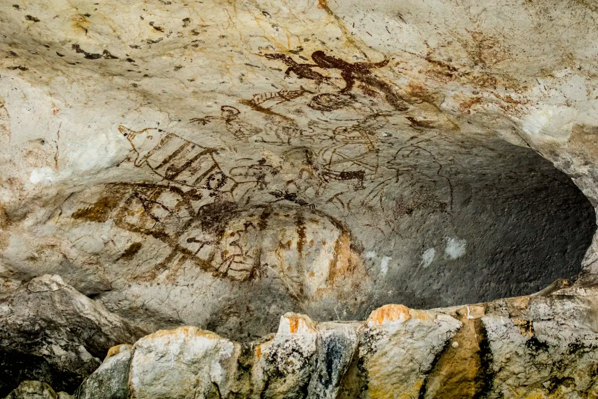
Khao Khian in Phang Nga Province is a prehistoric rock-art site within Ao Phang Nga National Park. Located north of Ko Panyi, it is visited mainly by boat along the Phang Nga Bay sightseeing route. The paintings appear on a limestone rock shelter near sea level and include human figures, boats, fish, aquatic animals, birds, land animals, and symbolic forms. Khao Khian is best experienced as part of a boat route that may also include Ko Panyi, Khao Ma Chu, Khao Phing Kan, Khao Tapu, Tham Lot, Ko Hong, and the mangrove landscape of Ao Phang Nga.
Khao Khian in Phang Nga Province is one of the most important cultural and archaeological highlights within Ao Phang Nga National Park. It lies along the boat route to Ko Panyi and is known for prehistoric rock paintings preserved on a limestone cliff. Unlike archaeological sites that require walking trails or climbing, Khao Khian is viewed mainly from a boat. This makes the experience distinct: visitors float through the mangrove-and-limestone landscape of Phang Nga Bay and observe ancient images still visible on the rock face above the waterline.
Khao Khian is located in Ko Panyi Subdistrict, Mueang Phang Nga District, Phang Nga Province. It is a limestone island-hill surrounded by water. To the east is Khlong Ko Panyi, and to the west is Khlong Nai Ngop. The hill runs roughly north to south for about 2.3 km and lies north of Ko Panyi. The rock paintings are found on lower rock shelters and recessed cliff areas about 3–5 meters above mean sea level. This position offered natural protection from sun and rain and may also have served as a practical resting or sheltering place for people moving through the bay by water.
The site is important because it is one of the best-known rock-art locations in Phang Nga Bay and one of the few that sits directly on a common tourism route. Several rock-painting sites have been identified in the area, including Khao Phra At Thao, Khao Nak, Khao Raya, and Khao Khian. Among them, Khao Khian is the most accessible for general visitors because it can be seen from outside by boat and does not require climbing onto the cliff. This makes it a valuable cultural stop that can be experienced with minimal physical impact on the archaeological site.
The paintings belong to the prehistoric rock-art tradition of southern Thailand. Archaeological references place the broad age range at roughly 5,000–2,000 years ago, while tourism descriptions often explain the paintings as being at least 3,000 years old. These images therefore belong to a period long before written records in the area. They show that the Andaman coast and Phang Nga Bay were already meaningful landscapes for human movement, food gathering, and maritime activity in prehistoric times.
The images include human figures, boats, fish, aquatic animals, birds, crabs, monitor lizards, other animals, and symbolic forms. The pigments appear mainly in red, orange, and yellow tones. Some images are linear outlines, while others are filled silhouettes or simplified symbolic figures. Many of the subjects relate directly to the surrounding environment: water, fish, boats, birds, and animals that could be found in the bay, mangroves, or coastal habitats. For visitors, this gives the paintings strong local meaning. They are not abstract decorations; they are connected to the life and environment of Phang Nga Bay.
The boat images are especially meaningful because Phang Nga Bay is a water-based landscape of limestone islands, mangrove channels, shallow waters, and coastal communities. The presence of boats in the rock art suggests the importance of water travel, fishing, movement, shelter, and communication between groups. The images help modern visitors imagine a prehistoric world in which the bay itself was not only scenery, but a route, a food source, a shelter zone, and a lived environment.
The fish and marine-animal images connect the site strongly with the ecological identity of Ao Phang Nga. The bay’s mangrove forests are natural nurseries for fish, shrimp, crabs, shellfish, and many small organisms. This aquatic abundance would have been central to the lives of prehistoric people, and it remains important to local communities today. Seeing marine imagery on the rock face while traveling through the same water landscape creates a direct connection between past and present.
Human figures and symbolic images add another dimension. They may refer to events, activities, identities, beliefs, memory, or communication within prehistoric groups. Although their exact meaning cannot be read like written language, the images show that people were using the limestone shelter as more than a temporary physical space. It also became a place for creating signs and leaving cultural traces in the landscape.
Khao Khian has a long history of archaeological study. The site was first reported in the early 20th century by a French scholar and later studied in more detail by Thai archaeologists and the Fine Arts Department, especially during the 1980s and early 1990s. These studies documented the paintings, their groups, their location, and their relationship with other archaeological evidence in Ao Luek and Phang Nga Bay. For this reason, Khao Khian is not only a tourist stop but also an important source for understanding prehistoric coastal life and rock art in southern Thailand.
Survey information describes several groups of paintings distributed along the eastern side of the limestone hill. Some groups are close to one another, while others are spread along the cliff line. Because the paintings lie along a rock face parallel to the waterway, viewing by boat is the most appropriate method. Boats can move along the cliff and allow visitors to observe the site without touching the rock surface or disturbing the archaeological remains.
Conservation is essential. Rock paintings cannot be replaced once damaged. Touching the cliff, scratching the rock, writing over the surface, climbing near the images, using intrusive equipment, or causing unnecessary physical disturbance can permanently damage the site. The safest and most respectful way to experience Khao Khian is to view the paintings from the boat and follow guidance from park staff, boat operators, or qualified local guides.
Khao Khian sits within the limestone karst landscape of Ao Phang Nga. This landscape was formed through long geological processes involving sedimentary rocks, limestone, erosion, dissolution, sea-level change, and coastal reshaping. The result is a bay filled with cliffs, caves, notches, islands, rock shelters, and mangrove channels. At Khao Khian, geology and culture meet: nature created the rock shelter, and prehistoric people used it as a place to mark their presence.
The experience of visiting Khao Khian is different from entering a museum. Visitors remain on a boat, surrounded by water, mangroves, limestone cliffs, and nearby Ko Panyi. As the boat approaches the cliff, a guide or boat operator usually points out the rock paintings. Some images are faded by time, so careful observation is needed. The remaining red, orange, and yellow marks on the limestone feel like quiet messages from the past, visible only to those who slow down and look carefully.
The boat route to Khao Khian commonly begins at Ban Tha Dan Pier near Ao Phang Nga National Park headquarters or from Surakul Pier in Takua Thung District. From the national park pier, boats travel toward Khlong Ko Panyi and the inner bay. Khao Khian lies about 7 km from the park pier and is often reached in about 10–15 minutes under normal conditions. It is located before Ko Panyi on many routes, making it a natural stop before visiting the floating village or continuing to Khao Phing Kan and Khao Tapu.
Ko Panyi is the major nearby cultural destination. It is a Muslim fishing community built on stilts over the water, with restaurants, souvenir shops, a mosque, a school, and a floating football pitch. Visiting Khao Khian and Ko Panyi together creates a strong continuity between past and present: Khao Khian reflects prehistoric human relationships with the bay, while Ko Panyi shows a living community still connected to water-based life today.
Khao Ma Chu is another small limestone landmark along the route. It is known for a natural silhouette that resembles a poodle when seen from the right angle. Together, Khao Ma Chu and Khao Khian show two different ways that limestone formations become meaningful: one through local visual imagination and the other through prehistoric human images preserved on the cliff.
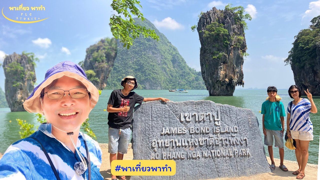
Khao Phing Kan and Khao Tapu are the most famous scenic icons of the bay. Khao Phing Kan is known for its leaning limestone formation, while Khao Tapu is a freestanding limestone stack with a narrow base and broader upper section. When Khao Khian is included with these famous sites, visitors gain a more complete understanding of Ao Phang Nga: not only a place for beautiful photographs, but also a cultural landscape containing ancient evidence, local communities, mangroves, and protected ecosystems.
Tham Lot, Ko Hong, and Ko Phanak add further variety to the route. Tham Lot includes a sea-cave passage that small boats or canoes may pass through in suitable tidal conditions. Ko Hong is known for enclosed lagoon-like spaces surrounded by limestone cliffs. Ko Phanak has caves and complex limestone scenery. These sites help visitors see that Phang Nga Bay is a layered karst environment of caves, channels, cliffs, and hidden water spaces.
The best season to visit Khao Khian is generally from November to April, when rainfall is usually lower and conditions are often easier for boat travel. However, Phang Nga Bay is relatively sheltered compared with open-sea island routes, so visits can be possible at other times when weather, tide, and visibility are suitable. Travelers should always follow park announcements, weather conditions, tide information, and boat-operator guidance, especially if a program includes canoeing or cave access.
The best time of day is usually from morning to afternoon when natural light helps reveal the paintings. Strong midday light may create glare on the rock and water, while low light can make faded pigments harder to see. A local guide who knows the exact positions of the images can make the visit much more meaningful because some paintings are located in recesses or on shaded sections of the rock face.
Photography should be done safely from the boat. Visitors should not stand on the boat edge, lean out dangerously, or ask the boat to get too close to the cliff. A phone or camera with moderate zoom is useful. The purpose of photographing the paintings should be documentation and learning, not creating disturbance. The rock art is fragile, and keeping an appropriate distance helps protect it.
Khao Khian is suitable for most visitors because it does not require hiking or climbing. The main requirement is traveling by boat. Children and older travelers can enjoy the site if the boat is safe, life jackets are available, and the program is not rushed. Those prone to seasickness should prepare medication, although Phang Nga Bay is usually calmer than many open-sea routes.
The entrance fee for Ao Phang Nga National Park is 60 baht for Thai adults and 30 baht for Thai children. Foreign adults pay 300 baht and foreign children pay 150 baht. Vehicle fees are separate, including 30 baht for a four-wheeled car and 20 baht for a motorcycle. These fees do not include boat hire, tour packages, food, canoeing, or other additional services. Boat prices depend on the pier, route, passenger number, boat type, and season.
Khao Khian remains an active sightseeing point on the Ao Phang Nga National Park boat route. It is viewed mainly from the boat and is protected as an important archaeological site. Visitors should treat it as cultural heritage, not merely a photo stop. Respectful viewing helps protect the paintings for future study and future generations.
Getting There by road from Bangkok follows Highway 4, Phet Kasem Road, toward Phang Nga Province. From Phang Nga town, continue to Ban Tha Dan Pier near Ao Phang Nga National Park, about 8–9 km away. Travelers flying in commonly use Phuket International Airport and continue by car to Phang Nga. Rail travelers can use Phunphin Station in Surat Thani and continue by road. Long-distance bus travelers can arrive at Phang Nga Bus Terminal and continue by local transport or hired vehicle to Ban Tha Dan Pier.
By boat, visitors can depart from Ban Tha Dan Pier in Mueang Phang Nga District or from Surakul Pier in Takua Thung District depending on the chosen program. From Ban Tha Dan, the boat travels through mangrove channels toward Khlong Ko Panyi, passing Khao Khian before or near Ko Panyi and continuing to other sites such as Khao Phing Kan, Khao Tapu, Tham Lot, Ko Hong, or Ko Phanak. Travelers should confirm in advance whether the program includes enough time to view the Khao Khian paintings.
Useful items include a hat, sunglasses, sun-protective clothing, waterproof phone bag, camera, drinking water, motion sickness medicine, and footwear suitable for boat transfer. Visitors should wear a life jacket while on the boat and keep belongings secure. Families should watch children carefully when the boat approaches the cliff or slows for viewing.
In summary, Khao Khian gives Phang Nga Bay historical depth beyond its famous limestone scenery. The ancient paintings on the cliff connect modern visitors with prehistoric people who moved through the same waters, used the same bay environment, and left symbols on the rock. Combined with Ko Panyi, Khao Ma Chu, Khao Phing Kan, Khao Tapu, Tham Lot, Ko Hong, and the mangrove landscape, Khao Khian completes the Ao Phang Nga experience with nature, archaeology, culture, and conservation in one route.
| Name | Khao Khian |
| Other Names | Ko Khian, Ko Khao Khian, Tham Khao Khian |
| Location | Ko Panyi Subdistrict, Mueang Phang Nga District, Phang Nga Province, within Ao Phang Nga National Park, north of Ko Panyi |
| Khao Khian Coordinates | 8.34544, 98.50333 |
| National Park Contact Address | Ao Phang Nga National Park, 80 Moo 1, Ban Tha Dan Road, Ko Panyi Subdistrict, Mueang Phang Nga District, Phang Nga 82000, Thailand |
| Place Type | Limestone island-hill and prehistoric rock-art site viewed mainly from a boat |
| Period / Age | Prehistoric period, broadly dated to about 5,000–2,000 years ago, and commonly described in tourism context as at least 3,000 years old |
| Highlights | Ancient rock paintings, human figures, boats, fish, aquatic animals, birds, symbolic forms, Ko Panyi boat route, and Ao Phang Nga mangrove scenery |
| Significance | An important southern Thai prehistoric rock-art and archaeological site showing relationships between ancient people, the sea, mangroves, boats, and coastal life |
| Open Days | Daily |
| Opening Hours | Ao Phang Nga National Park 08.30 – 16.30; Khao Khian viewing depends on boat schedules and sea conditions |
| Fees | Thai adults 60 baht, Thai children 30 baht / foreign adults 300 baht, foreign children 150 baht / car 30 baht / motorcycle 20 baht |
| Current Status | A boat-view prehistoric rock-art site on the Ao Phang Nga National Park sightseeing route; not a climbing or walking site |
| Caretaker | Ao Phang Nga National Park, Department of National Parks, Wildlife and Plant Conservation, with the Fine Arts Department involved in archaeological heritage matters |
| Park Contact Numbers | 076-481-188, 076-481-163 |
| Main Route Areas | Khao Khian, Khlong Ko Panyi, Ko Panyi, Khao Ma Chu, Khao Phing Kan, Khao Tapu, Tham Lot, Ko Hong, Ko Phanak, and Ao Phang Nga mangrove areas |
| Travel Information | Travel about 8–9 km from Phang Nga town to Ban Tha Dan Pier, then continue by boat through Khlong Ko Panyi. Khao Khian is about 7 km from the national park pier and usually takes about 10–15 minutes by boat under normal conditions. Surakul Pier is another departure option depending on the tour program. |
| Recommended Activities | Boat viewing of prehistoric rock paintings, photography from the boat, local-guide interpretation, mangrove sightseeing, Ko Panyi visit, Khao Phing Kan and Khao Tapu visit, and canoeing where available |
| Visitor Conduct | Do not touch or mark the rock surface, do not climb the cliff, do not litter, wear a life jacket while on the boat, and follow park staff or boat-operator guidance |
| Nearby Tourist Attractions | 1. Ko Panyi, about 0.7 km from Khao Khian by boat route 2. Khao Ma Chu, about 3 km by boat route 3. Khao Phing Kan And Khao Tapu, about 15 km from the national park office via Khlong Ko Panyi 4. Tham Lot, about 10 km by boat route 5. Ko Hong, about 12 km by boat route 6. Samet Nangshe Viewpoint, about 22 km by road from Ban Tha Dan Pier |
| Nearby Restaurants | 1. Ao Phang Nga National Park Welfare Restaurant, about 0 km from Ban Tha Dan Pier 2. Newfern Restaurant, Ko Panyi, about 7 km from the national park pier by boat, Tel. 081-677-8985 3. Ko Panyi Village Restaurant, about 7 km from the national park pier by boat 4. Mee Giew Pae Suan, Kalai, about 14 km, Tel. 064-992-9996 5. J’Nong Local Phang Nga Restaurant, about 18 km, Tel. 095-423-2624, 087-464-0509 6. Ja Charan Restaurant, Mueang Phang Nga, about 10 km |
| Nearby Accommodations | 1. Ao Phang Nga National Park Accommodation, Ban Tha Dan, Tel. 076-481-188, 076-481-163 2. Bang Nu River Homestay, about 8 km, Tel. 086-947-2456 3. Pakor Boutique Resort, about 12 km 4. Home Phang-Nga Guest House, about 10 km, Tel. 081-958-5538 5. Accommodations In Phang Nga Town, about 8–12 km 6. Accommodations Around Samet Nangshe And Takua Thung, about 20–30 km |
Frequently Asked Questions (FAQ)
Q: Where is Khao Khian located?
A: Khao Khian is located in Ao Phang Nga National Park, Ko Panyi Subdistrict, Mueang Phang Nga District, Phang Nga Province. It lies north of Ko Panyi and is viewed mainly from a boat.
Q: Why is Khao Khian important?
A: Khao Khian is a prehistoric rock-art site in southern Thailand. Its paintings include human figures, boats, fish, aquatic animals, birds, and symbols that reflect ancient relationships with the sea and Phang Nga Bay.
Q: How old are the Khao Khian paintings?
A: The paintings are prehistoric and broadly dated to about 5,000–2,000 years ago. In travel context, they are often described as being at least 3,000 years old.
Q: Can visitors climb up to the paintings?
A: No. Visitors should view the paintings from the boat. Climbing or touching the rock surface can damage the archaeological site and is unsafe.
Q: Which pier is used to visit Khao Khian?
A: Ban Tha Dan Pier near Ao Phang Nga National Park headquarters is the main starting point. Surakul Pier in Takua Thung District is another option depending on the chosen boat program.
Q: How much is the Ao Phang Nga National Park entrance fee?
A: Thai adults pay 60 baht and Thai children pay 30 baht. Foreign adults pay 300 baht and foreign children pay 150 baht. Vehicle fees are charged separately.
Q: What other places can be visited with Khao Khian?
A: Common nearby stops include Ko Panyi, Khao Ma Chu, Khao Phing Kan, Khao Tapu, Tham Lot, Ko Hong, Ko Phanak, and the mangrove areas of Ao Phang Nga.
Q: What should visitors prepare for the boat trip?
A: Bring a hat, sunglasses, sun-protective clothing, waterproof phone bag, camera, drinking water, motion sickness medicine, and wear a life jacket while on the boat.
 Category: ●Nature and Wildlife
 Group: ●Mountain (Doi)
Last Update : 2 MonthAgo
 Last Update : 2 MonthAgo
 Click to Access the Navigation Map GPS
Khao Khian Map
Recommend

 Art, Culture and Heritage
 Historical Sites and Monuments(2)
 Landmarks and Memorials(6)
 Art, Craft Centres, Tradition(3)
 Places of Worship
 Temple(18)
 Other Sacred Sites(8)
 Suburban Living
 Village, Community(3)
 National Parks and Marine Reserves(12)
Mountain (Doi)(8)
 Waterfalls(21)
 Hot Springs(2)
 Caves(12)
 River, Canal(4)
 Bays and Beaches(28)
 Islands(11)
 Other natural attractions(7)
 Entertainment and Agricultural
 Animal camps and shows(2)
 Farms, Parks and Ecotourism(2)
 Waterpark(3)
 Outdoor and Adventure Activities(3)
 Travel Articles, Recipes
 Travel Review, Food Review(1)
 Southern Food Menu, Southern Food Recipes(1)


