
lovethailand home >South Travel Attractions >Krabi Travel Attractions > 40 Places to Visit in Krabi Southern Thailand Trav..
TL;DR: 40 Places to Visit in Krabi Southern Thailand Travel Guide.

40 Places to Visit in Krabi Southern Thailand Travel Guide
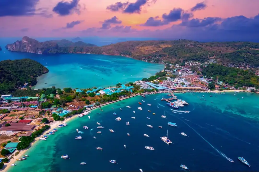
Krabi is one of Southern Thailand’s most important travel destinations on the Andaman coast, offering an exceptional variety of landscapes and experiences, including sandy beaches, emerald-green seas, islands, limestone mountains, tropical rainforest, waterfalls, hot springs, caves, archaeological sites, Muslim communities, sea-people communities, and traditional fishing lifestyles. For first-time visitors, the main highlights include Ao Nang, Railay Beach, the Phi Phi Islands, Emerald Pool, Namtok Ron Khlong Thom, Wat Tham Suea, Ko Lanta Yai, Susan Hoi or the 75-Million-Year Shell Cemetery, Khao Khanap Nam, and Tha Pom Khlong Song Nam. Travelers with 4–5 days can extend their journey to Ao Luek, Ko Lanta, Khao Phanom, Nuea Khlong, Plai Phraya, and Lam Thap to experience Krabi more completely through its sea, forests, mountains, history, and local communities.
40 Places to Visit in Krabi – Southern Thailand Travel Guide Krabi is one of Thailand’s best-known travel provinces and a major destination on the Andaman coast, attracting visitors from around the world throughout the year. The appeal of Krabi extends far beyond its beaches and islands. Its landscape combines dramatic limestone cliffs, pale sandy beaches, blue-green seawater, mangrove forests, tropical rainforest, waterfalls, hot springs, caves, and communities that continue to preserve distinctive traditional ways of life.
Krabi has an exceptionally diverse landscape. Inland areas consist of mountains, forests, plains, and agricultural land, while the Andaman coastline is filled with bays, coves, islands of different sizes, and distinctive limestone cliffs. Many parts of Krabi can therefore be considered natural outdoor classrooms for learning about geology, mangrove ecosystems, geothermal-water systems, lowland rainforest, and marine ecology.
Numerous islands are scattered along the coast of Krabi, particularly around Mueang Krabi, Ao Luek, and Ko Lanta districts. The Phi Phi Islands, Poda Islands, Hong Islands, Rok Islands, Ko Ngai, and the many islands surrounding Ko Lanta are important destinations for diving and marine tourism. Along the mainland coast, Ao Nang, Noppharat Thara Beach, Ao Thalane, mangrove forests, and brackish-water environments create another range of ecosystems with their own distinctive natural character.
One of the province’s most important mountain areas is Khao Phanom Bencha, which rises approximately 1,397 meters above sea level and is the highest mountain in Krabi Province. Its forest is the source of numerous streams and waterfalls, including Huai To Waterfall. Farther south around Khlong Thom lies the lowland forest of Khao Pra–Bang Khram, an ecologically important conservation area containing Emerald Pool, Blue Pool, and a natural warm-water system that gives Khlong Thom a landscape and ecosystem very different from Krabi’s coastal areas.
Krabi is also important for history and archaeology. Evidence indicates human settlement and activity in the area since prehistoric times. Caves and ancient paintings in Ao Luek District, together with archaeological evidence from Moh Khiew Cave, show that people have used the region’s limestone landscapes and coastal resources for a very long period. In Khlong Thom, ancient beads and other artifacts have been discovered that are associated with historical maritime trading networks, making the area important for understanding connections between Thailand’s Andaman coast and regional trade routes of the past.
Krabi Province is currently divided into 8 districts: Mueang Krabi, Ao Luek, Plai Phraya, Khao Phanom, Khlong Thom, Lam Thap, Ko Lanta, and Nuea Khlong. Each district offers a different style of travel. Mueang Krabi is the main center for marine tourism and transportation; Ao Luek is known for caves, limestone mountains, and kayaking; Khlong Thom is known for hot springs and lowland rainforest; and Ko Lanta is famous for beaches, communities, and the southern Andaman Sea. Khao Phanom, Plai Phraya, and Lam Thap add another dimension through forests, mountains, waterfalls, agriculture, and the quieter inland countryside of Krabi.
Krabi’s local cuisine is rooted in Southern Thai cooking, known for strong flavors, intensely seasoned curry pastes, and generous use of fresh herbs. Common dishes include southern-style sour curry, gaeng tai pla, khua kling, shrimp-paste chili dip served with fresh vegetables, turmeric-fried fish, and fresh Andaman seafood such as shrimp, crab, fish, shellfish, and squid. The freshness of seafood is one of the strengths of coastal communities around Ao Nang, Khlong Prasong, Ao Luek, and Ko Lanta.
Krabi’s food culture also reflects the diversity of its Muslim and sea-people communities. Halal food, khao mok, roti, spiced curries, seafood, and traditional sweets are widely found around Ao Nang, Ban Na Teen, Ko Klang, and Ko Lanta. Inland areas produce tropical fruit such as durian, mangosteen, and rambutan, together with agricultural products from rubber and oil-palm plantations. Eating within local communities therefore offers a closer connection with the everyday lives of Krabi residents than dining only in the main tourist zones.
Krabi’s traditions and culture reflect the long coexistence of Thai Buddhists, Thai Muslims, and sea people. The Urak Lawoi community on Ko Lanta continues to preserve the important Sea Gypsy Boat Floating Ceremony, a ritual associated with dispelling misfortune, honoring ancestors, and praying for safety at sea. This ceremony should not be viewed simply as a performance for tourists because it continues to have genuine spiritual and cultural meaning for the community.
Muslim communities are another essential part of Krabi’s identity and are found along the coast, on many islands, and in villages surrounding Ao Nang. Fishing traditions, handicrafts, halal food, and mosques remain ordinary parts of everyday community life. Buddhism is represented by important religious centers such as Wat Tham Suea and Wat Sai Thai. This coexistence gives Krabi a culturally diverse atmosphere that remains closely integrated into daily life.
For trip planning, travelers with 3 days can spend the first day exploring Krabi Town and Ao Nang, the second day taking a boat trip to the Phi Phi Islands or the Four Islands, and the third day visiting Emerald Pool and Namtok Ron Khlong Thom. Travelers with 4–5 days should add Ao Luek or stay on Ko Lanta for at least 1–2 nights because both areas offer experiences that are distinctly different from Ao Nang. Renting a car makes inland natural attractions easier to reach, while island trips should always be planned around boat schedules, weather, wave conditions, and conservation-area announcements.
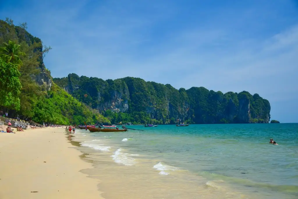
1. Ao Nang is located in Ao Nang Subdistrict, Mueang Krabi District, and is one of the most important marine-tourism centers in the province. Its landscape combines a long beach, limestone cliffs rising beside the coast, the Andaman Sea, and numerous islands visible offshore. The sight of traditional long-tail boats lined up along the beach has become one of the most recognizable images associated with travel in Krabi.
Behind the beach is a large tourism district with hotels, resorts, guesthouses, restaurants, cafés, tour companies, vehicle-rental shops, travel-equipment stores, and numerous boat services. This makes Ao Nang particularly suitable for first-time visitors who want a convenient base with comprehensive services. Ao Nang also functions as a major departure point for Railay Beach, Phra Nang Cave Beach, the Poda Islands, Thale Waek, and other islands, allowing travelers to explore several destinations without changing accommodation every day.
Morning is the best time to depart for island trips, while late afternoon and evening are ideal for walking along the beach and watching the sunset. Visitors traveling during the monsoon season should check wave and wind conditions before going out to sea because boat schedules and routes can change according to weather. Although the beach itself is an open natural area, marine activities should only be undertaken under safe conditions and with operators that follow appropriate safety standards.
Ao Nang works particularly well as a base for a 2–3 night stay because it lies conveniently between marine attractions and inland travel routes. Travelers can spend one day island-hopping and then drive to Tha Pom, Ao Thalane, Khao Khanap Nam, or Khlong Thom the following day. This reduces the need to move accommodation frequently and makes the overall itinerary easier to manage.
Getting There: From Krabi Town, take Route 4034 toward Ao Nang Subdistrict. The journey is approximately 15–20 kilometers and generally takes around 30–45 minutes depending on traffic. Travelers can use a private car, rental vehicle, local transport, taxi, or airport transfer service.
Map (GPS): https://maps.app.goo.gl/GEgTYH8NhucHH1L37
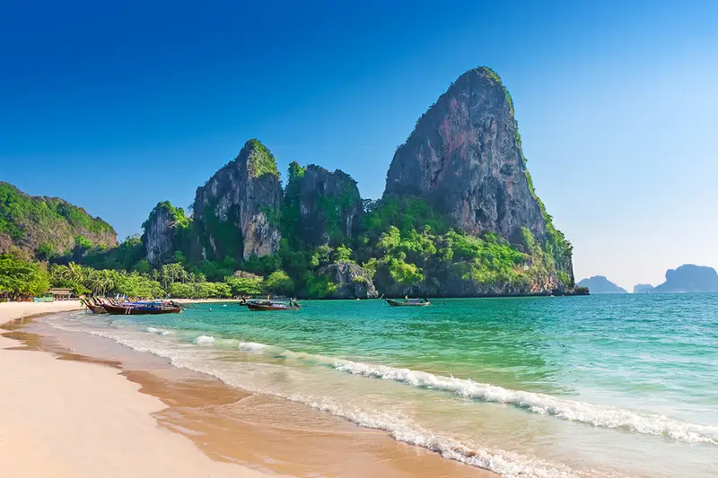
2. Railay Beach is an important beach on the Railay Peninsula in Ao Nang Subdistrict. Although geographically connected to the mainland, Railay is surrounded by steep limestone cliffs that prevent road access. All travel therefore takes place by boat, giving Railay the atmosphere of an island while preserving the distinctive character of a beach enclosed by dramatic limestone formations.
Railay is divided into several areas. Railay West has a broad sandy beach and is particularly suitable for watching the sunset, while Railay East contains mangrove areas, boat-landing points for some routes, and a walking connection toward Phra Nang Cave Beach. Railay’s limestone cliffs are internationally famous for rock climbing, with routes ranging from beginner-friendly climbs to technically demanding challenges. Local climbing operators also provide introductory courses for first-time climbers.
Beyond relaxing on the beach, visitors can walk to Phra Nang Cave Beach, Railay Viewpoint, and the lagoon. However, the routes to the viewpoint and lagoon are steep, with clay and rocky surfaces that can become extremely slippery after rain. Travelers without suitable experience or physical condition do not need to force themselves to climb because the beaches and lower-level scenery already provide enough natural beauty for a half-day or full-day visit.
Staying overnight provides a noticeably different experience. After many day-trip boats leave, Railay becomes quieter and is particularly pleasant for walking along the shore during early morning or evening, allowing visitors to experience the peninsula at a more relaxed pace.
Getting There: From Ao Nang, take a long-tail boat for approximately 10–15 minutes. Boat services are also available from Ao Nam Mao. Actual departures depend on sea conditions and daily operating schedules.
Map (GPS): https://maps.app.goo.gl/RfVXwZPuhSikKHQg7
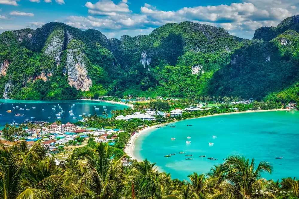
3. The Phi Phi Islands are a world-famous island group in Krabi Province and form part of Hat Noppharat Thara–Mu Ko Phi Phi National Park. Their defining landscape includes limestone mountains rising directly from the sea, emerald-green water, pale sandy beaches, and bays surrounded by towering cliffs. The island group includes several important islands such as Ko Phi Phi Don, Ko Phi Phi Le, Bamboo Island, and Ko Yung.
Ko Phi Phi Don is the main inhabited island and has the most complete range of accommodation, restaurants, piers, dive shops, and visitor services. Important areas include Tonsai Bay, Loh Dalum Bay, viewpoints, and beaches around the island. Ko Phi Phi Le has no permanent settlement but contains some of the archipelago’s most celebrated natural sites, including Maya Bay, Pileh Lagoon, Viking Cave, and dramatic limestone cliffs.
Popular activities include snorkeling, scuba diving, boat trips, viewing limestone cliffs, and relaxing on the beaches. The islands’ high popularity has required stronger visitor-management and ecological-restoration measures in several areas. Travelers should follow national park rules, never feed fish, avoid standing on coral, and never remove shells or marine life from protected areas.
If time allows, staying on Ko Phi Phi Don for at least one night provides a different experience from a day trip. Visitors can depart by boat early in the morning or explore the island before the main daily tour groups arrive. However, boat schedules and temporary ecological closures should always be checked before traveling.
Getting There: Passenger ferries and speedboats operate from piers in Krabi Province and Ao Nang, with additional services from Phuket and nearby destinations. Boat schedules vary according to season and sea conditions.
Map (GPS): https://maps.app.goo.gl/E9PtyEA5UJvSq2yw7
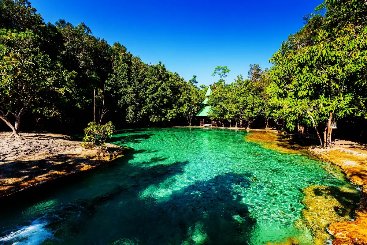
4. Emerald Pool (Sa Morakot) is located inside Khao Pra–Bang Khram Wildlife Sanctuary in Khlong Thom Nuea Subdistrict, Khlong Thom District. It is a naturally formed forest pool known for its blue-green water and is one of Krabi’s most famous inland nature attractions. Its significance extends beyond the color of the pool because the surrounding area contains a warm-water stream system, lowland rainforest, and nature trails linking several natural pools.
The water in Emerald Pool is supplied by underground sources and natural forest streams. Swimming is allowed in designated areas of the main pool. Some sections of the pool floor can be slippery and water depth varies, so visitors should take additional care, particularly children and people who are not confident swimmers.
Another important site is Blue Pool, also known as Sa Nam Phut, a striking blue spring that forms an important source of the surrounding water system. Swimming is strictly prohibited there. Walking to Blue Pool allows visitors to experience more of the lowland rainforest ecosystem, including forest vegetation, bird calls, and an environment that feels entirely different from Krabi’s coastline.
Morning is generally the best time to visit because temperatures are cooler and visitor numbers may be lower. Travelers who want to experience Emerald Pool, Blue Pool, and the nature trails should allow at least half a day. The site can be combined very effectively with Namtok Ron Khlong Thom.
Getting There: From Krabi Town, take Phetkasem Road, Highway 4, toward Khlong Thom District, then turn toward Khlong Thom Nuea Subdistrict and follow signs for Emerald Pool. The distance from Krabi Town is approximately 60 kilometers.
Map (GPS): https://maps.app.goo.gl/99qvSXDRcsE9gTdB9
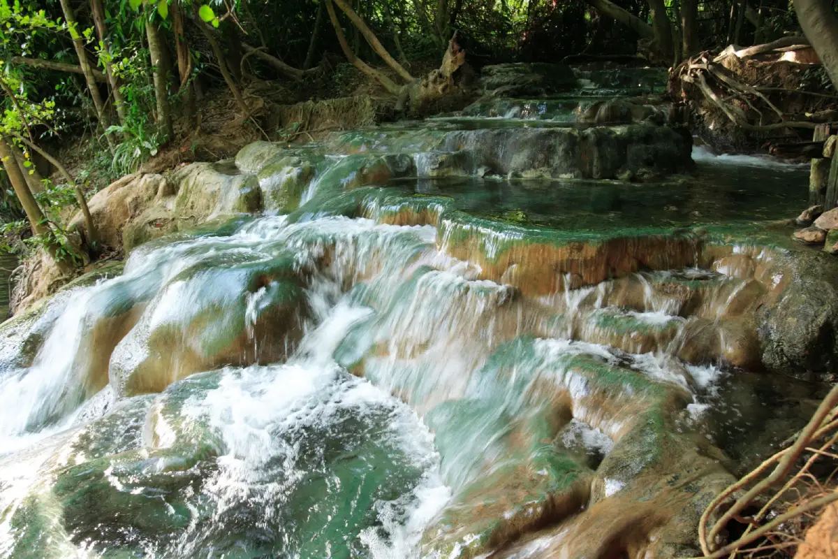
5. Namtok Ron Khlong Thom is located in Khlong Thom Nuea Subdistrict, Khlong Thom District. It is a natural hot-spring attraction with a character very different from conventional hot-spring pools because geothermal water flows across natural rock formations and descends through a series of small basins resembling a miniature waterfall, all beneath large trees in a shaded forest environment.
The water temperature is generally around 40–50 degrees Celsius. Several natural basins are suitable for sitting and soaking to relax the muscles. Below the hot-water area is a natural stream with a different temperature, creating an unusual landscape in which a hot spring, waterfall-like formations, and a cooler natural stream exist together.
Hot-water bathing should be done in moderation. Visitors should avoid soaking continuously for too long and should drink enough water. Elderly travelers and people with heart conditions, blood-pressure problems, or other medical conditions should consider their physical condition before entering the hot pools. Anyone who experiences dizziness, palpitations, or discomfort should leave the water immediately.
Namtok Ron Khlong Thom is commonly combined with Emerald Pool because both are located within the Khlong Thom Nuea area. Travelers who begin early can visit Emerald Pool first and then relax at the hot waterfall later in the morning or afternoon.
Getting There: From Khlong Thom District, follow the route toward Khlong Thom Nuea and the Bang Khram–Bang Tiao area, then follow signs to the hot waterfall. A private car or rental vehicle is the most convenient option.
Map (GPS): https://maps.app.goo.gl/CnAtQGLHtdYfu57S8
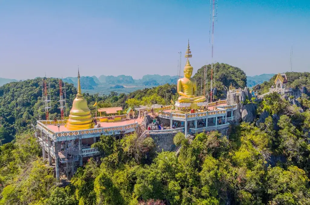
6. Wat Tham Suea is located at Ban Tham Suea in Krabi Noi Subdistrict, Mueang Krabi District. It is an important Buddhist temple and meditation center that combines religious significance, natural caves, forest, limestone mountains, and panoramic viewpoints within one area. The temple originally developed around a meditation environment before becoming one of Krabi’s major religious centers visited by both worshippers and travelers.
The most famous feature is the summit of Khao Kaeo, reached by climbing approximately 1,237 steps. At the top are a Buddha image and viewing areas overlooking limestone mountains, Krabi Town, agricultural land, and the distant coastline. The ascent is physically demanding, with steep sections and some unusually high steps, so visitors should allow enough time and climb according to their fitness level.
Those planning to climb should start in the morning or later in the afternoon to reduce exposure to intense heat. Drinking water and secure footwear are recommended. Extra care is needed during or after rain because the stairs may become slippery. Travelers who do not wish to climb can still explore the lower temple grounds, caves, forest areas, and religious sites.
Because Wat Tham Suea remains an active Buddhist meditation site, visitors should dress respectfully and keep noise to a minimum. Monkeys are present in some areas, so food and personal belongings should be kept secure. Visitors should not offer food to the animals or approach them too closely.
Getting There: The temple is not far from Krabi Town. Travel along Phetkasem Road toward Krabi Noi Subdistrict. It is also conveniently accessible by car or local transport from Krabi International Airport.
Map (GPS): https://maps.app.goo.gl/gswEQ4xr3ooVffDS9
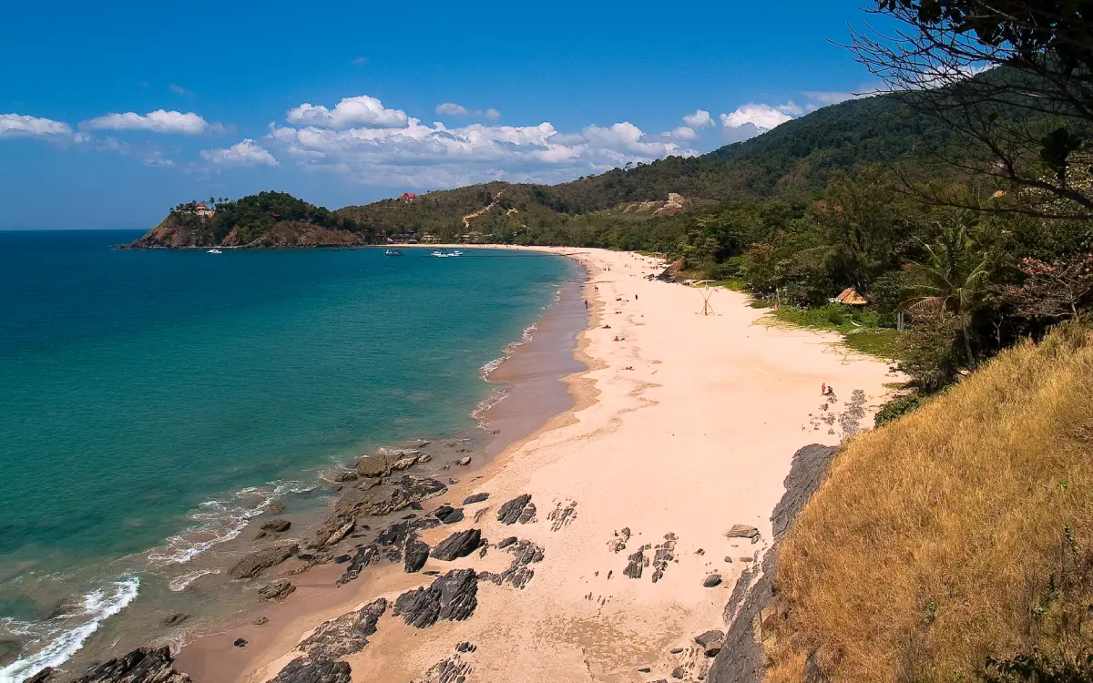
7. Ko Lanta Yai is the main island of Ko Lanta District and serves as the southern Krabi area’s principal center for accommodation, restaurants, transportation, and marine activities. The island stretches from north to south, with a series of beaches along the western coast and older communities, mangrove environments, and traditional coastal settlements on the eastern side.
The western coast includes popular beaches such as Klong Dao, Phra Ae, Klong Khong, Klong Nin, Ba Kan Tiang Bay, and beaches near Laem Tanod. Each has a different atmosphere, allowing visitors to choose between areas with restaurants and full services or quieter beaches farther south.
The eastern side contains Lanta Old Town at Ban Si Raya, the mangrove-based community tourism of Ban Thung Yee Pheng, and Ban Sangka U, an Urak Lawoi sea-people community that continues to preserve its own culture. These communities show that Ko Lanta is much more than a resort-and-beach destination; it is also an island with significant history and cultural diversity.
Ko Lanta is best experienced with a stay of at least 2–3 nights because the island is long and attractions are spread across different areas. It also serves as an important departure base for boat trips to the Rok Islands, Ko Haa, and well-known offshore dive sites.
Getting There: From Krabi Town or Krabi International Airport, travel by car or passenger van toward the car-ferry terminal, cross to Ko Lanta Noi, and then continue across Siri Lanta Bridge to Ko Lanta Yai.
Map (GPS): https://maps.app.goo.gl/wTppRVJSAgBfC8GC9
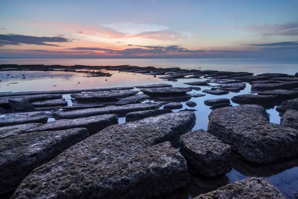
8. Susan Hoi (Fossils Shell Beach), also known as the Laem Pho Shell Cemetery or the 75-Million-Year Shell Cemetery, is located at Ban Laem Pho in Sai Thai Subdistrict, Mueang Krabi District. It is an important fossil site famous for coastal rock layers composed of enormous quantities of freshwater shells that accumulated, became compacted, and were naturally cemented into broad slabs of solid rock.
Although the name “75-Million-Year Shell Cemetery” has been used in tourism for many years, current geological information places the fossil shell beds at approximately 40–20 million years old. The site’s real significance therefore lies in its geological value and evidence of long-term environmental change rather than the 75-million-year figure contained in its traditional tourism name.
The freshwater-shell fossils now exposed beside the sea demonstrate that the environment here was once very different from the modern coastline. As environmental conditions and sea levels changed over millions of years, the original sediment layers eventually became the distinctive coastal fossil platform visible today.
Low tide is generally the best time to observe the fossil platforms because a larger area of rock is exposed. Visitors should walk carefully because the surfaces are uneven and may become slippery. Fossils must not be broken, removed, excavated, or collected from the site.
Getting There: From Krabi Town, travel toward Sai Thai Subdistrict and Ban Laem Pho, approximately 15–17 kilometers away. The site can be combined with Ao Nam Mao, Ao Nang, and other coastal attractions in the same area.
Map (GPS): https://maps.app.goo.gl/vWnTGKEyiruaw1Hb6
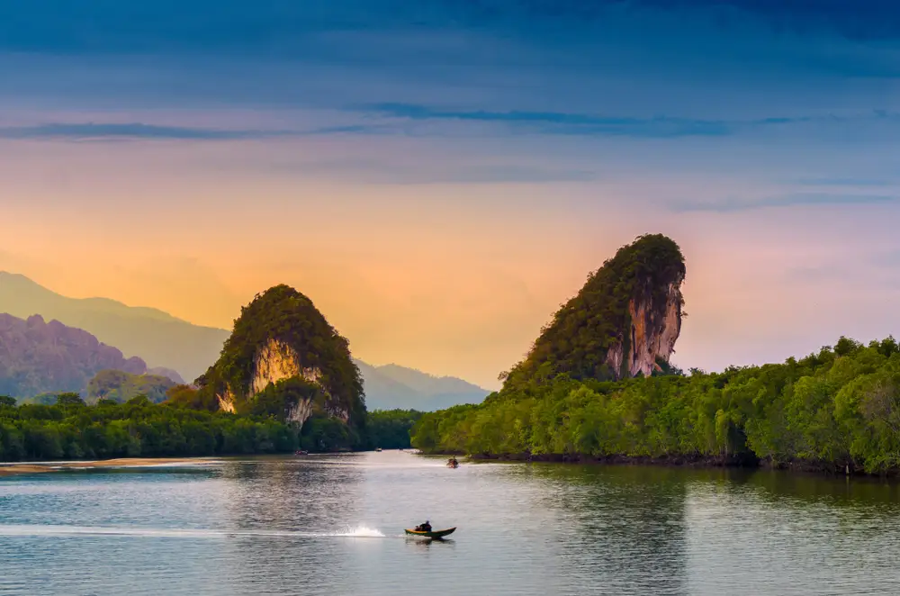
9. Khao Khanap Nam is one of the principal landmarks of Krabi Town. It consists of two limestone mountains rising approximately 100 meters on opposite sides of the Krabi River in front of the town, creating a distinctive landscape visible from the Black Crab Monument and riverside areas.
Visitors reach the mountains by Hua Thong boat or long-tail boat. Inside are caves, stalactites, stalagmites, and areas connected with archaeological evidence. The surrounding mangrove forest serves as an important nursery habitat for aquatic life and forms a major part of the Krabi River ecosystem.
Boat trips to Khao Khanap Nam are often combined with the Ko Klang community, allowing travelers to experience Krabi Town, the river, limestone mountains, mangrove forest, and a Muslim community within a single half-day itinerary. It is therefore particularly suitable for travelers who do not want to travel far outside town but still want to experience nature and local life.
Visitors should check tide conditions and boat schedules before traveling. Those entering the caves should wear footwear suitable for rocky surfaces and avoid touching stalactites, stalagmites, or archaeological areas unnecessarily.
Getting There: Take a Hua Thong or long-tail boat from the pier area in Krabi Town. The boat ride to Khao Khanap Nam takes approximately 15 minutes.
Map (GPS): https://maps.app.goo.gl/3xUCpsYrw4k783Fp8
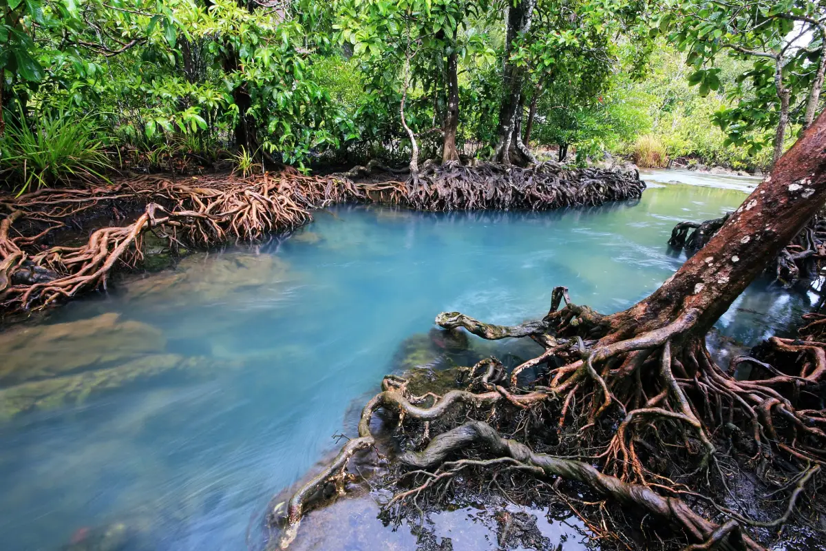
10. Tha Pom Khlong Song Nam is located at Ban Nong Chik in Khao Khram Subdistrict, Mueang Krabi District. It is a distinctive nature-learning area where freshwater from underground springs meets seawater entering with the tides, creating freshwater, brackish-water, and saltwater conditions within the same canal system.
During low tide, freshwater has a stronger influence and the canal can become exceptionally clear, revealing the sandy bottom, tree roots, and aquatic plants. When seawater rises, saltwater enters and mixes with the freshwater, changing the color and ecological conditions according to salinity. These tidal changes mean that Tha Pom can look noticeably different at different times of the same day.
The site has wooden walkways and nature trails passing through freshwater swamp forest, tropical rainforest, and mangrove forest. Visitors can observe ecological transitions over a relatively short distance. Swimming or water activities are permitted only in designated areas, while other sections are reserved for conservation and must be protected according to site regulations.
Travelers hoping to see the water at its clearest should check tide conditions before visiting because the tidal cycle has a direct influence on the canal. Visitors should not step on exposed tree roots, throw food to fish, or leave the designated nature trail because the ecosystem is delicate and depends on the balance between freshwater and seawater.
Getting There: From Krabi Town, take Highway 4 on the Krabi–Ao Luek route, then turn toward Khao Khram Subdistrict and follow signs to Tha Pom Khlong Song Nam. A private or rental car is the most convenient option.
Map (GPS): https://maps.app.goo.gl/yxUHPw3pvL3Tfauo9
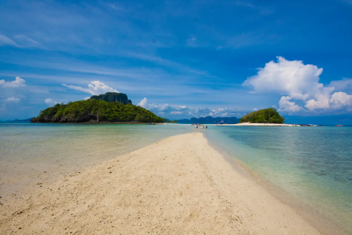
11. Noppharat Thara Beach is located in Ao Nang Subdistrict, Mueang Krabi District, within Hat Noppharat Thara–Mu Ko Phi Phi National Park. It is a broad, long beach well suited to relaxing, walking along the coast, and enjoying views of the small offshore islands scattered in front of the shoreline. One of its defining characteristics is the open, spacious atmosphere, with lines of trees providing shade and a particularly wide expanse of beach becoming visible at low tide.
The beach surface consists of fine sand, shell fragments, and shallow tidal areas that change continuously with the sea level. At certain stages of low tide, exposed sandbars and broad tidal flats extend farther from the shore, making the beach particularly attractive for walking and photography. However, visitors should avoid walking too far from the mainland without monitoring the tide because the sea can rise again relatively quickly.
Noppharat Thara Beach is also important as a transportation area because it lies close to Ao Nang and has piers and marine-tourism services nearby. Travelers can therefore use it as a place to relax before boarding a boat or stop here in the evening after returning from an island trip. Sunset is one of the best periods to visit, when temperatures are cooler and the beach atmosphere becomes more pleasant than during the middle of the day.
The beach itself is an open natural area without conventional entrance gates or fixed closing hours, although national park service facilities generally operate during official daytime hours. Visitors should keep the beach clean, avoid leaving rubbish, and follow national park regulations, particularly around pier areas and marine-activity zones.
Getting There: From Ao Nang, follow the coastal road for a short distance to Noppharat Thara Beach. The beach is also easily reached from Krabi Town by private car, rental vehicle, taxi, or local transport.
Map (GPS): https://maps.app.goo.gl/TJDgzPdViGDFP18p7
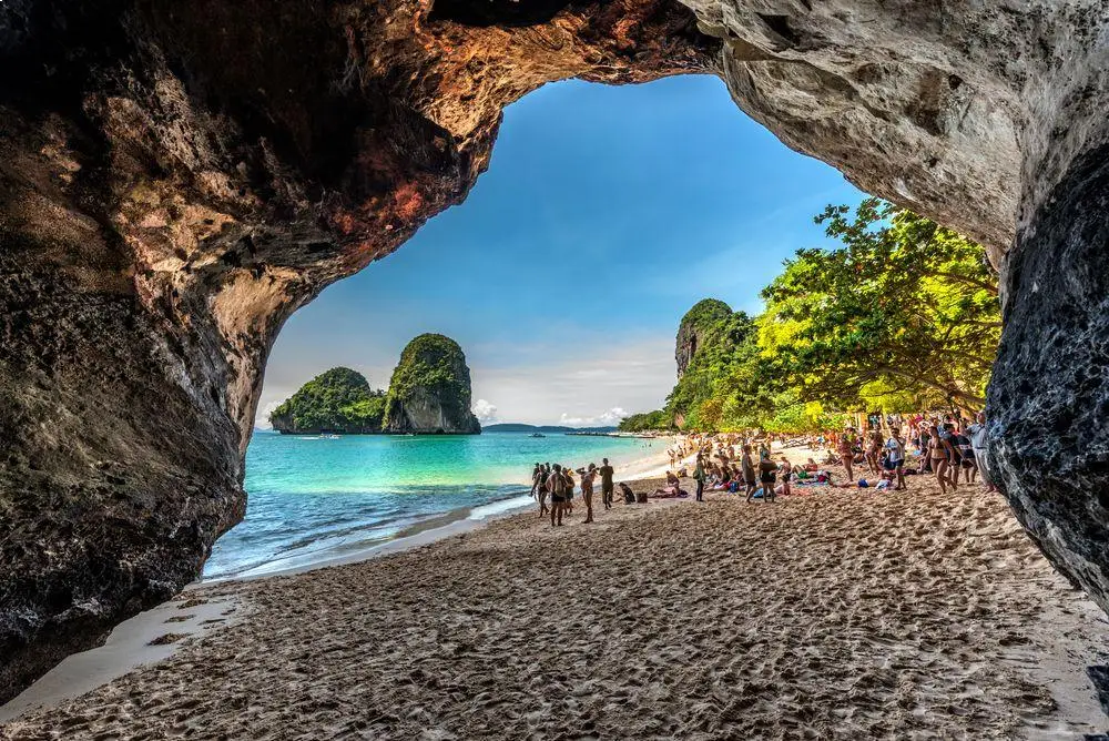
12. Phra Nang Cave Beach is located on the Railay Peninsula in Ao Nang Subdistrict, Mueang Krabi District. The beach combines many of the landscapes most strongly associated with Krabi, including pale sand, clear seawater, limestone cliffs, caves, and a dramatic coastal setting. It is commonly included in the same itinerary as Railay Beach because the two areas are connected by walking paths across the peninsula.
At one end of the beach is Phra Nang Cave, which has long been associated with the beliefs of fishermen and coastal communities. Inside the cave is a shrine respected by local residents and boatmen, who connect the site with prayers for safety and successful journeys at sea. Visitors should behave respectfully, avoid moving offerings, and keep noise to a minimum around the sacred area.
Another defining feature is the line of steep limestone cliffs forming part of the same karst landscape as Railay. Visitors can watch rock climbers on nearby cliffs, rent kayaks, or simply relax along the beach. On clear days, the limestone formations and small islands offshore can be seen especially clearly from the shoreline.
The beach itself is naturally open, but boat access and activities depend on wave conditions, boat schedules, and national park management measures. Visitors should avoid swimming when the sea is rough and bring only necessary personal items because this is a natural beach area where unnecessary waste should be minimized.
Getting There: Take a boat from Ao Nang or Ao Nam Mao to the Railay Peninsula, then walk along the connecting path to Phra Nang Cave Beach. Some boat services also stop closer to the beach depending on the operating route and sea conditions.
Map (GPS): https://maps.app.goo.gl/Hq9nf4uq7M21885A6
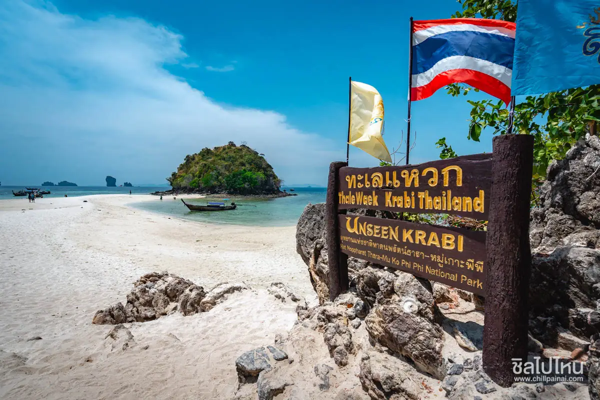
13. Thale Waek (Separated Sea) is one of Krabi’s most famous natural marine phenomena. It occurs when a pale sandbar emerges as the tide falls, temporarily connecting Chicken Island, Ko Thap, and Ko Mo. During the right tidal conditions, visitors can walk across the exposed sand between the islands, making this one of the signature highlights of Krabi’s popular Four Islands route.
The phenomenon does not appear at the same time every day because it depends on the tidal cycle, lunar conditions, sea state, and season. On some days the sandbar becomes fully exposed, while at other times part of it remains underwater. Travelers hoping to see the most dramatic version of the separated sea should ask their boat operator about the day’s tide table and the best arrival time before departure.
The surrounding water is often clear when weather conditions are favorable, and the area is frequently used as a swimming or snorkeling stop. However, because Thale Waek is extremely popular, large numbers of boats and visitors may arrive during peak periods. Visitors should therefore use designated boarding areas and avoid crossing the sandbar if the tide is already rising or currents are becoming stronger.
Thale Waek lies within a protected marine environment. Visitors should not collect shells, stand on coral, feed fish, or leave rubbish behind. Everything brought to the site should be taken back onto the boat so that the sandbar and surrounding island ecosystem remain as natural as possible.
Getting There: Travel by long-tail boat or speedboat from Ao Nang, Noppharat Thara Beach, or other authorized boat-service points. Thale Waek is usually included in a Four Islands program together with Ko Poda, Chicken Island, and nearby snorkeling areas.
Map (GPS): https://maps.app.goo.gl/Ku7o1oh5Pb5jQHRM8
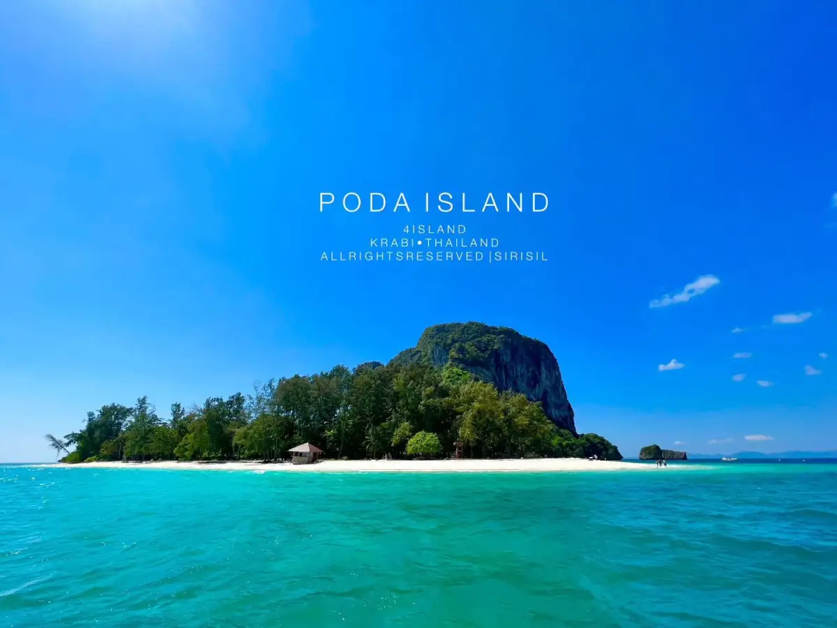
14. Ko Poda lies south of Ao Nang, approximately 8 kilometers from the mainland coast, and is one of the most popular island stops on Krabi’s Four Islands route. The island is known for its pale sandy beach, clear seawater, and the striking limestone rock rising from the sea in front of the shoreline, creating one of the most recognizable views associated with Krabi’s marine landscape.
The beach is suitable for relaxing, swimming, and enjoying the surrounding sea views. Snorkeling is possible around parts of the island when weather and water conditions are suitable. Water clarity changes according to season, wind, waves, and rainfall, so visitors should not expect exactly the same sea conditions on every trip.
Ko Poda lies within a national park management area, and landing on the island or participating in activities must follow official regulations. Particular attention should be given to keeping the beach clean and protecting coral areas. Visitors should use sunscreen responsibly and avoid touching marine life unnecessarily.
Most travelers visit Ko Poda as one stop within a multi-island itinerary rather than staying for the entire day. The order of islands may vary depending on tides, weather, and the boat operator. Choosing a responsible operator that follows national park rules and provides adequate safety equipment is therefore important.
Getting There: Depart from Ao Nang or Noppharat Thara Beach by long-tail boat or speedboat. Ko Poda is commonly included in the Four Islands route together with Thale Waek and Chicken Island.
Map (GPS): https://maps.app.goo.gl/ai4hNRS4WF7j12co9
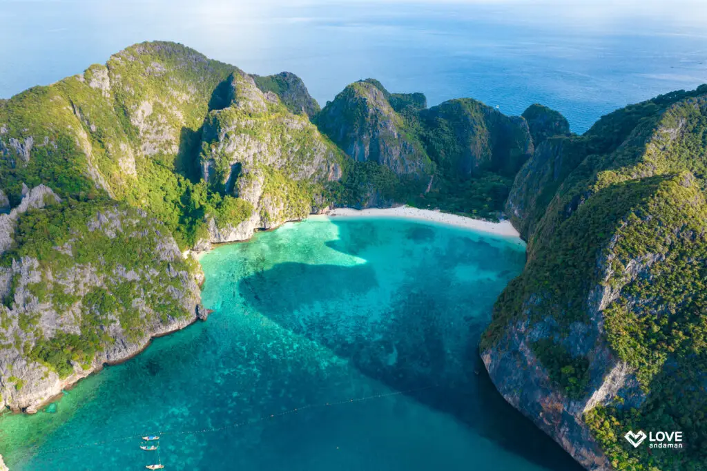
15. Maya Bay is located on Ko Phi Phi Le within Hat Noppharat Thara–Mu Ko Phi Phi National Park. It is a cove surrounded by high limestone cliffs, with pale sand and blue-green water that have made it one of the world’s most recognizable images of Krabi. The bay’s former popularity resulted in significant tourism pressure, eventually leading authorities to close the area temporarily for ecological restoration and introduce a new visitor-management system.
Today, access is more tightly controlled through designated entry routes, visitor limits, and restrictions on activities so that the environment can continue recovering. The bay functions as a nursery area for marine species, and blacktip reef sharks have been observed using the shallow waters. Visitors should therefore understand that restrictions are part of active conservation rather than simply inconveniences for tourism.
Maya Bay has an annual ecological-recovery closure period, generally from 1 August to 30 September, while tourism is allowed during the officially announced open season. Actual dates and operating measures should always be checked with the national park before traveling because they can change according to environmental conditions and management decisions.
Visitors should allow time to walk through the designated access route and enjoy the viewpoints rather than rushing only to take photographs. If swimming is prohibited, the rule should be followed strictly. Travelers must remain within permitted areas and avoid disturbing marine animals using the shallow coastal zone.
Getting There: Travel by authorized boat from Ko Phi Phi Don, Krabi, Ao Nang, or other approved speedboat services. Landing procedures and visiting times are controlled by the national park and may vary with sea conditions.
Map (GPS): https://maps.app.goo.gl/pRf1eXWZM9f1gSe37
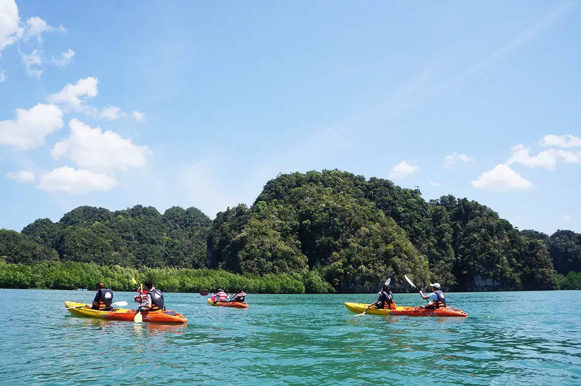
16. Ao Thalane is located at Ban Tha Len in Khao Thong Subdistrict, Mueang Krabi District, and is one of the most famous kayaking areas in the province. The main attraction is paddling through tidal channels, mangrove forest, and narrow passages between high limestone cliffs, allowing travelers to experience Krabi’s landscape in a very different way from traveling by speedboat across open sea.
The bay contains a rich mangrove ecosystem that provides food and habitat for crabs, fish, birds, and other coastal wildlife. Quiet kayaking allows visitors to observe nature more closely than traveling by motorized boat, but a respectful distance should always be maintained from wildlife, exposed mangrove roots, and fragile shallow-water areas.
Tides strongly influence which routes are accessible. Some channels can only be entered when the water level is suitable, while very low tide may make it difficult for kayaks to pass through certain sections. Visitors without kayaking experience should use a local guide or operator familiar with the tides and detailed route conditions.
Ao Thalane is suitable for travelers who enjoy moderate outdoor activities rather than highly strenuous adventure. Trips can range from short paddles to several-hour programs. Life jackets should be worn throughout the activity, and visitors should bring drinking water, a hat, and sun protection, especially on clear and hot days.
Getting There: From Krabi Town, travel to Khao Thong Subdistrict and Ban Tha Len, approximately 30–35 kilometers away. The drive generally takes around 40–50 minutes.
Map (GPS): https://maps.app.goo.gl/6NJvGQPdYuidiLJF7
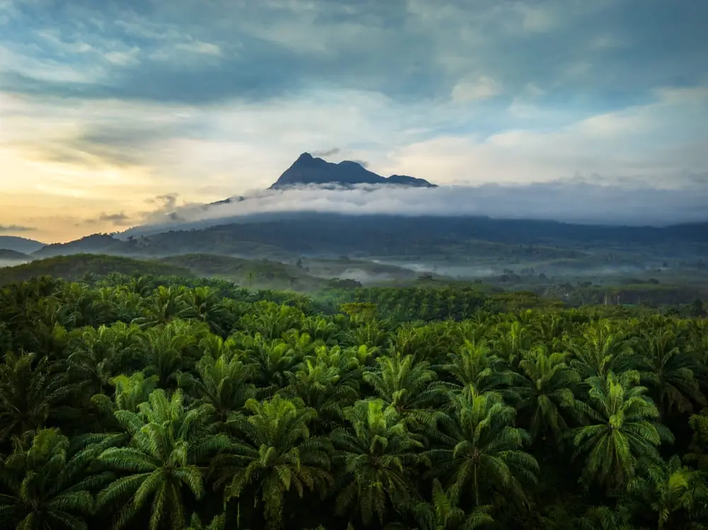
17. Khao Phanom Bencha National Park is one of Krabi’s most important inland national parks, covering parts of Mueang Krabi, Ao Luek, and Khao Phanom districts. The protected area includes tropical rainforest, high mountains, streams, waterfalls, caves, and nature trails. Khao Phanom Bencha, rising approximately 1,397 meters above sea level, is the highest mountain in Krabi Province.
The park forms an important watershed for several streams and helps maintain the ecological balance of inland Krabi. Its vegetation includes evergreen forest trees, ferns, orchids, and moisture-loving plants, while numerous wildlife and bird species depend on the forest as habitat. The park therefore has conservation importance extending far beyond its tourism value.
Huai To Waterfall is the park’s most accessible and popular attraction, while longer trekking routes and higher-elevation areas require more time and preparation. Travelers planning long-distance walks should contact park staff beforehand and should not enter remote forest routes without current information because mountain weather can change quickly.
The rainy season makes the forest especially green and increases waterfall volume, but it also creates slippery trails and raises the risk of sudden water surges. Visitors should monitor national park announcements during heavy rainfall. If staff temporarily close a route, the closure should be respected for safety.
Getting There: The main entrance and visitor-service area are around Thap Prik Subdistrict, Mueang Krabi District. The park is most conveniently reached from Krabi Town by private or rental car.
Map (GPS): https://maps.app.goo.gl/jodcfTexDQabDcAS9
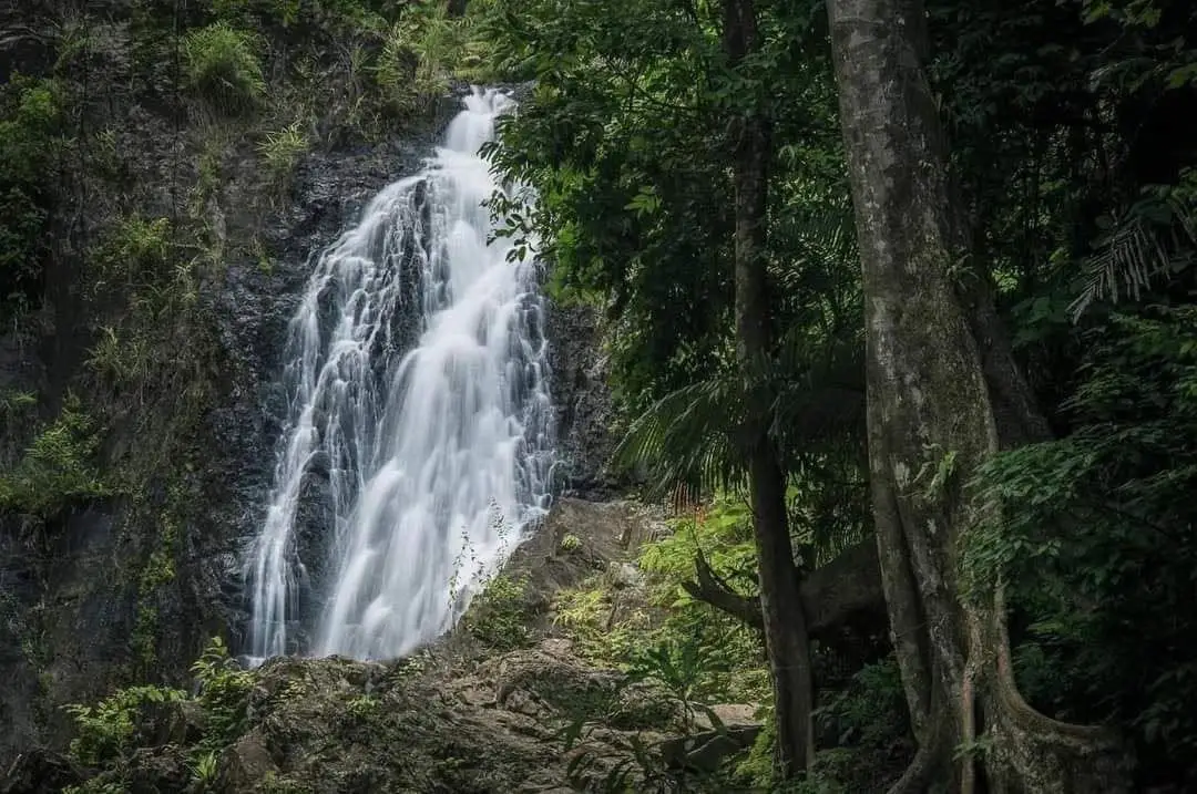
18. Huai To Waterfall is located inside Khao Phanom Bencha National Park in Thap Prik Subdistrict, Mueang Krabi District. It is a large waterfall formed by streams descending from the Khao Phanom Bencha mountain range, flowing over cliffs and boulders through multiple levels and creating a series of natural pools.
The waterfall has several named levels, including Wang Thewada, Wang Sam Hap, Wang Chong Loi, Wang Prong, and Wang Ton Phlio. Some levels can be reached relatively easily, while higher sections require more walking on natural trails and greater physical effort. Visitors should therefore select the route according to the time available and their own fitness.
The surrounding landscape is humid tropical rainforest with large trees, streams, and dense vegetation, making it suitable for nature walks and relaxation. During periods of heavy rain the waterfall becomes more powerful and visually impressive, but currents can also become much stronger. Swimming should therefore only take place in areas approved by park staff.
Visitors should not climb wet boulders or approach waterfall edges, particularly after rainfall. If the water suddenly changes color or rises rapidly, everyone should leave the stream immediately and move to higher ground according to staff instructions.
Getting There: Enter Khao Phanom Bencha National Park through the Thap Prik Subdistrict route. From the parking and visitor-service area, continue on foot along the designated trail to the waterfall.
Map (GPS): https://maps.app.goo.gl/SwZwSMMnZQG7S1qp8
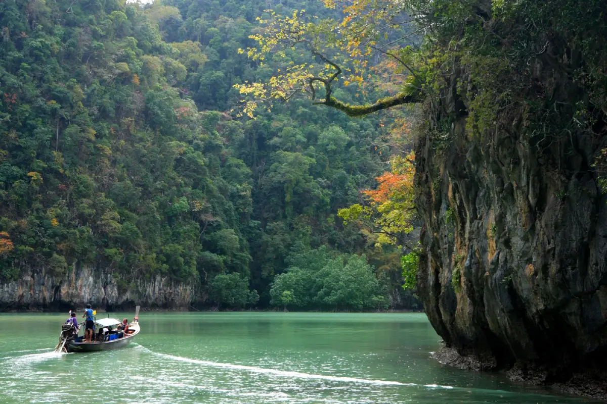
19. Than Bok Khorani National Park is located in Ao Luek District and protects both inland and marine environments. It is one of Krabi’s most diverse national parks because it combines limestone mountains, tropical rainforest, freshwater swamp forest, mangroves, streams, caves, prehistoric paintings, beaches, and Andaman islands within a single protected area.
The park headquarters area contains natural streams flowing through green limestone pools beneath large shade trees. The atmosphere is calm and suitable for walking and relaxation. This area is easier to reach than the caves and offshore islands that require boat access, making it a good starting point for travelers who want an introduction to the natural character of Ao Luek.
The national park also includes or connects with attractions such as Tham Lod–Phi Hua To Cave, Khao Karos, and the Hong Islands. Than Bok Khorani National Park is therefore one of the most varied tourism areas in Krabi, combining archaeology, kayaking, caves, mangrove forest, beaches, and offshore islands.
Travelers planning to explore several locations around Ao Luek should consider staying at least one night or beginning very early in the morning because some sites depend on boat schedules and tide levels. Trying to rush through too many locations in a single day can make it difficult to appreciate the natural and cultural significance of the area.
Getting There: From Krabi Town, follow Phetkasem Road toward Ao Luek District, then follow signs to Than Bok Khorani National Park headquarters.
Map (GPS): https://maps.app.goo.gl/6XEyme6irNbz2j2n8
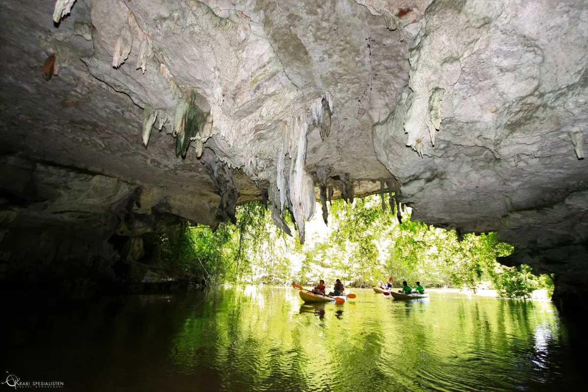
20. Tham Lod and Phi Hua To Cave are located around Ban Bo Tho in Ao Luek Tai Subdistrict, Ao Luek District. The area combines nature, geology, mangrove forest, and archaeology. Most visitors reach the caves by Hua Thong boat or kayak through brackish canals and mangrove forest, meaning that the travel experience begins well before entering the caves themselves.
Tham Lod is a natural tunnel cave through which water flows, allowing visitors to paddle beneath limestone walls and observe the shape of the karst formations when the tide is suitable. Phi Hua To Cave contains a large cavern and is especially known for ancient painted images on the cave walls that reflect the activities and beliefs of people who used the area in the past.
Shell deposits and other evidence inside the caves have also helped archaeologists study how people used this landscape in earlier periods. The surrounding geography suggests that past communities were closely connected with mangrove forests, the sea, and coastal resources rather than living separately from the natural system.
Visitors should never touch the ancient paintings, write on cave walls, or move objects within the site. Using a local guide provides much more historical and environmental context than simply walking through the caves, while also helping support income within the Ban Bo Tho community.
Getting There: Travel to Ban Bo Tho in Ao Luek District, then use a community boat or kayak service from the local pier. Access to the caves depends on tide levels and weather conditions.
Map (GPS): https://maps.app.goo.gl/ixyigneSminfvqiA6
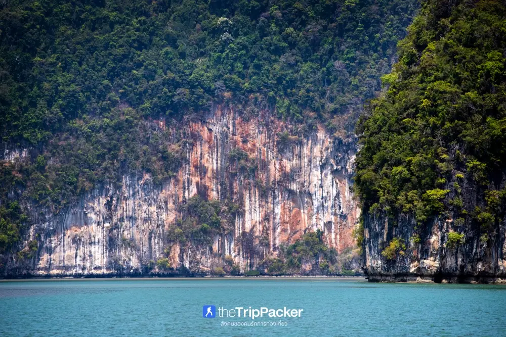
21. Khao Karos is located around Moo 5, Ban Khuan O, in Ao Luek District, Krabi Province. It is a distinctive natural attraction dominated by massive limestone formations that have been shaped by seawater, wind, and time into cliffs, hollows, caves, narrow passages, and hidden lagoon-like areas. Some sections of the weathered rock resemble human faces or unusual imaginary forms, giving Khao Karos an atmosphere very different from ordinary limestone mountains and making it one of Ao Luek’s most interesting nature routes.
Most visits to Khao Karos involve traveling by local long-tail boat or kayak along the coastline and through waterways between the limestone mountains. The route passes mangrove forest, steep limestone walls, and shallow-water areas that change according to the tide. Some caves, passages, and inner lagoons can only be entered when the water level is suitable, so travelers should use local boat operators or community guides who understand the tides and routes well.
Khao Karos also has archaeological and cultural value. Several limestone areas around Ao Luek contain evidence of human use in the past, including caves, natural shelters, and ancient rock paintings. A visit is therefore more than a scenic boat journey; it provides an opportunity to understand the long relationship between people, mangrove ecosystems, and the limestone coastal landscape.
Morning or cooler periods of the day are especially suitable for visiting, particularly for travelers planning to kayak. Life jackets should be worn throughout water activities, and visitors should not climb cliffs, enter restricted caves, or leave rubbish in the mangrove ecosystem. Khao Karos can be combined with Tham Lod–Phi Hua To Cave and Than Bok Khorani National Park as part of a 1–2 day Ao Luek itinerary.
Getting There: From Krabi Town, travel toward Ao Luek District and continue to the Ban Khuan O area. From the community pier, continue by local long-tail boat or kayak. The actual route depends on tide levels and weather conditions on the day of travel.
Map (GPS): https://maps.app.goo.gl/bDWLEpyqGW6d5cTD8
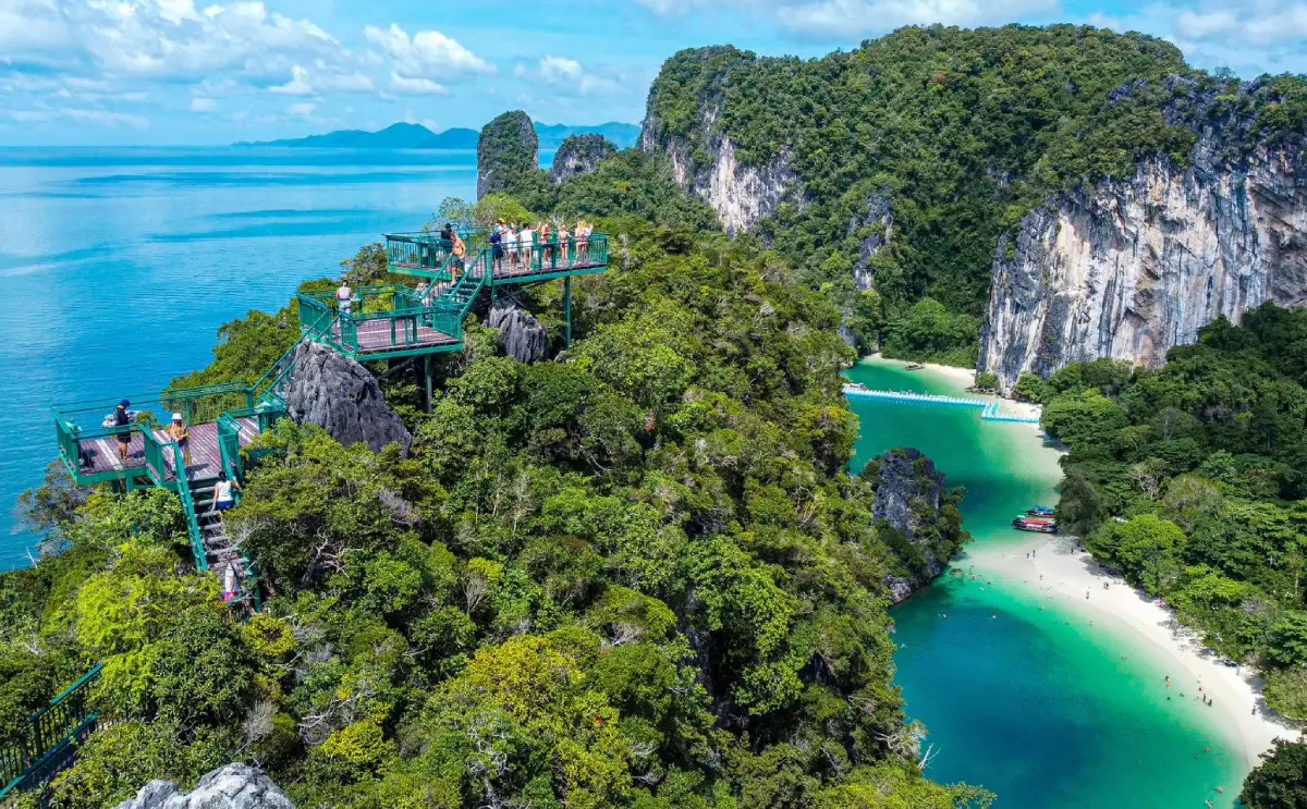
22. Hong Islands are a group of islands within Than Bok Khorani National Park and one of the most important marine-tourism routes in northern Krabi. The principal island is known for its pale sandy beach, emerald-green sea, high limestone cliffs, and a natural lagoon enclosed by mountains, creating a large chamber-like landscape that explains the name “Hong,” meaning “room.”
The main beach is suitable for relaxing, swimming, and snorkeling when the sea is calm. The inner lagoon is reached by boat through a narrow opening between limestone cliffs. Its appearance changes according to tide level and sunlight, and at certain times the water becomes especially clear and green while the surrounding limestone walls are reflected across the surface.
Another major attraction is the island’s viewpoint trail, which leads to a panoramic view across the surrounding islands and the Andaman Sea. The climb involves a considerable number of steps, so visitors should consider their physical condition and the weather before starting. Morning is usually more comfortable because temperatures are lower than around midday.
The Hong Islands are part of a national park, so visitors must follow regulations concerning landing, waste management, coral protection, and marine activities. The best travel conditions generally occur during periods of calmer seas, but national park announcements and boat schedules should always be checked before departure.
Getting There: Travel by long-tail boat or speedboat from Ao Nang, Noppharat Thara Beach, Klong Muang, or nearby piers in the Nong Thale area. Day-trip programs commonly include Hong Lagoon and nearby snorkeling or island stops.
Map (GPS): https://maps.app.goo.gl/nw8cVXc6isJDLM9H9
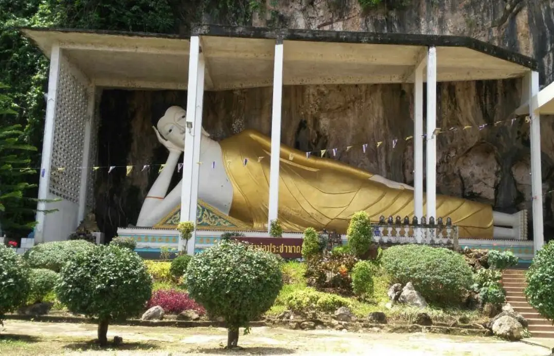
23. Wat Sai Thai is located in Moo 4, Ban Sai Thai, Sai Thai Subdistrict, Mueang Krabi District. It is an established community temple and an important religious stop on the route between Krabi Town and Ao Nang. Its most immediately recognizable feature is the large reclining Buddha image positioned at the base of a limestone mountain, creating a landscape in which Buddhist faith and Krabi’s natural karst scenery are closely integrated.
The reclining Buddha is an important focus of devotion for visitors and local residents. The temple grounds also contain open courtyards, religious halls, caves, and foothill areas. Together, these features illustrate a pattern often found in Southern Thailand, where Buddhist temples are established close to limestone hills and use the surrounding natural landscape as part of the religious environment.
Wat Sai Thai is particularly convenient as a stop between Krabi Town and Ao Nang because it does not require a major detour. Around 30–60 minutes is generally sufficient for paying respects, viewing the reclining Buddha, and walking around the temple before continuing to Ao Nang, Susan Hoi, or Ao Nam Mao.
Visitors should dress respectfully, avoid loud behavior around active religious areas, and never climb on Buddha images or temple structures. The temple generally welcomes visitors during daytime hours, but if a Buddhist ceremony or community event is taking place, religious use of the space should take priority over sightseeing.
Getting There: Wat Sai Thai is located along Route 4034 in Sai Thai Subdistrict between Krabi Town and Ao Nang. It can be reached easily by private car, rental vehicle, or hired local transport.
Map (GPS): https://maps.app.goo.gl/vU91ABahBCNSPcfw5
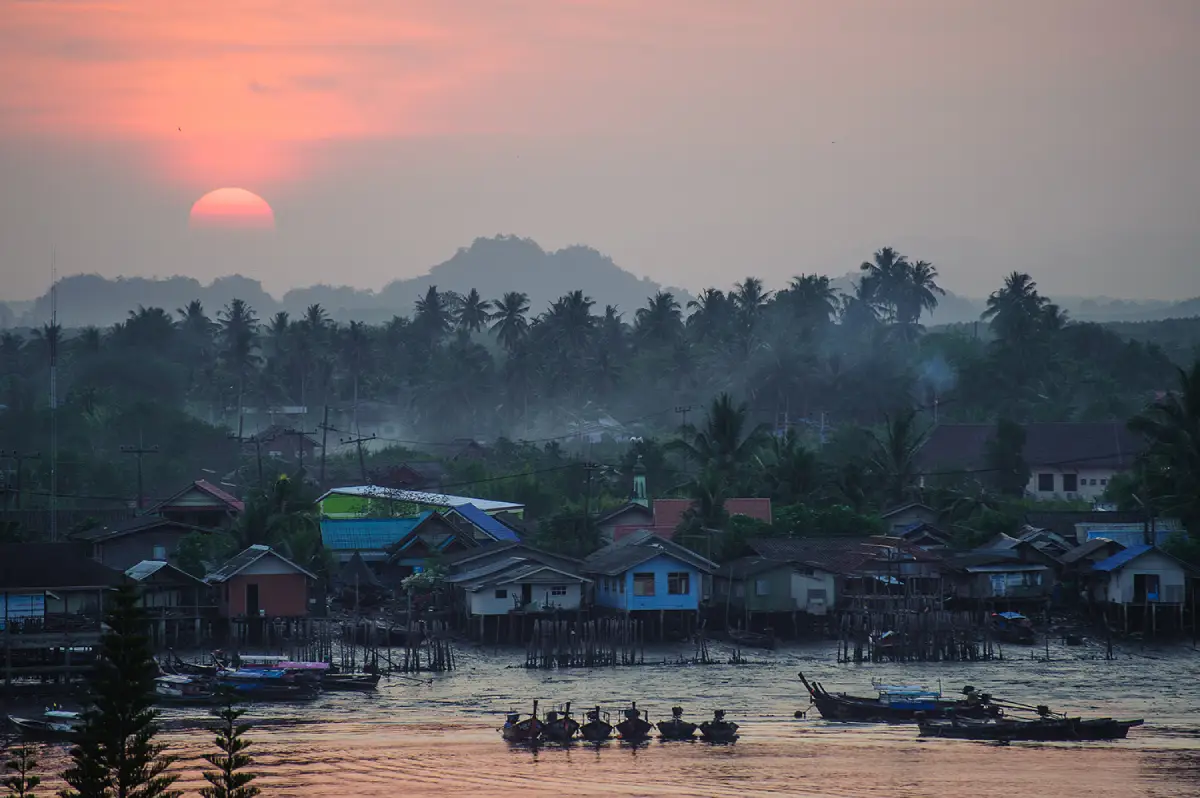
24. Ban Ko Klang Community is located in Khlong Prasong Subdistrict, Mueang Krabi District. It is a Muslim community situated on an island in the Krabi River only a short distance from the town center, yet its atmosphere is noticeably different from Krabi’s main tourism districts. The community is surrounded by the river, mangrove forest, and agricultural land, reflecting a way of life closely connected with water, fishing, and farming.
The main appeal of Ban Ko Klang is community-based tourism that focuses on learning from everyday local life. Activities may include observing rice cultivation, traditional fishing, fish farming, handicrafts, and halal food preparation. Some community programs also allow travelers to explore the village by bicycle or local sidecar vehicle, visit occupational groups, and share meals prepared by local residents.
Ko Klang offers an opportunity to experience another side of Krabi beyond resorts and beaches. From different parts of the island, visitors can view Khao Khanap Nam from the opposite side of the river, observe mangrove environments, and understand how communities along the Krabi River contribute to the city’s food system, fishing economy, and local culture.
Because Ban Ko Klang is a living Muslim community, visitors should dress and behave appropriately, avoid alcohol where the community does not permit it, and ask permission before taking close photographs of residents or entering working areas. Travelers wishing to participate in a complete community-tourism program should arrange their visit in advance.
Getting There: From Krabi Town, travel to a riverside pier and take a short boat ride across to Ko Klang. Once on the island, visitors can continue by local transport, bicycle, motorcycle, or on foot depending on the activity.
Map (GPS): https://maps.app.goo.gl/tvCXkkt5jA3Gkdxh9
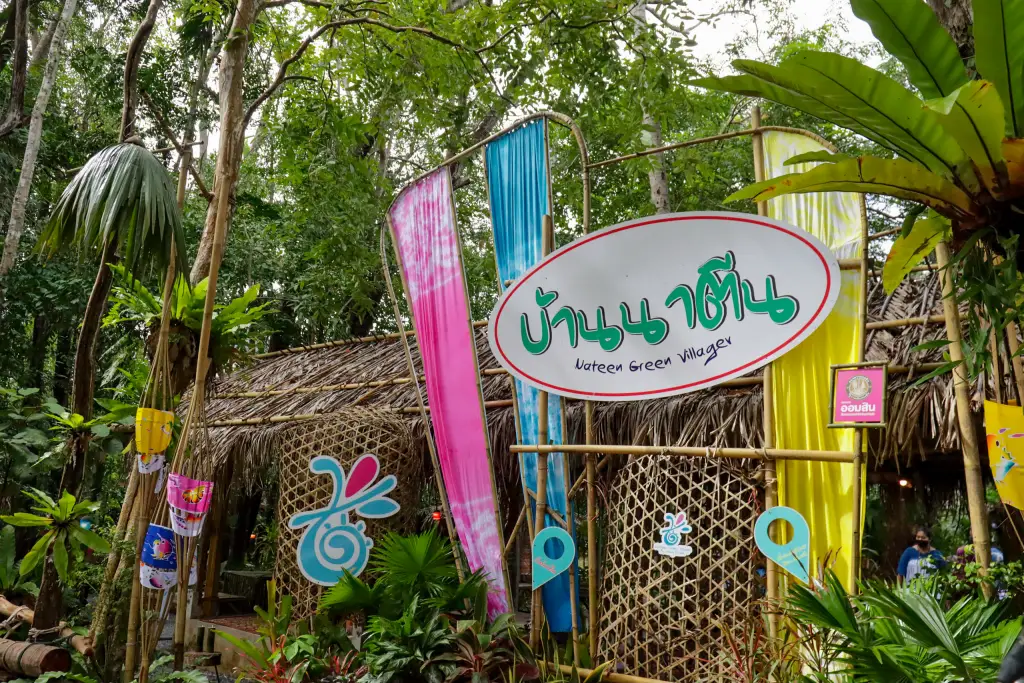
25. Ban Na Teen Village is located in Moo 4, Ao Nang Subdistrict, Mueang Krabi District. It is a Muslim community situated close to Krabi’s major tourism zone but still retains its local lifestyle, handicrafts, and community-based tourism structure. Ban Na Teen therefore offers a valuable alternative for travelers who want a break from the beach atmosphere and wish to understand local life in greater depth.
The community is particularly known for handicrafts made from local materials, including coconut-shell products, basketry, and household items developed from traditional knowledge. Other community activities include local food, cultural learning connected with Muslim life, agriculture, rubber farming, and traditional coastal livelihoods.
Tourism in Ban Na Teen emphasizes distributing income among local residents rather than developing a large conventional tourist attraction. Visitors may learn from occupational groups, stay in a homestay, or participate in organized community activities. This makes the village especially suitable for travelers interested in responsible tourism and experiences based on direct interaction with the people who live in the area.
The village is very close to Ao Nang and can therefore be visited as a half-day activity combined with Ao Nang or Noppharat Thara Beach. However, travelers interested in specific handicraft demonstrations, homestays, or organized activities should contact the community in advance because not every activity operates continuously throughout the day.
Getting There: From Ao Nang, travel into Moo 4, Ban Na Teen, Ao Nang Subdistrict by car or motorcycle. The village is only a short drive from the main beach tourism area.
Map (GPS): https://maps.app.goo.gl/1ukxPeiGDFCGGSX88
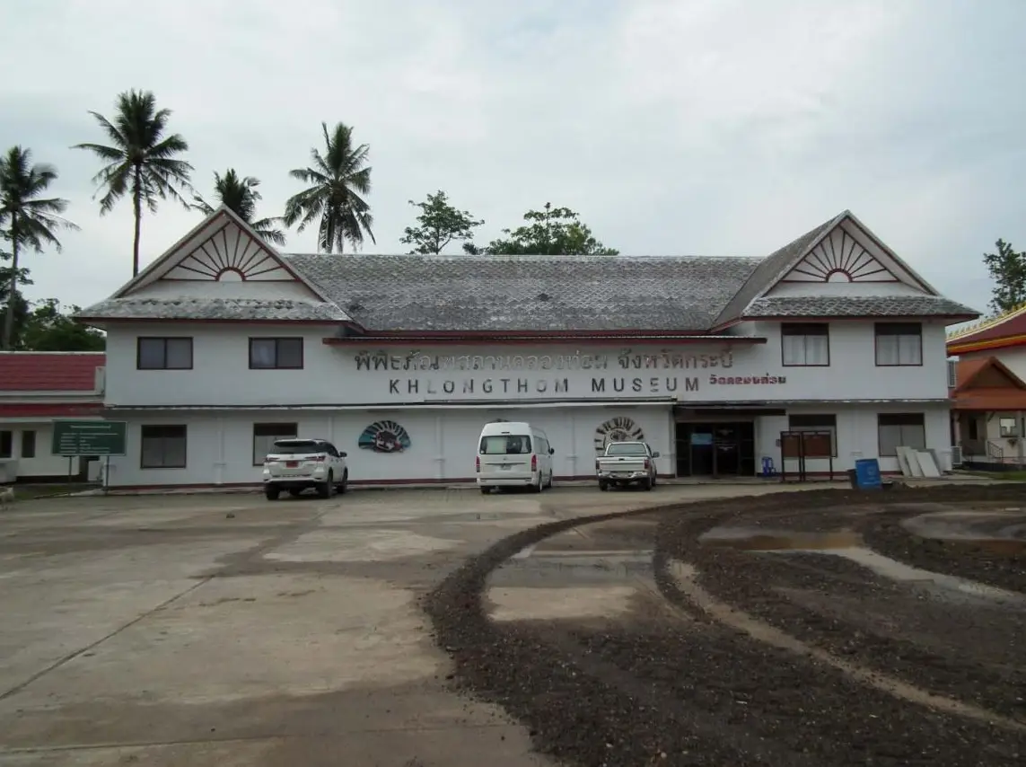
26. Wat Khlong Thom Museum is located inside Wat Khlong Thom in Khlong Thom Tai Subdistrict, Khlong Thom District. It is one of Krabi’s most important archaeological learning centers and preserves artifacts and evidence from the Khlong Thom area, which once played a significant role in historical maritime trade and travel networks.
The museum is especially famous for its collection of ancient beads, including glass beads, stone beads, and other objects discovered at archaeological sites around Khlong Thom. The variety of raw materials, colors, forms, and production techniques indicates that this was not an isolated settlement but a place connected with people, goods, and trade networks extending across different regions.
In addition to beads, the museum contains pottery, tools, ornaments, and other objects that help explain how people lived in the area. Visiting the museum before or after Emerald Pool and Namtok Ron Khlong Thom gives a Khlong Thom itinerary an important historical dimension rather than limiting the journey to natural attractions alone.
The museum is open from Thursday to Tuesday and closes every Wednesday according to current published information. Visitors should allow at least around one hour to read the displays and examine the collections. Objects inside display cases should not be touched or moved.
Getting There: Travel to Wat Khlong Thom in Khlong Thom Tai Subdistrict from Phetkasem Road. The museum can be combined conveniently with Emerald Pool and Namtok Ron Khlong Thom on the same day.
Map (GPS): https://maps.app.goo.gl/EtZaAVzgJ66rmrKY6
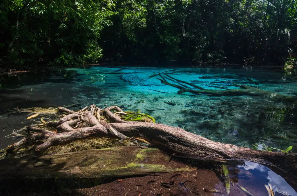
27. Khao Pra–Bang Khram Wildlife Sanctuary is located around Khlong Thom Nuea Subdistrict, Khlong Thom District. It protects one of Southern Thailand’s important lowland rainforest ecosystems and contains exceptionally high biological diversity. Emerald Pool and Blue Pool are located within this conservation area, but the value of Khao Pra–Bang Khram extends far beyond its swimming attractions because the forest supports numerous plant, animal, and rare bird species.
Lowland rainforest once covered much larger areas of Southern Thailand but has declined substantially because of land-use change. Khao Pra–Bang Khram is therefore particularly important for conservation and nature study. It is also closely associated with the history of research into Gurney’s pitta, one of Thailand’s rarest birds, making the sanctuary especially significant for birdwatchers and conservationists.
Visitors can use nature trails around Emerald Pool and the surrounding forest to observe vegetation, streams, and natural spring systems. Walking quietly and remaining on designated paths reduces disturbance to wildlife and also increases the chance of seeing birds and other forest species.
The sanctuary operates under specific visiting hours and regulations that differ from those of ordinary beach attractions because it is a wildlife sanctuary. Visitors should follow staff instructions, avoid excessive noise, never collect plants or animals, and stay out of any areas temporarily closed for conservation.
Getting There: From Krabi Town, take Highway 4 toward Khlong Thom District, then turn toward Khlong Thom Nuea Subdistrict and Ban Bang Tiao along the same general route used to reach Emerald Pool.
Map (GPS): https://maps.app.goo.gl/LPMLJoi1xm5kqoG2A
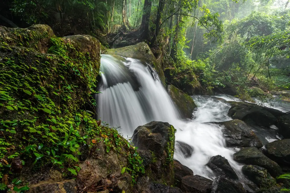
28. Hin Phoeng Waterfall is located in Moo 8, Ban Hin Phoeng, Khlong Phon Subdistrict, Khlong Thom District. It is a waterfall in a forested watershed area with a noticeably quieter atmosphere than Emerald Pool and Namtok Ron Khlong Thom. Its main characteristics are streams flowing across cliffs and large boulders in several stages, surrounded by shaded tropical forest.
The waterfall is suitable for travelers who prefer a less crowded nature experience. Visitors can walk through the forest, take photographs, and rest beside the stream. Water volume changes considerably by season. During wetter periods the waterfall carries more water and the forest becomes greener, but trails and boulders also become much more slippery.
Some sections require walking through natural terrain, so shoes with good grip are recommended and slippery sandals should be avoided. If there has been prolonged heavy rainfall in the upstream area, visitors should avoid entering the water because stream levels can change rapidly.
Hin Phoeng Waterfall helps spread tourism beyond Khlong Thom’s most famous attractions and is suitable for travelers interested in seeing more of inland Krabi. It can be combined with Wat Khlong Thom Museum or other destinations around Khlong Phon.
Getting There: From Khlong Thom District, travel toward Khlong Phon Subdistrict and Ban Hin Phoeng. The waterfall is approximately 25 kilometers from the district center, and a private car is the most practical means of transportation.
Map (GPS): https://maps.app.goo.gl/84ByhJpx8EahgK198
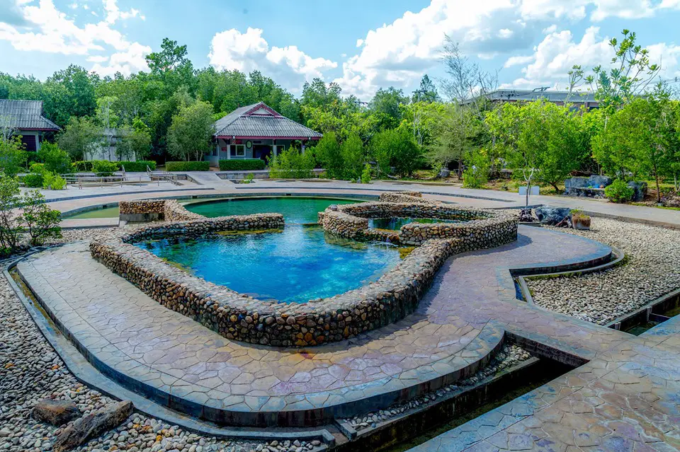
29. Krabi Hot Springs, also known as Bang Phueng Hot Springs, are located at Ban Bang Phueng in Khok Yang Subdistrict, Nuea Khlong District. This is another natural hot-spring destination in Krabi, but it differs from Namtok Ron Khlong Thom because the site is primarily arranged around hot-water pools for soaking and relaxation rather than a naturally cascading hot stream.
One advantage is its location close to Phetkasem Road, making it convenient as a stop while traveling from Krabi Town toward Khlong Thom or farther south toward Trang Province. Travelers who do not want to spend half a day at a larger hot-spring attraction can stop here for a shorter rest and soak.
Visitors should follow the same health precautions used at other hot springs: enter the water gradually, avoid soaking continuously for too long, and drink enough water. People with chronic health conditions should consider whether hot-water bathing is appropriate for them, while children should always remain under adult supervision.
Bang Phueng Hot Springs also reveal another side of Nuea Khlong District. Many travelers know the district mainly because of Krabi International Airport and as a transit route to Ko Lanta, but the area also contains natural attractions, communities, and educational sites related to local resources.
Getting There: The hot springs are located at Ban Bang Phueng, Khok Yang Subdistrict, Nuea Khlong District, near Highway 4. They are easily accessible by private car or rental vehicle.
Map (GPS): https://maps.app.goo.gl/LALizDFn7ZjQmRAH9

30. Krabi Lignite Mine and Fossil Museum are located within the Krabi Power Plant area in Khlong Khanan Subdistrict, Nuea Khlong District. This educational attraction reveals a very different side of Krabi from the province’s familiar beaches and islands. The area is closely connected with Krabi’s former lignite-mining activities and the history of energy production.
Excavation of the lignite layers led to the discovery of numerous fossils, allowing researchers to study ancient organisms and past environments in the Krabi Basin before the modern landscape developed. The site is therefore important not only for industrial history but also for geology and paleontology.
The exhibition includes information about lignite, mining, electricity generation, and fossil specimens discovered in the area. It is particularly suitable for students, families, fossil enthusiasts, and visitors who want to understand Krabi’s natural development over millions of years rather than focusing only on human history or coastal tourism.
Because the attraction is located within an energy-sector facility, its visiting schedule differs from ordinary natural attractions. Current published information indicates that it is open on weekdays during daytime hours. Travelers visiting specifically for the museum, particularly schools or organized groups, should confirm opening conditions and visitor procedures before arrival.
Getting There: Travel to the Krabi Power Plant area in Khlong Khanan Subdistrict, Nuea Khlong District, from Phetkasem Road and follow signs into the facility. Organized groups should contact the site in advance before visiting.
Map (GPS): https://maps.app.goo.gl/Tze2j5bdcoowqGkn9
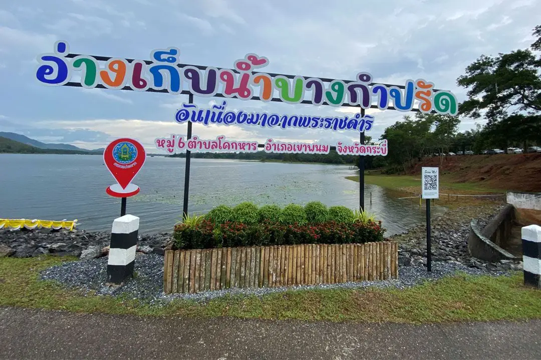
31. Bang Kamprad Reservoir is located in Moo 6, Khok Han Subdistrict, Khao Phanom District, Krabi Province. It is an important water resource for inland Krabi and forms part of a royal-initiative development project supporting water storage, agriculture, and the reduction of water shortages affecting local communities. The surrounding landscape consists of mountains, forest, and agricultural land, creating an atmosphere very different from Krabi’s well-known coastal attractions.
The reservoir is medium-sized, with a storage capacity of approximately 16 million cubic meters. Its earth dam is around 608 meters long and approximately 23 meters high. In addition to its irrigation function, the broad body of water framed by mountain scenery has made the reservoir a quiet recreational area for local residents. It is suitable for sightseeing, photography, and travelers looking for a peaceful landscape away from heavily visited tourist areas.
Morning and late afternoon are generally the most pleasant times to visit because temperatures are cooler and the light across the water is softer than during midday. On clear days, visitors can see surrounding mountain ridges and agricultural landscapes particularly well. The site is therefore suitable for travelers who enjoy quiet places, countryside road trips, and photography of inland Krabi.
Because the reservoir’s primary purpose is water management, visitors should remain within areas open to the public. Swimming or water activities should not be attempted in zones where they are not specifically permitted, and visitors should never enter operational irrigation areas or water-control structures without authorization. Respecting the reservoir’s functional role helps maintain both visitor safety and normal community use.
Getting There: From Khao Phanom District, travel into Khok Han Subdistrict and continue to Moo 6 using local roads. A private vehicle is the most practical option because public transportation into the area is limited.
Map (GPS): https://maps.app.goo.gl/QoicSkRhR4UgYBN86
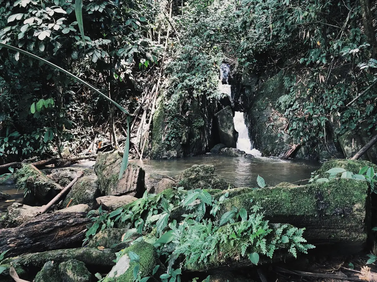
32. Bang Thao Mae Waterfall is located at Ban Bang Thao Mae, Moo 1, Khao To Subdistrict, Plai Phraya District, Krabi Province. It is a community waterfall surrounded by forest and mountains in northern Krabi, making it suitable for travelers who want to leave the province’s main tourism routes and experience nature in a quieter environment than the better-known waterfalls and attractions closer to Krabi Town.
The area consists of streams, cascades, boulders, and natural vegetation. It is used as a recreational place by local residents and demonstrates that Plai Phraya District is not defined only by rubber plantations, oil-palm plantations, and agricultural land. Forest and natural waterways also play an important role in the district’s ecology and in the everyday lives of people living nearby.
The amount of water changes significantly with the season. During periods of continuous rain, the waterfall becomes fuller and the forest especially green, but rocks and walking routes also become much more slippery. Visitors should avoid strong currents and pools of unknown depth, and should not visit during periods of heavy rain in the upstream area.
Bang Thao Mae Waterfall is particularly suitable for travelers who enjoy locally known nature sites and do not require the extensive facilities found at major tourist attractions. Visitors should prepare drinking water, snacks, and necessary personal equipment before entering the area, and all rubbish should be taken away after the visit.
Getting There: From Plai Phraya District, travel toward Khao To Subdistrict and continue along local roads to Ban Bang Thao Mae, Moo 1. A private car or motorcycle is the most convenient way to reach the area.
Map (GPS): https://maps.app.goo.gl/UFELpSbvVFFp2Uqi9
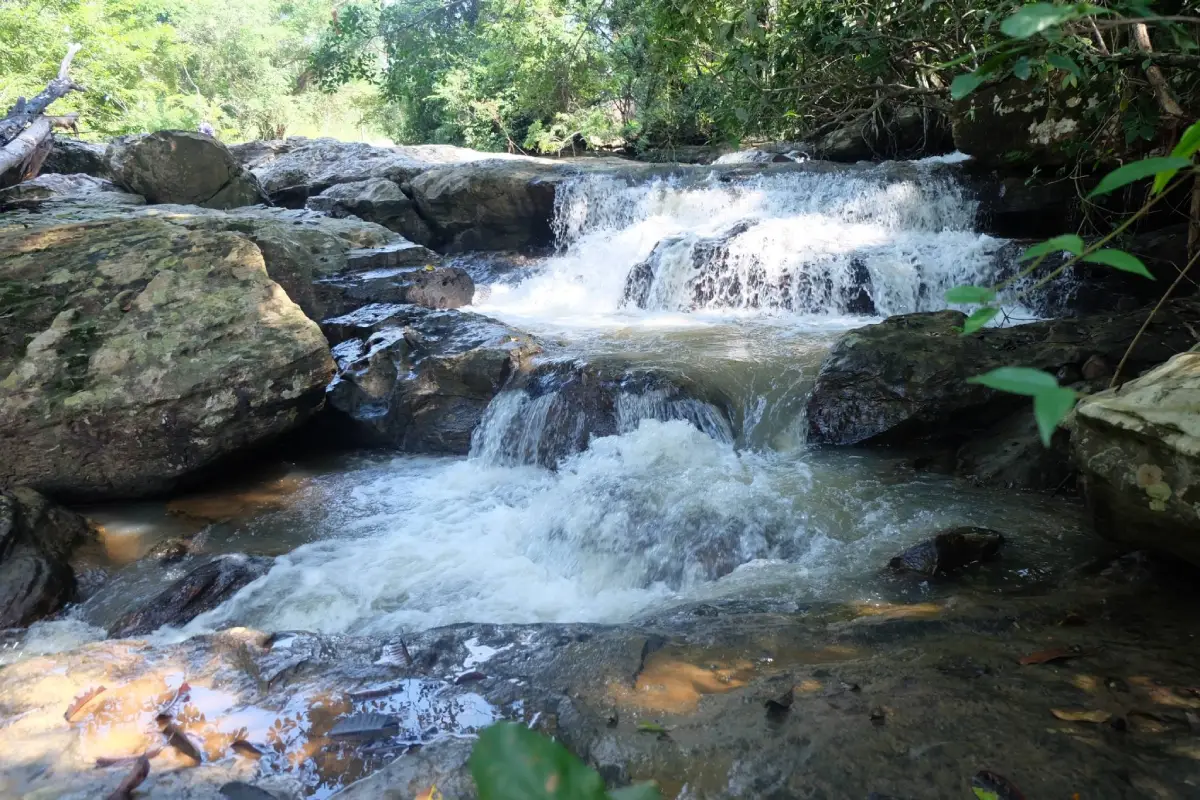
33. Thung Sai Thong Waterfall is located in Thung Sai Thong Subdistrict, Lam Thap District, Krabi Province. It is a natural attraction in the forested interior of Krabi and lies within the wider Khao Pra–Bang Khram Wildlife Sanctuary area. Its defining landscape includes streams flowing through forest and over rocks in an environment that retains a considerably more natural character than Krabi’s heavily visited coastal tourism zones.
The waterfall and surrounding forest are suitable for nature walks, observing vegetation, photography, and learning about watershed ecosystems. Travelers who primarily associate Krabi with beaches and islands can discover a very different side of the province here, one connected with the Khao Pra–Bang Khram forest complex, which is particularly important for biodiversity in Southern Thailand.
The rainy season brings fuller streams and especially lush vegetation, but it also increases the risks of slippery trails, sudden water surges, and stronger currents. Weather conditions should therefore be checked before visiting, and travelers should avoid entering the water if the water level appears abnormal. Because the area is connected with a conservation zone, visitors must follow official regulations and remain on permitted routes.
Thung Sai Thong Waterfall is particularly suitable for travelers who want to explore attractions across all of Krabi’s districts and who are interested in conservation-based travel rather than only popular photo stops. Allowing sufficient time rather than rushing the journey also provides a better opportunity to experience Lam Thap District, whose geography and local way of life differ considerably from the coastal areas.
Getting There: Travel to Lam Thap District, continue into Thung Sai Thong Subdistrict, and use local roads toward the waterfall area. Before departure, visitors should check current road conditions and whether the area is open with the relevant local or conservation authorities.
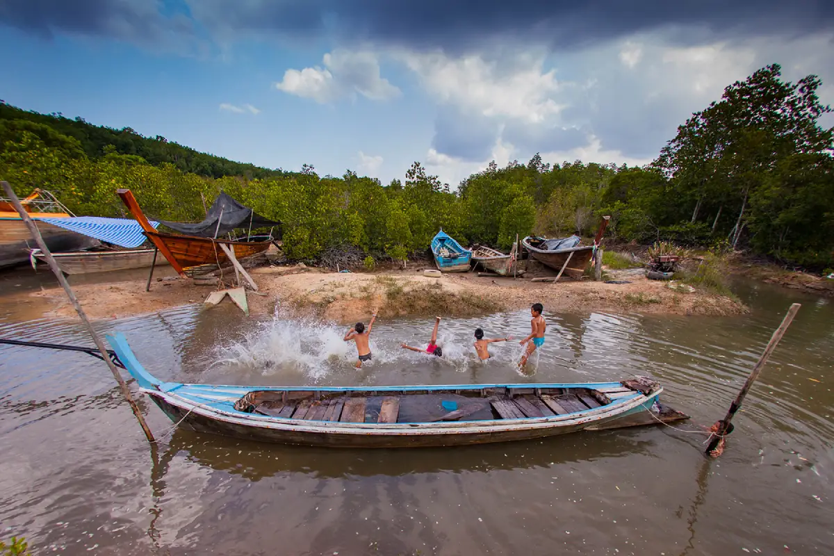
34. Ban Thung Yee Pheng is located on the eastern side of Ko Lanta Yai in Sala Dan Subdistrict, Ko Lanta District. It is a community-based ecotourism destination where mangrove forest is one of the most important natural resources. Community life is closely connected with the sea, traditional fishing, and responsible use of the coastal ecosystem.
Popular activities include long-tail boat trips through mangrove forest and kayaking along natural canals. Visitors can see exposed mangrove roots, tidal waterways, and areas that serve as nursery habitat for aquatic animals. The community has developed tourism in ways intended to distribute income locally through boat services, traditional meals, and educational activities related to natural resources.
One of the most popular experiences is an early-morning boat trip that allows visitors to enjoy the atmosphere before sunrise and, depending on the community program, have breakfast during the excursion. Evening trips are also available for viewing sunset light, while kayaking can be arranged during the daytime according to tide levels and weather conditions.
Visitors should contact the community in advance because many activities operate according to scheduled departures and participant numbers. Travelers should not enter community-managed areas or mangrove routes without informing local operators. Plastic use should be minimized, life jackets should be worn during boat activities, and wildlife should never be fed.
Getting There: From Sala Dan on Ko Lanta Yai, travel along the island’s main road toward the eastern side, then turn toward Ban Thung Yee Pheng. Community activities should ideally be arranged before arrival.
Map (GPS): https://maps.app.goo.gl/uR2KoTAW9oxZkDAs5
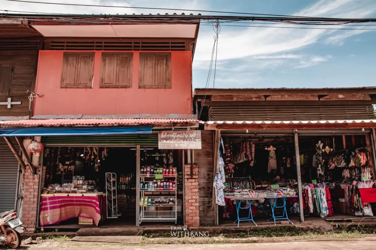
35. Ban Si Raya is located in Moo 2, Ko Lanta Yai Subdistrict, Ko Lanta District. It is a long-established community on the island’s eastern coast and one of the best places to understand the trading and maritime history of Ko Lanta. Before the western coast developed into a major resort and tourism area, Ban Si Raya served as an important community center and exchange point for people from several cultural backgrounds.
Many old buildings remain aligned along the waterfront. Some are traditional wooden houses and former shophouses that have been adapted into restaurants, cafés, accommodation, or local shops while still preserving the general structure and character of the historic community. The atmosphere is therefore very different from the beaches of western Ko Lanta and is especially suited to slow walking and observing old houses, piers, and everyday waterfront life.
The community reflects the coexistence of several cultural groups that came to trade, travel, and settle on Ko Lanta, including Thai, Chinese, Muslim, and sea-people communities. This history has created diversity in food, language, beliefs, and architecture. Travelers interested in Ko Lanta’s history should visit Ban Si Raya before continuing toward Ban Sangka U or other destinations in the southern part of the island.
Ban Si Raya remains a living residential community rather than an open-air museum. Visitors should respect private homes, avoid blocking entrances while taking photographs, keep noise to a reasonable level, and ask permission before photographing people closely. Late morning through early evening is a particularly suitable period for walking through the old town, visiting shops, and dining by the sea.
Getting There: From Sala Dan, drive south along the eastern road of Ko Lanta Yai until reaching the Si Raya or Lanta Old Town area. Both cars and motorcycles can travel the route conveniently.
Map (GPS): https://maps.app.goo.gl/yZkDFJZre2VX8TV78
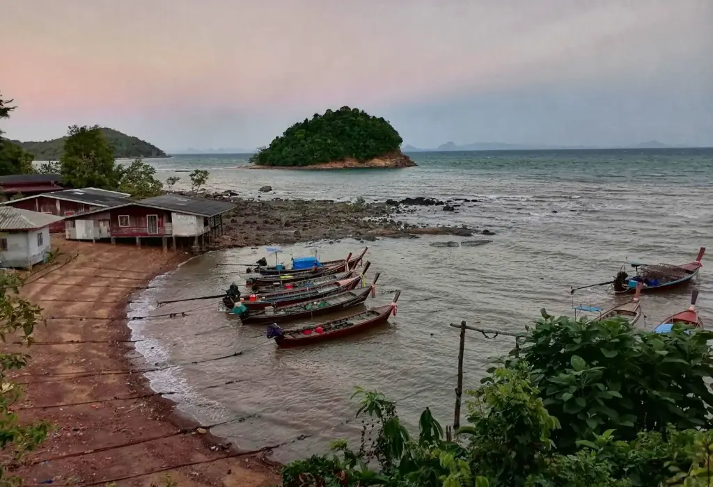
36. Ban Sangka U is located in Moo 7, Ko Lanta Yai Subdistrict, Ko Lanta District. It is an Urak Lawoi sea-people community that continues to maintain a way of life, belief system, and culture deeply connected with the sea. The village lies on the eastern side toward the southern part of Ko Lanta Yai, with houses extending along the shoreline and traditional fishing continuing to form an important part of daily life.
The Urak Lawoi have a distinct history and cultural identity that differs from other communities on Ko Lanta, including their language, beliefs, rituals, and body of knowledge relating to the sea. One of the most important traditions is the Loi Ruea, or Sea Gypsy Boat Floating Ceremony, which is associated with removing misfortune, honoring ancestors, and seeking protection and auspiciousness for the community.
The Boat Floating Ceremony remains a living cultural tradition with genuine meaning for the community. Travelers who happen to visit during the ceremony should behave as guests rather than spectators. They should not obstruct ritual areas, touch ceremonial objects without permission, or photograph important moments without asking local participants first.
On ordinary days, Ban Sangka U is suitable for learning about traditional fishing, coastal houses, and the history of the Urak Lawoi. Tourism should respect private property because this is a working residential village rather than a staged attraction. Contacting community members or a local coordinator before visiting can help travelers receive more accurate information and reduce unnecessary disturbance to residents.
Getting There: From Ban Si Raya, continue south along the eastern road of Ko Lanta Yai to Ban Sangka U. A private or rental vehicle is the most convenient option, and daytime travel is recommended.
Map (GPS): https://maps.app.goo.gl/xPENd5K9R4HT8DLQ9
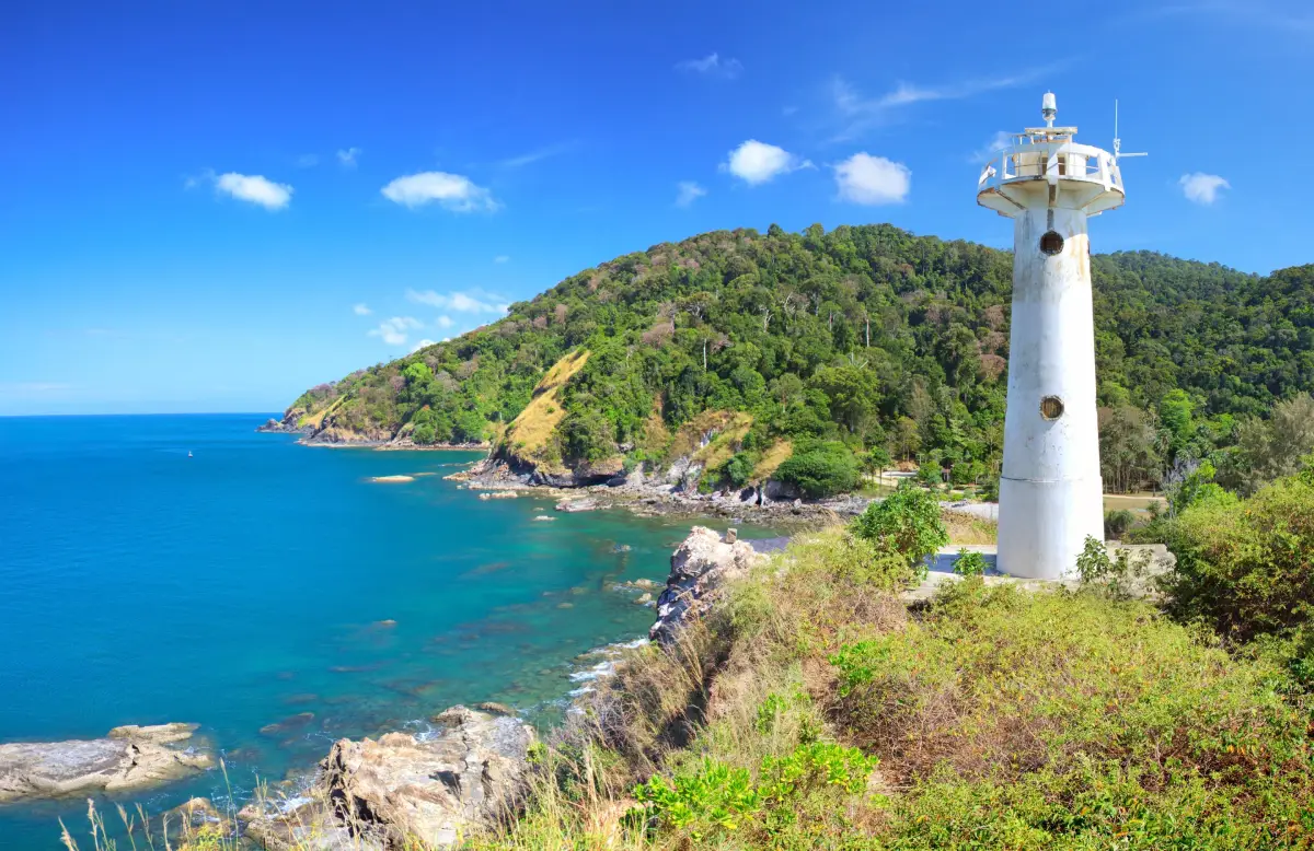
37. Mu Ko Lanta National Park protects both terrestrial and marine environments within Ko Lanta District. The national park headquarters are located at Laem Tanod at the southern end of Ko Lanta Yai. The protected area includes island forest, beaches, cliffs, coral reefs, and important offshore island groups such as Mu Ko Rok and Mu Ko Haa.
Laem Tanod is one of the places visitors should include when exploring Ko Lanta Yai because it brings together a beach, nature trail, rocky coastline, headland scenery, and the lighthouse that has become a landmark of the area. From elevated sections near the headland, visitors can enjoy broad views across the coastline and Andaman Sea, especially during clear weather.
The marine areas of the national park contain some of Krabi’s important snorkeling and diving destinations. Ko Rok and Ko Haa are especially popular for clear water, coral reefs, and marine life. However, many offshore sites close seasonally during the monsoon period for visitor safety and ecological recovery, so current national park announcements should always be checked before booking a boat trip.
Visitors must follow national park rules carefully. Coral, shells, and other natural materials must not be removed, wildlife should never be fed, and travelers should remain on designated routes. Monkeys are present around parts of Laem Tanod, so food should be kept securely stored and never offered directly to the animals.
Getting There: From Sala Dan, drive south through Ko Lanta Yai to Laem Tanod and the national park headquarters. Some sections of the road contain curves and steep gradients, so careful driving is recommended.
Map (GPS): https://maps.app.goo.gl/hVjnKEjgtBcHU6aJ7
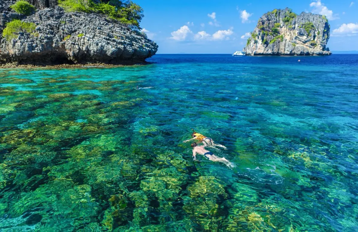
38. Ko Rok Nai is one of the two principal islands of Mu Ko Rok within Mu Ko Lanta National Park. It is known for white sandy beaches, exceptionally clear seawater, and coral reefs that make the area one of southern Krabi’s popular snorkeling destinations. Ko Rok Nai lies close to Ko Rok Nok, with a narrow channel separating the two islands.
During periods of calm weather, underwater visibility can be very good, making the area suitable for snorkeling and observing schools of fish as well as coral in zones open for marine activities. The beaches retain a comparatively natural atmosphere because the island is protected within a national park and does not contain the extensive urban development found on larger tourism islands.
Mu Ko Rok lies relatively far offshore, so boat journeys take longer than Krabi’s standard Four Islands excursions. Trips should only be undertaken when sea conditions are suitable. Travelers prone to seasickness should prepare in advance and choose licensed operators with adequate safety equipment.
Ko Rok operates seasonally and closes during the monsoon according to national park announcements. Published information generally identifies November through 15 May as the main tourism season, but travelers should verify current opening and closing dates every year because schedules can change according to weather and conservation policy.
Getting There: Speedboats and organized boat tours commonly depart from Ko Lanta Yai, while seasonal excursions may also operate from other coastal areas. Travel time depends on the departure point and sea conditions.
Map (GPS): https://maps.app.goo.gl/ajdGKhVrYhzYSXDW7
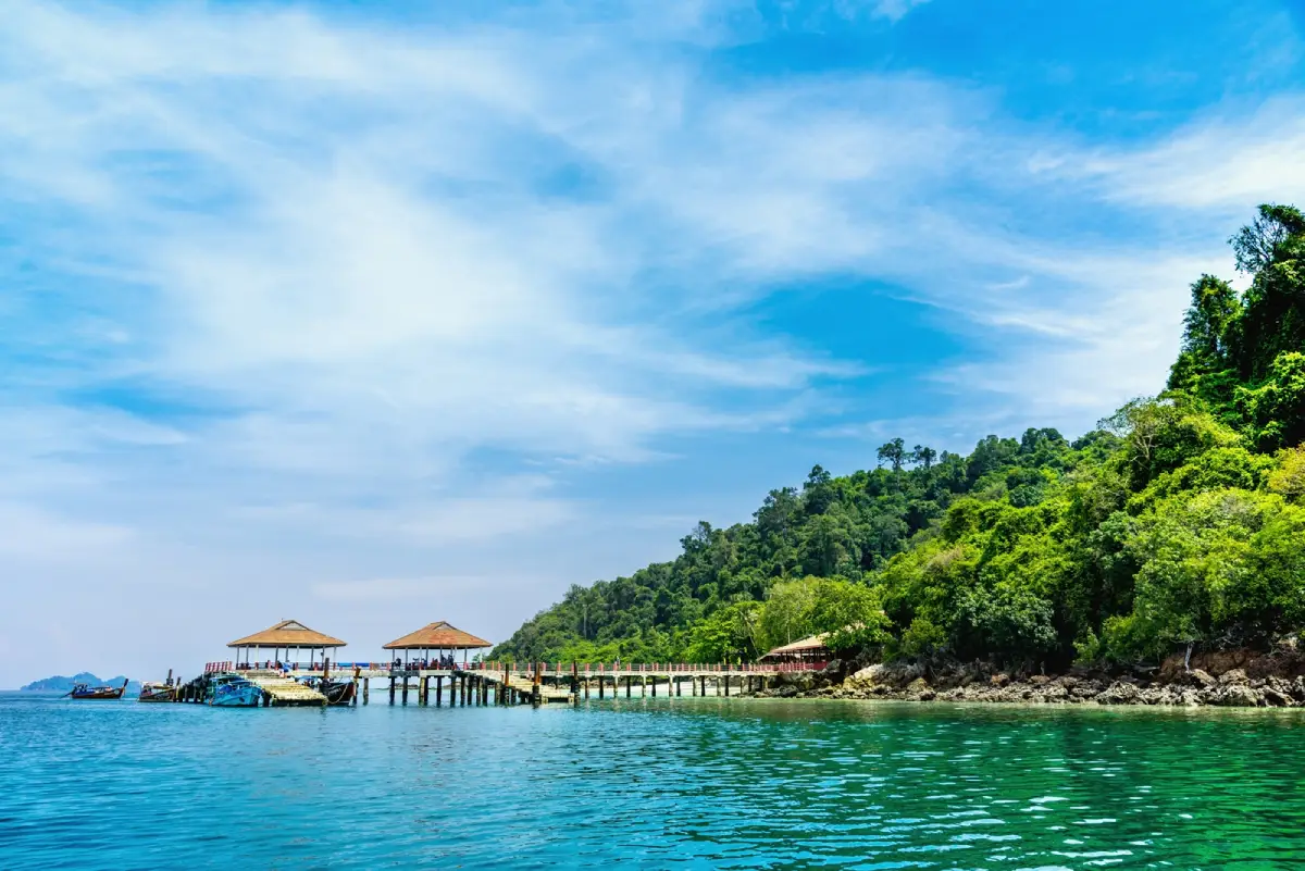
39. Ko Ngai is located administratively in Ko Lanta District, Krabi Province, within Mu Ko Lanta National Park. In practical tourism terms, however, many visitors approach the island from Trang Province because the distance and boat connections from the Trang coast are often more convenient. Administratively, Ko Ngai remains part of Krabi Province.
The island is known for beaches, clear seawater, and a relatively quiet atmosphere. It is particularly suitable for travelers who want to stay for several days rather than rush through on a short island-hopping trip. The surrounding sea includes snorkeling areas, while views from the island include limestone islands scattered across the southern Andaman Sea.
Ko Ngai has resorts and accommodation along the beachfront but no large urban community. The atmosphere is therefore significantly quieter than the Phi Phi Islands or Ao Nang. It is particularly suitable for couples, families, and travelers who want to spend more time with the beach and natural environment rather than nightlife.
Boat travel is strongly affected by the monsoon. From around mid-May to mid-October, access to the island and some marine areas may be restricted, while the calmer sea season generally brings more boat connections with Ko Lanta, Trang, and neighboring islands. Travelers should always confirm seasonal boat schedules before booking accommodation.
Getting There: Ko Ngai can be reached by seasonal boat services from Ko Lanta Yai or from piers in Trang Province. Travelers should confirm boat schedules and wave conditions before departure.
Map (GPS): https://maps.app.goo.gl/juTk8n7jYMYgrWqs6
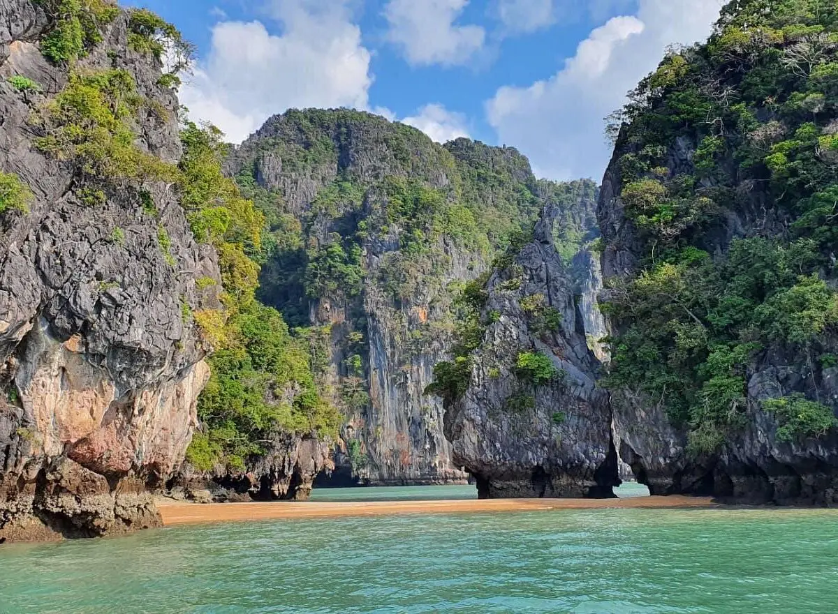
40. Ko Talabeng lies east of Ko Lanta in the area of Ko Lanta Noi Subdistrict, Ko Lanta District. It is a large limestone island characterized by high cliffs, sea caves, rock openings, and a landscape particularly suitable for kayaking. Its appeal comes from a combination of light adventure and natural scenery that feels very different from relaxing on the western beaches of Ko Lanta.
The principal activity is kayaking along the limestone cliffs and exploring sea caves or rock passages according to tide level. Some routes can only be entered when the tide is suitable, which means that travelers should use a guide or operator with detailed knowledge of local tidal conditions. Visitors should not paddle into narrow caves independently without current information, particularly when the tide is rising.
The limestone landscape has developed through long-term erosion and dissolution of the rock, creating cave walls, stalactites, stalagmites, recesses, and openings of many different forms. Kayaking close to the cliffs provides a much clearer view of these geological details than observing the island from a larger boat, making Ko Talabeng especially suitable for travelers interested in nature and light-to-moderate adventure.
Life jackets should be worn throughout kayaking activities. Visitors should check rain, wind, and sea conditions and avoid approaching cave walls or cliffs where loose rock may be present. The trip can be combined with the eastern side of Ko Lanta, including Ban Si Raya, Ban Thung Yee Pheng, and Ko Lanta Noi, providing a very different perspective on Lanta from the conventional western-beach route.
Getting There: Use boat and kayak services operated by communities or local tourism operators around Ko Lanta Noi and the eastern side of Ko Lanta Yai. The actual route depends on tide levels and sea conditions on the day of travel.
Map (GPS): https://maps.app.goo.gl/D6p8e7fuUo1PEDRw5
| Topic | Details |
| Province | Krabi, Southern Thailand, on the Andaman Sea coast |
| Travel Overview | Krabi is distinguished by the Andaman Sea, sandy beaches, islands, limestone mountains, mangrove forests, tropical rainforest, waterfalls, hot springs, caves, archaeological sites, Muslim communities, Urak Lawoi sea-people communities, and traditional fishing lifestyles. The province is suitable for relaxation, scuba diving, snorkeling, kayaking, rock climbing, trekking, community-based tourism, and historical exploration. |
| Top 10 Attractions | 1. Ao Nang 2. Railay Beach 3. The Phi Phi Islands 4. Emerald Pool (Sa Morakot) 5. Namtok Ron Khlong Thom 6. Wat Tham Suea 7. Ko Lanta Yai 8. Susan Hoi (Fossils Shell Beach) 9. Khao Khanap Nam 10. Tha Pom Khlong Song Nam |
| Mueang Krabi District | 1. Ao Nang 2. Railay Beach 3. The Phi Phi Islands 4. Wat Tham Suea 5. Susan Hoi (Fossils Shell Beach) 6. Khao Khanap Nam 7. Tha Pom Khlong Song Nam 8. Noppharat Thara Beach 9. Phra Nang Cave Beach 10. Thale Waek (Separated Sea) 11. Ko Poda 12. Maya Bay 13. Ao Thalane 14. Khao Phanom Bencha National Park 15. Huai To Waterfall 16. Wat Sai Thai 17. Ban Ko Klang Community 18. Ban Na Teen Village |
| Ao Luek District | 1. Than Bok Khorani National Park 2. Tham Lod and Phi Hua To Cave 3. Khao Karos 4. Hong Islands |
| Khlong Thom District | 1. Emerald Pool (Sa Morakot) 2. Namtok Ron Khlong Thom 3. Wat Khlong Thom Museum 4. Khao Pra–Bang Khram Wildlife Sanctuary 5. Hin Phoeng Waterfall |
| Nuea Khlong District | 1. Krabi Hot Springs, also known as Bang Phueng Hot Springs 2. Krabi Lignite Mine and Fossil Museum |
| Khao Phanom District | 1. Bang Kamprad Reservoir |
| Plai Phraya District | 1. Bang Thao Mae Waterfall |
| Lam Thap District | 1. Thung Sai Thong Waterfall |
| Ko Lanta District | 1. Ko Lanta Yai 2. Ban Thung Yee Pheng 3. Ban Si Raya 4. Ban Sangka U 5. Mu Ko Lanta National Park 6. Ko Rok Nai 7. Ko Ngai 8. Ko Talabeng |
| Sea, Beaches and Islands | 1. Ao Nang 2. Railay Beach 3. The Phi Phi Islands 4. Ko Lanta Yai 5. Noppharat Thara Beach 6. Phra Nang Cave Beach 7. Thale Waek (Separated Sea) 8. Ko Poda 9. Maya Bay 10. Hong Islands 11. Ko Rok Nai 12. Ko Ngai 13. Ko Talabeng |
| Forests, Mountains and Waterfalls | 1. Khao Phanom Bencha National Park 2. Huai To Waterfall 3. Khao Pra–Bang Khram Wildlife Sanctuary 4. Hin Phoeng Waterfall 5. Bang Thao Mae Waterfall 6. Thung Sai Thong Waterfall 7. Bang Kamprad Reservoir |
| Hot Springs and Wellness Nature | 1. Namtok Ron Khlong Thom 2. Krabi Hot Springs, also known as Bang Phueng Hot Springs |
| Caves and Limestone Landscapes | 1. Railay Beach and its limestone cliffs 2. Phra Nang Cave Beach 3. Khao Khanap Nam 4. Tham Lod and Phi Hua To Cave 5. Khao Karos 6. Ko Talabeng |
| History, Archaeology and Geology | 1. Susan Hoi (Fossils Shell Beach) 2. Tham Lod and Phi Hua To Cave 3. Wat Khlong Thom Museum 4. Krabi Lignite Mine and Fossil Museum 5. Khao Khanap Nam |
| Temples and Religious Sites | 1. Wat Tham Suea 2. Wat Sai Thai 3. Wat Khlong Thom Museum |
| Communities and Local Lifestyles | 1. Ban Ko Klang Community 2. Ban Na Teen Village 3. Ban Thung Yee Pheng 4. Ban Si Raya 5. Ban Sangka U |
| Adventure Activities | 1. Rock climbing at Railay Beach 2. Kayaking at Ao Thalane 3. Kayaking at Tham Lod and Phi Hua To Cave 4. Kayaking at Khao Karos 5. Kayaking at Ko Talabeng 6. Climbing to the summit at Wat Tham Suea 7. Trekking in Khao Phanom Bencha National Park 8. Diving and snorkeling around the Phi Phi Islands, Hong Islands, Ko Rok and Ko Ngai |
| Local Food to Try | Southern-style sour curry, gaeng tai pla, khua kling, turmeric-fried fish, shrimp-paste chili dip with fresh vegetables, khanom jeen, fresh seafood, khao mok, roti, and halal dishes from local Muslim communities. Seasonal local fruit such as durian, mangosteen, and rambutan is also widely available. |
| Important Culture | Krabi is culturally diverse, with Thai Buddhist, Thai Muslim, and Urak Lawoi sea-people communities. Important cultural traditions include traditional fishing, community handicrafts, halal food culture, and the Sea Gypsy Boat Floating Ceremony on Ko Lanta. |
| Sea Gypsy Boat Floating Ceremony | This is an important ceremony of the Urak Lawoi community associated with dispelling misfortune, honoring ancestors, praying for safety, and symbolically sending negative influences away from the community. It is held according to the lunar calendar around the 6th and 11th lunar months. Visitors should respect ceremonial spaces and follow community guidance. |
| Recommended For | Families, couples, scuba divers, snorkelers, kayakers, rock climbers, hikers, cultural travelers, photographers, beach travelers, nature lovers, and visitors interested in learning about Southern Thai community lifestyles. |
| Getting to Krabi | Krabi can be reached by air through Krabi International Airport, by private car or bus via Phetkasem Road, and by seasonal boat connections from neighboring provinces and islands. |
| Getting Around Krabi | Ao Nang and Krabi Town have taxis, rental vehicles, and organized tours. Inland attractions in Khlong Thom, Khao Phanom, Plai Phraya, Lam Thap, and Ao Luek are more convenient with a private or rental car. Railay, the Phi Phi Islands, Ko Poda, Hong Islands, Ko Rok, and other offshore attractions require boat transfers. |
| Suggested 3-Day Itinerary | Day 1: Wat Tham Suea – Khao Khanap Nam – Ao Nang – Noppharat Thara Beach Day 2: Choose either the Phi Phi Islands or a Four Islands trip including Ko Poda, Thale Waek and nearby islands Day 3: Emerald Pool – Namtok Ron Khlong Thom – Wat Khlong Thom Museum |
| Suggested 4–5 Day Itinerary | Add the Railay Peninsula and Phra Nang Cave Beach, or stay on Ko Lanta Yai for 1–2 nights and visit Ban Si Raya, Ban Thung Yee Pheng, Ban Sangka U, and Mu Ko Lanta National Park. Travelers who enjoy caves and kayaking can add Ao Luek for Phi Hua To Cave, Khao Karos, and Than Bok Khorani National Park. |
| For Travelers Who Do Not Focus on the Sea | A land-based itinerary can include Wat Tham Suea – Khao Khanap Nam – Tha Pom Khlong Song Nam – Khao Phanom Bencha National Park – Huai To Waterfall – Emerald Pool – Namtok Ron Khlong Thom – Wat Khlong Thom Museum – Ban Ko Klang Community without taking an island tour. |
| Best Conditions for Marine Travel | Periods of calmer seas are generally better for island trips, diving, snorkeling, and boat travel. However, weather patterns vary from year to year, so travelers should check current weather forecasts, marine warnings, national park announcements, and boat schedules before departure. |
| What to Check Before Island Trips | Check wave and wind conditions, weather forecasts, boat schedules, island opening and closure status, ecological-recovery closures, national park fees, and activity regulations for each destination, particularly Maya Bay, Ko Rok, Hong Islands, and islands within national park areas. |
| Waterfall and Forest Safety | Avoid swimming during heavy rain or after prolonged rainfall. Watch for flash floods, slippery trails, and wet rocks. Do not leave designated trails, and leave streams immediately if the water rises rapidly or changes color unexpectedly. |
| Responsible Travel | Do not collect coral, shells, rocks, or archaeological objects. Do not feed marine animals or wildlife, never stand on coral, reduce plastic use, take rubbish away, respect religious sites and community ceremonies, and choose tourism operators that follow safety and conservation regulations. |
Frequently Asked Questions (FAQ)
Q: What attractions are there in Krabi?
A: Krabi offers a very wide variety of attractions, including Ao Nang, Railay Beach, the Phi Phi Islands, Maya Bay, Thale Waek, Ko Poda, the Hong Islands, Ko Lanta, Emerald Pool, Namtok Ron Khlong Thom, Wat Tham Suea, Khao Khanap Nam, Tha Pom Khlong Song Nam, Khao Phanom Bencha National Park, Phi Hua To Cave, Ban Ko Klang Community, Ban Thung Yee Pheng, and Ban Sangka U. Travelers can therefore plan trips focused on the sea, nature, adventure, local communities, or culture.
Q: Where should first-time visitors go in Krabi?
A: First-time visitors should begin with Ao Nang, Railay Beach or Phra Nang Cave Beach, and choose either a Phi Phi Islands trip or a Four Islands trip. Wat Tham Suea, Emerald Pool, and Namtok Ron Khlong Thom can then be added to provide a more complete experience combining the sea, limestone mountains, Buddhist culture, forest, and inland nature.
Q: Is Krabi only about beaches and islands?
A: No. Krabi also has Khao Phanom Bencha National Park, Huai To Waterfall, Hin Phoeng Waterfall, Emerald Pool, hot springs, Khao Pra–Bang Khram lowland forest, caves, prehistoric paintings, communities, and museums. It is entirely possible to plan a multi-day Krabi itinerary without taking any island boat trip.
Q: How many days are recommended for Krabi?
A: Three days is suitable for the main highlights, such as Krabi Town, Ao Nang, one full day at sea, and one day in Khlong Thom. Travelers who also want to visit Ao Luek or Ko Lanta should allow around 4–5 days or more. Those who want a relaxed stay on Ko Lanta or the Phi Phi Islands can comfortably plan 5–7 days.
Q: Is Ao Nang a good place to use as the main base?
A: Yes. Ao Nang is especially convenient for first-time visitors because it has a large choice of accommodation, restaurants, tour companies, rental vehicles, and boats to Railay and nearby islands. It also provides convenient road access to Krabi Town, Tha Pom, Ao Thalane, and the Khlong Thom route.
Q: Should I choose the Phi Phi Islands or the Four Islands trip?
A: The Phi Phi Islands are suitable for travelers who want dramatic offshore limestone scenery, Maya Bay, and internationally famous marine landscapes. The Four Islands trip is closer to Ao Nang and includes several attractions such as Ko Poda, Chicken Island, Ko Thap, and Thale Waek. Travelers with two available sea days can visit both routes separately.
Q: Can Emerald Pool and Namtok Ron Khlong Thom be visited on the same day?
A: Yes. This is one of the most popular routes in Khlong Thom District. It is best to begin at Emerald Pool in the morning for the nature trail and cooler temperatures, then continue to Namtok Ron Khlong Thom for a hot-water soak and relaxation. Travelers with additional time can also visit Wat Khlong Thom Museum to learn about ancient beads and historical maritime trade.
Q: Where is Krabi’s famous rock-climbing area?
A: The Railay Peninsula is internationally famous for rock climbing. Its limestone cliffs have routes ranging from beginner level to technically demanding climbs for experienced climbers. Beginners should use qualified instructors and standard safety equipment rather than attempting established climbing routes independently without knowledge of ropes and climbing systems.
Q: Where are the best places for kayaking in Krabi?
A: Important kayaking areas include Ao Thalane, Tham Lod–Phi Hua To Cave, Khao Karos, Ban Thung Yee Pheng, and Ko Talabeng. Each offers a different environment, ranging from mangrove forest and limestone passages to sea caves and natural tidal canals. Access depends on tides and weather, so local guides or experienced operators are recommended.
Q: Is Maya Bay open throughout the year?
A: No. Maya Bay has an annual ecological-recovery closure period, and visiting times or management measures may also be adjusted according to national park announcements. Travelers should always check current information before visiting rather than relying on old social-media posts or outdated tour schedules.
Q: Can Ko Rok be visited throughout the year?
A: Ko Rok is part of Mu Ko Lanta National Park and operates according to the marine tourism season. It closes during the monsoon period for safety and ecological recovery. Visitors should always check current national park announcements and sea conditions before booking a boat trip.
Q: Where should travelers go to learn about local culture?
A: Ban Ko Klang Community and Ban Na Teen Village are suitable for learning about Muslim community life. Ban Thung Yee Pheng focuses on community-based mangrove conservation, Ban Si Raya reflects the trading history of Ko Lanta, and Ban Sangka U is an important Urak Lawoi sea-people community associated with the traditional Boat Floating Ceremony.
Q: What is the Sea Gypsy Boat Floating Ceremony?
A: It is an important ritual of the Urak Lawoi community on Ko Lanta. The ceremony is associated with removing misfortune, sending negative influences away from the community, honoring ancestors, and praying for safety in a life closely connected with the sea. Visitors should respect the ceremony, avoid disrupting ritual areas, and ask permission before taking photographs during important moments.
Q: What local food should visitors try in Krabi?
A: Recommended dishes include southern-style sour curry, gaeng tai pla, khua kling, turmeric-fried fish, shrimp-paste chili dip with fresh vegetables, khanom jeen, and fresh seafood. Krabi also has a strong Muslim food culture, including khao mok, roti, spiced curries, and coastal dishes prepared with seasonal fish, shrimp, crab, and shellfish.
Q: Is it necessary to rent a car in Krabi?
A: Travelers staying in Ao Nang and focusing mainly on marine tours may not need a rental car because taxis and organized tours are widely available. However, a private or rental vehicle is much more convenient for Emerald Pool, Namtok Ron Khlong Thom, Tha Pom, Ao Luek, Khao Phanom, Plai Phraya, Lam Thap, and community destinations because it reduces travel time and provides greater flexibility.
Q: What should travelers check before taking a boat trip in Krabi?
A: Check the latest weather forecast, wave and wind conditions, marine warnings, boat schedules, island opening and closure status, and national park announcements. If high-wave warnings are issued or operators cancel trips for safety reasons, travelers should not attempt to go to sea because conditions in the Andaman Sea can change rapidly.
 Category: ●Travel Articles, Recipes
 Group: ●Travel Review, Food Review
Last Update : 3 WeekAgo
 Last Update : 3 WeekAgo
Recommend

 Art, Culture and Heritage
 Historical Sites and Monuments(1)
 Landmarks and Memorials(7)
 Art, Craft Centres, Tradition(2)
 Museums(2)
 Educational Places
 Educational Gardens, Farm(1)
 Places of Worship
 Temple(3)
 Mosque(2)
 Other Sacred Sites(2)
 Research and Development
 Royal Project(1)
 Suburban Living
 Village, Community(6)
 Nature and Wildlife
 National Parks and Marine Reserves(5)
 Mountain (Doi)(2)
 Dam, Reservoir, Lake(3)
 Waterfalls(12)
 Hot Springs(3)
 Caves(20)
 River, Canal(2)
 Bays and Beaches(36)
 Islands(23)
 Other natural attractions(7)
 Entertainment and Agricultural
 Farms, Parks and Ecotourism(1)
 Outdoor and Adventure Activities(1)
Travel Review, Food Review(2)
 Southern Food Menu, Southern Food Recipes(1)


