
lovethailand home >South Travel Attractions >Krabi Travel Attractions >Koh Lanta >Koh Lanta Noi > Ko Talabeng
TL;DR: Ko Talabeng, Krabi attractions : Nature and Wildlife, Islands.

Ko Talabeng
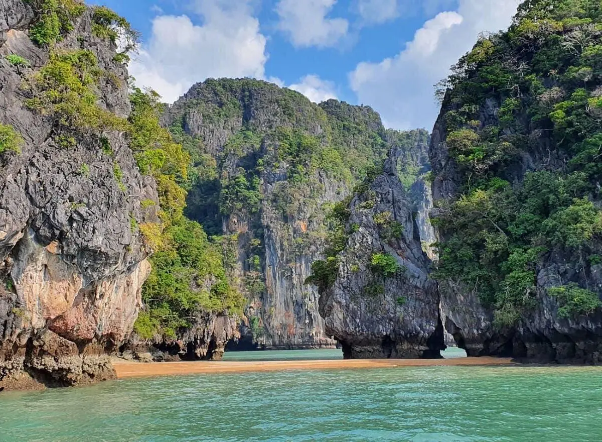
Open Days: Daily according to authorized boat and kayaking schedules; sea-cave access depends on tide level, weather, sea conditions, and national park area announcements
Opening Hours: Mu Ko Lanta National Park areas generally operate from 08.30 – 16.30
Ko Talabeng in Krabi Province is a limestone island on the eastern side of Ko Lanta, within Ko Lanta District. It is best known for dramatic limestone cliffs, small beaches, sea caves, swallow nesting areas, and kayaking routes that can be explored when tide and sea conditions are suitable. Unlike the west-coast beaches of Ko Lanta Yai, Ko Talabeng is not a resort island and does not have permanent restaurants, hotels, or large tourist facilities. Its main value lies in natural scenery, sea-cave kayaking, and a quieter limestone landscape that shows a different side of the Ko Lanta area.
The island’s strongest attraction is its relationship with the tide. Some of the cave openings and beach sections become easier to see during low tide, while the sea-cave kayaking route must be managed according to the water level of the day. When conditions are suitable, visitors can paddle close to limestone walls, enter permitted cave sections, see stalactites and stalagmites, and experience the echoing interior of a sea cave. This makes Ko Talabeng very different from a normal beach stop: the experience is based on timing, water movement, and careful navigation.
Ko Talabeng lies on the quieter eastern side of the Lanta islands, away from the main west-coast beach zones such as Klong Dao, Phra Ae, Klong Khong, and Klong Nin. The eastern side of Lanta is known for mangroves, local communities, small piers, and nature-based routes. A typical Talabeng trip often combines the island with Ko Phee, Thung Yee Pheng Mangrove Forest, Ko Bu Bu, or other nearby stops, depending on the operator, tide, and season.
The island is composed mainly of limestone, with steep rock faces rising from the sea. Its surface is rugged, with cavities, overhangs, cliff sections, and sea-level cave openings formed by long-term erosion. The scenery may remind some travelers of Ko Phi Phi Le or Phang Nga Bay, but Ko Talabeng generally feels more intimate because visitors approach the cliffs slowly by kayak rather than simply passing by on a larger boat.
The small beach areas on Ko Talabeng are not designed for long beach stays. They are better suited to short stops, swimming in safe conditions, taking photos, and resting during a kayaking trip. The shape and width of the beach can change with the tide. At higher water levels, beach space may become limited, while at lower water levels more rock and sand may appear. Visitors should follow the boat guide’s instructions and avoid exploring alone.
The sea caves are the main reason many travelers visit Ko Talabeng. Inside or near the cave openings, limestone features, rock textures, shadow, and filtered daylight create a strong visual experience. Access must be controlled because water level, wave reflection, slippery rock, and narrow cave openings can affect safety. Visitors should never enter a cave before the guide confirms that it is safe.
Kayaking is the best way to appreciate Ko Talabeng. Paddling allows visitors to move slowly along the limestone walls, look into cave entrances, observe the rock formations, and experience the quiet of the eastern Lanta seascape. It also reduces the need for motorized access in tight spaces. Travelers who enjoy gentle adventure, natural scenery, and close contact with coastal geology will find Ko Talabeng especially rewarding.
Swallows are associated with the island’s cliffs and caves, adding ecological value to the site. The cliffs are not only scenic; they are also habitat. Visitors should avoid shouting inside cave areas, disturbing nesting zones, climbing rock faces, or approaching bird areas unnecessarily. Responsible viewing keeps the island suitable for both wildlife and carefully managed tourism.
Ko Phee lies north of Ko Talabeng and is commonly included in the same kayaking or long-tail boat route. It is known for unusual limestone shapes that local tour operators often describe as ghost-like or skull-like from certain angles. A combined route with Ko Phee, Ko Talabeng, mangroves, and Ko Bu Bu gives travelers a broader understanding of the eastern Lanta landscape, including cliffs, caves, small islands, and mangrove ecology.
The best general season to visit Ko Talabeng is from November to April, when the Andaman Sea is usually calmer and kayaking conditions are more reliable. From May to October, weather and sea conditions can be more variable. Although the eastern side of Lanta may be more sheltered than exposed open-sea routes at times, visitors should still follow current operator advice, tide information, and national park area announcements before departure.
Tide timing is central to a good Ko Talabeng trip. The best time is not simply morning or afternoon; it is the period when the water level allows safe cave viewing and kayaking. A knowledgeable operator will adjust the route according to the day’s tide. Forcing a cave visit at the wrong water level is unsafe and can also damage the natural environment.
Getting There is usually easiest from Ko Lanta. Visitors staying on Ko Lanta Yai are commonly picked up from their accommodation and transferred to a local departure point on Ko Lanta Noi, such as the Loh Yai area. From there, a long-tail boat heads toward Ko Phee, Ko Talabeng, or the mangrove area, depending on the selected itinerary. Half-day and full-day trips are available through local operators.
Travelers staying in Krabi Town, Ao Nang, or other parts of Krabi should consider staying on Ko Lanta for at least one night before doing the Talabeng kayaking route. The trip depends on tide timing, and reaching Lanta from the mainland on the same day can make the schedule unnecessarily rushed. Staying on Ko Lanta makes the experience safer and more flexible.
There are no permanent restaurants, overnight accommodation, large piers, or full tourist facilities on Ko Talabeng. Visitors should bring drinking water, sun protection, a towel, a dry bag, suitable footwear, and a small bag for carrying waste back to the mainland. If joining a tour, confirm whether lunch, drinking water, kayaking equipment, life jackets, insurance, and hotel transfer are included.
Trip costs depend on the program. Options may include half-day kayaking, full-day kayaking, Ko Talabeng with Ko Phee, mangrove routes, Ko Bu Bu stops, meals, transfers, and national park-related fees. Travelers should confirm exactly what is included before booking, especially during the main travel season when small-group spaces can be limited.
Suitable activities include sea-cave kayaking, viewing limestone cliffs, exploring permitted cave openings, photographing rock formations, swimming at safe small-beach areas, visiting Ko Phee, and combining the route with Thung Yee Pheng Mangrove Forest. Ko Talabeng is best for travelers who enjoy active nature experiences rather than long beach lounging.
Beginners can visit Ko Talabeng if they join a guided trip and sea conditions are calm. Anyone who cannot swim well, has medical conditions, is prone to seasickness, or travels with children or elderly family members should inform the operator before booking. A life jacket should be worn at all times on the boat and kayak.
Safety precautions matter. Limestone can be sharp, cave floors can be slippery, waves can reflect off cliff walls, and cave openings may be narrow. Visitors should not stand in kayaks, grab cave walls while moving, climb rocks, collect shells or stones, or paddle away from the group. If the guide asks the group to leave a cave or change route, follow the instruction immediately.
Environmental care is essential because Ko Talabeng is a compact natural area. Rubbish, food waste, loud noise, reckless paddling, and disturbance near bird areas can have a direct impact. Visitors should leave no waste, avoid touching cave formations, respect wildlife, and treat the island as a protected natural site rather than a casual playground.
Compared with other Ko Lanta attractions, Ko Talabeng has a clear role. Ko Lanta Yai is known for beaches, accommodation, and local communities. Ko Rok and Ko Haa are known for seasonal snorkeling and diving. Ko Ngai is known for quiet beaches and reefs. Ko Talabeng is known for limestone cliffs, caves, kayaking, and the quieter eastern Lanta landscape. It is one of the best ways to see a side of Lanta that many beach-focused travelers miss.
For photography, Ko Talabeng offers strong compositions: kayaks under limestone cliffs, cave shadows framing the sea, green-blue water reflecting rock walls, and dramatic cliff textures. Visitors should take photos without compromising kayak balance, blocking cave entrances, disturbing wildlife, or using drones in national park areas without permission.
A well-planned Ko Lanta itinerary can include Ko Talabeng as part of a broader 2–3 day stay. One day can focus on the west-coast beaches, another on the eastern side with Lanta Old Town, Thung Yee Pheng Mangrove Forest, and Ko Talabeng, and another on Laem Tanod or seasonal island trips. This approach gives travelers a more complete picture of Ko Lanta beyond its beaches.
In summary, Ko Talabeng is a distinctive limestone island in Ko Lanta District, Krabi Province. Its highlights are limestone cliffs, small beaches, low-tide cave openings, swallows, and sea-cave kayaking. The island is best visited as a guided day trip from Ko Lanta, not as an overnight destination. With proper tide timing, safe kayaking, respect for wildlife, and careful operator choice, Ko Talabeng offers one of the most memorable nature-based experiences on the eastern side of Ko Lanta.
| Name | Ko Talabeng |
| Location | Ko Lanta Noi Subdistrict, Ko Lanta District, Krabi Province, on the eastern side of the Ko Lanta area |
| Park Office Address | Mu Ko Lanta National Park, No. 5, Ko Lanta Yai Subdistrict, Ko Lanta District, Krabi 81150 |
| Coordinates | Approximately 7.625389, 99.146536 |
| Highlights | Limestone island, sea caves, low-tide cave openings, stalactites and stalagmites, small beaches, swallows, and sea-cave kayaking |
| Distinctive Features | A limestone island with small beach areas and tide-dependent sea caves, suitable for guided kayaking and nature sightseeing |
| Current Status | Not permanently closed; visited by authorized boat and kayaking tours according to weather, tide levels, sea conditions, and national park area announcements |
| Open Days | Daily according to authorized tour schedules and permitted areas |
| Opening Hours | Mu Ko Lanta National Park areas generally operate from 08.30 – 16.30; kayaking tour times depend on tide levels and operator schedules |
| Best Time To Visit | November to April is generally best, with a tide window suitable for safe sea-cave access |
| Fees | Mu Ko Lanta National Park rate where applicable: Thai adults 40 THB, Thai children 20 THB; foreign adults 200 THB, foreign children 100 THB. Boat, kayaking, meals, and transfers are charged separately by operators. |
| Caretaker | Mu Ko Lanta National Park and authorized boat/kayaking operators in the Ko Lanta area |
| Main Contact Number | Mu Ko Lanta National Park, Tel. 075-656-576, 075-656-577 |
| Main Areas / Zones | Limestone cliffs, small beaches, sea-cave openings, low-tide cave sections, kayaking route around the island, safe swimming stops, swallow cliff areas, and nearby Ko Phee |
| Facilities | No overnight accommodation, no permanent restaurants, and no large facilities on the island. Visitors rely on boats, kayaking tours, and services on Ko Lanta. |
| Travel Information | Most trips start from Ko Lanta Yai with hotel pickup, transfer to a local departure point on Ko Lanta Noi such as Loh Yai, then travel by long-tail boat and kayak to Ko Talabeng. |
| Nearby Tourist Attractions | 1. Ko Phee, about 2 km 2. Ko Bu Bu, about 6 km 3. Thung Yee Pheng Mangrove Forest, about 14 km by boat and road route 4. Ko Lanta Noi, about 8 km by boat route 5. Lanta Old Town, about 24 km by boat and road route 6. Sala Dan, about 26 km by boat and road route 7. Laem Tanod And Mu Ko Lanta National Park, about 45 km by boat and road route |
| Nearby Restaurants | 1. L. Maladee Restaurant, Sala Dan, about 26 km, Tel. 087-891-3149 2. Red Snapper, Phra Ae Beach, about 30 km, Tel. 087-885-6965 3. SeaSky Restaurant At Layana Resort & Spa, Phra Ae Beach, about 30 km, Tel. 075-607-100 4. Watermark Restaurant At Rawi Warin Resort & Spa, Klong Tob Beach, about 36 km, Tel. 075-607-400 5. Same Same But Different, Ba Kan Tiang Bay, about 43 km, Tel. 081-787-8670 6. Restaurant At Pimalai Resort And Spa, Ba Kan Tiang Bay, about 43 km, Tel. 075-607-999 |
| Nearby Accommodations | 1. Twin Lotus Resort & Spa, Klong Dao Beach, about 27 km, Tel. 075-607-000 2. Layana Resort & Spa, Phra Ae Beach, about 30 km, Tel. 075-607-100 3. Lanta Casa Blanca, Klong Khong Beach, about 32 km, Tel. 083-970-0530 4. Rawi Warin Resort & Spa, Klong Tob Beach, about 36 km, Tel. 075-607-400 5. SriLanta Resort And Spa, Klong Nin Beach, about 39 km, Tel. 086-661-6886, 083-394-6661 6. Pimalai Resort And Spa, Ba Kan Tiang Bay, about 43 km, Tel. 075-607-999 |
Frequently Asked Questions (FAQ)
Q: Where is Ko Talabeng located?
A: Ko Talabeng is located on the eastern side of the Ko Lanta area in Ko Lanta District, Krabi Province. It is a limestone island in the Lanta island group.
Q: Is Ko Talabeng open to visitors?
A: Ko Talabeng is not permanently closed. It is visited by authorized boat and kayaking tours according to weather, sea conditions, tide levels, and national park area announcements.
Q: What is Ko Talabeng known for?
A: Ko Talabeng is known for limestone cliffs, small beaches, low-tide sea-cave openings, stalactites and stalagmites, swallows, and guided sea-cave kayaking.
Q: How do travelers get to Ko Talabeng?
A: Most travelers join a kayaking tour from Ko Lanta Yai, transfer to a local departure point on Ko Lanta Noi, then continue by long-tail boat and kayak to Ko Talabeng.
Q: When is the best time to visit Ko Talabeng?
A: November to April is generally the best season, and the cave route is best during a tide window that allows safe sea-cave access.
Q: Are there hotels or restaurants on Ko Talabeng?
A: No. There are no overnight accommodations or permanent restaurants on Ko Talabeng. Travelers should stay and dine on Ko Lanta Yai or join a tour that includes meals.
Q: Can beginners kayak at Ko Talabeng?
A: Beginners can join a guided trip when conditions are calm. They should wear a life jacket, stay with the group, and inform the operator in advance if they cannot swim well or have medical concerns.
Q: What should visitors be careful about at Ko Talabeng?
A: Visitors should watch tide levels, sharp limestone, slippery cave areas, wave reflection near cliffs, wildlife disturbance, and guide instructions. They should not climb rocks, touch cave formations, leave rubbish, or enter caves without permission.
 Category: ●Nature and Wildlife
 Group: ●Islands
Last Update : 2 MonthAgo
 Last Update : 2 MonthAgo
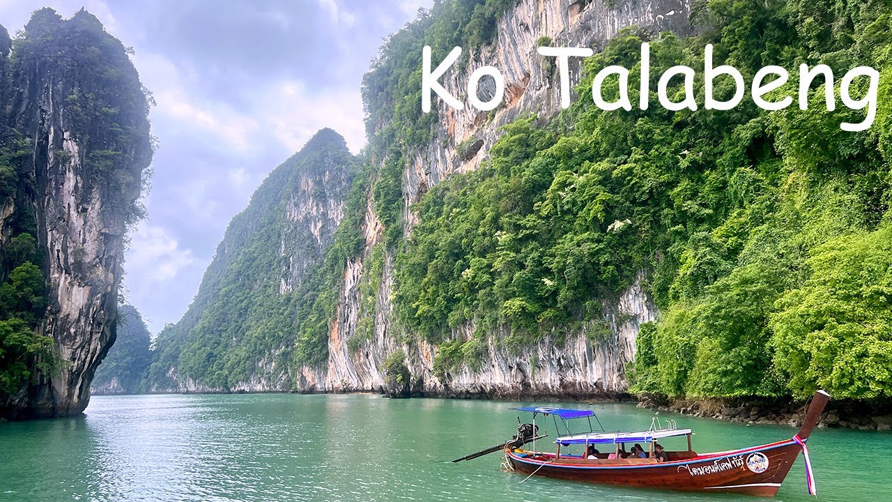
 Click to Access the Navigation Map GPS
Ko Talabeng Map
Recommend

 Art, Culture and Heritage
 Historical Sites and Monuments(1)
 Landmarks and Memorials(7)
 Art, Craft Centres, Tradition(2)
 Museums(2)
 Educational Places
 Educational Gardens, Farm(1)
 Places of Worship
 Temple(3)
 Mosque(2)
 Other Sacred Sites(2)
 Research and Development
 Royal Project(1)
 Suburban Living
 Village, Community(6)
 National Parks and Marine Reserves(5)
 Mountain (Doi)(2)
 Dam, Reservoir, Lake(3)
 Waterfalls(12)
 Hot Springs(3)
 Caves(20)
 River, Canal(2)
 Bays and Beaches(36)
Islands(23)
 Other natural attractions(7)
 Entertainment and Agricultural
 Farms, Parks and Ecotourism(1)
 Outdoor and Adventure Activities(1)
 Travel Articles, Recipes
 Travel Review, Food Review(2)
 Southern Food Menu, Southern Food Recipes(1)


