
lovethailand home >North Travel Attractions >Lamphun Travel Attractions > 50 Best Places to Visit in Lamphun Northern Thaila..
TL;DR: 50 Best Places to Visit in Lamphun Northern Thailand, open Daily Opening Hours: 06:30 – 17:00.
50 Best Places to Visit in Lamphun Northern Thailand
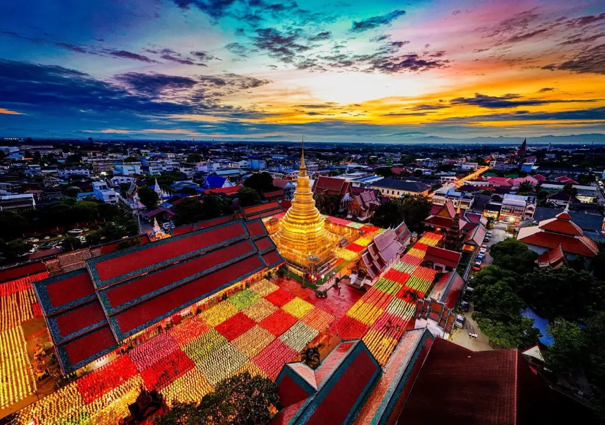
50 Best Places to Visit in Lamphun: Must-See Attractions in Northern Thailand Lamphun may be one of Northern Thailand’s more compact provinces, but it contains some of the region’s richest layers of history and culture. Its identity is closely tied to the ancient Hariphunchai Kingdom, centuries-old temples, Mon–Hariphunchai art, sacred stupas, legends of Queen Chamadevi, traditional craft communities, and the mountains, forests, waterfalls, and rivers of southern Lamphun. If you have only 1 day, begin with Wat Phra That Hariphunchai Woramahawihan, Wat Chamthewi, Hariphunchai National Museum, and the Queen Chamadevi Monument. With 2–3 days, add Wat Phra Phutthabat Tak Pha, the Mae Tha–Doi Khun Tan area, and the handicraft communities of Pa Sang. Travelers with 4–5 days can continue south to Li District, Mae Ping National Park, Koh Luang Waterfall, Kaeng Ko, and the communities of southern Lamphun for a more complete journey.
Lamphun Province is located in upper Northern Thailand between Chiang Mai, Lampang, and Tak. The province includes the lowlands of the Kuang River around Lamphun city as well as increasingly mountainous terrain toward the south and east. These contrasting landscapes give Lamphun two distinct travel experiences: an old city where temples, museums, and communities can be explored at an easy pace, and natural areas filled with forests, mountains, waterfalls, reservoirs, and ecotourism routes.
Lamphun’s history is deeply connected with the ancient city of Hariphunchai, which flourished before the rise of the Lanna Kingdom. The story of Queen Chamadevi, regarded as the first ruler of Hariphunchai, remains visible today through Wat Chamthewi, the Queen Chamadevi Monument, Ku Chang–Ku Ma, and local legends passed down through generations. For travelers interested in the early history of Northern Thailand, Lamphun is one of the most important provinces to explore.
At the heart of the old city stands Wat Phra That Hariphunchai Woramahawihan, a royal temple and spiritual center for the people of Lamphun. The surrounding area connects easily with Hariphunchai National Museum, Wat Mahawan, markets, local neighborhoods, and the remains of the old city moat, making this part of Lamphun especially suitable for walking or cycling from morning until evening.
Lamphun is also renowned for sacred amulets and Buddhist art. The most famous example is the Phra Rod amulet associated with Wat Mahawan, while Hariphunchai art itself has a distinctive visual identity that differs clearly from the later Lanna style. Travelers interested in archaeology should begin at Hariphunchai National Museum before visiting the temples and archaeological sites around the city, as the museum provides useful historical context for what can be seen in the field.
Community life is another major part of Lamphun’s character. The province is particularly well known for cotton weaving, especially in Pa Sang, Ban Nong Ngueak, and Ban Don Luang, where handwoven cotton and locally made textile products remain important parts of the community economy. Mae Tha is also known for woodcarving, while several ethnic communities preserve traditional clothing, handicrafts, and ways of life that reflect the cultural diversity of the province.
Lamphun’s local cuisine shares many characteristics with wider Lanna food culture, including gaeng hung lay, nam prik noom, nam prik ong, sai ua, pork crackling, khanom jeen nam ngiao, and seasonal dishes. Popular souvenirs include Pa Sang cotton, dried longan, processed longan products, and handmade goods produced by local communities.
For practical trip planning, Lamphun can be divided into several travel zones. Lamphun city is best for temples and history; Pa Sang is ideal for Wat Phra Phutthabat Tak Pha and cotton handicrafts; Mae Tha–Khun Tan combines railway heritage, mountains, and nature; Ban Thi offers reservoirs and local communities; while Li–Mae Ping is the province’s major zone for national parks, waterfalls, river scenery, and nature-based travel.
Lamphun works well for senior travelers, families, Buddhist pilgrims, history enthusiasts, photographers, travelers interested in cafes and local communities, hikers, and road-trip travelers. Many zones are within manageable driving distance of one another, allowing cultural and natural attractions to be combined within a multi-day itinerary.
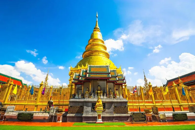
1. Wat Phra That Hariphunchai Woramahawihan stands in the heart of Lamphun city, in Nai Mueang Subdistrict, Mueang Lamphun District. It is a royal temple and one of the province’s most important sacred sites. For first-time visitors to Lamphun, this should be near the top of the itinerary because it brings together history, architecture, Buddhist faith, and the atmosphere of the old city in one place.
Highlights: The golden Phra Borommathat Hariphunchai stupa, the main viharn, historic entrance arches, scripture hall, bell tower, Lanna architecture, and the annual tradition of bathing the sacred relic stupa.
The temple’s history is associated with King Athitayaraj of Hariphunchai. It was established in 1108 CE (B.E. 1651) as a major religious center of the city. Phra Borommathat Hariphunchai therefore represents the continuity of Buddhism from the Hariphunchai period through the Lanna era and into the present day.
The golden chedi is the temple’s most striking feature. Its form and decoration reflect Lanna artistic development built upon older Hariphunchai cultural foundations. When sunlight falls across the gilded surface, the chedi rises brilliantly above the roofs of the surrounding viharns and temple buildings.
Beyond the main stupa, the temple complex includes the principal viharn, scripture hall, bell tower, and many other architectural details worth examining closely. Visitors interested in woodwork, carving, and the historical development of major Northern Thai temples should allow enough time to explore the compound carefully.
One of the temple’s most important traditions is the annual bathing ceremony of Phra Borommathat Hariphunchai. This major religious event attracts large numbers of worshippers and demonstrates that the temple is not simply a historic monument, but a living center of faith that remains deeply connected to the local community.
After visiting the temple, travelers can continue on foot to Hariphunchai National Museum, Wat Mahawan, and other parts of the old city without traveling far. The area works especially well as a half-day or full-day walking route through central Lamphun.
Open Days: Daily Opening Hours: 06:30 – 17:00
Getting There: The temple is located in the center of Lamphun city, approximately 150 meters from the provincial hall. It can be reached easily by car, motorcycle, bicycle, or on foot from other major sites in the old city.

2. Wat Chamthewi, commonly known among Lamphun residents as “Wat Ku Kut,” stands on Chamthewi Road in Nai Mueang Subdistrict, Mueang Lamphun District. This ancient temple is highly significant to the history of the Hariphunchai Kingdom and is directly associated with Queen Chamadevi.
Highlights: Suwan Chang Kot Chedi, also known as Chamadevi Chedi, its multi-tiered square form, standing Buddha images in niches around the structure, the octagonal Ratana Chedi, and distinctive Hariphunchai art influenced by the ancient city of Lavo.
According to local tradition, the temple was developed after the reign of Queen Chamadevi and became associated with the enshrinement of her remains. The principal chedi therefore carries religious, historical, and symbolic importance for the people of Lamphun.
Suwan Chang Kot Chedi has a stepped square form with niches containing standing Buddha images arranged around its exterior. Its design differs clearly from many later Lanna chedis found in Chiang Mai and Lampang, making Wat Chamthewi one of the key places for studying Hariphunchai art and architecture.
The local name “Ku Kut” refers to the damaged or truncated appearance of the chedi’s upper section. In local usage, “ku” refers to a stupa or funerary monument, while “kut” refers to something shortened, broken, or cut off. The name therefore preserves both a physical observation and local cultural memory.
The temple compound also contains Ratana Chedi, an octagonal stupa, as well as viharns and other religious structures. Visitors should spend time exploring the entire complex rather than stopping only for photographs at the principal chedi, as the site as a whole helps explain the artistic development of Lamphun.
Wat Chamthewi is especially suitable for travelers interested in history, archaeology, Buddhist art, and photography. It can easily be combined with the Queen Chamadevi Monument, Wat Mahawan, and Ku Chang–Ku Ma in the same day.
Open Days: Daily Opening Hours: 06:00 – 18:00
Getting There: The temple is located on Chamthewi Road in central Lamphun. It is only a short drive, motorcycle ride, or bicycle trip from Wat Phra That Hariphunchai Woramahawihan.
Map (GPS):Open Google Maps – Wat Chamthewi

3. Mae Ping National Park lies mainly in Li District, Lamphun Province. The park contains a remarkably varied landscape of mountains, forests, rivers, cliffs, rapids, and waterfalls, with the Ping River serving as one of the defining natural features of the area.
Highlights: Approximately 140 kilometers of the Ping River running through the park, Kaeng Ko, Koh Luang Waterfall, Thung Kik, mixed deciduous forest, dry dipterocarp forest, and nature routes throughout Li District.
Mae Ping National Park is dominated by complex mountain terrain and includes both mixed deciduous and dry dipterocarp forests, along with other well-preserved forest ecosystems. The Ping River winds between mountains and cliffs, creating scenery quite different from the high-elevation national parks more commonly associated with Northern Thailand.
Kaeng Ko is one of the park’s major attractions. It forms a broad body of water surrounded by mountains and is suitable for scenic relaxation and water-based activities when permitted by park regulations. The atmosphere is especially peaceful in the morning and evening, making the area well suited to an overnight stay.
Another well-known attraction is Koh Luang Waterfall, a multi-tiered limestone waterfall where the water can appear turquoise-green under certain light and seasonal conditions. The pale limestone creates a visual character that differs from waterfalls flowing over darker granite formations.
The park also includes Thung Kik and other natural areas suitable for hiking, birdwatching, photography, and ecological learning. Travelers planning to visit several locations should allow at least one full day, and an overnight stay in Li District is advisable for a less rushed experience.
During the rainy season, visitors should check road conditions and current park announcements before traveling, particularly for routes leading into natural areas that may be affected by heavy rainfall, flash floods, or temporary seasonal closures.
Open Days: Daily Opening Hours: 08:00 – 18:00
Getting There: From Lamphun city, drive south toward Li District and continue along the access roads to Mae Ping National Park. A private vehicle is the most practical option because the park’s attractions are spread across a wide area.

4. Doi Khun Tan National Park covers parts of Mae Tha District in Lamphun and Hang Chat District in Lampang. The park combines railway history, hiking trails, and mountainous landscapes, making it an excellent destination for travelers interested in both nature and the history of transportation in Northern Thailand.
Highlights: Doi Khun Tan hiking routes, pine and mountain forests, viewpoints, cool weather, Khun Tan Railway Tunnel, and Khun Tan Railway Station.
Doi Khun Tan forms part of the mountain range separating Lamphun and Lampang. Vegetation includes dry dipterocarp forest, mixed deciduous forest, and montane evergreen forest at higher elevations, so visitors can observe clear changes in plant communities while ascending the mountain.
One of the park’s greatest attractions is its hiking network connecting several rest areas and viewpoints. It is suitable for travelers who want a slower hiking experience and a mountain environment that remains relatively accessible from Chiang Mai and Lamphun.
Nearby is the historic Khun Tan Railway Tunnel, an important part of the development of Thailand’s Northern Railway Line. Combining the national park with the railway station and tunnel creates a day trip that blends natural scenery with transportation history.
Winter is the most popular season because temperatures are cooler and comfortable for hiking. During the rainy season the forest becomes lush and green, although trails can be slippery and misty, so appropriate footwear and rain protection are recommended.
Travelers planning longer hikes or overnight stays should check the latest information on campsites, accommodation, and park regulations before departure.
Open Days: Daily Opening Hours: 08:00 – 18:00
Getting There: Travel from Lamphun city toward Mae Tha District and the Khun Tan area. Visitors can drive or take a train to Khun Tan Railway Station and continue their trip according to the chosen hiking route.

5. Koh Luang Waterfall is located inside Mae Ping National Park in Li District and is one of the best-known limestone waterfalls in Lamphun. Its defining features are the pale limestone terraces and turquoise-green pools that appear under favorable seasonal and lighting conditions.
Highlights: A 7-tier limestone waterfall, turquoise-green natural pools, clear water, shaded forest, and a convenient location for combining with Kaeng Ko and other attractions in Mae Ping National Park.
The waterfall is formed by forest streams flowing over limestone formations and descending through a series of terraces. The pale-colored rock changes the appearance of the water depending on light and season, creating the distinctive look for which Koh Luang Waterfall is known.
Natural pools form below parts of the waterfall, but swimming should always follow park regulations and current safety advice. Water levels and currents can change significantly depending on rainfall.
From the end of the rainy season into early winter, the surrounding forest is often especially green and water levels can be attractive. However, after periods of heavy rain visitors should check park announcements because waterfall areas may occasionally be restricted for safety.
Visitors should avoid stepping on, scraping, or damaging limestone formations. These structures develop through very slow natural processes, so protecting them is essential to preserving the waterfall’s ecosystem and appearance.
Koh Luang Waterfall is suitable for families, nature travelers, and photographers. It can be the main destination on a 1-day Mae Ping National Park trip or combined with Kaeng Ko and an overnight stay in Li District.
Open Days: Daily Opening Hours: 08:30 – 16:30
Getting There: From Mae Ping National Park headquarters, continue approximately 20 kilometers toward the waterfall along the park’s designated access route.
Map (GPS):Open Google Maps – Koh Luang Waterfall
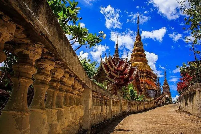
6. Wat Phra Phutthabat Tak Pha is located in Makok Subdistrict, Pa Sang District. It is a royal temple and one of Lamphun’s major Buddhist sites, known for its sacred footprint, meditation areas, and the hilltop chedi that rises prominently above the surrounding landscape.
Highlights: The sacred Buddha footprint, hilltop chedi, naga staircase, mountain route, meditation grounds, and the temple’s connection with Khruba Phromma.
The temple is an important pilgrimage destination for people in Lamphun and visitors from other provinces. The name “Tak Pha,” meaning “drying cloth,” is linked to a local Buddhist legend about the Buddha and a place believed to have been used for drying robes, giving the site both religious meaning and a strong local narrative.
The sacred footprint and main religious structures are located near the lower part of the hill, while the upper area contains a chedi that can be seen from a considerable distance. Visitors can travel upward to pay respects and enjoy views from the higher ground.
The journey up the hill is part of the pilgrimage experience, combining religious devotion with changing views of the surrounding landscape. Senior visitors or those unable to climb long stairways may be able to use the vehicle route to the upper area depending on current access conditions.
Wat Phra Phutthabat Tak Pha is also associated with meditation practice and respected Lanna Buddhist teachers, making it appropriate for travelers who want to make merit, pay respects, and spend time in a quiet religious environment.
The temple can be combined with Ban Nong Ngueak weaving community, Ban Don Luang, and other attractions in Pa Sang District, creating a convenient 1-day route combining religion and traditional handicrafts.
Open Days: Daily Opening Hours: 08:00 – 17:00
Getting There: Take Highway 106 on the Lamphun–Pa Sang route. Around kilometer 136–137, turn onto the access road and continue for approximately 1 kilometer. Vehicles can currently reach the upper chedi area using the mountain road when access is open.

7. Hariphunchai National Museum is located in central Lamphun, close to Wat Phra That Hariphunchai Woramahawihan. It is an essential learning center for travelers who want to understand Hariphunchai history before visiting the city’s temples and archaeological sites.
Highlights: Hariphunchai-period antiquities, Buddha images, stone inscriptions, ceramics, works of art, and archaeological evidence explaining the development of Lamphun from ancient Hariphunchai through the Lanna period.
The museum preserves archaeological objects discovered in Lamphun and surrounding areas, allowing visitors to explore the region’s social history, religion, artistic traditions, and patterns of settlement through original artifacts.
One of the museum’s greatest strengths is its ability to explain Hariphunchai artistic styles, which differ in important ways from later Lanna art. After seeing the museum collections, visitors will be better prepared to understand the details of Wat Chamthewi and other archaeological sites around the province.
Stone inscriptions and archaeological evidence are particularly important because they help connect traditional narratives with physical historical records. These objects demonstrate Lamphun’s role as one of Northern Thailand’s earliest and most influential cultural centers.
The museum is suitable for students, families, history enthusiasts, and travelers who want a strong introduction before walking through the old city. Allow at least 1 hour for a relaxed visit.
Its location close to Wat Phra That Hariphunchai Woramahawihan and Wat Mahawan makes it easy to include in a walking itinerary without needing transport between every stop.
Open Days: Wednesday – Sunday Opening Hours: 09:00 – 16:00
Getting There: The museum is located in Lamphun’s old city near Wat Phra That Hariphunchai Woramahawihan and can easily be reached on foot from the temple and surrounding attractions.

8. Queen Chamadevi Monument is located in the Nong Dok public park area of Nai Mueang Subdistrict, Mueang Lamphun District. It is one of the province’s major landmarks and was created to commemorate Queen Chamadevi, regarded as the first ruler of the Hariphunchai Kingdom.
Highlights: The dignified standing statue of Queen Chamadevi, a central city worship area, local beliefs associated with success, and the monument’s connection with the founding history of Hariphunchai.
Queen Chamadevi played a central role in Lamphun’s history through governance, support of Buddhism, city building, and the establishment of cultural foundations that continued to influence Hariphunchai for generations.
The monument is therefore more than a photographic landmark. Local residents come here to pay respects and remember her contributions to the city, and visitors often offer flower garlands and pray according to personal beliefs.
The standing figure has a dignified appearance and has become one of Lamphun’s most recognizable symbols. The surrounding public space remains accessible throughout the day, making the monument a convenient starting point for a tour of central Lamphun.
The monument was officially inaugurated on October 2, 1982, and has since become an important symbol linking Hariphunchai history with modern Lamphun.
It can easily be combined with Wat Chamthewi, Wat Mahawan, Wat Phra That Hariphunchai Woramahawihan, and Hariphunchai National Museum, all of which lie within the wider central Lamphun area.
Open Days: Daily Opening Hours: Open 24 hours
Getting There: The monument is located in Nong Dok public park behind Nong Dok Market, approximately 1 kilometer from Lamphun Provincial Hall. It is easily accessible by car, motorcycle, or bicycle.
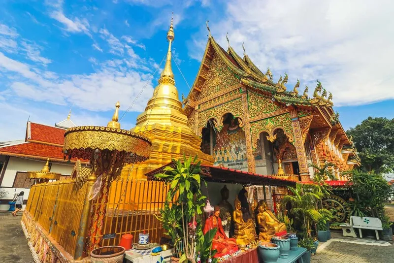
9. Wat Mahawan, also known as Wat Mahawan Wanaram, is located on Chamthewi Road in Lamphun’s old city. This ancient temple is associated with Queen Chamadevi, the Phra Phuttha Sikkhi image, and the legend of the famous Phra Rod Mahawan amulets, which are widely known throughout Thailand.
Highlights: Phra Phuttha Sikkhi, also known as the Black Stone Buddha, Phra Rod Luang, the legend of Phra Rod Mahawan, its location within ancient Hariphunchai, and its proximity to the old city moat.
According to tradition, Wat Mahawan was established around the beginning of Queen Chamadevi’s reign in Hariphunchai, around the 7th century CE. It is therefore regarded as one of the temples closely connected with the formative period of the city and the spread of Buddhism in Hariphunchai.
One of the temple’s most important sacred objects is Phra Phuttha Sikkhi, or the Black Stone Buddha, which is associated with stories of a Buddha image brought from Lavo. Lamphun residents also refer to the image as Phra Rod Luang or Phra Rod Lamphun.
Wat Mahawan is also inseparable from the tradition of Phra Rod Mahawan, one of Lamphun’s most famous sacred amulets and an important name in Thai amulet culture. This gives the temple significance in religious, archaeological, and cultural contexts.
Despite its central location, the temple has a relatively peaceful atmosphere. It is a worthwhile stop for travelers interested in Buddhist worship, the history of Phra Rod amulets, and the ancient religious landscape of Lamphun.
Wat Phra That Hariphunchai Woramahawihan, Hariphunchai National Museum, and the Queen Chamadevi Monument can all be reached within a short distance.
Open Days: Daily Opening Hours: 06:00 – 18:00
Getting There: Wat Mahawan is located at 52 Chamthewi Road, Nai Mueang Subdistrict, Mueang Lamphun District. It can be reached from the Wat Phra That Hariphunchai area by car, motorcycle, bicycle, or on foot as part of an old-city route.
Map (GPS):Open Google Maps – Wat Mahawan

10. Ku Chang–Ku Ma is located in the Wat Kai Kaeo community of Nai Mueang Subdistrict, Mueang Lamphun District. The site consists of two ancient monuments associated with legends of Queen Chamadevi, her royal war elephant, and the horse connected with her son.
Highlights: The cylindrical Ku Chang monument with its rounded upper form, the bell-shaped Ku Ma, the legend of Pu Kam Nga Khiao, the Chao Pho Ku Chang shrine, and beliefs associated with victory, achievement, and good fortune.
Ku Chang is traditionally believed to contain the remains of Queen Chamadevi’s royal war elephant, known as Phu Kam Nga Khiao or Pu Kam Nga Khiao. Local legends describe the elephant as exceptionally powerful and important in warfare, and it continues to be respected by the community.
Ku Ma stands nearby and is associated with the horse belonging to Queen Chamadevi’s son. Its architectural form differs from Ku Chang, giving this relatively compact site two distinct types of ancient monuments.
The site remains an active place of local belief. People visit the Chao Pho Ku Chang shrine to pray for success in work, education, travel, and other personal goals. Visitors should therefore approach the site respectfully and observe local customs.
Historically, Ku Chang–Ku Ma adds another layer to the story of Hariphunchai when visited together with Wat Chamthewi, the Queen Chamadevi Monument, and Hariphunchai National Museum. These places allow visitors to consider archaeological evidence and local legend side by side.
The site is relatively small and usually requires around 30–60 minutes. It fits naturally into a Lamphun city route focused on Queen Chamadevi and the early history of Hariphunchai.
Open Days: Daily Opening Hours: 08:00 – 17:00
Getting There: From central Lamphun, take the old Chiang Mai–Lamphun road and enter the local lane near Chakkham Khanathon School or the Ku Chang access road. Directional signs are available within the community.
Map (GPS):Open Google Maps – Ku Chang–Ku Ma

11. Wat Phra Khong Rueasi, also known as Wat Anantharam, is located in Nai Mueang Subdistrict, Mueang Lamphun District. This ancient temple is closely connected with the history of the Hariphunchai Kingdom, legends of the hermits associated with the founding of the city, and Phra Khong, one of Lamphun’s most respected ancient clay amulets.
Highlights: Phra Khong amulets, ancient Lamphun amulet traditions, legends of Wasuthep Rueasi and Sukkathanta Rueasi, historic chedis and religious structures, and beliefs surrounding sacred temples believed to have protected the ancient city of Hariphunchai.
According to local tradition, the temple was once known as Wat Aphattharam and is believed to have been established during the reign of Queen Chamadevi as a residence and place of religious practice for Buddhist monks who had traveled from Sri Lanka. The temple therefore reflects the relationship between Buddhism and the early development of Hariphunchai.
What makes the temple especially famous is “Phra Khong,” an ancient clay amulet highly respected for beliefs associated with stability, protection, and auspiciousness. Phra Khong is considered one of the major ancient amulet types of Lamphun, and the temple’s name is directly associated with this tradition.
Local legends also connect the creation of Phra Khong with Wasuthep Rueasi and Sukkathanta Rueasi, two hermits who play important roles in stories surrounding the founding of Hariphunchai. This gives the temple value not only as a Buddhist site but also as a place where belief, legend, and urban history intersect.
Wat Phra Khong Rueasi can also be studied together with Wat Mahawan, Wat Pratu Li, and other ancient temples within Lamphun city to gain a deeper understanding of the sacred geography and urban structure of ancient Hariphunchai.
Travelers interested in sacred amulets, history, and Hariphunchai art should allow around 30–60 minutes for a visit. The temple can conveniently be combined with Wat Phra That Hariphunchai Woramahawihan, Wat Chamthewi, and Hariphunchai National Museum.
Open Days: Daily Opening Hours: 08:00 – 17:00
Getting There: The temple is located in Nai Mueang Subdistrict, Mueang Lamphun District. It can be reached from the old city by car, motorcycle, bicycle, or included as part of a temple route through central Lamphun.
Map (GPS):Open Google Maps – Wat Phra Khong Rueasi

12. Ban Nong Ngueak Handwoven Cotton Village is located in Ban Nong Ngueak, Mae Raeng Subdistrict, Pa Sang District. The community is well known for handwoven cotton, naturally dyed cotton textiles, and a wide range of cotton-based products created from skills passed down through generations.
Highlights: Handwoven cotton, natural dyeing, traditional weaving looms, Tai Yong community life, cotton products, and opportunities to learn how cotton is transformed from yarn into finished fabric.
Ban Nong Ngueak has been known for cotton weaving for generations. Local weavers continue to use skills learned within their families to select cotton threads, prepare yarn, dye fibers, set up traditional looms, and weave a variety of patterns. Each finished piece reflects craftsmanship, patience, and the cultural identity of the community.
Products include lengths of fabric, clothing, cushion covers, tablecloths, curtains, bags, and home-decor items. Many designs have been adapted for modern lifestyles while preserving the fundamental use of cotton and community-based weaving techniques.
The appeal of visiting Ban Nong Ngueak goes beyond shopping. Travelers can observe the actual production process and understand how many individual stages are required before cotton yarn becomes a finished textile.
The wider village also reflects the culture of the Tai Yong people, who maintain distinctive traditions in language, clothing, handicrafts, and community life. Travelers interested in local history can combine a visit to the weaving community with nearby Wat Nong Ngueak and other learning sites within the village.
Buying products directly from community groups helps generate income for local weavers and supports the continuation of traditional knowledge. This makes the village particularly suitable for travelers looking for meaningful locally made souvenirs.
Open Days: Visitors are advised to contact the community in advance Opening Hours: Daytime is the most suitable period for visiting
Getting There: From Lamphun city, travel toward Pa Sang District, then continue into Mae Raeng Subdistrict and Ban Nong Ngueak. A car or motorcycle is the most convenient option, and the village can easily be combined with Wat Phra Phutthabat Tak Pha.

13. Ban Don Luang Handicraft Village is located in Moo 7, Mae Raeng Subdistrict, Pa Sang District. It is an old Tai Yong community and one of Lamphun’s major handwoven cotton production centers, with weaving groups, tailoring groups, tie-dye and batik producers, and a wide range of community handicrafts.
Highlights: Tai Yong handwoven cotton, four-heddle weaving groups, cotton product processing, traditional community life, and the annual “Taeng Si Uat Lai Pha Fai Don Luang” cotton festival.
The village’s history is connected with Tai Yong migrants who settled in Lamphun during the period of regional reconstruction following earlier conflicts. The community was originally known as “Ban Ko Thon” before later becoming Ban Don Luang, a name associated with its location on elevated ground.
Textile craftsmanship remains central to village life. Today the community includes weaving groups, tailoring groups, product-processing groups, longan-farming groups, and batik and tie-dye groups. Together they demonstrate how traditional handicrafts can develop into a sustainable local economy.
Visitors can walk through shops and homes selling locally produced cotton goods, including clothing, lengths of fabric, household items, bags, and decorative products. Many of these pieces are made directly by residents of the village.
The “Taeng Si Uat Lai Pha Fai Don Luang” festival is an important community event showcasing local cotton textiles and Tai Yong culture. During the event, villagers display and sell products while presenting traditional skills and community identity in a lively setting.
Ban Don Luang is well suited to travelers interested in slow travel and community-based tourism because it encourages visitors to spend time observing craftsmanship, speaking with local people, and buying directly from producers.
Open Days: Daily Opening Hours: Daytime is the most suitable period for visiting
Getting There: Ban Don Luang is approximately 7 kilometers from Pa Sang town and around 23 kilometers from Lamphun city. Traveling by private car is convenient.

14. Tha Chompoo Bridge, also known as the “White Bridge,” is located at Ban Tha Chomphu in Tha Pla Duk Subdistrict, Mae Tha District. This white reinforced-concrete railway bridge is distinguished by its elegant arches stretching across open fields and remains in active use on Thailand’s Northern Railway Line.
Highlights: A white concrete railway bridge, Western-style arches, a length of approximately 87.3 meters, Northern Railway history, and picturesque rice-field and mountain scenery.
Construction of the bridge began around 1918 and was completed around 1920, during a period when building the Northern Railway was a major engineering challenge and materials were difficult to obtain because of wartime conditions.
Instead of using the steel structure typical of many railway bridges, engineers used reinforced concrete. The bridge’s distinctive white arches eventually became both an architectural landmark and one of Mae Tha District’s most recognizable images.
The bridge crosses the Tha River and lies on the railway section between Khun Tan and Tha Chomphu stations. When a train crosses the bridge, the combination of the white structure, railway carriages, rice fields, and surrounding mountains creates an especially memorable scene.
The area around the bridge is popular for photography, but it remains part of an active railway. Visitors should stay within designated safe areas, avoid walking on the tracks, and never stand inside the operating railway corridor.
Tha Chompoo Bridge can be combined with Khun Tan Railway Tunnel, Doi Khun Tan National Park, and communities around Tha Pla Duk, creating a route that combines engineering heritage with natural scenery.
Open Days: Daily Opening Hours: Open throughout the day
Getting There: The bridge is located at Ban Tha Chomphu, Tha Pla Duk Subdistrict, Mae Tha District, opposite Wat Tha Chomphu. It can be reached by car via local roads from Mae Tha toward Tha Pla Duk.
Map (GPS):Open Google Maps – Tha Chompoo Bridge

15. Ban Tha Pa Pao is located in Tha Pla Duk Subdistrict, Mae Tha District. It is an ecotourism community known for forest restoration, natural-resource conservation, and community-based forest management.
Highlights: Community forest conservation, ecosystem restoration, nature-learning routes, local knowledge, sustainable resource use, and community practices influenced by the sufficiency economy philosophy.
Ban Tha Pa Pao once faced serious problems from logging and environmental degradation. In response, villagers worked together to establish community rules and restore the surrounding forest, eventually helping the area regain much of its natural richness.
The community’s forest management approach does not simply prohibit all resource use. Instead, it emphasizes using only what is necessary while protecting the forest collectively. This makes the village an important example of natural-resource management closely connected with everyday local life.
Visitors can learn about watershed forests, native plants, ecosystems, and restoration methods, as well as how local residents transformed an area once affected by resource degradation into a functioning community conservation zone.
The main appeal of Ban Tha Pa Pao lies in learning rather than simply taking photographs. Travelers should spend time walking through the area and listening to community stories in order to understand the context of conservation more deeply.
The village is suitable for students, families, educational groups, and travelers interested in sustainable tourism. It can be combined with Tha Chompoo Bridge and other attractions in Mae Tha District.
Open Days: Daily Opening Hours: Visitors should contact the community in advance before traveling
Getting There: Travel toward Mae Tha District, then continue into Tha Pla Duk Subdistrict and Ban Tha Pa Pao. A private car is the most convenient option. Visitors planning educational activities or forest visits should coordinate with the community beforehand.
Map (GPS):Open Google Maps – Ban Tha Pa Pao

16. Mae Thi Reservoir is located at Ban Doi Wiang, Moo 9, Ban Thi Subdistrict, Ban Thi District. It is an important reservoir supporting water management and agriculture while also serving as a peaceful recreational area close to Lamphun city.
Highlights: A broad reservoir surrounded by mountains, open viewpoints, a quiet atmosphere, and relaxing scenery in the morning and late afternoon.
Mae Thi Reservoir has a storage capacity of approximately 5 million cubic meters and supports around 5,000 rai of agricultural land. Its role within the community therefore extends well beyond tourism.
The landscape around the reservoir is open and spacious, with mountains forming a backdrop to the water. Mornings are generally fresh and quiet, while late-afternoon light reflecting across the reservoir makes the area particularly suitable for photography and relaxation.
The area is not heavily commercialized, making it suitable for visitors who prefer quieter destinations and want to spend unhurried time beside the water.
From the end of the rainy season through winter, the surrounding landscape becomes greener and the weather more comfortable, making the reservoir a pleasant stop while exploring Ban Thi or traveling onward toward Mae Tha.
Because the reservoir is a working water source used by local communities, visitors should keep the area clean and avoid activities that interfere with agricultural or water-management operations.
Open Days: Daily Opening Hours: Recommended visiting time 06:00 – 18:00
Getting There: Mae Thi Reservoir is located at Ban Doi Wiang in Ban Thi Subdistrict, approximately 5 kilometers from Ban Thi district center. It is easily accessible by car or motorcycle.
Map (GPS):Open Google Maps – Mae Thi Reservoir

17. Wat Nong Ngueak is located in Ban Nong Ngueak, Mae Raeng Subdistrict, Pa Sang District. This historic Tai Yong community temple is distinguished by local Lanna stucco decoration, a scripture hall influenced by Burmese artistic traditions, and the peaceful atmosphere of a traditional village temple.
Highlights: Decorative stucco entrance arches, a scripture hall with Burmese artistic influence, traditional Lanna craftsmanship, and the temple’s close connection with the cotton-weaving community of Ban Nong Ngueak.
The temple’s history began in 1828 when a local resident named Nai Chai wished to establish a temple for the village and consulted Khruba Parami. Construction was completed in 1829, and the temple was named after the surrounding community.
The entrance arch is one of the most interesting architectural features to examine closely. Its stucco decoration reflects both Buddhist beliefs and the artistic preferences of local craftsmen.
The scripture hall is another important feature. Traditionally used for preserving Buddhist manuscripts and palm-leaf texts, its architectural form shows Burmese influence adapted to the Lanna cultural setting of Pa Sang District.
The temple continues to serve as a spiritual center for the village and remains closely connected with Tai Yong culture and the cotton-weaving traditions of Ban Nong Ngueak.
Visitors should combine the temple with Ban Nong Ngueak Handwoven Cotton Village, as the two attractions are located close together and offer a more complete view of local religion, architecture, and handicraft traditions.
Open Days: Daily Opening Hours: 08:00 – 17:30
Getting There: Wat Nong Ngueak is located in Ban Nong Ngueak, Mae Raeng Subdistrict, approximately 4 kilometers south of Pa Sang District Office and close to the Pa Sang–Li route.
Map (GPS):Open Google Maps – Wat Nong Ngueak

18. Ban Mae Khanat Karen Village is located at Ban Mae Khanat, Moo 8, Tha Kat Subdistrict, Mae Tha District. It is a Pga K’nyau Karen community where local language, traditional clothing, handwoven textiles, and community ways of life remain clearly visible.
Highlights: Karen weaving, Pga K’nyau clothing, hand-dyeing and weaving, a community lifestyle influenced by sufficiency-economy principles, and opportunities to learn about ethnic culture.
The name Ban Mae Khanat is connected with Mae Khana stream, also known locally as Mae Khanat River, which runs through the area. The community has therefore long maintained a close relationship with forests, water sources, and agricultural land.
Traditional clothing is an important part of cultural identity. Married women commonly wear red woven sarongs decorated with distinctive patterns and Job’s tears seeds, while unmarried young women traditionally wear long white garments. Men also have their own forms of shirts and traditional dress.
Textile production still begins with fundamental processes such as preparing cotton, spinning yarn, weaving, dyeing, and decorating patterns. Each stage requires substantial skill and represents knowledge passed down between generations.
The village produces a range of items including shawls, blankets, clothing, shoulder bags, and handwoven Karen textiles. Buying directly from local producers helps support traditional knowledge and provides income to community households.
Visitors should respect local ways of life, avoid photographing individuals without permission, and support community services or locally made products whenever possible.
Open Days: Daily Opening Hours: Daytime is the most suitable period for visiting
Getting There: Travel toward Mae Tha District, then continue into Tha Kat Subdistrict and Ban Mae Khanat, Moo 8. A private vehicle is the most convenient way to reach the community.

19. Mae Wang San Reservoir is located in Nakhon Chedi Subdistrict, Pa Sang District. This reservoir in the Mae Ao watershed serves both as a water-storage facility and a peaceful recreational area surrounded by mountains.
Highlights: Reservoir views, mountain scenery, a quiet atmosphere, floating structures, lakeside restaurants, and attractive morning and evening light.
The reservoir is particularly scenic because of its wide expanse of water framed by mountain ridges. Morning and late-afternoon light are generally the most suitable periods for photography.
The atmosphere is relaxed and considerably quieter than major commercial tourist attractions, making the reservoir suitable for families, groups of friends, or travelers simply looking for a peaceful place beside the water.
Some sections of the reservoir have floating structures and restaurants, allowing visitors to relax, eat, and enjoy the scenery at the same time. Opening schedules for individual businesses should be checked on the day of travel.
The reservoir also plays an important role in local water management, so visitors should keep the area clean and avoid activities that interfere with its practical use by surrounding communities.
Mae Wang San Reservoir can be included as a stop on a Pa Sang route together with Wat Phra Phutthabat Tak Pha, Ban Nong Ngueak, and Ban Don Luang.
Open Days: Daily Opening Hours: Recommended visiting time 06:00 – 18:00
Getting There: From Pa Sang District, travel toward Nakhon Chedi Subdistrict and follow local roads to the reservoir. A private car is the most convenient option.

20. Mae Tha Woodcarving Village is centered around Ban Nong Yang Khrai in Tha Thung Luang Subdistrict, Mae Tha District, together with several nearby villages. It is a local woodcarving center built around household industries and craftsmanship passed down through generations.
Highlights: Hand-carved wooden figures of people and animals, home decorations, household objects, souvenirs, and opportunities to observe local artisans at work.
A distinctive feature of the area is the number of woodworkers operating from individual households. They produce carvings in a wide range of sizes, from small souvenirs to large decorative pieces for homes, hotels, restaurants, and resorts.
Each piece requires several stages, including design, timber selection, rough shaping, detailed carving, sanding, and finishing. Many craftspeople learned these skills from older family members, helping preserve woodcarving knowledge within the community.
Products include both traditional and contemporary designs, such as animal figures, human figures, practical objects, decorative pieces, and wooden toys. This variety allows the community’s products to appeal to different groups of buyers.
The village is especially interesting for travelers who appreciate handicrafts and design because it offers a clear view of the difference between handmade craftsmanship and industrial production. Visitors can also buy directly from producers in the area.
Mae Tha Woodcarving Village can be combined with Tha Chompoo Bridge, Ban Tha Pa Pao, and other attractions in Mae Tha District, creating a route that includes craftsmanship, community life, and nature.
Open Days: Daily Opening Hours: Daytime is the most suitable period for visiting
Getting There: Travel toward Mae Tha District, then continue into Tha Thung Luang Subdistrict and Ban Nong Yang Khrai, as well as nearby villages where woodcarving workshops are located. A private vehicle is the most convenient option.

21. Wat Tha Kat is located in Tha Kat Subdistrict, Mae Tha District. This historic temple is associated with the early period of the Hariphunchai Kingdom and continues to serve as an important Buddhist center for the Mae Tha community.
Highlights: An ancient temple in Mae Tha District, the ordination hall, sermon hall, Buddhist scripture school, historic Buddha images, and a long history linked with the period of Queen Chamadevi.
The history of Wat Tha Kat stretches back more than 1,300 years and is traditionally connected with the era of Queen Chamadevi, the first ruler of Hariphunchai. During that period, temples did not function only as religious sites but also as centers for education, Buddhist teaching, and community gatherings.
Over many centuries, the temple has undergone restoration and development, while retaining the role of a traditional Lanna community temple. Its buildings include an ordination hall, sermon hall, monks’ dining area, monastic residences, and facilities for Buddhist education.
The Buddha images and religious objects preserved within the temple reflect the long continuity of Buddhism in the Mae Tha area. Travelers interested in local history can use Wat Tha Kat as a point for understanding the relationship between the Hariphunchai Kingdom and communities east of Lamphun city.
Today the temple remains a spiritual center for local residents and continues to host Buddhist activities throughout the year. The atmosphere is peaceful and relatively uncrowded, making it suitable for worship, merit-making, and learning about an active local temple.
Wat Tha Kat can be combined with Ban Mae Khanat Karen Village, Mae Tha Woodcarving Village, Tha Chompoo Bridge, and Ban Tha Pa Pao, creating a route that combines religion, community culture, handicrafts, and nature.
Open Days: Daily Opening Hours: 08:00 – 17:00
Getting There: From Lamphun city, travel toward Mae Tha District and continue into Tha Kat Subdistrict. The temple is located within the local community and can be reached easily by car or motorcycle.
Map (GPS):Open Google Maps – Wat Tha Kat

22. Doi Kaew Agricultural Market (Kad Ban Tha) is located at Ban Doi Kaew, Moo 12, Tha Sop Sao Subdistrict, Mae Tha District. This roadside local market along the Chiang Mai–Lampang route reflects a way of life based on forest products, agriculture, and seasonal resources gathered by local communities.
Highlights: Wild mushrooms, bamboo shoots, wild sweet-leaf vegetables, Chiang Da vegetables, local herbs, seasonal produce, Northern Thai food, and the atmosphere of a traditional community market.
One of Kad Ban Tha’s defining features is its selection of forest products that can be difficult to find in urban markets, including hed phor mushrooms, termite mushrooms, bamboo shoots, wild sweet-leaf vegetables, and seasonal herbs. Many products are collected from nearby natural areas or grown locally before being brought directly to market by villagers.
The market began from a simple local practice in which residents gathered food from forests and farms and sold surplus produce beside the road. As increasing numbers of travelers on the Chiang Mai–Lampang route stopped to buy these goods, the small roadside trading area gradually developed into a community market.
Beyond fresh ingredients, visitors can also find Northern Thai dishes such as bamboo-shoot curry, mushroom curry, chili dips, and other local foods. This makes the market especially interesting for travelers who want to understand regional ingredients rather than simply stop for shopping.
Morning is generally the best time to visit because products are freshest and temperatures are cooler. Many forest products are strongly seasonal, so the market’s selection changes throughout the year.
Kad Ban Tha is particularly suitable for food travelers, community-tourism enthusiasts, and motorists looking for a meaningful stop along the Mae Tha–Lampang route. It can be combined easily with Tha Chompoo Bridge and other attractions in Mae Tha District.
Open Days: Daily Opening Hours: Morning – late morning
Getting There: The market is located at Ban Doi Kaew, Tha Sop Sao Subdistrict, Mae Tha District, beside the Chiang Mai–Lampang route and approximately 4 kilometers from the Mae Tha district area.

23. Chao Pho Lak Mueang Li Shrine is located in Li District and is an important center of local faith. The shrine reflects traditional Lanna beliefs in protective guardian spirits associated with the settlement and well-being of a community.
Highlights: Li’s city-pillar shrine, beliefs associated with protection, prayers for work, health, success, and auspicious beginnings, and the atmosphere of a living local place of worship.
Within Lanna cultural traditions, a city pillar is more than a physical marker. It is also connected with beliefs in sacred powers responsible for protecting the settlement and promoting stability and prosperity.
Residents of Li District continue to respect the shrine as a sacred place where people can pray during important moments, such as before traveling, beginning a business, taking examinations, or starting a new stage in life.
Although the shrine is not as large as major city-pillar shrines in provincial capitals, its strength lies in its peaceful atmosphere and continued importance to the local community, demonstrating the close relationship between belief and everyday life.
For travelers who want to understand Li District beyond Mae Ping National Park and Kaeng Ko, a visit to the shrine adds an important cultural and spiritual dimension to the journey.
It can be combined with the Three Kruba Monument, Wat Phra That Ha Duang, and Wat Ban Pang to create a route centered on faith and history in Li District.
Open Days: Daily Opening Hours: 06:00 – 18:00
Getting There: Take Highway 106 into Li town and follow local streets toward the city-pillar shrine. Both cars and motorcycles can reach the site easily.

24. Wat Pa Hieng is located in Ban Kong Ngam, Mae Raeng Subdistrict, Pa Sang District. This historic temple is especially notable for its century-old scripture hall standing over a pond, an important example of Lanna wooden architecture and a registered historic structure.
Highlights: The over-water scripture hall, Lanna woodcarving, carved doors and gables, important historic architecture, and the atmosphere of a traditional Pa Sang community temple.
Wat Pa Hieng was established in 1877 and has remained a religious center for the surrounding community. Its most distinctive architectural feature is the scripture hall built over water, which reflects both practical knowledge and reverence for Buddhist manuscripts.
Building scripture halls over ponds helped protect palm-leaf manuscripts from termites, ants, and other insects while also physically separating sacred texts from ordinary daily-use buildings.
The structure is built largely of wood and features decorative carving on the gables and door panels, providing a valuable example of the craftsmanship of earlier Lanna artisans. Travelers interested in architecture should spend time examining these details rather than viewing the building only from a distance.
Because the temple is located in Pa Sang, an area rich in old temples and textile communities, it can easily be combined with Ban Don Luang, Ban Nong Ngueak, and Wat Inthakhil.
The temple has a peaceful atmosphere and is ideal for travelers who appreciate community temples preserving traditional architecture without the crowds of larger attractions.
Open Days: Daily Opening Hours: 08:00 – 17:00
Getting There: Travel toward Pa Sang District and continue into Mae Raeng Subdistrict and Ban Kong Ngam. The temple can be reached easily by car or motorcycle.
Map (GPS):Open Google Maps – Wat Pa Hieng

25. Wat Inthakhil is located in Ban Pa Sang, Pa Sang Subdistrict, Pa Sang District. The temple is notable for housing the Inthakhil, or city pillar, of ancient Wiang Pa Sang and remains an important center for beliefs concerning the protection and prosperity of the settlement.
Highlights: The Inthakhil city pillar of Wiang Pa Sang, chedi, viharn, ordination hall, and the traditional floral-offering ceremony honoring the city pillar.
The temple was established in 1794 during the period when the area was known as Wiang Pa Sang, giving it close connections with the former urban structure, local administration, and beliefs surrounding the city pillar.
The Inthakhil is the temple’s most important sacred object. Local people regard it as a spiritual center believed to protect the settlement while promoting stability, fertility, prosperity, and good fortune.
The temple compound also contains a chedi, viharn, ordination hall, and other structures used for community religious activities, maintaining its function as a living Buddhist center in Pa Sang.
An important annual tradition is the offering of floral trays to the Inthakhil, generally held according to the Lanna calendar around May or June. Worshippers bring flowers, incense, candles, and other offerings to pray for auspiciousness.
Wat Inthakhil is particularly valuable for travelers who want to understand Pa Sang as an old settlement rather than only as a center of cotton weaving, as the temple brings together religion, local belief, and historic urban identity.
Open Days: Daily Opening Hours: 06:00 – 18:00
Getting There: Take Highway 106 from Lamphun toward Pa Sang and continue into the center of Pa Sang District. The temple is located within Ban Pa Sang and is easy to reach by road.
Map (GPS):Open Google Maps – Wat Inthakhil

26. Wat Pa Sang Ngam is located in Ban Pa Sang, Pa Sang Subdistrict, Pa Sang District. This old temple contains important Buddha images, a teak preaching throne inscribed in Lanna script, a scripture hall, and a temple museum.
Highlights: Phra Chao Wat Noi, Phra Phuttha Mongkhon Sorakan, a teak preaching throne with Lanna inscriptions, the scripture hall, museum collections, and local Pa Sang craftsmanship.
The temple developed from the site of an earlier abandoned monastery before being restored by Khruba Nanta, a wandering monk from Mueang Yong. Historical accounts indicate that the temple was established around 1837 and later formally recognized as a functioning monastery.
One of the important Buddha images is Somdet Phra Sri Wilunlakavil Prathan, commonly known among local residents as “Phra Chao Wat Noi.” The metal image combines artistic characteristics associated with Sukhothai and Chiang Saen traditions.
The teak preaching throne is another significant object, decorated with Lanna inscriptions and gilded details. It reflects both fine woodworking skills and the temple’s historical role as a center for Buddhist teaching.
The temple museum preserves objects and stories connected with both the monastery and the surrounding community, giving visitors an opportunity to learn beyond the main act of Buddhist worship.
The peaceful setting makes Wat Pa Sang Ngam suitable for travelers interested in Buddhist art, inscriptions, temple museums, and Tai Yong cultural heritage in Pa Sang.
Open Days: Monday – Friday Opening Hours: 08:00 – 16:00
Getting There: The temple is located beside the Lamphun–Pa Sang road in Ban Pa Sang and can be reached directly by car or motorcycle from Lamphun city.
Map (GPS):Open Google Maps – Wat Pa Sang Ngam

27. Wat Phra That Ha Duang, also known as Wiang Chedi Ha Lang, is located in Li Subdistrict, Li District. The temple and archaeological site are distinguished by a group of five sacred stupas standing together, along with traces of ancient moats and city walls that indicate the area once formed part of an important historic settlement.
Highlights: Five sacred stupas, Wiang Chedi Ha Lang, traces of ancient city moats and walls, the legend of five celestial crystal lights, and the annual bathing ceremony of Phra That Ha Duang.
The site has both archaeological and historical value because sections of former moats and defensive walls can still be identified, indicating earlier patterns of settlement and the importance of religious structures within the historic townscape.
Local legend tells that Queen Chamadevi learned of five radiant crystal lights appearing above five earthen mounds. She is said to have traveled to the site and ordered sacred stupas to be built over the locations, resulting in the five chedis that became the temple’s defining feature.
The group of five stupas standing within the same compound creates an unusual architectural arrangement compared with many Northern Thai temples, making the site interesting from both artistic and archaeological perspectives.
On April 20 each year, the community holds the Phra That Ha Duang bathing ceremony. Local residents gather to make merit and pour ceremonial water over the sacred stupas as an act of devotion and auspiciousness.
The temple can be combined with the Three Kruba Monument, Chao Pho Lak Mueang Li Shrine, and Mae Ping National Park, creating a route that brings together faith, history, and nature in Li District.
Open Days: Daily Opening Hours: 08:30 – 16:30
Getting There: From Li town, follow Highway 106 south for approximately 2 kilometers and turn onto the local access road for another 500 meters.

28. Kaeng Ko is located in Ko Subdistrict, Li District, within Mae Ping National Park. It is a broad body of water formed where Huai Mae Ko joins the Ping River, surrounded by mountains and limestone cliffs, and is one of Lamphun’s most distinctive natural destinations.
Highlights: The Ping River, limestone mountains, floating accommodation, scenic boat trips, mist over the water, and a peaceful natural atmosphere.
The landscape of Kaeng Ko is very different from the image many travelers associate with Lamphun. A broad expanse of water lies among surrounding mountains, and views from floating rafts or boats reveal layered ridges extending around the reservoir-like river landscape.
Popular activities include relaxing on floating accommodation and taking boat trips along the Ping River. Along the route, visitors can see limestone cliffs, forested slopes, and landforms shaped by long-term water erosion.
Morning is particularly atmospheric because light mist sometimes drifts over the water. Late afternoon is also ideal for relaxing and watching changing light over the surrounding mountains.
Kaeng Ko is especially suitable for an overnight stay or a slower trip because it is relatively far from Lamphun city. Spending more time in the area allows visitors to experience the natural surroundings without rushing.
The site can be combined with Koh Luang Waterfall and other attractions within Mae Ping National Park. Visitors should check current water levels, weather conditions, and boat or raft services before traveling.
Open Days: Open throughout the year Opening Hours: 08:00 – 18:00
Getting There: From Li District, continue into Mae Ping National Park and Ko Subdistrict. Some parts of the route are far from major communities, so a private vehicle is the most convenient option.
Map (GPS):Open Google Maps – Kaeng Ko

29. Three Kruba Monument stands in central Li District, opposite the district office. It is a landmark representing Li as the “Land of the Three Krubas” and brings together reverence for three major Lanna Buddhist masters in one place.
Highlights: Statues of Kruba Srivichai, Kruba Aphichai Khao Pi, and Kruba Chaiya Wongsa Phatthana, a central worship area, and nighttime illumination.
The monument was created to honor three monks with deep connections to Li District: Kruba Srivichai of Wat Ban Pang, Kruba Aphichai Khao Pi of Wat Phra Phutthabat Pha Nam, and Kruba Chaiya Wongsa Phatthana of Wat Phra Bat Huai Tom.
Each monk played an important role in Buddhism, community development, and the spiritual life of local people. Their combined legacy gives Li District a distinctive religious identity closely associated with the Kruba lineage.
Daytime is suitable for paying respects and beginning a trip through Li District, while evening lighting makes the monument stand out prominently in the center of town.
Travelers can use the monument as the starting point for a route following the life of Kruba Srivichai by continuing to Wat Ban Pang, or extend the journey to places associated with Kruba Aphichai Khao Pi and Kruba Chaiya Wongsa Phatthana.
Its central location makes it an easy stop before continuing toward Wat Phra That Ha Duang, Kaeng Ko, or Koh Luang Waterfall.
Open Days: Daily Opening Hours: Open throughout the day
Getting There: Follow Highway 106 into Li town. The monument stands in an open area near the main intersection opposite Li District Office.
Map (GPS):Open Google Maps – Three Kruba Monument

30. Wat Ban Pang is located at Ban Pang, Moo 1, Si Wichai Subdistrict, Li District, on a shaded hillside. The temple is highly significant to the history of Kruba Srivichai, one of the most revered Buddhist monks in Lanna history.
Highlights: The first temple where Kruba Srivichai studied as a monk, the Kruba Srivichai personal-effects museum, ordination hall, viharn, hillside religious buildings, and a pilgrimage route following the life of this major Lanna religious figure.
Wat Ban Pang played an important role in Kruba Srivichai’s life, both during his early period of Buddhist study and toward the end of his life. This connection makes the temple a major pilgrimage destination for devotees who want to follow the story of a monk who had a profound influence on Buddhism in Northern Thailand.
Kruba Srivichai is widely remembered for restoring and constructing temples, religious structures, roads, and other public works throughout Lanna. Respect for him therefore extends far beyond Li District and Lamphun Province.
One of the temple’s most important attractions is the museum preserving his personal religious belongings, including robes, pillows, spittoons, vases, and other everyday objects. These items provide visitors with a closer view of the simple way of life associated with the revered monk.
The temple is located on a wooded hillside and has a calm atmosphere suitable for unhurried exploration. In addition to its historical significance, it includes an ordination hall, viharn, and worship areas reflecting the architecture of a traditional Lanna temple.
For a more meaningful journey, Wat Ban Pang should be combined with the Three Kruba Monument and extended to places associated with Kruba Aphichai Khao Pi and Kruba Chaiya Wongsa Phatthana, helping travelers understand why Li District is known as the “Land of the Three Krubas.”
Open Days: Daily
Getting There: Wat Ban Pang is located at 381 Moo 1, Si Wichai Subdistrict, approximately 38 kilometers from Li town. Take Highway 106 on the Li–Ban Hong–Chiang Mai route and continue onto the local road toward Ban Pang.
Map (GPS):Open Google Maps – Wat Ban Pang

31. Wat Phra Phutthabat Pha Nam is located at Ban Pha Nam, Moo 12, Pa Phai Subdistrict, Li District. It is an important pilgrimage site in southern Lamphun and is closely connected with Kruba Aphichai Khao Pi, also known as Kruba Khao Pi, one of the principal disciples of Kruba Srivichai.
Highlights: The preserved body of Kruba Khao Pi, the sacred Buddha footprint, meditation areas, Doi Pha Nam, a peaceful forested setting, and a pilgrimage route linked with one of Lanna’s important Buddhist masters.
The temple is situated at the foot of Doi Pha Nam amid mountains and forest, giving it a calm atmosphere that brings together Buddhist devotion and the natural environment.
The history of the temple is closely associated with Kruba Khao Pi, an important Buddhist monk who played a major role in spreading Buddhism and supporting local communities in Northern Thailand. He was a leading disciple of Kruba Srivichai and remains highly respected among the people of Lamphun.
After Kruba Khao Pi passed away on March 3, 1977, his preserved body was enshrined in a glass coffin at the temple. Devotees continue to visit the site to pay respects and remember his teachings, conduct, and contributions.
Wat Phra Phutthabat Pha Nam is particularly suitable for travelers following the religious heritage of Li District, known as the “Land of the Three Krubas.” It can be combined with Wat Ban Pang, the Three Kruba Monument, and sites associated with Kruba Chaiya Wongsa Phatthana.
Visitors should dress respectfully and explore the area quietly because the temple remains an active place of worship and meditation for monks and Buddhist practitioners.
Open Days: Daily Opening Hours: 06:00 – 18:00
Getting There: Take Highway 106 into Li District, then continue toward Pa Phai Subdistrict and Ban Pha Nam. A private vehicle is the most convenient option.

32. Huai Tom Royal Project Development Center is located in Na Sai Subdistrict, Li District. It is an agricultural and cultural learning destination where visitors can explore the relationship between livelihood development, natural-resource conservation, and the traditions of the Pga K’nyau community at Phra Bat Huai Tom.
Highlights: Royal Project agricultural plots, cool-climate crops, fruit trees, medicinal plants, traditional weaving, silverwork, coconut-shell crafts, vegetarian community life, and Pga K’nyau culture.
A major turning point came in 1978 when King Bhumibol Adulyadej, Rama IX, visited the people of Ban Phra Bat Huai Tom. The community was subsequently supported through the Royal Project Foundation to develop livelihoods, restore natural resources, and improve quality of life.
The center contains demonstration plots for vegetables, fruit, flowers, and medicinal plants. Visitors can learn how crops are selected for local conditions, how agricultural production can generate sustainable income, and how land and water resources can be managed more effectively.
Another important aspect is the culture of the Pga K’nyau community at Phra Bat Huai Tom. Traditional textile weaving, silverwork, coconut-shell jewelry, and basketry remain important local skills, while vegetarian food practices form a distinctive part of community identity.
After the harvest season, the community also holds a new-rice merit-making tradition around January. This event reflects the connection between agriculture, belief, gratitude, and the natural environment.
The center is therefore well suited to travelers interested in Royal Project agriculture, community development, ethnic culture, and tourism that contributes directly to local livelihoods.
Open Days: Daily Opening Hours: 08:30 – 16:30
Getting There: From Li town, continue toward Na Sai Subdistrict and the Phra Bat Huai Tom community. A private car is recommended, and the center can be combined easily with Wat Phra Bat Huai Tom and nearby community attractions.

33. Huai La Karen Development Village is located at Moo 2, Pa Phlu Subdistrict, Ban Hong District. This Karen community continues to preserve traditional backstrap weaving, natural dyeing, and a way of life closely connected with forests and local resources.
Highlights: Traditional backstrap looms, Karen textiles, natural dyes, ethnic clothing, community life, and cultural learning through community-based tourism.
Textile weaving is one of the village’s most distinctive forms of local knowledge. Weavers use their own bodies to maintain tension on the loom, requiring skill and experience that has been passed down over generations.
Many textile colors are produced from locally available natural materials. Preparing yarn, dyeing fibers, and creating woven patterns therefore reflects both botanical knowledge and craftsmanship.
Visitors may be able to observe weaving, purchase woven cloth, clothing, bags, and other locally made products. Buying directly from community producers supports household income and helps preserve traditional skills.
The village is appealing precisely because it has not been developed into a heavily commercialized tourist attraction. Visitors should therefore treat it as a living community and respect the everyday routines of local residents.
Anyone wishing to photograph people or enter private working areas should ask permission first so that tourism remains respectful and culturally appropriate.
Open Days: Daily Opening Hours: Daytime is the most suitable period for visiting
Getting There: Take Highway 106 on the Lamphun–Li route. Around kilometer 107–108, turn toward the village following local signs. A private vehicle is the most convenient option.

34. Wat Phra That Doi Kwang Kham is located at Ban Pong Daeng–Sanchai in Thung Hua Chang Subdistrict, Thung Hua Chang District. This hilltop temple is important for local Buddhist devotion and is associated with Kruba Chaiya Wongsa Phatthana, one of the major Buddhist masters connected with southern Lamphun.
Highlights: Phra That Doi Kwang Kham, a sacred Buddha footprint, a crowned Buddha image in the Maha Chakraphat style, views over Thung Hua Chang, and a pilgrimage route connected with Kruba Chaiya Wongsa Phatthana.
The temple stands on elevated ground, giving it a different atmosphere from temples in the lowlands. The journey up the hill to pay respects to the sacred stupa while looking across the surrounding landscape is an important part of the visit.
Phra That Doi Kwang Kham serves as a major focus of faith for local residents, while the sacred Buddha footprint adds another layer of religious importance and makes the temple a notable pilgrimage destination in Thung Hua Chang District.
Inside the viharn is a crowned principal Buddha image in the Maha Chakraphat style. Its appearance is elegant and distinct from the more common principal Buddha images found in many Lanna temples, making it worth examining closely.
The temple is associated with Kruba Chaiya Wongsa Phatthana, a monk who played an important role in both Buddhism and community development in Lamphun. This makes the temple relevant to travelers following the wider Kruba pilgrimage route through Li District and nearby areas.
Visitors traveling to Thung Hua Chang should allow time to enjoy the temple at a relaxed pace and appreciate the surrounding scenery, as this part of the province receives fewer visitors than central Lamphun.
Open Days: Daily Opening Hours: 08:00 – 17:00
Getting There: Travel into Thung Hua Chang District and continue toward Ban Pong Daeng–Sanchai. A private car is the most practical option because the temple is located in a hill area.

35. Ku Hueang–Ku Pa Lan is located in the Ban Si Don Chai area of Ban Thi Subdistrict, Ban Thi District. These archaeological remains reflect traces of religion and early settlement in the Ban Thi area through brick-and-plaster structures and surviving stucco decoration.
Highlights: Mandapa-style structures, molded-base architecture, niches, stucco patterns of flowers and leaves, Dharma wheels, peacocks, and horse motifs.
Ku Pa Lan stands behind the viharn of Wat Ku Pa Lan and takes the form of a brick-and-plaster mandapa. Its lower section consists of a square base with molded decorative elements. Although parts of the structure are damaged, its architectural form remains clearly visible.
Ku Hueang is another nearby archaeological structure with a square plan. The main chamber is surrounded by projecting sections on four sides. The eastern side functions as the entrance, while the other sides contain recessed niches.
The surviving stucco decoration is especially important and includes bead patterns, flowers, leaves, Dharma wheels, peacocks, and horse figures. These details help illustrate artistic styles and religious beliefs of earlier communities in the area.
Local oral traditions describe the area as an old temple site that was later abandoned during periods of conflict and migration. Villagers eventually returned, restored the area, and established new religious structures.
Ku Hueang–Ku Pa Lan is especially suitable for travelers interested in archaeology and architecture. It can be combined with Wat Ban Thi Luang, Mae Thi Reservoir, and other attractions in Ban Thi District.
Open Days: Daily Opening Hours: 08:00 – 17:00
Getting There: Travel into Ban Thi Subdistrict and continue toward Ban Si Don Chai and the Wat Ku Pa Lan area. The site is accessible by car or motorcycle.
Map (GPS):Open Google Maps – Ku Hueang–Ku Pa Lan

36. Wat Ban Thi Luang is located at 148 Moo 14, Ban Thi Subdistrict, Ban Thi District. It is one of the oldest temples in the area and is regarded as the first temple established in Ban Thi, with a close connection to the Mae Thi River and the early settlement of the community.
Highlights: A historic temple beside the Mae Thi River, the original spiritual center of the community, the settlement history of Ban Thi, and the atmosphere of a traditional Lanna temple beside a waterway.
The temple was established in 1732, before many of the other temples in Ban Thi were founded. In earlier times, residents of several nearby villages traveled here for Buddhist ceremonies, making it a major religious center for a wider area.
As communities expanded and transportation remained difficult, additional village temples were gradually established. Even so, Wat Ban Thi Luang retained its status as one of the oldest and most important religious centers in the district.
Its location beside the Mae Thi River reflects traditional Lanna settlement patterns, in which communities often developed near water sources used for agriculture and daily life. The temple therefore forms part of the cultural landscape of the area.
The temple received royal permission for its consecrated ordination boundary in 1995 and was recognized as a model development temple in 1996, reflecting its continuing religious and community role.
Visitors exploring Ban Thi can combine Wat Ban Thi Luang with Ku Hueang–Ku Pa Lan, Mae Thi Reservoir, and nearby community temples for a broader understanding of the district.
Open Days: Daily Opening Hours: 08:00 – 17:00
Getting There: The temple is located in Ban Thi Subdistrict beside the Mae Thi River and can be reached easily by car or motorcycle from Lamphun city.
Map (GPS):Open Google Maps – Wat Ban Thi Luang

37. Wat Pa Tan (Ban Thi) is located in Ban Pa Tan–Hong Hae, Ban Thi Subdistrict, Ban Thi District. This community temple is notable for the story of how an abandoned temple site was restored and returned to its role as the spiritual center of the village.
Highlights: The history of an abandoned temple, community-led restoration, the origin of the name from local palm trees, and the role of the temple as a community center.
Historical accounts indicate that the temple was originally established in 1832 before later being abandoned for a long period. Only brick remains and traces of earlier religious structures survived in an area where palm trees grew in large numbers.
This landscape became the origin of the name “Wat Pa Tan,” meaning the temple of the palm grove. The name therefore preserves both the former natural environment and the memory of the local community.
When people later returned to settle in the area, villagers worked together to restore the temple, invited monks to reside there, and rebuilt monastic structures until the site once again became an active religious center.
The story of Wat Pa Tan clearly reflects the strength of community participation. Its revival was not driven by tourism development but by the desire of local residents to restore a shared spiritual center and a place for Buddhist ceremonies.
Wat Pa Tan is suitable for travelers interested in local history and community temples and can be visited together with Wat Ban Thi Luang and Ku Hueang–Ku Pa Lan in the same day.
Open Days: Daily Opening Hours: 08:00 – 17:00
Getting There: The temple is located at Ban Pa Tan–Hong Hae, Moo 19, Ban Thi Subdistrict. It can be reached by car or motorcycle through local community roads.
Map (GPS):Open Google Maps – Wat Pa Tan (Ban Thi)

38. Wat Ban Hong Luang is located at Ban Hong, Moo 2, Ban Hong Subdistrict, Ban Hong District. This historic temple has stood with the community for more than 200 years and has played important roles in religion, education, and local culture.
Highlights: Phra Phuttha Mongkhon, viharn, ordination hall, chedi, Buddhist scripture school, scripture chests, and lacquered and gilded scripture cabinets.
The temple’s history can be traced back to 1776, a period when Ban Hong was developing into a settled community. The temple therefore became an important spiritual center from the early stages of local settlement.
The compound contains a complete group of religious buildings, including a viharn, ordination hall, sermon hall, monks’ residences, chedi, and Buddhist study facilities. This demonstrates that the temple has long functioned not only as a place of worship but also as an educational center.
The principal Buddha image in the viharn is known as “Phra Phuttha Mongkhon.” It is a brick-and-plaster Buddha image covered with lacquer and gold leaf and remains highly revered among residents of Ban Hong.
The scripture chests and lacquered and gilded cabinets are another significant group of objects, reflecting fine craftsmanship and the importance the community placed on preserving Buddhist teachings.
Wat Ban Hong Luang is suitable for travelers who want to understand Ban Hong District through one of its central community temples. It can be combined with Huai La Karen Development Village and other temples in the district.
Open Days: Daily Opening Hours: 08:00 – 17:00
Getting There: The temple is located at 5 Ban Hong, Moo 2, Ban Hong Subdistrict. Follow Highway 106 into Ban Hong town, where the temple is easily accessible by road.
Map (GPS):Open Google Maps – Wat Ban Hong Luang

39. Wat Pathumsararam is located at Ban San Pu Loei, Moo 2, Si Tia Subdistrict, Ban Hong District. This long-established community temple takes its name from the former landscape, where ponds filled with water lilies once covered parts of the area.
Highlights: A historic community temple, a replica Buddha footprint, viharn, ordination hall, sermon hall, and the story of the lotus-filled wetlands that inspired the temple’s name.
The temple was formally established in 1870 and has served as a Buddhist center for the Ban San Pu Loei community for more than a century.
The name “Pathumsararam” refers to the area’s former environment of ponds and water lilies, preserving a memory of the community’s original landscape within the name of the temple.
The compound contains a viharn, ordination hall, sermon hall, monks’ residences, Buddha images, and a replica of the Buddha footprint, supporting both monastic activities and religious practice by local residents.
The temple is located close to a school and educational facilities in Si Tia Subdistrict, reflecting the traditional Thai relationship between temple, village, and school as interconnected community institutions.
Wat Pathumsararam is ideal for travelers who prefer quiet community temples and can be combined with Wat Ban Hong Luang and Wat Huai Nam Dip on a route through Ban Hong District.
Open Days: Daily Opening Hours: 08:00 – 17:00
Getting There: The temple is located at Ban San Pu Loei, Moo 2, on the Muang Ton–Tha Li road in Si Tia Subdistrict, Ban Hong District. It is easily accessible by car.
Map (GPS):Open Google Maps – Wat Pathumsararam

40. Wat Huai Nam Dip is located at Ban Huai Nam Dip, Moo 5, Ban Hong Subdistrict, Ban Hong District. This historic community temple was established in the early 20th century and continues to serve as a center for Buddhist faith and shared community activities.
Highlights: A brick-and-plaster principal Buddha image, ordination hall, sermon hall, monks’ residences, local temple history, and the temple’s role in community learning.
The temple was established in 1906 under the initiative of Phra Chaiya from Wat Ban Hong Luang and received royal permission for its consecrated ordination boundary on February 3, 1950.
The temple covers approximately 9 rai and 50 square wah, with additional monastic land, reflecting its established role as the Buddhist center of the Ban Huai Nam Dip community.
Within the compound are an ordination hall, monks’ residences, sermon hall, a brick-and-plaster principal Buddha image, and several other sacred images that reflect the craftsmanship of local Northern Thai temples.
In the past, Wat Huai Nam Dip also supported educational and youth activities, including reading spaces and agricultural youth programs, showing that its social role extended beyond religious ceremonies.
The temple is suitable for travelers interested in community temples and local ways of life and can be combined with Wat Ban Hong Luang and Wat Pathumsararam to explore Ban Hong District in greater depth.
Open Days: Daily Opening Hours: 08:00 – 17:00
Getting There: Wat Huai Nam Dip is located at Ban Huai Nam Dip, Moo 5, Ban Hong Subdistrict. It can be reached from Ban Hong town by car or motorcycle using local roads.
Map (GPS):Open Google Maps – Wat Huai Nam Dip

41. Wat Don Chai is located at Ban Lao Mun, Moo 10, Lao Yao Subdistrict, Ban Hong District. This historic community temple was established in 1882 and contains a variety of architectural features, including a viharn, ordination hall, chedi, sermon hall, and a Khmer-influenced prang.
Highlights: Khmer-style prang, viharn, ordination hall, chedi, sermon hall, and the history of the Ban Lao Mun community spanning more than a century.
The temple was originally known as “Wat Den Phak Kum.” In the local Northern Thai dialect, “den” refers to elevated ground, while the area was once filled with kum trees. The former name therefore preserved both the physical landscape and vegetation of the site.
The name was later changed to “Wat Don Chai.” The word “don” again refers to raised ground, while “chai” conveys victory, prosperity, and auspiciousness. The current name therefore combines geographical meaning with a positive religious interpretation.
The temple contains a full range of structures used by monks and the local community. One of its more unusual features is the Khmer-influenced prang, which gives Wat Don Chai a distinctive architectural identity compared with many other rural Lanna temples in Ban Hong District.
The temple received royal permission for its consecrated ordination boundary on March 26, 1970. This marked an important stage in its development from a village religious center into a fully established monastic complex capable of conducting formal Buddhist ceremonies.
The surrounding area remains closely connected with the local agricultural community. Wat Don Chai is suitable for travelers seeking a quieter rural temple experience and can be combined with Wat Ban Hong Luang, Wat Huai Ha, and Wat Thung Man.
Open Days: Daily Opening Hours: 08:00 – 17:00
Getting There: From Ban Hong town, travel toward Lao Yao Subdistrict and Ban Lao Mun, Moo 10. A car or motorcycle is the most convenient option.
Map (GPS):Open Google Maps – Wat Don Chai

42. Wat Huai Ha is located at Ban Huai Ha, Moo 7, Ban Hong Subdistrict, Ban Hong District. This long-established community temple was founded through the collective faith of local residents in 1857 and continues to function as a center for religion and community learning.
Highlights: Ordination hall, viharn, chedi, multipurpose hall, Sunday Buddhist Study Center, and a long history of community-led temple development.
The temple began when villagers cleared public land and constructed simple religious buildings so that the community would have a nearby place for Buddhist ceremonies. This origin reflects the traditional relationship between temple and village in Northern Thailand.
Phra Suwan Suwanno was later appointed as the first abbot, and the temple continued to expand through the combined efforts of monks and residents.
In 1976, the community purchased additional land to enlarge the temple grounds, allowing more space for religious activities and public gatherings. Today the compound includes an ordination hall, viharn, chedi, monks’ residences, and a multipurpose pavilion.
Wat Huai Ha also operates a Sunday Buddhist Study Center, giving the temple an educational role in addition to its religious functions and helping pass Buddhist values to younger generations.
Travelers exploring Ban Hong District in depth can combine Wat Huai Ha with Wat Ban Hong Luang, Wat Don Chai, and Wat Thung Man to see how community temples continue to shape village life.
Open Days: Daily Opening Hours: 08:00 – 17:00
Getting There: Wat Huai Ha is located in Ban Huai Ha, Moo 7, Ban Hong Subdistrict. It can be reached easily from Ban Hong town by car or motorcycle.
Map (GPS):Open Google Maps – Wat Huai Ha

43. Wat Thung Man is located at Ban Thung Man, Moo 4, Pa Phlu Subdistrict, Ban Hong District. Established in 1826, the temple has long played important roles in religion, meditation practice, public education, and the preservation of community culture.
Highlights: Ordination hall, viharn, chedi, sermon hall, meditation areas, public Buddhist education programs, and community cultural activities.
The temple has stood with Ban Thung Man for nearly 200 years. Its presence close to the village has allowed local residents to make merit, listen to Buddhist teachings, and participate in Lanna religious traditions continuously across generations.
Wat Thung Man received royal permission for its consecrated ordination boundary on October 30, 1936, an important milestone in its development as a fully established Buddhist temple.
Major structures include the ordination hall, viharn, sermon hall, monks’ residences, and chedi, supporting both monastic activities and wider community gatherings.
The temple also functions as a meditation center and public education site, meaning its role extends beyond major religious holidays to year-round Buddhist learning and cultural activities.
Wat Thung Man can be combined with Huai La Karen Development Village, also located in Pa Phlu Subdistrict, creating a route that includes both Buddhist heritage and ethnic community culture.
Open Days: Daily Opening Hours: 08:00 – 17:00
Getting There: Travel from Ban Hong District toward Pa Phlu Subdistrict and Ban Thung Man, Moo 4. A private vehicle is the most convenient option.
Map (GPS):Open Google Maps – Wat Thung Man

44. Wat Pak Kong is located at Moo 2, Ban Thi Subdistrict, Ban Thi District. This historic community temple is closely connected with local Tai Lue settlement history, agricultural life, and the cultural identity of Ban Thi.
Highlights: A Tai Lue community temple, the Mae Thi River, the history of the temple’s earlier names associated with the pao tree and “Pak Klong,” and the traditional community atmosphere of Ban Thi.
The temple was formally established in 1870 and received royal permission for its consecrated ordination boundary in 1999. It has continued to serve as a center for merit-making and community religious activities.
The temple was originally known as “Wat Ton Pao,” named after a type of tree locally called ton pao. It was later known as “Wat Pak Klong,” before local pronunciation gradually evolved into the present name, Wat Pak Kong.
The Mae Thi River flows north of the temple and has long played an important role in agriculture and settlement. The temple’s location close to the river reflects a traditional Lanna pattern of establishing communities near dependable water sources.
Many residents around the temple are of Tai Lue heritage. Traditional livelihoods have included rice farming, orchard agriculture, basketry, and local trade, making the temple an important center for both religion and cultural identity.
Wat Pak Kong can be combined with Wat Ban Thi Luang, Wat Pa Tan, Ku Hueang–Ku Pa Lan, and Mae Thi Reservoir for a broader exploration of Ban Thi District.
Open Days: Daily Opening Hours: 08:00 – 17:00
Getting There: From Lamphun city, travel toward Ban Thi District and continue to Moo 2, Ban Thi Subdistrict. The temple is approximately 4.5 kilometers from Ban Thi District Office.
Map (GPS):Open Google Maps – Wat Pak Kong

45. Wat San Sai is located at Moo 5, Ban Thi Subdistrict, Ban Thi District. This historic community temple has a history stretching back more than 200 years and remains an important place for merit-making, ceremonies, and community gatherings.
Highlights: A community temple more than 2 centuries old, a large temple compound of more than 8 rai, and an enduring role as a center for local Buddhist activities.
The temple was established around 1822, making it one of the older religious sites that developed alongside the growth of the Ban Thi community.
The temple grounds cover approximately 8 rai, 1 ngan, and 7 square wah, providing sufficient space for religious buildings, merit-making events, and community activities.
Wat San Sai received royal permission for its consecrated ordination boundary on December 30, 1975, formally establishing an area for monastic ceremonies.
The temple’s appeal lies less in large-scale tourism than in the continuity of a working community temple closely connected with the daily life of local residents.
Wat San Sai is well suited to travelers exploring Ban Thi’s community temples and can be combined with Wat Pak Kong, Wat Pa Tan, Wat Ban Thi Luang, and Ku Hueang–Ku Pa Lan.
Open Days: Daily Opening Hours: 08:00 – 17:00
Getting There: The temple is located at 101 Moo 5, Ban Thi Subdistrict, Ban Thi District, and can be reached easily from the district center by car or motorcycle.
Map (GPS):Open Google Maps – Wat San Sai

46. Wat Si Don Chai is located at Ban San Mana, Moo 10, Ban Thi Subdistrict, Ban Thi District. The temple is particularly notable for “Phra Phuttha Chaloem Siri Rat,” a large walking Buddha image measuring 59 sok in height and visible prominently within the temple grounds.
Highlights: Phra Phuttha Chaloem Siri Rat, a monumental walking Buddha image measuring 59 sok, its royal commemorative purpose, and the atmosphere of a working Ban Thi community temple.
The image was constructed in 1995 through donations from Buddhist devotees in Thailand and abroad as a royal merit-making project marking the 50th year of the reign of King Bhumibol Adulyadej.
The Buddha image received the name “Phra Phuttha Chaloem Siri Rat” and has since become the temple’s defining landmark. The walking posture symbolizes elegance, movement, and the Buddha’s journey to spread the Dhamma.
At 59 sok high, the image can be seen clearly from a distance and creates a strong visual impression on arrival. It is both an object of worship and an example of monumental modern Buddhist art.
The temple remains an active local religious center rather than functioning solely as an attraction built around the large Buddha image. Visitors can therefore experience both the monument and the atmosphere of everyday Buddhist community life.
Wat Si Don Chai can be combined with Wat Ban Thi Luang, Wat Pak Kong, and Ku Hueang–Ku Pa Lan, all within the wider Ban Thi area.
Open Days: Daily Opening Hours: 06:00 – 18:00
Getting There: Travel into Ban Thi District and continue toward Ban San Mana, Moo 10, Ban Thi Subdistrict. The temple is easily accessible by car or motorcycle.
Map (GPS):Open Google Maps – Wat Si Don Chai

47. Wat Phra Phutthabat Huai Tom is located at Moo 8, Na Sai Subdistrict, Li District. It is one of the most important temples in southern Lamphun and serves as the spiritual center of the Pga K’nyau community at Phra Bat Huai Tom. The temple is deeply associated with Luang Pu Kruba Chaiya Wongsa Phatthana.
Highlights: Phra Mueang Kaew Viharn, the preserved body of Luang Pu Kruba Chaiya Wongsa Phatthana, the sacred Buddha footprint, laterite religious architecture, Pga K’nyau culture, and the pilgrimage route of Phra Bat Huai Tom.
The temple stands at the center of both religious and community life. Pga K’nyau residents maintain a close relationship with the temple through merit-making, observance of Buddhist precepts, community ceremonies, and a simple way of life influenced by the teachings of Luang Pu Kruba Chaiya Wongsa Phatthana.
One of the architectural characteristics of the temple is the extensive use of laterite in buildings and religious structures. The material comes from the local area, giving the temple a distinctive color and texture unlike many other Lanna temples.
Phra Mueang Kaew Viharn is an important place of worship because it houses the preserved body of Luang Pu Kruba Chaiya Wongsa Phatthana, a Buddhist master who played a major role in both community development and religious life in the region.
The temple is also associated with a sacred Buddha footprint and local traditions that the Buddha once passed through this area, adding to its importance as a pilgrimage destination for devotees from several provinces.
For a more complete visit, the temple should be combined with Huai Tom Royal Project Development Center and Wat Mahathat Chedi Si Wiang Chai. All three lie within the same general area and together explain the religious, cultural, and development history of Phra Bat Huai Tom.
Open Days: Daily Opening Hours: 05:00 – 18:00
Getting There: From Li town, travel toward Na Sai Subdistrict and Ban Phra Bat Huai Tom. A private vehicle is the most practical option for visiting several attractions in the area.

48. Wat Mahathat Chedi Si Wiang Chai is located at Ban Nong Pu, also known as Ban Huai Tom, Moo 9, Na Sai Subdistrict, Li District. The Buddhist complex is dominated by a large golden stupa inspired by the form of Shwedagon Pagoda and is one of the most striking religious landmarks in southern Lamphun.
Highlights: A golden stupa 64.39 meters high, a base measuring approximately 40 × 40 meters, laterite construction, Lanna artistic influence, and religious concepts associated with the Five Buddhas of the current Bhadrakalpa.
The enormous golden stupa can be seen from a considerable distance. When sunlight reflects from its surface, the structure stands out dramatically above the landscape of Ban Huai Tom.
Luang Pu Kruba Chaiya Wongsa Phatthana initiated the concept of constructing the monument as a Buddhist stupa associated with the Five Buddhas of the current Bhadrakalpa and as a long-term center of faith for future generations.
Although its exterior form recalls Shwedagon Pagoda, the site incorporates Lanna artistic elements, laterite materials, and the religious traditions of the Phra Bat Huai Tom community.
The stupa base measures approximately 40 × 40 meters, while the structure rises 64.39 meters from the ground to the upper lotus section beneath the finial. Its scale allows visitors to appreciate the monument from several different viewpoints.
The temple should be visited together with Wat Phra Phutthabat Huai Tom and Huai Tom Royal Project Development Center, as the three attractions are closely connected through faith, community identity, and local development.
Open Days: Daily
Getting There: The temple is located at Ban Nong Pu or Ban Huai Tom in Na Sai Subdistrict, Li District, close to Wat Phra Phutthabat Huai Tom and accessible by private vehicle.

49. Wat Phra That Duang Diao (Wiang Chedi) is located near Ban San Doi Wiang, also known as Ban Phra That Ha Duang, Moo 15, Li Subdistrict, Li District. This relatively small hilltop temple is associated with an ancient settlement area and is distinguished by a tall, slender single stupa.
Highlights: The approximately 30-meter-high Phra That Duang Diao, a tall recessed-corner chedi, Buddha niches facing 4 directions, replicas of the 12 zodiac birth-year stupas, and traces of the ancient Wiang settlement.
The present sacred stupa was constructed around an older chedi. Its tall, slender form and recessed corners make it visually distinctive despite the relatively compact scale of the temple.
A covered walkway surrounds the stupa, with Buddha niches facing the four cardinal directions. Visitors can walk around the monument while paying respects and examining the architectural details at close range.
Nearby are replicas of the sacred stupas associated with the 12 zodiac birth years, adding another dimension of Lanna Buddhist belief and giving visitors an opportunity to pay respects according to their own birth-year tradition.
The significance of the temple extends beyond the stupa itself because its location is associated with an old fortified settlement. Local names such as “Klang Wiang” and “Wiang Chedi” help preserve the historical context of the area.
The temple can be combined with Wat Phra That Ha Duang, Chao Pho Lak Mueang Li Shrine, and the Three Kruba Monument, all within the wider Li town area and relatively close to one another.
Open Days: Daily Opening Hours: 08:00 – 16:30
Getting There: From Li town, travel toward Ban San Doi Wiang or Ban Phra That Ha Duang, Moo 15. The temple is located on a hill not far from the district center.

50. Phra Phutthabat Tham Pa Phai (Doi Ton Cave) is located in Mae Lan Subdistrict, Li District. This destination combines the natural environment of a limestone cave with Buddhist devotion and includes a sacred Buddha footprint, multiple cave chambers, stalactites and stalagmites, and Buddha images placed within the cave.
Highlights: The sacred Buddha footprint on Doi Ton, several limestone cave chambers, stalactites and stalagmites, natural shafts of light and ventilation, Buddha images inside the cave, and a peaceful spiritual atmosphere.
The sacred Buddha footprint is located behind Tham Pa Phai on higher ground on Doi Ton. It has long been respected by local people in Li District and is associated with traditions surrounding Luang Pu Kruba Chaiya Wongsa Phatthana.
The cave consists of several connected limestone chambers. Natural stalactites and stalagmites can be seen throughout the interior, while Buddha images placed at various points create a setting where natural geology and Buddhist worship come together.
Natural openings in the cave roof and walls provide ventilation and allow some daylight to enter. As a result, parts of the cave feel more open than caves with only a single narrow entrance.
Visitors should wear footwear suitable for uneven rock surfaces, take care in damp or slippery areas, and avoid touching or damaging stalactites and stalagmites, which require extremely long periods of time to form.
The site is suitable for both pilgrims and nature travelers and can be combined with Wat Phra Phutthabat Pha Nam, Wat Phra Phutthabat Huai Tom, and other important religious destinations in Li District.
Open Days: Daily Opening Hours: 08:00 – 17:00
Getting There: Travel into Li District and continue toward Mae Lan Subdistrict and the Doi Ton Cave area. A private vehicle is the most convenient option, and daytime travel is recommended for better natural light when exploring the cave.
| Rank | Attraction | Area | Highlights |
| 1 | Wat Phra That Hariphunchai Woramahawihan | Mueang Lamphun District | Sacred Hariphunchai stupa, major spiritual center, and one of Lamphun’s most important landmarks |
| 2 | Wat Chamthewi | Mueang Lamphun District | Suwan Chang Kot Chedi, Hariphunchai art, and the history of Queen Chamadevi |
| 3 | Mae Ping National Park | Li District | Ping River, forests, mountains, Kaeng Ko, Koh Luang Waterfall, and extensive natural landscapes |
| 4 | Doi Khun Tan National Park | Mae Tha District | Hiking, mountain forests, railway history, and Khun Tan Railway Tunnel |
| 5 | Koh Luang Waterfall | Li District | Seven-tier limestone waterfall, turquoise-green pools, and shaded forest |
| 6 | Wat Phra Phutthabat Tak Pha | Pa Sang District | Sacred Buddha footprint, hilltop chedi, and meditation center |
| 7 | Hariphunchai National Museum | Mueang Lamphun District | Antiquities, inscriptions, Buddhist art, and Hariphunchai history |
| 8 | Queen Chamadevi Monument | Mueang Lamphun District | Major monument commemorating the first ruler of Hariphunchai |
| 9 | Wat Mahawan | Mueang Lamphun District | Phra Phuttha Sikkhi, Phra Rod Luang, and the famous Phra Rod Mahawan tradition |
| 10 | Ku Chang–Ku Ma | Mueang Lamphun District | Ancient monuments linked with Queen Chamadevi’s elephant and horse legends |
| 11 | Wat Phra Khong Rueasi | Mueang Lamphun District | Phra Khong amulets, hermit legends, and Hariphunchai history |
| 12 | Ban Nong Ngueak Handwoven Cotton Village | Pa Sang District | Handwoven cotton, Tai Yong culture, and natural-dye techniques |
| 13 | Ban Don Luang Handicraft Village | Pa Sang District | Tai Yong cotton weaving, handicrafts, and community culture |
| 14 | Tha Chompoo Bridge | Mae Tha District | Historic white railway bridge, engineering heritage, and scenic rice-field setting |
| 15 | Ban Tha Pa Pao | Mae Tha District | Community forest restoration, ecosystem learning, and sustainable tourism |
| 16 | Mae Thi Reservoir | Ban Thi District | Reservoir views, mountain scenery, and a peaceful recreational setting |
| 17 | Wat Nong Ngueak | Pa Sang District | Scripture hall, Lanna-Burmese artistic influence, and Tai Yong heritage |
| 18 | Ban Mae Khanat Karen Village | Mae Tha District | Pga K’nyau weaving, traditional dress, and ethnic community culture |
| 19 | Mae Wang San Reservoir | Pa Sang District | Water and mountain scenery, floating structures, and relaxed atmosphere |
| 20 | Mae Tha Woodcarving Village | Mae Tha District | Traditional woodcarving, household handicrafts, and decorative products |
| 21 | Wat Tha Kat | Mae Tha District | Historic temple, Buddhist architecture, and long-standing community role |
| 22 | Doi Kaew Agricultural Market (Kad Ban Tha) | Mae Tha District | Wild mushrooms, bamboo shoots, native vegetables, herbs, and local agricultural products |
| 23 | Chao Pho Lak Mueang Li Shrine | Li District | Major center of local belief and spiritual protection |
| 24 | Wat Pa Hieng | Pa Sang District | Over-water scripture hall, Lanna woodwork, and historic architecture |
| 25 | Wat Inthakhil | Pa Sang District | Ancient city pillar of Wiang Pa Sang and floral-offering tradition |
| 26 | Wat Pa Sang Ngam | Pa Sang District | Important Buddha images, teak preaching throne, and temple museum |
| 27 | Wat Phra That Ha Duang | Li District | Five sacred stupas, ancient settlement remains, and city-moat traces |
| 28 | Kaeng Ko | Li District | Ping River, mountain scenery, boat trips, and floating accommodation |
| 29 | Three Kruba Monument | Li District | Kruba Srivichai, Kruba Aphichai Khao Pi, and Kruba Chaiya Wongsa Phatthana |
| 30 | Wat Ban Pang | Li District | Important site in the life of Kruba Srivichai and museum of his personal belongings |
| 31 | Wat Phra Phutthabat Pha Nam | Li District | Preserved body of Kruba Khao Pi, sacred footprint, and pilgrimage route |
| 32 | Huai Tom Royal Project Development Center | Li District | Royal Project agriculture, Pga K’nyau culture, and community handicrafts |
| 33 | Huai La Karen Development Village | Ban Hong District | Backstrap weaving, Karen textiles, and natural dyeing |
| 34 | Wat Phra That Doi Kwang Kham | Thung Hua Chang District | Hilltop stupa, sacred Buddha footprint, and views over Thung Hua Chang |
| 35 | Ku Hueang–Ku Pa Lan | Ban Thi District | Archaeological remains, stucco art, and traces of an ancient community |
| 36 | Wat Ban Thi Luang | Ban Thi District | Historic riverside temple and original spiritual center of Ban Thi |
| 37 | Wat Pa Tan (Ban Thi) | Ban Thi District | Restored abandoned temple site and community history |
| 38 | Wat Ban Hong Luang | Ban Hong District | Phra Phuttha Mongkhon, scripture cabinets, and major community temple |
| 39 | Wat Pathumsararam | Ban Hong District | Replica Buddha footprint and history linked to former lotus wetlands |
| 40 | Wat Huai Nam Dip | Ban Hong District | Historic community temple and role in local education |
| 41 | Wat Don Chai | Ban Hong District | Khmer-style prang, viharn, ordination hall, and village history |
| 42 | Wat Huai Ha | Ban Hong District | Historic temple and Sunday Buddhist Study Center |
| 43 | Wat Thung Man | Ban Hong District | Historic temple, meditation center, and community cultural activities |
| 44 | Wat Pak Kong | Ban Thi District | Tai Lue heritage, Mae Thi River, and local settlement history |
| 45 | Wat San Sai | Ban Thi District | Community temple more than 200 years old |
| 46 | Wat Si Don Chai | Ban Thi District | Monumental walking Buddha image, Phra Phuttha Chaloem Siri Rat |
| 47 | Wat Phra Phutthabat Huai Tom | Li District | Kruba Chaiya Wongsa Phatthana, laterite architecture, and Pga K’nyau community |
| 48 | Wat Mahathat Chedi Si Wiang Chai | Li District | Golden stupa 64.39 meters high and distinctive laterite architecture |
| 49 | Wat Phra That Duang Diao | Li District | Tall single stupa, ancient Wiang settlement, and 12 zodiac stupa replicas |
| 50 | Phra Phutthabat Tham Pa Phai (Doi Ton Cave) | Li District | Limestone cave, stalactites, stalagmites, sacred Buddha footprint, and cave shrines |
5-Day, 4-Night Lamphun Itinerary
Day 1 – Ancient Hariphunchai: Begin the morning at Wat Phra That Hariphunchai Woramahawihan, then walk to Hariphunchai National Museum for an introduction to the history of the ancient kingdom. Continue to Wat Mahawan, Wat Phra Khong Rueasi, and the Queen Chamadevi Monument. In the afternoon, visit Wat Chamthewi and Ku Chang–Ku Ma. This route provides a strong introduction to Hariphunchai history, Buddhist art, sacred amulets, and the legends of Queen Chamadevi in a single day.
Day 2 – Pa Sang and the Cotton Route: Start at Wat Phra Phutthabat Tak Pha in the morning, then continue to Wat Inthakhil, Wat Pa Sang Ngam, and Wat Pa Hieng. Spend the afternoon at Ban Nong Ngueak Handwoven Cotton Village and Ban Don Luang to learn about Tai Yong cotton weaving and shop directly from local producers. If time allows, finish the day at Mae Wang San Reservoir.
Day 3 – Mae Tha and Khun Tan: Begin the morning at Doi Kaew Agricultural Market to see local forest products and regional ingredients. Continue to Tha Chompoo Bridge, Ban Tha Pa Pao, Mae Tha Woodcarving Village, and Wat Tha Kat. Travelers who prefer nature can spend half a day or a full day at Doi Khun Tan National Park and add Ban Mae Khanat Karen Village in the afternoon if the schedule allows.
Day 4 – Ban Thi and Ban Hong: Begin at Mae Thi Reservoir in the morning, then visit Wat Ban Thi Luang, Ku Hueang–Ku Pa Lan, Wat Pak Kong, Wat San Sai, and Wat Si Don Chai. Continue to Ban Hong District in the afternoon for Wat Ban Hong Luang, Wat Huai Ha, or Wat Thung Man. Travelers interested in ethnic culture can also add Huai La Karen Development Village.
Day 5 – Li and the Three Krubas Route: Leave early and begin at Wat Ban Pang and the Three Kruba Monument. Continue to Wat Phra Phutthabat Pha Nam, Wat Phra That Ha Duang, and Wat Phra That Duang Diao. In the afternoon, continue to Wat Phra Phutthabat Huai Tom, Wat Mahathat Chedi Si Wiang Chai, and Huai Tom Royal Project Development Center. Travelers who want to focus on nature should dedicate an additional day to Mae Ping National Park, Koh Luang Waterfall, and Kaeng Ko rather than trying to include everything in a single day.
Frequently Asked Questions (FAQ)
Q: What are the must-see attractions in Lamphun for first-time visitors?
A: Wat Phra That Hariphunchai Woramahawihan, Wat Chamthewi, Hariphunchai National Museum, Wat Phra Phutthabat Tak Pha, Doi Khun Tan National Park, and Mae Ping National Park are excellent starting points because together they represent Lamphun’s history, religion, architecture, and natural landscapes.
Q: How many days should I spend in Lamphun?
A: One day is enough for the main attractions in Lamphun city, but travelers who want to explore Pa Sang, Mae Tha, Ban Thi, Ban Hong, Thung Hua Chang, and Li should allow at least 3–5 days to avoid spending most of the trip driving.
Q: Can I explore Lamphun Old Town on foot?
A: Yes. Several important attractions are located relatively close together, including Wat Phra That Hariphunchai Woramahawihan, Hariphunchai National Museum, Wat Mahawan, and parts of the historic city area. Walking or cycling is practical for this zone.
Q: Where should history enthusiasts go in Lamphun?
A: Start with Hariphunchai National Museum, then visit Wat Phra That Hariphunchai Woramahawihan, Wat Chamthewi, Wat Mahawan, Wat Phra Khong Rueasi, Ku Chang–Ku Ma, Wat Phra That Ha Duang, and Ku Hueang–Ku Pa Lan. Together these places cover Hariphunchai history, archaeology, Buddhist art, and the development of local communities.
Q: What are the best nature attractions in Lamphun?
A: Mae Ping National Park, Doi Khun Tan National Park, Koh Luang Waterfall, Kaeng Ko, Ban Tha Pa Pao, Mae Thi Reservoir, and Mae Wang San Reservoir are suitable for travelers looking for forests, mountains, waterfalls, water scenery, and outdoor activities.
Q: Which places are best for community tourism and handicrafts?
A: Ban Nong Ngueak Handwoven Cotton Village, Ban Don Luang Handicraft Village, Mae Tha Woodcarving Village, Ban Mae Khanat Karen Village, Huai La Karen Development Village, and the Phra Bat Huai Tom community are among the best choices for learning about traditional skills and buying directly from local producers.
Q: Is there a Kruba Srivichai pilgrimage route in Lamphun?
A: Yes. Li District is especially important. Travelers can begin at Wat Ban Pang, continue to the Three Kruba Monument, Wat Phra Phutthabat Pha Nam, Wat Phra Phutthabat Huai Tom, and Wat Mahathat Chedi Si Wiang Chai to learn about Kruba Srivichai, Kruba Aphichai Khao Pi, and Kruba Chaiya Wongsa Phatthana.
Q: Why is Wat Phra That Hariphunchai Woramahawihan so important?
A: The temple is one of Lamphun’s most important spiritual centers. Phra Borommathat Hariphunchai is closely connected with the history of the Hariphunchai Kingdom and the development of Buddhism in Northern Thailand.
Q: What is Pa Sang best known for?
A: Pa Sang is particularly famous for cotton textiles and Tai Yong culture, especially at Ban Nong Ngueak and Ban Don Luang. The district is also home to important religious sites including Wat Phra Phutthabat Tak Pha, Wat Pa Hieng, Wat Inthakhil, and Wat Pa Sang Ngam.
Q: Are there attractions in Lamphun suitable for families and senior travelers?
A: Yes. Wat Phra That Hariphunchai Woramahawihan, Hariphunchai National Museum, the Queen Chamadevi Monument, Wat Phra Phutthabat Tak Pha, Ban Don Luang, and Mae Thi Reservoir are relatively accessible. Hiking trails, caves, and waterfalls should be considered according to individual mobility and fitness levels.
Q: Should I stay overnight in Li District?
A: Yes, especially if you want to visit several attractions. Li includes the Three Krubas route, Phra Bat Huai Tom, Mae Ping National Park, Kaeng Ko, Koh Luang Waterfall, and several important temples. Distances between some attractions are substantial, so staying at least 1 night makes the trip more comfortable.
Q: What is the best time of year to visit Lamphun?
A: November through February is generally the most comfortable period for sightseeing because temperatures are cooler. Travelers visiting forests and waterfalls may also enjoy the late rainy season through early winter, but should always check weather conditions and official announcements for natural attractions before traveling.
Q: What is the best 1-day Lamphun itinerary?
A: Begin with Wat Phra That Hariphunchai Woramahawihan, continue to Hariphunchai National Museum, Wat Mahawan, the Queen Chamadevi Monument, and Wat Chamthewi. If time remains, add Ku Chang–Ku Ma or Wat Phra Khong Rueasi.
Q: Do I need to visit all 50 places on one trip?
A: No. The list is designed to help travelers choose attractions according to interests and location. Dividing the province into Lamphun city, Pa Sang, Mae Tha, Ban Thi, Ban Hong, Thung Hua Chang, and Li makes the journey more efficient and reduces unnecessary backtracking.
 Category: ●Travel Articles, Recipes
 Group: ●Travel Review, Food Review
Last Update : 2 WeekAgo
 Last Update : 2 WeekAgo
Recommend

 Art, Culture and Heritage
 Historical Sites and Monuments(2)
 Landmarks and Memorials(8)
 Art, Craft Centres, Tradition(9)
 Museums(3)
 Historic Homes and Cities(1)
 Places of Worship
 Temple(91)
 Mosque(1)
 Other Sacred Sites(7)
 Research and Development
 Royal Project(1)
 Suburban Living
 Village, Community(13)
 Local Market(3)
 Nature and Wildlife
 National Parks and Marine Reserves(2)
 Mountain (Doi)(1)
 Dam, Reservoir, Lake(13)
 Waterfalls(3)
 Caves(4)
 River, Canal(1)
 Other natural attractions(1)
 Entertainment and Agricultural
 Farms, Parks and Ecotourism(2)
 Waterpark(1)
Travel Review, Food Review(1)


