
lovethailand home >Central Travel Attractions >Bangkok Travel Attractions > Where to Travel for New Year in Thailand 50 Amazin..
TL;DR: Where to Travel for New Year in Thailand 50 Amazing Destinations for the Long Holiday, open Daily Opening Hours: Generally 5:30 AM – 6:30 PM. Access to some trails depends, hours 8:30 AM – 5:30 PM.
Where to Travel for New Year in Thailand 50 Amazing Destinations for the Long Holiday

Where to Travel for New Year in Thailand: 50 Amazing Destinations for the Long Holiday The New Year holiday is an ideal opportunity to travel, relax, and recharge after a busy year of work or study. If you are wondering where to go for New Year in Thailand, the country offers an extraordinary variety of destinations for an extended holiday. From cool mountain landscapes and seas of mist in Northern Thailand to forests and waterfalls in the Northeast, spectacular beaches and islands in the South, and historical landmarks and traditional communities throughout the country, there are countless places to create memorable experiences with family, a partner, or friends.
For travelers hoping to enjoy cold weather and beautiful seas of mist during the New Year holiday, Doi Inthanon National Park in Chiang Mai, Phu Chi Fa in Chiang Rai, and Khao Kho in Phetchabun are excellent choices. Those who enjoy hiking and exploring nature may prefer Phu Kradueng National Park in Loei or Khao Yai National Park in Nakhon Ratchasima. For a seaside holiday, the Phi Phi Islands and Thale Waek in Krabi, along with Patong Beach in Phuket, are among Thailand's best-known destinations. Meanwhile, travelers interested in history can visit the Bridge over the River Kwai in Kanchanaburi or explore Wat Phra That Doi Suthep in Chiang Mai.
The period from late December to early January generally brings favorable travel conditions to many parts of Thailand. Northern provinces and mountainous areas experience cooler temperatures during the winter season, encouraging visitors to watch the sunrise, admire mist-covered valleys, and explore highland scenery. At the same time, Thailand's Andaman coast becomes particularly attractive because this period generally offers better conditions for marine activities than the southwest monsoon season. However, sea conditions, winds, and weather forecasts should always be checked before departure.
Choosing the right New Year destination begins with considering how many days you have available and what kind of holiday you want. If you only have one day, selecting somewhere close to home or within easy traveling distance can reduce fatigue and allow more time for sightseeing. With two or three days, you can explore one province in greater depth, such as Chiang Mai, Phetchabun, Kanchanaburi, or Chon Buri. A longer break of four or five days is well suited to a journey through Northern or Southern Thailand, allowing enough time for major attractions, additional activities, and genuine relaxation without an overly demanding schedule.
New Year travel in Northern Thailand is particularly memorable for its mountain ranges, deep valleys, cool temperatures, and landscapes that look quite different from those of the rainy season. Chiang Mai offers both Doi Inthanon and Wat Phra That Doi Suthep, reflecting the close relationship between nature and Lanna culture. Chiang Rai is home to Phu Chi Fa, a celebrated destination for sunrise views and seas of mist along the Thai–Lao border. In Phetchabun, Khao Kho combines mountain scenery, accommodation, and the atmosphere of a highland holiday town, making it an appealing retreat during the winter months.
For outdoor enthusiasts, trekking and nature exploration are appealing alternatives during the long holiday. Phu Kradueng in Loei is known for its demanding ascent, extensive summit plateau, and dramatic landscapes, while Khao Yai National Park offers evergreen forests, waterfalls, grasslands, and a rich variety of wildlife. Both destinations provide opportunities to leave the pace of city life behind and reconnect with nature, although their activities and physical requirements are quite different. Travelers should choose a destination that matches their experience, fitness, and interests.
For those wishing to celebrate the New Year by the sea, Southern Thailand offers destinations suitable for both relaxation and water-based adventures. Krabi is famous for the Phi Phi Islands and Thale Waek, where clear blue water, limestone islands, and beautiful beaches create remarkable coastal scenery. Phuket's Patong Beach, meanwhile, offers a lively resort atmosphere with restaurants, accommodation, and a wide selection of activities. These destinations are particularly attractive to travelers who want to spend their long holiday near the sea while enjoying convenient tourist facilities.
The New Year holiday can also be an opportunity to discover Thailand's history and regional culture. The Bridge over the River Kwai in Kanchanaburi is closely associated with the events of World War II, while Wat Phra That Doi Suthep in Chiang Mai is an important religious landmark of the Lanna region. Visiting such places adds historical and cultural meaning to a journey, allowing travelers to experience more than sightseeing and leisure activities alone.
Families traveling with children or older adults should prioritize destinations with convenient access, restrooms, places to rest, and walking routes suited to everyone's abilities. Groups of adventurous friends may prefer hiking, boat excursions, or nature exploration, provided they are adequately prepared. Couples might choose a romantic sunrise viewpoint, a mountain resort, or a peaceful beach where they can spend time together. Planning around the needs and interests of everyone in the group will help create a more enjoyable New Year holiday.
Because many destinations attract large numbers of visitors during the New Year period, accommodation, transportation, and expenses should be arranged in advance whenever possible. This is especially important for national parks, popular mist-viewing locations, and islands where visitor numbers or transport services may be limited. Checking the latest national park announcements, boat schedules, weather forecasts, and road conditions before traveling can reduce unexpected difficulties during the journey.
Making the most of a New Year holiday does not mean visiting as many attractions as possible in a single day. Grouping destinations that are geographically close to one another helps reduce travel time and allows visitors to enjoy each place more fully. This is particularly important during the New Year holiday, when traffic on major highways may be considerably heavier than usual. Choosing a suitable province or travel area is therefore just as important as choosing a beautiful destination.
The 50 destinations featured in this guide cover different regions of Thailand and a wide range of travel experiences, helping visitors select a New Year itinerary according to their available time, budget, and personal interests. The journey begins with some of the country's most appealing destinations for the end-of-year holiday, including mountain summits, misty viewpoints, national parks, beaches, islands, and historical attractions.
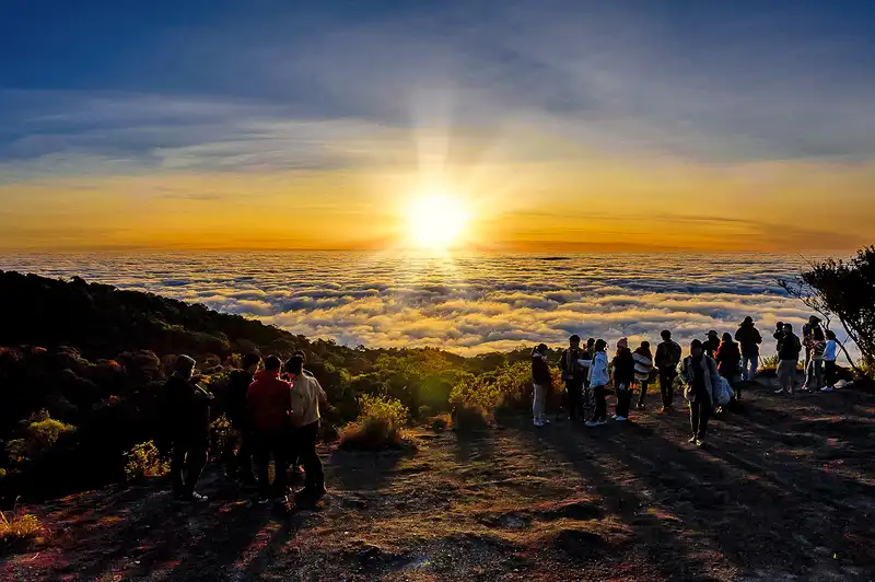
1. Doi Inthanon National Park, Chiang Mai is one of Thailand's most popular destinations during the New Year holiday. The national park extends across several districts of Chiang Mai Province, with major attractions located in Chom Thong District. It is best known as the home of Thailand's highest mountain, rising approximately 2,565 meters above sea level. Its elevation creates particularly cool conditions and a natural landscape that differs considerably from the surrounding lowlands.
Highlights: Thailand's highest summit, the Ang Ka Nature Trail, the twin royal pagodas of Phra Mahathat Naphamethanidon and Phra Mahathat Naphaphonphumisiri, the Kew Mae Pan Nature Trail, Wachirathan Waterfall, and mountain viewpoints where a sea of mist may appear when weather conditions are favorable.
One of Doi Inthanon's greatest attractions during the New Year period is its cold climate and highly humid montane evergreen forest. Near the summit, the vegetation has adapted to the conditions of the high mountains. Mosses, ferns, and trees with forms unlike those commonly found in lowland forests create an environment that is fascinating to explore, even for visitors who are not primarily interested in watching the sunrise.
The two royal pagodas are another important attraction, standing amid mountain landscapes and gardens featuring cool-climate flowers. The surrounding area offers beautiful photography opportunities and panoramic views. Wachirathan Waterfall is also a popular natural landmark, with a powerful cascade that can be reached relatively easily compared with the park's more demanding long-distance hiking routes.
The Kew Mae Pan Nature Trail is especially popular during the cool season. It provides an opportunity to explore cloud forest, open grassland along a mountain ridge, and expansive views of the surrounding highlands. Access to the trail, however, depends on the regulations and seasonal announcements of the national park. Visitors should use a local guide when required and prepare warm clothing and suitable footwear for trails that may be wet or slippery.
Families visiting during the New Year holiday can focus on attractions accessible by road and those that do not involve lengthy walks. Travelers who enjoy photography and nature study may prefer to allow additional time for forest trails and viewpoints. Staying in Chom Thong District or a nearby area makes it easier to begin the journey up the mountain early in the morning.
Traffic on the mountain road can become heavy during long holidays, and certain sections contain sharp bends and steep gradients. Drivers should check their vehicle's condition and plan their journey carefully. Parking where it obstructs traffic and walking outside designated paths should be avoided, particularly in fragile natural areas that are vulnerable to damage from trampling.
Open Days: Daily Opening Hours: Generally 5:30 AM – 6:30 PM. Access to some trails depends on national park announcements.
Getting There: From Chiang Mai city, take Highway 108 toward Chom Thong District, then turn onto Highway 1009 to enter Doi Inthanon National Park. Travelers without a private vehicle can take public transportation to Chom Thong and connect with a local service heading up the mountain, or book a guided tour from Chiang Mai. Bring warm clothing and allow additional travel time during the New Year holiday.

2. Phu Chi Fa Forest Park, Chiang Rai is one of Northern Thailand's best-known destinations for sunrise views and seas of mist. It is situated in the Phor subdistrict area near the Thai–Lao border in Chiang Rai Province, along the Doi Pha Mon mountain range. Its most recognizable feature is a mountain ridge and projecting cliff that overlook a spectacular expanse of valleys and mountain ranges.
Highlights: Morning seas of mist, sunrise over the mountains, the distinctive Phu Chi Fa cliff, grassland along the ridge, and views toward the Thai–Lao border. The destination is particularly attractive to travelers who want to experience the winter atmosphere and photograph natural landscapes.
Phu Chi Fa rises to elevations of approximately 1,200–1,628 meters above sea level. When conditions are favorable, visitors may see thick layers of mist covering the valleys below, especially shortly before and after sunrise. As golden morning light gradually reaches the mountain ridges, the landscape changes in appearance, creating a memorable experience and making the viewpoint a popular destination at the end of the year.
Travelers hoping to experience the early-morning scenery should consider staying nearby the previous night. Reaching the viewpoint requires traveling to the parking area and then continuing on foot, so sufficient time should be allowed before sunrise. A flashlight, warm jacket, and shoes with good traction are recommended because some sections of the trail may be steep and slippery from moisture.
Phu Chi Fa also offers opportunities to experience the culture of highland communities in the surrounding area. Staying in a local village or locally operated accommodation allows visitors to enjoy the atmosphere beyond the sunrise viewpoint while supporting businesses and services within the community.
The New Year holiday is one of the busiest periods at Phu Chi Fa. Booking accommodation and planning transportation in advance can make the journey less stressful. Visitors should follow all safety instructions, stay away from cliff edges, and avoid leaving designated paths for photographs, especially when heavy mist or limited daylight reduces visibility.
Open Days: Daily Opening Hours: 4:30 AM – 6:00 PM.
Getting There: From Chiang Rai city, travel toward Thoeng District and continue along the route leading to Phu Chi Fa. From the parking area, walk to the main viewpoint. A private vehicle or organized tour is convenient for visitors intending to see the sunrise. Check road and weather conditions before departure.
Map (GPS):Get Directions to Phu Chi Fa Forest Park

3. Khao Kho, Phetchabun is a popular highland destination during Thailand's New Year holiday. Located in Khao Kho District, Phetchabun Province, the area features overlapping mountain ranges, scenic viewpoints, resorts, restaurants, and natural attractions spread across several locations. Its cool atmosphere and mountain landscapes make it suitable for couples, families, and groups of friends seeking a relaxing retreat.
Highlights: Mountain ranges, morning seas of mist, highland viewpoints, resorts surrounded by nature, and historical attractions connected with the area's past.
Khao Kho is especially attractive for its varied landscapes of valleys and ridges at different elevations. When temperature and humidity conditions are suitable, mist may gather across the valleys, particularly during the morning. The interaction of sunlight with the surrounding mountains creates beautiful scenery, making Khao Kho a favorite destination for photography and winter relaxation.
Khao Kho also has a history associated with political and military conflicts in the past. The area later developed into a tourism destination and highland agricultural community. Visitors interested in history can learn about these earlier events while enjoying the natural surroundings, adding another dimension to their trip.
A two-day, one-night stay is a convenient way to experience Khao Kho without rushing. The first day can be spent traveling and visiting several local attractions before staying at accommodation with mountain views. On the following morning, travelers can wake early to look for a sea of mist, enjoy breakfast, and explore another nearby attraction before returning home.
However, a sea of mist is a natural phenomenon that depends on weather conditions and cannot be guaranteed every morning. Visitors should include alternative activities in their itinerary and drive carefully during periods of dense fog or reduced visibility.
Open Days: Daily Opening Hours: General tourist areas are accessible throughout the day, although individual attractions have their own regulations.
Getting There: From Bangkok, follow Highway 1 and Highway 21 toward Phetchabun, then take the connecting roads into Khao Kho District. Travelers arriving from Phitsanulok can use Highway 12 and the roads leading into Khao Kho. Check mountain routes and the vehicle's condition before traveling.
Map (GPS):Get Directions to Khao Kho
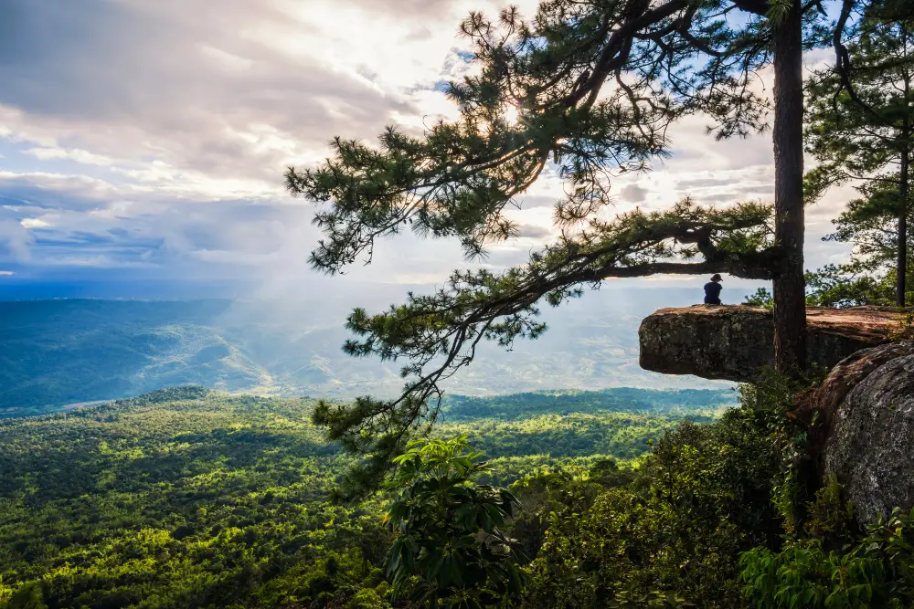
4. Phu Kradueng National Park, Loei is a major destination for travelers who enjoy trekking and wish to experience Thailand's natural landscapes during the cool season. Located in Si Than Subdistrict, Phu Kradueng District, Loei Province, the park is distinguished by its table-shaped mountain and extensive summit plateau, surrounded by forests, grasslands, cliffs, and nature trails.
Highlights: The hike up Phu Kradueng, Pha Nok Aen, Pha Lom Sak, grasslands on the summit, pine forests, waterfalls, and the cool atmosphere of the mountain plateau.
Phu Kradueng offers a different experience from mountain viewpoints that visitors can reach directly by car. The ascent itself is an important part of the journey, requiring determination and physical effort. Hikers pass through different landscapes before reaching the broad summit plateau, where walking routes connect the park's main attractions. It is therefore best suited to those who are physically prepared and enjoy outdoor activities.
Pha Nok Aen is renowned as a sunrise viewpoint, while Pha Lom Sak is celebrated for its dramatic cliff-edge scenery, particularly the silhouette of a pine tree against the evening sky. These two landmarks capture the distinctive character of Phu Kradueng, although visitors need to plan carefully because the walking distances between attractions on the plateau can be considerable.
The New Year period generally falls within Phu Kradueng's regular tourist season. The destination page identifies the normal opening season as October 1 to May 31, with an annual closure period for ecological recovery. Nevertheless, trail access and visitor admission remain subject to the national park's latest announcements and safety requirements.
Visitors planning to stay overnight on the mountain should prepare warm clothing, appropriate hiking shoes, and only the essential equipment and belongings. Accommodation and campsite reservation requirements should be checked in advance. Keeping the park clean, avoiding feeding wildlife, and remaining on designated trails are important practices for preserving Phu Kradueng's natural environment.
Open Days: Regular tourist season: October 1 – May 31. Opening Hours: The visitor service center generally operates from 7:00 AM – 4:00 PM. Mountain ascent times are subject to national park announcements.
Getting There: From Bangkok, travel along the main highways toward Loei Province and Phu Kradueng District. Continue to the national park headquarters in Si Than Subdistrict, where the mountain ascent begins. Visitors arriving by bus can connect with local transportation to the park. Plan to arrive before the permitted ascent cut-off time.
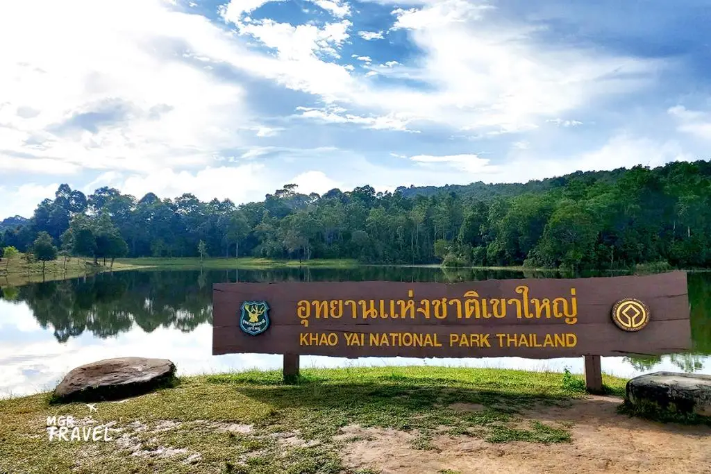
5. Khao Yai National Park, Nakhon Ratchasima is a popular destination for travelers seeking a nature-focused New Year holiday. The park extends across Nakhon Ratchasima, Saraburi, Prachin Buri, and Nakhon Nayok provinces, with the entrance near Pak Chong District in Nakhon Ratchasima serving as one of the main gateways. Khao Yai is particularly important as Thailand's first national park and part of the UNESCO-listed Dong Phayayen–Khao Yai Forest Complex.
Highlights: Haew Narok Waterfall, Haew Suwat Waterfall, grasslands, scenic viewpoints, evergreen and montane forests, nature trails, and opportunities to observe wildlife in its natural habitat.
Khao Yai's greatest attraction is its rich ecosystem, which includes forests, grasslands, and waterways that provide habitats for many wildlife species. Visitors may encounter wild animals while traveling through the park, but should always maintain a safe distance, never feed them, and avoid approaching them for photographs. This is particularly important with large animals whose behavior may be unpredictable.
Haew Suwat and Haew Narok are among the park's most famous waterfalls, each offering a different natural landscape. Visitors should follow warning signs and safety regulations when exploring these sites because paths near waterfalls may be wet and slippery. Certain locations also restrict access to cliff edges or prohibit swimming.
Travelers who do not wish to undertake long hikes can still enjoy Khao Yai through its roads and accessible scenic viewpoints. Those interested in studying ecosystems may choose designated nature trails, following park regulations and arranging a guide when required.
A New Year visit to Khao Yai is well suited to a two-day, one-night or three-day, two-night itinerary. This provides enough time to explore the national park and surrounding Pak Chong area without rushing. However, the holiday period attracts many visitors, so travelers should depart early, allow time for possible queues at the park entrance, and check the latest notices concerning road and trail access.
Open Days: Daily Opening Hours: 6:00 AM – 6:00 PM.
Getting There: From Bangkok, follow Mittraphap Road toward Pak Chong District in Nakhon Ratchasima, then take the road leading to the Pak Chong entrance of Khao Yai National Park. An alternative entrance is available from Prachin Buri Province. Choose the route that best matches your intended destinations within the park and current traffic conditions.
Map (GPS):Get Directions to Khao Yai National Park
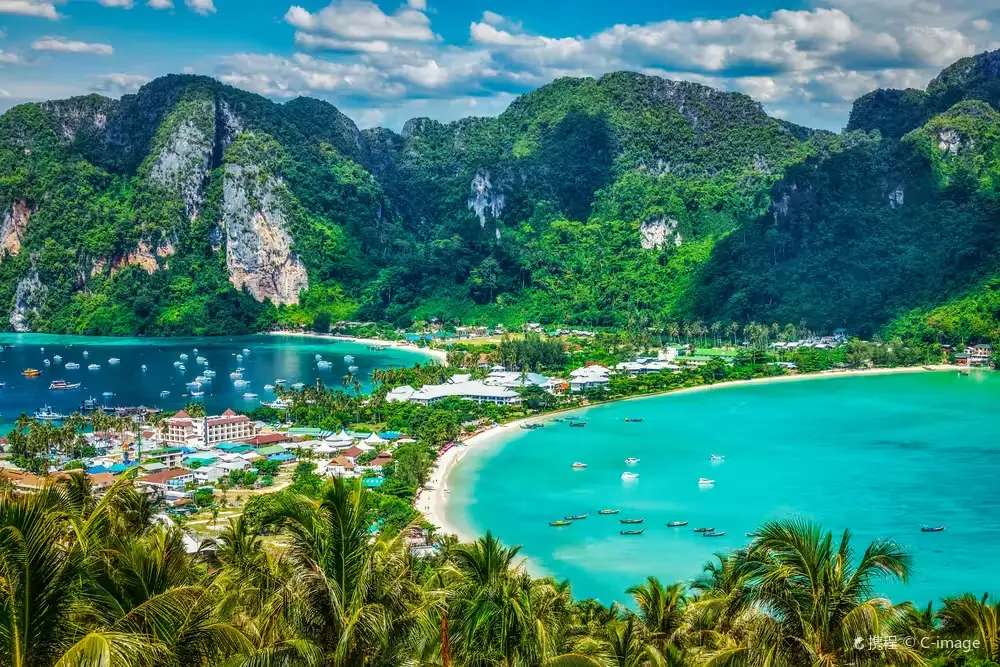
6. The Phi Phi Islands, Krabi are among Thailand's most internationally recognized island destinations. Located in Ao Nang Subdistrict, Mueang Krabi District, Krabi Province, the islands are famous for towering limestone cliffs, turquoise waters, and beaches surrounded by spectacular Andaman Sea scenery. The Phi Phi group includes several islands, with Phi Phi Don serving as the main center for accommodation and tourist services, while Phi Phi Leh is known for its beautiful bays and natural attractions.
Highlights: Phi Phi Don, Phi Phi Leh, Maya Bay, Pileh Lagoon, clear turquoise waters, limestone cliffs, and boat excursions around the islands. Visitors must comply with national park regulations and seasonal access restrictions at individual sites.
The Phi Phi Islands are particularly appealing during the New Year holiday to travelers who enjoy the sea and outdoor activities. Their diverse coastal landscapes include sandy beaches, shallow bays, limestone cliffs, and snorkeling or diving areas that may be accessible when sea conditions permit. Visitors can choose a day trip by sightseeing boat or stay overnight on Phi Phi Don to enjoy more of the islands' atmosphere.
Maya Bay attracts international attention, but visiting the area is subject to national park regulations designed to protect the marine ecosystem. Temporary closures for environmental recovery may occur during certain periods. Travelers should therefore check which areas are open and what activities are permitted before their boat trip, particularly restrictions on swimming and access to sensitive sections of the bay.
Phi Phi Don has a local community and a range of tourist facilities, including restaurants, accommodation, and boat services. Staying overnight allows visitors to explore at a more comfortable pace and adjust their plans to changing weather conditions more easily than on a single-day excursion.
Although late December and early January are generally favorable months for visiting Thailand's Andaman coast, waves and winds can still change unexpectedly. Travelers should choose boats equipped with appropriate safety equipment, wear life jackets as instructed, and avoid sailing during official weather warnings. Protecting coral reefs and keeping rubbish out of the sea are essential to preserving the natural beauty of the Phi Phi Islands.
Getting There: From Krabi town or Krabi International Airport, travel to a pier serving the Phi Phi Islands, then take a scheduled ferry or speedboat. Boats also operate from selected piers in Phuket. Reserve tickets in advance and check marine conditions before departure, particularly during the busy New Year period.
Map (GPS):View the Phi Phi Islands on Google Maps
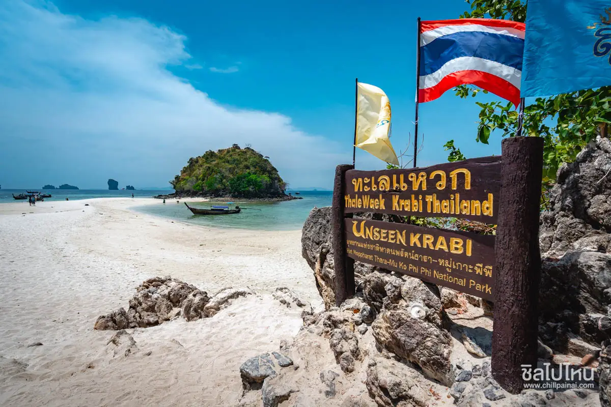
7. Thale Waek (Separated Sea), Krabi is one of Krabi's most remarkable natural marine attractions. Located near Chicken Island, Tup Island, and Mor Island in Ao Nang Subdistrict, Mueang Krabi District, within Hat Noppharat Thara–Mu Ko Phi Phi National Park, it is famous for a sandy pathway that appears between the islands when the sea level falls. The exposed white sandbar creates the extraordinary impression of a walkway stretching across the surrounding Andaman Sea.
Highlights: The natural sandbar phenomenon, Chicken Island, Tup Island, Mor Island, clear turquoise water, walking along the exposed sandbar at low tide, and one-day island-hopping excursions in Krabi.
The unusual appearance of Thale Waek is created by the changing tides. When the sea level becomes sufficiently low, the sandbar linking the islands gradually emerges from the water. As the tide rises, the sandy pathway disappears beneath the sea again. Timing a visit according to the tidal schedule is therefore much more important than simply choosing a morning or afternoon trip.
Chicken Island is a distinctive landmark because one of its rock formations resembles a chicken's head. Tup and Mor islands form part of the interconnected sandbar landscape that becomes visible at low tide. The combination of limestone formations, clear seawater, and white sand makes this area one of Krabi's most recognizable photography locations.
Many visitors choose a four-island tour that may include Thale Waek, Chicken Island, Poda Island, and the Phra Nang Cave Beach area. These excursions are usually offered by long-tail boat or speedboat from Ao Nang. The itinerary should be arranged around low tide to maximize the chance of seeing the exposed sandbar clearly.
When walking on the sandbar, wear suitable beach footwear because small stones or shell fragments may be present. Stay within areas recommended by boat operators or park staff, and do not walk too far away when the tide begins to rise. Visitors should also avoid touching or stepping on coral reefs in nearby waters.
Getting There: From Krabi town, take Highways 4034 and 4202 toward Ao Nang or Noppharat Thara Beach. Continue by long-tail boat or speedboat to Thale Waek. Ask the boat operator about the expected low-tide period before choosing an excursion, because the exposed sandbar cannot be seen in the same way throughout the day.
Map (GPS):View Thale Waek on Google Maps
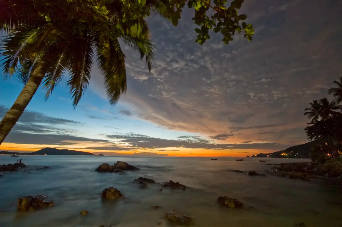
8. Patong Beach, Phuket is one of the most famous beaches in Phuket Province. Located in Patong Subdistrict, Kathu District, it features a broad curved bay and an extensive sandy shoreline, together with a wide range of tourist facilities, including hotels, restaurants, shops, and seaside activities. It is particularly suitable for travelers who want to celebrate the New Year in a lively coastal resort town.
Highlights: Patong Beach, its sandy shoreline and bay views, water-based activities, seaside restaurants, numerous accommodation choices, and the energetic atmosphere of a major holiday destination.
Patong's appeal comes from combining relaxation by the sea with the convenience of a well-developed resort town. Travelers can begin their day with a walk along the beach, enjoy meals at nearby restaurants, and spend time relaxing beside the water before choosing other activities in the afternoon or evening.
A variety of water-based recreational activities may be available along the beach when operators are working and sea conditions are suitable. Visitors should check safety precautions and obey beach warning flags, as waves, currents, and wind conditions can change even during the popular high season.
Patong also provides a broad selection of restaurants and accommodation, allowing visitors to plan anything from a one-night stay to a longer holiday. It can serve as a convenient base for exploring other parts of Phuket, including scenic viewpoints and nearby beaches. Accommodation should be selected carefully because some parts of Patong remain particularly busy late into the night.
During the New Year period, Patong typically welcomes large numbers of visitors. Travelers looking for a quieter holiday should choose their accommodation and preferred beach area accordingly. Those who enjoy a lively atmosphere will find a well-established international resort destination where people from many countries gather to celebrate their holidays.
Open Days: Daily Opening Hours: The public beach does not operate under fixed opening and closing hours like a commercial establishment.
Getting There: From Phuket town, travel toward Kathu District and continue along the main road into Patong. Visitors arriving at Phuket International Airport can take a bus or taxi to the Patong area. Allow extra travel time during long holidays because the roads crossing the hills and the streets near the beach can become congested.
Map (GPS):Get Directions to Patong Beach

9. Bridge over the River Kwai, Kanchanaburi is one of Thailand's most significant historical tourist attractions. Located in Tha Makham Subdistrict, Mueang Kanchanaburi District, it is associated with the Thailand–Burma Railway, which was constructed during World War II under the control of the Japanese military. The bridge has become an internationally recognized symbol of wartime history and remembrance of those who suffered during the railway's construction.
Highlights: The steel railway bridge over the River Kwai, the history of the Thailand–Burma Railway, riverside scenery, photography opportunities, and nearby places dedicated to the history of World War II.
The bridge is historically important because of its role in the railway project connecting Thailand and Burma during World War II. The construction involved large numbers of prisoners of war and civilian laborers who worked under extremely difficult conditions. This history gives the bridge significance as a place of remembrance for the suffering and loss of life associated with the war.
Today, the bridge remains both an important railway structure and a widely visited historical landmark. Travelers can view the bridge and surrounding river scenery from areas open to the public, but must take special care around the railway tracks and obey staff instructions when trains approach or cross the bridge.
A visit can be combined with other historical attractions in Kanchanaburi, including museums dedicated to the railway and the war, as well as sections of the Death Railway that pass through remarkable riverside and mountain landscapes. Exploring these places together provides a deeper understanding of the historical context than visiting the bridge alone.
For a New Year itinerary combining history and nature, visitors can explore the Bridge over the River Kwai in the morning and then continue to another natural attraction or educational site in Kanchanaburi, depending on available time. Those interested in the historical details should allow enough time to read exhibitions and supporting information rather than treating the bridge merely as a short photography stop.
Open Days: Daily Opening Hours: The surrounding public area is generally accessible throughout the day, but visitors on or near the railway must observe all railway safety measures.
Getting There: From Bangkok, take the main route toward Kanchanaburi Province, continue into the town, and follow Highway 323 to the bridge. Train services may also be available to the River Kwai Bridge railway station according to their operating timetable. Check railway schedules before departure.
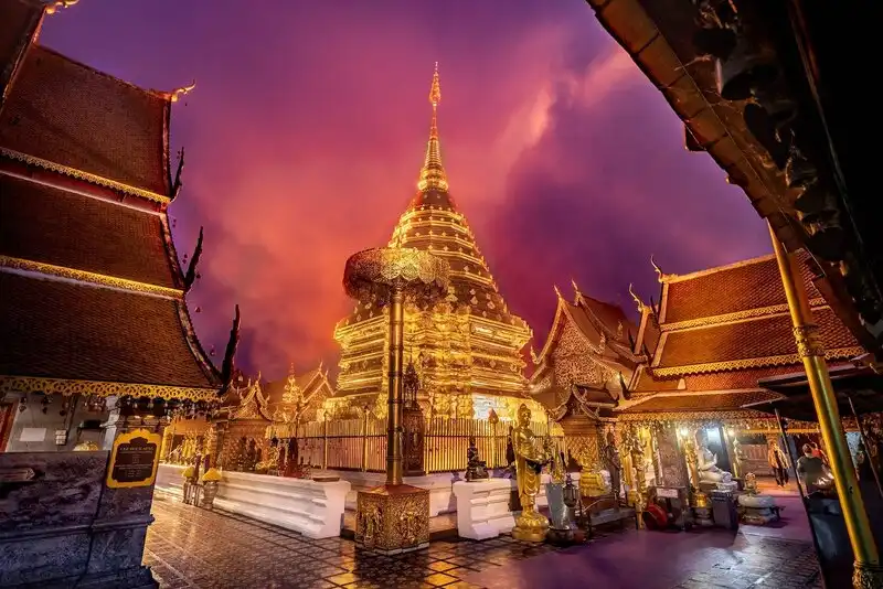
10. Wat Phra That Doi Suthep, Chiang Mai is one of the most important sacred Buddhist sites in Northern Thailand's Lanna region. Located on Doi Suthep mountain in Mueang Chiang Mai District, the temple is famous for its golden chedi containing sacred Buddhist relics and its elevated position overlooking Chiang Mai city. It attracts both Buddhist worshippers seeking to pay respects to the relics and visitors interested in the history, architecture, and culture of Lanna.
Highlights: The sacred Doi Suthep relics, golden chedi, traditional Lanna architecture, the naga staircase leading to the temple, panoramic views over Chiang Mai, and long-standing traditions of paying respect to the sacred relics.
The history of Wat Phra That Doi Suthep is closely associated with the Lanna Kingdom and the belief in enshrining sacred Buddhist relics on a revered mountain. According to traditional accounts passed down over generations, Doi Suthep was selected as the location for the relics, establishing the temple as an important religious and cultural landmark for the people of Chiang Mai over many centuries.
The golden chedi is the temple's most significant architectural feature, reflecting Lanna Buddhist art and the devotion of Buddhist worshippers. Many visitors ascend the naga staircase to reach the temple courtyard, while those who may find the stairs difficult can inquire about alternative access services available at the site.
During the New Year holiday, Wat Phra That Doi Suthep is a popular destination for making merit, offering prayers, and enjoying the atmosphere of the mountains. Travelers can combine a temple visit with natural attractions in Doi Suthep–Pui National Park, although journey times and visitor numbers should be considered carefully during the busy holiday period.
Beyond its religious importance, the temple also offers valuable insights into the history of Chiang Mai. It brings together local beliefs, Buddhism, and Lanna architectural traditions in a single place. Visitors should dress respectfully, follow temple etiquette, and avoid disturbing people engaged in religious activities.
Open Days: Daily Opening Hours: 5:00 AM – 7:30 PM.
Getting There: From central Chiang Mai, follow Huay Kaew Road toward Chiang Mai University, then continue up Doi Suthep along the mountain road. Visitors may use a private vehicle, taxi, or shared red truck serving the route. Allow additional travel time during the New Year holiday because the winding mountain road can become busy.
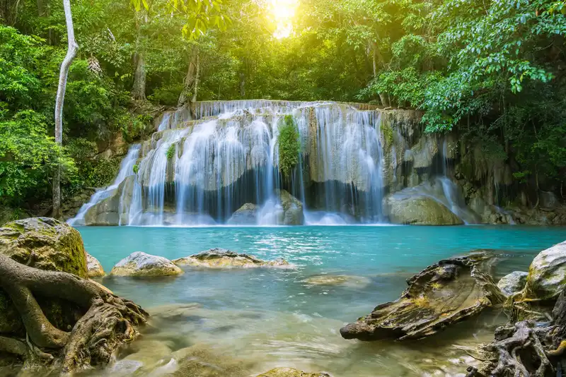
11. Erawan Waterfall, Kanchanaburi is one of Thailand's most famous waterfalls. Located inside Erawan National Park in Tha Kradan Subdistrict, Si Sawat District, Kanchanaburi Province, it is renowned for streams flowing over limestone formations into greenish-blue pools. The waterfall consists of seven successive tiers surrounded by lush forest, making it an appealing New Year destination for families, groups of friends, and nature enthusiasts.
Highlights: Seven waterfall tiers, emerald-colored natural pools, forest walking trails, limestone landscapes, and opportunities to relax beside streams in areas where the national park permits visitors.
One of Erawan Waterfall's most distinctive characteristics is the variation in scenery from one tier to another. Some sections feature water cascading over broad rock surfaces, while others form natural pools of different shapes. These formations result from the continuing interaction between water and limestone, giving the waterfall significance not only as a tourist attraction but also as a place to observe natural geological processes and freshwater ecosystems.
Most visitors begin at the lower tiers and follow the national park's designated trail toward the higher levels. Along the way, they encounter different plant species and forest environments as the route gains elevation. Some sections are steep or pass through damp ground, so suitable hiking shoes and additional care are recommended, particularly for families with children or older adults.
Erawan Waterfall is especially popular during the New Year holiday because visitors can spend several hours enjoying the natural surroundings. However, crowds may increase considerably during long weekends. Arriving early allows enough time to explore multiple waterfall levels without having to rush back before trail access closes.
Photography enthusiasts will find many attractive subjects, including pools, streams, rock formations, and forest scenery. Nevertheless, protecting the ecosystem should remain a priority. Visitors must not litter, use products that may contaminate the water in restricted areas, or swim in sections where park officials prohibit entry. Responsible behavior helps maintain the waterfall's beauty and ecological condition for future visitors.
A two-day, one-night trip to Kanchanaburi can combine the Bridge over the River Kwai on the first day with Erawan Waterfall on the second. This itinerary introduces travelers to both the province's wartime history and its natural landscapes. Grouping attractions by location also reduces travel fatigue and provides more time to appreciate each destination.
Open Days: Daily Opening Hours: 8:00 AM – 4:00 PM.
Getting There: From Kanchanaburi town, take Highway 3199 toward Si Sawat District and follow the signs to Erawan National Park. Travelers without a private vehicle may use scheduled bus services operating between Kanchanaburi town and the national park area. An early departure is recommended to allow sufficient time for walking between the waterfall's seven tiers.
Map (GPS):Get Directions to Erawan Waterfall

12. Kaeng Krachan National Park, Phetchaburi is one of Thailand's most important large-scale nature conservation areas. Centered in Kaeng Krachan District, Phetchaburi Province, with forest areas extending into Prachuap Khiri Khan Province, its landscape includes mountain ranges, evergreen forests, montane forests, streams, and habitats for numerous wildlife species. The park is particularly attractive during the New Year holiday to visitors interested in nature exploration and the ecological importance of Thailand's forests.
Highlights: The forests of Kaeng Krachan, panoramic seas of mist at Phanoen Thung, nature trails, birdwatching, butterfly observation, and ecotourism activities in areas that are open to the public.
Kaeng Krachan forms part of the Kaeng Krachan Forest Complex, an area recognized internationally for its biodiversity. Its interconnected ecosystems extend from mountainous forests to waterways and lower elevations, providing habitats for many kinds of wildlife, including birds, mammals, and insects essential to the balance of the natural environment. The ecological richness of this forest is central to the park's value, extending far beyond its scenic viewpoints.
Phanoen Thung is particularly well known among nature travelers for its views of mist drifting above forested valleys in the early morning. The appearance and density of the mist depend on temperature, humidity, and weather conditions, so it is wise to include other activities, such as birdwatching and nature study, in the itinerary rather than relying entirely on the chance of seeing a sea of mist.
Access to certain parts of Kaeng Krachan National Park is regulated because of their conservation status and the conditions of the roads. Some routes require suitable vehicles or specific permission under park regulations. Travelers should check trail and road openings, visitor limits, and camping requirements before departure. Driving into closed areas or entering restricted forest sections is prohibited.
Birdwatching and wildlife observation are particularly rewarding activities in Kaeng Krachan because the forest supports a remarkable variety of bird species. Visitors can use binoculars and cameras to observe and document wildlife from a respectful distance. Avoiding recorded calls used to attract animals and refraining from disturbing their natural habitats are important principles of responsible nature tourism.
For a New Year trip, a two-day, one-night itinerary can be arranged around permitted camping areas or nearby accommodation, allowing time to visit natural attractions and viewpoints. Travelers with limited time may prefer the accessible areas around Kaeng Krachan Dam and other nearby attractions. Selecting activities according to the capabilities and interests of everyone in the group ensures a more comfortable and educational experience.
Getting There: From Bangkok, travel along Rama II Road or Phetkasem Road toward Phetchaburi Province, then continue into Kaeng Krachan District following the signs. Anyone planning to enter deeper forest areas or specific mountain viewpoints should contact national park officials in advance for information about access routes and permitted transportation.

13. Cha-Am Beach, Phetchaburi is a popular seaside resort destination within convenient reach of Bangkok. Located in Cha-Am District, Phetchaburi Province, the beach is known for its long stretch of sand along the Gulf of Thailand, seafood restaurants, and accommodation options for different travel styles. It appeals to families, couples, and groups of friends looking to spend their New Year break beside the sea without traveling all the way to Southern Thailand.
Highlights: Cha-Am Beach, seaside walks, fresh seafood, beachside relaxation, coastal accommodation, and the familiar atmosphere of a resort town with facilities for visitors.
The appeal of Cha-Am lies in the variety of ways visitors can enjoy a seaside holiday. Travelers can take a morning walk along the beach, sit in the shade enjoying the sea breeze, eat at a favorite restaurant, or spend time with family without following a demanding schedule. The beach has a different atmosphere in the morning and afternoon, influenced by changing light and the daily activities of people along the coast.
Cha-Am has developed over many years as a resort town serving travelers from Bangkok and other provinces. Hotels and tourist services are spread along the beachfront road, allowing visitors to choose between lively sections close to restaurants and areas that provide a quieter setting for relaxation.
Families with children should choose beach areas with appropriate resting places and convenient facilities. Couples may prefer enjoying the morning coastal atmosphere and dining together, while photography enthusiasts can explore different stretches of the shoreline to capture views of the Gulf of Thailand. In every case, swimming conditions and beach safety should be considered carefully.
Cha-Am receives many visitors during the New Year holiday. Booking accommodation in advance and choosing suitable travel times can reduce inconvenience. A two-day, one-night trip might include relaxation along Cha-Am Beach on the first day, followed by a visit to Hat Chao Samran or another attraction in Phetchaburi Province before returning home.
Fresh seafood and local cuisine are another important part of the Cha-Am experience, especially for visitors who enjoy dining with views of the sea. Supporting locally operated restaurants and keeping the beach clean help tourism benefit the community while protecting the coastal environment.
Open Days: Daily Opening Hours: Public beach areas are accessible throughout the day, while shops and activity operators have individual service hours.
Getting There: From Bangkok, travel along Rama II Road or Phetkasem Road toward Phetchaburi, then follow the main route into Cha-Am District. Train services stop at Cha-Am Station according to their operating timetable. Visitors may also travel by bus and continue to the beach using local transportation.
Map (GPS):Get Directions to Cha-Am Beach

14. Koh Larn, Chon Buri is a well-known island destination in Bang Lamung District, Chon Buri Province, approximately seven kilometers off the coast of Pattaya. Its principal attractions are beautiful beaches, inviting seawater, and several recreational areas connected by local roads. Koh Larn is an excellent choice for travelers who want to enjoy a seaside New Year holiday with Pattaya as their departure point.
Highlights: Tawaen Beach, Tien Beach, Samae Beach, Nual Beach, views across the Gulf of Thailand, ferry journeys from Pattaya, and relaxing activities along the shoreline.
Koh Larn offers beaches with different characteristics and atmospheres. Tawaen Beach is attractive to visitors seeking a wide selection of services and activities, while other beaches have their own landscapes and varying numbers of visitors. Choosing just one or two beaches for a day allows more time to relax rather than attempting to visit every location without a break.
The journey to Koh Larn is part of the experience. As the boat leaves Pattaya, visitors can enjoy views across the Gulf of Thailand and watch the coastal city gradually recede into the distance. Once on the island, local transportation services provide connections to beaches and accommodation according to the traveler's plans.
The New Year period is a popular time for island holidays, so Koh Larn may welcome large numbers of visitors. Travelers should check boat departure times and ensure that their arrival pier matches their intended itinerary. Those planning to stay overnight should reserve accommodation in advance and leave sufficient time to return to the mainland before the last scheduled boat.
Water-based activities should be selected according to prevailing weather and safety conditions. Visitors must follow instructions from staff and operators, avoid swimming in restricted areas or places with heavy boat traffic, and take care not to damage coral reefs or marine life.
For a two-day, one-night trip, Koh Larn offers the opportunity to arrive on the first day, choose a favorite beach, enjoy a meal, and relax on the island. The following morning can be spent exploring another beach or viewpoint before the return journey. Staying overnight allows travelers to experience a calmer rhythm than a rushed day trip.
Getting There: From Bangkok, take Motorway 7 toward Pattaya in Chon Buri Province, then continue to Bali Hai Pier to board a boat to Koh Larn. After arriving on the island, use local transportation to reach your chosen beach or accommodation. Check boat schedules and sea conditions before departure.
Map (GPS):View Koh Larn on Google Maps
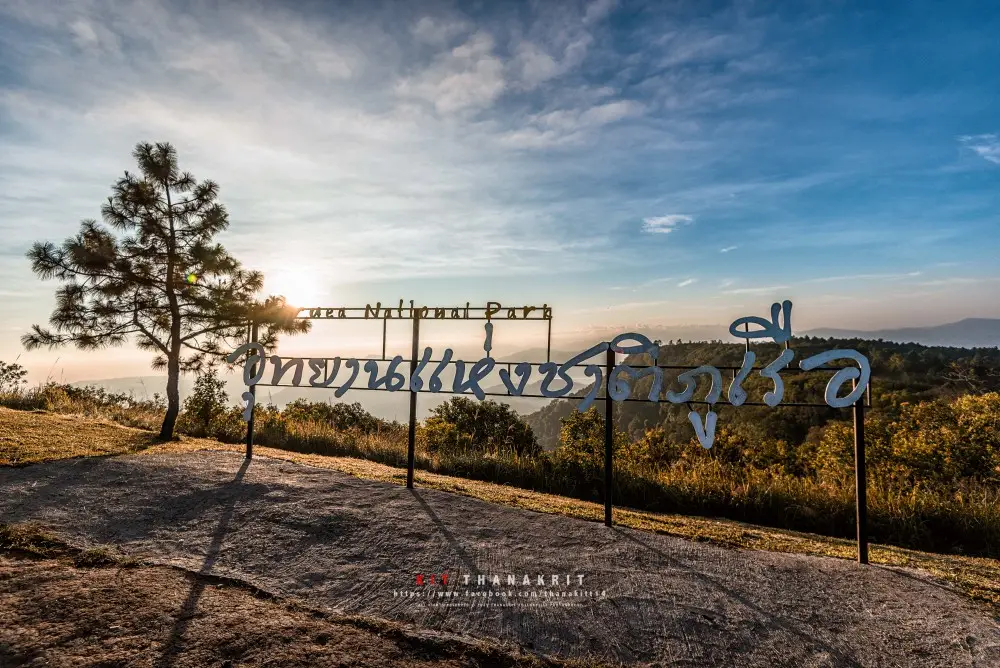
15. Phu Ruea National Park, Loei is a popular high-altitude nature destination during Thailand's cool season and New Year holiday. Situated in Nong Bua Subdistrict, Phu Ruea District, Loei Province, with forest areas extending toward Tha Li District, it features mountain ranges, forests, and viewpoints overlooking broad stretches of highland scenery. The park is ideal for travelers seeking cold weather, sunrise views, and quiet moments surrounded by nature.
Highlights: Phu Ruea summit, sunrise viewpoints, mountain scenery, pine forests, high-altitude vegetation, and the cool winter atmosphere of Northern Isan.
Phu Ruea is characterized by elevated mountain terrain with several scenic viewpoints. The summit is especially popular among visitors who want to watch the first light of the morning. During the cool season, temperatures at higher elevations may be considerably lower than those in the town below, so warm clothing is important, particularly for people traveling to the viewpoint before sunrise.
Phu Ruea's forests support a variety of plant species, including pine forests and vegetation adapted to high-altitude conditions. Walking through the natural surroundings provides not only scenic enjoyment but also an opportunity to observe how elevation, temperature, and environmental conditions influence the plants found in different parts of the park.
Photography enthusiasts often arrive at the summit early because the soft morning light enhances the mountain scenery. When conditions are favorable, mist may appear over the valleys, creating another layer of visual interest. However, caution is necessary in dense fog because visibility along roads and walking routes can decrease significantly.
Phu Ruea can also be incorporated into a broader Loei Province itinerary featuring nearby natural attractions and communities. Staying in Phu Ruea District makes an early-morning sunrise excursion more convenient and reduces the need for a long drive in darkness.
The New Year holiday is a busy period at Phu Ruea. Visitors should check weather forecasts, prepare adequate warm clothing, and follow national park regulations. Avoiding unnecessary noise, protecting wildlife, and keeping natural areas free of litter are important steps toward preserving the park's environment.
Open Days: Daily Opening Hours: 5:00 AM – 8:00 PM.
Getting There: From Loei town, take Highway 203 toward Phu Ruea District and follow the signs into Phu Ruea National Park. Travelers from Bangkok may approach Loei via Phetchabun Province according to their chosen route. Check road conditions and allow additional time during foggy or particularly cold weather.
Map (GPS):Get Directions to Phu Ruea National Park
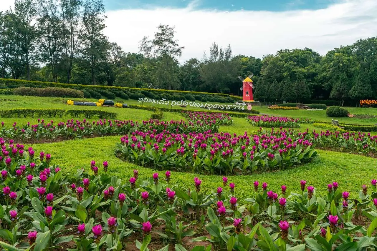
16. Phu Foi Lom, Udon Thani is a nature tourism and environmental learning destination situated in the Phu Phan Noi mountain range, Thap Kung Subdistrict, Nong Saeng District, Udon Thani Province. It is distinguished by its elevated location, a climate different from that of the provincial city, and an environment suited to nature study and relaxation during the New Year holiday. The destination is particularly attractive to families and visitors looking for a peaceful outdoor retreat.
Highlights: The landscapes of the Phu Phan Noi mountain range, nature study areas, local plant species, forest surroundings, and conservation-oriented activities emphasizing the value of natural resources.
Phu Foi Lom is important as a place where nature conservation and public education come together. The mountain landscape supports forests and plant species characteristic of northeastern Thailand's ecosystems. Visitors can explore designated areas and learn about natural environments that differ from the agricultural land and communities surrounding the mountain.
The name Phu Foi Lom is associated with a plant known locally as foi lom, an epiphytic plant found in certain natural environments. Learning about these plants adds another dimension to the visit beyond sightseeing alone, helping travelers understand the relationships among moisture, forest conditions, and the living organisms that share the same ecosystem.
From late December to early January, conditions in the highlands are often pleasant for outdoor activities, particularly nature walks and photography. Visitors should use only paths and viewpoints open to the public and avoid collecting or damaging plants, since some species play important roles in maintaining the ecological balance.
Phu Foi Lom is also suitable for families who want children to learn about forests, biodiversity, and environmental conservation through direct observation. At the same time, travelers interested in photography can enjoy the natural scenery and seasonal vegetation found throughout the area.
For a two-day, one-night trip to Udon Thani, Phu Foi Lom can serve as the main nature destination on one day, while the other day can be devoted to local communities, cultural attractions, or regional cuisine in Udon Thani city. This provides a varied travel experience without requiring repeated journeys across provincial boundaries.
Open Days: Daily Opening Hours: 6:00 AM – 6:00 PM.
Getting There: From Udon Thani city, follow the Udon Thani–Loei route and continue toward Nong Saeng District and Thap Kung Subdistrict, following signs to Phu Foi Lom. Traveling by private car or hired vehicle provides greater flexibility. Check road conditions and visiting hours before departure.
Map (GPS):Get Directions to Phu Foi Lom
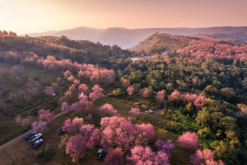
17. Phu Hin Rong Kla National Park, Phitsanulok is a distinctive national park combining natural scenery, geology, and Thailand's political history. It lies near the boundaries of Phitsanulok, Phetchabun, and Loei provinces, with key tourism areas located in Nakhon Thai District, Phitsanulok. Its landscape includes high mountains, unusual rock formations, cliffs, pine forests, montane forests, and viewpoints that are particularly appealing during the cool season.
Highlights: Lan Hin Pum, Lan Hin Taek, Pha Chu Thong, nature trails, pine forests, highland scenery, and historical locations connected with political conflict in Thailand's past.
Phu Hin Rong Kla is especially remarkable for its unusual rock landscapes. At Lan Hin Pum, groups of rounded rock projections have formed through natural weathering and erosion. Lan Hin Taek, by contrast, features cracks and fissures across exposed rock surfaces, creating a landscape quite unlike that of most mountain attractions. Both sites are fascinating for travelers interested in geology and photography.
Pha Chu Thong is another significant destination, valued for its historical associations and mountain views. Exploring this landmark while learning about the park's background helps visitors appreciate that Phu Hin Rong Kla is not only a natural attraction but also an area connected with important events in Thailand's modern social history.
In the past, Phu Hin Rong Kla was associated with political and military activities of the Communist Party of Thailand. As circumstances changed, the area was eventually developed into a national park. Today, several historical sites help visitors understand the political conflict of that period and the social changes that followed.
The New Year holiday is a suitable time for exploring the rock formations and forests, as temperatures in the highlands are generally cooler than in surrounding lowland areas. Visitors should bring warm clothing, shoes suitable for walking on rocky ground, and sufficient drinking water. Extra caution is necessary around cliffs and deep rock fissures, and travelers should never leave designated paths or approach dangerous edges for photographs.
Nature enthusiasts can combine a trip to Phu Hin Rong Kla with a visit to Khao Kho in Phetchabun Province, allowing enough time for mountain roads and sightseeing. Visitors who are particularly interested in history should devote more time to the park's important historical sites to understand the relationship between the people, events, and mountain landscape.
Open Days: Daily Opening Hours: 6:00 AM – 6:00 PM.
Getting There: From Phitsanulok, travel toward Nakhon Thai District and follow the connecting road to Phu Hin Rong Kla National Park. Another approach is available from Phetchabun via the Phu Thap Boek area. Check road conditions, sharp bends, and any seasonal restrictions before traveling, especially during the New Year holiday.

18. Pang Ung (Royal Forest Park Project), Mae Hong Son is a celebrated natural destination known for its reservoir surrounded by pine forests and mountain scenery. Located in Mok Cham Pae Subdistrict, Mueang Mae Hong Son District, the area is also associated with the Pang Tong 2 Royal Initiative Project. Pang Ung is particularly peaceful and atmospheric during the cool season, making it a popular destination for travelers seeking misty landscapes and relaxation surrounded by nature.
Highlights: A reservoir surrounded by pine trees, mist drifting above the water in the early morning, mountain scenery, nature photography, and the peaceful atmosphere of Mae Hong Son's highlands.
Pang Ung's beauty comes from the harmonious combination of water, pine forest, and mountains. On cool mornings when humidity levels are suitable, thin layers of mist may hover above the reservoir, particularly after sunrise. Reflections of pine trees on the still water and the gradually changing morning light create a scene that is especially appealing to photographers.
Pang Ung is associated with forest restoration and the management of natural resources under a royal initiative. The area therefore has environmental importance as well as significance for regional development. Visiting offers an opportunity to appreciate the value of protecting headwater forests and maintaining a balance between sustainable land use and nature conservation.
Travelers who want to enjoy the early-morning atmosphere should consider staying overnight in an authorized accommodation or camping area, or somewhere nearby. The journey from Mae Hong Son town follows mountainous roads with numerous bends, so driving after dark or during thick fog requires particular caution.
The principal pleasure of visiting Pang Ung is simply spending time quietly in nature. Visitors can walk through areas open to the public, photograph the landscape, and observe how light and mist change over the reservoir in the morning, while avoiding disturbance to wildlife and damage to plants along the water's edge.
A Mae Hong Son itinerary can combine Pang Ung with Ban Rak Thai, another destination in Mueang Mae Hong Son District. The two places offer different highland experiences: Pang Ung is characterized by water and pine forest, while Ban Rak Thai is known for its Yunnanese Chinese community and regional cuisine. Depending on available time and travel arrangements, they can be visited on a two-day, one-night trip or as part of a longer itinerary.
Getting There: From Mae Hong Son town, travel toward Mok Cham Pae Subdistrict and Ban Ruam Thai, following the route to Pang Ung. Parts of the journey follow winding mountain roads. Check your vehicle's condition and the latest entry regulations before traveling, particularly if you plan to camp or use services with limited capacity.
Map (GPS):Get Directions to Pang Ung

19. Ban Rak Thai, Mae Hong Son is a highland village distinguished by its Yunnanese Chinese culture. Located in Mok Cham Pae Subdistrict, Mueang Mae Hong Son District, it is a mountain community built around a reservoir and surrounded by green hills. Ban Rak Thai is especially popular from late December to early January because its cool climate and picturesque lakeside village create an atmosphere unlike that of many other destinations in Thailand.
Highlights: The reservoir at the heart of the village, Yunnanese-style buildings and shops, Chinese tea, Yunnanese cuisine, mountain landscapes, and the early-morning atmosphere of a highland community.
Ban Rak Thai's history is closely connected with the settlement of Yunnanese Chinese communities, whose residents brought their food traditions, language, and way of life to the mountains of Mae Hong Son. Over time, these traditions adapted to local conditions and developed into a distinctive cultural identity that sets the village apart from other tourist communities in Northern Thailand.
The village's principal landmark is its reservoir, surrounded by buildings and mountains. Visitors can walk along the waterfront, take photographs, and relax in restaurants or tea shops decorated in styles reflecting Yunnanese Chinese culture. When morning temperatures and humidity are favorable, mist may drift above the water, adding to the charm of the village landscape.
Food is an essential part of the Ban Rak Thai experience, particularly Yunnanese cuisine and tea, both of which are closely associated with the community's cultural traditions. Sampling local dishes offers an opportunity to learn about the settlement's history and the continuation of its cultural identity through recipes and ingredients used in everyday life.
For photographers, Ban Rak Thai offers a beautiful combination of buildings arranged along the reservoir, mountain scenery, and early-morning light. Couples and families often choose to stay overnight so they can experience both the evening and morning atmosphere without having to make a hurried return to Mae Hong Son town.
Ban Rak Thai is also an appealing destination for community-based tourism. Visitors can support local restaurants, tea producers, and small businesses. Respecting the everyday life of residents, keeping noise levels low at night, and maintaining the cleanliness of public spaces all contribute to a more considerate form of tourism.
Travelers wishing to explore both the natural and cultural attractions of Mae Hong Son can combine Ban Rak Thai with Pang Ung. The order of visits should depend on the accommodation location and road conditions. There is no need to rush through several destinations in one day, because much of the appeal of both places lies in slowing down and enjoying their changing atmosphere throughout the day.
Getting There: From Mae Hong Son town, follow the route toward Mok Cham Pae Subdistrict and Ban Rak Thai. The road includes mountainous sections with bends and steep gradients. A vehicle in good condition and sufficient travel time are important. The journey can also be combined with a visit to Pang Ung, which lies in the surrounding area.
Map (GPS):Get Directions to Ban Rak Thai

20. Doi Mon Jam, Chiang Mai is a popular highland destination in Mae Rim District, Chiang Mai Province, known for its views across mountain ranges, cool climate, and hillside farmland reflecting the way of life of nearby communities. During the New Year holiday, it attracts couples, families, and groups of friends who enjoy natural scenery, photography, and relaxing in a mountain setting.
Highlights: Mountain viewpoints, cool winter temperatures, highland agricultural landscapes, restaurants and rest areas that are open to visitors, and accommodation overlooking the surrounding valleys.
Doi Mon Jam is characterized by ridges and sloping terrain that offer expansive views of the surrounding mountains. Toward the end of the year, the weather is often comfortably cool, making it suitable for scenic walks and photography. Morning and late-afternoon sunlight can bring out the shapes of the mountains and the patterns of agricultural land along the hillsides.
The Mon Jam area is closely connected with highland communities and the development of agriculture suited to mountainous conditions. Observing local farms and purchasing regional produce can help visitors understand more about the everyday lives of people living in the mountains around Chiang Mai.
For photography enthusiasts, Mon Jam offers a wide range of scenery, including mountain ridges, valleys, and cultivated areas whose appearance changes with the seasons. However, access to particular locations may depend on the regulations of local operators or landowners. Visitors should follow posted signs and avoid entering cultivated fields without permission.
Mon Jam is suitable for a day trip from Chiang Mai city or an overnight stay for travelers who want to enjoy the mountain atmosphere in the morning. It can also be combined with other attractions in Mae Rim District, provided sufficient time is allowed for the distances involved. Mountain roads generally take longer to travel than urban roads, so planning too many stops in one day is not recommended.
The New Year holiday attracts large numbers of visitors to Mon Jam. Accommodation should therefore be checked and booked in advance where appropriate, and vehicles should never be parked where they obstruct traffic. Some sections of the mountain road are narrow or steep, so travelers should use a roadworthy vehicle and drive cautiously, especially in the early morning when fog may reduce visibility.
Getting There: From Chiang Mai city, take Highway 107 toward Mae Rim District and continue along the connecting mountain road toward Mon Jam, following local signs. Visitors without a private car can use taxi or tour services operating along this route. Check the regulations of individual viewpoints and accommodation providers before traveling during the long holiday.
Map (GPS):Get Directions to Doi Mon Jam
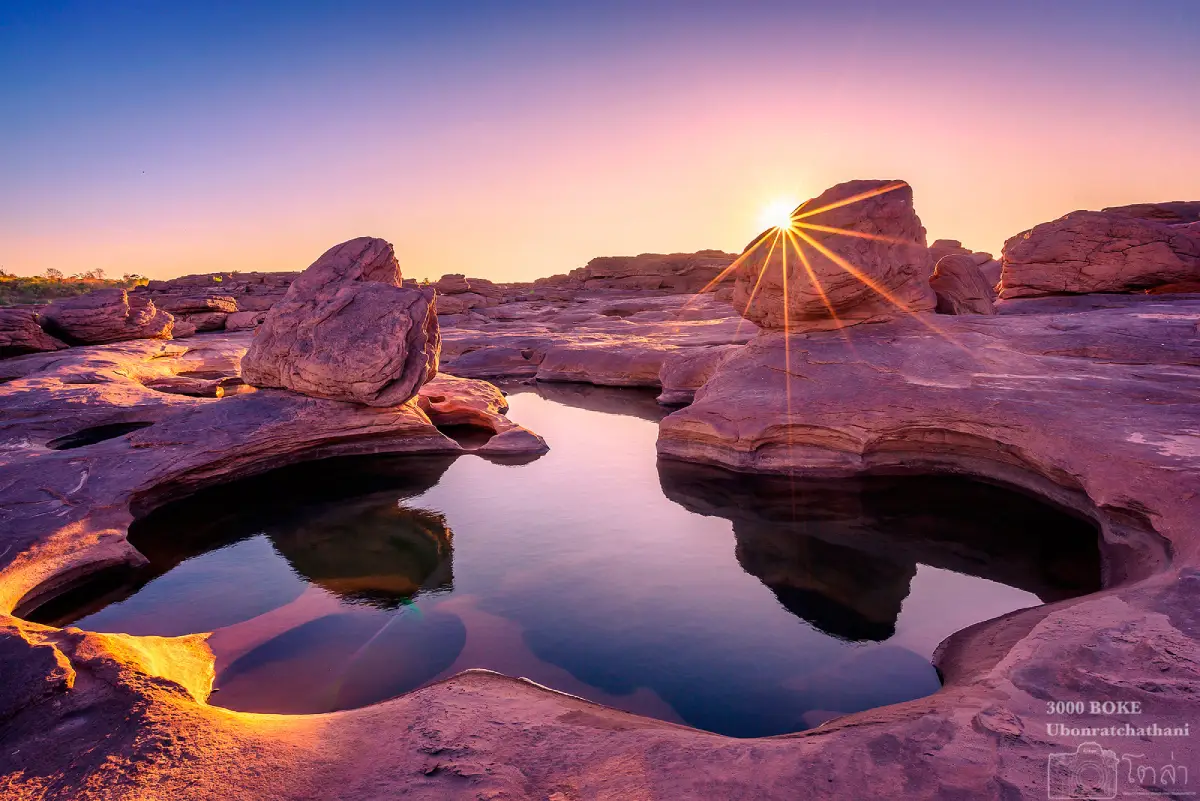
21. Kaeng Song Khon (Sam Phan Bok), Ubon Ratchathani is a remarkable natural attraction along the Mekong River in Song Khon Subdistrict, Pho Sai District, Ubon Ratchathani Province. It is renowned for extensive sandstone formations that have been eroded by the river into thousands of differently shaped potholes, earning the nickname the Grand Canyon of Thailand. Sam Phan Bok is particularly appealing during the New Year holiday because this period falls within the dry season, when falling river levels often reveal more of the unusual geological landscape.
Highlights: Thousands of naturally eroded rock potholes, unusual sandstone formations, sweeping Mekong River scenery, photography opportunities across exposed rock platforms, and excursions to nearby natural attractions and riverside communities in Pho Sai District.
The name Sam Phan Bok literally refers to three thousand potholes. In the local dialect, bok describes a hollow or depression in the rock. These formations developed through the long-term action of moving water and sediment. As the Mekong River flows across the sandstone, swirling currents carrying sand and small stones gradually wear away the rock, creating hollows of varying depth and shape. Some are nearly circular or oval, while others resemble hearts or familiar objects, depending on the imagination of the observer.
The appearance of Sam Phan Bok changes dramatically with the seasons. During periods of high water, much of the rocky landscape is submerged. As the river recedes in the dry season, increasingly extensive rock surfaces become exposed, allowing visitors to examine the natural formations more closely. River levels vary from year to year, however, so travelers should check current conditions before visiting if seeing the widest possible expanse of rock is a priority.
Exploring Sam Phan Bok is particularly rewarding for nature enthusiasts and photographers because the formations offer an extraordinary variety of compositions. Visitors should walk slowly and take time to examine the depth, contours, and shapes of individual hollows. These features provide visible evidence of the geological processes that have shaped the Mekong River landscape over a long period.
Morning and late afternoon are generally the most comfortable times to explore the sandstone because temperatures are lower than at midday. Angled sunlight also emphasizes the textures, shadows, and contours of the rock formations. Families should supervise children closely, as some potholes are deep and the surfaces vary in height. Rocks may also become slippery where water remains trapped or moisture is present.
Sam Phan Bok also reflects the long-standing relationship between the Mekong River and the communities living along its banks. The river has supported transportation, fishing, trade, and everyday life for generations. Visitors can learn about both the physical landscape and local culture, and may choose to use community-based guide services provided by people familiar with river conditions and the surrounding terrain.
A two-day, one-night New Year trip can combine Sam Phan Bok with other riverside attractions in Ubon Ratchathani Province. Staying in the surrounding area allows travelers to organize their visits according to river levels and available time. This itinerary is particularly suitable for those seeking a northeastern Thai landscape that differs from the country's more familiar mountain and seaside destinations.
Sam Phan Bok is therefore a New Year destination with considerable natural, geological, and cultural value. Visitors should walk only on safe surfaces, avoid throwing rubbish into the rock hollows, and stay clear of areas where water is flowing strongly. These precautions help protect both the landscape and the safety of those exploring it.
Getting There: From Ubon Ratchathani city, travel toward Pho Sai District and continue into Song Khon Subdistrict, following the signs to Sam Phan Bok. Drivers should check the current access road and designated parking area. Visitors interested in exploring several sections of the formations may benefit from a local guide familiar with the terrain and changing river levels.
Map (GPS):Get Directions to Sam Phan Bok
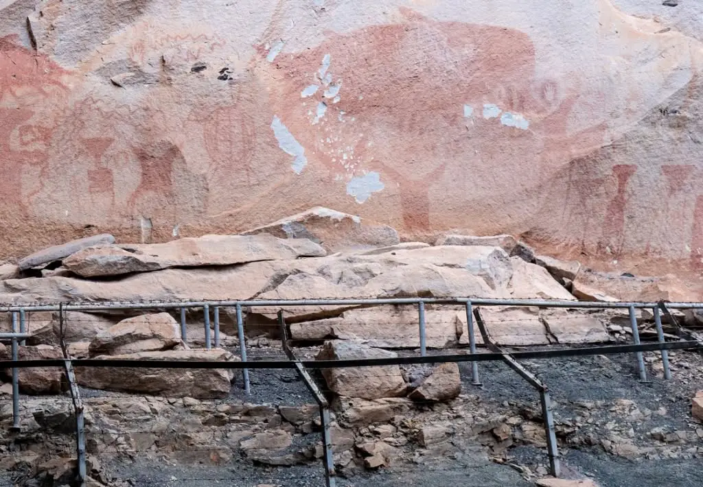
22. Pha Taem Prehistoric Rock Paintings, Ubon Ratchathani are an important archaeological and natural attraction within Pha Taem National Park, Huai Phai Subdistrict, Khong Chiam District, Ubon Ratchathani Province. The site is distinguished by ancient paintings on sandstone cliffs that provide evidence of prehistoric human life, beliefs, and artistic expression. It also offers expansive views of the Mekong River and mountain ranges across the border in Laos, making it an excellent destination for travelers who want to combine history and natural scenery during the New Year holiday.
Highlights: Prehistoric paintings on sandstone cliffs, images of animals and symbolic figures, cliff viewpoints, Mekong River scenery, nature trails, and the distinctive landscape of Pha Taem National Park.
The Pha Taem paintings are important evidence for the study of prehistoric communities in northeastern Thailand. The surviving images include representations of animals, human figures, objects, and various symbolic patterns. Archaeologists study these works to better understand how ancient people lived and interpreted the world around them. Although the exact meaning of every image cannot be established with certainty, the paintings clearly demonstrate the ability of prehistoric societies in the Mekong River region to create visual art and communicate ideas.
The paintings are particularly notable because the natural sandstone cliff served as their canvas. Red pigments remain visible in several sections, and the locations of the paintings are closely associated with the shape of the rock walls and sheltered areas beneath the overhangs. Studying these images helps visitors consider how prehistoric people interacted with their environment and the animals that shared their landscape.
The route to the paintings follows sections of the cliff, so visitors should wear suitable walking shoes, carry drinking water, and allow enough time to explore. Understanding the details of the artwork requires more careful observation than a brief stop at a scenic viewpoint. Remaining on designated paths also helps protect the fragile archaeological environment from unnecessary disturbance.
Beyond the ancient artwork, Pha Taem is famous as a place to watch sunrise along Thailand's eastern frontier. On clear mornings, visitors can see early sunlight illuminating mountain ridges and the Mekong River. This gives the area a particularly appealing atmosphere during the cool season, when outdoor sightseeing is often more comfortable.
During the New Year holiday, Pha Taem can serve as the main attraction in Khong Chiam District, with additional visits to nearby natural landmarks along the Mekong River if time permits. Grouping destinations by area reduces unnecessary driving and gives travelers more time to appreciate the archaeological features in detail.
Pha Taem is valuable for its archaeology, geology, and ecology. Visitors should never touch, mark, or write on the paintings, climb into prohibited areas, or use equipment that may damage the site. Any restrictions on photography or lighting should be observed carefully to support the preservation of these ancient works.
A New Year visit to Pha Taem is especially suitable for families, students, and travelers interested in history. It offers the opportunity to learn about prehistoric people while enjoying the remarkable landscape of the Mekong River region.
Getting There: From Ubon Ratchathani city, travel toward Khong Chiam District, then continue into Huai Phai Subdistrict and follow the signs to Pha Taem National Park. Check the starting point of the rock-painting trail and the permitted visiting hours before departure, as certain cliff sections may have access restrictions.
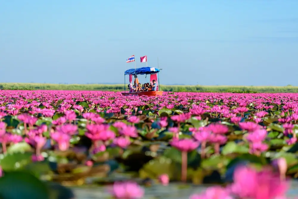
23. Red Lotus Sea, Udon Thani is one of Thailand's most celebrated seasonal natural attractions. Located at Nong Han Kumphawapi Lake in Chiang Wae Subdistrict, Kumphawapi District, Udon Thani Province, it is famous for the pinkish-red water lilies that spread across large areas of the lake when seasonal conditions are favorable. The extensive fields of blossoms create the appearance of a flower-covered sea, making late December through the early months of the year an especially popular period for visiting.
Highlights: Pink and red water lily blossoms across Nong Han Lake, boat excursions, early-morning light, waterbirds, and the valuable wetland ecosystem surrounding the lake.
The Red Lotus Sea is remarkable for the relationship between seasonal conditions and the flowering cycle of its aquatic plants. When water levels and weather conditions are suitable, large numbers of blossoms open across the lake, creating sweeping stretches of pink and red. This striking landscape attracts nature photographers and travelers seeking a distinctive cool-season experience.
Visitors usually explore the Red Lotus Sea by taking a local boat into the areas where the flowers are most abundant. Traveling by boat provides an opportunity to see the blossoms and wetland ecosystem at closer range without walking through the water. The activity also supports local livelihoods through community-operated tourism services.
Early morning is generally the best time to view the flowers because the blossoms tend to be most attractive before the day becomes hot. Their appearance can change as sunlight becomes stronger. Travelers should therefore aim to arrive at the pier in the morning and ask boat operators about the current flowering season before arranging their trip.
Nong Han Kumphawapi is also an important wetland habitat supporting fish, waterbirds, and aquatic plants. A boat excursion offers the chance to learn how these species interact within the ecosystem and how the lake provides habitats and feeding grounds for numerous forms of wildlife.
During the boat trip, visitors should follow the operator's instructions, wear life jackets, and avoid picking flowers or throwing rubbish into the water. Water lilies and other aquatic plants are part of the lake's ecological system, so responsible tourism plays an important role in preserving its natural beauty.
For travelers planning a New Year itinerary in Udon Thani, the Red Lotus Sea can be visited in the morning, followed by another provincial attraction in the afternoon, such as Phu Foi Lom or a cultural landmark in the city. Driving distances should be considered carefully, with the flowering schedule remaining the main priority.
The Red Lotus Sea is suitable for couples seeking beautiful photographs, families introducing children to wetland ecosystems, and nature enthusiasts. Its seasonal flowering display makes it a distinctive New Year destination unlike most other attractions in Thailand.
Getting There: From Udon Thani city, travel toward Kumphawapi District, then continue into Chiang Wae Subdistrict and follow the signs to a pier serving the Red Lotus Sea. Confirm the departure point and current flowering conditions before traveling, and allow additional time in the morning when boat services are particularly popular.
Map (GPS):Get Directions to the Red Lotus Sea
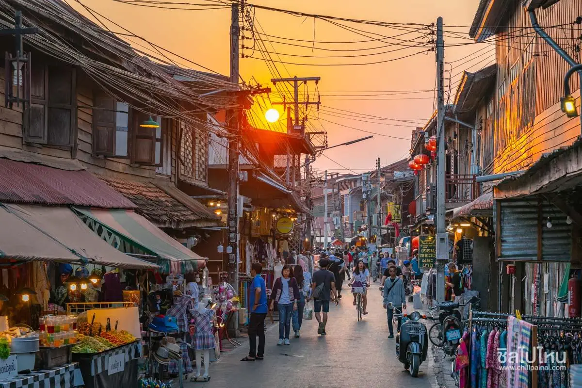
24. Ban Chiang Khan, Loei is a charming historic community on the banks of the Mekong River in Chiang Khan District, Loei Province. Located opposite Laos, the town is known for its traditional wooden houses, relaxed lifestyle, and atmospheric walking street. Its preservation of older buildings and local traditions reflects the close relationship between riverside communities and the Mekong, making Chiang Khan an appealing place for a New Year holiday.
Highlights: Historic wooden houses along the Mekong, Chiang Khan Walking Street, riverside promenades, evening scenery, regional cuisine, and the distinctive culture of a traditional Mekong River community.
Much of Chiang Khan's charm comes from its unhurried atmosphere. Visitors can walk past preserved wooden buildings, explore small shops, and enjoy views over the Mekong River. Late afternoon is particularly pleasant, when temperatures begin to fall and local residents and travelers gradually gather along the old streets and riverside paths.
Chiang Khan's history is connected with settlement along the Mekong and the movement of people between communities on both the Thai and Lao sides of the river. As a result, aspects of local cuisine, language, and cultural traditions share similarities with neighboring communities across the border. Exploring the old town reveals traces of these long-standing cultural connections.
Chiang Khan Walking Street is one of the town's most popular evening activities, featuring regional dishes, souvenirs, and locally made products. Browsing the stalls allows visitors to experience another side of the historic community. However, travelers should respect residential areas and avoid making excessive noise, particularly near homes along the old streets.
In the early morning, Chiang Khan has a different atmosphere from the evening. Some streets are peaceful, with residents continuing their daily routines before the busiest tourist hours begin. Staying overnight is therefore recommended for visitors who want to experience both the morning and evening character of the town without rushing back the same day.
The New Year holiday is a particularly popular time to visit Chiang Khan, as temperatures in Loei Province are generally cooler and the riverside setting is ideal for leisurely walks. Accommodation in the old town may be in high demand, so advance reservations are advisable. Visitors should also use designated parking areas because parts of the main street may be closed or restricted to vehicles during walking-street activities.
Chiang Khan can be combined with Phu Ruea or other attractions in Loei Province, but sufficient travel time should be allowed because the destinations are separated by considerable distances. Spending at least one night in Chiang Khan makes it easier to appreciate the old town and the Mekong River scenery.
Ban Chiang Khan is particularly suitable for couples, families, and travelers who enjoy historic neighborhoods, local food, and simple relaxation. The Mekong River remains central to the identity and special atmosphere of this charming community.
Getting There: From Loei town, follow Highway 201 toward Chiang Khan District and continue to the historic riverside neighborhood. Travelers using public transportation may take a service directly to Chiang Khan or travel first to Loei town and connect with local transportation. Check parking arrangements and walking-street operating times during the holiday period.
Map (GPS):Get Directions to Ban Chiang Khan
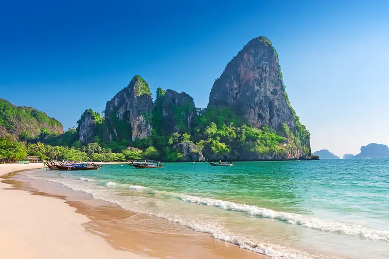
25. Railay Beach, Krabi is internationally recognized for its towering limestone cliffs and spectacular Andaman Sea scenery. Located in Ao Nang Subdistrict, Mueang Krabi District, the Railay peninsula is physically connected to the mainland, but surrounding limestone mountains make ordinary road access impractical. Visitors therefore generally arrive by boat from Ao Nang or Ao Nam Mao, giving Railay the atmosphere of a secluded island destination.
Highlights: Railay West Beach, Railay East Beach, dramatic limestone cliffs, rock-climbing activities, Andaman Sea views, and beaches surrounded by remarkable natural landscapes.
Railay's most recognizable feature is the towering limestone cliffs rising above its beaches. These formations were shaped by geological processes over immense periods of time, creating steep rock faces, caves, and coastal areas with different characteristics. The combination of limestone cliffs and blue water makes Railay one of the defining coastal landscapes of Krabi Province.
Railay West is particularly attractive for relaxing on the beach and enjoying open sea views, while Railay East has a different coastal environment and serves as an access point for certain transportation and tourism services. Walking between the peninsula's various areas allows visitors to experience several distinct landscapes within a relatively compact destination.
Rock climbing is another signature activity at Railay because its limestone cliffs are popular with climbers from Thailand and abroad. Beginners should arrange instruction from experienced professionals and use appropriate, certified safety equipment. Attempting to climb without proper training and protection is unsafe.
Late December through early January generally falls within the more favorable tourism season on Thailand's Andaman coast, but travelers must still check wave conditions and marine safety announcements. Overnight visitors should plan luggage transport and boat connections carefully, as arrival and departure arrangements differ from those at road-accessible beaches.
Railay is suitable for both day trips and overnight stays. Visitors with limited time may enjoy walking between beaches and photographing the cliffs, while those staying overnight can experience the quieter early-morning and evening atmosphere. This makes Railay especially appealing to couples and travelers who love coastal scenery.
Responsible tourism is important for protecting Railay's landscape. Visitors should not leave rubbish on the beach, disturb wildlife, or enter cliffs and rocky areas where falling stones or access restrictions create safety risks. Preserving the natural environment helps maintain the qualities that make Railay such a remarkable destination.
Getting There: From Krabi town, travel to Ao Nang or Ao Nam Mao, then take a long-tail boat to Railay Beach. Travelers arriving at Krabi Airport can take a bus or taxi to the departure pier. Check boat operating times, tidal conditions, and luggage arrangements before departure.
Map (GPS):View Railay Beach on Google Maps
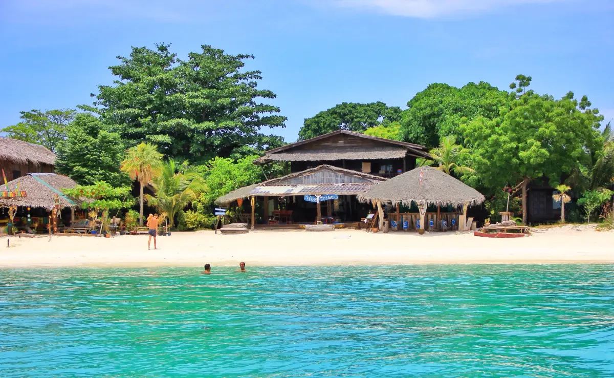
26. Koh Lipe, Satun is a well-known island destination in the southern Andaman Sea, located in Ko Sarai Subdistrict, Mueang Satun District, Satun Province, near Tarutao National Park. It is famous for its white sandy beaches and clear turquoise water. With several beaches within walking distance of one another, as well as accommodation, restaurants, and boat connections to nearby islands, Koh Lipe is an attractive destination for travelers seeking a seaside New Year holiday.
Highlights: Pattaya Beach, Sunrise Beach, Sunset Beach, the Andaman Sea, snorkeling and other marine activities, and a relaxed island atmosphere that changes from one beach to another.
Koh Lipe is distinguished by beaches facing different directions, creating opportunities to enjoy different lighting conditions and coastal environments. Sunrise Beach is particularly suitable for watching the morning light, while Sunset Beach is known for its evening atmosphere and views toward the setting sun. Pattaya Beach offers a greater concentration of tourist services and restaurants. Choosing accommodation near the beach that best matches personal interests can make an island holiday more rewarding.
Koh Lipe is closely associated with the sea-dwelling communities that have inhabited islands in the southern Andaman region for generations. Traditional ways of life have involved boat travel, fishing, and detailed knowledge of the marine environment passed down within the community. Tourism should therefore respect local culture while allowing visitors to enjoy the beaches and surrounding sea.
Snorkeling is another popular activity around Koh Lipe and the surrounding islands. Travelers can choose boat excursions to locations open for recreation according to seasonal conditions and sea safety. Operators should provide suitable safety equipment, and participants should avoid touching coral, feeding fish, or disturbing marine animals.
A New Year trip to Koh Lipe is best planned for at least three days and two nights because travel usually involves a road transfer from an airport or transport terminal to a pier, followed by a boat journey. Allowing at least one full day to relax on the island makes the trip less tiring, especially for families and couples seeking a genuine break rather than an exhausting travel schedule.
Koh Lipe's walking street becomes particularly lively in the evening, with restaurants, shops, and tourist services. After spending the day on the beach, visitors can explore the shopping and dining area. As always, respect for local communities and consideration for residents living near tourist areas are important.
Although late December and early January are generally favorable months for tourism on the Andaman coast, boat services depend on actual sea conditions. Travelers should monitor notices from operators and the relevant authorities, and avoid arranging mainland return connections too close to a flight or the last scheduled bus, because rough weather can affect boat departures.
Koh Lipe is particularly attractive to travelers who want to begin the New Year with beach relaxation, sunrise and sunset views, or exploration of the southern Andaman islands. Respectful tourism helps preserve both the marine environment and the traditions of local communities.
Getting There: From Hat Yai Airport or elsewhere in Satun Province, travel to Pak Bara Pier in La-ngu District, then board a scheduled speedboat to Koh Lipe. During the New Year holiday, accommodation and transportation should be booked ahead, and weather and sea conditions checked before departure.
Map (GPS):View Koh Lipe on Google Maps
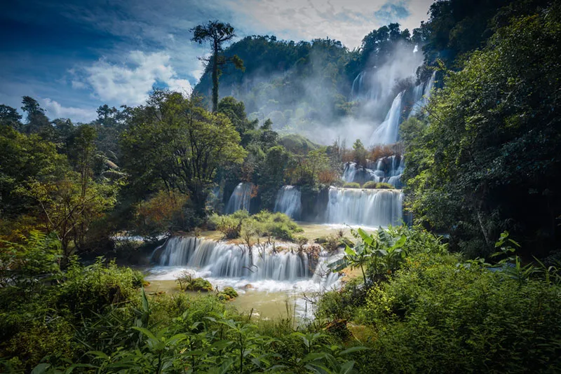
27. Thi Lo Su Waterfall, Tak is one of Thailand's most spectacular large waterfalls. Situated within Umphang Wildlife Sanctuary in Tak Province, it lies amid extensive mountain forests and is renowned for its broad series of cascades flowing over limestone cliffs. The waterfall's impressive scale and surrounding wilderness make it a memorable destination for nature lovers and adventurous travelers during a long holiday.
Highlights: Multiple streams cascading over a large cliff face, the forests of Umphang Wildlife Sanctuary, natural touring routes, mountain scenery, and the journey through the rugged landscapes of western Thailand.
Thi Lo Su's dramatic appearance is created by water flowing over different levels of rock and cliff. Some sections form wide curtains of water, while others divide into multiple smaller streams. Its appearance changes with seasonal water volumes. Following the rainy season, the waterfall may be particularly powerful, although access routes can be restricted when conditions are unsafe or areas are closed for environmental recovery.
Umphang is part of the extensive forested mountain landscapes of western Thailand, an area important for ecosystems and the protection of water sources. The journey to Thi Lo Su is therefore not limited to viewing the waterfall itself. It also provides opportunities to experience forests and geographical features that demonstrate the ecological richness of the region. Visitors must follow wildlife sanctuary regulations carefully.
The road to Umphang District is well known for its numerous winding mountain bends. Travelers driving their own vehicles should check tires, brakes, and overall vehicle condition before departure. Those unfamiliar with mountain driving may prefer a tour or transportation service operated by local providers with experience on the route.
Depending on the permitted route and current conditions, reaching Thi Lo Su may require appropriate vehicles and a further walk through natural terrain. Because the waterfall is inside a wildlife sanctuary, access depends on official announcements, and travelers should never attempt to use closed roads or enter restricted sections without permission.
The New Year period attracts travelers to Umphang, but sufficient time should be allocated for the journey because the distance and mountain roads make travel slower than to most urban destinations. Visitors who want a more relaxed experience can stay in Umphang District and arrange their waterfall visit through an authorized local operator.
Recommended equipment includes footwear suitable for damp terrain, quick-drying clothing, drinking water, and essential supplies for a forest excursion. Visitors must not swim in areas with warnings or approach cliff sections where water flows strongly. Keeping a safe distance from wildlife and carrying out all rubbish are important responsibilities in the protected environment.
Thi Lo Su is an excellent New Year destination for nature enthusiasts who have enough travel time and are prepared for mountain roads. The experience is memorable not only for the waterfall's scale but also for the forests and scenery encountered on the way into this remarkable natural landscape.
Getting There: From Tak Province, travel toward Mae Sot and continue along the mountain route to Umphang District. Contact wildlife sanctuary officials or an authorized local tour operator for access arrangements and information about the roads currently open to Thi Lo Su. Check official entry conditions before departure.
Map (GPS):View Thi Lo Su Waterfall on Google Maps
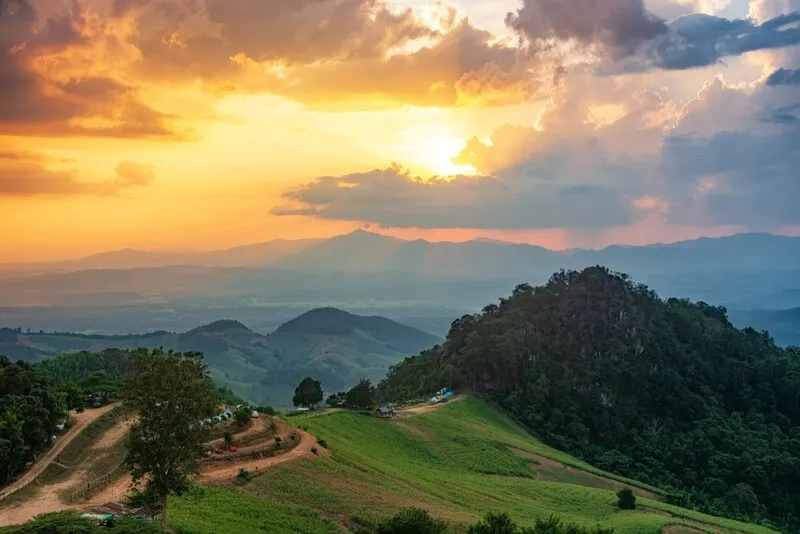
28. Si Nan National Park, Nan is a national park celebrated for its mountain viewpoints and opportunities to observe the night sky. Located in Nan Province, the park includes major tourist attractions in Na Noi District, particularly Doi Samer Dao and Pha Chu, which are popular for watching sunrise, sunset, and the changing mountain scenery during the cool season.
Highlights: Doi Samer Dao, Pha Chu, mountain viewpoints, seas of mist when weather conditions allow, stargazing, and the peaceful highland atmosphere of Nan Province.
Si Nan National Park is characterized by mountain ranges and cliff formations, including open areas along ridgelines that provide extensive views of the surrounding landscape. Different viewpoints face different directions and elevations, allowing travelers to select locations for enjoying morning or evening light according to the areas currently open to visitors.
Doi Samer Dao is particularly popular with travelers who enjoy camping and photographing the night sky. Some parts of the ridge offer unobstructed views overhead, and on clear nights with limited artificial light, large numbers of stars may be visible. The quality of stargazing nevertheless depends on cloud cover, rain, moonlight, and other atmospheric conditions.
Pha Chu is another distinctive scenic viewpoint, known for its dramatic cliff landscape and local stories. Visitors can explore designated viewpoints and photograph the mountains from safe areas. Caution is important near steep drops and exposed cliffs, particularly when strong winds affect the ridgeline.
During the New Year holiday, Doi Samer Dao is a popular destination for travelers seeking cool weather and close contact with nature. Overnight stays or camping inside the national park are subject to reservation requirements and visitor limits. Travelers should check which facilities are available before departure because demand for camping spaces may be high during the holiday period.
Photography enthusiasts can begin the day by watching sunlight appear over the mountains and then explore other viewpoints within the park. In the evening, visitors may enjoy the changing colors of the sky before preparing for stargazing if the weather permits. Staying in an authorized area makes it easier to experience several different times of day without repeatedly driving up and down mountain roads.
Si Nan National Park also contributes to the protection of forest ecosystems in Nan Province. Visitors should remain on designated routes, avoid collecting plants, keep noise levels low, and follow regulations concerning fires in camping areas. These practices help preserve the park's natural environment and reduce safety risks.
Si Nan National Park is an excellent New Year destination for travelers who want mountain scenery, sunrise views, and the possibility of stargazing. It provides a different experience from a conventional beach holiday, with an emphasis on peace and the natural beauty of the highlands.
Getting There: From Nan town, travel toward Na Noi District and follow the roads leading into Si Nan National Park. Continue according to signs for Doi Samer Dao or Pha Chu. Check the exact destination before driving because the national park covers a broad area and its attractions are not all located in the same place.
Map (GPS):Get Directions to Si Nan National Park
29. Bo Kluea Rock Salt Wells, Nan are a distinctive cultural attraction in Bo Kluea District, Nan Province, known for the traditional production of salt in a mountainous environment. The community has preserved the knowledge of extracting naturally occurring saline water from wells and boiling it until salt crystals form. This practice is closely connected to local livelihoods and the economy of the community, making the destination particularly interesting to visitors seeking cultural experiences during the New Year holiday.
Highlights: Natural saline wells, demonstrations of traditional salt boiling, locally produced rock salt products, mountain community life, and scenic highland routes in Nan Province.
Rock salt is produced from natural saline water rather than seawater. At Bo Kluea, the traditional process demonstrates how mountain communities have learned to use local mineral resources through methods developed over generations. The production of salt is therefore evidence of the community's practical knowledge of its environment and the passing down of specialized skills within families and local society.
The traditional salt-making process begins by collecting saline water from the well and placing it in a vessel for boiling. As water evaporates, the salt concentration increases until crystals form and can be collected for use. The procedure requires experience in controlling heat and boiling time, reflecting the skills developed by local salt makers over many years.
A New Year visit to Bo Kluea offers cool mountain weather along with opportunities to discover local culture. Travelers can explore public visiting areas, observe salt-making demonstrations when production is taking place, and purchase products directly from community businesses, helping support the local economy.
Bo Kluea is also attractive for its surrounding mountains and small rural communities. Reaching the area involves traveling along winding mountain roads with scenic views, making the journey itself enjoyable for travelers who appreciate countryside landscapes and highland driving.
However, salt production is an activity carried out by local residents and may stop at certain times according to community customs or the circumstances of individual producers. Travelers who specifically want to see salt boiling should inquire before visiting and must not enter working areas with hot water or boiling equipment without permission.
For a broader Nan Province itinerary, Bo Kluea can be combined with mountain scenery and other natural attractions, allowing enough time for local travel. Exploring both traditional salt-making and highland landscapes creates a varied New Year holiday that goes beyond conventional nature sightseeing.
Bo Kluea Rock Salt Wells are particularly suitable for families, students, cultural travelers, and anyone interested in learning about local livelihoods through direct observation of traditional production methods. The experience highlights the enduring value of specialized knowledge within mountain communities.
Getting There: From Nan town, travel toward Santi Suk and Bo Kluea districts, or choose a mountain route connecting through Pua District depending on road conditions and the planned itinerary. The journey involves bends and steep gradients, so vehicle preparation and cautious driving are essential.

30. Phu Thap Boek, Phetchabun is a celebrated mountain destination in Wang Ban Subdistrict, Lom Kao District, Phetchabun Province. Known as the highest area in Phetchabun, it offers extensive views of mountain ranges and valleys that may be covered by a sea of mist during the cool season. The mountain is also associated with highland agriculture, particularly cabbage cultivation, which has become one of its most recognizable landscapes.
Highlights: Seas of mist, cool winter temperatures, seasonal cabbage fields, sunrise viewpoints, winding mountain roads, and the atmosphere of a highland village.
Phu Thap Boek is distinguished by its elevation and mountain terrain, which provides extensive views in several directions. When weather conditions are favorable, mist may gather in the valleys during the morning before gradually moving and dispersing as temperatures rise. The constantly changing light and cloud formations make the mountain a popular destination for landscape photography during the New Year holiday.
The surrounding agricultural landscape is closely associated with Hmong communities living in the highlands, where farming has long been an important livelihood. Cabbage fields arranged along the mountain slopes create a distinctive pattern across the landscape. However, planting and harvesting times vary with the seasons, so visitors should not assume that the fields will look the same throughout the year.
The road up Phu Thap Boek is itself part of the experience, with a succession of steep slopes, sharp bends, and mountain views. Drivers should check their brakes, tires, and engine condition before making the ascent. Stopping in dangerous locations for photographs should be avoided, and extra caution is needed when heavy fog reduces visibility.
Staying overnight on Phu Thap Boek gives visitors the opportunity to experience both the evening and morning mountain atmosphere. This is especially appealing to travelers hoping to photograph sunrise or a sea of mist. Accommodation should be legally operated, and visitors should confirm the availability of services before booking because mountainous areas can present limitations in transportation, utilities, and environmental management.
A wider Phetchabun itinerary can combine Phu Thap Boek with Khao Kho or Phu Hin Rong Kla National Park, provided sufficient time is allowed for mountain roads. Driving on steep and winding routes generally takes longer than a simple calculation based on distance might suggest, so the schedule should not be overloaded.
Responsible tourism is especially important at Phu Thap Boek because increasing visitor numbers can affect waste management, wastewater treatment, and land use in the mountain environment. Travelers should keep the area clean, avoid entering agricultural fields without permission, and support tourism businesses that respect local communities and environmental protection.
Phu Thap Boek is ideal for couples, friends, and families who enjoy cool weather and high mountain landscapes. It is particularly attractive to visitors who want to welcome the New Year by waking early to admire the mist and enjoy the natural beauty of Phetchabun's highlands.
Open Days: Daily Opening Hours: General tourist areas are accessible throughout the day, although individual viewpoints and accommodation providers may have their own restrictions.
Getting There: From Phetchabun, travel toward Lom Sak and Lom Kao districts, then follow the mountain road through Wang Ban Subdistrict to Phu Thap Boek. Travelers approaching from Phitsanulok may use connecting roads through Phu Hin Rong Kla National Park when permitted and safe. Prepare the vehicle for steep gradients and allow additional travel time during the New Year holiday.
Map (GPS):Get Directions to Phu Thap Boek

31. Namtok Phliu National Park, Chanthaburi is an important natural attraction in eastern Thailand, located in Khom Bang Subdistrict, Mueang Chanthaburi District. It is famous for Phliu Waterfall, which flows over rocks through a lush forest, and for historical landmarks associated with King Chulalongkorn (Rama V). The park is therefore suitable for families and travelers who want to combine nature and history during the New Year holiday.
Highlights: Phliu Waterfall, natural pools, the forests of the Khao Sa Bap mountain area, the large fish known as pla phluang hin, Alongkorn Chedi, and the memorial associated with Queen Sunandha Kumariratana, an important historical figure of the reign of King Rama V.
Phliu Waterfall features streams flowing over rock formations into pools surrounded by forest. Large trees and tropical vegetation create a shaded atmosphere, while designated paths allow visitors to explore the natural scenery. Fish inhabiting the water are another distinctive feature. The attraction is not limited to the waterfall itself, but includes the surrounding ecosystem and the opportunity to observe freshwater life.
The site's historical importance is connected with visits by King Chulalongkorn, who appreciated the natural beauty of Chanthaburi. Alongkorn Chedi and the memorial associated with Queen Sunandha Kumariratana remain within the park, giving Phliu Waterfall a historical and royal dimension alongside its natural appeal.
The New Year period can be pleasant for walking through forests and visiting waterfalls because temperatures are often less intense than in the hottest months. Water volumes and currents still vary with the season, however. Visitors should follow park staff instructions, avoid restricted sections, and never feed fish if doing so is prohibited by park regulations.
A two-day, one-night Chanthaburi itinerary can include Phliu Waterfall on the first day and Chao Lao Beach on the second, providing the opportunity to experience both forest landscapes and the Gulf of Thailand coastline within the same province.
Namtok Phliu National Park is especially suitable for visitors interested in nature, history, and family outings. Allowing time to see the historical memorials and read their background makes it possible to appreciate the relationship between the natural landscape and Thailand's royal history more fully.
Open Days: Daily
Opening Hours: 8:30 AM – 5:30 PM.
Getting There: From Chanthaburi town, follow Sukhumvit Road toward Khom Bang Subdistrict and turn toward Namtok Phliu National Park according to road signs. Travelers without a private vehicle can reach Chanthaburi by bus and continue by local hired transportation. Bring footwear suitable for damp paths and check park regulations before entering.

32. Chao Lao Beach, Chanthaburi is a popular seaside destination in Khlong Khut Subdistrict, Tha Mai District, Chanthaburi Province. Its long coastline along the Gulf of Thailand provides a pleasant setting for beach walks, sea breezes, and relaxing holidays with family or a partner. With accommodation and seafood restaurants in the surrounding area, Chao Lao Beach is particularly suitable for a two-day, one-night New Year getaway without traveling to an island.
Highlights: Chao Lao Beach, Gulf of Thailand scenery, seafood restaurants, leisurely seaside walks, beachfront accommodation, and opportunities to explore other parts of Chanthaburi's coastline.
Much of Chao Lao Beach's appeal comes from the different ways visitors can enjoy the coastline. Walking beside the sea, relaxing in the shade, taking photographs, and sharing a meal with family are all possible without a demanding itinerary. Early morning is usually pleasant for walking before temperatures rise, while the afternoon offers opportunities to rest in shaded areas and enjoy the coastal atmosphere.
The beach is closely connected with the lives of Chanthaburi's coastal communities, where fishing and tourism services have developed alongside one another. Visitors can experience a seaside environment that retains links with local seafood, regional products, and traditional livelihoods.
For couples seeking a romantic atmosphere, Chao Lao Beach is ideal for walking along the shoreline in softer light, taking photographs together, and enjoying a relaxed seafood meal. Families traveling with children should choose areas with suitable facilities and check wave conditions before allowing children to swim.
The New Year period brings increased travel to seaside destinations, so accommodation should be reserved in advance and extra time allowed for coastal roads. Visitors who prefer a slower pace can stay overnight and explore another nearby viewpoint or natural attraction in Chanthaburi the following day.
Chao Lao Beach can also be combined with Namtok Phliu National Park or other natural attractions in Tha Mai and Laem Sing districts, making it possible to enjoy seaside relaxation, forest landscapes, and regional cuisine within a single provincial itinerary.
Open Days: Daily
Opening Hours: General public beach areas are accessible throughout the day, although individual businesses have their own operating hours.
Getting There: From Bangkok, follow Sukhumvit Road toward Chanthaburi Province, then continue into Tha Mai District and take the road leading to Khlong Khut Subdistrict and Chao Lao Beach. Travelers arriving by bus in Chanthaburi town can continue by local transportation. Check the exact location of your accommodation because the beachfront extends across several sections.
Map (GPS):Get Directions to Chao Lao Beach
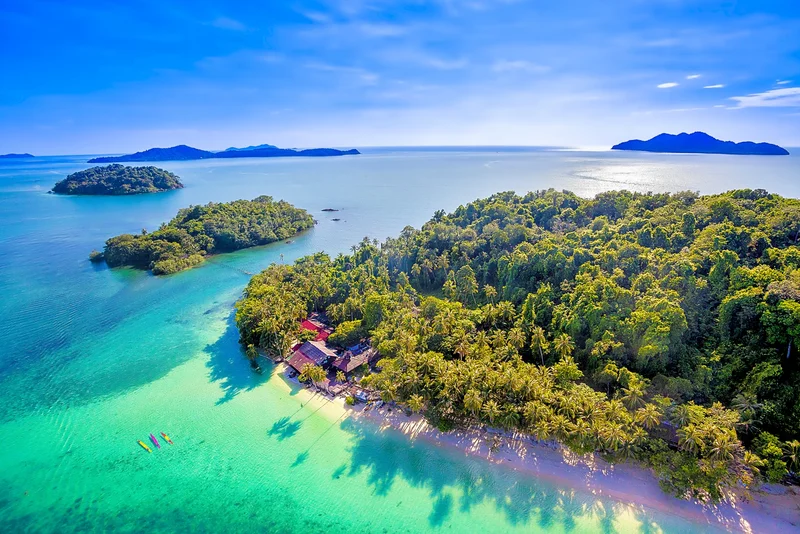
33. Mu Ko Chang National Park, Trat is an important protected marine and forest area in eastern Thailand, covering parts of Koh Chang and surrounding islands in Trat Province. Its landscape combines mountains, tropical forests, waterfalls, and the Gulf of Thailand coastline, making it a suitable destination for travelers who want both island nature experiences and seaside relaxation during the New Year holiday.
Highlights: The mountains and forests of Koh Chang, Khlong Phlu Waterfall, major beaches along the island's coastline, sea viewpoints, and permitted marine tourism activities.
Koh Chang is a large mountainous island covered by extensive forest. Several coastal areas contain beaches and tourism communities, while inland streams and waterfalls originate in the mountain catchments. This varied geography allows visitors to choose between relaxing by the sea and exploring forested national park areas.
The importance of Mu Ko Chang National Park extends beyond its scenery to the conservation of connected marine and terrestrial ecosystems. The forests help protect the island's freshwater sources, while coastal waters provide important habitats for aquatic organisms. Visitors should therefore follow national park regulations and practice environmentally responsible tourism.
Families seeking a relaxed New Year holiday can select accommodation near an accessible beach and visit only a few nearby attractions each day. Nature enthusiasts may prefer waterfalls, forest areas, or marine activities, depending on weather conditions and personal abilities. Avoiding an overloaded itinerary makes a holiday on Koh Chang more enjoyable.
Driving on Koh Chang requires care because several roads, particularly those connecting beaches on the western side, contain steep gradients and sharp bends. Visitors using their own vehicles should check brake performance and avoid excessive speed. Marine activities should also be selected according to wave conditions and the safety standards of local operators.
The New Year holiday is a busy period on Koh Chang. Ferry schedules, accommodation availability, and possible queues at the piers should be checked in advance. Staying for two or three nights is suitable for visitors who want to enjoy both the beaches and the island's natural attractions.
Getting There: From Bangkok, drive toward Trat Province and continue to a ferry pier serving Koh Chang. After crossing to the island, use a private vehicle or local transportation to reach accommodation and attractions. The GPS location identifies a destination on the island and does not represent an uninterrupted driving route from the mainland.

34. Koh Kood, Trat is an island destination in Koh Kood District, Trat Province, celebrated for its beaches, turquoise water, forests, and natural waterfalls. It is particularly appealing to travelers looking for a peaceful seaside New Year holiday, especially couples and families hoping to spend time away from the noise and pace of major cities.
Highlights: Natural bays and beaches around the island, clear blue seawater, Khlong Chao Waterfall, island communities, beachfront accommodation, and kayaking or other water activities when conditions permit.
Koh Kood is distinguished by its combination of beaches, forests, and freshwater streams. Unlike heavily urbanized resort destinations, many sections retain a close connection with nature. Visitors can enjoy the sea breeze, listen to waves, and walk along sandy beaches without feeling obliged to follow a busy schedule.
Khlong Chao Waterfall is one of the island's best-known natural attractions. The water flows through forested surroundings into a pool, although its volume and appearance change with the seasons. Travelers wishing to explore both the waterfall and beaches can divide their time between the two, checking trail conditions and safety requirements before entering the natural area.
Koh Kood also has communities whose livelihoods have long been connected with the sea, particularly fishing and tourism services. Enjoying local cuisine and choosing community-operated businesses can make the trip more meaningful while supporting the local economy.
An overnight stay is generally the most practical choice because reaching the island requires a boat journey with specific departure times. A three-day, two-night itinerary gives visitors time to enjoy beaches, waterfalls, and accommodation without having to rush back to the mainland on the same day.
During the New Year holiday, both boat tickets and accommodation should be booked in advance. Weather and sea conditions must be checked daily because services may change when conditions are unsafe. Return connections should not be scheduled too close to flights or the last bus of the day, as weather-related boat delays can occur.
Koh Kood is particularly suitable for travelers hoping to begin the New Year with quiet relaxation, coastal walks, natural scenery, and opportunities to experience the everyday life of an island community.
Getting There: From Bangkok, travel to Trat Province and continue to a pier offering scheduled boat services to Koh Kood. On arrival, use accommodation transfers or local transport to reach your destination. Confirm the departure pier, boat schedule, and weather conditions directly with the operator before traveling.
Map (GPS):View Koh Kood on Google Maps

35. Hat Sai Kaew (Koh Samet), Rayong is one of the most popular beaches on Koh Samet, located off the coast of Phe Subdistrict, Mueang Rayong District, Rayong Province. Its pale sandy shoreline, beautiful sea, restaurants, and beachfront accommodation make it a popular New Year destination for travelers seeking a seaside holiday within relatively convenient reach of Bangkok.
Highlights: Hat Sai Kaew Beach, the Gulf of Thailand, shoreline walks, marine recreational activities, restaurants, and connections to other beaches around Koh Samet.
Hat Sai Kaew is popular because its long sandy beach offers space for walking, relaxing, and enjoying the surrounding seascape. Tourist services are available along different sections, making it suitable both for visitors who want a quiet moment by the water and those interested in beach activities.
Koh Samet is part of Rayong Province's important marine tourism area, with several locations falling within Khao Laem Ya–Mu Ko Samet National Park. Visitors should follow environmental regulations, respect restrictions on beach use, and help protect coastal and marine resources.
For couples, Hat Sai Kaew is well suited to a one-night seaside trip, offering time to enjoy the afternoon beach atmosphere and share a relaxed evening meal. Families with children can choose sections with convenient facilities and should check sea conditions before swimming.
The New Year holiday attracts many visitors to Koh Samet, making it important to confirm boat schedules and accommodation availability in advance. Day-trippers should establish the time of their return boat and allow enough time to travel from the beach to the departure pier.
Hat Sai Kaew can also be combined with other beaches on Koh Samet using local transportation or designated walking routes. Selecting a manageable number of stops allows visitors to experience different parts of the coastline without spending the entire day traveling between them.
Getting There: From Bangkok, travel toward Rayong Province and continue to Phe Subdistrict and Ban Phe Pier. Take a scheduled ferry or speedboat to Koh Samet, then walk or use local transportation to reach Hat Sai Kaew, depending on the arrival pier and luggage. Check boat schedules and sea conditions before departure.
Map (GPS):View Hat Sai Kaew on Google Maps

36. Damnoen Saduak Floating Market, Ratchaburi is one of Thailand's most famous cultural attractions, located in Damnoen Saduak Subdistrict, Damnoen Saduak District, Ratchaburi Province. Known for boats selling fruit, food, and locally made products along the canal, it reflects the traditional water-based way of life in Central Thailand. It is ideal for a half-day New Year excursion or a trip combined with other attractions in Ratchaburi and Samut Songkhram.
Highlights: Trading boats along Damnoen Saduak Canal, fresh fruit and local dishes, canal boat excursions, bridges and traditional waterside houses, and the lively atmosphere of a morning floating market.
The history of Damnoen Saduak Floating Market is closely connected with the construction of Damnoen Saduak Canal during the reign of King Mongkut (Rama IV). The canal was developed to improve connections between the Mae Klong and Tha Chin river systems, helping farming communities transport produce and communicate more easily. As commerce along the waterway expanded, floating markets became an important part of the local economy and daily life.
The market is particularly memorable for the sight of boats carrying food and fruit through the narrow canal. Visitors can explore shops along the waterfront or take a boat ride to see the canal community from the perspective of those traveling on the water. This experience also illustrates how floating markets once played an important economic role before roads and land transportation became dominant.
Morning is generally the best time to visit Damnoen Saduak, when trading activities are at their most lively and the weather is less hot. Travelers interested in photographing boats and food vendors should arrive relatively early, since the market is usually more active in the morning than in the afternoon.
Local food is an essential part of the floating market experience. Visitors can sample fresh fruit, prepared dishes, and traditional Thai desserts while learning about ingredients produced in the surrounding agricultural areas. Asking prices before purchasing goods or booking a boat service helps travelers manage their expenses more clearly.
Boat excursions should be arranged through operators providing suitable safety equipment and clear explanations of their routes. Passengers should avoid extending arms or belongings outside the boat in busy sections of the canal and should respect the privacy of residents living along the waterways.
Damnoen Saduak is suitable for a New Year day trip from Bangkok and can be followed by a visit to Amphawa or another attraction in Ratchaburi Province if time permits. Because the floating market is most distinctive in the morning, it is best scheduled as the day's first stop.
Open Days: Daily
Opening Hours: Approximately 6:00 AM – 12:00 PM.
Getting There: From Bangkok, travel along Rama II Road or the route through Ban Phaeo District, then continue toward Damnoen Saduak District in Ratchaburi. Public transportation options are available to the district or nearby towns, with local services for the final connection. Check the appropriate parking area and boat departure point before visiting.
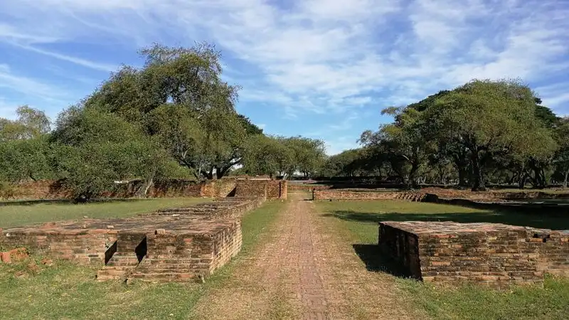
37. Phra Racha Wang Luang (Ancient Royal Palace), Ayutthaya is a major historical site within Ayutthaya Historical Park in Phra Nakhon Si Ayutthaya Province. It was closely associated with royal authority and the administration of the Ayutthaya Kingdom for several centuries. Today, the remains of palace structures, royal halls, foundations, and the original layout provide valuable evidence of the organization and architecture of the historic Thai royal court.
Highlights: The historic Royal Palace grounds, foundations of royal audience halls, the layout of former royal precincts, the political history of the Ayutthaya Kingdom, and the atmosphere of archaeological remains within a UNESCO World Heritage city.
The Royal Palace was a center of government during the Ayutthaya period, with structures added, expanded, and modified under successive rulers. The original grounds included royal halls, supporting buildings, ceremonial areas, and precincts reserved for different functions. Their arrangement reflected the importance and hierarchy of activities within the court.
After Ayutthaya fell to Burmese forces in 1767, much of the palace suffered extensive damage. What remains today includes foundations, wall lines, and surviving structural elements. Understanding the original appearance and functions of the palace therefore requires information from archaeology, historical sources, and studies of the former city's layout.
Exploring the Ancient Royal Palace differs from visiting a preserved historical building because visitors encounter the surviving remains of structures rather than complete architecture. Taking time to read interpretive signs and examine the positions of major building foundations helps explain how the palace related to the wider urban landscape of Ayutthaya.
The Royal Palace is also significant for understanding the development of Thai architecture and royal administration before the Rattanakosin period. Certain traditions of royal precinct organization and ceremonial practice influenced later periods. Exploring the site can therefore help visitors connect the history of the Ayutthaya Kingdom with developments in modern Thai history.
The New Year holiday can be a pleasant time to explore outdoor historical attractions, particularly in the morning when temperatures are less intense. Visitors should carry drinking water, wear a hat and suitable walking shoes, and keep a safe distance from fragile remains. Climbing archaeological structures for photographs should be avoided.
The Ancient Royal Palace can be visited alongside museums and other historical attractions on Ayutthaya's city island. Spending a full day or two exploring the area's historical sites allows visitors to gain a deeper understanding of the former capital rather than making only brief photography stops.
Getting There: From Bangkok, follow Highway 1 or the expressway network toward Phra Nakhon Si Ayutthaya, then enter the historic city island and Ayutthaya Historical Park. Visitors arriving by train can alight at Ayutthaya Station and continue by local transportation to the archaeological site. Check designated parking areas and visitor entrances before exploring.
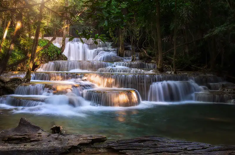
38. Huai Mae Khamin Waterfall, Kanchanaburi is a celebrated natural attraction inside Khuean Srinagarindra National Park, located in Dan Mae Chalaep Subdistrict, Si Sawat District, Kanchanaburi Province. Its water flows over successive limestone terraces through a shady forest environment. The waterfall is well suited to New Year travelers who enjoy nature and want to explore several connected waterfall tiers along walking trails.
Highlights: Seven waterfall tiers, naturally greenish-blue water, cascades with different shapes, forest trails, and the landscapes of Khuean Srinagarindra National Park.
Huai Mae Khamin Waterfall is remarkable for its streams flowing over limestone formations into natural pools. Each tier has its own appearance, including stepped cascades, smooth rock surfaces, and pools surrounded by trees. These variations allow visitors to select walking distances and sightseeing activities according to their abilities and available time.
The surrounding forest creates a cool, shaded environment, while the streams demonstrate the importance of forested watersheds in maintaining moisture and supporting ecological systems. Nature enthusiasts can observe the interactions between water, rock, and vegetation as they walk along the national park's designated paths.
The New Year holiday can be a pleasant time for forest walks, although water volumes may be lower than during the rainy season. Photographers should consider the lighting and safety conditions carefully, avoiding wet rocks and areas outside the marked route because slippery surfaces may cause accidents.
A private vehicle or organized transportation is convenient for reaching Huai Mae Khamin because it is some distance from Kanchanaburi town. A two-day, one-night stay can allow visitors to explore the waterfall at a comfortable pace and use accommodation or camping areas that are officially open.
The waterfall may be combined with other destinations around Srinagarind Reservoir, provided that travel routes and times are considered carefully. Trying to visit several distant waterfalls in a single short itinerary may leave insufficient time for both driving and walking through the natural areas.
Visitors should follow national park regulations, avoid leaving food waste or rubbish in streams, refrain from using products that might affect water quality in restricted areas, and stay out of sections temporarily closed for ecological recovery. Such practices protect the waterfall's natural beauty and ecological integrity.
Open Days: Daily, subject to national park announcements.
Opening Hours: Approximately 6:00 AM – 4:30 PM.
Getting There: From Kanchanaburi town, travel toward Si Sawat District and Khuean Srinagarindra National Park using the roads leading to Huai Mae Khamin Waterfall. Drivers should check road conditions and fuel levels before departure and review current park notices concerning access routes and visiting hours.

39. Hua Hin Beach, Prachuap Khiri Khan is a historic seaside destination in Hua Hin Subdistrict, Hua Hin District, Prachuap Khiri Khan Province. Known for its Gulf of Thailand coastline, pleasant shoreline walks, and extensive tourist facilities, it is suitable for families, couples, and travelers seeking a convenient seaside New Year holiday. The town provides numerous hotels, restaurants, and leisure opportunities.
Highlights: Hua Hin Beach, seaside walks, the atmosphere of a historic resort town, coastal restaurants, diverse accommodation options, and convenient access to other attractions around Hua Hin District.
Hua Hin developed into a prominent seaside resort during the early twentieth century, influenced by the expansion of Thailand's railway network and growing royal interest in coastal retreats. Improvements to transportation and local infrastructure established the town as an important holiday destination for visitors from Bangkok and other parts of the country.
Hua Hin's beach is especially pleasant for morning walks, when temperatures are relatively mild and the atmosphere is often calmer than during busier periods. Visitors can enjoy the sea breeze, photograph the coast, or simply spend time beside the water without a tightly scheduled program.
The town's extensive selection of restaurants and accommodation makes it possible to plan holidays around different budgets and preferences. Visitors can choose a short break from nearby provinces or spend several nights exploring the coast. Couples seeking a relaxed atmosphere may particularly enjoy staying close to the beach and walking together in the evening.
New Year travel to Hua Hin requires consideration of heavy holiday traffic and accommodation prices that may change according to demand. Reserving rooms in advance and planning suitable parking arrangements can make the visit more convenient, especially around the beachfront and town center.
Travelers interested in exploring more than the beach can combine Hua Hin with natural and community attractions elsewhere in Prachuap Khiri Khan Province. Planning routes and travel time carefully makes the town a useful base for a longer holiday along the Gulf of Thailand.
Open Days: Daily
Opening Hours: Public beach areas are generally accessible throughout the day, while individual businesses and activities have different operating hours.
Getting There: From Bangkok, travel along Rama II Road or Phetkasem Road toward Prachuap Khiri Khan and follow the main roads into Hua Hin. Train services operate to Hua Hin Station, and intercity buses also serve the town. Continue to the beach by walking or using local transport, depending on the intended access point.
Map (GPS):Get Directions to Hua Hin Beach
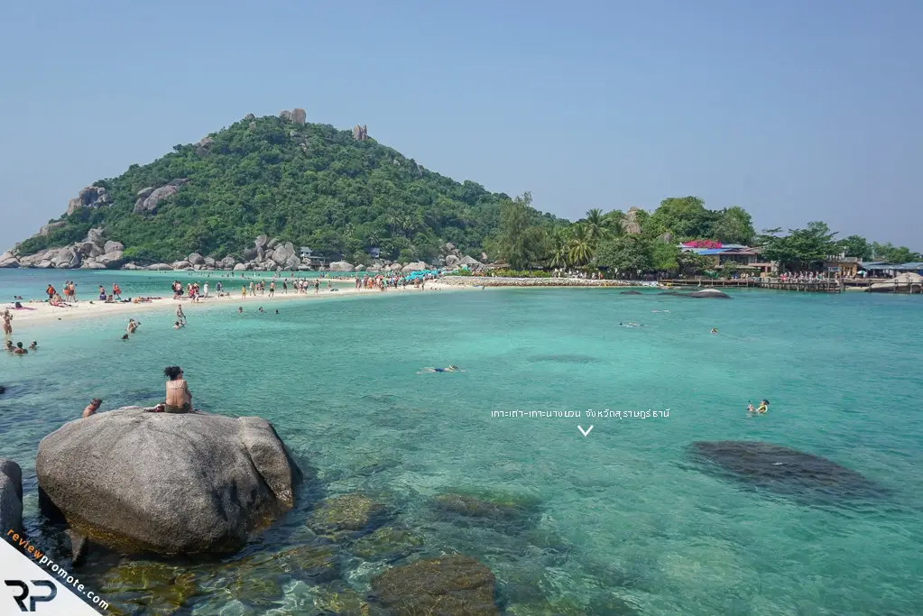
40. Koh Tao, Surat Thani is a famous island in the Gulf of Thailand, located in Koh Tao Subdistrict, Koh Phangan District, Surat Thani Province. It is internationally recognized for its diving opportunities and diverse marine landscapes, including coral reefs, sandy beaches, small bays, and scenic viewpoints. Koh Tao attracts both Thai and international travelers, particularly those interested in learning to dive or spending several days relaxing beside the sea.
Highlights: Beaches and bays around Koh Tao, snorkeling and scuba diving sites, coral reefs, scenic viewpoints, and connections to other island destinations in Surat Thani Province.
Koh Tao is best known for underwater landscapes that support diving activities at different experience levels. Beginners can participate in introductory courses, while more experienced divers may explore coral reefs and marine habitats according to their qualifications. All activities should be selected with careful attention to prevailing wind and wave conditions, underwater visibility, and the safety standards of individual dive operators.
The island's beaches and bays have distinct characteristics. Some areas are suitable for relaxing and walking along the shoreline, while others serve as departure points for diving activities. Visitors can choose accommodation near restaurants and boat services or select quieter areas depending on the type of holiday they prefer.
Responsible diving is particularly important around Koh Tao because coral reefs are sensitive ecosystems. Visitors should never stand on coral, touch marine animals, or feed fish. First-time scuba divers should arrange training with appropriately qualified instructors and follow all applicable safety procedures.
New Year travel to Koh Tao requires careful consideration of seasonal weather. The island is in the Gulf of Thailand, where monsoon patterns differ from those of the Andaman coast. Northeasterly monsoon conditions may still affect parts of the Gulf late in the year, so travelers should not assume calm seas throughout the holiday. Marine forecasts and boat service announcements must be checked before departure.
A multi-day itinerary is advisable because reaching Koh Tao requires a boat journey from the mainland or another island. Travelers interested in diving should allow flexibility for weather-related changes and avoid scheduling return boats too close to flights or the last available road transportation connection.
Koh Tao also offers opportunities for visitors who do not wish to dive every day. Beach walks, seaside dining, and enjoying the island's coastal scenery can provide a relaxed alternative to water-based activities and make a longer holiday more enjoyable.
Getting There: Koh Tao can be reached by scheduled boats from piers in Surat Thani or Chumphon provinces, as well as connecting services from Koh Samui and Koh Phangan. Check the correct departure pier, sailing times, and weather conditions in advance. There is no direct road connection between Koh Tao and mainland Thailand.
Map (GPS):View Koh Tao on Google Maps
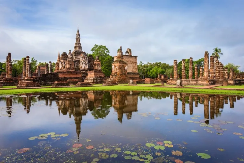
41. Sukhothai Historical Park, Sukhothai is one of Thailand's most significant historical and cultural heritage destinations. Located in Mueang Kao Subdistrict, Mueang Sukhothai District, Sukhothai Province, the park preserves the archaeological remains of the former capital that flourished during the 13th and 14th centuries. Its extensive grounds contain remnants of royal buildings, ancient temples, Buddha images, chedis, reservoirs, and a historic urban layout that reflects the development of art, architecture, and governance during the Sukhothai period. The park is particularly suitable for a New Year holiday when the generally cooler weather makes exploring outdoor monuments more comfortable.
Highlights: The UNESCO World Heritage city of Sukhothai, Wat Mahathat, Wat Sa Si, Wat Si Sawai, Wat Traphang Ngoen, Sukhothai-style Buddha images, lotus-bud-shaped chedis, and cycling through historical areas where bicycles are permitted.
Sukhothai Historical Park forms a major part of the Historic Town of Sukhothai and Associated Historic Towns, inscribed on the UNESCO World Heritage List in 1991. Its importance extends beyond the beauty of its temples and archaeological remains. The site also demonstrates historical urban planning, water management, religious life, artistic achievement, and aspects of society in an early period of Thai history that are documented through surviving physical evidence.
Wat Mahathat is one of the most important monuments in the heart of the ancient city. Its principal chedi reflects distinctive Sukhothai artistic traditions, while surviving Buddha images and architectural elements reveal the prominence of Buddhism during the kingdom's development. Exploring Wat Mahathat helps visitors understand the relationship between sacred spaces and the former city's administrative and cultural center, as major temples often served as important religious and symbolic landmarks.
Wat Sa Si is especially memorable for its location amid a reservoir and the paths connecting it to the surrounding historical grounds. Wat Si Sawai, meanwhile, preserves architectural elements associated with Khmer cultural influence before its later development as a Buddhist religious site. The contrasting forms of these monuments reveal how Sukhothai incorporated and transformed artistic and cultural influences over time.
Sukhothai art is distinguished by refined and graceful representations of the Buddha, especially the walking Buddha image, which became an enduring symbol of Thai Buddhist sculpture. Studying the facial features, body proportions, and implied movement of these images helps visitors appreciate the artistic ideas and exceptional craftsmanship developed during the Sukhothai period.
The reservoirs, embankments, and water-management features within the historical city also demonstrate the engineering knowledge of its inhabitants. These facilities reflect the importance of water for settlement, agriculture, and daily life in a society closely connected with its natural surroundings. They provide another perspective on the ancient city's development beyond its religious architecture.
During the New Year holiday, visitors should allow at least half a day or preferably a full day to explore the park. Walking and cycling along authorized routes are popular ways to experience its extensive landscape. Morning temperatures are often comfortable, while softer late-afternoon light enhances the appearance of ancient structures and Buddha images, creating excellent opportunities for photography.
For families with children, Sukhothai Historical Park is an opportunity to introduce Thai history through direct experience. Explaining the Sukhothai Kingdom, the architectural features of its temples, and the importance of World Heritage conservation while exploring the site helps younger visitors understand why archaeological remains must be protected for future generations.
Visitors must follow regulations concerning cycling and access to monuments. Climbing archaeological structures, touching fragile surfaces, and leaving rubbish in reservoirs or historic areas should be avoided. Preserving the integrity of these remains is essential to safeguarding the historical legacy represented by the ancient city.
Sukhothai Historical Park is therefore a rewarding New Year destination for travelers who want to begin the year by discovering Thai history and culture. A two-day, one-night trip can also include attractions around modern Sukhothai or Si Satchanalai Historical Park, depending on the available time and travel arrangements.
Open Days: Daily
Opening Hours: 6:30 AM – 7:30 PM. Some sections may operate under different visiting hours.
Getting There: From Sukhothai town, take Highway 12 toward Mueang Kao Subdistrict and follow the signs to Sukhothai Historical Park. Travelers arriving by public transportation can connect from the town to the old city and explore permitted areas on foot or by bicycle. Check ticket offices and access regulations for different forms of transportation before entering.

42. Khlong Lan National Park, Kamphaeng Phet is an important natural attraction in Kamphaeng Phet Province, located around Khlong Lan District, including areas of Khlong Lan Phatthana, Khlong Nam Lai, and Pong Nam Ron subdistricts. Its landscape comprises mountain ranges and extensive forests, with Khlong Lan Waterfall serving as its best-known attraction. The national park is particularly suitable for travelers who want to experience waterfalls and forest scenery during the New Year holiday.
Highlights: Khlong Lan Waterfall cascading from a high cliff, mountain forests, streams, designated nature trails, and relaxing recreational areas surrounded by natural scenery.
Khlong Lan Waterfall is a large cascade that descends from a cliff amid the forest. Its appearance changes according to seasonal water volumes. During periods of abundant rainfall, the waterfall may form a broad curtain of water accompanied by the powerful sound of the cascade. In the dry season, the volume may decrease, but the surrounding forest and dramatic landscape remain attractive for nature tourism.
The importance of Khlong Lan National Park lies in its role as a protected forest area that safeguards natural watersheds and biodiversity. Mountain forests retain moisture and provide habitats for numerous wildlife species. Visiting the park therefore offers opportunities to understand the relationship between forests, freshwater systems, and the geographical environment of northern Thailand.
The waterfall is an appealing location for nature photography, with its cliff face, flowing water, rock formations, and surrounding trees providing a variety of compositions. Visitors should use viewpoints designated by park officials and avoid climbing wet rocks or entering restricted sections, as slippery surfaces and changing water currents create significant risks.
During the New Year holiday, Khlong Lan National Park is suitable for families and groups of friends seeking a day outdoors. The waterfall can be visited on a day trip from Kamphaeng Phet town, while travelers with additional time can arrange a two-day, one-night itinerary to explore other natural attractions within the province.
Nature enthusiasts can observe forest vegetation and geographical features along permitted walking routes. Remaining on designated paths and avoiding disturbance to wildlife are important responsibilities. Increased numbers of holiday visitors can lead to litter and other impacts, so careful waste management is essential to protecting the park's environment.
Visitors should prepare footwear suitable for wet ground, drinking water, a hat, and additional clothing or rain protection when needed. Families traveling with children or older adults should consider walking distances and trail conditions before selecting activities to ensure that everyone can enjoy the visit safely.
Khlong Lan National Park is therefore a rewarding New Year destination for travelers seeking waterfall scenery and opportunities to learn about the forest ecosystems that form an important part of Kamphaeng Phet Province's natural heritage.
Open Days: Daily
Opening Hours: 8:30 AM – 4:30 PM.
Getting There: From Kamphaeng Phet town, follow the main route toward Khlong Lan District and continue to Khlong Lan National Park according to road signs. Visitors without a private vehicle can travel to Khlong Lan District and arrange local transportation to the park. Confirm return transportation and park visiting hours before departure.

43. Ao Manao, Prachuap Khiri Khan is a well-known beach and natural attraction in Mueang Prachuap Khiri Khan District, Prachuap Khiri Khan Province. Located within the area administered by Wing 5 of the Royal Thai Air Force, the bay is distinguished by its beautiful curved shoreline, surrounding mountains, and relaxing seaside atmosphere. Ao Manao is popular with families and travelers who want to spend the New Year holiday enjoying the Gulf of Thailand without a demanding schedule.
Highlights: Ao Manao Beach, the distinctive curved bay, views of Khao Lom Muak, Gulf of Thailand scenery, seaside relaxation, and historical sites within the Wing 5 area.
Ao Manao is particularly attractive because its coastal landscape combines mountains and a gently curving beach. The distinctive shape of the bay creates different views from those found along long, straight stretches of coastline. Visitors can walk beside the sea, relax in the breeze, and photograph the shoreline with mountains forming a dramatic backdrop, making it a pleasant setting for couples and families.
Khao Lom Muak is an important mountain visible from the bay. The surrounding area also has historical significance connected with World War II, particularly the fighting that took place in Prachuap Khiri Khan in December 1941. As a result, Ao Manao offers visitors an opportunity to appreciate historical events alongside its natural seaside attractions.
For photography enthusiasts, morning provides an opportunity to enjoy the early light over the coast, while afternoons can be spent relaxing and watching the changing appearance of the bay. Visitors should remain within areas open to the public and follow the regulations of the authority responsible for the site, since parts of the surrounding area are used for Royal Thai Air Force activities.
Ao Manao is suitable for families wishing to enjoy a beach holiday without taking a ferry to an island. Travelers with more time can combine the destination with Hua Hin Beach or other attractions in Prachuap Khiri Khan Province, allowing sufficient time for driving and local traffic conditions.
Before swimming or participating in water activities, visitors should check wave conditions and any warning flags. The Gulf of Thailand can be affected by the northeast monsoon toward the end of the year, so sea conditions should not be assumed to be calm. Children should be supervised closely at all times.
Travelers arriving from Bangkok can consider staying overnight in Prachuap Khiri Khan town, enjoying the beach and town atmosphere in the morning before returning home. A two-day, one-night visit also allows time to explore additional natural attractions without rushing.
Ao Manao is therefore an attractive New Year destination for people who enjoy both seaside scenery and historical learning. Visitors should respect access requirements and help keep the beach and surrounding environment clean.
Open Days: Daily, subject to the entry requirements of Wing 5.
Getting There: From Bangkok, follow Phetkasem Road toward Mueang Prachuap Khiri Khan District, then continue to the Wing 5 entrance and Ao Manao according to local signs. Travelers arriving by train can get off at Prachuap Khiri Khan Station and take local transportation to the bay. Check current entry procedures before visiting during the New Year holiday.
Map (GPS):Get Directions to Ao Manao
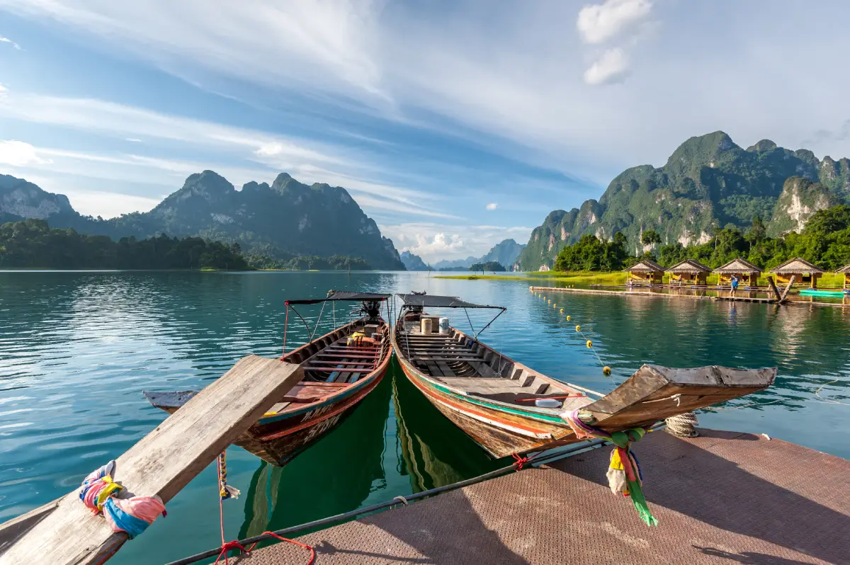
44. Khao Sok National Park, Surat Thani is one of Southern Thailand's most important nature destinations. Its protected area extends through parts of Phanom, Ban Ta Khun, and Khiri Rat Nikhom districts in Surat Thani Province. The park is famous for tropical evergreen rainforest, limestone mountains, streams, waterfalls, and exceptional ecological diversity. It appeals to travelers who want a nature-focused New Year holiday, particularly those interested in wildlife and tropical plant communities.
Highlights: Khao Sok's tropical rainforest, limestone mountains, nature trails, streams and waterfalls, unusual plant species, and forest excursions conducted under national park regulations.
Khao Sok is part of an ecologically significant forest landscape in Southern Thailand. Its tropical rainforest receives substantial rainfall and supports habitats for many different forms of life. The variety of plants and geographical environments makes the national park important for both conservation and scientific study.
Limestone mountains are among the most striking features of Khao Sok and its surrounding landscape. These formations developed through geological processes over very long periods, creating steep cliffs, caves, and forested slopes at different elevations. Such varied terrain provides a wide range of habitats and produces scenery quite different from the forested mountain landscapes of Northern Thailand.
Walking along nature trails is one of the most rewarding activities in Khao Sok. Visitors can choose routes open to the public according to their available time and physical abilities. Some routes require a park ranger or authorized guide because they may pass through dense forest, streams, or habitats where wild animals are present.
For travelers interested in plants, Khao Sok is an important place to study the diversity of tropical vegetation, including species adapted to the distinctive conditions of Southern Thailand's rainforests. Whether certain plants can be observed depends on the season and environmental conditions. Visitors should never collect flowers or other plant materials because some species are protected or play important ecological roles.
New Year travel is possible in areas of Khao Sok that are officially open, but weather conditions must be considered carefully. Rainfall can occur in Southern Thailand's rainforests even during periods when other regions are relatively dry. Trails may be temporarily closed because of flash-flood risks, rising streams, or unsafe walking conditions.
Travelers planning a multi-day trip can use Khao Sok as a base for exploring the forest before visiting Ratchaprapha Dam in Ban Ta Khun District. The reservoir offers another perspective on the province's limestone mountain scenery. Visiting both areas provides insight into the connection between forests, watersheds, and the wider geographical landscape of Surat Thani.
Suitable hiking shoes, drinking water, quick-drying clothing, and protection from insects are recommended for nature excursions. Visitors should stay on permitted trails, avoid feeding wildlife, and follow the instructions of park staff to protect both the forest ecosystem and their own safety.
Open Days: Daily in areas without official closure announcements.
Opening Hours: Generally 8:30 AM – 4:30 PM for visitor service and access arrangements at designated points.
Getting There: From Surat Thani town, follow Highway 401 toward Phanom District and the Khao Sok area. Travelers from Phuket or Phang Nga can also use connecting highways to reach the park. Anyone planning a nature walk should contact the visitor center to confirm current trail access and guide requirements.
Map (GPS):Get Directions to Khao Sok National Park
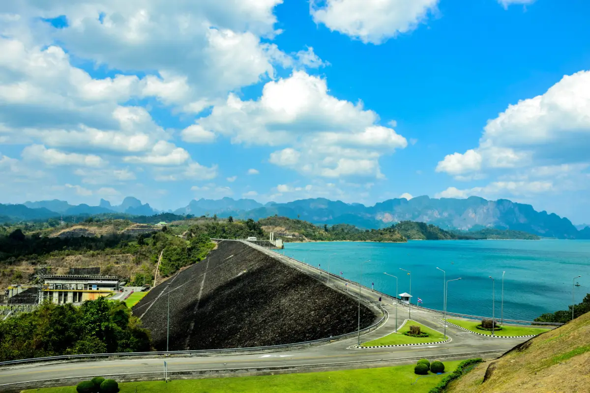
45. Ratchaprapha Dam (Cheow Lan Dam), Surat Thani is one of Southern Thailand's most remarkable destinations, celebrated for its expansive reservoir and limestone mountains rising dramatically from the water. Located in Khao Phang Subdistrict, Ban Ta Khun District, Surat Thani Province, the dam is important for water management, hydroelectric power generation, and nature tourism. The beautiful landscape of Cheow Lan Lake makes it particularly attractive for boat excursions and relaxing holidays.
Highlights: Cheow Lan Lake, limestone mountains emerging from the reservoir, dam viewpoints, boat excursions, authorized floating accommodation, and nature tourism connected with Khao Sok National Park.
Ratchaprapha Dam is a major water-resource development project serving Surat Thani Province and surrounding areas. Its construction created an extensive reservoir within a limestone mountain landscape that later became one of the most recognizable nature tourism destinations in Southern Thailand. Mountain peaks rising above the water and forest-covered slopes create the extraordinary scenery associated with Cheow Lan Lake.
The beauty of the reservoir lies in the contrast between its broad expanse of water and the steep limestone formations above it. During a boat excursion, visitors can observe the mountains from perspectives unavailable on land, including cliffs, rocky cavities, and forests growing along the slopes. Traveling across the lake is therefore one of the best ways to appreciate the distinctive geographical features of the area.
Boat excursions and floating accommodation are available through operators serving permitted areas of the reservoir. Visitors can choose a shorter sightseeing journey or an overnight stay to enjoy the peaceful morning atmosphere, when the water may be calm and thin mist can appear if weather conditions are suitable. Accommodation should be chosen according to transportation arrangements, facilities, and operator safety standards.
Ratchaprapha Dam is closely connected with the forests and ecosystems of Khao Sok and neighboring protected areas. Responsible tourism is therefore essential to maintaining water quality and reducing impacts on wildlife. Visitors should not throw rubbish into the reservoir, feed wild animals, or create excessive noise in sensitive natural surroundings.
The New Year holiday is a popular period for lake excursions and floating accommodation, so advance reservations are recommended. Weather should still be checked before boat travel because wind, rain, and visibility can change, even though the destination is an inland reservoir rather than an open sea.
Ratchaprapha Dam is particularly suitable for couples seeking a romantic nature retreat, families interested in scenic boat journeys, and travelers who want to understand the relationship between water resources and forests. A two- or three-day itinerary combining the dam with Khao Sok National Park offers a varied and rewarding experience.
Open Days: Daily
Opening Hours: 7:00 AM – 6:00 PM for the tourist areas indicated by the destination listing; boat excursions operate according to separate service schedules.
Getting There: From Surat Thani town, take Highway 401 toward Ban Ta Khun District and continue to Khao Phang Subdistrict and Ratchaprapha Dam following local signs. Visitors planning a lake cruise should travel to the appropriate boat departure pier and confirm their booking and departure time in advance.
Map (GPS):Get Directions to Ratchaprapha Dam
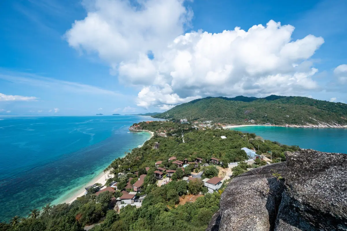
46. Koh Phangan, Surat Thani is a well-known island destination in the Gulf of Thailand, located in Koh Phangan District, Surat Thani Province, north of Koh Samui. Its varied landscape includes sandy beaches, small bays, mountains, forests, and waterfalls, making it suitable for many types of travelers. Visitors can choose between peaceful seaside relaxation and more lively activities and nightlife, depending on their interests and preferred location on the island.
Highlights: Haad Rin, Thong Nai Pan beaches, Haad Yao, scenic bays, island viewpoints, forested hills, waterfalls, and marine recreational activities where conditions are safe.
Koh Phangan is distinctive for its wide variety of beaches. Some have broad sandy shores with numerous restaurants and tourist facilities, while others are tucked into bays surrounded by mountains and provide a quieter atmosphere. Choosing accommodation carefully is important because different parts of the island offer significantly different environments and levels of accessibility.
Haad Rin is internationally known for its Full Moon Party events, which attract many foreign visitors. However, Koh Phangan offers much more than nightlife. Thong Nai Pan and other beaches appeal to travelers seeking tranquility and natural scenery, while viewpoints and walking trails provide opportunities to explore the island's mountainous interior.
Couples and families who prefer a quieter holiday can select accommodation away from major event locations, allowing more time for beach walks, seaside dining, and relaxation. Outdoor enthusiasts can choose coastal excursions or designated nature trails, taking into account fitness levels, weather, and local safety conditions.
Island communities have long maintained livelihoods connected with the sea, including fishing, trading, and tourism services. Visitors can experience aspects of local culture through regional food, markets, and community areas. Respecting residents' daily lives and helping maintain clean beaches are essential to sustainable tourism.
Koh Phangan also contains forested areas and freshwater sources that support waterfalls and certain nature trails. Access conditions should be checked before exploring these locations because paths may become slippery after rain and stream levels can rise quickly.
The New Year holiday brings many visitors to Koh Phangan, but travel during late December and early January requires attention to the northeast monsoon. Strong winds and waves can sometimes affect the Gulf of Thailand and lead to changes in ferry schedules. Travelers should not assume that sea conditions will remain calm throughout the holiday period.
A stay of at least two or three nights allows visitors to experience different beaches and activities without rushing. Accommodation and ferry tickets should be booked in advance during busy holiday periods, when demand may be high and certain services may become fully booked.
Koh Phangan is therefore a rewarding destination for travelers wanting both beaches and mountain scenery in one holiday. Depending on personal preferences, visitors can focus on peaceful seaside relaxation, nature exploration, or the island's lively resort atmosphere.
Getting There: Travel by scheduled ferry or passenger boat from departure points in Surat Thani Province or from Koh Samui, depending on the available services. On arrival at Koh Phangan, continue to your accommodation by local transportation. Choose the departure pier carefully and check the latest ferry schedule and sea conditions before traveling.
Map (GPS):View Koh Phangan on Google Maps
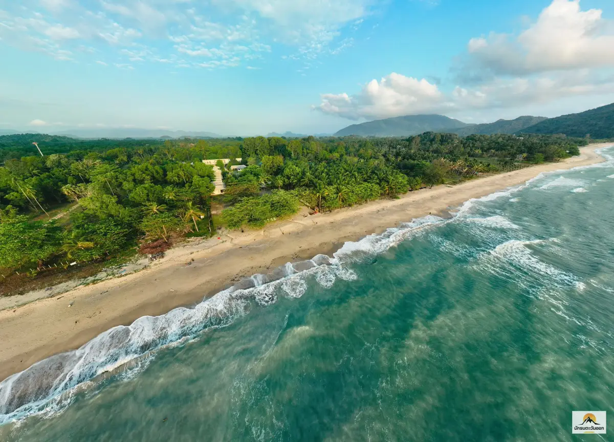
47. Ao Khanom, Nakhon Si Thammarat is an important coastal tourism area in Khanom District, Nakhon Si Thammarat Province, located around Khanom Subdistrict. Its coastline includes several stretches of sandy beach, nearby mountains, and fishing communities. It is an appealing New Year destination for travelers who enjoy the sea and want to experience a coastal town with a different atmosphere from Thailand's larger resort centers.
Highlights: Beaches around Ao Khanom, Gulf of Thailand scenery, coastal mountain landscapes, fishing community life, fresh seafood, and natural attractions throughout Khanom District.
Ao Khanom has a varied coastal landscape combining sandy beaches and nearby hills. Some sections are ideal for walking and enjoying the sea breeze, while others are close to communities or local restaurants. Visitors can select different places to relax according to their interests without necessarily traveling far beyond Khanom District.
The appeal of Khanom extends beyond its beaches to the area's marine environment and the lives of local fishing communities, which contribute significantly to the regional economy. Travelers can learn about seafood, traditional occupations, and the relationship between coastal residents and marine resources through their experiences in the area.
The waters around Khanom are also known for occasional sightings of pink dolphins in certain coastal areas. However, encounters depend on natural conditions and cannot be guaranteed. Visitors interested in dolphin watching should choose responsible operators who follow conservation guidelines, avoid pursuing the animals, and maintain appropriate distances.
For families, Ao Khanom provides opportunities to relax on the beach, enjoy seafood, and stay in accommodation surrounded by coastal scenery. Couples can spend time walking along the shore in the morning or evening and photographing the landscape with the sea and mountains in the background.
During the New Year holiday, particular attention should be paid to wave conditions because Thailand's southern Gulf coast may still experience effects from the northeast monsoon. This is especially relevant for swimming, boat excursions, and other water activities. Monitoring forecasts and official marine warnings helps travelers choose appropriate activities and travel times.
Visitors with two days and one night can stay in Khanom District and explore several sections of coastline without following a demanding itinerary. Those with a longer holiday may consider visiting additional areas of Nakhon Si Thammarat or neighboring Surat Thani Province, provided distances and travel arrangements are suitable.
Responsible tourism at Ao Khanom includes keeping beaches clean, reducing single-use plastic waste, and respecting the daily lives of coastal communities. These practices help ensure that tourism benefits local residents while minimizing impacts on the marine environment.
Open Days: Daily
Opening Hours: General coastal areas are accessible throughout the day, while individual activities and businesses operate according to their own schedules.
Getting There: From Nakhon Si Thammarat town, follow the main road toward Khanom District and continue into Khanom Subdistrict and the coastal area. Another approach is available from Surat Thani Province using roads connecting to Khanom. Visitors without a private vehicle can travel to Khanom District and arrange local transportation to the desired beach or accommodation.
Map (GPS):Get Directions to Ao Khanom
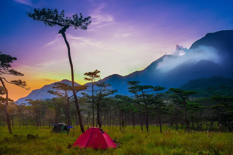
48. Phu Soi Dao National Park, Uttaradit is a protected high-mountain area near the boundary between Uttaradit and Phitsanulok provinces, with important sections located in Huai Mun Subdistrict, Nam Pat District, Uttaradit Province. The park is celebrated for the pine-covered plateau of Phu Soi Dao, seasonal wildflower meadows, and challenging trekking routes. It is particularly suitable for adventurous travelers interested in mountain ecology, although the seasonal opening of trekking routes must be checked carefully before planning a New Year trip.
Highlights: The Phu Soi Dao pine plateau, mountain trekking routes, seasonal wildflower fields, forest landscapes, Phu Soi Dao Waterfall, and high-altitude ecosystems near the Thai–Lao border.
Phu Soi Dao is characterized by high mountain ranges and a diversity of forest types. Plant communities change with altitude and moisture, allowing hikers to observe differences in the natural environment as they ascend. The transition from forested mountain slopes to the higher pine plateau is one of the distinctive ecological experiences associated with the destination.
The Phu Soi Dao pine plateau is popular with trekkers because of its pine trees and views across the surrounding valleys. During certain seasons, wildflowers bloom and add vivid colors to the landscape. However, the main wildflower season may not coincide with the New Year holiday, and visitors should not assume that flowers will be blooming in late December simply because they appear in photographs taken during other months.
Ascending to the pine plateau requires considerably more physical effort and time than visiting a roadside mountain viewpoint. Anyone planning the trek should prepare for the route's distance, weather, and national park regulations. Appropriate warm clothing, hiking footwear, and essential camping equipment are particularly important for visitors staying overnight in permitted areas.
For a New Year holiday, verifying the latest trekking arrangements is essential. Access to the pine plateau may be restricted to a designated season or temporarily closed for environmental recovery. Lower-altitude attractions and visitor services may operate under different conditions. The fact that a national park is open does not necessarily mean that every trekking route and camping area is accessible.
Phu Soi Dao Waterfall is another natural attraction associated with the park. Visitors should confirm access routes with officials, since suitability for visiting depends on water levels, trail conditions, and safety requirements that may vary throughout the year.
Protecting the natural environment is a central responsibility when trekking in Phu Soi Dao. Travelers must carry out their rubbish, avoid collecting wildflowers or rare plants, and respect trail closures. Following ranger instructions helps preserve the forest ecosystem and reduces risks to visitors.
Phu Soi Dao National Park is therefore best suited to people interested in outdoor adventure and high-altitude nature. Anyone considering a New Year visit should select activities according to the routes that are officially open, rather than assuming the main pine plateau trek will be available without confirming current announcements.
Open Days: The national park operates under its general schedule, but access to the pine plateau trekking route is subject to seasonal regulations.
Getting There: From Uttaradit town, travel toward Nam Pat District and continue into Huai Mun Subdistrict, following the route to Phu Soi Dao National Park. Visitors approaching from Phitsanulok can travel through Chat Trakan District according to road conditions and their intended destination. Contact park officials before departure to confirm trekking access and overnight accommodation requirements.

49. Bueng Chawak Chaloem Phrakiat, Suphan Buri is an important nature tourism and educational destination in Doem Bang Nang Buat District, Suphan Buri Province, close to the boundary with Chai Nat Province. The area includes a natural lake and facilities dedicated to aquatic animals and environmental learning. It is particularly suitable for a family New Year outing, especially for visitors traveling with children who want activities combining education and recreation.
Highlights: The natural lake, aquarium and aquatic animal exhibition facilities, wetland ecosystem learning areas, animal and plant displays in sections open to visitors, and family-friendly activities.
Bueng Chawak is important as a wetland area connected with Central Thailand's natural resources and ecological systems. Developing parts of the area for tourism and education has made information about aquatic animals, conservation, and the environment more accessible through exhibitions and facilities designed for visitors of different ages.
The aquarium is a major attraction for families and students because it allows visitors to observe different kinds of aquatic life in one location. Beyond appreciating the appearance of the animals, visitors can learn about habitats, feeding behavior, and ecological relationships. This educational approach helps children understand the importance of conserving aquatic environments.
The surrounding lake also provides attractive scenery and opportunities to learn about wetland vegetation. Visitors can explore designated public areas and observe the characteristics of wetlands, which provide important habitats for fish, waterbirds, and a variety of aquatic plants.
For families with children, Bueng Chawak can provide several hours of activities without requiring travel between multiple distant attractions. Parents can choose exhibition areas according to children's ages and interests, allowing time for breaks, meals, and comfortable movement between facilities.
The New Year holiday may bring increased visitor numbers, particularly to popular aquarium buildings and exhibition areas. Visiting hours and admission arrangements should be checked for each section because facilities may have different operating schedules and management requirements.
Bueng Chawak is suitable for a day trip from Suphan Buri or neighboring provinces. Visitors with additional time may explore other attractions in Doem Bang Nang Buat District. This type of itinerary allows families to combine recreation and learning without an exhausting journey.
Visitors should follow exhibition regulations, avoid tapping aquarium glass, never feed animals without permission, and keep rubbish out of the lake. These practices help protect animal welfare and maintain environmental quality.
Open Days: Daily, according to the operating arrangements of individual exhibition areas.
Getting There: From Suphan Buri town, take Highway 340 toward Doem Bang Nang Buat District and follow signs to Bueng Chawak Chaloem Phrakiat. Travelers from Chai Nat Province can use connecting roads leading into the lake area. Visitors without private transportation should confirm local bus and taxi arrangements before traveling.

50. Pa Sak Cholasit Dam, Lop Buri is a major water-resource development project in the Pa Sak River Basin, located in Nong Bua Subdistrict, Phatthana Nikhom District, Lop Buri Province. The dam plays an important role in water management and is known for its expansive reservoir and scenic public areas. It is an appealing New Year destination for families seeking a relaxing day trip with opportunities to learn about water-resource engineering and environmental management.
Highlights: The Pa Sak Cholasit Dam embankment, extensive reservoir views, recreation and photography areas, visitor education facilities when open, and seasonal tourism activities organized according to official schedules.
Pa Sak Cholasit Dam was developed to support water-resource management within the Pa Sak River Basin. Its functions include storing water, helping reduce flood-related problems, and distributing water for agriculture and other uses. The project is therefore important not only as an engineering structure but also for its contribution to the livelihoods and development of communities in the surrounding basin.
The extensive reservoir provides open scenic views and a pleasant setting for relaxation. Visitors can explore designated public areas, photograph the water, and learn about the significance of large-scale water management projects in Thailand. The dam is especially interesting to those curious about infrastructure, environmental planning, and the relationship between water resources and local communities.
The dam embankment is a popular sightseeing area because it offers broad views over the reservoir. During cooler periods, walking and photography can be enjoyable activities for families and groups of friends. Visitors should remain in authorized areas and avoid entering operational sections of the dam where access is restricted.
Pa Sak Cholasit Dam is also associated with rail-based tourism during certain seasons. Special train services or excursions may be organized according to announcements from the relevant authorities. However, these activities are not available continuously, so travelers should verify the actual timetable and operating dates before making plans.
For a one-day New Year trip, visitors can depart from Bangkok in the morning, spend time enjoying the reservoir scenery, and then have a meal in Phatthana Nikhom District or continue to another nearby attraction if time permits. This makes the dam suitable for travelers who prefer a shorter journey without an overnight stay.
Visiting the dam also provides an opportunity to learn about the importance of water in Thai society. Large water-management projects affect agriculture, urban areas, and communities throughout a river basin. Reading interpretive information or visiting educational facilities when available adds value beyond scenic sightseeing alone.
The New Year holiday may attract many visitors to the dam. Drivers should follow local traffic regulations, avoid parking where vehicles obstruct access, and never swim in restricted reservoir sections. As a working water-management facility, certain parts of the site require strict attention to safety.
Pa Sak Cholasit Dam is therefore a practical New Year destination for families and travelers who want to enjoy open landscapes while learning about Thailand's water-resource infrastructure. It can be arranged as a short trip from Bangkok without traveling to distant mountains or islands.
Open Days: Daily
Opening Hours: 8:00 AM – 5:00 PM for tourist areas listed in the destination information. Special activities follow separate schedules.
Getting There: From Bangkok, travel toward Lop Buri Province and continue to Phatthana Nikhom District using Highway 3017 and the signs to Pa Sak Cholasit Dam. Rail and public transportation options may be available according to their service routes and schedules, which should be checked in advance for New Year travel.
Map (GPS):Get Directions to Pa Sak Cholasit Dam
Summary Table: 50 Places to Visit in Thailand During the New Year Holiday
| Destination | Location, Highlights and Travel Style |
| 1. Doi Inthanon National Park | Chiang Mai — Thailand's highest mountain, cool weather, waterfalls and montane forests. Ideal for families and mountain lovers. GPS: 18.588333, 98.487500. |
| 2. Phu Chi Fa Forest Park | Chiang Rai — Sunrise, dramatic cliffs and seas of mist along the Thai–Lao border. Ideal for photographers and couples. GPS: 19.849122, 100.445723. |
| 3. Khao Kho | Phetchabun — Highland resorts, mountain scenery and possible morning mist. Ideal for romantic and family holidays. GPS: 16.625944, 100.993903. |
| 4. Phu Kradueng National Park | Loei — Challenging mountain trekking, pine forests and cliff viewpoints. Ideal for experienced hikers. GPS: 16.902342, 101.752385. |
| 5. Khao Yai National Park | Nakhon Ratchasima and neighboring provinces — Forests, wildlife and waterfalls in a World Heritage landscape. GPS: 14.339244, 101.521856. |
| 6. The Phi Phi Islands | Krabi — Limestone islands, Maya Bay and Andaman Sea boat tours. Ideal for multi-day beach trips. GPS: 7.738956, 98.768775. |
| 7. Thale Waek (Separated Sea) | Krabi — Sandbars appearing between islands at low tide. Ideal for boat excursions and photography. GPS: 7.961263, 98.811248. |
| 8. Patong Beach | Phuket — Lively seaside resort, restaurants and extensive accommodation options. GPS: 7.895732, 98.295279. |
| 9. Bridge over the River Kwai | Kanchanaburi — World War II history and the Thailand–Burma Railway. GPS: 14.040887, 99.503702. |
| 10. Wat Phra That Doi Suthep | Chiang Mai — Golden Buddhist chedi, Lanna architecture and city views. GPS: 18.804607, 98.921682. |
| 11. Erawan Waterfall | Kanchanaburi — Seven-tier waterfall with greenish-blue natural pools. GPS: 14.375178, 99.145045. |
| 12. Kaeng Krachan National Park | Phetchaburi — Extensive forests, birdwatching and Phanoen Thung viewpoints subject to access regulations. GPS: 12.891131, 99.628143. |
| 13. Cha-Am Beach | Phetchaburi — Seaside relaxation, local seafood and family-friendly accommodation. GPS: 12.794277, 99.984233. |
| 14. Koh Larn | Chon Buri — Island beaches accessible by boat from Pattaya. GPS: 12.918226, 100.780262. |
| 15. Phu Ruea National Park | Loei — Cool mountain weather, pine forests and sunrise viewpoints. GPS: 17.514187, 101.344891. |
| 16. Phu Foi Lom | Udon Thani — Highland ecosystems and environmental learning. GPS: 17.162038, 102.698010. |
| 17. Phu Hin Rong Kla National Park | Phitsanulok — Unusual rock formations and political history. GPS: 17.003523, 100.993178. |
| 18. Pang Ung | Mae Hong Son — Pine forest, reservoir reflections and misty mornings. GPS: 19.499063, 97.906114. |
| 19. Ban Rak Thai | Mae Hong Son — Yunnanese village, tea, local food and mountain reservoir. GPS: 19.586673, 97.942228. |
| 20. Doi Mon Jam | Chiang Mai — Mountain viewpoints, highland agriculture and cool-season scenery. GPS: 18.935820, 98.822409. |
| 21. Sam Phan Bok | Ubon Ratchathani — Sandstone potholes and Mekong River geology. GPS: 15.788619, 105.410900. |
| 22. Pha Taem Prehistoric Rock Paintings | Ubon Ratchathani — Ancient paintings, archaeology and Mekong viewpoints. GPS: 15.399435, 105.511837. |
| 23. Red Lotus Sea | Udon Thani — Seasonal pink water lilies and boat trips on Nong Han Lake. GPS: 17.177944, 103.056794. |
| 24. Ban Chiang Khan | Loei — Historic wooden houses, walking street and Mekong scenery. GPS: 17.893095, 101.659000. |
| 25. Railay Beach | Krabi — Limestone cliffs, beaches and rock climbing. Access primarily by boat. GPS: 8.010897, 98.837806. |
| 26. Koh Lipe | Satun — White-sand beaches, snorkeling, sunrise and sunset views. GPS: 6.488572, 99.304896. |
| 27. Thi Lo Su Waterfall | Tak — Extensive waterfall in Umphang Wildlife Sanctuary. Access subject to official restrictions. GPS: 15.917317, 98.764271. |
| 28. Si Nan National Park | Nan — Doi Samer Dao, Pha Chu, mountain viewpoints and stargazing. GPS: 18.370303, 100.829523. |
| 29. Bo Kluea Rock Salt Wells | Nan — Traditional mountain salt-making and local cultural heritage. GPS: 19.272610, 101.178654. |
| 30. Phu Thap Boek | Phetchabun — Seas of mist, mountain scenery and seasonal cabbage fields. GPS: 16.897461, 101.105471. |
| 31. Namtok Phliu National Park | Chanthaburi — Waterfall, freshwater fish and royal historical memorials. GPS: 12.527270, 102.182129. |
| 32. Chao Lao Beach | Chanthaburi — Seaside accommodation, beach walks and local seafood. GPS: 12.533954, 101.940969. |
| 33. Mu Ko Chang National Park | Trat — Mountain forests, waterfalls and island beaches. GPS: 12.063290, 102.309368. |
| 34. Koh Kood | Trat — Quiet beaches, turquoise water and Khlong Chao Waterfall. GPS: 11.668076, 102.564226. |
| 35. Hat Sai Kaew (Koh Samet) | Rayong — White sand and a popular island getaway from the Bangkok region. GPS: 12.566250, 101.462562. |
| 36. Damnoen Saduak Floating Market | Ratchaburi — Traditional canal trading, local food and morning boat excursions. GPS: 13.519637, 99.958741. |
| 37. Ancient Royal Palace | Ayutthaya — Archaeological remains and the history of the former royal capital. GPS: 14.355600, 100.572600. |
| 38. Huai Mae Khamin Waterfall | Kanchanaburi — Seven-tier waterfall and forest landscapes around Srinagarind Reservoir. GPS: 14.640028, 98.986643. |
| 39. Hua Hin Beach | Prachuap Khiri Khan — Historic seaside resort, accommodation and coastal recreation. GPS: 12.568773, 99.963280. |
| 40. Koh Tao | Surat Thani — Scuba diving, snorkeling and island viewpoints. Check monsoon conditions. GPS: 10.095610, 99.840396. |
| 41. Sukhothai Historical Park | Sukhothai — UNESCO World Heritage archaeological park, ancient temples and cycling. GPS: 17.018652, 99.703992. |
| 42. Khlong Lan National Park | Kamphaeng Phet — Large waterfall and forest scenery. GPS: 16.115407, 99.299788. |
| 43. Ao Manao | Prachuap Khiri Khan — Curved bay, Khao Lom Muak and wartime history. GPS: 11.770005, 99.795192. |
| 44. Khao Sok National Park | Surat Thani — Tropical rainforest, limestone cliffs and guided nature trails. GPS: 8.972709, 98.638888. |
| 45. Ratchaprapha Dam | Surat Thani — Cheow Lan Lake, limestone mountains and floating accommodation. GPS: 9.037475, 98.665559. |
| 46. Koh Phangan | Surat Thani — Beaches, island forests and lively or peaceful resort areas. GPS: 9.731875, 100.013593. |
| 47. Ao Khanom | Nakhon Si Thammarat — Gulf beaches, coastal communities and possible dolphin sightings. GPS: 9.199026, 99.877287. |
| 48. Phu Soi Dao National Park | Uttaradit — Mountain trekking, pine plateau and seasonal wildflowers. Check trail openings. GPS: 17.812559, 100.937312. |
| 49. Bueng Chawak Chaloem Phrakiat | Suphan Buri — Lake, aquariums and educational attractions for families. GPS: 14.924540, 100.046275. |
| 50. Pa Sak Cholasit Dam | Lop Buri — Reservoir scenery, dam engineering and family day trips. GPS: 15.019229, 101.048549. |
Suggested New Year Itineraries: Day Trips, Overnight Getaways and Extended Holidays
| Trip Type | Recommended Route and Activities |
| 1-Day Trip — Ayutthaya | Visit the Ancient Royal Palace in Phra Nakhon Si Ayutthaya Province. This is suitable for travelers interested in history who want to make a round trip from Bangkok in one day. Spend time learning about the archaeological remains and exploring designated areas of the historic city. |
| 1-Day Trip — Suphan Buri | Visit Bueng Chawak Chaloem Phrakiat, particularly suitable for families with children. Focus on the aquarium, educational exhibitions, and natural surroundings, arranging the itinerary according to the operating hours of individual exhibition sections. |
| 1-Day Trip — Lop Buri | Visit Pa Sak Cholasit Dam to enjoy reservoir views, photography, and opportunities to learn about water-resource management. This is a practical day trip from Bangkok. |
| 1-Day Trip — Floating Market | Visit Damnoen Saduak Floating Market in Ratchaburi in the morning to see the trading boats and sample traditional food. If time permits, continue to a nearby community or attraction later in the day. The market should be the first stop because its busiest period is usually in the morning. |
| 2 Days, 1 Night — Kanchanaburi | Day 1: Explore the Bridge over the River Kwai and historical attractions in Kanchanaburi town. Day 2: Visit Erawan Waterfall. If you also want to include Huai Mae Khamin Waterfall, add an extra day or reduce other activities, because journeys within Si Sawat District can take considerable time. |
| 2 Days, 1 Night — Chanthaburi | Day 1: Explore Namtok Phliu National Park, its waterfall, and historical memorials. Day 2: Relax at Chao Lao Beach and enjoy fresh seafood. This route combines forests and coastal scenery within the same province. |
| 2 Days, 1 Night — Phetchaburi | Day 1: Relax and walk along Cha-Am Beach. Day 2: Explore the Kaeng Krachan Dam area or other nearby attractions currently open. A visit to the Phanoen Thung viewpoint should be arranged separately according to national park access regulations. |
| 2 Days, 1 Night — Chiang Mai | Day 1: Visit Wat Phra That Doi Suthep and explore Chiang Mai city. Day 2: Visit Doi Mon Jam in Mae Rim District. If Doi Inthanon is also a priority, consider adding another day rather than creating an excessively busy schedule. |
| 2 Days, 1 Night — Phetchabun | Day 1: Explore Khao Kho and its mountain viewpoints. Day 2: Choose either Phu Thap Boek or Phu Hin Rong Kla National Park according to road and weather conditions. Stay near the main attraction and allow plenty of time for driving on mountain roads. |
| 3 Days, 2 Nights — Mae Hong Son | Day 1: Arrive in Mae Hong Son and rest. Day 2: Visit Pang Ung for its pine forest and reservoir, then explore Ban Rak Thai. Day 3: Relax and begin the return journey. Allow extra travel days if driving from a distant province. |
| 3 Days, 2 Nights — Nan | Day 1: Arrive and stay in Nan town. Day 2: Visit Bo Kluea Rock Salt Wells and mountain communities. Day 3: Choose Si Nan National Park if travel time permits, or relax before returning home. Avoid combining distant mountain attractions into a single day without checking routes carefully. |
| 3 Days, 2 Nights — Loei | Day 1: Explore Phu Ruea and its viewpoints. Day 2: Travel to Chiang Khan, relax beside the Mekong River, and visit the walking street. Day 3: Enjoy the old town in the morning and return home. Phu Kradueng is better planned as a separate trekking trip because it requires substantial time and physical preparation. |
| 3 Days, 2 Nights — Ubon Ratchathani | Day 1: Travel to Ubon Ratchathani and settle into accommodation. Day 2: Explore Sam Phan Bok when river levels are suitable. Day 3: Visit Pha Taem National Park and its prehistoric paintings, or add another day for more detailed exploration. |
| 3 Days, 2 Nights — Surat Thani | Day 1: Arrive in the Khao Sok area and relax. Day 2: Visit Ratchaprapha Dam for a reserved boat excursion on Cheow Lan Lake. Day 3: Enjoy another nature activity or begin the return journey. Keep travel days separate from boat tours and floating accommodation bookings where possible. |
| 3 Days, 2 Nights — Krabi | Day 1: Visit Railay Beach and relax by the sea. Day 2: Take a boat tour to Thale Waek, timed according to low tide. Day 3: Relax or choose a Phi Phi Islands excursion if sea conditions and boat schedules permit. Add another day if you want to explore the Phi Phi Islands in greater depth. |
| 3 Days, 2 Nights — Trat | Choose either Koh Chang or Koh Kood as the main island destination. Use the first day to cross by boat, the second for beaches and nature, and the third for the return journey. Attempting to visit both islands in just three days may result in too much time being spent on transportation. |
| 4–5 Days — Southern Thailand | Choose one province or a practical island group, such as Phuket and Krabi, Koh Lipe, or Koh Tao and Koh Phangan. Consider actual travel distances, ferry schedules, seasonal weather, and a backup day for the return journey. The same weather assumptions should not be applied to the Andaman Sea and Gulf of Thailand because their monsoon patterns differ. |
| Family Holidays with Children | Bueng Chawak Chaloem Phrakiat, Cha-Am Beach, Hua Hin Beach, Pa Sak Cholasit Dam, and Sukhothai Historical Park are suitable choices. Activities can be adjusted for children and older adults, but walking routes and accessibility should be checked in advance. |
| Romantic Holidays for Couples | Ban Rak Thai, Pang Ung, Khao Kho, Phu Thap Boek, Koh Lipe, Koh Kood, and Ratchaprapha Dam offer atmospheric settings for couples. Choose between mountains, beaches, or lakeside scenery according to shared preferences. |
| Adventure and Trekking Holidays | Phu Kradueng, Phu Soi Dao, Thi Lo Su Waterfall, and selected national park trails are suitable for physically prepared travelers. Seasonal access, reservations, and official safety requirements must be checked individually. |
| Reservations and Preparation | Reserve accommodation and boat services in advance, check national park opening announcements, bring warm clothing for high-altitude destinations, confirm marine conditions before island travel, and allow extra time for difficult routes and holiday traffic. |
Frequently Asked Questions (FAQ)
Q: Where should I go for the New Year holiday in Thailand?
A: If you enjoy cold weather and misty mountain scenery, consider Doi Inthanon, Phu Chi Fa, Khao Kho, Phu Ruea, or Phu Thap Boek. For a seaside holiday, popular choices include the Phi Phi Islands, Koh Lipe, Koh Larn, Koh Kood, and Railay Beach. Families seeking destinations within reasonable reach of Bangkok can consider Bueng Chawak, Pa Sak Cholasit Dam, or the Ancient Royal Palace in Ayutthaya.
Q: Which destinations offer cold weather and a chance to see a sea of mist during New Year?
A: Popular destinations include Doi Inthanon in Chiang Mai, Phu Chi Fa in Chiang Rai, Khao Kho and Phu Thap Boek in Phetchabun, Phu Ruea in Loei, and Pang Ung in Mae Hong Son. However, mist depends on temperature, humidity, and daily weather conditions, so it cannot be guaranteed every morning.
Q: Which destinations on Thailand's Andaman coast are suitable for a New Year beach holiday?
A: The Phi Phi Islands, Railay Beach, and Thale Waek in Krabi, Patong Beach in Phuket, and Koh Lipe in Satun are well-known destinations. Late December and early January generally fall within the Andaman coast's popular tourism season, but visitors must still check wave conditions, weather forecasts, and official boat service announcements.
Q: Is it suitable to visit Koh Tao and Koh Phangan during the New Year holiday?
A: Both islands can be visited when boat services are operating and marine conditions are suitable. However, they are located in the Gulf of Thailand, where the northeast monsoon may still affect conditions toward the end of the year. Check weather forecasts and ferry schedules carefully and allow additional time for the return journey.
Q: What are the best New Year day trips near Bangkok?
A: The Ancient Royal Palace in Ayutthaya, Bueng Chawak Chaloem Phrakiat in Suphan Buri, Pa Sak Cholasit Dam in Lop Buri, and Damnoen Saduak Floating Market in Ratchaburi are suitable choices for a day trip. Select destinations according to available travel time and allow for heavier traffic during the holiday.
Q: Where should families with children travel during the New Year holiday?
A: Bueng Chawak Chaloem Phrakiat is a good choice for learning about aquatic animals. Cha-Am Beach and Hua Hin Beach are suitable for seaside relaxation, while Sukhothai Historical Park offers opportunities to learn about Thai history and culture. Activities and walking distances should be selected according to the ages and physical abilities of children and older family members.
Q: What are some romantic New Year destinations for couples in Thailand?
A: Ban Rak Thai and Pang Ung in Mae Hong Son offer misty mountain and reservoir scenery. Khao Kho and Phu Thap Boek are known for cool weather and highland viewpoints. Koh Lipe, Koh Kood, and Ratchaprapha Dam are appealing for relaxing beside the sea or a scenic lake. The best choice depends on whether you prefer mountains, beaches, or tranquil waterfront landscapes.
Q: Which provinces are suitable for a two-day, one-night New Year trip?
A: Kanchanaburi is suitable for combining wartime history with waterfalls. Chanthaburi offers Namtok Phliu National Park and Chao Lao Beach. Phetchaburi is attractive for Cha-Am Beach and accessible parts of Kaeng Krachan. Phetchabun offers highland scenery and possible seas of mist. For a practical itinerary, concentrate on attractions that are geographically close to one another.
Q: Where should I travel if I have three days and two nights for New Year?
A: Consider Mae Hong Son for Pang Ung and Ban Rak Thai, Loei for Phu Ruea and Chiang Khan, Ubon Ratchathani for Sam Phan Bok and Pha Taem, or Surat Thani for Khao Sok and Ratchaprapha Dam. Additional travel time may be necessary depending on where the journey begins.
Q: Can I visit Phu Kradueng and Phu Soi Dao during the New Year holiday?
A: Phu Kradueng normally has a tourist season that includes New Year, subject to national park announcements. At Phu Soi Dao, access to the pine plateau and overnight camping is regulated according to the season. A national park being open does not mean that every trekking route is available, so the latest official notices must be checked before making plans.
Q: Is Thi Lo Su Waterfall suitable for a New Year holiday?
A: Thi Lo Su is a famous natural attraction in Umphang District, Tak Province. However, reaching it involves winding mountain roads and entry arrangements regulated by Umphang Wildlife Sanctuary. Visitors should check the latest road openings and entry conditions, prepare for the journey, and allow several days for the trip.
Q: Is New Year a good time to visit the Red Lotus Sea in Udon Thani?
A: Late December and the early months of the year are generally within the seasonal period when visitors may see the red and pink water lilies at Nong Han Kumphawapi. Morning is usually the best time for a boat excursion, but flowering conditions vary with the weather and natural cycles each year. Confirm the latest situation before departure.
Q: Will the sandstone potholes at Sam Phan Bok be visible during New Year?
A: New Year falls within the dry season, when the Mekong River often begins to recede, making portions of the sandstone landscape more visible. However, water levels vary each year. Travelers who particularly want to see extensive exposed rock formations should confirm current river conditions before visiting.
Q: How can I plan an affordable New Year trip in Thailand?
A: Consider destinations that can be reached in one day from Bangkok or your accommodation, such as Pa Sak Cholasit Dam, Damnoen Saduak Floating Market, or the Ancient Royal Palace in Ayutthaya. For overnight trips, concentrate on one province and compare accommodation, transportation, admission fees, and meal expenses in advance to avoid unnecessary costs from traveling between distant areas.
Q: What should I prepare before traveling in Thailand during the New Year holiday?
A: Check your vehicle's condition and planned route, reserve accommodation in advance, review national park access announcements, and monitor weather forecasts. Travelers heading into the mountains should bring warm clothing and suitable footwear. Those visiting islands must check ferry schedules, wave conditions, and return transportation. Allow additional time for heavy traffic during the holiday period.
 Category: ●Travel Articles, Recipes
 Group: ●Travel Review, Food Review
Last Update : 1 DayAgo
 Last Update : 1 DayAgo
Recommend

 Art, Culture and Heritage
 Historical Sites and Monuments(3)
 Landmarks and Memorials(23)
 Royal Palace(13)
 Art, Craft Centres, Tradition(35)
 Museums(59)
 Historic Homes and Cities(3)
 Art Gallery(16)
 Educational Places
 Museum for Study(6)
 Library(4)
 Places of Worship
 Temple(72)
 Church(2)
 Mosque(67)
 Other Sacred Sites(8)
 Research and Development
 Royal Project(1)
 Suburban Living
 Village, Community(5)
 Local Market(9)
 Floating Market(2)
 Nature and Wildlife
 River, Canal(3)
 Bays and Beaches(1)
 Other natural attractions(1)
 Entertainment and Agricultural
 Zoos and Aquariums(5)
 Animal camps and shows(5)
 Stadium(9)
 Farms, Parks and Ecotourism(20)
 Amusement Park(1)
 Waterpark(4)
 Theater(7)
 Cinema(1)
 Shopping
 Shopping and Night Market(20)
 Department Store(7)
 Spas and Wellness
 Spas and Wellness(1)
 Restaurant
 Michelin Star(5)
 Accommodation
 Hotel(3)
 Call Customer Service in Tourism
 Call Customer Service in Tourism(1)
Travel Review, Food Review(41)
 Royal Thai Desserts and Recipes(56)


