
lovethailand home >Central Travel Attractions >Bangkok Travel Attractions > 50 Best Nature Destinations in Thailand
TL;DR: 50 Best Nature Destinations in Thailand.

50 Best Nature Destinations in Thailand
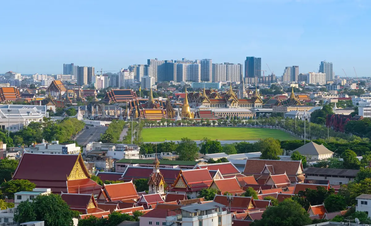
50 Best Nature Destinations in Thailand: Mountains, Waterfalls, Islands and Forests Thailand offers an extraordinary diversity of landscapes, from mountain summits rising above the clouds and tropical rainforests in the south to limestone waterfalls in the west, sandstone formations in the northeast, and tropical islands and beaches in the Andaman Sea. Choosing the best nature destinations in Thailand involves more than admiring beautiful scenery. Travelers should also consider the season, travel time, the needs of everyone in their group, and the conservation regulations that protect each destination.
Travelers who enjoy mountains and cool weather can begin with Doi Inthanon, Phu Kradueng or Phu Ruea. Those interested in waterfalls and peaceful forests can explore Erawan Waterfall, Huai Mae Khamin Waterfall or Tat Ton. Beach and island enthusiasts can choose the Similan Islands, the Separated Sea in Krabi or Railay Beach according to sea conditions. Thailand also offers natural attractions with fascinating historical and geological significance, such as Pha Taem, Phu Hin Rong Kla and Phu Wiang.
For a one-day trip, it is generally best to choose a destination that is relatively easy to reach and allows enough time to enjoy its main attractions. Erawan Waterfall, Tat Ton and Phu Pha Thoep are examples of destinations that can fit into a shorter itinerary. Phu Kradueng, Thi Lo Su Waterfall and the Similan Islands require more preparation because of hiking distances, road conditions, boat transfers or seasonal access restrictions. Some destinations are therefore better suited to trips lasting two or three days or longer.
Families traveling with children or older adults should carefully consider walking conditions, rest areas and the weather. Not every attraction within the same national park is equally accessible. Photography enthusiasts may prefer destinations with dramatic morning light, mist, flowing waterfalls or sandbars exposed at low tide. Hikers should assess actual walking distances, elevation changes and requirements for local guides before setting out.
Grouping destinations by landscape makes travel planning easier. Mountain destinations offer panoramic scenery and opportunities to explore high-altitude forests. Waterfall destinations feature streams, pools and woodland trails. Marine destinations are known for beaches and underwater ecosystems, while limestone and sandstone landscapes provide opportunities to learn about geology and history. Rather than asking which destination is the most beautiful in every season, travelers should choose places that best match their interests and travel preferences.
The rainy season generally brings lush forests and seasonal wildflowers, although heavy rainfall can cause flash floods and temporary trail closures. The cooler months are particularly attractive for mountain viewpoints and misty valleys. Travel to islands in the Andaman Sea depends on monsoon conditions and official national park announcements. Visitors should always check current access restrictions, weather forecasts and boat operations before traveling.
Responsible travel is an essential part of enjoying Thailand's natural heritage. Visitors should never feed wild animals, collect rocks, plants or coral, leave rubbish in forests or the sea, or venture beyond designated trails. Approaching cliff edges or strong currents for photographs can be extremely dangerous. Supporting local communities and following the instructions of park officials also help preserve these destinations for future generations.
The first 20 destinations in this collection form the opening section of 50 remarkable natural attractions across Thailand. Travelers can also explore more places to visit in Thailand. This guide brings together mountains, waterfalls, forests, geological landscapes and tropical seas, with detailed destination links and navigation maps to help travelers plan according to their interests.
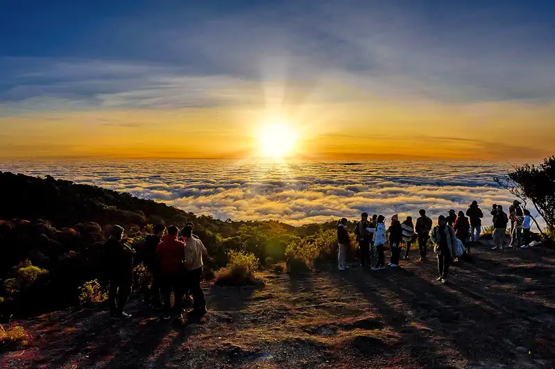
1. Doi Inthanon National Park, Chiang Mai — Doi Inthanon National Park is located in Chom Thong District, Chiang Mai Province. Its mountain ecosystems change considerably with elevation, from relatively warm forests along the lower slopes to cool, humid montane evergreen forests supporting mosses, ferns and plants adapted to high-altitude conditions. Rising approximately 2,565 meters above sea level, Doi Inthanon is Thailand's highest mountain and an important destination for travelers interested in northern Thailand's geography and highland ecosystems.
Highlights: Thailand's highest mountain, Ang Ka montane forest and scenic nature trails.
The park offers several nature experiences, including the Ang Ka Nature Trail, the highest point in Thailand and the Kew Mae Pan Nature Trail, where access is regulated according to the season. The park is also home to the Royal Twin Pagodas, Phra Mahathat Naphamethanidon and Phra Mahathat Naphaphonphumisiri. Together, these attractions allow travelers to appreciate both Chiang Mai's natural landscape and its cultural significance.
Visitors hoping to enjoy mountain scenery and cooler temperatures can arrange a day trip from Chiang Mai city, although it is important to select stops according to available time and weather conditions. Anyone planning to walk a nature trail should check seasonal opening announcements and local guide requirements in advance.
Doi Inthanon forms part of northern Thailand's high mountain landscape, where altitude strongly influences temperatures and vegetation. Around the summit, the humid montane forest supports abundant epiphytic plants, and mist can develop throughout different periods of the year. Lower down, surrounding communities and agricultural areas reflect the relationship between local livelihoods and the careful management of mountain resources.
The summit is only one part of the experience. The Ang Ka Nature Trail allows visitors to observe mosses, ferns and moisture-loving forest plants at close range. The Kew Mae Pan Nature Trail offers views of ridgelines and high-altitude grasslands, but visitors must follow the national park's seasonal access rules and guide requirements.
For a one-day visit, travelers should arrange stops around mountain viewpoints and the summit according to the weather, then consider waterfalls or local communities while descending. This reduces unnecessary backtracking. Rain and thick mist may occur on the mountain even when conditions in Chiang Mai city are sunny.
Getting There: Travel from Chiang Mai city toward Chom Thong District, then follow Highway 1009 into Doi Inthanon National Park. The mountain road has numerous bends, and temperatures can be significantly cooler than in the lowlands.
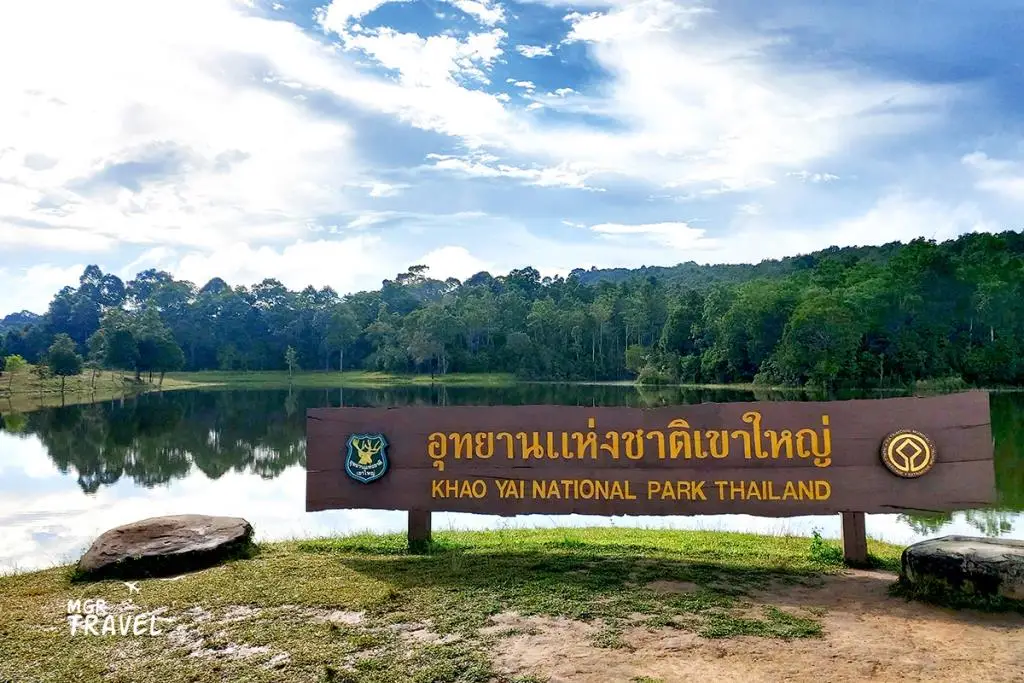
2. Khao Yai National Park, Nakhon Ratchasima — Khao Yai National Park is a major protected area extending across Nakhon Ratchasima, Prachin Buri, Nakhon Nayok and Saraburi provinces. Established as Thailand's first national park, it forms part of the UNESCO-listed Dong Phayayen–Khao Yai Forest Complex. Its varied landscape includes evergreen forests, mixed deciduous woodland, grasslands, waterfalls and important watershed areas.
Highlights: UNESCO World Natural Heritage status, extensive forests, waterfalls and opportunities to observe wildlife.
One of Khao Yai's greatest attractions is the opportunity to experience a vast forest ecosystem through managed visitor routes. Popular destinations include viewpoints, Haew Suwat Waterfall, Haew Narok Waterfall and designated nature trails. Grasslands and forest edges provide habitats for many species of wildlife, although sightings depend on the season, time of day and natural animal behavior.
Visitors should follow speed restrictions while driving through the park, never feed wild animals, and avoid leaving their vehicles when large animals are nearby. Loud noises and intrusive photography can disturb wildlife. Families with children or older adults should select accessible viewpoints and shorter walking routes suitable for their group.
Khao Yai connects important ecosystems within the Dong Phayayen mountain landscape. Its forests and grasslands support a wide range of wildlife. Because wild animals move according to their natural routines, visitors should not expect to encounter a particular species on every trip.
Haew Suwat Waterfall can be viewed from designated park routes, while Haew Narok is a large waterfall reached through a managed walking trail. Before choosing which attractions to visit, travelers should consider the physical abilities of everyone in their group and avoid swimming in prohibited areas.
Nature enthusiasts often benefit from spending more time observing the forest and listening to birds rather than trying to visit every attraction in one day. Driving slowly and maintaining a safe distance from wildlife reduces risks to both visitors and animals. Restrictions on night driving and early-morning activities should be checked with park authorities.
Getting There: Enter Khao Yai National Park from the Pak Chong side in Nakhon Ratchasima or from the Prachin Buri entrance, depending on which gates are operating. Choose your entrance according to the specific attractions you plan to visit.
Map (GPS):Get Directions to Khao Yai National Park
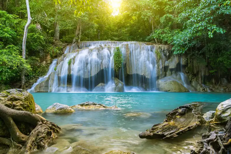
3. Erawan Waterfall, Kanchanaburi — Erawan Waterfall is located within Erawan National Park in Si Sawat District, Kanchanaburi Province. The waterfall consists of seven successive levels, each with distinctive streams, limestone formations and natural pools. Some pools appear turquoise or blue-green depending on light conditions and the minerals present in the water. The waterfall is popular with visitors who enjoy both scenic landscapes and walks through the surrounding forest.
Highlights: Seven waterfall levels, natural pools and shaded forest trails.
The experience extends well beyond the lower waterfall levels. Walking farther uphill reveals changes in the stream's course, forest vegetation and limestone formations, but trail distances and gradients increase along the way. Visitors should assess their physical abilities and follow instructions from park officials regarding swimming in each area.
Erawan Waterfall is suitable for family nature trips and travelers who enjoy forest walks without necessarily staying overnight for several days. A visit can also be combined with attractions around Srinagarind Dam. During heavy rainfall, visitors should watch for flash floods, strong currents and slippery rocks, and pay particular attention to announcements concerning temporary closures.
The waterfall descends through several limestone terraces, creating a succession of pools that can appear green or blue under certain lighting conditions. Each level has its own characteristics, including differences in pool size, water flow and trail difficulty. Reaching the upper levels requires more time and footwear with good traction.
The rainy season brings higher water levels but can make trails slippery. During periods of clearer water, the limestone pools may be easier to appreciate. Regulations on bringing food into certain areas and swimming at individual waterfall levels can change as part of the park's conservation measures.
Families traveling with children or older adults can enjoy the lower waterfall levels without needing to complete the entire route. A trip to Kanchanaburi can also include historical attractions or riverside viewpoints, depending on the time available.
Getting There: Travel from Kanchanaburi city toward Si Sawat District, following the road leading to Erawan National Park.
Map (GPS):Get Directions to Erawan Waterfall
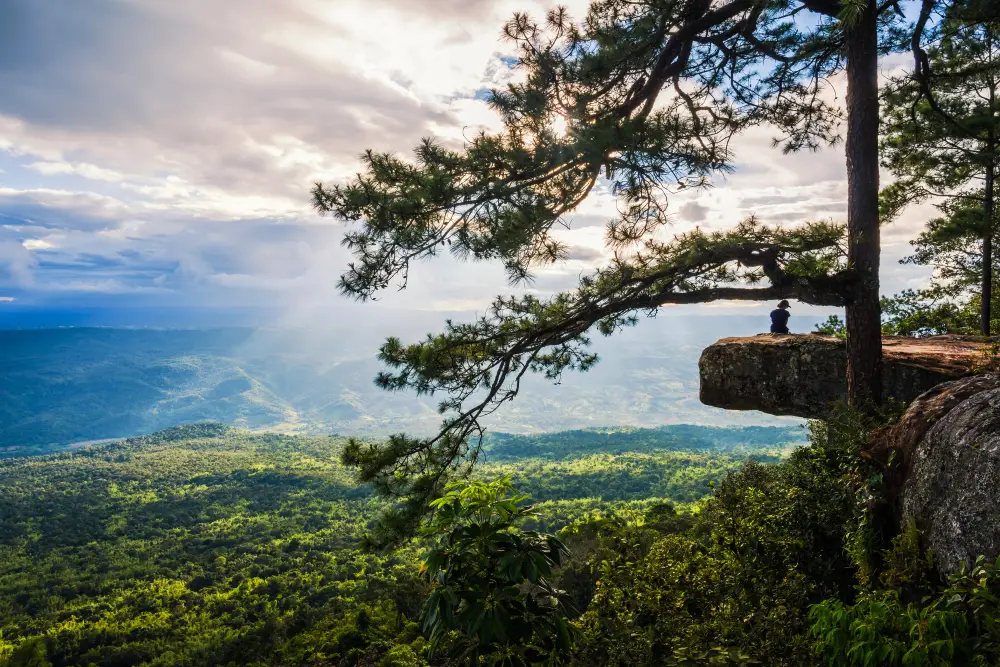
4. Phu Kradueng National Park, Loei — Phu Kradueng is a massive sandstone mountain in Loei Province, known for its broad plateau and demanding uphill hiking route. The climb requires a reasonable level of physical fitness. Along the way, hikers pass several resting points locally known as sam before reaching the upper plateau, where pine forests, grasslands and dramatic cliff viewpoints are scattered across the mountain.
Highlights: A flat-topped sandstone mountain, an iconic uphill hiking trail, dramatic cliffs and sunrise and sunset viewpoints.
The plateau offers walking routes to Pha Nok Aen, Pha Lom Sak and several waterfalls. It is particularly suitable for travelers who want to spend meaningful time in a mountain environment. However, distances between attractions on the plateau can be substantial, so visitors must plan carefully even after completing the ascent.
The national park operates a seasonal tourism schedule and closes for ecological recovery during certain periods. Hikers should check the latest announcements, accommodation or campsite reservations, and baggage regulations before traveling. Anyone unfamiliar with long-distance hiking should prepare suitable footwear, sufficient drinking water and adequate rest time.
Phu Kradueng's distinctive topography is that of a flat-topped sandstone mountain. The journey begins at the foothills and passes a series of resting points before reaching pine forests and open grasslands on the plateau. Physical preparation is more important here than at mountain attractions that can be reached directly by car.
Walking routes on the plateau connect several cliffs and waterfalls, including Pha Nok Aen, Pha Lom Sak and Sa Anodat. Visitors planning to watch sunrise or sunset should allow enough time to return safely and carry a flashlight. Leaving marked trails or approaching cliff edges for photographs should be avoided.
An overnight trip is generally more appropriate than attempting a rushed ascent and descent on the same day. Seasonal access rules must be checked directly with the park, and overnight visitors should arrange accommodation or camping according to the regulations in effect during their trip.
Getting There: Travel to Phu Kradueng District in Loei Province, continue to the national park headquarters and begin the ascent using the designated hiking trail.
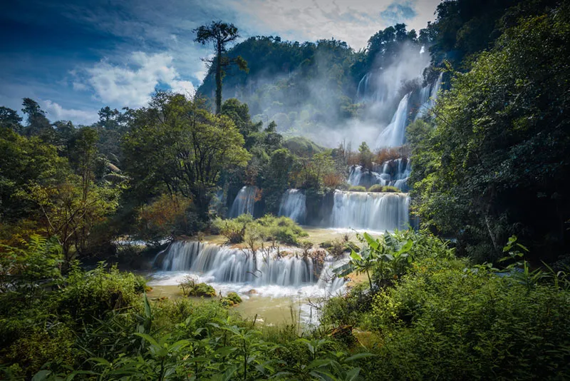
5. Thi Lo Su Waterfall, Tak — Thi Lo Su Waterfall is located within the Umphang Wildlife Sanctuary in Tak Province. It is one of Thailand's most impressive large waterfalls, with water cascading across a broad rocky cliff surrounded by the biologically rich forests of western Thailand. The roar of falling water and the mist rising from the cascades create an atmosphere very different from waterfalls located beside major roads.
Highlights: A magnificent wide waterfall deep within western Thailand's forests and an adventurous nature experience.
Thi Lo Su's significance extends beyond its visual beauty. The waterfall forms part of a protected watershed and forest ecosystem. Access therefore requires careful route planning and compliance with wildlife sanctuary regulations. This is especially important during the rainy season, when road conditions can change and travel restrictions may be introduced.
The destination is best suited to nature enthusiasts who have sufficient time and can prepare their journey in advance. Roads leading to Umphang District contain numerous bends and can require considerable travel time. Visitors should use authorized local services where required, keep the area clean and respect restricted zones.
Thi Lo Su is a large waterfall surrounded by the forests of Umphang. Its beauty comes from multiple streams cascading across a wide cliff face, contrasting with the green forest and drifting spray at the base. This creates a very different landscape from waterfalls consisting of a single narrow stream or a small series of rocky terraces.
The main challenge is reaching Umphang District and entering the protected wildlife sanctuary. Some access routes have restrictions during the rainy season. Travelers should coordinate with authorized local operators and check official access announcements before finalizing their itinerary.
Visitors must remain within permitted viewing areas. Water that appears calm from a distance may conceal strong currents, while wet rocks can be extremely slippery. A relaxed itinerary allows more time to appreciate the waterfall and learn about communities in the Umphang area without rushing.
Getting There: Travel to Umphang District in Tak Province, then contact the responsible authorities or an authorized local operator to arrange access to the waterfall under current sanctuary regulations.
Map (GPS):Get Directions to Thi Lo Su Waterfall
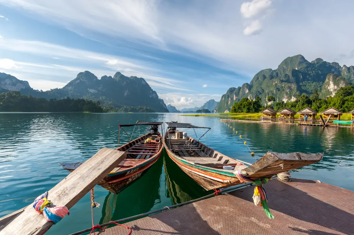
6. Khao Sok National Park, Surat Thani — Khao Sok National Park is an important tropical rainforest conservation area in Surat Thani Province, southern Thailand. It encompasses both extensive forest landscapes and areas around the reservoir created by Ratchaprapha Dam, commonly known as Cheow Lan Lake. The lake is surrounded by striking limestone mountains, allowing visitors to experience the region's natural beauty through forest walks and scenic boat journeys.
Highlights: Tropical rainforests, limestone mountains and Cheow Lan Lake.
The forests of Khao Sok support tropical vegetation, streams and ecosystems shaped by abundant rainfall. Walking along nature trails may require an authorized guide, depending on the route and current park regulations. For activities on the lake, travelers should choose operators that provide appropriate safety equipment and comply with conservation requirements.
Visitors can stay near the national park entrance to explore the rainforest or choose accommodation around Ratchaprapha Dam for convenient access to boat excursions. These two areas are located some distance apart, so planning the journey between them is essential.
Khao Sok is characterized by dense tropical rainforest, limestone cliffs and numerous streams. The forest section of the national park and the Cheow Lan Lake area offer distinctly different experiences. Travelers should decide whether they want to focus on forest trekking, exploring streams and woodland trails, or taking a boat trip across the reservoir.
Early mornings may offer opportunities to see mist drifting above the lake, while forest trails reveal the diversity of plants and animals living in this humid environment. Wildlife should be observed without disturbing its natural habitat. Certain activities require guides or are subject to specific park regulations.
Travelers with limited time may find it more practical to concentrate on one area rather than repeatedly traveling between the national park entrance and the Cheow Lan Lake pier. A trip lasting at least two days is better suited to exploring both the rainforest and the lake landscape.
Getting There: Travel to the Khao Sok area in Surat Thani Province. Choose your destination carefully: the national park's forest entrance and the boat piers serving Ratchaprapha Dam are separate locations, and the best route depends on your planned activities.
Map (GPS):Get Directions to Khao Sok National Park
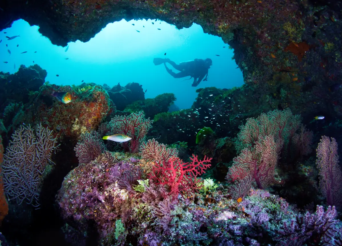
7. Mu Ko Similan National Park, Phang Nga — The Similan Islands lie in the Andaman Sea off Phang Nga Province. This protected marine area is renowned for its distinctive granite formations, pale sandy beaches, clear seawater and coral reefs in areas open to visitors. The islands' beauty reflects both their geological features and delicate marine ecosystems, which require ongoing conservation and careful management.
Highlights: Granite island landscapes, crystal-clear seawater and opportunities to explore marine ecosystems.
Popular activities include island sightseeing by boat, swimming and snorkeling in designated areas. Visitors should follow the guidance of park officials and licensed tour operators concerning island access, environmental restrictions and responsible marine activities. Touching coral or disturbing marine animals should always be avoided.
The Similan Islands have a designated tourism season followed by an annual closure period for ecological recovery. They are therefore not accessible for tourism throughout the entire year. Travelers should check official seasonal announcements alongside Andaman Sea weather and wave forecasts, particularly when booking boat trips or planning snorkeling activities.
The Similan Islands are famous for their turquoise waters, light-colored beaches and dramatic granite boulders. Certain viewpoints offer sweeping views over bays and surrounding coastlines. Sea colors vary with sunlight, water conditions and the weather, creating different scenery throughout the day.
Beneath the surface, coral reefs and marine wildlife are especially sensitive to human disturbance. Snorkelers and divers should maintain a safe distance from coral, avoid touching marine animals and use their equipment carefully. There is no need to approach wildlife closely simply to obtain a photograph.
Access to the islands requires boat transportation and depends heavily on sea conditions. The national park operates seasonal tourism schedules and visitor restrictions that must be checked with the responsible authorities before booking. Travelers who are susceptible to seasickness should also prepare appropriately and consider the forecast conditions.
Getting There: Travel to Phang Nga Province and join a boat service departing from an authorized pier during the national park's permitted operating season. Check marine forecasts, boat schedules and the latest park access announcements before traveling.
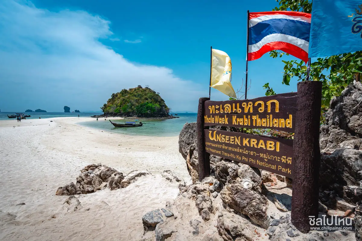
8. Thale Waek (Separated Sea), Krabi — Thale Waek is a natural sandbar phenomenon connecting the areas around Chicken Island, Tup Island and Mor Island in Krabi's coastal waters. When the tide falls to a suitable level, exposed sandbars form a temporary walkway through the sea. This remarkable landscape demonstrates the relationship between coastal geography, ocean currents and tidal movements.
Highlights: Sandbars emerging at low tide and panoramic views of Krabi's offshore islands.
The main attraction is the opportunity to walk along the exposed sandbar when sea conditions allow. However, the appearance of the sandbar changes throughout the day depending on tides, waves and weather conditions. On some days it is clearly visible, while on others much of the sand remains underwater. Travelers should therefore choose a boat departure based on tidal information checked by their local operator.
Thale Waek is especially attractive to travelers interested in coastal landscapes and natural phenomena. Visitors should remain aware of water currents, avoid stepping on marine organisms and never leave rubbish on the beach or in the sea.
The sandbar phenomenon occurs between Chicken Island, Tup Island and Mor Island when the sea level drops sufficiently. The resulting sandy passage is one of Krabi's most recognizable natural sights, but its visibility varies from day to day and even from hour to hour.
Planning a visit requires careful attention to tidal schedules and the advice of local boat operators. Excursions often combine the sandbar with nearby islands and beaches. However, travelers should allow enough time to return to their boat safely before the tide rises again.
Visitors should keep the beaches clean, avoid disturbing marine life in shallow water and wear suitable footwear when boarding or leaving boats. When taking photographs on the exposed sandbar, personal safety and the return route should always take priority.
Getting There: Join an island-hopping boat excursion departing from Ao Nang or another authorized pier in Krabi. Select a departure that coincides with a suitable low tide based on conditions on the day of travel.
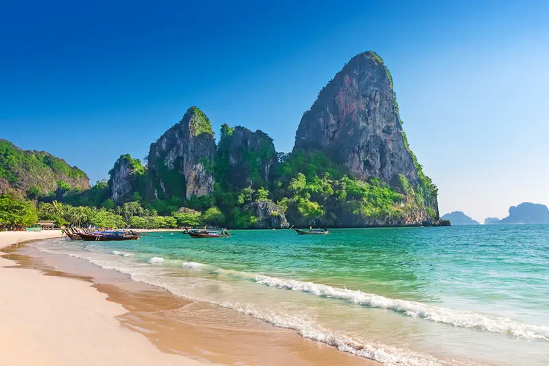
9. Railay Beach, Krabi — Railay Beach is a coastal destination in Krabi distinguished by towering limestone cliffs surrounding picturesque bays. Although Railay is part of the mainland, access is primarily by boat from Ao Nang or nearby departure points. This unusual geography gives Railay a distinctive atmosphere compared with beaches that can be reached directly by road.
Highlights: Sandy bays beneath dramatic limestone cliffs and opportunities to explore coastal scenery.
Railay features several beaches and a range of activities, from scenic coastal walks and relaxing beside the sea to rock climbing on designated cliffs. Visitors should understand the differences between Railay West and Railay East and plan photography or sightseeing according to the direction of sunlight and the surrounding landscape.
For nature photographers, one of Railay's greatest attractions is the contrast between steep limestone formations, turquoise seawater and sandy beaches. Visitors should respect coastal ecosystems, remain cautious during rough weather and check the schedule for their return boat before leaving the mainland.
Railay is surrounded by towering limestone mountains. Although physically connected to the mainland, it is normally accessed by boat from Ao Nang or nearby piers. This geographical isolation creates an atmosphere quite different from beaches with direct road access.
Railay West is particularly attractive for sea views and late-afternoon scenery, while Railay East features mangrove vegetation and pathways connecting different parts of the peninsula. Travelers interested in rock climbing should choose reputable operators with appropriate safety standards and routes suitable for their experience.
A visit can also include Phra Nang Beach and viewpoints along permitted walking routes. Travelers should consider the heat, slippery paths and tidal conditions when exploring the area, since return boat services depend on weather, waves and local operating arrangements.
Getting There: Take a boat from Ao Nang or another nearby pier according to the available service and sea conditions. Railay Beach cannot be reached directly by car.
Map (GPS):Get Directions to Railay Beach

10. Kaeng Krachan National Park, Phetchaburi — Kaeng Krachan National Park in Phetchaburi Province protects an extensive forest landscape encompassing mountain ranges, evergreen forests, mixed deciduous woodland and important watersheds of western Thailand. Its exceptional biodiversity is internationally recognized through its inclusion in the UNESCO World Heritage-listed Kaeng Krachan Forest Complex.
Highlights: Extensive Tenasserim forest landscapes, Kaeng Krachan Lake, Ban Krang and Phanoen Thung.
Nature enthusiasts can explore areas around Kaeng Krachan Lake and the dam or arrange visits to forest destinations such as Ban Krang and Phanoen Thung when access is permitted. Butterfly watching, birdwatching and misty mountain views depend on seasonal and weather conditions. Wildlife should always be observed from a respectful distance.
The differences between lakeside attractions and mountain forest routes make careful planning essential. Visitors should select transportation suitable for their intended route and allow sufficient travel time. Some sections close seasonally for ecological recovery, while access to remote forest areas is subject to official restrictions.
Kaeng Krachan encompasses a vast landscape ranging from reservoir surroundings to high mountains and evergreen forests near Thailand's western border. One of its most important roles is the protection of birds, butterflies and other wildlife. Visitors seeking meaningful nature experiences should take time to observe their surroundings quietly.
Attractions are spread across different zones, including lake areas, forest trails and high-altitude viewpoints. Travelers should identify their priorities before departure because certain roads are mountainous and access may be controlled through vehicle restrictions or designated entry schedules.
Birdwatchers and wildlife photographers should learn about appropriate observation times and responsible practices. Using bait to attract animals, making excessive noise or ignoring park instructions can disturb wildlife and damage sensitive habitats.
Getting There: Travel from Phetchaburi toward Kaeng Krachan District, then follow the route to the specific visitor zone that is open during your trip. Check national park announcements before entering more remote areas.
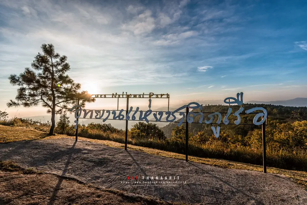
11. Phu Ruea National Park, Loei — Phu Ruea National Park is located in Phu Ruea District, Loei Province, and is one of northeastern Thailand's most popular destinations for watching the sunrise and enjoying panoramic mountain scenery.
Highlights: Phu Ruea Summit, sunrise viewpoints, seasonal sea mist and mountain forests.
Phu Ruea is distinguished by its high mountain ridges, cool climate and expansive views across the northeastern highlands. The summit is particularly popular during the cool season, when visitors gather to watch the sunrise. However, its appeal is not limited to mornings with sea mist, as the colors of the forests and surrounding mountains change throughout the year.
Many viewpoints are easier to reach than destinations requiring long mountain hikes, making Phu Ruea suitable for visitors who want to experience cooler mountain weather without strenuous trekking. Nevertheless, strong winds and significantly lower temperatures can occur near the summit. Warm clothing and footwear suitable for wet surfaces are recommended.
The park protects mountain forests, high-altitude vegetation and important watershed areas that support nearby communities. Visitors should remain on designated trails, avoid collecting wildflowers or other plants, and stay away from steep slopes outside established viewpoints.
A visit to Phu Ruea can be combined with cultural attractions and local communities around Dan Sai District. Travelers should decide whether to stay near Phu Ruea for an early sunrise excursion or travel from Loei city, taking care to minimize driving on mountain roads after dark.
Phu Ruea is suitable for families, couples, photographers and nature enthusiasts with limited time. Travelers looking for a more demanding multi-day hiking experience may prefer Phu Kradueng, another major mountain destination in Loei Province.
Getting There: Travel to Phu Ruea District in Loei Province via Highway 203, then follow the signs leading to Phu Ruea National Park and its designated summit access road.
Map (GPS):Get Directions to Phu Ruea National Park
12. Pa Hin Ngam National Park, Chaiyaphum — Pa Hin Ngam National Park is located in Thep Sathit District, Chaiyaphum Province. It is famous for its seasonal Siam tulip fields and remarkable rock formations among the mountains of the Phang Hoei Range.
Highlights: Siam tulip fields, Lan Hin Ngam rock formations and the Sut Phaen Din viewpoint.
Pa Hin Ngam combines mountain grasslands with unusual sandstone formations shaped by natural weathering and erosion. During the rainy season, Siam tulips emerge among the green hillsides, creating one of Chaiyaphum's best-known seasonal landscapes. The park offers an excellent example of how geological features and native vegetation together shape the character of a destination.
As seasonal rainfall becomes more consistent, the grasslands turn green and Siam tulips begin flowering across the mountain slopes. The flowering period depends on weather conditions and annual rainfall, so visitors should check current bloom reports rather than rely on fixed dates from previous years.
Lan Hin Ngam and the Sut Phaen Din viewpoint offer expansive views of unusual rock formations and the surrounding landscape. Visitors should follow established walkways and avoid stepping into protected flower fields, even when open grassland appears easily accessible.
Travelers should allow time for walking and any shuttle services operated during the flowering season. Wide-angle photography is particularly suitable for capturing the landscape, but close-up photographs should be taken without touching flowers or damaging surrounding vegetation.
With additional time, the trip can be combined with Sai Thong National Park, another Chaiyaphum destination known for Siam tulips and waterfalls. Travel distances and the accessibility of individual trails should be assessed before arranging a combined itinerary.
Getting There: Travel to Thep Sathit District in Chaiyaphum Province and follow the road signs to Pa Hin Ngam National Park.
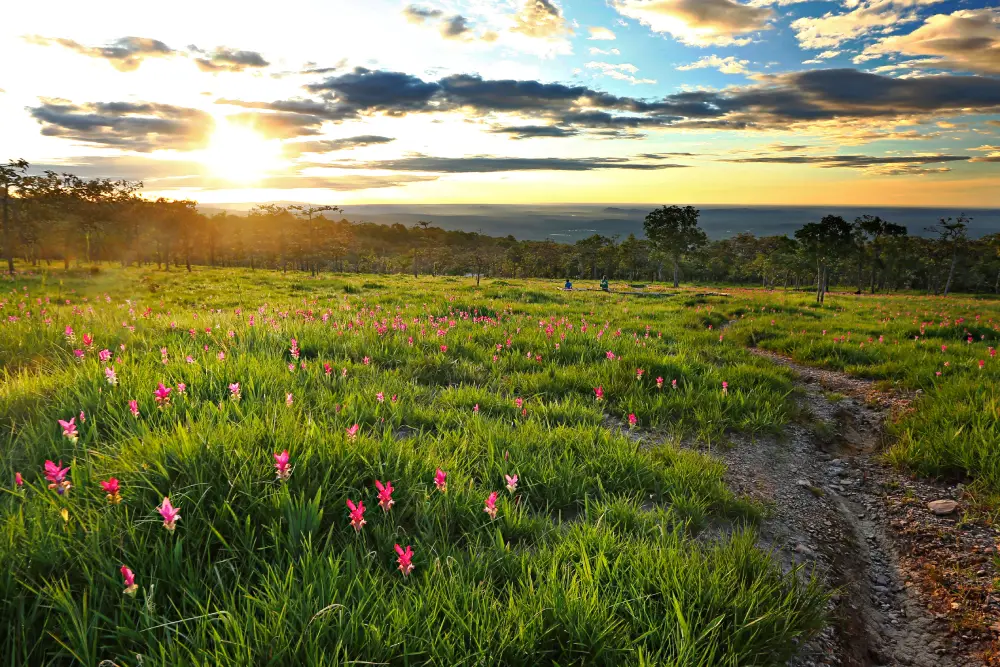
13. Sai Thong National Park, Chaiyaphum — Sai Thong National Park is located in Nong Bua Rawe District, Chaiyaphum Province. The park brings together seasonal Siam tulip fields, waterfalls, forests and dramatic cliffs, offering varied experiences for travelers interested in northeastern Thailand's natural landscapes.
Highlights: Siam tulip fields, Sai Thong Waterfall and cliff viewpoints along designated trails.
Sai Thong features a combination of waterfalls, woodland, cliffs and Siam tulip fields along the Phang Hoei mountain range. Although it shares certain seasonal attractions with Pa Hin Ngam, reaching some viewpoints and flower fields at Sai Thong requires longer nature walks and greater physical effort.
Sai Thong Waterfall is one of the park's principal attractions. The Siam tulip fields and viewpoints along the mountain ridges become particularly scenic during the rainy season, when surrounding vegetation is lush. However, wet conditions can make some trails slippery and more challenging.
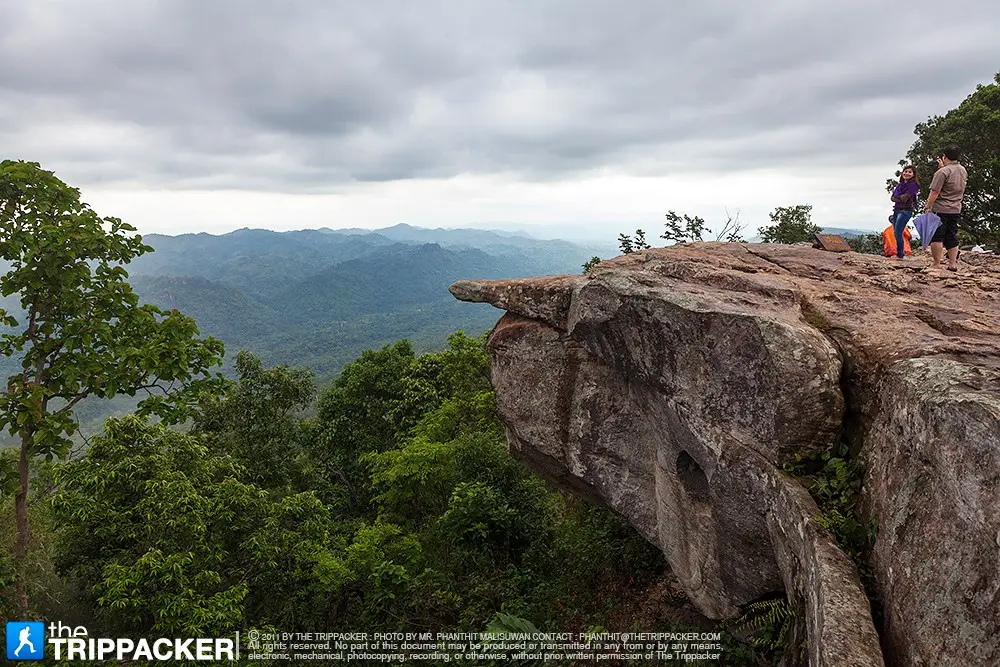
Pha Ham Hot is a well-known cliff viewpoint distinguished by a rocky projection extending toward an open landscape. Visitors must observe all access restrictions and avoid dangerous activities for photographs. Regulations may change according to trail conditions and safety assessments.
Travelers visiting primarily for Siam tulips should allow sufficient time in the morning and check rainfall conditions before departure. It is advisable not to schedule too many stops that would require walking close to sunset, particularly where shuttle services or extended hikes are involved.
Sai Thong is suitable for wildflower enthusiasts, nature walkers and mountain photographers. Families with young children or older adults should confirm the difficulty of currently accessible trails and select viewpoints appropriate for their abilities.
Getting There: Travel toward Nong Bua Rawe District in Chaiyaphum Province, then follow the access route to Sai Thong National Park. Use only the routes currently approved by park officials.
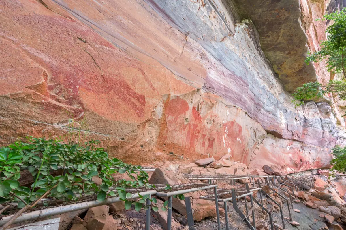
14. Pha Taem National Park, Ubon Ratchathani — Pha Taem National Park lies near the Mekong River in Ubon Ratchathani Province. It combines impressive sandstone cliffs, prehistoric rock paintings and natural viewpoints overlooking the river landscape.
Highlights: Prehistoric rock paintings, Mekong River cliffs and early-morning sunrise scenery.
Pha Taem offers an unusual combination of natural landscapes and archaeological heritage. Sandstone cliffs rise above the Mekong River, while prehistoric paintings preserved on rock surfaces provide evidence of human activity in the region's distant past. The elevated plateau also offers views toward the river and neighboring Laos.
The area's cliffs and exposed rock surfaces were shaped by geological processes over long periods. Walking along the designated rock art trail allows visitors to examine the cliff formations and paintings associated with ancient communities. The paintings must never be touched, scratched or marked, and visitors should remain on established pathways.
Early morning is particularly popular for watching sunlight appear over the Mekong landscape. During the rainy season, parts of the park become greener and seasonal waterfalls may develop. These natural features vary according to prevailing weather conditions.
Exposed cliff areas can be windy and hot, so visitors should bring drinking water, sun protection and suitable walking shoes. Those interested in viewing the prehistoric paintings should allow sufficient time for the walking route and avoid approaching unprotected cliff edges.
Pha Taem can be combined with natural attractions and other destinations around Khong Chiam District. Planning visits by geographical area helps reduce driving time and provides more opportunities to appreciate each location.
Getting There: Travel to Khong Chiam District in Ubon Ratchathani Province, then follow the access road to Pha Taem National Park. Select viewpoints and walking routes according to the time available.
Map (GPS):Get Directions to Pha Taem National Park
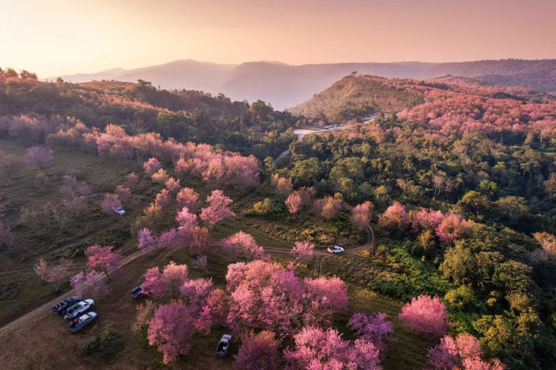
15. Phu Hin Rong Kla National Park, Phitsanulok — Phu Hin Rong Kla National Park extends across mountainous areas near the boundaries of Phitsanulok, Phetchabun and Loei provinces. It is distinguished by rocky landscapes, high-altitude forests and significant sites associated with Thailand's modern history.
Highlights: Lan Hin Pum, Pha Chu Thong, pine forests and historical learning sites.
Phu Hin Rong Kla combines high mountains, pine forests, rocky plateaus and unusual formations produced by the weathering of stone. Visitors can enjoy natural scenery while exploring places associated with important events in Thailand's modern political history.
Lan Hin Pum and Pha Chu Thong showcase different characteristics of the area's rock formations and cliffs. Good walking shoes are essential because some stone surfaces are uneven and can become slippery after rainfall.
The park also contains historical sites connected with political conflicts in the past. Designated interpretive routes allow visitors to learn about these events. Taking time to read historical explanations provides a more meaningful understanding of the area beyond its scenic attractions.
During the rainy season, vegetation becomes lush and the mountain landscape can be particularly atmospheric. The cooler season brings lower temperatures and sometimes clearer views. Visitors should prepare rainwear or warm clothing as appropriate and exercise caution when driving through mist on mountain roads.
Travelers planning a multi-day mountain journey can connect Phu Hin Rong Kla with natural attractions in neighboring parts of Phetchabun or Phitsanulok. It is better to allow time to explore individual destinations than to rush between too many locations in a single day.
Getting There: Travel toward Nakhon Thai District in Phitsanulok Province, then follow the mountain road into Phu Hin Rong Kla National Park. Be cautious of winding roads and reduced visibility in misty weather.
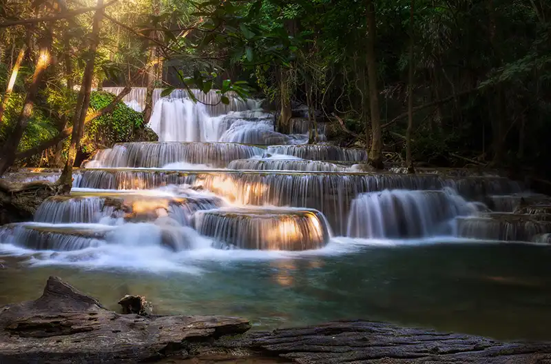
16. Huai Mae Khamin Waterfall, Kanchanaburi — Huai Mae Khamin Waterfall is a beautiful multi-tiered limestone waterfall within Khuean Srinagarindra National Park in Kanchanaburi Province. Its cascading streams and shaded forest surroundings make it a rewarding destination for travelers interested in waterfalls and nature walks.
Highlights: Multiple limestone waterfall levels, clear water during suitable conditions and forest trails alongside the streams.
Huai Mae Khamin features a series of limestone cascades surrounded by woodland. Each level has its own distinctive appearance, with variations in water flow, natural pools and vegetation along the trail. Exploring different levels allows visitors to experience the changing character of the waterfall.
As water flows over limestone, it creates recognizable formations and small terraces. Depending on sunlight and water conditions, some pools appear green or turquoise. Water clarity and current strength change with rainfall and the season, so visitors should not expect the waterfall to look identical to photographs at all times.
Some connecting pathways are relatively accessible, while others involve climbing, descending or crossing wet surfaces. Travelers should select viewpoints appropriate for their physical condition and follow all signs restricting swimming or access to particular areas.
Reaching the waterfall can take considerable time because of its distance from central Kanchanaburi and the roads around Srinagarind Dam. Travel planning should distinguish between time spent reaching the site and time available for exploring the falls. Travelers using a vehicle ferry should also account for operational arrangements.
Huai Mae Khamin is suitable for waterfall photography, nature walking and relaxing in forest surroundings. With sufficient time, travelers can combine the waterfall with other attractions around Srinagarind Dam, provided road distances and operating conditions permit.
Getting There: Travel from Kanchanaburi toward Si Sawat District, then follow the access routes into Khuean Srinagarindra National Park. Check vehicle ferry arrangements if your selected route requires crossing the reservoir.
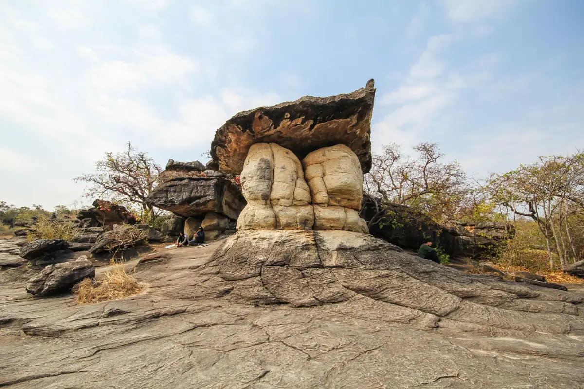
17. Phu Pha Thoep National Park, Mukdahan — Phu Pha Thoep National Park is located in Mukdahan Province and is best known for its extraordinary sandstone formations, naturally sculpted by weathering and erosion.
Highlights: Hin Thoep rock formations, sandstone plateaus and seasonal wildflowers.
Located relatively close to Mukdahan city, Phu Pha Thoep is distinguished by large sandstone formations of unusual shapes. Long-term geological processes have gradually altered the rock surfaces, creating a landscape reminiscent of natural sculptures.
Broad sandstone platforms and the Hin Thoep formations are among the park's main attractions. Visitors can study the shapes and layers of the rock while following designated routes. Climbing unstable formations or damaging rock surfaces should be avoided.
During certain seasons, wildflowers and small streams add variety to the park's landscapes. Conditions differ between the rainy and dry seasons. On sunny days, exposed rock surfaces can become hot and shaded areas may be limited, so drinking water and sun protection are important.
Phu Pha Thoep is suitable for geology enthusiasts, landscape photographers and travelers seeking a natural attraction without going far from Mukdahan city. Visitors should check the accessibility of individual trails and attractions with park authorities.
The park can be included in a wider itinerary exploring Mukdahan's riverside communities and cultural heritage along the Mekong. Spending enough time at each destination provides a more rewarding experience than attempting too many stops.
Getting There: Travel from Mukdahan city toward Phu Pha Thoep National Park, following the designated road signs and currently accessible routes.

18. Phu Wiang National Park, Khon Kaen — Phu Wiang National Park in Khon Kaen Province is an important destination for both sandstone landscapes and paleontological discoveries, especially evidence of prehistoric dinosaurs.
Highlights: Sandstone mountains, dinosaur fossil sites and geological learning opportunities.
Phu Wiang brings together the natural beauty of sandstone mountains and the fascinating history of prehistoric life. The area is renowned for discoveries of dinosaur fossils and other ancient biological evidence within Phu Wiang and its surroundings.
What distinguishes Phu Wiang from many other national parks is its value as a place to understand geological time. Visitors can learn about sedimentary rock layers, the accumulation of sediments and the discovery of fossils through designated educational attractions.
The landscape also includes forests and nature trails with sandstone formations, cliffs and varied plant life. Families with children should select age-appropriate learning activities and avoid entering restricted excavation sites.
Visitors should distinguish between fossil excavation locations within or near the national park and dinosaur museums in the wider Phu Wiang area. These are separate sites with different access arrangements. Allowing at least half a day, or preferably a full day, makes it easier to explore the area's educational attractions without rushing.
Phu Wiang is suitable for families, students, geology enthusiasts, fossil enthusiasts and travelers interested in northeastern Thailand's sandstone landscapes. Opening arrangements should be checked individually for each educational site.
Getting There: Travel toward Wiang Kao District or the Phu Wiang area of Khon Kaen Province, then follow the official access route to the relevant national park visitor facilities.
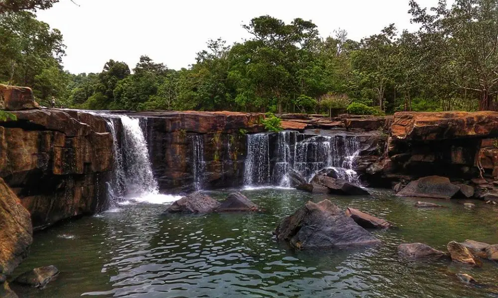
19. Tat Ton National Park, Chaiyaphum — Tat Ton National Park is located near Chaiyaphum city. Its main attraction is a broad waterfall flowing across expansive rock surfaces, surrounded by shady trees and a relaxing natural environment.
Highlights: Tat Ton Waterfall, riverside rock formations and forest scenery close to the city.
Tat Ton National Park is known for its wide waterfall flowing over a rocky riverbed amid shady woodland. Rather than dropping from a very high cliff, the water spreads across a broad rock surface, creating a landscape particularly suitable for sitting, relaxing and enjoying the sounds of nature.
Water levels vary with rainfall and the season. When the stream is full, the waterfall can spread dramatically across the rocks, but strong currents and slippery surfaces also create hazards. Visitors should remain in designated areas and avoid entering water where swimming is prohibited.
The park offers places to relax and forest surroundings where visitors can observe trees, birds and streams without rushing. Children should remain under close adult supervision even in areas where the water appears shallow.
Tat Ton is well suited to short nature excursions and family trips in Chaiyaphum Province. It offers a different experience from Sai Thong and Pa Hin Ngam, where visiting the seasonal Siam tulip fields may involve longer journeys or additional hiking.
A visit can be combined with cultural and educational attractions in Chaiyaphum city, taking into account available time, road conditions and local opening arrangements.
Getting There: Travel from Chaiyaphum city toward Na Fai Subdistrict and follow the designated route into Tat Ton National Park.
Map (GPS):Get Directions to Tat Ton National Park
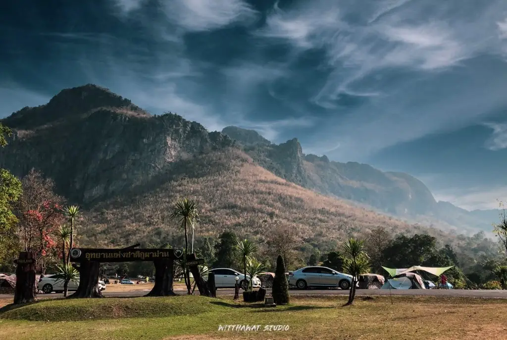
20. Phu Pha Man National Park, Khon Kaen — Phu Pha Man National Park in Khon Kaen Province is distinguished by towering limestone cliffs and natural cave systems, creating a landscape that differs considerably from the sandstone mountains commonly found elsewhere in northeastern Thailand.
Highlights: Limestone cliffs, natural caves and limestone mountain forest ecosystems.
Phu Pha Man is known for its impressive limestone cliffs, whose steep vertical surfaces resemble a large curtain. This distinctive landscape surrounds forests and caves, providing opportunities to explore the geology of limestone mountains rather than the sandstone formations associated with many other northeastern destinations.
The park contains cave systems and natural habitats associated with wildlife, including bats that shelter in caves and emerge to feed under suitable conditions. Visitors should observe wildlife from a distance, avoid disturbing bats with camera flashes and never enter closed caves or restricted areas without permission.
Limestone terrain can feature sharp rock surfaces, steep slopes and trails that become slippery in wet weather. Appropriate walking shoes are important, and visitors should select routes suited to their physical condition rather than leaving designated trails in search of photographs.
The significance of Phu Pha Man extends to both its natural scenery and the conservation of limestone forest ecosystems. Visitors should respect caves and wildlife habitats and avoid collecting rocks or other natural materials.
The park can be combined with destinations around Chum Phae District or neighboring Loei Province, depending on the itinerary. Travelers should choose geographically practical routes, particularly if cave exploration or nature walking is planned for the same day.
Getting There: Travel to Phu Pha Man District in Khon Kaen Province, then follow the route to the national park headquarters or a designated cave attraction according to your plans.
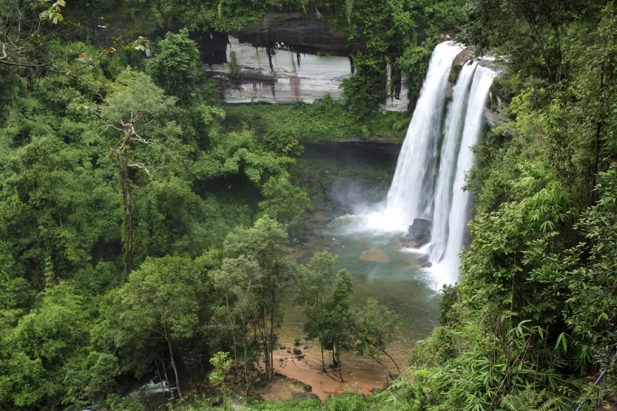
21. Phu Chong Na Yoi National Park, Ubon Ratchathani — Phu Chong Na Yoi National Park extends across parts of Na Chaluai, Buntharik and Nam Yuen districts in Ubon Ratchathani Province. This protected borderland forest is connected to the landscape of the Phanom Dong Rak mountain range. Its extensive woodland contains mountains, streams, cliffs and waterfalls, offering a different experience from nature attractions located beside major roads.
Highlights: Huai Luang Waterfall and extensive forests near the border region. The waterfall offers attractive views of flowing water surrounded by woodland, particularly when water levels are high. Access to more remote areas requires attention to travel distances, road conditions and park regulations.
The park contains dry evergreen forest, dry dipterocarp forest and mixed deciduous woodland. Moisture conditions vary according to elevation and local geography. These different forest types support biodiversity and give visitors noticeably different experiences throughout the year.
Nature photographers should allow time to observe rock formations, streams and seasonal changes in the forest rather than rushing toward a single viewpoint. Wildlife and plants should be observed without disturbance to help preserve the area's ecological value.
Phu Chong Na Yoi is suitable for travelers interested in forests and waterfalls, as well as those planning a nature-focused journey through southern Ubon Ratchathani. With several days available, the itinerary can also include cultural destinations in nearby communities.
Getting There: Travel to Ubon Ratchathani Province and follow the designated road to Phu Chong Na Yoi National Park. Check road conditions, travel distances and the availability of individual routes with park officials, especially during the rainy season.
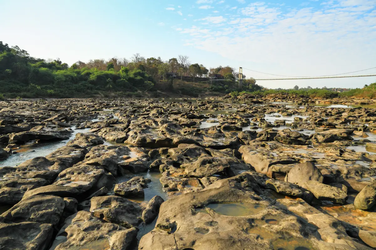
22. Kaeng Tana National Park, Ubon Ratchathani — Kaeng Tana National Park lies within Sirindhorn and Khong Chiam districts of Ubon Ratchathani Province. It is distinguished by landscapes along the Mun River and rocky rapids that have been shaped by flowing water over long periods. The park demonstrates the relationship between forests, rivers and the geological formations of northeastern Thailand.
Highlights: Rocky rapids in the river and scenic views along the Mun River. Visitors should choose only areas officially open to tourists, particularly when water levels rise or after heavy rainfall, as river currents and rock conditions can change rapidly.
Unlike high mountain national parks, Kaeng Tana is characterized by rocky riverbanks, exposed stone surfaces and relatively open forests adapted to shallow, rocky soil. Dry dipterocarp and dry evergreen forests occur in different areas, while vegetation close to streams and waterways benefits from higher moisture levels.
Viewpoints and the suspension bridge provide opportunities to observe the river landscape from different perspectives. Visitors can appreciate the contrast between moving water, surrounding woodland and broad rock formations while learning about the importance of rivers to nearby communities.
Kaeng Tana is suitable for a one-day nature excursion and can be combined with Pha Taem National Park in the Khong Chiam area, which is also featured in this collection. Travel plans should reflect the time available and weather conditions on the day of the visit.
Getting There: Travel to Ubon Ratchathani Province and follow the access roads to Kaeng Tana National Park. Check the condition and availability of smaller roads and visitor routes with park officials, particularly during the rainy season.
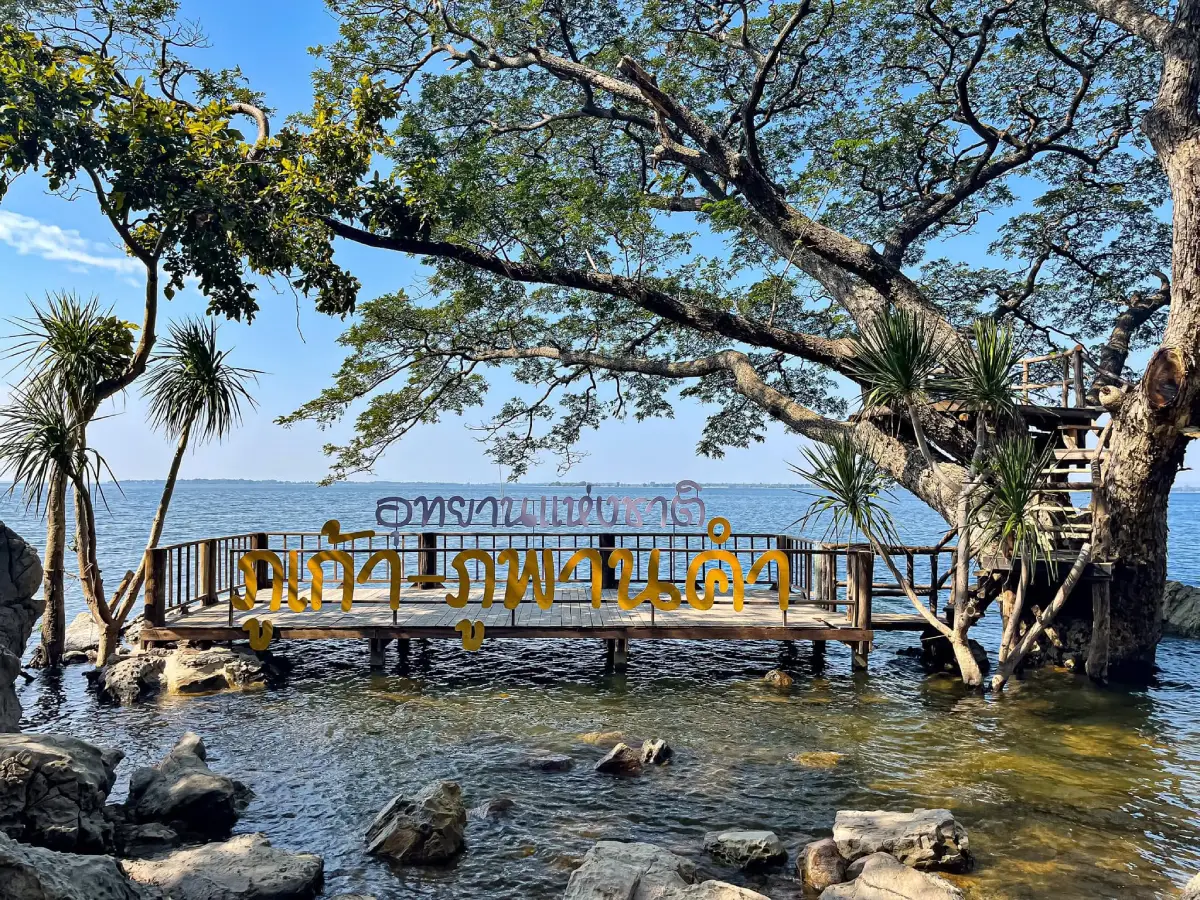
23. Phu Kao Phu Phan Kham National Park, Nong Bua Lamphu and Khon Kaen — Phu Kao Phu Phan Kham National Park covers areas of Nong Bua Lamphu and Khon Kaen provinces. Its landscape consists of sandstone mountain ranges and forests near the extensive reservoir formed by Ubol Ratana Dam. Visitors can therefore experience both mountainous woodland and panoramic views over the water during the same journey.
Highlights: Reservoir viewpoints, nature trails and archaeological evidence in selected areas, including caves and prehistoric rock paintings. These features connect the history of human settlement with the surrounding natural landscape.
The Phu Kao and Phu Phan Kham sections have different geographical characteristics. Mountain forests contain sandstone platforms, dry dipterocarp woodland and mixed deciduous forests. This diversity explains why the park offers both opportunities for nature study and elevated viewpoints across a wide landscape.
Families can begin with viewpoints that are relatively easy to access, while travelers interested in more remote forest trails or archaeological locations should check which areas are open and whether an official guide is required. Footwear suitable for rocky surfaces is recommended.
The park can be included in nature itineraries beginning in Khon Kaen or Nong Bua Lamphu. It may also be combined with Nam Phong National Park, another destination in this collection. Routes should be planned according to the actual access points to avoid unnecessary journeys around the reservoir.
Getting There: Travel through Nong Bua Lamphu or Khon Kaen Province toward the appropriate entrance to Phu Kao Phu Phan Kham National Park. Check road conditions and access restrictions for individual attractions, particularly during wet weather.
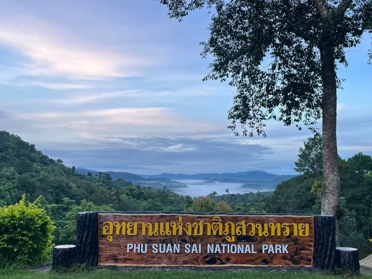
24. Phu Suan Sai National Park, Loei — Phu Suan Sai National Park is situated in Na Haeo District, Loei Province, along the mountainous Thai–Lao border. Its quiet atmosphere and forest ecosystems at different elevations appeal to travelers seeking nature experiences away from the region's busiest tourist routes.
Highlights: The Hin Si Thit rock formations and mountain viewpoints overlooking forests and ridges along the border. Landscape photographers should allow time for morning or late-afternoon light and use only viewpoints officially accessible to visitors.
Montane evergreen forest, dry evergreen woodland and bamboo forest contribute to the park's varied ecosystems. Differences in humidity and vegetation create distinct environments along walking routes, especially during the early morning and the transition from the rainy season to the cooler months, when mist may appear over the mountains.
Nature trails provide opportunities to study mountain vegetation and forest habitats. Phu Suan Sai is also attractive to birdwatchers and travelers interested in observing the night sky away from urban lighting. Overnight stays and access to remote forest areas must comply with current park regulations.
The park is best suited to mountain enthusiasts, landscape photographers and travelers who prefer a slower pace. A longer Loei itinerary can combine Na Haeo with Phu Ruea or Dan Sai, allowing sufficient time for winding mountain roads.
Getting There: Travel toward Na Haeo District in Loei Province and follow the designated access route to Phu Suan Sai National Park. Confirm the availability of individual trails and mountain roads before setting out.
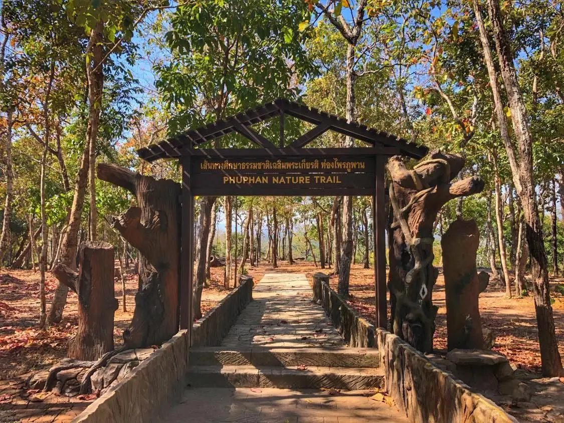
25. Phu Phan National Park, Sakon Nakhon and Kalasin — Phu Phan National Park extends across the Phu Phan mountain range in Sakon Nakhon and Kalasin provinces. It combines forests, waterfalls, viewpoints and historical landscapes. The mountain range plays an important role in the geography of upper northeastern Thailand and provides watershed areas for numerous local streams.
Highlights: Scenic viewpoints, waterfalls and nature study areas located throughout the park. Individual attractions have different access conditions, so travelers should select routes based on the time available, particularly when planning a day trip from Sakon Nakhon city.
The forests include dry dipterocarp woodland, mixed deciduous forest and plant communities influenced by variations in soil and elevation. Driving along Highway 213 between Sakon Nakhon and Kalasin reveals a gradual transition from inhabited areas to forested mountain landscapes.
The Phu Phan mountains also have historical significance, adding another dimension to a scenic journey. Visitors can explore how human settlement, transport routes and local communities have developed in relation to the mountainous terrain and surrounding forests.
The park is suitable for nature lovers interested in scenic drives and local history. Walking routes should be chosen according to the abilities of everyone in the group. Travelers wishing to continue to Phu Pha Yon National Park should also allow enough time for the journey.
Getting There: Travel toward the Phu Phan mountain range between Sakon Nakhon and Kalasin, following the designated national park signs and access routes. Check smaller roads and trail conditions before departure.
Map (GPS):Get Directions to Phu Phan National Park
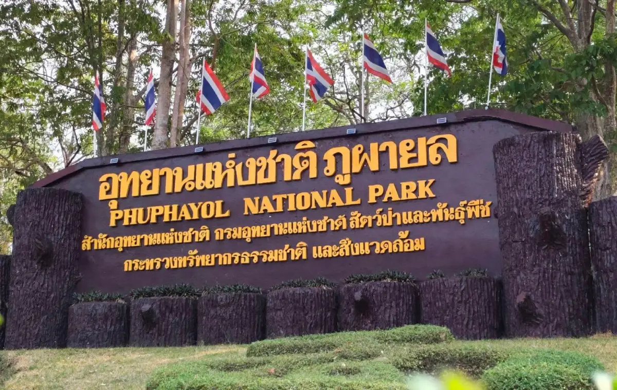
26. Phu Pha Yon National Park, Sakon Nakhon, Nakhon Phanom and Mukdahan — Phu Pha Yon National Park is a large protected forest area along the Phu Phan mountain range, covering districts in Sakon Nakhon, Nakhon Phanom and Mukdahan provinces. Its landscapes feature mountains, reservoirs, waterfalls, rock formations and archaeological sites that reflect the relationship between nature and human communities in the past.
Highlights: Reservoir viewpoints, nature trails and areas containing ancient rock art. Visitors should observe archaeological evidence without touching, scratching or marking the rock surfaces, helping preserve these important records for future generations.
Reservoirs and surrounding forests support different habitats, while rocky plateaus and cliffs provide opportunities to observe the area's geological features. Walking through these landscapes allows visitors to appreciate the scenery while learning about the natural characteristics of the Phu Phan mountains.
Travelers seeking relaxation may prefer accessible viewpoints near visitor facilities or reservoirs. Those planning longer forest walks should check trail openings and actual walking times with park authorities, as attractions are spread across a large area.
The park is suitable for photographers, nature enthusiasts and visitors interested in history. It can be included in a broader journey through the Phu Phan mountain landscapes of Sakon Nakhon Province, without attempting to cover every attraction in a single day.
Getting There: Travel toward the relevant park entrance in the mountainous areas of Sakon Nakhon, Nakhon Phanom or Mukdahan. Confirm the correct access route, road conditions and available nature trails with park authorities before departure.
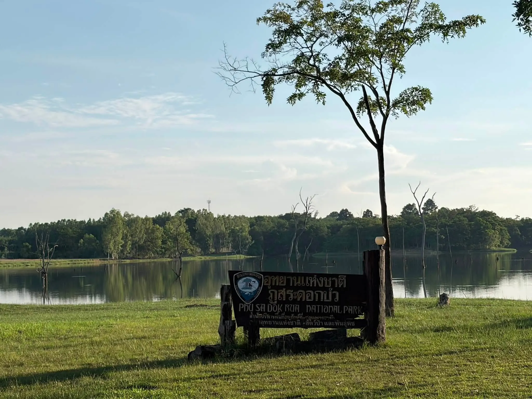
27. Phu Sa Dok Bua National Park, Amnat Charoen, Mukdahan and Yasothon — Phu Sa Dok Bua National Park extends across the borders of Amnat Charoen, Mukdahan and Yasothon provinces. It consists of mountain ranges and different forest types adapted to variations in rock formations, soil and moisture. The park appeals to visitors interested in natural environments beyond the more familiar lowland landscapes of northeastern Thailand.
Highlights: Sandstone landscapes, natural rock formations and forest scenery. Visitors should stay on designated trails and avoid climbing rocky structures that have not been established as official viewpoints.
The park's character is shaped by sandstone mountains, natural rock formations and elements of local history. Dry dipterocarp and mixed deciduous forests occur along the mountain slopes, while streams and more humid areas provide habitats for a variety of plants and animals.
Certain attractions are associated with historical events and local heritage. Travelers should take time to understand these accounts as well as the natural surroundings, allowing them to appreciate both the historical and ecological importance of the region.
Phu Sa Dok Bua suits travelers who prefer peaceful nature destinations and those undertaking a more detailed exploration of northeastern Thailand. Preparing a reliable route and confirming accessible attractions with park officials will make the journey easier to organize.
Getting There: Travel toward the appropriate park access point in the border areas of Amnat Charoen, Mukdahan or Yasothon provinces. Check road conditions and the availability of designated visitor areas before traveling.

28. Nam Phong National Park, Khon Kaen — Nam Phong National Park is a protected natural area in Khon Kaen Province, extending into parts of neighboring Chaiyaphum. It is known for mountain forests, rocky plateaus and viewpoints overlooking Ubol Ratana Reservoir, making it an attractive destination for visitors seeking nature experiences within reach of Khon Kaen city.
Highlights: Hin Chang Si viewpoint, natural sandstone formations and trails through dry dipterocarp and dry evergreen forests. Rocky surfaces can become slippery after rainfall, so visitors should remain on designated paths.
Hin Chang Si is one of the park's best-known attractions. Large sandstone formations and elevated viewpoints reveal panoramic views of the reservoir and surrounding mountains. Morning and late-afternoon light can enhance the shapes of the rocks and the contours of the landscape.
Visitors interested in ecology can explore the relationship between forest vegetation, rocky soils and water resources. The park's forests also play an important role in protecting local watersheds. Taking time to observe these features provides a more meaningful experience than stopping only for photographs.
Nam Phong is suitable for families, groups of friends and landscape photographers. It can be combined with Phu Kao Phu Phan Kham National Park or destinations around Ubol Ratana Dam, provided the route is planned to avoid unnecessary travel around the reservoir.
Getting There: Travel toward the designated park entrance in Khon Kaen Province and follow the signs to Nam Phong National Park. Check access conditions for individual viewpoints, particularly during wet weather.

29. Thap Lan National Park, Prachin Buri and Nakhon Ratchasima — Thap Lan National Park is a vast protected forest extending across Prachin Buri and Nakhon Ratchasima provinces. It forms part of the UNESCO World Heritage-listed Dong Phayayen–Khao Yai Forest Complex, which is internationally recognized for its important ecosystems and biodiversity.
Highlights: Fan palm forests, the Pha Kep Tawan viewpoint and other natural attractions accessible under national park regulations. Travelers watching the sunset should allow enough time to return safely before dark and avoid unauthorized routes through remote forest areas.
The park's name is associated with the fan palm, a distinctive plant found in parts of the area. Beyond its palm forests, Thap Lan contains dry evergreen forests, dry dipterocarp woodland, mixed deciduous forests, mountains and waterways that contribute to eastern Thailand's wider forest ecosystems.
Thap Lan's importance goes far beyond tourism. As part of an extensive protected forest complex, it provides habitat for wildlife and helps maintain connections between forest areas. Conserving wildlife movement routes and natural habitats is essential to its long-term ecological health.
The park suits travelers interested in forests and landscape photography. With several days available, visitors can combine a trip to Thap Lan with the Wang Nam Khiao area or Khao Yai National Park, while allowing sufficient time to travel between different park entrances.
Getting There: Travel toward the relevant entrance to Thap Lan National Park from Prachin Buri or Nakhon Ratchasima Province. Confirm the correct access road and available visitor routes with park authorities, especially during the rainy season.
Map (GPS):Get Directions to Thap Lan National Park

30. Ta Phraya National Park, Sa Kaeo and Buri Ram — Ta Phraya National Park is a protected borderland forest in eastern Thailand, extending across areas of Sa Kaeo and Buri Ram provinces. Its geography includes plains, low hills and mountain ridges connected to a much larger conservation landscape. The park appeals to travelers interested in natural environments beyond Thailand's major tourist centers.
Highlights: Forest landscapes and views of mountain ranges near the border. Some routes may be close to restricted areas or subject to special safety regulations. Visitors should enter only destinations officially open to tourists on the day of travel.
Mixed deciduous, dry evergreen and dry dipterocarp forests occur according to differences in soil and moisture. These habitats support numerous species of wildlife and plants. Visitors should respect park regulations and avoid activities that disturb the forest ecosystem.
Watershed areas, natural streams and rocky landscapes add to the park's geographical interest. Nature enthusiasts can study the differences between vegetation communities and forest conditions along approved trails, without removing plants, animals or natural materials.
Ta Phraya is more suitable for conservation-minded travelers and those interested in detailed nature study than for rushed sightseeing. Current visitor access, special restrictions and trail conditions should be confirmed directly with responsible officials before departure.
Getting There: Travel toward the designated national park entrance in Sa Kaeo or Buri Ram Province. Confirm the availability of access routes and any special restrictions before traveling, especially because of the park's borderland location.

31. Doi Mon Jam, Chiang Mai Doi Mon Jam is a scenic mountain ridge in Mae Rim District, Chiang Mai Province, known for its layered mountain views and highland agricultural landscapes. The atmosphere changes with the seasons, from lush green cultivated slopes during the rainy months to cool temperatures and beautiful morning light toward the end of the year. For travelers looking for a natural attraction near Chiang Mai city, Mon Jam offers an opportunity to appreciate northern Thailand's mountain scenery without undertaking a long-distance hike.
Highlights: Open mountain viewpoints, ridgelines, highland farming communities and opportunities to see mist when weather conditions are favorable. Visitors can enjoy the scenery from designated public areas and learn about cool-climate crops through activities offered locally.
The landscape around Mon Jam consists of steep slopes and valleys, creating views quite different from gardens in urban areas. The curves of the ridges and cultivated fields illustrate the relationship between local communities and natural resources. Morning and late-afternoon visits are particularly attractive for observing sunlight across the mountains, although mist depends on humidity, wind and temperature and does not appear every day.
The surrounding area includes villages and highland learning centers that reflect the importance of agriculture and tourism to the local economy. Travelers should respect cultivated land, avoid entering private farms without permission and choose operators who follow appropriate environmental and safety practices.
Mon Jam is suitable for families, couples, groups of friends and travelers interested in mountain photography without strenuous adventure activities. However, access roads include winding sections and steep gradients. Drivers should check weather conditions and exercise additional caution during rain or thick mist.
Getting There: From Chiang Mai city, travel toward Mae Rim District, then continue through the Mae Raem and Nong Hoi areas toward Mon Jam. Private vehicles or local transport services are practical because viewpoints are spread along different roads and parking arrangements may vary.
Map (GPS):Get Directions to Doi Mon Jam

32. Phu Chi Fa Forest Park, Chiang Rai Phu Chi Fa is a spectacular mountain viewpoint near the Thai–Lao border in Wiang Kaen District, Chiang Rai Province. It is famous for its pointed summit and dramatic cliff extending toward the sky. On clear days, the expansive horizon reveals valleys and mountain ranges across the border in Laos, making it one of northern Thailand's most popular destinations for sunrise viewing.
Highlights: Phu Chi Fa's distinctive pointed summit, grasslands along the ridgeline, border mountain scenery and mist that may gather in the valleys during cooler weather. Watching the first sunlight appear above the mountains is a memorable experience, although both sunrise visibility and sea mist depend on actual weather conditions.
Although reaching the main viewpoint does not require a multi-day trek, visitors must still walk uphill over mountain terrain, including some uneven surfaces. Shoes with good grip, wind-resistant clothing and the use of designated paths are recommended. The cliff edges are steep and should never be approached carelessly.
The highland ecosystem includes grasslands and vegetation adapted to wind and cooler conditions along the ridge. Seasonal changes in the plant cover mean that Phu Chi Fa is attractive beyond the cool season. During the rainy months, surrounding mountains become lush and green, but slippery trails and reduced visibility require extra caution.
A trip to Phu Chi Fa can be combined with Doi Pha Tang, another mountain viewpoint along Chiang Rai's border landscape. Travelers with more than one day available can enjoy the different perspectives offered by the two destinations. Adequate time should be allowed for travel between viewpoints on winding mountain roads.
Getting There: Travel from Chiang Rai city through the Thoeng area toward Wiang Kaen and Phu Chi Fa. From the parking area, walk to the viewpoint along the designated trail. Visitors planning to watch sunrise should arrive sufficiently early.
Map (GPS):Get Directions to Phu Chi Fa Forest Park

33. Doi Pha Tang, Chiang Rai Doi Pha Tang is a mountain viewpoint along the Thai–Lao border in Wiang Kaen District, Chiang Rai Province. Its elevated ridgeline offers impressive views of the Mekong River and the mountains of Laos. In addition to its natural beauty, the area is associated with highland communities whose distinctive cultural traditions add another dimension to the travel experience.
Highlights: Mountain ridge viewpoints, opportunities to see sunrise and seasonal sea mist, and expansive views toward the border. Landscape photographers can appreciate the layers of distant mountains and the course of the river on clear days.
Doi Pha Tang differs from Phu Chi Fa in the shape of its ridges and the perspectives available from its viewpoints. Visiting both can therefore offer contrasting landscapes rather than a repetition of the same scenery. Travelers should allow time to explore because morning light changes the appearance of the mountains and mist relatively quickly.
Communities around Doi Pha Tang have distinctive settlement histories and highland agricultural traditions. Sampling local cuisine or purchasing community products allows visitors to experience the cultural setting alongside the mountain scenery. Private homes and agricultural areas should always be respected.
Cool weather makes mountain sightseeing particularly pleasant, but strong winds and thick mist can make temperatures feel considerably lower than at the foothills. Visitors should bring warm clothing, drinking water and shoes suitable for steep pathways, and avoid approaching exposed cliff edges for photographs.
Getting There: Follow the mountain roads from Chiang Rai through Thoeng and Wiang Kaen toward Ban Pha Tang. Private transportation is convenient for moving between viewpoints, and road conditions should be checked during periods of heavy rainfall.
Map (GPS):Get Directions to Doi Pha Tang

34. Doi Mae U Kho Bua Tong Fields, Mae Hong Son The Bua Tong flower fields of Doi Mae U Kho are located in Khun Yuam District, Mae Hong Son Province. This mountain destination is famous for the bright yellow Mexican sunflower blossoms that cover the hillsides during the flowering season. The contrast between expansive flower fields, surrounding mountain ridges and open skies has made the area one of Mae Hong Son's most recognizable late-year attractions.
Highlights: Yellow flower fields spreading across rolling hills, panoramic viewpoints and mountain scenery. Soft morning or evening light enhances the flowers' colors, although the extent of blooming depends on the weather and natural flowering cycle each year.
Bua Tong flowers bring distinctive color to the mountains for a limited period. Travelers should plan their visit according to actual bloom reports rather than relying exclusively on the dates from previous years. Outside the flowering season, the mountains still offer attractive scenery, but the experience differs from a hillside covered in yellow blossoms.
The viewing area includes designated paths and photography stops. Visitors should stay on established walkways, avoid picking flowers and never step into planted or naturally growing flower areas. Protecting the vegetation helps preserve the landscape for future visitors.
Doi Mae U Kho is suitable for photographers, families and travelers seeking mountain scenery without lengthy hikes. The roads in Mae Hong Son include many winding sections, so driving time should be planned carefully, particularly by those unfamiliar with steep mountain roads.
Getting There: Travel to Khun Yuam District in Mae Hong Son Province, then follow the road signs toward Doi Mae U Kho. Private transportation allows convenient stops at viewpoints, but visitors should check road conditions before traveling.
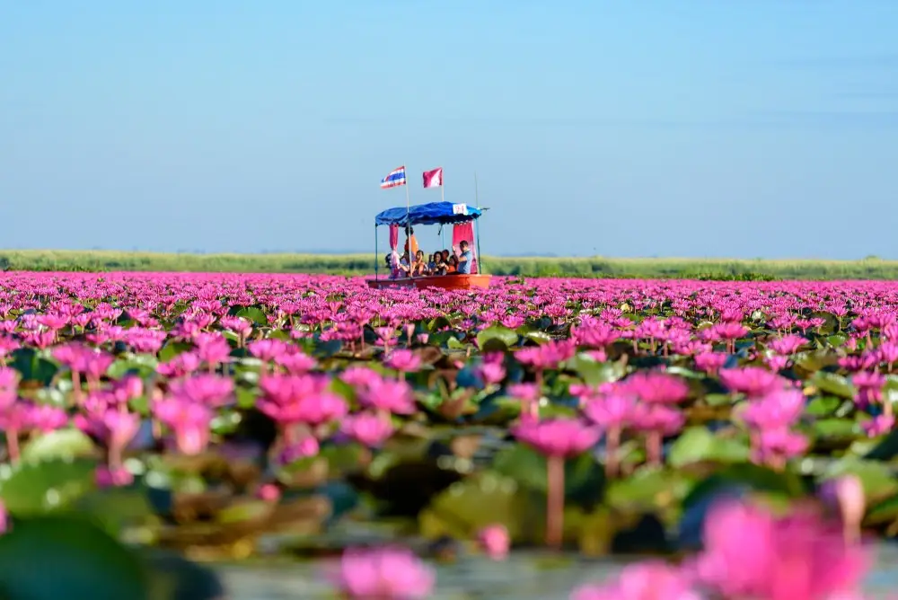
35. Red Lotus Sea, Nong Han Kumphawapi, Udon Thani The Red Lotus Sea is a remarkable seasonal natural attraction on Nong Han Kumphawapi Lake in Udon Thani Province. Its most distinctive feature is the abundance of pinkish-red water lilies that bloom across the lake during the flowering season. In the early morning, sunlight illuminates the expansive water surface and creates the appearance of a vast carpet of flowers stretching into the distance.
Highlights: Morning boat trips among blooming water lilies, colorful lake scenery and a wetland ecosystem that supports aquatic animals and numerous bird species. The flowering season and water levels directly affect what visitors can experience.
A visit is best arranged early in the morning according to the local boat operators' schedules, as the flowers usually open most visibly in the gentle morning light. As the day progresses, the blossoms gradually close. Photography enthusiasts should prepare their cameras or phones before boarding and use suitable protection against water.
The lake's wetland ecosystem is closely connected to local communities and their traditional use of water resources. Visitors should respect designated boating routes, avoid throwing objects into the water and never pick flowers for photographs. Choosing community-operated boat services helps support the local economy.
The Red Lotus Sea is suitable for families, photographers and older visitors who can board and leave boats safely. Everyone should wear a life jacket throughout the boat trip, check the weather before departure and avoid standing or changing seats while the boat is moving.
Getting There: Travel from Udon Thani city toward Kumphawapi District, then continue to Nong Han Lake and the designated Red Lotus Sea boat piers. Confirm the departure location and boat schedule before leaving.
Map (GPS):Get Directions to the Red Lotus Sea
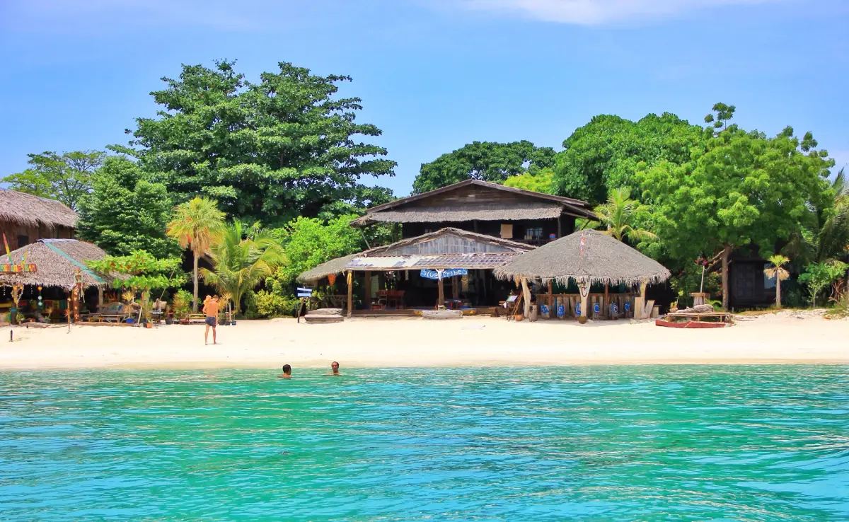
36. Koh Lipe, Satun Koh Lipe is a tropical island in the Andaman Sea within Satun Province. Famous for its pale sandy beaches, clear water and surrounding coral reefs, the island is both a popular seaside destination and home to sea-dwelling communities whose traditions have long been connected to marine resources.
Highlights: Pattaya Beach, Sunrise Beach, Sunset Beach, morning and evening coastal scenery, and snorkeling in permitted areas. Water clarity and suitability for marine activities vary with the season and sea conditions.
Koh Lipe is relatively small compared with many other tourist islands, allowing travelers to explore several beaches and community areas during the same trip. However, some locations are private properties or residential neighborhoods, and visitors should use public pathways and respect the privacy of local residents.
Underwater ecosystems are among the island's most valuable natural resources. Choosing boat operators with appropriate safety standards, avoiding contact with coral and never feeding marine animals are essential practices for protecting the environment over the long term.
Koh Lipe appeals to couples, groups of friends and travelers who enjoy island holidays. Boat transfers and seasonal sea conditions require preparation. Families with children or older adults should select suitable departure times and ask about boarding arrangements in advance.
Getting There: Travel to Pak Bara Pier in Satun Province and take a passenger boat to Koh Lipe according to the operating timetable. Boat services depend on waves, weather and relevant announcements, so travelers should check schedules and travel conditions before departure.
Map (GPS):Get Directions to Koh Lipe
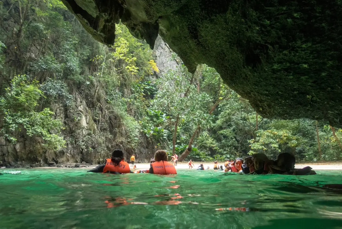
37. Koh Mook and Emerald Cave, Trang Koh Mook and Emerald Cave are among Trang Province's best-known marine attractions. The main feature is a sea cave with a water passage leading into a secluded beach surrounded by towering limestone cliffs. When sunlight reflects through the cave, the water takes on a striking green appearance, giving Emerald Cave its name.
Highlights: Swimming or floating through the cave passage to reach the hidden beach, limestone cliffs surrounding the island and the peaceful coastal atmosphere of Koh Mook. Access depends strictly on tides and sea conditions and is not suitable at all times.
Emerald Cave was formed through long-term geological processes involving limestone and erosion by seawater. Its water-filled passage provides a very different experience from visiting a cave on land, because lighting, currents and available space change with the tide.
Visitors should enter the cave only with experienced local operators and appropriate flotation equipment. Anyone uncomfortable in the water or affected by health-related limitations should discuss the activity with the operator before deciding to participate. Entering during rough seas should be avoided.
Beyond Emerald Cave, Koh Mook is also home to fishing communities and coastal landscapes that offer more than a brief cave excursion. Travelers can learn about local island life through food and community services while respecting residential areas and local livelihoods.
Getting There: Travel to a pier in Trang Province offering services to Koh Mook, then continue by local boat or an organized marine excursion to Emerald Cave. Check sea conditions, tidal timing and seasonal access regulations with the operator before traveling.

38. Laem Mae Phim, Rayong Laem Mae Phim is a long coastal beach in Klaeng District, Rayong Province, suitable for travelers seeking a relaxing seaside holiday without taking a boat to an island. The shoreline stretches alongside a coastal road, offering views of the waves and easy connections to restaurants, local businesses and coastal communities.
Highlights: A long sandy beach, a relaxing seaside atmosphere, evening light and locally available seafood. For photography enthusiasts, the extended shoreline provides a different composition from beaches enclosed within small bays.
Coastal conditions change with the season and the strength of the waves. At times, the sea is calm and suitable for walking along the beach, while other periods may bring stronger waves and currents. Anyone planning to swim should pay attention to warning flags and local safety advice and avoid areas without appropriate supervision.
Communities around Laem Mae Phim have a strong connection with coastal fishing and seafood traditions. Supporting local restaurants and businesses allows tourism income to reach the community directly. Visitors should also help protect the coastal environment by avoiding litter, particularly plastic waste.
Laem Mae Phim is suitable for families and travelers looking for an unhurried beach excursion. It can be combined with other destinations in Klaeng District, with travel time adjusted for traffic conditions, especially during long weekends.
Getting There: From Rayong city, travel toward Klaeng District and follow the coastal road toward Kram Subdistrict and Laem Mae Phim. Private vehicles provide convenient access, and visitors should park only in permitted areas.
Map (GPS):Get Directions to Laem Mae Phim

39. Khlong Nam Lai Waterfall (Pang Kwai Waterfall), Kamphaeng Phet Khlong Nam Lai Waterfall, also known as Pang Kwai Waterfall, is located in Khlong Lan District, Kamphaeng Phet Province. Surrounded by mountain forests, the waterfall consists of flowing streams, rocky terraces and natural pools. Its shaded woodland and varying waterfall levels make it an appealing destination for both relaxation and nature study.
Highlights: Forest streams, multiple waterfall levels, rocky surfaces and natural pools in areas open to visitors. Water levels vary with rainfall and the season, so trip planning should consider both scenery and safety.
Walking trails near the waterfall offer opportunities to observe the ecosystem of a forest watershed, including streamside plants, moisture-loving vegetation and rock surfaces gradually shaped by flowing water. Walking carefully is essential because wet rocks and algae can make paths extremely slippery.
Although the waterfall is attractive for family outings, visitors should not assume that every natural pool is suitable for swimming. Warning signs and park officials' instructions must be followed, and entering the water should be avoided during heavy rainfall in upstream areas.
Photography enthusiasts can capture streams flowing over rocks under the forest canopy, creating a different visual atmosphere from waterfalls descending from tall cliffs. Responsible visitors should take rubbish away with them and avoid removing plants or animals from the natural environment.
Getting There: Travel to Khlong Lan District in Kamphaeng Phet Province, then follow the signs and permitted access routes to Khlong Nam Lai Waterfall. Private transportation is convenient, but road conditions and closures should be checked after prolonged rainfall.
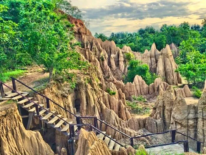
40. Sao Din Na Noi and Kok Suea, Nan Sao Din Na Noi and Kok Suea are unusual geological attractions in Na Noi District, Nan Province. The landscape consists of naturally formed earth pillars, eroded walls and varied soil formations shaped over long periods by water and wind. This distinctive terrain provides an alternative nature experience to the mountains, waterfalls and beaches commonly associated with Thailand.
Highlights: Earth pillars of different heights, eroded cliffs, gullies and exposed soil layers. Photographers can use the shadows and natural lines of the formations to create striking compositions, especially when the sunlight is not too intense.
The earth pillars formed because layers of soil and sediment eroded at different rates. More resistant materials remained standing as pillars and walls, while softer layers were gradually washed away. As this process continues naturally, visitors should avoid climbing or touching fragile formations.
Sao Din Na Noi is an excellent destination for educational travel because visitors can observe geological processes directly. Even without specialist knowledge, it is possible to appreciate differences in soil colors, sediment layers and the patterns formed by flowing water.
The exposed landscape can become very hot and dusty during the dry season, so drinking water, a hat and suitable footwear are recommended. During the rainy season, muddy surfaces can be slippery and erosion may increase. Visitors should follow authorized walking routes and local instructions.
Getting There: Travel from Nan city toward Na Noi District, then continue into Chiang Khong Subdistrict following the route to Sao Din Na Noi and Kok Suea. With sufficient time, the visit can be combined with nearby viewpoints and other natural attractions in Na Noi District.

41. Pang Ung, Mae Hong Son Pang Ung is a reservoir surrounded by pine forests and mountain scenery in Mok Cham Pae Subdistrict, Mueang Mae Hong Son District. The reflections of tall pine trees on the water, together with mist rising above the reservoir on certain mornings, create a distinctive atmosphere. It is an ideal destination for travelers who want to enjoy the cool highland environment without climbing a distant mountain summit.
Highlights: A reservoir surrounded by mountains, pine forests along the shoreline, cool weather toward the end of the year and the reflections of trees on the water. Early morning is especially attractive, when soft light may reveal layers of mountains and mist above the reservoir.
Pang Ung's landscape is closely connected to watershed management and the restoration of highland forests. A visit therefore offers more than scenic views of the reservoir, providing opportunities to understand forest conservation, community development and responsible land use. Travelers should remain on designated paths and avoid swimming where it is not permitted.
Mist is more likely to appear above the water during cooler weather, but it cannot be guaranteed because its formation depends on humidity and temperature. Staying overnight in permitted accommodation can make it easier to enjoy the early morning without driving mountain roads in darkness. Visitors should check current access and camping arrangements before arrival.
Pang Ung is suitable for couples, landscape photographers and families looking for a peaceful pine forest setting with relatively little walking. Exploring nearby communities and natural attractions around Pang Tong can enrich the trip, provided visitors respect agricultural areas and local privacy.
Getting There: Travel from Mae Hong Son city toward Ban Rak Thai and the Pang Tong area, then continue to Ban Ruam Thai, where Pang Ung is located. The mountain roads contain winding sections and steep gradients, so vehicles should be in good condition and weather forecasts checked in advance.
Map (GPS):Get Directions to Pang Ung

42. Koh Kood, Trat Koh Kood is a large island off Trat Province in the Gulf of Thailand, known for sandy beaches, coconut palms, clear seawater and forested hills containing streams and waterfalls. The island offers both relaxing beach holidays and opportunities to explore inland natural attractions, making it more varied than a destination focused exclusively on the coast.
Highlights: Khlong Chao Beach, Khlong Chao Waterfall, Ao Bang Bao and local fishing communities. These attractions allow travelers to enjoy different aspects of Koh Kood, with activities selected according to weather, sea conditions and travel distances on the island.
Ecologically, Koh Kood includes coastal environments, forests on the hills and freshwater streams flowing toward the sea. This variety creates a landscape that changes from exposed sandy beaches to shaded woodland over relatively short distances. Visitors should not leave rubbish in waterways or collect living organisms from coastal habitats.
Experiences on Koh Kood vary by season. Calm sea conditions are more favorable for boat transfers and snorkeling, while monsoon weather may lead to delayed or canceled boat services. Travelers should allow flexibility and avoid relying entirely on the last available ferry of the day.
Koh Kood is suitable for couples, families and travelers who prefer spending several days exploring at a relaxed pace. Photographers can capture beaches in morning light, inland streams and fishing village scenery while respecting homes and places where local people work.
Getting There: Travel to Trat Province and continue to a pier serving Koh Kood. Take a scheduled passenger boat, then use local transfers or transportation arranged by your accommodation. Check the departure pier and boat timetable for the actual travel date.
Map (GPS):Get Directions to Koh Kood

43. Mae Ya Waterfall, Chiang Mai Mae Ya Waterfall is a large waterfall in Chom Thong District, Chiang Mai Province, within the natural landscape associated with Doi Inthanon. The water spreads across several broad rocky terraces, creating a very different appearance from waterfalls that descend in a single narrow stream. It is particularly attractive to visitors interested in forest watersheds and waterfall photography.
Highlights: A wide curtain of water descending over multiple levels, shaded forest surroundings and viewpoints offering an expansive perspective of the waterfall. The amount of flowing water changes according to seasonal rainfall.
Approaching the waterfall reveals differences in humidity and atmosphere between the forest path and the open area near the stream. Higher moisture levels support many types of forest vegetation, while flowing water contributes to the surrounding ecosystem.
The rainy season can make the waterfall appear particularly impressive, with water covering much of the rock face. However, it also increases the risk of slippery ground and sudden flooding. Visitors should use only authorized trails, avoid prohibited pools or areas beneath the cliff, and refrain from visiting during heavy rain.
Mae Ya is more suitable for viewing and photographing the waterfall than assuming every part is safe for swimming. It can be included in a trip exploring natural attractions around Chom Thong District, provided enough travel time is allowed between stops.
Getting There: From Chiang Mai city, travel to Chom Thong District and follow the designated access route to Mae Ya Waterfall. Private transportation is more convenient where public transport is limited, and seasonal trail conditions should be checked before departure.
Map (GPS):Get Directions to Mae Ya Waterfall

44. Chiang Dao Cave, Chiang Mai Chiang Dao Cave is located at the foot of Doi Luang Chiang Dao in Chiang Mai Province. This limestone cave system is closely associated with a religious site and local beliefs. Its attractions include natural cave chambers, stalactites, stalagmites, underground waterways and the peaceful surroundings of the temple near the entrance.
Highlights: Cave chambers containing varied stalactite and stalagmite formations, illuminated walkways and deeper cave sections requiring an authorized local guide. Visitors should understand the differences between these areas before arranging a tour.
Stalactites and stalagmites develop gradually as mineral-rich water deposits layers of material over long periods. These formations are fragile and can be damaged by touching them. Visitors should never handle, climb on or break cave formations, even where they appear easy to reach.
Conditions inside the cave differ significantly from outdoor forest walks, with limited light, damp ground and some narrow passages. Travelers should wear shoes with good traction and follow the guide's instructions, especially during the rainy season when water levels inside the cave may change.
Chiang Dao Cave appeals to visitors interested in natural history, geology, religious heritage and community-based experiences. It can be combined with other attractions in Chiang Dao District and views of Doi Luang Chiang Dao without undertaking a trek to the mountain summit.
Getting There: Follow the main road from Chiang Mai toward Chiang Dao District, then continue to the Wat Tham Chiang Dao area. Parking is available near the entrance. Travelers using public transportation should arrange a local transfer from the district center.
Map (GPS):Get Directions to Chiang Dao Cave
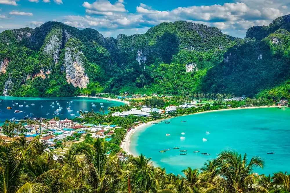
45. Phi Phi Islands, Krabi The Phi Phi Islands are a group of tropical islands in the Andaman Sea off Krabi Province, famous for towering limestone mountains surrounding picturesque bays and clear turquoise waters. The main islands include Phi Phi Don, which has communities and tourism facilities, and Phi Phi Leh, known for its striking cliffs and scenic bays.
Highlights: Phi Phi Don viewpoints, the landscapes of Tonsai Bay and Loh Dalum Bay, limestone mountains and permitted snorkeling sites. Individual areas have different access regulations, particularly zones undergoing environmental restoration.
The islands' beauty extends beneath the surface, where coral reefs and marine life depend on clean water and balanced ecosystems. Visitors should travel on authorized boat routes, avoid stepping on coral and refrain from feeding fish.
Travelers can experience the Phi Phi Islands on a day trip or stay overnight. Accommodation on Phi Phi Don provides more opportunities to walk around local communities and enjoy early-morning or evening scenery. Day-trip visitors should plan carefully around boat schedules and the amount of time spent at each stop.
During the monsoon season, rough seas may affect boat operations, and certain bays may close for environmental recovery. Travelers should check announcements for individual areas and inform tour operators about any special needs, particularly when traveling with young children or people who are not confident swimmers.
Getting There: Take a passenger ferry or authorized tour boat from Krabi or Phuket to Phi Phi Don. Continue to other island attractions with approved boat operators and check local access regulations before departure.
Map (GPS):Get Directions to the Phi Phi Islands

46. Koh Larn, Chon Buri Koh Larn is a popular island in the Gulf of Thailand off the coast of Pattaya, Chon Buri Province. Its beaches face different directions and experience varying wind and wave conditions. This makes the island a practical choice for visitors seeking a seaside getaway within relatively easy reach of Bangkok.
Highlights: Tawaen Beach, Samae Beach, Tien Beach and selected island viewpoints. These locations offer opportunities to enjoy the sea, beaches and photography, although visitor numbers, waves and facilities vary from beach to beach.
Despite having relatively extensive tourism facilities, Koh Larn's coastal ecosystems still require protection. Visitors should avoid speeding on narrow island roads, leaving litter on beaches or rocks and swimming near areas where boats regularly enter and depart.
Day-trip travelers may find it more enjoyable to focus on one or two beaches rather than spend most of their time moving around the island. An overnight stay offers greater flexibility for visiting beaches during quieter morning or evening periods. Accommodation should be selected according to its actual location and transport connections.
Koh Larn suits families, friends and travelers seeking a short island excursion from Pattaya. Sun protection, suitable footwear and weather checks are recommended. When conditions are rough, visitors should follow the advice of boat operators.
Getting There: Travel to Bali Hai Pier in Pattaya and take a scheduled passenger boat to Koh Larn. From the island pier, use local transport suited to the destination. Check the actual outbound and return boat schedules before traveling.
Map (GPS):Get Directions to Koh Larn

47. Nang Ram Beach, Chon Buri Nang Ram Beach is located in the Sattahip area of Chon Buri Province. This relatively small beach is known for coastal trees and shaded areas near the shoreline, making it suitable for short seaside visits, relaxing by the water and enjoying a quieter atmosphere than the urban beaches of Pattaya.
Highlights: Sandy shores, seawater that changes color with the light and shaded spaces near the beach. Families can select suitable places to relax while taking account of waves and designated swimming areas.
Nang Ram Beach is associated with an area managed by the Royal Thai Navy, so visitors must follow regulations concerning entry, parking and beach use. Restricted areas and locations where photography or access is prohibited must be respected.
Tides and wind conditions influence the suitability of swimming. Calm-looking water should never be assumed safe in every location. Young children should remain under adult supervision at all times near the sea.
The beach can be included in a one-day trip with other coastal destinations around Sattahip. Photographers may prefer softer light in the morning or late afternoon to capture shoreline details. Visitors should collect their rubbish before leaving.
Getting There: Travel from Chon Buri or Pattaya toward Sattahip District, then follow signs to Nang Ram Beach and comply with the access requirements of the managing authorities. Check local entry announcements before departure.
Map (GPS):Get Directions to Nang Ram Beach

48. Phae Mueang Phi Forest Park, Phrae Phae Mueang Phi is an unusual geological landscape in Phrae Province, featuring earth pillars, eroded walls and striking layers of soil and sandstone. Its formations were shaped by natural weathering and erosion over time, creating scenery that differs significantly from Thailand's more familiar mountains and waterfalls.
Highlights: Mushroom-shaped earth pillars, exposed layers of sediment and nature study trails. The formations offer opportunities to observe geological processes and photograph landscapes with unusual textures and shapes.
The significance of Phae Mueang Phi lies in its gradual transformation through wind and rainfall. Examining the different pillars reveals how variations in soil composition and resistance to erosion create distinctive shapes without human carving.
The exposed landscape receives considerable sunlight, so visitors should bring drinking water, a hat and footwear suitable for walking on soil. Climbing earth pillars or standing on fragile cliff edges should be avoided because the formations can be unstable and easily damaged.
Phae Mueang Phi is suitable for geography enthusiasts, students and photographers. It can be combined with cultural attractions in Phrae city during a half-day trip, allowing enough time to observe the landscape rather than rushing through a few photographic stops.
Getting There: From Phrae city, travel toward the Phrae–Nan road and follow the signs to Phae Mueang Phi Forest Park. Designated walkways lead visitors into the area containing the earth formations.
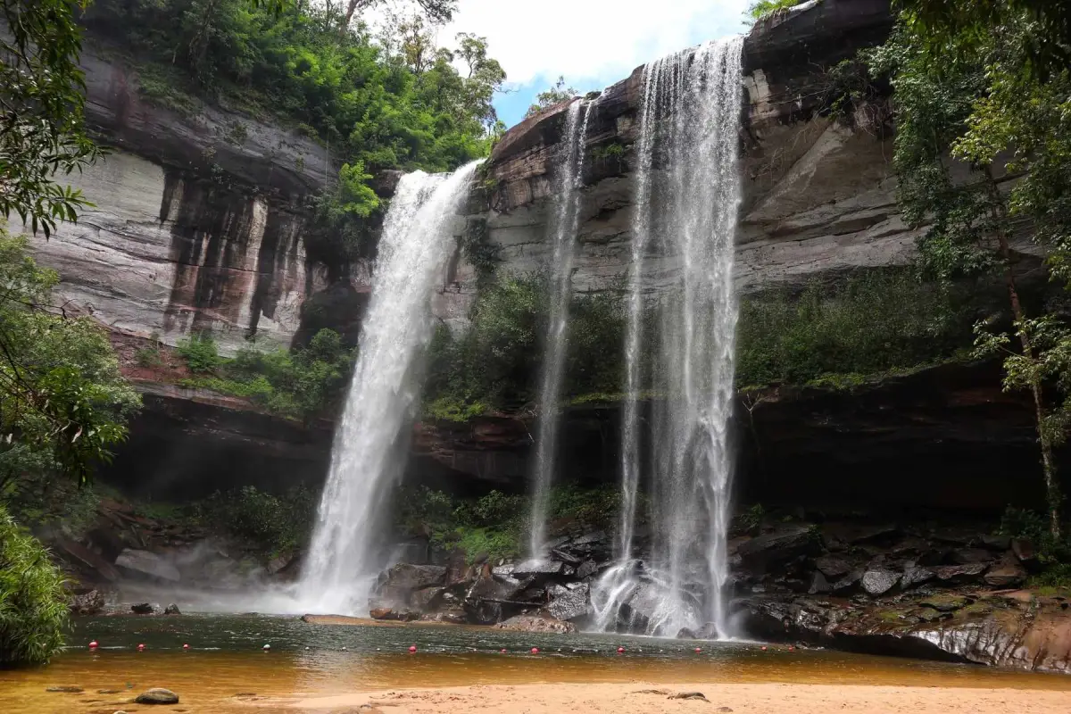
49. Huai Luang Waterfall, Ubon Ratchathani Huai Luang Waterfall, also locally known as Tham Bak Teo Waterfall, is a major natural attraction in Na Chaluai District, Ubon Ratchathani Province. Situated within the forest landscape of Phu Chong Na Yoi National Park, it features water cascading from a tall cliff into a natural pool below, revealing the dramatic changes in elevation and the power of flowing water.
Highlights: A high waterfall cliff, white cascades, a natural pool and surrounding forest. The waterfall's flow changes with the season, and higher rainfall can produce an impressive curtain of water, although safety precautions become especially important.
The surrounding forest and waterways form part of the region's watershed ecosystem. Responsible travel includes keeping the area clean, protecting vegetation and avoiding the removal of rocks, plants or animals from the pools and trails.
Visitors should pay close attention to warning signs concerning flash floods, slippery surfaces and steep paths. Swimming close to the waterfall's plunge pool or in restricted areas can be dangerous because currents may change rapidly even when rain is not falling at the viewpoint.
Huai Luang Waterfall suits travelers interested in nature photography, forest walks and the landscapes of southern northeastern Thailand. It can be combined with other natural attractions around Na Chaluai, although journeys into remote forest areas should not be scheduled too late in the day.
Getting There: Travel from Ubon Ratchathani city toward Na Chaluai District, then follow the road to Phu Chong Na Yoi National Park and the designated entrance to Huai Luang Waterfall. Check current trail access announcements, particularly during the rainy season.
Map (GPS):Get Directions to Huai Luang Waterfall

50. Hat Sai Kaew (Koh Samet), Rayong Hat Sai Kaew is one of the best-known beaches on Koh Samet in Rayong Province. With its broad sandy shoreline, blue seawater and convenient travel services, it appeals to visitors planning either an overnight seaside holiday or a short island excursion without traveling to the more distant Andaman Islands.
Highlights: Pale sandy shores, a gently curving bay, seaside activities and beautiful morning light. Travelers can walk along the beach and choose restaurants or accommodation according to their preferences while respecting public areas and other visitors' privacy.
Hat Sai Kaew is one of Koh Samet's main tourism centers, with a lively atmosphere and a range of visitor facilities. It therefore offers a different experience from quieter natural beaches. Travelers seeking more peaceful moments may prefer early morning or explore other accessible beaches on the island.
Sea color and swimming conditions depend on the season, waves and currents. Life jackets should be used for suitable boating activities, and visitors should follow safety advice from local authorities. Protecting the beach also means avoiding plastic litter and cigarette waste.
Hat Sai Kaew is suitable for couples, groups of friends and families looking for an island escape within reach of Bangkok. Staying longer than one day allows more time for relaxation, swimming in permitted areas and exploring Koh Samet at a comfortable pace.
Getting There: Travel to Ban Phe in Rayong Province and take a passenger boat to Koh Samet. From the island pier, continue to Hat Sai Kaew using local transport or the designated access route. Check actual boat fares and schedules before traveling.
| Article Title | 50 Best Nature Destinations in Thailand: Mountains, Waterfalls, Islands and Forests |
| Number of Destinations | 50 destinations covering mountains, viewpoints, waterfalls, seas, islands, beaches, forests, caves and geological wonders. |
| Mountains, Viewpoints and Sea Mist | 1. Doi Inthanon National Park 2. Phu Kradueng National Park 3. Phu Ruea National Park 4. Phu Hin Rong Kla National Park 5. Phu Suan Sai National Park, Loei 6. Doi Mon Jam 7. Phu Chi Fa Forest Park 8. Doi Pha Tang 9. Doi Mae U Kho Bua Tong Fields 10. Pang Ung |
| Waterfalls, Streams and Freshwater Attractions | 1. Erawan Waterfall 2. Thi Lo Su Waterfall 3. Huai Mae Khamin Waterfall 4. Tat Ton National Park 5. Red Lotus Sea, Nong Han Kumphawapi 6. Khlong Nam Lai Waterfall 7. Mae Ya Waterfall 8. Huai Luang Waterfall |
| Seas, Islands and Beaches | 1. Mu Ko Similan National Park 2. Thale Waek (Separated Sea) 3. Railay Beach 4. Koh Lipe 5. Koh Mook and Emerald Cave 6. Laem Mae Phim 7. Koh Kood 8. Phi Phi Islands 9. Koh Larn 10. Nang Ram Beach 11. Hat Sai Kaew, Koh Samet |
| Forests, Geology, Caves and Ecosystems | 1. Khao Yai National Park 2. Khao Sok National Park 3. Kaeng Krachan National Park 4. Pa Hin Ngam National Park 5. Sai Thong National Park 6. Pha Taem National Park 7. Phu Pha Thoep National Park 8. Phu Wiang National Park 9. Phu Pha Man National Park 10. Phu Chong Na Yoi National Park, Ubon Ratchathani 11. Kaeng Tana National Park, Ubon Ratchathani 12. Phu Kao Phu Phan Kham National Park, Nong Bua Lamphu and Khon Kaen 13. Phu Phan National Park, Sakon Nakhon and Kalasin 14. Phu Pha Yon National Park, Sakon Nakhon, Nakhon Phanom and Mukdahan 15. Phu Sa Dok Bua National Park, Amnat Charoen, Mukdahan and Yasothon 16. Nam Phong National Park, Khon Kaen 17. Thap Lan National Park, Prachin Buri and Nakhon Ratchasima 18. Ta Phraya National Park, Sa Kaeo and Buri Ram 19. Sao Din Na Noi and Kok Suea 20. Chiang Dao Cave 21. Phae Mueang Phi Forest Park |
| Best Destinations for Sunrise and Sea Mist | 1. Doi Inthanon National Park 2. Phu Kradueng National Park 3. Phu Ruea National Park 4. Phu Chi Fa Forest Park 5. Doi Pha Tang 6. Pang Ung |
| Family-Friendly Nature Destinations | 1. Erawan Waterfall 2. Railay Beach 3. Tat Ton National Park 4. Red Lotus Sea, Nong Han Kumphawapi 5. Laem Mae Phim 6. Koh Kood 7. Koh Larn 8. Nang Ram Beach 9. Hat Sai Kaew, Koh Samet |
| Destinations for Hiking and Nature Enthusiasts | 1. Phu Kradueng National Park 2. Thi Lo Su Waterfall 3. Khao Sok National Park 4. Kaeng Krachan National Park 5. Phu Hin Rong Kla National Park 6. Phu Chong Na Yoi National Park 7. Sao Din Na Noi and Kok Suea 8. Chiang Dao Cave 9. Phae Mueang Phi Forest Park |
| Recommended Travel Seasons | Cool Season: Mountain summits and misty viewpoints in northern and northeastern Thailand. Rainy Season: Waterfalls and lush forests, with caution required for flash floods and slippery trails. Calm Sea Conditions: Islands and beaches in the Gulf of Thailand and Andaman Sea, where favorable travel seasons may differ. Flowering Seasons: Doi Mae U Kho's Bua Tong fields and the Red Lotus Sea should be visited during their respective bloom periods. |
| Main Transportation Options | Private cars or rental vehicles are useful for mountains, waterfalls and viewpoints far from towns. Passenger boats and sightseeing boats are essential for many islands. Visitors to national parks and protected areas must use officially permitted access routes. |
| Safety Precautions | Check temporary closures, mountain trail conditions, waterfall currents, waves, boat schedules and conservation regulations before traveling. Never swim in prohibited areas or approach dangerous cliff edges. |
| Responsible Tourism | Take rubbish away, never feed wild animals, do not collect coral or wild plants, avoid touching cave formations, and respect local communities and conservation rules. |
Recommended Thailand Nature Travel Itineraries
1 Day: Khao Yai and Nature Near Bangkok Travel to Khao Yai National Park and choose nature trails and viewpoints that are open on the day of your visit. Allow enough time to return before nightfall. This itinerary is suitable for travelers seeking a refreshing nature trip without visiting several provinces in one day.
1 Day: Rayong Beach Escape Spend the day at Laem Mae Phim Beach and enjoy coastal activities around Klaeng District. Travelers interested in Koh Samet should consider visiting on another day, as boat transfers and local transportation require additional time.
2 Days, 1 Night: Kanchanaburi Waterfalls On the first day, visit Erawan Waterfall and stay around Si Sawat District. On the second day, explore Huai Mae Khamin Waterfall. Check access roads and travel times before leaving your accommodation.
2 Days, 1 Night: Eastern Thailand Islands Travel to Pattaya on the first day and take a boat to Koh Larn. Spend the next day relaxing on the island before returning. Koh Samet and Koh Kood are alternative destinations that require separate routes and should not be combined into the same short itinerary.
3 Days, 2 Nights: Chiang Mai and Doi Inthanon Spend the first day exploring Mon Jam and Mae Rim. On the second day, travel to Chom Thong District to visit Mae Ya Waterfall and Doi Inthanon. Reserve the third day for a relaxed morning and the return journey, allowing sufficient time for both mountain roads and waterfall access.
3 Days, 2 Nights: Chiang Rai Mountain Mist Travel toward Wiang Kaen and stay near the routes leading to Phu Chi Fa and Doi Pha Tang. Arrange early-morning viewpoint visits and enjoy the nearby highland communities. Avoid rushing between mountain destinations after dark.
3 Days, 2 Nights: Loei Mountain Journey Combine Phu Ruea and Phu Suan Sai on a scenic driving itinerary. Phu Kradueng is better planned as a separate hiking trip because reaching its plateau requires considerable walking and involves specific overnight arrangements.
3 Days, 2 Nights: Krabi Beaches and Limestone Cliffs Visit Railay Beach on the first day. On the second day, take an authorized boat excursion to the Phi Phi Islands according to available services. On the final day, plan a visit to Thale Waek around suitable tidal and weather conditions before returning.
4 Days, 3 Nights: Southern Andaman Island Holiday Travel from Pak Bara Pier to Koh Lipe and spend several nights on the island. Koh Mook and Emerald Cave are in another province and require different departure points, so they are better planned as a separate trip when only four days are available.
5 Days, 4 Nights: Northeastern Thailand's Natural Landscapes Choose one geographical region, such as Chaiyaphum–Khon Kaen or Ubon Ratchathani–Mukdahan, rather than driving across every province. Include rest periods and explore individual nature destinations in greater depth, according to the access restrictions and operating arrangements in each area.
Frequently Asked Questions (FAQ)
Q: What types of natural attractions are included in these 50 destinations in Thailand?
A: The collection includes mountains and misty viewpoints, waterfalls and streams, forests and national parks, islands and beaches, caves, and geological attractions such as Sao Din Na Noi and Phae Mueang Phi. This variety allows travelers to select destinations according to their interests.
Q: Where should first-time visitors begin exploring Thailand's natural attractions?
A: Travelers seeking relatively accessible destinations can start with Erawan Waterfall, Khao Yai National Park, Laem Mae Phim, Hat Sai Kaew on Koh Samet, or Mon Jam. More demanding hiking routes and remote islands can be explored after gaining experience with local travel conditions.
Q: Which nature destinations in Thailand are suitable for families?
A: Family-friendly options include Laem Mae Phim, Koh Larn, Hat Sai Kaew, Tat Ton National Park and the Red Lotus Sea during its flowering season. Families should still assess walking conditions, weather and child safety before visiting.
Q: Where can travelers see sea mist in Thailand?
A: Popular destinations include Doi Inthanon, Phu Kradueng, Phu Ruea, Phu Chi Fa, Doi Pha Tang and Pang Ung. Mist depends on humidity, wind and temperature, so sightings cannot be guaranteed every day.
Q: Which waterfalls are worth visiting during the rainy season?
A: Erawan Waterfall, Huai Mae Khamin Waterfall, Mae Ya Waterfall and Khlong Nam Lai Waterfall are options for travelers interested in rainy-season landscapes. Always check flash flood warnings, strong currents and temporary trail closures before departure.
Q: When is the best time to visit islands in the Andaman Sea?
A: Koh Lipe, the Phi Phi Islands, the Similan Islands, and Koh Mook with Emerald Cave are best visited when seas are calm and boat services operate normally. Individual destinations may close temporarily for environmental restoration or because of rough seas, so current announcements should be checked separately.
Q: Which beautiful Thai islands are featured in this article?
A: The collection includes Koh Lipe, Koh Kood, Koh Larn, the Phi Phi Islands, the Similan Islands and Koh Mook with Emerald Cave. Each destination offers different combinations of beaches, snorkeling, coastal landscapes and marine activities.
Q: What are some nature destinations near Bangkok?
A: Khao Yai National Park and Laem Mae Phim are options for shorter trips. Kanchanaburi also offers Erawan Waterfall and Huai Mae Khamin Waterfall, although travelers should plan sufficient driving time.
Q: Where can travelers photograph natural scenery other than mountains and beaches?
A: The Red Lotus Sea, Doi Mae U Kho's Bua Tong flower fields, Sao Din Na Noi and Phae Mueang Phi are distinguished by flowers, wetlands and unusual geological formations. The best photography conditions depend on the season and time of day.
Q: Where should travelers go for a two-day, one-night nature trip?
A: Choose destinations within a manageable geographical area, such as Chiang Mai's Mae Rim and Chom Thong districts, Kanchanaburi's Si Sawat area, or Rayong and Koh Samet. Avoid combining attractions in different regions during a short trip.
Q: Which nature destinations are convenient without a private car?
A: Koh Larn, Koh Samet and destinations served by public transportation to nearby towns, followed by local vehicles or boats, can be practical choices. Travelers should confirm bus connections, boat timetables and local transfer arrangements for their travel dates.
Q: What should travelers prepare for hiking in Thailand?
A: Good walking shoes, drinking water, rain protection, weather-appropriate clothing, route information and any required medication are essential for many trails. Certain protected areas and specialist routes require official guides or authorized local leaders.
Q: Why are some natural attractions open only during certain seasons?
A: Some forests, mountains and marine parks close temporarily for ecological recovery or because rainfall and waves create safety risks. Checking current announcements from the responsible authorities is essential for safe and responsible travel.
Q: How can visitors reduce their environmental impact while exploring Thailand's natural attractions?
A: Stay on designated trails, take rubbish away, never feed wild animals, avoid disturbing coral reefs, do not touch stalactites or stalagmites, and choose local operators who respect environmental and conservation regulations.
 Category: ●Travel Articles, Recipes
 Group: ●Travel Review, Food Review
Last Update : 1 DayAgo
 Last Update : 1 DayAgo
Recommend

 Art, Culture and Heritage
 Historical Sites and Monuments(3)
 Landmarks and Memorials(23)
 Royal Palace(13)
 Art, Craft Centres, Tradition(35)
 Museums(59)
 Historic Homes and Cities(3)
 Art Gallery(16)
 Educational Places
 Museum for Study(6)
 Library(4)
 Places of Worship
 Temple(72)
 Church(2)
 Mosque(67)
 Other Sacred Sites(8)
 Research and Development
 Royal Project(1)
 Suburban Living
 Village, Community(5)
 Local Market(9)
 Floating Market(2)
 Nature and Wildlife
 River, Canal(3)
 Bays and Beaches(1)
 Other natural attractions(1)
 Entertainment and Agricultural
 Zoos and Aquariums(5)
 Animal camps and shows(5)
 Stadium(9)
 Farms, Parks and Ecotourism(20)
 Amusement Park(1)
 Waterpark(4)
 Theater(7)
 Cinema(1)
 Shopping
 Shopping and Night Market(20)
 Department Store(7)
 Spas and Wellness
 Spas and Wellness(1)
 Restaurant
 Michelin Star(5)
 Accommodation
 Hotel(3)
 Call Customer Service in Tourism
 Call Customer Service in Tourism(1)
Travel Review, Food Review(41)
 Royal Thai Desserts and Recipes(56)


