
lovethailand home >South Travel Attractions >Ranong Travel Attractions > 20 Best Places to Visit in Ranong Popular Attracti..
TL;DR: 20 Best Places to Visit in Ranong Popular Attractions.
20 Best Places to Visit in Ranong Popular Attractions
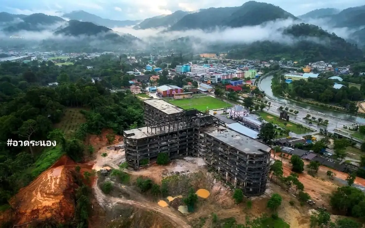
20 Best Places to Visit in Ranong: Popular Attractions in Southern Thailand Ranong is a province on the upper Andaman coast of Southern Thailand with a character quite different from many of the region’s better-known resort destinations. Its landscape combines mountains, tropical rainforest, waterfalls, natural hot springs, mangrove forests, coastal areas, and islands that still retain a relatively peaceful atmosphere. Ranong is also a historic border province shaped by tin mining, maritime trade, and the cultural interaction of Thai, Chinese, and Myanmar communities. Travelers can therefore build an itinerary around island stays, mineral hot springs, rainforest, waterfalls, heritage sites, Buddhist temples, local communities, mangrove ecosystems, and coastal life.
If this is your first trip to Ranong, the key attractions to begin with include Koh Phayam, Raksawarin Hot Springs and Raksawarin Arboretum Public Park, Namtok Ngao National Park, Ranong Canyon, Rattanarangsan Palace, Khao Fa Chi, Koh Chang Ranong, Hat Chan Damri, Sai Dam Beach, and Wat Suwan Khiri Wihan. One of Ranong’s greatest strengths is that visitors can experience the sea, mountains, waterfalls, hot springs, local history, and community life within the same province. The period from around December to April is generally more suitable for island trips and marine activities, while mainland attractions can be explored throughout the year with appropriate weather checks.
Ranong Province lies along the western coast of upper Southern Thailand and covers approximately 3,298 square kilometers. The province stretches roughly from north to south, with mountain ranges rising along the eastern side before descending toward the Andaman Sea in the west. This geography creates a varied natural environment of tropical rainforest, streams, waterfalls, mangrove forests, bays, islands, and coastal ecosystems. Although Ranong has relatively limited lowland areas, it remains exceptionally rich in natural resources and biodiversity.
Ranong is strongly influenced by the southwest monsoon and receives significant rainfall for much of the year. This moisture keeps the forests green and supports headwaters, waterfalls, rainforest vegetation, and a wide variety of wildlife. Along the Andaman coast, extensive mangrove ecosystems and offshore islands add further ecological diversity.
The northern part of the province around Kra Buri District is geographically important because of its proximity to the Kra Isthmus, the narrowest section of the Malay Peninsula. Ranong has therefore long played a role as a border province, maritime gateway, trading area, and transit corridor connecting the Andaman coast with neighboring regions.
Ranong’s history is closely associated with tin mining and maritime trade. In earlier periods, the area was administered under Chumphon before growing in importance through mining and commerce. During the reign of King Rama IV, Ranong was elevated in administrative status, and development continued during the reign of King Rama V. The prosperity generated by tin brought merchants, laborers, and influential families into the area, particularly the Na Ranong family, whose history is closely connected with Khaw Soo Cheang and the development of the province.
As tin mining declined in importance, Ranong’s economy diversified into agriculture, fishing, border trade, and tourism. Major agricultural products include rubber, oil palm, and cashew nuts, while coastal communities and island settlements continue to depend heavily on small-scale fishing and marine resources.
Ranong’s culture reflects the coexistence of Thai, Thai-Chinese, and Myanmar communities. These influences can be seen in local food, language, religious sites, festivals, and border-market life. The Vegetarian Festival remains an important tradition among Thai-Chinese communities, while the Sat Duan Sip tradition and Southern Thai performing arts also reflect the cultural roots of the region.
Coastal life is another defining aspect of Ranong. Fishing communities on the islands and mainland coast continue to rely on knowledge of tides, seasons, and sea conditions. Small-scale fishing, seafood processing, shrimp-paste production, and mangrove conservation remain closely linked with everyday life, making community-based tourism and environmental learning an important part of the Ranong travel experience.
Ranong’s local cuisine includes fresh Andaman seafood, strongly flavored Southern Thai dishes, and foods influenced by Chinese and Myanmar communities. Popular choices include crab, shrimp, fish, shellfish, sour yellow curry, kaeng tai pla, chili paste with shrimp paste, fish porridge, noodle dishes, and chicken rice. Cashew nuts, known locally as kaju, are also strongly associated with the province and with island communities such as Koh Phayam and Koh Chang.
This guide selects 20 attractions covering islands, beaches, waterfalls, hot springs, forests, mangroves, viewpoints, historic sites, temples, caves, and local communities. The list is designed both for first-time visitors and for travelers who want to understand Ranong beyond a short stop in the provincial town.
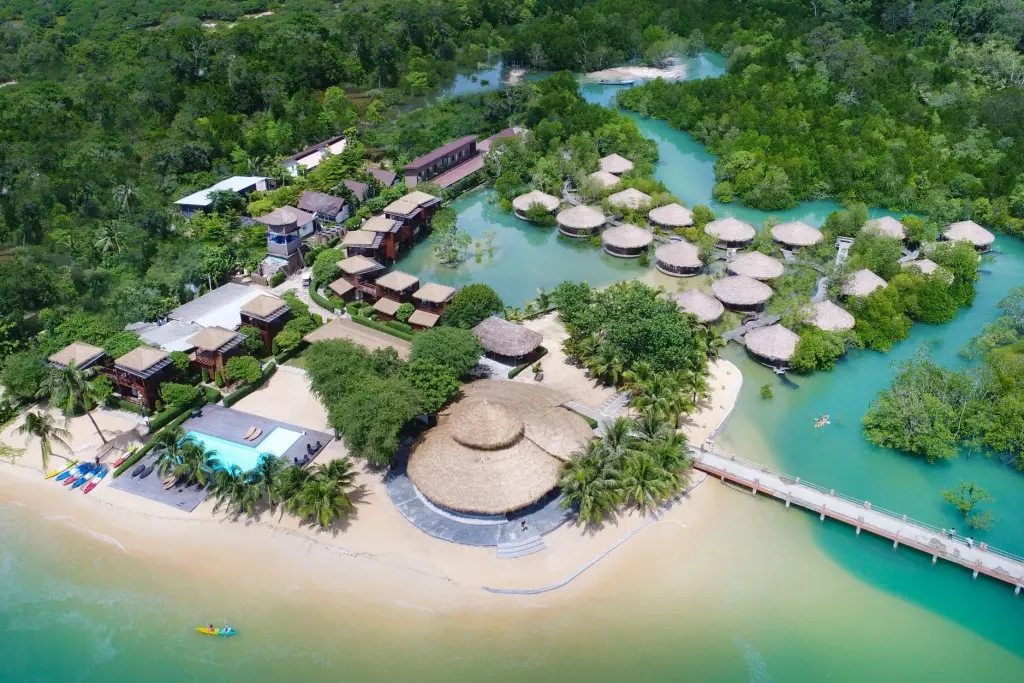
1. Koh Phayam, Ranong is one of the best-known island destinations in the province. Located in Ko Phayam Subdistrict, Mueang Ranong District, in the Andaman Sea, the island has a very different atmosphere from Thailand’s larger resort islands. Small roads, local communities, cashew orchards, mangrove areas, and beaches remain spread across the island, creating a relaxed environment well suited to slow travel and nature-based stays.
Important areas around the island include Ao Yai, Ao Khao Khwai, Ao Mae Mai, and Ao Kwang Peeb. Each offers a different character. Ao Yai has a broad beach and is particularly popular for sunset views, Ao Khao Khwai is known for its distinctive shoreline and rock formations, while Ao Mae Mai functions as the island’s main arrival area and pier.
Koh Phayam offers more than beaches. Visitors can explore mangrove areas, cashew orchards, Wat Koh Phayam and its seaside ordination hall, as well as fishing communities and everyday island life. Motorcycles and bicycles are commonly used for getting around because many roads are relatively narrow and the island is best explored at a slower pace.
Travelers planning to swim or take boat trips should check waves, wind, and boat schedules before departure. During the monsoon season, marine services and island activities may change according to sea conditions, while the drier travel season is generally more suitable for beach stays and exploring the island.
Getting There: From Ranong Town, travel to the pier serving Koh Phayam and continue by passenger boat or speedboat according to the available schedule. After arriving at Ao Mae Mai, visitors can use motorcycle taxis, rental motorcycles, or accommodation transfer services to reach other beaches and areas around the island.
Map (GPS): https://maps.app.goo.gl/ceCzJJ3EP5GjUwZx5
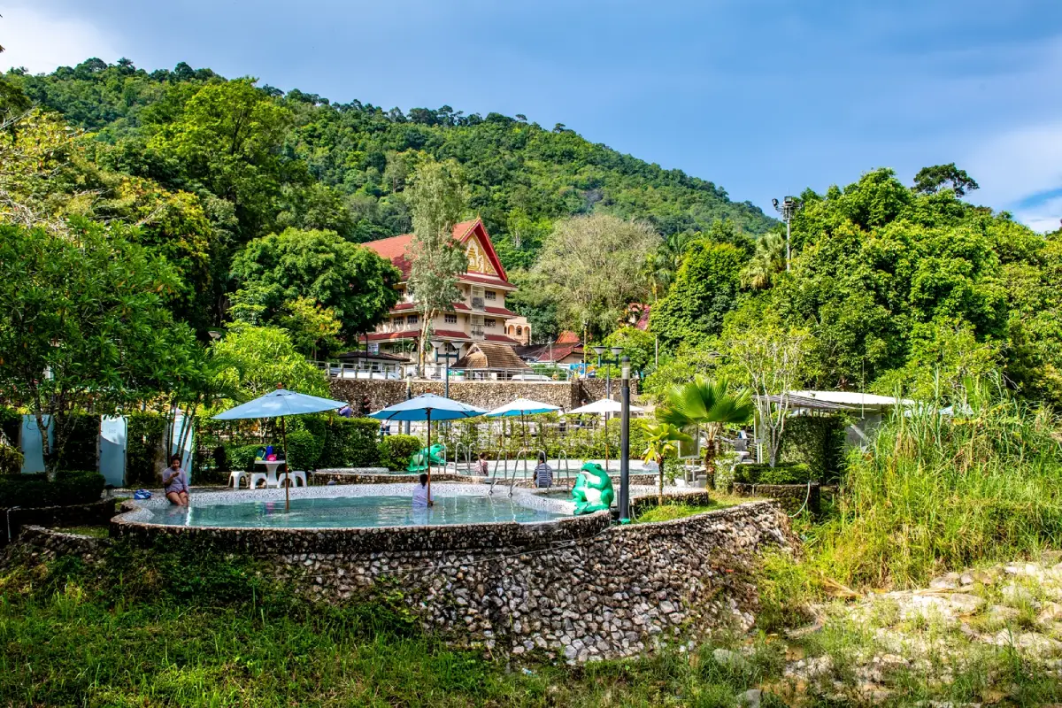
2. Raksawarin Hot Springs and Raksawarin Arboretum Public Park is one of the most recognizable landmarks in Ranong Town. Located on Chon Ra-u Road in Khao Niwet Subdistrict, it is only a short distance from the town center. Its natural mineral hot springs have become one of the province’s defining attractions, and the surrounding area has been developed as both a public park and a wellness destination.
The site includes natural hot-spring pools, areas where visitors can experience the mineral water, and public spaces for walking, resting, and enjoying the shaded surroundings. Early morning and late afternoon are especially popular because temperatures are more comfortable, and the springs can easily be combined with historical attractions around Ranong Town.
The mineral springs are an important natural resource that gives Ranong a distinctive wellness identity among Andaman coastal provinces. A visit is not only about soaking in hot water but also about understanding the relationship between the province’s geology, mountain systems, and underground water sources.
Visitors who use the soaking areas should choose an appropriate water temperature and limit the length of each session. Anyone with heart disease, blood-pressure problems, circulatory conditions, or other relevant health concerns should consider whether hot-water bathing is appropriate and follow on-site guidance.
Getting There: From central Ranong, follow Phetkasem Road toward the Chon Ra-u intersection, then continue along Chon Ra-u Road or Route 4005. The hot springs are only a few kilometers from the town center and can be combined conveniently with Hat Som Paen and Ranong Canyon.
Map (GPS): https://maps.app.goo.gl/LBewJs9MZSJg7iPS6
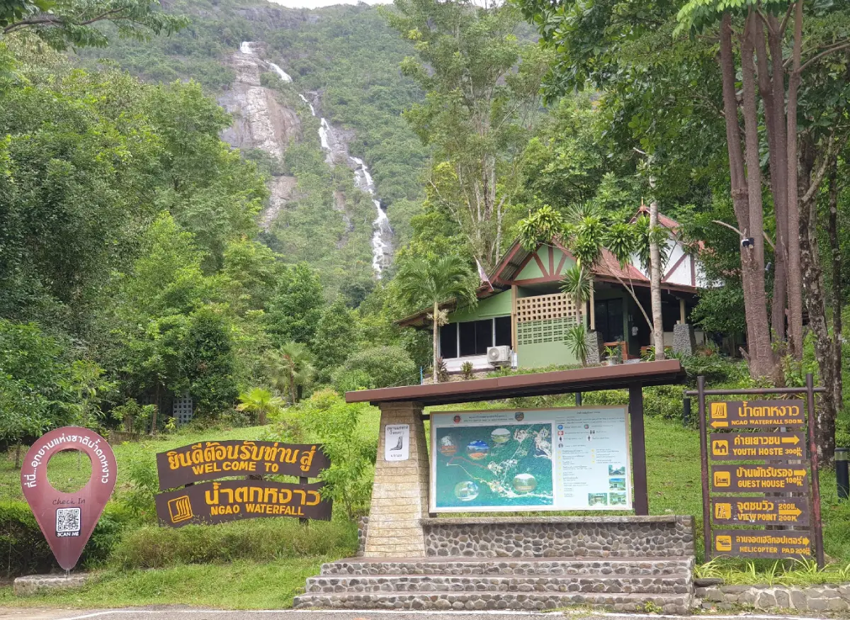
3. Namtok Ngao National Park is one of Ranong’s most important natural areas and is best known for Ngao Waterfall, a tall waterfall descending from a mountain cliff. Under suitable water conditions, the cascade can be seen from surrounding areas, while the forest around the park reflects the exceptionally wet and humid climate for which Ranong is known.
Beyond Ngao Waterfall, the national park contains nature trails, headwater forests, streams, and notable biodiversity. The endemic Princess Crab is one of the area’s best-known natural symbols and adds to the park’s significance as a conservation area.
Nearby attractions include Phu Khao Ya, Wat Ban Ngao, and Porn Rang Hot Spring, making the Ngao area suitable for a full-day nature itinerary. Visitors can experience waterfalls, rainforest, open hills, temples, and mineral hot springs without traveling long distances between stops.
During periods of heavy rain, visitors should be alert to slippery trails, flash floods, and rapidly changing water levels. Park instructions and temporary closures should always be followed. During drier periods, the waterfall may naturally carry less water.
Getting There: From Ranong Town, follow Highway 4 on the Ranong–Ratchakrut route for approximately 13 kilometers, then turn toward the national park following local signs. Private cars, rental vehicles, and hired transport are practical options.
Map (GPS): https://maps.app.goo.gl/Ku63WAecsqfQdRM48
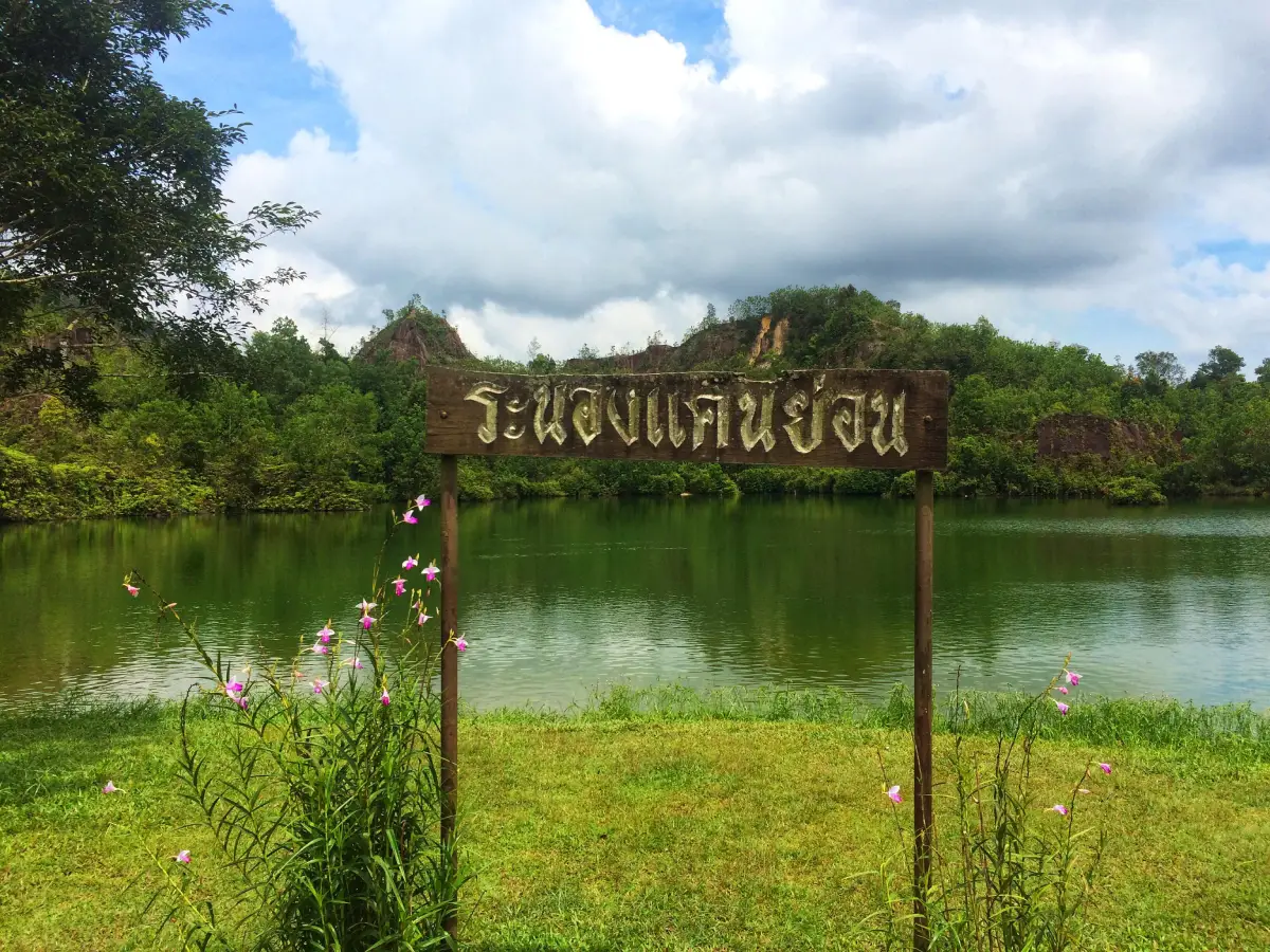
4. Ranong Canyon is located at Ban Thung Kha in Hat Som Paen Subdistrict, Mueang Ranong District. The attraction developed from a landscape shaped by former mining activity and is distinguished by a large body of water surrounded by exposed earth, hills, and vegetation.
Hat Som Paen was historically associated with mining and kaolin extraction. The present landscape therefore reflects both natural processes and earlier human use of the land. Ranong Canyon is valuable not only as a scenic attraction but also as a place that helps explain the province’s resource-based economic history.
The main appeal is the quiet atmosphere and the view over the water surrounded by steep earth formations. It is better suited to sightseeing and photography than to swimming. Visitors should keep a safe distance from steep edges and avoid entering areas not intended for public access.
Ranong Canyon can be combined with Raksawarin Hot Springs, Wat Hat Som Paen, and former mining communities along the same route, creating an itinerary that links mineral springs, mining history, and the inland mountain landscape.
Getting There: From Ranong Town, travel toward Raksawarin Hot Springs and continue along Route 4005 toward Hat Som Paen. Pass Wat Hat Som Paen and continue uphill toward Ban Thung Kha. Some sections are steep and winding, so careful driving is recommended.
Map (GPS): https://maps.app.goo.gl/8ToihvbaRSNYdHQv9
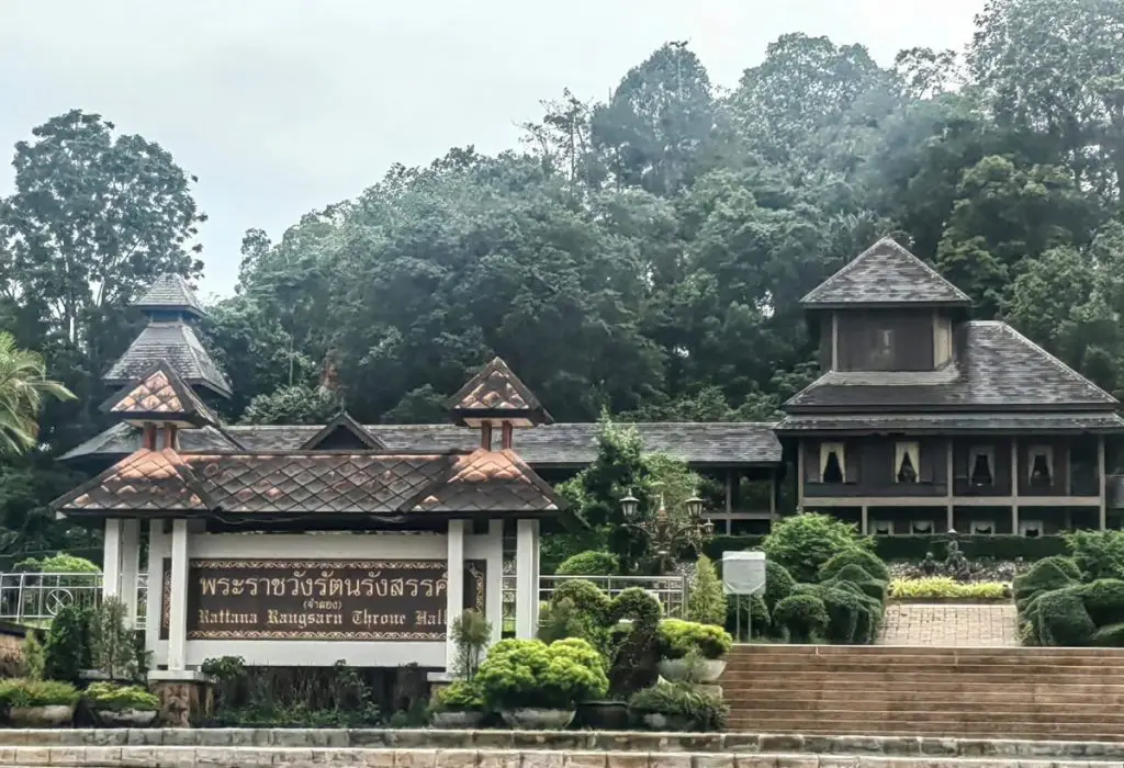
5. Rattanarangsan Palace (Replica) is located at the foot of Rattanarangsan Hill in Khao Niwet Subdistrict near Ranong Provincial Hall. It is an important historical learning site created to interpret the story of the original palace and the royal visits during which Thai monarchs stayed in Ranong.
The wooden building was designed to evoke the architectural character of the earlier palace. Interior spaces and recreated rooms help visitors understand Ranong during the period when tin mining, trade, and provincial administration were central to the town’s growth.
The importance of the site extends beyond the building itself. It is closely connected with the history of the Na Ranong family and the development of the town during the Rattanakosin era. Combining the palace with Ranong Governor’s Residence Wall, Khaw Soo Cheang Monument, Ranong City Pillar Shrine, and Wat Suwan Khiri Wihan provides a clearer picture of the historic urban center.
Because the palace is located within the town area, it is particularly suitable for a half-day heritage itinerary. Visitors can combine it easily with Raksawarin Hot Springs and local restaurants without traveling far outside central Ranong.
Getting There: The palace is located on Luang Road in Khao Niwet Subdistrict near Ranong Provincial Hall. It is easily reached from central Ranong by private car or hired transport and is only a short drive from the City Pillar Shrine and Raksawarin Hot Springs.
Map (GPS): https://maps.app.goo.gl/FTqAS9wm5ZVcVQwz8
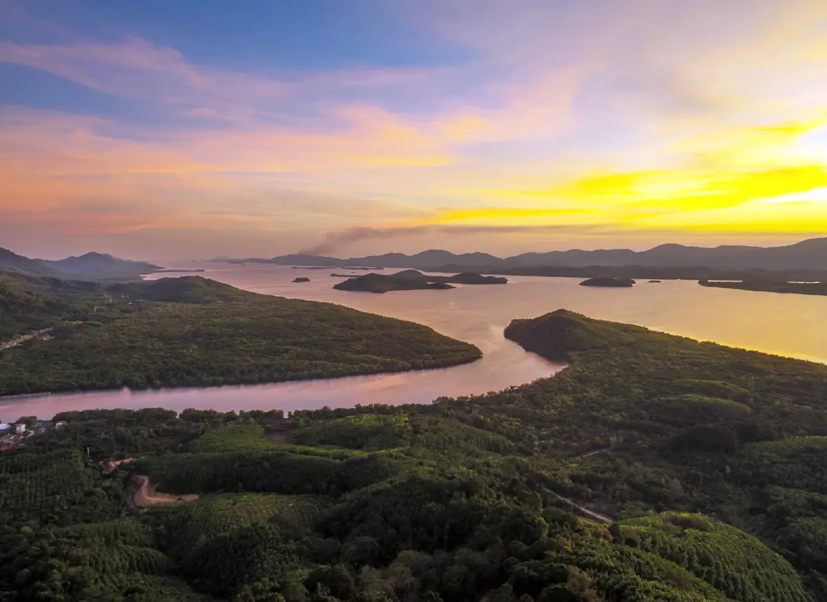
6. Khao Fa Chi is a major scenic viewpoint in Bang Kaeo Subdistrict, La-un District, approximately 30 kilometers from Ranong Town. Its most striking feature is the elevated panorama over the Kraburi River and the surrounding border landscape, where the geography of Thailand and Myanmar can be viewed together.
From the summit area, visitors can see rivers, waterways, mangrove forests, mountains, and settlements spread across the landscape below. This makes Khao Fa Chi an excellent place for understanding the geography of Ranong as a border province, particularly the relationship between mountain terrain, river systems, and the Andaman coast.
Morning and late afternoon are generally the best times to visit because temperatures are lower and the light creates more definition across the landscape. On clear days, visibility can extend far across the border area. During rain or heavy mist, drivers should be particularly careful because visibility on the hill road may be reduced.
Khao Fa Chi can be combined with attractions in La-un and Kra Buri Districts, including sites connected with the Kra Isthmus and Kraburi River. This makes it a strong choice for travelers who want to explore beyond Ranong Town and understand the province on a wider geographical scale.
Getting There: From Ranong Town, follow Highway 4 north toward La-un and Kra Buri. Continue into Bang Kaeo Subdistrict and follow the road toward Khao Fa Chi. The final section is steep and winding, so visitors should check road and weather conditions before traveling.
Map (GPS): https://maps.app.goo.gl/qjaHfpiW6aZbQEeG6
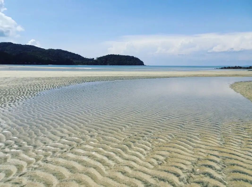
7. Koh Chang Ranong is located in Ko Phayam Subdistrict, Mueang Ranong District, and is one of the province’s larger islands. It remains quieter than mainstream island destinations and is characterized by beaches, mangrove areas, cashew orchards, viewpoints, and small fishing communities.
The island’s appeal lies in its simplicity. Visitors usually come to relax in a quiet setting, spend time on the beaches, walk through natural areas, watch birds, and experience local island life. Fishing and agriculture remain more visible here than large-scale tourism development.
Cashew orchards form part of both the landscape and the local economy. The island is also a place where visitors may encounter hornbills and other native wildlife. Services remain relatively simple, so travelers should prepare cash and basic necessities and confirm accommodation and boat schedules before departure.
Spending at least one night is recommended for travelers who want to experience the island properly. A rushed day trip is generally less suitable than on Koh Phayam because Koh Chang’s greatest attraction is its slower pace and sense of isolation.
Getting There: From Ranong Town, travel to the pier serving Koh Chang and continue by passenger boat according to the operating schedule. Boat times may change according to season and sea conditions, so travelers should confirm arrangements before departure.
Map (GPS): https://maps.app.goo.gl/WNnLYrBoQn3jPhB5A
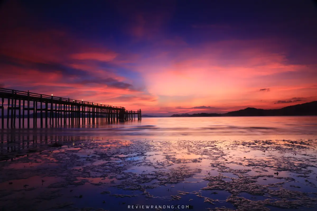
8. Hat Chan Damri is located in Pak Nam Subdistrict, Mueang Ranong District. It is a relatively small coastal area best known for Andaman Sea views and the atmosphere of the Ranong estuary. The shoreline, rocks, viewpoints, and distant views toward islands and Myanmar give the area a distinctive border-coast character.
Hat Chan Damri is not a broad swimming beach. Its main attractions are walking, enjoying the sea breeze, photography, and sunset views. Late afternoon is particularly pleasant and provides a clear sense of Ranong’s close relationship with the sea and its cross-border maritime routes.
The Pak Nam area is also connected with piers and routes to offshore islands, so visitors can often see boats and working coastal activity nearby. Hat Chan Damri can be visited after exploring Ranong Town, the Governor’s Grave, or Rattanarangsan Palace and makes a suitable place to end the day by the sea.
During heavy rain or strong winds, visitors should avoid wet rocks and exposed coastal edges because surfaces may become slippery. A clear late afternoon generally provides the best conditions for sightseeing and photography.
Getting There: From Ranong Town, follow the Ranong–Pak Nam road toward Pak Nam Subdistrict. The beach can be reached by car, motorcycle, or hired transport and can be combined with Ranong Governor’s Grave and nearby pier areas.
Map (GPS): https://maps.app.goo.gl/uAkHwswrdrsNRcc57
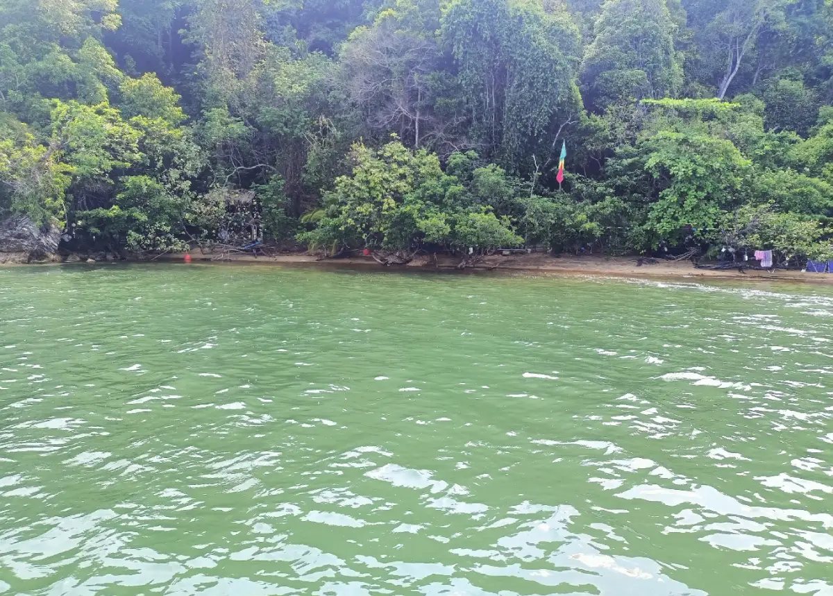
9. Sai Dam Beach is located around Ban Ko Hat Sai Dam in Ngao Subdistrict, Mueang Ranong District. This ecological attraction is very different from a conventional sandy beach because its dark surface is formed from accumulated sediment, soil, wood fragments, and organic material deposited naturally by tides and coastal processes over a long period.
The area includes much more than the dark shoreline. Mangrove forest, brackish-water ecosystems, tidal creeks, and traditional fishing communities allow visitors to learn about the relationship between forest, water, sediment, marine life, and the people who have depended on coastal resources for generations.
The Laem Makham area includes rich mangrove environments and nature-study opportunities. Community activities may involve boat trips, observing fishing practices, learning about shrimp-paste production, traditional fishing equipment, and studying coastal ecosystems according to the tidal cycle. It is therefore better suited to community-based and ecological tourism than to conventional sea swimming.
Visits should be planned according to the tides, and community coordination is advisable when boat transport or local activities are required. Visitors should avoid disturbing wildlife, collecting marine organisms, or leaving waste in the mangrove environment.
Getting There: From Ranong Town, follow Phetkasem Road toward Ngao Subdistrict and Ban Tha Chang, then continue to the Ton Son pier area. From there, use a local community or fishing boat to reach Ko Hat Sai Dam. Advance coordination is recommended so boat travel and activities can be arranged according to the tides.
Map (GPS): https://maps.app.goo.gl/JYgo1rh46kiw5qBb9
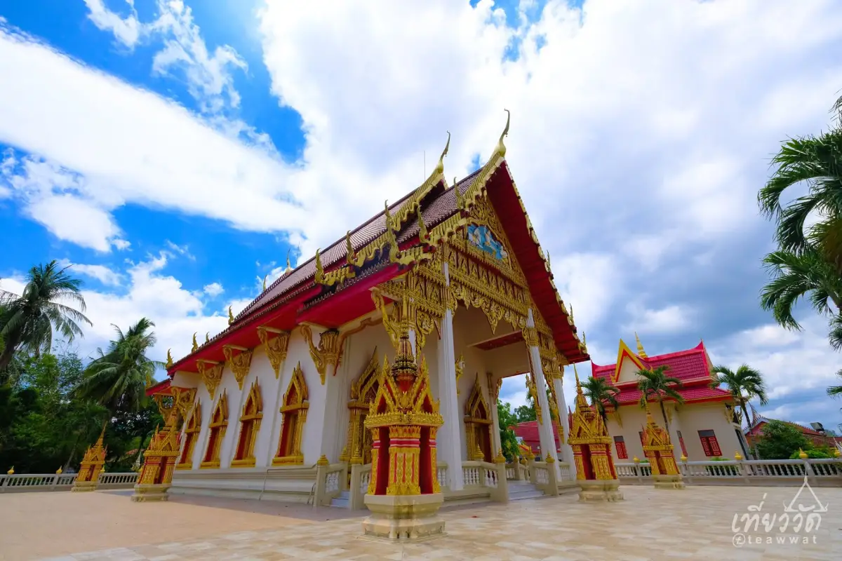
10. Wat Suwan Khiri Wihan (Wat Na Mueang) is one of Ranong Town’s oldest and most important Buddhist temples. Located on Chat Chaloem Road in Khao Niwet Subdistrict, the temple is closely connected with the history of the town and the growth of the local community during the period when tin mining and trade drove Ranong’s development.
The temple contains Buddha images, religious buildings, and architectural elements reflecting its role as an important urban Buddhist site. Visitors can come to make merit, pay respect to sacred images, and learn about the history of Ranong alongside other heritage attractions in the surrounding area.
Wat Suwan Khiri Wihan works particularly well as part of a historical route including Rattanarangsan Palace, Ranong City Pillar Shrine, Khaw Soo Cheang Monument, Ranong Governor’s Residence Wall, and Ranong Governor’s Grave. Together, these places connect the religious, administrative, and family history of the old town.
Visitors should dress modestly, remain quiet, and avoid interfering with religious activities, particularly around the ordination hall, viharn, and any area where monks or local worshippers are conducting ceremonies.
Getting There: The temple is located on Chat Chaloem Road in central Ranong, Khao Niwet Subdistrict. It can be reached easily by car, motorcycle, or hired transport and can be combined with Rattanarangsan Palace, the City Pillar Shrine, and Raksawarin Hot Springs.
Map (GPS): https://maps.app.goo.gl/6hHZJBvJZSPEMMtp9
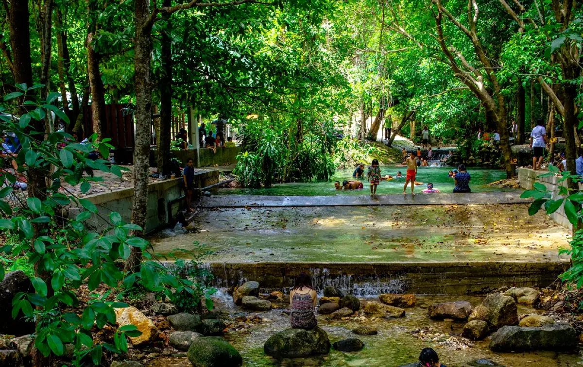
11. Ban Phon Rang Hot Spring is located at Ban Phon Rang in Bang Rin Subdistrict, Mueang Ranong District, within Namtok Ngao National Park. It offers a different experience from the hot springs in central Ranong because the mineral water is surrounded by forest, streams, and humid mountain scenery.
The natural mineral water emerges from underground springs and flows into developed soaking areas, while a cool natural stream runs nearby. This allows visitors to experience both warm mineral water and a forest environment in the same location. Another notable characteristic is that the water does not have the strong sulfur smell associated with some geothermal springs.
The site has been developed for relaxation and wellness tourism with soaking pools, bathing areas, private soaking spaces, and rest zones. It is suitable for families, older visitors, and travelers looking to relax after hiking or nature trips. However, soaking sessions should be kept moderate, and visitors should leave the water immediately if they feel dizzy, excessively hot, or unwell.
Ban Phon Rang Hot Spring can be combined conveniently with Namtok Ngao National Park, Phu Khao Ya, and other attractions around Ngao Subdistrict, allowing travelers to experience waterfalls, rainforest, open hills, and natural mineral water in a single day.
Getting There: From Ranong Town, follow Highway 4 or Phetkasem Road south toward Phang Nga. Around kilometer markers 620–621, turn onto the access road for Ban Phon Rang Hot Spring and continue for approximately 2 kilometers. The site is around 10 kilometers from central Ranong.
Map (GPS): https://maps.app.goo.gl/LdRtFFWK7eNnwnHU6
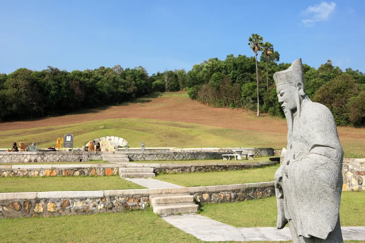
12. Ranong Governor's Cemetery is located on Rakhang Thong Hill in Bang Non Subdistrict, Mueang Ranong District. It is an important historical site associated with Ranong’s former governors and the Na Ranong family, whose members played a major role in the province’s development during the tin-mining and border-trade era.
The cemetery dates back to 1883 and reflects traditional Chinese concepts of burial-site selection and feng shui. Its hillside setting, orientation, and relationship with the surrounding terrain illustrate beliefs about harmony between ancestry, landscape, and spiritual protection.
A visit provides useful insight into the Chinese community that became deeply involved in Ranong’s economy during the period when tin was one of the province’s most valuable resources. Combining the cemetery with Khaw Soo Cheang Monument, Ranong Governor’s Residence Wall, and Rattanarangsan Palace helps explain the relationship between influential families, commerce, and provincial administration.
Visitors should behave respectfully because this remains a burial and ancestral memorial site. Loud behavior, climbing on structures, or activities that may be considered inappropriate should be avoided.
Getting There: From Ranong Town, follow Highway 4004 toward Pak Nam and Bang Non Subdistrict. The cemetery is located on Rakhang Thong Hill not far from the municipal area and can be combined with a visit to Hat Chan Damri.
Map (GPS): https://maps.app.goo.gl/fvQiodbeThZCqNDQ7
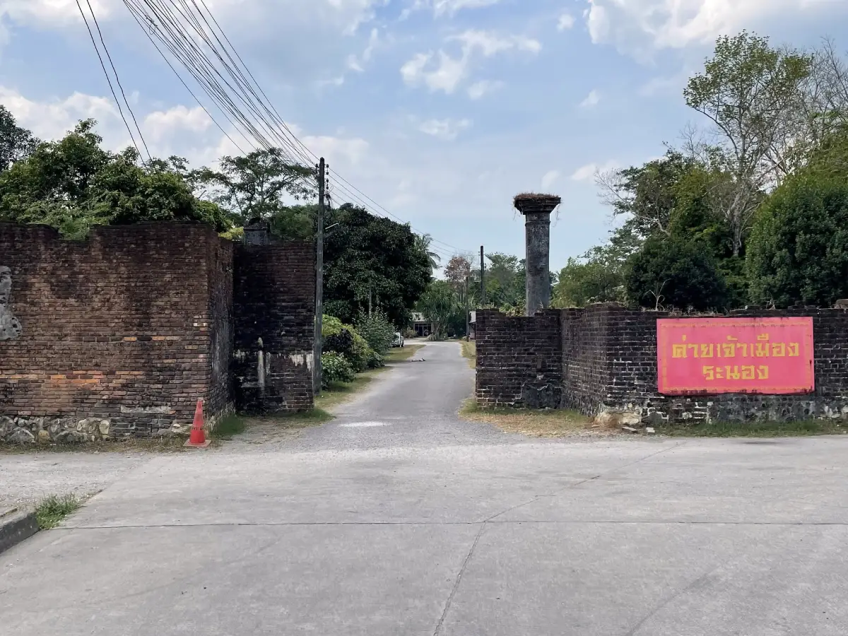
13. Ranong Governor's Residence Wall is located on Kitchaphadung Road in Khao Niwet Subdistrict, Mueang Ranong District. It is one of the surviving historical remains of the former governor’s residence and helps illustrate the period when the Na Ranong family played an important role in provincial administration, commerce, and tin mining.
Although the original residence no longer survives in complete form, the remaining wall and structural elements help visitors understand the scale and layout of the former administrative center. The site is therefore most meaningful when viewed together with other historic locations in the Khao Niwet area.
The area is particularly relevant for travelers interested in Hokkien Chinese heritage, mining history, and the development of Andaman coastal towns. Ranong grew through natural-resource trade and Chinese merchant networks before becoming an important provincial center in upper Southern Thailand.
The wall can be visited on the same route as Rattanarangsan Palace, Ranong City Pillar Shrine, Khaw Soo Cheang Monument, Wat Suwan Khiri Wihan, and Raksawarin Hot Springs because these attractions are located in or close to Ranong Town.
Getting There: From central Ranong, follow Kitchaphadung Road into the old-town area of Khao Niwet Subdistrict. The site is close to Rattanarangsan Palace and Ranong City Pillar Shrine and can be reached easily by car, motorcycle, or hired transport.
Map (GPS): https://maps.app.goo.gl/gs9urRbv8fkqHB4T8
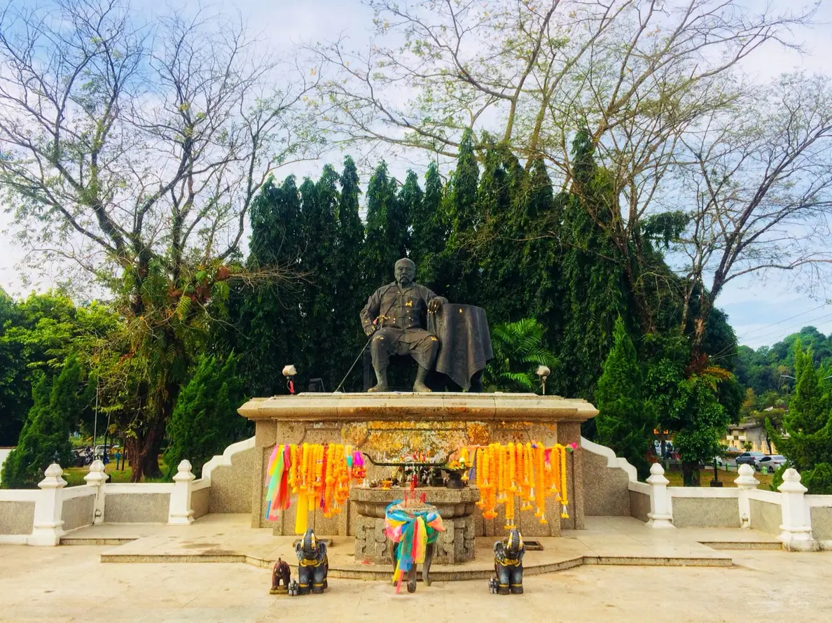
14. Khaw Soo Cheang Monument stands on Permphon Road in front of Ranong Municipality, Khao Niwet Subdistrict. The monument honors Khaw Soo Cheang, an important historical figure whose life and work were closely connected with Ranong’s transformation during the tin-mining era.
Khaw Soo Cheang was the founder of the Na Ranong family and played major roles in business, administration, and urban development. His mining activities and commercial networks helped Ranong develop from a relatively small border settlement into an important economic center on the Andaman coast.
The monument is therefore more than a civic landmark. It is a useful starting point for understanding Ranong’s local leadership and Chinese-Hokkien heritage before continuing to the Governor’s Cemetery, Governor’s Residence Wall, and Rattanarangsan Palace.
The surrounding area is close to Ranong City Pillar Shrine and government offices, making it easy to explore several historical locations during the same morning or late-afternoon walk.
Getting There: The monument is located on Permphon Road in front of Ranong Municipality in Khao Niwet Subdistrict. It is easily reached from central Ranong and stands close to Ranong City Pillar Shrine.
Map (GPS): https://maps.app.goo.gl/bBTYPdBmbKACMTQAA
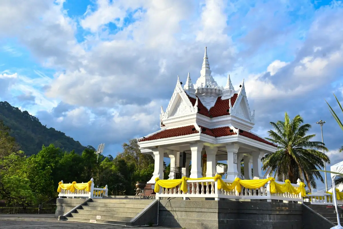
15. Ranong City Pillar Shrine is located on Permphon Road opposite Ranong Municipality in Khao Niwet Subdistrict. It is an important spiritual center for local residents and a significant landmark linking the town’s history, civic identity, and traditional beliefs.
The shrine is designed as a white four-sided pavilion with Thai architectural elements. The city pillar itself is associated with old royal-poinciana wood, while the surrounding area provides space for worship and ceremonial activity.
Its central location close to Khaw Soo Cheang Monument, Rattanarangsan Palace, and other old-town sites allows visitors to explore Ranong’s history from several perspectives within a compact area, including provincial administration, royal connections, religion, and Chinese-Hokkien community heritage.
Visitors should dress appropriately, remain quiet, and avoid obstructing people who have come to worship, especially during provincial ceremonies and religious occasions when the shrine may become busier.
Getting There: The shrine stands on Permphon Road opposite Ranong Municipality in central Ranong. It is easily accessible by car, motorcycle, or hired transport and is within walking distance of Khaw Soo Cheang Monument.
Map (GPS): https://maps.app.goo.gl/nMAQUEDUHeax2UtS7
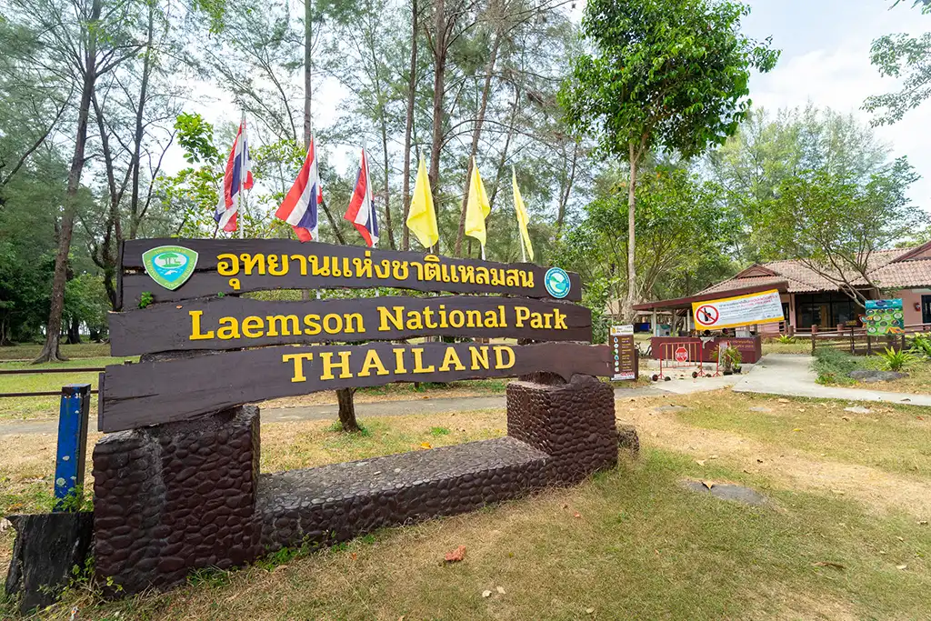
16. Laem Son National Park is one of Ranong’s major marine national parks, protecting coastal landscapes and offshore islands in the Andaman Sea. The park headquarters is located near Bang Ben Beach in Muang Kluang Subdistrict, Kapoe District, approximately 45 kilometers from Ranong Town.
The park contains beaches, mangrove forests, coastal woodland, and several offshore islands, including Ko Khang Khao, Ko Kam Yai, and Ko Kam Tok. This combination makes it one of the province’s best areas for nature-focused sea travel, particularly for visitors looking for quieter surroundings and relatively undeveloped coastal scenery.
Bang Ben Beach is one of the main access points for discovering the park and has a long, peaceful shoreline. Trips to the offshore islands require boat transport and depend heavily on wind and sea conditions, so visitors should check park announcements and boat availability before departure.
Laem Son National Park can be combined with Ko Kam Tok and other coastal attractions around Kapoe and Suk Samran, allowing travelers to plan a 1–2 day nature itinerary without returning immediately to Ranong Town.
Getting There: From Ranong Town, follow Highway 4 south toward Phang Nga and Kapoe District, then take the local road toward Bang Ben Beach and the national park headquarters. The distance is approximately 45 kilometers.
Map (GPS): https://maps.app.goo.gl/tJ13oerbw6Ur7Sa38
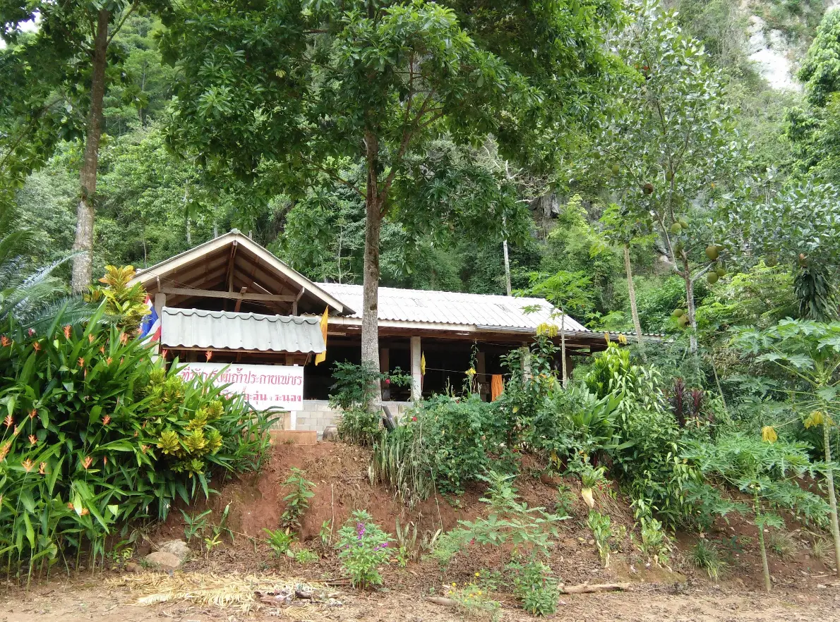
17. Prakai Phet Cave is located near Ban Khok Chang, Moo 2, Nai Wong Nuea Subdistrict, La-un District. It adds a geological dimension to a Ranong itinerary because the province is not limited to beaches and waterfalls but also includes limestone landscapes and natural cave systems.
The cave is known for stalactites, stalagmites, and mineral surfaces that sparkle when illuminated, giving rise to the name “Prakai Phet,” or Diamond Sparkle Cave. Visitors should use appropriate lighting and remain on established routes to avoid damaging formations that have taken extremely long periods to develop.
The surrounding area of Nai Wong Nuea contains mountains, forest, and rural communities and is suitable for travelers who prefer quieter nature destinations away from major tourism centers. Shoes with good grip are recommended because cave floors may become damp or slippery, particularly during rainy periods.
Visitors should never touch, break, or remove cave formations, write on cave walls, or leave rubbish. Caves are fragile ecosystems and may also provide habitat for specialized wildlife.
Getting There: From Ranong Town, follow Highway 4 toward La-un District, then continue onto the local road toward Nai Wong Nuea Subdistrict and Ban Khok Chang. Road and weather conditions should be checked before traveling, especially during the rainy season.
Map (GPS): https://maps.app.goo.gl/EaaB3BkwjmgmrXo17
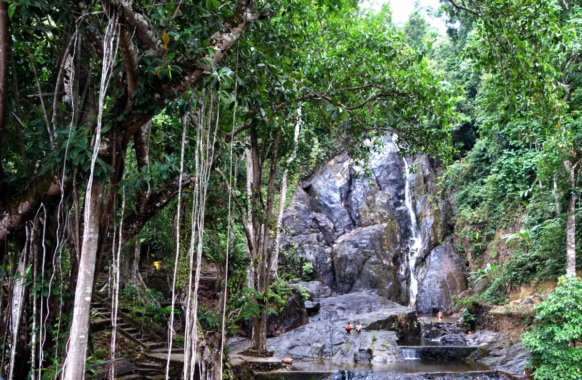
18. Lam Nam Kraburi National Park protects one of the most important border landscapes in Ranong Province. Its ecosystems include river environments, mangrove forests, coastal areas, islands, and inland forest connected with the Kraburi River, which forms part of the natural boundary between Thailand and Myanmar.
The area is distinctive because freshwater, brackish water, and marine environments meet within the same wider ecosystem. This creates mangrove forests, wetlands, aquatic nursery grounds, and communities whose livelihoods have long been connected with the river and the international border.
The park is especially useful for understanding Ranong’s geography because the Kraburi River has influenced nature, transportation, trade, and border history. Combining the park with Khao Fa Chi and the Kra Isthmus helps travelers understand northern Ranong in a much broader geographical context.
Boat activities or travel into protected areas should be planned according to weather, water levels, and current park regulations. During the rainy season, currents can become stronger and some areas may be more difficult to access.
Getting There: From Ranong Town, follow Highway 4 or Phetkasem Road north toward Kra Buri District, then continue to the appropriate access point for the Kraburi River area. A private or rental car is the most convenient option for combining several attractions in the same route.
Map (GPS): https://maps.app.goo.gl/M1vMarTpTnQxADxf7
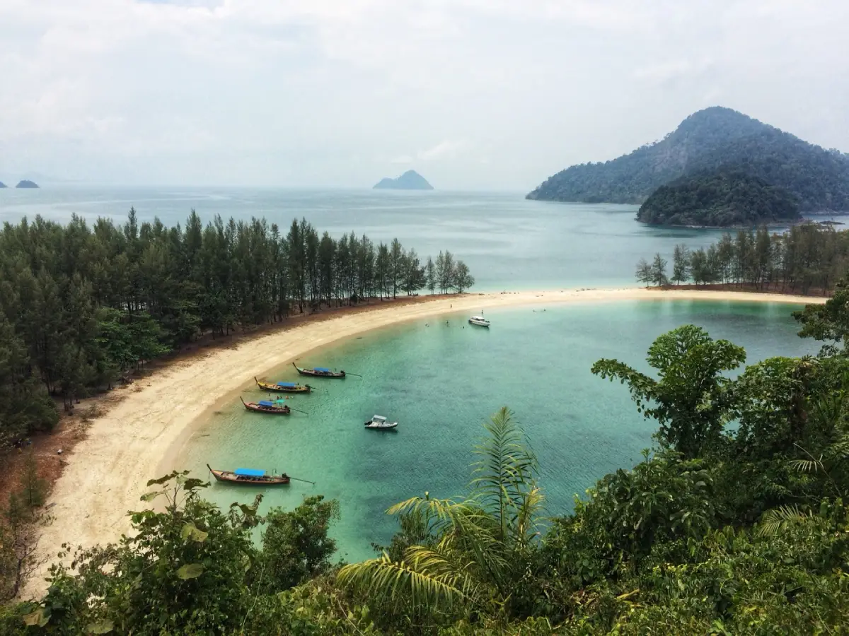
19. Kamtok Island (Khao Kwai Island) is a scenic island within Laem Son National Park in Kapoe District. Its most recognizable feature is a curved bay shaped somewhat like buffalo horns, together with pale sand, clear sea during suitable conditions, and a largely natural island landscape.
The beach is suitable for relaxing, walking, photography, and swimming when sea conditions are safe. Forested areas and viewpoints around the island provide attractive perspectives over the curved bay, making the island one of the most photogenic natural attractions in the Kam Islands group.
Travel depends on boat schedules, sea conditions, and national-park access. Visitors should use operators that provide proper safety equipment and follow park regulations. Coral, shells, plants, and other natural materials should never be removed from the island.
Kamtok Island can be combined with Ko Khang Khao and other islands within Laem Son National Park. It is particularly suitable for travelers who want a marine experience that feels different from Koh Phayam and places greater emphasis on protected natural scenery.
Getting There: Trips commonly begin from the Laem Son National Park and Bang Ben Beach area, followed by boat travel into the Kam Islands group. Travel time varies according to the route, stops, and sea conditions. Boat schedules and park announcements should be checked before departure.
Map (GPS): https://maps.app.goo.gl/gzRAMBMGTPFapaYo9
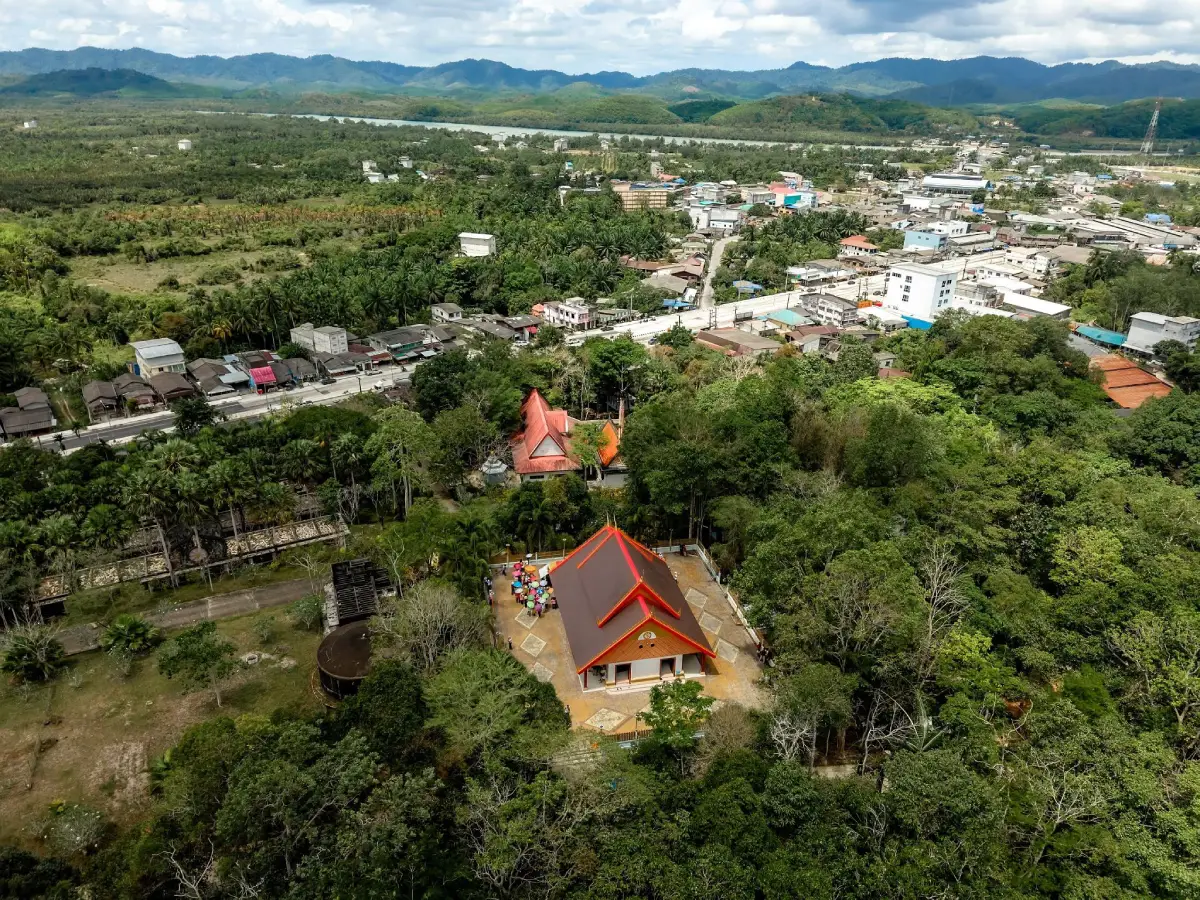
20. Wat Chantharam Cultural Center is located in Moo 2, Nam Chuet Subdistrict, Kra Buri District. It is a local learning site that connects Buddhism, history, community life, and the cultural heritage of northern Ranong. Wat Chantharam dates back to 1890 and has played an important role in the surrounding community for generations.
The temple was originally known as Wat Prathum Thara Thep Nimit and is associated with Phra Asadongkhot Thitraksa, or Kho Sim Bee Na Ranong, as well as Luang Pho Chan, who was involved in the early development of the religious site in Nam Chuet. The history reflects the relationship between provincial leadership and local Buddhist communities in Kra Buri.
The cultural center and temple grounds have served functions beyond worship. They have been used for learning, meetings, training, and community activities, while the temple also played a role in Buddhist education and the social history of this border district.
The wider historical context also connects the area with World War II, when Kra Buri became part of Japanese military transport and logistics routes in the region. Travelers interested in history can combine the temple with the Kra Isthmus, archaeological sites, and other heritage locations around Kra Buri.
Getting There: From Ranong Town, follow Highway 4 or Phetkasem Road north toward Kra Buri District and Chumphon, then continue into Nam Chuet Subdistrict, Moo 2. A private car or rental vehicle is the most practical option for combining the cultural center with other attractions around Kra Buri.
Map (GPS): https://maps.app.goo.gl/KEtJuWsEZ55od49e9
| Topic | Details |
| Province | Ranong, in upper Southern Thailand, lies along the Andaman Sea. The province stretches from north to south and features mountains, tropical rainforest, waterfalls, natural hot springs, mangrove forests, coastline, and numerous offshore islands. |
| Travel Overview | Ranong is suitable for nature trips, islands and beaches, waterfalls, mineral hot springs, viewpoints, mangrove forests, old-town history, Buddhist temples, the city pillar shrine, community-based tourism, and learning about Thai–Myanmar border culture. |
| Top 10 Highlights | 1. Koh Phayam, Ranong 2. Raksawarin Hot Springs and Raksawarin Arboretum Public Park 3. Namtok Ngao National Park 4. Ranong Canyon 5. Rattanarangsan Palace (Replica) 6. Khao Fa Chi 7. Koh Chang Ranong 8. Hat Chan Damri 9. Sai Dam Beach 10. Wat Suwan Khiri Wihan |
| Sea and Islands | Koh Phayam, Koh Chang, Kamtok Island, Laem Son National Park, Hat Chan Damri, and Sai Dam Beach together showcase beaches, offshore islands, mangrove ecosystems, community life, and the natural character of Ranong’s Andaman coast. |
| Waterfalls and Forests | Namtok Ngao National Park is a major destination for waterfalls and tropical rainforest, while Lam Nam Kraburi National Park highlights river ecosystems, mangrove forest, and border wetlands. |
| Natural Hot Springs | Raksawarin Hot Springs and Ban Phon Rang Hot Spring are important wellness attractions and among the natural features that distinguish Ranong from other Andaman coastal provinces. |
| Viewpoints and Landscapes | Khao Fa Chi offers panoramic views over the Kraburi River and the Thailand–Myanmar border landscape, while Ranong Canyon presents a distinctive former-mining landscape unlike the province’s coastal scenery. |
| Caves and Geology | Prakai Phet Cave in La-un District features stalactites, stalagmites, and mineral surfaces that reflect light, making it suitable for learning about geology and underground natural formations. |
| Ranong Town History | Rattanarangsan Palace, Ranong Governor’s Cemetery, Ranong Governor’s Residence Wall, and Khaw Soo Cheang Monument help explain the development of Ranong during the tin-mining era, provincial administration, and the historical role of the Na Ranong family. |
| Temples and Religious Sites | Wat Suwan Khiri Wihan is an important temple in Ranong Town, while Wat Chantharam Cultural Center in Kra Buri District reflects the role of Buddhist temples as centers of religion, education, culture, and community activities. |
| Spiritual Landmark | Ranong City Pillar Shrine is an important spiritual center and a key stop on a heritage route through the old town, particularly when combined with Khaw Soo Cheang Monument and Rattanarangsan Palace. |
| Communities and Local Life | Communities on Koh Phayam, Koh Chang, and around Sai Dam Beach remain closely connected with fishing, cashew orchards, mangrove forests, and coastal resources, while Kra Buri reflects the lifestyle and history of communities along the Thailand–Myanmar border. |
| Key Cultural Influences | Ranong’s culture reflects a blend of Thai, Thai-Chinese, and Myanmar influences expressed through food, language, religious sites, the Vegetarian Festival, Sat Duan Sip traditions, and everyday border-market life. |
| Local Food to Try | Fresh seafood, fish porridge, chicken rice, noodle dishes, Southern Thai sour yellow curry, kaeng tai pla, shrimp-paste chili dip, and local cashew-nut products. |
| Mueang Ranong District | Koh Phayam, Koh Chang, Raksawarin Hot Springs, Namtok Ngao National Park, Ranong Canyon, Rattanarangsan Palace, Hat Chan Damri, Sai Dam Beach, Wat Suwan Khiri Wihan, Ban Phon Rang Hot Spring, Ranong Governor’s Cemetery, Ranong Governor’s Residence Wall, Khaw Soo Cheang Monument, and Ranong City Pillar Shrine. |
| La-un District | Khao Fa Chi and Prakai Phet Cave are suitable for travelers interested in viewpoints, mountain scenery, geology, and inland nature. |
| Kapoe District | Laem Son National Park and Kamtok Island are major attractions for marine travel, island scenery, and protected coastal nature. |
| Kra Buri District | Lam Nam Kraburi National Park and Wat Chantharam Cultural Center are especially suitable for visitors interested in border geography, history, local culture, and communities in northern Ranong. |
| Top Activities | Island trips, swimming, beach walks, sunset watching, mineral hot-spring soaking, waterfall visits, hiking, cave exploration, mangrove trips, learning about fishing communities, temple visits, and exploring Ranong’s historic town. |
| Best For | Families, couples, groups of friends, nature travelers, beach lovers, history enthusiasts, wellness travelers, photographers, and visitors who prefer quieter destinations than the major resort centers of Southern Thailand. |
| Getting to Ranong | Ranong can be reached by car via Highway 4 or Phetkasem Road, by interprovincial bus, and by air through Ranong Airport. From the airport, travelers can continue into town by hired transport or rent a vehicle for exploring the province. |
| Getting Around Ranong | A private car or rental vehicle is the most convenient option because attractions are spread from Kra Buri in the north through La-un and Mueang Ranong to Kapoe and the southern coast. Boat transport is required for Koh Phayam, Koh Chang, and Kamtok Island. |
| 1-Day Itinerary | Morning: Rattanarangsan Palace – Ranong City Pillar Shrine – Khaw Soo Cheang Monument Late Morning: Raksawarin Hot Springs Afternoon: Namtok Ngao National Park – Ban Phon Rang Hot Spring Evening: Hat Chan Damri |
| 2-Day Itinerary | Day 1: Ranong Town – Raksawarin Hot Springs – Namtok Ngao National Park – Ranong Canyon – Hat Chan Damri Day 2: Choose Koh Phayam or Koh Chang and stay overnight to experience the island at a slower pace. |
| 3-Day Itinerary | Day 1: Old-town heritage and mineral hot springs Day 2: Koh Phayam or Koh Chang Day 3: Khao Fa Chi – Lam Nam Kraburi National Park – Wat Chantharam Cultural Center and the wider Kra Buri area |
| 4–5 Day Itinerary | Add Laem Son National Park, Kamtok Island, Sai Dam Beach, Prakai Phet Cave, and Ranong Town’s historical route for a more complete mix of sea, nature, heritage, and border culture. |
| For Sea Lovers | Koh Phayam, Koh Chang, Kamtok Island, Laem Son National Park, Hat Chan Damri, and Sai Dam Beach. |
| For Nature Lovers | Namtok Ngao National Park, Khao Fa Chi, Prakai Phet Cave, Lam Nam Kraburi National Park, Sai Dam Beach, and Laem Son National Park. |
| For History Lovers | Rattanarangsan Palace, Ranong Governor’s Cemetery, Ranong Governor’s Residence Wall, Khaw Soo Cheang Monument, Wat Suwan Khiri Wihan, and Wat Chantharam Cultural Center. |
| For Wellness Travelers | Raksawarin Hot Springs and Ban Phon Rang Hot Spring are ideal for travelers who want to relax and experience the natural mineral waters for which Ranong is particularly well known. |
| For Photographers | Khao Fa Chi, Koh Phayam, Kamtok Island, Ranong Canyon, Hat Chan Damri, Ngao Waterfall, and the mangrove landscapes around the Kraburi River. |
| Best Season for Sea Travel | Generally, December through April is more suitable for island trips and marine activities because rainfall is lower and sea conditions are often more favorable than during the monsoon season. |
| Visiting Ranong in the Rainy Season | The rainy season is well suited to green forest scenery, waterfalls, and Ranong’s humid atmosphere, but travelers should check weather conditions, flash-flood risks, slippery roads, boat operations, and national-park announcements before traveling. |
| Before Island Trips | Check boat schedules, waves, wind, weather forecasts, departure piers, return times, and accommodation arrangements in advance. This is particularly important for Koh Chang, where services are relatively simple and an overnight stay is often more suitable than a rushed day trip. |
| Responsible Travel | Do not leave rubbish in the sea or forest, remove coral, shells, or natural materials, disturb wildlife, damage cave formations, or behave disrespectfully in temples, cemeteries, communities, and other culturally sensitive areas. |
Frequently Asked Questions (FAQ)
Q: Where should first-time visitors start when traveling to Ranong?
A: If time is limited, start with Raksawarin Hot Springs, Rattanarangsan Palace, Namtok Ngao National Park, Ranong Canyon, and Hat Chan Damri. Travelers with more time should spend at least one night on Koh Phayam to experience Ranong’s island scenery properly.
Q: What is a good 1-day itinerary in Ranong?
A: Begin in the morning with Rattanarangsan Palace, Ranong City Pillar Shrine, and Khaw Soo Cheang Monument. Continue to Raksawarin Hot Springs, visit Namtok Ngao National Park and Ban Phon Rang Hot Spring in the afternoon, and finish the day at Hat Chan Damri.
Q: How should travelers plan a 3-day Ranong itinerary?
A: Spend the first day exploring Ranong Town, hot springs, and waterfalls. On the second day, stay on Koh Phayam or Koh Chang. On the third day, explore Khao Fa Chi, Lam Nam Kraburi National Park, and Kra Buri, or travel south toward Laem Son National Park and the Kam Islands.
Q: What are the best sea attractions in Ranong?
A: Major highlights include Koh Phayam, Koh Chang, Kamtok Island, Laem Son National Park, Hat Chan Damri, and Sai Dam Beach. Each offers a different experience, ranging from relaxing beaches to mangrove ecosystems and traditional fishing communities.
Q: Are there attractions in Ranong that are not related to the sea?
A: Yes. Recommended inland attractions include Raksawarin Hot Springs, Ban Phon Rang Hot Spring, Namtok Ngao National Park, Ranong Canyon, Khao Fa Chi, Prakai Phet Cave, Rattanarangsan Palace, Ranong Governor’s Cemetery, and Ranong Governor’s Residence Wall.
Q: What is the best time of year to visit Ranong?
A: For island trips and marine activities, approximately December through April is generally more suitable because rainfall is lower and sea conditions are often calmer. Travelers who enjoy rainforest, waterfalls, and lush green scenery can also visit during the rainy season, but should check weather and local access conditions carefully.
Q: Is it necessary to rent a car in Ranong?
A: It is not essential, but a private or rental car is highly convenient because the 20 attractions in this guide are spread across Kra Buri, La-un, Mueang Ranong, and Kapoe districts. Boat transfers are required for island destinations.
Q: Is Ranong suitable for a family trip?
A: Yes. Raksawarin Hot Springs, Ban Phon Rang Hot Spring, Rattanarangsan Palace, Namtok Ngao National Park, and Ranong Town’s historical attractions are especially suitable for families. Island trips should be planned according to children’s ages, weather conditions, and readiness for boat travel.
 Category: ●Travel Articles, Recipes
 Group: ●Travel Review, Food Review
Last Update : 3 WeekAgo
 Last Update : 3 WeekAgo
Recommend

 Art, Culture and Heritage
 Historical Sites and Monuments(4)
 Landmarks and Memorials(1)
 Royal Palace(1)
 Art, Craft Centres, Tradition(4)
 Educational Places
 Educational Gardens, Farm(1)
 Places of Worship
 Temple(12)
 Other Sacred Sites(2)
 Suburban Living
 Village, Community(2)
 Nature and Wildlife
 National Parks and Marine Reserves(6)
 Mountain (Doi)(4)
 Waterfalls(15)
 Hot Springs(3)
 Caves(4)
 River, Canal(2)
 Bays and Beaches(10)
 Islands(8)
 Other natural attractions(3)
Travel Review, Food Review(1)


