
lovethailand home >South Travel Attractions >Ranong Travel Attractions >Muang Ranong >Pak Nam > Lam Nam Kraburi National Park
TL;DR: Lam Nam Kraburi National Park, open Daily, hours 08.30 – 16.30. Highlights include Kra Buri River, Mangrove Forest, River Islands, Khao Kom Ma Viewpoint, Punyaban Waterfall, Laem Set Kuat, Hat Yai Hot Spring And Ton Mai.
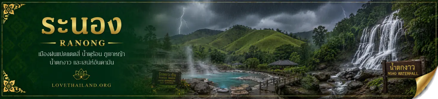
Lam Nam Kraburi National Park
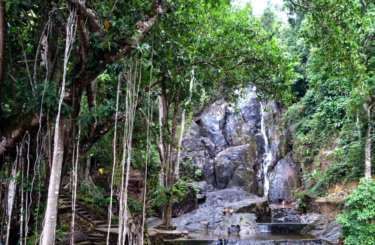
Open Days: Daily
Opening Hours: 08.30 – 16.30
Lam Nam Kraburi National Park in Ranong Province is a distinctive national park on Thailand’s upper Andaman coast, defined by the Kra Buri River, an important natural boundary between Thailand and Myanmar. The park covers areas in Mueang Ranong, Kra Buri and La-un districts of Ranong Province. It covers approximately 160 square kilometres and was officially declared a national park on 21 April 1999. Its landscape combines a border river, mangrove forests, tropical evergreen forest, mountain ridges, river islands, viewpoints, Punyaban Waterfall, Hat Yai Hot Spring and ecological zones that connect upland forest with the Andaman coastal system.
The park headquarters are located at 130 Moo 3, Ban Hin Chang, Phetkasem Road, Pak Nam Subdistrict, Mueang Ranong District, Ranong Province 85000. This area is a useful starting point for understanding the park because it lies close to the Kra Buri River, Laem Set Kuat, mangrove forest and the hillside viewpoint behind the headquarters. Visitors can use this area as a base for river scenery, mangrove learning, borderland landscapes and a trip to Punyaban Waterfall, one of the most accessible waterfalls in Ranong.
The Kra Buri River, sometimes called the Pak River in local tourism information, is important geographically, historically and ecologically. It forms part of the natural boundary between Thailand and Myanmar in Ranong Province. The river rises from the Phuket Range, flows through Kra Buri and La-un districts, and reaches the Andaman Sea at the Kra Buri River estuary in Mueang Ranong District. The river scenery is marked by mangrove-lined banks, mountain backdrops and small islands in the water, giving the park a character very different from ordinary beach destinations.
Water areas form an important part of the national park, covering about 40 percent of the park area, or around 64 square kilometres. Key river islands include Ko Siat, Ko Khwang, Ko Chon, Ko Yao, Ko Pling and Ko Nok Plao. These islands shape the river landscape, support mangrove vegetation, trap sediment, provide shelter for aquatic life and add interest to boat-based sightseeing in the Kra Buri River system.
The coastline in this area is a drowned coast, resulting in narrow coastal strips and many streams flowing from inland highlands into the Kra Buri River. Important streams include Khlong Bang Mi, Khlong Khi Nak, Khlong Lam Liang, Khlong Bang Song Ra, Khlong Bang Yai Nuea, Khlong Bang Yai, Khlong La-un, Khlong Chik, Khlong Lum Than, Khlong Set Takuat and Khlong Hin Chang. These waterways carry sediment to river mouths and coastal zones, creating muddy areas where mangrove forests can grow strongly.
The inland landscape is mountainous and complex. Important mountains include Khao Ngam, Khao Set Takuat, Khao Hin Chang, Khao Mueang Sung, Khao Chom Laem, Khao Sam Laem, Khao Lum Than and Khao Nam Ron. Khao Mueang Sung is the highest peak in the park, rising to about 609 metres above mean sea level. These mountains serve as headwaters, evergreen forest habitats, wildlife refuges and the scenic backdrop for river viewpoints throughout the park.
Geologically, Lam Nam Kraburi National Park contains sedimentary, metamorphic and igneous rocks. Areas around Ko Siat, Ko Yao, Ko Khwang, Ko Chon, Ko Pling and the riverside plains from Ban Bang Kung to the southern part of Khao Set Takuat are Quaternary alluvial deposits, including gravel, sand, silt, clay, beach sediment and fan-shaped sediment. The eastern inland zone north of Khlong La-un includes orthoquartzite, siltstone and shale with bryozoan and brachiopod fossils, while the southern zone below Khlong Chik includes greywacke, conglomeratic sandstone, conglomeratic shale and thick mudstone of the Kra Buri unit in the Tenasserim series. Small igneous areas occur between Khao Sam Laem and Khao Hin Chang, mainly medium- to fine-grained biotite granite.
This geological diversity gives the park more value than a simple viewpoint destination. The area shows how the Andaman coastal landscape was formed through river sediment, mudflats, mangrove development and ancient mountain structures. A visit to the park is therefore suitable for travelers interested in nature, geology, forest ecology and the connection between mountains and a border river.
The park has a humid Ranong climate. The average minimum temperature is about 13.7 degrees Celsius and the maximum is about 34 degrees Celsius. Average annual rainfall is around 4,276 millimetres. The most convenient travel period is from January to April, when rainfall is lower and walking routes and viewpoints are easier to use. The rainy season is good for seeing fuller waterfalls and lush mangroves, but visitors should take extra care with slippery roads, fast-changing water levels and sudden weather changes.
The main plant communities are tropical evergreen forest, mangrove forest and grassland. Tropical evergreen forest covers about 72 square kilometres, or about 45 percent of the park. It is found mainly around Khao Hin Chang, Khao Sam Laem, Khao Mueang Sung and Khao Chom Laem. Important plants include yang trees, takhian, khu mai and palm-family plants. These forests protect headwaters, retain moisture and provide habitat for many wildlife species.
Mangrove forest occurs strongly around the mouth of Khlong La-un, along the Kra Buri River near Khao Hin Chang and around islands near the La-un estuary. Important plants include large-leaf and small-leaf Rhizophora, Ceriops, black and white Xylocarpus, Bruguiera, sea gutta-percha, Avicennia, Sonneratia, Derris, nipa palm and mangrove-associated undergrowth. These mangroves reduce wave energy, trap sediment, serve as nurseries for aquatic animals and support communities living along the Kra Buri River.
Grassland occurs behind the park headquarters around Khao Ya, covering about 1.6 square kilometres. The area was formerly a plantation site that had been maintained, but repeated fires turned it into the present grass-covered hill. This open landscape adds variety to the park because visitors can experience evergreen forest, mangroves and open hill scenery within one protected area.
Wildlife recorded in the park includes mammals such as tiger, clouded leopard, Asiatic black bear, wild boar, mouse deer, long-tailed macaque, civet and bats. Birdlife includes raptors, coucals, crows, sunbirds, hill mynas, woodpeckers, doves, magpie-robins, hornbills and junglefowl. Reptiles and amphibians include snakes, frogs, toads and tree frogs. Aquatic life includes sea eels, mullets, mackerel, mudskippers, fiddler crabs, mussels and freshwater prawns. This diversity reflects the park’s combination of upland forest, streams, mangroves, river islands and estuarine habitats.
The Kra Buri River is one of the park’s signature attractions. Visitors can view the river, mangrove forest, river islands and the mountain scenery of Myanmar from park areas and viewpoints. The wide river, island-dotted water and mangrove-covered banks create a borderland landscape that is visually and ecologically distinct from ordinary beach tourism.
Khao Kom Ma Viewpoint, located on the hill behind the park headquarters, is one of the best places to see the wider landscape. About 2 kilometres from the headquarters, the viewpoint overlooks the Kra Buri River, river islands, mangroves and the Myanmar side of the border. It is suitable for landscape photography, morning and evening light, and understanding the park’s relationship with coastal ecology and border geography.
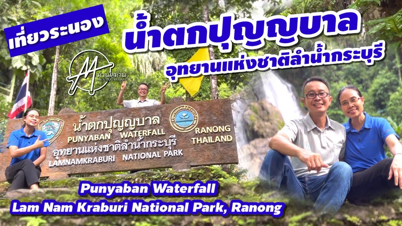
Punyaban Waterfall is the park’s easiest natural attraction to access. Located in Moo 1, Bang Non Subdistrict, beside Highway 4 and about 3 kilometres from the park headquarters, the waterfall flows throughout the year and can be seen from the roadside. It has three levels: Punyaban, Ton Mai Phai and Ton Ton Fern. A 300-metre nature trail allows visitors to see the waterfall and the surrounding tropical forest within a short visit.
Laem Set Kuat is a mangrove area in front of the park headquarters, covering about 2,000 rai. It is a good place to understand the richness of mangrove forest along the Kra Buri River. Visitors should observe mangrove roots, mud, coastal plants and signs of small aquatic animals carefully, because mangroves are not only scenic backgrounds. They are living systems that support fish, crabs, shellfish and local livelihoods.
Other park areas include Hat Yai Hot Spring at Protection Unit KB.1 in Moo 2, Bang Phra Nuea Subdistrict, La-un District, and Ton Mai Pak Waterfall, located about 6 kilometres from that protection unit. These areas are suitable for visitors who want to extend the trip from the headquarters toward La-un District and experience forest, hot spring and waterfall landscapes in a quieter setting.
The park also has an important conservation role. In recent years, the Department of National Parks opened public participation for a proposed expansion of Lam Nam Kraburi National Park around Khlong Lam Liang–La-un Forest, Khlong Set Kuat–Khao Hin Chang–Khao Sam Laem Forest and La-un–Ratchakrut Forest. These areas are significant because they connect several protected forests, include first-class watershed areas, contain rich evergreen forest and support important plants such as bua phut and related rare forest species. This shows that Lam Nam Kraburi is not only a tourist destination but also a strategic conservation area for Ranong’s watersheds and biodiversity.
Recommended activities include viewing the Kra Buri River, walking in mangrove areas, photographing Khao Kom Ma Viewpoint, visiting Punyaban Waterfall, swimming only in safe permitted areas, walking short nature trails, staying in park accommodation, camping in permitted zones and joining river sightseeing activities where local services and conditions allow. Nature-focused visitors should spend time observing the park slowly because its value lies in the details of forest, water, mud, sediment, plants, wildlife and borderland geography.
Visitors must follow national park rules carefully. Do not litter, feed wildlife, catch aquatic animals, collect plants, disturb mangrove roots, swim in dangerous areas or leave designated trails. During the rainy season, waterfalls and streams can change quickly, so extra caution is needed. Traveling in a river and mangrove national park requires more care than visiting an ordinary public park.
The best general travel period is January to April for convenient travel, viewpoints and outdoor activities. The rainy season is attractive for waterfall flow and lush mangroves, but visitors should check weather conditions and drive carefully. Photographers should visit river viewpoints in the morning or late afternoon, when the light is softer and the layers of mountains, mangroves and water are clearer.
Getting There is easiest by private car, rental car or local hired transport. From Bangkok, take Highway 4 south. At the Chumphon–Ranong junction, turn toward Ranong Province and continue to around kilometre marker 595, where a right-hand turn leads toward Lam Nam Kraburi National Park. Continue along Rural Road RN 4010 near kilometre marker 14 and drive about 1 kilometre to reach the park headquarters on the right.
From Ranong town, take Highway 4, or Phetkasem Road, toward Pak Nam Subdistrict and Ban Hin Chang. The park is about 18 kilometres from town. Self-drive travel is convenient because the same route can be combined with Punyaban Waterfall, Khao Kom Ma Viewpoint, Raksa Warin Hot Spring, Rattanarangsan Palace, Ranong Mangrove Research Centre and Ranong town attractions in one day.
Lam Nam Kraburi National Park suits many types of travelers: families stopping at Punyaban Waterfall, visitors interested in the Thai–Myanmar border landscape, mangrove lovers, birdwatchers, nature photographers, coastal-resource study groups and travelers who want to see a deeper side of Ranong beyond islands, hot springs and popular waterfalls. The park reveals how Ranong’s mountains, rivers, mangroves and coastal communities are closely connected.
Overall, Lam Nam Kraburi National Park is one of Ranong’s most meaningful nature destinations. It combines geography, conservation history, mangroves, evergreen forest, mountains, river islands, waterfalls and hot springs. Visitors can see the Kra Buri River not only as a border on a map, but as a living natural system. They can also understand how mangroves protect the coast, nourish aquatic life and support the long-term identity of Ranong’s Andaman landscape.
| Name | Lam Nam Kraburi National Park |
| Place Type | National Park, Border River, Mangrove Forest, Tropical Evergreen Forest, Viewpoint, Waterfall And Eco-Tourism Area |
| Headquarters Address | 130 Moo 3, Ban Hin Chang, Phetkasem Road, Pak Nam Subdistrict, Mueang Ranong District, Ranong Province 85000 |
| Coverage Area | Mueang Ranong, Kra Buri And La-un Districts In Ranong Province, With The Kra Buri River Forming The Natural Western Boundary With Myanmar |
| Area Size | Approximately 160 Square Kilometres |
| National Park Declaration | 21 April 1999 |
| Park Chief / Responsible Officer | Ukrit Deethong-on |
| Contact Number | 077-989-817 |
| Highlights | Kra Buri River, Mangrove Forest, River Islands, Khao Kom Ma Viewpoint, Punyaban Waterfall, Laem Set Kuat, Hat Yai Hot Spring And Ton Mai Pak Waterfall |
| River Islands | Ko Siat, Ko Khwang, Ko Chon, Ko Yao, Ko Pling And Ko Nok Plao |
| Major Landforms | Drowned Coastline, Multiple Streams, Estuarine Mangroves, Complex Mountains And Khao Mueang Sung, About 609 Metres Above Mean Sea Level |
| Important Ecosystems | Tropical Evergreen Forest, Mangrove Forest, Grassland, Streams, River Mouths, River Islands And Brackish-Water Andaman Coastal Habitats |
| Important Plants | Yang, Takhian, Khu Mai, Rhizophora, Ceriops, Xylocarpus, Avicennia, Sonneratia, Nipa Palm And Acanthus Ebracteatus |
| Wildlife | Long-Tailed Macaques, Civets, Bats, Hornbills, Raptors, Sunbirds, Woodpeckers, Junglefowl, Snakes, Frogs, Mudskippers, Fiddler Crabs, Mussels And Freshwater Prawns |
| Main Zones | Ban Hin Chang Headquarters, Kra Buri River, Laem Set Kuat, Khao Kom Ma Viewpoint, Punyaban Waterfall, Mangrove Nature Trail, Hat Yai Protection Unit And Ton Mai Pak Waterfall |
| Recommended Activities | River Viewpoint, Mangrove Walk, Landscape Photography, Punyaban Waterfall Visit, Short Nature Trail, Safe-Zone Swimming, Park Accommodation, Camping And Seasonal River Sightseeing Services |
| Current Status | Open As A National Park And Nature Attraction In Ranong Province, With Park Staff Continuously Operating And Managing The Area |
| Open Days | Daily |
| Opening Hours | 08.30 – 16.30 |
| Admission Fee | Thai Adult 20 Baht, Thai Child 10 Baht / Foreign Adult 100 Baht, Foreign Child 50 Baht / Vehicle Fees Include Car 30 Baht And Motorcycle 20 Baht According To National Park Rates |
| Best Travel Period | January To April Is Best For Convenient Travel And Viewpoints. The Rainy Season Is Good For Waterfalls And Lush Mangroves. |
| Facilities | Park Headquarters, Parking, Toilets, Welfare Shop In Some Areas, Park Accommodation, Camping Area, Boat Landing In Some Areas, Nature Trail And Safety Staff |
| Visitor Etiquette | Do Not Litter, Feed Wildlife, Catch Aquatic Animals, Collect Wild Plants, Disturb Mangroves, Swim In Unsafe Areas Or Leave Designated Trails. Follow Park Staff Instructions. |
| Travel Information | From Ranong town, take Highway 4 / Phetkasem Road toward Pak Nam Subdistrict and Ban Hin Chang for about 18 km. Near kilometre marker 595, turn into the park road for about 1 km. |
| Nearby Tourist Attractions | 1. Khao Kom Ma Viewpoint, about 2 km 2. Laem Set Kuat And Mangrove Forest In Front Of Park Headquarters, about 0.5 km 3. Punyaban Waterfall, about 3 km 4. Ranong Mangrove Research Centre And Ranong Biosphere Reserve, about 15 km 5. Raksa Warin Hot Spring, about 18 km 6. Rattanarangsan Palace And Ranong Old Town, about 18 km 7. Phu Khao Ya / Khao Hua Lan, about 35 km |
| Nearby Restaurants | 1. Lam Nam Kraburi National Park Welfare Shop, about 0 km, Tel. 077-989-817 2. KeingLay Ranong, about 15 km, Tel. 086-304-2628, 063-620-6090, 063-287-8924 3. Pak Nam Seafood Ranong, about 16 km, Tel. 081-978-3640 4. Tod Rong Tao Restaurant, about 18 km, Tel. 083-060-3009 5. Farmhouse Ranong, about 18 km, Tel. 094-424-2459 6. Koon Lin Restaurant, about 20 km, Tel. 077-822-863, 081-892-3455 |
| Nearby Accommodations | 1. Lam Nam Kraburi National Park Accommodation And Camping Area, about 0 km, Tel. 077-989-817 2. Phutara Resort Ranong, about 10 km, Tel. 091-654-5409, 084-443-6799 3. Bannaimong Natural Springs, about 13 km, Tel. 093-497-4999 4. The Hidden Resort & Restaurant, about 16 km, Tel. 077-821-900 5. Le Ranong Bistro Hotel, about 18 km, Tel. 077-826-026, 081-892-2200 6. Sook Hotel Ranong, about 18 km, Tel. 093-581-2500 7. The B Ranong Trend Hotel, about 18 km, Tel. 077-823-111 |
Frequently Asked Questions (FAQ)
Q: Where is Lam Nam Kraburi National Park located?
A: The park headquarters are located at 130 Moo 3, Ban Hin Chang, Phetkasem Road, Pak Nam Subdistrict, Mueang Ranong District, Ranong Province 85000. The park covers parts of Mueang Ranong, Kra Buri and La-un districts.
Q: What are the opening days and hours?
A: Lam Nam Kraburi National Park is open daily from 08.30 to 16.30.
Q: What is the entrance fee?
A: The published rate is 20 baht for Thai adults, 10 baht for Thai children, 100 baht for foreign adults and 50 baht for foreign children. Vehicle fees apply separately, such as 30 baht for a car and 20 baht for a motorcycle.
Q: What are the main highlights of Lam Nam Kraburi National Park?
A: The highlights include the Kra Buri River, Thai–Myanmar border scenery, mangrove forests, river islands, Khao Kom Ma Viewpoint, Punyaban Waterfall, Laem Set Kuat and the connection between mountain forest and the Andaman coastal ecosystem.
Q: Is Punyaban Waterfall part of Lam Nam Kraburi National Park?
A: Yes. Punyaban Waterfall is located within Lam Nam Kraburi National Park, beside Highway 4 and about 3 km from the park headquarters. It flows throughout the year and has a short 300-metre nature trail.
Q: When is the best time to visit?
A: January to April is the most convenient period for travel, viewpoints and outdoor activities. The rainy season is suitable for seeing stronger waterfall flow and lush mangrove scenery, but visitors should check weather conditions and travel carefully.
Q: Does the park have accommodation?
A: Yes. The park has accommodation and camping areas. Visitors planning an overnight stay should contact the park in advance at 077-989-817.
Q: How do travelers get to Lam Nam Kraburi National Park?
A: From Ranong town, take Highway 4 toward Pak Nam Subdistrict and Ban Hin Chang for about 18 km. Near kilometre marker 595, turn into the park road for about 1 km. Private car, rental car or local hired transport is the most convenient option.
 Category: ●Nature and Wildlife
 Group: ●National Parks and Marine Reserves
Last Update : 2 MonthAgo
 Last Update : 2 MonthAgo
 Click to Access the Navigation Map GPS
Lam Nam Kraburi National Park Map
Recommend

 Art, Culture and Heritage
 Historical Sites and Monuments(4)
 Landmarks and Memorials(1)
 Royal Palace(1)
 Art, Craft Centres, Tradition(4)
 Educational Places
 Educational Gardens, Farm(1)
 Places of Worship
 Temple(12)
 Other Sacred Sites(2)
 Suburban Living
 Village, Community(2)
National Parks and Marine Reserves(6)
 Mountain (Doi)(4)
 Waterfalls(15)
 Hot Springs(3)
 Caves(4)
 River, Canal(2)
 Bays and Beaches(10)
 Islands(8)
 Other natural attractions(3)
 Travel Articles, Recipes
 Travel Review, Food Review(1)


