
lovethailand home >South Travel Attractions >Phatthalung Travel Attractions > 40 Best Places to Visit in Phatthalung Southern Th..
TL;DR: 40 Best Places to Visit in Phatthalung Southern Thailand.
40 Best Places to Visit in Phatthalung Southern Thailand
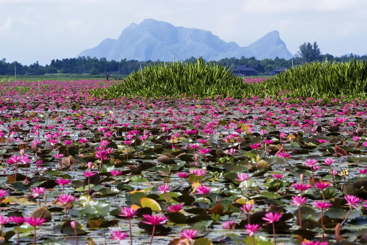
40 Best Places to Visit in Phatthalung, Southern Thailand Phatthalung is a distinctive province in southern Thailand where nature, history, traditional arts, local culture, and community life come together within a remarkably varied landscape. Although the province has no open-sea coastline like many other destinations in southern Thailand, it offers an impressive range of environments, from the Banthat Mountain Range, tropical evergreen forests, waterfalls, caves, and limestone mountains to agricultural plains, wetlands, and the vast Songkhla Lake basin. This diversity makes Phatthalung suitable for nature trips, cultural journeys, photography, community-based travel, and slow travel away from heavily developed tourist areas.
One of the province’s most recognizable landmarks is Khao Ok Thalu, the dramatic limestone mountain rising close to the city center. To the north, Khuan Khanun District is home to Thale Noi, one of Thailand’s most important wetland landscapes, known for waterbirds, lotus fields, water buffalo, sedge wetlands, and traditional lakeside communities. Along the western side of the province, the Banthat Mountain Range forms a contrasting landscape of dense forest, streams, waterfalls, caves, and protected natural areas such as Khao Pu–Khao Ya National Park.
The western part of Phatthalung is dominated by the Banthat Mountain Range, where tropical evergreen forests form important watershed areas and feed numerous streams and waterfalls. The central part of the province consists largely of plains used for settlements, rice farming, orchards, and other forms of agriculture, while the eastern landscape gradually descends toward wetlands and Songkhla Lake. Because these environments lie relatively close to one another, travelers can move from mountain and forest scenery to lakeside landscapes within the same day.
Phatthalung’s history stretches back to ancient settlement periods, and communities around the Songkhla Lake basin played an important role in linking different parts of the southern peninsula. Archaeological remains, religious sites, and historic communities reflect successive cultural and religious influences. One of the province’s most important historical areas is associated with Wat Phra Borommathat Chedi Khian Bang Kaeo, where archaeological evidence helps illustrate the long development of communities around the lake basin.
During the Ayutthaya period, Phatthalung developed as an important southern administrative center with roles in regional governance and security. Its significance continued into the Rattanakosin period before the modern center of the province became established around present-day Khuha Sawan. Traces of this long history remain visible in temples, archaeological objects, old settlements, religious monuments, and local traditions.
Phatthalung’s cultural identity is strongly associated with Nora and Nang Talung shadow puppetry, two of southern Thailand’s best-known traditional performing arts. Nora combines performance, music, costume, movement, belief, and ritual, while Nang Talung brings together carved leather puppets, storytelling, dialogue, music, humor, and observations of everyday society. These traditions remain central to understanding the cultural character of Phatthalung.
Local lifestyles vary with the landscape. Communities around Thale Noi depend on fishing, aquatic resources, sedge weaving, and wetland ecosystems. Farming communities across the plains are closely connected with rice fields, fruit orchards, and local agriculture, while settlements near the Banthat Mountains depend more heavily on forests, streams, orchards, and mountain resources. Traveling through different districts therefore reveals noticeably different environments and ways of life.
Phatthalung cuisine reflects the bold flavors of southern Thailand, with extensive use of curry pastes, herbs, local vegetables, freshwater fish, and agricultural produce. Common dishes include southern sour curry, kaeng tai pla, khua kling, chili dips served with local vegetables, and fish-based dishes. Sangyod Phatthalung rice is closely associated with the province’s rice-farming heritage, while pla duk ra, fermented catfish, and other local products make distinctive foods and souvenirs.
For a first visit, some of the best places for understanding the province include Thale Noi, Khao Ok Thalu, Wat Khuha Sawan, Phraiwan Waterfall, Khlong Pak Pra, Khao Pu–Khao Ya National Park, Hu Rae Rapids or Hu Rae Basin, Sumano Cave, Wat Phra Borommathat Chedi Khian Bang Kaeo, and Na Po Kae. Together with the remaining attractions in this guide, these 40 destinations cover wetlands, mountains, waterfalls, caves, temples, traditional arts, agriculture, historic communities, and the Songkhla Lake landscape.
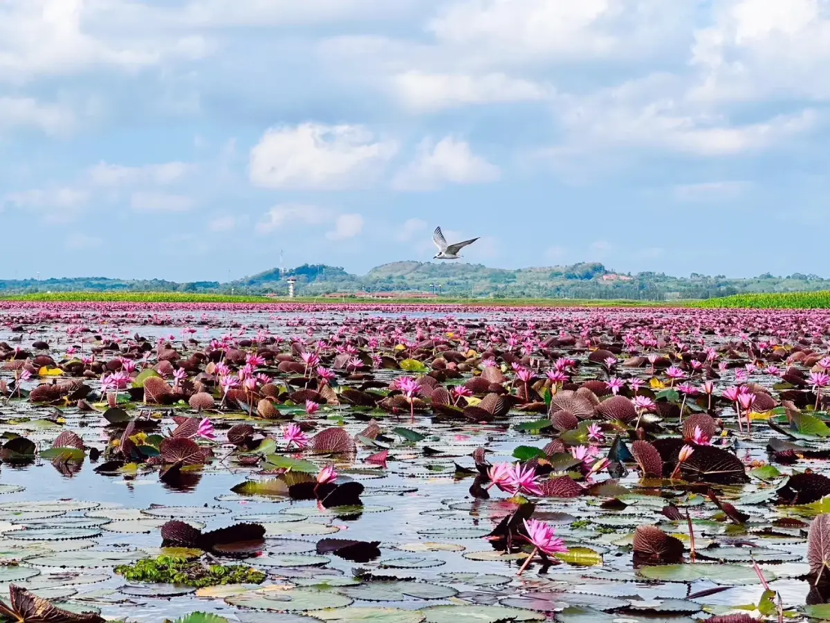
1. Thale Noi is one of the most important wetland and ecotourism destinations in Phatthalung. Located in Khuan Khanun District, the wider wetland landscape includes freshwater lake areas, lotus fields, peat swamp forest, grasslands, sedge vegetation, waterbirds, water buffalo, and communities whose livelihoods have long depended on the wetland environment.
Thale Noi was declared a non-hunting area on 18 February 1975, becoming Thailand’s first officially designated non-hunting area. Its international ecological importance is further strengthened by Khuan Khi Sian peat swamp, which became Thailand’s first Ramsar Site on 13 September 1998. The wetland therefore has significance not only as a scenic destination but also as an internationally recognized habitat for biodiversity conservation.
The signature experience is an early-morning boat trip through the wetland. At this time of day, lotus flowers are opening, waterbirds are beginning to feed, and the soft morning light reflects across the water. Depending on the season and water level, travelers may also see water buffalo moving through shallow wetland areas and grasslands, one of the most distinctive scenes associated with Phatthalung.
Communities around Thale Noi are also known for sedge weaving, traditional fishing, local food, and wetland-based products. After a boat trip, visitors can explore community products such as woven mats, bags, hats, and other items made from local sedge, while fish dishes and regional ingredients provide another way to experience the relationship between local people and the wetland.
Getting There: From Phatthalung town, drive toward Khuan Khanun District and the Thale Noi area. The main visitor and boat-access zone is around the Thale Noi Non-Hunting Area office. Travelers planning to see lotus flowers, birds, and the sunrise landscape should arrive early in the morning or stay near Thale Noi the night before.
Map (GPS): https://maps.app.goo.gl/A1qZLUfnRJFfQ9pK7
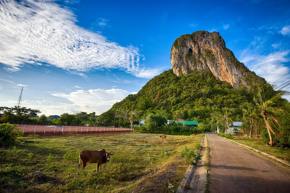
2. Khao Ok Thalu is a dramatic limestone mountain rising near the center of Phatthalung town and one of the province’s most recognizable landmarks. Its defining feature is a large natural opening near the upper section of the mountain that allows visitors to see through the rock from one side to the other. This pierced opening is the origin of the name “Ok Thalu” and has made the mountain a visual symbol of Phatthalung.
Khao Ok Thalu rises approximately 245–250 meters above sea level and stands prominently above the surrounding lowlands. The mountain is composed mainly of limestone, and the large opening developed through long-term natural weathering and erosion. Its unusual shape is visible from many areas of the city, especially around Phatthalung Railway Station and Wat Khuha Sawan.
Visitors can climb the mountain to enjoy panoramic views over Phatthalung town and the surrounding countryside. The route includes a long staircase and requires a reasonable level of fitness. Comfortable walking shoes, drinking water, and an early start are recommended, as the climb can become hot later in the day.
Khao Ok Thalu is conveniently located near Wat Khuha Sawan and Phatthalung Railway Station, making it easy to combine these attractions in a half-day city itinerary. Extra caution is necessary during or immediately after rain because stairs and natural surfaces can become slippery.
Getting There: From the Wat Khuha Sawan area, follow Highway 4047 toward the Khao Ok Thalu access area. The mountain stands east of Phatthalung Railway Station and is easily recognizable from central Phatthalung.
Map (GPS): https://maps.app.goo.gl/DLoB8cttBjNjC5r48
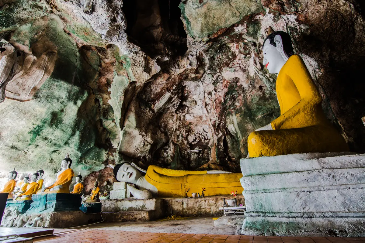
3. Wat Khuha Sawan is one of Phatthalung’s most important historic Buddhist temples, located at the foot of Khuha Sawan Hill in Mueang Phatthalung District. The temple is particularly distinctive because a natural limestone cave forms part of its sacred landscape, combining Buddhist worship, local history, archaeology, and natural geology within one site.
Khuha Sawan Cave contains numerous Buddha images placed within natural chambers, along rock walls, and on different levels of the cave. Natural openings allow daylight to enter parts of the interior, while deeper areas remain cooler and more subdued. The combination of sacred images and limestone formations creates a setting very different from a conventional temple hall.
The temple has been closely connected with the people of Phatthalung for generations and remains an active place of worship. Visitors should dress respectfully, keep noise to a minimum, and move carefully inside the cave because some sections have uneven or damp surfaces.
Its central location makes Wat Khuha Sawan particularly convenient for visitors exploring Phatthalung town. Khao Ok Thalu, the railway station, and several historic sites are nearby, allowing travelers to combine religious, historical, and natural attractions without long transfers.
Getting There: Wat Khuha Sawan is located at the foot of Khuha Sawan Hill in central Phatthalung. It is easily accessible by car from Phatthalung Railway Station, the city market, and other parts of the town center.
Map (GPS): https://maps.app.goo.gl/ca5KZseiwkwDZbYe9
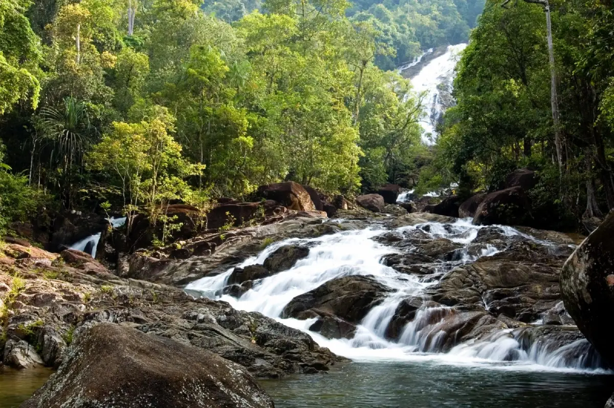
4. Phraiwan Waterfall is a major natural waterfall in Moo 11, Khlong Chaloem Subdistrict, Kong Ra District. Surrounded by forest along the Banthat Mountain Range, it is one of Phatthalung’s best-known waterfall destinations. Water cascades over a series of rock levels through a cool, shaded forest environment, creating an attractive place for nature trips and relaxation.
When water levels are suitable, the stream flows continuously across the rock formations and forms several natural pools. Visitors can relax beside the stream or enjoy safe sections of the water without having to trek deep into the forest. This makes the waterfall suitable for families, groups of friends, and travelers exploring the Kong Ra area.
The rainy season and the period immediately after it usually bring stronger water flow and particularly lush forest scenery. However, visitors should be cautious about flash floods, slippery rocks, and rapidly changing conditions after heavy rainfall. During drier periods, the amount of water can decrease naturally.
Phraiwan Waterfall can be combined with other attractions in Kong Ra and Si Nakharin districts, creating a route that includes waterfalls, caves, forest landscapes, and local food. Non-slip footwear, a change of clothes, drinking water, and waterproof protection for phones and cameras are useful for the trip.
Getting There: From Phatthalung town, take Highway 4 toward Trang. At the Kong Ra junction, turn onto Highway 4133 and continue for approximately 29 kilometers, then follow the signs for another 3 kilometers to the waterfall area.
Map (GPS): https://maps.app.goo.gl/t35BG43WFYddc9o6A
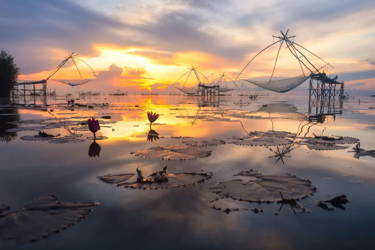
5. Khlong Pak Pra is one of Phatthalung’s most iconic waterways and one of the best places to experience the traditional fishing culture of the Songkhla Lake basin. The canal is particularly famous for its enormous square lift nets, known locally as Yo Yak, which stand above the water and create one of the province’s most recognizable landscapes, especially at sunrise.
Khlong Pak Pra forms part of a larger water system connecting inland streams, agricultural areas, lakeside communities, and Songkhla Lake. Fishing remains closely tied to the movement of water, fish, seasons, and local knowledge. The giant lift nets are therefore not merely photographic landmarks but working fishing equipment developed through generations of practical engineering and experience.
The most popular activity is an early-morning boat trip before sunrise. As the first light reaches the canal, the silhouettes of giant nets, fishing boats, and bamboo structures reflect across the water. Travelers may also observe fishermen at work, waterbirds, and the quiet rhythm of everyday lakeside life. For photographers, this is one of the most important sunrise locations in Phatthalung.
Khlong Pak Pra can easily be combined with Thale Noi. Many boat routes begin around Ban Pak Pra before continuing toward wetland scenery, lotus fields, waterbirds, water buffalo, and other parts of the Songkhla Lake ecosystem. Visitors who want the sunrise experience should consider staying near the canal or Thale Noi the night before because boats often depart before dawn.
Getting There: From Phatthalung town, travel toward Khuan Khanun District and Ban Pak Pra. The main tourism area is around the Pak Pra lakeside community and local boat piers. Travelers should contact boat operators in advance when planning an early-morning trip.
Map (GPS): https://maps.app.goo.gl/SqwzRt5XDHvFZmtAA
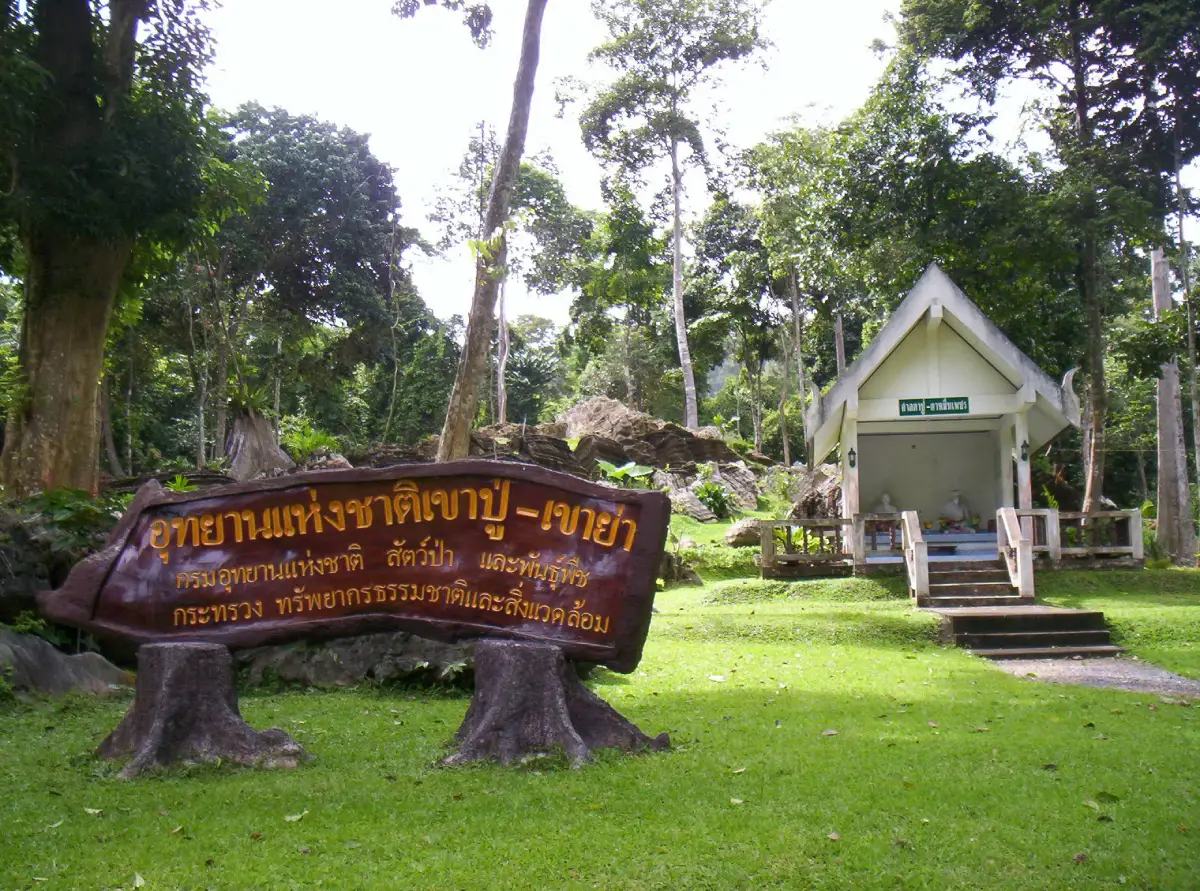
6. Khao Pu–Khao Ya National Park is a large tropical evergreen forest area along the Banthat Mountain Range, extending across parts of Phatthalung, Nakhon Si Thammarat, and Trang provinces. The main Phatthalung section is associated with Khao Pu Subdistrict in Si Banphot District. The park was officially declared Thailand’s 42nd national park on 27 May 1982 and covers approximately 433,750 rai, or around 694 square kilometers.
The landscape consists of complex mountain terrain, tropical evergreen forest, streams, waterfalls, limestone caves, and important watershed areas. The dense forest stores moisture and feeds numerous waterways, while also providing habitat for birds, mammals, reptiles, amphibians, insects, and many other forms of wildlife.
Natural attractions within and around the national park include Matcha Pla Won Cave, Pha Phueng, nature trails, Riang Thong Waterfall, and numerous forest streams. Visitors can choose activities according to available time and fitness level. Easier trails near developed areas are suitable for casual visitors, while deeper forest routes require more preparation.
The names Khao Pu and Khao Ya also carry cultural meaning for surrounding communities. Khao Pu in particular has long been regarded as a sacred mountain. The park therefore represents more than forest conservation alone, reflecting the relationship between mountains, local beliefs, natural resources, and communities around the Banthat Range.
Getting There: From Phatthalung town, travel toward Si Banphot District and Khao Pu Subdistrict, then follow the road and signs leading to Khao Pu–Khao Ya National Park headquarters.
Map (GPS): https://maps.app.goo.gl/FnrajPmQNZvFsJu68
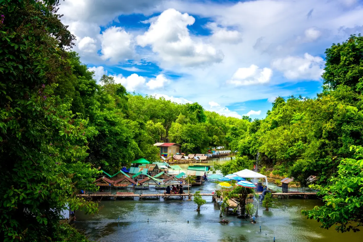
7. Ho Rae Lake (Hu Rae Rapids) is a natural stream and recreational water area in Tha Maduea Subdistrict, Bang Kaeo District. The site is known locally by several closely related names, including Ho Rae Lake, Hu Rae Basin, Hu Rae Rapids, and Khlong Hu Rae. Clear water flows over sandy sections and natural rocks, creating shallow areas, deeper pools, and small rapids.
The attraction is popular because it provides easy access to a natural stream without requiring a long forest trek. Shaded banks, flowing water, and nearby food areas make it suitable for families and groups wanting a relaxed half-day stop.
Some parts of the stream are suitable for swimming when water levels are normal, but depth and current strength vary according to rainfall and season. Children should remain under close adult supervision, and visitors should avoid entering the water during heavy rain or whenever currents become unusually strong.
Ho Rae Lake can be combined with attractions around Khao Chaison and Bang Kaeo, including Wat Phra Borommathat Chedi Khian Bang Kaeo and other natural sites in southern Phatthalung. This makes it useful for travelers planning a full-day route combining history and nature.
Getting There: From Phatthalung town, follow Phet Kasem Road for around 20 kilometers, then continue on Highway 4081 toward the Khao Chaison area. Turn near Khao Chaison District Office and continue for approximately 5 kilometers toward the attraction.
Map (GPS): https://maps.app.goo.gl/uqfF4Hq2uP1arSD67
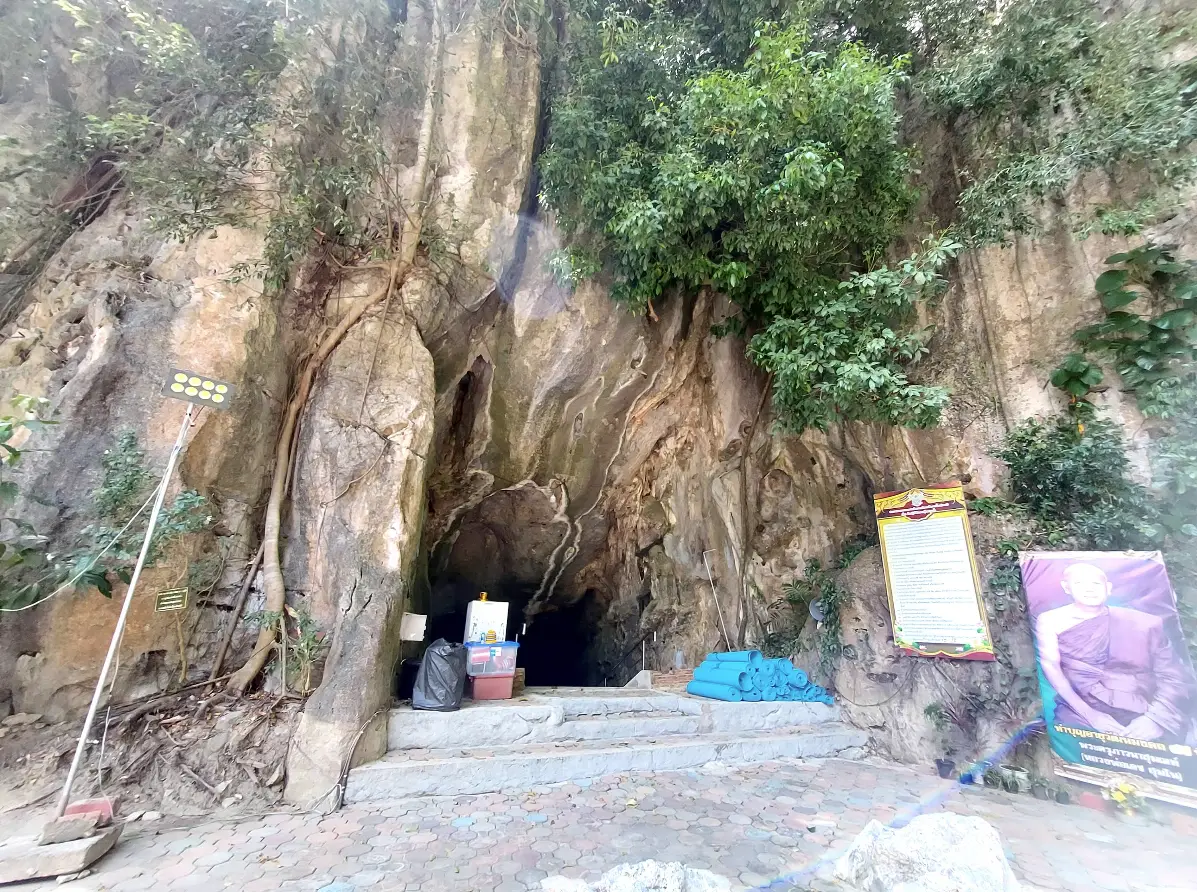
8. Sumano Cave is both a natural limestone cave complex and an important Buddhist meditation site in Moo 1, Ban Na Subdistrict, Si Nakharin District. The attraction is known for its spacious chambers, stalactites, stalagmites, limestone formations, and quiet environment used for meditation and religious practice.
The site began developing as a meditation center after Phra Ajarn Det Sumano, later known as Phra Khru Phawana Sumon, discovered the cave on 28 April 1987. The temple and meditation area subsequently expanded around two limestone hills, with the wider site covering approximately 500 rai.
Inside the cave system are large chambers, natural passageways, limestone formations, and areas used for Buddhist practice. Visitors can explore accessible sections while experiencing the noticeably cooler and quieter atmosphere inside the mountain.
Because Sumano Cave remains an active religious and meditation site, visitors should dress modestly, keep noise low, avoid touching stalactites and stalagmites, and respect areas reserved for monks and practitioners. The cave works well as part of a Phatthalung–Trang route or a day trip around Si Nakharin District.
Getting There: Take Highway 4 on the Phatthalung–Trang route into Si Nakharin District, then continue toward Ban Na Subdistrict and the Wat Tham Sumano area.
Map (GPS): https://maps.app.goo.gl/b5erCLqE1Sa75DDA9
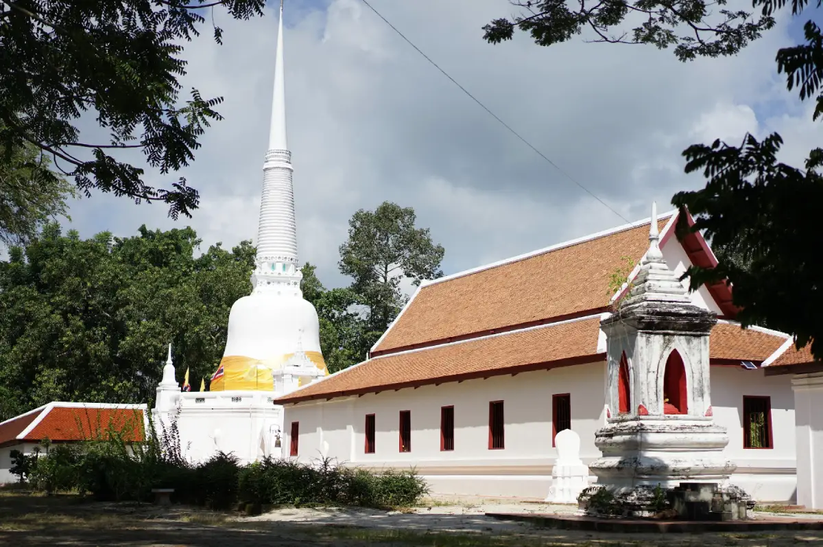
9. Wat Phra Borommathat Chedi Khian Bang Kaeo is an important Buddhist temple and historical site at 42 Ban Bang Kaeo, Moo 4, Chong Thanon Subdistrict, Khao Chaison District. The temple is closely associated with ancient communities around the Songkhla Lake basin and contains archaeological evidence reflecting settlement, religion, trade, and cultural exchange over a long period.
The principal monument is the Phra Borommathat Chedi, an important brick-built stupa with an octagonal base and a height of approximately 22 meters. Archaeological discoveries in the area include laterite remains, Buddha images, ceramics, religious objects, and artifacts associated with different cultural traditions.
A museum area preserves part of the archaeological collection and helps visitors understand the development of communities around the lake basin. A visit therefore provides more than an opportunity to pay respect at the stupa; it also introduces the historical importance of southern Phatthalung.
The temple remains an active sacred site. Visitors should dress respectfully and behave quietly, particularly around the stupa, museum areas, and spaces used for religious ceremonies.
Getting There: The temple is located at Ban Bang Kaeo, Moo 4, Chong Thanon Subdistrict, Khao Chaison District. It can be reached by car from Phatthalung town and combined conveniently with lakeside and natural attractions in the Khao Chaison and Bang Kaeo areas.
Map (GPS): https://maps.app.goo.gl/cDk19Za9E4dY5V1Z9
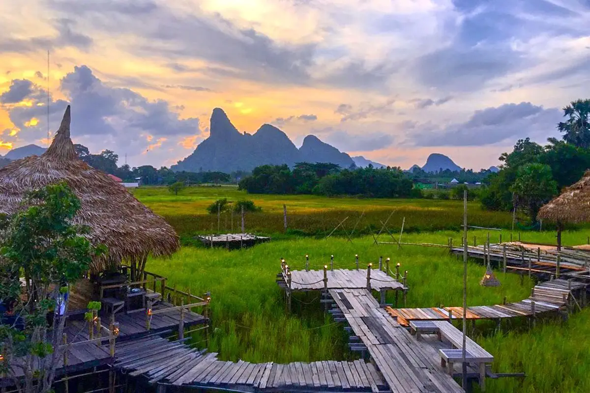
10. Na Po Kae is an agritourism attraction and rice-farming learning center at 456 Moo 6, Makok Nuea Subdistrict, Khuan Khanun District. The site presents traditional agricultural life through working rice fields, wooden walkways, farm shelters, community activities, and landscapes associated with rural Phatthalung.
The name “Na Po Kae” evokes the rice fields and agricultural knowledge of earlier generations. Its appeal therefore goes beyond scenic photography, with the attraction designed to introduce visitors to rice farming, rural knowledge, and the agricultural identity of Phatthalung.
The appearance of the landscape changes according to the rice-growing season. Young rice creates broad green fields, while mature rice turns the area golden. Rest areas, food, local products, and agricultural activities allow visitors to spend more time here than at a simple photo stop.
Its location in Khuan Khanun makes Na Po Kae easy to combine with Thale Noi and Khlong Pak Pra. A practical itinerary is to take an early boat trip first, then visit Na Po Kae later in the morning or afternoon.
Getting There: Na Po Kae is located at 456 Moo 6, Makok Nuea Subdistrict, Khuan Khanun District, Phatthalung. It is easily reached by car from Phatthalung town and can be combined with Thale Noi and Khlong Pak Pra.
Map (GPS): https://maps.app.goo.gl/TNi9WVT9NP3uvC3d6
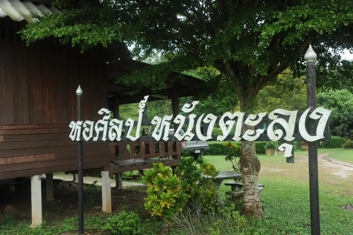
11. Shadow Puppet Gallery is an important cultural learning center dedicated to preserving Nang Talung, the traditional shadow-puppet art of southern Thailand. Located at 122 Moo 4 on Phet Kasem Road in Tha Miram Subdistrict, Mueang Phatthalung District, the gallery brings together puppets, craftsmanship, performance history, musical instruments, exhibitions, and knowledge related to this distinctive southern performing art.
Nang Talung combines several disciplines: leather carving, puppet manipulation, narration, singing, music, literature, southern dialect, humor, and social commentary. The gallery therefore allows visitors to understand the complete artistic process rather than seeing shadow puppetry only as a stage performance.
Visitors can learn how leather is selected, designs are drawn, patterns are carefully carved, colors are applied, and rods are attached to create functioning puppets. These steps demonstrate the level of skill required to transform a sheet of leather into an expressive character used behind the illuminated screen.
The gallery also demonstrates how Nang Talung continues beyond its traditional performance setting. Carved leather techniques are now applied to decorative artwork, souvenirs, and contemporary craft products, allowing the tradition to reach new audiences while maintaining its cultural roots.
Getting There: From central Phatthalung, follow Phet Kasem Road toward Tha Miram Subdistrict. The gallery is located near Phatthalung City Pillar Shrine and around 4 kilometers from the provincial government center. Travelers arriving by train can continue from Phatthalung Railway Station by local transport.
Map (GPS): https://maps.app.goo.gl/E4K56DbVzGjGY69J8
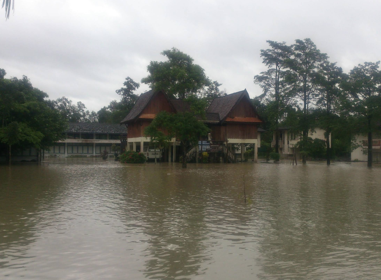
12. Ban Tamot Cultural Center is a local cultural learning center located within Prachabamrung School in Tamot Subdistrict, Tamot District. It was established to preserve and present the history, everyday life, local wisdom, material culture, and traditions of the Tamot community.
Tamot is an old community notable for the long coexistence of Thai Buddhist and Thai Muslim residents. Local life therefore reflects a mixture of religious practices, food traditions, community customs, beliefs, and shared social spaces. The cultural center helps explain the relationship between homes, temples, mosques, schools, and community organizations.
Displays include tools, household objects, local equipment, documents, and stories relating to life in earlier periods. Because the center is located within a school, it also plays an educational role in helping younger generations understand the history and cultural identity of their own community.
The surrounding Tamot landscape includes forested foothills, waterways, farmland, and long-established villages. The cultural center therefore works particularly well as part of a broader route combining community history with natural attractions in Tamot District.
Getting There: Travel to Tamot District and continue to Prachabamrung School in Tamot Subdistrict. The center is around 1 kilometer from Wat Tamot. Groups should arrange visits in advance so that access does not conflict with normal school activities.
Map (GPS): https://maps.app.goo.gl/AxCg7FXVRy2RzUvWA
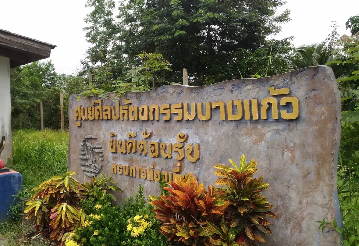
13. Bang Kaeo Shadow Puppet Handicraft Center is an important craft and learning center in Tha Maduea Subdistrict, Bang Kaeo District. Visitors can observe the process of producing traditional Nang Talung leather figures, from drawing and leather preparation to detailed carving, coloring, and final assembly.
The center’s craftspeople produce traditional shadow-puppet figures, Nang Yai-style pieces, Ramakien characters, decorative artwork, and custom designs. The fine carving techniques demonstrate how traditional southern craftsmanship can be preserved while also being adapted for contemporary decorative and souvenir products.
The center was founded by Khru Im Chanchum, a local master of traditional leather carving who played an important role in teaching the craft to community members, younger generations, and visitors. As a result, the center functions both as a production space and as a place where traditional knowledge is actively transmitted.
Buying work directly from the center is also a way to support local craftspeople. Visitors can choose from large decorative pieces and smaller souvenirs while gaining a clearer understanding of the time, precision, and skill involved in each handmade object.
Getting There: From Phatthalung town, travel toward Bang Kaeo District and Tha Maduea Subdistrict. The site is approximately 36 kilometers from the provincial center. From the Phet Kasem Road–railway junction, continue for around 9 kilometers, then follow the local access road for approximately 200 meters.
Map (GPS): https://maps.app.goo.gl/NPXSB1zSrVrXmg9w9
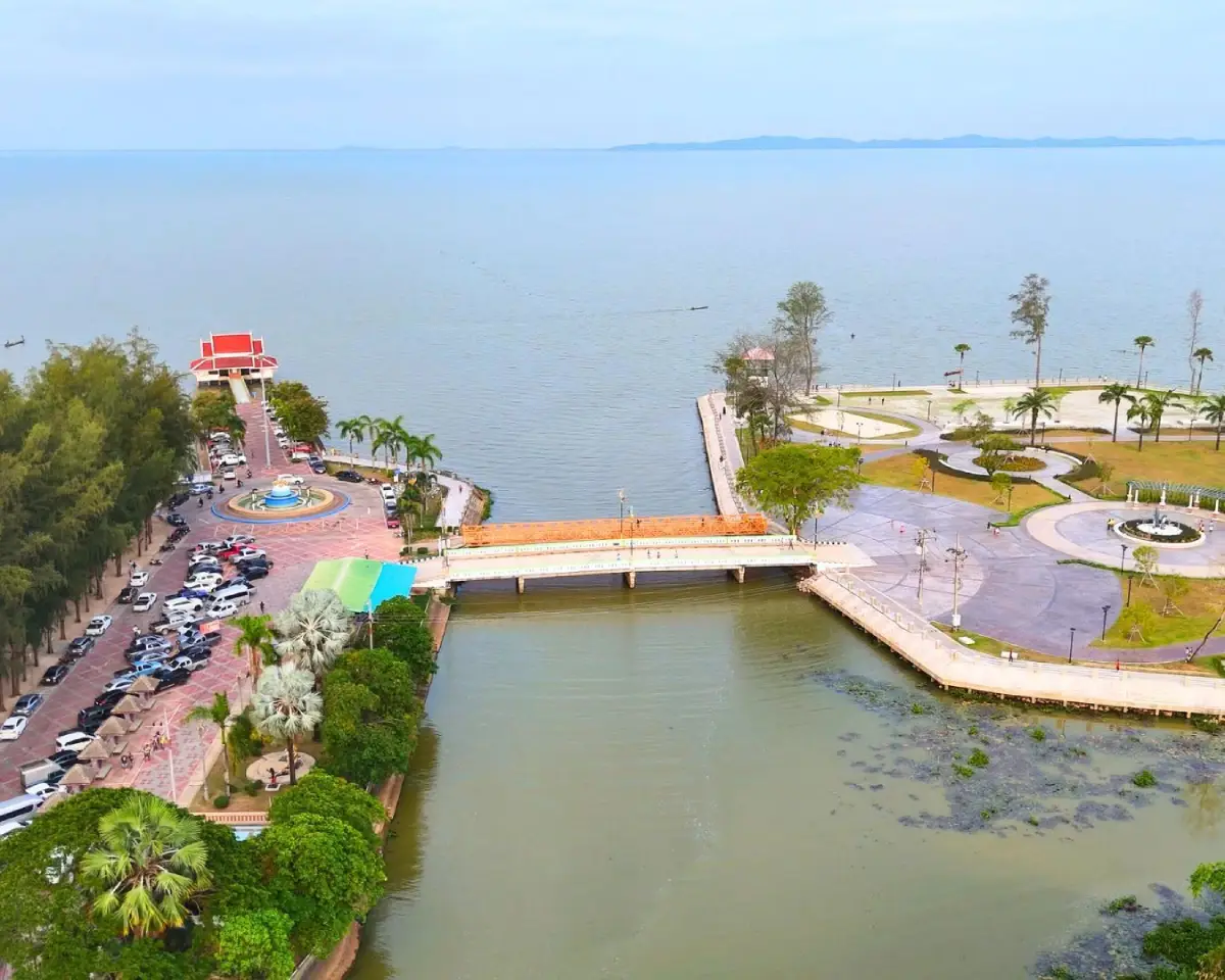
14. Saen Suk Lampam Beach, often called Lampam Beach, is one of the easiest lakeside recreation areas to reach from Phatthalung town. Located in Lampam Subdistrict, approximately 7–10 kilometers from the city center, it offers a long waterfront, shady trees, public recreation areas, and broad views across Songkhla Lake.
One notable feature is the waterside pavilion known locally as “Sala Lampam Thi Rak,” along with Ko Loi or Lampam Island, a small sediment-formed island connected to the mainland by a bridge. Visitors can walk across the bridge, enjoy the breeze, and view the lake from the island area.
The broader waterfront also contains public spaces and visual elements associated with Phatthalung identity, including Nora imagery, a monument to King Rama V, landscaped areas, fountains, and sculptures connected with aquatic life in Songkhla Lake.
The area becomes particularly pleasant in the late afternoon and evening, when local residents come to relax and lakeside food options become more active. Families with children should nevertheless take care around the water’s edge and bridge areas.
Getting There: From Phatthalung town, follow Highway 4047 on the Phatthalung–Lampam route eastward for approximately 7–10 kilometers. If starting from Wat Wang, continue along the same route for roughly another 2 kilometers.
Map (GPS): https://maps.app.goo.gl/MYiVGGzBBiUk6shS7
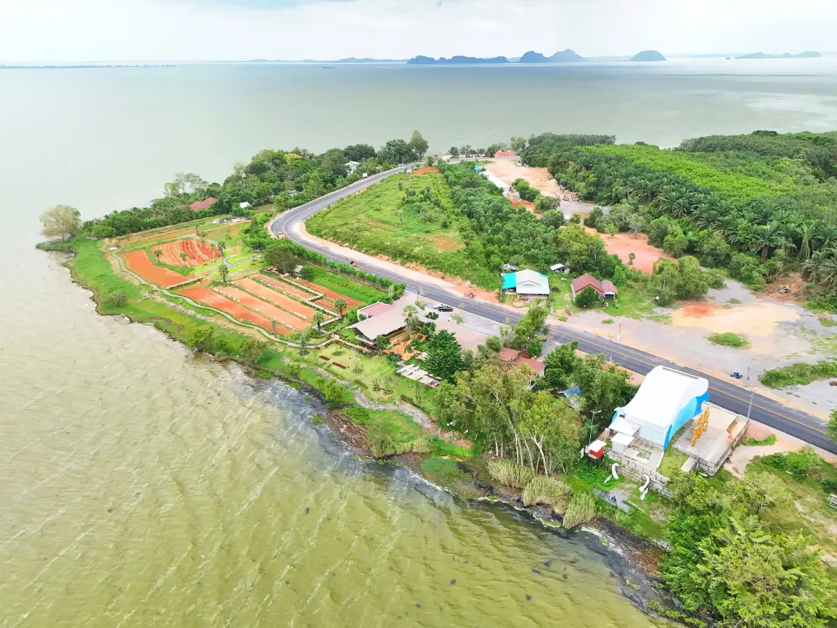
15. Laem Chong Thanon is a fishing community and lakeside viewpoint in Chong Thanon Subdistrict, Khao Chaison District. The village occupies a projecting lakeside area where the land slopes toward Songkhla Lake, creating wide views of the water, nearby islands, fishing boats, and traditional lift nets.
The appeal of Laem Chong Thanon lies largely in its simple community atmosphere and visible connection with traditional fishing. Visitors can observe local boats, fishing equipment, lift nets, and everyday use of the lakeshore rather than a heavily developed tourism environment.
The area is well suited to photography and quiet sightseeing, especially in the morning or late afternoon when the sunlight is softer. On clear days, distant islands and fishing activity across the lake can be seen more clearly.
Laem Chong Thanon can be combined with Wat Phra Borommathat Chedi Khian Bang Kaeo and natural attractions around Khao Chaison and Bang Kaeo, creating a full-day route across southern Phatthalung.
Getting There: From Phatthalung town, follow Phet Kasem Road toward Khao Chaison District, then turn toward Chong Thanon Subdistrict and Ban Laem Chong Thanon. The final section passes through local community roads near Songkhla Lake.
Map (GPS): https://maps.app.goo.gl/es1qE85do7G9o6ta6
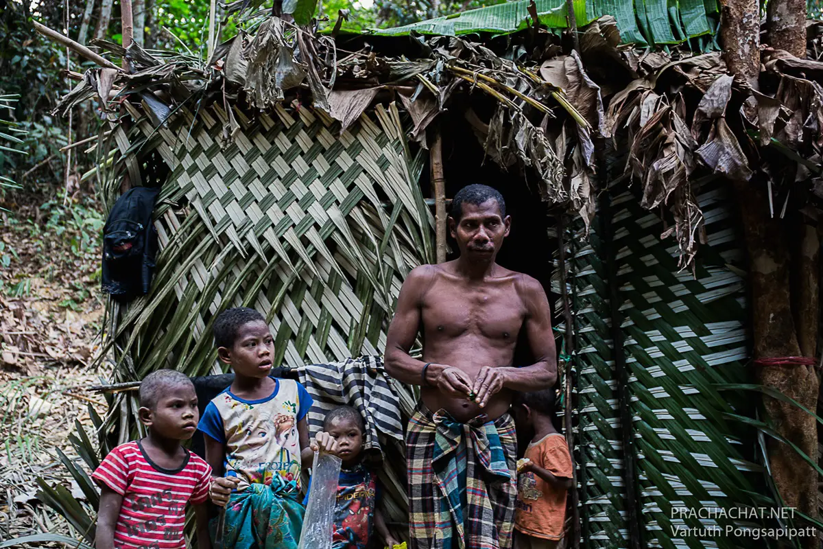
16. Mani Community at Ban Lo Han is an Indigenous cultural learning area around Ban Lo Han, Moo 7, Thung Nari Subdistrict, Pa Bon District. Although the existing English LoveThailand page uses the older title “Sakai Forest Community,” the term Mani is more appropriate when referring to the Indigenous group themselves.
The community’s traditional knowledge is closely connected with the forest environment behind Khlong Pa Bon Reservoir and the Banthat Mountain Range. Forests, streams, wild foods, medicinal plants, and knowledge of the surrounding landscape have long played important roles in Mani livelihoods.
The Ban Lo Han area contains lowland terrain, streams, reservoirs, foothills, and forest. A visit therefore provides an opportunity to understand the relationship between Indigenous knowledge, forest ecosystems, water resources, and the wider mountain landscape.
Visits should be coordinated with local community contacts or responsible authorities. Travelers should not enter residential areas without permission, and photographs of individuals should only be taken with clear consent. The experience should focus on respectful learning rather than treating community members as a tourist display.
Getting There: From Phatthalung town, travel toward Pa Bon District, then continue to Thung Nari Subdistrict and Ban Lo Han, Moo 7. Private transport is the most practical option. Access to forest areas beyond Khlong Pa Bon Reservoir should be arranged locally and undertaken only with permission.
Map (GPS): https://maps.app.goo.gl/HvHXe6k2yuCJxfwz9
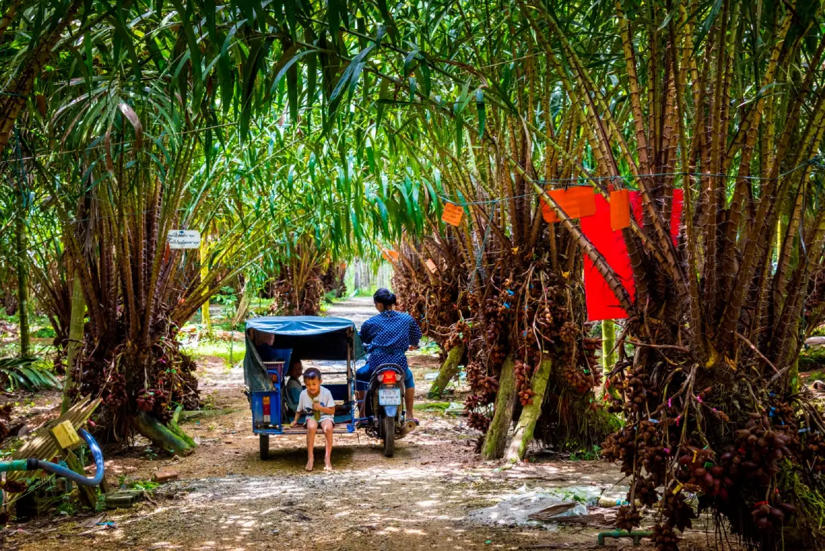
17. Suan Sala Lung Than is a well-known agritourism attraction at 6 Moo 5, Nong Thong Subdistrict, Pa Bon District. The garden developed from an agricultural property into a learning site focused on salak palm cultivation and orchard management, allowing visitors to observe real farming practices.
The garden contains around 20 rai of salak cultivation and more than 1,000 salak palms. The planting area is organized into clearly managed plots, with taller palms helping provide appropriate shade and growing conditions. Visitors can walk through the orchard and observe fruit clusters, farm layout, and day-to-day cultivation methods.
One of the most interesting subjects is hand pollination. Salak palms have separate male and female flowers, and producing high-quality fruit requires careful pollination at the correct stage. The garden therefore provides a useful opportunity to understand the skill and timing required for commercial salak production.
Suan Sala Lung Than is a good example of how agriculture can be combined with educational tourism. It is suitable for families, students, agricultural visitors, and travelers interested in the orchard-based economy of southern Thailand.
Getting There: The garden is located at 6 Moo 5, Nong Thong Subdistrict, Pa Bon District. From Phatthalung town, drive toward Pa Bon and continue to Nong Thong Subdistrict. The site can be combined with other agricultural and natural attractions in the southern part of the province.
Map (GPS): https://maps.app.goo.gl/tDRWh8r1UBoHsy7B7
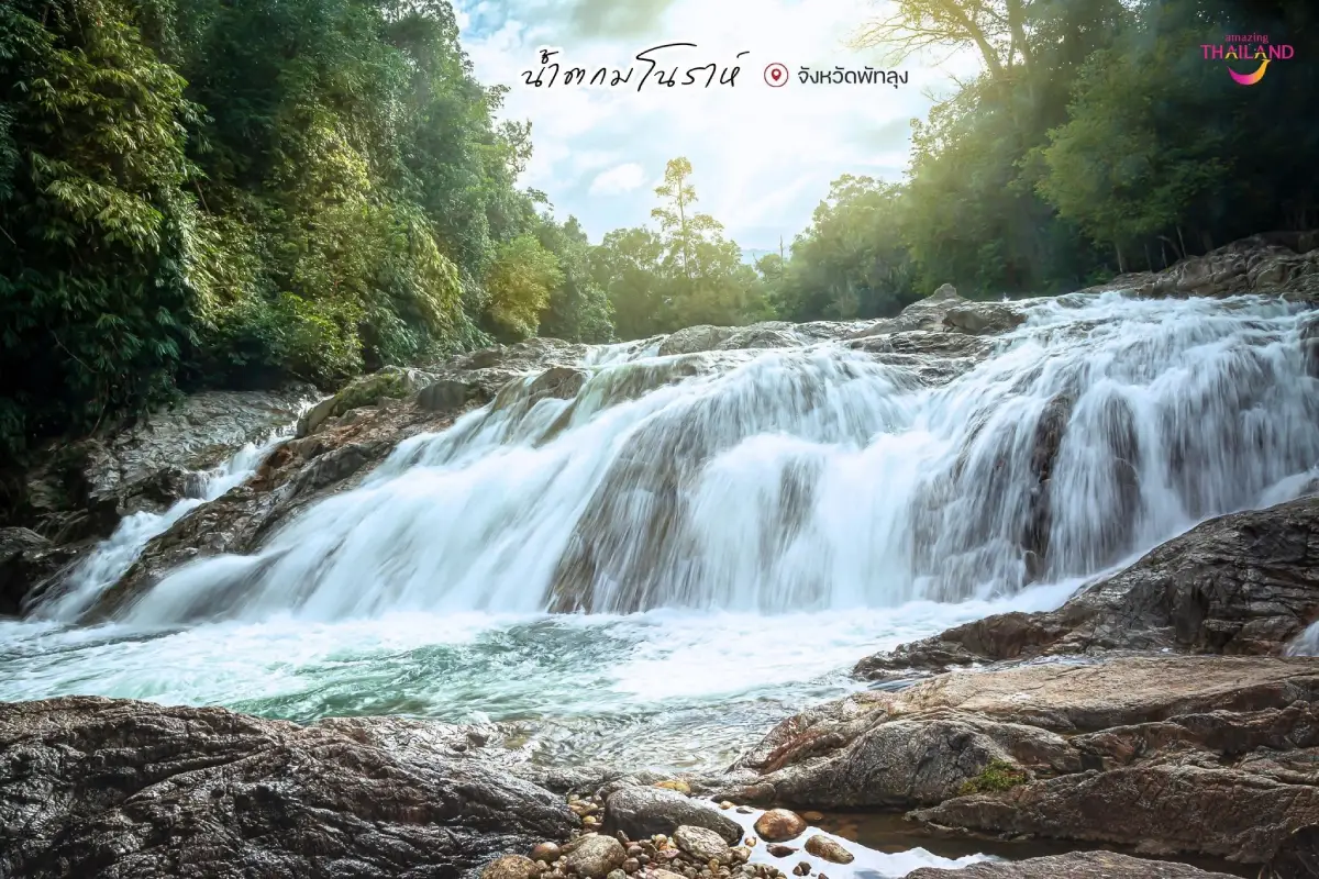
18. Manora Waterfall is a natural waterfall at Ban Thung Na Pho in Khlong Chaloem Subdistrict, Kong Ra District, within the forest landscape associated with Khao Banthat Wildlife Sanctuary. It lies before Phraiwan Waterfall and is known for clear flowing water, rocks, forest shade, and a peaceful natural environment.
The stream passes through forested terrain and forms several natural pools and rocky sections. Visitors can rest beside the water or use safe shallow areas without undertaking a difficult forest trek, making the site suitable for a relaxed nature stop.
A suspension bridge is another feature of the area and provides a different perspective over the surrounding landscape. Visitors should use the bridge responsibly, avoid jumping or shaking it, and allow others sufficient space.
Water flow is generally more attractive after the rainy season, but heavy rain can rapidly change conditions. If the water becomes muddy, unusually fast, or rises quickly, visitors should leave the stream immediately and move to safer ground.
Getting There: From Phatthalung town, follow Phet Kasem Road toward Kong Ra District, then take the Ban Khlong Muai route and Highway 4122. From the access junction, continue to the parking area and walk approximately 500 meters to the waterfall.
Map (GPS): https://maps.app.goo.gl/P4j5eWmfwXWeUcKR8
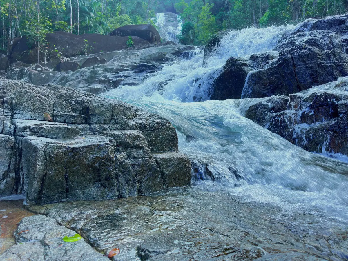
19. Rai Nuea Waterfall is a natural waterfall at Ban Rai Nuea, Moo 4, Kong Ra District, on the lower slopes of the Banthat Mountain Range. Water flows over several rock levels, broad stone surfaces, boulders, and natural pools, while the surrounding landscape contains forest, rubber plantations, fruit orchards, and foothill communities.
One distinctive feature is the way water spreads across the sloping rock surface. From a distance, the white flow can resemble fabric moving in the wind, giving rise to the alternative local description “Nam Plio,” or flowing water that appears to flutter.
The waterfall does not descend from a single vertical cliff. Instead, water travels across a sequence of rock levels, creating areas suitable for sitting, resting, cooling the feet, and swimming when conditions are safe.
The atmosphere is generally quiet and close to the local community. Rai Nuea Waterfall can be combined with Manora Waterfall, Phraiwan Waterfall, and other natural sites in Kong Ra to create a full-day waterfall route.
Getting There: From Phatthalung town, follow Highway 4 for approximately 18 kilometers, then turn onto the Khlong Muai–Ban Kong Ra road and continue for around 17 kilometers toward Ban Rai Nuea and the waterfall area.
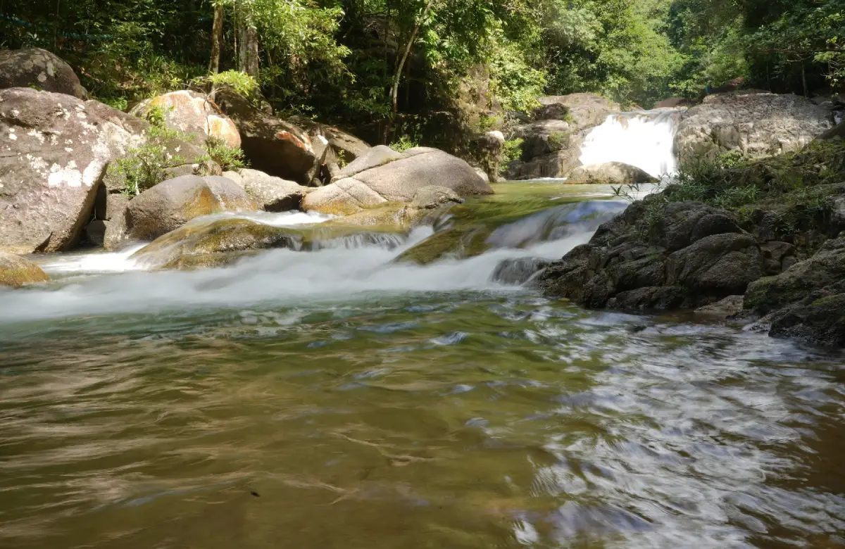
20. Ban Khlong Wa Lang Waterfall (Nok Ram Waterfall) is a natural waterfall in the Ban Khlong Wa Lang area of Kong Ra District. Located within the broader Banthat Mountain wildlife landscape, it is a relatively small waterfall with clear water, rocky stream sections, natural pools, and shady forest surroundings.
The site retains a simple, undeveloped character. Water flows through rocks and small pools under tree cover, making it suitable for sitting beside the stream, photography, quiet nature walks, and swimming only in clearly safe areas.
The surrounding area is also associated with natural hot-water features, adding another geological element to the local environment. This combination of cool stream water and underground geothermal activity makes the wider area particularly interesting from a natural-history perspective.
Ban Khlong Wa Lang Waterfall can be included in a Kong Ra waterfall route together with Rai Nuea, Manora, and Phraiwan waterfalls. During the rainy season, travelers should monitor conditions carefully and avoid entering the water when currents are strong or unusually muddy.
Getting There: From Phatthalung town, travel toward Kong Ra District using Highway 4 and continue onto the Khlong Muai–Ban Kong Ra route toward Ban Khlong Wa Lang. Private transport is the easiest option, and local directions may be useful for the final community road.
Map (GPS): https://maps.app.goo.gl/74cdCd2HYtorXTYq9
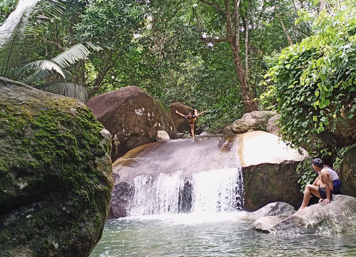
21. Nam Tok Nan Lud (Nam Tok Nan Harut) is a small to medium-sized local waterfall in Moo 4, Khlong Sai Khao Subdistrict, Kong Ra District. The stream passes over sloping rock surfaces, boulders, and natural pools in a quiet foothill environment connected with the Banthat Mountain Range.
The waterfall is not particularly large, but its appeal comes from the natural setting and uncomplicated access. The stream forms several places for sitting, soaking the feet, and cooling off, making it suitable for travelers who want a relaxed half-day nature stop.
Khlong Sai Khao Subdistrict contains mountains, orchards, rural communities, and streams. The surrounding landscape therefore adds a strong local character to the waterfall experience. Water levels are generally more attractive after the rainy season, although heavy rainfall can make swimming unsafe.
Nam Tok Nan Lud can be combined with other waterfalls in Kong Ra, including Rai Nuea and Manora, allowing travelers to explore several natural sites within the same district without repeatedly returning to Phatthalung town.
Getting There: From Phatthalung town, travel to Kong Ra District and continue toward Khlong Sai Khao Subdistrict, Moo 4. Private car or rental vehicle is the most convenient option.
Map (GPS): https://maps.app.goo.gl/HDMAYEeAgWuein9S6
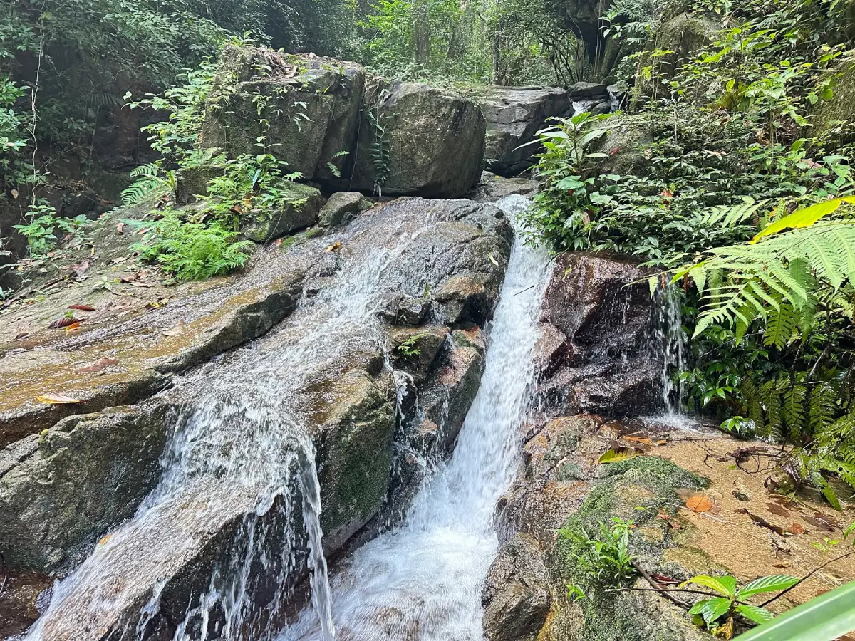
22. Riang Thong Waterfall is an important waterfall within Khao Pu–Khao Ya National Park in Moo 1, Khao Pu Subdistrict, Si Banphot District. Its stream descends through numerous rock levels within tropical evergreen forest, leading to the local description of the site as a waterfall with many or even “a hundred” tiers.
The water follows a long natural route through the forest rather than dropping from one isolated cliff. Different sections alternate between flowing stream, small cascades, larger waterfall sections, rocky slopes, and forest viewpoints.
From some higher areas, visitors may see parts of the surrounding national park landscape and, in clear conditions, broader views toward the eastern side of Phatthalung. Travelers planning to climb to higher sections should wear suitable footwear, carry drinking water, and check trail conditions with park staff.
Riang Thong Waterfall is better suited to visitors interested in forest exploration than to those looking only for a short roadside swimming stop. Because it lies within the national park, travelers should follow park regulations and check current access conditions before visiting.
Getting There: From Phatthalung town, take Highway 41 for approximately 20 kilometers to Pho Thong Junction, then turn onto Highway 4164 toward Khuan Khanun–Khao Pu for around 17 kilometers. Follow the national park signs for approximately another 4 kilometers.
Map (GPS): https://maps.app.goo.gl/ixHDVb1VJnCcdSSW9
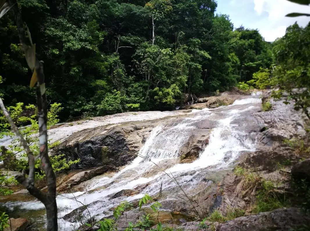
23. Khao Khram Waterfall is a large waterfall in the Ban Pa Son area, Moo 10, Ban Na Subdistrict, Si Nakharin District. Surrounded by forest connected with the Banthat Mountain Range, the waterfall descends through approximately nine levels and forms one of the more substantial mountain-waterfall landscapes in this part of Phatthalung.
The waterfall extends over a long vertical and sloping section of mountain terrain, with an overall height of roughly 700 meters. Water passes over cliffs, broad rock surfaces, and several levels, giving each section a somewhat different appearance.
The surrounding forest is quiet and strongly characteristic of a watershed landscape. During periods of good water flow, the long white stream can be seen descending through the mountain vegetation. Heavy rainfall, however, can make some sections dangerous.
Khao Khram Waterfall can be combined with Sumano Cave and other attractions in Si Nakharin District, creating a full-day route of caves, waterfalls, limestone mountains, and forest scenery.
Getting There: From Phatthalung town, follow Phet Kasem Road toward Si Nakharin District for approximately 25 kilometers to the Ban Ton Sai area, then turn onto the Ton Sai–Ban Khao Khram road and continue for around 3 kilometers.
Map (GPS): https://maps.app.goo.gl/aaEg2NvfmLerrxiF7
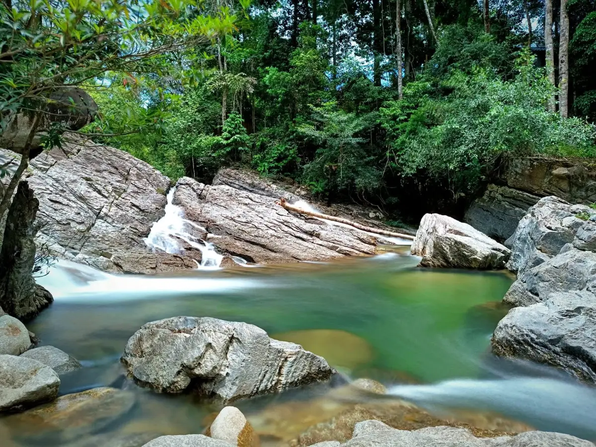
24. Ton Phrae Thong Waterfall, also known locally as Ban Ton Waterfall, is a medium-sized waterfall in Moo 5, Lam Sin Subdistrict, Si Nakharin District. Water flows over several natural rock levels within the green foothills of the Banthat Mountain Range, creating a pleasant setting for swimming, relaxing, and spending time in nature.
The waterfall is known for having flowing water through much of the year and several natural pools. Some areas are suitable for sitting or cooling the feet, while other sections can be used for swimming when water levels and currents are safe.
The route around the waterfall is not excessively difficult, making the attraction suitable for families and groups of friends. Nevertheless, rocks close to the stream can be slippery, so footwear with good grip is recommended.
Ton Phrae Thong Waterfall can be combined with Lam Sin Cave and other attractions in Si Nakharin District. It is particularly suitable for travelers who want a natural day trip without undertaking a difficult trek deep into the mountains.
Getting There: From Phatthalung town, follow Highway 4 on the Phatthalung–Trang route for approximately 18 kilometers, then use the Khlong Muai Ban–Kong Ra road for around 9 kilometers. At the Ban Ton junction, turn west and follow the signs for approximately another 5 kilometers.
Map (GPS): https://maps.app.goo.gl/byog2k2opK17bmar5
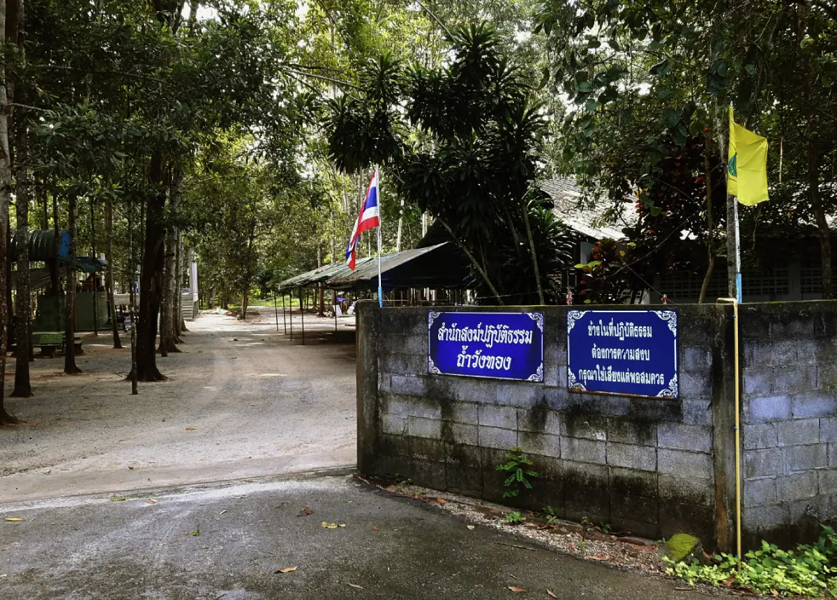
25. Tham Wang Thong is a natural cave and quiet Buddhist site in Phanom Wang Subdistrict, Khuan Khanun District. The cave is associated with a monastic residence and is therefore different from a purely recreational cave attraction. Visitors come here for a calm experience combining limestone scenery, a religious atmosphere, and the rural character of the surrounding community.
Tham Wang Thong is not a heavily developed tourist destination. Its main value lies in the quiet setting and connection with a Buddhist monastic area. The surrounding landscape includes villages, temples, orchards, rubber plantations, rural roads, and limestone hills.
The cave should be approached as a peaceful natural and spiritual site rather than an adventure attraction. Paths may be damp, uneven, dark, or slippery in some sections, so visitors should wear shoes with good grip, carry a flashlight when appropriate, and avoid deep or restricted sections without guidance.
Visitors should dress modestly, speak quietly, and avoid disturbing monks or people practicing meditation. Photography should also be respectful, particularly around private monastic zones and religious activities.
Getting There: Travel to Phanom Wang Subdistrict in Khuan Khanun District. Private car is the easiest option. Search for “Tham Wang Thong Phanom Wang Khuan Khanun Phatthalung” or “Tham Wang Thong Monastic Residence” in a navigation application. If the final access road is unclear, use Phanom Wang Subdistrict Administrative Organization as a reference point and ask local residents for directions.
Map (GPS): https://maps.app.goo.gl/c564mGvC7sZ6rpnE6
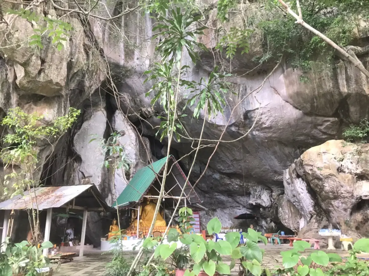
26. Tham Khao Nang Chi is a natural limestone cave and nationally registered historic site at Moo 4, Ban Thung Kha, Phanom Wang Subdistrict, Khuan Khanun District. The cave combines natural geology, Buddhist heritage, ancient mural paintings, inscriptions, local legends, and cave ecology in one significant cultural landscape.
One of the cave’s most important features is its ancient mural art. Paintings appear on several wall surfaces and include Buddhist imagery associated with past Buddhas and the reclining Buddha. Their artistic characteristics reflect connections with late Ava-period Burmese art and the middle Ayutthaya period, making the cave particularly valuable for the study of southern Thai religious art.
Thai inscriptions dating from the Ayutthaya period have also been found inside the cave. Together with the paintings, limestone chambers, and local religious traditions, these inscriptions demonstrate that Khao Nang Chi was historically more than a natural shelter. It was also a place of Buddhist expression and community belief.
The cave is home to many bats and should be visited quietly. Visitors must not touch murals, inscriptions, cave walls, stalactites, or other heritage surfaces. Flash photography near ancient paintings should be avoided, and shoes with good grip are recommended because cave floors can be damp and uneven.
Getting There: Travel by car to Moo 4, Ban Thung Kha, Phanom Wang Subdistrict, Khuan Khanun District. Search for “Tham Khao Nang Chi Phatthalung” in a navigation app. If the final route is unclear, use Phanom Wang Subdistrict Administrative Organization as a reference point and ask local residents for the access road.
Map (GPS): https://maps.app.goo.gl/CqVaw5bzsEQjyanz6
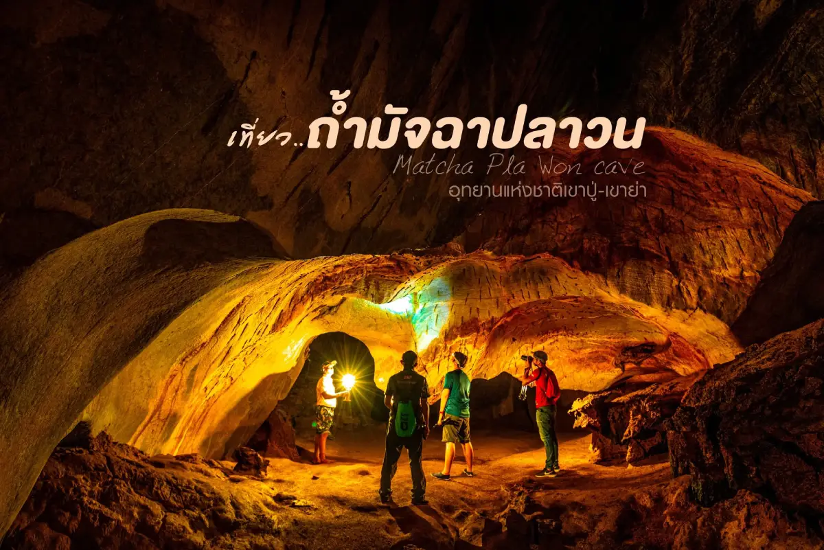
27. Tham Matcha Pla Won is a natural cave inside Khao Pu–Khao Ya National Park in Khao Pu Subdistrict, Si Banphot District, approximately 2 kilometers from the national park headquarters. Its best-known feature is a clear natural pool inside the cave where small fish can be seen swimming in the calm water.
The cave lies within the humid evergreen forest of the Banthat Mountain Range. Its shaded entrance, limestone walls, humid air, stalactites, stalagmites, and natural water features create a cool environment that contrasts strongly with the forest outside.
The fish pool is the most memorable part of the cave and gives the site its name. Visitors should observe the fish without feeding or touching them and should avoid stirring sediment or throwing anything into the water because cave-water ecosystems are especially sensitive.
Tham Matcha Pla Won can be combined with Riang Thong Waterfall, nature trails, viewpoints, and other attractions within Khao Pu–Khao Ya National Park. Visitors should check current national park access conditions before traveling, especially during seasonal closures or periods of heavy rain.
Getting There: Travel to Khao Pu–Khao Ya National Park in Si Banphot District. From the park headquarters, continue along the internal park route toward Tham Matcha Pla Won, approximately 2 kilometers away.
Map (GPS): https://maps.app.goo.gl/d6YpAkbKJc5LymrXA
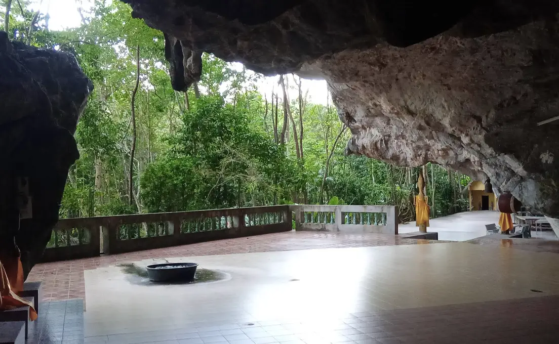
28. Tham Lam Sin (Phra Phutthawihan Cave) is a natural limestone cave and Buddhist sacred site at Moo 3, Lam Sin Subdistrict, Si Nakharin District. Large trees shade the surrounding area, while the cave entrance opens into a spacious chamber containing Buddha images and areas used for worship.
The quiet atmosphere makes the cave suitable for travelers who want a slower spiritual stop between more active nature attractions. Visitors can rest, observe the limestone landscape, and experience a religious site that has developed naturally within the mountain environment.
The cave reflects a wider southern Thai tradition of using limestone caves as sacred Buddhist spaces. The placement of Buddha images inside natural rock chambers creates a strong connection between landscape, religious practice, and community faith.
Visitors should dress modestly, keep noise low, and walk carefully inside the cave. Tham Lam Sin can be combined with Ton Phrae Thong Waterfall and other natural attractions in Si Nakharin District.
Getting There: From Phatthalung town, take Highway 4 on the Phatthalung–Trang route toward Si Nakharin District and Lam Sin Subdistrict, then continue to Moo 3 and the cave area.
Map (GPS): https://maps.app.goo.gl/sZhpiULoN8tQdXB1A
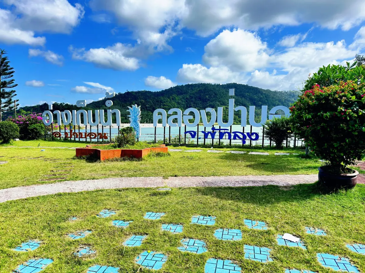
29. Klong Pa Bon Reservoir is a medium-sized reservoir at Ban Lo Han, Moo 7, Thung Nari Subdistrict, Pa Bon District, surrounded by the mountain landscape of the Banthat Range. Covering approximately 2,000 rai, the reservoir is an important water-storage project supporting agriculture, household water use, and flood management.
The main tourism appeal is the broad water surface framed by forested hills and mountains. Early morning and late afternoon provide especially pleasant conditions for photography, walking, and quiet relaxation beside the reservoir.
A waterside walkway extends for around 1,500 meters and several resting pavilions allow visitors to stop and enjoy the scenery. The reservoir is particularly suitable for travelers seeking peaceful landscapes rather than commercial tourism activities.
Klong Pa Bon Reservoir is also closely connected with Ban Lo Han and the surrounding forest landscape. Because it remains an active water source for local communities, visitors should avoid littering, contaminating the water, or entering operational areas without permission.
Getting There: From Phatthalung town, travel toward Pa Bon District, then continue to Thung Nari Subdistrict and Ban Lo Han, Moo 7. A private car or rental vehicle is the most convenient option.
Map (GPS): https://maps.app.goo.gl/iKBEn874pN8VmmtNA
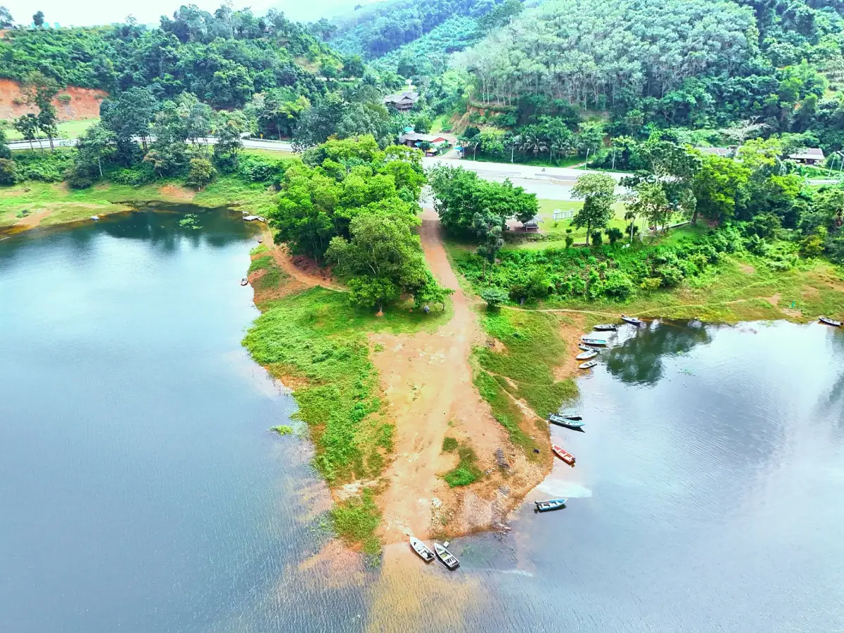
30. Pa Phayom Reservoir is a scenic reservoir in Ban Wang Len, Ko Tao Subdistrict, Pa Phayom District. Created by an earth dam across Khlong Pa Phayom, it plays an important role in water storage for agriculture and surrounding communities while also functioning as a peaceful recreational landscape.
The reservoir is surrounded by the mountain scenery of the Banthat Range, creating broad views of water, forest, and sky. On clear days, reflections of the mountains across the reservoir add to the visual appeal.
Beyond tourism, the reservoir remains important for local water management and agriculture. Understanding this working function adds context to a visit and helps explain the relationship between Phatthalung’s mountain watersheds and farming communities.
The reservoir can be combined with other natural attractions in Pa Phayom and the northern part of Phatthalung, including routes toward Khao Pu–Khao Ya National Park.
Getting There: From Phet Kasem Road, turn onto the Pa Phayom–Khuan Din So route and continue approximately 16 kilometers to Ban Wang Len, Ko Tao Subdistrict, Pa Phayom District.
Map (GPS): https://maps.app.goo.gl/bS6Lkp4KE7BBp2Mb8
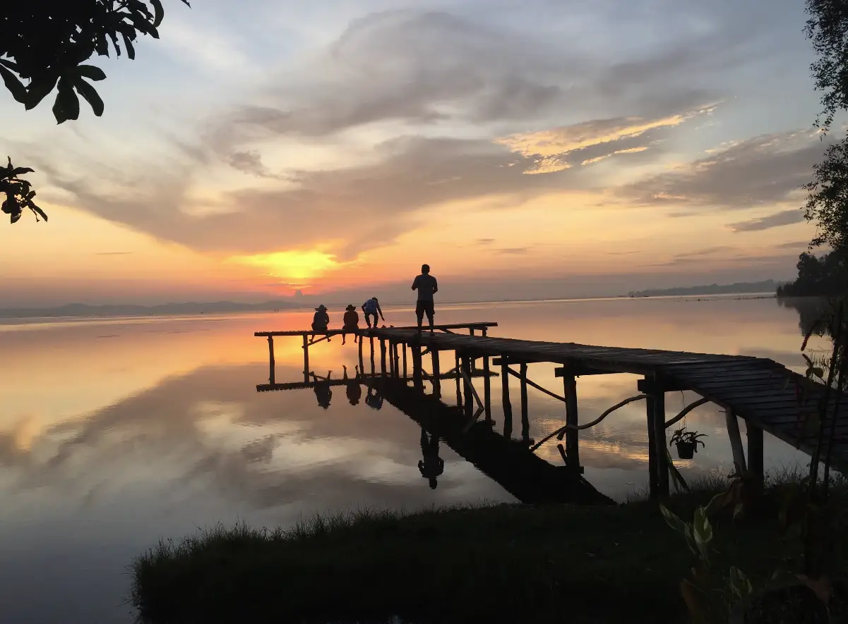
31. Phat Thong Beach is a quiet lakeside recreation area in Chong Thanon Subdistrict, Khao Chaison District, near Ban A Phat and the shoreline of Songkhla Lake. Its main appeal is a simple natural setting with large shade trees, lakeside vegetation, steady breezes, and wide views across the water.
Unlike an open-sea beach, Phat Thong faces Songkhla Lake. The shoreline environment therefore has gentler water movement and more aquatic vegetation, creating a very different atmosphere from beaches on the Andaman Sea or Gulf of Thailand.
The beach is well suited to picnics, lakeside photography, sitting beneath the trees, and slow travel. Visitors should bring their own supplies when necessary and remove all rubbish after the visit to help protect the lake ecosystem.
Phat Thong Beach can be combined with Laem Chong Thanon and Wat Phra Borommathat Chedi Khian Bang Kaeo, creating a route that includes lakeside nature, fishing communities, and historical attractions in Khao Chaison.
Getting There: From Phatthalung town, take Phet Kasem Road or Highway 4 toward Khao Chaison District, then continue to Chong Thanon Subdistrict and Ban A Phat near Songkhla Lake.
Map (GPS): https://maps.app.goo.gl/cGJ225y8gSTCvjWe8
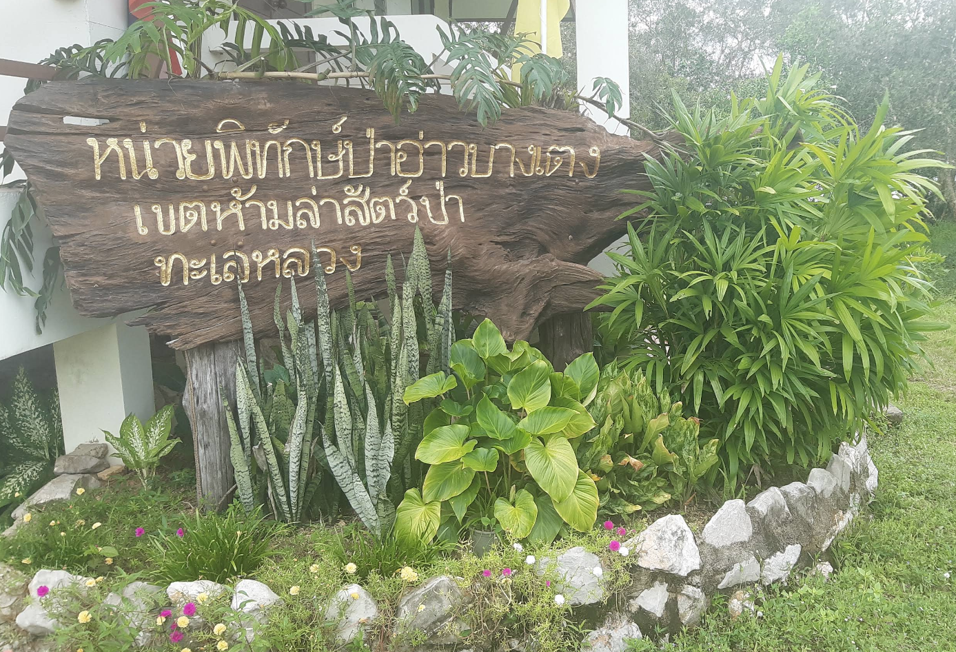
32. Ao Bang Teng is a quiet lakeside bay at Moo 3, Ban Bang Teng, Pak Phayun Subdistrict, Pak Phayun District. The attraction is known for open views across Songkhla Lake, waterbirds, fishing boats, and the relaxed atmosphere of a traditional lakeside community.
Ao Bang Teng is not an open-sea beach. It forms part of the wider Songkhla Lake ecosystem, where fishing, wetland habitats, aquatic resources, and community life remain closely linked.
Morning and late afternoon are particularly suitable for birdwatching and photography. The softer light across the water, cooler temperatures, and increased activity of waterbirds make these periods especially rewarding.
Ao Bang Teng can be combined with Ko Mak, Ko Nang Kham, and other community-based attractions in Pak Phayun District. Visitors should avoid disturbing birds, fishing equipment, or private lakeside property.
Getting There: Travel to Pak Phayun District, then continue to Pak Phayun Subdistrict and Moo 3, Ban Bang Teng. Pak Phayun Municipality can be used as a useful navigation reference.
Map (GPS): https://maps.app.goo.gl/XpKC5cJWTQ1VXb2f8
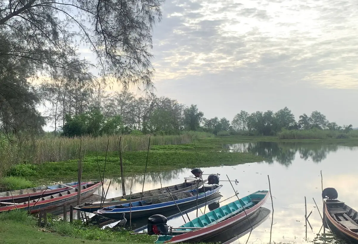
33. Hat Thong is a lakeside attraction at Moo 6, Ban Bang Khuan, Falami Subdistrict, Pak Phayun District. The area offers broad views over Songkhla Lake, a quiet shoreline atmosphere, and access to local boat routes leading toward islands in the central lake.
The attraction is best suited to travelers seeking quiet scenery rather than conventional beach activities. Morning and late afternoon provide cooler conditions and better light for viewing the lake and surrounding communities.
Local boat trips may connect the area with Ko Rab and the Ko Si–Ko Ha island group. Boat availability, routes, weather, passenger capacity, prices, and life jackets should always be confirmed locally before departure.
Hat Thong can therefore function either as a short lakeside stop or as a departure point for exploring the wider Songkhla Lake landscape.
Getting There: Travel by car to Falami Subdistrict in Pak Phayun District, then continue to Moo 6, Ban Bang Khuan. Local community landmarks and accommodation around Hat Thong can be used as navigation references.
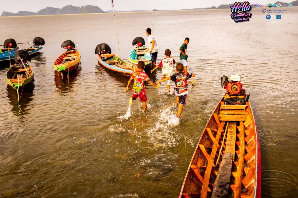
34. Hat Khai Tao is a peaceful Songkhla Lake shoreline attraction at Ban Hat Khai Tao, Moo 1, Na Pakho Subdistrict, Bang Kaeo District. Small lakeside pavilions, natural vegetation, gentle lake ripples, and views toward the Ko Si–Ko Ha island group create a relaxed rural atmosphere.
Hat Khai Tao differs from an open-sea beach because it forms part of the Songkhla Lake system. The water is generally calmer, the horizon is broad, and vegetation along the shoreline reinforces the feeling of a natural community landscape.
The beach is particularly good for sitting beside the lake, walking along the shoreline, photography, and viewing Ko Si–Ko Ha from a distance. Its appeal lies more in atmosphere and scenery than in developed tourism facilities.
Morning and late afternoon are the most comfortable times to visit. Travelers should avoid unknown water areas, protect shoreline vegetation, keep the area clean, and supervise children closely near the water.
Getting There: From Phatthalung town, follow Highway 4 south. At Ban Mae Khri Junction, turn onto Highway 4038, pass Bang Kaeo District, and continue toward Ban Hat Khai Tao in Na Pakho Subdistrict.
Map (GPS): https://maps.app.goo.gl/ZtdmPGgT1BNP1xDD8
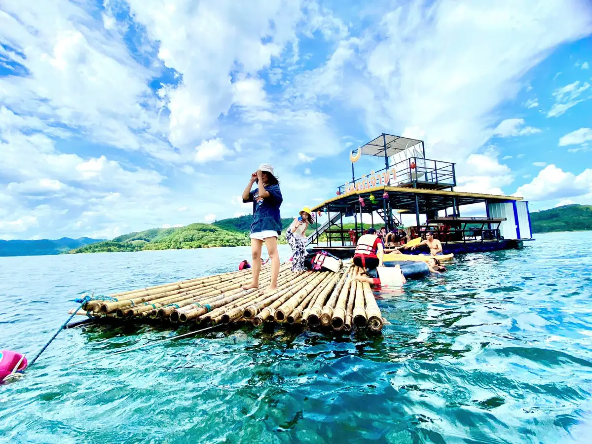
35. Ko Phae is an island-community area in Moo 5, Ko Nang Kham Subdistrict, Pak Phayun District. The community is closely connected with Songkhla Lake through fishing, boat travel, aquaculture, food resources, and a settlement pattern shaped by the surrounding water.
The attraction is less about built tourist facilities and more about observing authentic lakeside life. Visitors may see local houses, mosques, fishing boats, lift nets, fish cages, shrimp farming, and other activities connected with the lake economy.
Ko Phae adds another dimension to Phatthalung’s landscape, showing that the province includes not only forests, waterfalls, wetlands, and rice fields but also island communities whose lives remain closely connected with Songkhla Lake.
Travelers interested in boat trips or community activities should contact local operators before arriving to confirm routes, meeting points, weather, and available services. Respect for private homes and local livelihoods is essential.
Getting There: From Pak Phayun town, follow local roads toward Ko Nang Kham Subdistrict and Moo 5. Visitors arranging boat or community activities should coordinate with local operators in advance.
Map (GPS): https://maps.app.goo.gl/LtSnS7X9aWCyqk6NA
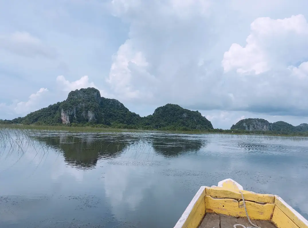
36. Mu Ko Si Ko Ha is a group of limestone islands in the central part of Songkhla Lake, within Ko Mak Subdistrict, Pak Phayun District. The islands combine dramatic limestone scenery, caves, swiftlet nesting areas, local history, and the traditional lake environment.
The name translates as “Four Islands, Five Islands.” The group appears to contain four islands when viewed from some directions and five from another, producing the distinctive name that has long been associated with this part of Songkhla Lake.
The islands are also historically significant. At Ko Na Thevada, royal initials associated with King Chulalongkorn’s visit can be found, linking the island group with the travel history of King Rama V in southern Thailand.
Visitors travel by boat and should check weather, wind, access restrictions, and local boat schedules before departure. Some areas are connected with swiftlet-nest concessions and conservation, so access may be limited and local instructions must be followed.
Getting There: Travel to Pak Phayun or Ko Mak, then continue by local boat from an appropriate community pier. Boat travel from Pak Phayun generally takes around 1 hour depending on the departure point and weather conditions.
Map (GPS): https://maps.app.goo.gl/rsBk6C2QB6ak2GoY8
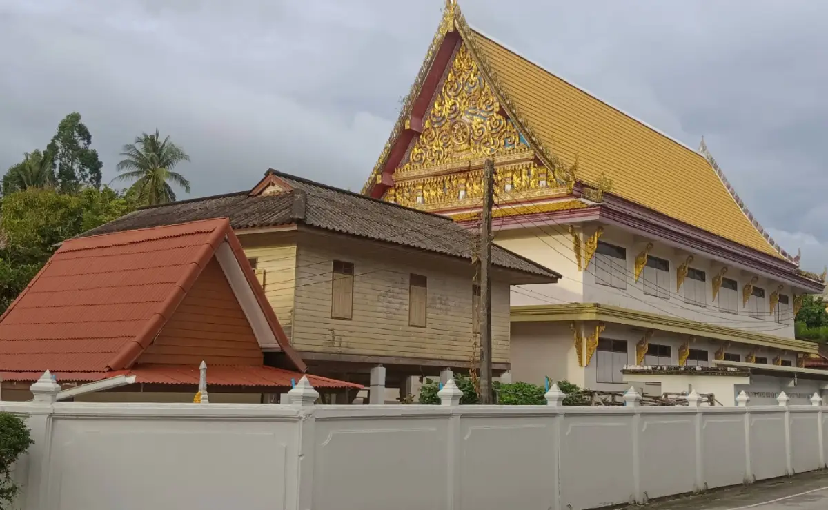
37. Wat Tamot is an important Buddhist temple in Tamot District and serves not only as a religious site but also as a center for local education, culture, community learning, and grassroots development.
Important areas include the viharn dedicated to Phor Than Chuay Intasaro, the first officially appointed abbot of the temple, together with the ordination hall, pavilions, cultural-learning areas, and community facilities.
Wat Tamot is also associated with the community forum known as “Sapha Lan Wat Tamot,” an example of how temple grounds can function as a shared space for discussion, cooperation, and local problem-solving.
Travelers interested in understanding Tamot more deeply can combine the temple with Ban Tamot Cultural Center. Together, the two places provide insight into local religion, history, community organization, and cultural continuity.
Getting There: From Phatthalung town, travel toward Tamot District and continue to Tamot Subdistrict. Private transport is the easiest option and also allows visitors to combine the temple with nearby community and nature attractions.
Map (GPS): https://maps.app.goo.gl/ucfNJCQkFvXT8B9B9
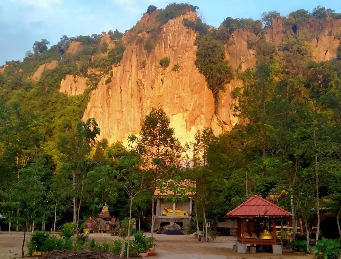
38. Khao Lak Kho is a small limestone hill in Na Not Subdistrict, Mueang Phatthalung District, rising approximately 200–250 meters. The area is closely connected with Wat Hua Mon, Ban Hua Mon community, local legends, and a present-day Buddhist monastic retreat.
The limestone hill and surrounding trees create a peaceful setting suitable for meditation, religious visits, and quiet nature observation. It is a useful alternative for travelers who want to explore locations beyond Phatthalung’s major tourist landmarks.
Khao Lak Kho also reflects the connection between the landscape and local community history. Stories associated with the mountain, old temple traces, and the continuing religious use of the area give the site both natural and cultural significance.
Because it remains a monastic area, visitors should dress modestly, keep noise low, and avoid entering private meditation zones. Walking surfaces can become slippery after rain.
Getting There: From Phatthalung town, travel toward Na Not Subdistrict and the Ban Hua Mon or Khao Lak Kho area using local roads. Private transport is the easiest option.
Map (GPS): https://maps.app.goo.gl/zy2sT4kSHwBdtrKL9
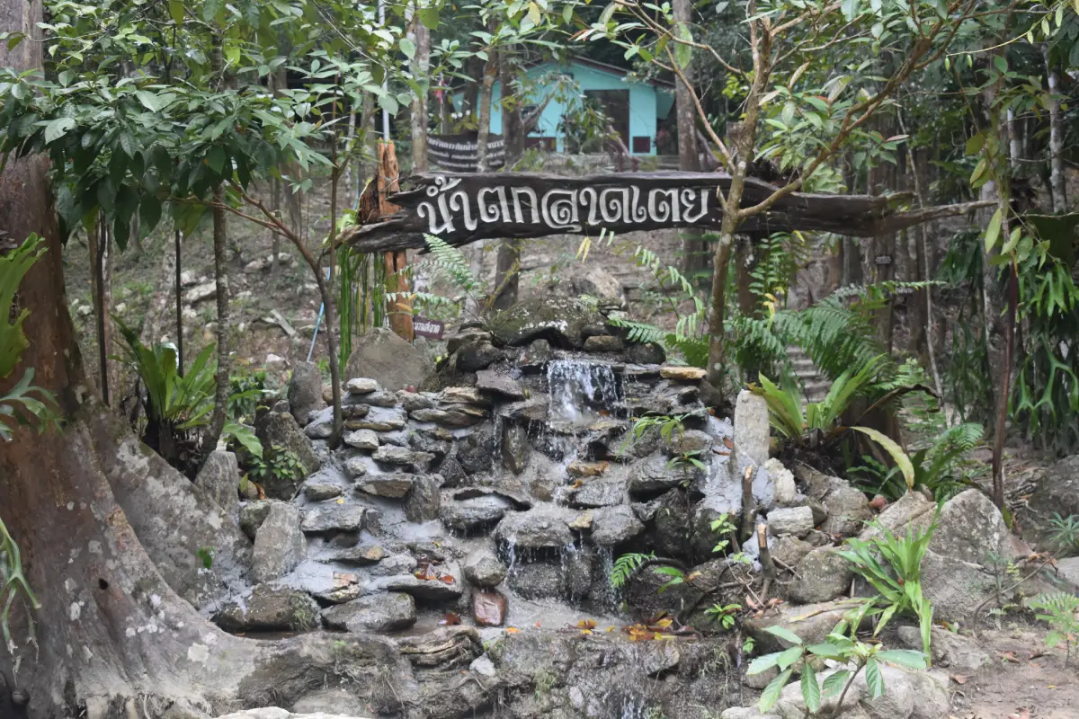
39. Lad Toei Waterfall is a forest waterfall at Moo 4, Ban Lo Ba, Khlong Yai Subdistrict, Tamot District, within the wider Khao Banthat Wildlife Sanctuary landscape. Clear water flows over rocky cascades and natural pools beneath dense forest shade.
The stream contains several relatively gentle sections suitable for cooling off and family relaxation during normal water conditions. The forest surroundings also make the area suitable for plant observation, birdwatching, and nature photography.
Because the waterfall is fed by mountain streams, conditions can change quickly after heavy rain. Cloudy water, sudden changes in water color, floating leaves, or stronger currents should be treated as warning signs of possible flash flooding.
The waterfall can be combined with Wat Tamot and other community attractions in Tamot District. Morning to early afternoon is generally the most practical visiting period.
Getting There: Lad Toei Waterfall is approximately 15 kilometers west of Tamot District Office. Travel toward Khlong Yai Subdistrict and Ban Lo Ba by private car or rental vehicle.
Map (GPS): https://maps.app.goo.gl/JqLfk8tj3dQNpC3t7
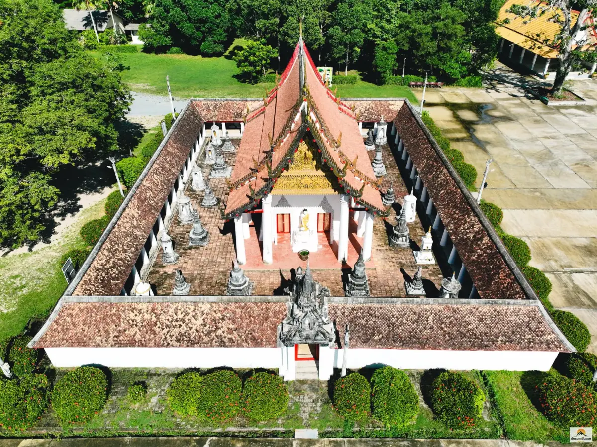
40. Wat Wang is an important Buddhist temple and historic site in Moo 4, Lampam Subdistrict, Mueang Phatthalung District, approximately 6–7 kilometers from the city center. The temple is closely linked with the history of old Lampam and provides insight into Phatthalung during the early Rattanakosin period.
Wat Wang was historically associated with the Oath of Allegiance Water Ceremony used by government officials. The temple contains architecture, mural paintings, stucco Buddha images, chedis, and traditional decorative elements that reflect the craftsmanship of earlier periods.
The mural paintings are among the most important features to observe carefully. Together with other architectural and artistic elements, they illustrate Buddhist beliefs, local artistic traditions, and historical culture in Phatthalung.
Wat Wang can be combined conveniently with the Governor’s Palace of Phatthalung and Saen Suk Lampam Beach. This creates an excellent half-day historical and cultural route before continuing to the lakeside in the late afternoon.
Getting There: From Phatthalung town, follow Aphai Aphirak Road or Highway 4047 toward Lampam Subdistrict for approximately 6 kilometers. Wat Wang is located on the right before reaching the Governor’s Palace of Phatthalung.
Map (GPS): https://maps.app.goo.gl/P8sN69Fouk6KcLeh8
| Topic | Details |
| Province | Phatthalung, Southern Thailand — a province where the Banthat Mountain Range, agricultural plains, wetlands, and the Songkhla Lake basin meet within a relatively compact area. |
| Travel Overview | Phatthalung is known for Thale Noi wetlands, Khlong Pak Pra and giant lift nets, limestone mountains, waterfalls, caves, reservoirs, lakeside communities, historic temples, Nang Talung shadow puppetry, Nora performing arts, sedge handicrafts, agriculture, and southern Thai food. |
| Top 10 Highlights | 1. Thale Noi 2. Khao Ok Thalu 3. Wat Khuha Sawan 4. Phraiwan Waterfall 5. Khlong Pak Pra 6. Khao Pu–Khao Ya National Park 7. Ho Rae Lake / Hu Rae Rapids 8. Sumano Cave 9. Wat Phra Borommathat Chedi Khian Bang Kaeo 10. Na Po Kae |
| Mueang Phatthalung District | 1. Khao Ok Thalu 2. Wat Khuha Sawan 3. Shadow Puppet Gallery 4. Saen Suk Lampam Beach 5. Khao Lak Kho 6. Wat Wang |
| Khuan Khanun District | 1. Thale Noi 2. Khlong Pak Pra 3. Na Po Kae 4. Tham Wang Thong 5. Tham Khao Nang Chi |
| Kong Ra District | 1. Phraiwan Waterfall 2. Manora Waterfall 3. Rai Nuea Waterfall 4. Ban Khlong Wa Lang Waterfall (Nok Ram Waterfall) 5. Nam Tok Nan Lud |
| Si Nakharin District | 1. Sumano Cave 2. Khao Khram Waterfall 3. Ton Phrae Thong Waterfall 4. Tham Lam Sin |
| Si Banphot District | 1. Khao Pu–Khao Ya National Park 2. Riang Thong Waterfall 3. Tham Matcha Pla Won |
| Khao Chaison District | 1. Wat Phra Borommathat Chedi Khian Bang Kaeo 2. Laem Chong Thanon 3. Phat Thong Beach |
| Bang Kaeo District | 1. Ho Rae Lake / Hu Rae Rapids 2. Bang Kaeo Shadow Puppet Handicraft Center 3. Hat Khai Tao |
| Tamot District | 1. Ban Tamot Cultural Center 2. Wat Tamot 3. Lad Toei Waterfall |
| Pa Bon District | 1. Mani Community at Ban Lo Han 2. Suan Sala Lung Than 3. Klong Pa Bon Reservoir |
| Pa Phayom District | 1. Pa Phayom Reservoir |
| Pak Phayun District | 1. Ao Bang Teng 2. Hat Thong 3. Ko Phae 4. Mu Ko Si Ko Ha |
| Wetlands, Lake and Fishing Culture | Thale Noi, Khlong Pak Pra, Saen Suk Lampam Beach, Laem Chong Thanon, Phat Thong Beach, Ao Bang Teng, Hat Thong, Hat Khai Tao, Ko Phae, and Mu Ko Si Ko Ha. |
| Forests, Mountains and Waterfalls | Khao Ok Thalu, Khao Pu–Khao Ya National Park, Khao Lak Kho, Phraiwan Waterfall, Manora Waterfall, Rai Nuea Waterfall, Ban Khlong Wa Lang Waterfall, Nam Tok Nan Lud, Riang Thong Waterfall, Khao Khram Waterfall, Ton Phrae Thong Waterfall, and Lad Toei Waterfall. |
| Caves and Limestone Landscapes | Khao Ok Thalu, Wat Khuha Sawan, Sumano Cave, Tham Wang Thong, Tham Khao Nang Chi, Tham Matcha Pla Won, and Tham Lam Sin. |
| Temples, History and Heritage | Wat Khuha Sawan, Wat Phra Borommathat Chedi Khian Bang Kaeo, Wat Tamot, Wat Wang, Tham Khao Nang Chi, and Tham Lam Sin. |
| Arts, Culture and Local Wisdom | Shadow Puppet Gallery, Bang Kaeo Shadow Puppet Handicraft Center, Ban Tamot Cultural Center, Na Po Kae, and Suan Sala Lung Than. |
| Community and Local Life | Thale Noi wetland communities, Khlong Pak Pra fishing communities, Laem Chong Thanon, the Mani community at Ban Lo Han, Ko Phae, and the Buddhist–Muslim community landscape of Tamot. |
| Agritourism | Na Po Kae for rice-farming culture, Suan Sala Lung Than for salak cultivation, and Thale Noi communities for sedge handicrafts. |
| Top Activities | 1. Early-morning boat trip at Thale Noi 2. Sunrise and giant lift nets at Khlong Pak Pra 3. Climb Khao Ok Thalu 4. Explore Khao Pu–Khao Ya National Park 5. Visit waterfalls in Kong Ra, Si Nakharin and Tamot 6. Explore limestone caves 7. Learn traditional shadow-puppet carving 8. Visit farms and agricultural learning centers 9. Boat around Mu Ko Si Ko Ha and Songkhla Lake communities |
| Local Food to Try | Sangyod Phatthalung rice, southern sour curry, khua kling, kaeng tai pla, chili dips with local vegetables, pla duk ra fermented catfish, freshwater and lake fish dishes, local vegetables, and salak fruit from Pa Bon. |
| Important Cultural Traditions | Nora performing arts, Nang Talung shadow puppetry, traditional leather carving, sedge weaving, rice-farming traditions, local fishing culture, Buddhist temple traditions, and Muslim community life around Tamot and the Songkhla Lake basin. |
| Best For | Families, couples, photographers, birdwatchers, nature lovers, hikers, culture travelers, community-tourism visitors, southern-food enthusiasts, and travelers seeking quieter destinations beyond major beach resorts. |
| Getting to Phatthalung | Phatthalung can be reached by car, long-distance bus, and Thailand’s southern railway, with Phatthalung Railway Station located in the city center. Travelers flying to the region can use nearby airports such as Trang or Hat Yai and continue by road. |
| Getting Around | A private car or rental vehicle is the most practical choice because attractions are spread across many districts. Boat services are required for some activities at Thale Noi, Khlong Pak Pra, Mu Ko Si Ko Ha, and other Songkhla Lake destinations. |
| 1-Day Itinerary | Before Sunrise: Khlong Pak Pra Morning: Thale Noi Late Morning / Afternoon: Na Po Kae Afternoon: Wat Khuha Sawan or Khao Ok Thalu Evening: Saen Suk Lampam Beach |
| 2-Day Itinerary | Day 1: Khlong Pak Pra – Thale Noi – Na Po Kae – Phatthalung town – Saen Suk Lampam Beach Day 2: Choose Kong Ra for Phraiwan and Manora waterfalls, or explore Khao Chaison and Bang Kaeo for Wat Phra Borommathat Chedi Khian Bang Kaeo, Ho Rae Lake, and Laem Chong Thanon. |
| 3-Day Itinerary | Day 1: Khlong Pak Pra – Thale Noi – Na Po Kae Day 2: Khao Ok Thalu – Wat Khuha Sawan – Shadow Puppet Gallery – Wat Wang – Saen Suk Lampam Beach Day 3: Phraiwan Waterfall – Manora Waterfall – Sumano Cave, or a Khao Chaison–Bang Kaeo–Songkhla Lake route. |
| 4–5 Day Itinerary | Add Khao Pu–Khao Ya National Park, Riang Thong Waterfall, Tham Matcha Pla Won, Pa Phayom, Tamot, Pa Bon, Pak Phayun, Ko Phae, Mu Ko Si Ko Ha, Khao Khram Waterfall, Ton Phrae Thong Waterfall, and Lad Toei Waterfall according to travel interests. |
| For Nature Lovers | Prioritize Thale Noi, Khlong Pak Pra, Khao Pu–Khao Ya National Park, Phraiwan Waterfall, Manora Waterfall, Khao Khram Waterfall, Klong Pa Bon Reservoir, and Pa Phayom Reservoir. |
| For Culture and History | Prioritize Wat Khuha Sawan, Wat Wang, Wat Phra Borommathat Chedi Khian Bang Kaeo, Shadow Puppet Gallery, Bang Kaeo Shadow Puppet Handicraft Center, Ban Tamot Cultural Center, and Wat Tamot. |
| For Photography | Khlong Pak Pra for sunrise and giant lift nets; Thale Noi for lotus flowers, birds and water buffalo; Khao Ok Thalu for city views; and Klong Pa Bon Reservoir, Ao Bang Teng, Laem Chong Thanon, Hat Khai Tao, and Mu Ko Si Ko Ha for lake landscapes. |
| Thale Noi and Khlong Pak Pra | Start early. Khlong Pak Pra is best around sunrise, while Thale Noi is particularly rewarding in the morning when temperatures are cooler, lotus flowers are open, and birds and water buffalo are more active. |
| Before Lake and Boat Trips | Check weather, rainfall, wind, water conditions, boat schedules, departure points, sunrise time, and local access. Trips to Mu Ko Si Ko Ha and other open-lake areas should be arranged with local boat operators in advance. |
| Waterfall, Stream and Cave Safety | Avoid entering water after heavy rain or when streams become muddy or unusually strong. Wear non-slip footwear, do not touch cave formations or heritage surfaces, and avoid unmarked routes without local guidance. |
| Visiting the Mani Community | Coordinate visits in advance, do not enter residential areas without permission, ask before photographing people, and treat the community as an Indigenous society with privacy and dignity rather than as a tourist display. |
| Responsible Travel | Do not litter, feed wildlife, remove plants or animals, damage cave formations, write on historic surfaces, disturb fishing gear, or enter restricted religious and community areas. Supporting local food, crafts, accommodation, guides, and boat services helps tourism income remain within local communities. |
Frequently Asked Questions (FAQ)
Q: Where should first-time visitors go in Phatthalung?
A: Start with Thale Noi, Khlong Pak Pra, Khao Ok Thalu, and Wat Khuha Sawan. Together, these attractions provide a strong introduction to Phatthalung’s wetlands, fishing culture, limestone landscape, history, and local identity.
Q: What is the best one-day itinerary in Phatthalung?
A: Begin before sunrise at Khlong Pak Pra, continue to Thale Noi in the morning, visit Na Po Kae around late morning or early afternoon, explore Wat Khuha Sawan or Khao Ok Thalu in the afternoon, and finish at Saen Suk Lampam Beach.
Q: How should travelers plan a 2–3 day Phatthalung trip?
A: Spend the first day around Khuan Khanun and Thale Noi, the second day in Phatthalung town and Lampam, and the third day exploring Kong Ra, Si Nakharin, Khao Chaison, Bang Kaeo, or Si Banphot according to your interests.
Q: What are the best nature attractions in Phatthalung?
A: Major nature attractions include Thale Noi, Khlong Pak Pra, Khao Pu–Khao Ya National Park, Khao Ok Thalu, Phraiwan Waterfall, Manora Waterfall, Khao Khram Waterfall, limestone caves, reservoirs, and the Songkhla Lake shoreline.
Q: Where can travelers experience Phatthalung culture?
A: Recommended cultural stops include the Shadow Puppet Gallery, Bang Kaeo Shadow Puppet Handicraft Center, Ban Tamot Cultural Center, Wat Phra Borommathat Chedi Khian Bang Kaeo, Wat Wang, Wat Tamot, and Wat Khuha Sawan.
Q: Is Phatthalung suitable for family travel?
A: Yes. The province has accessible lakeside recreation areas, farms, cultural learning centers, temples, wetlands, and waterfalls. Children should be supervised carefully near streams, waterfalls, reservoirs, caves, and Songkhla Lake.
Q: Is a rental car recommended in Phatthalung?
A: Yes. A private car or rental vehicle is the most practical way to explore the province because attractions are spread across many districts. Boat transport is additionally required for some wetland and island attractions.
Q: Where are the best photography locations in Phatthalung?
A: Khlong Pak Pra is famous for sunrise and giant lift nets, Thale Noi for lotus fields, birds and water buffalo, Khao Ok Thalu for elevated views, while Klong Pa Bon Reservoir, Ao Bang Teng, Laem Chong Thanon, Hat Khai Tao, and Mu Ko Si Ko Ha offer excellent Songkhla Lake scenery.
 Category: ●Travel Articles, Recipes
 Group: ●Travel Review, Food Review
Last Update : 3 WeekAgo
 Last Update : 3 WeekAgo
Recommend

 Art, Culture and Heritage
 Historical Sites and Monuments(1)
 Landmarks and Memorials(1)
 Art, Craft Centres, Tradition(6)
 Historic Homes and Cities(1)
 Educational Places
 Educational Gardens, Farm(1)
 Places of Worship
 Temple(25)
 Other Sacred Sites(4)
 Research and Development
 Royal Project(2)
 Suburban Living
 Village, Community(3)
 Nature and Wildlife
 National Parks and Marine Reserves(3)
 Mountain (Doi)(4)
 Dam, Reservoir, Lake(7)
 Waterfalls(16)
 Hot Springs(2)
 Caves(12)
 River, Canal(5)
 Bays and Beaches(6)
 Islands(2)
 Other natural attractions(4)
 Entertainment and Agricultural
 Farms, Parks and Ecotourism(4)
Travel Review, Food Review(1)


