
lovethailand home >South Travel Attractions >Phatthalung Travel Attractions >Si Nakarin >Lam Sin > Ton Phrae Thong Waterfall
TL;DR: Ton Phrae Thong Waterfall is located at Moo 5, Lam Sin Subdistrict, Srinagarindra District, Phatthalung Province, open Daily, hours 08.00 – 17.00.

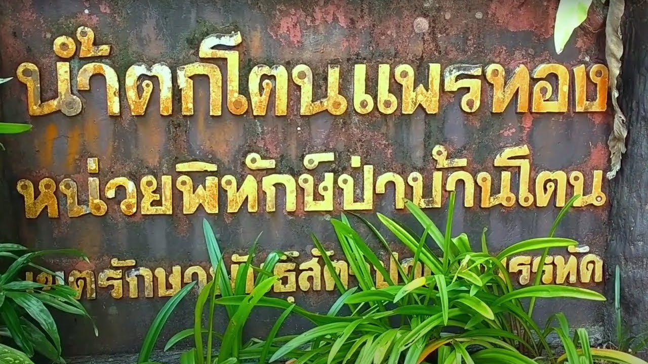
Ton Phrae Thong Waterfall
Open Days: Daily
Opening Hours: 08.00 – 17.00
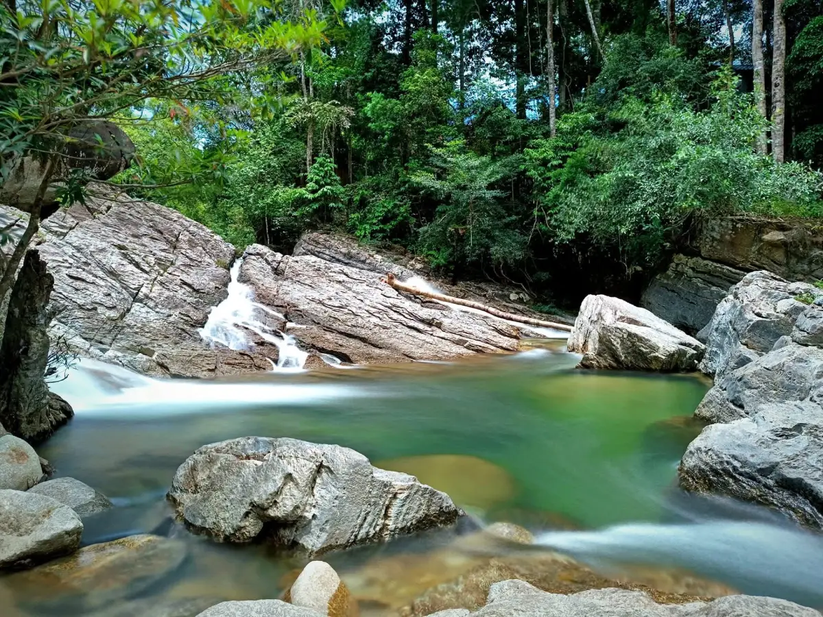
Ton Phrae Thong Waterfall, also known as Ban Ton Waterfall, is a medium-sized natural waterfall in Lam Sin Subdistrict, Srinagarindra District, Phatthalung Province. It is known for its clear water flowing down layered rocks in several natural levels, surrounded by the lush green forest of the Banthat mountain range. The waterfall has water throughout the year, safe pools in suitable sections, and a calm forest atmosphere that makes it ideal for relaxing, nature walking, photography, and spending time beside a cool southern Thai stream.
The name Ton Phrae Thong evokes the image of water flowing like a bright sheet of fabric over rocks. In southern Thai usage, the word “ton” is often associated with a waterfall or water dropping from higher ground. Combined with the greenery of the Banthat forest, the name gives the waterfall a memorable identity as a clear-water forest retreat where visitors can cool down and enjoy a slower pace of travel.
The waterfall is formed by water flowing from upper rock levels down to lower sections. Along the route, the stream passes over large and small rocks, natural rock slopes, and shallow pools. Each level has a different character. Some sections are gentle rock streams, some are clear pools suitable for sitting or swimming carefully, and some are deeper water bends with local names. This makes a visit more interesting than simply stopping at one waterfall pool.
Important named sections include Wang Phayu, Wang Phet Na Thang, Wang Phae, and Wang Nam Rap. Wang Phayu is described as an upper pool and source section where water is divided and flows down to lower levels. Its name relates to the stronger wind often felt in that area. The named pools give the waterfall a local character and help visitors remember each section through its landscape and meaning.
Ton Phrae Thong Waterfall is especially attractive because the water is very clear and flows year-round. Visitors can swim in safe sections where the water is not strong and the streambed is visible. Swimming should be limited to calm, shallow, and clearly safe areas. Visitors should avoid slippery rocks, strong currents, unknown depths, and areas close to steep waterfall drops.
The surrounding area remains shaded and green. The waterfall sits within the natural landscape of the Banthat mountain range, an important source of streams and waterways in southern Thailand. This makes Ton Phrae Thong more than a recreational waterfall. It is part of an upstream forest system that supports streams, agricultural areas, communities, and ecosystems downstream.
The natural setting is also interesting in terms of terrain and geology. The area includes sandstone and granite, while the wider landscape consists of forest, mountains, hills, and highland areas that gradually slope eastward toward lower plains and water systems connected to Songkhla Lake. Continuous water flow over the rocks has shaped the waterfall’s smooth surfaces, natural channels, and attractive rock slopes.
The vegetation around the waterfall has the character of southern humid evergreen forest. Important plants and trees reported in the area include takhian thong, lumpho, yang, krabak, champa pa, phikun, khai khiao, nakabut, phaya mai, rattan, wild orchids, medicinal plants, and various forest herbs. These plants provide shade, retain moisture, and create the cool atmosphere that makes the waterfall pleasant throughout the day.
The forest landscape of the Banthat range also supports many forms of wildlife, including mammals, birds, reptiles, amphibians, fish, and insects. Visitors may not directly see large animals, but the sounds of birds and insects help create the feeling of a living forest. Travelers should therefore keep noise low, avoid disturbing wildlife, and avoid activities that could damage aquatic or forest life.
Recommended activities include swimming in safe areas, walking along the waterfall levels, light forest walking, plant observation, rock and stream photography, resting beside the water, and learning about the upstream forest ecosystem. For photography, the best features are the broad rock surfaces, flowing water, clear pools, green forest backdrop, and natural light filtering through the trees.
Ton Phrae Thong Waterfall is suitable for families, groups of friends, nature travelers, and visitors looking for a refreshing destination not too far from Phatthalung city. It is easier to access than many deeper forest waterfalls, with a road leading conveniently to the waterfall area. This makes it suitable for a half-day or full-day nature trip, especially when visitors arrive in the morning and allow enough time to enjoy the area without rushing.
Although the waterfall has water all year, the best time to visit is during stable weather without continuous heavy rain. After the rainy season, the water flow is often beautiful and the surrounding forest is fresh. However, visitors should avoid the monsoon period and heavy-rain days because waterfalls in the Banthat mountain range can be affected by fast-rising water, strong currents, and flash floods.
Safety should always come first. Visitors should check the weather before traveling and observe the stream conditions while at the waterfall. If the water suddenly becomes muddy, rises quickly, or sounds unusually loud from upstream, visitors should leave the stream immediately. Flash floods in waterfall areas can arrive quickly and carry strong force.
Families with children should allow children to play only in shallow and calm sections under close adult supervision. Natural waterfall rocks can be slippery and uneven. Visitors should wear sandals or shoes with good grip, avoid running on rocks, avoid climbing steep waterfall levels, and never jump from rocks into unknown water. Elderly visitors or those with limited mobility should stay in easier-access sections.
Basic facilities are available, including a parking area and resting seats. Local vendors may also be found in some periods. Still, visitors should bring personal essentials such as drinking water, a towel, spare clothing, a personal trash bag, a waterproof pouch for phones or cameras, and footwear with good grip. Good preparation makes the trip safer and more comfortable.
Keeping the waterfall clean is especially important. The area has faced litter problems on rock surfaces due to tourism use. Visitors should carry all waste out, avoid leaving food scraps in the stream, avoid using soap or shampoo in the water, avoid writing on rocks, and avoid damaging forest plants or wild orchids. Responsible behavior keeps the stream clear and helps the local community benefit from tourism sustainably.
The nature study route around Ton Phrae Thong Waterfall is suitable for visitors who enjoy forest walking and learning about plants in the Khao Banthat Wildlife Sanctuary area. Travelers should stay on existing routes, avoid entering deep forest without permission, and never remove plants, orchids, animals, or stones from the area. Longer forest walks should be coordinated with local authorities or knowledgeable local guides.
Getting There from Phatthalung city is straightforward. Take Highway 4 on the Phatthalung–Trang route for about 18 km, then turn onto the Khlong Muai Ban–Kong Ra road for about 9 km. At Ban Ton junction, turn west and continue for about 5 km to reach the waterfall. The route is commonly used and has road access to the waterfall area.
For navigation, search for “Ton Phrae Thong Waterfall, Lam Sin Subdistrict, Srinagarindra District, Phatthalung” or use the coordinates 7.48702, 99.8997. Including both Lam Sin Subdistrict and Srinagarindra District in the search helps avoid confusion with older sources that may still mention Mueang Phatthalung District.
Ton Phrae Thong Waterfall can be combined with nearby attractions in Srinagarindra District and the Banthat mountain area. Useful nearby places include Tham Lam Sin or Tham Phra Phuttha Wihan, Thang Daeng Historical Park, Khao Khram Waterfall, Lam Sin Hot Spring, Wat Tham Sumano, and Khuan Khai Hot Viewpoint. This route gives travelers a fuller view of Phatthalung through nature, community, history, and local culture.
For food and accommodation, the Srinagarindra area and nearby routes offer restaurants, cafes, homestays, resorts, and streamside lodging. Visitors can plan a one-day waterfall trip or stay overnight to continue exploring nearby waterfalls and viewpoints. During holidays or changing weather conditions, it is better to contact restaurants and accommodations in advance.
In summary, Ton Phrae Thong Waterfall, or Ban Ton Waterfall, is one of Phatthalung’s attractive natural waterfalls for relaxation, safe swimming, light forest walking, and photography. Its strengths are clear water, year-round flow, multiple waterfall levels, locally named pools, natural rock formations, humid evergreen forest, and convenient access. With good timing, proper preparation, and responsible behavior, Ton Phrae Thong Waterfall offers a refreshing and meaningful nature experience in Phatthalung.
| Name | Ton Phrae Thong Waterfall Or Ban Ton Waterfall |
| Location | Moo 5, Lam Sin Subdistrict, Srinagarindra District, Phatthalung Province |
| Coordinates | 7.48702, 99.8997 |
| Natural Area | Khao Banthat Wildlife Sanctuary, Phatthalung Province |
| Highlights | Medium-sized waterfall with clear water flowing over layered rocks, year-round water flow, safe pools in suitable sections, and a shaded forest setting |
| Important Waterfall Sections | Wang Phayu, Wang Phet Na Thang, Wang Phae, and Wang Nam Rap |
| Water Source | Banthat Mountain Range |
| Landscape | Water flows over large and small rocks in a forest, mountain, hill, and highland landscape that slopes eastward toward lower plains |
| Recommended Activities | Safe waterfall swimming, nature walking, light forest walking, plant observation, photography, streamside rest, and upstream ecosystem learning |
| Getting There | From Phatthalung city, take Highway 4 on the Phatthalung–Trang route for about 18 km, then turn onto the Khlong Muai Ban–Kong Ra road for about 9 km. At Ban Ton junction, turn west and continue for about 5 km to reach the waterfall |
| Current Status | Open to visitors during regular visiting hours; avoid visiting during heavy rain or flash-flood warnings |
| Open Days | Daily |
| Opening Hours | 08.00 – 17.00 |
| Best Time To Visit | Stable-weather periods without continuous heavy rain; after the rainy season is good for stronger water flow and fresh forest scenery |
| Facilities | Parking area, resting seats, and local vendors in some periods |
| Safety Notes | Avoid monsoon and heavy-rain periods because flash floods, slippery rocks, and strong currents can occur |
| Local Contacts | Lam Sin Subdistrict Municipality, Tel. 074-843-191, and Khao Banthat Wildlife Sanctuary, Tel. 074-605-466 |
| Nearby Tourist Attractions | 1. Tham Lam Sin Or Tham Phra Phuttha Wihan, About 4 km 2. Thang Daeng Historical Park, About 6 km 3. Khao Khram Waterfall, About 8 km 4. Lam Sin Hot Spring, About 10 km 5. Wat Tham Sumano, About 12 km 6. Khuan Khai Hot Viewpoint, About 18 km |
| Nearby Restaurants | 1. The Khaokram, About 8 km, Tel. 084-889-1821 2. Baan Suan Kwang Homestay & Cafe, About 9 km, Tel. 080-709-8361 3. Banna Mountain View, About 10 km, Tel. 063-406-4141 4. Rong Khua Ban Pa, About 12 km, Tel. 081-082-4387 5. The Khuan Dinso, About 18 km, Tel. 085-554-2499 |
| Nearby Accommodations | 1. Kohklang Ton Phrae Thong Camping, About 1 km, Tel. 095-441-6254 2. Baan Suan Kwang Homestay & Cafe, About 9 km, Tel. 080-709-8361 3. Baannakoh Blissful Resort, About 11 km, Tel. 074-605-770 4. Phudinsow Resort, About 14 km, Tel. 086-438-0999 5. Waree Cheewa, About 20 km, Tel. 094-964-9699 |
Frequently Asked Questions (FAQ)
Q: Where is Ton Phrae Thong Waterfall located?
A: Ton Phrae Thong Waterfall, also known as Ban Ton Waterfall, is located at Moo 5, Lam Sin Subdistrict, Srinagarindra District, Phatthalung Province, within the natural area of Khao Banthat Wildlife Sanctuary.
Q: What are the opening hours?
A: The waterfall is open daily from 08.00 to 17.00.
Q: What makes Ton Phrae Thong Waterfall special?
A: It is a medium-sized clear-water waterfall with year-round flow, layered rock cascades, safe pools in suitable areas, and named sections such as Wang Phayu, Wang Phet Na Thang, Wang Phae, and Wang Nam Rap.
Q: Is Ton Phrae Thong Waterfall suitable for swimming?
A: Yes, swimming is suitable in safe areas where the current is gentle and the rocks are not slippery. Visitors should avoid deep, unknown, or fast-flowing sections.
Q: When is the best time to visit?
A: Visit during stable weather without continuous heavy rain. After the rainy season, the waterfall usually has stronger flow and the forest looks especially fresh.
Q: How do visitors get there from Phatthalung city?
A: Take Highway 4 on the Phatthalung–Trang route for about 18 km, turn onto the Khlong Muai Ban–Kong Ra road for about 9 km, then turn west at Ban Ton junction for about 5 km to reach the waterfall.
Q: What safety precautions should visitors follow?
A: Avoid visiting during monsoon or heavy-rain periods, watch for slippery rocks and strong currents, and leave the water immediately if the water becomes muddy or rises quickly.
Q: What nearby attractions can be combined with Ton Phrae Thong Waterfall?
A: Nearby places include Tham Lam Sin, Thang Daeng Historical Park, Khao Khram Waterfall, Lam Sin Hot Spring, Wat Tham Sumano, and Khuan Khai Hot Viewpoint.
 Category: ●Nature and Wildlife
 Group: ●Waterfalls
Last Update : 2 MonthAgo
 Last Update : 2 MonthAgo
 Click to Access the Navigation Map GPS
Ton Phrae Thong Waterfall Map
Recommend

 Art, Culture and Heritage
 Historical Sites and Monuments(1)
 Landmarks and Memorials(1)
 Art, Craft Centres, Tradition(6)
 Historic Homes and Cities(1)
 Educational Places
 Educational Gardens, Farm(1)
 Places of Worship
 Temple(25)
 Other Sacred Sites(4)
 Research and Development
 Royal Project(2)
 Suburban Living
 Village, Community(3)
 National Parks and Marine Reserves(3)
 Mountain (Doi)(4)
 Dam, Reservoir, Lake(7)
Waterfalls(16)
 Hot Springs(2)
 Caves(12)
 River, Canal(5)
 Bays and Beaches(6)
 Islands(2)
 Other natural attractions(4)
 Entertainment and Agricultural
 Farms, Parks and Ecotourism(4)
 Travel Articles, Recipes
 Travel Review, Food Review(1)


