
lovethailand home >South Travel Attractions >Chumphon Travel Attractions > 40 Places to Visit in Chumphon Explore Southern Th..
TL;DR: 40 Places to Visit in Chumphon Explore Southern Thailand.
40 Places to Visit in Chumphon Explore Southern Thailand
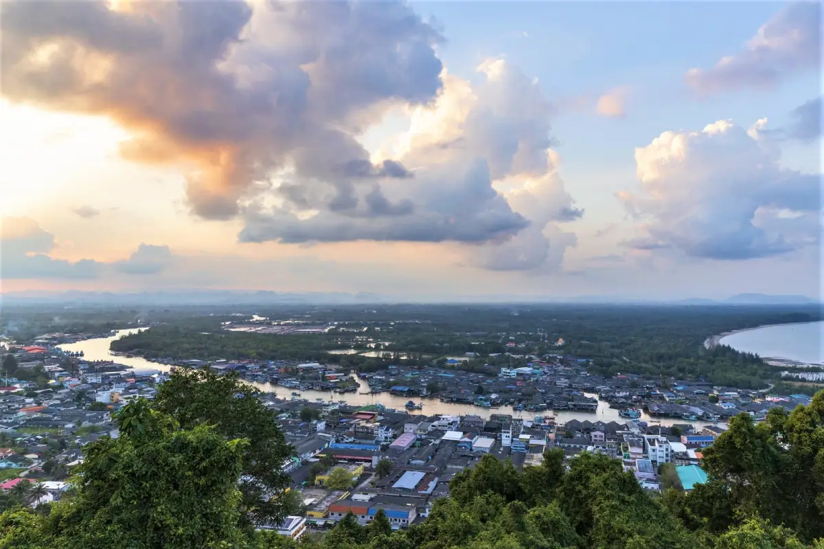
40 Places to Visit in Chumphon – Explore Southern Thailand Chumphon is often described as the gateway to Southern Thailand, but the province deserves far more than a quick stop on the way south. Stretching between mountain ranges in the west and the Gulf of Thailand in the east, Chumphon brings together an unusually diverse range of landscapes in one province, including beaches, islands, coral reefs, bays, tropical rainforest, mountains, waterfalls, caves, hot springs, canals, fishing communities, Buddhist temples, historical sites, and agricultural areas. Travelers can begin the day beside the sea, take a boat out for snorkeling or diving, then change scenery completely by heading inland to waterfalls, forest trails, mountain viewpoints, or even a sea of mist without leaving the province.
Travelers planning a trip around Chumphon attractions can divide the province into several practical travel zones. Mueang Chumphon District is ideal for Hat Sai Ri, Mu Ko Chumphon National Park, museums, and historical sites. Pathio District is known for Thung Wua Laen Beach, Khao Dinsor, coastal beaches, and nearby islands for snorkeling and diving. Tha Sae offers waterfalls and important roadside places of worship, while Sawi is home to Phra That Sawi, Doi Ta Pang, the Khao Thalu coffee-growing area, and mountain scenery. Phato is characterized by rainforest, watershed communities, and river rafting, while Lang Suan, Lamae, and Thung Tako offer island communities, quiet beaches, hot springs, agricultural attractions, waterfalls, and a slower local atmosphere.
Chumphon is also strongly defined by its local food and agricultural products, which reflect the province's geography. Coastal communities have access to fresh fish, shrimp, crab, squid, and shellfish from the Gulf of Thailand, which are used in strongly flavored southern Thai dishes such as sour curry, gaeng tai pla, khua kling, shrimp-paste chili dip, and simple local seafood dishes. Inland farming areas are especially known for robusta coffee, including coffee from Khao Thalu and communities around Sawi. Chumphon is also famous for Leb Mue Nang bananas, which are sold fresh or processed into dried bananas and banana chips, together with seasonal tropical fruits such as durian, mangosteen, and longkong. Food can therefore become part of the journey through local markets, fishing communities, fruit orchards, coffee shops, and agricultural areas throughout the province.
In terms of traditions and cultural identity, Chumphon is closely connected with the sea, rivers, Buddhism, and local history. One of the most respected historical figures in the province is Admiral Prince Abhakara Kiartivongse, Prince of Chumphon, widely known as the “Father of the Royal Thai Navy,” with memorial sites found throughout the province, particularly around Hat Sai Ri. Lang Suan District is known for the Hae Phra Boat Procession and traditional boat races held after the end of Buddhist Lent, combining Buddhist devotion with life along the Lang Suan River. Other important traditions include the robe-wrapping ceremony at Phra That Sawi, southern Buddhist merit-making traditions, and the seasonal migratory raptor-watching activities at Khao Dinsor, showing how nature and culture remain closely connected in Chumphon. :chatgpt-content-reference{index="0"}
This diversity makes Chumphon suitable for many kinds of travelers, including beach lovers, divers, photographers, birdwatchers, hikers, families, couples, and visitors interested in local communities and food. With 2–3 days, travelers can concentrate on Mueang Chumphon, Pathio, and the nearby islands. Those with 4–5 days or more can continue to Sawi, Phato, Lang Suan, Lamae, and Thung Tako for a more complete view of the province's coast, rainforest, mountains, rivers, agriculture, and community life.
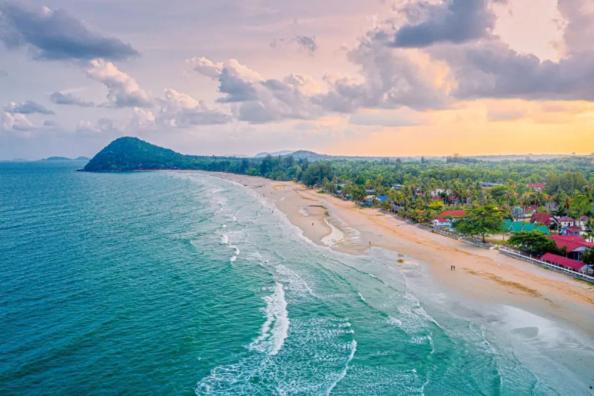
1. Thung Wua Laen Beach is located in Moo 8, Saphli Subdistrict, Pathio District, Chumphon Province. It is one of the best-known beaches in the province and one of the clearest symbols of Chumphon's seaside tourism. The beach stretches for around 3 kilometers with fine, soft, off-white sand and a gently sloping seabed. When the sea is calm, the central section is suitable for swimming, beach walking, photography, and relaxing by the water. Restaurants, cafés, accommodations, diving services, and local tourism operators are found along the beachfront road, yet the area remains considerably more relaxed than Thailand's major resort destinations.
The southern end of the beach near Khao Pho Bae has a noticeably different landscape, where the broad sandy beach gives way to rocky sections and underwater natural features. In suitable sea conditions, snorkeling around this area can reveal coral, seaweed, sponges, and small marine fish. The name “Thung Wua Laen” is also linked to a local legend about a wild cow that was shot by a hunter but suddenly recovered and ran away. A cow statue now serves as a recognizable landmark and a reminder of this local story.
Thung Wua Laen is also an excellent base for exploring Pathio District. Travelers can combine the beach with Khao Dinsor, Saphli Walking Street, nearby coastal attractions, and snorkeling or diving trips to islands in northern Chumphon waters. Morning is ideal for beach walks and swimming, while late afternoon is pleasant for seafood, photography, and relaxing in the sea breeze. Visitors planning to swim should always check wave conditions, particularly during rainy or monsoon periods when sea conditions can change quickly.
Getting There: From Chumphon town, travel past the provincial government center and continue onto Route 3180 toward Saphli Subdistrict. The beach is about 16 kilometers from town and can be reached easily by private car or motorcycle.
Map (GPS): https://maps.app.goo.gl/ztVYmBCpHVZH8zgS9
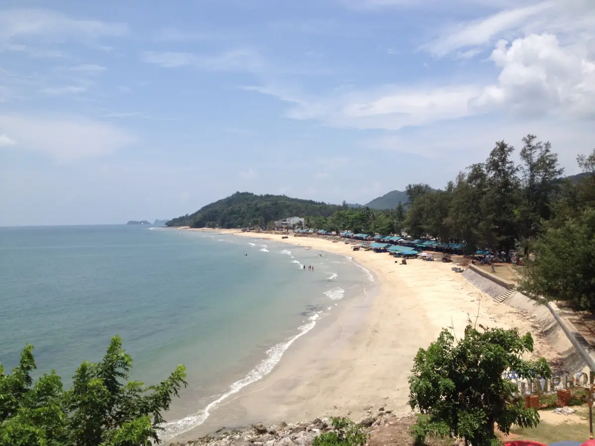
2. Hat Sai Ri is located in Hat Sai Ri Subdistrict, Mueang Chumphon District, around 20 kilometers from Chumphon town. The beach is important not only for its natural setting but also for its historical and spiritual significance. Its long shoreline curves along the Gulf of Thailand, with a fairly broad sandy area and a gently sloping shore. During calm weather it is suitable for walking, sitting by the sea, and swimming. Seafood restaurants, accommodations, souvenir shops, and a coastal road make the area convenient for both day trips and overnight stays.
What distinguishes Hat Sai Ri from an ordinary beach is its close association with Admiral Prince Abhakara Kiartivongse, Prince of Chumphon, who is widely honored as the Father of the Royal Thai Navy. The area around the beach includes memorial sites connected with the Prince, the HTMS Chumphon warship, and the Mo Phon Herbal Garden. Visitors can therefore combine seaside relaxation with local history in the same trip. Many residents, sailors, fishermen, and travelers continue to visit the shrine to pay respect and seek blessings for safe journeys.
Hat Sai Ri can also be used as a base for visiting Khao Chao Mueang, Thung Makham Bay, coastal viewpoints, and Mu Ko Chumphon National Park. Morning offers quieter scenery and soft light over the Gulf of Thailand, while late afternoon is suitable for beach walks and seafood dining. Travelers planning marine activities or boat excursions should check the weather and sea conditions before departure.
Getting There: From Chumphon town, take Highway 4001 toward Pak Nam Chumphon and continue toward Hat Sai Ri Subdistrict. Road signs are available along the route and the beach is easily reached by private car.
Map (GPS): https://maps.app.goo.gl/UfrLsqRHXA4KjAVT6
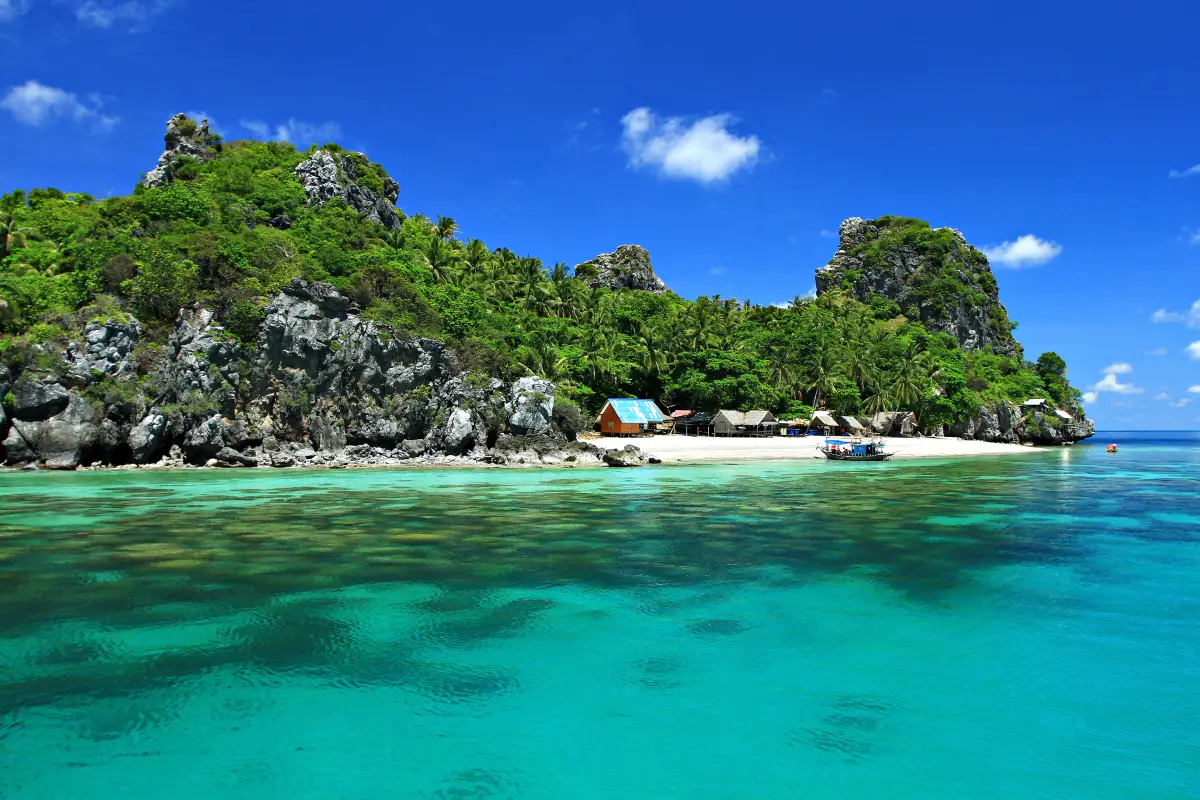
3. Mu Ko Chumphon National Park is the province's most important protected marine area, covering coastal zones, mangrove forest, bays, coral reefs, and numerous islands in Chumphon waters. The park extends across several districts, including Pathio, Mueang Chumphon, Sawi, Thung Tako, and Lang Suan. Its outstanding feature is ecological diversity: visitors can encounter mangrove forest, beaches, rocky islands, coral reefs, sea fans, sea anemones, and a wide range of marine wildlife within the same protected area.
Popular islands include Ko Ngam Yai, Ko Ngam Noi, Ko Mattra, Ko Langka Chio, and Ko Thalu, each offering a different marine landscape. Some are especially suited to scuba diving, others to snorkeling, while several have dramatic limestone formations, sea caves, or historic links to bird's-nest harvesting and royal visits. A trip through the park is therefore about much more than diving; it also provides insight into Chumphon's marine ecology, history, and long relationship with coastal resources.
Travelers planning an island trip should book with operators who follow national park regulations and should check current park announcements before departure. Conditions in the Gulf of Thailand can directly affect boat operations and access to marine sites. Responsible travel is essential: visitors should never stand on coral, touch marine animals, feed fish, collect shells or coral, or leave waste behind.
Getting There: From Mueang Chumphon District, follow Highway 4001 toward Pak Nam Chumphon and Hat Sai Ri, then follow signs to the Mu Ko Chumphon National Park headquarters. Boat services are required to continue to the islands.
Map (GPS): https://maps.app.goo.gl/XnmEzm1P9hMCfiLx6
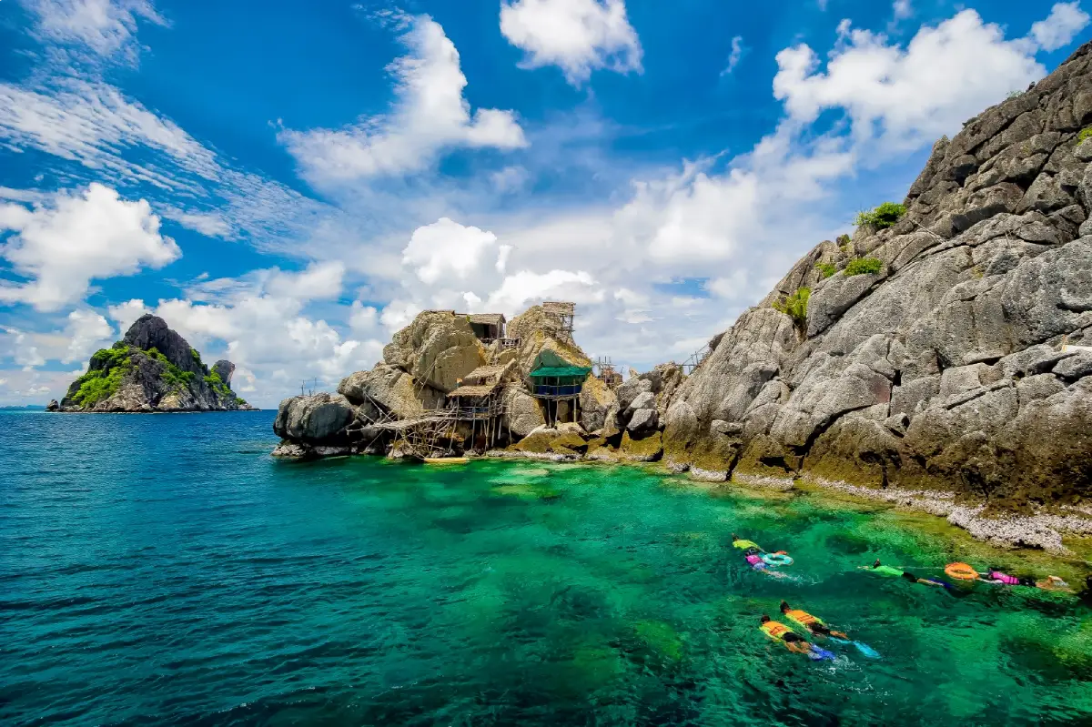
4. Ko Ngam Yai and Ko Ngam Noi are rocky offshore islands within Mu Ko Chumphon National Park and among the province's best-known diving destinations. Unlike resort islands with long beaches and accommodation, these islands are characterized by steep rock faces, underwater boulders, sea caves, coral reefs, and marine life living around complex rocky formations. Visitors generally come to admire the islands from the boat and explore the surrounding underwater environment rather than to walk around onshore.
The waters around the islands contain hard coral, soft coral, sea anemones, sea fans, and schools of tropical fish. Certain underwater formations are particularly suited to experienced scuba divers, while casual visitors can snorkel in safer areas selected by local guides. Both islands are also associated with swiftlet bird's-nest concession areas, meaning that access to the islands and certain restricted zones is controlled. Visitors should never attempt to land or enter restricted areas without permission.
Trips to the Ngam Islands are often combined with other marine sites such as Ko Thong Lang or Ko Langka Chio, depending on the boat program, weather, and national park regulations. Divers and snorkelers should use operators with proper safety equipment, wear life jackets while traveling by boat, and avoid touching coral. Currents around offshore rocks can be stronger than in sheltered bays, so guidance from experienced local operators is particularly important.
Getting There: Travel to the Mu Ko Chumphon National Park headquarters or the departure point arranged by your boat operator, then continue by boat to Ko Ngam Yai and Ko Ngam Noi.
Map (GPS): https://maps.app.goo.gl/m5eBWFu3ZbS6j5fW8
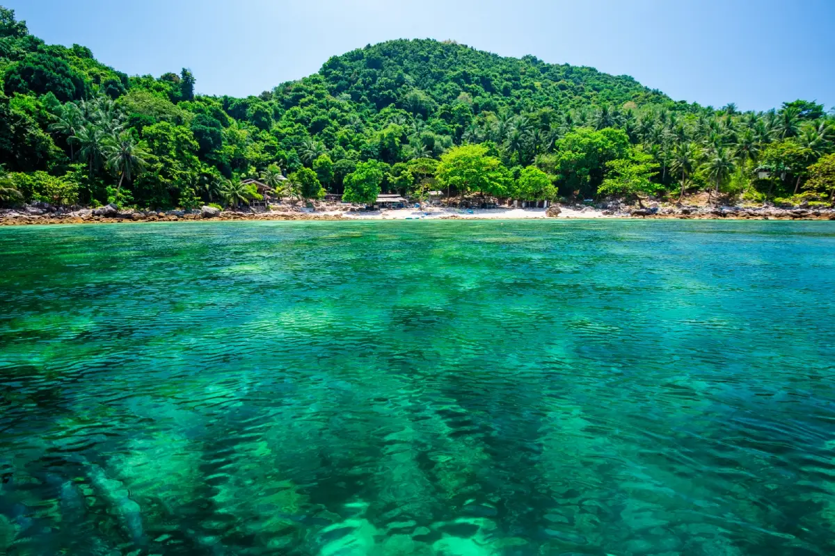
5. Ko Mattra, also known locally as Ko Tua Kuai, is another important island within Mu Ko Chumphon National Park. Located relatively close to the Mueang Chumphon coastline, it is popular with travelers seeking a one-day marine excursion. Its main attractions are coral reefs around the island, clear water during favorable conditions, and the natural atmosphere of a small island that remains much quieter than Thailand's major resort islands.
Popular activities include snorkeling, coral viewing, kayaking, and relaxing in areas permitted by the national park. The surrounding marine ecosystem consists of rocky areas, coral formations, and habitats for many species of reef fish. Travelers who do not wish to snorkel can still enjoy the island scenery from the boat and spend time in the coastal environment. Because the island lies within a protected national park, visitors should keep the area clean and take all rubbish back to the mainland.
Ko Mattra is frequently included in Mu Ko Chumphon snorkeling itineraries and can be combined with Ko Ngam Yai, Ko Ngam Noi, or Ko Langka Chio, depending on the route operated that day. This type of island-hopping trip allows travelers to see several different marine environments in one day, ranging from deeper rocky dive sites to shallow coral areas. Weather, sea conditions, and national park access should always be checked before departure.
Getting There: Travel to a boat departure point in Mueang Chumphon or the Hat Sai Ri area, then continue by tour boat to Ko Mattra according to the available program.
Map (GPS): https://maps.app.goo.gl/VNFXRnUKebninSoy7
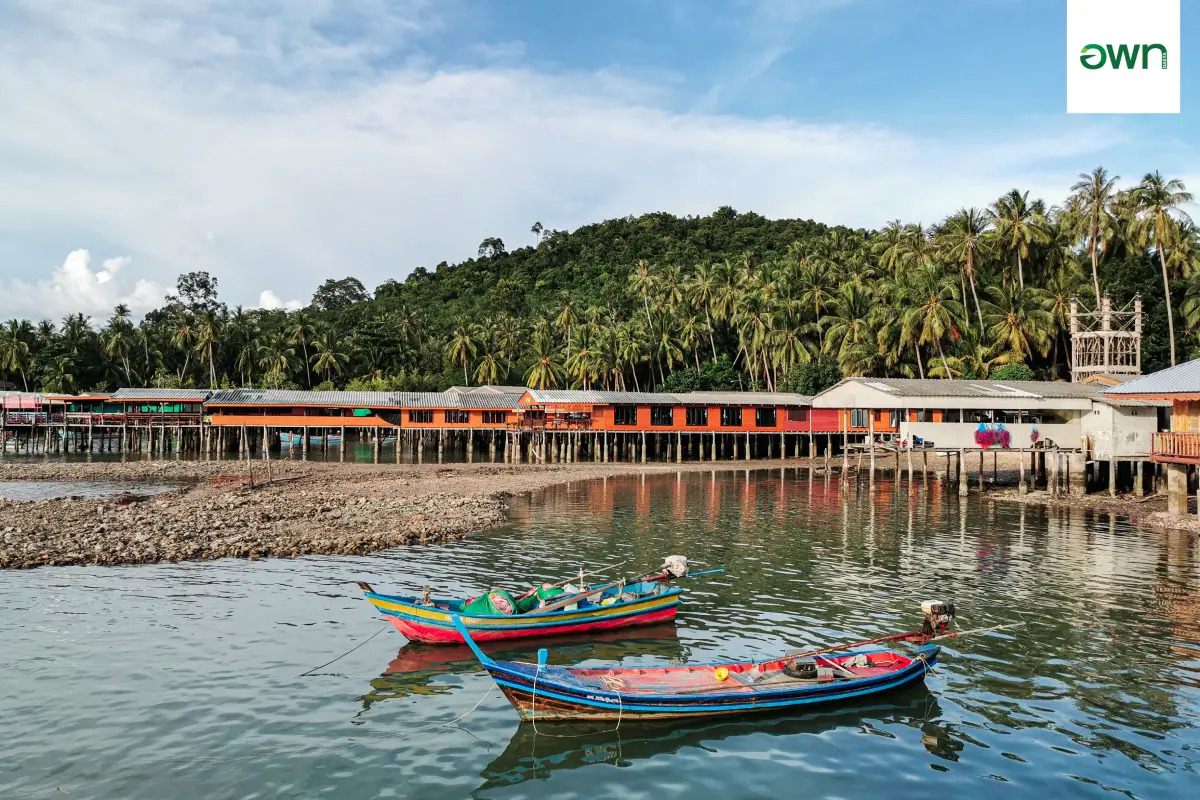
6. Ko Phitak is located in Moo 14, Bang Nam Chuet Subdistrict, Lang Suan District. It is a community island known for homestays and local-life tourism. Unlike the uninhabited dive islands around Mueang Chumphon, Ko Phitak has a permanent fishing community, allowing visitors to experience the sea, seafood, fishing boats, village houses, and everyday island life in the same destination. The island is relatively small and retains a simple atmosphere, making it well suited to travelers looking for a community-based experience rather than a conventional resort holiday.
Activities include staying with local homestays, walking through the village, eating freshly prepared seafood, learning about small-scale fishing, joining community boat trips, and enjoying views around the island. Spending a night on Ko Phitak offers a different rhythm from a day-trip island excursion. Early morning gives visitors a chance to observe the fishing community starting its day, while evenings are suitable for walking, enjoying dinner, and relaxing in the quieter island atmosphere.
Ko Phitak can be combined with Ao Thong Kho, the historic shipwreck site, and the Bang Nam Chuet coastline, creating a route that combines fishing culture, marine scenery, and coastal history. Travelers planning to stay overnight should contact a homestay or community coordinator in advance because accommodation capacity is limited and services depend on local arrangements.
Getting There: Travel to the coast of Bang Nam Chuet Subdistrict in Lang Suan District, then take a local boat across to Ko Phitak. The boat journey from the mainland is relatively short.
Map (GPS): https://maps.app.goo.gl/gEme1togiwEvnQ8P9
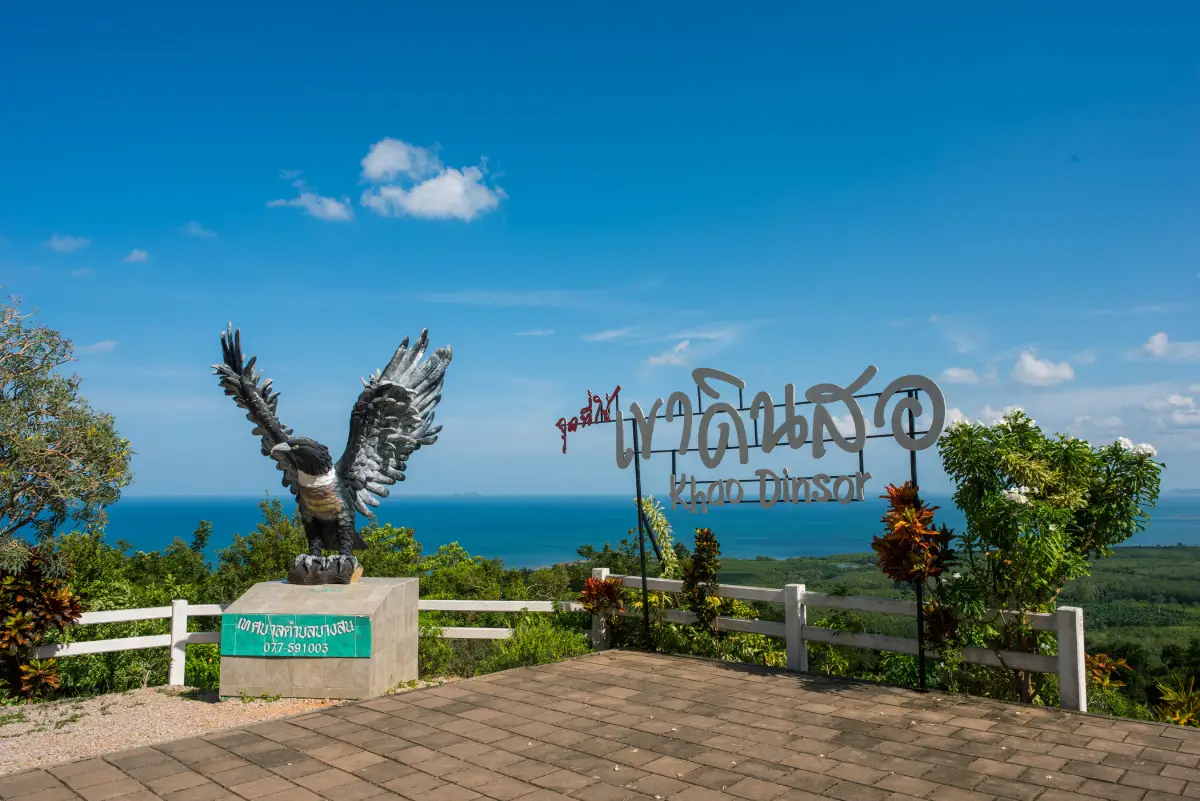
7. Khao Dinsor in Pathio District is known both as a panoramic viewpoint and as one of Thailand's important locations for observing migratory raptors. From the higher areas, visitors can see sweeping views of the Gulf of Thailand, Thung Wua Laen Beach, Saphli Beach, Bo Mao Beach, and the wider Pathio coastline. Even outside the migration season, the mountain is worth visiting for photography, sea views, and a broader understanding of how Chumphon's mountains meet its coastline.
Khao Dinsor becomes especially significant during the migration period, when large numbers of hawks and other birds of prey move along the southern peninsula. Birdwatchers and wildlife photographers travel here to observe the migration from the viewpoint. Binoculars or telephoto lenses are recommended, and visitors should avoid loud noise or approaching birds too closely. The site's importance comes from its role in a natural migration corridor, not simply from its value as a photo location.
Outside the main birdwatching season, mornings and late afternoons remain pleasant times to visit because temperatures are lower and the light is better for photography. Khao Dinsor can easily be combined with Thung Wua Laen Beach, Saphli Walking Street, or other attractions along the Pathio coast. Visitors walking the mountain routes should carry drinking water, wear appropriate footwear, and prepare sun protection.
Getting There: From Chumphon town, travel toward Pathio District and follow the local route to Khao Dinsor. Check road conditions before visiting during periods of heavy rain.
Map (GPS): https://maps.app.goo.gl/X4dcAiQayN1g4g666
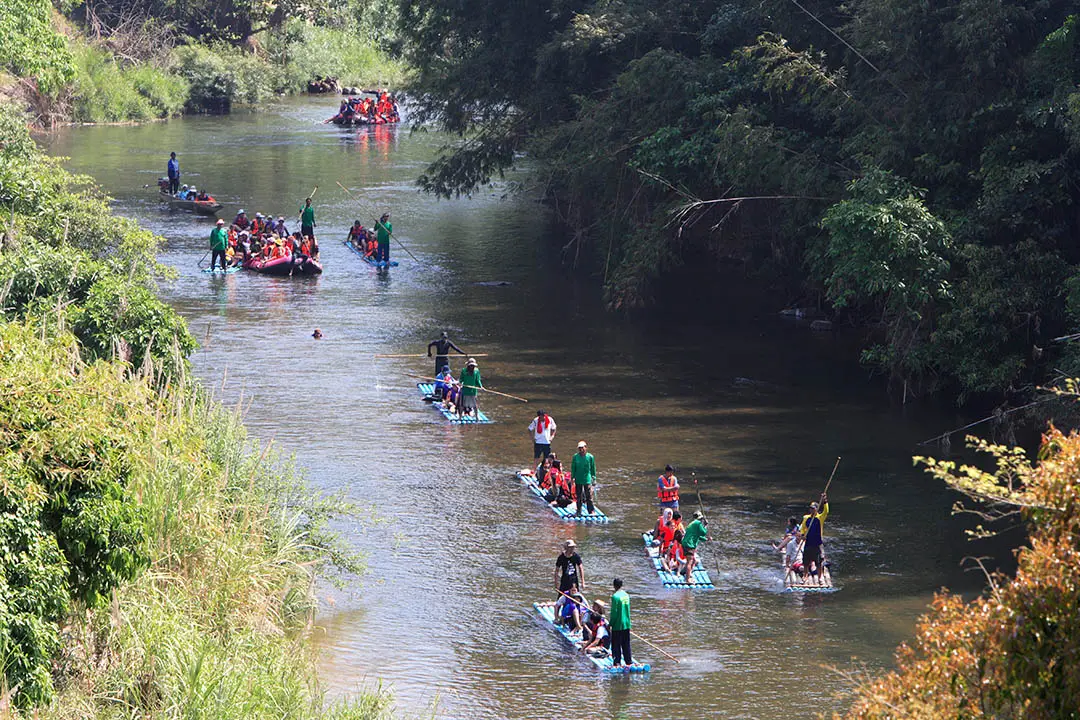
8. Khlong Phato Rafting is one of Chumphon's most distinctive eco-adventure activities and one of the experiences that best represents Phato District. The district is characterized by watershed forest, mountains, orchards, and numerous streams. The main rafting route is around 11 kilometers long and passes a series of natural rapids, including Kaeng Bok Fai, Kaeng Hew Bua Thong, Kaeng Hew Tawan, Kaeng Hew Ta On, Kaeng Khuean Nam Won, Kaeng Hua Kalok, and Kaeng Hin Chang. The journey generally takes around 2–3 hours depending on water level and conditions.
The appeal of Khlong Phato rafting is not limited to the excitement of the rapids. Much of the experience comes from the rainforest scenery, riverside vegetation, orchards, and communities along the route. Some sections offer gentle water suitable for observing the surrounding forest, while faster rapids require coordinated control with the rafting guide. Using an experienced local operator or community team is therefore important for both safety and understanding the river.
Water levels change according to rainfall and season, so travelers should contact operators before arrival, especially after prolonged heavy rain. Life jackets should be worn throughout the activity and all instructions from the rafting team should be followed carefully. Travelers with more than one day can stay in a local homestay and combine rafting with Khlong Ruea Village, waterfalls, and other communities in Phato for a more complete forest-and-river experience.
Getting There: Travel to Phato District and contact the rafting operator or community activity center responsible for the route operating on the day of your visit. Advance booking is recommended so rafts, safety equipment, and return transport can be arranged.
Map (GPS): https://maps.app.goo.gl/YwhQbJLjNmVNd53W9
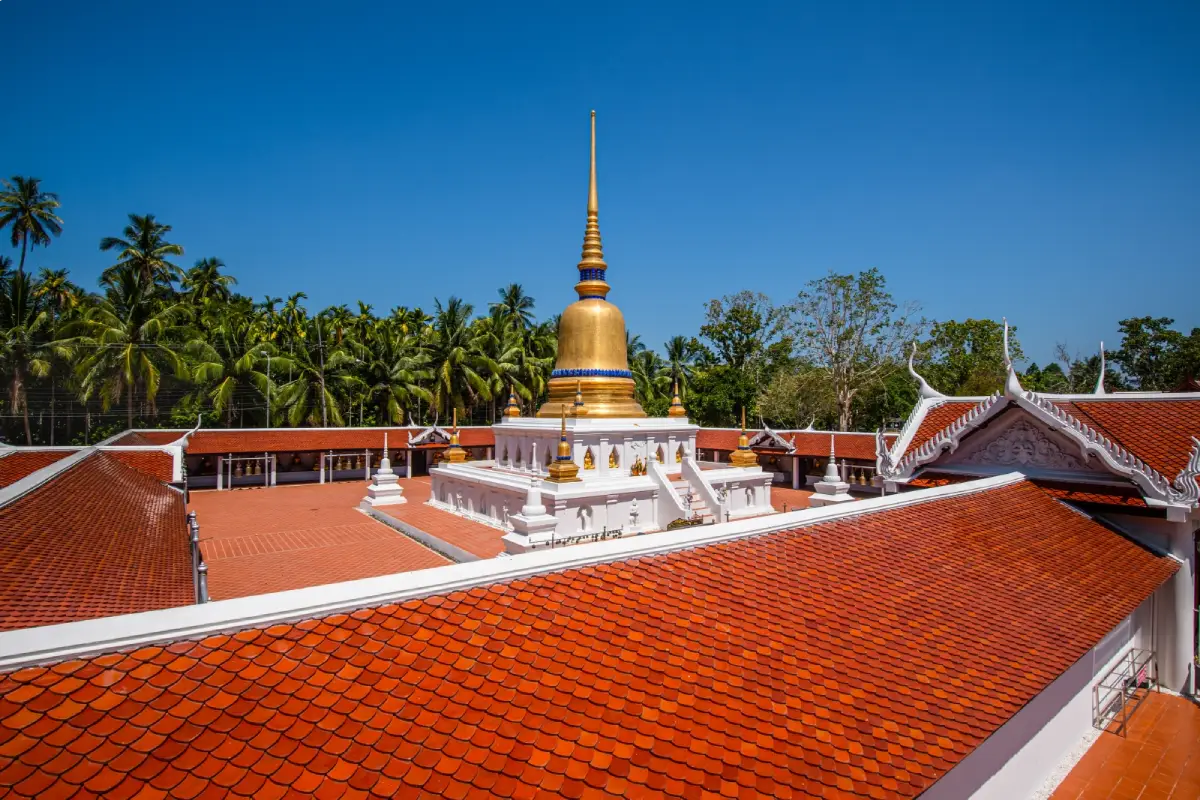
9. Phra That Sawi is located at Ban Wat Sawi, Moo 1, Sawi Subdistrict, Sawi District. It is one of Chumphon's most important historic Buddhist monuments and sacred places. The stupa is closely connected with the history of old Sawi and has served as a center of faith for local communities for generations. A visit is therefore not only about paying respect to a sacred site but also about understanding the historical development of settlements, waterways, and communities in central Chumphon.
The temple grounds include a museum that helps visitors understand the history of the stupa, local artifacts, and the cultural development of Sawi. Because the main stupa is a protected historic structure, visitors should dress respectfully, keep noise low, and avoid touching or climbing on historic architectural elements. Walking slowly around the site reveals details of its architecture and allows visitors to appreciate the calm atmosphere of the temple.
An important tradition associated with Phra That Sawi is the annual cloth procession and robe-wrapping ceremony, during which local residents join a procession and offer a long ceremonial cloth around the sacred stupa as an act of Buddhist devotion. Religious ceremonies and community cultural activities are also held as part of the event. The tradition demonstrates that Phra That Sawi is not simply a monument from the past but remains part of the living religious and cultural life of Sawi today.
Getting There: From Chumphon town, follow Highway 41 toward Lang Suan and enter Sawi District and Sawi Subdistrict. The temple is located relatively close to the main road and Sawi Railway Station.
Map (GPS): https://maps.app.goo.gl/Yu6fX5frBTiyynXF9
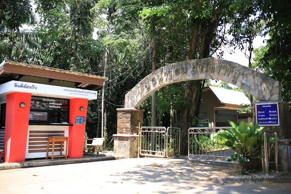
10. Tham Khao Plu Hot Spring is located in Moo 2, Ban Duat, Suan Taeng Subdistrict, Lamae District. This natural mineral hot spring lies among limestone hills and forest and is one of Chumphon's better-known wellness-oriented attractions. Natural hot water rises from underground at three principal spring areas known as Uea Ari Than Thip, Amarit Thara, and Phrueksa Chonlathan. The surrounding greenery and mountain setting make it a relaxing stop for travelers exploring Lamae or driving long distances through southern Thailand.
The site provides communal mineral bathing areas, private bathing rooms, and spaces for visitors to rest. Warm mineral water can be used for relaxation after traveling or exploring outdoor attractions. However, water close to the natural source can be significantly hotter than ordinary bathwater, so visitors should always test the temperature before entering. Elderly visitors, pregnant travelers, and people with heart conditions, blood-pressure problems, or other medical concerns should limit bathing time and leave the water immediately if they feel dizzy or unwell.
The limestone landscape surrounding the hot spring also contributes to the quiet atmosphere of the area. A Lamae itinerary can combine the hot spring with Champun Waterfall, Lamae rafting, Tawan Chai Beach, and local markets, allowing travelers to experience forest, freshwater, mineral springs, and the coast in the same district. Those planning to use private bathing facilities should allow additional time on weekends and holidays when visitor numbers may be higher.
Getting There: From Highway 41 in Lamae District, turn toward Ban Duat in Suan Taeng Subdistrict and continue along the local road to Tham Khao Plu Hot Spring.
Map (GPS): https://maps.app.goo.gl/YKxMLhCKAqYW36iP9
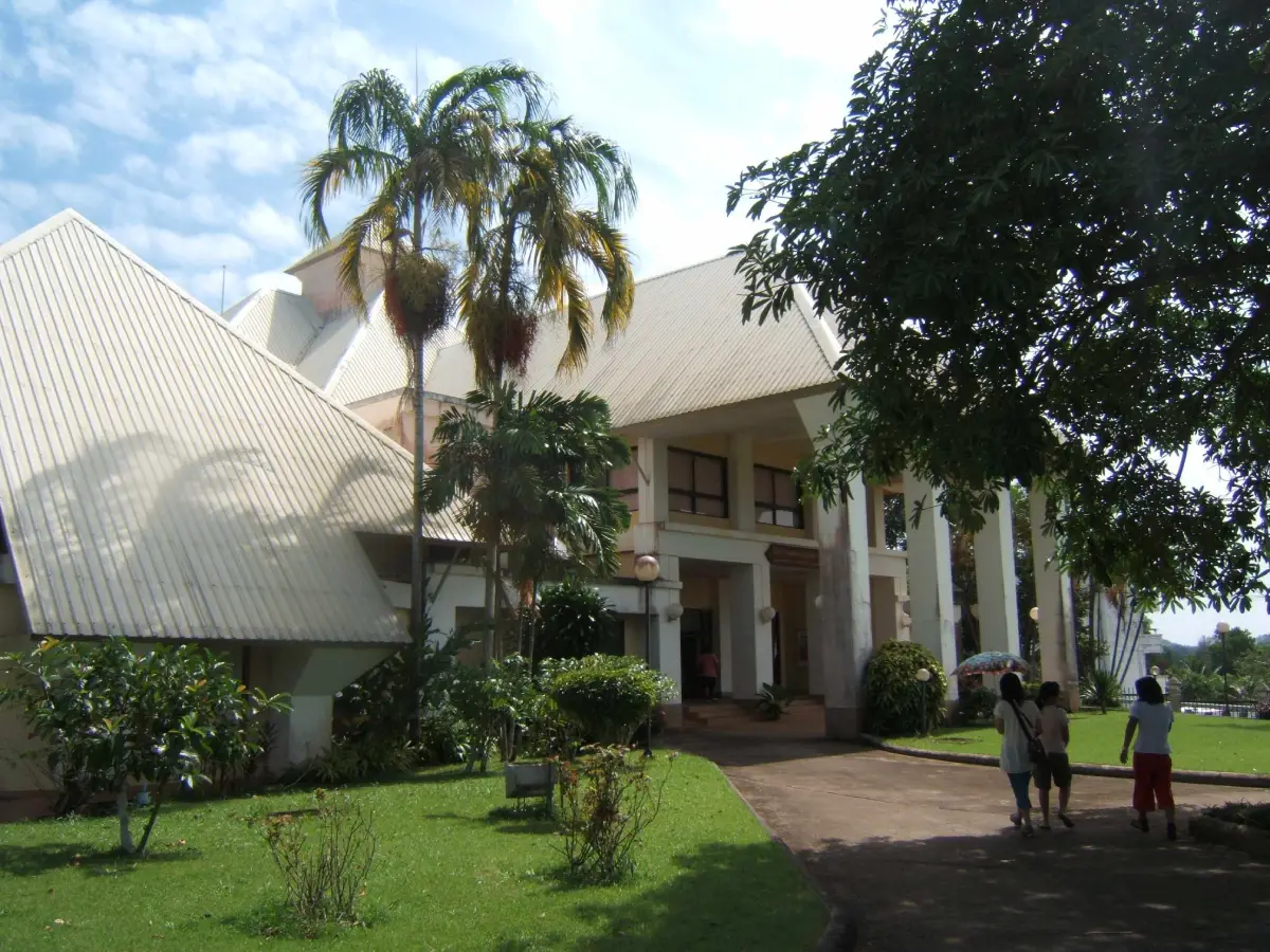
11. Chumphon National Museum is located at 312 within the Chumphon Provincial Government Complex on Tri Rat Road, Na Cha-ang Subdistrict, Mueang Chumphon District. It is one of the best places to gain a structured overview of the province before exploring individual attractions. The museum covers Chumphon's geography, settlement history, archaeology, local arts and culture, World War II events, marine nature, and the life and work of Admiral Prince Abhakara Kiartivongse, Prince of Chumphon. The building stands in the Khao Sam Kaeo area and combines elements inspired by southern Thai architecture with a contemporary museum design.
The exhibitions are arranged thematically, allowing visitors to move from the present into the past and then back toward modern history. Displays cover prehistoric evidence, the ancient Khao Sam Kaeo community, the development of Chumphon town, local lifestyles and culture, World War II, Typhoon Gay, and the province's marine resources and islands. This makes the museum useful for general travelers, families, students, and visitors who want historical context before visiting archaeological sites or memorials around the province.
Visiting the museum before the Youth Soldiers Monument, Hat Sai Ri, Phra That Sawi, or other historic sites helps travelers understand how those places fit into the larger story of Chumphon. Visitors should allow around 1–2 hours for a relaxed visit and should check current opening information before traveling. The museum's published schedule lists Wednesday–Sunday, approximately 09.00–16.00.
Getting There: From Chumphon town, follow Phet Kasem Road or Highway 4 toward the Chumphon Provincial Government Complex. The museum is in the Khao Sam Kaeo area of Na Cha-ang Subdistrict and is easily reached by private car.
Map (GPS): https://maps.app.goo.gl/b54exYP6gFRxqugP6
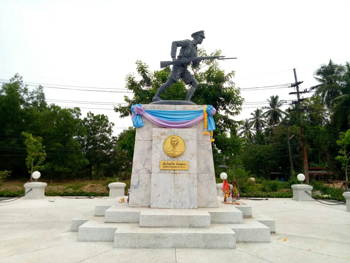
12. Youth Soldiers Monument stands beside Highway 4001 on the Chumphon–Pak Nam route in Bang Mak Subdistrict, Mueang Chumphon District, close to the base of Tha Nang Sang Bridge. The monument commemorates youth soldiers, police officers, soldiers, and civilians who participated in the defense of Chumphon during the Japanese landing on 8 December 1941 during World War II. The fighting around Tha Nang Sang Bridge became one of the province's most important wartime memories.
The main feature is a sculpture of an armed youth soldier standing on a white monument base, with an open area used for remembrance ceremonies. Its importance lies not only in the monument itself but in the story of Youth Soldier Unit 52 from Sriyapai School, whose students had received military training and joined regular police and military personnel during the defense of the town. Their participation at such a young age remains an important part of Chumphon's modern history.
For visitors interested in World War II history, the site is a short but meaningful stop and can be combined with Chumphon National Museum, Pharadonphap Beach, Pak Nam Chumphon, and Hat Sai Ri. The monument is in an open outdoor area, and morning or late afternoon is generally more comfortable than the heat of midday.
Getting There: From Chumphon town, take Highway 4001 toward Pak Nam Chumphon for approximately 5 kilometers. The monument is beside the route near Tha Nang Sang Bridge.
Map (GPS): https://maps.app.goo.gl/J7PMA2sHzesRoSuP6
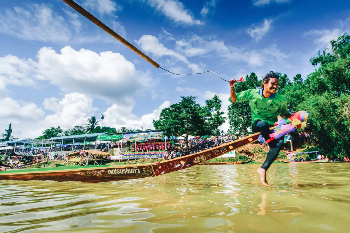
13. The Traditional Boat Race Parade is one of the most important annual traditions in Lang Suan District and is closely connected with the Lang Suan River. The festival takes place after the end of Buddhist Lent, with the 1st waning day of the 11th lunar month forming an important part of the traditional schedule. Activities include Buddhist processions from local temples, merit-making, long-boat racing, community celebrations, and cultural events, bringing together religious devotion, river life, and local identity.
The Hae Phra procession is important because sacred Buddha images and decorated Buddha boats are brought out so that local residents can make merit and pay respect. Long-boat racing on the Lang Suan River adds energy and competition to the festival, with communities preparing boats, paddlers, and cheering teams. The event also includes food, local products, performances, and other community activities, transforming the riverfront into one of the liveliest places in Chumphon during the festival period.
Travelers who want to experience living Chumphon culture should plan their visit around the festival period, when Lang Suan's identity is most visible through the processions, boats, temples, food, and river communities. Because exact event dates and daily schedules can vary from year to year, visitors should confirm the official program before traveling.
Getting There: The main event area is around the Southern Regional Boat-Racing Field and the Lang Suan River in Lang Suan District. Travelers can reach Lang Suan town from Highway 41 and continue to the riverside festival area.
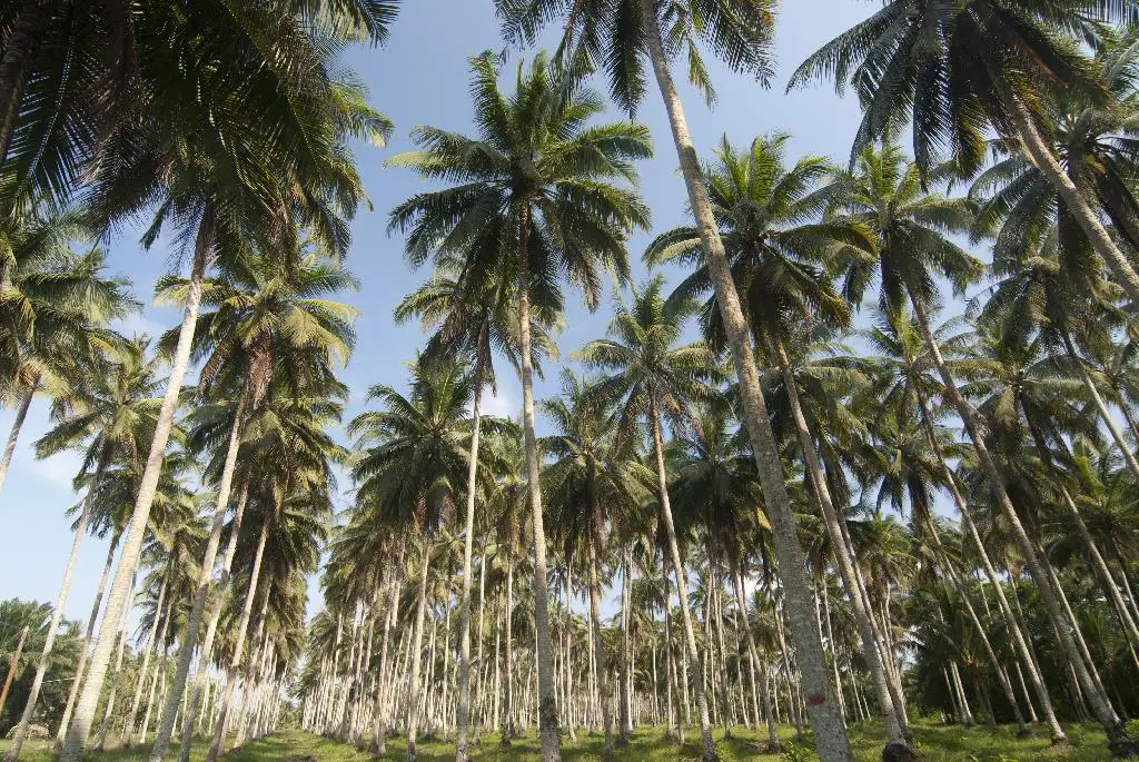
14. Chumphon Horticultural Research Centre is located in Wisai Tai Subdistrict, Sawi District and serves as an important research and learning center for tropical horticulture in Chumphon and the wider southern region. Its work includes major economic crops such as robusta coffee, coconut, cacao, and other tropical horticultural plants adapted to southern Thailand's warm and humid climate. The site helps visitors understand the close relationship between Chumphon's geography, agriculture, and local economy.
Chumphon is one of Thailand's major robusta coffee-growing areas, particularly around Sawi and Khao Thalu. Visiting the research center therefore provides useful context for understanding the province's coffee culture. Farmers, students, and travelers interested in agriculture can learn about crop varieties, cultivation, field management, propagation, processing, and quality development, showing that Chumphon coffee is supported by both traditional farming and formal agricultural research.
The center can be included in a Sawi itinerary with Doi Ta Pang, Phra That Sawi, and coffee-growing communities around Khao Thalu. It is particularly suitable for travelers interested in agricultural tourism and the relationship between mountain landscapes, coffee farms, and modern research. Because it remains an active government research facility rather than a conventional tourist farm, visitors should check access arrangements or coordinate in advance if they wish to enter specialized areas or join a study visit.
Getting There: From Chumphon town, follow Highway 41 toward Sawi District, then continue to Wisai Tai Subdistrict. The center is located along the main southern route.
Map (GPS): https://maps.app.goo.gl/daZ5LDQLz6ziaqDT8
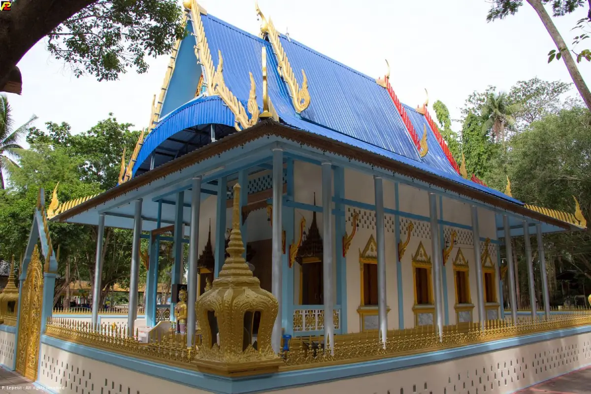
15. Wat Chao Fa Sala Loi is located in Bang Luek Subdistrict, Mueang Chumphon District. It is one of the province's important local temples and remains closely connected with the surrounding community. The temple has a quiet and shaded atmosphere suitable for merit-making, Buddhist worship, and a peaceful break from travel. Its location also places it within reach of several learning sites and royal development projects in the inland part of Mueang Chumphon.
One of the temple's strengths is that it remains an active community religious site rather than functioning solely as a tourist attraction. Visitors will find Buddhist structures and spaces used for regular religious activities. Appropriate dress, respectful behavior, and quiet voices are therefore expected, especially when monks or local residents are participating in ceremonies.
Travelers exploring the Mueang Chumphon zone can combine Wat Chao Fa Sala Loi with the Nong Yai Royal Initiative Project, Hua Wang–Phanang Tak Canal, and Chumphon National Museum. This creates a route that adds religion, local culture, and community life to an itinerary that might otherwise focus mainly on beaches and marine attractions.
Getting There: From Chumphon town, travel inland toward Bang Luek Subdistrict along the route to Nong Yai. The temple can be reached conveniently by private car.
Map (GPS): https://maps.app.goo.gl/48BN2cvsBndeSTNX6
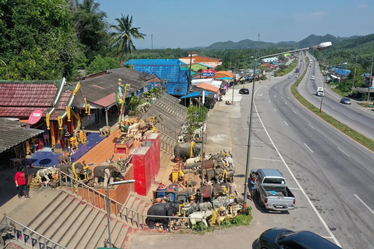
16. San Pho Ta Hin Chang Shrine is located beside Phet Kasem Road, Highway 4, in Salui Subdistrict, Tha Sae District. It is one of the best-known roadside sacred places for people traveling between central and southern Thailand. Many drivers traditionally sound their horns when passing the shrine as a gesture of respect, while others stop to pray for a safe journey. The name of the shrine is connected with a natural rock formation in the Tha Sae stream area that resembles a multi-headed elephant and became the focus of local belief.
The shrine is also known as San Pho Si Harimongkhon and is associated with stories dating from the construction of Phet Kasem Road, when unusual incidents and difficulties were said to have occurred in the area. Local residents established the shrine and performed rituals for good fortune, after which it gradually became a place of faith for truck drivers, bus operators, traders, and ordinary travelers. Visitors commonly offer elephant figurines, light firecrackers in designated areas, or pray for protection, work, business, and safe transportation.
The area around the shrine has also developed into one of Chumphon's important roadside souvenir centers. Leb Mue Nang bananas are especially prominent and are sold fresh, dried, or processed into different products. Chumphon coffee, seasonal fruits, processed seafood, and community products can also be found here, making the area a combined rest stop, spiritual landmark, and local shopping zone. Visitors should take care when entering or leaving the roadside shops because Phet Kasem Road carries fast-moving traffic and many heavy vehicles.
Getting There: Follow Highway 4 south toward Chumphon. In Salui Subdistrict, Tha Sae District, look for the roadside souvenir shops and shrine around kilometer markers 454–456.
Map (GPS): https://maps.app.goo.gl/6MfidQ12TXouCUNN7
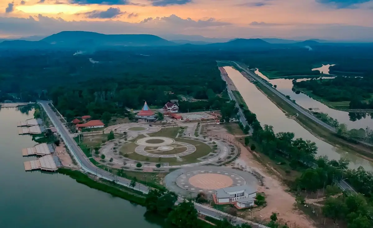
17. Nong Yai Royal Development Project is located in Bang Luek Subdistrict, Mueang Chumphon District and is an important learning site for water management. The project became especially significant after Chumphon experienced major flooding, leading to the development of Nong Yai as a large water-retention area following the “monkey cheek” concept. The area stores excess water during periods of heavy rainfall, slows the movement of floodwater, and helps reduce pressure on urban drainage systems before water is gradually released through connected canals.
One of the most interesting aspects of Nong Yai is the way a natural lowland area has been integrated with modern irrigation management. Together with Khlong Hua Wang–Phanang Tak, the system helps move excess water from low-lying urban areas toward the sea. The site therefore has value not only as a water-management project but also as an educational example of irrigation engineering, wetland conservation, and disaster mitigation adapted to the geography of Chumphon.
The surrounding area also includes green spaces and a calm environment suitable for educational visits and family trips. Travelers interested in royal development projects can combine Nong Yai with Wat Chao Fa Sala Loi and Khlong Hua Wang–Phanang Tak. Seeing these places together makes it easier to understand that flood prevention depends on an integrated system of retention areas, drainage canals, and urban water management rather than a single structure.
Getting There: From Chumphon town, travel toward Bang Luek Subdistrict and follow the local route to Nong Yai. The project is not far from the city and is easily accessible by private car.
Map (GPS): https://maps.app.goo.gl/z3kFCiCM6NoXTkjm6
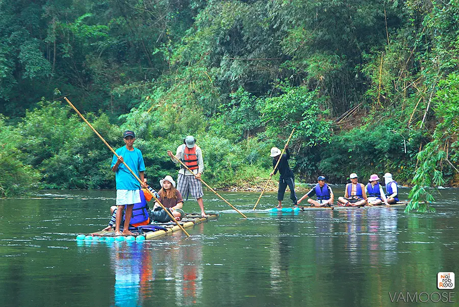
18. Ban Klong Ruea is an ecotourism community in Phato District where travel is built around nature, local livelihoods, and community participation. The village is surrounded by forest, mountains, orchards, and waterways, creating a very different atmosphere from Chumphon's coastal fishing communities. Visitors can stay in local homestays, learn about everyday life, and take part in activities organized by residents without relying on large-scale tourist infrastructure.
The main appeal of the village is the opportunity to spend time in the landscape rather than simply pass through it. Activities may include visiting orchards, walking through natural areas, eating home-cooked local food, and talking with residents about life in a watershed community. Staying overnight also reveals how local people depend on forest resources, streams, and agriculture while trying to maintain a balance between livelihood and conservation.
Ban Klong Ruea can be combined with Khlong Phato rafting and nearby waterfalls as a 2-day, 1-night itinerary. One day can focus on rafting and outdoor activities, while the evening and following morning are spent in the village. This style of trip is well suited to families, groups of friends, and travelers who want meaningful community experiences rather than simply collecting photo stops.
Getting There: Travel to Phato District, then continue along local roads to Ban Klong Ruea. Travelers planning to stay in a homestay or join community activities should contact local coordinators in advance.
Map (GPS): https://maps.app.goo.gl/5VQVxJwqimHfmmry6
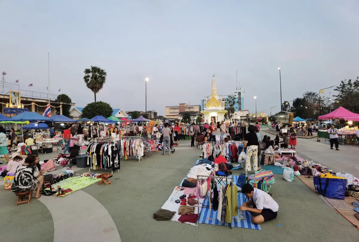
19. Municipal Walking Street is held along the road near Saphli Pier in Saphli Subdistrict, Pathio District. This seaside walking street adds a lively evening atmosphere to the Thung Wua Laen and Saphli coastal area. Food stalls, local seafood, snacks, drinks, clothing, household items, and community products are sold throughout the market, making it a convenient place to stop after spending the day at the beach.
The market's character is closely connected with the local fishing community and Saphli Pier. Visitors can find simple dishes made with fish, squid, shrimp, and shellfish alongside southern Thai food and local desserts. The market is not separated from everyday community life; local residents also come here to buy food, meet friends, and relax, giving travelers a chance to experience Saphli in a more authentic evening setting.
A practical itinerary is to spend the day at Thung Wua Laen Beach, visit Khao Dinsor or a nearby viewpoint in the afternoon, and finish at the walking street in the evening. Because the market operates on a weekly schedule rather than every day, travelers should confirm the current market day before visiting. The latest information lists Friday as the regular market day.
Getting There: From Chumphon town, travel to Saphli Subdistrict in Pathio District using the same route as Thung Wua Laen Beach, then continue toward the Saphli Pier road.
Map (GPS): https://maps.app.goo.gl/1GpLnKYfrmV4HLes5
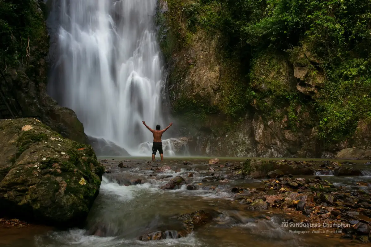
20. Khlong Phrao National Park refers to the Chumphon-side forest area now connected with Namtok Ngao National Park. One of the main attractions on the Chumphon side is Khlong Phrao Waterfall, also known as Thap Chang Waterfall, in Tako Subdistrict, Thung Tako District. The surrounding landscape consists of tropical rainforest, rugged mountain terrain, streams, and important watershed forest connecting Chumphon with Ranong.
Khlong Phrao Waterfall is a large multi-tiered waterfall with water flowing through the forest throughout much of the year. One of the best-known sections is the third tier, where water drops from a rocky cliff into a pool below, creating mist and a cool, humid atmosphere. Reaching some levels requires descending natural trails from the ranger area, and the return journey can be more physically demanding because of the uphill terrain.
This destination is well suited to travelers who want a more serious nature experience involving forest walking, waterfall exploration, photography, and time in relatively undisturbed rainforest. Visitors interested in camping or longer routes should contact park staff in advance. During the rainy season, trail conditions and water levels can change rapidly, so sturdy footwear, drinking water, and caution around fast-moving water are essential.
Getting There: From Pathomphon Junction, follow Highway 41 toward Surat Thani and continue to Thung Tako District. Turn onto the local road toward Ban Mueang Nai Kut and the park ranger unit near Khlong Phrao Waterfall.
Map (GPS): https://maps.app.goo.gl/LGxbJtrCzM5nwqPt7
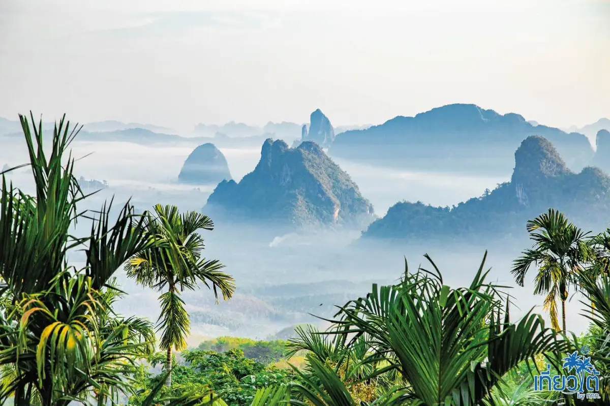
21. Doi Ta Pang is located at Ban Bon Doi, Moo 7, Khao Thalu Subdistrict, Sawi District. It is one of Chumphon's best-known viewpoints for sunrise and sea-of-mist scenery. The viewpoint overlooks mountains, forest, orchards, and farming communities, with Khao Thalu—a limestone mountain with a natural opening through its center—forming the most distinctive landmark in the landscape. The viewpoint is around 500 meters above sea level, high enough for mist to gather in the valleys under suitable weather conditions.
The most popular time to visit is before sunrise, when the first light begins to illuminate the valley and Khao Thalu. On mornings with sufficient humidity and calm air, layers of mist can form below the viewpoint, creating one of the most recognizable inland landscapes in Chumphon. Even when there is no sea of mist, the panoramic view remains impressive, with limestone hills, coffee plantations, fruit orchards, and villages visible across the valley.
The road to the viewpoint is steep, narrow, and partly unpaved, so ordinary private cars are not recommended for the final ascent. Visitors usually park at a community meeting point and continue by local four-wheel-drive vehicle with drivers familiar with the route. Those planning to see sunrise should arrive at the lower meeting point at around 04.30–05.00 and bring a light jacket, drinking water, and suitable footwear.
Getting There: From Sawi District, travel toward Khao Thalu Subdistrict and Ban Bon Doi. At the community meeting point, use a local four-wheel-drive vehicle to reach Doi Ta Pang viewpoint.
Map (GPS): https://maps.app.goo.gl/KZHDaKtAUwrCr5g98
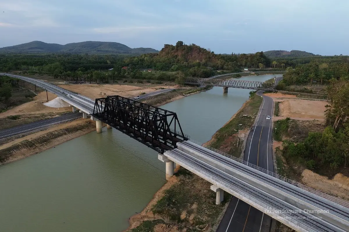
22. Khlong Hua Wang–Phanang Tak, locally known as the “Royal Canal,” is an important drainage canal developed as part of Chumphon's flood-management system. The canal runs from Ban Hua Wang in Bang Luek Subdistrict toward Phanang Tak Bay in Na Thung Subdistrict, Mueang Chumphon District, for approximately 8.1 kilometers. Its main role is to accelerate the movement of floodwater from low-lying urban areas toward the sea and reduce pressure on the Tha Taphao River and older drainage channels during periods of heavy rain.
The canal became particularly important after major flooding affected Chumphon in 1997. The overall concept combines an additional drainage route with Nong Yai, which functions as a temporary flood-retention area under the “monkey cheek” water-management principle. When urban water levels rise, Nong Yai holds excess water before it is gradually released through Khlong Hua Wang–Phanang Tak toward the coast. Together, the retention and drainage system provides a clear example of water management adapted to local topography.
For travelers interested in irrigation, infrastructure, and royal development projects, the canal provides insight into how a coastal city manages flood risk from inland to sea. The area can be visited together with the Nong Yai Royal Development Project. Those interested in a more technical understanding may wish to arrange a study visit or contact the relevant local authority in advance.
Getting There: The canal can be accessed from Bang Luek and Na Thung subdistricts in Mueang Chumphon District. Main access routes connect with the Nong Yai area and continue toward Phanang Tak Bay.
Map (GPS): https://maps.app.goo.gl/LwhZQvCnkbUB16ZCA
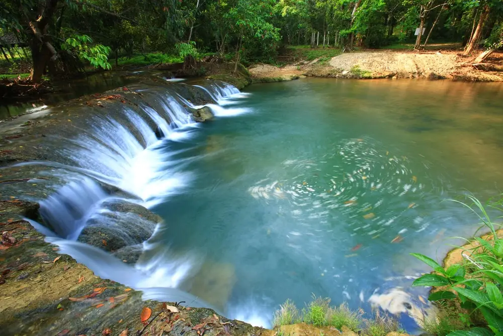
23. Namtok Kapo Forest Park is located near Ban Yai Thai in Hong Charoen Subdistrict, Tha Sae District. It is one of Chumphon's most accessible natural rest areas because it lies close to Phet Kasem Road and does not require a long forest trek. Kapo Waterfall is a relatively small waterfall fed by the Khao Kapo watershed and resembles a low curved weir, measuring around 20 meters wide and approximately 2 meters high. Water flows through the area for much of the year, and the surrounding forest creates a shaded environment suitable for resting, wading, and family recreation.
Although the waterfall is not especially tall, accessibility and natural atmosphere are its main strengths. Visitors can walk from the parking area to the stream without a difficult hike, and several flat areas are suitable for sitting and relaxing. The surrounding forest park covers a much larger natural area, with forest vegetation, birdlife, and a cooler environment than the nearby highway.
Extra caution is required during the rainy season because water levels and current speed can rise quickly and rocks near the waterfall can become slippery. Swimming should be avoided when heavy rain has fallen upstream. The forest park can be combined with San Pho Ta Hin Chang Shrine and other attractions in Tha Sae, creating a route that mixes nature, religion, and local culture.
Getting There: From Tha Sae District, travel along Phet Kasem Road for around 13 kilometers. The forest park is near kilometer markers 467–468 and is easily reached by private vehicle.
Map (GPS): https://maps.app.goo.gl/L8NjpSZVeaGRgwQx9
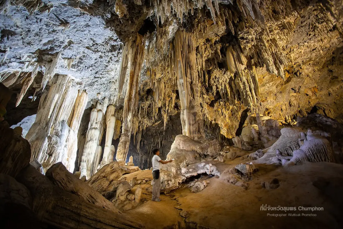
24. Khao Kriab Cave is located in Ban Khuan Subdistrict, Lang Suan District. It is a limestone cave with a relatively spacious and airy interior compared with many completely enclosed caves. Natural openings and shafts allow daylight to enter parts of the cave, making stalactites, stalagmites, and rock walls easier to see and creating a more open atmosphere. The surrounding limestone hills and forest add another layer of natural interest to the site.
The cave contains several chambers and mineral formations created gradually over long periods of time. Visitors should follow established paths and avoid touching stalactites and stalagmites because oils from human skin can interfere with mineral deposition. Some sections can be damp and slippery, especially during rainy weather, so footwear with good grip is recommended.
Khao Kriab Cave is a useful addition to a Lang Suan itinerary because it offers a geological and inland nature experience that contrasts with Ko Phitak and the district's coastal attractions. Travelers with enough time can combine the cave with Somdet Phra Srinagarindra Park and the Lang Suan riverside area for a day that includes caves, mountains, history, and local communities.
Getting There: Travel to Ban Khuan Subdistrict in Lang Suan District and follow local roads to the Khao Kriab Cave area. Daytime visits are recommended, and entry should be avoided during heavy rain.
Map (GPS): https://maps.app.goo.gl/6uZu62pUtJYG81NW9
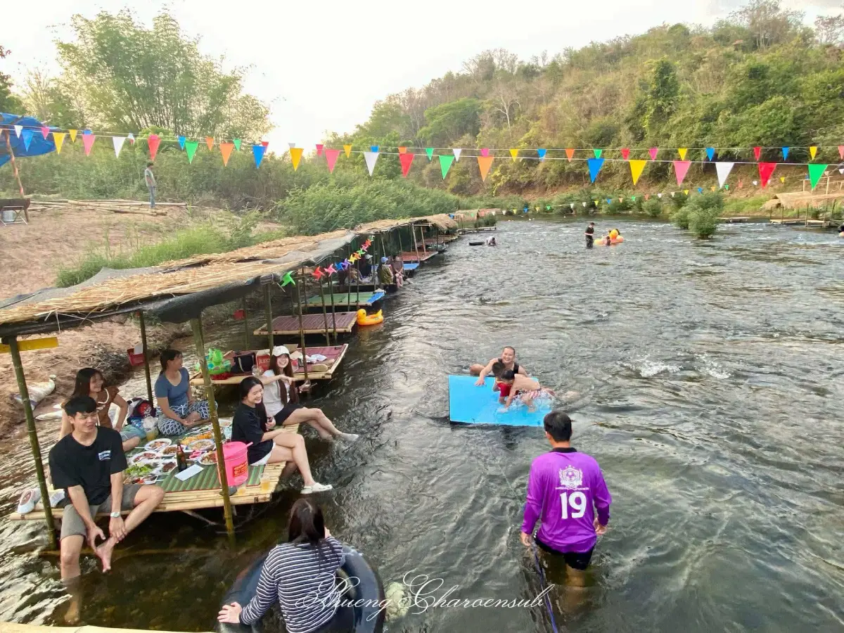
25. Kaeng Yao is located in Moo 6, Na Sak Subdistrict, Sawi District. This natural stream attraction is formed where water flows through a long series of rocky rapids surrounded by forest and mountain scenery. The sound of flowing water, naturally shaped rocks, and the quiet valley environment create a distinctly different experience from Chumphon's coastal attractions. It is suitable for relaxing, photography, sitting beside the stream, and enjoying inland nature.
When the water level is moderate, the stream forms a mixture of shallow pools and faster channels between rocks. Visitors who want to enter the water should choose only calm areas and avoid sections with strong currents. The landscape changes with the season: periods of higher water emphasize the movement and sound of the rapids, while lower water levels reveal more of the rock formations and channels beneath the stream.
Kaeng Yao is best suited to travelers who prefer small, quiet natural sites away from heavily visited attractions. It can be combined with Doi Ta Pang, Phra That Sawi, and the Khao Thalu coffee route, creating a Sawi itinerary that includes mountains, culture, agriculture, and freshwater scenery. Water conditions should be checked during the rainy season because runoff from the mountains can cause levels to rise quickly.
Getting There: From Sawi District, travel to Na Sak Subdistrict and continue to Moo 6 along local roads. Private car or motorcycle is the most convenient option.
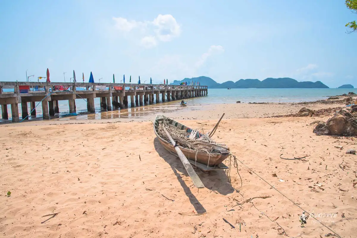
26. Thung Maha Bay is located at Ban Thung Maha in Pak Khlong Subdistrict, Pathio District. The bay retains the atmosphere of a working coastal community, with fishing boats, local houses, beaches, and hills forming a landscape that feels more like a traditional fishing area than a developed resort beach. Travelers can experience the sea, small-scale fisheries, and everyday community life in the same setting.
Morning is a good time to observe fishing boats and the community as the day begins, while late afternoon is more suitable for walking along the bay, watching the changing light over the sea, and eating seafood nearby. Thung Maha does not have the same concentration of tourism facilities as Thung Wua Laen Beach, which makes it more appealing to travelers who prefer quieter coastal scenery and less crowded surroundings.
The bay and nearby canal mouth are also closely connected with coastal ecology and local fishing. Visitors should avoid blocking work areas used by fishermen, boat access points, or seafood unloading areas, and should help keep the coastline clean. Thung Maha can be combined with Thung Sang Bay, Khao Dinsor, or other beaches in Pathio to show the variety of Chumphon's northern coastline.
Getting There: From Pathio District, travel toward Pak Khlong Subdistrict and Ban Thung Maha, then follow the coastal road to the bay. Private car is the most convenient option.
Map (GPS): https://maps.app.goo.gl/WSkxGckZAP4BZy3b8
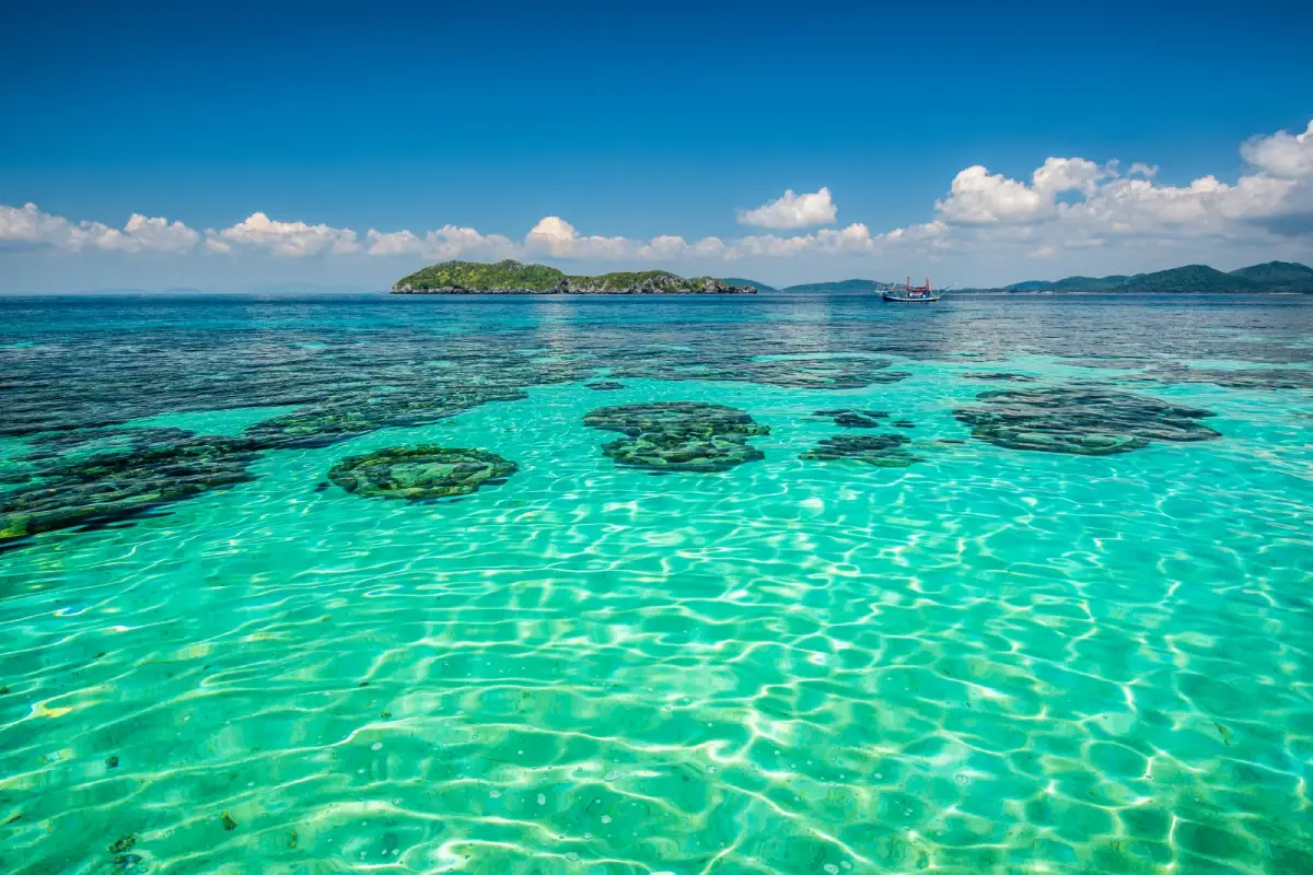
27. Ko Langka Jiw is a small limestone island within Mu Ko Chumphon National Park and is notable for both natural beauty and historical associations. Rocky cliffs, sea caves, and surrounding coral habitats make the island attractive for snorkeling and marine sightseeing, while parts of the island are connected with swiftlet bird's-nest concessions and therefore have controlled access.
What makes Ko Langka Jiw particularly significant is its historical connection with King Chulalongkorn, Rama V, who visited the island and observed bird's-nest harvesting in the area. Royal initials and other historical traces associated with these visits give the island a cultural dimension beyond its role as a marine attraction. It therefore brings together nature, coastal resource use, and royal travel history in one place.
Visitors should follow national park regulations and concession-area restrictions carefully. Landing, entering caves, or approaching bird-nest areas without permission should be avoided. Snorkelers should wear life jackets and never touch coral. Ko Langka Jiw can be included with Ko Ngam Yai, Ko Ngam Noi, and Ko Mattra on a Mu Ko Chumphon boat itinerary, depending on sea conditions and the operator's route.
Getting There: Depart from the Mueang Chumphon coast or another boat point arranged by the operator and continue by boat to Ko Langka Jiw within Mu Ko Chumphon National Park.
Map (GPS): https://maps.app.goo.gl/iqP35owCctZU5LKV7
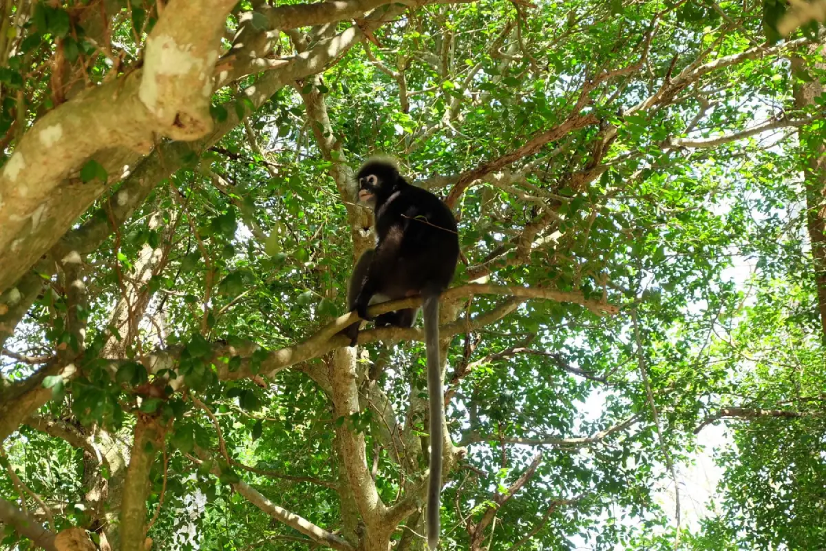
28. Southern Spectacled Langur Viewing Point is located in Moo 3, Chum Kho Subdistrict, Pathio District, near Wat Tham Khao Plu and the limestone hill habitat in the area. The site is known for sightings of southern spectacled langurs living in trees and limestone-forest surroundings close to the community. Adults are recognizable by pale rings around the eyes that resemble spectacles, while young langurs are born with bright orange-yellow fur that gradually darkens as they mature.
The appeal of the site lies in observing wild animals in their natural environment rather than in captivity. Langurs often move through trees around the lower slopes and temple area, with early morning and late afternoon generally offering better opportunities for sightings than midday. Visitors should keep a respectful distance, remain quiet, and never feed or approach the animals for photographs because feeding can alter their behavior and increase risks for both wildlife and people.
The same area can be combined with Wat Tham Khao Plu, caves, natural springs, and religious sites, giving visitors a mixture of wildlife, limestone geology, and local Buddhist culture. Binoculars or zoom lenses are preferable to walking close to the animals, making the experience more responsible and more comfortable for the langurs.
Getting There: Travel to Chum Kho Subdistrict in Pathio District and follow the route toward Wat Tham Khao Plu. The langur-viewing area is near the temple and limestone hill.
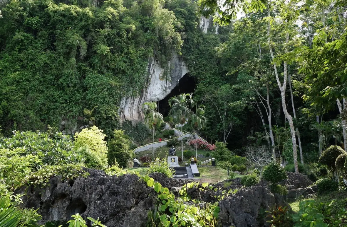
29. Somdet Phra Srinagarindra Park is located near Khao Ngoen Cave in Moo 7, Ban Khao Ngoen, Tha Maphla Subdistrict, Lang Suan District. The park was established in honor of the 80th birthday anniversary of Princess Srinagarindra and is the 10th park in the national series dedicated to her. The setting combines landscaped gardens, mountain scenery, caves, and the Lang Suan River, with a monument to Princess Srinagarindra as one of the main landmarks.
The area is more than a public park. It also contains important historical and natural features. On the hill are a replica Buddha footprint, Roi Khwai Cave, and walking routes connecting to Khao Ngoen Cave. Inside the cave are Buddha images and royal initials associated with King Chulalongkorn, together with historical evidence connected with his travels in 1889. A chedi near the cave entrance also serves as a religious and commemorative feature.
The park is therefore suitable for travelers who want to experience Lang Suan through nature, history, and culture in one place. Visitors can walk through landscaped gardens, rest near the river, climb the hill, and explore cave areas. Families and elderly visitors may choose the lower garden sections, while those exploring caves or uphill paths should wear suitable shoes and bring drinking water.
Getting There: From Lang Suan town, travel toward Tha Maphla Subdistrict and Ban Khao Ngoen. The park is located near Khao Ngoen Cave and the Lang Suan River and is accessible by private car.
Map (GPS): https://maps.app.goo.gl/JrWmCtciHs8WCyXR7
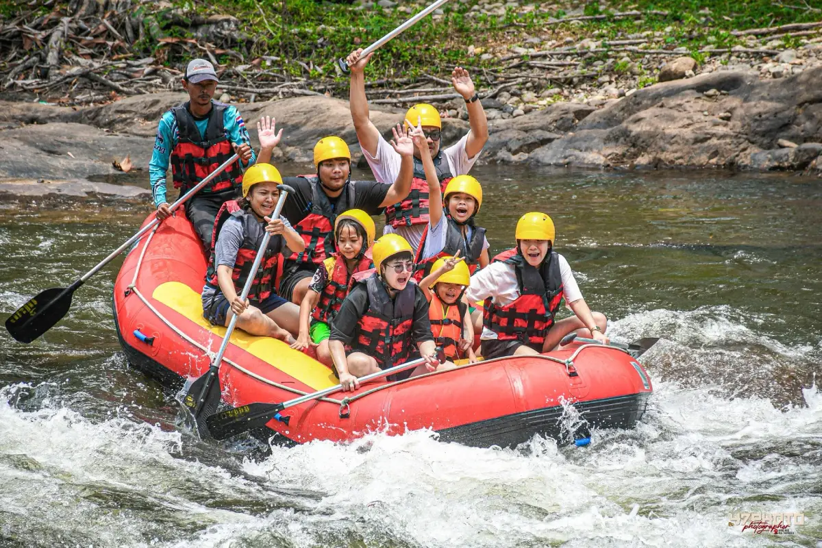
30. Lamae Rafting is an adventure activity in Lamae and Thung Kha Wat subdistricts of Lamae District. It is suited to travelers who want to experience Chumphon through forest, rivers, and local communities rather than the sea. The rafting route is divided into two main sections. The first begins near Yuan Sai Bridge on the boundary between Lamae and Thung Kha Wat and continues to Thung Sawan Weir for approximately 3 kilometers, taking around 1.5–2 hours with difficulty levels of roughly 1–3.
The second section runs from Thung Sawan Weir to Khao Chamot for around 2 kilometers and takes approximately 1.5 hours, with difficulty levels around 2–4. This section is more challenging, with faster currents, rocky rapids, bends, and sections requiring coordinated paddling. Participants must listen carefully to the rafting guide, maintain balance, and work as a team as the water conditions change.
Good rafting conditions are often found between around August and January, but actual operation depends on water levels, rainfall, and daily safety assessments. Travelers should contact operators before arrival and should never insist on rafting after prolonged heavy rain. Life jackets are required and participants should follow the guide's instructions at all times. After rafting, travelers can continue to Tham Khao Plu Hot Spring, Champun Waterfall, Tawan Chai Beach, or other attractions in Lamae, making this one of Chumphon's most varied nature-and-adventure districts.
Getting There: Travel to Lamae District and continue to the rafting starting point arranged by the operator in Lamae or Thung Kha Wat Subdistrict. Advance booking is recommended so boats, safety equipment, and return transport can be prepared.
Map (GPS): https://maps.app.goo.gl/adMR6ycjYjn2mujK6
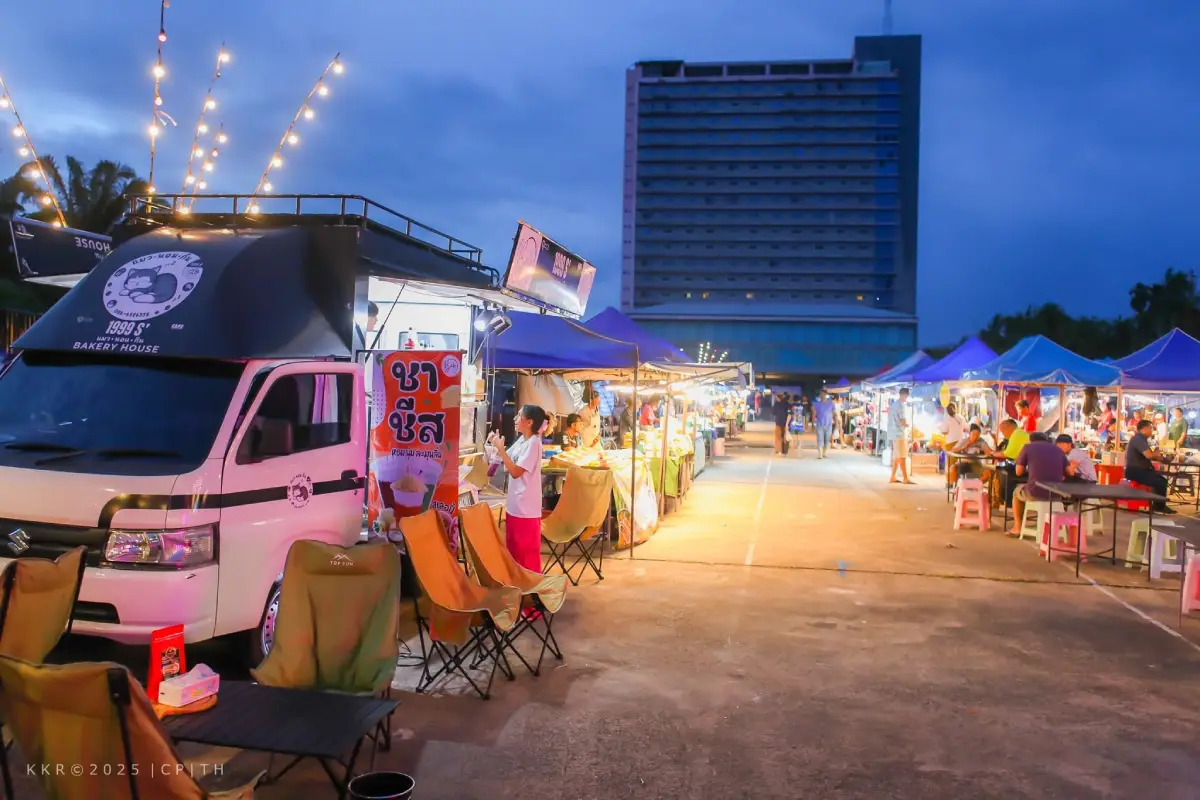
31. Chumphon Night Market is located on Krom Luang Road directly in front of Chumphon Railway Station in Tha Taphao Subdistrict, Mueang Chumphon District. This evening market is one of the easiest places for visitors to experience everyday local life after spending the day exploring beaches, museums, islands, or other attractions around the province. Its location beside the railway station, accommodations, shops, and central city streets makes it especially convenient for travelers arriving by train or staying overnight in downtown Chumphon.
The market offers a wide selection of ready-to-eat food, fried snacks, seafood dishes, desserts, drinks, fruits, rice and noodle dishes, and takeaway meals. It is a useful place for travelers who want to sample several kinds of food in one evening without visiting multiple restaurants. Rather than functioning solely as a tourist market, it remains part of daily life in Chumphon, with local residents stopping by after work to buy dinner, snacks, and groceries. The mix of commuters, railway passengers, local vendors, and travelers creates a lively but distinctly local atmosphere.
Chumphon Night Market is also a practical introduction to the province's food culture. Visitors can encounter southern Thai dishes, seafood, local sweets, fruit, and familiar Thai street food within the same compact area. Travelers staying in town can easily visit after sightseeing at Chumphon National Museum, Nong Yai Royal Development Project, or other places around Mueang Chumphon. The latest published information lists the market as operating daily from approximately 17.00 to 20.00.
Getting There: The market is located on Krom Luang Road directly in front of Chumphon Railway Station. Train passengers can walk from the station, while travelers arriving by car can enter central Chumphon and use available parking in nearby streets and designated areas.
Map (GPS): https://maps.app.goo.gl/GzL7RXTRaqzSmgKo6

32. Ancient Warship Wreck is located in the Ao Thong Kho area of Moo 13, Bang Nam Chuet Subdistrict, Lang Suan District. It is an unusual coastal historical attraction because the remains of a large metal vessel lie in relatively shallow water not far from the shore. The site is connected with local memories of the World War II period and with Chumphon's long-standing role as a maritime route, transportation corridor, and strategically important coastline in southern Thailand.
On days when the sea is calm, visibility is good, and shifting sand has not covered too much of the structure, parts of the wreck may be visible from the surface. Visitors can get closer by kayak or by using a small local boat. Because the wreck lies in comparatively shallow water, it provides a different experience from deep-water wreck-diving sites. However, its visibility changes according to tides, waves, currents, and sand movement, so the amount of the wreck visible on any particular day cannot be guaranteed.
The appeal of the site extends beyond the wreck itself. Ao Thong Kho retains a quiet coastal and fishing-community atmosphere, allowing travelers to combine maritime history with contemporary local life. The site can be included in the same itinerary as Ko Phitak and other attractions around Bang Nam Chuet. Travelers wishing to approach the wreck should use a local boat or community service and check sea conditions first. Swimming out independently is not recommended when waves are strong or visibility is poor.
Getting There: Travel to Bang Nam Chuet Subdistrict in Lang Suan District and continue to Ao Thong Kho. Visitors who want to approach the wreck by sea should contact a local boat operator or community service in the area.
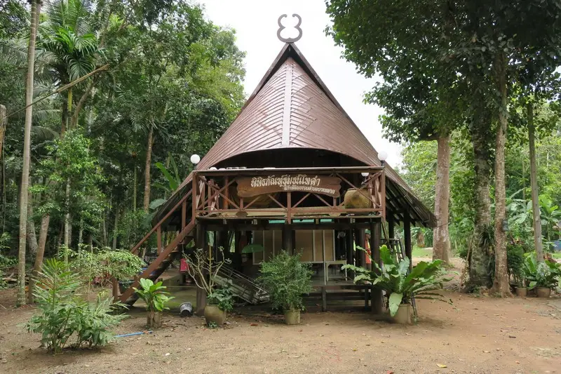
33. Tai Dam Community Museum is located at Ban Don Ruap, Moo 8, Bang Mak Subdistrict, Mueang Chumphon District. The museum preserves and presents the cultural heritage of the Tai Dam, also known in Thailand as Thai Song Dam, whose community has been established in this area for generations. Although relatively small, the museum is valuable because its collection is rooted directly in the lives of local families and covers migration history, traditional houses, household tools, clothing, beliefs, rituals, and customs that remain meaningful to the community.
The museum building reflects elements of traditional Tai Dam domestic architecture and displays objects associated with everyday life, including agricultural tools, kitchen equipment, textiles, clothing, and ritual objects. These exhibits help visitors understand that Tai Dam identity is expressed not only through distinctive black clothing or house design but also through family structures, ancestral beliefs, social traditions, and knowledge passed from one generation to the next.
One of the most important qualities of the museum is that it represents a living community rather than a culture preserved only behind display cases. Traditions represented inside the museum can still be connected to people living around Ban Don Ruap and the local temple area. Visitors therefore gain more from speaking with community members and listening to local explanations than simply walking through the exhibits. Because this is a community museum rather than a large institution with staff permanently stationed throughout the day, visitors should contact the local caretaker or community in advance before arriving.
Getting There: From Chumphon town, travel to Bang Mak Subdistrict and continue to Ban Don Ruap near the local temple area. Advance coordination with the museum caretaker or community is recommended.
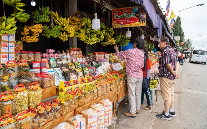
34. Por Ta Hin Chang Community is located beside Phet Kasem Road around kilometer markers 453–454 in Salui Subdistrict, Tha Sae District. The roadside community developed around the well-known San Pho Ta Hin Chang Shrine and has become one of Chumphon's major places to stop for local products and souvenirs. Its character comes from the combination of roadside faith, long-distance travel, and community commerce, with numerous shops selling products made from ingredients grown or produced within Chumphon.
The most recognizable local product is the Leb Mue Nang banana, available fresh, dried, fried into chips, or processed in other forms. Visitors can also find Chumphon coffee, seasonal tropical fruits, shrimp paste, processed seafood, and community-made products from different parts of the province. This makes Por Ta Hin Chang Community a useful stop for travelers who want to buy several kinds of Chumphon products without making a detour into the center of town.
Visitors can combine shopping with a visit to the nearby San Pho Ta Hin Chang Shrine, turning the stop into a place for rest, worship, and local food shopping. The area illustrates how belief, road travel, and local commerce have developed together over time. Because shops stand directly along a major highway used by buses, trucks, and long-distance traffic, visitors should be particularly careful when parking, crossing the road, or re-entering the traffic lane.
Getting There: Follow Phet Kasem Road, Highway 4, through Salui Subdistrict in Tha Sae District. The community's roadside shops are concentrated around the Por Ta Hin Chang area.
Map (GPS): https://maps.app.goo.gl/dtZ6ar3xZCTYVofz5
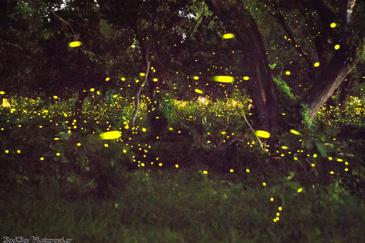
35. Bang Charoen Canal Firefly Watching is an evening nature activity in Moo 2, Tha Yang Subdistrict, Mueang Chumphon District. Visitors travel by small boat along the community canal to observe fireflies flashing among trees and vegetation beside the water after sunset. The peaceful nighttime setting creates a very different experience from Chumphon's beaches, islands, and city markets and offers a chance to explore the province after the daytime attractions have closed.
Firefly watching should be carried out with minimal disturbance. Camera flashes should be switched off, strong flashlights should not be directed into the trees, and noise should be kept low. Artificial light can disturb both fireflies and other nocturnal wildlife. Visitors should travel with local boat operators who know the canal because navigation after dark can be difficult, particularly where the waterway has bends, branches, shallow sections, or changing water levels.
The recommended period for the activity is generally around 18.00–21.00, although the actual number of fireflies varies with season, rainfall, humidity, temperature, water conditions, and other environmental factors. A large display can never be guaranteed on every visit. The activity is valuable because it adds a nighttime experience to a Mueang Chumphon itinerary while also creating income for the local community. It can be arranged after daytime sightseeing along the coast or in Chumphon town.
Getting There: Travel to Tha Yang Subdistrict in Mueang Chumphon District and continue to the community meeting point for boats on Bang Charoen Canal. Advance contact is recommended because the activity takes place after dark.
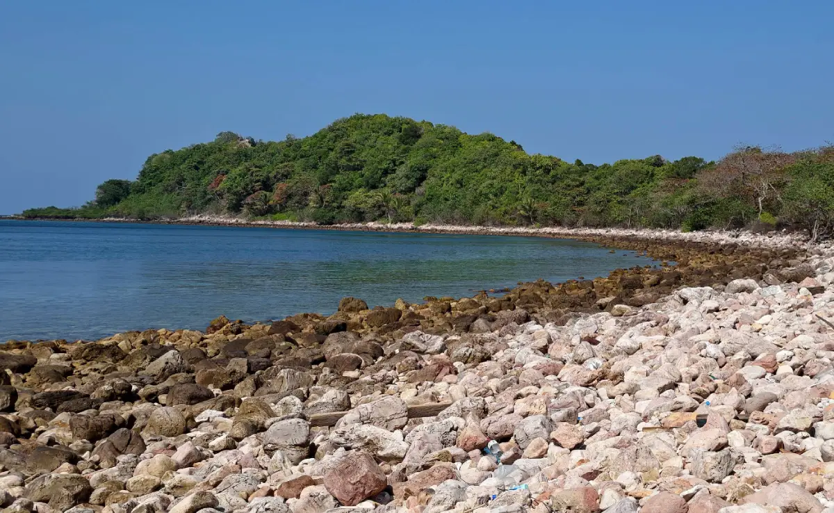
36. Ko Chorakhe lies in the Gulf of Thailand in the northern part of the Mu Ko Chumphon marine area near Pathio District. This small rocky island is known primarily for the underwater environment surrounding it rather than for developed facilities on land. In calm sea conditions, the island is suitable for snorkeling and coral viewing and is often included in marine excursions from the Pathio and Thung Wua Laen coastal zone.
Underwater rocks around the island provide habitats for reef fish, coral, and other small marine organisms. Most activities therefore take place in the water rather than on the island itself. Travelers should choose an operator familiar with local currents and use suitable snorkeling equipment and life jackets. Diving or snorkeling should be avoided when waves are strong because underwater visibility and currents around offshore rocks can change quickly.
Ko Chorakhe can be combined with Thung Wua Laen Beach, Khao Dinsor, and attractions around Saphli as part of a one-day Pathio itinerary. Morning trips are often more suitable when the sea is calm, leaving the afternoon for viewpoints or beach relaxation on the mainland. As with all reef sites, visitors should avoid standing on coral, touching marine animals, feeding fish, or leaving rubbish in the sea.
Getting There: Travel to a boat departure point along the Pathio coastline or another location arranged by the operator, then continue by boat to Ko Chorakhe according to sea conditions.
Map (GPS): https://maps.app.goo.gl/HB2Hf3BHvRjCG8TC9
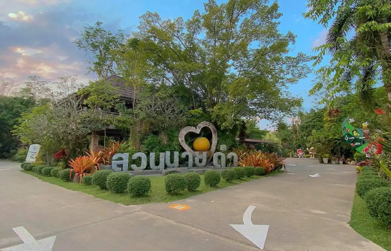
37. Suan Nai Dum is located at 199 Moo 7, Tako Subdistrict, Thung Tako District. Originally developed around agricultural activities, the property has gradually evolved into a well-known roadside rest stop and agro-tourism attraction along the main Chumphon–Surat Thani travel corridor. Its combination of orchard surroundings, landscaped areas, local products, food, drinks, and rest facilities makes it useful both for travelers specifically interested in agriculture and for people simply looking for a comfortable break during a long drive through southern Thailand.
The grounds contain shaded areas created by mature trees and landscaped gardens where visitors can walk, rest, and observe different plants. Seasonal fruit and processed products from the orchard and surrounding communities are available for purchase. The attraction is therefore not centered on a single fruit variety but on the broader idea of developing an agricultural property into a learning and travel stop while maintaining its connection with farming.
Suan Nai Dum is particularly convenient for travelers continuing south toward Lang Suan, Lamae, or Surat Thani and can also be combined with Khlong Phrao National Park in Thung Tako. Families traveling with children or elderly passengers may find it especially useful as a break from long hours in the car, with space to walk, buy refreshments, shop for local products, and rest before continuing the journey. Published information lists daily opening hours at approximately 07.30–17.00.
Getting There: Follow Highway 41 toward Thung Tako District, then enter Tako Subdistrict according to local signs. Suan Nai Dum is located close to the main southern highway and is convenient for travelers by private car.
Map (GPS): https://maps.app.goo.gl/Jr9LecGEen7Eigyz7
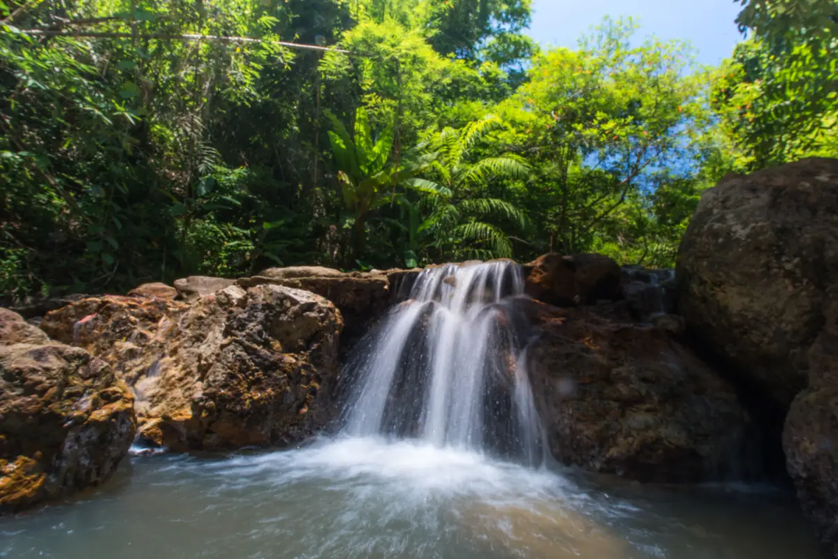
38. Champoon Waterfall is located in Moo 8, Thung Khawat Subdistrict, Lamae District, within the Lamae Forest Reserve. This medium-sized waterfall has seven levels and forms part of an important headwater system supplying streams and communities throughout Lamae. Water originating in the mountain areas flows through Lamae, Thung Khawat, and Thung Luang subdistricts before eventually connecting with Khlong Lamae and the coastal zone. The site therefore has ecological importance beyond its role as a place for recreation.
The seven levels have different combinations of rock terraces, forest streams, and natural pools surrounded by humid tropical vegetation. Some pools in the lower area are relatively shallow during normal water conditions and provide quiet places for relaxation. Visitors interested in nature can observe streamside plants, mature trees, fish, and the cool microclimate created by the forest. Reaching higher levels requires more time and physical effort, so travelers should assess their fitness and wear footwear with good grip.
Champoon Waterfall can be combined with Lamae Rafting and Tham Khao Plu Hot Spring, creating a Lamae itinerary that includes adventure activities, mineral springs, forest, and freshwater scenery. The rainy season brings fuller streams and greener vegetation but also increases the risk of flash floods and slippery rocks. After prolonged rainfall, visitors should check local conditions before entering the area and should never swim when the current is unusually strong.
Getting There: From Lamae District, travel toward Thung Khawat Subdistrict and Moo 8, then follow local roads toward Champoon Waterfall. Daytime travel is recommended and visitors should allow sufficient time for walking in the natural area.
Map (GPS): https://maps.app.goo.gl/6emqiVFTHjYoDYidA
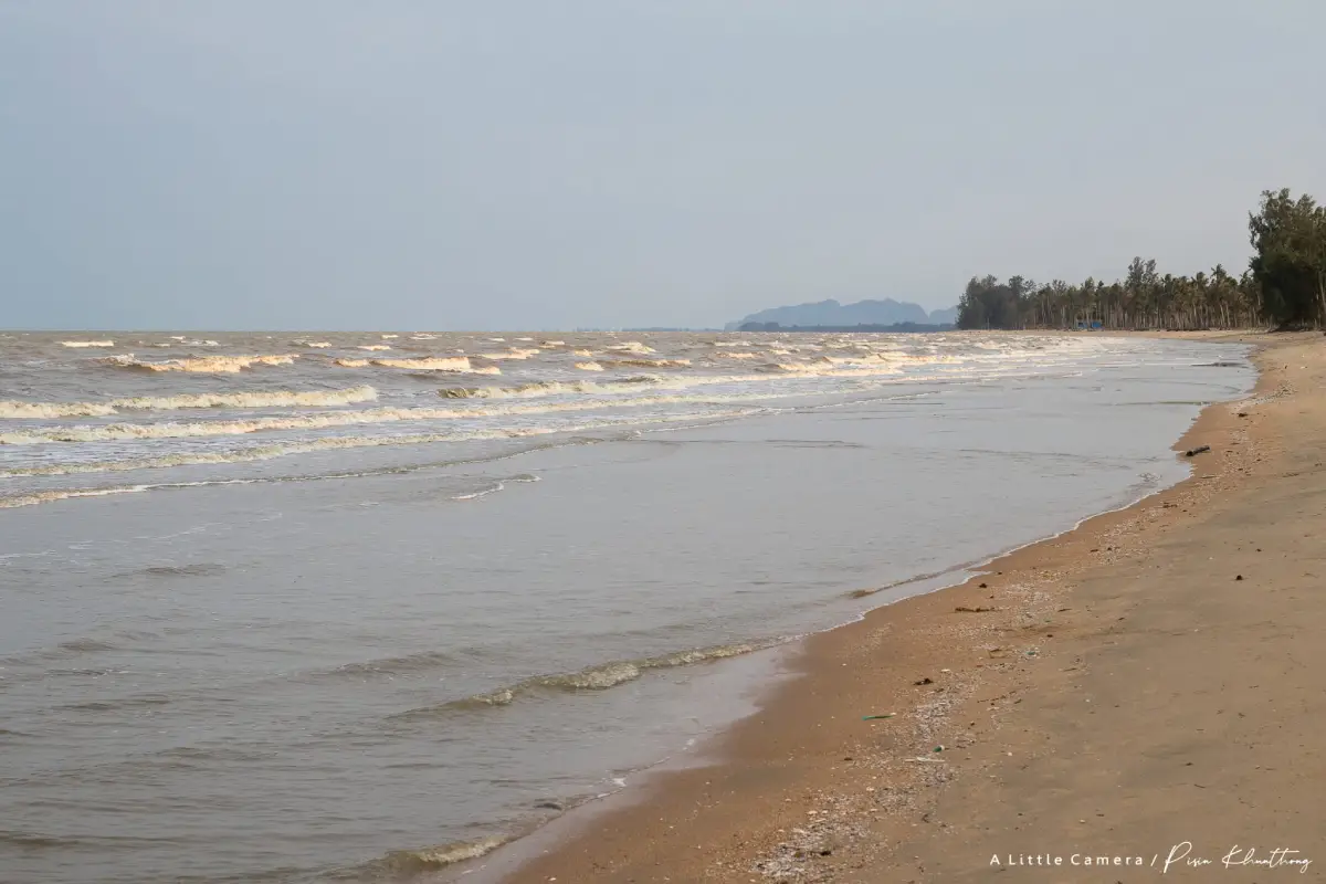
39. Hat Tawan Chai Beach is located in Moo 3, Lamae Subdistrict, Lamae District. This natural beach on the Gulf of Thailand remains relatively quiet and retains the character of a local southern coastline. A broad stretch of beach runs alongside coconut trees and open coastal land, with far less dense development than major resort beaches. It is therefore suitable for travelers looking for a peaceful place to walk, enjoy the sea breeze, take photographs, or simply spend time beside the water.
Small-scale fishing remains part of the surrounding coastal landscape, with local boats, seaside communities, and fishing-related activity still visible near the beach. This makes a walk along Hat Tawan Chai more than a purely scenic experience because it also reveals how local residents continue to depend on the Gulf of Thailand. Early morning is a good time to see the coast in soft light and observe local activity, while late afternoon is comfortable for walking when temperatures begin to fall.
Hat Tawan Chai can be combined with Tham Khao Plu Hot Spring, Champoon Waterfall, and Lamae Rafting, allowing travelers to begin the day among forest and streams before ending beside the sea. The combination illustrates the remarkable diversity of this small district in southern Chumphon. Swimming should be avoided when waves are strong or when weather warnings indicate unsuitable sea conditions.
Getting There: From Highway 41, enter Lamae District and follow local roads toward Lamae Subdistrict and the Hat Tawan Chai coastline. Private car is the most convenient form of transport.
Map (GPS): https://maps.app.goo.gl/MG3ge8gdv5VDXHDU6
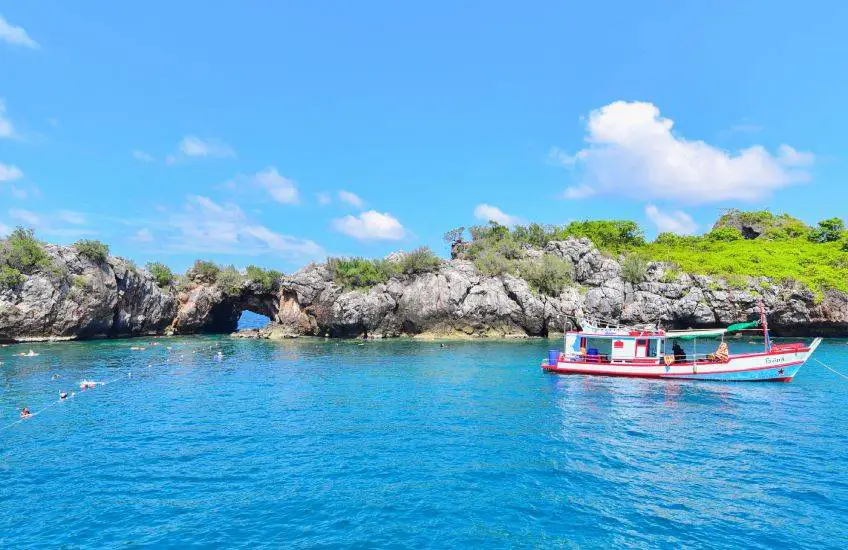
40. Ko Thalu is a small limestone island in the Gulf of Thailand within Mu Ko Chumphon National Park. Its most distinctive natural feature is a large opening through the rock created gradually by wind, waves, and marine erosion. From the boat, the opening appears like a natural window through the island, producing a landscape very different from islands that are known primarily for beaches or accommodation.
The waters around Ko Thalu contain coral reefs, sea anemones, schools of fish, and other marine life, making snorkeling rewarding when sea conditions are suitable. Parts of the natural opening lie close to sea level, allowing visitors to look through to the water on the opposite side. However, swimming through or approaching the rock opening should only be attempted when guides determine that waves and currents are safe, as water movement near limestone walls can be stronger and less predictable than in open, sheltered water.
There is no permanent community, accommodation, or commercial infrastructure on Ko Thalu, so visits are made as day trips from the mainland or as part of a Mu Ko Chumphon island-hopping program. Travelers should bring drinking water, sun protection, and essential personal items before boarding the boat and should take all rubbish back to the mainland. Ko Thalu can be combined with the Ngam Islands, Ko Mattra, or other marine sites according to the boat operator's program and national park regulations. Current marine access and weather conditions should always be checked before departure.
Getting There: Travel to the boat departure point arranged by the operator in the Mueang Chumphon area, then continue by boat to Ko Thalu according to the route operating that day.
Map (GPS): https://maps.app.goo.gl/8XdhcCsqkmNmSTuf7
| Topic | Details |
| Province | Chumphon, Southern Thailand |
| Main Highlights | A Gulf of Thailand coastal province offering beaches, islands, coral reefs, dive sites, tropical rainforest, mountains, waterfalls, caves, hot springs, rivers and canals, fishing communities, royal development projects, temples, museums, local traditions, seafood, robusta coffee, and tropical agriculture. |
| Top 10 Places to Visit in Chumphon | 1. Thung Wua Laen Beach 2. Hat Sai Ri 3. Mu Ko Chumphon National Park 4. Ko Ngam Yai and Ko Ngam Noi 5. Ko Mattra 6. Ko Phitak 7. Khao Dinsor 8. Khlong Phato Rafting 9. Phra That Sawi 10. Tham Khao Plu Hot Spring |
| Mueang Chumphon Zone | 1. Hat Sai Ri 2. Mu Ko Chumphon National Park 3. Ko Ngam Yai and Ko Ngam Noi 4. Ko Mattra 5. Chumphon National Museum 6. Youth Soldiers Monument 7. Wat Chao Fa Sala Loi 8. Nong Yai Royal Development Project 9. Khlong Hua Wang–Phanang Tak 10. Ko Langka Jiw 11. Chumphon Night Market 12. Tai Dam Community Museum 13. Bang Charoen Canal Firefly Watching |
| Pathio Zone | 1. Thung Wua Laen Beach 2. Khao Dinsor 3. Municipal Walking Street 4. Thung Maha Bay 5. Southern Spectacled Langur Viewing Point 6. Ko Chorakhe |
| Tha Sae Zone | 1. San Pho Ta Hin Chang Shrine 2. Por Ta Hin Chang Community 3. Namtok Kapo Forest Park |
| Sawi Zone | 1. Phra That Sawi 2. Chumphon Horticultural Research Centre 3. Doi Ta Pang 4. Kaeng Yao |
| Phato Zone | 1. Khlong Phato Rafting 2. Ban Klong Ruea |
| Lang Suan Zone | 1. Ko Phitak 2. The Traditional Boat Race Parade 3. Khao Kriab Cave 4. Somdet Phra Srinagarindra Park 5. Ancient Warship Wreck |
| Thung Tako Zone | 1. Khlong Phrao National Park 2. Suan Nai Dum |
| Lamae Zone | 1. Tham Khao Plu Hot Spring 2. Lamae Rafting 3. Champoon Waterfall 4. Hat Tawan Chai Beach |
| Beaches, Sea and Islands | 1. Thung Wua Laen Beach 2. Hat Sai Ri 3. Mu Ko Chumphon National Park 4. Ko Ngam Yai and Ko Ngam Noi 5. Ko Mattra 6. Ko Phitak 7. Thung Maha Bay 8. Ko Langka Jiw 9. Ko Chorakhe 10. Hat Tawan Chai Beach 11. Ko Thalu |
| Mainland Nature | 1. Khao Dinsor 2. Namtok Kapo Forest Park 3. Khlong Phrao National Park 4. Doi Ta Pang 5. Khao Kriab Cave 6. Kaeng Yao 7. Southern Spectacled Langur Viewing Point 8. Champoon Waterfall 9. Tham Khao Plu Hot Spring |
| History, Religion and Culture | 1. Phra That Sawi 2. Chumphon National Museum 3. Youth Soldiers Monument 4. The Traditional Boat Race Parade 5. Wat Chao Fa Sala Loi 6. San Pho Ta Hin Chang Shrine 7. Somdet Phra Srinagarindra Park 8. Ancient Warship Wreck 9. Tai Dam Community Museum |
| Communities and Local Life | 1. Ko Phitak 2. Ban Klong Ruea 3. Municipal Walking Street 4. Por Ta Hin Chang Community 5. Tai Dam Community Museum 6. Chumphon Night Market 7. Bang Charoen Canal Firefly Watching |
| Agro-Tourism and Local Products | 1. Chumphon Horticultural Research Centre – economic crops and robusta coffee research 2. Suan Nai Dum – agricultural attraction, rest stop, and local products 3. Por Ta Hin Chang Community – Leb Mue Nang bananas and processed local products 4. Khao Thalu–Sawi Area – an important coffee-growing and agricultural zone in Chumphon |
| Adventure Activities | 1. Khlong Phato Rafting 2. Lamae Rafting 3. Nature exploration at Doi Ta Pang 4. Forest trekking and waterfall exploration at Khlong Phrao 5. Diving and snorkeling around the Chumphon islands 6. Community boat trips and coastal activities at Ko Phitak |
| Local Food and Specialties | Fresh seafood, fish, shrimp, crab, squid, southern Thai cuisine, Chumphon robusta coffee, Khao Thalu coffee, Leb Mue Nang bananas and processed banana products, durian, mangosteen, longkong, and other seasonal tropical fruits. |
| Important Traditions and Culture | The Hae Phra Boat Procession and traditional boat races in Lang Suan, the robe-wrapping ceremony at Phra That Sawi, commemorative events honoring Admiral Prince Abhakara Kiartivongse, Buddhist traditions of local communities, and the living culture of the Tai Dam community at Ban Don Ruap. |
| Suitable For | Beach travelers, divers, families, couples, photographers, birdwatchers, hikers, adventure travelers, history and culture enthusiasts, community-based travelers, and visitors interested in agricultural tourism. |
| Getting Around Chumphon | A private car or rental car is the most practical option for traveling across several districts because attractions are spread along the province's long north–south corridor. Islands require additional boat transport. Doi Ta Pang is best reached using local four-wheel-drive vehicles, while rafting and community activities should be arranged with experienced local operators. |
| Suggested 2–3 Day Trip | Focus on Mueang Chumphon and Pathio, including Thung Wua Laen Beach, Hat Sai Ri, Khao Dinsor, and one full-day island or snorkeling trip in Mu Ko Chumphon National Park. |
| Suggested 4–5 Day Trip | Add Sawi, Doi Ta Pang, Phra That Sawi, Phato, Lang Suan, Ko Phitak, Lamae, and Thung Tako for a broader journey combining the sea, mountains, rainforest, waterfalls, local communities, agriculture, and culture. |
| Check Before Traveling | Check weather and sea conditions before boat trips, current national park marine-access announcements, water levels before rafting, trail and waterfall conditions, weekly market schedules, annual festival dates, and advance reservations for homestays or community activities. |
Frequently Asked Questions (FAQ)
Q: What are the best places to visit in Chumphon?
A: Chumphon offers a wide variety of attractions, including Thung Wua Laen Beach, Hat Sai Ri, Mu Ko Chumphon National Park, Ko Ngam Yai, Ko Ngam Noi, Ko Mattra, Ko Phitak, Khao Dinsor, Doi Ta Pang, Phra That Sawi, Khlong Phato Rafting, Tham Khao Plu Hot Spring, Champoon Waterfall, and many community-based attractions. Travelers can combine beaches, islands, forests, mountains, culture, food, and local communities within the same province.
Q: Where should first-time visitors go in Chumphon?
A: For a first trip of around 2–3 days, start with Thung Wua Laen Beach, Hat Sai Ri, and a one-day boat trip through Mu Ko Chumphon National Park. Khao Dinsor is a good addition for panoramic coastal views and birdwatching. Travelers with more time can continue south to Ko Phitak, Phato, Sawi, or Lamae for a broader experience beyond the main coastal zone.
Q: Which Chumphon beaches and islands should not be missed?
A: Major coastal highlights include Thung Wua Laen Beach, Hat Sai Ri, Ko Ngam Yai, Ko Ngam Noi, Ko Mattra, Ko Langka Jiw, Ko Chorakhe, Ko Thalu, and Ko Phitak. The islands within Mu Ko Chumphon National Park are particularly suitable for snorkeling and diving, while Ko Phitak is best known for homestays, fishing-community life, and local seafood.
Q: Where are the best diving and snorkeling spots in Chumphon?
A: Many of the best sites are within Mu Ko Chumphon National Park, including Ko Ngam Yai, Ko Ngam Noi, Ko Mattra, Ko Langka Jiw, Ko Chorakhe, and Ko Thalu. Each site offers different coral formations, underwater rock structures, fish populations, and depth conditions. Travelers should choose locations according to their experience level and current sea conditions.
Q: What can travelers do in Chumphon without going to the beach?
A: Inland attractions include Doi Ta Pang, Khao Dinsor, Namtok Kapo Forest Park, Khlong Phrao National Park, Champoon Waterfall, Khao Kriab Cave, Phra That Sawi, Tham Khao Plu Hot Spring, Khlong Phato Rafting, Ban Klong Ruea, Chumphon National Museum, and Somdet Phra Srinagarindra Park.
Q: Where can travelers see a sea of mist in Chumphon?
A: Doi Ta Pang in Khao Thalu Subdistrict, Sawi District, is one of Chumphon's best-known sunrise and sea-of-mist viewpoints. The landscape features Khao Thalu as a distinctive backdrop. Local four-wheel-drive vehicles are recommended for the final ascent because the road is steep, narrow, and partly unpaved.
Q: What adventure activities are available in Chumphon?
A: Adventure options include Khlong Phato Rafting, Lamae Rafting, trekking around Doi Ta Pang, forest and waterfall exploration at Khlong Phrao, snorkeling and scuba diving around the Chumphon islands, and exploring Khao Kriab Cave. Weather, water levels, and local safety conditions should always be checked before participating.
Q: Which community-based attractions are worth visiting in Chumphon?
A: Ko Phitak is known for fishing-community homestays, Ban Klong Ruea offers a watershed-community experience in Phato, the Tai Dam Community Museum introduces the living culture of the Tai Dam people, and Por Ta Hin Chang Community is known for local products, especially Leb Mue Nang bananas and processed foods.
Q: What local food and souvenirs is Chumphon known for?
A: Chumphon is known for fresh Gulf of Thailand seafood, southern Thai dishes, robusta coffee, Khao Thalu coffee, and Leb Mue Nang bananas sold fresh or processed into dried bananas and banana chips. Seasonal tropical fruits such as durian, mangosteen, and longkong are also important local products.
Q: What are the major cultural traditions in Chumphon?
A: One of the most important traditions is the Hae Phra Boat Procession and traditional boat races in Lang Suan after the end of Buddhist Lent. Other notable cultural events include the robe-wrapping ceremony at Phra That Sawi, commemorative activities honoring Admiral Prince Abhakara Kiartivongse, and Buddhist traditions maintained by communities throughout the province.
Q: How many days are recommended for visiting Chumphon?
A: Around 2–3 days is enough for Mueang Chumphon, Pathio, major beaches, and one island trip. Travelers who want to explore several districts and experience the sea, mountains, rainforest, local communities, agriculture, and cultural sites should allow around 4–5 days or longer.
Q: Can travelers explore Chumphon without a private car?
A: Chumphon can be reached by train, long-distance bus, and air travel, but a private car or rental car is considerably more convenient for exploring several districts because many attractions are far from regular public transport routes. Island trips, rafting, community tourism, and homestays can often be arranged with local transfers through tour operators or community coordinators.
Q: What should travelers check before taking a boat trip in Chumphon?
A: Check the latest weather forecast, wave conditions, national park announcements, and current marine-access status before departure. Use a reputable boat operator with proper safety equipment, wear a life jacket, and follow marine conservation rules by avoiding contact with coral, not feeding fish, not collecting marine life, and taking all rubbish back to the mainland.
 Category: ●Travel Articles, Recipes
 Group: ●Travel Review, Food Review
Last Update : 3 WeekAgo
 Last Update : 3 WeekAgo
Recommend

 Art, Culture and Heritage
 Historical Sites and Monuments(1)
 Landmarks and Memorials(2)
 Art, Craft Centres, Tradition(3)
 Museums(2)
 Educational Places
 Educational Gardens, Farm(1)
 Places of Worship
 Temple(31)
 Other Sacred Sites(10)
 Research and Development
 Royal Project(1)
 Suburban Living
 Village, Community(5)
 Local Market(1)
 Nature and Wildlife
 National Parks and Marine Reserves(7)
 Mountain (Doi)(5)
 Dam, Reservoir, Lake(1)
 Waterfalls(26)
 Hot Springs(1)
 Caves(21)
 River, Canal(7)
 Bays and Beaches(30)
 Islands(13)
 Other natural attractions(7)
 Entertainment and Agricultural
 Farms, Parks and Ecotourism(3)
 Outdoor and Adventure Activities(4)
 Shopping
 Shopping and Night Market(1)
Travel Review, Food Review(1)


